

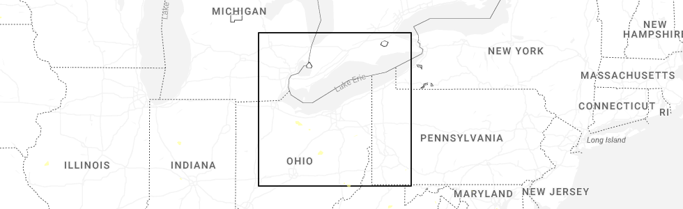
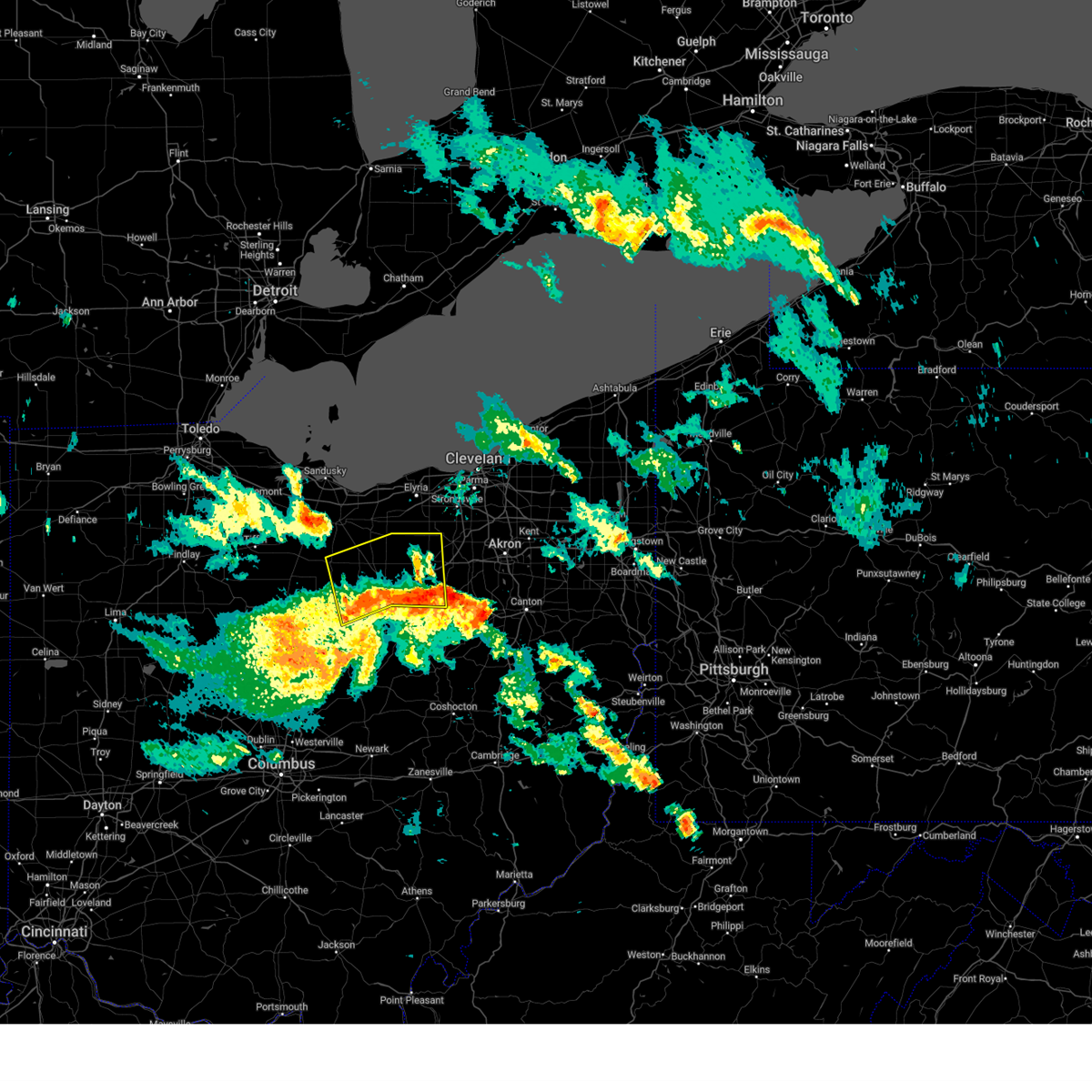
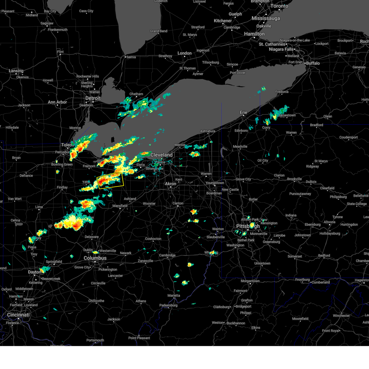
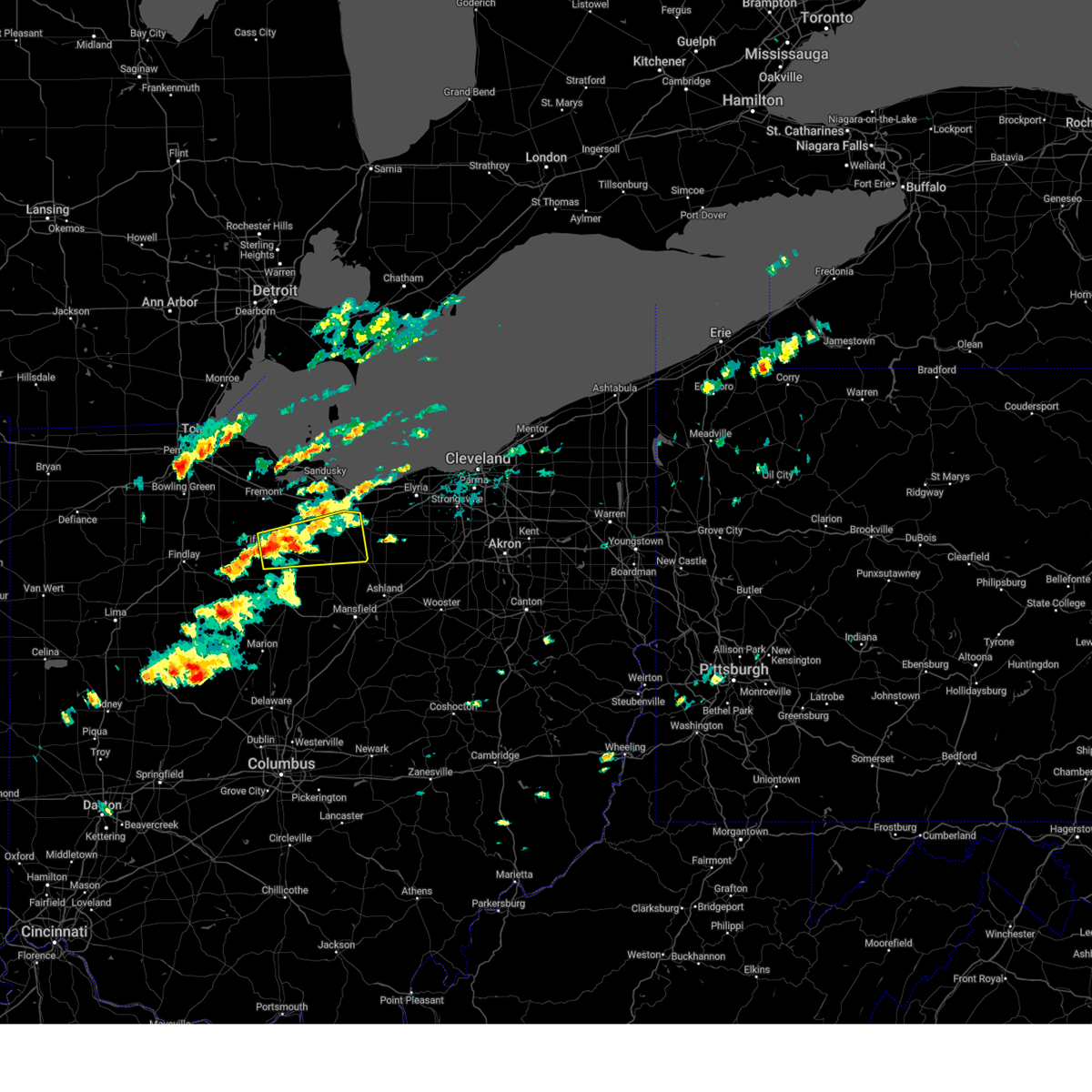
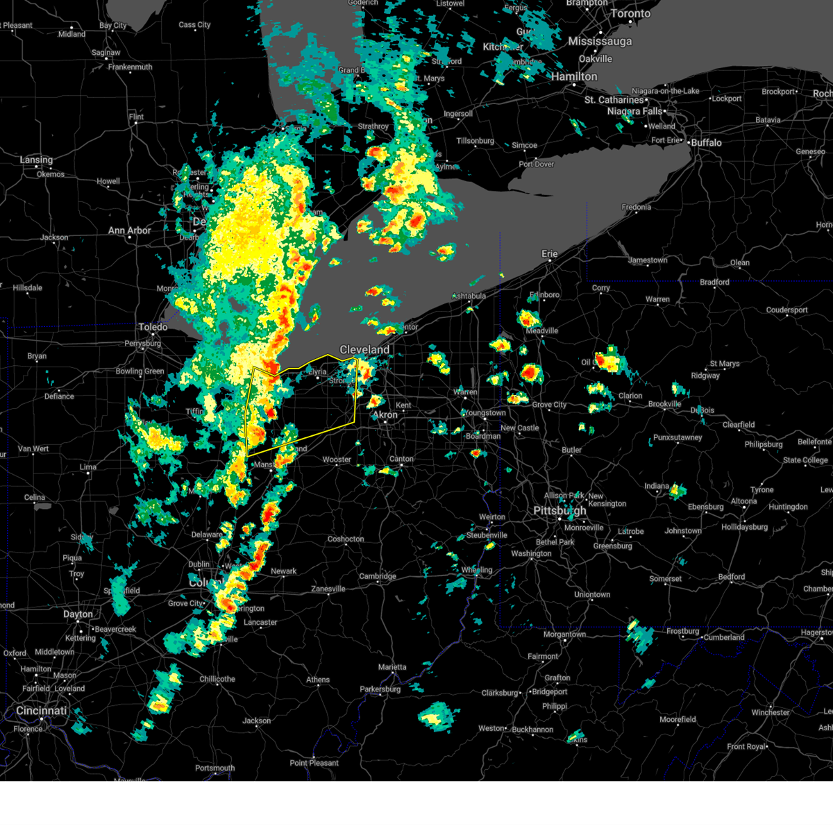
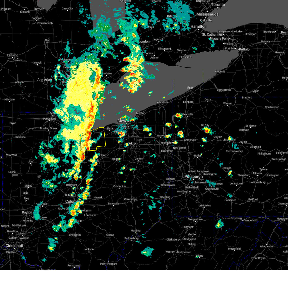
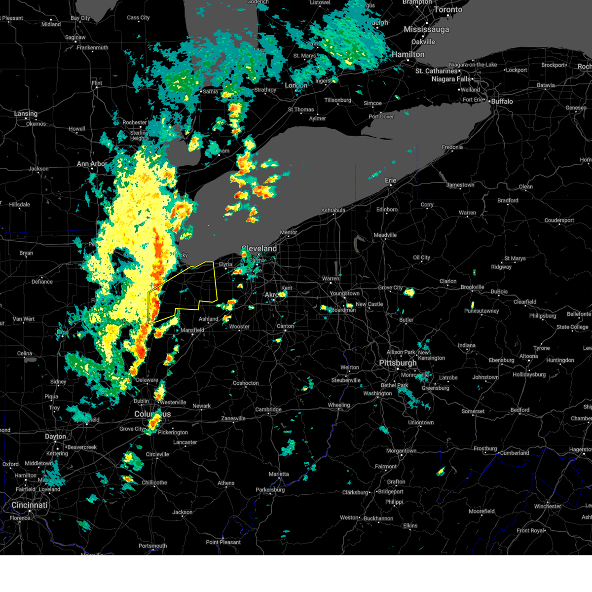
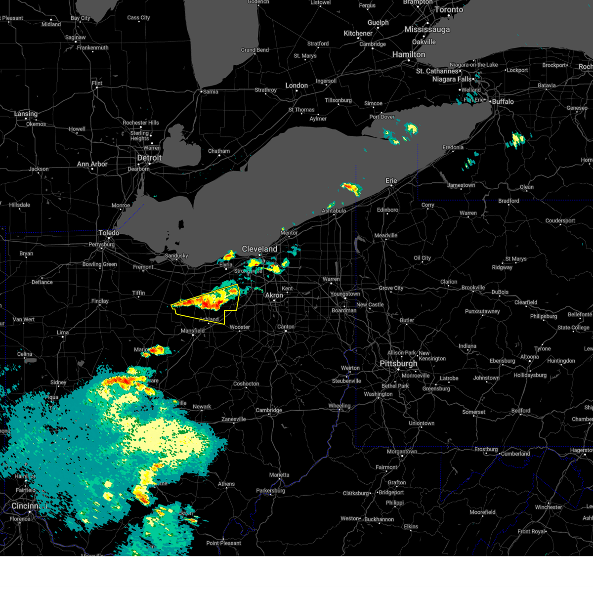
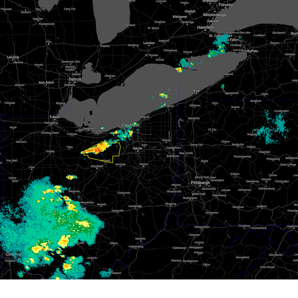
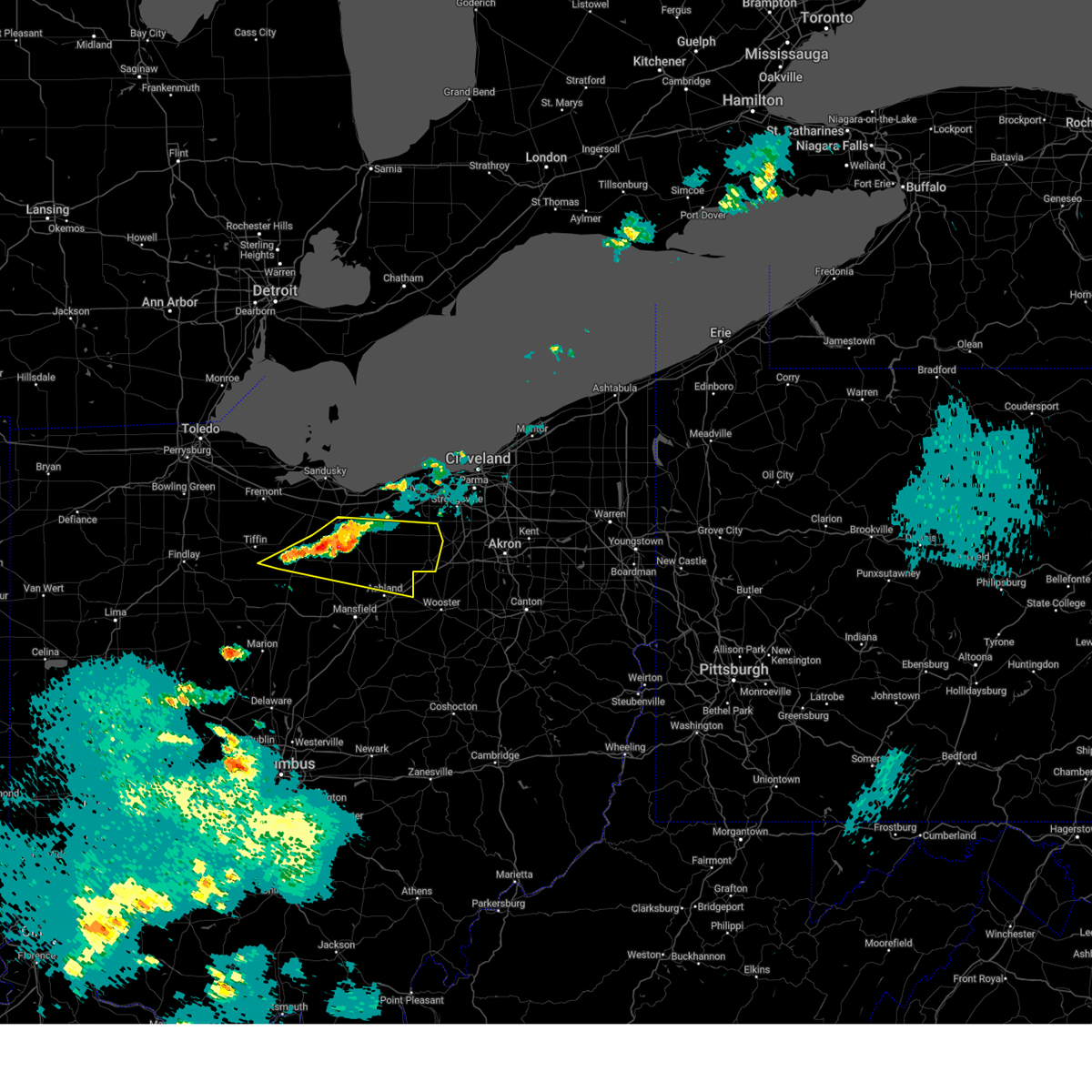
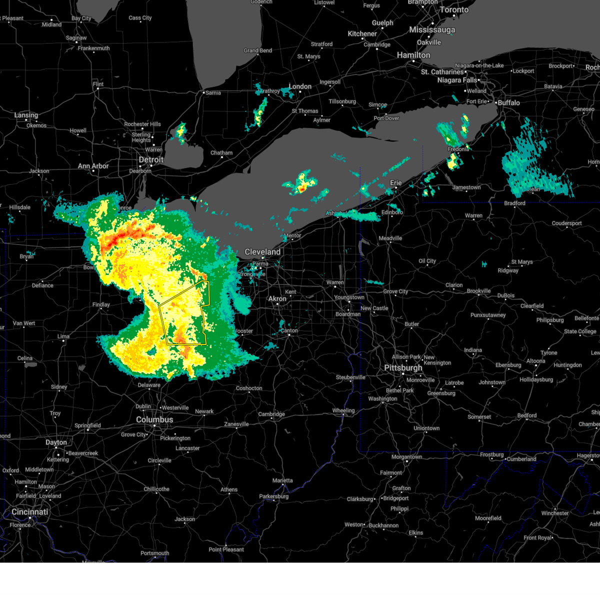
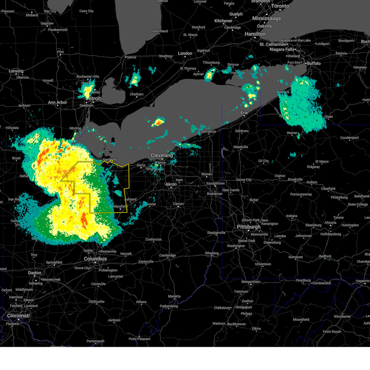
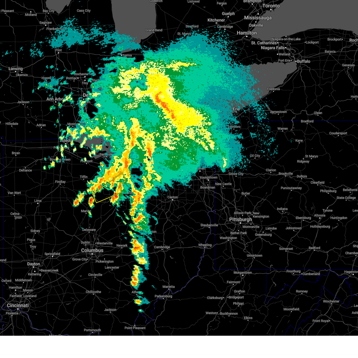
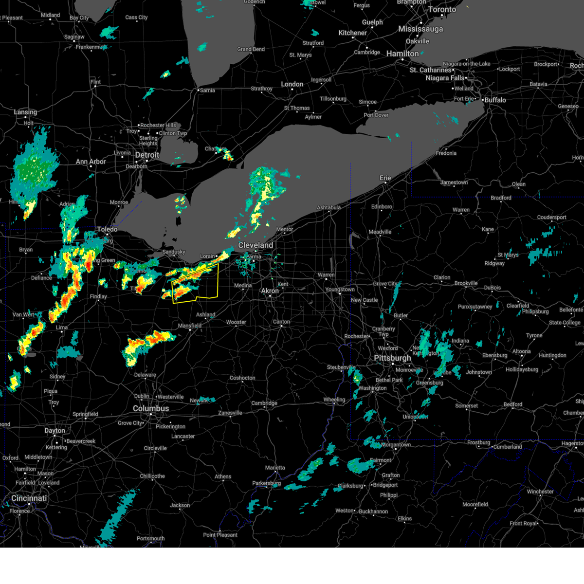
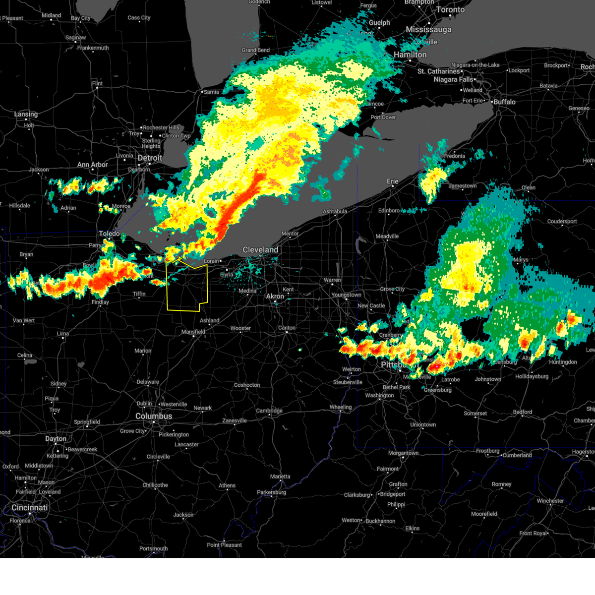
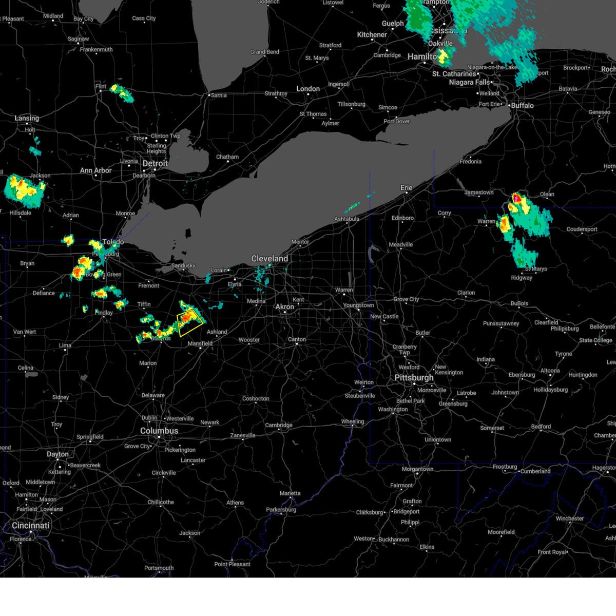
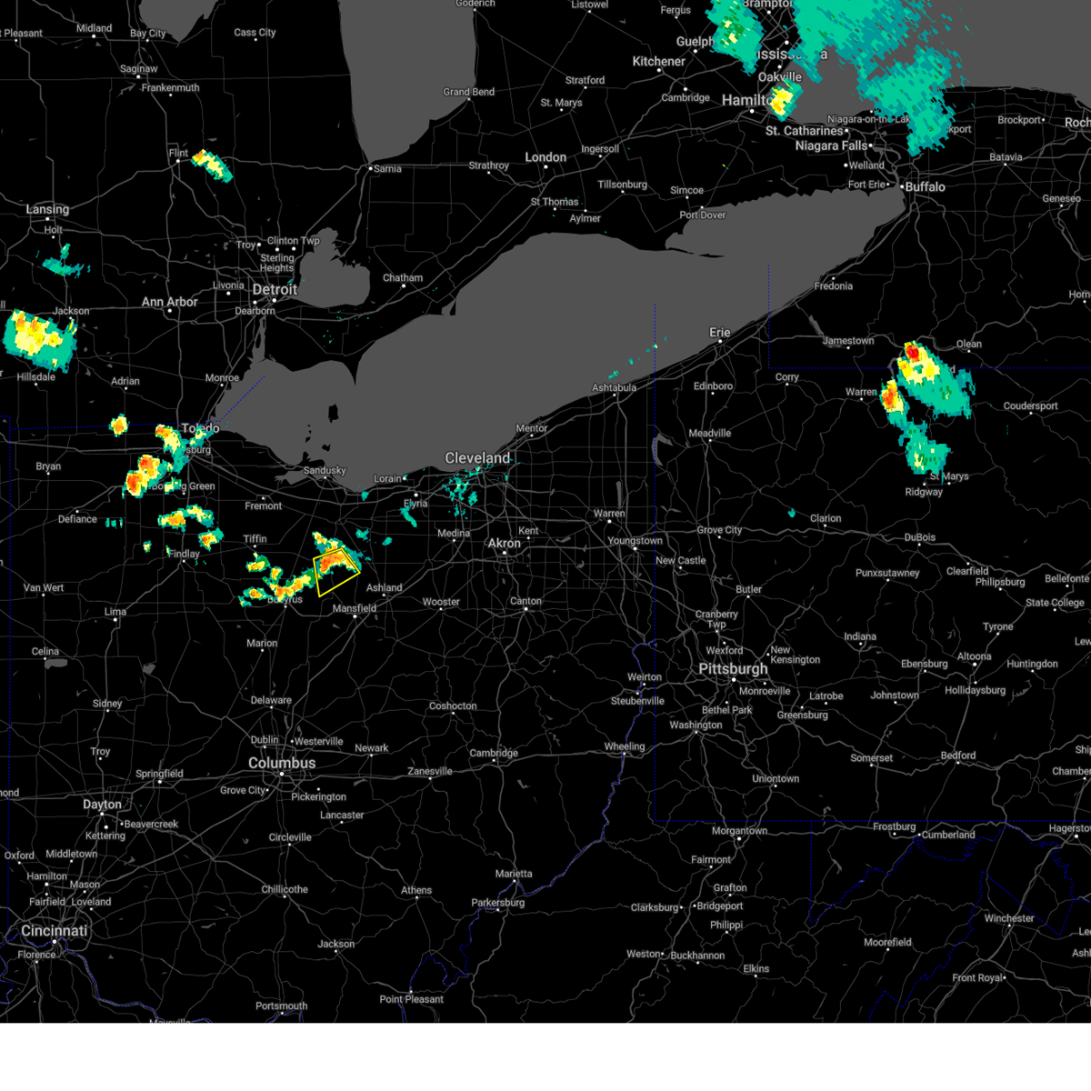
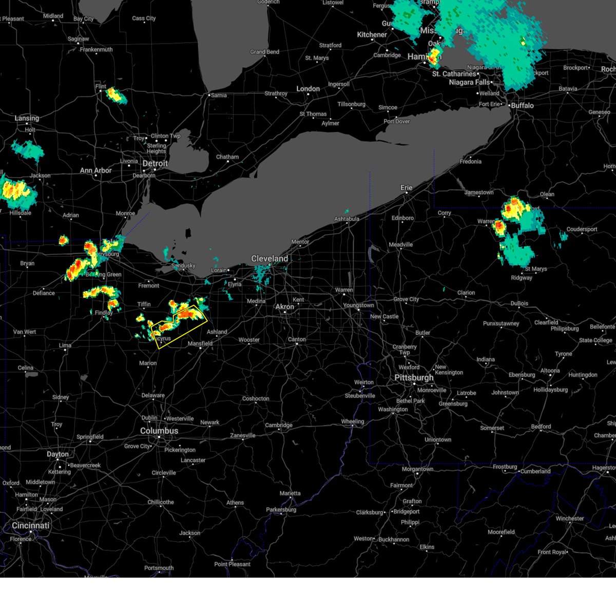
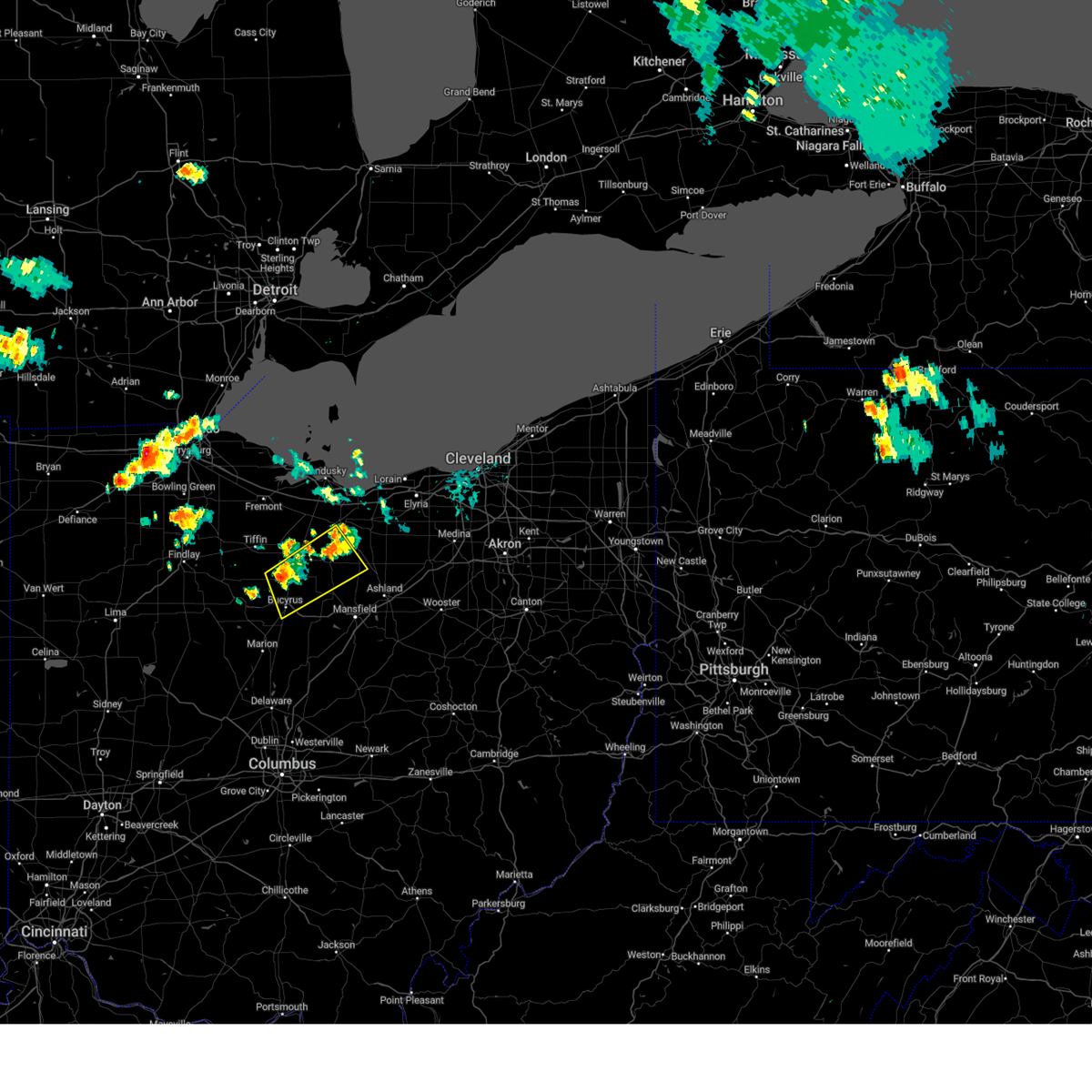
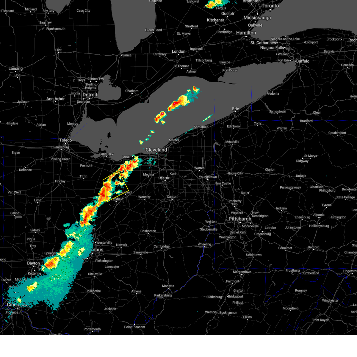
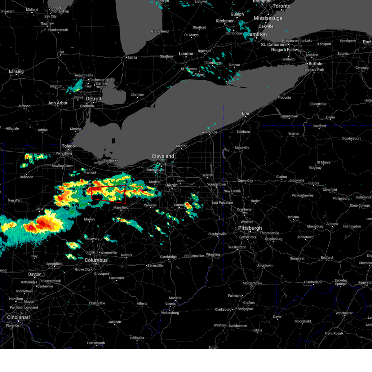
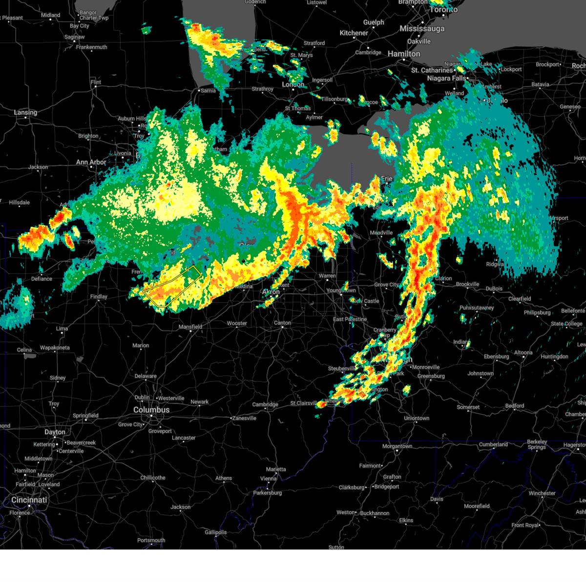
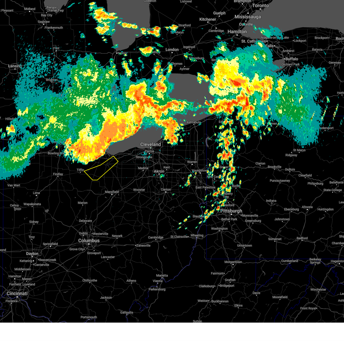
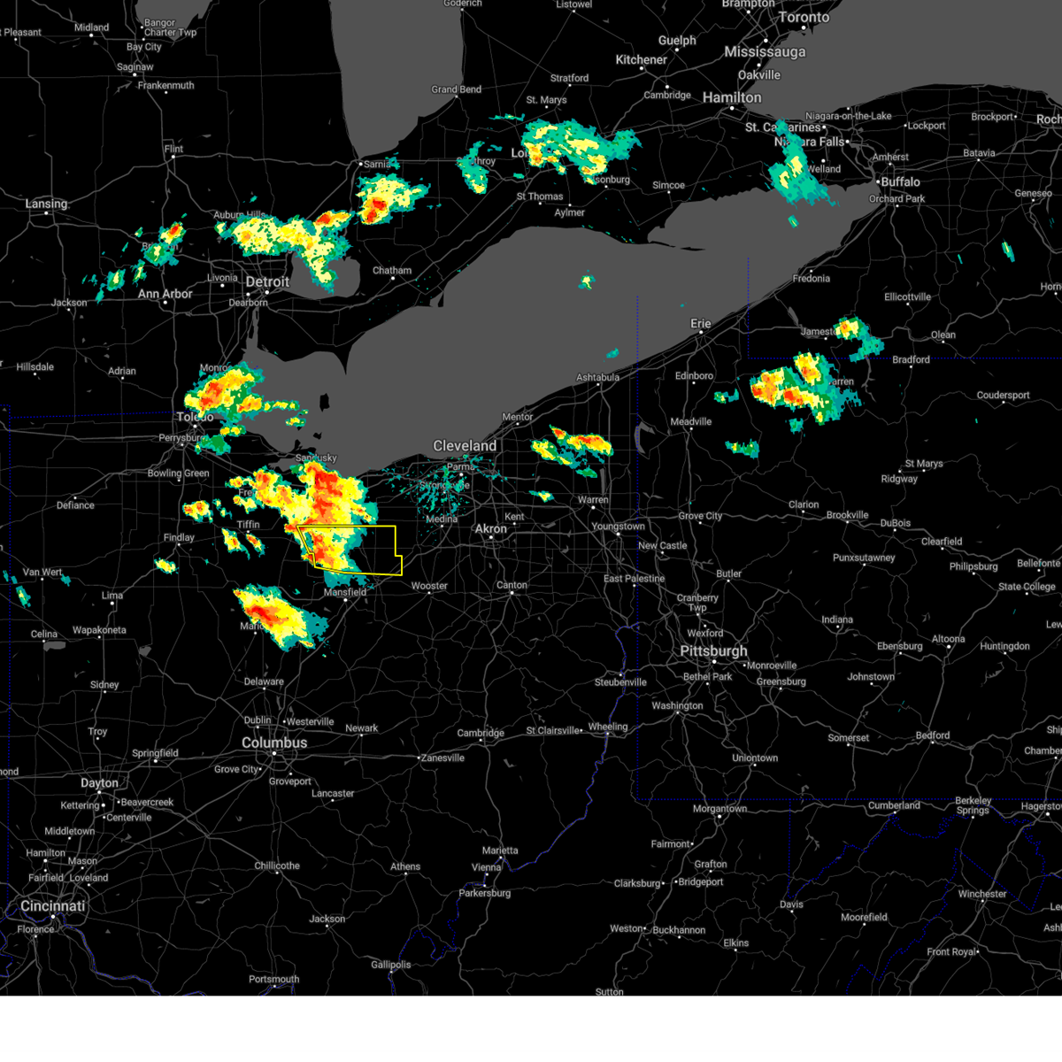
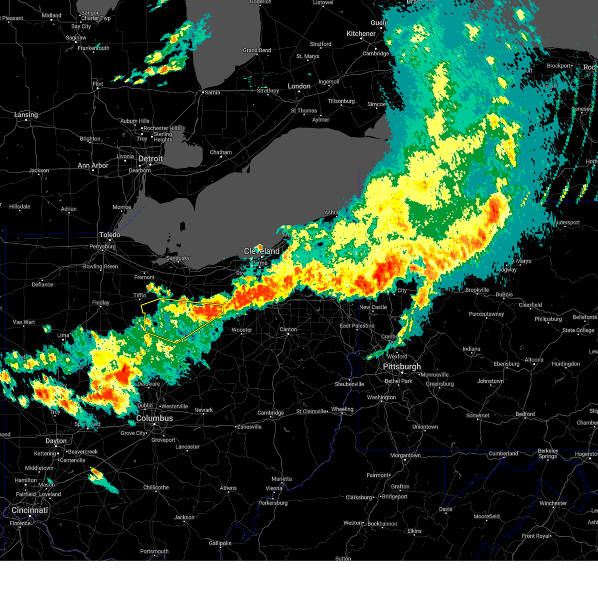
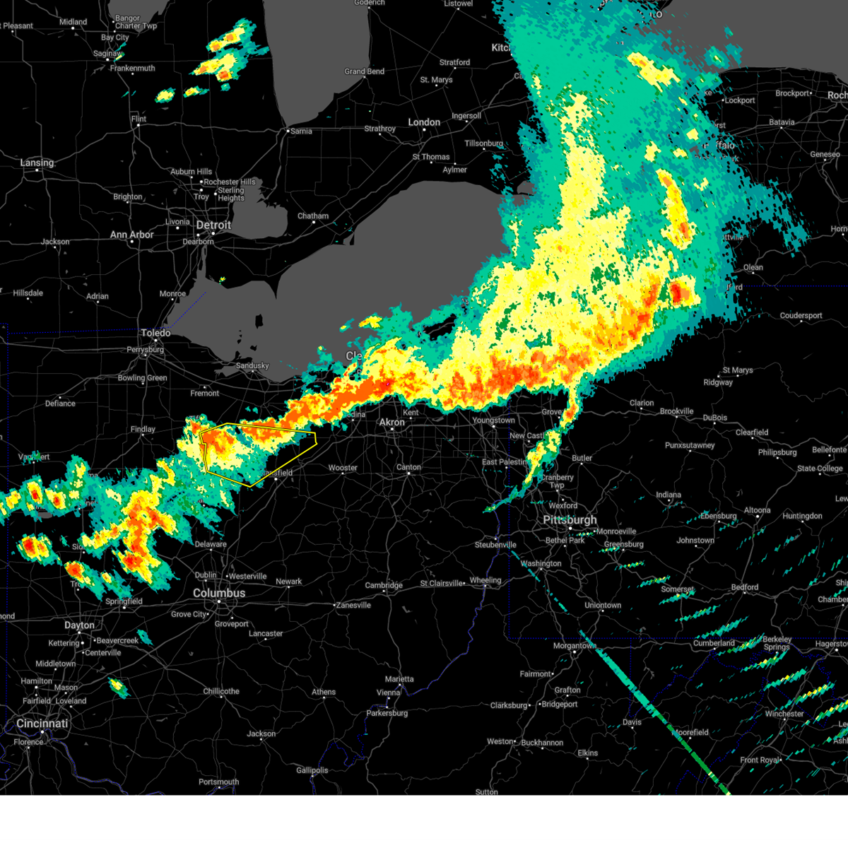
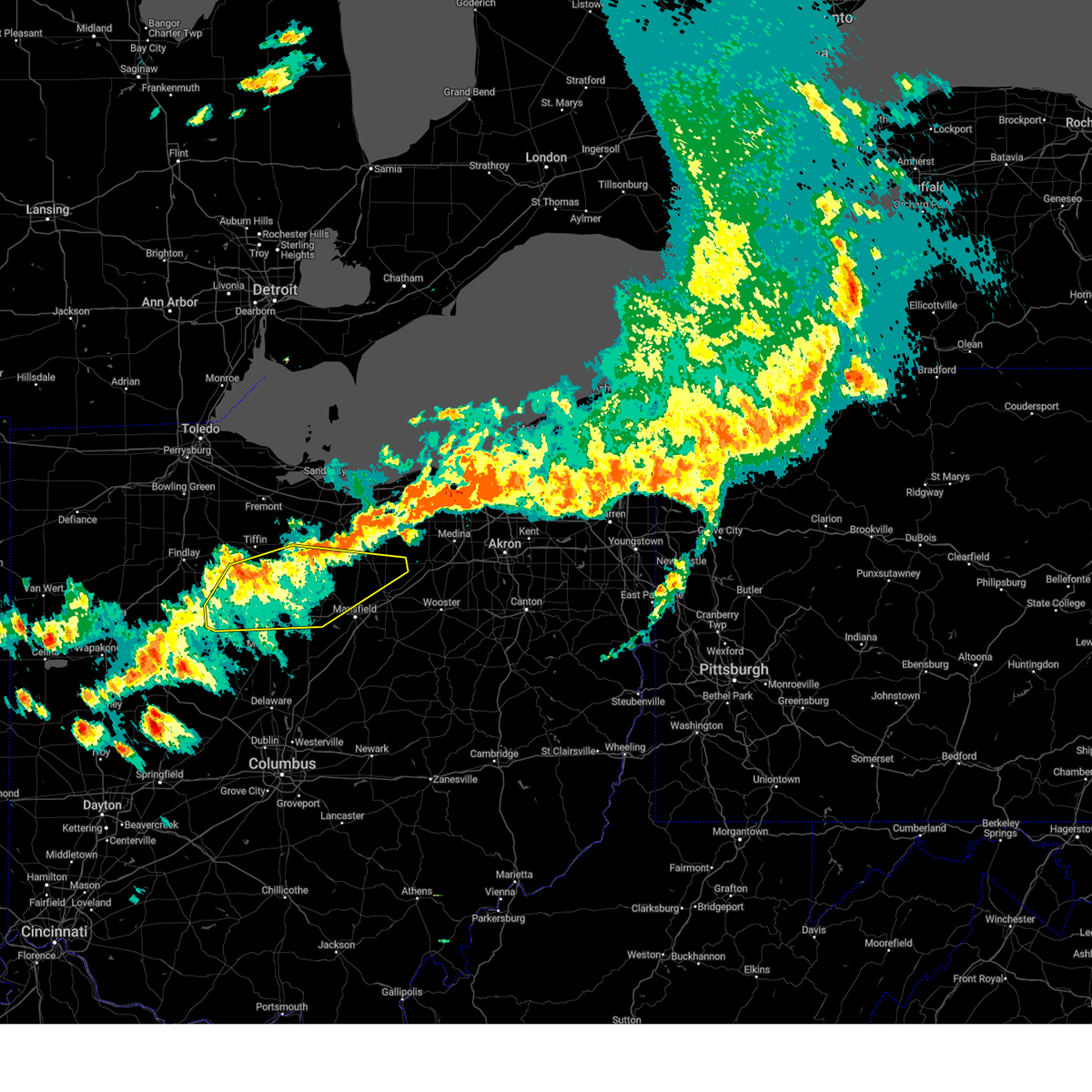
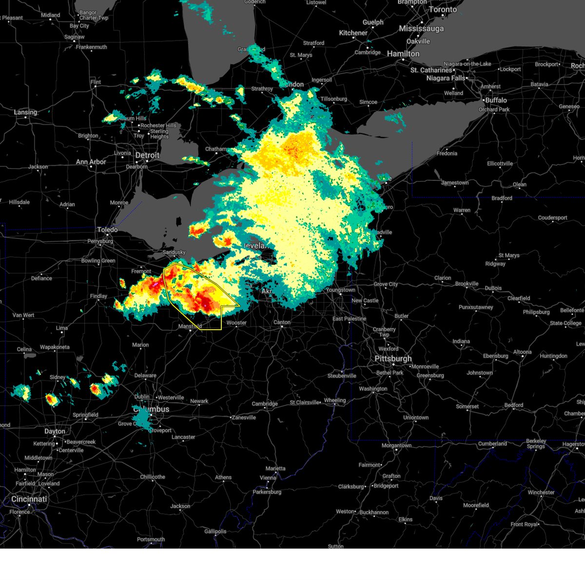
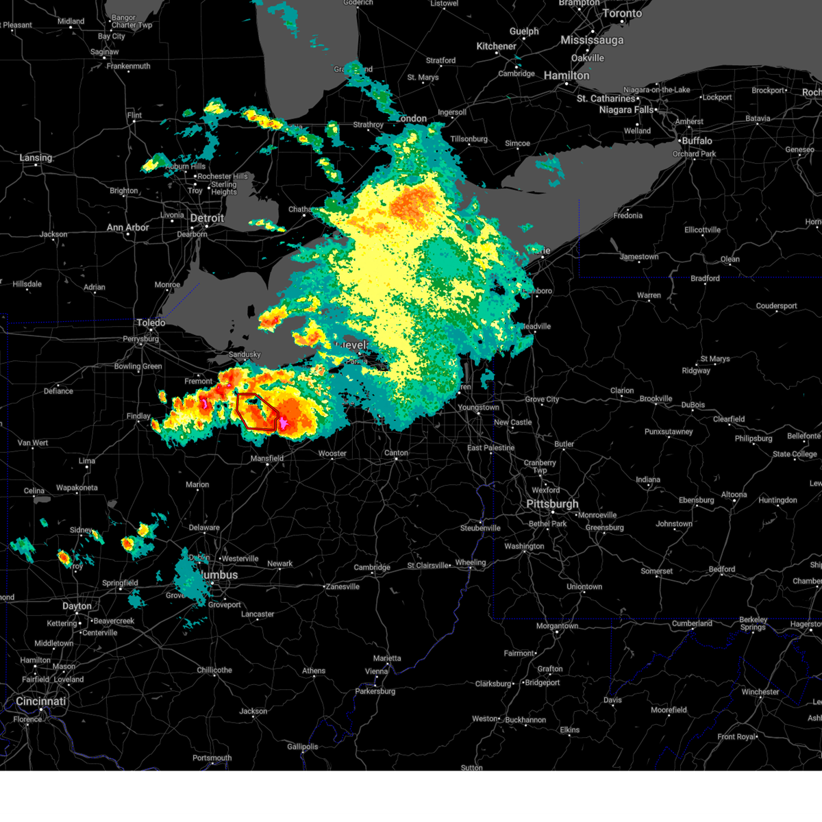
Hail Map for Willard, OH
The Willard, OH area has had 2 reports of on-the-ground hail by trained spotters, and has been under severe weather warnings 39 times during the past 12 months. Doppler radar has detected hail at or near Willard, OH on 36 occasions, including 3 occasions during the past year.
| Name: | Willard, OH |
| Where Located: | 62.2 miles WSW of Cleveland, OH |
| Map: | Google Map for Willard, OH |
| Population: | 6236 |
| Housing Units: | 2687 |
| More Info: | Search Google for Willard, OH |
0
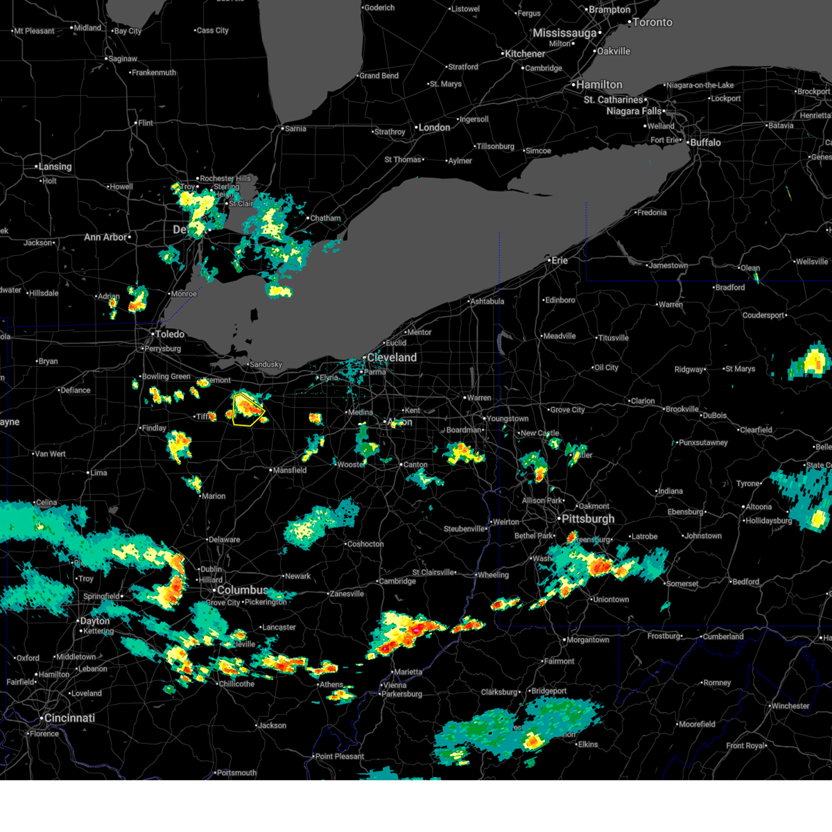
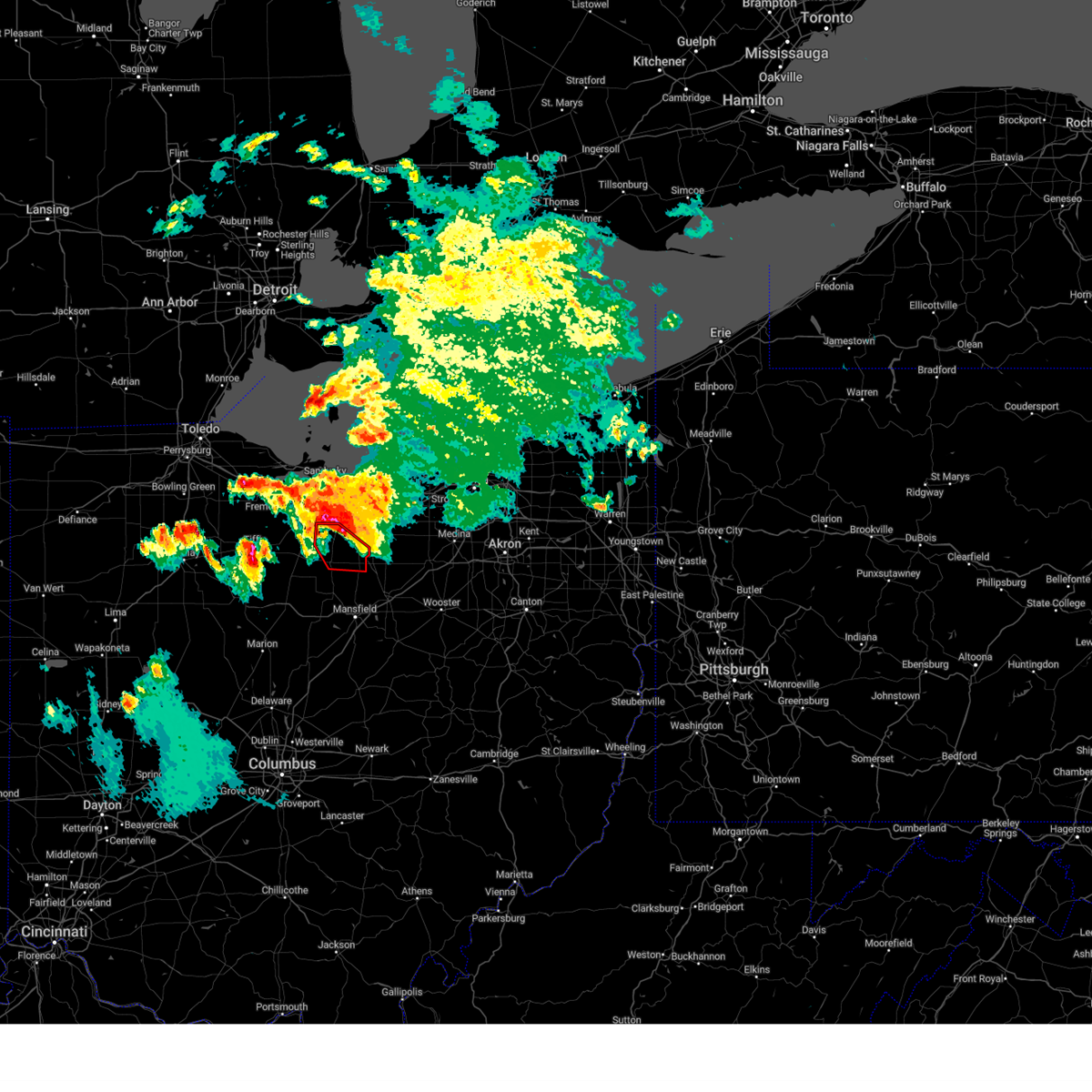
The Top Recent Hail Date for Willard, OH is Wednesday, June 25, 2025 (26th out of 36)
Hail and Wind Damage Spotted near Willard, OH
| Date / Time | Report Details |
|---|---|
| 6/25/2025 5:44 PM EDT |
 The storm which prompted the warning has weakened below severe limits, and no longer poses an immediate threat to life or property. therefore, the warning will be allowed to expire. however, gusty winds and heavy rain are still possible with this thunderstorm. The storm which prompted the warning has weakened below severe limits, and no longer poses an immediate threat to life or property. therefore, the warning will be allowed to expire. however, gusty winds and heavy rain are still possible with this thunderstorm.
|
| 6/25/2025 5:40 PM EDT | Estimated 60 mph wind in huron county OH, 6.1 miles SSE of Willard, OH |
| 6/25/2025 5:38 PM EDT | Storm damage reported in huron county OH, 8.8 miles SSW of Willard, OH |
| 6/25/2025 5:28 PM EDT | At 528 pm edt, a severe thunderstorm was located 8 miles south of bellevue, or 12 miles southwest of norwalk, moving southeast at 10 mph (radar indicated). Hazards include 60 mph wind gusts. Expect damage to trees and power lines. Locations impacted include, willard and north fairfield. |
| 6/25/2025 5:28 PM EDT | the severe thunderstorm warning has been cancelled and is no longer in effect |
| 6/25/2025 5:11 PM EDT | At 511 pm edt, a severe thunderstorm was located near bellevue, or 14 miles west of norwalk, moving southeast at 10 mph (radar indicated). Hazards include 60 mph wind gusts and quarter size hail. Minor damage to vehicles is possible. expect damage to trees and power lines. Locations impacted include, willard, attica, north fairfield, and flat rock. |
| 6/25/2025 5:11 PM EDT | the severe thunderstorm warning has been cancelled and is no longer in effect |
| 6/25/2025 5:02 PM EDT | Svrcle the national weather service in cleveland has issued a * severe thunderstorm warning for, western huron county in north central ohio, northeastern seneca county in northwestern ohio, southeastern sandusky county in northwestern ohio, * until 545 pm edt. * at 502 pm edt, a severe thunderstorm was located near bellevue, or 15 miles west of norwalk, moving southeast at 10 mph (radar indicated). Hazards include 60 mph wind gusts and quarter size hail. Minor damage to vehicles is possible. Expect damage to trees and power lines. |
| 6/18/2025 8:44 PM EDT | The storms which prompted the warning have moved out of the area. therefore, the warning will be allowed to expire. a severe thunderstorm watch remains in effect until 1000 pm edt for north central ohio. |
| 6/18/2025 8:10 PM EDT | 12 to 15 inch trees downed in holiday lakes. relayed by ham radio grou in huron county OH, 3.1 miles S of Willard, OH |
| 6/18/2025 7:41 PM EDT |
 Svrcle the national weather service in cleveland has issued a * severe thunderstorm warning for, huron county in north central ohio, east central seneca county in northwestern ohio, erie county in north central ohio, * until 845 pm edt. * at 740 pm edt, severe thunderstorms were located along a line extending from genoa to near sycamore, moving northeast at 60 mph (radar indicated). Hazards include 70 mph wind gusts. Expect considerable tree damage. Damage is likely to mobile homes, roofs, and outbuildings. Svrcle the national weather service in cleveland has issued a * severe thunderstorm warning for, huron county in north central ohio, east central seneca county in northwestern ohio, erie county in north central ohio, * until 845 pm edt. * at 740 pm edt, severe thunderstorms were located along a line extending from genoa to near sycamore, moving northeast at 60 mph (radar indicated). Hazards include 70 mph wind gusts. Expect considerable tree damage. Damage is likely to mobile homes, roofs, and outbuildings.
|
| 5/5/2025 7:25 PM EDT |
 At 725 pm edt, severe thunderstorms were located along a line extending from creston to near polk to 8 miles southwest of savannah, moving north at 30 mph (radar indicated). Hazards include 60 mph wind gusts and nickel size hail. Expect damage to trees and power lines. Locations impacted include, shelby, willard, wellington, lodi, new london, plymouth, west salem, savannah, polk, sullivan, penfield, greenwich, westfield center, spencer, bailey lakes, burbank, congress, rochester, nova, and nankin. At 725 pm edt, severe thunderstorms were located along a line extending from creston to near polk to 8 miles southwest of savannah, moving north at 30 mph (radar indicated). Hazards include 60 mph wind gusts and nickel size hail. Expect damage to trees and power lines. Locations impacted include, shelby, willard, wellington, lodi, new london, plymouth, west salem, savannah, polk, sullivan, penfield, greenwich, westfield center, spencer, bailey lakes, burbank, congress, rochester, nova, and nankin.
|
| 5/5/2025 7:11 PM EDT |
 Svrcle the national weather service in cleveland has issued a * severe thunderstorm warning for, southeastern huron county in north central ohio, northern richland county in north central ohio, southwestern medina county in northeastern ohio, ashland county in north central ohio, northwestern wayne county in northeastern ohio, southwestern lorain county in north central ohio, * until 800 pm edt. * at 711 pm edt, severe thunderstorms were located along a line extending from near wooster to near ashland to near mansfield, moving north at 30 mph (radar indicated). Hazards include 60 mph wind gusts and quarter size hail. Minor damage to vehicles is possible. Expect damage to trees and power lines. Svrcle the national weather service in cleveland has issued a * severe thunderstorm warning for, southeastern huron county in north central ohio, northern richland county in north central ohio, southwestern medina county in northeastern ohio, ashland county in north central ohio, northwestern wayne county in northeastern ohio, southwestern lorain county in north central ohio, * until 800 pm edt. * at 711 pm edt, severe thunderstorms were located along a line extending from near wooster to near ashland to near mansfield, moving north at 30 mph (radar indicated). Hazards include 60 mph wind gusts and quarter size hail. Minor damage to vehicles is possible. Expect damage to trees and power lines.
|
| 5/2/2025 1:17 PM EDT |
 At 116 pm edt, a severe thunderstorm was located 7 miles south of bellevue, or 12 miles southwest of norwalk, moving east at 40 mph (radar indicated). Hazards include 60 mph wind gusts and quarter size hail. Minor damage to vehicles is possible. expect damage to trees and power lines. Locations impacted include, norwalk, willard, milan, northern milan, monroeville, attica, north fairfield, and flat rock. At 116 pm edt, a severe thunderstorm was located 7 miles south of bellevue, or 12 miles southwest of norwalk, moving east at 40 mph (radar indicated). Hazards include 60 mph wind gusts and quarter size hail. Minor damage to vehicles is possible. expect damage to trees and power lines. Locations impacted include, norwalk, willard, milan, northern milan, monroeville, attica, north fairfield, and flat rock.
|
| 5/2/2025 1:01 PM EDT |
 Svrcle the national weather service in cleveland has issued a * severe thunderstorm warning for, huron county in north central ohio, eastern seneca county in northwestern ohio, * until 145 pm edt. * at 100 pm edt, a severe thunderstorm was located near bloomville, or near tiffin, moving east at 30 mph (radar indicated). Hazards include 60 mph wind gusts and quarter size hail. Minor damage to vehicles is possible. Expect damage to trees and power lines. Svrcle the national weather service in cleveland has issued a * severe thunderstorm warning for, huron county in north central ohio, eastern seneca county in northwestern ohio, * until 145 pm edt. * at 100 pm edt, a severe thunderstorm was located near bloomville, or near tiffin, moving east at 30 mph (radar indicated). Hazards include 60 mph wind gusts and quarter size hail. Minor damage to vehicles is possible. Expect damage to trees and power lines.
|
| 5/1/2025 2:56 PM EDT |
 Svrcle the national weather service in cleveland has issued a * severe thunderstorm warning for, huron county in north central ohio, northwestern richland county in north central ohio, erie county in north central ohio, southwestern cuyahoga county in northeastern ohio, medina county in northeastern ohio, northern ashland county in north central ohio, lorain county in north central ohio, * until 345 pm edt. * at 255 pm edt, severe thunderstorms were located along a line extending from 11 miles east of kelleys island to 7 miles west of new london to near shelby, moving northeast at 50 mph (radar indicated). Hazards include 60 mph wind gusts. expect damage to trees and power lines Svrcle the national weather service in cleveland has issued a * severe thunderstorm warning for, huron county in north central ohio, northwestern richland county in north central ohio, erie county in north central ohio, southwestern cuyahoga county in northeastern ohio, medina county in northeastern ohio, northern ashland county in north central ohio, lorain county in north central ohio, * until 345 pm edt. * at 255 pm edt, severe thunderstorms were located along a line extending from 11 miles east of kelleys island to 7 miles west of new london to near shelby, moving northeast at 50 mph (radar indicated). Hazards include 60 mph wind gusts. expect damage to trees and power lines
|
| 5/1/2025 2:46 PM EDT |
 the severe thunderstorm warning has been cancelled and is no longer in effect the severe thunderstorm warning has been cancelled and is no longer in effect
|
| 5/1/2025 2:46 PM EDT |
 At 245 pm edt, a severe thunderstorm was located over norwalk, moving northeast at 45 mph (radar indicated). Hazards include 60 mph wind gusts. Expect damage to trees and power lines. Locations impacted include, lorain, norwalk, western vermilion, vermilion, amherst, bellevue, willard, wellington, new london, plymouth, northern milan, milan, wakeman, oberlin, south amherst, greenwich, monroeville, berlin heights, north fairfield, and kipton. At 245 pm edt, a severe thunderstorm was located over norwalk, moving northeast at 45 mph (radar indicated). Hazards include 60 mph wind gusts. Expect damage to trees and power lines. Locations impacted include, lorain, norwalk, western vermilion, vermilion, amherst, bellevue, willard, wellington, new london, plymouth, northern milan, milan, wakeman, oberlin, south amherst, greenwich, monroeville, berlin heights, north fairfield, and kipton.
|
| 5/1/2025 2:18 PM EDT |
 Svrcle the national weather service in cleveland has issued a * severe thunderstorm warning for, huron county in north central ohio, southeastern seneca county in northwestern ohio, erie county in north central ohio, northern crawford county in north central ohio, southwestern lorain county in north central ohio, * until 300 pm edt. * at 217 pm edt, a severe thunderstorm was located near chatfield, or 14 miles southeast of tiffin, moving northeast at 55 mph (radar indicated). Hazards include 60 mph wind gusts. expect damage to trees and power lines Svrcle the national weather service in cleveland has issued a * severe thunderstorm warning for, huron county in north central ohio, southeastern seneca county in northwestern ohio, erie county in north central ohio, northern crawford county in north central ohio, southwestern lorain county in north central ohio, * until 300 pm edt. * at 217 pm edt, a severe thunderstorm was located near chatfield, or 14 miles southeast of tiffin, moving northeast at 55 mph (radar indicated). Hazards include 60 mph wind gusts. expect damage to trees and power lines
|
| 4/29/2025 8:14 PM EDT |
 At 814 pm edt, severe thunderstorms were located along a line extending from 6 miles west of medina to near polk to willard, moving east at 45 mph (radar indicated). Hazards include 60 mph wind gusts and quarter size hail. Minor damage to vehicles is possible. expect damage to trees and power lines. Locations impacted include, ashland, willard, wellington, lodi, new london, plymouth, savannah, polk, sullivan, penfield, greenwich, spencer, bailey lakes, burbank, rochester, nova, and nankin. At 814 pm edt, severe thunderstorms were located along a line extending from 6 miles west of medina to near polk to willard, moving east at 45 mph (radar indicated). Hazards include 60 mph wind gusts and quarter size hail. Minor damage to vehicles is possible. expect damage to trees and power lines. Locations impacted include, ashland, willard, wellington, lodi, new london, plymouth, savannah, polk, sullivan, penfield, greenwich, spencer, bailey lakes, burbank, rochester, nova, and nankin.
|
| 4/29/2025 8:01 PM EDT |
 At 801 pm edt, severe thunderstorms were located along a line extending from near wellington to new london to near willard, moving east at 40 mph (radar indicated). Hazards include 60 mph wind gusts and quarter size hail. Minor damage to vehicles is possible. expect damage to trees and power lines. Locations impacted include, ashland, willard, wellington, lodi, new london, plymouth, savannah, polk, sullivan, lagrange, penfield, pittsfield, greenwich, spencer, north fairfield, bailey lakes, burbank, rochester, nova, and nankin. At 801 pm edt, severe thunderstorms were located along a line extending from near wellington to new london to near willard, moving east at 40 mph (radar indicated). Hazards include 60 mph wind gusts and quarter size hail. Minor damage to vehicles is possible. expect damage to trees and power lines. Locations impacted include, ashland, willard, wellington, lodi, new london, plymouth, savannah, polk, sullivan, lagrange, penfield, pittsfield, greenwich, spencer, north fairfield, bailey lakes, burbank, rochester, nova, and nankin.
|
| 4/29/2025 8:01 PM EDT |
 the severe thunderstorm warning has been cancelled and is no longer in effect the severe thunderstorm warning has been cancelled and is no longer in effect
|
| 4/29/2025 7:41 PM EDT |
 Svrcle the national weather service in cleveland has issued a * severe thunderstorm warning for, huron county in north central ohio, northern richland county in north central ohio, southeastern seneca county in northwestern ohio, western medina county in northeastern ohio, northern ashland county in north central ohio, northeastern crawford county in north central ohio, southern lorain county in north central ohio, * until 830 pm edt. * at 740 pm edt, severe thunderstorms were located along a line extending from near norwalk to 8 miles west of new london to bloomville, moving east at 45 mph (radar indicated). Hazards include 60 mph wind gusts and quarter size hail. Minor damage to vehicles is possible. Expect damage to trees and power lines. Svrcle the national weather service in cleveland has issued a * severe thunderstorm warning for, huron county in north central ohio, northern richland county in north central ohio, southeastern seneca county in northwestern ohio, western medina county in northeastern ohio, northern ashland county in north central ohio, northeastern crawford county in north central ohio, southern lorain county in north central ohio, * until 830 pm edt. * at 740 pm edt, severe thunderstorms were located along a line extending from near norwalk to 8 miles west of new london to bloomville, moving east at 45 mph (radar indicated). Hazards include 60 mph wind gusts and quarter size hail. Minor damage to vehicles is possible. Expect damage to trees and power lines.
|
| 4/29/2025 7:33 PM EDT |
 At 733 pm edt, severe thunderstorms were located along a line extending from norwalk to near willard to bloomville, moving east at 45 mph (radar indicated). Hazards include 60 mph wind gusts and quarter size hail. Minor damage to vehicles is possible. expect damage to trees and power lines. Locations impacted include, norwalk, willard, attica, and north fairfield. At 733 pm edt, severe thunderstorms were located along a line extending from norwalk to near willard to bloomville, moving east at 45 mph (radar indicated). Hazards include 60 mph wind gusts and quarter size hail. Minor damage to vehicles is possible. expect damage to trees and power lines. Locations impacted include, norwalk, willard, attica, and north fairfield.
|
| 4/29/2025 7:19 PM EDT | At 719 pm edt, severe thunderstorms were located along a line extending from near bellevue to near bloomville, moving east at 45 mph (radar indicated). Hazards include 60 mph wind gusts and quarter size hail. Minor damage to vehicles is possible. expect damage to trees and power lines. Locations impacted include, tiffin, norwalk, bellevue, willard, milan, greenwich, monroeville, attica, north fairfield, republic, and flat rock. |
| 4/29/2025 7:19 PM EDT | the severe thunderstorm warning has been cancelled and is no longer in effect |
| 4/29/2025 7:00 PM EDT |
 Svrcle the national weather service in cleveland has issued a * severe thunderstorm warning for, western huron county in north central ohio, northern seneca county in northwestern ohio, erie county in north central ohio, southeastern sandusky county in northwestern ohio, * until 745 pm edt. * at 700 pm edt, severe thunderstorms were located along a line extending from green springs to tiffin, moving east at 35 mph (radar indicated). Hazards include 60 mph wind gusts and quarter size hail. Minor damage to vehicles is possible. Expect damage to trees and power lines. Svrcle the national weather service in cleveland has issued a * severe thunderstorm warning for, western huron county in north central ohio, northern seneca county in northwestern ohio, erie county in north central ohio, southeastern sandusky county in northwestern ohio, * until 745 pm edt. * at 700 pm edt, severe thunderstorms were located along a line extending from green springs to tiffin, moving east at 35 mph (radar indicated). Hazards include 60 mph wind gusts and quarter size hail. Minor damage to vehicles is possible. Expect damage to trees and power lines.
|
| 4/19/2025 8:44 AM EDT |
 The storms which prompted the warning have moved out of the area. therefore, the warning will be allowed to expire. The storms which prompted the warning have moved out of the area. therefore, the warning will be allowed to expire.
|
| 4/19/2025 8:12 AM EDT |
 At 812 am edt, severe thunderstorms were located along a line extending from near willard to near ontario, moving northeast at 70 mph (radar indicated). Hazards include 60 mph wind gusts. Expect damage to trees and power lines. Locations impacted include, mansfield, galion, shelby, willard, ontario, crestline, new london, plymouth, wakeman, new washington, greenwich, attica, lucas, north fairfield, tiro, north robinson, sulpher springs, shenandoah, and olivesburg. At 812 am edt, severe thunderstorms were located along a line extending from near willard to near ontario, moving northeast at 70 mph (radar indicated). Hazards include 60 mph wind gusts. Expect damage to trees and power lines. Locations impacted include, mansfield, galion, shelby, willard, ontario, crestline, new london, plymouth, wakeman, new washington, greenwich, attica, lucas, north fairfield, tiro, north robinson, sulpher springs, shenandoah, and olivesburg.
|
| 4/19/2025 8:12 AM EDT |
 the severe thunderstorm warning has been cancelled and is no longer in effect the severe thunderstorm warning has been cancelled and is no longer in effect
|
| 4/19/2025 7:52 AM EDT |
 Svrcle the national weather service in cleveland has issued a * severe thunderstorm warning for, huron county in north central ohio, richland county in north central ohio, seneca county in northwestern ohio, erie county in north central ohio, sandusky county in northwestern ohio, crawford county in north central ohio, southeastern wood county in northwestern ohio, * until 845 am edt. * at 751 am edt, severe thunderstorms were located along a line extending from fostoria to near upper sandusky to marion, moving northeast at 70 mph (radar indicated). Hazards include 60 mph wind gusts. expect damage to trees and power lines Svrcle the national weather service in cleveland has issued a * severe thunderstorm warning for, huron county in north central ohio, richland county in north central ohio, seneca county in northwestern ohio, erie county in north central ohio, sandusky county in northwestern ohio, crawford county in north central ohio, southeastern wood county in northwestern ohio, * until 845 am edt. * at 751 am edt, severe thunderstorms were located along a line extending from fostoria to near upper sandusky to marion, moving northeast at 70 mph (radar indicated). Hazards include 60 mph wind gusts. expect damage to trees and power lines
|
| 4/3/2025 1:11 AM EDT | The storms which prompted the warning have weakened below severe limits, and no longer pose an immediate threat to life or property. therefore, the warning will be allowed to expire. however, gusty winds and heavy rain are still possible with these thunderstorms. a tornado watch remains in effect until 400 am edt for north central, northeastern and northwestern ohio. |
| 4/3/2025 12:44 AM EDT | At 1244 am edt, severe thunderstorms were located along a line extending from near sandusky to near norwalk to plymouth, moving northeast at 55 mph (radar indicated). Hazards include 60 mph wind gusts. Expect damage to trees and power lines. Locations impacted include, lorain, elyria, norwalk, western vermilion, vermilion, strongsville, north ridgeville, avon lake, amherst, shelby, grafton, willard, wellington, new london, plymouth, northern milan, milan, wakeman, savannah, and avon. |
| 4/3/2025 12:34 AM EDT | the severe thunderstorm warning has been cancelled and is no longer in effect |
| 4/3/2025 12:34 AM EDT | At 1233 am edt, severe thunderstorms were located along a line extending from near clyde to 6 miles north of willard to near new washington, moving northeast at 55 mph (radar indicated). Hazards include 70 mph wind gusts. Expect considerable tree damage. damage is likely to mobile homes, roofs, and outbuildings. Locations impacted include, lorain, elyria, sandusky, norwalk, vermilion, western vermilion, strongsville, north ridgeville, avon lake, amherst, shelby, bellevue, grafton, willard, wellington, new london, plymouth, northern milan, milan, and wakeman. |
| 4/3/2025 12:19 AM EDT | Svrcle the national weather service in cleveland has issued a * severe thunderstorm warning for, huron county in north central ohio, northwestern richland county in north central ohio, ottawa county in northwestern ohio, eastern seneca county in northwestern ohio, erie county in north central ohio, western medina county in northeastern ohio, northern ashland county in north central ohio, eastern sandusky county in northwestern ohio, northern crawford county in north central ohio, lorain county in north central ohio, * until 115 am edt. * at 1219 am edt, severe thunderstorms were located along a line extending from near green springs to near bloomville to near bucyrus, moving east at 55 mph (radar indicated). Hazards include 70 mph wind gusts. Expect considerable tree damage. Damage is likely to mobile homes, roofs, and outbuildings. |
| 4/2/2025 12:04 PM EDT | the severe thunderstorm warning has been cancelled and is no longer in effect |
| 4/2/2025 11:51 AM EDT |
 Svrcle the national weather service in cleveland has issued a * severe thunderstorm warning for, southeastern huron county in north central ohio, northwestern richland county in north central ohio, eastern crawford county in north central ohio, * until 1215 pm edt. * at 1151 am edt, a severe thunderstorm was located near bucyrus, moving northeast at 65 mph (trained weather spotters). Hazards include quarter size hail. minor damage to vehicles is possible Svrcle the national weather service in cleveland has issued a * severe thunderstorm warning for, southeastern huron county in north central ohio, northwestern richland county in north central ohio, eastern crawford county in north central ohio, * until 1215 pm edt. * at 1151 am edt, a severe thunderstorm was located near bucyrus, moving northeast at 65 mph (trained weather spotters). Hazards include quarter size hail. minor damage to vehicles is possible
|
| 9/24/2024 7:02 PM EDT |
 Svrcle the national weather service in cleveland has issued a * severe thunderstorm warning for, huron county in north central ohio, erie county in north central ohio, southwestern lorain county in north central ohio, * until 745 pm edt. * at 702 pm edt, a severe thunderstorm was located near willard, or 10 miles south of norwalk, moving east at 30 mph (radar indicated). Hazards include 60 mph wind gusts and quarter size hail. Minor damage to vehicles is possible. Expect damage to trees and power lines. Svrcle the national weather service in cleveland has issued a * severe thunderstorm warning for, huron county in north central ohio, erie county in north central ohio, southwestern lorain county in north central ohio, * until 745 pm edt. * at 702 pm edt, a severe thunderstorm was located near willard, or 10 miles south of norwalk, moving east at 30 mph (radar indicated). Hazards include 60 mph wind gusts and quarter size hail. Minor damage to vehicles is possible. Expect damage to trees and power lines.
|
| 8/27/2024 7:34 PM EDT |
 Svrcle the national weather service in cleveland has issued a * severe thunderstorm warning for, huron county in north central ohio, seneca county in northwestern ohio, erie county in north central ohio, southwestern cuyahoga county in northeastern ohio, southern sandusky county in northwestern ohio, southern wood county in northwestern ohio, hancock county in northwestern ohio, lorain county in north central ohio, * until 815 pm edt. * at 733 pm edt, severe thunderstorm outflow winds were located along a line extending from near western vermilion to near green springs to mccomb, moving southeast at 45 mph (radar indicated). Hazards include 60 mph wind gusts. expect damage to trees and power lines Svrcle the national weather service in cleveland has issued a * severe thunderstorm warning for, huron county in north central ohio, seneca county in northwestern ohio, erie county in north central ohio, southwestern cuyahoga county in northeastern ohio, southern sandusky county in northwestern ohio, southern wood county in northwestern ohio, hancock county in northwestern ohio, lorain county in north central ohio, * until 815 pm edt. * at 733 pm edt, severe thunderstorm outflow winds were located along a line extending from near western vermilion to near green springs to mccomb, moving southeast at 45 mph (radar indicated). Hazards include 60 mph wind gusts. expect damage to trees and power lines
|
| 8/6/2024 4:28 PM EDT | Svrcle the national weather service in cleveland has issued a * severe thunderstorm warning for, huron county in north central ohio, western medina county in northeastern ohio, northern ashland county in north central ohio, southern lorain county in north central ohio, * until 515 pm edt. * at 428 pm edt, a severe thunderstorm was located near new london, or 10 miles southeast of norwalk, moving east at 45 mph (radar indicated). Hazards include 60 mph wind gusts. expect damage to trees and power lines |
| 8/6/2024 3:25 PM EDT |
 Svrcle the national weather service in cleveland has issued a * severe thunderstorm warning for, huron county in north central ohio, erie county in north central ohio, * until 430 pm edt. * at 325 pm edt, severe thunderstorms were located along a line extending from 14 miles north of avon lake to near western vermilion to near bellevue, moving east at 45 mph (trained weather spotters. there were multiple reports of estimated gusts to 60 mph in sandusky). Hazards include 60 mph wind gusts. expect damage to trees and power lines Svrcle the national weather service in cleveland has issued a * severe thunderstorm warning for, huron county in north central ohio, erie county in north central ohio, * until 430 pm edt. * at 325 pm edt, severe thunderstorms were located along a line extending from 14 miles north of avon lake to near western vermilion to near bellevue, moving east at 45 mph (trained weather spotters. there were multiple reports of estimated gusts to 60 mph in sandusky). Hazards include 60 mph wind gusts. expect damage to trees and power lines
|
| 6/29/2024 11:08 AM EDT |
 Svrcle the national weather service in cleveland has issued a * severe thunderstorm warning for, huron county in north central ohio, erie county in north central ohio, northern ashland county in north central ohio, lorain county in north central ohio, * until noon edt. * at 1108 am edt, severe thunderstorms were located along a line extending from 6 miles northeast of milan to near willard, moving east at 40 mph (radar indicated). Hazards include 60 mph wind gusts. expect damage to trees and power lines Svrcle the national weather service in cleveland has issued a * severe thunderstorm warning for, huron county in north central ohio, erie county in north central ohio, northern ashland county in north central ohio, lorain county in north central ohio, * until noon edt. * at 1108 am edt, severe thunderstorms were located along a line extending from 6 miles northeast of milan to near willard, moving east at 40 mph (radar indicated). Hazards include 60 mph wind gusts. expect damage to trees and power lines
|
| 6/29/2024 11:01 AM EDT | Multiple large limbs dow in huron county OH, 1.7 miles S of Willard, OH |
| 6/20/2024 8:30 PM EDT |
 The storm which prompted the warning has weakened below severe limits, and no longer poses an immediate threat to life or property. therefore, the warning has been allowed to expire. however, gusty winds are still possible with this thunderstorm. The storm which prompted the warning has weakened below severe limits, and no longer poses an immediate threat to life or property. therefore, the warning has been allowed to expire. however, gusty winds are still possible with this thunderstorm.
|
| 6/20/2024 8:24 PM EDT |
 At 824 pm edt, a severe thunderstorm was located over plymouth, or 17 miles south of norwalk, moving south at 5 mph (radar indicated). Hazards include 60 mph wind gusts and penny size hail. Expect damage to trees and power lines. Locations impacted include, shelby, willard, plymouth, and greenwich. At 824 pm edt, a severe thunderstorm was located over plymouth, or 17 miles south of norwalk, moving south at 5 mph (radar indicated). Hazards include 60 mph wind gusts and penny size hail. Expect damage to trees and power lines. Locations impacted include, shelby, willard, plymouth, and greenwich.
|
| 6/20/2024 8:13 PM EDT |
 the severe thunderstorm warning has been cancelled and is no longer in effect the severe thunderstorm warning has been cancelled and is no longer in effect
|
| 6/20/2024 8:13 PM EDT |
 At 813 pm edt, severe thunderstorms were located along a line extending from near plymouth to near chatfield, moving southeast at 10 mph (radar indicated). Hazards include 60 mph wind gusts and penny size hail. Expect damage to trees and power lines. Locations impacted include, bucyrus, shelby, willard, plymouth, new washington, chatfield, greenwich, north fairfield, tiro, and sulpher springs. At 813 pm edt, severe thunderstorms were located along a line extending from near plymouth to near chatfield, moving southeast at 10 mph (radar indicated). Hazards include 60 mph wind gusts and penny size hail. Expect damage to trees and power lines. Locations impacted include, bucyrus, shelby, willard, plymouth, new washington, chatfield, greenwich, north fairfield, tiro, and sulpher springs.
|
| 6/20/2024 8:01 PM EDT | Several tree limbs down on roadway on state road 99 and egypt road. time estimated via rada in huron county OH, 1.7 miles S of Willard, OH |
| 6/20/2024 7:51 PM EDT |
 Svrcle the national weather service in cleveland has issued a * severe thunderstorm warning for, southwestern huron county in north central ohio, northwestern richland county in north central ohio, southeastern seneca county in northwestern ohio, crawford county in north central ohio, * until 830 pm edt. * at 751 pm edt, severe thunderstorms were located along a line extending from near willard to near chatfield, moving southeast at 10 mph (radar indicated). Hazards include 60 mph wind gusts and penny size hail. expect damage to trees and power lines Svrcle the national weather service in cleveland has issued a * severe thunderstorm warning for, southwestern huron county in north central ohio, northwestern richland county in north central ohio, southeastern seneca county in northwestern ohio, crawford county in north central ohio, * until 830 pm edt. * at 751 pm edt, severe thunderstorms were located along a line extending from near willard to near chatfield, moving southeast at 10 mph (radar indicated). Hazards include 60 mph wind gusts and penny size hail. expect damage to trees and power lines
|
| 5/26/2024 6:16 PM EDT |
 the tornado warning has been cancelled and is no longer in effect the tornado warning has been cancelled and is no longer in effect
|
| 5/26/2024 6:16 PM EDT |
 At 615 pm edt, severe thunderstorms capable of producing tornadoes were located along a line extending from willard to 7 miles east of plymouth, moving north at 40 mph (radar indicated rotation). Hazards include tornado. Flying debris will be dangerous to those caught without shelter. mobile homes will be damaged or destroyed. damage to roofs, windows, and vehicles will occur. tree damage is likely. these dangerous storms will be near, willard around 620 pm edt. norwalk around 630 pm edt. Other locations impacted by these tornadic storms include north fairfield and greenwich. At 615 pm edt, severe thunderstorms capable of producing tornadoes were located along a line extending from willard to 7 miles east of plymouth, moving north at 40 mph (radar indicated rotation). Hazards include tornado. Flying debris will be dangerous to those caught without shelter. mobile homes will be damaged or destroyed. damage to roofs, windows, and vehicles will occur. tree damage is likely. these dangerous storms will be near, willard around 620 pm edt. norwalk around 630 pm edt. Other locations impacted by these tornadic storms include north fairfield and greenwich.
|
| 5/26/2024 5:58 PM EDT |
 the tornado warning has been cancelled and is no longer in effect the tornado warning has been cancelled and is no longer in effect
|
| 5/26/2024 5:58 PM EDT |
 At 557 pm edt, severe thunderstorms capable of producing tornadoes were located along a line extending from near shelby to 8 miles southwest of savannah, moving north at 45 mph (radar indicated rotation). Hazards include tornado. Flying debris will be dangerous to those caught without shelter. mobile homes will be damaged or destroyed. damage to roofs, windows, and vehicles will occur. tree damage is likely. these dangerous storms will be near, shelby around 600 pm edt. plymouth around 605 pm edt. willard and greenwich around 610 pm edt. north fairfield around 615 pm edt. Other locations impacted by these tornadic storms include shenandoah, north fairfield, tiro, and greenwich. At 557 pm edt, severe thunderstorms capable of producing tornadoes were located along a line extending from near shelby to 8 miles southwest of savannah, moving north at 45 mph (radar indicated rotation). Hazards include tornado. Flying debris will be dangerous to those caught without shelter. mobile homes will be damaged or destroyed. damage to roofs, windows, and vehicles will occur. tree damage is likely. these dangerous storms will be near, shelby around 600 pm edt. plymouth around 605 pm edt. willard and greenwich around 610 pm edt. north fairfield around 615 pm edt. Other locations impacted by these tornadic storms include shenandoah, north fairfield, tiro, and greenwich.
|
| 5/26/2024 5:44 PM EDT |
 Torcle the national weather service in cleveland has issued a * tornado warning for, huron county in north central ohio, richland county in north central ohio, northwestern ashland county in north central ohio, northeastern crawford county in north central ohio, * until 630 pm edt. * at 544 pm edt, a severe thunderstorm capable of producing a tornado was located over ontario, or near mansfield, moving north at 50 mph (radar indicated rotation). Hazards include tornado. Flying debris will be dangerous to those caught without shelter. mobile homes will be damaged or destroyed. damage to roofs, windows, and vehicles will occur. tree damage is likely. this dangerous storm will be near, mansfield and shelby around 550 pm edt. plymouth around 600 pm edt. norwalk around 620 pm edt. Other locations impacted by this tornadic thunderstorm include shenandoah, north fairfield, tiro, olivesburg, and greenwich. Torcle the national weather service in cleveland has issued a * tornado warning for, huron county in north central ohio, richland county in north central ohio, northwestern ashland county in north central ohio, northeastern crawford county in north central ohio, * until 630 pm edt. * at 544 pm edt, a severe thunderstorm capable of producing a tornado was located over ontario, or near mansfield, moving north at 50 mph (radar indicated rotation). Hazards include tornado. Flying debris will be dangerous to those caught without shelter. mobile homes will be damaged or destroyed. damage to roofs, windows, and vehicles will occur. tree damage is likely. this dangerous storm will be near, mansfield and shelby around 550 pm edt. plymouth around 600 pm edt. norwalk around 620 pm edt. Other locations impacted by this tornadic thunderstorm include shenandoah, north fairfield, tiro, olivesburg, and greenwich.
|
| 5/22/2024 8:48 PM EDT | Trees dow in huron county OH, 3.1 miles S of Willard, OH |
| 5/22/2024 8:48 PM EDT |
 Svrcle the national weather service in cleveland has issued a * severe thunderstorm warning for, southeastern huron county in north central ohio, northern richland county in north central ohio, northwestern ashland county in north central ohio, * until 930 pm edt. * at 848 pm edt, a severe thunderstorm was located near shelby, or 13 miles northwest of mansfield, moving northeast at 30 mph (radar indicated). Hazards include 60 mph wind gusts and quarter size hail. Minor damage to vehicles is possible. Expect damage to trees and power lines. Svrcle the national weather service in cleveland has issued a * severe thunderstorm warning for, southeastern huron county in north central ohio, northern richland county in north central ohio, northwestern ashland county in north central ohio, * until 930 pm edt. * at 848 pm edt, a severe thunderstorm was located near shelby, or 13 miles northwest of mansfield, moving northeast at 30 mph (radar indicated). Hazards include 60 mph wind gusts and quarter size hail. Minor damage to vehicles is possible. Expect damage to trees and power lines.
|
| 3/14/2024 8:30 PM EDT | Utility poles down on state route 10 in huron county OH, 1.8 miles N of Willard, OH |
| 3/14/2024 8:16 PM EDT |
 The tornado warning that was previously in effect has been reissued for northern richland and southern huron counties. please refer to that bulletin for the latest severe weather information. a tornado watch remains in effect until midnight edt for north central and northwestern ohio. The tornado warning that was previously in effect has been reissued for northern richland and southern huron counties. please refer to that bulletin for the latest severe weather information. a tornado watch remains in effect until midnight edt for north central and northwestern ohio.
|
| 3/14/2024 8:12 PM EDT |
 Torcle the national weather service in cleveland has issued a * tornado warning for, northern richland county in north central ohio, southern huron county in north central ohio, northern ashland county in north central ohio, * until 900 pm edt. * at 811 pm edt, a confirmed large and extremely dangerous tornado was located over plymouth, or 15 miles north of mansfield, moving east at 40 mph. this is a particularly dangerous situation. take cover now! (emergency management confirmed tornado). Hazards include damaging tornado. You are in a life-threatening situation. flying debris may be deadly to those caught without shelter. mobile homes will be destroyed. considerable damage to homes, businesses, and vehicles is likely and complete destruction is possible. the tornado will be near, savannah around 825 pm edt. polk around 840 pm edt. Other locations impacted by this tornadic thunderstorm include nankin, sullivan, rowsburg, nova, shenandoah, bailey lakes, olivesburg, and greenwich. Torcle the national weather service in cleveland has issued a * tornado warning for, northern richland county in north central ohio, southern huron county in north central ohio, northern ashland county in north central ohio, * until 900 pm edt. * at 811 pm edt, a confirmed large and extremely dangerous tornado was located over plymouth, or 15 miles north of mansfield, moving east at 40 mph. this is a particularly dangerous situation. take cover now! (emergency management confirmed tornado). Hazards include damaging tornado. You are in a life-threatening situation. flying debris may be deadly to those caught without shelter. mobile homes will be destroyed. considerable damage to homes, businesses, and vehicles is likely and complete destruction is possible. the tornado will be near, savannah around 825 pm edt. polk around 840 pm edt. Other locations impacted by this tornadic thunderstorm include nankin, sullivan, rowsburg, nova, shenandoah, bailey lakes, olivesburg, and greenwich.
|
| 3/14/2024 8:03 PM EDT | Hen Egg sized hail reported 3.8 miles N of Willard, OH |
| 3/14/2024 8:03 PM EDT |
 At 802 pm edt, a confirmed large and extremely dangerous tornado was located near plymouth, or 18 miles northeast of bucyrus, moving east at 40 mph. this is a particularly dangerous situation. take cover now! (emergency management confirmed tornado). Hazards include damaging tornado. You are in a life-threatening situation. flying debris may be deadly to those caught without shelter. mobile homes will be destroyed. considerable damage to homes, businesses, and vehicles is likely and complete destruction is possible. the tornado will be near, plymouth around 810 pm edt. Other locations impacted by this tornadic thunderstorm include shenandoah, north fairfield, tiro, olivesburg, and greenwich. At 802 pm edt, a confirmed large and extremely dangerous tornado was located near plymouth, or 18 miles northeast of bucyrus, moving east at 40 mph. this is a particularly dangerous situation. take cover now! (emergency management confirmed tornado). Hazards include damaging tornado. You are in a life-threatening situation. flying debris may be deadly to those caught without shelter. mobile homes will be destroyed. considerable damage to homes, businesses, and vehicles is likely and complete destruction is possible. the tornado will be near, plymouth around 810 pm edt. Other locations impacted by this tornadic thunderstorm include shenandoah, north fairfield, tiro, olivesburg, and greenwich.
|
| 3/14/2024 8:03 PM EDT |
 the tornado warning has been cancelled and is no longer in effect the tornado warning has been cancelled and is no longer in effect
|
| 3/14/2024 8:02 PM EDT | Corrects previous tstm wnd dmg report from 2 ssw willard. utility poles down on state route 103. report corrected for time based on rada in huron county OH, 1.8 miles N of Willard, OH |
| 3/14/2024 7:51 PM EDT |
 At 751 pm edt, a confirmed tornado was located near new washington, or 15 miles northeast of bucyrus, moving east at 45 mph (radar confirmed tornado). Hazards include damaging tornado and golf ball size hail. Flying debris will be dangerous to those caught without shelter. mobile homes will be damaged or destroyed. damage to roofs, windows, and vehicles will occur. tree damage is likely. this tornado will be near, willard and new washington around 755 pm edt. plymouth around 800 pm edt. Other locations impacted by this tornadic thunderstorm include shenandoah, north fairfield, attica, tiro, olivesburg, and greenwich. At 751 pm edt, a confirmed tornado was located near new washington, or 15 miles northeast of bucyrus, moving east at 45 mph (radar confirmed tornado). Hazards include damaging tornado and golf ball size hail. Flying debris will be dangerous to those caught without shelter. mobile homes will be damaged or destroyed. damage to roofs, windows, and vehicles will occur. tree damage is likely. this tornado will be near, willard and new washington around 755 pm edt. plymouth around 800 pm edt. Other locations impacted by this tornadic thunderstorm include shenandoah, north fairfield, attica, tiro, olivesburg, and greenwich.
|
| 3/14/2024 7:41 PM EDT |
 Torcle the national weather service in cleveland has issued a * tornado warning for, northern richland county in north central ohio, southern huron county in north central ohio, southeastern seneca county in northwestern ohio, northern crawford county in north central ohio, * until 815 pm edt. * at 741 pm edt, a severe thunderstorm capable of producing a tornado was located over bloomville, or 11 miles southeast of tiffin, moving east at 45 mph (radar indicated rotation). Hazards include tornado and hail up to two inches in diameter. Flying debris will be dangerous to those caught without shelter. mobile homes will be damaged or destroyed. damage to roofs, windows, and vehicles will occur. tree damage is likely. this dangerous storm will be near, new washington around 745 pm edt. willard and plymouth around 755 pm edt. Other locations impacted by this tornadic thunderstorm include shenandoah, north fairfield, attica, tiro, olivesburg, and greenwich. Torcle the national weather service in cleveland has issued a * tornado warning for, northern richland county in north central ohio, southern huron county in north central ohio, southeastern seneca county in northwestern ohio, northern crawford county in north central ohio, * until 815 pm edt. * at 741 pm edt, a severe thunderstorm capable of producing a tornado was located over bloomville, or 11 miles southeast of tiffin, moving east at 45 mph (radar indicated rotation). Hazards include tornado and hail up to two inches in diameter. Flying debris will be dangerous to those caught without shelter. mobile homes will be damaged or destroyed. damage to roofs, windows, and vehicles will occur. tree damage is likely. this dangerous storm will be near, new washington around 745 pm edt. willard and plymouth around 755 pm edt. Other locations impacted by this tornadic thunderstorm include shenandoah, north fairfield, attica, tiro, olivesburg, and greenwich.
|
| 8/25/2023 12:13 AM EDT |
 The severe thunderstorm warning for western huron, southeastern seneca and erie counties will expire at 1215 am edt, the storms which prompted the warning have moved out of the warned area. therefore, the warning will be allowed to expire. a severe thunderstorm watch remains in effect until 300 am edt for north central and northwestern ohio. The severe thunderstorm warning for western huron, southeastern seneca and erie counties will expire at 1215 am edt, the storms which prompted the warning have moved out of the warned area. therefore, the warning will be allowed to expire. a severe thunderstorm watch remains in effect until 300 am edt for north central and northwestern ohio.
|
| 8/24/2023 11:47 PM EDT |
 At 1146 pm edt, severe thunderstorms were located along a line extending from near wakeman to near bloomville, moving southeast at 65 mph (radar indicated). Hazards include 60 mph wind gusts. expect damage to trees and power lines At 1146 pm edt, severe thunderstorms were located along a line extending from near wakeman to near bloomville, moving southeast at 65 mph (radar indicated). Hazards include 60 mph wind gusts. expect damage to trees and power lines
|
| 8/24/2023 11:41 PM EDT |
 At 1140 pm edt, severe thunderstorms were located along a line extending from near northern milan to near green springs, moving southeast at 50 mph (radar indicated). Hazards include 70 mph wind gusts. Expect considerable tree damage. Damage is likely to mobile homes, roofs, and outbuildings. At 1140 pm edt, severe thunderstorms were located along a line extending from near northern milan to near green springs, moving southeast at 50 mph (radar indicated). Hazards include 70 mph wind gusts. Expect considerable tree damage. Damage is likely to mobile homes, roofs, and outbuildings.
|
| 8/24/2023 11:12 PM EDT |
 At 1112 pm edt, severe thunderstorms were located along a line extending from 7 miles northeast of put-in-bay to near gibsonburg, moving southeast at 60 mph (radar indicated). Hazards include 70 mph wind gusts. Expect considerable tree damage. damage is likely to mobile homes, roofs, and outbuildings. Locations impacted include, sandusky, tiffin, norwalk, fremont, western vermilion, bellevue, clyde, willard, gibsonburg, green springs, northern milan, milan, wakeman, bloomville, castalia, ballville, monroeville, marblehead, attica and berlin heights. At 1112 pm edt, severe thunderstorms were located along a line extending from 7 miles northeast of put-in-bay to near gibsonburg, moving southeast at 60 mph (radar indicated). Hazards include 70 mph wind gusts. Expect considerable tree damage. damage is likely to mobile homes, roofs, and outbuildings. Locations impacted include, sandusky, tiffin, norwalk, fremont, western vermilion, bellevue, clyde, willard, gibsonburg, green springs, northern milan, milan, wakeman, bloomville, castalia, ballville, monroeville, marblehead, attica and berlin heights.
|
| 8/24/2023 11:03 PM EDT |
 At 1102 pm edt, severe thunderstorms were located along a line extending from 12 miles north of put-in-bay to 7 miles west of woodville, moving southeast at 60 mph (radar indicated). Hazards include 70 mph wind gusts. Expect considerable tree damage. Damage is likely to mobile homes, roofs, and outbuildings. At 1102 pm edt, severe thunderstorms were located along a line extending from 12 miles north of put-in-bay to 7 miles west of woodville, moving southeast at 60 mph (radar indicated). Hazards include 70 mph wind gusts. Expect considerable tree damage. Damage is likely to mobile homes, roofs, and outbuildings.
|
| 8/24/2023 1:10 AM EDT |
 The severe thunderstorm warning for western huron, eastern seneca, erie and eastern sandusky counties will expire at 115 am edt, the storms which prompted the warning have weakened below severe limits, and no longer pose an immediate threat to life or property. therefore, the warning will be allowed to expire. however heavy rain is still possible with these thunderstorms. The severe thunderstorm warning for western huron, eastern seneca, erie and eastern sandusky counties will expire at 115 am edt, the storms which prompted the warning have weakened below severe limits, and no longer pose an immediate threat to life or property. therefore, the warning will be allowed to expire. however heavy rain is still possible with these thunderstorms.
|
| 8/24/2023 12:55 AM EDT |
 At 1255 am edt, severe thunderstorms were located along a line extending from near clyde to 6 miles west of willard, moving southwest at 25 mph (radar indicated). Hazards include 60 mph wind gusts. Expect damage to trees and power lines. locations impacted include, bellevue, clyde, willard, plymouth, green springs, bloomville, castalia, monroeville, attica, north fairfield, republic, flat rock, whites landing and vickery. hail threat, radar indicated max hail size, <. 75 in wind threat, radar indicated max wind gust, 60 mph. At 1255 am edt, severe thunderstorms were located along a line extending from near clyde to 6 miles west of willard, moving southwest at 25 mph (radar indicated). Hazards include 60 mph wind gusts. Expect damage to trees and power lines. locations impacted include, bellevue, clyde, willard, plymouth, green springs, bloomville, castalia, monroeville, attica, north fairfield, republic, flat rock, whites landing and vickery. hail threat, radar indicated max hail size, <. 75 in wind threat, radar indicated max wind gust, 60 mph.
|
| 8/24/2023 12:13 AM EDT |
 At 1213 am edt, a severe thunderstorm was located near castalia, or near sandusky, moving south at 20 mph. a second severe thunderstorm was located near norwalk (radar indicated). Hazards include 60 mph wind gusts. expect damage to trees and power lines At 1213 am edt, a severe thunderstorm was located near castalia, or near sandusky, moving south at 20 mph. a second severe thunderstorm was located near norwalk (radar indicated). Hazards include 60 mph wind gusts. expect damage to trees and power lines
|
| 8/23/2023 11:52 PM EDT |
 At 1152 pm edt, severe thunderstorms were located along a line extending from near bellevue to near shelby, moving south at 25 mph (radar indicated). Hazards include 60 mph wind gusts. Expect damage to trees and power lines. locations impacted include, mansfield, sandusky, ashland, norwalk, shelby, bellevue, clyde, willard, ontario, new london, plymouth, northern milan, milan, castalia, savannah, greenwich, monroeville, attica, bay view and north fairfield. hail threat, radar indicated max hail size, <. 75 in wind threat, radar indicated max wind gust, 60 mph. At 1152 pm edt, severe thunderstorms were located along a line extending from near bellevue to near shelby, moving south at 25 mph (radar indicated). Hazards include 60 mph wind gusts. Expect damage to trees and power lines. locations impacted include, mansfield, sandusky, ashland, norwalk, shelby, bellevue, clyde, willard, ontario, new london, plymouth, northern milan, milan, castalia, savannah, greenwich, monroeville, attica, bay view and north fairfield. hail threat, radar indicated max hail size, <. 75 in wind threat, radar indicated max wind gust, 60 mph.
|
| 8/23/2023 11:15 PM EDT |
 At 1115 pm edt, severe thunderstorms were located along a line extending from near sandusky to 7 miles west of savannah, moving southwest at 25 mph (radar indicated). Hazards include 60 mph wind gusts and quarter size hail. Minor damage to vehicles is possible. Expect damage to trees and power lines. At 1115 pm edt, severe thunderstorms were located along a line extending from near sandusky to 7 miles west of savannah, moving southwest at 25 mph (radar indicated). Hazards include 60 mph wind gusts and quarter size hail. Minor damage to vehicles is possible. Expect damage to trees and power lines.
|
| 8/12/2023 1:42 PM EDT |
 At 142 pm edt, a severe thunderstorm was located over plymouth, or 16 miles south of norwalk, moving east at 35 mph (radar indicated). Hazards include 60 mph wind gusts and quarter size hail. Minor damage to vehicles is possible. Expect damage to trees and power lines. At 142 pm edt, a severe thunderstorm was located over plymouth, or 16 miles south of norwalk, moving east at 35 mph (radar indicated). Hazards include 60 mph wind gusts and quarter size hail. Minor damage to vehicles is possible. Expect damage to trees and power lines.
|
| 8/12/2023 1:31 PM EDT |
 At 131 pm edt, severe thunderstorms were located along a line extending from near fremont to 7 miles northeast of bloomville to near new washington, moving east at 40 mph (radar indicated). Hazards include 60 mph wind gusts and quarter size hail. Minor damage to vehicles is possible. expect damage to trees and power lines. locations impacted include, sandusky, norwalk, fremont, bellevue, clyde, willard, plymouth, green springs, new washington, bloomville, castalia, chatfield, ballville, monroeville, attica, bettsville, bay view, republic, tiro and burgoon. hail threat, radar indicated max hail size, 1. 00 in wind threat, radar indicated max wind gust, 60 mph. At 131 pm edt, severe thunderstorms were located along a line extending from near fremont to 7 miles northeast of bloomville to near new washington, moving east at 40 mph (radar indicated). Hazards include 60 mph wind gusts and quarter size hail. Minor damage to vehicles is possible. expect damage to trees and power lines. locations impacted include, sandusky, norwalk, fremont, bellevue, clyde, willard, plymouth, green springs, new washington, bloomville, castalia, chatfield, ballville, monroeville, attica, bettsville, bay view, republic, tiro and burgoon. hail threat, radar indicated max hail size, 1. 00 in wind threat, radar indicated max wind gust, 60 mph.
|
| 8/12/2023 1:02 PM EDT |
 At 102 pm edt, severe thunderstorms were located along a line extending from near fostoria to tiffin to near sycamore, moving northeast at 45 mph (radar indicated). Hazards include 60 mph wind gusts and quarter size hail. Minor damage to vehicles is possible. Expect damage to trees and power lines. At 102 pm edt, severe thunderstorms were located along a line extending from near fostoria to tiffin to near sycamore, moving northeast at 45 mph (radar indicated). Hazards include 60 mph wind gusts and quarter size hail. Minor damage to vehicles is possible. Expect damage to trees and power lines.
|
| 7/29/2023 4:52 AM EDT |
 At 452 am edt, severe thunderstorms were located along a line extending from near castalia to 6 miles northwest of willard, moving east at 55 mph (radar indicated). Hazards include 60 mph wind gusts. Expect damage to trees and power lines. locations impacted include, lorain, elyria, sandusky, norwalk, western vermilion, vermilion, amherst, bellevue, willard, wellington, new london, plymouth, northern milan, milan, wakeman, castalia, oberlin, south amherst, pittsfield and greenwich. hail threat, radar indicated max hail size, <. 75 in wind threat, radar indicated max wind gust, 60 mph. At 452 am edt, severe thunderstorms were located along a line extending from near castalia to 6 miles northwest of willard, moving east at 55 mph (radar indicated). Hazards include 60 mph wind gusts. Expect damage to trees and power lines. locations impacted include, lorain, elyria, sandusky, norwalk, western vermilion, vermilion, amherst, bellevue, willard, wellington, new london, plymouth, northern milan, milan, wakeman, castalia, oberlin, south amherst, pittsfield and greenwich. hail threat, radar indicated max hail size, <. 75 in wind threat, radar indicated max wind gust, 60 mph.
|
| 7/29/2023 4:28 AM EDT |
 At 428 am edt, severe thunderstorms were located along a line extending from near oak harbor to near tiffin, moving east at 60 mph (radar indicated). Hazards include 60 mph wind gusts. expect damage to trees and power lines At 428 am edt, severe thunderstorms were located along a line extending from near oak harbor to near tiffin, moving east at 60 mph (radar indicated). Hazards include 60 mph wind gusts. expect damage to trees and power lines
|
| 7/26/2023 5:19 PM EDT |
 At 518 pm edt, severe thunderstorms were located along a line extending from 25 miles north of avon lake to near western vermilion to 7 miles northeast of willard, moving east at 35 mph (radar indicated). Hazards include 60 mph wind gusts and nickel size hail. Expect damage to trees and power lines. locations impacted include, norwalk, western vermilion, willard, new london, plymouth, milan, northern milan, wakeman, greenwich, berlin heights, north fairfield and birmingham. hail threat, radar indicated max hail size, 0. 88 in wind threat, radar indicated max wind gust, 60 mph. At 518 pm edt, severe thunderstorms were located along a line extending from 25 miles north of avon lake to near western vermilion to 7 miles northeast of willard, moving east at 35 mph (radar indicated). Hazards include 60 mph wind gusts and nickel size hail. Expect damage to trees and power lines. locations impacted include, norwalk, western vermilion, willard, new london, plymouth, milan, northern milan, wakeman, greenwich, berlin heights, north fairfield and birmingham. hail threat, radar indicated max hail size, 0. 88 in wind threat, radar indicated max wind gust, 60 mph.
|
| 7/26/2023 4:57 PM EDT |
 At 457 pm edt, severe thunderstorms were located along a line extending from 26 miles northwest of avon lake to 6 miles east of sandusky to near willard, moving east at 35 mph (radar indicated). Hazards include 60 mph wind gusts and nickel size hail. Expect damage to trees and power lines. locations impacted include, sandusky, norwalk, western vermilion, bellevue, willard, new london, plymouth, northern milan, milan, wakeman, greenwich, monroeville, marblehead, berlin heights, north fairfield, bloomingville, sandusky south, birmingham and fairview lanes. hail threat, radar indicated max hail size, 0. 88 in wind threat, radar indicated max wind gust, 60 mph. At 457 pm edt, severe thunderstorms were located along a line extending from 26 miles northwest of avon lake to 6 miles east of sandusky to near willard, moving east at 35 mph (radar indicated). Hazards include 60 mph wind gusts and nickel size hail. Expect damage to trees and power lines. locations impacted include, sandusky, norwalk, western vermilion, bellevue, willard, new london, plymouth, northern milan, milan, wakeman, greenwich, monroeville, marblehead, berlin heights, north fairfield, bloomingville, sandusky south, birmingham and fairview lanes. hail threat, radar indicated max hail size, 0. 88 in wind threat, radar indicated max wind gust, 60 mph.
|
| 7/26/2023 4:23 PM EDT |
 At 422 pm edt, severe thunderstorms were located along a line extending from 15 miles northeast of put-in-bay to near port clinton to near tiffin, moving east at 35 mph (radar indicated). Hazards include 60 mph wind gusts and nickel size hail. expect damage to trees and power lines At 422 pm edt, severe thunderstorms were located along a line extending from 15 miles northeast of put-in-bay to near port clinton to near tiffin, moving east at 35 mph (radar indicated). Hazards include 60 mph wind gusts and nickel size hail. expect damage to trees and power lines
|
| 7/20/2023 8:07 PM EDT |
 The severe thunderstorm warning for northern richland, southern huron, southeastern seneca, northern ashland and crawford counties will expire at 815 pm edt, the storms which prompted the warning have weakened below severe limits, and no longer pose an immediate threat to life or property. therefore, the warning will be allowed to expire. a severe thunderstorm watch remains in effect until 1100 pm edt for north central, northeastern and northwestern ohio. remember, a severe thunderstorm warning still remains in effect for southeastern huron county, northeastern richland county and ashland county. please see that bulletin for more details. The severe thunderstorm warning for northern richland, southern huron, southeastern seneca, northern ashland and crawford counties will expire at 815 pm edt, the storms which prompted the warning have weakened below severe limits, and no longer pose an immediate threat to life or property. therefore, the warning will be allowed to expire. a severe thunderstorm watch remains in effect until 1100 pm edt for north central, northeastern and northwestern ohio. remember, a severe thunderstorm warning still remains in effect for southeastern huron county, northeastern richland county and ashland county. please see that bulletin for more details.
|
| 7/20/2023 7:46 PM EDT |
 At 745 pm edt, severe thunderstorms were located along a line extending from near new london to near bloomville, moving east at 40 mph (radar indicated). Hazards include 60 mph wind gusts. Expect damage to trees and power lines. locations impacted include, mansfield, bucyrus, galion, shelby, willard, ontario, crestline, new london, plymouth, new washington, bloomville, savannah, chatfield, sullivan, greenwich, attica, benton, bailey lakes, tiro and north robinson. hail threat, radar indicated max hail size, <. 75 in wind threat, radar indicated max wind gust, 60 mph. At 745 pm edt, severe thunderstorms were located along a line extending from near new london to near bloomville, moving east at 40 mph (radar indicated). Hazards include 60 mph wind gusts. Expect damage to trees and power lines. locations impacted include, mansfield, bucyrus, galion, shelby, willard, ontario, crestline, new london, plymouth, new washington, bloomville, savannah, chatfield, sullivan, greenwich, attica, benton, bailey lakes, tiro and north robinson. hail threat, radar indicated max hail size, <. 75 in wind threat, radar indicated max wind gust, 60 mph.
|
| 7/20/2023 7:29 PM EDT |
 At 729 pm edt, severe thunderstorms were located along a line extending from near norwalk to near sycamore, moving east at 60 mph (radar indicated). Hazards include 60 mph wind gusts. Expect damage to trees and power lines. locations impacted include, mansfield, bucyrus, upper sandusky, galion, shelby, willard, ontario, crestline, new london, plymouth, forest, new washington, bloomville, sycamore, savannah, morral, chatfield, marseilles, carey and sullivan. hail threat, radar indicated max hail size, <. 75 in wind threat, radar indicated max wind gust, 60 mph. At 729 pm edt, severe thunderstorms were located along a line extending from near norwalk to near sycamore, moving east at 60 mph (radar indicated). Hazards include 60 mph wind gusts. Expect damage to trees and power lines. locations impacted include, mansfield, bucyrus, upper sandusky, galion, shelby, willard, ontario, crestline, new london, plymouth, forest, new washington, bloomville, sycamore, savannah, morral, chatfield, marseilles, carey and sullivan. hail threat, radar indicated max hail size, <. 75 in wind threat, radar indicated max wind gust, 60 mph.
|
| 7/20/2023 7:11 PM EDT |
 At 710 pm edt, severe thunderstorms were located along a line extending from 8 miles northeast of bloomville to forest, moving east at 40 mph (radar indicated). Hazards include 60 mph wind gusts and quarter size hail. Minor damage to vehicles is possible. Expect damage to trees and power lines. At 710 pm edt, severe thunderstorms were located along a line extending from 8 miles northeast of bloomville to forest, moving east at 40 mph (radar indicated). Hazards include 60 mph wind gusts and quarter size hail. Minor damage to vehicles is possible. Expect damage to trees and power lines.
|
| 6/15/2023 8:35 PM EDT |
 At 834 pm edt, a severe thunderstorm was located 7 miles north of polk, or 12 miles north of ashland, moving southeast at 40 mph (law enforcement. golf ball sized hail was recently reported in savanna in northern ashland county). Hazards include golf ball size hail and 60 mph wind gusts. People and animals outdoors will be injured. expect hail damage to roofs, siding, windows, and vehicles. expect damage to trees and power lines. Locations impacted include, ashland, norwalk, bellevue, willard, wellington, lodi, new london, plymouth, northern milan, milan, wakeman, hayesville, savannah, polk, sullivan, greenwich, monroeville, spencer, berlin heights and jeromesville. At 834 pm edt, a severe thunderstorm was located 7 miles north of polk, or 12 miles north of ashland, moving southeast at 40 mph (law enforcement. golf ball sized hail was recently reported in savanna in northern ashland county). Hazards include golf ball size hail and 60 mph wind gusts. People and animals outdoors will be injured. expect hail damage to roofs, siding, windows, and vehicles. expect damage to trees and power lines. Locations impacted include, ashland, norwalk, bellevue, willard, wellington, lodi, new london, plymouth, northern milan, milan, wakeman, hayesville, savannah, polk, sullivan, greenwich, monroeville, spencer, berlin heights and jeromesville.
|
| 6/15/2023 8:25 PM EDT |
 The tornado warning for southwestern huron county will expire at 830 pm edt, radar continues to indicate strong rotation near greenwich and new london, and a tornado warning remains in effect for southeastern huron county until 845 pm edt. a severe thunderstorm warning remains in effect for huron county until 900 pm. please see those bulletins for more information. The tornado warning for southwestern huron county will expire at 830 pm edt, radar continues to indicate strong rotation near greenwich and new london, and a tornado warning remains in effect for southeastern huron county until 845 pm edt. a severe thunderstorm warning remains in effect for huron county until 900 pm. please see those bulletins for more information.
|
| 6/15/2023 8:09 PM EDT |
 At 809 pm edt, a severe thunderstorm was located near norwalk, moving southeast at 40 mph (trained spotters reported. golf ball sized hail was reported in norwalk with this storm). Hazards include golf ball size hail and 60 mph wind gusts. People and animals outdoors will be injured. expect hail damage to roofs, siding, windows, and vehicles. Expect damage to trees and power lines. At 809 pm edt, a severe thunderstorm was located near norwalk, moving southeast at 40 mph (trained spotters reported. golf ball sized hail was reported in norwalk with this storm). Hazards include golf ball size hail and 60 mph wind gusts. People and animals outdoors will be injured. expect hail damage to roofs, siding, windows, and vehicles. Expect damage to trees and power lines.
|
| 6/15/2023 7:55 PM EDT |
 At 755 pm edt, a severe thunderstorm capable of producing a tornado was located 3 miles southwest of norwalk, moving southeast at 30 mph (radar indicated rotation). Hazards include tornado and golf ball size hail. Flying debris will be dangerous to those caught without shelter. mobile homes will be damaged or destroyed. damage to roofs, windows, and vehicles will occur. Tree damage is likely. At 755 pm edt, a severe thunderstorm capable of producing a tornado was located 3 miles southwest of norwalk, moving southeast at 30 mph (radar indicated rotation). Hazards include tornado and golf ball size hail. Flying debris will be dangerous to those caught without shelter. mobile homes will be damaged or destroyed. damage to roofs, windows, and vehicles will occur. Tree damage is likely.
|
| 4/16/2023 3:33 PM EDT | Wires across us 224 between new state and old state roa in huron county OH, 6.8 miles WNW of Willard, OH |
| 4/1/2023 12:11 PM EDT |
 The severe thunderstorm warning for huron and erie counties will expire at 1215 pm edt, the storms which prompted the warning have moved out of the area. therefore, the warning will be allowed to expire. wind gusts to 50 mph will continue for the next several hours and a wind advisory remains in effect until 800 pm edt. a severe thunderstorm watch remains in effect until 600 pm edt for north central ohio. The severe thunderstorm warning for huron and erie counties will expire at 1215 pm edt, the storms which prompted the warning have moved out of the area. therefore, the warning will be allowed to expire. wind gusts to 50 mph will continue for the next several hours and a wind advisory remains in effect until 800 pm edt. a severe thunderstorm watch remains in effect until 600 pm edt for north central ohio.
|
| 4/1/2023 11:50 AM EDT |
 At 1150 am edt, severe thunderstorms were located along a line extending from 7 miles east of sandusky to 6 miles northeast of northern milan to 7 miles south of norwalk, moving east at 65 mph. strong wind gusts in excess of 50 mph are continuing even after the rain exits (radar indicated). Hazards include 60 mph wind gusts. Expect damage to trees and power lines. locations impacted include, sandusky, norwalk, western vermilion, bellevue, willard, new london, plymouth, northern milan, milan, wakeman, castalia, greenwich, monroeville, marblehead, berlin heights, bay view, north fairfield, bloomingville, sandusky south and birmingham. hail threat, radar indicated max hail size, <. 75 in wind threat, radar indicated max wind gust, 60 mph. At 1150 am edt, severe thunderstorms were located along a line extending from 7 miles east of sandusky to 6 miles northeast of northern milan to 7 miles south of norwalk, moving east at 65 mph. strong wind gusts in excess of 50 mph are continuing even after the rain exits (radar indicated). Hazards include 60 mph wind gusts. Expect damage to trees and power lines. locations impacted include, sandusky, norwalk, western vermilion, bellevue, willard, new london, plymouth, northern milan, milan, wakeman, castalia, greenwich, monroeville, marblehead, berlin heights, bay view, north fairfield, bloomingville, sandusky south and birmingham. hail threat, radar indicated max hail size, <. 75 in wind threat, radar indicated max wind gust, 60 mph.
|
| 4/1/2023 11:22 AM EDT |
 At 1121 am edt, severe thunderstorms were located along a line extending from near oak harbor to near bloomville, moving east at 65 mph (radar indicated). Hazards include 60 mph wind gusts. expect damage to trees and power lines At 1121 am edt, severe thunderstorms were located along a line extending from near oak harbor to near bloomville, moving east at 65 mph (radar indicated). Hazards include 60 mph wind gusts. expect damage to trees and power lines
|
| 1/19/2023 5:57 PM EST |
 At 556 pm est, a severe thunderstorm was located over new london, or 13 miles north of ashland, moving east at 60 mph (radar indicated). Hazards include 60 mph wind gusts. Expect damage to trees and power lines. locations impacted include, mansfield, ashland, shelby, willard, wellington, new london, plymouth, west salem, savannah, polk, sullivan, penfield, greenwich, spencer, north fairfield, bailey lakes, congress, rochester, rowsburg and nova. hail threat, radar indicated max hail size, <. 75 in wind threat, radar indicated max wind gust, 60 mph. At 556 pm est, a severe thunderstorm was located over new london, or 13 miles north of ashland, moving east at 60 mph (radar indicated). Hazards include 60 mph wind gusts. Expect damage to trees and power lines. locations impacted include, mansfield, ashland, shelby, willard, wellington, new london, plymouth, west salem, savannah, polk, sullivan, penfield, greenwich, spencer, north fairfield, bailey lakes, congress, rochester, rowsburg and nova. hail threat, radar indicated max hail size, <. 75 in wind threat, radar indicated max wind gust, 60 mph.
|
| 1/19/2023 5:50 PM EST |
 At 550 pm est, a severe thunderstorm was located near northern milan, or 7 miles northwest of norwalk, moving northeast at 50 mph (radar indicated). Hazards include 60 mph wind gusts. Expect damage to trees and power lines. locations impacted include, sandusky, norwalk, western vermilion, bellevue, clyde, northern milan, milan, wakeman, castalia, monroeville, berlin heights, north fairfield, flat rock, bloomingville, sandusky south, birmingham and fairview lanes. hail threat, radar indicated max hail size, <. 75 in wind threat, radar indicated max wind gust, 60 mph. At 550 pm est, a severe thunderstorm was located near northern milan, or 7 miles northwest of norwalk, moving northeast at 50 mph (radar indicated). Hazards include 60 mph wind gusts. Expect damage to trees and power lines. locations impacted include, sandusky, norwalk, western vermilion, bellevue, clyde, northern milan, milan, wakeman, castalia, monroeville, berlin heights, north fairfield, flat rock, bloomingville, sandusky south, birmingham and fairview lanes. hail threat, radar indicated max hail size, <. 75 in wind threat, radar indicated max wind gust, 60 mph.
|
| 1/19/2023 5:47 PM EST |
 At 547 pm est, a severe thunderstorm was located near plymouth, or 15 miles south of norwalk, moving east at 60 mph (radar indicated). Hazards include 60 mph wind gusts. expect damage to trees and power lines At 547 pm est, a severe thunderstorm was located near plymouth, or 15 miles south of norwalk, moving east at 60 mph (radar indicated). Hazards include 60 mph wind gusts. expect damage to trees and power lines
|
| 8/29/2022 7:30 PM EDT |
 At 730 pm edt, severe thunderstorms were located along a line extending from 12 miles east of kelleys island to near bloomville, moving east at 50 mph (radar indicated). Hazards include 60 mph wind gusts. Expect damage to trees and power lines. locations impacted include, sandusky, norwalk, western vermilion, vermilion, kelleys island, bellevue, willard, new london, plymouth, northern milan, milan, wakeman, castalia, greenwich, monroeville, marblehead, berlin heights, north fairfield, bloomingville and sandusky south. hail threat, radar indicated max hail size, <. 75 in wind threat, radar indicated max wind gust, 60 mph. At 730 pm edt, severe thunderstorms were located along a line extending from 12 miles east of kelleys island to near bloomville, moving east at 50 mph (radar indicated). Hazards include 60 mph wind gusts. Expect damage to trees and power lines. locations impacted include, sandusky, norwalk, western vermilion, vermilion, kelleys island, bellevue, willard, new london, plymouth, northern milan, milan, wakeman, castalia, greenwich, monroeville, marblehead, berlin heights, north fairfield, bloomingville and sandusky south. hail threat, radar indicated max hail size, <. 75 in wind threat, radar indicated max wind gust, 60 mph.
|
| 8/29/2022 7:08 PM EDT |
 At 708 pm edt, severe thunderstorms were located along a line extending from kelleys island to near new riegel, moving east at 45 mph (trained weather spotters. these thunderstorms have a history of producing wind damage across northwest ohio). Hazards include 60 mph wind gusts and penny size hail. expect damage to trees and power lines At 708 pm edt, severe thunderstorms were located along a line extending from kelleys island to near new riegel, moving east at 45 mph (trained weather spotters. these thunderstorms have a history of producing wind damage across northwest ohio). Hazards include 60 mph wind gusts and penny size hail. expect damage to trees and power lines
|
| 7/20/2022 7:03 PM EDT |
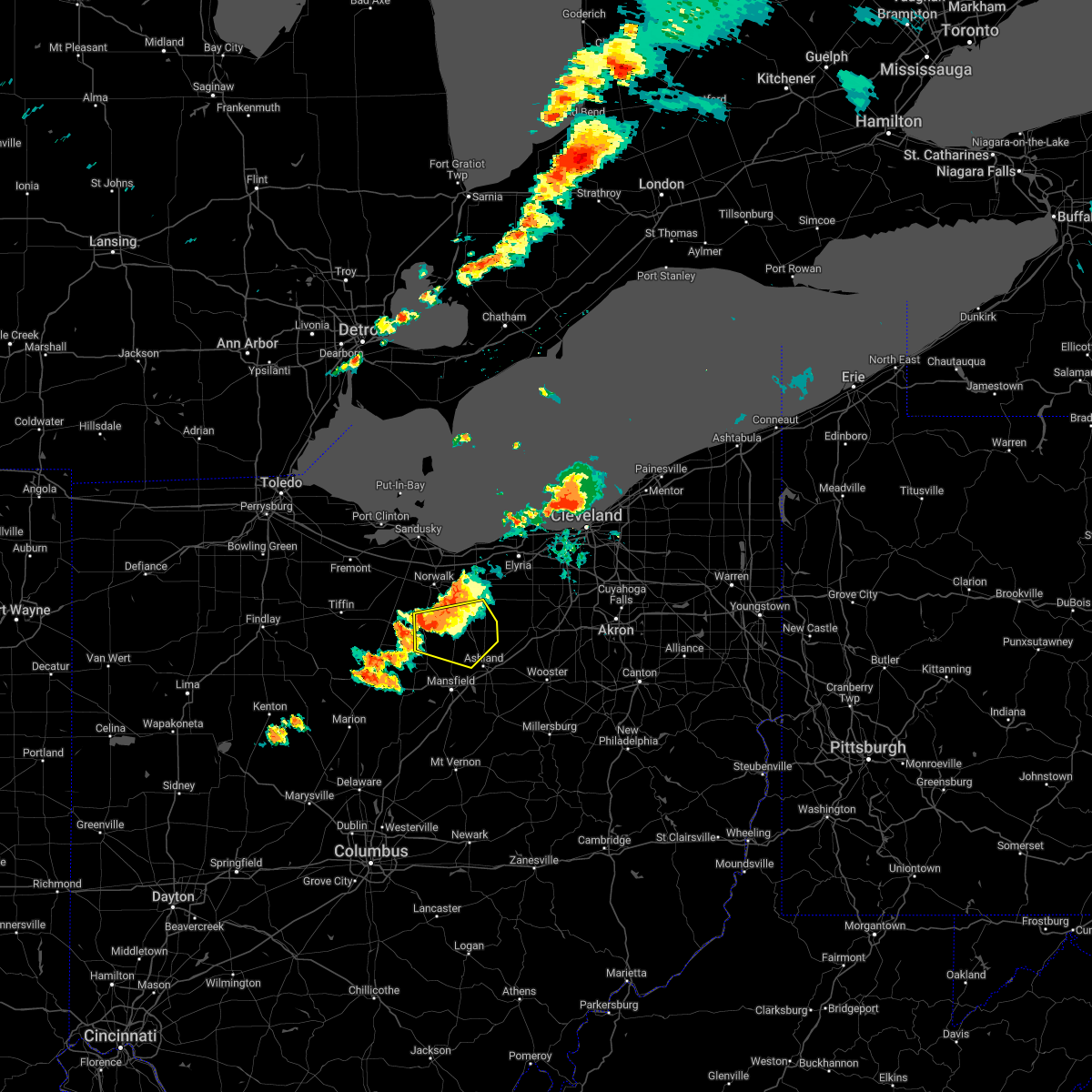 At 702 pm edt, a severe thunderstorm was located 7 miles northeast of plymouth, or 12 miles south of norwalk, moving east at 25 mph (radar indicated). Hazards include 60 mph wind gusts and penny size hail. Expect damage to trees and power lines. locations impacted include, ashland, willard, new london, plymouth, savannah, greenwich, north fairfield, bailey lakes, rochester, shenandoah, nova and olivesburg. hail threat, radar indicated max hail size, 0. 75 in wind threat, radar indicated max wind gust, 60 mph. At 702 pm edt, a severe thunderstorm was located 7 miles northeast of plymouth, or 12 miles south of norwalk, moving east at 25 mph (radar indicated). Hazards include 60 mph wind gusts and penny size hail. Expect damage to trees and power lines. locations impacted include, ashland, willard, new london, plymouth, savannah, greenwich, north fairfield, bailey lakes, rochester, shenandoah, nova and olivesburg. hail threat, radar indicated max hail size, 0. 75 in wind threat, radar indicated max wind gust, 60 mph.
|
| 7/20/2022 6:52 PM EDT | 2 foot diameter tree down and blocking tiffen ave in willard. time estimated via rada in huron county OH, 0.5 miles NW of Willard, OH |
| 7/20/2022 6:45 PM EDT |
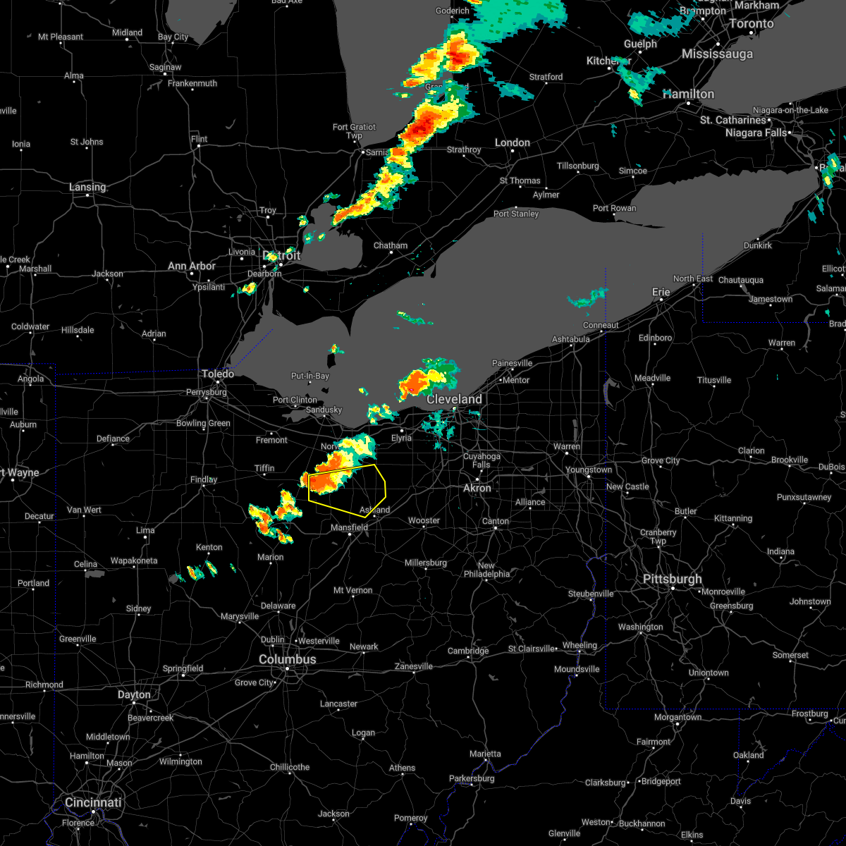 At 645 pm edt, a severe thunderstorm was located over willard, or 12 miles south of norwalk, moving east at 25 mph (radar indicated). Hazards include 60 mph wind gusts and penny size hail. Expect damage to trees and power lines. Locations impacted include, ashland, willard, new london, plymouth, savannah, greenwich, north fairfield, bailey lakes, rochester, shenandoah, nova and olivesburg. At 645 pm edt, a severe thunderstorm was located over willard, or 12 miles south of norwalk, moving east at 25 mph (radar indicated). Hazards include 60 mph wind gusts and penny size hail. Expect damage to trees and power lines. Locations impacted include, ashland, willard, new london, plymouth, savannah, greenwich, north fairfield, bailey lakes, rochester, shenandoah, nova and olivesburg.
|
| 7/20/2022 6:28 PM EDT |
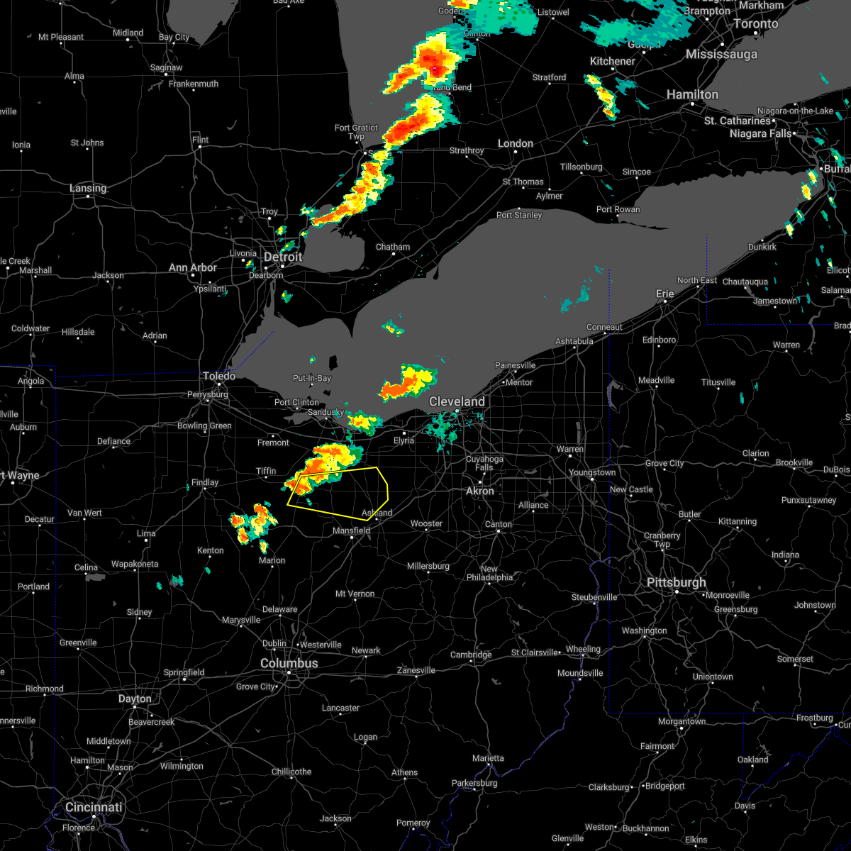 At 628 pm edt, a severe thunderstorm was located near willard, or 16 miles southwest of norwalk, moving east at 25 mph (radar indicated). Hazards include 60 mph wind gusts and penny size hail. expect damage to trees and power lines At 628 pm edt, a severe thunderstorm was located near willard, or 16 miles southwest of norwalk, moving east at 25 mph (radar indicated). Hazards include 60 mph wind gusts and penny size hail. expect damage to trees and power lines
|
| 6/13/2022 11:03 PM EDT |
 At 1103 pm edt, severe thunderstorms were located along a line extending from near wakeman to near new london to near willard, moving east at 55 mph (trained weather spotters). Hazards include 70 mph wind gusts and penny size hail. Expect considerable tree damage. damage is likely to mobile homes, roofs, and outbuildings. locations impacted include, mansfield, ashland, shelby, grafton, willard, wellington, lodi, new london, plymouth, west salem, wakeman, savannah, polk, oberlin, sullivan, lagrange, penfield, south amherst, pittsfield and greenwich. thunderstorm damage threat, considerable hail threat, radar indicated max hail size, 0. 75 in wind threat, radar indicated max wind gust, 70 mph. At 1103 pm edt, severe thunderstorms were located along a line extending from near wakeman to near new london to near willard, moving east at 55 mph (trained weather spotters). Hazards include 70 mph wind gusts and penny size hail. Expect considerable tree damage. damage is likely to mobile homes, roofs, and outbuildings. locations impacted include, mansfield, ashland, shelby, grafton, willard, wellington, lodi, new london, plymouth, west salem, wakeman, savannah, polk, oberlin, sullivan, lagrange, penfield, south amherst, pittsfield and greenwich. thunderstorm damage threat, considerable hail threat, radar indicated max hail size, 0. 75 in wind threat, radar indicated max wind gust, 70 mph.
|
| 6/13/2022 11:01 PM EDT |
 At 1100 pm edt, severe thunderstorms were located along a line extending from near wakeman to 7 miles west of new london to near willard, moving southeast at 55 mph (trained weather spotters). Hazards include 60 mph wind gusts and penny size hail. expect damage to trees and power lines At 1100 pm edt, severe thunderstorms were located along a line extending from near wakeman to 7 miles west of new london to near willard, moving southeast at 55 mph (trained weather spotters). Hazards include 60 mph wind gusts and penny size hail. expect damage to trees and power lines
|
| 6/1/2022 8:27 PM EDT |
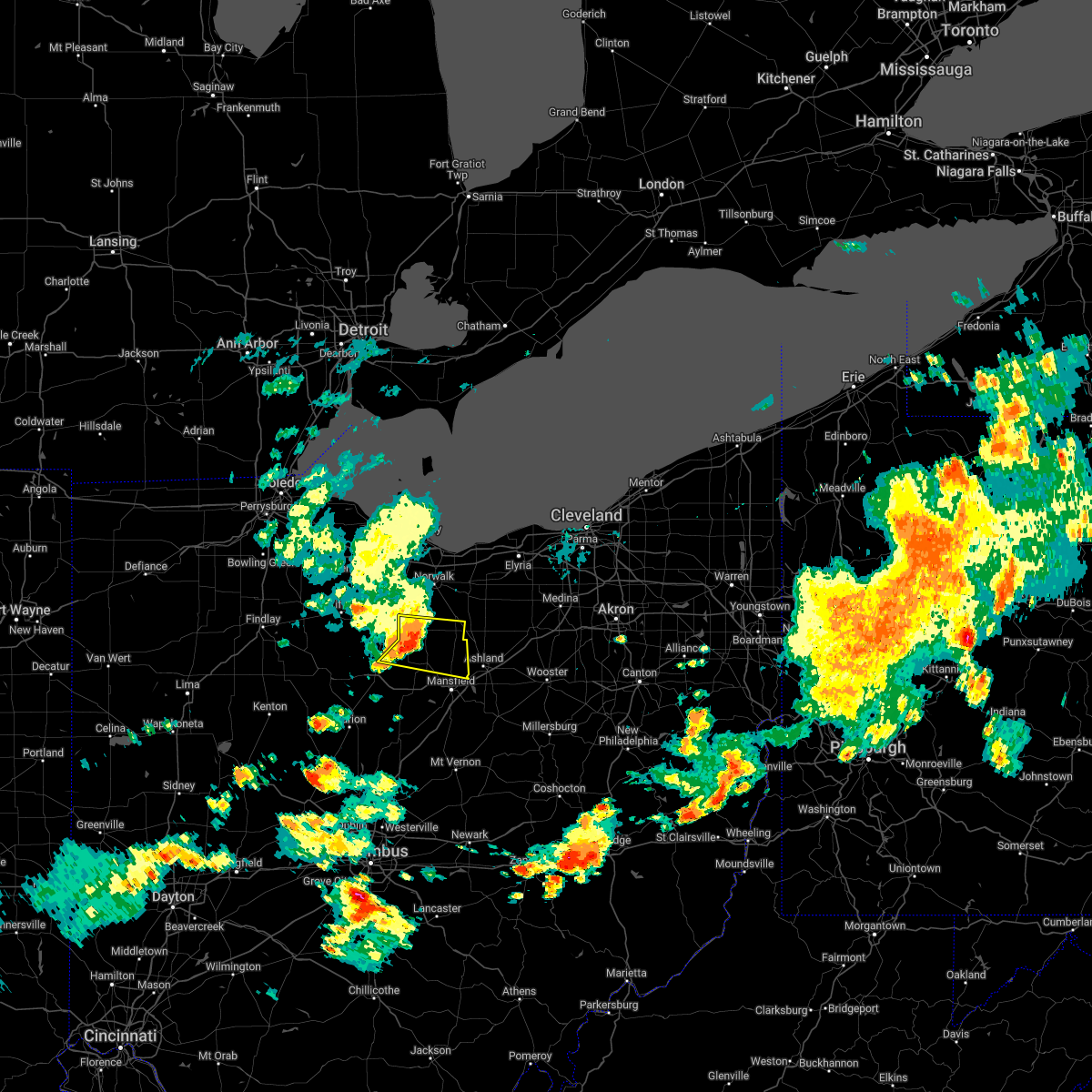 At 827 pm edt, a severe thunderstorm was located near new washington, or 16 miles northeast of bucyrus, moving east at 30 mph (radar indicated). Hazards include 60 mph wind gusts and quarter size hail. Minor damage to vehicles is possible. expect damage to trees and power lines. locations impacted include, mansfield, shelby, willard, new london, plymouth, new washington, greenwich, tiro, shenandoah and olivesburg. hail threat, radar indicated max hail size, 1. 00 in wind threat, radar indicated max wind gust, 60 mph. At 827 pm edt, a severe thunderstorm was located near new washington, or 16 miles northeast of bucyrus, moving east at 30 mph (radar indicated). Hazards include 60 mph wind gusts and quarter size hail. Minor damage to vehicles is possible. expect damage to trees and power lines. locations impacted include, mansfield, shelby, willard, new london, plymouth, new washington, greenwich, tiro, shenandoah and olivesburg. hail threat, radar indicated max hail size, 1. 00 in wind threat, radar indicated max wind gust, 60 mph.
|
| 6/1/2022 8:02 PM EDT |
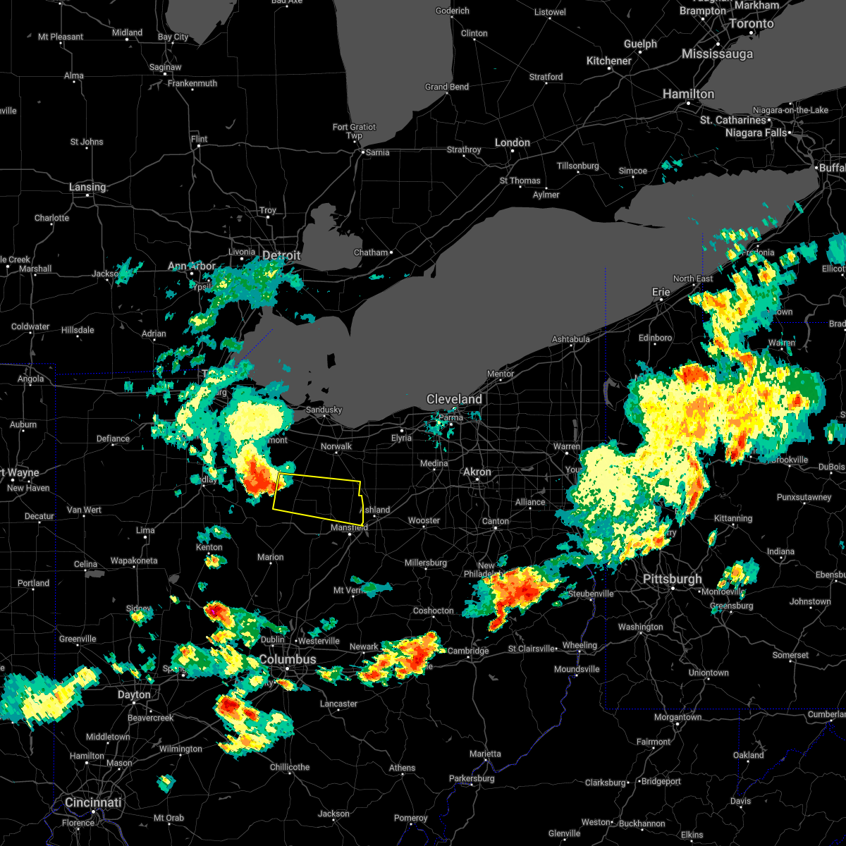 At 802 pm edt, a severe thunderstorm was located over bloomville, or 10 miles southeast of tiffin, moving east at 30 mph (radar indicated). Hazards include 60 mph wind gusts and quarter size hail. Minor damage to vehicles is possible. Expect damage to trees and power lines. At 802 pm edt, a severe thunderstorm was located over bloomville, or 10 miles southeast of tiffin, moving east at 30 mph (radar indicated). Hazards include 60 mph wind gusts and quarter size hail. Minor damage to vehicles is possible. Expect damage to trees and power lines.
|
| 6/1/2022 5:10 PM EDT |
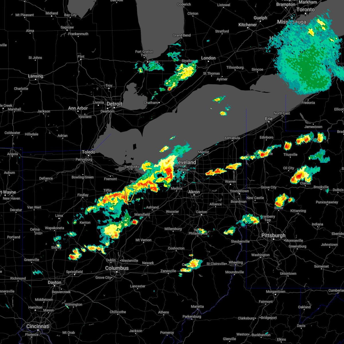 The severe thunderstorm warning for southwestern huron county will expire at 515 pm edt, the storms which prompted the warning have weakened below severe limits, and no longer pose an immediate threat to life or property. therefore, the warning will be allowed to expire. however heavy rain is still possible with these thunderstorms. a severe thunderstorm watch remains in effect until 1000 pm edt for north central and northwestern ohio. The severe thunderstorm warning for southwestern huron county will expire at 515 pm edt, the storms which prompted the warning have weakened below severe limits, and no longer pose an immediate threat to life or property. therefore, the warning will be allowed to expire. however heavy rain is still possible with these thunderstorms. a severe thunderstorm watch remains in effect until 1000 pm edt for north central and northwestern ohio.
|
| 6/1/2022 5:01 PM EDT |
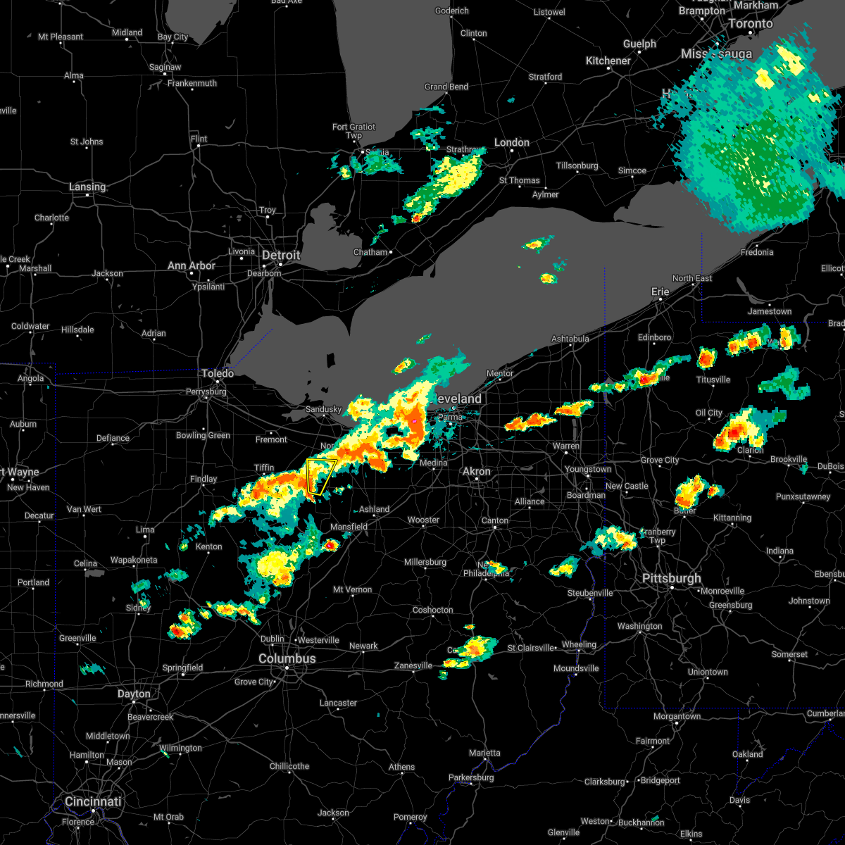 At 501 pm edt, severe thunderstorms were located along a line extending from 7 miles southwest of norwalk to near chatfield to near upper sandusky, moving east at 20 mph (radar indicated). Hazards include 60 mph wind gusts and penny size hail. Expect damage to trees and power lines. locations impacted include, willard. hail threat, radar indicated max hail size, 0. 75 in wind threat, radar indicated max wind gust, 60 mph. At 501 pm edt, severe thunderstorms were located along a line extending from 7 miles southwest of norwalk to near chatfield to near upper sandusky, moving east at 20 mph (radar indicated). Hazards include 60 mph wind gusts and penny size hail. Expect damage to trees and power lines. locations impacted include, willard. hail threat, radar indicated max hail size, 0. 75 in wind threat, radar indicated max wind gust, 60 mph.
|
| 6/1/2022 4:51 PM EDT |
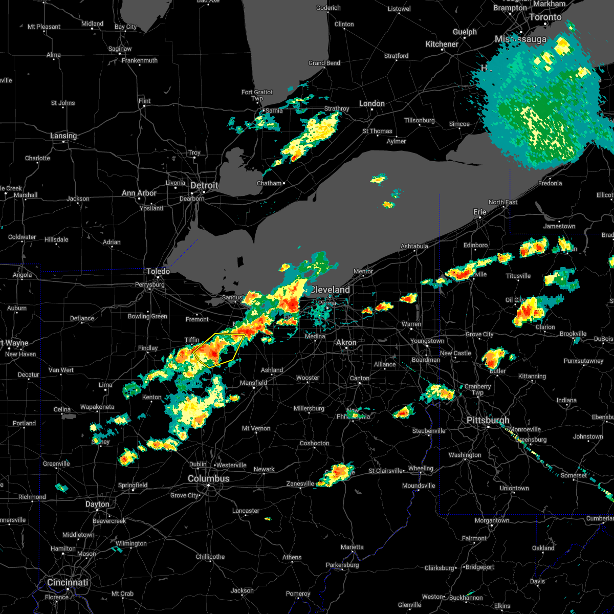 At 451 pm edt, severe thunderstorms were located along a line extending from 7 miles southeast of bellevue to near bloomville to near upper sandusky, moving east at 20 mph (radar indicated). Hazards include 60 mph wind gusts and penny size hail. Expect damage to trees and power lines. locations impacted include, willard, new washington, bloomville, chatfield, attica and republic. hail threat, radar indicated max hail size, 0. 75 in wind threat, radar indicated max wind gust, 60 mph. At 451 pm edt, severe thunderstorms were located along a line extending from 7 miles southeast of bellevue to near bloomville to near upper sandusky, moving east at 20 mph (radar indicated). Hazards include 60 mph wind gusts and penny size hail. Expect damage to trees and power lines. locations impacted include, willard, new washington, bloomville, chatfield, attica and republic. hail threat, radar indicated max hail size, 0. 75 in wind threat, radar indicated max wind gust, 60 mph.
|
| 6/1/2022 4:35 PM EDT |
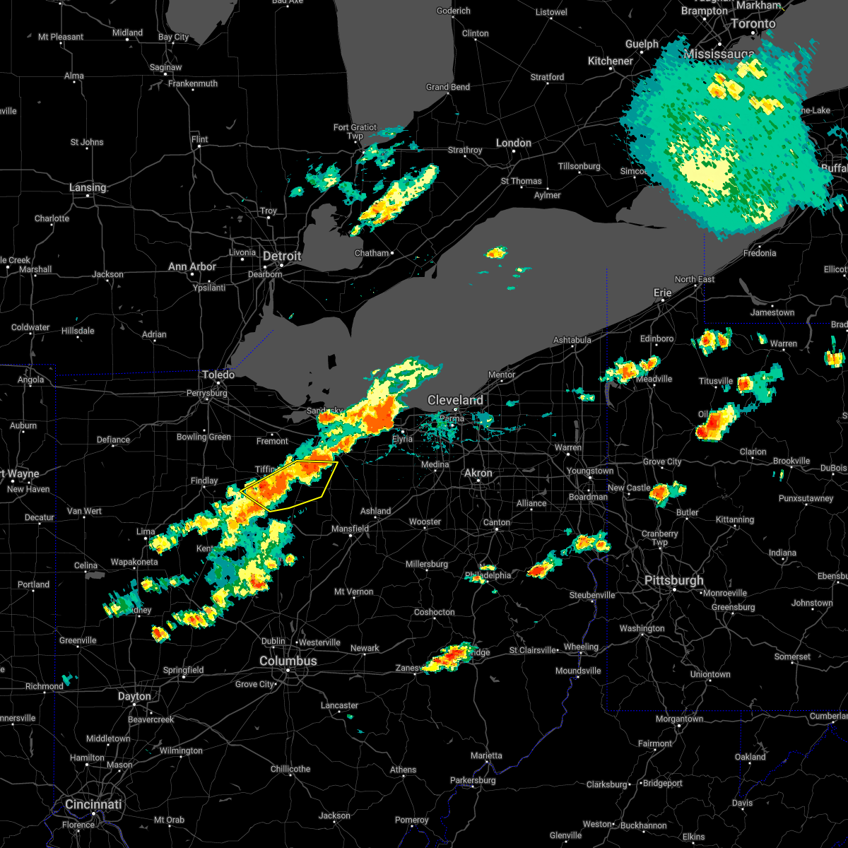 At 435 pm edt, severe thunderstorms were located along a line extending from 7 miles south of bellevue to near sycamore to near forest, moving east at 20 mph (radar indicated). Hazards include 60 mph wind gusts and penny size hail. Expect damage to trees and power lines. locations impacted include, tiffin, willard, new washington, bloomville, sycamore, chatfield, attica, benton and republic. hail threat, radar indicated max hail size, 0. 75 in wind threat, radar indicated max wind gust, 60 mph. At 435 pm edt, severe thunderstorms were located along a line extending from 7 miles south of bellevue to near sycamore to near forest, moving east at 20 mph (radar indicated). Hazards include 60 mph wind gusts and penny size hail. Expect damage to trees and power lines. locations impacted include, tiffin, willard, new washington, bloomville, sycamore, chatfield, attica, benton and republic. hail threat, radar indicated max hail size, 0. 75 in wind threat, radar indicated max wind gust, 60 mph.
|
| 6/1/2022 4:08 PM EDT |
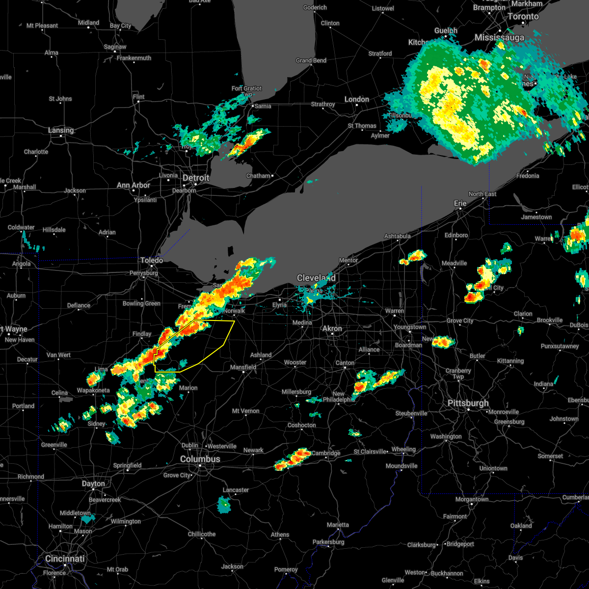 At 408 pm edt, severe thunderstorms were located along a line extending from 6 miles south of green springs to near sycamore to dunkirk, moving east at 20 mph (radar indicated). Hazards include 60 mph wind gusts and penny size hail. expect damage to trees and power lines At 408 pm edt, severe thunderstorms were located along a line extending from 6 miles south of green springs to near sycamore to dunkirk, moving east at 20 mph (radar indicated). Hazards include 60 mph wind gusts and penny size hail. expect damage to trees and power lines
|
| 5/21/2022 5:51 PM EDT |
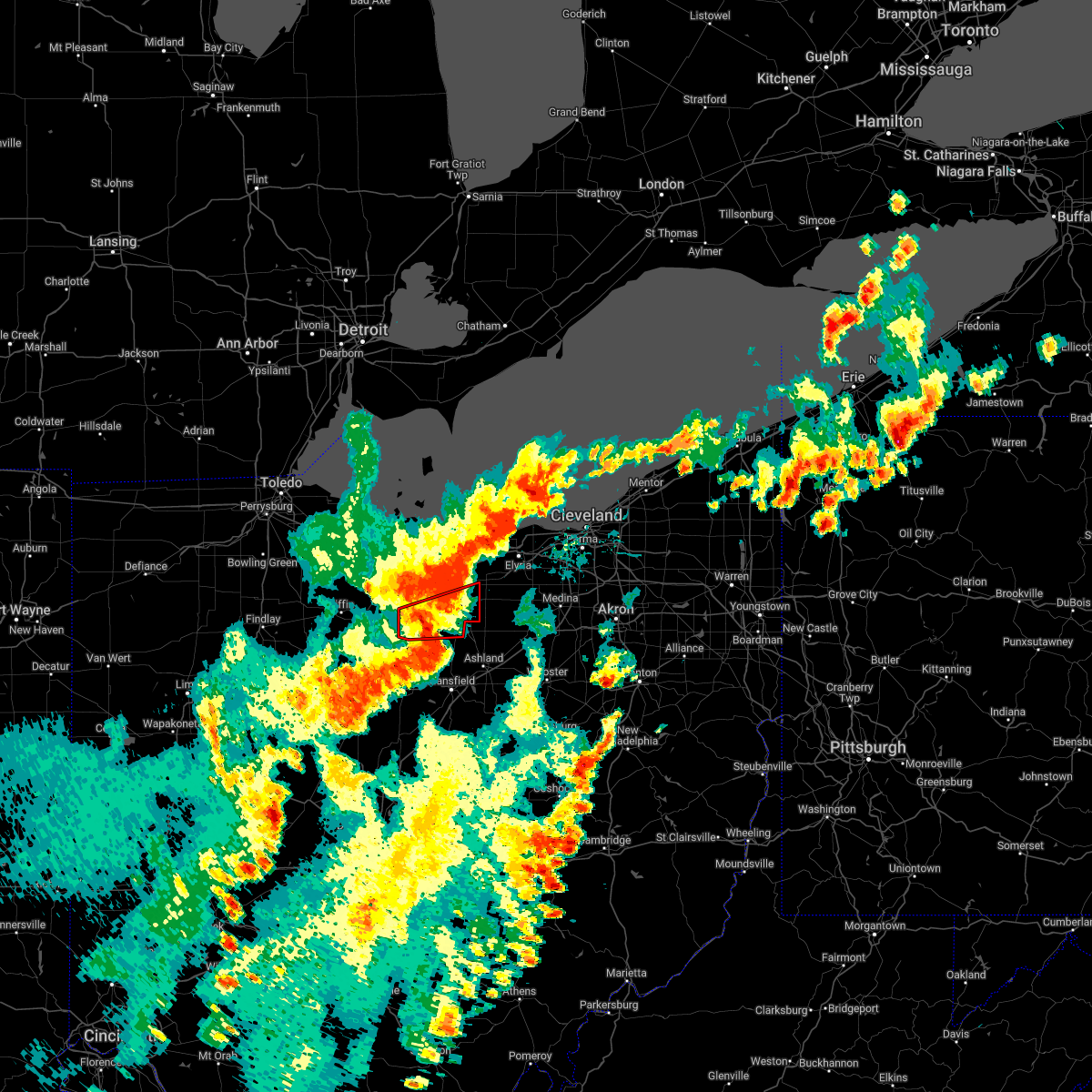 The tornado warning for huron county will expire at 600 pm edt, the tornado threat has diminished and the tornado warning has been cancelled. however, large hail and damaging winds remain likely and a severe thunderstorm warning remains in effect for the area. a severe thunderstorm watch remains in effect until 1000 pm edt for north central and northwestern ohio. The tornado warning for huron county will expire at 600 pm edt, the tornado threat has diminished and the tornado warning has been cancelled. however, large hail and damaging winds remain likely and a severe thunderstorm warning remains in effect for the area. a severe thunderstorm watch remains in effect until 1000 pm edt for north central and northwestern ohio.
|
| 5/21/2022 5:41 PM EDT |
 At 540 pm edt, a severe thunderstorm was located near plymouth, or 13 miles south of norwalk, moving east at 45 mph (radar indicated). Hazards include ping pong ball size hail and 60 mph wind gusts. People and animals outdoors will be injured. expect hail damage to roofs, siding, windows, and vehicles. expect damage to trees and power lines. Locations impacted include, grafton, willard, wellington, new london, plymouth, savannah, polk, sullivan, lagrange, penfield, pittsfield, greenwich, spencer, north fairfield, bailey lakes, rochester and nova. At 540 pm edt, a severe thunderstorm was located near plymouth, or 13 miles south of norwalk, moving east at 45 mph (radar indicated). Hazards include ping pong ball size hail and 60 mph wind gusts. People and animals outdoors will be injured. expect hail damage to roofs, siding, windows, and vehicles. expect damage to trees and power lines. Locations impacted include, grafton, willard, wellington, new london, plymouth, savannah, polk, sullivan, lagrange, penfield, pittsfield, greenwich, spencer, north fairfield, bailey lakes, rochester and nova.
|
| 5/21/2022 5:39 PM EDT | Storm chaser video shows trees and power lines downed on ohio state route 103 south of wiers road in celeryvill in huron county OH, 1.8 miles N of Willard, OH |
| 5/21/2022 5:39 PM EDT |
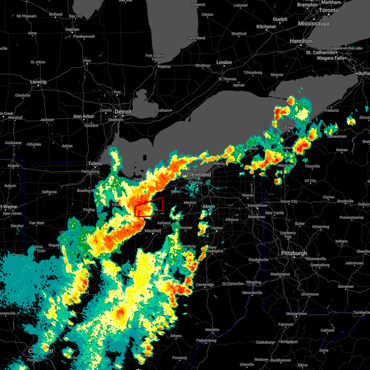 At 539 pm edt, a severe thunderstorm capable of producing a tornado was located over willard, or 12 miles south of norwalk, moving east at 40 mph (radar indicated rotation). Hazards include tornado and quarter size hail. Flying debris will be dangerous to those caught without shelter. mobile homes will be damaged or destroyed. damage to roofs, windows, and vehicles will occur. tree damage is likely. this dangerous storm will be near, new london around 600 pm edt. Other locations impacted by this tornadic thunderstorm include north fairfield and greenwich. At 539 pm edt, a severe thunderstorm capable of producing a tornado was located over willard, or 12 miles south of norwalk, moving east at 40 mph (radar indicated rotation). Hazards include tornado and quarter size hail. Flying debris will be dangerous to those caught without shelter. mobile homes will be damaged or destroyed. damage to roofs, windows, and vehicles will occur. tree damage is likely. this dangerous storm will be near, new london around 600 pm edt. Other locations impacted by this tornadic thunderstorm include north fairfield and greenwich.
|
| 5/21/2022 5:31 PM EDT |
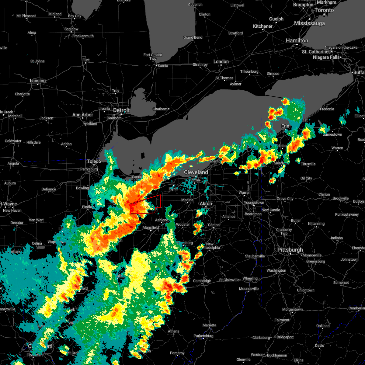 At 531 pm edt, a severe thunderstorm capable of producing a tornado was located near willard, or 15 miles southwest of norwalk, moving east at 40 mph (radar indicated rotation). Hazards include tornado and quarter size hail. Flying debris will be dangerous to those caught without shelter. mobile homes will be damaged or destroyed. damage to roofs, windows, and vehicles will occur. tree damage is likely. this dangerous storm will be near, willard around 535 pm edt. plymouth around 540 pm edt. new london around 600 pm edt. Other locations impacted by this tornadic thunderstorm include north fairfield, greenwich and attica. At 531 pm edt, a severe thunderstorm capable of producing a tornado was located near willard, or 15 miles southwest of norwalk, moving east at 40 mph (radar indicated rotation). Hazards include tornado and quarter size hail. Flying debris will be dangerous to those caught without shelter. mobile homes will be damaged or destroyed. damage to roofs, windows, and vehicles will occur. tree damage is likely. this dangerous storm will be near, willard around 535 pm edt. plymouth around 540 pm edt. new london around 600 pm edt. Other locations impacted by this tornadic thunderstorm include north fairfield, greenwich and attica.
|
| 5/21/2022 5:27 PM EDT |
 At 527 pm edt, a severe thunderstorm was located over willard, or 16 miles southwest of norwalk, moving east at 45 mph (radar indicated). Hazards include ping pong ball size hail and 60 mph wind gusts. People and animals outdoors will be injured. expect hail damage to roofs, siding, windows, and vehicles. expect damage to trees and power lines. Locations impacted include, grafton, willard, wellington, new london, plymouth, new washington, savannah, polk, sullivan, lagrange, penfield, pittsfield, greenwich, attica, spencer, north fairfield, bailey lakes, tiro, rochester and nova. At 527 pm edt, a severe thunderstorm was located over willard, or 16 miles southwest of norwalk, moving east at 45 mph (radar indicated). Hazards include ping pong ball size hail and 60 mph wind gusts. People and animals outdoors will be injured. expect hail damage to roofs, siding, windows, and vehicles. expect damage to trees and power lines. Locations impacted include, grafton, willard, wellington, new london, plymouth, new washington, savannah, polk, sullivan, lagrange, penfield, pittsfield, greenwich, attica, spencer, north fairfield, bailey lakes, tiro, rochester and nova.
|
| 5/21/2022 5:23 PM EDT |
 At 523 pm edt, a severe thunderstorm was located near new washington, or 16 miles northeast of bucyrus, moving east at 45 mph (radar indicated). Hazards include 60 mph wind gusts and quarter size hail. Minor damage to vehicles is possible. Expect damage to trees and power lines. At 523 pm edt, a severe thunderstorm was located near new washington, or 16 miles northeast of bucyrus, moving east at 45 mph (radar indicated). Hazards include 60 mph wind gusts and quarter size hail. Minor damage to vehicles is possible. Expect damage to trees and power lines.
|
| 5/3/2022 6:46 PM EDT |
 At 646 pm edt, severe thunderstorms were located along a line extending from near sandusky to near willard, moving east at 55 mph (trained weather spotters). Hazards include 70 mph wind gusts and half dollar size hail. People and animals outdoors will be injured. expect hail damage to roofs, siding, windows, and vehicles. expect considerable tree damage. wind damage is also likely to mobile homes, roofs, and outbuildings. locations impacted include, sandusky, norwalk, bellevue, clyde, willard, plymouth, northern milan, milan, castalia, greenwich, monroeville, attica, berlin heights, north fairfield, flat rock, bloomingville, sandusky south, fairview lanes and vickery. thunderstorm damage threat, considerable hail threat, radar indicated max hail size, 1. 25 in wind threat, radar indicated max wind gust, 70 mph. At 646 pm edt, severe thunderstorms were located along a line extending from near sandusky to near willard, moving east at 55 mph (trained weather spotters). Hazards include 70 mph wind gusts and half dollar size hail. People and animals outdoors will be injured. expect hail damage to roofs, siding, windows, and vehicles. expect considerable tree damage. wind damage is also likely to mobile homes, roofs, and outbuildings. locations impacted include, sandusky, norwalk, bellevue, clyde, willard, plymouth, northern milan, milan, castalia, greenwich, monroeville, attica, berlin heights, north fairfield, flat rock, bloomingville, sandusky south, fairview lanes and vickery. thunderstorm damage threat, considerable hail threat, radar indicated max hail size, 1. 25 in wind threat, radar indicated max wind gust, 70 mph.
|
| 5/3/2022 6:41 PM EDT |
 At 641 pm edt, severe thunderstorms were located along a line extending from near castalia to near willard, moving east at 55 mph (trained weather spotters). Hazards include 70 mph wind gusts and half dollar size hail. People and animals outdoors will be injured. expect hail damage to roofs, siding, windows, and vehicles. expect considerable tree damage. wind damage is also likely to mobile homes, roofs, and outbuildings. locations impacted include, sandusky, norwalk, bellevue, clyde, willard, plymouth, northern milan, milan, new washington, bloomville, castalia, chatfield, greenwich, monroeville, attica, berlin heights, north fairfield, republic, flat rock and bloomingville. thunderstorm damage threat, considerable hail threat, radar indicated max hail size, 1. 25 in wind threat, radar indicated max wind gust, 70 mph. At 641 pm edt, severe thunderstorms were located along a line extending from near castalia to near willard, moving east at 55 mph (trained weather spotters). Hazards include 70 mph wind gusts and half dollar size hail. People and animals outdoors will be injured. expect hail damage to roofs, siding, windows, and vehicles. expect considerable tree damage. wind damage is also likely to mobile homes, roofs, and outbuildings. locations impacted include, sandusky, norwalk, bellevue, clyde, willard, plymouth, northern milan, milan, new washington, bloomville, castalia, chatfield, greenwich, monroeville, attica, berlin heights, north fairfield, republic, flat rock and bloomingville. thunderstorm damage threat, considerable hail threat, radar indicated max hail size, 1. 25 in wind threat, radar indicated max wind gust, 70 mph.
|
| 5/3/2022 6:27 PM EDT |
 At 627 pm edt, severe thunderstorms were located along a line extending from near clyde to chatfield, moving east at 55 mph (trained weather spotters). Hazards include 70 mph wind gusts and ping pong ball size hail. People and animals outdoors will be injured. expect hail damage to roofs, siding, windows, and vehicles. expect considerable tree damage. wind damage is also likely to mobile homes, roofs, and outbuildings. locations impacted include, sandusky, norwalk, bucyrus, shelby, bellevue, clyde, willard, plymouth, northern milan, milan, new washington, bloomville, castalia, chatfield, greenwich, monroeville, attica, berlin heights, north fairfield and republic. thunderstorm damage threat, considerable hail threat, radar indicated max hail size, 1. 50 in wind threat, radar indicated max wind gust, 70 mph. At 627 pm edt, severe thunderstorms were located along a line extending from near clyde to chatfield, moving east at 55 mph (trained weather spotters). Hazards include 70 mph wind gusts and ping pong ball size hail. People and animals outdoors will be injured. expect hail damage to roofs, siding, windows, and vehicles. expect considerable tree damage. wind damage is also likely to mobile homes, roofs, and outbuildings. locations impacted include, sandusky, norwalk, bucyrus, shelby, bellevue, clyde, willard, plymouth, northern milan, milan, new washington, bloomville, castalia, chatfield, greenwich, monroeville, attica, berlin heights, north fairfield and republic. thunderstorm damage threat, considerable hail threat, radar indicated max hail size, 1. 50 in wind threat, radar indicated max wind gust, 70 mph.
|
| 5/3/2022 6:22 PM EDT |
 At 621 pm edt, severe thunderstorms were located along a line extending from clyde to near chatfield, moving east at 55 mph (radar indicated). Hazards include 70 mph wind gusts and quarter size hail. Minor damage to vehicles is possible. expect considerable tree damage. Wind damage is also likely to mobile homes, roofs, and outbuildings. At 621 pm edt, severe thunderstorms were located along a line extending from clyde to near chatfield, moving east at 55 mph (radar indicated). Hazards include 70 mph wind gusts and quarter size hail. Minor damage to vehicles is possible. expect considerable tree damage. Wind damage is also likely to mobile homes, roofs, and outbuildings.
|
| 5/3/2022 6:19 PM EDT |
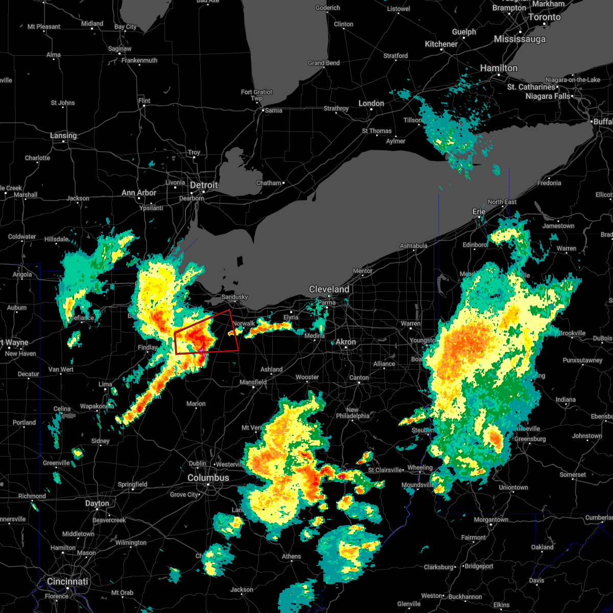 At 617 pm edt, a severe thunderstorm capable of producing a tornado was located near tiffin, moving east at 45 mph (radar indicated rotation). Hazards include tornado and quarter size hail. Flying debris will be dangerous to those caught without shelter. mobile homes will be damaged or destroyed. damage to roofs, windows, and vehicles will occur. Tree damage is likely. At 617 pm edt, a severe thunderstorm capable of producing a tornado was located near tiffin, moving east at 45 mph (radar indicated rotation). Hazards include tornado and quarter size hail. Flying debris will be dangerous to those caught without shelter. mobile homes will be damaged or destroyed. damage to roofs, windows, and vehicles will occur. Tree damage is likely.
|
| 4/25/2022 1:44 PM EDT | Several utility poles snapped off along with wires dow in huron county OH, 6.2 miles SSW of Willard, OH |
| 8/11/2021 4:14 PM EDT |
 At 414 pm edt, severe thunderstorms were located along a line extending from near clyde to 7 miles northeast of bloomville to near upper sandusky, moving east at 30 mph (radar indicated). Hazards include 70 mph wind gusts and penny size hail. Expect considerable tree damage. Damage is likely to mobile homes, roofs, and outbuildings. At 414 pm edt, severe thunderstorms were located along a line extending from near clyde to 7 miles northeast of bloomville to near upper sandusky, moving east at 30 mph (radar indicated). Hazards include 70 mph wind gusts and penny size hail. Expect considerable tree damage. Damage is likely to mobile homes, roofs, and outbuildings.
|
| 8/11/2021 9:50 AM EDT | Numerous trees dow in huron county OH, 0.5 miles NW of Willard, OH |
| 8/11/2021 9:50 AM EDT | Multiple tress down along peru olena r in huron county OH, 3 miles SW of Willard, OH |
| 8/11/2021 9:50 AM EDT |
 The severe thunderstorm warning for northwestern richland, huron and northern crawford counties will expire at 1000 am edt, the storms which prompted the warning have weakened below severe limits, and have exited the warned area. therefore, the warning will be allowed to expire. The severe thunderstorm warning for northwestern richland, huron and northern crawford counties will expire at 1000 am edt, the storms which prompted the warning have weakened below severe limits, and have exited the warned area. therefore, the warning will be allowed to expire.
|
| 8/11/2021 9:31 AM EDT |
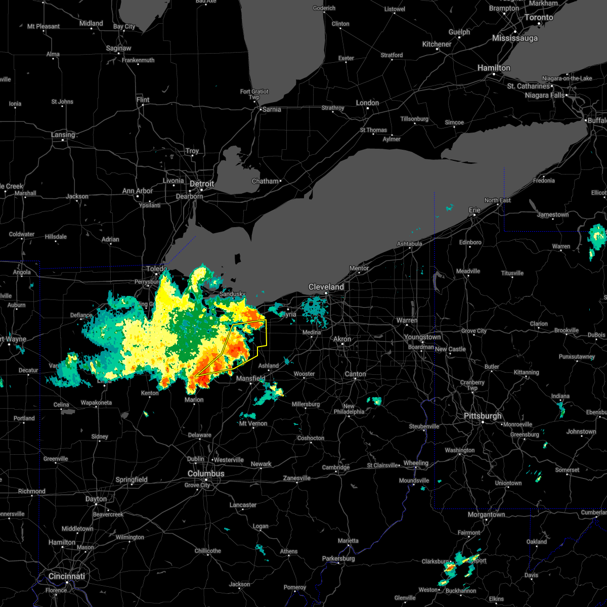 At 931 am edt, severe thunderstorms were located along a line extending from near bellevue to near willard to near bucyrus, moving east at 35 mph (radar indicated). Hazards include 60 mph wind gusts. Expect damage to trees and power lines. locations impacted include, norwalk, shelby, willard, new london, plymouth, wakeman, new washington, greenwich, monroeville, north fairfield, tiro and sulpher springs. hail threat, radar indicated max hail size, <. 75 in wind threat, radar indicated max wind gust, 60 mph. At 931 am edt, severe thunderstorms were located along a line extending from near bellevue to near willard to near bucyrus, moving east at 35 mph (radar indicated). Hazards include 60 mph wind gusts. Expect damage to trees and power lines. locations impacted include, norwalk, shelby, willard, new london, plymouth, wakeman, new washington, greenwich, monroeville, north fairfield, tiro and sulpher springs. hail threat, radar indicated max hail size, <. 75 in wind threat, radar indicated max wind gust, 60 mph.
|
| 8/11/2021 9:12 AM EDT |
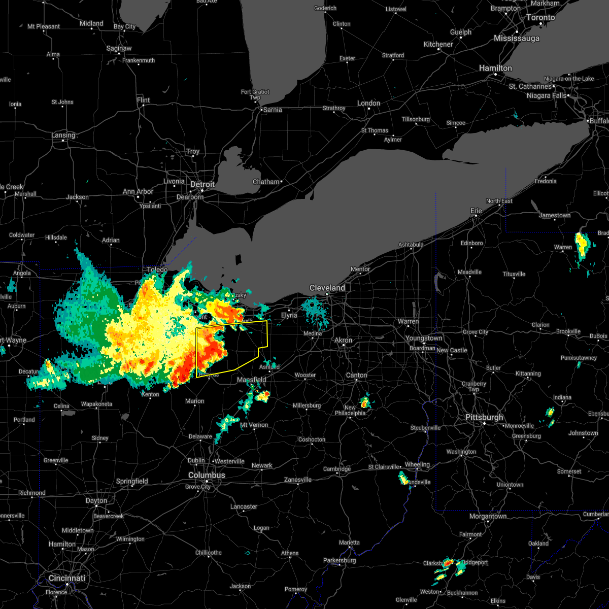 At 912 am edt, severe thunderstorms were located along a line extending from near green springs to near bloomville to upper sandusky, moving east at 35 mph (radar indicated). Hazards include 70 mph wind gusts. Expect considerable tree damage. damage is likely to mobile homes, roofs, and outbuildings. locations impacted include, norwalk, shelby, willard, new london, plymouth, wakeman, new washington, bloomville, chatfield, greenwich, monroeville, attica, benton, north fairfield, republic, tiro, flat rock, oceola and sulpher springs. thunderstorm damage threat, considerable hail threat, radar indicated max hail size, <. 75 in wind threat, radar indicated max wind gust, 70 mph. At 912 am edt, severe thunderstorms were located along a line extending from near green springs to near bloomville to upper sandusky, moving east at 35 mph (radar indicated). Hazards include 70 mph wind gusts. Expect considerable tree damage. damage is likely to mobile homes, roofs, and outbuildings. locations impacted include, norwalk, shelby, willard, new london, plymouth, wakeman, new washington, bloomville, chatfield, greenwich, monroeville, attica, benton, north fairfield, republic, tiro, flat rock, oceola and sulpher springs. thunderstorm damage threat, considerable hail threat, radar indicated max hail size, <. 75 in wind threat, radar indicated max wind gust, 70 mph.
|
| 8/11/2021 8:58 AM EDT |
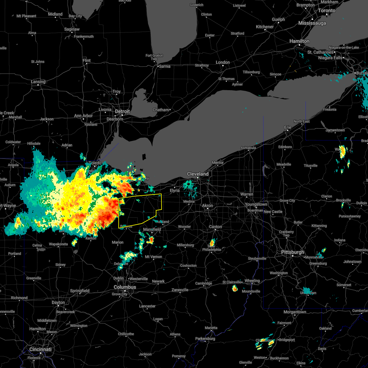 At 858 am edt, severe thunderstorms were located along a line extending from near green springs to near sycamore to near upper sandusky, moving east at 35 mph (radar indicated). Hazards include 60 mph wind gusts. expect damage to trees and power lines At 858 am edt, severe thunderstorms were located along a line extending from near green springs to near sycamore to near upper sandusky, moving east at 35 mph (radar indicated). Hazards include 60 mph wind gusts. expect damage to trees and power lines
|
| 6/30/2021 3:42 PM EDT |
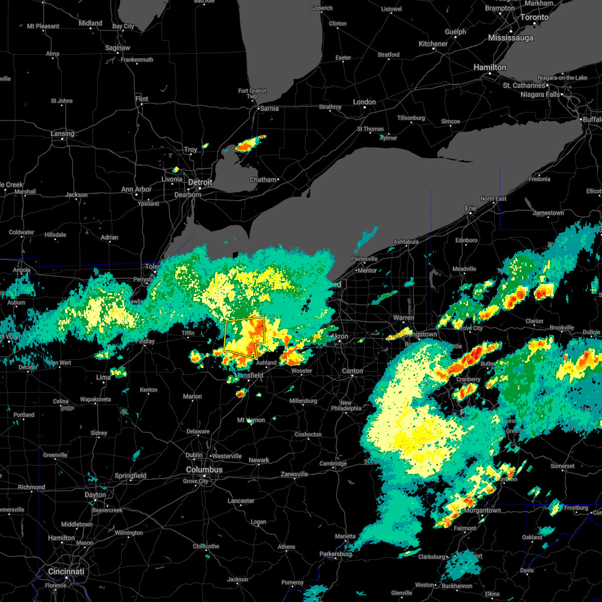 The severe thunderstorm warning for north central richland and huron counties will expire at 345 pm edt, the storms which prompted the warning have weakened below severe limits, and have exited the warned area. therefore, the warning will be allowed to expire. however, heavy rain is still possible with these thunderstorms. The severe thunderstorm warning for north central richland and huron counties will expire at 345 pm edt, the storms which prompted the warning have weakened below severe limits, and have exited the warned area. therefore, the warning will be allowed to expire. however, heavy rain is still possible with these thunderstorms.
|
| 6/30/2021 3:19 PM EDT |
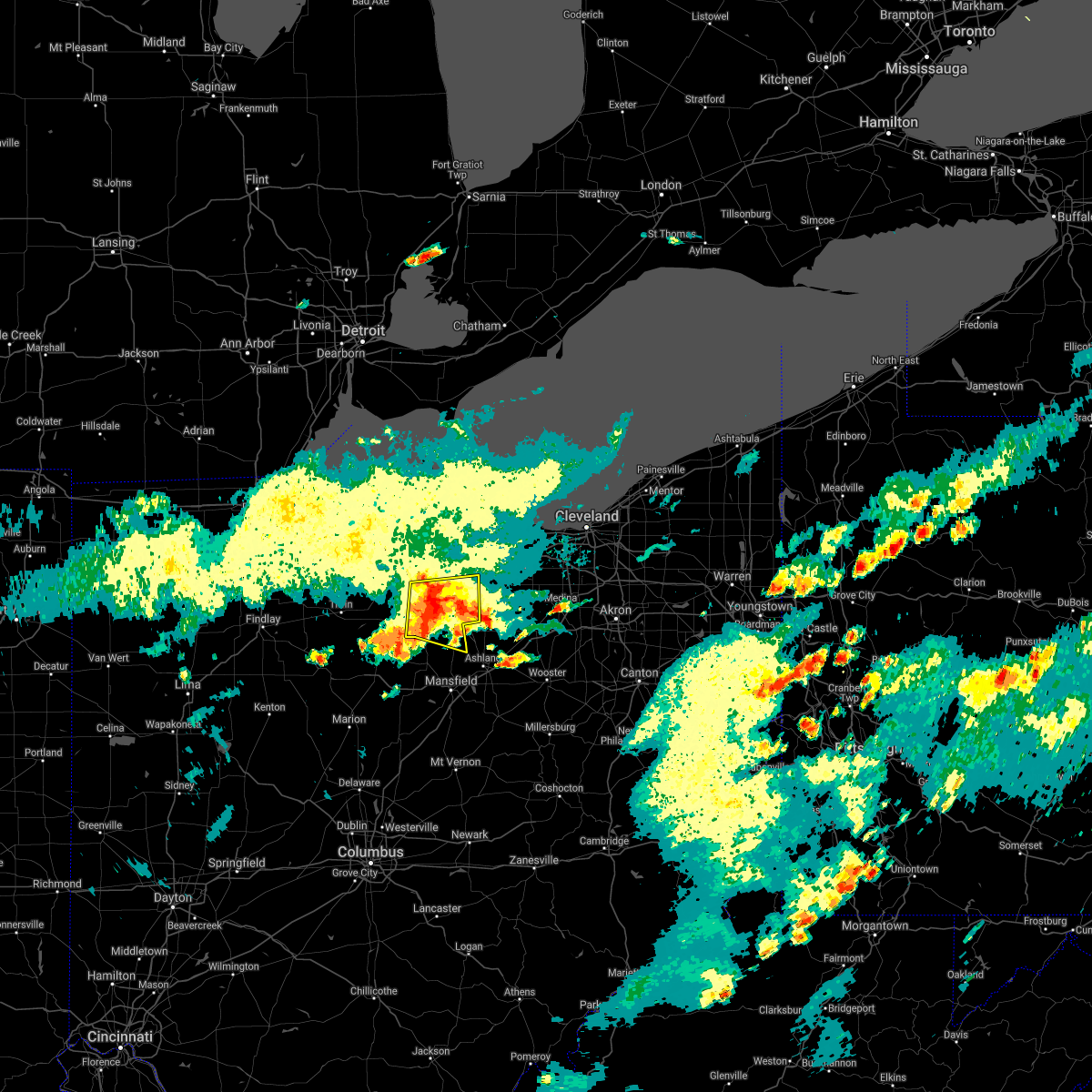 At 318 pm edt, severe thunderstorms were located along a line extending from near norwalk to willard, moving east at 40 mph (radar indicated). Hazards include 60 mph wind gusts. Expect damage to trees and power lines. Locations impacted include, norwalk, willard, new london, plymouth, wakeman, greenwich, monroeville and north fairfield. At 318 pm edt, severe thunderstorms were located along a line extending from near norwalk to willard, moving east at 40 mph (radar indicated). Hazards include 60 mph wind gusts. Expect damage to trees and power lines. Locations impacted include, norwalk, willard, new london, plymouth, wakeman, greenwich, monroeville and north fairfield.
|
| 6/30/2021 2:55 PM EDT |
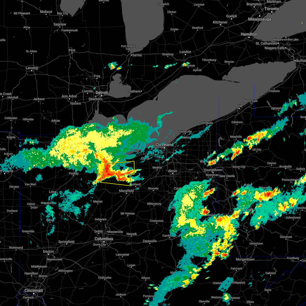 At 255 pm edt, severe thunderstorms were located along a line extending from near bellevue to near bloomville, moving east at 40 mph (radar indicated). Hazards include 60 mph wind gusts. expect damage to trees and power lines At 255 pm edt, severe thunderstorms were located along a line extending from near bellevue to near bloomville, moving east at 40 mph (radar indicated). Hazards include 60 mph wind gusts. expect damage to trees and power lines
|
| 6/29/2021 7:22 PM EDT |
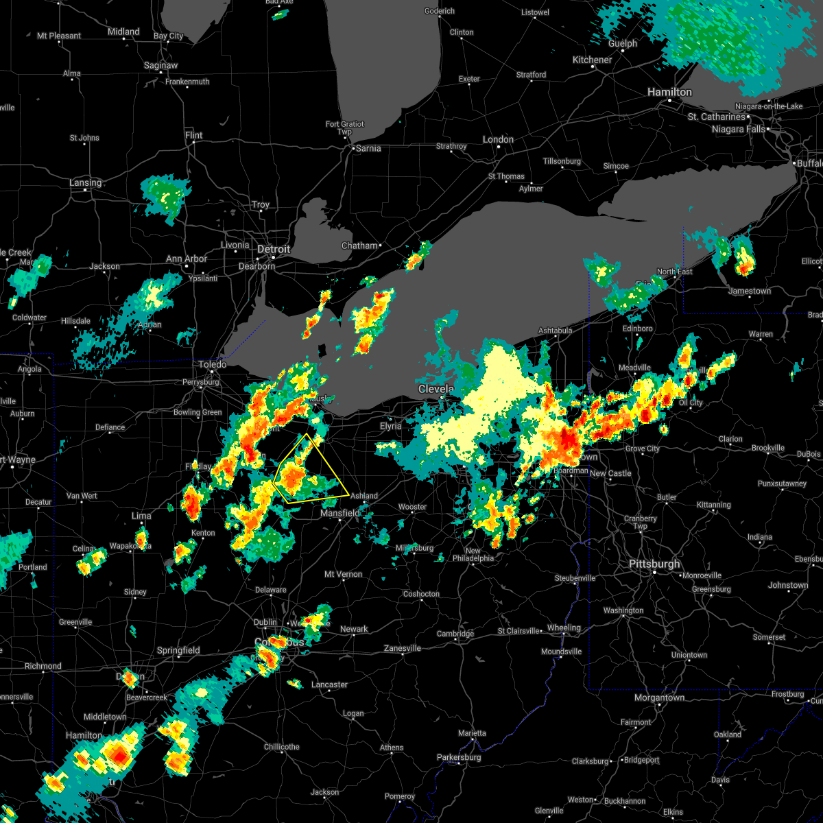 At 722 pm edt, a severe thunderstorm was located over chatfield, or 11 miles north of bucyrus, moving east at 35 mph (radar indicated). Hazards include 60 mph wind gusts. Expect damage to trees and power lines. Locations impacted include, shelby, willard, plymouth, new washington, bloomville, chatfield, attica, north fairfield, tiro, shenandoah and sulpher springs. At 722 pm edt, a severe thunderstorm was located over chatfield, or 11 miles north of bucyrus, moving east at 35 mph (radar indicated). Hazards include 60 mph wind gusts. Expect damage to trees and power lines. Locations impacted include, shelby, willard, plymouth, new washington, bloomville, chatfield, attica, north fairfield, tiro, shenandoah and sulpher springs.
|
| 6/29/2021 7:05 PM EDT |
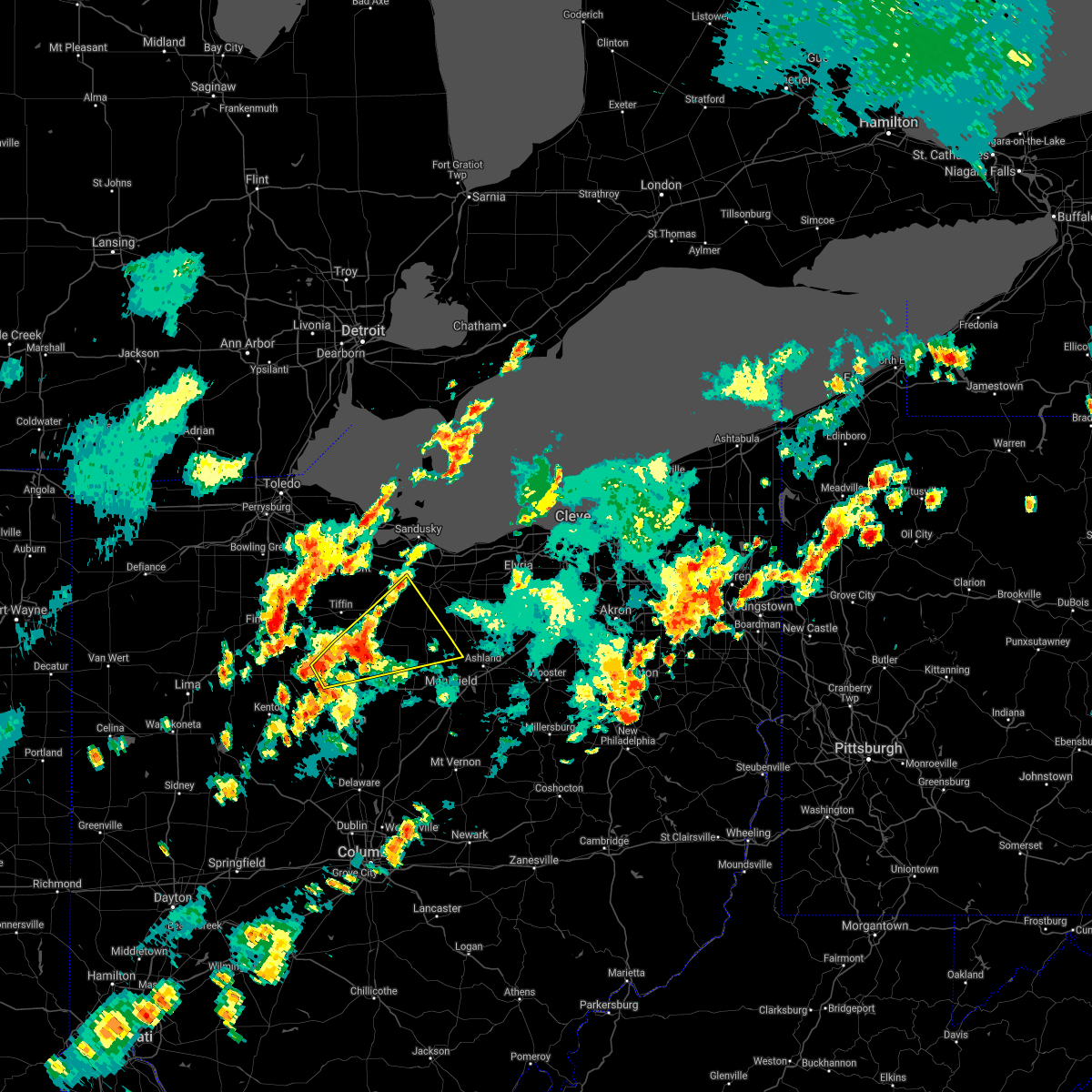 At 705 pm edt, a severe thunderstorm was located near sycamore, or 10 miles northwest of bucyrus, moving east at 35 mph (radar indicated). Hazards include 60 mph wind gusts and quarter size hail. Minor damage to vehicles is possible. Expect damage to trees and power lines. At 705 pm edt, a severe thunderstorm was located near sycamore, or 10 miles northwest of bucyrus, moving east at 35 mph (radar indicated). Hazards include 60 mph wind gusts and quarter size hail. Minor damage to vehicles is possible. Expect damage to trees and power lines.
|
| 6/29/2021 3:49 PM EDT |
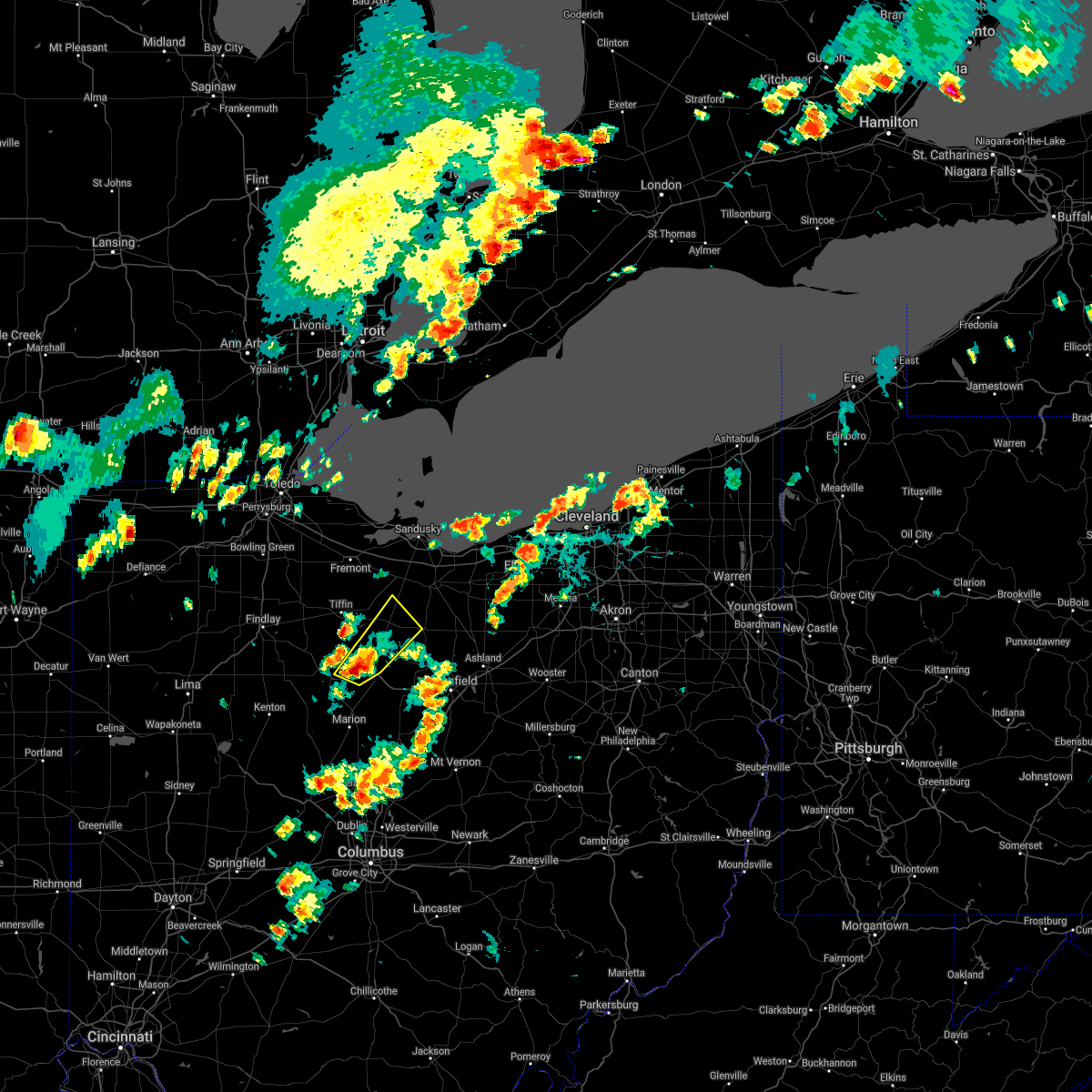 At 349 pm edt, a severe thunderstorm was located near bucyrus, moving northeast at 15 mph (radar indicated). Hazards include 60 mph wind gusts and quarter size hail. Minor damage to vehicles is possible. expect damage to trees and power lines. Locations impacted include, bucyrus, willard, new washington, bloomville, chatfield, attica, benton, nevada and oceola. At 349 pm edt, a severe thunderstorm was located near bucyrus, moving northeast at 15 mph (radar indicated). Hazards include 60 mph wind gusts and quarter size hail. Minor damage to vehicles is possible. expect damage to trees and power lines. Locations impacted include, bucyrus, willard, new washington, bloomville, chatfield, attica, benton, nevada and oceola.
|
| 6/29/2021 3:29 PM EDT |
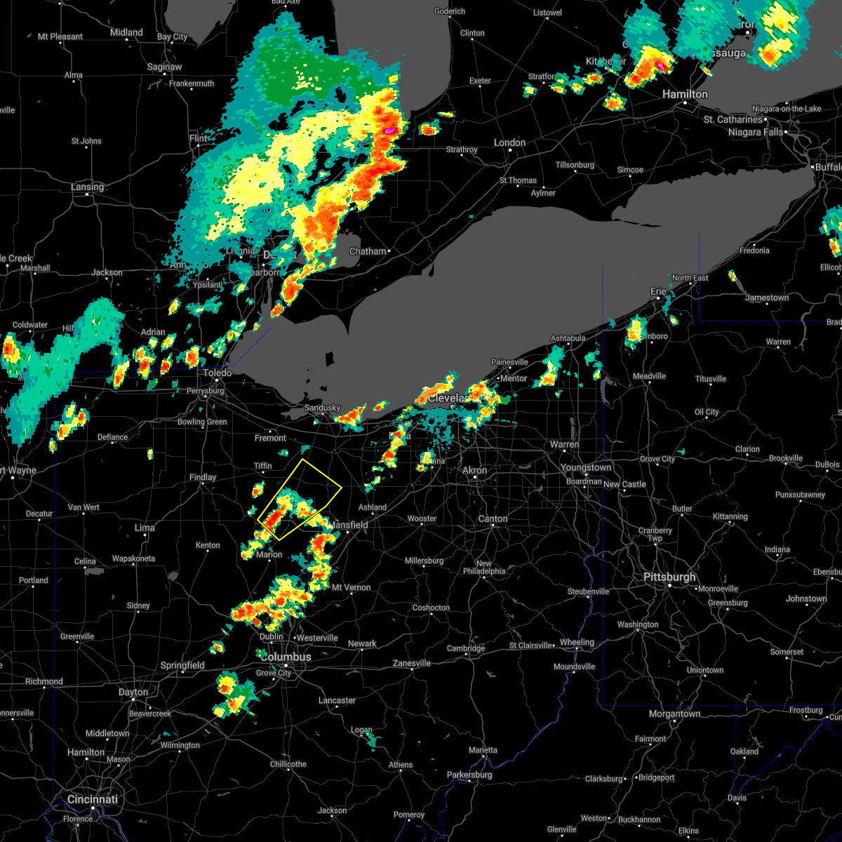 At 329 pm edt, a severe thunderstorm was located near bucyrus, moving northeast at 35 mph (radar indicated). Hazards include 60 mph wind gusts and quarter size hail. Minor damage to vehicles is possible. Expect damage to trees and power lines. At 329 pm edt, a severe thunderstorm was located near bucyrus, moving northeast at 35 mph (radar indicated). Hazards include 60 mph wind gusts and quarter size hail. Minor damage to vehicles is possible. Expect damage to trees and power lines.
|
| 6/21/2021 5:45 AM EDT |
 At 544 am edt, severe thunderstorms were located along a line extending from near lorain to near wakeman to near willard, moving east at 50 mph (radar indicated). Hazards include 60 mph wind gusts. Expect damage to trees and power lines. Locations impacted include, norwalk, western vermilion, willard, new london, plymouth, milan, northern milan, wakeman, greenwich, berlin heights, north fairfield and birmingham. At 544 am edt, severe thunderstorms were located along a line extending from near lorain to near wakeman to near willard, moving east at 50 mph (radar indicated). Hazards include 60 mph wind gusts. Expect damage to trees and power lines. Locations impacted include, norwalk, western vermilion, willard, new london, plymouth, milan, northern milan, wakeman, greenwich, berlin heights, north fairfield and birmingham.
|
| 6/21/2021 5:17 AM EDT |
 At 517 am edt, severe thunderstorms were located along a line extending from 6 miles southeast of kelleys island to bellevue to near bloomville, moving east at 50 mph (radar indicated). Hazards include 60 mph wind gusts. expect damage to trees and power lines At 517 am edt, severe thunderstorms were located along a line extending from 6 miles southeast of kelleys island to bellevue to near bloomville, moving east at 50 mph (radar indicated). Hazards include 60 mph wind gusts. expect damage to trees and power lines
|
| 11/15/2020 12:08 PM EST |
 At 1208 pm est, severe thunderstorms were located along a line extending from near bellevue to near bucyrus, moving east at 55 mph (radar indicated). Hazards include 70 mph wind gusts. Expect considerable tree damage. damage is likely to mobile homes, roofs, and outbuildings. Locations impacted include, mansfield, sandusky, norwalk, western vermilion, mount gilead, galion, shelby, willard, ontario, lexington, crestline, new london, cardington, plymouth, northern milan, milan, ashley, wakeman, new washington and chesterville. At 1208 pm est, severe thunderstorms were located along a line extending from near bellevue to near bucyrus, moving east at 55 mph (radar indicated). Hazards include 70 mph wind gusts. Expect considerable tree damage. damage is likely to mobile homes, roofs, and outbuildings. Locations impacted include, mansfield, sandusky, norwalk, western vermilion, mount gilead, galion, shelby, willard, ontario, lexington, crestline, new london, cardington, plymouth, northern milan, milan, ashley, wakeman, new washington and chesterville.
|
| 11/15/2020 11:55 AM EST |
 At 1154 am est, severe thunderstorms were located along a line extending from near green springs to morral, moving northeast at 55 mph (radar indicated). Hazards include 70 mph wind gusts. Expect considerable tree damage. damage is likely to mobile homes, roofs, and outbuildings. Locations impacted include, mansfield, marion, sandusky, norwalk, bucyrus, western vermilion, mount gilead, kelleys island, put-in-bay, galion, shelby, bellevue, willard, ontario, lexington, crestline, new london, cardington, plymouth and northern milan. At 1154 am est, severe thunderstorms were located along a line extending from near green springs to morral, moving northeast at 55 mph (radar indicated). Hazards include 70 mph wind gusts. Expect considerable tree damage. damage is likely to mobile homes, roofs, and outbuildings. Locations impacted include, mansfield, marion, sandusky, norwalk, bucyrus, western vermilion, mount gilead, kelleys island, put-in-bay, galion, shelby, bellevue, willard, ontario, lexington, crestline, new london, cardington, plymouth and northern milan.
|
| 11/15/2020 11:38 AM EST |
 At 1138 am est, severe thunderstorms were located along a line extending from near tiffin to near la rue, moving northeast at 55 mph (radar indicated). Hazards include 70 mph wind gusts. Expect considerable tree damage. Damage is likely to mobile homes, roofs, and outbuildings. At 1138 am est, severe thunderstorms were located along a line extending from near tiffin to near la rue, moving northeast at 55 mph (radar indicated). Hazards include 70 mph wind gusts. Expect considerable tree damage. Damage is likely to mobile homes, roofs, and outbuildings.
|
| 10/23/2020 6:42 PM EDT |
 At 641 pm edt, severe thunderstorms were located along a line extending from 8 miles northeast of sandusky to 7 miles west of vermilion to near wakeman to willard, moving east at 55 mph (radar indicated). Hazards include 70 mph wind gusts and penny size hail. Expect considerable tree damage. Damage is likely to mobile homes, roofs, and outbuildings. At 641 pm edt, severe thunderstorms were located along a line extending from 8 miles northeast of sandusky to 7 miles west of vermilion to near wakeman to willard, moving east at 55 mph (radar indicated). Hazards include 70 mph wind gusts and penny size hail. Expect considerable tree damage. Damage is likely to mobile homes, roofs, and outbuildings.
|
| 10/23/2020 6:34 PM EDT |
 At 633 pm edt, severe thunderstorms were located along a line extending from near sandusky to near northern milan to near willard, moving northeast at 50 mph (radar indicated). Hazards include 70 mph wind gusts and penny size hail. Expect considerable tree damage. damage is likely to mobile homes, roofs, and outbuildings. Locations impacted include, sandusky, norwalk, western vermilion, kelleys island, bellevue, willard, new london, plymouth, northern milan, milan, wakeman, castalia, greenwich, monroeville, marblehead, berlin heights, north fairfield, bloomingville, sandusky south and birmingham. At 633 pm edt, severe thunderstorms were located along a line extending from near sandusky to near northern milan to near willard, moving northeast at 50 mph (radar indicated). Hazards include 70 mph wind gusts and penny size hail. Expect considerable tree damage. damage is likely to mobile homes, roofs, and outbuildings. Locations impacted include, sandusky, norwalk, western vermilion, kelleys island, bellevue, willard, new london, plymouth, northern milan, milan, wakeman, castalia, greenwich, monroeville, marblehead, berlin heights, north fairfield, bloomingville, sandusky south and birmingham.
|
| 10/23/2020 6:14 PM EDT |
 At 613 pm edt, severe thunderstorms were located along a line extending from 7 miles north of clyde to near bellevue to near bloomville, moving east at 50 mph. another severe storm was located over kelleys island and moving east-northeast at 50 mph (radar indicated). Hazards include 70 mph wind gusts and penny size hail. Expect considerable tree damage. damage is likely to mobile homes, roofs, and outbuildings. Locations impacted include, sandusky, norwalk, fremont, western vermilion, port clinton, kelleys island, bellevue, clyde, willard, new london, plymouth, green springs, northern milan, milan, wakeman, bloomville, castalia, greenwich, monroeville and marblehead. At 613 pm edt, severe thunderstorms were located along a line extending from 7 miles north of clyde to near bellevue to near bloomville, moving east at 50 mph. another severe storm was located over kelleys island and moving east-northeast at 50 mph (radar indicated). Hazards include 70 mph wind gusts and penny size hail. Expect considerable tree damage. damage is likely to mobile homes, roofs, and outbuildings. Locations impacted include, sandusky, norwalk, fremont, western vermilion, port clinton, kelleys island, bellevue, clyde, willard, new london, plymouth, green springs, northern milan, milan, wakeman, bloomville, castalia, greenwich, monroeville and marblehead.
|
| 10/23/2020 5:52 PM EDT |
 At 552 pm edt, severe thunderstorms were located along a line extending from near oak harbor to new riegel, moving east at 50 mph (radar indicated). Hazards include 70 mph wind gusts and penny size hail. Expect considerable tree damage. Damage is likely to mobile homes, roofs, and outbuildings. At 552 pm edt, severe thunderstorms were located along a line extending from near oak harbor to new riegel, moving east at 50 mph (radar indicated). Hazards include 70 mph wind gusts and penny size hail. Expect considerable tree damage. Damage is likely to mobile homes, roofs, and outbuildings.
|
| 8/28/2020 3:08 PM EDT |
 The severe thunderstorm warning for central huron, medina, northern ashland, northern wayne and southern lorain counties will expire at 315 pm edt, the storms which prompted the warning have weakened below severe limits, and no longer pose an immediate threat to life or property. therefore, the warning will be allowed to expire. however gusty winds and heavy rain are still possible with these thunderstorms. The severe thunderstorm warning for central huron, medina, northern ashland, northern wayne and southern lorain counties will expire at 315 pm edt, the storms which prompted the warning have weakened below severe limits, and no longer pose an immediate threat to life or property. therefore, the warning will be allowed to expire. however gusty winds and heavy rain are still possible with these thunderstorms.
|
| 8/28/2020 2:36 PM EDT |
 At 235 pm edt, severe thunderstorms were located along a line extending from near new washington to near savannah to 6 miles northeast of hayesville, moving northeast at 35 mph (radar indicated). Hazards include 60 mph wind gusts and nickel size hail. expect damage to trees and power lines At 235 pm edt, severe thunderstorms were located along a line extending from near new washington to near savannah to 6 miles northeast of hayesville, moving northeast at 35 mph (radar indicated). Hazards include 60 mph wind gusts and nickel size hail. expect damage to trees and power lines
|
| 7/27/2020 4:24 PM EDT |
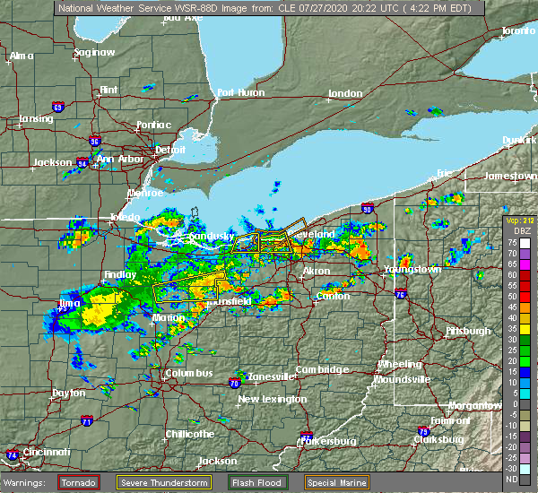 The severe thunderstorm warning for southern huron, northern richland and northeastern crawford counties will expire at 430 pm edt, the storm which prompted the warning has weakened below severe limits, and no longer poses an immediate threat to life or property. therefore, the warning will be allowed to expire. however gusty winds and heavy rain are still possible with this thunderstorm. The severe thunderstorm warning for southern huron, northern richland and northeastern crawford counties will expire at 430 pm edt, the storm which prompted the warning has weakened below severe limits, and no longer poses an immediate threat to life or property. therefore, the warning will be allowed to expire. however gusty winds and heavy rain are still possible with this thunderstorm.
|
| 7/27/2020 4:13 PM EDT |
 At 413 pm edt, a severe thunderstorm was located near shelby, or 14 miles northwest of mansfield, moving east at 35 mph (radar indicated). Hazards include 60 mph wind gusts. Expect damage to trees and power lines. Locations impacted include, shelby, willard, new london, plymouth, greenwich, tiro, shenandoah and olivesburg. At 413 pm edt, a severe thunderstorm was located near shelby, or 14 miles northwest of mansfield, moving east at 35 mph (radar indicated). Hazards include 60 mph wind gusts. Expect damage to trees and power lines. Locations impacted include, shelby, willard, new london, plymouth, greenwich, tiro, shenandoah and olivesburg.
|
| 7/27/2020 3:48 PM EDT |
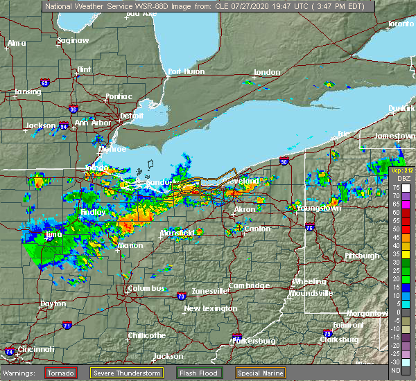 At 348 pm edt, a severe thunderstorm was located over chatfield, or 9 miles north of bucyrus, moving east at 35 mph (radar indicated). Hazards include 60 mph wind gusts. expect damage to trees and power lines At 348 pm edt, a severe thunderstorm was located over chatfield, or 9 miles north of bucyrus, moving east at 35 mph (radar indicated). Hazards include 60 mph wind gusts. expect damage to trees and power lines
|
| 7/10/2020 3:39 PM EDT |
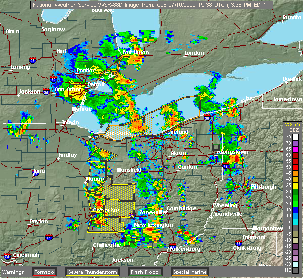 At 339 pm edt, a severe thunderstorm was located near willard, or 15 miles southwest of norwalk, moving northeast at 25 mph (radar indicated). Hazards include 60 mph wind gusts. Expect damage to trees and power lines. Locations impacted include, willard and north fairfield. At 339 pm edt, a severe thunderstorm was located near willard, or 15 miles southwest of norwalk, moving northeast at 25 mph (radar indicated). Hazards include 60 mph wind gusts. Expect damage to trees and power lines. Locations impacted include, willard and north fairfield.
|
| 7/10/2020 3:14 PM EDT |
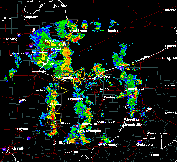 At 313 pm edt, a severe thunderstorm was located over chatfield, or 11 miles north of bucyrus, moving northeast at 25 mph (radar indicated). Hazards include 60 mph wind gusts. expect damage to trees and power lines At 313 pm edt, a severe thunderstorm was located over chatfield, or 11 miles north of bucyrus, moving northeast at 25 mph (radar indicated). Hazards include 60 mph wind gusts. expect damage to trees and power lines
|
| 7/10/2020 2:02 PM EDT |
 At 202 pm edt, severe thunderstorms were located along a line extending from green springs to 6 miles northeast of bloomville to near chatfield, moving northeast at 30 mph (radar indicated). Hazards include 60 mph wind gusts and penny size hail. expect damage to trees and power lines At 202 pm edt, severe thunderstorms were located along a line extending from green springs to 6 miles northeast of bloomville to near chatfield, moving northeast at 30 mph (radar indicated). Hazards include 60 mph wind gusts and penny size hail. expect damage to trees and power lines
|
| 6/21/2020 8:00 PM EDT |
 At 759 pm edt, severe thunderstorms were located along a line extending from bellevue to near norwalk to 7 miles northeast of willard to 6 miles southwest of new london, moving northeast at 25 mph (radar indicated). Hazards include 60 mph wind gusts. Expect damage to trees and power lines. Locations impacted include, sandusky, norwalk, western vermilion, bellevue, willard, new london, plymouth, northern milan, milan, wakeman, castalia, greenwich, monroeville, berlin heights, north fairfield, bloomingville, sandusky south, birmingham and fairview lanes. At 759 pm edt, severe thunderstorms were located along a line extending from bellevue to near norwalk to 7 miles northeast of willard to 6 miles southwest of new london, moving northeast at 25 mph (radar indicated). Hazards include 60 mph wind gusts. Expect damage to trees and power lines. Locations impacted include, sandusky, norwalk, western vermilion, bellevue, willard, new london, plymouth, northern milan, milan, wakeman, castalia, greenwich, monroeville, berlin heights, north fairfield, bloomingville, sandusky south, birmingham and fairview lanes.
|
| 6/21/2020 7:39 PM EDT |
 At 739 pm edt, severe thunderstorms were located along a line extending from 6 miles southeast of green springs to near bellevue to 9 miles northwest of plymouth to near willard, moving northeast at 65 mph (radar indicated). Hazards include 60 mph wind gusts. expect damage to trees and power lines At 739 pm edt, severe thunderstorms were located along a line extending from 6 miles southeast of green springs to near bellevue to 9 miles northwest of plymouth to near willard, moving northeast at 65 mph (radar indicated). Hazards include 60 mph wind gusts. expect damage to trees and power lines
|
| 6/10/2020 6:39 PM EDT |
 At 638 pm edt, severe thunderstorms were located along a line extending from 8 miles east of sandusky to 8 miles northeast of northern milan to near plymouth, moving northeast at 45 mph (radar indicated). Hazards include 70 mph wind gusts and quarter size hail. Minor damage to vehicles is possible. expect considerable tree damage. wind damage is also likely to mobile homes, roofs, and outbuildings. Locations impacted include, sandusky, norwalk, western vermilion, vermilion, kelleys island, bellevue, willard, plymouth, northern milan, milan, wakeman, castalia, greenwich, monroeville, marblehead, berlin heights, bay view, north fairfield, bloomingville and sandusky south. At 638 pm edt, severe thunderstorms were located along a line extending from 8 miles east of sandusky to 8 miles northeast of northern milan to near plymouth, moving northeast at 45 mph (radar indicated). Hazards include 70 mph wind gusts and quarter size hail. Minor damage to vehicles is possible. expect considerable tree damage. wind damage is also likely to mobile homes, roofs, and outbuildings. Locations impacted include, sandusky, norwalk, western vermilion, vermilion, kelleys island, bellevue, willard, plymouth, northern milan, milan, wakeman, castalia, greenwich, monroeville, marblehead, berlin heights, bay view, north fairfield, bloomingville and sandusky south.
|
| 6/10/2020 6:11 PM EDT |
 At 611 pm edt, severe thunderstorms were located along a line extending from near clyde to near bellevue to near bloomville, moving northeast at 60 mph (radar indicated). Hazards include 70 mph wind gusts and quarter size hail. Minor damage to vehicles is possible. expect considerable tree damage. Wind damage is also likely to mobile homes, roofs, and outbuildings. At 611 pm edt, severe thunderstorms were located along a line extending from near clyde to near bellevue to near bloomville, moving northeast at 60 mph (radar indicated). Hazards include 70 mph wind gusts and quarter size hail. Minor damage to vehicles is possible. expect considerable tree damage. Wind damage is also likely to mobile homes, roofs, and outbuildings.
|
| 5/14/2020 5:40 PM EDT |
 At 540 pm edt, severe thunderstorms were located along a line extending from 8 miles west of western vermilion to near new london, moving east at 55 mph (radar indicated). Hazards include 60 mph wind gusts. Expect damage to trees and power lines. Locations impacted include, sandusky, norwalk, western vermilion, shelby, willard, new london, plymouth, northern milan, milan, wakeman, greenwich, berlin heights, north fairfield, tiro, sandusky south, birmingham, fairview lanes, shenandoah and olivesburg. At 540 pm edt, severe thunderstorms were located along a line extending from 8 miles west of western vermilion to near new london, moving east at 55 mph (radar indicated). Hazards include 60 mph wind gusts. Expect damage to trees and power lines. Locations impacted include, sandusky, norwalk, western vermilion, shelby, willard, new london, plymouth, northern milan, milan, wakeman, greenwich, berlin heights, north fairfield, tiro, sandusky south, birmingham, fairview lanes, shenandoah and olivesburg.
|
| 5/14/2020 5:20 PM EDT |
 At 520 pm edt, severe thunderstorms were located along a line extending from near bellevue to new washington, moving east at 65 mph (radar indicated). Hazards include 60 mph wind gusts. expect damage to trees and power lines At 520 pm edt, severe thunderstorms were located along a line extending from near bellevue to new washington, moving east at 65 mph (radar indicated). Hazards include 60 mph wind gusts. expect damage to trees and power lines
|
| 5/10/2020 4:49 PM EDT |
 At 448 pm edt, severe thunderstorms were located along a line extending from near kelleys island to 8 miles south of norwalk, moving northeast at 45 mph (radar indicated). Hazards include 60 mph wind gusts. Expect damage to trees and power lines. Locations impacted include, sandusky, norwalk, port clinton, bellevue, willard, oak harbor, plymouth, northern milan, milan, castalia, catawba island, greenwich, monroeville, marblehead, bay view, north fairfield, bloomingville, sandusky south, fairview lanes and whites landing. At 448 pm edt, severe thunderstorms were located along a line extending from near kelleys island to 8 miles south of norwalk, moving northeast at 45 mph (radar indicated). Hazards include 60 mph wind gusts. Expect damage to trees and power lines. Locations impacted include, sandusky, norwalk, port clinton, bellevue, willard, oak harbor, plymouth, northern milan, milan, castalia, catawba island, greenwich, monroeville, marblehead, bay view, north fairfield, bloomingville, sandusky south, fairview lanes and whites landing.
|
| 5/10/2020 4:14 PM EDT |
 At 413 pm edt, severe thunderstorms were located along a line extending from near oak harbor to near bloomville, moving east at 40 mph (radar indicated). Hazards include 60 mph wind gusts. expect damage to trees and power lines At 413 pm edt, severe thunderstorms were located along a line extending from near oak harbor to near bloomville, moving east at 40 mph (radar indicated). Hazards include 60 mph wind gusts. expect damage to trees and power lines
|
| 8/18/2019 5:13 AM EDT |
 At 435 am edt, severe thunderstorms were located along a line extending from fremont to 7 miles northeast of bloomville, moving northeast at 50 mph (radar indicated). Hazards include 60 mph wind gusts. expect damage to trees and power lines At 435 am edt, severe thunderstorms were located along a line extending from fremont to 7 miles northeast of bloomville, moving northeast at 50 mph (radar indicated). Hazards include 60 mph wind gusts. expect damage to trees and power lines
|
| 8/18/2019 5:00 AM EDT |
 At 459 am edt, severe thunderstorms were located along a line extending from near sandusky to norwalk, moving northeast at 45 mph (radar indicated). Hazards include 60 mph wind gusts. Expect damage to trees and power lines. Locations impacted include, sandusky, norwalk, fremont, western vermilion, port clinton, bellevue, clyde, willard, oak harbor, northern milan, milan, wakeman, castalia, ballville, catawba island, monroeville, marblehead, berlin heights, bay view and north fairfield. At 459 am edt, severe thunderstorms were located along a line extending from near sandusky to norwalk, moving northeast at 45 mph (radar indicated). Hazards include 60 mph wind gusts. Expect damage to trees and power lines. Locations impacted include, sandusky, norwalk, fremont, western vermilion, port clinton, bellevue, clyde, willard, oak harbor, northern milan, milan, wakeman, castalia, ballville, catawba island, monroeville, marblehead, berlin heights, bay view and north fairfield.
|
| 8/18/2019 4:37 AM EDT |
 At 435 am edt, severe thunderstorms were located along a line extending from fremont to 7 miles northeast of bloomville, moving northeast at 50 mph (radar indicated). Hazards include 60 mph wind gusts. expect damage to trees and power lines At 435 am edt, severe thunderstorms were located along a line extending from fremont to 7 miles northeast of bloomville, moving northeast at 50 mph (radar indicated). Hazards include 60 mph wind gusts. expect damage to trees and power lines
|
| 8/6/2019 2:06 PM EDT |
 At 204 pm edt, severe thunderstorms were located along a line extending from near milan to plymouth, moving northeast at 25 mph (radar indicated). Hazards include 60 mph wind gusts. expect damage to trees and power lines At 204 pm edt, severe thunderstorms were located along a line extending from near milan to plymouth, moving northeast at 25 mph (radar indicated). Hazards include 60 mph wind gusts. expect damage to trees and power lines
|
| 7/21/2019 4:30 PM EDT | Several branches down... along with 30 ft pine tree which was toppled onto power lin in huron county OH, 6.7 miles SSE of Willard, OH |
| 7/21/2019 4:14 PM EDT |
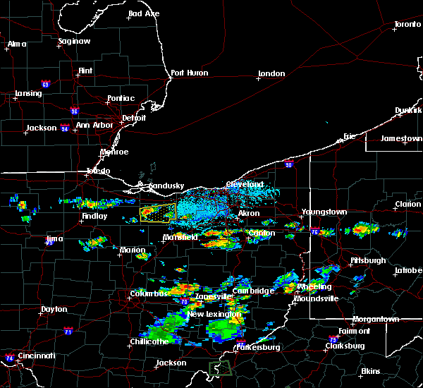 At 414 pm edt, a severe thunderstorm was located near willard, or 9 miles southwest of norwalk, moving east at 15 mph (radar indicated). Hazards include 60 mph wind gusts. expect damage to trees and power lines At 414 pm edt, a severe thunderstorm was located near willard, or 9 miles southwest of norwalk, moving east at 15 mph (radar indicated). Hazards include 60 mph wind gusts. expect damage to trees and power lines
|
| 7/16/2019 6:42 PM EDT |
 At 641 pm edt, severe thunderstorms were located along a line extending from near bellevue to new washington to near galion, moving northeast at 35 mph (radar indicated). Hazards include 60 mph wind gusts. Expect damage to trees and power lines. Locations impacted include, mansfield, sandusky, norwalk, western vermilion, vermilion, galion, shelby, bellevue, willard, ontario, crestline, new london, plymouth, northern milan, milan, wakeman, new washington, chatfield, greenwich and monroeville. At 641 pm edt, severe thunderstorms were located along a line extending from near bellevue to new washington to near galion, moving northeast at 35 mph (radar indicated). Hazards include 60 mph wind gusts. Expect damage to trees and power lines. Locations impacted include, mansfield, sandusky, norwalk, western vermilion, vermilion, galion, shelby, bellevue, willard, ontario, crestline, new london, plymouth, northern milan, milan, wakeman, new washington, chatfield, greenwich and monroeville.
|
| 7/16/2019 6:21 PM EDT |
 At 621 pm edt, severe thunderstorms were located along a line extending from near bloomville to 6 miles northwest of cardington, moving northeast at 35 mph (radar indicated). Hazards include 60 mph wind gusts. expect damage to trees and power lines At 621 pm edt, severe thunderstorms were located along a line extending from near bloomville to 6 miles northwest of cardington, moving northeast at 35 mph (radar indicated). Hazards include 60 mph wind gusts. expect damage to trees and power lines
|
| 7/2/2019 4:10 PM EDT |
 At 410 pm edt, severe thunderstorms were located along a line extending from 10 miles northwest of vermilion to 6 miles northeast of willard, moving east at 35 mph (radar indicated). Hazards include 70 mph wind gusts and quarter size hail. Minor damage to vehicles is possible. expect considerable tree damage. Wind damage is also likely to mobile homes, roofs, and outbuildings. At 410 pm edt, severe thunderstorms were located along a line extending from 10 miles northwest of vermilion to 6 miles northeast of willard, moving east at 35 mph (radar indicated). Hazards include 70 mph wind gusts and quarter size hail. Minor damage to vehicles is possible. expect considerable tree damage. Wind damage is also likely to mobile homes, roofs, and outbuildings.
|
| 7/2/2019 4:03 PM EDT |
 At 403 pm edt, severe thunderstorms were located along a line extending from 10 miles east of kelleys island to near willard, moving east at 35 mph (radar indicated). Hazards include 60 mph wind gusts and quarter size hail. Minor damage to vehicles is possible. expect damage to trees and power lines. Locations impacted include, sandusky, norwalk, western vermilion, bellevue, willard, new london, plymouth, northern milan, milan, wakeman, greenwich, monroeville, berlin heights, north fairfield, bloomingville, sandusky south, birmingham and fairview lanes. At 403 pm edt, severe thunderstorms were located along a line extending from 10 miles east of kelleys island to near willard, moving east at 35 mph (radar indicated). Hazards include 60 mph wind gusts and quarter size hail. Minor damage to vehicles is possible. expect damage to trees and power lines. Locations impacted include, sandusky, norwalk, western vermilion, bellevue, willard, new london, plymouth, northern milan, milan, wakeman, greenwich, monroeville, berlin heights, north fairfield, bloomingville, sandusky south, birmingham and fairview lanes.
|
| 7/2/2019 3:49 PM EDT |
 At 349 pm edt, severe thunderstorms were located along a line extending from near kelleys island to 8 miles northwest of willard, moving east at 35 mph (radar indicated). Hazards include 60 mph wind gusts and quarter size hail. Minor damage to vehicles is possible. expect damage to trees and power lines. Locations impacted include, sandusky, norwalk, western vermilion, bellevue, clyde, willard, new london, plymouth, northern milan, milan, wakeman, bloomville, castalia, greenwich, monroeville, marblehead, attica, berlin heights, bay view and north fairfield. At 349 pm edt, severe thunderstorms were located along a line extending from near kelleys island to 8 miles northwest of willard, moving east at 35 mph (radar indicated). Hazards include 60 mph wind gusts and quarter size hail. Minor damage to vehicles is possible. expect damage to trees and power lines. Locations impacted include, sandusky, norwalk, western vermilion, bellevue, clyde, willard, new london, plymouth, northern milan, milan, wakeman, bloomville, castalia, greenwich, monroeville, marblehead, attica, berlin heights, bay view and north fairfield.
|
| 7/2/2019 3:20 PM EDT |
 At 320 pm edt, severe thunderstorms were located along a line extending from 7 miles north of port clinton to near tiffin, moving east at 35 mph (radar indicated). Hazards include 60 mph wind gusts and quarter size hail. Minor damage to vehicles is possible. Expect damage to trees and power lines. At 320 pm edt, severe thunderstorms were located along a line extending from 7 miles north of port clinton to near tiffin, moving east at 35 mph (radar indicated). Hazards include 60 mph wind gusts and quarter size hail. Minor damage to vehicles is possible. Expect damage to trees and power lines.
|
| 6/1/2019 7:33 PM EDT |
 At 733 pm edt, a severe thunderstorm was located near tiffin, moving east at 35 mph (radar indicated). Hazards include 60 mph wind gusts and quarter size hail. Minor damage to vehicles is possible. Expect damage to trees and power lines. At 733 pm edt, a severe thunderstorm was located near tiffin, moving east at 35 mph (radar indicated). Hazards include 60 mph wind gusts and quarter size hail. Minor damage to vehicles is possible. Expect damage to trees and power lines.
|
| 5/23/2019 7:33 AM EDT |
 At 732 am edt, severe thunderstorms were located along a line extending from 6 miles southeast of sandusky to near prospect, moving east at 60 mph (radar indicated). Hazards include 70 mph wind gusts. Expect considerable tree damage. Damage is likely to mobile homes, roofs, and outbuildings. At 732 am edt, severe thunderstorms were located along a line extending from 6 miles southeast of sandusky to near prospect, moving east at 60 mph (radar indicated). Hazards include 70 mph wind gusts. Expect considerable tree damage. Damage is likely to mobile homes, roofs, and outbuildings.
|
| 10/6/2018 8:44 PM EDT |
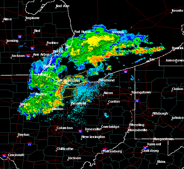 At 844 pm edt, a severe thunderstorm was located near willard, or 12 miles southwest of norwalk, moving east at 45 mph (radar indicated). Hazards include 60 mph wind gusts. expect damage to trees and power lines At 844 pm edt, a severe thunderstorm was located near willard, or 12 miles southwest of norwalk, moving east at 45 mph (radar indicated). Hazards include 60 mph wind gusts. expect damage to trees and power lines
|
| 7/26/2018 9:22 PM EDT |
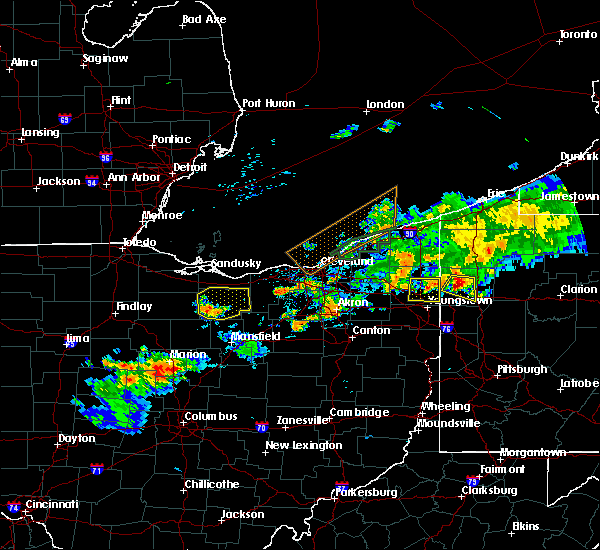 At 921 pm edt, a severe thunderstorm was located near willard, or 12 miles southwest of norwalk, moving east at 35 mph (radar indicated). Hazards include 60 mph wind gusts and quarter size hail. Minor damage to vehicles is possible. expect damage to trees and power lines. Locations impacted include, norwalk, willard, new london, plymouth, milan, northern milan, wakeman, greenwich, monroeville and north fairfield. At 921 pm edt, a severe thunderstorm was located near willard, or 12 miles southwest of norwalk, moving east at 35 mph (radar indicated). Hazards include 60 mph wind gusts and quarter size hail. Minor damage to vehicles is possible. expect damage to trees and power lines. Locations impacted include, norwalk, willard, new london, plymouth, milan, northern milan, wakeman, greenwich, monroeville and north fairfield.
|
| 7/26/2018 9:02 PM EDT |
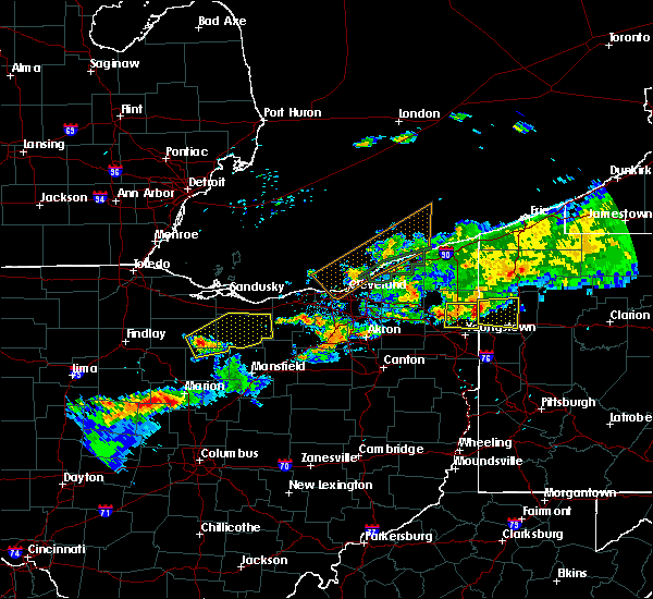 At 902 pm edt, a severe thunderstorm was located near bloomville, or 13 miles southeast of tiffin, moving east at 35 mph (radar indicated). Hazards include 60 mph wind gusts and quarter size hail. Minor damage to vehicles is possible. Expect damage to trees and power lines. At 902 pm edt, a severe thunderstorm was located near bloomville, or 13 miles southeast of tiffin, moving east at 35 mph (radar indicated). Hazards include 60 mph wind gusts and quarter size hail. Minor damage to vehicles is possible. Expect damage to trees and power lines.
|
| 7/26/2018 7:32 PM EDT |
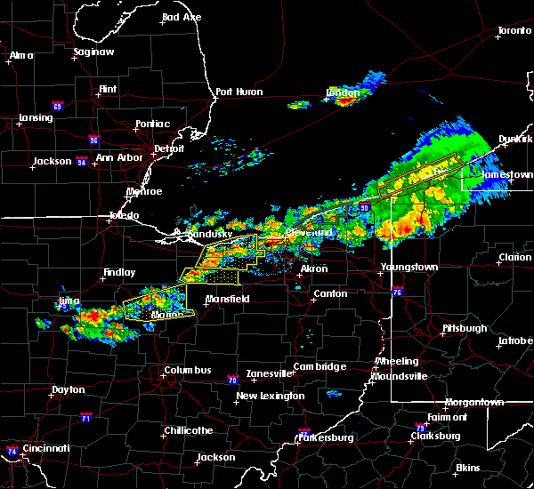 At 731 pm edt, a severe thunderstorm was located near new london, or 8 miles southeast of norwalk, moving northeast at 30 mph (radar indicated). Hazards include 60 mph wind gusts and quarter size hail. Minor damage to vehicles is possible. expect damage to trees and power lines. Locations impacted include, willard, new london, plymouth, sullivan, greenwich, north fairfield, rochester and nova. At 731 pm edt, a severe thunderstorm was located near new london, or 8 miles southeast of norwalk, moving northeast at 30 mph (radar indicated). Hazards include 60 mph wind gusts and quarter size hail. Minor damage to vehicles is possible. expect damage to trees and power lines. Locations impacted include, willard, new london, plymouth, sullivan, greenwich, north fairfield, rochester and nova.
|
| 7/26/2018 7:14 PM EDT |
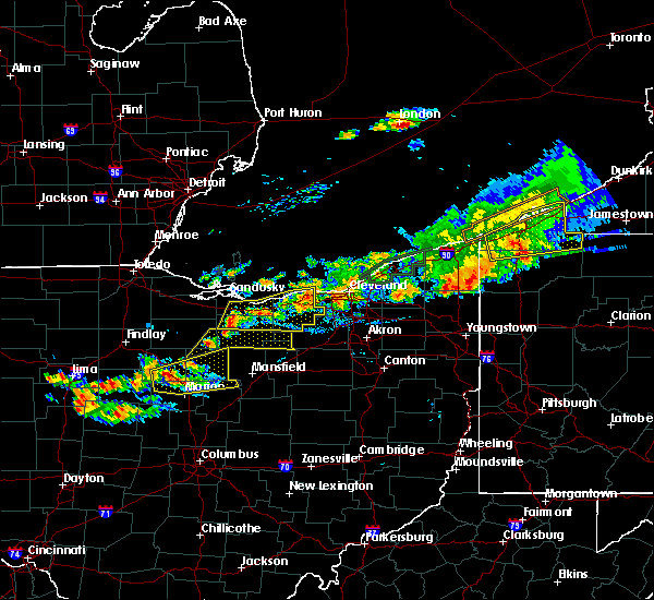 At 713 pm edt, a severe thunderstorm was located near willard, or 13 miles southwest of norwalk, moving east at 20 mph (radar indicated). Hazards include 60 mph wind gusts and quarter size hail. Minor damage to vehicles is possible. Expect damage to trees and power lines. At 713 pm edt, a severe thunderstorm was located near willard, or 13 miles southwest of norwalk, moving east at 20 mph (radar indicated). Hazards include 60 mph wind gusts and quarter size hail. Minor damage to vehicles is possible. Expect damage to trees and power lines.
|
| 5/22/2018 3:01 PM EDT |
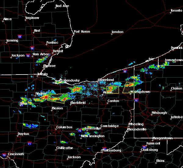 At 238 pm edt, a severe thunderstorm was located over new washington, or 12 miles northeast of bucyrus, moving east at 40 mph. additional strong storms will move into western seneca and wyandot (radar indicated). Hazards include 60 mph wind gusts and quarter size hail. Minor damage to vehicles is possible. expect damage to trees and power lines. Locations impacted include, willard, plymouth, new washington, bloomville, sycamore, chatfield, attica, benton, north fairfield, tiro and sulpher springs. At 238 pm edt, a severe thunderstorm was located over new washington, or 12 miles northeast of bucyrus, moving east at 40 mph. additional strong storms will move into western seneca and wyandot (radar indicated). Hazards include 60 mph wind gusts and quarter size hail. Minor damage to vehicles is possible. expect damage to trees and power lines. Locations impacted include, willard, plymouth, new washington, bloomville, sycamore, chatfield, attica, benton, north fairfield, tiro and sulpher springs.
|
| 5/22/2018 2:40 PM EDT |
 At 238 pm edt, a severe thunderstorm was located over new washington, or 12 miles northeast of bucyrus, moving east at 40 mph. additional strong storms will move into western seneca and wyandot (radar indicated). Hazards include 60 mph wind gusts and quarter size hail. Minor damage to vehicles is possible. expect damage to trees and power lines. Locations impacted include, willard, plymouth, new washington, bloomville, sycamore, chatfield, attica, benton, north fairfield, tiro and sulpher springs. At 238 pm edt, a severe thunderstorm was located over new washington, or 12 miles northeast of bucyrus, moving east at 40 mph. additional strong storms will move into western seneca and wyandot (radar indicated). Hazards include 60 mph wind gusts and quarter size hail. Minor damage to vehicles is possible. expect damage to trees and power lines. Locations impacted include, willard, plymouth, new washington, bloomville, sycamore, chatfield, attica, benton, north fairfield, tiro and sulpher springs.
|
| 5/22/2018 2:16 PM EDT |
 At 215 pm edt, a severe thunderstorm was located over sycamore, or 9 miles south of tiffin, moving east at 40 mph (radar indicated). Hazards include 60 mph wind gusts and quarter size hail. Minor damage to vehicles is possible. Expect damage to trees and power lines. At 215 pm edt, a severe thunderstorm was located over sycamore, or 9 miles south of tiffin, moving east at 40 mph (radar indicated). Hazards include 60 mph wind gusts and quarter size hail. Minor damage to vehicles is possible. Expect damage to trees and power lines.
|
| 4/3/2018 8:52 PM EDT |
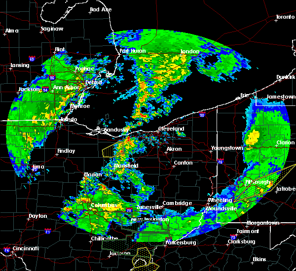 The severe thunderstorm warning for huron county will expire at 900 pm edt, the storm which prompted the warning has weakened below severe limits, and no longer poses an immediate threat to life or property. therefore the warning will be allowed to expire. The severe thunderstorm warning for huron county will expire at 900 pm edt, the storm which prompted the warning has weakened below severe limits, and no longer poses an immediate threat to life or property. therefore the warning will be allowed to expire.
|
| 4/3/2018 8:38 PM EDT |
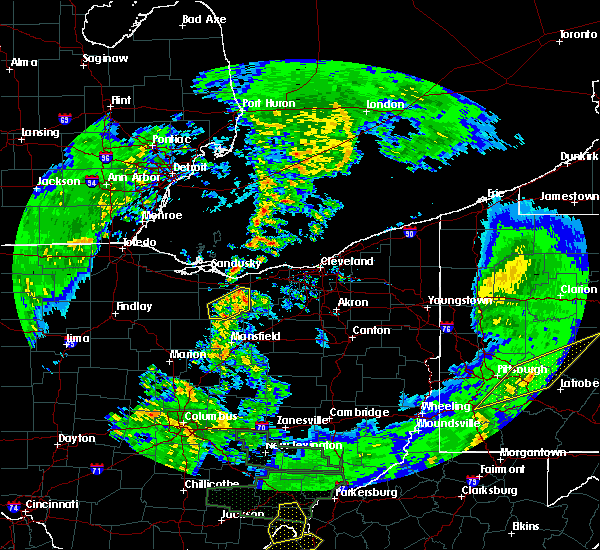 At 837 pm edt, a severe thunderstorm was located near new london, or 10 miles southeast of norwalk, moving northeast at 55 mph (radar indicated). Hazards include 60 mph wind gusts and quarter size hail. Minor damage to vehicles is possible. expect damage to trees and power lines. Locations impacted include, willard, new london, plymouth, wakeman, greenwich and north fairfield. At 837 pm edt, a severe thunderstorm was located near new london, or 10 miles southeast of norwalk, moving northeast at 55 mph (radar indicated). Hazards include 60 mph wind gusts and quarter size hail. Minor damage to vehicles is possible. expect damage to trees and power lines. Locations impacted include, willard, new london, plymouth, wakeman, greenwich and north fairfield.
|
| 4/3/2018 8:16 PM EDT |
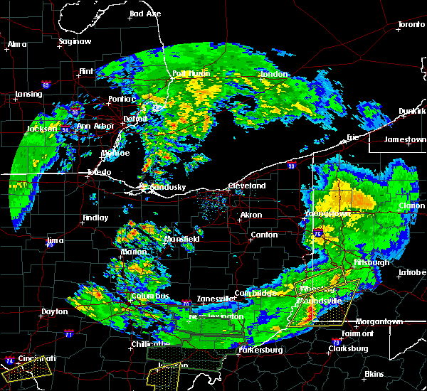 At 815 pm edt, a severe thunderstorm was located over new washington, or 15 miles northeast of bucyrus, moving northeast at 65 mph (radar indicated). Hazards include 60 mph wind gusts and quarter size hail. Minor damage to vehicles is possible. Expect damage to trees and power lines. At 815 pm edt, a severe thunderstorm was located over new washington, or 15 miles northeast of bucyrus, moving northeast at 65 mph (radar indicated). Hazards include 60 mph wind gusts and quarter size hail. Minor damage to vehicles is possible. Expect damage to trees and power lines.
|
| 11/5/2017 6:12 PM EDT |
 At 512 pm est, a severe thunderstorm capable of producing a tornado was located near norwalk, moving east at 65 mph (weather spotters reported a funnel cloud). Hazards include tornado. Flying debris will be dangerous to those caught without shelter. mobile homes will be damaged or destroyed. damage to roofs, windows, and vehicles will occur. tree damage is likely. this dangerous storm will be near, new london and wakeman around 520 pm est. Other locations impacted by this tornadic thunderstorm include north fairfield and monroeville. At 512 pm est, a severe thunderstorm capable of producing a tornado was located near norwalk, moving east at 65 mph (weather spotters reported a funnel cloud). Hazards include tornado. Flying debris will be dangerous to those caught without shelter. mobile homes will be damaged or destroyed. damage to roofs, windows, and vehicles will occur. tree damage is likely. this dangerous storm will be near, new london and wakeman around 520 pm est. Other locations impacted by this tornadic thunderstorm include north fairfield and monroeville.
|
| 11/5/2017 6:02 PM EDT | Powerlines sheared... several 30-foot diameter grain bins and aluminum sheds damaged on state route 162 west of steube in huron county OH, 3.4 miles SSW of Willard, OH |
| 11/5/2017 6:00 PM EDT | Trees down on niver road... east of egypt roa in huron county OH, 1.8 miles SSE of Willard, OH |
| 11/5/2017 5:58 PM EDT |
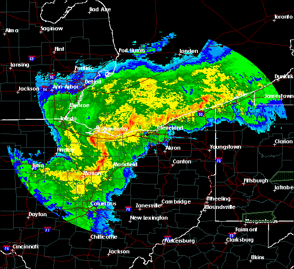 At 458 pm est, a severe thunderstorm capable of producing a tornado was located 7 miles south of bellevue, or 13 miles west of norwalk, moving east at 65 mph (radar indicated rotation). Hazards include tornado and quarter size hail. Flying debris will be dangerous to those caught without shelter. mobile homes will be damaged or destroyed. damage to roofs, windows, and vehicles will occur. tree damage is likely. this dangerous storm will be near, norwalk and milan around 510 pm est. new london and wakeman around 520 pm est. Other locations impacted by this tornadic thunderstorm include flat rock, north fairfield, monroeville and attica. At 458 pm est, a severe thunderstorm capable of producing a tornado was located 7 miles south of bellevue, or 13 miles west of norwalk, moving east at 65 mph (radar indicated rotation). Hazards include tornado and quarter size hail. Flying debris will be dangerous to those caught without shelter. mobile homes will be damaged or destroyed. damage to roofs, windows, and vehicles will occur. tree damage is likely. this dangerous storm will be near, norwalk and milan around 510 pm est. new london and wakeman around 520 pm est. Other locations impacted by this tornadic thunderstorm include flat rock, north fairfield, monroeville and attica.
|
| 11/5/2017 5:51 PM EDT |
 At 451 pm est, severe thunderstorms were located along a line extending from fremont to near chatfield, moving east at 60 mph (radar indicated). Hazards include 70 mph wind gusts. Expect considerable tree damage. Damage is likely to mobile homes, roofs, and outbuildings. At 451 pm est, severe thunderstorms were located along a line extending from fremont to near chatfield, moving east at 60 mph (radar indicated). Hazards include 70 mph wind gusts. Expect considerable tree damage. Damage is likely to mobile homes, roofs, and outbuildings.
|
| 8/3/2017 7:38 PM EDT |
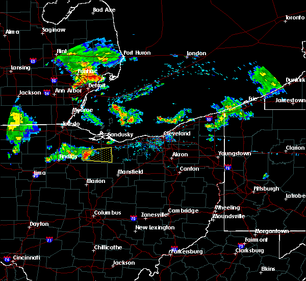 At 738 pm edt, a severe thunderstorm was located over tiffin, moving east at 15 mph (radar indicated). Hazards include 60 mph wind gusts and quarter size hail. Minor damage to vehicles is possible. Expect damage to trees and power lines. At 738 pm edt, a severe thunderstorm was located over tiffin, moving east at 15 mph (radar indicated). Hazards include 60 mph wind gusts and quarter size hail. Minor damage to vehicles is possible. Expect damage to trees and power lines.
|
| 6/13/2017 5:27 PM EDT |
 The severe thunderstorm warning for southern huron. richland and eastern crawford counties will expire at 530 pm edt. the storm which prompted the warning has weakened below severe limits, and no longer poses an immediate threat to life or property. Therefore the warning will be allowed to expire. The severe thunderstorm warning for southern huron. richland and eastern crawford counties will expire at 530 pm edt. the storm which prompted the warning has weakened below severe limits, and no longer poses an immediate threat to life or property. Therefore the warning will be allowed to expire.
|
| 6/13/2017 4:47 PM EDT |
 At 446 pm edt, a severe thunderstorm was located over willard, or 13 miles southwest of norwalk, moving east at 15 mph (radar indicated). Hazards include two inch hail and 70 mph wind gusts. People and animals outdoors will be injured. expect hail damage to roofs, siding, windows, and vehicles. expect considerable tree damage. wind damage is also likely to mobile homes, roofs, and outbuildings. Locations impacted include, mansfield, galion, shelby, willard, ontario, crestline, plymouth, new washington, greenwich, lucas, north fairfield, tiro, north robinson, sulpher springs, shenandoah and olivesburg. At 446 pm edt, a severe thunderstorm was located over willard, or 13 miles southwest of norwalk, moving east at 15 mph (radar indicated). Hazards include two inch hail and 70 mph wind gusts. People and animals outdoors will be injured. expect hail damage to roofs, siding, windows, and vehicles. expect considerable tree damage. wind damage is also likely to mobile homes, roofs, and outbuildings. Locations impacted include, mansfield, galion, shelby, willard, ontario, crestline, plymouth, new washington, greenwich, lucas, north fairfield, tiro, north robinson, sulpher springs, shenandoah and olivesburg.
|
| 6/13/2017 4:47 PM EDT |
 A severe thunderstorm warning remains in effect until 530 pm edt for southern huron. richland and eastern crawford counties. at 446 pm edt, a severe thunderstorm was located over willard, or 13 miles southwest of norwalk, moving east at 15 mph. hazard. two inch hail and 70 mph wind gusts. source. Radar indicated. A severe thunderstorm warning remains in effect until 530 pm edt for southern huron. richland and eastern crawford counties. at 446 pm edt, a severe thunderstorm was located over willard, or 13 miles southwest of norwalk, moving east at 15 mph. hazard. two inch hail and 70 mph wind gusts. source. Radar indicated.
|
| 6/13/2017 4:33 PM EDT |
 At 433 pm edt, a severe thunderstorm was located near plymouth, or 16 miles northeast of bucyrus, moving southeast at 25 mph (radar indicated). Hazards include 60 mph wind gusts and quarter size hail. Minor damage to vehicles is possible. Expect damage to trees and power lines. At 433 pm edt, a severe thunderstorm was located near plymouth, or 16 miles northeast of bucyrus, moving southeast at 25 mph (radar indicated). Hazards include 60 mph wind gusts and quarter size hail. Minor damage to vehicles is possible. Expect damage to trees and power lines.
|
| 5/29/2017 10:39 PM EDT |
 At 1038 pm edt, a severe thunderstorm was located over new washington, or 12 miles northeast of bucyrus, moving northeast at 40 mph (radar indicated). Hazards include 60 mph wind gusts and quarter size hail. Minor damage to vehicles is possible. Expect damage to trees and power lines. At 1038 pm edt, a severe thunderstorm was located over new washington, or 12 miles northeast of bucyrus, moving northeast at 40 mph (radar indicated). Hazards include 60 mph wind gusts and quarter size hail. Minor damage to vehicles is possible. Expect damage to trees and power lines.
|
| 4/19/2017 5:19 PM EDT |
 At 516 pm edt, a severe thunderstorm was located over willard, or 15 miles southwest of norwalk, moving east at 35 mph. trained weather spotters reported half dollar sized hail southeast of bloomville. another severe thunderstorm was located near chatfield, also moving east at 35 mph (trained weather spotters). Hazards include half dollar size hail. Damage to vehicles is expected. Locations impacted include, shelby, willard, new london, plymouth, new washington, chatfield, greenwich, shiloh, north fairfield, tiro and shenandoah. At 516 pm edt, a severe thunderstorm was located over willard, or 15 miles southwest of norwalk, moving east at 35 mph. trained weather spotters reported half dollar sized hail southeast of bloomville. another severe thunderstorm was located near chatfield, also moving east at 35 mph (trained weather spotters). Hazards include half dollar size hail. Damage to vehicles is expected. Locations impacted include, shelby, willard, new london, plymouth, new washington, chatfield, greenwich, shiloh, north fairfield, tiro and shenandoah.
|
| 4/19/2017 5:00 PM EDT |
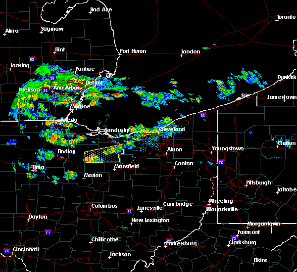 At 459 pm edt, a severe thunderstorm was located near bloomville, or 13 miles southeast of tiffin, moving east at 30 mph (radar indicated). Hazards include 60 mph wind gusts and quarter size hail. Hail damage to vehicles is expected. Expect wind damage to roofs, siding, and trees. At 459 pm edt, a severe thunderstorm was located near bloomville, or 13 miles southeast of tiffin, moving east at 30 mph (radar indicated). Hazards include 60 mph wind gusts and quarter size hail. Hail damage to vehicles is expected. Expect wind damage to roofs, siding, and trees.
|
| 3/1/2017 4:38 AM EST |
 At 438 am est, a severe thunderstorm was located over chatfield, or 10 miles north of bucyrus, moving east at 60 mph. damage has been reported in southern seneca county with this storm (radar indicated). Hazards include 60 mph wind gusts and quarter size hail. Hail damage to vehicles is expected. Expect wind damage to roofs, siding, and trees. At 438 am est, a severe thunderstorm was located over chatfield, or 10 miles north of bucyrus, moving east at 60 mph. damage has been reported in southern seneca county with this storm (radar indicated). Hazards include 60 mph wind gusts and quarter size hail. Hail damage to vehicles is expected. Expect wind damage to roofs, siding, and trees.
|
| 3/1/2017 12:55 AM EST |
 At 1254 am est, severe thunderstorms were located along a line extending from near fostoria to 6 miles northwest of crestline to near chesterville, moving northeast at 85 mph (radar indicated). Hazards include 60 mph wind gusts and quarter size hail. Hail damage to vehicles is expected. Expect wind damage to roofs, siding, and trees. At 1254 am est, severe thunderstorms were located along a line extending from near fostoria to 6 miles northwest of crestline to near chesterville, moving northeast at 85 mph (radar indicated). Hazards include 60 mph wind gusts and quarter size hail. Hail damage to vehicles is expected. Expect wind damage to roofs, siding, and trees.
|
| 2/24/2017 8:30 PM EST |
 At 829 pm est, a severe thunderstorm was located near willard, or 15 miles southwest of norwalk, moving northeast at 50 mph (radar indicated). Hazards include 60 mph wind gusts. expect damage to roofs, siding, and trees At 829 pm est, a severe thunderstorm was located near willard, or 15 miles southwest of norwalk, moving northeast at 50 mph (radar indicated). Hazards include 60 mph wind gusts. expect damage to roofs, siding, and trees
|
| 2/24/2017 8:19 PM EST |
 At 818 pm est, a severe thunderstorm was located near new washington, or 17 miles east of tiffin, moving northeast at 45 mph (radar indicated). Hazards include 70 mph wind gusts and quarter size hail. Hail damage to vehicles is expected. expect considerable tree damage. wind damage is also likely to mobile homes, roofs, and outbuildings. Locations impacted include, norwalk, willard, plymouth, new washington, greenwich, monroeville, attica and north fairfield. At 818 pm est, a severe thunderstorm was located near new washington, or 17 miles east of tiffin, moving northeast at 45 mph (radar indicated). Hazards include 70 mph wind gusts and quarter size hail. Hail damage to vehicles is expected. expect considerable tree damage. wind damage is also likely to mobile homes, roofs, and outbuildings. Locations impacted include, norwalk, willard, plymouth, new washington, greenwich, monroeville, attica and north fairfield.
|
| 2/24/2017 8:07 PM EST |
 At 806 pm est, a severe thunderstorm was located over chatfield, or 12 miles north of bucyrus, moving northeast at 45 mph (radar indicated). Hazards include 70 mph wind gusts and half dollar size hail. Hail damage to vehicles is expected. expect considerable tree damage. Wind damage is also likely to mobile homes, roofs, and outbuildings. At 806 pm est, a severe thunderstorm was located over chatfield, or 12 miles north of bucyrus, moving northeast at 45 mph (radar indicated). Hazards include 70 mph wind gusts and half dollar size hail. Hail damage to vehicles is expected. expect considerable tree damage. Wind damage is also likely to mobile homes, roofs, and outbuildings.
|
| 9/10/2016 4:28 PM EDT |
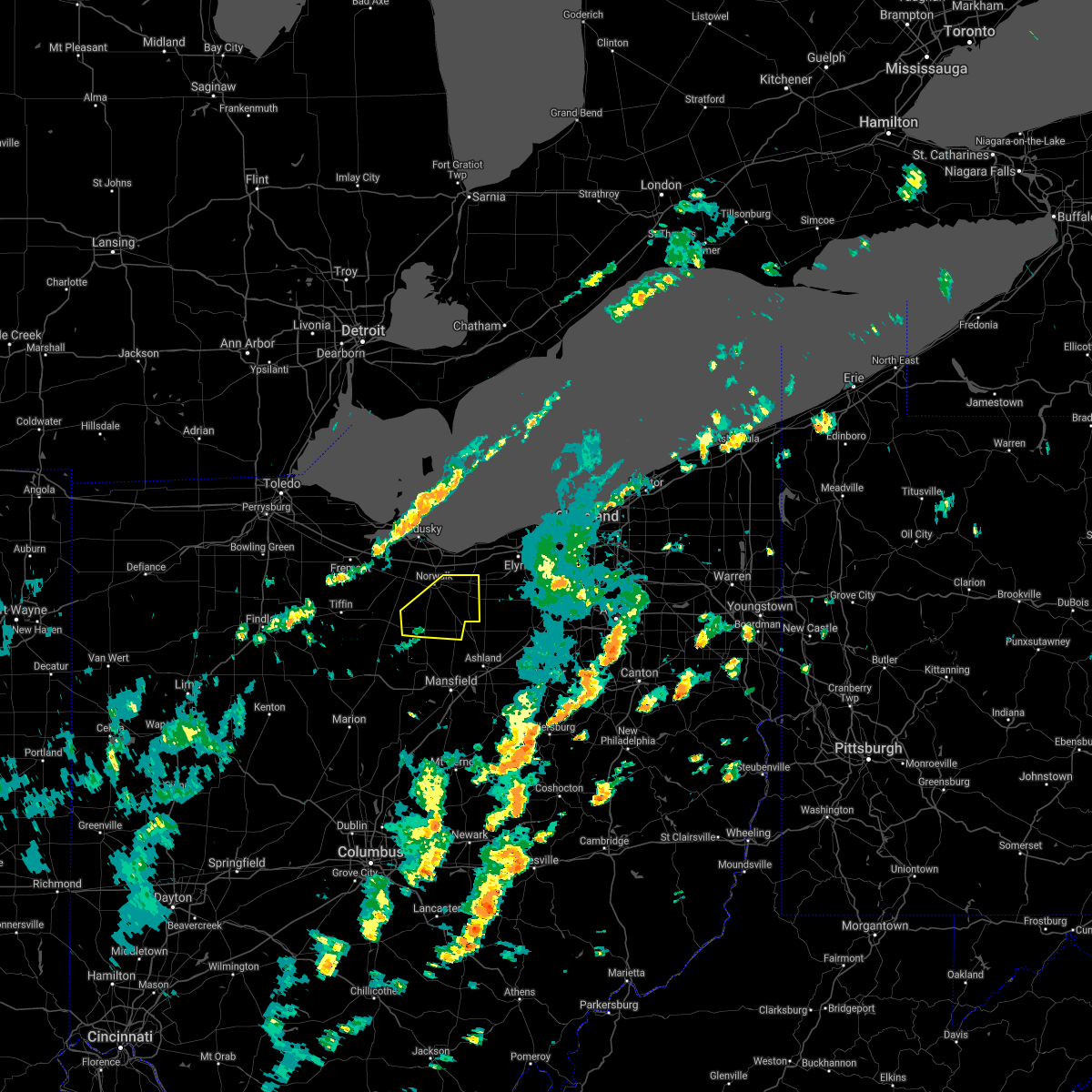 The severe thunderstorm warning for huron county will expire at 430 pm edt. the storm which prompted the warning has weakened below severe limits. and no longer pose an immediate threat to life or property. therefore the warning will be allowed to expire. However gusty winds are still possible with this thunderstorm. The severe thunderstorm warning for huron county will expire at 430 pm edt. the storm which prompted the warning has weakened below severe limits. and no longer pose an immediate threat to life or property. therefore the warning will be allowed to expire. However gusty winds are still possible with this thunderstorm.
|
| 9/10/2016 3:56 PM EDT |
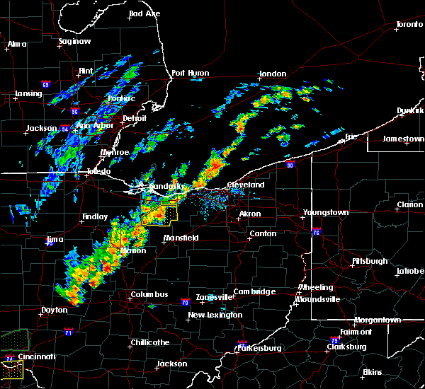 At 355 pm edt, a severe thunderstorm was located 7 miles west of new london, or 10 miles southeast of norwalk, moving northeast at 55 mph (radar indicated). Hazards include 60 mph wind gusts and nickel size hail. Expect damage to roofs. siding and trees. Locations impacted include, norwalk, willard, new london, plymouth, wakeman, greenwich and north fairfield. At 355 pm edt, a severe thunderstorm was located 7 miles west of new london, or 10 miles southeast of norwalk, moving northeast at 55 mph (radar indicated). Hazards include 60 mph wind gusts and nickel size hail. Expect damage to roofs. siding and trees. Locations impacted include, norwalk, willard, new london, plymouth, wakeman, greenwich and north fairfield.
|
| 9/10/2016 3:48 PM EDT | Trees down across huron county. a cluster of reports were from the willard area where several trees were downed in addition to a couple power line in huron county OH, 1.4 miles WNW of Willard, OH |
| 9/10/2016 3:42 PM EDT |
 At 342 pm edt, a severe thunderstorm was located near willard, or 17 miles southwest of norwalk, moving northeast at 30 mph (radar indicated). Hazards include 60 mph wind gusts and nickel size hail. Expect damage to roofs. Siding and trees. At 342 pm edt, a severe thunderstorm was located near willard, or 17 miles southwest of norwalk, moving northeast at 30 mph (radar indicated). Hazards include 60 mph wind gusts and nickel size hail. Expect damage to roofs. Siding and trees.
|
| 7/13/2016 8:59 PM EDT |
 At 858 pm edt, severe thunderstorms were located along a line extending from near sandusky to near new london, moving northeast at 40 mph (trained weather spotters). Hazards include 60 mph wind gusts and penny size hail. this storm has a history of producing wind damage. Expect damage to roofs. siding and trees. Locations impacted include, sandusky, norwalk, western vermilion, vermilion, new london, plymouth, milan, northern milan, wakeman, greenwich, monroeville, berlin heights, north fairfield, bloomingville, sandusky south, fairview lanes and birmingham. At 858 pm edt, severe thunderstorms were located along a line extending from near sandusky to near new london, moving northeast at 40 mph (trained weather spotters). Hazards include 60 mph wind gusts and penny size hail. this storm has a history of producing wind damage. Expect damage to roofs. siding and trees. Locations impacted include, sandusky, norwalk, western vermilion, vermilion, new london, plymouth, milan, northern milan, wakeman, greenwich, monroeville, berlin heights, north fairfield, bloomingville, sandusky south, fairview lanes and birmingham.
|
| 7/13/2016 8:41 PM EDT |
 At 839 pm edt, severe thunderstorms were located along a line extending from near bellevue to plymouth, moving northeast at 40 mph (radar indicated). Hazards include 60 mph wind gusts and penny size hail. Expect damage to roofs. Siding and trees. At 839 pm edt, severe thunderstorms were located along a line extending from near bellevue to plymouth, moving northeast at 40 mph (radar indicated). Hazards include 60 mph wind gusts and penny size hail. Expect damage to roofs. Siding and trees.
|
| 6/5/2016 2:47 PM EDT |
 At 246 pm edt, a severe thunderstorm was located near bloomville, or 8 miles southeast of tiffin, moving east at 30 mph. other strong storms were in northern wyandot county (radar indicated). Hazards include 60 mph wind gusts and quarter size hail. Hail damage to vehicles is expected. expect wind damage to roofs, siding and trees. Locations impacted include, norwalk, bucyrus, upper sandusky, galion, bellevue, willard, crestline, new london, plymouth, milan, wakeman, new washington, bloomville, sycamore, morral, chatfield, marseilles, greenwich, monroeville and attica. At 246 pm edt, a severe thunderstorm was located near bloomville, or 8 miles southeast of tiffin, moving east at 30 mph. other strong storms were in northern wyandot county (radar indicated). Hazards include 60 mph wind gusts and quarter size hail. Hail damage to vehicles is expected. expect wind damage to roofs, siding and trees. Locations impacted include, norwalk, bucyrus, upper sandusky, galion, bellevue, willard, crestline, new london, plymouth, milan, wakeman, new washington, bloomville, sycamore, morral, chatfield, marseilles, greenwich, monroeville and attica.
|
| 6/5/2016 2:20 PM EDT |
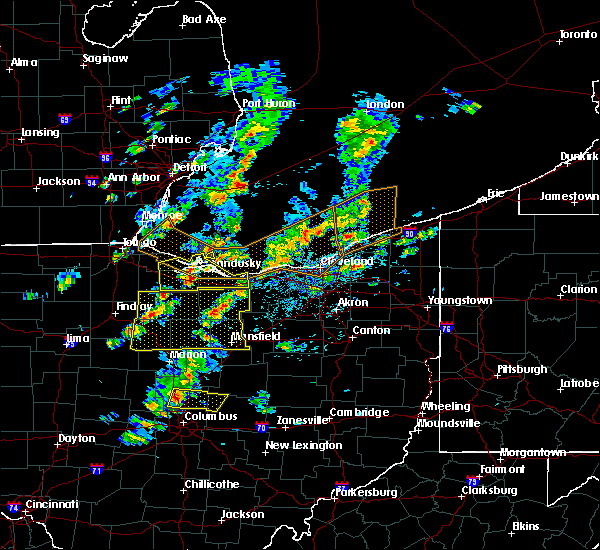 At 218 pm edt, a severe thunderstorm was located over new riegel, or 9 miles southwest of tiffin, moving east at 30 mph. other storms were over seneca crawford and huron counties (radar indicated). Hazards include 60 mph wind gusts and quarter size hail. Hail damage to vehicles is expected. Expect wind damage to roofs, siding and trees. At 218 pm edt, a severe thunderstorm was located over new riegel, or 9 miles southwest of tiffin, moving east at 30 mph. other storms were over seneca crawford and huron counties (radar indicated). Hazards include 60 mph wind gusts and quarter size hail. Hail damage to vehicles is expected. Expect wind damage to roofs, siding and trees.
|
| 5/29/2016 5:32 PM EDT |
 At 532 pm edt, a severe thunderstorm was located near bucyrus, moving northeast at 20 mph (radar indicated). Hazards include 60 mph wind gusts and quarter size hail. Hail damage to vehicles is expected. Expect wind damage to roofs, siding, and trees. At 532 pm edt, a severe thunderstorm was located near bucyrus, moving northeast at 20 mph (radar indicated). Hazards include 60 mph wind gusts and quarter size hail. Hail damage to vehicles is expected. Expect wind damage to roofs, siding, and trees.
|
| 5/7/2016 7:20 PM EDT |
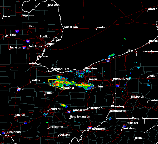 At 718 pm edt, a severe thunderstorm was located near plymouth, or 17 miles northwest of mansfield, moving southeast at 40 mph (radar indicated). Hazards include 60 mph wind gusts and quarter size hail. Hail damage to vehicles is expected. expect wind damage to roofs, siding and trees. Locations impacted include, mansfield, shelby, willard, new london, plymouth, new washington, greenwich, shiloh, tiro, olivesburg and shenandoah. At 718 pm edt, a severe thunderstorm was located near plymouth, or 17 miles northwest of mansfield, moving southeast at 40 mph (radar indicated). Hazards include 60 mph wind gusts and quarter size hail. Hail damage to vehicles is expected. expect wind damage to roofs, siding and trees. Locations impacted include, mansfield, shelby, willard, new london, plymouth, new washington, greenwich, shiloh, tiro, olivesburg and shenandoah.
|
| 5/7/2016 7:02 PM EDT |
 At 702 pm edt, a severe thunderstorm was located near bloomville, or 13 miles east of tiffin, moving southeast at 30 mph (radar indicated). Hazards include 60 mph wind gusts and quarter size hail. Hail damage to vehicles is expected. Expect wind damage to roofs, siding and trees. At 702 pm edt, a severe thunderstorm was located near bloomville, or 13 miles east of tiffin, moving southeast at 30 mph (radar indicated). Hazards include 60 mph wind gusts and quarter size hail. Hail damage to vehicles is expected. Expect wind damage to roofs, siding and trees.
|
| 6/12/2015 2:58 PM EDT |
 At 258 pm edt, a severe thunderstorm was located over norwalk, moving east at 40 mph (radar indicated). Hazards include 60 mph wind gusts. Expect damage to roofs. siding and trees. Locations impacted include, norwalk, willard, new london, milan, wakeman, berlin heights, monroeville and north fairfield. At 258 pm edt, a severe thunderstorm was located over norwalk, moving east at 40 mph (radar indicated). Hazards include 60 mph wind gusts. Expect damage to roofs. siding and trees. Locations impacted include, norwalk, willard, new london, milan, wakeman, berlin heights, monroeville and north fairfield.
|
| 6/12/2015 2:38 PM EDT |
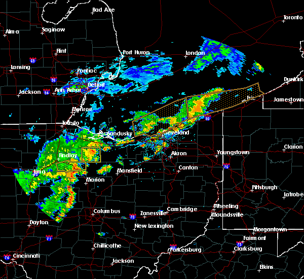 The national weather service in cleveland has issued a * severe thunderstorm warning for. huron county in north central ohio. southern erie county in north central ohio. until 330 pm edt * at 238 pm edt. A severe thunderstorm was located near bellevue. The national weather service in cleveland has issued a * severe thunderstorm warning for. huron county in north central ohio. southern erie county in north central ohio. until 330 pm edt * at 238 pm edt. A severe thunderstorm was located near bellevue.
|
| 5/30/2015 7:34 PM EDT | Storm damage reported in huron county OH, 0.5 miles NW of Willard, OH |
| 5/30/2015 7:29 PM EDT | At 729 pm edt, a severe thunderstorm was located near willard, or 8 miles southwest of norwalk, moving northeast at 40 mph (trained weather spotters). Hazards include 60 mph wind gusts and penny size hail. Expect damage to roofs. Siding and trees. |
| 5/30/2015 7:27 PM EDT | Storm damage reported in huron county OH, 0.5 miles NW of Willard, OH |
| 5/30/2015 7:22 PM EDT | Storm damage reported in huron county OH, 0.5 miles NW of Willard, OH |
| 6/18/2014 5:23 PM EDT | Numerous 18 diameter trees down. large tree fell on power line and took down power pol in huron county OH, 0.5 miles NW of Willard, OH |
| 6/18/2014 5:22 PM EDT | Numerous 18 diameter trees down. large tree fell on power line and took down power pol in huron county OH, 0.5 miles NW of Willard, OH |
| 9/7/2012 3:02 PM EDT | Quarter sized hail reported 0.5 miles NW of Willard, OH |
| 7/1/2012 7:15 PM EDT | Several trees reported dow in huron county OH, 0.5 miles NW of Willard, OH |
| 1/1/0001 12:00 AM | Trees dow in huron county OH, 0.5 miles NW of Willard, OH |
| 1/1/0001 12:00 AM | Large limb dow in huron county OH, 0.5 miles NW of Willard, OH |
Hail Maps for Willard, OH


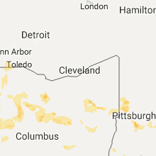


Connect with Interactive Hail Maps