

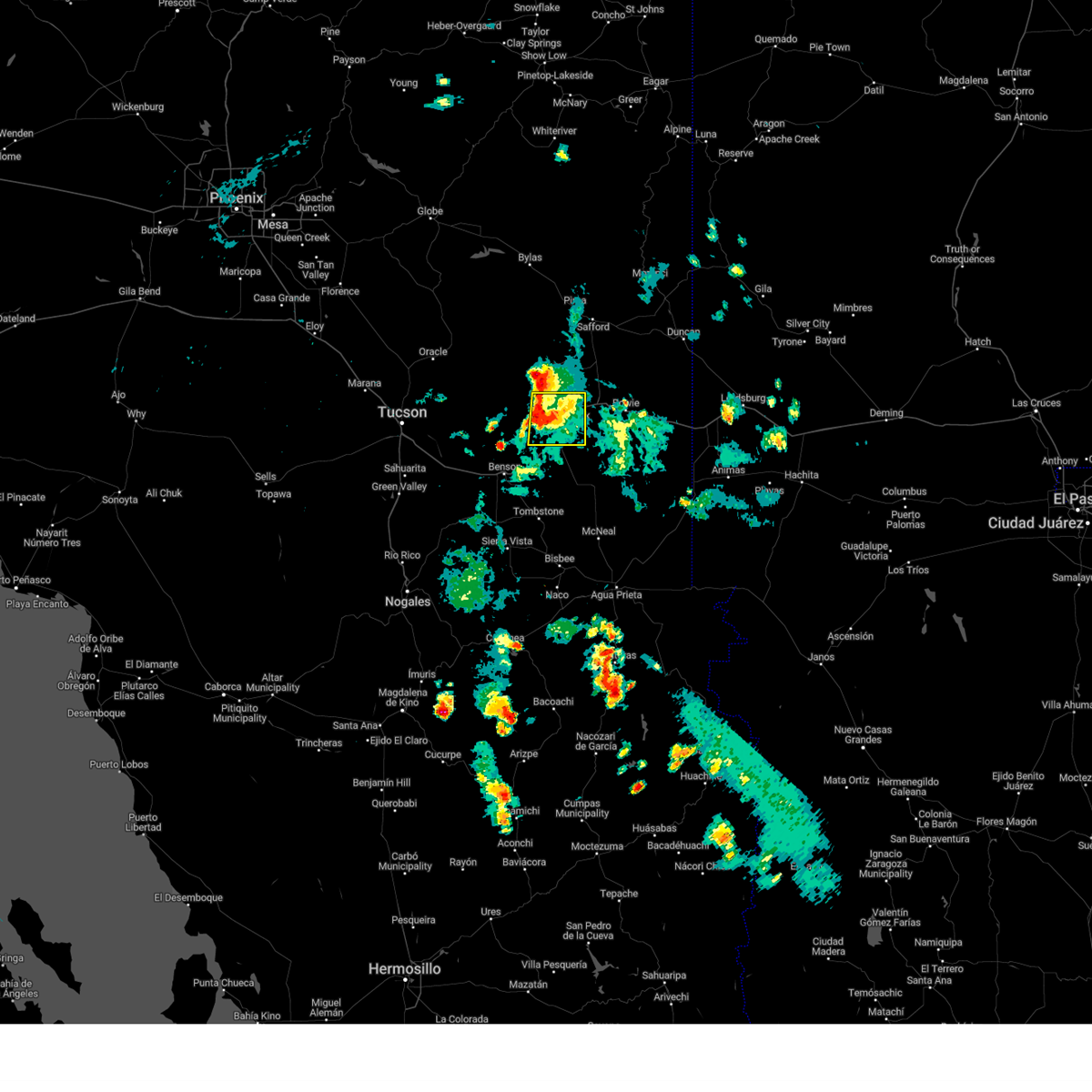
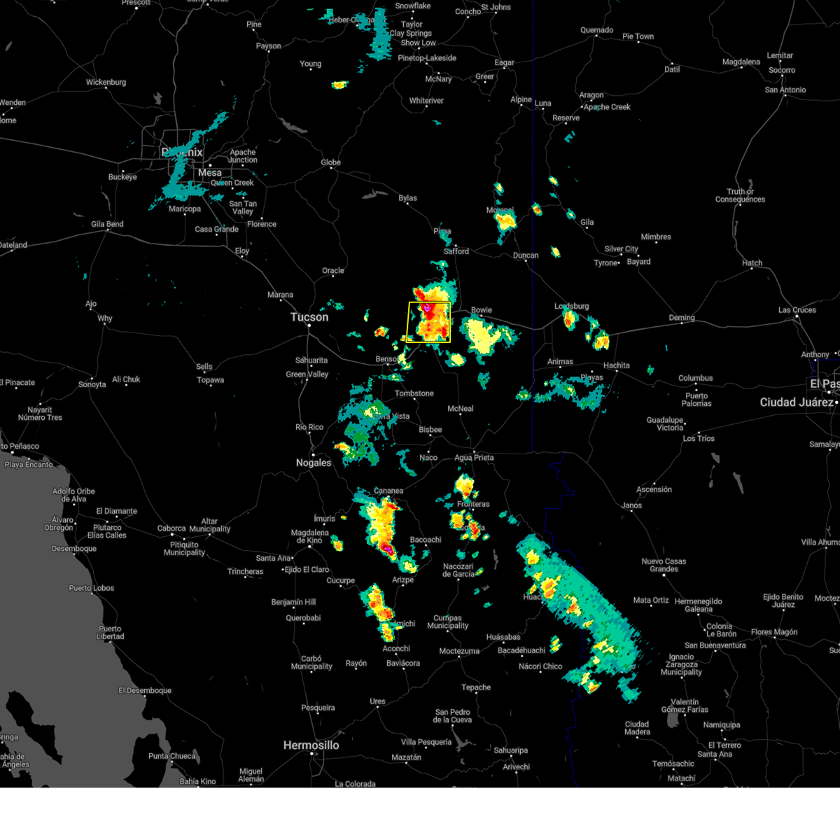
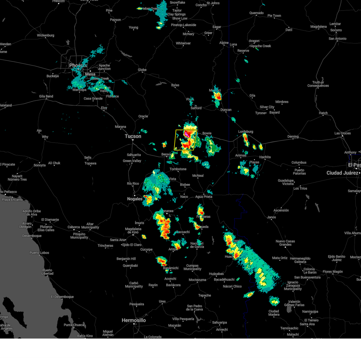
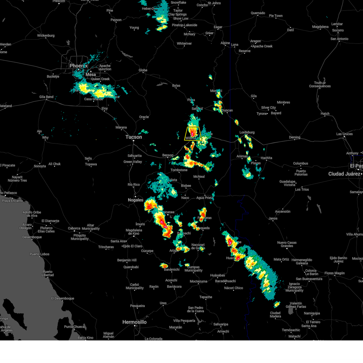
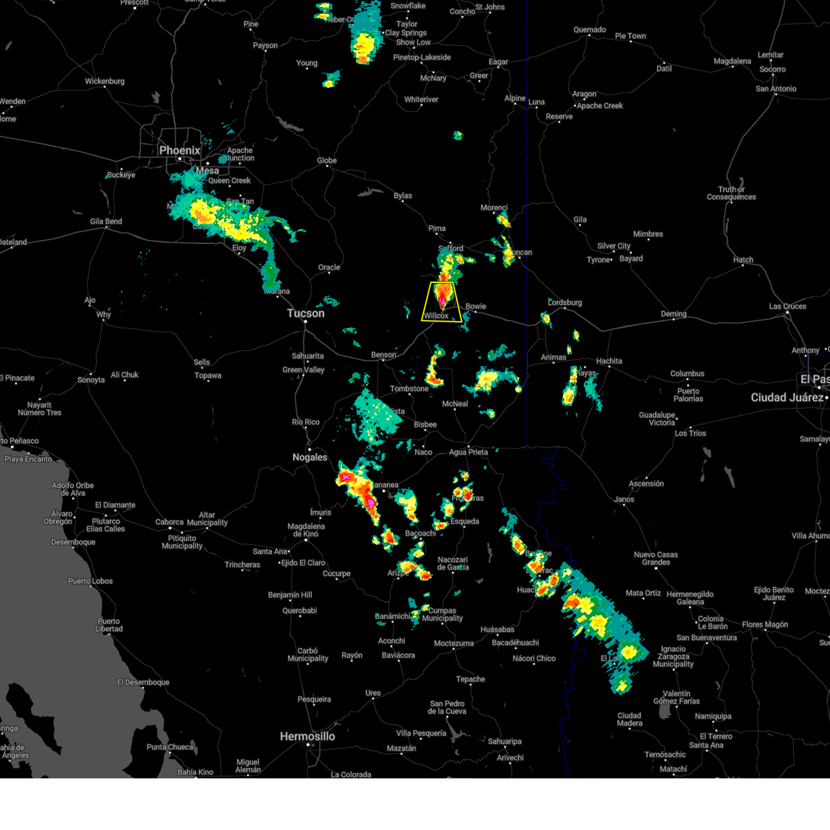
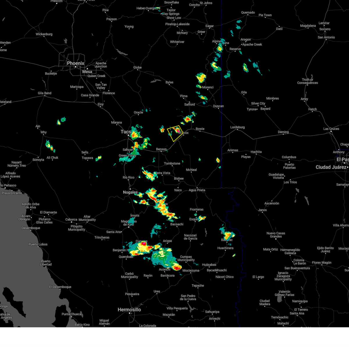
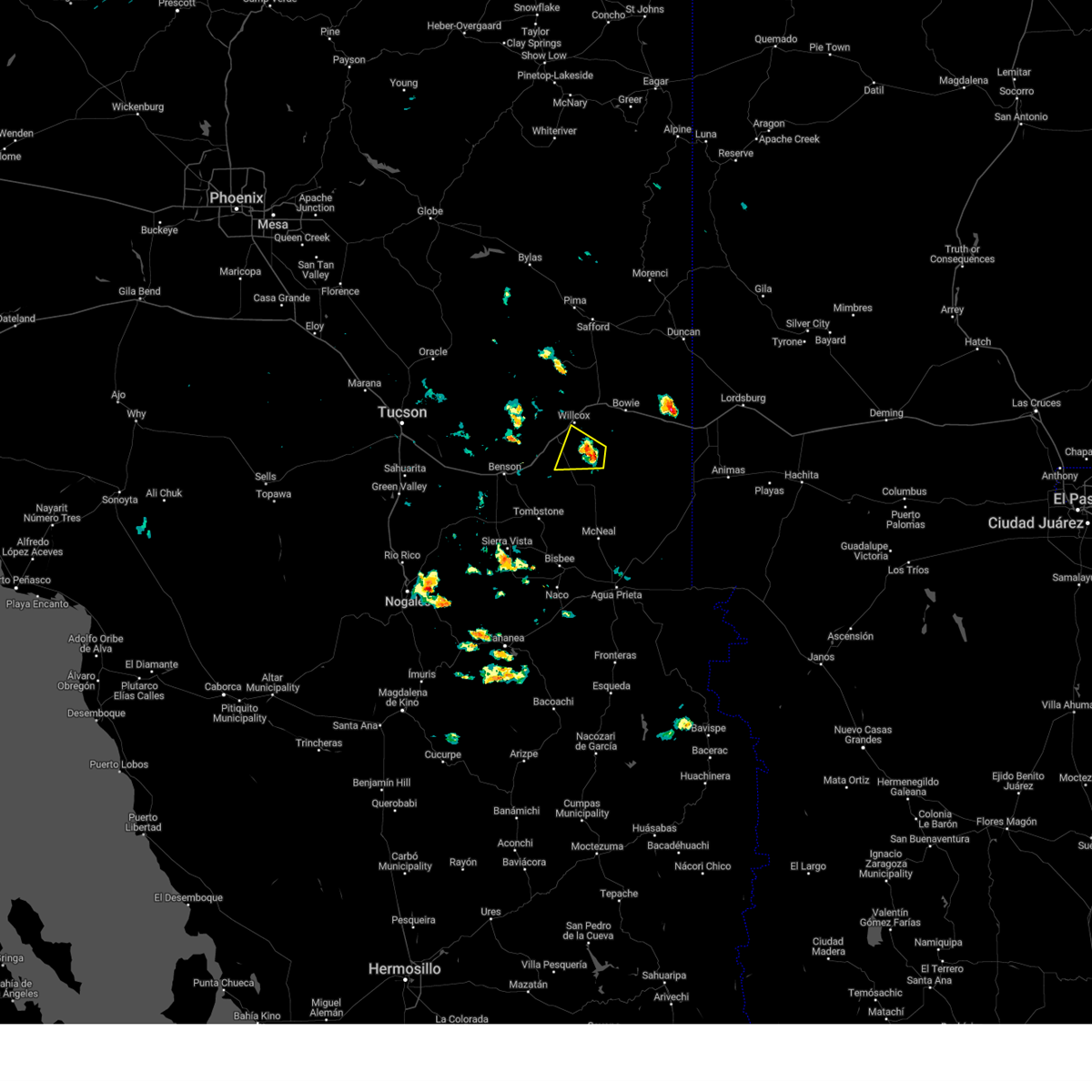
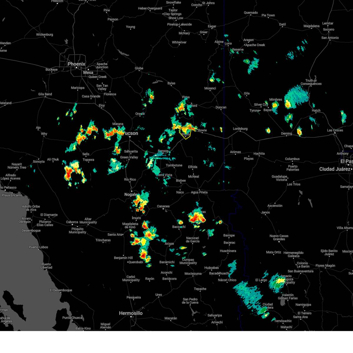
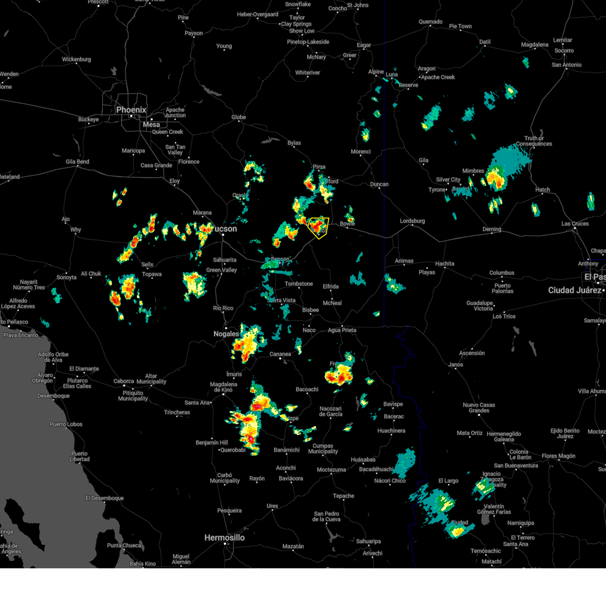
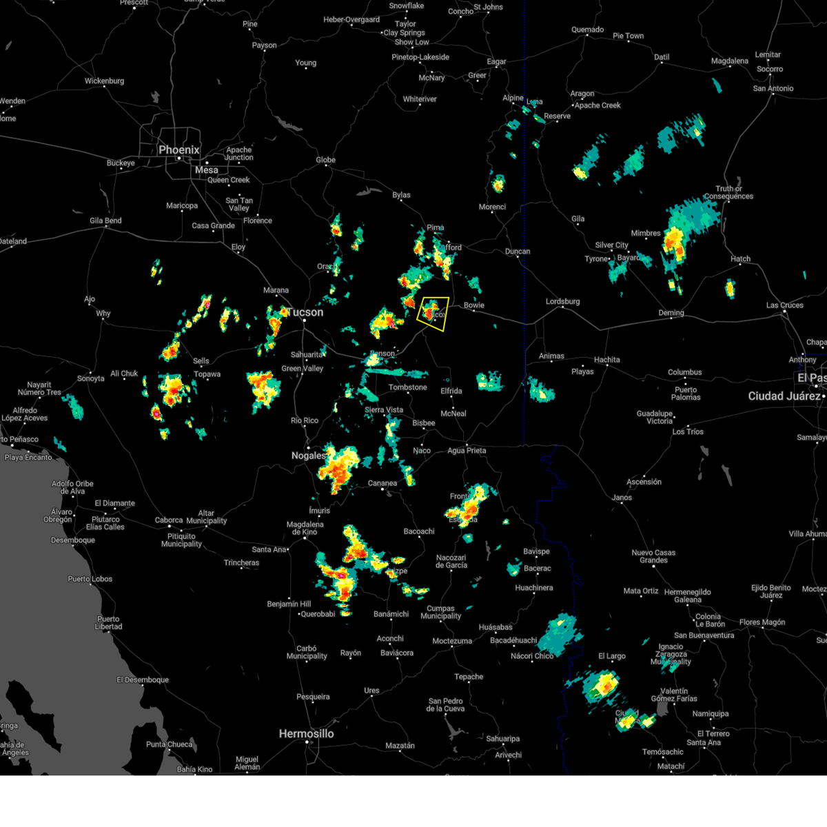
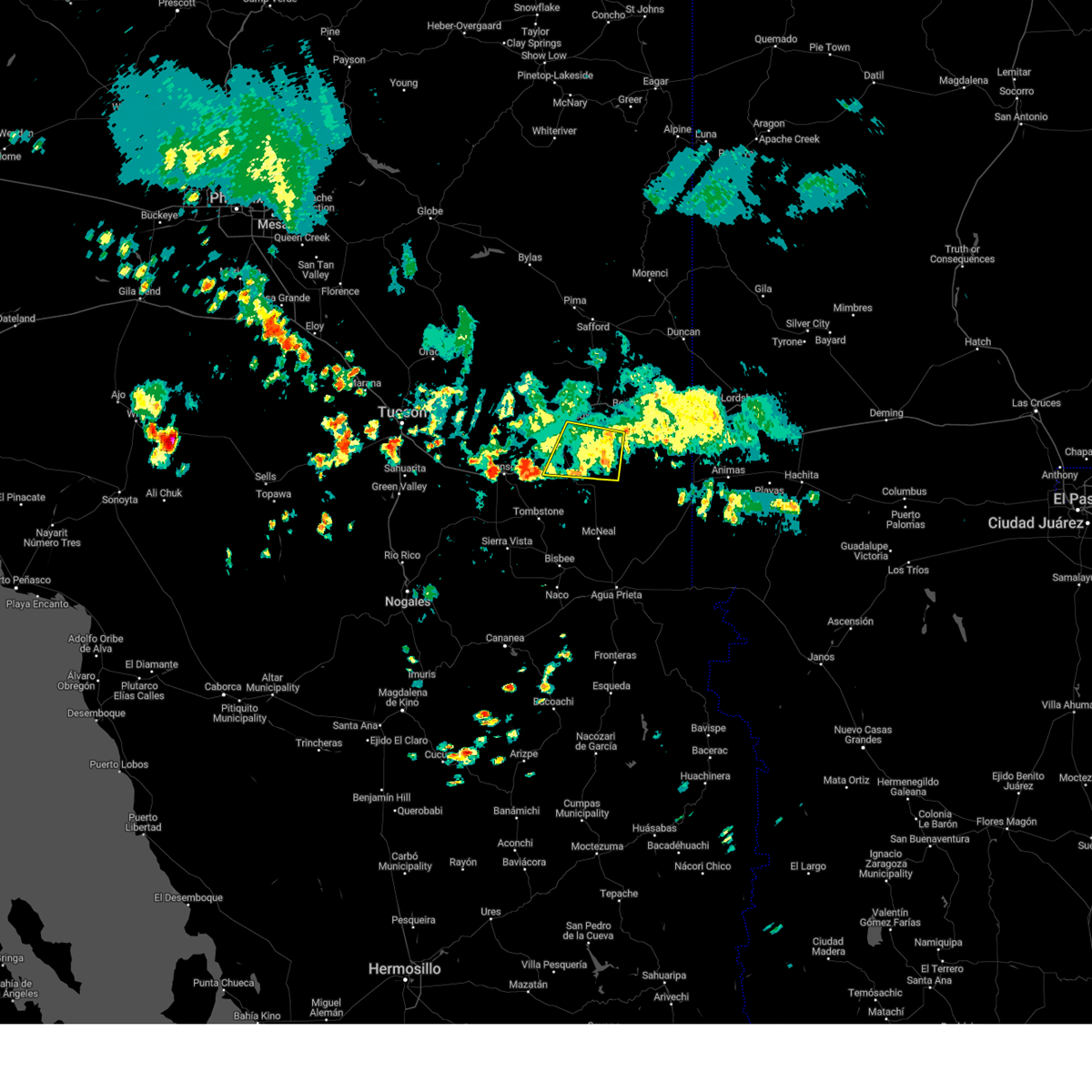
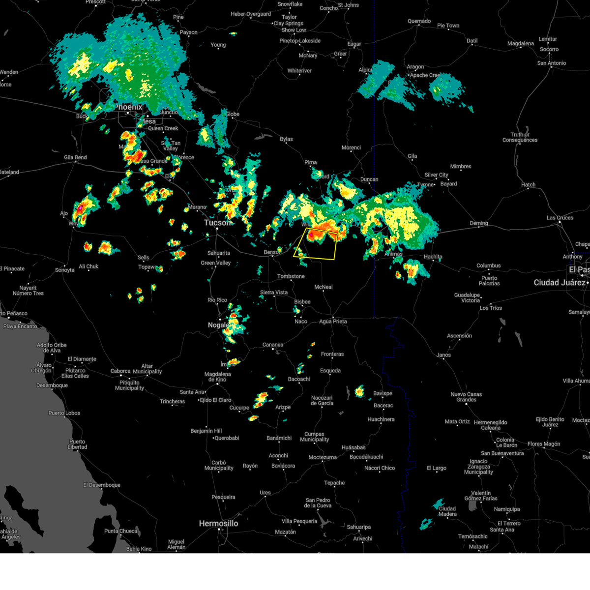
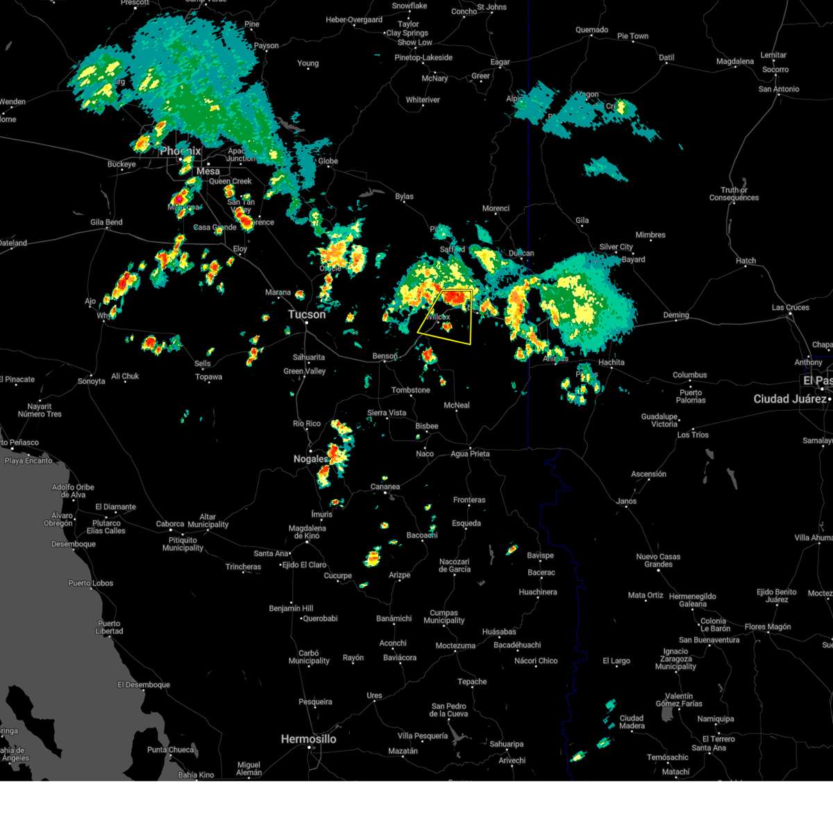
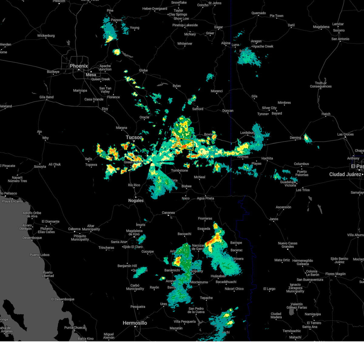
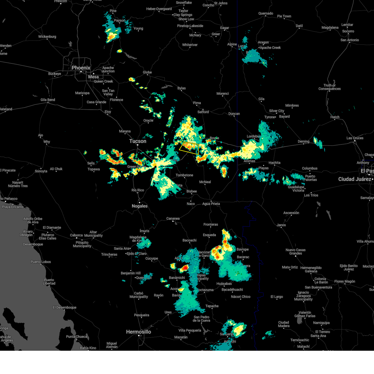
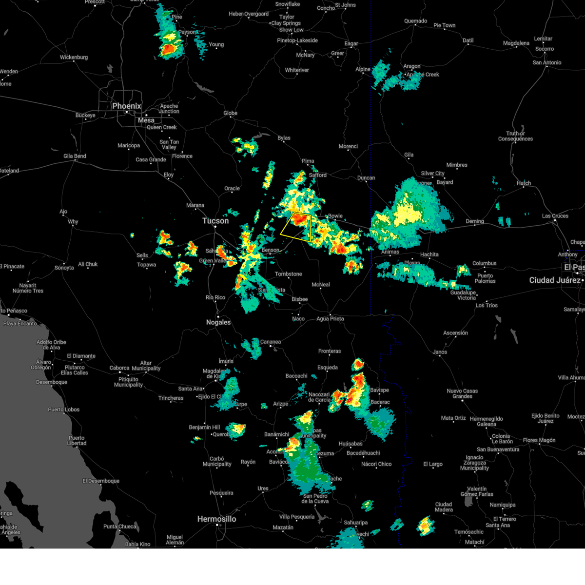
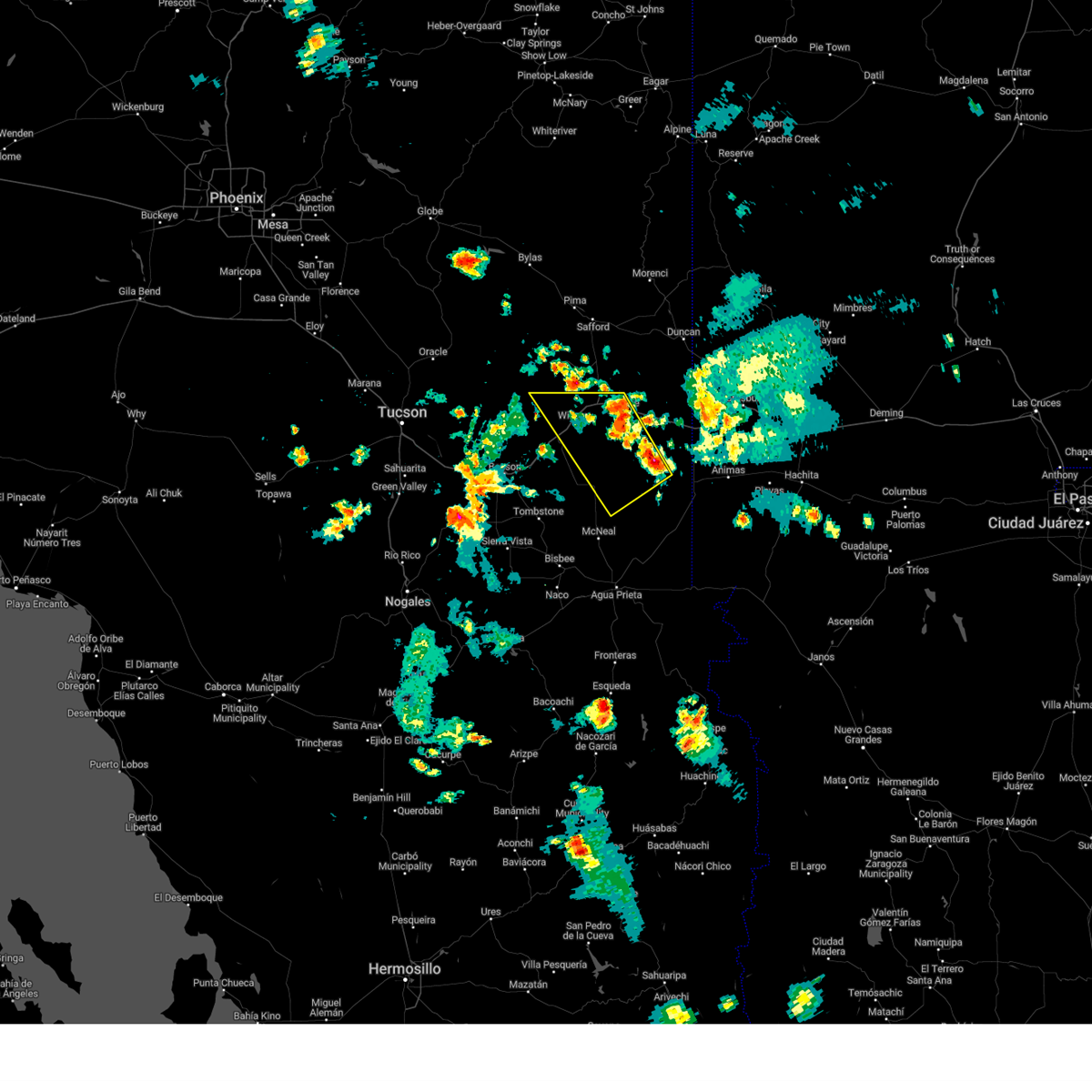
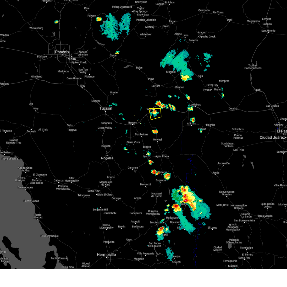
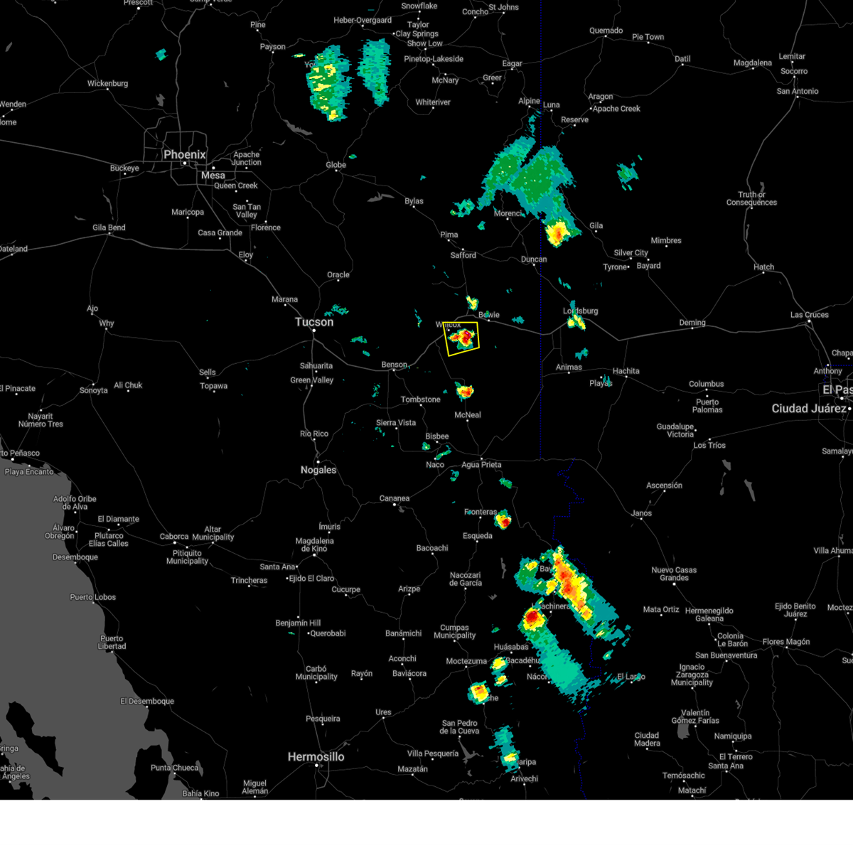
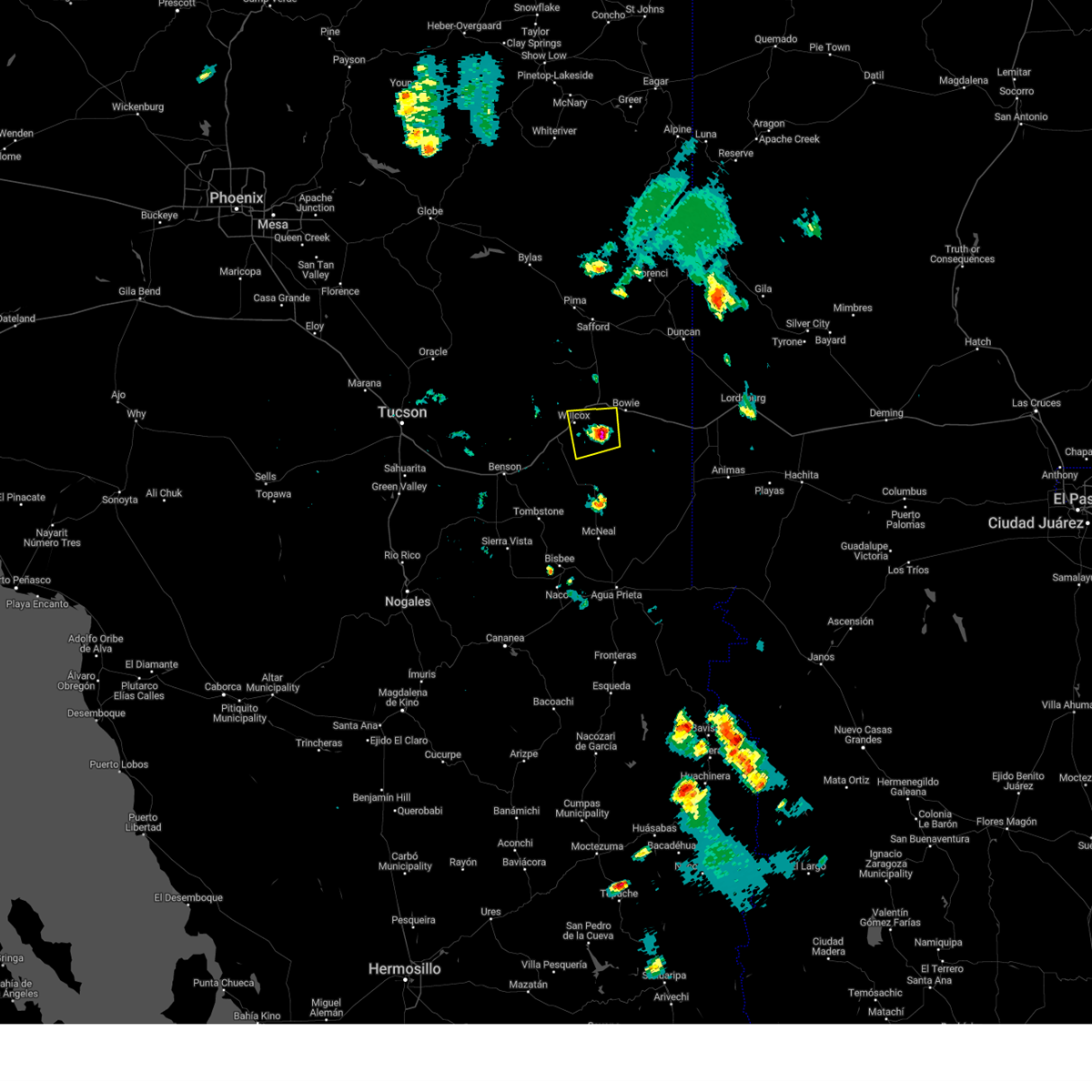
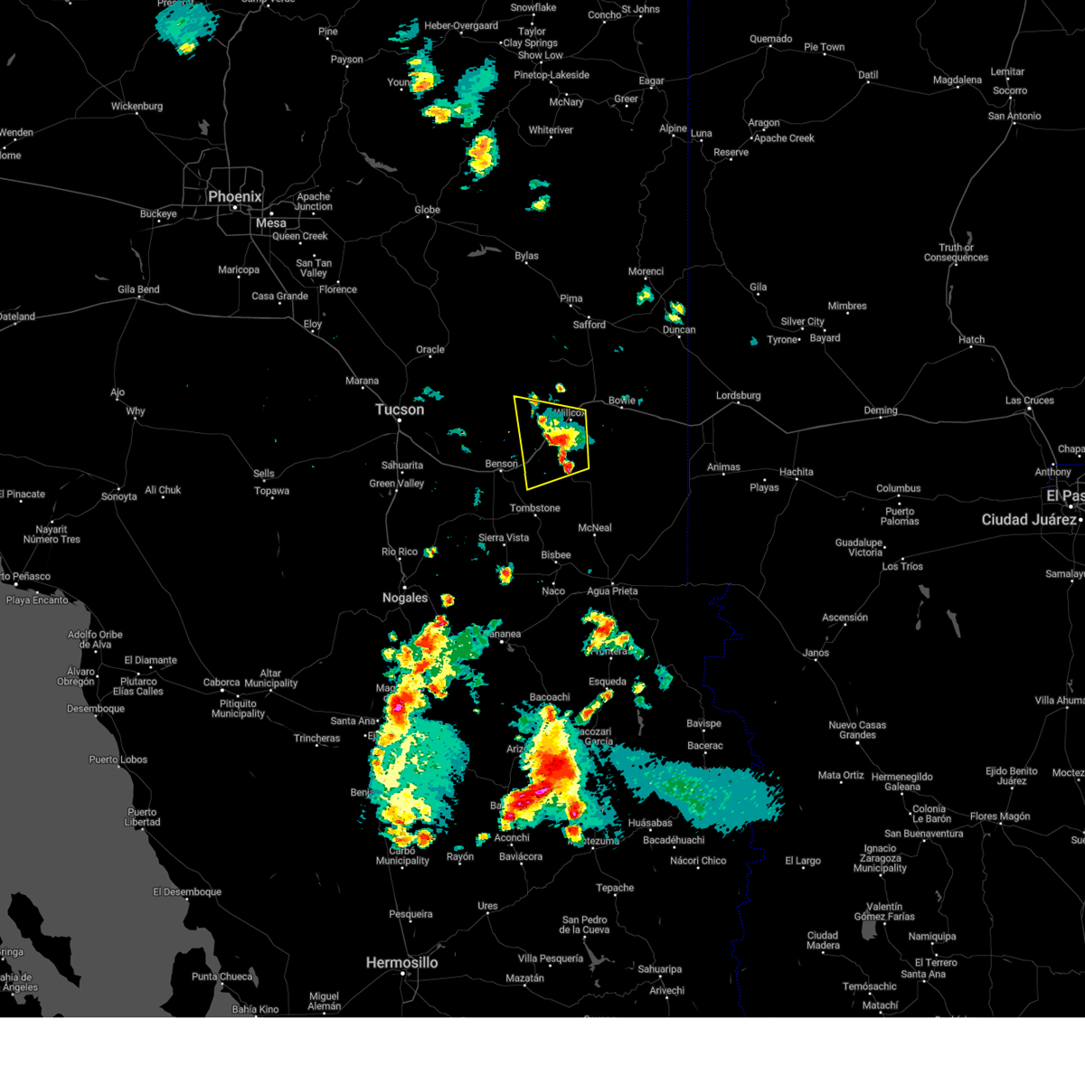
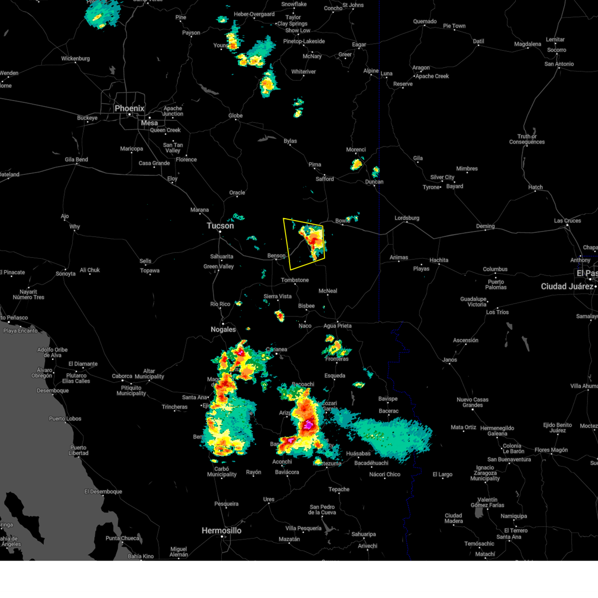
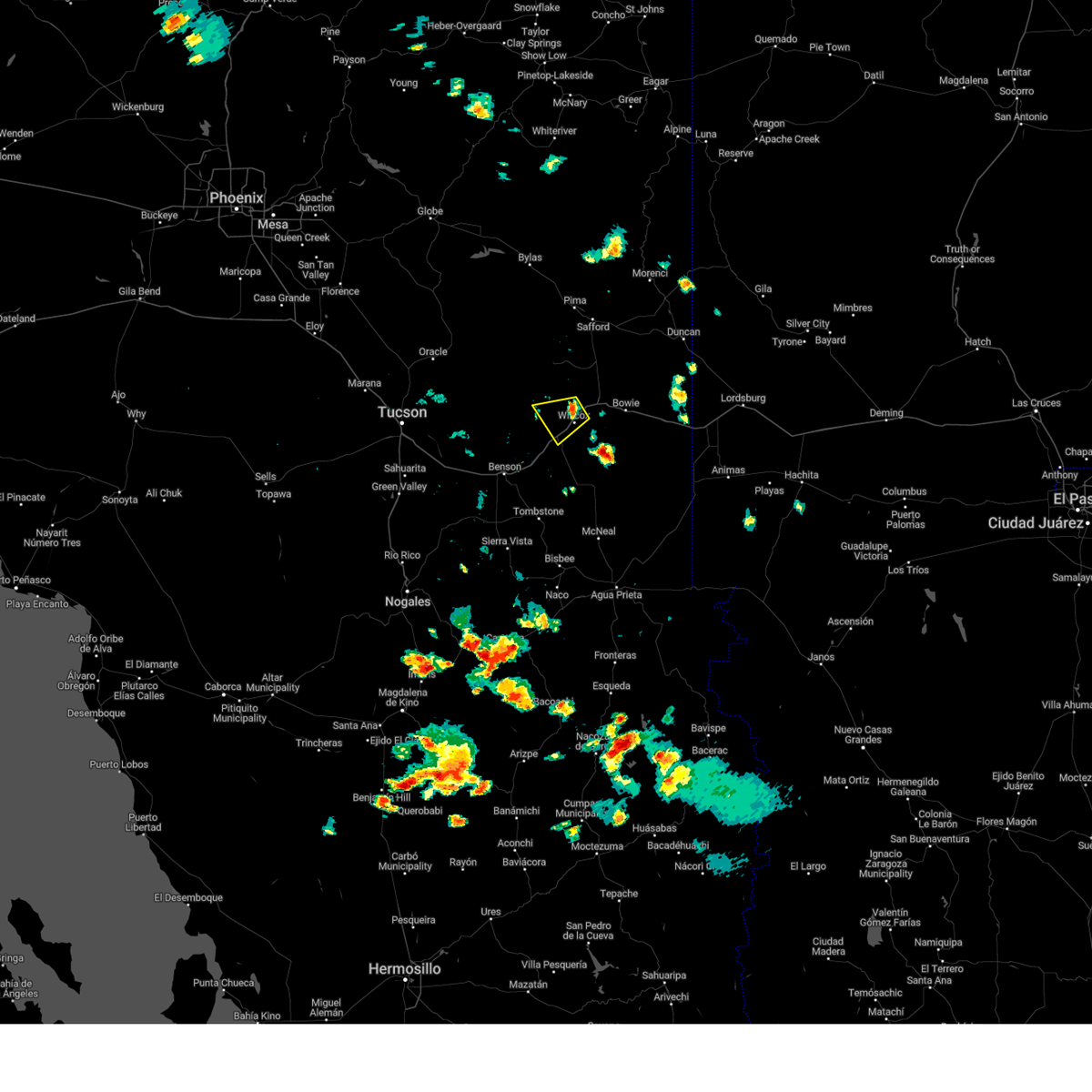
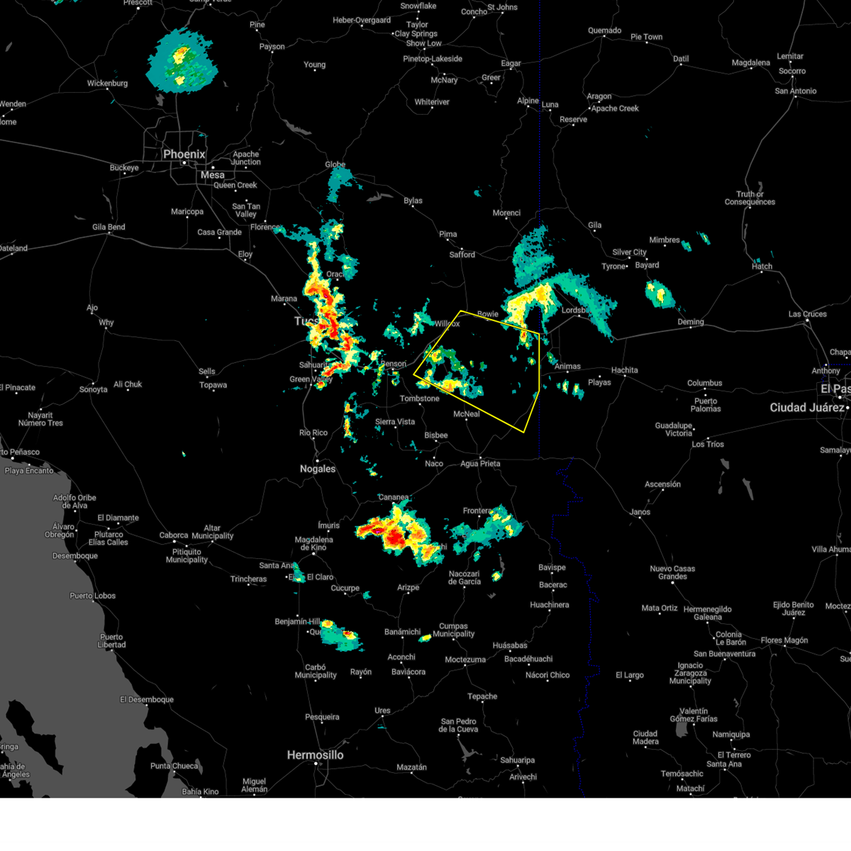
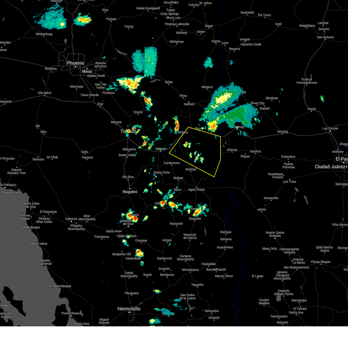
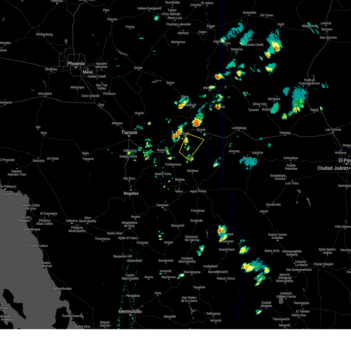
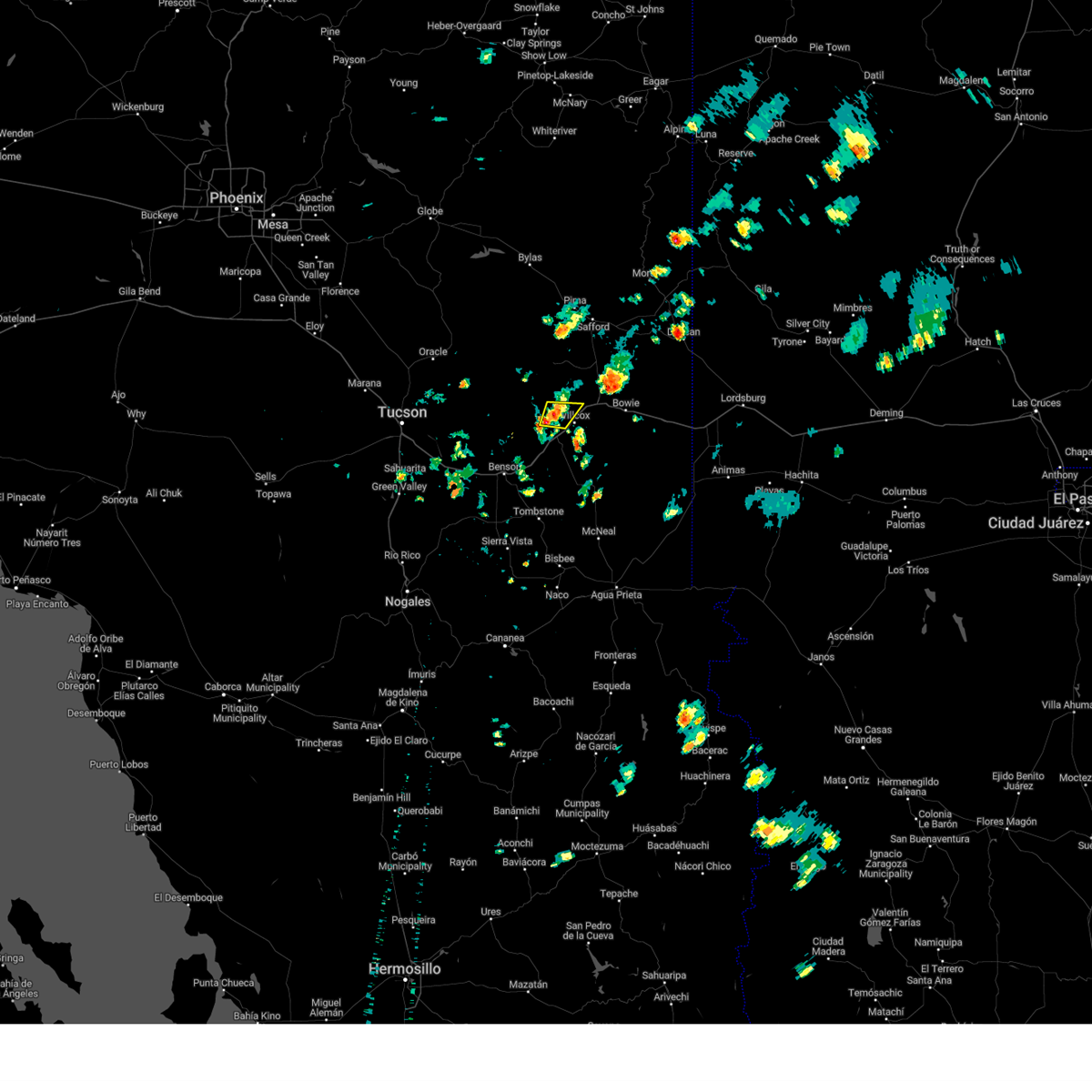
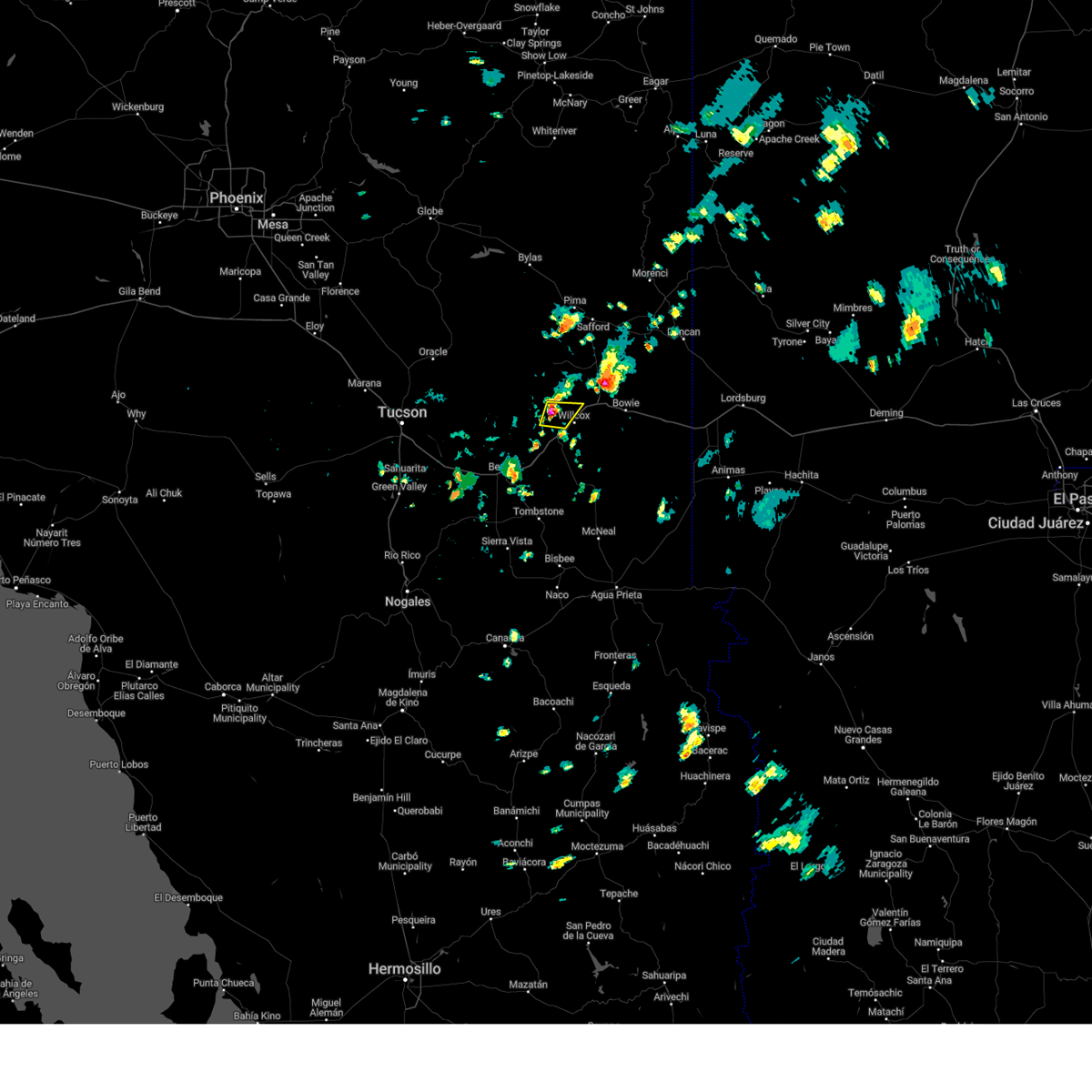
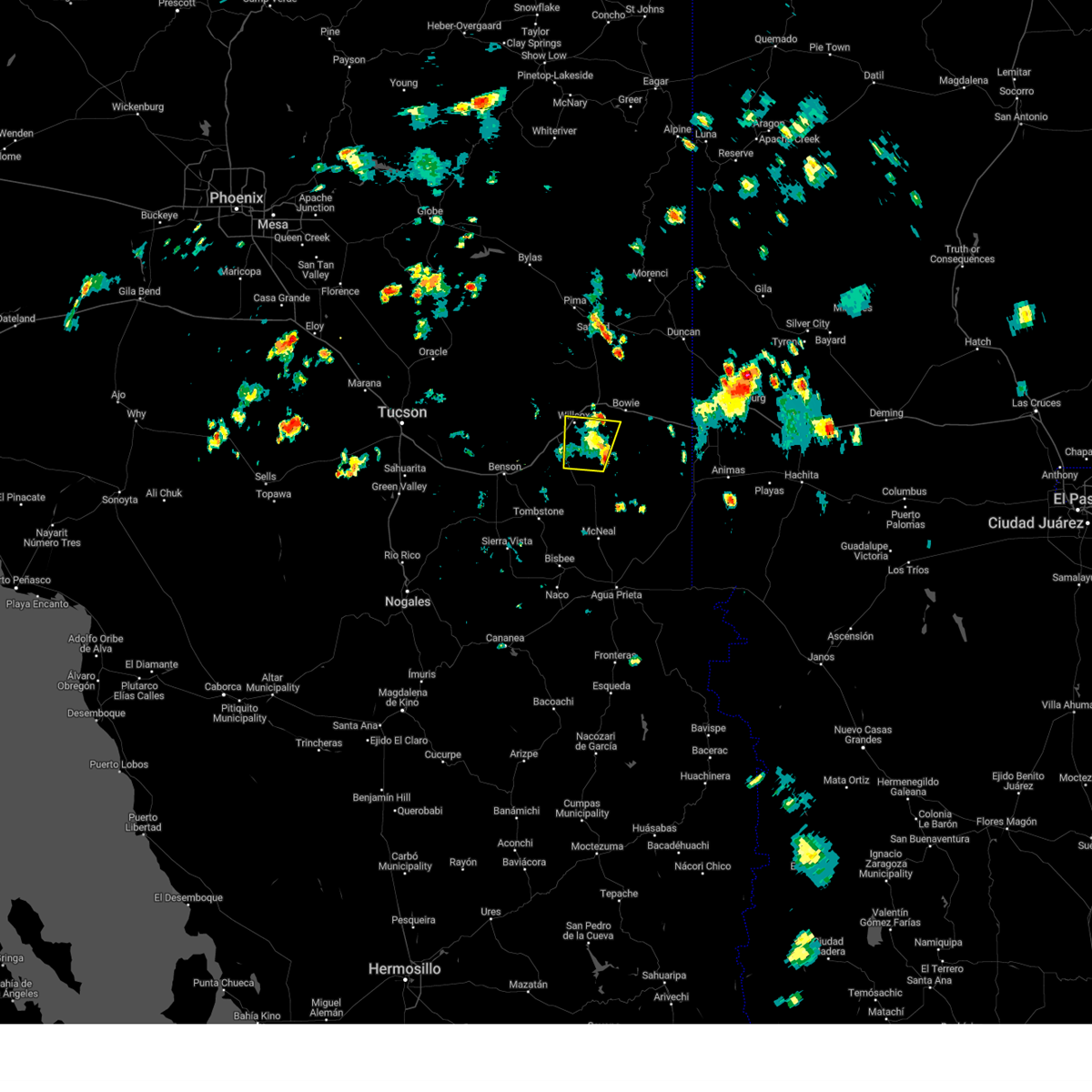
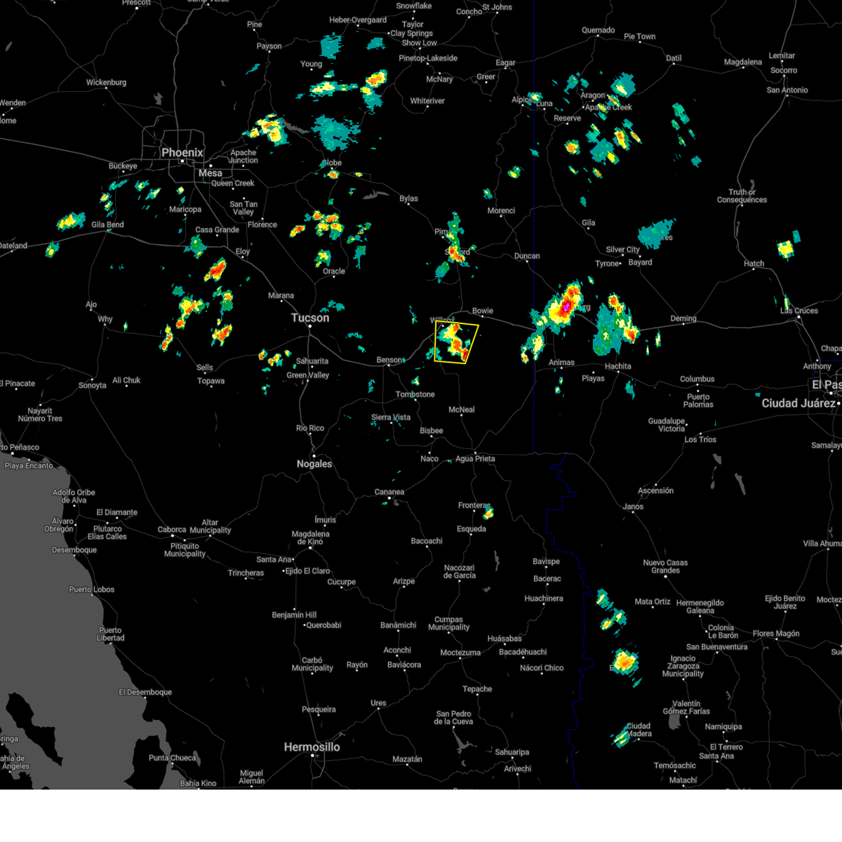
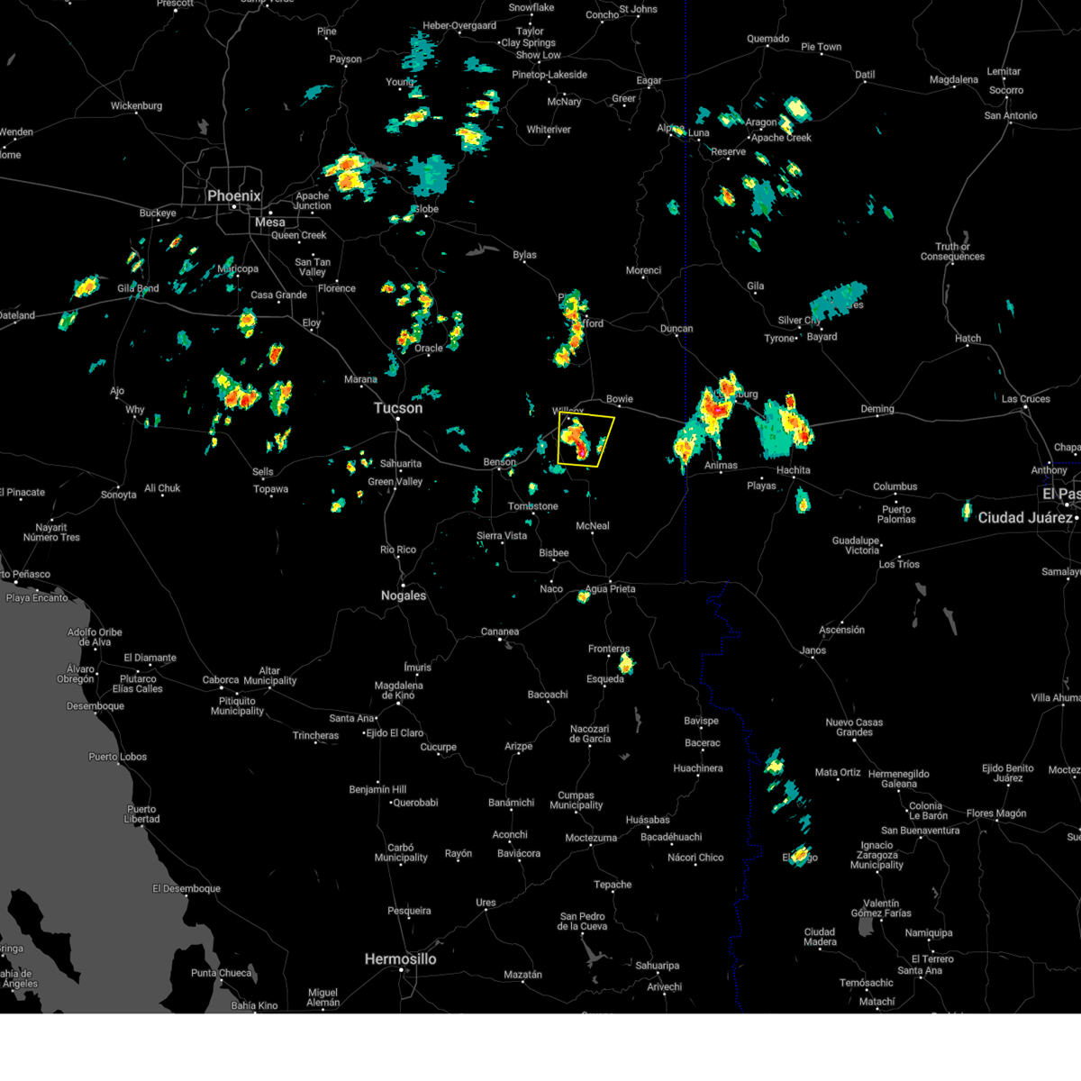
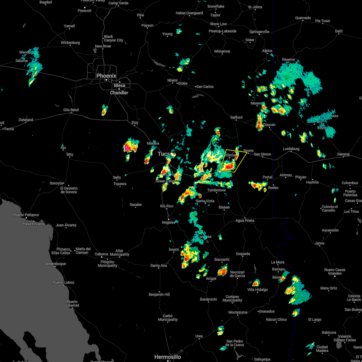
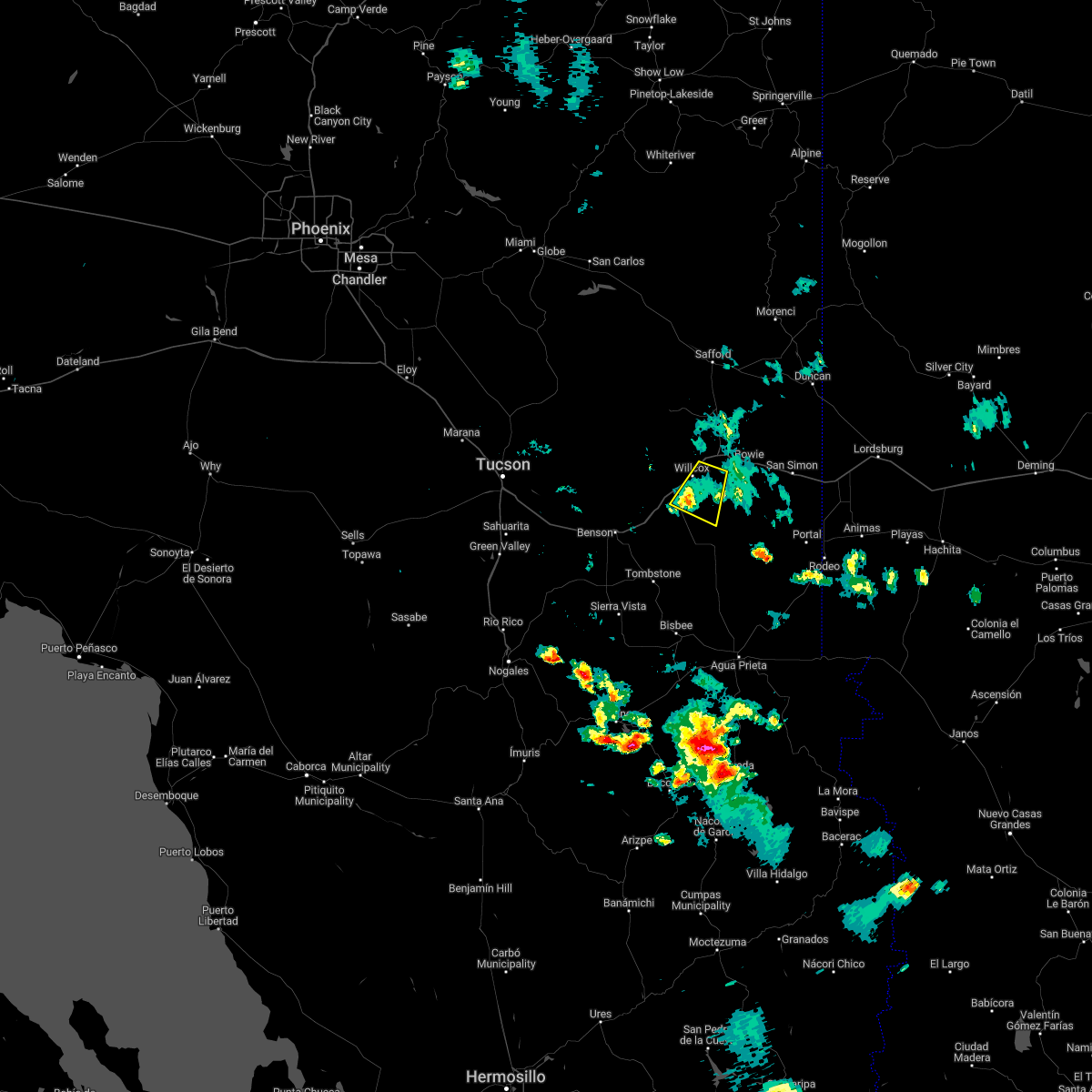
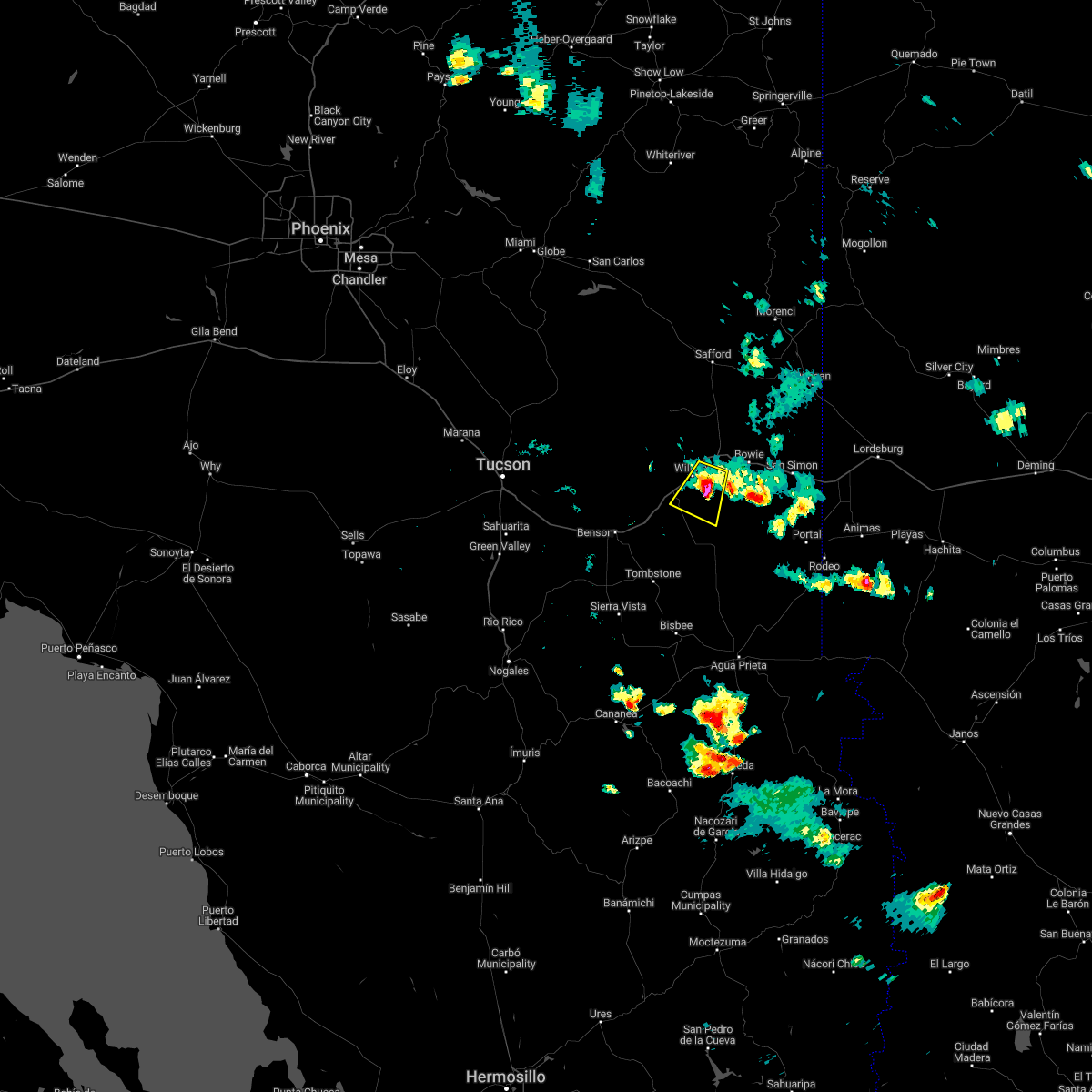
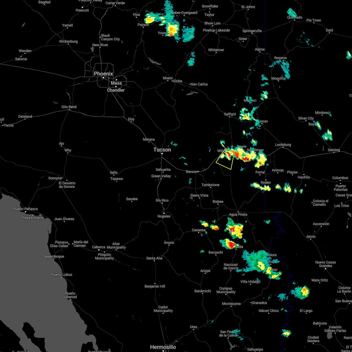
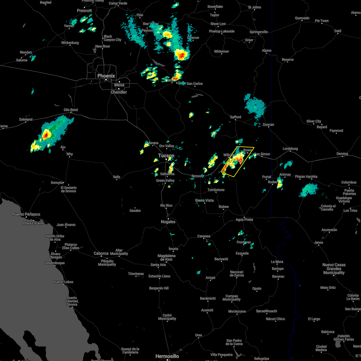
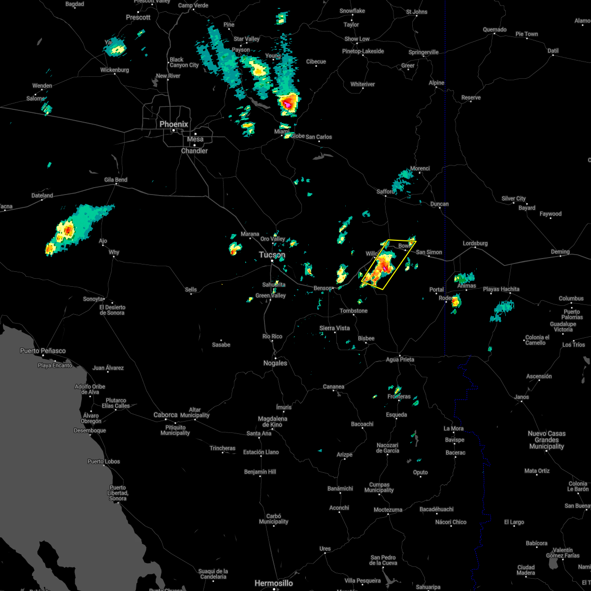
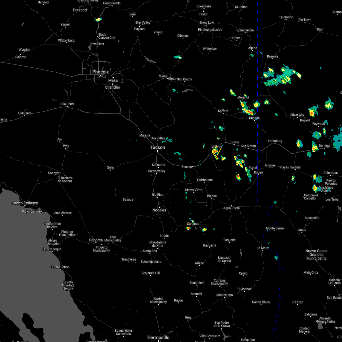
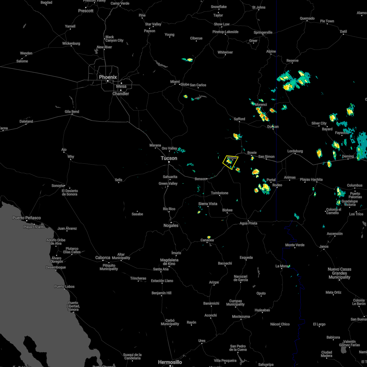
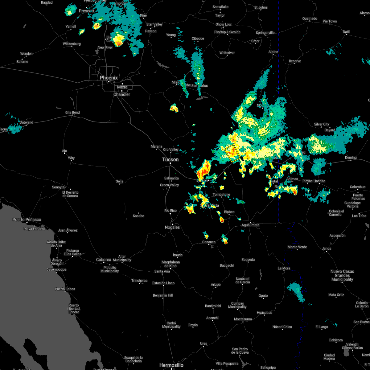
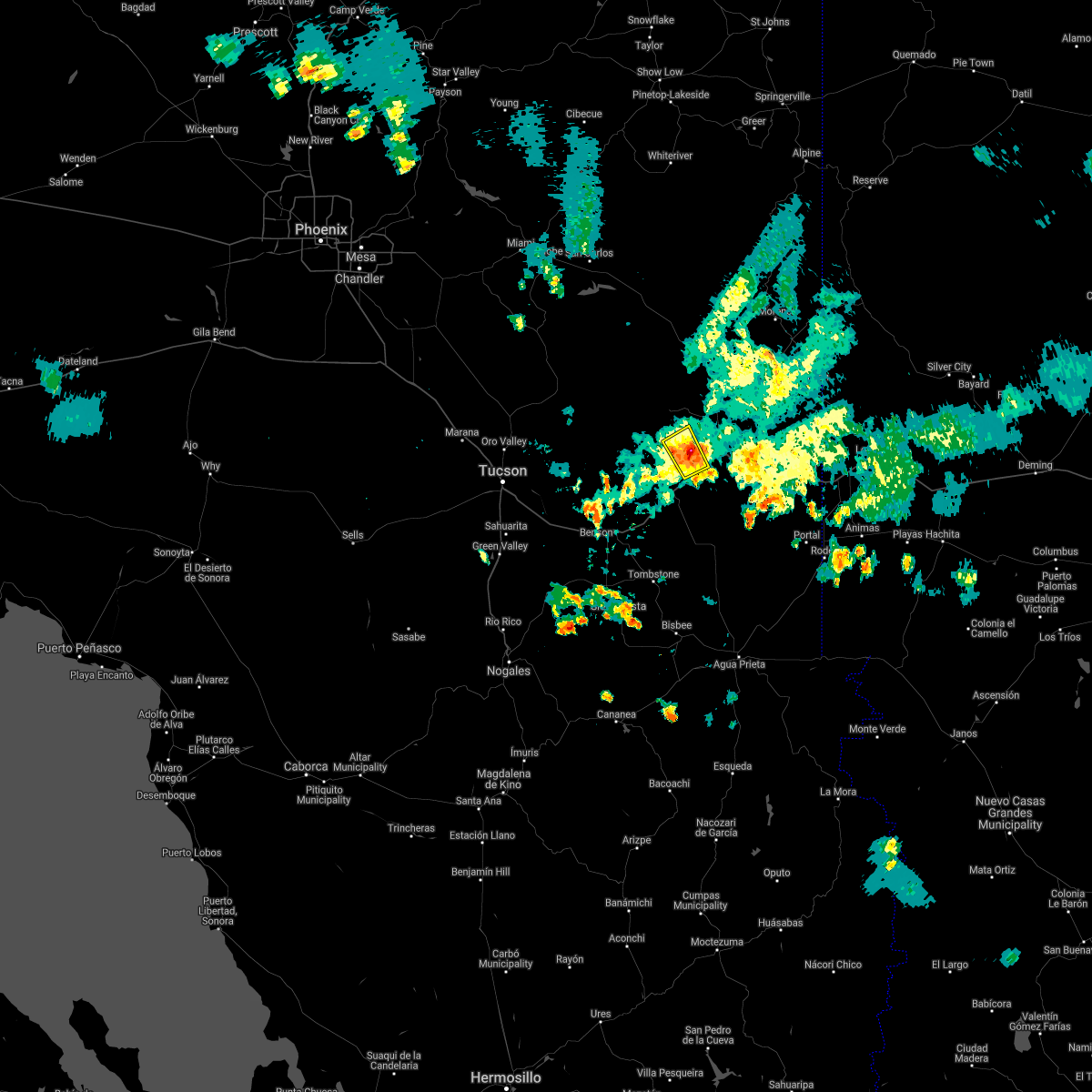
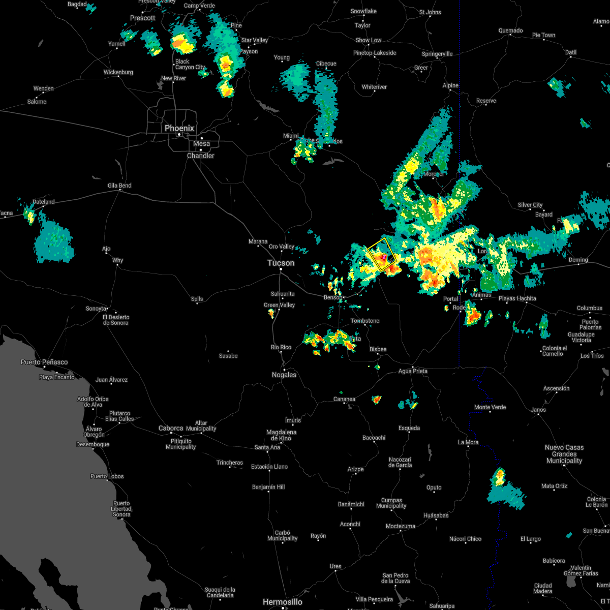
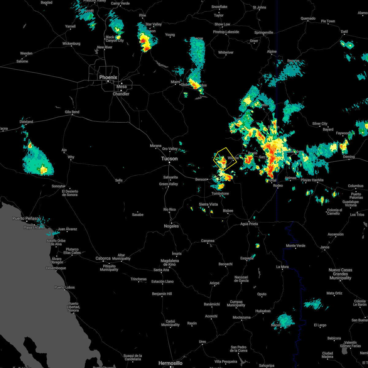
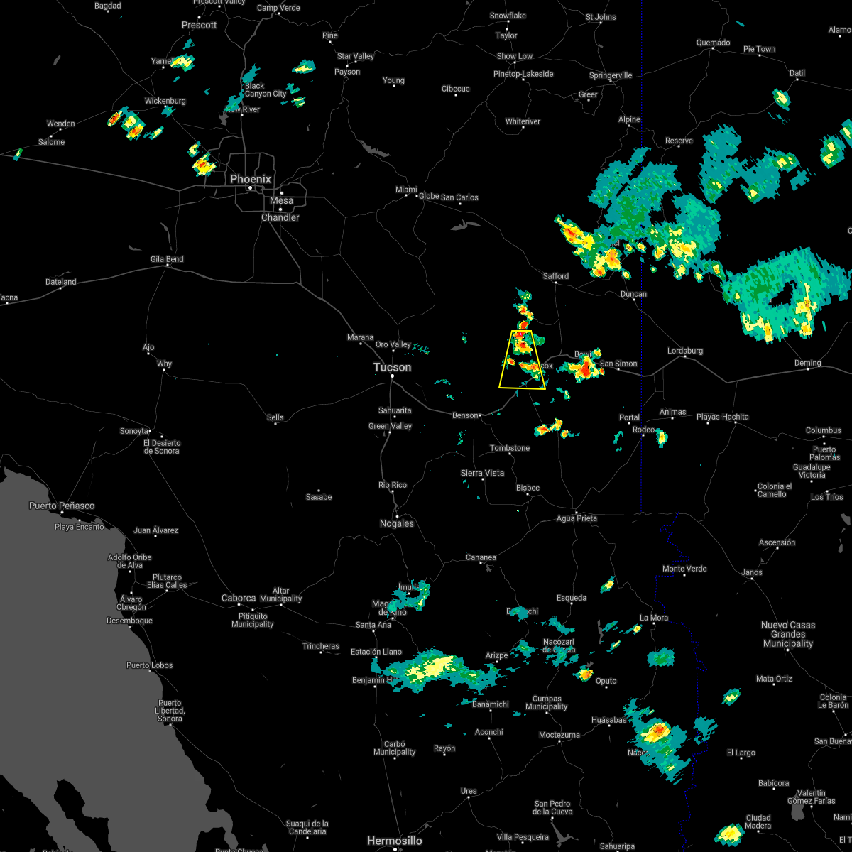
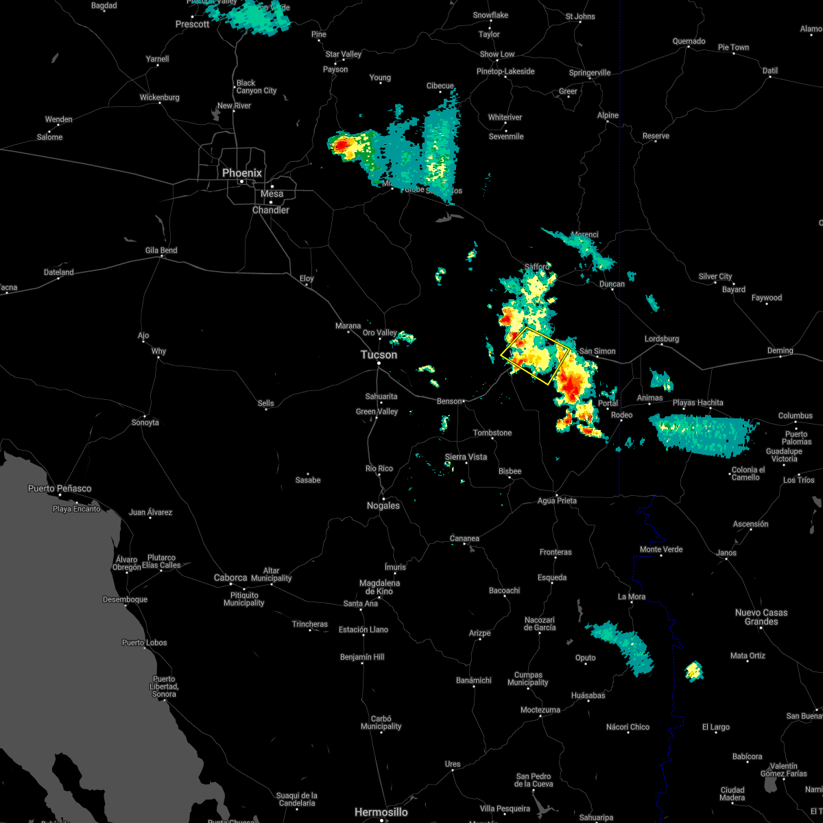
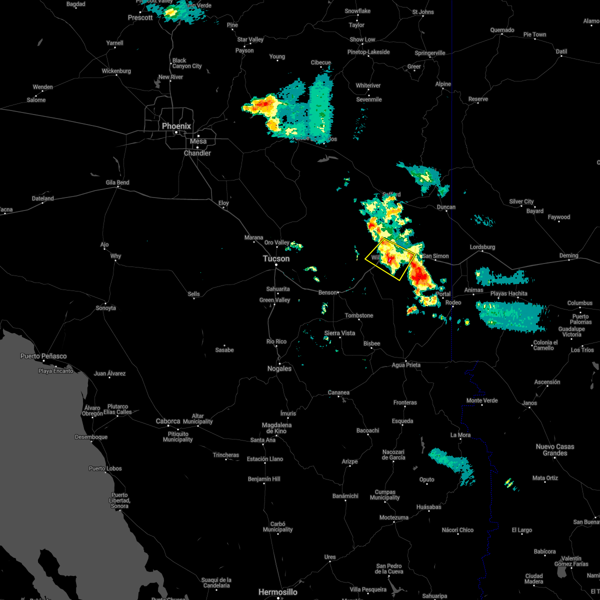
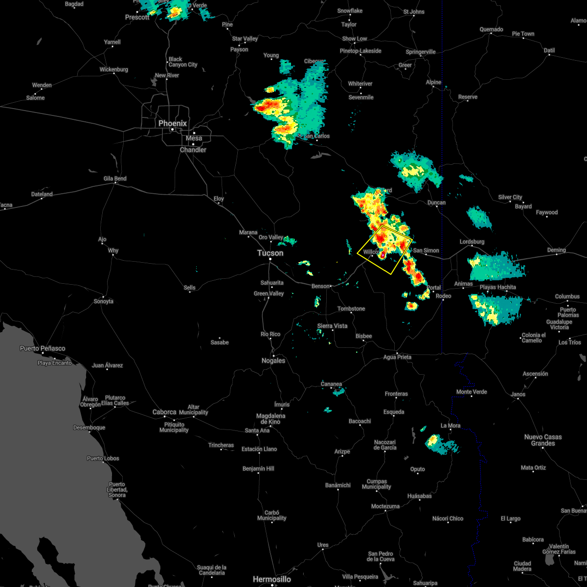
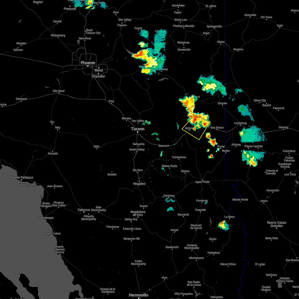
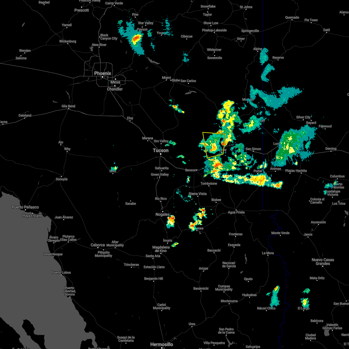
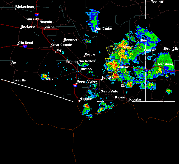
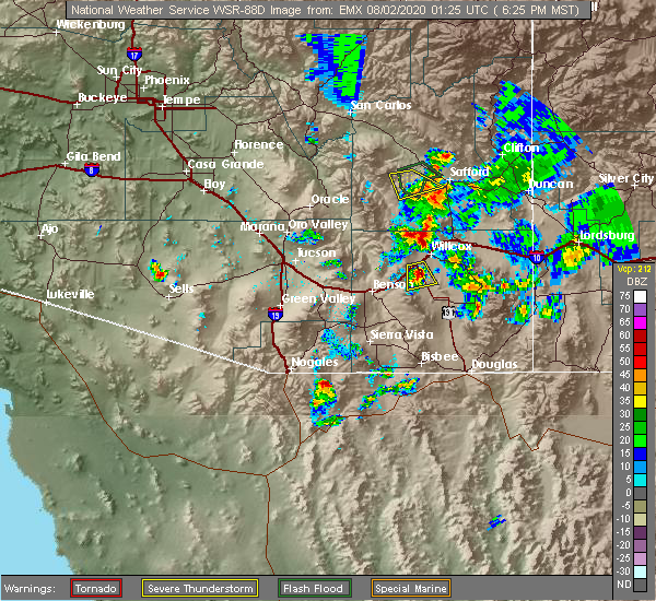
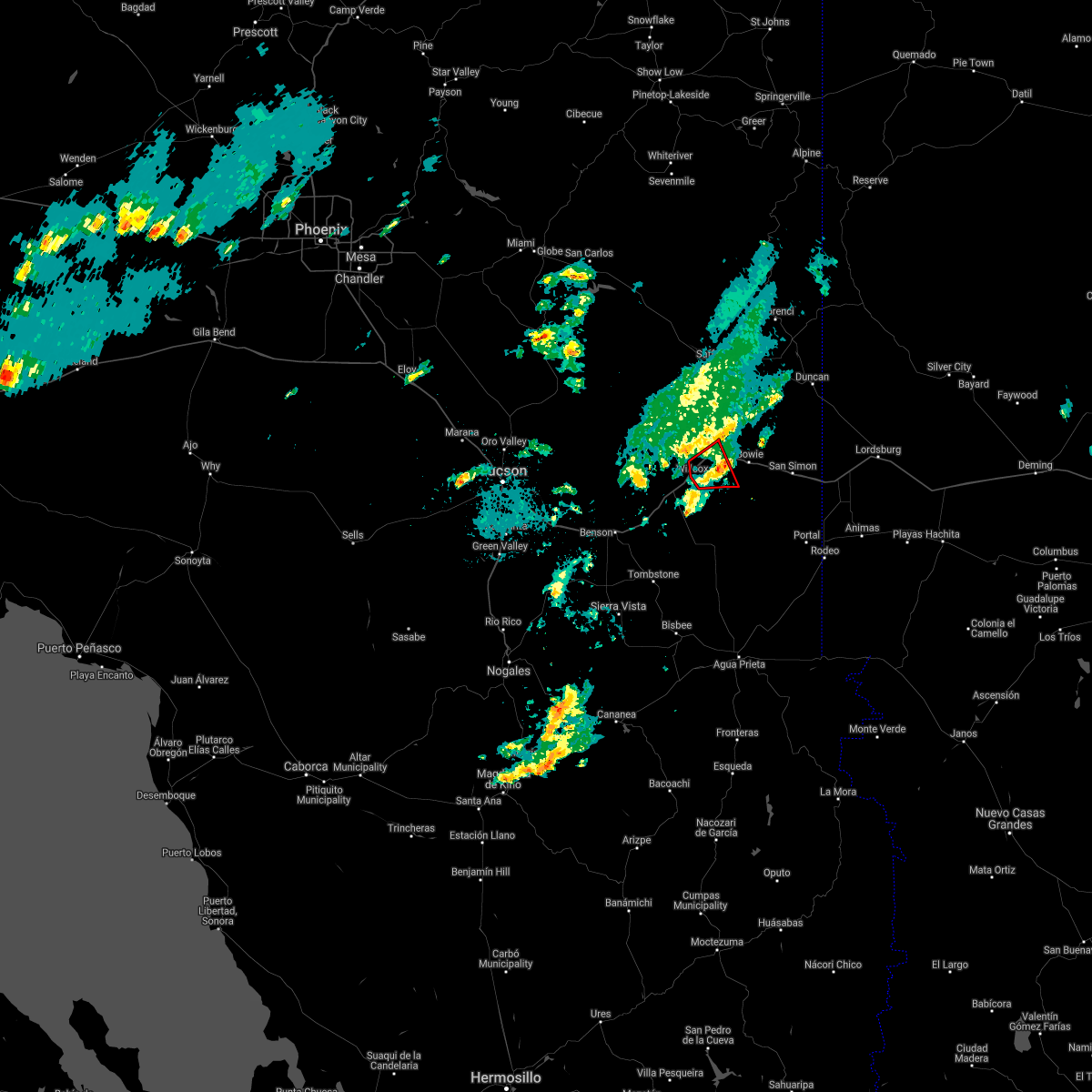
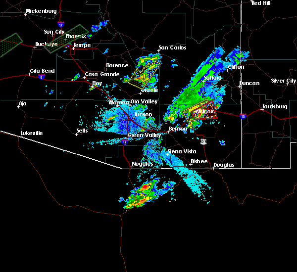
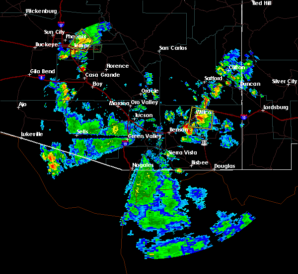
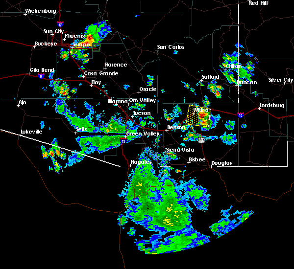
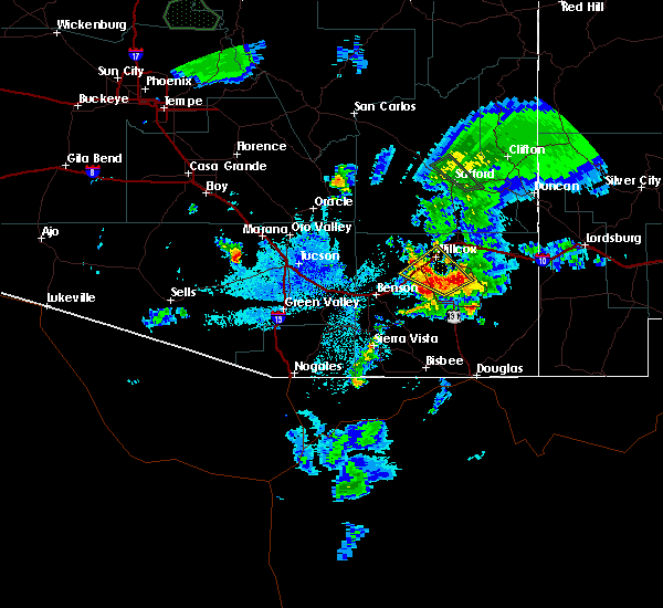
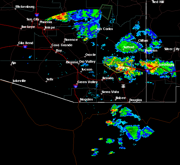
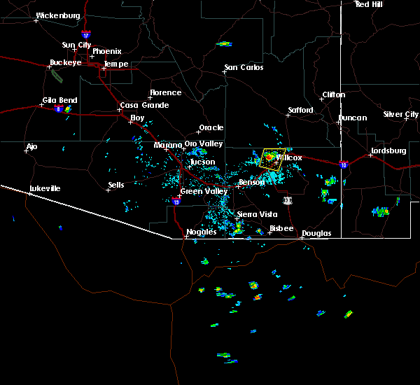
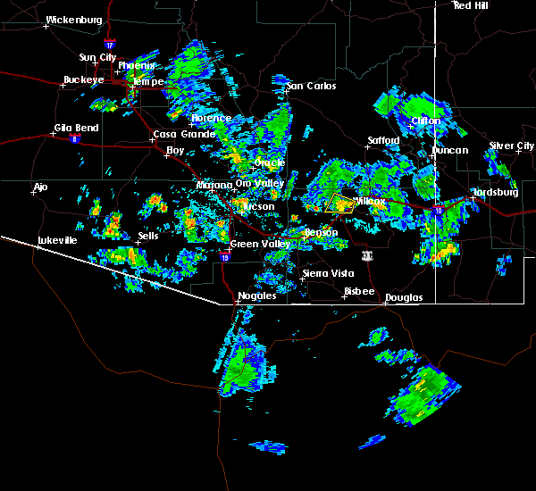
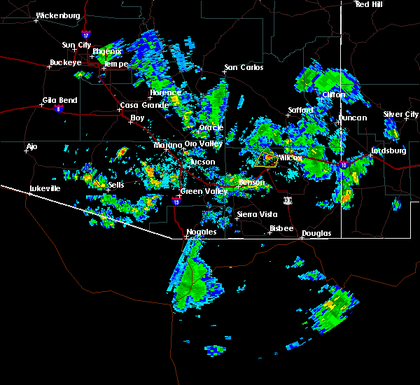
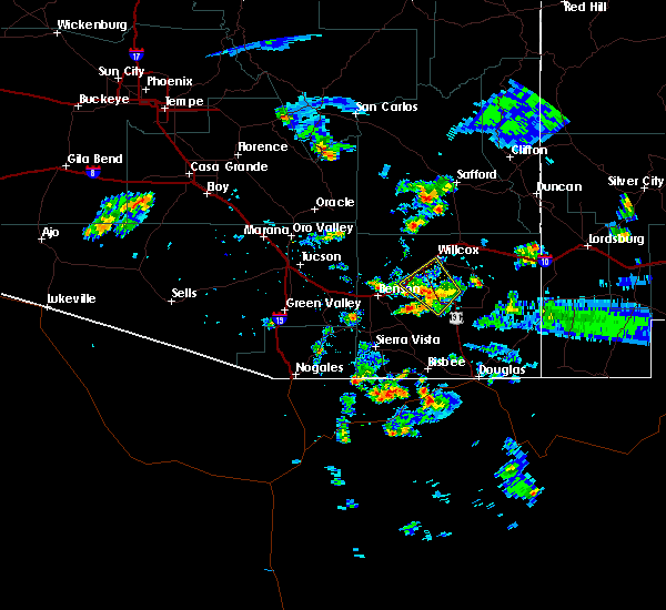
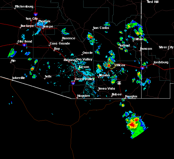
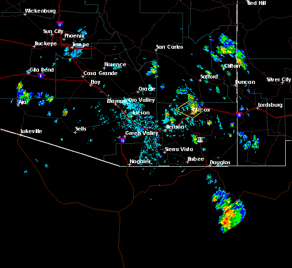
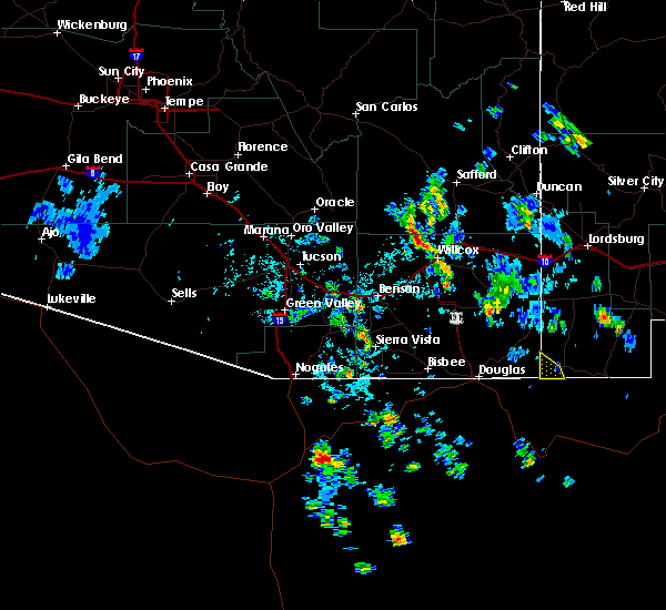
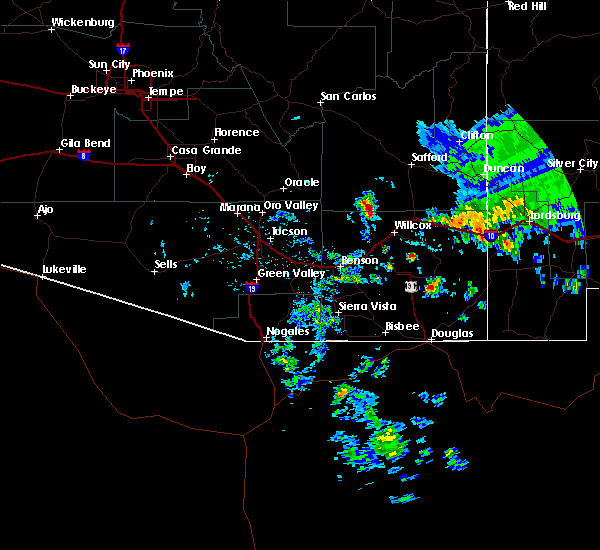
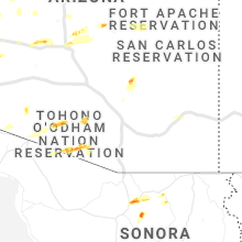
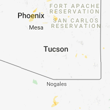
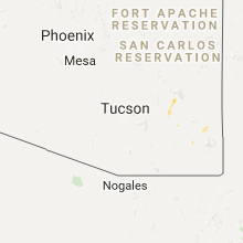
Hail Map for Willcox, AZ
The Willcox, AZ area has had 3 reports of on-the-ground hail by trained spotters, and has been under severe weather warnings 29 times during the past 12 months. Doppler radar has detected hail at or near Willcox, AZ on 30 occasions, including 6 occasions during the past year.
| Name: | Willcox, AZ |
| Where Located: | 64.5 miles NNW of Douglas, AZ |
| Map: | Google Map for Willcox, AZ |
| Population: | 3757 |
| Housing Units: | 1659 |
| More Info: | Search Google for Willcox, AZ |
2
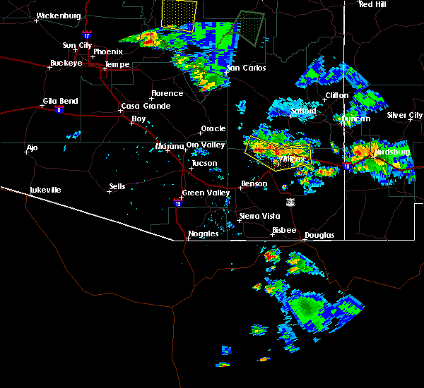
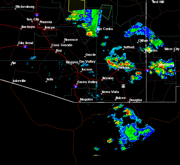
The Top Recent Hail Date for Willcox, AZ is Monday, July 15, 2024 (3rd out of 30)

Hail and Wind Damage Spotted near Willcox, AZ
| Date / Time | Report Details |
|---|---|
| 8/21/2024 4:10 PM MST |
 The storm which prompted the warning has weakened below severe limits, and no longer poses an immediate threat to life or property. therefore, the warning will be allowed to expire. however, gusty winds and heavy rain are still possible with this thunderstorm. remember, a severe thunderstorm warning still remains in effect for north central cochise county until 4:45 pm mst. The storm which prompted the warning has weakened below severe limits, and no longer poses an immediate threat to life or property. therefore, the warning will be allowed to expire. however, gusty winds and heavy rain are still possible with this thunderstorm. remember, a severe thunderstorm warning still remains in effect for north central cochise county until 4:45 pm mst.
|
| 8/21/2024 3:46 PM MST |
 At 345 pm mst, a severe thunderstorm was located near willcox, moving west at 15 mph (radar indicated). Hazards include 60 mph wind gusts and quarter size hail. Hail damage to vehicles is expected. expect wind damage to roofs, siding, and trees. locations impacted include, willcox. this includes the following highways, interstate 10 between mile markers 327 and 347. route 186 between mile markers 327 and 334. Route 191 between mile markers 63 and 66. At 345 pm mst, a severe thunderstorm was located near willcox, moving west at 15 mph (radar indicated). Hazards include 60 mph wind gusts and quarter size hail. Hail damage to vehicles is expected. expect wind damage to roofs, siding, and trees. locations impacted include, willcox. this includes the following highways, interstate 10 between mile markers 327 and 347. route 186 between mile markers 327 and 334. Route 191 between mile markers 63 and 66.
|
| 8/21/2024 3:28 PM MST | Personal weather station recorded gust to 58 mp in cochise county AZ, 11.3 miles SE of Willcox, AZ |
| 8/21/2024 3:26 PM MST |
 Svrtwc the national weather service in tucson has issued a * severe thunderstorm warning for, northwestern cochise county in southeastern arizona, * until 415 pm mst. * at 325 pm mst, severe thunderstorms were located over willcox, moving west at 15 mph (radar indicated). Hazards include 60 mph wind gusts and quarter size hail. Hail damage to vehicles is expected. Expect wind damage to roofs, siding, and trees. Svrtwc the national weather service in tucson has issued a * severe thunderstorm warning for, northwestern cochise county in southeastern arizona, * until 415 pm mst. * at 325 pm mst, severe thunderstorms were located over willcox, moving west at 15 mph (radar indicated). Hazards include 60 mph wind gusts and quarter size hail. Hail damage to vehicles is expected. Expect wind damage to roofs, siding, and trees.
|
| 8/21/2024 3:25 PM MST | Ping Pong Ball sized hail reported 1.8 miles SSE of Willcox, AZ, video on social media showing accumulating hail with the biggest hailstone being 1.5 inches in diameter. another video at same location showed damage to car windshield |
| 8/21/2024 3:05 PM MST |
 At 305 pm mst, a severe thunderstorm was located near willcox, moving south at 10 mph (radar indicated). Hazards include 60 mph wind gusts and quarter size hail. Hail damage to vehicles is expected. expect wind damage to roofs, siding, and trees. locations impacted include, willcox. this includes the following highways, interstate 10 between mile markers 340 and 354. route 186 near mile marker 327. Route 191 between mile markers 88 and 96. At 305 pm mst, a severe thunderstorm was located near willcox, moving south at 10 mph (radar indicated). Hazards include 60 mph wind gusts and quarter size hail. Hail damage to vehicles is expected. expect wind damage to roofs, siding, and trees. locations impacted include, willcox. this includes the following highways, interstate 10 between mile markers 340 and 354. route 186 near mile marker 327. Route 191 between mile markers 88 and 96.
|
| 8/21/2024 2:42 PM MST |
 Svrtwc the national weather service in tucson has issued a * severe thunderstorm warning for, south central graham county in southeastern arizona, north central cochise county in southeastern arizona, * until 330 pm mst. * at 242 pm mst, a severe thunderstorm was located 9 miles north of willcox, moving south at 10 mph (radar indicated). Hazards include 60 mph wind gusts and quarter size hail. Hail damage to vehicles is expected. Expect wind damage to roofs, siding, and trees. Svrtwc the national weather service in tucson has issued a * severe thunderstorm warning for, south central graham county in southeastern arizona, north central cochise county in southeastern arizona, * until 330 pm mst. * at 242 pm mst, a severe thunderstorm was located 9 miles north of willcox, moving south at 10 mph (radar indicated). Hazards include 60 mph wind gusts and quarter size hail. Hail damage to vehicles is expected. Expect wind damage to roofs, siding, and trees.
|
| 8/19/2024 5:01 PM MST |
 Svrtwc the national weather service in tucson has issued a * severe thunderstorm warning for, north central cochise county in southeastern arizona, * until 545 pm mst. * at 501 pm mst, a severe thunderstorm was located 8 miles northwest of willcox, moving southwest at 10 mph (radar indicated). Hazards include 60 mph wind gusts and quarter size hail. Hail damage to vehicles is expected. expect wind damage to roofs, siding, and trees. This severe thunderstorm will remain over mainly remote areas of north central cochise county. Svrtwc the national weather service in tucson has issued a * severe thunderstorm warning for, north central cochise county in southeastern arizona, * until 545 pm mst. * at 501 pm mst, a severe thunderstorm was located 8 miles northwest of willcox, moving southwest at 10 mph (radar indicated). Hazards include 60 mph wind gusts and quarter size hail. Hail damage to vehicles is expected. expect wind damage to roofs, siding, and trees. This severe thunderstorm will remain over mainly remote areas of north central cochise county.
|
| 8/19/2024 1:43 PM MST |
 Svrtwc the national weather service in tucson has issued a * severe thunderstorm warning for, north central cochise county in southeastern arizona, * until 230 pm mst. * at 142 pm mst, a severe thunderstorm was located 11 miles southeast of willcox, or near kansas settlement, moving west at 15 mph (radar indicated). Hazards include 60 mph wind gusts and quarter size hail. Hail damage to vehicles is expected. Expect wind damage to roofs, siding, and trees. Svrtwc the national weather service in tucson has issued a * severe thunderstorm warning for, north central cochise county in southeastern arizona, * until 230 pm mst. * at 142 pm mst, a severe thunderstorm was located 11 miles southeast of willcox, or near kansas settlement, moving west at 15 mph (radar indicated). Hazards include 60 mph wind gusts and quarter size hail. Hail damage to vehicles is expected. Expect wind damage to roofs, siding, and trees.
|
| 7/28/2024 3:06 PM MST |
 The storm which prompted the warning has weakened below severe limits, and has exited the warned area. therefore, the warning will be allowed to expire. however, heavy rain is still possible with this thunderstorm. The storm which prompted the warning has weakened below severe limits, and has exited the warned area. therefore, the warning will be allowed to expire. however, heavy rain is still possible with this thunderstorm.
|
| 7/28/2024 2:49 PM MST |
 At 248 pm mst, a severe thunderstorm was located near willcox, moving northeast at 5 mph (public). Hazards include 60 mph wind gusts and quarter size hail. Hail damage to vehicles is expected. expect wind damage to roofs, siding, and trees. locations impacted include, willcox. this includes the following highways, interstate 10 between mile markers 339 and 349. Route 186 between mile markers 327 and 330. At 248 pm mst, a severe thunderstorm was located near willcox, moving northeast at 5 mph (public). Hazards include 60 mph wind gusts and quarter size hail. Hail damage to vehicles is expected. expect wind damage to roofs, siding, and trees. locations impacted include, willcox. this includes the following highways, interstate 10 between mile markers 339 and 349. Route 186 between mile markers 327 and 330.
|
| 7/28/2024 2:45 PM MST | Power pole down on circle i between jonnie drive and iron rose r in cochise county AZ, 2.2 miles S of Willcox, AZ |
| 7/28/2024 2:40 PM MST | Quarter sized hail reported 3.6 miles SE of Willcox, AZ, relayed via social media. |
| 7/28/2024 2:33 PM MST |
 Svrtwc the national weather service in tucson has issued a * severe thunderstorm warning for, north central cochise county in southeastern arizona, * until 315 pm mst. * at 233 pm mst, a severe thunderstorm was located near willcox, and is nearly stationary (radar indicated). Hazards include 60 mph wind gusts and quarter size hail. Hail damage to vehicles is expected. Expect wind damage to roofs, siding, and trees. Svrtwc the national weather service in tucson has issued a * severe thunderstorm warning for, north central cochise county in southeastern arizona, * until 315 pm mst. * at 233 pm mst, a severe thunderstorm was located near willcox, and is nearly stationary (radar indicated). Hazards include 60 mph wind gusts and quarter size hail. Hail damage to vehicles is expected. Expect wind damage to roofs, siding, and trees.
|
| 7/21/2024 5:26 PM MST |
 The storm which prompted the warning has weakened below severe limits, and no longer poses an immediate threat to life or property. therefore, the warning will be allowed to expire. The storm which prompted the warning has weakened below severe limits, and no longer poses an immediate threat to life or property. therefore, the warning will be allowed to expire.
|
| 7/21/2024 4:46 PM MST |
 Svrtwc the national weather service in tucson has issued a * severe thunderstorm warning for, north central cochise county in southeastern arizona, * until 530 pm mst. * at 446 pm mst, a severe thunderstorm was located near willcox, moving southwest at 15 mph (radar indicated). Hazards include 60 mph wind gusts. expect damage to roofs, siding, and trees Svrtwc the national weather service in tucson has issued a * severe thunderstorm warning for, north central cochise county in southeastern arizona, * until 530 pm mst. * at 446 pm mst, a severe thunderstorm was located near willcox, moving southwest at 15 mph (radar indicated). Hazards include 60 mph wind gusts. expect damage to roofs, siding, and trees
|
| 7/21/2024 4:22 PM MST |
 Svrtwc the national weather service in tucson has issued a * severe thunderstorm warning for, south central graham county in southeastern arizona, north central cochise county in southeastern arizona, * until 500 pm mst. * at 421 pm mst, a severe thunderstorm was located 12 miles northeast of willcox, moving south at 15 mph (radar indicated). Hazards include 60 mph wind gusts. expect damage to roofs, siding, and trees Svrtwc the national weather service in tucson has issued a * severe thunderstorm warning for, south central graham county in southeastern arizona, north central cochise county in southeastern arizona, * until 500 pm mst. * at 421 pm mst, a severe thunderstorm was located 12 miles northeast of willcox, moving south at 15 mph (radar indicated). Hazards include 60 mph wind gusts. expect damage to roofs, siding, and trees
|
| 7/20/2024 6:22 PM MST |
 The storm which prompted the warning near willcox has weakened below severe limits. therefore, the warning will be allowed to expire. however, gusty winds and heavy rain are still possible with this thunderstorm. The storm which prompted the warning near willcox has weakened below severe limits. therefore, the warning will be allowed to expire. however, gusty winds and heavy rain are still possible with this thunderstorm.
|
| 7/20/2024 6:05 PM MST |
 At 605 pm mst, a severe thunderstorm was located 5 miles west of willcox, moving south at 10 mph (radar indicated). Hazards include 60 mph wind gusts. Expect damage to roofs, siding, and trees. locations impacted include, willcox. this includes the following highways, interstate 10 between mile markers 328 and 340. route 186 between mile markers 327 and 330. Route 191 between mile markers 62 and 66. At 605 pm mst, a severe thunderstorm was located 5 miles west of willcox, moving south at 10 mph (radar indicated). Hazards include 60 mph wind gusts. Expect damage to roofs, siding, and trees. locations impacted include, willcox. this includes the following highways, interstate 10 between mile markers 328 and 340. route 186 between mile markers 327 and 330. Route 191 between mile markers 62 and 66.
|
| 7/20/2024 5:39 PM MST |
 Svrtwc the national weather service in tucson has issued a * severe thunderstorm warning for, northwestern cochise county in southeastern arizona, * until 630 pm mst. * at 538 pm mst, a severe thunderstorm was located 7 miles northwest of willcox, moving south at 10 mph (radar indicated). Hazards include 60 mph wind gusts. expect damage to roofs, siding, and trees Svrtwc the national weather service in tucson has issued a * severe thunderstorm warning for, northwestern cochise county in southeastern arizona, * until 630 pm mst. * at 538 pm mst, a severe thunderstorm was located 7 miles northwest of willcox, moving south at 10 mph (radar indicated). Hazards include 60 mph wind gusts. expect damage to roofs, siding, and trees
|
| 7/20/2024 5:19 PM MST |
 At 519 pm mst, severe thunderstorms were located along a line extending from near willcox to chiricahua national monument, moving southwest at 15 mph (radar indicated). Hazards include 60 mph wind gusts. Expect damage to roofs, siding, and trees. locations impacted include, willcox, chiricahua national monument, sunizona, and kansas settlement. this includes the following highways, interstate 10 between mile markers 333 and 358. route 181 between mile markers 39 and 64. route 186 between mile markers 327 and 359. Route 191 between mile markers 37 and 40, and between mile markers 88 and 91. At 519 pm mst, severe thunderstorms were located along a line extending from near willcox to chiricahua national monument, moving southwest at 15 mph (radar indicated). Hazards include 60 mph wind gusts. Expect damage to roofs, siding, and trees. locations impacted include, willcox, chiricahua national monument, sunizona, and kansas settlement. this includes the following highways, interstate 10 between mile markers 333 and 358. route 181 between mile markers 39 and 64. route 186 between mile markers 327 and 359. Route 191 between mile markers 37 and 40, and between mile markers 88 and 91.
|
| 7/20/2024 4:53 PM MST |
 Svrtwc the national weather service in tucson has issued a * severe thunderstorm warning for, northeastern cochise county in southeastern arizona, * until 545 pm mst. * at 453 pm mst, severe thunderstorms were located along a line extending from 10 miles west of bowie to near chiricahua national monument, moving west and southwest at 15 mph (radar indicated). Hazards include 60 mph wind gusts. expect damage to roofs, siding, and trees Svrtwc the national weather service in tucson has issued a * severe thunderstorm warning for, northeastern cochise county in southeastern arizona, * until 545 pm mst. * at 453 pm mst, severe thunderstorms were located along a line extending from 10 miles west of bowie to near chiricahua national monument, moving west and southwest at 15 mph (radar indicated). Hazards include 60 mph wind gusts. expect damage to roofs, siding, and trees
|
| 7/16/2024 5:51 PM MST |
 The storm which prompted the warning has weakened below severe limits, and no longer poses an immediate threat to life or property. therefore, the warning will be allowed to expire. remember, a severe thunderstorm warning still remains in effect for north central cochise county until 6:30 pm mst. The storm which prompted the warning has weakened below severe limits, and no longer poses an immediate threat to life or property. therefore, the warning will be allowed to expire. remember, a severe thunderstorm warning still remains in effect for north central cochise county until 6:30 pm mst.
|
| 7/16/2024 5:34 PM MST |
 At 533 pm mst, a severe thunderstorm was located 9 miles southeast of willcox, moving west at 10 mph (radar indicated). Hazards include 60 mph wind gusts and nickel size hail. Expect damage to roofs, siding, and trees. locations impacted include, willcox. this includes the following highways, interstate 10 between mile markers 339 and 344. Route 186 between mile markers 327 and 345. At 533 pm mst, a severe thunderstorm was located 9 miles southeast of willcox, moving west at 10 mph (radar indicated). Hazards include 60 mph wind gusts and nickel size hail. Expect damage to roofs, siding, and trees. locations impacted include, willcox. this includes the following highways, interstate 10 between mile markers 339 and 344. Route 186 between mile markers 327 and 345.
|
| 7/16/2024 5:17 PM MST |
 Svrtwc the national weather service in tucson has issued a * severe thunderstorm warning for, north central cochise county in southeastern arizona, * until 600 pm mst. * at 517 pm mst, a severe thunderstorm was located 11 miles east of willcox, moving west at 10 mph (radar indicated). Hazards include 60 mph wind gusts and nickel size hail. expect damage to roofs, siding, and trees Svrtwc the national weather service in tucson has issued a * severe thunderstorm warning for, north central cochise county in southeastern arizona, * until 600 pm mst. * at 517 pm mst, a severe thunderstorm was located 11 miles east of willcox, moving west at 10 mph (radar indicated). Hazards include 60 mph wind gusts and nickel size hail. expect damage to roofs, siding, and trees
|
| 7/15/2024 4:00 PM MST |
 At 400 pm mst, severe thunderstorms were located along a line extending from near pearce-sunsites through cochise to 14 miles northwest of willcox, moving west at 10 mph (radar indicated). Hazards include 70 mph wind gusts and quarter size hail. Hail damage to vehicles is expected. expect considerable tree damage. wind damage is also likely to mobile homes, roofs, and outbuildings. locations impacted include, willcox, dragoon, pearce-sunsites, cochise, texas canyon, and kansas settlement. this includes the following highways, interstate 10 between mile markers 315 and 345. route 186 between mile markers 327 and 336. Route 191 between mile markers 49 and 66. At 400 pm mst, severe thunderstorms were located along a line extending from near pearce-sunsites through cochise to 14 miles northwest of willcox, moving west at 10 mph (radar indicated). Hazards include 70 mph wind gusts and quarter size hail. Hail damage to vehicles is expected. expect considerable tree damage. wind damage is also likely to mobile homes, roofs, and outbuildings. locations impacted include, willcox, dragoon, pearce-sunsites, cochise, texas canyon, and kansas settlement. this includes the following highways, interstate 10 between mile markers 315 and 345. route 186 between mile markers 327 and 336. Route 191 between mile markers 49 and 66.
|
| 7/15/2024 3:51 PM MST |
 The storm which prompted the warning has moved out of the area. therefore, the warning will be allowed to expire. remember, a severe thunderstorm warning still remains in effect for portions of cochise county until 4:45 pm mst. The storm which prompted the warning has moved out of the area. therefore, the warning will be allowed to expire. remember, a severe thunderstorm warning still remains in effect for portions of cochise county until 4:45 pm mst.
|
| 7/15/2024 3:44 PM MST |
 Svrtwc the national weather service in tucson has issued a * severe thunderstorm warning for, northwestern cochise county in southeastern arizona, * until 445 pm mst. * at 344 pm mst, a severe thunderstorm was located near and south of willcox, moving west at 10 mph (radar indicated). Hazards include 70 mph wind gusts and quarter size hail. Hail damage to vehicles is expected. expect considerable tree damage. Wind damage is also likely to mobile homes, roofs, and outbuildings. Svrtwc the national weather service in tucson has issued a * severe thunderstorm warning for, northwestern cochise county in southeastern arizona, * until 445 pm mst. * at 344 pm mst, a severe thunderstorm was located near and south of willcox, moving west at 10 mph (radar indicated). Hazards include 70 mph wind gusts and quarter size hail. Hail damage to vehicles is expected. expect considerable tree damage. Wind damage is also likely to mobile homes, roofs, and outbuildings.
|
| 7/15/2024 3:36 PM MST | At 335 pm mst, a severe thunderstorm was located 7 miles southwest of willcox, moving west at 15 mph (radar indicated). Hazards include 70 mph wind gusts and quarter size hail. Hail damage to vehicles is expected. expect considerable tree damage. wind damage is also likely to mobile homes, roofs, and outbuildings. locations impacted include, willcox, cochise, and kansas settlement. this includes the following highways, route 186 between mile markers 329 and 340. Route 191 between mile markers 61 and 65. |
| 7/15/2024 3:11 PM MST | Svrtwc the national weather service in tucson has issued a * severe thunderstorm warning for, north central cochise county in southeastern arizona, * until 400 pm mst. * at 311 pm mst, a severe thunderstorm was located near willcox, moving west at 15 mph (radar indicated). Hazards include 60 mph wind gusts and quarter size hail. Hail damage to vehicles is expected. Expect wind damage to roofs, siding, and trees. |
| 7/15/2024 2:49 PM MST |
 Svrtwc the national weather service in tucson has issued a * severe thunderstorm warning for, north central cochise county in southeastern arizona, * until 330 pm mst. * at 248 pm mst, a severe thunderstorm was located near willcox, moving southwest at 10 mph (radar indicated). Hazards include 60 mph wind gusts and penny size hail. expect damage to roofs, siding, and trees Svrtwc the national weather service in tucson has issued a * severe thunderstorm warning for, north central cochise county in southeastern arizona, * until 330 pm mst. * at 248 pm mst, a severe thunderstorm was located near willcox, moving southwest at 10 mph (radar indicated). Hazards include 60 mph wind gusts and penny size hail. expect damage to roofs, siding, and trees
|
| 7/11/2024 5:04 PM MST |
 the severe thunderstorm warning has been cancelled and is no longer in effect the severe thunderstorm warning has been cancelled and is no longer in effect
|
| 7/11/2024 4:12 PM MST |
 Svrtwc the national weather service in tucson has issued a * severe thunderstorm warning for, northeastern cochise county in southeastern arizona, * until 515 pm mst. * at 411 pm mst, severe thunderstorms were located along a line extending from 9 miles east of willcox to 7 miles north of portal, moving southwest at 15 mph (radar indicated). Hazards include 60 mph wind gusts and areas of blowing dust. expect damage to roofs, siding, and trees Svrtwc the national weather service in tucson has issued a * severe thunderstorm warning for, northeastern cochise county in southeastern arizona, * until 515 pm mst. * at 411 pm mst, severe thunderstorms were located along a line extending from 9 miles east of willcox to 7 miles north of portal, moving southwest at 15 mph (radar indicated). Hazards include 60 mph wind gusts and areas of blowing dust. expect damage to roofs, siding, and trees
|
| 7/2/2024 3:05 PM MST |
 The storm which prompted the warning has weakened below severe limits, and no longer poses an immediate threat to life or property. therefore, the warning will be allowed to expire. The storm which prompted the warning has weakened below severe limits, and no longer poses an immediate threat to life or property. therefore, the warning will be allowed to expire.
|
| 7/2/2024 2:49 PM MST |
 At 249 pm mst, a severe thunderstorm was located 8 miles east of pearce-sunsites, or 18 miles south of willcox, moving northeast at 20 mph (radar indicated). Hazards include 60 mph wind gusts and quarter size hail. Hail damage to vehicles is expected. expect wind damage to roofs, siding, and trees. locations impacted include, pearce-sunsites and kansas settlement. this includes the following highways, route 186 between mile markers 330 and 351. Route 191 between mile markers 39 and 57. At 249 pm mst, a severe thunderstorm was located 8 miles east of pearce-sunsites, or 18 miles south of willcox, moving northeast at 20 mph (radar indicated). Hazards include 60 mph wind gusts and quarter size hail. Hail damage to vehicles is expected. expect wind damage to roofs, siding, and trees. locations impacted include, pearce-sunsites and kansas settlement. this includes the following highways, route 186 between mile markers 330 and 351. Route 191 between mile markers 39 and 57.
|
| 7/2/2024 2:31 PM MST |
 Svrtwc the national weather service in tucson has issued a * severe thunderstorm warning for, north central cochise county in southeastern arizona, * until 315 pm mst. * at 230 pm mst, a severe thunderstorm was located near pearce-sunsites, or 17 miles south of willcox, moving northeast at 25 mph (radar indicated). Hazards include 60 mph wind gusts and quarter size hail. Hail damage to vehicles is expected. Expect wind damage to roofs, siding, and trees. Svrtwc the national weather service in tucson has issued a * severe thunderstorm warning for, north central cochise county in southeastern arizona, * until 315 pm mst. * at 230 pm mst, a severe thunderstorm was located near pearce-sunsites, or 17 miles south of willcox, moving northeast at 25 mph (radar indicated). Hazards include 60 mph wind gusts and quarter size hail. Hail damage to vehicles is expected. Expect wind damage to roofs, siding, and trees.
|
| 7/2/2024 2:03 PM MST |
 the severe thunderstorm warning has been cancelled and is no longer in effect the severe thunderstorm warning has been cancelled and is no longer in effect
|
| 7/2/2024 1:29 PM MST |
 Svrtwc the national weather service in tucson has issued a * severe thunderstorm warning for, northwestern cochise county in southeastern arizona, * until 215 pm mst. * at 128 pm mst, a severe thunderstorm was located 9 miles northwest of willcox, moving east at 10 mph (radar indicated). Hazards include 60 mph wind gusts and quarter size hail. Hail damage to vehicles is expected. Expect wind damage to roofs, siding, and trees. Svrtwc the national weather service in tucson has issued a * severe thunderstorm warning for, northwestern cochise county in southeastern arizona, * until 215 pm mst. * at 128 pm mst, a severe thunderstorm was located 9 miles northwest of willcox, moving east at 10 mph (radar indicated). Hazards include 60 mph wind gusts and quarter size hail. Hail damage to vehicles is expected. Expect wind damage to roofs, siding, and trees.
|
| 7/1/2024 3:07 PM MST |
 The storm which prompted the warning has weakened below severe limits, and no longer poses an immediate threat to life or property. therefore, the warning will be allowed to expire. however, gusty winds are still possible with this thunderstorm. The storm which prompted the warning has weakened below severe limits, and no longer poses an immediate threat to life or property. therefore, the warning will be allowed to expire. however, gusty winds are still possible with this thunderstorm.
|
| 7/1/2024 2:57 PM MST |
 At 257 pm mst, a severe thunderstorm was located 16 miles northeast of pearce-sunsites, or 18 miles southeast of willcox, moving north at 10 mph (radar indicated). Hazards include 60 mph wind gusts and penny size hail. Expect damage to roofs, siding, and trees. locations impacted include, willcox, pearce-sunsites, and kansas settlement. this includes the following highways, interstate 10 between mile markers 336 and 342. route 186 between mile markers 327 and 346. Route 191 between mile markers 53 and 58. At 257 pm mst, a severe thunderstorm was located 16 miles northeast of pearce-sunsites, or 18 miles southeast of willcox, moving north at 10 mph (radar indicated). Hazards include 60 mph wind gusts and penny size hail. Expect damage to roofs, siding, and trees. locations impacted include, willcox, pearce-sunsites, and kansas settlement. this includes the following highways, interstate 10 between mile markers 336 and 342. route 186 between mile markers 327 and 346. Route 191 between mile markers 53 and 58.
|
| 7/1/2024 2:38 PM MST |
 Svrtwc the national weather service in tucson has issued a * severe thunderstorm warning for, north central cochise county in southeastern arizona, * until 315 pm mst. * at 238 pm mst, a severe thunderstorm was located 11 miles northeast of pearce-sunsites, or 13 miles southeast of willcox, moving north at 10 mph (radar indicated). Hazards include 60 mph wind gusts and penny size hail. expect damage to roofs, siding, and trees Svrtwc the national weather service in tucson has issued a * severe thunderstorm warning for, north central cochise county in southeastern arizona, * until 315 pm mst. * at 238 pm mst, a severe thunderstorm was located 11 miles northeast of pearce-sunsites, or 13 miles southeast of willcox, moving north at 10 mph (radar indicated). Hazards include 60 mph wind gusts and penny size hail. expect damage to roofs, siding, and trees
|
| 9/12/2022 3:54 PM MST |
 At 353 pm mst, a severe thunderstorm was located 9 miles south of willcox, moving northeast at 10 mph (radar indicated). Hazards include 60 mph wind gusts and quarter size hail. Hail damage to vehicles is expected. Expect wind damage to roofs, siding, and trees. At 353 pm mst, a severe thunderstorm was located 9 miles south of willcox, moving northeast at 10 mph (radar indicated). Hazards include 60 mph wind gusts and quarter size hail. Hail damage to vehicles is expected. Expect wind damage to roofs, siding, and trees.
|
| 7/19/2022 6:09 PM MST |
 The severe thunderstorm warning for north central cochise county will expire at 615 pm mst, the storm which prompted the warning has weakened below severe limits, and no longer poses an immediate threat to life or property. therefore, the warning will be allowed to expire. The severe thunderstorm warning for north central cochise county will expire at 615 pm mst, the storm which prompted the warning has weakened below severe limits, and no longer poses an immediate threat to life or property. therefore, the warning will be allowed to expire.
|
| 7/19/2022 5:34 PM MST |
 At 533 pm mst, a severe thunderstorm was located 7 miles southeast of willcox, moving south at 15 mph (radar indicated). Hazards include 60 mph wind gusts and quarter size hail. Hail damage to vehicles is expected. Expect wind damage to roofs, siding, and trees. At 533 pm mst, a severe thunderstorm was located 7 miles southeast of willcox, moving south at 15 mph (radar indicated). Hazards include 60 mph wind gusts and quarter size hail. Hail damage to vehicles is expected. Expect wind damage to roofs, siding, and trees.
|
| 7/19/2022 5:20 PM MST |
 At 520 pm mst, a severe thunderstorm was located near willcox, moving southwest at 10 mph (radar indicated). Hazards include 60 mph wind gusts and quarter size hail. Hail damage to vehicles is expected. Expect wind damage to roofs, siding, and trees. At 520 pm mst, a severe thunderstorm was located near willcox, moving southwest at 10 mph (radar indicated). Hazards include 60 mph wind gusts and quarter size hail. Hail damage to vehicles is expected. Expect wind damage to roofs, siding, and trees.
|
| 10/5/2021 3:04 PM MST |
 At 304 pm mst, a severe thunderstorm was located 10 miles east of willcox, moving northeast at 20 mph (radar indicated). Hazards include 60 mph wind gusts and quarter size hail. Hail damage to vehicles is expected. expect wind damage to roofs, siding, and trees. locations impacted include, willcox, bowie, pearce-sunsites and kansas settlement. hail threat, radar indicated max hail size, 1. 00 in wind threat, radar indicated max wind gust, 60 mph. At 304 pm mst, a severe thunderstorm was located 10 miles east of willcox, moving northeast at 20 mph (radar indicated). Hazards include 60 mph wind gusts and quarter size hail. Hail damage to vehicles is expected. expect wind damage to roofs, siding, and trees. locations impacted include, willcox, bowie, pearce-sunsites and kansas settlement. hail threat, radar indicated max hail size, 1. 00 in wind threat, radar indicated max wind gust, 60 mph.
|
| 10/5/2021 2:48 PM MST |
 At 248 pm mst, a severe thunderstorm was located 9 miles southeast of willcox, moving northeast at 20 mph (radar indicated). Hazards include 60 mph wind gusts and quarter size hail. Hail damage to vehicles is expected. Expect wind damage to roofs, siding, and trees. At 248 pm mst, a severe thunderstorm was located 9 miles southeast of willcox, moving northeast at 20 mph (radar indicated). Hazards include 60 mph wind gusts and quarter size hail. Hail damage to vehicles is expected. Expect wind damage to roofs, siding, and trees.
|
| 10/5/2021 1:37 PM MST |
 At 137 pm mst, a severe thunderstorm was located near willcox, moving northeast at 20 mph (radar indicated). Hazards include 70 mph wind gusts and ping pong ball size hail. People and animals outdoors will be injured. expect hail damage to roofs, siding, windows, and vehicles. expect considerable tree damage. wind damage is also likely to mobile homes, roofs, and outbuildings. Locations impacted include, willcox and cochise. At 137 pm mst, a severe thunderstorm was located near willcox, moving northeast at 20 mph (radar indicated). Hazards include 70 mph wind gusts and ping pong ball size hail. People and animals outdoors will be injured. expect hail damage to roofs, siding, windows, and vehicles. expect considerable tree damage. wind damage is also likely to mobile homes, roofs, and outbuildings. Locations impacted include, willcox and cochise.
|
| 10/5/2021 1:27 PM MST |
 At 127 pm mst, a severe thunderstorm was located near willcox, moving northeast at 20 mph (radar indicated). Hazards include 60 mph wind gusts and quarter size hail. Hail damage to vehicles is expected. Expect wind damage to roofs, siding, and trees. At 127 pm mst, a severe thunderstorm was located near willcox, moving northeast at 20 mph (radar indicated). Hazards include 60 mph wind gusts and quarter size hail. Hail damage to vehicles is expected. Expect wind damage to roofs, siding, and trees.
|
| 8/7/2021 2:24 PM MST |
 The severe thunderstorm warning for north central cochise county will expire at 230 pm mst, the storm which prompted the warning has weakened below severe limits, and no longer poses an immediate threat to life or property. therefore, the warning will be allowed to expire. The severe thunderstorm warning for north central cochise county will expire at 230 pm mst, the storm which prompted the warning has weakened below severe limits, and no longer poses an immediate threat to life or property. therefore, the warning will be allowed to expire.
|
| 8/7/2021 2:01 PM MST |
 At 200 pm mst, a severe thunderstorm was located near willcox, moving southeast at 10 mph (radar indicated). Hazards include 60 mph wind gusts and penny size hail. Expect damage to roofs, siding, and trees. locations impacted include, willcox. hail threat, radar indicated max hail size, 0. 75 in wind threat, radar indicated max wind gust, 60 mph. At 200 pm mst, a severe thunderstorm was located near willcox, moving southeast at 10 mph (radar indicated). Hazards include 60 mph wind gusts and penny size hail. Expect damage to roofs, siding, and trees. locations impacted include, willcox. hail threat, radar indicated max hail size, 0. 75 in wind threat, radar indicated max wind gust, 60 mph.
|
| 8/7/2021 1:41 PM MST |
 At 141 pm mst, a severe thunderstorm was located near willcox, and is nearly stationary (radar indicated). Hazards include 60 mph wind gusts and quarter size hail. Hail damage to vehicles is expected. Expect wind damage to roofs, siding, and trees. At 141 pm mst, a severe thunderstorm was located near willcox, and is nearly stationary (radar indicated). Hazards include 60 mph wind gusts and quarter size hail. Hail damage to vehicles is expected. Expect wind damage to roofs, siding, and trees.
|
| 7/18/2021 6:51 PM MST |
 The severe thunderstorm warning for southern graham and northern cochise counties will expire at 700 pm mst, the storm which prompted the warning has weakened below severe limits, and no longer poses an immediate threat to life or property. therefore, the warning will be allowed to expire. The severe thunderstorm warning for southern graham and northern cochise counties will expire at 700 pm mst, the storm which prompted the warning has weakened below severe limits, and no longer poses an immediate threat to life or property. therefore, the warning will be allowed to expire.
|
| 7/18/2021 6:28 PM MST |
 At 628 pm mst, a severe thunderstorm was located 10 miles north of willcox, moving north at 15 mph (radar indicated). Hazards include 60 mph wind gusts and quarter size hail. Hail damage to vehicles is expected. expect wind damage to roofs, siding, and trees. locations impacted include, willcox. this includes the following highways, interstate 10 between mile markers 340 and 347. Route 186 near mile marker 327. At 628 pm mst, a severe thunderstorm was located 10 miles north of willcox, moving north at 15 mph (radar indicated). Hazards include 60 mph wind gusts and quarter size hail. Hail damage to vehicles is expected. expect wind damage to roofs, siding, and trees. locations impacted include, willcox. this includes the following highways, interstate 10 between mile markers 340 and 347. Route 186 near mile marker 327.
|
| 7/18/2021 6:12 PM MST |
 At 612 pm mst, a severe thunderstorm was located near willcox, moving north at 10 mph (radar indicated). Hazards include 60 mph wind gusts and quarter size hail. Hail damage to vehicles is expected. Expect wind damage to roofs, siding, and trees. At 612 pm mst, a severe thunderstorm was located near willcox, moving north at 10 mph (radar indicated). Hazards include 60 mph wind gusts and quarter size hail. Hail damage to vehicles is expected. Expect wind damage to roofs, siding, and trees.
|
| 7/18/2021 5:27 PM MST |
 At 526 pm mst, a severe thunderstorm was located 7 miles west of willcox, moving northwest at 5 mph (radar indicated). Hazards include 60 mph wind gusts. expect damage to roofs, siding, and trees At 526 pm mst, a severe thunderstorm was located 7 miles west of willcox, moving northwest at 5 mph (radar indicated). Hazards include 60 mph wind gusts. expect damage to roofs, siding, and trees
|
| 7/15/2021 2:19 PM MST |
 At 219 pm mst, a severe thunderstorm was located 17 miles northwest of willcox, moving south at 20 mph (radar indicated). Hazards include 60 mph wind gusts and penny size hail. expect damage to roofs, siding, and trees At 219 pm mst, a severe thunderstorm was located 17 miles northwest of willcox, moving south at 20 mph (radar indicated). Hazards include 60 mph wind gusts and penny size hail. expect damage to roofs, siding, and trees
|
| 8/22/2020 7:37 PM MST |
 The severe thunderstorm warning for south central graham and north central cochise counties will expire at 745 pm mst, the storm which prompted the warning has weakened below severe limits, and no longer poses an immediate threat to life or property. therefore, the warning will be allowed to expire. however gusty winds and brief heavy rain are still possible with this thunderstorm. The severe thunderstorm warning for south central graham and north central cochise counties will expire at 745 pm mst, the storm which prompted the warning has weakened below severe limits, and no longer poses an immediate threat to life or property. therefore, the warning will be allowed to expire. however gusty winds and brief heavy rain are still possible with this thunderstorm.
|
| 8/22/2020 7:21 PM MST |
 At 721 pm mst, a severe thunderstorm was located near willcox, moving south at 15 mph (radar indicated). Hazards include 60 mph wind gusts and half dollar size hail. Hail damage to vehicles is expected. expect wind damage to roofs, siding, and trees. locations impacted include, willcox and bowie. this includes the following highways, interstate 10 between mile markers 337 and 366. route 186 between mile markers 327 and 345. Route 191 between mile markers 88 and 91. At 721 pm mst, a severe thunderstorm was located near willcox, moving south at 15 mph (radar indicated). Hazards include 60 mph wind gusts and half dollar size hail. Hail damage to vehicles is expected. expect wind damage to roofs, siding, and trees. locations impacted include, willcox and bowie. this includes the following highways, interstate 10 between mile markers 337 and 366. route 186 between mile markers 327 and 345. Route 191 between mile markers 88 and 91.
|
| 8/22/2020 6:56 PM MST |
 At 655 pm mst, there were two severe thunderstorms, one near bowie and one 5 miles east of willcox, moving south at 15 mph (radar indicated). Hazards include 60 mph wind gusts and half dollar size hail. Hail damage to vehicles is expected. expect wind damage to roofs, siding, and trees. locations impacted include, willcox and bowie. this includes the following highways, interstate 10 between mile markers 337 and 366. route 186 between mile markers 327 and 346. Route 191 between mile markers 88 and 99. At 655 pm mst, there were two severe thunderstorms, one near bowie and one 5 miles east of willcox, moving south at 15 mph (radar indicated). Hazards include 60 mph wind gusts and half dollar size hail. Hail damage to vehicles is expected. expect wind damage to roofs, siding, and trees. locations impacted include, willcox and bowie. this includes the following highways, interstate 10 between mile markers 337 and 366. route 186 between mile markers 327 and 346. Route 191 between mile markers 88 and 99.
|
| 8/22/2020 6:46 PM MST |
 At 644 pm mst, a severe thunderstorm was located 11 miles northeast of willcox, moving south at 15 mph (radar indicated). Hazards include 60 mph wind gusts and half dollar size hail. Hail damage to vehicles is expected. Expect wind damage to roofs, siding, and trees. At 644 pm mst, a severe thunderstorm was located 11 miles northeast of willcox, moving south at 15 mph (radar indicated). Hazards include 60 mph wind gusts and half dollar size hail. Hail damage to vehicles is expected. Expect wind damage to roofs, siding, and trees.
|
| 8/1/2020 7:13 PM MST |
 The severe thunderstorm warning for south central graham and north central cochise counties will expire at 715 pm mst, the storm which prompted the warning has weakened below severe limits, and no longer poses an immediate threat to life or property. therefore, the warning will be allowed to expire. The severe thunderstorm warning for south central graham and north central cochise counties will expire at 715 pm mst, the storm which prompted the warning has weakened below severe limits, and no longer poses an immediate threat to life or property. therefore, the warning will be allowed to expire.
|
| 8/1/2020 6:44 PM MST |
 At 643 pm mst, a severe thunderstorm was located 10 miles north to northwest of willcox, moving south at 20 mph (radar indicated). Hazards include 60 mph wind gusts and quarter size hail. Hail damage to vehicles is expected. expect wind damage to roofs, siding, and trees. locations impacted include, willcox. this includes the following highways, interstate 10 between mile markers 335 and 345. Route 186 between mile markers 327 and 330. At 643 pm mst, a severe thunderstorm was located 10 miles north to northwest of willcox, moving south at 20 mph (radar indicated). Hazards include 60 mph wind gusts and quarter size hail. Hail damage to vehicles is expected. expect wind damage to roofs, siding, and trees. locations impacted include, willcox. this includes the following highways, interstate 10 between mile markers 335 and 345. Route 186 between mile markers 327 and 330.
|
| 8/1/2020 6:26 PM MST |
 At 626 pm mst, a severe thunderstorm was located 7 miles northwest of willcox, moving south at 35 mph (radar indicated). Hazards include 60 mph wind gusts and quarter size hail. Hail damage to vehicles is expected. Expect wind damage to roofs, siding, and trees. At 626 pm mst, a severe thunderstorm was located 7 miles northwest of willcox, moving south at 35 mph (radar indicated). Hazards include 60 mph wind gusts and quarter size hail. Hail damage to vehicles is expected. Expect wind damage to roofs, siding, and trees.
|
| 9/23/2019 9:43 PM MST |
 The tornado warning for southeastern graham and north central cochise counties will expire at 945 pm mst, the storm which prompted the warning has weakened, and no longer appears capable of producing a tornado. therefore, the warning will be allowed to expire. however a severe thunderstorm warning still remains in effect for areas northeast of willcox to west of bowie until 10 pm mst. to report severe weather, contact your nearest law enforcement agency. they will relay your report to the national weather service tucson. The tornado warning for southeastern graham and north central cochise counties will expire at 945 pm mst, the storm which prompted the warning has weakened, and no longer appears capable of producing a tornado. therefore, the warning will be allowed to expire. however a severe thunderstorm warning still remains in effect for areas northeast of willcox to west of bowie until 10 pm mst. to report severe weather, contact your nearest law enforcement agency. they will relay your report to the national weather service tucson.
|
| 9/23/2019 9:36 PM MST | Multiple power poles down around willco in cochise county AZ, 0.9 miles SSE of Willcox, AZ |
| 9/23/2019 9:33 PM MST |
 At 932 pm mst, a severe thunderstorm capable of producing a tornado was located over or just northeast of willcox, moving east at 15 mph (radar indicated rotation). Hazards include tornado and quarter size hail. Flying debris will be dangerous to those caught without shelter. mobile homes will be damaged or destroyed. damage to roofs, windows, and vehicles will occur. tree damage is likely. locations impacted include, willcox. this includes the following highways, interstate 10 between mile markers 341 and 355. route 186 between mile markers 327 and 336. Route 191 between mile markers 88 and 91. At 932 pm mst, a severe thunderstorm capable of producing a tornado was located over or just northeast of willcox, moving east at 15 mph (radar indicated rotation). Hazards include tornado and quarter size hail. Flying debris will be dangerous to those caught without shelter. mobile homes will be damaged or destroyed. damage to roofs, windows, and vehicles will occur. tree damage is likely. locations impacted include, willcox. this includes the following highways, interstate 10 between mile markers 341 and 355. route 186 between mile markers 327 and 336. Route 191 between mile markers 88 and 91.
|
| 9/23/2019 9:25 PM MST | *** 2 inj *** corrects previous tstm wnd dmg report from 1 nnw willcox. possible tornado with 3 residences (mobile homes) flipped on n. hamilton road just nw of willcox in cochise county AZ, 0.9 miles SSE of Willcox, AZ |
| 9/23/2019 9:21 PM MST |
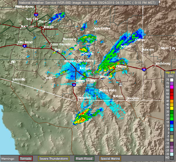 At 921 pm mst, a severe thunderstorm capable of producing a tornado was located over willcox, moving northeast at 30 mph (radar indicated rotation). Hazards include tornado and quarter size hail. Flying debris will be dangerous to those caught without shelter. mobile homes will be damaged or destroyed. damage to roofs, windows, and vehicles will occur. tree damage is likely. this tornadic thunderstorm will remain over mainly remote areas of south central graham and north central cochise counties. this includes the following highways, interstate 10 between mile markers 339 and 364. route 186 between mile markers 327 and 337. Route 191 between mile markers 88 and 93. At 921 pm mst, a severe thunderstorm capable of producing a tornado was located over willcox, moving northeast at 30 mph (radar indicated rotation). Hazards include tornado and quarter size hail. Flying debris will be dangerous to those caught without shelter. mobile homes will be damaged or destroyed. damage to roofs, windows, and vehicles will occur. tree damage is likely. this tornadic thunderstorm will remain over mainly remote areas of south central graham and north central cochise counties. this includes the following highways, interstate 10 between mile markers 339 and 364. route 186 between mile markers 327 and 337. Route 191 between mile markers 88 and 93.
|
| 9/23/2019 9:15 PM MST |
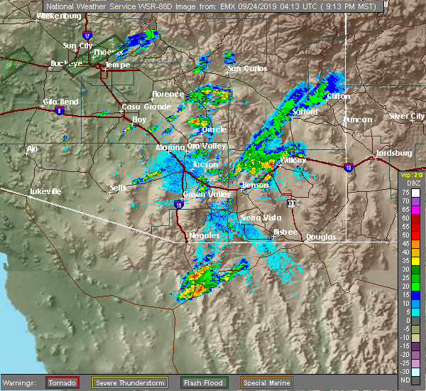 At 914 pm mst, a severe thunderstorm was located near willcox, moving northeast at 25 mph (radar indicated). Hazards include 60 mph wind gusts and quarter size hail. Hail damage to vehicles is expected. Expect wind damage to roofs, siding, and trees. At 914 pm mst, a severe thunderstorm was located near willcox, moving northeast at 25 mph (radar indicated). Hazards include 60 mph wind gusts and quarter size hail. Hail damage to vehicles is expected. Expect wind damage to roofs, siding, and trees.
|
| 7/30/2019 5:57 PM MST |
 The severe thunderstorm warning for northwestern cochise county will expire at 600 pm mst, the storm which prompted the warning has weakened below severe limits, and no longer poses an immediate threat to life or property. therefore, the warning will be allowed to expire. however gusty winds and heavy rain are still possible with this thunderstorm. The severe thunderstorm warning for northwestern cochise county will expire at 600 pm mst, the storm which prompted the warning has weakened below severe limits, and no longer poses an immediate threat to life or property. therefore, the warning will be allowed to expire. however gusty winds and heavy rain are still possible with this thunderstorm.
|
| 7/30/2019 5:23 PM MST |
 At 521 pm mst, a severe thunderstorm was located along highway 186 near willcox and another was located 8 miles north of dragoon, or 13 miles southwest of willcox. these two storms are expected to merge and move northwest at 20 mph, impacting interstate 10 between texas canyon and willcox (radar indicated). Hazards include 60 mph wind gusts and quarter size hail. Hail damage to vehicles is expected. Expect wind damage to roofs, siding, and trees. At 521 pm mst, a severe thunderstorm was located along highway 186 near willcox and another was located 8 miles north of dragoon, or 13 miles southwest of willcox. these two storms are expected to merge and move northwest at 20 mph, impacting interstate 10 between texas canyon and willcox (radar indicated). Hazards include 60 mph wind gusts and quarter size hail. Hail damage to vehicles is expected. Expect wind damage to roofs, siding, and trees.
|
| 7/30/2019 5:14 PM MST |
 At 511 pm mst, a severe thunderstorm was located along highway 186 near willcox, moving west at 15 mph. this is producing very heavy rainfall along highway 186. weather radar estimates that between 1.00 and 1.50 inches of rain has fallen which may result in running water in normally dry washes and low lying areas that drain into the willcox playa (radar indicated). Hazards include 60 mph wind gusts. Expect damage to roofs, siding, and trees. locations impacted include, willcox, cochise and kansas settlement. this includes the following highways, interstate 10 between mile markers 333 and 354, and between mile markers 357 and 361. route 186 between mile markers 327 and 347. Route 191 between mile markers 59 and 88. At 511 pm mst, a severe thunderstorm was located along highway 186 near willcox, moving west at 15 mph. this is producing very heavy rainfall along highway 186. weather radar estimates that between 1.00 and 1.50 inches of rain has fallen which may result in running water in normally dry washes and low lying areas that drain into the willcox playa (radar indicated). Hazards include 60 mph wind gusts. Expect damage to roofs, siding, and trees. locations impacted include, willcox, cochise and kansas settlement. this includes the following highways, interstate 10 between mile markers 333 and 354, and between mile markers 357 and 361. route 186 between mile markers 327 and 347. Route 191 between mile markers 59 and 88.
|
| 7/30/2019 4:52 PM MST |
 At 451 pm mst, a severe thunderstorm was located 8 miles east of willcox, moving west at 20 mph (radar indicated). Hazards include 60 mph wind gusts and quarter size hail. Hail damage to vehicles is expected. Expect wind damage to roofs, siding, and trees. At 451 pm mst, a severe thunderstorm was located 8 miles east of willcox, moving west at 20 mph (radar indicated). Hazards include 60 mph wind gusts and quarter size hail. Hail damage to vehicles is expected. Expect wind damage to roofs, siding, and trees.
|
| 8/14/2018 8:44 PM MST |
 At 843 pm mst, a severe thunderstorm was located near kansas settlement or 14 miles southeast of willcox, moving northwest at 15 mph (radar indicated). Hazards include 60 mph wind gusts and quarter size hail. Hail damage to vehicles is expected. Expect wind damage to roofs, siding, and trees. At 843 pm mst, a severe thunderstorm was located near kansas settlement or 14 miles southeast of willcox, moving northwest at 15 mph (radar indicated). Hazards include 60 mph wind gusts and quarter size hail. Hail damage to vehicles is expected. Expect wind damage to roofs, siding, and trees.
|
| 8/8/2018 6:41 PM MST |
 The severe thunderstorm warning for south central graham and north central cochise counties will expire at 645 pm mst, the storms in northern cochise county which prompted the warning have weakened below severe limits. therefore, the warning will be allowed to expire. however heavy rain is still possible with these thunderstorms along with wind gusts to 40 mph. The severe thunderstorm warning for south central graham and north central cochise counties will expire at 645 pm mst, the storms in northern cochise county which prompted the warning have weakened below severe limits. therefore, the warning will be allowed to expire. however heavy rain is still possible with these thunderstorms along with wind gusts to 40 mph.
|
| 8/8/2018 6:17 PM MST |
 At 614 pm mst, severe thunderstorms were located along a line extending from 20 miles northwest of willcox, to willcox to near bowie, moving south at 10 mph (radar indicated). Hazards include 60 mph wind gusts and penny size hail. also, areas of blowing dust followed by heavy rain. Expect damage to roofs, siding, and trees. hazardous driving conditions. locations impacted include, willcox, bowie. this includes the following highways, interstate 10 between mile markers 335 and 366. route 186 between mile markers 327 and 335. Route 191 between mile markers 88 and 95. At 614 pm mst, severe thunderstorms were located along a line extending from 20 miles northwest of willcox, to willcox to near bowie, moving south at 10 mph (radar indicated). Hazards include 60 mph wind gusts and penny size hail. also, areas of blowing dust followed by heavy rain. Expect damage to roofs, siding, and trees. hazardous driving conditions. locations impacted include, willcox, bowie. this includes the following highways, interstate 10 between mile markers 335 and 366. route 186 between mile markers 327 and 335. Route 191 between mile markers 88 and 95.
|
| 8/8/2018 6:01 PM MST |
 At 559 pm mst, severe thunderstorms were located along a line extending from 12 miles southwest of fort grant to near willcox to 6 miles northwest of bowie, moving south at 10 mph (radar indicated). Hazards include 60 mph wind gusts and penny size hail along with heavy rain. expect damage to roofs, siding, and trees At 559 pm mst, severe thunderstorms were located along a line extending from 12 miles southwest of fort grant to near willcox to 6 miles northwest of bowie, moving south at 10 mph (radar indicated). Hazards include 60 mph wind gusts and penny size hail along with heavy rain. expect damage to roofs, siding, and trees
|
| 6/29/2018 2:09 PM MST |
 At 209 pm mst, a severe thunderstorm was located 12 miles southeast of willcox, moving northeast at 15 mph (radar indicated). Hazards include 60 mph wind gusts and penny size hail. Expect damage to roofs, siding, and trees. locations impacted include, cochise and kansas settlement. this includes the following highways, route 186 between mile markers 331 and 340. Route 191 between mile markers 59 and 62. At 209 pm mst, a severe thunderstorm was located 12 miles southeast of willcox, moving northeast at 15 mph (radar indicated). Hazards include 60 mph wind gusts and penny size hail. Expect damage to roofs, siding, and trees. locations impacted include, cochise and kansas settlement. this includes the following highways, route 186 between mile markers 331 and 340. Route 191 between mile markers 59 and 62.
|
| 6/29/2018 1:55 PM MST |
 At 155 pm mst, a severe thunderstorm was located 11 miles south of willcox, moving northeast at 15 mph (radar indicated). Hazards include 60 mph wind gusts and penny size hail. expect damage to roofs, siding, and trees At 155 pm mst, a severe thunderstorm was located 11 miles south of willcox, moving northeast at 15 mph (radar indicated). Hazards include 60 mph wind gusts and penny size hail. expect damage to roofs, siding, and trees
|
| 8/12/2017 6:14 PM MST |
 At 613 pm mst, a severe thunderstorm was located over willcox, moving northeast at 5 mph (radar indicated). Hazards include 60 mph wind gusts. Expect damage to roofs, siding, and trees. Locations impacted include, willcox. At 613 pm mst, a severe thunderstorm was located over willcox, moving northeast at 5 mph (radar indicated). Hazards include 60 mph wind gusts. Expect damage to roofs, siding, and trees. Locations impacted include, willcox.
|
| 8/12/2017 5:55 PM MST |
 At 555 pm mst, a severe thunderstorm was located near willcox, moving northeast at 5 mph (radar indicated). Hazards include 60 mph wind gusts. expect damage to roofs, siding, and trees At 555 pm mst, a severe thunderstorm was located near willcox, moving northeast at 5 mph (radar indicated). Hazards include 60 mph wind gusts. expect damage to roofs, siding, and trees
|
| 8/12/2017 1:58 PM MST |
 The severe thunderstorm warning for north central cochise county will expire at 200 pm mst, the storm which prompted the warning has weakened below severe limits, and no longer poses an immediate threat to life or property. therefore the warning will be allowed to expire. a flood advisory remains in effect until 3 pm mst northwest of willcox where low water crossings could be affected by the rain that fell with this storm. severe weather can be reported to the local law enforcement, or directly to the national weather service via the internet. The severe thunderstorm warning for north central cochise county will expire at 200 pm mst, the storm which prompted the warning has weakened below severe limits, and no longer poses an immediate threat to life or property. therefore the warning will be allowed to expire. a flood advisory remains in effect until 3 pm mst northwest of willcox where low water crossings could be affected by the rain that fell with this storm. severe weather can be reported to the local law enforcement, or directly to the national weather service via the internet.
|
| 8/12/2017 1:38 PM MST |
 At 137 pm mst, a severe thunderstorm was located near willcox, moving east at 10 mph (radar indicated). Hazards include 60 mph wind gusts and quarter size hail. Hail damage to vehicles is expected. expect wind damage to roofs, siding, and trees. Locations impacted include, willcox. At 137 pm mst, a severe thunderstorm was located near willcox, moving east at 10 mph (radar indicated). Hazards include 60 mph wind gusts and quarter size hail. Hail damage to vehicles is expected. expect wind damage to roofs, siding, and trees. Locations impacted include, willcox.
|
| 8/12/2017 1:18 PM MST |
 At 118 pm mst, a severe thunderstorm was located 7 miles northwest of willcox, moving east at 5 mph (radar indicated). Hazards include 60 mph wind gusts and quarter size hail. Hail damage to vehicles is expected. Expect wind damage to roofs, siding, and trees. At 118 pm mst, a severe thunderstorm was located 7 miles northwest of willcox, moving east at 5 mph (radar indicated). Hazards include 60 mph wind gusts and quarter size hail. Hail damage to vehicles is expected. Expect wind damage to roofs, siding, and trees.
|
| 7/22/2017 5:12 PM MST |
 At 451 pm mst, a severe thunderstorm was located just northwest of willcox, moving southwest at 25 mph (radar indicated). Hazards include 60 mph wind gusts and quarter size hail. Hail damage to vehicles is expected. Expect wind damage to roofs, siding, and trees. At 451 pm mst, a severe thunderstorm was located just northwest of willcox, moving southwest at 25 mph (radar indicated). Hazards include 60 mph wind gusts and quarter size hail. Hail damage to vehicles is expected. Expect wind damage to roofs, siding, and trees.
|
| 7/22/2017 4:53 PM MST |
 At 451 pm mst, a severe thunderstorm was located just northwest of willcox, moving southwest at 25 mph (radar indicated). Hazards include 60 mph wind gusts and quarter size hail. Hail damage to vehicles is expected. Expect wind damage to roofs, siding, and trees. At 451 pm mst, a severe thunderstorm was located just northwest of willcox, moving southwest at 25 mph (radar indicated). Hazards include 60 mph wind gusts and quarter size hail. Hail damage to vehicles is expected. Expect wind damage to roofs, siding, and trees.
|
| 9/29/2016 4:25 PM MST |
 The severe thunderstorm warning for northwestern cochise county will expire at 430 pm mst, the storm which prompted the warning has weakened below severe limits, and no longer poses an immediate threat to life or property. therefore the warning will be allowed to expire. The severe thunderstorm warning for northwestern cochise county will expire at 430 pm mst, the storm which prompted the warning has weakened below severe limits, and no longer poses an immediate threat to life or property. therefore the warning will be allowed to expire.
|
| 9/29/2016 4:09 PM MST |
 At 406 pm mst, doppler radar indicated a cluster of severe thunderstorms capable of producing damaging winds in excess of 60 mph. these storms were located 13 miles northeast of benson, but also extended west and east toward the pima county border and east toward cochise and pearce. these storms were moving north at 10 to 15 mph. penny size hail may also accompany the damaging winds. locations impacted include, benson, cochise, st. david, saint david, kartchner caverns state park, dragoon, muleshoe ranch preserve, cascabel, mescal, i-10 and texas canyon and whetstone. At 406 pm mst, doppler radar indicated a cluster of severe thunderstorms capable of producing damaging winds in excess of 60 mph. these storms were located 13 miles northeast of benson, but also extended west and east toward the pima county border and east toward cochise and pearce. these storms were moving north at 10 to 15 mph. penny size hail may also accompany the damaging winds. locations impacted include, benson, cochise, st. david, saint david, kartchner caverns state park, dragoon, muleshoe ranch preserve, cascabel, mescal, i-10 and texas canyon and whetstone.
|
| 9/29/2016 3:39 PM MST |
 At 338 pm mst, doppler radar indicated a cluster of severe thunderstorms capable of producing damaging winds in excess of 60 mph. these storms were located 11 miles east of benson, or 24 miles southwest of willcox, and moving north at 15 mph. penny size hail may also accompany the damaging winds. At 338 pm mst, doppler radar indicated a cluster of severe thunderstorms capable of producing damaging winds in excess of 60 mph. these storms were located 11 miles east of benson, or 24 miles southwest of willcox, and moving north at 15 mph. penny size hail may also accompany the damaging winds.
|
| 7/31/2016 5:56 PM MST |
 At 555 pm mst, doppler radar indicated a severe thunderstorm capable of producing quarter size hail and damaging winds in excess of 60 mph. this storm was located 19 miles south of willcox, moving west at 10 mph. this storm will impact portions of highway 191 between pearce and cochise. locations impacted include, willcox, cochise, kansas settlement, dragoon and pearce-sunsites. At 555 pm mst, doppler radar indicated a severe thunderstorm capable of producing quarter size hail and damaging winds in excess of 60 mph. this storm was located 19 miles south of willcox, moving west at 10 mph. this storm will impact portions of highway 191 between pearce and cochise. locations impacted include, willcox, cochise, kansas settlement, dragoon and pearce-sunsites.
|
| 7/31/2016 5:36 PM MST |
 At 535 pm mst, doppler radar indicated a severe thunderstorm capable of producing quarter size hail and damaging winds in excess of 60 mph. this storm was located 17 miles south of willcox, and moving northwest at 5 mph. At 535 pm mst, doppler radar indicated a severe thunderstorm capable of producing quarter size hail and damaging winds in excess of 60 mph. this storm was located 17 miles south of willcox, and moving northwest at 5 mph.
|
| 9/2/2015 2:28 PM MST |
 At 228 pm mst, national weather service meteorologists detected a severe thunderstorm capable of producing damaging winds in excess of 60 mph. this storm was located near cochise, and moving north at 10 mph. At 228 pm mst, national weather service meteorologists detected a severe thunderstorm capable of producing damaging winds in excess of 60 mph. this storm was located near cochise, and moving north at 10 mph.
|
| 8/26/2015 3:23 PM MST |
 The severe thunderstorm warning for north central cochise county will expire at 330 pm mst, the storm which prompted the warning has weakened below severe limits and will exit the warned area. therefore, the warning will be allowed to expire. The severe thunderstorm warning for north central cochise county will expire at 330 pm mst, the storm which prompted the warning has weakened below severe limits and will exit the warned area. therefore, the warning will be allowed to expire.
|
| 8/26/2015 2:44 PM MST |
 At 244 pm mst, doppler radar indicated a severe thunderstorm capable of producing quarter size hail and damaging winds in excess of 60 mph. this storm was located over willcox, and moving northwest at 20 mph. At 244 pm mst, doppler radar indicated a severe thunderstorm capable of producing quarter size hail and damaging winds in excess of 60 mph. this storm was located over willcox, and moving northwest at 20 mph.
|
| 8/11/2015 3:49 PM MST |
 At 348 pm mst, doppler radar indicated a severe thunderstorm capable of producing damaging winds in excess of 60 mph. this storm was located 9 miles west of willcox, moving northwest at 15 mph. locations impacted include, willcox. At 348 pm mst, doppler radar indicated a severe thunderstorm capable of producing damaging winds in excess of 60 mph. this storm was located 9 miles west of willcox, moving northwest at 15 mph. locations impacted include, willcox.
|
| 8/11/2015 3:23 PM MST |
 At 323 pm mst, doppler radar indicated a severe thunderstorm capable of producing damaging winds in excess of 60 mph. this storm was located over willcox, and moving northwest at 15 mph. At 323 pm mst, doppler radar indicated a severe thunderstorm capable of producing damaging winds in excess of 60 mph. this storm was located over willcox, and moving northwest at 15 mph.
|
| 7/12/2015 2:11 PM MST | Commercial produce barn destroyed. pieces found 3 fields awa in cochise county AZ, 8.8 miles SE of Willcox, AZ |
| 7/12/2015 2:01 PM MST |
 At 201 pm mst, doppler radar indicated a severe thunderstorm capable of producing quarter size hail and damaging winds in excess of 60 mph. this storm was located 7 miles southwest of bonita, and moving north at 40 mph. At 201 pm mst, doppler radar indicated a severe thunderstorm capable of producing quarter size hail and damaging winds in excess of 60 mph. this storm was located 7 miles southwest of bonita, and moving north at 40 mph.
|
| 6/16/2015 5:25 PM MST |
 At 524 pm mst, doppler radar indicated a severe thunderstorm capable of producing damaging winds in excess of 60 mph. this storm was located 13 miles northwest of willcox, and moving southeast at 20 mph. nickel size hail may also accompany the damaging winds. * this severe thunderstorm will remain over mainly rural areas of north central cochise and south central graham counties. At 524 pm mst, doppler radar indicated a severe thunderstorm capable of producing damaging winds in excess of 60 mph. this storm was located 13 miles northwest of willcox, and moving southeast at 20 mph. nickel size hail may also accompany the damaging winds. * this severe thunderstorm will remain over mainly rural areas of north central cochise and south central graham counties.
|
| 7/6/2013 8:08 PM MST | Spotter report of 78mph wind gust in cochise county AZ, 6.5 miles SSE of Willcox, AZ |
| 1/1/0001 12:00 AM | Quarter sized hail reported 0.3 miles WSW of Willcox, AZ |
Hail Maps for Willcox, AZ


Connect with Interactive Hail Maps