

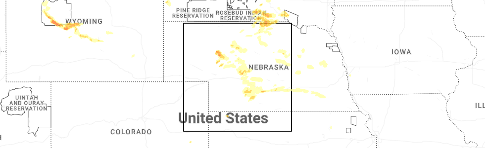
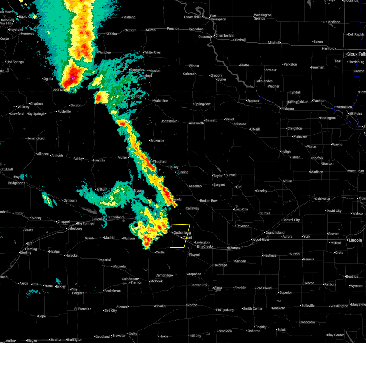
Hail Map for Willow Island, NE
The Willow Island, NE area has had 3 reports of on-the-ground hail by trained spotters, and has been under severe weather warnings 18 times during the past 12 months. Doppler radar has detected hail at or near Willow Island, NE on 104 occasions, including 8 occasions during the past year.
| Name: | Willow Island, NE |
| Where Located: | 39.8 miles ESE of North Platte, NE |
| Map: | Google Map for Willow Island, NE |
| Population: | 26 |
| Housing Units: | 12 |
| More Info: | Search Google for Willow Island, NE |
1
The Top Recent Hail Date for Willow Island, NE is Tuesday, July 15, 2025 (27th out of 104)
Hail and Wind Damage Spotted near Willow Island, NE
| Date / Time | Report Details |
|---|---|
| 7/9/2025 11:28 PM CDT |
 Svrgid the national weather service in hastings has issued a * severe thunderstorm warning for, northwestern dawson county in south central nebraska, * until 1215 am cdt. * at 1128 pm cdt, a severe thunderstorm was located 10 miles north of gothenburg, or 29 miles northwest of lexington, moving southeast at 20 mph (radar indicated). Hazards include ping pong ball size hail and 60 mph wind gusts. People and animals outdoors will be injured. expect hail damage to roofs, siding, windows, and vehicles. expect wind damage to roofs, siding, and trees. this severe thunderstorm will remain over mainly rural areas of northwestern dawson county. This includes interstate 80 between mile markers 215 and 220. Svrgid the national weather service in hastings has issued a * severe thunderstorm warning for, northwestern dawson county in south central nebraska, * until 1215 am cdt. * at 1128 pm cdt, a severe thunderstorm was located 10 miles north of gothenburg, or 29 miles northwest of lexington, moving southeast at 20 mph (radar indicated). Hazards include ping pong ball size hail and 60 mph wind gusts. People and animals outdoors will be injured. expect hail damage to roofs, siding, windows, and vehicles. expect wind damage to roofs, siding, and trees. this severe thunderstorm will remain over mainly rural areas of northwestern dawson county. This includes interstate 80 between mile markers 215 and 220.
|
| 6/30/2025 1:55 AM CDT |
 Svrgid the national weather service in hastings has issued a * severe thunderstorm warning for, northwestern phelps county in south central nebraska, gosper county in south central nebraska, western buffalo county in south central nebraska, southwestern sherman county in central nebraska, dawson county in south central nebraska, northwestern furnas county in south central nebraska, * until 245 am cdt. * at 154 am cdt, severe thunderstorms were located along a line extending from near oconto to 6 miles northwest of lexington to eustis to near stockville, moving east at 35 mph (radar indicated). Hazards include 60 mph wind gusts and nickel size hail. Expect damage to roofs, siding, and trees. severe thunderstorms will be near, lexington, eddyville, and johnson lake around 200 am cdt. elwood around 205 am cdt. other locations in the path of these severe thunderstorms include sumner, overton, smithfield, miller, elm creek and bertrand. This includes interstate 80 between mile markers 219 and 264. Svrgid the national weather service in hastings has issued a * severe thunderstorm warning for, northwestern phelps county in south central nebraska, gosper county in south central nebraska, western buffalo county in south central nebraska, southwestern sherman county in central nebraska, dawson county in south central nebraska, northwestern furnas county in south central nebraska, * until 245 am cdt. * at 154 am cdt, severe thunderstorms were located along a line extending from near oconto to 6 miles northwest of lexington to eustis to near stockville, moving east at 35 mph (radar indicated). Hazards include 60 mph wind gusts and nickel size hail. Expect damage to roofs, siding, and trees. severe thunderstorms will be near, lexington, eddyville, and johnson lake around 200 am cdt. elwood around 205 am cdt. other locations in the path of these severe thunderstorms include sumner, overton, smithfield, miller, elm creek and bertrand. This includes interstate 80 between mile markers 219 and 264.
|
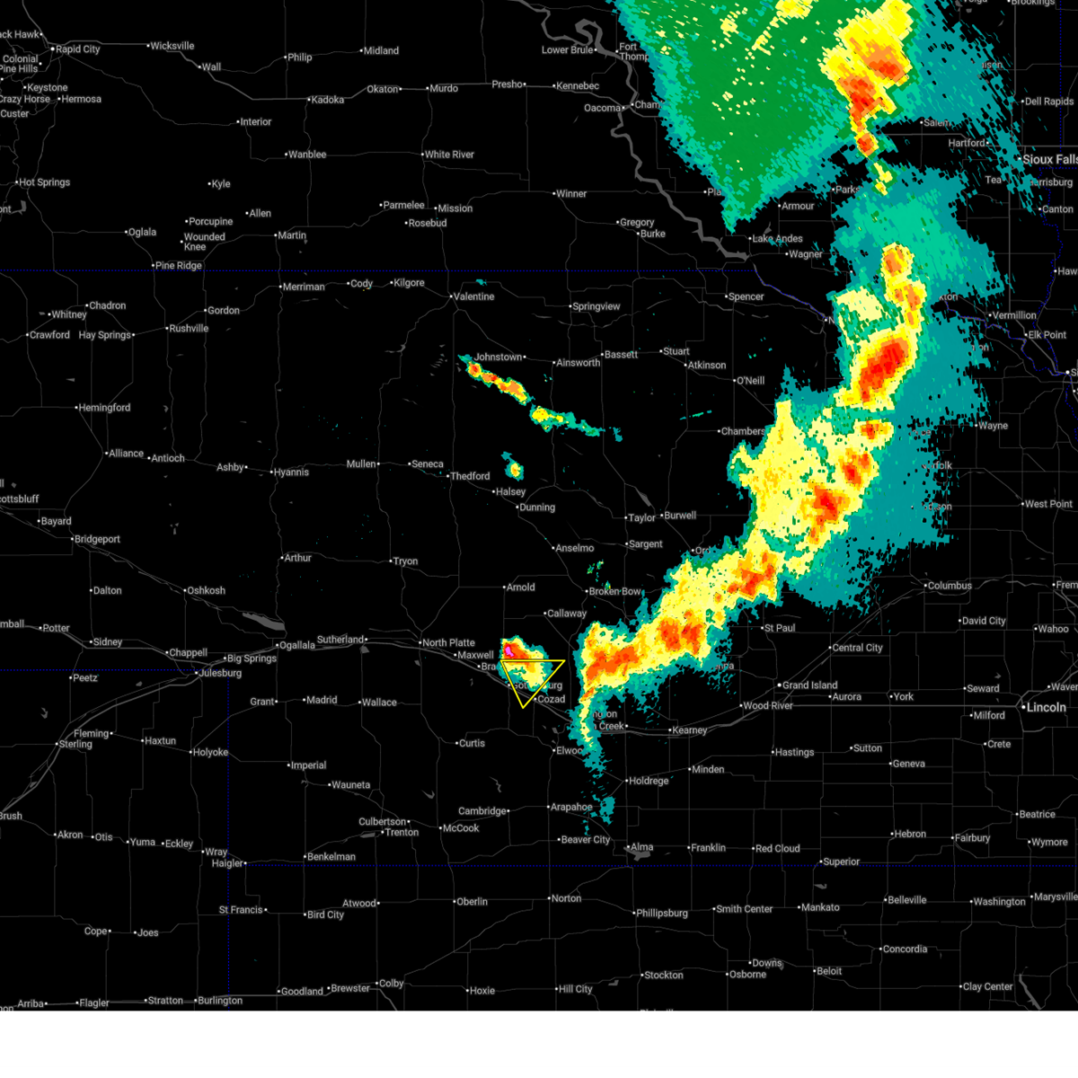
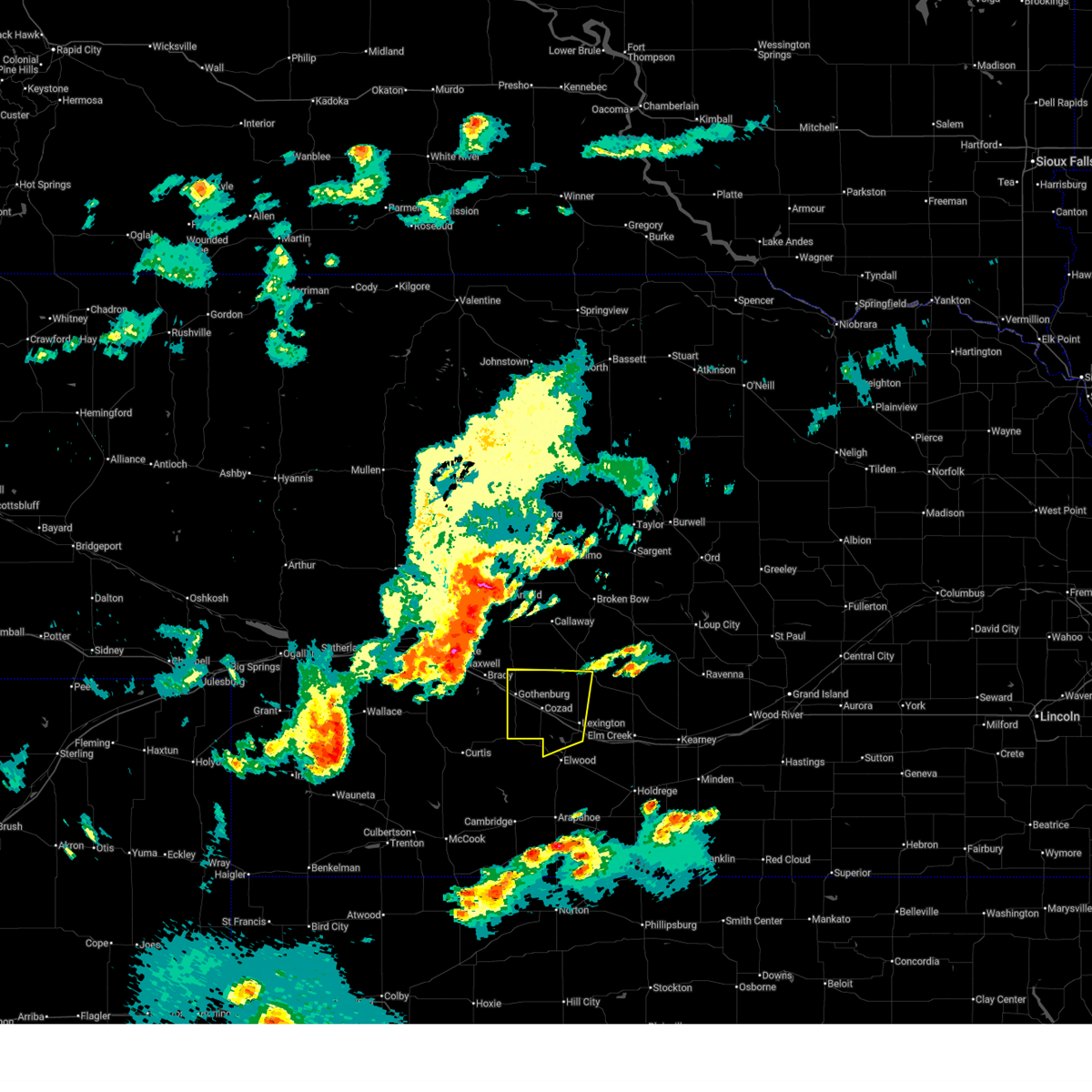
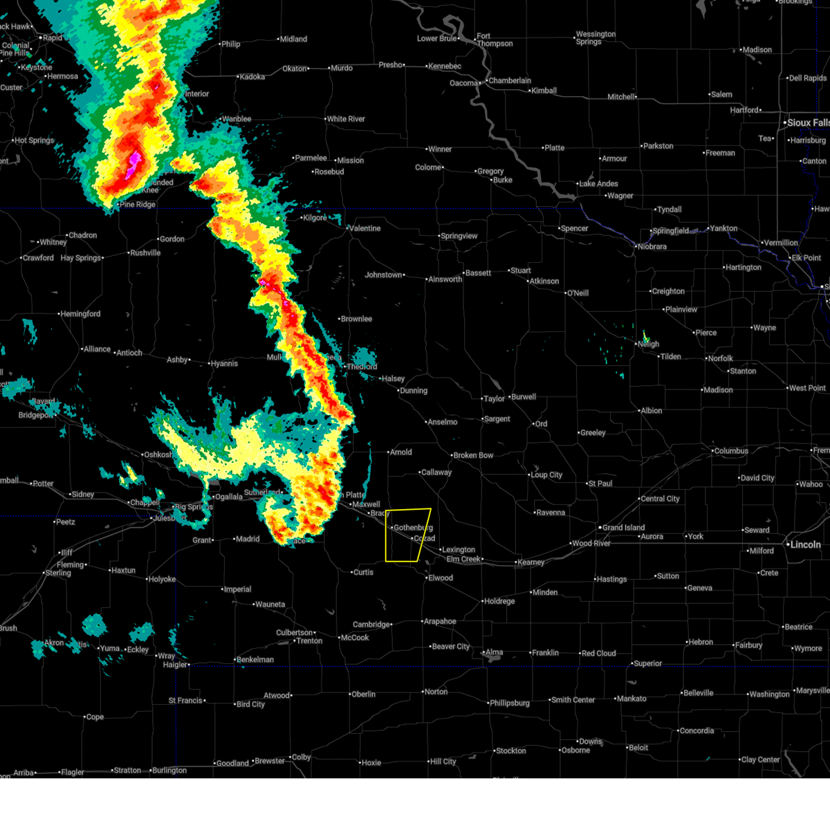
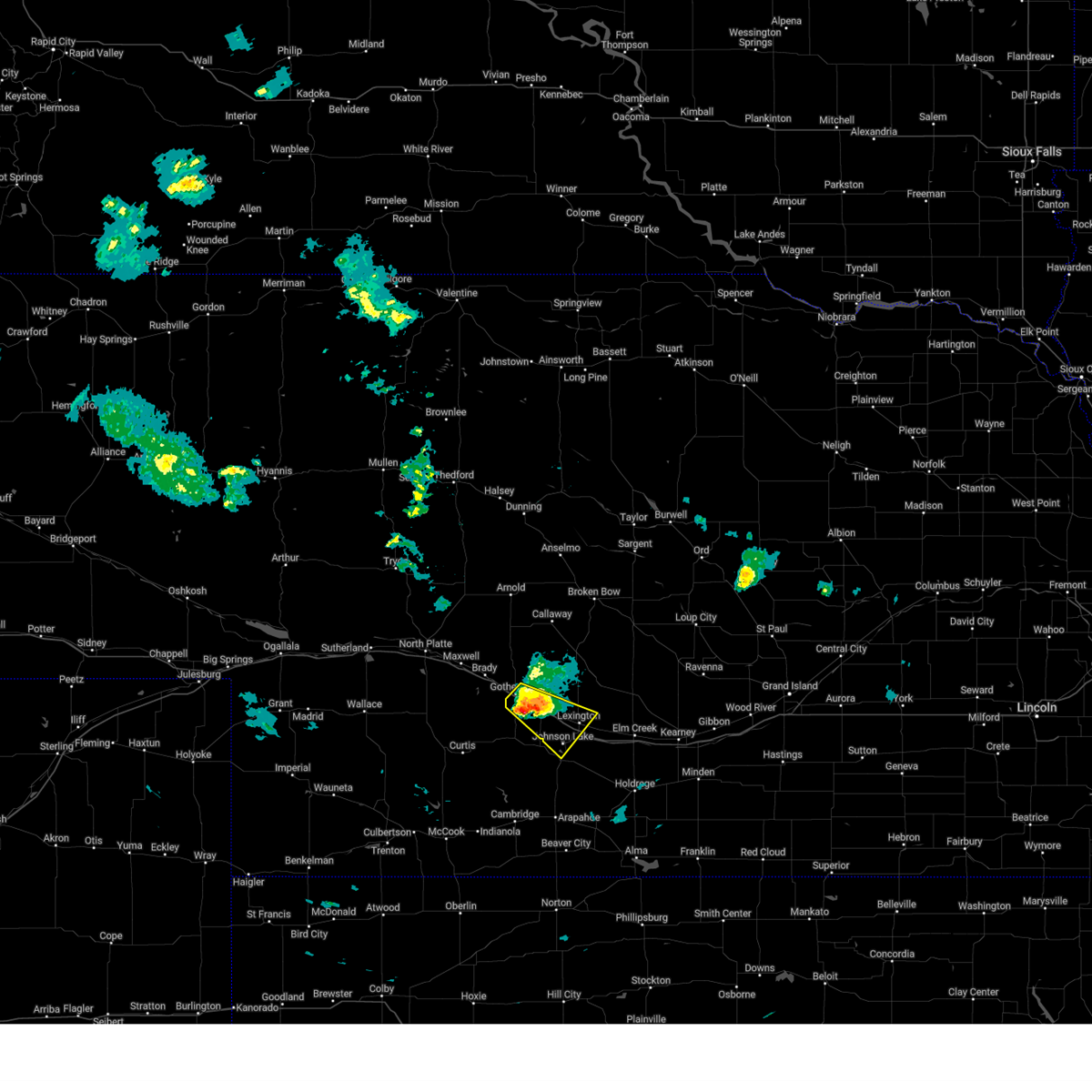
| 6/30/2025 1:44 AM CDT | Quarter sized hail reported 0.6 miles NNW of Willow Island, NE, quarter size hail. |
| 6/30/2025 1:32 AM CDT |
 At 132 am cdt, severe thunderstorms were located along a line extending from near callaway to near gothenburg to moorefield, moving southeast at 45 mph (radar indicated). Hazards include 60 mph wind gusts and quarter size hail. Hail damage to vehicles is expected. expect wind damage to roofs, siding, and trees. locations impacted include, lexington, cozad, gothenburg, willow island, johnson lake, and farnam. This includes interstate 80 between mile markers 209 and 238. At 132 am cdt, severe thunderstorms were located along a line extending from near callaway to near gothenburg to moorefield, moving southeast at 45 mph (radar indicated). Hazards include 60 mph wind gusts and quarter size hail. Hail damage to vehicles is expected. expect wind damage to roofs, siding, and trees. locations impacted include, lexington, cozad, gothenburg, willow island, johnson lake, and farnam. This includes interstate 80 between mile markers 209 and 238.
|
| 6/30/2025 1:00 AM CDT |
 Svrgid the national weather service in hastings has issued a * severe thunderstorm warning for, north central gosper county in south central nebraska, dawson county in south central nebraska, * until 200 am cdt. * at 100 am cdt, severe thunderstorms were located along a line extending from near arnold to 10 miles northeast of maxwell to 8 miles southeast of lake maloney state recreation area, moving southeast at 35 mph (radar indicated). Hazards include 60 mph wind gusts and nickel size hail. expect damage to roofs, siding, and trees Svrgid the national weather service in hastings has issued a * severe thunderstorm warning for, north central gosper county in south central nebraska, dawson county in south central nebraska, * until 200 am cdt. * at 100 am cdt, severe thunderstorms were located along a line extending from near arnold to 10 miles northeast of maxwell to 8 miles southeast of lake maloney state recreation area, moving southeast at 35 mph (radar indicated). Hazards include 60 mph wind gusts and nickel size hail. expect damage to roofs, siding, and trees
|
| 6/16/2025 9:24 PM CDT |
 The storm which prompted the warning has weakened below severe limits, and no longer poses an immediate threat to life or property. therefore, the warning will be allowed to expire. a severe thunderstorm watch remains in effect until midnight cdt for south central nebraska. The storm which prompted the warning has weakened below severe limits, and no longer poses an immediate threat to life or property. therefore, the warning will be allowed to expire. a severe thunderstorm watch remains in effect until midnight cdt for south central nebraska.
|
| 6/16/2025 9:09 PM CDT | At 909 pm cdt, a severe thunderstorm was located 7 miles northeast of willow island, or 19 miles northwest of lexington, moving east at 30 mph (radar indicated). Hazards include 60 mph wind gusts and quarter size hail. Hail damage to vehicles is expected. expect wind damage to roofs, siding, and trees. this severe thunderstorm will remain over mainly rural areas of northwestern dawson county. This includes interstate 80 between mile markers 215 and 220. |
| 6/16/2025 8:49 PM CDT |
 Svrgid the national weather service in hastings has issued a * severe thunderstorm warning for, northwestern dawson county in south central nebraska, * until 930 pm cdt. * at 849 pm cdt, a severe thunderstorm was located near gothenburg, or 27 miles northwest of lexington, moving east at 30 mph (radar indicated). Hazards include 60 mph wind gusts and quarter size hail. Hail damage to vehicles is expected. expect wind damage to roofs, siding, and trees. this severe thunderstorm will be near, gothenburg around 855 pm cdt. This includes interstate 80 between mile markers 209 and 220. Svrgid the national weather service in hastings has issued a * severe thunderstorm warning for, northwestern dawson county in south central nebraska, * until 930 pm cdt. * at 849 pm cdt, a severe thunderstorm was located near gothenburg, or 27 miles northwest of lexington, moving east at 30 mph (radar indicated). Hazards include 60 mph wind gusts and quarter size hail. Hail damage to vehicles is expected. expect wind damage to roofs, siding, and trees. this severe thunderstorm will be near, gothenburg around 855 pm cdt. This includes interstate 80 between mile markers 209 and 220.
|
| 6/15/2025 11:38 PM CDT |
 The storms which prompted the warning have weakened. therefore, the warning will be allowed to expire. The storms which prompted the warning have weakened. therefore, the warning will be allowed to expire.
|
| 6/15/2025 11:12 PM CDT |
 At 1112 pm cdt, severe thunderstorms were located along a line extending from 8 miles southeast of arnold to near gothenburg to 8 miles north of moorefield, moving east at 45 mph (radar indicated). Hazards include 60 mph wind gusts and penny size hail. Expect damage to roofs, siding, and trees. locations impacted include, cozad, gothenburg, willow island, and farnam. This includes interstate 80 between mile markers 209 and 227. At 1112 pm cdt, severe thunderstorms were located along a line extending from 8 miles southeast of arnold to near gothenburg to 8 miles north of moorefield, moving east at 45 mph (radar indicated). Hazards include 60 mph wind gusts and penny size hail. Expect damage to roofs, siding, and trees. locations impacted include, cozad, gothenburg, willow island, and farnam. This includes interstate 80 between mile markers 209 and 227.
|
| 6/15/2025 10:53 PM CDT |
 Svrgid the national weather service in hastings has issued a * severe thunderstorm warning for, western dawson county in south central nebraska, * until 1145 pm cdt. * at 1052 pm cdt, severe thunderstorms were located along a line extending from 6 miles south of gandy to maxwell to 8 miles north of wellfleet, moving east at 40 mph (radar indicated). Hazards include 60 mph wind gusts and penny size hail. expect damage to roofs, siding, and trees Svrgid the national weather service in hastings has issued a * severe thunderstorm warning for, western dawson county in south central nebraska, * until 1145 pm cdt. * at 1052 pm cdt, severe thunderstorms were located along a line extending from 6 miles south of gandy to maxwell to 8 miles north of wellfleet, moving east at 40 mph (radar indicated). Hazards include 60 mph wind gusts and penny size hail. expect damage to roofs, siding, and trees
|
| 5/21/2025 4:55 PM CDT |
 The storm which prompted the warning has weakened below severe limits, and no longer poses an immediate threat to life or property. therefore, the warning will be allowed to expire. however, small hail and gusty winds are still possible with this thunderstorm. The storm which prompted the warning has weakened below severe limits, and no longer poses an immediate threat to life or property. therefore, the warning will be allowed to expire. however, small hail and gusty winds are still possible with this thunderstorm.
|
| 5/21/2025 4:48 PM CDT |
 At 448 pm cdt, a severe thunderstorm was located 7 miles west of lexington, moving southeast at 50 mph (radar indicated). Hazards include 60 mph wind gusts and penny size hail. Expect damage to roofs, siding, and trees. this severe storm will be near, lexington around 455 pm cdt. This includes interstate 80 between mile markers 218 and 238. At 448 pm cdt, a severe thunderstorm was located 7 miles west of lexington, moving southeast at 50 mph (radar indicated). Hazards include 60 mph wind gusts and penny size hail. Expect damage to roofs, siding, and trees. this severe storm will be near, lexington around 455 pm cdt. This includes interstate 80 between mile markers 218 and 238.
|
| 5/21/2025 4:34 PM CDT |
 Svrgid the national weather service in hastings has issued a * severe thunderstorm warning for, north central gosper county in south central nebraska, southwestern dawson county in south central nebraska, * until 500 pm cdt. * at 433 pm cdt, a severe thunderstorm was located over willow island, or 18 miles northwest of lexington, moving southeast at 45 mph (radar indicated). Hazards include 60 mph wind gusts and quarter size hail. Hail damage to vehicles is expected. expect wind damage to roofs, siding, and trees. this severe thunderstorm will be near, cozad around 440 pm cdt. other locations in the path of this severe thunderstorm include lexington. This includes interstate 80 between mile markers 211 and 238. Svrgid the national weather service in hastings has issued a * severe thunderstorm warning for, north central gosper county in south central nebraska, southwestern dawson county in south central nebraska, * until 500 pm cdt. * at 433 pm cdt, a severe thunderstorm was located over willow island, or 18 miles northwest of lexington, moving southeast at 45 mph (radar indicated). Hazards include 60 mph wind gusts and quarter size hail. Hail damage to vehicles is expected. expect wind damage to roofs, siding, and trees. this severe thunderstorm will be near, cozad around 440 pm cdt. other locations in the path of this severe thunderstorm include lexington. This includes interstate 80 between mile markers 211 and 238.
|
| 5/18/2025 7:41 PM CDT |
 The storm which prompted the warning has weakened below severe limits, and no longer poses an immediate threat to life or property. therefore, the warning will be allowed to expire. however, small hail is still possible with this thunderstorm. a severe thunderstorm watch remains in effect until midnight cdt for south central nebraska. The storm which prompted the warning has weakened below severe limits, and no longer poses an immediate threat to life or property. therefore, the warning will be allowed to expire. however, small hail is still possible with this thunderstorm. a severe thunderstorm watch remains in effect until midnight cdt for south central nebraska.
|
| 5/18/2025 7:18 PM CDT |
 Svrgid the national weather service in hastings has issued a * severe thunderstorm warning for, north central gosper county in south central nebraska, western dawson county in south central nebraska, * until 745 pm cdt. * at 718 pm cdt, a severe thunderstorm was located near johnson lake, or 12 miles southwest of lexington, moving north at 45 mph (radar indicated). Hazards include quarter size hail. Damage to vehicles is expected. this severe thunderstorm will be near, cozad around 735 pm cdt. This includes interstate 80 between mile markers 218 and 233. Svrgid the national weather service in hastings has issued a * severe thunderstorm warning for, north central gosper county in south central nebraska, western dawson county in south central nebraska, * until 745 pm cdt. * at 718 pm cdt, a severe thunderstorm was located near johnson lake, or 12 miles southwest of lexington, moving north at 45 mph (radar indicated). Hazards include quarter size hail. Damage to vehicles is expected. this severe thunderstorm will be near, cozad around 735 pm cdt. This includes interstate 80 between mile markers 218 and 233.
|
| 5/14/2025 9:27 PM CDT |
 Svrgid the national weather service in hastings has issued a * severe thunderstorm warning for, phelps county in south central nebraska, gosper county in south central nebraska, western buffalo county in south central nebraska, dawson county in south central nebraska, furnas county in south central nebraska, harlan county in south central nebraska, * until 1030 pm cdt. * at 924 pm cdt, outflow from strong thunderstorms over southwest nebraska was located along a line extending from 9 miles northeast of north platte airport to 6 miles east of stockville to 6 miles southwest of danbury, moving east at 55 mph (automated weather station. widespread wind gusts of 50 to 70 mph have been reported with this outflow, along with reduced visibility to one half mile, or less, from blowing dust). Hazards include 70 mph wind gusts. Expect considerable tree damage. damage is likely to mobile homes, roofs, and outbuildings. rapid reduction in visibility due to blowing dust. severe winds will be near, cambridge around 930 pm cdt. gothenburg around 935 pm cdt. cozad, elwood, holbrook, wilsonville, and willow island around 940 pm cdt. other locations in the path of these severe thunderstorms include arapahoe, hendley, johnson lake, smithfield, lexington, bertrand, beaver city, edison, oxford, hollinger, overton, loomis, stamford and eddyville. This includes interstate 80 between mile markers 209 and 267. Svrgid the national weather service in hastings has issued a * severe thunderstorm warning for, phelps county in south central nebraska, gosper county in south central nebraska, western buffalo county in south central nebraska, dawson county in south central nebraska, furnas county in south central nebraska, harlan county in south central nebraska, * until 1030 pm cdt. * at 924 pm cdt, outflow from strong thunderstorms over southwest nebraska was located along a line extending from 9 miles northeast of north platte airport to 6 miles east of stockville to 6 miles southwest of danbury, moving east at 55 mph (automated weather station. widespread wind gusts of 50 to 70 mph have been reported with this outflow, along with reduced visibility to one half mile, or less, from blowing dust). Hazards include 70 mph wind gusts. Expect considerable tree damage. damage is likely to mobile homes, roofs, and outbuildings. rapid reduction in visibility due to blowing dust. severe winds will be near, cambridge around 930 pm cdt. gothenburg around 935 pm cdt. cozad, elwood, holbrook, wilsonville, and willow island around 940 pm cdt. other locations in the path of these severe thunderstorms include arapahoe, hendley, johnson lake, smithfield, lexington, bertrand, beaver city, edison, oxford, hollinger, overton, loomis, stamford and eddyville. This includes interstate 80 between mile markers 209 and 267.
|
| 8/14/2024 12:06 AM CDT |
 At 1206 am cdt, severe thunderstorms were located along a line extending from lexington to near bertrand to 7 miles south of beaver city, moving east at 55 mph (radar indicated). Hazards include 60 mph wind gusts and quarter size hail. Hail damage to vehicles is expected. expect wind damage to roofs, siding, and trees. these severe storms will be near, oxford, bertrand, beaver city, and hollinger around 1210 am cdt. This includes interstate 80 between mile markers 219 and 242. At 1206 am cdt, severe thunderstorms were located along a line extending from lexington to near bertrand to 7 miles south of beaver city, moving east at 55 mph (radar indicated). Hazards include 60 mph wind gusts and quarter size hail. Hail damage to vehicles is expected. expect wind damage to roofs, siding, and trees. these severe storms will be near, oxford, bertrand, beaver city, and hollinger around 1210 am cdt. This includes interstate 80 between mile markers 219 and 242.
|
| 8/13/2024 11:54 PM CDT |
 Svrgid the national weather service in hastings has issued a * severe thunderstorm warning for, phelps county in south central nebraska, gosper county in south central nebraska, western buffalo county in south central nebraska, dawson county in south central nebraska, furnas county in south central nebraska, harlan county in south central nebraska, * until 1245 am cdt. * at 1154 pm cdt, severe thunderstorms were located along a line extending from near cozad to 9 miles north of arapahoe to near hendley, moving east at 55 mph (radar indicated). Hazards include ping pong ball size hail and 60 mph wind gusts. People and animals outdoors will be injured. expect hail damage to roofs, siding, windows, and vehicles. expect wind damage to roofs, siding, and trees. severe thunderstorms will be near, lexington, arapahoe, elwood, beaver city, edison, smithfield, hendley, and johnson lake around 1200 am cdt. bertrand and hollinger around 1205 am cdt. oxford around 1210 am cdt. other locations in the path of these severe thunderstorms include overton, loomis, stamford, atlanta, holdrege, elm creek, orleans, odessa, amherst, funk, huntley and ragan. This includes interstate 80 between mile markers 217 and 267. Svrgid the national weather service in hastings has issued a * severe thunderstorm warning for, phelps county in south central nebraska, gosper county in south central nebraska, western buffalo county in south central nebraska, dawson county in south central nebraska, furnas county in south central nebraska, harlan county in south central nebraska, * until 1245 am cdt. * at 1154 pm cdt, severe thunderstorms were located along a line extending from near cozad to 9 miles north of arapahoe to near hendley, moving east at 55 mph (radar indicated). Hazards include ping pong ball size hail and 60 mph wind gusts. People and animals outdoors will be injured. expect hail damage to roofs, siding, windows, and vehicles. expect wind damage to roofs, siding, and trees. severe thunderstorms will be near, lexington, arapahoe, elwood, beaver city, edison, smithfield, hendley, and johnson lake around 1200 am cdt. bertrand and hollinger around 1205 am cdt. oxford around 1210 am cdt. other locations in the path of these severe thunderstorms include overton, loomis, stamford, atlanta, holdrege, elm creek, orleans, odessa, amherst, funk, huntley and ragan. This includes interstate 80 between mile markers 217 and 267.
|
| 7/6/2024 12:29 PM CDT |
 At 1229 pm cdt, a severe thunderstorm was located near willow island, or 18 miles northwest of lexington, moving east at 25 mph (trained weather spotters). Hazards include golf ball size hail. People and animals outdoors will be injured. expect damage to roofs, siding, windows, and vehicles. locations impacted include, lexington, cozad, and willow island. This includes interstate 80 between mile markers 216 and 227. At 1229 pm cdt, a severe thunderstorm was located near willow island, or 18 miles northwest of lexington, moving east at 25 mph (trained weather spotters). Hazards include golf ball size hail. People and animals outdoors will be injured. expect damage to roofs, siding, windows, and vehicles. locations impacted include, lexington, cozad, and willow island. This includes interstate 80 between mile markers 216 and 227.
|
| 7/6/2024 12:19 PM CDT |
 At 1219 pm cdt, a severe thunderstorm was located near gothenburg, or 22 miles northwest of lexington, moving east at 25 mph (trained weather spotters). Hazards include golf ball size hail. People and animals outdoors will be injured. expect damage to roofs, siding, windows, and vehicles. this severe thunderstorm will remain over mainly rural areas of northwestern dawson county. This includes interstate 80 between mile markers 209 and 227. At 1219 pm cdt, a severe thunderstorm was located near gothenburg, or 22 miles northwest of lexington, moving east at 25 mph (trained weather spotters). Hazards include golf ball size hail. People and animals outdoors will be injured. expect damage to roofs, siding, windows, and vehicles. this severe thunderstorm will remain over mainly rural areas of northwestern dawson county. This includes interstate 80 between mile markers 209 and 227.
|
| 7/6/2024 12:10 PM CDT |
 Svrgid the national weather service in hastings has issued a * severe thunderstorm warning for, northwestern dawson county in south central nebraska, * until 100 pm cdt. * at 1209 pm cdt, a severe thunderstorm was located near gothenburg, or 25 miles northwest of lexington, moving east at 25 mph (radar indicated). Hazards include golf ball size hail. People and animals outdoors will be injured. expect damage to roofs, siding, windows, and vehicles. this severe thunderstorm will be near, gothenburg around 1215 pm cdt. This includes interstate 80 between mile markers 209 and 227. Svrgid the national weather service in hastings has issued a * severe thunderstorm warning for, northwestern dawson county in south central nebraska, * until 100 pm cdt. * at 1209 pm cdt, a severe thunderstorm was located near gothenburg, or 25 miles northwest of lexington, moving east at 25 mph (radar indicated). Hazards include golf ball size hail. People and animals outdoors will be injured. expect damage to roofs, siding, windows, and vehicles. this severe thunderstorm will be near, gothenburg around 1215 pm cdt. This includes interstate 80 between mile markers 209 and 227.
|
| 7/6/2024 12:07 PM CDT |
 At 1207 pm cdt, a severe thunderstorm was located near gothenburg, or 24 miles northwest of lexington, moving east at 25 mph (trained weather spotters). Hazards include golf ball size hail. People and animals outdoors will be injured. expect damage to roofs, siding, windows, and vehicles. this severe thunderstorm will remain over mainly rural areas of northwestern dawson county, including the following locations, vroman. This includes interstate 80 between mile markers 208 and 223. At 1207 pm cdt, a severe thunderstorm was located near gothenburg, or 24 miles northwest of lexington, moving east at 25 mph (trained weather spotters). Hazards include golf ball size hail. People and animals outdoors will be injured. expect damage to roofs, siding, windows, and vehicles. this severe thunderstorm will remain over mainly rural areas of northwestern dawson county, including the following locations, vroman. This includes interstate 80 between mile markers 208 and 223.
|
| 7/6/2024 11:58 AM CDT |
 At 1158 am cdt, a severe thunderstorm was located near gothenburg, or 27 miles northwest of lexington, moving east at 25 mph (radar indicated). Hazards include quarter size hail. Damage to vehicles is expected. this severe storm will be near, gothenburg around 1205 pm cdt. other locations impacted by this severe thunderstorm include vroman. This includes interstate 80 between mile markers 208 and 223. At 1158 am cdt, a severe thunderstorm was located near gothenburg, or 27 miles northwest of lexington, moving east at 25 mph (radar indicated). Hazards include quarter size hail. Damage to vehicles is expected. this severe storm will be near, gothenburg around 1205 pm cdt. other locations impacted by this severe thunderstorm include vroman. This includes interstate 80 between mile markers 208 and 223.
|
| 7/6/2024 11:36 AM CDT |
 Svrgid the national weather service in hastings has issued a * severe thunderstorm warning for, northwestern dawson county in south central nebraska, * until 1215 pm cdt. * at 1136 am cdt, a severe thunderstorm was located over brady, or 23 miles southeast of north platte, moving east at 25 mph (radar indicated). Hazards include 60 mph wind gusts and quarter size hail. Hail damage to vehicles is expected. expect wind damage to roofs, siding, and trees. this severe thunderstorm will be near, gothenburg around 1155 am cdt. This includes interstate 80 between mile markers 208 and 223. Svrgid the national weather service in hastings has issued a * severe thunderstorm warning for, northwestern dawson county in south central nebraska, * until 1215 pm cdt. * at 1136 am cdt, a severe thunderstorm was located over brady, or 23 miles southeast of north platte, moving east at 25 mph (radar indicated). Hazards include 60 mph wind gusts and quarter size hail. Hail damage to vehicles is expected. expect wind damage to roofs, siding, and trees. this severe thunderstorm will be near, gothenburg around 1155 am cdt. This includes interstate 80 between mile markers 208 and 223.
|
| 6/29/2024 1:57 AM CDT |
 At 156 am cdt, a severe thunderstorm was located near cozad, or 10 miles northwest of lexington, moving southeast at 30 mph (radar indicated. at 152 am cdt, golf ball size hail was reported in cozad). Hazards include tennis ball size hail and 60 mph wind gusts. People and animals outdoors will be injured. expect hail damage to roofs, siding, windows, and vehicles. expect wind damage to roofs, siding, and trees. this severe storm will be near, lexington around 210 am cdt. This includes interstate 80 between mile markers 209 and 239. At 156 am cdt, a severe thunderstorm was located near cozad, or 10 miles northwest of lexington, moving southeast at 30 mph (radar indicated. at 152 am cdt, golf ball size hail was reported in cozad). Hazards include tennis ball size hail and 60 mph wind gusts. People and animals outdoors will be injured. expect hail damage to roofs, siding, windows, and vehicles. expect wind damage to roofs, siding, and trees. this severe storm will be near, lexington around 210 am cdt. This includes interstate 80 between mile markers 209 and 239.
|
| 6/29/2024 1:51 AM CDT |
 At 151 am cdt, a severe thunderstorm was located over cozad, or 13 miles northwest of lexington, moving southeast at 30 mph (radar indicated. at 132 am cdt, golf ball size hail was reported in gothenburg). Hazards include tennis ball size hail and 60 mph wind gusts. People and animals outdoors will be injured. expect hail damage to roofs, siding, windows, and vehicles. expect wind damage to roofs, siding, and trees. this severe storm will be near, cozad around 155 am cdt. lexington around 210 am cdt. This includes interstate 80 between mile markers 209 and 239. At 151 am cdt, a severe thunderstorm was located over cozad, or 13 miles northwest of lexington, moving southeast at 30 mph (radar indicated. at 132 am cdt, golf ball size hail was reported in gothenburg). Hazards include tennis ball size hail and 60 mph wind gusts. People and animals outdoors will be injured. expect hail damage to roofs, siding, windows, and vehicles. expect wind damage to roofs, siding, and trees. this severe storm will be near, cozad around 155 am cdt. lexington around 210 am cdt. This includes interstate 80 between mile markers 209 and 239.
|
| 6/29/2024 1:39 AM CDT |
 Svrgid the national weather service in hastings has issued a * severe thunderstorm warning for, central dawson county in south central nebraska, * until 230 am cdt. * at 139 am cdt, a severe thunderstorm was located over willow island, or 19 miles northwest of lexington, moving southeast at 30 mph (radar indicated). Hazards include tennis ball size hail and 60 mph wind gusts. People and animals outdoors will be injured. expect hail damage to roofs, siding, windows, and vehicles. expect wind damage to roofs, siding, and trees. this severe thunderstorm will be near, cozad and willow island around 145 am cdt. other locations in the path of this severe thunderstorm include lexington. This includes interstate 80 between mile markers 209 and 239. Svrgid the national weather service in hastings has issued a * severe thunderstorm warning for, central dawson county in south central nebraska, * until 230 am cdt. * at 139 am cdt, a severe thunderstorm was located over willow island, or 19 miles northwest of lexington, moving southeast at 30 mph (radar indicated). Hazards include tennis ball size hail and 60 mph wind gusts. People and animals outdoors will be injured. expect hail damage to roofs, siding, windows, and vehicles. expect wind damage to roofs, siding, and trees. this severe thunderstorm will be near, cozad and willow island around 145 am cdt. other locations in the path of this severe thunderstorm include lexington. This includes interstate 80 between mile markers 209 and 239.
|
| 6/29/2024 1:30 AM CDT |
 At 130 am cdt, a severe thunderstorm was located near gothenburg, or 21 miles northwest of lexington, moving southeast at 25 mph (radar indicated). Hazards include tennis ball size hail and 60 mph wind gusts. People and animals outdoors will be injured. expect hail damage to roofs, siding, windows, and vehicles. expect wind damage to roofs, siding, and trees. locations impacted include, cozad, gothenburg, and willow island. This includes interstate 80 between mile markers 209 and 223. At 130 am cdt, a severe thunderstorm was located near gothenburg, or 21 miles northwest of lexington, moving southeast at 25 mph (radar indicated). Hazards include tennis ball size hail and 60 mph wind gusts. People and animals outdoors will be injured. expect hail damage to roofs, siding, windows, and vehicles. expect wind damage to roofs, siding, and trees. locations impacted include, cozad, gothenburg, and willow island. This includes interstate 80 between mile markers 209 and 223.
|
| 6/29/2024 1:16 AM CDT |
 At 116 am cdt, a severe thunderstorm was located near gothenburg, or 27 miles northwest of lexington, moving east at 25 mph (radar indicated). Hazards include tennis ball size hail and 60 mph wind gusts. People and animals outdoors will be injured. expect hail damage to roofs, siding, windows, and vehicles. expect wind damage to roofs, siding, and trees. locations impacted include, cozad, gothenburg, and willow island. This includes interstate 80 between mile markers 209 and 223. At 116 am cdt, a severe thunderstorm was located near gothenburg, or 27 miles northwest of lexington, moving east at 25 mph (radar indicated). Hazards include tennis ball size hail and 60 mph wind gusts. People and animals outdoors will be injured. expect hail damage to roofs, siding, windows, and vehicles. expect wind damage to roofs, siding, and trees. locations impacted include, cozad, gothenburg, and willow island. This includes interstate 80 between mile markers 209 and 223.
|
| 6/29/2024 1:10 AM CDT |
 At 110 am cdt, a severe thunderstorm was located 7 miles east of brady, or 28 miles east of north platte, moving east at 25 mph (radar indicated). Hazards include tennis ball size hail and 60 mph wind gusts. People and animals outdoors will be injured. expect hail damage to roofs, siding, windows, and vehicles. expect wind damage to roofs, siding, and trees. locations impacted include, cozad, gothenburg, and willow island. This includes interstate 80 between mile markers 209 and 223. At 110 am cdt, a severe thunderstorm was located 7 miles east of brady, or 28 miles east of north platte, moving east at 25 mph (radar indicated). Hazards include tennis ball size hail and 60 mph wind gusts. People and animals outdoors will be injured. expect hail damage to roofs, siding, windows, and vehicles. expect wind damage to roofs, siding, and trees. locations impacted include, cozad, gothenburg, and willow island. This includes interstate 80 between mile markers 209 and 223.
|
| 6/29/2024 1:03 AM CDT |
 At 103 am cdt, a severe thunderstorm was located near brady, or 26 miles east of north platte, moving east at 25 mph (radar indicated). Hazards include golf ball size hail and 60 mph wind gusts. People and animals outdoors will be injured. expect hail damage to roofs, siding, windows, and vehicles. expect wind damage to roofs, siding, and trees. locations impacted include, cozad, gothenburg, and willow island. This includes interstate 80 between mile markers 209 and 223. At 103 am cdt, a severe thunderstorm was located near brady, or 26 miles east of north platte, moving east at 25 mph (radar indicated). Hazards include golf ball size hail and 60 mph wind gusts. People and animals outdoors will be injured. expect hail damage to roofs, siding, windows, and vehicles. expect wind damage to roofs, siding, and trees. locations impacted include, cozad, gothenburg, and willow island. This includes interstate 80 between mile markers 209 and 223.
|
| 6/29/2024 12:59 AM CDT |
 Svrgid the national weather service in hastings has issued a * severe thunderstorm warning for, northwestern dawson county in south central nebraska, * until 145 am cdt. * at 1258 am cdt, a severe thunderstorm was located near brady, or 23 miles east of north platte, moving east at 25 mph (radar indicated). Hazards include 60 mph wind gusts and half dollar size hail. Hail damage to vehicles is expected. expect wind damage to roofs, siding, and trees. this severe thunderstorm will remain over mainly rural areas of northwestern dawson county. This includes interstate 80 between mile markers 209 and 223. Svrgid the national weather service in hastings has issued a * severe thunderstorm warning for, northwestern dawson county in south central nebraska, * until 145 am cdt. * at 1258 am cdt, a severe thunderstorm was located near brady, or 23 miles east of north platte, moving east at 25 mph (radar indicated). Hazards include 60 mph wind gusts and half dollar size hail. Hail damage to vehicles is expected. expect wind damage to roofs, siding, and trees. this severe thunderstorm will remain over mainly rural areas of northwestern dawson county. This includes interstate 80 between mile markers 209 and 223.
|
| 6/2/2024 8:57 PM CDT |
 The storms which prompted the warning have weakened below severe limits, and have exited the warned area. therefore, the warning will be allowed to expire. a severe thunderstorm watch remains in effect until midnight cdt for south central nebraska. The storms which prompted the warning have weakened below severe limits, and have exited the warned area. therefore, the warning will be allowed to expire. a severe thunderstorm watch remains in effect until midnight cdt for south central nebraska.
|
| 6/2/2024 8:29 PM CDT |
 At 828 pm cdt, severe thunderstorms were located along a line extending from 6 miles east of oconto to near smithfield, moving east at 40 mph (radar indicated). Hazards include 60 mph wind gusts. Expect damage to roofs, siding, and trees. these severe storms will be near, overton and sumner around 835 pm cdt. This includes interstate 80 between mile markers 216 and 253. At 828 pm cdt, severe thunderstorms were located along a line extending from 6 miles east of oconto to near smithfield, moving east at 40 mph (radar indicated). Hazards include 60 mph wind gusts. Expect damage to roofs, siding, and trees. these severe storms will be near, overton and sumner around 835 pm cdt. This includes interstate 80 between mile markers 216 and 253.
|
| 6/2/2024 8:12 PM CDT |
 Svrgid the national weather service in hastings has issued a * severe thunderstorm warning for, dawson county in south central nebraska, * until 900 pm cdt. * at 812 pm cdt, severe thunderstorms were located along a line extending from 10 miles southwest of callaway to near eustis, moving east at 25 mph (radar indicated). Hazards include 70 mph wind gusts. Expect considerable tree damage. damage is likely to mobile homes, roofs, and outbuildings. severe thunderstorms will be near, cozad around 815 pm cdt. lexington around 830 pm cdt. other locations in the path of these severe thunderstorms include eddyville. This includes interstate 80 between mile markers 216 and 253. Svrgid the national weather service in hastings has issued a * severe thunderstorm warning for, dawson county in south central nebraska, * until 900 pm cdt. * at 812 pm cdt, severe thunderstorms were located along a line extending from 10 miles southwest of callaway to near eustis, moving east at 25 mph (radar indicated). Hazards include 70 mph wind gusts. Expect considerable tree damage. damage is likely to mobile homes, roofs, and outbuildings. severe thunderstorms will be near, cozad around 815 pm cdt. lexington around 830 pm cdt. other locations in the path of these severe thunderstorms include eddyville. This includes interstate 80 between mile markers 216 and 253.
|
| 6/2/2024 8:05 PM CDT | Mesonet station ur443 willow island (upr in dawson county NE, 0.3 miles WSW of Willow Island, NE |
| 6/2/2024 7:59 PM CDT |
 The storm which prompted the warning has weakened and no longer appears currently capable of producing a tornado. therefore, the warning will be allowed to expire. however, strong winds up to or exceeding 80 mph are still possible with this thunderstorm. a severe thunderstorm watch remains in effect until midnight cdt for south central nebraska. remember, a severe thunderstorm warning still remains in effect for dawso county until 815 pm cdt. The storm which prompted the warning has weakened and no longer appears currently capable of producing a tornado. therefore, the warning will be allowed to expire. however, strong winds up to or exceeding 80 mph are still possible with this thunderstorm. a severe thunderstorm watch remains in effect until midnight cdt for south central nebraska. remember, a severe thunderstorm warning still remains in effect for dawso county until 815 pm cdt.
|
| 6/2/2024 7:33 PM CDT |
 Torgid the national weather service in hastings has issued a * tornado warning for, western dawson county in south central nebraska, * until 800 pm cdt. * at 733 pm cdt, a severe thunderstorm capable of producing a tornado was located near moorefield, or 9 miles north of curtis, moving northeast at 60 mph (radar indicated rotation). Hazards include tornado and half dollar size hail. Flying debris will be dangerous to those caught without shelter. mobile homes will be damaged or destroyed. damage to roofs, windows, and vehicles will occur. tree damage is likely. this dangerous storm will be near, gothenburg and willow island around 750 pm cdt. other locations in the path of this tornadic thunderstorm include cozad. This includes interstate 80 between mile markers 209 and 233. Torgid the national weather service in hastings has issued a * tornado warning for, western dawson county in south central nebraska, * until 800 pm cdt. * at 733 pm cdt, a severe thunderstorm capable of producing a tornado was located near moorefield, or 9 miles north of curtis, moving northeast at 60 mph (radar indicated rotation). Hazards include tornado and half dollar size hail. Flying debris will be dangerous to those caught without shelter. mobile homes will be damaged or destroyed. damage to roofs, windows, and vehicles will occur. tree damage is likely. this dangerous storm will be near, gothenburg and willow island around 750 pm cdt. other locations in the path of this tornadic thunderstorm include cozad. This includes interstate 80 between mile markers 209 and 233.
|
| 6/2/2024 7:27 PM CDT |
 Svrgid the national weather service in hastings has issued a * severe thunderstorm warning for, northwestern phelps county in south central nebraska, northeastern gosper county in south central nebraska, dawson county in south central nebraska, * until 815 pm cdt. * at 725 pm cdt, severe thunderstorms were located along a line extending from 8 miles south of gandy to near curtis, moving east at 55 mph. these are destructive storms for northwestern phelps, northeastern gosper, and dawson counties! (radar indicated). Hazards include 80 mph wind gusts and ping pong ball size hail. Flying debris will be dangerous to those caught without shelter. mobile homes will be heavily damaged. expect considerable damage to roofs, windows, and vehicles. extensive tree damage and power outages are likely. severe thunderstorms will be near, gothenburg around 745 pm cdt. other locations in the path of these severe thunderstorms include willow island, cozad and lexington. This includes interstate 80 between mile markers 209 and 254. Svrgid the national weather service in hastings has issued a * severe thunderstorm warning for, northwestern phelps county in south central nebraska, northeastern gosper county in south central nebraska, dawson county in south central nebraska, * until 815 pm cdt. * at 725 pm cdt, severe thunderstorms were located along a line extending from 8 miles south of gandy to near curtis, moving east at 55 mph. these are destructive storms for northwestern phelps, northeastern gosper, and dawson counties! (radar indicated). Hazards include 80 mph wind gusts and ping pong ball size hail. Flying debris will be dangerous to those caught without shelter. mobile homes will be heavily damaged. expect considerable damage to roofs, windows, and vehicles. extensive tree damage and power outages are likely. severe thunderstorms will be near, gothenburg around 745 pm cdt. other locations in the path of these severe thunderstorms include willow island, cozad and lexington. This includes interstate 80 between mile markers 209 and 254.
|
| 5/21/2024 2:51 AM CDT |
 Svrgid the national weather service in hastings has issued a * severe thunderstorm warning for, northwestern phelps county in south central nebraska, northeastern gosper county in south central nebraska, dawson county in south central nebraska, * until 330 am cdt. * at 250 am cdt, severe thunderstorms were located along a line extending from near cozad to elwood, moving northeast at 35 mph (public). Hazards include 60 mph wind gusts and quarter size hail. Hail damage to vehicles is expected. expect wind damage to roofs, siding, and trees. severe thunderstorms will be near, cozad, elwood, and johnson lake around 255 am cdt. lexington around 305 am cdt. other locations in the path of these severe thunderstorms include overton. This includes interstate 80 between mile markers 218 and 254. Svrgid the national weather service in hastings has issued a * severe thunderstorm warning for, northwestern phelps county in south central nebraska, northeastern gosper county in south central nebraska, dawson county in south central nebraska, * until 330 am cdt. * at 250 am cdt, severe thunderstorms were located along a line extending from near cozad to elwood, moving northeast at 35 mph (public). Hazards include 60 mph wind gusts and quarter size hail. Hail damage to vehicles is expected. expect wind damage to roofs, siding, and trees. severe thunderstorms will be near, cozad, elwood, and johnson lake around 255 am cdt. lexington around 305 am cdt. other locations in the path of these severe thunderstorms include overton. This includes interstate 80 between mile markers 218 and 254.
|
| 5/21/2024 2:16 AM CDT |
 At 216 am cdt, severe thunderstorms were located along a line extending from 7 miles north of cozad to near johnson lake, moving northeast at 40 mph (radar indicated). Hazards include 60 mph wind gusts and quarter size hail. Hail damage to vehicles is expected. expect wind damage to roofs, siding, and trees. these severe storms will be near, lexington around 220 am cdt. eddyville around 235 am cdt. sumner around 245 am cdt. This includes interstate 80 between mile markers 220 and 243. At 216 am cdt, severe thunderstorms were located along a line extending from 7 miles north of cozad to near johnson lake, moving northeast at 40 mph (radar indicated). Hazards include 60 mph wind gusts and quarter size hail. Hail damage to vehicles is expected. expect wind damage to roofs, siding, and trees. these severe storms will be near, lexington around 220 am cdt. eddyville around 235 am cdt. sumner around 245 am cdt. This includes interstate 80 between mile markers 220 and 243.
|
| 5/21/2024 2:04 AM CDT |
 Svrgid the national weather service in hastings has issued a * severe thunderstorm warning for, north central gosper county in south central nebraska, northwestern buffalo county in south central nebraska, dawson county in south central nebraska, * until 245 am cdt. * at 204 am cdt, a severe thunderstorm was located near johnson lake, or 7 miles west of lexington, moving northeast at 45 mph (radar indicated). Hazards include 60 mph wind gusts and quarter size hail. Hail damage to vehicles is expected. expect wind damage to roofs, siding, and trees. this severe thunderstorm will be near, lexington around 210 am cdt. other locations in the path of this severe thunderstorm include eddyville and sumner. This includes interstate 80 between mile markers 212 and 243. Svrgid the national weather service in hastings has issued a * severe thunderstorm warning for, north central gosper county in south central nebraska, northwestern buffalo county in south central nebraska, dawson county in south central nebraska, * until 245 am cdt. * at 204 am cdt, a severe thunderstorm was located near johnson lake, or 7 miles west of lexington, moving northeast at 45 mph (radar indicated). Hazards include 60 mph wind gusts and quarter size hail. Hail damage to vehicles is expected. expect wind damage to roofs, siding, and trees. this severe thunderstorm will be near, lexington around 210 am cdt. other locations in the path of this severe thunderstorm include eddyville and sumner. This includes interstate 80 between mile markers 212 and 243.
|
| 5/3/2024 8:16 PM CDT |
 At 816 pm cdt, severe thunderstorms were located along a line extending from near gothenburg to near eustis to 6 miles west of medicine creek reservoir state recreation area, moving east at 40 mph (trained weather spotters). Hazards include golf ball size hail was reported near eustis and 60 mph wind gusts. People and animals outdoors will be injured. expect hail damage to roofs, siding, windows, and vehicles. expect wind damage to roofs, siding, and trees. these severe storms will be near, gothenburg, elwood, and willow island around 820 pm cdt. cozad around 825 pm cdt. smithfield and johnson lake around 830 pm cdt. bertrand and holbrook around 840 pm cdt. lexington around 845 pm cdt. arapahoe around 850 pm cdt. other locations impacted by these severe thunderstorms include farnam. This includes interstate 80 between mile markers 209 and 247. At 816 pm cdt, severe thunderstorms were located along a line extending from near gothenburg to near eustis to 6 miles west of medicine creek reservoir state recreation area, moving east at 40 mph (trained weather spotters). Hazards include golf ball size hail was reported near eustis and 60 mph wind gusts. People and animals outdoors will be injured. expect hail damage to roofs, siding, windows, and vehicles. expect wind damage to roofs, siding, and trees. these severe storms will be near, gothenburg, elwood, and willow island around 820 pm cdt. cozad around 825 pm cdt. smithfield and johnson lake around 830 pm cdt. bertrand and holbrook around 840 pm cdt. lexington around 845 pm cdt. arapahoe around 850 pm cdt. other locations impacted by these severe thunderstorms include farnam. This includes interstate 80 between mile markers 209 and 247.
|
| 5/3/2024 7:55 PM CDT |
 Svrgid the national weather service in hastings has issued a * severe thunderstorm warning for, gosper county in south central nebraska, southwestern dawson county in south central nebraska, furnas county in south central nebraska, * until 845 pm cdt. * at 755 pm cdt, severe thunderstorms were located along a line extending from 8 miles north of moorefield to 9 miles northeast of medicine creek reservoir state recreation area to 7 miles northwest of indianola, moving east at 35 mph (radar indicated). Hazards include ping pong ball size hail and 60 mph wind gusts. People and animals outdoors will be injured. expect hail damage to roofs, siding, windows, and vehicles. expect wind damage to roofs, siding, and trees. severe thunderstorms will be near, cambridge and elwood around 815 pm cdt. other locations in the path of these severe thunderstorms include holbrook, johnson lake, smithfield, arapahoe and bertrand. This includes interstate 80 between mile markers 209 and 247. Svrgid the national weather service in hastings has issued a * severe thunderstorm warning for, gosper county in south central nebraska, southwestern dawson county in south central nebraska, furnas county in south central nebraska, * until 845 pm cdt. * at 755 pm cdt, severe thunderstorms were located along a line extending from 8 miles north of moorefield to 9 miles northeast of medicine creek reservoir state recreation area to 7 miles northwest of indianola, moving east at 35 mph (radar indicated). Hazards include ping pong ball size hail and 60 mph wind gusts. People and animals outdoors will be injured. expect hail damage to roofs, siding, windows, and vehicles. expect wind damage to roofs, siding, and trees. severe thunderstorms will be near, cambridge and elwood around 815 pm cdt. other locations in the path of these severe thunderstorms include holbrook, johnson lake, smithfield, arapahoe and bertrand. This includes interstate 80 between mile markers 209 and 247.
|
| 5/3/2024 7:40 PM CDT |
 At 740 pm cdt, severe thunderstorms were located along a line extending from 9 miles west of gothenburg to 8 miles northeast of stockville to 12 miles northwest of indianola, moving southeast at 35 mph (radar indicated). Hazards include ping pong ball size hail and 60 mph wind gusts. People and animals outdoors will be injured. expect hail damage to roofs, siding, windows, and vehicles. expect wind damage to roofs, siding, and trees. these severe storms will be near, elwood around 815 pm cdt. johnson lake around 820 pm cdt. other locations impacted by these severe thunderstorms include farnam. This includes interstate 80 between mile markers 209 and 232. At 740 pm cdt, severe thunderstorms were located along a line extending from 9 miles west of gothenburg to 8 miles northeast of stockville to 12 miles northwest of indianola, moving southeast at 35 mph (radar indicated). Hazards include ping pong ball size hail and 60 mph wind gusts. People and animals outdoors will be injured. expect hail damage to roofs, siding, windows, and vehicles. expect wind damage to roofs, siding, and trees. these severe storms will be near, elwood around 815 pm cdt. johnson lake around 820 pm cdt. other locations impacted by these severe thunderstorms include farnam. This includes interstate 80 between mile markers 209 and 232.
|
| 5/3/2024 7:17 PM CDT |
 Svrgid the national weather service in hastings has issued a * severe thunderstorm warning for, gosper county in south central nebraska, dawson county in south central nebraska, * until 800 pm cdt. * at 717 pm cdt, severe thunderstorms were located along a line extending from 7 miles south of maxwell to near moorefield to 15 miles east of hayes center, moving east at 55 mph (radar indicated). Hazards include 60 mph wind gusts and quarter size hail. Hail damage to vehicles is expected. expect wind damage to roofs, siding, and trees. severe thunderstorms will be near, gothenburg around 735 pm cdt. other locations in the path of these severe thunderstorms include willow island, cozad and johnson lake. This includes interstate 80 between mile markers 209 and 248. Svrgid the national weather service in hastings has issued a * severe thunderstorm warning for, gosper county in south central nebraska, dawson county in south central nebraska, * until 800 pm cdt. * at 717 pm cdt, severe thunderstorms were located along a line extending from 7 miles south of maxwell to near moorefield to 15 miles east of hayes center, moving east at 55 mph (radar indicated). Hazards include 60 mph wind gusts and quarter size hail. Hail damage to vehicles is expected. expect wind damage to roofs, siding, and trees. severe thunderstorms will be near, gothenburg around 735 pm cdt. other locations in the path of these severe thunderstorms include willow island, cozad and johnson lake. This includes interstate 80 between mile markers 209 and 248.
|
| 4/16/2024 2:05 AM CDT |
 At 205 am cdt, severe thunderstorms were located along a line extending from near cozad to near sumner, moving northwest at 10 mph (automated weather station). Hazards include 60 mph wind gusts. Expect damage to roofs, siding, and trees. these severe storms will be near, lexington, cozad, and sumner around 210 am cdt. willow island around 220 am cdt. This includes interstate 80 between mile markers 216 and 232. At 205 am cdt, severe thunderstorms were located along a line extending from near cozad to near sumner, moving northwest at 10 mph (automated weather station). Hazards include 60 mph wind gusts. Expect damage to roofs, siding, and trees. these severe storms will be near, lexington, cozad, and sumner around 210 am cdt. willow island around 220 am cdt. This includes interstate 80 between mile markers 216 and 232.
|
| 4/16/2024 1:44 AM CDT |
 Svrgid the national weather service in hastings has issued a * severe thunderstorm warning for, northwestern buffalo county in south central nebraska, dawson county in south central nebraska, * until 215 am cdt. * at 143 am cdt, severe thunderstorms were located along a line extending from 6 miles northeast of eustis to 7 miles southwest of miller, moving north at 35 mph (automated weather station. at 137 am cdt, the lexington airport measured a wind gust of 59 mph). Hazards include 60 mph wind gusts. Expect damage to roofs, siding, and trees. severe thunderstorms will be near, cozad, sumner, and miller around 150 am cdt. eddyville around 200 am cdt. This includes interstate 80 between mile markers 216 and 239. Svrgid the national weather service in hastings has issued a * severe thunderstorm warning for, northwestern buffalo county in south central nebraska, dawson county in south central nebraska, * until 215 am cdt. * at 143 am cdt, severe thunderstorms were located along a line extending from 6 miles northeast of eustis to 7 miles southwest of miller, moving north at 35 mph (automated weather station. at 137 am cdt, the lexington airport measured a wind gust of 59 mph). Hazards include 60 mph wind gusts. Expect damage to roofs, siding, and trees. severe thunderstorms will be near, cozad, sumner, and miller around 150 am cdt. eddyville around 200 am cdt. This includes interstate 80 between mile markers 216 and 239.
|
| 4/16/2024 1:25 AM CDT |
 At 124 am cdt, severe thunderstorms were located along a line extending from 6 miles west of elwood to smithfield to 8 miles southwest of elm creek, moving north at 40 mph (radar indicated). Hazards include 60 mph wind gusts. Expect damage to roofs, siding, and trees. these severe storms will be near, elwood, overton, and johnson lake around 130 am cdt. lexington around 135 am cdt. cozad around 145 am cdt. This includes interstate 80 between mile markers 219 and 253. At 124 am cdt, severe thunderstorms were located along a line extending from 6 miles west of elwood to smithfield to 8 miles southwest of elm creek, moving north at 40 mph (radar indicated). Hazards include 60 mph wind gusts. Expect damage to roofs, siding, and trees. these severe storms will be near, elwood, overton, and johnson lake around 130 am cdt. lexington around 135 am cdt. cozad around 145 am cdt. This includes interstate 80 between mile markers 219 and 253.
|
| 4/16/2024 1:14 AM CDT |
 Svrgid the national weather service in hastings has issued a * severe thunderstorm warning for, northwestern phelps county in south central nebraska, gosper county in south central nebraska, southern dawson county in south central nebraska, * until 145 am cdt. * at 114 am cdt, severe thunderstorms were located along a line extending from 8 miles southwest of elwood to near loomis, moving north at 35 mph (radar indicated). Hazards include 60 mph wind gusts and penny size hail. expect damage to roofs, siding, and trees Svrgid the national weather service in hastings has issued a * severe thunderstorm warning for, northwestern phelps county in south central nebraska, gosper county in south central nebraska, southern dawson county in south central nebraska, * until 145 am cdt. * at 114 am cdt, severe thunderstorms were located along a line extending from 8 miles southwest of elwood to near loomis, moving north at 35 mph (radar indicated). Hazards include 60 mph wind gusts and penny size hail. expect damage to roofs, siding, and trees
|
| 4/6/2024 3:19 PM CDT |
 the severe thunderstorm warning has been cancelled and is no longer in effect the severe thunderstorm warning has been cancelled and is no longer in effect
|
| 4/6/2024 3:19 PM CDT |
 At 319 pm cdt, severe thunderstorms were located along a line extending from 9 miles east of brady to 7 miles south of overton to near bloomington, moving north at 55 mph (radar indicated). Hazards include 70 mph wind gusts. Expect considerable tree damage. damage is likely to mobile homes, roofs, and outbuildings. these severe storms will be near, overton, hildreth, wilcox, and funk around 325 pm cdt. elm creek and axtell around 330 pm cdt. odessa, sumner, and eddyville around 335 pm cdt. minden and miller around 340 pm cdt. kearney and amherst around 345 pm cdt. This includes interstate 80 between mile markers 209 and 274. At 319 pm cdt, severe thunderstorms were located along a line extending from 9 miles east of brady to 7 miles south of overton to near bloomington, moving north at 55 mph (radar indicated). Hazards include 70 mph wind gusts. Expect considerable tree damage. damage is likely to mobile homes, roofs, and outbuildings. these severe storms will be near, overton, hildreth, wilcox, and funk around 325 pm cdt. elm creek and axtell around 330 pm cdt. odessa, sumner, and eddyville around 335 pm cdt. minden and miller around 340 pm cdt. kearney and amherst around 345 pm cdt. This includes interstate 80 between mile markers 209 and 274.
|
| 4/6/2024 3:07 PM CDT |
 At 307 pm cdt, severe thunderstorms were located along a line extending from near gothenburg to near bertrand to near bloomington, moving north at 60 mph (radar indicated). Hazards include 70 mph wind gusts. Expect considerable tree damage. damage is likely to mobile homes, roofs, and outbuildings. these severe storms will be near, lexington, holdrege, cozad, overton, wilcox, funk, and ragan around 315 pm cdt. elm creek, axtell, and hildreth around 325 pm cdt. eddyville around 330 pm cdt. odessa and sumner around 335 pm cdt. other locations impacted by these severe thunderstorms include farnam. This includes interstate 80 between mile markers 209 and 274. At 307 pm cdt, severe thunderstorms were located along a line extending from near gothenburg to near bertrand to near bloomington, moving north at 60 mph (radar indicated). Hazards include 70 mph wind gusts. Expect considerable tree damage. damage is likely to mobile homes, roofs, and outbuildings. these severe storms will be near, lexington, holdrege, cozad, overton, wilcox, funk, and ragan around 315 pm cdt. elm creek, axtell, and hildreth around 325 pm cdt. eddyville around 330 pm cdt. odessa and sumner around 335 pm cdt. other locations impacted by these severe thunderstorms include farnam. This includes interstate 80 between mile markers 209 and 274.
|
| 4/6/2024 2:53 PM CDT |
 Svrgid the national weather service in hastings has issued a * severe thunderstorm warning for, northwestern smith county in north central kansas, northeastern phillips county in north central kansas, franklin county in south central nebraska, phelps county in south central nebraska, kearney county in south central nebraska, gosper county in south central nebraska, southwestern buffalo county in south central nebraska, dawson county in south central nebraska, northeastern furnas county in south central nebraska, harlan county in south central nebraska, * until 330 pm cdt. * at 252 pm cdt, severe thunderstorms were located along a line extending from 9 miles northwest of eustis to near kensington, moving north at 55 mph (radar indicated). Hazards include 70 mph wind gusts. Expect considerable tree damage. damage is likely to mobile homes, roofs, and outbuildings. severe thunderstorms will be near, alma, elwood, orleans, republican city, and harlan county dam around 255 pm cdt. gothenburg, bertrand, atlanta, naponee, smithfield, huntley, willow island, and johnson lake around 300 pm cdt. cozad, loomis, bloomington, and ragan around 305 pm cdt. lexington, holdrege, and franklin around 310 pm cdt. other locations in the path of these severe thunderstorms include wilcox, funk, overton, hildreth and axtell. This includes interstate 80 between mile markers 209 and 274. Svrgid the national weather service in hastings has issued a * severe thunderstorm warning for, northwestern smith county in north central kansas, northeastern phillips county in north central kansas, franklin county in south central nebraska, phelps county in south central nebraska, kearney county in south central nebraska, gosper county in south central nebraska, southwestern buffalo county in south central nebraska, dawson county in south central nebraska, northeastern furnas county in south central nebraska, harlan county in south central nebraska, * until 330 pm cdt. * at 252 pm cdt, severe thunderstorms were located along a line extending from 9 miles northwest of eustis to near kensington, moving north at 55 mph (radar indicated). Hazards include 70 mph wind gusts. Expect considerable tree damage. damage is likely to mobile homes, roofs, and outbuildings. severe thunderstorms will be near, alma, elwood, orleans, republican city, and harlan county dam around 255 pm cdt. gothenburg, bertrand, atlanta, naponee, smithfield, huntley, willow island, and johnson lake around 300 pm cdt. cozad, loomis, bloomington, and ragan around 305 pm cdt. lexington, holdrege, and franklin around 310 pm cdt. other locations in the path of these severe thunderstorms include wilcox, funk, overton, hildreth and axtell. This includes interstate 80 between mile markers 209 and 274.
|
| 10/12/2023 1:02 PM CDT |
 At 101 pm cdt, a severe thunderstorm was located near eustis, or 18 miles west of lexington, moving north at 25 mph (radar indicated). Hazards include 60 mph wind gusts and quarter size hail. Hail damage to vehicles is expected. expect wind damage to roofs, siding, and trees. locations impacted include, cozad and willow island. this includes interstate 80 between mile markers 209 and 227. hail threat, radar indicated max hail size, 1. 00 in wind threat, radar indicated max wind gust, 60 mph. At 101 pm cdt, a severe thunderstorm was located near eustis, or 18 miles west of lexington, moving north at 25 mph (radar indicated). Hazards include 60 mph wind gusts and quarter size hail. Hail damage to vehicles is expected. expect wind damage to roofs, siding, and trees. locations impacted include, cozad and willow island. this includes interstate 80 between mile markers 209 and 227. hail threat, radar indicated max hail size, 1. 00 in wind threat, radar indicated max wind gust, 60 mph.
|
| 10/12/2023 12:49 PM CDT |
 At 1248 pm cdt, a severe thunderstorm was located near eustis, or 20 miles east of curtis, moving north at 25 mph (radar indicated). Hazards include 60 mph wind gusts and quarter size hail. Hail damage to vehicles is expected. Expect wind damage to roofs, siding, and trees. At 1248 pm cdt, a severe thunderstorm was located near eustis, or 20 miles east of curtis, moving north at 25 mph (radar indicated). Hazards include 60 mph wind gusts and quarter size hail. Hail damage to vehicles is expected. Expect wind damage to roofs, siding, and trees.
|
| 10/3/2023 3:30 PM CDT |
 At 330 pm cdt, a severe thunderstorm was located near gothenburg, or 22 miles northeast of curtis, moving northeast at 50 mph (radar indicated). Hazards include 60 mph wind gusts and half dollar size hail. Hail damage to vehicles is expected. expect wind damage to roofs, siding, and trees. this severe thunderstorm will be near, gothenburg around 335 pm cdt. this includes interstate 80 between mile markers 209 and 221. hail threat, radar indicated max hail size, 1. 25 in wind threat, radar indicated max wind gust, 60 mph. At 330 pm cdt, a severe thunderstorm was located near gothenburg, or 22 miles northeast of curtis, moving northeast at 50 mph (radar indicated). Hazards include 60 mph wind gusts and half dollar size hail. Hail damage to vehicles is expected. expect wind damage to roofs, siding, and trees. this severe thunderstorm will be near, gothenburg around 335 pm cdt. this includes interstate 80 between mile markers 209 and 221. hail threat, radar indicated max hail size, 1. 25 in wind threat, radar indicated max wind gust, 60 mph.
|
| 10/3/2023 2:42 PM CDT |
 The severe thunderstorm warning for western dawson county will expire at 245 pm cdt, the storm which prompted the warning has weakened below severe limits, and no longer poses an immediate threat to life or property. therefore, the warning will be allowed to expire. however, small hail and gusty winds are still possible with this thunderstorm. a severe thunderstorm watch remains in effect until 800 pm cdt for south central nebraska. The severe thunderstorm warning for western dawson county will expire at 245 pm cdt, the storm which prompted the warning has weakened below severe limits, and no longer poses an immediate threat to life or property. therefore, the warning will be allowed to expire. however, small hail and gusty winds are still possible with this thunderstorm. a severe thunderstorm watch remains in effect until 800 pm cdt for south central nebraska.
|
| 10/3/2023 2:27 PM CDT |
 At 226 pm cdt, a severe thunderstorm was located near eustis, or 20 miles west of lexington, moving northeast at 55 mph (radar indicated). Hazards include 60 mph wind gusts and quarter size hail. Hail damage to vehicles is expected. expect wind damage to roofs, siding, and trees. this severe storm will be near, cozad around 235 pm cdt. other locations impacted by this severe thunderstorm include farnam. this includes interstate 80 between mile markers 209 and 228. hail threat, radar indicated max hail size, 1. 00 in wind threat, radar indicated max wind gust, 60 mph. At 226 pm cdt, a severe thunderstorm was located near eustis, or 20 miles west of lexington, moving northeast at 55 mph (radar indicated). Hazards include 60 mph wind gusts and quarter size hail. Hail damage to vehicles is expected. expect wind damage to roofs, siding, and trees. this severe storm will be near, cozad around 235 pm cdt. other locations impacted by this severe thunderstorm include farnam. this includes interstate 80 between mile markers 209 and 228. hail threat, radar indicated max hail size, 1. 00 in wind threat, radar indicated max wind gust, 60 mph.
|
| 10/3/2023 2:05 PM CDT |
 At 204 pm cdt, a severe thunderstorm was located 8 miles west of eustis, or 17 miles east of curtis, moving northeast at 45 mph (radar indicated). Hazards include 60 mph wind gusts and quarter size hail. Hail damage to vehicles is expected. expect wind damage to roofs, siding, and trees. this severe thunderstorm will be near, cozad and willow island around 220 pm cdt. this includes interstate 80 between mile markers 209 and 230. hail threat, radar indicated max hail size, 1. 00 in wind threat, radar indicated max wind gust, 60 mph. At 204 pm cdt, a severe thunderstorm was located 8 miles west of eustis, or 17 miles east of curtis, moving northeast at 45 mph (radar indicated). Hazards include 60 mph wind gusts and quarter size hail. Hail damage to vehicles is expected. expect wind damage to roofs, siding, and trees. this severe thunderstorm will be near, cozad and willow island around 220 pm cdt. this includes interstate 80 between mile markers 209 and 230. hail threat, radar indicated max hail size, 1. 00 in wind threat, radar indicated max wind gust, 60 mph.
|
| 9/21/2023 4:54 PM CDT |
 At 454 pm cdt, severe thunderstorms were located along a line extending from 6 miles south of sumner to near lexington to near gothenburg, moving northeast at 5 mph (radar indicated). Hazards include golf ball size hail and 60 mph wind gusts. People and animals outdoors will be injured. expect hail damage to roofs, siding, windows, and vehicles. expect wind damage to roofs, siding, and trees. these severe storms will be near, lexington, cozad, gothenburg, and willow island around 500 pm cdt. miller around 520 pm cdt. this includes interstate 80 between mile markers 209 and 242. thunderstorm damage threat, considerable hail threat, radar indicated max hail size, 1. 75 in wind threat, radar indicated max wind gust, 60 mph. At 454 pm cdt, severe thunderstorms were located along a line extending from 6 miles south of sumner to near lexington to near gothenburg, moving northeast at 5 mph (radar indicated). Hazards include golf ball size hail and 60 mph wind gusts. People and animals outdoors will be injured. expect hail damage to roofs, siding, windows, and vehicles. expect wind damage to roofs, siding, and trees. these severe storms will be near, lexington, cozad, gothenburg, and willow island around 500 pm cdt. miller around 520 pm cdt. this includes interstate 80 between mile markers 209 and 242. thunderstorm damage threat, considerable hail threat, radar indicated max hail size, 1. 75 in wind threat, radar indicated max wind gust, 60 mph.
|
| 9/21/2023 4:32 PM CDT |
 At 432 pm cdt, severe thunderstorms were located along a line extending from 6 miles north of overton to near lexington to near gothenburg, moving northeast at 5 mph (radar indicated). Hazards include golf ball size hail and 60 mph wind gusts. People and animals outdoors will be injured. expect hail damage to roofs, siding, windows, and vehicles. expect wind damage to roofs, siding, and trees. these severe storms will be near, lexington, cozad, gothenburg, and willow island around 435 pm cdt. this includes interstate 80 between mile markers 209 and 250. thunderstorm damage threat, considerable hail threat, radar indicated max hail size, 1. 75 in wind threat, radar indicated max wind gust, 60 mph. At 432 pm cdt, severe thunderstorms were located along a line extending from 6 miles north of overton to near lexington to near gothenburg, moving northeast at 5 mph (radar indicated). Hazards include golf ball size hail and 60 mph wind gusts. People and animals outdoors will be injured. expect hail damage to roofs, siding, windows, and vehicles. expect wind damage to roofs, siding, and trees. these severe storms will be near, lexington, cozad, gothenburg, and willow island around 435 pm cdt. this includes interstate 80 between mile markers 209 and 250. thunderstorm damage threat, considerable hail threat, radar indicated max hail size, 1. 75 in wind threat, radar indicated max wind gust, 60 mph.
|
| 9/21/2023 4:23 PM CDT |
 At 423 pm cdt, severe thunderstorms were located along a line extending from near overton to near gothenburg, moving northeast at 20 mph (radar indicated). Hazards include 60 mph wind gusts and quarter size hail. Hail damage to vehicles is expected. expect wind damage to roofs, siding, and trees. severe thunderstorms will be near, gothenburg around 430 pm cdt. sumner around 440 pm cdt. other locations in the path of these severe thunderstorms include miller and eddyville. this includes interstate 80 between mile markers 209 and 250. hail threat, radar indicated max hail size, 1. 00 in wind threat, radar indicated max wind gust, 60 mph. At 423 pm cdt, severe thunderstorms were located along a line extending from near overton to near gothenburg, moving northeast at 20 mph (radar indicated). Hazards include 60 mph wind gusts and quarter size hail. Hail damage to vehicles is expected. expect wind damage to roofs, siding, and trees. severe thunderstorms will be near, gothenburg around 430 pm cdt. sumner around 440 pm cdt. other locations in the path of these severe thunderstorms include miller and eddyville. this includes interstate 80 between mile markers 209 and 250. hail threat, radar indicated max hail size, 1. 00 in wind threat, radar indicated max wind gust, 60 mph.
|
| 9/9/2023 5:58 PM CDT |
 The severe thunderstorm warning for western dawson county will expire at 600 pm cdt, the storms which prompted the warning have weakened below severe limits, and no longer pose an immediate threat to life or property. therefore, the warning will be allowed to expire. however, small hail and gusty winds are still possible with these thunderstorms. a severe thunderstorm watch remains in effect until 900 pm cdt for south central nebraska. The severe thunderstorm warning for western dawson county will expire at 600 pm cdt, the storms which prompted the warning have weakened below severe limits, and no longer pose an immediate threat to life or property. therefore, the warning will be allowed to expire. however, small hail and gusty winds are still possible with these thunderstorms. a severe thunderstorm watch remains in effect until 900 pm cdt for south central nebraska.
|
| 9/9/2023 5:34 PM CDT |
 At 533 pm cdt, severe thunderstorms were located along a line extending from near willow island to near cozad to 9 miles southwest of eddyville, moving southeast at 20 mph (radar indicated). Hazards include 60 mph wind gusts and quarter size hail. Hail damage to vehicles is expected. expect wind damage to roofs, siding, and trees. these severe storms will be near, cozad around 540 pm cdt. lexington around 555 pm cdt. this includes interstate 80 between mile markers 209 and 239. hail threat, radar indicated max hail size, 1. 00 in wind threat, radar indicated max wind gust, 60 mph. At 533 pm cdt, severe thunderstorms were located along a line extending from near willow island to near cozad to 9 miles southwest of eddyville, moving southeast at 20 mph (radar indicated). Hazards include 60 mph wind gusts and quarter size hail. Hail damage to vehicles is expected. expect wind damage to roofs, siding, and trees. these severe storms will be near, cozad around 540 pm cdt. lexington around 555 pm cdt. this includes interstate 80 between mile markers 209 and 239. hail threat, radar indicated max hail size, 1. 00 in wind threat, radar indicated max wind gust, 60 mph.
|
| 9/9/2023 5:13 PM CDT |
 At 512 pm cdt, severe thunderstorms were located along a line extending from near gothenburg to near cozad to 10 miles west of eddyville, moving southeast at 30 mph (radar indicated). Hazards include 60 mph wind gusts and quarter size hail. Hail damage to vehicles is expected. expect wind damage to roofs, siding, and trees. severe thunderstorms will be near, cozad and willow island around 520 pm cdt. lexington around 530 pm cdt. this includes interstate 80 between mile markers 209 and 239. hail threat, radar indicated max hail size, 1. 00 in wind threat, radar indicated max wind gust, 60 mph. At 512 pm cdt, severe thunderstorms were located along a line extending from near gothenburg to near cozad to 10 miles west of eddyville, moving southeast at 30 mph (radar indicated). Hazards include 60 mph wind gusts and quarter size hail. Hail damage to vehicles is expected. expect wind damage to roofs, siding, and trees. severe thunderstorms will be near, cozad and willow island around 520 pm cdt. lexington around 530 pm cdt. this includes interstate 80 between mile markers 209 and 239. hail threat, radar indicated max hail size, 1. 00 in wind threat, radar indicated max wind gust, 60 mph.
|
| 8/4/2023 8:56 PM CDT |
 At 855 pm cdt, severe thunderstorms were located along a line extending from 12 miles northeast of brady to 7 miles northeast of stockville to 8 miles north of herndon, moving east at 45 mph (radar indicated). Hazards include 60 mph wind gusts. Expect damage to roofs, siding, and trees. locations impacted include, lexington, cozad, gothenburg, cambridge, arapahoe, elwood, holbrook, eddyville, wilsonville, smithfield, hendley, willow island, johnson lake and farnam. this includes interstate 80 between mile markers 209 and 243. hail threat, radar indicated max hail size, <. 75 in wind threat, radar indicated max wind gust, 60 mph. At 855 pm cdt, severe thunderstorms were located along a line extending from 12 miles northeast of brady to 7 miles northeast of stockville to 8 miles north of herndon, moving east at 45 mph (radar indicated). Hazards include 60 mph wind gusts. Expect damage to roofs, siding, and trees. locations impacted include, lexington, cozad, gothenburg, cambridge, arapahoe, elwood, holbrook, eddyville, wilsonville, smithfield, hendley, willow island, johnson lake and farnam. this includes interstate 80 between mile markers 209 and 243. hail threat, radar indicated max hail size, <. 75 in wind threat, radar indicated max wind gust, 60 mph.
|
| 8/4/2023 8:33 PM CDT |
 At 832 pm cdt, severe thunderstorms were located along a line extending from 8 miles north of maxwell to curtis to 8 miles south of trenton, moving east at 45 mph (radar indicated). Hazards include 60 mph wind gusts. expect damage to roofs, siding, and trees At 832 pm cdt, severe thunderstorms were located along a line extending from 8 miles north of maxwell to curtis to 8 miles south of trenton, moving east at 45 mph (radar indicated). Hazards include 60 mph wind gusts. expect damage to roofs, siding, and trees
|
| 7/29/2023 4:44 AM CDT |
 At 443 am cdt, severe thunderstorms were located along a line extending from 7 miles northeast of mason city to 6 miles east of oconto to near gothenburg, moving southeast at 45 mph (automated weather stations have measured wind gusts around 60 mph). Hazards include 60 mph wind gusts and quarter size hail. Hail damage to vehicles is expected. expect wind damage to roofs, siding, and trees. severe thunderstorms will be near, eddyville around 450 am cdt. litchfield around 455 am cdt. sumner around 500 am cdt. other locations in the path of these severe thunderstorms include miller, hazard, lexington, ravenna, rockville, johnson lake, amherst, riverdale and smithfield. this includes interstate 80 between mile markers 209 and 260. hail threat, radar indicated max hail size, 1. 00 in wind threat, observed max wind gust, 60 mph. At 443 am cdt, severe thunderstorms were located along a line extending from 7 miles northeast of mason city to 6 miles east of oconto to near gothenburg, moving southeast at 45 mph (automated weather stations have measured wind gusts around 60 mph). Hazards include 60 mph wind gusts and quarter size hail. Hail damage to vehicles is expected. expect wind damage to roofs, siding, and trees. severe thunderstorms will be near, eddyville around 450 am cdt. litchfield around 455 am cdt. sumner around 500 am cdt. other locations in the path of these severe thunderstorms include miller, hazard, lexington, ravenna, rockville, johnson lake, amherst, riverdale and smithfield. this includes interstate 80 between mile markers 209 and 260. hail threat, radar indicated max hail size, 1. 00 in wind threat, observed max wind gust, 60 mph.
|
| 7/22/2023 6:09 PM CDT |
 The severe thunderstorm warning for northwestern dawson county will expire at 615 pm cdt, the storm which prompted the warning has weakened below severe limits, and no longer poses an immediate threat to life or property. therefore, the warning will be allowed to expire. however small hail, gusty winds and heavy rain are still possible with this thunderstorm. a severe thunderstorm watch remains in effect until 1100 pm cdt for south central nebraska. to report severe weather, contact your nearest law enforcement agency. they will relay your report to the national weather service hastings. The severe thunderstorm warning for northwestern dawson county will expire at 615 pm cdt, the storm which prompted the warning has weakened below severe limits, and no longer poses an immediate threat to life or property. therefore, the warning will be allowed to expire. however small hail, gusty winds and heavy rain are still possible with this thunderstorm. a severe thunderstorm watch remains in effect until 1100 pm cdt for south central nebraska. to report severe weather, contact your nearest law enforcement agency. they will relay your report to the national weather service hastings.
|
| 7/22/2023 6:02 PM CDT |
 At 602 pm cdt, a severe thunderstorm was located near cozad, or 16 miles northwest of lexington, moving south at 30 mph (radar indicated). Hazards include 60 mph wind gusts and quarter size hail. Hail damage to vehicles is expected. expect wind damage to roofs, siding, and trees. this severe storm will be near, cozad around 610 pm cdt. this includes interstate 80 between mile markers 219 and 227. hail threat, radar indicated max hail size, 1. 00 in wind threat, radar indicated max wind gust, 60 mph. At 602 pm cdt, a severe thunderstorm was located near cozad, or 16 miles northwest of lexington, moving south at 30 mph (radar indicated). Hazards include 60 mph wind gusts and quarter size hail. Hail damage to vehicles is expected. expect wind damage to roofs, siding, and trees. this severe storm will be near, cozad around 610 pm cdt. this includes interstate 80 between mile markers 219 and 227. hail threat, radar indicated max hail size, 1. 00 in wind threat, radar indicated max wind gust, 60 mph.
|
| 7/22/2023 5:53 PM CDT |
 At 552 pm cdt, a severe thunderstorm was located near willow island, or 19 miles northwest of lexington, moving south at 30 mph (radar indicated). Hazards include half dollar size hail. Damage to vehicles is expected. this severe storm will be near, cozad and willow island around 605 pm cdt. this includes interstate 80 between mile markers 214 and 233. hail threat, radar indicated max hail size, 1. 25 in wind threat, radar indicated max wind gust, <50 mph. At 552 pm cdt, a severe thunderstorm was located near willow island, or 19 miles northwest of lexington, moving south at 30 mph (radar indicated). Hazards include half dollar size hail. Damage to vehicles is expected. this severe storm will be near, cozad and willow island around 605 pm cdt. this includes interstate 80 between mile markers 214 and 233. hail threat, radar indicated max hail size, 1. 25 in wind threat, radar indicated max wind gust, <50 mph.
|
| 7/22/2023 5:43 PM CDT |
 At 543 pm cdt, a severe thunderstorm was located 8 miles northeast of gothenburg, or 23 miles northwest of lexington, moving south at 30 mph (radar indicated). Hazards include ping pong ball size hail. People and animals outdoors will be injured. expect damage to roofs, siding, windows, and vehicles. this severe storm will be near, gothenburg around 550 pm cdt. cozad and willow island around 605 pm cdt. this includes interstate 80 between mile markers 212 and 236. hail threat, radar indicated max hail size, 1. 50 in wind threat, radar indicated max wind gust, <50 mph. At 543 pm cdt, a severe thunderstorm was located 8 miles northeast of gothenburg, or 23 miles northwest of lexington, moving south at 30 mph (radar indicated). Hazards include ping pong ball size hail. People and animals outdoors will be injured. expect damage to roofs, siding, windows, and vehicles. this severe storm will be near, gothenburg around 550 pm cdt. cozad and willow island around 605 pm cdt. this includes interstate 80 between mile markers 212 and 236. hail threat, radar indicated max hail size, 1. 50 in wind threat, radar indicated max wind gust, <50 mph.
|
| 7/22/2023 5:32 PM CDT |
 At 532 pm cdt, a severe thunderstorm was located 11 miles northeast of gothenburg, or 27 miles northwest of lexington, moving south at 30 mph (radar indicated). Hazards include golf ball size hail. People and animals outdoors will be injured. expect damage to roofs, siding, windows, and vehicles. this severe thunderstorm will be near, gothenburg around 545 pm cdt. other locations in the path of this severe thunderstorm include cozad and willow island. this includes interstate 80 between mile markers 210 and 237. thunderstorm damage threat, considerable hail threat, radar indicated max hail size, 1. 75 in wind threat, radar indicated max wind gust, <50 mph. At 532 pm cdt, a severe thunderstorm was located 11 miles northeast of gothenburg, or 27 miles northwest of lexington, moving south at 30 mph (radar indicated). Hazards include golf ball size hail. People and animals outdoors will be injured. expect damage to roofs, siding, windows, and vehicles. this severe thunderstorm will be near, gothenburg around 545 pm cdt. other locations in the path of this severe thunderstorm include cozad and willow island. this includes interstate 80 between mile markers 210 and 237. thunderstorm damage threat, considerable hail threat, radar indicated max hail size, 1. 75 in wind threat, radar indicated max wind gust, <50 mph.
|
| 7/14/2023 10:07 AM CDT |
 At 1005 am cdt, severe thunderstorms were located along a line extending from near oconto to 7 miles southwest of willow island, moving east at 30 mph (radar indicated). Hazards include quarter size hail. Damage to vehicles is expected. locations impacted include, cozad, gothenburg, willow island and farnam. this includes interstate 80 between mile markers 209 and 228. over the last several minutes these storms have mostly exhibited a weakening trend, but could still re-intensify at any time. hail threat, observed max hail size, 1. 00 in wind threat, radar indicated max wind gust, <50 mph. At 1005 am cdt, severe thunderstorms were located along a line extending from near oconto to 7 miles southwest of willow island, moving east at 30 mph (radar indicated). Hazards include quarter size hail. Damage to vehicles is expected. locations impacted include, cozad, gothenburg, willow island and farnam. this includes interstate 80 between mile markers 209 and 228. over the last several minutes these storms have mostly exhibited a weakening trend, but could still re-intensify at any time. hail threat, observed max hail size, 1. 00 in wind threat, radar indicated max wind gust, <50 mph.
|
| 7/14/2023 9:47 AM CDT |
 At 946 am cdt, severe thunderstorms were located along a line extending from 10 miles west of oconto to 10 miles north of moorefield, moving east at 35 mph (radar indicated. in addition, at 936 am cdt, the public reported quarter size hail 6 miles south-southeast of maxwell in lincoln county). Hazards include 60 mph wind gusts and quarter size hail. Hail damage to vehicles is expected. expect wind damage to roofs, siding, and trees. locations impacted include, cozad, gothenburg, willow island and farnam. this includes interstate 80 between mile markers 209 and 228. hail threat, observed max hail size, 1. 00 in wind threat, radar indicated max wind gust, 60 mph. At 946 am cdt, severe thunderstorms were located along a line extending from 10 miles west of oconto to 10 miles north of moorefield, moving east at 35 mph (radar indicated. in addition, at 936 am cdt, the public reported quarter size hail 6 miles south-southeast of maxwell in lincoln county). Hazards include 60 mph wind gusts and quarter size hail. Hail damage to vehicles is expected. expect wind damage to roofs, siding, and trees. locations impacted include, cozad, gothenburg, willow island and farnam. this includes interstate 80 between mile markers 209 and 228. hail threat, observed max hail size, 1. 00 in wind threat, radar indicated max wind gust, 60 mph.
|
| 7/14/2023 9:33 AM CDT |
 At 933 am cdt, severe thunderstorms were located along a line extending from 13 miles southwest of callaway to 12 miles southwest of brady, moving east at 30 mph (radar indicated). Hazards include 60 mph wind gusts and quarter size hail. Hail damage to vehicles is expected. Expect wind damage to roofs, siding, and trees. At 933 am cdt, severe thunderstorms were located along a line extending from 13 miles southwest of callaway to 12 miles southwest of brady, moving east at 30 mph (radar indicated). Hazards include 60 mph wind gusts and quarter size hail. Hail damage to vehicles is expected. Expect wind damage to roofs, siding, and trees.
|
| 5/6/2023 12:38 AM CDT |
 At 1238 am cdt, a severe thunderstorm was located near gothenburg, or 22 miles west of lexington, moving northeast at 35 mph (radar indicated). Hazards include 60 mph wind gusts and quarter size hail. Hail damage to vehicles is expected. expect wind damage to roofs, siding, and trees. this severe thunderstorm will be near, willow island around 1245 am cdt. cozad around 1250 am cdt. this includes interstate 80 between mile markers 209 and 222. hail threat, radar indicated max hail size, 1. 00 in wind threat, radar indicated max wind gust, 60 mph. At 1238 am cdt, a severe thunderstorm was located near gothenburg, or 22 miles west of lexington, moving northeast at 35 mph (radar indicated). Hazards include 60 mph wind gusts and quarter size hail. Hail damage to vehicles is expected. expect wind damage to roofs, siding, and trees. this severe thunderstorm will be near, willow island around 1245 am cdt. cozad around 1250 am cdt. this includes interstate 80 between mile markers 209 and 222. hail threat, radar indicated max hail size, 1. 00 in wind threat, radar indicated max wind gust, 60 mph.
|
| 5/5/2023 11:06 PM CDT |
 At 1106 pm cdt, severe thunderstorms were located along a line extending from 6 miles south of broken bow to near lexington to 10 miles north of holbrook, moving east at 45 mph (an automated weather station reported a 58 mph wind gust near johnson lake). Hazards include 60 mph wind gusts and quarter size hail. Hail damage to vehicles is expected. expect wind damage to roofs, siding, and trees. these severe storms will be near, elwood around 1120 pm cdt. smithfield around 1125 pm cdt. This includes interstate 80 between mile markers 218 and 244. At 1106 pm cdt, severe thunderstorms were located along a line extending from 6 miles south of broken bow to near lexington to 10 miles north of holbrook, moving east at 45 mph (an automated weather station reported a 58 mph wind gust near johnson lake). Hazards include 60 mph wind gusts and quarter size hail. Hail damage to vehicles is expected. expect wind damage to roofs, siding, and trees. these severe storms will be near, elwood around 1120 pm cdt. smithfield around 1125 pm cdt. This includes interstate 80 between mile markers 218 and 244.
|
| 5/5/2023 10:52 PM CDT |
 At 1052 pm cdt, severe thunderstorms were located along a line extending from near callaway to near cozad to near medicine creek reservoir state recreation area, moving east at 40 mph (radar indicated). Hazards include 60 mph wind gusts and quarter size hail. Hail damage to vehicles is expected. expect wind damage to roofs, siding, and trees. severe thunderstorms will be near, lexington around 1105 pm cdt. other locations in the path of these severe thunderstorms include elwood and smithfield. this includes interstate 80 between mile markers 218 and 244. hail threat, radar indicated max hail size, 1. 00 in wind threat, radar indicated max wind gust, 60 mph. At 1052 pm cdt, severe thunderstorms were located along a line extending from near callaway to near cozad to near medicine creek reservoir state recreation area, moving east at 40 mph (radar indicated). Hazards include 60 mph wind gusts and quarter size hail. Hail damage to vehicles is expected. expect wind damage to roofs, siding, and trees. severe thunderstorms will be near, lexington around 1105 pm cdt. other locations in the path of these severe thunderstorms include elwood and smithfield. this includes interstate 80 between mile markers 218 and 244. hail threat, radar indicated max hail size, 1. 00 in wind threat, radar indicated max wind gust, 60 mph.
|
| 5/5/2023 10:29 PM CDT |
 At 1029 pm cdt, severe thunderstorms were located along a line extending from 7 miles southwest of callaway to near gothenburg to 15 miles southwest of stockville, moving east at 30 mph (radar indicated). Hazards include 60 mph wind gusts and quarter size hail. Hail damage to vehicles is expected. expect wind damage to roofs, siding, and trees. these severe storms will be near, gothenburg around 1035 pm cdt. willow island around 1045 pm cdt. cozad around 1050 pm cdt. other locations impacted by these severe thunderstorms include farnam. This includes interstate 80 between mile markers 209 and 235. At 1029 pm cdt, severe thunderstorms were located along a line extending from 7 miles southwest of callaway to near gothenburg to 15 miles southwest of stockville, moving east at 30 mph (radar indicated). Hazards include 60 mph wind gusts and quarter size hail. Hail damage to vehicles is expected. expect wind damage to roofs, siding, and trees. these severe storms will be near, gothenburg around 1035 pm cdt. willow island around 1045 pm cdt. cozad around 1050 pm cdt. other locations impacted by these severe thunderstorms include farnam. This includes interstate 80 between mile markers 209 and 235.
|
| 5/5/2023 10:21 PM CDT |
 At 1021 pm cdt, severe thunderstorms were located along a line extending from 9 miles southwest of callaway to 7 miles southwest of gothenburg to 15 miles north of mccook, moving east at 30 mph (radar indicated). Hazards include 60 mph wind gusts and quarter size hail. Hail damage to vehicles is expected. expect wind damage to roofs, siding, and trees. severe thunderstorms will be near, gothenburg around 1035 pm cdt. willow island around 1040 pm cdt. other locations in the path of these severe thunderstorms include cozad. this includes interstate 80 between mile markers 209 and 235. hail threat, radar indicated max hail size, 1. 00 in wind threat, radar indicated max wind gust, 60 mph. At 1021 pm cdt, severe thunderstorms were located along a line extending from 9 miles southwest of callaway to 7 miles southwest of gothenburg to 15 miles north of mccook, moving east at 30 mph (radar indicated). Hazards include 60 mph wind gusts and quarter size hail. Hail damage to vehicles is expected. expect wind damage to roofs, siding, and trees. severe thunderstorms will be near, gothenburg around 1035 pm cdt. willow island around 1040 pm cdt. other locations in the path of these severe thunderstorms include cozad. this includes interstate 80 between mile markers 209 and 235. hail threat, radar indicated max hail size, 1. 00 in wind threat, radar indicated max wind gust, 60 mph.
|
| 5/5/2023 8:32 PM CDT |
 At 832 pm cdt, a severe thunderstorm was located near cozad, or 10 miles northwest of lexington, moving northeast at 20 mph (radar indicated). Hazards include quarter size hail. Damage to vehicles is expected. this severe thunderstorm will remain over mainly rural areas of central dawson county. this includes interstate 80 between mile markers 218 and 230. hail threat, radar indicated max hail size, 1. 00 in wind threat, radar indicated max wind gust, <50 mph. At 832 pm cdt, a severe thunderstorm was located near cozad, or 10 miles northwest of lexington, moving northeast at 20 mph (radar indicated). Hazards include quarter size hail. Damage to vehicles is expected. this severe thunderstorm will remain over mainly rural areas of central dawson county. this includes interstate 80 between mile markers 218 and 230. hail threat, radar indicated max hail size, 1. 00 in wind threat, radar indicated max wind gust, <50 mph.
|
| 5/5/2023 8:15 PM CDT |
 At 815 pm cdt, a severe thunderstorm was located near cozad, or 13 miles west of lexington, moving northeast at 20 mph (radar indicated). Hazards include 60 mph wind gusts and half dollar size hail. Hail damage to vehicles is expected. expect wind damage to roofs, siding, and trees. this severe thunderstorm will be near, cozad around 825 pm cdt. this includes interstate 80 between mile markers 218 and 230. hail threat, radar indicated max hail size, 1. 25 in wind threat, radar indicated max wind gust, 60 mph. At 815 pm cdt, a severe thunderstorm was located near cozad, or 13 miles west of lexington, moving northeast at 20 mph (radar indicated). Hazards include 60 mph wind gusts and half dollar size hail. Hail damage to vehicles is expected. expect wind damage to roofs, siding, and trees. this severe thunderstorm will be near, cozad around 825 pm cdt. this includes interstate 80 between mile markers 218 and 230. hail threat, radar indicated max hail size, 1. 25 in wind threat, radar indicated max wind gust, 60 mph.
|
| 7/28/2022 12:45 AM CDT |
 At 1245 am cdt, severe thunderstorms were located along a line extending from 7 miles southwest of sumner to near eustis to near stockville to 6 miles south of wellfleet, moving east at 45 mph (radar indicated). Hazards include 60 mph wind gusts and quarter size hail. Hail damage to vehicles is expected. expect wind damage to roofs, siding, and trees. locations impacted include, lexington, cozad, bertrand, elwood, overton, smithfield, willow island, johnson lake and farnam. this includes interstate 80 between mile markers 215 and 252. hail threat, radar indicated max hail size, 1. 00 in wind threat, radar indicated max wind gust, 60 mph. At 1245 am cdt, severe thunderstorms were located along a line extending from 7 miles southwest of sumner to near eustis to near stockville to 6 miles south of wellfleet, moving east at 45 mph (radar indicated). Hazards include 60 mph wind gusts and quarter size hail. Hail damage to vehicles is expected. expect wind damage to roofs, siding, and trees. locations impacted include, lexington, cozad, bertrand, elwood, overton, smithfield, willow island, johnson lake and farnam. this includes interstate 80 between mile markers 215 and 252. hail threat, radar indicated max hail size, 1. 00 in wind threat, radar indicated max wind gust, 60 mph.
|
| 7/28/2022 12:30 AM CDT |
 At 1228 am cdt, severe thunderstorms were located along a line extending from near eddyville to 11 miles southwest of willow island to moorefield to near wellfleet, moving southeast at 45 mph (radar indicated). Hazards include 60 mph wind gusts. expect damage to roofs, siding, and trees At 1228 am cdt, severe thunderstorms were located along a line extending from near eddyville to 11 miles southwest of willow island to moorefield to near wellfleet, moving southeast at 45 mph (radar indicated). Hazards include 60 mph wind gusts. expect damage to roofs, siding, and trees
|
| 7/28/2022 12:20 AM CDT |
 At 1219 am cdt, severe thunderstorms were located along a line extending from 7 miles west of oconto to 8 miles south of brady to 6 miles east of dickens, moving southeast at 40 mph (radar indicated). Hazards include 60 mph wind gusts. Expect damage to roofs, siding, and trees. locations impacted include, cozad, gothenburg, willow island and farnam. This includes interstate 80 between mile markers 209 and 229. At 1219 am cdt, severe thunderstorms were located along a line extending from 7 miles west of oconto to 8 miles south of brady to 6 miles east of dickens, moving southeast at 40 mph (radar indicated). Hazards include 60 mph wind gusts. Expect damage to roofs, siding, and trees. locations impacted include, cozad, gothenburg, willow island and farnam. This includes interstate 80 between mile markers 209 and 229.
|
| 7/27/2022 11:53 PM CDT |
 At 1152 pm cdt, severe thunderstorms were located along a line extending from near callaway to near maxwell to 8 miles southeast of sutherland reservoir state recreation area, moving southeast at 30 mph (radar indicated). Hazards include 60 mph wind gusts and penny size hail. Expect damage to roofs, siding, and trees. these severe thunderstorms will remain over mainly rural areas of northwestern dawson county, including the following locations, gothenburg, cozad, and farnam. this includes interstate 80 between mile markers 209 and 229. hail threat, radar indicated max hail size, 0. 75 in wind threat, radar indicated max wind gust, 60 mph. At 1152 pm cdt, severe thunderstorms were located along a line extending from near callaway to near maxwell to 8 miles southeast of sutherland reservoir state recreation area, moving southeast at 30 mph (radar indicated). Hazards include 60 mph wind gusts and penny size hail. Expect damage to roofs, siding, and trees. these severe thunderstorms will remain over mainly rural areas of northwestern dawson county, including the following locations, gothenburg, cozad, and farnam. this includes interstate 80 between mile markers 209 and 229. hail threat, radar indicated max hail size, 0. 75 in wind threat, radar indicated max wind gust, 60 mph.
|
| 7/21/2022 9:27 PM CDT |
 The severe thunderstorm warning for north central gosper and dawson counties will expire at 930 pm cdt, the storms which prompted the warning have weakened below severe limits, and no longer pose an immediate threat to life or property. therefore, the warning will be allowed to expire. however gusty winds are still possible with these thunderstorms. a severe thunderstorm watch remains in effect until 1100 pm cdt for south central nebraska. The severe thunderstorm warning for north central gosper and dawson counties will expire at 930 pm cdt, the storms which prompted the warning have weakened below severe limits, and no longer pose an immediate threat to life or property. therefore, the warning will be allowed to expire. however gusty winds are still possible with these thunderstorms. a severe thunderstorm watch remains in effect until 1100 pm cdt for south central nebraska.
|
| 7/21/2022 8:38 PM CDT |
 At 837 pm cdt, severe thunderstorms were located along a line extending from near callaway to 13 miles northeast of gothenburg to 12 miles northeast of wellfleet, moving southeast at 45 mph (radar indicated). Hazards include 60 mph wind gusts. expect damage to roofs, siding, and trees At 837 pm cdt, severe thunderstorms were located along a line extending from near callaway to 13 miles northeast of gothenburg to 12 miles northeast of wellfleet, moving southeast at 45 mph (radar indicated). Hazards include 60 mph wind gusts. expect damage to roofs, siding, and trees
|
| 6/5/2022 8:10 PM CDT |
 At 809 pm cdt, a severe thunderstorm was located near lexington, moving southeast at 25 mph (trained weather spotters. quarter to half dollar size hail was reported in lexington around 8 pm cdt). Hazards include ping pong ball size hail and 60 mph wind gusts. People and animals outdoors will be injured. expect hail damage to roofs, siding, windows, and vehicles. expect wind damage to roofs, siding, and trees. this severe storm will be near, overton around 820 pm cdt. elm creek around 840 pm cdt. this includes interstate 80 between mile markers 211 and 254. hail threat, observed max hail size, 1. 50 in wind threat, radar indicated max wind gust, 60 mph. At 809 pm cdt, a severe thunderstorm was located near lexington, moving southeast at 25 mph (trained weather spotters. quarter to half dollar size hail was reported in lexington around 8 pm cdt). Hazards include ping pong ball size hail and 60 mph wind gusts. People and animals outdoors will be injured. expect hail damage to roofs, siding, windows, and vehicles. expect wind damage to roofs, siding, and trees. this severe storm will be near, overton around 820 pm cdt. elm creek around 840 pm cdt. this includes interstate 80 between mile markers 211 and 254. hail threat, observed max hail size, 1. 50 in wind threat, radar indicated max wind gust, 60 mph.
|
| 6/5/2022 8:05 PM CDT |
 At 804 pm cdt, a severe thunderstorm was located near lexington, moving southeast at 25 mph (trained weather spotters. at 801 pm cdt, quarter size hail was reported in lexington). Hazards include 60 mph wind gusts and quarter size hail. Hail damage to vehicles is expected. expect wind damage to roofs, siding, and trees. this severe storm will be near, overton around 820 pm cdt. elm creek around 840 pm cdt. this includes interstate 80 between mile markers 211 and 254. hail threat, observed max hail size, 1. 00 in wind threat, radar indicated max wind gust, 60 mph. At 804 pm cdt, a severe thunderstorm was located near lexington, moving southeast at 25 mph (trained weather spotters. at 801 pm cdt, quarter size hail was reported in lexington). Hazards include 60 mph wind gusts and quarter size hail. Hail damage to vehicles is expected. expect wind damage to roofs, siding, and trees. this severe storm will be near, overton around 820 pm cdt. elm creek around 840 pm cdt. this includes interstate 80 between mile markers 211 and 254. hail threat, observed max hail size, 1. 00 in wind threat, radar indicated max wind gust, 60 mph.
|
| 6/5/2022 7:44 PM CDT |
 At 744 pm cdt, severe thunderstorms were located along a line extending from near eddyville to near lexington, moving southeast at 20 mph (trained weather spotters). Hazards include 60 mph wind gusts and quarter size hail. Hail damage to vehicles is expected. expect wind damage to roofs, siding, and trees. severe thunderstorms will be near, lexington around 755 pm cdt. sumner around 800 pm cdt. other locations in the path of these severe thunderstorms include miller, overton and amherst. this includes interstate 80 between mile markers 211 and 254. hail threat, observed max hail size, 1. 00 in wind threat, radar indicated max wind gust, 60 mph. At 744 pm cdt, severe thunderstorms were located along a line extending from near eddyville to near lexington, moving southeast at 20 mph (trained weather spotters). Hazards include 60 mph wind gusts and quarter size hail. Hail damage to vehicles is expected. expect wind damage to roofs, siding, and trees. severe thunderstorms will be near, lexington around 755 pm cdt. sumner around 800 pm cdt. other locations in the path of these severe thunderstorms include miller, overton and amherst. this includes interstate 80 between mile markers 211 and 254. hail threat, observed max hail size, 1. 00 in wind threat, radar indicated max wind gust, 60 mph.
|
| 6/5/2022 7:29 PM CDT |
 At 727 pm cdt, severe thunderstorms were located along a line extending from 7 miles east of oconto to 6 miles northwest of lexington to 10 miles southwest of eustis, moving east at 25 mph (radar indicated). Hazards include quarter size hail. Damage to vehicles is expected. these severe storms will be near, lexington and eddyville around 735 pm cdt. at 728 pm cdt, another thunderstorm capable of producing quarter sized hail was located over gothenburg. this includes interstate 80 between mile markers 209 and 239. hail threat, radar indicated max hail size, 1. 00 in wind threat, radar indicated max wind gust, <50 mph. At 727 pm cdt, severe thunderstorms were located along a line extending from 7 miles east of oconto to 6 miles northwest of lexington to 10 miles southwest of eustis, moving east at 25 mph (radar indicated). Hazards include quarter size hail. Damage to vehicles is expected. these severe storms will be near, lexington and eddyville around 735 pm cdt. at 728 pm cdt, another thunderstorm capable of producing quarter sized hail was located over gothenburg. this includes interstate 80 between mile markers 209 and 239. hail threat, radar indicated max hail size, 1. 00 in wind threat, radar indicated max wind gust, <50 mph.
|
| 6/5/2022 7:07 PM CDT |
 At 707 pm cdt, severe thunderstorms were located along a line extending from oconto to near cozad to near stockville, moving east at 30 mph (radar indicated). Hazards include quarter size hail. Damage to vehicles is expected. severe thunderstorms will be near, cozad around 710 pm cdt. other locations in the path of these severe thunderstorms include lexington. this includes interstate 80 between mile markers 209 and 239. hail threat, radar indicated max hail size, 1. 00 in wind threat, radar indicated max wind gust, <50 mph. At 707 pm cdt, severe thunderstorms were located along a line extending from oconto to near cozad to near stockville, moving east at 30 mph (radar indicated). Hazards include quarter size hail. Damage to vehicles is expected. severe thunderstorms will be near, cozad around 710 pm cdt. other locations in the path of these severe thunderstorms include lexington. this includes interstate 80 between mile markers 209 and 239. hail threat, radar indicated max hail size, 1. 00 in wind threat, radar indicated max wind gust, <50 mph.
|
| 6/4/2022 6:58 PM CDT |
 The severe thunderstorm warning for northwestern dawson county will expire at 700 pm cdt, the storm which prompted the warning has weakened below severe limits, and no longer poses an immediate threat to life or property. therefore, the warning will be allowed to expire. however small hail is still possible with this thunderstorm. a severe thunderstorm watch remains in effect until midnight cdt for south central nebraska. The severe thunderstorm warning for northwestern dawson county will expire at 700 pm cdt, the storm which prompted the warning has weakened below severe limits, and no longer poses an immediate threat to life or property. therefore, the warning will be allowed to expire. however small hail is still possible with this thunderstorm. a severe thunderstorm watch remains in effect until midnight cdt for south central nebraska.
|
| 6/4/2022 6:42 PM CDT |
 At 642 pm cdt, a severe thunderstorm was located 10 miles north of cozad, or 18 miles northwest of lexington, moving south at 15 mph (radar indicated). Hazards include quarter size hail. Damage to vehicles is expected. locations impacted include, cozad and willow island. this includes interstate 80 between mile markers 217 and 219. hail threat, radar indicated max hail size, 1. 00 in wind threat, radar indicated max wind gust, <50 mph. At 642 pm cdt, a severe thunderstorm was located 10 miles north of cozad, or 18 miles northwest of lexington, moving south at 15 mph (radar indicated). Hazards include quarter size hail. Damage to vehicles is expected. locations impacted include, cozad and willow island. this includes interstate 80 between mile markers 217 and 219. hail threat, radar indicated max hail size, 1. 00 in wind threat, radar indicated max wind gust, <50 mph.
|
| 6/4/2022 6:18 PM CDT |
 At 618 pm cdt, a severe thunderstorm was located 9 miles west of oconto, or 23 miles northwest of lexington, moving south at 15 mph (radar indicated). Hazards include quarter size hail. damage to vehicles is expected At 618 pm cdt, a severe thunderstorm was located 9 miles west of oconto, or 23 miles northwest of lexington, moving south at 15 mph (radar indicated). Hazards include quarter size hail. damage to vehicles is expected
|
| 4/29/2022 4:18 PM CDT |
 At 418 pm cdt, severe thunderstorms were located along a line extending from 11 miles north of gothenburg to 10 miles northeast of medicine creek reservoir state recreation area, moving east at 35 mph (radar indicated). Hazards include 60 mph wind gusts and quarter size hail. Hail damage to vehicles is expected. Expect wind damage to roofs, siding, and trees. At 418 pm cdt, severe thunderstorms were located along a line extending from 11 miles north of gothenburg to 10 miles northeast of medicine creek reservoir state recreation area, moving east at 35 mph (radar indicated). Hazards include 60 mph wind gusts and quarter size hail. Hail damage to vehicles is expected. Expect wind damage to roofs, siding, and trees.
|
| 8/9/2021 6:10 PM CDT |
 At 609 pm cdt, a severe thunderstorm was located near gothenburg, or 20 miles northeast of curtis, moving northeast at 10 mph (radar indicated). Hazards include 60 mph wind gusts and quarter size hail. Hail damage to vehicles is expected. expect wind damage to roofs, siding, and trees. locations impacted include, gothenburg and willow island. this includes interstate 80 between mile markers 209 and 217. hail threat, radar indicated max hail size, 1. 00 in wind threat, radar indicated max wind gust, 60 mph. At 609 pm cdt, a severe thunderstorm was located near gothenburg, or 20 miles northeast of curtis, moving northeast at 10 mph (radar indicated). Hazards include 60 mph wind gusts and quarter size hail. Hail damage to vehicles is expected. expect wind damage to roofs, siding, and trees. locations impacted include, gothenburg and willow island. this includes interstate 80 between mile markers 209 and 217. hail threat, radar indicated max hail size, 1. 00 in wind threat, radar indicated max wind gust, 60 mph.
|
| 8/9/2021 5:41 PM CDT |
 At 541 pm cdt, a severe thunderstorm was located over gothenburg, or 26 miles northwest of lexington, moving northeast at 10 mph (radar indicated). Hazards include 60 mph wind gusts and quarter size hail. Hail damage to vehicles is expected. expect wind damage to roofs, siding, and trees. this severe thunderstorm will remain over mainly rural areas of northwestern dawson county. this includes interstate 80 between mile markers 209 and 217. hail threat, radar indicated max hail size, 1. 00 in wind threat, radar indicated max wind gust, 60 mph. At 541 pm cdt, a severe thunderstorm was located over gothenburg, or 26 miles northwest of lexington, moving northeast at 10 mph (radar indicated). Hazards include 60 mph wind gusts and quarter size hail. Hail damage to vehicles is expected. expect wind damage to roofs, siding, and trees. this severe thunderstorm will remain over mainly rural areas of northwestern dawson county. this includes interstate 80 between mile markers 209 and 217. hail threat, radar indicated max hail size, 1. 00 in wind threat, radar indicated max wind gust, 60 mph.
|
| 7/10/2021 2:36 AM CDT |
 At 236 am cdt, severe thunderstorms were located along a line extending from 14 miles southwest of callaway to near brady to near maxwell, moving southeast at 55 mph (radar indicated). Hazards include 60 mph wind gusts. Expect damage to roofs, siding, and trees. severe thunderstorms will be near, gothenburg around 250 am cdt. other locations in the path of these severe thunderstorms include cozad and willow island. This includes interstate 80 between mile markers 209 and 254. At 236 am cdt, severe thunderstorms were located along a line extending from 14 miles southwest of callaway to near brady to near maxwell, moving southeast at 55 mph (radar indicated). Hazards include 60 mph wind gusts. Expect damage to roofs, siding, and trees. severe thunderstorms will be near, gothenburg around 250 am cdt. other locations in the path of these severe thunderstorms include cozad and willow island. This includes interstate 80 between mile markers 209 and 254.
|
| 7/9/2021 9:54 PM CDT |
 At 953 pm cdt, severe thunderstorms were located along a line extending from 6 miles north of miller to near lexington to near elwood to near eustis, moving east at 70 mph (radar indicated). Hazards include 70 mph wind gusts and half dollar size hail. Hail damage to vehicles is expected. expect considerable tree damage. wind damage is also likely to mobile homes, roofs, and outbuildings. severe thunderstorms will be near, overton around 1005 pm cdt. elm creek and bertrand around 1010 pm cdt. other locations in the path of these severe thunderstorms include odessa, amherst, loomis, riverdale and kearney. This includes interstate 80 between mile markers 218 and 271. At 953 pm cdt, severe thunderstorms were located along a line extending from 6 miles north of miller to near lexington to near elwood to near eustis, moving east at 70 mph (radar indicated). Hazards include 70 mph wind gusts and half dollar size hail. Hail damage to vehicles is expected. expect considerable tree damage. wind damage is also likely to mobile homes, roofs, and outbuildings. severe thunderstorms will be near, overton around 1005 pm cdt. elm creek and bertrand around 1010 pm cdt. other locations in the path of these severe thunderstorms include odessa, amherst, loomis, riverdale and kearney. This includes interstate 80 between mile markers 218 and 271.
|
| 7/9/2021 9:09 PM CDT |
 At 909 pm cdt, severe thunderstorms were located along a line extending from 7 miles southeast of arnold to 10 miles northeast of brady to lake maloney state recreation area, moving southeast at 50 mph (radar indicated). Hazards include 70 mph wind gusts and half dollar size hail. Hail damage to vehicles is expected. expect considerable tree damage. wind damage is also likely to mobile homes, roofs, and outbuildings. severe thunderstorms will be near, gothenburg around 925 pm cdt. other locations in the path of these severe thunderstorms include cozad, lexington, eddyville and sumner. This includes interstate 80 between mile markers 209 and 243. At 909 pm cdt, severe thunderstorms were located along a line extending from 7 miles southeast of arnold to 10 miles northeast of brady to lake maloney state recreation area, moving southeast at 50 mph (radar indicated). Hazards include 70 mph wind gusts and half dollar size hail. Hail damage to vehicles is expected. expect considerable tree damage. wind damage is also likely to mobile homes, roofs, and outbuildings. severe thunderstorms will be near, gothenburg around 925 pm cdt. other locations in the path of these severe thunderstorms include cozad, lexington, eddyville and sumner. This includes interstate 80 between mile markers 209 and 243.
|
| 5/26/2021 6:00 PM CDT |
 At 559 pm cdt, severe thunderstorms were located along a line extending from 7 miles southwest of eddyville to near cozad, moving northeast at 20 mph (radar indicated). Hazards include 60 mph wind gusts and quarter size hail. Hail damage to vehicles is expected. expect wind damage to roofs, siding, and trees. locations impacted include, lexington, cozad, eddyville, willow island and farnam. this includes interstate 80 between mile markers 217 and 239. This warning no longer includes gothenburg. At 559 pm cdt, severe thunderstorms were located along a line extending from 7 miles southwest of eddyville to near cozad, moving northeast at 20 mph (radar indicated). Hazards include 60 mph wind gusts and quarter size hail. Hail damage to vehicles is expected. expect wind damage to roofs, siding, and trees. locations impacted include, lexington, cozad, eddyville, willow island and farnam. this includes interstate 80 between mile markers 217 and 239. This warning no longer includes gothenburg.
|
| 5/26/2021 5:48 PM CDT |
 At 547 pm cdt, severe thunderstorms were located along a line extending from 7 miles north of lexington to 6 miles north of eustis, moving northeast at 25 mph. the main two storm cores were centered north of lexington and southwest of cozad (radar indicated). Hazards include 60 mph wind gusts and quarter size hail. Hail damage to vehicles is expected. expect wind damage to roofs, siding, and trees. locations impacted include, lexington, cozad, gothenburg, eddyville, willow island and farnam. This includes interstate 80 between mile markers 210 and 239. At 547 pm cdt, severe thunderstorms were located along a line extending from 7 miles north of lexington to 6 miles north of eustis, moving northeast at 25 mph. the main two storm cores were centered north of lexington and southwest of cozad (radar indicated). Hazards include 60 mph wind gusts and quarter size hail. Hail damage to vehicles is expected. expect wind damage to roofs, siding, and trees. locations impacted include, lexington, cozad, gothenburg, eddyville, willow island and farnam. This includes interstate 80 between mile markers 210 and 239.
|
| 5/26/2021 5:33 PM CDT |
 At 533 pm cdt, severe thunderstorms were located along a line extending from 6 miles east of cozad to 7 miles northwest of eustis, moving northeast at 20 mph (radar indicated. at 527 pm cdt, the public reported quarter size hail in darr). Hazards include ping pong ball size hail and 60 mph wind gusts. People and animals outdoors will be injured. expect hail damage to roofs, siding, windows, and vehicles. Expect wind damage to roofs, siding, and trees. At 533 pm cdt, severe thunderstorms were located along a line extending from 6 miles east of cozad to 7 miles northwest of eustis, moving northeast at 20 mph (radar indicated. at 527 pm cdt, the public reported quarter size hail in darr). Hazards include ping pong ball size hail and 60 mph wind gusts. People and animals outdoors will be injured. expect hail damage to roofs, siding, windows, and vehicles. Expect wind damage to roofs, siding, and trees.
|
| 5/23/2021 11:36 PM CDT |
 At 1135 pm cdt, severe thunderstorms were located along a line extending from 8 miles southwest of oconto to near johnson lake to near elwood to near medicine creek reservoir state recreation area, moving east at 35 mph (radar indicated). Hazards include 60 mph wind gusts. Expect damage to roofs, siding, and trees. locations impacted include, johnson lake, lexington, elwood, smithfield, eddyville, bertrand, overton and sumner. This includes interstate 80 between mile markers 209 and 252. At 1135 pm cdt, severe thunderstorms were located along a line extending from 8 miles southwest of oconto to near johnson lake to near elwood to near medicine creek reservoir state recreation area, moving east at 35 mph (radar indicated). Hazards include 60 mph wind gusts. Expect damage to roofs, siding, and trees. locations impacted include, johnson lake, lexington, elwood, smithfield, eddyville, bertrand, overton and sumner. This includes interstate 80 between mile markers 209 and 252.
|
| 5/23/2021 11:08 PM CDT |
 At 1108 pm cdt, severe thunderstorms were located along a line extending from near gothenburg to 6 miles northwest of eustis to 6 miles north of medicine creek reservoir state recreation area to 6 miles northwest of indianola, moving east at 35 mph (radar indicated). Hazards include 60 mph wind gusts. Expect damage to roofs, siding, and trees. severe thunderstorms will be near, gothenburg around 1115 pm cdt. other locations in the path of these severe thunderstorms include johnson lake, elwood, lexington, eddyville and smithfield. This includes interstate 80 between mile markers 209 and 252. At 1108 pm cdt, severe thunderstorms were located along a line extending from near gothenburg to 6 miles northwest of eustis to 6 miles north of medicine creek reservoir state recreation area to 6 miles northwest of indianola, moving east at 35 mph (radar indicated). Hazards include 60 mph wind gusts. Expect damage to roofs, siding, and trees. severe thunderstorms will be near, gothenburg around 1115 pm cdt. other locations in the path of these severe thunderstorms include johnson lake, elwood, lexington, eddyville and smithfield. This includes interstate 80 between mile markers 209 and 252.
|
| 7/20/2020 9:00 PM CDT |
 At 900 pm cdt, severe thunderstorms were located along a line extending from 9 miles southwest of oconto to near willow island, moving east at 25 mph (radar indicated). Hazards include 60 mph wind gusts and penny size hail. Expect damage to roofs, siding, and trees. locations impacted include, cozad, gothenburg, eddyville, willow island and farnam. This includes interstate 80 between mile markers 213 and 231. At 900 pm cdt, severe thunderstorms were located along a line extending from 9 miles southwest of oconto to near willow island, moving east at 25 mph (radar indicated). Hazards include 60 mph wind gusts and penny size hail. Expect damage to roofs, siding, and trees. locations impacted include, cozad, gothenburg, eddyville, willow island and farnam. This includes interstate 80 between mile markers 213 and 231.
|
| 7/20/2020 8:43 PM CDT |
 At 843 pm cdt, severe thunderstorms were located along a line extending from 11 miles north of cozad to 8 miles northeast of moorefield, moving southeast at 20 mph (radar indicated). Hazards include 60 mph wind gusts and quarter size hail. Hail damage to vehicles is expected. Expect wind damage to roofs, siding, and trees. At 843 pm cdt, severe thunderstorms were located along a line extending from 11 miles north of cozad to 8 miles northeast of moorefield, moving southeast at 20 mph (radar indicated). Hazards include 60 mph wind gusts and quarter size hail. Hail damage to vehicles is expected. Expect wind damage to roofs, siding, and trees.
|
| 7/13/2020 9:44 PM CDT |
 At 939 pm cdt, severe thunderstorms were located along a line extending from 11 miles southwest of callaway to 6 miles north of eustis to near medicine creek reservoir state recreation area, moving east at 35 mph (radar indicated). Hazards include 70 mph wind gusts and penny size hail. Expect considerable tree damage. damage is likely to mobile homes, roofs, and outbuildings. locations impacted include, lexington, cozad, gothenburg, elwood, smithfield, willow island, johnson lake and farnam. this includes interstate 80 between mile markers 209 and 242. this thunderstorm produced wind gusts to 87 mph earlier at the north platte airport and is still capable of producing wind gusts to around 70 mph. The strongest bowing portion of this storm will likely hit between the elwood, johnson lake, and lexington area. At 939 pm cdt, severe thunderstorms were located along a line extending from 11 miles southwest of callaway to 6 miles north of eustis to near medicine creek reservoir state recreation area, moving east at 35 mph (radar indicated). Hazards include 70 mph wind gusts and penny size hail. Expect considerable tree damage. damage is likely to mobile homes, roofs, and outbuildings. locations impacted include, lexington, cozad, gothenburg, elwood, smithfield, willow island, johnson lake and farnam. this includes interstate 80 between mile markers 209 and 242. this thunderstorm produced wind gusts to 87 mph earlier at the north platte airport and is still capable of producing wind gusts to around 70 mph. The strongest bowing portion of this storm will likely hit between the elwood, johnson lake, and lexington area.
|
| 7/13/2020 9:13 PM CDT |
 At 912 pm cdt, severe thunderstorms were located along a line extending from 11 miles northeast of maxwell to 7 miles northeast of moorefield to 10 miles north of mccook, moving east at 35 mph. these are very dangerous storms (radar indicated). Hazards include 80 mph wind gusts and quarter size hail. Flying debris will be dangerous to those caught without shelter. mobile homes will be heavily damaged. expect considerable damage to roofs, windows, and vehicles. Extensive tree damage and power outages are likely. At 912 pm cdt, severe thunderstorms were located along a line extending from 11 miles northeast of maxwell to 7 miles northeast of moorefield to 10 miles north of mccook, moving east at 35 mph. these are very dangerous storms (radar indicated). Hazards include 80 mph wind gusts and quarter size hail. Flying debris will be dangerous to those caught without shelter. mobile homes will be heavily damaged. expect considerable damage to roofs, windows, and vehicles. Extensive tree damage and power outages are likely.
|
| 7/10/2020 1:33 AM CDT |
 At 132 am cdt, a severe thunderstorm was located near cozad, or 11 miles northwest of lexington, moving east at 35 mph (emergency management. at 122 am cdt, emergency management reported 70 mph wind gusts in cozad). Hazards include 70 mph wind gusts and ping pong ball size hail. People and animals outdoors will be injured. expect hail damage to roofs, siding, windows, and vehicles. expect considerable tree damage. wind damage is also likely to mobile homes, roofs, and outbuildings. this severe storm will be near, lexington around 150 am cdt. This includes interstate 80 between mile markers 215 and 231. At 132 am cdt, a severe thunderstorm was located near cozad, or 11 miles northwest of lexington, moving east at 35 mph (emergency management. at 122 am cdt, emergency management reported 70 mph wind gusts in cozad). Hazards include 70 mph wind gusts and ping pong ball size hail. People and animals outdoors will be injured. expect hail damage to roofs, siding, windows, and vehicles. expect considerable tree damage. wind damage is also likely to mobile homes, roofs, and outbuildings. this severe storm will be near, lexington around 150 am cdt. This includes interstate 80 between mile markers 215 and 231.
|
| 7/10/2020 1:25 AM CDT |
 At 125 am cdt, a severe thunderstorm was located near cozad, or 15 miles northwest of lexington, moving east at 35 mph (radar indicated). Hazards include 70 mph wind gusts and ping pong ball size hail. People and animals outdoors will be injured. expect hail damage to roofs, siding, windows, and vehicles. expect considerable tree damage. wind damage is also likely to mobile homes, roofs, and outbuildings. this severe storm will be near, lexington around 145 am cdt. This includes interstate 80 between mile markers 210 and 231. At 125 am cdt, a severe thunderstorm was located near cozad, or 15 miles northwest of lexington, moving east at 35 mph (radar indicated). Hazards include 70 mph wind gusts and ping pong ball size hail. People and animals outdoors will be injured. expect hail damage to roofs, siding, windows, and vehicles. expect considerable tree damage. wind damage is also likely to mobile homes, roofs, and outbuildings. this severe storm will be near, lexington around 145 am cdt. This includes interstate 80 between mile markers 210 and 231.
|
| 7/10/2020 1:12 AM CDT |
 At 112 am cdt, a severe thunderstorm was located near gothenburg, or 21 miles northwest of lexington, moving east at 35 mph (radar indicated). Hazards include 70 mph wind gusts and quarter size hail. Hail damage to vehicles is expected. expect considerable tree damage. Wind damage is also likely to mobile homes, roofs, and outbuildings. At 112 am cdt, a severe thunderstorm was located near gothenburg, or 21 miles northwest of lexington, moving east at 35 mph (radar indicated). Hazards include 70 mph wind gusts and quarter size hail. Hail damage to vehicles is expected. expect considerable tree damage. Wind damage is also likely to mobile homes, roofs, and outbuildings.
|
| 7/10/2020 12:57 AM CDT |
 At 1243 am cdt, a severe thunderstorm was located over brady, or 21 miles southeast of north platte, moving southeast at 50 mph (trained weather spotters. at 1224 am cdt, a 87 mph wind gust was reported at north platte airport). Hazards include 70 mph wind gusts and quarter size hail. Hail damage to vehicles is expected. expect considerable tree damage. wind damage is also likely to mobile homes, roofs, and outbuildings. this severe storm will be near, gothenburg around 1255 am cdt. cozad and willow island around 105 am cdt. other locations impacted by this severe thunderstorm include farnam. This includes interstate 80 between mile markers 209 and 232. At 1243 am cdt, a severe thunderstorm was located over brady, or 21 miles southeast of north platte, moving southeast at 50 mph (trained weather spotters. at 1224 am cdt, a 87 mph wind gust was reported at north platte airport). Hazards include 70 mph wind gusts and quarter size hail. Hail damage to vehicles is expected. expect considerable tree damage. wind damage is also likely to mobile homes, roofs, and outbuildings. this severe storm will be near, gothenburg around 1255 am cdt. cozad and willow island around 105 am cdt. other locations impacted by this severe thunderstorm include farnam. This includes interstate 80 between mile markers 209 and 232.
|
| 7/10/2020 12:44 AM CDT |
 At 1243 am cdt, a severe thunderstorm was located over brady, or 21 miles southeast of north platte, moving southeast at 50 mph (trained weather spotters. at 1224 am cdt, a 87 mph wind gust was reported at north platte airport). Hazards include 70 mph wind gusts and quarter size hail. Hail damage to vehicles is expected. expect considerable tree damage. wind damage is also likely to mobile homes, roofs, and outbuildings. this severe storm will be near, gothenburg around 1255 am cdt. cozad and willow island around 105 am cdt. other locations impacted by this severe thunderstorm include farnam. This includes interstate 80 between mile markers 209 and 232. At 1243 am cdt, a severe thunderstorm was located over brady, or 21 miles southeast of north platte, moving southeast at 50 mph (trained weather spotters. at 1224 am cdt, a 87 mph wind gust was reported at north platte airport). Hazards include 70 mph wind gusts and quarter size hail. Hail damage to vehicles is expected. expect considerable tree damage. wind damage is also likely to mobile homes, roofs, and outbuildings. this severe storm will be near, gothenburg around 1255 am cdt. cozad and willow island around 105 am cdt. other locations impacted by this severe thunderstorm include farnam. This includes interstate 80 between mile markers 209 and 232.
|
| 7/10/2020 12:34 AM CDT |
 At 1232 am cdt, a severe thunderstorm was located over maxwell, or 12 miles east of north platte, moving southeast at 50 mph (trained weather spotters). Hazards include 70 mph wind gusts and quarter size hail. Hail damage to vehicles is expected. expect considerable tree damage. Wind damage is also likely to mobile homes, roofs, and outbuildings. At 1232 am cdt, a severe thunderstorm was located over maxwell, or 12 miles east of north platte, moving southeast at 50 mph (trained weather spotters). Hazards include 70 mph wind gusts and quarter size hail. Hail damage to vehicles is expected. expect considerable tree damage. Wind damage is also likely to mobile homes, roofs, and outbuildings.
|
| 7/8/2020 9:53 PM CDT |
 The severe thunderstorm warning for western dawson county will expire at 1000 pm cdt, the storms which prompted the warning have weakened below severe limits, and no longer pose an immediate threat to life or property. therefore, the warning will be allowed to expire. however gusty winds are still possible with these thunderstorms. a severe thunderstorm watch remains in effect until 1100 pm cdt for south central nebraska. The severe thunderstorm warning for western dawson county will expire at 1000 pm cdt, the storms which prompted the warning have weakened below severe limits, and no longer pose an immediate threat to life or property. therefore, the warning will be allowed to expire. however gusty winds are still possible with these thunderstorms. a severe thunderstorm watch remains in effect until 1100 pm cdt for south central nebraska.
|
| 7/8/2020 9:43 PM CDT |
 At 942 pm cdt, severe thunderstorms were located along a line extending from 10 miles northeast of brady to near gothenburg to near eustis, moving east at 30 mph (radar indicated). Hazards include 70 mph wind gusts. Expect considerable tree damage. damage is likely to mobile homes, roofs, and outbuildings. locations impacted include, cozad, gothenburg, willow island and farnam. This includes interstate 80 between mile markers 209 and 230. At 942 pm cdt, severe thunderstorms were located along a line extending from 10 miles northeast of brady to near gothenburg to near eustis, moving east at 30 mph (radar indicated). Hazards include 70 mph wind gusts. Expect considerable tree damage. damage is likely to mobile homes, roofs, and outbuildings. locations impacted include, cozad, gothenburg, willow island and farnam. This includes interstate 80 between mile markers 209 and 230.
|
| 7/8/2020 9:11 PM CDT |
 At 911 pm cdt, severe thunderstorms were located along a line extending from gandy to 10 miles southwest of brady to 14 miles east of hayes center, moving east at 25 mph (radar indicated). Hazards include 70 mph wind gusts and quarter size hail. Hail damage to vehicles is expected. expect considerable tree damage. Wind damage is also likely to mobile homes, roofs, and outbuildings. At 911 pm cdt, severe thunderstorms were located along a line extending from gandy to 10 miles southwest of brady to 14 miles east of hayes center, moving east at 25 mph (radar indicated). Hazards include 70 mph wind gusts and quarter size hail. Hail damage to vehicles is expected. expect considerable tree damage. Wind damage is also likely to mobile homes, roofs, and outbuildings.
|
| 6/4/2020 7:41 PM CDT |
 The severe thunderstorm warning for gosper and dawson counties will expire at 745 pm cdt, the storms which prompted the warning have weakened below severe limits, and no longer pose an immediate threat to life or property. therefore, the warning will be allowed to expire. however gusty winds are still possible with these thunderstorms. a severe thunderstorm watch remains in effect until 200 am cdt for south central nebraska. The severe thunderstorm warning for gosper and dawson counties will expire at 745 pm cdt, the storms which prompted the warning have weakened below severe limits, and no longer pose an immediate threat to life or property. therefore, the warning will be allowed to expire. however gusty winds are still possible with these thunderstorms. a severe thunderstorm watch remains in effect until 200 am cdt for south central nebraska.
|
| 6/4/2020 7:32 PM CDT |
 At 731 pm cdt, severe thunderstorms were located along a line extending from eddyville to near lexington to near elwood, moving east at 35 mph (radar indicated). Hazards include 60 mph wind gusts and quarter size hail. Hail damage to vehicles is expected. expect wind damage to roofs, siding, and trees. locations impacted include, lexington, cozad, gothenburg, bertrand, elwood, overton, sumner, eddyville, smithfield, willow island, johnson lake and farnam. This includes interstate 80 between mile markers 209 and 254. At 731 pm cdt, severe thunderstorms were located along a line extending from eddyville to near lexington to near elwood, moving east at 35 mph (radar indicated). Hazards include 60 mph wind gusts and quarter size hail. Hail damage to vehicles is expected. expect wind damage to roofs, siding, and trees. locations impacted include, lexington, cozad, gothenburg, bertrand, elwood, overton, sumner, eddyville, smithfield, willow island, johnson lake and farnam. This includes interstate 80 between mile markers 209 and 254.
|
| 6/4/2020 7:16 PM CDT |
 At 715 pm cdt, severe thunderstorms were located along a line extending from 9 miles southwest of oconto to near cozad to 6 miles south of eustis, moving east at 40 mph (radar indicated). Hazards include 60 mph wind gusts and quarter size hail. Hail damage to vehicles is expected. expect wind damage to roofs, siding, and trees. locations impacted include, lexington, cozad, gothenburg, bertrand, elwood, overton, sumner, eddyville, smithfield, willow island, johnson lake and farnam. This includes interstate 80 between mile markers 209 and 254. At 715 pm cdt, severe thunderstorms were located along a line extending from 9 miles southwest of oconto to near cozad to 6 miles south of eustis, moving east at 40 mph (radar indicated). Hazards include 60 mph wind gusts and quarter size hail. Hail damage to vehicles is expected. expect wind damage to roofs, siding, and trees. locations impacted include, lexington, cozad, gothenburg, bertrand, elwood, overton, sumner, eddyville, smithfield, willow island, johnson lake and farnam. This includes interstate 80 between mile markers 209 and 254.
|
| 6/4/2020 7:10 PM CDT |
 At 710 pm cdt, severe thunderstorms were located along a line extending from 9 miles north of willow island to near cozad to 6 miles southwest of eustis, moving east at 40 mph (radar indicated). Hazards include 60 mph wind gusts and blowing dust. Expect damage to roofs, siding, and trees. locations impacted include, lexington, cozad, gothenburg, bertrand, elwood, overton, sumner, eddyville, smithfield, willow island, johnson lake and farnam. This includes interstate 80 between mile markers 209 and 254. At 710 pm cdt, severe thunderstorms were located along a line extending from 9 miles north of willow island to near cozad to 6 miles southwest of eustis, moving east at 40 mph (radar indicated). Hazards include 60 mph wind gusts and blowing dust. Expect damage to roofs, siding, and trees. locations impacted include, lexington, cozad, gothenburg, bertrand, elwood, overton, sumner, eddyville, smithfield, willow island, johnson lake and farnam. This includes interstate 80 between mile markers 209 and 254.
|
| 6/4/2020 7:02 PM CDT |
 At 702 pm cdt, severe thunderstorms were located along a line extending from 6 miles north of gothenburg to near willow island to 10 miles southwest of eustis, moving east at 40 mph (radar indicated). Hazards include 70 mph wind gusts. Expect considerable tree damage. damage is likely to mobile homes, roofs, and outbuildings. locations impacted include, lexington, cozad, gothenburg, bertrand, elwood, overton, sumner, eddyville, smithfield, willow island, johnson lake and farnam. This includes interstate 80 between mile markers 209 and 254. At 702 pm cdt, severe thunderstorms were located along a line extending from 6 miles north of gothenburg to near willow island to 10 miles southwest of eustis, moving east at 40 mph (radar indicated). Hazards include 70 mph wind gusts. Expect considerable tree damage. damage is likely to mobile homes, roofs, and outbuildings. locations impacted include, lexington, cozad, gothenburg, bertrand, elwood, overton, sumner, eddyville, smithfield, willow island, johnson lake and farnam. This includes interstate 80 between mile markers 209 and 254.
|
| 6/4/2020 6:42 PM CDT |
 At 641 pm cdt, severe thunderstorms were located along a line extending from brady to 9 miles north of moorefield to near curtis, moving east at 35 mph (radar indicated). Hazards include 70 mph wind gusts and blowing dust. Expect considerable tree damage. Damage is likely to mobile homes, roofs, and outbuildings. At 641 pm cdt, severe thunderstorms were located along a line extending from brady to 9 miles north of moorefield to near curtis, moving east at 35 mph (radar indicated). Hazards include 70 mph wind gusts and blowing dust. Expect considerable tree damage. Damage is likely to mobile homes, roofs, and outbuildings.
|
| 6/3/2020 8:26 PM CDT |
 At 825 pm cdt, a cluster of severe thunderstorms were located across dawson county, with the strongest storm located near willow island, or 20 miles northwest of lexington, moving east at 35 mph (radar indicated). Hazards include golf ball size hail and 60 mph wind gusts. People and animals outdoors will be injured. expect hail damage to roofs, siding, windows, and vehicles. expect wind damage to roofs, siding, and trees. locations impacted include, lexington, cozad, gothenburg, overton, sumner, eddyville, willow island and farnam. This includes interstate 80 between mile markers 209 and 255. At 825 pm cdt, a cluster of severe thunderstorms were located across dawson county, with the strongest storm located near willow island, or 20 miles northwest of lexington, moving east at 35 mph (radar indicated). Hazards include golf ball size hail and 60 mph wind gusts. People and animals outdoors will be injured. expect hail damage to roofs, siding, windows, and vehicles. expect wind damage to roofs, siding, and trees. locations impacted include, lexington, cozad, gothenburg, overton, sumner, eddyville, willow island and farnam. This includes interstate 80 between mile markers 209 and 255.
|
| 6/3/2020 8:13 PM CDT |
 At 812 pm cdt, a cluster of severe thunderstorms were located dawson county with one of the stronger storms over gothenburg, or 25 miles northwest of lexington, moving southeast at 35 mph (radar indicated). Hazards include golf ball size hail and 60 mph wind gusts. People and animals outdoors will be injured. expect hail damage to roofs, siding, windows, and vehicles. Expect wind damage to roofs, siding, and trees. At 812 pm cdt, a cluster of severe thunderstorms were located dawson county with one of the stronger storms over gothenburg, or 25 miles northwest of lexington, moving southeast at 35 mph (radar indicated). Hazards include golf ball size hail and 60 mph wind gusts. People and animals outdoors will be injured. expect hail damage to roofs, siding, windows, and vehicles. Expect wind damage to roofs, siding, and trees.
|
| 9/11/2019 11:44 PM CDT |
 At 1144 pm cdt, severe thunderstorms were located along a line extending from 6 miles south of oconto to 6 miles west of lexington to near elwood to near holbrook, moving east at 30 mph (radar indicated). Hazards include 60 mph wind gusts. expect damage to roofs, siding, and trees At 1144 pm cdt, severe thunderstorms were located along a line extending from 6 miles south of oconto to 6 miles west of lexington to near elwood to near holbrook, moving east at 30 mph (radar indicated). Hazards include 60 mph wind gusts. expect damage to roofs, siding, and trees
|
| 8/12/2019 12:18 AM CDT |
 At 1218 am cdt, a severe thunderstorm was located 8 miles southwest of sumner, or 9 miles northeast of lexington, moving east at 45 mph (radar indicated). Hazards include 70 mph wind gusts. Expect considerable tree damage. damage is likely to mobile homes, roofs, and outbuildings. locations impacted include, kearney, lexington, cozad, elm creek, axtell, overton, odessa, pleasanton, amherst, sumner, funk, riverdale, miller, eddyville, willow island and johnson lake. This includes interstate 80 between mile markers 217 and 274. At 1218 am cdt, a severe thunderstorm was located 8 miles southwest of sumner, or 9 miles northeast of lexington, moving east at 45 mph (radar indicated). Hazards include 70 mph wind gusts. Expect considerable tree damage. damage is likely to mobile homes, roofs, and outbuildings. locations impacted include, kearney, lexington, cozad, elm creek, axtell, overton, odessa, pleasanton, amherst, sumner, funk, riverdale, miller, eddyville, willow island and johnson lake. This includes interstate 80 between mile markers 217 and 274.
|
| 8/12/2019 12:05 AM CDT |
 At 1205 am cdt, a severe thunderstorm was located near lexington, moving east at 45 mph (radar indicated). Hazards include 70 mph wind gusts. Expect considerable tree damage. Damage is likely to mobile homes, roofs, and outbuildings. At 1205 am cdt, a severe thunderstorm was located near lexington, moving east at 45 mph (radar indicated). Hazards include 70 mph wind gusts. Expect considerable tree damage. Damage is likely to mobile homes, roofs, and outbuildings.
|
| 7/8/2019 3:59 PM CDT |
 At 358 pm cdt, severe thunderstorms were located along a line extending from 7 miles northeast of willow island to cozad to near eustis, moving northeast at 20 mph (radar indicated). Hazards include 60 mph wind gusts and quarter size hail. Hail damage to vehicles is expected. expect wind damage to roofs, siding, and trees. these severe thunderstorms will remain over mainly rural areas of western dawson county, including cozad. This includes interstate 80 between mile markers 217 and 227. At 358 pm cdt, severe thunderstorms were located along a line extending from 7 miles northeast of willow island to cozad to near eustis, moving northeast at 20 mph (radar indicated). Hazards include 60 mph wind gusts and quarter size hail. Hail damage to vehicles is expected. expect wind damage to roofs, siding, and trees. these severe thunderstorms will remain over mainly rural areas of western dawson county, including cozad. This includes interstate 80 between mile markers 217 and 227.
|
| 7/8/2019 3:47 PM CDT |
 At 347 pm cdt, a severe thunderstorm was located near willow island, or 16 miles west of lexington, moving northeast at 30 mph (radar indicated). Hazards include golf ball size hail and 60 mph wind gusts. People and animals outdoors will be injured. expect hail damage to roofs, siding, windows, and vehicles. expect wind damage to roofs, siding, and trees. this severe thunderstorm will be near, willow island around 350 pm cdt. cozad around 355 pm cdt. This includes interstate 80 between mile markers 215 and 227. At 347 pm cdt, a severe thunderstorm was located near willow island, or 16 miles west of lexington, moving northeast at 30 mph (radar indicated). Hazards include golf ball size hail and 60 mph wind gusts. People and animals outdoors will be injured. expect hail damage to roofs, siding, windows, and vehicles. expect wind damage to roofs, siding, and trees. this severe thunderstorm will be near, willow island around 350 pm cdt. cozad around 355 pm cdt. This includes interstate 80 between mile markers 215 and 227.
|
| 7/1/2019 7:08 PM CDT |
 At 654 pm cdt, a severe thunderstorm was located near cozad, or 14 miles northwest of lexington, moving northeast at 25 mph (radar indicated). Hazards include 70 mph wind gusts and half dollar size hail. Hail damage to vehicles is expected. expect considerable tree damage. wind damage is also likely to mobile homes, roofs, and outbuildings. locations impacted include, cozad and willow island. This includes interstate 80 between mile markers 215 and 229. At 654 pm cdt, a severe thunderstorm was located near cozad, or 14 miles northwest of lexington, moving northeast at 25 mph (radar indicated). Hazards include 70 mph wind gusts and half dollar size hail. Hail damage to vehicles is expected. expect considerable tree damage. wind damage is also likely to mobile homes, roofs, and outbuildings. locations impacted include, cozad and willow island. This includes interstate 80 between mile markers 215 and 229.
|
| 7/1/2019 6:54 PM CDT |
 At 654 pm cdt, a severe thunderstorm was located near cozad, or 14 miles northwest of lexington, moving northeast at 25 mph (radar indicated). Hazards include 70 mph wind gusts and half dollar size hail. Hail damage to vehicles is expected. expect considerable tree damage. wind damage is also likely to mobile homes, roofs, and outbuildings. locations impacted include, cozad and willow island. This includes interstate 80 between mile markers 215 and 229. At 654 pm cdt, a severe thunderstorm was located near cozad, or 14 miles northwest of lexington, moving northeast at 25 mph (radar indicated). Hazards include 70 mph wind gusts and half dollar size hail. Hail damage to vehicles is expected. expect considerable tree damage. wind damage is also likely to mobile homes, roofs, and outbuildings. locations impacted include, cozad and willow island. This includes interstate 80 between mile markers 215 and 229.
|
| 7/1/2019 6:26 PM CDT |
 At 625 pm cdt, a severe thunderstorm was located near cozad, or 15 miles west of lexington, moving northeast at 25 mph (radar indicated). Hazards include golf ball size hail and 70 mph wind gusts. People and animals outdoors will be injured. expect hail damage to roofs, siding, windows, and vehicles. expect considerable tree damage. Wind damage is also likely to mobile homes, roofs, and outbuildings. At 625 pm cdt, a severe thunderstorm was located near cozad, or 15 miles west of lexington, moving northeast at 25 mph (radar indicated). Hazards include golf ball size hail and 70 mph wind gusts. People and animals outdoors will be injured. expect hail damage to roofs, siding, windows, and vehicles. expect considerable tree damage. Wind damage is also likely to mobile homes, roofs, and outbuildings.
|
| 6/8/2019 7:50 PM CDT |
 The severe thunderstorm warning for western dawson county will expire at 800 pm cdt, the storms which prompted the warning have weakened below severe limits, and no longer pose an immediate threat to life or property. therefore, the warning will be allowed to expire. however small hail and gusty winds are still possible with these thunderstorms. a severe thunderstorm watch remains in effect until 1000 pm cdt for south central nebraska. The severe thunderstorm warning for western dawson county will expire at 800 pm cdt, the storms which prompted the warning have weakened below severe limits, and no longer pose an immediate threat to life or property. therefore, the warning will be allowed to expire. however small hail and gusty winds are still possible with these thunderstorms. a severe thunderstorm watch remains in effect until 1000 pm cdt for south central nebraska.
|
| 6/8/2019 7:31 PM CDT |
 At 730 pm cdt, severe thunderstorms were located along a line extending from near willow island to near eustis, moving southeast at 25 mph (radar indicated). Hazards include 60 mph wind gusts and quarter size hail. Hail damage to vehicles is expected. expect wind damage to roofs, siding, and trees. locations impacted include, cozad, gothenburg and willow island. This includes interstate 80 between mile markers 209 and 234. At 730 pm cdt, severe thunderstorms were located along a line extending from near willow island to near eustis, moving southeast at 25 mph (radar indicated). Hazards include 60 mph wind gusts and quarter size hail. Hail damage to vehicles is expected. expect wind damage to roofs, siding, and trees. locations impacted include, cozad, gothenburg and willow island. This includes interstate 80 between mile markers 209 and 234.
|
| 6/8/2019 7:12 PM CDT |
 At 712 pm cdt, severe thunderstorms were located along a line extending from gothenburg to 11 miles northwest of eustis, moving southeast at 25 mph (radar indicated). Hazards include 60 mph wind gusts and half dollar size hail. Hail damage to vehicles is expected. Expect wind damage to roofs, siding, and trees. At 712 pm cdt, severe thunderstorms were located along a line extending from gothenburg to 11 miles northwest of eustis, moving southeast at 25 mph (radar indicated). Hazards include 60 mph wind gusts and half dollar size hail. Hail damage to vehicles is expected. Expect wind damage to roofs, siding, and trees.
|
| 6/8/2019 7:03 PM CDT |
 At 703 pm cdt, a severe thunderstorm was located 7 miles northwest of eustis, or 19 miles east of curtis, moving southeast at 25 mph (radar indicated). Hazards include ping pong ball size hail and 60 mph wind gusts. People and animals outdoors will be injured. expect hail damage to roofs, siding, windows, and vehicles. expect wind damage to roofs, siding, and trees. locations impacted include, cozad, gothenburg, willow island and farnam. This includes interstate 80 between mile markers 209 and 222. At 703 pm cdt, a severe thunderstorm was located 7 miles northwest of eustis, or 19 miles east of curtis, moving southeast at 25 mph (radar indicated). Hazards include ping pong ball size hail and 60 mph wind gusts. People and animals outdoors will be injured. expect hail damage to roofs, siding, windows, and vehicles. expect wind damage to roofs, siding, and trees. locations impacted include, cozad, gothenburg, willow island and farnam. This includes interstate 80 between mile markers 209 and 222.
|
| 6/8/2019 6:42 PM CDT |
 The severe thunderstorm warning for western dawson county will expire at 645 pm cdt, this warning has been replaced by a new severe thunderstorm warning which is in effect for western dawson county through 715 pm cdt. a severe thunderstorm watch remains in effect until 1000 pm cdt for south central nebraska. to report severe weather, contact your nearest law enforcement agency. they will relay your report to the national weather service hastings. The severe thunderstorm warning for western dawson county will expire at 645 pm cdt, this warning has been replaced by a new severe thunderstorm warning which is in effect for western dawson county through 715 pm cdt. a severe thunderstorm watch remains in effect until 1000 pm cdt for south central nebraska. to report severe weather, contact your nearest law enforcement agency. they will relay your report to the national weather service hastings.
|
| 6/8/2019 6:41 PM CDT |
 At 641 pm cdt, a severe thunderstorm was located 9 miles southwest of gothenburg, or 18 miles northeast of curtis, moving southeast at 25 mph (radar indicated). Hazards include ping pong ball size hail and 60 mph wind gusts. People and animals outdoors will be injured. expect hail damage to roofs, siding, windows, and vehicles. Expect wind damage to roofs, siding, and trees. At 641 pm cdt, a severe thunderstorm was located 9 miles southwest of gothenburg, or 18 miles northeast of curtis, moving southeast at 25 mph (radar indicated). Hazards include ping pong ball size hail and 60 mph wind gusts. People and animals outdoors will be injured. expect hail damage to roofs, siding, windows, and vehicles. Expect wind damage to roofs, siding, and trees.
|
| 6/8/2019 6:21 PM CDT |
 At 559 pm cdt, severe thunderstorms were located along a line extending from 10 miles northeast of brady to 11 miles northeast of wellfleet, moving southeast at 30 mph (radar indicated). Hazards include 60 mph wind gusts and half dollar size hail. Hail damage to vehicles is expected. Expect wind damage to roofs, siding, and trees. At 559 pm cdt, severe thunderstorms were located along a line extending from 10 miles northeast of brady to 11 miles northeast of wellfleet, moving southeast at 30 mph (radar indicated). Hazards include 60 mph wind gusts and half dollar size hail. Hail damage to vehicles is expected. Expect wind damage to roofs, siding, and trees.
|
| 6/8/2019 5:59 PM CDT |
 At 559 pm cdt, severe thunderstorms were located along a line extending from 10 miles northeast of brady to 11 miles northeast of wellfleet, moving southeast at 30 mph (radar indicated). Hazards include 60 mph wind gusts and half dollar size hail. Hail damage to vehicles is expected. Expect wind damage to roofs, siding, and trees. At 559 pm cdt, severe thunderstorms were located along a line extending from 10 miles northeast of brady to 11 miles northeast of wellfleet, moving southeast at 30 mph (radar indicated). Hazards include 60 mph wind gusts and half dollar size hail. Hail damage to vehicles is expected. Expect wind damage to roofs, siding, and trees.
|
| 6/3/2019 11:00 PM CDT |
 At 1059 pm cdt, severe thunderstorms were located along a line extending from 6 miles north of eustis to 8 miles southwest of smithfield to near oxford to near stamford, moving east at 40 mph (radar indicated. at 1050pm damaging wind gusts estimated around 70 mph were reported near edison, ne in furnas county). Hazards include 70 mph wind gusts and penny size hail. Expect considerable tree damage. damage is likely to mobile homes, roofs, and outbuildings. locations impacted include, lexington, cozad, gothenburg, cambridge, arapahoe, oxford, elwood, beaver city, holbrook, edison, wilsonville, smithfield, hendley, hollinger, willow island, johnson lake and farnam. This includes interstate 80 between mile markers 209 and 242. At 1059 pm cdt, severe thunderstorms were located along a line extending from 6 miles north of eustis to 8 miles southwest of smithfield to near oxford to near stamford, moving east at 40 mph (radar indicated. at 1050pm damaging wind gusts estimated around 70 mph were reported near edison, ne in furnas county). Hazards include 70 mph wind gusts and penny size hail. Expect considerable tree damage. damage is likely to mobile homes, roofs, and outbuildings. locations impacted include, lexington, cozad, gothenburg, cambridge, arapahoe, oxford, elwood, beaver city, holbrook, edison, wilsonville, smithfield, hendley, hollinger, willow island, johnson lake and farnam. This includes interstate 80 between mile markers 209 and 242.
|
| 6/3/2019 10:43 PM CDT |
 At 1043 pm cdt, severe thunderstorms were located along a line extending from 8 miles northwest of eustis to 8 miles north of holbrook to near arapahoe to near beaver city, moving east at 50 mph (radar indicated). Hazards include 60 mph wind gusts and penny size hail. Expect damage to roofs, siding, and trees. locations impacted include, lexington, cozad, gothenburg, cambridge, arapahoe, oxford, elwood, beaver city, holbrook, edison, wilsonville, smithfield, hendley, hollinger, willow island, johnson lake and farnam. This includes interstate 80 between mile markers 209 and 242. At 1043 pm cdt, severe thunderstorms were located along a line extending from 8 miles northwest of eustis to 8 miles north of holbrook to near arapahoe to near beaver city, moving east at 50 mph (radar indicated). Hazards include 60 mph wind gusts and penny size hail. Expect damage to roofs, siding, and trees. locations impacted include, lexington, cozad, gothenburg, cambridge, arapahoe, oxford, elwood, beaver city, holbrook, edison, wilsonville, smithfield, hendley, hollinger, willow island, johnson lake and farnam. This includes interstate 80 between mile markers 209 and 242.
|
| 6/3/2019 10:22 PM CDT |
 At 1022 pm cdt, severe thunderstorms were located along a line extending from near curtis to 8 miles north of indianola to near lebanon, moving east at 35 mph (radar indicated). Hazards include 60 mph wind gusts and penny size hail. expect damage to roofs, siding, and trees At 1022 pm cdt, severe thunderstorms were located along a line extending from near curtis to 8 miles north of indianola to near lebanon, moving east at 35 mph (radar indicated). Hazards include 60 mph wind gusts and penny size hail. expect damage to roofs, siding, and trees
|
| 5/27/2019 11:29 PM CDT |
 At 1116 pm cdt, a severe thunderstorm was located over cozad, or 15 miles northwest of lexington, moving east at 30 mph (radar indicated). Hazards include two inch hail and 60 mph wind gusts. People and animals outdoors will be injured. expect hail damage to roofs, siding, windows, and vehicles. Expect wind damage to roofs, siding, and trees. At 1116 pm cdt, a severe thunderstorm was located over cozad, or 15 miles northwest of lexington, moving east at 30 mph (radar indicated). Hazards include two inch hail and 60 mph wind gusts. People and animals outdoors will be injured. expect hail damage to roofs, siding, windows, and vehicles. Expect wind damage to roofs, siding, and trees.
|
| 5/27/2019 11:20 PM CDT | Golf Ball sized hail reported 0.3 miles WSW of Willow Island, NE |
| 5/27/2019 11:16 PM CDT |
 At 1116 pm cdt, a severe thunderstorm was located over cozad, or 15 miles northwest of lexington, moving east at 30 mph (radar indicated). Hazards include two inch hail and 60 mph wind gusts. People and animals outdoors will be injured. expect hail damage to roofs, siding, windows, and vehicles. Expect wind damage to roofs, siding, and trees. At 1116 pm cdt, a severe thunderstorm was located over cozad, or 15 miles northwest of lexington, moving east at 30 mph (radar indicated). Hazards include two inch hail and 60 mph wind gusts. People and animals outdoors will be injured. expect hail damage to roofs, siding, windows, and vehicles. Expect wind damage to roofs, siding, and trees.
|
| 5/27/2019 10:49 PM CDT |
 At 1049 pm cdt, a severe thunderstorm was located near gothenburg, or 23 miles northeast of curtis, moving east at 30 mph (radar indicated). Hazards include two inch hail and 60 mph wind gusts. People and animals outdoors will be injured. expect hail damage to roofs, siding, windows, and vehicles. expect wind damage to roofs, siding, and trees. locations impacted include, cozad, gothenburg and willow island. This includes interstate 80 between mile markers 209 and 229. At 1049 pm cdt, a severe thunderstorm was located near gothenburg, or 23 miles northeast of curtis, moving east at 30 mph (radar indicated). Hazards include two inch hail and 60 mph wind gusts. People and animals outdoors will be injured. expect hail damage to roofs, siding, windows, and vehicles. expect wind damage to roofs, siding, and trees. locations impacted include, cozad, gothenburg and willow island. This includes interstate 80 between mile markers 209 and 229.
|
| 5/27/2019 10:26 PM CDT |
 At 1025 pm cdt, a severe thunderstorm was located 11 miles south of brady, or 16 miles north of curtis, moving east at 40 mph (radar indicated). Hazards include tennis ball size hail and 60 mph wind gusts. People and animals outdoors will be injured. expect hail damage to roofs, siding, windows, and vehicles. Expect wind damage to roofs, siding, and trees. At 1025 pm cdt, a severe thunderstorm was located 11 miles south of brady, or 16 miles north of curtis, moving east at 40 mph (radar indicated). Hazards include tennis ball size hail and 60 mph wind gusts. People and animals outdoors will be injured. expect hail damage to roofs, siding, windows, and vehicles. Expect wind damage to roofs, siding, and trees.
|
| 5/17/2019 10:28 PM CDT |
 At 1027 pm cdt, severe thunderstorms were located along a line extending from near victoria springs state recreation area to 8 miles southwest of oconto to near eustis, moving east at 30 mph (radar indicated). Hazards include 60 mph wind gusts and half dollar size hail. Hail damage to vehicles is expected. expect wind damage to roofs, siding, and trees. locations impacted include, lexington, cozad and willow island. this includes interstate 80 between mile markers 215 and 239. A tornado watch remains in effect until midnight cdt for south central nebraska. At 1027 pm cdt, severe thunderstorms were located along a line extending from near victoria springs state recreation area to 8 miles southwest of oconto to near eustis, moving east at 30 mph (radar indicated). Hazards include 60 mph wind gusts and half dollar size hail. Hail damage to vehicles is expected. expect wind damage to roofs, siding, and trees. locations impacted include, lexington, cozad and willow island. this includes interstate 80 between mile markers 215 and 239. A tornado watch remains in effect until midnight cdt for south central nebraska.
|
| 5/17/2019 10:06 PM CDT |
 At 1005 pm cdt, severe thunderstorms were located along a line extending from 7 miles southwest of anselmo to 7 miles northeast of gothenburg to 7 miles west of eustis, moving east at 30 mph (radar indicated). Hazards include 60 mph wind gusts and half dollar size hail. Hail damage to vehicles is expected. expect wind damage to roofs, siding, and trees. locations impacted include, lexington, cozad, gothenburg, willow island and farnam. this includes interstate 80 between mile markers 209 and 239. A tornado watch remains in effect until midnight cdt for south central nebraska. At 1005 pm cdt, severe thunderstorms were located along a line extending from 7 miles southwest of anselmo to 7 miles northeast of gothenburg to 7 miles west of eustis, moving east at 30 mph (radar indicated). Hazards include 60 mph wind gusts and half dollar size hail. Hail damage to vehicles is expected. expect wind damage to roofs, siding, and trees. locations impacted include, lexington, cozad, gothenburg, willow island and farnam. this includes interstate 80 between mile markers 209 and 239. A tornado watch remains in effect until midnight cdt for south central nebraska.
|
| 5/17/2019 9:40 PM CDT |
 At 940 pm cdt, severe thunderstorms were located along a line extending from 11 miles south of arnold to near brady to near moorefield, moving east at 30 mph (radar indicated). Hazards include golf ball size hail and 60 mph wind gusts. People and animals outdoors will be injured. expect hail damage to roofs, siding, windows, and vehicles. Expect wind damage to roofs, siding, and trees. At 940 pm cdt, severe thunderstorms were located along a line extending from 11 miles south of arnold to near brady to near moorefield, moving east at 30 mph (radar indicated). Hazards include golf ball size hail and 60 mph wind gusts. People and animals outdoors will be injured. expect hail damage to roofs, siding, windows, and vehicles. Expect wind damage to roofs, siding, and trees.
|
| 5/17/2019 8:12 PM CDT |
 At 809 pm cdt, a confirmed tornado was located 9 miles northeast of cozad, or 15 miles northwest of lexington, moving northeast at 30 mph. another possible tornado is just southwest of cozad, also moving northeast (weather spotters confirmed tornado. at 810 pm cdt, trained weather spotters reported damage 8 miles northeast of cozad). Hazards include damaging tornado and three inch hail. Flying debris will be dangerous to those caught without shelter. mobile homes will be damaged or destroyed. damage to roofs, windows, and vehicles will occur. tree damage is likely. This tornadic thunderstorm will affect cozad, then remain over mainly rural areas of western dawson county. At 809 pm cdt, a confirmed tornado was located 9 miles northeast of cozad, or 15 miles northwest of lexington, moving northeast at 30 mph. another possible tornado is just southwest of cozad, also moving northeast (weather spotters confirmed tornado. at 810 pm cdt, trained weather spotters reported damage 8 miles northeast of cozad). Hazards include damaging tornado and three inch hail. Flying debris will be dangerous to those caught without shelter. mobile homes will be damaged or destroyed. damage to roofs, windows, and vehicles will occur. tree damage is likely. This tornadic thunderstorm will affect cozad, then remain over mainly rural areas of western dawson county.
|
| 5/17/2019 8:01 PM CDT |
 At 749 pm cdt, a confirmed tornado was located near cozad, or 15 miles northwest of lexington, moving northeast at 25 mph. a second possible tornado is near farnam (weather spotters confirmed tornado). Hazards include damaging tornado and three inch hail. Flying debris will be dangerous to those caught without shelter. mobile homes will be damaged or destroyed. damage to roofs, windows, and vehicles will occur. tree damage is likely. strong rotation is directly overhead interstate 80 near cozad. folks in cozad need to take shelter now! a second tornado is possible northeast of farnam. both tornadoes are moving northeast at 25 mph. This includes interstate 80 between mile markers 211 and 228. At 749 pm cdt, a confirmed tornado was located near cozad, or 15 miles northwest of lexington, moving northeast at 25 mph. a second possible tornado is near farnam (weather spotters confirmed tornado). Hazards include damaging tornado and three inch hail. Flying debris will be dangerous to those caught without shelter. mobile homes will be damaged or destroyed. damage to roofs, windows, and vehicles will occur. tree damage is likely. strong rotation is directly overhead interstate 80 near cozad. folks in cozad need to take shelter now! a second tornado is possible northeast of farnam. both tornadoes are moving northeast at 25 mph. This includes interstate 80 between mile markers 211 and 228.
|
| 5/17/2019 7:52 PM CDT |
 At 749 pm cdt, a confirmed tornado was located near cozad, or 15 miles northwest of lexington, moving northeast at 25 mph. a second possible tornado is near farnam (weather spotters confirmed tornado). Hazards include damaging tornado and three inch hail. Flying debris will be dangerous to those caught without shelter. mobile homes will be damaged or destroyed. damage to roofs, windows, and vehicles will occur. tree damage is likely. strong rotation is directly overhead interstate 80 near cozad. folks in cozad need to take shelter now! a second tornado is possible northeast of farnam. both tornadoes are moving northeast at 25 mph. This includes interstate 80 between mile markers 211 and 228. At 749 pm cdt, a confirmed tornado was located near cozad, or 15 miles northwest of lexington, moving northeast at 25 mph. a second possible tornado is near farnam (weather spotters confirmed tornado). Hazards include damaging tornado and three inch hail. Flying debris will be dangerous to those caught without shelter. mobile homes will be damaged or destroyed. damage to roofs, windows, and vehicles will occur. tree damage is likely. strong rotation is directly overhead interstate 80 near cozad. folks in cozad need to take shelter now! a second tornado is possible northeast of farnam. both tornadoes are moving northeast at 25 mph. This includes interstate 80 between mile markers 211 and 228.
|
| 5/17/2019 7:40 PM CDT |
 At 737 pm cdt, a confirmed tornado was located 7 miles southwest of willow island, or 20 miles west of lexington, moving northeast at 30 mph (weather spotters confirmed tornado. at 733 pm cdt trained weather spotters reported a tornado 8 miles east northeast of farnam). Hazards include damaging tornado and tennis ball size hail. Flying debris will be dangerous to those caught without shelter. mobile homes will be damaged or destroyed. damage to roofs, windows, and vehicles will occur. tree damage is likely. the tornado will be near, cozad and willow island around 755 pm cdt. a second possible tornado is also tracking towards farnam. This includes interstate 80 between mile markers 211 and 228. At 737 pm cdt, a confirmed tornado was located 7 miles southwest of willow island, or 20 miles west of lexington, moving northeast at 30 mph (weather spotters confirmed tornado. at 733 pm cdt trained weather spotters reported a tornado 8 miles east northeast of farnam). Hazards include damaging tornado and tennis ball size hail. Flying debris will be dangerous to those caught without shelter. mobile homes will be damaged or destroyed. damage to roofs, windows, and vehicles will occur. tree damage is likely. the tornado will be near, cozad and willow island around 755 pm cdt. a second possible tornado is also tracking towards farnam. This includes interstate 80 between mile markers 211 and 228.
|
| 5/17/2019 7:33 PM CDT |
 At 732 pm cdt, a severe thunderstorm capable of producing a tornado was located 9 miles northwest of eustis, or 20 miles northeast of curtis, moving northeast at 20 mph (radar indicated rotation. this storm has a history of producing tornadoes near farnam). Hazards include tornado and tennis ball size hail. Flying debris will be dangerous to those caught without shelter. mobile homes will be damaged or destroyed. damage to roofs, windows, and vehicles will occur. tree damage is likely. this dangerous storm will be near, cozad and willow island around 745 pm cdt. This includes interstate 80 between mile markers 209 and 227. At 732 pm cdt, a severe thunderstorm capable of producing a tornado was located 9 miles northwest of eustis, or 20 miles northeast of curtis, moving northeast at 20 mph (radar indicated rotation. this storm has a history of producing tornadoes near farnam). Hazards include tornado and tennis ball size hail. Flying debris will be dangerous to those caught without shelter. mobile homes will be damaged or destroyed. damage to roofs, windows, and vehicles will occur. tree damage is likely. this dangerous storm will be near, cozad and willow island around 745 pm cdt. This includes interstate 80 between mile markers 209 and 227.
|
| 5/17/2019 7:17 PM CDT |
 At 714 pm cdt, a severe thunderstorm capable of producing a tornado was located 9 miles west of eustis, or 17 miles east of curtis, moving northeast at 40 mph (radar indicated rotation. at 709 pm cdt, a storm chaser reported a tornado 10 miles northeast of stockville). Hazards include tornado and tennis ball size hail. Flying debris will be dangerous to those caught without shelter. mobile homes will be damaged or destroyed. damage to roofs, windows, and vehicles will occur. tree damage is likely. this storm has a history of producing tornadoes and may strengthen to produce additional tornadoes at any time! this dangerous storm will be near, farnam at this time, cozad and willow island around 735 pm cdt. This includes interstate 80 between mile markers 209 and 227. At 714 pm cdt, a severe thunderstorm capable of producing a tornado was located 9 miles west of eustis, or 17 miles east of curtis, moving northeast at 40 mph (radar indicated rotation. at 709 pm cdt, a storm chaser reported a tornado 10 miles northeast of stockville). Hazards include tornado and tennis ball size hail. Flying debris will be dangerous to those caught without shelter. mobile homes will be damaged or destroyed. damage to roofs, windows, and vehicles will occur. tree damage is likely. this storm has a history of producing tornadoes and may strengthen to produce additional tornadoes at any time! this dangerous storm will be near, farnam at this time, cozad and willow island around 735 pm cdt. This includes interstate 80 between mile markers 209 and 227.
|
| 5/17/2019 7:06 PM CDT |
 At 704 pm cdt, a confirmed large and extremely dangerous tornado was located near moorefield, or 12 miles east of curtis, moving northeast at 25 mph. this is a particularly dangerous situation. take cover now! (weather spotters confirmed tornado. at 7:05 pm, off duty nws meteorologist reported a large tornado just southwest of farnam). Hazards include damaging tornado. You are in a life-threatening situation. flying debris may be deadly to those caught without shelter. mobile homes will be destroyed. considerable damage to homes, businesses, and vehicles is likely and complete destruction is possible. the tornado will be near, farnam around 715 pm, cozad, gothenburg and willow island around 745 pm cdt. This includes interstate 80 between mile markers 209 and 227. At 704 pm cdt, a confirmed large and extremely dangerous tornado was located near moorefield, or 12 miles east of curtis, moving northeast at 25 mph. this is a particularly dangerous situation. take cover now! (weather spotters confirmed tornado. at 7:05 pm, off duty nws meteorologist reported a large tornado just southwest of farnam). Hazards include damaging tornado. You are in a life-threatening situation. flying debris may be deadly to those caught without shelter. mobile homes will be destroyed. considerable damage to homes, businesses, and vehicles is likely and complete destruction is possible. the tornado will be near, farnam around 715 pm, cozad, gothenburg and willow island around 745 pm cdt. This includes interstate 80 between mile markers 209 and 227.
|
| 5/17/2019 6:58 PM CDT |
 At 658 pm cdt, a confirmed tornado was located near moorefield, or 10 miles east of curtis, moving northeast at 20 mph (weather spotters confirmed tornado). Hazards include damaging tornado and tennis ball size hail. Flying debris will be dangerous to those caught without shelter. mobile homes will be damaged or destroyed. damage to roofs, windows, and vehicles will occur. tree damage is likely. this tornado will be near, cozad and willow island around 745 pm cdt. other locations impacted by this tornadic thunderstorm include farnam. This includes interstate 80 between mile markers 209 and 227. At 658 pm cdt, a confirmed tornado was located near moorefield, or 10 miles east of curtis, moving northeast at 20 mph (weather spotters confirmed tornado). Hazards include damaging tornado and tennis ball size hail. Flying debris will be dangerous to those caught without shelter. mobile homes will be damaged or destroyed. damage to roofs, windows, and vehicles will occur. tree damage is likely. this tornado will be near, cozad and willow island around 745 pm cdt. other locations impacted by this tornadic thunderstorm include farnam. This includes interstate 80 between mile markers 209 and 227.
|
| 5/17/2019 6:48 PM CDT |
 At 645 pm cdt, a severe thunderstorm capable of producing a tornado was located over stockville, or 8 miles southeast of curtis, moving northeast at 30 mph (radar indicated rotation. at 600 pm cdt a tornado was reported 8 miles north of indianola. this storm has a history of producing tornadoes). Hazards include tornado and hail up to two inches in diameter. Flying debris will be dangerous to those caught without shelter. mobile homes will be damaged or destroyed. damage to roofs, windows, and vehicles will occur. tree damage is likely. this dangerous storm will be near, willow island around 735 pm cdt. cozad around 740 pm cdt. Other locations impacted by this tornadic thunderstorm include farnam and gothenburg this includes interstate 80 between mile markers 209 and 227. At 645 pm cdt, a severe thunderstorm capable of producing a tornado was located over stockville, or 8 miles southeast of curtis, moving northeast at 30 mph (radar indicated rotation. at 600 pm cdt a tornado was reported 8 miles north of indianola. this storm has a history of producing tornadoes). Hazards include tornado and hail up to two inches in diameter. Flying debris will be dangerous to those caught without shelter. mobile homes will be damaged or destroyed. damage to roofs, windows, and vehicles will occur. tree damage is likely. this dangerous storm will be near, willow island around 735 pm cdt. cozad around 740 pm cdt. Other locations impacted by this tornadic thunderstorm include farnam and gothenburg this includes interstate 80 between mile markers 209 and 227.
|
| 4/26/2019 9:15 PM CDT |
 At 915 pm cdt, a severe thunderstorm was located near cozad, or 16 miles northwest of lexington, moving east at 35 mph (radar indicated). Hazards include 60 mph wind gusts and quarter size hail. Hail damage to vehicles is expected. expect wind damage to roofs, siding, and trees. this severe thunderstorm will remain over mainly rural areas of central dawson county. This includes interstate 80 between mile markers 213 and 240. At 915 pm cdt, a severe thunderstorm was located near cozad, or 16 miles northwest of lexington, moving east at 35 mph (radar indicated). Hazards include 60 mph wind gusts and quarter size hail. Hail damage to vehicles is expected. expect wind damage to roofs, siding, and trees. this severe thunderstorm will remain over mainly rural areas of central dawson county. This includes interstate 80 between mile markers 213 and 240.
|
| 4/26/2019 9:03 PM CDT |
 At 902 pm cdt, a severe thunderstorm was located near gothenburg, or 22 miles northwest of lexington, moving east at 40 mph (radar indicated). Hazards include 60 mph wind gusts and quarter size hail. Hail damage to vehicles is expected. expect wind damage to roofs, siding, and trees. this severe storm will be near, cozad around 910 pm cdt. lexington around 930 pm cdt. This includes interstate 80 between mile markers 210 and 240. At 902 pm cdt, a severe thunderstorm was located near gothenburg, or 22 miles northwest of lexington, moving east at 40 mph (radar indicated). Hazards include 60 mph wind gusts and quarter size hail. Hail damage to vehicles is expected. expect wind damage to roofs, siding, and trees. this severe storm will be near, cozad around 910 pm cdt. lexington around 930 pm cdt. This includes interstate 80 between mile markers 210 and 240.
|
| 4/26/2019 8:47 PM CDT |
 At 847 pm cdt, a severe thunderstorm was located near brady, or 26 miles east of north platte, moving east at 40 mph (radar indicated). Hazards include 60 mph wind gusts and quarter size hail. Hail damage to vehicles is expected. expect wind damage to roofs, siding, and trees. this severe thunderstorm will be near, gothenburg around 900 pm cdt. cozad and willow island around 910 pm cdt. lexington around 930 pm cdt. This includes interstate 80 between mile markers 209 and 240. At 847 pm cdt, a severe thunderstorm was located near brady, or 26 miles east of north platte, moving east at 40 mph (radar indicated). Hazards include 60 mph wind gusts and quarter size hail. Hail damage to vehicles is expected. expect wind damage to roofs, siding, and trees. this severe thunderstorm will be near, gothenburg around 900 pm cdt. cozad and willow island around 910 pm cdt. lexington around 930 pm cdt. This includes interstate 80 between mile markers 209 and 240.
|
| 8/15/2018 8:13 PM CDT |
 At 813 pm cdt, a severe thunderstorm was located near eustis, or 18 miles west of lexington, moving southeast at 35 mph (radar indicated). Hazards include 60 mph wind gusts and quarter size hail. Hail damage to vehicles is expected. expect wind damage to roofs, siding, and trees. locations impacted include, lexington, cozad, gothenburg, willow island, johnson lake and farnam. This includes interstate 80 between mile markers 209 and 238. At 813 pm cdt, a severe thunderstorm was located near eustis, or 18 miles west of lexington, moving southeast at 35 mph (radar indicated). Hazards include 60 mph wind gusts and quarter size hail. Hail damage to vehicles is expected. expect wind damage to roofs, siding, and trees. locations impacted include, lexington, cozad, gothenburg, willow island, johnson lake and farnam. This includes interstate 80 between mile markers 209 and 238.
|
| 8/15/2018 7:50 PM CDT |
 At 750 pm cdt, a severe thunderstorm was located 9 miles southwest of gothenburg, or 18 miles northeast of curtis, moving southeast at 35 mph (radar indicated). Hazards include 70 mph wind gusts and half dollar size hail. Hail damage to vehicles is expected. expect considerable tree damage. Wind damage is also likely to mobile homes, roofs, and outbuildings. At 750 pm cdt, a severe thunderstorm was located 9 miles southwest of gothenburg, or 18 miles northeast of curtis, moving southeast at 35 mph (radar indicated). Hazards include 70 mph wind gusts and half dollar size hail. Hail damage to vehicles is expected. expect considerable tree damage. Wind damage is also likely to mobile homes, roofs, and outbuildings.
|
| 7/29/2018 9:08 PM CDT |
 At 908 pm cdt, a severe thunderstorm was located near lexington, moving southeast at 25 mph (radar indicated). Hazards include 60 mph wind gusts and quarter size hail. Hail damage to vehicles is expected. expect wind damage to roofs, siding, and trees. locations impacted include, cozad and willow island. This includes interstate 80 between mile markers 217 and 225. At 908 pm cdt, a severe thunderstorm was located near lexington, moving southeast at 25 mph (radar indicated). Hazards include 60 mph wind gusts and quarter size hail. Hail damage to vehicles is expected. expect wind damage to roofs, siding, and trees. locations impacted include, cozad and willow island. This includes interstate 80 between mile markers 217 and 225.
|
| 7/29/2018 8:53 PM CDT |
 At 853 pm cdt, a severe thunderstorm was located 7 miles northeast of cozad, or 13 miles northwest of lexington, moving southeast at 25 mph (radar indicated). Hazards include 60 mph wind gusts and quarter size hail. Hail damage to vehicles is expected. expect wind damage to roofs, siding, and trees. locations impacted include, cozad, gothenburg and willow island. This includes interstate 80 between mile markers 209 and 225. At 853 pm cdt, a severe thunderstorm was located 7 miles northeast of cozad, or 13 miles northwest of lexington, moving southeast at 25 mph (radar indicated). Hazards include 60 mph wind gusts and quarter size hail. Hail damage to vehicles is expected. expect wind damage to roofs, siding, and trees. locations impacted include, cozad, gothenburg and willow island. This includes interstate 80 between mile markers 209 and 225.
|
| 7/29/2018 8:38 PM CDT |
 At 838 pm cdt, a severe thunderstorm was located 11 miles north of cozad, or 19 miles northwest of lexington, moving southeast at 25 mph (radar indicated). Hazards include 60 mph wind gusts and quarter size hail. Hail damage to vehicles is expected. Expect wind damage to roofs, siding, and trees. At 838 pm cdt, a severe thunderstorm was located 11 miles north of cozad, or 19 miles northwest of lexington, moving southeast at 25 mph (radar indicated). Hazards include 60 mph wind gusts and quarter size hail. Hail damage to vehicles is expected. Expect wind damage to roofs, siding, and trees.
|
| 7/26/2018 5:20 PM CDT |
 At 520 pm cdt, severe thunderstorms were located along a line extending from 12 miles northeast of willow island to gothenburg to 10 miles south of brady, moving northwest at 265 mph (radar indicated). Hazards include 60 mph wind gusts and nickel size hail. Expect damage to roofs, siding, and trees. locations impacted include, lexington, cozad, gothenburg, willow island and farnam. this includes interstate 80 between mile markers 209 and 237. Time, mot, loc 2220z 133deg 231kt 4105 9997 4100 10007 4091 10014 4088 10041. At 520 pm cdt, severe thunderstorms were located along a line extending from 12 miles northeast of willow island to gothenburg to 10 miles south of brady, moving northwest at 265 mph (radar indicated). Hazards include 60 mph wind gusts and nickel size hail. Expect damage to roofs, siding, and trees. locations impacted include, lexington, cozad, gothenburg, willow island and farnam. this includes interstate 80 between mile markers 209 and 237. Time, mot, loc 2220z 133deg 231kt 4105 9997 4100 10007 4091 10014 4088 10041.
|
| 7/26/2018 4:48 PM CDT |
 At 447 pm cdt, severe thunderstorms were located along a line extending from 10 miles south of callaway to 14 miles north of willow island to 6 miles north of gothenburg to near brady, moving southeast at 30 mph (radar indicated). Hazards include 60 mph wind gusts and half dollar size hail. Hail damage to vehicles is expected. Expect wind damage to roofs, siding, and trees. At 447 pm cdt, severe thunderstorms were located along a line extending from 10 miles south of callaway to 14 miles north of willow island to 6 miles north of gothenburg to near brady, moving southeast at 30 mph (radar indicated). Hazards include 60 mph wind gusts and half dollar size hail. Hail damage to vehicles is expected. Expect wind damage to roofs, siding, and trees.
|
| 6/19/2018 9:16 PM CDT |
 At 916 pm cdt, a severe thunderstorm was located 7 miles south of willow island, or 17 miles west of lexington, moving east at 40 mph (radar indicated). Hazards include 60 mph wind gusts. expect damage to roofs, siding, and trees At 916 pm cdt, a severe thunderstorm was located 7 miles south of willow island, or 17 miles west of lexington, moving east at 40 mph (radar indicated). Hazards include 60 mph wind gusts. expect damage to roofs, siding, and trees
|
| 6/9/2018 1:19 AM CDT |
 At 119 am cdt, severe thunderstorm outflow winds were located along a line extending from near cedar rapids to near rockville to near willow island, moving south at 45 mph (radar indicated). Hazards include 60 mph wind gusts. Expect damage to roofs, siding, and trees. locations impacted include, lexington, cozad, gothenburg, greeley, st. paul, ravenna, fullerton, loup city, spalding, palmer, pleasanton, scotia, dannebrog, north loup, wolbach, litchfield, sumner, elba, ashton and miller. This includes interstate 80 between mile markers 209 and 231. At 119 am cdt, severe thunderstorm outflow winds were located along a line extending from near cedar rapids to near rockville to near willow island, moving south at 45 mph (radar indicated). Hazards include 60 mph wind gusts. Expect damage to roofs, siding, and trees. locations impacted include, lexington, cozad, gothenburg, greeley, st. paul, ravenna, fullerton, loup city, spalding, palmer, pleasanton, scotia, dannebrog, north loup, wolbach, litchfield, sumner, elba, ashton and miller. This includes interstate 80 between mile markers 209 and 231.
|
| 6/9/2018 1:00 AM CDT |
 At 1259 am cdt, severe thunderstorm outflow winds were located along a line extending from near spalding to near sherman reservoir dam to near oconto, moving south at 45 mph (radar indicated. in addition, at 1231 am cdt, the ord airport gusted to 64 mph). Hazards include 60 mph wind gusts. expect damage to roofs, siding, and trees At 1259 am cdt, severe thunderstorm outflow winds were located along a line extending from near spalding to near sherman reservoir dam to near oconto, moving south at 45 mph (radar indicated. in addition, at 1231 am cdt, the ord airport gusted to 64 mph). Hazards include 60 mph wind gusts. expect damage to roofs, siding, and trees
|
| 5/10/2018 11:44 PM CDT |
 At 1143 pm cdt, severe thunderstorms were located along a line extending from litchfield to near overton to 7 miles southwest of eustis, moving east at 20 mph (trained weather spotters and automated weather observing equipment ). Hazards include 70 mph wind gusts. Expect considerable tree damage. Damage is likely to mobile homes, roofs, and outbuildings. At 1143 pm cdt, severe thunderstorms were located along a line extending from litchfield to near overton to 7 miles southwest of eustis, moving east at 20 mph (trained weather spotters and automated weather observing equipment ). Hazards include 70 mph wind gusts. Expect considerable tree damage. Damage is likely to mobile homes, roofs, and outbuildings.
|
| 5/10/2018 11:32 PM CDT |
 At 1128 pm cdt, severe thunderstorms were located along a line extending from 6 miles north of miller to near lexington to near moorefield, moving east at 55 mph (automated observing equipment indicated. at 1115 pm cdt, the lexington automated observing equipment measured a peak wind gust of 64 mph). Hazards include 70 mph wind gusts and quarter size hail. Hail damage to vehicles is expected. expect considerable tree damage. wind damage is also likely to mobile homes, roofs, and outbuildings. locations impacted include, lexington, cozad, gothenburg, overton, sumner, eddyville, willow island and farnam. This includes interstate 80 between mile markers 209 and 249. At 1128 pm cdt, severe thunderstorms were located along a line extending from 6 miles north of miller to near lexington to near moorefield, moving east at 55 mph (automated observing equipment indicated. at 1115 pm cdt, the lexington automated observing equipment measured a peak wind gust of 64 mph). Hazards include 70 mph wind gusts and quarter size hail. Hail damage to vehicles is expected. expect considerable tree damage. wind damage is also likely to mobile homes, roofs, and outbuildings. locations impacted include, lexington, cozad, gothenburg, overton, sumner, eddyville, willow island and farnam. This includes interstate 80 between mile markers 209 and 249.
|
| 5/10/2018 11:13 PM CDT |
 At 1112 pm cdt, severe thunderstorms were located along a line extending from 6 miles north of eddyville to near cozad to 8 miles northeast of wellfleet, moving east at 45 mph (radar indicated). Hazards include 70 mph wind gusts and nickel size hail. Expect considerable tree damage. Damage is likely to mobile homes, roofs, and outbuildings. At 1112 pm cdt, severe thunderstorms were located along a line extending from 6 miles north of eddyville to near cozad to 8 miles northeast of wellfleet, moving east at 45 mph (radar indicated). Hazards include 70 mph wind gusts and nickel size hail. Expect considerable tree damage. Damage is likely to mobile homes, roofs, and outbuildings.
|
| 5/10/2018 10:49 PM CDT |
 At 1048 pm cdt, severe thunderstorms were located along a line extending from near berwyn to near oconto to near willow island to near wellfleet, moving east at 45 mph (trained weather spotters). Hazards include 60 mph wind gusts. Expect damage to roofs, siding, and trees. locations impacted include, cozad, gothenburg, sumner, eddyville and willow island. This includes interstate 80 between mile markers 209 and 227. At 1048 pm cdt, severe thunderstorms were located along a line extending from near berwyn to near oconto to near willow island to near wellfleet, moving east at 45 mph (trained weather spotters). Hazards include 60 mph wind gusts. Expect damage to roofs, siding, and trees. locations impacted include, cozad, gothenburg, sumner, eddyville and willow island. This includes interstate 80 between mile markers 209 and 227.
|
| 5/10/2018 10:17 PM CDT |
 At 1016 pm cdt, severe thunderstorms were located along a line extending from near callaway to 11 miles northeast of brady to 11 miles south of maxwell, moving east at 45 mph (trained weather spotters). Hazards include 60 mph wind gusts. expect damage to roofs, siding, and trees At 1016 pm cdt, severe thunderstorms were located along a line extending from near callaway to 11 miles northeast of brady to 11 miles south of maxwell, moving east at 45 mph (trained weather spotters). Hazards include 60 mph wind gusts. expect damage to roofs, siding, and trees
|
| 10/1/2017 8:12 PM CDT |
 The severe thunderstorm warning for western dawson county will expire at 815 pm cdt, the storm which prompted the warning has weakened below severe limits, and no longer poses an immediate threat to life or property. therefore the warning will be allowed to expire. however small hail and gusty winds are still possible with this thunderstorm. a tornado watch remains in effect until 1100 pm cdt for south central nebraska. The severe thunderstorm warning for western dawson county will expire at 815 pm cdt, the storm which prompted the warning has weakened below severe limits, and no longer poses an immediate threat to life or property. therefore the warning will be allowed to expire. however small hail and gusty winds are still possible with this thunderstorm. a tornado watch remains in effect until 1100 pm cdt for south central nebraska.
|
| 10/1/2017 8:01 PM CDT |
 At 801 pm cdt, a severe thunderstorm was located over willow island, or 18 miles west of lexington, moving northeast at 35 mph (radar indicated). Hazards include 60 mph wind gusts and quarter size hail. Hail damage to vehicles is expected. expect wind damage to roofs, siding, and trees. locations impacted include, cozad, gothenburg, willow island and farnam. this includes interstate 80 between mile markers 209 and 227. A tornado watch remains in effect until 1100 pm cdt for south central nebraska. At 801 pm cdt, a severe thunderstorm was located over willow island, or 18 miles west of lexington, moving northeast at 35 mph (radar indicated). Hazards include 60 mph wind gusts and quarter size hail. Hail damage to vehicles is expected. expect wind damage to roofs, siding, and trees. locations impacted include, cozad, gothenburg, willow island and farnam. this includes interstate 80 between mile markers 209 and 227. A tornado watch remains in effect until 1100 pm cdt for south central nebraska.
|
| 10/1/2017 7:32 PM CDT |
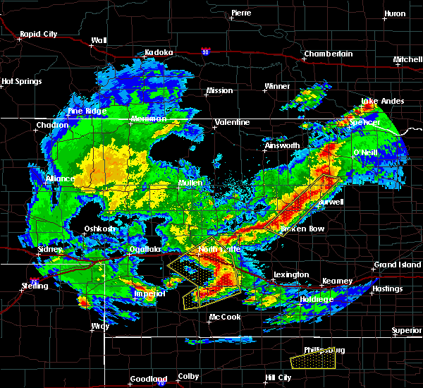 At 732 pm cdt, a severe thunderstorm was located 7 miles north of moorefield, or 13 miles northeast of curtis, moving northeast at 45 mph (radar indicated). Hazards include 60 mph wind gusts and quarter size hail. Hail damage to vehicles is expected. Expect wind damage to roofs, siding, and trees. At 732 pm cdt, a severe thunderstorm was located 7 miles north of moorefield, or 13 miles northeast of curtis, moving northeast at 45 mph (radar indicated). Hazards include 60 mph wind gusts and quarter size hail. Hail damage to vehicles is expected. Expect wind damage to roofs, siding, and trees.
|
| 8/27/2017 4:10 AM CDT |
 At 408 am cdt, severe thunderstorms were located along a line extending from near wood river to near prosser to near kearney, moving southeast at 55 mph (emergency management. at 405am power lines were down near pleasanton). Hazards include 70 mph wind gusts and quarter size hail. Hail damage to vehicles is expected. expect considerable tree damage. wind damage is also likely to mobile homes, roofs, and outbuildings. locations impacted include, grand island, kearney, lexington, cozad, gibbon, ravenna, wood river, shelton, elm creek, doniphan, cairo, alda, overton, odessa, pleasanton, amherst, sumner, riverdale, miller and eddyville. This includes interstate 80 between mile markers 218 and 317. At 408 am cdt, severe thunderstorms were located along a line extending from near wood river to near prosser to near kearney, moving southeast at 55 mph (emergency management. at 405am power lines were down near pleasanton). Hazards include 70 mph wind gusts and quarter size hail. Hail damage to vehicles is expected. expect considerable tree damage. wind damage is also likely to mobile homes, roofs, and outbuildings. locations impacted include, grand island, kearney, lexington, cozad, gibbon, ravenna, wood river, shelton, elm creek, doniphan, cairo, alda, overton, odessa, pleasanton, amherst, sumner, riverdale, miller and eddyville. This includes interstate 80 between mile markers 218 and 317.
|
| 8/27/2017 3:43 AM CDT |
 At 343 am cdt, severe thunderstorms were located along a line extending from near boelus to 6 miles east of poole to 7 miles west of pleasanton, moving southeast at 55 mph (radar indicated). Hazards include 60 mph wind gusts and quarter size hail. Hail damage to vehicles is expected. Expect wind damage to roofs, siding, and trees. At 343 am cdt, severe thunderstorms were located along a line extending from near boelus to 6 miles east of poole to 7 miles west of pleasanton, moving southeast at 55 mph (radar indicated). Hazards include 60 mph wind gusts and quarter size hail. Hail damage to vehicles is expected. Expect wind damage to roofs, siding, and trees.
|
| 8/14/2017 2:13 AM CDT |
 At 213 am cdt, a severe thunderstorm was located near willow island, or 20 miles northwest of lexington, moving southeast at 10 mph (radar indicated). Hazards include quarter size hail. damage to vehicles is expected At 213 am cdt, a severe thunderstorm was located near willow island, or 20 miles northwest of lexington, moving southeast at 10 mph (radar indicated). Hazards include quarter size hail. damage to vehicles is expected
|
| 8/14/2017 1:52 AM CDT |
 At 152 am cdt, a severe thunderstorm was located near willow island, or 20 miles northwest of lexington, moving southeast at 15 mph (radar indicated). Hazards include 60 mph wind gusts and quarter size hail. Hail damage to vehicles is expected. expect wind damage to roofs, siding, and trees. locations impacted include, cozad, gothenburg and willow island. This includes interstate 80 between mile markers 211 and 226. At 152 am cdt, a severe thunderstorm was located near willow island, or 20 miles northwest of lexington, moving southeast at 15 mph (radar indicated). Hazards include 60 mph wind gusts and quarter size hail. Hail damage to vehicles is expected. expect wind damage to roofs, siding, and trees. locations impacted include, cozad, gothenburg and willow island. This includes interstate 80 between mile markers 211 and 226.
|
| 8/14/2017 1:37 AM CDT |
 At 136 am cdt, a severe thunderstorm was located near gothenburg, or 24 miles northwest of lexington, moving southeast at 15 mph (radar indicated). Hazards include 60 mph wind gusts and quarter size hail. Hail damage to vehicles is expected. Expect wind damage to roofs, siding, and trees. At 136 am cdt, a severe thunderstorm was located near gothenburg, or 24 miles northwest of lexington, moving southeast at 15 mph (radar indicated). Hazards include 60 mph wind gusts and quarter size hail. Hail damage to vehicles is expected. Expect wind damage to roofs, siding, and trees.
|
| 8/13/2017 10:33 PM CDT |
 At 1033 pm cdt, a severe thunderstorm was located near cozad, or 14 miles west of lexington, moving southeast at 10 mph (trained weather spotters). Hazards include 60 mph wind gusts and half dollar size hail. Hail damage to vehicles is expected. expect wind damage to roofs, siding, and trees. locations impacted include, cozad and willow island. This includes interstate 80 between mile markers 217 and 227. At 1033 pm cdt, a severe thunderstorm was located near cozad, or 14 miles west of lexington, moving southeast at 10 mph (trained weather spotters). Hazards include 60 mph wind gusts and half dollar size hail. Hail damage to vehicles is expected. expect wind damage to roofs, siding, and trees. locations impacted include, cozad and willow island. This includes interstate 80 between mile markers 217 and 227.
|
| 8/13/2017 10:14 PM CDT |
 At 1013 pm cdt, a cluster of severe thunderstorms was located from near gothenburg to near cozad willow island, moving southeast at 15 mph (trained weather spotters reported half dollar size hail in gothenburg). Hazards include 60 mph wind gusts and half dollar size hail. Hail damage to vehicles is expected. expect wind damage to roofs, siding, and trees. locations impacted include, cozad, gothenburg and willow island. This includes interstate 80 between mile markers 211 and 227. At 1013 pm cdt, a cluster of severe thunderstorms was located from near gothenburg to near cozad willow island, moving southeast at 15 mph (trained weather spotters reported half dollar size hail in gothenburg). Hazards include 60 mph wind gusts and half dollar size hail. Hail damage to vehicles is expected. expect wind damage to roofs, siding, and trees. locations impacted include, cozad, gothenburg and willow island. This includes interstate 80 between mile markers 211 and 227.
|
| 8/13/2017 10:09 PM CDT |
 At 1008 pm cdt, a severe thunderstorm was located over willow island, or 19 miles northwest of lexington, moving southeast at 15 mph (trained weather spotters reported half dollar size hail in gothenburg at 1008 pm). Hazards include 60 mph wind gusts and half dollar size hail. Hail damage to vehicles is expected. expect wind damage to roofs, siding, and trees. locations impacted include, cozad, gothenburg and willow island. This includes interstate 80 between mile markers 211 and 227. At 1008 pm cdt, a severe thunderstorm was located over willow island, or 19 miles northwest of lexington, moving southeast at 15 mph (trained weather spotters reported half dollar size hail in gothenburg at 1008 pm). Hazards include 60 mph wind gusts and half dollar size hail. Hail damage to vehicles is expected. expect wind damage to roofs, siding, and trees. locations impacted include, cozad, gothenburg and willow island. This includes interstate 80 between mile markers 211 and 227.
|
| 8/13/2017 10:04 PM CDT |
 At 1004 pm cdt, a severe thunderstorm was located near cozad, or 16 miles northwest of lexington, moving southeast at 25 mph (radar indicated). Hazards include ping pong ball size hail and 60 mph wind gusts. People and animals outdoors will be injured. expect hail damage to roofs, siding, windows, and vehicles. expect wind damage to roofs, siding, and trees. locations impacted include, cozad. This includes interstate 80 between mile markers 220 and 226. At 1004 pm cdt, a severe thunderstorm was located near cozad, or 16 miles northwest of lexington, moving southeast at 25 mph (radar indicated). Hazards include ping pong ball size hail and 60 mph wind gusts. People and animals outdoors will be injured. expect hail damage to roofs, siding, windows, and vehicles. expect wind damage to roofs, siding, and trees. locations impacted include, cozad. This includes interstate 80 between mile markers 220 and 226.
|
| 8/13/2017 10:01 PM CDT |
 At 1001 pm cdt, a severe thunderstorm was located over willow island, or 20 miles northwest of lexington, moving southeast at 15 mph (trained weather spotters reported nickel to quarter size hail in gothenburg at 10 pm). Hazards include 60 mph wind gusts and quarter size hail. Hail damage to vehicles is expected. Expect wind damage to roofs, siding, and trees. At 1001 pm cdt, a severe thunderstorm was located over willow island, or 20 miles northwest of lexington, moving southeast at 15 mph (trained weather spotters reported nickel to quarter size hail in gothenburg at 10 pm). Hazards include 60 mph wind gusts and quarter size hail. Hail damage to vehicles is expected. Expect wind damage to roofs, siding, and trees.
|
| 8/13/2017 9:53 PM CDT |
 At 953 pm cdt, a severe thunderstorm was located 8 miles north of willow island, or 20 miles northwest of lexington, moving southeast at 20 mph (radar indicated). Hazards include 70 mph wind gusts and ping pong ball size hail. People and animals outdoors will be injured. expect hail damage to roofs, siding, windows, and vehicles. expect considerable tree damage. wind damage is also likely to mobile homes, roofs, and outbuildings. locations impacted include, cozad. This includes interstate 80 between mile markers 220 and 226. At 953 pm cdt, a severe thunderstorm was located 8 miles north of willow island, or 20 miles northwest of lexington, moving southeast at 20 mph (radar indicated). Hazards include 70 mph wind gusts and ping pong ball size hail. People and animals outdoors will be injured. expect hail damage to roofs, siding, windows, and vehicles. expect considerable tree damage. wind damage is also likely to mobile homes, roofs, and outbuildings. locations impacted include, cozad. This includes interstate 80 between mile markers 220 and 226.
|
| 8/13/2017 9:34 PM CDT |
 At 934 pm cdt, a severe thunderstorm was located 10 miles northeast of gothenburg, or 26 miles northwest of lexington, moving southeast at 25 mph (radar indicated). Hazards include 70 mph wind gusts and ping pong ball size hail. People and animals outdoors will be injured. expect hail damage to roofs, siding, windows, and vehicles. expect considerable tree damage. Wind damage is also likely to mobile homes, roofs, and outbuildings. At 934 pm cdt, a severe thunderstorm was located 10 miles northeast of gothenburg, or 26 miles northwest of lexington, moving southeast at 25 mph (radar indicated). Hazards include 70 mph wind gusts and ping pong ball size hail. People and animals outdoors will be injured. expect hail damage to roofs, siding, windows, and vehicles. expect considerable tree damage. Wind damage is also likely to mobile homes, roofs, and outbuildings.
|
| 7/2/2017 8:53 PM CDT |
 At 853 pm cdt, severe thunderstorms were located along a line extending from near willow island to 8 miles northwest of eustis, moving southeast at 25 mph (radar indicated). Hazards include ping pong ball size hail and 60 mph wind gusts. People and animals outdoors will be injured. expect hail damage to roofs, siding, windows, and vehicles. expect wind damage to roofs, siding, and trees. locations impacted include, cozad, willow island and farnam. This includes interstate 80 between mile markers 215 and 229. At 853 pm cdt, severe thunderstorms were located along a line extending from near willow island to 8 miles northwest of eustis, moving southeast at 25 mph (radar indicated). Hazards include ping pong ball size hail and 60 mph wind gusts. People and animals outdoors will be injured. expect hail damage to roofs, siding, windows, and vehicles. expect wind damage to roofs, siding, and trees. locations impacted include, cozad, willow island and farnam. This includes interstate 80 between mile markers 215 and 229.
|
| 7/2/2017 8:40 PM CDT |
 The national weather service in hastings has issued a * severe thunderstorm warning for. western dawson county in south central nebraska. Until 930 pm cdt * at 840 pm cdt, severe thunderstorms were located along a line extending from near willow island to 9 miles northwest of eustis to. The national weather service in hastings has issued a * severe thunderstorm warning for. western dawson county in south central nebraska. Until 930 pm cdt * at 840 pm cdt, severe thunderstorms were located along a line extending from near willow island to 9 miles northwest of eustis to.
|
| 7/2/2017 8:24 PM CDT |
 At 823 pm cdt, a severe thunderstorm was located over gothenburg, or 24 miles west of lexington, moving south at 10 mph (radar indicated. at 813 pm half dollar size hail was reported in gothenburg). Hazards include ping pong ball size hail. People and animals outdoors will be injured. expect damage to roofs, siding, windows, and vehicles. locations impacted include, gothenburg, willow island and farnam. This includes interstate 80 between mile markers 209 and 219. At 823 pm cdt, a severe thunderstorm was located over gothenburg, or 24 miles west of lexington, moving south at 10 mph (radar indicated. at 813 pm half dollar size hail was reported in gothenburg). Hazards include ping pong ball size hail. People and animals outdoors will be injured. expect damage to roofs, siding, windows, and vehicles. locations impacted include, gothenburg, willow island and farnam. This includes interstate 80 between mile markers 209 and 219.
|
| 7/2/2017 8:07 PM CDT |
 At 807 pm cdt, a severe thunderstorm was located over gothenburg, or 24 miles northwest of lexington, moving south at 5 mph (radar indicated). Hazards include quarter size hail. damage to vehicles is expected At 807 pm cdt, a severe thunderstorm was located over gothenburg, or 24 miles northwest of lexington, moving south at 5 mph (radar indicated). Hazards include quarter size hail. damage to vehicles is expected
|
| 6/27/2017 5:02 PM CDT |
 At 1001 pm cdt, severe thunderstorms were located along a line extending from near cozad to near eustis to 9 miles east of medicine creek reservoir state recreation area, moving east at 50 mph (an automated weather station at lexington reported a 61 mph wind gust at 9:55 pm cdt). Hazards include 60 mph wind gusts and nickel size hail. Expect damage to roofs, siding, and trees. locations impacted include, lexington, cozad, gothenburg, elwood, smithfield, willow island, johnson lake and farnam. This includes interstate 80 between mile markers 209 and 242. At 1001 pm cdt, severe thunderstorms were located along a line extending from near cozad to near eustis to 9 miles east of medicine creek reservoir state recreation area, moving east at 50 mph (an automated weather station at lexington reported a 61 mph wind gust at 9:55 pm cdt). Hazards include 60 mph wind gusts and nickel size hail. Expect damage to roofs, siding, and trees. locations impacted include, lexington, cozad, gothenburg, elwood, smithfield, willow island, johnson lake and farnam. This includes interstate 80 between mile markers 209 and 242.
|
| 6/27/2017 4:40 PM CDT |
 At 940 pm cdt, severe thunderstorms were located along a line extending from 7 miles southwest of gothenburg to near moorefield to 6 miles west of medicine creek reservoir state recreation area, moving east at 50 mph (radar indicated). Hazards include 60 mph wind gusts and nickel size hail. expect damage to roofs, siding, and trees At 940 pm cdt, severe thunderstorms were located along a line extending from 7 miles southwest of gothenburg to near moorefield to 6 miles west of medicine creek reservoir state recreation area, moving east at 50 mph (radar indicated). Hazards include 60 mph wind gusts and nickel size hail. expect damage to roofs, siding, and trees
|
| 4/9/2017 5:25 PM CDT |
 At 524 pm cdt, severe thunderstorms were located along a line extending from cozad to near smithfield to near edison, moving east at 45 mph (trained weather spotters. there have been several reports of 60 to 70 mph winds associated with this line of thunderstorms). Hazards include 70 mph wind gusts. Expect considerable tree damage. Damage is likely to mobile homes, roofs, and outbuildings. At 524 pm cdt, severe thunderstorms were located along a line extending from cozad to near smithfield to near edison, moving east at 45 mph (trained weather spotters. there have been several reports of 60 to 70 mph winds associated with this line of thunderstorms). Hazards include 70 mph wind gusts. Expect considerable tree damage. Damage is likely to mobile homes, roofs, and outbuildings.
|
| 4/9/2017 5:19 PM CDT |
 At 516 pm cdt, severe thunderstorms were located along a line extending from willow island to near arapahoe to near hendley, moving east at 40 mph (trained weather spotters. at 513 pm cdt...a storm chaser measured a wind gust of 72 mph at a location 8 miles southwest of elwood). Hazards include 70 mph wind gusts. Expect considerable tree damage. damage is likely to mobile homes, roofs, and outbuildings. locations impacted include, lexington, cozad, gothenburg, arapahoe, oxford, elwood, holbrook, edison, smithfield, willow island, johnson lake and farnam. This includes interstate 80 between mile markers 209 and 241. At 516 pm cdt, severe thunderstorms were located along a line extending from willow island to near arapahoe to near hendley, moving east at 40 mph (trained weather spotters. at 513 pm cdt...a storm chaser measured a wind gust of 72 mph at a location 8 miles southwest of elwood). Hazards include 70 mph wind gusts. Expect considerable tree damage. damage is likely to mobile homes, roofs, and outbuildings. locations impacted include, lexington, cozad, gothenburg, arapahoe, oxford, elwood, holbrook, edison, smithfield, willow island, johnson lake and farnam. This includes interstate 80 between mile markers 209 and 241.
|
| 4/9/2017 4:58 PM CDT |
 At 454 pm cdt, severe thunderstorms were located along a line extending from 8 miles southwest of gothenburg to near cambridge to 7 miles southwest of danbury, moving east at 40 mph (trained weather spotters. at 449 pm cdt trained weather spotters measured a 64 mph wind gust in cambridge along the thunderstorm gust front). Hazards include 60 mph wind gusts. Expect damage to roofs, siding, and trees. locations impacted include, lexington, cozad, gothenburg, cambridge, arapahoe, elwood, beaver city, holbrook, edison, wilsonville, smithfield, hendley, hollinger, willow island, johnson lake and farnam. this includes interstate 80 between mile markers 209 and 241. The strongest winds are occurring out ahead of the broken line of thunderstorms in association with a strong gust front. At 454 pm cdt, severe thunderstorms were located along a line extending from 8 miles southwest of gothenburg to near cambridge to 7 miles southwest of danbury, moving east at 40 mph (trained weather spotters. at 449 pm cdt trained weather spotters measured a 64 mph wind gust in cambridge along the thunderstorm gust front). Hazards include 60 mph wind gusts. Expect damage to roofs, siding, and trees. locations impacted include, lexington, cozad, gothenburg, cambridge, arapahoe, elwood, beaver city, holbrook, edison, wilsonville, smithfield, hendley, hollinger, willow island, johnson lake and farnam. this includes interstate 80 between mile markers 209 and 241. The strongest winds are occurring out ahead of the broken line of thunderstorms in association with a strong gust front.
|
| 4/9/2017 4:37 PM CDT |
 At 436 pm cdt, severe thunderstorms were located along a line extending from 11 miles northwest of moorefield to near bartley to near herndon, moving east at 40 mph (trained weather spotters). Hazards include 60 mph wind gusts. expect damage to roofs, siding, and trees At 436 pm cdt, severe thunderstorms were located along a line extending from 11 miles northwest of moorefield to near bartley to near herndon, moving east at 40 mph (trained weather spotters). Hazards include 60 mph wind gusts. expect damage to roofs, siding, and trees
|
| 3/23/2017 9:51 PM CDT |
 At 951 pm cdt, severe thunderstorms were located along a line extending from near holbrook to near miller, moving north at 50 mph (radar indicated). Hazards include 70 mph wind gusts. Expect considerable tree damage. Damage is likely to mobile homes, roofs, and outbuildings. At 951 pm cdt, severe thunderstorms were located along a line extending from near holbrook to near miller, moving north at 50 mph (radar indicated). Hazards include 70 mph wind gusts. Expect considerable tree damage. Damage is likely to mobile homes, roofs, and outbuildings.
|
| 3/23/2017 6:46 PM CDT |
 At 646 pm cdt, a severe thunderstorm was located near willow island, or 17 miles northwest of lexington, moving northeast at 50 mph (radar indicated). Hazards include 60 mph wind gusts and quarter size hail. Hail damage to vehicles is expected. expect wind damage to roofs, siding, and trees. locations impacted include, cozad, gothenburg and willow island. This includes interstate 80 between mile markers 214 and 227. At 646 pm cdt, a severe thunderstorm was located near willow island, or 17 miles northwest of lexington, moving northeast at 50 mph (radar indicated). Hazards include 60 mph wind gusts and quarter size hail. Hail damage to vehicles is expected. expect wind damage to roofs, siding, and trees. locations impacted include, cozad, gothenburg and willow island. This includes interstate 80 between mile markers 214 and 227.
|
| 3/23/2017 6:21 PM CDT |
 At 621 pm cdt, a severe thunderstorm was located 9 miles west of eustis, or 15 miles east of curtis, moving northeast at 55 mph (radar indicated). Hazards include 60 mph wind gusts and quarter size hail. Hail damage to vehicles is expected. Expect wind damage to roofs, siding, and trees. At 621 pm cdt, a severe thunderstorm was located 9 miles west of eustis, or 15 miles east of curtis, moving northeast at 55 mph (radar indicated). Hazards include 60 mph wind gusts and quarter size hail. Hail damage to vehicles is expected. Expect wind damage to roofs, siding, and trees.
|
| 8/12/2016 1:25 AM CDT |
 The severe thunderstorm warning for western dawson county will expire at 130 am cdt, the storms which prompted the warning have weakened below severe limits, and no longer pose an immediate threat to life or property. therefore, the warning will be allowed to expire. however gusty winds and heavy rain are still possible with these thunderstorms. to report severe weather, contact your nearest law enforcement agency. they will relay your report to the national weather service hastings. The severe thunderstorm warning for western dawson county will expire at 130 am cdt, the storms which prompted the warning have weakened below severe limits, and no longer pose an immediate threat to life or property. therefore, the warning will be allowed to expire. however gusty winds and heavy rain are still possible with these thunderstorms. to report severe weather, contact your nearest law enforcement agency. they will relay your report to the national weather service hastings.
|
| 8/12/2016 1:14 AM CDT |
 At 113 am cdt, severe thunderstorms were located along a line extending from 13 miles southwest of callaway to near willow island to near moorefield, moving east at 40 mph (radar indicated. at 108 am cdt...quarter size hail was reported in gothenburg). Hazards include 60 mph wind gusts and quarter size hail. Hail damage to vehicles is expected. expect wind damage to roofs, siding, and trees. locations impacted include, cozad, gothenburg, willow island and farnam. This includes interstate 80 between mile markers 209 and 227. At 113 am cdt, severe thunderstorms were located along a line extending from 13 miles southwest of callaway to near willow island to near moorefield, moving east at 40 mph (radar indicated. at 108 am cdt...quarter size hail was reported in gothenburg). Hazards include 60 mph wind gusts and quarter size hail. Hail damage to vehicles is expected. expect wind damage to roofs, siding, and trees. locations impacted include, cozad, gothenburg, willow island and farnam. This includes interstate 80 between mile markers 209 and 227.
|
| 8/12/2016 12:52 AM CDT |
 At 1251 am cdt, severe thunderstorms were located along a line extending from 13 miles south of gandy to near brady to 6 miles southeast of wellfleet, moving east at 40 mph (radar indicated). Hazards include 70 mph wind gusts. Expect considerable tree damage. damage is likely to mobile homes, roofs, and outbuildings. locations impacted include, cozad, gothenburg, willow island and farnam. This includes interstate 80 between mile markers 209 and 227. At 1251 am cdt, severe thunderstorms were located along a line extending from 13 miles south of gandy to near brady to 6 miles southeast of wellfleet, moving east at 40 mph (radar indicated). Hazards include 70 mph wind gusts. Expect considerable tree damage. damage is likely to mobile homes, roofs, and outbuildings. locations impacted include, cozad, gothenburg, willow island and farnam. This includes interstate 80 between mile markers 209 and 227.
|
| 8/12/2016 12:38 AM CDT |
 At 1237 am cdt, severe thunderstorms were located along a line extending from 13 miles south of stapleton to 6 miles south of maxwell to wellfleet, moving east at 40 mph (radar indicated. at 1234 am cdt...a wind gust of 72 mph was recorded by the north platte asos). Hazards include 70 mph wind gusts. Expect considerable tree damage. Damage is likely to mobile homes, roofs, and outbuildings. At 1237 am cdt, severe thunderstorms were located along a line extending from 13 miles south of stapleton to 6 miles south of maxwell to wellfleet, moving east at 40 mph (radar indicated. at 1234 am cdt...a wind gust of 72 mph was recorded by the north platte asos). Hazards include 70 mph wind gusts. Expect considerable tree damage. Damage is likely to mobile homes, roofs, and outbuildings.
|
| 7/27/2016 12:40 AM CDT |
 The severe thunderstorm warning for dawson county will expire at 1245 am cdt, the storms which prompted the warning have weakened below severe limits, and no longer pose an immediate threat to life or property. therefore the warning will be allowed to expire. however gusty winds are still possible with these thunderstorms. The severe thunderstorm warning for dawson county will expire at 1245 am cdt, the storms which prompted the warning have weakened below severe limits, and no longer pose an immediate threat to life or property. therefore the warning will be allowed to expire. however gusty winds are still possible with these thunderstorms.
|
| 7/27/2016 12:28 AM CDT |
 At 1227 am cdt, severe thunderstorms were located along a line extending from 6 miles north of eddyville to near cozad to near gothenburg, moving southeast at 40 mph (radar indicated). Hazards include 60 mph wind gusts. Expect damage to roofs. siding. and trees. Locations impacted include, lexington, cozad, gothenburg, overton, sumner, eddyville and farnam. At 1227 am cdt, severe thunderstorms were located along a line extending from 6 miles north of eddyville to near cozad to near gothenburg, moving southeast at 40 mph (radar indicated). Hazards include 60 mph wind gusts. Expect damage to roofs. siding. and trees. Locations impacted include, lexington, cozad, gothenburg, overton, sumner, eddyville and farnam.
|
| 7/27/2016 12:07 AM CDT |
 At 1207 am cdt, severe thunderstorms were located along a line extending from 22 miles northwest of eddyville to 9 miles north of gothenburg to 38 miles northwest of cozad, moving southeast at 45 mph (radar indicated). Hazards include 70 mph wind gusts. Expect considerable tree damage. Damage is likely to mobile homes, roofs, and outbuildings. At 1207 am cdt, severe thunderstorms were located along a line extending from 22 miles northwest of eddyville to 9 miles north of gothenburg to 38 miles northwest of cozad, moving southeast at 45 mph (radar indicated). Hazards include 70 mph wind gusts. Expect considerable tree damage. Damage is likely to mobile homes, roofs, and outbuildings.
|
| 6/30/2016 12:25 AM CDT |
 The severe thunderstorm warning for dawson county will expire at 1230 am cdt, the storms which prompted the warning have weakened below severe limits, and no longer pose an immediate threat to life or property. therefore the warning will be allowed to expire. however gusty winds are still possible with these thunderstorms. The severe thunderstorm warning for dawson county will expire at 1230 am cdt, the storms which prompted the warning have weakened below severe limits, and no longer pose an immediate threat to life or property. therefore the warning will be allowed to expire. however gusty winds are still possible with these thunderstorms.
|
| 6/30/2016 12:16 AM CDT |
 At 1215 am cdt, severe thunderstorms were located along a line extending from near eddyville to near lexington to near johnson lake, moving southeast at 35 mph (radar indicated). Hazards include 60 mph wind gusts. Expect damage to roofs. siding. and trees. Locations impacted include, lexington, cozad, gothenburg, eddyville and farnam. At 1215 am cdt, severe thunderstorms were located along a line extending from near eddyville to near lexington to near johnson lake, moving southeast at 35 mph (radar indicated). Hazards include 60 mph wind gusts. Expect damage to roofs. siding. and trees. Locations impacted include, lexington, cozad, gothenburg, eddyville and farnam.
|
| 6/30/2016 12:02 AM CDT |
 At 1201 am cdt, severe thunderstorms were located along a line extending from 10 miles northwest of eddyville to 12 miles northwest of lexington to near cozad, moving southeast at 40 mph (radar indicated). Hazards include 60 mph wind gusts. Expect damage to roofs. siding. and trees. Locations impacted include, lexington, cozad, gothenburg, eddyville and farnam. At 1201 am cdt, severe thunderstorms were located along a line extending from 10 miles northwest of eddyville to 12 miles northwest of lexington to near cozad, moving southeast at 40 mph (radar indicated). Hazards include 60 mph wind gusts. Expect damage to roofs. siding. and trees. Locations impacted include, lexington, cozad, gothenburg, eddyville and farnam.
|
| 6/29/2016 11:41 PM CDT |
 At 1141 pm cdt, severe thunderstorms were located along a line extending from 22 miles northwest of eddyville to 13 miles north of cozad to 9 miles northwest of gothenburg, moving southeast at 40 mph (radar indicated). Hazards include 60 mph wind gusts. Expect damage to roofs. siding. And trees. At 1141 pm cdt, severe thunderstorms were located along a line extending from 22 miles northwest of eddyville to 13 miles north of cozad to 9 miles northwest of gothenburg, moving southeast at 40 mph (radar indicated). Hazards include 60 mph wind gusts. Expect damage to roofs. siding. And trees.
|
| 5/30/2016 8:15 PM CDT |
 At 814 pm cdt, severe thunderstorms were located along a line extending from 17 miles north of cozad to near gothenburg to 18 miles west of elwood, moving east at 30 mph (radar indicated). Hazards include 60 mph wind gusts. Expect damage to roofs. siding. and trees. Locations impacted include, cozad, gothenburg and farnam. At 814 pm cdt, severe thunderstorms were located along a line extending from 17 miles north of cozad to near gothenburg to 18 miles west of elwood, moving east at 30 mph (radar indicated). Hazards include 60 mph wind gusts. Expect damage to roofs. siding. and trees. Locations impacted include, cozad, gothenburg and farnam.
|
| 5/30/2016 7:43 PM CDT |
 At 741 pm cdt, severe thunderstorms were located along a line extending from 58 miles northwest of cozad to 12 miles west of gothenburg to 27 miles northwest of cambridge, moving east at 35 mph (radar indicated). Hazards include 60 mph wind gusts. Expect damage to roofs. siding. And trees. At 741 pm cdt, severe thunderstorms were located along a line extending from 58 miles northwest of cozad to 12 miles west of gothenburg to 27 miles northwest of cambridge, moving east at 35 mph (radar indicated). Hazards include 60 mph wind gusts. Expect damage to roofs. siding. And trees.
|
| 5/25/2016 8:39 PM CDT |
 At 838 pm cdt, severe thunderstorms were located along a line extending from near gothenburg to near cozad to 11 miles west of johnson lake, moving east at 35 mph (radar indicated). Hazards include 60 mph wind gusts and nickel size hail. Expect damage to roofs. siding. and trees. Locations impacted include, cozad, gothenburg and farnam. At 838 pm cdt, severe thunderstorms were located along a line extending from near gothenburg to near cozad to 11 miles west of johnson lake, moving east at 35 mph (radar indicated). Hazards include 60 mph wind gusts and nickel size hail. Expect damage to roofs. siding. and trees. Locations impacted include, cozad, gothenburg and farnam.
|
| 5/25/2016 8:11 PM CDT |
 At 810 pm cdt, severe thunderstorms were located along a line extending from 10 miles northwest of gothenburg to 18 miles west of cozad to 30 miles northwest of cambridge, moving east at 35 mph (radar indicated). Hazards include 60 mph wind gusts and quarter size hail. Hail damage to vehicles is expected. Expect wind damage to roofs, siding, and trees. At 810 pm cdt, severe thunderstorms were located along a line extending from 10 miles northwest of gothenburg to 18 miles west of cozad to 30 miles northwest of cambridge, moving east at 35 mph (radar indicated). Hazards include 60 mph wind gusts and quarter size hail. Hail damage to vehicles is expected. Expect wind damage to roofs, siding, and trees.
|
| 5/8/2016 8:27 PM CDT | The severe thunderstorm warning for western dawson county will expire at 830 pm cdt, the storm which prompted the warning has weakened below severe limits. therefore the warning will be allowed to expire. a severe thunderstorm watch remains in effect until midnight cdt for south central nebraska. |
| 5/8/2016 8:09 PM CDT |
 At 808 pm cdt, a severe thunderstorm was located over gothenburg, or 23 miles northwest of lexington, moving north at 20 mph (trained weather spotters. at 804 pm cdt...trained weather spotters reported quarter size hail in gothenburg). Hazards include 60 mph wind gusts and quarter size hail. Hail damage to vehicles is expected. expect wind damage to roofs, siding, and trees. Locations impacted include, gothenburg and farnam. At 808 pm cdt, a severe thunderstorm was located over gothenburg, or 23 miles northwest of lexington, moving north at 20 mph (trained weather spotters. at 804 pm cdt...trained weather spotters reported quarter size hail in gothenburg). Hazards include 60 mph wind gusts and quarter size hail. Hail damage to vehicles is expected. expect wind damage to roofs, siding, and trees. Locations impacted include, gothenburg and farnam.
|
| 5/8/2016 7:58 PM CDT |
 At 756 pm cdt, a severe thunderstorm was located over gothenburg, or 23 miles west of lexington, moving north at 30 mph. a second thunderstorm capable of producing quarter size hail was moving north into farnam (radar indicated). Hazards include 60 mph wind gusts and quarter size hail. Hail damage to vehicles is expected. expect wind damage to roofs, siding, and trees. Locations impacted include, gothenburg and farnam. At 756 pm cdt, a severe thunderstorm was located over gothenburg, or 23 miles west of lexington, moving north at 30 mph. a second thunderstorm capable of producing quarter size hail was moving north into farnam (radar indicated). Hazards include 60 mph wind gusts and quarter size hail. Hail damage to vehicles is expected. expect wind damage to roofs, siding, and trees. Locations impacted include, gothenburg and farnam.
|
| 5/8/2016 7:39 PM CDT |
 At 738 pm cdt, a severe thunderstorm was located 14 miles southwest of cozad, or 23 miles west of lexington, moving north at 25 mph (radar indicated). Hazards include 60 mph wind gusts and quarter size hail. Hail damage to vehicles is expected. Expect wind damage to roofs, siding, and trees. At 738 pm cdt, a severe thunderstorm was located 14 miles southwest of cozad, or 23 miles west of lexington, moving north at 25 mph (radar indicated). Hazards include 60 mph wind gusts and quarter size hail. Hail damage to vehicles is expected. Expect wind damage to roofs, siding, and trees.
|
| 5/8/2016 5:44 PM CDT |
 At 544 pm cdt, a severe thunderstorm was located near cozad, or 18 miles northwest of lexington, moving north at 20 mph (radar indicated). Hazards include 60 mph wind gusts and half dollar size hail. Hail damage to vehicles is expected. Expect wind damage to roofs, siding, and trees. At 544 pm cdt, a severe thunderstorm was located near cozad, or 18 miles northwest of lexington, moving north at 20 mph (radar indicated). Hazards include 60 mph wind gusts and half dollar size hail. Hail damage to vehicles is expected. Expect wind damage to roofs, siding, and trees.
|
| 5/7/2016 9:13 PM CDT | The severe thunderstorm warning for western dawson county will expire at 915 pm cdt, the severe thunderstorm which prompted the warning has weakened. therefore the warning will be allowed to expire. however small hail and gusty winds are still possible with this thunderstorm. |
| 5/7/2016 9:04 PM CDT |
 At 902 pm cdt, a severe thunderstorm was located near cozad, or 15 miles west of lexington, moving north at 40 mph (radar indicated). Hazards include 60 mph wind gusts and quarter size hail. Hail damage to vehicles is expected. wind damage to roofs, siding, and trees is possible. Locations impacted include, cozad, gothenburg and farnam. At 902 pm cdt, a severe thunderstorm was located near cozad, or 15 miles west of lexington, moving north at 40 mph (radar indicated). Hazards include 60 mph wind gusts and quarter size hail. Hail damage to vehicles is expected. wind damage to roofs, siding, and trees is possible. Locations impacted include, cozad, gothenburg and farnam.
|
| 5/7/2016 8:28 PM CDT |
 At 828 pm cdt, a severe thunderstorm was located 17 miles southwest of cozad, or 25 miles west of lexington, moving north at 35 mph (radar indicated). Hazards include 60 mph wind gusts and quarter size hail. Hail damage to vehicles is expected. Expect wind damage to roofs, siding, and trees. At 828 pm cdt, a severe thunderstorm was located 17 miles southwest of cozad, or 25 miles west of lexington, moving north at 35 mph (radar indicated). Hazards include 60 mph wind gusts and quarter size hail. Hail damage to vehicles is expected. Expect wind damage to roofs, siding, and trees.
|
| 11/16/2015 6:54 PM CST |
 The severe thunderstorm warning for western dawson and north central gosper counties will expire at 700 pm cst, the storm which prompted the warning has weakened below severe limits, and no longer poses an immediate threat to life or property. therefore the warning will be allowed to expire. however small hail and gusty winds are still possible with this thunderstorm. a tornado watch remains in effect until 1000 pm cst for south central nebraska. to report severe weather, contact your nearest law enforcement agency. they will relay your report to the national weather service hastings. The severe thunderstorm warning for western dawson and north central gosper counties will expire at 700 pm cst, the storm which prompted the warning has weakened below severe limits, and no longer poses an immediate threat to life or property. therefore the warning will be allowed to expire. however small hail and gusty winds are still possible with this thunderstorm. a tornado watch remains in effect until 1000 pm cst for south central nebraska. to report severe weather, contact your nearest law enforcement agency. they will relay your report to the national weather service hastings.
|
| 11/16/2015 6:46 PM CST |
 At 646 pm cst, a severe thunderstorm was located near cozad, or 17 miles northwest of lexington, moving north at 30 mph (radar indicated). Hazards include 60 mph wind gusts and quarter size hail. Hail damage to vehicles is expected. expect wind damage to roofs, siding and trees. locations impacted include, cozad, gothenburg, elwood, johnson lake and farnam. this includes interstate 80 between mile markers 209 and 232. A tornado watch remains in effect until 1000 pm cst for south central nebraska. At 646 pm cst, a severe thunderstorm was located near cozad, or 17 miles northwest of lexington, moving north at 30 mph (radar indicated). Hazards include 60 mph wind gusts and quarter size hail. Hail damage to vehicles is expected. expect wind damage to roofs, siding and trees. locations impacted include, cozad, gothenburg, elwood, johnson lake and farnam. this includes interstate 80 between mile markers 209 and 232. A tornado watch remains in effect until 1000 pm cst for south central nebraska.
|
| 11/16/2015 6:33 PM CST |
 At 632 pm cst, a severe thunderstorm was located near cozad, or 16 miles west of lexington, moving north at 40 mph (radar indicated). Hazards include 60 mph wind gusts and quarter size hail. Hail damage to vehicles is expected. expect wind damage to roofs, siding and trees. locations impacted include, cozad, gothenburg, elwood, johnson lake and farnam. this includes interstate 80 between mile markers 209 and 232. A tornado watch remains in effect until 1000 pm cst for south central nebraska. At 632 pm cst, a severe thunderstorm was located near cozad, or 16 miles west of lexington, moving north at 40 mph (radar indicated). Hazards include 60 mph wind gusts and quarter size hail. Hail damage to vehicles is expected. expect wind damage to roofs, siding and trees. locations impacted include, cozad, gothenburg, elwood, johnson lake and farnam. this includes interstate 80 between mile markers 209 and 232. A tornado watch remains in effect until 1000 pm cst for south central nebraska.
|
| 11/16/2015 6:17 PM CST |
 At 617 pm cst, a severe thunderstorm was located 15 miles west of johnson lake, or 21 miles west of lexington, moving north at 30 mph (radar indicated). Hazards include 60 mph wind gusts and quarter size hail. Hail damage to vehicles is expected. Expect wind damage to roofs, siding and trees. At 617 pm cst, a severe thunderstorm was located 15 miles west of johnson lake, or 21 miles west of lexington, moving north at 30 mph (radar indicated). Hazards include 60 mph wind gusts and quarter size hail. Hail damage to vehicles is expected. Expect wind damage to roofs, siding and trees.
|
| 8/8/2015 12:19 AM CDT |
 At 1218 am cdt, a severe thunderstorm was located over cozad, or 13 miles northwest of lexington, moving east at 40 mph (radar indicated). Hazards include 70 mph wind gusts. Expect considerable tree damage. Damage is likely to mobile homes, roofs and outbuildings. At 1218 am cdt, a severe thunderstorm was located over cozad, or 13 miles northwest of lexington, moving east at 40 mph (radar indicated). Hazards include 70 mph wind gusts. Expect considerable tree damage. Damage is likely to mobile homes, roofs and outbuildings.
|
| 7/24/2015 8:05 PM CDT |
 At 805 pm cdt, severe thunderstorms were located along a line extending from near pressey state wildlife management area to near jeffrey canyon state wildlife management area, moving east at 30 mph (radar indicated). Hazards include 60 mph wind gusts and quarter size hail. Hail damage to vehicles is expected. Expect wind damage to roofs, siding and trees. At 805 pm cdt, severe thunderstorms were located along a line extending from near pressey state wildlife management area to near jeffrey canyon state wildlife management area, moving east at 30 mph (radar indicated). Hazards include 60 mph wind gusts and quarter size hail. Hail damage to vehicles is expected. Expect wind damage to roofs, siding and trees.
|
| 7/23/2015 8:52 PM CDT |
 At 852 pm cdt, a severe thunderstorm was located near eustis, or 20 miles west of lexington, moving east at 20 mph (radar indicated). Hazards include 60 mph wind gusts. Expect damage to roofs. siding and trees. locations impacted include, cozad, elwood, willow island, johnson lake and farnam. This includes interstate 80 between mile markers 217 and 235. At 852 pm cdt, a severe thunderstorm was located near eustis, or 20 miles west of lexington, moving east at 20 mph (radar indicated). Hazards include 60 mph wind gusts. Expect damage to roofs. siding and trees. locations impacted include, cozad, elwood, willow island, johnson lake and farnam. This includes interstate 80 between mile markers 217 and 235.
|
| 7/23/2015 8:10 PM CDT |
 At 810 pm cdt, a severe thunderstorm was located near moorefield, or 11 miles east of curtis, moving east at 35 mph (radar indicated). Hazards include golf ball size hail and 60 mph wind gusts. People and animals outdoors will be injured. expect hail damage to roofs, siding, windows and vehicles. Expect wind damage to roofs, siding and trees. At 810 pm cdt, a severe thunderstorm was located near moorefield, or 11 miles east of curtis, moving east at 35 mph (radar indicated). Hazards include golf ball size hail and 60 mph wind gusts. People and animals outdoors will be injured. expect hail damage to roofs, siding, windows and vehicles. Expect wind damage to roofs, siding and trees.
|
| 6/10/2015 8:07 PM CDT | 1 inch tree branches down between willow island and gothenbur in dawson county NE, 0.6 miles NNW of Willow Island, NE |
| 6/10/2015 4:50 PM CDT |
 The severe thunderstorm warning for western dawson county will expire at 500 pm cdt, the storms which prompted the warning have weakened below severe limits, and no longer poses an immediate threat to life or property. therefore the warning will be allowed to expire. however heavy rain is still possible with these thunderstorms. a severe thunderstorm watch remains in effect until 900 pm cdt for south central nebraska. The severe thunderstorm warning for western dawson county will expire at 500 pm cdt, the storms which prompted the warning have weakened below severe limits, and no longer poses an immediate threat to life or property. therefore the warning will be allowed to expire. however heavy rain is still possible with these thunderstorms. a severe thunderstorm watch remains in effect until 900 pm cdt for south central nebraska.
|
| 6/10/2015 4:23 PM CDT |
 A severe thunderstorm warning remains in effect until 500 pm cdt for western dawson county. at 423 pm cdt. severe thunderstorms were located along a line extending from gothenburg to 6 miles south of cozad. moving north at 30 mph. hazard. 60 mph wind gusts and quarter size hail. A severe thunderstorm warning remains in effect until 500 pm cdt for western dawson county. at 423 pm cdt. severe thunderstorms were located along a line extending from gothenburg to 6 miles south of cozad. moving north at 30 mph. hazard. 60 mph wind gusts and quarter size hail.
|
| 6/10/2015 4:13 PM CDT |
 At 412 pm cdt, severe thunderstorms were located along a line extending from near gothenburg to near eustis, moving north at 35 mph (radar indicated). Hazards include 60 mph wind gusts and quarter size hail. Hail damage to vehicles is expected. Expect wind damage to roofs, siding and trees. At 412 pm cdt, severe thunderstorms were located along a line extending from near gothenburg to near eustis, moving north at 35 mph (radar indicated). Hazards include 60 mph wind gusts and quarter size hail. Hail damage to vehicles is expected. Expect wind damage to roofs, siding and trees.
|
| 8/1/2013 10:29 PM CDT | Golf Ball sized hail reported 0.6 miles NNW of Willow Island, NE |
Hail Maps for Willow Island, NE
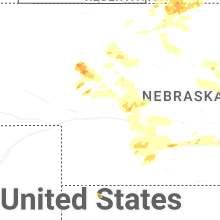
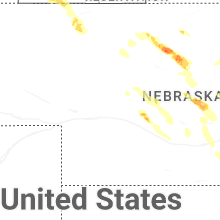
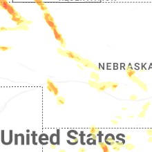
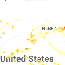


Connect with Interactive Hail Maps