

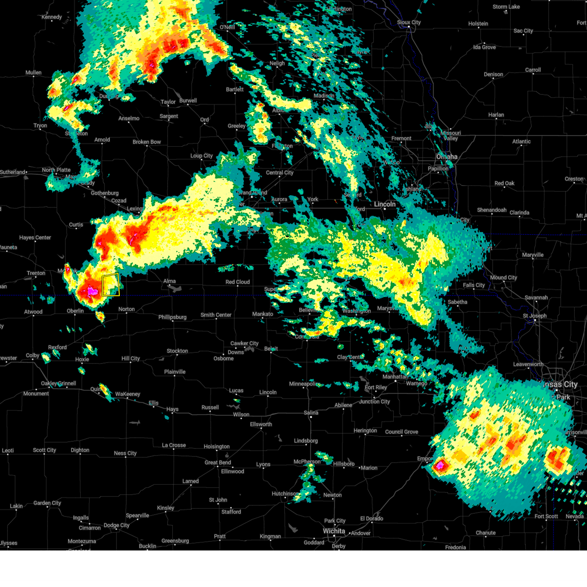
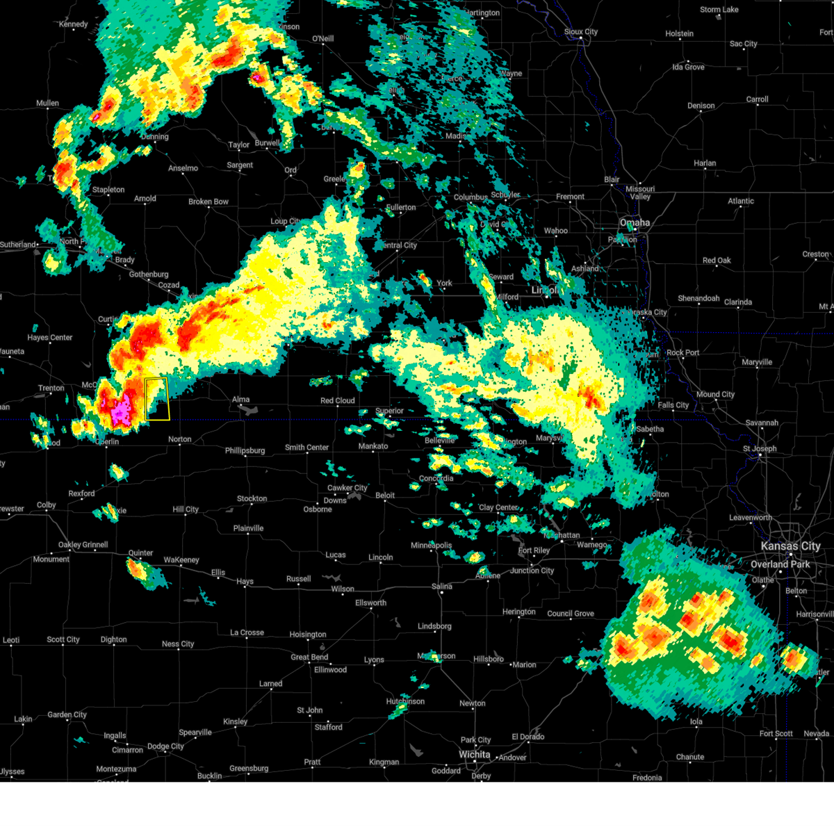
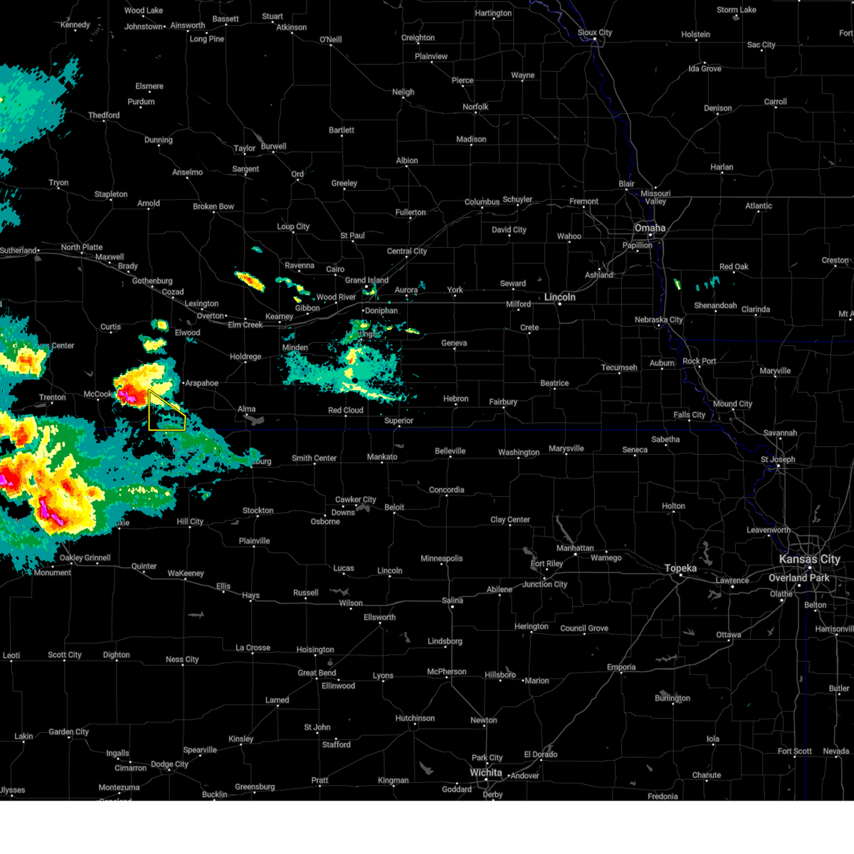
Hail Map for Wilsonville, NE
The Wilsonville, NE area has had 17 reports of on-the-ground hail by trained spotters, and has been under severe weather warnings 15 times during the past 12 months. Doppler radar has detected hail at or near Wilsonville, NE on 88 occasions, including 4 occasions during the past year.
| Name: | Wilsonville, NE |
| Where Located: | 70.1 miles NE of Colby, KS |
| Map: | Google Map for Wilsonville, NE |
| Population: | 93 |
| Housing Units: | 83 |
| More Info: | Search Google for Wilsonville, NE |
1
The Top Recent Hail Date for Wilsonville, NE is Wednesday, July 31, 2024 (32nd out of 88)

Hail and Wind Damage Spotted near Wilsonville, NE
| Date / Time | Report Details |
|---|---|
| 6/2/2025 9:27 PM CDT |
 The storms which prompted the warning have weakened below severe limits, and no longer pose an immediate threat to life or property. therefore, the warning will be allowed to expire. however, small hail and gusty winds are still possible with these thunderstorms. a severe thunderstorm watch remains in effect until 100 am cdt for north central kansas, and south central nebraska. remember, a severe thunderstorm warning still remains in effect for northwestern phillips county, eastern furnas county, and harlan county until 1000 pm cdt. The storms which prompted the warning have weakened below severe limits, and no longer pose an immediate threat to life or property. therefore, the warning will be allowed to expire. however, small hail and gusty winds are still possible with these thunderstorms. a severe thunderstorm watch remains in effect until 100 am cdt for north central kansas, and south central nebraska. remember, a severe thunderstorm warning still remains in effect for northwestern phillips county, eastern furnas county, and harlan county until 1000 pm cdt.
|
| 6/2/2025 9:05 PM CDT |
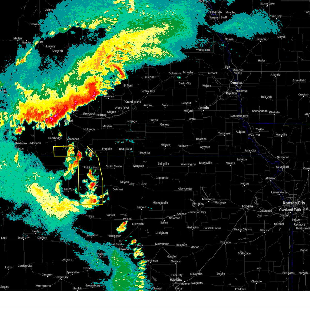
 At 904 pm cdt, severe thunderstorms were located along a line extending from near norton to 6 miles north of webster state park to 9 miles south of plainville, moving northeast at 40 mph (radar indicated). Hazards include 60 mph wind gusts and quarter size hail. Hail damage to vehicles is expected. expect wind damage to roofs, siding, and trees. these severe storms will be near, plainville, stockton, and logan around 910 pm cdt. speed and codell around 915 pm cdt. prairie view and glade around 920 pm cdt. phillipsburg around 925 pm cdt. woodston and long island around 930 pm cdt. Kirwin around 935 pm cdt. At 904 pm cdt, severe thunderstorms were located along a line extending from near norton to 6 miles north of webster state park to 9 miles south of plainville, moving northeast at 40 mph (radar indicated). Hazards include 60 mph wind gusts and quarter size hail. Hail damage to vehicles is expected. expect wind damage to roofs, siding, and trees. these severe storms will be near, plainville, stockton, and logan around 910 pm cdt. speed and codell around 915 pm cdt. prairie view and glade around 920 pm cdt. phillipsburg around 925 pm cdt. woodston and long island around 930 pm cdt. Kirwin around 935 pm cdt.
|
| 6/2/2025 8:47 PM CDT |
 Svrgid the national weather service in hastings has issued a * severe thunderstorm warning for, rooks county in north central kansas, phillips county in north central kansas, southern furnas county in south central nebraska, southern harlan county in south central nebraska, * until 930 pm cdt. * at 847 pm cdt, severe thunderstorms were located along a line extending from 6 miles east of clayton to near nicodemus to near yocemento, moving northeast at 40 mph (radar indicated). Hazards include 60 mph wind gusts and quarter size hail. Hail damage to vehicles is expected. expect wind damage to roofs, siding, and trees. severe thunderstorms will be near, zurich and webster state park around 855 pm cdt. plainville and logan around 900 pm cdt. Other locations in the path of these severe thunderstorms include stockton, speed, codell, prairie view and glade. Svrgid the national weather service in hastings has issued a * severe thunderstorm warning for, rooks county in north central kansas, phillips county in north central kansas, southern furnas county in south central nebraska, southern harlan county in south central nebraska, * until 930 pm cdt. * at 847 pm cdt, severe thunderstorms were located along a line extending from 6 miles east of clayton to near nicodemus to near yocemento, moving northeast at 40 mph (radar indicated). Hazards include 60 mph wind gusts and quarter size hail. Hail damage to vehicles is expected. expect wind damage to roofs, siding, and trees. severe thunderstorms will be near, zurich and webster state park around 855 pm cdt. plainville and logan around 900 pm cdt. Other locations in the path of these severe thunderstorms include stockton, speed, codell, prairie view and glade.
|
| 5/14/2025 9:27 PM CDT |
 Svrgid the national weather service in hastings has issued a * severe thunderstorm warning for, phelps county in south central nebraska, gosper county in south central nebraska, western buffalo county in south central nebraska, dawson county in south central nebraska, furnas county in south central nebraska, harlan county in south central nebraska, * until 1030 pm cdt. * at 924 pm cdt, outflow from strong thunderstorms over southwest nebraska was located along a line extending from 9 miles northeast of north platte airport to 6 miles east of stockville to 6 miles southwest of danbury, moving east at 55 mph (automated weather station. widespread wind gusts of 50 to 70 mph have been reported with this outflow, along with reduced visibility to one half mile, or less, from blowing dust). Hazards include 70 mph wind gusts. Expect considerable tree damage. damage is likely to mobile homes, roofs, and outbuildings. rapid reduction in visibility due to blowing dust. severe winds will be near, cambridge around 930 pm cdt. gothenburg around 935 pm cdt. cozad, elwood, holbrook, wilsonville, and willow island around 940 pm cdt. other locations in the path of these severe thunderstorms include arapahoe, hendley, johnson lake, smithfield, lexington, bertrand, beaver city, edison, oxford, hollinger, overton, loomis, stamford and eddyville. This includes interstate 80 between mile markers 209 and 267. Svrgid the national weather service in hastings has issued a * severe thunderstorm warning for, phelps county in south central nebraska, gosper county in south central nebraska, western buffalo county in south central nebraska, dawson county in south central nebraska, furnas county in south central nebraska, harlan county in south central nebraska, * until 1030 pm cdt. * at 924 pm cdt, outflow from strong thunderstorms over southwest nebraska was located along a line extending from 9 miles northeast of north platte airport to 6 miles east of stockville to 6 miles southwest of danbury, moving east at 55 mph (automated weather station. widespread wind gusts of 50 to 70 mph have been reported with this outflow, along with reduced visibility to one half mile, or less, from blowing dust). Hazards include 70 mph wind gusts. Expect considerable tree damage. damage is likely to mobile homes, roofs, and outbuildings. rapid reduction in visibility due to blowing dust. severe winds will be near, cambridge around 930 pm cdt. gothenburg around 935 pm cdt. cozad, elwood, holbrook, wilsonville, and willow island around 940 pm cdt. other locations in the path of these severe thunderstorms include arapahoe, hendley, johnson lake, smithfield, lexington, bertrand, beaver city, edison, oxford, hollinger, overton, loomis, stamford and eddyville. This includes interstate 80 between mile markers 209 and 267.
|
| 8/14/2024 12:06 AM CDT |
 At 1206 am cdt, severe thunderstorms were located along a line extending from lexington to near bertrand to 7 miles south of beaver city, moving east at 55 mph (radar indicated). Hazards include 60 mph wind gusts and quarter size hail. Hail damage to vehicles is expected. expect wind damage to roofs, siding, and trees. these severe storms will be near, oxford, bertrand, beaver city, and hollinger around 1210 am cdt. This includes interstate 80 between mile markers 219 and 242. At 1206 am cdt, severe thunderstorms were located along a line extending from lexington to near bertrand to 7 miles south of beaver city, moving east at 55 mph (radar indicated). Hazards include 60 mph wind gusts and quarter size hail. Hail damage to vehicles is expected. expect wind damage to roofs, siding, and trees. these severe storms will be near, oxford, bertrand, beaver city, and hollinger around 1210 am cdt. This includes interstate 80 between mile markers 219 and 242.
|
| 8/13/2024 11:43 PM CDT |
 At 1143 pm cdt, severe thunderstorms were located along a line extending from 7 miles north of eustis to 11 miles north of holbrook to near lebanon, moving east at 65 mph (radar indicated). Hazards include 60 mph wind gusts and quarter size hail. Hail damage to vehicles is expected. expect wind damage to roofs, siding, and trees. these severe storms will be near, arapahoe, elwood, holbrook, wilsonville, hendley, and johnson lake around 1150 pm cdt. lexington, beaver city, edison, and smithfield around 1155 pm cdt. bertrand and hollinger around 1200 am cdt. oxford around 1205 am cdt. other locations impacted by these severe thunderstorms include farnam. This includes interstate 80 between mile markers 219 and 242. At 1143 pm cdt, severe thunderstorms were located along a line extending from 7 miles north of eustis to 11 miles north of holbrook to near lebanon, moving east at 65 mph (radar indicated). Hazards include 60 mph wind gusts and quarter size hail. Hail damage to vehicles is expected. expect wind damage to roofs, siding, and trees. these severe storms will be near, arapahoe, elwood, holbrook, wilsonville, hendley, and johnson lake around 1150 pm cdt. lexington, beaver city, edison, and smithfield around 1155 pm cdt. bertrand and hollinger around 1200 am cdt. oxford around 1205 am cdt. other locations impacted by these severe thunderstorms include farnam. This includes interstate 80 between mile markers 219 and 242.
|
| 8/13/2024 11:32 PM CDT |
 Svrgid the national weather service in hastings has issued a * severe thunderstorm warning for, gosper county in south central nebraska, southwestern dawson county in south central nebraska, furnas county in south central nebraska, * until 1215 am cdt. * at 1132 pm cdt, severe thunderstorms were located along a line extending from near moorefield to near medicine creek reservoir state recreation area to 6 miles east of oberlin, moving east at 55 mph (radar indicated). Hazards include 70 mph wind gusts and penny size hail. Expect considerable tree damage. damage is likely to mobile homes, roofs, and outbuildings. severe thunderstorms will be near, cambridge around 1135 pm cdt. holbrook and wilsonville around 1140 pm cdt. arapahoe and hendley around 1145 pm cdt. elwood around 1150 pm cdt. other locations in the path of these severe thunderstorms include beaver city, edison, johnson lake, lexington, smithfield, hollinger, oxford and bertrand. This includes interstate 80 between mile markers 220 and 242. Svrgid the national weather service in hastings has issued a * severe thunderstorm warning for, gosper county in south central nebraska, southwestern dawson county in south central nebraska, furnas county in south central nebraska, * until 1215 am cdt. * at 1132 pm cdt, severe thunderstorms were located along a line extending from near moorefield to near medicine creek reservoir state recreation area to 6 miles east of oberlin, moving east at 55 mph (radar indicated). Hazards include 70 mph wind gusts and penny size hail. Expect considerable tree damage. damage is likely to mobile homes, roofs, and outbuildings. severe thunderstorms will be near, cambridge around 1135 pm cdt. holbrook and wilsonville around 1140 pm cdt. arapahoe and hendley around 1145 pm cdt. elwood around 1150 pm cdt. other locations in the path of these severe thunderstorms include beaver city, edison, johnson lake, lexington, smithfield, hollinger, oxford and bertrand. This includes interstate 80 between mile markers 220 and 242.
|
| 8/13/2024 11:22 PM CDT |
 Svrgid the national weather service in hastings has issued a * severe thunderstorm warning for, gosper county in south central nebraska, southwestern dawson county in south central nebraska, furnas county in south central nebraska, * until midnight cdt. * at 1121 pm cdt, severe thunderstorms were located along a line extending from 7 miles north of curtis to 8 miles north of indianola to near oberlin, moving east at 55 mph (radar indicated). Hazards include 60 mph wind gusts and penny size hail. Expect damage to roofs, siding, and trees. severe thunderstorms will be near, cambridge around 1130 pm cdt. holbrook and wilsonville around 1140 pm cdt. other locations in the path of these severe thunderstorms include hendley, arapahoe and elwood. This includes interstate 80 between mile markers 220 and 242. Svrgid the national weather service in hastings has issued a * severe thunderstorm warning for, gosper county in south central nebraska, southwestern dawson county in south central nebraska, furnas county in south central nebraska, * until midnight cdt. * at 1121 pm cdt, severe thunderstorms were located along a line extending from 7 miles north of curtis to 8 miles north of indianola to near oberlin, moving east at 55 mph (radar indicated). Hazards include 60 mph wind gusts and penny size hail. Expect damage to roofs, siding, and trees. severe thunderstorms will be near, cambridge around 1130 pm cdt. holbrook and wilsonville around 1140 pm cdt. other locations in the path of these severe thunderstorms include hendley, arapahoe and elwood. This includes interstate 80 between mile markers 220 and 242.
|
| 7/31/2024 4:27 PM CDT |
 the severe thunderstorm warning has been cancelled and is no longer in effect the severe thunderstorm warning has been cancelled and is no longer in effect
|
| 7/31/2024 4:01 PM CDT | Quarter sized hail reported 0.2 miles ENE of Wilsonville, NE, facebook report of nickel to quarter size hail. |
| 7/31/2024 3:58 PM CDT |
 Svrgid the national weather service in hastings has issued a * severe thunderstorm warning for, southwestern furnas county in south central nebraska, * until 445 pm cdt. * at 357 pm cdt, a severe thunderstorm was located near wilsonville, or 20 miles northwest of norton, moving northeast at 25 mph (radar indicated). Hazards include 60 mph wind gusts and quarter size hail. Hail damage to vehicles is expected. expect wind damage to roofs, siding, and trees. this severe thunderstorm will be near, wilsonville around 405 pm cdt. Hendley around 410 pm cdt. Svrgid the national weather service in hastings has issued a * severe thunderstorm warning for, southwestern furnas county in south central nebraska, * until 445 pm cdt. * at 357 pm cdt, a severe thunderstorm was located near wilsonville, or 20 miles northwest of norton, moving northeast at 25 mph (radar indicated). Hazards include 60 mph wind gusts and quarter size hail. Hail damage to vehicles is expected. expect wind damage to roofs, siding, and trees. this severe thunderstorm will be near, wilsonville around 405 pm cdt. Hendley around 410 pm cdt.
|
| 7/19/2024 4:27 PM CDT |
 The storm which prompted the warning has moved out of the area. therefore, the warning will be allowed to expire. a severe thunderstorm watch remains in effect until 1000 pm cdt for south central nebraska. to report severe weather, contact your nearest law enforcement agency. they will relay your report to the national weather service hastings. The storm which prompted the warning has moved out of the area. therefore, the warning will be allowed to expire. a severe thunderstorm watch remains in effect until 1000 pm cdt for south central nebraska. to report severe weather, contact your nearest law enforcement agency. they will relay your report to the national weather service hastings.
|
| 7/19/2024 4:13 PM CDT |
 At 412 pm cdt, a severe thunderstorm was located near wilsonville, or 17 miles northwest of norton, moving southeast at 30 mph (automated weather station. this storm has a history of producing wind gusts of 60 to 65 mph). Hazards include 60 mph wind gusts. Expect damage to roofs, siding, and trees. This severe thunderstorm will remain over mainly rural areas of southern furnas county. At 412 pm cdt, a severe thunderstorm was located near wilsonville, or 17 miles northwest of norton, moving southeast at 30 mph (automated weather station. this storm has a history of producing wind gusts of 60 to 65 mph). Hazards include 60 mph wind gusts. Expect damage to roofs, siding, and trees. This severe thunderstorm will remain over mainly rural areas of southern furnas county.
|
| 7/19/2024 3:58 PM CDT | Storm damage reported in furnas county NE, 3.2 miles SSE of Wilsonville, NE |
| 7/19/2024 3:51 PM CDT |
 the severe thunderstorm warning has been cancelled and is no longer in effect the severe thunderstorm warning has been cancelled and is no longer in effect
|
| 7/19/2024 3:51 PM CDT |
 At 350 pm cdt, severe thunderstorms were located along a line extending from near arapahoe to 7 miles southeast of bartley, moving southeast at 30 mph (radar indicated). Hazards include 70 mph wind gusts and quarter size hail. Hail damage to vehicles is expected. expect considerable tree damage. wind damage is also likely to mobile homes, roofs, and outbuildings. these severe storms will be near, arapahoe and wilsonville around 355 pm cdt. hendley around 405 pm cdt. Beaver city around 410 pm cdt. At 350 pm cdt, severe thunderstorms were located along a line extending from near arapahoe to 7 miles southeast of bartley, moving southeast at 30 mph (radar indicated). Hazards include 70 mph wind gusts and quarter size hail. Hail damage to vehicles is expected. expect considerable tree damage. wind damage is also likely to mobile homes, roofs, and outbuildings. these severe storms will be near, arapahoe and wilsonville around 355 pm cdt. hendley around 405 pm cdt. Beaver city around 410 pm cdt.
|
| 7/19/2024 3:40 PM CDT |
 Svrgid the national weather service in hastings has issued a * severe thunderstorm warning for, southwestern gosper county in south central nebraska, furnas county in south central nebraska, * until 430 pm cdt. * at 340 pm cdt, severe thunderstorms were located along a line extending from near holbrook to near bartley, moving southeast at 30 mph (radar indicated). Hazards include 70 mph wind gusts and quarter size hail. Hail damage to vehicles is expected. expect considerable tree damage. wind damage is also likely to mobile homes, roofs, and outbuildings. severe thunderstorms will be near, arapahoe and holbrook around 345 pm cdt. wilsonville around 355 pm cdt. hendley around 400 pm cdt. Other locations in the path of these severe thunderstorms include beaver city. Svrgid the national weather service in hastings has issued a * severe thunderstorm warning for, southwestern gosper county in south central nebraska, furnas county in south central nebraska, * until 430 pm cdt. * at 340 pm cdt, severe thunderstorms were located along a line extending from near holbrook to near bartley, moving southeast at 30 mph (radar indicated). Hazards include 70 mph wind gusts and quarter size hail. Hail damage to vehicles is expected. expect considerable tree damage. wind damage is also likely to mobile homes, roofs, and outbuildings. severe thunderstorms will be near, arapahoe and holbrook around 345 pm cdt. wilsonville around 355 pm cdt. hendley around 400 pm cdt. Other locations in the path of these severe thunderstorms include beaver city.
|
| 7/3/2024 9:00 PM CDT |
 Svrgid the national weather service in hastings has issued a * severe thunderstorm warning for, northwestern phillips county in north central kansas, furnas county in south central nebraska, western harlan county in south central nebraska, * until 945 pm cdt. * at 900 pm cdt, severe thunderstorms were located along a line extending from near cambridge to 7 miles northwest of norcatur, moving east at 45 mph (radar indicated. this storm has a history of producing wind gusts near 60 mph in the mccook area). Hazards include 60 mph wind gusts. Expect damage to roofs, siding, and trees. severe thunderstorms will be near, holbrook and wilsonville around 905 pm cdt. arapahoe and hendley around 910 pm cdt. beaver city around 915 pm cdt. edison around 920 pm cdt. Other locations in the path of these severe thunderstorms include oxford, hollinger and stamford. Svrgid the national weather service in hastings has issued a * severe thunderstorm warning for, northwestern phillips county in north central kansas, furnas county in south central nebraska, western harlan county in south central nebraska, * until 945 pm cdt. * at 900 pm cdt, severe thunderstorms were located along a line extending from near cambridge to 7 miles northwest of norcatur, moving east at 45 mph (radar indicated. this storm has a history of producing wind gusts near 60 mph in the mccook area). Hazards include 60 mph wind gusts. Expect damage to roofs, siding, and trees. severe thunderstorms will be near, holbrook and wilsonville around 905 pm cdt. arapahoe and hendley around 910 pm cdt. beaver city around 915 pm cdt. edison around 920 pm cdt. Other locations in the path of these severe thunderstorms include oxford, hollinger and stamford.
|
| 7/1/2024 5:30 PM CDT |
 Svrgid the national weather service in hastings has issued a * severe thunderstorm warning for, southern gosper county in south central nebraska, furnas county in south central nebraska, * until 615 pm cdt. * at 530 pm cdt, a severe thunderstorm was located near holbrook, or 29 miles east of mccook, moving northeast at 35 mph (radar indicated). Hazards include 60 mph wind gusts and nickel size hail. Expect damage to roofs, siding, and trees. this severe thunderstorm will be near, holbrook around 535 pm cdt. arapahoe around 540 pm cdt. Other locations in the path of this severe thunderstorm include edison. Svrgid the national weather service in hastings has issued a * severe thunderstorm warning for, southern gosper county in south central nebraska, furnas county in south central nebraska, * until 615 pm cdt. * at 530 pm cdt, a severe thunderstorm was located near holbrook, or 29 miles east of mccook, moving northeast at 35 mph (radar indicated). Hazards include 60 mph wind gusts and nickel size hail. Expect damage to roofs, siding, and trees. this severe thunderstorm will be near, holbrook around 535 pm cdt. arapahoe around 540 pm cdt. Other locations in the path of this severe thunderstorm include edison.
|
| 6/2/2024 9:15 PM CDT |
 At 915 pm cdt, severe thunderstorms were located along a line extending from near kearney to hildreth to near woodruff, moving east at 50 mph (radar indicated). Hazards include 60 mph wind gusts and penny size hail. Expect damage to roofs, siding, and trees. these severe storms will be near, minden, republican city, upland, naponee, bloomington, and harlan county dam around 920 pm cdt. franklin, heartwell, and norman around 925 pm cdt. Campbell around 930 pm cdt. At 915 pm cdt, severe thunderstorms were located along a line extending from near kearney to hildreth to near woodruff, moving east at 50 mph (radar indicated). Hazards include 60 mph wind gusts and penny size hail. Expect damage to roofs, siding, and trees. these severe storms will be near, minden, republican city, upland, naponee, bloomington, and harlan county dam around 920 pm cdt. franklin, heartwell, and norman around 925 pm cdt. Campbell around 930 pm cdt.
|
| 6/2/2024 8:53 PM CDT |
 Svrgid the national weather service in hastings has issued a * severe thunderstorm warning for, franklin county in south central nebraska, phelps county in south central nebraska, kearney county in south central nebraska, furnas county in south central nebraska, harlan county in south central nebraska, * until 930 pm cdt. * at 852 pm cdt, severe thunderstorms were located along a line extending from near elm creek to near ragan to 8 miles north of almena, moving east at 50 mph (radar indicated). Hazards include 60 mph wind gusts and penny size hail. Expect damage to roofs, siding, and trees. severe thunderstorms will be near, alma, axtell, orleans, wilcox, funk, huntley, and ragan around 900 pm cdt. hildreth around 905 pm cdt. republican city and harlan county dam around 910 pm cdt. Other locations in the path of these severe thunderstorms include minden, upland, naponee and bloomington. Svrgid the national weather service in hastings has issued a * severe thunderstorm warning for, franklin county in south central nebraska, phelps county in south central nebraska, kearney county in south central nebraska, furnas county in south central nebraska, harlan county in south central nebraska, * until 930 pm cdt. * at 852 pm cdt, severe thunderstorms were located along a line extending from near elm creek to near ragan to 8 miles north of almena, moving east at 50 mph (radar indicated). Hazards include 60 mph wind gusts and penny size hail. Expect damage to roofs, siding, and trees. severe thunderstorms will be near, alma, axtell, orleans, wilcox, funk, huntley, and ragan around 900 pm cdt. hildreth around 905 pm cdt. republican city and harlan county dam around 910 pm cdt. Other locations in the path of these severe thunderstorms include minden, upland, naponee and bloomington.
|
| 6/2/2024 8:28 PM CDT |
 At 828 pm cdt, severe thunderstorms were located along a line extending from near smithfield to 6 miles northeast of edison to near wilsonville, moving east at 60 mph (radar indicated). Hazards include 70 mph wind gusts and penny size hail. Expect considerable tree damage. damage is likely to mobile homes, roofs, and outbuildings. these severe storms will be near, oxford, beaver city, loomis, edison, atlanta, and hollinger around 835 pm cdt. holdrege around 840 pm cdt. stamford around 845 pm cdt. Funk around 850 pm cdt. At 828 pm cdt, severe thunderstorms were located along a line extending from near smithfield to 6 miles northeast of edison to near wilsonville, moving east at 60 mph (radar indicated). Hazards include 70 mph wind gusts and penny size hail. Expect considerable tree damage. damage is likely to mobile homes, roofs, and outbuildings. these severe storms will be near, oxford, beaver city, loomis, edison, atlanta, and hollinger around 835 pm cdt. holdrege around 840 pm cdt. stamford around 845 pm cdt. Funk around 850 pm cdt.
|
| 6/2/2024 8:15 PM CDT |
 Svrgid the national weather service in hastings has issued a * severe thunderstorm warning for, phelps county in south central nebraska, gosper county in south central nebraska, furnas county in south central nebraska, northwestern harlan county in south central nebraska, * until 900 pm cdt. * at 815 pm cdt, severe thunderstorms were located along a line extending from near eustis to 8 miles north of holbrook to near danbury, moving east at 50 mph (radar indicated). Hazards include 70 mph wind gusts and penny size hail. Expect considerable tree damage. damage is likely to mobile homes, roofs, and outbuildings. severe thunderstorms will be near, cambridge, elwood, holbrook, and johnson lake around 820 pm cdt. arapahoe and smithfield around 825 pm cdt. wilsonville around 830 pm cdt. bertrand, edison, and hendley around 835 pm cdt. Other locations in the path of these severe thunderstorms include loomis, oxford, beaver city, holdrege, atlanta and hollinger. Svrgid the national weather service in hastings has issued a * severe thunderstorm warning for, phelps county in south central nebraska, gosper county in south central nebraska, furnas county in south central nebraska, northwestern harlan county in south central nebraska, * until 900 pm cdt. * at 815 pm cdt, severe thunderstorms were located along a line extending from near eustis to 8 miles north of holbrook to near danbury, moving east at 50 mph (radar indicated). Hazards include 70 mph wind gusts and penny size hail. Expect considerable tree damage. damage is likely to mobile homes, roofs, and outbuildings. severe thunderstorms will be near, cambridge, elwood, holbrook, and johnson lake around 820 pm cdt. arapahoe and smithfield around 825 pm cdt. wilsonville around 830 pm cdt. bertrand, edison, and hendley around 835 pm cdt. Other locations in the path of these severe thunderstorms include loomis, oxford, beaver city, holdrege, atlanta and hollinger.
|
| 6/2/2024 7:52 PM CDT |
 At 752 pm cdt, severe thunderstorms were located along a line extending from near stockville to 7 miles south of culbertson, moving east at 40 mph (radar indicated). Hazards include 70 mph wind gusts and ping pong ball size hail. People and animals outdoors will be injured. expect hail damage to roofs, siding, windows, and vehicles. expect considerable tree damage. wind damage is also likely to mobile homes, roofs, and outbuildings. Locations impacted include, holdrege, cambridge, arapahoe, oxford, bertrand, beaver city, loomis, holbrook, funk, stamford, edison, atlanta, wilsonville, hendley, and hollinger. At 752 pm cdt, severe thunderstorms were located along a line extending from near stockville to 7 miles south of culbertson, moving east at 40 mph (radar indicated). Hazards include 70 mph wind gusts and ping pong ball size hail. People and animals outdoors will be injured. expect hail damage to roofs, siding, windows, and vehicles. expect considerable tree damage. wind damage is also likely to mobile homes, roofs, and outbuildings. Locations impacted include, holdrege, cambridge, arapahoe, oxford, bertrand, beaver city, loomis, holbrook, funk, stamford, edison, atlanta, wilsonville, hendley, and hollinger.
|
| 6/2/2024 7:36 PM CDT |
 Svrgid the national weather service in hastings has issued a * severe thunderstorm warning for, southern phelps county in south central nebraska, west central kearney county in south central nebraska, gosper county in south central nebraska, furnas county in south central nebraska, northwestern harlan county in south central nebraska, * until 830 pm cdt. * at 735 pm cdt, severe thunderstorms were located along a line extending from 10 miles southwest of curtis to near trenton, moving east at 65 mph. these are destructive storms for gosper, furnas, phelps, and harlan counties (radar indicated). Hazards include 80 mph wind gusts and ping pong ball size hail. Flying debris will be dangerous to those caught without shelter. mobile homes will be heavily damaged. expect considerable damage to roofs, windows, and vehicles. Extensive tree damage and power outages are likely. Svrgid the national weather service in hastings has issued a * severe thunderstorm warning for, southern phelps county in south central nebraska, west central kearney county in south central nebraska, gosper county in south central nebraska, furnas county in south central nebraska, northwestern harlan county in south central nebraska, * until 830 pm cdt. * at 735 pm cdt, severe thunderstorms were located along a line extending from 10 miles southwest of curtis to near trenton, moving east at 65 mph. these are destructive storms for gosper, furnas, phelps, and harlan counties (radar indicated). Hazards include 80 mph wind gusts and ping pong ball size hail. Flying debris will be dangerous to those caught without shelter. mobile homes will be heavily damaged. expect considerable damage to roofs, windows, and vehicles. Extensive tree damage and power outages are likely.
|
| 5/23/2024 10:41 PM CDT |
 Svrgid the national weather service in hastings has issued a * severe thunderstorm warning for, western phelps county in south central nebraska, southern gosper county in south central nebraska, furnas county in south central nebraska, western harlan county in south central nebraska, * until 1130 pm cdt. * at 1040 pm cdt, severe thunderstorms were located along a line extending from 9 miles north of holbrook to near hendley to 9 miles northeast of norcatur, moving east at 30 mph (radar indicated). Hazards include 70 mph wind gusts and ping pong ball size hail. People and animals outdoors will be injured. expect hail damage to roofs, siding, windows, and vehicles. expect considerable tree damage. wind damage is also likely to mobile homes, roofs, and outbuildings. severe thunderstorms will be near, arapahoe and hendley around 1045 pm cdt. beaver city and edison around 1055 pm cdt. Other locations in the path of these severe thunderstorms include hollinger, oxford and bertrand. Svrgid the national weather service in hastings has issued a * severe thunderstorm warning for, western phelps county in south central nebraska, southern gosper county in south central nebraska, furnas county in south central nebraska, western harlan county in south central nebraska, * until 1130 pm cdt. * at 1040 pm cdt, severe thunderstorms were located along a line extending from 9 miles north of holbrook to near hendley to 9 miles northeast of norcatur, moving east at 30 mph (radar indicated). Hazards include 70 mph wind gusts and ping pong ball size hail. People and animals outdoors will be injured. expect hail damage to roofs, siding, windows, and vehicles. expect considerable tree damage. wind damage is also likely to mobile homes, roofs, and outbuildings. severe thunderstorms will be near, arapahoe and hendley around 1045 pm cdt. beaver city and edison around 1055 pm cdt. Other locations in the path of these severe thunderstorms include hollinger, oxford and bertrand.
|
| 5/23/2024 10:21 PM CDT |
 At 1020 pm cdt, severe thunderstorms were located along a line extending from near medicine creek reservoir state recreation area to near cambridge to danbury, moving northeast at 25 mph (radar indicated). Hazards include ping pong ball size hail and 60 mph wind gusts. People and animals outdoors will be injured. expect hail damage to roofs, siding, windows, and vehicles. expect wind damage to roofs, siding, and trees. these severe storms will be near, cambridge around 1025 pm cdt. holbrook around 1040 pm cdt. Wilsonville around 1045 pm cdt. At 1020 pm cdt, severe thunderstorms were located along a line extending from near medicine creek reservoir state recreation area to near cambridge to danbury, moving northeast at 25 mph (radar indicated). Hazards include ping pong ball size hail and 60 mph wind gusts. People and animals outdoors will be injured. expect hail damage to roofs, siding, windows, and vehicles. expect wind damage to roofs, siding, and trees. these severe storms will be near, cambridge around 1025 pm cdt. holbrook around 1040 pm cdt. Wilsonville around 1045 pm cdt.
|
| 5/23/2024 10:04 PM CDT |
 Svrgid the national weather service in hastings has issued a * severe thunderstorm warning for, western gosper county in south central nebraska, western furnas county in south central nebraska, * until 1045 pm cdt. * at 1003 pm cdt, severe thunderstorms were located along a line extending from 7 miles south of stockville to near bartley to near danbury, moving northeast at 25 mph (radar indicated). Hazards include ping pong ball size hail and 60 mph wind gusts. People and animals outdoors will be injured. expect hail damage to roofs, siding, windows, and vehicles. expect wind damage to roofs, siding, and trees. Severe thunderstorms will be near, cambridge around 1010 pm cdt. Svrgid the national weather service in hastings has issued a * severe thunderstorm warning for, western gosper county in south central nebraska, western furnas county in south central nebraska, * until 1045 pm cdt. * at 1003 pm cdt, severe thunderstorms were located along a line extending from 7 miles south of stockville to near bartley to near danbury, moving northeast at 25 mph (radar indicated). Hazards include ping pong ball size hail and 60 mph wind gusts. People and animals outdoors will be injured. expect hail damage to roofs, siding, windows, and vehicles. expect wind damage to roofs, siding, and trees. Severe thunderstorms will be near, cambridge around 1010 pm cdt.
|
| 5/21/2024 2:53 AM CDT |
 At 253 am cdt, severe thunderstorms were located along a line extending from near johnson lake to 9 miles north of edison to near hendley, moving east at 50 mph (radar indicated). Hazards include 60 mph wind gusts and quarter size hail. Hail damage to vehicles is expected. expect wind damage to roofs, siding, and trees. these severe storms will be near, oxford, bertrand, beaver city, edison, smithfield, and hollinger around 300 am cdt. loomis around 305 am cdt. Stamford and atlanta around 310 am cdt. At 253 am cdt, severe thunderstorms were located along a line extending from near johnson lake to 9 miles north of edison to near hendley, moving east at 50 mph (radar indicated). Hazards include 60 mph wind gusts and quarter size hail. Hail damage to vehicles is expected. expect wind damage to roofs, siding, and trees. these severe storms will be near, oxford, bertrand, beaver city, edison, smithfield, and hollinger around 300 am cdt. loomis around 305 am cdt. Stamford and atlanta around 310 am cdt.
|
| 5/21/2024 2:22 AM CDT |
 Svrgid the national weather service in hastings has issued a * severe thunderstorm warning for, western phelps county in south central nebraska, gosper county in south central nebraska, furnas county in south central nebraska, western harlan county in south central nebraska, * until 315 am cdt. * at 222 am cdt, severe thunderstorms were located along a line extending from 9 miles southeast of moorefield to near medicine creek reservoir state recreation area to near danbury, moving east at 45 mph (radar indicated). Hazards include 60 mph wind gusts and quarter size hail. Hail damage to vehicles is expected. expect wind damage to roofs, siding, and trees. severe thunderstorms will be near, cambridge around 225 am cdt. holbrook and wilsonville around 230 am cdt. arapahoe, elwood, and hendley around 240 am cdt. Other locations in the path of these severe thunderstorms include johnson lake, beaver city, edison, smithfield, bertrand, hollinger, oxford, loomis, stamford and atlanta. Svrgid the national weather service in hastings has issued a * severe thunderstorm warning for, western phelps county in south central nebraska, gosper county in south central nebraska, furnas county in south central nebraska, western harlan county in south central nebraska, * until 315 am cdt. * at 222 am cdt, severe thunderstorms were located along a line extending from 9 miles southeast of moorefield to near medicine creek reservoir state recreation area to near danbury, moving east at 45 mph (radar indicated). Hazards include 60 mph wind gusts and quarter size hail. Hail damage to vehicles is expected. expect wind damage to roofs, siding, and trees. severe thunderstorms will be near, cambridge around 225 am cdt. holbrook and wilsonville around 230 am cdt. arapahoe, elwood, and hendley around 240 am cdt. Other locations in the path of these severe thunderstorms include johnson lake, beaver city, edison, smithfield, bertrand, hollinger, oxford, loomis, stamford and atlanta.
|
| 5/6/2024 12:19 PM CDT |
 At 1219 pm cdt, a severe thunderstorm was located 8 miles south of hendley, or 12 miles north of norton, moving northeast at 45 mph (radar indicated). Hazards include 60 mph wind gusts and quarter size hail. Hail damage to vehicles is expected. expect wind damage to roofs, siding, and trees. Locations impacted include, beaver city, wilsonville, hendley, and hollinger. At 1219 pm cdt, a severe thunderstorm was located 8 miles south of hendley, or 12 miles north of norton, moving northeast at 45 mph (radar indicated). Hazards include 60 mph wind gusts and quarter size hail. Hail damage to vehicles is expected. expect wind damage to roofs, siding, and trees. Locations impacted include, beaver city, wilsonville, hendley, and hollinger.
|
| 5/6/2024 12:06 PM CDT |
 Svrgid the national weather service in hastings has issued a * severe thunderstorm warning for, southern furnas county in south central nebraska, * until 1245 pm cdt. * at 1205 pm cdt, a severe thunderstorm was located 8 miles west of norton, moving northeast at 40 mph (radar indicated). Hazards include 60 mph wind gusts and quarter size hail. Hail damage to vehicles is expected. Expect wind damage to roofs, siding, and trees. Svrgid the national weather service in hastings has issued a * severe thunderstorm warning for, southern furnas county in south central nebraska, * until 1245 pm cdt. * at 1205 pm cdt, a severe thunderstorm was located 8 miles west of norton, moving northeast at 40 mph (radar indicated). Hazards include 60 mph wind gusts and quarter size hail. Hail damage to vehicles is expected. Expect wind damage to roofs, siding, and trees.
|
| 5/3/2024 9:32 PM CDT |
 The storm which prompted the warning has weakened below severe limits, and no longer poses an immediate threat to life or property. therefore, the warning has been allowed to expire. however, small hail and gusty winds are still possible with this thunderstorm. a severe thunderstorm watch remains in effect until midnight cdt for south central nebraska. The storm which prompted the warning has weakened below severe limits, and no longer poses an immediate threat to life or property. therefore, the warning has been allowed to expire. however, small hail and gusty winds are still possible with this thunderstorm. a severe thunderstorm watch remains in effect until midnight cdt for south central nebraska.
|
| 5/3/2024 9:07 PM CDT |
 At 907 pm cdt, a severe thunderstorm was located near beaver city, or 16 miles north of norton, moving east at 35 mph (radar indicated). Hazards include 60 mph wind gusts and quarter size hail. Hail damage to vehicles is expected. expect wind damage to roofs, siding, and trees. This severe thunderstorm will remain over mainly rural areas of southern furnas county. At 907 pm cdt, a severe thunderstorm was located near beaver city, or 16 miles north of norton, moving east at 35 mph (radar indicated). Hazards include 60 mph wind gusts and quarter size hail. Hail damage to vehicles is expected. expect wind damage to roofs, siding, and trees. This severe thunderstorm will remain over mainly rural areas of southern furnas county.
|
| 5/3/2024 8:40 PM CDT |
 Svrgid the national weather service in hastings has issued a * severe thunderstorm warning for, furnas county in south central nebraska, * until 930 pm cdt. * at 840 pm cdt, a severe thunderstorm was located near wilsonville, or 23 miles northwest of norton, moving east at 40 mph (radar indicated). Hazards include 60 mph wind gusts and quarter size hail. Hail damage to vehicles is expected. expect wind damage to roofs, siding, and trees. this severe thunderstorm will be near, wilsonville around 845 pm cdt. Hendley around 850 pm cdt. Svrgid the national weather service in hastings has issued a * severe thunderstorm warning for, furnas county in south central nebraska, * until 930 pm cdt. * at 840 pm cdt, a severe thunderstorm was located near wilsonville, or 23 miles northwest of norton, moving east at 40 mph (radar indicated). Hazards include 60 mph wind gusts and quarter size hail. Hail damage to vehicles is expected. expect wind damage to roofs, siding, and trees. this severe thunderstorm will be near, wilsonville around 845 pm cdt. Hendley around 850 pm cdt.
|
| 4/27/2024 8:37 PM CDT |
 At 837 pm cdt, a severe thunderstorm was located over hendley, or 19 miles north of norton, moving northeast at 35 mph (radar indicated). Hazards include 60 mph wind gusts and quarter size hail. Hail damage to vehicles is expected. expect wind damage to roofs, siding, and trees. Locations impacted include, beaver city, wilsonville, and hendley. At 837 pm cdt, a severe thunderstorm was located over hendley, or 19 miles north of norton, moving northeast at 35 mph (radar indicated). Hazards include 60 mph wind gusts and quarter size hail. Hail damage to vehicles is expected. expect wind damage to roofs, siding, and trees. Locations impacted include, beaver city, wilsonville, and hendley.
|
| 4/27/2024 8:11 PM CDT |
 Svrgid the national weather service in hastings has issued a * severe thunderstorm warning for, furnas county in south central nebraska, * until 900 pm cdt. * at 810 pm cdt, a severe thunderstorm was located 7 miles north of norcatur, or 16 miles northwest of norton, moving northeast at 35 mph (radar indicated). Hazards include quarter size hail. damage to vehicles is expected Svrgid the national weather service in hastings has issued a * severe thunderstorm warning for, furnas county in south central nebraska, * until 900 pm cdt. * at 810 pm cdt, a severe thunderstorm was located 7 miles north of norcatur, or 16 miles northwest of norton, moving northeast at 35 mph (radar indicated). Hazards include quarter size hail. damage to vehicles is expected
|
| 3/24/2024 6:14 PM CDT |
 Thunderstorms continue to develop across portions of furnas county. this warning is expiring at 615 pm cdt but has been replaced by another severe thunderstorm warning that is in effect until 645 pm cdt. hail to the size of half dollars is still possible with this thunderstorm. remember, a severe thunderstorm warning still remains in effect for southeastern furnas county until 645 pm cdt. Thunderstorms continue to develop across portions of furnas county. this warning is expiring at 615 pm cdt but has been replaced by another severe thunderstorm warning that is in effect until 645 pm cdt. hail to the size of half dollars is still possible with this thunderstorm. remember, a severe thunderstorm warning still remains in effect for southeastern furnas county until 645 pm cdt.
|
| 3/24/2024 5:54 PM CDT |
 At 553 pm cdt, a severe thunderstorm was located over hendley, or 18 miles north of norton, moving northeast at 25 mph (trained weather spotters). Hazards include 60 mph wind gusts and half dollar size hail. Hail damage to vehicles is expected. expect wind damage to roofs, siding, and trees. This severe storm will be near, hendley around 600 pm cdt. At 553 pm cdt, a severe thunderstorm was located over hendley, or 18 miles north of norton, moving northeast at 25 mph (trained weather spotters). Hazards include 60 mph wind gusts and half dollar size hail. Hail damage to vehicles is expected. expect wind damage to roofs, siding, and trees. This severe storm will be near, hendley around 600 pm cdt.
|
| 3/24/2024 5:44 PM CDT |
 Svrgid the national weather service in hastings has issued a * severe thunderstorm warning for, southeastern furnas county in south central nebraska, * until 615 pm cdt. * at 544 pm cdt, a severe thunderstorm was located near hendley, or 15 miles north of norton, moving northeast at 30 mph (radar indicated). Hazards include 60 mph wind gusts and half dollar size hail. Hail damage to vehicles is expected. expect wind damage to roofs, siding, and trees. this severe thunderstorm will be near, beaver city around 555 pm cdt. Other locations in the path of this severe thunderstorm include hollinger. Svrgid the national weather service in hastings has issued a * severe thunderstorm warning for, southeastern furnas county in south central nebraska, * until 615 pm cdt. * at 544 pm cdt, a severe thunderstorm was located near hendley, or 15 miles north of norton, moving northeast at 30 mph (radar indicated). Hazards include 60 mph wind gusts and half dollar size hail. Hail damage to vehicles is expected. expect wind damage to roofs, siding, and trees. this severe thunderstorm will be near, beaver city around 555 pm cdt. Other locations in the path of this severe thunderstorm include hollinger.
|
| 10/3/2023 4:31 PM CDT |
 At 431 pm cdt, severe thunderstorms were located along a line extending from wilsonville to 8 miles northwest of almena to near prairie view, moving northeast at 50 mph (radar indicated). Hazards include golf ball size hail and 60 mph wind gusts. People and animals outdoors will be injured. expect hail damage to roofs, siding, windows, and vehicles. expect wind damage to roofs, siding, and trees. these severe storms will be near, beaver city, long island, and hendley around 435 pm cdt. stamford, woodruff, and hollinger around 440 pm cdt. arapahoe and edison around 445 pm cdt. Alma, oxford, and orleans around 450 pm cdt. At 431 pm cdt, severe thunderstorms were located along a line extending from wilsonville to 8 miles northwest of almena to near prairie view, moving northeast at 50 mph (radar indicated). Hazards include golf ball size hail and 60 mph wind gusts. People and animals outdoors will be injured. expect hail damage to roofs, siding, windows, and vehicles. expect wind damage to roofs, siding, and trees. these severe storms will be near, beaver city, long island, and hendley around 435 pm cdt. stamford, woodruff, and hollinger around 440 pm cdt. arapahoe and edison around 445 pm cdt. Alma, oxford, and orleans around 450 pm cdt.
|
| 10/3/2023 4:21 PM CDT |
 At 421 pm cdt, severe thunderstorms were located along a line extending from near wilsonville to near norton to near logan, moving northeast at 45 mph (radar indicated). Hazards include golf ball size hail and 60 mph wind gusts. People and animals outdoors will be injured. expect hail damage to roofs, siding, windows, and vehicles. expect wind damage to roofs, siding, and trees. severe thunderstorms will be near, prairie view and wilsonville around 425 pm cdt. hendley around 430 pm cdt. beaver city and long island around 435 pm cdt. hollinger around 440 pm cdt. Other locations in the path of these severe thunderstorms include arapahoe, stamford, woodruff, edison, oxford and orleans. At 421 pm cdt, severe thunderstorms were located along a line extending from near wilsonville to near norton to near logan, moving northeast at 45 mph (radar indicated). Hazards include golf ball size hail and 60 mph wind gusts. People and animals outdoors will be injured. expect hail damage to roofs, siding, windows, and vehicles. expect wind damage to roofs, siding, and trees. severe thunderstorms will be near, prairie view and wilsonville around 425 pm cdt. hendley around 430 pm cdt. beaver city and long island around 435 pm cdt. hollinger around 440 pm cdt. Other locations in the path of these severe thunderstorms include arapahoe, stamford, woodruff, edison, oxford and orleans.
|
| 10/3/2023 4:18 PM CDT |
 At 418 pm cdt, a severe thunderstorm was located near cambridge, or 27 miles east of mccook, moving northeast at 40 mph (radar indicated). Hazards include 60 mph wind gusts and quarter size hail. Hail damage to vehicles is expected. expect wind damage to roofs, siding, and trees. this severe storm will be near, holbrook around 425 pm cdt. hail threat, radar indicated max hail size, 1. 00 in wind threat, radar indicated max wind gust, 60 mph. At 418 pm cdt, a severe thunderstorm was located near cambridge, or 27 miles east of mccook, moving northeast at 40 mph (radar indicated). Hazards include 60 mph wind gusts and quarter size hail. Hail damage to vehicles is expected. expect wind damage to roofs, siding, and trees. this severe storm will be near, holbrook around 425 pm cdt. hail threat, radar indicated max hail size, 1. 00 in wind threat, radar indicated max wind gust, 60 mph.
|
| 10/3/2023 4:06 PM CDT |
 At 406 pm cdt, a severe thunderstorm was located near wilsonville, or 23 miles east of mccook, moving northeast at 40 mph (radar indicated). Hazards include 60 mph wind gusts and quarter size hail. Hail damage to vehicles is expected. expect wind damage to roofs, siding, and trees. this severe thunderstorm will be near, wilsonville around 410 pm cdt. holbrook around 425 pm cdt. hail threat, radar indicated max hail size, 1. 00 in wind threat, radar indicated max wind gust, 60 mph. At 406 pm cdt, a severe thunderstorm was located near wilsonville, or 23 miles east of mccook, moving northeast at 40 mph (radar indicated). Hazards include 60 mph wind gusts and quarter size hail. Hail damage to vehicles is expected. expect wind damage to roofs, siding, and trees. this severe thunderstorm will be near, wilsonville around 410 pm cdt. holbrook around 425 pm cdt. hail threat, radar indicated max hail size, 1. 00 in wind threat, radar indicated max wind gust, 60 mph.
|
| 10/3/2023 2:57 PM CDT |
 The severe thunderstorm warning for southwestern gosper and western furnas counties will expire at 300 pm cdt, the storm which prompted the warning is moving out of the area. therefore, this warning will be allowed to expire. a severe thunderstorm watch remains in effect until 800 pm cdt for south central nebraska. to report severe weather, contact your nearest law enforcement agency. they will relay your report to the national weather service hastings. remember, a severe thunderstorm warning still remains in effect for northwestern furnas county and gosper county until 330 pm cdt. The severe thunderstorm warning for southwestern gosper and western furnas counties will expire at 300 pm cdt, the storm which prompted the warning is moving out of the area. therefore, this warning will be allowed to expire. a severe thunderstorm watch remains in effect until 800 pm cdt for south central nebraska. to report severe weather, contact your nearest law enforcement agency. they will relay your report to the national weather service hastings. remember, a severe thunderstorm warning still remains in effect for northwestern furnas county and gosper county until 330 pm cdt.
|
| 10/3/2023 2:43 PM CDT |
 At 243 pm cdt, a severe thunderstorm was located near cambridge, or 25 miles east of mccook, moving northeast at 40 mph (radar indicated). Hazards include 60 mph wind gusts and quarter size hail. Hail damage to vehicles is expected. expect wind damage to roofs, siding, and trees. this severe storm will be near, cambridge and holbrook around 250 pm cdt. hail threat, radar indicated max hail size, 1. 00 in wind threat, radar indicated max wind gust, 60 mph. At 243 pm cdt, a severe thunderstorm was located near cambridge, or 25 miles east of mccook, moving northeast at 40 mph (radar indicated). Hazards include 60 mph wind gusts and quarter size hail. Hail damage to vehicles is expected. expect wind damage to roofs, siding, and trees. this severe storm will be near, cambridge and holbrook around 250 pm cdt. hail threat, radar indicated max hail size, 1. 00 in wind threat, radar indicated max wind gust, 60 mph.
|
| 10/3/2023 2:30 PM CDT |
 At 230 pm cdt, a severe thunderstorm was located near lebanon, or 23 miles east of mccook, moving northeast at 40 mph (radar indicated). Hazards include 60 mph wind gusts and quarter size hail. Hail damage to vehicles is expected. expect wind damage to roofs, siding, and trees. this severe thunderstorm will be near, wilsonville around 235 pm cdt. cambridge around 245 pm cdt. holbrook around 250 pm cdt. hail threat, radar indicated max hail size, 1. 00 in wind threat, radar indicated max wind gust, 60 mph. At 230 pm cdt, a severe thunderstorm was located near lebanon, or 23 miles east of mccook, moving northeast at 40 mph (radar indicated). Hazards include 60 mph wind gusts and quarter size hail. Hail damage to vehicles is expected. expect wind damage to roofs, siding, and trees. this severe thunderstorm will be near, wilsonville around 235 pm cdt. cambridge around 245 pm cdt. holbrook around 250 pm cdt. hail threat, radar indicated max hail size, 1. 00 in wind threat, radar indicated max wind gust, 60 mph.
|
| 9/21/2023 8:15 PM CDT |
 At 814 pm cdt, a severe thunderstorm was located near wilsonville, or 16 miles northwest of norton, moving east at 15 mph (radar indicated). Hazards include golf ball size hail and 60 mph wind gusts. People and animals outdoors will be injured. expect hail damage to roofs, siding, windows, and vehicles. expect wind damage to roofs, siding, and trees. locations impacted include, beaver city, wilsonville, and hendley. thunderstorm damage threat, considerable hail threat, radar indicated max hail size, 1. 75 in wind threat, radar indicated max wind gust, 60 mph. At 814 pm cdt, a severe thunderstorm was located near wilsonville, or 16 miles northwest of norton, moving east at 15 mph (radar indicated). Hazards include golf ball size hail and 60 mph wind gusts. People and animals outdoors will be injured. expect hail damage to roofs, siding, windows, and vehicles. expect wind damage to roofs, siding, and trees. locations impacted include, beaver city, wilsonville, and hendley. thunderstorm damage threat, considerable hail threat, radar indicated max hail size, 1. 75 in wind threat, radar indicated max wind gust, 60 mph.
|
| 9/21/2023 7:57 PM CDT |
 At 756 pm cdt, a severe thunderstorm was located near lebanon, or 19 miles northwest of norton, moving east at 15 mph (radar indicated). Hazards include golf ball size hail and 60 mph wind gusts. People and animals outdoors will be injured. expect hail damage to roofs, siding, windows, and vehicles. expect wind damage to roofs, siding, and trees. this severe thunderstorm will remain over mainly rural areas of southwestern furnas county, and including the towns of wilsonville and hendley. thunderstorm damage threat, considerable hail threat, radar indicated max hail size, 1. 75 in wind threat, radar indicated max wind gust, 60 mph. At 756 pm cdt, a severe thunderstorm was located near lebanon, or 19 miles northwest of norton, moving east at 15 mph (radar indicated). Hazards include golf ball size hail and 60 mph wind gusts. People and animals outdoors will be injured. expect hail damage to roofs, siding, windows, and vehicles. expect wind damage to roofs, siding, and trees. this severe thunderstorm will remain over mainly rural areas of southwestern furnas county, and including the towns of wilsonville and hendley. thunderstorm damage threat, considerable hail threat, radar indicated max hail size, 1. 75 in wind threat, radar indicated max wind gust, 60 mph.
|
| 9/21/2023 7:36 PM CDT |
 At 736 pm cdt, a severe thunderstorm was located over lebanon, or 21 miles southeast of mccook, moving east at 15 mph (radar indicated). Hazards include golf ball size hail and 60 mph wind gusts. People and animals outdoors will be injured. expect hail damage to roofs, siding, windows, and vehicles. expect wind damage to roofs, siding, and trees. locations impacted include, wilsonville. thunderstorm damage threat, considerable hail threat, radar indicated max hail size, 1. 75 in wind threat, radar indicated max wind gust, 60 mph. At 736 pm cdt, a severe thunderstorm was located over lebanon, or 21 miles southeast of mccook, moving east at 15 mph (radar indicated). Hazards include golf ball size hail and 60 mph wind gusts. People and animals outdoors will be injured. expect hail damage to roofs, siding, windows, and vehicles. expect wind damage to roofs, siding, and trees. locations impacted include, wilsonville. thunderstorm damage threat, considerable hail threat, radar indicated max hail size, 1. 75 in wind threat, radar indicated max wind gust, 60 mph.
|
| 9/21/2023 7:10 PM CDT |
 At 710 pm cdt, a severe thunderstorm was located over danbury, or 16 miles southeast of mccook, moving east at 15 mph (radar indicated). Hazards include golf ball size hail and 60 mph wind gusts. People and animals outdoors will be injured. expect hail damage to roofs, siding, windows, and vehicles. expect wind damage to roofs, siding, and trees. this severe thunderstorm will remain over mainly rural areas of western furnas county. thunderstorm damage threat, considerable hail threat, radar indicated max hail size, 1. 75 in wind threat, radar indicated max wind gust, 60 mph. At 710 pm cdt, a severe thunderstorm was located over danbury, or 16 miles southeast of mccook, moving east at 15 mph (radar indicated). Hazards include golf ball size hail and 60 mph wind gusts. People and animals outdoors will be injured. expect hail damage to roofs, siding, windows, and vehicles. expect wind damage to roofs, siding, and trees. this severe thunderstorm will remain over mainly rural areas of western furnas county. thunderstorm damage threat, considerable hail threat, radar indicated max hail size, 1. 75 in wind threat, radar indicated max wind gust, 60 mph.
|
| 8/7/2023 5:53 PM CDT |
 At 552 pm cdt, a severe thunderstorm was located over indianola, or 12 miles east of mccook, moving southeast at 30 mph (radar indicated). Hazards include 60 mph wind gusts and half dollar size hail. Hail damage to vehicles is expected. Expect wind damage to roofs, siding, and trees. At 552 pm cdt, a severe thunderstorm was located over indianola, or 12 miles east of mccook, moving southeast at 30 mph (radar indicated). Hazards include 60 mph wind gusts and half dollar size hail. Hail damage to vehicles is expected. Expect wind damage to roofs, siding, and trees.
|
| 8/4/2023 9:45 PM CDT |
 At 945 pm cdt, severe thunderstorms were located along a line extending from bertrand to hendley to near clayton, moving east at 60 mph (trained weather spotters. between 926 pm cdt and 938 pm cdt trained weather spotters reported multiple wind gusts of 60 to 70 mph from cambridge to around holbrook). Hazards include 70 mph wind gusts. Expect considerable tree damage. damage is likely to mobile homes, roofs, and outbuildings. locations impacted include, holdrege, alma, cambridge, arapahoe, oxford, bertrand, beaver city, orleans, loomis, holbrook, funk, stamford, republican city, edison, atlanta, wilsonville, huntley, ragan, hendley and hollinger. thunderstorm damage threat, considerable hail threat, radar indicated max hail size, <. 75 in wind threat, observed max wind gust, 70 mph. At 945 pm cdt, severe thunderstorms were located along a line extending from bertrand to hendley to near clayton, moving east at 60 mph (trained weather spotters. between 926 pm cdt and 938 pm cdt trained weather spotters reported multiple wind gusts of 60 to 70 mph from cambridge to around holbrook). Hazards include 70 mph wind gusts. Expect considerable tree damage. damage is likely to mobile homes, roofs, and outbuildings. locations impacted include, holdrege, alma, cambridge, arapahoe, oxford, bertrand, beaver city, orleans, loomis, holbrook, funk, stamford, republican city, edison, atlanta, wilsonville, huntley, ragan, hendley and hollinger. thunderstorm damage threat, considerable hail threat, radar indicated max hail size, <. 75 in wind threat, observed max wind gust, 70 mph.
|
| 8/4/2023 9:31 PM CDT |
 At 930 pm cdt, severe thunderstorms were located along a line extending from near elwood to near wilsonville to near jennings, moving east at 60 mph (trained weather spotters). Hazards include 60 mph wind gusts. Expect damage to roofs, siding, and trees. severe thunderstorms will be near, hendley around 940 pm cdt. bertrand around 945 pm cdt. beaver city and loomis around 950 pm cdt. holdrege and hollinger around 955 pm cdt. stamford around 1000 pm cdt. funk around 1005 pm cdt. orleans around 1010 pm cdt. alma around 1015 pm cdt. hail threat, radar indicated max hail size, <. 75 in wind threat, observed max wind gust, 60 mph. At 930 pm cdt, severe thunderstorms were located along a line extending from near elwood to near wilsonville to near jennings, moving east at 60 mph (trained weather spotters). Hazards include 60 mph wind gusts. Expect damage to roofs, siding, and trees. severe thunderstorms will be near, hendley around 940 pm cdt. bertrand around 945 pm cdt. beaver city and loomis around 950 pm cdt. holdrege and hollinger around 955 pm cdt. stamford around 1000 pm cdt. funk around 1005 pm cdt. orleans around 1010 pm cdt. alma around 1015 pm cdt. hail threat, radar indicated max hail size, <. 75 in wind threat, observed max wind gust, 60 mph.
|
| 8/4/2023 9:22 PM CDT |
 At 921 pm cdt, severe thunderstorms were located along a line extending from 9 miles southwest of eddyville to near elwood to near cambridge to 8 miles east of oberlin, moving east at 50 mph (radar indicated). Hazards include 60 mph wind gusts. Expect damage to roofs, siding, and trees. locations impacted include, lexington, cozad, cambridge, arapahoe, elwood, holbrook, eddyville, wilsonville, smithfield, hendley and johnson lake. this includes interstate 80 between mile markers 222 and 243. hail threat, radar indicated max hail size, <. 75 in wind threat, radar indicated max wind gust, 60 mph. At 921 pm cdt, severe thunderstorms were located along a line extending from 9 miles southwest of eddyville to near elwood to near cambridge to 8 miles east of oberlin, moving east at 50 mph (radar indicated). Hazards include 60 mph wind gusts. Expect damage to roofs, siding, and trees. locations impacted include, lexington, cozad, cambridge, arapahoe, elwood, holbrook, eddyville, wilsonville, smithfield, hendley and johnson lake. this includes interstate 80 between mile markers 222 and 243. hail threat, radar indicated max hail size, <. 75 in wind threat, radar indicated max wind gust, 60 mph.
|
| 8/4/2023 8:56 PM CDT |
 At 855 pm cdt, severe thunderstorms were located along a line extending from 12 miles northeast of brady to 7 miles northeast of stockville to 8 miles north of herndon, moving east at 45 mph (radar indicated). Hazards include 60 mph wind gusts. Expect damage to roofs, siding, and trees. locations impacted include, lexington, cozad, gothenburg, cambridge, arapahoe, elwood, holbrook, eddyville, wilsonville, smithfield, hendley, willow island, johnson lake and farnam. this includes interstate 80 between mile markers 209 and 243. hail threat, radar indicated max hail size, <. 75 in wind threat, radar indicated max wind gust, 60 mph. At 855 pm cdt, severe thunderstorms were located along a line extending from 12 miles northeast of brady to 7 miles northeast of stockville to 8 miles north of herndon, moving east at 45 mph (radar indicated). Hazards include 60 mph wind gusts. Expect damage to roofs, siding, and trees. locations impacted include, lexington, cozad, gothenburg, cambridge, arapahoe, elwood, holbrook, eddyville, wilsonville, smithfield, hendley, willow island, johnson lake and farnam. this includes interstate 80 between mile markers 209 and 243. hail threat, radar indicated max hail size, <. 75 in wind threat, radar indicated max wind gust, 60 mph.
|
| 8/4/2023 8:33 PM CDT |
 At 832 pm cdt, severe thunderstorms were located along a line extending from 8 miles north of maxwell to curtis to 8 miles south of trenton, moving east at 45 mph (radar indicated). Hazards include 60 mph wind gusts. expect damage to roofs, siding, and trees At 832 pm cdt, severe thunderstorms were located along a line extending from 8 miles north of maxwell to curtis to 8 miles south of trenton, moving east at 45 mph (radar indicated). Hazards include 60 mph wind gusts. expect damage to roofs, siding, and trees
|
| 7/22/2023 4:09 PM CDT |
 At 409 pm cdt, a severe thunderstorm was located near holbrook, or 31 miles west of holdrege, moving south at 25 mph (radar indicated). Hazards include golf ball size hail and 60 mph wind gusts. People and animals outdoors will be injured. expect hail damage to roofs, siding, windows, and vehicles. expect wind damage to roofs, siding, and trees. this severe storm will be near, holbrook around 415 pm cdt. arapahoe around 420 pm cdt. hendley around 445 pm cdt. beaver city around 450 pm cdt. thunderstorm damage threat, considerable hail threat, radar indicated max hail size, 1. 75 in wind threat, radar indicated max wind gust, 60 mph. At 409 pm cdt, a severe thunderstorm was located near holbrook, or 31 miles west of holdrege, moving south at 25 mph (radar indicated). Hazards include golf ball size hail and 60 mph wind gusts. People and animals outdoors will be injured. expect hail damage to roofs, siding, windows, and vehicles. expect wind damage to roofs, siding, and trees. this severe storm will be near, holbrook around 415 pm cdt. arapahoe around 420 pm cdt. hendley around 445 pm cdt. beaver city around 450 pm cdt. thunderstorm damage threat, considerable hail threat, radar indicated max hail size, 1. 75 in wind threat, radar indicated max wind gust, 60 mph.
|
| 7/22/2023 3:58 PM CDT |
 At 358 pm cdt, a severe thunderstorm was located near holbrook, or 29 miles southwest of lexington, moving south at 25 mph (radar indicated). Hazards include quarter size hail. Damage to vehicles is expected. this severe thunderstorm will be near, holbrook around 410 pm cdt. arapahoe around 415 pm cdt. other locations in the path of this severe thunderstorm include beaver city and hendley. hail threat, radar indicated max hail size, 1. 00 in wind threat, radar indicated max wind gust, <50 mph. At 358 pm cdt, a severe thunderstorm was located near holbrook, or 29 miles southwest of lexington, moving south at 25 mph (radar indicated). Hazards include quarter size hail. Damage to vehicles is expected. this severe thunderstorm will be near, holbrook around 410 pm cdt. arapahoe around 415 pm cdt. other locations in the path of this severe thunderstorm include beaver city and hendley. hail threat, radar indicated max hail size, 1. 00 in wind threat, radar indicated max wind gust, <50 mph.
|
| 7/14/2023 11:04 AM CDT |
 At 1103 am cdt, severe thunderstorms were located along a line extending from 8 miles south of elwood to near beaver city to 7 miles east of lebanon, moving southeast at 45 mph (trained weather spotters. at 11 am cdt, a trained spotter in wilsonville reported 60 mph winds and nickel size hail). Hazards include ping pong ball size hail and 60 mph wind gusts. People and animals outdoors will be injured. expect hail damage to roofs, siding, windows, and vehicles. expect wind damage to roofs, siding, and trees. these severe storms will be near, beaver city and edison around 1110 am cdt. hollinger around 1115 am cdt. hail threat, radar indicated max hail size, 1. 50 in wind threat, observed max wind gust, 60 mph. At 1103 am cdt, severe thunderstorms were located along a line extending from 8 miles south of elwood to near beaver city to 7 miles east of lebanon, moving southeast at 45 mph (trained weather spotters. at 11 am cdt, a trained spotter in wilsonville reported 60 mph winds and nickel size hail). Hazards include ping pong ball size hail and 60 mph wind gusts. People and animals outdoors will be injured. expect hail damage to roofs, siding, windows, and vehicles. expect wind damage to roofs, siding, and trees. these severe storms will be near, beaver city and edison around 1110 am cdt. hollinger around 1115 am cdt. hail threat, radar indicated max hail size, 1. 50 in wind threat, observed max wind gust, 60 mph.
|
| 7/14/2023 11:00 AM CDT | Also nickel size hai in furnas county NE, 0.2 miles ENE of Wilsonville, NE |
| 7/14/2023 10:52 AM CDT |
 At 1050 am cdt, severe thunderstorms were located along a line extending from 9 miles southwest of elwood to near holbrook to near lebanon, moving southeast at 45 mph (radar indicated. in addition, at 1047 am cdt, the automated sensor at cambridge airport recorded a 64 mph wind gust). Hazards include ping pong ball size hail and 60 to 65 mph wind gusts. People and animals outdoors will be injured. expect hail damage to roofs, siding, windows, and vehicles. expect wind damage to roofs, siding, and trees. these severe storms will be near, wilsonville and hendley around 1100 am cdt. arapahoe and beaver city around 1105 am cdt. edison around 1115 am cdt. hollinger around 1125 am cdt. hail threat, radar indicated max hail size, 1. 50 in wind threat, observed max wind gust, 60 mph. At 1050 am cdt, severe thunderstorms were located along a line extending from 9 miles southwest of elwood to near holbrook to near lebanon, moving southeast at 45 mph (radar indicated. in addition, at 1047 am cdt, the automated sensor at cambridge airport recorded a 64 mph wind gust). Hazards include ping pong ball size hail and 60 to 65 mph wind gusts. People and animals outdoors will be injured. expect hail damage to roofs, siding, windows, and vehicles. expect wind damage to roofs, siding, and trees. these severe storms will be near, wilsonville and hendley around 1100 am cdt. arapahoe and beaver city around 1105 am cdt. edison around 1115 am cdt. hollinger around 1125 am cdt. hail threat, radar indicated max hail size, 1. 50 in wind threat, observed max wind gust, 60 mph.
|
| 7/14/2023 10:33 AM CDT |
 At 1033 am cdt, severe thunderstorms were located along a line extending from near eustis to near medicine creek reservoir state recreation area to indianola, moving southeast at 50 mph (radar indicated). Hazards include 60 mph wind gusts and half dollar size hail. Hail damage to vehicles is expected. expect wind damage to roofs, siding, and trees. severe thunderstorms will be near, cambridge around 1040 am cdt. holbrook around 1045 am cdt. other locations in the path of these severe thunderstorms include wilsonville, hendley, arapahoe, beaver city, hollinger and edison. hail threat, radar indicated max hail size, 1. 25 in wind threat, radar indicated max wind gust, 60 mph. At 1033 am cdt, severe thunderstorms were located along a line extending from near eustis to near medicine creek reservoir state recreation area to indianola, moving southeast at 50 mph (radar indicated). Hazards include 60 mph wind gusts and half dollar size hail. Hail damage to vehicles is expected. expect wind damage to roofs, siding, and trees. severe thunderstorms will be near, cambridge around 1040 am cdt. holbrook around 1045 am cdt. other locations in the path of these severe thunderstorms include wilsonville, hendley, arapahoe, beaver city, hollinger and edison. hail threat, radar indicated max hail size, 1. 25 in wind threat, radar indicated max wind gust, 60 mph.
|
| 6/29/2023 3:20 AM CDT | Furnas county deputies reported significant thunderstorm damage... including multiple windows broken... trees down... and tree damage... due to both large hail and seve in furnas county NE, 3 miles W of Wilsonville, NE |
| 6/29/2023 3:10 AM CDT | Golf Ball sized hail reported 0.4 miles W of Wilsonville, NE, social media report of large hail that broke windows on the west side of a home. |
| 6/29/2023 3:05 AM CDT | Tea Cup sized hail reported 4.4 miles E of Wilsonville, NE, numerous windows broken... tree limbs snapped. |
| 6/29/2023 3:02 AM CDT |
 At 301 am cdt, a severe thunderstorm was located over wilsonville, or 22 miles northwest of norton, moving east at 45 mph (trained weather spotters). Hazards include golf ball size hail and 70 mph wind gusts. People and animals outdoors will be injured. expect hail damage to roofs, siding, windows, and vehicles. expect considerable tree damage. wind damage is also likely to mobile homes, roofs, and outbuildings. locations impacted include, cambridge, holbrook, wilsonville and hendley. thunderstorm damage threat, considerable hail threat, radar indicated max hail size, 1. 75 in wind threat, observed max wind gust, 70 mph. At 301 am cdt, a severe thunderstorm was located over wilsonville, or 22 miles northwest of norton, moving east at 45 mph (trained weather spotters). Hazards include golf ball size hail and 70 mph wind gusts. People and animals outdoors will be injured. expect hail damage to roofs, siding, windows, and vehicles. expect considerable tree damage. wind damage is also likely to mobile homes, roofs, and outbuildings. locations impacted include, cambridge, holbrook, wilsonville and hendley. thunderstorm damage threat, considerable hail threat, radar indicated max hail size, 1. 75 in wind threat, observed max wind gust, 70 mph.
|
| 6/29/2023 2:48 AM CDT |
 At 248 am cdt, a severe thunderstorm was located near bartley, or 16 miles east of mccook, moving east at 45 mph (trained weather spotters). Hazards include 70 mph wind gusts and ping pong ball size hail. People and animals outdoors will be injured. expect hail damage to roofs, siding, windows, and vehicles. expect considerable tree damage. wind damage is also likely to mobile homes, roofs, and outbuildings. locations impacted include, cambridge, arapahoe, holbrook, wilsonville and hendley. thunderstorm damage threat, considerable hail threat, observed max hail size, 1. 50 in wind threat, observed max wind gust, 70 mph. At 248 am cdt, a severe thunderstorm was located near bartley, or 16 miles east of mccook, moving east at 45 mph (trained weather spotters). Hazards include 70 mph wind gusts and ping pong ball size hail. People and animals outdoors will be injured. expect hail damage to roofs, siding, windows, and vehicles. expect considerable tree damage. wind damage is also likely to mobile homes, roofs, and outbuildings. locations impacted include, cambridge, arapahoe, holbrook, wilsonville and hendley. thunderstorm damage threat, considerable hail threat, observed max hail size, 1. 50 in wind threat, observed max wind gust, 70 mph.
|
| 6/29/2023 2:27 AM CDT |
 At 226 am cdt, a severe thunderstorm was located over mccook, moving east at 45 mph (trained weather spotters). Hazards include two inch hail and 70 mph wind gusts. People and animals outdoors will be injured. expect hail damage to roofs, siding, windows, and vehicles. expect considerable tree damage. Wind damage is also likely to mobile homes, roofs, and outbuildings. At 226 am cdt, a severe thunderstorm was located over mccook, moving east at 45 mph (trained weather spotters). Hazards include two inch hail and 70 mph wind gusts. People and animals outdoors will be injured. expect hail damage to roofs, siding, windows, and vehicles. expect considerable tree damage. Wind damage is also likely to mobile homes, roofs, and outbuildings.
|
| 6/9/2023 3:30 PM CDT |
 At 329 pm cdt, severe thunderstorms were located along a line extending from 9 miles north of arapahoe to near hendley, moving northeast at 20 mph (radar indicated). Hazards include 60 mph wind gusts and quarter size hail. Hail damage to vehicles is expected. expect wind damage to roofs, siding, and trees. these severe thunderstorms will remain over mainly rural areas of southwestern gosper and western furnas counties. hail threat, radar indicated max hail size, 1. 00 in wind threat, radar indicated max wind gust, 60 mph. At 329 pm cdt, severe thunderstorms were located along a line extending from 9 miles north of arapahoe to near hendley, moving northeast at 20 mph (radar indicated). Hazards include 60 mph wind gusts and quarter size hail. Hail damage to vehicles is expected. expect wind damage to roofs, siding, and trees. these severe thunderstorms will remain over mainly rural areas of southwestern gosper and western furnas counties. hail threat, radar indicated max hail size, 1. 00 in wind threat, radar indicated max wind gust, 60 mph.
|
| 6/9/2023 3:18 PM CDT |
 At 317 pm cdt, severe thunderstorms were located along a line extending from 6 miles north of holbrook to 8 miles southeast of wilsonville, moving northeast at 20 mph (radar indicated). Hazards include 60 mph wind gusts and quarter size hail. Hail damage to vehicles is expected. expect wind damage to roofs, siding, and trees. severe thunderstorms will be near, arapahoe around 325 pm cdt. hail threat, radar indicated max hail size, 1. 00 in wind threat, radar indicated max wind gust, 60 mph. At 317 pm cdt, severe thunderstorms were located along a line extending from 6 miles north of holbrook to 8 miles southeast of wilsonville, moving northeast at 20 mph (radar indicated). Hazards include 60 mph wind gusts and quarter size hail. Hail damage to vehicles is expected. expect wind damage to roofs, siding, and trees. severe thunderstorms will be near, arapahoe around 325 pm cdt. hail threat, radar indicated max hail size, 1. 00 in wind threat, radar indicated max wind gust, 60 mph.
|
| 5/9/2023 8:42 AM CDT |
 At 842 am cdt, severe thunderstorms were located along a line extending from loomis to near oxford to near wilsonville, moving east at 30 mph (trained weather spotters reported another round of half dollar size hail in edison). Hazards include 60 mph wind gusts and half dollar size hail. Hail damage to vehicles is expected. expect wind damage to roofs, siding, and trees. these severe storms will be near, oxford, loomis and stamford around 845 am cdt. atlanta around 850 am cdt. holdrege around 855 am cdt. orleans around 900 am cdt. alma and huntley around 910 am cdt. ragan around 915 am cdt. republican city and harlan county dam around 925 am cdt. long island around 930 am cdt. hail threat, observed max hail size, 1. 25 in wind threat, radar indicated max wind gust, 60 mph. At 842 am cdt, severe thunderstorms were located along a line extending from loomis to near oxford to near wilsonville, moving east at 30 mph (trained weather spotters reported another round of half dollar size hail in edison). Hazards include 60 mph wind gusts and half dollar size hail. Hail damage to vehicles is expected. expect wind damage to roofs, siding, and trees. these severe storms will be near, oxford, loomis and stamford around 845 am cdt. atlanta around 850 am cdt. holdrege around 855 am cdt. orleans around 900 am cdt. alma and huntley around 910 am cdt. ragan around 915 am cdt. republican city and harlan county dam around 925 am cdt. long island around 930 am cdt. hail threat, observed max hail size, 1. 25 in wind threat, radar indicated max wind gust, 60 mph.
|
| 5/9/2023 8:33 AM CDT |
 At 833 am cdt, cluster of severe thunderstorms were located along a line extending from near bertrand to oxford to near wilsonville, moving east at 30 mph (radar indicated). Hazards include 60 mph wind gusts and quarter size hail. Hail damage to vehicles is expected. expect wind damage to roofs, siding, and trees. severe thunderstorms will be near, oxford, loomis and stamford around 840 am cdt. atlanta around 850 am cdt. other locations in the path of these severe thunderstorms include holdrege, orleans, alma, huntley, ragan, republican city and harlan county dam. hail threat, radar indicated max hail size, 1. 00 in wind threat, radar indicated max wind gust, 60 mph. At 833 am cdt, cluster of severe thunderstorms were located along a line extending from near bertrand to oxford to near wilsonville, moving east at 30 mph (radar indicated). Hazards include 60 mph wind gusts and quarter size hail. Hail damage to vehicles is expected. expect wind damage to roofs, siding, and trees. severe thunderstorms will be near, oxford, loomis and stamford around 840 am cdt. atlanta around 850 am cdt. other locations in the path of these severe thunderstorms include holdrege, orleans, alma, huntley, ragan, republican city and harlan county dam. hail threat, radar indicated max hail size, 1. 00 in wind threat, radar indicated max wind gust, 60 mph.
|
| 5/9/2023 8:28 AM CDT |
 At 828 am cdt, severe thunderstorms were located along a line extending from bertrand to near oxford to near wilsonville, moving east at 30 mph (trained weather spotters reported up to half dollar size hail in edison). Hazards include 60 mph wind gusts and half dollar size hail. Hail damage to vehicles is expected. expect wind damage to roofs, siding, and trees. these severe storms will be near, oxford and bertrand around 835 am cdt. stamford around 840 am cdt. loomis and hendley around 845 am cdt. atlanta around 850 am cdt. holdrege and orleans around 855 am cdt. funk and huntley around 910 am cdt. ragan around 915 am cdt. hail threat, observed max hail size, 1. 25 in wind threat, radar indicated max wind gust, 60 mph. At 828 am cdt, severe thunderstorms were located along a line extending from bertrand to near oxford to near wilsonville, moving east at 30 mph (trained weather spotters reported up to half dollar size hail in edison). Hazards include 60 mph wind gusts and half dollar size hail. Hail damage to vehicles is expected. expect wind damage to roofs, siding, and trees. these severe storms will be near, oxford and bertrand around 835 am cdt. stamford around 840 am cdt. loomis and hendley around 845 am cdt. atlanta around 850 am cdt. holdrege and orleans around 855 am cdt. funk and huntley around 910 am cdt. ragan around 915 am cdt. hail threat, observed max hail size, 1. 25 in wind threat, radar indicated max wind gust, 60 mph.
|
| 5/9/2023 8:10 AM CDT |
 At 810 am cdt, a cluster of severe thunderstorms were located along a line extending from near bertrand to near edison to near hendley, moving east at 35 mph. the most intense part of the cluster is near arapahoe (radar indicated). Hazards include 60 mph wind gusts and quarter size hail. Hail damage to vehicles is expected. expect wind damage to roofs, siding, and trees. these severe storms will be near, bertrand around 815 am cdt. loomis around 820 am cdt. oxford around 825 am cdt. stamford and atlanta around 840 am cdt. orleans around 850 am cdt. ragan around 855 am cdt. alma and huntley around 900 am cdt. hail threat, radar indicated max hail size, 1. 00 in wind threat, radar indicated max wind gust, 60 mph. At 810 am cdt, a cluster of severe thunderstorms were located along a line extending from near bertrand to near edison to near hendley, moving east at 35 mph. the most intense part of the cluster is near arapahoe (radar indicated). Hazards include 60 mph wind gusts and quarter size hail. Hail damage to vehicles is expected. expect wind damage to roofs, siding, and trees. these severe storms will be near, bertrand around 815 am cdt. loomis around 820 am cdt. oxford around 825 am cdt. stamford and atlanta around 840 am cdt. orleans around 850 am cdt. ragan around 855 am cdt. alma and huntley around 900 am cdt. hail threat, radar indicated max hail size, 1. 00 in wind threat, radar indicated max wind gust, 60 mph.
|
| 5/9/2023 7:58 AM CDT |
 At 758 am cdt, severe thunderstorms were located along a line extending from near smithfield to arapahoe to near hendley, moving east at 35 mph (radar indicated). Hazards include 60 mph wind gusts and quarter size hail. Hail damage to vehicles is expected. expect wind damage to roofs, siding, and trees. severe thunderstorms will be near, bertrand and smithfield around 805 am cdt. edison around 810 am cdt. loomis around 815 am cdt. other locations in the path of these severe thunderstorms include oxford, hollinger, stamford, atlanta, funk, orleans and ragan. hail threat, radar indicated max hail size, 1. 00 in wind threat, radar indicated max wind gust, 60 mph. At 758 am cdt, severe thunderstorms were located along a line extending from near smithfield to arapahoe to near hendley, moving east at 35 mph (radar indicated). Hazards include 60 mph wind gusts and quarter size hail. Hail damage to vehicles is expected. expect wind damage to roofs, siding, and trees. severe thunderstorms will be near, bertrand and smithfield around 805 am cdt. edison around 810 am cdt. loomis around 815 am cdt. other locations in the path of these severe thunderstorms include oxford, hollinger, stamford, atlanta, funk, orleans and ragan. hail threat, radar indicated max hail size, 1. 00 in wind threat, radar indicated max wind gust, 60 mph.
|
| 9/2/2022 5:07 PM CDT |
 At 507 pm cdt, a severe thunderstorm was located near wilsonville, or 23 miles northwest of norton, moving south at 20 mph (radar indicated). Hazards include 60 mph wind gusts and quarter size hail. Hail damage to vehicles is expected. expect wind damage to roofs, siding, and trees. this severe thunderstorm will remain over mainly rural areas of southwestern furnas county. hail threat, radar indicated max hail size, 1. 00 in wind threat, radar indicated max wind gust, 60 mph. At 507 pm cdt, a severe thunderstorm was located near wilsonville, or 23 miles northwest of norton, moving south at 20 mph (radar indicated). Hazards include 60 mph wind gusts and quarter size hail. Hail damage to vehicles is expected. expect wind damage to roofs, siding, and trees. this severe thunderstorm will remain over mainly rural areas of southwestern furnas county. hail threat, radar indicated max hail size, 1. 00 in wind threat, radar indicated max wind gust, 60 mph.
|
| 9/2/2022 4:55 PM CDT |
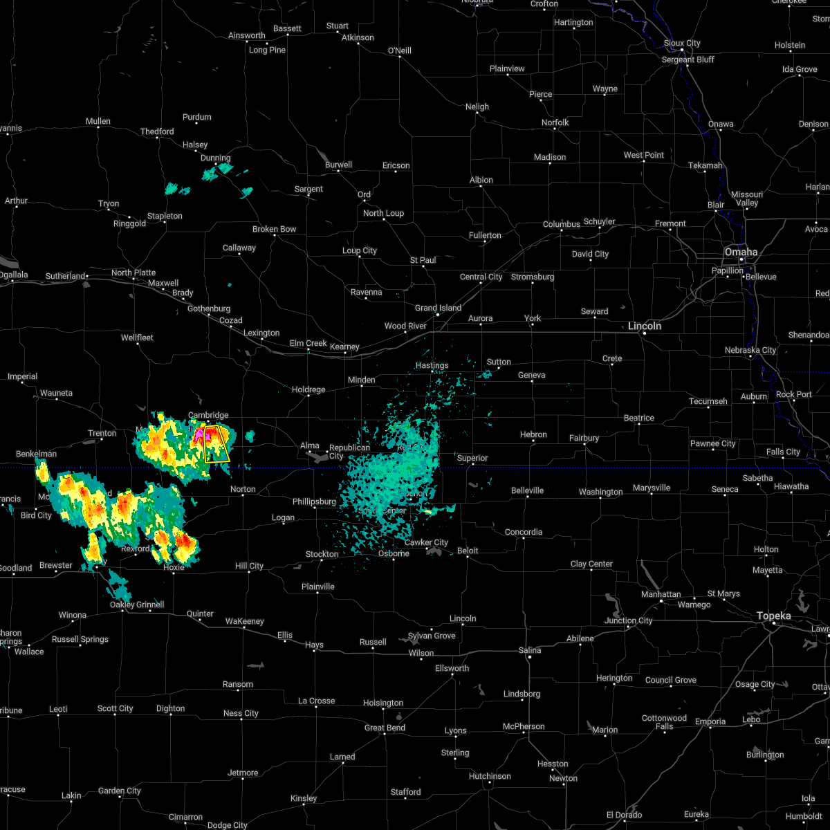 At 455 pm cdt, a severe thunderstorm was located near wilsonville, or 23 miles east of mccook, moving south at 20 mph (radar indicated). Hazards include 60 mph wind gusts and quarter size hail. Hail damage to vehicles is expected. expect wind damage to roofs, siding, and trees. this severe thunderstorm will be near, wilsonville around 510 pm cdt. hail threat, radar indicated max hail size, 1. 00 in wind threat, radar indicated max wind gust, 60 mph. At 455 pm cdt, a severe thunderstorm was located near wilsonville, or 23 miles east of mccook, moving south at 20 mph (radar indicated). Hazards include 60 mph wind gusts and quarter size hail. Hail damage to vehicles is expected. expect wind damage to roofs, siding, and trees. this severe thunderstorm will be near, wilsonville around 510 pm cdt. hail threat, radar indicated max hail size, 1. 00 in wind threat, radar indicated max wind gust, 60 mph.
|
| 7/23/2022 3:50 PM CDT |
 At 350 pm cdt, a severe thunderstorm was located near bartley, or 17 miles east of mccook, moving east at 30 mph (radar indicated). Hazards include 60 mph wind gusts and nickel size hail. Expect damage to roofs, siding, and trees. locations impacted include, cambridge, holbrook and wilsonville. hail threat, radar indicated max hail size, 0. 88 in wind threat, radar indicated max wind gust, 60 mph. At 350 pm cdt, a severe thunderstorm was located near bartley, or 17 miles east of mccook, moving east at 30 mph (radar indicated). Hazards include 60 mph wind gusts and nickel size hail. Expect damage to roofs, siding, and trees. locations impacted include, cambridge, holbrook and wilsonville. hail threat, radar indicated max hail size, 0. 88 in wind threat, radar indicated max wind gust, 60 mph.
|
| 7/23/2022 3:33 PM CDT |
 At 333 pm cdt, a severe thunderstorm was located near indianola, or 8 miles east of mccook, moving east at 20 mph (radar indicated). Hazards include 60 mph wind gusts and quarter size hail. Hail damage to vehicles is expected. Expect wind damage to roofs, siding, and trees. At 333 pm cdt, a severe thunderstorm was located near indianola, or 8 miles east of mccook, moving east at 20 mph (radar indicated). Hazards include 60 mph wind gusts and quarter size hail. Hail damage to vehicles is expected. Expect wind damage to roofs, siding, and trees.
|
| 6/24/2022 10:56 PM CDT |
 At 1055 pm cdt, severe thunderstorms were located along a line extending from near johnson lake to near arapahoe to 10 miles south of hendley, moving east at 45 mph (radar indicated). Hazards include 60 mph wind gusts and penny size hail. Expect damage to roofs, siding, and trees. severe thunderstorms will be near, edison around 1100 pm cdt. lexington around 1105 pm cdt. oxford around 1110 pm cdt. overton, loomis and atlanta around 1120 pm cdt. holdrege around 1130 pm cdt. elm creek and ragan around 1135 pm cdt. alma, odessa and funk around 1140 pm cdt. republican city around 1145 pm cdt. other locations impacted by these severe thunderstorms include farnam. this includes interstate 80 between mile markers 231 and 265. hail threat, radar indicated max hail size, 0. 75 in wind threat, radar indicated max wind gust, 60 mph. At 1055 pm cdt, severe thunderstorms were located along a line extending from near johnson lake to near arapahoe to 10 miles south of hendley, moving east at 45 mph (radar indicated). Hazards include 60 mph wind gusts and penny size hail. Expect damage to roofs, siding, and trees. severe thunderstorms will be near, edison around 1100 pm cdt. lexington around 1105 pm cdt. oxford around 1110 pm cdt. overton, loomis and atlanta around 1120 pm cdt. holdrege around 1130 pm cdt. elm creek and ragan around 1135 pm cdt. alma, odessa and funk around 1140 pm cdt. republican city around 1145 pm cdt. other locations impacted by these severe thunderstorms include farnam. this includes interstate 80 between mile markers 231 and 265. hail threat, radar indicated max hail size, 0. 75 in wind threat, radar indicated max wind gust, 60 mph.
|
| 6/24/2022 10:47 PM CDT |
 At 1045 pm cdt, severe thunderstorms were located along a line extending from near eustis to 10 miles north of holbrook to 11 miles northeast of norcatur, moving east at 50 mph (radar indicated. in addition, at 1040 pm cdt the public estimated 60 mph wind gusts nine miles south of eustis). Hazards include 60 mph wind gusts and quarter size hail. Hail damage to vehicles is expected. expect wind damage to roofs, siding, and trees. locations impacted include, cambridge, arapahoe, elwood, beaver city, holbrook, wilsonville, hendley, johnson lake and farnam. this includes interstate 80 between mile markers 231 and 232. hail threat, radar indicated max hail size, 1. 00 in wind threat, observed max wind gust, 60 mph. At 1045 pm cdt, severe thunderstorms were located along a line extending from near eustis to 10 miles north of holbrook to 11 miles northeast of norcatur, moving east at 50 mph (radar indicated. in addition, at 1040 pm cdt the public estimated 60 mph wind gusts nine miles south of eustis). Hazards include 60 mph wind gusts and quarter size hail. Hail damage to vehicles is expected. expect wind damage to roofs, siding, and trees. locations impacted include, cambridge, arapahoe, elwood, beaver city, holbrook, wilsonville, hendley, johnson lake and farnam. this includes interstate 80 between mile markers 231 and 232. hail threat, radar indicated max hail size, 1. 00 in wind threat, observed max wind gust, 60 mph.
|
| 6/24/2022 10:36 PM CDT |
 At 1035 pm cdt, severe thunderstorms were located along a line extending from 9 miles east of moorefield to near medicine creek reservoir state recreation area to 7 miles north of norcatur, moving east at 35 mph (radar indicated. in addition, the mccook airport reported a wind gust of 58 mph at 1009 pm cdt). Hazards include 60 mph wind gusts and quarter size hail. Hail damage to vehicles is expected. expect wind damage to roofs, siding, and trees. locations impacted include, cambridge, arapahoe, elwood, beaver city, holbrook, wilsonville, hendley, johnson lake and farnam. this includes interstate 80 between mile markers 231 and 232. hail threat, radar indicated max hail size, 1. 00 in wind threat, radar indicated max wind gust, 60 mph. At 1035 pm cdt, severe thunderstorms were located along a line extending from 9 miles east of moorefield to near medicine creek reservoir state recreation area to 7 miles north of norcatur, moving east at 35 mph (radar indicated. in addition, the mccook airport reported a wind gust of 58 mph at 1009 pm cdt). Hazards include 60 mph wind gusts and quarter size hail. Hail damage to vehicles is expected. expect wind damage to roofs, siding, and trees. locations impacted include, cambridge, arapahoe, elwood, beaver city, holbrook, wilsonville, hendley, johnson lake and farnam. this includes interstate 80 between mile markers 231 and 232. hail threat, radar indicated max hail size, 1. 00 in wind threat, radar indicated max wind gust, 60 mph.
|
| 6/24/2022 10:22 PM CDT |
 At 1021 pm cdt, severe thunderstorms were located along a line extending from near moorefield to near medicine creek reservoir state recreation area to 7 miles northwest of norcatur, moving east at 25 mph (radar indicated). Hazards include 60 mph wind gusts and quarter size hail. Hail damage to vehicles is expected. Expect wind damage to roofs, siding, and trees. At 1021 pm cdt, severe thunderstorms were located along a line extending from near moorefield to near medicine creek reservoir state recreation area to 7 miles northwest of norcatur, moving east at 25 mph (radar indicated). Hazards include 60 mph wind gusts and quarter size hail. Hail damage to vehicles is expected. Expect wind damage to roofs, siding, and trees.
|
| 6/14/2022 11:57 PM CDT |
 At 1156 pm cdt, a severe thunderstorm was located near wilsonville, or 22 miles east of mccook, moving northeast at 40 mph (radar indicated). Hazards include quarter size hail. Damage to vehicles is expected. this severe thunderstorm will be near, wilsonville around 1200 am cdt. cambridge and hendley around 1210 am cdt. other locations in the path of this severe thunderstorm include holbrook, arapahoe and edison. hail threat, radar indicated max hail size, 1. 00 in wind threat, radar indicated max wind gust, <50 mph. At 1156 pm cdt, a severe thunderstorm was located near wilsonville, or 22 miles east of mccook, moving northeast at 40 mph (radar indicated). Hazards include quarter size hail. Damage to vehicles is expected. this severe thunderstorm will be near, wilsonville around 1200 am cdt. cambridge and hendley around 1210 am cdt. other locations in the path of this severe thunderstorm include holbrook, arapahoe and edison. hail threat, radar indicated max hail size, 1. 00 in wind threat, radar indicated max wind gust, <50 mph.
|
| 4/23/2022 2:14 AM CDT |
 At 213 am cdt, severe thunderstorms were located along a line extending from near holbrook to near beaver city to norton, moving northeast at 75 mph (radar indicated). Hazards include 70 mph wind gusts and penny size hail. Expect considerable tree damage. damage is likely to mobile homes, roofs, and outbuildings. Locations impacted include, arapahoe, beaver city, holbrook, edison, wilsonville, hendley and hollinger. At 213 am cdt, severe thunderstorms were located along a line extending from near holbrook to near beaver city to norton, moving northeast at 75 mph (radar indicated). Hazards include 70 mph wind gusts and penny size hail. Expect considerable tree damage. damage is likely to mobile homes, roofs, and outbuildings. Locations impacted include, arapahoe, beaver city, holbrook, edison, wilsonville, hendley and hollinger.
|
| 4/23/2022 1:53 AM CDT |
 At 152 am cdt, severe thunderstorms were located along a line extending from lebanon to near norcatur to 6 miles south of clayton, moving northeast at 45 mph (radar indicated). Hazards include 70 mph wind gusts and penny size hail. Expect considerable tree damage. Damage is likely to mobile homes, roofs, and outbuildings. At 152 am cdt, severe thunderstorms were located along a line extending from lebanon to near norcatur to 6 miles south of clayton, moving northeast at 45 mph (radar indicated). Hazards include 70 mph wind gusts and penny size hail. Expect considerable tree damage. Damage is likely to mobile homes, roofs, and outbuildings.
|
| 10/26/2021 9:00 PM CDT |
 At 859 pm cdt, a severe thunderstorm was located 7 miles south of hendley, or 13 miles north of norton, moving north at 40 mph (radar indicated). Hazards include 60 mph wind gusts and quarter size hail. Hail damage to vehicles is expected. expect wind damage to roofs, siding, and trees. this severe thunderstorm will be near, hendley around 910 pm cdt. beaver city around 915 pm cdt. hail threat, radar indicated max hail size, 1. 00 in wind threat, radar indicated max wind gust, 60 mph. At 859 pm cdt, a severe thunderstorm was located 7 miles south of hendley, or 13 miles north of norton, moving north at 40 mph (radar indicated). Hazards include 60 mph wind gusts and quarter size hail. Hail damage to vehicles is expected. expect wind damage to roofs, siding, and trees. this severe thunderstorm will be near, hendley around 910 pm cdt. beaver city around 915 pm cdt. hail threat, radar indicated max hail size, 1. 00 in wind threat, radar indicated max wind gust, 60 mph.
|
| 8/22/2021 5:51 PM CDT |
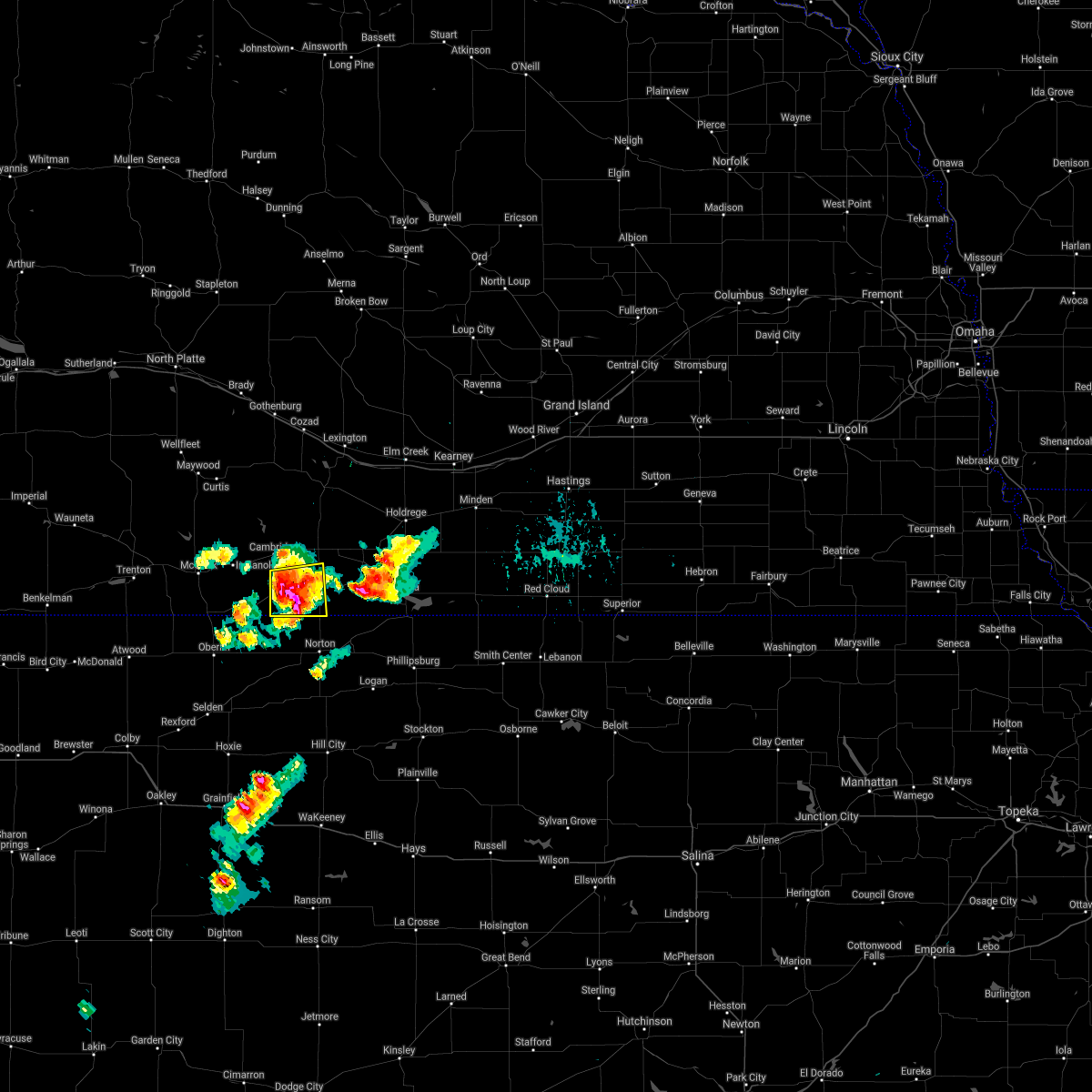 At 550 pm cdt, a severe thunderstorm was located near wilsonville, or 17 miles northwest of norton, moving east at 30 mph (radar indicated). Hazards include ping pong ball size hail and 60 mph wind gusts. People and animals outdoors will be injured. expect hail damage to roofs, siding, windows, and vehicles. expect wind damage to roofs, siding, and trees. locations impacted include, wilsonville and hendley. the main threat for large hail will concentrate slightly south-southeast of wilsonville. hail threat, radar indicated max hail size, 1. 50 in wind threat, radar indicated max wind gust, 60 mph. At 550 pm cdt, a severe thunderstorm was located near wilsonville, or 17 miles northwest of norton, moving east at 30 mph (radar indicated). Hazards include ping pong ball size hail and 60 mph wind gusts. People and animals outdoors will be injured. expect hail damage to roofs, siding, windows, and vehicles. expect wind damage to roofs, siding, and trees. locations impacted include, wilsonville and hendley. the main threat for large hail will concentrate slightly south-southeast of wilsonville. hail threat, radar indicated max hail size, 1. 50 in wind threat, radar indicated max wind gust, 60 mph.
|
| 8/22/2021 5:50 PM CDT | Ping Pong Ball sized hail reported 2.2 miles N of Wilsonville, NE |
| 8/22/2021 5:41 PM CDT |
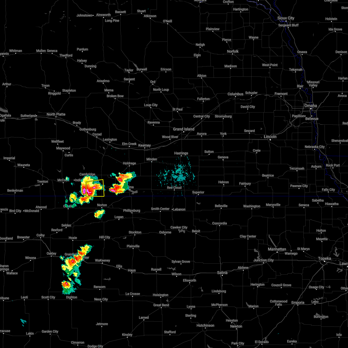 At 540 pm cdt, a severe thunderstorm was centered a few miles west of wilsonville, or 21 miles northwest of norton, moving east at 25 mph (radar indicated). Hazards include ping pong ball size hail and 60 mph wind gusts. People and animals outdoors will be injured. expect hail damage to roofs, siding, windows, and vehicles. expect wind damage to roofs, siding, and trees. locations impacted include, wilsonville and hendley. hail threat, radar indicated max hail size, 1. 50 in wind threat, radar indicated max wind gust, 60 mph. At 540 pm cdt, a severe thunderstorm was centered a few miles west of wilsonville, or 21 miles northwest of norton, moving east at 25 mph (radar indicated). Hazards include ping pong ball size hail and 60 mph wind gusts. People and animals outdoors will be injured. expect hail damage to roofs, siding, windows, and vehicles. expect wind damage to roofs, siding, and trees. locations impacted include, wilsonville and hendley. hail threat, radar indicated max hail size, 1. 50 in wind threat, radar indicated max wind gust, 60 mph.
|
| 8/22/2021 5:28 PM CDT |
 At 527 pm cdt, a severe thunderstorm was located over lebanon, or 19 miles northeast of oberlin, moving east at 20 mph (radar indicated). Hazards include ping pong ball size hail and 60 mph wind gusts. People and animals outdoors will be injured. expect hail damage to roofs, siding, windows, and vehicles. Expect wind damage to roofs, siding, and trees. At 527 pm cdt, a severe thunderstorm was located over lebanon, or 19 miles northeast of oberlin, moving east at 20 mph (radar indicated). Hazards include ping pong ball size hail and 60 mph wind gusts. People and animals outdoors will be injured. expect hail damage to roofs, siding, windows, and vehicles. Expect wind damage to roofs, siding, and trees.
|
| 6/19/2021 10:20 PM CDT |
 At 1019 pm cdt, severe thunderstorms were located along a line extending from near oxford to near alma to naponee, moving northeast at 40 mph (radar indicated). Hazards include 70 mph wind gusts. Expect considerable tree damage. damage is likely to mobile homes, roofs, and outbuildings. Locations impacted include, republican city, naponee, harlan county dam, huntley, atlanta, holdrege, ragan and funk. At 1019 pm cdt, severe thunderstorms were located along a line extending from near oxford to near alma to naponee, moving northeast at 40 mph (radar indicated). Hazards include 70 mph wind gusts. Expect considerable tree damage. damage is likely to mobile homes, roofs, and outbuildings. Locations impacted include, republican city, naponee, harlan county dam, huntley, atlanta, holdrege, ragan and funk.
|
| 6/19/2021 9:52 PM CDT |
 At 951 pm cdt, severe thunderstorms were located along a line extending from near beaver city to 8 miles southwest of stamford to near long island, moving northeast at 25 mph (radar indicated). Hazards include 70 mph wind gusts and quarter size hail. Hail damage to vehicles is expected. expect considerable tree damage. wind damage is also likely to mobile homes, roofs, and outbuildings. these severe storms will be near, hollinger around 1000 pm cdt. Other locations in the path of these severe thunderstorms include edison, stamford, oxford, orleans, alma, republican city, atlanta, naponee, huntley and harlan county dam. At 951 pm cdt, severe thunderstorms were located along a line extending from near beaver city to 8 miles southwest of stamford to near long island, moving northeast at 25 mph (radar indicated). Hazards include 70 mph wind gusts and quarter size hail. Hail damage to vehicles is expected. expect considerable tree damage. wind damage is also likely to mobile homes, roofs, and outbuildings. these severe storms will be near, hollinger around 1000 pm cdt. Other locations in the path of these severe thunderstorms include edison, stamford, oxford, orleans, alma, republican city, atlanta, naponee, huntley and harlan county dam.
|
| 6/19/2021 9:42 PM CDT |
 At 942 pm cdt, severe thunderstorms were located along a line extending from holbrook to 6 miles south of beaver city to near almena, moving east at 25 mph (radar indicated). Hazards include 70 mph wind gusts. Expect considerable tree damage. damage is likely to mobile homes, roofs, and outbuildings. severe thunderstorms will be near, beaver city around 950 pm cdt. hollinger around 1000 pm cdt. Other locations in the path of these severe thunderstorms include edison, stamford, oxford and orleans. At 942 pm cdt, severe thunderstorms were located along a line extending from holbrook to 6 miles south of beaver city to near almena, moving east at 25 mph (radar indicated). Hazards include 70 mph wind gusts. Expect considerable tree damage. damage is likely to mobile homes, roofs, and outbuildings. severe thunderstorms will be near, beaver city around 950 pm cdt. hollinger around 1000 pm cdt. Other locations in the path of these severe thunderstorms include edison, stamford, oxford and orleans.
|
| 6/19/2021 9:26 PM CDT |
 At 925 pm cdt, severe thunderstorms were located along a line extending from near stockville to near cambridge to 11 miles south of wilsonville, moving east at 35 mph (radar indicated. at 9:03 pm a 68 mph wind gust was reported at mccook airport). Hazards include 70 mph wind gusts. Expect considerable tree damage. damage is likely to mobile homes, roofs, and outbuildings. Locations impacted include, cambridge, arapahoe, oxford, bertrand, beaver city, holbrook, edison, wilsonville, hendley and hollinger. At 925 pm cdt, severe thunderstorms were located along a line extending from near stockville to near cambridge to 11 miles south of wilsonville, moving east at 35 mph (radar indicated. at 9:03 pm a 68 mph wind gust was reported at mccook airport). Hazards include 70 mph wind gusts. Expect considerable tree damage. damage is likely to mobile homes, roofs, and outbuildings. Locations impacted include, cambridge, arapahoe, oxford, bertrand, beaver city, holbrook, edison, wilsonville, hendley and hollinger.
|
| 6/19/2021 9:06 PM CDT |
 At 905 pm cdt, severe thunderstorms were located along a line extending from 12 miles north of culbertson to 7 miles southwest of indianola to near norcatur, moving northeast at 40 mph (radar indicated). Hazards include 60 mph wind gusts. expect damage to roofs, siding, and trees At 905 pm cdt, severe thunderstorms were located along a line extending from 12 miles north of culbertson to 7 miles southwest of indianola to near norcatur, moving northeast at 40 mph (radar indicated). Hazards include 60 mph wind gusts. expect damage to roofs, siding, and trees
|
| 5/26/2021 9:54 PM CDT |
 At 954 pm cdt, severe thunderstorms were located along a line extending from near wilsonville to near beaver city, moving east at 25 mph (radar indicated). Hazards include 60 mph wind gusts and quarter size hail. Hail damage to vehicles is expected. expect wind damage to roofs, siding, and trees. Locations impacted include, beaver city, hollinger, holbrook, arapahoe and edison. At 954 pm cdt, severe thunderstorms were located along a line extending from near wilsonville to near beaver city, moving east at 25 mph (radar indicated). Hazards include 60 mph wind gusts and quarter size hail. Hail damage to vehicles is expected. expect wind damage to roofs, siding, and trees. Locations impacted include, beaver city, hollinger, holbrook, arapahoe and edison.
|
| 5/26/2021 9:31 PM CDT |
 At 931 pm cdt, severe thunderstorms were located along a line extending from bartley to near lebanon, moving east at 50 mph (radar indicated). Hazards include 60 mph wind gusts and quarter size hail. Hail damage to vehicles is expected. expect wind damage to roofs, siding, and trees. severe thunderstorms will be near, cambridge and wilsonville around 940 pm cdt. holbrook and hendley around 950 pm cdt. Other locations in the path of these severe thunderstorms include arapahoe, beaver city, edison and hollinger. At 931 pm cdt, severe thunderstorms were located along a line extending from bartley to near lebanon, moving east at 50 mph (radar indicated). Hazards include 60 mph wind gusts and quarter size hail. Hail damage to vehicles is expected. expect wind damage to roofs, siding, and trees. severe thunderstorms will be near, cambridge and wilsonville around 940 pm cdt. holbrook and hendley around 950 pm cdt. Other locations in the path of these severe thunderstorms include arapahoe, beaver city, edison and hollinger.
|
| 5/26/2021 7:43 PM CDT |
 At 741 pm cdt, a severe thunderstorm was located near the red willow- furnas county line, or 22 miles east of mccook, moving east at 25 mph (radar indicated). Hazards include 60 mph wind gusts and quarter size hail. Hail damage to vehicles is expected. expect wind damage to roofs, siding, and trees. locations impacted include, cambridge, holbrook, wilsonville and hendley. Radar indicates some weak rotation with this storm, but it does not appear as strong as it was when it was farther west of furnas county. At 741 pm cdt, a severe thunderstorm was located near the red willow- furnas county line, or 22 miles east of mccook, moving east at 25 mph (radar indicated). Hazards include 60 mph wind gusts and quarter size hail. Hail damage to vehicles is expected. expect wind damage to roofs, siding, and trees. locations impacted include, cambridge, holbrook, wilsonville and hendley. Radar indicates some weak rotation with this storm, but it does not appear as strong as it was when it was farther west of furnas county.
|
| 5/26/2021 7:20 PM CDT |
 At 718 pm cdt, a severe thunderstorm was located near danbury, or 14 miles southeast of mccook, moving east at 25 mph (radar indicated). Hazards include 60 mph wind gusts and quarter size hail. Hail damage to vehicles is expected. Expect wind damage to roofs, siding, and trees. At 718 pm cdt, a severe thunderstorm was located near danbury, or 14 miles southeast of mccook, moving east at 25 mph (radar indicated). Hazards include 60 mph wind gusts and quarter size hail. Hail damage to vehicles is expected. Expect wind damage to roofs, siding, and trees.
|
| 5/2/2021 7:58 PM CDT |
 At 758 pm cdt, severe thunderstorms were located along a line extending from near bertrand to holbrook to near norcatur, moving east at 30 mph (radar indicated). Hazards include 60 mph wind gusts and penny size hail. Expect damage to roofs, siding, and trees. Locations impacted include, cambridge, arapahoe, oxford, bertrand, beaver city, loomis, holbrook, stamford, edison, atlanta, wilsonville, hendley and hollinger. At 758 pm cdt, severe thunderstorms were located along a line extending from near bertrand to holbrook to near norcatur, moving east at 30 mph (radar indicated). Hazards include 60 mph wind gusts and penny size hail. Expect damage to roofs, siding, and trees. Locations impacted include, cambridge, arapahoe, oxford, bertrand, beaver city, loomis, holbrook, stamford, edison, atlanta, wilsonville, hendley and hollinger.
|
| 5/2/2021 7:35 PM CDT |
 At 735 pm cdt, severe thunderstorms were located along a line extending from 10 miles northeast of medicine creek reservoir state recreation area to near lebanon to dresden, moving east at 40 mph (trained weather spotters). Hazards include 60 mph wind gusts and penny size hail. expect damage to roofs, siding, and trees At 735 pm cdt, severe thunderstorms were located along a line extending from 10 miles northeast of medicine creek reservoir state recreation area to near lebanon to dresden, moving east at 40 mph (trained weather spotters). Hazards include 60 mph wind gusts and penny size hail. expect damage to roofs, siding, and trees
|
| 8/16/2020 6:05 PM CDT |
 The severe thunderstorm warning for southwestern furnas county will expire at 615 pm cdt, the storms which prompted the warning have moved out of the area. therefore, the warning will be allowed to expire. a severe thunderstorm watch remains in effect until 900 pm cdt for south central nebraska. The severe thunderstorm warning for southwestern furnas county will expire at 615 pm cdt, the storms which prompted the warning have moved out of the area. therefore, the warning will be allowed to expire. a severe thunderstorm watch remains in effect until 900 pm cdt for south central nebraska.
|
| 8/16/2020 5:38 PM CDT |
 At 538 pm cdt, severe thunderstorms were located along a line extending from near lebanon to near wilsonville to 9 miles south of beaver city, moving southeast at 25 mph (radar indicated). Hazards include 60 mph wind gusts and half dollar size hail. Hail damage to vehicles is expected. Expect wind damage to roofs, siding, and trees. At 538 pm cdt, severe thunderstorms were located along a line extending from near lebanon to near wilsonville to 9 miles south of beaver city, moving southeast at 25 mph (radar indicated). Hazards include 60 mph wind gusts and half dollar size hail. Hail damage to vehicles is expected. Expect wind damage to roofs, siding, and trees.
|
| 7/29/2020 7:18 PM CDT |
 At 717 pm cdt, a severe thunderstorm was located near wilsonville, or 15 miles northwest of norton, moving southeast at 25 mph (radar indicated). Hazards include 60 mph wind gusts and quarter size hail. Hail damage to vehicles is expected. expect wind damage to roofs, siding, and trees. Locations impacted include, wilsonville. At 717 pm cdt, a severe thunderstorm was located near wilsonville, or 15 miles northwest of norton, moving southeast at 25 mph (radar indicated). Hazards include 60 mph wind gusts and quarter size hail. Hail damage to vehicles is expected. expect wind damage to roofs, siding, and trees. Locations impacted include, wilsonville.
|
| 7/29/2020 7:09 PM CDT |
 At 709 pm cdt, a severe thunderstorm was located over wilsonville, or 19 miles northwest of norton, moving southeast at 25 mph (radar indicated). Hazards include 60 mph wind gusts and quarter size hail. Hail damage to vehicles is expected. expect wind damage to roofs, siding, and trees. Locations impacted include, wilsonville and hendley. At 709 pm cdt, a severe thunderstorm was located over wilsonville, or 19 miles northwest of norton, moving southeast at 25 mph (radar indicated). Hazards include 60 mph wind gusts and quarter size hail. Hail damage to vehicles is expected. expect wind damage to roofs, siding, and trees. Locations impacted include, wilsonville and hendley.
|
| 7/29/2020 6:58 PM CDT |
 At 658 pm cdt, a severe thunderstorm was located over wilsonville, or 23 miles northwest of norton, moving southeast at 20 mph (radar indicated). Hazards include 60 mph wind gusts and quarter size hail. Hail damage to vehicles is expected. Expect wind damage to roofs, siding, and trees. At 658 pm cdt, a severe thunderstorm was located over wilsonville, or 23 miles northwest of norton, moving southeast at 20 mph (radar indicated). Hazards include 60 mph wind gusts and quarter size hail. Hail damage to vehicles is expected. Expect wind damage to roofs, siding, and trees.
|
| 7/13/2020 11:13 PM CDT |
 At 1113 pm cdt, severe thunderstorms were located along a line extending from near holbrook to near hendley to 8 miles southeast of wilsonville, moving east at 30 mph (radar indicated). Hazards include 60 mph wind gusts. expect damage to roofs, siding, and trees At 1113 pm cdt, severe thunderstorms were located along a line extending from near holbrook to near hendley to 8 miles southeast of wilsonville, moving east at 30 mph (radar indicated). Hazards include 60 mph wind gusts. expect damage to roofs, siding, and trees
|
| 7/13/2020 11:04 PM CDT |
 At 1104 pm cdt, severe thunderstorms were located along a line extending from near holbrook to near wilsonville to near norcatur, moving east at 30 mph (radar indicated). Hazards include 70 mph wind gusts. Expect considerable tree damage. damage is likely to mobile homes, roofs, and outbuildings. Locations impacted include, cambridge, arapahoe, oxford, beaver city, holbrook, edison, wilsonville, hendley and hollinger. At 1104 pm cdt, severe thunderstorms were located along a line extending from near holbrook to near wilsonville to near norcatur, moving east at 30 mph (radar indicated). Hazards include 70 mph wind gusts. Expect considerable tree damage. damage is likely to mobile homes, roofs, and outbuildings. Locations impacted include, cambridge, arapahoe, oxford, beaver city, holbrook, edison, wilsonville, hendley and hollinger.
|
| 7/13/2020 10:36 PM CDT |
 At 1034 pm cdt, severe thunderstorms were located along a line extending from near overton to near holbrook to 9 miles west of danbury, moving east at 35 mph (radar indicated). Hazards include 70 mph wind gusts. Expect considerable tree damage. Damage is likely to mobile homes, roofs, and outbuildings. At 1034 pm cdt, severe thunderstorms were located along a line extending from near overton to near holbrook to 9 miles west of danbury, moving east at 35 mph (radar indicated). Hazards include 70 mph wind gusts. Expect considerable tree damage. Damage is likely to mobile homes, roofs, and outbuildings.
|
| 7/12/2020 8:51 PM CDT |
 The severe thunderstorm warning for southwestern furnas county will expire at 900 pm cdt, the storm which prompted the warning has weakened below severe limits, and no longer poses an immediate threat to life or property. therefore, the warning will be allowed to expire. however gusty winds are still possible with this thunderstorm. The severe thunderstorm warning for southwestern furnas county will expire at 900 pm cdt, the storm which prompted the warning has weakened below severe limits, and no longer poses an immediate threat to life or property. therefore, the warning will be allowed to expire. however gusty winds are still possible with this thunderstorm.
|
| 7/12/2020 8:46 PM CDT |
 At 845 pm cdt, a severe thunderstorm was located near wilsonville, or 22 miles east of mccook, moving southeast at 25 mph (trained weather spotters). Hazards include 60 mph wind gusts and penny size hail. Expect damage to roofs, siding, and trees. Locations impacted include, wilsonville and hendley. At 845 pm cdt, a severe thunderstorm was located near wilsonville, or 22 miles east of mccook, moving southeast at 25 mph (trained weather spotters). Hazards include 60 mph wind gusts and penny size hail. Expect damage to roofs, siding, and trees. Locations impacted include, wilsonville and hendley.
|
| 7/12/2020 8:37 PM CDT |
 At 837 pm cdt, a severe thunderstorm was located near cambridge, or 21 miles east of mccook, moving east at 30 mph (trained weather spotters). Hazards include 60 mph wind gusts and quarter size hail. Hail damage to vehicles is expected. expect wind damage to roofs, siding, and trees. Locations impacted include, cambridge, arapahoe, beaver city, holbrook, wilsonville and hendley. At 837 pm cdt, a severe thunderstorm was located near cambridge, or 21 miles east of mccook, moving east at 30 mph (trained weather spotters). Hazards include 60 mph wind gusts and quarter size hail. Hail damage to vehicles is expected. expect wind damage to roofs, siding, and trees. Locations impacted include, cambridge, arapahoe, beaver city, holbrook, wilsonville and hendley.
|
| 7/12/2020 8:15 PM CDT |
 At 814 pm cdt, a severe thunderstorm was located near indianola, or 13 miles northeast of mccook, moving east at 35 mph (trained weather spotters). Hazards include ping pong ball size hail and 60 mph wind gusts. People and animals outdoors will be injured. expect hail damage to roofs, siding, windows, and vehicles. Expect wind damage to roofs, siding, and trees. At 814 pm cdt, a severe thunderstorm was located near indianola, or 13 miles northeast of mccook, moving east at 35 mph (trained weather spotters). Hazards include ping pong ball size hail and 60 mph wind gusts. People and animals outdoors will be injured. expect hail damage to roofs, siding, windows, and vehicles. Expect wind damage to roofs, siding, and trees.
|
| 7/8/2020 11:25 PM CDT | Golf Ball sized hail reported 0.2 miles ENE of Wilsonville, NE, facebook report and picture of hail. |
| 7/8/2020 11:00 PM CDT |
 At 1059 pm cdt, severe thunderstorms were located along a line extending from near riverton to 11 miles northwest of smith center to near speed, moving southeast at 60 mph (radar indicated). Hazards include 70 mph wind gusts. Expect considerable tree damage. damage is likely to mobile homes, roofs, and outbuildings. Locations impacted include, holdrege, phillipsburg, minden, smith center, alma, red cloud, franklin, oxford, axtell, beaver city, logan, kensington, orleans, hildreth, wilcox, campbell, agra, funk, stamford and kirwin. At 1059 pm cdt, severe thunderstorms were located along a line extending from near riverton to 11 miles northwest of smith center to near speed, moving southeast at 60 mph (radar indicated). Hazards include 70 mph wind gusts. Expect considerable tree damage. damage is likely to mobile homes, roofs, and outbuildings. Locations impacted include, holdrege, phillipsburg, minden, smith center, alma, red cloud, franklin, oxford, axtell, beaver city, logan, kensington, orleans, hildreth, wilcox, campbell, agra, funk, stamford and kirwin.
|
| 7/8/2020 10:33 PM CDT |
 At 1033 pm cdt, severe thunderstorms were located along a line extending from near ragan to near alma to near norton, moving southeast at 60 mph (radar indicated). Hazards include 70 mph wind gusts. Expect considerable tree damage. Damage is likely to mobile homes, roofs, and outbuildings. At 1033 pm cdt, severe thunderstorms were located along a line extending from near ragan to near alma to near norton, moving southeast at 60 mph (radar indicated). Hazards include 70 mph wind gusts. Expect considerable tree damage. Damage is likely to mobile homes, roofs, and outbuildings.
|
| 7/8/2020 10:01 PM CDT |
 At 1001 pm cdt, severe thunderstorms were located along a line extending from near johnson lake to near smithfield to 8 miles north of edison to near arapahoe to near wilsonville, moving east at 50 mph (radar indicated). Hazards include 70 mph wind gusts and penny size hail. Expect considerable tree damage. Damage is likely to mobile homes, roofs, and outbuildings. At 1001 pm cdt, severe thunderstorms were located along a line extending from near johnson lake to near smithfield to 8 miles north of edison to near arapahoe to near wilsonville, moving east at 50 mph (radar indicated). Hazards include 70 mph wind gusts and penny size hail. Expect considerable tree damage. Damage is likely to mobile homes, roofs, and outbuildings.
|
| 7/8/2020 9:35 PM CDT |
 The national weather service in hastings has issued a * severe thunderstorm warning for. western phelps county in south central nebraska. gosper county in south central nebraska. furnas county in south central nebraska. Until 1015 pm cdt. The national weather service in hastings has issued a * severe thunderstorm warning for. western phelps county in south central nebraska. gosper county in south central nebraska. furnas county in south central nebraska. Until 1015 pm cdt.
|
| 7/2/2020 7:59 PM CDT |
 At 758 pm cdt, severe thunderstorms were located along a line extending from 10 miles northeast of medicine creek reservoir state recreation area to near beaver city to near edmond, moving east at 60 mph (trained weather spotters. at 756 pm cdt, a 73 mph wind gust was reported 7 miles south of holbrook). Hazards include 70 mph wind gusts and quarter size hail. Hail damage to vehicles is expected. expect considerable tree damage. wind damage is also likely to mobile homes, roofs, and outbuildings. Locations impacted include, cambridge, arapahoe, beaver city, holbrook, edison, wilsonville, hendley and hollinger. At 758 pm cdt, severe thunderstorms were located along a line extending from 10 miles northeast of medicine creek reservoir state recreation area to near beaver city to near edmond, moving east at 60 mph (trained weather spotters. at 756 pm cdt, a 73 mph wind gust was reported 7 miles south of holbrook). Hazards include 70 mph wind gusts and quarter size hail. Hail damage to vehicles is expected. expect considerable tree damage. wind damage is also likely to mobile homes, roofs, and outbuildings. Locations impacted include, cambridge, arapahoe, beaver city, holbrook, edison, wilsonville, hendley and hollinger.
|
| 7/2/2020 7:38 PM CDT |
 At 736 pm cdt, severe thunderstorms were located along a line extending from near stockville to near bartley to 8 miles northwest of morland, moving east at 40 mph (trained weather spotters. at 733 pm cdt, 60 mph wind gusts were reported in indianola). Hazards include 60 mph wind gusts and quarter size hail. Hail damage to vehicles is expected. expect wind damage to roofs, siding, and trees. Locations impacted include, cambridge, arapahoe, elwood, beaver city, holbrook, edison, wilsonville, smithfield, hendley, hollinger and johnson lake. At 736 pm cdt, severe thunderstorms were located along a line extending from near stockville to near bartley to 8 miles northwest of morland, moving east at 40 mph (trained weather spotters. at 733 pm cdt, 60 mph wind gusts were reported in indianola). Hazards include 60 mph wind gusts and quarter size hail. Hail damage to vehicles is expected. expect wind damage to roofs, siding, and trees. Locations impacted include, cambridge, arapahoe, elwood, beaver city, holbrook, edison, wilsonville, smithfield, hendley, hollinger and johnson lake.
|
| 7/2/2020 7:21 PM CDT |
 At 720 pm cdt, severe thunderstorms were located along a line extending from near curtis to near indianola to near hoxie, moving east at 40 mph (trained weather spotters). Hazards include 60 mph wind gusts and nickel size hail. expect damage to roofs, siding, and trees At 720 pm cdt, severe thunderstorms were located along a line extending from near curtis to near indianola to near hoxie, moving east at 40 mph (trained weather spotters). Hazards include 60 mph wind gusts and nickel size hail. expect damage to roofs, siding, and trees
|
| 6/20/2020 7:15 PM CDT | Golf Ball sized hail reported 4.9 miles N of Wilsonville, NE, time estimated from radar. |
| 6/20/2020 7:10 PM CDT | Ping Pong Ball sized hail reported 5.5 miles NNW of Wilsonville, NE |
| 6/20/2020 6:59 PM CDT |
 At 659 pm cdt, severe thunderstorms were located along a line extending from near edison to near beaver city to 6 miles south of wilsonville, moving east at 35 mph (radar indicated). Hazards include 60 mph wind gusts and quarter size hail. Hail damage to vehicles is expected. expect wind damage to roofs, siding, and trees. Locations impacted include, oxford, beaver city, edison, wilsonville, hendley and hollinger. At 659 pm cdt, severe thunderstorms were located along a line extending from near edison to near beaver city to 6 miles south of wilsonville, moving east at 35 mph (radar indicated). Hazards include 60 mph wind gusts and quarter size hail. Hail damage to vehicles is expected. expect wind damage to roofs, siding, and trees. Locations impacted include, oxford, beaver city, edison, wilsonville, hendley and hollinger.
|
| 6/20/2020 6:50 PM CDT |
 At 650 pm cdt, severe thunderstorms were located along a line extending from near edison to hendley to near wilsonville, moving east at 30 mph (radar indicated). Hazards include 60 mph wind gusts and quarter size hail. Hail damage to vehicles is expected. expect wind damage to roofs, siding, and trees. Locations impacted include, arapahoe, oxford, beaver city, edison, wilsonville, hendley and hollinger. At 650 pm cdt, severe thunderstorms were located along a line extending from near edison to hendley to near wilsonville, moving east at 30 mph (radar indicated). Hazards include 60 mph wind gusts and quarter size hail. Hail damage to vehicles is expected. expect wind damage to roofs, siding, and trees. Locations impacted include, arapahoe, oxford, beaver city, edison, wilsonville, hendley and hollinger.
|
| 6/20/2020 6:37 PM CDT |
 At 636 pm cdt, severe thunderstorms were located along a line extending from arapahoe to near hendley to near lebanon, moving east at 35 mph (radar indicated). Hazards include 60 mph wind gusts and quarter size hail. Hail damage to vehicles is expected. Expect wind damage to roofs, siding, and trees. At 636 pm cdt, severe thunderstorms were located along a line extending from arapahoe to near hendley to near lebanon, moving east at 35 mph (radar indicated). Hazards include 60 mph wind gusts and quarter size hail. Hail damage to vehicles is expected. Expect wind damage to roofs, siding, and trees.
|
| 6/3/2020 8:39 PM CDT |
 The severe thunderstorm warning for furnas county will expire at 845 pm cdt, the storm which prompted the warning has weakened below severe limits, and no longer poses an immediate threat to life or property. therefore, the warning will be allowed to expire. a severe thunderstorm watch remains in effect until 100 am cdt for south central nebraska. The severe thunderstorm warning for furnas county will expire at 845 pm cdt, the storm which prompted the warning has weakened below severe limits, and no longer poses an immediate threat to life or property. therefore, the warning will be allowed to expire. a severe thunderstorm watch remains in effect until 100 am cdt for south central nebraska.
|
| 6/3/2020 8:23 PM CDT |
 At 823 pm cdt, a severe thunderstorm was located near hendley, or 26 miles north of norton, moving east at 40 mph (radar indicated). Hazards include 60 mph wind gusts. Expect damage to roofs, siding, and trees. Locations impacted include, cambridge, arapahoe, beaver city, holbrook, edison, wilsonville and hendley. At 823 pm cdt, a severe thunderstorm was located near hendley, or 26 miles north of norton, moving east at 40 mph (radar indicated). Hazards include 60 mph wind gusts. Expect damage to roofs, siding, and trees. Locations impacted include, cambridge, arapahoe, beaver city, holbrook, edison, wilsonville and hendley.
|
| 6/3/2020 8:04 PM CDT |
 At 804 pm cdt, a severe thunderstorm was located over bartley, or 18 miles east of mccook, moving southeast at 35 mph (radar indicated). Hazards include 60 mph wind gusts and penny size hail. expect damage to roofs, siding, and trees At 804 pm cdt, a severe thunderstorm was located over bartley, or 18 miles east of mccook, moving southeast at 35 mph (radar indicated). Hazards include 60 mph wind gusts and penny size hail. expect damage to roofs, siding, and trees
|
| 9/30/2019 7:12 PM CDT |
 The severe thunderstorm warning for central furnas and west central harlan counties will expire at 715 pm cdt, the storm which prompted the warning has weakened below severe limits, and no longer poses an immediate threat to life or property. therefore, the warning will be allowed to expire. to report severe weather, contact your nearest law enforcement agency. they will relay your report to the national weather service hastings. The severe thunderstorm warning for central furnas and west central harlan counties will expire at 715 pm cdt, the storm which prompted the warning has weakened below severe limits, and no longer poses an immediate threat to life or property. therefore, the warning will be allowed to expire. to report severe weather, contact your nearest law enforcement agency. they will relay your report to the national weather service hastings.
|
| 9/30/2019 6:43 PM CDT |
 At 642 pm cdt, a severe thunderstorm was located near hendley, or 26 miles north of norton, moving northeast at 30 mph (radar indicated). Hazards include 60 mph wind gusts and quarter size hail. Hail damage to vehicles is expected. expect wind damage to roofs, siding, and trees. Locations impacted include, arapahoe, oxford, beaver city, stamford, edison, wilsonville, hendley and hollinger. At 642 pm cdt, a severe thunderstorm was located near hendley, or 26 miles north of norton, moving northeast at 30 mph (radar indicated). Hazards include 60 mph wind gusts and quarter size hail. Hail damage to vehicles is expected. expect wind damage to roofs, siding, and trees. Locations impacted include, arapahoe, oxford, beaver city, stamford, edison, wilsonville, hendley and hollinger.
|
| 9/30/2019 6:28 PM CDT |
 At 628 pm cdt, a severe thunderstorm was located over wilsonville, or 19 miles northwest of norton, moving northeast at 30 mph (radar indicated). Hazards include 60 mph wind gusts and quarter size hail. Hail damage to vehicles is expected. Expect wind damage to roofs, siding, and trees. At 628 pm cdt, a severe thunderstorm was located over wilsonville, or 19 miles northwest of norton, moving northeast at 30 mph (radar indicated). Hazards include 60 mph wind gusts and quarter size hail. Hail damage to vehicles is expected. Expect wind damage to roofs, siding, and trees.
|
| 8/11/2019 11:22 PM CDT |
 At 1122 pm cdt, severe thunderstorms were located along a line extending from 8 miles west of huntley to harlan county dam to 6 miles north of agra to near webster state park, moving east at 45 mph (radar indicated). Hazards include 60 mph wind gusts. Expect damage to roofs, siding, and trees. Locations impacted include, phillipsburg, plainville, stockton, alma, cambridge, arapahoe, franklin, oxford, beaver city, logan, kensington, orleans, hildreth, natoma, palco, agra, holbrook, stamford, kirwin and republican city. At 1122 pm cdt, severe thunderstorms were located along a line extending from 8 miles west of huntley to harlan county dam to 6 miles north of agra to near webster state park, moving east at 45 mph (radar indicated). Hazards include 60 mph wind gusts. Expect damage to roofs, siding, and trees. Locations impacted include, phillipsburg, plainville, stockton, alma, cambridge, arapahoe, franklin, oxford, beaver city, logan, kensington, orleans, hildreth, natoma, palco, agra, holbrook, stamford, kirwin and republican city.
|
| 8/11/2019 11:16 PM CDT |
 At 1116 pm cdt, severe thunderstorms were located along a line extending from 6 miles east of oxford to near alma to 7 miles northeast of phillipsburg to webster state park, moving east at 45 mph (radar indicated). Hazards include 70 mph wind gusts. Expect considerable tree damage. damage is likely to mobile homes, roofs, and outbuildings. Locations impacted include, phillipsburg, plainville, stockton, alma, cambridge, arapahoe, franklin, oxford, beaver city, logan, kensington, orleans, hildreth, natoma, palco, agra, holbrook, stamford, kirwin and republican city. At 1116 pm cdt, severe thunderstorms were located along a line extending from 6 miles east of oxford to near alma to 7 miles northeast of phillipsburg to webster state park, moving east at 45 mph (radar indicated). Hazards include 70 mph wind gusts. Expect considerable tree damage. damage is likely to mobile homes, roofs, and outbuildings. Locations impacted include, phillipsburg, plainville, stockton, alma, cambridge, arapahoe, franklin, oxford, beaver city, logan, kensington, orleans, hildreth, natoma, palco, agra, holbrook, stamford, kirwin and republican city.
|
| 8/11/2019 10:59 PM CDT |
 The national weather service in hastings has issued a * severe thunderstorm warning for. rooks county in north central kansas. western smith county in north central kansas. western osborne county in north central kansas. Phillips county in north central kansas. The national weather service in hastings has issued a * severe thunderstorm warning for. rooks county in north central kansas. western smith county in north central kansas. western osborne county in north central kansas. Phillips county in north central kansas.
|
| 8/11/2019 10:59 PM CDT |
 At 1058 pm cdt, severe thunderstorms were located along a line extending from near hollinger to near long island to logan to near bogue, moving east at 50 mph. this warning replaces the previous warning for furnas, harlan, phillips and rooks counties (radar indicated). Hazards include 70 mph wind gusts. Expect considerable tree damage. Damage is likely to mobile homes, roofs, and outbuildings. At 1058 pm cdt, severe thunderstorms were located along a line extending from near hollinger to near long island to logan to near bogue, moving east at 50 mph. this warning replaces the previous warning for furnas, harlan, phillips and rooks counties (radar indicated). Hazards include 70 mph wind gusts. Expect considerable tree damage. Damage is likely to mobile homes, roofs, and outbuildings.
|
| 8/11/2019 10:40 PM CDT |
 At 1040 pm cdt, severe thunderstorms were located along a line extending from near hendley to 9 miles northwest of almena to near edmond to near morland, moving east at 50 mph (radar indicated). Hazards include 70 mph wind gusts and quarter size hail. Hail damage to vehicles is expected. expect considerable tree damage. wind damage is also likely to mobile homes, roofs, and outbuildings. Locations impacted include, cambridge, arapahoe, oxford, beaver city, logan, orleans, palco, holbrook, stamford, long island, prairie view, edison, damar, wilsonville, nicodemus, speed, hendley, hollinger, woodruff and webster state park. At 1040 pm cdt, severe thunderstorms were located along a line extending from near hendley to 9 miles northwest of almena to near edmond to near morland, moving east at 50 mph (radar indicated). Hazards include 70 mph wind gusts and quarter size hail. Hail damage to vehicles is expected. expect considerable tree damage. wind damage is also likely to mobile homes, roofs, and outbuildings. Locations impacted include, cambridge, arapahoe, oxford, beaver city, logan, orleans, palco, holbrook, stamford, long island, prairie view, edison, damar, wilsonville, nicodemus, speed, hendley, hollinger, woodruff and webster state park.
|
| 8/11/2019 10:17 PM CDT |
 At 1016 pm cdt, severe thunderstorms were located along a line extending from near bartley to 7 miles southeast of lebanon to near clayton to 9 miles east of hoxie, moving east at 50 mph (radar indicated). Hazards include 70 mph wind gusts and quarter size hail. Hail damage to vehicles is expected. expect considerable tree damage. Wind damage is also likely to mobile homes, roofs, and outbuildings. At 1016 pm cdt, severe thunderstorms were located along a line extending from near bartley to 7 miles southeast of lebanon to near clayton to 9 miles east of hoxie, moving east at 50 mph (radar indicated). Hazards include 70 mph wind gusts and quarter size hail. Hail damage to vehicles is expected. expect considerable tree damage. Wind damage is also likely to mobile homes, roofs, and outbuildings.
|
| 8/2/2019 9:28 PM CDT |
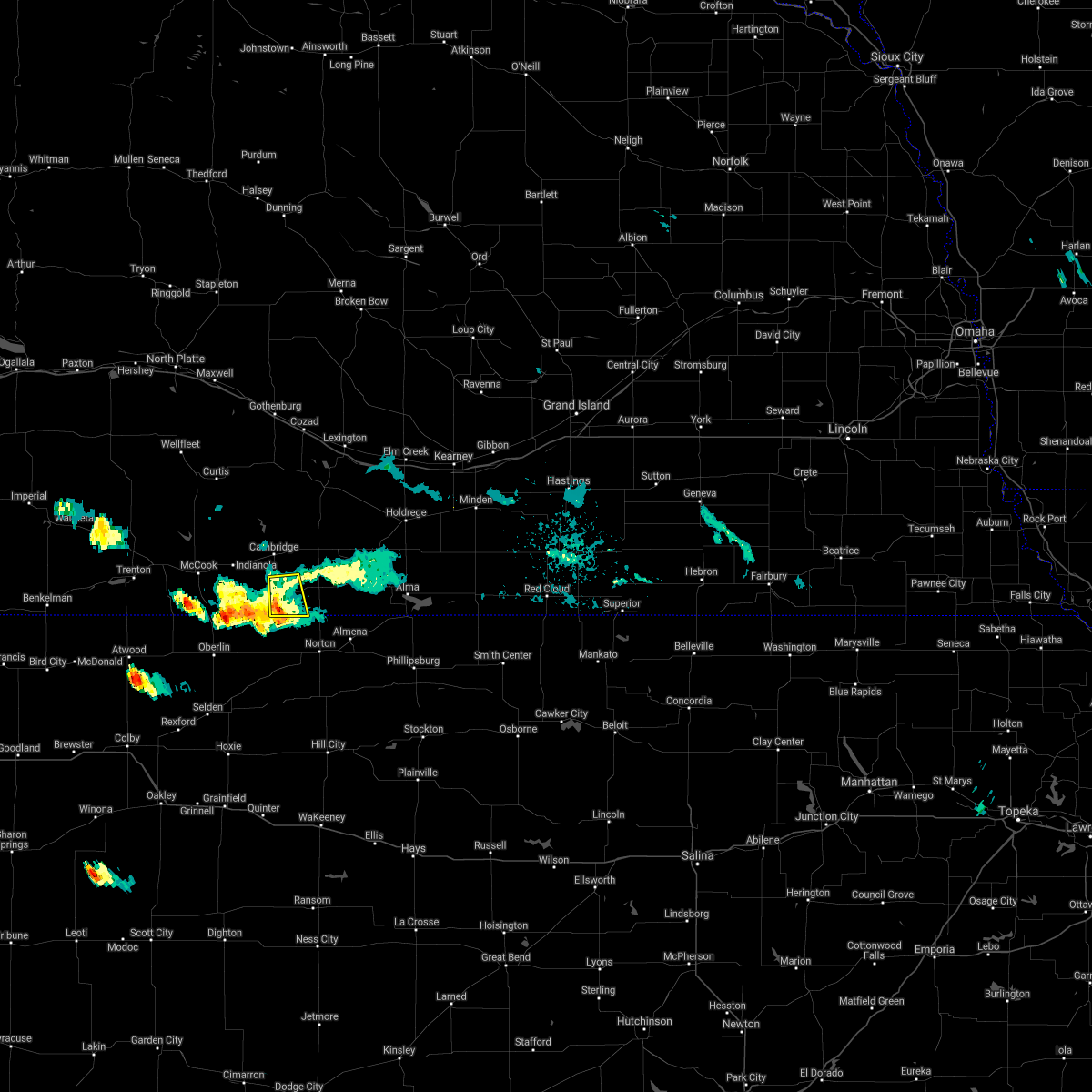 The severe thunderstorm warning for southwestern furnas county will expire at 930 pm cdt, the storm which prompted the warning has weakened below severe limits, and has exited the most of the warned area. therefore, the warning will be allowed to expire. The severe thunderstorm warning for southwestern furnas county will expire at 930 pm cdt, the storm which prompted the warning has weakened below severe limits, and has exited the most of the warned area. therefore, the warning will be allowed to expire.
|
| 8/2/2019 9:18 PM CDT |
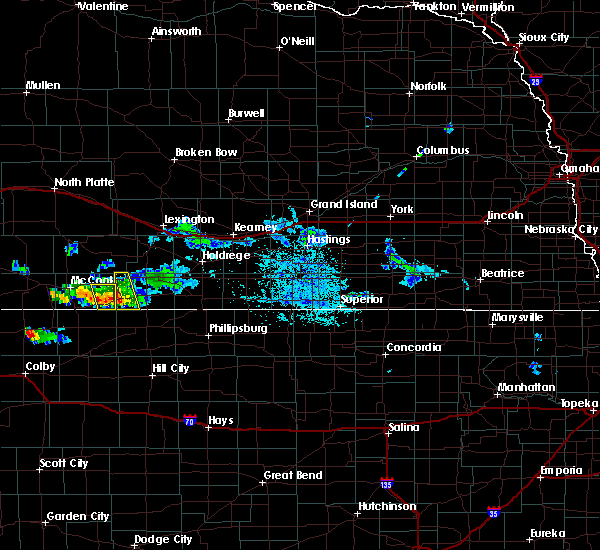 At 918 pm cdt, a severe thunderstorm was located near wilsonville, or 17 miles northwest of norton, moving south at 30 mph (radar indicated). Hazards include 60 mph wind gusts. Expect damage to roofs, siding, and trees. Locations impacted include, wilsonville. At 918 pm cdt, a severe thunderstorm was located near wilsonville, or 17 miles northwest of norton, moving south at 30 mph (radar indicated). Hazards include 60 mph wind gusts. Expect damage to roofs, siding, and trees. Locations impacted include, wilsonville.
|
| 8/2/2019 8:45 PM CDT |
 At 845 pm cdt, a severe thunderstorm was located over cambridge, or 23 miles east of mccook, moving south at 30 mph (radar indicated). Hazards include golf ball size hail and 70 mph wind gusts. People and animals outdoors will be injured. expect hail damage to roofs, siding, windows, and vehicles. expect considerable tree damage. Wind damage is also likely to mobile homes, roofs, and outbuildings. At 845 pm cdt, a severe thunderstorm was located over cambridge, or 23 miles east of mccook, moving south at 30 mph (radar indicated). Hazards include golf ball size hail and 70 mph wind gusts. People and animals outdoors will be injured. expect hail damage to roofs, siding, windows, and vehicles. expect considerable tree damage. Wind damage is also likely to mobile homes, roofs, and outbuildings.
|
| 7/10/2019 2:55 AM CDT |
 At 255 am cdt, a severe thunderstorm was located over hendley, or 21 miles north of norton, moving southeast at 35 mph (radar indicated). Hazards include ping pong ball size hail. People and animals outdoors will be injured. expect damage to roofs, siding, windows, and vehicles. this severe thunderstorm will be near, beaver city around 305 am cdt. Hollinger around 310 am cdt. At 255 am cdt, a severe thunderstorm was located over hendley, or 21 miles north of norton, moving southeast at 35 mph (radar indicated). Hazards include ping pong ball size hail. People and animals outdoors will be injured. expect damage to roofs, siding, windows, and vehicles. this severe thunderstorm will be near, beaver city around 305 am cdt. Hollinger around 310 am cdt.
|
| 6/20/2019 11:15 PM CDT |
 At 1114 pm cdt, severe thunderstorms were located along a line extending from 7 miles southwest of smithfield to near holbrook to 7 miles southeast of wilsonville, moving east at 35 mph (radar indicated). Hazards include 70 mph wind gusts and ping pong ball size hail. People and animals outdoors will be injured. expect hail damage to roofs, siding, windows, and vehicles. expect considerable tree damage. wind damage is also likely to mobile homes, roofs, and outbuildings. Locations impacted include, cambridge, arapahoe, beaver city, holbrook, edison, wilsonville, smithfield, hendley and hollinger. At 1114 pm cdt, severe thunderstorms were located along a line extending from 7 miles southwest of smithfield to near holbrook to 7 miles southeast of wilsonville, moving east at 35 mph (radar indicated). Hazards include 70 mph wind gusts and ping pong ball size hail. People and animals outdoors will be injured. expect hail damage to roofs, siding, windows, and vehicles. expect considerable tree damage. wind damage is also likely to mobile homes, roofs, and outbuildings. Locations impacted include, cambridge, arapahoe, beaver city, holbrook, edison, wilsonville, smithfield, hendley and hollinger.
|
| 6/20/2019 11:00 PM CDT |
 At 1059 pm cdt, severe thunderstorms were located along a line extending from 9 miles north of arapahoe to 6 miles southeast of bartley to near lebanon, moving northeast at 30 mph (radar indicated). Hazards include 70 mph wind gusts and ping pong ball size hail. People and animals outdoors will be injured. expect hail damage to roofs, siding, windows, and vehicles. expect considerable tree damage. Wind damage is also likely to mobile homes, roofs, and outbuildings. At 1059 pm cdt, severe thunderstorms were located along a line extending from 9 miles north of arapahoe to 6 miles southeast of bartley to near lebanon, moving northeast at 30 mph (radar indicated). Hazards include 70 mph wind gusts and ping pong ball size hail. People and animals outdoors will be injured. expect hail damage to roofs, siding, windows, and vehicles. expect considerable tree damage. Wind damage is also likely to mobile homes, roofs, and outbuildings.
|
| 6/3/2019 11:00 PM CDT |
 At 1059 pm cdt, severe thunderstorms were located along a line extending from 6 miles north of eustis to 8 miles southwest of smithfield to near oxford to near stamford, moving east at 40 mph (radar indicated. at 1050pm damaging wind gusts estimated around 70 mph were reported near edison, ne in furnas county). Hazards include 70 mph wind gusts and penny size hail. Expect considerable tree damage. damage is likely to mobile homes, roofs, and outbuildings. locations impacted include, lexington, cozad, gothenburg, cambridge, arapahoe, oxford, elwood, beaver city, holbrook, edison, wilsonville, smithfield, hendley, hollinger, willow island, johnson lake and farnam. This includes interstate 80 between mile markers 209 and 242. At 1059 pm cdt, severe thunderstorms were located along a line extending from 6 miles north of eustis to 8 miles southwest of smithfield to near oxford to near stamford, moving east at 40 mph (radar indicated. at 1050pm damaging wind gusts estimated around 70 mph were reported near edison, ne in furnas county). Hazards include 70 mph wind gusts and penny size hail. Expect considerable tree damage. damage is likely to mobile homes, roofs, and outbuildings. locations impacted include, lexington, cozad, gothenburg, cambridge, arapahoe, oxford, elwood, beaver city, holbrook, edison, wilsonville, smithfield, hendley, hollinger, willow island, johnson lake and farnam. This includes interstate 80 between mile markers 209 and 242.
|
| 6/3/2019 10:43 PM CDT |
 At 1043 pm cdt, severe thunderstorms were located along a line extending from 8 miles northwest of eustis to 8 miles north of holbrook to near arapahoe to near beaver city, moving east at 50 mph (radar indicated). Hazards include 60 mph wind gusts and penny size hail. Expect damage to roofs, siding, and trees. locations impacted include, lexington, cozad, gothenburg, cambridge, arapahoe, oxford, elwood, beaver city, holbrook, edison, wilsonville, smithfield, hendley, hollinger, willow island, johnson lake and farnam. This includes interstate 80 between mile markers 209 and 242. At 1043 pm cdt, severe thunderstorms were located along a line extending from 8 miles northwest of eustis to 8 miles north of holbrook to near arapahoe to near beaver city, moving east at 50 mph (radar indicated). Hazards include 60 mph wind gusts and penny size hail. Expect damage to roofs, siding, and trees. locations impacted include, lexington, cozad, gothenburg, cambridge, arapahoe, oxford, elwood, beaver city, holbrook, edison, wilsonville, smithfield, hendley, hollinger, willow island, johnson lake and farnam. This includes interstate 80 between mile markers 209 and 242.
|
| 6/3/2019 10:22 PM CDT |
 At 1022 pm cdt, severe thunderstorms were located along a line extending from near curtis to 8 miles north of indianola to near lebanon, moving east at 35 mph (radar indicated). Hazards include 60 mph wind gusts and penny size hail. expect damage to roofs, siding, and trees At 1022 pm cdt, severe thunderstorms were located along a line extending from near curtis to 8 miles north of indianola to near lebanon, moving east at 35 mph (radar indicated). Hazards include 60 mph wind gusts and penny size hail. expect damage to roofs, siding, and trees
|
| 7/26/2018 6:57 PM CDT |
 The severe thunderstorm warning for central furnas county will expire at 700 pm cdt, the storm which prompted the warning has weakened below severe limits, and no longer poses an immediate threat to life or property. therefore, the warning will be allowed to expire. however gusty winds are still possible with this thunderstorm. The severe thunderstorm warning for central furnas county will expire at 700 pm cdt, the storm which prompted the warning has weakened below severe limits, and no longer poses an immediate threat to life or property. therefore, the warning will be allowed to expire. however gusty winds are still possible with this thunderstorm.
|
| 7/26/2018 6:46 PM CDT |
 At 646 pm cdt, a severe thunderstorm was located near holbrook, or 27 miles north of norton, moving south at 25 mph (radar indicated). Hazards include 60 mph wind gusts and half dollar size hail. Hail damage to vehicles is expected. expect wind damage to roofs, siding, and trees. Locations impacted include, arapahoe, beaver city, holbrook, wilsonville and hendley. At 646 pm cdt, a severe thunderstorm was located near holbrook, or 27 miles north of norton, moving south at 25 mph (radar indicated). Hazards include 60 mph wind gusts and half dollar size hail. Hail damage to vehicles is expected. expect wind damage to roofs, siding, and trees. Locations impacted include, arapahoe, beaver city, holbrook, wilsonville and hendley.
|
| 7/26/2018 6:21 PM CDT |
 At 620 pm cdt, a severe thunderstorm was located near holbrook, or 30 miles southwest of lexington, moving south at 25 mph (radar indicated). Hazards include ping pong ball size hail and 60 mph wind gusts. People and animals outdoors will be injured. expect hail damage to roofs, siding, windows, and vehicles. Expect wind damage to roofs, siding, and trees. At 620 pm cdt, a severe thunderstorm was located near holbrook, or 30 miles southwest of lexington, moving south at 25 mph (radar indicated). Hazards include ping pong ball size hail and 60 mph wind gusts. People and animals outdoors will be injured. expect hail damage to roofs, siding, windows, and vehicles. Expect wind damage to roofs, siding, and trees.
|
| 7/25/2018 4:21 PM CDT |
 The severe thunderstorm warning for western furnas county will expire at 430 pm cdt, the storm which prompted the warning has weakened below severe limits, and no longer poses an immediate threat to life or property. therefore, the warning will be allowed to expire. however gusty winds are still possible with this thunderstorm. The severe thunderstorm warning for western furnas county will expire at 430 pm cdt, the storm which prompted the warning has weakened below severe limits, and no longer poses an immediate threat to life or property. therefore, the warning will be allowed to expire. however gusty winds are still possible with this thunderstorm.
|
| 7/25/2018 3:51 PM CDT |
 At 351 pm cdt, a severe thunderstorm was located near medicine creek reservoir state recreation area, or 23 miles northeast of mccook, moving southeast at 25 mph (radar indicated). Hazards include ping pong ball size hail and 60 mph wind gusts. People and animals outdoors will be injured. expect hail damage to roofs, siding, windows, and vehicles. Expect wind damage to roofs, siding, and trees. At 351 pm cdt, a severe thunderstorm was located near medicine creek reservoir state recreation area, or 23 miles northeast of mccook, moving southeast at 25 mph (radar indicated). Hazards include ping pong ball size hail and 60 mph wind gusts. People and animals outdoors will be injured. expect hail damage to roofs, siding, windows, and vehicles. Expect wind damage to roofs, siding, and trees.
|
| 6/19/2018 9:10 PM CDT |
 The national weather service in hastings has issued a * severe thunderstorm warning for. furnas county in south central nebraska. until 1000 pm cdt. At 909 pm cdt, a severe thunderstorm was located near hendley, or 26 miles north of norton, moving east at 40 mph. The national weather service in hastings has issued a * severe thunderstorm warning for. furnas county in south central nebraska. until 1000 pm cdt. At 909 pm cdt, a severe thunderstorm was located near hendley, or 26 miles north of norton, moving east at 40 mph.
|
| 6/19/2018 8:55 PM CDT |
 At 855 pm cdt, a severe thunderstorm was located near cambridge, or 23 miles east of mccook, moving east at 25 mph (radar indicated). Hazards include 60 mph wind gusts. this storm has a history of producing winds as high as 70 mph in mccook. Expect damage to roofs, siding, and trees. this severe storm will be near, wilsonville around 905 pm cdt. Holbrook and hendley around 915 pm cdt. At 855 pm cdt, a severe thunderstorm was located near cambridge, or 23 miles east of mccook, moving east at 25 mph (radar indicated). Hazards include 60 mph wind gusts. this storm has a history of producing winds as high as 70 mph in mccook. Expect damage to roofs, siding, and trees. this severe storm will be near, wilsonville around 905 pm cdt. Holbrook and hendley around 915 pm cdt.
|
| 6/19/2018 8:26 PM CDT |
 At 825 pm cdt, a severe thunderstorm was located over indianola, or 9 miles east of mccook, moving east at 40 mph (radar indicated. winds were also measured at 58 mph at the airport in mccook). Hazards include 60 mph wind gusts. Expect damage to roofs, siding, and trees. this severe thunderstorm will be near, cambridge around 845 pm cdt. wilsonville around 855 pm cdt. holbrook around 900 pm cdt. hendley around 905 pm cdt. Beaver city, edison and hollinger around 915 pm cdt. At 825 pm cdt, a severe thunderstorm was located over indianola, or 9 miles east of mccook, moving east at 40 mph (radar indicated. winds were also measured at 58 mph at the airport in mccook). Hazards include 60 mph wind gusts. Expect damage to roofs, siding, and trees. this severe thunderstorm will be near, cambridge around 845 pm cdt. wilsonville around 855 pm cdt. holbrook around 900 pm cdt. hendley around 905 pm cdt. Beaver city, edison and hollinger around 915 pm cdt.
|
| 6/19/2018 4:35 PM CDT |
 At 435 pm cdt, a severe thunderstorm was located over edison, or 25 miles southwest of holdrege, moving northeast at 15 mph (radar indicated). Hazards include 60 mph wind gusts and half dollar size hail. Hail damage to vehicles is expected. expect wind damage to roofs, siding, and trees. This severe thunderstorm will remain over mainly rural areas of gosper and furnas counties. At 435 pm cdt, a severe thunderstorm was located over edison, or 25 miles southwest of holdrege, moving northeast at 15 mph (radar indicated). Hazards include 60 mph wind gusts and half dollar size hail. Hail damage to vehicles is expected. expect wind damage to roofs, siding, and trees. This severe thunderstorm will remain over mainly rural areas of gosper and furnas counties.
|
| 6/19/2018 4:13 PM CDT |
 At 413 pm cdt, severe thunderstorms were located along a line extending from 8 miles northeast of edison to near wilsonville, moving north at 15 mph (radar indicated). Hazards include golf ball size hail and 60 mph wind gusts. People and animals outdoors will be injured. expect hail damage to roofs, siding, windows, and vehicles. expect wind damage to roofs, siding, and trees. severe thunderstorms will be near, cambridge around 450 pm cdt. Smithfield around 500 pm cdt. At 413 pm cdt, severe thunderstorms were located along a line extending from 8 miles northeast of edison to near wilsonville, moving north at 15 mph (radar indicated). Hazards include golf ball size hail and 60 mph wind gusts. People and animals outdoors will be injured. expect hail damage to roofs, siding, windows, and vehicles. expect wind damage to roofs, siding, and trees. severe thunderstorms will be near, cambridge around 450 pm cdt. Smithfield around 500 pm cdt.
|
| 9/15/2017 8:57 PM CDT |
 The severe thunderstorm warning for furnas county will expire at 900 pm cdt. the storms which prompted the warning have weakened below severe limits, and no longer pose an immediate threat to life or property. Therefore the warning will be allowed to expire. The severe thunderstorm warning for furnas county will expire at 900 pm cdt. the storms which prompted the warning have weakened below severe limits, and no longer pose an immediate threat to life or property. Therefore the warning will be allowed to expire.
|
| 9/15/2017 8:19 PM CDT |
 At 819 pm cdt, severe thunderstorms were located along a line extending from near hendley to 10 miles southeast of lebanon to 6 miles west of norcatur, moving northeast at 20 mph (radar indicated). Hazards include 60 mph wind gusts and quarter size hail. Hail damage to vehicles is expected. Expect wind damage to roofs, siding, and trees. At 819 pm cdt, severe thunderstorms were located along a line extending from near hendley to 10 miles southeast of lebanon to 6 miles west of norcatur, moving northeast at 20 mph (radar indicated). Hazards include 60 mph wind gusts and quarter size hail. Hail damage to vehicles is expected. Expect wind damage to roofs, siding, and trees.
|
| 8/16/2017 4:56 PM CDT |
 At 456 pm cdt, severe thunderstorms were located along a line extending from smithfield to hollinger to 11 miles northwest of norton, moving southeast at 30 mph (radar indicated). Hazards include 70 mph wind gusts. Expect considerable tree damage. Damage is likely to mobile homes, roofs, and outbuildings. At 456 pm cdt, severe thunderstorms were located along a line extending from smithfield to hollinger to 11 miles northwest of norton, moving southeast at 30 mph (radar indicated). Hazards include 70 mph wind gusts. Expect considerable tree damage. Damage is likely to mobile homes, roofs, and outbuildings.
|
| 8/16/2017 4:56 PM CDT |
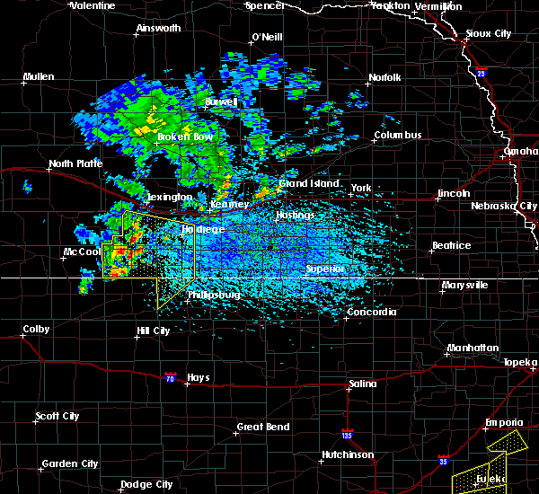 At 456 pm cdt, severe thunderstorms were located along a line extending from smithfield to hollinger to 11 miles northwest of norton, moving southeast at 30 mph (radar indicated). Hazards include 70 mph wind gusts. Expect considerable tree damage. Damage is likely to mobile homes, roofs, and outbuildings. At 456 pm cdt, severe thunderstorms were located along a line extending from smithfield to hollinger to 11 miles northwest of norton, moving southeast at 30 mph (radar indicated). Hazards include 70 mph wind gusts. Expect considerable tree damage. Damage is likely to mobile homes, roofs, and outbuildings.
|
| 8/16/2017 1:53 AM CDT |
 At 153 am cdt, severe thunderstorms were located along a line extending from 6 miles southwest of elwood to holbrook to 8 miles south of hendley, moving east at 30 mph (trained weather spotters). Hazards include 60 mph wind gusts and dime size hail. expect damage to roofs, siding, and trees At 153 am cdt, severe thunderstorms were located along a line extending from 6 miles southwest of elwood to holbrook to 8 miles south of hendley, moving east at 30 mph (trained weather spotters). Hazards include 60 mph wind gusts and dime size hail. expect damage to roofs, siding, and trees
|
| 8/14/2017 1:56 AM CDT |
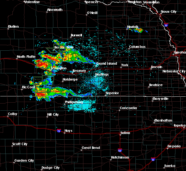 The severe thunderstorm warning for southwestern furnas county will expire at 200 am cdt, the storm which prompted the warning has weakened below severe limits, and no longer poses an immediate threat to life or property. therefore the warning will be allowed to expire. however small hail, gusty winds and heavy rain are still possible with this thunderstorm. a severe thunderstorm watch remains in effect until 300 am cdt for south central nebraska. The severe thunderstorm warning for southwestern furnas county will expire at 200 am cdt, the storm which prompted the warning has weakened below severe limits, and no longer poses an immediate threat to life or property. therefore the warning will be allowed to expire. however small hail, gusty winds and heavy rain are still possible with this thunderstorm. a severe thunderstorm watch remains in effect until 300 am cdt for south central nebraska.
|
| 8/14/2017 1:22 AM CDT |
 At 121 am cdt, a severe thunderstorm was located over wilsonville, or 22 miles northwest of norton, moving east at 10 mph (radar indicated). Hazards include 60 mph wind gusts and quarter size hail. Hail damage to vehicles is expected. Expect wind damage to roofs, siding, and trees. At 121 am cdt, a severe thunderstorm was located over wilsonville, or 22 miles northwest of norton, moving east at 10 mph (radar indicated). Hazards include 60 mph wind gusts and quarter size hail. Hail damage to vehicles is expected. Expect wind damage to roofs, siding, and trees.
|
| 8/14/2017 1:13 AM CDT |
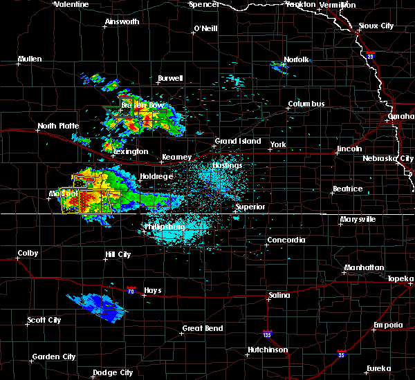 At 113 am cdt, a severe thunderstorm was located near wilsonville, or 26 miles east of mccook, moving south at 20 mph (radar indicated). Hazards include 60 mph wind gusts and penny size hail. Expect damage to roofs, siding, and trees. Locations impacted include, cambridge, arapahoe, beaver city, holbrook, wilsonville and hendley. At 113 am cdt, a severe thunderstorm was located near wilsonville, or 26 miles east of mccook, moving south at 20 mph (radar indicated). Hazards include 60 mph wind gusts and penny size hail. Expect damage to roofs, siding, and trees. Locations impacted include, cambridge, arapahoe, beaver city, holbrook, wilsonville and hendley.
|
| 8/14/2017 12:49 AM CDT |
 At 1249 am cdt, severe thunderstorms were located along a line extending from near edison to near bartley, moving southeast at 15 mph (radar indicated). Hazards include 60 mph wind gusts and penny size hail. expect damage to roofs, siding, and trees At 1249 am cdt, severe thunderstorms were located along a line extending from near edison to near bartley, moving southeast at 15 mph (radar indicated). Hazards include 60 mph wind gusts and penny size hail. expect damage to roofs, siding, and trees
|
| 7/6/2017 8:26 PM CDT |
 At 825 pm cdt, severe thunderstorms were located along a line extending from near beaver city to 9 miles south of hollinger to near norton, moving southeast at 20 mph (radar indicated). Hazards include 60 mph wind gusts. Expect damage to roofs, siding, and trees. Locations impacted include, beaver city, wilsonville, hendley and hollinger. At 825 pm cdt, severe thunderstorms were located along a line extending from near beaver city to 9 miles south of hollinger to near norton, moving southeast at 20 mph (radar indicated). Hazards include 60 mph wind gusts. Expect damage to roofs, siding, and trees. Locations impacted include, beaver city, wilsonville, hendley and hollinger.
|
| 7/6/2017 8:12 PM CDT |
 At 812 pm cdt, severe thunderstorms were located along a line extending from 6 miles south of arapahoe to 6 miles northwest of norton, moving southeast at 15 mph (radar indicated). Hazards include 60 mph wind gusts. expect damage to roofs, siding, and trees At 812 pm cdt, severe thunderstorms were located along a line extending from 6 miles south of arapahoe to 6 miles northwest of norton, moving southeast at 15 mph (radar indicated). Hazards include 60 mph wind gusts. expect damage to roofs, siding, and trees
|
| 7/6/2017 7:56 PM CDT |
 At 748 pm cdt, severe thunderstorms were located along a line extending from near holbrook to near wilsonville, moving southeast at 20 mph (radar indicated). Hazards include 60 mph wind gusts and penny size hail. Expect damage to roofs, siding, and trees. Locations impacted include, cambridge, arapahoe, holbrook, wilsonville and hendley. At 748 pm cdt, severe thunderstorms were located along a line extending from near holbrook to near wilsonville, moving southeast at 20 mph (radar indicated). Hazards include 60 mph wind gusts and penny size hail. Expect damage to roofs, siding, and trees. Locations impacted include, cambridge, arapahoe, holbrook, wilsonville and hendley.
|
| 7/6/2017 7:49 PM CDT |
 At 735 pm cdt, a severe thunderstorm was located over medicine creek reservoir state recreation area, or 21 miles southeast of curtis, moving southeast at 15 mph (radar indicated). Hazards include 60 mph wind gusts and penny size hail. expect damage to roofs, siding, and trees At 735 pm cdt, a severe thunderstorm was located over medicine creek reservoir state recreation area, or 21 miles southeast of curtis, moving southeast at 15 mph (radar indicated). Hazards include 60 mph wind gusts and penny size hail. expect damage to roofs, siding, and trees
|
| 7/6/2017 7:36 PM CDT |
 At 735 pm cdt, a severe thunderstorm was located over medicine creek reservoir state recreation area, or 21 miles southeast of curtis, moving southeast at 15 mph (radar indicated). Hazards include 60 mph wind gusts and penny size hail. expect damage to roofs, siding, and trees At 735 pm cdt, a severe thunderstorm was located over medicine creek reservoir state recreation area, or 21 miles southeast of curtis, moving southeast at 15 mph (radar indicated). Hazards include 60 mph wind gusts and penny size hail. expect damage to roofs, siding, and trees
|
| 7/2/2017 9:53 PM CDT |
 At 953 pm cdt, severe thunderstorms were located along a line extending from 9 miles north of arapahoe to holbrook to near danbury, moving southeast at 35 mph (trained weather spotters). Hazards include 70 mph wind gusts and half dollar size hail. Hail damage to vehicles is expected. expect considerable tree damage. Wind damage is also likely to mobile homes, roofs, and outbuildings. At 953 pm cdt, severe thunderstorms were located along a line extending from 9 miles north of arapahoe to holbrook to near danbury, moving southeast at 35 mph (trained weather spotters). Hazards include 70 mph wind gusts and half dollar size hail. Hail damage to vehicles is expected. expect considerable tree damage. Wind damage is also likely to mobile homes, roofs, and outbuildings.
|
| 7/2/2017 9:50 PM CDT |
 At 950 pm cdt, severe thunderstorms were located along a line extending from 10 miles southwest of elwood to 6 miles north of holbrook to near hendley to near cambridge, moving south at 30 mph (trained weather spotters). Hazards include 70 mph wind gusts and ping pong ball size hail. People and animals outdoors will be injured. expect hail damage to roofs, siding, windows, and vehicles. expect considerable tree damage. wind damage is also likely to mobile homes, roofs, and outbuildings. Locations impacted include, cambridge, arapahoe, beaver city, holbrook, edison, wilsonville, hendley and hollinger. At 950 pm cdt, severe thunderstorms were located along a line extending from 10 miles southwest of elwood to 6 miles north of holbrook to near hendley to near cambridge, moving south at 30 mph (trained weather spotters). Hazards include 70 mph wind gusts and ping pong ball size hail. People and animals outdoors will be injured. expect hail damage to roofs, siding, windows, and vehicles. expect considerable tree damage. wind damage is also likely to mobile homes, roofs, and outbuildings. Locations impacted include, cambridge, arapahoe, beaver city, holbrook, edison, wilsonville, hendley and hollinger.
|
| 7/2/2017 9:21 PM CDT |
 At 920 pm cdt, severe thunderstorms were located along a line extending from near eustis to 13 miles east of stockville to near holbrook to near medicine creek reservoir state recreation area, moving south at 40 mph (at 9:18 pm cdt...a 72 mph wind gust was reported 2 miles north northeast of cambridge). Hazards include 70 mph wind gusts and ping pong ball size hail. People and animals outdoors will be injured. expect hail damage to roofs, siding, windows, and vehicles. expect considerable tree damage. wind damage is also likely to mobile homes, roofs, and outbuildings. Locations impacted include, cambridge, arapahoe, elwood, beaver city, holbrook, edison, wilsonville, smithfield, hendley, hollinger and johnson lake. At 920 pm cdt, severe thunderstorms were located along a line extending from near eustis to 13 miles east of stockville to near holbrook to near medicine creek reservoir state recreation area, moving south at 40 mph (at 9:18 pm cdt...a 72 mph wind gust was reported 2 miles north northeast of cambridge). Hazards include 70 mph wind gusts and ping pong ball size hail. People and animals outdoors will be injured. expect hail damage to roofs, siding, windows, and vehicles. expect considerable tree damage. wind damage is also likely to mobile homes, roofs, and outbuildings. Locations impacted include, cambridge, arapahoe, elwood, beaver city, holbrook, edison, wilsonville, smithfield, hendley, hollinger and johnson lake.
|
| 7/2/2017 9:09 PM CDT |
 At 909 pm cdt, severe thunderstorms were located along a line extending from near eustis to 13 miles east of stockville to 12 miles northwest of holbrook to medicine creek reservoir state recreation area, moving south at 30 mph (radar indicated). Hazards include 70 mph wind gusts and ping pong ball size hail. People and animals outdoors will be injured. expect hail damage to roofs, siding, windows, and vehicles. expect considerable tree damage. Wind damage is also likely to mobile homes, roofs, and outbuildings. At 909 pm cdt, severe thunderstorms were located along a line extending from near eustis to 13 miles east of stockville to 12 miles northwest of holbrook to medicine creek reservoir state recreation area, moving south at 30 mph (radar indicated). Hazards include 70 mph wind gusts and ping pong ball size hail. People and animals outdoors will be injured. expect hail damage to roofs, siding, windows, and vehicles. expect considerable tree damage. Wind damage is also likely to mobile homes, roofs, and outbuildings.
|
| 6/29/2017 8:44 PM CDT | Quarter sized hail reported 5.5 miles NNW of Wilsonville, NE, dime to quarter sized hail with heavy rain. |
| 6/26/2017 2:25 PM CDT |
 At 224 pm cdt, a severe thunderstorm was located over hendley, or 19 miles north of norton, moving southeast at 40 mph (radar indicated). Hazards include ping pong ball size hail and 60 mph wind gusts. People and animals outdoors will be injured. expect hail damage to roofs, siding, windows, and vehicles. expect wind damage to roofs, siding, and trees. This severe thunderstorm will remain over mainly rural areas of southwestern furnas county. At 224 pm cdt, a severe thunderstorm was located over hendley, or 19 miles north of norton, moving southeast at 40 mph (radar indicated). Hazards include ping pong ball size hail and 60 mph wind gusts. People and animals outdoors will be injured. expect hail damage to roofs, siding, windows, and vehicles. expect wind damage to roofs, siding, and trees. This severe thunderstorm will remain over mainly rural areas of southwestern furnas county.
|
| 6/26/2017 2:13 PM CDT |
 At 213 pm cdt, a severe thunderstorm was located near hendley, or 25 miles north of norton, moving south at 35 mph (radar indicated). Hazards include golf ball size hail and 60 mph wind gusts. People and animals outdoors will be injured. expect hail damage to roofs, siding, windows, and vehicles. expect wind damage to roofs, siding, and trees. this severe storm will be near, hendley around 220 pm cdt. Beaver city around 225 pm cdt. At 213 pm cdt, a severe thunderstorm was located near hendley, or 25 miles north of norton, moving south at 35 mph (radar indicated). Hazards include golf ball size hail and 60 mph wind gusts. People and animals outdoors will be injured. expect hail damage to roofs, siding, windows, and vehicles. expect wind damage to roofs, siding, and trees. this severe storm will be near, hendley around 220 pm cdt. Beaver city around 225 pm cdt.
|
| 6/26/2017 2:04 PM CDT |
 At 202 pm cdt, a severe thunderstorm was located near holbrook, or 29 miles north of norton, moving south at 35 mph (radar indicated). Hazards include golf ball size hail and 60 mph wind gusts. People and animals outdoors will be injured. expect hail damage to roofs, siding, windows, and vehicles. expect wind damage to roofs, siding, and trees. this severe storm will be near, beaver city and hendley around 220 pm cdt. Hail to the size of golfballs was reported in holbrook at 201 pm cdt. At 202 pm cdt, a severe thunderstorm was located near holbrook, or 29 miles north of norton, moving south at 35 mph (radar indicated). Hazards include golf ball size hail and 60 mph wind gusts. People and animals outdoors will be injured. expect hail damage to roofs, siding, windows, and vehicles. expect wind damage to roofs, siding, and trees. this severe storm will be near, beaver city and hendley around 220 pm cdt. Hail to the size of golfballs was reported in holbrook at 201 pm cdt.
|
| 6/26/2017 1:57 PM CDT |
 The national weather service in hastings has issued a * severe thunderstorm warning for. central furnas county in south central nebraska. Until 245 pm cdt * at 156 pm cdt, a severe thunderstorm was located over holbrook, or 31 miles east of mccook, moving south at 30 mph. The national weather service in hastings has issued a * severe thunderstorm warning for. central furnas county in south central nebraska. Until 245 pm cdt * at 156 pm cdt, a severe thunderstorm was located over holbrook, or 31 miles east of mccook, moving south at 30 mph.
|
| 5/15/2017 7:08 PM CDT |
 At 708 pm cdt, a severe thunderstorm was located 8 miles south of beaver city, or 12 miles north of norton, moving northeast at 45 mph (radar indicated). Hazards include 60 mph wind gusts and quarter size hail. Hail damage to vehicles is expected. Expect wind damage to roofs, siding, and trees. At 708 pm cdt, a severe thunderstorm was located 8 miles south of beaver city, or 12 miles north of norton, moving northeast at 45 mph (radar indicated). Hazards include 60 mph wind gusts and quarter size hail. Hail damage to vehicles is expected. Expect wind damage to roofs, siding, and trees.
|
| 4/9/2017 4:58 PM CDT |
 At 454 pm cdt, severe thunderstorms were located along a line extending from 8 miles southwest of gothenburg to near cambridge to 7 miles southwest of danbury, moving east at 40 mph (trained weather spotters. at 449 pm cdt trained weather spotters measured a 64 mph wind gust in cambridge along the thunderstorm gust front). Hazards include 60 mph wind gusts. Expect damage to roofs, siding, and trees. locations impacted include, lexington, cozad, gothenburg, cambridge, arapahoe, elwood, beaver city, holbrook, edison, wilsonville, smithfield, hendley, hollinger, willow island, johnson lake and farnam. this includes interstate 80 between mile markers 209 and 241. The strongest winds are occurring out ahead of the broken line of thunderstorms in association with a strong gust front. At 454 pm cdt, severe thunderstorms were located along a line extending from 8 miles southwest of gothenburg to near cambridge to 7 miles southwest of danbury, moving east at 40 mph (trained weather spotters. at 449 pm cdt trained weather spotters measured a 64 mph wind gust in cambridge along the thunderstorm gust front). Hazards include 60 mph wind gusts. Expect damage to roofs, siding, and trees. locations impacted include, lexington, cozad, gothenburg, cambridge, arapahoe, elwood, beaver city, holbrook, edison, wilsonville, smithfield, hendley, hollinger, willow island, johnson lake and farnam. this includes interstate 80 between mile markers 209 and 241. The strongest winds are occurring out ahead of the broken line of thunderstorms in association with a strong gust front.
|
| 4/9/2017 4:37 PM CDT |
 At 436 pm cdt, severe thunderstorms were located along a line extending from 11 miles northwest of moorefield to near bartley to near herndon, moving east at 40 mph (trained weather spotters). Hazards include 60 mph wind gusts. expect damage to roofs, siding, and trees At 436 pm cdt, severe thunderstorms were located along a line extending from 11 miles northwest of moorefield to near bartley to near herndon, moving east at 40 mph (trained weather spotters). Hazards include 60 mph wind gusts. expect damage to roofs, siding, and trees
|
| 3/23/2017 11:53 PM CDT |
 The severe thunderstorm warning for northern smith, northern phillips, webster, franklin, phelps, adams, kearney, gosper, furnas and harlan counties will expire at midnight cdt, the storms which prompted the warning have weakened below severe limits, and no longer pose an immediate threat to life or property. therefore, the warning will be allowed to expire. however gusty winds sustained at 25 to 35 mph with gusts to 45 to 55 mph are expected through 4 am. The severe thunderstorm warning for northern smith, northern phillips, webster, franklin, phelps, adams, kearney, gosper, furnas and harlan counties will expire at midnight cdt, the storms which prompted the warning have weakened below severe limits, and no longer pose an immediate threat to life or property. therefore, the warning will be allowed to expire. however gusty winds sustained at 25 to 35 mph with gusts to 45 to 55 mph are expected through 4 am.
|
| 3/23/2017 11:13 PM CDT |
 At 1113 pm cdt, severe thunderstorms were located along a line extending from indianola to near long island to naponee to 7 miles north of lebanon, moving northeast at 70 mph (radar indicated). Hazards include 70 mph wind gusts. Expect considerable tree damage. Damage is likely to mobile homes, roofs, and outbuildings. At 1113 pm cdt, severe thunderstorms were located along a line extending from indianola to near long island to naponee to 7 miles north of lebanon, moving northeast at 70 mph (radar indicated). Hazards include 70 mph wind gusts. Expect considerable tree damage. Damage is likely to mobile homes, roofs, and outbuildings.
|
| 3/23/2017 9:51 PM CDT |
 At 951 pm cdt, severe thunderstorms were located along a line extending from near holbrook to near miller, moving north at 50 mph (radar indicated). Hazards include 70 mph wind gusts. Expect considerable tree damage. Damage is likely to mobile homes, roofs, and outbuildings. At 951 pm cdt, severe thunderstorms were located along a line extending from near holbrook to near miller, moving north at 50 mph (radar indicated). Hazards include 70 mph wind gusts. Expect considerable tree damage. Damage is likely to mobile homes, roofs, and outbuildings.
|
| 9/5/2016 7:25 PM CDT |
 The severe thunderstorm warning for southwestern furnas county will expire at 730 pm cdt, the storm which prompted the warning has weakened below severe limits, and no longer poses an immediate threat to life or property. therefore, the warning will be allowed to expire. however small hail and gusty winds are still possible with this thunderstorm. The severe thunderstorm warning for southwestern furnas county will expire at 730 pm cdt, the storm which prompted the warning has weakened below severe limits, and no longer poses an immediate threat to life or property. therefore, the warning will be allowed to expire. however small hail and gusty winds are still possible with this thunderstorm.
|
| 9/5/2016 7:11 PM CDT |
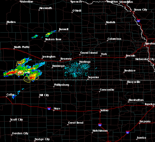 At 710 pm cdt, a severe thunderstorm was located near wilsonville, or 20 miles northwest of norton, moving northeast at 30 mph (radar indicated). Hazards include 60 mph wind gusts and quarter size hail. Hail damage to vehicles is expected. expect wind damage to roofs, siding, and trees. Locations impacted include, wilsonville and hendley. At 710 pm cdt, a severe thunderstorm was located near wilsonville, or 20 miles northwest of norton, moving northeast at 30 mph (radar indicated). Hazards include 60 mph wind gusts and quarter size hail. Hail damage to vehicles is expected. expect wind damage to roofs, siding, and trees. Locations impacted include, wilsonville and hendley.
|
| 9/5/2016 6:48 PM CDT |
 At 646 pm cdt, a severe thunderstorm was located near lebanon, or 16 miles northeast of oberlin, moving northeast at 40 mph (radar indicated). Hazards include 60 mph wind gusts and half dollar size hail. Hail damage to vehicles is expected. Expect wind damage to roofs, siding, and trees. At 646 pm cdt, a severe thunderstorm was located near lebanon, or 16 miles northeast of oberlin, moving northeast at 40 mph (radar indicated). Hazards include 60 mph wind gusts and half dollar size hail. Hail damage to vehicles is expected. Expect wind damage to roofs, siding, and trees.
|
| 8/1/2016 9:25 PM CDT |
 The severe thunderstorm warning for northwestern furnas county will expire at 930 pm cdt, the storm which prompted the warning has weakened below severe limits, and no longer poses an immediate threat to life or property. therefore, the warning will be allowed to expire. however small hail and gusty winds are still possible with this thunderstorm. The severe thunderstorm warning for northwestern furnas county will expire at 930 pm cdt, the storm which prompted the warning has weakened below severe limits, and no longer poses an immediate threat to life or property. therefore, the warning will be allowed to expire. however small hail and gusty winds are still possible with this thunderstorm.
|
| 8/1/2016 9:02 PM CDT |
 At 901 pm cdt, a severe thunderstorm was located near cambridge, or 45 miles west of holdrege, moving east at 10 mph (radar indicated). Hazards include 60 mph wind gusts and half dollar size hail. Hail damage to vehicles is expected. expect wind damage to roofs, siding, and trees. Locations impacted include, cambridge, wilsonville and hendley. At 901 pm cdt, a severe thunderstorm was located near cambridge, or 45 miles west of holdrege, moving east at 10 mph (radar indicated). Hazards include 60 mph wind gusts and half dollar size hail. Hail damage to vehicles is expected. expect wind damage to roofs, siding, and trees. Locations impacted include, cambridge, wilsonville and hendley.
|
| 8/1/2016 8:45 PM CDT |
 At 845 pm cdt, a severe thunderstorm was located 7 miles south of cambridge, or 48 miles west of holdrege, moving east at 10 mph. this warning replaces the previous warning in effect for northwest furnas county (radar indicated). Hazards include ping pong ball size hail and 60 mph wind gusts. People and animals outdoors will be injured. expect hail damage to roofs, siding, windows, and vehicles. Expect wind damage to roofs, siding, and trees. At 845 pm cdt, a severe thunderstorm was located 7 miles south of cambridge, or 48 miles west of holdrege, moving east at 10 mph. this warning replaces the previous warning in effect for northwest furnas county (radar indicated). Hazards include ping pong ball size hail and 60 mph wind gusts. People and animals outdoors will be injured. expect hail damage to roofs, siding, windows, and vehicles. Expect wind damage to roofs, siding, and trees.
|
| 8/1/2016 6:04 PM CDT |
 At 604 pm cdt, a severe thunderstorm was located near cambridge, or 43 miles west of holdrege, moving northeast at 15 mph (radar indicated). Hazards include 60 mph wind gusts and quarter size hail. Hail damage to vehicles is expected. expect wind damage to roofs, siding, and trees. Locations impacted include, cambridge, arapahoe, holbrook and wilsonville. At 604 pm cdt, a severe thunderstorm was located near cambridge, or 43 miles west of holdrege, moving northeast at 15 mph (radar indicated). Hazards include 60 mph wind gusts and quarter size hail. Hail damage to vehicles is expected. expect wind damage to roofs, siding, and trees. Locations impacted include, cambridge, arapahoe, holbrook and wilsonville.
|
| 8/1/2016 5:49 PM CDT |
 At 549 pm cdt, a severe thunderstorm was located near cambridge, or 46 miles southwest of lexington, moving northeast at 20 mph (radar indicated). Hazards include ping pong ball size hail and 60 mph wind gusts. People and animals outdoors will be injured. expect hail damage to roofs, siding, windows, and vehicles. Expect wind damage to roofs, siding, and trees. At 549 pm cdt, a severe thunderstorm was located near cambridge, or 46 miles southwest of lexington, moving northeast at 20 mph (radar indicated). Hazards include ping pong ball size hail and 60 mph wind gusts. People and animals outdoors will be injured. expect hail damage to roofs, siding, windows, and vehicles. Expect wind damage to roofs, siding, and trees.
|
| 7/28/2016 4:05 PM CDT |
 At 404 pm cdt, severe thunderstorms were located along a line extending from 6 miles northeast of hendley to near beaver city to 16 miles west of prairie view, moving east at 45 mph (radar indicated). Hazards include 60 mph wind gusts and penny size hail. Expect damage to roofs. siding. and trees. Locations impacted include, oxford, beaver city, wilsonville, hendley and hollinger. At 404 pm cdt, severe thunderstorms were located along a line extending from 6 miles northeast of hendley to near beaver city to 16 miles west of prairie view, moving east at 45 mph (radar indicated). Hazards include 60 mph wind gusts and penny size hail. Expect damage to roofs. siding. and trees. Locations impacted include, oxford, beaver city, wilsonville, hendley and hollinger.
|
| 7/28/2016 3:54 PM CDT |
 At 353 pm cdt, severe thunderstorms were located along a line extending from near holbrook to near hendley to 14 miles south of wilsonville, moving east at 45 mph (radar indicated). Hazards include 60 mph wind gusts and penny size hail. Expect damage to roofs. siding. And trees. At 353 pm cdt, severe thunderstorms were located along a line extending from near holbrook to near hendley to 14 miles south of wilsonville, moving east at 45 mph (radar indicated). Hazards include 60 mph wind gusts and penny size hail. Expect damage to roofs. siding. And trees.
|
| 7/28/2016 3:44 PM CDT |
 At 343 pm cdt, severe thunderstorms were located along a line extending from cambridge to near wilsonville to 16 miles southwest of hendley, moving east at 30 mph (radar indicated). Hazards include 60 mph wind gusts and nickel size hail. Expect damage to roofs. siding. and trees. Locations impacted include, cambridge, arapahoe, beaver city, holbrook, wilsonville and hendley. At 343 pm cdt, severe thunderstorms were located along a line extending from cambridge to near wilsonville to 16 miles southwest of hendley, moving east at 30 mph (radar indicated). Hazards include 60 mph wind gusts and nickel size hail. Expect damage to roofs. siding. and trees. Locations impacted include, cambridge, arapahoe, beaver city, holbrook, wilsonville and hendley.
|
| 7/28/2016 3:31 PM CDT |
 At 330 pm cdt, severe thunderstorms were located along a line extending from near cambridge to 17 miles southwest of wilsonville, moving east at 35 mph (radar indicated). Hazards include 60 mph wind gusts and nickel size hail. Expect damage to roofs. siding. and trees. Locations impacted include, cambridge, arapahoe, beaver city, holbrook, wilsonville and hendley. At 330 pm cdt, severe thunderstorms were located along a line extending from near cambridge to 17 miles southwest of wilsonville, moving east at 35 mph (radar indicated). Hazards include 60 mph wind gusts and nickel size hail. Expect damage to roofs. siding. and trees. Locations impacted include, cambridge, arapahoe, beaver city, holbrook, wilsonville and hendley.
|
| 7/28/2016 3:15 PM CDT |
 At 314 pm cdt, severe thunderstorms were located along a line extending from near cambridge to 25 miles west of wilsonville, moving east at 30 mph (radar indicated. at 306 pm cdt...a wind gust of 59 mph was recorded by the asos at the mccook airport). Hazards include 60 mph wind gusts and quarter size hail. Hail damage to vehicles is expected. Expect wind damage to roofs, siding, and trees. At 314 pm cdt, severe thunderstorms were located along a line extending from near cambridge to 25 miles west of wilsonville, moving east at 30 mph (radar indicated. at 306 pm cdt...a wind gust of 59 mph was recorded by the asos at the mccook airport). Hazards include 60 mph wind gusts and quarter size hail. Hail damage to vehicles is expected. Expect wind damage to roofs, siding, and trees.
|
| 7/6/2016 11:12 PM CDT |
 At 1112 pm cdt, severe thunderstorms were located along a line extending from 6 miles northeast of loomis to near funk to near ragan to huntley to near woodruff, moving east at 60 mph (radar indicated). Hazards include 60 mph wind gusts and penny size hail. Expect damage to roofs. siding. and trees. Locations impacted include, holdrege, minden, alma, arapahoe, franklin, oxford, bertrand, axtell, elwood, beaver city, orleans, loomis, hildreth, wilcox, funk, stamford, republican city, upland, edison and atlanta. At 1112 pm cdt, severe thunderstorms were located along a line extending from 6 miles northeast of loomis to near funk to near ragan to huntley to near woodruff, moving east at 60 mph (radar indicated). Hazards include 60 mph wind gusts and penny size hail. Expect damage to roofs. siding. and trees. Locations impacted include, holdrege, minden, alma, arapahoe, franklin, oxford, bertrand, axtell, elwood, beaver city, orleans, loomis, hildreth, wilcox, funk, stamford, republican city, upland, edison and atlanta.
|
| 7/6/2016 10:41 PM CDT |
 At 1040 pm cdt, severe thunderstorms were located along a line extending from 8 miles southwest of elwood to 6 miles north of arapahoe to near edison to beaver city to 9 miles southeast of wilsonville, moving east at 60 mph (radar indicated). Hazards include 70 mph wind gusts and penny size hail. Expect considerable tree damage. Damage is likely to mobile homes, roofs, and outbuildings. At 1040 pm cdt, severe thunderstorms were located along a line extending from 8 miles southwest of elwood to 6 miles north of arapahoe to near edison to beaver city to 9 miles southeast of wilsonville, moving east at 60 mph (radar indicated). Hazards include 70 mph wind gusts and penny size hail. Expect considerable tree damage. Damage is likely to mobile homes, roofs, and outbuildings.
|
| 7/6/2016 10:26 PM CDT |
 At 1026 pm cdt, severe thunderstorms were located along a line extending from 8 miles north of cambridge to near wilsonville to 17 miles southwest of hendley, moving east at 50 mph (radar indicated). Hazards include 70 mph wind gusts and quarter size hail. Hail damage to vehicles is expected. expect considerable tree damage. wind damage is also likely to mobile homes, roofs, and outbuildings. Locations impacted include, cambridge, arapahoe, oxford, bertrand, beaver city, holbrook, edison, wilsonville, hendley and hollinger. At 1026 pm cdt, severe thunderstorms were located along a line extending from 8 miles north of cambridge to near wilsonville to 17 miles southwest of hendley, moving east at 50 mph (radar indicated). Hazards include 70 mph wind gusts and quarter size hail. Hail damage to vehicles is expected. expect considerable tree damage. wind damage is also likely to mobile homes, roofs, and outbuildings. Locations impacted include, cambridge, arapahoe, oxford, bertrand, beaver city, holbrook, edison, wilsonville, hendley and hollinger.
|
| 7/6/2016 10:01 PM CDT |
 At 1001 pm cdt, severe thunderstorms were located along a line extending from 27 miles west of holbrook to 19 miles west of cambridge to 28 miles west of wilsonville, moving east at 55 mph (radar indicated). Hazards include 60 mph wind gusts and half dollar size hail. Hail damage to vehicles is expected. Expect wind damage to roofs, siding, and trees. At 1001 pm cdt, severe thunderstorms were located along a line extending from 27 miles west of holbrook to 19 miles west of cambridge to 28 miles west of wilsonville, moving east at 55 mph (radar indicated). Hazards include 60 mph wind gusts and half dollar size hail. Hail damage to vehicles is expected. Expect wind damage to roofs, siding, and trees.
|
| 6/28/2016 11:57 PM CDT | The severe thunderstorm warning for gosper, phelps, furnas and western harlan counties will expire at midnight cdt, the storms which prompted the warning have weakened below severe limits, and no longer pose an immediate threat to life or property. therefore the warning will be allowed to expire. however gusty winds are still possible with these thunderstorms. a severe thunderstorm watch remains in effect until 400 am cdt for north central kansas, and south central nebraska. |
| 6/28/2016 11:21 PM CDT |
 At 1121 pm cdt, severe thunderstorms were located along a line extending from 8 miles west of johnson lake to 10 miles north of holbrook to 6 miles southwest of cambridge, moving east at 60 mph (radar indicated). Hazards include 60 mph wind gusts. Expect damage to roofs. siding. And trees. At 1121 pm cdt, severe thunderstorms were located along a line extending from 8 miles west of johnson lake to 10 miles north of holbrook to 6 miles southwest of cambridge, moving east at 60 mph (radar indicated). Hazards include 60 mph wind gusts. Expect damage to roofs. siding. And trees.
|
| 5/30/2016 9:08 PM CDT |
 At 908 pm cdt, severe thunderstorms were located along a line extending from near overton to 7 miles southwest of loomis to 9 miles south of hollinger, moving east at 45 mph (radar indicated). Hazards include 60 mph wind gusts. Expect damage to roofs. siding. and trees. Locations impacted include, holdrege, alma, cambridge, arapahoe, oxford, bertrand, elwood, beaver city, orleans, loomis, holbrook, funk, stamford, republican city, edison, atlanta, wilsonville, smithfield, huntley and ragan. At 908 pm cdt, severe thunderstorms were located along a line extending from near overton to 7 miles southwest of loomis to 9 miles south of hollinger, moving east at 45 mph (radar indicated). Hazards include 60 mph wind gusts. Expect damage to roofs. siding. and trees. Locations impacted include, holdrege, alma, cambridge, arapahoe, oxford, bertrand, elwood, beaver city, orleans, loomis, holbrook, funk, stamford, republican city, edison, atlanta, wilsonville, smithfield, huntley and ragan.
|
| 5/30/2016 8:55 PM CDT |
 At 854 pm cdt, severe thunderstorms were located along a line extending from near smithfield to 9 miles north of edison to 7 miles southeast of hendley, moving east at 40 mph. this warning replaces the previous warning for gosper and furnas counties expiring at 9pm (radar indicated). Hazards include 60 mph wind gusts. Expect damage to roofs. siding. And trees. At 854 pm cdt, severe thunderstorms were located along a line extending from near smithfield to 9 miles north of edison to 7 miles southeast of hendley, moving east at 40 mph. this warning replaces the previous warning for gosper and furnas counties expiring at 9pm (radar indicated). Hazards include 60 mph wind gusts. Expect damage to roofs. siding. And trees.
|
| 5/30/2016 8:21 PM CDT |
 At 820 pm cdt, severe thunderstorms were located along a line extending from 11 miles southwest of cozad to 12 miles north of cambridge to 15 miles west of wilsonville, moving east at 40 mph (radar indicated). Hazards include 60 mph wind gusts. Expect damage to roofs. siding. And trees. At 820 pm cdt, severe thunderstorms were located along a line extending from 11 miles southwest of cozad to 12 miles north of cambridge to 15 miles west of wilsonville, moving east at 40 mph (radar indicated). Hazards include 60 mph wind gusts. Expect damage to roofs. siding. And trees.
|
| 11/16/2015 7:11 PM CST |
 At 710 pm cst, a severe thunderstorm was located near holbrook, or 38 miles southwest of holdrege, moving northeast at 35 mph (radar indicated). Hazards include quarter size hail. Damage to vehicles is expected. locations impacted include, cambridge, arapahoe, beaver city, holbrook, wilsonville and hendley. A tornado watch remains in effect until 1000 pm cst for south central nebraska. At 710 pm cst, a severe thunderstorm was located near holbrook, or 38 miles southwest of holdrege, moving northeast at 35 mph (radar indicated). Hazards include quarter size hail. Damage to vehicles is expected. locations impacted include, cambridge, arapahoe, beaver city, holbrook, wilsonville and hendley. A tornado watch remains in effect until 1000 pm cst for south central nebraska.
|
| 11/16/2015 7:01 PM CST |
 At 701 pm cst, a severe thunderstorm was located over wilsonville, or 43 miles southwest of holdrege, moving northeast at 35 mph (radar indicated). Hazards include quarter size hail. Damage to vehicles is expected. locations impacted include, cambridge, arapahoe, beaver city, holbrook, wilsonville and hendley. A tornado watch remains in effect until 1000 pm cst for south central nebraska. At 701 pm cst, a severe thunderstorm was located over wilsonville, or 43 miles southwest of holdrege, moving northeast at 35 mph (radar indicated). Hazards include quarter size hail. Damage to vehicles is expected. locations impacted include, cambridge, arapahoe, beaver city, holbrook, wilsonville and hendley. A tornado watch remains in effect until 1000 pm cst for south central nebraska.
|
| 11/16/2015 6:54 PM CST |
 At 654 pm cst, a severe thunderstorm was located near wilsonville, or 47 miles southwest of holdrege, moving north at 40 mph (radar indicated). Hazards include quarter size hail. damage to vehicles is expected At 654 pm cst, a severe thunderstorm was located near wilsonville, or 47 miles southwest of holdrege, moving north at 40 mph (radar indicated). Hazards include quarter size hail. damage to vehicles is expected
|
| 9/10/2015 5:38 PM CDT |
 At 538 pm cdt, a severe thunderstorm was located near hendley, or 36 miles southwest of holdrege, moving southeast at 30 mph. this storm has a history of producing tennis ball size hail (trained weather spotters). Hazards include tennis ball size hail and 60 mph wind gusts. People and animals outdoors will be injured. expect hail damage to roofs, siding, windows and vehicles. expect wind damage to roofs, siding and trees. this severe storm will be near, hendley around 545 pm cdt. Beaver city around 555 pm cdt. At 538 pm cdt, a severe thunderstorm was located near hendley, or 36 miles southwest of holdrege, moving southeast at 30 mph. this storm has a history of producing tennis ball size hail (trained weather spotters). Hazards include tennis ball size hail and 60 mph wind gusts. People and animals outdoors will be injured. expect hail damage to roofs, siding, windows and vehicles. expect wind damage to roofs, siding and trees. this severe storm will be near, hendley around 545 pm cdt. Beaver city around 555 pm cdt.
|
| 9/10/2015 5:35 PM CDT |
 At 534 pm cdt, a severe thunderstorm was located near hendley, or 36 miles southwest of holdrege, moving southeast at 30 mph (radar indicated). Hazards include two inch hail and 60 mph wind gusts. People and animals outdoors will be injured. expect hail damage to roofs, siding, windows and vehicles. expect wind damage to roofs, siding and trees. this severe storm will be near, hendley around 545 pm cdt. Beaver city around 555 pm cdt. At 534 pm cdt, a severe thunderstorm was located near hendley, or 36 miles southwest of holdrege, moving southeast at 30 mph (radar indicated). Hazards include two inch hail and 60 mph wind gusts. People and animals outdoors will be injured. expect hail damage to roofs, siding, windows and vehicles. expect wind damage to roofs, siding and trees. this severe storm will be near, hendley around 545 pm cdt. Beaver city around 555 pm cdt.
|
| 9/10/2015 5:21 PM CDT |
 At 521 pm cdt, a severe thunderstorm was located near holbrook, or 37 miles southwest of lexington, moving southeast at 30 mph (radar indicated). Hazards include golf ball size hail and 60 mph wind gusts. People and animals outdoors will be injured. expect hail damage to roofs, siding, windows and vehicles. expect wind damage to roofs, siding and trees. this severe thunderstorm will be near, holbrook around 525 pm cdt. hendley around 550 pm cdt. Beaver city around 555 pm cdt. At 521 pm cdt, a severe thunderstorm was located near holbrook, or 37 miles southwest of lexington, moving southeast at 30 mph (radar indicated). Hazards include golf ball size hail and 60 mph wind gusts. People and animals outdoors will be injured. expect hail damage to roofs, siding, windows and vehicles. expect wind damage to roofs, siding and trees. this severe thunderstorm will be near, holbrook around 525 pm cdt. hendley around 550 pm cdt. Beaver city around 555 pm cdt.
|
| 9/9/2015 5:18 PM CDT |
 At 518 pm cdt, severe thunderstorms were located along a line extending from near cambridge to hendley, moving southeast at 25 mph (radar indicated). Hazards include 60 mph wind gusts and quarter size hail. Hail damage to vehicles is expected. expect wind damage to roofs, siding and trees. Locations impacted include, beaver city, wilsonville and hendley. At 518 pm cdt, severe thunderstorms were located along a line extending from near cambridge to hendley, moving southeast at 25 mph (radar indicated). Hazards include 60 mph wind gusts and quarter size hail. Hail damage to vehicles is expected. expect wind damage to roofs, siding and trees. Locations impacted include, beaver city, wilsonville and hendley.
|
| 9/9/2015 5:06 PM CDT |
 At 504 pm cdt, severe thunderstorms were located along a line extending from near cambridge to near hendley, moving southeast at 20 mph (public. at 503 pm cdt...hail up to golf ball size was reported 2 miles south of cambridge). Hazards include golf ball size hail and 60 mph wind gusts. People and animals outdoors will be injured. expect hail damage to roofs, siding, windows and vehicles. expect wind damage to roofs, siding and trees. Locations potentially impacted include, beaver city, wilsonville and hendley. At 504 pm cdt, severe thunderstorms were located along a line extending from near cambridge to near hendley, moving southeast at 20 mph (public. at 503 pm cdt...hail up to golf ball size was reported 2 miles south of cambridge). Hazards include golf ball size hail and 60 mph wind gusts. People and animals outdoors will be injured. expect hail damage to roofs, siding, windows and vehicles. expect wind damage to roofs, siding and trees. Locations potentially impacted include, beaver city, wilsonville and hendley.
|
| 9/9/2015 4:54 PM CDT |
 At 453 pm cdt, severe thunderstorms were located along a line extending from cambridge to 6 miles north of wilsonville, moving southeast at 15 mph (public. there have been a few reports of hail up to quarter size in the cambridge area). Hazards include 60 mph wind gusts and half dollar size hail. Hail damage to vehicles is expected. expect wind damage to roofs, siding and trees. Locations impacted include, cambridge, beaver city, wilsonville and hendley. At 453 pm cdt, severe thunderstorms were located along a line extending from cambridge to 6 miles north of wilsonville, moving southeast at 15 mph (public. there have been a few reports of hail up to quarter size in the cambridge area). Hazards include 60 mph wind gusts and half dollar size hail. Hail damage to vehicles is expected. expect wind damage to roofs, siding and trees. Locations impacted include, cambridge, beaver city, wilsonville and hendley.
|
| 9/9/2015 4:43 PM CDT |
 At 441 pm cdt, a severe thunderstorm was located over cambridge, or 42 miles southwest of lexington, moving southeast at 25 mph (public. at 433 pm cdt quarter size hail was reported 1 mile north of cambridge). Hazards include 60 mph wind gusts and half dollar size hail. Hail damage to vehicles is expected. Expect wind damage to roofs, siding and trees. At 441 pm cdt, a severe thunderstorm was located over cambridge, or 42 miles southwest of lexington, moving southeast at 25 mph (public. at 433 pm cdt quarter size hail was reported 1 mile north of cambridge). Hazards include 60 mph wind gusts and half dollar size hail. Hail damage to vehicles is expected. Expect wind damage to roofs, siding and trees.
|
| 8/7/2015 9:56 PM CDT |
 At 956 pm cdt, severe thunderstorms were located along a line extending from near wilsonville to near norton to near lenora, moving northeast at 65 mph (radar indicated). Hazards include 60 mph wind gusts and quarter size hail. Hail damage to vehicles is expected. Expect wind damage to roofs, siding and trees. At 956 pm cdt, severe thunderstorms were located along a line extending from near wilsonville to near norton to near lenora, moving northeast at 65 mph (radar indicated). Hazards include 60 mph wind gusts and quarter size hail. Hail damage to vehicles is expected. Expect wind damage to roofs, siding and trees.
|
| 8/6/2015 10:01 AM CDT |
 At 1001 am cdt, a severe thunderstorm was located near arapahoe, or 26 miles north of norton, moving east at 30 mph (radar indicated). Hazards include quarter size hail. damage to vehicles is expected At 1001 am cdt, a severe thunderstorm was located near arapahoe, or 26 miles north of norton, moving east at 30 mph (radar indicated). Hazards include quarter size hail. damage to vehicles is expected
|
| 7/11/2015 12:04 AM CDT |
 At 1203 am cdt, severe thunderstorms were located along a line extending from near atlanta to hollinger to 8 miles south of hendley, moving east at 15 mph (radar indicated). Hazards include half dollar size hail. Damage to vehicles is expected. Locations impacted include, arapahoe, oxford, beaver city, orleans, stamford, edison, wilsonville, ragan, hendley and hollinger. At 1203 am cdt, severe thunderstorms were located along a line extending from near atlanta to hollinger to 8 miles south of hendley, moving east at 15 mph (radar indicated). Hazards include half dollar size hail. Damage to vehicles is expected. Locations impacted include, arapahoe, oxford, beaver city, orleans, stamford, edison, wilsonville, ragan, hendley and hollinger.
|
| 7/10/2015 11:54 PM CDT |
 At 1154 pm cdt, severe thunderstorms were located along a line extending from near oxford to hollinger to 7 miles southeast of wilsonville, moving east at 15 mph (radar indicated). Hazards include half dollar size hail. damage to vehicles is expected At 1154 pm cdt, severe thunderstorms were located along a line extending from near oxford to hollinger to 7 miles southeast of wilsonville, moving east at 15 mph (radar indicated). Hazards include half dollar size hail. damage to vehicles is expected
|
| 7/10/2015 11:37 PM CDT |
 At 1137 pm cdt, severe thunderstorms were located along a line extending from near holbrook to wilsonville, moving east at 15 mph (radar indicated). Hazards include quarter size hail. Damage to vehicles is expected. Locations impacted include, cambridge, beaver city, wilsonville and hendley. At 1137 pm cdt, severe thunderstorms were located along a line extending from near holbrook to wilsonville, moving east at 15 mph (radar indicated). Hazards include quarter size hail. Damage to vehicles is expected. Locations impacted include, cambridge, beaver city, wilsonville and hendley.
|
| 7/10/2015 11:23 PM CDT |
 At 1123 pm cdt, a severe thunderstorm was located near wilsonville, or 26 miles northwest of norton, moving east at 30 mph (radar indicated). Hazards include quarter size hail. damage to vehicles is expected At 1123 pm cdt, a severe thunderstorm was located near wilsonville, or 26 miles northwest of norton, moving east at 30 mph (radar indicated). Hazards include quarter size hail. damage to vehicles is expected
|
| 6/6/2015 12:45 AM CDT | At 1243 am cdt, severe thunderstorms were located along a line extending from near holbrook to beaver city, moving east at 30 mph (radar indicated. in addition...a trained spotter reported 50 to 60 mph winds four miles west of arapahoe at 1240 am cdt). Hazards include 60 mph wind gusts. Expect damage to roofs. siding and trees. Locations impacted include, cambridge, arapahoe, holbrook, edison, wilsonville, hendley and hollinger. |
| 6/6/2015 12:24 AM CDT | At 1224 am cdt, severe thunderstorms were located along a line extending from near cambridge to 6 miles south of hendley, moving east at 35 mph (at 1220 am cdt...a trained weather spotter reported winds near 60 mph six miles south of cambridge). Hazards include 60 mph wind gusts. Expect damage to roofs. Siding and trees. |
| 5/29/2015 5:10 PM CDT | At 509 pm cdt, severe thunderstorms were located along a line extending from 7 miles east of medicine creek reservoir state recreation area to near hendley to wilsonville, moving east at 35 mph (radar indicated). Hazards include 60 mph wind gusts and quarter size hail. Hail damage to vehicles is expected. expect wind damage to roofs, siding and trees. Locations impacted include, cambridge, arapahoe, beaver city, holbrook, edison, wilsonville, hendley and hollinger. |
| 5/29/2015 5:00 PM CDT | At 459 pm cdt, severe thunderstorms were located along a line extending from near medicine creek reservoir state recreation area to near cambridge to near lebanon, moving east at 35 mph (radar indicated). Hazards include 60 mph wind gusts. Expect damage to roofs. Siding and trees. |
| 5/15/2015 11:56 PM CDT | At 1156 pm cdt, a severe thunderstorm was located near wilsonville, or 15 miles northwest of norton, moving northeast at 50 mph (radar indicated). Hazards include 60 mph wind gusts and half dollar size hail. Hail damage to vehicles is expected. Expect wind damage to roofs, siding and trees. |
| 6/6/2014 8:14 PM CDT | Trained spotter measured wind gust of 68 mph 8 miles south of cambridg in furnas county NE, 5.3 miles SE of Wilsonville, NE |
| 7/9/2013 8:40 PM CDT | Ping Pong Ball sized hail reported 0.2 miles ENE of Wilsonville, NE, 10 min of pea to walnut size hail ended at 840 pm. |
| 7/9/2013 8:40 PM CDT | Golf Ball sized hail reported 0.2 miles ENE of Wilsonville, NE, hail lasted from 830 to 840 pm cdt. |
| 7/9/2013 8:23 PM CDT | Quarter sized hail reported 2 miles NW of Wilsonville, NE, quarter sized hail with dime sized hail mixed in. |
| 6/14/2012 5:14 PM CDT | Quarter sized hail reported 4.2 miles N of Wilsonville, NE |
| 6/14/2012 5:10 PM CDT | Quarter sized hail reported 4.2 miles N of Wilsonville, NE, lasted for about 15 minutes 510pm-525pm. |
| 6/14/2012 4:57 PM CDT | Ping Pong Ball sized hail reported 0.2 miles ENE of Wilsonville, NE, a few ping pong ball size stones |
| 6/14/2012 4:48 PM CDT | Quarter sized hail reported 0.2 miles ENE of Wilsonville, NE |
| 1/1/0001 12:00 AM | Half Dollar sized hail reported 0.2 miles ENE of Wilsonville, NE |
| 1/1/0001 12:00 AM | Golf Ball sized hail reported 2 miles NW of Wilsonville, NE |
Hail Maps for Wilsonville, NE


Connect with Interactive Hail Maps