

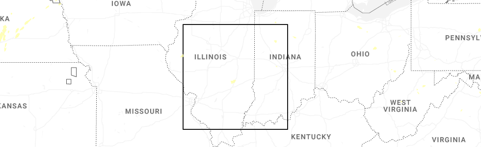
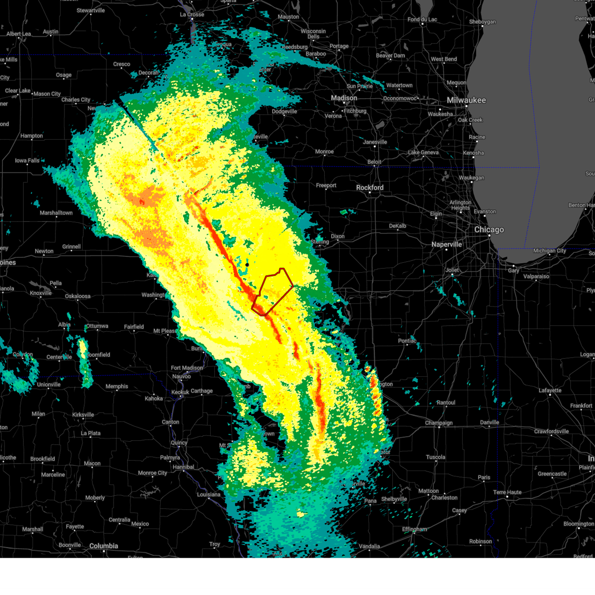
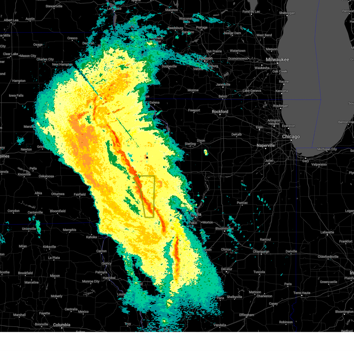
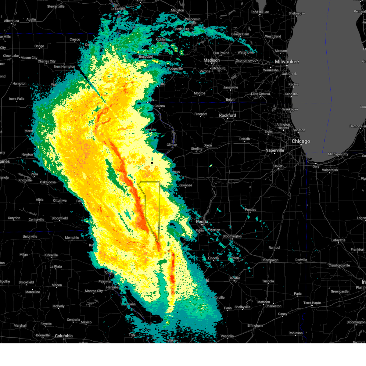
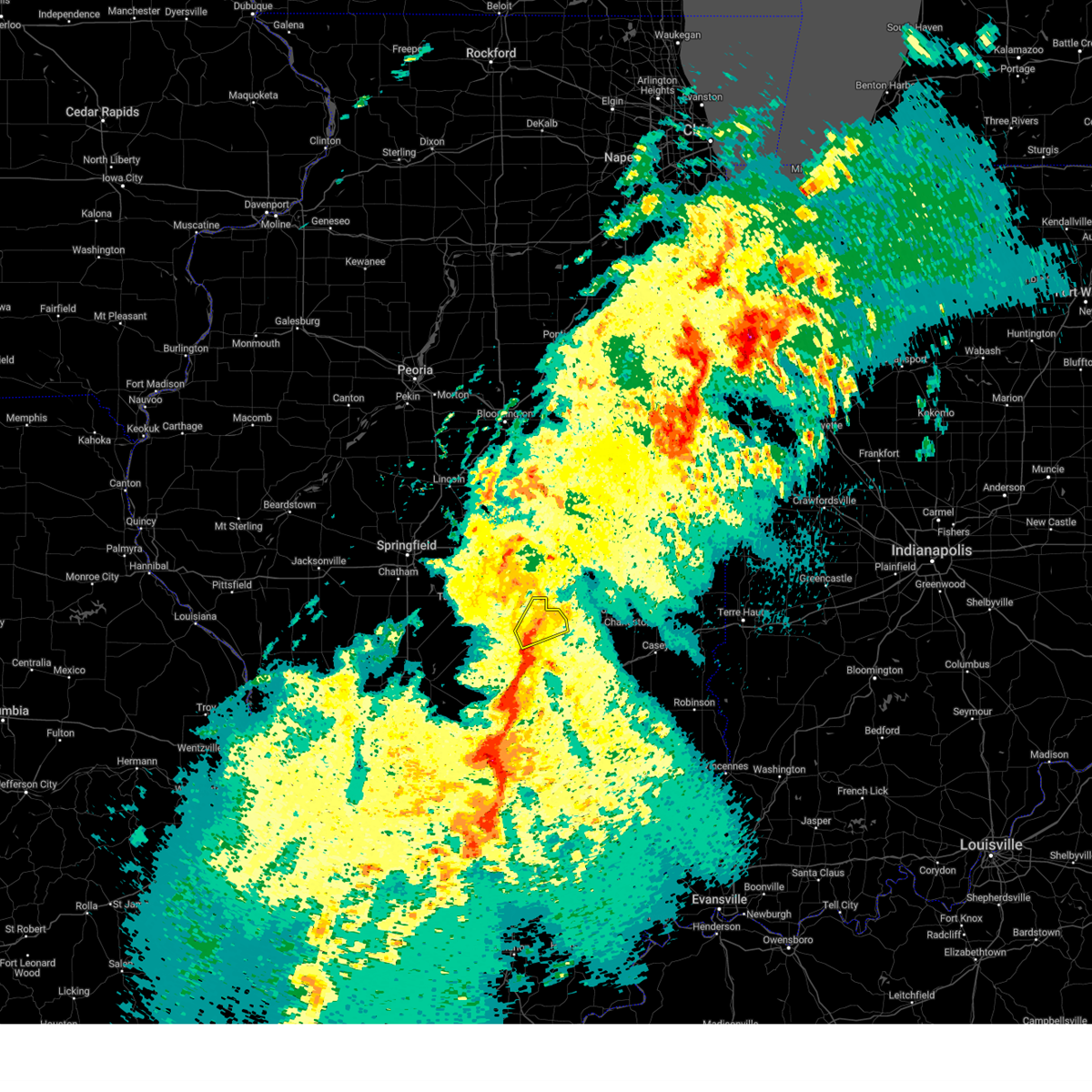
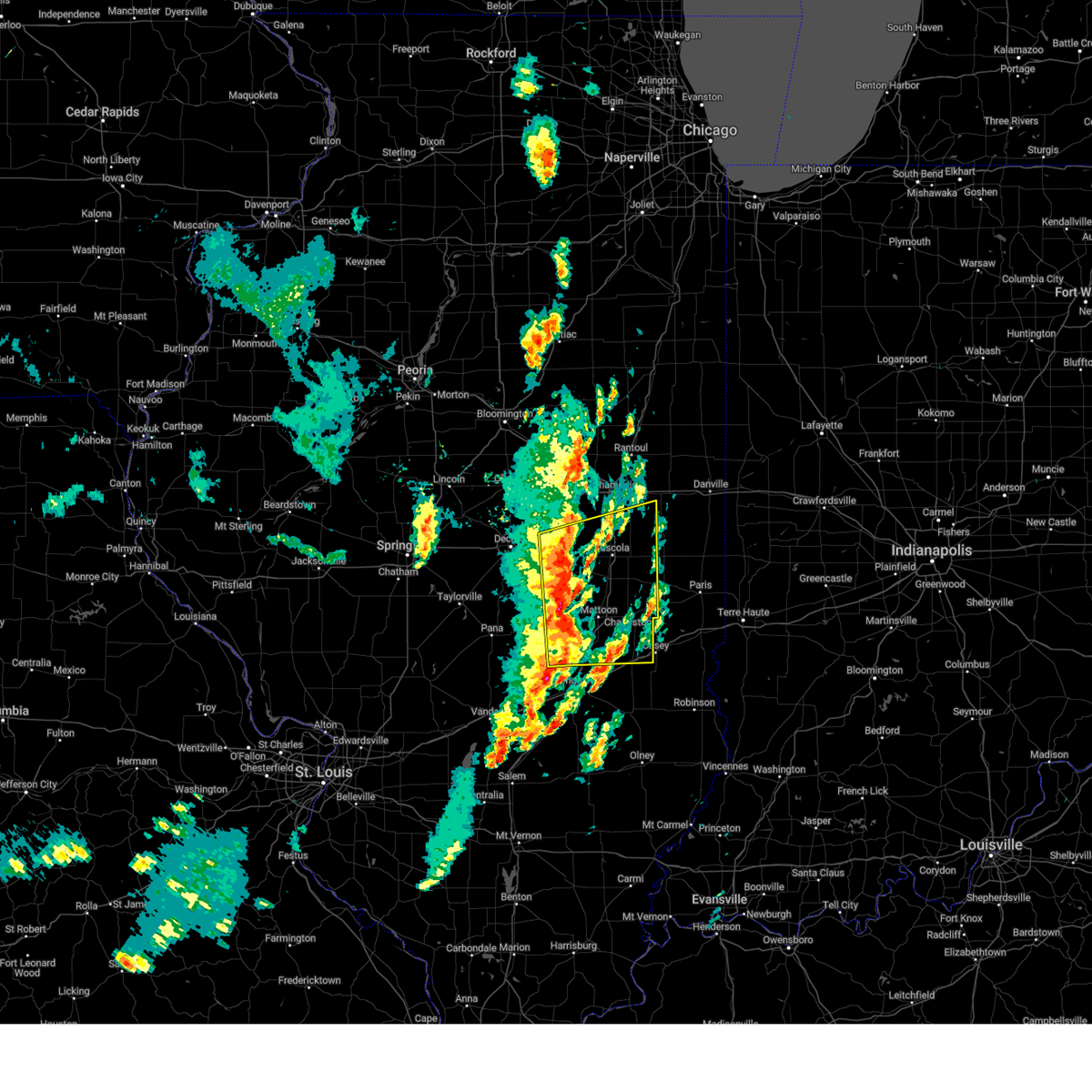
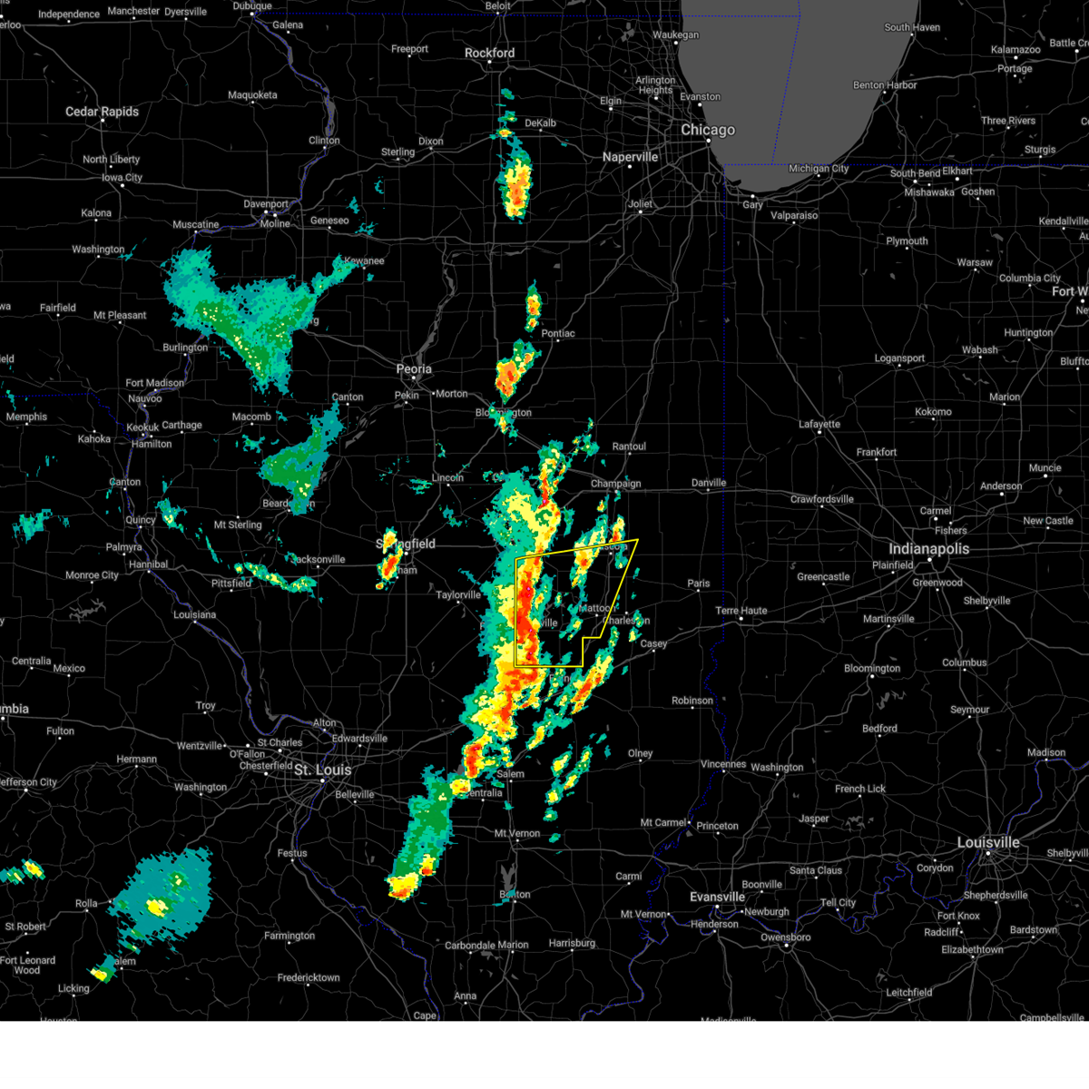
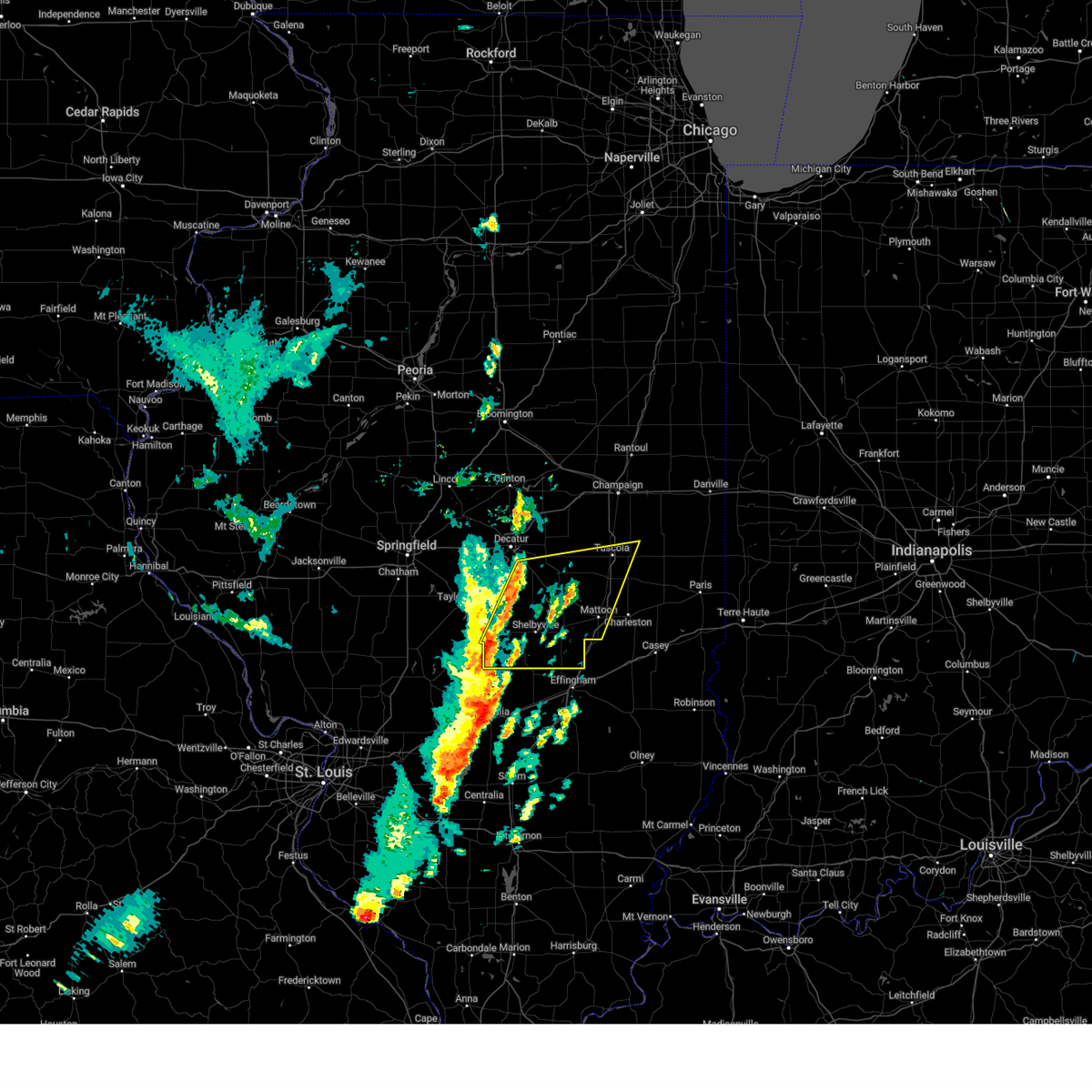
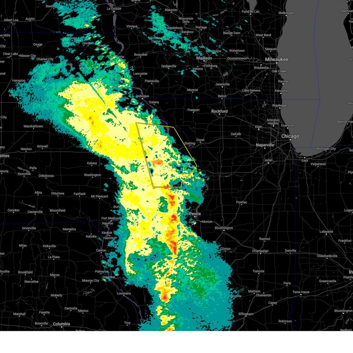
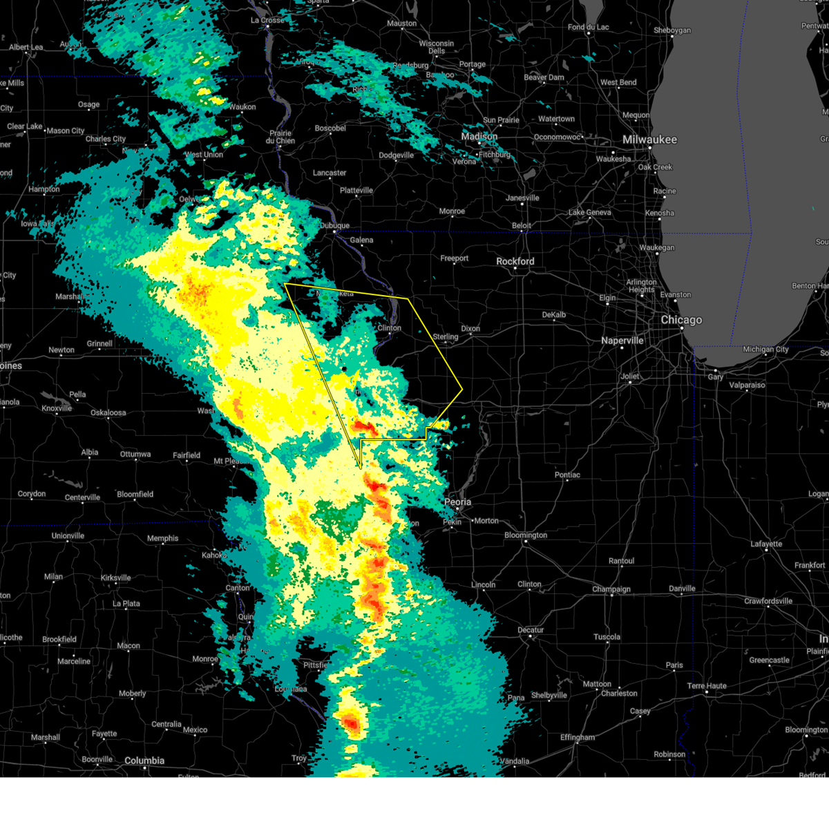
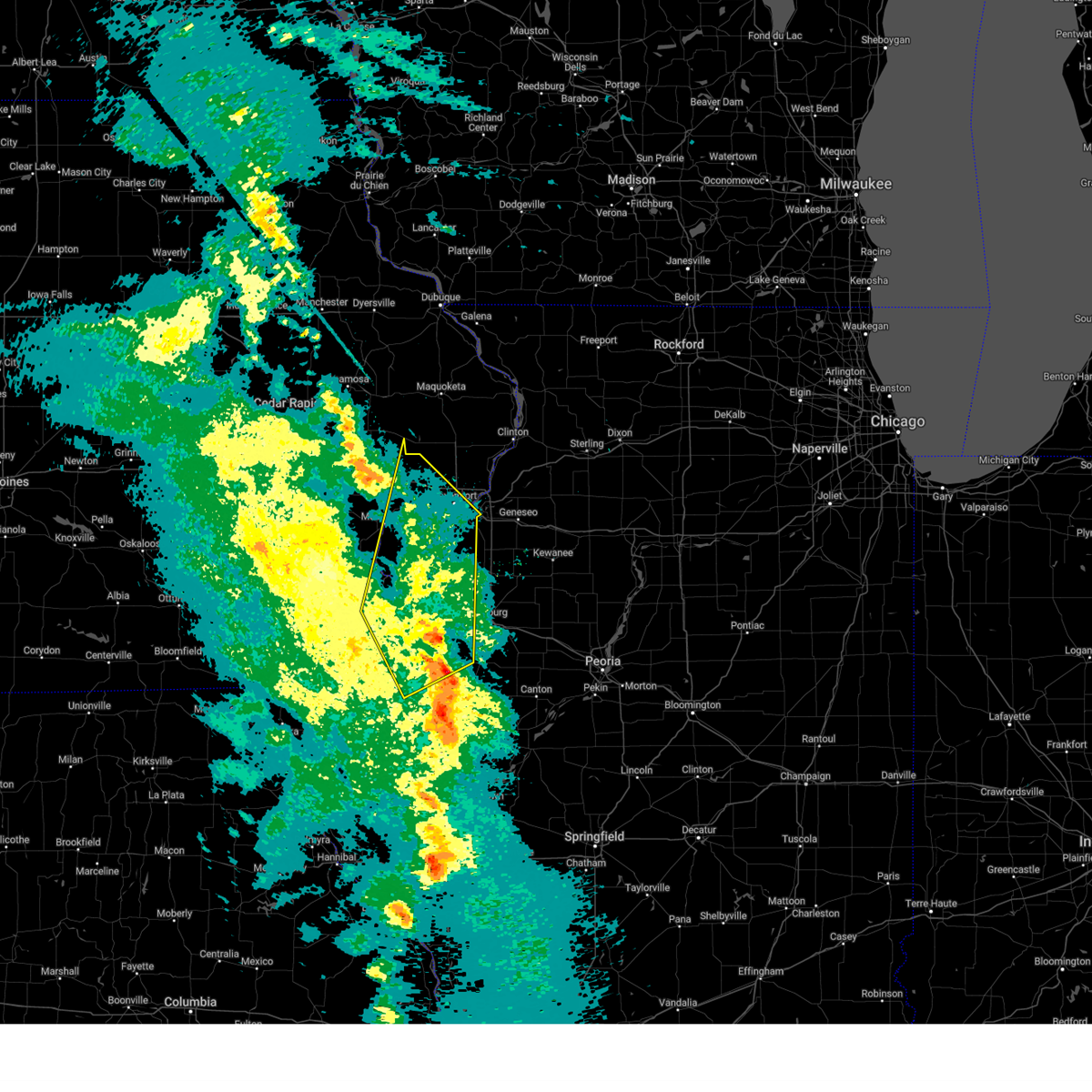
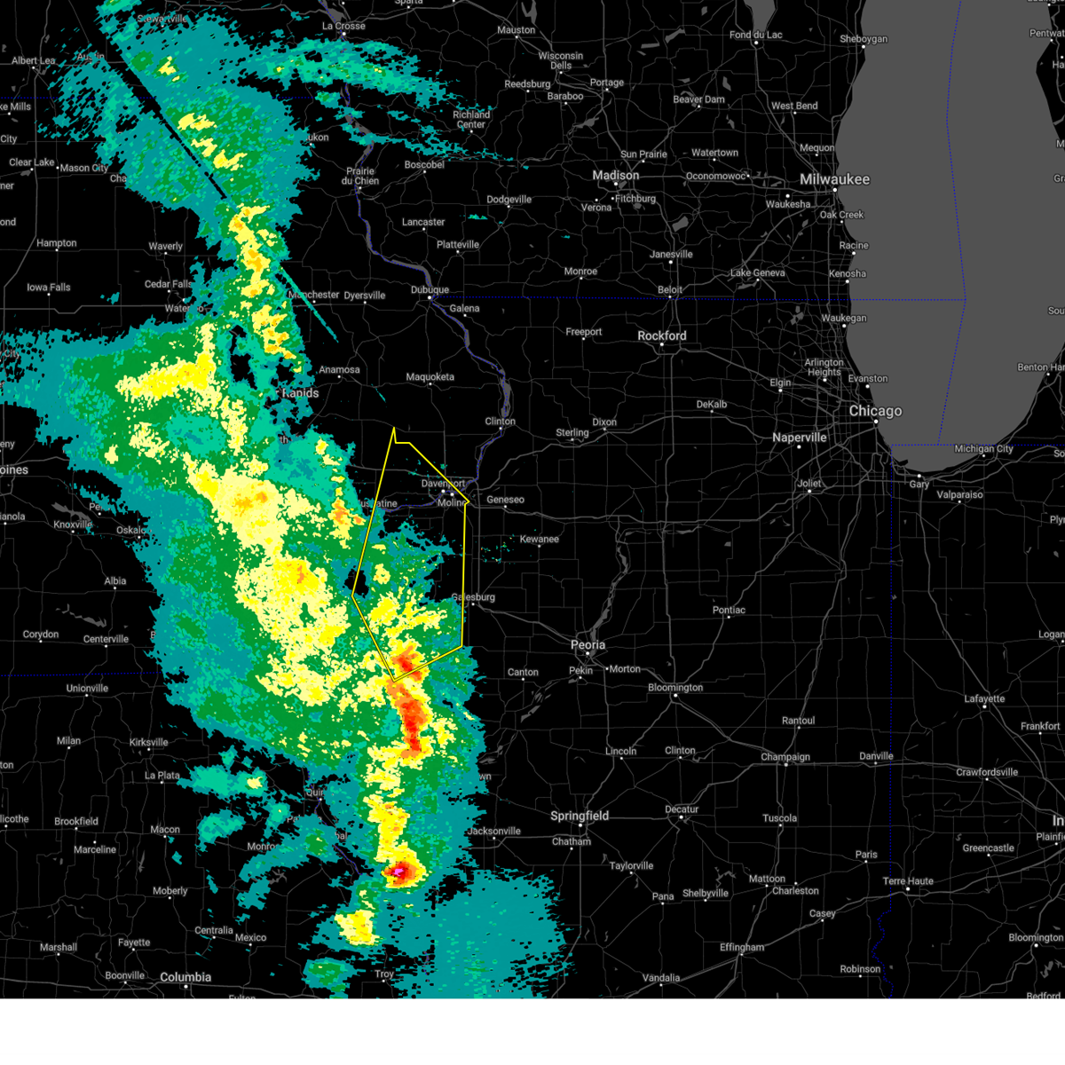
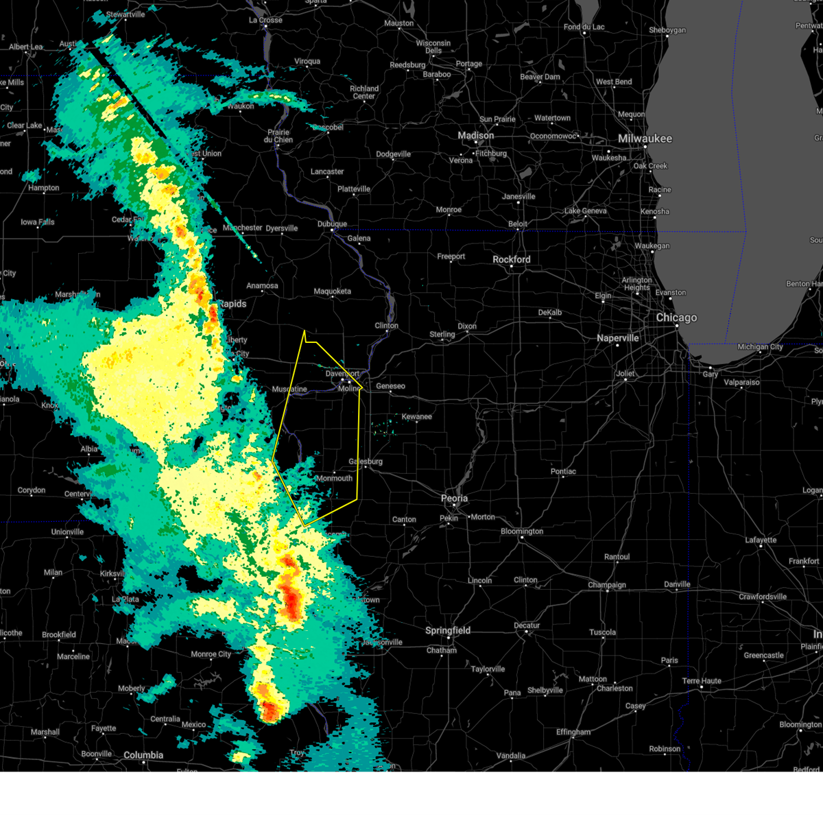
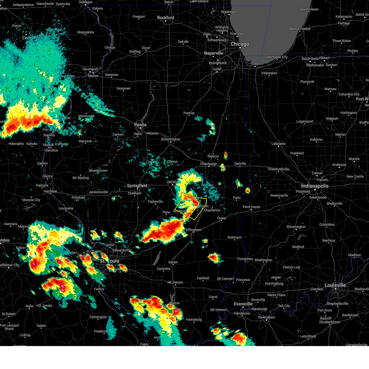
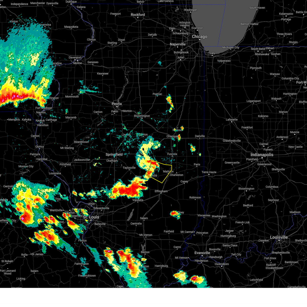
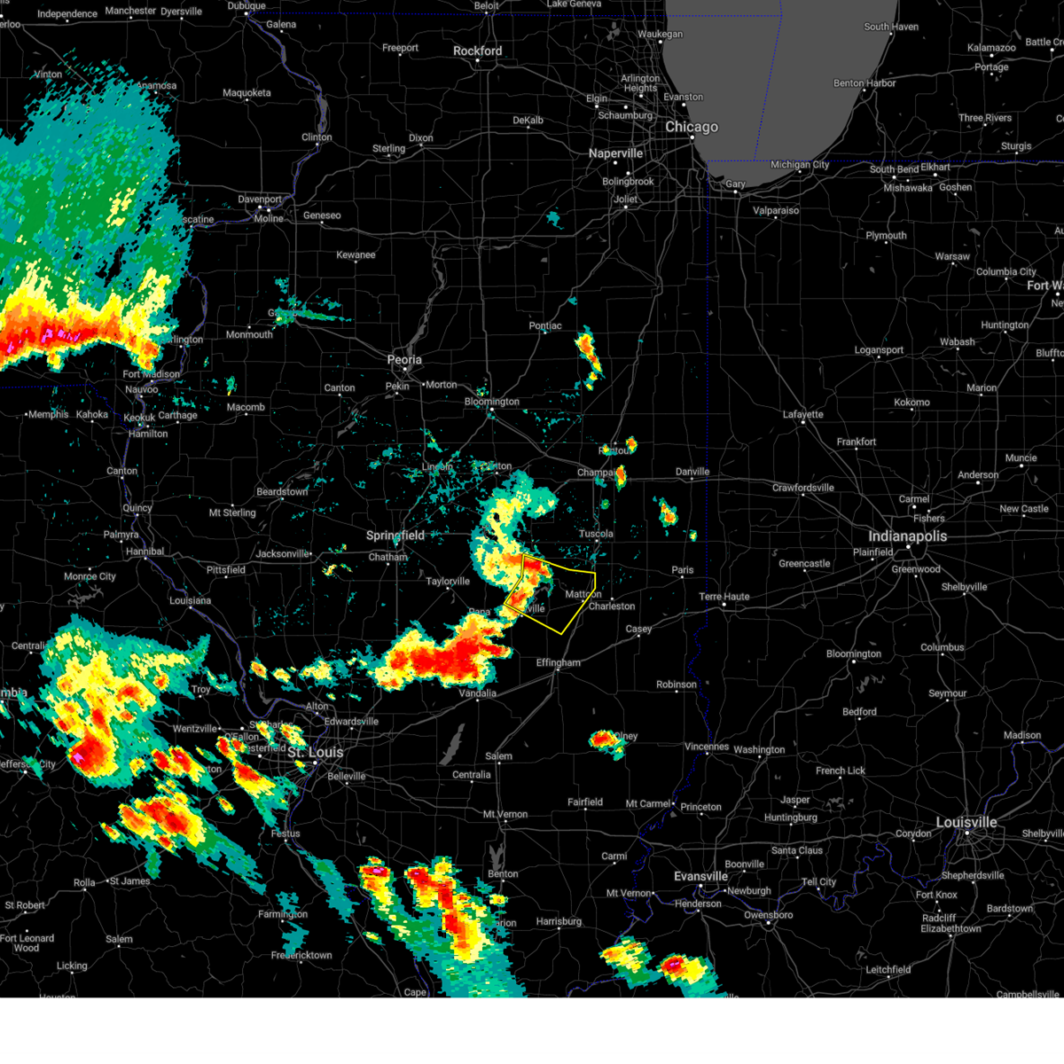
Hail Map for Windsor, IL
The Windsor, IL area has had 2 reports of on-the-ground hail by trained spotters, and has been under severe weather warnings 87 times during the past 12 months. Doppler radar has detected hail at or near Windsor, IL on 93 occasions, including 6 occasions during the past year.
| Name: | Windsor, IL |
| Where Located: | 12.2 miles WSW of Mattoon, IL |
| Map: | Google Map for Windsor, IL |
| Population: | 1187 |
| Housing Units: | 529 |
| More Info: | Search Google for Windsor, IL |
0
The Top Recent Hail Date for Windsor, IL is Wednesday, June 25, 2025 (38th out of 93)
Hail and Wind Damage Spotted near Windsor, IL
| Date / Time | Report Details |
|---|---|
| 6/18/2025 12:05 PM CDT |
 Svrilx the national weather service in lincoln has issued a * severe thunderstorm warning for, western coles county in east central illinois, moultrie county in central illinois, northwestern jasper county in southeastern illinois, eastern shelby county in central illinois, southeastern piatt county in central illinois, western cumberland county in east central illinois, northwestern clay county in south central illinois, western douglas county in east central illinois, effingham county in south central illinois, * until 1230 pm cdt. * at 1204 pm cdt, severe thunderstorms were located along a line extending from near hammond to near neoga to near mason, moving northeast at 40 mph (radar indicated). Hazards include 60 mph wind gusts. Expect damage to roofs, siding, and trees. severe thunderstorms will be near, mattoon, effingham, neoga, arthur, teutopolis, atwood, watson, cooks mill, and heartville around 1210 pm cdt. humboldt and montrose around 1215 pm cdt. arcola, dieterich, and lerna around 1220 pm cdt. this includes the following highways, interstate 57 between mile markers 142 and 217. Interstate 70 between mile markers 79 and 112. Svrilx the national weather service in lincoln has issued a * severe thunderstorm warning for, western coles county in east central illinois, moultrie county in central illinois, northwestern jasper county in southeastern illinois, eastern shelby county in central illinois, southeastern piatt county in central illinois, western cumberland county in east central illinois, northwestern clay county in south central illinois, western douglas county in east central illinois, effingham county in south central illinois, * until 1230 pm cdt. * at 1204 pm cdt, severe thunderstorms were located along a line extending from near hammond to near neoga to near mason, moving northeast at 40 mph (radar indicated). Hazards include 60 mph wind gusts. Expect damage to roofs, siding, and trees. severe thunderstorms will be near, mattoon, effingham, neoga, arthur, teutopolis, atwood, watson, cooks mill, and heartville around 1210 pm cdt. humboldt and montrose around 1215 pm cdt. arcola, dieterich, and lerna around 1220 pm cdt. this includes the following highways, interstate 57 between mile markers 142 and 217. Interstate 70 between mile markers 79 and 112.
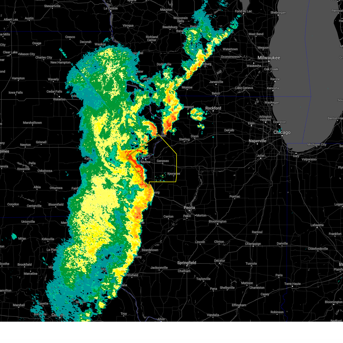
|
| 6/3/2025 7:13 PM CDT |
 Tordvn the national weather service in the quad cities has issued a * tornado warning for, south central rock island county in northwestern illinois, eastern mercer county in northwestern illinois, henry county in northwestern illinois, west central bureau county in north central illinois, * until 800 pm cdt. * at 713 pm cdt, severe thunderstorms capable of producing a tornado were located along a line extending from near sherrard to near wataga, moving east at 50 mph (radar indicated rotation). Hazards include tornado. Flying debris will be dangerous to those caught without shelter. mobile homes will be damaged or destroyed. damage to roofs, windows, and vehicles will occur. tree damage is likely. these dangerous storms will be near, orion, woodhull, andover, lynn center, osco, ophiem, nekoma, and sunny hill around 720 pm cdt. cambridge, bishop hill, ulah, henry county fairgrounds, and morristown around 725 pm cdt. geneseo around 730 pm cdt. Other locations in the path of these tornadic storms include kewanee, german corner, atkinson, annawan and johnson-sauk trail state park. Tordvn the national weather service in the quad cities has issued a * tornado warning for, south central rock island county in northwestern illinois, eastern mercer county in northwestern illinois, henry county in northwestern illinois, west central bureau county in north central illinois, * until 800 pm cdt. * at 713 pm cdt, severe thunderstorms capable of producing a tornado were located along a line extending from near sherrard to near wataga, moving east at 50 mph (radar indicated rotation). Hazards include tornado. Flying debris will be dangerous to those caught without shelter. mobile homes will be damaged or destroyed. damage to roofs, windows, and vehicles will occur. tree damage is likely. these dangerous storms will be near, orion, woodhull, andover, lynn center, osco, ophiem, nekoma, and sunny hill around 720 pm cdt. cambridge, bishop hill, ulah, henry county fairgrounds, and morristown around 725 pm cdt. geneseo around 730 pm cdt. Other locations in the path of these tornadic storms include kewanee, german corner, atkinson, annawan and johnson-sauk trail state park.
|
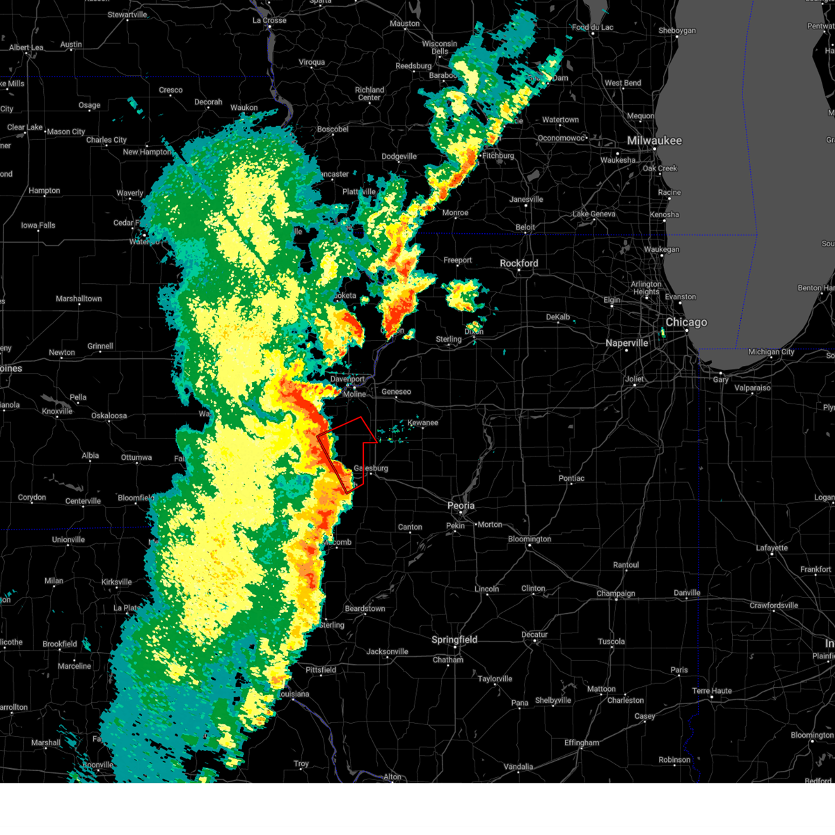
| 6/3/2025 7:08 PM CDT |
 Svrdvn the national weather service in the quad cities has issued a * severe thunderstorm warning for, rock island county in northwestern illinois, eastern mercer county in northwestern illinois, southwestern whiteside county in northwestern illinois, henry county in northwestern illinois, scott county in east central iowa, northeastern muscatine county in east central iowa, southeastern clinton county in east central iowa, * until 800 pm cdt. * at 707 pm cdt, severe thunderstorms were located along a line extending from walcott to near coyne center to henderson, moving northeast at 50 mph (radar indicated). Hazards include 70 mph wind gusts. Expect considerable tree damage. Damage is likely to mobile homes, roofs, and outbuildings. Svrdvn the national weather service in the quad cities has issued a * severe thunderstorm warning for, rock island county in northwestern illinois, eastern mercer county in northwestern illinois, southwestern whiteside county in northwestern illinois, henry county in northwestern illinois, scott county in east central iowa, northeastern muscatine county in east central iowa, southeastern clinton county in east central iowa, * until 800 pm cdt. * at 707 pm cdt, severe thunderstorms were located along a line extending from walcott to near coyne center to henderson, moving northeast at 50 mph (radar indicated). Hazards include 70 mph wind gusts. Expect considerable tree damage. Damage is likely to mobile homes, roofs, and outbuildings.
|
| 6/3/2025 6:57 PM CDT |
 At 656 pm cdt, severe thunderstorms capable of producing tornadoes were located along a line extending from near sunbeam to cameron, moving northeast at 55 mph (radar indicated rotation). Hazards include tornado. Flying debris will be dangerous to those caught without shelter. mobile homes will be damaged or destroyed. damage to roofs, windows, and vehicles will occur. tree damage is likely. these dangerous storms will be near, burgess, viola, north henderson, alexis, coldbrook, and gilchrist around 700 pm cdt. new windsor, shale city, and wanlock around 705 pm cdt. other locations in the path of these tornadic storms include alpha, new windsor, cable, swedona and griffin. This includes interstate 74 in illinois near mile marker 33. At 656 pm cdt, severe thunderstorms capable of producing tornadoes were located along a line extending from near sunbeam to cameron, moving northeast at 55 mph (radar indicated rotation). Hazards include tornado. Flying debris will be dangerous to those caught without shelter. mobile homes will be damaged or destroyed. damage to roofs, windows, and vehicles will occur. tree damage is likely. these dangerous storms will be near, burgess, viola, north henderson, alexis, coldbrook, and gilchrist around 700 pm cdt. new windsor, shale city, and wanlock around 705 pm cdt. other locations in the path of these tornadic storms include alpha, new windsor, cable, swedona and griffin. This includes interstate 74 in illinois near mile marker 33.
|
| 6/3/2025 6:57 PM CDT |
 the tornado warning has been cancelled and is no longer in effect the tornado warning has been cancelled and is no longer in effect
|
| 6/3/2025 6:47 PM CDT |
 Tordvn the national weather service in the quad cities has issued a * tornado warning for, northeastern henderson county in west central illinois, northern warren county in west central illinois, southeastern mercer county in northwestern illinois, southwestern henry county in northwestern illinois, * until 715 pm cdt. * at 647 pm cdt, severe thunderstorms capable of producing a tornado were located along a line extending from little york to ormonde, moving northeast at 55 mph (radar indicated rotation). Hazards include tornado. Flying debris will be dangerous to those caught without shelter. mobile homes will be damaged or destroyed. damage to roofs, windows, and vehicles will occur. tree damage is likely. these dangerous storms will be near, monmouth, little york, lake warren, coldbrook, eleanor, monmouth municipal airport, ormonde, gerlaw, and cameron around 650 pm cdt. burgess, alexis, and sunbeam around 655 pm cdt. viola, north henderson, and gilchrist around 700 pm cdt. new windsor, alpha, new windsor, and griffin around 705 pm cdt. other locations in the path of these tornadic storms include cable and swedona. This includes interstate 74 in illinois near mile marker 33. Tordvn the national weather service in the quad cities has issued a * tornado warning for, northeastern henderson county in west central illinois, northern warren county in west central illinois, southeastern mercer county in northwestern illinois, southwestern henry county in northwestern illinois, * until 715 pm cdt. * at 647 pm cdt, severe thunderstorms capable of producing a tornado were located along a line extending from little york to ormonde, moving northeast at 55 mph (radar indicated rotation). Hazards include tornado. Flying debris will be dangerous to those caught without shelter. mobile homes will be damaged or destroyed. damage to roofs, windows, and vehicles will occur. tree damage is likely. these dangerous storms will be near, monmouth, little york, lake warren, coldbrook, eleanor, monmouth municipal airport, ormonde, gerlaw, and cameron around 650 pm cdt. burgess, alexis, and sunbeam around 655 pm cdt. viola, north henderson, and gilchrist around 700 pm cdt. new windsor, alpha, new windsor, and griffin around 705 pm cdt. other locations in the path of these tornadic storms include cable and swedona. This includes interstate 74 in illinois near mile marker 33.
|
| 5/20/2025 2:05 PM CDT | At 205 pm cdt, severe thunderstorms were located along a line extending from buffalo to ophiem, moving north at 35 mph (radar indicated). Hazards include 60 mph wind gusts. Expect damage to roofs, siding, and trees. locations impacted include, moline, rock island, east moline, cambridge, silvis, colona, milan, coal valley, orion, rapids city, woodhull, alpha, sherrard, andover, reynolds, oak grove, cleveland, cable, new windsor, and warner. this includes the following highways, interstate 80 in illinois between mile markers 1 and 13. interstate 74 in illinois between mile markers 3 and 33. Interstate 280 between mile markers 17 and 18. |
| 5/20/2025 1:55 PM CDT |
 At 155 pm cdt, severe thunderstorms were located along a line extending from near edgington to new windsor, moving north at 35 mph (radar indicated). Hazards include 60 mph wind gusts. Expect damage to roofs, siding, and trees. locations impacted include, moline, rock island, east moline, cambridge, silvis, colona, milan, coal valley, orion, rapids city, viola, woodhull, matherville, alpha, sherrard, andover, reynolds, oak grove, cleveland, and north henderson. this includes the following highways, interstate 80 in illinois between mile markers 1 and 13. interstate 74 in illinois between mile markers 3 and 33. Interstate 280 between mile markers 17 and 18. At 155 pm cdt, severe thunderstorms were located along a line extending from near edgington to new windsor, moving north at 35 mph (radar indicated). Hazards include 60 mph wind gusts. Expect damage to roofs, siding, and trees. locations impacted include, moline, rock island, east moline, cambridge, silvis, colona, milan, coal valley, orion, rapids city, viola, woodhull, matherville, alpha, sherrard, andover, reynolds, oak grove, cleveland, and north henderson. this includes the following highways, interstate 80 in illinois between mile markers 1 and 13. interstate 74 in illinois between mile markers 3 and 33. Interstate 280 between mile markers 17 and 18.
|
| 5/20/2025 1:43 PM CDT | Svrdvn the national weather service in the quad cities has issued a * severe thunderstorm warning for, southeastern rock island county in northwestern illinois, eastern mercer county in northwestern illinois, western henry county in northwestern illinois, * until 245 pm cdt. * at 142 pm cdt, severe thunderstorms were located along a line extending from marston to north henderson, moving north at 35 mph (radar indicated). Hazards include 60 mph wind gusts. expect damage to roofs, siding, and trees |
| 4/20/2025 9:27 PM CDT |
 The storms which prompted the warning have moved out of the area. therefore, the warning will be allowed to expire. a tornado watch remains in effect until 1100 pm cdt for northwestern illinois. The storms which prompted the warning have moved out of the area. therefore, the warning will be allowed to expire. a tornado watch remains in effect until 1100 pm cdt for northwestern illinois.
|
| 4/20/2025 8:50 PM CDT |
 The storms which prompted the warning have moved out of the area. therefore, the warning will be allowed to expire. a tornado watch remains in effect until 1100 pm cdt for northwestern and west central illinois. The storms which prompted the warning have moved out of the area. therefore, the warning will be allowed to expire. a tornado watch remains in effect until 1100 pm cdt for northwestern and west central illinois.
|
| 4/20/2025 8:36 PM CDT | Spotter has an anemometer reading of 65 mph with a 4 inch tree limb dow in henry county IL, 2.7 miles S of Windsor, IL |
| 4/20/2025 8:36 PM CDT |
 Tordvn the national weather service in the quad cities has issued a * tornado warning for, northeastern mercer county in northwestern illinois, western henry county in northwestern illinois, * until 915 pm cdt. * at 836 pm cdt, a severe thunderstorm capable of producing a tornado was located over ophiem, or 13 miles west of cambridge, moving northeast at 40 mph (radar indicated rotation). Hazards include tornado. Flying debris will be dangerous to those caught without shelter. mobile homes will be damaged or destroyed. damage to roofs, windows, and vehicles will occur. tree damage is likely. this dangerous storm will be near, sunny hill, osco, lynn center, orion, swedona, ophiem, and andover around 840 pm cdt. colona, morristown, and warner around 845 pm cdt. cleveland, green river, and dayton around 850 pm cdt. osborn and geneseo around 855 pm cdt. other locations in the path of this tornadic thunderstorm include shady beach. this includes the following highways, interstate 80 in illinois between mile markers 6 and 26. Interstate 74 in illinois between mile markers 11 and 32. Tordvn the national weather service in the quad cities has issued a * tornado warning for, northeastern mercer county in northwestern illinois, western henry county in northwestern illinois, * until 915 pm cdt. * at 836 pm cdt, a severe thunderstorm capable of producing a tornado was located over ophiem, or 13 miles west of cambridge, moving northeast at 40 mph (radar indicated rotation). Hazards include tornado. Flying debris will be dangerous to those caught without shelter. mobile homes will be damaged or destroyed. damage to roofs, windows, and vehicles will occur. tree damage is likely. this dangerous storm will be near, sunny hill, osco, lynn center, orion, swedona, ophiem, and andover around 840 pm cdt. colona, morristown, and warner around 845 pm cdt. cleveland, green river, and dayton around 850 pm cdt. osborn and geneseo around 855 pm cdt. other locations in the path of this tornadic thunderstorm include shady beach. this includes the following highways, interstate 80 in illinois between mile markers 6 and 26. Interstate 74 in illinois between mile markers 11 and 32.
|
| 4/20/2025 8:31 PM CDT |
 Svrdvn the national weather service in the quad cities has issued a * severe thunderstorm warning for, henry county in northwestern illinois, * until 930 pm cdt. * at 831 pm cdt, severe thunderstorms were located along a line extending from sherrard to near knoxville, moving northeast at 35 mph (radar indicated). Hazards include 60 mph wind gusts. expect damage to roofs, siding, and trees Svrdvn the national weather service in the quad cities has issued a * severe thunderstorm warning for, henry county in northwestern illinois, * until 930 pm cdt. * at 831 pm cdt, severe thunderstorms were located along a line extending from sherrard to near knoxville, moving northeast at 35 mph (radar indicated). Hazards include 60 mph wind gusts. expect damage to roofs, siding, and trees
|
| 4/20/2025 8:30 PM CDT |
 At 829 pm cdt, severe thunderstorms were located along a line extending from taylor ridge to griffin to galesburg municipal airport to fairview, moving northeast at 30 mph (radar indicated). Hazards include 60 mph wind gusts. Expect damage to roofs, siding, and trees. Locations impacted include, preemption, cable, matherville, boden, north henderson, griffin, new windsor, swedona, sherrard, and viola. At 829 pm cdt, severe thunderstorms were located along a line extending from taylor ridge to griffin to galesburg municipal airport to fairview, moving northeast at 30 mph (radar indicated). Hazards include 60 mph wind gusts. Expect damage to roofs, siding, and trees. Locations impacted include, preemption, cable, matherville, boden, north henderson, griffin, new windsor, swedona, sherrard, and viola.
|
| 4/20/2025 8:30 PM CDT |
 the severe thunderstorm warning has been cancelled and is no longer in effect the severe thunderstorm warning has been cancelled and is no longer in effect
|
| 4/20/2025 8:26 PM CDT |
 At 825 pm cdt, severe thunderstorms were located along a line extending from taylor ridge to near viola to galesburg municipal airport to near fairview, moving northeast at 35 mph (radar indicated). Hazards include 60 mph wind gusts. Expect damage to roofs, siding, and trees. Locations impacted include, preemption, cable, alexis, matherville, boden, north henderson, griffin, new windsor, swedona, viola, sherrard, and reynolds. At 825 pm cdt, severe thunderstorms were located along a line extending from taylor ridge to near viola to galesburg municipal airport to near fairview, moving northeast at 35 mph (radar indicated). Hazards include 60 mph wind gusts. Expect damage to roofs, siding, and trees. Locations impacted include, preemption, cable, alexis, matherville, boden, north henderson, griffin, new windsor, swedona, viola, sherrard, and reynolds.
|
| 4/20/2025 8:21 PM CDT |
 At 821 pm cdt, severe thunderstorms were located along a line extending from near hamlet to near viola to near cameron to near ellisville, moving northeast at 35 mph (radar indicated). Hazards include 60 mph wind gusts. Expect damage to roofs, siding, and trees. Locations impacted include, preemption, hamlet, cable, burgess, alexis, shale city, wanlock, new windsor, swedona, gilchrist, old gilchrist, matherville, boden, north henderson, griffin, viola, coldbrook, sherrard, and reynolds. At 821 pm cdt, severe thunderstorms were located along a line extending from near hamlet to near viola to near cameron to near ellisville, moving northeast at 35 mph (radar indicated). Hazards include 60 mph wind gusts. Expect damage to roofs, siding, and trees. Locations impacted include, preemption, hamlet, cable, burgess, alexis, shale city, wanlock, new windsor, swedona, gilchrist, old gilchrist, matherville, boden, north henderson, griffin, viola, coldbrook, sherrard, and reynolds.
|
| 4/20/2025 8:11 PM CDT |
 At 811 pm cdt, severe thunderstorms were located along a line extending from marston to burgess to near cameron to near marietta, moving northeast at 30 mph (radar indicated). Hazards include 60 mph wind gusts. Expect damage to roofs, siding, and trees. Locations impacted include, preemption, hamlet, cable, gerlaw, aledo mercer county airport, aledo, shale city, monmouth municipal airport, new windsor, cameron, gingle corners, boden, lake warren, berwick, viola, coldbrook, sherrard, mercer county fairgrounds, ormonde, and burgess. At 811 pm cdt, severe thunderstorms were located along a line extending from marston to burgess to near cameron to near marietta, moving northeast at 30 mph (radar indicated). Hazards include 60 mph wind gusts. Expect damage to roofs, siding, and trees. Locations impacted include, preemption, hamlet, cable, gerlaw, aledo mercer county airport, aledo, shale city, monmouth municipal airport, new windsor, cameron, gingle corners, boden, lake warren, berwick, viola, coldbrook, sherrard, mercer county fairgrounds, ormonde, and burgess.
|
| 4/20/2025 8:11 PM CDT |
 the severe thunderstorm warning has been cancelled and is no longer in effect the severe thunderstorm warning has been cancelled and is no longer in effect
|
| 4/20/2025 7:55 PM CDT |
 Svrdvn the national weather service in the quad cities has issued a * severe thunderstorm warning for, warren county in west central illinois, northeastern mcdonough county in west central illinois, eastern mercer county in northwestern illinois, * until 900 pm cdt. * at 755 pm cdt, severe thunderstorms were located along a line extending from near mannon to near seaton to larchland to new philadelphia, moving northeast at 30 mph (radar indicated). Hazards include 60 mph wind gusts. expect damage to roofs, siding, and trees Svrdvn the national weather service in the quad cities has issued a * severe thunderstorm warning for, warren county in west central illinois, northeastern mcdonough county in west central illinois, eastern mercer county in northwestern illinois, * until 900 pm cdt. * at 755 pm cdt, severe thunderstorms were located along a line extending from near mannon to near seaton to larchland to new philadelphia, moving northeast at 30 mph (radar indicated). Hazards include 60 mph wind gusts. expect damage to roofs, siding, and trees
|
| 4/2/2025 6:26 PM CDT | The storms which prompted the warning have moved out of the area. therefore, the warning will be allowed to expire. a tornado watch remains in effect until 1000 pm cdt for south central, central and east central illinois. |
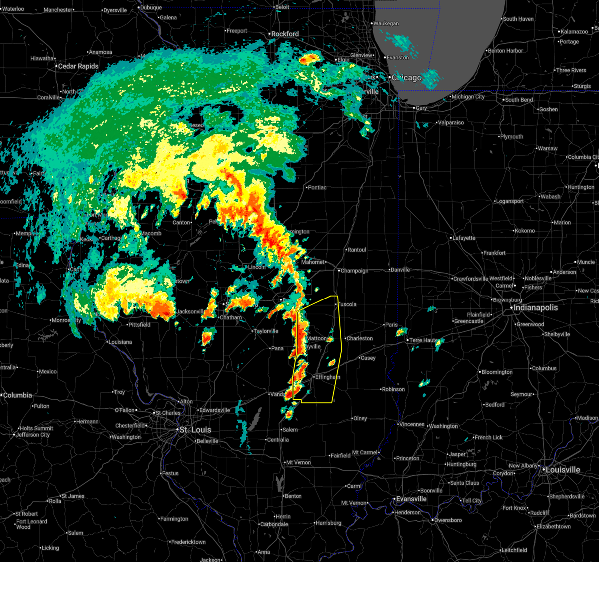
| 4/2/2025 6:17 PM CDT | At 617 pm cdt, severe thunderstorms capable of producing tornadoes were located along a line extending from near windsor to near stewardson, moving northeast at 65 mph (radar indicated rotation). Hazards include tornado and quarter size hail. Flying debris will be dangerous to those caught without shelter. mobile homes will be damaged or destroyed. damage to roofs, windows, and vehicles will occur. tree damage is likely. these tornadic storms will remain over mainly rural areas of southeastern shelby and north central effingham counties, including the following locations, strasburg, sigel, and trowbridge. This includes interstate 57 between mile markers 169 and 172. |
| 4/2/2025 6:16 PM CDT | The storm which prompted the warning has moved out of the area. therefore, the warning has been allowed to expire. a tornado watch remains in effect until 1000 pm cdt for central illinois. remember, a tornado warning still remains in effect for southeastern shelby county until 630 pm cdt. |
| 4/2/2025 6:02 PM CDT |
 At 602 pm cdt, severe thunderstorms capable of producing tornadoes were located along a line extending from near shelbyville to near beecher city, moving northeast at 60 mph (radar indicated rotation). Hazards include tornado and quarter size hail. Flying debris will be dangerous to those caught without shelter. mobile homes will be damaged or destroyed. damage to roofs, windows, and vehicles will occur. tree damage is likely. these dangerous storms will be near, stewardson and windsor around 610 pm cdt. other locations impacted by these tornadic storms include sigel, trowbridge, clarksburg, strasburg, and mode. This includes interstate 57 between mile markers 169 and 172. At 602 pm cdt, severe thunderstorms capable of producing tornadoes were located along a line extending from near shelbyville to near beecher city, moving northeast at 60 mph (radar indicated rotation). Hazards include tornado and quarter size hail. Flying debris will be dangerous to those caught without shelter. mobile homes will be damaged or destroyed. damage to roofs, windows, and vehicles will occur. tree damage is likely. these dangerous storms will be near, stewardson and windsor around 610 pm cdt. other locations impacted by these tornadic storms include sigel, trowbridge, clarksburg, strasburg, and mode. This includes interstate 57 between mile markers 169 and 172.
|
| 4/2/2025 5:59 PM CDT |
 the severe thunderstorm warning has been cancelled and is no longer in effect the severe thunderstorm warning has been cancelled and is no longer in effect
|
| 4/2/2025 5:59 PM CDT |
 At 558 pm cdt, a severe thunderstorm was located near shelbyville, moving northeast at 75 mph (radar indicated). Hazards include 60 mph wind gusts and quarter size hail. Hail damage to vehicles is expected. expect wind damage to roofs, siding, and trees. This severe thunderstorm will remain over mainly rural areas of central shelby county, including the following locations, westervelt and wolf creek state park. At 558 pm cdt, a severe thunderstorm was located near shelbyville, moving northeast at 75 mph (radar indicated). Hazards include 60 mph wind gusts and quarter size hail. Hail damage to vehicles is expected. expect wind damage to roofs, siding, and trees. This severe thunderstorm will remain over mainly rural areas of central shelby county, including the following locations, westervelt and wolf creek state park.
|
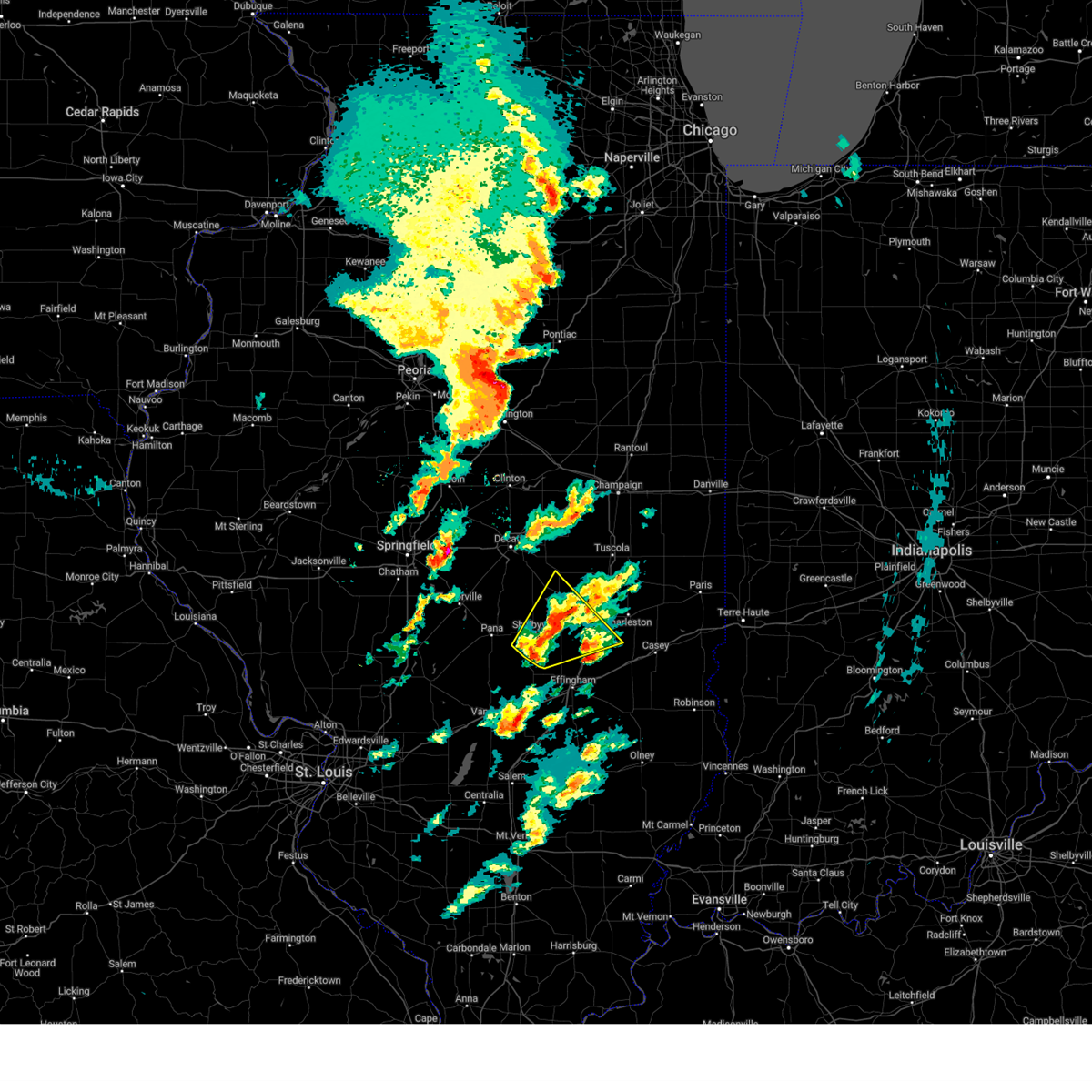
| 4/2/2025 5:39 PM CDT | Torilx the national weather service in lincoln has issued a * tornado warning for, southeastern shelby county in central illinois, northwestern effingham county in south central illinois, * until 630 pm cdt. * at 539 pm cdt, a severe thunderstorm capable of producing a tornado was located over ramsey, or 10 miles north of vandalia, moving northeast at 65 mph (radar indicated rotation). Hazards include tornado and quarter size hail. Flying debris will be dangerous to those caught without shelter. mobile homes will be damaged or destroyed. damage to roofs, windows, and vehicles will occur. tree damage is likely. this dangerous storm will be near, herrick around 545 pm cdt. cowden around 550 pm cdt. other locations in the path of this tornadic thunderstorm include windsor. This includes interstate 57 between mile markers 169 and 172. |
| 4/2/2025 5:34 PM CDT | Svrilx the national weather service in lincoln has issued a * severe thunderstorm warning for, southeastern christian county in central illinois, central shelby county in central illinois, * until 615 pm cdt. * at 534 pm cdt, a severe thunderstorm was located near nokomis, moving northeast at 55 mph (radar indicated). Hazards include 60 mph wind gusts and quarter size hail. Hail damage to vehicles is expected. expect wind damage to roofs, siding, and trees. this severe thunderstorm will be near, pana around 540 pm cdt. Assumption around 550 pm cdt. |
| 3/30/2025 1:11 PM CDT |
 Svrilx the national weather service in lincoln has issued a * severe thunderstorm warning for, coles county in east central illinois, moultrie county in central illinois, eastern shelby county in central illinois, southern piatt county in central illinois, cumberland county in east central illinois, southern champaign county in east central illinois, douglas county in east central illinois, east central macon county in central illinois, * until 200 pm cdt. * at 111 pm cdt, severe thunderstorms were located along a line extending from near bement to near neoga, moving northeast at 55 mph (radar indicated). Hazards include 60 mph wind gusts and quarter size hail. Hail damage to vehicles is expected. expect wind damage to roofs, siding, and trees. severe thunderstorms will be near, cooks mill, ivesdale, arthur, mattoon, and atwood around 115 pm cdt. sadorus, arcola, and humboldt around 120 pm cdt. pesotum, tolono, and tuscola around 125 pm cdt. camargo around 130 pm cdt. other locations in the path of these severe thunderstorms include villa grove, philo, sidney, broadlands and newman. this includes the following highways, interstate 57 between mile markers 170 and 227. Interstate 70 between mile markers 116 and 119, and between mile markers 121 and 126. Svrilx the national weather service in lincoln has issued a * severe thunderstorm warning for, coles county in east central illinois, moultrie county in central illinois, eastern shelby county in central illinois, southern piatt county in central illinois, cumberland county in east central illinois, southern champaign county in east central illinois, douglas county in east central illinois, east central macon county in central illinois, * until 200 pm cdt. * at 111 pm cdt, severe thunderstorms were located along a line extending from near bement to near neoga, moving northeast at 55 mph (radar indicated). Hazards include 60 mph wind gusts and quarter size hail. Hail damage to vehicles is expected. expect wind damage to roofs, siding, and trees. severe thunderstorms will be near, cooks mill, ivesdale, arthur, mattoon, and atwood around 115 pm cdt. sadorus, arcola, and humboldt around 120 pm cdt. pesotum, tolono, and tuscola around 125 pm cdt. camargo around 130 pm cdt. other locations in the path of these severe thunderstorms include villa grove, philo, sidney, broadlands and newman. this includes the following highways, interstate 57 between mile markers 170 and 227. Interstate 70 between mile markers 116 and 119, and between mile markers 121 and 126.
|
| 3/30/2025 12:53 PM CDT |
 the severe thunderstorm warning has been cancelled and is no longer in effect the severe thunderstorm warning has been cancelled and is no longer in effect
|
| 3/30/2025 12:53 PM CDT |
 At 1252 pm cdt, severe thunderstorms were located along a line extending from near dalton city to near beecher city, moving east at 40 mph (radar indicated). Hazards include 60 mph wind gusts and quarter size hail. Hail damage to vehicles is expected. expect wind damage to roofs, siding, and trees. these severe storms will be near, sullivan, lovington, stewardson, and windsor around 100 pm cdt. allenville around 105 pm cdt. arthur around 110 pm cdt. cooks mill and mattoon around 115 pm cdt. atwood around 120 pm cdt. other locations impacted by these severe thunderstorms include trowbridge, etna, clarksburg, wolf creek state park, lake city, mode, strasburg, lakewood, chesterville, and hervey city. This includes interstate 57 between mile markers 169 and 172, and between mile markers 180 and 215. At 1252 pm cdt, severe thunderstorms were located along a line extending from near dalton city to near beecher city, moving east at 40 mph (radar indicated). Hazards include 60 mph wind gusts and quarter size hail. Hail damage to vehicles is expected. expect wind damage to roofs, siding, and trees. these severe storms will be near, sullivan, lovington, stewardson, and windsor around 100 pm cdt. allenville around 105 pm cdt. arthur around 110 pm cdt. cooks mill and mattoon around 115 pm cdt. atwood around 120 pm cdt. other locations impacted by these severe thunderstorms include trowbridge, etna, clarksburg, wolf creek state park, lake city, mode, strasburg, lakewood, chesterville, and hervey city. This includes interstate 57 between mile markers 169 and 172, and between mile markers 180 and 215.
|
| 3/30/2025 12:33 PM CDT |
 Svrilx the national weather service in lincoln has issued a * severe thunderstorm warning for, western coles county in east central illinois, southeastern christian county in central illinois, moultrie county in central illinois, shelby county in central illinois, southeastern piatt county in central illinois, western douglas county in east central illinois, southeastern macon county in central illinois, * until 115 pm cdt. * at 1233 pm cdt, severe thunderstorms were located along a line extending from dalton city to near herrick, moving east at 45 mph (radar indicated). Hazards include 60 mph wind gusts and quarter size hail. Hail damage to vehicles is expected. expect wind damage to roofs, siding, and trees. severe thunderstorms will be near, cowden, bethany, shelbyville, lovington, findlay, and herrick around 1240 pm cdt. sullivan and hammond around 1245 pm cdt. other locations in the path of these severe thunderstorms include allenville, arthur, atwood and windsor. This includes interstate 57 between mile markers 169 and 172, and between mile markers 180 and 215. Svrilx the national weather service in lincoln has issued a * severe thunderstorm warning for, western coles county in east central illinois, southeastern christian county in central illinois, moultrie county in central illinois, shelby county in central illinois, southeastern piatt county in central illinois, western douglas county in east central illinois, southeastern macon county in central illinois, * until 115 pm cdt. * at 1233 pm cdt, severe thunderstorms were located along a line extending from dalton city to near herrick, moving east at 45 mph (radar indicated). Hazards include 60 mph wind gusts and quarter size hail. Hail damage to vehicles is expected. expect wind damage to roofs, siding, and trees. severe thunderstorms will be near, cowden, bethany, shelbyville, lovington, findlay, and herrick around 1240 pm cdt. sullivan and hammond around 1245 pm cdt. other locations in the path of these severe thunderstorms include allenville, arthur, atwood and windsor. This includes interstate 57 between mile markers 169 and 172, and between mile markers 180 and 215.
|
| 3/28/2025 3:41 AM CDT |
 The storm which prompted the warning has weakened below severe limits, and has exited the warned area. therefore, the warning will be allowed to expire. however, heavy rain is still possible with this thunderstorm. The storm which prompted the warning has weakened below severe limits, and has exited the warned area. therefore, the warning will be allowed to expire. however, heavy rain is still possible with this thunderstorm.
|
| 3/28/2025 3:37 AM CDT |
 At 336 am cdt, a severe thunderstorm was located over ophiem, or 10 miles southwest of cambridge, moving northeast at 25 mph (radar indicated). Hazards include quarter size hail. Damage to vehicles is expected. this severe storm will be near, woodhull around 340 am cdt. other locations impacted by this severe thunderstorm include griffin, swedona, and ophiem. This includes interstate 74 in illinois between mile markers 27 and 33. At 336 am cdt, a severe thunderstorm was located over ophiem, or 10 miles southwest of cambridge, moving northeast at 25 mph (radar indicated). Hazards include quarter size hail. Damage to vehicles is expected. this severe storm will be near, woodhull around 340 am cdt. other locations impacted by this severe thunderstorm include griffin, swedona, and ophiem. This includes interstate 74 in illinois between mile markers 27 and 33.
|
| 3/28/2025 3:24 AM CDT |
 At 323 am cdt, a severe thunderstorm was located over new windsor, or 14 miles east of aledo, moving northeast at 25 mph (radar indicated). Hazards include quarter size hail. Damage to vehicles is expected. this severe storm will be near, alpha, swedona, ophiem, woodhull, cable, and new windsor around 330 am cdt. other locations impacted by this severe thunderstorm include griffin, wanlock, gilchrist, swedona, ophiem, and old gilchrist. This includes interstate 74 in illinois between mile markers 27 and 33. At 323 am cdt, a severe thunderstorm was located over new windsor, or 14 miles east of aledo, moving northeast at 25 mph (radar indicated). Hazards include quarter size hail. Damage to vehicles is expected. this severe storm will be near, alpha, swedona, ophiem, woodhull, cable, and new windsor around 330 am cdt. other locations impacted by this severe thunderstorm include griffin, wanlock, gilchrist, swedona, ophiem, and old gilchrist. This includes interstate 74 in illinois between mile markers 27 and 33.
|
| 3/28/2025 3:11 AM CDT |
 At 310 am cdt, a severe thunderstorm was located near viola, or 10 miles east of aledo, moving northeast at 25 mph (radar indicated). Hazards include quarter size hail. Damage to vehicles is expected. this severe storm will be near, boden, north henderson, new windsor, alpha, swedona, matherville, ophiem, griffin, cable, and new windsor around 315 am cdt. woodhull around 320 am cdt. other locations impacted by this severe thunderstorm include gilchrist, ophiem, old gilchrist, griffin, wanlock, swedona, mercer county fairgrounds, and alexis. This includes interstate 74 in illinois between mile markers 27 and 33. At 310 am cdt, a severe thunderstorm was located near viola, or 10 miles east of aledo, moving northeast at 25 mph (radar indicated). Hazards include quarter size hail. Damage to vehicles is expected. this severe storm will be near, boden, north henderson, new windsor, alpha, swedona, matherville, ophiem, griffin, cable, and new windsor around 315 am cdt. woodhull around 320 am cdt. other locations impacted by this severe thunderstorm include gilchrist, ophiem, old gilchrist, griffin, wanlock, swedona, mercer county fairgrounds, and alexis. This includes interstate 74 in illinois between mile markers 27 and 33.
|
| 3/28/2025 3:11 AM CDT |
 the severe thunderstorm warning has been cancelled and is no longer in effect the severe thunderstorm warning has been cancelled and is no longer in effect
|
| 3/28/2025 2:58 AM CDT |
 Svrdvn the national weather service in the quad cities has issued a * severe thunderstorm warning for, north central warren county in west central illinois, southeastern mercer county in northwestern illinois, southwestern henry county in northwestern illinois, * until 345 am cdt. * at 258 am cdt, a severe thunderstorm was located over burgess, or 7 miles southeast of aledo, moving northeast at 25 mph (radar indicated). Hazards include quarter size hail. damage to vehicles is expected Svrdvn the national weather service in the quad cities has issued a * severe thunderstorm warning for, north central warren county in west central illinois, southeastern mercer county in northwestern illinois, southwestern henry county in northwestern illinois, * until 345 am cdt. * at 258 am cdt, a severe thunderstorm was located over burgess, or 7 miles southeast of aledo, moving northeast at 25 mph (radar indicated). Hazards include quarter size hail. damage to vehicles is expected
|
| 3/19/2025 4:42 PM CDT |
 The storm which prompted the warning has weakened below severe limits, and has exited the warned area. therefore, the warning will be allowed to expire. a tornado watch remains in effect until 900 pm cdt for central and east central illinois. The storm which prompted the warning has weakened below severe limits, and has exited the warned area. therefore, the warning will be allowed to expire. a tornado watch remains in effect until 900 pm cdt for central and east central illinois.
|
| 3/19/2025 4:15 PM CDT |
 At 414 pm cdt, a severe thunderstorm was located near stewardson, or 7 miles south of shelbyville, moving northeast at 55 mph (radar indicated). Hazards include 70 mph wind gusts and quarter size hail. Hail damage to vehicles is expected. expect considerable tree damage. wind damage is also likely to mobile homes, roofs, and outbuildings. this severe storm will be near, windsor around 425 pm cdt. mattoon around 440 pm cdt. other locations impacted by this severe thunderstorm include trowbridge, etna, clarksburg, wolf creek state park, kirksville, gays, mode, trilla, strasburg, and paradise. This includes interstate 57 between mile markers 174 and 187. At 414 pm cdt, a severe thunderstorm was located near stewardson, or 7 miles south of shelbyville, moving northeast at 55 mph (radar indicated). Hazards include 70 mph wind gusts and quarter size hail. Hail damage to vehicles is expected. expect considerable tree damage. wind damage is also likely to mobile homes, roofs, and outbuildings. this severe storm will be near, windsor around 425 pm cdt. mattoon around 440 pm cdt. other locations impacted by this severe thunderstorm include trowbridge, etna, clarksburg, wolf creek state park, kirksville, gays, mode, trilla, strasburg, and paradise. This includes interstate 57 between mile markers 174 and 187.
|
| 3/19/2025 4:15 PM CDT |
 the severe thunderstorm warning has been cancelled and is no longer in effect the severe thunderstorm warning has been cancelled and is no longer in effect
|
| 3/19/2025 4:04 PM CDT |
 Svrilx the national weather service in lincoln has issued a * severe thunderstorm warning for, southwestern coles county in east central illinois, southern moultrie county in central illinois, shelby county in central illinois, northwestern cumberland county in east central illinois, northwestern effingham county in south central illinois, * until 445 pm cdt. * at 403 pm cdt, a severe thunderstorm was located near cowden, or 7 miles south of shelbyville, moving northeast at 55 mph (radar indicated). Hazards include 70 mph wind gusts and quarter size hail. Hail damage to vehicles is expected. expect considerable tree damage. wind damage is also likely to mobile homes, roofs, and outbuildings. this severe thunderstorm will be near, windsor around 415 pm cdt. other locations in the path of this severe thunderstorm include allenville and mattoon. This includes interstate 57 between mile markers 172 and 187. Svrilx the national weather service in lincoln has issued a * severe thunderstorm warning for, southwestern coles county in east central illinois, southern moultrie county in central illinois, shelby county in central illinois, northwestern cumberland county in east central illinois, northwestern effingham county in south central illinois, * until 445 pm cdt. * at 403 pm cdt, a severe thunderstorm was located near cowden, or 7 miles south of shelbyville, moving northeast at 55 mph (radar indicated). Hazards include 70 mph wind gusts and quarter size hail. Hail damage to vehicles is expected. expect considerable tree damage. wind damage is also likely to mobile homes, roofs, and outbuildings. this severe thunderstorm will be near, windsor around 415 pm cdt. other locations in the path of this severe thunderstorm include allenville and mattoon. This includes interstate 57 between mile markers 172 and 187.
|
| 3/19/2025 1:14 PM CDT |
 the severe thunderstorm warning has been cancelled and is no longer in effect the severe thunderstorm warning has been cancelled and is no longer in effect
|
| 3/19/2025 1:14 PM CDT |
 At 114 pm cdt, severe thunderstorms were located along a line extending from walcott to blackhawk state park to near griffin to near oneida, moving northeast at 40 mph (radar indicated). Hazards include 60 mph wind gusts. Expect damage to roofs, siding, and trees. locations impacted include, preemption, hamlet, cable, moline, shale city, coyne center, new windsor, edgington, taylor ridge, gingle corners, boden, moline quad-city airport, viola, loud thunder scout camp, sherrard, blackhawk state park, reynolds, andalusia, fruitland, and oak grove. this includes the following highways, interstate 74 in illinois between mile markers 2 and 7. Interstate 280 between mile markers 11 and 18. At 114 pm cdt, severe thunderstorms were located along a line extending from walcott to blackhawk state park to near griffin to near oneida, moving northeast at 40 mph (radar indicated). Hazards include 60 mph wind gusts. Expect damage to roofs, siding, and trees. locations impacted include, preemption, hamlet, cable, moline, shale city, coyne center, new windsor, edgington, taylor ridge, gingle corners, boden, moline quad-city airport, viola, loud thunder scout camp, sherrard, blackhawk state park, reynolds, andalusia, fruitland, and oak grove. this includes the following highways, interstate 74 in illinois between mile markers 2 and 7. Interstate 280 between mile markers 11 and 18.
|
| 3/19/2025 12:57 PM CDT |
 the severe thunderstorm warning has been cancelled and is no longer in effect the severe thunderstorm warning has been cancelled and is no longer in effect
|
| 3/19/2025 12:57 PM CDT |
 At 1257 pm cdt, severe thunderstorms were located along a line extending from sweetland center to taylor ridge to near burgess to henderson, moving northeast at 40 mph (radar indicated). Hazards include 60 mph wind gusts. Expect damage to roofs, siding, and trees. locations impacted include, preemption, moline, gerlaw, clark's ferry recreation area, new era, shale city, new windsor, taylor ridge, gingle corners, lake warren, seaton, viola, loud thunder scout camp, mercer county fairgrounds, blackhawk state park, fruitland, oak grove, swedona, gilchrist, and milan. this includes the following highways, interstate 74 in illinois between mile markers 2 and 7. Interstate 280 between mile markers 11 and 18. At 1257 pm cdt, severe thunderstorms were located along a line extending from sweetland center to taylor ridge to near burgess to henderson, moving northeast at 40 mph (radar indicated). Hazards include 60 mph wind gusts. Expect damage to roofs, siding, and trees. locations impacted include, preemption, moline, gerlaw, clark's ferry recreation area, new era, shale city, new windsor, taylor ridge, gingle corners, lake warren, seaton, viola, loud thunder scout camp, mercer county fairgrounds, blackhawk state park, fruitland, oak grove, swedona, gilchrist, and milan. this includes the following highways, interstate 74 in illinois between mile markers 2 and 7. Interstate 280 between mile markers 11 and 18.
|
| 3/19/2025 12:48 PM CDT |
 At 1248 pm cdt, severe thunderstorms were located along a line extending from near muscatine to marston to near seaton to near coldbrook, moving northeast at 40 mph (radar indicated). Hazards include 60 mph wind gusts. Expect damage to roofs, siding, and trees. locations impacted include, preemption, moline, gerlaw, clark's ferry recreation area, new era, shale city, monmouth municipal airport, new windsor, taylor ridge, gingle corners, petersville, lake warren, seaton, viola, loud thunder scout camp, mercer county fairgrounds, blackhawk state park, fruitland, oak grove, and swedona. this includes the following highways, interstate 74 in illinois between mile markers 2 and 7. Interstate 280 between mile markers 11 and 18. At 1248 pm cdt, severe thunderstorms were located along a line extending from near muscatine to marston to near seaton to near coldbrook, moving northeast at 40 mph (radar indicated). Hazards include 60 mph wind gusts. Expect damage to roofs, siding, and trees. locations impacted include, preemption, moline, gerlaw, clark's ferry recreation area, new era, shale city, monmouth municipal airport, new windsor, taylor ridge, gingle corners, petersville, lake warren, seaton, viola, loud thunder scout camp, mercer county fairgrounds, blackhawk state park, fruitland, oak grove, and swedona. this includes the following highways, interstate 74 in illinois between mile markers 2 and 7. Interstate 280 between mile markers 11 and 18.
|
| 3/19/2025 12:48 PM CDT |
 the severe thunderstorm warning has been cancelled and is no longer in effect the severe thunderstorm warning has been cancelled and is no longer in effect
|
| 3/19/2025 12:36 PM CDT |
 Svrdvn the national weather service in the quad cities has issued a * severe thunderstorm warning for, northeastern henderson county in west central illinois, northern warren county in west central illinois, rock island county in northwestern illinois, mercer county in northwestern illinois, southeastern louisa county in southeastern iowa, central muscatine county in east central iowa, * until 130 pm cdt. * at 1235 pm cdt, severe thunderstorms were located along a line extending from muscatine municipal airport to near petersville to bald bluff to near monmouth, moving northeast at 40 mph (radar indicated). Hazards include 60 mph wind gusts. expect damage to roofs, siding, and trees Svrdvn the national weather service in the quad cities has issued a * severe thunderstorm warning for, northeastern henderson county in west central illinois, northern warren county in west central illinois, rock island county in northwestern illinois, mercer county in northwestern illinois, southeastern louisa county in southeastern iowa, central muscatine county in east central iowa, * until 130 pm cdt. * at 1235 pm cdt, severe thunderstorms were located along a line extending from muscatine municipal airport to near petersville to bald bluff to near monmouth, moving northeast at 40 mph (radar indicated). Hazards include 60 mph wind gusts. expect damage to roofs, siding, and trees
|
| 3/14/2025 11:58 PM CDT |
 The tornado threat has diminished and the tornado warning is expiring. however, large hail and damaging winds remain likely and a severe thunderstorm warning remains in effect for the area. a tornado watch remains in effect until 300 am cdt for central and east central illinois. remember, a severe thunderstorm warning still remains in effect for portions of shelby county until 1215 am cdt. The tornado threat has diminished and the tornado warning is expiring. however, large hail and damaging winds remain likely and a severe thunderstorm warning remains in effect for the area. a tornado watch remains in effect until 300 am cdt for central and east central illinois. remember, a severe thunderstorm warning still remains in effect for portions of shelby county until 1215 am cdt.
|
| 3/14/2025 11:39 PM CDT | At 1139 pm cdt, a severe thunderstorm capable of producing a tornado was located near shelbyville, moving northeast at 45 mph (radar indicated rotation). Hazards include tornado and half dollar size hail. Flying debris will be dangerous to those caught without shelter. mobile homes will be damaged or destroyed. damage to roofs, windows, and vehicles will occur. tree damage is likely. this dangerous storm will be near, findlay around 1145 pm cdt. Other locations impacted by this tornadic thunderstorm include clarksburg, wolf creek state park, strasburg, westervelt, mode, and lakewood. |
| 3/14/2025 11:15 PM CDT | Svrilx the national weather service in lincoln has issued a * severe thunderstorm warning for, coles county in east central illinois, southern moultrie county in central illinois, northwestern jasper county in southeastern illinois, shelby county in central illinois, western cumberland county in east central illinois, northwestern clay county in south central illinois, effingham county in south central illinois, * until 1215 am cdt. * at 1114 pm cdt, severe thunderstorms were located along a line extending from findlay to near wrights corner to near carlyle, moving northeast at 60 mph (radar indicated). Hazards include 70 mph wind gusts and quarter size hail. Hail damage to vehicles is expected. expect considerable tree damage. wind damage is also likely to mobile homes, roofs, and outbuildings. severe thunderstorms will be near, cowden, sullivan, shelbyville, findlay, and beecher city around 1120 pm cdt. allenville, stewardson, and windsor around 1125 pm cdt. shumway around 1130 pm cdt. other locations in the path of these severe thunderstorms include cooks mill, altamont, mattoon, neoga, humboldt, effingham, lerna, charleston, rardin, janesville and teutopolis. this includes the following highways, interstate 57 between mile markers 142 and 201. Interstate 70 between mile markers 79 and 112. |
| 3/14/2025 11:11 PM CDT | Torilx the national weather service in lincoln has issued a * tornado warning for, shelby county in central illinois, * until midnight cdt. * at 1111 pm cdt, a severe thunderstorm capable of producing a tornado was located over herrick, or 12 miles south of pana, moving northeast at 50 mph (radar indicated rotation). Hazards include tornado and ping pong ball size hail. Flying debris will be dangerous to those caught without shelter. mobile homes will be damaged or destroyed. damage to roofs, windows, and vehicles will occur. tree damage is likely. this dangerous storm will be near, herrick around 1115 pm cdt. Shelbyville around 1125 pm cdt. |
| 3/14/2025 9:47 PM CDT |
 the severe thunderstorm warning has been cancelled and is no longer in effect the severe thunderstorm warning has been cancelled and is no longer in effect
|
| 3/14/2025 9:47 PM CDT |
 At 946 pm cdt, severe thunderstorms were located along a line extending from near zwingle to johnson-sauk trail state park, moving east at 50 mph (radar indicated). Hazards include 70 mph wind gusts. Expect considerable tree damage. damage is likely to mobile homes, roofs, and outbuildings. locations impacted include, moline, wacker, ideal, cambridge, maquoketa caves state park, manlius, kewanee municipal airport, jackson county fairgrounds, east clinton, port byron, panorama park, davenport municipal airport, denrock, union grove, thomson causeway, osborn, elwood, albany, bryant, and barstow. this includes the following highways, interstate 74 in iowa between mile markers 1 and 5. interstate 80 in iowa between mile markers 294 and 306. interstate 80 in illinois between mile markers 1 and 46. interstate 74 in illinois between mile markers 1 and 33. interstate 88 between mile markers 1 and 36. Interstate 280 between mile markers 15 and 18. At 946 pm cdt, severe thunderstorms were located along a line extending from near zwingle to johnson-sauk trail state park, moving east at 50 mph (radar indicated). Hazards include 70 mph wind gusts. Expect considerable tree damage. damage is likely to mobile homes, roofs, and outbuildings. locations impacted include, moline, wacker, ideal, cambridge, maquoketa caves state park, manlius, kewanee municipal airport, jackson county fairgrounds, east clinton, port byron, panorama park, davenport municipal airport, denrock, union grove, thomson causeway, osborn, elwood, albany, bryant, and barstow. this includes the following highways, interstate 74 in iowa between mile markers 1 and 5. interstate 80 in iowa between mile markers 294 and 306. interstate 80 in illinois between mile markers 1 and 46. interstate 74 in illinois between mile markers 1 and 33. interstate 88 between mile markers 1 and 36. Interstate 280 between mile markers 15 and 18.
|
| 3/14/2025 9:31 PM CDT |
 At 930 pm cdt, severe thunderstorms were located along a line extending from near garry owen to near ulah, moving northeast at 50 mph (radar indicated). Hazards include 70 mph wind gusts. Expect considerable tree damage. damage is likely to mobile homes, roofs, and outbuildings. locations impacted include, moline, wacker, ideal, west lake park, cambridge, maquoketa caves state park, manlius, kewanee municipal airport, jackson county fairgrounds, east clinton, port byron, panorama park, davenport municipal airport, denrock, union grove, thomson causeway, osborn, elwood, albany, and bryant. this includes the following highways, interstate 74 in iowa between mile markers 1 and 5. interstate 80 in iowa between mile markers 284 and 306. interstate 80 in illinois between mile markers 1 and 46. interstate 74 in illinois between mile markers 1 and 33. interstate 88 between mile markers 1 and 36. Interstate 280 between mile markers 1 and 18. At 930 pm cdt, severe thunderstorms were located along a line extending from near garry owen to near ulah, moving northeast at 50 mph (radar indicated). Hazards include 70 mph wind gusts. Expect considerable tree damage. damage is likely to mobile homes, roofs, and outbuildings. locations impacted include, moline, wacker, ideal, west lake park, cambridge, maquoketa caves state park, manlius, kewanee municipal airport, jackson county fairgrounds, east clinton, port byron, panorama park, davenport municipal airport, denrock, union grove, thomson causeway, osborn, elwood, albany, and bryant. this includes the following highways, interstate 74 in iowa between mile markers 1 and 5. interstate 80 in iowa between mile markers 284 and 306. interstate 80 in illinois between mile markers 1 and 46. interstate 74 in illinois between mile markers 1 and 33. interstate 88 between mile markers 1 and 36. Interstate 280 between mile markers 1 and 18.
|
| 3/14/2025 9:31 PM CDT |
 the severe thunderstorm warning has been cancelled and is no longer in effect the severe thunderstorm warning has been cancelled and is no longer in effect
|
| 3/14/2025 9:26 PM CDT |
 Svrdvn the national weather service in the quad cities has issued a * severe thunderstorm warning for, eastern rock island county in northwestern illinois, eastern mercer county in northwestern illinois, southwestern whiteside county in northwestern illinois, western henry county in northwestern illinois, eastern scott county in east central iowa, southeastern clinton county in east central iowa, * until 1015 pm cdt. * at 925 pm cdt, severe thunderstorms were located along a line extending from near viola to near wataga, moving north at 65 mph. these are destructive storms for alpha and andover illinois (radar indicated). Hazards include 80 mph wind gusts. Flying debris will be dangerous to those caught without shelter. mobile homes will be heavily damaged. expect considerable damage to roofs, windows, and vehicles. Extensive tree damage and power outages are likely. Svrdvn the national weather service in the quad cities has issued a * severe thunderstorm warning for, eastern rock island county in northwestern illinois, eastern mercer county in northwestern illinois, southwestern whiteside county in northwestern illinois, western henry county in northwestern illinois, eastern scott county in east central iowa, southeastern clinton county in east central iowa, * until 1015 pm cdt. * at 925 pm cdt, severe thunderstorms were located along a line extending from near viola to near wataga, moving north at 65 mph. these are destructive storms for alpha and andover illinois (radar indicated). Hazards include 80 mph wind gusts. Flying debris will be dangerous to those caught without shelter. mobile homes will be heavily damaged. expect considerable damage to roofs, windows, and vehicles. Extensive tree damage and power outages are likely.
|
| 3/14/2025 9:19 PM CDT |
 At 919 pm cdt, severe thunderstorms were located along a line extending from near temple hill to near nekoma, moving northeast at 50 mph (radar indicated). Hazards include 70 mph wind gusts. Expect considerable tree damage. damage is likely to mobile homes, roofs, and outbuildings. locations impacted include, ideal, west lake park, cambridge, manlius, kewanee municipal airport, jackson county fairgrounds, east clinton, port byron, davenport municipal airport, stone city, union grove, thomson causeway, osborn, elwood, albany, bryant, blackhawk state park, maquoketa, princeton, and fruitland. this includes the following highways, interstate 74 in iowa between mile markers 1 and 5. interstate 80 in iowa between mile markers 272 and 306. interstate 80 in illinois between mile markers 1 and 46. interstate 74 in illinois between mile markers 1 and 33. interstate 88 between mile markers 1 and 36. Interstate 280 between mile markers 1 and 18. At 919 pm cdt, severe thunderstorms were located along a line extending from near temple hill to near nekoma, moving northeast at 50 mph (radar indicated). Hazards include 70 mph wind gusts. Expect considerable tree damage. damage is likely to mobile homes, roofs, and outbuildings. locations impacted include, ideal, west lake park, cambridge, manlius, kewanee municipal airport, jackson county fairgrounds, east clinton, port byron, davenport municipal airport, stone city, union grove, thomson causeway, osborn, elwood, albany, bryant, blackhawk state park, maquoketa, princeton, and fruitland. this includes the following highways, interstate 74 in iowa between mile markers 1 and 5. interstate 80 in iowa between mile markers 272 and 306. interstate 80 in illinois between mile markers 1 and 46. interstate 74 in illinois between mile markers 1 and 33. interstate 88 between mile markers 1 and 36. Interstate 280 between mile markers 1 and 18.
|
| 3/14/2025 9:08 PM CDT |
 Svrdvn the national weather service in the quad cities has issued a * severe thunderstorm warning for, rock island county in northwestern illinois, eastern mercer county in northwestern illinois, whiteside county in northwestern illinois, south central carroll county in northwestern illinois, northeastern warren county in west central illinois, henry county in northwestern illinois, northwestern bureau county in north central illinois, southern jackson county in east central iowa, eastern cedar county in east central iowa, northeastern muscatine county in east central iowa, scott county in east central iowa, southern jones county in east central iowa, clinton county in east central iowa, * until 1000 pm cdt. * at 906 pm cdt, severe thunderstorms were located along a line extending from near central park to near alpha, moving northeast at 50 mph (radar indicated). Hazards include 70 mph wind gusts. Expect considerable tree damage. Damage is likely to mobile homes, roofs, and outbuildings. Svrdvn the national weather service in the quad cities has issued a * severe thunderstorm warning for, rock island county in northwestern illinois, eastern mercer county in northwestern illinois, whiteside county in northwestern illinois, south central carroll county in northwestern illinois, northeastern warren county in west central illinois, henry county in northwestern illinois, northwestern bureau county in north central illinois, southern jackson county in east central iowa, eastern cedar county in east central iowa, northeastern muscatine county in east central iowa, scott county in east central iowa, southern jones county in east central iowa, clinton county in east central iowa, * until 1000 pm cdt. * at 906 pm cdt, severe thunderstorms were located along a line extending from near central park to near alpha, moving northeast at 50 mph (radar indicated). Hazards include 70 mph wind gusts. Expect considerable tree damage. Damage is likely to mobile homes, roofs, and outbuildings.
|
| 3/14/2025 8:59 PM CDT |
 At 858 pm cdt, severe thunderstorms were located along a line extending from near pleasant prairie to near cable, moving north at 50 mph (radar indicated). Hazards include 70 mph wind gusts. Expect considerable tree damage. damage is likely to mobile homes, roofs, and outbuildings. locations impacted include, west lake park, moline quad-city airport, milan, rock island arsenal, eldridge, plainview, moline, coyne center, fruitland, credit island and camp liberty. this includes the following highways, interstate 74 in iowa between mile markers 3 and 5. interstate 80 in iowa between mile markers 274 and 295. interstate 74 in illinois between mile markers 1 and 7. Interstate 280 between mile markers 1 and 18. At 858 pm cdt, severe thunderstorms were located along a line extending from near pleasant prairie to near cable, moving north at 50 mph (radar indicated). Hazards include 70 mph wind gusts. Expect considerable tree damage. damage is likely to mobile homes, roofs, and outbuildings. locations impacted include, west lake park, moline quad-city airport, milan, rock island arsenal, eldridge, plainview, moline, coyne center, fruitland, credit island and camp liberty. this includes the following highways, interstate 74 in iowa between mile markers 3 and 5. interstate 80 in iowa between mile markers 274 and 295. interstate 74 in illinois between mile markers 1 and 7. Interstate 280 between mile markers 1 and 18.
|
| 3/14/2025 8:42 PM CDT |
 At 842 pm cdt, severe thunderstorms were located along a line extending from near edgington to bald bluff, moving north at 50 mph (radar indicated). Hazards include 70 mph wind gusts. Expect considerable tree damage. damage is likely to mobile homes, roofs, and outbuildings. these severe storms will be near, ogle, loud thunder forest preserve, marston, bald bluff, edgington, wildcat den state park, montpelier, sunbeam, millersburg, and gingle corners around 845 pm cdt. west lake park, pleasant prairie, davenport, and walcott around 850 pm cdt. other locations in the path of these severe thunderstorms include taylor ridge, plainview, maysville, reynolds, dixon, eldridge, rock island, credit island and mississippi valley fairgrounds. this includes the following highways, interstate 74 in iowa between mile markers 3 and 5. interstate 80 in iowa between mile markers 274 and 295. interstate 74 in illinois between mile markers 1 and 7. Interstate 280 between mile markers 1 and 18. At 842 pm cdt, severe thunderstorms were located along a line extending from near edgington to bald bluff, moving north at 50 mph (radar indicated). Hazards include 70 mph wind gusts. Expect considerable tree damage. damage is likely to mobile homes, roofs, and outbuildings. these severe storms will be near, ogle, loud thunder forest preserve, marston, bald bluff, edgington, wildcat den state park, montpelier, sunbeam, millersburg, and gingle corners around 845 pm cdt. west lake park, pleasant prairie, davenport, and walcott around 850 pm cdt. other locations in the path of these severe thunderstorms include taylor ridge, plainview, maysville, reynolds, dixon, eldridge, rock island, credit island and mississippi valley fairgrounds. this includes the following highways, interstate 74 in iowa between mile markers 3 and 5. interstate 80 in iowa between mile markers 274 and 295. interstate 74 in illinois between mile markers 1 and 7. Interstate 280 between mile markers 1 and 18.
|
| 3/14/2025 8:31 PM CDT | At 829 pm cdt, severe thunderstorms were located along a line extending from near joy to biggsville, moving north at 70 mph. a trained spotter reported a 77 mph gust near kingston iowa (radar indicated). Hazards include 70 mph wind gusts. Expect considerable tree damage. damage is likely to mobile homes, roofs, and outbuildings. these severe storms will be near, petersville, ogle, marston, bald bluff, little york, millersburg, keithsburg, joy, seaton, and big river state forest around 835 pm cdt. other locations in the path of these severe thunderstorms include loud thunder forest preserve, edgington, sunbeam, gingle corners, hamlet, aledo mercer county airport, illinois city, loud thunder scout camp, wildcat den state park, montpelier, andalusia, midway beach, clark's ferry recreation area, shady creek campground, buffalo shores, blue grass, buffalo, west lake park, pleasant prairie, reynolds, davenport, walcott, taylor ridge, plainview, maysville, eldridge, dixon, rock island, credit island and mississippi valley fairgrounds. this includes the following highways, interstate 74 in iowa between mile markers 3 and 5. interstate 80 in iowa between mile markers 274 and 295. interstate 74 in illinois between mile markers 1 and 7. Interstate 280 between mile markers 1 and 18. |
| 3/14/2025 8:18 PM CDT |
 Svrdvn the national weather service in the quad cities has issued a * severe thunderstorm warning for, northeastern hancock county in west central illinois, henderson county in west central illinois, warren county in west central illinois, rock island county in northwestern illinois, northwestern mcdonough county in west central illinois, mercer county in northwestern illinois, northeastern des moines county in southeastern iowa, southeastern louisa county in southeastern iowa, southeastern cedar county in east central iowa, western scott county in east central iowa, eastern muscatine county in east central iowa, * until 915 pm cdt. * at 817 pm cdt, severe thunderstorms were located along a line extending from delabar state park to near terre haute, moving north at 70 mph (radar indicated). Hazards include 70 mph wind gusts. Expect considerable tree damage. damage is likely to mobile homes, roofs, and outbuildings. severe thunderstorms will be near, oquawka, ogle, bald bluff, olena, media, biggsville, keithsburg, joy, seaton, and big river state forest around 825 pm cdt. mannon and millersburg around 830 pm cdt. petersville, marston, little york, aledo, and mercer county fairgrounds around 835 pm cdt. other locations in the path of these severe thunderstorms include loud thunder forest preserve, edgington, sunbeam, gingle corners, hamlet, aledo mercer county airport, illinois city, loud thunder scout camp, wildcat den state park, montpelier, andalusia, midway beach, clark's ferry recreation area, shady creek campground, buffalo shores, blue grass, buffalo, west lake park, taylor ridge, pleasant prairie, reynolds, davenport, walcott, plainview, maysville, rock island, eldridge, credit island, dixon and mississippi valley fairgrounds. this includes the following highways, interstate 74 in iowa between mile markers 3 and 5. interstate 80 in iowa between mile markers 274 and 295. interstate 74 in illinois between mile markers 1 and 7. Interstate 280 between mile markers 1 and 18. Svrdvn the national weather service in the quad cities has issued a * severe thunderstorm warning for, northeastern hancock county in west central illinois, henderson county in west central illinois, warren county in west central illinois, rock island county in northwestern illinois, northwestern mcdonough county in west central illinois, mercer county in northwestern illinois, northeastern des moines county in southeastern iowa, southeastern louisa county in southeastern iowa, southeastern cedar county in east central iowa, western scott county in east central iowa, eastern muscatine county in east central iowa, * until 915 pm cdt. * at 817 pm cdt, severe thunderstorms were located along a line extending from delabar state park to near terre haute, moving north at 70 mph (radar indicated). Hazards include 70 mph wind gusts. Expect considerable tree damage. damage is likely to mobile homes, roofs, and outbuildings. severe thunderstorms will be near, oquawka, ogle, bald bluff, olena, media, biggsville, keithsburg, joy, seaton, and big river state forest around 825 pm cdt. mannon and millersburg around 830 pm cdt. petersville, marston, little york, aledo, and mercer county fairgrounds around 835 pm cdt. other locations in the path of these severe thunderstorms include loud thunder forest preserve, edgington, sunbeam, gingle corners, hamlet, aledo mercer county airport, illinois city, loud thunder scout camp, wildcat den state park, montpelier, andalusia, midway beach, clark's ferry recreation area, shady creek campground, buffalo shores, blue grass, buffalo, west lake park, taylor ridge, pleasant prairie, reynolds, davenport, walcott, plainview, maysville, rock island, eldridge, credit island, dixon and mississippi valley fairgrounds. this includes the following highways, interstate 74 in iowa between mile markers 3 and 5. interstate 80 in iowa between mile markers 274 and 295. interstate 74 in illinois between mile markers 1 and 7. Interstate 280 between mile markers 1 and 18.
|
| 10/24/2024 10:22 PM CDT |
 At 1022 pm cdt, a severe thunderstorm was located over nekoma, or 7 miles south of cambridge, moving east at 40 mph (radar indicated). Hazards include quarter size hail. Damage to vehicles is expected. locations impacted include, kewanee, cambridge, galva, orion, annawan, woodhull, alpha, andover, new windsor, lynn center, osco, bishop hill, henry county fairgrounds, ophiem, german corner, swedona, nekoma, kewanee municipal airport, ulah, and griffin. this includes the following highways, interstate 80 in illinois between mile markers 33 and 35. Interstate 74 in illinois between mile markers 18 and 33. At 1022 pm cdt, a severe thunderstorm was located over nekoma, or 7 miles south of cambridge, moving east at 40 mph (radar indicated). Hazards include quarter size hail. Damage to vehicles is expected. locations impacted include, kewanee, cambridge, galva, orion, annawan, woodhull, alpha, andover, new windsor, lynn center, osco, bishop hill, henry county fairgrounds, ophiem, german corner, swedona, nekoma, kewanee municipal airport, ulah, and griffin. this includes the following highways, interstate 80 in illinois between mile markers 33 and 35. Interstate 74 in illinois between mile markers 18 and 33.
|
| 10/24/2024 10:15 PM CDT |
 At 1015 pm cdt, a severe thunderstorm was located over cambridge, moving east at 40 mph (radar indicated). Hazards include quarter size hail. Damage to vehicles is expected. locations impacted include, kewanee, cambridge, galva, orion, annawan, woodhull, alpha, andover, new windsor, lynn center, osco, bishop hill, henry county fairgrounds, ophiem, german corner, swedona, nekoma, kewanee municipal airport, ulah, and griffin. this includes the following highways, interstate 80 in illinois between mile markers 33 and 35. Interstate 74 in illinois between mile markers 18 and 33. At 1015 pm cdt, a severe thunderstorm was located over cambridge, moving east at 40 mph (radar indicated). Hazards include quarter size hail. Damage to vehicles is expected. locations impacted include, kewanee, cambridge, galva, orion, annawan, woodhull, alpha, andover, new windsor, lynn center, osco, bishop hill, henry county fairgrounds, ophiem, german corner, swedona, nekoma, kewanee municipal airport, ulah, and griffin. this includes the following highways, interstate 80 in illinois between mile markers 33 and 35. Interstate 74 in illinois between mile markers 18 and 33.
|
| 10/24/2024 10:09 PM CDT |
 At 1009 pm cdt, a severe thunderstorm was located over andover, or near cambridge, moving east at 40 mph (radar indicated). Hazards include quarter size hail. Damage to vehicles is expected. locations impacted include, kewanee, cambridge, galva, orion, annawan, woodhull, alpha, andover, new windsor, lynn center, osco, bishop hill, henry county fairgrounds, ophiem, german corner, swedona, nekoma, kewanee municipal airport, ulah, and griffin. this includes the following highways, interstate 80 in illinois between mile markers 33 and 35. Interstate 74 in illinois between mile markers 18 and 33. At 1009 pm cdt, a severe thunderstorm was located over andover, or near cambridge, moving east at 40 mph (radar indicated). Hazards include quarter size hail. Damage to vehicles is expected. locations impacted include, kewanee, cambridge, galva, orion, annawan, woodhull, alpha, andover, new windsor, lynn center, osco, bishop hill, henry county fairgrounds, ophiem, german corner, swedona, nekoma, kewanee municipal airport, ulah, and griffin. this includes the following highways, interstate 80 in illinois between mile markers 33 and 35. Interstate 74 in illinois between mile markers 18 and 33.
|
| 10/24/2024 10:03 PM CDT |
 Svrdvn the national weather service in the quad cities has issued a * severe thunderstorm warning for, east central mercer county in northwestern illinois, southern henry county in northwestern illinois, * until 1045 pm cdt. * at 1002 pm cdt, a severe thunderstorm was located over ophiem, or 9 miles west of cambridge, moving east at 45 mph (radar indicated). Hazards include quarter size hail. damage to vehicles is expected Svrdvn the national weather service in the quad cities has issued a * severe thunderstorm warning for, east central mercer county in northwestern illinois, southern henry county in northwestern illinois, * until 1045 pm cdt. * at 1002 pm cdt, a severe thunderstorm was located over ophiem, or 9 miles west of cambridge, moving east at 45 mph (radar indicated). Hazards include quarter size hail. damage to vehicles is expected
|
| 7/30/2024 4:27 PM CDT |
 The storms which prompted the warning have weakened below severe limits, and no longer pose an immediate threat to life or property. therefore, the warning will be allowed to expire. however, gusty winds are still possible with these thunderstorms. a severe thunderstorm watch remains in effect until 1000 pm cdt for central and east central illinois. remember, a severe thunderstorm warning still remains in effect for southern shelby county until 530 pm. The storms which prompted the warning have weakened below severe limits, and no longer pose an immediate threat to life or property. therefore, the warning will be allowed to expire. however, gusty winds are still possible with these thunderstorms. a severe thunderstorm watch remains in effect until 1000 pm cdt for central and east central illinois. remember, a severe thunderstorm warning still remains in effect for southern shelby county until 530 pm.
|
| 7/30/2024 4:10 PM CDT |
 the severe thunderstorm warning has been cancelled and is no longer in effect the severe thunderstorm warning has been cancelled and is no longer in effect
|
| 7/30/2024 4:10 PM CDT |
 At 410 pm cdt, severe thunderstorms were located along a line extending from near lovington to near sullivan to near shelbyville, moving southeast at 50 mph (radar indicated). Hazards include 60 mph wind gusts and penny size hail. Expect damage to roofs, siding, and trees. these severe storms will be near, windsor, allenville, and cooks mill around 415 pm cdt. mattoon around 420 pm cdt. humboldt around 425 pm cdt. other locations impacted by these severe thunderstorms include wolf creek state park, westervelt, kirksville, gays, paradise, trowbridge, and strasburg. This includes interstate 57 between mile markers 193 and 199. At 410 pm cdt, severe thunderstorms were located along a line extending from near lovington to near sullivan to near shelbyville, moving southeast at 50 mph (radar indicated). Hazards include 60 mph wind gusts and penny size hail. Expect damage to roofs, siding, and trees. these severe storms will be near, windsor, allenville, and cooks mill around 415 pm cdt. mattoon around 420 pm cdt. humboldt around 425 pm cdt. other locations impacted by these severe thunderstorms include wolf creek state park, westervelt, kirksville, gays, paradise, trowbridge, and strasburg. This includes interstate 57 between mile markers 193 and 199.
|
| 7/30/2024 3:48 PM CDT |
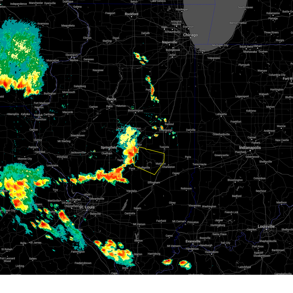 Svrilx the national weather service in lincoln has issued a * severe thunderstorm warning for, western coles county in east central illinois, moultrie county in central illinois, central shelby county in central illinois, southwestern douglas county in east central illinois, southeastern macon county in central illinois, * until 430 pm cdt. * at 348 pm cdt, severe thunderstorms were located along a line extending from long creek to near dalton city to near moweaqua, moving east at 45 mph (radar indicated). Hazards include 60 mph wind gusts and quarter size hail. Hail damage to vehicles is expected. expect wind damage to roofs, siding, and trees. severe thunderstorms will be near, bethany and dalton city around 355 pm cdt. lovington and findlay around 400 pm cdt. sullivan around 405 pm cdt. other locations in the path of these severe thunderstorms include arthur, allenville, windsor, arcola and cooks mill. This includes interstate 57 between mile markers 193 and 205. Svrilx the national weather service in lincoln has issued a * severe thunderstorm warning for, western coles county in east central illinois, moultrie county in central illinois, central shelby county in central illinois, southwestern douglas county in east central illinois, southeastern macon county in central illinois, * until 430 pm cdt. * at 348 pm cdt, severe thunderstorms were located along a line extending from long creek to near dalton city to near moweaqua, moving east at 45 mph (radar indicated). Hazards include 60 mph wind gusts and quarter size hail. Hail damage to vehicles is expected. expect wind damage to roofs, siding, and trees. severe thunderstorms will be near, bethany and dalton city around 355 pm cdt. lovington and findlay around 400 pm cdt. sullivan around 405 pm cdt. other locations in the path of these severe thunderstorms include arthur, allenville, windsor, arcola and cooks mill. This includes interstate 57 between mile markers 193 and 205.
|
| 7/30/2024 8:58 AM CDT |
 Svrilx the national weather service in lincoln has issued a * severe thunderstorm warning for, southern coles county in east central illinois, southern moultrie county in central illinois, jasper county in southeastern illinois, eastern shelby county in central illinois, cumberland county in east central illinois, northeastern effingham county in south central illinois, * until 945 am cdt. * at 857 am cdt, severe thunderstorms were located along a line extending from near sullivan to near stewardson, moving southeast at 60 mph (radar indicated). Hazards include 60 mph wind gusts. Expect damage to roofs, siding, and trees. severe thunderstorms will be near, effingham, neoga, windsor, stewardson, and allenville around 905 am cdt. mattoon, teutopolis, and montrose around 910 am cdt. lerna around 915 am cdt. other locations in the path of these severe thunderstorms include charleston, toledo, jewett, janesville, greenup, hidalgo and newton. this includes the following highways, interstate 57 between mile markers 161 and 194. Interstate 70 between mile markers 94 and 125. Svrilx the national weather service in lincoln has issued a * severe thunderstorm warning for, southern coles county in east central illinois, southern moultrie county in central illinois, jasper county in southeastern illinois, eastern shelby county in central illinois, cumberland county in east central illinois, northeastern effingham county in south central illinois, * until 945 am cdt. * at 857 am cdt, severe thunderstorms were located along a line extending from near sullivan to near stewardson, moving southeast at 60 mph (radar indicated). Hazards include 60 mph wind gusts. Expect damage to roofs, siding, and trees. severe thunderstorms will be near, effingham, neoga, windsor, stewardson, and allenville around 905 am cdt. mattoon, teutopolis, and montrose around 910 am cdt. lerna around 915 am cdt. other locations in the path of these severe thunderstorms include charleston, toledo, jewett, janesville, greenup, hidalgo and newton. this includes the following highways, interstate 57 between mile markers 161 and 194. Interstate 70 between mile markers 94 and 125.
|
| 7/30/2024 8:49 AM CDT |
 the severe thunderstorm warning has been cancelled and is no longer in effect the severe thunderstorm warning has been cancelled and is no longer in effect
|
| 7/30/2024 8:49 AM CDT |
 At 848 am cdt, severe thunderstorms were located along a line extending from near bethany to cowden, moving east at 45 mph (radar indicated). Hazards include 60 mph wind gusts. Expect damage to roofs, siding, and trees. these severe storms will be near, shelbyville, bethany, and findlay around 855 am cdt. sullivan, windsor, stewardson, and shumway around 900 am cdt. effingham and allenville around 905 am cdt. other locations impacted by these severe thunderstorms include trowbridge, etna, clarksburg, wolf creek state park, mode, strasburg, lakewood, westervelt, kirksville, and gays. this includes the following highways, interstate 57 between mile markers 162 and 187. Interstate 70 between mile markers 96 and 105. At 848 am cdt, severe thunderstorms were located along a line extending from near bethany to cowden, moving east at 45 mph (radar indicated). Hazards include 60 mph wind gusts. Expect damage to roofs, siding, and trees. these severe storms will be near, shelbyville, bethany, and findlay around 855 am cdt. sullivan, windsor, stewardson, and shumway around 900 am cdt. effingham and allenville around 905 am cdt. other locations impacted by these severe thunderstorms include trowbridge, etna, clarksburg, wolf creek state park, mode, strasburg, lakewood, westervelt, kirksville, and gays. this includes the following highways, interstate 57 between mile markers 162 and 187. Interstate 70 between mile markers 96 and 105.
|
| 7/30/2024 8:36 AM CDT |
 Svrilx the national weather service in lincoln has issued a * severe thunderstorm warning for, western coles county in east central illinois, southeastern christian county in central illinois, moultrie county in central illinois, shelby county in central illinois, western cumberland county in east central illinois, northeastern effingham county in south central illinois, southeastern macon county in central illinois, * until 900 am cdt. * at 835 am cdt, severe thunderstorms were located along a line extending from near macon to near herrick, moving southeast at 70 mph (radar indicated). Hazards include 60 mph wind gusts. Expect damage to roofs, siding, and trees. severe thunderstorms will be near, cowden and tower hill around 840 am cdt. shelbyville and findlay around 845 am cdt. shumway around 855 am cdt. this includes the following highways, interstate 57 between mile markers 162 and 187. Interstate 70 between mile markers 96 and 105. Svrilx the national weather service in lincoln has issued a * severe thunderstorm warning for, western coles county in east central illinois, southeastern christian county in central illinois, moultrie county in central illinois, shelby county in central illinois, western cumberland county in east central illinois, northeastern effingham county in south central illinois, southeastern macon county in central illinois, * until 900 am cdt. * at 835 am cdt, severe thunderstorms were located along a line extending from near macon to near herrick, moving southeast at 70 mph (radar indicated). Hazards include 60 mph wind gusts. Expect damage to roofs, siding, and trees. severe thunderstorms will be near, cowden and tower hill around 840 am cdt. shelbyville and findlay around 845 am cdt. shumway around 855 am cdt. this includes the following highways, interstate 57 between mile markers 162 and 187. Interstate 70 between mile markers 96 and 105.
|
| 7/15/2024 7:59 PM CDT |
 the severe thunderstorm warning has been cancelled and is no longer in effect the severe thunderstorm warning has been cancelled and is no longer in effect
|
| 7/15/2024 7:59 PM CDT |
 At 759 pm cdt, severe thunderstorms were located along a line extending from near henry county fairgrounds to wataga to near ponemah, moving southeast at 55 mph (radar indicated). Hazards include 70 mph wind gusts. Expect considerable tree damage. damage is likely to mobile homes, roofs, and outbuildings. locations impacted include, kewanee, monmouth, cambridge, oquawka, geneseo, colona, galva, burgess, orion, atkinson, annawan, woodhull, kirkwood, alpha, andover, little york, rozetta, seaton, hooppole, and cleveland. this includes the following highways, interstate 80 in illinois between mile markers 4 and 34. interstate 74 in illinois between mile markers 11 and 33. Interstate 88 between mile markers 1 and 8. At 759 pm cdt, severe thunderstorms were located along a line extending from near henry county fairgrounds to wataga to near ponemah, moving southeast at 55 mph (radar indicated). Hazards include 70 mph wind gusts. Expect considerable tree damage. damage is likely to mobile homes, roofs, and outbuildings. locations impacted include, kewanee, monmouth, cambridge, oquawka, geneseo, colona, galva, burgess, orion, atkinson, annawan, woodhull, kirkwood, alpha, andover, little york, rozetta, seaton, hooppole, and cleveland. this includes the following highways, interstate 80 in illinois between mile markers 4 and 34. interstate 74 in illinois between mile markers 11 and 33. Interstate 88 between mile markers 1 and 8.
|
| 7/15/2024 7:47 PM CDT |
 At 747 pm cdt, severe thunderstorms were located along a line extending from near morristown to rio to near kirkwood, moving southeast at 55 mph (radar indicated). Hazards include 70 mph wind gusts. Expect considerable tree damage. damage is likely to mobile homes, roofs, and outbuildings. locations impacted include, moline, bettendorf, east moline, kewanee, monmouth, aledo, cambridge, oquawka, silvis, geneseo, colona, le claire, coal valley, galva, burgess, hampton, orion, port byron, atkinson, and rapids city. this includes the following highways, interstate 80 in iowa between mile markers 304 and 306. interstate 80 in illinois between mile markers 1 and 34. interstate 74 in illinois between mile markers 3 and 33. interstate 88 between mile markers 1 and 8. Interstate 280 near mile marker 18. At 747 pm cdt, severe thunderstorms were located along a line extending from near morristown to rio to near kirkwood, moving southeast at 55 mph (radar indicated). Hazards include 70 mph wind gusts. Expect considerable tree damage. damage is likely to mobile homes, roofs, and outbuildings. locations impacted include, moline, bettendorf, east moline, kewanee, monmouth, aledo, cambridge, oquawka, silvis, geneseo, colona, le claire, coal valley, galva, burgess, hampton, orion, port byron, atkinson, and rapids city. this includes the following highways, interstate 80 in iowa between mile markers 304 and 306. interstate 80 in illinois between mile markers 1 and 34. interstate 74 in illinois between mile markers 3 and 33. interstate 88 between mile markers 1 and 8. Interstate 280 near mile marker 18.
|
| 7/15/2024 7:46 PM CDT |
 At 745 pm cdt, tornado producing storms were located along a line extending from joslin to near woodhull, moving east at 50 mph. a tornado was reported near andover, near i-74 (weather spotters confirmed tornado). Hazards include damaging tornado. Flying debris will be dangerous to those caught without shelter. mobile homes will be damaged or destroyed. damage to roofs, windows, and vehicles will occur. tree damage is likely. these tornadic storms will be near, cambridge, geneseo, woodhull, bishop hill, spring hill, nekoma, ulah, and henry county fairgrounds around 750 pm cdt. galva, atkinson, hooppole, german corner, and leon corners around 755 pm cdt. kewanee, annawan, yorktown, and kewanee municipal airport around 800 pm cdt. other locations in the path of these tornadic storms include mineral, thomas, johnson-sauk trail state park, sheffield, tampico, deer grove, neponset, new bedford, walnut, buda, manlius and normandy. this includes the following highways, interstate 80 in illinois between mile markers 6 and 48. interstate 74 in illinois between mile markers 11 and 33. Interstate 88 between mile markers 14 and 16. At 745 pm cdt, tornado producing storms were located along a line extending from joslin to near woodhull, moving east at 50 mph. a tornado was reported near andover, near i-74 (weather spotters confirmed tornado). Hazards include damaging tornado. Flying debris will be dangerous to those caught without shelter. mobile homes will be damaged or destroyed. damage to roofs, windows, and vehicles will occur. tree damage is likely. these tornadic storms will be near, cambridge, geneseo, woodhull, bishop hill, spring hill, nekoma, ulah, and henry county fairgrounds around 750 pm cdt. galva, atkinson, hooppole, german corner, and leon corners around 755 pm cdt. kewanee, annawan, yorktown, and kewanee municipal airport around 800 pm cdt. other locations in the path of these tornadic storms include mineral, thomas, johnson-sauk trail state park, sheffield, tampico, deer grove, neponset, new bedford, walnut, buda, manlius and normandy. this includes the following highways, interstate 80 in illinois between mile markers 6 and 48. interstate 74 in illinois between mile markers 11 and 33. Interstate 88 between mile markers 14 and 16.
|
| 7/15/2024 7:42 PM CDT | Tordvn the national weather service in the quad cities has issued a * tornado warning for, southern whiteside county in northwestern illinois, henry county in northwestern illinois, western bureau county in north central illinois, * until 830 pm cdt. * at 742 pm cdt, severe thunderstorms capable of producing both tornadoes and extensive straight line wind damage were located along a line extending from joslin to near alpha, moving east at 50 mph (radar indicated rotation). Hazards include tornado. Flying debris will be dangerous to those caught without shelter. mobile homes will be damaged or destroyed. damage to roofs, windows, and vehicles will occur. tree damage is likely. these dangerous storms will be near, cambridge, geneseo, woodhull, andover, hillsdale, osco, shady beach, nekoma, ulah, and henry county fairgrounds around 745 pm cdt. atkinson, bishop hill, and spring hill around 750 pm cdt. galva, hooppole, and german corner around 755 pm cdt. kewanee, annawan, yorktown, thomas, johnson-sauk trail state park, and kewanee municipal airport around 800 pm cdt. other locations in the path of these tornadic storms include mineral, sheffield, neponset, manlius, new bedford and buda. this includes the following highways, interstate 80 in illinois between mile markers 6 and 48. interstate 74 in illinois between mile markers 11 and 33. Interstate 88 between mile markers 14 and 16. |
| 7/15/2024 7:36 PM CDT |
 At 736 pm cdt, severe thunderstorms were located along a line extending from carbon cliff to near new windsor to rozetta, moving east at 55 mph (radar indicated). Hazards include 70 mph wind gusts. Expect considerable tree damage. damage is likely to mobile homes, roofs, and outbuildings. locations impacted include, moline, bettendorf, east moline, kewanee, monmouth, aledo, cambridge, oquawka, silvis, geneseo, colona, le claire, coal valley, galva, burgess, hampton, orion, port byron, atkinson, and rapids city. this includes the following highways, interstate 80 in iowa between mile markers 304 and 306. interstate 80 in illinois between mile markers 1 and 34. interstate 74 in illinois between mile markers 3 and 33. interstate 88 between mile markers 1 and 8. Interstate 280 near mile marker 18. At 736 pm cdt, severe thunderstorms were located along a line extending from carbon cliff to near new windsor to rozetta, moving east at 55 mph (radar indicated). Hazards include 70 mph wind gusts. Expect considerable tree damage. damage is likely to mobile homes, roofs, and outbuildings. locations impacted include, moline, bettendorf, east moline, kewanee, monmouth, aledo, cambridge, oquawka, silvis, geneseo, colona, le claire, coal valley, galva, burgess, hampton, orion, port byron, atkinson, and rapids city. this includes the following highways, interstate 80 in iowa between mile markers 304 and 306. interstate 80 in illinois between mile markers 1 and 34. interstate 74 in illinois between mile markers 3 and 33. interstate 88 between mile markers 1 and 8. Interstate 280 near mile marker 18.
|
| 7/15/2024 7:23 PM CDT |
 Svrdvn the national weather service in the quad cities has issued a * severe thunderstorm warning for, northeastern henderson county in west central illinois, warren county in west central illinois, southeastern rock island county in northwestern illinois, mercer county in northwestern illinois, henry county in northwestern illinois, northeastern des moines county in southeastern iowa, southeastern louisa county in southeastern iowa, east central scott county in east central iowa, * until 815 pm cdt. * at 722 pm cdt, severe thunderstorms were located along a line extending from davenport municipal airport to near reynolds to northfield, moving southeast at 55 mph (trained weather spotters. at 718 pm cdt a 74 mph wind gust was measured at the davenport municipal airport). Hazards include 70 mph wind gusts. Expect considerable tree damage. Damage is likely to mobile homes, roofs, and outbuildings. Svrdvn the national weather service in the quad cities has issued a * severe thunderstorm warning for, northeastern henderson county in west central illinois, warren county in west central illinois, southeastern rock island county in northwestern illinois, mercer county in northwestern illinois, henry county in northwestern illinois, northeastern des moines county in southeastern iowa, southeastern louisa county in southeastern iowa, east central scott county in east central iowa, * until 815 pm cdt. * at 722 pm cdt, severe thunderstorms were located along a line extending from davenport municipal airport to near reynolds to northfield, moving southeast at 55 mph (trained weather spotters. at 718 pm cdt a 74 mph wind gust was measured at the davenport municipal airport). Hazards include 70 mph wind gusts. Expect considerable tree damage. Damage is likely to mobile homes, roofs, and outbuildings.
|
| 7/14/2024 9:42 PM CDT |
 The storm which prompted the warning has weakened below severe limits, and no longer poses an immediate threat to life or property. therefore, the warning will be allowed to expire. however, gusty winds and heavy rain are still possible with this thunderstorm. a severe thunderstorm watch remains in effect until 100 am cdt for northwestern illinois, and east central iowa. The storm which prompted the warning has weakened below severe limits, and no longer poses an immediate threat to life or property. therefore, the warning will be allowed to expire. however, gusty winds and heavy rain are still possible with this thunderstorm. a severe thunderstorm watch remains in effect until 100 am cdt for northwestern illinois, and east central iowa.
|
| 7/14/2024 9:31 PM CDT |
 At 931 pm cdt, a severe thunderstorm was located over marston, or 9 miles north of aledo, moving east at 30 mph (radar indicated). Hazards include 60 mph wind gusts. Expect damage to roofs, siding, and trees. this severe storm will be near, rock island, andalusia, matherville, reynolds, taylor ridge, hamlet, preemption, edgington, gingle corners, and aledo mercer county airport around 935 pm cdt. milan, oak grove, boden, coyne center, and old gilchrist around 940 pm cdt. sherrard, shale city, cable, and wanlock around 945 pm cdt. swedona and indian bluff golf course around 950 pm cdt. coal valley and griffin around 955 pm cdt. moline around 1000 pm cdt. other locations impacted by this severe thunderstorm include preemption, blackhawk state park, aledo mercer county airport, fruitland, wanlock, coyne center, swedona, edgington, gingle corners, and indian bluff golf course. this includes the following highways, interstate 74 in illinois between mile markers 4 and 7. Interstate 280 between mile markers 11 and 18. At 931 pm cdt, a severe thunderstorm was located over marston, or 9 miles north of aledo, moving east at 30 mph (radar indicated). Hazards include 60 mph wind gusts. Expect damage to roofs, siding, and trees. this severe storm will be near, rock island, andalusia, matherville, reynolds, taylor ridge, hamlet, preemption, edgington, gingle corners, and aledo mercer county airport around 935 pm cdt. milan, oak grove, boden, coyne center, and old gilchrist around 940 pm cdt. sherrard, shale city, cable, and wanlock around 945 pm cdt. swedona and indian bluff golf course around 950 pm cdt. coal valley and griffin around 955 pm cdt. moline around 1000 pm cdt. other locations impacted by this severe thunderstorm include preemption, blackhawk state park, aledo mercer county airport, fruitland, wanlock, coyne center, swedona, edgington, gingle corners, and indian bluff golf course. this includes the following highways, interstate 74 in illinois between mile markers 4 and 7. Interstate 280 between mile markers 11 and 18.
|
| 7/14/2024 9:10 PM CDT |
 At 909 pm cdt, a severe thunderstorm was located over hamlet, or 9 miles north of aledo, moving east at 40 mph (radar indicated). Hazards include 60 mph wind gusts. Expect damage to roofs, siding, and trees. this severe storm will be near, rock island, milan, andalusia, matherville, reynolds, oak grove, boden, taylor ridge, preemption, and coyne center around 915 pm cdt. sherrard, shale city, cable, and wanlock around 920 pm cdt. coal valley, viola, swedona, indian bluff golf course, and griffin around 925 pm cdt. new windsor around 935 pm cdt. other locations impacted by this severe thunderstorm include preemption, blackhawk state park, aledo mercer county airport, fruitland, loud thunder forest preserve, wanlock, coyne center, swedona, edgington, and gingle corners. this includes the following highways, interstate 74 in illinois between mile markers 4 and 7. Interstate 280 between mile markers 11 and 18. At 909 pm cdt, a severe thunderstorm was located over hamlet, or 9 miles north of aledo, moving east at 40 mph (radar indicated). Hazards include 60 mph wind gusts. Expect damage to roofs, siding, and trees. this severe storm will be near, rock island, milan, andalusia, matherville, reynolds, oak grove, boden, taylor ridge, preemption, and coyne center around 915 pm cdt. sherrard, shale city, cable, and wanlock around 920 pm cdt. coal valley, viola, swedona, indian bluff golf course, and griffin around 925 pm cdt. new windsor around 935 pm cdt. other locations impacted by this severe thunderstorm include preemption, blackhawk state park, aledo mercer county airport, fruitland, loud thunder forest preserve, wanlock, coyne center, swedona, edgington, and gingle corners. this includes the following highways, interstate 74 in illinois between mile markers 4 and 7. Interstate 280 between mile markers 11 and 18.
|
| 7/14/2024 8:58 PM CDT |
 Svrdvn the national weather service in the quad cities has issued a * severe thunderstorm warning for, rock island county in northwestern illinois, mercer county in northwestern illinois, * until 945 pm cdt. * at 857 pm cdt, a severe thunderstorm was located over petersville, or 11 miles southeast of muscatine, moving east at 40 mph (radar indicated). Hazards include 60 mph wind gusts. Expect damage to roofs, siding, and trees. this severe thunderstorm will be near, aledo, millersburg, reynolds, hamlet, edgington, marston, gingle corners, aledo mercer county airport, mercer county fairgrounds, and loud thunder scout camp around 905 pm cdt. matherville, boden, taylor ridge, shale city, preemption, wanlock, and old gilchrist around 910 pm cdt. viola, sherrard, and gilchrist around 915 pm cdt. cable, coyne center, swedona, and griffin around 920 pm cdt. new windsor and new windsor around 925 pm cdt. other locations impacted by this severe thunderstorm include preemption, blackhawk state park, aledo mercer county airport, alexis, fruitland, loud thunder forest preserve, wanlock, coyne center, swedona, and edgington. this includes the following highways, interstate 74 in illinois between mile markers 4 and 7. Interstate 280 between mile markers 11 and 18. Svrdvn the national weather service in the quad cities has issued a * severe thunderstorm warning for, rock island county in northwestern illinois, mercer county in northwestern illinois, * until 945 pm cdt. * at 857 pm cdt, a severe thunderstorm was located over petersville, or 11 miles southeast of muscatine, moving east at 40 mph (radar indicated). Hazards include 60 mph wind gusts. Expect damage to roofs, siding, and trees. this severe thunderstorm will be near, aledo, millersburg, reynolds, hamlet, edgington, marston, gingle corners, aledo mercer county airport, mercer county fairgrounds, and loud thunder scout camp around 905 pm cdt. matherville, boden, taylor ridge, shale city, preemption, wanlock, and old gilchrist around 910 pm cdt. viola, sherrard, and gilchrist around 915 pm cdt. cable, coyne center, swedona, and griffin around 920 pm cdt. new windsor and new windsor around 925 pm cdt. other locations impacted by this severe thunderstorm include preemption, blackhawk state park, aledo mercer county airport, alexis, fruitland, loud thunder forest preserve, wanlock, coyne center, swedona, and edgington. this includes the following highways, interstate 74 in illinois between mile markers 4 and 7. Interstate 280 between mile markers 11 and 18.
|
| 7/2/2024 8:13 PM CDT |
 the severe thunderstorm warning has been cancelled and is no longer in effect the severe thunderstorm warning has been cancelled and is no longer in effect
|
| 7/2/2024 8:13 PM CDT |
 At 813 pm cdt, a severe thunderstorm was located near woodhull, or near cambridge, moving east at 55 mph (radar indicated). Hazards include 60 mph wind gusts. Expect damage to roofs, siding, and trees. this severe storm will be near, kewanee, cambridge, galva, bishop hill, german corner, ulah, kewanee municipal airport, and henry county fairgrounds around 820 pm cdt. other locations in the path of this severe thunderstorm include neponset, johnson-sauk trail state park, mineral, sheffield and buda. this includes the following highways, interstate 80 in illinois between mile markers 37 and 47. Interstate 74 in illinois between mile markers 21 and 33. At 813 pm cdt, a severe thunderstorm was located near woodhull, or near cambridge, moving east at 55 mph (radar indicated). Hazards include 60 mph wind gusts. Expect damage to roofs, siding, and trees. this severe storm will be near, kewanee, cambridge, galva, bishop hill, german corner, ulah, kewanee municipal airport, and henry county fairgrounds around 820 pm cdt. other locations in the path of this severe thunderstorm include neponset, johnson-sauk trail state park, mineral, sheffield and buda. this includes the following highways, interstate 80 in illinois between mile markers 37 and 47. Interstate 74 in illinois between mile markers 21 and 33.
|
| 7/2/2024 8:00 PM CDT |
 Svrdvn the national weather service in the quad cities has issued a * severe thunderstorm warning for, eastern mercer county in northwestern illinois, southern henry county in northwestern illinois, southwestern bureau county in north central illinois, * until 845 pm cdt. * at 800 pm cdt, a severe thunderstorm was located over new windsor, or 14 miles east of aledo, moving east at 55 mph (radar indicated). Hazards include 60 mph wind gusts. Expect damage to roofs, siding, and trees. this severe thunderstorm will be near, woodhull, new windsor, alpha, andover, lynn center, swedona, and ophiem around 805 pm cdt. cambridge, nekoma, and ulah around 810 pm cdt. galva, bishop hill, and henry county fairgrounds around 815 pm cdt. german corner and kewanee municipal airport around 820 pm cdt. other locations in the path of this severe thunderstorm include kewanee, johnson-sauk trail state park, neponset and sheffield. this includes the following highways, interstate 80 in illinois between mile markers 37 and 47. Interstate 74 in illinois between mile markers 21 and 33. Svrdvn the national weather service in the quad cities has issued a * severe thunderstorm warning for, eastern mercer county in northwestern illinois, southern henry county in northwestern illinois, southwestern bureau county in north central illinois, * until 845 pm cdt. * at 800 pm cdt, a severe thunderstorm was located over new windsor, or 14 miles east of aledo, moving east at 55 mph (radar indicated). Hazards include 60 mph wind gusts. Expect damage to roofs, siding, and trees. this severe thunderstorm will be near, woodhull, new windsor, alpha, andover, lynn center, swedona, and ophiem around 805 pm cdt. cambridge, nekoma, and ulah around 810 pm cdt. galva, bishop hill, and henry county fairgrounds around 815 pm cdt. german corner and kewanee municipal airport around 820 pm cdt. other locations in the path of this severe thunderstorm include kewanee, johnson-sauk trail state park, neponset and sheffield. this includes the following highways, interstate 80 in illinois between mile markers 37 and 47. Interstate 74 in illinois between mile markers 21 and 33.
|
| 7/2/2024 7:37 PM CDT |
 The storms which prompted the warning have weakened below severe limits, and no longer pose an immediate threat to life or property. therefore, the warning will be allowed to expire. a tornado watch remains in effect until 900 pm cdt for northwestern and west central illinois, and southeastern iowa. The storms which prompted the warning have weakened below severe limits, and no longer pose an immediate threat to life or property. therefore, the warning will be allowed to expire. a tornado watch remains in effect until 900 pm cdt for northwestern and west central illinois, and southeastern iowa.
|
| 7/2/2024 7:32 PM CDT |
 At 731 pm cdt, severe thunderstorms were located along a line extending from near morristown to alpha to alexis, moving east at 40 mph (radar indicated). Hazards include 60 mph wind gusts. Expect damage to roofs, siding, and trees. locations impacted include, cambridge, geneseo, woodhull, alpha, andover, north henderson, alexis, osco, henry county fairgrounds, nekoma, ulah, atkinson, bishop hill, german corner and annawan. this includes the following highways, interstate 80 in illinois between mile markers 19 and 33. Interstate 74 in illinois between mile markers 15 and 33. At 731 pm cdt, severe thunderstorms were located along a line extending from near morristown to alpha to alexis, moving east at 40 mph (radar indicated). Hazards include 60 mph wind gusts. Expect damage to roofs, siding, and trees. locations impacted include, cambridge, geneseo, woodhull, alpha, andover, north henderson, alexis, osco, henry county fairgrounds, nekoma, ulah, atkinson, bishop hill, german corner and annawan. this includes the following highways, interstate 80 in illinois between mile markers 19 and 33. Interstate 74 in illinois between mile markers 15 and 33.
|
| 7/2/2024 7:32 PM CDT |
 the severe thunderstorm warning has been cancelled and is no longer in effect the severe thunderstorm warning has been cancelled and is no longer in effect
|
| 7/2/2024 7:04 PM CDT |
 Svrdvn the national weather service in the quad cities has issued a * severe thunderstorm warning for, northeastern henderson county in west central illinois, northern warren county in west central illinois, south central rock island county in northwestern illinois, mercer county in northwestern illinois, southern henry county in northwestern illinois, southeastern louisa county in southeastern iowa, * until 745 pm cdt. * at 703 pm cdt, severe thunderstorms were located along a line extending from milan to aledo mercer county airport to keithsburg, moving east at 40 mph (radar indicated). Hazards include 60 mph wind gusts. Expect damage to roofs, siding, and trees. severe thunderstorms will be near, aledo, milan, coal valley, burgess, viola, matherville, sherrard, oak grove, seaton, and boden around 710 pm cdt. orion, warner, sunny hill, swedona, and griffin around 715 pm cdt. new windsor, new windsor, lynn center, morristown, and ophiem around 720 pm cdt. other locations in the path of these severe thunderstorms include alpha, andover, north henderson, alexis, osco, cambridge, geneseo, woodhull and henry county fairgrounds. this includes the following highways, interstate 80 in illinois between mile markers 12 and 33. Interstate 74 in illinois between mile markers 14 and 33. Svrdvn the national weather service in the quad cities has issued a * severe thunderstorm warning for, northeastern henderson county in west central illinois, northern warren county in west central illinois, south central rock island county in northwestern illinois, mercer county in northwestern illinois, southern henry county in northwestern illinois, southeastern louisa county in southeastern iowa, * until 745 pm cdt. * at 703 pm cdt, severe thunderstorms were located along a line extending from milan to aledo mercer county airport to keithsburg, moving east at 40 mph (radar indicated). Hazards include 60 mph wind gusts. Expect damage to roofs, siding, and trees. severe thunderstorms will be near, aledo, milan, coal valley, burgess, viola, matherville, sherrard, oak grove, seaton, and boden around 710 pm cdt. orion, warner, sunny hill, swedona, and griffin around 715 pm cdt. new windsor, new windsor, lynn center, morristown, and ophiem around 720 pm cdt. other locations in the path of these severe thunderstorms include alpha, andover, north henderson, alexis, osco, cambridge, geneseo, woodhull and henry county fairgrounds. this includes the following highways, interstate 80 in illinois between mile markers 12 and 33. Interstate 74 in illinois between mile markers 14 and 33.
|
| 6/25/2024 8:39 PM CDT |
 At 839 pm cdt, severe thunderstorms were located along a line extending from andover to near rio, moving east at 45 mph. there is also some weak rotation near the town of alpha with this storm (radar indicated). Hazards include 60 mph wind gusts. Expect damage to roofs, siding, and trees. locations impacted include, cambridge, woodhull, alpha, sherrard, andover, cable, new windsor, lynn center, henry county fairgrounds, ophiem, swedona, nekoma, and griffin. This includes interstate 74 in illinois between mile markers 22 and 33. At 839 pm cdt, severe thunderstorms were located along a line extending from andover to near rio, moving east at 45 mph. there is also some weak rotation near the town of alpha with this storm (radar indicated). Hazards include 60 mph wind gusts. Expect damage to roofs, siding, and trees. locations impacted include, cambridge, woodhull, alpha, sherrard, andover, cable, new windsor, lynn center, henry county fairgrounds, ophiem, swedona, nekoma, and griffin. This includes interstate 74 in illinois between mile markers 22 and 33.
|
| 6/25/2024 8:23 PM CDT |
 At 823 pm cdt, severe thunderstorms were located along a line extending from near coyne center to near burgess, moving east at 35 mph (radar indicated). Hazards include 60 mph wind gusts. Expect damage to roofs, siding, and trees. locations impacted include, cambridge, viola, woodhull, matherville, alpha, sherrard, andover, cable, shale city, new windsor, lynn center, boden, preemption, henry county fairgrounds, ophiem, wanlock, swedona, gilchrist, nekoma, and old gilchrist. This includes interstate 74 in illinois between mile markers 22 and 33. At 823 pm cdt, severe thunderstorms were located along a line extending from near coyne center to near burgess, moving east at 35 mph (radar indicated). Hazards include 60 mph wind gusts. Expect damage to roofs, siding, and trees. locations impacted include, cambridge, viola, woodhull, matherville, alpha, sherrard, andover, cable, shale city, new windsor, lynn center, boden, preemption, henry county fairgrounds, ophiem, wanlock, swedona, gilchrist, nekoma, and old gilchrist. This includes interstate 74 in illinois between mile markers 22 and 33.
|
| 6/25/2024 8:06 PM CDT |
 Svrdvn the national weather service in the quad cities has issued a * severe thunderstorm warning for, northeastern mercer county in northwestern illinois, southwestern henry county in northwestern illinois, * until 900 pm cdt. * at 806 pm cdt, severe thunderstorms were located along a line extending from taylor ridge to mercer county fairgrounds, moving east at 35 mph (radar indicated). Hazards include 60 mph wind gusts. expect damage to roofs, siding, and trees Svrdvn the national weather service in the quad cities has issued a * severe thunderstorm warning for, northeastern mercer county in northwestern illinois, southwestern henry county in northwestern illinois, * until 900 pm cdt. * at 806 pm cdt, severe thunderstorms were located along a line extending from taylor ridge to mercer county fairgrounds, moving east at 35 mph (radar indicated). Hazards include 60 mph wind gusts. expect damage to roofs, siding, and trees
|
| 6/13/2024 7:29 PM CDT |
 At 729 pm cdt, a severe thunderstorm was located over woodhull, or 11 miles southwest of cambridge, moving east at 30 mph (radar indicated). Hazards include 60 mph wind gusts and quarter size hail. Hail damage to vehicles is expected. expect wind damage to roofs, siding, and trees. locations impacted include, galva, burgess, viola, woodhull, alpha, north henderson, new windsor, alexis, bishop hill, ophiem, german corner, gilchrist, nekoma, ulah, and griffin. This includes interstate 74 in illinois between mile markers 27 and 33. At 729 pm cdt, a severe thunderstorm was located over woodhull, or 11 miles southwest of cambridge, moving east at 30 mph (radar indicated). Hazards include 60 mph wind gusts and quarter size hail. Hail damage to vehicles is expected. expect wind damage to roofs, siding, and trees. locations impacted include, galva, burgess, viola, woodhull, alpha, north henderson, new windsor, alexis, bishop hill, ophiem, german corner, gilchrist, nekoma, ulah, and griffin. This includes interstate 74 in illinois between mile markers 27 and 33.
|
| 6/13/2024 7:01 PM CDT |
 Svrdvn the national weather service in the quad cities has issued a * severe thunderstorm warning for, northeastern warren county in west central illinois, southeastern mercer county in northwestern illinois, southwestern henry county in northwestern illinois, * until 745 pm cdt. * at 701 pm cdt, a severe thunderstorm was located near burgess, or 10 miles southeast of aledo, moving east at 30 mph (radar indicated). Hazards include 60 mph wind gusts and quarter size hail. Hail damage to vehicles is expected. Expect wind damage to roofs, siding, and trees. Svrdvn the national weather service in the quad cities has issued a * severe thunderstorm warning for, northeastern warren county in west central illinois, southeastern mercer county in northwestern illinois, southwestern henry county in northwestern illinois, * until 745 pm cdt. * at 701 pm cdt, a severe thunderstorm was located near burgess, or 10 miles southeast of aledo, moving east at 30 mph (radar indicated). Hazards include 60 mph wind gusts and quarter size hail. Hail damage to vehicles is expected. Expect wind damage to roofs, siding, and trees.
|
| 5/24/2024 8:40 AM CDT |
 the severe thunderstorm warning has been cancelled and is no longer in effect the severe thunderstorm warning has been cancelled and is no longer in effect
|
| 5/24/2024 8:40 AM CDT |
 At 840 am cdt, severe thunderstorms were located along a line extending from ustick to near thomas to galva, moving east at 60 mph (radar indicated). Hazards include 60 mph wind gusts and penny size hail. Expect damage to roofs, siding, and trees. locations impacted include, clinton, sterling, kewanee, rock falls, princeton, morrison, cambridge, hennepin, geneseo, spring valley, colona, camanche, fulton, galva, henry, prophetstown, orion, depue, port byron, and erie. this includes the following highways, interstate 80 in illinois between mile markers 2 and 72. interstate 74 in illinois between mile markers 12 and 33. interstate 88 between mile markers 1 and 44. Interstate 180 between mile markers 1 and 13. At 840 am cdt, severe thunderstorms were located along a line extending from ustick to near thomas to galva, moving east at 60 mph (radar indicated). Hazards include 60 mph wind gusts and penny size hail. Expect damage to roofs, siding, and trees. locations impacted include, clinton, sterling, kewanee, rock falls, princeton, morrison, cambridge, hennepin, geneseo, spring valley, colona, camanche, fulton, galva, henry, prophetstown, orion, depue, port byron, and erie. this includes the following highways, interstate 80 in illinois between mile markers 2 and 72. interstate 74 in illinois between mile markers 12 and 33. interstate 88 between mile markers 1 and 44. Interstate 180 between mile markers 1 and 13.
|
| 5/24/2024 8:26 AM CDT |
 Svrdvn the national weather service in the quad cities has issued a * severe thunderstorm warning for, northeastern rock island county in northwestern illinois, putnam county in north central illinois, east central mercer county in northwestern illinois, whiteside county in northwestern illinois, henry county in northwestern illinois, bureau county in north central illinois, northeastern scott county in east central iowa, southeastern clinton county in east central iowa, * until 930 am cdt. * at 825 am cdt, severe thunderstorms were located along a line extending from clinton to near shady beach to near woodhull, moving east at 60 mph (radar indicated). Hazards include 60 mph wind gusts and penny size hail. expect damage to roofs, siding, and trees Svrdvn the national weather service in the quad cities has issued a * severe thunderstorm warning for, northeastern rock island county in northwestern illinois, putnam county in north central illinois, east central mercer county in northwestern illinois, whiteside county in northwestern illinois, henry county in northwestern illinois, bureau county in north central illinois, northeastern scott county in east central iowa, southeastern clinton county in east central iowa, * until 930 am cdt. * at 825 am cdt, severe thunderstorms were located along a line extending from clinton to near shady beach to near woodhull, moving east at 60 mph (radar indicated). Hazards include 60 mph wind gusts and penny size hail. expect damage to roofs, siding, and trees
|
| 5/24/2024 8:16 AM CDT |
 At 815 am cdt, severe thunderstorms were located along a line extending from near lyons to rapids city to monmouth municipal airport, moving east at 45 mph (radar indicated). Hazards include 60 mph wind gusts and penny size hail. Expect damage to roofs, siding, and trees. locations impacted include, davenport, moline, rock island, bettendorf, clinton, east moline, monmouth, aledo, oquawka, silvis, geneseo, eldridge, dewitt, milan, colona, camanche, le claire, coal valley, burgess, and hampton. this includes the following highways, interstate 74 in iowa between mile markers 1 and 5. interstate 80 in iowa between mile markers 286 and 306. interstate 80 in illinois between mile markers 1 and 19. interstate 74 in illinois between mile markers 1 and 33. interstate 88 between mile markers 1 and 14. Interstate 280 between mile markers 1 and 18. At 815 am cdt, severe thunderstorms were located along a line extending from near lyons to rapids city to monmouth municipal airport, moving east at 45 mph (radar indicated). Hazards include 60 mph wind gusts and penny size hail. Expect damage to roofs, siding, and trees. locations impacted include, davenport, moline, rock island, bettendorf, clinton, east moline, monmouth, aledo, oquawka, silvis, geneseo, eldridge, dewitt, milan, colona, camanche, le claire, coal valley, burgess, and hampton. this includes the following highways, interstate 74 in iowa between mile markers 1 and 5. interstate 80 in iowa between mile markers 286 and 306. interstate 80 in illinois between mile markers 1 and 19. interstate 74 in illinois between mile markers 1 and 33. interstate 88 between mile markers 1 and 14. Interstate 280 between mile markers 1 and 18.
|
| 5/24/2024 8:16 AM CDT |
 the severe thunderstorm warning has been cancelled and is no longer in effect the severe thunderstorm warning has been cancelled and is no longer in effect
|
| 5/24/2024 8:02 AM CDT |
 At 802 am cdt, severe thunderstorms were located along a line extending from near massillon park to near rock island arsenal to near rozetta, moving east at 45 mph (radar indicated). Hazards include 60 mph wind gusts and penny size hail. Expect damage to roofs, siding, and trees. locations impacted include, davenport, moline, rock island, bettendorf, clinton, east moline, monmouth, aledo, durant, oquawka, silvis, geneseo, eldridge, dewitt, milan, colona, camanche, le claire, coal valley, and burgess. this includes the following highways, interstate 74 in iowa between mile markers 1 and 5. interstate 80 in iowa between mile markers 275 and 306. interstate 80 in illinois between mile markers 1 and 19. interstate 74 in illinois between mile markers 1 and 33. interstate 88 between mile markers 1 and 14. Interstate 280 between mile markers 1 and 18. At 802 am cdt, severe thunderstorms were located along a line extending from near massillon park to near rock island arsenal to near rozetta, moving east at 45 mph (radar indicated). Hazards include 60 mph wind gusts and penny size hail. Expect damage to roofs, siding, and trees. locations impacted include, davenport, moline, rock island, bettendorf, clinton, east moline, monmouth, aledo, durant, oquawka, silvis, geneseo, eldridge, dewitt, milan, colona, camanche, le claire, coal valley, and burgess. this includes the following highways, interstate 74 in iowa between mile markers 1 and 5. interstate 80 in iowa between mile markers 275 and 306. interstate 80 in illinois between mile markers 1 and 19. interstate 74 in illinois between mile markers 1 and 33. interstate 88 between mile markers 1 and 14. Interstate 280 between mile markers 1 and 18.
|
| 5/24/2024 7:50 AM CDT |
 At 750 am cdt, severe thunderstorms were located along a line extending from stanwood to west lake park to oquawka, moving east at 45 mph (radar indicated). Hazards include 70 mph wind gusts and penny size hail. Expect considerable tree damage. damage is likely to mobile homes, roofs, and outbuildings. locations impacted include, davenport, moline, rock island, bettendorf, clinton, muscatine, east moline, monmouth, aledo, tipton, wapello, durant, oquawka, silvis, geneseo, eldridge, dewitt, milan, colona, and camanche. this includes the following highways, interstate 74 in iowa between mile markers 1 and 5. interstate 80 in iowa between mile markers 268 and 306. interstate 80 in illinois between mile markers 1 and 19. interstate 74 in illinois between mile markers 1 and 33. interstate 88 between mile markers 1 and 14. Interstate 280 between mile markers 1 and 18. At 750 am cdt, severe thunderstorms were located along a line extending from stanwood to west lake park to oquawka, moving east at 45 mph (radar indicated). Hazards include 70 mph wind gusts and penny size hail. Expect considerable tree damage. damage is likely to mobile homes, roofs, and outbuildings. locations impacted include, davenport, moline, rock island, bettendorf, clinton, muscatine, east moline, monmouth, aledo, tipton, wapello, durant, oquawka, silvis, geneseo, eldridge, dewitt, milan, colona, and camanche. this includes the following highways, interstate 74 in iowa between mile markers 1 and 5. interstate 80 in iowa between mile markers 268 and 306. interstate 80 in illinois between mile markers 1 and 19. interstate 74 in illinois between mile markers 1 and 33. interstate 88 between mile markers 1 and 14. Interstate 280 between mile markers 1 and 18.
|
| 5/24/2024 7:32 AM CDT |
 Svrdvn the national weather service in the quad cities has issued a * severe thunderstorm warning for, northeastern henderson county in west central illinois, northern warren county in west central illinois, rock island county in northwestern illinois, mercer county in northwestern illinois, southwestern whiteside county in northwestern illinois, western henry county in northwestern illinois, northern des moines county in southeastern iowa, southeastern louisa county in southeastern iowa, cedar county in east central iowa, scott county in east central iowa, eastern muscatine county in east central iowa, southern clinton county in east central iowa, * until 830 am cdt. * at 732 am cdt, severe thunderstorms were located along a line extending from near lisbon to near sweetland center to big hollow recreation area, moving east at 45 mph (radar indicated). Hazards include 70 mph wind gusts and penny size hail. Expect considerable tree damage. Damage is likely to mobile homes, roofs, and outbuildings. Svrdvn the national weather service in the quad cities has issued a * severe thunderstorm warning for, northeastern henderson county in west central illinois, northern warren county in west central illinois, rock island county in northwestern illinois, mercer county in northwestern illinois, southwestern whiteside county in northwestern illinois, western henry county in northwestern illinois, northern des moines county in southeastern iowa, southeastern louisa county in southeastern iowa, cedar county in east central iowa, scott county in east central iowa, eastern muscatine county in east central iowa, southern clinton county in east central iowa, * until 830 am cdt. * at 732 am cdt, severe thunderstorms were located along a line extending from near lisbon to near sweetland center to big hollow recreation area, moving east at 45 mph (radar indicated). Hazards include 70 mph wind gusts and penny size hail. Expect considerable tree damage. Damage is likely to mobile homes, roofs, and outbuildings.
|
| 4/18/2024 7:42 PM CDT |
 At 742 pm cdt, severe thunderstorms were located along a line extending from near neoga to near louisville, moving east at 45 mph (radar indicated). Hazards include 60 mph wind gusts. Expect damage to roofs, siding, and trees. these severe storms will be near, effingham, teutopolis, louisville, bible grove, and heartville around 745 pm cdt. dieterich and montrose around 750 pm cdt. other locations impacted by these severe thunderstorms include wendelin, trowbridge, flora municipal airport, clarksburg, effingham county airport, mode, ingraham, iola, sigel, and hord. this includes the following highways, interstate 57 between mile markers 142 and 172. Interstate 70 between mile markers 83 and 104. At 742 pm cdt, severe thunderstorms were located along a line extending from near neoga to near louisville, moving east at 45 mph (radar indicated). Hazards include 60 mph wind gusts. Expect damage to roofs, siding, and trees. these severe storms will be near, effingham, teutopolis, louisville, bible grove, and heartville around 745 pm cdt. dieterich and montrose around 750 pm cdt. other locations impacted by these severe thunderstorms include wendelin, trowbridge, flora municipal airport, clarksburg, effingham county airport, mode, ingraham, iola, sigel, and hord. this includes the following highways, interstate 57 between mile markers 142 and 172. Interstate 70 between mile markers 83 and 104.
|
| 4/18/2024 7:20 PM CDT |
 Svrilx the national weather service in lincoln has issued a * severe thunderstorm warning for, southeastern shelby county in central illinois, clay county in south central illinois, effingham county in south central illinois, * until 815 pm cdt. * at 720 pm cdt, severe thunderstorms were located along a line extending from near cowden to near kinmundy, moving east at 40 mph (radar indicated). Hazards include 60 mph wind gusts. Expect damage to roofs, siding, and trees. severe thunderstorms will be near, altamont and beecher city around 725 pm cdt. edgewood and shumway around 730 pm cdt. stewardson and mason around 735 pm cdt. effingham, watson, and heartville around 740 pm cdt. other locations in the path of these severe thunderstorms include teutopolis, louisville, bible grove, dieterich, montrose and sailor springs. this includes the following highways, interstate 57 between mile markers 142 and 172. Interstate 70 between mile markers 79 and 104. Svrilx the national weather service in lincoln has issued a * severe thunderstorm warning for, southeastern shelby county in central illinois, clay county in south central illinois, effingham county in south central illinois, * until 815 pm cdt. * at 720 pm cdt, severe thunderstorms were located along a line extending from near cowden to near kinmundy, moving east at 40 mph (radar indicated). Hazards include 60 mph wind gusts. Expect damage to roofs, siding, and trees. severe thunderstorms will be near, altamont and beecher city around 725 pm cdt. edgewood and shumway around 730 pm cdt. stewardson and mason around 735 pm cdt. effingham, watson, and heartville around 740 pm cdt. other locations in the path of these severe thunderstorms include teutopolis, louisville, bible grove, dieterich, montrose and sailor springs. this includes the following highways, interstate 57 between mile markers 142 and 172. Interstate 70 between mile markers 79 and 104.
|
| 4/16/2024 8:15 PM CDT |
 At 815 pm cdt, severe thunderstorms were located along a line extending from alpha to near alexis, moving northeast at 35 mph (radar indicated). Hazards include 60 mph wind gusts and quarter size hail. Hail damage to vehicles is expected. expect wind damage to roofs, siding, and trees. Locations impacted include, north henderson, new windsor, and alexis. At 815 pm cdt, severe thunderstorms were located along a line extending from alpha to near alexis, moving northeast at 35 mph (radar indicated). Hazards include 60 mph wind gusts and quarter size hail. Hail damage to vehicles is expected. expect wind damage to roofs, siding, and trees. Locations impacted include, north henderson, new windsor, and alexis.
|
| 4/16/2024 8:07 PM CDT |
 Svrdvn the national weather service in the quad cities has issued a * severe thunderstorm warning for, eastern mercer county in northwestern illinois, * until 830 pm cdt. * at 806 pm cdt, severe thunderstorms were located along a line extending from swedona to north henderson, moving east at 35 mph (radar indicated). Hazards include 60 mph wind gusts and quarter size hail. Hail damage to vehicles is expected. Expect wind damage to roofs, siding, and trees. Svrdvn the national weather service in the quad cities has issued a * severe thunderstorm warning for, eastern mercer county in northwestern illinois, * until 830 pm cdt. * at 806 pm cdt, severe thunderstorms were located along a line extending from swedona to north henderson, moving east at 35 mph (radar indicated). Hazards include 60 mph wind gusts and quarter size hail. Hail damage to vehicles is expected. Expect wind damage to roofs, siding, and trees.
|
| 4/16/2024 7:51 PM CDT |
 At 750 pm cdt, severe thunderstorms were located along a line extending from osco to near rio to near smithshire, moving east at 30 mph (radar indicated). Hazards include 60 mph wind gusts and nickel size hail. Expect damage to roofs, siding, and trees. Locations impacted include, monmouth, burgess, viola, matherville, kirkwood, sherrard, little york, north henderson, cable, shale city, new windsor, boden, lake warren, alexis, coldbrook, gerlaw, wanlock, monmouth municipal airport, swedona, and gilchrist. At 750 pm cdt, severe thunderstorms were located along a line extending from osco to near rio to near smithshire, moving east at 30 mph (radar indicated). Hazards include 60 mph wind gusts and nickel size hail. Expect damage to roofs, siding, and trees. Locations impacted include, monmouth, burgess, viola, matherville, kirkwood, sherrard, little york, north henderson, cable, shale city, new windsor, boden, lake warren, alexis, coldbrook, gerlaw, wanlock, monmouth municipal airport, swedona, and gilchrist.
|
| 4/16/2024 7:51 PM CDT |
 the severe thunderstorm warning has been cancelled and is no longer in effect the severe thunderstorm warning has been cancelled and is no longer in effect
|
| 4/16/2024 7:49 PM CDT |
 At 748 pm cdt, severe thunderstorms were located along a line extending from warner to lynn center to near alpha, moving east at 40 mph (radar indicated). Hazards include 60 mph wind gusts and quarter size hail. Hail damage to vehicles is expected. expect wind damage to roofs, siding, and trees. locations impacted include, moline, cambridge, silvis, geneseo, colona, coal valley, orion, erie, atkinson, woodhull, new windsor, alpha, andover, cleveland, warner, osborn, lynn center, dayton, carbon cliff, and hillsdale. this includes the following highways, interstate 80 in illinois between mile markers 5 and 27. interstate 74 in illinois between mile markers 8 and 33. Interstate 88 between mile markers 2 and 9. At 748 pm cdt, severe thunderstorms were located along a line extending from warner to lynn center to near alpha, moving east at 40 mph (radar indicated). Hazards include 60 mph wind gusts and quarter size hail. Hail damage to vehicles is expected. expect wind damage to roofs, siding, and trees. locations impacted include, moline, cambridge, silvis, geneseo, colona, coal valley, orion, erie, atkinson, woodhull, new windsor, alpha, andover, cleveland, warner, osborn, lynn center, dayton, carbon cliff, and hillsdale. this includes the following highways, interstate 80 in illinois between mile markers 5 and 27. interstate 74 in illinois between mile markers 8 and 33. Interstate 88 between mile markers 2 and 9.
|
| 4/16/2024 7:40 PM CDT |
 Svrdvn the national weather service in the quad cities has issued a * severe thunderstorm warning for, southeastern rock island county in northwestern illinois, south central whiteside county in northwestern illinois, henry county in northwestern illinois, * until 830 pm cdt. * at 740 pm cdt, severe thunderstorms were located along a line extending from sunny hill estates to north henderson, moving northeast at 40 mph (radar indicated). Hazards include 60 mph wind gusts and quarter size hail. Hail damage to vehicles is expected. Expect wind damage to roofs, siding, and trees. Svrdvn the national weather service in the quad cities has issued a * severe thunderstorm warning for, southeastern rock island county in northwestern illinois, south central whiteside county in northwestern illinois, henry county in northwestern illinois, * until 830 pm cdt. * at 740 pm cdt, severe thunderstorms were located along a line extending from sunny hill estates to north henderson, moving northeast at 40 mph (radar indicated). Hazards include 60 mph wind gusts and quarter size hail. Hail damage to vehicles is expected. Expect wind damage to roofs, siding, and trees.
|
| 4/16/2024 7:40 PM CDT |
 At 739 pm cdt, severe thunderstorms were located along a line extending from near orion to north henderson to media, moving east at 40 mph (radar indicated). Hazards include 60 mph wind gusts and penny size hail. Expect damage to roofs, siding, and trees. Locations impacted include, monmouth, aledo, oquawka, burgess, viola, stronghurst, matherville, kirkwood, sherrard, reynolds, little york, biggsville, gladstone, rozetta, seaton, north henderson, cable, shale city, new windsor, and boden. At 739 pm cdt, severe thunderstorms were located along a line extending from near orion to north henderson to media, moving east at 40 mph (radar indicated). Hazards include 60 mph wind gusts and penny size hail. Expect damage to roofs, siding, and trees. Locations impacted include, monmouth, aledo, oquawka, burgess, viola, stronghurst, matherville, kirkwood, sherrard, reynolds, little york, biggsville, gladstone, rozetta, seaton, north henderson, cable, shale city, new windsor, and boden.
|
| 4/16/2024 7:25 PM CDT |
 the severe thunderstorm warning has been cancelled and is no longer in effect the severe thunderstorm warning has been cancelled and is no longer in effect
|
| 4/16/2024 7:25 PM CDT |
 At 725 pm cdt, severe thunderstorms were located along a line extending from sherrard to henderson county fairgrounds, moving east at 40 mph (radar indicated). Hazards include 60 mph wind gusts and penny size hail. Expect damage to roofs, siding, and trees. Locations impacted include, burlington, monmouth, aledo, oquawka, burgess, viola, stronghurst, millersburg, matherville, kirkwood, sherrard, keithsburg, joy, little york, carman, biggsville, gladstone, rozetta, seaton, and north henderson. At 725 pm cdt, severe thunderstorms were located along a line extending from sherrard to henderson county fairgrounds, moving east at 40 mph (radar indicated). Hazards include 60 mph wind gusts and penny size hail. Expect damage to roofs, siding, and trees. Locations impacted include, burlington, monmouth, aledo, oquawka, burgess, viola, stronghurst, millersburg, matherville, kirkwood, sherrard, keithsburg, joy, little york, carman, biggsville, gladstone, rozetta, seaton, and north henderson.
|
| 4/16/2024 6:56 PM CDT |
 the severe thunderstorm warning has been cancelled and is no longer in effect the severe thunderstorm warning has been cancelled and is no longer in effect
|
| 4/16/2024 6:56 PM CDT |
 Svrdvn the national weather service in the quad cities has issued a * severe thunderstorm warning for, henderson county in west central illinois, warren county in west central illinois, mercer county in northwestern illinois, eastern des moines county in southeastern iowa, southeastern louisa county in southeastern iowa, * until 800 pm cdt. * at 655 pm cdt, severe thunderstorms were located along a line extending from near edgington to lone tree, moving northeast at 30 mph (radar indicated). Hazards include 60 mph wind gusts and penny size hail. expect damage to roofs, siding, and trees Svrdvn the national weather service in the quad cities has issued a * severe thunderstorm warning for, henderson county in west central illinois, warren county in west central illinois, mercer county in northwestern illinois, eastern des moines county in southeastern iowa, southeastern louisa county in southeastern iowa, * until 800 pm cdt. * at 655 pm cdt, severe thunderstorms were located along a line extending from near edgington to lone tree, moving northeast at 30 mph (radar indicated). Hazards include 60 mph wind gusts and penny size hail. expect damage to roofs, siding, and trees
|
| 4/16/2024 6:43 PM CDT |
 At 643 pm cdt, a severe thunderstorm was located over swedona, or 12 miles west of cambridge, moving northeast at 45 mph (radar indicated). Hazards include 60 mph wind gusts and quarter size hail. Hail damage to vehicles is expected. expect wind damage to roofs, siding, and trees. locations impacted include, orion, alpha, sherrard, cable, new windsor, lynn center, preemption, ophiem, sunny hill estates, griffin, swedona, and sunny hill. This includes interstate 74 in illinois between mile markers 22 and 31. At 643 pm cdt, a severe thunderstorm was located over swedona, or 12 miles west of cambridge, moving northeast at 45 mph (radar indicated). Hazards include 60 mph wind gusts and quarter size hail. Hail damage to vehicles is expected. expect wind damage to roofs, siding, and trees. locations impacted include, orion, alpha, sherrard, cable, new windsor, lynn center, preemption, ophiem, sunny hill estates, griffin, swedona, and sunny hill. This includes interstate 74 in illinois between mile markers 22 and 31.
|
| 4/16/2024 6:43 PM CDT |
 the severe thunderstorm warning has been cancelled and is no longer in effect the severe thunderstorm warning has been cancelled and is no longer in effect
|
| 4/16/2024 6:20 PM CDT |
 Svrdvn the national weather service in the quad cities has issued a * severe thunderstorm warning for, northwestern warren county in west central illinois, south central rock island county in northwestern illinois, eastern mercer county in northwestern illinois, southwestern henry county in northwestern illinois, * until 715 pm cdt. * at 619 pm cdt, a severe thunderstorm was located over sunbeam, or near aledo, moving northeast at 45 mph (radar indicated). Hazards include 60 mph wind gusts and nickel size hail. expect damage to roofs, siding, and trees Svrdvn the national weather service in the quad cities has issued a * severe thunderstorm warning for, northwestern warren county in west central illinois, south central rock island county in northwestern illinois, eastern mercer county in northwestern illinois, southwestern henry county in northwestern illinois, * until 715 pm cdt. * at 619 pm cdt, a severe thunderstorm was located over sunbeam, or near aledo, moving northeast at 45 mph (radar indicated). Hazards include 60 mph wind gusts and nickel size hail. expect damage to roofs, siding, and trees
|
| 3/14/2024 6:29 PM CDT |
 The storm which prompted the warning has moved out of the area. therefore, the warning will be allowed to expire. a tornado watch remains in effect until 900 pm cdt for central and east central illinois. remember, a severe thunderstorm warning still remains in effect for coles, cumberland, and shelby counties until 715 pm cdt. The storm which prompted the warning has moved out of the area. therefore, the warning will be allowed to expire. a tornado watch remains in effect until 900 pm cdt for central and east central illinois. remember, a severe thunderstorm warning still remains in effect for coles, cumberland, and shelby counties until 715 pm cdt.
|
| 3/14/2024 6:11 PM CDT |
 At 611 pm cdt, a severe thunderstorm was located over windsor, or 9 miles south of sullivan, moving east at 45 mph (radar indicated). Hazards include ping pong ball size hail and 60 mph wind gusts. People and animals outdoors will be injured. expect hail damage to roofs, siding, windows, and vehicles. expect wind damage to roofs, siding, and trees. this severe storm will be near, mattoon around 620 pm cdt. lerna around 625 pm cdt. other locations impacted by this severe thunderstorm include etna, wolf creek state park, coles county airport, gays, trilla, loxa, strasburg, and paradise. This includes interstate 57 between mile markers 176 and 199. At 611 pm cdt, a severe thunderstorm was located over windsor, or 9 miles south of sullivan, moving east at 45 mph (radar indicated). Hazards include ping pong ball size hail and 60 mph wind gusts. People and animals outdoors will be injured. expect hail damage to roofs, siding, windows, and vehicles. expect wind damage to roofs, siding, and trees. this severe storm will be near, mattoon around 620 pm cdt. lerna around 625 pm cdt. other locations impacted by this severe thunderstorm include etna, wolf creek state park, coles county airport, gays, trilla, loxa, strasburg, and paradise. This includes interstate 57 between mile markers 176 and 199.
|
| 3/14/2024 5:48 PM CDT |
 Svrilx the national weather service in lincoln has issued a * severe thunderstorm warning for, western coles county in east central illinois, southern moultrie county in central illinois, central shelby county in central illinois, northwestern cumberland county in east central illinois, * until 630 pm cdt. * at 547 pm cdt, a severe thunderstorm was located 7 miles northwest of shelbyville, moving east at 55 mph (radar indicated). Hazards include ping pong ball size hail and 60 mph wind gusts. People and animals outdoors will be injured. expect hail damage to roofs, siding, windows, and vehicles. expect wind damage to roofs, siding, and trees. this severe thunderstorm will be near, findlay around 555 pm cdt. windsor around 600 pm cdt. other locations in the path of this severe thunderstorm include mattoon and lerna. This includes interstate 57 between mile markers 174 and 199. Svrilx the national weather service in lincoln has issued a * severe thunderstorm warning for, western coles county in east central illinois, southern moultrie county in central illinois, central shelby county in central illinois, northwestern cumberland county in east central illinois, * until 630 pm cdt. * at 547 pm cdt, a severe thunderstorm was located 7 miles northwest of shelbyville, moving east at 55 mph (radar indicated). Hazards include ping pong ball size hail and 60 mph wind gusts. People and animals outdoors will be injured. expect hail damage to roofs, siding, windows, and vehicles. expect wind damage to roofs, siding, and trees. this severe thunderstorm will be near, findlay around 555 pm cdt. windsor around 600 pm cdt. other locations in the path of this severe thunderstorm include mattoon and lerna. This includes interstate 57 between mile markers 174 and 199.
|
| 3/14/2024 9:12 AM CDT |
 The storms which prompted the warning have weakened below severe limits, and have exited the warned area. therefore, the warning will be allowed to expire. however, gusty winds and heavy rain are still possible with these thunderstorms. a severe thunderstorm watch remains in effect until noon cdt for central illinois. The storms which prompted the warning have weakened below severe limits, and have exited the warned area. therefore, the warning will be allowed to expire. however, gusty winds and heavy rain are still possible with these thunderstorms. a severe thunderstorm watch remains in effect until noon cdt for central illinois.
|
| 3/14/2024 8:48 AM CDT |
 At 848 am cdt, severe thunderstorms were located along a line extending from near sullivan to near shelbyville, moving northeast at 45 mph (radar indicated). Hazards include 60 mph wind gusts and quarter size hail. Hail damage to vehicles is expected. expect wind damage to roofs, siding, and trees. these severe storms will be near, sullivan, windsor, and allenville around 855 am cdt. Other locations impacted by these severe thunderstorms include clarksburg, wolf creek state park, strasburg, cadwell, kirksville, and gays. At 848 am cdt, severe thunderstorms were located along a line extending from near sullivan to near shelbyville, moving northeast at 45 mph (radar indicated). Hazards include 60 mph wind gusts and quarter size hail. Hail damage to vehicles is expected. expect wind damage to roofs, siding, and trees. these severe storms will be near, sullivan, windsor, and allenville around 855 am cdt. Other locations impacted by these severe thunderstorms include clarksburg, wolf creek state park, strasburg, cadwell, kirksville, and gays.
|
| 3/14/2024 8:26 AM CDT |
 Svrilx the national weather service in lincoln has issued a * severe thunderstorm warning for, moultrie county in central illinois, central shelby county in central illinois, * until 915 am cdt. * at 826 am cdt, a severe thunderstorm was located over tower hill, or 8 miles east of pana, moving northeast at 40 mph (radar indicated). Hazards include 60 mph wind gusts and quarter size hail. Hail damage to vehicles is expected. expect wind damage to roofs, siding, and trees. this severe thunderstorm will be near, shelbyville around 830 am cdt. Other locations in the path of this severe thunderstorm include windsor and allenville. Svrilx the national weather service in lincoln has issued a * severe thunderstorm warning for, moultrie county in central illinois, central shelby county in central illinois, * until 915 am cdt. * at 826 am cdt, a severe thunderstorm was located over tower hill, or 8 miles east of pana, moving northeast at 40 mph (radar indicated). Hazards include 60 mph wind gusts and quarter size hail. Hail damage to vehicles is expected. expect wind damage to roofs, siding, and trees. this severe thunderstorm will be near, shelbyville around 830 am cdt. Other locations in the path of this severe thunderstorm include windsor and allenville.
|
| 3/14/2024 2:50 AM CDT |
 The storm which prompted the warning has weakened below severe limits, and has exited the warned area. therefore, the warning will be allowed to expire. a severe thunderstorm watch remains in effect until 600 am cdt for west central illinois. The storm which prompted the warning has weakened below severe limits, and has exited the warned area. therefore, the warning will be allowed to expire. a severe thunderstorm watch remains in effect until 600 am cdt for west central illinois.
|
| 3/14/2024 2:33 AM CDT |
 At 233 am cdt, a severe thunderstorm was located near alexis, or 9 miles northwest of galesburg, moving northeast at 25 mph (radar indicated). Hazards include 60 mph wind gusts and quarter size hail. Hail damage to vehicles is expected. expect wind damage to roofs, siding, and trees. Locations impacted include, north henderson, new windsor, griffin, and swedona. At 233 am cdt, a severe thunderstorm was located near alexis, or 9 miles northwest of galesburg, moving northeast at 25 mph (radar indicated). Hazards include 60 mph wind gusts and quarter size hail. Hail damage to vehicles is expected. expect wind damage to roofs, siding, and trees. Locations impacted include, north henderson, new windsor, griffin, and swedona.
|
| 3/14/2024 2:23 AM CDT |
 At 223 am cdt, a severe thunderstorm was located over gerlaw, or 8 miles northeast of monmouth, moving northeast at 25 mph (radar indicated). Hazards include 60 mph wind gusts and quarter size hail. Hail damage to vehicles is expected. expect wind damage to roofs, siding, and trees. Locations impacted include, burgess, north henderson, new windsor, alexis, coldbrook, gerlaw, griffin, and swedona. At 223 am cdt, a severe thunderstorm was located over gerlaw, or 8 miles northeast of monmouth, moving northeast at 25 mph (radar indicated). Hazards include 60 mph wind gusts and quarter size hail. Hail damage to vehicles is expected. expect wind damage to roofs, siding, and trees. Locations impacted include, burgess, north henderson, new windsor, alexis, coldbrook, gerlaw, griffin, and swedona.
|
| 3/14/2024 2:14 AM CDT |
 Svrdvn the national weather service in the quad cities has issued a * severe thunderstorm warning for, northeastern warren county in west central illinois, southeastern mercer county in northwestern illinois, southwestern henry county in northwestern illinois, * until 300 am cdt. * at 213 am cdt, a severe thunderstorm was located over lake warren, or near monmouth, moving northeast at 25 mph (radar indicated). Hazards include 60 mph wind gusts and quarter size hail. Hail damage to vehicles is expected. Expect wind damage to roofs, siding, and trees. Svrdvn the national weather service in the quad cities has issued a * severe thunderstorm warning for, northeastern warren county in west central illinois, southeastern mercer county in northwestern illinois, southwestern henry county in northwestern illinois, * until 300 am cdt. * at 213 am cdt, a severe thunderstorm was located over lake warren, or near monmouth, moving northeast at 25 mph (radar indicated). Hazards include 60 mph wind gusts and quarter size hail. Hail damage to vehicles is expected. Expect wind damage to roofs, siding, and trees.
|
| 2/27/2024 5:50 PM CST |
 At 550 pm cst, a severe thunderstorm capable of producing a tornado was located over new windsor, or 12 miles southwest of cambridge, moving east at 30 mph (radar indicated rotation). Hazards include tornado and ping pong ball size hail. Flying debris will be dangerous to those caught without shelter. mobile homes will be damaged or destroyed. damage to roofs, windows, and vehicles will occur. tree damage is likely. this dangerous storm will be near, woodhull, alpha, andover, and ophiem around 555 pm cst. cambridge, nekoma, and ulah around 600 pm cst. other locations in the path of this tornadic thunderstorm include bishop hill, galva and german corner. This includes interstate 74 in illinois between mile markers 25 and 33. At 550 pm cst, a severe thunderstorm capable of producing a tornado was located over new windsor, or 12 miles southwest of cambridge, moving east at 30 mph (radar indicated rotation). Hazards include tornado and ping pong ball size hail. Flying debris will be dangerous to those caught without shelter. mobile homes will be damaged or destroyed. damage to roofs, windows, and vehicles will occur. tree damage is likely. this dangerous storm will be near, woodhull, alpha, andover, and ophiem around 555 pm cst. cambridge, nekoma, and ulah around 600 pm cst. other locations in the path of this tornadic thunderstorm include bishop hill, galva and german corner. This includes interstate 74 in illinois between mile markers 25 and 33.
|
| 2/27/2024 5:43 PM CST |
 Tordvn the national weather service in the quad cities has issued a * tornado warning for, east central mercer county in northwestern illinois, southwestern henry county in northwestern illinois, * until 630 pm cst. * at 543 pm cst, a severe thunderstorm capable of producing a tornado was located over new windsor, or 14 miles southwest of cambridge, moving east at 30 mph (radar indicated rotation). Hazards include tornado and ping pong ball size hail. Flying debris will be dangerous to those caught without shelter. mobile homes will be damaged or destroyed. damage to roofs, windows, and vehicles will occur. tree damage is likely. this dangerous storm will be near, woodhull, alpha, andover, and ophiem around 550 pm cst. cambridge and nekoma around 555 pm cst. bishop hill, ulah, and henry county fairgrounds around 600 pm cst. other locations in the path of this tornadic thunderstorm include galva and german corner. This includes interstate 74 in illinois between mile markers 25 and 33. Tordvn the national weather service in the quad cities has issued a * tornado warning for, east central mercer county in northwestern illinois, southwestern henry county in northwestern illinois, * until 630 pm cst. * at 543 pm cst, a severe thunderstorm capable of producing a tornado was located over new windsor, or 14 miles southwest of cambridge, moving east at 30 mph (radar indicated rotation). Hazards include tornado and ping pong ball size hail. Flying debris will be dangerous to those caught without shelter. mobile homes will be damaged or destroyed. damage to roofs, windows, and vehicles will occur. tree damage is likely. this dangerous storm will be near, woodhull, alpha, andover, and ophiem around 550 pm cst. cambridge and nekoma around 555 pm cst. bishop hill, ulah, and henry county fairgrounds around 600 pm cst. other locations in the path of this tornadic thunderstorm include galva and german corner. This includes interstate 74 in illinois between mile markers 25 and 33.
|
| 2/27/2024 5:24 PM CST |
 At 524 pm cst, a severe thunderstorm was located over mercer county fairgrounds, or over aledo, moving east at 25 mph (radar indicated). Hazards include ping pong ball size hail and 60 mph wind gusts. People and animals outdoors will be injured. expect hail damage to roofs, siding, windows, and vehicles. expect wind damage to roofs, siding, and trees. Locations impacted include, aledo, viola, millersburg, matherville, sherrard, joy, cable, shale city, new windsor, boden, preemption, aledo mercer county airport, wanlock, swedona, gingle corners, gilchrist, old gilchrist, griffin, and mercer county fairgrounds. At 524 pm cst, a severe thunderstorm was located over mercer county fairgrounds, or over aledo, moving east at 25 mph (radar indicated). Hazards include ping pong ball size hail and 60 mph wind gusts. People and animals outdoors will be injured. expect hail damage to roofs, siding, windows, and vehicles. expect wind damage to roofs, siding, and trees. Locations impacted include, aledo, viola, millersburg, matherville, sherrard, joy, cable, shale city, new windsor, boden, preemption, aledo mercer county airport, wanlock, swedona, gingle corners, gilchrist, old gilchrist, griffin, and mercer county fairgrounds.
|
| 2/27/2024 5:12 PM CST |
 At 512 pm cst, a severe thunderstorm was located over aledo, moving northeast at 30 mph (radar indicated). Hazards include ping pong ball size hail and 60 mph wind gusts. People and animals outdoors will be injured. expect hail damage to roofs, siding, windows, and vehicles. expect wind damage to roofs, siding, and trees. Locations impacted include, aledo, burgess, viola, millersburg, matherville, sherrard, joy, cable, shale city, new windsor, boden, preemption, aledo mercer county airport, wanlock, swedona, gingle corners, gilchrist, sunbeam, old gilchrist, and griffin. At 512 pm cst, a severe thunderstorm was located over aledo, moving northeast at 30 mph (radar indicated). Hazards include ping pong ball size hail and 60 mph wind gusts. People and animals outdoors will be injured. expect hail damage to roofs, siding, windows, and vehicles. expect wind damage to roofs, siding, and trees. Locations impacted include, aledo, burgess, viola, millersburg, matherville, sherrard, joy, cable, shale city, new windsor, boden, preemption, aledo mercer county airport, wanlock, swedona, gingle corners, gilchrist, sunbeam, old gilchrist, and griffin.
|
| 2/27/2024 5:03 PM CST |
 At 503 pm cst, a severe thunderstorm was located over mercer county fairgrounds, or over aledo, moving northeast at 30 mph (radar indicated). Hazards include ping pong ball size hail and 60 mph wind gusts. People and animals outdoors will be injured. expect hail damage to roofs, siding, windows, and vehicles. expect wind damage to roofs, siding, and trees. Locations impacted include, aledo, burgess, viola, millersburg, matherville, sherrard, joy, cable, shale city, new windsor, boden, preemption, aledo mercer county airport, wanlock, swedona, gingle corners, gilchrist, sunbeam, old gilchrist, and griffin. At 503 pm cst, a severe thunderstorm was located over mercer county fairgrounds, or over aledo, moving northeast at 30 mph (radar indicated). Hazards include ping pong ball size hail and 60 mph wind gusts. People and animals outdoors will be injured. expect hail damage to roofs, siding, windows, and vehicles. expect wind damage to roofs, siding, and trees. Locations impacted include, aledo, burgess, viola, millersburg, matherville, sherrard, joy, cable, shale city, new windsor, boden, preemption, aledo mercer county airport, wanlock, swedona, gingle corners, gilchrist, sunbeam, old gilchrist, and griffin.
|
| 2/27/2024 4:56 PM CST |
 Svrdvn the national weather service in the quad cities has issued a * severe thunderstorm warning for, eastern mercer county in northwestern illinois, * until 545 pm cst. * at 456 pm cst, a severe thunderstorm was located near joy, or near aledo, moving northeast at 30 mph (radar indicated). Hazards include 60 mph wind gusts and quarter size hail. Hail damage to vehicles is expected. Expect wind damage to roofs, siding, and trees. Svrdvn the national weather service in the quad cities has issued a * severe thunderstorm warning for, eastern mercer county in northwestern illinois, * until 545 pm cst. * at 456 pm cst, a severe thunderstorm was located near joy, or near aledo, moving northeast at 30 mph (radar indicated). Hazards include 60 mph wind gusts and quarter size hail. Hail damage to vehicles is expected. Expect wind damage to roofs, siding, and trees.
|
| 8/25/2023 9:56 PM CDT |
 The severe thunderstorm warning for northwestern coles, southeastern moultrie, eastern shelby and southwestern douglas counties will expire at 1000 pm cdt, the storm which prompted the warning has weakened below severe limits, and no longer poses an immediate threat to life or property. therefore, the warning will be allowed to expire. a severe thunderstorm watch remains in effect until midnight cdt for central and east central illinois. to report severe weather, contact your nearest law enforcement agency. they will relay your report to the national weather service lincoln. remember, a severe thunderstorm warning still remains in effect for eastern douglas county until 1045 pm cdt. The severe thunderstorm warning for northwestern coles, southeastern moultrie, eastern shelby and southwestern douglas counties will expire at 1000 pm cdt, the storm which prompted the warning has weakened below severe limits, and no longer poses an immediate threat to life or property. therefore, the warning will be allowed to expire. a severe thunderstorm watch remains in effect until midnight cdt for central and east central illinois. to report severe weather, contact your nearest law enforcement agency. they will relay your report to the national weather service lincoln. remember, a severe thunderstorm warning still remains in effect for eastern douglas county until 1045 pm cdt.
|
| 8/25/2023 9:46 PM CDT |
 At 945 pm cdt, a severe thunderstorm was located near cooks mill, or 10 miles east of sullivan, moving southeast at 60 mph (radar indicated). Hazards include 60 mph wind gusts. Expect damage to roofs, siding, and trees. locations impacted include, shelbyville, sullivan, arcola, arthur, windsor, findlay, humboldt, allenville, westervelt, cooks mill, coles, bourbon, strasburg, gays, wolf creek state park, chesterville, cadwell, eagle creek state park and kirksville. this includes interstate 57 between mile markers 196 and 207. hail threat, radar indicated max hail size, <. 75 in wind threat, radar indicated max wind gust, 60 mph. At 945 pm cdt, a severe thunderstorm was located near cooks mill, or 10 miles east of sullivan, moving southeast at 60 mph (radar indicated). Hazards include 60 mph wind gusts. Expect damage to roofs, siding, and trees. locations impacted include, shelbyville, sullivan, arcola, arthur, windsor, findlay, humboldt, allenville, westervelt, cooks mill, coles, bourbon, strasburg, gays, wolf creek state park, chesterville, cadwell, eagle creek state park and kirksville. this includes interstate 57 between mile markers 196 and 207. hail threat, radar indicated max hail size, <. 75 in wind threat, radar indicated max wind gust, 60 mph.
|
| 8/25/2023 9:20 PM CDT |
 At 920 pm cdt, a severe thunderstorm was located over lovington, or 9 miles north of sullivan, moving east at 40 mph (radar indicated). Hazards include 60 mph wind gusts. Expect damage to roofs, siding, and trees. locations impacted include, arthur, atwood, cooks mill, arcola and humboldt. this includes interstate 57 between mile markers 196 and 207. hail threat, radar indicated max hail size, <. 75 in wind threat, radar indicated max wind gust, 60 mph. At 920 pm cdt, a severe thunderstorm was located over lovington, or 9 miles north of sullivan, moving east at 40 mph (radar indicated). Hazards include 60 mph wind gusts. Expect damage to roofs, siding, and trees. locations impacted include, arthur, atwood, cooks mill, arcola and humboldt. this includes interstate 57 between mile markers 196 and 207. hail threat, radar indicated max hail size, <. 75 in wind threat, radar indicated max wind gust, 60 mph.
|
| 8/25/2023 8:59 PM CDT |
 At 859 pm cdt, a severe thunderstorm was located over long creek, or near decatur, moving southeast at 45 mph (radar indicated). Hazards include 60 mph wind gusts and quarter size hail. Hail damage to vehicles is expected. expect wind damage to roofs, siding, and trees. this severe thunderstorm will be near, dalton city around 905 pm cdt. bethany, lovington and hammond around 915 pm cdt. other locations in the path of this severe thunderstorm include sullivan, arthur, allenville, cooks mill and humboldt. this includes the following highways, interstate 57 between mile markers 196 and 207. interstate 72 between mile markers 131 and 137, and between mile markers 141 and 147. hail threat, radar indicated max hail size, 1. 00 in wind threat, radar indicated max wind gust, 60 mph. At 859 pm cdt, a severe thunderstorm was located over long creek, or near decatur, moving southeast at 45 mph (radar indicated). Hazards include 60 mph wind gusts and quarter size hail. Hail damage to vehicles is expected. expect wind damage to roofs, siding, and trees. this severe thunderstorm will be near, dalton city around 905 pm cdt. bethany, lovington and hammond around 915 pm cdt. other locations in the path of this severe thunderstorm include sullivan, arthur, allenville, cooks mill and humboldt. this includes the following highways, interstate 57 between mile markers 196 and 207. interstate 72 between mile markers 131 and 137, and between mile markers 141 and 147. hail threat, radar indicated max hail size, 1. 00 in wind threat, radar indicated max wind gust, 60 mph.
|
| 8/17/2023 6:21 AM CDT |
 At 621 am cdt, a severe thunderstorm was located near north henderson, or 13 miles east of aledo, moving east at 55 mph (radar indicated). Hazards include quarter size hail. Damage to vehicles is expected. this severe thunderstorm will be near, woodhull and alpha around 630 am cdt. nekoma around 640 am cdt. other locations in the path of this severe thunderstorm include bishop hill, galva and kewanee municipal airport. hail threat, radar indicated max hail size, 1. 00 in wind threat, radar indicated max wind gust, <50 mph. At 621 am cdt, a severe thunderstorm was located near north henderson, or 13 miles east of aledo, moving east at 55 mph (radar indicated). Hazards include quarter size hail. Damage to vehicles is expected. this severe thunderstorm will be near, woodhull and alpha around 630 am cdt. nekoma around 640 am cdt. other locations in the path of this severe thunderstorm include bishop hill, galva and kewanee municipal airport. hail threat, radar indicated max hail size, 1. 00 in wind threat, radar indicated max wind gust, <50 mph.
|
| 8/17/2023 6:11 AM CDT |
 At 610 am cdt, a severe thunderstorm was located over aledo, moving east at 50 mph. at 600 am, quarter to half dollar size hail was reported north of new boston (broadcast media). Hazards include half dollar size hail. Damage to vehicles is expected. this severe storm will be near, burgess, matherville, gilchrist and wanlock around 615 am cdt. viola, boden and alexis around 620 am cdt. other locations in the path of this severe thunderstorm include new windsor, north henderson, new windsor, griffin, alpha, ophiem and woodhull. hail threat, radar indicated max hail size, 1. 25 in wind threat, radar indicated max wind gust, <50 mph. At 610 am cdt, a severe thunderstorm was located over aledo, moving east at 50 mph. at 600 am, quarter to half dollar size hail was reported north of new boston (broadcast media). Hazards include half dollar size hail. Damage to vehicles is expected. this severe storm will be near, burgess, matherville, gilchrist and wanlock around 615 am cdt. viola, boden and alexis around 620 am cdt. other locations in the path of this severe thunderstorm include new windsor, north henderson, new windsor, griffin, alpha, ophiem and woodhull. hail threat, radar indicated max hail size, 1. 25 in wind threat, radar indicated max wind gust, <50 mph.
|
| 8/17/2023 6:01 AM CDT |
 At 601 am cdt, a severe thunderstorm was located over joy, or near aledo, moving east at 50 mph (radar indicated). Hazards include quarter size hail. Damage to vehicles is expected. this severe storm will be near, seaton around 605 am cdt. other locations in the path of this severe thunderstorm include aledo, mercer county fairgrounds, sunbeam, aledo mercer county airport, gingle corners, burgess, matherville, shale city, gilchrist, wanlock, old gilchrist, viola, boden, alexis, new windsor, north henderson, new windsor, cable, griffin, alpha, ophiem and woodhull. hail threat, radar indicated max hail size, 1. 00 in wind threat, radar indicated max wind gust, <50 mph. At 601 am cdt, a severe thunderstorm was located over joy, or near aledo, moving east at 50 mph (radar indicated). Hazards include quarter size hail. Damage to vehicles is expected. this severe storm will be near, seaton around 605 am cdt. other locations in the path of this severe thunderstorm include aledo, mercer county fairgrounds, sunbeam, aledo mercer county airport, gingle corners, burgess, matherville, shale city, gilchrist, wanlock, old gilchrist, viola, boden, alexis, new windsor, north henderson, new windsor, cable, griffin, alpha, ophiem and woodhull. hail threat, radar indicated max hail size, 1. 00 in wind threat, radar indicated max wind gust, <50 mph.
|
| 8/17/2023 5:49 AM CDT |
 At 549 am cdt, a severe thunderstorm was located over snively access campground, or near wapello, moving east at 50 mph (radar indicated). Hazards include quarter size hail. Damage to vehicles is expected. this severe thunderstorm will be near, keithsburg, mannon and petersville around 555 am cdt. joy and ogle around 600 am cdt. millersburg and seaton around 605 am cdt. other locations in the path of this severe thunderstorm include aledo, mercer county fairgrounds, sunbeam, aledo mercer county airport, gingle corners, burgess, matherville, shale city, gilchrist, wanlock, old gilchrist, viola, boden, alexis, north henderson, new windsor, griffin, woodhull, new windsor, alpha and ophiem. hail threat, radar indicated max hail size, 1. 00 in wind threat, radar indicated max wind gust, <50 mph. At 549 am cdt, a severe thunderstorm was located over snively access campground, or near wapello, moving east at 50 mph (radar indicated). Hazards include quarter size hail. Damage to vehicles is expected. this severe thunderstorm will be near, keithsburg, mannon and petersville around 555 am cdt. joy and ogle around 600 am cdt. millersburg and seaton around 605 am cdt. other locations in the path of this severe thunderstorm include aledo, mercer county fairgrounds, sunbeam, aledo mercer county airport, gingle corners, burgess, matherville, shale city, gilchrist, wanlock, old gilchrist, viola, boden, alexis, north henderson, new windsor, griffin, woodhull, new windsor, alpha and ophiem. hail threat, radar indicated max hail size, 1. 00 in wind threat, radar indicated max wind gust, <50 mph.
|
| 8/11/2023 6:38 AM CDT |
 At 638 am cdt, severe thunderstorms were located along a line extending from near galva to near monmouth, moving southeast at 40 mph (radar indicated). Hazards include 60 mph wind gusts. Expect damage to roofs, siding, and trees. Locations impacted include, monmouth, cambridge, galva, burgess, woodhull, alpha, andover, little york, seaton, north henderson, new windsor, lake warren, alexis, coldbrook, bald bluff, berwick, bishop hill, henry county fairgrounds, gerlaw and ophiem. At 638 am cdt, severe thunderstorms were located along a line extending from near galva to near monmouth, moving southeast at 40 mph (radar indicated). Hazards include 60 mph wind gusts. Expect damage to roofs, siding, and trees. Locations impacted include, monmouth, cambridge, galva, burgess, woodhull, alpha, andover, little york, seaton, north henderson, new windsor, lake warren, alexis, coldbrook, bald bluff, berwick, bishop hill, henry county fairgrounds, gerlaw and ophiem.
|
| 8/11/2023 6:17 AM CDT |
 At 616 am cdt, severe thunderstorms were located along a line extending from near andover to near bald bluff, moving southeast at 40 mph (radar indicated). Hazards include 60 mph wind gusts. expect damage to roofs, siding, and trees At 616 am cdt, severe thunderstorms were located along a line extending from near andover to near bald bluff, moving southeast at 40 mph (radar indicated). Hazards include 60 mph wind gusts. expect damage to roofs, siding, and trees
|
| 8/11/2023 6:01 AM CDT |
 At 601 am cdt, severe thunderstorms were located along a line extending from near coyne center to joy, moving southeast at 35 mph (radar indicated). Hazards include 60 mph wind gusts. Expect damage to roofs, siding, and trees. Locations impacted include, aledo, cambridge, coal valley, burgess, orion, viola, millersburg, matherville, new boston, sherrard, keithsburg, andover, reynolds, joy, seaton, cable, shale city, new windsor, boden and lynn center. At 601 am cdt, severe thunderstorms were located along a line extending from near coyne center to joy, moving southeast at 35 mph (radar indicated). Hazards include 60 mph wind gusts. Expect damage to roofs, siding, and trees. Locations impacted include, aledo, cambridge, coal valley, burgess, orion, viola, millersburg, matherville, new boston, sherrard, keithsburg, andover, reynolds, joy, seaton, cable, shale city, new windsor, boden and lynn center.
|
| 8/11/2023 5:53 AM CDT |
 At 553 am cdt, severe thunderstorms were located along a line extending from oak grove to mannon, moving southeast at 35 mph (radar indicated). Hazards include 60 mph wind gusts. expect damage to roofs, siding, and trees At 553 am cdt, severe thunderstorms were located along a line extending from oak grove to mannon, moving southeast at 35 mph (radar indicated). Hazards include 60 mph wind gusts. expect damage to roofs, siding, and trees
|
| 8/6/2023 7:58 PM CDT |
 At 757 pm cdt, severe thunderstorms were located along a line extending from windsor to near stewardson to near wrights corner, moving east at 35 mph (radar indicated). Hazards include 60 mph wind gusts and nickel size hail. expect damage to roofs, siding, and trees At 757 pm cdt, severe thunderstorms were located along a line extending from windsor to near stewardson to near wrights corner, moving east at 35 mph (radar indicated). Hazards include 60 mph wind gusts and nickel size hail. expect damage to roofs, siding, and trees
|
| 8/6/2023 7:47 PM CDT |
 At 746 pm cdt, a severe thunderstorm was located near shelbyville, moving southeast at 35 mph (radar indicated). Hazards include 60 mph wind gusts. Expect damage to roofs, siding, and trees. Locations impacted include, shelbyville, windsor, stewardson, findlay, strasburg, clarksburg, gays, wolf creek state park and eagle creek state park. At 746 pm cdt, a severe thunderstorm was located near shelbyville, moving southeast at 35 mph (radar indicated). Hazards include 60 mph wind gusts. Expect damage to roofs, siding, and trees. Locations impacted include, shelbyville, windsor, stewardson, findlay, strasburg, clarksburg, gays, wolf creek state park and eagle creek state park.
|
| 8/6/2023 7:33 PM CDT |
 At 733 pm cdt, a severe thunderstorm was located over shelbyville, moving east at 40 mph (radar indicated). Hazards include 60 mph wind gusts. Expect damage to roofs, siding, and trees. Locations impacted include, shelbyville, windsor, stewardson, findlay, tower hill, westervelt, strasburg, clarksburg, gays, wolf creek state park and eagle creek state park. At 733 pm cdt, a severe thunderstorm was located over shelbyville, moving east at 40 mph (radar indicated). Hazards include 60 mph wind gusts. Expect damage to roofs, siding, and trees. Locations impacted include, shelbyville, windsor, stewardson, findlay, tower hill, westervelt, strasburg, clarksburg, gays, wolf creek state park and eagle creek state park.
|
| 8/6/2023 7:26 PM CDT |
 At 725 pm cdt, a severe thunderstorm was located over westervelt, or near shelbyville, moving east at 40 mph (radar indicated). Hazards include 60 mph wind gusts. expect damage to roofs, siding, and trees At 725 pm cdt, a severe thunderstorm was located over westervelt, or near shelbyville, moving east at 40 mph (radar indicated). Hazards include 60 mph wind gusts. expect damage to roofs, siding, and trees
|
| 7/28/2023 9:42 PM CDT |
 The severe thunderstorm warning for southwestern rock island, mercer, southwestern henry, louisa, southern washington and southern muscatine counties will expire at 945 pm cdt, the storms which prompted the warning have weakened below severe limits, and no longer pose an immediate threat to life or property. therefore, the warning will be allowed to expire. however, gusty winds are still possible with these thunderstorms. a severe thunderstorm watch remains in effect until midnight cdt for east central iowa. a severe thunderstorm watch also remains in effect until 200 am cdt for northwestern illinois, and southeastern and east central iowa. The severe thunderstorm warning for southwestern rock island, mercer, southwestern henry, louisa, southern washington and southern muscatine counties will expire at 945 pm cdt, the storms which prompted the warning have weakened below severe limits, and no longer pose an immediate threat to life or property. therefore, the warning will be allowed to expire. however, gusty winds are still possible with these thunderstorms. a severe thunderstorm watch remains in effect until midnight cdt for east central iowa. a severe thunderstorm watch also remains in effect until 200 am cdt for northwestern illinois, and southeastern and east central iowa.
|
| 7/28/2023 9:18 PM CDT |
 At 918 pm cdt, strong thunderstorm outflow winds were located along a line extending from near marston to near brighton, moving southeast at 55 mph (radar indicated). Hazards include 60 mph wind gusts. Expect damage to roofs, siding, and trees. locations impacted include, muscatine, washington, aledo, wapello, columbus junction, andalusia, fruitland, viola, woodhull, millersburg, matherville, new boston, alpha, brighton, sherrard, ainsworth, grandview, reynolds, conesville and eliza. hail threat, radar indicated max hail size, <. 75 in wind threat, observed max wind gust, 60 mph. At 918 pm cdt, strong thunderstorm outflow winds were located along a line extending from near marston to near brighton, moving southeast at 55 mph (radar indicated). Hazards include 60 mph wind gusts. Expect damage to roofs, siding, and trees. locations impacted include, muscatine, washington, aledo, wapello, columbus junction, andalusia, fruitland, viola, woodhull, millersburg, matherville, new boston, alpha, brighton, sherrard, ainsworth, grandview, reynolds, conesville and eliza. hail threat, radar indicated max hail size, <. 75 in wind threat, observed max wind gust, 60 mph.
|
| 7/28/2023 8:45 PM CDT |
 At 844 pm cdt, strong thunderstorm outflow winds were located along a line extending from near west liberty to webster, moving southeast at 55 mph (radar indicated). Hazards include 60 mph wind gusts. expect damage to roofs, siding, and trees At 844 pm cdt, strong thunderstorm outflow winds were located along a line extending from near west liberty to webster, moving southeast at 55 mph (radar indicated). Hazards include 60 mph wind gusts. expect damage to roofs, siding, and trees
|
| 7/25/2023 10:10 PM CDT |
 At 1009 pm cdt, a severe thunderstorm was located near findlay, or near shelbyville, moving east at 15 mph (radar indicated). Hazards include ping pong ball size hail and 60 mph wind gusts. People and animals outdoors will be injured. expect hail damage to roofs, siding, windows, and vehicles. expect wind damage to roofs, siding, and trees. locations impacted include, windsor, sullivan, mattoon and allenville. this includes interstate 57 between mile markers 181 and 185. hail threat, radar indicated max hail size, 1. 50 in wind threat, radar indicated max wind gust, 60 mph. At 1009 pm cdt, a severe thunderstorm was located near findlay, or near shelbyville, moving east at 15 mph (radar indicated). Hazards include ping pong ball size hail and 60 mph wind gusts. People and animals outdoors will be injured. expect hail damage to roofs, siding, windows, and vehicles. expect wind damage to roofs, siding, and trees. locations impacted include, windsor, sullivan, mattoon and allenville. this includes interstate 57 between mile markers 181 and 185. hail threat, radar indicated max hail size, 1. 50 in wind threat, radar indicated max wind gust, 60 mph.
|
| 7/25/2023 9:43 PM CDT |
 At 943 pm cdt, a severe thunderstorm was located over westervelt, or near shelbyville, moving east at 20 mph (radar indicated). Hazards include ping pong ball size hail and 60 mph wind gusts. People and animals outdoors will be injured. expect hail damage to roofs, siding, windows, and vehicles. expect wind damage to roofs, siding, and trees. this severe thunderstorm will be near, findlay around 955 pm cdt. other locations in the path of this severe thunderstorm include windsor, sullivan, allenville and cooks mill. this includes interstate 57 between mile markers 181 and 185. hail threat, radar indicated max hail size, 1. 50 in wind threat, radar indicated max wind gust, 60 mph. At 943 pm cdt, a severe thunderstorm was located over westervelt, or near shelbyville, moving east at 20 mph (radar indicated). Hazards include ping pong ball size hail and 60 mph wind gusts. People and animals outdoors will be injured. expect hail damage to roofs, siding, windows, and vehicles. expect wind damage to roofs, siding, and trees. this severe thunderstorm will be near, findlay around 955 pm cdt. other locations in the path of this severe thunderstorm include windsor, sullivan, allenville and cooks mill. this includes interstate 57 between mile markers 181 and 185. hail threat, radar indicated max hail size, 1. 50 in wind threat, radar indicated max wind gust, 60 mph.
|
| 7/25/2023 9:23 PM CDT |
 At 923 pm cdt, a severe thunderstorm was located over findlay, or 8 miles southwest of sullivan, moving east at 20 mph (radar indicated). Hazards include ping pong ball size hail and 60 mph wind gusts. People and animals outdoors will be injured. expect hail damage to roofs, siding, windows, and vehicles. expect wind damage to roofs, siding, and trees. locations impacted include, sullivan, windsor and allenville. hail threat, radar indicated max hail size, 1. 50 in wind threat, radar indicated max wind gust, 60 mph. At 923 pm cdt, a severe thunderstorm was located over findlay, or 8 miles southwest of sullivan, moving east at 20 mph (radar indicated). Hazards include ping pong ball size hail and 60 mph wind gusts. People and animals outdoors will be injured. expect hail damage to roofs, siding, windows, and vehicles. expect wind damage to roofs, siding, and trees. locations impacted include, sullivan, windsor and allenville. hail threat, radar indicated max hail size, 1. 50 in wind threat, radar indicated max wind gust, 60 mph.
|
| 7/25/2023 9:15 PM CDT |
 At 915 pm cdt, a severe thunderstorm was located near findlay, or 8 miles north of shelbyville, moving east at 20 mph (radar indicated). Hazards include 60 mph wind gusts and quarter size hail. Hail damage to vehicles is expected. expect wind damage to roofs, siding, and trees. this severe thunderstorm will be near, findlay around 920 pm cdt. other locations in the path of this severe thunderstorm include sullivan, windsor and allenville. hail threat, radar indicated max hail size, 1. 00 in wind threat, radar indicated max wind gust, 60 mph. At 915 pm cdt, a severe thunderstorm was located near findlay, or 8 miles north of shelbyville, moving east at 20 mph (radar indicated). Hazards include 60 mph wind gusts and quarter size hail. Hail damage to vehicles is expected. expect wind damage to roofs, siding, and trees. this severe thunderstorm will be near, findlay around 920 pm cdt. other locations in the path of this severe thunderstorm include sullivan, windsor and allenville. hail threat, radar indicated max hail size, 1. 00 in wind threat, radar indicated max wind gust, 60 mph.
|
| 6/29/2023 1:16 PM CDT |
 At 114 pm cdt, severe thunderstorms were located along a line extending from near lake of the woods to near tuscola to near windsor, moving east at 80 mph. these are destructive storms for champaign and tuscola (emergency management). Hazards include 80 mph wind gusts and half dollar size hail. Flying debris will be dangerous to those caught without shelter. mobile homes will be heavily damaged. expect considerable damage to roofs, windows, and vehicles. extensive tree damage and power outages are likely. locations impacted include, champaign, urbana, villa grove, thomasboro, camargo, toledo, st. joseph, gifford, janesville, newman, ogden, broadlands and allerton. this includes the following highways, interstate 57 between mile markers 168 and 249. interstate 70 between mile markers 108 and 124. interstate 72 between mile markers 153 and 182. Interstate 74 between mile markers 159 and 200. At 114 pm cdt, severe thunderstorms were located along a line extending from near lake of the woods to near tuscola to near windsor, moving east at 80 mph. these are destructive storms for champaign and tuscola (emergency management). Hazards include 80 mph wind gusts and half dollar size hail. Flying debris will be dangerous to those caught without shelter. mobile homes will be heavily damaged. expect considerable damage to roofs, windows, and vehicles. extensive tree damage and power outages are likely. locations impacted include, champaign, urbana, villa grove, thomasboro, camargo, toledo, st. joseph, gifford, janesville, newman, ogden, broadlands and allerton. this includes the following highways, interstate 57 between mile markers 168 and 249. interstate 70 between mile markers 108 and 124. interstate 72 between mile markers 153 and 182. Interstate 74 between mile markers 159 and 200.
|
| 6/29/2023 12:51 PM CDT |
 At 1250 pm cdt, severe thunderstorms were located along a line extending from near wapella to near pana, moving east at 65 mph. these are destructive storms for eastern de witt and northern piatt county (radar indicated). Hazards include 80 mph wind gusts and half dollar size hail. Flying debris will be dangerous to those caught without shelter. mobile homes will be heavily damaged. expect considerable damage to roofs, windows, and vehicles. extensive tree damage and power outages are likely. severe thunderstorms will be near, weldon around 1255 pm cdt. farmer city and de land around 100 pm cdt. shelbyville and cowden around 105 pm cdt. mansfield and seymour around 110 pm cdt. other locations in the path of these severe thunderstorms include mahomet, fisher, windsor, stewardson, bondville, lake of the woods, champaign, urbana, mattoon, rantoul, neoga, thomasboro, toledo, st. joseph, gifford, lerna and janesville. this includes the following highways, interstate 57 between mile markers 168 and 250. interstate 70 between mile markers 108 and 124. interstate 72 between mile markers 133 and 182. Interstate 74 between mile markers 155 and 200. At 1250 pm cdt, severe thunderstorms were located along a line extending from near wapella to near pana, moving east at 65 mph. these are destructive storms for eastern de witt and northern piatt county (radar indicated). Hazards include 80 mph wind gusts and half dollar size hail. Flying debris will be dangerous to those caught without shelter. mobile homes will be heavily damaged. expect considerable damage to roofs, windows, and vehicles. extensive tree damage and power outages are likely. severe thunderstorms will be near, weldon around 1255 pm cdt. farmer city and de land around 100 pm cdt. shelbyville and cowden around 105 pm cdt. mansfield and seymour around 110 pm cdt. other locations in the path of these severe thunderstorms include mahomet, fisher, windsor, stewardson, bondville, lake of the woods, champaign, urbana, mattoon, rantoul, neoga, thomasboro, toledo, st. joseph, gifford, lerna and janesville. this includes the following highways, interstate 57 between mile markers 168 and 250. interstate 70 between mile markers 108 and 124. interstate 72 between mile markers 133 and 182. Interstate 74 between mile markers 155 and 200.
|
| 5/7/2023 7:54 PM CDT |
 The severe thunderstorm warning for northeastern henderson, northern warren, mercer and southwestern henry counties will expire at 800 pm cdt, the storms which prompted the warning have moved out of the area. therefore, the warning will be allowed to expire. however gusty winds are still possible with these thunderstorms. a severe thunderstorm watch remains in effect until midnight cdt for northwestern and west central illinois. The severe thunderstorm warning for northeastern henderson, northern warren, mercer and southwestern henry counties will expire at 800 pm cdt, the storms which prompted the warning have moved out of the area. therefore, the warning will be allowed to expire. however gusty winds are still possible with these thunderstorms. a severe thunderstorm watch remains in effect until midnight cdt for northwestern and west central illinois.
|
| 5/7/2023 7:34 PM CDT |
 At 734 pm cdt, severe thunderstorms were located along a line extending from henry county fairgrounds to near new windsor to near lake warren, moving southeast at 30 mph (radar indicated). Hazards include 70 mph wind gusts and quarter size hail. Hail damage to vehicles is expected. expect considerable tree damage. wind damage is also likely to mobile homes, roofs, and outbuildings. locations impacted include, cambridge, ulah, henry county fairgrounds, woodhull, coldbrook, nekoma and bishop hill. thunderstorm damage threat, considerable hail threat, radar indicated max hail size, 1. 00 in wind threat, radar indicated max wind gust, 70 mph. At 734 pm cdt, severe thunderstorms were located along a line extending from henry county fairgrounds to near new windsor to near lake warren, moving southeast at 30 mph (radar indicated). Hazards include 70 mph wind gusts and quarter size hail. Hail damage to vehicles is expected. expect considerable tree damage. wind damage is also likely to mobile homes, roofs, and outbuildings. locations impacted include, cambridge, ulah, henry county fairgrounds, woodhull, coldbrook, nekoma and bishop hill. thunderstorm damage threat, considerable hail threat, radar indicated max hail size, 1. 00 in wind threat, radar indicated max wind gust, 70 mph.
|
| 5/7/2023 7:09 PM CDT |
 At 709 pm cdt, severe thunderstorms were located along a line extending from near sunny hill to old gilchrist to ogle, moving southeast at 45 mph (radar indicated). Hazards include 70 mph wind gusts and quarter size hail. Hail damage to vehicles is expected. expect considerable tree damage. wind damage is also likely to mobile homes, roofs, and outbuildings. severe thunderstorms will be near, coal valley, orion, sherrard, lynn center, warner, morristown, sunny hill and sunny hill estates around 715 pm cdt. cable and osco around 720 pm cdt. andover, griffin and swedona around 725 pm cdt. other locations in the path of these severe thunderstorms include cambridge, new windsor, new windsor, henry county fairgrounds, alpha, north henderson, eleanor, ophiem, lake warren, ulah, monmouth, woodhull, alexis, bishop hill, gerlaw, monmouth municipal airport and coldbrook. thunderstorm damage threat, considerable hail threat, radar indicated max hail size, 1. 00 in wind threat, radar indicated max wind gust, 70 mph. At 709 pm cdt, severe thunderstorms were located along a line extending from near sunny hill to old gilchrist to ogle, moving southeast at 45 mph (radar indicated). Hazards include 70 mph wind gusts and quarter size hail. Hail damage to vehicles is expected. expect considerable tree damage. wind damage is also likely to mobile homes, roofs, and outbuildings. severe thunderstorms will be near, coal valley, orion, sherrard, lynn center, warner, morristown, sunny hill and sunny hill estates around 715 pm cdt. cable and osco around 720 pm cdt. andover, griffin and swedona around 725 pm cdt. other locations in the path of these severe thunderstorms include cambridge, new windsor, new windsor, henry county fairgrounds, alpha, north henderson, eleanor, ophiem, lake warren, ulah, monmouth, woodhull, alexis, bishop hill, gerlaw, monmouth municipal airport and coldbrook. thunderstorm damage threat, considerable hail threat, radar indicated max hail size, 1. 00 in wind threat, radar indicated max wind gust, 70 mph.
|
| 5/7/2023 6:56 PM CDT |
 At 656 pm cdt, severe thunderstorms were located along a line extending from near osco to griffin to near seaton, moving southeast at 40 mph (radar indicated). Hazards include 70 mph wind gusts and quarter size hail. Hail damage to vehicles is expected. expect considerable tree damage. wind damage is also likely to mobile homes, roofs, and outbuildings. these severe storms will be near, cambridge, new windsor, andover, new windsor, osco, henry county fairgrounds and morristown around 700 pm cdt. alpha, lynn center, ophiem and ulah around 705 pm cdt. other locations in the path of these severe thunderstorms include woodhull, alexis, gerlaw, north henderson, nekoma and bishop hill. thunderstorm damage threat, considerable hail threat, radar indicated max hail size, 1. 00 in wind threat, radar indicated max wind gust, 70 mph. At 656 pm cdt, severe thunderstorms were located along a line extending from near osco to griffin to near seaton, moving southeast at 40 mph (radar indicated). Hazards include 70 mph wind gusts and quarter size hail. Hail damage to vehicles is expected. expect considerable tree damage. wind damage is also likely to mobile homes, roofs, and outbuildings. these severe storms will be near, cambridge, new windsor, andover, new windsor, osco, henry county fairgrounds and morristown around 700 pm cdt. alpha, lynn center, ophiem and ulah around 705 pm cdt. other locations in the path of these severe thunderstorms include woodhull, alexis, gerlaw, north henderson, nekoma and bishop hill. thunderstorm damage threat, considerable hail threat, radar indicated max hail size, 1. 00 in wind threat, radar indicated max wind gust, 70 mph.
|
| 5/7/2023 6:45 PM CDT |
 At 645 pm cdt, severe thunderstorms were located along a line extending from credit island to matherville to ogle, moving southeast at 50 mph (radar indicated). Hazards include 70 mph wind gusts and quarter size hail. Hail damage to vehicles is expected. expect considerable tree damage. wind damage is also likely to mobile homes, roofs, and outbuildings. these severe storms will be near, viola, matherville, sherrard, boden, cable, shale city, gilchrist and wanlock around 650 pm cdt. burgess, new windsor, little york, new windsor, griffin and swedona around 655 pm cdt. other locations in the path of these severe thunderstorms include coal valley, alpha, north henderson, warner, lake warren, sunny hill estates, eleanor, ophiem, orion, woodhull, alexis, gerlaw, sunny hill, morristown, lynn center, osco, nekoma, cambridge, andover, henry county fairgrounds, ulah and bishop hill. thunderstorm damage threat, considerable hail threat, radar indicated max hail size, 1. 00 in wind threat, radar indicated max wind gust, 70 mph. At 645 pm cdt, severe thunderstorms were located along a line extending from credit island to matherville to ogle, moving southeast at 50 mph (radar indicated). Hazards include 70 mph wind gusts and quarter size hail. Hail damage to vehicles is expected. expect considerable tree damage. wind damage is also likely to mobile homes, roofs, and outbuildings. these severe storms will be near, viola, matherville, sherrard, boden, cable, shale city, gilchrist and wanlock around 650 pm cdt. burgess, new windsor, little york, new windsor, griffin and swedona around 655 pm cdt. other locations in the path of these severe thunderstorms include coal valley, alpha, north henderson, warner, lake warren, sunny hill estates, eleanor, ophiem, orion, woodhull, alexis, gerlaw, sunny hill, morristown, lynn center, osco, nekoma, cambridge, andover, henry county fairgrounds, ulah and bishop hill. thunderstorm damage threat, considerable hail threat, radar indicated max hail size, 1. 00 in wind threat, radar indicated max wind gust, 70 mph.
|
| 5/7/2023 6:36 PM CDT |
 At 635 pm cdt, severe thunderstorms were located along a line extending from near walcott to edgington to near new boston, moving east at 40 mph (radar indicated). Hazards include 70 mph wind gusts and half dollar size hail. Hail damage to vehicles is expected. expect considerable tree damage. wind damage is also likely to mobile homes, roofs, and outbuildings. severe thunderstorms will be near, reynolds, taylor ridge, hamlet, gingle corners and aledo mercer county airport around 640 pm cdt. davenport, aledo, milan, oak grove, credit island, mercer county fairgrounds, coyne center and old gilchrist around 645 pm cdt. rock island, viola, matherville, seaton, boden, shale city, preemption, sunbeam, blackhawk state park and wanlock around 650 pm cdt. moline, sherrard, little york, cable, fruitland, moline quad-city airport, indian bluff golf course and gilchrist around 655 pm cdt. other locations in the path of these severe thunderstorms include burgess, orion, new windsor, new windsor, swedona, griffin, eleanor, coal valley, alpha, lynn center, warner, lake warren, alexis, ophiem, gerlaw, sunny hill, sunny hill estates, woodhull, andover, north henderson, morristown, cambridge, osco, bishop hill, nekoma, ulah and henry county fairgrounds. thunderstorm damage threat, considerable hail threat, radar indicated max hail size, 1. 25 in wind threat, radar indicated max wind gust, 70 mph. At 635 pm cdt, severe thunderstorms were located along a line extending from near walcott to edgington to near new boston, moving east at 40 mph (radar indicated). Hazards include 70 mph wind gusts and half dollar size hail. Hail damage to vehicles is expected. expect considerable tree damage. wind damage is also likely to mobile homes, roofs, and outbuildings. severe thunderstorms will be near, reynolds, taylor ridge, hamlet, gingle corners and aledo mercer county airport around 640 pm cdt. davenport, aledo, milan, oak grove, credit island, mercer county fairgrounds, coyne center and old gilchrist around 645 pm cdt. rock island, viola, matherville, seaton, boden, shale city, preemption, sunbeam, blackhawk state park and wanlock around 650 pm cdt. moline, sherrard, little york, cable, fruitland, moline quad-city airport, indian bluff golf course and gilchrist around 655 pm cdt. other locations in the path of these severe thunderstorms include burgess, orion, new windsor, new windsor, swedona, griffin, eleanor, coal valley, alpha, lynn center, warner, lake warren, alexis, ophiem, gerlaw, sunny hill, sunny hill estates, woodhull, andover, north henderson, morristown, cambridge, osco, bishop hill, nekoma, ulah and henry county fairgrounds. thunderstorm damage threat, considerable hail threat, radar indicated max hail size, 1. 25 in wind threat, radar indicated max wind gust, 70 mph.
|
| 5/7/2023 5:30 AM CDT |
 At 530 am cdt, severe thunderstorms were located along a line extending from near dennison to near morrisonville, moving south at 20 mph (radar indicated). Hazards include 60 mph wind gusts and penny size hail. Expect damage to roofs, siding, and trees. severe thunderstorms will be near, morrisonville around 535 am cdt. other locations in the path of these severe thunderstorms include west union. this includes the following highways, interstate 57 between mile markers 169 and 191. interstate 70 between mile markers 106 and 154. hail threat, radar indicated max hail size, 0. 75 in wind threat, radar indicated max wind gust, 60 mph. At 530 am cdt, severe thunderstorms were located along a line extending from near dennison to near morrisonville, moving south at 20 mph (radar indicated). Hazards include 60 mph wind gusts and penny size hail. Expect damage to roofs, siding, and trees. severe thunderstorms will be near, morrisonville around 535 am cdt. other locations in the path of these severe thunderstorms include west union. this includes the following highways, interstate 57 between mile markers 169 and 191. interstate 70 between mile markers 106 and 154. hail threat, radar indicated max hail size, 0. 75 in wind threat, radar indicated max wind gust, 60 mph.
|
| 5/7/2023 1:27 AM CDT |
 At 127 am cdt, a severe thunderstorm was located near north henderson, or 11 miles east of aledo, moving east at 35 mph (radar indicated). Hazards include quarter size hail. Damage to vehicles is expected. locations impacted include, viola, north henderson, new windsor, alexis and griffin. hail threat, radar indicated max hail size, 1. 00 in wind threat, radar indicated max wind gust, <50 mph. At 127 am cdt, a severe thunderstorm was located near north henderson, or 11 miles east of aledo, moving east at 35 mph (radar indicated). Hazards include quarter size hail. Damage to vehicles is expected. locations impacted include, viola, north henderson, new windsor, alexis and griffin. hail threat, radar indicated max hail size, 1. 00 in wind threat, radar indicated max wind gust, <50 mph.
|
| 5/7/2023 1:21 AM CDT |
 At 121 am cdt, a severe thunderstorm was located over burgess, or 8 miles southeast of aledo, moving east at 35 mph (radar indicated). Hazards include quarter size hail. Damage to vehicles is expected. locations impacted include, burgess, viola, north henderson, shale city, new windsor, alexis, gilchrist, old gilchrist, griffin and wanlock. hail threat, radar indicated max hail size, 1. 00 in wind threat, radar indicated max wind gust, <50 mph. At 121 am cdt, a severe thunderstorm was located over burgess, or 8 miles southeast of aledo, moving east at 35 mph (radar indicated). Hazards include quarter size hail. Damage to vehicles is expected. locations impacted include, burgess, viola, north henderson, shale city, new windsor, alexis, gilchrist, old gilchrist, griffin and wanlock. hail threat, radar indicated max hail size, 1. 00 in wind threat, radar indicated max wind gust, <50 mph.
|
| 5/7/2023 1:10 AM CDT |
 At 110 am cdt, a severe thunderstorm was located over sunbeam, or near aledo, moving east at 35 mph (radar indicated). Hazards include quarter size hail. damage to vehicles is expected At 110 am cdt, a severe thunderstorm was located over sunbeam, or near aledo, moving east at 35 mph (radar indicated). Hazards include quarter size hail. damage to vehicles is expected
|
| 4/20/2023 3:47 PM CDT |
 At 347 pm cdt, a severe thunderstorm was located near andover, or near cambridge, moving northeast at 45 mph (radar indicated). Hazards include 60 mph wind gusts and quarter size hail. Hail damage to vehicles is expected. expect wind damage to roofs, siding, and trees. Locations impacted include, nekoma, cambridge, bishop hill, henry county fairgrounds, ulah and german corner. At 347 pm cdt, a severe thunderstorm was located near andover, or near cambridge, moving northeast at 45 mph (radar indicated). Hazards include 60 mph wind gusts and quarter size hail. Hail damage to vehicles is expected. expect wind damage to roofs, siding, and trees. Locations impacted include, nekoma, cambridge, bishop hill, henry county fairgrounds, ulah and german corner.
|
| 4/20/2023 3:25 PM CDT |
 At 325 pm cdt, a severe thunderstorm was located over alexis, or 12 miles southeast of aledo, moving northeast at 45 mph (radar indicated). Hazards include 60 mph wind gusts and quarter size hail. Hail damage to vehicles is expected. expect wind damage to roofs, siding, and trees. this severe thunderstorm will be near, north henderson around 330 pm cdt. new windsor and griffin around 335 pm cdt. new windsor and alpha around 340 pm cdt. woodhull and ophiem around 345 pm cdt. Other locations in the path of this severe thunderstorm include andover, lynn center, nekoma, cambridge, bishop hill, henry county fairgrounds, ulah and german corner. At 325 pm cdt, a severe thunderstorm was located over alexis, or 12 miles southeast of aledo, moving northeast at 45 mph (radar indicated). Hazards include 60 mph wind gusts and quarter size hail. Hail damage to vehicles is expected. expect wind damage to roofs, siding, and trees. this severe thunderstorm will be near, north henderson around 330 pm cdt. new windsor and griffin around 335 pm cdt. new windsor and alpha around 340 pm cdt. woodhull and ophiem around 345 pm cdt. Other locations in the path of this severe thunderstorm include andover, lynn center, nekoma, cambridge, bishop hill, henry county fairgrounds, ulah and german corner.
|
| 4/15/2023 9:11 PM CDT |
 The severe thunderstorm warning for southern shelby, southwestern cumberland, clay and effingham counties will expire at 915 pm cdt, the storm which prompted the warning has weakened below severe limits, and has exited the warned area. therefore, the warning will be allowed to expire. however gusty winds are still possible with this thunderstorm. a severe thunderstorm watch remains in effect until 100 am cdt for south central, central, southeastern and east central illinois. The severe thunderstorm warning for southern shelby, southwestern cumberland, clay and effingham counties will expire at 915 pm cdt, the storm which prompted the warning has weakened below severe limits, and has exited the warned area. therefore, the warning will be allowed to expire. however gusty winds are still possible with this thunderstorm. a severe thunderstorm watch remains in effect until 100 am cdt for south central, central, southeastern and east central illinois.
|
| 4/15/2023 8:25 PM CDT |
 At 824 pm cdt, a severe thunderstorm was located near ramsey, or 11 miles northeast of vandalia, moving northeast at 45 mph (radar indicated). Hazards include 60 mph wind gusts and quarter size hail. Hail damage to vehicles is expected. expect wind damage to roofs, siding, and trees. this severe thunderstorm will be near, cowden and beecher city around 840 pm cdt. other locations in the path of this severe thunderstorm include stewardson and windsor. this includes the following highways, interstate 57 between mile markers 143 and 175. Interstate 70 between mile markers 79 and 104. At 824 pm cdt, a severe thunderstorm was located near ramsey, or 11 miles northeast of vandalia, moving northeast at 45 mph (radar indicated). Hazards include 60 mph wind gusts and quarter size hail. Hail damage to vehicles is expected. expect wind damage to roofs, siding, and trees. this severe thunderstorm will be near, cowden and beecher city around 840 pm cdt. other locations in the path of this severe thunderstorm include stewardson and windsor. this includes the following highways, interstate 57 between mile markers 143 and 175. Interstate 70 between mile markers 79 and 104.
|
| 4/5/2023 4:58 AM CDT |
 The severe thunderstorm warning for central warren and southeastern mercer counties will expire at 500 am cdt. the storm which prompted the warning has moved out of the area. therefore, the warning will be allowed to expire. A severe thunderstorm watch remains in effect until 1100 am cdt for northwestern and west central illinois. The severe thunderstorm warning for central warren and southeastern mercer counties will expire at 500 am cdt. the storm which prompted the warning has moved out of the area. therefore, the warning will be allowed to expire. A severe thunderstorm watch remains in effect until 1100 am cdt for northwestern and west central illinois.
|
| 4/5/2023 4:47 AM CDT |
 At 447 am cdt, a severe thunderstorm was located over rio, or 11 miles north of galesburg, moving northeast at 55 mph (radar indicated). Hazards include 60 mph wind gusts and quarter size hail. Hail damage to vehicles is expected. expect wind damage to roofs, siding, and trees. Locations impacted include, monmouth, roseville, north henderson, new windsor, lake warren, alexis, coldbrook, berwick, ormonde, gerlaw, ponemah, larchland, monmouth municipal airport, cameron and warren county fairgrounds. At 447 am cdt, a severe thunderstorm was located over rio, or 11 miles north of galesburg, moving northeast at 55 mph (radar indicated). Hazards include 60 mph wind gusts and quarter size hail. Hail damage to vehicles is expected. expect wind damage to roofs, siding, and trees. Locations impacted include, monmouth, roseville, north henderson, new windsor, lake warren, alexis, coldbrook, berwick, ormonde, gerlaw, ponemah, larchland, monmouth municipal airport, cameron and warren county fairgrounds.
|
| 4/5/2023 4:36 AM CDT |
 At 436 am cdt, a severe thunderstorm was located over gerlaw, or 8 miles northeast of monmouth, moving northeast at 55 mph (radar indicated). Hazards include 60 mph wind gusts and quarter size hail. Hail damage to vehicles is expected. expect wind damage to roofs, siding, and trees. Locations impacted include, monmouth, roseville, kirkwood, little york, north henderson, raritan, new windsor, lake warren, alexis, coldbrook, berwick, media, ormonde, gerlaw, ponemah, larchland, monmouth municipal airport, cameron, warren county fairgrounds and eleanor. At 436 am cdt, a severe thunderstorm was located over gerlaw, or 8 miles northeast of monmouth, moving northeast at 55 mph (radar indicated). Hazards include 60 mph wind gusts and quarter size hail. Hail damage to vehicles is expected. expect wind damage to roofs, siding, and trees. Locations impacted include, monmouth, roseville, kirkwood, little york, north henderson, raritan, new windsor, lake warren, alexis, coldbrook, berwick, media, ormonde, gerlaw, ponemah, larchland, monmouth municipal airport, cameron, warren county fairgrounds and eleanor.
|
| 4/5/2023 4:27 AM CDT |
 At 427 am cdt, a severe thunderstorm was located over eleanor, or near monmouth, moving northeast at 55 mph (radar indicated). Hazards include 60 mph wind gusts and quarter size hail. Hail damage to vehicles is expected. expect wind damage to roofs, siding, and trees. Locations impacted include, monmouth, roseville, stronghurst, kirkwood, little york, biggsville, north henderson, raritan, new windsor, lake warren, alexis, coldbrook, berwick, media, gerlaw, larchland, monmouth municipal airport, cameron, warren county fairgrounds and eleanor. At 427 am cdt, a severe thunderstorm was located over eleanor, or near monmouth, moving northeast at 55 mph (radar indicated). Hazards include 60 mph wind gusts and quarter size hail. Hail damage to vehicles is expected. expect wind damage to roofs, siding, and trees. Locations impacted include, monmouth, roseville, stronghurst, kirkwood, little york, biggsville, north henderson, raritan, new windsor, lake warren, alexis, coldbrook, berwick, media, gerlaw, larchland, monmouth municipal airport, cameron, warren county fairgrounds and eleanor.
|
| 4/5/2023 4:21 AM CDT |
 At 420 am cdt, a severe thunderstorm was located over kirkwood, or 8 miles west of monmouth, moving northeast at 55 mph. additional thunderstorms to the south were also moving into the warned area, and are cabaple of producing large hail (radar indicated). Hazards include 60 mph wind gusts and quarter size hail. Hail damage to vehicles is expected. expect wind damage to roofs, siding, and trees. Locations impacted include, monmouth, little york, monmouth municipal airport, eleanor, ormonde, lake warren, coldbrook, gerlaw, alexis, north henderson, new windsor and new windsor. At 420 am cdt, a severe thunderstorm was located over kirkwood, or 8 miles west of monmouth, moving northeast at 55 mph. additional thunderstorms to the south were also moving into the warned area, and are cabaple of producing large hail (radar indicated). Hazards include 60 mph wind gusts and quarter size hail. Hail damage to vehicles is expected. expect wind damage to roofs, siding, and trees. Locations impacted include, monmouth, little york, monmouth municipal airport, eleanor, ormonde, lake warren, coldbrook, gerlaw, alexis, north henderson, new windsor and new windsor.
|
| 4/5/2023 4:09 AM CDT |
 At 408 am cdt, a severe thunderstorm was located over hopper, or 7 miles east of burlington, moving northeast at 55 mph (radar indicated). Hazards include 60 mph wind gusts and quarter size hail. Hail damage to vehicles is expected. expect wind damage to roofs, siding, and trees. this severe thunderstorm will be near, media around 415 am cdt. biggsville, rozetta and smithshire around 420 am cdt. kirkwood and ponemah around 425 am cdt. Other locations in the path of this severe thunderstorm include monmouth, little york, monmouth municipal airport, eleanor, ormonde, lake warren, gerlaw, alexis, coldbrook, north henderson and new windsor. At 408 am cdt, a severe thunderstorm was located over hopper, or 7 miles east of burlington, moving northeast at 55 mph (radar indicated). Hazards include 60 mph wind gusts and quarter size hail. Hail damage to vehicles is expected. expect wind damage to roofs, siding, and trees. this severe thunderstorm will be near, media around 415 am cdt. biggsville, rozetta and smithshire around 420 am cdt. kirkwood and ponemah around 425 am cdt. Other locations in the path of this severe thunderstorm include monmouth, little york, monmouth municipal airport, eleanor, ormonde, lake warren, gerlaw, alexis, coldbrook, north henderson and new windsor.
|
| 2/22/2023 3:37 PM CST |
 At 337 pm cst, severe thunderstorms were located along a line extending from near bethany to near stewardson, moving east at 50 mph (radar indicated). Hazards include 60 mph wind gusts. Expect damage to roofs, siding, and trees. locations impacted include, sullivan and allenville. hail threat, radar indicated max hail size, <. 75 in wind threat, radar indicated max wind gust, 60 mph. At 337 pm cst, severe thunderstorms were located along a line extending from near bethany to near stewardson, moving east at 50 mph (radar indicated). Hazards include 60 mph wind gusts. Expect damage to roofs, siding, and trees. locations impacted include, sullivan and allenville. hail threat, radar indicated max hail size, <. 75 in wind threat, radar indicated max wind gust, 60 mph.
|
| 2/22/2023 3:29 PM CST |
 At 329 pm cst, severe thunderstorms were located along a line extending from near westervelt to near cowden, moving east at 45 mph (radar indicated). Hazards include 60 mph wind gusts. Expect damage to roofs, siding, and trees. these severe storms will be near, findlay around 335 pm cst. other locations in the path of these severe thunderstorms include bethany, stewardson, sullivan, windsor and allenville. hail threat, radar indicated max hail size, <. 75 in wind threat, radar indicated max wind gust, 60 mph. At 329 pm cst, severe thunderstorms were located along a line extending from near westervelt to near cowden, moving east at 45 mph (radar indicated). Hazards include 60 mph wind gusts. Expect damage to roofs, siding, and trees. these severe storms will be near, findlay around 335 pm cst. other locations in the path of these severe thunderstorms include bethany, stewardson, sullivan, windsor and allenville. hail threat, radar indicated max hail size, <. 75 in wind threat, radar indicated max wind gust, 60 mph.
|
| 2/22/2023 3:18 PM CST |
 At 317 pm cst, severe thunderstorms were located along a line extending from assumption to 6 miles south of tower hill, moving east at 45 mph (radar indicated). Hazards include 60 mph wind gusts. Expect damage to roofs, siding, and trees. locations impacted include, shelbyville, westervelt, findlay, bethany, stewardson, sullivan, lovington, windsor and allenville. hail threat, radar indicated max hail size, <. 75 in wind threat, radar indicated max wind gust, 60 mph. At 317 pm cst, severe thunderstorms were located along a line extending from assumption to 6 miles south of tower hill, moving east at 45 mph (radar indicated). Hazards include 60 mph wind gusts. Expect damage to roofs, siding, and trees. locations impacted include, shelbyville, westervelt, findlay, bethany, stewardson, sullivan, lovington, windsor and allenville. hail threat, radar indicated max hail size, <. 75 in wind threat, radar indicated max wind gust, 60 mph.
|
| 2/22/2023 3:08 PM CST |
 At 307 pm cst, severe thunderstorms were located along a line extending from 6 miles southeast of taylorville to 7 miles north of ramsey, moving east at 45 mph (radar indicated). Hazards include 60 mph wind gusts. Expect damage to roofs, siding, and trees. severe thunderstorms will be near, assumption around 315 pm cst. tower hill around 320 pm cst. cowden around 325 pm cst. other locations in the path of these severe thunderstorms include shelbyville, westervelt, findlay, bethany, stewardson, sullivan, lovington, windsor and allenville. hail threat, radar indicated max hail size, <. 75 in wind threat, radar indicated max wind gust, 60 mph. At 307 pm cst, severe thunderstorms were located along a line extending from 6 miles southeast of taylorville to 7 miles north of ramsey, moving east at 45 mph (radar indicated). Hazards include 60 mph wind gusts. Expect damage to roofs, siding, and trees. severe thunderstorms will be near, assumption around 315 pm cst. tower hill around 320 pm cst. cowden around 325 pm cst. other locations in the path of these severe thunderstorms include shelbyville, westervelt, findlay, bethany, stewardson, sullivan, lovington, windsor and allenville. hail threat, radar indicated max hail size, <. 75 in wind threat, radar indicated max wind gust, 60 mph.
|
| 8/20/2022 2:49 PM CDT |
 At 249 pm cdt, severe thunderstorms were located along a line extending from lynn center to near alpha to gerlaw, moving east at 20 mph (radar indicated). Hazards include 60 mph wind gusts and quarter size hail. Hail damage to vehicles is expected. expect wind damage to roofs, siding, and trees. these severe storms will be near, orion, alpha, andover, lynn center and ophiem around 255 pm cdt. woodhull around 300 pm cdt. Other locations in the path of these severe thunderstorms include cambridge, henry county fairgrounds, ulah and nekoma. At 249 pm cdt, severe thunderstorms were located along a line extending from lynn center to near alpha to gerlaw, moving east at 20 mph (radar indicated). Hazards include 60 mph wind gusts and quarter size hail. Hail damage to vehicles is expected. expect wind damage to roofs, siding, and trees. these severe storms will be near, orion, alpha, andover, lynn center and ophiem around 255 pm cdt. woodhull around 300 pm cdt. Other locations in the path of these severe thunderstorms include cambridge, henry county fairgrounds, ulah and nekoma.
|
| 8/20/2022 2:44 PM CDT |
 At 244 pm cdt, severe thunderstorms were located along a line extending from lynn center to near rio to gerlaw, moving east at 20 mph (radar indicated). Hazards include 60 mph wind gusts and quarter size hail. Hail damage to vehicles is expected. expect wind damage to roofs, siding, and trees. these severe storms will be near, orion, alpha, lynn center and ophiem around 250 pm cdt. Other locations in the path of these severe thunderstorms include woodhull, andover, cambridge, henry county fairgrounds, ulah and nekoma. At 244 pm cdt, severe thunderstorms were located along a line extending from lynn center to near rio to gerlaw, moving east at 20 mph (radar indicated). Hazards include 60 mph wind gusts and quarter size hail. Hail damage to vehicles is expected. expect wind damage to roofs, siding, and trees. these severe storms will be near, orion, alpha, lynn center and ophiem around 250 pm cdt. Other locations in the path of these severe thunderstorms include woodhull, andover, cambridge, henry county fairgrounds, ulah and nekoma.
|
| 8/20/2022 2:30 PM CDT |
 At 230 pm cdt, severe thunderstorms were located along a line extending from swedona to near new windsor to eleanor, moving east at 20 mph (radar indicated). Hazards include 60 mph wind gusts and quarter size hail. Hail damage to vehicles is expected. expect wind damage to roofs, siding, and trees. severe thunderstorms will be near, new windsor, north henderson, new windsor, cable, swedona and griffin around 235 pm cdt. orion and ophiem around 240 pm cdt. alpha and lynn center around 245 pm cdt. Other locations in the path of these severe thunderstorms include woodhull, andover, cambridge, henry county fairgrounds, ulah and nekoma. At 230 pm cdt, severe thunderstorms were located along a line extending from swedona to near new windsor to eleanor, moving east at 20 mph (radar indicated). Hazards include 60 mph wind gusts and quarter size hail. Hail damage to vehicles is expected. expect wind damage to roofs, siding, and trees. severe thunderstorms will be near, new windsor, north henderson, new windsor, cable, swedona and griffin around 235 pm cdt. orion and ophiem around 240 pm cdt. alpha and lynn center around 245 pm cdt. Other locations in the path of these severe thunderstorms include woodhull, andover, cambridge, henry county fairgrounds, ulah and nekoma.
|
| 8/2/2022 9:53 AM CDT |
 At 952 am cdt, a severe thunderstorm was located near findlay, or 7 miles southwest of sullivan, moving southeast at 45 mph (radar indicated). Hazards include 60 mph wind gusts. expect damage to roofs, siding, and trees At 952 am cdt, a severe thunderstorm was located near findlay, or 7 miles southwest of sullivan, moving southeast at 45 mph (radar indicated). Hazards include 60 mph wind gusts. expect damage to roofs, siding, and trees
|
| 8/2/2022 3:58 AM CDT |
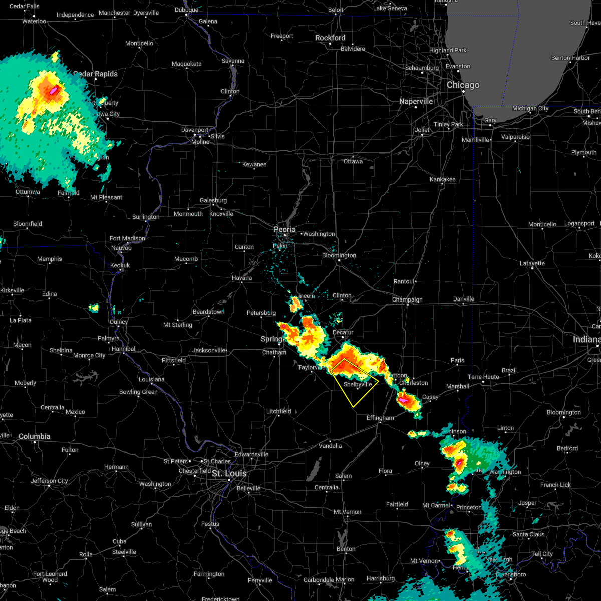 At 358 am cdt, a severe thunderstorm was located near westervelt, or 11 miles northwest of shelbyville, moving southeast at 35 mph (radar indicated). Hazards include 60 mph wind gusts and nickel size hail. expect damage to roofs, siding, and trees At 358 am cdt, a severe thunderstorm was located near westervelt, or 11 miles northwest of shelbyville, moving southeast at 35 mph (radar indicated). Hazards include 60 mph wind gusts and nickel size hail. expect damage to roofs, siding, and trees
|
| 8/1/2022 2:22 AM CDT |
 At 222 am cdt, a severe thunderstorm was located over cable, or 13 miles northeast of aledo, moving southeast at 40 mph (radar indicated). Hazards include 60 mph wind gusts and penny size hail. Expect damage to roofs, siding, and trees. locations impacted include, viola, woodhull, matherville, alpha, sherrard, reynolds, hamlet, cable, shale city, new windsor, taylor ridge, boden, preemption, ophiem, wanlock, swedona, gingle corners, gilchrist, old gilchrist and griffin. hail threat, radar indicated max hail size, 0. 75 in wind threat, radar indicated max wind gust, 60 mph. At 222 am cdt, a severe thunderstorm was located over cable, or 13 miles northeast of aledo, moving southeast at 40 mph (radar indicated). Hazards include 60 mph wind gusts and penny size hail. Expect damage to roofs, siding, and trees. locations impacted include, viola, woodhull, matherville, alpha, sherrard, reynolds, hamlet, cable, shale city, new windsor, taylor ridge, boden, preemption, ophiem, wanlock, swedona, gingle corners, gilchrist, old gilchrist and griffin. hail threat, radar indicated max hail size, 0. 75 in wind threat, radar indicated max wind gust, 60 mph.
|
| 8/1/2022 2:12 AM CDT |
 At 212 am cdt, a severe thunderstorm was located over reynolds, or 10 miles south of rock island, moving southeast at 40 mph (radar indicated). Hazards include 60 mph wind gusts and penny size hail. expect damage to roofs, siding, and trees At 212 am cdt, a severe thunderstorm was located over reynolds, or 10 miles south of rock island, moving southeast at 40 mph (radar indicated). Hazards include 60 mph wind gusts and penny size hail. expect damage to roofs, siding, and trees
|
| 7/5/2022 11:24 PM CDT |
 At 1124 pm cdt, severe thunderstorms were located along a line extending from near atkinson to german corner to near altona, moving east at 40 mph (radar indicated). Hazards include 60 mph wind gusts. Expect damage to roofs, siding, and trees. locations impacted include, kewanee, cambridge, geneseo, colona, coal valley, galva, orion, atkinson, annawan, woodhull, new windsor, alpha, andover, cleveland, warner, osborn, lynn center, dayton, carbon cliff and osco. hail threat, radar indicated max hail size, <. 75 in wind threat, observed max wind gust, 60 mph. At 1124 pm cdt, severe thunderstorms were located along a line extending from near atkinson to german corner to near altona, moving east at 40 mph (radar indicated). Hazards include 60 mph wind gusts. Expect damage to roofs, siding, and trees. locations impacted include, kewanee, cambridge, geneseo, colona, coal valley, galva, orion, atkinson, annawan, woodhull, new windsor, alpha, andover, cleveland, warner, osborn, lynn center, dayton, carbon cliff and osco. hail threat, radar indicated max hail size, <. 75 in wind threat, observed max wind gust, 60 mph.
|
| 7/5/2022 11:17 PM CDT |
 At 1117 pm cdt, severe thunderstorms were located along a line extending from fairhaven to near hooppole to nekoma, moving east at 50 mph (radar indicated). Hazards include 60 mph wind gusts. Expect damage to roofs, siding, and trees. locations impacted include, davenport, moline, rock island, bettendorf, east moline, kewanee, cambridge, silvis, geneseo, colona, milan, le claire, coal valley, galva, hampton, orion, port byron, atkinson, rapids city and annawan. hail threat, radar indicated max hail size, <. 75 in wind threat, observed max wind gust, 60 mph. At 1117 pm cdt, severe thunderstorms were located along a line extending from fairhaven to near hooppole to nekoma, moving east at 50 mph (radar indicated). Hazards include 60 mph wind gusts. Expect damage to roofs, siding, and trees. locations impacted include, davenport, moline, rock island, bettendorf, east moline, kewanee, cambridge, silvis, geneseo, colona, milan, le claire, coal valley, galva, hampton, orion, port byron, atkinson, rapids city and annawan. hail threat, radar indicated max hail size, <. 75 in wind threat, observed max wind gust, 60 mph.
|
| 7/5/2022 11:12 PM CDT |
 At 1112 pm cdt, severe thunderstorms were located along a line extending from thomson to shady beach to alpha, moving east at 35 mph (trained weather spotters). Hazards include 60 mph wind gusts. Expect damage to roofs, siding, and trees. locations impacted include, davenport, moline, rock island, bettendorf, clinton, east moline, sterling, kewanee, rock falls, morrison, cambridge, silvis, geneseo, milan, colona, camanche, le claire, coal valley, fulton and galva. hail threat, radar indicated max hail size, <. 75 in wind threat, observed max wind gust, 60 mph. At 1112 pm cdt, severe thunderstorms were located along a line extending from thomson to shady beach to alpha, moving east at 35 mph (trained weather spotters). Hazards include 60 mph wind gusts. Expect damage to roofs, siding, and trees. locations impacted include, davenport, moline, rock island, bettendorf, clinton, east moline, sterling, kewanee, rock falls, morrison, cambridge, silvis, geneseo, milan, colona, camanche, le claire, coal valley, fulton and galva. hail threat, radar indicated max hail size, <. 75 in wind threat, observed max wind gust, 60 mph.
|
| 7/5/2022 11:09 PM CDT |
 At 1108 pm cdt, severe thunderstorms were located along a line extending from near coldbrook to near carthage, moving southeast at 60 mph (radar indicated). Hazards include 60 mph wind gusts. Expect damage to roofs, siding, and trees. locations impacted include, macomb, monmouth, carthage, nauvoo, bushnell, burgess, colchester, la harpe, roseville, viola, dallas city, stronghurst, matherville, kirkwood, blandinsville, sherrard, industry, good hope, prairie city and little york. hail threat, radar indicated max hail size, <. 75 in wind threat, radar indicated max wind gust, 60 mph. At 1108 pm cdt, severe thunderstorms were located along a line extending from near coldbrook to near carthage, moving southeast at 60 mph (radar indicated). Hazards include 60 mph wind gusts. Expect damage to roofs, siding, and trees. locations impacted include, macomb, monmouth, carthage, nauvoo, bushnell, burgess, colchester, la harpe, roseville, viola, dallas city, stronghurst, matherville, kirkwood, blandinsville, sherrard, industry, good hope, prairie city and little york. hail threat, radar indicated max hail size, <. 75 in wind threat, radar indicated max wind gust, 60 mph.
|
| 7/5/2022 10:56 PM CDT |
 At 1056 pm cdt, severe thunderstorms were located along a line extending from alexis to adrian, moving south at 35 mph (radar indicated). Hazards include 60 mph wind gusts. Expect damage to roofs, siding, and trees. locations impacted include, burlington, macomb, fort madison, monmouth, aledo, carthage, oquawka, nauvoo, bushnell, west burlington, burgess, colchester, la harpe, roseville, viola, dallas city, stronghurst, millersburg, matherville and kirkwood. hail threat, radar indicated max hail size, <. 75 in wind threat, radar indicated max wind gust, 60 mph. At 1056 pm cdt, severe thunderstorms were located along a line extending from alexis to adrian, moving south at 35 mph (radar indicated). Hazards include 60 mph wind gusts. Expect damage to roofs, siding, and trees. locations impacted include, burlington, macomb, fort madison, monmouth, aledo, carthage, oquawka, nauvoo, bushnell, west burlington, burgess, colchester, la harpe, roseville, viola, dallas city, stronghurst, millersburg, matherville and kirkwood. hail threat, radar indicated max hail size, <. 75 in wind threat, radar indicated max wind gust, 60 mph.
|
| 7/5/2022 10:54 PM CDT |
 At 1054 pm cdt, severe thunderstorms were located along a line extending from near miles to fishermans corner to viola, moving east at 35 mph (trained weather spotters). Hazards include 60 mph wind gusts. expect damage to roofs, siding, and trees At 1054 pm cdt, severe thunderstorms were located along a line extending from near miles to fishermans corner to viola, moving east at 35 mph (trained weather spotters). Hazards include 60 mph wind gusts. expect damage to roofs, siding, and trees
|
| 7/5/2022 10:31 PM CDT |
 At 1031 pm cdt, severe thunderstorms were located along a line extending from gingle corners to denmark, moving southeast at 60 mph (radar indicated). Hazards include 60 mph wind gusts. expect damage to roofs, siding, and trees At 1031 pm cdt, severe thunderstorms were located along a line extending from gingle corners to denmark, moving southeast at 60 mph (radar indicated). Hazards include 60 mph wind gusts. expect damage to roofs, siding, and trees
|
| 6/25/2022 6:35 PM CDT |
 At 635 pm cdt, a severe thunderstorm was located over marston, or 9 miles north of aledo, moving east at 30 mph (radar indicated). Hazards include 60 mph wind gusts and quarter size hail. Hail damage to vehicles is expected. expect wind damage to roofs, siding, and trees. locations impacted include, aledo, hamlet, gingle corners, aledo mercer county airport, reynolds, taylor ridge, matherville, boden, shale city, preemption, old gilchrist, wanlock, gilchrist, viola, sherrard, cable, new windsor, new windsor, swedona and griffin. hail threat, radar indicated max hail size, 1. 00 in wind threat, radar indicated max wind gust, 60 mph. At 635 pm cdt, a severe thunderstorm was located over marston, or 9 miles north of aledo, moving east at 30 mph (radar indicated). Hazards include 60 mph wind gusts and quarter size hail. Hail damage to vehicles is expected. expect wind damage to roofs, siding, and trees. locations impacted include, aledo, hamlet, gingle corners, aledo mercer county airport, reynolds, taylor ridge, matherville, boden, shale city, preemption, old gilchrist, wanlock, gilchrist, viola, sherrard, cable, new windsor, new windsor, swedona and griffin. hail threat, radar indicated max hail size, 1. 00 in wind threat, radar indicated max wind gust, 60 mph.
|
| 6/25/2022 6:21 PM CDT |
 At 621 pm cdt, a severe thunderstorm was located near eliza, or 8 miles southeast of muscatine, moving east at 30 mph (radar indicated). Hazards include 60 mph wind gusts and quarter size hail. Hail damage to vehicles is expected. expect wind damage to roofs, siding, and trees. this severe thunderstorm will be near, loud thunder scout camp around 630 pm cdt. marston around 635 pm cdt. millersburg and edgington around 640 pm cdt. other locations in the path of this severe thunderstorm include aledo, hamlet, gingle corners, aledo mercer county airport, mercer county fairgrounds, reynolds, taylor ridge, viola, matherville, sherrard, boden, cable, shale city, preemption, old gilchrist, wanlock and gilchrist. hail threat, radar indicated max hail size, 1. 00 in wind threat, radar indicated max wind gust, 60 mph. At 621 pm cdt, a severe thunderstorm was located near eliza, or 8 miles southeast of muscatine, moving east at 30 mph (radar indicated). Hazards include 60 mph wind gusts and quarter size hail. Hail damage to vehicles is expected. expect wind damage to roofs, siding, and trees. this severe thunderstorm will be near, loud thunder scout camp around 630 pm cdt. marston around 635 pm cdt. millersburg and edgington around 640 pm cdt. other locations in the path of this severe thunderstorm include aledo, hamlet, gingle corners, aledo mercer county airport, mercer county fairgrounds, reynolds, taylor ridge, viola, matherville, sherrard, boden, cable, shale city, preemption, old gilchrist, wanlock and gilchrist. hail threat, radar indicated max hail size, 1. 00 in wind threat, radar indicated max wind gust, 60 mph.
|
| 6/25/2022 7:06 AM CDT |
 The severe thunderstorm warning for southeastern mercer and southwestern henry counties will expire at 715 am cdt, the storms which prompted the warning have weakened below severe limits, and no longer pose an immediate threat to life or property. therefore, the warning will be allowed to expire. however gusty winds and heavy rain are still possible with these thunderstorms. to report severe weather, contact your nearest law enforcement agency. they will relay your report to the national weather service the quad cities. The severe thunderstorm warning for southeastern mercer and southwestern henry counties will expire at 715 am cdt, the storms which prompted the warning have weakened below severe limits, and no longer pose an immediate threat to life or property. therefore, the warning will be allowed to expire. however gusty winds and heavy rain are still possible with these thunderstorms. to report severe weather, contact your nearest law enforcement agency. they will relay your report to the national weather service the quad cities.
|
| 6/25/2022 6:55 AM CDT |
 At 655 am cdt, severe thunderstorms were located along a line extending from near henry county fairgrounds to north henderson, moving east at 30 mph (radar indicated). Hazards include 60 mph wind gusts. Expect damage to roofs, siding, and trees. locations impacted include, cambridge, woodhull, alpha, andover, north henderson, new windsor, lynn center, osco, henry county fairgrounds, ophiem and ulah. hail threat, radar indicated max hail size, <. 75 in wind threat, observed max wind gust, 60 mph. At 655 am cdt, severe thunderstorms were located along a line extending from near henry county fairgrounds to north henderson, moving east at 30 mph (radar indicated). Hazards include 60 mph wind gusts. Expect damage to roofs, siding, and trees. locations impacted include, cambridge, woodhull, alpha, andover, north henderson, new windsor, lynn center, osco, henry county fairgrounds, ophiem and ulah. hail threat, radar indicated max hail size, <. 75 in wind threat, observed max wind gust, 60 mph.
|
| 6/25/2022 6:49 AM CDT |
 At 649 am cdt, severe thunderstorms were located along a line extending from near henry county fairgrounds to near alexis, moving east at 30 mph (law enforcement). Hazards include 60 mph wind gusts. Expect damage to roofs, siding, and trees. locations impacted include, cambridge, burgess, orion, viola, woodhull, alpha, andover, north henderson, cable, new windsor, lynn center, osco, henry county fairgrounds, ophiem, swedona, ulah and griffin. hail threat, radar indicated max hail size, <. 75 in wind threat, observed max wind gust, 60 mph. At 649 am cdt, severe thunderstorms were located along a line extending from near henry county fairgrounds to near alexis, moving east at 30 mph (law enforcement). Hazards include 60 mph wind gusts. Expect damage to roofs, siding, and trees. locations impacted include, cambridge, burgess, orion, viola, woodhull, alpha, andover, north henderson, cable, new windsor, lynn center, osco, henry county fairgrounds, ophiem, swedona, ulah and griffin. hail threat, radar indicated max hail size, <. 75 in wind threat, observed max wind gust, 60 mph.
|
| 6/25/2022 6:42 AM CDT |
 At 640 am cdt, severe thunderstorms were located along a line extending from near geneseo to burgess, moving east at 30 mph (law enforcement. at 626 am cdt a downed tree was reported just west of viola). Hazards include 60 mph wind gusts. Expect damage to roofs, siding, and trees. locations impacted include, geneseo, morristown, griffin, atkinson, new windsor, new windsor, alpha and woodhull. hail threat, radar indicated max hail size, <. 75 in wind threat, observed max wind gust, 60 mph. At 640 am cdt, severe thunderstorms were located along a line extending from near geneseo to burgess, moving east at 30 mph (law enforcement. at 626 am cdt a downed tree was reported just west of viola). Hazards include 60 mph wind gusts. Expect damage to roofs, siding, and trees. locations impacted include, geneseo, morristown, griffin, atkinson, new windsor, new windsor, alpha and woodhull. hail threat, radar indicated max hail size, <. 75 in wind threat, observed max wind gust, 60 mph.
|
| 6/25/2022 6:23 AM CDT |
 At 623 am cdt, severe thunderstorms were located along a line extending from near colona to near seaton, moving east at 30 mph (radar indicated). Hazards include 60 mph wind gusts. Expect damage to roofs, siding, and trees. severe thunderstorms will be near, east moline, silvis, colona, coal valley, orion, warner, carbon cliff, green river, sunny hill and sunny hill estates around 630 am cdt. osco and morristown around 635 am cdt. shale city, gilchrist, wanlock and old gilchrist around 640 am cdt. other locations in the path of these severe thunderstorms include geneseo, viola, atkinson, new windsor, north henderson, new windsor, alpha and woodhull. hail threat, radar indicated max hail size, <. 75 in wind threat, radar indicated max wind gust, 60 mph. At 623 am cdt, severe thunderstorms were located along a line extending from near colona to near seaton, moving east at 30 mph (radar indicated). Hazards include 60 mph wind gusts. Expect damage to roofs, siding, and trees. severe thunderstorms will be near, east moline, silvis, colona, coal valley, orion, warner, carbon cliff, green river, sunny hill and sunny hill estates around 630 am cdt. osco and morristown around 635 am cdt. shale city, gilchrist, wanlock and old gilchrist around 640 am cdt. other locations in the path of these severe thunderstorms include geneseo, viola, atkinson, new windsor, north henderson, new windsor, alpha and woodhull. hail threat, radar indicated max hail size, <. 75 in wind threat, radar indicated max wind gust, 60 mph.
|
| 5/26/2022 12:56 PM CDT |
 At 1256 pm cdt, a severe thunderstorm was located over alexis, or 11 miles southeast of aledo, moving north at 20 mph (radar indicated). Hazards include 60 mph wind gusts and quarter size hail. Hail damage to vehicles is expected. expect wind damage to roofs, siding, and trees. this severe storm will be near, burgess around 105 pm cdt. other locations in the path of this severe thunderstorm include new windsor, new windsor, gilchrist, viola, shale city, wanlock, griffin, old gilchrist, matherville, sherrard, reynolds, boden, cable, preemption, swedona, gingle corners and aledo mercer county airport. hail threat, radar indicated max hail size, 1. 00 in wind threat, radar indicated max wind gust, 60 mph. At 1256 pm cdt, a severe thunderstorm was located over alexis, or 11 miles southeast of aledo, moving north at 20 mph (radar indicated). Hazards include 60 mph wind gusts and quarter size hail. Hail damage to vehicles is expected. expect wind damage to roofs, siding, and trees. this severe storm will be near, burgess around 105 pm cdt. other locations in the path of this severe thunderstorm include new windsor, new windsor, gilchrist, viola, shale city, wanlock, griffin, old gilchrist, matherville, sherrard, reynolds, boden, cable, preemption, swedona, gingle corners and aledo mercer county airport. hail threat, radar indicated max hail size, 1. 00 in wind threat, radar indicated max wind gust, 60 mph.
|
| 5/26/2022 12:50 PM CDT |
 At 1250 pm cdt, a severe thunderstorm was located over alexis, or 11 miles southeast of aledo, moving north at 30 mph (radar indicated). Hazards include 60 mph wind gusts and quarter size hail. Hail damage to vehicles is expected. expect wind damage to roofs, siding, and trees. locations impacted include, burgess, new windsor, viola, shale city, gilchrist, wanlock, griffin, aledo, old gilchrist, matherville, boden, cable, gingle corners, aledo mercer county airport, sherrard, hamlet, preemption and reynolds. hail threat, radar indicated max hail size, 1. 00 in wind threat, radar indicated max wind gust, 60 mph. At 1250 pm cdt, a severe thunderstorm was located over alexis, or 11 miles southeast of aledo, moving north at 30 mph (radar indicated). Hazards include 60 mph wind gusts and quarter size hail. Hail damage to vehicles is expected. expect wind damage to roofs, siding, and trees. locations impacted include, burgess, new windsor, viola, shale city, gilchrist, wanlock, griffin, aledo, old gilchrist, matherville, boden, cable, gingle corners, aledo mercer county airport, sherrard, hamlet, preemption and reynolds. hail threat, radar indicated max hail size, 1. 00 in wind threat, radar indicated max wind gust, 60 mph.
|
| 5/26/2022 12:34 PM CDT |
 At 1234 pm cdt, a severe thunderstorm was located over gerlaw, or 7 miles northeast of monmouth, moving north at 25 mph (radar indicated). Hazards include 60 mph wind gusts and quarter size hail. Hail damage to vehicles is expected. expect wind damage to roofs, siding, and trees. this severe thunderstorm will be near, north henderson and alexis around 1245 pm cdt. other locations in the path of this severe thunderstorm include burgess, sunbeam, viola, shale city, gilchrist, wanlock, griffin, mercer county fairgrounds, aledo, old gilchrist, matherville, sherrard, reynolds, boden, cable, hamlet, preemption, gingle corners and aledo mercer county airport. hail threat, radar indicated max hail size, 1. 00 in wind threat, radar indicated max wind gust, 60 mph. At 1234 pm cdt, a severe thunderstorm was located over gerlaw, or 7 miles northeast of monmouth, moving north at 25 mph (radar indicated). Hazards include 60 mph wind gusts and quarter size hail. Hail damage to vehicles is expected. expect wind damage to roofs, siding, and trees. this severe thunderstorm will be near, north henderson and alexis around 1245 pm cdt. other locations in the path of this severe thunderstorm include burgess, sunbeam, viola, shale city, gilchrist, wanlock, griffin, mercer county fairgrounds, aledo, old gilchrist, matherville, sherrard, reynolds, boden, cable, hamlet, preemption, gingle corners and aledo mercer county airport. hail threat, radar indicated max hail size, 1. 00 in wind threat, radar indicated max wind gust, 60 mph.
|
| 3/6/2022 12:10 AM CST |
 The severe thunderstorm warning for moultrie, central shelby and southeastern piatt counties will expire at 1215 am cst, the storm which prompted the warning has moved out of the area. therefore, the warning will be allowed to expire. a severe thunderstorm watch remains in effect until 200 am cst for central and east central illinois. to report severe weather, contact your nearest law enforcement agency. they will relay your report to the national weather service lincoln. The severe thunderstorm warning for moultrie, central shelby and southeastern piatt counties will expire at 1215 am cst, the storm which prompted the warning has moved out of the area. therefore, the warning will be allowed to expire. a severe thunderstorm watch remains in effect until 200 am cst for central and east central illinois. to report severe weather, contact your nearest law enforcement agency. they will relay your report to the national weather service lincoln.
|
| 3/5/2022 11:52 PM CST |
 At 1152 pm cst, a severe thunderstorm was located over sullivan, moving east at 60 mph (radar indicated). Hazards include 70 mph wind gusts. Expect considerable tree damage. damage is likely to mobile homes, roofs, and outbuildings. Locations impacted include, allenville and arthur. At 1152 pm cst, a severe thunderstorm was located over sullivan, moving east at 60 mph (radar indicated). Hazards include 70 mph wind gusts. Expect considerable tree damage. damage is likely to mobile homes, roofs, and outbuildings. Locations impacted include, allenville and arthur.
|
| 3/5/2022 11:31 PM CST |
 At 1131 pm cst, a severe thunderstorm was located over moweaqua, or 14 miles northeast of taylorville, moving east at 65 mph (radar indicated). Hazards include 60 mph wind gusts. Expect damage to roofs, siding, and trees. this severe thunderstorm will be near, bethany and dalton city around 1145 pm cst. lovington around 1150 pm cst. Other locations in the path of this severe thunderstorm include hammond, arthur and atwood. At 1131 pm cst, a severe thunderstorm was located over moweaqua, or 14 miles northeast of taylorville, moving east at 65 mph (radar indicated). Hazards include 60 mph wind gusts. Expect damage to roofs, siding, and trees. this severe thunderstorm will be near, bethany and dalton city around 1145 pm cst. lovington around 1150 pm cst. Other locations in the path of this severe thunderstorm include hammond, arthur and atwood.
|
| 3/5/2022 8:57 PM CST |
 At 856 pm cst, a severe thunderstorm capable of producing a tornado was located over boden, or 8 miles east of aledo, moving east at 60 mph (radar indicated rotation). Hazards include tornado. Flying debris will be dangerous to those caught without shelter. mobile homes will be damaged or destroyed. damage to roofs, windows, and vehicles will occur. tree damage is likely. This dangerous storm will be near, new windsor and cable around 905 pm cst. At 856 pm cst, a severe thunderstorm capable of producing a tornado was located over boden, or 8 miles east of aledo, moving east at 60 mph (radar indicated rotation). Hazards include tornado. Flying debris will be dangerous to those caught without shelter. mobile homes will be damaged or destroyed. damage to roofs, windows, and vehicles will occur. tree damage is likely. This dangerous storm will be near, new windsor and cable around 905 pm cst.
|
| 3/5/2022 8:49 PM CST |
 At 849 pm cst, a severe thunderstorm capable of producing a tornado was located over aledo, moving east at 60 mph (radar indicated rotation). Hazards include tornado. Flying debris will be dangerous to those caught without shelter. mobile homes will be damaged or destroyed. damage to roofs, windows, and vehicles will occur. tree damage is likely. this dangerous storm will be near, viola and matherville around 855 pm cst. boden around 900 pm cst. Other locations in the path of this tornadic thunderstorm include new windsor, sherrard and cable. At 849 pm cst, a severe thunderstorm capable of producing a tornado was located over aledo, moving east at 60 mph (radar indicated rotation). Hazards include tornado. Flying debris will be dangerous to those caught without shelter. mobile homes will be damaged or destroyed. damage to roofs, windows, and vehicles will occur. tree damage is likely. this dangerous storm will be near, viola and matherville around 855 pm cst. boden around 900 pm cst. Other locations in the path of this tornadic thunderstorm include new windsor, sherrard and cable.
|
| 3/5/2022 8:44 PM CST |
 At 844 pm cst, a severe thunderstorm capable of producing a tornado was located near joy, or near aledo, moving east at 60 mph (radar indicated rotation). Hazards include tornado. Flying debris will be dangerous to those caught without shelter. mobile homes will be damaged or destroyed. damage to roofs, windows, and vehicles will occur. tree damage is likely. this dangerous storm will be near, viola, matherville and shale city around 855 pm cst. boden around 900 pm cst. Other locations in the path of this tornadic thunderstorm include new windsor, sherrard and cable. At 844 pm cst, a severe thunderstorm capable of producing a tornado was located near joy, or near aledo, moving east at 60 mph (radar indicated rotation). Hazards include tornado. Flying debris will be dangerous to those caught without shelter. mobile homes will be damaged or destroyed. damage to roofs, windows, and vehicles will occur. tree damage is likely. this dangerous storm will be near, viola, matherville and shale city around 855 pm cst. boden around 900 pm cst. Other locations in the path of this tornadic thunderstorm include new windsor, sherrard and cable.
|
| 12/10/2021 9:50 PM CST | Trees were blown down and power poles were bent along rt 16 just northeast of windso in shelby county IL, 156.8 miles NW of Windsor, IL |
| 8/26/2021 3:11 PM CDT |
 At 311 pm cdt, a severe thunderstorm was located near windsor, or near sullivan, moving southeast at 20 mph (radar indicated). Hazards include 60 mph wind gusts. Expect damage to roofs, siding, and trees. this severe thunderstorm will be near, allenville around 315 pm cdt. windsor around 325 pm cdt. other locations in the path of this severe thunderstorm include mattoon. hail threat, radar indicated max hail size, <. 75 in wind threat, radar indicated max wind gust, 60 mph. At 311 pm cdt, a severe thunderstorm was located near windsor, or near sullivan, moving southeast at 20 mph (radar indicated). Hazards include 60 mph wind gusts. Expect damage to roofs, siding, and trees. this severe thunderstorm will be near, allenville around 315 pm cdt. windsor around 325 pm cdt. other locations in the path of this severe thunderstorm include mattoon. hail threat, radar indicated max hail size, <. 75 in wind threat, radar indicated max wind gust, 60 mph.
|
| 8/24/2021 6:10 PM CDT |
 At 610 pm cdt, severe thunderstorms were located along a line extending from 9 miles west of paw paw to near galva, moving southeast at 55 mph (trained weather spotters). Hazards include 60 mph wind gusts. Expect damage to roofs, siding, and trees. these severe thunderstorms will remain over mainly rural areas of south central rock island, northeastern mercer, southeastern whiteside, henry and bureau counties, including the following locations, preemption, seatonville, henry county fairgrounds, ophiem, cherry, german corner, coal hollow, kasbeer, manlius and nekoma. hail threat, radar indicated max hail size, <. 75 in wind threat, radar indicated max wind gust, 60 mph. At 610 pm cdt, severe thunderstorms were located along a line extending from 9 miles west of paw paw to near galva, moving southeast at 55 mph (trained weather spotters). Hazards include 60 mph wind gusts. Expect damage to roofs, siding, and trees. these severe thunderstorms will remain over mainly rural areas of south central rock island, northeastern mercer, southeastern whiteside, henry and bureau counties, including the following locations, preemption, seatonville, henry county fairgrounds, ophiem, cherry, german corner, coal hollow, kasbeer, manlius and nekoma. hail threat, radar indicated max hail size, <. 75 in wind threat, radar indicated max wind gust, 60 mph.
|
| 8/24/2021 6:03 PM CDT |
 At 602 pm cdt, outflow from severe thunderstorms were located along a line extending from near amboy to near cambridge, moving southeast at 55 mph (trained weather spotters). Hazards include 60 mph wind gusts. Expect damage to roofs, siding, and trees. locations impacted include, kewanee. hail threat, radar indicated max hail size, <. 75 in wind threat, radar indicated max wind gust, 60 mph. At 602 pm cdt, outflow from severe thunderstorms were located along a line extending from near amboy to near cambridge, moving southeast at 55 mph (trained weather spotters). Hazards include 60 mph wind gusts. Expect damage to roofs, siding, and trees. locations impacted include, kewanee. hail threat, radar indicated max hail size, <. 75 in wind threat, radar indicated max wind gust, 60 mph.
|
| 8/24/2021 5:46 PM CDT |
 At 545 pm cdt, severe thunderstorms were located along a line extending from near dixon to near sherrard, moving southeast at 55 mph (trained weather spotters). Hazards include 60 mph wind gusts. Expect damage to roofs, siding, and trees. severe thunderstorms will be near, woodhull around 600 pm cdt. cambridge around 605 pm cdt. other locations in the path of these severe thunderstorms include galva and kewanee. hail threat, radar indicated max hail size, <. 75 in wind threat, radar indicated max wind gust, 60 mph. At 545 pm cdt, severe thunderstorms were located along a line extending from near dixon to near sherrard, moving southeast at 55 mph (trained weather spotters). Hazards include 60 mph wind gusts. Expect damage to roofs, siding, and trees. severe thunderstorms will be near, woodhull around 600 pm cdt. cambridge around 605 pm cdt. other locations in the path of these severe thunderstorms include galva and kewanee. hail threat, radar indicated max hail size, <. 75 in wind threat, radar indicated max wind gust, 60 mph.
|
| 8/12/2021 3:43 PM CDT |
 At 343 pm cdt, a severe thunderstorm was located over shelbyville, moving southeast at 50 mph (radar indicated). Hazards include 70 mph wind gusts and quarter size hail. Hail damage to vehicles is expected. expect considerable tree damage. wind damage is also likely to mobile homes, roofs, and outbuildings. this severe thunderstorm will be near, stewardson and shumway around 400 pm cdt. other locations in the path of this severe thunderstorm include effingham, neoga, teutopolis and montrose. this includes the following highways, interstate 57 between mile markers 146 and 190. interstate 70 between mile markers 79 and 107. thunderstorm damage threat, considerable hail threat, radar indicated max hail size, 1. 00 in wind threat, radar indicated max wind gust, 70 mph. At 343 pm cdt, a severe thunderstorm was located over shelbyville, moving southeast at 50 mph (radar indicated). Hazards include 70 mph wind gusts and quarter size hail. Hail damage to vehicles is expected. expect considerable tree damage. wind damage is also likely to mobile homes, roofs, and outbuildings. this severe thunderstorm will be near, stewardson and shumway around 400 pm cdt. other locations in the path of this severe thunderstorm include effingham, neoga, teutopolis and montrose. this includes the following highways, interstate 57 between mile markers 146 and 190. interstate 70 between mile markers 79 and 107. thunderstorm damage threat, considerable hail threat, radar indicated max hail size, 1. 00 in wind threat, radar indicated max wind gust, 70 mph.
|
| 6/18/2021 11:09 PM CDT |
 At 1109 pm cdt, a severe thunderstorm was located near north henderson, or 10 miles northeast of monmouth, moving east at 15 mph (radar indicated). Hazards include 70 mph wind gusts and quarter size hail. Hail damage to vehicles is expected. expect considerable tree damage. wind damage is also likely to mobile homes, roofs, and outbuildings. this severe storm will be near, lake warren around 1115 pm cdt. Other locations in the path of this severe thunderstorm include north henderson. At 1109 pm cdt, a severe thunderstorm was located near north henderson, or 10 miles northeast of monmouth, moving east at 15 mph (radar indicated). Hazards include 70 mph wind gusts and quarter size hail. Hail damage to vehicles is expected. expect considerable tree damage. wind damage is also likely to mobile homes, roofs, and outbuildings. this severe storm will be near, lake warren around 1115 pm cdt. Other locations in the path of this severe thunderstorm include north henderson.
|
| 6/18/2021 11:00 PM CDT |
 At 1100 pm cdt, a severe thunderstorm was located near burgess, or 10 miles southeast of aledo, moving east at 25 mph (radar indicated). Hazards include ping pong ball size hail and 60 mph wind gusts. People and animals outdoors will be injured. expect hail damage to roofs, siding, windows, and vehicles. expect wind damage to roofs, siding, and trees. this severe storm will be near, lake warren around 1105 pm cdt. Other locations in the path of this severe thunderstorm include north henderson. At 1100 pm cdt, a severe thunderstorm was located near burgess, or 10 miles southeast of aledo, moving east at 25 mph (radar indicated). Hazards include ping pong ball size hail and 60 mph wind gusts. People and animals outdoors will be injured. expect hail damage to roofs, siding, windows, and vehicles. expect wind damage to roofs, siding, and trees. this severe storm will be near, lake warren around 1105 pm cdt. Other locations in the path of this severe thunderstorm include north henderson.
|
| 6/18/2021 10:56 PM CDT |
 At 1056 pm cdt, a severe thunderstorm was located over seaton, or near aledo, moving east at 20 mph (radar indicated). Hazards include ping pong ball size hail. People and animals outdoors will be injured. expect damage to roofs, siding, windows, and vehicles. Locations impacted include, lake warren and burgess. At 1056 pm cdt, a severe thunderstorm was located over seaton, or near aledo, moving east at 20 mph (radar indicated). Hazards include ping pong ball size hail. People and animals outdoors will be injured. expect damage to roofs, siding, windows, and vehicles. Locations impacted include, lake warren and burgess.
|
| 6/18/2021 10:52 PM CDT |
 At 1051 pm cdt, a severe thunderstorm was located over seaton, or near aledo, moving east at 20 mph (radar indicated). Hazards include golf ball size hail. People and animals outdoors will be injured. expect damage to roofs, siding, windows, and vehicles. this severe storm will be near, aledo and little york around 1100 pm cdt. Other locations in the path of this severe thunderstorm include lake warren, burgess, viola and north henderson. At 1051 pm cdt, a severe thunderstorm was located over seaton, or near aledo, moving east at 20 mph (radar indicated). Hazards include golf ball size hail. People and animals outdoors will be injured. expect damage to roofs, siding, windows, and vehicles. this severe storm will be near, aledo and little york around 1100 pm cdt. Other locations in the path of this severe thunderstorm include lake warren, burgess, viola and north henderson.
|
| 6/18/2021 10:45 PM CDT |
 At 1044 pm cdt, a severe thunderstorm was located over seaton, or 7 miles southwest of aledo, moving east at 25 mph (radar indicated). Hazards include golf ball size hail. People and animals outdoors will be injured. expect damage to roofs, siding, windows, and vehicles. this severe thunderstorm will be near, aledo and little york around 1100 pm cdt. Other locations in the path of this severe thunderstorm include burgess, lake warren and north henderson. At 1044 pm cdt, a severe thunderstorm was located over seaton, or 7 miles southwest of aledo, moving east at 25 mph (radar indicated). Hazards include golf ball size hail. People and animals outdoors will be injured. expect damage to roofs, siding, windows, and vehicles. this severe thunderstorm will be near, aledo and little york around 1100 pm cdt. Other locations in the path of this severe thunderstorm include burgess, lake warren and north henderson.
|
| 5/6/2021 2:58 PM CDT |
 At 258 pm cdt, a severe thunderstorm was located over windsor, or 9 miles west of mattoon, moving southeast at 35 mph (radar indicated). Hazards include 60 mph wind gusts and quarter size hail. Hail damage to vehicles is expected. Expect wind damage to roofs, siding, and trees. At 258 pm cdt, a severe thunderstorm was located over windsor, or 9 miles west of mattoon, moving southeast at 35 mph (radar indicated). Hazards include 60 mph wind gusts and quarter size hail. Hail damage to vehicles is expected. Expect wind damage to roofs, siding, and trees.
|
| 5/6/2021 2:55 PM CDT |
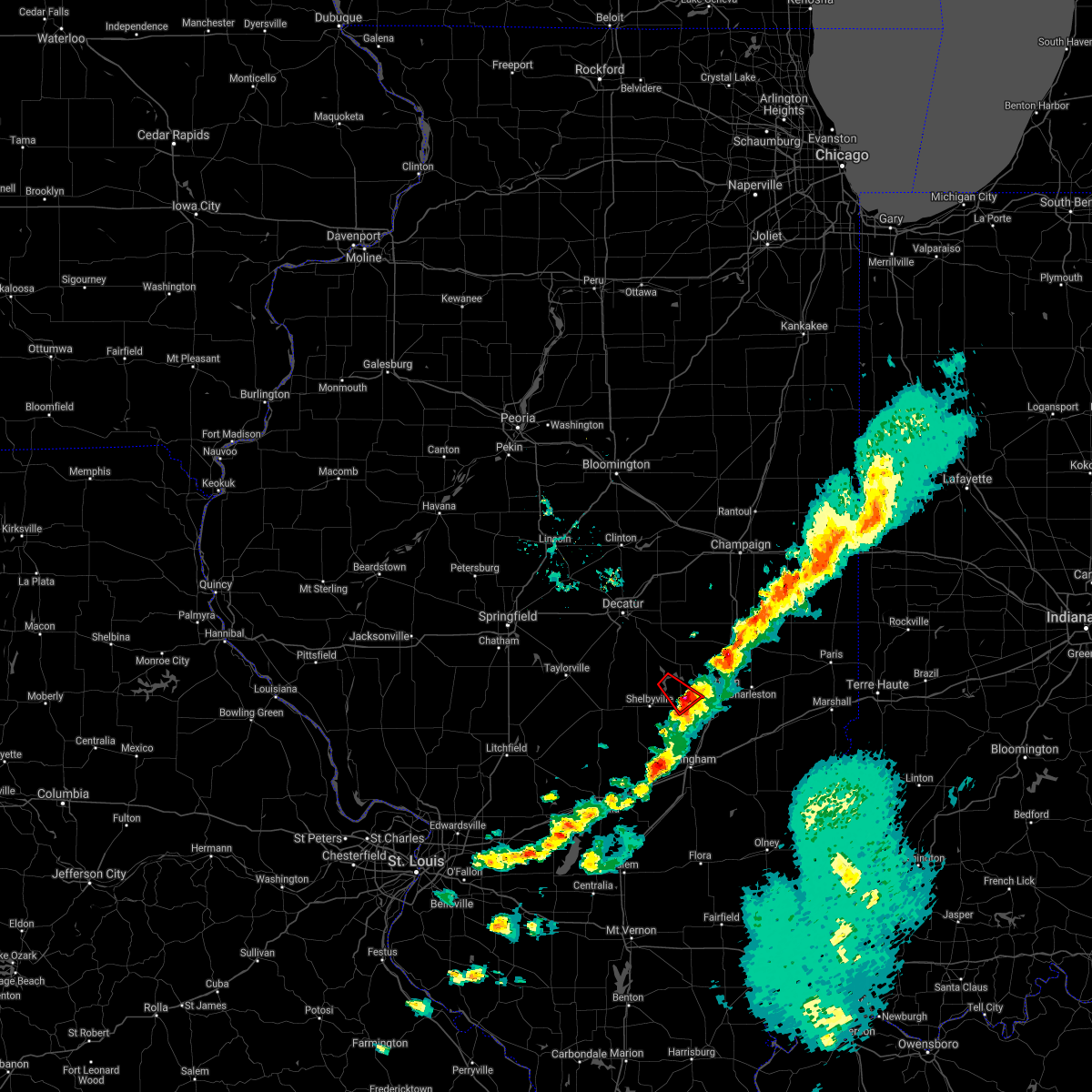 The tornado warning for south central moultrie and east central shelby counties will expire at 300 pm cdt, the storm which prompted the warning has weakened below severe limits, and no longer appears capable of producing a tornado. therefore, the warning will be allowed to expire. The tornado warning for south central moultrie and east central shelby counties will expire at 300 pm cdt, the storm which prompted the warning has weakened below severe limits, and no longer appears capable of producing a tornado. therefore, the warning will be allowed to expire.
|
| 5/6/2021 2:40 PM CDT |
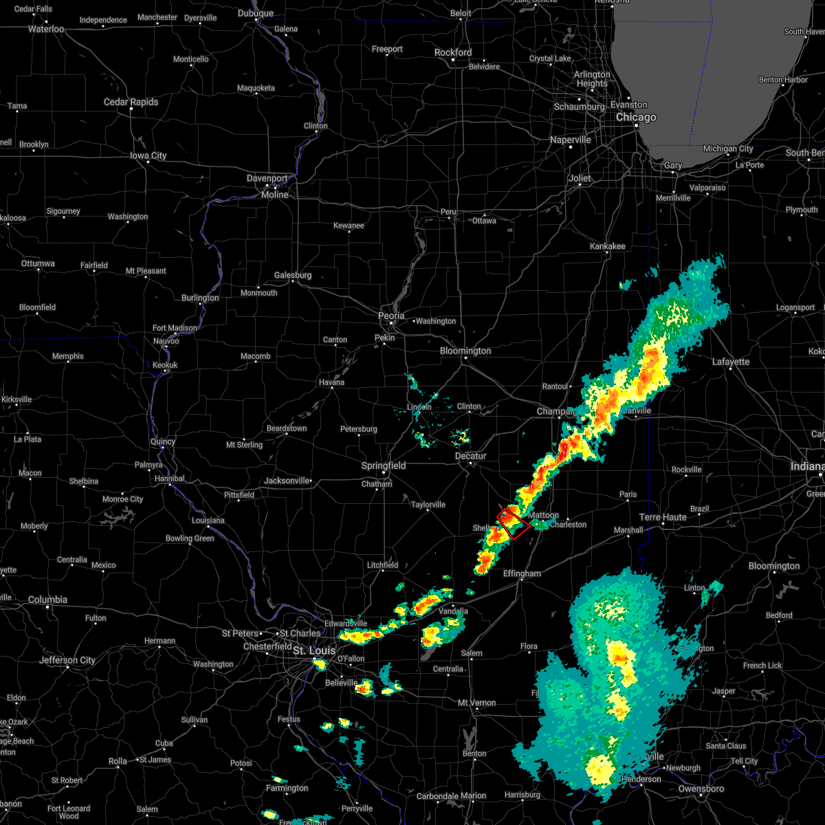 At 229 pm cdt, a severe thunderstorm capable of producing a tornado was located over findlay, or 8 miles west of sullivan, moving southeast at 35 mph (radar indicated rotation). Hazards include tornado. Flying debris will be dangerous to those caught without shelter. mobile homes will be damaged or destroyed. damage to roofs, windows, and vehicles will occur. tree damage is likely. this dangerous storm will be near, windsor around 250 pm cdt. Other locations impacted by this tornadic thunderstorm include eagle creek state park, gays and wolf creek state park. At 229 pm cdt, a severe thunderstorm capable of producing a tornado was located over findlay, or 8 miles west of sullivan, moving southeast at 35 mph (radar indicated rotation). Hazards include tornado. Flying debris will be dangerous to those caught without shelter. mobile homes will be damaged or destroyed. damage to roofs, windows, and vehicles will occur. tree damage is likely. this dangerous storm will be near, windsor around 250 pm cdt. Other locations impacted by this tornadic thunderstorm include eagle creek state park, gays and wolf creek state park.
|
| 5/6/2021 2:29 PM CDT |
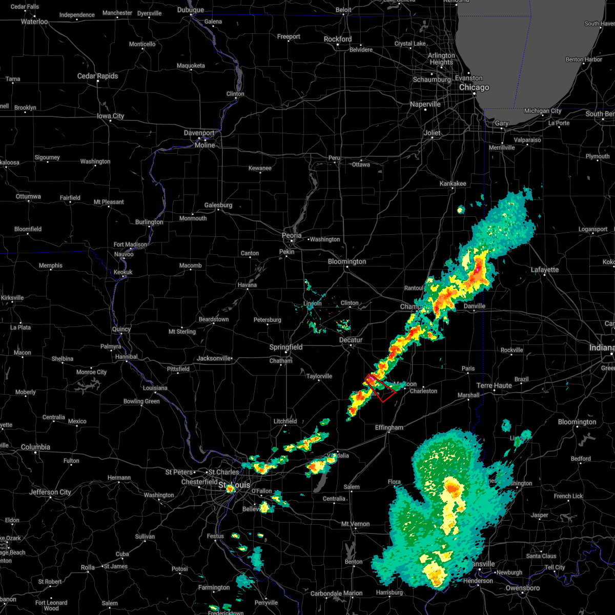 At 229 pm cdt, a severe thunderstorm capable of producing a tornado was located over findlay, or 8 miles west of sullivan, moving southeast at 35 mph (radar indicated rotation). Hazards include tornado. Flying debris will be dangerous to those caught without shelter. mobile homes will be damaged or destroyed. damage to roofs, windows, and vehicles will occur. tree damage is likely. this dangerous storm will be near, windsor around 250 pm cdt. Other locations impacted by this tornadic thunderstorm include eagle creek state park, gays and wolf creek state park. At 229 pm cdt, a severe thunderstorm capable of producing a tornado was located over findlay, or 8 miles west of sullivan, moving southeast at 35 mph (radar indicated rotation). Hazards include tornado. Flying debris will be dangerous to those caught without shelter. mobile homes will be damaged or destroyed. damage to roofs, windows, and vehicles will occur. tree damage is likely. this dangerous storm will be near, windsor around 250 pm cdt. Other locations impacted by this tornadic thunderstorm include eagle creek state park, gays and wolf creek state park.
|
| 5/3/2021 8:19 PM CDT |
 At 818 pm cdt, a severe thunderstorm was located over windsor, or 9 miles east of shelbyville, moving east at 35 mph (radar indicated). Hazards include 60 mph wind gusts and quarter size hail. Hail damage to vehicles is expected. Expect wind damage to roofs, siding, and trees. At 818 pm cdt, a severe thunderstorm was located over windsor, or 9 miles east of shelbyville, moving east at 35 mph (radar indicated). Hazards include 60 mph wind gusts and quarter size hail. Hail damage to vehicles is expected. Expect wind damage to roofs, siding, and trees.
|
| 3/27/2021 6:07 PM CDT |
 At 607 pm cdt, a severe thunderstorm was located over assumption, or 9 miles east of taylorville, moving east at 45 mph (radar indicated). Hazards include 60 mph wind gusts and quarter size hail. Hail damage to vehicles is expected. Expect wind damage to roofs, siding, and trees. At 607 pm cdt, a severe thunderstorm was located over assumption, or 9 miles east of taylorville, moving east at 45 mph (radar indicated). Hazards include 60 mph wind gusts and quarter size hail. Hail damage to vehicles is expected. Expect wind damage to roofs, siding, and trees.
|
| 11/10/2020 2:41 PM CST |
 The severe thunderstorm warning for eastern warren, eastern mcdonough, southeastern mercer and southwestern henry counties will expire at 245 pm cst, the storms which prompted the warning have moved out of the warned area. therefore, the warning will be allowed to expire. a tornado watch remains in effect until 800 pm cst for northwestern illinois. a severe thunderstorm watch remains in effect until 600 pm cst for northwestern and west central illinois. The severe thunderstorm warning for eastern warren, eastern mcdonough, southeastern mercer and southwestern henry counties will expire at 245 pm cst, the storms which prompted the warning have moved out of the warned area. therefore, the warning will be allowed to expire. a tornado watch remains in effect until 800 pm cst for northwestern illinois. a severe thunderstorm watch remains in effect until 600 pm cst for northwestern and west central illinois.
|
| 11/10/2020 2:26 PM CST |
 At 226 pm cst, severe thunderstorms were located along a line extending from near woodhull to near industry, moving east at 45 mph (radar indicated). Hazards include 60 mph wind gusts and nickel size hail. Expect damage to roofs, siding, and trees. locations impacted include, macomb, cambridge, bushnell, galva, woodhull, alpha, andover, industry, prairie city, bardolph, north henderson, new windsor, little swan lake, new philadelphia, adair, lynn center, walnut grove, greenbush, coldbrook and berwick. This includes interstate 74 in illinois between mile markers 23 and 33. At 226 pm cst, severe thunderstorms were located along a line extending from near woodhull to near industry, moving east at 45 mph (radar indicated). Hazards include 60 mph wind gusts and nickel size hail. Expect damage to roofs, siding, and trees. locations impacted include, macomb, cambridge, bushnell, galva, woodhull, alpha, andover, industry, prairie city, bardolph, north henderson, new windsor, little swan lake, new philadelphia, adair, lynn center, walnut grove, greenbush, coldbrook and berwick. This includes interstate 74 in illinois between mile markers 23 and 33.
|
| 11/10/2020 2:11 PM CST |
 At 211 pm cst, severe thunderstorms were located along a line extending from viola to near industry, moving east at 50 mph (radar indicated). Hazards include 60 mph wind gusts and nickel size hail. expect damage to roofs, siding, and trees At 211 pm cst, severe thunderstorms were located along a line extending from viola to near industry, moving east at 50 mph (radar indicated). Hazards include 60 mph wind gusts and nickel size hail. expect damage to roofs, siding, and trees
|
| 8/10/2020 4:57 PM CDT |
 At 457 pm cdt, severe thunderstorms were located along a line extending from near redmon to 7 miles south of tower hill, moving east at 70 mph (radar indicated). Hazards include 70 mph wind gusts. Expect considerable tree damage. damage is likely to mobile homes, roofs, and outbuildings. locations impacted include, charleston, mattoon, shelbyville, sullivan, arcola, oakland, windsor, stewardson, findlay, cowden, tower hill, humboldt, hindsboro, lerna, allenville, cooks mill, rardin, westervelt, coles and paradise. This includes interstate 57 between mile markers 182 and 203. At 457 pm cdt, severe thunderstorms were located along a line extending from near redmon to 7 miles south of tower hill, moving east at 70 mph (radar indicated). Hazards include 70 mph wind gusts. Expect considerable tree damage. damage is likely to mobile homes, roofs, and outbuildings. locations impacted include, charleston, mattoon, shelbyville, sullivan, arcola, oakland, windsor, stewardson, findlay, cowden, tower hill, humboldt, hindsboro, lerna, allenville, cooks mill, rardin, westervelt, coles and paradise. This includes interstate 57 between mile markers 182 and 203.
|
| 8/10/2020 4:40 PM CDT |
 At 439 pm cdt, severe thunderstorms were located along a line extending from camargo to near nokomis, moving southeast at 40 mph (radar indicated). Hazards include 70 mph wind gusts. Expect considerable tree damage. damage is likely to mobile homes, roofs, and outbuildings. locations impacted include, charleston, mattoon, taylorville, shelbyville, tuscola, sullivan, pana, arcola, arthur, bethany, assumption, morrisonville, oakland, windsor, stewardson, findlay, cowden, tower hill, camargo and humboldt. This includes interstate 57 between mile markers 182 and 212. At 439 pm cdt, severe thunderstorms were located along a line extending from camargo to near nokomis, moving southeast at 40 mph (radar indicated). Hazards include 70 mph wind gusts. Expect considerable tree damage. damage is likely to mobile homes, roofs, and outbuildings. locations impacted include, charleston, mattoon, taylorville, shelbyville, tuscola, sullivan, pana, arcola, arthur, bethany, assumption, morrisonville, oakland, windsor, stewardson, findlay, cowden, tower hill, camargo and humboldt. This includes interstate 57 between mile markers 182 and 212.
|
| 8/10/2020 4:29 PM CDT |
 At 429 pm cdt, severe thunderstorms were located along a line extending from allerton to near assumption, moving east at 70 mph (radar indicated). Hazards include 70 mph wind gusts. Expect considerable tree damage. Damage is likely to mobile homes, roofs, and outbuildings. At 429 pm cdt, severe thunderstorms were located along a line extending from allerton to near assumption, moving east at 70 mph (radar indicated). Hazards include 70 mph wind gusts. Expect considerable tree damage. Damage is likely to mobile homes, roofs, and outbuildings.
|
| 8/10/2020 1:23 PM CDT |
 At 123 pm cdt, severe thunderstorms were located along a line extending from hamlet to niota, moving east at 60 mph (trained weather spotters). Hazards include 60 mph wind gusts. expect damage to roofs, siding, and trees At 123 pm cdt, severe thunderstorms were located along a line extending from hamlet to niota, moving east at 60 mph (trained weather spotters). Hazards include 60 mph wind gusts. expect damage to roofs, siding, and trees
|
| 7/19/2020 9:30 AM CDT |
 At 930 am cdt, a severe thunderstorm was located near kewanee, moving east at 60 mph (trained weather spotters). Hazards include 60 mph wind gusts. expect damage to roofs, siding, and trees At 930 am cdt, a severe thunderstorm was located near kewanee, moving east at 60 mph (trained weather spotters). Hazards include 60 mph wind gusts. expect damage to roofs, siding, and trees
|
| 7/19/2020 9:14 AM CDT |
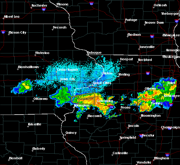 At 914 am cdt, a severe thunderstorm was located near north henderson, or 14 miles north of galesburg, moving east at 60 mph (radar indicated). Hazards include 60 mph wind gusts. Expect damage to roofs, siding, and trees. Locations impacted include, aledo, burgess, viola, matherville, shale city, new windsor, wanlock, swedona, gilchrist, sunbeam, old gilchrist, griffin and mercer county fairgrounds. At 914 am cdt, a severe thunderstorm was located near north henderson, or 14 miles north of galesburg, moving east at 60 mph (radar indicated). Hazards include 60 mph wind gusts. Expect damage to roofs, siding, and trees. Locations impacted include, aledo, burgess, viola, matherville, shale city, new windsor, wanlock, swedona, gilchrist, sunbeam, old gilchrist, griffin and mercer county fairgrounds.
|
| 7/19/2020 8:47 AM CDT |
 At 847 am cdt, a severe thunderstorm was located over keithsburg, or 11 miles north of oquawka, moving east at 55 mph (radar indicated). Hazards include 60 mph wind gusts. expect damage to roofs, siding, and trees At 847 am cdt, a severe thunderstorm was located over keithsburg, or 11 miles north of oquawka, moving east at 55 mph (radar indicated). Hazards include 60 mph wind gusts. expect damage to roofs, siding, and trees
|
| 7/15/2020 6:17 PM CDT |
 At 616 pm cdt, a severe thunderstorm was located over windsor, or 10 miles west of mattoon, moving northeast at 45 mph (radar indicated). Hazards include 70 mph wind gusts and penny size hail. Expect considerable tree damage. Damage is likely to mobile homes, roofs, and outbuildings. At 616 pm cdt, a severe thunderstorm was located over windsor, or 10 miles west of mattoon, moving northeast at 45 mph (radar indicated). Hazards include 70 mph wind gusts and penny size hail. Expect considerable tree damage. Damage is likely to mobile homes, roofs, and outbuildings.
|
| 7/15/2020 6:07 PM CDT |
 At 607 pm cdt, a severe thunderstorm was located near shelbyville, moving northeast at 45 mph (radar indicated). Hazards include 70 mph wind gusts and penny size hail. Expect considerable tree damage. damage is likely to mobile homes, roofs, and outbuildings. Locations impacted include, shelbyville, windsor, stewardson, cowden, tower hill, strasburg, herrick, clarksburg, trowbridge, wolf creek state park, mode and eagle creek state park. At 607 pm cdt, a severe thunderstorm was located near shelbyville, moving northeast at 45 mph (radar indicated). Hazards include 70 mph wind gusts and penny size hail. Expect considerable tree damage. damage is likely to mobile homes, roofs, and outbuildings. Locations impacted include, shelbyville, windsor, stewardson, cowden, tower hill, strasburg, herrick, clarksburg, trowbridge, wolf creek state park, mode and eagle creek state park.
|
| 7/15/2020 5:40 PM CDT |
 At 540 pm cdt, a severe thunderstorm was located 7 miles northeast of ramsey, or 14 miles east of nokomis, moving northeast at 50 mph (radar indicated). Hazards include 70 mph wind gusts and penny size hail. Expect considerable tree damage. Damage is likely to mobile homes, roofs, and outbuildings. At 540 pm cdt, a severe thunderstorm was located 7 miles northeast of ramsey, or 14 miles east of nokomis, moving northeast at 50 mph (radar indicated). Hazards include 70 mph wind gusts and penny size hail. Expect considerable tree damage. Damage is likely to mobile homes, roofs, and outbuildings.
|
| 7/11/2020 7:52 PM CDT |
 At 751 pm cdt, a severe thunderstorm was located over woodhull, or 10 miles southwest of cambridge, moving southeast at 40 mph. this is a very dangerous storm (trained weather spotters). Hazards include 80 mph wind gusts. Flying debris will be dangerous to those caught without shelter. mobile homes will be heavily damaged. expect considerable damage to roofs, windows, and vehicles. extensive tree damage and power outages are likely. locations impacted include, kewanee, cambridge, geneseo, colona, galva, orion, viola, woodhull, alpha, andover, north henderson, new windsor, warner, lynn center, osco, bishop hill, henry county fairgrounds, ophiem, german corner and nekoma. this includes the following highways, interstate 80 in illinois between mile markers 10 and 21. Interstate 74 in illinois between mile markers 14 and 33. At 751 pm cdt, a severe thunderstorm was located over woodhull, or 10 miles southwest of cambridge, moving southeast at 40 mph. this is a very dangerous storm (trained weather spotters). Hazards include 80 mph wind gusts. Flying debris will be dangerous to those caught without shelter. mobile homes will be heavily damaged. expect considerable damage to roofs, windows, and vehicles. extensive tree damage and power outages are likely. locations impacted include, kewanee, cambridge, geneseo, colona, galva, orion, viola, woodhull, alpha, andover, north henderson, new windsor, warner, lynn center, osco, bishop hill, henry county fairgrounds, ophiem, german corner and nekoma. this includes the following highways, interstate 80 in illinois between mile markers 10 and 21. Interstate 74 in illinois between mile markers 14 and 33.
|
| 7/11/2020 7:34 PM CDT |
 At 734 pm cdt, a severe thunderstorm was located near sherrard, or 11 miles south of moline, moving southeast at 40 mph. this is a very dangerous storm (trained weather spotters). Hazards include 80 mph wind gusts. Flying debris will be dangerous to those caught without shelter. mobile homes will be heavily damaged. expect considerable damage to roofs, windows, and vehicles. extensive tree damage and power outages are likely. locations impacted include, kewanee, cambridge, geneseo, colona, galva, burgess, orion, viola, woodhull, matherville, alpha, sherrard, andover, north henderson, cable, shale city, new windsor, warner, boden and lynn center. this includes the following highways, interstate 80 in illinois between mile markers 10 and 21. Interstate 74 in illinois between mile markers 14 and 33. At 734 pm cdt, a severe thunderstorm was located near sherrard, or 11 miles south of moline, moving southeast at 40 mph. this is a very dangerous storm (trained weather spotters). Hazards include 80 mph wind gusts. Flying debris will be dangerous to those caught without shelter. mobile homes will be heavily damaged. expect considerable damage to roofs, windows, and vehicles. extensive tree damage and power outages are likely. locations impacted include, kewanee, cambridge, geneseo, colona, galva, burgess, orion, viola, woodhull, matherville, alpha, sherrard, andover, north henderson, cable, shale city, new windsor, warner, boden and lynn center. this includes the following highways, interstate 80 in illinois between mile markers 10 and 21. Interstate 74 in illinois between mile markers 14 and 33.
|
| 7/11/2020 7:27 PM CDT |
 At 727 pm cdt, a severe thunderstorm was located near sherrard, or 8 miles south of moline, moving southeast at 40 mph. this is a very dangerous storm! (trained weather spotters). Hazards include 80 mph wind gusts. Flying debris will be dangerous to those caught without shelter. mobile homes will be heavily damaged. expect considerable damage to roofs, windows, and vehicles. Extensive tree damage and power outages are likely. At 727 pm cdt, a severe thunderstorm was located near sherrard, or 8 miles south of moline, moving southeast at 40 mph. this is a very dangerous storm! (trained weather spotters). Hazards include 80 mph wind gusts. Flying debris will be dangerous to those caught without shelter. mobile homes will be heavily damaged. expect considerable damage to roofs, windows, and vehicles. Extensive tree damage and power outages are likely.
|
| 4/8/2020 6:33 PM CDT |
 At 633 pm cdt, severe thunderstorms were located along a line extending from near arcola to near windsor to 7 miles north of ramsey, moving southeast at 60 mph (radar indicated). Hazards include 70 mph wind gusts and half dollar size hail. Hail damage to vehicles is expected. expect considerable tree damage. Wind damage is also likely to mobile homes, roofs, and outbuildings. At 633 pm cdt, severe thunderstorms were located along a line extending from near arcola to near windsor to 7 miles north of ramsey, moving southeast at 60 mph (radar indicated). Hazards include 70 mph wind gusts and half dollar size hail. Hail damage to vehicles is expected. expect considerable tree damage. Wind damage is also likely to mobile homes, roofs, and outbuildings.
|
| 4/7/2020 10:27 PM CDT |
 At 1027 pm cdt, a severe thunderstorm was located over burgess, or near aledo, moving southeast at 45 mph (radar indicated). Hazards include golf ball size hail. People and animals outdoors will be injured. expect damage to roofs, siding, windows, and vehicles. Locations impacted include, aledo, burgess, viola, seaton, north henderson, shale city, new windsor, alexis, gilchrist, sunbeam, old gilchrist and wanlock. At 1027 pm cdt, a severe thunderstorm was located over burgess, or near aledo, moving southeast at 45 mph (radar indicated). Hazards include golf ball size hail. People and animals outdoors will be injured. expect damage to roofs, siding, windows, and vehicles. Locations impacted include, aledo, burgess, viola, seaton, north henderson, shale city, new windsor, alexis, gilchrist, sunbeam, old gilchrist and wanlock.
|
| 4/7/2020 10:09 PM CDT |
 At 1008 pm cdt, a severe thunderstorm was located over joy, or 7 miles west of aledo, moving east at 50 mph (law enforcement. this storm has a history of producing up to 2 inch diameter hail). Hazards include golf ball size hail. People and animals outdoors will be injured. Expect damage to roofs, siding, windows, and vehicles. At 1008 pm cdt, a severe thunderstorm was located over joy, or 7 miles west of aledo, moving east at 50 mph (law enforcement. this storm has a history of producing up to 2 inch diameter hail). Hazards include golf ball size hail. People and animals outdoors will be injured. Expect damage to roofs, siding, windows, and vehicles.
|
| 4/7/2020 9:43 PM CDT |
 At 941 pm cdt, a severe thunderstorm was located over taylor ridge, or 7 miles southwest of rock island, moving east at 45 mph (trained weather spotters). Hazards include half dollar size hail. Damage to vehicles is expected. locations impacted include, davenport, moline, rock island, milan, coal valley, buffalo, andalusia, new windsor, sherrard, reynolds, oak grove, cable, taylor ridge, preemption, edgington, blackhawk state park, coyne center, swedona, indian bluff golf course and buffalo shores. this includes the following highways, interstate 74 in illinois between mile markers 5 and 6. Interstate 280 between mile markers 11 and 18. At 941 pm cdt, a severe thunderstorm was located over taylor ridge, or 7 miles southwest of rock island, moving east at 45 mph (trained weather spotters). Hazards include half dollar size hail. Damage to vehicles is expected. locations impacted include, davenport, moline, rock island, milan, coal valley, buffalo, andalusia, new windsor, sherrard, reynolds, oak grove, cable, taylor ridge, preemption, edgington, blackhawk state park, coyne center, swedona, indian bluff golf course and buffalo shores. this includes the following highways, interstate 74 in illinois between mile markers 5 and 6. Interstate 280 between mile markers 11 and 18.
|
| 4/7/2020 9:27 PM CDT |
 At 926 pm cdt, a severe thunderstorm was located over fairport, or 10 miles south of durant, moving east at 45 mph (trained weather spotters). Hazards include half dollar size hail. damage to vehicles is expected At 926 pm cdt, a severe thunderstorm was located over fairport, or 10 miles south of durant, moving east at 45 mph (trained weather spotters). Hazards include half dollar size hail. damage to vehicles is expected
|
| 3/28/2020 7:51 PM CDT |
 At 751 pm cdt, a severe thunderstorm capable of producing a tornado was located over cambridge, moving northeast at 40 mph (weather spotters reported a funnel cloud). Hazards include tornado. Flying debris will be dangerous to those caught without shelter. mobile homes will be damaged or destroyed. damage to roofs, windows, and vehicles will occur. tree damage is likely. this dangerous storm will be near, geneseo and atkinson around 805 pm cdt. annawan around 815 pm cdt. other locations impacted by this tornadic thunderstorm include henry county fairgrounds, bishop hill, ophiem, nekoma, kewanee municipal airport, ulah and german corner. this includes the following highways, interstate 80 in illinois between mile markers 20 and 32. Interstate 74 in illinois between mile markers 24 and 33. At 751 pm cdt, a severe thunderstorm capable of producing a tornado was located over cambridge, moving northeast at 40 mph (weather spotters reported a funnel cloud). Hazards include tornado. Flying debris will be dangerous to those caught without shelter. mobile homes will be damaged or destroyed. damage to roofs, windows, and vehicles will occur. tree damage is likely. this dangerous storm will be near, geneseo and atkinson around 805 pm cdt. annawan around 815 pm cdt. other locations impacted by this tornadic thunderstorm include henry county fairgrounds, bishop hill, ophiem, nekoma, kewanee municipal airport, ulah and german corner. this includes the following highways, interstate 80 in illinois between mile markers 20 and 32. Interstate 74 in illinois between mile markers 24 and 33.
|
| 3/28/2020 7:46 PM CDT |
 At 745 pm cdt, a severe thunderstorm capable of producing a tornado was located over cambridge, moving northeast at 45 mph (radar indicated rotation). Hazards include tornado. Flying debris will be dangerous to those caught without shelter. mobile homes will be damaged or destroyed. damage to roofs, windows, and vehicles will occur. tree damage is likely. this dangerous storm will be near, geneseo around 800 pm cdt. atkinson around 805 pm cdt. annawan around 810 pm cdt. other locations impacted by this tornadic thunderstorm include henry county fairgrounds, bishop hill, ophiem, nekoma, kewanee municipal airport, ulah and german corner. this includes the following highways, interstate 80 in illinois between mile markers 20 and 32. Interstate 74 in illinois between mile markers 24 and 33. At 745 pm cdt, a severe thunderstorm capable of producing a tornado was located over cambridge, moving northeast at 45 mph (radar indicated rotation). Hazards include tornado. Flying debris will be dangerous to those caught without shelter. mobile homes will be damaged or destroyed. damage to roofs, windows, and vehicles will occur. tree damage is likely. this dangerous storm will be near, geneseo around 800 pm cdt. atkinson around 805 pm cdt. annawan around 810 pm cdt. other locations impacted by this tornadic thunderstorm include henry county fairgrounds, bishop hill, ophiem, nekoma, kewanee municipal airport, ulah and german corner. this includes the following highways, interstate 80 in illinois between mile markers 20 and 32. Interstate 74 in illinois between mile markers 24 and 33.
|
| 3/28/2020 7:33 PM CDT |
 At 733 pm cdt, a severe thunderstorm capable of producing a tornado was located over alpha, or 10 miles southwest of cambridge, moving northeast at 40 mph (radar indicated rotation). Hazards include tornado. Flying debris will be dangerous to those caught without shelter. mobile homes will be damaged or destroyed. damage to roofs, windows, and vehicles will occur. tree damage is likely. this dangerous storm will be near, andover around 745 pm cdt. cambridge around 750 pm cdt. atkinson around 805 pm cdt. annawan around 815 pm cdt. other locations impacted by this tornadic thunderstorm include henry county fairgrounds, bishop hill, ophiem, nekoma, kewanee municipal airport, ulah and german corner. this includes the following highways, interstate 80 in illinois between mile markers 20 and 32. Interstate 74 in illinois between mile markers 24 and 33. At 733 pm cdt, a severe thunderstorm capable of producing a tornado was located over alpha, or 10 miles southwest of cambridge, moving northeast at 40 mph (radar indicated rotation). Hazards include tornado. Flying debris will be dangerous to those caught without shelter. mobile homes will be damaged or destroyed. damage to roofs, windows, and vehicles will occur. tree damage is likely. this dangerous storm will be near, andover around 745 pm cdt. cambridge around 750 pm cdt. atkinson around 805 pm cdt. annawan around 815 pm cdt. other locations impacted by this tornadic thunderstorm include henry county fairgrounds, bishop hill, ophiem, nekoma, kewanee municipal airport, ulah and german corner. this includes the following highways, interstate 80 in illinois between mile markers 20 and 32. Interstate 74 in illinois between mile markers 24 and 33.
|
| 3/28/2020 7:14 PM CDT |
 At 713 pm cdt, a severe thunderstorm capable of producing a tornado was located near north henderson, or 9 miles northeast of monmouth, moving northeast at 55 mph (radar indicated rotation). Hazards include tornado. Flying debris will be dangerous to those caught without shelter. mobile homes will be damaged or destroyed. damage to roofs, windows, and vehicles will occur. tree damage is likely. this dangerous storm will be near, north henderson around 720 pm cdt. new windsor around 725 pm cdt. Other locations impacted by this tornadic thunderstorm include alexis and gerlaw. At 713 pm cdt, a severe thunderstorm capable of producing a tornado was located near north henderson, or 9 miles northeast of monmouth, moving northeast at 55 mph (radar indicated rotation). Hazards include tornado. Flying debris will be dangerous to those caught without shelter. mobile homes will be damaged or destroyed. damage to roofs, windows, and vehicles will occur. tree damage is likely. this dangerous storm will be near, north henderson around 720 pm cdt. new windsor around 725 pm cdt. Other locations impacted by this tornadic thunderstorm include alexis and gerlaw.
|
| 11/26/2019 11:42 PM CST |
 At 1142 pm cst, severe thunderstorms were located along a line extending from near fairport to near taylor ridge to near north henderson, moving northeast at 60 mph (radar indicated). Hazards include 60 mph wind gusts. Expect damage to roofs, siding, and trees. locations impacted include, rock island, aledo, milan, burgess, andalusia, viola, matherville, sherrard, reynolds, oak grove, north henderson, hamlet, cable, shale city, new windsor, taylor ridge, boden, illinois city, preemption and edgington. This includes interstate 280 between mile markers 11 and 14. At 1142 pm cst, severe thunderstorms were located along a line extending from near fairport to near taylor ridge to near north henderson, moving northeast at 60 mph (radar indicated). Hazards include 60 mph wind gusts. Expect damage to roofs, siding, and trees. locations impacted include, rock island, aledo, milan, burgess, andalusia, viola, matherville, sherrard, reynolds, oak grove, north henderson, hamlet, cable, shale city, new windsor, taylor ridge, boden, illinois city, preemption and edgington. This includes interstate 280 between mile markers 11 and 14.
|
| 11/26/2019 11:30 PM CST |
 At 1130 pm cst, severe thunderstorms were located along a line extending from muscatine to near millersburg to near little york, moving northeast at 60 mph (radar indicated). Hazards include 60 mph wind gusts. Expect damage to roofs, siding, and trees. locations impacted include, rock island, aledo, milan, burgess, andalusia, viola, millersburg, matherville, new boston, sherrard, keithsburg, reynolds, eliza, joy, oak grove, seaton, north henderson, hamlet, cable and shale city. This includes interstate 280 between mile markers 11 and 14. At 1130 pm cst, severe thunderstorms were located along a line extending from muscatine to near millersburg to near little york, moving northeast at 60 mph (radar indicated). Hazards include 60 mph wind gusts. Expect damage to roofs, siding, and trees. locations impacted include, rock island, aledo, milan, burgess, andalusia, viola, millersburg, matherville, new boston, sherrard, keithsburg, reynolds, eliza, joy, oak grove, seaton, north henderson, hamlet, cable and shale city. This includes interstate 280 between mile markers 11 and 14.
|
| 11/26/2019 11:11 PM CST |
 At 1111 pm cst, severe thunderstorms were located along a line extending from columbus junction to near toolesboro to near gladstone, moving northeast at 60 mph (radar indicated). Hazards include 60 mph wind gusts. expect damage to roofs, siding, and trees At 1111 pm cst, severe thunderstorms were located along a line extending from columbus junction to near toolesboro to near gladstone, moving northeast at 60 mph (radar indicated). Hazards include 60 mph wind gusts. expect damage to roofs, siding, and trees
|
| 8/20/2019 9:02 AM CDT |
 At 901 am cdt, severe thunderstorms were located along a line extending from rock island to alpha, moving east at 30 mph (radar indicated). Hazards include 60 mph wind gusts. the strongest winds are located around milan moving east northeast. Expect damage to roofs, siding, and trees. locations impacted include, moline, rock island, east moline, kewanee, cambridge, silvis, geneseo, colona, milan, coal valley, galva, orion, atkinson, viola, sheffield, annawan, woodhull, matherville, alpha and sherrard. this includes the following highways, interstate 80 in illinois between mile markers 4 and 47. interstate 74 in illinois between mile markers 1 and 33. interstate 88 between mile markers 1 and 5. Interstate 280 between mile markers 11 and 18. At 901 am cdt, severe thunderstorms were located along a line extending from rock island to alpha, moving east at 30 mph (radar indicated). Hazards include 60 mph wind gusts. the strongest winds are located around milan moving east northeast. Expect damage to roofs, siding, and trees. locations impacted include, moline, rock island, east moline, kewanee, cambridge, silvis, geneseo, colona, milan, coal valley, galva, orion, atkinson, viola, sheffield, annawan, woodhull, matherville, alpha and sherrard. this includes the following highways, interstate 80 in illinois between mile markers 4 and 47. interstate 74 in illinois between mile markers 1 and 33. interstate 88 between mile markers 1 and 5. Interstate 280 between mile markers 11 and 18.
|
| 8/20/2019 8:51 AM CDT |
 A severe thunderstorm warning remains in effect until 945 am cdt for southeastern rock island. northeastern mercer. henry and western bureau counties. at 851 am cdt, severe thunderstorms were located along a line extending from near moline to new windsor, moving east at 40 mph. hazard. 60 mph wind gusts. A severe thunderstorm warning remains in effect until 945 am cdt for southeastern rock island. northeastern mercer. henry and western bureau counties. at 851 am cdt, severe thunderstorms were located along a line extending from near moline to new windsor, moving east at 40 mph. hazard. 60 mph wind gusts.
|
| 8/20/2019 8:48 AM CDT |
 A severe thunderstorm warning remains in effect until 900 am cdt for northeastern warren. south central rock island. eastern mercer and southwestern henry counties. At 847 am cdt, severe thunderstorms were located along a line extending from near warner to 6 miles south of cambridge to near knoxville, moving east at 55 mph. A severe thunderstorm warning remains in effect until 900 am cdt for northeastern warren. south central rock island. eastern mercer and southwestern henry counties. At 847 am cdt, severe thunderstorms were located along a line extending from near warner to 6 miles south of cambridge to near knoxville, moving east at 55 mph.
|
| 8/20/2019 8:45 AM CDT |
 At 844 am cdt, severe thunderstorms were located along a line extending from milan to near new windsor, moving east at 55 mph (radar indicated). Hazards include 60 mph wind gusts. expect damage to roofs, siding, and trees At 844 am cdt, severe thunderstorms were located along a line extending from milan to near new windsor, moving east at 55 mph (radar indicated). Hazards include 60 mph wind gusts. expect damage to roofs, siding, and trees
|
| 8/20/2019 8:28 AM CDT |
 At 752 am cdt, severe thunderstorms were located along a line extending from letts to near mediapolis, moving east at 55 mph (radar indicated). Hazards include 70 mph wind gusts. Expect considerable tree damage. Damage is likely to mobile homes, roofs, and outbuildings. At 752 am cdt, severe thunderstorms were located along a line extending from letts to near mediapolis, moving east at 55 mph (radar indicated). Hazards include 70 mph wind gusts. Expect considerable tree damage. Damage is likely to mobile homes, roofs, and outbuildings.
|
| 8/20/2019 8:15 AM CDT |
 At 815 am cdt, severe thunderstorms were located along a line extending from near illinois city to near aledo to near kirkwood, moving east at 55 mph (radar indicated). Hazards include 70 mph wind gusts. Expect considerable tree damage. damage is likely to mobile homes, roofs, and outbuildings. locations impacted include, muscatine, monmouth, aledo, oquawka, milan, burgess, orion, fruitland, viola, woodhull, millersburg, matherville, new boston, alpha, sherrard, keithsburg, reynolds, eliza, joy and oak grove. This includes interstate 74 in illinois between mile markers 31 and 33. At 815 am cdt, severe thunderstorms were located along a line extending from near illinois city to near aledo to near kirkwood, moving east at 55 mph (radar indicated). Hazards include 70 mph wind gusts. Expect considerable tree damage. damage is likely to mobile homes, roofs, and outbuildings. locations impacted include, muscatine, monmouth, aledo, oquawka, milan, burgess, orion, fruitland, viola, woodhull, millersburg, matherville, new boston, alpha, sherrard, keithsburg, reynolds, eliza, joy and oak grove. This includes interstate 74 in illinois between mile markers 31 and 33.
|
| 8/20/2019 8:07 AM CDT |
 At 807 am cdt, severe thunderstorms were located along a line extending from near illinois city to near joy to near rozetta, moving east at 55 mph (radar indicated). Hazards include 70 mph wind gusts. Expect considerable tree damage. damage is likely to mobile homes, roofs, and outbuildings. locations impacted include, muscatine, monmouth, aledo, wapello, oquawka, milan, burgess, orion, mediapolis, fruitland, viola, morning sun, woodhull, millersburg, matherville, new boston, alpha, sherrard, keithsburg and grandview. This includes interstate 74 in illinois between mile markers 31 and 33. At 807 am cdt, severe thunderstorms were located along a line extending from near illinois city to near joy to near rozetta, moving east at 55 mph (radar indicated). Hazards include 70 mph wind gusts. Expect considerable tree damage. damage is likely to mobile homes, roofs, and outbuildings. locations impacted include, muscatine, monmouth, aledo, wapello, oquawka, milan, burgess, orion, mediapolis, fruitland, viola, morning sun, woodhull, millersburg, matherville, new boston, alpha, sherrard, keithsburg and grandview. This includes interstate 74 in illinois between mile markers 31 and 33.
|
| 8/20/2019 7:53 AM CDT |
 At 752 am cdt, severe thunderstorms were located along a line extending from letts to near mediapolis, moving east at 55 mph (radar indicated). Hazards include 70 mph wind gusts. Expect considerable tree damage. Damage is likely to mobile homes, roofs, and outbuildings. At 752 am cdt, severe thunderstorms were located along a line extending from letts to near mediapolis, moving east at 55 mph (radar indicated). Hazards include 70 mph wind gusts. Expect considerable tree damage. Damage is likely to mobile homes, roofs, and outbuildings.
|
| 8/12/2019 10:37 PM CDT |
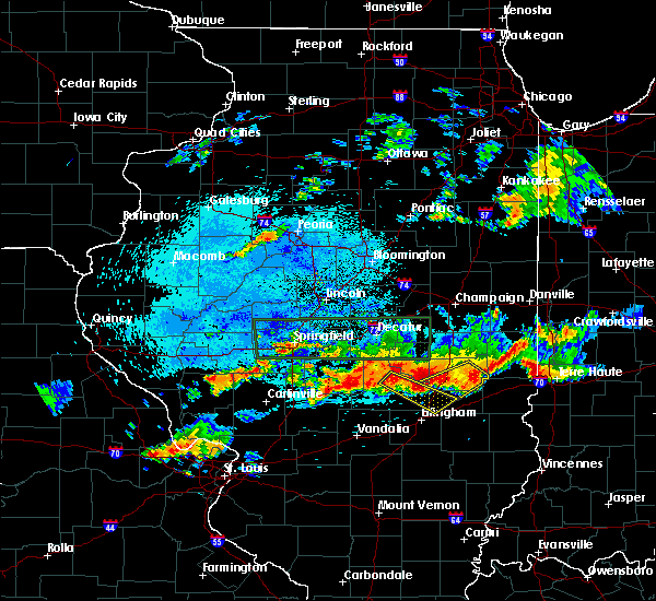 At 1037 pm cdt, a severe thunderstorm was located near neoga, or 10 miles southwest of mattoon, moving southeast at 30 mph (radar indicated). Hazards include 60 mph wind gusts and quarter size hail. Hail damage to vehicles is expected. expect wind damage to roofs, siding, and trees. locations impacted include, shelbyville, neoga, windsor, findlay, westervelt, strasburg, sigel, trowbridge, wolf creek state park and eagle creek state park. This includes interstate 57 between mile markers 169 and 180. At 1037 pm cdt, a severe thunderstorm was located near neoga, or 10 miles southwest of mattoon, moving southeast at 30 mph (radar indicated). Hazards include 60 mph wind gusts and quarter size hail. Hail damage to vehicles is expected. expect wind damage to roofs, siding, and trees. locations impacted include, shelbyville, neoga, windsor, findlay, westervelt, strasburg, sigel, trowbridge, wolf creek state park and eagle creek state park. This includes interstate 57 between mile markers 169 and 180.
|
| 8/12/2019 10:15 PM CDT |
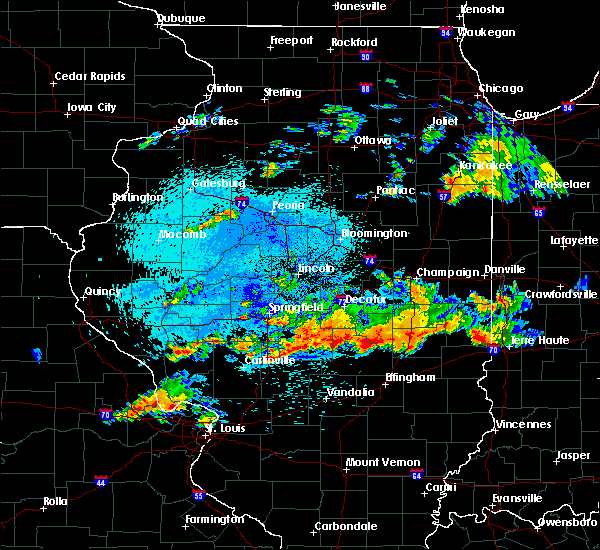 At 1015 pm cdt, a severe thunderstorm was located near shelbyville, moving southeast at 30 mph (radar indicated). Hazards include 60 mph wind gusts and quarter size hail. Hail damage to vehicles is expected. Expect wind damage to roofs, siding, and trees. At 1015 pm cdt, a severe thunderstorm was located near shelbyville, moving southeast at 30 mph (radar indicated). Hazards include 60 mph wind gusts and quarter size hail. Hail damage to vehicles is expected. Expect wind damage to roofs, siding, and trees.
|
| 6/30/2019 7:45 PM CDT |
 At 744 pm cdt, severe thunderstorms were located along a line extending from abingdon to stronghurst to rome, moving east at 45 mph (radar indicated. a 58 mph wind gust was measured at the burlington airport). Hazards include 60 mph wind gusts. Expect damage to roofs, siding, and trees. Locations impacted include, burlington, macomb, fort madison, keokuk, fairfield, monmouth, mount pleasant, washington, aledo, carthage, kahoka, wapello, columbus junction, oquawka, nauvoo, bushnell, west burlington, hamilton, burgess and new london. At 744 pm cdt, severe thunderstorms were located along a line extending from abingdon to stronghurst to rome, moving east at 45 mph (radar indicated. a 58 mph wind gust was measured at the burlington airport). Hazards include 60 mph wind gusts. Expect damage to roofs, siding, and trees. Locations impacted include, burlington, macomb, fort madison, keokuk, fairfield, monmouth, mount pleasant, washington, aledo, carthage, kahoka, wapello, columbus junction, oquawka, nauvoo, bushnell, west burlington, hamilton, burgess and new london.
|
| 6/30/2019 7:43 PM CDT |
 The severe thunderstorm warning for northeastern henderson, northern warren, rock island, mercer, south central whiteside, henry, northeastern des moines, louisa, southern johnson, washington, southwestern muscatine and southeastern iowa counties will expire at 745 pm cdt, the storms which prompted the warning have moved out of the area. therefore, the warning will be allowed to expire. however gusty winds and heavy rain are still possible with these thunderstorms. a severe thunderstorm watch remains in effect until 900 pm cdt for northwestern and west central illinois, and southeastern and east central iowa. The severe thunderstorm warning for northeastern henderson, northern warren, rock island, mercer, south central whiteside, henry, northeastern des moines, louisa, southern johnson, washington, southwestern muscatine and southeastern iowa counties will expire at 745 pm cdt, the storms which prompted the warning have moved out of the area. therefore, the warning will be allowed to expire. however gusty winds and heavy rain are still possible with these thunderstorms. a severe thunderstorm watch remains in effect until 900 pm cdt for northwestern and west central illinois, and southeastern and east central iowa.
|
| 6/30/2019 7:32 PM CDT |
 At 732 pm cdt, severe thunderstorms were located along a line extending from near galesburg to near gladstone to near lockridge, moving south at 45 mph (radar indicated). Hazards include 60 mph wind gusts. expect damage to roofs, siding, and trees At 732 pm cdt, severe thunderstorms were located along a line extending from near galesburg to near gladstone to near lockridge, moving south at 45 mph (radar indicated). Hazards include 60 mph wind gusts. expect damage to roofs, siding, and trees
|
| 6/30/2019 7:12 PM CDT |
 At 705 pm cdt, severe thunderstorms were located along a line extending from near atkinson to joy to kalona, moving southeast at 40 mph (radar indicated). Hazards include 60 mph wind gusts. Expect damage to roofs, siding, and trees. locations impacted include, davenport, moline, rock island, bettendorf, muscatine, east moline, kewanee, washington, aledo, cambridge, wapello, columbus junction, silvis, geneseo, milan, colona, coal valley, galva, burgess and kalona. if you are at henry county fairgrounds in cambridge you should seek safe shelter immediately! this includes the following highways, interstate 74 in iowa near mile marker 5. interstate 80 in illinois between mile markers 1 and 35. interstate 74 in illinois between mile markers 1 and 33. interstate 88 between mile markers 1 and 11. Interstate 280 between mile markers 8 and 18. At 705 pm cdt, severe thunderstorms were located along a line extending from near atkinson to joy to kalona, moving southeast at 40 mph (radar indicated). Hazards include 60 mph wind gusts. Expect damage to roofs, siding, and trees. locations impacted include, davenport, moline, rock island, bettendorf, muscatine, east moline, kewanee, washington, aledo, cambridge, wapello, columbus junction, silvis, geneseo, milan, colona, coal valley, galva, burgess and kalona. if you are at henry county fairgrounds in cambridge you should seek safe shelter immediately! this includes the following highways, interstate 74 in iowa near mile marker 5. interstate 80 in illinois between mile markers 1 and 35. interstate 74 in illinois between mile markers 1 and 33. interstate 88 between mile markers 1 and 11. Interstate 280 between mile markers 8 and 18.
|
| 6/30/2019 7:12 PM CDT |
 A severe thunderstorm warning remains in effect until 745 pm cdt for northeastern henderson. northern warren. rock island. mercer. south central whiteside. henry. northeastern des moines. louisa. southern johnson. washington. southwestern muscatine and southeastern iowa counties. At 712 pm cdt, severe thunderstorms were located along a line. A severe thunderstorm warning remains in effect until 745 pm cdt for northeastern henderson. northern warren. rock island. mercer. south central whiteside. henry. northeastern des moines. louisa. southern johnson. washington. southwestern muscatine and southeastern iowa counties. At 712 pm cdt, severe thunderstorms were located along a line.
|
| 6/30/2019 7:06 PM CDT |
 At 705 pm cdt, severe thunderstorms were located along a line extending from near atkinson to joy to kalona, moving southeast at 40 mph (radar indicated). Hazards include 60 mph wind gusts. Expect damage to roofs, siding, and trees. locations impacted include, davenport, moline, rock island, bettendorf, muscatine, east moline, kewanee, washington, aledo, cambridge, wapello, columbus junction, silvis, geneseo, milan, colona, coal valley, galva, burgess and kalona. if you are at henry county fairgrounds in cambridge you should seek safe shelter immediately! this includes the following highways, interstate 74 in iowa near mile marker 5. interstate 80 in illinois between mile markers 1 and 35. interstate 74 in illinois between mile markers 1 and 33. interstate 88 between mile markers 1 and 11. Interstate 280 between mile markers 8 and 18. At 705 pm cdt, severe thunderstorms were located along a line extending from near atkinson to joy to kalona, moving southeast at 40 mph (radar indicated). Hazards include 60 mph wind gusts. Expect damage to roofs, siding, and trees. locations impacted include, davenport, moline, rock island, bettendorf, muscatine, east moline, kewanee, washington, aledo, cambridge, wapello, columbus junction, silvis, geneseo, milan, colona, coal valley, galva, burgess and kalona. if you are at henry county fairgrounds in cambridge you should seek safe shelter immediately! this includes the following highways, interstate 74 in iowa near mile marker 5. interstate 80 in illinois between mile markers 1 and 35. interstate 74 in illinois between mile markers 1 and 33. interstate 88 between mile markers 1 and 11. Interstate 280 between mile markers 8 and 18.
|
| 6/30/2019 7:03 PM CDT |
 At 702 pm cdt, severe thunderstorms were located along a line extending from near hooppole to joy to near kalona, moving southeast at 40 mph (radar indicated). Hazards include 60 mph wind gusts. Expect damage to roofs, siding, and trees. locations impacted include, davenport, iowa city, moline, rock island, bettendorf, muscatine, east moline, kewanee, washington, aledo, cambridge, wapello, columbus junction, silvis, geneseo, milan, colona, le claire, coal valley and west liberty. if you are at henry county fairgrounds in cambridge you should seek safe shelter immediately! this includes the following highways, interstate 74 in iowa between mile markers 1 and 5. interstate 80 in iowa between mile markers 295 and 306. interstate 80 in illinois between mile markers 1 and 35. interstate 74 in illinois between mile markers 1 and 33. interstate 88 between mile markers 1 and 15. Interstate 280 between mile markers 2 and 18. At 702 pm cdt, severe thunderstorms were located along a line extending from near hooppole to joy to near kalona, moving southeast at 40 mph (radar indicated). Hazards include 60 mph wind gusts. Expect damage to roofs, siding, and trees. locations impacted include, davenport, iowa city, moline, rock island, bettendorf, muscatine, east moline, kewanee, washington, aledo, cambridge, wapello, columbus junction, silvis, geneseo, milan, colona, le claire, coal valley and west liberty. if you are at henry county fairgrounds in cambridge you should seek safe shelter immediately! this includes the following highways, interstate 74 in iowa between mile markers 1 and 5. interstate 80 in iowa between mile markers 295 and 306. interstate 80 in illinois between mile markers 1 and 35. interstate 74 in illinois between mile markers 1 and 33. interstate 88 between mile markers 1 and 15. Interstate 280 between mile markers 2 and 18.
|
| 6/30/2019 6:56 PM CDT |
 At 654 pm cdt, severe thunderstorms were located along a line extending from near erie to near eliza to 6 miles southwest of tiffin, moving south at 45 mph (radar indicated). Hazards include 60 mph wind gusts. expect damage to roofs, siding, and trees At 654 pm cdt, severe thunderstorms were located along a line extending from near erie to near eliza to 6 miles southwest of tiffin, moving south at 45 mph (radar indicated). Hazards include 60 mph wind gusts. expect damage to roofs, siding, and trees
|
| 6/30/2019 6:56 PM CDT |
 The national weather service in the quad cities has issued a * severe thunderstorm warning for. northeastern henderson county in west central illinois. rock island county in northwestern illinois. mercer county in northwestern illinois. Southwestern whiteside county in northwestern illinois. The national weather service in the quad cities has issued a * severe thunderstorm warning for. northeastern henderson county in west central illinois. rock island county in northwestern illinois. mercer county in northwestern illinois. Southwestern whiteside county in northwestern illinois.
|
| 6/30/2019 6:45 PM CDT |
 At 645 pm cdt, severe thunderstorms were located along a line extending from near erie to illinois city to near oxford, moving south at 45 mph (trained weather spotters). Hazards include 70 mph wind gusts. Expect considerable tree damage. damage is likely to mobile homes, roofs, and outbuildings. locations impacted include, davenport, iowa city, moline, rock island, bettendorf, muscatine, east moline, sterling, kewanee, rock falls, washington, morrison, aledo, cambridge, wapello, columbus junction, durant, silvis, geneseo and eldridge. if you are at henry county fairgrounds in cambridge, or davenport airport you should seek safe shelter immediately! this includes the following highways, interstate 74 in iowa between mile markers 1 and 5. interstate 80 in iowa between mile markers 280 and 306. interstate 80 in illinois between mile markers 1 and 45. interstate 74 in illinois between mile markers 1 and 33. interstate 88 between mile markers 1 and 43. Interstate 280 between mile markers 1 and 18. At 645 pm cdt, severe thunderstorms were located along a line extending from near erie to illinois city to near oxford, moving south at 45 mph (trained weather spotters). Hazards include 70 mph wind gusts. Expect considerable tree damage. damage is likely to mobile homes, roofs, and outbuildings. locations impacted include, davenport, iowa city, moline, rock island, bettendorf, muscatine, east moline, sterling, kewanee, rock falls, washington, morrison, aledo, cambridge, wapello, columbus junction, durant, silvis, geneseo and eldridge. if you are at henry county fairgrounds in cambridge, or davenport airport you should seek safe shelter immediately! this includes the following highways, interstate 74 in iowa between mile markers 1 and 5. interstate 80 in iowa between mile markers 280 and 306. interstate 80 in illinois between mile markers 1 and 45. interstate 74 in illinois between mile markers 1 and 33. interstate 88 between mile markers 1 and 43. Interstate 280 between mile markers 1 and 18.
|
| 6/30/2019 6:37 PM CDT |
 At 637 pm cdt, severe thunderstorms were located along a line extending from near fulton to fairport to oxford, moving south at 45 mph (trained weather spotters). Hazards include 70 mph wind gusts. Expect considerable tree damage. damage is likely to mobile homes, roofs, and outbuildings. locations impacted include, davenport, iowa city, moline, rock island, bettendorf, muscatine, east moline, sterling, kewanee, rock falls, washington, morrison, aledo, cambridge, wapello, columbus junction, durant, silvis, geneseo and eldridge. if you are at henry county fairgrounds in cambridge, or davenport airport you should seek safe shelter immediately! this includes the following highways, interstate 74 in iowa between mile markers 1 and 5. interstate 80 in iowa between mile markers 280 and 306. interstate 80 in illinois between mile markers 1 and 45. interstate 74 in illinois between mile markers 1 and 33. interstate 88 between mile markers 1 and 43. Interstate 280 between mile markers 1 and 18. At 637 pm cdt, severe thunderstorms were located along a line extending from near fulton to fairport to oxford, moving south at 45 mph (trained weather spotters). Hazards include 70 mph wind gusts. Expect considerable tree damage. damage is likely to mobile homes, roofs, and outbuildings. locations impacted include, davenport, iowa city, moline, rock island, bettendorf, muscatine, east moline, sterling, kewanee, rock falls, washington, morrison, aledo, cambridge, wapello, columbus junction, durant, silvis, geneseo and eldridge. if you are at henry county fairgrounds in cambridge, or davenport airport you should seek safe shelter immediately! this includes the following highways, interstate 74 in iowa between mile markers 1 and 5. interstate 80 in iowa between mile markers 280 and 306. interstate 80 in illinois between mile markers 1 and 45. interstate 74 in illinois between mile markers 1 and 33. interstate 88 between mile markers 1 and 43. Interstate 280 between mile markers 1 and 18.
|
| 6/30/2019 6:29 PM CDT |
 At 622 pm cdt, severe thunderstorms were located along a line extending from near charlotte to near rochester to amana, moving south at 45 mph (trained weather spotters). Hazards include 70 mph wind gusts. Expect considerable tree damage. Damage is likely to mobile homes, roofs, and outbuildings. At 622 pm cdt, severe thunderstorms were located along a line extending from near charlotte to near rochester to amana, moving south at 45 mph (trained weather spotters). Hazards include 70 mph wind gusts. Expect considerable tree damage. Damage is likely to mobile homes, roofs, and outbuildings.
|
| 6/30/2019 6:22 PM CDT |
 At 622 pm cdt, severe thunderstorms were located along a line extending from near charlotte to near rochester to amana, moving south at 45 mph (trained weather spotters). Hazards include 70 mph wind gusts. Expect considerable tree damage. Damage is likely to mobile homes, roofs, and outbuildings. At 622 pm cdt, severe thunderstorms were located along a line extending from near charlotte to near rochester to amana, moving south at 45 mph (trained weather spotters). Hazards include 70 mph wind gusts. Expect considerable tree damage. Damage is likely to mobile homes, roofs, and outbuildings.
|
| 6/15/2019 9:19 PM CDT |
 At 919 pm cdt, a severe thunderstorm was located over woodhull, or 11 miles southwest of cambridge, moving east at 30 mph (radar indicated). Hazards include 60 mph wind gusts. expect damage to roofs, siding, and trees At 919 pm cdt, a severe thunderstorm was located over woodhull, or 11 miles southwest of cambridge, moving east at 30 mph (radar indicated). Hazards include 60 mph wind gusts. expect damage to roofs, siding, and trees
|
| 6/5/2019 5:27 PM CDT |
 At 526 pm cdt, severe thunderstorms were located along a line extending from west of neoga through stewardson to near wrights corner, moving southeast at 30 mph (radar indicated). Hazards include 60 mph wind gusts. Expect damage to roofs, siding, and trees. locations impacted include, shelbyville, altamont, windsor, stewardson, cowden, tower hill, beecher city, shumway, moccasin, strasburg, herrick, clarksburg, oconee, trowbridge, mode, lake sara and altamont reservoir. This includes interstate 70 between mile markers 79 and 87. At 526 pm cdt, severe thunderstorms were located along a line extending from west of neoga through stewardson to near wrights corner, moving southeast at 30 mph (radar indicated). Hazards include 60 mph wind gusts. Expect damage to roofs, siding, and trees. locations impacted include, shelbyville, altamont, windsor, stewardson, cowden, tower hill, beecher city, shumway, moccasin, strasburg, herrick, clarksburg, oconee, trowbridge, mode, lake sara and altamont reservoir. This includes interstate 70 between mile markers 79 and 87.
|
| 6/5/2019 5:03 PM CDT |
 At 502 pm cdt, severe thunderstorms were located along a line extending from shelbyville to 6 miles north of ramsey, moving east at 30 mph (radar indicated). Hazards include 60 mph wind gusts. expect damage to roofs, siding, and trees At 502 pm cdt, severe thunderstorms were located along a line extending from shelbyville to 6 miles north of ramsey, moving east at 30 mph (radar indicated). Hazards include 60 mph wind gusts. expect damage to roofs, siding, and trees
|
| 5/27/2019 3:05 PM CDT |
 At 305 pm cdt, a severe thunderstorm capable of producing a tornado was located near new windsor, or 13 miles east of aledo, moving northeast at 35 mph (radar indicated rotation). Hazards include tornado and quarter size hail. Flying debris will be dangerous to those caught without shelter. mobile homes will be damaged or destroyed. damage to roofs, windows, and vehicles will occur. tree damage is likely. this dangerous storm will be near, new windsor around 310 pm cdt. alpha around 315 pm cdt. woodhull around 320 pm cdt. lynn center around 325 pm cdt. andover around 330 pm cdt. cambridge around 340 pm cdt. other locations impacted by this tornadic thunderstorm include henry county fairgrounds, griffin, ophiem and ulah. This includes interstate 74 in illinois between mile markers 23 and 33. At 305 pm cdt, a severe thunderstorm capable of producing a tornado was located near new windsor, or 13 miles east of aledo, moving northeast at 35 mph (radar indicated rotation). Hazards include tornado and quarter size hail. Flying debris will be dangerous to those caught without shelter. mobile homes will be damaged or destroyed. damage to roofs, windows, and vehicles will occur. tree damage is likely. this dangerous storm will be near, new windsor around 310 pm cdt. alpha around 315 pm cdt. woodhull around 320 pm cdt. lynn center around 325 pm cdt. andover around 330 pm cdt. cambridge around 340 pm cdt. other locations impacted by this tornadic thunderstorm include henry county fairgrounds, griffin, ophiem and ulah. This includes interstate 74 in illinois between mile markers 23 and 33.
|
| 5/27/2019 3:01 PM CDT |
 At 300 pm cdt, a severe thunderstorm capable of producing a tornado was located near north henderson, or 11 miles east of aledo, moving northeast at 30 mph (radar indicated rotation). Hazards include tornado and quarter size hail. Flying debris will be dangerous to those caught without shelter. mobile homes will be damaged or destroyed. damage to roofs, windows, and vehicles will occur. tree damage is likely. this dangerous storm will be near, new windsor around 310 pm cdt. alpha around 315 pm cdt. woodhull around 320 pm cdt. lynn center around 325 pm cdt. andover around 335 pm cdt. cambridge around 340 pm cdt. other locations impacted by this tornadic thunderstorm include henry county fairgrounds, griffin, gilchrist, swedona, ophiem and ulah. This includes interstate 74 in illinois between mile markers 22 and 33. At 300 pm cdt, a severe thunderstorm capable of producing a tornado was located near north henderson, or 11 miles east of aledo, moving northeast at 30 mph (radar indicated rotation). Hazards include tornado and quarter size hail. Flying debris will be dangerous to those caught without shelter. mobile homes will be damaged or destroyed. damage to roofs, windows, and vehicles will occur. tree damage is likely. this dangerous storm will be near, new windsor around 310 pm cdt. alpha around 315 pm cdt. woodhull around 320 pm cdt. lynn center around 325 pm cdt. andover around 335 pm cdt. cambridge around 340 pm cdt. other locations impacted by this tornadic thunderstorm include henry county fairgrounds, griffin, gilchrist, swedona, ophiem and ulah. This includes interstate 74 in illinois between mile markers 22 and 33.
|
| 5/23/2019 2:14 AM CDT |
 At 213 am cdt, a severe thunderstorm was located over cooks mill, or near mattoon, moving east at 55 mph (radar indicated). Hazards include 60 mph wind gusts and penny size hail. brief tornados are possible with this storm. expect damage to roofs, siding, and trees At 213 am cdt, a severe thunderstorm was located over cooks mill, or near mattoon, moving east at 55 mph (radar indicated). Hazards include 60 mph wind gusts and penny size hail. brief tornados are possible with this storm. expect damage to roofs, siding, and trees
|
| 5/21/2019 4:30 PM CDT |
 The national weather service in lincoln has issued a * severe thunderstorm warning for. moultrie county in central illinois. shelby county in central illinois. western effingham county in south central illinois. Until 1015 pm cdt. The national weather service in lincoln has issued a * severe thunderstorm warning for. moultrie county in central illinois. shelby county in central illinois. western effingham county in south central illinois. Until 1015 pm cdt.
|
| 5/17/2019 8:57 AM CDT |
 The severe thunderstorm warning for northeastern warren and southeastern mercer counties will expire at 900 am cdt, the storm which prompted the warning has moved out of the area. therefore, the warning will be allowed to expire. however heavy rain is still possible with this thunderstorm. The severe thunderstorm warning for northeastern warren and southeastern mercer counties will expire at 900 am cdt, the storm which prompted the warning has moved out of the area. therefore, the warning will be allowed to expire. however heavy rain is still possible with this thunderstorm.
|
| 5/17/2019 8:45 AM CDT |
 At 845 am cdt, a severe thunderstorm was located over rio, or 8 miles north of galesburg, moving east at 35 mph (radar indicated). Hazards include 60 mph wind gusts. Expect damage to roofs, siding, and trees. Locations impacted include, burgess, viola, north henderson, shale city, new windsor, alexis, gerlaw, gilchrist, old gilchrist, griffin and wanlock. At 845 am cdt, a severe thunderstorm was located over rio, or 8 miles north of galesburg, moving east at 35 mph (radar indicated). Hazards include 60 mph wind gusts. Expect damage to roofs, siding, and trees. Locations impacted include, burgess, viola, north henderson, shale city, new windsor, alexis, gerlaw, gilchrist, old gilchrist, griffin and wanlock.
|
| 5/17/2019 8:29 AM CDT |
 At 823 am cdt, a severe thunderstorm was located near burgess, or 9 miles southeast of aledo, moving east at 40 mph (radar indicated). Hazards include 60 mph wind gusts. Expect damage to roofs, siding, and trees. Locations impacted include, monmouth, aledo, burgess, viola, kirkwood, joy, little york, biggsville, rozetta, seaton, north henderson, shale city, new windsor, ogle, alexis, coldbrook, bald bluff, berwick, gerlaw and larchland. At 823 am cdt, a severe thunderstorm was located near burgess, or 9 miles southeast of aledo, moving east at 40 mph (radar indicated). Hazards include 60 mph wind gusts. Expect damage to roofs, siding, and trees. Locations impacted include, monmouth, aledo, burgess, viola, kirkwood, joy, little york, biggsville, rozetta, seaton, north henderson, shale city, new windsor, ogle, alexis, coldbrook, bald bluff, berwick, gerlaw and larchland.
|
| 5/17/2019 8:23 AM CDT |
 At 812 am cdt, a severe thunderstorm was located over seaton, or 9 miles southwest of aledo, moving east at 35 mph (radar indicated). Hazards include 60 mph wind gusts. expect damage to roofs, siding, and trees At 812 am cdt, a severe thunderstorm was located over seaton, or 9 miles southwest of aledo, moving east at 35 mph (radar indicated). Hazards include 60 mph wind gusts. expect damage to roofs, siding, and trees
|
| 5/17/2019 8:12 AM CDT |
 The national weather service in the quad cities has issued a * severe thunderstorm warning for. northeastern henderson county in west central illinois. warren county in west central illinois. southern mercer county in northwestern illinois. Until 900 am cdt. The national weather service in the quad cities has issued a * severe thunderstorm warning for. northeastern henderson county in west central illinois. warren county in west central illinois. southern mercer county in northwestern illinois. Until 900 am cdt.
|
| 5/16/2019 10:47 PM CDT |
 The national weather service in the quad cities has issued a * severe thunderstorm warning for. northeastern mercer county in northwestern illinois. henry county in northwestern illinois. southwestern bureau county in north central illinois. Until 1145 pm cdt. The national weather service in the quad cities has issued a * severe thunderstorm warning for. northeastern mercer county in northwestern illinois. henry county in northwestern illinois. southwestern bureau county in north central illinois. Until 1145 pm cdt.
|
| 9/18/2018 1:20 PM CDT |
 The severe thunderstorm warning for northeastern henderson, northwestern warren, mercer, northeastern des moines and southeastern louisa counties will expire at 130 pm cdt, the storm which prompted the warning has weakened below severe limits, and no longer poses an immediate threat to life or property. therefore, the warning will be allowed to expire. however small hail, gusty winds and heavy rain are still possible with this thunderstorm. to report severe weather, contact your nearest law enforcement agency. they will relay your report to the national weather service the quad cities. The severe thunderstorm warning for northeastern henderson, northwestern warren, mercer, northeastern des moines and southeastern louisa counties will expire at 130 pm cdt, the storm which prompted the warning has weakened below severe limits, and no longer poses an immediate threat to life or property. therefore, the warning will be allowed to expire. however small hail, gusty winds and heavy rain are still possible with this thunderstorm. to report severe weather, contact your nearest law enforcement agency. they will relay your report to the national weather service the quad cities.
|
| 9/18/2018 1:07 PM CDT |
 At 107 pm cdt, a severe thunderstorm was located over aledo, moving southeast at 25 mph (radar indicated). Hazards include 60 mph wind gusts and quarter size hail. Hail damage to vehicles is expected. expect wind damage to roofs, siding, and trees. Locations impacted include, aledo, oquawka, burgess, viola, millersburg, matherville, new boston, keithsburg, joy, little york, rozetta, seaton, oakville, shale city, new windsor, toolesboro, boden, mannon, ogle and bald bluff. At 107 pm cdt, a severe thunderstorm was located over aledo, moving southeast at 25 mph (radar indicated). Hazards include 60 mph wind gusts and quarter size hail. Hail damage to vehicles is expected. expect wind damage to roofs, siding, and trees. Locations impacted include, aledo, oquawka, burgess, viola, millersburg, matherville, new boston, keithsburg, joy, little york, rozetta, seaton, oakville, shale city, new windsor, toolesboro, boden, mannon, ogle and bald bluff.
|
| 9/18/2018 12:57 PM CDT |
 At 1257 pm cdt, a severe thunderstorm was located over aledo, moving east at 30 mph (radar indicated). Hazards include 60 mph wind gusts and quarter size hail. Hail damage to vehicles is expected. expect wind damage to roofs, siding, and trees. Locations impacted include, aledo, wapello, oquawka, burgess, viola, millersburg, matherville, new boston, keithsburg, eliza, joy, little york, rozetta, seaton, oakville, shale city, new windsor, toolesboro, boden and mannon. At 1257 pm cdt, a severe thunderstorm was located over aledo, moving east at 30 mph (radar indicated). Hazards include 60 mph wind gusts and quarter size hail. Hail damage to vehicles is expected. expect wind damage to roofs, siding, and trees. Locations impacted include, aledo, wapello, oquawka, burgess, viola, millersburg, matherville, new boston, keithsburg, eliza, joy, little york, rozetta, seaton, oakville, shale city, new windsor, toolesboro, boden and mannon.
|
| 9/18/2018 12:32 PM CDT |
 At 1232 pm cdt, a severe thunderstorm was located over new boston, or 10 miles east of wapello, moving southeast at 30 mph (radar indicated). Hazards include 60 mph wind gusts and quarter size hail. Hail damage to vehicles is expected. Expect wind damage to roofs, siding, and trees. At 1232 pm cdt, a severe thunderstorm was located over new boston, or 10 miles east of wapello, moving southeast at 30 mph (radar indicated). Hazards include 60 mph wind gusts and quarter size hail. Hail damage to vehicles is expected. Expect wind damage to roofs, siding, and trees.
|
| 8/28/2018 10:13 PM CDT |
 The severe thunderstorm warning for southern henry county will expire at 1015 pm cdt, the storms which prompted the warning have moved out of the area. therefore, the warning will be allowed to expire. however heavy rain is still possible with these thunderstorms. a severe thunderstorm watch remains in effect until 1100 pm cdt for northwestern illinois. to report severe weather, contact your nearest law enforcement agency. they will relay your report to the national weather service the quad cities. The severe thunderstorm warning for southern henry county will expire at 1015 pm cdt, the storms which prompted the warning have moved out of the area. therefore, the warning will be allowed to expire. however heavy rain is still possible with these thunderstorms. a severe thunderstorm watch remains in effect until 1100 pm cdt for northwestern illinois. to report severe weather, contact your nearest law enforcement agency. they will relay your report to the national weather service the quad cities.
|
| 8/28/2018 9:48 PM CDT |
 At 948 pm cdt, severe thunderstorms were located along a line extending from near andover to near victoria, moving east at 50 mph (radar indicated). Hazards include 60 mph wind gusts. Expect damage to roofs, siding, and trees. locations impacted include, cambridge, galva, woodhull, new windsor, alpha, andover, lynn center, bishop hill, henry county fairgrounds, ophiem, german corner, nekoma, ulah and kewanee municipal airport. This includes interstate 74 in illinois between mile markers 21 and 33. At 948 pm cdt, severe thunderstorms were located along a line extending from near andover to near victoria, moving east at 50 mph (radar indicated). Hazards include 60 mph wind gusts. Expect damage to roofs, siding, and trees. locations impacted include, cambridge, galva, woodhull, new windsor, alpha, andover, lynn center, bishop hill, henry county fairgrounds, ophiem, german corner, nekoma, ulah and kewanee municipal airport. This includes interstate 74 in illinois between mile markers 21 and 33.
|
| 8/28/2018 9:38 PM CDT |
 At 938 pm cdt, severe thunderstorms were located along a line extending from sherrard to galesburg, moving east at 55 mph (law enforcement). Hazards include 60 mph wind gusts. Expect damage to roofs, siding, and trees. locations impacted include, aledo, cambridge, galva, burgess, viola, woodhull, millersburg, matherville, alpha, sherrard, andover, north henderson, hamlet, cable, shale city, new windsor, boden, lynn center, preemption and bishop hill. This includes interstate 74 in illinois between mile markers 21 and 33. At 938 pm cdt, severe thunderstorms were located along a line extending from sherrard to galesburg, moving east at 55 mph (law enforcement). Hazards include 60 mph wind gusts. Expect damage to roofs, siding, and trees. locations impacted include, aledo, cambridge, galva, burgess, viola, woodhull, millersburg, matherville, alpha, sherrard, andover, north henderson, hamlet, cable, shale city, new windsor, boden, lynn center, preemption and bishop hill. This includes interstate 74 in illinois between mile markers 21 and 33.
|
| 8/28/2018 9:22 PM CDT |
 At 921 pm cdt, severe thunderstorms were located along a line extending from near millersburg to near monmouth, moving east at 45 mph (radar indicated). Hazards include 60 mph wind gusts. Expect damage to roofs, siding, and trees. locations impacted include, aledo, cambridge, galva, burgess, viola, woodhull, millersburg, matherville, new boston, alpha, sherrard, keithsburg, andover, eliza, joy, seaton, north henderson, hamlet, cable and shale city. This includes interstate 74 in illinois between mile markers 21 and 33. At 921 pm cdt, severe thunderstorms were located along a line extending from near millersburg to near monmouth, moving east at 45 mph (radar indicated). Hazards include 60 mph wind gusts. Expect damage to roofs, siding, and trees. locations impacted include, aledo, cambridge, galva, burgess, viola, woodhull, millersburg, matherville, new boston, alpha, sherrard, keithsburg, andover, eliza, joy, seaton, north henderson, hamlet, cable and shale city. This includes interstate 74 in illinois between mile markers 21 and 33.
|
| 8/28/2018 9:10 PM CDT |
 At 910 pm cdt, severe thunderstorms were located along a line extending from near grandview to near oquawka, moving east at 55 mph (radar indicated). Hazards include 60 mph wind gusts. expect damage to roofs, siding, and trees At 910 pm cdt, severe thunderstorms were located along a line extending from near grandview to near oquawka, moving east at 55 mph (radar indicated). Hazards include 60 mph wind gusts. expect damage to roofs, siding, and trees
|
| 8/28/2018 7:34 PM CDT |
 At 733 pm cdt, a severe thunderstorm was located near cambridge, moving east at 50 mph (radar indicated). Hazards include 60 mph wind gusts and penny size hail. Expect damage to roofs, siding, and trees. locations impacted include, kewanee, cambridge, galva, orion, woodhull, new windsor, alpha, andover, lynn center, osco, bishop hill, henry county fairgrounds, ophiem, german corner, nekoma, kewanee municipal airport, ulah and johnson-sauk trail state park. This includes interstate 74 in illinois between mile markers 20 and 33. At 733 pm cdt, a severe thunderstorm was located near cambridge, moving east at 50 mph (radar indicated). Hazards include 60 mph wind gusts and penny size hail. Expect damage to roofs, siding, and trees. locations impacted include, kewanee, cambridge, galva, orion, woodhull, new windsor, alpha, andover, lynn center, osco, bishop hill, henry county fairgrounds, ophiem, german corner, nekoma, kewanee municipal airport, ulah and johnson-sauk trail state park. This includes interstate 74 in illinois between mile markers 20 and 33.
|
| 8/28/2018 7:16 PM CDT |
 At 716 pm cdt, a severe thunderstorm was located near alpha, or 11 miles southwest of cambridge, moving east at 60 mph (radar indicated). Hazards include 60 mph wind gusts and penny size hail. Expect damage to roofs, siding, and trees. locations impacted include, kewanee, aledo, cambridge, galva, burgess, orion, viola, woodhull, millersburg, matherville, alpha, sherrard, keithsburg, andover, reynolds, joy, seaton, north henderson, hamlet and cable. This includes interstate 74 in illinois between mile markers 20 and 33. At 716 pm cdt, a severe thunderstorm was located near alpha, or 11 miles southwest of cambridge, moving east at 60 mph (radar indicated). Hazards include 60 mph wind gusts and penny size hail. Expect damage to roofs, siding, and trees. locations impacted include, kewanee, aledo, cambridge, galva, burgess, orion, viola, woodhull, millersburg, matherville, alpha, sherrard, keithsburg, andover, reynolds, joy, seaton, north henderson, hamlet and cable. This includes interstate 74 in illinois between mile markers 20 and 33.
|
| 8/28/2018 6:45 PM CDT |
 At 645 pm cdt, a severe thunderstorm was located over mannon, or 12 miles east of wapello, moving east at 55 mph (radar indicated). Hazards include 60 mph wind gusts and penny size hail. expect damage to roofs, siding, and trees At 645 pm cdt, a severe thunderstorm was located over mannon, or 12 miles east of wapello, moving east at 55 mph (radar indicated). Hazards include 60 mph wind gusts and penny size hail. expect damage to roofs, siding, and trees
|
| 8/2/2018 6:00 PM CDT |
 At 559 pm cdt, a severe thunderstorm was located near windsor, or 8 miles south of sullivan, moving east at 25 mph (radar indicated). Hazards include 60 mph wind gusts and quarter size hail. Hail damage to vehicles is expected. expect wind damage to roofs, siding, and trees. Locations impacted include, sullivan, windsor, findlay, allenville, gays, wolf creek state park, eagle creek state park and kirksville. At 559 pm cdt, a severe thunderstorm was located near windsor, or 8 miles south of sullivan, moving east at 25 mph (radar indicated). Hazards include 60 mph wind gusts and quarter size hail. Hail damage to vehicles is expected. expect wind damage to roofs, siding, and trees. Locations impacted include, sullivan, windsor, findlay, allenville, gays, wolf creek state park, eagle creek state park and kirksville.
|
| 8/2/2018 5:32 PM CDT |
 At 532 pm cdt, a severe thunderstorm was located over shelbyville, moving east at 25 mph (radar indicated). Hazards include 60 mph wind gusts and quarter size hail. Hail damage to vehicles is expected. Expect wind damage to roofs, siding, and trees. At 532 pm cdt, a severe thunderstorm was located over shelbyville, moving east at 25 mph (radar indicated). Hazards include 60 mph wind gusts and quarter size hail. Hail damage to vehicles is expected. Expect wind damage to roofs, siding, and trees.
|
| 6/28/2018 6:10 PM CDT |
 At 551 pm cdt, severe thunderstorms were located along a line extending from near shelbyville to near cowden to near brownstown, moving southeast at 50 mph (radar indicated). Hazards include 70 mph wind gusts. Expect considerable tree damage. Damage is likely to mobile homes, roofs, and outbuildings. At 551 pm cdt, severe thunderstorms were located along a line extending from near shelbyville to near cowden to near brownstown, moving southeast at 50 mph (radar indicated). Hazards include 70 mph wind gusts. Expect considerable tree damage. Damage is likely to mobile homes, roofs, and outbuildings.
|
| 6/28/2018 5:52 PM CDT |
 At 551 pm cdt, severe thunderstorms were located along a line extending from near shelbyville to near cowden to near brownstown, moving southeast at 50 mph (radar indicated). Hazards include 70 mph wind gusts. Expect considerable tree damage. Damage is likely to mobile homes, roofs, and outbuildings. At 551 pm cdt, severe thunderstorms were located along a line extending from near shelbyville to near cowden to near brownstown, moving southeast at 50 mph (radar indicated). Hazards include 70 mph wind gusts. Expect considerable tree damage. Damage is likely to mobile homes, roofs, and outbuildings.
|
| 6/19/2018 2:51 PM CDT |
 At 250 pm cdt, severe thunderstorms were located along a line extending from andover to near woodhull, moving east at 30 mph (radar indicated). Hazards include 60 mph wind gusts. Expect damage to roofs, siding, and trees. locations impacted include, cambridge, woodhull, new windsor, alpha, andover, lynn center, henry county fairgrounds, ophiem, nekoma, ulah and german corner. If you are at henry county fairgrounds you should seek safe shelter immediately! this includes interstate 74 in illinois between mile markers 23 and 33. At 250 pm cdt, severe thunderstorms were located along a line extending from andover to near woodhull, moving east at 30 mph (radar indicated). Hazards include 60 mph wind gusts. Expect damage to roofs, siding, and trees. locations impacted include, cambridge, woodhull, new windsor, alpha, andover, lynn center, henry county fairgrounds, ophiem, nekoma, ulah and german corner. If you are at henry county fairgrounds you should seek safe shelter immediately! this includes interstate 74 in illinois between mile markers 23 and 33.
|
| 6/19/2018 2:38 PM CDT |
 At 238 pm cdt, severe thunderstorms were located along a line extending from lynn center to woodhull, moving east at 30 mph (radar indicated). Hazards include 60 mph wind gusts. expect damage to roofs, siding, and trees At 238 pm cdt, severe thunderstorms were located along a line extending from lynn center to woodhull, moving east at 30 mph (radar indicated). Hazards include 60 mph wind gusts. expect damage to roofs, siding, and trees
|
| 6/16/2018 5:38 PM CDT |
 The severe thunderstorm warning for southeastern shelby county will expire at 545 pm cdt, the storm which prompted the warning has weakened below severe limits, and will exit the warning area shortly. therefore, the warning will be allowed to expire. however gusty winds and heavy rain are still possible with this thunderstorm. The severe thunderstorm warning for southeastern shelby county will expire at 545 pm cdt, the storm which prompted the warning has weakened below severe limits, and will exit the warning area shortly. therefore, the warning will be allowed to expire. however gusty winds and heavy rain are still possible with this thunderstorm.
|
| 6/16/2018 5:27 PM CDT |
 At 527 pm cdt, a severe thunderstorm was located near windsor, or 11 miles east of shelbyville, moving northeast at 10 mph (radar indicated). Hazards include 60 mph wind gusts and quarter size hail. Hail damage to vehicles is expected. expect wind damage to roofs, siding, and trees. Locations impacted include, windsor, strasburg and trowbridge. At 527 pm cdt, a severe thunderstorm was located near windsor, or 11 miles east of shelbyville, moving northeast at 10 mph (radar indicated). Hazards include 60 mph wind gusts and quarter size hail. Hail damage to vehicles is expected. expect wind damage to roofs, siding, and trees. Locations impacted include, windsor, strasburg and trowbridge.
|
| 6/16/2018 5:14 PM CDT |
 At 513 pm cdt, a severe thunderstorm was located near stewardson, or 10 miles southeast of shelbyville, moving northeast at 25 mph (radar indicated). Hazards include 60 mph wind gusts and quarter size hail. Hail damage to vehicles is expected. Expect wind damage to roofs, siding, and trees. At 513 pm cdt, a severe thunderstorm was located near stewardson, or 10 miles southeast of shelbyville, moving northeast at 25 mph (radar indicated). Hazards include 60 mph wind gusts and quarter size hail. Hail damage to vehicles is expected. Expect wind damage to roofs, siding, and trees.
|
| 6/11/2018 6:08 PM CDT |
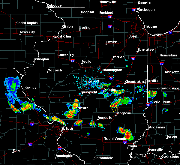 At 608 pm cdt, a severe thunderstorm was located over windsor, or 10 miles east of shelbyville, moving southeast at 20 mph (radar indicated). Hazards include 60 mph wind gusts and quarter size hail. Hail damage to vehicles is expected. Expect wind damage to roofs, siding, and trees. At 608 pm cdt, a severe thunderstorm was located over windsor, or 10 miles east of shelbyville, moving southeast at 20 mph (radar indicated). Hazards include 60 mph wind gusts and quarter size hail. Hail damage to vehicles is expected. Expect wind damage to roofs, siding, and trees.
|
| 5/9/2018 8:48 PM CDT |
 At 848 pm cdt, severe thunderstorms were located along a line extending from near windsor to near cowden, moving east at 30 mph (radar indicated). Hazards include 60 mph wind gusts and quarter size hail. Hail damage to vehicles is expected. Expect wind damage to roofs, siding, and trees. At 848 pm cdt, severe thunderstorms were located along a line extending from near windsor to near cowden, moving east at 30 mph (radar indicated). Hazards include 60 mph wind gusts and quarter size hail. Hail damage to vehicles is expected. Expect wind damage to roofs, siding, and trees.
|
| 4/3/2018 4:38 PM CDT |
 The severe thunderstorm warning for western coles, southeastern moultrie and northeastern shelby counties will expire at 445 pm cdt, the storm which prompted the warning has moved out of the area. therefore the warning will be allowed to expire. a tornado watch remains in effect until 800 pm cdt for central and east central illinois. remember, a severe thunderstorm warning still remains in effect for northern coles county until 5 pm cdt. The severe thunderstorm warning for western coles, southeastern moultrie and northeastern shelby counties will expire at 445 pm cdt, the storm which prompted the warning has moved out of the area. therefore the warning will be allowed to expire. a tornado watch remains in effect until 800 pm cdt for central and east central illinois. remember, a severe thunderstorm warning still remains in effect for northern coles county until 5 pm cdt.
|
| 4/3/2018 4:14 PM CDT |
 At 411 pm cdt, a severe thunderstorm was located near findlay, or 7 miles southwest of sullivan, moving east at 55 mph (radar indicated). Hazards include 60 mph wind gusts and quarter size hail. Hail damage to vehicles is expected. Expect wind damage to roofs, siding, and trees. At 411 pm cdt, a severe thunderstorm was located near findlay, or 7 miles southwest of sullivan, moving east at 55 mph (radar indicated). Hazards include 60 mph wind gusts and quarter size hail. Hail damage to vehicles is expected. Expect wind damage to roofs, siding, and trees.
|
| 11/5/2017 4:08 PM CDT |
 At 307 pm cst, a severe thunderstorm was located 13 miles southwest of shelbyville, moving east at 50 mph (radar indicated). Hazards include 60 mph wind gusts and quarter size hail. Hail damage to vehicles is expected. expect wind damage to roofs, siding, and trees. locations impacted include, shelbyville, pana, windsor, stewardson, cowden, tower hill, allenville, strasburg, herrick, clarksburg, sigel, gays, oconee, trowbridge, wolf creek state park, mode and eagle creek state park. this includes interstate 57 between mile markers 169 and 172. A tornado watch remains in effect until 700 pm cst for central and east central illinois. At 307 pm cst, a severe thunderstorm was located 13 miles southwest of shelbyville, moving east at 50 mph (radar indicated). Hazards include 60 mph wind gusts and quarter size hail. Hail damage to vehicles is expected. expect wind damage to roofs, siding, and trees. locations impacted include, shelbyville, pana, windsor, stewardson, cowden, tower hill, allenville, strasburg, herrick, clarksburg, sigel, gays, oconee, trowbridge, wolf creek state park, mode and eagle creek state park. this includes interstate 57 between mile markers 169 and 172. A tornado watch remains in effect until 700 pm cst for central and east central illinois.
|
| 11/5/2017 3:49 PM CDT |
 At 249 pm cst, a severe thunderstorm was located near nokomis, moving east at 50 mph (radar indicated). Hazards include 60 mph wind gusts and quarter size hail. Hail damage to vehicles is expected. Expect wind damage to roofs, siding, and trees. At 249 pm cst, a severe thunderstorm was located near nokomis, moving east at 50 mph (radar indicated). Hazards include 60 mph wind gusts and quarter size hail. Hail damage to vehicles is expected. Expect wind damage to roofs, siding, and trees.
|
| 8/10/2017 5:14 PM CDT |
 At 514 pm cdt, a severe thunderstorm was located near rozetta, or near oquawka, moving east at 25 mph (radar indicated). Hazards include 60 mph wind gusts and quarter size hail. Hail damage to vehicles is expected. Expect wind damage to roofs, siding, and trees. At 514 pm cdt, a severe thunderstorm was located near rozetta, or near oquawka, moving east at 25 mph (radar indicated). Hazards include 60 mph wind gusts and quarter size hail. Hail damage to vehicles is expected. Expect wind damage to roofs, siding, and trees.
|
| 7/10/2017 4:48 AM CDT |
 At 448 am cdt, severe thunderstorms were located along a line extending from near boden to near morning sun, moving southeast at 50 mph (radar indicated). Hazards include 60 mph wind gusts. expect damage to roofs, siding, and trees At 448 am cdt, severe thunderstorms were located along a line extending from near boden to near morning sun, moving southeast at 50 mph (radar indicated). Hazards include 60 mph wind gusts. expect damage to roofs, siding, and trees
|
| 6/17/2017 6:36 PM CDT |
 At 635 pm cdt, a severe thunderstorm was located over orion, or 10 miles west of cambridge, moving east at 35 mph (radar indicated). Hazards include 70 mph wind gusts and quarter size hail. Hail damage to vehicles is expected. expect considerable tree damage. wind damage is also likely to mobile homes, roofs, and outbuildings. locations impacted include, moline, rock island, east moline, cambridge, silvis, geneseo, colona, milan, coal valley, orion, viola, woodhull, matherville, alpha, sherrard, andover, reynolds, oak grove, cable and new windsor. this includes the following highways, interstate 80 in illinois between mile markers 7 and 24. interstate 74 in illinois between mile markers 1 and 33. Interstate 280 between mile markers 13 and 18. At 635 pm cdt, a severe thunderstorm was located over orion, or 10 miles west of cambridge, moving east at 35 mph (radar indicated). Hazards include 70 mph wind gusts and quarter size hail. Hail damage to vehicles is expected. expect considerable tree damage. wind damage is also likely to mobile homes, roofs, and outbuildings. locations impacted include, moline, rock island, east moline, cambridge, silvis, geneseo, colona, milan, coal valley, orion, viola, woodhull, matherville, alpha, sherrard, andover, reynolds, oak grove, cable and new windsor. this includes the following highways, interstate 80 in illinois between mile markers 7 and 24. interstate 74 in illinois between mile markers 1 and 33. Interstate 280 between mile markers 13 and 18.
|
| 6/17/2017 6:05 PM CDT |
 At 605 pm cdt, a severe thunderstorm was located near illinois city, or 12 miles east of muscatine, moving east at 45 mph (radar indicated). Hazards include 70 mph wind gusts and ping pong ball size hail. People and animals outdoors will be injured. expect hail damage to roofs, siding, windows, and vehicles. expect considerable tree damage. Wind damage is also likely to mobile homes, roofs, and outbuildings. At 605 pm cdt, a severe thunderstorm was located near illinois city, or 12 miles east of muscatine, moving east at 45 mph (radar indicated). Hazards include 70 mph wind gusts and ping pong ball size hail. People and animals outdoors will be injured. expect hail damage to roofs, siding, windows, and vehicles. expect considerable tree damage. Wind damage is also likely to mobile homes, roofs, and outbuildings.
|
| 6/15/2017 10:39 PM CDT |
 At 1038 pm cdt, severe thunderstorms were located along a line extending from near geneseo to near cambridge to lynn center, moving southeast at 45 mph (radar indicated). Hazards include 60 mph wind gusts. Expect damage to roofs, siding, and trees. locations impacted include, kewanee, cambridge, silvis, geneseo, colona, coal valley, galva, orion, atkinson, annawan, woodhull, new windsor, alpha, andover, cleveland, warner, lynn center, osborn, dayton and osco. this includes the following highways, interstate 80 in illinois between mile markers 6 and 36. Interstate 74 in illinois between mile markers 8 and 33. At 1038 pm cdt, severe thunderstorms were located along a line extending from near geneseo to near cambridge to lynn center, moving southeast at 45 mph (radar indicated). Hazards include 60 mph wind gusts. Expect damage to roofs, siding, and trees. locations impacted include, kewanee, cambridge, silvis, geneseo, colona, coal valley, galva, orion, atkinson, annawan, woodhull, new windsor, alpha, andover, cleveland, warner, lynn center, osborn, dayton and osco. this includes the following highways, interstate 80 in illinois between mile markers 6 and 36. Interstate 74 in illinois between mile markers 8 and 33.
|
| 6/15/2017 10:30 PM CDT |
 At 1030 pm cdt, severe thunderstorms were located along a line extending from near osborn to near warner to near sherrard, moving southeast at 40 mph (trained weather spotters). Hazards include 60 mph wind gusts. Expect damage to roofs, siding, and trees. locations impacted include, kewanee, cambridge, silvis, geneseo, colona, coal valley, galva, orion, atkinson, annawan, woodhull, alpha, andover, cleveland, north henderson, cable, new windsor, warner, lynn center and osborn. this includes the following highways, interstate 80 in illinois between mile markers 6 and 36. Interstate 74 in illinois between mile markers 8 and 33. At 1030 pm cdt, severe thunderstorms were located along a line extending from near osborn to near warner to near sherrard, moving southeast at 40 mph (trained weather spotters). Hazards include 60 mph wind gusts. Expect damage to roofs, siding, and trees. locations impacted include, kewanee, cambridge, silvis, geneseo, colona, coal valley, galva, orion, atkinson, annawan, woodhull, alpha, andover, cleveland, north henderson, cable, new windsor, warner, lynn center and osborn. this includes the following highways, interstate 80 in illinois between mile markers 6 and 36. Interstate 74 in illinois between mile markers 8 and 33.
|
| 6/15/2017 10:22 PM CDT |
 At 1021 pm cdt, severe thunderstorms were located along a line extending from port byron to near coal valley to near oak grove, moving southeast at 55 mph (trained weather spotters and national weather service personnel at davenport airport). Hazards include 70 mph wind gusts and quarter size hail. Hail damage to vehicles is expected. expect considerable tree damage. wind damage is also likely to mobile homes, roofs, and outbuildings. locations impacted include, kewanee, cambridge, silvis, geneseo, colona, coal valley, galva, orion, atkinson, viola, annawan, woodhull, matherville, alpha, sherrard, andover, reynolds, cleveland, north henderson and cable. this includes the following highways, interstate 80 in illinois between mile markers 6 and 36. Interstate 74 in illinois between mile markers 8 and 33. At 1021 pm cdt, severe thunderstorms were located along a line extending from port byron to near coal valley to near oak grove, moving southeast at 55 mph (trained weather spotters and national weather service personnel at davenport airport). Hazards include 70 mph wind gusts and quarter size hail. Hail damage to vehicles is expected. expect considerable tree damage. wind damage is also likely to mobile homes, roofs, and outbuildings. locations impacted include, kewanee, cambridge, silvis, geneseo, colona, coal valley, galva, orion, atkinson, viola, annawan, woodhull, matherville, alpha, sherrard, andover, reynolds, cleveland, north henderson and cable. this includes the following highways, interstate 80 in illinois between mile markers 6 and 36. Interstate 74 in illinois between mile markers 8 and 33.
|
| 6/15/2017 10:16 PM CDT |
 At 1015 pm cdt, severe thunderstorms were located along a line extending from near princeton to near rock island to near buffalo, moving southeast at 45 mph (radar indicated). Hazards include 70 mph wind gusts and quarter size hail. Hail damage to vehicles is expected. expect considerable tree damage. Wind damage is also likely to mobile homes, roofs, and outbuildings. At 1015 pm cdt, severe thunderstorms were located along a line extending from near princeton to near rock island to near buffalo, moving southeast at 45 mph (radar indicated). Hazards include 70 mph wind gusts and quarter size hail. Hail damage to vehicles is expected. expect considerable tree damage. Wind damage is also likely to mobile homes, roofs, and outbuildings.
|
| 6/14/2017 3:07 PM CDT |
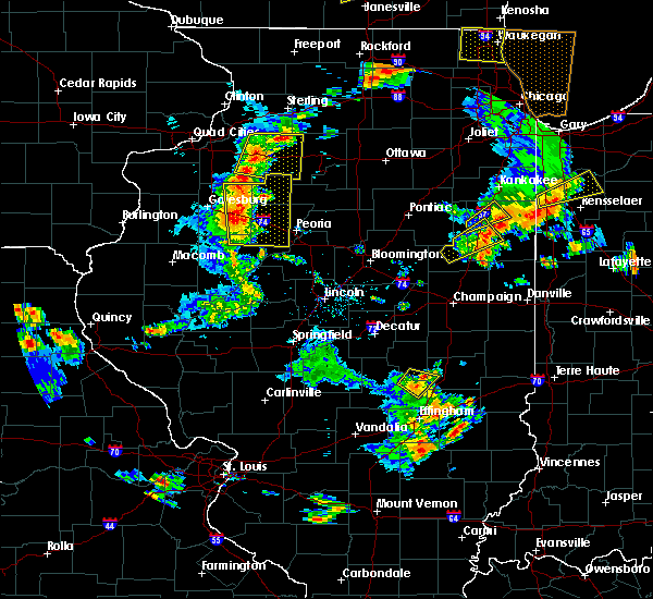 At 307 pm cdt, a severe thunderstorm was located near allenville, or near mattoon, moving northeast at 35 mph (radar indicated). Hazards include 60 mph wind gusts and nickel size hail. Expect damage to roofs, siding, and trees. Locations impacted include, mattoon, windsor, paradise, strasburg and gays. At 307 pm cdt, a severe thunderstorm was located near allenville, or near mattoon, moving northeast at 35 mph (radar indicated). Hazards include 60 mph wind gusts and nickel size hail. Expect damage to roofs, siding, and trees. Locations impacted include, mattoon, windsor, paradise, strasburg and gays.
|
| 6/14/2017 2:44 PM CDT |
 At 243 pm cdt, a severe thunderstorm was located near stewardson, or 8 miles southeast of shelbyville, moving northeast at 40 mph (radar indicated). Hazards include 60 mph wind gusts and quarter size hail. Hail damage to vehicles is expected. Expect wind damage to roofs, siding, and trees. At 243 pm cdt, a severe thunderstorm was located near stewardson, or 8 miles southeast of shelbyville, moving northeast at 40 mph (radar indicated). Hazards include 60 mph wind gusts and quarter size hail. Hail damage to vehicles is expected. Expect wind damage to roofs, siding, and trees.
|
| 5/17/2017 8:12 PM CDT |
 At 812 pm cdt, a confirmed tornado was located over orion, or 10 miles west of cambridge, moving northeast at 40 mph (radar confirmed tornado). Hazards include damaging tornado and ping pong ball size hail. Flying debris will be dangerous to those caught without shelter. mobile homes will be damaged or destroyed. damage to roofs, windows, and vehicles will occur. tree damage is likely. this tornado will be near, colona around 825 pm cdt. cleveland and osborn around 830 pm cdt. geneseo around 835 pm cdt. other locations impacted by this tornadic thunderstorm include henry county fairgrounds, ophiem, osco, sunny hill estates, morristown, green river, griffin, shady beach, swedona and joslin. this includes the following highways, interstate 80 in illinois between mile markers 6 and 28. interstate 74 in illinois between mile markers 10 and 30. Interstate 88 between mile markers 2 and 9. At 812 pm cdt, a confirmed tornado was located over orion, or 10 miles west of cambridge, moving northeast at 40 mph (radar confirmed tornado). Hazards include damaging tornado and ping pong ball size hail. Flying debris will be dangerous to those caught without shelter. mobile homes will be damaged or destroyed. damage to roofs, windows, and vehicles will occur. tree damage is likely. this tornado will be near, colona around 825 pm cdt. cleveland and osborn around 830 pm cdt. geneseo around 835 pm cdt. other locations impacted by this tornadic thunderstorm include henry county fairgrounds, ophiem, osco, sunny hill estates, morristown, green river, griffin, shady beach, swedona and joslin. this includes the following highways, interstate 80 in illinois between mile markers 6 and 28. interstate 74 in illinois between mile markers 10 and 30. Interstate 88 between mile markers 2 and 9.
|
| 5/17/2017 8:05 PM CDT |
 At 805 pm cdt, a tornado producing storm was located over cable, or 13 miles west of cambridge, moving northeast at 40 mph (radar confirmed tornado). Hazards include damaging tornado and ping pong ball size hail. Flying debris will be dangerous to those caught without shelter. mobile homes will be damaged or destroyed. damage to roofs, windows, and vehicles will occur. tree damage is likely. this tornadic storm will be near, orion, andover and lynn center around 815 pm cdt. warner around 820 pm cdt. coal valley around 825 pm cdt. colona around 830 pm cdt. cleveland and osborn around 835 pm cdt. geneseo around 840 pm cdt. other locations impacted by this tornadic thunderstorm include henry county fairgrounds, ophiem, osco, sunny hill estates, morristown, green river, griffin, shady beach, swedona and joslin. this includes the following highways, interstate 80 in illinois between mile markers 6 and 28. interstate 74 in illinois between mile markers 10 and 30. Interstate 88 between mile markers 2 and 9. At 805 pm cdt, a tornado producing storm was located over cable, or 13 miles west of cambridge, moving northeast at 40 mph (radar confirmed tornado). Hazards include damaging tornado and ping pong ball size hail. Flying debris will be dangerous to those caught without shelter. mobile homes will be damaged or destroyed. damage to roofs, windows, and vehicles will occur. tree damage is likely. this tornadic storm will be near, orion, andover and lynn center around 815 pm cdt. warner around 820 pm cdt. coal valley around 825 pm cdt. colona around 830 pm cdt. cleveland and osborn around 835 pm cdt. geneseo around 840 pm cdt. other locations impacted by this tornadic thunderstorm include henry county fairgrounds, ophiem, osco, sunny hill estates, morristown, green river, griffin, shady beach, swedona and joslin. this includes the following highways, interstate 80 in illinois between mile markers 6 and 28. interstate 74 in illinois between mile markers 10 and 30. Interstate 88 between mile markers 2 and 9.
|
| 5/17/2017 7:37 PM CDT |
 At 737 pm cdt, a severe thunderstorm was located over seaton, or near aledo, moving northeast at 50 mph (radar indicated). Hazards include ping pong ball size hail and 60 mph wind gusts. People and animals outdoors will be injured. expect hail damage to roofs, siding, windows, and vehicles. Expect wind damage to roofs, siding, and trees. At 737 pm cdt, a severe thunderstorm was located over seaton, or near aledo, moving northeast at 50 mph (radar indicated). Hazards include ping pong ball size hail and 60 mph wind gusts. People and animals outdoors will be injured. expect hail damage to roofs, siding, windows, and vehicles. Expect wind damage to roofs, siding, and trees.
|
| 4/29/2017 6:42 PM CDT |
 At 641 pm cdt, severe thunderstorms were located along a line extending from near mansfield to near tuscola to near bible grove, moving northeast at 45 mph (radar indicated). Hazards include 60 mph wind gusts and quarter size hail. Hail damage to vehicles is expected. expect wind damage to roofs, siding, and trees. locations impacted include, champaign, charleston, mattoon, rantoul, effingham, monticello, tuscola, sullivan, newton, toledo, urbana, savoy, mahomet, st. joseph, tolono, arcola, villa grove, altamont, arthur and fisher. this includes the following highways, interstate 57 between mile markers 142 and 249. interstate 70 between mile markers 78 and 123. interstate 72 between mile markers 157 and 182. Interstate 74 between mile markers 161 and 192. At 641 pm cdt, severe thunderstorms were located along a line extending from near mansfield to near tuscola to near bible grove, moving northeast at 45 mph (radar indicated). Hazards include 60 mph wind gusts and quarter size hail. Hail damage to vehicles is expected. expect wind damage to roofs, siding, and trees. locations impacted include, champaign, charleston, mattoon, rantoul, effingham, monticello, tuscola, sullivan, newton, toledo, urbana, savoy, mahomet, st. joseph, tolono, arcola, villa grove, altamont, arthur and fisher. this includes the following highways, interstate 57 between mile markers 142 and 249. interstate 70 between mile markers 78 and 123. interstate 72 between mile markers 157 and 182. Interstate 74 between mile markers 161 and 192.
|
| 4/29/2017 6:14 PM CDT |
 At 613 pm cdt, severe thunderstorms were located along a line extending from near maroa to near sullivan to near kinmundy, moving northeast at 40 mph (radar indicated). Hazards include 60 mph wind gusts and quarter size hail. Hail damage to vehicles is expected. Expect wind damage to roofs, siding, and trees. At 613 pm cdt, severe thunderstorms were located along a line extending from near maroa to near sullivan to near kinmundy, moving northeast at 40 mph (radar indicated). Hazards include 60 mph wind gusts and quarter size hail. Hail damage to vehicles is expected. Expect wind damage to roofs, siding, and trees.
|
| 4/29/2017 5:26 PM CDT |
 At 526 pm cdt, severe thunderstorms were located along a line extending from mount auburn to 8 miles north of ramsey, moving northeast at 50 mph (trained weather spotters). Hazards include 60 mph wind gusts and quarter size hail. Hail damage to vehicles is expected. Expect wind damage to roofs, siding, and trees. At 526 pm cdt, severe thunderstorms were located along a line extending from mount auburn to 8 miles north of ramsey, moving northeast at 50 mph (trained weather spotters). Hazards include 60 mph wind gusts and quarter size hail. Hail damage to vehicles is expected. Expect wind damage to roofs, siding, and trees.
|
| 3/7/2017 1:57 AM CST |
 At 156 am cst, severe thunderstorms were located along a line extending from near pesotum to near stewardson, moving east at 65 mph (radar indicated). Hazards include 60 mph wind gusts. expect damage to roofs, siding, and trees At 156 am cst, severe thunderstorms were located along a line extending from near pesotum to near stewardson, moving east at 65 mph (radar indicated). Hazards include 60 mph wind gusts. expect damage to roofs, siding, and trees
|
| 3/7/2017 1:44 AM CST |
 At 143 am cst, severe thunderstorms were located along a line extending from 6 miles south of white heath to near cowden, moving east at 60 mph (radar indicated). Hazards include 60 mph wind gusts and quarter size hail. Hail damage to vehicles is expected. expect wind damage to roofs, siding, and trees. locations impacted include, monticello, shelbyville, sullivan, arthur, bement, bethany, lovington, windsor, stewardson, findlay, cowden, tower hill, hammond, allenville, westervelt, white heath, strasburg, herrick, clarksburg and gays. This includes interstate 72 between mile markers 164 and 173. At 143 am cst, severe thunderstorms were located along a line extending from 6 miles south of white heath to near cowden, moving east at 60 mph (radar indicated). Hazards include 60 mph wind gusts and quarter size hail. Hail damage to vehicles is expected. expect wind damage to roofs, siding, and trees. locations impacted include, monticello, shelbyville, sullivan, arthur, bement, bethany, lovington, windsor, stewardson, findlay, cowden, tower hill, hammond, allenville, westervelt, white heath, strasburg, herrick, clarksburg and gays. This includes interstate 72 between mile markers 164 and 173.
|
| 3/7/2017 1:16 AM CST |
 At 115 am cst, severe thunderstorms were located along a line extending from de land to 7 miles northeast of nokomis, moving east at 75 mph (radar indicated). Hazards include 60 mph wind gusts and quarter size hail. Hail damage to vehicles is expected. Expect wind damage to roofs, siding, and trees. At 115 am cst, severe thunderstorms were located along a line extending from de land to 7 miles northeast of nokomis, moving east at 75 mph (radar indicated). Hazards include 60 mph wind gusts and quarter size hail. Hail damage to vehicles is expected. Expect wind damage to roofs, siding, and trees.
|
| 3/6/2017 11:12 PM CST |
 The severe thunderstorm warning for eastern mercer county will expire at 1115 pm cst, the storms which prompted the warning have moved out of the area. therefore the warning will be allowed to expire. however gusty winds are still possible with these thunderstorms. The severe thunderstorm warning for eastern mercer county will expire at 1115 pm cst, the storms which prompted the warning have moved out of the area. therefore the warning will be allowed to expire. however gusty winds are still possible with these thunderstorms.
|
| 3/6/2017 11:05 PM CST |
 At 1105 pm cst, a severe thunderstorm capable of producing a tornado was located near woodhull, or 8 miles southwest of cambridge, moving northeast at 60 mph (radar indicated rotation). Hazards include tornado. Flying debris will be dangerous to those caught without shelter. mobile homes will be damaged or destroyed. damage to roofs, windows, and vehicles will occur. tree damage is likely. this dangerous storm will be near, cambridge around 1115 pm cst. other locations impacted by this tornadic thunderstorm include henry county fairgrounds, ophiem, nekoma, osco, ulah and bishop hill. This includes interstate 74 in illinois between mile markers 23 and 33. At 1105 pm cst, a severe thunderstorm capable of producing a tornado was located near woodhull, or 8 miles southwest of cambridge, moving northeast at 60 mph (radar indicated rotation). Hazards include tornado. Flying debris will be dangerous to those caught without shelter. mobile homes will be damaged or destroyed. damage to roofs, windows, and vehicles will occur. tree damage is likely. this dangerous storm will be near, cambridge around 1115 pm cst. other locations impacted by this tornadic thunderstorm include henry county fairgrounds, ophiem, nekoma, osco, ulah and bishop hill. This includes interstate 74 in illinois between mile markers 23 and 33.
|
| 3/6/2017 11:04 PM CST |
 At 1104 pm cst, severe thunderstorms were located along a line extending from 6 miles northwest of hooppole to near andover to north henderson, moving east at 35 mph (trained weather spotters). Hazards include 70 mph wind gusts. Expect considerable tree damage. damage is likely to mobile homes, roofs, and outbuildings. locations impacted include, viola, sherrard, north henderson, cable, new windsor, griffin and swedona. A tornado watch remains in effect until 400 am cst for northwestern illinois. At 1104 pm cst, severe thunderstorms were located along a line extending from 6 miles northwest of hooppole to near andover to north henderson, moving east at 35 mph (trained weather spotters). Hazards include 70 mph wind gusts. Expect considerable tree damage. damage is likely to mobile homes, roofs, and outbuildings. locations impacted include, viola, sherrard, north henderson, cable, new windsor, griffin and swedona. A tornado watch remains in effect until 400 am cst for northwestern illinois.
|
| 3/6/2017 11:02 PM CST |
 At 1102 pm cst, severe thunderstorms were located along a line extending from near fairhaven to near geneseo to near rio, moving east at 55 mph (radar indicated). Hazards include 70 mph wind gusts. Expect considerable tree damage. damage is likely to mobile homes, roofs, and outbuildings. locations impacted include, sterling, kewanee, rock falls, morrison, cambridge, geneseo, colona, galva, prophetstown, orion, erie, walnut, garden plain, wyanet, atkinson, sheffield, annawan, woodhull, tampico and new windsor. this includes the following highways, interstate 80 in illinois between mile markers 8 and 50. interstate 74 in illinois between mile markers 13 and 33. interstate 88 between mile markers 14 and 44. A tornado watch remains in effect until 400 am cst for north central and northwestern illinois. At 1102 pm cst, severe thunderstorms were located along a line extending from near fairhaven to near geneseo to near rio, moving east at 55 mph (radar indicated). Hazards include 70 mph wind gusts. Expect considerable tree damage. damage is likely to mobile homes, roofs, and outbuildings. locations impacted include, sterling, kewanee, rock falls, morrison, cambridge, geneseo, colona, galva, prophetstown, orion, erie, walnut, garden plain, wyanet, atkinson, sheffield, annawan, woodhull, tampico and new windsor. this includes the following highways, interstate 80 in illinois between mile markers 8 and 50. interstate 74 in illinois between mile markers 13 and 33. interstate 88 between mile markers 14 and 44. A tornado watch remains in effect until 400 am cst for north central and northwestern illinois.
|
| 3/6/2017 11:00 PM CST |
 At 1059 pm cst, severe thunderstorms were located along a line extending from garden plain to near warner to north henderson, moving east at 55 mph (trained weather spotters. this line of storms has a history of producing damaging winds and isolated tornadoes). Hazards include 70 mph wind gusts. Expect considerable tree damage. damage is likely to mobile homes, roofs, and outbuildings. locations impacted include, moline, east moline, silvis, milan, coal valley, burgess, hampton, port byron, rapids city, viola, matherville, cordova, sherrard, riverdale, oak grove, north henderson, cable, new windsor, boden and shale city. this includes the following highways, interstate 80 in illinois between mile markers 1 and 5. interstate 74 in illinois between mile markers 3 and 7. interstate 88 between mile markers 1 and 13. interstate 280 between mile markers 16 and 18. A tornado watch remains in effect until 400 am cst for northwestern illinois, and east central iowa. At 1059 pm cst, severe thunderstorms were located along a line extending from garden plain to near warner to north henderson, moving east at 55 mph (trained weather spotters. this line of storms has a history of producing damaging winds and isolated tornadoes). Hazards include 70 mph wind gusts. Expect considerable tree damage. damage is likely to mobile homes, roofs, and outbuildings. locations impacted include, moline, east moline, silvis, milan, coal valley, burgess, hampton, port byron, rapids city, viola, matherville, cordova, sherrard, riverdale, oak grove, north henderson, cable, new windsor, boden and shale city. this includes the following highways, interstate 80 in illinois between mile markers 1 and 5. interstate 74 in illinois between mile markers 3 and 7. interstate 88 between mile markers 1 and 13. interstate 280 between mile markers 16 and 18. A tornado watch remains in effect until 400 am cst for northwestern illinois, and east central iowa.
|
| 3/6/2017 10:58 PM CST |
 At 1058 pm cst, a severe thunderstorm capable of producing a tornado was located over rio, or 13 miles north of galesburg, moving northeast at 60 mph (radar indicated rotation). Hazards include tornado. Flying debris will be dangerous to those caught without shelter. mobile homes will be damaged or destroyed. damage to roofs, windows, and vehicles will occur. tree damage is likely. this dangerous storm will be near, andover and lynn center around 1110 pm cst. cambridge around 1115 pm cst. other locations impacted by this tornadic thunderstorm include henry county fairgrounds, ophiem, nekoma, osco, ulah and bishop hill. This includes interstate 74 in illinois between mile markers 22 and 33. At 1058 pm cst, a severe thunderstorm capable of producing a tornado was located over rio, or 13 miles north of galesburg, moving northeast at 60 mph (radar indicated rotation). Hazards include tornado. Flying debris will be dangerous to those caught without shelter. mobile homes will be damaged or destroyed. damage to roofs, windows, and vehicles will occur. tree damage is likely. this dangerous storm will be near, andover and lynn center around 1110 pm cst. cambridge around 1115 pm cst. other locations impacted by this tornadic thunderstorm include henry county fairgrounds, ophiem, nekoma, osco, ulah and bishop hill. This includes interstate 74 in illinois between mile markers 22 and 33.
|
| 3/6/2017 10:26 PM CST |
 At 1026 pm cst, severe thunderstorms were located along a line extending from near dewitt to near little york, moving east at 75 mph (radar indicated). Hazards include 70 mph wind gusts. Expect considerable tree damage. Damage is likely to mobile homes, roofs, and outbuildings. At 1026 pm cst, severe thunderstorms were located along a line extending from near dewitt to near little york, moving east at 75 mph (radar indicated). Hazards include 70 mph wind gusts. Expect considerable tree damage. Damage is likely to mobile homes, roofs, and outbuildings.
|
| 3/6/2017 9:52 PM CST |
 At 952 pm cst, severe thunderstorms were located along a line extending from near lone tree to near wapello to near donnellson, moving east at 55 mph (trained weather spotters. this line of storms has a history of producing damaging winds). Hazards include 70 mph wind gusts. Expect considerable tree damage. Damage is likely to mobile homes, roofs, and outbuildings. At 952 pm cst, severe thunderstorms were located along a line extending from near lone tree to near wapello to near donnellson, moving east at 55 mph (trained weather spotters. this line of storms has a history of producing damaging winds). Hazards include 70 mph wind gusts. Expect considerable tree damage. Damage is likely to mobile homes, roofs, and outbuildings.
|
| 2/28/2017 6:43 PM CST |
 At 642 pm cst, a severe thunderstorm was located over shelbyville, moving northeast at 55 mph (radar indicated). Hazards include 60 mph wind gusts and quarter size hail. Hail damage to vehicles is expected. expect wind damage to roofs, siding, and trees. locations impacted include, shelbyville, windsor, tower hill, strasburg, clarksburg, trowbridge, mode, eagle creek state park and wolf creek state park. A tornado watch remains in effect until 1000 pm cst for central and east central illinois. At 642 pm cst, a severe thunderstorm was located over shelbyville, moving northeast at 55 mph (radar indicated). Hazards include 60 mph wind gusts and quarter size hail. Hail damage to vehicles is expected. expect wind damage to roofs, siding, and trees. locations impacted include, shelbyville, windsor, tower hill, strasburg, clarksburg, trowbridge, mode, eagle creek state park and wolf creek state park. A tornado watch remains in effect until 1000 pm cst for central and east central illinois.
|
| 2/28/2017 6:27 PM CST |
 At 626 pm cst, a severe thunderstorm was located near ramsey, or 12 miles southeast of nokomis, moving northeast at 70 mph (radar indicated). Hazards include 60 mph wind gusts and quarter size hail. Hail damage to vehicles is expected. Expect wind damage to roofs, siding, and trees. At 626 pm cst, a severe thunderstorm was located near ramsey, or 12 miles southeast of nokomis, moving northeast at 70 mph (radar indicated). Hazards include 60 mph wind gusts and quarter size hail. Hail damage to vehicles is expected. Expect wind damage to roofs, siding, and trees.
|
| 8/26/2016 3:29 PM CDT |
 At 328 pm cdt, a severe thunderstorm was located near windsor, or 12 miles southwest of mattoon, moving northeast at 25 mph (radar indicated). Hazards include 60 mph wind gusts and quarter size hail. Hail damage to vehicles is expected. Expect wind damage to roofs, siding, and trees. At 328 pm cdt, a severe thunderstorm was located near windsor, or 12 miles southwest of mattoon, moving northeast at 25 mph (radar indicated). Hazards include 60 mph wind gusts and quarter size hail. Hail damage to vehicles is expected. Expect wind damage to roofs, siding, and trees.
|
| 7/13/2016 5:18 PM CDT | Tree fell on house and went through roof in shelby county IL, 155.8 miles NW of Windsor, IL |
| 7/13/2016 4:58 PM CDT |
 At 457 pm cdt, severe thunderstorms were located along a line extending from near forsyth to near moweaqua to 7 miles northeast of ramsey, moving east at 40 mph (radar indicated). Hazards include 60 mph wind gusts. Expect damage to roofs. siding. And trees. At 457 pm cdt, severe thunderstorms were located along a line extending from near forsyth to near moweaqua to 7 miles northeast of ramsey, moving east at 40 mph (radar indicated). Hazards include 60 mph wind gusts. Expect damage to roofs. siding. And trees.
|
| 7/13/2016 3:41 PM CDT |
 At 341 pm cdt, severe thunderstorms were located along a line extending from near orion to rio, moving east at 45 mph (radar indicated). Hazards include 60 mph wind gusts. Expect damage to roofs. siding. And trees. At 341 pm cdt, severe thunderstorms were located along a line extending from near orion to rio, moving east at 45 mph (radar indicated). Hazards include 60 mph wind gusts. Expect damage to roofs. siding. And trees.
|
| 7/13/2016 3:29 PM CDT |
 At 327 pm cdt, severe thunderstorms were located along a line extending from near coal valley to cable to 6 miles southwest of north henderson, moving east at 55 mph (this storm has a history of wind damage with downed trees in portions of mercer county). Hazards include 70 mph wind gusts. Expect considerable tree damage. damage is likely to mobile homes, roofs, and outbuildings. Locations impacted include, rock island, kewanee, aledo, cambridge, milan, galva, burgess, orion, andalusia, viola, woodhull, matherville, alpha, sherrard, andover, reynolds, oak grove, seaton, north henderson and taylor ridge. At 327 pm cdt, severe thunderstorms were located along a line extending from near coal valley to cable to 6 miles southwest of north henderson, moving east at 55 mph (this storm has a history of wind damage with downed trees in portions of mercer county). Hazards include 70 mph wind gusts. Expect considerable tree damage. damage is likely to mobile homes, roofs, and outbuildings. Locations impacted include, rock island, kewanee, aledo, cambridge, milan, galva, burgess, orion, andalusia, viola, woodhull, matherville, alpha, sherrard, andover, reynolds, oak grove, seaton, north henderson and taylor ridge.
|
| 7/13/2016 3:19 PM CDT |
 At 318 pm cdt, severe thunderstorms were located along a line extending from montpelier to near hamlet to near keithsburg, moving east at 55 mph (radar indicated). Hazards include 70 mph wind gusts. Expect considerable tree damage. damage is likely to mobile homes, roofs, and outbuildings. Locations impacted include, rock island, kewanee, aledo, cambridge, milan, galva, burgess, orion, buffalo, andalusia, viola, woodhull, millersburg, matherville, alpha, sherrard, keithsburg, andover, reynolds and joy. At 318 pm cdt, severe thunderstorms were located along a line extending from montpelier to near hamlet to near keithsburg, moving east at 55 mph (radar indicated). Hazards include 70 mph wind gusts. Expect considerable tree damage. damage is likely to mobile homes, roofs, and outbuildings. Locations impacted include, rock island, kewanee, aledo, cambridge, milan, galva, burgess, orion, buffalo, andalusia, viola, woodhull, millersburg, matherville, alpha, sherrard, keithsburg, andover, reynolds and joy.
|
| 7/13/2016 3:07 PM CDT |
 At 306 pm cdt, severe thunderstorms were located along a line extending from near fairport to near illinois city to near oakville, moving east at 50 mph (this storm has a history of wind damage with downed trees in portions of keokuk and washington counties). Hazards include 70 mph wind gusts. Expect considerable tree damage. damage is likely to mobile homes, roofs, and outbuildings. Locations impacted include, rock island, muscatine, kewanee, aledo, cambridge, milan, galva, burgess, orion, buffalo, andalusia, fruitland, viola, woodhull, millersburg, matherville, new boston, alpha, sherrard and keithsburg. At 306 pm cdt, severe thunderstorms were located along a line extending from near fairport to near illinois city to near oakville, moving east at 50 mph (this storm has a history of wind damage with downed trees in portions of keokuk and washington counties). Hazards include 70 mph wind gusts. Expect considerable tree damage. damage is likely to mobile homes, roofs, and outbuildings. Locations impacted include, rock island, muscatine, kewanee, aledo, cambridge, milan, galva, burgess, orion, buffalo, andalusia, fruitland, viola, woodhull, millersburg, matherville, new boston, alpha, sherrard and keithsburg.
|
| 7/13/2016 2:45 PM CDT |
 At 244 pm cdt, severe thunderstorms were located along a line extending from near nichols to near letts to near mount union, moving east at 70 mph (this storm has a history of wind damage with downed trees in portions of keokuk and washington counties). Hazards include 70 mph wind gusts. Expect considerable tree damage. Damage is likely to mobile homes, roofs, and outbuildings. At 244 pm cdt, severe thunderstorms were located along a line extending from near nichols to near letts to near mount union, moving east at 70 mph (this storm has a history of wind damage with downed trees in portions of keokuk and washington counties). Hazards include 70 mph wind gusts. Expect considerable tree damage. Damage is likely to mobile homes, roofs, and outbuildings.
|
| 7/6/2016 4:40 AM CDT |
 At 439 am cdt, a severe thunderstorm was located over galva, or near kewanee, moving east at 40 mph (radar indicated). Hazards include 60 mph wind gusts. Expect damage to roofs. siding. and trees. Locations impacted include, kewanee, cambridge, galva, woodhull, new windsor, alpha, andover, lynn center, bishop hill, ophiem, kewanee municipal airport, henry county fairgrounds, german corner, ulah, johnson-sauk trail state park and nekoma. At 439 am cdt, a severe thunderstorm was located over galva, or near kewanee, moving east at 40 mph (radar indicated). Hazards include 60 mph wind gusts. Expect damage to roofs. siding. and trees. Locations impacted include, kewanee, cambridge, galva, woodhull, new windsor, alpha, andover, lynn center, bishop hill, ophiem, kewanee municipal airport, henry county fairgrounds, german corner, ulah, johnson-sauk trail state park and nekoma.
|
| 7/6/2016 4:35 AM CDT |
 At 434 am cdt, a severe thunderstorm was located over galva, or 9 miles southwest of kewanee, moving east at 40 mph (radar indicated). Hazards include 60 mph wind gusts. Expect damage to roofs. siding. and trees. Locations impacted include, kewanee, cambridge, hennepin, galva, depue, granville, woodhull, new windsor, alpha, andover, mcnabb, lynn center, putnam, mark, magnolia, standard, bishop hill, lake thunderbird, kewanee municipal airport and henry county fairgrounds. At 434 am cdt, a severe thunderstorm was located over galva, or 9 miles southwest of kewanee, moving east at 40 mph (radar indicated). Hazards include 60 mph wind gusts. Expect damage to roofs. siding. and trees. Locations impacted include, kewanee, cambridge, hennepin, galva, depue, granville, woodhull, new windsor, alpha, andover, mcnabb, lynn center, putnam, mark, magnolia, standard, bishop hill, lake thunderbird, kewanee municipal airport and henry county fairgrounds.
|
| 7/6/2016 4:20 AM CDT |
 At 419 am cdt, a severe thunderstorm was located near cambridge, moving southeast at 30 mph (radar indicated). Hazards include 60 mph wind gusts. Expect damage to roofs. siding. and trees. locations impacted include, kewanee, princeton, cambridge, hennepin, geneseo, spring valley, colona, galva, burgess, orion, depue, granville, walnut, ladd, wyanet, atkinson, viola, sheffield, annawan and tiskilwa. This includes interstate 80 in illinois between mile markers 10 and 72. At 419 am cdt, a severe thunderstorm was located near cambridge, moving southeast at 30 mph (radar indicated). Hazards include 60 mph wind gusts. Expect damage to roofs. siding. and trees. locations impacted include, kewanee, princeton, cambridge, hennepin, geneseo, spring valley, colona, galva, burgess, orion, depue, granville, walnut, ladd, wyanet, atkinson, viola, sheffield, annawan and tiskilwa. This includes interstate 80 in illinois between mile markers 10 and 72.
|
| 7/6/2016 3:56 AM CDT |
 At 356 am cdt, severe thunderstorms were located along a line extending from 6 miles north of geneseo to alpha, moving east at 50 mph (radar indicated). Hazards include 70 mph wind gusts. Expect considerable tree damage. damage is likely to mobile homes, roofs, and outbuildings. locations impacted include, moline, rock island, east moline, kewanee, princeton, cambridge, hennepin, silvis, geneseo, spring valley, milan, colona, le claire, coal valley, galva, burgess, hampton, orion, depue and port byron. this includes the following highways, interstate 80 in illinois between mile markers 1 and 72. interstate 74 in illinois between mile markers 2 and 3. interstate 88 between mile markers 1 and 10. Interstate 280 between mile markers 13 and 18. At 356 am cdt, severe thunderstorms were located along a line extending from 6 miles north of geneseo to alpha, moving east at 50 mph (radar indicated). Hazards include 70 mph wind gusts. Expect considerable tree damage. damage is likely to mobile homes, roofs, and outbuildings. locations impacted include, moline, rock island, east moline, kewanee, princeton, cambridge, hennepin, silvis, geneseo, spring valley, milan, colona, le claire, coal valley, galva, burgess, hampton, orion, depue and port byron. this includes the following highways, interstate 80 in illinois between mile markers 1 and 72. interstate 74 in illinois between mile markers 2 and 3. interstate 88 between mile markers 1 and 10. Interstate 280 between mile markers 13 and 18.
|
| 7/6/2016 3:46 AM CDT |
 At 345 am cdt, a severe thunderstorm was located over cleveland, or near east moline, moving east at 55 mph (radar indicated). Hazards include 60 mph wind gusts. Expect damage to roofs. siding. And trees. At 345 am cdt, a severe thunderstorm was located over cleveland, or near east moline, moving east at 55 mph (radar indicated). Hazards include 60 mph wind gusts. Expect damage to roofs. siding. And trees.
|
| 6/22/2016 3:33 AM CDT |
 At 332 am cdt, severe thunderstorms were located along a line extending from cable to near little york to oquawka, moving southeast at 25 mph (radar indicated). Hazards include 60 mph wind gusts. Expect damage to roofs. siding. and trees. Locations impacted include, aledo, burgess, viola, millersburg, matherville, sherrard, keithsburg, joy, seaton, new windsor, cable, shale city, boden, mannon, ogle, preemption, old gilchrist, gingle corners, sunbeam and wanlock. At 332 am cdt, severe thunderstorms were located along a line extending from cable to near little york to oquawka, moving southeast at 25 mph (radar indicated). Hazards include 60 mph wind gusts. Expect damage to roofs. siding. and trees. Locations impacted include, aledo, burgess, viola, millersburg, matherville, sherrard, keithsburg, joy, seaton, new windsor, cable, shale city, boden, mannon, ogle, preemption, old gilchrist, gingle corners, sunbeam and wanlock.
|
| 6/22/2016 3:16 AM CDT |
 At 316 am cdt, severe thunderstorms were located along a line extending from near boden to near aledo to wapello, moving southeast at 20 mph (radar indicated). Hazards include 60 mph wind gusts. Expect damage to roofs. siding. and trees. Locations impacted include, aledo, wapello, columbus junction, burgess, fruitland, viola, morning sun, millersburg, matherville, new boston, sherrard, keithsburg, grandview, reynolds, eliza, joy, letts, seaton, oakville and mannon. At 316 am cdt, severe thunderstorms were located along a line extending from near boden to near aledo to wapello, moving southeast at 20 mph (radar indicated). Hazards include 60 mph wind gusts. Expect damage to roofs. siding. and trees. Locations impacted include, aledo, wapello, columbus junction, burgess, fruitland, viola, morning sun, millersburg, matherville, new boston, sherrard, keithsburg, grandview, reynolds, eliza, joy, letts, seaton, oakville and mannon.
|
| 6/22/2016 3:02 AM CDT |
 At 302 am cdt, severe thunderstorms were located along a line extending from near reynolds to joy to wapello, moving southeast at 20 mph (radar indicated). Hazards include 60 mph wind gusts. Expect damage to roofs. siding. And trees. At 302 am cdt, severe thunderstorms were located along a line extending from near reynolds to joy to wapello, moving southeast at 20 mph (radar indicated). Hazards include 60 mph wind gusts. Expect damage to roofs. siding. And trees.
|
| 4/27/2016 7:22 PM CDT |
 The severe thunderstorm warning for northwestern jasper, northern effingham, southwestern cumberland and southeastern shelby counties will expire at 730 pm cdt, remember, a tornado warning still remains in effect for effingham, southwest cumberland, and southeast shelby counties until 800 pm cdt. The severe thunderstorm warning for northwestern jasper, northern effingham, southwestern cumberland and southeastern shelby counties will expire at 730 pm cdt, remember, a tornado warning still remains in effect for effingham, southwest cumberland, and southeast shelby counties until 800 pm cdt.
|
| 4/27/2016 6:39 PM CDT |
 At 639 pm cdt, a severe thunderstorm was located near wrights corner, or 14 miles west of effingham, moving northeast at 45 mph (radar indicated). Hazards include 60 mph wind gusts and quarter size hail. Hail damage to vehicles is expected. Expect wind damage to roofs, siding, and trees. At 639 pm cdt, a severe thunderstorm was located near wrights corner, or 14 miles west of effingham, moving northeast at 45 mph (radar indicated). Hazards include 60 mph wind gusts and quarter size hail. Hail damage to vehicles is expected. Expect wind damage to roofs, siding, and trees.
|
| 12/23/2015 10:13 AM CST | The severe thunderstorm warning for piatt, western coles, moultrie, southeastern macon, northern cumberland, eastern shelby and western douglas counties will expire at 1015 am cst, the storms which prompted the warning have weakened below severe limits, and no longer pose an immediate threat to life or property. therefore the warning will be allowed to expire. however gusty winds are still possible with these thunderstorms. a tornado watch remains in effect until 500 pm cst for east central illinois. |
| 12/23/2015 9:59 AM CST | A severe thunderstorm warning remains in effect until 1015 am cst for piatt. western coles. moultrie. southeastern macon. northern cumberland. eastern shelby and western douglas counties. at 959 am cst. severe thunderstorms were located along a line extending from near cerro gordo to 5 miles northwest of stewardson. Moving northeast at 55 mph. |
| 12/23/2015 9:48 AM CST | At 947 am cst, severe thunderstorms were located along a line extending from near mount zion to near cowden, moving northeast at 55 mph (radar indicated). Hazards include 60 mph wind gusts. Expect damage to roofs. Siding and trees. |
| 11/11/2015 6:21 PM CST |
 At 621 pm cst, severe thunderstorms were located along a line extending from near oak grove to near alpha to bushnell, moving northeast at 60 mph (radar indicated). Hazards include 60 mph wind gusts. Expect damage to roofs. siding and trees. locations impacted include, macomb, monmouth, bushnell, burgess, roseville, viola, matherville, industry, good hope, prairie city, bardolph, north henderson, western illinois university, new philadelphia, adair, cable, shale city, boden, little swan lake and new windsor. A tornado watch remains in effect until 900 pm cst for northwestern illinois. At 621 pm cst, severe thunderstorms were located along a line extending from near oak grove to near alpha to bushnell, moving northeast at 60 mph (radar indicated). Hazards include 60 mph wind gusts. Expect damage to roofs. siding and trees. locations impacted include, macomb, monmouth, bushnell, burgess, roseville, viola, matherville, industry, good hope, prairie city, bardolph, north henderson, western illinois university, new philadelphia, adair, cable, shale city, boden, little swan lake and new windsor. A tornado watch remains in effect until 900 pm cst for northwestern illinois.
|
| 11/11/2015 6:03 PM CST |
 At 602 pm cst, severe thunderstorms were located along a line extending from near millersburg to near burgess to western illinois university, moving northeast at 60 mph (radar indicated). Hazards include 60 mph wind gusts. Expect damage to roofs. siding and trees. locations impacted include, macomb, monmouth, aledo, bushnell, burgess, colchester, la harpe, roseville, viola, stronghurst, matherville, kirkwood, blandinsville, industry, joy, good hope, prairie city, little york, biggsville and rozetta. A tornado watch remains in effect until 900 pm cst for northwestern illinois. At 602 pm cst, severe thunderstorms were located along a line extending from near millersburg to near burgess to western illinois university, moving northeast at 60 mph (radar indicated). Hazards include 60 mph wind gusts. Expect damage to roofs. siding and trees. locations impacted include, macomb, monmouth, aledo, bushnell, burgess, colchester, la harpe, roseville, viola, stronghurst, matherville, kirkwood, blandinsville, industry, joy, good hope, prairie city, little york, biggsville and rozetta. A tornado watch remains in effect until 900 pm cst for northwestern illinois.
|
| 11/11/2015 5:48 PM CST |
 At 548 pm cst, severe thunderstorms were located along a line extending from new boston to near rozetta to near colmar, moving northeast at 60 mph (radar indicated). Hazards include 60 mph wind gusts. Expect damage to roofs. siding and trees. locations impacted include, macomb, monmouth, aledo, oquawka, bushnell, burgess, colchester, la harpe, roseville, viola, stronghurst, matherville, kirkwood, new boston, blandinsville, keithsburg, augusta, industry, joy and good hope. A tornado watch remains in effect until 900 pm cst for northwestern illinois and southeastern iowa. At 548 pm cst, severe thunderstorms were located along a line extending from new boston to near rozetta to near colmar, moving northeast at 60 mph (radar indicated). Hazards include 60 mph wind gusts. Expect damage to roofs. siding and trees. locations impacted include, macomb, monmouth, aledo, oquawka, bushnell, burgess, colchester, la harpe, roseville, viola, stronghurst, matherville, kirkwood, new boston, blandinsville, keithsburg, augusta, industry, joy and good hope. A tornado watch remains in effect until 900 pm cst for northwestern illinois and southeastern iowa.
|
| 11/11/2015 5:28 PM CST |
 At 527 pm cst, severe thunderstorms were located along a line extending from near mount union to near west burlington to near west point, moving northeast at 60 mph (radar indicated). Hazards include 60 mph wind gusts. Expect damage to roofs. Siding and trees. At 527 pm cst, severe thunderstorms were located along a line extending from near mount union to near west burlington to near west point, moving northeast at 60 mph (radar indicated). Hazards include 60 mph wind gusts. Expect damage to roofs. Siding and trees.
|
| 6/22/2015 7:19 PM CDT |
 At 718 pm cdt, a severe thunderstorm capable of producing a tornado was located near andalusia, or 13 miles southwest of rock island, moving southeast at 30 mph (radar indicated rotation). Hazards include tornado. Flying debris will be dangerous to those caught without shelter. mobile homes will be damaged or destroyed. damage to roofs, windows and vehicles will occur. tree damage is likely. this dangerous storm will be near, taylor ridge around 730 pm cdt. reynolds around 735 pm cdt. matherville around 745 pm cdt. sherrard and boden around 750 pm cdt. cable around 755 pm cdt. new windsor around 805 pm cdt. Other locations impacted by this tornadic thunderstorm include swedona, edgington, preemption and griffin. At 718 pm cdt, a severe thunderstorm capable of producing a tornado was located near andalusia, or 13 miles southwest of rock island, moving southeast at 30 mph (radar indicated rotation). Hazards include tornado. Flying debris will be dangerous to those caught without shelter. mobile homes will be damaged or destroyed. damage to roofs, windows and vehicles will occur. tree damage is likely. this dangerous storm will be near, taylor ridge around 730 pm cdt. reynolds around 735 pm cdt. matherville around 745 pm cdt. sherrard and boden around 750 pm cdt. cable around 755 pm cdt. new windsor around 805 pm cdt. Other locations impacted by this tornadic thunderstorm include swedona, edgington, preemption and griffin.
|
| 6/20/2015 10:46 PM CDT |
 At 1046 pm cdt, severe thunderstorms were located along a line extending from argenta to near moweaqua to 10 miles west of pana, moving east at 45 mph (trained weather spotters). Hazards include 60 mph wind gusts. Expect damage to roofs. Siding and trees. At 1046 pm cdt, severe thunderstorms were located along a line extending from argenta to near moweaqua to 10 miles west of pana, moving east at 45 mph (trained weather spotters). Hazards include 60 mph wind gusts. Expect damage to roofs. Siding and trees.
|
| 6/20/2015 8:38 PM CDT |
 At 837 pm cdt, severe thunderstorms were located along a line extending from near north henderson to near abingdon to near macomb, moving east at 25 mph (radar indicated). Hazards include 60 mph wind gusts. Expect damage to roofs. siding and trees. locations impacted include, macomb, bushnell, viola, blandinsville, good hope, prairie city, bardolph, north henderson, ferris, sciota, new windsor, new philadelphia, shale city, little swan lake, alexis, walnut grove, greenbush, coldbrook, berwick and fountain green. A tornado watch remains in effect until 1100 pm cdt for northwestern illinois. At 837 pm cdt, severe thunderstorms were located along a line extending from near north henderson to near abingdon to near macomb, moving east at 25 mph (radar indicated). Hazards include 60 mph wind gusts. Expect damage to roofs. siding and trees. locations impacted include, macomb, bushnell, viola, blandinsville, good hope, prairie city, bardolph, north henderson, ferris, sciota, new windsor, new philadelphia, shale city, little swan lake, alexis, walnut grove, greenbush, coldbrook, berwick and fountain green. A tornado watch remains in effect until 1100 pm cdt for northwestern illinois.
|
| 6/20/2015 8:05 PM CDT |
 At 805 pm cdt, severe thunderstorms were located along a line extending from near aledo to near monmouth to near blandinsville, moving east at 55 mph (trained weather spotters). Hazards include 70 mph wind gusts. Expect considerable tree damage. damage is likely to mobile homes, roofs and outbuildings. locations impacted include, macomb, monmouth, aledo, bushnell, burgess, la harpe, roseville, viola, kirkwood, blandinsville, joy, good hope, prairie city, little york, bardolph, north henderson, ferris, raritan, sciota and new windsor. A tornado watch remains in effect until 1100 pm cdt for northwestern illinois. At 805 pm cdt, severe thunderstorms were located along a line extending from near aledo to near monmouth to near blandinsville, moving east at 55 mph (trained weather spotters). Hazards include 70 mph wind gusts. Expect considerable tree damage. damage is likely to mobile homes, roofs and outbuildings. locations impacted include, macomb, monmouth, aledo, bushnell, burgess, la harpe, roseville, viola, kirkwood, blandinsville, joy, good hope, prairie city, little york, bardolph, north henderson, ferris, raritan, sciota and new windsor. A tornado watch remains in effect until 1100 pm cdt for northwestern illinois.
|
| 6/20/2015 7:51 PM CDT |
 At 750 pm cdt, severe thunderstorms were located along a line extending from new boston to near oquawka to burnside, moving east at 55 mph (radar indicated). Hazards include 70 mph wind gusts. Expect considerable tree damage. Damage is likely to mobile homes, roofs and outbuildings. At 750 pm cdt, severe thunderstorms were located along a line extending from new boston to near oquawka to burnside, moving east at 55 mph (radar indicated). Hazards include 70 mph wind gusts. Expect considerable tree damage. Damage is likely to mobile homes, roofs and outbuildings.
|
| 6/15/2015 7:54 PM CDT |
 The severe thunderstorm warning for southeastern moultrie and southeastern shelby counties will expire at 800 pm cdt, the storm which prompted the warning has moved out of the area. therefore the warning will be allowed to expire. however heavy rain is still possible with this thunderstorm. to report severe weather, contact your nearest law enforcement agency. they will relay your report to the national weather service lincoln. The severe thunderstorm warning for southeastern moultrie and southeastern shelby counties will expire at 800 pm cdt, the storm which prompted the warning has moved out of the area. therefore the warning will be allowed to expire. however heavy rain is still possible with this thunderstorm. to report severe weather, contact your nearest law enforcement agency. they will relay your report to the national weather service lincoln.
|
| 6/15/2015 7:31 PM CDT |
 At 730 pm cdt, a severe thunderstorm was located near shelbyville, moving east at 40 mph (radar indicated). Hazards include 60 mph wind gusts. Expect damage to roofs. Siding and trees. At 730 pm cdt, a severe thunderstorm was located near shelbyville, moving east at 40 mph (radar indicated). Hazards include 60 mph wind gusts. Expect damage to roofs. Siding and trees.
|
| 6/7/2015 9:45 PM CDT | At 945 pm cdt, severe thunderstorms were located along a line extending from near cooks mills to near shelbyville to 5 miles southeast of morrisonville, moving southeast at 55 mph (radar indicated). Hazards include 60 mph wind gusts and quarter size hail. Hail damage to vehicles is expected. expect wind damage to roofs, siding and trees. locations impacted include, taylorville, shelbyville, sullivan, pana, lakewood, moweaqua, kincaid, bethany, assumption, blue mound, macon, edinburg, morrisonville, stonington, windsor, stewardson, findlay, cowden, tower hill and dalton city. This includes interstate 57 between mile markers 169 and 170. |
| 6/7/2015 9:15 PM CDT | At 915 pm cdt, severe thunderstorms were located along a line extending from 6 miles southwest of dalton city to 6 miles southwest of auburn, moving southeast at 35 mph (radar indicated). Hazards include 60 mph wind gusts and quarter size hail. Hail damage to vehicles is expected. Expect wind damage to roofs, siding and trees. |
| 6/1/2014 7:45 PM CDT | Numerous small limbs down. two limbs of 8 to 10 inches in diameter and 15 to 20 feet in length also down. delayed repor in mercer county IL, 2 miles S of Windsor, IL |
| 5/11/2014 3:30 PM CDT | Quarter sized hail reported 3.9 miles SE of Windsor, IL |
| 5/20/2013 11:25 PM CDT | 14 inch diameter tree snapped off. grain bins destroyed and rolled over a car. machine shed roof ripped off. 4 power poles snapped. time estimate in shelby county IL, 2 miles W of Windsor, IL |
| 5/19/2013 6:15 PM CDT | Trees down us 67 south of 50th street. delayed repor in mercer county IL, 0.3 miles ENE of Windsor, IL |
| 8/16/2012 3:40 PM CDT | Numerous power poles and power lines down. siding blown off trailers. tree limbs down across tow in shelby county IL, 0.2 miles ESE of Windsor, IL |
| 8/16/2012 3:36 PM CDT | Numerous tree limbs down and 2 foot diameter tree down in town. numerous roads blocked by limbs in shelby county IL, 0.2 miles ESE of Windsor, IL |
| 6/29/2012 9:05 PM CDT | Flagpole bent over and tree limbs blown down. winds estimated at 70 mph. relayed by nws lincol in mercer county IL, 1.1 miles NE of Windsor, IL |
| 1/1/0001 12:00 AM | Delayed report. power poles down and part of a machine shed blown apart. time estimate in shelby county IL, 0.9 miles W of Windsor, IL |
| 1/1/0001 12:00 AM | Quarter sized hail reported 152 miles NW of Windsor, IL |
Hail Maps for Windsor, IL


Connect with Interactive Hail Maps