

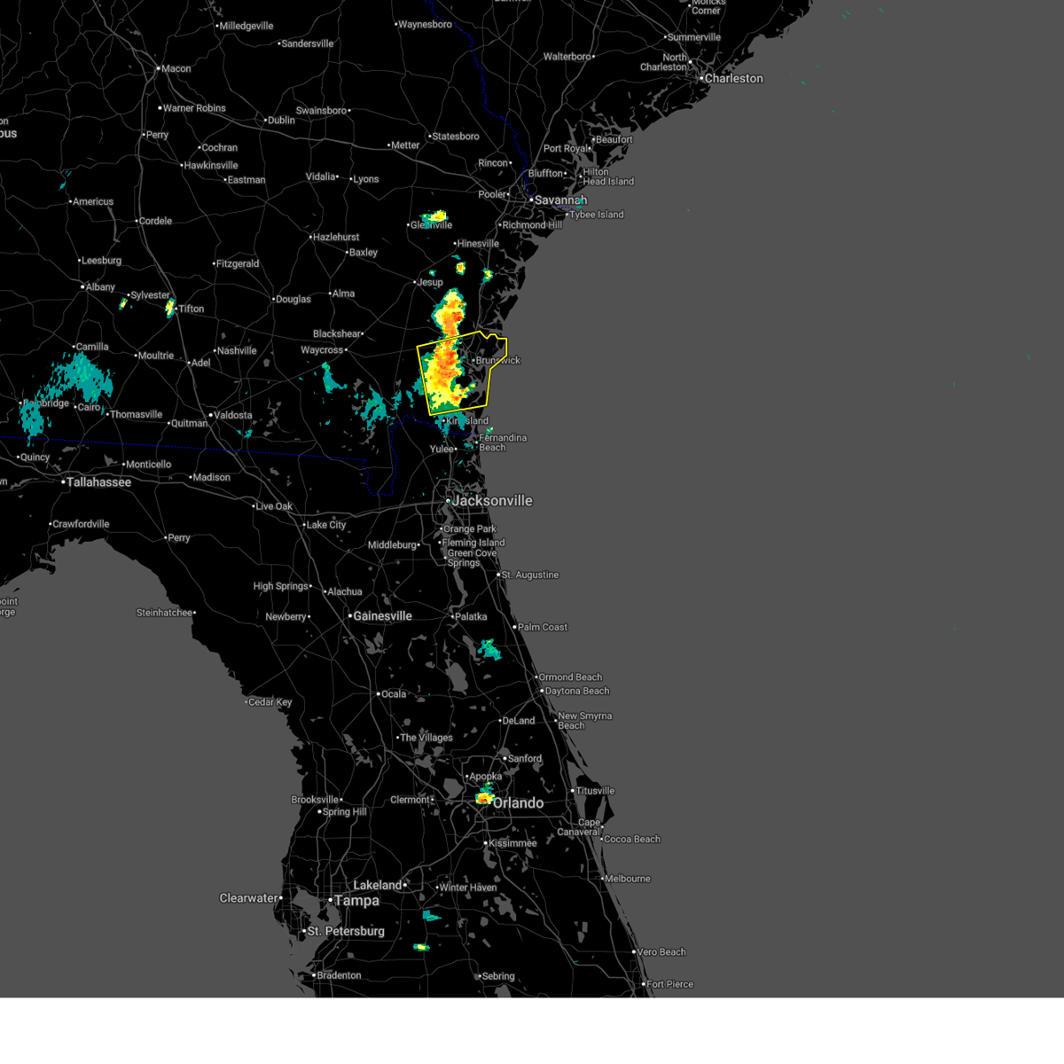
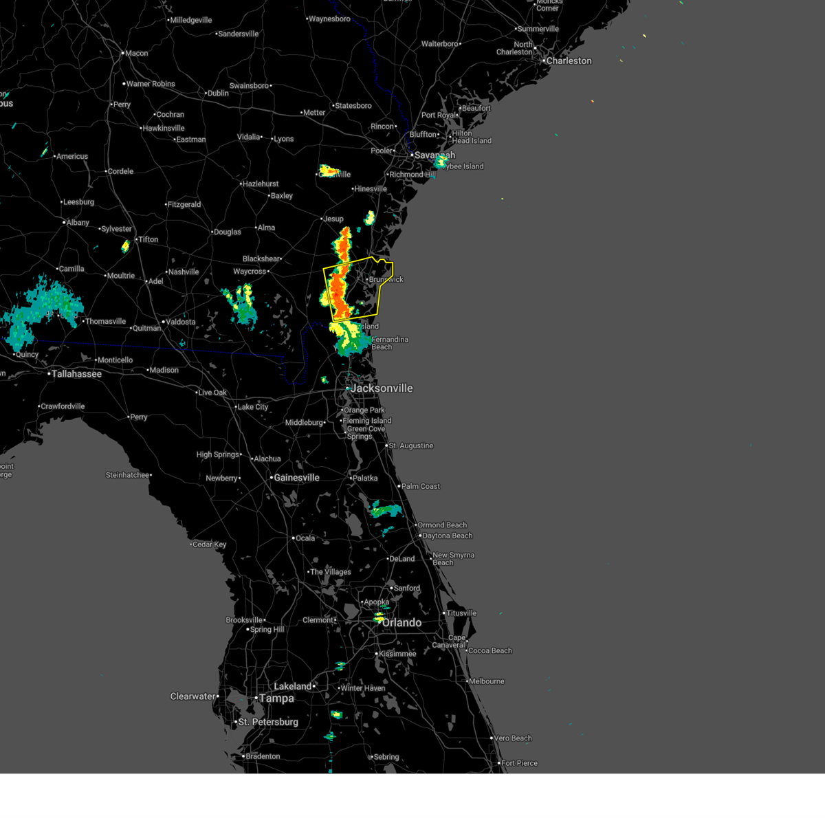
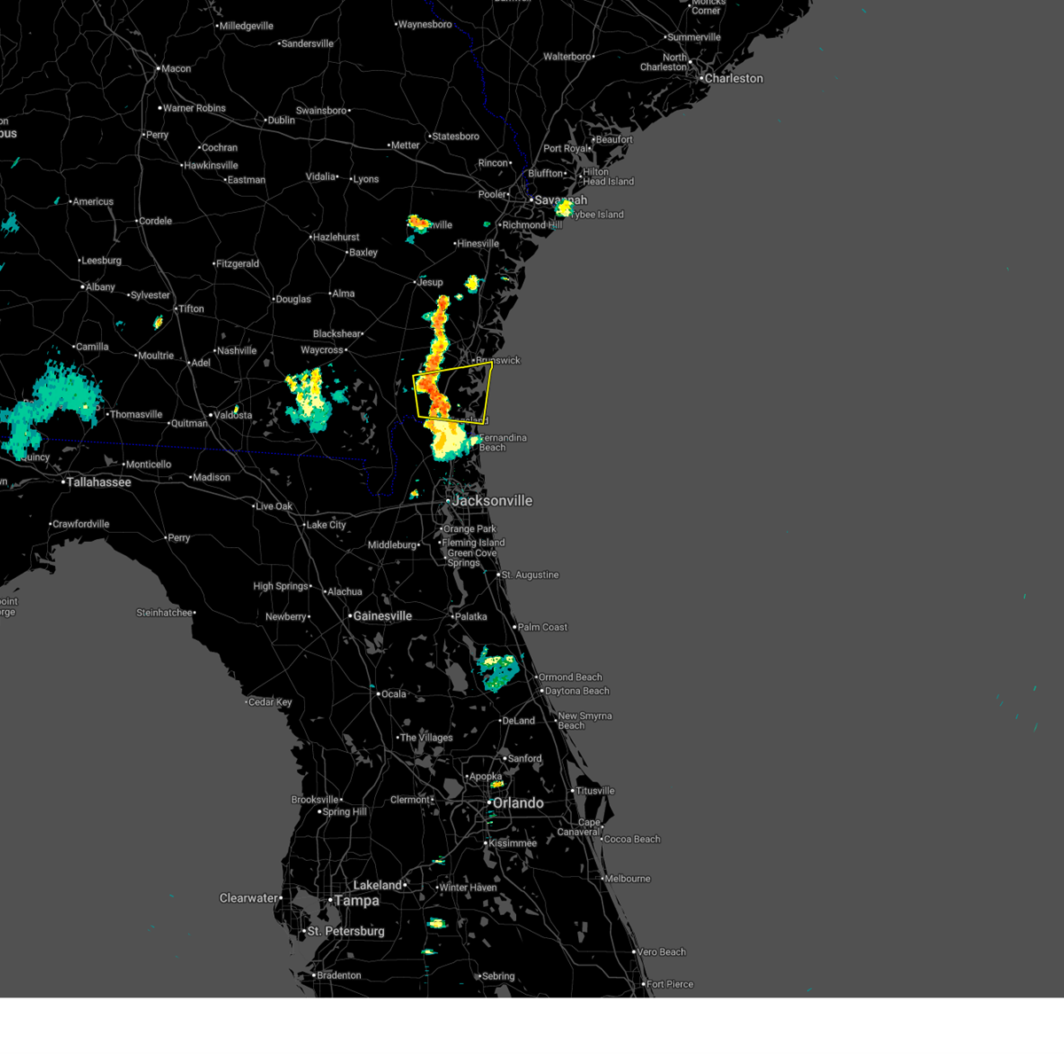
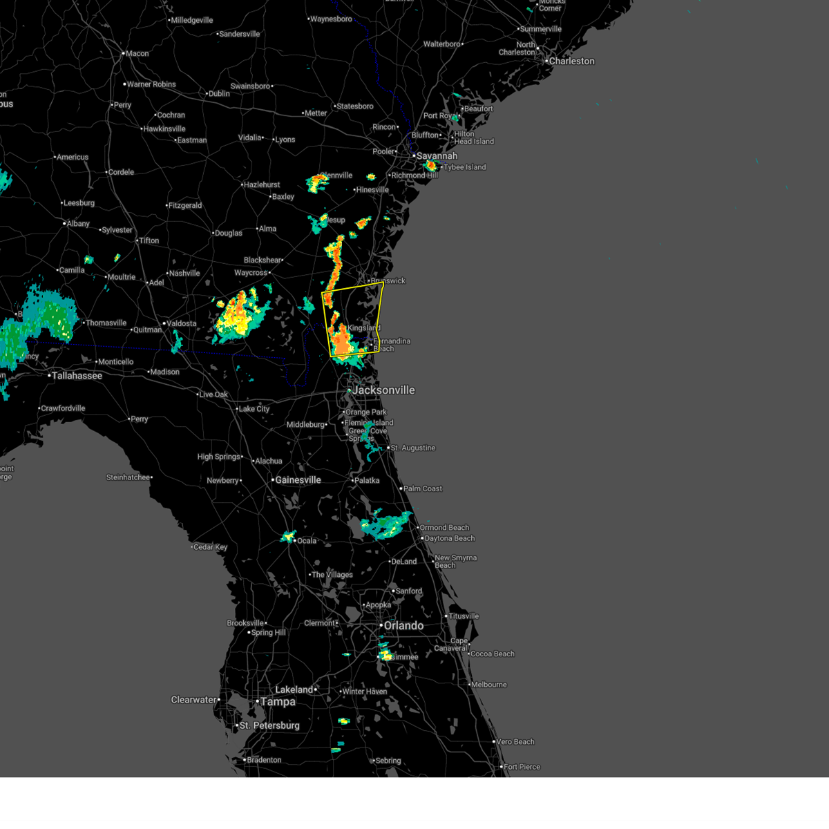
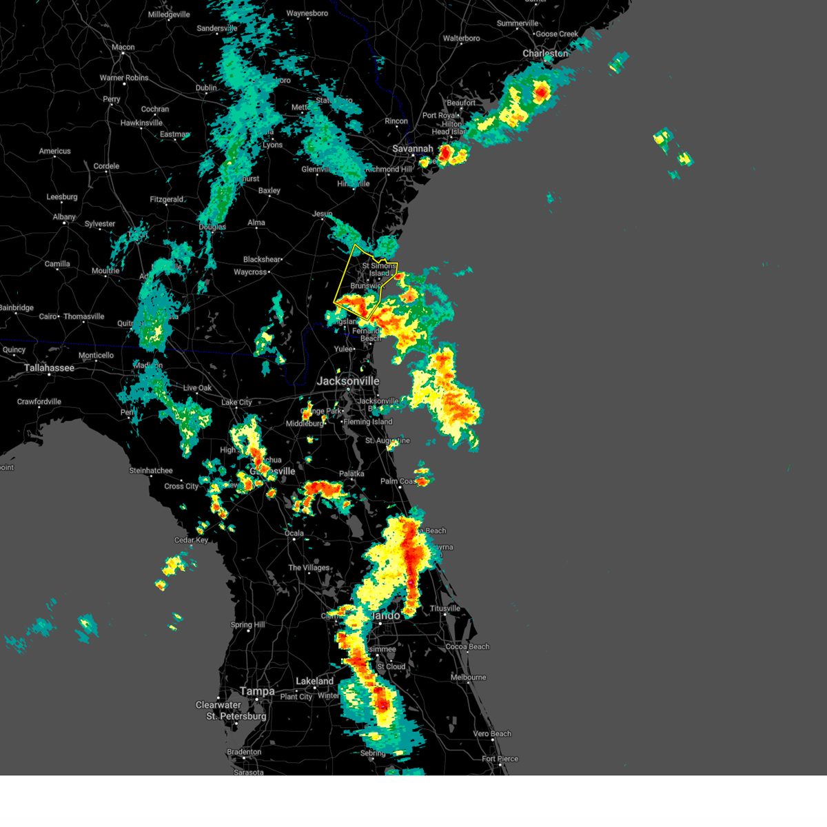
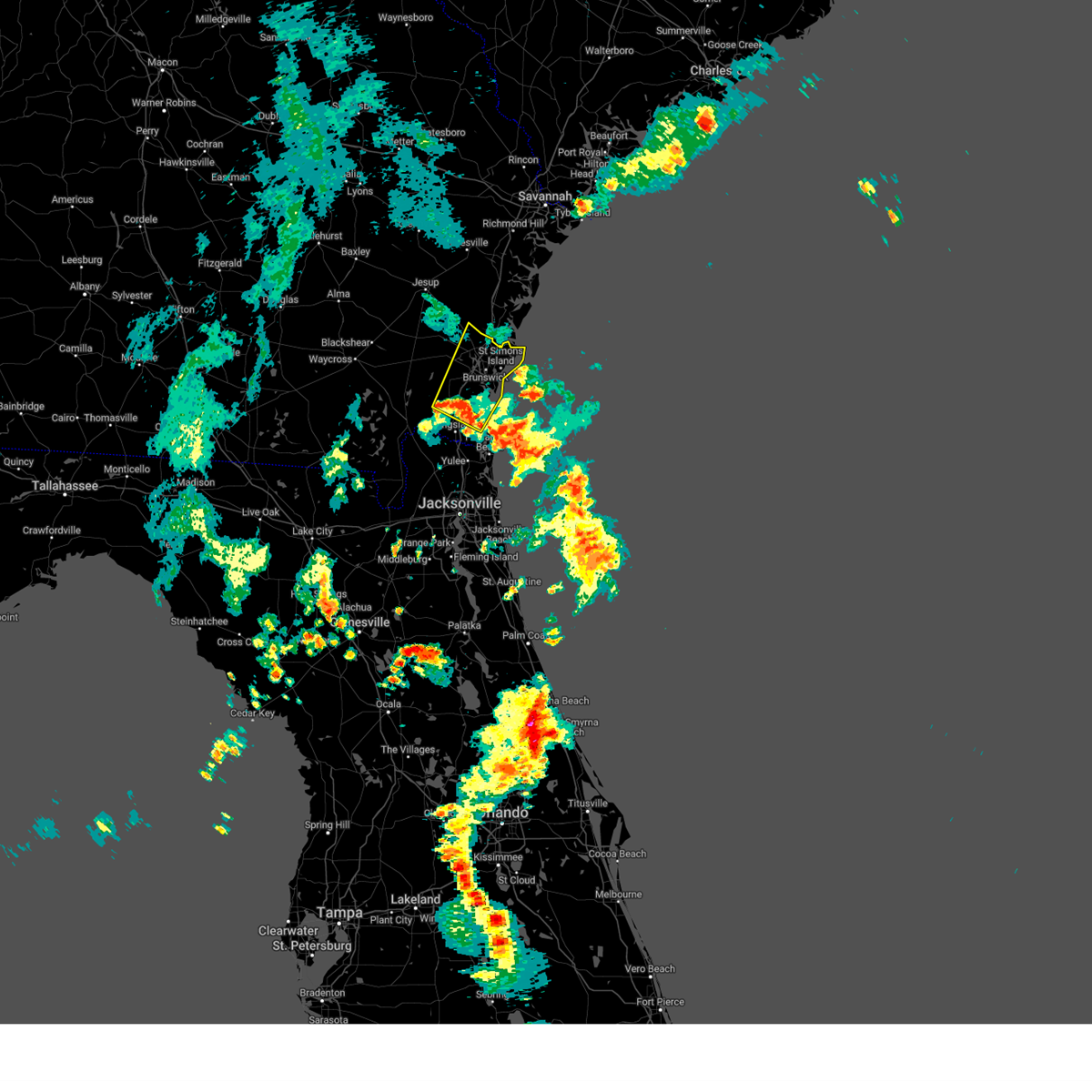
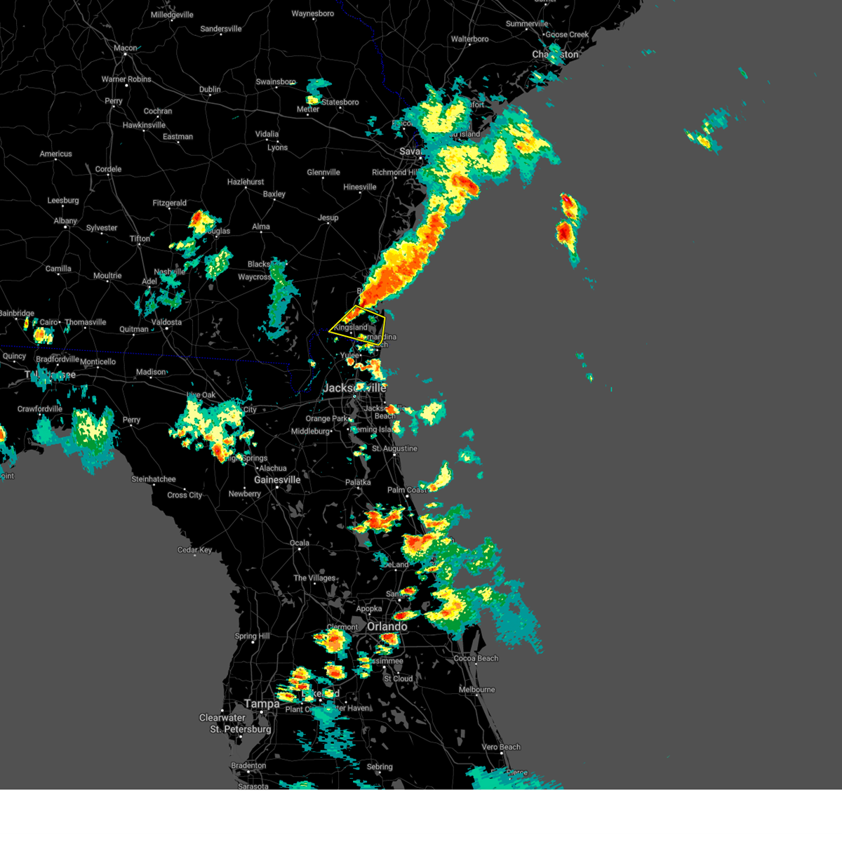
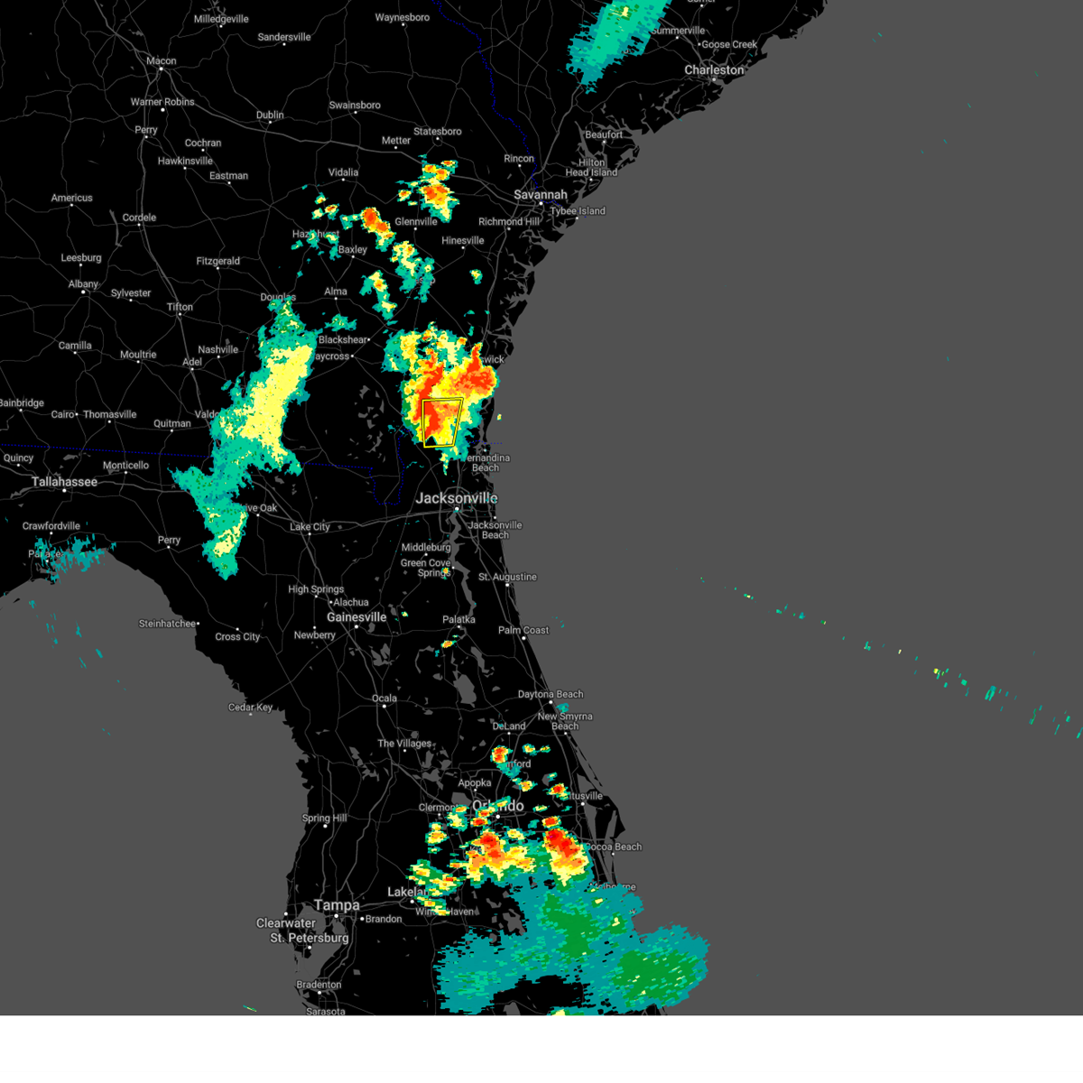
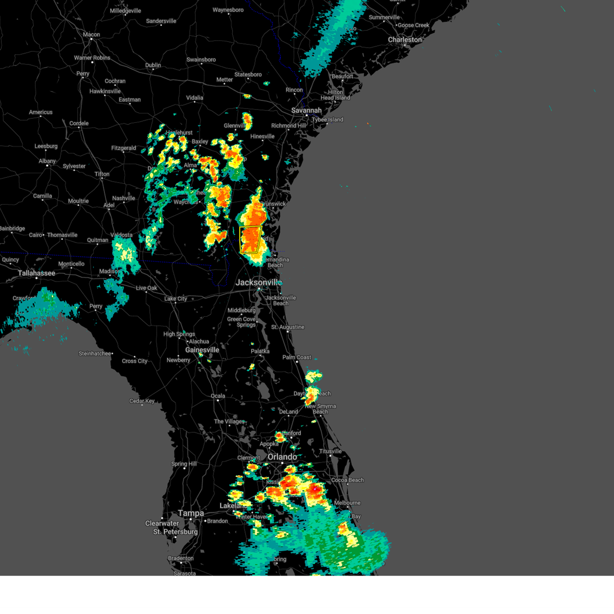
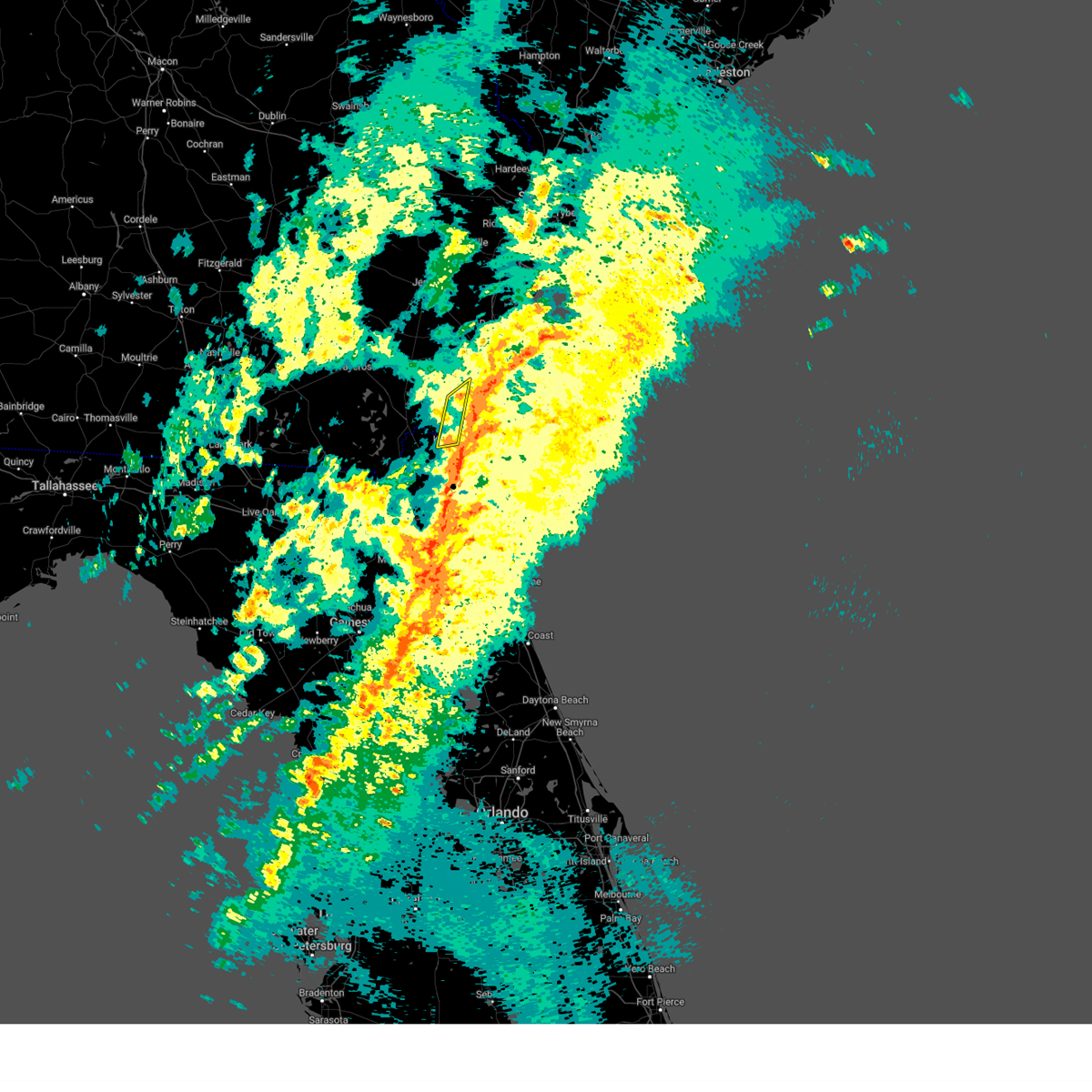
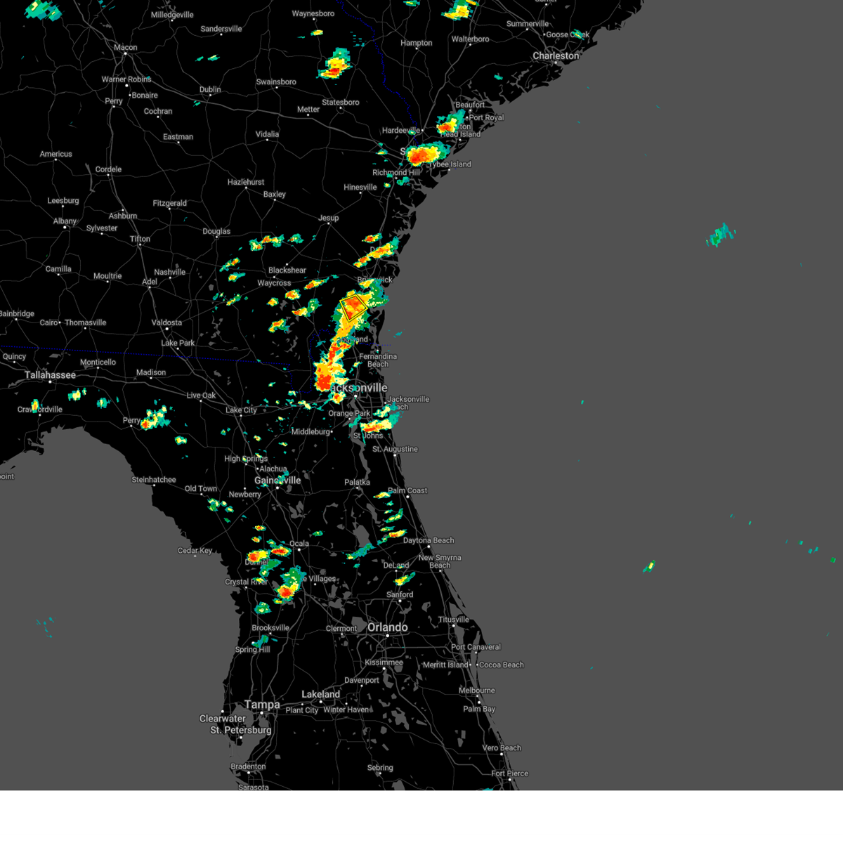
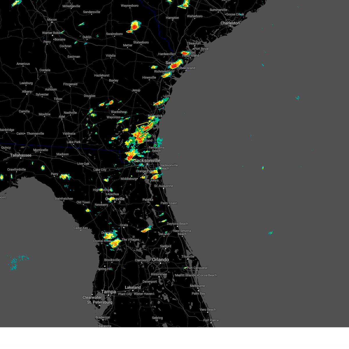
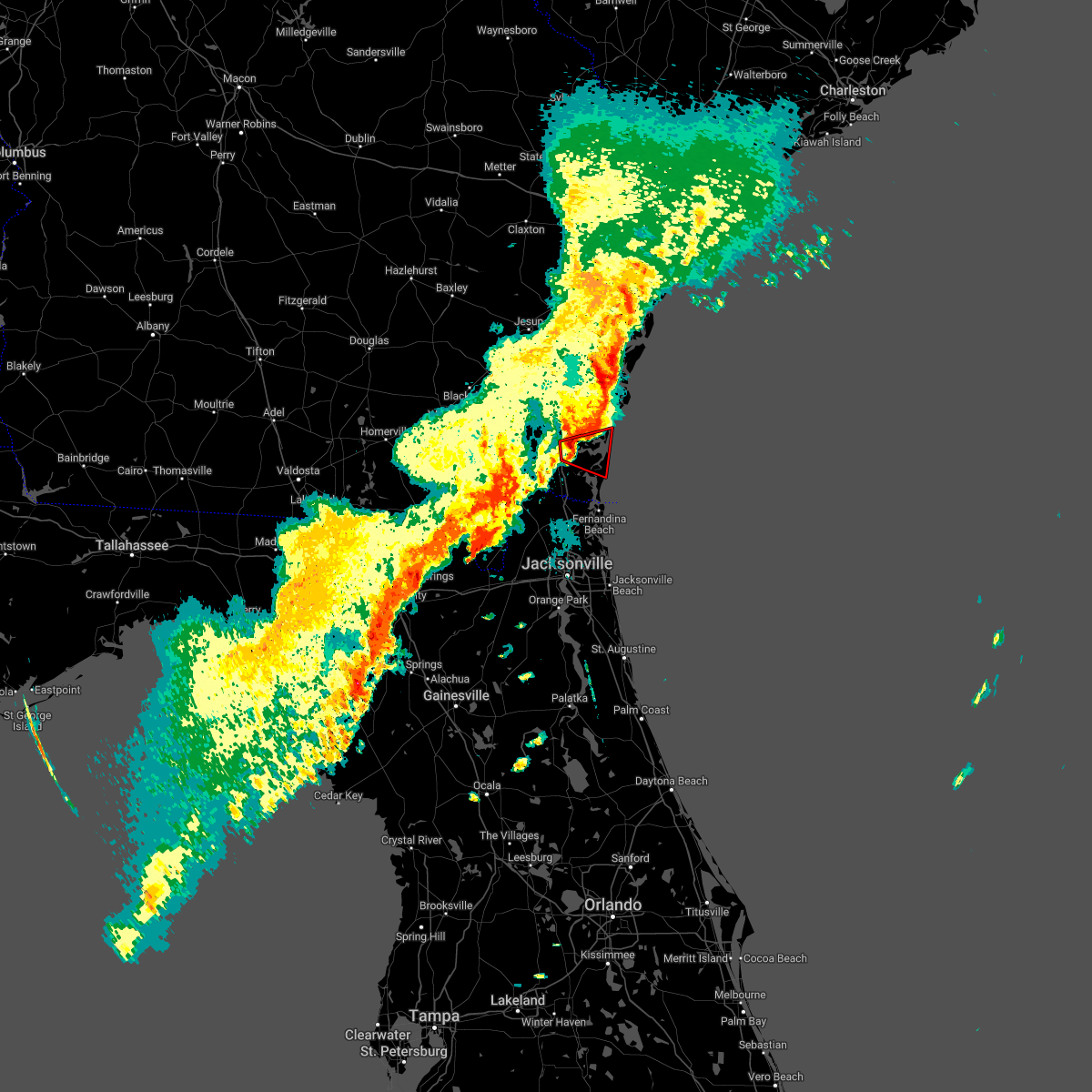
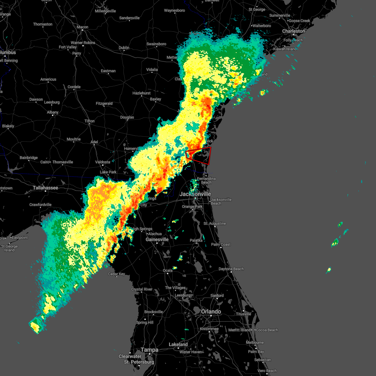
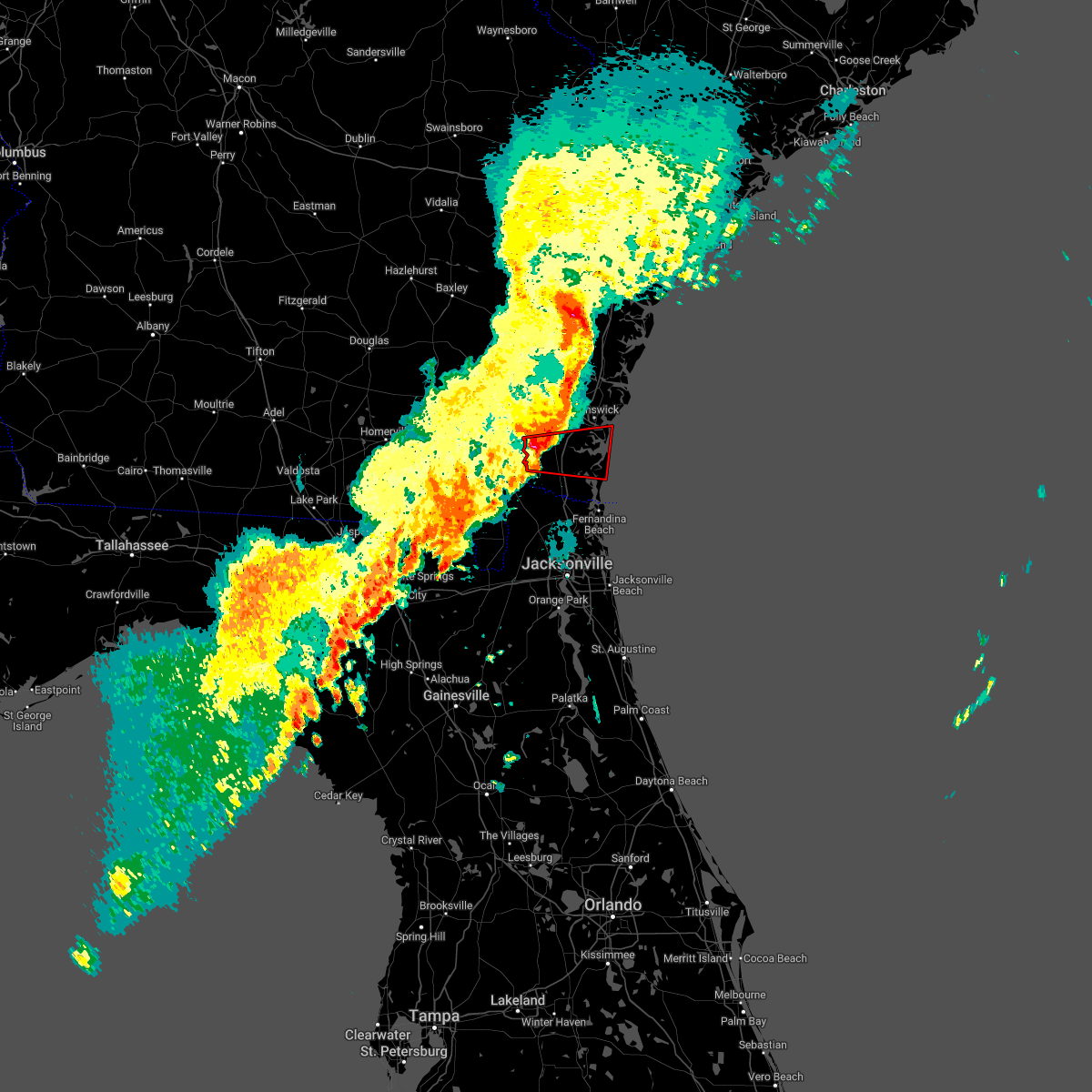
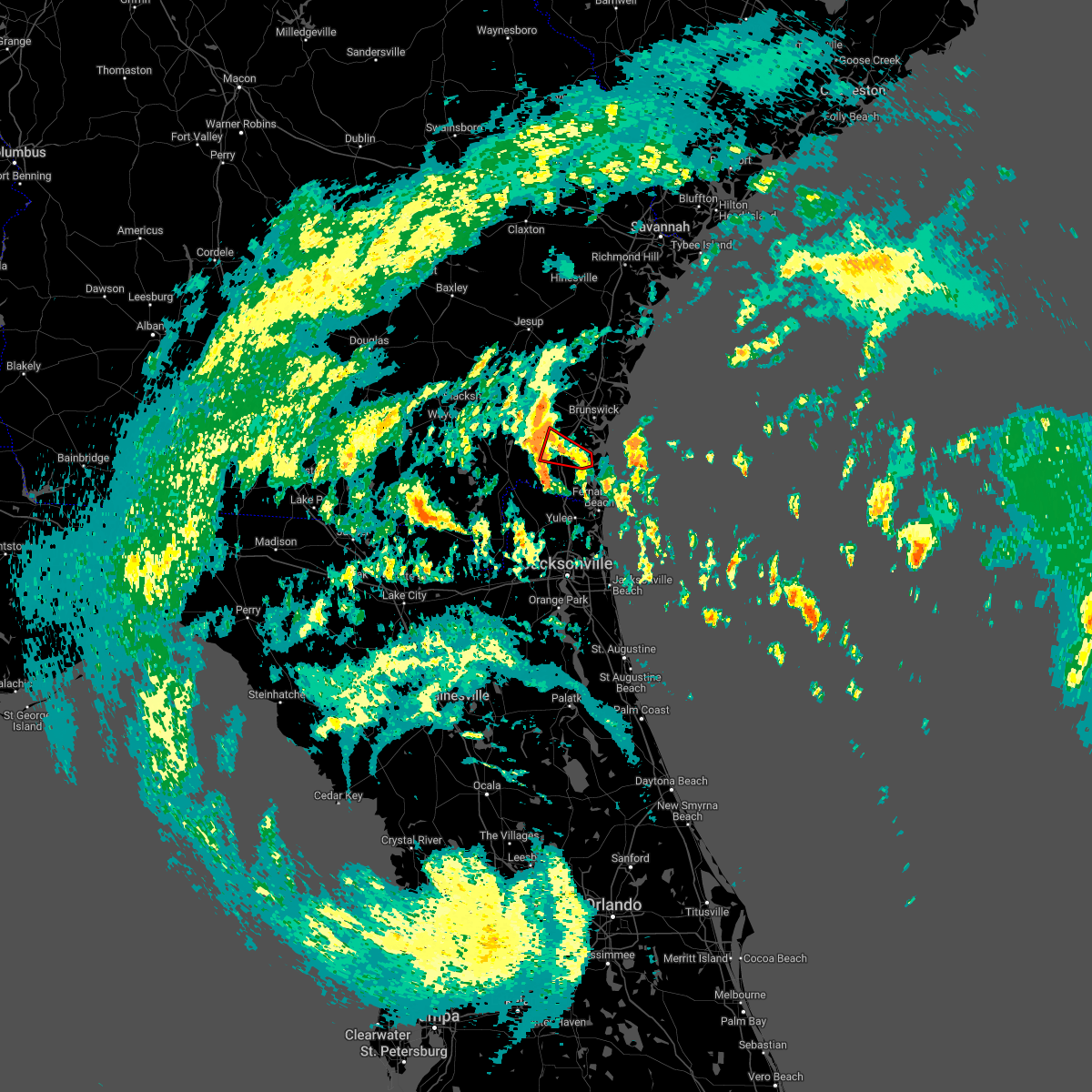
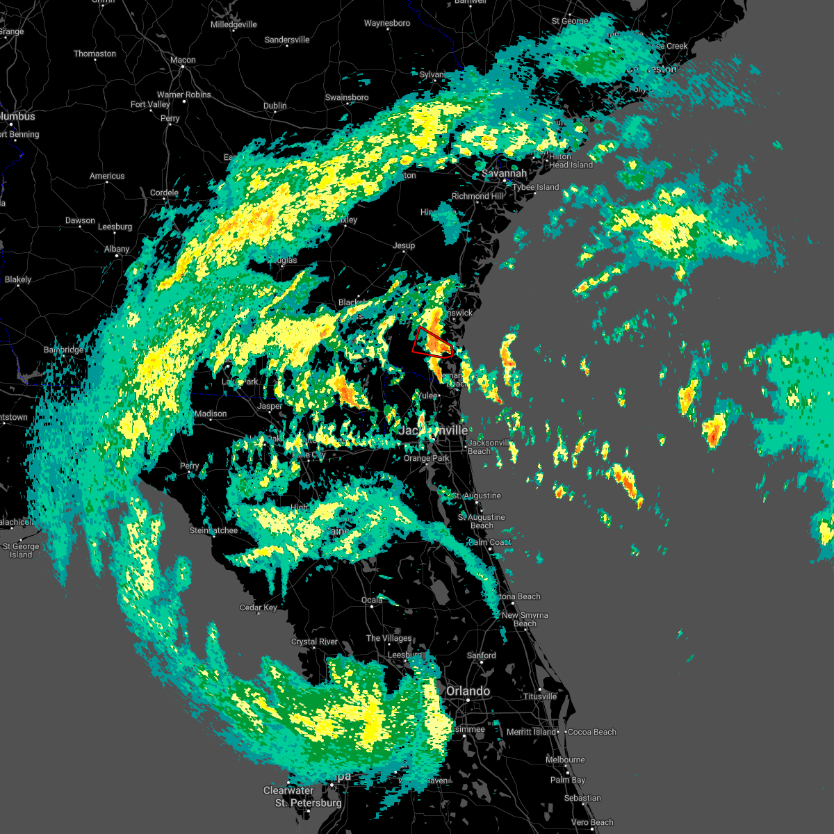
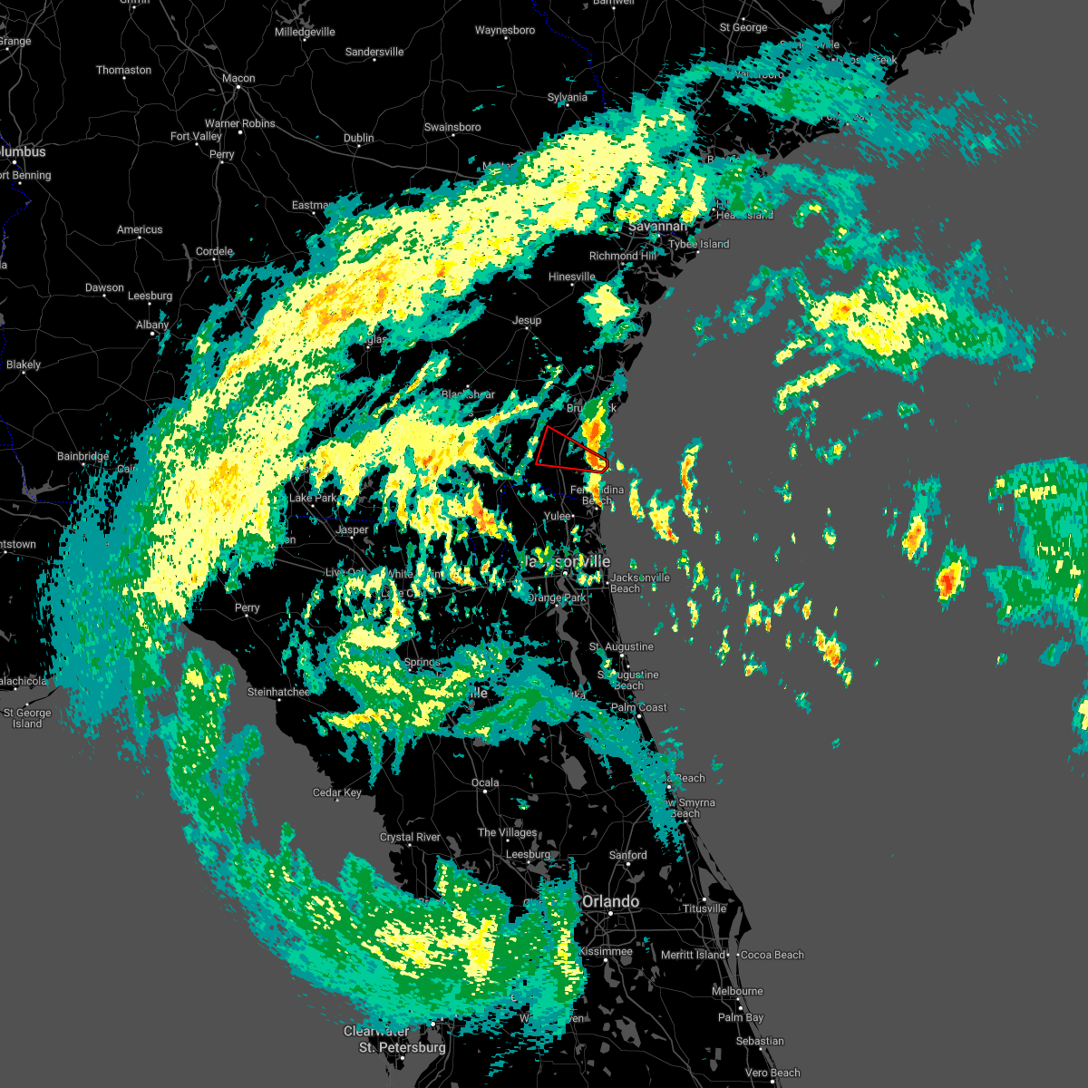
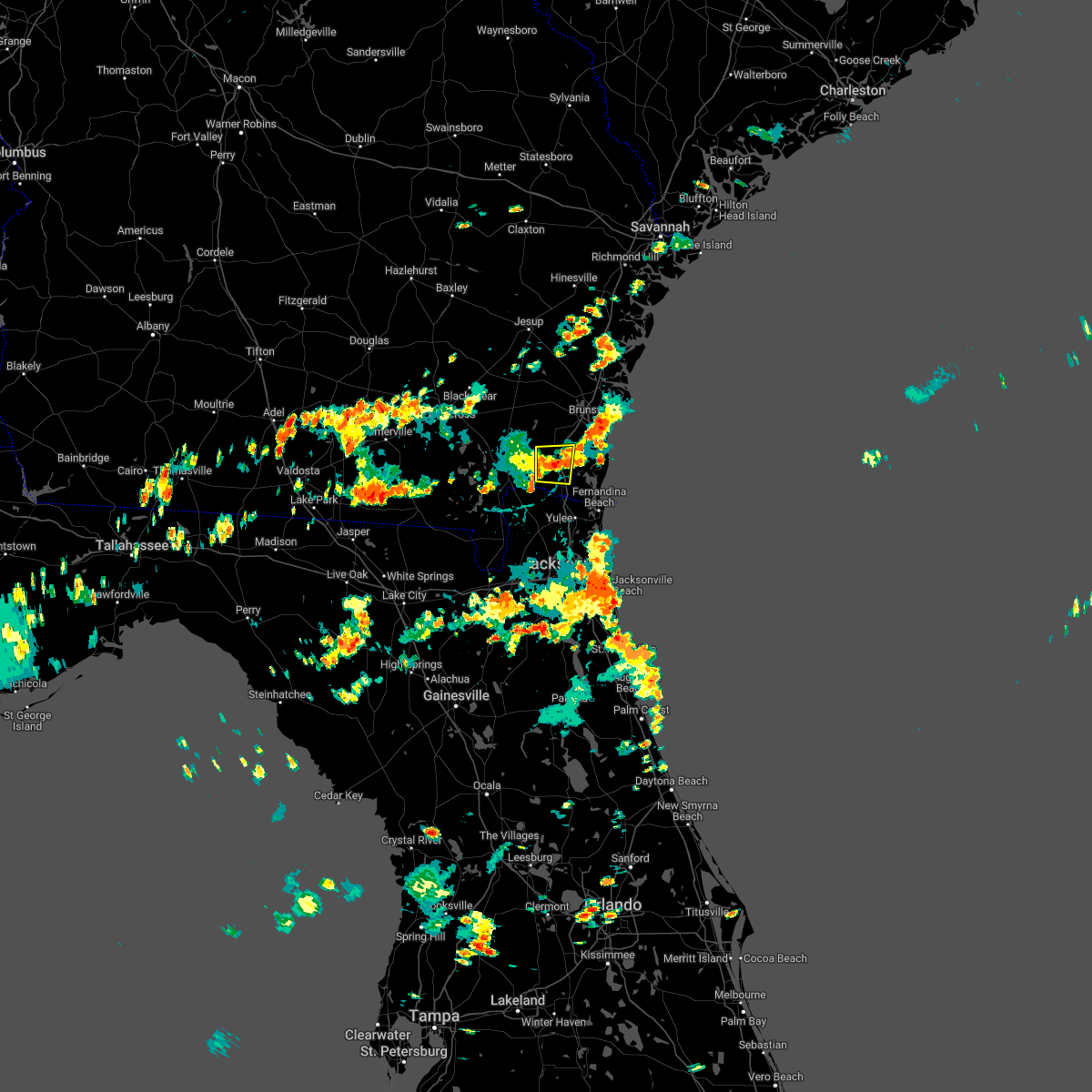
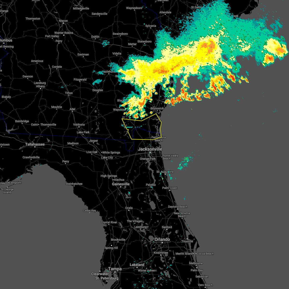
Hail Map for Woodbine, GA
The Woodbine, GA area has had 5 reports of on-the-ground hail by trained spotters, and has been under severe weather warnings 8 times during the past 12 months. Doppler radar has detected hail at or near Woodbine, GA on 62 occasions, including 3 occasions during the past year.
| Name: | Woodbine, GA |
| Where Located: | 43.4 miles N of Jacksonville, FL |
| Map: | Google Map for Woodbine, GA |
| Population: | 1412 |
| Housing Units: | 554 |
| More Info: | Search Google for Woodbine, GA |
5
The Top Recent Hail Date for Woodbine, GA is Monday, June 9, 2025 (3rd out of 62)

Hail and Wind Damage Spotted near Woodbine, GA
| Date / Time | Report Details |
|---|---|
| 6/16/2025 7:51 PM EDT |
 The storm which prompted the warning has weakened below severe limits, and no longer poses an immediate threat to life or property. therefore, the warning will be allowed to expire. however, gusty winds and heavy rain are still possible with this thunderstorm. The storm which prompted the warning has weakened below severe limits, and no longer poses an immediate threat to life or property. therefore, the warning will be allowed to expire. however, gusty winds and heavy rain are still possible with this thunderstorm.
|
| 6/16/2025 7:35 PM EDT |
 Svrjax the national weather service in jacksonville has issued a * severe thunderstorm warning for, central camden county in southeastern georgia, glynn county in southeastern georgia, east central brantley county in southeastern georgia, * until 800 pm edt. * at 734 pm edt, a severe thunderstorm was located near woodbine, moving northeast at 15 mph (radar indicated). Hazards include 60 mph wind gusts and penny size hail. expect damage to roofs, siding, and trees Svrjax the national weather service in jacksonville has issued a * severe thunderstorm warning for, central camden county in southeastern georgia, glynn county in southeastern georgia, east central brantley county in southeastern georgia, * until 800 pm edt. * at 734 pm edt, a severe thunderstorm was located near woodbine, moving northeast at 15 mph (radar indicated). Hazards include 60 mph wind gusts and penny size hail. expect damage to roofs, siding, and trees
|
| 6/16/2025 7:26 PM EDT |
 At 726 pm edt, severe thunderstorms were located along a line extending from near waverly to near kingsland, moving northeast at 15 mph (radar indicated). Hazards include 60 mph wind gusts and penny size hail. Expect damage to roofs, siding, and trees. Locations impacted include, kingsland, woodbine, kings bay base, jekyll island, high point, tarboro, cumberland island, harrietts bluff, dover bluff, and colesburg. At 726 pm edt, severe thunderstorms were located along a line extending from near waverly to near kingsland, moving northeast at 15 mph (radar indicated). Hazards include 60 mph wind gusts and penny size hail. Expect damage to roofs, siding, and trees. Locations impacted include, kingsland, woodbine, kings bay base, jekyll island, high point, tarboro, cumberland island, harrietts bluff, dover bluff, and colesburg.
|
| 6/16/2025 7:26 PM EDT |
 the severe thunderstorm warning has been cancelled and is no longer in effect the severe thunderstorm warning has been cancelled and is no longer in effect
|
| 6/16/2025 7:09 PM EDT |
 Svrjax the national weather service in jacksonville has issued a * severe thunderstorm warning for, northeastern nassau county in northeastern florida, camden county in southeastern georgia, southeastern glynn county in southeastern georgia, * until 745 pm edt. * at 709 pm edt, severe thunderstorms were located along a line extending from 6 miles northwest of woodbine to near kingsland, moving northeast at 15 mph (radar indicated). Hazards include 60 mph wind gusts and penny size hail. expect damage to roofs, siding, and trees Svrjax the national weather service in jacksonville has issued a * severe thunderstorm warning for, northeastern nassau county in northeastern florida, camden county in southeastern georgia, southeastern glynn county in southeastern georgia, * until 745 pm edt. * at 709 pm edt, severe thunderstorms were located along a line extending from 6 miles northwest of woodbine to near kingsland, moving northeast at 15 mph (radar indicated). Hazards include 60 mph wind gusts and penny size hail. expect damage to roofs, siding, and trees
|
| 5/29/2025 6:36 PM EDT |
 At 636 pm edt, a severe thunderstorm was located 9 miles southwest of jekyll island, or 10 miles southwest of brunswick, moving northeast at 35 mph (radar indicated). Hazards include 60 mph wind gusts. Expect damage to roofs, siding, and trees. locations impacted include, brunswick, st. Simons island, woodbine, dock junction, st simons island village, country club estates, waverly, sea island, jekyll island, and boys estate. At 636 pm edt, a severe thunderstorm was located 9 miles southwest of jekyll island, or 10 miles southwest of brunswick, moving northeast at 35 mph (radar indicated). Hazards include 60 mph wind gusts. Expect damage to roofs, siding, and trees. locations impacted include, brunswick, st. Simons island, woodbine, dock junction, st simons island village, country club estates, waverly, sea island, jekyll island, and boys estate.
|
| 5/29/2025 6:28 PM EDT |
 Svrjax the national weather service in jacksonville has issued a * severe thunderstorm warning for, central camden county in southeastern georgia, glynn county in southeastern georgia, * until 715 pm edt. * at 628 pm edt, a severe thunderstorm was located near woodbine, moving northeast at 35 mph (radar indicated). Hazards include 60 mph wind gusts. expect damage to roofs, siding, and trees Svrjax the national weather service in jacksonville has issued a * severe thunderstorm warning for, central camden county in southeastern georgia, glynn county in southeastern georgia, * until 715 pm edt. * at 628 pm edt, a severe thunderstorm was located near woodbine, moving northeast at 35 mph (radar indicated). Hazards include 60 mph wind gusts. expect damage to roofs, siding, and trees
|
| 5/25/2025 4:40 PM EDT |
 Svrjax the national weather service in jacksonville has issued a * severe thunderstorm warning for, southern camden county in southeastern georgia, * until 515 pm edt. * at 439 pm edt, a severe thunderstorm was located 7 miles southeast of woodbine, moving southeast at 15 mph (radar indicated). Hazards include 60 mph wind gusts and quarter size hail. Hail damage to vehicles is expected. Expect wind damage to roofs, siding, and trees. Svrjax the national weather service in jacksonville has issued a * severe thunderstorm warning for, southern camden county in southeastern georgia, * until 515 pm edt. * at 439 pm edt, a severe thunderstorm was located 7 miles southeast of woodbine, moving southeast at 15 mph (radar indicated). Hazards include 60 mph wind gusts and quarter size hail. Hail damage to vehicles is expected. Expect wind damage to roofs, siding, and trees.
|
| 6/28/2024 3:29 PM EDT |
 Svrjax the national weather service in jacksonville has issued a * severe thunderstorm warning for, camden county in southeastern georgia, southwestern glynn county in southeastern georgia, * until 415 pm edt. * at 329 pm edt, a severe thunderstorm was located near kingsland, moving northeast at 20 mph (radar indicated). Hazards include 60 mph wind gusts and penny size hail. expect damage to roofs, siding, and trees Svrjax the national weather service in jacksonville has issued a * severe thunderstorm warning for, camden county in southeastern georgia, southwestern glynn county in southeastern georgia, * until 415 pm edt. * at 329 pm edt, a severe thunderstorm was located near kingsland, moving northeast at 20 mph (radar indicated). Hazards include 60 mph wind gusts and penny size hail. expect damage to roofs, siding, and trees
|
| 6/26/2024 6:10 PM EDT | Several wires down in the waverly and white oak areas due to thunderstorm winds. time estimated by rada in camden county GA, 7.7 miles S of Woodbine, GA |
| 6/26/2024 5:55 PM EDT |
 The storm which prompted the warning has weakened below severe limits, and no longer poses an immediate threat to life or property. therefore, the warning will be allowed to expire. however, gusty winds and heavy rain are still possible with this thunderstorm. The storm which prompted the warning has weakened below severe limits, and no longer poses an immediate threat to life or property. therefore, the warning will be allowed to expire. however, gusty winds and heavy rain are still possible with this thunderstorm.
|
| 6/26/2024 5:45 PM EDT |
 the severe thunderstorm warning has been cancelled and is no longer in effect the severe thunderstorm warning has been cancelled and is no longer in effect
|
| 6/26/2024 5:45 PM EDT |
 At 544 pm edt, a severe thunderstorm was located near kingsland, moving east at 5 mph (radar indicated). Hazards include 60 mph wind gusts and penny size hail. Expect damage to roofs, siding, and trees. Locations impacted include, kingsland, woodbine, kings ferry, and colesburg. At 544 pm edt, a severe thunderstorm was located near kingsland, moving east at 5 mph (radar indicated). Hazards include 60 mph wind gusts and penny size hail. Expect damage to roofs, siding, and trees. Locations impacted include, kingsland, woodbine, kings ferry, and colesburg.
|
| 6/26/2024 5:28 PM EDT |
 Svrjax the national weather service in jacksonville has issued a * severe thunderstorm warning for, northeastern nassau county in northeastern florida, camden county in southeastern georgia, south central glynn county in southeastern georgia, southeastern brantley county in southeastern georgia, * until 600 pm edt. * at 528 pm edt, a severe thunderstorm was located near kingsland, moving east at 5 mph (radar indicated). Hazards include 60 mph wind gusts and penny size hail. expect damage to roofs, siding, and trees Svrjax the national weather service in jacksonville has issued a * severe thunderstorm warning for, northeastern nassau county in northeastern florida, camden county in southeastern georgia, south central glynn county in southeastern georgia, southeastern brantley county in southeastern georgia, * until 600 pm edt. * at 528 pm edt, a severe thunderstorm was located near kingsland, moving east at 5 mph (radar indicated). Hazards include 60 mph wind gusts and penny size hail. expect damage to roofs, siding, and trees
|
| 6/26/2024 5:10 PM EDT | Corrects previous tstm wnd dmg report from waverly/white oak. several wires down in the waverly and white oak areas due to thunderstorm winds. time estimated by rada in camden county GA, 7.7 miles S of Woodbine, GA |
| 6/26/2024 5:01 PM EDT |
 Svrjax the national weather service in jacksonville has issued a * severe thunderstorm warning for, northeastern nassau county in northeastern florida, camden county in southeastern georgia, southwestern glynn county in southeastern georgia, east central brantley county in southeastern georgia, * until 530 pm edt. * at 500 pm edt, severe thunderstorms were located along a line extending from near waverly to near st. marys, moving northeast at 15 mph (radar indicated). Hazards include 60 mph wind gusts and quarter size hail. Hail damage to vehicles is expected. Expect wind damage to roofs, siding, and trees. Svrjax the national weather service in jacksonville has issued a * severe thunderstorm warning for, northeastern nassau county in northeastern florida, camden county in southeastern georgia, southwestern glynn county in southeastern georgia, east central brantley county in southeastern georgia, * until 530 pm edt. * at 500 pm edt, severe thunderstorms were located along a line extending from near waverly to near st. marys, moving northeast at 15 mph (radar indicated). Hazards include 60 mph wind gusts and quarter size hail. Hail damage to vehicles is expected. Expect wind damage to roofs, siding, and trees.
|
| 5/10/2024 10:00 AM EDT |
 the severe thunderstorm warning has been cancelled and is no longer in effect the severe thunderstorm warning has been cancelled and is no longer in effect
|
| 5/10/2024 9:59 AM EDT |
 The storms which prompted the warning have moved out of the area. therefore, the warning will be allowed to expire. however, heavy rain is still possible with these thunderstorms. a severe thunderstorm watch remains in effect until noon edt for northern and northeastern florida, and southeastern georgia. The storms which prompted the warning have moved out of the area. therefore, the warning will be allowed to expire. however, heavy rain is still possible with these thunderstorms. a severe thunderstorm watch remains in effect until noon edt for northern and northeastern florida, and southeastern georgia.
|
| 5/10/2024 9:45 AM EDT |
 Svrjax the national weather service in jacksonville has issued a * severe thunderstorm warning for, northwestern flagler county in northeastern florida, northeastern nassau county in northeastern florida, st. johns county in northeastern florida, putnam county in northeastern florida, northeastern clay county in northeastern florida, duval county in northeastern florida, southeastern camden county in southeastern georgia, * until 1015 am edt. * at 945 am edt, severe thunderstorms were located along a line extending from near st. marys to near bostwick to near lake delancy, moving east at 55 mph (radar indicated). Hazards include 60 mph wind gusts and penny size hail. expect damage to roofs, siding, and trees Svrjax the national weather service in jacksonville has issued a * severe thunderstorm warning for, northwestern flagler county in northeastern florida, northeastern nassau county in northeastern florida, st. johns county in northeastern florida, putnam county in northeastern florida, northeastern clay county in northeastern florida, duval county in northeastern florida, southeastern camden county in southeastern georgia, * until 1015 am edt. * at 945 am edt, severe thunderstorms were located along a line extending from near st. marys to near bostwick to near lake delancy, moving east at 55 mph (radar indicated). Hazards include 60 mph wind gusts and penny size hail. expect damage to roofs, siding, and trees
|
| 5/10/2024 9:25 AM EDT |
 Svrjax the national weather service in jacksonville has issued a * severe thunderstorm warning for, nassau county in northeastern florida, southeastern alachua county in northern florida, st. johns county in northeastern florida, central marion county in northern florida, putnam county in northeastern florida, clay county in northeastern florida, duval county in northeastern florida, camden county in southeastern georgia, northeastern charlton county in southeastern georgia, * until 1000 am edt. * at 925 am edt, severe thunderstorms were located along a line extending from near kings ferry to near florahome to near williston municipal airport, moving east at 60 mph (radar indicated). Hazards include 60 mph wind gusts and penny size hail. expect damage to roofs, siding, and trees Svrjax the national weather service in jacksonville has issued a * severe thunderstorm warning for, nassau county in northeastern florida, southeastern alachua county in northern florida, st. johns county in northeastern florida, central marion county in northern florida, putnam county in northeastern florida, clay county in northeastern florida, duval county in northeastern florida, camden county in southeastern georgia, northeastern charlton county in southeastern georgia, * until 1000 am edt. * at 925 am edt, severe thunderstorms were located along a line extending from near kings ferry to near florahome to near williston municipal airport, moving east at 60 mph (radar indicated). Hazards include 60 mph wind gusts and penny size hail. expect damage to roofs, siding, and trees
|
| 5/10/2024 9:20 AM EDT |
 At 920 am edt, severe thunderstorms were located along a line extending from 10 miles east of woodbine to baymeadows to near bardin to 8 miles southwest of cross creek, moving east at 90 mph (radar indicated). Hazards include 60 mph wind gusts and penny size hail. Expect damage to roofs, siding, and trees. locations impacted include, jacksonville, st. Marys, kingsland, fernandina beach, palatka, orange park, green cove springs, rainbow lakes estates, woodbine, and interlachen. At 920 am edt, severe thunderstorms were located along a line extending from 10 miles east of woodbine to baymeadows to near bardin to 8 miles southwest of cross creek, moving east at 90 mph (radar indicated). Hazards include 60 mph wind gusts and penny size hail. Expect damage to roofs, siding, and trees. locations impacted include, jacksonville, st. Marys, kingsland, fernandina beach, palatka, orange park, green cove springs, rainbow lakes estates, woodbine, and interlachen.
|
| 5/10/2024 9:17 AM EDT |
 the severe thunderstorm warning has been cancelled and is no longer in effect the severe thunderstorm warning has been cancelled and is no longer in effect
|
| 5/10/2024 9:17 AM EDT |
 At 916 am edt, severe thunderstorms were located along a line extending from near thalmann to 6 miles west of jekyll island, moving east at 55 mph (radar indicated). Hazards include 60 mph wind gusts and penny size hail. Expect damage to roofs, siding, and trees. locations impacted include, brunswick, st. Simons island, woodbine, dock junction, country club estates, waverly, jekyll island, st simons island village, tarboro, and dover bluff. At 916 am edt, severe thunderstorms were located along a line extending from near thalmann to 6 miles west of jekyll island, moving east at 55 mph (radar indicated). Hazards include 60 mph wind gusts and penny size hail. Expect damage to roofs, siding, and trees. locations impacted include, brunswick, st. Simons island, woodbine, dock junction, country club estates, waverly, jekyll island, st simons island village, tarboro, and dover bluff.
|
| 5/10/2024 9:10 AM EDT | Trees uprooted... power outages... minor structural damage reported. time est off rada in camden county GA, 0.9 miles SE of Woodbine, GA |
| 5/10/2024 9:00 AM EDT |
 Svrjax the national weather service in jacksonville has issued a * severe thunderstorm warning for, nassau county in northeastern florida, southeastern bradford county in northern florida, southeastern alachua county in northern florida, northwestern st. johns county in northeastern florida, northwestern marion county in northern florida, northwestern putnam county in northeastern florida, clay county in northeastern florida, duval county in northeastern florida, camden county in southeastern georgia, * until 930 am edt. * at 900 am edt, severe thunderstorms were located along a line extending from near hickox to near bryceville to near keystone heights to near archer, moving east at 70 mph (radar indicated). Hazards include 70 mph wind gusts and quarter size hail. Hail damage to vehicles is expected. expect considerable tree damage. Wind damage is also likely to mobile homes, roofs, and outbuildings. Svrjax the national weather service in jacksonville has issued a * severe thunderstorm warning for, nassau county in northeastern florida, southeastern bradford county in northern florida, southeastern alachua county in northern florida, northwestern st. johns county in northeastern florida, northwestern marion county in northern florida, northwestern putnam county in northeastern florida, clay county in northeastern florida, duval county in northeastern florida, camden county in southeastern georgia, * until 930 am edt. * at 900 am edt, severe thunderstorms were located along a line extending from near hickox to near bryceville to near keystone heights to near archer, moving east at 70 mph (radar indicated). Hazards include 70 mph wind gusts and quarter size hail. Hail damage to vehicles is expected. expect considerable tree damage. Wind damage is also likely to mobile homes, roofs, and outbuildings.
|
| 5/10/2024 8:54 AM EDT |
 Svrjax the national weather service in jacksonville has issued a * severe thunderstorm warning for, northern camden county in southeastern georgia, glynn county in southeastern georgia, southeastern brantley county in southeastern georgia, northeastern charlton county in southeastern georgia, * until 930 am edt. * at 854 am edt, severe thunderstorms were located along a line extending from near nahunta to near woodbine, moving east at 50 mph (radar indicated). Hazards include 60 mph wind gusts and penny size hail. expect damage to roofs, siding, and trees Svrjax the national weather service in jacksonville has issued a * severe thunderstorm warning for, northern camden county in southeastern georgia, glynn county in southeastern georgia, southeastern brantley county in southeastern georgia, northeastern charlton county in southeastern georgia, * until 930 am edt. * at 854 am edt, severe thunderstorms were located along a line extending from near nahunta to near woodbine, moving east at 50 mph (radar indicated). Hazards include 60 mph wind gusts and penny size hail. expect damage to roofs, siding, and trees
|
| 5/10/2024 8:44 AM EDT |
 Svrjax the national weather service in jacksonville has issued a * severe thunderstorm warning for, nassau county in northeastern florida, bradford county in northern florida, alachua county in northern florida, north central marion county in northern florida, baker county in northeastern florida, northwestern putnam county in northeastern florida, union county in northern florida, western clay county in northeastern florida, western duval county in northeastern florida, southwestern camden county in southeastern georgia, southeastern ware county in southeastern georgia, charlton county in southeastern georgia, * until 915 am edt. * at 843 am edt, severe thunderstorms were located along a line extending from 9 miles south of argyle to near lulu to 7 miles southeast of cross city, moving east at 70 mph. these are destructive storms for lake butler, starke, gainesville, macclenny, baldwin, and hilliard. (radar indicated). Hazards include 80 mph wind gusts and quarter size hail. Flying debris will be dangerous to those caught without shelter. mobile homes will be heavily damaged. expect considerable damage to roofs, windows, and vehicles. Extensive tree damage and power outages are likely. Svrjax the national weather service in jacksonville has issued a * severe thunderstorm warning for, nassau county in northeastern florida, bradford county in northern florida, alachua county in northern florida, north central marion county in northern florida, baker county in northeastern florida, northwestern putnam county in northeastern florida, union county in northern florida, western clay county in northeastern florida, western duval county in northeastern florida, southwestern camden county in southeastern georgia, southeastern ware county in southeastern georgia, charlton county in southeastern georgia, * until 915 am edt. * at 843 am edt, severe thunderstorms were located along a line extending from 9 miles south of argyle to near lulu to 7 miles southeast of cross city, moving east at 70 mph. these are destructive storms for lake butler, starke, gainesville, macclenny, baldwin, and hilliard. (radar indicated). Hazards include 80 mph wind gusts and quarter size hail. Flying debris will be dangerous to those caught without shelter. mobile homes will be heavily damaged. expect considerable damage to roofs, windows, and vehicles. Extensive tree damage and power outages are likely.
|
| 1/9/2024 3:35 PM EST |
 At 335 pm est, severe thunderstorms were located along a line extending from near dock junction to near kings ferry, moving east at 60 mph (radar indicated). Hazards include 60 mph wind gusts. Expect damage to roofs, siding, and trees. Locations impacted include, kingsland, woodbine, and colesburg. At 335 pm est, severe thunderstorms were located along a line extending from near dock junction to near kings ferry, moving east at 60 mph (radar indicated). Hazards include 60 mph wind gusts. Expect damage to roofs, siding, and trees. Locations impacted include, kingsland, woodbine, and colesburg.
|
| 1/9/2024 3:10 PM EST |
 At 310 pm est, severe thunderstorms were located along a line extending from near woodbine to near st. george, moving northeast at 55 mph (radar indicated). Hazards include 60 mph wind gusts. expect damage to roofs, siding, and trees At 310 pm est, severe thunderstorms were located along a line extending from near woodbine to near st. george, moving northeast at 55 mph (radar indicated). Hazards include 60 mph wind gusts. expect damage to roofs, siding, and trees
|
| 1/9/2024 3:10 PM EST |
 The national weather service in jacksonville has issued a * severe thunderstorm warning for. northwestern nassau county in northeastern florida. western camden county in southeastern georgia. western glynn county in southeastern georgia. East central charlton county in southeastern georgia. The national weather service in jacksonville has issued a * severe thunderstorm warning for. northwestern nassau county in northeastern florida. western camden county in southeastern georgia. western glynn county in southeastern georgia. East central charlton county in southeastern georgia.
|
| 1/9/2024 2:52 PM EST |
 The severe thunderstorm warning for northwestern nassau, camden, western glynn, brantley, southeastern ware, southeastern wayne and northeastern charlton counties will expire at 300 pm est, the storms which prompted the warning have moved out of the area. therefore, the warning will be allowed to expire. however, gusty winds are still possible with these thunderstorms. a tornado watch remains in effect until 600 pm est for northeastern florida, and southeastern georgia. The severe thunderstorm warning for northwestern nassau, camden, western glynn, brantley, southeastern ware, southeastern wayne and northeastern charlton counties will expire at 300 pm est, the storms which prompted the warning have moved out of the area. therefore, the warning will be allowed to expire. however, gusty winds are still possible with these thunderstorms. a tornado watch remains in effect until 600 pm est for northeastern florida, and southeastern georgia.
|
| 1/9/2024 2:03 PM EST |
 At 202 pm est, severe thunderstorms were located along a line extending from near race pond to 10 miles north of taylor, moving northeast at 70 mph (radar indicated). Hazards include 70 mph wind gusts and penny size hail. Expect considerable tree damage. damage is likely to mobile homes, roofs, and outbuildings. Locations impacted include, kingsland, jesup, hilliard, folkston, woodbine, nahunta, gardi, dock junction, homeland, and hickox. At 202 pm est, severe thunderstorms were located along a line extending from near race pond to 10 miles north of taylor, moving northeast at 70 mph (radar indicated). Hazards include 70 mph wind gusts and penny size hail. Expect considerable tree damage. damage is likely to mobile homes, roofs, and outbuildings. Locations impacted include, kingsland, jesup, hilliard, folkston, woodbine, nahunta, gardi, dock junction, homeland, and hickox.
|
| 1/9/2024 1:55 PM EST |
 At 155 pm est, severe thunderstorms were located along a line extending from 7 miles southeast of hickox to 9 miles southeast of fargo, moving northeast at 95 mph (radar indicated). Hazards include 70 mph wind gusts and penny size hail. Expect considerable tree damage. Damage is likely to mobile homes, roofs, and outbuildings. At 155 pm est, severe thunderstorms were located along a line extending from 7 miles southeast of hickox to 9 miles southeast of fargo, moving northeast at 95 mph (radar indicated). Hazards include 70 mph wind gusts and penny size hail. Expect considerable tree damage. Damage is likely to mobile homes, roofs, and outbuildings.
|
| 9/12/2023 8:27 PM EDT |
 At 827 pm edt, severe thunderstorms were located along a line extending from near woodbine to near bryceville, moving east at 25 mph (radar indicated). Hazards include 60 mph wind gusts. Expect damage to roofs, siding, and trees. locations impacted include, hilliard, woodbine, callahan, jacksonville international arpt, kings ferry, cisco gardens, bryceville, nassau village-ratliff, ratliff, and normandy. hail threat, radar indicated max hail size, <. 75 in wind threat, radar indicated max wind gust, 60 mph. At 827 pm edt, severe thunderstorms were located along a line extending from near woodbine to near bryceville, moving east at 25 mph (radar indicated). Hazards include 60 mph wind gusts. Expect damage to roofs, siding, and trees. locations impacted include, hilliard, woodbine, callahan, jacksonville international arpt, kings ferry, cisco gardens, bryceville, nassau village-ratliff, ratliff, and normandy. hail threat, radar indicated max hail size, <. 75 in wind threat, radar indicated max wind gust, 60 mph.
|
| 9/12/2023 8:13 PM EDT |
 At 813 pm edt, severe thunderstorms were located along a line extending from 10 miles southwest of waverly to 7 miles west of bryceville, moving east at 15 mph (radar indicated). Hazards include 60 mph wind gusts. expect damage to roofs, siding, and trees At 813 pm edt, severe thunderstorms were located along a line extending from 10 miles southwest of waverly to 7 miles west of bryceville, moving east at 15 mph (radar indicated). Hazards include 60 mph wind gusts. expect damage to roofs, siding, and trees
|
| 9/12/2023 8:08 PM EDT |
 The severe thunderstorm warning for northwestern nassau, southwestern camden and central charlton counties will expire at 815 pm edt, the storms which prompted the warning have weakened below severe limits, and no longer pose an immediate threat to life or property. therefore, the warning will be allowed to expire. however, gusty winds are still possible with these thunderstorms. the severe thunderstorm warning may be reissued if the storms become severe again. remain alert for possible warnings. to report severe weather, contact your nearest law enforcement agency. they will relay your report to the national weather service jacksonville. The severe thunderstorm warning for northwestern nassau, southwestern camden and central charlton counties will expire at 815 pm edt, the storms which prompted the warning have weakened below severe limits, and no longer pose an immediate threat to life or property. therefore, the warning will be allowed to expire. however, gusty winds are still possible with these thunderstorms. the severe thunderstorm warning may be reissued if the storms become severe again. remain alert for possible warnings. to report severe weather, contact your nearest law enforcement agency. they will relay your report to the national weather service jacksonville.
|
| 9/12/2023 7:42 PM EDT |
 At 741 pm edt, severe thunderstorms were located along a line extending from homeland to near st. george, moving southeast at 35 mph (radar indicated). Hazards include 60 mph wind gusts. expect damage to roofs, siding, and trees At 741 pm edt, severe thunderstorms were located along a line extending from homeland to near st. george, moving southeast at 35 mph (radar indicated). Hazards include 60 mph wind gusts. expect damage to roofs, siding, and trees
|
| 9/11/2023 3:31 PM EDT |
 At 331 pm edt, a severe thunderstorm was located over woodbine, moving southwest at 5 mph (radar indicated). Hazards include 60 mph wind gusts. Expect damage to roofs, siding, and trees. locations impacted include, woodbine and colesburg. hail threat, radar indicated max hail size, <. 75 in wind threat, radar indicated max wind gust, 60 mph. At 331 pm edt, a severe thunderstorm was located over woodbine, moving southwest at 5 mph (radar indicated). Hazards include 60 mph wind gusts. Expect damage to roofs, siding, and trees. locations impacted include, woodbine and colesburg. hail threat, radar indicated max hail size, <. 75 in wind threat, radar indicated max wind gust, 60 mph.
|
| 9/11/2023 3:09 PM EDT |
 At 309 pm edt, a severe thunderstorm was located over woodbine, moving southwest at 5 mph (radar indicated). Hazards include 60 mph wind gusts and penny size hail. expect damage to roofs, siding, and trees At 309 pm edt, a severe thunderstorm was located over woodbine, moving southwest at 5 mph (radar indicated). Hazards include 60 mph wind gusts and penny size hail. expect damage to roofs, siding, and trees
|
| 8/11/2023 10:05 PM EDT |
 At 1005 pm edt, severe thunderstorms were located along a line extending from near waverly to 10 miles south of jekyll island, moving south at 10 mph (radar indicated). Hazards include 60 mph wind gusts. Expect damage to roofs, siding, and trees. locations impacted include, woodbine, waverly, tarboro, cumberland island, harrietts bluff, dover bluff, and colesburg. hail threat, radar indicated max hail size, <. 75 in wind threat, radar indicated max wind gust, 60 mph. At 1005 pm edt, severe thunderstorms were located along a line extending from near waverly to 10 miles south of jekyll island, moving south at 10 mph (radar indicated). Hazards include 60 mph wind gusts. Expect damage to roofs, siding, and trees. locations impacted include, woodbine, waverly, tarboro, cumberland island, harrietts bluff, dover bluff, and colesburg. hail threat, radar indicated max hail size, <. 75 in wind threat, radar indicated max wind gust, 60 mph.
|
| 8/11/2023 9:49 PM EDT |
 At 948 pm edt, severe thunderstorms were located along a line extending from near waverly to 8 miles south of jekyll island, moving south at 10 mph (radar indicated). Hazards include 60 mph wind gusts. expect damage to roofs, siding, and trees At 948 pm edt, severe thunderstorms were located along a line extending from near waverly to 8 miles south of jekyll island, moving south at 10 mph (radar indicated). Hazards include 60 mph wind gusts. expect damage to roofs, siding, and trees
|
| 8/8/2023 8:50 PM EDT |
 The severe thunderstorm warning for northeastern nassau, camden and glynn counties will expire at 900 pm edt, the storm which prompted the warning has weakened below severe limits, and has exited the warned area. therefore, the warning will be allowed to expire. a severe thunderstorm watch remains in effect until 1100 pm edt for northeastern florida, and southeastern georgia. The severe thunderstorm warning for northeastern nassau, camden and glynn counties will expire at 900 pm edt, the storm which prompted the warning has weakened below severe limits, and has exited the warned area. therefore, the warning will be allowed to expire. a severe thunderstorm watch remains in effect until 1100 pm edt for northeastern florida, and southeastern georgia.
|
| 8/8/2023 8:29 PM EDT |
 At 829 pm edt, a severe thunderstorm was located near jekyll island, or 7 miles south of brunswick, moving east at 40 mph (radar indicated). Hazards include 60 mph wind gusts. expect damage to roofs, siding, and trees At 829 pm edt, a severe thunderstorm was located near jekyll island, or 7 miles south of brunswick, moving east at 40 mph (radar indicated). Hazards include 60 mph wind gusts. expect damage to roofs, siding, and trees
|
| 8/8/2023 7:43 PM EDT |
 At 743 pm edt, a severe thunderstorm was located near race pond, or 15 miles southwest of nahunta, moving east at 45 mph (radar indicated). Hazards include 70 mph wind gusts and quarter size hail. Hail damage to vehicles is expected. expect considerable tree damage. Wind damage is also likely to mobile homes, roofs, and outbuildings. At 743 pm edt, a severe thunderstorm was located near race pond, or 15 miles southwest of nahunta, moving east at 45 mph (radar indicated). Hazards include 70 mph wind gusts and quarter size hail. Hail damage to vehicles is expected. expect considerable tree damage. Wind damage is also likely to mobile homes, roofs, and outbuildings.
|
| 7/30/2023 5:05 PM EDT |
 The severe thunderstorm warning for northern nassau and southern camden counties will expire at 515 pm edt, the storm which prompted the warning has weakened below severe limits, and no longer poses an immediate threat to life or property. therefore, the warning will be allowed to expire. however small hail, gusty winds and heavy rain are still possible with this thunderstorm. The severe thunderstorm warning for northern nassau and southern camden counties will expire at 515 pm edt, the storm which prompted the warning has weakened below severe limits, and no longer poses an immediate threat to life or property. therefore, the warning will be allowed to expire. however small hail, gusty winds and heavy rain are still possible with this thunderstorm.
|
| 7/30/2023 4:33 PM EDT |
 At 433 pm edt, a severe thunderstorm was located near kings ferry, or 10 miles southwest of woodbine, moving east at 15 mph (radar indicated). Hazards include 60 mph wind gusts and penny size hail. expect damage to roofs, siding, and trees At 433 pm edt, a severe thunderstorm was located near kings ferry, or 10 miles southwest of woodbine, moving east at 15 mph (radar indicated). Hazards include 60 mph wind gusts and penny size hail. expect damage to roofs, siding, and trees
|
| 7/3/2023 5:33 PM EDT | Quarter sized hail reported 2.8 miles N of Woodbine, GA, a spotter observed quarter size hail near the intersection of colesburg tompkins road and us highway 17. |
| 7/3/2023 5:30 PM EDT |
 At 530 pm edt, a severe thunderstorm was located near kingsland, moving south at 10 mph (radar indicated). Hazards include 60 mph wind gusts and penny size hail. expect damage to roofs, siding, and trees At 530 pm edt, a severe thunderstorm was located near kingsland, moving south at 10 mph (radar indicated). Hazards include 60 mph wind gusts and penny size hail. expect damage to roofs, siding, and trees
|
| 7/3/2023 5:02 PM EDT |
 At 502 pm edt, a severe thunderstorm was located over woodbine, moving south at 15 mph (radar indicated). Hazards include 60 mph wind gusts. expect damage to roofs, siding, and trees At 502 pm edt, a severe thunderstorm was located over woodbine, moving south at 15 mph (radar indicated). Hazards include 60 mph wind gusts. expect damage to roofs, siding, and trees
|
| 6/19/2023 12:23 PM EDT | A tree fell on powerlines along pine drive. time estimated by rada in camden county GA, 8 miles NNW of Woodbine, GA |
| 5/18/2023 3:12 PM EDT |
 At 312 pm edt, a severe thunderstorm was located over kingsland, moving northeast at 10 mph (radar indicated). Hazards include 60 mph wind gusts and nickel size hail. expect damage to roofs, siding, and trees At 312 pm edt, a severe thunderstorm was located over kingsland, moving northeast at 10 mph (radar indicated). Hazards include 60 mph wind gusts and nickel size hail. expect damage to roofs, siding, and trees
|
| 3/25/2023 4:10 PM EDT |
 At 410 pm edt, a severe thunderstorm was located near hickox, or near nahunta, moving east at 45 mph (radar indicated). Hazards include 60 mph wind gusts and quarter size hail. Hail damage to vehicles is expected. Expect wind damage to roofs, siding, and trees. At 410 pm edt, a severe thunderstorm was located near hickox, or near nahunta, moving east at 45 mph (radar indicated). Hazards include 60 mph wind gusts and quarter size hail. Hail damage to vehicles is expected. Expect wind damage to roofs, siding, and trees.
|
| 1/4/2023 2:23 PM EST |
 At 223 pm est, a severe thunderstorm capable of producing a tornado was located near jekyll island, or 9 miles south of brunswick, moving east at 35 mph (radar indicated rotation). Hazards include tornado and two inch hail. Flying debris will be dangerous to those caught without shelter. mobile homes will be damaged or destroyed. damage to roofs, windows, and vehicles will occur. tree damage is likely. this dangerous storm will be near, jekyll island around 235 pm est. Other locations impacted by this tornadic thunderstorm include dover bluff, cumberland island and high point. At 223 pm est, a severe thunderstorm capable of producing a tornado was located near jekyll island, or 9 miles south of brunswick, moving east at 35 mph (radar indicated rotation). Hazards include tornado and two inch hail. Flying debris will be dangerous to those caught without shelter. mobile homes will be damaged or destroyed. damage to roofs, windows, and vehicles will occur. tree damage is likely. this dangerous storm will be near, jekyll island around 235 pm est. Other locations impacted by this tornadic thunderstorm include dover bluff, cumberland island and high point.
|
| 1/4/2023 2:13 PM EST | Golf Ball sized hail reported 0.1 miles ENE of Woodbine, GA, report of golf ball size hail. photo received over social media. |
| 1/4/2023 2:12 PM EST |
 At 212 pm est, a severe thunderstorm capable of producing a tornado was located near woodbine, moving east at 35 mph (radar indicated rotation). Hazards include tornado and golf ball size hail. Flying debris will be dangerous to those caught without shelter. mobile homes will be damaged or destroyed. damage to roofs, windows, and vehicles will occur. tree damage is likely. this dangerous storm will be near, jekyll island around 230 pm est. Other locations impacted by this tornadic thunderstorm include tarboro, cumberland island, high point, dover bluff and colesburg. At 212 pm est, a severe thunderstorm capable of producing a tornado was located near woodbine, moving east at 35 mph (radar indicated rotation). Hazards include tornado and golf ball size hail. Flying debris will be dangerous to those caught without shelter. mobile homes will be damaged or destroyed. damage to roofs, windows, and vehicles will occur. tree damage is likely. this dangerous storm will be near, jekyll island around 230 pm est. Other locations impacted by this tornadic thunderstorm include tarboro, cumberland island, high point, dover bluff and colesburg.
|
| 1/4/2023 2:08 PM EST |
 At 208 pm est, a confirmed tornado was located near woodbine, moving east at 35 mph (public confirmed tornado). Hazards include damaging tornado and golf ball size hail. Flying debris will be dangerous to those caught without shelter. mobile homes will be damaged or destroyed. damage to roofs, windows, and vehicles will occur. tree damage is likely. Locations impacted include, woodbine, jekyll island, high point, tarboro, cumberland island, harrietts bluff, dover bluff and colesburg. At 208 pm est, a confirmed tornado was located near woodbine, moving east at 35 mph (public confirmed tornado). Hazards include damaging tornado and golf ball size hail. Flying debris will be dangerous to those caught without shelter. mobile homes will be damaged or destroyed. damage to roofs, windows, and vehicles will occur. tree damage is likely. Locations impacted include, woodbine, jekyll island, high point, tarboro, cumberland island, harrietts bluff, dover bluff and colesburg.
|
| 1/4/2023 2:01 PM EST |
 At 201 pm est, a confirmed tornado was located over woodbine, moving east at 35 mph (public confirmed tornado). Hazards include damaging tornado. Flying debris will be dangerous to those caught without shelter. mobile homes will be damaged or destroyed. damage to roofs, windows, and vehicles will occur. tree damage is likely. This tornadic thunderstorm will remain over mainly rural areas of central camden and south central glynn counties, including the following locations, tarboro, cumberland island, high point, harrietts bluff, dover bluff and colesburg. At 201 pm est, a confirmed tornado was located over woodbine, moving east at 35 mph (public confirmed tornado). Hazards include damaging tornado. Flying debris will be dangerous to those caught without shelter. mobile homes will be damaged or destroyed. damage to roofs, windows, and vehicles will occur. tree damage is likely. This tornadic thunderstorm will remain over mainly rural areas of central camden and south central glynn counties, including the following locations, tarboro, cumberland island, high point, harrietts bluff, dover bluff and colesburg.
|
| 1/4/2023 2:00 PM EST | Possible tornado reported near highway 17 northbound approaching woodbin in camden county GA, 0.7 miles E of Woodbine, GA |
| 1/4/2023 1:47 PM EST |
 At 147 pm est, a severe thunderstorm was located 9 miles northeast of homeland, or 10 miles northeast of folkston, moving east at 50 mph (radar indicated). Hazards include 60 mph wind gusts and quarter size hail. Hail damage to vehicles is expected. Expect wind damage to roofs, siding, and trees. At 147 pm est, a severe thunderstorm was located 9 miles northeast of homeland, or 10 miles northeast of folkston, moving east at 50 mph (radar indicated). Hazards include 60 mph wind gusts and quarter size hail. Hail damage to vehicles is expected. Expect wind damage to roofs, siding, and trees.
|
| 1/4/2023 1:39 PM EST |
 At 139 pm est, severe thunderstorms were located along a line extending from 6 miles southeast of gardi to near waverly to woodbine to st. george, moving east at 50 mph (radar indicated). Hazards include 60 mph wind gusts and quarter size hail. Hail damage to vehicles is expected. expect wind damage to roofs, siding, and trees. Locations impacted include, kingsland, brunswick, jesup, hilliard, folkston, woodbine, callahan, gardi, dock junction and homeland. At 139 pm est, severe thunderstorms were located along a line extending from 6 miles southeast of gardi to near waverly to woodbine to st. george, moving east at 50 mph (radar indicated). Hazards include 60 mph wind gusts and quarter size hail. Hail damage to vehicles is expected. expect wind damage to roofs, siding, and trees. Locations impacted include, kingsland, brunswick, jesup, hilliard, folkston, woodbine, callahan, gardi, dock junction and homeland.
|
| 1/4/2023 1:38 PM EST |
 At 138 pm est, a severe thunderstorm capable of producing a tornado was located near homeland, or 7 miles north of folkston, moving east at 40 mph (radar indicated rotation). Hazards include tornado. Flying debris will be dangerous to those caught without shelter. mobile homes will be damaged or destroyed. damage to roofs, windows, and vehicles will occur. tree damage is likely. Locations impacted include, woodbine, tarboro and colesburg. At 138 pm est, a severe thunderstorm capable of producing a tornado was located near homeland, or 7 miles north of folkston, moving east at 40 mph (radar indicated rotation). Hazards include tornado. Flying debris will be dangerous to those caught without shelter. mobile homes will be damaged or destroyed. damage to roofs, windows, and vehicles will occur. tree damage is likely. Locations impacted include, woodbine, tarboro and colesburg.
|
| 1/4/2023 1:36 PM EST |
 At 136 pm est, severe thunderstorms were located along a line extending from near gardi to near waynesville to near woodbine to near st. george, moving east at 50 mph (radar indicated). Hazards include 60 mph wind gusts and quarter size hail. Hail damage to vehicles is expected. expect wind damage to roofs, siding, and trees. Locations impacted include, kingsland, brunswick, jesup, hilliard, folkston, woodbine, callahan, dock junction, gardi and homeland. At 136 pm est, severe thunderstorms were located along a line extending from near gardi to near waynesville to near woodbine to near st. george, moving east at 50 mph (radar indicated). Hazards include 60 mph wind gusts and quarter size hail. Hail damage to vehicles is expected. expect wind damage to roofs, siding, and trees. Locations impacted include, kingsland, brunswick, jesup, hilliard, folkston, woodbine, callahan, dock junction, gardi and homeland.
|
| 1/4/2023 1:30 PM EST |
 At 130 pm est, severe thunderstorms were located along a line extending from near gardi to near waynesville to 7 miles west of woodbine to 6 miles northwest of st. george, moving east at 50 mph (radar indicated). Hazards include 60 mph wind gusts and quarter size hail. Hail damage to vehicles is expected. expect wind damage to roofs, siding, and trees. Locations impacted include, kingsland, brunswick, jesup, hilliard, folkston, woodbine, callahan, nahunta, dock junction and gardi. At 130 pm est, severe thunderstorms were located along a line extending from near gardi to near waynesville to 7 miles west of woodbine to 6 miles northwest of st. george, moving east at 50 mph (radar indicated). Hazards include 60 mph wind gusts and quarter size hail. Hail damage to vehicles is expected. expect wind damage to roofs, siding, and trees. Locations impacted include, kingsland, brunswick, jesup, hilliard, folkston, woodbine, callahan, nahunta, dock junction and gardi.
|
| 1/4/2023 1:29 PM EST |
 At 129 pm est, a severe thunderstorm capable of producing a tornado was located near homeland, or near folkston, moving east at 45 mph (radar indicated rotation). Hazards include tornado. Flying debris will be dangerous to those caught without shelter. mobile homes will be damaged or destroyed. damage to roofs, windows, and vehicles will occur. tree damage is likely. This tornadic thunderstorm will remain over mainly rural areas of western camden and northeastern charlton counties, including the following locations, tarboro and colesburg. At 129 pm est, a severe thunderstorm capable of producing a tornado was located near homeland, or near folkston, moving east at 45 mph (radar indicated rotation). Hazards include tornado. Flying debris will be dangerous to those caught without shelter. mobile homes will be damaged or destroyed. damage to roofs, windows, and vehicles will occur. tree damage is likely. This tornadic thunderstorm will remain over mainly rural areas of western camden and northeastern charlton counties, including the following locations, tarboro and colesburg.
|
| 1/4/2023 1:27 PM EST |
 At 127 pm est, a severe thunderstorm capable of producing a tornado was located near homeland, or near folkston, moving east at 40 mph (radar indicated rotation). Hazards include tornado. Flying debris will be dangerous to those caught without shelter. mobile homes will be damaged or destroyed. damage to roofs, windows, and vehicles will occur. tree damage is likely. this dangerous storm will be near, folkston and homeland around 135 pm est. Other locations impacted by this tornadic thunderstorm include tarboro and colesburg. At 127 pm est, a severe thunderstorm capable of producing a tornado was located near homeland, or near folkston, moving east at 40 mph (radar indicated rotation). Hazards include tornado. Flying debris will be dangerous to those caught without shelter. mobile homes will be damaged or destroyed. damage to roofs, windows, and vehicles will occur. tree damage is likely. this dangerous storm will be near, folkston and homeland around 135 pm est. Other locations impacted by this tornadic thunderstorm include tarboro and colesburg.
|
| 1/4/2023 1:11 PM EST |
 At 110 pm est, severe thunderstorms were located along a line extending from near screven to near nahunta to race pond to 12 miles northwest of taylor, moving east at 50 mph (radar indicated). Hazards include 60 mph wind gusts and quarter size hail. Hail damage to vehicles is expected. Expect wind damage to roofs, siding, and trees. At 110 pm est, severe thunderstorms were located along a line extending from near screven to near nahunta to race pond to 12 miles northwest of taylor, moving east at 50 mph (radar indicated). Hazards include 60 mph wind gusts and quarter size hail. Hail damage to vehicles is expected. Expect wind damage to roofs, siding, and trees.
|
| 11/10/2022 12:08 PM EST |
 The tornado warning for central camden county will expire at 1215 pm est, the storm which prompted the warning has weakened, and no longer appears capable of producing a tornado. therefore, the warning will be allowed to expire. a tornado watch remains in effect until 100 pm est for southeastern georgia. The tornado warning for central camden county will expire at 1215 pm est, the storm which prompted the warning has weakened, and no longer appears capable of producing a tornado. therefore, the warning will be allowed to expire. a tornado watch remains in effect until 100 pm est for southeastern georgia.
|
| 11/10/2022 11:58 AM EST |
 At 1157 am est, a severe thunderstorm capable of producing a tornado was located 8 miles east of woodbine, moving west at 35 mph (radar indicated rotation). Hazards include tornado. Flying debris will be dangerous to those caught without shelter. mobile homes will be damaged or destroyed. damage to roofs, windows, and vehicles will occur. tree damage is likely. this dangerous storm will be near, woodbine around 1215 pm est. Other locations impacted by this tornadic thunderstorm include colesburg. At 1157 am est, a severe thunderstorm capable of producing a tornado was located 8 miles east of woodbine, moving west at 35 mph (radar indicated rotation). Hazards include tornado. Flying debris will be dangerous to those caught without shelter. mobile homes will be damaged or destroyed. damage to roofs, windows, and vehicles will occur. tree damage is likely. this dangerous storm will be near, woodbine around 1215 pm est. Other locations impacted by this tornadic thunderstorm include colesburg.
|
| 11/10/2022 11:49 AM EST |
 At 1148 am est, a severe thunderstorm capable of producing a tornado was located 8 miles northeast of kings bay base, moving west at 55 mph (radar indicated rotation). Hazards include tornado. Flying debris will be dangerous to those caught without shelter. mobile homes will be damaged or destroyed. damage to roofs, windows, and vehicles will occur. tree damage is likely. this dangerous storm will be near, woodbine around 1205 pm est. Other locations impacted by this tornadic thunderstorm include colesburg. At 1148 am est, a severe thunderstorm capable of producing a tornado was located 8 miles northeast of kings bay base, moving west at 55 mph (radar indicated rotation). Hazards include tornado. Flying debris will be dangerous to those caught without shelter. mobile homes will be damaged or destroyed. damage to roofs, windows, and vehicles will occur. tree damage is likely. this dangerous storm will be near, woodbine around 1205 pm est. Other locations impacted by this tornadic thunderstorm include colesburg.
|
| 8/31/2022 3:26 PM EDT |
 At 326 pm edt, a severe thunderstorm was located near woodbine, moving east at 10 mph (radar indicated). Hazards include 60 mph wind gusts and half dollar size hail. Hail damage to vehicles is expected. Expect wind damage to roofs, siding, and trees. At 326 pm edt, a severe thunderstorm was located near woodbine, moving east at 10 mph (radar indicated). Hazards include 60 mph wind gusts and half dollar size hail. Hail damage to vehicles is expected. Expect wind damage to roofs, siding, and trees.
|
| 6/18/2022 12:06 AM EDT |
 At 1205 am edt, weakening thunderstorms were located along a line extending from near homeland to near kings ferry to 6 miles north of kings bay base, moving southeast at 40 mph. although the storms are weakening, they are still capable of producing 40-50 mph wind gusts (radar indicated). Hazards include 40 to 50 mph wind gusts. Expect minor damage to trees and structures. locations impacted include, st. marys, kingsland, fernandina beach, hilliard, folkston, woodbine, kings bay base, yulee, homeland and kings ferry. hail threat, radar indicated max hail size, <. 75 in wind threat, radar indicated max wind gust, 60 mph. At 1205 am edt, weakening thunderstorms were located along a line extending from near homeland to near kings ferry to 6 miles north of kings bay base, moving southeast at 40 mph. although the storms are weakening, they are still capable of producing 40-50 mph wind gusts (radar indicated). Hazards include 40 to 50 mph wind gusts. Expect minor damage to trees and structures. locations impacted include, st. marys, kingsland, fernandina beach, hilliard, folkston, woodbine, kings bay base, yulee, homeland and kings ferry. hail threat, radar indicated max hail size, <. 75 in wind threat, radar indicated max wind gust, 60 mph.
|
| 6/17/2022 11:50 PM EDT | Georgia dot reported tree debris blown down and blocking all lanes of state road 110 at godley avenue. the time of the event was based on radar dat in camden county GA, 2 miles ENE of Woodbine, GA |
| 6/17/2022 11:39 PM EDT |
 At 1139 pm edt, severe thunderstorms were located along a line extending from 6 miles northwest of race pond to 10 miles west of woodbine to near waverly, moving southeast at 50 mph. the storms have a history of producing damage (radar indicated). Hazards include 60 mph wind gusts. expect damage to roofs, siding, and trees At 1139 pm edt, severe thunderstorms were located along a line extending from 6 miles northwest of race pond to 10 miles west of woodbine to near waverly, moving southeast at 50 mph. the storms have a history of producing damage (radar indicated). Hazards include 60 mph wind gusts. expect damage to roofs, siding, and trees
|
| 6/9/2022 2:55 PM EDT |
 At 254 pm edt, a severe thunderstorm was located 8 miles north of kings ferry, or 9 miles northeast of folkston, moving southeast at 25 mph (radar indicated). Hazards include 60 mph wind gusts and penny size hail. expect damage to roofs, siding, and trees At 254 pm edt, a severe thunderstorm was located 8 miles north of kings ferry, or 9 miles northeast of folkston, moving southeast at 25 mph (radar indicated). Hazards include 60 mph wind gusts and penny size hail. expect damage to roofs, siding, and trees
|
| 4/7/2022 3:06 AM EDT |
 At 306 am edt, severe thunderstorms were located along a line extending from near brunswick to near kings bay base to nassau village-ratliff, moving east at 45 mph (radar indicated). Hazards include 70 mph wind gusts. Expect considerable tree damage. damage is likely to mobile homes, roofs, and outbuildings. locations impacted include, st. Marys, kingsland, fernandina beach, woodbine, callahan, jacksonville international arpt, kings bay base, yulee, jekyll island and nassau village-ratliff. At 306 am edt, severe thunderstorms were located along a line extending from near brunswick to near kings bay base to nassau village-ratliff, moving east at 45 mph (radar indicated). Hazards include 70 mph wind gusts. Expect considerable tree damage. damage is likely to mobile homes, roofs, and outbuildings. locations impacted include, st. Marys, kingsland, fernandina beach, woodbine, callahan, jacksonville international arpt, kings bay base, yulee, jekyll island and nassau village-ratliff.
|
| 4/7/2022 2:56 AM EDT |
 The severe thunderstorm warning for northwestern nassau, southwestern camden and northeastern charlton counties will expire at 300 am edt, the storms which prompted the warning have moved out of the area. therefore, the warning will be allowed to expire. however gusty winds and heavy rain are still possible with these thunderstorms. remember, a severe thunderstorm warning still remains in effect for nassau and camden counties. The severe thunderstorm warning for northwestern nassau, southwestern camden and northeastern charlton counties will expire at 300 am edt, the storms which prompted the warning have moved out of the area. therefore, the warning will be allowed to expire. however gusty winds and heavy rain are still possible with these thunderstorms. remember, a severe thunderstorm warning still remains in effect for nassau and camden counties.
|
| 4/7/2022 2:49 AM EDT |
 At 248 am edt, severe thunderstorms were located along a line extending from waverly to 6 miles east of kings ferry to st. george, moving east at 45 mph (radar indicated). Hazards include 70 mph wind gusts. Expect considerable tree damage. Damage is likely to mobile homes, roofs, and outbuildings. At 248 am edt, severe thunderstorms were located along a line extending from waverly to 6 miles east of kings ferry to st. george, moving east at 45 mph (radar indicated). Hazards include 70 mph wind gusts. Expect considerable tree damage. Damage is likely to mobile homes, roofs, and outbuildings.
|
| 4/7/2022 2:43 AM EDT |
 At 243 am edt, severe thunderstorms were located along a line extending from near waverly to near kings ferry to near st. george, moving east at 50 mph (radar indicated). Hazards include 70 mph wind gusts. Expect considerable tree damage. damage is likely to mobile homes, roofs, and outbuildings. Locations impacted include, kingsland, hilliard, folkston, woodbine, homeland, kings ferry, tarboro and colesburg. At 243 am edt, severe thunderstorms were located along a line extending from near waverly to near kings ferry to near st. george, moving east at 50 mph (radar indicated). Hazards include 70 mph wind gusts. Expect considerable tree damage. damage is likely to mobile homes, roofs, and outbuildings. Locations impacted include, kingsland, hilliard, folkston, woodbine, homeland, kings ferry, tarboro and colesburg.
|
| 4/7/2022 2:23 AM EDT |
 At 223 am edt, severe thunderstorms were located along a line extending from near race pond to 7 miles southwest of folkston to 6 miles north of taylor, moving east at 50 mph (radar indicated). Hazards include 70 mph wind gusts. Expect considerable tree damage. Damage is likely to mobile homes, roofs, and outbuildings. At 223 am edt, severe thunderstorms were located along a line extending from near race pond to 7 miles southwest of folkston to 6 miles north of taylor, moving east at 50 mph (radar indicated). Hazards include 70 mph wind gusts. Expect considerable tree damage. Damage is likely to mobile homes, roofs, and outbuildings.
|
| 4/5/2022 8:08 PM EDT |
 At 808 pm edt, a severe thunderstorm was located near woodbine, moving east at 40 mph (radar indicated). Hazards include 60 mph wind gusts and penny size hail. Expect damage to roofs, siding, and trees. locations impacted include, kingsland, brunswick, st. Simons island, woodbine, jekyll island, cumberland island, harrietts bluff, dover bluff and colesburg. At 808 pm edt, a severe thunderstorm was located near woodbine, moving east at 40 mph (radar indicated). Hazards include 60 mph wind gusts and penny size hail. Expect damage to roofs, siding, and trees. locations impacted include, kingsland, brunswick, st. Simons island, woodbine, jekyll island, cumberland island, harrietts bluff, dover bluff and colesburg.
|
| 4/5/2022 8:02 PM EDT |
 At 802 pm edt, a severe thunderstorm was located near kings ferry, or 9 miles southwest of woodbine, moving east at 40 mph (radar indicated). Hazards include 70 mph wind gusts. Expect considerable tree damage. damage is likely to mobile homes, roofs, and outbuildings. locations impacted include, kingsland, brunswick, st. Simons island, woodbine, jekyll island, cumberland island, harrietts bluff, dover bluff and colesburg. At 802 pm edt, a severe thunderstorm was located near kings ferry, or 9 miles southwest of woodbine, moving east at 40 mph (radar indicated). Hazards include 70 mph wind gusts. Expect considerable tree damage. damage is likely to mobile homes, roofs, and outbuildings. locations impacted include, kingsland, brunswick, st. Simons island, woodbine, jekyll island, cumberland island, harrietts bluff, dover bluff and colesburg.
|
| 4/5/2022 7:53 PM EDT |
 At 753 pm edt, a severe thunderstorm was located near folkston, moving east at 35 mph (radar indicated). Hazards include 70 mph wind gusts. Expect considerable tree damage. Damage is likely to mobile homes, roofs, and outbuildings. At 753 pm edt, a severe thunderstorm was located near folkston, moving east at 35 mph (radar indicated). Hazards include 70 mph wind gusts. Expect considerable tree damage. Damage is likely to mobile homes, roofs, and outbuildings.
|
| 3/23/2022 4:48 PM EDT |
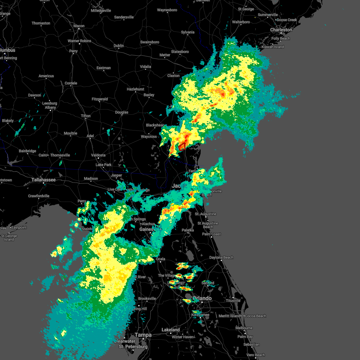 At 448 pm edt, a severe thunderstorm capable of producing a tornado was located over woodbine, moving northeast at 30 mph (radar indicated rotation). Hazards include tornado. Flying debris will be dangerous to those caught without shelter. mobile homes will be damaged or destroyed. damage to roofs, windows, and vehicles will occur. tree damage is likely. This tornadic thunderstorm will remain over mainly rural areas of north central camden county. At 448 pm edt, a severe thunderstorm capable of producing a tornado was located over woodbine, moving northeast at 30 mph (radar indicated rotation). Hazards include tornado. Flying debris will be dangerous to those caught without shelter. mobile homes will be damaged or destroyed. damage to roofs, windows, and vehicles will occur. tree damage is likely. This tornadic thunderstorm will remain over mainly rural areas of north central camden county.
|
| 3/23/2022 4:39 PM EDT |
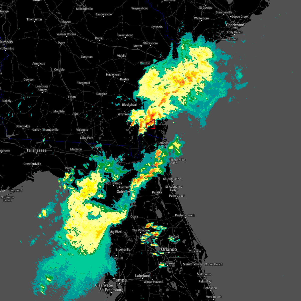 At 439 pm edt, a severe thunderstorm capable of producing a tornado was located near woodbine, moving northeast at 30 mph (radar indicated rotation). Hazards include tornado. Flying debris will be dangerous to those caught without shelter. mobile homes will be damaged or destroyed. damage to roofs, windows, and vehicles will occur. tree damage is likely. this dangerous storm will be near, woodbine around 450 pm edt. Other locations impacted by this tornadic thunderstorm include colesburg. At 439 pm edt, a severe thunderstorm capable of producing a tornado was located near woodbine, moving northeast at 30 mph (radar indicated rotation). Hazards include tornado. Flying debris will be dangerous to those caught without shelter. mobile homes will be damaged or destroyed. damage to roofs, windows, and vehicles will occur. tree damage is likely. this dangerous storm will be near, woodbine around 450 pm edt. Other locations impacted by this tornadic thunderstorm include colesburg.
|
| 3/23/2022 4:26 PM EDT |
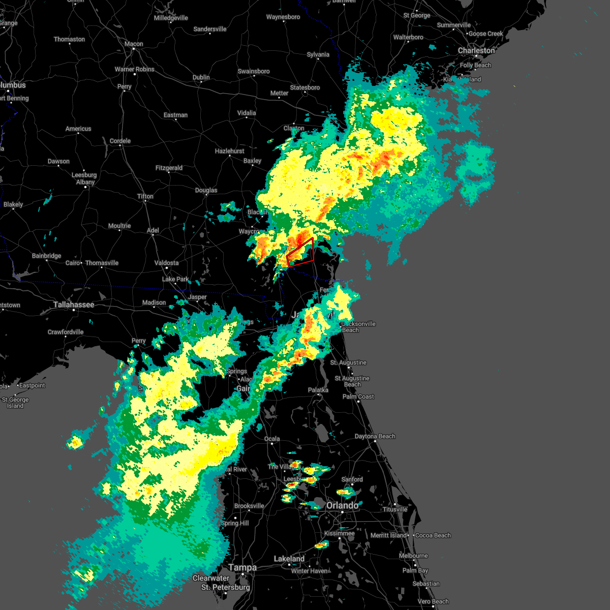 At 426 pm edt, a severe thunderstorm capable of producing a tornado was located near homeland, or 7 miles northeast of folkston, moving northeast at 30 mph (radar indicated rotation). Hazards include tornado. Flying debris will be dangerous to those caught without shelter. mobile homes will be damaged or destroyed. damage to roofs, windows, and vehicles will occur. tree damage is likely. this dangerous storm will be near, woodbine around 455 pm edt. waverly around 500 pm edt. Other locations impacted by this tornadic thunderstorm include tarboro and colesburg. At 426 pm edt, a severe thunderstorm capable of producing a tornado was located near homeland, or 7 miles northeast of folkston, moving northeast at 30 mph (radar indicated rotation). Hazards include tornado. Flying debris will be dangerous to those caught without shelter. mobile homes will be damaged or destroyed. damage to roofs, windows, and vehicles will occur. tree damage is likely. this dangerous storm will be near, woodbine around 455 pm edt. waverly around 500 pm edt. Other locations impacted by this tornadic thunderstorm include tarboro and colesburg.
|
| 3/19/2022 7:21 PM EDT |
 At 721 pm edt, a severe thunderstorm was located near waverly, or 8 miles northeast of woodbine, moving east at 40 mph (radar indicated). Hazards include 60 mph wind gusts and quarter size hail. Hail damage to vehicles is expected. Expect wind damage to roofs, siding, and trees. At 721 pm edt, a severe thunderstorm was located near waverly, or 8 miles northeast of woodbine, moving east at 40 mph (radar indicated). Hazards include 60 mph wind gusts and quarter size hail. Hail damage to vehicles is expected. Expect wind damage to roofs, siding, and trees.
|
| 3/19/2022 6:44 PM EDT |
 At 643 pm edt, a severe thunderstorm was located near race pond, or 15 miles northeast of stephen foster state park, moving northeast at 20 mph (radar indicated). Hazards include 60 mph wind gusts and quarter size hail. Hail damage to vehicles is expected. Expect wind damage to roofs, siding, and trees. At 643 pm edt, a severe thunderstorm was located near race pond, or 15 miles northeast of stephen foster state park, moving northeast at 20 mph (radar indicated). Hazards include 60 mph wind gusts and quarter size hail. Hail damage to vehicles is expected. Expect wind damage to roofs, siding, and trees.
|
| 4/25/2021 12:23 AM EDT |
 At 1223 am edt, a severe thunderstorm was located near woodbine, moving east at 65 mph (radar indicated). Hazards include 60 mph wind gusts and quarter size hail. possible tornado. Hail damage to vehicles is expected. expect wind damage to roofs, siding, and trees. Locations impacted include, brunswick, woodbine, dock junction, country club estates, waverly, jekyll island, waynesville, tarboro and dover bluff. At 1223 am edt, a severe thunderstorm was located near woodbine, moving east at 65 mph (radar indicated). Hazards include 60 mph wind gusts and quarter size hail. possible tornado. Hail damage to vehicles is expected. expect wind damage to roofs, siding, and trees. Locations impacted include, brunswick, woodbine, dock junction, country club estates, waverly, jekyll island, waynesville, tarboro and dover bluff.
|
| 4/25/2021 12:01 AM EDT |
 At 1201 am edt, a severe thunderstorm was located 7 miles east of hickox, or 7 miles southeast of nahunta, moving east at 40 mph (radar indicated). Hazards include 60 mph wind gusts and quarter size hail. possible tornado. Hail damage to vehicles is expected. Expect wind damage to roofs, siding, and trees. At 1201 am edt, a severe thunderstorm was located 7 miles east of hickox, or 7 miles southeast of nahunta, moving east at 40 mph (radar indicated). Hazards include 60 mph wind gusts and quarter size hail. possible tornado. Hail damage to vehicles is expected. Expect wind damage to roofs, siding, and trees.
|
| 4/10/2021 4:49 PM EDT |
 At 448 pm edt, a severe thunderstorm capable of producing a tornado was located near woodbine, moving northeast at 45 mph (radar indicated rotation). Hazards include tornado. Flying debris will be dangerous to those caught without shelter. mobile homes will be damaged or destroyed. damage to roofs, windows, and vehicles will occur. tree damage is likely. this dangerous storm will be near, brunswick and jekyll island around 510 pm edt. st. simons island, dock junction and country club estates around 515 pm edt. Other locations impacted by this tornadic thunderstorm include dover bluff. At 448 pm edt, a severe thunderstorm capable of producing a tornado was located near woodbine, moving northeast at 45 mph (radar indicated rotation). Hazards include tornado. Flying debris will be dangerous to those caught without shelter. mobile homes will be damaged or destroyed. damage to roofs, windows, and vehicles will occur. tree damage is likely. this dangerous storm will be near, brunswick and jekyll island around 510 pm edt. st. simons island, dock junction and country club estates around 515 pm edt. Other locations impacted by this tornadic thunderstorm include dover bluff.
|
| 4/10/2021 4:44 PM EDT |
 At 444 pm edt, a severe thunderstorm was located over woodbine, moving northeast at 45 mph (radar indicated). Hazards include 60 mph wind gusts and penny size hail. expect damage to roofs, siding, and trees At 444 pm edt, a severe thunderstorm was located over woodbine, moving northeast at 45 mph (radar indicated). Hazards include 60 mph wind gusts and penny size hail. expect damage to roofs, siding, and trees
|
| 12/24/2020 7:22 PM EST |
 The severe thunderstorm warning for northeastern nassau, st. johns, north central putnam, northeastern clay, duval, eastern camden and southeastern glynn counties will expire at 730 pm est, the storms which prompted the warning have weakened below severe limits, and have exited the warned area. therefore, the warning will be allowed to expire. however gusty winds and heavy rain are still possible with these thunderstorms. remember, a severe thunderstorm warning still remains in effect for portions of st johns county until 730 pm. The severe thunderstorm warning for northeastern nassau, st. johns, north central putnam, northeastern clay, duval, eastern camden and southeastern glynn counties will expire at 730 pm est, the storms which prompted the warning have weakened below severe limits, and have exited the warned area. therefore, the warning will be allowed to expire. however gusty winds and heavy rain are still possible with these thunderstorms. remember, a severe thunderstorm warning still remains in effect for portions of st johns county until 730 pm.
|
| 12/24/2020 6:56 PM EST |
 At 654 pm est, severe thunderstorms were located along a line extending from near brunswick to jacksonville and green cove springs, moving east at 60 mph (radar indicated). Hazards include 60 mph wind gusts. Expect damage to roofs, siding, and trees. locations impacted include, jacksonville, st. marys, kingsland, brunswick, saint augustine, st. Simons island, fernandina beach, orange park, green cove springs and jacksonville international arpt. At 654 pm est, severe thunderstorms were located along a line extending from near brunswick to jacksonville and green cove springs, moving east at 60 mph (radar indicated). Hazards include 60 mph wind gusts. Expect damage to roofs, siding, and trees. locations impacted include, jacksonville, st. marys, kingsland, brunswick, saint augustine, st. Simons island, fernandina beach, orange park, green cove springs and jacksonville international arpt.
|
| 12/24/2020 6:28 PM EST |
 At 627 pm est, severe thunderstorms were located along a line extending from 10 miles west of woodbine to near orange heights, moving northeast at 55 mph (radar indicated). Hazards include 60 mph wind gusts. expect damage to roofs, siding, and trees At 627 pm est, severe thunderstorms were located along a line extending from 10 miles west of woodbine to near orange heights, moving northeast at 55 mph (radar indicated). Hazards include 60 mph wind gusts. expect damage to roofs, siding, and trees
|
| 12/24/2020 6:15 PM EST |
 At 615 pm est, severe thunderstorms were located along a line extending from cox to 6 miles northeast of waverly to near folkston, moving east at 55 mph (radar indicated). Hazards include 60 mph wind gusts. Expect damage to roofs, siding, and trees. locations impacted include, kingsland, brunswick, st. Simons island, folkston, woodbine, nahunta, dock junction, kings bay base, homeland and country club estates. At 615 pm est, severe thunderstorms were located along a line extending from cox to 6 miles northeast of waverly to near folkston, moving east at 55 mph (radar indicated). Hazards include 60 mph wind gusts. Expect damage to roofs, siding, and trees. locations impacted include, kingsland, brunswick, st. Simons island, folkston, woodbine, nahunta, dock junction, kings bay base, homeland and country club estates.
|
| 12/24/2020 6:00 PM EST |
 At 600 pm est, severe thunderstorms were located along a line extending from near ludowici to near waynesville to 9 miles southeast of stephen foster state park, moving southeast at 50 mph (radar indicated). Hazards include 60 mph wind gusts. Expect damage to roofs, siding, and trees. locations impacted include, kingsland, brunswick, st. Simons island, jesup, folkston, woodbine, nahunta, dock junction, kings bay base and stephen foster state park. At 600 pm est, severe thunderstorms were located along a line extending from near ludowici to near waynesville to 9 miles southeast of stephen foster state park, moving southeast at 50 mph (radar indicated). Hazards include 60 mph wind gusts. Expect damage to roofs, siding, and trees. locations impacted include, kingsland, brunswick, st. Simons island, jesup, folkston, woodbine, nahunta, dock junction, kings bay base and stephen foster state park.
|
| 12/24/2020 5:33 PM EST |
 At 533 pm est, severe thunderstorms were located along a line extending from 8 miles west of donald to near patterson to near stephen foster state park, moving east at 55 mph (radar indicated). Hazards include 60 mph wind gusts. expect damage to roofs, siding, and trees At 533 pm est, severe thunderstorms were located along a line extending from 8 miles west of donald to near patterson to near stephen foster state park, moving east at 55 mph (radar indicated). Hazards include 60 mph wind gusts. expect damage to roofs, siding, and trees
|
| 8/9/2020 8:12 PM EDT |
 At 812 pm edt, severe thunderstorms were located along a line extending from near woodbine to near kingsland to near hilliard, moving east at 30 mph (radar indicated). Hazards include 60 mph wind gusts and nickel size hail. expect damage to roofs, siding, and trees At 812 pm edt, severe thunderstorms were located along a line extending from near woodbine to near kingsland to near hilliard, moving east at 30 mph (radar indicated). Hazards include 60 mph wind gusts and nickel size hail. expect damage to roofs, siding, and trees
|
| 6/19/2020 4:00 PM EDT |
 At 400 pm edt, a severe thunderstorm was located near woodbine, moving southeast at 10 mph (radar indicated). Hazards include 60 mph wind gusts and quarter size hail. Hail damage to vehicles is expected. Expect wind damage to roofs, siding, and trees. At 400 pm edt, a severe thunderstorm was located near woodbine, moving southeast at 10 mph (radar indicated). Hazards include 60 mph wind gusts and quarter size hail. Hail damage to vehicles is expected. Expect wind damage to roofs, siding, and trees.
|
| 4/23/2020 3:50 PM EDT |
 At 350 pm edt, tornado producing storms were located along a line extending from near country club estates to near jekyll island, moving east at 50 mph (radar confirmed tornado). Hazards include damaging tornado and golf ball size hail. Flying debris will be dangerous to those caught without shelter. mobile homes will be damaged or destroyed. damage to roofs, windows, and vehicles will occur. tree damage is likely. these tornadic storms will be near, st. simons island around 355 pm edt. Other locations impacted by these tornadic storms include dover bluff. At 350 pm edt, tornado producing storms were located along a line extending from near country club estates to near jekyll island, moving east at 50 mph (radar confirmed tornado). Hazards include damaging tornado and golf ball size hail. Flying debris will be dangerous to those caught without shelter. mobile homes will be damaged or destroyed. damage to roofs, windows, and vehicles will occur. tree damage is likely. these tornadic storms will be near, st. simons island around 355 pm edt. Other locations impacted by these tornadic storms include dover bluff.
|
| 4/23/2020 3:38 PM EDT |
 At 337 pm edt, a confirmed large and extremely dangerous tornado was located along a line extending from near thalmann to near woodbine, moving east at 50 mph. this is a particularly dangerous situation. take cover now! (radar confirmed tornado. at 335 pm a tornado was confirmed on the ground in camden county along i-95 near mile marker 22.). Hazards include damaging tornado. You are in a life-threatening situation. flying debris may be deadly to those caught without shelter. mobile homes will be destroyed. considerable damage to homes, businesses, and vehicles is likely and complete destruction is possible. these tornadic storms will be near, brunswick and dock junction around 345 pm edt. st. simons island and country club estates around 350 pm edt. jekyll island around 355 pm edt. Other locations impacted by these tornadic storms include dover bluff and boys estate. At 337 pm edt, a confirmed large and extremely dangerous tornado was located along a line extending from near thalmann to near woodbine, moving east at 50 mph. this is a particularly dangerous situation. take cover now! (radar confirmed tornado. at 335 pm a tornado was confirmed on the ground in camden county along i-95 near mile marker 22.). Hazards include damaging tornado. You are in a life-threatening situation. flying debris may be deadly to those caught without shelter. mobile homes will be destroyed. considerable damage to homes, businesses, and vehicles is likely and complete destruction is possible. these tornadic storms will be near, brunswick and dock junction around 345 pm edt. st. simons island and country club estates around 350 pm edt. jekyll island around 355 pm edt. Other locations impacted by these tornadic storms include dover bluff and boys estate.
|
| 4/23/2020 3:35 PM EDT |
 At 334 pm edt, severe thunderstorms capable of producing tornadoes were located along a line extending from near thalmann to near woodbine, moving east at 55 mph (radar indicated rotation). Hazards include tornado and golf ball size hail. Flying debris will be dangerous to those caught without shelter. mobile homes will be damaged or destroyed. damage to roofs, windows, and vehicles will occur. tree damage is likely. these dangerous storms will be near, dock junction and country club estates around 345 pm edt. st. simons island around 350 pm edt. brunswick and jekyll island around 355 pm edt. sea island around 400 pm edt. Other locations impacted by these tornadic storms include dover bluff and boys estate. At 334 pm edt, severe thunderstorms capable of producing tornadoes were located along a line extending from near thalmann to near woodbine, moving east at 55 mph (radar indicated rotation). Hazards include tornado and golf ball size hail. Flying debris will be dangerous to those caught without shelter. mobile homes will be damaged or destroyed. damage to roofs, windows, and vehicles will occur. tree damage is likely. these dangerous storms will be near, dock junction and country club estates around 345 pm edt. st. simons island around 350 pm edt. brunswick and jekyll island around 355 pm edt. sea island around 400 pm edt. Other locations impacted by these tornadic storms include dover bluff and boys estate.
|
| 4/23/2020 3:21 PM EDT |
 At 321 pm edt, a severe thunderstorm capable of producing a tornado was located near woodbine, moving east at 50 mph (radar indicated rotation). Hazards include tornado and golf ball size hail. Flying debris will be dangerous to those caught without shelter. mobile homes will be damaged or destroyed. damage to roofs, windows, and vehicles will occur. tree damage is likely. this dangerous storm will be near, woodbine around 325 pm edt. waverly around 330 pm edt. jekyll island around 350 pm edt. Other locations impacted by this tornadic thunderstorm include tarboro, boys estate, dover bluff and atkinson. At 321 pm edt, a severe thunderstorm capable of producing a tornado was located near woodbine, moving east at 50 mph (radar indicated rotation). Hazards include tornado and golf ball size hail. Flying debris will be dangerous to those caught without shelter. mobile homes will be damaged or destroyed. damage to roofs, windows, and vehicles will occur. tree damage is likely. this dangerous storm will be near, woodbine around 325 pm edt. waverly around 330 pm edt. jekyll island around 350 pm edt. Other locations impacted by this tornadic thunderstorm include tarboro, boys estate, dover bluff and atkinson.
|
| 4/23/2020 3:10 PM EDT |
 At 309 pm edt, a severe thunderstorm capable of producing a tornado was located 8 miles north of homeland, or 10 miles north of folkston, moving east at 55 mph (radar indicated rotation). Hazards include tornado and golf ball size hail. Flying debris will be dangerous to those caught without shelter. mobile homes will be damaged or destroyed. damage to roofs, windows, and vehicles will occur. tree damage is likely. this dangerous storm will be near, woodbine and waverly around 325 pm edt. Other locations impacted by this tornadic thunderstorm include winokur, tarboro and colesburg. At 309 pm edt, a severe thunderstorm capable of producing a tornado was located 8 miles north of homeland, or 10 miles north of folkston, moving east at 55 mph (radar indicated rotation). Hazards include tornado and golf ball size hail. Flying debris will be dangerous to those caught without shelter. mobile homes will be damaged or destroyed. damage to roofs, windows, and vehicles will occur. tree damage is likely. this dangerous storm will be near, woodbine and waverly around 325 pm edt. Other locations impacted by this tornadic thunderstorm include winokur, tarboro and colesburg.
|
| 4/23/2020 3:04 PM EDT |
 At 303 pm edt, severe thunderstorms were located along a line extending from near fort mudge to 6 miles east of fargo, moving east at 50 mph (radar indicated). Hazards include golf ball size hail and 60 mph wind gusts. People and animals outdoors will be injured. expect hail damage to roofs, siding, windows, and vehicles. expect wind damage to roofs, siding, and trees. Locations impacted include, hilliard, folkston, woodbine, callahan, stephen foster state park, homeland, boggy bay, kings ferry, race pond and fort mudge. At 303 pm edt, severe thunderstorms were located along a line extending from near fort mudge to 6 miles east of fargo, moving east at 50 mph (radar indicated). Hazards include golf ball size hail and 60 mph wind gusts. People and animals outdoors will be injured. expect hail damage to roofs, siding, windows, and vehicles. expect wind damage to roofs, siding, and trees. Locations impacted include, hilliard, folkston, woodbine, callahan, stephen foster state park, homeland, boggy bay, kings ferry, race pond and fort mudge.
|
| 4/23/2020 2:52 PM EDT |
 At 251 pm edt, a severe thunderstorm capable of producing a tornado was located 8 miles northeast of stephen foster state park, moving east at 55 mph (radar indicated rotation). Hazards include tornado and golf ball size hail. Flying debris will be dangerous to those caught without shelter. mobile homes will be damaged or destroyed. damage to roofs, windows, and vehicles will occur. tree damage is likely. this dangerous storm will be near, race pond around 300 pm edt. homeland around 305 pm edt. folkston around 310 pm edt. woodbine around 325 pm edt. waverly around 330 pm edt. Other locations impacted by this tornadic thunderstorm include winokur, tarboro and colesburg. At 251 pm edt, a severe thunderstorm capable of producing a tornado was located 8 miles northeast of stephen foster state park, moving east at 55 mph (radar indicated rotation). Hazards include tornado and golf ball size hail. Flying debris will be dangerous to those caught without shelter. mobile homes will be damaged or destroyed. damage to roofs, windows, and vehicles will occur. tree damage is likely. this dangerous storm will be near, race pond around 300 pm edt. homeland around 305 pm edt. folkston around 310 pm edt. woodbine around 325 pm edt. waverly around 330 pm edt. Other locations impacted by this tornadic thunderstorm include winokur, tarboro and colesburg.
|
| 4/23/2020 2:41 PM EDT |
 At 240 pm edt, severe thunderstorms were located along a line extending from 6 miles south of boggy bay to near needmore, moving east at 50 mph (radar indicated). Hazards include 60 mph wind gusts and quarter size hail. Hail damage to vehicles is expected. Expect wind damage to roofs, siding, and trees. At 240 pm edt, severe thunderstorms were located along a line extending from 6 miles south of boggy bay to near needmore, moving east at 50 mph (radar indicated). Hazards include 60 mph wind gusts and quarter size hail. Hail damage to vehicles is expected. Expect wind damage to roofs, siding, and trees.
|
| 4/20/2020 6:13 AM EDT |
 At 613 am edt, a severe thunderstorm was located over kings ferry, or 8 miles northeast of hilliard, moving east at 65 mph (radar indicated). Hazards include 60 mph wind gusts and quarter size hail. Hail damage to vehicles is expected. expect wind damage to roofs, siding, and trees. locations impacted include, st. Marys, kingsland, kings bay base, kings ferry, cumberland island, harrietts bluff and colesburg. At 613 am edt, a severe thunderstorm was located over kings ferry, or 8 miles northeast of hilliard, moving east at 65 mph (radar indicated). Hazards include 60 mph wind gusts and quarter size hail. Hail damage to vehicles is expected. expect wind damage to roofs, siding, and trees. locations impacted include, st. Marys, kingsland, kings bay base, kings ferry, cumberland island, harrietts bluff and colesburg.
|
| 4/20/2020 6:09 AM EDT |
 At 609 am edt, a severe thunderstorm was located near kings ferry, or near hilliard, moving east at 60 mph (radar indicated). Hazards include 60 mph wind gusts and quarter size hail. Hail damage to vehicles is expected. Expect wind damage to roofs, siding, and trees. At 609 am edt, a severe thunderstorm was located near kings ferry, or near hilliard, moving east at 60 mph (radar indicated). Hazards include 60 mph wind gusts and quarter size hail. Hail damage to vehicles is expected. Expect wind damage to roofs, siding, and trees.
|
| 4/13/2020 10:09 AM EDT |
 The severe thunderstorm warning for northern nassau, camden, southeastern glynn, southeastern ware and central charlton counties will expire at 1015 am edt, the storms which prompted the warning have weakened and some have moved out of the warned area. therefore, the warning will be allowed to expire. however gusty winds are still possible with these thunderstorms and a significant weather advisory is in effect. a tornado watch remains in effect until 1100 am edt for northeastern florida, and southeastern georgia. The severe thunderstorm warning for northern nassau, camden, southeastern glynn, southeastern ware and central charlton counties will expire at 1015 am edt, the storms which prompted the warning have weakened and some have moved out of the warned area. therefore, the warning will be allowed to expire. however gusty winds are still possible with these thunderstorms and a significant weather advisory is in effect. a tornado watch remains in effect until 1100 am edt for northeastern florida, and southeastern georgia.
|
| 4/13/2020 9:42 AM EDT |
 At 941 am edt, severe thunderstorms were located along a line extending from 8 miles east of jekyll island to 10 miles southeast of stephen foster state park, moving east at 60 mph (radar indicated). Hazards include 60 mph wind gusts. Expect damage to roofs, siding, and trees. locations impacted include, st. marys, kingsland, brunswick, st. Simons island, hilliard, folkston, woodbine, kings bay base, homeland and kings ferry. At 941 am edt, severe thunderstorms were located along a line extending from 8 miles east of jekyll island to 10 miles southeast of stephen foster state park, moving east at 60 mph (radar indicated). Hazards include 60 mph wind gusts. Expect damage to roofs, siding, and trees. locations impacted include, st. marys, kingsland, brunswick, st. Simons island, hilliard, folkston, woodbine, kings bay base, homeland and kings ferry.
|
| 4/13/2020 9:29 AM EDT |
 At 929 am edt, severe thunderstorms were located along a line extending from near jekyll island to 9 miles east of fargo, moving east at 60 mph (radar indicated). Hazards include 70 mph wind gusts and quarter size hail. Hail damage to vehicles is expected. expect considerable tree damage. wind damage is also likely to mobile homes, roofs, and outbuildings. locations impacted include, st. marys, kingsland, brunswick, st. Simons island, hilliard, folkston, woodbine, fargo, statenville and dock junction. At 929 am edt, severe thunderstorms were located along a line extending from near jekyll island to 9 miles east of fargo, moving east at 60 mph (radar indicated). Hazards include 70 mph wind gusts and quarter size hail. Hail damage to vehicles is expected. expect considerable tree damage. wind damage is also likely to mobile homes, roofs, and outbuildings. locations impacted include, st. marys, kingsland, brunswick, st. Simons island, hilliard, folkston, woodbine, fargo, statenville and dock junction.
|
| 4/13/2020 9:08 AM EDT |
 At 908 am edt, severe thunderstorms were located along a line extending from 6 miles west of woodbine to near needmore, moving east at 60 mph (radar indicated). Hazards include 70 mph wind gusts and quarter size hail. Hail damage to vehicles is expected. expect considerable tree damage. Wind damage is also likely to mobile homes, roofs, and outbuildings. At 908 am edt, severe thunderstorms were located along a line extending from 6 miles west of woodbine to near needmore, moving east at 60 mph (radar indicated). Hazards include 70 mph wind gusts and quarter size hail. Hail damage to vehicles is expected. expect considerable tree damage. Wind damage is also likely to mobile homes, roofs, and outbuildings.
|
| 4/13/2020 8:44 AM EDT |
 At 843 am edt, severe thunderstorms were located along a line extending from 8 miles southeast of hickox to 7 miles northeast of fargo, moving east at 50 mph (radar indicated). Hazards include 60 mph wind gusts. expect damage to roofs, siding, and trees At 843 am edt, severe thunderstorms were located along a line extending from 8 miles southeast of hickox to 7 miles northeast of fargo, moving east at 50 mph (radar indicated). Hazards include 60 mph wind gusts. expect damage to roofs, siding, and trees
|
| 2/6/2020 10:06 PM EST |
 The severe thunderstorm warning for northwestern nassau, western camden and southwestern glynn counties will expire at 1015 pm est, the storm which prompted the warning has moved out of the area. therefore, the warning will be allowed to expire. a tornado watch remains in effect until midnight est for northeastern florida, and southeastern georgia. The severe thunderstorm warning for northwestern nassau, western camden and southwestern glynn counties will expire at 1015 pm est, the storm which prompted the warning has moved out of the area. therefore, the warning will be allowed to expire. a tornado watch remains in effect until midnight est for northeastern florida, and southeastern georgia.
|
| 2/6/2020 10:02 PM EST |
 At 1001 pm est, a severe thunderstorm was located near waverly, or 9 miles northwest of woodbine, moving northeast at 70 mph (radar indicated). Hazards include 60 mph wind gusts. Expect damage to roofs, siding, and trees. Locations impacted include, hilliard, woodbine, kings ferry, waverly, tarboro and colesburg. At 1001 pm est, a severe thunderstorm was located near waverly, or 9 miles northwest of woodbine, moving northeast at 70 mph (radar indicated). Hazards include 60 mph wind gusts. Expect damage to roofs, siding, and trees. Locations impacted include, hilliard, woodbine, kings ferry, waverly, tarboro and colesburg.
|
| 2/6/2020 9:54 PM EST |
 At 954 pm est, severe thunderstorms were located along a line extending from 7 miles southwest of waverly to 6 miles southwest of hilliard, moving northeast at 50 mph (radar indicated). Hazards include 70 mph wind gusts. Expect considerable tree damage. Damage is likely to mobile homes, roofs, and outbuildings. At 954 pm est, severe thunderstorms were located along a line extending from 7 miles southwest of waverly to 6 miles southwest of hilliard, moving northeast at 50 mph (radar indicated). Hazards include 70 mph wind gusts. Expect considerable tree damage. Damage is likely to mobile homes, roofs, and outbuildings.
|
| 2/6/2020 9:48 PM EST | Camden county 911/dispatch reports trees and powerlines downed throughout the county. no major damage to homes reported. time of damage based on radar dat in camden county GA, 8.6 miles ESE of Woodbine, GA |
| 2/6/2020 9:28 PM EST |
 At 927 pm est, a severe thunderstorm was located 10 miles southeast of stephen foster state park, moving northeast at 70 mph (radar indicated). Hazards include 60 mph wind gusts. expect damage to roofs, siding, and trees At 927 pm est, a severe thunderstorm was located 10 miles southeast of stephen foster state park, moving northeast at 70 mph (radar indicated). Hazards include 60 mph wind gusts. expect damage to roofs, siding, and trees
|
| 12/17/2019 4:38 PM EST |
 The severe thunderstorm warning for northern nassau, eastern camden and southeastern glynn counties will expire at 445 pm est, the storms which prompted the warning have weakened below severe limits, and have exited the warned area. therefore, the warning will be allowed to expire. however heavy rain is still possible with these thunderstorms. a tornado watch remains in effect until 700 pm est for northeastern florida, and southeastern georgia. The severe thunderstorm warning for northern nassau, eastern camden and southeastern glynn counties will expire at 445 pm est, the storms which prompted the warning have weakened below severe limits, and have exited the warned area. therefore, the warning will be allowed to expire. however heavy rain is still possible with these thunderstorms. a tornado watch remains in effect until 700 pm est for northeastern florida, and southeastern georgia.
|
| 12/17/2019 4:21 PM EST |
 The severe thunderstorm warning for northwestern camden and glynn counties will expire at 430 pm est, the storms which prompted the warning have moved out of the area. therefore, the warning will be allowed to expire. a tornado watch remains in effect until 700 pm est for southeastern georgia. The severe thunderstorm warning for northwestern camden and glynn counties will expire at 430 pm est, the storms which prompted the warning have moved out of the area. therefore, the warning will be allowed to expire. a tornado watch remains in effect until 700 pm est for southeastern georgia.
|
| 12/17/2019 4:20 PM EST |
 At 420 pm est, severe thunderstorms were located along a line extending from 6 miles southwest of brunswick to 6 miles north of kingsland to near callahan, moving east at 40 mph (radar indicated). Hazards include 60 mph wind gusts. expect damage to roofs, siding, and trees At 420 pm est, severe thunderstorms were located along a line extending from 6 miles southwest of brunswick to 6 miles north of kingsland to near callahan, moving east at 40 mph (radar indicated). Hazards include 60 mph wind gusts. expect damage to roofs, siding, and trees
|
| 12/17/2019 4:19 PM EST | A tree was reported down near the intersection of harriets bluff rd and kinlaw rd. time based on rada in camden county GA, 8.4 miles N of Woodbine, GA |
| 12/17/2019 4:00 PM EST |
 At 400 pm est, severe thunderstorms were located along a line extending from near thalmann to 10 miles south of hickox to 12 miles south of stephen foster state park, moving northeast at 45 mph (radar indicated). Hazards include 60 mph wind gusts. Expect damage to roofs, siding, and trees. Locations impacted include, dock junction, everett, waverly, thalmann, tarboro and boys estate. At 400 pm est, severe thunderstorms were located along a line extending from near thalmann to 10 miles south of hickox to 12 miles south of stephen foster state park, moving northeast at 45 mph (radar indicated). Hazards include 60 mph wind gusts. Expect damage to roofs, siding, and trees. Locations impacted include, dock junction, everett, waverly, thalmann, tarboro and boys estate.
|
| 12/17/2019 3:39 PM EST |
 At 339 pm est, severe thunderstorms were located along a line extending from near waynesville to near race pond to 11 miles southeast of fargo, moving northeast at 45 mph (radar indicated). Hazards include 60 mph wind gusts. expect damage to roofs, siding, and trees At 339 pm est, severe thunderstorms were located along a line extending from near waynesville to near race pond to 11 miles southeast of fargo, moving northeast at 45 mph (radar indicated). Hazards include 60 mph wind gusts. expect damage to roofs, siding, and trees
|
| 6/20/2019 9:27 PM EDT |
 The national weather service in jacksonville has issued a * severe thunderstorm warning for. northwestern nassau county in northeastern florida. southwestern camden county in southeastern georgia. south central brantley county in southeastern georgia. Southeastern ware county in southeastern georgia. The national weather service in jacksonville has issued a * severe thunderstorm warning for. northwestern nassau county in northeastern florida. southwestern camden county in southeastern georgia. south central brantley county in southeastern georgia. Southeastern ware county in southeastern georgia.
|
| 6/10/2019 4:23 PM EDT |
 At 423 pm edt, a severe thunderstorm was located over woodbine, moving north at 20 mph (radar indicated). Hazards include 60 mph wind gusts and penny size hail. Expect damage to roofs, siding, and trees. Locations impacted include, woodbine, tarboro and colesburg. At 423 pm edt, a severe thunderstorm was located over woodbine, moving north at 20 mph (radar indicated). Hazards include 60 mph wind gusts and penny size hail. Expect damage to roofs, siding, and trees. Locations impacted include, woodbine, tarboro and colesburg.
|
| 6/10/2019 4:14 PM EDT | A few trees were downed near the intersection of old jefferson highway and state road 110. time estimated by rada in camden county GA, 3.7 miles NE of Woodbine, GA |
| 6/10/2019 4:08 PM EDT |
 At 408 pm edt, a severe thunderstorm was located near woodbine, moving north at 10 mph (radar indicated). Hazards include 60 mph wind gusts and penny size hail. expect damage to roofs, siding, and trees At 408 pm edt, a severe thunderstorm was located near woodbine, moving north at 10 mph (radar indicated). Hazards include 60 mph wind gusts and penny size hail. expect damage to roofs, siding, and trees
|
| 6/10/2019 3:54 PM EDT |
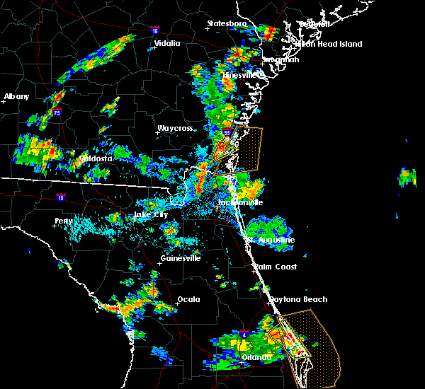 At 354 pm edt, a severe thunderstorm was located near woodbine, moving northeast at 20 mph (radar indicated). Hazards include 60 mph wind gusts and penny size hail. Expect damage to roofs, siding, and trees. Locations impacted include, dover bluff. At 354 pm edt, a severe thunderstorm was located near woodbine, moving northeast at 20 mph (radar indicated). Hazards include 60 mph wind gusts and penny size hail. Expect damage to roofs, siding, and trees. Locations impacted include, dover bluff.
|
| 6/10/2019 3:42 PM EDT |
 At 342 pm edt, a severe thunderstorm was located near woodbine, moving northeast at 15 mph (radar indicated). Hazards include 60 mph wind gusts and penny size hail. expect damage to roofs, siding, and trees At 342 pm edt, a severe thunderstorm was located near woodbine, moving northeast at 15 mph (radar indicated). Hazards include 60 mph wind gusts and penny size hail. expect damage to roofs, siding, and trees
|
| 6/4/2019 3:41 PM EDT |
 The severe thunderstorm warning for central camden county will expire at 345 pm edt, the storm which prompted the warning has weakened below severe limits, and no longer poses an immediate threat to life or property. therefore, the warning will be allowed to expire. however heavy rain is still possible with this thunderstorm. The severe thunderstorm warning for central camden county will expire at 345 pm edt, the storm which prompted the warning has weakened below severe limits, and no longer poses an immediate threat to life or property. therefore, the warning will be allowed to expire. however heavy rain is still possible with this thunderstorm.
|
| 6/4/2019 3:37 PM EDT |
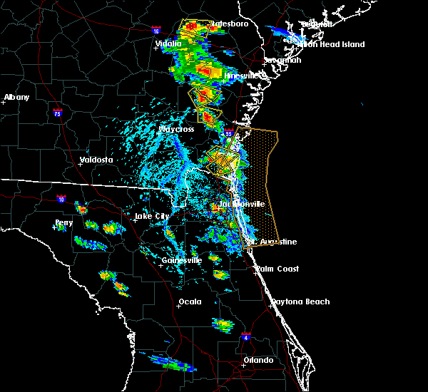 At 337 pm edt, a severe thunderstorm was located near woodbine, moving southeast at 5 mph (radar indicated). Hazards include 60 mph wind gusts and quarter size hail. Hail damage to vehicles is expected. expect wind damage to roofs, siding, and trees. Locations impacted include, woodbine, colesburg and harrietts bluff. At 337 pm edt, a severe thunderstorm was located near woodbine, moving southeast at 5 mph (radar indicated). Hazards include 60 mph wind gusts and quarter size hail. Hail damage to vehicles is expected. expect wind damage to roofs, siding, and trees. Locations impacted include, woodbine, colesburg and harrietts bluff.
|
| 6/4/2019 3:22 PM EDT | Golf Ball sized hail reported 0.7 miles E of Woodbine, GA, emergency management reported golf ball sized hail in woodbine. |
| 6/4/2019 3:09 PM EDT |
 At 308 pm edt, a severe thunderstorm was located over woodbine, moving southeast at 15 mph (radar indicated). Hazards include 60 mph wind gusts and quarter size hail. Hail damage to vehicles is expected. Expect wind damage to roofs, siding, and trees. At 308 pm edt, a severe thunderstorm was located over woodbine, moving southeast at 15 mph (radar indicated). Hazards include 60 mph wind gusts and quarter size hail. Hail damage to vehicles is expected. Expect wind damage to roofs, siding, and trees.
|
| 4/19/2019 12:26 PM EDT |
 At 1226 pm edt, severe thunderstorms were located along a line extending from near everett to 6 miles west of waverly to near keystone heights, moving northeast at 50 mph (radar indicated). Hazards include 70 mph wind gusts. Expect considerable tree damage. Damage is likely to mobile homes, roofs, and outbuildings. At 1226 pm edt, severe thunderstorms were located along a line extending from near everett to 6 miles west of waverly to near keystone heights, moving northeast at 50 mph (radar indicated). Hazards include 70 mph wind gusts. Expect considerable tree damage. Damage is likely to mobile homes, roofs, and outbuildings.
|
| 4/19/2019 12:10 PM EDT |
 At 1209 pm edt, a severe thunderstorm capable of producing a tornado was located near kingsland, moving northeast at 55 mph (radar indicated rotation). Hazards include tornado. Flying debris will be dangerous to those caught without shelter. mobile homes will be damaged or destroyed. damage to roofs, windows, and vehicles will occur. tree damage is likely. this dangerous storm will be near, jekyll island around 1235 pm edt. st. simons island and sea island around 1245 pm edt. Other locations impacted by this tornadic thunderstorm include dover bluff. At 1209 pm edt, a severe thunderstorm capable of producing a tornado was located near kingsland, moving northeast at 55 mph (radar indicated rotation). Hazards include tornado. Flying debris will be dangerous to those caught without shelter. mobile homes will be damaged or destroyed. damage to roofs, windows, and vehicles will occur. tree damage is likely. this dangerous storm will be near, jekyll island around 1235 pm edt. st. simons island and sea island around 1245 pm edt. Other locations impacted by this tornadic thunderstorm include dover bluff.
|
| 4/19/2019 12:04 PM EDT |
 At 1202 pm edt, a severe thunderstorm capable of producing a tornado was located over kings ferry, or 7 miles northeast of hilliard, moving northeast at 55 mph (radar indicated rotation). Hazards include tornado. Flying debris will be dangerous to those caught without shelter. mobile homes will be damaged or destroyed. damage to roofs, windows, and vehicles will occur. tree damage is likely. this dangerous storm will be near, st. marys, kingsland and woodbine around 1215 pm edt. Other locations impacted by this tornadic thunderstorm include colesburg and harrietts bluff. At 1202 pm edt, a severe thunderstorm capable of producing a tornado was located over kings ferry, or 7 miles northeast of hilliard, moving northeast at 55 mph (radar indicated rotation). Hazards include tornado. Flying debris will be dangerous to those caught without shelter. mobile homes will be damaged or destroyed. damage to roofs, windows, and vehicles will occur. tree damage is likely. this dangerous storm will be near, st. marys, kingsland and woodbine around 1215 pm edt. Other locations impacted by this tornadic thunderstorm include colesburg and harrietts bluff.
|
| 4/19/2019 11:49 AM EDT |
 At 1149 am edt, a severe thunderstorm capable of producing a tornado was located near hilliard, moving northeast at 50 mph (radar indicated rotation). Hazards include tornado. Flying debris will be dangerous to those caught without shelter. mobile homes will be damaged or destroyed. damage to roofs, windows, and vehicles will occur. tree damage is likely. this dangerous storm will be near, kings ferry around 1205 pm edt. st. marys, kingsland, woodbine and kings bay base around 1215 pm edt. Other locations impacted by this tornadic thunderstorm include colesburg and harrietts bluff. At 1149 am edt, a severe thunderstorm capable of producing a tornado was located near hilliard, moving northeast at 50 mph (radar indicated rotation). Hazards include tornado. Flying debris will be dangerous to those caught without shelter. mobile homes will be damaged or destroyed. damage to roofs, windows, and vehicles will occur. tree damage is likely. this dangerous storm will be near, kings ferry around 1205 pm edt. st. marys, kingsland, woodbine and kings bay base around 1215 pm edt. Other locations impacted by this tornadic thunderstorm include colesburg and harrietts bluff.
|
| 4/19/2019 11:33 AM EDT |
 At 1133 am edt, severe thunderstorms were located along a line extending from near fort mudge to near raiford, moving northeast at 55 mph (radar indicated). Hazards include 70 mph wind gusts. Expect considerable tree damage. Damage is likely to mobile homes, roofs, and outbuildings. At 1133 am edt, severe thunderstorms were located along a line extending from near fort mudge to near raiford, moving northeast at 55 mph (radar indicated). Hazards include 70 mph wind gusts. Expect considerable tree damage. Damage is likely to mobile homes, roofs, and outbuildings.
|
| 12/20/2018 11:42 AM EST |
 At 1140 am est, strong showers and a thunderstorm were located over kings bay base, moving north at 50 mph. this activity is associated with a developing area of low pressure near the coast (radar indicated). Hazards include 60 mph wind gusts. expect damage to roofs, siding, and trees At 1140 am est, strong showers and a thunderstorm were located over kings bay base, moving north at 50 mph. this activity is associated with a developing area of low pressure near the coast (radar indicated). Hazards include 60 mph wind gusts. expect damage to roofs, siding, and trees
|
| 12/3/2018 6:43 AM EST |
 At 643 am est, a severe thunderstorm was located near woodbine, moving east at 35 mph (radar indicated). Hazards include 60 mph wind gusts. Expect damage to roofs, siding, and trees. Locations impacted include, kingsland, woodbine, kings bay base, cumberland island, harrietts bluff, dover bluff and colesburg. At 643 am est, a severe thunderstorm was located near woodbine, moving east at 35 mph (radar indicated). Hazards include 60 mph wind gusts. Expect damage to roofs, siding, and trees. Locations impacted include, kingsland, woodbine, kings bay base, cumberland island, harrietts bluff, dover bluff and colesburg.
|
| 12/3/2018 6:29 AM EST |
 At 628 am est, a severe thunderstorm was located 8 miles northeast of folkston, moving east at 35 mph (radar indicated). Hazards include 60 mph wind gusts. expect damage to roofs, siding, and trees At 628 am est, a severe thunderstorm was located 8 miles northeast of folkston, moving east at 35 mph (radar indicated). Hazards include 60 mph wind gusts. expect damage to roofs, siding, and trees
|
| 12/1/2018 11:56 PM EST |
 At 1156 pm est, a severe thunderstorm capable of producing a tornado was located near woodbine, moving east at 55 mph (radar indicated rotation). Hazards include tornado. Flying debris will be dangerous to those caught without shelter. mobile homes will be damaged or destroyed. damage to roofs, windows, and vehicles will occur. tree damage is likely. this dangerous storm will be near, jekyll island around 1210 am est. Other locations impacted by this tornadic thunderstorm include dover bluff. At 1156 pm est, a severe thunderstorm capable of producing a tornado was located near woodbine, moving east at 55 mph (radar indicated rotation). Hazards include tornado. Flying debris will be dangerous to those caught without shelter. mobile homes will be damaged or destroyed. damage to roofs, windows, and vehicles will occur. tree damage is likely. this dangerous storm will be near, jekyll island around 1210 am est. Other locations impacted by this tornadic thunderstorm include dover bluff.
|
| 12/1/2018 11:53 PM EST |
 At 1153 pm est, a severe thunderstorm capable of producing a tornado was located over woodbine, moving east at 55 mph (radar indicated rotation). Hazards include tornado. Flying debris will be dangerous to those caught without shelter. mobile homes will be damaged or destroyed. damage to roofs, windows, and vehicles will occur. tree damage is likely. this dangerous storm will be near, jekyll island around 1210 am est. Other locations impacted by this tornadic thunderstorm include dover bluff and colesburg. At 1153 pm est, a severe thunderstorm capable of producing a tornado was located over woodbine, moving east at 55 mph (radar indicated rotation). Hazards include tornado. Flying debris will be dangerous to those caught without shelter. mobile homes will be damaged or destroyed. damage to roofs, windows, and vehicles will occur. tree damage is likely. this dangerous storm will be near, jekyll island around 1210 am est. Other locations impacted by this tornadic thunderstorm include dover bluff and colesburg.
|
| 12/1/2018 11:31 PM EST |
 At 1131 pm est, severe thunderstorms were located along a line extending from near little saint simons island to near jekyll island to near homeland, moving east at 45 mph (radar indicated). Hazards include 60 mph wind gusts. expect damage to roofs, siding, and trees At 1131 pm est, severe thunderstorms were located along a line extending from near little saint simons island to near jekyll island to near homeland, moving east at 45 mph (radar indicated). Hazards include 60 mph wind gusts. expect damage to roofs, siding, and trees
|
| 12/1/2018 11:24 PM EST |
 At 1124 pm est, severe thunderstorms were located along a line extending from 7 miles east of blackbeard island to 7 miles east of little saint simons island to near brunswick, moving east at 60 mph (radar indicated). Hazards include 60 mph wind gusts. Expect damage to roofs, siding, and trees. locations impacted include, brunswick, st. Simons island, woodbine, dock junction, country club estates, sea island, jekyll island, boys estate and dover bluff. At 1124 pm est, severe thunderstorms were located along a line extending from 7 miles east of blackbeard island to 7 miles east of little saint simons island to near brunswick, moving east at 60 mph (radar indicated). Hazards include 60 mph wind gusts. Expect damage to roofs, siding, and trees. locations impacted include, brunswick, st. Simons island, woodbine, dock junction, country club estates, sea island, jekyll island, boys estate and dover bluff.
|
| 12/1/2018 10:56 PM EST |
 At 1056 pm est, severe thunderstorms were located along a line extending from near darien to 6 miles northeast of waverly to 10 miles northeast of homeland, moving east at 60 mph (radar indicated). Hazards include 60 mph wind gusts. expect damage to roofs, siding, and trees At 1056 pm est, severe thunderstorms were located along a line extending from near darien to 6 miles northeast of waverly to 10 miles northeast of homeland, moving east at 60 mph (radar indicated). Hazards include 60 mph wind gusts. expect damage to roofs, siding, and trees
|
| 8/17/2018 5:55 PM EDT |
 At 554 pm edt, a severe thunderstorm was located near kings ferry, or 9 miles east of folkston, moving north at 15 mph (radar indicated). Hazards include 60 mph wind gusts. Expect damage to roofs, siding, and trees. This severe thunderstorm will remain over mainly rural areas of west central camden and eastern charlton counties. At 554 pm edt, a severe thunderstorm was located near kings ferry, or 9 miles east of folkston, moving north at 15 mph (radar indicated). Hazards include 60 mph wind gusts. Expect damage to roofs, siding, and trees. This severe thunderstorm will remain over mainly rural areas of west central camden and eastern charlton counties.
|
| 8/17/2018 5:40 PM EDT |
 At 540 pm edt, a severe thunderstorm was located over kings ferry, or 8 miles northeast of hilliard, moving north at 20 mph (radar indicated). Hazards include 60 mph wind gusts and penny size hail. Expect damage to roofs, siding, and trees. Locations impacted include, kings ferry. At 540 pm edt, a severe thunderstorm was located over kings ferry, or 8 miles northeast of hilliard, moving north at 20 mph (radar indicated). Hazards include 60 mph wind gusts and penny size hail. Expect damage to roofs, siding, and trees. Locations impacted include, kings ferry.
|
| 8/17/2018 5:29 PM EDT |
 At 528 pm edt, a severe thunderstorm was located near kings ferry, or near hilliard, moving north at 15 to 20 mph (radar indicated). Hazards include 60 mph wind gusts and penny size hail. expect damage to roofs, siding, and trees At 528 pm edt, a severe thunderstorm was located near kings ferry, or near hilliard, moving north at 15 to 20 mph (radar indicated). Hazards include 60 mph wind gusts and penny size hail. expect damage to roofs, siding, and trees
|
| 7/27/2018 6:46 PM EDT |
 At 627 pm edt, a severe thunderstorm was located near woodbine, moving south at 20 mph (radar indicated). Hazards include 60 mph wind gusts and penny size hail. Expect damage to roofs, siding, and trees. Locations impacted include, woodbine, harrietts bluff, dover bluff, colesburg and tarboro. At 627 pm edt, a severe thunderstorm was located near woodbine, moving south at 20 mph (radar indicated). Hazards include 60 mph wind gusts and penny size hail. Expect damage to roofs, siding, and trees. Locations impacted include, woodbine, harrietts bluff, dover bluff, colesburg and tarboro.
|
| 7/27/2018 6:27 PM EDT |
 At 627 pm edt, a severe thunderstorm was located near woodbine, moving south at 20 mph (radar indicated). Hazards include 60 mph wind gusts and penny size hail. Expect damage to roofs, siding, and trees. Locations impacted include, woodbine, harrietts bluff, dover bluff, colesburg and tarboro. At 627 pm edt, a severe thunderstorm was located near woodbine, moving south at 20 mph (radar indicated). Hazards include 60 mph wind gusts and penny size hail. Expect damage to roofs, siding, and trees. Locations impacted include, woodbine, harrietts bluff, dover bluff, colesburg and tarboro.
|
| 7/27/2018 6:13 PM EDT |
 At 613 pm edt, a severe thunderstorm was located over woodbine, moving southeast at 10 mph (radar indicated). Hazards include 60 mph wind gusts and penny size hail. expect damage to roofs, siding, and trees At 613 pm edt, a severe thunderstorm was located over woodbine, moving southeast at 10 mph (radar indicated). Hazards include 60 mph wind gusts and penny size hail. expect damage to roofs, siding, and trees
|
| 7/16/2018 6:11 PM EDT |
 At 611 pm edt, a severe thunderstorm was located near woodbine, moving northeast at 15 mph (radar indicated). Hazards include 60 mph wind gusts and nickel size hail. expect damage to roofs, siding, and trees At 611 pm edt, a severe thunderstorm was located near woodbine, moving northeast at 15 mph (radar indicated). Hazards include 60 mph wind gusts and nickel size hail. expect damage to roofs, siding, and trees
|
| 6/28/2018 7:03 PM EDT |
 At 703 pm edt, a severe thunderstorm was located over kings ferry, or 7 miles north of hilliard, moving south at 30 mph (radar indicated). Hazards include 60 mph wind gusts. Expect damage to roofs, siding, and trees. Locations impacted include, hilliard, folkston, woodbine, homeland and kings ferry. At 703 pm edt, a severe thunderstorm was located over kings ferry, or 7 miles north of hilliard, moving south at 30 mph (radar indicated). Hazards include 60 mph wind gusts. Expect damage to roofs, siding, and trees. Locations impacted include, hilliard, folkston, woodbine, homeland and kings ferry.
|
| 6/28/2018 6:46 PM EDT |
 At 646 pm edt, a severe thunderstorm was located 8 miles west of woodbine, moving south at 20 mph (radar indicated). Hazards include 60 mph wind gusts. expect damage to roofs, siding, and trees At 646 pm edt, a severe thunderstorm was located 8 miles west of woodbine, moving south at 20 mph (radar indicated). Hazards include 60 mph wind gusts. expect damage to roofs, siding, and trees
|
| 6/27/2018 8:23 PM EDT |
 At 822 pm edt, severe thunderstorms were located along a line extending from near jekyll island to near woodbine, moving southeast at 15 mph. radar detected damaging winds up to 60 mph with these storms (radar indicated). Hazards include 60 mph wind gusts and penny size hail. expect damage to roofs, siding, and trees At 822 pm edt, severe thunderstorms were located along a line extending from near jekyll island to near woodbine, moving southeast at 15 mph. radar detected damaging winds up to 60 mph with these storms (radar indicated). Hazards include 60 mph wind gusts and penny size hail. expect damage to roofs, siding, and trees
|
| 6/20/2018 4:39 PM EDT |
 The national weather service in jacksonville has issued a * severe thunderstorm warning for. northeastern camden county in southeastern georgia. southwestern glynn county in southeastern georgia. until 530 pm edt. At 438 pm edt, a severe thunderstorm was located near waverly, or 8. The national weather service in jacksonville has issued a * severe thunderstorm warning for. northeastern camden county in southeastern georgia. southwestern glynn county in southeastern georgia. until 530 pm edt. At 438 pm edt, a severe thunderstorm was located near waverly, or 8.
|
| 6/2/2018 5:38 PM EDT |
 The severe thunderstorm warning for northwestern nassau and southwestern camden counties will expire at 545 pm edt, the storms which prompted the warning have moved out of the area. therefore, the warning will be allowed to expire. however heavy rain is still possible with these thunderstorms. a severe thunderstorm watch remains in effect until 800 pm edt for northeastern florida, and southeastern georgia. The severe thunderstorm warning for northwestern nassau and southwestern camden counties will expire at 545 pm edt, the storms which prompted the warning have moved out of the area. therefore, the warning will be allowed to expire. however heavy rain is still possible with these thunderstorms. a severe thunderstorm watch remains in effect until 800 pm edt for northeastern florida, and southeastern georgia.
|
| 6/2/2018 5:33 PM EDT |
 At 533 pm edt, severe thunderstorms were located along a line extending from near woodbine to near kings ferry to near hilliard, moving southeast at 40 mph (radar indicated). Hazards include 60 mph wind gusts and quarter size hail. Hail damage to vehicles is expected. expect wind damage to roofs, siding, and trees. Locations impacted include, hilliard, woodbine, kings ferry and colesburg. At 533 pm edt, severe thunderstorms were located along a line extending from near woodbine to near kings ferry to near hilliard, moving southeast at 40 mph (radar indicated). Hazards include 60 mph wind gusts and quarter size hail. Hail damage to vehicles is expected. expect wind damage to roofs, siding, and trees. Locations impacted include, hilliard, woodbine, kings ferry and colesburg.
|
| 6/2/2018 4:57 PM EDT |
 At 456 pm edt, severe thunderstorms were located along a line extending from near homeland to 7 miles east of stephen foster state park, moving east at 25 mph (radar indicated). Hazards include 60 mph wind gusts and quarter size hail. Hail damage to vehicles is expected. Expect wind damage to roofs, siding, and trees. At 456 pm edt, severe thunderstorms were located along a line extending from near homeland to 7 miles east of stephen foster state park, moving east at 25 mph (radar indicated). Hazards include 60 mph wind gusts and quarter size hail. Hail damage to vehicles is expected. Expect wind damage to roofs, siding, and trees.
|
| 4/15/2018 3:14 PM EDT |
 At 313 pm edt, a severe thunderstorm was located over kingsland, moving northeast at 50 mph (radar indicated). Hazards include 60 mph wind gusts and penny size hail. expect damage to roofs, siding, and trees At 313 pm edt, a severe thunderstorm was located over kingsland, moving northeast at 50 mph (radar indicated). Hazards include 60 mph wind gusts and penny size hail. expect damage to roofs, siding, and trees
|
| 4/15/2018 3:02 PM EDT |
 At 301 pm edt, a severe thunderstorm capable of producing a tornado was located 10 miles east of woodbine, moving northeast at 50 mph (radar indicated rotation). Hazards include tornado. Flying debris will be dangerous to those caught without shelter. mobile homes will be damaged or destroyed. damage to roofs, windows, and vehicles will occur. tree damage is likely. this dangerous storm will be near, jekyll island around 310 pm edt. brunswick, dock junction, sea island and country club estates around 320 pm edt. st. simons island around 325 pm edt. Other locations impacted by this tornadic thunderstorm include dover bluff, colesburg and boys estate. At 301 pm edt, a severe thunderstorm capable of producing a tornado was located 10 miles east of woodbine, moving northeast at 50 mph (radar indicated rotation). Hazards include tornado. Flying debris will be dangerous to those caught without shelter. mobile homes will be damaged or destroyed. damage to roofs, windows, and vehicles will occur. tree damage is likely. this dangerous storm will be near, jekyll island around 310 pm edt. brunswick, dock junction, sea island and country club estates around 320 pm edt. st. simons island around 325 pm edt. Other locations impacted by this tornadic thunderstorm include dover bluff, colesburg and boys estate.
|
| 4/15/2018 3:00 PM EDT | Corrects previous tornado report from harrietts bluff. report of a tree down in back yard. it has been determined there was no tornad in camden county GA, 9.4 miles NW of Woodbine, GA |
| 4/15/2018 2:54 PM EDT |
 At 253 pm edt, a severe thunderstorm capable of producing a tornado was located near kingsland, moving northeast at 50 mph (radar indicated rotation). Hazards include tornado. Flying debris will be dangerous to those caught without shelter. mobile homes will be damaged or destroyed. damage to roofs, windows, and vehicles will occur. tree damage is likely. this dangerous storm will be near, jekyll island around 310 pm edt. brunswick, dock junction, sea island and country club estates around 320 pm edt. st. simons island around 325 pm edt. Other locations impacted by this tornadic thunderstorm include dover bluff, boys estate and harrietts bluff. At 253 pm edt, a severe thunderstorm capable of producing a tornado was located near kingsland, moving northeast at 50 mph (radar indicated rotation). Hazards include tornado. Flying debris will be dangerous to those caught without shelter. mobile homes will be damaged or destroyed. damage to roofs, windows, and vehicles will occur. tree damage is likely. this dangerous storm will be near, jekyll island around 310 pm edt. brunswick, dock junction, sea island and country club estates around 320 pm edt. st. simons island around 325 pm edt. Other locations impacted by this tornadic thunderstorm include dover bluff, boys estate and harrietts bluff.
|
| 4/15/2018 2:42 PM EDT |
 At 242 pm edt, a severe thunderstorm was located near kingsland, moving northeast at 50 mph (radar indicated). Hazards include 60 mph wind gusts. Expect damage to roofs, siding, and trees. locations impacted include, kingsland, woodbine, harrietts bluff, dover bluff and colesburg. A tornado watch remains in effect until 600 pm edt for northeastern florida, and southeastern georgia. At 242 pm edt, a severe thunderstorm was located near kingsland, moving northeast at 50 mph (radar indicated). Hazards include 60 mph wind gusts. Expect damage to roofs, siding, and trees. locations impacted include, kingsland, woodbine, harrietts bluff, dover bluff and colesburg. A tornado watch remains in effect until 600 pm edt for northeastern florida, and southeastern georgia.
|
| 4/15/2018 2:34 PM EDT |
 At 234 pm edt, a severe thunderstorm was located near woodbine, moving northeast at 35 mph (radar indicated). Hazards include 60 mph wind gusts. expect damage to roofs, siding, and trees At 234 pm edt, a severe thunderstorm was located near woodbine, moving northeast at 35 mph (radar indicated). Hazards include 60 mph wind gusts. expect damage to roofs, siding, and trees
|
| 4/15/2018 2:23 PM EDT |
 At 223 pm edt, a severe thunderstorm was located over callahan, moving northeast at 45 mph (radar indicated). Hazards include 60 mph wind gusts. expect damage to roofs, siding, and trees At 223 pm edt, a severe thunderstorm was located over callahan, moving northeast at 45 mph (radar indicated). Hazards include 60 mph wind gusts. expect damage to roofs, siding, and trees
|
| 9/5/2017 5:24 PM EDT |
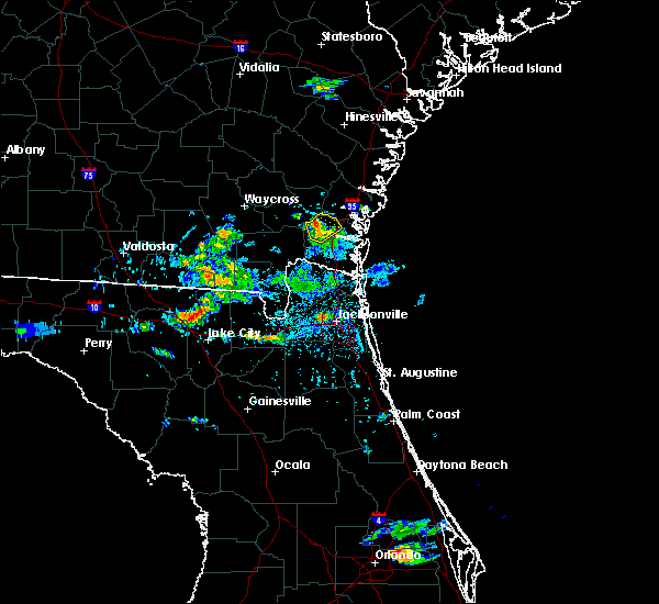 At 524 pm edt, a severe thunderstorm was located near waverly, or 7 miles northwest of woodbine, moving northeast at 25 mph (radar indicated). Hazards include 60 mph wind gusts. Expect damage to roofs, siding, and trees. Locations impacted include, woodbine, waverly and tarboro. At 524 pm edt, a severe thunderstorm was located near waverly, or 7 miles northwest of woodbine, moving northeast at 25 mph (radar indicated). Hazards include 60 mph wind gusts. Expect damage to roofs, siding, and trees. Locations impacted include, woodbine, waverly and tarboro.
|
| 9/5/2017 5:14 PM EDT |
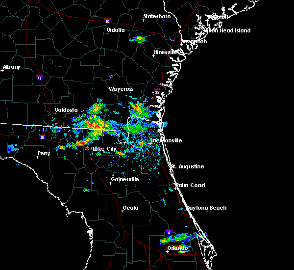 At 514 pm edt, a severe thunderstorm was located 9 miles west of woodbine, moving northeast at 25 mph (radar indicated). Hazards include 60 mph wind gusts and nickel size hail. expect damage to roofs, siding, and trees At 514 pm edt, a severe thunderstorm was located 9 miles west of woodbine, moving northeast at 25 mph (radar indicated). Hazards include 60 mph wind gusts and nickel size hail. expect damage to roofs, siding, and trees
|
| 7/29/2017 3:54 PM EDT |
 At 354 pm edt, severe thunderstorms were located along a line extending from 6 miles north of dock junction to near kingsland, moving east at 30 mph (radar indicated). Hazards include 60 mph wind gusts. Expect damage to roofs, siding, and trees. locations impacted include, st. marys, kingsland, brunswick, st. Simons island, woodbine, dock junction, kings bay base, country club estates, sea island and jekyll island. At 354 pm edt, severe thunderstorms were located along a line extending from 6 miles north of dock junction to near kingsland, moving east at 30 mph (radar indicated). Hazards include 60 mph wind gusts. Expect damage to roofs, siding, and trees. locations impacted include, st. marys, kingsland, brunswick, st. Simons island, woodbine, dock junction, kings bay base, country club estates, sea island and jekyll island.
|
| 7/29/2017 3:45 PM EDT | 911 call center reported tree down just north of woodbine. time is estimated by radar imager in camden county GA, 4.2 miles S of Woodbine, GA |
| 7/29/2017 3:34 PM EDT |
 At 334 pm edt, severe thunderstorms were located along a line extending from near cox to near kings ferry, moving east at 20 mph (radar indicated). Hazards include 60 mph wind gusts. expect damage to roofs, siding, and trees At 334 pm edt, severe thunderstorms were located along a line extending from near cox to near kings ferry, moving east at 20 mph (radar indicated). Hazards include 60 mph wind gusts. expect damage to roofs, siding, and trees
|
| 7/17/2017 4:41 PM EDT |
 The severe thunderstorm warning for southeastern camden county will expire at 445 pm edt, the storm which prompted the warning has weakened below severe limits, and has exited the warned area. therefore, the warning will be allowed to expire. however heavy rain is still possible with this thunderstorm. The severe thunderstorm warning for southeastern camden county will expire at 445 pm edt, the storm which prompted the warning has weakened below severe limits, and has exited the warned area. therefore, the warning will be allowed to expire. however heavy rain is still possible with this thunderstorm.
|
| 7/17/2017 4:29 PM EDT |
 At 428 pm edt, a severe thunderstorm was located near kingsland, moving north at 30 mph (radar indicated). Hazards include 60 mph wind gusts. Expect damage to roofs, siding, and trees. Locations impacted include, kingsland, kings bay base, cumberland island, harrietts bluff and colesburg. At 428 pm edt, a severe thunderstorm was located near kingsland, moving north at 30 mph (radar indicated). Hazards include 60 mph wind gusts. Expect damage to roofs, siding, and trees. Locations impacted include, kingsland, kings bay base, cumberland island, harrietts bluff and colesburg.
|
| 7/17/2017 4:06 PM EDT |
 At 406 pm edt, a severe thunderstorm was located near kingsland, moving north at 25 mph (radar indicated). Hazards include 60 mph wind gusts and penny size hail. expect damage to roofs, siding, and trees At 406 pm edt, a severe thunderstorm was located near kingsland, moving north at 25 mph (radar indicated). Hazards include 60 mph wind gusts and penny size hail. expect damage to roofs, siding, and trees
|
| 7/17/2017 4:06 PM EDT |
 The national weather service in jacksonville has issued a * severe thunderstorm warning for. northeastern nassau county in northeastern florida. southern camden county in southeastern georgia. Until 445 pm edt * at 406 pm edt, a severe thunderstorm was located near kingsland,. The national weather service in jacksonville has issued a * severe thunderstorm warning for. northeastern nassau county in northeastern florida. southern camden county in southeastern georgia. Until 445 pm edt * at 406 pm edt, a severe thunderstorm was located near kingsland,.
|
| 6/17/2017 6:29 PM EDT |
 At 629 pm edt, a severe thunderstorm was located 7 miles north of kingsland, moving southeast at 15 mph (radar indicated). Hazards include 60 mph wind gusts and penny size hail. Expect damage to roofs, siding, and trees. Locations impacted include, kingsland, brunswick, woodbine, kings bay base, kings ferry, harrietts bluff, dover bluff and colesburg. At 629 pm edt, a severe thunderstorm was located 7 miles north of kingsland, moving southeast at 15 mph (radar indicated). Hazards include 60 mph wind gusts and penny size hail. Expect damage to roofs, siding, and trees. Locations impacted include, kingsland, brunswick, woodbine, kings bay base, kings ferry, harrietts bluff, dover bluff and colesburg.
|
| 6/17/2017 5:54 PM EDT |
 At 554 pm edt, a severe thunderstorm was located near woodbine, moving east at 25 mph (radar indicated). Hazards include 60 mph wind gusts and penny size hail. expect damage to roofs, siding, and trees At 554 pm edt, a severe thunderstorm was located near woodbine, moving east at 25 mph (radar indicated). Hazards include 60 mph wind gusts and penny size hail. expect damage to roofs, siding, and trees
|
| 5/13/2017 4:28 PM EDT |
 At 428 pm edt, a severe thunderstorm was located near kingsland, moving east at 55 mph (radar indicated). Hazards include 60 mph wind gusts and penny size hail. Expect damage to roofs, siding, and trees. Locations impacted include, woodbine, jekyll island, tarboro, harrietts bluff, dover bluff and colesburg. At 428 pm edt, a severe thunderstorm was located near kingsland, moving east at 55 mph (radar indicated). Hazards include 60 mph wind gusts and penny size hail. Expect damage to roofs, siding, and trees. Locations impacted include, woodbine, jekyll island, tarboro, harrietts bluff, dover bluff and colesburg.
|
| 5/13/2017 4:00 PM EDT |
 At 359 pm edt, a severe thunderstorm was located 8 miles northeast of homeland, or 9 miles northeast of folkston, moving east at 45 mph (radar indicated). Hazards include 60 mph wind gusts and quarter size hail. Hail damage to vehicles is expected. Expect wind damage to roofs, siding, and trees. At 359 pm edt, a severe thunderstorm was located 8 miles northeast of homeland, or 9 miles northeast of folkston, moving east at 45 mph (radar indicated). Hazards include 60 mph wind gusts and quarter size hail. Hail damage to vehicles is expected. Expect wind damage to roofs, siding, and trees.
|
| 4/6/2017 1:29 AM EDT |
 At 129 am edt, a severe thunderstorm was located 8 miles northwest of st. george, or 11 miles southwest of hilliard, moving east at 55 mph (radar indicated). Hazards include 60 mph wind gusts and quarter size hail. Hail damage to vehicles is expected. Expect wind damage to roofs, siding, and trees. At 129 am edt, a severe thunderstorm was located 8 miles northwest of st. george, or 11 miles southwest of hilliard, moving east at 55 mph (radar indicated). Hazards include 60 mph wind gusts and quarter size hail. Hail damage to vehicles is expected. Expect wind damage to roofs, siding, and trees.
|
| 4/3/2017 3:13 PM EDT |
 At 313 pm edt, a severe thunderstorm was located over woodbine, moving northeast at 20 mph (radar indicated). Hazards include 60 mph wind gusts and quarter size hail. Hail damage to vehicles is expected. Expect wind damage to roofs, siding, and trees. At 313 pm edt, a severe thunderstorm was located over woodbine, moving northeast at 20 mph (radar indicated). Hazards include 60 mph wind gusts and quarter size hail. Hail damage to vehicles is expected. Expect wind damage to roofs, siding, and trees.
|
| 1/22/2017 6:51 PM EST |
 At 650 pm est, severe thunderstorms were located along a line extending from near darien to 7 miles southeast of woodbine, moving northeast at 70 mph (radar indicated). Hazards include 70 mph wind gusts. Expect considerable tree damage. damage is likely to mobile homes, roofs, and outbuildings. locations impacted include, brunswick, st. simons island, woodbine, dock junction, jekyll island, waverly, sea island, country club estates, little saint simons island and dover bluff. A tornado watch remains in effect until 800 pm est for southeastern georgia. At 650 pm est, severe thunderstorms were located along a line extending from near darien to 7 miles southeast of woodbine, moving northeast at 70 mph (radar indicated). Hazards include 70 mph wind gusts. Expect considerable tree damage. damage is likely to mobile homes, roofs, and outbuildings. locations impacted include, brunswick, st. simons island, woodbine, dock junction, jekyll island, waverly, sea island, country club estates, little saint simons island and dover bluff. A tornado watch remains in effect until 800 pm est for southeastern georgia.
|
| 1/22/2017 6:40 PM EST | Trees down 2 miles east of i-95 near exit 22. possible tornad in camden county GA, 4.5 miles SW of Woodbine, GA |
| 1/22/2017 6:37 PM EST |
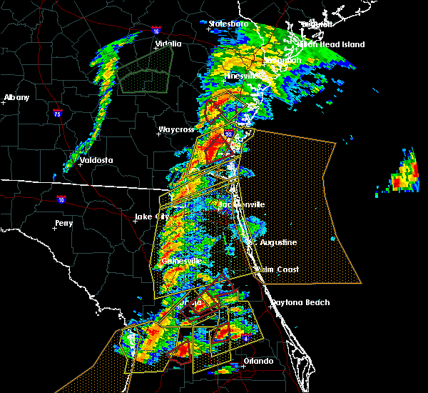 At 636 pm est, a confirmed tornado was located over woodbine, moving northeast at 55 mph (radar confirmed tornado). Hazards include damaging tornado and quarter size hail. Flying debris will be dangerous to those caught without shelter. mobile homes will be damaged or destroyed. damage to roofs, windows, and vehicles will occur. tree damage is likely. this tornado will be near, waverly around 640 pm est. Other locations impacted by this tornadic thunderstorm include dover bluff, colesburg and tarboro. At 636 pm est, a confirmed tornado was located over woodbine, moving northeast at 55 mph (radar confirmed tornado). Hazards include damaging tornado and quarter size hail. Flying debris will be dangerous to those caught without shelter. mobile homes will be damaged or destroyed. damage to roofs, windows, and vehicles will occur. tree damage is likely. this tornado will be near, waverly around 640 pm est. Other locations impacted by this tornadic thunderstorm include dover bluff, colesburg and tarboro.
|
| 1/22/2017 6:33 PM EST |
 At 632 pm est, a severe thunderstorm capable of producing a tornado was located near woodbine, moving northeast at 55 mph (radar indicated rotation). Hazards include tornado and quarter size hail. Flying debris will be dangerous to those caught without shelter. mobile homes will be damaged or destroyed. damage to roofs, windows, and vehicles will occur. tree damage is likely. this dangerous storm will be near, woodbine and waverly around 640 pm est. Other locations impacted by this tornadic thunderstorm include tarboro, dover bluff and colesburg. At 632 pm est, a severe thunderstorm capable of producing a tornado was located near woodbine, moving northeast at 55 mph (radar indicated rotation). Hazards include tornado and quarter size hail. Flying debris will be dangerous to those caught without shelter. mobile homes will be damaged or destroyed. damage to roofs, windows, and vehicles will occur. tree damage is likely. this dangerous storm will be near, woodbine and waverly around 640 pm est. Other locations impacted by this tornadic thunderstorm include tarboro, dover bluff and colesburg.
|
| 1/22/2017 6:30 PM EST |
 At 630 pm est, severe thunderstorms were located along a line extending from 8 miles west of waverly to near kings ferry, moving northeast at 70 mph (radar indicated). Hazards include 70 mph wind gusts. Expect considerable tree damage. Damage is likely to mobile homes, roofs, and outbuildings. At 630 pm est, severe thunderstorms were located along a line extending from 8 miles west of waverly to near kings ferry, moving northeast at 70 mph (radar indicated). Hazards include 70 mph wind gusts. Expect considerable tree damage. Damage is likely to mobile homes, roofs, and outbuildings.
|
| 1/22/2017 6:22 PM EST |
 At 621 pm est, a severe thunderstorm capable of producing a tornado was located near folkston, moving northeast at 55 mph (radar indicated rotation). Hazards include tornado and quarter size hail. Flying debris will be dangerous to those caught without shelter. mobile homes will be damaged or destroyed. damage to roofs, windows, and vehicles will occur. tree damage is likely. this dangerous storm will be near, woodbine and waverly around 640 pm est. Other locations impacted by this tornadic thunderstorm include tarboro, dover bluff and colesburg. At 621 pm est, a severe thunderstorm capable of producing a tornado was located near folkston, moving northeast at 55 mph (radar indicated rotation). Hazards include tornado and quarter size hail. Flying debris will be dangerous to those caught without shelter. mobile homes will be damaged or destroyed. damage to roofs, windows, and vehicles will occur. tree damage is likely. this dangerous storm will be near, woodbine and waverly around 640 pm est. Other locations impacted by this tornadic thunderstorm include tarboro, dover bluff and colesburg.
|
| 1/22/2017 6:14 PM EST |
 At 614 pm est, a severe thunderstorm capable of producing a tornado was located over homeland, or near folkston, moving northeast at 55 mph (radar indicated rotation). Hazards include tornado and quarter size hail. Flying debris will be dangerous to those caught without shelter. mobile homes will be damaged or destroyed. damage to roofs, windows, and vehicles will occur. tree damage is likely. this dangerous storm will be near, woodbine and waverly around 640 pm est. Other locations impacted by this tornadic thunderstorm include tarboro, dover bluff and colesburg. At 614 pm est, a severe thunderstorm capable of producing a tornado was located over homeland, or near folkston, moving northeast at 55 mph (radar indicated rotation). Hazards include tornado and quarter size hail. Flying debris will be dangerous to those caught without shelter. mobile homes will be damaged or destroyed. damage to roofs, windows, and vehicles will occur. tree damage is likely. this dangerous storm will be near, woodbine and waverly around 640 pm est. Other locations impacted by this tornadic thunderstorm include tarboro, dover bluff and colesburg.
|
| 1/22/2017 6:14 PM EST |
 At 614 pm est, severe thunderstorms were located along a line extending from near waynesville to 6 miles north of st. george, moving northeast at 85 mph (radar indicated). Hazards include 60 mph wind gusts and quarter size hail. Hail damage to vehicles is expected. expect wind damage to roofs, siding, and trees. locations impacted include, st. marys, kingsland, brunswick, st. simons island, hilliard, folkston, woodbine, callahan, dock junction and kings bay base. A tornado watch remains in effect until 800 pm est for northern and northeastern florida, and southeastern georgia. At 614 pm est, severe thunderstorms were located along a line extending from near waynesville to 6 miles north of st. george, moving northeast at 85 mph (radar indicated). Hazards include 60 mph wind gusts and quarter size hail. Hail damage to vehicles is expected. expect wind damage to roofs, siding, and trees. locations impacted include, st. marys, kingsland, brunswick, st. simons island, hilliard, folkston, woodbine, callahan, dock junction and kings bay base. A tornado watch remains in effect until 800 pm est for northern and northeastern florida, and southeastern georgia.
|
| 1/22/2017 6:10 PM EST |
 At 609 pm est, severe thunderstorms were located along a line extending from near nahunta to near st. george, moving northeast at 85 mph (radar indicated). Hazards include 60 mph wind gusts and quarter size hail. Hail damage to vehicles is expected. expect wind damage to roofs, siding, and trees. locations impacted include, st. marys, kingsland, brunswick, st. simons island, hilliard, folkston, woodbine, callahan, dock junction and kings bay base. A tornado watch remains in effect until 800 pm est for northern and northeastern florida, and southeastern georgia. At 609 pm est, severe thunderstorms were located along a line extending from near nahunta to near st. george, moving northeast at 85 mph (radar indicated). Hazards include 60 mph wind gusts and quarter size hail. Hail damage to vehicles is expected. expect wind damage to roofs, siding, and trees. locations impacted include, st. marys, kingsland, brunswick, st. simons island, hilliard, folkston, woodbine, callahan, dock junction and kings bay base. A tornado watch remains in effect until 800 pm est for northern and northeastern florida, and southeastern georgia.
|
| 1/22/2017 5:50 PM EST |
 At 550 pm est, severe thunderstorms were located along a line extending from 8 miles west of race pond to 6 miles northwest of olustee, moving northeast at 85 mph (radar indicated). Hazards include 60 mph wind gusts and quarter size hail. Hail damage to vehicles is expected. Expect wind damage to roofs, siding, and trees. At 550 pm est, severe thunderstorms were located along a line extending from 8 miles west of race pond to 6 miles northwest of olustee, moving northeast at 85 mph (radar indicated). Hazards include 60 mph wind gusts and quarter size hail. Hail damage to vehicles is expected. Expect wind damage to roofs, siding, and trees.
|
| 1/22/2017 10:26 AM EST |
 At 1026 am est, severe thunderstorms were located along a line extending from near st. simons island to kingsland to near hilliard, moving east at 70 mph (radar indicated). Hazards include 60 mph wind gusts. Expect damage to roofs, siding, and trees. locations impacted include, st. marys, kingsland, brunswick, st. simons island, fernandina beach, hilliard, folkston, woodbine, dock junction and kings bay base. A tornado watch remains in effect until 1100 am est for northeastern florida, and southeastern georgia. At 1026 am est, severe thunderstorms were located along a line extending from near st. simons island to kingsland to near hilliard, moving east at 70 mph (radar indicated). Hazards include 60 mph wind gusts. Expect damage to roofs, siding, and trees. locations impacted include, st. marys, kingsland, brunswick, st. simons island, fernandina beach, hilliard, folkston, woodbine, dock junction and kings bay base. A tornado watch remains in effect until 1100 am est for northeastern florida, and southeastern georgia.
|
| 1/22/2017 10:02 AM EST |
 At 1002 am est, severe thunderstorms were located along a line extending from near sea island to 12 miles southeast of stephen foster state park, moving east at 70 mph (radar indicated). Hazards include 60 mph wind gusts. expect damage to roofs, siding, and trees At 1002 am est, severe thunderstorms were located along a line extending from near sea island to 12 miles southeast of stephen foster state park, moving east at 70 mph (radar indicated). Hazards include 60 mph wind gusts. expect damage to roofs, siding, and trees
|
| 1/22/2017 9:45 AM EST |
 At 944 am est, severe thunderstorms were located along a line extending from near blackbeard island to near little saint simons island to 8 miles southwest of brunswick, moving northeast at 60 mph (radar indicated). Hazards include 60 mph wind gusts. expect damage to roofs, siding, and trees At 944 am est, severe thunderstorms were located along a line extending from near blackbeard island to near little saint simons island to 8 miles southwest of brunswick, moving northeast at 60 mph (radar indicated). Hazards include 60 mph wind gusts. expect damage to roofs, siding, and trees
|
| 1/22/2017 9:25 AM EST |
 At 925 am est, a severe thunderstorm capable of producing a tornado was located near waverly, or near woodbine, moving east at 50 mph (radar indicated rotation). Hazards include tornado. Flying debris will be dangerous to those caught without shelter. mobile homes will be damaged or destroyed. damage to roofs, windows, and vehicles will occur. tree damage is likely. this dangerous storm will be near, jekyll island around 945 am est. Other locations impacted by this tornadic thunderstorm include dover bluff. At 925 am est, a severe thunderstorm capable of producing a tornado was located near waverly, or near woodbine, moving east at 50 mph (radar indicated rotation). Hazards include tornado. Flying debris will be dangerous to those caught without shelter. mobile homes will be damaged or destroyed. damage to roofs, windows, and vehicles will occur. tree damage is likely. this dangerous storm will be near, jekyll island around 945 am est. Other locations impacted by this tornadic thunderstorm include dover bluff.
|
| 7/15/2016 5:39 PM EDT |
 At 539 pm edt, a severe thunderstorm was located over waverly, or 8 miles north of woodbine, moving north at 20 mph (radar indicated). Hazards include 60 mph wind gusts and quarter size hail. Hail damage to vehicles is expected. Expect wind damage to roofs, siding, and trees. At 539 pm edt, a severe thunderstorm was located over waverly, or 8 miles north of woodbine, moving north at 20 mph (radar indicated). Hazards include 60 mph wind gusts and quarter size hail. Hail damage to vehicles is expected. Expect wind damage to roofs, siding, and trees.
|
| 7/14/2016 3:56 PM EDT |
 At 355 pm edt, a severe thunderstorm was located over kingsland, moving northeast at 5 mph (radar indicated). Hazards include 60 mph wind gusts and quarter size hail. Hail damage to vehicles is expected. Expect wind damage to roofs, siding, and trees. At 355 pm edt, a severe thunderstorm was located over kingsland, moving northeast at 5 mph (radar indicated). Hazards include 60 mph wind gusts and quarter size hail. Hail damage to vehicles is expected. Expect wind damage to roofs, siding, and trees.
|
| 8/23/2015 5:03 PM EDT |
 At 503 pm edt, doppler radar indicated a severe thunderstorm capable of producing damaging winds in excess of 60 mph. this storm was located over kings ferry, or near hilliard, and moving east at 35 mph. nickel size hail may also accompany the damaging winds. At 503 pm edt, doppler radar indicated a severe thunderstorm capable of producing damaging winds in excess of 60 mph. this storm was located over kings ferry, or near hilliard, and moving east at 35 mph. nickel size hail may also accompany the damaging winds.
|
| 8/22/2015 9:27 PM EDT |
 At 926 pm edt, doppler radar indicated a severe thunderstorm capable of producing quarter size hail and destructive winds in excess of 80 mph. this storm was located over kingsland, moving south at 25 mph. locations impacted include, st. marys, kingsland, hilliard, woodbine, kings bay base, yulee, kings ferry, colesburg and harrietts bluff. At 926 pm edt, doppler radar indicated a severe thunderstorm capable of producing quarter size hail and destructive winds in excess of 80 mph. this storm was located over kingsland, moving south at 25 mph. locations impacted include, st. marys, kingsland, hilliard, woodbine, kings bay base, yulee, kings ferry, colesburg and harrietts bluff.
|
| 8/22/2015 9:15 PM EDT |
 At 915 pm edt, doppler radar indicated a severe thunderstorm capable of producing quarter size hail and destructive winds in excess of 70 mph. this storm was located near woodbine, and moving south at 25 mph. At 915 pm edt, doppler radar indicated a severe thunderstorm capable of producing quarter size hail and destructive winds in excess of 70 mph. this storm was located near woodbine, and moving south at 25 mph.
|
| 8/22/2015 9:00 PM EDT | Camden county 911/dispatch reports numerous trees and powerlines downed by strong wind gusts throughout the count in camden county GA, 0.7 miles E of Woodbine, GA |
| 8/22/2015 8:56 PM EDT |
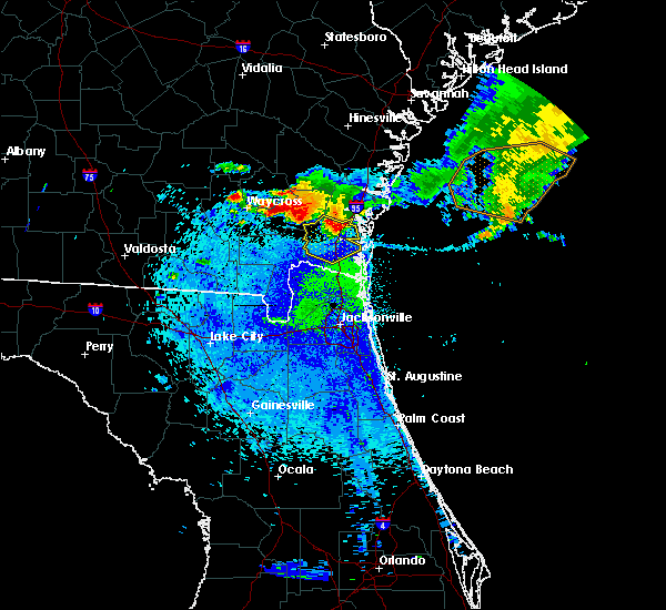 At 855 pm edt, doppler radar indicated a severe thunderstorm capable of producing quarter size hail and destructive winds in excess of 80 mph. this storm was located over woodbine, moving south at 25 mph. locations impacted include, kingsland, woodbine, waverly, tarboro, colesburg, dover bluff and harrietts bluff. At 855 pm edt, doppler radar indicated a severe thunderstorm capable of producing quarter size hail and destructive winds in excess of 80 mph. this storm was located over woodbine, moving south at 25 mph. locations impacted include, kingsland, woodbine, waverly, tarboro, colesburg, dover bluff and harrietts bluff.
|
| 8/22/2015 8:42 PM EDT |
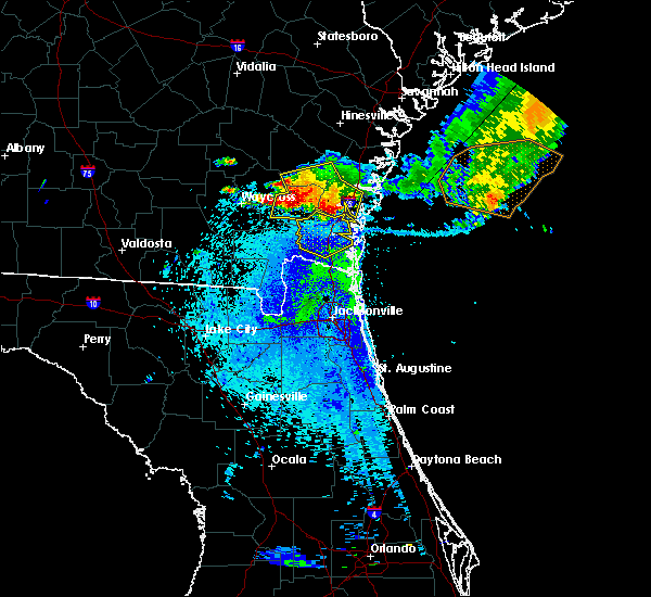 At 841 pm edt, doppler radar indicated a severe thunderstorm capable of producing quarter size hail and destructive winds in excess of 70 mph. this storm was located over waverly, or 11 miles north of woodbine, moving south at 25 mph. locations impacted include, kingsland, woodbine, waverly, tarboro, colesburg, dover bluff and harrietts bluff. At 841 pm edt, doppler radar indicated a severe thunderstorm capable of producing quarter size hail and destructive winds in excess of 70 mph. this storm was located over waverly, or 11 miles north of woodbine, moving south at 25 mph. locations impacted include, kingsland, woodbine, waverly, tarboro, colesburg, dover bluff and harrietts bluff.
|
| 8/22/2015 8:35 PM EDT |
 At 834 pm edt, doppler radar indicated a severe thunderstorm capable of producing quarter size hail and damaging winds in excess of 60 mph. this storm was located near waverly, or 10 miles west of dock junction, and moving south at 25 mph. At 834 pm edt, doppler radar indicated a severe thunderstorm capable of producing quarter size hail and damaging winds in excess of 60 mph. this storm was located near waverly, or 10 miles west of dock junction, and moving south at 25 mph.
|
| 8/17/2015 3:50 PM EDT |
 At 349 pm edt, doppler radar indicated a severe thunderstorm capable of producing damaging winds in excess of 60 mph. this storm was located near waverly, or 10 miles northwest of woodbine, and moving northeast at 15 mph. At 349 pm edt, doppler radar indicated a severe thunderstorm capable of producing damaging winds in excess of 60 mph. this storm was located near waverly, or 10 miles northwest of woodbine, and moving northeast at 15 mph.
|
| 7/14/2015 6:11 PM EDT |
 The severe thunderstorm warning for southeastern brantley, southwestern glynn, northwestern camden and northeastern charlton counties will expire at 615 pm edt, the storm which prompted the warning has weakened below severe limits, and no longer poses an immediate threat to life or property. therefore the warning will be allowed to expire. however gusty winds are still possible with this thunderstorm. The severe thunderstorm warning for southeastern brantley, southwestern glynn, northwestern camden and northeastern charlton counties will expire at 615 pm edt, the storm which prompted the warning has weakened below severe limits, and no longer poses an immediate threat to life or property. therefore the warning will be allowed to expire. however gusty winds are still possible with this thunderstorm.
|
| 7/14/2015 6:02 PM EDT |
 At 602 pm edt, doppler radar indicated a severe thunderstorm capable of producing quarter size hail and damaging winds in excess of 60 mph. this storm was located near dock junction, moving east at 25 mph. locations impacted include, brunswick, woodbine, nahunta, waynesville, waverly, hickox, atkinson, tarboro, winokur and colesburg. At 602 pm edt, doppler radar indicated a severe thunderstorm capable of producing quarter size hail and damaging winds in excess of 60 mph. this storm was located near dock junction, moving east at 25 mph. locations impacted include, brunswick, woodbine, nahunta, waynesville, waverly, hickox, atkinson, tarboro, winokur and colesburg.
|
| 7/14/2015 5:30 PM EDT |
 At 530 pm edt, doppler radar indicated a severe thunderstorm capable of producing quarter size hail and damaging winds in excess of 60 mph. this storm was located near hickox, or 7 miles south of nahunta, and moving southeast at 25 mph. At 530 pm edt, doppler radar indicated a severe thunderstorm capable of producing quarter size hail and damaging winds in excess of 60 mph. this storm was located near hickox, or 7 miles south of nahunta, and moving southeast at 25 mph.
|
| 7/14/2015 4:35 PM EDT | Storm damage reported in camden county GA, 0.7 miles E of Woodbine, GA |
| 7/12/2015 7:48 PM EDT |
 At 748 pm edt, doppler radar indicated a severe thunderstorm capable of producing damaging winds in excess of 60 mph. this storm was located 9 miles west of woodbine, moving southwest at 15 mph. penny size hail may also accompany the damaging winds. locations impacted include, folkston, woodbine, homeland, kings ferry, tarboro and colesburg. At 748 pm edt, doppler radar indicated a severe thunderstorm capable of producing damaging winds in excess of 60 mph. this storm was located 9 miles west of woodbine, moving southwest at 15 mph. penny size hail may also accompany the damaging winds. locations impacted include, folkston, woodbine, homeland, kings ferry, tarboro and colesburg.
|
| 7/12/2015 7:28 PM EDT |
 At 728 pm edt, doppler radar indicated a severe thunderstorm capable of producing quarter size hail and damaging winds in excess of 60 mph. this storm was located near woodbine, and moving southwest at 15 mph. At 728 pm edt, doppler radar indicated a severe thunderstorm capable of producing quarter size hail and damaging winds in excess of 60 mph. this storm was located near woodbine, and moving southwest at 15 mph.
|
| 7/5/2015 4:19 PM EDT |
 At 419 pm edt, doppler radar indicated a severe thunderstorm capable of producing quarter size hail and damaging winds in excess of 60 mph. this storm was located near kingsland, moving east at 10 mph. locations impacted include, kingsland, woodbine, kings ferry and colesburg. At 419 pm edt, doppler radar indicated a severe thunderstorm capable of producing quarter size hail and damaging winds in excess of 60 mph. this storm was located near kingsland, moving east at 10 mph. locations impacted include, kingsland, woodbine, kings ferry and colesburg.
|
| 7/5/2015 3:43 PM EDT |
 At 342 pm edt, doppler radar indicated a severe thunderstorm capable of producing quarter size hail and damaging winds in excess of 60 mph. this storm was located near kings ferry, or near hilliard, and moving northeast at 30 mph. At 342 pm edt, doppler radar indicated a severe thunderstorm capable of producing quarter size hail and damaging winds in excess of 60 mph. this storm was located near kings ferry, or near hilliard, and moving northeast at 30 mph.
|
| 7/4/2015 4:00 PM EDT | Public report via social media of a tree downed on an apartment home in satilla villas. time estimated by rada in camden county GA, 0.7 miles E of Woodbine, GA |
| 7/2/2015 6:13 PM EDT |
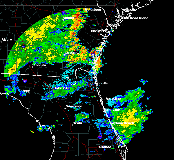 At 613 pm edt, doppler radar indicated a line of severe thunderstorms capable of producing damaging winds in excess of 60 mph. these storms were located along a line extending from near jesup to near nahunta to race pond, and moving northeast at 35 mph. At 613 pm edt, doppler radar indicated a line of severe thunderstorms capable of producing damaging winds in excess of 60 mph. these storms were located along a line extending from near jesup to near nahunta to race pond, and moving northeast at 35 mph.
|
| 7/2/2015 5:37 PM EDT |
 At 537 pm edt, doppler radar indicated a severe thunderstorm capable of producing damaging winds in excess of 60 mph. this storm was located over kings bay base, and moving northeast at 30 mph. At 537 pm edt, doppler radar indicated a severe thunderstorm capable of producing damaging winds in excess of 60 mph. this storm was located over kings bay base, and moving northeast at 30 mph.
|
| 6/28/2015 4:34 PM EDT |
 At 434 pm edt, doppler radar indicated a line of severe thunderstorms capable of producing damaging winds in excess of 60 mph. these storms were located along a line extending from near woodbine to near callahan, and moving east at 25 mph. At 434 pm edt, doppler radar indicated a line of severe thunderstorms capable of producing damaging winds in excess of 60 mph. these storms were located along a line extending from near woodbine to near callahan, and moving east at 25 mph.
|
| 6/22/2015 6:43 PM EDT | The severe thunderstorm warning for southwestern glynn and northwestern camden counties will expire at 645 pm edt, the storm which prompted the warning has weakened below severe limits, and no longer poses an immediate threat to life or property. therefore the warning will be allowed to expire. however small. |
| 6/22/2015 6:07 PM EDT |
 At 606 pm edt, doppler radar indicated a severe thunderstorm capable of producing quarter size hail and damaging winds in excess of 60 mph. this storm was located 7 miles southwest of dock junction, and moving southeast at 10 mph. At 606 pm edt, doppler radar indicated a severe thunderstorm capable of producing quarter size hail and damaging winds in excess of 60 mph. this storm was located 7 miles southwest of dock junction, and moving southeast at 10 mph.
|
| 6/19/2015 6:20 PM EDT |
 At 620 pm edt, doppler radar indicated a severe thunderstorm capable of producing damaging winds in excess of 60 mph. this storm was located 7 miles east of woodbine, and moving northeast at 15 mph. penny size hail may also accompany the damaging winds. At 620 pm edt, doppler radar indicated a severe thunderstorm capable of producing damaging winds in excess of 60 mph. this storm was located 7 miles east of woodbine, and moving northeast at 15 mph. penny size hail may also accompany the damaging winds.
|
| 6/19/2015 5:51 PM EDT |
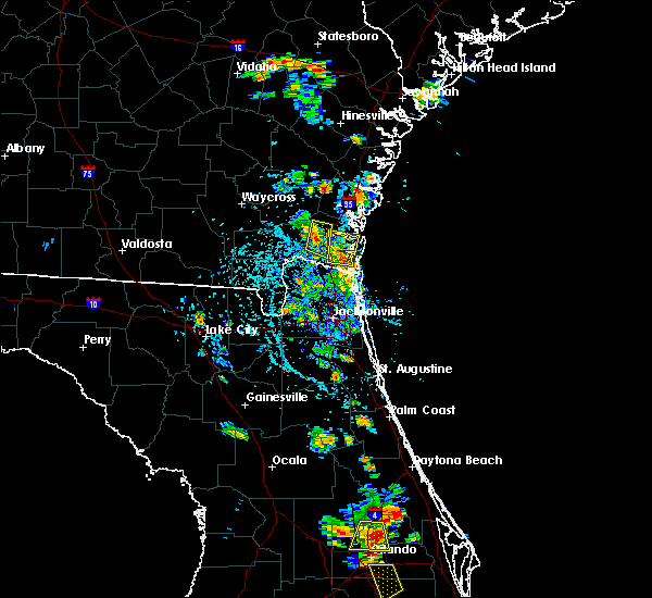 At 551 pm edt, doppler radar indicated a severe thunderstorm capable of producing damaging winds in excess of 60 mph. this storm was located near woodbine, and moving north at 15 mph. At 551 pm edt, doppler radar indicated a severe thunderstorm capable of producing damaging winds in excess of 60 mph. this storm was located near woodbine, and moving north at 15 mph.
|
| 6/3/2015 7:55 PM EDT | Camden county 911 dispatch reports a tree downed by strong wind gusts across new post road just north of tarbor in camden county GA, 7.7 miles SE of Woodbine, GA |
| 6/3/2015 7:49 PM EDT | At 749 pm edt, doppler radar indicated a line of severe thunderstorms capable of producing half dollar size hail and destructive winds in excess of 70 mph. these storms were located along a line extending from near waynesville to 6 miles southwest of waverly, moving southeast at 20 mph. locations impacted include, brunswick, woodbine, dock junction, waynesville, waverly, thalmann, atkinson, tarboro, colesburg and dover bluff. |
| 6/3/2015 7:31 PM EDT | At 731 pm edt, doppler radar indicated a line of severe thunderstorms capable of producing quarter size hail and damaging winds in excess of 60 mph. these storms were located along a line extending from near waynesville to near hickox, and moving southeast at 15 mph. |
| 6/2/2015 6:39 PM EDT | At 639 pm edt, doppler radar indicated a severe thunderstorm capable of producing damaging winds in excess of 60 mph. this storm was located near woodbine. this storm was nearly stationary. nickel size hail may also accompany the damaging winds. |
| 5/19/2015 5:06 PM EDT | At 506 pm edt, doppler radar indicated a severe thunderstorm capable of producing quarter size hail and damaging winds in excess of 60 mph. this storm was located 7 miles east of woodbine, and moving south at 10 mph. |
| 4/25/2015 9:44 PM EDT | At 944 pm edt, doppler radar indicated a line of severe thunderstorms capable of producing quarter size hail and damaging winds in excess of 60 mph. these storms were located along a line extending from 8 miles south of hickox to near race pond to 11 miles north of fargo, and moving east at 70 mph. |
| 4/25/2015 9:16 PM EDT | At 916 pm edt, doppler radar indicated a line of severe thunderstorms capable of producing quarter size hail and damaging winds in excess of 60 mph. these storms were located along a line extending from near donald to near jesup to 7 miles southeast of homerville, and moving east at 70 mph. |
| 4/19/2015 4:55 PM EDT | At 455 pm edt, doppler radar indicated a line of severe thunderstorms capable of producing damaging winds in excess of 60 mph. these storms were located along a line extending from near race pond to near folkston to bryceville, and moving east at 55 mph. |
| 4/19/2015 4:55 PM EDT | At 455 pm edt, doppler radar indicated a line of severe thunderstorms capable of producing damaging winds in excess of 60 mph. these storms were located along a line extending from near race pond to near folkston to bryceville, and moving east at 55 mph. |
| 7/10/2014 4:30 PM EDT | Trees were blown down in waverly. time was estimated based on rada in camden county GA, 9 miles S of Woodbine, GA |
| 7/10/2014 4:00 PM EDT | A storm spotter reported a wind gust estimated at 60 mp in camden county GA, 1.5 miles NNW of Woodbine, GA |
| 6/12/2014 2:55 PM EDT | Camden county 911 dispatch reports a tree downed by strong thunderstorm wind gusts along georgia highway 252 near white oak. time of damage based on radar dat in camden county GA, 5.1 miles SSE of Woodbine, GA |
| 2/21/2014 11:40 AM EST | Strong gusty winds and large tree down in camden county GA, 4.5 miles SSE of Woodbine, GA |
| 8/15/2013 5:00 PM EDT | Trees reported down in the waverly area. time based on radar imager in camden county GA, 9 miles S of Woodbine, GA |
| 1/30/2013 10:30 PM EST | Trees were blown down along interstate 9 in camden county GA, 2.4 miles WSW of Woodbine, GA |
| 1/30/2013 10:30 PM EST | Trees were blown down along highway 110 nw of woodbin in camden county GA, 3 miles SSE of Woodbine, GA |
| 1/30/2013 10:25 PM EST | Trees were blown down in tarbor in camden county GA, 6.8 miles SE of Woodbine, GA |
| 10/8/2012 5:00 PM EDT | A tree was blown down in woodbine. the time of damage was based on radar imager in camden county GA, 0.7 miles E of Woodbine, GA |
| 7/30/2012 2:36 PM EDT | 911 call center reported a few trees down along the off-ramp from i-95 to woodbine near satilla bluff roa in camden county GA, 1.8 miles NW of Woodbine, GA |
| 6/11/2012 7:01 PM EDT | Tree limbs knocked down power lines resulting in a fire on mckinnon road in white oa in camden county GA, 5 miles SSE of Woodbine, GA |
| 6/11/2012 6:33 PM EDT | Power lines down on residential property as a result of trees falling on the line in camden county GA, 3 miles NNE of Woodbine, GA |
| 6/11/2012 6:20 PM EDT | Large oak tree crashed onto power line in camden county GA, 2.2 miles NNE of Woodbine, GA |
| 5/31/2012 3:49 PM EDT | Winds reported gusting to 63 mph. spotter had to pull over on the roa in camden county GA, 5.9 miles SW of Woodbine, GA |
| 5/22/2012 10:18 PM EDT | Trees were blown down in woodbine. some trees were blown into power lines which caused damage to transformer in camden county GA, 1.4 miles ESE of Woodbine, GA |
| 5/17/2012 5:10 PM EDT | A powerline was down in woodbine on lang roa in camden county GA, 0.7 miles E of Woodbine, GA |
| 5/17/2012 4:10 PM EDT | Tree limb reported down near interstate 95 and exit 14. time of event based on rada in camden county GA, 3 miles WNW of Woodbine, GA |
| 5/15/2012 5:00 PM EDT | Quarter sized hail reported 9 miles S of Woodbine, GA, quarter sized hail occurred in waverly between 5 pm and 515 pm. |
| 5/14/2012 4:40 PM EDT | Large tree was reported down on highway 110 just outside of waverl in camden county GA, 9 miles S of Woodbine, GA |
| 5/14/2012 4:40 PM EDT | Large tree fell down one half mile south of mile marker 12 on interstate 9 in camden county GA, 3.6 miles NW of Woodbine, GA |
| 1/1/0001 12:00 AM | Emergency management reported trees and power lines down in tarbor in camden county GA, 6.9 miles ESE of Woodbine, GA |
| 1/1/0001 12:00 AM | Public reported trees down on powerlines near highway 252 and 3r fish camp road. time is approximat in camden county GA, 7.9 miles E of Woodbine, GA |
| 1/1/0001 12:00 AM | The emergency manager reported several trees were blown down in the northwest section of the county. the time of the event was based on radar imager in camden county GA, 9.6 miles SSE of Woodbine, GA |
| 1/1/0001 12:00 AM | An outflow boundary merged with a weak downburst near waverly and together they produced scattered tree damage across northern camden county between waverly and dover b in camden county GA, 9 miles S of Woodbine, GA |
| 1/1/0001 12:00 AM | Golf Ball sized hail reported 9.9 miles ESE of Woodbine, GA, public reported golf ball size hail. the hail lasted for about 20 minutes and caused major damage to garden plants. |
Hail Maps for Woodbine, GA
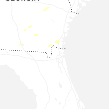
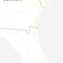


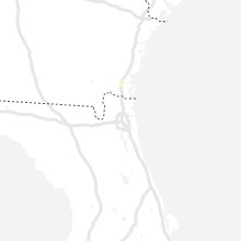


Connect with Interactive Hail Maps