

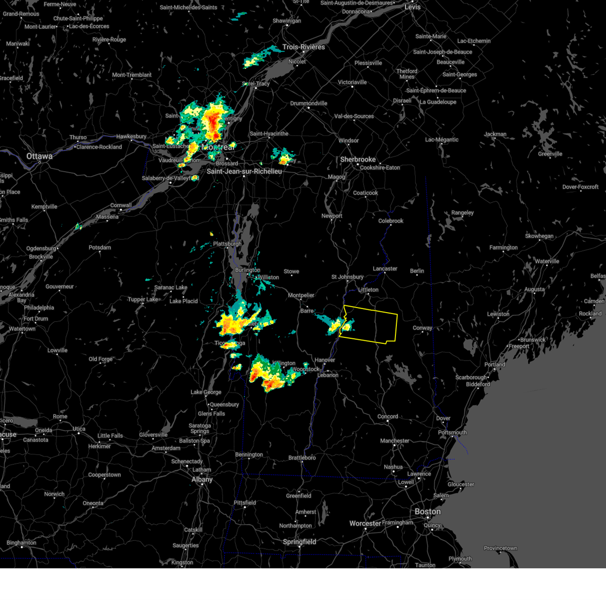
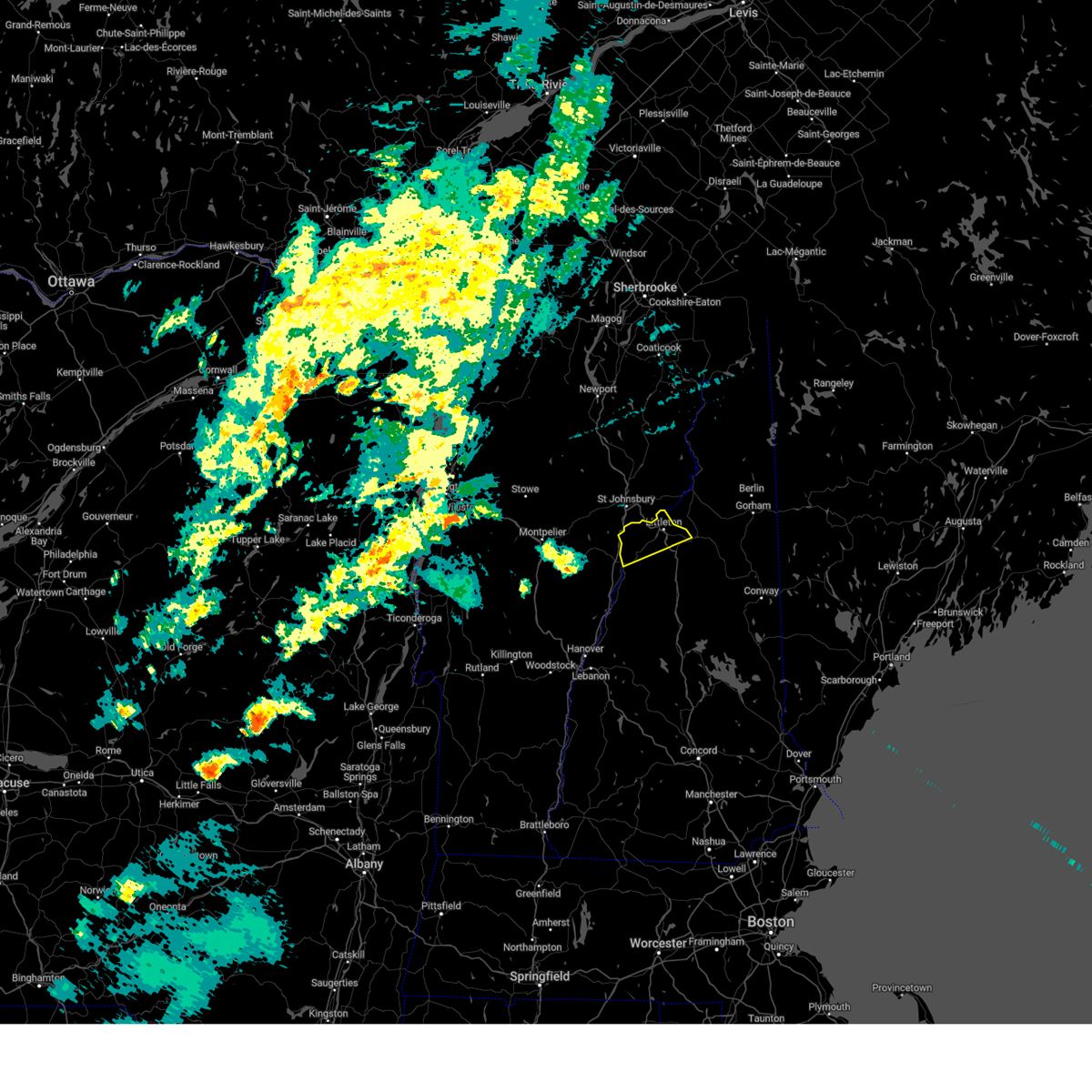
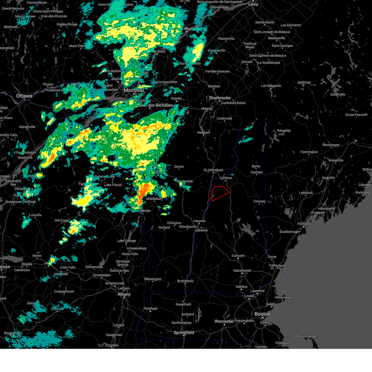
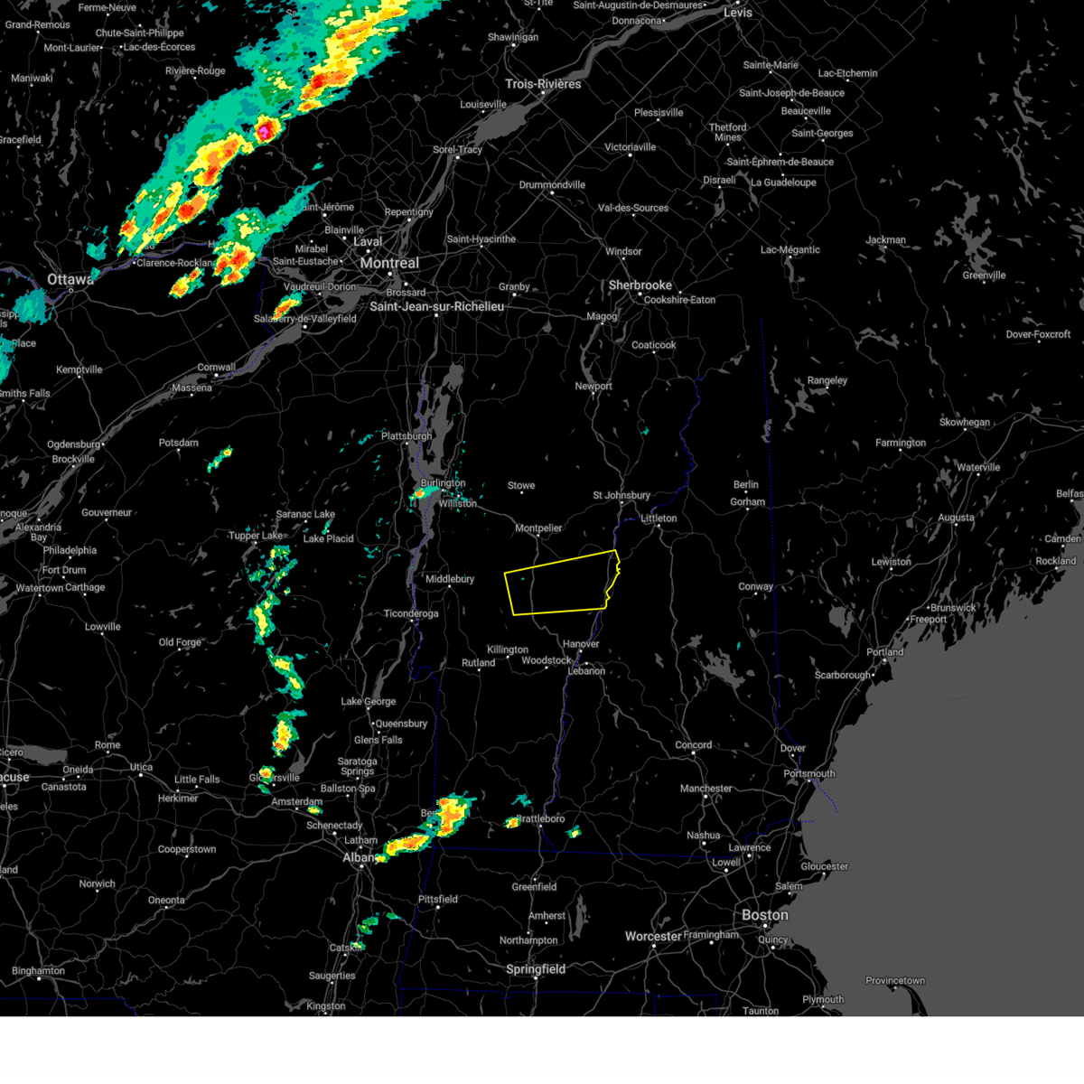
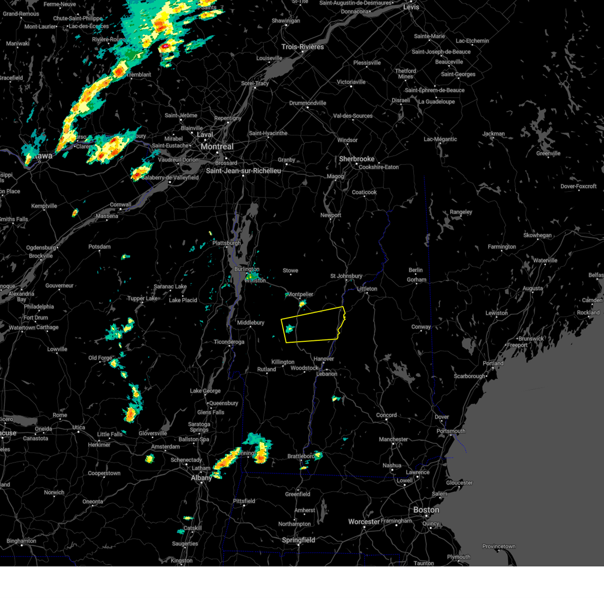
Hail Map for Woodsville, NH
The Woodsville, NH area has had 0 reports of on-the-ground hail by trained spotters, and has been under severe weather warnings 6 times during the past 12 months. Doppler radar has detected hail at or near Woodsville, NH on 10 occasions.
| Name: | Woodsville, NH |
| Where Located: | 62.9 miles ESE of Burlington, VT |
| Map: | Google Map for Woodsville, NH |
| Population: | 1126 |
| Housing Units: | 558 |
| More Info: | Search Google for Woodsville, NH |
2
The Top Recent Hail Date for Woodsville, NH is Sunday, June 30, 2024 (2nd out of 10)

Hail and Wind Damage Spotted near Woodsville, NH
| Date / Time | Report Details |
|---|---|
| 8/9/2024 5:51 PM EDT | Spotter reported trees and wires down on nh-135... road fully closed at time of repor in grafton county NH, 4.5 miles SSE of Woodsville, NH |
| 8/4/2024 7:23 PM EDT |
 Svrgyx the national weather service in gray maine has issued a * severe thunderstorm warning for, central grafton county in northern new hampshire, * until 815 pm edt. * at 722 pm edt, a severe thunderstorm was located over haverhill, or 20 miles west of lincoln, moving east at 30 mph (radar indicated). Hazards include 60 mph wind gusts and penny size hail. expect damage to roofs, siding, and trees Svrgyx the national weather service in gray maine has issued a * severe thunderstorm warning for, central grafton county in northern new hampshire, * until 815 pm edt. * at 722 pm edt, a severe thunderstorm was located over haverhill, or 20 miles west of lincoln, moving east at 30 mph (radar indicated). Hazards include 60 mph wind gusts and penny size hail. expect damage to roofs, siding, and trees
|
| 7/10/2024 7:54 PM EDT |
 Svrgyx the national weather service in gray maine has issued a * severe thunderstorm warning for, north central grafton county in northern new hampshire, * until 845 pm edt. * at 753 pm edt, a severe thunderstorm was located 12 miles northwest of haverhill, or 18 miles southwest of littleton, moving northeast at 30 mph (radar indicated). Hazards include 60 mph wind gusts. expect damage to roofs, siding, and trees Svrgyx the national weather service in gray maine has issued a * severe thunderstorm warning for, north central grafton county in northern new hampshire, * until 845 pm edt. * at 753 pm edt, a severe thunderstorm was located 12 miles northwest of haverhill, or 18 miles southwest of littleton, moving northeast at 30 mph (radar indicated). Hazards include 60 mph wind gusts. expect damage to roofs, siding, and trees
|
| 7/10/2024 6:38 PM EDT |
 Torgyx the national weather service in gray maine has issued a * tornado warning for, north central grafton county in northern new hampshire, * until 715 pm edt. * at 637 pm edt, a severe thunderstorm capable of producing a tornado was located over haverhill, or 19 miles southwest of littleton, moving northeast at 35 mph (radar indicated rotation). Hazards include tornado. Flying debris will be dangerous to those caught without shelter. mobile homes will be damaged or destroyed. damage to roofs, windows, and vehicles will occur. tree damage is likely. this dangerous storm will be near, haverhill and franconia around 645 pm edt. lincoln around 650 pm edt. Other locations impacted by this tornadic thunderstorm include easton, landaff, bath, sugar hill, lisbon, benton, and lyman. Torgyx the national weather service in gray maine has issued a * tornado warning for, north central grafton county in northern new hampshire, * until 715 pm edt. * at 637 pm edt, a severe thunderstorm capable of producing a tornado was located over haverhill, or 19 miles southwest of littleton, moving northeast at 35 mph (radar indicated rotation). Hazards include tornado. Flying debris will be dangerous to those caught without shelter. mobile homes will be damaged or destroyed. damage to roofs, windows, and vehicles will occur. tree damage is likely. this dangerous storm will be near, haverhill and franconia around 645 pm edt. lincoln around 650 pm edt. Other locations impacted by this tornadic thunderstorm include easton, landaff, bath, sugar hill, lisbon, benton, and lyman.
|
| 7/6/2024 6:26 PM EDT |
 the severe thunderstorm warning has been cancelled and is no longer in effect the severe thunderstorm warning has been cancelled and is no longer in effect
|
| 7/6/2024 6:16 PM EDT | At 615 pm edt, a severe thunderstorm was located over south washington, moving east at 25 mph (radar indicated). Hazards include 60 mph wind gusts and penny size hail. Expect damage to trees and powerlines. Locations impacted include, braintree hill, bradford, chelsea, corinth, randolph, topsham, fairlee, west fairlee, tunbridge, vershire, corinth corners, topsham four corners, washington, wells river village, newbury, newbury village, roxbury, williamstown, braintree, and brookfield. |
| 7/6/2024 5:50 PM EDT |
 Svrbtv the national weather service in burlington has issued a * severe thunderstorm warning for, orange county in central vermont, southern caledonia county in northeastern vermont, east central addison county in central vermont, north central windsor county in southern vermont, south central washington county in central vermont, * until 645 pm edt. * at 549 pm edt, a severe thunderstorm was located over east braintree, moving east at 25 mph (radar indicated). Hazards include 60 mph wind gusts and penny size hail. expect damage to trees and powerlines Svrbtv the national weather service in burlington has issued a * severe thunderstorm warning for, orange county in central vermont, southern caledonia county in northeastern vermont, east central addison county in central vermont, north central windsor county in southern vermont, south central washington county in central vermont, * until 645 pm edt. * at 549 pm edt, a severe thunderstorm was located over east braintree, moving east at 25 mph (radar indicated). Hazards include 60 mph wind gusts and penny size hail. expect damage to trees and powerlines
|
| 6/30/2024 2:19 PM EDT | Trees with wires dow in grafton county NH, 4 miles WNW of Woodsville, NH |
| 6/30/2024 2:17 PM EDT | Tree on wire in grafton county NH, 3.2 miles WNW of Woodsville, NH |
| 6/30/2024 2:15 PM EDT |
 Svrgyx the national weather service in gray maine has issued a * severe thunderstorm warning for, northeastern grafton county in northern new hampshire, * until 300 pm edt. * at 214 pm edt, a severe thunderstorm was located near haverhill, or 16 miles southwest of littleton, moving east at 40 mph (radar indicated). Hazards include 60 mph wind gusts and quarter size hail. Hail damage to vehicles is expected. Expect wind damage to roofs, siding, and trees. Svrgyx the national weather service in gray maine has issued a * severe thunderstorm warning for, northeastern grafton county in northern new hampshire, * until 300 pm edt. * at 214 pm edt, a severe thunderstorm was located near haverhill, or 16 miles southwest of littleton, moving east at 40 mph (radar indicated). Hazards include 60 mph wind gusts and quarter size hail. Hail damage to vehicles is expected. Expect wind damage to roofs, siding, and trees.
|
| 6/30/2024 2:10 PM EDT | Storm winds toppled a few trees on rum hill rd on the east side of woodsville; estimated time by rada in grafton county NH, 0.7 miles NW of Woodsville, NH |
| 6/19/2024 3:24 PM EDT |
 Svrgyx the national weather service in gray maine has issued a * severe thunderstorm warning for, southwestern coos county in northern new hampshire, northeastern grafton county in northern new hampshire, * until 415 pm edt. * at 324 pm edt, a severe thunderstorm was located 7 miles southwest of littleton, moving east at 10 mph (radar indicated). Hazards include 60 mph wind gusts and quarter size hail. Hail damage to vehicles is expected. Expect wind damage to roofs, siding, and trees. Svrgyx the national weather service in gray maine has issued a * severe thunderstorm warning for, southwestern coos county in northern new hampshire, northeastern grafton county in northern new hampshire, * until 415 pm edt. * at 324 pm edt, a severe thunderstorm was located 7 miles southwest of littleton, moving east at 10 mph (radar indicated). Hazards include 60 mph wind gusts and quarter size hail. Hail damage to vehicles is expected. Expect wind damage to roofs, siding, and trees.
|
| 9/7/2023 10:52 PM EDT |
 At 1051 pm edt, severe thunderstorms were located along a line extending from 20 miles northwest of littleton to 7 miles north of hanover, moving north at 85 mph (radar indicated). Hazards include 60 mph wind gusts and quarter size hail. Expect wind damage to trees and power lines. minor hail damage to vehicles is possible. locations impacted include, franklin, littleton, bethlehem, lincoln, new london, plymouth, grafton, hanover, haverhill, enfield, canaan, bradford, danbury, franconia, groton, woodstock, piermont, newport, walpole and alstead. hail threat, radar indicated max hail size, 1. 00 in wind threat, observed max wind gust, 60 mph. At 1051 pm edt, severe thunderstorms were located along a line extending from 20 miles northwest of littleton to 7 miles north of hanover, moving north at 85 mph (radar indicated). Hazards include 60 mph wind gusts and quarter size hail. Expect wind damage to trees and power lines. minor hail damage to vehicles is possible. locations impacted include, franklin, littleton, bethlehem, lincoln, new london, plymouth, grafton, hanover, haverhill, enfield, canaan, bradford, danbury, franconia, groton, woodstock, piermont, newport, walpole and alstead. hail threat, radar indicated max hail size, 1. 00 in wind threat, observed max wind gust, 60 mph.
|
| 9/7/2023 10:18 PM EDT |
 At 1018 pm edt, severe thunderstorms were located along a line extending from 17 miles northwest of hanover to near charlestown, moving north at 85 mph (radar indicated). Hazards include 60 mph wind gusts and quarter size hail. Expect wind damage to trees and power lines. Minor hail damage to vehicles is possible. At 1018 pm edt, severe thunderstorms were located along a line extending from 17 miles northwest of hanover to near charlestown, moving north at 85 mph (radar indicated). Hazards include 60 mph wind gusts and quarter size hail. Expect wind damage to trees and power lines. Minor hail damage to vehicles is possible.
|
| 7/13/2023 8:02 PM EDT |
 At 802 pm edt, severe thunderstorms were located along a line extending from 11 miles west of littleton to 9 miles southwest of lebanon, moving northeast at 65 mph (radar indicated). Hazards include 60 mph wind gusts. expect damage to roofs, siding, and trees At 802 pm edt, severe thunderstorms were located along a line extending from 11 miles west of littleton to 9 miles southwest of lebanon, moving northeast at 65 mph (radar indicated). Hazards include 60 mph wind gusts. expect damage to roofs, siding, and trees
|
| 7/4/2023 7:11 PM EDT |
 At 711 pm edt, a severe thunderstorm was located over haverhill, or 18 miles southwest of littleton, moving southeast at 20 mph (radar indicated). Hazards include 60 mph wind gusts and penny size hail. expect damage to roofs, siding, and trees At 711 pm edt, a severe thunderstorm was located over haverhill, or 18 miles southwest of littleton, moving southeast at 20 mph (radar indicated). Hazards include 60 mph wind gusts and penny size hail. expect damage to roofs, siding, and trees
|
| 7/21/2022 2:20 PM EDT |
 At 220 pm edt, a severe thunderstorm was located over piermont, or 18 miles west of lincoln, moving northeast at 45 mph (radar indicated). Hazards include 60 mph wind gusts and quarter size hail. Hail damage to vehicles is expected. expect wind damage to roofs, siding, and trees. locations impacted include, littleton, bethlehem, lincoln, haverhill, franconia, piermont, woodstock, lisbon, bath, dalton, benton, easton, monroe, landaff, lyman, sugar hill and orford. This includes interstate 93 between mile markers 100 and 131. At 220 pm edt, a severe thunderstorm was located over piermont, or 18 miles west of lincoln, moving northeast at 45 mph (radar indicated). Hazards include 60 mph wind gusts and quarter size hail. Hail damage to vehicles is expected. expect wind damage to roofs, siding, and trees. locations impacted include, littleton, bethlehem, lincoln, haverhill, franconia, piermont, woodstock, lisbon, bath, dalton, benton, easton, monroe, landaff, lyman, sugar hill and orford. This includes interstate 93 between mile markers 100 and 131.
|
| 7/21/2022 1:46 PM EDT |
 At 146 pm edt, a severe thunderstorm was located 7 miles northwest of haverhill, or 22 miles southwest of littleton, moving northeast at 30 mph (radar indicated). Hazards include 60 mph wind gusts and quarter size hail. Hail damage to vehicles is expected. Expect wind damage to roofs, siding, and trees. At 146 pm edt, a severe thunderstorm was located 7 miles northwest of haverhill, or 22 miles southwest of littleton, moving northeast at 30 mph (radar indicated). Hazards include 60 mph wind gusts and quarter size hail. Hail damage to vehicles is expected. Expect wind damage to roofs, siding, and trees.
|
| 9/15/2021 2:31 PM EDT |
 At 231 pm edt, severe thunderstorms were located along a line extending from 8 miles west of littleton to near lebanon, moving east at 30 mph (radar indicated). Hazards include 60 mph wind gusts and nickel size hail. expect damage to roofs, siding, and trees At 231 pm edt, severe thunderstorms were located along a line extending from 8 miles west of littleton to near lebanon, moving east at 30 mph (radar indicated). Hazards include 60 mph wind gusts and nickel size hail. expect damage to roofs, siding, and trees
|
| 5/26/2021 4:51 PM EDT |
 At 450 pm edt, a severe thunderstorm was located 21 miles north of haverhill, or 21 miles west of littleton, moving east at 50 mph. this storm has a history of producing wind damage in vermont (radar indicated). Hazards include 60 mph wind gusts and penny size hail. expect damage to roofs, siding, and trees At 450 pm edt, a severe thunderstorm was located 21 miles north of haverhill, or 21 miles west of littleton, moving east at 50 mph. this storm has a history of producing wind damage in vermont (radar indicated). Hazards include 60 mph wind gusts and penny size hail. expect damage to roofs, siding, and trees
|
| 10/10/2020 7:21 PM EDT |
 At 721 pm edt, a severe thunderstorm was located 8 miles southwest of franconia, or 12 miles southwest of littleton, moving east at 50 mph (radar indicated). Hazards include 60 mph wind gusts and penny size hail. expect damage to roofs, siding, and trees At 721 pm edt, a severe thunderstorm was located 8 miles southwest of franconia, or 12 miles southwest of littleton, moving east at 50 mph (radar indicated). Hazards include 60 mph wind gusts and penny size hail. expect damage to roofs, siding, and trees
|
| 9/6/2018 10:36 AM EDT |
 At 1033 am edt, a severe thunderstorm was located over haverhill, or 20 miles west of lincoln, moving east at 50 mph (radar indicated an intensifying strong thunderstorm near south newbury, vt that is expected to become severe shortly with damaging winds in its path. also other strong storms were developing in this area to the east and may become severe shortly). Hazards include 60 mph wind gusts and penny size hail. expect damage to roofs, siding, and trees At 1033 am edt, a severe thunderstorm was located over haverhill, or 20 miles west of lincoln, moving east at 50 mph (radar indicated an intensifying strong thunderstorm near south newbury, vt that is expected to become severe shortly with damaging winds in its path. also other strong storms were developing in this area to the east and may become severe shortly). Hazards include 60 mph wind gusts and penny size hail. expect damage to roofs, siding, and trees
|
| 7/1/2018 1:50 AM EDT |
 At 149 am edt, a severe thunderstorm was located 14 miles west of littleton, moving southeast at 45 mph (radar indicated). Hazards include 60 mph wind gusts and penny size hail. expect damage to roofs, siding, and trees At 149 am edt, a severe thunderstorm was located 14 miles west of littleton, moving southeast at 45 mph (radar indicated). Hazards include 60 mph wind gusts and penny size hail. expect damage to roofs, siding, and trees
|
| 6/18/2018 4:03 PM EDT | Trees and wires dow in grafton county NH, 1.6 miles W of Woodsville, NH |
| 6/18/2018 3:50 PM EDT |
 At 350 pm edt, a severe thunderstorm was located 10 miles north of haverhill, or 18 miles southwest of littleton, moving southeast at 45 mph (radar indicated). Hazards include 60 mph wind gusts and penny size hail. expect damage to roofs, siding, and trees At 350 pm edt, a severe thunderstorm was located 10 miles north of haverhill, or 18 miles southwest of littleton, moving southeast at 45 mph (radar indicated). Hazards include 60 mph wind gusts and penny size hail. expect damage to roofs, siding, and trees
|
| 6/18/2018 3:09 PM EDT |
 At 308 pm edt, a severe thunderstorm was located 10 miles southwest of franconia, or 12 miles southwest of littleton, moving southeast at 30 mph (radar indicated). Hazards include 60 mph wind gusts. expect damage to roofs, siding, and trees At 308 pm edt, a severe thunderstorm was located 10 miles southwest of franconia, or 12 miles southwest of littleton, moving southeast at 30 mph (radar indicated). Hazards include 60 mph wind gusts. expect damage to roofs, siding, and trees
|
| 6/18/2018 3:03 PM EDT | Trees and wires dow in grafton county NH, 0.5 miles SE of Woodsville, NH |
| 6/18/2018 3:03 PM EDT | Trees and wires dow in grafton county NH, 1.6 miles W of Woodsville, NH |
| 5/4/2018 9:23 PM EDT |
 At 922 pm edt, severe thunderstorms were located along a line extending from bethlehem to 8 miles west of lincoln to 6 miles southeast of piermont to 6 miles northeast of hanover, moving east at 60 mph (radar indicated). Hazards include 60 mph wind gusts. Expect damage to roofs, siding, and trees. locations impacted include, lebanon, lincoln, plymouth, grafton, hanover, haverhill, enfield, canaan, holderness, ashland, danbury, franconia, groton, woodstock, piermont, sandwich, bristol, grantham, lyme and lisbon. this also includes, franconia notch, mount moosilauke, rumney rocks, cannon mountain, and franconia ridge. this includes the following highways, interstate 89 between mile markers 47 and 60. Interstate 93 between mile markers 75 and 115. At 922 pm edt, severe thunderstorms were located along a line extending from bethlehem to 8 miles west of lincoln to 6 miles southeast of piermont to 6 miles northeast of hanover, moving east at 60 mph (radar indicated). Hazards include 60 mph wind gusts. Expect damage to roofs, siding, and trees. locations impacted include, lebanon, lincoln, plymouth, grafton, hanover, haverhill, enfield, canaan, holderness, ashland, danbury, franconia, groton, woodstock, piermont, sandwich, bristol, grantham, lyme and lisbon. this also includes, franconia notch, mount moosilauke, rumney rocks, cannon mountain, and franconia ridge. this includes the following highways, interstate 89 between mile markers 47 and 60. Interstate 93 between mile markers 75 and 115.
|
| 5/4/2018 8:54 PM EDT |
 At 853 pm edt, severe thunderstorms were located along a line extending from 15 miles northwest of haverhill to 13 miles west of piermont to 14 miles northwest of hanover to 22 miles west of lebanon, moving east at 55 mph (radar indicated). Hazards include 60 mph wind gusts. expect damage to roofs, siding, and trees At 853 pm edt, severe thunderstorms were located along a line extending from 15 miles northwest of haverhill to 13 miles west of piermont to 14 miles northwest of hanover to 22 miles west of lebanon, moving east at 55 mph (radar indicated). Hazards include 60 mph wind gusts. expect damage to roofs, siding, and trees
|
| 8/22/2017 7:30 PM EDT | Trees and power lines down in grafton county NH, 0.5 miles SE of Woodsville, NH |
| 8/22/2017 7:03 PM EDT |
 At 703 pm edt, severe thunderstorms were located along a line extending from 27 miles west of littleton to 13 miles northwest of haverhill to 17 miles west of piermont, moving east at 55 mph (radar indicated). Hazards include 60 mph wind gusts and penny size hail. expect damage to trees, and power lines At 703 pm edt, severe thunderstorms were located along a line extending from 27 miles west of littleton to 13 miles northwest of haverhill to 17 miles west of piermont, moving east at 55 mph (radar indicated). Hazards include 60 mph wind gusts and penny size hail. expect damage to trees, and power lines
|
| 7/1/2017 3:43 PM EDT |
 At 343 pm edt, a severe thunderstorm was located 9 miles northeast of haverhill, or 13 miles west of lincoln, moving east at 40 mph (radar indicated). Hazards include 60 mph wind gusts and penny size hail. Expect damage to trees, and power lines. locations impacted include, littleton, bethlehem, lincoln, haverhill, franconia, piermont, woodstock, lisbon, bath, benton, easton, landaff and sugar hill. this also includes, franconia notch, mount moosilauke, cannon mountain, franconia ridge, and mount lafayette. This includes interstate 93 between mile markers 100 and 123. At 343 pm edt, a severe thunderstorm was located 9 miles northeast of haverhill, or 13 miles west of lincoln, moving east at 40 mph (radar indicated). Hazards include 60 mph wind gusts and penny size hail. Expect damage to trees, and power lines. locations impacted include, littleton, bethlehem, lincoln, haverhill, franconia, piermont, woodstock, lisbon, bath, benton, easton, landaff and sugar hill. this also includes, franconia notch, mount moosilauke, cannon mountain, franconia ridge, and mount lafayette. This includes interstate 93 between mile markers 100 and 123.
|
| 7/1/2017 3:18 PM EDT |
 At 317 pm edt, a severe thunderstorm was located near haverhill, or 25 miles west of lincoln, moving northeast at 25 mph (radar indicated). Hazards include 60 mph wind gusts and penny size hail. expect damage to trees, and power lines At 317 pm edt, a severe thunderstorm was located near haverhill, or 25 miles west of lincoln, moving northeast at 25 mph (radar indicated). Hazards include 60 mph wind gusts and penny size hail. expect damage to trees, and power lines
|
| 5/18/2017 8:31 PM EDT |
 At 831 pm edt, a severe thunderstorm was located 10 miles north of haverhill, or 14 miles southwest of littleton, moving east at 40 mph (radar indicated). Hazards include 60 mph wind gusts and penny size hail. expect damage to trees, and power lines At 831 pm edt, a severe thunderstorm was located 10 miles north of haverhill, or 14 miles southwest of littleton, moving east at 40 mph (radar indicated). Hazards include 60 mph wind gusts and penny size hail. expect damage to trees, and power lines
|
| 5/18/2017 8:28 PM EDT | Trees and wires down in grafton county NH, 7.3 miles WNW of Woodsville, NH |
| 5/18/2017 7:58 PM EDT |
 At 758 pm edt, a severe thunderstorm was located near haverhill, or 16 miles west of lincoln, moving east at 40 mph (radar indicated). Hazards include 60 mph wind gusts and nickel size hail. expect damage to trees, and power lines At 758 pm edt, a severe thunderstorm was located near haverhill, or 16 miles west of lincoln, moving east at 40 mph (radar indicated). Hazards include 60 mph wind gusts and nickel size hail. expect damage to trees, and power lines
|
| 7/22/2016 11:26 PM EDT |
 At 1126 pm edt, severe thunderstorms were located along a line extending from 9 miles southeast of stratford to 6 miles southeast of bethlehem to haverhill, moving east at 50 mph (radar indicated). Hazards include 60 mph wind gusts. Expect damage to roofs. siding. And trees. At 1126 pm edt, severe thunderstorms were located along a line extending from 9 miles southeast of stratford to 6 miles southeast of bethlehem to haverhill, moving east at 50 mph (radar indicated). Hazards include 60 mph wind gusts. Expect damage to roofs. siding. And trees.
|
| 7/14/2016 5:20 PM EDT |
 At 520 pm edt, a severe thunderstorm was located 7 miles north of haverhill, or 17 miles southwest of littleton, moving northeast at 20 mph (radar indicated). Hazards include 60 mph wind gusts and quarter size hail. Hail damage to vehicles is expected. Expect wind damage to roofs, siding, and trees. At 520 pm edt, a severe thunderstorm was located 7 miles north of haverhill, or 17 miles southwest of littleton, moving northeast at 20 mph (radar indicated). Hazards include 60 mph wind gusts and quarter size hail. Hail damage to vehicles is expected. Expect wind damage to roofs, siding, and trees.
|
| 8/4/2015 1:24 PM EDT |
 At 124 pm edt, doppler radar indicated a line of severe thunderstorms capable of producing quarter size hail and damaging winds in excess of 60 mph. these storms were located along a line extending from near granby to 7 miles southeast of barnet, and moving east at 40 mph. At 124 pm edt, doppler radar indicated a line of severe thunderstorms capable of producing quarter size hail and damaging winds in excess of 60 mph. these storms were located along a line extending from near granby to 7 miles southeast of barnet, and moving east at 40 mph.
|
| 5/27/2015 4:55 PM EDT | At 455 pm edt, doppler radar indicated a line of severe thunderstorms capable of producing damaging winds in excess of 60 mph. these storms were located along a line extending from near barnet to near fairlee to near north hartland, and moving northeast at 55 mph. |
| 5/27/2015 4:34 PM EDT | The national weather service in gray maine has issued a * severe thunderstorm warning for. central grafton county in northern new hampshire. until 500 pm edt * at 434 pm edt. Doppler radar indicated a line of severe thunderstorms capable of producing damaging winds in excess of 60. |
| 7/3/2014 8:25 PM EDT | Trees down on wires in grafton county NH, 0.5 miles SE of Woodsville, NH |
| 7/3/2014 7:30 PM EDT | Trees down on wires in grafton county NH, 0.5 miles SE of Woodsville, NH |
Hail Maps for Woodsville, NH


Connect with Interactive Hail Maps