

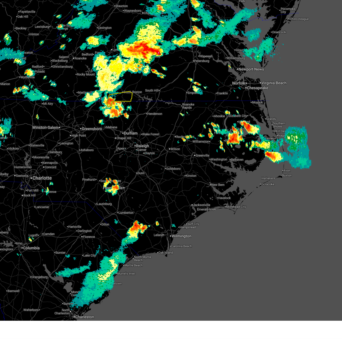
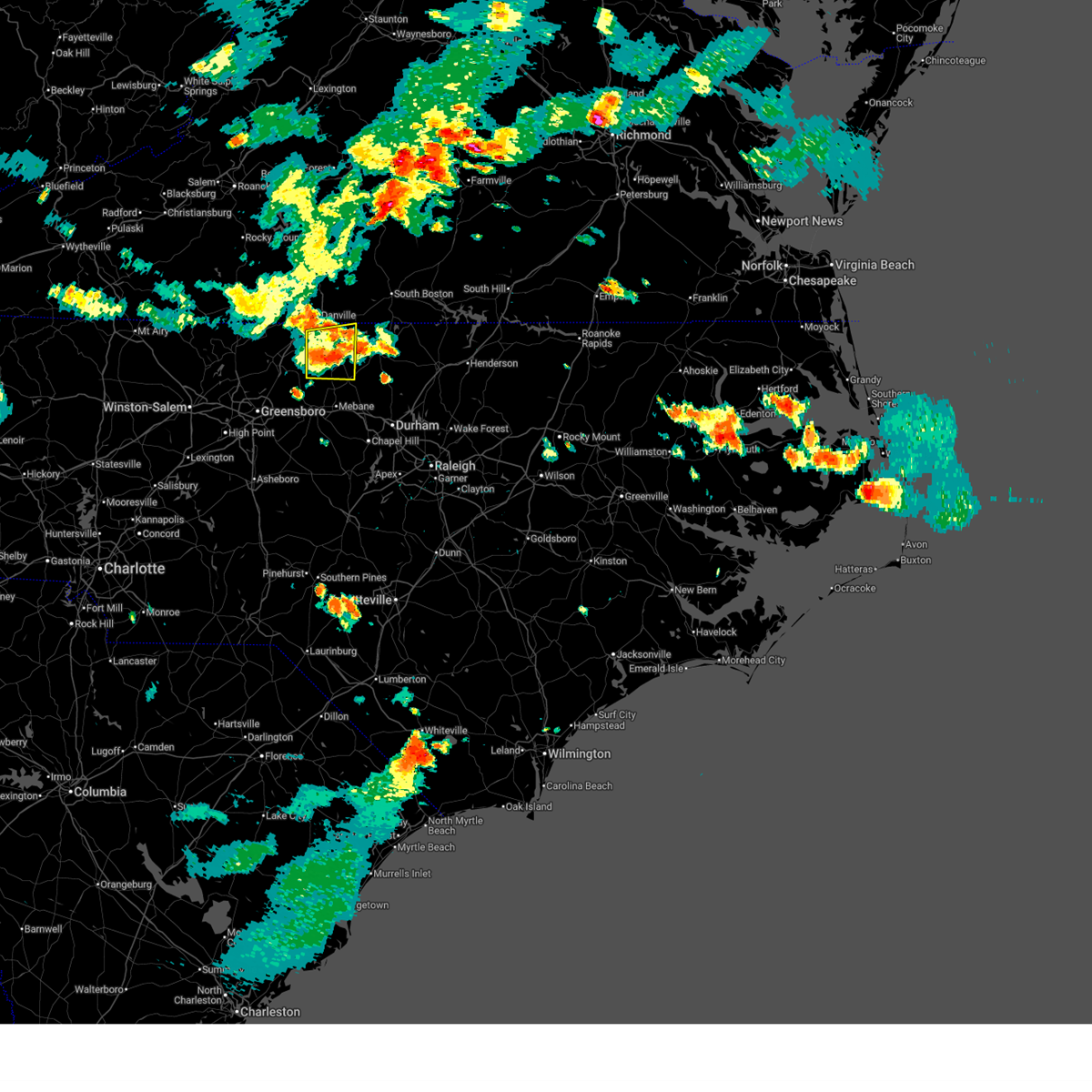
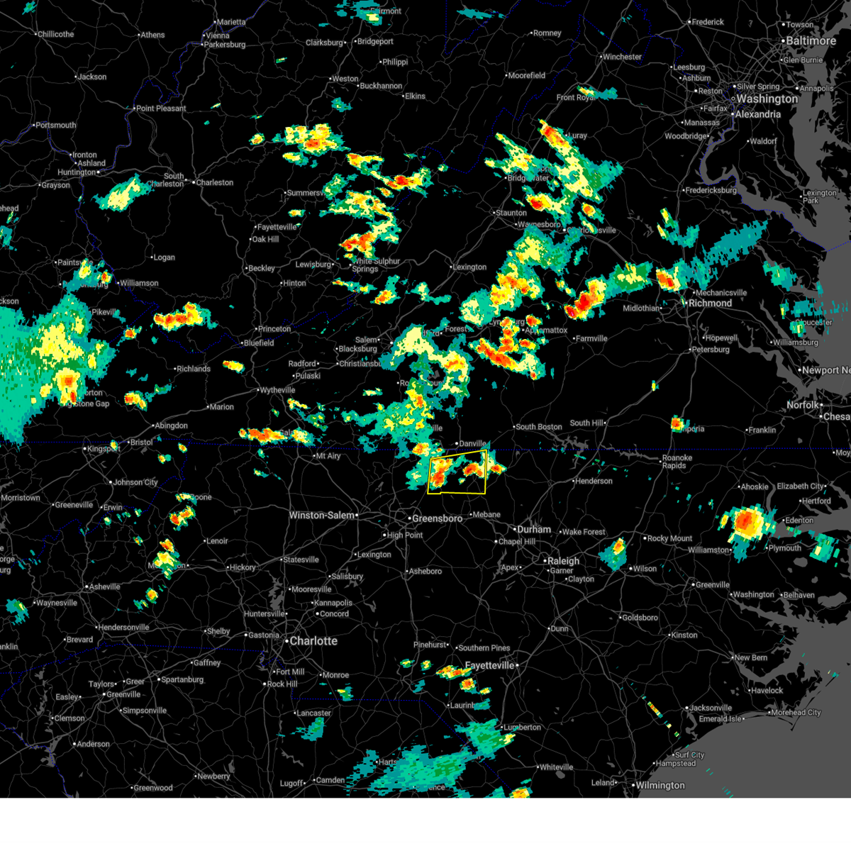
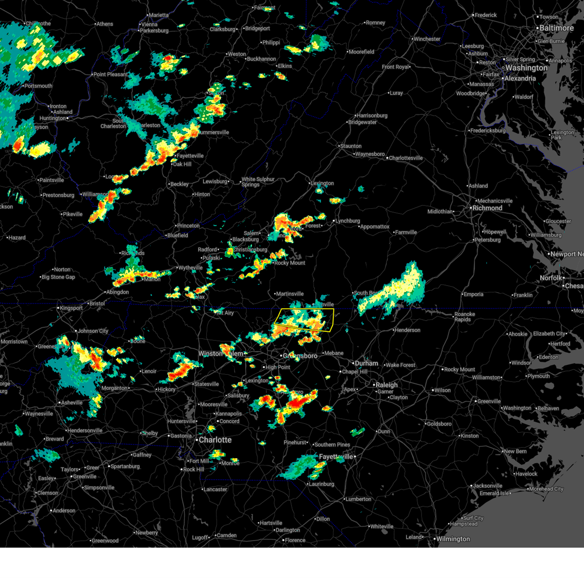
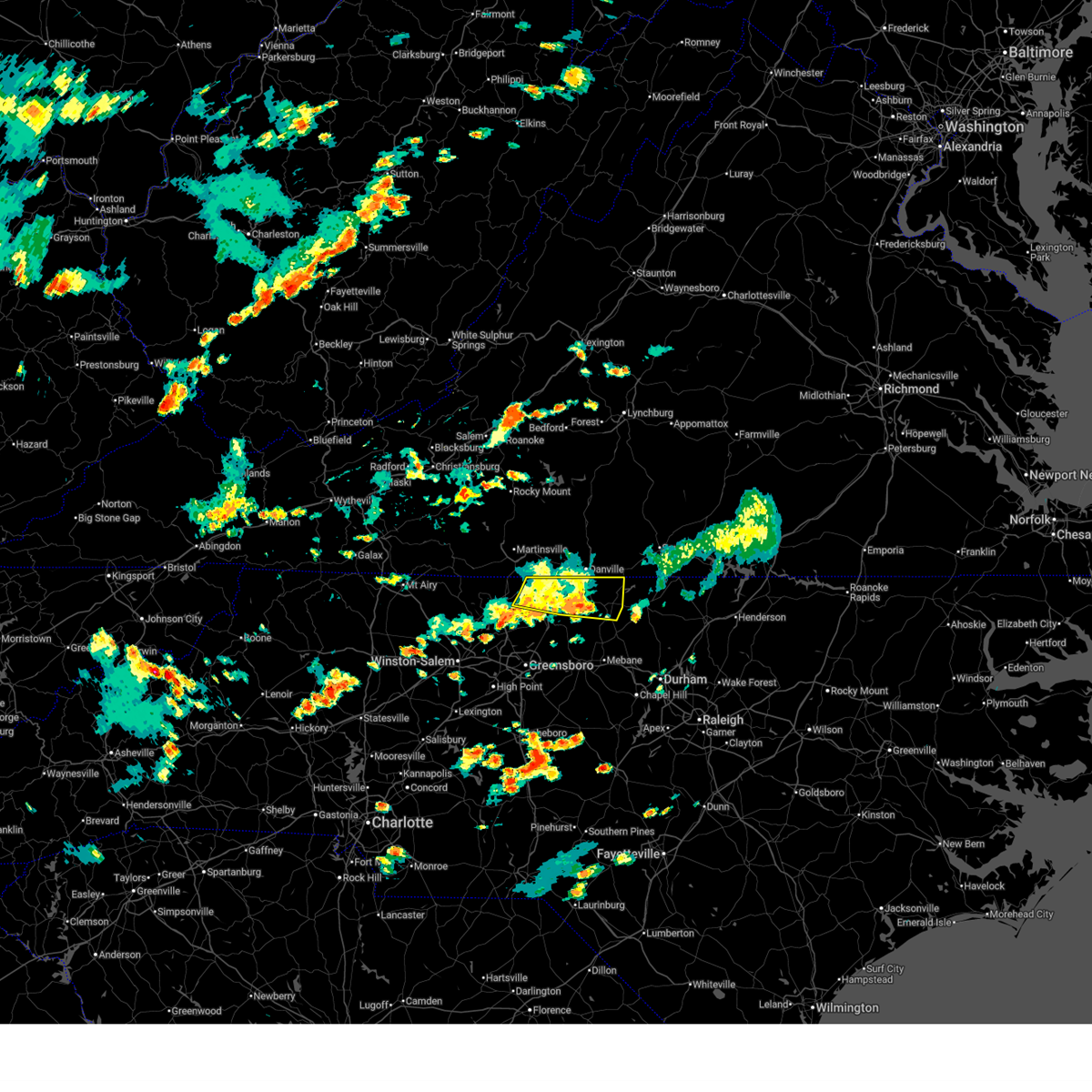
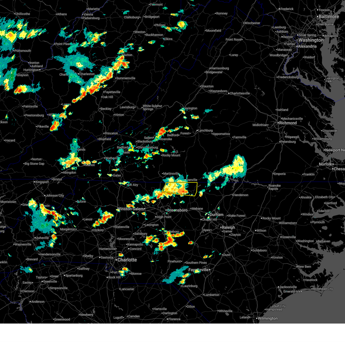
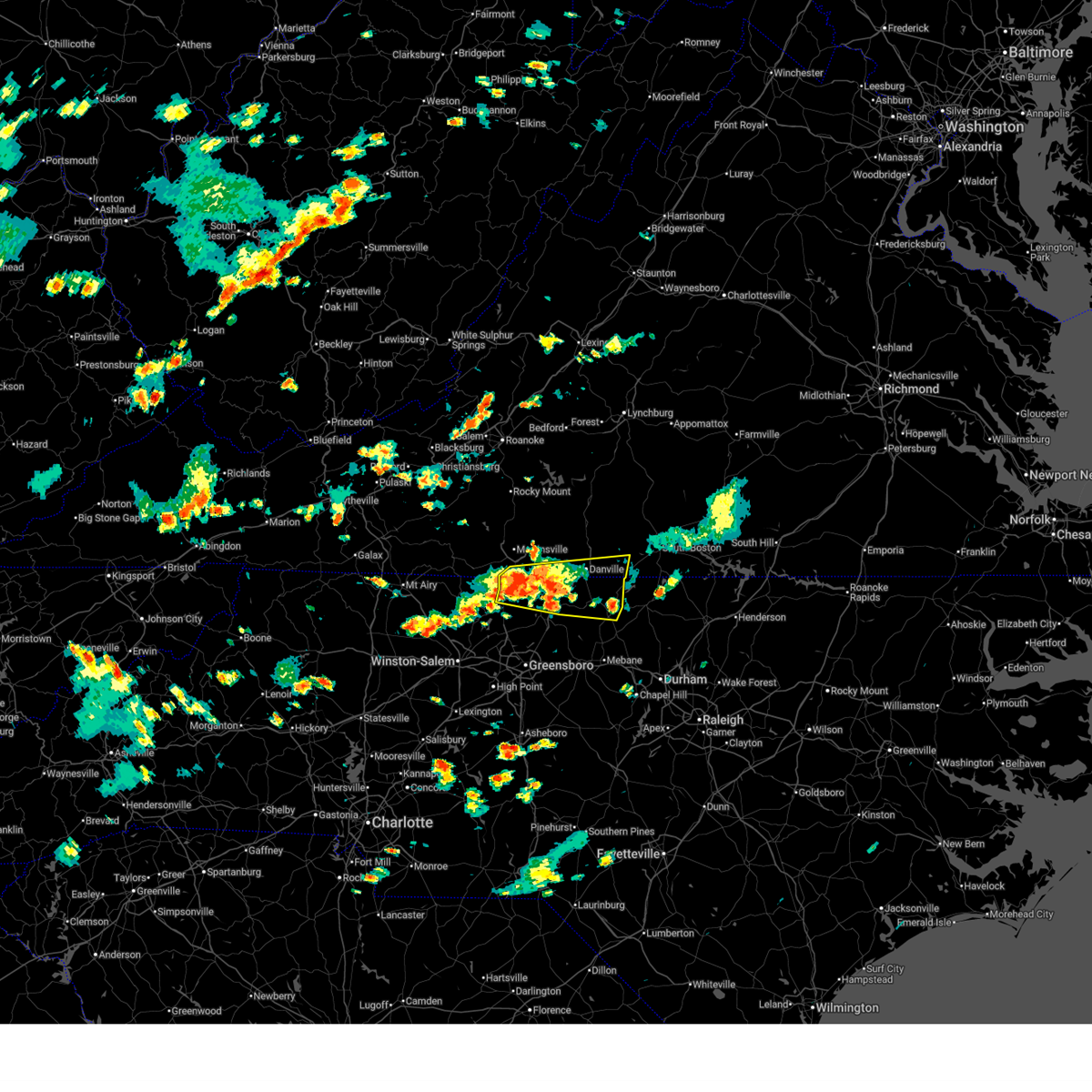
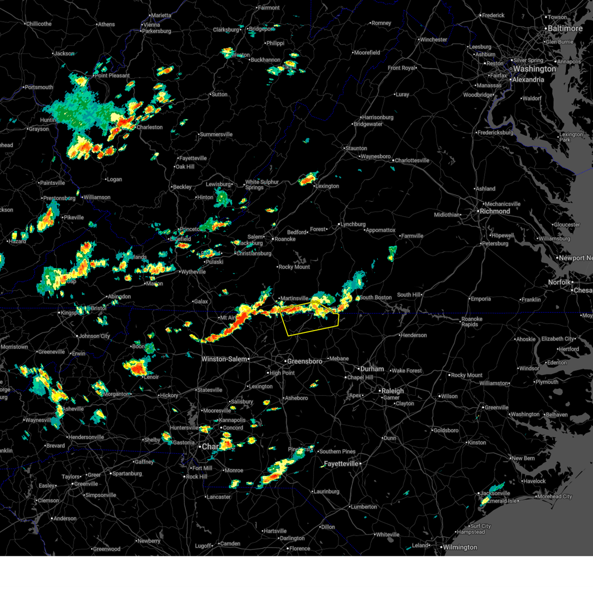
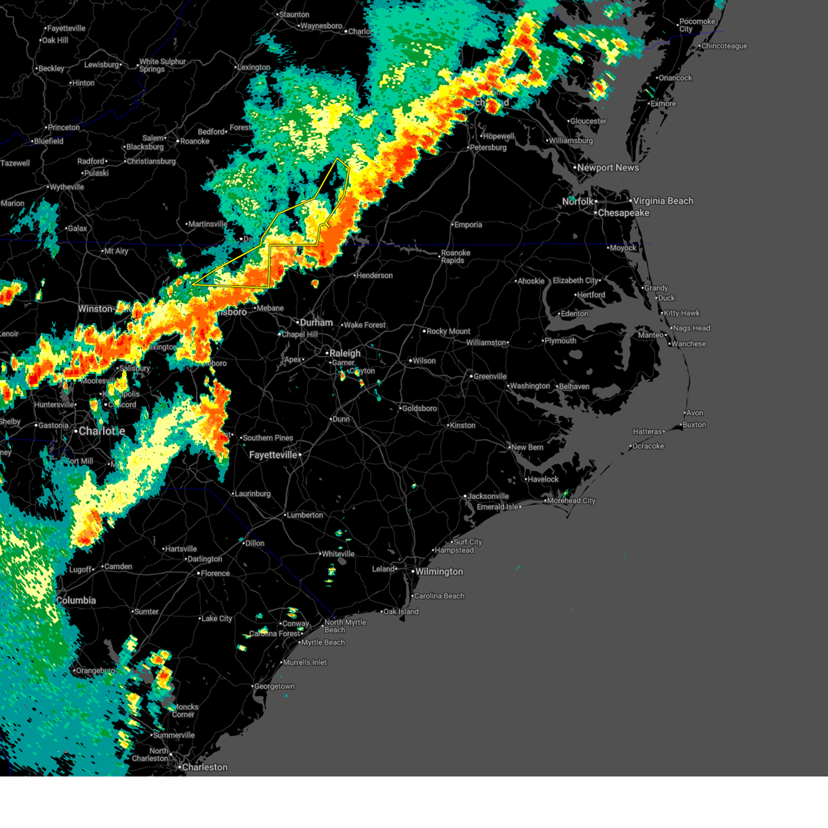
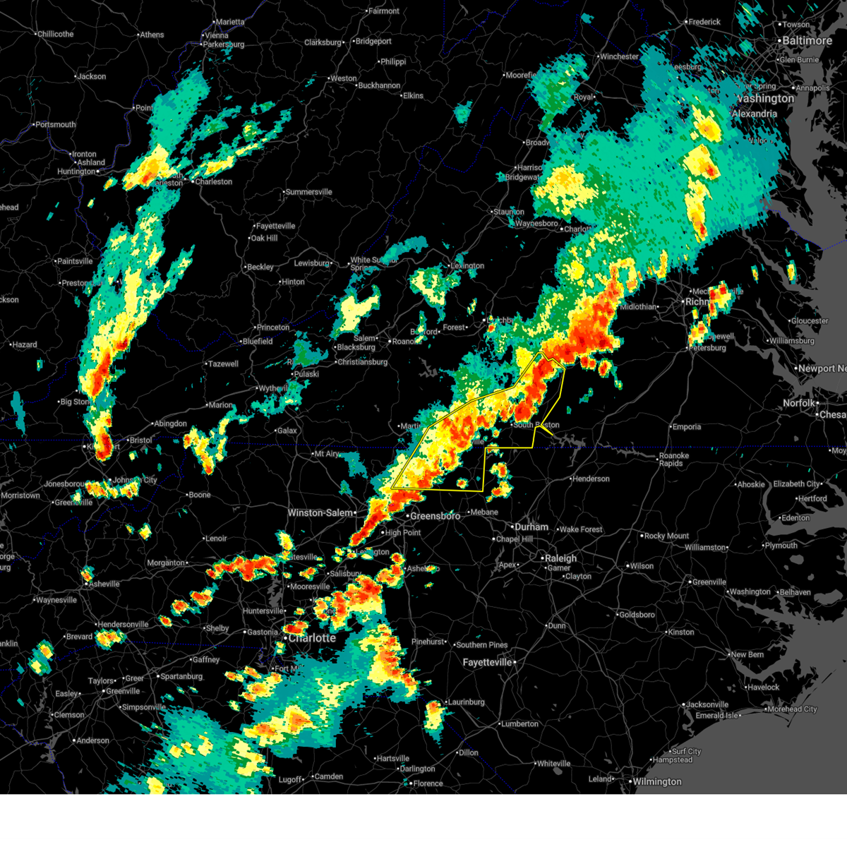
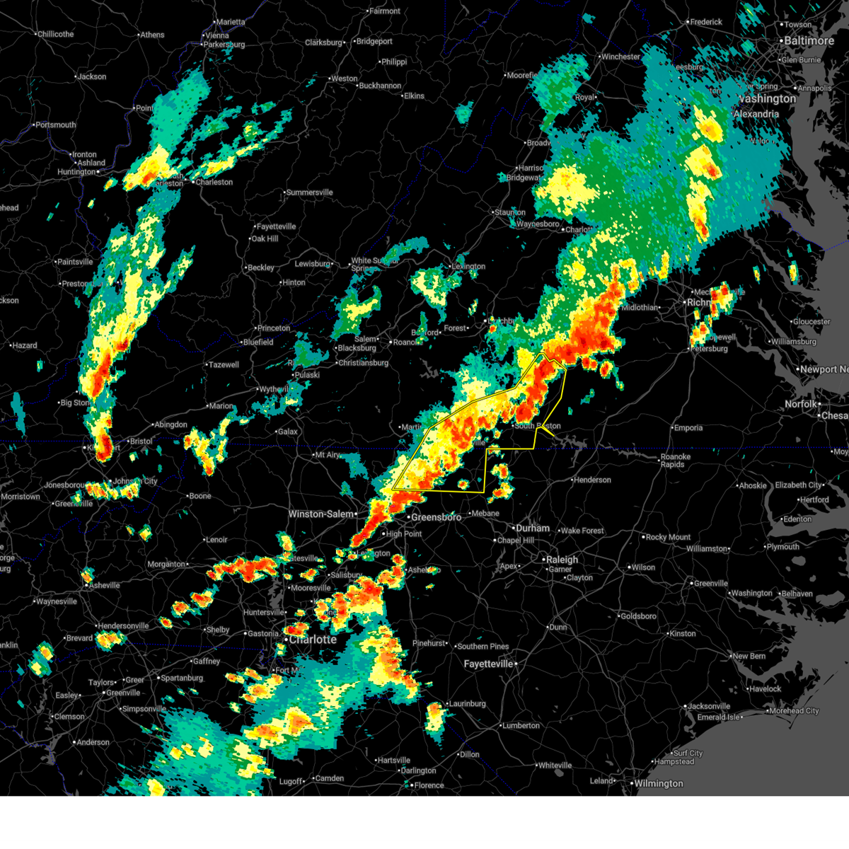
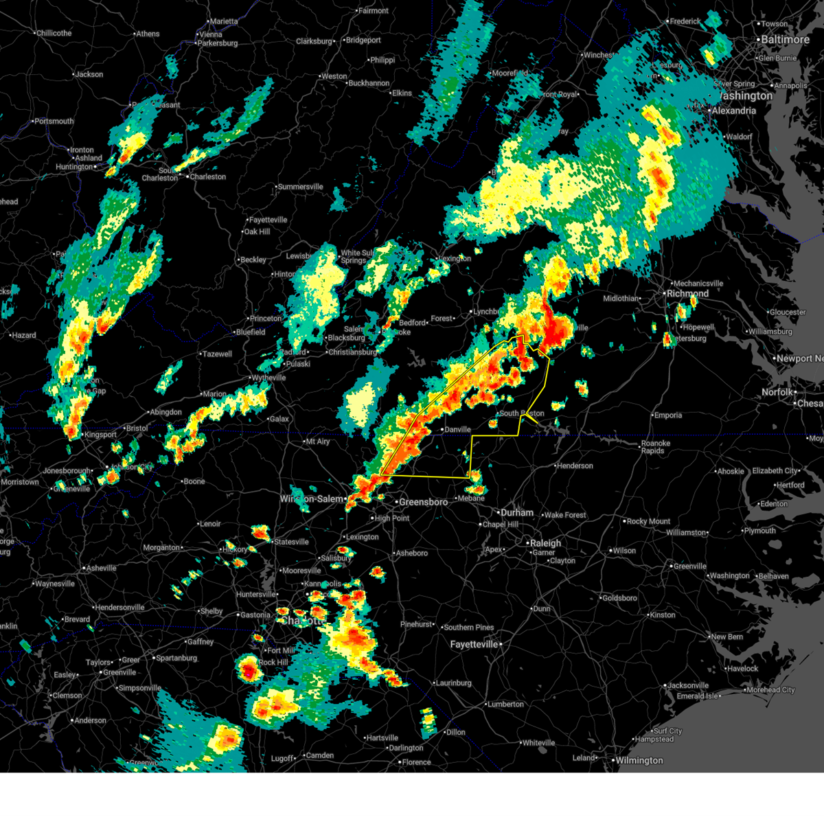
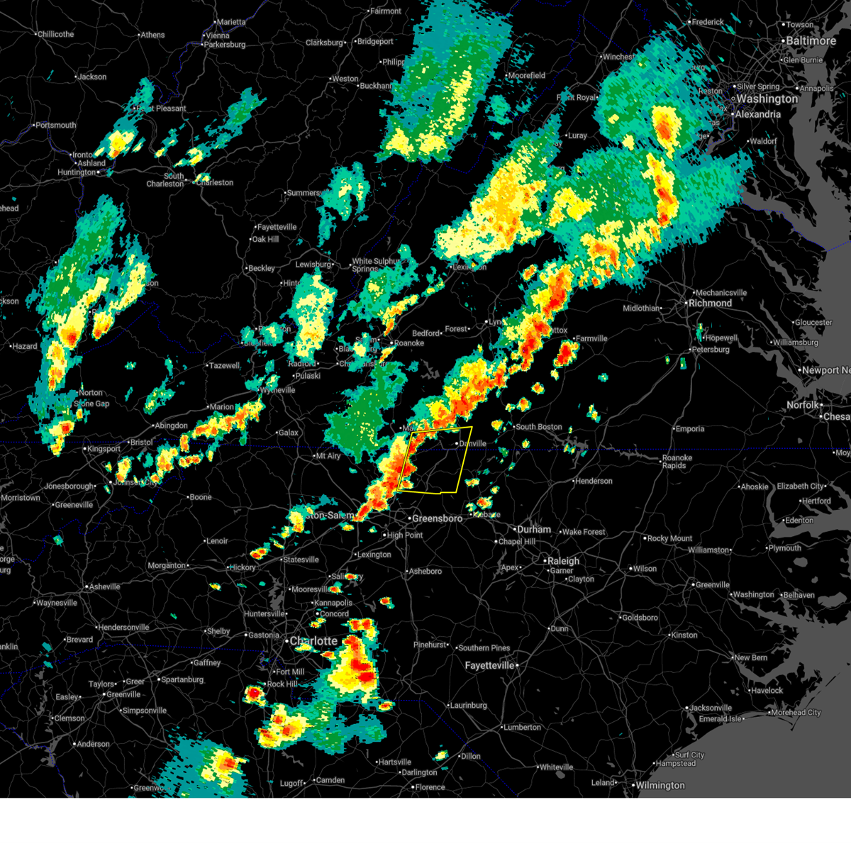
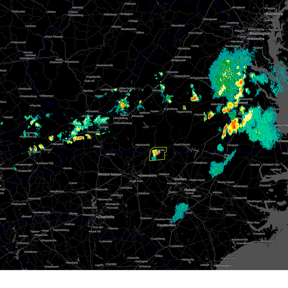
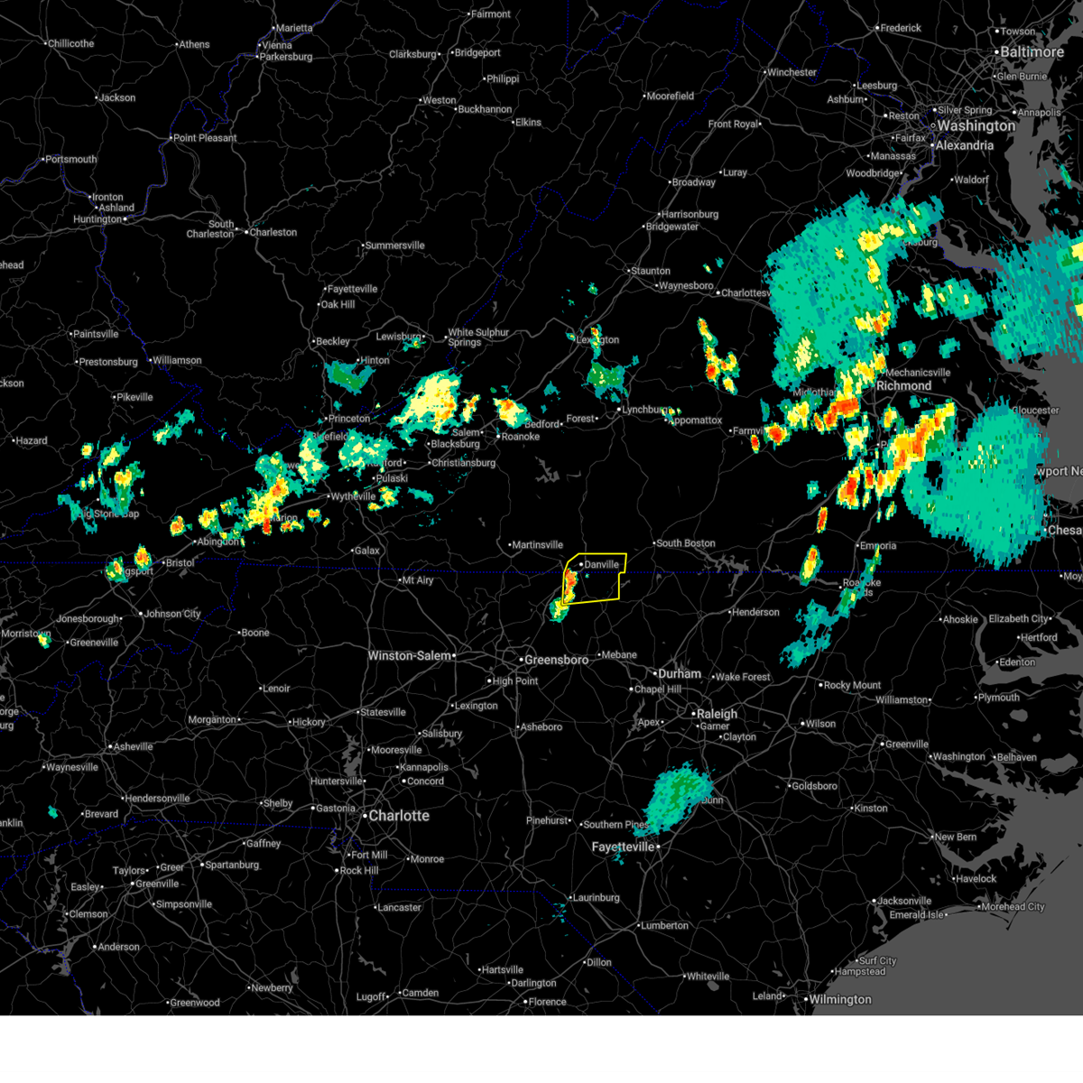
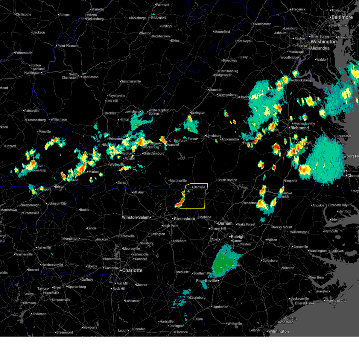
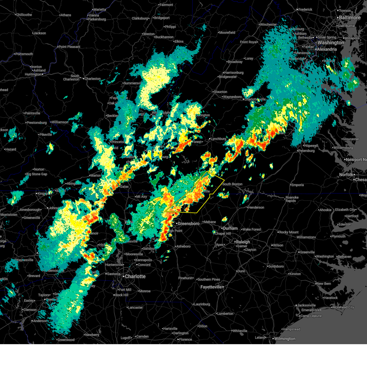
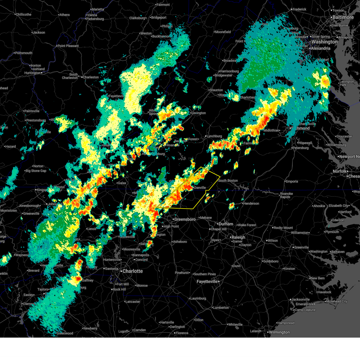
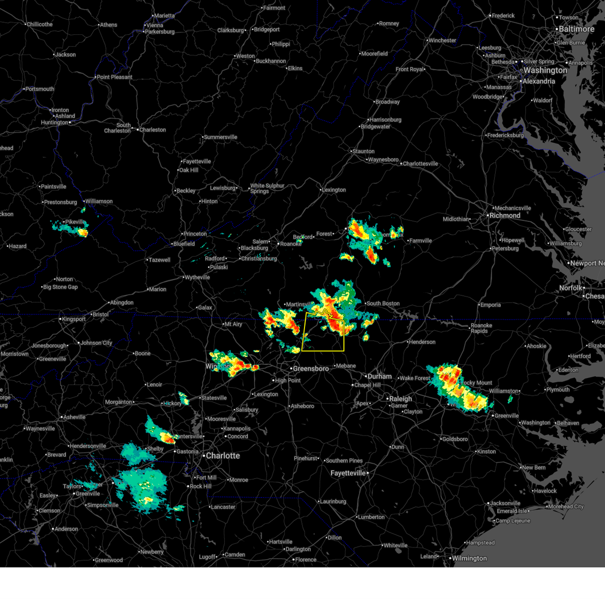
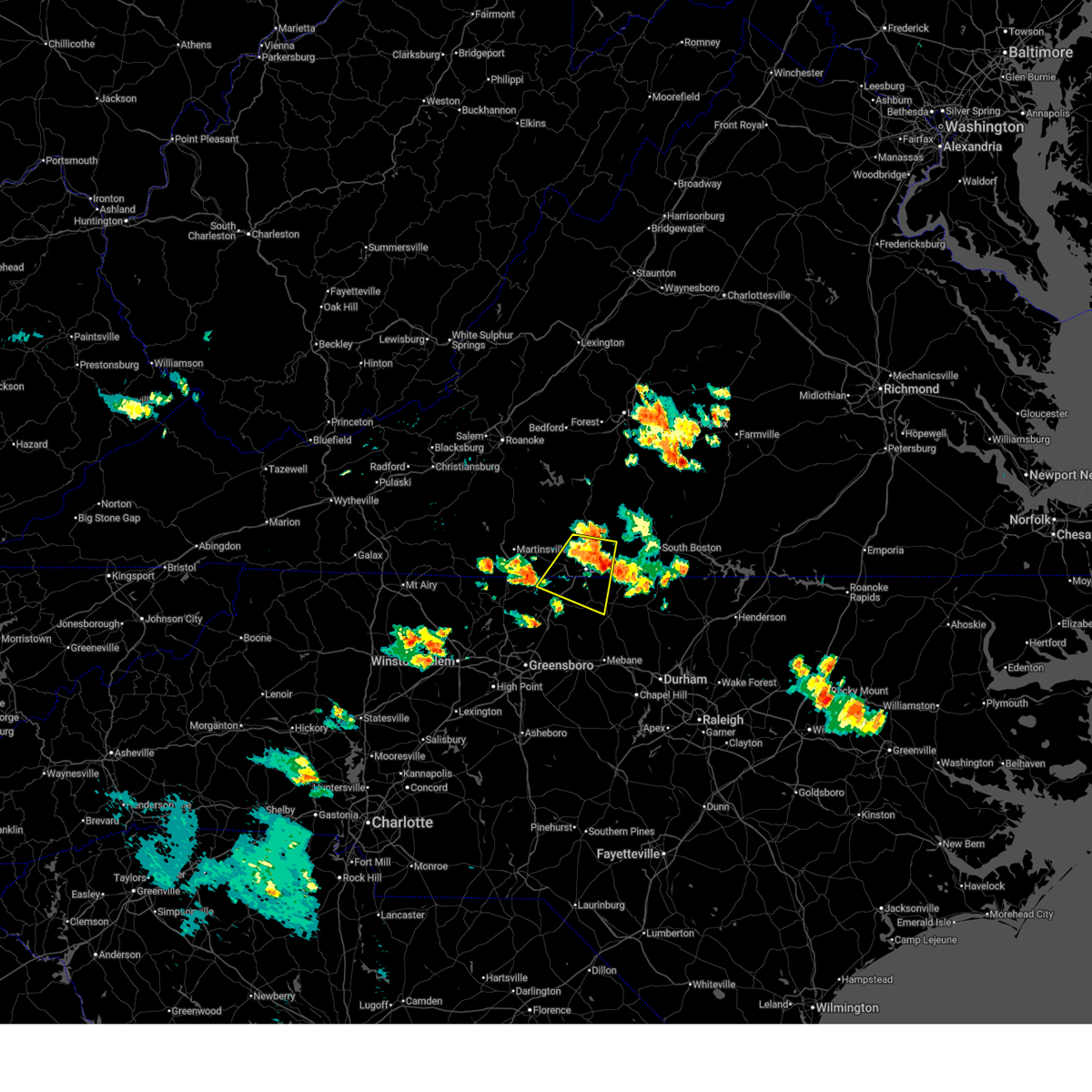
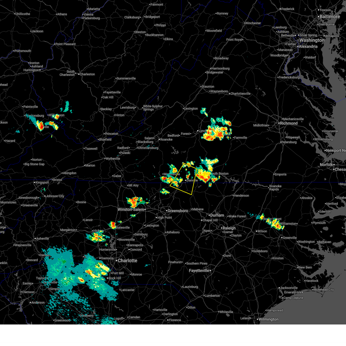
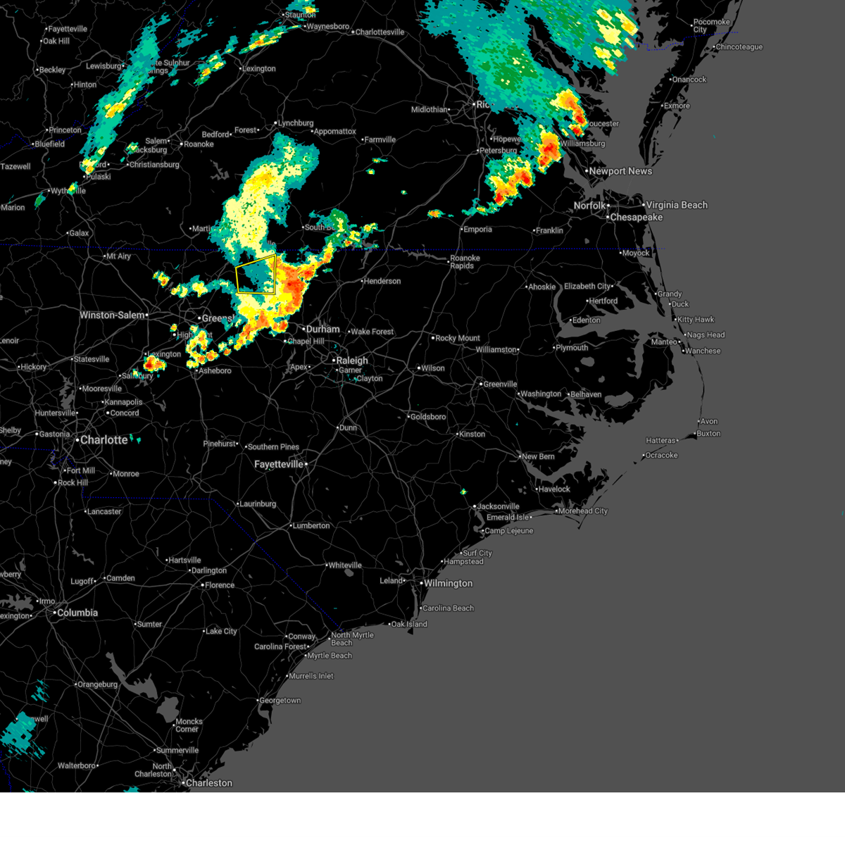
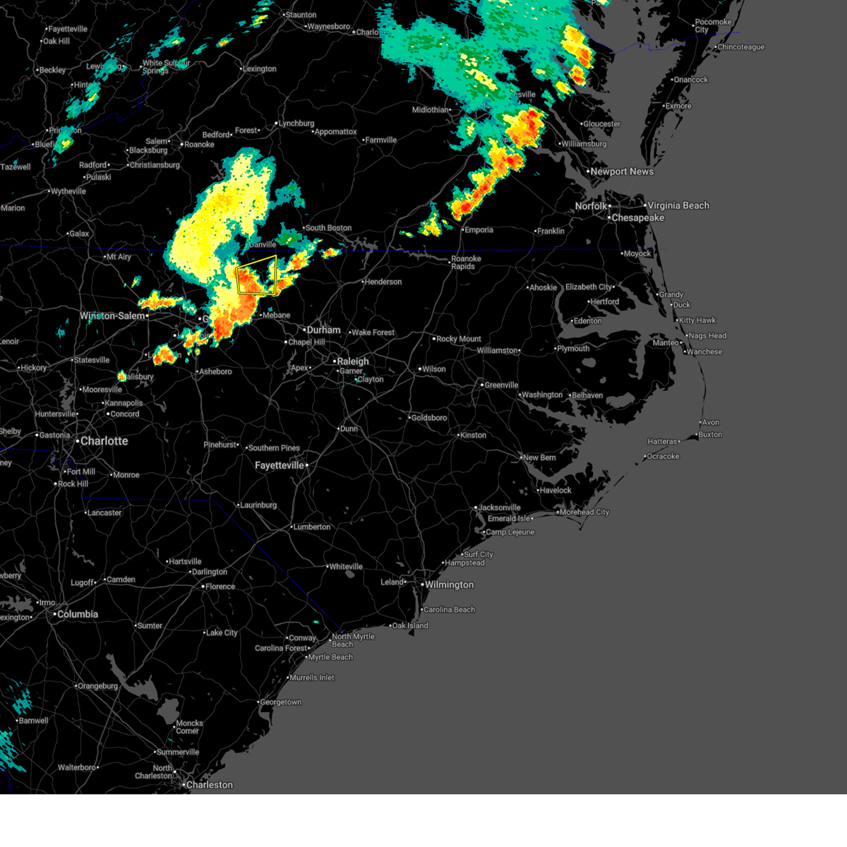
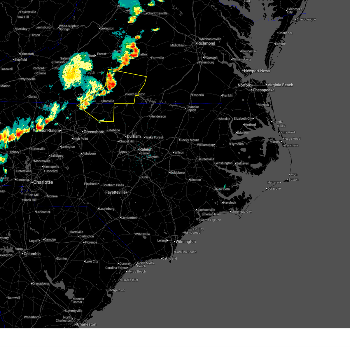
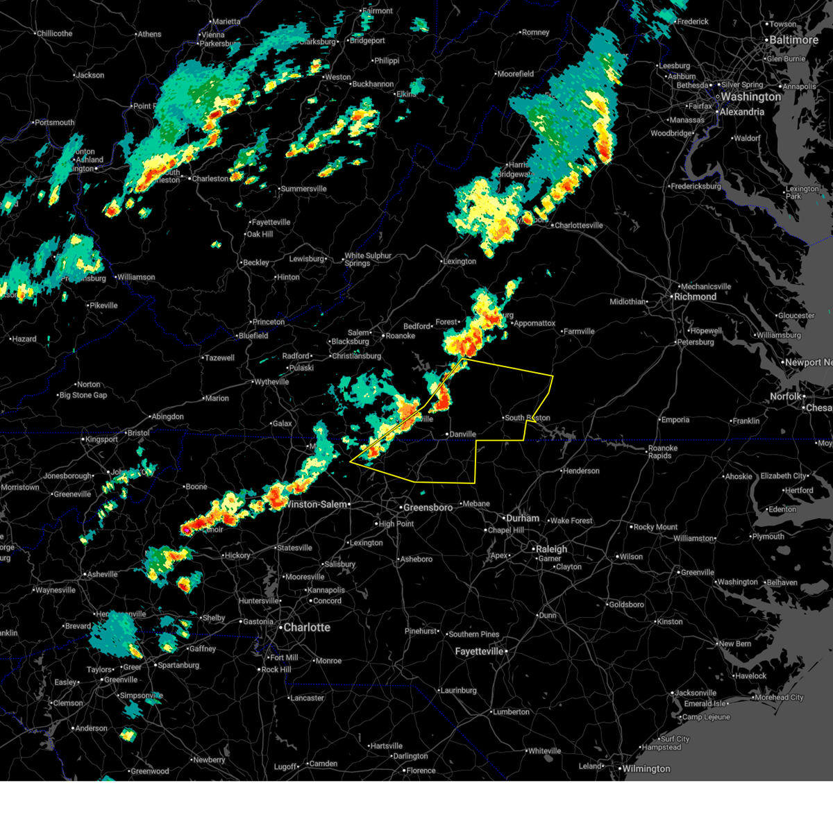
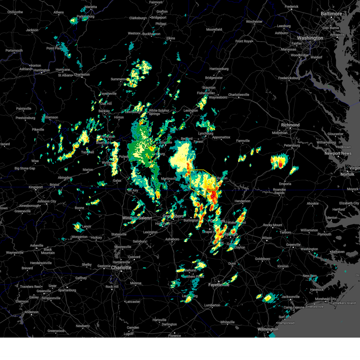
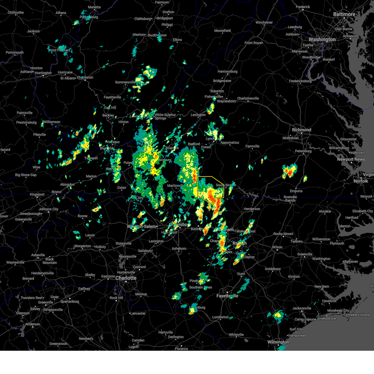
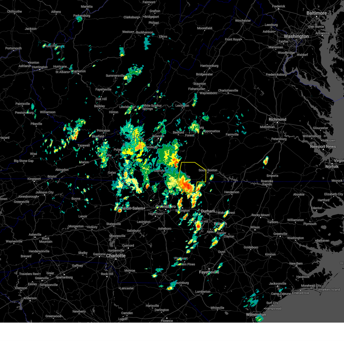
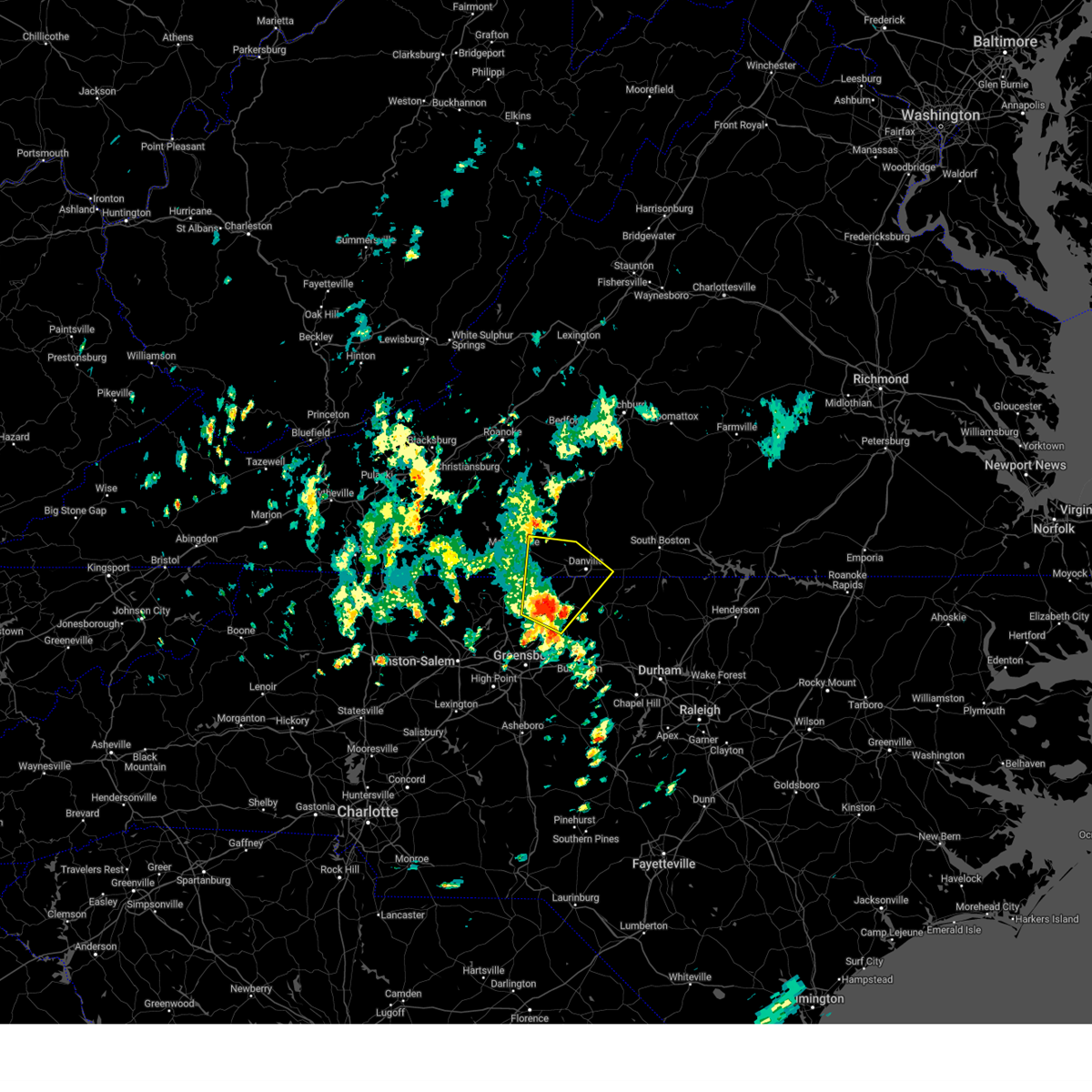
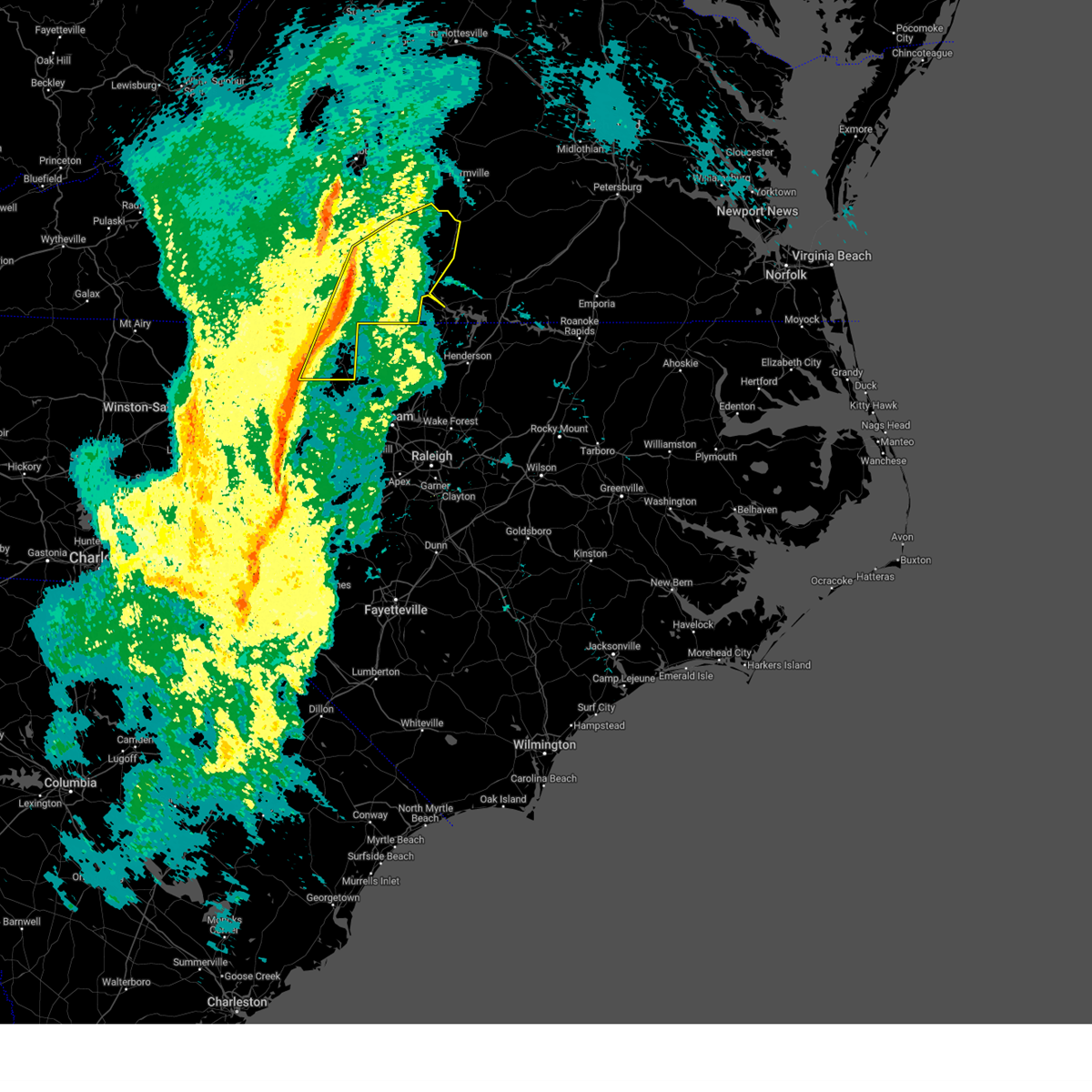
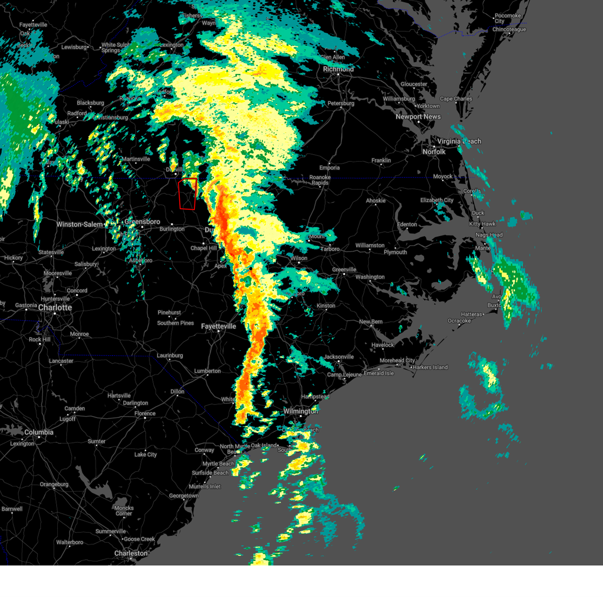
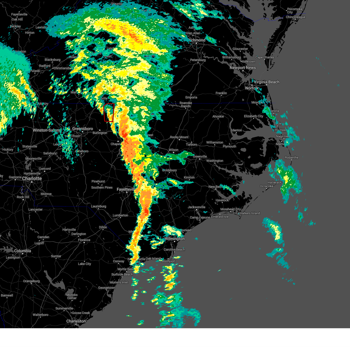
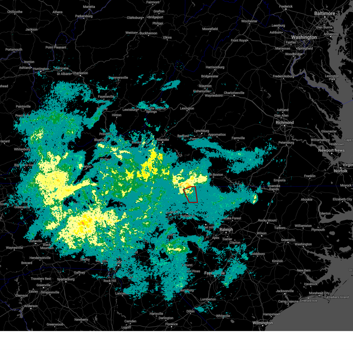
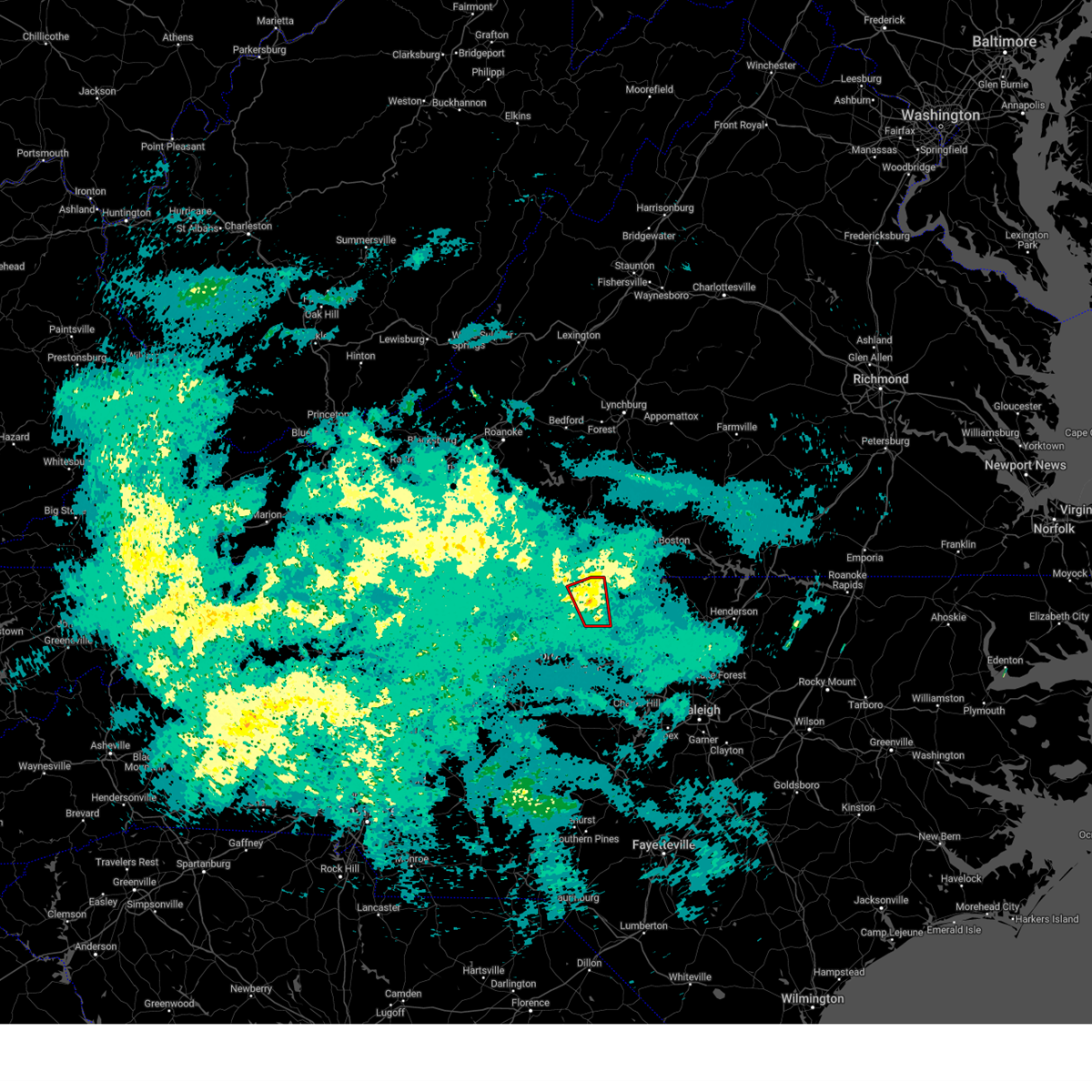
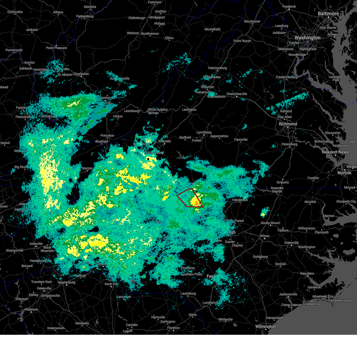
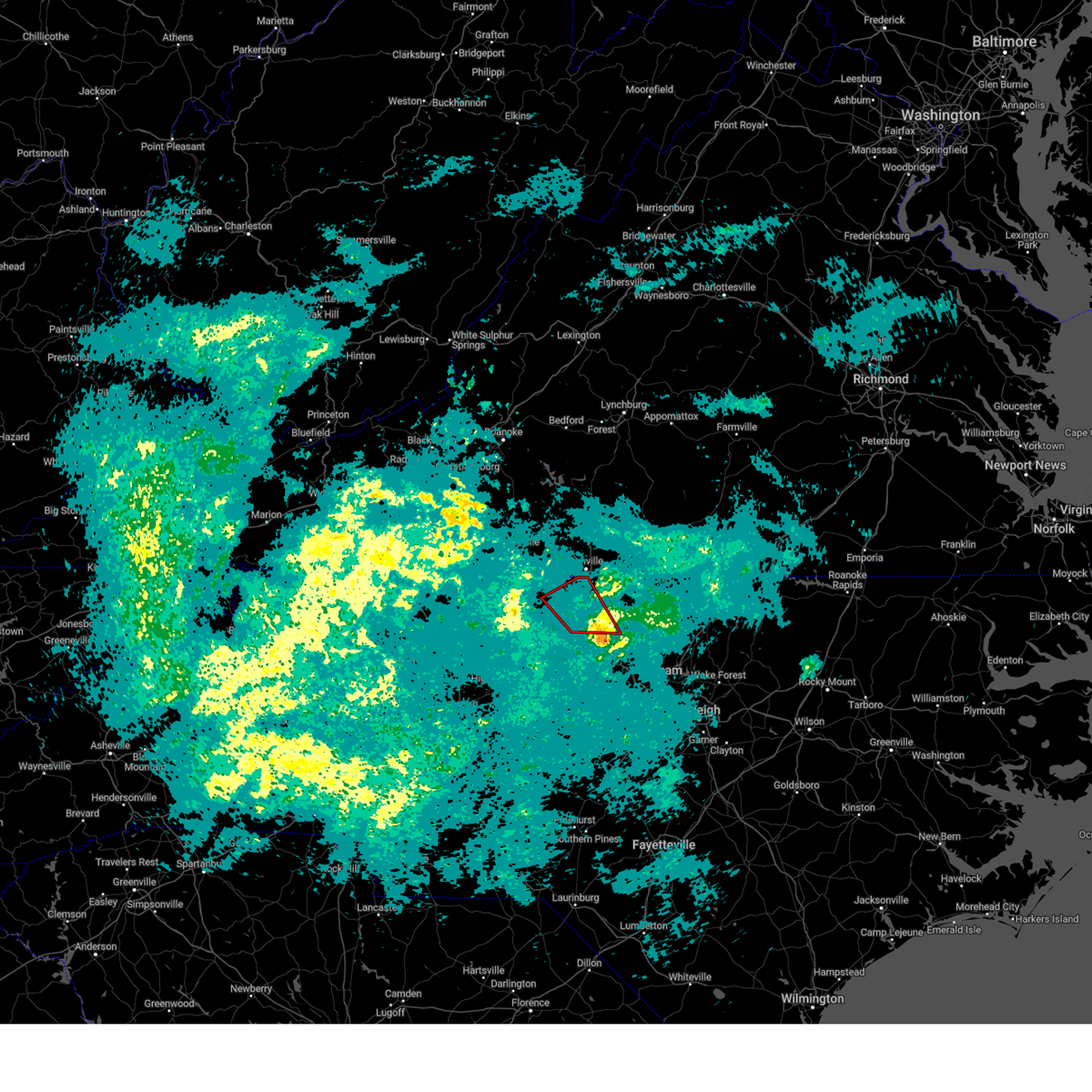
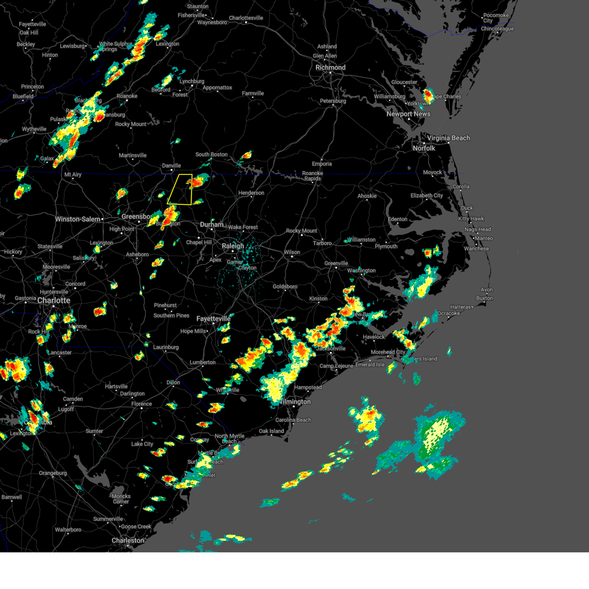
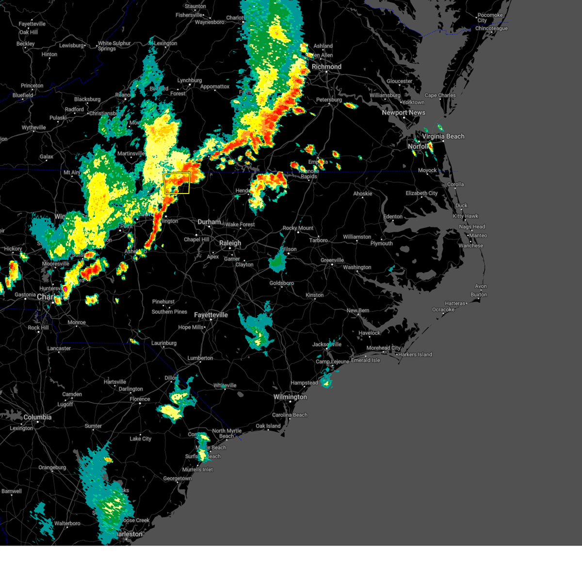
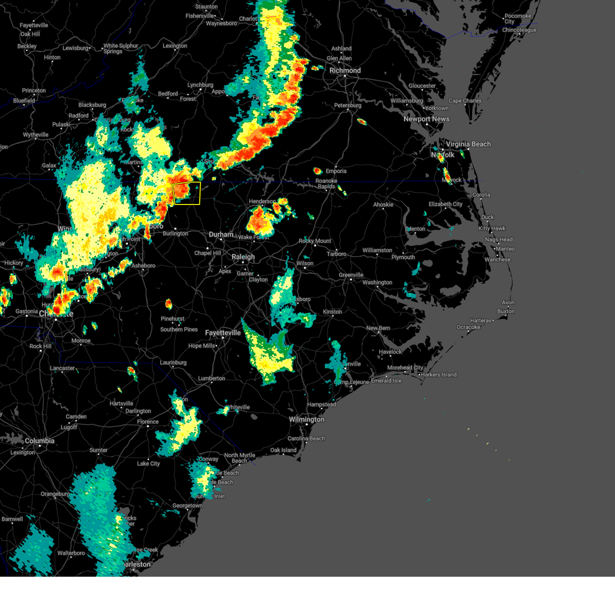
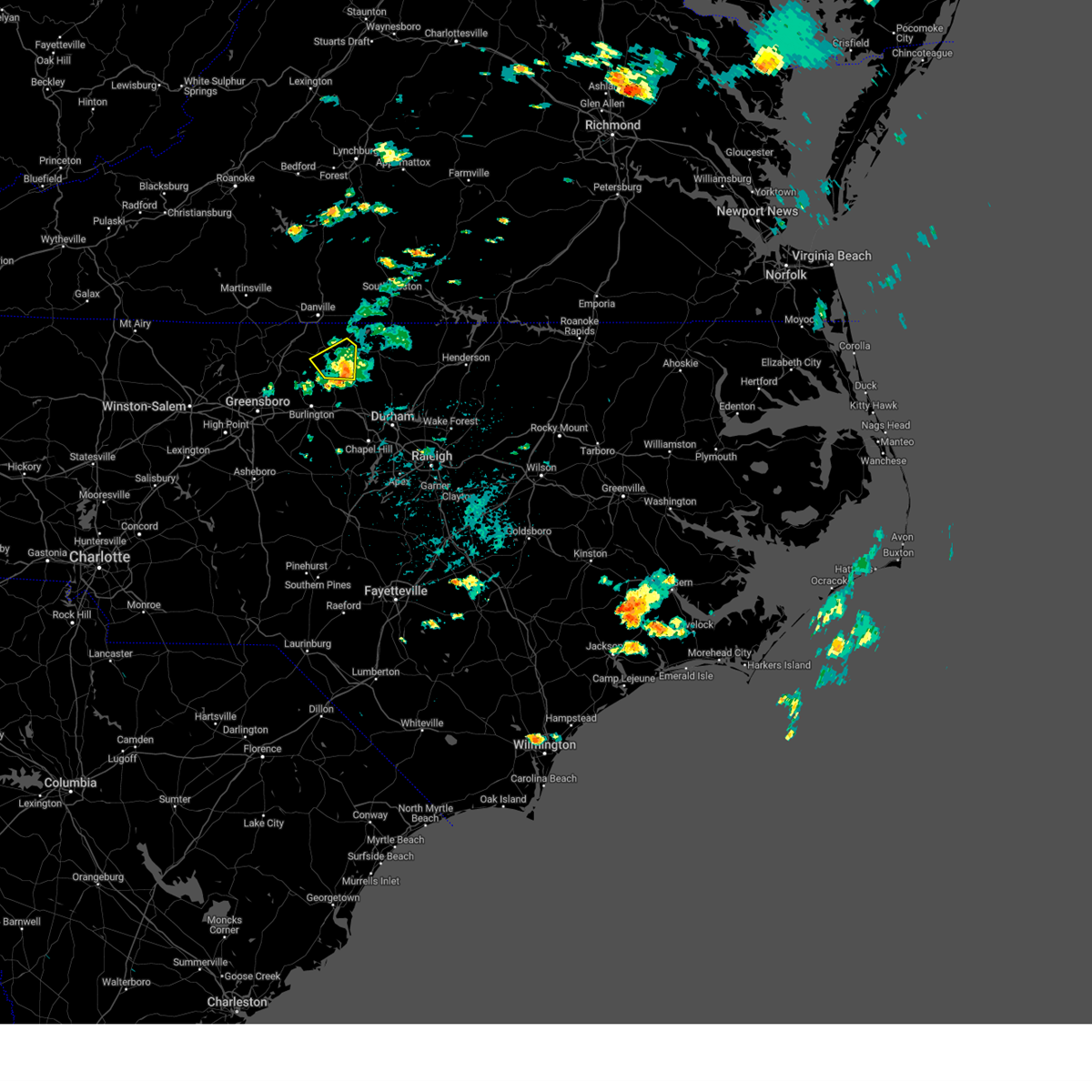
Hail Map for Yanceyville, NC
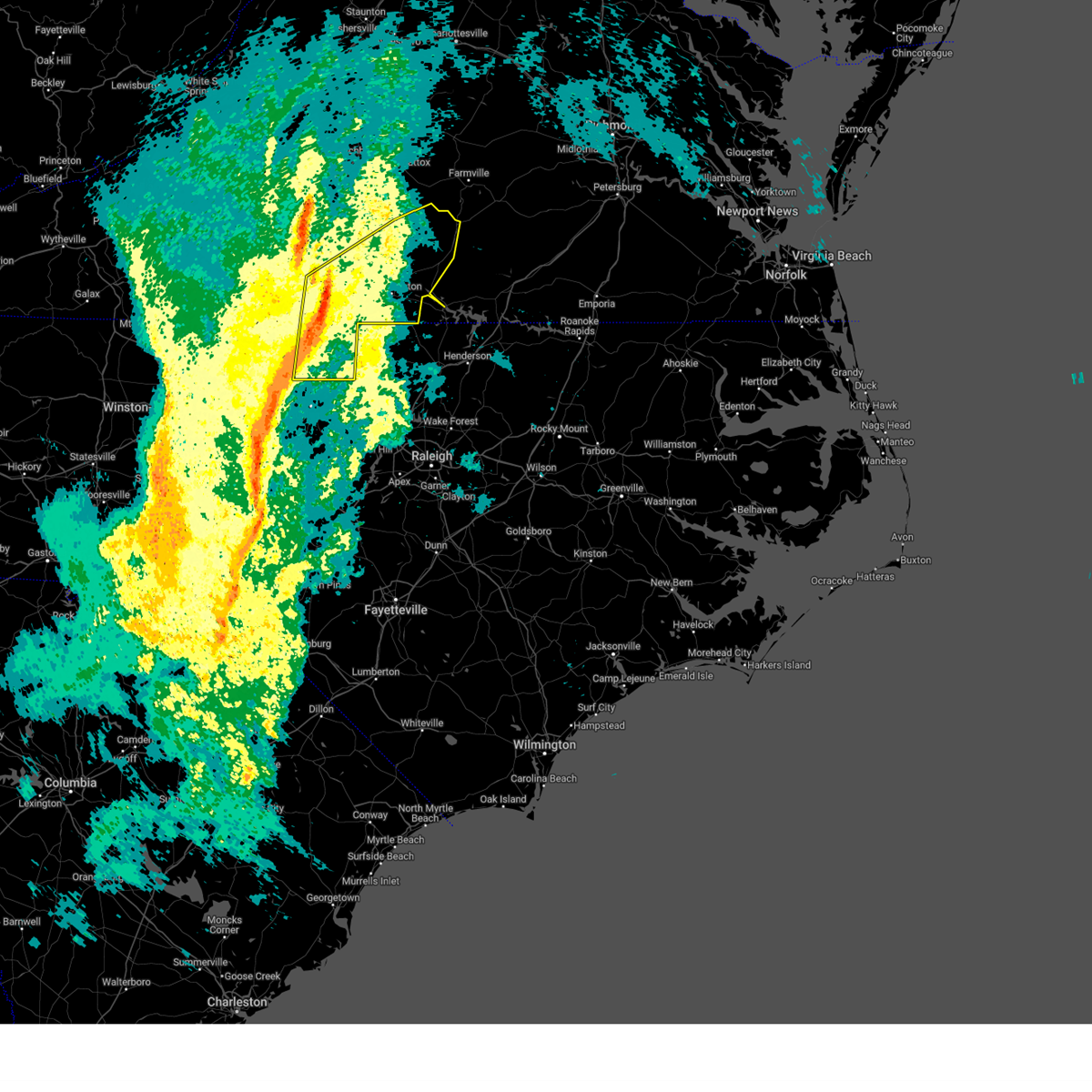
The Yanceyville, NC area has had 9 reports of on-the-ground hail by trained spotters, and has been under severe weather warnings 64 times during the past 12 months. Doppler radar has detected hail at or near Yanceyville, NC on 81 occasions, including 5 occasions during the past year.
| Name: | Yanceyville, NC |
| Where Located: | 57.9 miles NW of Raleigh, NC |
| Map: | Google Map for Yanceyville, NC |
| Population: | 2039 |
| Housing Units: | 748 |
| More Info: | Search Google for Yanceyville, NC |
1
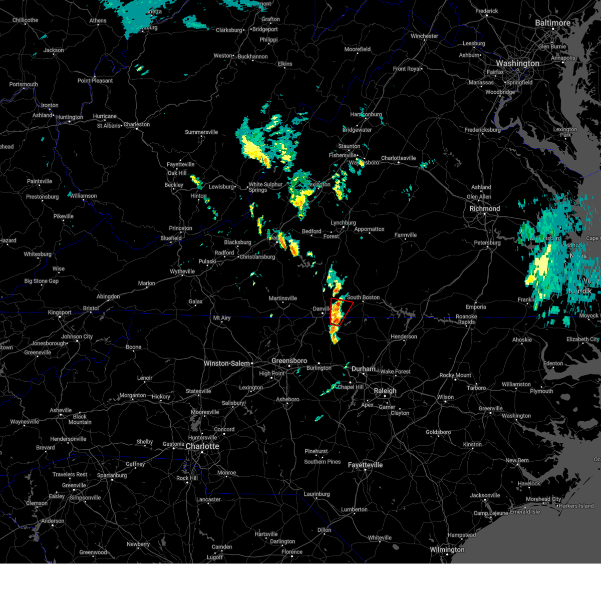
The Top Recent Hail Date for Yanceyville, NC is Wednesday, June 25, 2025 (17th out of 81)

Hail and Wind Damage Spotted near Yanceyville, NC
| Date / Time | Report Details |
|---|---|
| 7/18/2025 6:10 PM EDT |
 Svrrnk the national weather service in blacksburg has issued a * severe thunderstorm warning for, northeastern caswell county in north central north carolina, southern halifax county in south central virginia, * until 715 pm edt. * at 609 pm edt, a severe thunderstorm was located near turbeville, moving east at 20 mph (radar indicated). Hazards include 60 mph wind gusts and quarter size hail. Hail damage to vehicles is expected. Expect wind damage to roofs, siding, and trees. Svrrnk the national weather service in blacksburg has issued a * severe thunderstorm warning for, northeastern caswell county in north central north carolina, southern halifax county in south central virginia, * until 715 pm edt. * at 609 pm edt, a severe thunderstorm was located near turbeville, moving east at 20 mph (radar indicated). Hazards include 60 mph wind gusts and quarter size hail. Hail damage to vehicles is expected. Expect wind damage to roofs, siding, and trees.
|
| 7/18/2025 6:07 PM EDT | The storm which prompted the warning has weakened below severe limits, and has exited the warned area. therefore, the warning will be allowed to expire. however, gusty winds are still possible with this thunderstorm. |
| 7/18/2025 5:42 PM EDT |
 the severe thunderstorm warning has been cancelled and is no longer in effect the severe thunderstorm warning has been cancelled and is no longer in effect
|
| 7/18/2025 5:42 PM EDT |
 At 541 pm edt, a severe thunderstorm was located over hightowers, or 7 miles southeast of yanceyville, moving east at 30 mph (radar indicated). Hazards include 60 mph wind gusts and quarter size hail. Hail damage to vehicles is expected. expect wind damage to roofs, siding, and trees. Locations impacted include, yanceyville, bethel, providence, jericho, prospect hill, blanch, and leasburg. At 541 pm edt, a severe thunderstorm was located over hightowers, or 7 miles southeast of yanceyville, moving east at 30 mph (radar indicated). Hazards include 60 mph wind gusts and quarter size hail. Hail damage to vehicles is expected. expect wind damage to roofs, siding, and trees. Locations impacted include, yanceyville, bethel, providence, jericho, prospect hill, blanch, and leasburg.
|
| 7/18/2025 5:11 PM EDT |
 Svrrnk the national weather service in blacksburg has issued a * severe thunderstorm warning for, southeastern rockingham county in north central north carolina, caswell county in north central north carolina, * until 615 pm edt. * at 511 pm edt, a severe thunderstorm was located over quick, or near camp springs, moving east at 20 mph (radar indicated). Hazards include 60 mph wind gusts. expect damage to roofs, siding, and trees Svrrnk the national weather service in blacksburg has issued a * severe thunderstorm warning for, southeastern rockingham county in north central north carolina, caswell county in north central north carolina, * until 615 pm edt. * at 511 pm edt, a severe thunderstorm was located over quick, or near camp springs, moving east at 20 mph (radar indicated). Hazards include 60 mph wind gusts. expect damage to roofs, siding, and trees
|
| 7/17/2025 4:11 PM EDT |
 the severe thunderstorm warning has been cancelled and is no longer in effect the severe thunderstorm warning has been cancelled and is no longer in effect
|
| 7/17/2025 3:58 PM EDT |
 At 357 pm edt, clusters of severe thunderstorms were located along a line extending from near yanceyville to near quick to near oregon hill to near wentworth, moving east at 20 mph (radar indicated). Hazards include 60 mph wind gusts. Expect damage to roofs, siding, and trees. Locations impacted include, eden, reidsville, wentworth, yanceyville, bethel, providence, and mayfield. At 357 pm edt, clusters of severe thunderstorms were located along a line extending from near yanceyville to near quick to near oregon hill to near wentworth, moving east at 20 mph (radar indicated). Hazards include 60 mph wind gusts. Expect damage to roofs, siding, and trees. Locations impacted include, eden, reidsville, wentworth, yanceyville, bethel, providence, and mayfield.
|
| 7/17/2025 3:58 PM EDT |
 the severe thunderstorm warning has been cancelled and is no longer in effect the severe thunderstorm warning has been cancelled and is no longer in effect
|
| 7/17/2025 3:29 PM EDT |
 Svrrnk the national weather service in blacksburg has issued a * severe thunderstorm warning for, northern rockingham county in north central north carolina, caswell county in north central north carolina, the city of danville in south central virginia, southern pittsylvania county in south central virginia, southwestern halifax county in south central virginia, southeastern henry county in south central virginia, * until 430 pm edt. * at 328 pm edt, clusters of severe thunderstorms were located along a line extending from near ridgeway to sandy level to near eden to near stoneville. additional clusters of severe thunderstorms were located from aiken summit to reidsville. movement was east at 40 mph (radar indicated). Hazards include 60 mph wind gusts. expect damage to roofs, siding, and trees Svrrnk the national weather service in blacksburg has issued a * severe thunderstorm warning for, northern rockingham county in north central north carolina, caswell county in north central north carolina, the city of danville in south central virginia, southern pittsylvania county in south central virginia, southwestern halifax county in south central virginia, southeastern henry county in south central virginia, * until 430 pm edt. * at 328 pm edt, clusters of severe thunderstorms were located along a line extending from near ridgeway to sandy level to near eden to near stoneville. additional clusters of severe thunderstorms were located from aiken summit to reidsville. movement was east at 40 mph (radar indicated). Hazards include 60 mph wind gusts. expect damage to roofs, siding, and trees
|
| 7/17/2025 2:35 PM EDT |
 Svrrnk the national weather service in blacksburg has issued a * severe thunderstorm warning for, northeastern rockingham county in north central north carolina, northern caswell county in north central north carolina, the city of danville in south central virginia, southwestern pittsylvania county in south central virginia, southeastern henry county in south central virginia, * until 330 pm edt. * at 234 pm edt, severe thunderstorms were located along a line extending from westover hills to sandy level, moving southeast at 10 mph (radar indicated). Hazards include 60 mph wind gusts. expect damage to roofs, siding, and trees Svrrnk the national weather service in blacksburg has issued a * severe thunderstorm warning for, northeastern rockingham county in north central north carolina, northern caswell county in north central north carolina, the city of danville in south central virginia, southwestern pittsylvania county in south central virginia, southeastern henry county in south central virginia, * until 330 pm edt. * at 234 pm edt, severe thunderstorms were located along a line extending from westover hills to sandy level, moving southeast at 10 mph (radar indicated). Hazards include 60 mph wind gusts. expect damage to roofs, siding, and trees
|
| 7/9/2025 7:15 PM EDT |
 The storms which prompted the warning have moved out of the area. therefore, the warning has been allowed to expire. however, gusty winds and heavy rain are still possible. a severe thunderstorm watch remains in effect until 1000 pm edt for north central north carolina, and central and south central virginia. The storms which prompted the warning have moved out of the area. therefore, the warning has been allowed to expire. however, gusty winds and heavy rain are still possible. a severe thunderstorm watch remains in effect until 1000 pm edt for north central north carolina, and central and south central virginia.
|
| 7/9/2025 6:45 PM EDT | At 644 pm edt, severe thunderstorms were located along a line extending from near keysville to near redoak to near elmo to near camp springs, moving east at 30 mph (radar indicated). Hazards include 60 mph wind gusts and quarter size hail. Hail damage to vehicles is expected. expect wind damage to roofs, siding, and trees. Locations impacted include, reidsville, south boston, yanceyville, halifax, keysville, jericho, and prospect hill. |
| 7/9/2025 6:45 PM EDT | the severe thunderstorm warning has been cancelled and is no longer in effect |
| 7/9/2025 6:18 PM EDT |
 At 618 pm edt, severe thunderstorms were located along a line extending from cullen to near scottsburg to near ringgold to monroeton, moving northeast at 20 mph (radar indicated). Hazards include 60 mph wind gusts and quarter size hail. Hail damage to vehicles is expected. expect wind damage to roofs, siding, and trees. Locations impacted include, danville, eden, reidsville, south boston, wentworth, yanceyville, and bethel. At 618 pm edt, severe thunderstorms were located along a line extending from cullen to near scottsburg to near ringgold to monroeton, moving northeast at 20 mph (radar indicated). Hazards include 60 mph wind gusts and quarter size hail. Hail damage to vehicles is expected. expect wind damage to roofs, siding, and trees. Locations impacted include, danville, eden, reidsville, south boston, wentworth, yanceyville, and bethel.
|
| 7/9/2025 6:18 PM EDT |
 the severe thunderstorm warning has been cancelled and is no longer in effect the severe thunderstorm warning has been cancelled and is no longer in effect
|
| 7/9/2025 5:46 PM EDT |
 Svrrnk the national weather service in blacksburg has issued a * severe thunderstorm warning for, eastern rockingham county in north central north carolina, caswell county in north central north carolina, the city of danville in south central virginia, charlotte county in south central virginia, southeastern campbell county in central virginia, southern pittsylvania county in south central virginia, halifax county in south central virginia, * until 715 pm edt. * at 545 pm edt, severe thunderstorms were located along a line extending from hat creek to near bethany, moving east at 30 mph (radar indicated). Hazards include 60 mph wind gusts and quarter size hail. Hail damage to vehicles is expected. Expect wind damage to roofs, siding, and trees. Svrrnk the national weather service in blacksburg has issued a * severe thunderstorm warning for, eastern rockingham county in north central north carolina, caswell county in north central north carolina, the city of danville in south central virginia, charlotte county in south central virginia, southeastern campbell county in central virginia, southern pittsylvania county in south central virginia, halifax county in south central virginia, * until 715 pm edt. * at 545 pm edt, severe thunderstorms were located along a line extending from hat creek to near bethany, moving east at 30 mph (radar indicated). Hazards include 60 mph wind gusts and quarter size hail. Hail damage to vehicles is expected. Expect wind damage to roofs, siding, and trees.
|
| 7/9/2025 5:29 PM EDT |
 Svrrnk the national weather service in blacksburg has issued a * severe thunderstorm warning for, rockingham county in north central north carolina, western caswell county in north central north carolina, the city of danville in south central virginia, southwestern pittsylvania county in south central virginia, southeastern henry county in south central virginia, * until 615 pm edt. * at 529 pm edt, severe thunderstorms were located along a line extending from aiken summit to near bethany, moving east at 30 mph (radar indicated). Hazards include 60 mph wind gusts and quarter size hail. Hail damage to vehicles is expected. Expect wind damage to roofs, siding, and trees. Svrrnk the national weather service in blacksburg has issued a * severe thunderstorm warning for, rockingham county in north central north carolina, western caswell county in north central north carolina, the city of danville in south central virginia, southwestern pittsylvania county in south central virginia, southeastern henry county in south central virginia, * until 615 pm edt. * at 529 pm edt, severe thunderstorms were located along a line extending from aiken summit to near bethany, moving east at 30 mph (radar indicated). Hazards include 60 mph wind gusts and quarter size hail. Hail damage to vehicles is expected. Expect wind damage to roofs, siding, and trees.
|
| 7/8/2025 9:24 PM EDT |
 the severe thunderstorm warning has been cancelled and is no longer in effect the severe thunderstorm warning has been cancelled and is no longer in effect
|
| 7/8/2025 9:04 PM EDT |
 At 904 pm edt, severe thunderstorms were located along a line extending from danville to near yanceyville to near camp springs, moving northeast at 20 mph (radar indicated). Hazards include 60 mph wind gusts. Expect damage to roofs, siding, and trees. Locations impacted include, danville, yanceyville, bethel, providence, milton, quick, and blanch. At 904 pm edt, severe thunderstorms were located along a line extending from danville to near yanceyville to near camp springs, moving northeast at 20 mph (radar indicated). Hazards include 60 mph wind gusts. Expect damage to roofs, siding, and trees. Locations impacted include, danville, yanceyville, bethel, providence, milton, quick, and blanch.
|
| 7/8/2025 9:04 PM EDT |
 the severe thunderstorm warning has been cancelled and is no longer in effect the severe thunderstorm warning has been cancelled and is no longer in effect
|
| 7/8/2025 8:39 PM EDT |
 Svrrnk the national weather service in blacksburg has issued a * severe thunderstorm warning for, eastern rockingham county in north central north carolina, caswell county in north central north carolina, the city of danville in south central virginia, southeastern pittsylvania county in south central virginia, southwestern halifax county in south central virginia, * until 945 pm edt. * at 839 pm edt, severe thunderstorms were located along a line extending from near pelham to quick to near camp springs, moving northeast at 20 mph (radar indicated). Hazards include 60 mph wind gusts. expect damage to roofs, siding, and trees Svrrnk the national weather service in blacksburg has issued a * severe thunderstorm warning for, eastern rockingham county in north central north carolina, caswell county in north central north carolina, the city of danville in south central virginia, southeastern pittsylvania county in south central virginia, southwestern halifax county in south central virginia, * until 945 pm edt. * at 839 pm edt, severe thunderstorms were located along a line extending from near pelham to quick to near camp springs, moving northeast at 20 mph (radar indicated). Hazards include 60 mph wind gusts. expect damage to roofs, siding, and trees
|
| 7/1/2025 8:17 PM EDT |
 At 816 pm edt, severe thunderstorms were located along a line extending from elmo to monroeton, moving northeast at 35 mph (radar indicated). Hazards include 60 mph wind gusts. Expect damage to roofs, siding, and trees. Locations impacted include, danville, reidsville, south boston, wentworth, yanceyville, bethel, and halifax. At 816 pm edt, severe thunderstorms were located along a line extending from elmo to monroeton, moving northeast at 35 mph (radar indicated). Hazards include 60 mph wind gusts. Expect damage to roofs, siding, and trees. Locations impacted include, danville, reidsville, south boston, wentworth, yanceyville, bethel, and halifax.
|
| 7/1/2025 8:17 PM EDT |
 the severe thunderstorm warning has been cancelled and is no longer in effect the severe thunderstorm warning has been cancelled and is no longer in effect
|
| 7/1/2025 7:47 PM EDT |
 Svrrnk the national weather service in blacksburg has issued a * severe thunderstorm warning for, southeastern stokes county in north central north carolina, rockingham county in north central north carolina, caswell county in north central north carolina, the city of danville in south central virginia, southern pittsylvania county in south central virginia, southwestern halifax county in south central virginia, * until 845 pm edt. * at 747 pm edt, severe thunderstorms were located along a line extending from danville to near kernersville, moving northeast at 40 mph (radar indicated). Hazards include 60 mph wind gusts. expect damage to roofs, siding, and trees Svrrnk the national weather service in blacksburg has issued a * severe thunderstorm warning for, southeastern stokes county in north central north carolina, rockingham county in north central north carolina, caswell county in north central north carolina, the city of danville in south central virginia, southern pittsylvania county in south central virginia, southwestern halifax county in south central virginia, * until 845 pm edt. * at 747 pm edt, severe thunderstorms were located along a line extending from danville to near kernersville, moving northeast at 40 mph (radar indicated). Hazards include 60 mph wind gusts. expect damage to roofs, siding, and trees
|
| 6/26/2025 12:55 AM EDT |
 the severe thunderstorm warning has been cancelled and is no longer in effect the severe thunderstorm warning has been cancelled and is no longer in effect
|
| 6/26/2025 12:35 AM EDT |
 the severe thunderstorm warning has been cancelled and is no longer in effect the severe thunderstorm warning has been cancelled and is no longer in effect
|
| 6/26/2025 12:35 AM EDT |
 At 1234 am edt, a severe thunderstorm was located near jericho, moving southwest at 20 mph (radar indicated). Hazards include 60 mph wind gusts. Expect damage to roofs, siding, and trees. Locations impacted include, reidsville, yanceyville, bethel, providence, jericho, prospect hill, and mayfield. At 1234 am edt, a severe thunderstorm was located near jericho, moving southwest at 20 mph (radar indicated). Hazards include 60 mph wind gusts. Expect damage to roofs, siding, and trees. Locations impacted include, reidsville, yanceyville, bethel, providence, jericho, prospect hill, and mayfield.
|
| 6/26/2025 12:19 AM EDT | Trees down in the yanceyville are in caswell county NC, 1.3 miles ENE of Yanceyville, NC |
| 6/26/2025 12:11 AM EDT |
 The storm which prompted the warning has moved out of the area. therefore, the warning will be allowed to expire. however, gusty winds and heavy rain are still possible with this thunderstorm. remember, a new severe thunderstorm warning is in effect until 115 am for danville, southern pittsylvania county, caswell county and eastern rockingham county. The storm which prompted the warning has moved out of the area. therefore, the warning will be allowed to expire. however, gusty winds and heavy rain are still possible with this thunderstorm. remember, a new severe thunderstorm warning is in effect until 115 am for danville, southern pittsylvania county, caswell county and eastern rockingham county.
|
| 6/26/2025 12:08 AM EDT |
 Svrrnk the national weather service in blacksburg has issued a * severe thunderstorm warning for, eastern rockingham county in north central north carolina, caswell county in north central north carolina, the city of danville in south central virginia, south central pittsylvania county in south central virginia, * until 115 am edt. * at 1208 am edt, a severe thunderstorm was located over yanceyville, moving southwest at 20 mph (radar indicated). Hazards include 60 mph wind gusts and quarter size hail. Hail damage to vehicles is expected. Expect wind damage to roofs, siding, and trees. Svrrnk the national weather service in blacksburg has issued a * severe thunderstorm warning for, eastern rockingham county in north central north carolina, caswell county in north central north carolina, the city of danville in south central virginia, south central pittsylvania county in south central virginia, * until 115 am edt. * at 1208 am edt, a severe thunderstorm was located over yanceyville, moving southwest at 20 mph (radar indicated). Hazards include 60 mph wind gusts and quarter size hail. Hail damage to vehicles is expected. Expect wind damage to roofs, siding, and trees.
|
| 6/25/2025 11:54 PM EDT |
 At 1154 pm edt, a severe thunderstorm was located over ringgold, or near providence, moving south at 15 mph (radar indicated). Hazards include 60 mph wind gusts and quarter size hail. Hail damage to vehicles is expected. expect wind damage to roofs, siding, and trees. Locations impacted include, danville, eden, yanceyville, bethel, providence, mayfield, and blairs. At 1154 pm edt, a severe thunderstorm was located over ringgold, or near providence, moving south at 15 mph (radar indicated). Hazards include 60 mph wind gusts and quarter size hail. Hail damage to vehicles is expected. expect wind damage to roofs, siding, and trees. Locations impacted include, danville, eden, yanceyville, bethel, providence, mayfield, and blairs.
|
| 6/25/2025 11:18 PM EDT |
 Svrrnk the national weather service in blacksburg has issued a * severe thunderstorm warning for, northeastern rockingham county in north central north carolina, northwestern caswell county in north central north carolina, the city of danville in south central virginia, southern pittsylvania county in south central virginia, * until 1215 am edt. * at 1118 pm edt, a severe thunderstorm was located near blairs, moving southwest at 10 mph (radar indicated). Hazards include 60 mph wind gusts. expect damage to roofs, siding, and trees Svrrnk the national weather service in blacksburg has issued a * severe thunderstorm warning for, northeastern rockingham county in north central north carolina, northwestern caswell county in north central north carolina, the city of danville in south central virginia, southern pittsylvania county in south central virginia, * until 1215 am edt. * at 1118 pm edt, a severe thunderstorm was located near blairs, moving southwest at 10 mph (radar indicated). Hazards include 60 mph wind gusts. expect damage to roofs, siding, and trees
|
| 6/19/2025 6:44 PM EDT |
 The storms which prompted the warning have moved out of the area. therefore, the warning will be allowed to expire. a severe thunderstorm watch remains in effect until 900 pm edt for north central north carolina, and south central virginia. The storms which prompted the warning have moved out of the area. therefore, the warning will be allowed to expire. a severe thunderstorm watch remains in effect until 900 pm edt for north central north carolina, and south central virginia.
|
| 6/19/2025 6:21 PM EDT |
 the severe thunderstorm warning has been cancelled and is no longer in effect the severe thunderstorm warning has been cancelled and is no longer in effect
|
| 6/19/2025 6:21 PM EDT |
 At 620 pm edt, severe thunderstorms were located along a line extending from near hamer to near prospect hill to near graham, moving east at 55 mph (radar indicated). Hazards include 60 mph wind gusts. Expect damage to roofs, siding, and trees. Locations impacted include, yanceyville, jericho, prospect hill, leasburg, hamer, semora, and topnot. At 620 pm edt, severe thunderstorms were located along a line extending from near hamer to near prospect hill to near graham, moving east at 55 mph (radar indicated). Hazards include 60 mph wind gusts. Expect damage to roofs, siding, and trees. Locations impacted include, yanceyville, jericho, prospect hill, leasburg, hamer, semora, and topnot.
|
| 6/19/2025 6:03 PM EDT | Svrrnk the national weather service in blacksburg has issued a * severe thunderstorm warning for, southeastern rockingham county in north central north carolina, caswell county in north central north carolina, * until 645 pm edt. * at 603 pm edt, severe thunderstorms were located along a line extending from lawsonville to near jericho to 10 miles south of mcleansville, moving east at 50 mph (radar indicated). Hazards include 60 mph wind gusts. expect damage to roofs, siding, and trees |
| 6/19/2025 3:56 PM EDT | the severe thunderstorm warning has been cancelled and is no longer in effect |
| 6/19/2025 3:56 PM EDT | At 355 pm edt, severe thunderstorms were located along a line extending from near madisonville to near mt laurel to near mayfield, moving east at 50 mph (radar indicated). Hazards include 60 mph wind gusts. Expect damage to roofs, siding, and trees. Locations impacted include, danville, south boston, yanceyville, bethel, halifax, prospect hill, and turbeville. |
| 6/19/2025 3:38 PM EDT |
 the severe thunderstorm warning has been cancelled and is no longer in effect the severe thunderstorm warning has been cancelled and is no longer in effect
|
| 6/19/2025 3:38 PM EDT |
 At 337 pm edt, severe thunderstorms were located along a line extending from near hat creek to near leda to eden, moving east at 45 mph (radar indicated). Hazards include 60 mph wind gusts. Expect damage to roofs, siding, and trees. Locations impacted include, danville, eden, reidsville, south boston, wentworth, yanceyville, and bethel. At 337 pm edt, severe thunderstorms were located along a line extending from near hat creek to near leda to eden, moving east at 45 mph (radar indicated). Hazards include 60 mph wind gusts. Expect damage to roofs, siding, and trees. Locations impacted include, danville, eden, reidsville, south boston, wentworth, yanceyville, and bethel.
|
| 6/19/2025 3:13 PM EDT |
 Svrrnk the national weather service in blacksburg has issued a * severe thunderstorm warning for, east central stokes county in north central north carolina, rockingham county in north central north carolina, caswell county in north central north carolina, the city of danville in south central virginia, central charlotte county in south central virginia, south central campbell county in central virginia, pittsylvania county in south central virginia, halifax county in south central virginia, southeastern henry county in south central virginia, * until 415 pm edt. * at 313 pm edt, severe thunderstorms were located along a line extending from near hurt to dry fork to dillard, moving east at 50 mph (radar indicated). Hazards include 60 mph wind gusts. expect damage to roofs, siding, and trees Svrrnk the national weather service in blacksburg has issued a * severe thunderstorm warning for, east central stokes county in north central north carolina, rockingham county in north central north carolina, caswell county in north central north carolina, the city of danville in south central virginia, central charlotte county in south central virginia, south central campbell county in central virginia, pittsylvania county in south central virginia, halifax county in south central virginia, southeastern henry county in south central virginia, * until 415 pm edt. * at 313 pm edt, severe thunderstorms were located along a line extending from near hurt to dry fork to dillard, moving east at 50 mph (radar indicated). Hazards include 60 mph wind gusts. expect damage to roofs, siding, and trees
|
| 5/14/2025 1:31 PM EDT |
 the severe thunderstorm warning has been cancelled and is no longer in effect the severe thunderstorm warning has been cancelled and is no longer in effect
|
| 5/14/2025 1:12 PM EDT |
 At 111 pm edt, a severe thunderstorm was located near ringgold, or 9 miles southwest of ingram, moving northeast at 25 mph (radar indicated). Hazards include 60 mph wind gusts and quarter size hail. Hail damage to vehicles is expected. expect wind damage to roofs, siding, and trees. Locations impacted include, danville, south boston, chatham, blairs, turbeville, ingram, and milton. At 111 pm edt, a severe thunderstorm was located near ringgold, or 9 miles southwest of ingram, moving northeast at 25 mph (radar indicated). Hazards include 60 mph wind gusts and quarter size hail. Hail damage to vehicles is expected. expect wind damage to roofs, siding, and trees. Locations impacted include, danville, south boston, chatham, blairs, turbeville, ingram, and milton.
|
| 5/14/2025 12:45 PM EDT | Tree downed by thunderstorm winds on slade roa in caswell county NC, 3.5 miles SSW of Yanceyville, NC |
| 5/14/2025 12:43 PM EDT |
 Svrrnk the national weather service in blacksburg has issued a * severe thunderstorm warning for, northern caswell county in north central north carolina, the city of danville in south central virginia, southeastern pittsylvania county in south central virginia, southwestern halifax county in south central virginia, * until 145 pm edt. * at 1242 pm edt, a severe thunderstorm was located over providence, moving northeast at 25 mph (radar indicated). Hazards include 60 mph wind gusts and quarter size hail. Hail damage to vehicles is expected. Expect wind damage to roofs, siding, and trees. Svrrnk the national weather service in blacksburg has issued a * severe thunderstorm warning for, northern caswell county in north central north carolina, the city of danville in south central virginia, southeastern pittsylvania county in south central virginia, southwestern halifax county in south central virginia, * until 145 pm edt. * at 1242 pm edt, a severe thunderstorm was located over providence, moving northeast at 25 mph (radar indicated). Hazards include 60 mph wind gusts and quarter size hail. Hail damage to vehicles is expected. Expect wind damage to roofs, siding, and trees.
|
| 5/14/2025 11:52 AM EDT |
 Svrrnk the national weather service in blacksburg has issued a * severe thunderstorm warning for, eastern rockingham county in north central north carolina, northwestern caswell county in north central north carolina, the city of danville in south central virginia, southwestern pittsylvania county in south central virginia, southeastern henry county in south central virginia, * until 1245 pm edt. * at 1152 am edt, a severe thunderstorm was located over reidsville, moving northeast at 25 mph (radar indicated). Hazards include 60 mph wind gusts and quarter size hail. Hail damage to vehicles is expected. Expect wind damage to roofs, siding, and trees. Svrrnk the national weather service in blacksburg has issued a * severe thunderstorm warning for, eastern rockingham county in north central north carolina, northwestern caswell county in north central north carolina, the city of danville in south central virginia, southwestern pittsylvania county in south central virginia, southeastern henry county in south central virginia, * until 1245 pm edt. * at 1152 am edt, a severe thunderstorm was located over reidsville, moving northeast at 25 mph (radar indicated). Hazards include 60 mph wind gusts and quarter size hail. Hail damage to vehicles is expected. Expect wind damage to roofs, siding, and trees.
|
| 3/5/2025 10:04 AM EST |
 At 1003 am est, a severe thunderstorm was located over ingram, moving northeast at 45 mph (radar indicated). Hazards include 60 mph wind gusts. Expect damage to roofs, siding, and trees. locations impacted include, danville, south boston, yanceyville, halifax, brookneal, keysville, and charlotte court house. This includes the following location danville airport. At 1003 am est, a severe thunderstorm was located over ingram, moving northeast at 45 mph (radar indicated). Hazards include 60 mph wind gusts. Expect damage to roofs, siding, and trees. locations impacted include, danville, south boston, yanceyville, halifax, brookneal, keysville, and charlotte court house. This includes the following location danville airport.
|
| 3/5/2025 10:04 AM EST |
 the severe thunderstorm warning has been cancelled and is no longer in effect the severe thunderstorm warning has been cancelled and is no longer in effect
|
| 3/5/2025 9:46 AM EST |
 At 945 am est, a severe thunderstorm was located near ringgold, or near blairs, moving northeast at 50 mph (radar indicated). Hazards include 60 mph wind gusts. Expect damage to roofs, siding, and trees. locations impacted include, danville, south boston, yanceyville, bethel, halifax, chatham, and brookneal. This includes the following location danville airport. At 945 am est, a severe thunderstorm was located near ringgold, or near blairs, moving northeast at 50 mph (radar indicated). Hazards include 60 mph wind gusts. Expect damage to roofs, siding, and trees. locations impacted include, danville, south boston, yanceyville, bethel, halifax, chatham, and brookneal. This includes the following location danville airport.
|
| 3/5/2025 9:32 AM EST |
 Svrrnk the national weather service in blacksburg has issued a * severe thunderstorm warning for, eastern rockingham county in north central north carolina, caswell county in north central north carolina, the city of danville in south central virginia, charlotte county in south central virginia, southeastern campbell county in central virginia, southern pittsylvania county in south central virginia, halifax county in south central virginia, * until 1030 am est. * at 932 am est, a severe thunderstorm was located near westover hills, or near danville, moving northeast at 50 mph (radar indicated). Hazards include 60 mph wind gusts. expect damage to roofs, siding, and trees Svrrnk the national weather service in blacksburg has issued a * severe thunderstorm warning for, eastern rockingham county in north central north carolina, caswell county in north central north carolina, the city of danville in south central virginia, charlotte county in south central virginia, southeastern campbell county in central virginia, southern pittsylvania county in south central virginia, halifax county in south central virginia, * until 1030 am est. * at 932 am est, a severe thunderstorm was located near westover hills, or near danville, moving northeast at 50 mph (radar indicated). Hazards include 60 mph wind gusts. expect damage to roofs, siding, and trees
|
| 9/27/2024 4:59 PM EDT |
 Torrnk the national weather service in blacksburg has issued a * tornado warning for, northeastern caswell county in north central north carolina, southeastern pittsylvania county in south central virginia, southwestern halifax county in south central virginia, * until 545 pm edt. * at 459 pm edt, a severe thunderstorm capable of producing a tornado was located over milton, or 7 miles east of providence, moving north at 15 mph (radar indicated rotation). Hazards include tornado. Flying debris will be dangerous to those caught without shelter. mobile homes will be damaged or destroyed. damage to roofs, windows, and vehicles will occur. Tree damage is likely. Torrnk the national weather service in blacksburg has issued a * tornado warning for, northeastern caswell county in north central north carolina, southeastern pittsylvania county in south central virginia, southwestern halifax county in south central virginia, * until 545 pm edt. * at 459 pm edt, a severe thunderstorm capable of producing a tornado was located over milton, or 7 miles east of providence, moving north at 15 mph (radar indicated rotation). Hazards include tornado. Flying debris will be dangerous to those caught without shelter. mobile homes will be damaged or destroyed. damage to roofs, windows, and vehicles will occur. Tree damage is likely.
|
| 9/27/2024 4:32 PM EDT |
 Torrnk the national weather service in blacksburg has issued a * tornado warning for, northeastern caswell county in north central north carolina, southeastern pittsylvania county in south central virginia, southwestern halifax county in south central virginia, * until 500 pm edt. * at 432 pm edt, a severe thunderstorm capable of producing a tornado was located over blanch, or near providence, moving north at 30 mph (radar indicated rotation). Hazards include tornado. Flying debris will be dangerous to those caught without shelter. mobile homes will be damaged or destroyed. damage to roofs, windows, and vehicles will occur. Tree damage is likely. Torrnk the national weather service in blacksburg has issued a * tornado warning for, northeastern caswell county in north central north carolina, southeastern pittsylvania county in south central virginia, southwestern halifax county in south central virginia, * until 500 pm edt. * at 432 pm edt, a severe thunderstorm capable of producing a tornado was located over blanch, or near providence, moving north at 30 mph (radar indicated rotation). Hazards include tornado. Flying debris will be dangerous to those caught without shelter. mobile homes will be damaged or destroyed. damage to roofs, windows, and vehicles will occur. Tree damage is likely.
|
| 9/27/2024 11:44 AM EDT |
 The storm which prompted the warning has weakened below severe limits, and has exited the warned area. therefore, the warning will be allowed to expire. a tornado watch remains in effect until 600 pm edt for north central north carolina, and south central virginia. The storm which prompted the warning has weakened below severe limits, and has exited the warned area. therefore, the warning will be allowed to expire. a tornado watch remains in effect until 600 pm edt for north central north carolina, and south central virginia.
|
| 9/27/2024 11:14 AM EDT |
 Torrnk the national weather service in blacksburg has issued a * tornado warning for, eastern caswell county in north central north carolina, * until 1145 am edt. * at 1114 am edt, a severe thunderstorm capable of producing a tornado was located over prospect hill, moving north at 35 mph (radar indicated rotation). Hazards include tornado. Flying debris will be dangerous to those caught without shelter. mobile homes will be damaged or destroyed. damage to roofs, windows, and vehicles will occur. Tree damage is likely. Torrnk the national weather service in blacksburg has issued a * tornado warning for, eastern caswell county in north central north carolina, * until 1145 am edt. * at 1114 am edt, a severe thunderstorm capable of producing a tornado was located over prospect hill, moving north at 35 mph (radar indicated rotation). Hazards include tornado. Flying debris will be dangerous to those caught without shelter. mobile homes will be damaged or destroyed. damage to roofs, windows, and vehicles will occur. Tree damage is likely.
|
| 9/26/2024 9:09 PM EDT |
 The storm which prompted the warning has weakened below severe limits, and no longer appears capable of producing a tornado. therefore, the warning will be allowed to expire. The storm which prompted the warning has weakened below severe limits, and no longer appears capable of producing a tornado. therefore, the warning will be allowed to expire.
|
| 9/26/2024 8:52 PM EDT |
 At 852 pm edt, a severe thunderstorm capable of producing a tornado was located near jericho, moving northwest at 25 mph (radar indicated rotation). Hazards include tornado. Flying debris will be dangerous to those caught without shelter. mobile homes will be damaged or destroyed. damage to roofs, windows, and vehicles will occur. tree damage is likely. Locations impacted include, yanceyville, bethel, providence, jericho, blanch, hamer, and pelham. At 852 pm edt, a severe thunderstorm capable of producing a tornado was located near jericho, moving northwest at 25 mph (radar indicated rotation). Hazards include tornado. Flying debris will be dangerous to those caught without shelter. mobile homes will be damaged or destroyed. damage to roofs, windows, and vehicles will occur. tree damage is likely. Locations impacted include, yanceyville, bethel, providence, jericho, blanch, hamer, and pelham.
|
| 9/26/2024 8:43 PM EDT | Torrnk the national weather service in blacksburg has issued a * tornado warning for, caswell county in north central north carolina, * until 915 pm edt. * at 843 pm edt, a severe thunderstorm capable of producing a tornado was located over baynes, or over jericho, moving northwest at 25 mph (radar indicated rotation). Hazards include tornado. Flying debris will be dangerous to those caught without shelter. mobile homes will be damaged or destroyed. damage to roofs, windows, and vehicles will occur. Tree damage is likely. |
| 9/26/2024 8:19 PM EDT |
 At 819 pm edt, a confirmed tornado was located over baynes, or over jericho, moving northwest at 20 mph (radar confirmed tornado). Hazards include damaging tornado. Flying debris will be dangerous to those caught without shelter. mobile homes will be damaged or destroyed. damage to roofs, windows, and vehicles will occur. tree damage is likely. Locations impacted include, yanceyville, bethel, providence, jericho, prospect hill, camp springs, and quick. At 819 pm edt, a confirmed tornado was located over baynes, or over jericho, moving northwest at 20 mph (radar confirmed tornado). Hazards include damaging tornado. Flying debris will be dangerous to those caught without shelter. mobile homes will be damaged or destroyed. damage to roofs, windows, and vehicles will occur. tree damage is likely. Locations impacted include, yanceyville, bethel, providence, jericho, prospect hill, camp springs, and quick.
|
| 9/26/2024 8:11 PM EDT |
 Torrnk the national weather service in blacksburg has issued a * tornado warning for, east central rockingham county in north central north carolina, caswell county in north central north carolina, * until 845 pm edt. * at 811 pm edt, a severe thunderstorm capable of producing a tornado was located near baynes, or near jericho, moving northwest at 20 mph (radar indicated rotation). Hazards include tornado. Flying debris will be dangerous to those caught without shelter. mobile homes will be damaged or destroyed. damage to roofs, windows, and vehicles will occur. Tree damage is likely. Torrnk the national weather service in blacksburg has issued a * tornado warning for, east central rockingham county in north central north carolina, caswell county in north central north carolina, * until 845 pm edt. * at 811 pm edt, a severe thunderstorm capable of producing a tornado was located near baynes, or near jericho, moving northwest at 20 mph (radar indicated rotation). Hazards include tornado. Flying debris will be dangerous to those caught without shelter. mobile homes will be damaged or destroyed. damage to roofs, windows, and vehicles will occur. Tree damage is likely.
|
| 8/8/2024 6:00 PM EDT |
 The storm which prompted the warning has weakened below severe limits, and no longer appears capable of producing a tornado. therefore, the warning has been allowed to expire. a tornado watch remains in effect until 800 pm edt for south central virginia. The storm which prompted the warning has weakened below severe limits, and no longer appears capable of producing a tornado. therefore, the warning has been allowed to expire. a tornado watch remains in effect until 800 pm edt for south central virginia.
|
| 8/8/2024 5:49 PM EDT |
 At 549 pm edt, a severe thunderstorm capable of producing a tornado was located over jericho, moving northwest at 20 mph (radar indicated rotation). Hazards include tornado. Flying debris will be dangerous to those caught without shelter. mobile homes will be damaged or destroyed. damage to roofs, windows, and vehicles will occur. tree damage is likely. This tornadic thunderstorm will remain over mainly rural areas of southwestern caswell county. At 549 pm edt, a severe thunderstorm capable of producing a tornado was located over jericho, moving northwest at 20 mph (radar indicated rotation). Hazards include tornado. Flying debris will be dangerous to those caught without shelter. mobile homes will be damaged or destroyed. damage to roofs, windows, and vehicles will occur. tree damage is likely. This tornadic thunderstorm will remain over mainly rural areas of southwestern caswell county.
|
| 8/8/2024 5:40 PM EDT |
 Torrnk the national weather service in blacksburg has issued a * tornado warning for, southwestern caswell county in north central north carolina, * until 600 pm edt. * at 539 pm edt, a severe thunderstorm capable of producing a tornado was located over baynes, or near jericho, moving northwest at 20 mph (radar indicated rotation). Hazards include tornado. Flying debris will be dangerous to those caught without shelter. mobile homes will be damaged or destroyed. damage to roofs, windows, and vehicles will occur. Tree damage is likely. Torrnk the national weather service in blacksburg has issued a * tornado warning for, southwestern caswell county in north central north carolina, * until 600 pm edt. * at 539 pm edt, a severe thunderstorm capable of producing a tornado was located over baynes, or near jericho, moving northwest at 20 mph (radar indicated rotation). Hazards include tornado. Flying debris will be dangerous to those caught without shelter. mobile homes will be damaged or destroyed. damage to roofs, windows, and vehicles will occur. Tree damage is likely.
|
| 8/3/2024 2:02 PM EDT |
 Svrrnk the national weather service in blacksburg has issued a * severe thunderstorm warning for, caswell county in north central north carolina, * until 300 pm edt. * at 202 pm edt, a severe thunderstorm was located near baynes, or near jericho, moving northeast at 40 mph (radar indicated). Hazards include 60 mph wind gusts and quarter size hail. Hail damage to vehicles is expected. Expect wind damage to roofs, siding, and trees. Svrrnk the national weather service in blacksburg has issued a * severe thunderstorm warning for, caswell county in north central north carolina, * until 300 pm edt. * at 202 pm edt, a severe thunderstorm was located near baynes, or near jericho, moving northeast at 40 mph (radar indicated). Hazards include 60 mph wind gusts and quarter size hail. Hail damage to vehicles is expected. Expect wind damage to roofs, siding, and trees.
|
| 8/2/2024 6:23 PM EDT |
 The storm which prompted the warning has weakened below severe limits, and has exited the warned area. therefore, the warning will be allowed to expire. The storm which prompted the warning has weakened below severe limits, and has exited the warned area. therefore, the warning will be allowed to expire.
|
| 8/2/2024 6:00 PM EDT | Thunderstorm winds blew down a large tree on 1531 old statterfield roa in caswell county NC, 6.1 miles SSW of Yanceyville, NC |
| 8/2/2024 5:55 PM EDT |
 Svrrnk the national weather service in blacksburg has issued a * severe thunderstorm warning for, central caswell county in north central north carolina, * until 630 pm edt. * at 555 pm edt, a severe thunderstorm was located over yanceyville, moving east at 35 mph (radar indicated). Hazards include 60 mph wind gusts. expect damage to roofs, siding, and trees Svrrnk the national weather service in blacksburg has issued a * severe thunderstorm warning for, central caswell county in north central north carolina, * until 630 pm edt. * at 555 pm edt, a severe thunderstorm was located over yanceyville, moving east at 35 mph (radar indicated). Hazards include 60 mph wind gusts. expect damage to roofs, siding, and trees
|
| 8/2/2024 5:50 PM EDT | Thunderstorm winds blew down a large oak tree that blocked both lanes of 2455 park springs roa in caswell county NC, 6.1 miles SE of Yanceyville, NC |
| 7/23/2024 7:23 PM EDT |
 Svrrnk the national weather service in blacksburg has issued a * severe thunderstorm warning for, northeastern caswell county in north central north carolina, southeastern pittsylvania county in south central virginia, southwestern halifax county in south central virginia, * until 830 pm edt. * at 722 pm edt, a severe thunderstorm was located over milton, or 8 miles southwest of turbeville, moving northeast at 25 mph (radar indicated). Hazards include 60 mph wind gusts and quarter size hail. Hail damage to vehicles is expected. Expect wind damage to roofs, siding, and trees. Svrrnk the national weather service in blacksburg has issued a * severe thunderstorm warning for, northeastern caswell county in north central north carolina, southeastern pittsylvania county in south central virginia, southwestern halifax county in south central virginia, * until 830 pm edt. * at 722 pm edt, a severe thunderstorm was located over milton, or 8 miles southwest of turbeville, moving northeast at 25 mph (radar indicated). Hazards include 60 mph wind gusts and quarter size hail. Hail damage to vehicles is expected. Expect wind damage to roofs, siding, and trees.
|
| 7/17/2024 7:48 PM EDT |
 At 747 pm edt, a severe thunderstorm was located near cluster springs, or near south boston, moving east at 20 mph (radar indicated). Hazards include 60 mph wind gusts. Expect damage to roofs, siding, and trees. Locations impacted include, south boston, yanceyville, jericho, prospect hill, turbeville, milton, and hitesburg. At 747 pm edt, a severe thunderstorm was located near cluster springs, or near south boston, moving east at 20 mph (radar indicated). Hazards include 60 mph wind gusts. Expect damage to roofs, siding, and trees. Locations impacted include, south boston, yanceyville, jericho, prospect hill, turbeville, milton, and hitesburg.
|
| 7/17/2024 7:48 PM EDT |
 the severe thunderstorm warning has been cancelled and is no longer in effect the severe thunderstorm warning has been cancelled and is no longer in effect
|
| 7/17/2024 7:26 PM EDT |
 Svrrnk the national weather service in blacksburg has issued a * severe thunderstorm warning for, caswell county in north central north carolina, southeastern pittsylvania county in south central virginia, southern halifax county in south central virginia, * until 830 pm edt. * at 726 pm edt, a severe thunderstorm was located over turbeville, moving east at 20 mph (radar indicated). Hazards include 60 mph wind gusts. expect damage to roofs, siding, and trees Svrrnk the national weather service in blacksburg has issued a * severe thunderstorm warning for, caswell county in north central north carolina, southeastern pittsylvania county in south central virginia, southern halifax county in south central virginia, * until 830 pm edt. * at 726 pm edt, a severe thunderstorm was located over turbeville, moving east at 20 mph (radar indicated). Hazards include 60 mph wind gusts. expect damage to roofs, siding, and trees
|
| 6/30/2024 6:37 PM EDT |
 The storm which prompted the warning has weakened below severe limits, and no longer poses an immediate threat to life or property. therefore, the warning will be allowed to expire. however, heavy rain is still possible with this thunderstorm. a severe thunderstorm watch remains in effect until 1100 pm edt for south central virginia. The storm which prompted the warning has weakened below severe limits, and no longer poses an immediate threat to life or property. therefore, the warning will be allowed to expire. however, heavy rain is still possible with this thunderstorm. a severe thunderstorm watch remains in effect until 1100 pm edt for south central virginia.
|
| 6/30/2024 6:27 PM EDT |
 At 627 pm edt, a severe thunderstorm was located near westover hills, or 8 miles northwest of danville, moving southeast at 20 mph (radar indicated). Hazards include 60 mph wind gusts. Expect damage to roofs, siding, and trees. locations impacted include, danville, eden, bethel, providence, mayfield, blairs, and milton. This includes the following location danville airport. At 627 pm edt, a severe thunderstorm was located near westover hills, or 8 miles northwest of danville, moving southeast at 20 mph (radar indicated). Hazards include 60 mph wind gusts. Expect damage to roofs, siding, and trees. locations impacted include, danville, eden, bethel, providence, mayfield, blairs, and milton. This includes the following location danville airport.
|
| 6/30/2024 6:09 PM EDT |
 At 608 pm edt, a severe thunderstorm was located over swansonville, or 7 miles south of callands, moving southeast at 10 mph (radar indicated). Hazards include 60 mph wind gusts. Expect damage to roofs, siding, and trees. locations impacted include, danville, eden, bethel, providence, mayfield, blairs, and axton. This includes the following location danville airport. At 608 pm edt, a severe thunderstorm was located over swansonville, or 7 miles south of callands, moving southeast at 10 mph (radar indicated). Hazards include 60 mph wind gusts. Expect damage to roofs, siding, and trees. locations impacted include, danville, eden, bethel, providence, mayfield, blairs, and axton. This includes the following location danville airport.
|
| 6/30/2024 5:45 PM EDT |
 Svrrnk the national weather service in blacksburg has issued a * severe thunderstorm warning for, northeastern rockingham county in north central north carolina, northern caswell county in north central north carolina, the city of danville in south central virginia, southern pittsylvania county in south central virginia, southwestern halifax county in south central virginia, northeastern henry county in south central virginia, * until 645 pm edt. * at 545 pm edt, a severe thunderstorm was located over swansonville, or 7 miles south of callands, and is nearly stationary (radar indicated). Hazards include 60 mph wind gusts. expect damage to roofs, siding, and trees Svrrnk the national weather service in blacksburg has issued a * severe thunderstorm warning for, northeastern rockingham county in north central north carolina, northern caswell county in north central north carolina, the city of danville in south central virginia, southern pittsylvania county in south central virginia, southwestern halifax county in south central virginia, northeastern henry county in south central virginia, * until 645 pm edt. * at 545 pm edt, a severe thunderstorm was located over swansonville, or 7 miles south of callands, and is nearly stationary (radar indicated). Hazards include 60 mph wind gusts. expect damage to roofs, siding, and trees
|
| 5/26/2024 9:44 PM EDT |
 the severe thunderstorm warning has been cancelled and is no longer in effect the severe thunderstorm warning has been cancelled and is no longer in effect
|
| 5/26/2024 9:21 PM EDT |
 At 921 pm edt, a severe thunderstorm was located over yanceyville, moving east at 40 mph (radar indicated). Hazards include 60 mph wind gusts. Expect damage to roofs, siding, and trees. locations impacted include, danville, yanceyville, bethel, jericho, prospect hill, turbeville, and camp springs. This includes the following location danville airport. At 921 pm edt, a severe thunderstorm was located over yanceyville, moving east at 40 mph (radar indicated). Hazards include 60 mph wind gusts. Expect damage to roofs, siding, and trees. locations impacted include, danville, yanceyville, bethel, jericho, prospect hill, turbeville, and camp springs. This includes the following location danville airport.
|
| 5/26/2024 8:59 PM EDT |
 Svrrnk the national weather service in blacksburg has issued a * severe thunderstorm warning for, eastern rockingham county in north central north carolina, caswell county in north central north carolina, the city of danville in south central virginia, southeastern pittsylvania county in south central virginia, southwestern halifax county in south central virginia, * until 1000 pm edt. * at 859 pm edt, a severe thunderstorm was located over lawsonville, or near reidsville, moving east at 40 mph (radar indicated). Hazards include 60 mph wind gusts and quarter size hail. Hail damage to vehicles is expected. Expect wind damage to roofs, siding, and trees. Svrrnk the national weather service in blacksburg has issued a * severe thunderstorm warning for, eastern rockingham county in north central north carolina, caswell county in north central north carolina, the city of danville in south central virginia, southeastern pittsylvania county in south central virginia, southwestern halifax county in south central virginia, * until 1000 pm edt. * at 859 pm edt, a severe thunderstorm was located over lawsonville, or near reidsville, moving east at 40 mph (radar indicated). Hazards include 60 mph wind gusts and quarter size hail. Hail damage to vehicles is expected. Expect wind damage to roofs, siding, and trees.
|
| 5/24/2024 2:56 PM EDT |
 The storm which prompted the warning has moved out of the area. therefore, the warning will be allowed to expire. The storm which prompted the warning has moved out of the area. therefore, the warning will be allowed to expire.
|
| 5/24/2024 2:42 PM EDT |
 At 242 pm edt, a severe thunderstorm was located over hightowers, or near prospect hill, moving southeast at 20 mph (radar indicated). Hazards include 60 mph wind gusts and quarter size hail. Hail damage to vehicles is expected. expect wind damage to roofs, siding, and trees. Locations impacted include, yanceyville, jericho, prospect hill, leasburg, topnot, hightowers, and baynes. At 242 pm edt, a severe thunderstorm was located over hightowers, or near prospect hill, moving southeast at 20 mph (radar indicated). Hazards include 60 mph wind gusts and quarter size hail. Hail damage to vehicles is expected. expect wind damage to roofs, siding, and trees. Locations impacted include, yanceyville, jericho, prospect hill, leasburg, topnot, hightowers, and baynes.
|
| 5/24/2024 2:36 PM EDT | One tree down across the roa in caswell county NC, 6.2 miles NW of Yanceyville, NC |
| 5/24/2024 2:30 PM EDT | Tree down across george russell roa in caswell county NC, 5.9 miles N of Yanceyville, NC |
| 5/24/2024 2:15 PM EDT | Tree down in the road in the 3300 block of badgett sisters pkw in caswell county NC, 3 miles NE of Yanceyville, NC |
| 5/24/2024 2:14 PM EDT | One tree down in the 1100 block of hatchett roa in caswell county NC, 2.1 miles ENE of Yanceyville, NC |
| 5/24/2024 1:53 PM EDT |
 Svrrnk the national weather service in blacksburg has issued a * severe thunderstorm warning for, caswell county in north central north carolina, * until 300 pm edt. * at 152 pm edt, a severe thunderstorm was located over bethel, moving southeast at 15 mph (radar indicated). Hazards include 60 mph wind gusts and quarter size hail. Hail damage to vehicles is expected. Expect wind damage to roofs, siding, and trees. Svrrnk the national weather service in blacksburg has issued a * severe thunderstorm warning for, caswell county in north central north carolina, * until 300 pm edt. * at 152 pm edt, a severe thunderstorm was located over bethel, moving southeast at 15 mph (radar indicated). Hazards include 60 mph wind gusts and quarter size hail. Hail damage to vehicles is expected. Expect wind damage to roofs, siding, and trees.
|
| 5/7/2024 8:05 PM EDT |
 the severe thunderstorm warning has been cancelled and is no longer in effect the severe thunderstorm warning has been cancelled and is no longer in effect
|
| 5/7/2024 7:48 PM EDT |
 The storm which prompted the warning has weakened below severe limits, and no longer poses an immediate threat to life or property. therefore, the warning has been allowed to expire. however, small hail, gusty winds and heavy rain are still possible with this thunderstorm. The storm which prompted the warning has weakened below severe limits, and no longer poses an immediate threat to life or property. therefore, the warning has been allowed to expire. however, small hail, gusty winds and heavy rain are still possible with this thunderstorm.
|
| 5/7/2024 7:46 PM EDT |
 Svrrnk the national weather service in blacksburg has issued a * severe thunderstorm warning for, rockingham county in north central north carolina, southwestern caswell county in north central north carolina, * until 830 pm edt. * at 746 pm edt, a severe thunderstorm was located over bethany, or near madison, moving east at 35 mph (radar indicated). Hazards include 60 mph wind gusts and quarter size hail. Hail damage to vehicles is expected. Expect wind damage to roofs, siding, and trees. Svrrnk the national weather service in blacksburg has issued a * severe thunderstorm warning for, rockingham county in north central north carolina, southwestern caswell county in north central north carolina, * until 830 pm edt. * at 746 pm edt, a severe thunderstorm was located over bethany, or near madison, moving east at 35 mph (radar indicated). Hazards include 60 mph wind gusts and quarter size hail. Hail damage to vehicles is expected. Expect wind damage to roofs, siding, and trees.
|
| 5/7/2024 7:29 PM EDT |
 At 729 pm edt, a severe thunderstorm was located over danville, moving east at 25 mph (radar indicated). Hazards include 60 mph wind gusts and quarter size hail. Hail damage to vehicles is expected. expect wind damage to roofs, siding, and trees. locations impacted include, danville, yanceyville, bethel, providence, mayfield, blairs, and blanch. This includes the following location danville airport. At 729 pm edt, a severe thunderstorm was located over danville, moving east at 25 mph (radar indicated). Hazards include 60 mph wind gusts and quarter size hail. Hail damage to vehicles is expected. expect wind damage to roofs, siding, and trees. locations impacted include, danville, yanceyville, bethel, providence, mayfield, blairs, and blanch. This includes the following location danville airport.
|
| 5/7/2024 7:29 PM EDT |
 the severe thunderstorm warning has been cancelled and is no longer in effect the severe thunderstorm warning has been cancelled and is no longer in effect
|
| 5/7/2024 7:09 PM EDT |
 Svrrnk the national weather service in blacksburg has issued a * severe thunderstorm warning for, northeastern rockingham county in north central north carolina, northwestern caswell county in north central north carolina, the city of danville in south central virginia, southern pittsylvania county in south central virginia, southeastern henry county in south central virginia, * until 745 pm edt. * at 709 pm edt, a severe thunderstorm was located near cascade, or near mayfield, moving east at 35 mph (radar indicated). Hazards include 60 mph wind gusts and quarter size hail. Hail damage to vehicles is expected. Expect wind damage to roofs, siding, and trees. Svrrnk the national weather service in blacksburg has issued a * severe thunderstorm warning for, northeastern rockingham county in north central north carolina, northwestern caswell county in north central north carolina, the city of danville in south central virginia, southern pittsylvania county in south central virginia, southeastern henry county in south central virginia, * until 745 pm edt. * at 709 pm edt, a severe thunderstorm was located near cascade, or near mayfield, moving east at 35 mph (radar indicated). Hazards include 60 mph wind gusts and quarter size hail. Hail damage to vehicles is expected. Expect wind damage to roofs, siding, and trees.
|
| 4/11/2024 10:28 PM EDT |
 The storms which prompted the warning are moving east and out of the area. therefore, the warning will be allowed to expire. however, gusty winds are still possible in the wake of these thunderstorms. a tornado watch remains in effect until 1100 pm edt for north central north carolina, and central and south central virginia. remember, a severe thunderstorm warning still remains in effect for eastern halifax and into charlotte, appomattox, and buckingham counties until 1115 pm. The storms which prompted the warning are moving east and out of the area. therefore, the warning will be allowed to expire. however, gusty winds are still possible in the wake of these thunderstorms. a tornado watch remains in effect until 1100 pm edt for north central north carolina, and central and south central virginia. remember, a severe thunderstorm warning still remains in effect for eastern halifax and into charlotte, appomattox, and buckingham counties until 1115 pm.
|
| 4/11/2024 9:38 PM EDT |
 the severe thunderstorm warning has been cancelled and is no longer in effect the severe thunderstorm warning has been cancelled and is no longer in effect
|
| 4/11/2024 9:38 PM EDT |
 At 938 pm edt, severe thunderstorms were located along a line extending from near dry fork to near danville to near lawsonville, moving east at 45 mph (radar indicated). Hazards include 60 mph wind gusts. Expect damage to roofs, siding, and trees. locations impacted include, danville, reidsville, wentworth, yanceyville, bethel, providence, and mayfield. This includes the following location danville airport. At 938 pm edt, severe thunderstorms were located along a line extending from near dry fork to near danville to near lawsonville, moving east at 45 mph (radar indicated). Hazards include 60 mph wind gusts. Expect damage to roofs, siding, and trees. locations impacted include, danville, reidsville, wentworth, yanceyville, bethel, providence, and mayfield. This includes the following location danville airport.
|
| 4/11/2024 9:34 PM EDT |
 Svrrnk the national weather service in blacksburg has issued a * severe thunderstorm warning for, northeastern rockingham county in north central north carolina, northern caswell county in north central north carolina, the city of danville in south central virginia, northwestern charlotte county in south central virginia, campbell county in central virginia, pittsylvania county in south central virginia, halifax county in south central virginia, bedford county in south central virginia, southwestern amherst county in central virginia, the city of lynchburg in central virginia, * until 1030 pm edt. * at 934 pm edt, severe thunderstorms were located along a line extending from near chamblissburg to near huddleston to near blairs to near lawsonville, moving northeast at 50 mph (radar indicated). Hazards include 60 mph wind gusts. expect damage to roofs, siding, and trees Svrrnk the national weather service in blacksburg has issued a * severe thunderstorm warning for, northeastern rockingham county in north central north carolina, northern caswell county in north central north carolina, the city of danville in south central virginia, northwestern charlotte county in south central virginia, campbell county in central virginia, pittsylvania county in south central virginia, halifax county in south central virginia, bedford county in south central virginia, southwestern amherst county in central virginia, the city of lynchburg in central virginia, * until 1030 pm edt. * at 934 pm edt, severe thunderstorms were located along a line extending from near chamblissburg to near huddleston to near blairs to near lawsonville, moving northeast at 50 mph (radar indicated). Hazards include 60 mph wind gusts. expect damage to roofs, siding, and trees
|
| 4/11/2024 9:00 PM EDT |
 Svrrnk the national weather service in blacksburg has issued a * severe thunderstorm warning for, rockingham county in north central north carolina, caswell county in north central north carolina, the city of danville in south central virginia, southwestern pittsylvania county in south central virginia, the city of martinsville in south central virginia, eastern henry county in south central virginia, * until 1000 pm edt. * at 900 pm edt, severe thunderstorms were located along a line extending from horse pasture to near eden to 7 miles south of ellisboro, moving east at 45 mph (radar indicated). Hazards include 60 mph wind gusts. expect damage to roofs, siding, and trees Svrrnk the national weather service in blacksburg has issued a * severe thunderstorm warning for, rockingham county in north central north carolina, caswell county in north central north carolina, the city of danville in south central virginia, southwestern pittsylvania county in south central virginia, the city of martinsville in south central virginia, eastern henry county in south central virginia, * until 1000 pm edt. * at 900 pm edt, severe thunderstorms were located along a line extending from horse pasture to near eden to 7 miles south of ellisboro, moving east at 45 mph (radar indicated). Hazards include 60 mph wind gusts. expect damage to roofs, siding, and trees
|
| 1/9/2024 4:52 PM EST |
 The severe thunderstorm warning for caswell, southeastern pittsylvania and southwestern halifax counties and the city of danville will expire at 500 pm est, the storm which prompted the warning has moved out of the area. therefore, the warning will be allowed to expire. however, heavy rain is still possible with this thunderstorm. a tornado watch remains in effect until 900 pm est for north central north carolina, and central and south central virginia. The severe thunderstorm warning for caswell, southeastern pittsylvania and southwestern halifax counties and the city of danville will expire at 500 pm est, the storm which prompted the warning has moved out of the area. therefore, the warning will be allowed to expire. however, heavy rain is still possible with this thunderstorm. a tornado watch remains in effect until 900 pm est for north central north carolina, and central and south central virginia.
|
| 1/9/2024 4:16 PM EST |
 At 416 pm est, a severe thunderstorm was located over camp springs, moving northeast at 55 mph (radar indicated). Hazards include 60 mph wind gusts. Expect damage to roofs, siding, and trees. locations impacted include, danville, yanceyville, bethel, jericho, prospect hill, turbeville, and ingram. this includes the following location danville airport. hail threat, radar indicated max hail size, <. 75 in wind threat, radar indicated max wind gust, 60 mph. At 416 pm est, a severe thunderstorm was located over camp springs, moving northeast at 55 mph (radar indicated). Hazards include 60 mph wind gusts. Expect damage to roofs, siding, and trees. locations impacted include, danville, yanceyville, bethel, jericho, prospect hill, turbeville, and ingram. this includes the following location danville airport. hail threat, radar indicated max hail size, <. 75 in wind threat, radar indicated max wind gust, 60 mph.
|
| 1/9/2024 3:57 PM EST |
 At 356 pm est, a severe thunderstorm was located near greensboro, moving northeast at 55 mph (radar indicated). Hazards include 60 mph wind gusts. expect damage to roofs, siding, and trees At 356 pm est, a severe thunderstorm was located near greensboro, moving northeast at 55 mph (radar indicated). Hazards include 60 mph wind gusts. expect damage to roofs, siding, and trees
|
| 1/9/2024 3:12 PM EST |
 The severe thunderstorm warning for eastern rockingham, caswell, southern pittsylvania, northwestern halifax and southeastern henry counties and the city of danville will expire at 315 pm est, the storms which prompted the warning have moved out of the area. therefore, the warning will be allowed to expire. a tornado watch remains in effect until 900 pm est for north central north carolina, and central and south central virginia. remember, a severe thunderstorm warning still remains in effect for halifax county, eastern pittsylvania county and caswell county. The severe thunderstorm warning for eastern rockingham, caswell, southern pittsylvania, northwestern halifax and southeastern henry counties and the city of danville will expire at 315 pm est, the storms which prompted the warning have moved out of the area. therefore, the warning will be allowed to expire. a tornado watch remains in effect until 900 pm est for north central north carolina, and central and south central virginia. remember, a severe thunderstorm warning still remains in effect for halifax county, eastern pittsylvania county and caswell county.
|
| 1/9/2024 3:08 PM EST |
 At 307 pm est, severe thunderstorms were located along a line extending from near java to near camp springs, moving east at 45 mph (radar indicated). Hazards include 60 mph wind gusts. expect damage to roofs, siding, and trees At 307 pm est, severe thunderstorms were located along a line extending from near java to near camp springs, moving east at 45 mph (radar indicated). Hazards include 60 mph wind gusts. expect damage to roofs, siding, and trees
|
| 1/9/2024 2:42 PM EST |
 At 242 pm est, severe thunderstorms were located along a line extending from swansonville to wentworth, moving northeast at 45 mph (radar indicated). Hazards include 60 mph wind gusts. Expect damage to roofs, siding, and trees. locations impacted include, danville, eden, reidsville, wentworth, yanceyville, bethel, and chatham. this includes the following location danville airport. hail threat, radar indicated max hail size, <. 75 in wind threat, radar indicated max wind gust, 60 mph. At 242 pm est, severe thunderstorms were located along a line extending from swansonville to wentworth, moving northeast at 45 mph (radar indicated). Hazards include 60 mph wind gusts. Expect damage to roofs, siding, and trees. locations impacted include, danville, eden, reidsville, wentworth, yanceyville, bethel, and chatham. this includes the following location danville airport. hail threat, radar indicated max hail size, <. 75 in wind threat, radar indicated max wind gust, 60 mph.
|
| 1/9/2024 2:26 PM EST |
 At 226 pm est, severe thunderstorms were located along a line extending from laurel park to near intelligence, moving northeast at 45 mph (radar indicated). Hazards include 60 mph wind gusts. Expect damage to roofs, siding, and trees. locations impacted include, danville, eden, reidsville, martinsville, wentworth, madison, and yanceyville. this includes the following locations the martinsville speedway, martinsville airport, and danville airport. hail threat, radar indicated max hail size, <. 75 in wind threat, radar indicated max wind gust, 60 mph. At 226 pm est, severe thunderstorms were located along a line extending from laurel park to near intelligence, moving northeast at 45 mph (radar indicated). Hazards include 60 mph wind gusts. Expect damage to roofs, siding, and trees. locations impacted include, danville, eden, reidsville, martinsville, wentworth, madison, and yanceyville. this includes the following locations the martinsville speedway, martinsville airport, and danville airport. hail threat, radar indicated max hail size, <. 75 in wind threat, radar indicated max wind gust, 60 mph.
|
| 1/9/2024 2:09 PM EST |
 At 209 pm est, severe thunderstorms were located along a line extending from near horse pasture to near walnut cove, moving northeast at 45 mph (radar indicated). Hazards include 60 mph wind gusts. expect damage to roofs, siding, and trees At 209 pm est, severe thunderstorms were located along a line extending from near horse pasture to near walnut cove, moving northeast at 45 mph (radar indicated). Hazards include 60 mph wind gusts. expect damage to roofs, siding, and trees
|
| 9/9/2023 12:28 PM EDT |
 The severe thunderstorm warning for caswell, charlotte, pittsylvania and halifax counties as well as the city of danville will expire at 1230 pm edt, the storms which prompted the warning have weakened below severe limits, and no longer pose an immediate threat to life or property. therefore, the warning will be allowed to expire. however, gusty winds, heavy rain, and frequent cloud-to-ground lightning are still possible with these thunderstorms. you should remain indoors until the storms have passed and thunder is no longer heard. The severe thunderstorm warning for caswell, charlotte, pittsylvania and halifax counties as well as the city of danville will expire at 1230 pm edt, the storms which prompted the warning have weakened below severe limits, and no longer pose an immediate threat to life or property. therefore, the warning will be allowed to expire. however, gusty winds, heavy rain, and frequent cloud-to-ground lightning are still possible with these thunderstorms. you should remain indoors until the storms have passed and thunder is no longer heard.
|
| 9/9/2023 12:05 PM EDT |
 At 1203 pm edt, severe thunderstorms were located along a line extending from danville to ringgold to ingram to wylliesburg, moving north at 45 mph (radar indicated). Hazards include 60 mph wind gusts. Expect damage to roofs, siding, and trees. locations impacted include, danville, south boston, halifax, charlotte court house, turbeville, ingram, and redoak. this includes the following location danville airport. hail threat, radar indicated max hail size, <. 75 in wind threat, radar indicated max wind gust, 60 mph. At 1203 pm edt, severe thunderstorms were located along a line extending from danville to ringgold to ingram to wylliesburg, moving north at 45 mph (radar indicated). Hazards include 60 mph wind gusts. Expect damage to roofs, siding, and trees. locations impacted include, danville, south boston, halifax, charlotte court house, turbeville, ingram, and redoak. this includes the following location danville airport. hail threat, radar indicated max hail size, <. 75 in wind threat, radar indicated max wind gust, 60 mph.
|
| 9/9/2023 11:37 AM EDT |
 At 1135 am edt, severe thunderstorms were located along a line extending from near gatewood to near wylliesburg, moving north at 40 mph (radar indicated). Hazards include 60 mph wind gusts. expect damage to roofs, siding, and trees At 1135 am edt, severe thunderstorms were located along a line extending from near gatewood to near wylliesburg, moving north at 40 mph (radar indicated). Hazards include 60 mph wind gusts. expect damage to roofs, siding, and trees
|
| 8/6/2023 5:41 PM EDT |
 At 540 pm edt, severe thunderstorms were located along a line extending from near callands to near bethel, moving northeast at 25 mph (radar indicated). Hazards include 60 mph wind gusts. expect damage to roofs, siding, and trees At 540 pm edt, severe thunderstorms were located along a line extending from near callands to near bethel, moving northeast at 25 mph (radar indicated). Hazards include 60 mph wind gusts. expect damage to roofs, siding, and trees
|
| 7/29/2023 8:23 PM EDT |
 The severe thunderstorm warning for eastern rockingham, caswell, southeastern pittsylvania and southwestern halifax counties and the city of danville will expire at 830 pm edt, the storms which prompted the warning have moved out of the area. therefore, the warning will be allowed to expire. a severe thunderstorm watch remains in effect until 1000 pm edt for north central north carolina, and south central, central and west central virginia. The severe thunderstorm warning for eastern rockingham, caswell, southeastern pittsylvania and southwestern halifax counties and the city of danville will expire at 830 pm edt, the storms which prompted the warning have moved out of the area. therefore, the warning will be allowed to expire. a severe thunderstorm watch remains in effect until 1000 pm edt for north central north carolina, and south central, central and west central virginia.
|
| 7/29/2023 7:53 PM EDT |
 At 752 pm edt, severe thunderstorms were located along a line extending from near elmo to 7 miles southeast of monroeton, moving east at 35 mph (radar indicated). Hazards include 60 mph wind gusts. Expect damage to roofs, siding, and trees. locations impacted include, danville, reidsville, yanceyville, bethel, jericho, prospect hill, and turbeville. this includes the following location danville airport. hail threat, radar indicated max hail size, <. 75 in wind threat, radar indicated max wind gust, 60 mph. At 752 pm edt, severe thunderstorms were located along a line extending from near elmo to 7 miles southeast of monroeton, moving east at 35 mph (radar indicated). Hazards include 60 mph wind gusts. Expect damage to roofs, siding, and trees. locations impacted include, danville, reidsville, yanceyville, bethel, jericho, prospect hill, and turbeville. this includes the following location danville airport. hail threat, radar indicated max hail size, <. 75 in wind threat, radar indicated max wind gust, 60 mph.
|
| 7/29/2023 7:29 PM EDT |
 At 729 pm edt, severe thunderstorms were located along a line extending from near java to near bethany, moving east at 40 mph (radar indicated). Hazards include 60 mph wind gusts. expect damage to roofs, siding, and trees At 729 pm edt, severe thunderstorms were located along a line extending from near java to near bethany, moving east at 40 mph (radar indicated). Hazards include 60 mph wind gusts. expect damage to roofs, siding, and trees
|
| 7/23/2023 6:37 PM EDT |
 The severe thunderstorm warning for northeastern rockingham and northwestern caswell counties will expire at 645 pm edt, the storm which prompted the warning has weakened below severe limits, and no longer poses an immediate threat to life or property. therefore, the warning will be allowed to expire. The severe thunderstorm warning for northeastern rockingham and northwestern caswell counties will expire at 645 pm edt, the storm which prompted the warning has weakened below severe limits, and no longer poses an immediate threat to life or property. therefore, the warning will be allowed to expire.
|
| 7/23/2023 6:22 PM EDT |
 At 622 pm edt, a severe thunderstorm was located over ruffin, or near mayfield, moving northeast at 20 mph (radar indicated). Hazards include 60 mph wind gusts and quarter size hail. Hail damage to vehicles is expected. expect wind damage to roofs, siding, and trees. locations impacted include, yanceyville, bethel, providence, mayfield, quick, oregon hill, and ruffin. hail threat, radar indicated max hail size, 1. 00 in wind threat, radar indicated max wind gust, 60 mph. At 622 pm edt, a severe thunderstorm was located over ruffin, or near mayfield, moving northeast at 20 mph (radar indicated). Hazards include 60 mph wind gusts and quarter size hail. Hail damage to vehicles is expected. expect wind damage to roofs, siding, and trees. locations impacted include, yanceyville, bethel, providence, mayfield, quick, oregon hill, and ruffin. hail threat, radar indicated max hail size, 1. 00 in wind threat, radar indicated max wind gust, 60 mph.
|
| 7/23/2023 5:55 PM EDT |
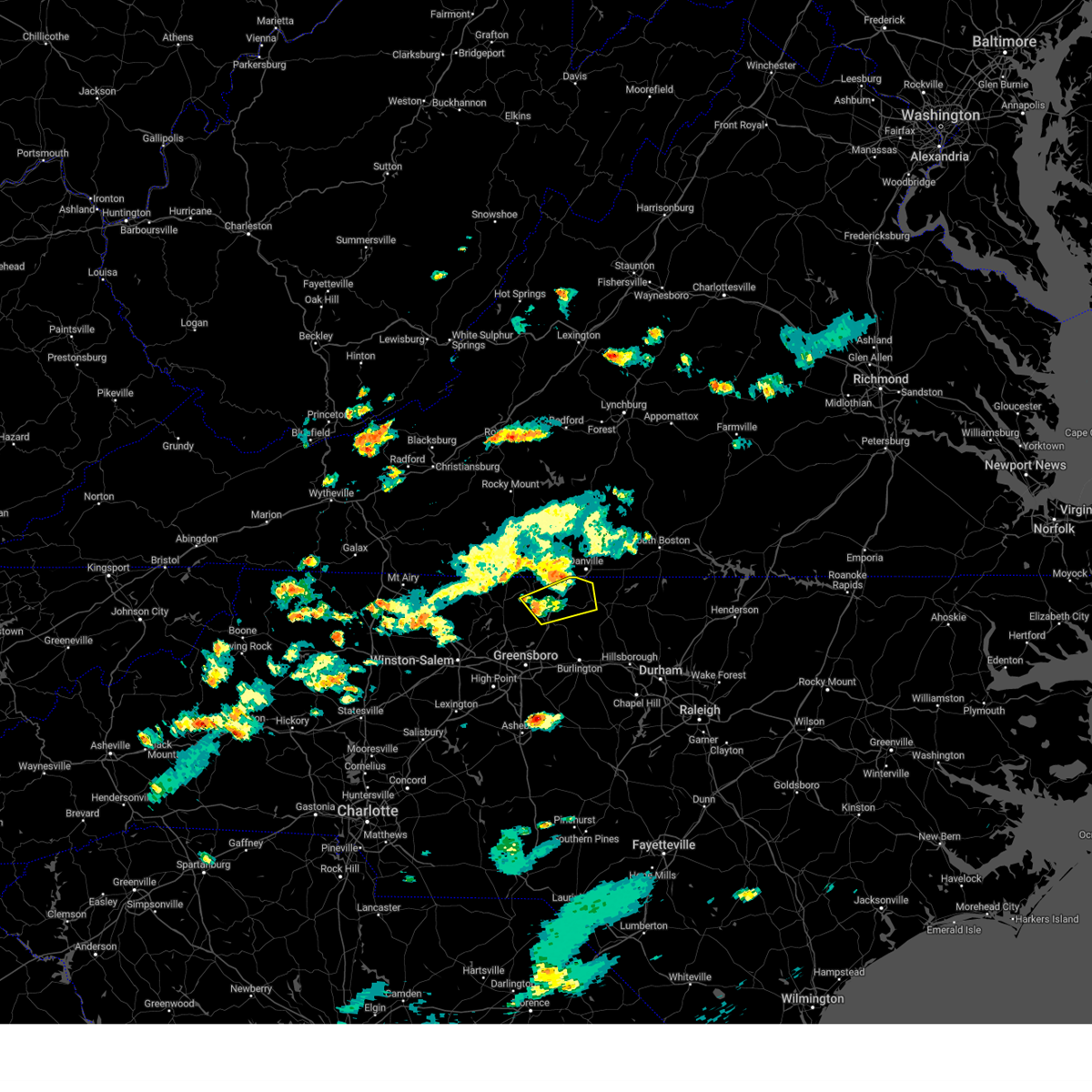 At 555 pm edt, a severe thunderstorm was located over harrisons crossroads, or near reidsville, moving northeast at 25 mph (radar indicated). Hazards include 60 mph wind gusts and quarter size hail. Hail damage to vehicles is expected. expect wind damage to roofs, siding, and trees. locations impacted include, reidsville, wentworth, yanceyville, bethel, providence, mayfield, and quick. hail threat, radar indicated max hail size, 1. 00 in wind threat, radar indicated max wind gust, 60 mph. At 555 pm edt, a severe thunderstorm was located over harrisons crossroads, or near reidsville, moving northeast at 25 mph (radar indicated). Hazards include 60 mph wind gusts and quarter size hail. Hail damage to vehicles is expected. expect wind damage to roofs, siding, and trees. locations impacted include, reidsville, wentworth, yanceyville, bethel, providence, mayfield, and quick. hail threat, radar indicated max hail size, 1. 00 in wind threat, radar indicated max wind gust, 60 mph.
|
| 7/23/2023 5:39 PM EDT |
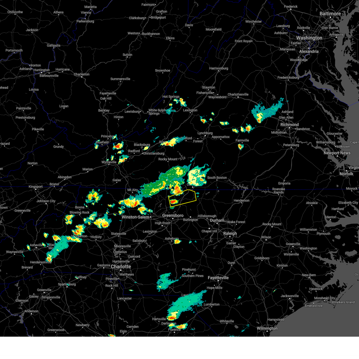 At 539 pm edt, a severe thunderstorm was located over wentworth, moving northeast at 20 mph (radar indicated). Hazards include 60 mph wind gusts and quarter size hail. Hail damage to vehicles is expected. Expect wind damage to roofs, siding, and trees. At 539 pm edt, a severe thunderstorm was located over wentworth, moving northeast at 20 mph (radar indicated). Hazards include 60 mph wind gusts and quarter size hail. Hail damage to vehicles is expected. Expect wind damage to roofs, siding, and trees.
|
| 7/23/2023 5:02 PM EDT |
 At 501 pm edt, a severe thunderstorm was located over ringgold, or near blairs, moving east at 20 mph (radar indicated). Hazards include 60 mph wind gusts and quarter size hail. Hail damage to vehicles is expected. expect wind damage to roofs, siding, and trees. locations impacted include, danville, south boston, blairs, turbeville, milton, cluster springs, and elmo. this includes the following location danville airport. hail threat, radar indicated max hail size, 1. 00 in wind threat, radar indicated max wind gust, 60 mph. At 501 pm edt, a severe thunderstorm was located over ringgold, or near blairs, moving east at 20 mph (radar indicated). Hazards include 60 mph wind gusts and quarter size hail. Hail damage to vehicles is expected. expect wind damage to roofs, siding, and trees. locations impacted include, danville, south boston, blairs, turbeville, milton, cluster springs, and elmo. this includes the following location danville airport. hail threat, radar indicated max hail size, 1. 00 in wind threat, radar indicated max wind gust, 60 mph.
|
| 7/23/2023 4:38 PM EDT |
 At 438 pm edt, a severe thunderstorm was located near westover hills, or near danville, moving east at 30 mph (radar indicated). Hazards include 60 mph wind gusts and quarter size hail. Hail damage to vehicles is expected. Expect wind damage to roofs, siding, and trees. At 438 pm edt, a severe thunderstorm was located near westover hills, or near danville, moving east at 30 mph (radar indicated). Hazards include 60 mph wind gusts and quarter size hail. Hail damage to vehicles is expected. Expect wind damage to roofs, siding, and trees.
|
| 7/9/2023 3:56 PM EDT | Corrects previous tstm wnd dmg report from blanch. numerous trees of all sizes down between blanch and milton in the northeastern part of caswell county. several roads in caswell county NC, 7.7 miles SSW of Yanceyville, NC |
| 7/9/2023 12:53 PM EDT |
 The severe thunderstorm warning for caswell, southeastern pittsylvania and southwestern halifax counties and the southeastern city of danville will expire at 100 pm edt, the storm which prompted the warning has moved out of the area. therefore, the warning will be allowed to expire. however heavy rain is still possible with this thunderstorm. a severe thunderstorm watch remains in effect until 800 pm edt for north central north carolina, and central and south central virginia. The severe thunderstorm warning for caswell, southeastern pittsylvania and southwestern halifax counties and the southeastern city of danville will expire at 100 pm edt, the storm which prompted the warning has moved out of the area. therefore, the warning will be allowed to expire. however heavy rain is still possible with this thunderstorm. a severe thunderstorm watch remains in effect until 800 pm edt for north central north carolina, and central and south central virginia.
|
| 7/9/2023 12:38 PM EDT |
 At 1237 pm edt, a severe thunderstorm was located over semora, or 10 miles southwest of turbeville, moving northeast at 20 mph (radar indicated). Hazards include 60 mph wind gusts and quarter size hail. Hail damage to vehicles is expected. expect wind damage to roofs, siding, and trees. locations impacted include, danville, south boston, yanceyville, halifax, virgilina, jericho, and prospect hill. this includes the following location danville airport. hail threat, radar indicated max hail size, 1. 00 in wind threat, radar indicated max wind gust, 60 mph. At 1237 pm edt, a severe thunderstorm was located over semora, or 10 miles southwest of turbeville, moving northeast at 20 mph (radar indicated). Hazards include 60 mph wind gusts and quarter size hail. Hail damage to vehicles is expected. expect wind damage to roofs, siding, and trees. locations impacted include, danville, south boston, yanceyville, halifax, virgilina, jericho, and prospect hill. this includes the following location danville airport. hail threat, radar indicated max hail size, 1. 00 in wind threat, radar indicated max wind gust, 60 mph.
|
| 7/9/2023 12:27 PM EDT | Tree downed by thunderstorm winds on nc highway 6 in caswell county NC, 7.3 miles N of Yanceyville, NC |
| 7/9/2023 12:24 PM EDT | Tree downed by thunderstorm winds near the intersection of longs mill road and daniel dairy roa in caswell county NC, 5.3 miles SW of Yanceyville, NC |
| 7/9/2023 12:21 PM EDT | Tree downed by thunderstorm winds near the intersection of highway 62 and zimmerman roa in caswell county NC, 3.2 miles WSW of Yanceyville, NC |
| 7/9/2023 12:15 PM EDT | Tree downed by thunderstorm winds in the 3200 block of country home roa in caswell county NC, 1.8 miles SSW of Yanceyville, NC |
| 7/9/2023 12:15 PM EDT |
 At 1214 pm edt, a severe thunderstorm was located over blanch, or near providence, moving northeast at 25 mph (radar indicated). Hazards include golf ball size hail and 60 mph wind gusts. People and animals outdoors will be injured. expect hail damage to roofs, siding, windows, and vehicles. expect wind damage to roofs, siding, and trees. locations impacted include, danville, south boston, yanceyville, bethel, halifax, jericho, and prospect hill. this includes the following location danville airport. thunderstorm damage threat, considerable hail threat, radar indicated max hail size, 1. 75 in wind threat, radar indicated max wind gust, 60 mph. At 1214 pm edt, a severe thunderstorm was located over blanch, or near providence, moving northeast at 25 mph (radar indicated). Hazards include golf ball size hail and 60 mph wind gusts. People and animals outdoors will be injured. expect hail damage to roofs, siding, windows, and vehicles. expect wind damage to roofs, siding, and trees. locations impacted include, danville, south boston, yanceyville, bethel, halifax, jericho, and prospect hill. this includes the following location danville airport. thunderstorm damage threat, considerable hail threat, radar indicated max hail size, 1. 75 in wind threat, radar indicated max wind gust, 60 mph.
|
| 7/9/2023 11:54 AM EDT |
 At 1153 am edt, a severe thunderstorm was located over bethel, moving northeast at 25 mph (radar indicated). Hazards include 60 mph wind gusts and quarter size hail. Hail damage to vehicles is expected. Expect wind damage to roofs, siding, and trees. At 1153 am edt, a severe thunderstorm was located over bethel, moving northeast at 25 mph (radar indicated). Hazards include 60 mph wind gusts and quarter size hail. Hail damage to vehicles is expected. Expect wind damage to roofs, siding, and trees.
|
| 7/2/2023 3:06 PM EDT |
 At 305 pm edt, severe thunderstorms were located along a line extending from near crystal hill to alton to leasburg, moving east at 35 mph (radar indicated). Hazards include 60 mph wind gusts and quarter size hail. Hail damage to vehicles is expected. expect wind damage to roofs, siding, and trees. locations impacted include, south boston, halifax, clover, turbeville, milton, scottsburg, and hitesburg. hail threat, radar indicated max hail size, 1. 00 in wind threat, radar indicated max wind gust, 60 mph. At 305 pm edt, severe thunderstorms were located along a line extending from near crystal hill to alton to leasburg, moving east at 35 mph (radar indicated). Hazards include 60 mph wind gusts and quarter size hail. Hail damage to vehicles is expected. expect wind damage to roofs, siding, and trees. locations impacted include, south boston, halifax, clover, turbeville, milton, scottsburg, and hitesburg. hail threat, radar indicated max hail size, 1. 00 in wind threat, radar indicated max wind gust, 60 mph.
|
| 7/2/2023 2:29 PM EDT |
 At 229 pm edt, severe thunderstorms were located along a line extending from near leda to near danville to bethel, moving east at 55 mph (radar indicated). Hazards include 60 mph wind gusts and quarter size hail. Hail damage to vehicles is expected. Expect wind damage to roofs, siding, and trees. At 229 pm edt, severe thunderstorms were located along a line extending from near leda to near danville to bethel, moving east at 55 mph (radar indicated). Hazards include 60 mph wind gusts and quarter size hail. Hail damage to vehicles is expected. Expect wind damage to roofs, siding, and trees.
|
| 6/19/2023 2:51 PM EDT |
 At 250 pm edt, severe thunderstorms were located along a line extending from dry fork to near providence, moving northeast at 25 mph (radar indicated). Hazards include 60 mph wind gusts. Expect damage to roofs, siding, and trees. locations impacted include, danville, yanceyville, bethel, chatham, gretna, providence, and blairs. this includes the following location danville airport. hail threat, radar indicated max hail size, <. 75 in wind threat, radar indicated max wind gust, 60 mph. At 250 pm edt, severe thunderstorms were located along a line extending from dry fork to near providence, moving northeast at 25 mph (radar indicated). Hazards include 60 mph wind gusts. Expect damage to roofs, siding, and trees. locations impacted include, danville, yanceyville, bethel, chatham, gretna, providence, and blairs. this includes the following location danville airport. hail threat, radar indicated max hail size, <. 75 in wind threat, radar indicated max wind gust, 60 mph.
|
| 6/19/2023 2:28 PM EDT |
 At 227 pm edt, severe thunderstorms were located along a line extending from near swansonville to quick, moving northeast at 25 mph (radar indicated). Hazards include 60 mph wind gusts. expect damage to roofs, siding, and trees At 227 pm edt, severe thunderstorms were located along a line extending from near swansonville to quick, moving northeast at 25 mph (radar indicated). Hazards include 60 mph wind gusts. expect damage to roofs, siding, and trees
|
| 6/16/2023 3:27 PM EDT |
 At 326 pm edt, a severe thunderstorm was located over danville, moving southeast at 35 mph (radar indicated. numerous trees have been reported down across southern henry county including the martinsville area. in addition, pea to dime-sized hail has also been observed with this storm). Hazards include 60 mph wind gusts and quarter size hail. Hail damage to vehicles is expected. Expect wind damage to roofs, siding, and trees. At 326 pm edt, a severe thunderstorm was located over danville, moving southeast at 35 mph (radar indicated. numerous trees have been reported down across southern henry county including the martinsville area. in addition, pea to dime-sized hail has also been observed with this storm). Hazards include 60 mph wind gusts and quarter size hail. Hail damage to vehicles is expected. Expect wind damage to roofs, siding, and trees.
|
| 5/16/2023 7:53 PM EDT |
 At 751 pm edt, a severe thunderstorm was located over ringgold, or 8 miles east of danville, moving east at 35 mph (radar indicated). Hazards include 60 mph wind gusts and quarter size hail. Hail damage to vehicles is expected. expect wind damage to roofs, siding, and trees. locations impacted include, milton, blanch, semora, alton, ringgold, and hyco lake. hail threat, radar indicated max hail size, 1. 00 in wind threat, radar indicated max wind gust, 60 mph. At 751 pm edt, a severe thunderstorm was located over ringgold, or 8 miles east of danville, moving east at 35 mph (radar indicated). Hazards include 60 mph wind gusts and quarter size hail. Hail damage to vehicles is expected. expect wind damage to roofs, siding, and trees. locations impacted include, milton, blanch, semora, alton, ringgold, and hyco lake. hail threat, radar indicated max hail size, 1. 00 in wind threat, radar indicated max wind gust, 60 mph.
|
| 5/16/2023 7:25 PM EDT |
 At 725 pm edt, a severe thunderstorm was located near westover hills, or 7 miles west of blairs, moving east at 30 mph (radar indicated). Hazards include 60 mph wind gusts and quarter size hail. Hail damage to vehicles is expected. Expect wind damage to roofs, siding, and trees. At 725 pm edt, a severe thunderstorm was located near westover hills, or 7 miles west of blairs, moving east at 30 mph (radar indicated). Hazards include 60 mph wind gusts and quarter size hail. Hail damage to vehicles is expected. Expect wind damage to roofs, siding, and trees.
|
| 5/16/2023 5:56 PM EDT |
 At 555 pm edt, a severe thunderstorm was located over milton, or 8 miles east of providence, moving east at 40 mph (radar indicated). Hazards include 60 mph wind gusts and quarter size hail. Hail damage to vehicles is expected. expect wind damage to roofs, siding, and trees. locations impacted include, milton, blanch, semora, hamer, and hyco lake. hail threat, radar indicated max hail size, 1. 00 in wind threat, radar indicated max wind gust, 60 mph. At 555 pm edt, a severe thunderstorm was located over milton, or 8 miles east of providence, moving east at 40 mph (radar indicated). Hazards include 60 mph wind gusts and quarter size hail. Hail damage to vehicles is expected. expect wind damage to roofs, siding, and trees. locations impacted include, milton, blanch, semora, hamer, and hyco lake. hail threat, radar indicated max hail size, 1. 00 in wind threat, radar indicated max wind gust, 60 mph.
|
| 5/16/2023 5:41 PM EDT |
 At 541 pm edt, a severe thunderstorm was located over gatewood, or over danville, moving east at 35 mph (radar indicated). Hazards include 60 mph wind gusts and quarter size hail. Hail damage to vehicles is expected. Expect wind damage to roofs, siding, and trees. At 541 pm edt, a severe thunderstorm was located over gatewood, or over danville, moving east at 35 mph (radar indicated). Hazards include 60 mph wind gusts and quarter size hail. Hail damage to vehicles is expected. Expect wind damage to roofs, siding, and trees.
|
| 8/10/2022 4:38 PM EDT |
 At 437 pm edt, severe thunderstorms were located along a line extending from near leasburg to hightowers to near baynes, moving southeast at 15 mph (radar indicated). Hazards include 60 mph wind gusts. Expect damage to roofs, siding, and trees. locations impacted include, yanceyville, jericho, prospect hill, blanch, leasburg, hamer, and semora. hail threat, radar indicated max hail size, <. 75 in wind threat, radar indicated max wind gust, 60 mph. At 437 pm edt, severe thunderstorms were located along a line extending from near leasburg to hightowers to near baynes, moving southeast at 15 mph (radar indicated). Hazards include 60 mph wind gusts. Expect damage to roofs, siding, and trees. locations impacted include, yanceyville, jericho, prospect hill, blanch, leasburg, hamer, and semora. hail threat, radar indicated max hail size, <. 75 in wind threat, radar indicated max wind gust, 60 mph.
|
| 8/10/2022 4:22 PM EDT |
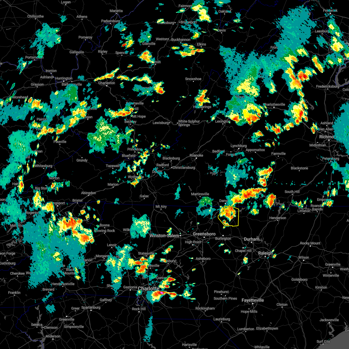 At 422 pm edt, severe thunderstorms were located along a line extending from near hamer to topnot to near jericho, moving southeast at 15 mph (radar indicated). Hazards include 60 mph wind gusts and quarter size hail. Hail damage to vehicles is expected. expect wind damage to roofs, siding, and trees. locations impacted include, yanceyville, bethel, providence, jericho, prospect hill, quick, and blanch. hail threat, radar indicated max hail size, 1. 00 in wind threat, radar indicated max wind gust, 60 mph. At 422 pm edt, severe thunderstorms were located along a line extending from near hamer to topnot to near jericho, moving southeast at 15 mph (radar indicated). Hazards include 60 mph wind gusts and quarter size hail. Hail damage to vehicles is expected. expect wind damage to roofs, siding, and trees. locations impacted include, yanceyville, bethel, providence, jericho, prospect hill, quick, and blanch. hail threat, radar indicated max hail size, 1. 00 in wind threat, radar indicated max wind gust, 60 mph.
|
| 8/10/2022 4:15 PM EDT | One tree down near the intersection of blackwell road and foster roa in caswell county NC, 3 miles E of Yanceyville, NC |
| 8/10/2022 3:54 PM EDT |
 At 354 pm edt, severe thunderstorms were located along a line extending from providence to yanceyville to near quick, moving southeast at 15 mph (radar indicated). Hazards include 60 mph wind gusts and quarter size hail. Hail damage to vehicles is expected. Expect wind damage to roofs, siding, and trees. At 354 pm edt, severe thunderstorms were located along a line extending from providence to yanceyville to near quick, moving southeast at 15 mph (radar indicated). Hazards include 60 mph wind gusts and quarter size hail. Hail damage to vehicles is expected. Expect wind damage to roofs, siding, and trees.
|
| 8/5/2022 3:51 PM EDT |
 The severe thunderstorm warning for northern caswell and southeastern pittsylvania counties and the city of danville will expire at 400 pm edt, the storm which prompted the warning has weakened below severe limits, and no longer poses an immediate threat to life or property. therefore, the warning will be allowed to expire. however heavy rain is still possible with this thunderstorm. The severe thunderstorm warning for northern caswell and southeastern pittsylvania counties and the city of danville will expire at 400 pm edt, the storm which prompted the warning has weakened below severe limits, and no longer poses an immediate threat to life or property. therefore, the warning will be allowed to expire. however heavy rain is still possible with this thunderstorm.
|
| 8/5/2022 3:30 PM EDT |
 At 330 pm edt, a severe thunderstorm was located near gatewood, or near danville, and is nearly stationary (radar indicated). Hazards include 60 mph wind gusts and quarter size hail. Hail damage to vehicles is expected. expect wind damage to roofs, siding, and trees. locations impacted include, danville, providence, milton, gatewood, blanch, westover hills, and pelham. hail threat, radar indicated max hail size, 1. 00 in wind threat, radar indicated max wind gust, 60 mph. At 330 pm edt, a severe thunderstorm was located near gatewood, or near danville, and is nearly stationary (radar indicated). Hazards include 60 mph wind gusts and quarter size hail. Hail damage to vehicles is expected. expect wind damage to roofs, siding, and trees. locations impacted include, danville, providence, milton, gatewood, blanch, westover hills, and pelham. hail threat, radar indicated max hail size, 1. 00 in wind threat, radar indicated max wind gust, 60 mph.
|
| 8/5/2022 2:55 PM EDT |
 At 254 pm edt, a severe thunderstorm was located over westover hills, or over danville, moving east at 5 mph (radar indicated). Hazards include 60 mph wind gusts and quarter size hail. Hail damage to vehicles is expected. Expect wind damage to roofs, siding, and trees. At 254 pm edt, a severe thunderstorm was located over westover hills, or over danville, moving east at 5 mph (radar indicated). Hazards include 60 mph wind gusts and quarter size hail. Hail damage to vehicles is expected. Expect wind damage to roofs, siding, and trees.
|
| 7/21/2022 2:28 PM EDT |
 At 227 pm edt, a severe thunderstorm was located near leasburg, or 7 miles west of roxboro, moving northeast at 35 mph (radar indicated). Hazards include 60 mph wind gusts and nickel size hail. Expect damage to roofs, siding, and trees. locations impacted include, yanceyville, milton, blanch, leasburg, hamer, semora, and topnot. hail threat, radar indicated max hail size, 0. 88 in wind threat, radar indicated max wind gust, 60 mph. At 227 pm edt, a severe thunderstorm was located near leasburg, or 7 miles west of roxboro, moving northeast at 35 mph (radar indicated). Hazards include 60 mph wind gusts and nickel size hail. Expect damage to roofs, siding, and trees. locations impacted include, yanceyville, milton, blanch, leasburg, hamer, semora, and topnot. hail threat, radar indicated max hail size, 0. 88 in wind threat, radar indicated max wind gust, 60 mph.
|
| 7/21/2022 2:23 PM EDT |
 The severe thunderstorm warning for western caswell county will expire at 230 pm edt, the storm which prompted the warning has moved out of the area. therefore, the warning will be allowed to expire. a severe thunderstorm watch remains in effect until 800 pm edt for north central north carolina, and south central virginia. remember, a severe thunderstorm warning still remains in effect for eastern portions of caswell county until 300 pm edt. The severe thunderstorm warning for western caswell county will expire at 230 pm edt, the storm which prompted the warning has moved out of the area. therefore, the warning will be allowed to expire. a severe thunderstorm watch remains in effect until 800 pm edt for north central north carolina, and south central virginia. remember, a severe thunderstorm warning still remains in effect for eastern portions of caswell county until 300 pm edt.
|
| 7/21/2022 2:13 PM EDT |
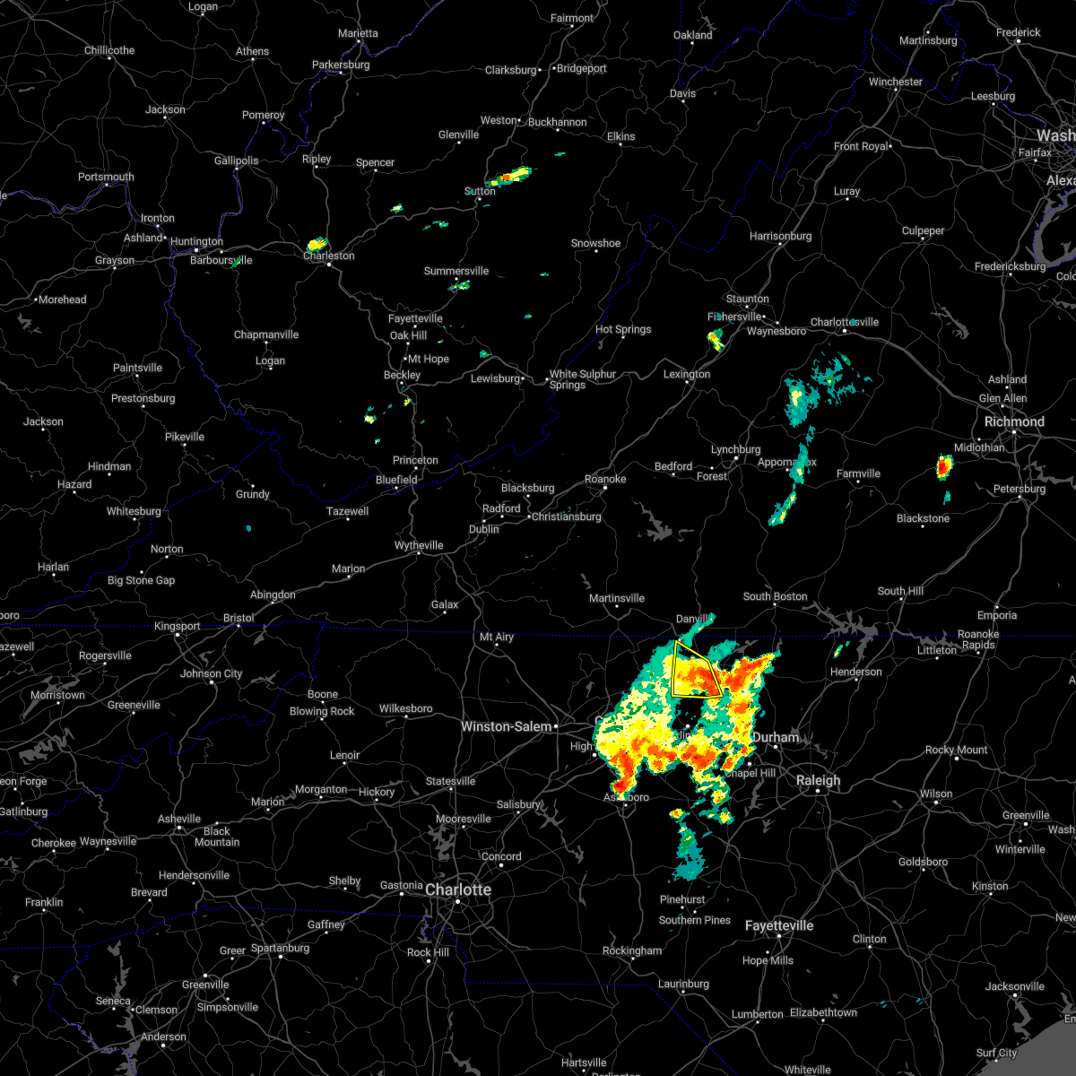 At 211 pm edt, a severe thunderstorm was located over topnot, or near yanceyville, moving northeast at 30 mph (radar indicated). Hazards include 60 mph wind gusts and nickel size hail. Expect damage to roofs, siding, and trees. locations impacted include, yanceyville, bethel, jericho, camp springs, quick, baynes, and pelham. hail threat, radar indicated max hail size, 0. 88 in wind threat, radar indicated max wind gust, 60 mph. At 211 pm edt, a severe thunderstorm was located over topnot, or near yanceyville, moving northeast at 30 mph (radar indicated). Hazards include 60 mph wind gusts and nickel size hail. Expect damage to roofs, siding, and trees. locations impacted include, yanceyville, bethel, jericho, camp springs, quick, baynes, and pelham. hail threat, radar indicated max hail size, 0. 88 in wind threat, radar indicated max wind gust, 60 mph.
|
| 7/21/2022 2:07 PM EDT |
 At 206 pm edt, a severe thunderstorm was located over baynes, or near jericho, moving northeast at 25 mph (radar indicated). Hazards include 60 mph wind gusts and quarter size hail. Hail damage to vehicles is expected. Expect wind damage to roofs, siding, and trees. At 206 pm edt, a severe thunderstorm was located over baynes, or near jericho, moving northeast at 25 mph (radar indicated). Hazards include 60 mph wind gusts and quarter size hail. Hail damage to vehicles is expected. Expect wind damage to roofs, siding, and trees.
|
| 7/21/2022 1:52 PM EDT |
 At 150 pm edt, a severe thunderstorm was located over camp springs, moving northeast at 30 mph (radar indicated). Hazards include 60 mph wind gusts and nickel size hail. Expect damage to roofs, siding, and trees. locations impacted include, reidsville, yanceyville, bethel, jericho, camp springs, quick, and ruffin. hail threat, radar indicated max hail size, 0. 88 in wind threat, radar indicated max wind gust, 60 mph. At 150 pm edt, a severe thunderstorm was located over camp springs, moving northeast at 30 mph (radar indicated). Hazards include 60 mph wind gusts and nickel size hail. Expect damage to roofs, siding, and trees. locations impacted include, reidsville, yanceyville, bethel, jericho, camp springs, quick, and ruffin. hail threat, radar indicated max hail size, 0. 88 in wind threat, radar indicated max wind gust, 60 mph.
|
| 7/21/2022 1:34 PM EDT |
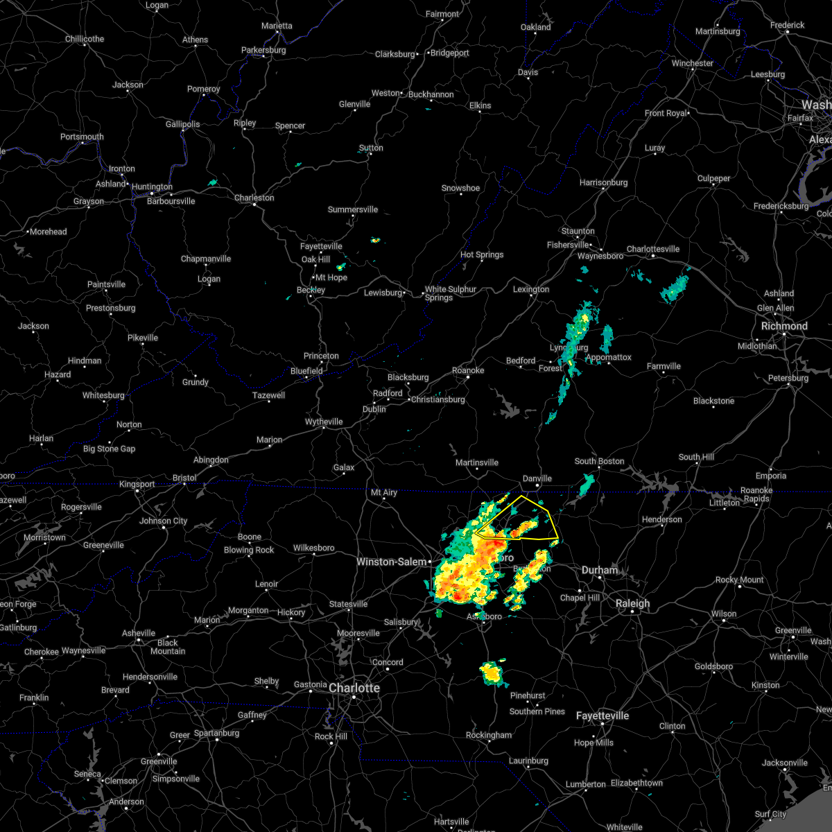 At 133 pm edt, a severe thunderstorm was located near monroeton, or near reidsville, moving northeast at 30 mph (radar indicated). Hazards include 60 mph wind gusts. expect damage to roofs, siding, and trees At 133 pm edt, a severe thunderstorm was located near monroeton, or near reidsville, moving northeast at 30 mph (radar indicated). Hazards include 60 mph wind gusts. expect damage to roofs, siding, and trees
|
| 7/16/2022 3:32 PM EDT |
 At 331 pm edt, a severe thunderstorm was located near elmo, or near turbeville, moving north at 25 mph (radar indicated). Hazards include 60 mph wind gusts and quarter size hail. Hail damage to vehicles is expected. expect wind damage to roofs, siding, and trees. locations impacted include, turbeville, milton, cluster springs, alton, and semora. hail threat, radar indicated max hail size, 1. 00 in wind threat, radar indicated max wind gust, 60 mph. At 331 pm edt, a severe thunderstorm was located near elmo, or near turbeville, moving north at 25 mph (radar indicated). Hazards include 60 mph wind gusts and quarter size hail. Hail damage to vehicles is expected. expect wind damage to roofs, siding, and trees. locations impacted include, turbeville, milton, cluster springs, alton, and semora. hail threat, radar indicated max hail size, 1. 00 in wind threat, radar indicated max wind gust, 60 mph.
|
| 7/16/2022 3:13 PM EDT |
 At 312 pm edt, a severe thunderstorm was located over milton, or 10 miles east of providence, moving east at 15 mph (radar indicated). Hazards include 60 mph wind gusts and quarter size hail. Hail damage to vehicles is expected. Expect wind damage to roofs, siding, and trees. At 312 pm edt, a severe thunderstorm was located over milton, or 10 miles east of providence, moving east at 15 mph (radar indicated). Hazards include 60 mph wind gusts and quarter size hail. Hail damage to vehicles is expected. Expect wind damage to roofs, siding, and trees.
|
| 7/5/2022 6:05 PM EDT |
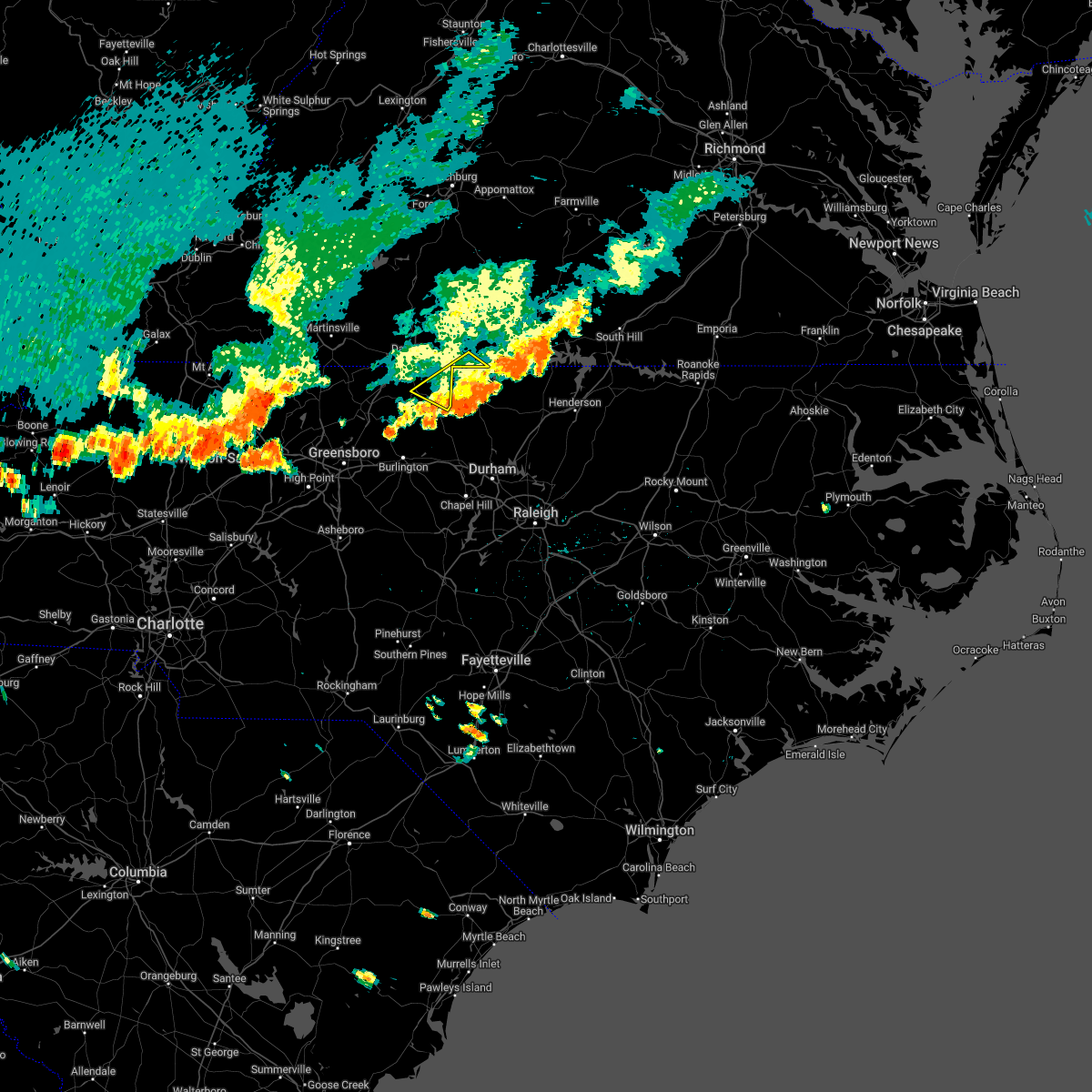 The severe thunderstorm warning for northeastern caswell and south central halifax counties will expire at 615 pm edt, the storms which prompted the warning have weakened below severe limits, and have exited the warned area. therefore, the warning will be allowed to expire. The severe thunderstorm warning for northeastern caswell and south central halifax counties will expire at 615 pm edt, the storms which prompted the warning have weakened below severe limits, and have exited the warned area. therefore, the warning will be allowed to expire.
|
| 7/5/2022 5:54 PM EDT |
 At 553 pm edt, severe thunderstorms were located along a line extending from near cluster springs to near hamer, moving southeast at 25 mph (radar indicated). Hazards include 60 mph wind gusts and quarter size hail. Hail damage to vehicles is expected. expect wind damage to roofs, siding, and trees. locations impacted include, yanceyville, leasburg, hamer, semora, alton, topnot, and hyco lake. hail threat, radar indicated max hail size, 1. 00 in wind threat, radar indicated max wind gust, 60 mph. At 553 pm edt, severe thunderstorms were located along a line extending from near cluster springs to near hamer, moving southeast at 25 mph (radar indicated). Hazards include 60 mph wind gusts and quarter size hail. Hail damage to vehicles is expected. expect wind damage to roofs, siding, and trees. locations impacted include, yanceyville, leasburg, hamer, semora, alton, topnot, and hyco lake. hail threat, radar indicated max hail size, 1. 00 in wind threat, radar indicated max wind gust, 60 mph.
|
| 7/5/2022 5:54 PM EDT |
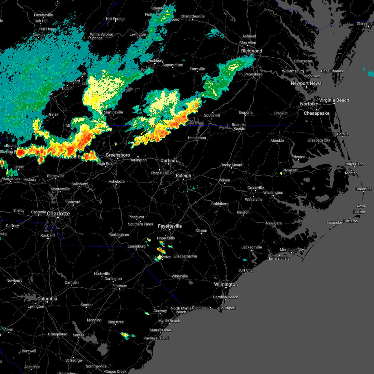 At 553 pm edt, severe thunderstorms were located along a line extending from near cluster springs to near hamer, moving southeast at 25 mph (radar indicated). Hazards include 60 mph wind gusts and quarter size hail. Hail damage to vehicles is expected. expect wind damage to roofs, siding, and trees. locations impacted include, yanceyville, leasburg, hamer, semora, alton, topnot, and hyco lake. hail threat, radar indicated max hail size, 1. 00 in wind threat, radar indicated max wind gust, 60 mph. At 553 pm edt, severe thunderstorms were located along a line extending from near cluster springs to near hamer, moving southeast at 25 mph (radar indicated). Hazards include 60 mph wind gusts and quarter size hail. Hail damage to vehicles is expected. expect wind damage to roofs, siding, and trees. locations impacted include, yanceyville, leasburg, hamer, semora, alton, topnot, and hyco lake. hail threat, radar indicated max hail size, 1. 00 in wind threat, radar indicated max wind gust, 60 mph.
|
| 7/5/2022 5:23 PM EDT |
 At 522 pm edt, severe thunderstorms were located along a line extending from near elmo to near pelham, moving southeast at 25 mph (radar indicated). Hazards include 60 mph wind gusts and quarter size hail. Hail damage to vehicles is expected. expect wind damage to roofs, siding, and trees. locations impacted include, danville, yanceyville, bethel, providence, mayfield, milton, and blanch. this includes the following location danville airport. hail threat, radar indicated max hail size, 1. 00 in wind threat, radar indicated max wind gust, 60 mph. At 522 pm edt, severe thunderstorms were located along a line extending from near elmo to near pelham, moving southeast at 25 mph (radar indicated). Hazards include 60 mph wind gusts and quarter size hail. Hail damage to vehicles is expected. expect wind damage to roofs, siding, and trees. locations impacted include, danville, yanceyville, bethel, providence, mayfield, milton, and blanch. this includes the following location danville airport. hail threat, radar indicated max hail size, 1. 00 in wind threat, radar indicated max wind gust, 60 mph.
|
| 7/5/2022 4:56 PM EDT |
 At 456 pm edt, severe thunderstorms were located along a line extending from near keeling to cascade, moving southeast at 25 mph (radar indicated). Hazards include 60 mph wind gusts and quarter size hail. Hail damage to vehicles is expected. Expect wind damage to roofs, siding, and trees. At 456 pm edt, severe thunderstorms were located along a line extending from near keeling to cascade, moving southeast at 25 mph (radar indicated). Hazards include 60 mph wind gusts and quarter size hail. Hail damage to vehicles is expected. Expect wind damage to roofs, siding, and trees.
|
| 6/17/2022 5:58 PM EDT |
 At 555 pm edt, severe thunderstorms were located along a line from halifax virginia, to prospect hill north carolina, moving east at 45 to 50 mph (radar indicated). Hazards include 60 mph wind gusts. Expect damage to roofs, siding, and trees. locations impacted include, south boston, halifax, brookneal, prospect hill, turbeville, ingram, and clover. hail threat, radar indicated max hail size, <. 75 in wind threat, radar indicated max wind gust, 60 mph. At 555 pm edt, severe thunderstorms were located along a line from halifax virginia, to prospect hill north carolina, moving east at 45 to 50 mph (radar indicated). Hazards include 60 mph wind gusts. Expect damage to roofs, siding, and trees. locations impacted include, south boston, halifax, brookneal, prospect hill, turbeville, ingram, and clover. hail threat, radar indicated max hail size, <. 75 in wind threat, radar indicated max wind gust, 60 mph.
|
| 6/17/2022 5:54 PM EDT |
 The severe thunderstorm warning for stokes, rockingham, western caswell, yadkin, pittsylvania and henry counties, the city of danville and the city of martinsville will expire at 600 pm edt, the storms which prompted the warning have moved southeast and out of the warned area. therefore, the warning will be allowed to expire. at 545 pm edt, regional radars indicated severe thunderstorms were moving southeast through southside virginia and into the northern piedmont of north carolina between south boston, virginia, and burlington, north carolina, moving southeast at 50 mph. The severe thunderstorm warning for stokes, rockingham, western caswell, yadkin, pittsylvania and henry counties, the city of danville and the city of martinsville will expire at 600 pm edt, the storms which prompted the warning have moved southeast and out of the warned area. therefore, the warning will be allowed to expire. at 545 pm edt, regional radars indicated severe thunderstorms were moving southeast through southside virginia and into the northern piedmont of north carolina between south boston, virginia, and burlington, north carolina, moving southeast at 50 mph.
|
| 6/17/2022 5:30 PM EDT | Multiple trees reported down and in roadways county wide... most reports from about 5:30pm to 7:00p in caswell county NC, 8.4 miles WNW of Yanceyville, NC |
| 6/17/2022 5:25 PM EDT |
 At 522 pm edt, a line of severe thunderstorms extended from north of danville virginia to near greensboro north carolina, moving to the southeast at 40 to 50 mph (radar indicated). Hazards include 60 mph wind gusts. expect damage to roofs, siding, and trees At 522 pm edt, a line of severe thunderstorms extended from north of danville virginia to near greensboro north carolina, moving to the southeast at 40 to 50 mph (radar indicated). Hazards include 60 mph wind gusts. expect damage to roofs, siding, and trees
|
| 6/17/2022 5:16 PM EDT |
 At 510 pm edt, strong winds were being produced by thunderstorms that were aligned just east of the blue ridge, and were moving into southside virginia and then piedmont of north carolina. wind gusts of 40 to 60 mph were being reported with these storms (radar indicated). Hazards include 60 mph wind gusts and penny size hail. Expect damage to roofs, siding, and trees. locations impacted include, danville, eden, reidsville, martinsville, yadkinville, wentworth, and mayodan. this includes the following locations the martinsville speedway, martinsville airport, and danville airport. hail threat, radar indicated max hail size, 0. 75 in wind threat, radar indicated max wind gust, 60 mph. At 510 pm edt, strong winds were being produced by thunderstorms that were aligned just east of the blue ridge, and were moving into southside virginia and then piedmont of north carolina. wind gusts of 40 to 60 mph were being reported with these storms (radar indicated). Hazards include 60 mph wind gusts and penny size hail. Expect damage to roofs, siding, and trees. locations impacted include, danville, eden, reidsville, martinsville, yadkinville, wentworth, and mayodan. this includes the following locations the martinsville speedway, martinsville airport, and danville airport. hail threat, radar indicated max hail size, 0. 75 in wind threat, radar indicated max wind gust, 60 mph.
|
| 6/17/2022 4:40 PM EDT |
 At 436 pm edt, severe thunderstorms were located along a line extending from near rocky mount virginia to wilkesboro north carolina, moving southeast at 50 mph. additional thunderstorms were developing ahead of this line, near wentworth and yadkinville, north carolina (radar indicated). Hazards include 60 mph wind gusts and quarter size hail. Hail damage to vehicles is expected. Expect wind damage to roofs, siding, and trees. At 436 pm edt, severe thunderstorms were located along a line extending from near rocky mount virginia to wilkesboro north carolina, moving southeast at 50 mph. additional thunderstorms were developing ahead of this line, near wentworth and yadkinville, north carolina (radar indicated). Hazards include 60 mph wind gusts and quarter size hail. Hail damage to vehicles is expected. Expect wind damage to roofs, siding, and trees.
|
| 6/16/2022 4:23 PM EDT |
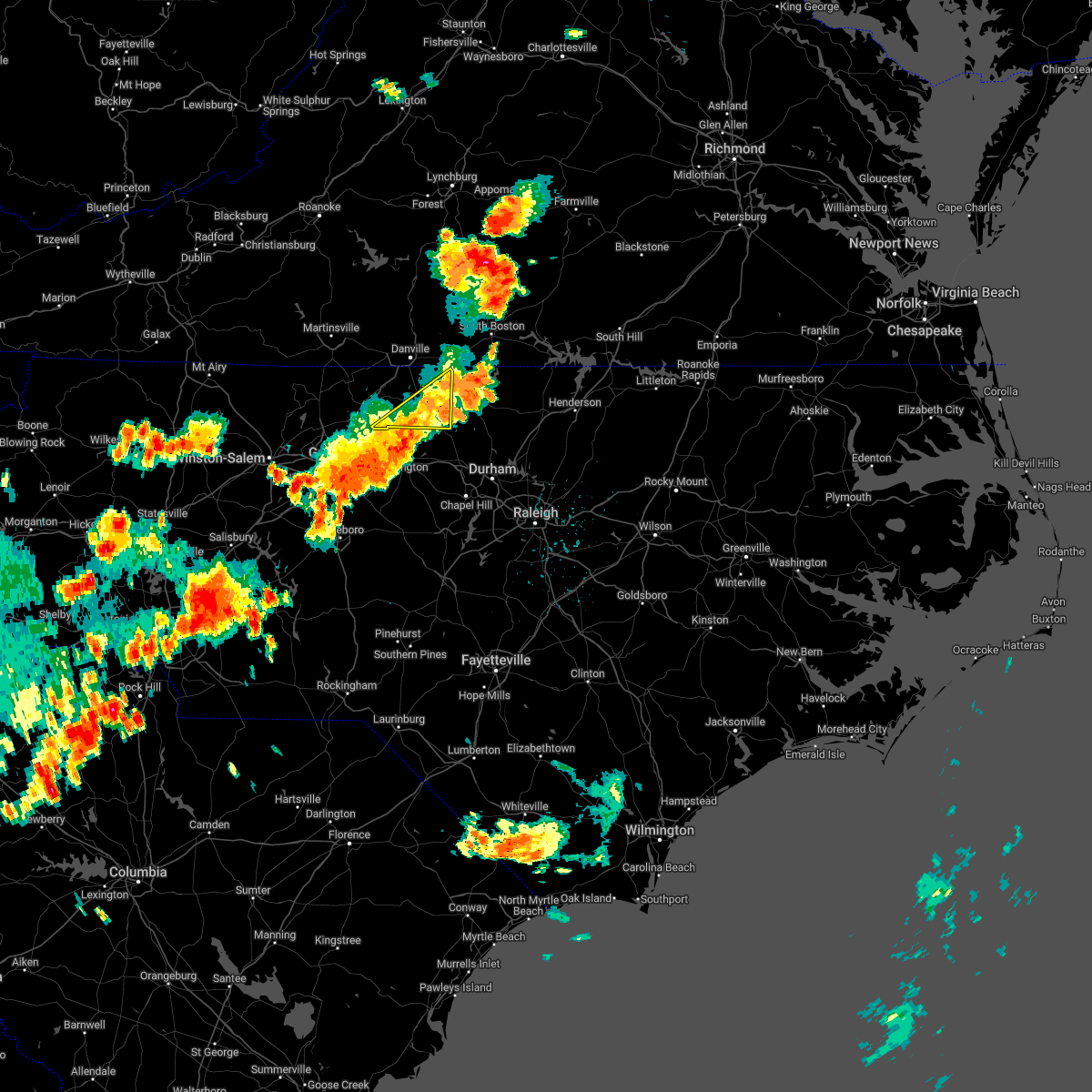 The severe thunderstorm warning for southeastern rockingham and caswell counties will expire at 430 pm edt, the storm which prompted the warning has moved out of the area. therefore, the warning will be allowed to expire. however small hail, gusty winds and heavy rain are still possible with this thunderstorm. a severe thunderstorm watch remains in effect until 900 pm edt for north central north carolina, and south central virginia. The severe thunderstorm warning for southeastern rockingham and caswell counties will expire at 430 pm edt, the storm which prompted the warning has moved out of the area. therefore, the warning will be allowed to expire. however small hail, gusty winds and heavy rain are still possible with this thunderstorm. a severe thunderstorm watch remains in effect until 900 pm edt for north central north carolina, and south central virginia.
|
| 6/16/2022 4:18 PM EDT |
 At 418 pm edt, a severe thunderstorm was located near prospect hill, moving southeast at 50 mph (radar indicated). Hazards include 60 mph wind gusts and quarter size hail. Hail damage to vehicles is expected. expect wind damage to roofs, siding, and trees. locations impacted include, yanceyville, jericho, prospect hill, camp springs, leasburg, hamer, and semora. hail threat, radar indicated max hail size, 1. 00 in wind threat, radar indicated max wind gust, 60 mph. At 418 pm edt, a severe thunderstorm was located near prospect hill, moving southeast at 50 mph (radar indicated). Hazards include 60 mph wind gusts and quarter size hail. Hail damage to vehicles is expected. expect wind damage to roofs, siding, and trees. locations impacted include, yanceyville, jericho, prospect hill, camp springs, leasburg, hamer, and semora. hail threat, radar indicated max hail size, 1. 00 in wind threat, radar indicated max wind gust, 60 mph.
|
| 6/16/2022 4:03 PM EDT |
 At 403 pm edt, a severe thunderstorm was located over hightowers, or near jericho, moving southeast at 35 mph (radar indicated). Hazards include 60 mph wind gusts and quarter size hail. Hail damage to vehicles is expected. Expect wind damage to roofs, siding, and trees. At 403 pm edt, a severe thunderstorm was located over hightowers, or near jericho, moving southeast at 35 mph (radar indicated). Hazards include 60 mph wind gusts and quarter size hail. Hail damage to vehicles is expected. Expect wind damage to roofs, siding, and trees.
|
| 6/16/2022 3:54 PM EDT | Tree down on nc hwy 86 near the caswell farmers marke in caswell county NC, 1.3 miles ESE of Yanceyville, NC |
| 6/16/2022 3:51 PM EDT |
 At 350 pm edt, a severe thunderstorm was located over topnot, or near yanceyville, moving southeast at 35 mph (radar indicated). Hazards include 60 mph wind gusts and quarter size hail. Hail damage to vehicles is expected. expect wind damage to roofs, siding, and trees. locations impacted include, danville, reidsville, yanceyville, bethel, jericho, prospect hill, and camp springs. this includes the following location danville airport. hail threat, radar indicated max hail size, 1. 00 in wind threat, radar indicated max wind gust, 60 mph. At 350 pm edt, a severe thunderstorm was located over topnot, or near yanceyville, moving southeast at 35 mph (radar indicated). Hazards include 60 mph wind gusts and quarter size hail. Hail damage to vehicles is expected. expect wind damage to roofs, siding, and trees. locations impacted include, danville, reidsville, yanceyville, bethel, jericho, prospect hill, and camp springs. this includes the following location danville airport. hail threat, radar indicated max hail size, 1. 00 in wind threat, radar indicated max wind gust, 60 mph.
|
| 6/16/2022 3:39 PM EDT |
 At 339 pm edt, a severe thunderstorm was located over hillsborough, moving southeast at 65 mph (radar indicated). Hazards include 60 mph wind gusts and quarter size hail. Hail damage to vehicles is expected. expect wind damage to roofs, siding, and trees. locations impacted include, danville, eden, reidsville, yanceyville, bethel, chatham, and jericho. this includes the following location danville airport. hail threat, radar indicated max hail size, 1. 00 in wind threat, radar indicated max wind gust, 60 mph. At 339 pm edt, a severe thunderstorm was located over hillsborough, moving southeast at 65 mph (radar indicated). Hazards include 60 mph wind gusts and quarter size hail. Hail damage to vehicles is expected. expect wind damage to roofs, siding, and trees. locations impacted include, danville, eden, reidsville, yanceyville, bethel, chatham, and jericho. this includes the following location danville airport. hail threat, radar indicated max hail size, 1. 00 in wind threat, radar indicated max wind gust, 60 mph.
|
| 6/16/2022 3:00 PM EDT |
 At 300 pm edt, a severe thunderstorm was located over westover hills, or near danville, moving southeast at 65 mph (radar indicated). Hazards include 60 mph wind gusts and quarter size hail. Hail damage to vehicles is expected. Expect wind damage to roofs, siding, and trees. At 300 pm edt, a severe thunderstorm was located over westover hills, or near danville, moving southeast at 65 mph (radar indicated). Hazards include 60 mph wind gusts and quarter size hail. Hail damage to vehicles is expected. Expect wind damage to roofs, siding, and trees.
|
| 6/14/2022 2:06 PM EDT |
 At 206 pm edt, severe thunderstorms were located along a line extending from halifax to near turbeville to near keeling, moving south at 55 mph (radar indicated). Hazards include 60 mph wind gusts. Expect damage to roofs, siding, and trees. locations impacted include, south boston, halifax, turbeville, ingram, milton, scottsburg, and hitesburg. hail threat, radar indicated max hail size, <. 75 in wind threat, radar indicated max wind gust, 60 mph. At 206 pm edt, severe thunderstorms were located along a line extending from halifax to near turbeville to near keeling, moving south at 55 mph (radar indicated). Hazards include 60 mph wind gusts. Expect damage to roofs, siding, and trees. locations impacted include, south boston, halifax, turbeville, ingram, milton, scottsburg, and hitesburg. hail threat, radar indicated max hail size, <. 75 in wind threat, radar indicated max wind gust, 60 mph.
|
| 6/14/2022 1:52 PM EDT |
 At 151 pm edt, severe thunderstorms were located along a line extending from cody to near java to near pittsville, moving south at 50 mph (radar indicated). Hazards include 60 mph wind gusts. expect damage to roofs, siding, and trees At 151 pm edt, severe thunderstorms were located along a line extending from cody to near java to near pittsville, moving south at 50 mph (radar indicated). Hazards include 60 mph wind gusts. expect damage to roofs, siding, and trees
|
| 5/27/2022 8:48 AM EDT |
 At 847 am edt, a severe thunderstorm was located over semora, or 7 miles southwest of turbeville, moving northeast at 45 mph (radar indicated). Hazards include 60 mph wind gusts. expect damage to roofs, siding, and trees At 847 am edt, a severe thunderstorm was located over semora, or 7 miles southwest of turbeville, moving northeast at 45 mph (radar indicated). Hazards include 60 mph wind gusts. expect damage to roofs, siding, and trees
|
| 5/27/2022 8:09 AM EDT |
 At 809 am edt, a severe thunderstorm was located over java, or near mt airy, moving northeast at 60 mph (radar indicated). Hazards include 60 mph wind gusts. Expect damage to roofs, siding, and trees. locations impacted include, danville, south boston, altavista, halifax, hurt, chatham, and gretna. This includes the following location danville airport. At 809 am edt, a severe thunderstorm was located over java, or near mt airy, moving northeast at 60 mph (radar indicated). Hazards include 60 mph wind gusts. Expect damage to roofs, siding, and trees. locations impacted include, danville, south boston, altavista, halifax, hurt, chatham, and gretna. This includes the following location danville airport.
|
| 5/27/2022 7:52 AM EDT |
 At 752 am edt, a severe thunderstorm was located over dry fork, or near blairs, moving northeast at 50 mph (radar indicated). Hazards include 60 mph wind gusts. Expect damage to roofs, siding, and trees. locations impacted include, danville, south boston, altavista, yanceyville, halifax, hurt, and chatham. This includes the following location danville airport. At 752 am edt, a severe thunderstorm was located over dry fork, or near blairs, moving northeast at 50 mph (radar indicated). Hazards include 60 mph wind gusts. Expect damage to roofs, siding, and trees. locations impacted include, danville, south boston, altavista, yanceyville, halifax, hurt, and chatham. This includes the following location danville airport.
|
| 5/27/2022 7:36 AM EDT |
 At 736 am edt, a severe thunderstorm was located over westover hills, or over danville, moving northeast at 60 mph (radar indicated). Hazards include 60 mph wind gusts. expect damage to roofs, siding, and trees At 736 am edt, a severe thunderstorm was located over westover hills, or over danville, moving northeast at 60 mph (radar indicated). Hazards include 60 mph wind gusts. expect damage to roofs, siding, and trees
|
| 5/16/2022 3:41 PM EDT |
 The severe thunderstorm warning for northern caswell county will expire at 345 pm edt, the storm which prompted the warning has weakened below severe limits, and no longer poses an immediate threat to life or property. therefore, the warning will be allowed to expire. The severe thunderstorm warning for northern caswell county will expire at 345 pm edt, the storm which prompted the warning has weakened below severe limits, and no longer poses an immediate threat to life or property. therefore, the warning will be allowed to expire.
|
| 5/16/2022 3:32 PM EDT |
 At 331 pm edt, a severe thunderstorm was located over bethel, moving east at 40 mph (radar indicated). Hazards include 60 mph wind gusts and quarter size hail. Hail damage to vehicles is expected. expect wind damage to roofs, siding, and trees. locations impacted include, yanceyville, bethel, providence, milton, gatewood, quick, and blanch. hail threat, radar indicated max hail size, 1. 00 in wind threat, radar indicated max wind gust, 60 mph. At 331 pm edt, a severe thunderstorm was located over bethel, moving east at 40 mph (radar indicated). Hazards include 60 mph wind gusts and quarter size hail. Hail damage to vehicles is expected. expect wind damage to roofs, siding, and trees. locations impacted include, yanceyville, bethel, providence, milton, gatewood, quick, and blanch. hail threat, radar indicated max hail size, 1. 00 in wind threat, radar indicated max wind gust, 60 mph.
|
| 5/16/2022 3:22 PM EDT |
 At 321 pm edt, a severe thunderstorm was located over ruffin, or near mayfield, moving east at 40 mph (radar indicated). Hazards include 60 mph wind gusts and quarter size hail. Hail damage to vehicles is expected. expect wind damage to roofs, siding, and trees. locations impacted include, danville, eden, wentworth, yanceyville, bethel, providence, and mayfield. this includes the following location danville airport. hail threat, radar indicated max hail size, 1. 00 in wind threat, radar indicated max wind gust, 60 mph. At 321 pm edt, a severe thunderstorm was located over ruffin, or near mayfield, moving east at 40 mph (radar indicated). Hazards include 60 mph wind gusts and quarter size hail. Hail damage to vehicles is expected. expect wind damage to roofs, siding, and trees. locations impacted include, danville, eden, wentworth, yanceyville, bethel, providence, and mayfield. this includes the following location danville airport. hail threat, radar indicated max hail size, 1. 00 in wind threat, radar indicated max wind gust, 60 mph.
|
| 5/16/2022 3:11 PM EDT |
 At 310 pm edt, a severe thunderstorm was located over draper, or over eden, moving east at 45 mph (radar indicated). Hazards include 60 mph wind gusts and quarter size hail. Hail damage to vehicles is expected. expect wind damage to roofs, siding, and trees. locations impacted include, danville, eden, wentworth, yanceyville, bethel, stoneville, and providence. this includes the following location danville airport. hail threat, radar indicated max hail size, 1. 00 in wind threat, radar indicated max wind gust, 60 mph. At 310 pm edt, a severe thunderstorm was located over draper, or over eden, moving east at 45 mph (radar indicated). Hazards include 60 mph wind gusts and quarter size hail. Hail damage to vehicles is expected. expect wind damage to roofs, siding, and trees. locations impacted include, danville, eden, wentworth, yanceyville, bethel, stoneville, and providence. this includes the following location danville airport. hail threat, radar indicated max hail size, 1. 00 in wind threat, radar indicated max wind gust, 60 mph.
|
| 5/16/2022 2:49 PM EDT |
 At 248 pm edt, a severe thunderstorm was located over price, or near stoneville, moving east at 40 mph (radar indicated). Hazards include 60 mph wind gusts and quarter size hail. Hail damage to vehicles is expected. Expect wind damage to roofs, siding, and trees. At 248 pm edt, a severe thunderstorm was located over price, or near stoneville, moving east at 40 mph (radar indicated). Hazards include 60 mph wind gusts and quarter size hail. Hail damage to vehicles is expected. Expect wind damage to roofs, siding, and trees.
|
| 5/16/2022 1:15 PM EDT |
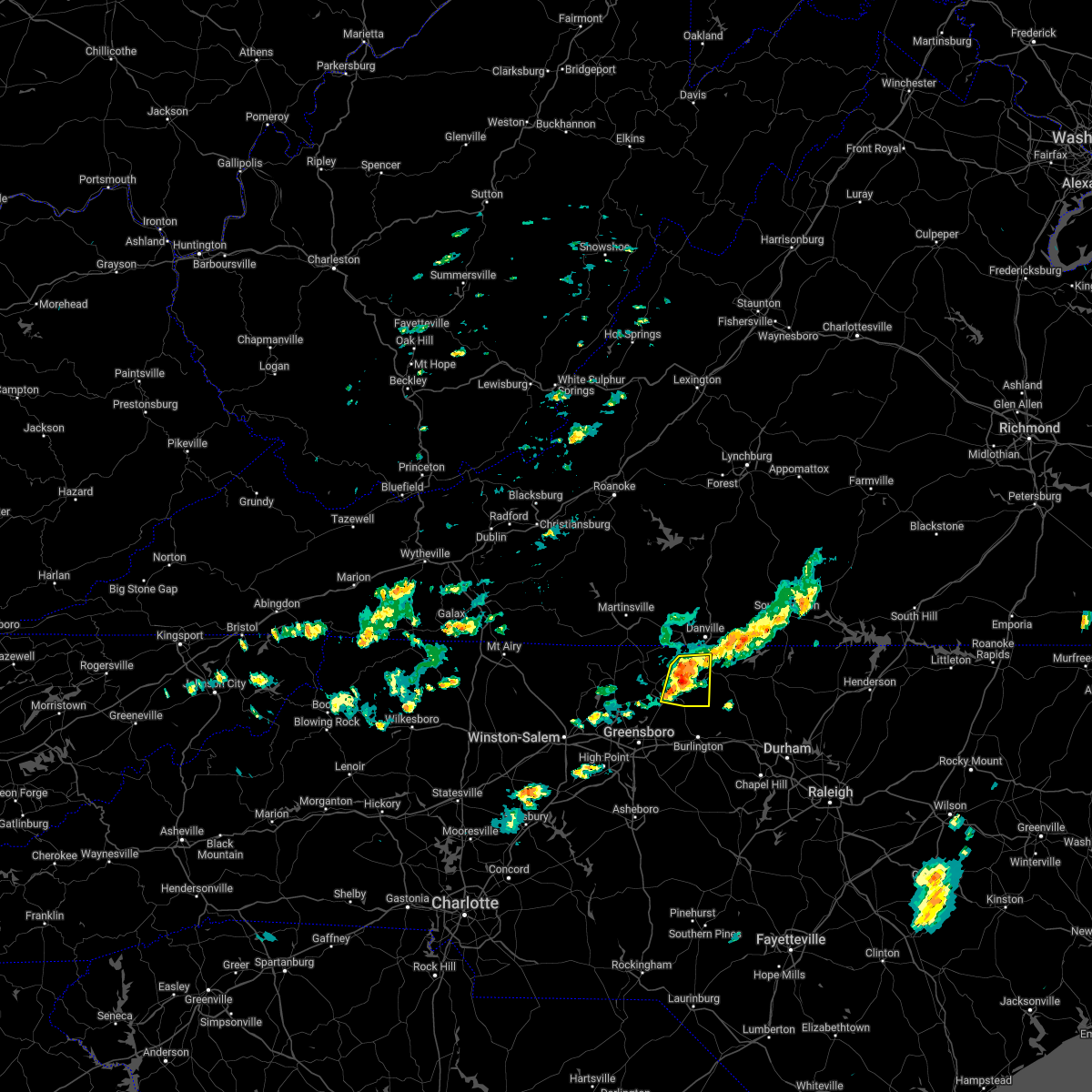 At 114 pm edt, a severe thunderstorm was located over quick, or near camp springs, moving east at 35 mph (radar indicated). Hazards include 60 mph wind gusts and nickel size hail. Expect damage to roofs, siding, and trees. locations impacted include, reidsville, bethel, camp springs, providence, jericho, quick, and ruffin. hail threat, radar indicated max hail size, 0. 88 in wind threat, radar indicated max wind gust, 60 mph. At 114 pm edt, a severe thunderstorm was located over quick, or near camp springs, moving east at 35 mph (radar indicated). Hazards include 60 mph wind gusts and nickel size hail. Expect damage to roofs, siding, and trees. locations impacted include, reidsville, bethel, camp springs, providence, jericho, quick, and ruffin. hail threat, radar indicated max hail size, 0. 88 in wind threat, radar indicated max wind gust, 60 mph.
|
| 5/16/2022 1:02 PM EDT |
 At 102 pm edt, a severe thunderstorm was located near reidsville, moving east at 35 mph (radar indicated). Hazards include 60 mph wind gusts and quarter size hail. Hail damage to vehicles is expected. expect wind damage to roofs, siding, and trees. locations impacted include, reidsville, wentworth, bethel, camp springs, providence, jericho, and quick. hail threat, radar indicated max hail size, 1. 00 in wind threat, radar indicated max wind gust, 60 mph. At 102 pm edt, a severe thunderstorm was located near reidsville, moving east at 35 mph (radar indicated). Hazards include 60 mph wind gusts and quarter size hail. Hail damage to vehicles is expected. expect wind damage to roofs, siding, and trees. locations impacted include, reidsville, wentworth, bethel, camp springs, providence, jericho, and quick. hail threat, radar indicated max hail size, 1. 00 in wind threat, radar indicated max wind gust, 60 mph.
|
| 5/16/2022 12:51 PM EDT |
 At 1251 pm edt, a severe thunderstorm was located over wentworth, moving east at 35 mph (radar indicated). Hazards include 60 mph wind gusts and quarter size hail. Hail damage to vehicles is expected. Expect wind damage to roofs, siding, and trees. At 1251 pm edt, a severe thunderstorm was located over wentworth, moving east at 35 mph (radar indicated). Hazards include 60 mph wind gusts and quarter size hail. Hail damage to vehicles is expected. Expect wind damage to roofs, siding, and trees.
|
| 5/6/2022 8:35 PM EDT |
 At 834 pm edt, a severe thunderstorm capable of producing a tornado was located over blanch, or near providence, moving east at 45 mph (radar indicated rotation). Hazards include tornado and ping pong ball size hail. Flying debris will be dangerous to those caught without shelter. mobile homes will be damaged or destroyed. damage to roofs, windows, and vehicles will occur. Tree damage is likely. At 834 pm edt, a severe thunderstorm capable of producing a tornado was located over blanch, or near providence, moving east at 45 mph (radar indicated rotation). Hazards include tornado and ping pong ball size hail. Flying debris will be dangerous to those caught without shelter. mobile homes will be damaged or destroyed. damage to roofs, windows, and vehicles will occur. Tree damage is likely.
|
| 5/6/2022 8:30 PM EDT |
 At 830 pm edt, a severe thunderstorm was located over blanch, or near providence, moving east at 30 mph (radar indicated). Hazards include 60 mph wind gusts and half dollar size hail. Hail damage to vehicles is expected. Expect wind damage to roofs, siding, and trees. At 830 pm edt, a severe thunderstorm was located over blanch, or near providence, moving east at 30 mph (radar indicated). Hazards include 60 mph wind gusts and half dollar size hail. Hail damage to vehicles is expected. Expect wind damage to roofs, siding, and trees.
|
| 5/6/2022 8:26 PM EDT |
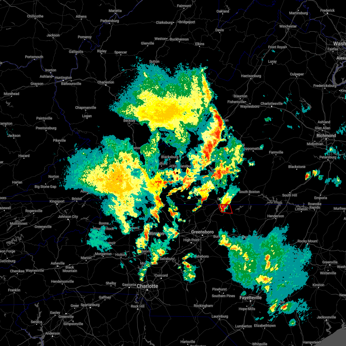 At 826 pm edt, a severe thunderstorm capable of producing a tornado was located over providence, moving east at 30 mph (radar indicated rotation). Hazards include tornado and ping pong ball size hail. Flying debris will be dangerous to those caught without shelter. mobile homes will be damaged or destroyed. damage to roofs, windows, and vehicles will occur. tree damage is likely. Locations impacted include, yanceyville, bethel, providence, gatewood, blanch, hamer, and pelham. At 826 pm edt, a severe thunderstorm capable of producing a tornado was located over providence, moving east at 30 mph (radar indicated rotation). Hazards include tornado and ping pong ball size hail. Flying debris will be dangerous to those caught without shelter. mobile homes will be damaged or destroyed. damage to roofs, windows, and vehicles will occur. tree damage is likely. Locations impacted include, yanceyville, bethel, providence, gatewood, blanch, hamer, and pelham.
|
| 5/6/2022 8:25 PM EDT | Half Dollar sized hail reported 4.9 miles SSE of Yanceyville, NC |
| 5/6/2022 8:17 PM EDT |
 At 817 pm edt, a severe thunderstorm capable of producing a tornado was located over bethel, moving east at 30 mph (radar indicated rotation). Hazards include tornado and ping pong ball size hail. Flying debris will be dangerous to those caught without shelter. mobile homes will be damaged or destroyed. damage to roofs, windows, and vehicles will occur. tree damage is likely. Locations impacted include, yanceyville, bethel, providence, gatewood, quick, blanch, and hamer. At 817 pm edt, a severe thunderstorm capable of producing a tornado was located over bethel, moving east at 30 mph (radar indicated rotation). Hazards include tornado and ping pong ball size hail. Flying debris will be dangerous to those caught without shelter. mobile homes will be damaged or destroyed. damage to roofs, windows, and vehicles will occur. tree damage is likely. Locations impacted include, yanceyville, bethel, providence, gatewood, quick, blanch, and hamer.
|
| 5/6/2022 8:11 PM EDT |
 At 811 pm edt, a tornado producing storm was located over ruffin, or near bethel, moving east at 30 mph (radar confirmed tornado). Hazards include damaging tornado and half dollar size hail. Flying debris will be dangerous to those caught without shelter. mobile homes will be damaged or destroyed. damage to roofs, windows, and vehicles will occur. Tree damage is likely. At 811 pm edt, a tornado producing storm was located over ruffin, or near bethel, moving east at 30 mph (radar confirmed tornado). Hazards include damaging tornado and half dollar size hail. Flying debris will be dangerous to those caught without shelter. mobile homes will be damaged or destroyed. damage to roofs, windows, and vehicles will occur. Tree damage is likely.
|
| 5/6/2022 7:22 PM EDT | Golf Ball sized hail reported 5.2 miles ESE of Yanceyville, NC, golf ball size hail reported at the intersection of allison road and lake road. |
| 5/6/2022 5:27 PM EDT |
 The severe thunderstorm warning for eastern caswell county will expire at 530 pm edt, the storm which prompted the warning has moved out of the area. therefore, the warning will be allowed to expire. a tornado watch remains in effect until 1000 pm edt for north central north carolina, and south central virginia. The severe thunderstorm warning for eastern caswell county will expire at 530 pm edt, the storm which prompted the warning has moved out of the area. therefore, the warning will be allowed to expire. a tornado watch remains in effect until 1000 pm edt for north central north carolina, and south central virginia.
|
| 5/6/2022 5:17 PM EDT |
 At 517 pm edt, a severe thunderstorm was located over leasburg, or 8 miles east of yanceyville, moving northeast at 35 mph (radar indicated). Hazards include 60 mph wind gusts and quarter size hail. Hail damage to vehicles is expected. expect wind damage to roofs, siding, and trees. locations impacted include, yanceyville, prospect hill, milton, blanch, leasburg, hamer, and semora. hail threat, radar indicated max hail size, 1. 00 in wind threat, radar indicated max wind gust, 60 mph. At 517 pm edt, a severe thunderstorm was located over leasburg, or 8 miles east of yanceyville, moving northeast at 35 mph (radar indicated). Hazards include 60 mph wind gusts and quarter size hail. Hail damage to vehicles is expected. expect wind damage to roofs, siding, and trees. locations impacted include, yanceyville, prospect hill, milton, blanch, leasburg, hamer, and semora. hail threat, radar indicated max hail size, 1. 00 in wind threat, radar indicated max wind gust, 60 mph.
|
| 5/6/2022 5:13 PM EDT | Ping Pong Ball sized hail reported 6.6 miles NW of Yanceyville, NC |
| 5/6/2022 5:10 PM EDT |
 At 509 pm edt, a severe thunderstorm was located over topnot, or near yanceyville, moving northeast at 25 mph (radar indicated). Hazards include 60 mph wind gusts and quarter size hail. Hail damage to vehicles is expected. expect wind damage to roofs, siding, and trees. locations impacted include, yanceyville, jericho, prospect hill, providence, milton, blanch, and leasburg. hail threat, radar indicated max hail size, 1. 00 in wind threat, radar indicated max wind gust, 60 mph. At 509 pm edt, a severe thunderstorm was located over topnot, or near yanceyville, moving northeast at 25 mph (radar indicated). Hazards include 60 mph wind gusts and quarter size hail. Hail damage to vehicles is expected. expect wind damage to roofs, siding, and trees. locations impacted include, yanceyville, jericho, prospect hill, providence, milton, blanch, and leasburg. hail threat, radar indicated max hail size, 1. 00 in wind threat, radar indicated max wind gust, 60 mph.
|
| 5/6/2022 4:59 PM EDT |
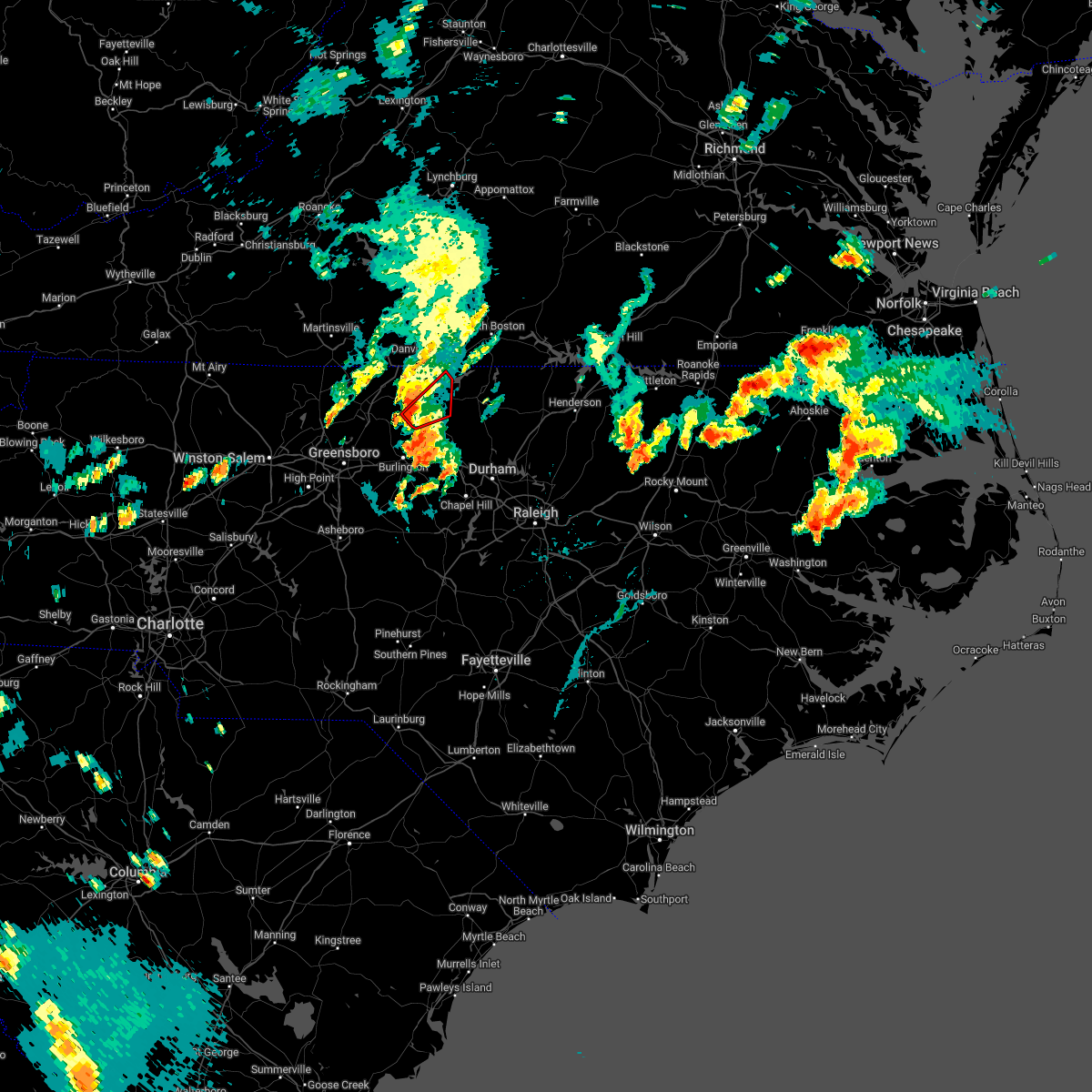 At 459 pm edt, a severe thunderstorm capable of producing a tornado was located over jericho, moving northeast at 25 mph (radar indicated rotation). Hazards include tornado and quarter size hail. Flying debris will be dangerous to those caught without shelter. mobile homes will be damaged or destroyed. damage to roofs, windows, and vehicles will occur. Tree damage is likely. At 459 pm edt, a severe thunderstorm capable of producing a tornado was located over jericho, moving northeast at 25 mph (radar indicated rotation). Hazards include tornado and quarter size hail. Flying debris will be dangerous to those caught without shelter. mobile homes will be damaged or destroyed. damage to roofs, windows, and vehicles will occur. Tree damage is likely.
|
| 5/6/2022 4:53 PM EDT |
 At 451 pm edt, a severe thunderstorm was located near camp springs, moving northeast at 25 mph (radar indicated). Hazards include 60 mph wind gusts and quarter size hail. Hail damage to vehicles is expected. expect wind damage to roofs, siding, and trees. Locations impacted include, yanceyville, bethel, providence, jericho, prospect hill, camp springs, and milton. At 451 pm edt, a severe thunderstorm was located near camp springs, moving northeast at 25 mph (radar indicated). Hazards include 60 mph wind gusts and quarter size hail. Hail damage to vehicles is expected. expect wind damage to roofs, siding, and trees. Locations impacted include, yanceyville, bethel, providence, jericho, prospect hill, camp springs, and milton.
|
| 5/6/2022 4:37 PM EDT |
 At 436 pm edt, a severe thunderstorm was located over camp springs, moving northeast at 35 mph (radar indicated). Hazards include 60 mph wind gusts and quarter size hail. Hail damage to vehicles is expected. expect wind damage to roofs, siding, and trees. Locations impacted include, reidsville, yanceyville, bethel, providence, jericho, prospect hill, and camp springs. At 436 pm edt, a severe thunderstorm was located over camp springs, moving northeast at 35 mph (radar indicated). Hazards include 60 mph wind gusts and quarter size hail. Hail damage to vehicles is expected. expect wind damage to roofs, siding, and trees. Locations impacted include, reidsville, yanceyville, bethel, providence, jericho, prospect hill, and camp springs.
|
| 5/6/2022 4:26 PM EDT |
 At 425 pm edt, a severe thunderstorm was located near monroeton, or near reidsville, moving northeast at 35 mph (radar indicated). Hazards include 60 mph wind gusts and quarter size hail. Hail damage to vehicles is expected. Expect wind damage to roofs, siding, and trees. At 425 pm edt, a severe thunderstorm was located near monroeton, or near reidsville, moving northeast at 35 mph (radar indicated). Hazards include 60 mph wind gusts and quarter size hail. Hail damage to vehicles is expected. Expect wind damage to roofs, siding, and trees.
|
| 5/1/2022 6:35 PM EDT |
 The severe thunderstorm warning for northeastern caswell county will expire at 645 pm edt, the storm which prompted the warning has moved out of the area. therefore, the warning will be allowed to expire. a severe thunderstorm watch remains in effect until 900 pm edt for north central north carolina, and south central virginia. The severe thunderstorm warning for northeastern caswell county will expire at 645 pm edt, the storm which prompted the warning has moved out of the area. therefore, the warning will be allowed to expire. a severe thunderstorm watch remains in effect until 900 pm edt for north central north carolina, and south central virginia.
|
| 5/1/2022 6:15 PM EDT | Power line down. time estimated from rada in caswell county NC, 4.9 miles WSW of Yanceyville, NC |
| 5/1/2022 6:13 PM EDT |
 The severe thunderstorm warning for northeastern rockingham, northwestern caswell and south central pittsylvania counties and the city of danville will expire at 615 pm edt, the storm which prompted the warning has moved out of the area. therefore, the warning will be allowed to expire. a severe thunderstorm watch remains in effect until 900 pm edt for north central north carolina, and south central and west central virginia. remember, a severe thunderstorm warning still remains in effect for northeastern caswell county until 645 pm edt. The severe thunderstorm warning for northeastern rockingham, northwestern caswell and south central pittsylvania counties and the city of danville will expire at 615 pm edt, the storm which prompted the warning has moved out of the area. therefore, the warning will be allowed to expire. a severe thunderstorm watch remains in effect until 900 pm edt for north central north carolina, and south central and west central virginia. remember, a severe thunderstorm warning still remains in effect for northeastern caswell county until 645 pm edt.
|
| 5/1/2022 6:13 PM EDT |
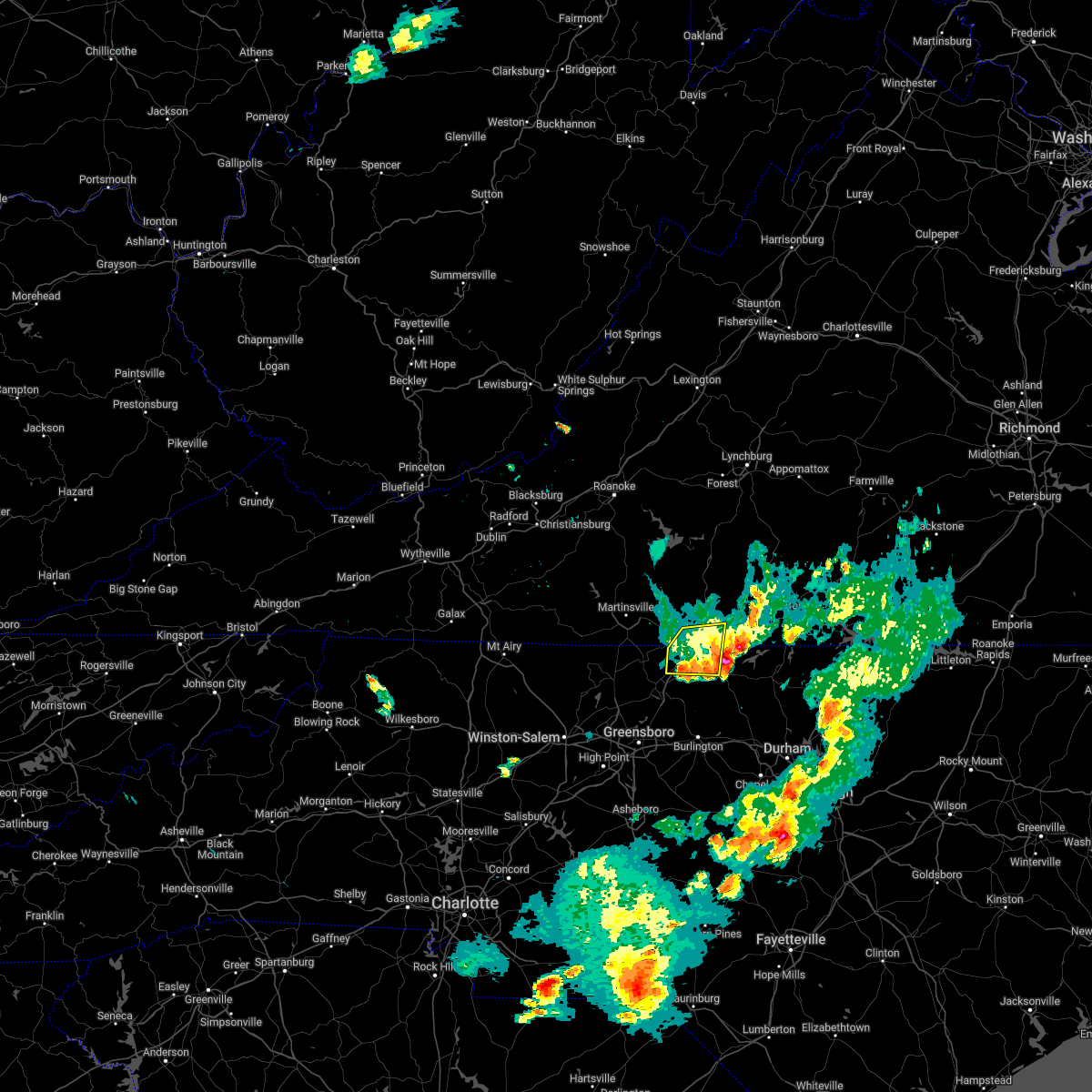 The severe thunderstorm warning for northeastern rockingham, northwestern caswell and south central pittsylvania counties and the city of danville will expire at 615 pm edt, the storm which prompted the warning has moved out of the area. therefore, the warning will be allowed to expire. a severe thunderstorm watch remains in effect until 900 pm edt for north central north carolina, and south central and west central virginia. remember, a severe thunderstorm warning still remains in effect for northeastern caswell county until 645 pm edt. The severe thunderstorm warning for northeastern rockingham, northwestern caswell and south central pittsylvania counties and the city of danville will expire at 615 pm edt, the storm which prompted the warning has moved out of the area. therefore, the warning will be allowed to expire. a severe thunderstorm watch remains in effect until 900 pm edt for north central north carolina, and south central and west central virginia. remember, a severe thunderstorm warning still remains in effect for northeastern caswell county until 645 pm edt.
|
| 5/1/2022 6:06 PM EDT |
 At 605 pm edt, a severe thunderstorm was located over providence, moving east at 30 mph (the public reported quarter size hail in eden, oregon hill, and ruffin). Hazards include 60 mph wind gusts and quarter size hail. Hail damage to vehicles is expected. expect wind damage to roofs, siding, and trees. locations impacted include, yanceyville, milton, blanch, leasburg, hamer, semora, and hyco lake. hail threat, observed max hail size, 1. 00 in wind threat, radar indicated max wind gust, 60 mph. At 605 pm edt, a severe thunderstorm was located over providence, moving east at 30 mph (the public reported quarter size hail in eden, oregon hill, and ruffin). Hazards include 60 mph wind gusts and quarter size hail. Hail damage to vehicles is expected. expect wind damage to roofs, siding, and trees. locations impacted include, yanceyville, milton, blanch, leasburg, hamer, semora, and hyco lake. hail threat, observed max hail size, 1. 00 in wind threat, radar indicated max wind gust, 60 mph.
|
| 5/1/2022 5:58 PM EDT |
 At 557 pm edt, a severe thunderstorm was located over bethel, moving east at 30 mph (the public reported quarter size hail in eden). Hazards include 60 mph wind gusts and quarter size hail. Hail damage to vehicles is expected. Expect wind damage to roofs, siding, and trees. At 557 pm edt, a severe thunderstorm was located over bethel, moving east at 30 mph (the public reported quarter size hail in eden). Hazards include 60 mph wind gusts and quarter size hail. Hail damage to vehicles is expected. Expect wind damage to roofs, siding, and trees.
|
| 5/1/2022 5:54 PM EDT |
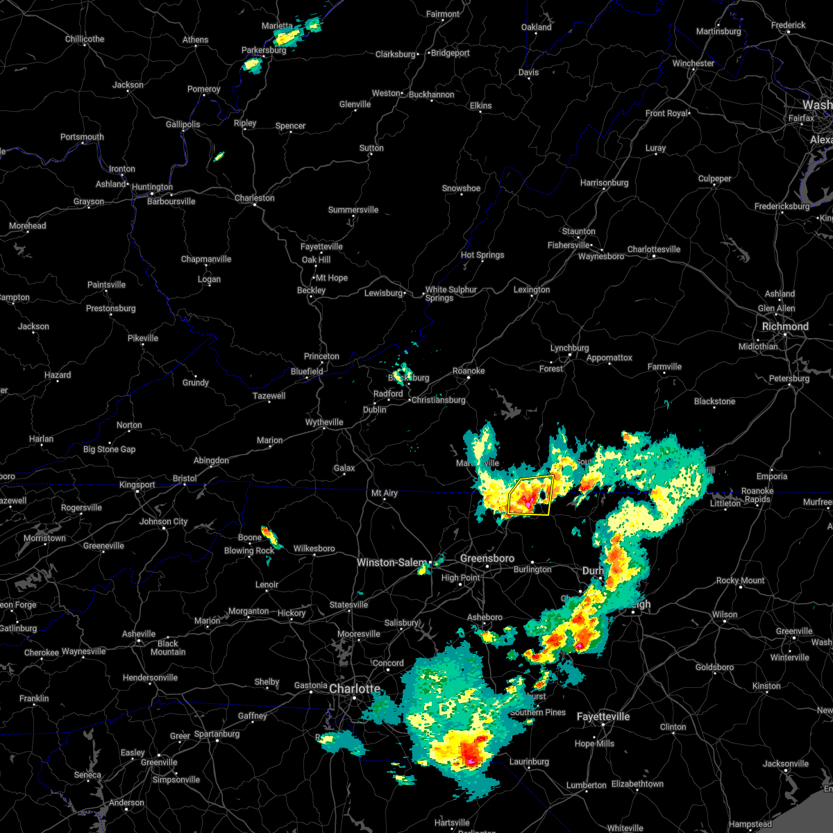 At 553 pm edt, a severe thunderstorm was located over pelham, or over bethel, moving east at 25 mph (the public reported quarter size hail in eden). Hazards include 60 mph wind gusts and quarter size hail. Hail damage to vehicles is expected. expect wind damage to roofs, siding, and trees. locations impacted include, danville, yanceyville, bethel, providence, mayfield, gatewood, and ruffin. this includes the following location danville airport. hail threat, observed max hail size, 1. 00 in wind threat, radar indicated max wind gust, 60 mph. At 553 pm edt, a severe thunderstorm was located over pelham, or over bethel, moving east at 25 mph (the public reported quarter size hail in eden). Hazards include 60 mph wind gusts and quarter size hail. Hail damage to vehicles is expected. expect wind damage to roofs, siding, and trees. locations impacted include, danville, yanceyville, bethel, providence, mayfield, gatewood, and ruffin. this includes the following location danville airport. hail threat, observed max hail size, 1. 00 in wind threat, radar indicated max wind gust, 60 mph.
|
| 5/1/2022 5:37 PM EDT |
 At 536 pm edt, a severe thunderstorm was located over oregon hill, or near mayfield, moving east at 30 mph (radar indicated). Hazards include 60 mph wind gusts and quarter size hail. Hail damage to vehicles is expected. expect wind damage to roofs, siding, and trees. locations impacted include, danville, eden, yanceyville, bethel, providence, mayfield, and harrisons crossroads. this includes the following location danville airport. hail threat, radar indicated max hail size, 1. 00 in wind threat, radar indicated max wind gust, 60 mph. At 536 pm edt, a severe thunderstorm was located over oregon hill, or near mayfield, moving east at 30 mph (radar indicated). Hazards include 60 mph wind gusts and quarter size hail. Hail damage to vehicles is expected. expect wind damage to roofs, siding, and trees. locations impacted include, danville, eden, yanceyville, bethel, providence, mayfield, and harrisons crossroads. this includes the following location danville airport. hail threat, radar indicated max hail size, 1. 00 in wind threat, radar indicated max wind gust, 60 mph.
|
| 5/1/2022 5:17 PM EDT |
 At 517 pm edt, a severe thunderstorm was located over eden, moving east at 25 mph (radar indicated). Hazards include 60 mph wind gusts and quarter size hail. Hail damage to vehicles is expected. Expect wind damage to roofs, siding, and trees. At 517 pm edt, a severe thunderstorm was located over eden, moving east at 25 mph (radar indicated). Hazards include 60 mph wind gusts and quarter size hail. Hail damage to vehicles is expected. Expect wind damage to roofs, siding, and trees.
|
| 5/1/2022 4:09 PM EDT |
 The severe thunderstorm warning for caswell county will expire at 415 pm edt, the storm which prompted the warning has weakened below severe limits, and no longer poses an immediate threat to life or property. therefore, the warning will be allowed to expire. however, heavy rain is still possible with this thunderstorm. a severe thunderstorm watch remains in effect until 900 pm edt for north central north carolina, and south central virginia. The severe thunderstorm warning for caswell county will expire at 415 pm edt, the storm which prompted the warning has weakened below severe limits, and no longer poses an immediate threat to life or property. therefore, the warning will be allowed to expire. however, heavy rain is still possible with this thunderstorm. a severe thunderstorm watch remains in effect until 900 pm edt for north central north carolina, and south central virginia.
|
| 5/1/2022 3:36 PM EDT |
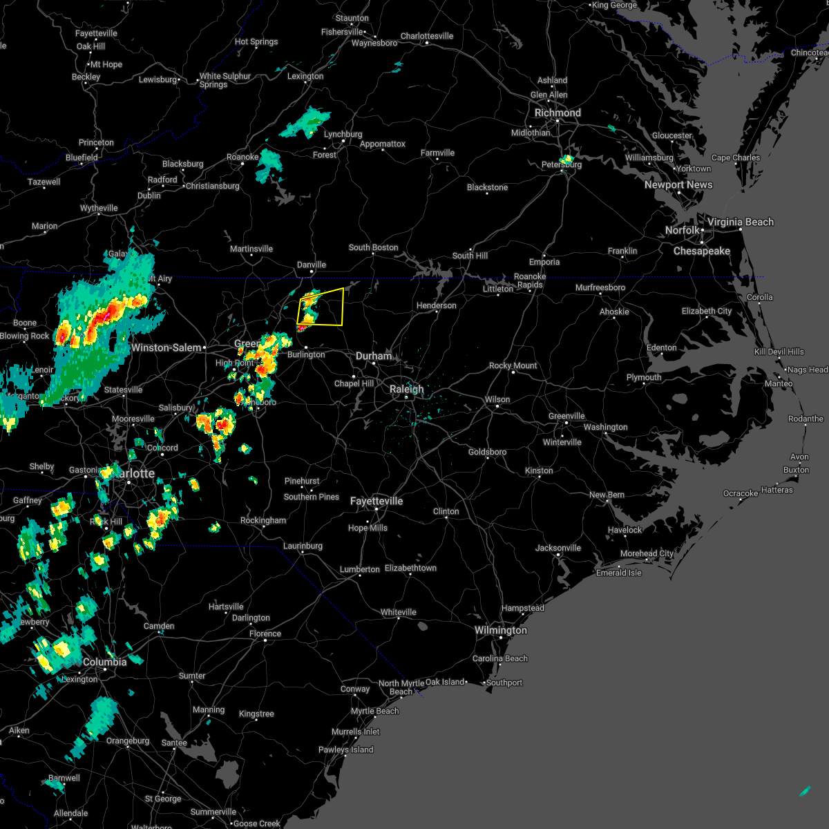 At 335 pm edt, a severe thunderstorm was located near camp springs, moving east at 20 mph (radar indicated). Hazards include 60 mph wind gusts and quarter size hail. Hail damage to vehicles is expected. expect wind damage to roofs, siding, and trees. locations impacted include, yanceyville, jericho, prospect hill, camp springs, leasburg, hamer, and topnot. hail threat, radar indicated max hail size, 1. 00 in wind threat, radar indicated max wind gust, 60 mph. At 335 pm edt, a severe thunderstorm was located near camp springs, moving east at 20 mph (radar indicated). Hazards include 60 mph wind gusts and quarter size hail. Hail damage to vehicles is expected. expect wind damage to roofs, siding, and trees. locations impacted include, yanceyville, jericho, prospect hill, camp springs, leasburg, hamer, and topnot. hail threat, radar indicated max hail size, 1. 00 in wind threat, radar indicated max wind gust, 60 mph.
|
| 5/1/2022 3:17 PM EDT |
 At 316 pm edt, a severe thunderstorm was located 7 miles southwest of camp springs, moving east at 25 mph (radar indicated). Hazards include 60 mph wind gusts and quarter size hail. Hail damage to vehicles is expected. Expect wind damage to roofs, siding, and trees. At 316 pm edt, a severe thunderstorm was located 7 miles southwest of camp springs, moving east at 25 mph (radar indicated). Hazards include 60 mph wind gusts and quarter size hail. Hail damage to vehicles is expected. Expect wind damage to roofs, siding, and trees.
|
| 10/25/2021 8:38 PM EDT |
 The severe thunderstorm warning for northeastern caswell and southwestern halifax counties will expire at 845 pm edt, the storm which prompted the warning has moved out of the area. therefore, the warning will be allowed to expire. a severe thunderstorm watch remains in effect until 100 am edt for north central north carolina, and south central virginia. The severe thunderstorm warning for northeastern caswell and southwestern halifax counties will expire at 845 pm edt, the storm which prompted the warning has moved out of the area. therefore, the warning will be allowed to expire. a severe thunderstorm watch remains in effect until 100 am edt for north central north carolina, and south central virginia.
|
| 10/25/2021 8:16 PM EDT |
 At 816 pm edt, a severe thunderstorm was located over milton, or 8 miles southwest of turbeville, moving east at 30 mph (radar indicated). Hazards include 60 mph wind gusts and quarter size hail. Hail damage to vehicles is expected. Expect wind damage to roofs, siding, and trees. At 816 pm edt, a severe thunderstorm was located over milton, or 8 miles southwest of turbeville, moving east at 30 mph (radar indicated). Hazards include 60 mph wind gusts and quarter size hail. Hail damage to vehicles is expected. Expect wind damage to roofs, siding, and trees.
|
| 8/17/2021 2:35 PM EDT |
 At 234 pm edt, a shower capable of producing a tornado was located over hamer, or over yanceyville, moving north at 25 mph (radar indicated rotation). Hazards include tornado. Flying debris will be dangerous to those caught without shelter. mobile homes will be damaged or destroyed. damage to roofs, windows, and vehicles will occur. tree damage is likely. Locations impacted include, yanceyville, bethel, providence, gatewood, blanch, hamer, and pelham. At 234 pm edt, a shower capable of producing a tornado was located over hamer, or over yanceyville, moving north at 25 mph (radar indicated rotation). Hazards include tornado. Flying debris will be dangerous to those caught without shelter. mobile homes will be damaged or destroyed. damage to roofs, windows, and vehicles will occur. tree damage is likely. Locations impacted include, yanceyville, bethel, providence, gatewood, blanch, hamer, and pelham.
|
| 8/17/2021 2:18 PM EDT |
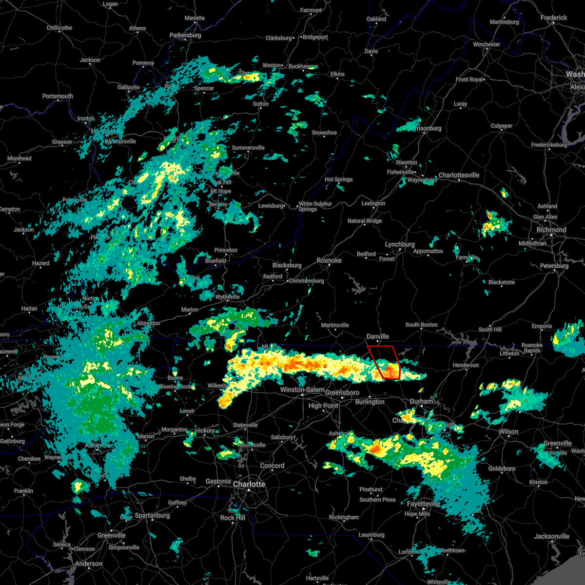 At 218 pm edt, a severe thunderstorm capable of producing a tornado was located over hightowers, or near jericho, moving northwest at 25 mph (radar indicated rotation). Hazards include tornado. Flying debris will be dangerous to those caught without shelter. mobile homes will be damaged or destroyed. damage to roofs, windows, and vehicles will occur. Tree damage is likely. At 218 pm edt, a severe thunderstorm capable of producing a tornado was located over hightowers, or near jericho, moving northwest at 25 mph (radar indicated rotation). Hazards include tornado. Flying debris will be dangerous to those caught without shelter. mobile homes will be damaged or destroyed. damage to roofs, windows, and vehicles will occur. Tree damage is likely.
|
| 8/15/2021 5:09 PM EDT |
 At 509 pm edt, a severe thunderstorm was located over bethel, moving north at 15 mph (radar indicated). Hazards include 60 mph wind gusts and penny size hail. Expect damage to roofs, siding, and trees. locations impacted include, yanceyville, bethel, providence, pelham, quick, and hamer. hail threat, radar indicated max hail size, 0. 75 in wind threat, radar indicated max wind gust, 60 mph. At 509 pm edt, a severe thunderstorm was located over bethel, moving north at 15 mph (radar indicated). Hazards include 60 mph wind gusts and penny size hail. Expect damage to roofs, siding, and trees. locations impacted include, yanceyville, bethel, providence, pelham, quick, and hamer. hail threat, radar indicated max hail size, 0. 75 in wind threat, radar indicated max wind gust, 60 mph.
|
| 8/15/2021 4:44 PM EDT |
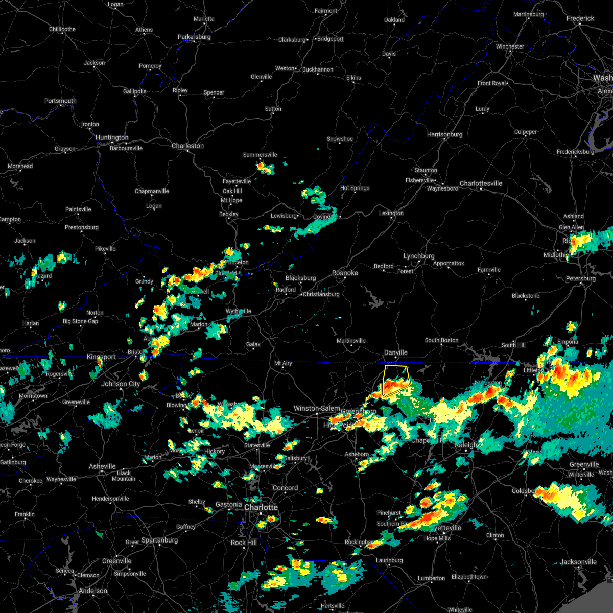 At 444 pm edt, a severe thunderstorm was located near quick, or near camp springs, moving northwest at 15 mph (radar indicated). Hazards include 60 mph wind gusts and quarter size hail. Hail damage to vehicles is expected. expect wind damage to roofs, siding, and trees. locations impacted include, yanceyville, bethel, providence, camp springs, quick, hamer, and pelham. hail threat, radar indicated max hail size, 1. 00 in wind threat, radar indicated max wind gust, 60 mph. At 444 pm edt, a severe thunderstorm was located near quick, or near camp springs, moving northwest at 15 mph (radar indicated). Hazards include 60 mph wind gusts and quarter size hail. Hail damage to vehicles is expected. expect wind damage to roofs, siding, and trees. locations impacted include, yanceyville, bethel, providence, camp springs, quick, hamer, and pelham. hail threat, radar indicated max hail size, 1. 00 in wind threat, radar indicated max wind gust, 60 mph.
|
| 8/15/2021 4:28 PM EDT |
 At 428 pm edt, a severe thunderstorm was located near jericho, moving northeast at 15 mph (radar indicated). Hazards include 60 mph wind gusts and quarter size hail. Hail damage to vehicles is expected. Expect wind damage to roofs, siding, and trees. At 428 pm edt, a severe thunderstorm was located near jericho, moving northeast at 15 mph (radar indicated). Hazards include 60 mph wind gusts and quarter size hail. Hail damage to vehicles is expected. Expect wind damage to roofs, siding, and trees.
|
| 7/17/2021 10:06 PM EDT |
 At 1005 pm edt, severe thunderstorms were located along a line extending from near alton to hightowers, moving east at 40 mph (radar indicated). Hazards include 60 mph wind gusts. Expect damage to roofs, siding, and trees. Locations impacted include, yanceyville, providence, milton, gatewood, blanch, leasburg, and hamer. At 1005 pm edt, severe thunderstorms were located along a line extending from near alton to hightowers, moving east at 40 mph (radar indicated). Hazards include 60 mph wind gusts. Expect damage to roofs, siding, and trees. Locations impacted include, yanceyville, providence, milton, gatewood, blanch, leasburg, and hamer.
|
| 7/17/2021 10:04 PM EDT |
 At 1004 pm edt, severe thunderstorms were located along a line extending from near alton to near ringgold, moving northeast at 25 mph (radar indicated). Hazards include 60 mph wind gusts. expect damage to roofs, siding, and trees At 1004 pm edt, severe thunderstorms were located along a line extending from near alton to near ringgold, moving northeast at 25 mph (radar indicated). Hazards include 60 mph wind gusts. expect damage to roofs, siding, and trees
|
| 7/17/2021 9:43 PM EDT |
 At 943 pm edt, severe thunderstorms were located along a line extending from near blanch to near camp springs, moving east at 45 mph (radar indicated). Hazards include 60 mph wind gusts. Expect damage to roofs, siding, and trees. Locations impacted include, reidsville, yanceyville, bethel, providence, jericho, prospect hill, and mayfield. At 943 pm edt, severe thunderstorms were located along a line extending from near blanch to near camp springs, moving east at 45 mph (radar indicated). Hazards include 60 mph wind gusts. Expect damage to roofs, siding, and trees. Locations impacted include, reidsville, yanceyville, bethel, providence, jericho, prospect hill, and mayfield.
|
| 7/17/2021 9:18 PM EDT |
 At 918 pm edt, severe thunderstorms were located along a line extending from eden to near monroeton, moving east at 40 mph (radar indicated). Hazards include 60 mph wind gusts. expect damage to roofs, siding, and trees At 918 pm edt, severe thunderstorms were located along a line extending from eden to near monroeton, moving east at 40 mph (radar indicated). Hazards include 60 mph wind gusts. expect damage to roofs, siding, and trees
|
| 7/17/2021 5:48 PM EDT |
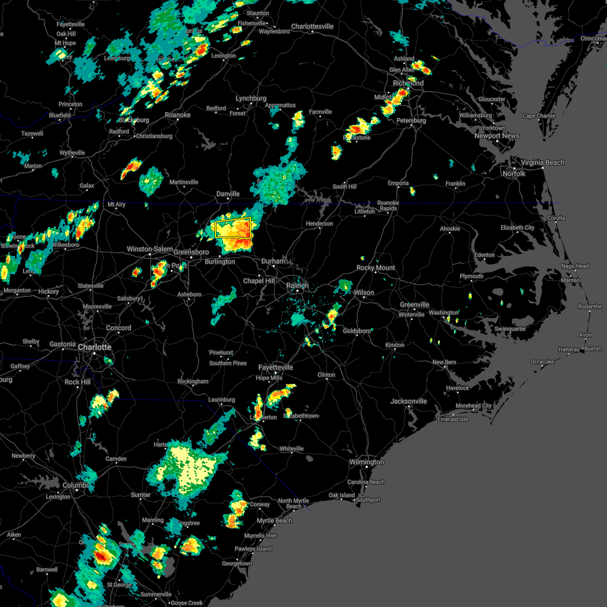 At 547 pm edt, severe thunderstorms were located along a line extending from topnot to near mcleansville, moving east at 20 mph (fire department confirmed several trees down earlier in rockingham county when storms moved through the county near williamsburg). Hazards include 60 mph wind gusts and quarter size hail. Hail damage to vehicles is expected. expect wind damage to roofs, siding, and trees. Locations impacted include, yanceyville, jericho, prospect hill, camp springs, leasburg, topnot, and hightowers. At 547 pm edt, severe thunderstorms were located along a line extending from topnot to near mcleansville, moving east at 20 mph (fire department confirmed several trees down earlier in rockingham county when storms moved through the county near williamsburg). Hazards include 60 mph wind gusts and quarter size hail. Hail damage to vehicles is expected. expect wind damage to roofs, siding, and trees. Locations impacted include, yanceyville, jericho, prospect hill, camp springs, leasburg, topnot, and hightowers.
|
| 7/17/2021 5:00 PM EDT |
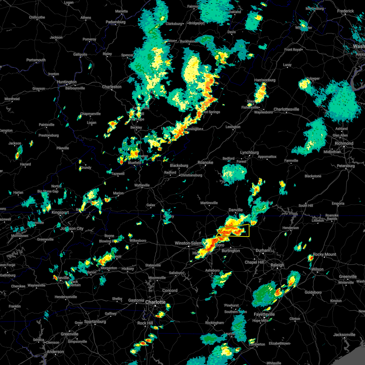 At 459 pm edt, severe thunderstorms were located along a line extending from near camp springs to near greensboro, moving east at 20 mph (radar indicated). Hazards include 60 mph wind gusts and quarter size hail. Hail damage to vehicles is expected. Expect wind damage to roofs, siding, and trees. At 459 pm edt, severe thunderstorms were located along a line extending from near camp springs to near greensboro, moving east at 20 mph (radar indicated). Hazards include 60 mph wind gusts and quarter size hail. Hail damage to vehicles is expected. Expect wind damage to roofs, siding, and trees.
|
| 7/17/2021 4:36 PM EDT |
 The severe thunderstorm warning for northeastern rockingham, northern caswell and south central pittsylvania counties and the city of danville will expire at 445 pm edt, the severe thunderstorm which prompted the warning has moved out of the warned area. therefore, the warning will be allowed to expire. however gusty winds are still possible with this thunderstorm. when it is safe to do so, please send your reports of hail of any size, as well as reports of any wind damage, including downed trees or large limbs, to the national weather service by calling toll free at 1, 8 6 6, 2 1 5, 4 3 2 4. reports and pictures can also be shared on the national weather service blacksburg facebook page and on twitter. remember, a severe thunderstorm warning still remains in effect for rockingham and casewell counties. The severe thunderstorm warning for northeastern rockingham, northern caswell and south central pittsylvania counties and the city of danville will expire at 445 pm edt, the severe thunderstorm which prompted the warning has moved out of the warned area. therefore, the warning will be allowed to expire. however gusty winds are still possible with this thunderstorm. when it is safe to do so, please send your reports of hail of any size, as well as reports of any wind damage, including downed trees or large limbs, to the national weather service by calling toll free at 1, 8 6 6, 2 1 5, 4 3 2 4. reports and pictures can also be shared on the national weather service blacksburg facebook page and on twitter. remember, a severe thunderstorm warning still remains in effect for rockingham and casewell counties.
|
| 7/17/2021 4:20 PM EDT |
 At 419 pm edt, a severe thunderstorm was located over danville, moving northeast at 15 mph (radar indicated). Hazards include 60 mph wind gusts. Expect damage to roofs, siding, and trees. locations impacted include, danville, bethel, providence, mayfield, blairs, milton, and blanch. This includes the following location danville airport. At 419 pm edt, a severe thunderstorm was located over danville, moving northeast at 15 mph (radar indicated). Hazards include 60 mph wind gusts. Expect damage to roofs, siding, and trees. locations impacted include, danville, bethel, providence, mayfield, blairs, milton, and blanch. This includes the following location danville airport.
|
| 7/17/2021 4:05 PM EDT |
 At 405 pm edt, a severe thunderstorm was located near pelham, or near danville, moving northeast at 15 mph (radar indicated). Hazards include 60 mph wind gusts. Expect damage to roofs, siding, and trees. locations impacted include, danville, bethel, providence, mayfield, blairs, milton, and dry fork. This includes the following location danville airport. At 405 pm edt, a severe thunderstorm was located near pelham, or near danville, moving northeast at 15 mph (radar indicated). Hazards include 60 mph wind gusts. Expect damage to roofs, siding, and trees. locations impacted include, danville, bethel, providence, mayfield, blairs, milton, and dry fork. This includes the following location danville airport.
|
| 7/17/2021 4:00 PM EDT |
 At 400 pm edt, a severe thunderstorm was located over harrisons crossroads, or near reidsville, moving east at 15 mph (radar indicated). Hazards include 60 mph wind gusts and quarter size hail. Hail damage to vehicles is expected. Expect wind damage to roofs, siding, and trees. At 400 pm edt, a severe thunderstorm was located over harrisons crossroads, or near reidsville, moving east at 15 mph (radar indicated). Hazards include 60 mph wind gusts and quarter size hail. Hail damage to vehicles is expected. Expect wind damage to roofs, siding, and trees.
|
| 7/17/2021 3:48 PM EDT |
 At 348 pm edt, a severe thunderstorm was located over mayfield, moving northeast at 15 mph (radar indicated). Hazards include 60 mph wind gusts. expect damage to roofs, siding, and trees At 348 pm edt, a severe thunderstorm was located over mayfield, moving northeast at 15 mph (radar indicated). Hazards include 60 mph wind gusts. expect damage to roofs, siding, and trees
|
| 7/17/2021 3:29 PM EDT |
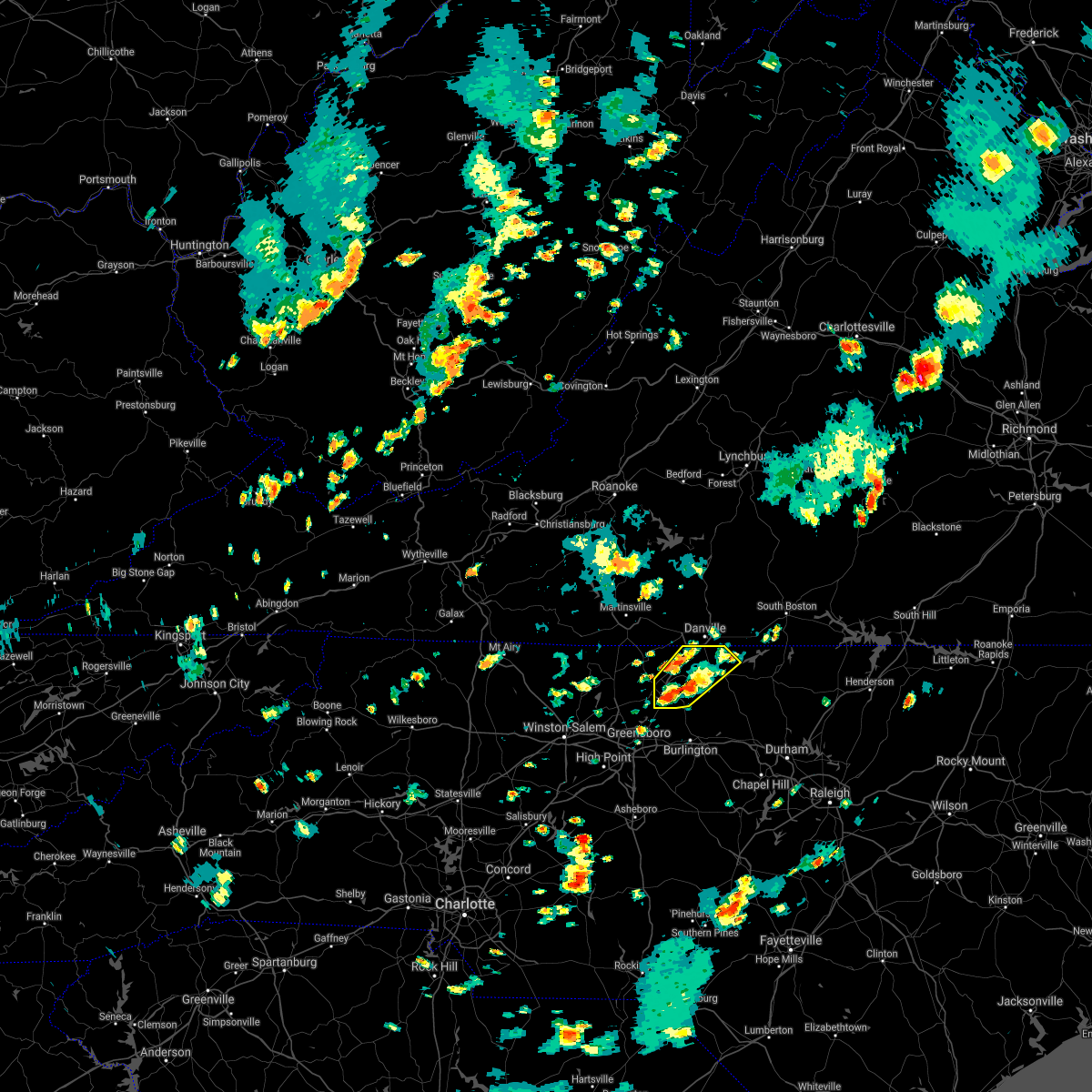 At 329 pm edt, a severe thunderstorm was located over quick, or near bethel, moving northeast at 15 mph (radar indicated). Hazards include 60 mph wind gusts. Expect damage to roofs, siding, and trees. Locations impacted include, reidsville, yanceyville, bethel, providence, camp springs, gatewood, and quick. At 329 pm edt, a severe thunderstorm was located over quick, or near bethel, moving northeast at 15 mph (radar indicated). Hazards include 60 mph wind gusts. Expect damage to roofs, siding, and trees. Locations impacted include, reidsville, yanceyville, bethel, providence, camp springs, gatewood, and quick.
|
| 7/17/2021 2:56 PM EDT |
 At 256 pm edt, a severe thunderstorm was located near reidsville, moving northeast at 15 mph (radar indicated). Hazards include 60 mph wind gusts. expect damage to roofs, siding, and trees At 256 pm edt, a severe thunderstorm was located near reidsville, moving northeast at 15 mph (radar indicated). Hazards include 60 mph wind gusts. expect damage to roofs, siding, and trees
|
| 7/11/2021 2:46 PM EDT |
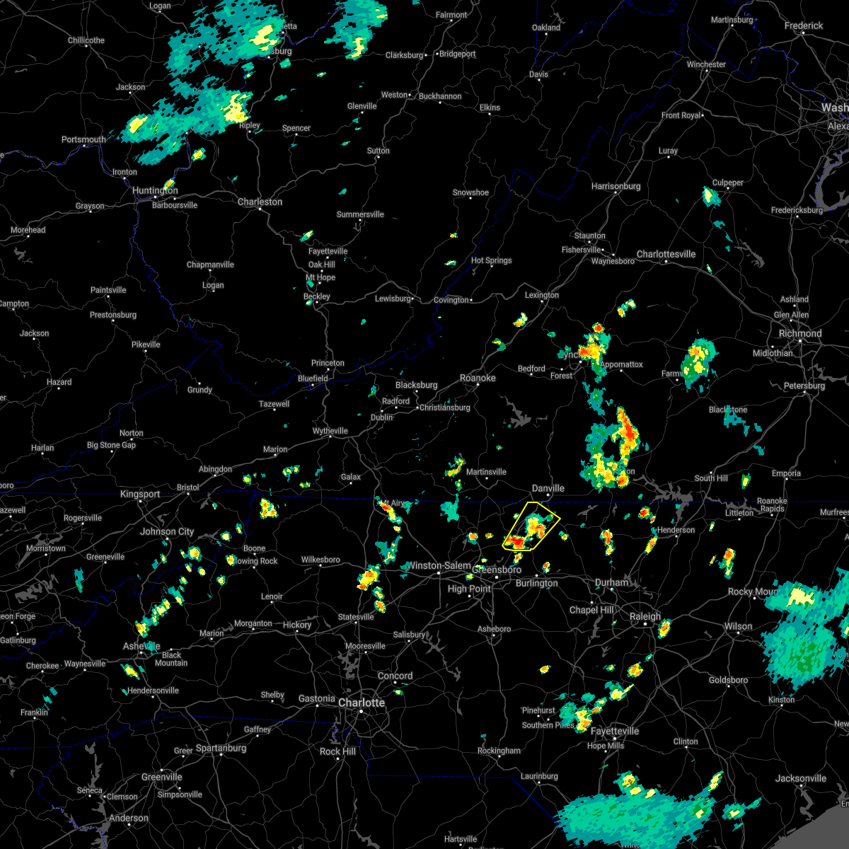 At 246 pm edt, a severe thunderstorm was located near reidsville, moving northeast at 25 mph (radar indicated). Hazards include 60 mph wind gusts. expect damage to roofs, siding, and trees At 246 pm edt, a severe thunderstorm was located near reidsville, moving northeast at 25 mph (radar indicated). Hazards include 60 mph wind gusts. expect damage to roofs, siding, and trees
|
| 7/11/2021 2:02 PM EDT |
 At 202 pm edt, severe thunderstorms were located along a line extending from near gladys to near ridgeway to near hamer, moving northeast at 25 mph (radar indicated). Hazards include 60 mph wind gusts. Expect damage to roofs, siding, and trees. Locations impacted include, south boston, altavista, yanceyville, halifax, hurt, brookneal, and turbeville. At 202 pm edt, severe thunderstorms were located along a line extending from near gladys to near ridgeway to near hamer, moving northeast at 25 mph (radar indicated). Hazards include 60 mph wind gusts. Expect damage to roofs, siding, and trees. Locations impacted include, south boston, altavista, yanceyville, halifax, hurt, brookneal, and turbeville.
|
| 7/11/2021 1:38 PM EDT |
 At 137 pm edt, severe thunderstorms were located along a line extending from altavista to near java to near jericho, moving northeast at 20 mph (radar indicated). Hazards include 60 mph wind gusts. expect damage to roofs, siding, and trees At 137 pm edt, severe thunderstorms were located along a line extending from altavista to near java to near jericho, moving northeast at 20 mph (radar indicated). Hazards include 60 mph wind gusts. expect damage to roofs, siding, and trees
|
| 6/11/2021 2:10 PM EDT |
 At 146 pm edt, a severe thunderstorm was located over eden, moving east at 15 mph (radar indicated). Hazards include 60 mph wind gusts and quarter size hail. Hail damage to vehicles is expected. Expect wind damage to roofs, siding, and trees. At 146 pm edt, a severe thunderstorm was located over eden, moving east at 15 mph (radar indicated). Hazards include 60 mph wind gusts and quarter size hail. Hail damage to vehicles is expected. Expect wind damage to roofs, siding, and trees.
|
| 6/11/2021 2:10 PM EDT |
 At 210 pm edt, a severe thunderstorm was located over draper, or over eden, moving east at 15 mph (radar indicated). Hazards include 60 mph wind gusts. Expect damage to roofs, siding, and trees. locations impacted include, danville, eden, wentworth, yanceyville, bethel, providence, and mayfield. This includes the following location danville airport. At 210 pm edt, a severe thunderstorm was located over draper, or over eden, moving east at 15 mph (radar indicated). Hazards include 60 mph wind gusts. Expect damage to roofs, siding, and trees. locations impacted include, danville, eden, wentworth, yanceyville, bethel, providence, and mayfield. This includes the following location danville airport.
|
| 6/11/2021 1:46 PM EDT |
 At 146 pm edt, a severe thunderstorm was located over eden, moving east at 15 mph (radar indicated). Hazards include 60 mph wind gusts and quarter size hail. Hail damage to vehicles is expected. Expect wind damage to roofs, siding, and trees. At 146 pm edt, a severe thunderstorm was located over eden, moving east at 15 mph (radar indicated). Hazards include 60 mph wind gusts and quarter size hail. Hail damage to vehicles is expected. Expect wind damage to roofs, siding, and trees.
|
| 3/18/2021 6:27 PM EDT |
 The severe thunderstorm warning for eastern caswell county will expire at 630 pm edt, the storm which prompted the warning has moved out of the area. therefore, the warning will be allowed to expire. when it is safe to do so, please send your reports of hail of any size, as well as reports of any wind damage, including downed trees or large limbs, to the national weather service by calling toll free at 1, 8 6 6, 2 1 5, 4 3 2 4. reports and pictures can also be shared on the national weather service blacksburg facebook page and on twitter. The severe thunderstorm warning for eastern caswell county will expire at 630 pm edt, the storm which prompted the warning has moved out of the area. therefore, the warning will be allowed to expire. when it is safe to do so, please send your reports of hail of any size, as well as reports of any wind damage, including downed trees or large limbs, to the national weather service by calling toll free at 1, 8 6 6, 2 1 5, 4 3 2 4. reports and pictures can also be shared on the national weather service blacksburg facebook page and on twitter.
|
| 3/18/2021 6:22 PM EDT |
 At 622 pm edt, a severe thunderstorm was located near alton, or near turbeville, moving northeast at 50 mph (radar indicated). Hazards include 60 mph wind gusts. Expect damage to roofs, siding, and trees. Locations impacted include, prospect hill, milton, leasburg, semora, topnot, hightowers, and baynes. At 622 pm edt, a severe thunderstorm was located near alton, or near turbeville, moving northeast at 50 mph (radar indicated). Hazards include 60 mph wind gusts. Expect damage to roofs, siding, and trees. Locations impacted include, prospect hill, milton, leasburg, semora, topnot, hightowers, and baynes.
|
| 3/18/2021 6:21 PM EDT |
 At 621 pm edt, a severe thunderstorm was located near alton, or near turbeville, moving northeast at 50 mph (radar indicated). Hazards include 60 mph wind gusts. Expect damage to roofs, siding, and trees. Locations impacted include, prospect hill, milton, leasburg, semora, topnot, hightowers, and baynes. At 621 pm edt, a severe thunderstorm was located near alton, or near turbeville, moving northeast at 50 mph (radar indicated). Hazards include 60 mph wind gusts. Expect damage to roofs, siding, and trees. Locations impacted include, prospect hill, milton, leasburg, semora, topnot, hightowers, and baynes.
|
| 3/18/2021 6:08 PM EDT |
 At 608 pm edt, a severe thunderstorm was located over leasburg, or 8 miles east of yanceyville, moving northeast at 50 mph (radar indicated). Hazards include 60 mph wind gusts. Expect damage to roofs, siding, and trees. Locations impacted include, yanceyville, jericho, prospect hill, camp springs, milton, blanch, and leasburg. At 608 pm edt, a severe thunderstorm was located over leasburg, or 8 miles east of yanceyville, moving northeast at 50 mph (radar indicated). Hazards include 60 mph wind gusts. Expect damage to roofs, siding, and trees. Locations impacted include, yanceyville, jericho, prospect hill, camp springs, milton, blanch, and leasburg.
|
| 3/18/2021 5:54 PM EDT |
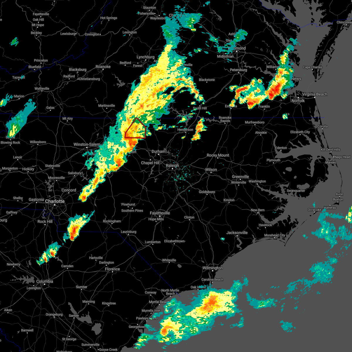 At 554 pm edt, a severe thunderstorm capable of producing a tornado was located near camp springs, moving northeast at 40 mph (radar indicated rotation). Hazards include tornado. Flying debris will be dangerous to those caught without shelter. mobile homes will be damaged or destroyed. damage to roofs, windows, and vehicles will occur. tree damage is likely. Locations impacted include, yanceyville, jericho, prospect hill, camp springs, blanch, leasburg, and hamer. At 554 pm edt, a severe thunderstorm capable of producing a tornado was located near camp springs, moving northeast at 40 mph (radar indicated rotation). Hazards include tornado. Flying debris will be dangerous to those caught without shelter. mobile homes will be damaged or destroyed. damage to roofs, windows, and vehicles will occur. tree damage is likely. Locations impacted include, yanceyville, jericho, prospect hill, camp springs, blanch, leasburg, and hamer.
|
| 3/18/2021 5:53 PM EDT |
 At 553 pm edt, a severe thunderstorm was located over jericho, moving northeast at 50 mph (radar indicated). Hazards include 60 mph wind gusts. Expect damage to roofs, siding, and trees. Locations impacted include, yanceyville, jericho, prospect hill, camp springs, milton, blanch, and leasburg. At 553 pm edt, a severe thunderstorm was located over jericho, moving northeast at 50 mph (radar indicated). Hazards include 60 mph wind gusts. Expect damage to roofs, siding, and trees. Locations impacted include, yanceyville, jericho, prospect hill, camp springs, milton, blanch, and leasburg.
|
| 3/18/2021 5:37 PM EDT |
 At 536 pm edt, a severe thunderstorm capable of producing a tornado was located 7 miles northeast of mcleansville, or 9 miles southwest of camp springs, moving northeast at 50 mph (radar indicated rotation). Hazards include tornado. Flying debris will be dangerous to those caught without shelter. mobile homes will be damaged or destroyed. damage to roofs, windows, and vehicles will occur. Tree damage is likely. At 536 pm edt, a severe thunderstorm capable of producing a tornado was located 7 miles northeast of mcleansville, or 9 miles southwest of camp springs, moving northeast at 50 mph (radar indicated rotation). Hazards include tornado. Flying debris will be dangerous to those caught without shelter. mobile homes will be damaged or destroyed. damage to roofs, windows, and vehicles will occur. Tree damage is likely.
|
| 3/18/2021 5:32 PM EDT |
 At 531 pm edt, a severe thunderstorm was located near mcleansville, or 11 miles northwest of burlington, moving northeast at 50 mph (radar indicated). Hazards include 60 mph wind gusts. expect damage to roofs, siding, and trees At 531 pm edt, a severe thunderstorm was located near mcleansville, or 11 miles northwest of burlington, moving northeast at 50 mph (radar indicated). Hazards include 60 mph wind gusts. expect damage to roofs, siding, and trees
|
| 10/29/2020 11:11 AM EDT |
 At 1108 am edt, severe tropical showers were located over climax, or near chatham, moving northeast at 55 mph (radar indicated. numerous trees were reported down in hanging rock and martinsville). Hazards include 70 mph wind gusts. Expect considerable tree damage. Damage is likely to mobile homes, roofs, and outbuildings. At 1108 am edt, severe tropical showers were located over climax, or near chatham, moving northeast at 55 mph (radar indicated. numerous trees were reported down in hanging rock and martinsville). Hazards include 70 mph wind gusts. Expect considerable tree damage. Damage is likely to mobile homes, roofs, and outbuildings.
|
| 9/29/2020 5:55 PM EDT |
 The severe thunderstorm warning for caswell, southeastern pittsylvania and southwestern halifax counties will expire at 600 pm edt, the storm which prompted the warning has weakened below severe limits, and no longer poses an immediate threat to life or property. therefore, the warning will be allowed to expire. however heavy rain is still possible with this thunderstorm. when it is safe to do so, please send your reports of hail of any size, as well as reports of any wind damage, including downed trees or large limbs, to the national weather service by calling toll free at 1, 8 6 6, 2 1 5, 4 3 2 4. reports and pictures can also be shared on the national weather service blacksburg facebook page and on twitter. The severe thunderstorm warning for caswell, southeastern pittsylvania and southwestern halifax counties will expire at 600 pm edt, the storm which prompted the warning has weakened below severe limits, and no longer poses an immediate threat to life or property. therefore, the warning will be allowed to expire. however heavy rain is still possible with this thunderstorm. when it is safe to do so, please send your reports of hail of any size, as well as reports of any wind damage, including downed trees or large limbs, to the national weather service by calling toll free at 1, 8 6 6, 2 1 5, 4 3 2 4. reports and pictures can also be shared on the national weather service blacksburg facebook page and on twitter.
|
| 9/29/2020 5:37 PM EDT |
 At 537 pm edt, a severe thunderstorm was located over milton, or 9 miles east of providence, moving northeast at 40 mph (radar indicated). Hazards include 60 mph wind gusts. Expect damage to roofs, siding, and trees. Locations impacted include, yanceyville, bethel, providence, jericho, prospect hill, turbeville, and camp springs. At 537 pm edt, a severe thunderstorm was located over milton, or 9 miles east of providence, moving northeast at 40 mph (radar indicated). Hazards include 60 mph wind gusts. Expect damage to roofs, siding, and trees. Locations impacted include, yanceyville, bethel, providence, jericho, prospect hill, turbeville, and camp springs.
|
| 9/29/2020 5:22 PM EDT |
 At 522 pm edt, a severe thunderstorm was located near camp springs, moving northeast at 40 mph (radar indicated). Hazards include 60 mph wind gusts and quarter size hail. Hail damage to vehicles is expected. Expect wind damage to roofs, siding, and trees. At 522 pm edt, a severe thunderstorm was located near camp springs, moving northeast at 40 mph (radar indicated). Hazards include 60 mph wind gusts and quarter size hail. Hail damage to vehicles is expected. Expect wind damage to roofs, siding, and trees.
|
| 8/6/2020 6:22 PM EDT |
 The severe thunderstorm warning for northeastern caswell and southwestern halifax counties will expire at 630 pm edt, the storm which prompted the warning has weakened below severe limits, and no longer poses an immediate threat to life or property. therefore, the warning will be allowed to expire. when it is safe to do so, please send your reports of hail of any size, as well as reports of any wind damage, including downed trees or large limbs, to the national weather service by calling toll free at 1, 8 6 6, 2 1 5, 4 3 2 4. reports and pictures can also be shared on the national weather service blacksburg facebook page and on twitter. The severe thunderstorm warning for northeastern caswell and southwestern halifax counties will expire at 630 pm edt, the storm which prompted the warning has weakened below severe limits, and no longer poses an immediate threat to life or property. therefore, the warning will be allowed to expire. when it is safe to do so, please send your reports of hail of any size, as well as reports of any wind damage, including downed trees or large limbs, to the national weather service by calling toll free at 1, 8 6 6, 2 1 5, 4 3 2 4. reports and pictures can also be shared on the national weather service blacksburg facebook page and on twitter.
|
| 8/6/2020 6:06 PM EDT |
 At 606 pm edt, a severe thunderstorm was located near semora, or near turbeville, moving northeast at 20 mph (radar indicated). Hazards include 60 mph wind gusts. Expect damage to roofs, siding, and trees. Locations impacted include, turbeville, milton, cluster springs, leasburg, semora, elmo, and alton. At 606 pm edt, a severe thunderstorm was located near semora, or near turbeville, moving northeast at 20 mph (radar indicated). Hazards include 60 mph wind gusts. Expect damage to roofs, siding, and trees. Locations impacted include, turbeville, milton, cluster springs, leasburg, semora, elmo, and alton.
|
| 8/6/2020 5:55 PM EDT | Tree down on hwy 86. time from rada in caswell county NC, 1.9 miles E of Yanceyville, NC |
| 8/6/2020 5:44 PM EDT |
 At 544 pm edt, a severe thunderstorm was located near semora, or 10 miles west of roxboro, moving northeast at 20 mph (radar indicated). Hazards include 60 mph wind gusts and quarter size hail. Hail damage to vehicles is expected. expect wind damage to roofs, siding, and trees. Locations impacted include, yanceyville, turbeville, milton, cluster springs, leasburg, hamer, and semora. At 544 pm edt, a severe thunderstorm was located near semora, or 10 miles west of roxboro, moving northeast at 20 mph (radar indicated). Hazards include 60 mph wind gusts and quarter size hail. Hail damage to vehicles is expected. expect wind damage to roofs, siding, and trees. Locations impacted include, yanceyville, turbeville, milton, cluster springs, leasburg, hamer, and semora.
|
| 8/6/2020 5:26 PM EDT |
 At 526 pm edt, a severe thunderstorm was located near leasburg, or 7 miles east of yanceyville, moving northeast at 20 mph (radar indicated). Hazards include 60 mph wind gusts and quarter size hail. Hail damage to vehicles is expected. Expect wind damage to roofs, siding, and trees. At 526 pm edt, a severe thunderstorm was located near leasburg, or 7 miles east of yanceyville, moving northeast at 20 mph (radar indicated). Hazards include 60 mph wind gusts and quarter size hail. Hail damage to vehicles is expected. Expect wind damage to roofs, siding, and trees.
|
| 8/3/2020 12:35 AM EDT |
 At 1235 am edt, a severe thunderstorm was located over ringgold, or just east of danville, moving northeast at 30 mph (radar indicated). Hazards include 60 mph wind gusts. expect damage to roofs, siding, and trees At 1235 am edt, a severe thunderstorm was located over ringgold, or just east of danville, moving northeast at 30 mph (radar indicated). Hazards include 60 mph wind gusts. expect damage to roofs, siding, and trees
|
| 8/1/2020 12:22 AM EDT |
 At 1221 am edt, a severe thunderstorm was located over leasburg, or 9 miles east of yanceyville, moving east at 35 mph (radar indicated). Hazards include 60 mph wind gusts. Expect damage to roofs, siding, and trees. Locations impacted include, yanceyville, jericho, prospect hill, leasburg, semora, topnot, and hightowers. At 1221 am edt, a severe thunderstorm was located over leasburg, or 9 miles east of yanceyville, moving east at 35 mph (radar indicated). Hazards include 60 mph wind gusts. Expect damage to roofs, siding, and trees. Locations impacted include, yanceyville, jericho, prospect hill, leasburg, semora, topnot, and hightowers.
|
| 7/31/2020 11:43 PM EDT |
 At 1142 pm edt, a severe thunderstorm was located near camp springs, moving east-northeast at 35 mph (radar indicated). Hazards include 60 mph wind gusts. expect damage to roofs, siding, and trees At 1142 pm edt, a severe thunderstorm was located near camp springs, moving east-northeast at 35 mph (radar indicated). Hazards include 60 mph wind gusts. expect damage to roofs, siding, and trees
|
| 7/28/2020 4:06 PM EDT |
 The severe thunderstorm warning for northern caswell, southeastern charlotte and southeastern halifax counties will expire at 415 pm edt, the storms which prompted the warning have weakened below severe limits, and have exited the warned area. therefore, the warning will be allowed to expire. however heavy rain is still possible with these thunderstorms. when it is safe to do so, please send your reports of hail of any size, as well as reports of any wind damage, including downed trees or large limbs, to the national weather service by calling toll free at 1, 8 6 6, 2 1 5, 4 3 2 4. reports and pictures can also be shared on the national weather service blacksburg facebook page and on twitter. The severe thunderstorm warning for northern caswell, southeastern charlotte and southeastern halifax counties will expire at 415 pm edt, the storms which prompted the warning have weakened below severe limits, and have exited the warned area. therefore, the warning will be allowed to expire. however heavy rain is still possible with these thunderstorms. when it is safe to do so, please send your reports of hail of any size, as well as reports of any wind damage, including downed trees or large limbs, to the national weather service by calling toll free at 1, 8 6 6, 2 1 5, 4 3 2 4. reports and pictures can also be shared on the national weather service blacksburg facebook page and on twitter.
|
| 7/28/2020 3:55 PM EDT |
 At 354 pm edt, severe thunderstorms were located along a line extending from mt laurel to yanceyville, moving east at 20 mph (radar indicated). Hazards include 60 mph wind gusts. Expect damage to roofs, siding, and trees. Locations impacted include, south boston, yanceyville, halifax, turbeville, redoak, clover, and milton. At 354 pm edt, severe thunderstorms were located along a line extending from mt laurel to yanceyville, moving east at 20 mph (radar indicated). Hazards include 60 mph wind gusts. Expect damage to roofs, siding, and trees. Locations impacted include, south boston, yanceyville, halifax, turbeville, redoak, clover, and milton.
|
| 7/28/2020 3:38 PM EDT | The caswell county 911 center reported a tree blown down by thunderstorm winds along longs mill roa in caswell county NC, 6.6 miles SW of Yanceyville, NC |
| 7/28/2020 3:27 PM EDT | The caswell county 911 call center reported a power line blown down by thunderstorm winds near the intersection of highway 158 and main stree in caswell county NC, 1.9 miles E of Yanceyville, NC |
| 7/28/2020 3:21 PM EDT |
 At 321 pm edt, severe thunderstorms were located along a line extending from near nathalie to lawsonville, moving east at 20 mph (radar indicated). Hazards include 60 mph wind gusts. expect damage to roofs, siding, and trees At 321 pm edt, severe thunderstorms were located along a line extending from near nathalie to lawsonville, moving east at 20 mph (radar indicated). Hazards include 60 mph wind gusts. expect damage to roofs, siding, and trees
|
| 7/10/2020 9:21 PM EDT |
 The severe thunderstorm warning for northeastern caswell, southeastern pittsylvania and southwestern halifax counties will expire at 930 pm edt, the storms which prompted the warning have weakened below severe limits, and have exited the warned area. therefore, the warning will be allowed to expire. when it is safe to do so, please send your reports of hail of any size, as well as reports of any wind damage, including downed trees or large limbs, to the national weather service by calling toll free at 1, 8 6 6, 2 1 5, 4 3 2 4. reports and pictures can also be shared on the national weather service blacksburg facebook page and on twitter. The severe thunderstorm warning for northeastern caswell, southeastern pittsylvania and southwestern halifax counties will expire at 930 pm edt, the storms which prompted the warning have weakened below severe limits, and have exited the warned area. therefore, the warning will be allowed to expire. when it is safe to do so, please send your reports of hail of any size, as well as reports of any wind damage, including downed trees or large limbs, to the national weather service by calling toll free at 1, 8 6 6, 2 1 5, 4 3 2 4. reports and pictures can also be shared on the national weather service blacksburg facebook page and on twitter.
|
| 7/10/2020 9:08 PM EDT |
 At 907 pm edt, severe thunderstorms were located along a line extending from near elmo to semora, moving east at 25 mph (radar indicated). Hazards include 60 mph wind gusts and quarter size hail. Hail damage to vehicles is expected. expect wind damage to roofs, siding, and trees. Locations impacted include, yanceyville, ingram, providence, blairs, milton, blanch, and leasburg. At 907 pm edt, severe thunderstorms were located along a line extending from near elmo to semora, moving east at 25 mph (radar indicated). Hazards include 60 mph wind gusts and quarter size hail. Hail damage to vehicles is expected. expect wind damage to roofs, siding, and trees. Locations impacted include, yanceyville, ingram, providence, blairs, milton, blanch, and leasburg.
|
| 7/10/2020 8:27 PM EDT |
 At 826 pm edt, severe thunderstorms were located along a line extending from westover hills to near bethel, moving east at 25 mph (radar indicated). Hazards include 60 mph wind gusts and quarter size hail. Hail damage to vehicles is expected. Expect wind damage to roofs, siding, and trees. At 826 pm edt, severe thunderstorms were located along a line extending from westover hills to near bethel, moving east at 25 mph (radar indicated). Hazards include 60 mph wind gusts and quarter size hail. Hail damage to vehicles is expected. Expect wind damage to roofs, siding, and trees.
|
| 7/1/2020 10:10 PM EDT |
 At 1009 pm edt, a severe thunderstorm was located near leda, or near nathalie, moving south at 25 mph (radar indicated). Hazards include 60 mph wind gusts. expect damage to roofs, siding, and trees At 1009 pm edt, a severe thunderstorm was located near leda, or near nathalie, moving south at 25 mph (radar indicated). Hazards include 60 mph wind gusts. expect damage to roofs, siding, and trees
|
| 4/13/2020 6:19 AM EDT |
 At 619 am edt, severe thunderstorms were located along a line extending from near toga to milton, moving northeast at 50 mph (radar indicated). Hazards include 60 mph wind gusts. Expect damage to roofs, siding, and trees. locations impacted include, south boston, yanceyville, appomattox, halifax, brookneal, phenix, and turbeville. A tornado watch remains in effect until noon edt for north central north carolina, and central and south central virginia. At 619 am edt, severe thunderstorms were located along a line extending from near toga to milton, moving northeast at 50 mph (radar indicated). Hazards include 60 mph wind gusts. Expect damage to roofs, siding, and trees. locations impacted include, south boston, yanceyville, appomattox, halifax, brookneal, phenix, and turbeville. A tornado watch remains in effect until noon edt for north central north carolina, and central and south central virginia.
|
| 4/13/2020 6:00 AM EDT |
 At 600 am edt, severe thunderstorms were located along a line extending from near stonewall to bethel, moving northeast at 50 mph (radar indicated). Hazards include 60 mph wind gusts. Expect damage to roofs, siding, and trees. locations impacted include, danville, reidsville, south boston, yanceyville, appomattox, bethel, and halifax. this includes the following location danville airport. A tornado watch remains in effect until noon edt for north central north carolina, and central and south central virginia. At 600 am edt, severe thunderstorms were located along a line extending from near stonewall to bethel, moving northeast at 50 mph (radar indicated). Hazards include 60 mph wind gusts. Expect damage to roofs, siding, and trees. locations impacted include, danville, reidsville, south boston, yanceyville, appomattox, bethel, and halifax. this includes the following location danville airport. A tornado watch remains in effect until noon edt for north central north carolina, and central and south central virginia.
|
| 4/13/2020 5:51 AM EDT |
 At 551 am edt, severe thunderstorms were located along a line extending from near concord to near lawsonville, moving northeast at 50 mph (radar indicated). Hazards include 60 mph wind gusts. Expect damage to roofs, siding, and trees. locations impacted include, danville, eden, reidsville, south boston, altavista, wentworth, and yanceyville. this includes the following location danville airport. A tornado watch remains in effect until noon edt for north central north carolina, and central and south central virginia. At 551 am edt, severe thunderstorms were located along a line extending from near concord to near lawsonville, moving northeast at 50 mph (radar indicated). Hazards include 60 mph wind gusts. Expect damage to roofs, siding, and trees. locations impacted include, danville, eden, reidsville, south boston, altavista, wentworth, and yanceyville. this includes the following location danville airport. A tornado watch remains in effect until noon edt for north central north carolina, and central and south central virginia.
|
| 4/13/2020 5:30 AM EDT |
 At 530 am edt, severe thunderstorms were located along a line extending from evington to near monroeton, moving northeast at 50 mph (radar indicated). Hazards include 60 mph wind gusts. expect damage to roofs, siding, and trees At 530 am edt, severe thunderstorms were located along a line extending from evington to near monroeton, moving northeast at 50 mph (radar indicated). Hazards include 60 mph wind gusts. expect damage to roofs, siding, and trees
|
| 4/8/2020 7:09 PM EDT |
 The severe thunderstorm warning for southern rockingham, caswell, southeastern pittsylvania and southern halifax counties will expire at 715 pm edt, the storms which prompted the warning have moved out of the area. therefore, the warning will be allowed to expire. a severe thunderstorm watch remains in effect until 800 pm edt for north central north carolina, and south central and southwestern virginia. when it is safe to do so, please send your reports of hail of any size, as well as reports of any wind damage, including downed trees or large limbs, to the national weather service by calling toll free at 1, 8 6 6, 2 1 5, 4 3 2 4. reports and pictures can also be shared on the national weather service blacksburg facebook page and on twitter. The severe thunderstorm warning for southern rockingham, caswell, southeastern pittsylvania and southern halifax counties will expire at 715 pm edt, the storms which prompted the warning have moved out of the area. therefore, the warning will be allowed to expire. a severe thunderstorm watch remains in effect until 800 pm edt for north central north carolina, and south central and southwestern virginia. when it is safe to do so, please send your reports of hail of any size, as well as reports of any wind damage, including downed trees or large limbs, to the national weather service by calling toll free at 1, 8 6 6, 2 1 5, 4 3 2 4. reports and pictures can also be shared on the national weather service blacksburg facebook page and on twitter.
|
| 4/8/2020 6:43 PM EDT |
 At 642 pm edt, severe thunderstorms were located along a line extending from turbeville to topnot to 6 miles southwest of camp springs to ellisboro, moving east at 40 mph (radar indicated). Hazards include 60 mph wind gusts and quarter size hail. Hail damage to vehicles is expected. Expect wind damage to roofs, siding, and trees. At 642 pm edt, severe thunderstorms were located along a line extending from turbeville to topnot to 6 miles southwest of camp springs to ellisboro, moving east at 40 mph (radar indicated). Hazards include 60 mph wind gusts and quarter size hail. Hail damage to vehicles is expected. Expect wind damage to roofs, siding, and trees.
|
| 4/8/2020 6:31 PM EDT |
 At 629 pm edt, severe thunderstorms were located along a line extending from near pelham to near monroeton to near bethany to ellisboro, moving southeast at 50 mph (radar indicated). Hazards include 60 mph wind gusts and half dollar size hail. Hail damage to vehicles is expected. expect wind damage to roofs, siding, and trees. Locations impacted include, reidsville, wentworth, madison, yanceyville, bethel, mayfield, and camp springs. At 629 pm edt, severe thunderstorms were located along a line extending from near pelham to near monroeton to near bethany to ellisboro, moving southeast at 50 mph (radar indicated). Hazards include 60 mph wind gusts and half dollar size hail. Hail damage to vehicles is expected. expect wind damage to roofs, siding, and trees. Locations impacted include, reidsville, wentworth, madison, yanceyville, bethel, mayfield, and camp springs.
|
| 4/8/2020 6:14 PM EDT |
 At 614 pm edt, severe thunderstorms were located along a line extending from near cascade to wentworth to near madison, moving southeast at 45 mph (radar indicated). Hazards include 60 mph wind gusts and half dollar size hail. Hail damage to vehicles is expected. Expect wind damage to roofs, siding, and trees. At 614 pm edt, severe thunderstorms were located along a line extending from near cascade to wentworth to near madison, moving southeast at 45 mph (radar indicated). Hazards include 60 mph wind gusts and half dollar size hail. Hail damage to vehicles is expected. Expect wind damage to roofs, siding, and trees.
|
| 4/8/2020 5:52 PM EDT |
 The severe thunderstorm warning for northeastern caswell county will expire at 600 pm edt, the storm which prompted the warning has moved out of the area. therefore, the warning will be allowed to expire. a severe thunderstorm watch remains in effect until 800 pm edt for north central north carolina, and south central virginia. when it is safe to do so, please send your reports of hail of any size, as well as reports of any wind damage, including downed trees or large limbs, to the national weather service by calling toll free at 1, 8 6 6, 2 1 5, 4 3 2 4. reports and pictures can also be shared on the national weather service blacksburg facebook page and on twitter. The severe thunderstorm warning for northeastern caswell county will expire at 600 pm edt, the storm which prompted the warning has moved out of the area. therefore, the warning will be allowed to expire. a severe thunderstorm watch remains in effect until 800 pm edt for north central north carolina, and south central virginia. when it is safe to do so, please send your reports of hail of any size, as well as reports of any wind damage, including downed trees or large limbs, to the national weather service by calling toll free at 1, 8 6 6, 2 1 5, 4 3 2 4. reports and pictures can also be shared on the national weather service blacksburg facebook page and on twitter.
|
| 4/8/2020 5:46 PM EDT |
 At 545 pm edt, a severe thunderstorm was located near leasburg, moving southeast at 40 mph (radar indicated). Hazards include 60 mph wind gusts and quarter size hail. Hail damage to vehicles is expected. expect wind damage to roofs, siding, and trees. Locations impacted include, yanceyville, milton, blanch, leasburg, hamer, semora, and topnot. At 545 pm edt, a severe thunderstorm was located near leasburg, moving southeast at 40 mph (radar indicated). Hazards include 60 mph wind gusts and quarter size hail. Hail damage to vehicles is expected. expect wind damage to roofs, siding, and trees. Locations impacted include, yanceyville, milton, blanch, leasburg, hamer, semora, and topnot.
|
| 4/8/2020 5:37 PM EDT |
 At 537 pm edt, a severe thunderstorm was located over semora, or 10 miles northeast of yanceyville, moving southeast at 40 mph (radar indicated). Hazards include 60 mph wind gusts and quarter size hail. Hail damage to vehicles is expected. Expect wind damage to roofs, siding, and trees. At 537 pm edt, a severe thunderstorm was located over semora, or 10 miles northeast of yanceyville, moving southeast at 40 mph (radar indicated). Hazards include 60 mph wind gusts and quarter size hail. Hail damage to vehicles is expected. Expect wind damage to roofs, siding, and trees.
|
| 2/6/2020 12:45 PM EST | Tree blown down on pallie watlington roa in caswell county NC, 4.1 miles E of Yanceyville, NC |
| 2/6/2020 12:37 PM EST | Tree blown down along highway 15 in caswell county NC, 6.5 miles ENE of Yanceyville, NC |
| 1/11/2020 11:50 PM EST |
 At 1149 pm est, severe thunderstorms were located along a line extending from near ingram to near prospect hill, moving northeast at 70 mph (radar indicated). Hazards include 60 mph wind gusts. Expect damage to roofs, siding, and trees. locations impacted include, danville, south boston, yanceyville, bethel, jericho, prospect hill, and turbeville. This includes the following location danville airport. At 1149 pm est, severe thunderstorms were located along a line extending from near ingram to near prospect hill, moving northeast at 70 mph (radar indicated). Hazards include 60 mph wind gusts. Expect damage to roofs, siding, and trees. locations impacted include, danville, south boston, yanceyville, bethel, jericho, prospect hill, and turbeville. This includes the following location danville airport.
|
| 1/11/2020 11:21 PM EST |
 At 1121 pm est, severe thunderstorms were located along a line extending from near swansonville to 9 miles east of randleman, moving northeast at 75 mph (radar indicated). Hazards include 60 mph wind gusts. expect damage to roofs, siding, and trees At 1121 pm est, severe thunderstorms were located along a line extending from near swansonville to 9 miles east of randleman, moving northeast at 75 mph (radar indicated). Hazards include 60 mph wind gusts. expect damage to roofs, siding, and trees
|
| 1/11/2020 11:07 PM EST |
 At 1106 pm est, severe thunderstorms were located along a line extending from 7 miles southwest of wintergreen to near jericho, moving east at 50 mph (radar indicated). Hazards include 60 mph wind gusts. Expect damage to roofs, siding, and trees. locations impacted include, lynchburg, danville, bedford, altavista, amherst, yanceyville, and bethel. This includes the following locations liberty university, danville airport, and lynchburg airport. At 1106 pm est, severe thunderstorms were located along a line extending from 7 miles southwest of wintergreen to near jericho, moving east at 50 mph (radar indicated). Hazards include 60 mph wind gusts. Expect damage to roofs, siding, and trees. locations impacted include, lynchburg, danville, bedford, altavista, amherst, yanceyville, and bethel. This includes the following locations liberty university, danville airport, and lynchburg airport.
|
| 1/11/2020 10:33 PM EST |
 At 1032 pm est, severe thunderstorms were located along a line extending from near buena vista to 6 miles northwest of greensboro, moving northeast at 75 mph (radar indicated. numerous trees were reported down by this line of storms in giles county and in galax). Hazards include 60 mph wind gusts. expect damage to roofs, siding, and trees At 1032 pm est, severe thunderstorms were located along a line extending from near buena vista to 6 miles northwest of greensboro, moving northeast at 75 mph (radar indicated. numerous trees were reported down by this line of storms in giles county and in galax). Hazards include 60 mph wind gusts. expect damage to roofs, siding, and trees
|
| 10/31/2019 7:36 PM EDT |
 The severe thunderstorm warning for eastern caswell county will expire at 745 pm edt, the storms which prompted the warning have moved out of the area. therefore, the warning will be allowed to expire. a tornado watch remains in effect until 1100 pm edt for north central north carolina, and south central virginia. when it is safe to do so, please send your reports of hail of any size, as well as reports of any wind damage, including downed trees or large limbs, to the national weather service by calling toll free at 1, 8 6 6, 2 1 5, 4 3 2 4. reports and pictures can also be shared on the national weather service blacksburg facebook page and on twitter. The severe thunderstorm warning for eastern caswell county will expire at 745 pm edt, the storms which prompted the warning have moved out of the area. therefore, the warning will be allowed to expire. a tornado watch remains in effect until 1100 pm edt for north central north carolina, and south central virginia. when it is safe to do so, please send your reports of hail of any size, as well as reports of any wind damage, including downed trees or large limbs, to the national weather service by calling toll free at 1, 8 6 6, 2 1 5, 4 3 2 4. reports and pictures can also be shared on the national weather service blacksburg facebook page and on twitter.
|
| 10/31/2019 7:25 PM EDT | Tree dow in caswell county NC, 8.4 miles WNW of Yanceyville, NC |
| 10/31/2019 7:15 PM EDT |
 At 715 pm edt, severe thunderstorms were located along a line extending from near milton to near baynes, moving east at 80 mph (radar indicated). Hazards include 60 mph wind gusts. expect damage to roofs, siding, and trees At 715 pm edt, severe thunderstorms were located along a line extending from near milton to near baynes, moving east at 80 mph (radar indicated). Hazards include 60 mph wind gusts. expect damage to roofs, siding, and trees
|
| 10/31/2019 7:03 PM EDT |
 At 702 pm edt, a severe thunderstorm capable of producing a tornado was located over topnot, or near yanceyville, moving northeast at 50 mph (radar indicated rotation). Hazards include tornado. Flying debris will be dangerous to those caught without shelter. mobile homes will be damaged or destroyed. damage to roofs, windows, and vehicles will occur. tree damage is likely. Locations impacted include, yanceyville, jericho, milton, blanch, leasburg, hamer, and semora. At 702 pm edt, a severe thunderstorm capable of producing a tornado was located over topnot, or near yanceyville, moving northeast at 50 mph (radar indicated rotation). Hazards include tornado. Flying debris will be dangerous to those caught without shelter. mobile homes will be damaged or destroyed. damage to roofs, windows, and vehicles will occur. tree damage is likely. Locations impacted include, yanceyville, jericho, milton, blanch, leasburg, hamer, and semora.
|
| 10/31/2019 7:00 PM EDT | Trees dow in caswell county NC, 7.7 miles NNE of Yanceyville, NC |
| 10/31/2019 6:52 PM EDT |
 At 652 pm edt, a severe thunderstorm capable of producing a tornado was located over camp springs, moving northeast at 55 mph (radar indicated rotation). Hazards include tornado. Flying debris will be dangerous to those caught without shelter. mobile homes will be damaged or destroyed. damage to roofs, windows, and vehicles will occur. Tree damage is likely. At 652 pm edt, a severe thunderstorm capable of producing a tornado was located over camp springs, moving northeast at 55 mph (radar indicated rotation). Hazards include tornado. Flying debris will be dangerous to those caught without shelter. mobile homes will be damaged or destroyed. damage to roofs, windows, and vehicles will occur. Tree damage is likely.
|
| 8/23/2019 6:43 PM EDT |
 At 642 pm edt, severe thunderstorms were located along a line extending from near keeling to near eden, moving east at 30 mph (radar indicated). Hazards include 60 mph wind gusts. Expect damage to roofs, siding, and trees. locations impacted include, danville, eden, reidsville, wentworth, and mayodan. This includes the following location danville airport. At 642 pm edt, severe thunderstorms were located along a line extending from near keeling to near eden, moving east at 30 mph (radar indicated). Hazards include 60 mph wind gusts. Expect damage to roofs, siding, and trees. locations impacted include, danville, eden, reidsville, wentworth, and mayodan. This includes the following location danville airport.
|
| 8/23/2019 6:21 PM EDT |
 At 621 pm edt, severe thunderstorms were located along a line extending from near blairs to near price, moving east at 30 mph (radar indicated). Hazards include 60 mph wind gusts. expect damage to roofs, siding, and trees At 621 pm edt, severe thunderstorms were located along a line extending from near blairs to near price, moving east at 30 mph (radar indicated). Hazards include 60 mph wind gusts. expect damage to roofs, siding, and trees
|
| 8/22/2019 5:13 PM EDT |
 At 512 pm edt, a severe thunderstorm was located over bethel, moving east at 30 mph (radar indicated). Hazards include 60 mph wind gusts. expect damage to roofs, siding, and trees At 512 pm edt, a severe thunderstorm was located over bethel, moving east at 30 mph (radar indicated). Hazards include 60 mph wind gusts. expect damage to roofs, siding, and trees
|
| 8/22/2019 5:10 PM EDT |
 The severe thunderstorm warning for eastern rockingham and caswell counties will expire at 515 pm edt, the storm which prompted the warning has moved out of the area. therefore, the warning will be allowed to expire. when it is safe to do so, please send your reports of hail of any size, as well as reports of any wind damage, including downed trees or large limbs, to the national weather service by calling toll free at 1, 8 6 6, 2 1 5, 4 3 2 4. reports and pictures can also be shared on the national weather service blacksburg facebook page and on twitter. remember, a severe thunderstorm warning still remains in effect for caswell county until 545 pm edt. The severe thunderstorm warning for eastern rockingham and caswell counties will expire at 515 pm edt, the storm which prompted the warning has moved out of the area. therefore, the warning will be allowed to expire. when it is safe to do so, please send your reports of hail of any size, as well as reports of any wind damage, including downed trees or large limbs, to the national weather service by calling toll free at 1, 8 6 6, 2 1 5, 4 3 2 4. reports and pictures can also be shared on the national weather service blacksburg facebook page and on twitter. remember, a severe thunderstorm warning still remains in effect for caswell county until 545 pm edt.
|
| 8/22/2019 4:57 PM EDT |
 At 435 pm edt, a severe thunderstorm was located over bethany, moving east at 35 mph. an additional severe thunderstorm was located west of danville along the north carolina virginia state line (radar indicated). Hazards include 60 mph wind gusts. Expect damage to roofs, siding, and trees. Locations impacted include, eden, reidsville, wentworth, yanceyville, and bethel. At 435 pm edt, a severe thunderstorm was located over bethany, moving east at 35 mph. an additional severe thunderstorm was located west of danville along the north carolina virginia state line (radar indicated). Hazards include 60 mph wind gusts. Expect damage to roofs, siding, and trees. Locations impacted include, eden, reidsville, wentworth, yanceyville, and bethel.
|
| 8/22/2019 4:36 PM EDT |
 At 435 pm edt, a severe thunderstorm was located over bethany, moving east at 35 mph. an additional severe thunderstorm was located west of danville along the north carolina virginia state line (radar indicated). Hazards include 60 mph wind gusts. Expect damage to roofs, siding, and trees. Locations impacted include, eden, reidsville, wentworth, yanceyville, and bethel. At 435 pm edt, a severe thunderstorm was located over bethany, moving east at 35 mph. an additional severe thunderstorm was located west of danville along the north carolina virginia state line (radar indicated). Hazards include 60 mph wind gusts. Expect damage to roofs, siding, and trees. Locations impacted include, eden, reidsville, wentworth, yanceyville, and bethel.
|
| 8/22/2019 4:13 PM EDT |
 At 412 pm edt, a severe thunderstorm was located near pine hall, moving east at 30 mph (radar indicated). Hazards include 60 mph wind gusts and quarter size hail. Hail damage to vehicles is expected. Expect wind damage to roofs, siding, and trees. At 412 pm edt, a severe thunderstorm was located near pine hall, moving east at 30 mph (radar indicated). Hazards include 60 mph wind gusts and quarter size hail. Hail damage to vehicles is expected. Expect wind damage to roofs, siding, and trees.
|
| 8/21/2019 6:04 PM EDT |
 At 603 pm edt, a severe thunderstorm was located near jericho, moving southeast at 40 mph (radar indicated). Hazards include 60 mph wind gusts. Expect damage to roofs, siding, and trees. Locations impacted include, reidsville, yanceyville, jericho, prospect hill, and camp springs. At 603 pm edt, a severe thunderstorm was located near jericho, moving southeast at 40 mph (radar indicated). Hazards include 60 mph wind gusts. Expect damage to roofs, siding, and trees. Locations impacted include, reidsville, yanceyville, jericho, prospect hill, and camp springs.
|
| 8/21/2019 5:41 PM EDT |
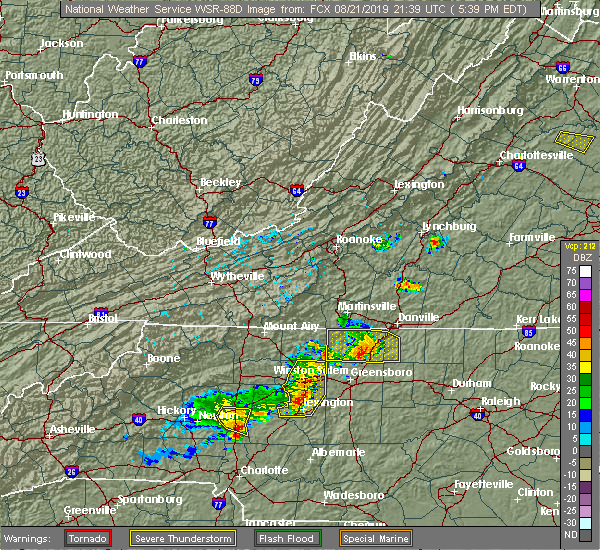 The national weather service in blacksburg has issued a * severe thunderstorm warning for. southeastern rockingham county in north central north carolina. caswell county in north central north carolina. Until 645 pm edt * at 541 pm edt, a severe thunderstorm was located near reidsville,. The national weather service in blacksburg has issued a * severe thunderstorm warning for. southeastern rockingham county in north central north carolina. caswell county in north central north carolina. Until 645 pm edt * at 541 pm edt, a severe thunderstorm was located near reidsville,.
|
| 8/21/2019 5:25 PM EDT |
 A severe thunderstorm warning remains in effect until 545 pm edt for rockingham and western caswell counties. at 523 pm edt, a severe thunderstorm was located over reidsville, moving southeast at 35 mph. At 520 pm edt, law enforcement reported widespread damage to trees in rockingham county. A severe thunderstorm warning remains in effect until 545 pm edt for rockingham and western caswell counties. at 523 pm edt, a severe thunderstorm was located over reidsville, moving southeast at 35 mph. At 520 pm edt, law enforcement reported widespread damage to trees in rockingham county.
|
| 8/21/2019 5:10 PM EDT |
 At 509 pm edt, a severe thunderstorm was located near wentworth, moving southeast at 30 mph (radar indicated). Hazards include 60 mph wind gusts. Expect damage to roofs, siding, and trees. Locations impacted include, eden, reidsville, wentworth, mayodan, and madison. At 509 pm edt, a severe thunderstorm was located near wentworth, moving southeast at 30 mph (radar indicated). Hazards include 60 mph wind gusts. Expect damage to roofs, siding, and trees. Locations impacted include, eden, reidsville, wentworth, mayodan, and madison.
|
| 8/21/2019 4:52 PM EDT |
 At 452 pm edt, a severe thunderstorm was located near ayersville, moving southeast at 35 mph (radar indicated). Hazards include 60 mph wind gusts. expect damage to roofs, siding, and trees At 452 pm edt, a severe thunderstorm was located near ayersville, moving southeast at 35 mph (radar indicated). Hazards include 60 mph wind gusts. expect damage to roofs, siding, and trees
|
| 8/15/2019 11:03 PM EDT |
 At 1103 pm edt, severe thunderstorms were located along a line extending from near pelham to near camp springs, moving east at 15 mph (radar indicated). Hazards include 60 mph wind gusts. Expect damage to roofs, siding, and trees. locations impacted include, danville, yanceyville, bethel, providence, and mayfield. This includes the following location danville airport. At 1103 pm edt, severe thunderstorms were located along a line extending from near pelham to near camp springs, moving east at 15 mph (radar indicated). Hazards include 60 mph wind gusts. Expect damage to roofs, siding, and trees. locations impacted include, danville, yanceyville, bethel, providence, and mayfield. This includes the following location danville airport.
|
| 8/15/2019 11:03 PM EDT |
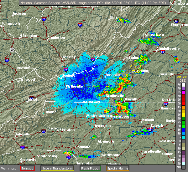 At 1103 pm edt, severe thunderstorms were located along a line extending from near pelham to near camp springs, moving east at 15 mph (radar indicated). Hazards include 60 mph wind gusts. Expect damage to roofs, siding, and trees. locations impacted include, danville, yanceyville, bethel, providence, and mayfield. This includes the following location danville airport. At 1103 pm edt, severe thunderstorms were located along a line extending from near pelham to near camp springs, moving east at 15 mph (radar indicated). Hazards include 60 mph wind gusts. Expect damage to roofs, siding, and trees. locations impacted include, danville, yanceyville, bethel, providence, and mayfield. This includes the following location danville airport.
|
| 8/15/2019 10:37 PM EDT |
 At 1037 pm edt, a severe thunderstorm was located near oregon hill, moving northeast at 15 mph (radar indicated). Hazards include 60 mph wind gusts and quarter size hail. Hail damage to vehicles is expected. Expect wind damage to roofs, siding, and trees. At 1037 pm edt, a severe thunderstorm was located near oregon hill, moving northeast at 15 mph (radar indicated). Hazards include 60 mph wind gusts and quarter size hail. Hail damage to vehicles is expected. Expect wind damage to roofs, siding, and trees.
|
| 8/13/2019 4:33 PM EDT |
 At 433 pm edt, severe thunderstorms were located along a line extending from near quick to near jericho, moving southeast at 40 mph (radar indicated). Hazards include 60 mph wind gusts and quarter size hail. Hail damage to vehicles is expected. expect wind damage to roofs, siding, and trees. Locations impacted include, yanceyville, jericho, prospect hill, camp springs, and quick. At 433 pm edt, severe thunderstorms were located along a line extending from near quick to near jericho, moving southeast at 40 mph (radar indicated). Hazards include 60 mph wind gusts and quarter size hail. Hail damage to vehicles is expected. expect wind damage to roofs, siding, and trees. Locations impacted include, yanceyville, jericho, prospect hill, camp springs, and quick.
|
| 8/13/2019 4:14 PM EDT |
 At 339 pm edt, severe thunderstorms were located along a line extending from semora to near eden to capella, moving east at 25 mph (radar indicated). Hazards include 60 mph wind gusts and quarter size hail. Hail damage to vehicles is expected. Expect wind damage to roofs, siding, and trees. At 339 pm edt, severe thunderstorms were located along a line extending from semora to near eden to capella, moving east at 25 mph (radar indicated). Hazards include 60 mph wind gusts and quarter size hail. Hail damage to vehicles is expected. Expect wind damage to roofs, siding, and trees.
|
| 8/13/2019 3:39 PM EDT |
 At 339 pm edt, severe thunderstorms were located along a line extending from semora to near eden to capella, moving east at 25 mph (radar indicated). Hazards include 60 mph wind gusts and quarter size hail. Hail damage to vehicles is expected. Expect wind damage to roofs, siding, and trees. At 339 pm edt, severe thunderstorms were located along a line extending from semora to near eden to capella, moving east at 25 mph (radar indicated). Hazards include 60 mph wind gusts and quarter size hail. Hail damage to vehicles is expected. Expect wind damage to roofs, siding, and trees.
|
| 8/13/2019 3:02 PM EDT |
 At 301 pm edt, a severe thunderstorm was located over pelham, moving east at 20 mph (radar indicated). Hazards include 60 mph wind gusts and quarter size hail. Hail damage to vehicles is expected. expect wind damage to roofs, siding, and trees. Locations impacted include, yanceyville, bethel, providence, milton, and gatewood. At 301 pm edt, a severe thunderstorm was located over pelham, moving east at 20 mph (radar indicated). Hazards include 60 mph wind gusts and quarter size hail. Hail damage to vehicles is expected. expect wind damage to roofs, siding, and trees. Locations impacted include, yanceyville, bethel, providence, milton, and gatewood.
|
| 8/13/2019 2:51 PM EDT |
 The national weather service in blacksburg has issued a * severe thunderstorm warning for. northeastern rockingham county in north central north carolina. northern caswell county in north central north carolina. Until 345 pm edt * at 251 pm edt, a severe thunderstorm was located over pelham,. The national weather service in blacksburg has issued a * severe thunderstorm warning for. northeastern rockingham county in north central north carolina. northern caswell county in north central north carolina. Until 345 pm edt * at 251 pm edt, a severe thunderstorm was located over pelham,.
|
| 8/1/2019 5:17 PM EDT |
 At 516 pm edt, a severe thunderstorm was located over ringgold, moving east at 10 mph (radar indicated). Hazards include 60 mph wind gusts and quarter size hail. Hail damage to vehicles is expected. Expect wind damage to roofs, siding, and trees. At 516 pm edt, a severe thunderstorm was located over ringgold, moving east at 10 mph (radar indicated). Hazards include 60 mph wind gusts and quarter size hail. Hail damage to vehicles is expected. Expect wind damage to roofs, siding, and trees.
|
| 7/2/2019 7:24 PM EDT |
 The severe thunderstorm warning for northeastern caswell county will expire at 730 pm edt, the storm which prompted the warning has weakened below severe limits and has exited the warned area. therefore, the warning will be allowed to expire. when it is safe to do so, please send your reports of hail of any size, as well as reports of any wind damage, including downed trees or large limbs, to the national weather service by calling toll free at 1, 8 6 6, 2 1 5, 4 3 2 4. reports and pictures can also be shared on the national weather service blacksburg facebook page and on twitter. The severe thunderstorm warning for northeastern caswell county will expire at 730 pm edt, the storm which prompted the warning has weakened below severe limits and has exited the warned area. therefore, the warning will be allowed to expire. when it is safe to do so, please send your reports of hail of any size, as well as reports of any wind damage, including downed trees or large limbs, to the national weather service by calling toll free at 1, 8 6 6, 2 1 5, 4 3 2 4. reports and pictures can also be shared on the national weather service blacksburg facebook page and on twitter.
|
| 7/2/2019 7:12 PM EDT |
 At 712 pm edt, a severe thunderstorm was located over hamer, moving east at 20 mph (radar indicated). Hazards include 60 mph wind gusts and quarter size hail. Hail damage to vehicles is expected. expect wind damage to roofs, siding, and trees. Locations impacted include, yanceyville, milton, blanch, leasburg, and hamer. At 712 pm edt, a severe thunderstorm was located over hamer, moving east at 20 mph (radar indicated). Hazards include 60 mph wind gusts and quarter size hail. Hail damage to vehicles is expected. expect wind damage to roofs, siding, and trees. Locations impacted include, yanceyville, milton, blanch, leasburg, and hamer.
|
| 7/2/2019 6:56 PM EDT |
 At 655 pm edt, a severe thunderstorm was located over providence, moving east at 20 mph (radar indicated). Hazards include 60 mph wind gusts and quarter size hail. Hail damage to vehicles is expected. expect wind damage to roofs, siding, and trees. locations impacted include, danville, yanceyville, bethel, providence, and turbeville. This includes the following location danville airport. At 655 pm edt, a severe thunderstorm was located over providence, moving east at 20 mph (radar indicated). Hazards include 60 mph wind gusts and quarter size hail. Hail damage to vehicles is expected. expect wind damage to roofs, siding, and trees. locations impacted include, danville, yanceyville, bethel, providence, and turbeville. This includes the following location danville airport.
|
| 7/2/2019 6:30 PM EDT |
 At 629 pm edt, a severe thunderstorm was located over pelham, moving east at 20 mph (radar indicated). Hazards include 60 mph wind gusts and quarter size hail. Hail damage to vehicles is expected. Expect wind damage to roofs, siding, and trees. At 629 pm edt, a severe thunderstorm was located over pelham, moving east at 20 mph (radar indicated). Hazards include 60 mph wind gusts and quarter size hail. Hail damage to vehicles is expected. Expect wind damage to roofs, siding, and trees.
|
| 6/20/2019 2:39 PM EDT |
 A severe thunderstorm warning remains in effect until 315 pm edt for eastern caswell and southern halifax counties. at 238 pm edt, a severe thunderstorm was located over leasburg, moving east at 55 mph. Widespread tree damage has been reported with this storm. A severe thunderstorm warning remains in effect until 315 pm edt for eastern caswell and southern halifax counties. at 238 pm edt, a severe thunderstorm was located over leasburg, moving east at 55 mph. Widespread tree damage has been reported with this storm.
|
| 6/20/2019 2:36 PM EDT |
 At 234 pm edt, a severe thunderstorm capable of producing a tornado was located over milton, moving east at 45 mph (radar indicated rotation). Hazards include tornado. Flying debris will be dangerous to those caught without shelter. mobile homes will be damaged or destroyed. damage to roofs, windows, and vehicles will occur. tree damage is likely. Locations impacted include, providence, turbeville, milton, blanch, and hamer. At 234 pm edt, a severe thunderstorm capable of producing a tornado was located over milton, moving east at 45 mph (radar indicated rotation). Hazards include tornado. Flying debris will be dangerous to those caught without shelter. mobile homes will be damaged or destroyed. damage to roofs, windows, and vehicles will occur. tree damage is likely. Locations impacted include, providence, turbeville, milton, blanch, and hamer.
|
| 6/20/2019 2:35 PM EDT | At least two trees were blown down by strong thunderstorm winds near powell lane off of highway 8 in caswell county NC, 4.4 miles WNW of Yanceyville, NC |
| 6/20/2019 2:30 PM EDT | Multiple trees down across the county. emergency management reports trees blocking several roads... including at leasburg; trees over route 62 between bethel and milton in caswell county NC, 0.4 miles NNE of Yanceyville, NC |
| 6/20/2019 2:28 PM EDT |
 At 227 pm edt, a severe thunderstorm capable of producing a tornado was located over blanch, moving east at 45 mph (radar indicated rotation). Hazards include tornado. Flying debris will be dangerous to those caught without shelter. mobile homes will be damaged or destroyed. damage to roofs, windows, and vehicles will occur. Tree damage is likely. At 227 pm edt, a severe thunderstorm capable of producing a tornado was located over blanch, moving east at 45 mph (radar indicated rotation). Hazards include tornado. Flying debris will be dangerous to those caught without shelter. mobile homes will be damaged or destroyed. damage to roofs, windows, and vehicles will occur. Tree damage is likely.
|
| 6/20/2019 2:19 PM EDT |
 At 219 pm edt, a severe thunderstorm was located over quick, moving east at 55 mph (radar indicated). Hazards include 70 mph wind gusts and quarter size hail. Hail damage to vehicles is expected. expect considerable tree damage. wind damage is also likely to mobile homes, roofs, and outbuildings. locations impacted include, danville, reidsville, south boston, yanceyville, and bethel. This includes the following location danville airport. At 219 pm edt, a severe thunderstorm was located over quick, moving east at 55 mph (radar indicated). Hazards include 70 mph wind gusts and quarter size hail. Hail damage to vehicles is expected. expect considerable tree damage. wind damage is also likely to mobile homes, roofs, and outbuildings. locations impacted include, danville, reidsville, south boston, yanceyville, and bethel. This includes the following location danville airport.
|
| 6/20/2019 2:06 PM EDT |
 At 206 pm edt, a severe thunderstorm was located over wentworth, moving east at 55 mph (radar indicated). Hazards include 60 mph wind gusts and quarter size hail. Hail damage to vehicles is expected. Expect wind damage to roofs, siding, and trees. At 206 pm edt, a severe thunderstorm was located over wentworth, moving east at 55 mph (radar indicated). Hazards include 60 mph wind gusts and quarter size hail. Hail damage to vehicles is expected. Expect wind damage to roofs, siding, and trees.
|
| 6/18/2019 6:50 PM EDT |
 The severe thunderstorm warning for eastern rockingham, and western caswell counties and the southwestern city of danville will expire at 700 pm edt, the storm which prompted the warning has weakened below severe limits, and no longer poses an immediate threat to life or property. therefore, the warning will be allowed to expire. however heavy rain is still possible with this thunderstorm. when it is safe to do so, please send your reports of hail of any size, as well as reports of any wind damage, including downed trees or large limbs, to the national weather service by calling toll free at 1, 8 6 6, 2 1 5, 4 3 2 4. reports and pictures can also be shared on the national weather service blacksburg facebook page and on twitter. The severe thunderstorm warning for eastern rockingham, and western caswell counties and the southwestern city of danville will expire at 700 pm edt, the storm which prompted the warning has weakened below severe limits, and no longer poses an immediate threat to life or property. therefore, the warning will be allowed to expire. however heavy rain is still possible with this thunderstorm. when it is safe to do so, please send your reports of hail of any size, as well as reports of any wind damage, including downed trees or large limbs, to the national weather service by calling toll free at 1, 8 6 6, 2 1 5, 4 3 2 4. reports and pictures can also be shared on the national weather service blacksburg facebook page and on twitter.
|
| 6/18/2019 6:19 PM EDT |
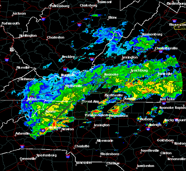 At 607 pm edt, a severe thunderstorm was located over monroeton, moving northeast at 20 mph (radar indicated). Hazards include 60 mph wind gusts and quarter size hail. Hail damage to vehicles is expected. Expect wind damage to roofs, siding, and trees. At 607 pm edt, a severe thunderstorm was located over monroeton, moving northeast at 20 mph (radar indicated). Hazards include 60 mph wind gusts and quarter size hail. Hail damage to vehicles is expected. Expect wind damage to roofs, siding, and trees.
|
| 6/18/2019 6:07 PM EDT |
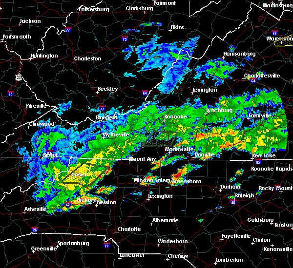 At 607 pm edt, a severe thunderstorm was located over monroeton, moving northeast at 20 mph (radar indicated). Hazards include 60 mph wind gusts and quarter size hail. Hail damage to vehicles is expected. Expect wind damage to roofs, siding, and trees. At 607 pm edt, a severe thunderstorm was located over monroeton, moving northeast at 20 mph (radar indicated). Hazards include 60 mph wind gusts and quarter size hail. Hail damage to vehicles is expected. Expect wind damage to roofs, siding, and trees.
|
| 5/31/2019 4:31 PM EDT |
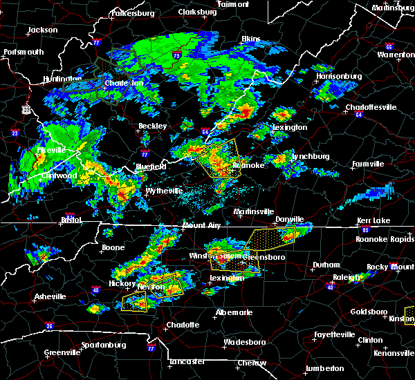 A severe thunderstorm warning remains in effect until 530 pm edt for eastern caswell county. at 431 pm edt, a severe thunderstorm was located over yanceyville, moving east at 20 mph. hazard. 60 mph wind gusts and quarter size hail. A severe thunderstorm warning remains in effect until 530 pm edt for eastern caswell county. at 431 pm edt, a severe thunderstorm was located over yanceyville, moving east at 20 mph. hazard. 60 mph wind gusts and quarter size hail.
|
| 5/31/2019 4:29 PM EDT |
 The national weather service in blacksburg has issued a * severe thunderstorm warning for. eastern rockingham county in north central north carolina. caswell county in north central north carolina. Until 530 pm edt * at 429 pm edt, a severe thunderstorm was located over yanceyville,. The national weather service in blacksburg has issued a * severe thunderstorm warning for. eastern rockingham county in north central north carolina. caswell county in north central north carolina. Until 530 pm edt * at 429 pm edt, a severe thunderstorm was located over yanceyville,.
|
| 5/31/2019 4:27 PM EDT | Golf Ball sized hail reported 3.6 miles WNW of Yanceyville, NC, spotter reported golf ball size hail 4 miles east of yanceville. timing estimated from radar. |
| 5/31/2019 4:20 PM EDT | Emergency manager reports dozens of pine trees snapped off on east side of farmer lake... as well as picnic shelter blown off its foundation. all trees down in same dir in caswell county NC, 3 miles NE of Yanceyville, NC |
| 5/31/2019 4:19 PM EDT |
 At 404 pm edt, a severe thunderstorm was located over bethel, moving east at 35 mph. quarter size hail was reported with this system near harrisons crossroads at 3:42 pm (radar indicated). Hazards include 60 mph wind gusts and quarter size hail. Hail damage to vehicles is expected. expect wind damage to roofs, siding, and trees. locations impacted include, danville, yanceyville, bethel, providence, and mayfield. This includes the following location danville airport. At 404 pm edt, a severe thunderstorm was located over bethel, moving east at 35 mph. quarter size hail was reported with this system near harrisons crossroads at 3:42 pm (radar indicated). Hazards include 60 mph wind gusts and quarter size hail. Hail damage to vehicles is expected. expect wind damage to roofs, siding, and trees. locations impacted include, danville, yanceyville, bethel, providence, and mayfield. This includes the following location danville airport.
|
| 5/31/2019 4:05 PM EDT |
 At 404 pm edt, a severe thunderstorm was located over bethel, moving east at 35 mph. quarter size hail was reported with this system near harrisons crossroads at 3:42 pm (radar indicated). Hazards include 60 mph wind gusts and quarter size hail. Hail damage to vehicles is expected. expect wind damage to roofs, siding, and trees. locations impacted include, danville, yanceyville, bethel, providence, and mayfield. This includes the following location danville airport. At 404 pm edt, a severe thunderstorm was located over bethel, moving east at 35 mph. quarter size hail was reported with this system near harrisons crossroads at 3:42 pm (radar indicated). Hazards include 60 mph wind gusts and quarter size hail. Hail damage to vehicles is expected. expect wind damage to roofs, siding, and trees. locations impacted include, danville, yanceyville, bethel, providence, and mayfield. This includes the following location danville airport.
|
| 5/31/2019 3:52 PM EDT |
 At 352 pm edt, a severe thunderstorm was located over oregon hill, moving east at 35 mph (radar indicated). Hazards include 60 mph wind gusts and quarter size hail. Hail damage to vehicles is expected. Expect wind damage to roofs, siding, and trees. At 352 pm edt, a severe thunderstorm was located over oregon hill, moving east at 35 mph (radar indicated). Hazards include 60 mph wind gusts and quarter size hail. Hail damage to vehicles is expected. Expect wind damage to roofs, siding, and trees.
|
| 5/29/2019 8:06 PM EDT |
 At 805 pm edt, severe thunderstorms were located along a line extending from near mckenney to near south hill to near staunton river state park to near yanceyville, moving east at 40 mph (radar indicated). Hazards include 60 mph wind gusts. Expect damage to roofs, siding, and trees. Locations impacted include, yanceyville, milton, blanch, leasburg, and hamer. At 805 pm edt, severe thunderstorms were located along a line extending from near mckenney to near south hill to near staunton river state park to near yanceyville, moving east at 40 mph (radar indicated). Hazards include 60 mph wind gusts. Expect damage to roofs, siding, and trees. Locations impacted include, yanceyville, milton, blanch, leasburg, and hamer.
|
| 5/29/2019 7:55 PM EDT |
 At 755 pm edt, severe thunderstorms were located along a line extending from near wilsons to 8 miles northwest of south hill to dryburg to quick, moving east at 40 mph (radar indicated). Hazards include 60 mph wind gusts. Expect damage to roofs, siding, and trees. Locations impacted include, south boston, yanceyville, bethel, turbeville, and redoak. At 755 pm edt, severe thunderstorms were located along a line extending from near wilsons to 8 miles northwest of south hill to dryburg to quick, moving east at 40 mph (radar indicated). Hazards include 60 mph wind gusts. Expect damage to roofs, siding, and trees. Locations impacted include, south boston, yanceyville, bethel, turbeville, and redoak.
|
| 5/29/2019 7:29 PM EDT |
 At 728 pm edt, severe thunderstorms were located along a line extending from near burkeville to wylliesburg to near ridgeway to near wentworth, moving east at 40 mph (radar indicated). Hazards include 60 mph wind gusts. Expect damage to roofs, siding, and trees. locations impacted include, danville, eden, reidsville, south boston, and wentworth. This includes the following location danville airport. At 728 pm edt, severe thunderstorms were located along a line extending from near burkeville to wylliesburg to near ridgeway to near wentworth, moving east at 40 mph (radar indicated). Hazards include 60 mph wind gusts. Expect damage to roofs, siding, and trees. locations impacted include, danville, eden, reidsville, south boston, and wentworth. This includes the following location danville airport.
|
| 5/29/2019 6:55 PM EDT |
 At 654 pm edt, severe thunderstorms were located along a line extending from near darlington heights to near nathalie to near chatham to near danbury, moving east at 40 mph (radar indicated). Hazards include 60 mph wind gusts and quarter size hail. Hail damage to vehicles is expected. Expect wind damage to roofs, siding, and trees. At 654 pm edt, severe thunderstorms were located along a line extending from near darlington heights to near nathalie to near chatham to near danbury, moving east at 40 mph (radar indicated). Hazards include 60 mph wind gusts and quarter size hail. Hail damage to vehicles is expected. Expect wind damage to roofs, siding, and trees.
|
| 5/25/2019 9:55 PM EDT |
 At 954 pm edt, a severe thunderstorm was located over hamer, moving southeast at 15 mph (radar indicated). Hazards include 60 mph wind gusts and quarter size hail. Hail damage to vehicles is expected. expect wind damage to roofs, siding, and trees. Locations impacted include, yanceyville, milton, blanch, leasburg, and hamer. At 954 pm edt, a severe thunderstorm was located over hamer, moving southeast at 15 mph (radar indicated). Hazards include 60 mph wind gusts and quarter size hail. Hail damage to vehicles is expected. expect wind damage to roofs, siding, and trees. Locations impacted include, yanceyville, milton, blanch, leasburg, and hamer.
|
| 5/25/2019 9:44 PM EDT |
 At 943 pm edt, a severe thunderstorm was located over blanch, moving east at 25 mph (radar indicated). Hazards include 60 mph wind gusts and quarter size hail. Hail damage to vehicles is expected. expect wind damage to roofs, siding, and trees. locations impacted include, danville, yanceyville, providence, milton, and gatewood. This includes the following location danville airport. At 943 pm edt, a severe thunderstorm was located over blanch, moving east at 25 mph (radar indicated). Hazards include 60 mph wind gusts and quarter size hail. Hail damage to vehicles is expected. expect wind damage to roofs, siding, and trees. locations impacted include, danville, yanceyville, providence, milton, and gatewood. This includes the following location danville airport.
|
| 5/25/2019 9:32 PM EDT |
 The national weather service in blacksburg has issued a * severe thunderstorm warning for. northern caswell county in north central north carolina. the eastern city of danville in south central virginia. south central pittsylvania county in south central virginia. Until 1030 pm edt. The national weather service in blacksburg has issued a * severe thunderstorm warning for. northern caswell county in north central north carolina. the eastern city of danville in south central virginia. south central pittsylvania county in south central virginia. Until 1030 pm edt.
|
| 5/25/2019 9:32 PM EDT |
 At 932 pm edt, a severe thunderstorm was located over providence, moving southeast at 25 mph (radar indicated). Hazards include 60 mph wind gusts and quarter size hail. Hail damage to vehicles is expected. Expect wind damage to roofs, siding, and trees. At 932 pm edt, a severe thunderstorm was located over providence, moving southeast at 25 mph (radar indicated). Hazards include 60 mph wind gusts and quarter size hail. Hail damage to vehicles is expected. Expect wind damage to roofs, siding, and trees.
|
| 4/12/2019 4:11 PM EDT |
 At 411 pm edt, severe thunderstorms were located along a line extending from near lawsonville to near graham, moving northeast at 35 mph (radar indicated). Hazards include 60 mph wind gusts and quarter size hail. Hail damage to vehicles is expected. expect wind damage to roofs, siding, and trees. Locations impacted include, reidsville, yanceyville, bethel, providence, and jericho. At 411 pm edt, severe thunderstorms were located along a line extending from near lawsonville to near graham, moving northeast at 35 mph (radar indicated). Hazards include 60 mph wind gusts and quarter size hail. Hail damage to vehicles is expected. expect wind damage to roofs, siding, and trees. Locations impacted include, reidsville, yanceyville, bethel, providence, and jericho.
|
| 4/12/2019 3:41 PM EDT |
 At 341 pm edt, a severe thunderstorm was located over mcleansville, moving northeast at 40 mph (radar indicated). Hazards include 60 mph wind gusts and quarter size hail. Hail damage to vehicles is expected. Expect wind damage to roofs, siding, and trees. At 341 pm edt, a severe thunderstorm was located over mcleansville, moving northeast at 40 mph (radar indicated). Hazards include 60 mph wind gusts and quarter size hail. Hail damage to vehicles is expected. Expect wind damage to roofs, siding, and trees.
|
| 4/8/2019 4:52 PM EDT |
 At 452 pm edt, severe thunderstorms were located along a line extending from near nathalie to near bethel, moving northeast at 40 mph (radar indicated). Hazards include 60 mph wind gusts and quarter size hail. Hail damage to vehicles is expected. expect wind damage to roofs, siding, and trees. Locations impacted include, south boston, yanceyville, halifax, brookneal, and keysville. At 452 pm edt, severe thunderstorms were located along a line extending from near nathalie to near bethel, moving northeast at 40 mph (radar indicated). Hazards include 60 mph wind gusts and quarter size hail. Hail damage to vehicles is expected. expect wind damage to roofs, siding, and trees. Locations impacted include, south boston, yanceyville, halifax, brookneal, and keysville.
|
| 4/8/2019 4:45 PM EDT | Tree down on power line along high rock school roa in caswell county NC, 5.2 miles WSW of Yanceyville, NC |
| 4/8/2019 4:45 PM EDT | Tree down on power lin in caswell county NC, 6.6 miles W of Yanceyville, NC |
| 4/8/2019 4:40 PM EDT | Tree down on power line at files roa in caswell county NC, 1.4 miles SW of Yanceyville, NC |
| 4/8/2019 4:38 PM EDT | Tree down on power line along old highway 8 in caswell county NC, 3.4 miles SSE of Yanceyville, NC |
| 4/8/2019 4:37 PM EDT | Tree down on power line at intersection of cherry grove road and marshall graves roa in caswell county NC, 8.6 miles NNE of Yanceyville, NC |
| 4/8/2019 4:27 PM EDT | Tree down on power line on hodges dairy roa in caswell county NC, 7.1 miles ENE of Yanceyville, NC |
| 4/8/2019 4:13 PM EDT |
 At 413 pm edt, severe thunderstorms were located along a line extending from near keeling to near monroeton, moving northeast at 40 mph (radar indicated). Hazards include 60 mph wind gusts and quarter size hail. Hail damage to vehicles is expected. Expect wind damage to roofs, siding, and trees. At 413 pm edt, severe thunderstorms were located along a line extending from near keeling to near monroeton, moving northeast at 40 mph (radar indicated). Hazards include 60 mph wind gusts and quarter size hail. Hail damage to vehicles is expected. Expect wind damage to roofs, siding, and trees.
|
| 10/11/2018 5:08 PM EDT |
 The severe thunderstorm warning for caswell, southeastern pittsylvania and halifax counties and the city of danville will expire at 515 pm edt, the storms which prompted the warning have weakened below severe limits, and have exited the warned area. therefore, the warning will be allowed to expire. however gusty winds and heavy rain are still possible with these storms. a tornado watch remains in effect until 900 pm edt for north central north carolina, and central and south central virginia. when it is safe to do so, please send your reports of hail of any size, as well as reports of any wind damage, including downed trees or large limbs, to the national weather service by calling toll free at 1, 8 6 6, 2 1 5, 4 3 2 4. reports and pictures can also be shared on the national weather service blacksburg facebook page and on twitter. The severe thunderstorm warning for caswell, southeastern pittsylvania and halifax counties and the city of danville will expire at 515 pm edt, the storms which prompted the warning have weakened below severe limits, and have exited the warned area. therefore, the warning will be allowed to expire. however gusty winds and heavy rain are still possible with these storms. a tornado watch remains in effect until 900 pm edt for north central north carolina, and central and south central virginia. when it is safe to do so, please send your reports of hail of any size, as well as reports of any wind damage, including downed trees or large limbs, to the national weather service by calling toll free at 1, 8 6 6, 2 1 5, 4 3 2 4. reports and pictures can also be shared on the national weather service blacksburg facebook page and on twitter.
|
| 10/11/2018 5:02 PM EDT |
 At 500 pm edt, severe thunderstorms were located along a line extending from near south boston to near camp springs, moving southeast at 30 mph (radar indicated). Hazards include 70 mph wind gusts. Expect considerable tree damage. damage is likely to mobile homes, roofs, and outbuildings. locations impacted include, danville, south boston, yanceyville, bethel, and halifax. this includes the following location danville airport. A tornado watch remains in effect until 900 pm edt for north central north carolina, and central and south central virginia. At 500 pm edt, severe thunderstorms were located along a line extending from near south boston to near camp springs, moving southeast at 30 mph (radar indicated). Hazards include 70 mph wind gusts. Expect considerable tree damage. damage is likely to mobile homes, roofs, and outbuildings. locations impacted include, danville, south boston, yanceyville, bethel, and halifax. this includes the following location danville airport. A tornado watch remains in effect until 900 pm edt for north central north carolina, and central and south central virginia.
|
| 10/11/2018 4:40 PM EDT |
 At 439 pm edt, severe storms were located along a line extending from near halifax to near lawsonville, moving southeast at 5 mph (radar indicated). Hazards include 70 mph wind gusts. Expect considerable tree damage. damage is likely to mobile homes, roofs, and outbuildings. locations impacted include, danville, eden, reidsville, south boston, and wentworth. this includes the following location danville airport. A tornado watch remains in effect until 900 pm edt for north central north carolina, and central and south central virginia. At 439 pm edt, severe storms were located along a line extending from near halifax to near lawsonville, moving southeast at 5 mph (radar indicated). Hazards include 70 mph wind gusts. Expect considerable tree damage. damage is likely to mobile homes, roofs, and outbuildings. locations impacted include, danville, eden, reidsville, south boston, and wentworth. this includes the following location danville airport. A tornado watch remains in effect until 900 pm edt for north central north carolina, and central and south central virginia.
|
| 10/11/2018 4:23 PM EDT |
 The tornado warning for eastern rockingham, caswell, southeastern pittsylvania and southwestern halifax counties and the city of danville will expire at 430 pm edt, the tornado threat has diminished and the tornado warning has been cancelled. however, damaging winds remain likely and a severe thunderstorm warning remains in effect for the area. additional strong storm may develop this afternoon. a tornado watch remains in effect until 900 pm edt for north central north carolina, and south central and central virginia. when it is safe to do so, please send your reports of hail of any size, as well as reports of any wind damage, including downed trees or large limbs, to the national weather service by calling toll free at 1, 8 6 6, 2 1 5, 4 3 2 4. reports and pictures can also be shared on the national weather service blacksburg facebook page and on twitter. remember, a severe thunderstorm warning still remains in effect for until 515 pm. The tornado warning for eastern rockingham, caswell, southeastern pittsylvania and southwestern halifax counties and the city of danville will expire at 430 pm edt, the tornado threat has diminished and the tornado warning has been cancelled. however, damaging winds remain likely and a severe thunderstorm warning remains in effect for the area. additional strong storm may develop this afternoon. a tornado watch remains in effect until 900 pm edt for north central north carolina, and south central and central virginia. when it is safe to do so, please send your reports of hail of any size, as well as reports of any wind damage, including downed trees or large limbs, to the national weather service by calling toll free at 1, 8 6 6, 2 1 5, 4 3 2 4. reports and pictures can also be shared on the national weather service blacksburg facebook page and on twitter. remember, a severe thunderstorm warning still remains in effect for until 515 pm.
|
| 10/11/2018 4:11 PM EDT |
 At 408 pm edt, severe thunderstorms were located along a line extending from halifax to near lawsonville, moving south at 40 mph (radar indicated). Hazards include 70 mph wind gusts. Expect considerable tree damage. Damage is likely to mobile homes, roofs, and outbuildings. At 408 pm edt, severe thunderstorms were located along a line extending from halifax to near lawsonville, moving south at 40 mph (radar indicated). Hazards include 70 mph wind gusts. Expect considerable tree damage. Damage is likely to mobile homes, roofs, and outbuildings.
|
| 10/11/2018 4:06 PM EDT |
 At 405 pm edt, severe storms were located along a line extending from near halifax to quick, moving southeast at 35 mph (radar indicated). Hazards include 70 mph wind gusts. Expect considerable tree damage. damage is likely to mobile homes, roofs, and outbuildings. locations impacted include, danville, eden, reidsville, south boston, and wentworth. this includes the following location danville airport. A tornado watch remains in effect until 900 pm edt for north central north carolina, and central and south central virginia. At 405 pm edt, severe storms were located along a line extending from near halifax to quick, moving southeast at 35 mph (radar indicated). Hazards include 70 mph wind gusts. Expect considerable tree damage. damage is likely to mobile homes, roofs, and outbuildings. locations impacted include, danville, eden, reidsville, south boston, and wentworth. this includes the following location danville airport. A tornado watch remains in effect until 900 pm edt for north central north carolina, and central and south central virginia.
|
| 10/11/2018 3:59 PM EDT |
 At 357 pm edt, a severe thunderstorm capable of producing a tornado was located over quick, moving south at 25 mph. a second storm capable of a tornado was located near ringgold moving south at 25 mph (radar indicated rotation). Hazards include tornado. Flying debris will be dangerous to those caught without shelter. mobile homes will be damaged or destroyed. damage to roofs, windows, and vehicles will occur. tree damage is likely. locations impacted include, danville, reidsville, yanceyville, bethel, and jericho. This includes the following location danville airport. At 357 pm edt, a severe thunderstorm capable of producing a tornado was located over quick, moving south at 25 mph. a second storm capable of a tornado was located near ringgold moving south at 25 mph (radar indicated rotation). Hazards include tornado. Flying debris will be dangerous to those caught without shelter. mobile homes will be damaged or destroyed. damage to roofs, windows, and vehicles will occur. tree damage is likely. locations impacted include, danville, reidsville, yanceyville, bethel, and jericho. This includes the following location danville airport.
|
| 10/11/2018 3:42 PM EDT |
 At 342 pm edt, a severe storm capable of producing one or more tornadoes was located over pelham, moving south at 25 mph (radar indicated rotation). Hazards include tornado. Flying debris will be dangerous to those caught without shelter. mobile homes will be damaged or destroyed. damage to roofs, windows, and vehicles will occur. Tree damage is likely. At 342 pm edt, a severe storm capable of producing one or more tornadoes was located over pelham, moving south at 25 mph (radar indicated rotation). Hazards include tornado. Flying debris will be dangerous to those caught without shelter. mobile homes will be damaged or destroyed. damage to roofs, windows, and vehicles will occur. Tree damage is likely.
|
| 10/11/2018 3:10 PM EDT |
 At 308 pm edt, band of showers with damaging winds were located along a line extending from near turbeville to near camp springs, moving south at 35 mph (radar indicated). Hazards include 70 mph wind gusts. Expect considerable tree damage. Damage is likely to mobile homes, roofs, and outbuildings. At 308 pm edt, band of showers with damaging winds were located along a line extending from near turbeville to near camp springs, moving south at 35 mph (radar indicated). Hazards include 70 mph wind gusts. Expect considerable tree damage. Damage is likely to mobile homes, roofs, and outbuildings.
|
| 9/1/2018 6:01 PM EDT |
 At 510 pm edt, severe thunderstorms were located along a line extending from blairs to yanceyville to near camp springs, moving northeast at 10 mph (radar indicated). Hazards include 60 mph wind gusts and quarter size hail. Hail damage to vehicles is expected. Expect wind damage to roofs, siding, and trees. At 510 pm edt, severe thunderstorms were located along a line extending from blairs to yanceyville to near camp springs, moving northeast at 10 mph (radar indicated). Hazards include 60 mph wind gusts and quarter size hail. Hail damage to vehicles is expected. Expect wind damage to roofs, siding, and trees.
|
| 9/1/2018 5:48 PM EDT | Tree down on high rock school r in caswell county NC, 4 miles SW of Yanceyville, NC |
| 9/1/2018 5:10 PM EDT |
 At 510 pm edt, severe thunderstorms were located along a line extending from blairs to yanceyville to near camp springs, moving northeast at 10 mph (radar indicated). Hazards include 60 mph wind gusts and quarter size hail. Hail damage to vehicles is expected. Expect wind damage to roofs, siding, and trees. At 510 pm edt, severe thunderstorms were located along a line extending from blairs to yanceyville to near camp springs, moving northeast at 10 mph (radar indicated). Hazards include 60 mph wind gusts and quarter size hail. Hail damage to vehicles is expected. Expect wind damage to roofs, siding, and trees.
|
| 8/8/2018 3:46 PM EDT |
 At 324 pm edt, a severe thunderstorm was located near baynes, moving east at 35 mph (radar indicated). Hazards include 60 mph wind gusts and quarter size hail. Hail damage to vehicles is expected. expect wind damage to roofs, siding, and trees. Locations impacted include, yanceyville, bethel, providence, quick, and blanch. At 324 pm edt, a severe thunderstorm was located near baynes, moving east at 35 mph (radar indicated). Hazards include 60 mph wind gusts and quarter size hail. Hail damage to vehicles is expected. expect wind damage to roofs, siding, and trees. Locations impacted include, yanceyville, bethel, providence, quick, and blanch.
|
| 8/8/2018 3:38 PM EDT | A tree and a power line down on lee street. time estimated from rada in caswell county NC, 1 miles N of Yanceyville, NC |
| 8/8/2018 3:24 PM EDT |
 At 324 pm edt, a severe thunderstorm was located near baynes, moving east at 35 mph (radar indicated). Hazards include 60 mph wind gusts and quarter size hail. Hail damage to vehicles is expected. expect wind damage to roofs, siding, and trees. Locations impacted include, yanceyville, bethel, providence, quick, and blanch. At 324 pm edt, a severe thunderstorm was located near baynes, moving east at 35 mph (radar indicated). Hazards include 60 mph wind gusts and quarter size hail. Hail damage to vehicles is expected. expect wind damage to roofs, siding, and trees. Locations impacted include, yanceyville, bethel, providence, quick, and blanch.
|
| 8/8/2018 3:23 PM EDT |
 At 323 pm edt, a severe thunderstorm was located near ringgold, moving east at 30 mph (radar indicated). Hazards include 60 mph wind gusts and quarter size hail. Hail damage to vehicles is expected. expect wind damage to roofs, siding, and trees. locations impacted include, danville, turbeville, ingram, blairs, and milton. This includes the following location danville airport. At 323 pm edt, a severe thunderstorm was located near ringgold, moving east at 30 mph (radar indicated). Hazards include 60 mph wind gusts and quarter size hail. Hail damage to vehicles is expected. expect wind damage to roofs, siding, and trees. locations impacted include, danville, turbeville, ingram, blairs, and milton. This includes the following location danville airport.
|
| 8/8/2018 3:12 PM EDT |
 At 311 pm edt, a severe thunderstorm was located near jericho, moving east at 35 mph (radar indicated). Hazards include 60 mph wind gusts and quarter size hail. Hail damage to vehicles is expected. expect wind damage to roofs, siding, and trees. This warning is a continuation to an expiring warning for rockingham and caswell counties. At 311 pm edt, a severe thunderstorm was located near jericho, moving east at 35 mph (radar indicated). Hazards include 60 mph wind gusts and quarter size hail. Hail damage to vehicles is expected. expect wind damage to roofs, siding, and trees. This warning is a continuation to an expiring warning for rockingham and caswell counties.
|
| 8/8/2018 2:57 PM EDT |
 At 243 pm edt, a severe thunderstorm was located near cascade, moving east at 30 mph (radar indicated). Hazards include 60 mph wind gusts and quarter size hail. Hail damage to vehicles is expected. Expect wind damage to roofs, siding, and trees. At 243 pm edt, a severe thunderstorm was located near cascade, moving east at 30 mph (radar indicated). Hazards include 60 mph wind gusts and quarter size hail. Hail damage to vehicles is expected. Expect wind damage to roofs, siding, and trees.
|
| 8/8/2018 2:57 PM EDT |
 At 257 pm edt, a severe thunderstorm was located over westover hills, moving east at 30 mph (radar indicated). Hazards include 60 mph wind gusts and quarter size hail. Hail damage to vehicles is expected. expect wind damage to roofs, siding, and trees. locations impacted include, danville, eden, blairs, turbeville, and ingram. This includes the following location danville airport. At 257 pm edt, a severe thunderstorm was located over westover hills, moving east at 30 mph (radar indicated). Hazards include 60 mph wind gusts and quarter size hail. Hail damage to vehicles is expected. expect wind damage to roofs, siding, and trees. locations impacted include, danville, eden, blairs, turbeville, and ingram. This includes the following location danville airport.
|
| 8/8/2018 2:54 PM EDT |
 At 254 pm edt, a severe thunderstorm was located near camp springs, moving east at 35 mph (radar indicated). Hazards include 60 mph wind gusts and quarter size hail. Hail damage to vehicles is expected. expect wind damage to roofs, siding, and trees. Locations impacted include, eden, reidsville, wentworth, yanceyville, and bethel. At 254 pm edt, a severe thunderstorm was located near camp springs, moving east at 35 mph (radar indicated). Hazards include 60 mph wind gusts and quarter size hail. Hail damage to vehicles is expected. expect wind damage to roofs, siding, and trees. Locations impacted include, eden, reidsville, wentworth, yanceyville, and bethel.
|
| 8/8/2018 2:43 PM EDT |
 At 243 pm edt, a severe thunderstorm was located near cascade, moving east at 30 mph (radar indicated). Hazards include 60 mph wind gusts and quarter size hail. Hail damage to vehicles is expected. Expect wind damage to roofs, siding, and trees. At 243 pm edt, a severe thunderstorm was located near cascade, moving east at 30 mph (radar indicated). Hazards include 60 mph wind gusts and quarter size hail. Hail damage to vehicles is expected. Expect wind damage to roofs, siding, and trees.
|
| 8/8/2018 2:37 PM EDT |
 At 237 pm edt, a severe thunderstorm was located over reidsville, moving east at 35 mph (radar indicated). Hazards include 60 mph wind gusts and quarter size hail. Hail damage to vehicles is expected. expect wind damage to roofs, siding, and trees. Locations impacted include, eden, reidsville, wentworth, yanceyville, and bethel. At 237 pm edt, a severe thunderstorm was located over reidsville, moving east at 35 mph (radar indicated). Hazards include 60 mph wind gusts and quarter size hail. Hail damage to vehicles is expected. expect wind damage to roofs, siding, and trees. Locations impacted include, eden, reidsville, wentworth, yanceyville, and bethel.
|
| 8/8/2018 2:17 PM EDT |
 At 217 pm edt, a severe thunderstorm was located over intelligence, moving southeast at 35 mph (radar indicated). Hazards include 60 mph wind gusts and quarter size hail. Hail damage to vehicles is expected. Expect wind damage to roofs, siding, and trees. At 217 pm edt, a severe thunderstorm was located over intelligence, moving southeast at 35 mph (radar indicated). Hazards include 60 mph wind gusts and quarter size hail. Hail damage to vehicles is expected. Expect wind damage to roofs, siding, and trees.
|
| 8/3/2018 5:10 PM EDT |
 At 510 pm edt, severe thunderstorms were located along a line extending from near forest to near evington to chalk level to near quick, moving northeast at 25 mph (radar indicated). Hazards include 60 mph wind gusts. Expect damage to roofs, siding, and trees. locations impacted include, lynchburg, danville, altavista, yanceyville, and bethel. This includes the following locations liberty university, danville airport, and lynchburg airport. At 510 pm edt, severe thunderstorms were located along a line extending from near forest to near evington to chalk level to near quick, moving northeast at 25 mph (radar indicated). Hazards include 60 mph wind gusts. Expect damage to roofs, siding, and trees. locations impacted include, lynchburg, danville, altavista, yanceyville, and bethel. This includes the following locations liberty university, danville airport, and lynchburg airport.
|
| 8/3/2018 5:10 PM EDT |
 At 442 pm edt, severe thunderstorms were located along a line extending from near bedford to leesville to near climax to near reidsville, moving northeast at 25 mph (radar indicated). Hazards include 60 mph wind gusts. Expect damage to roofs, siding, and trees. locations impacted include, lynchburg, danville, eden, reidsville, and bedford. This includes the following locations liberty university, the national d-day memorial, danville airport, and lynchburg airport. At 442 pm edt, severe thunderstorms were located along a line extending from near bedford to leesville to near climax to near reidsville, moving northeast at 25 mph (radar indicated). Hazards include 60 mph wind gusts. Expect damage to roofs, siding, and trees. locations impacted include, lynchburg, danville, eden, reidsville, and bedford. This includes the following locations liberty university, the national d-day memorial, danville airport, and lynchburg airport.
|
| 8/3/2018 4:42 PM EDT |
 At 442 pm edt, severe thunderstorms were located along a line extending from near bedford to leesville to near climax to near reidsville, moving northeast at 25 mph (radar indicated). Hazards include 60 mph wind gusts. Expect damage to roofs, siding, and trees. locations impacted include, lynchburg, danville, eden, reidsville, and bedford. This includes the following locations liberty university, the national d-day memorial, danville airport, and lynchburg airport. At 442 pm edt, severe thunderstorms were located along a line extending from near bedford to leesville to near climax to near reidsville, moving northeast at 25 mph (radar indicated). Hazards include 60 mph wind gusts. Expect damage to roofs, siding, and trees. locations impacted include, lynchburg, danville, eden, reidsville, and bedford. This includes the following locations liberty university, the national d-day memorial, danville airport, and lynchburg airport.
|
| 8/3/2018 4:27 PM EDT |
 At 426 pm edt, severe thunderstorms were located along a line extending from near moneta to near smith mountain lake state park to callands to near monroeton, moving northeast at 25 mph (radar indicated). Hazards include 60 mph wind gusts. expect damage to roofs, siding, and trees At 426 pm edt, severe thunderstorms were located along a line extending from near moneta to near smith mountain lake state park to callands to near monroeton, moving northeast at 25 mph (radar indicated). Hazards include 60 mph wind gusts. expect damage to roofs, siding, and trees
|
| 7/25/2018 4:25 PM EDT |
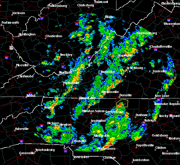 At 425 pm edt, a severe thunderstorm was located over hamer, moving northeast at 20 mph (radar indicated). Hazards include 60 mph wind gusts and quarter size hail. Hail damage to vehicles is expected. expect wind damage to roofs, siding, and trees. Locations impacted include, yanceyville, blanch, hamer, topnot, and hightowers. At 425 pm edt, a severe thunderstorm was located over hamer, moving northeast at 20 mph (radar indicated). Hazards include 60 mph wind gusts and quarter size hail. Hail damage to vehicles is expected. expect wind damage to roofs, siding, and trees. Locations impacted include, yanceyville, blanch, hamer, topnot, and hightowers.
|
| 7/25/2018 4:08 PM EDT |
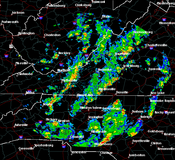 At 408 pm edt, a severe thunderstorm was located over yanceyville, moving northeast at 20 mph (radar indicated). Hazards include 60 mph wind gusts and quarter size hail. Hail damage to vehicles is expected. Expect wind damage to roofs, siding, and trees. At 408 pm edt, a severe thunderstorm was located over yanceyville, moving northeast at 20 mph (radar indicated). Hazards include 60 mph wind gusts and quarter size hail. Hail damage to vehicles is expected. Expect wind damage to roofs, siding, and trees.
|
| 7/22/2018 9:45 PM EDT |
 At 944 pm edt, severe thunderstorms were located along a line extending from providence to 7 miles northwest of rougemont, moving northeast at 15 mph (radar indicated). Hazards include 60 mph wind gusts and quarter size hail. Hail damage to vehicles is expected. Expect wind damage to roofs, siding, and trees. At 944 pm edt, severe thunderstorms were located along a line extending from providence to 7 miles northwest of rougemont, moving northeast at 15 mph (radar indicated). Hazards include 60 mph wind gusts and quarter size hail. Hail damage to vehicles is expected. Expect wind damage to roofs, siding, and trees.
|
| 7/22/2018 9:21 PM EDT |
 The severe thunderstorm warning for northeastern stokes, rockingham and caswell counties will expire at 930 pm edt, the storms which prompted the warning have moved out of the area. therefore, the warning will be allowed to expire. when it is safe to do so, please send your reports of hail of any size, as well as reports of any wind damage, including downed trees or large limbs, to the national weather service by calling toll free at 1, 8 6 6, 2 1 5, 4 3 2 4. reports and pictures can also be shared on the national weather service blacksburg facebook page and on twitter. The severe thunderstorm warning for northeastern stokes, rockingham and caswell counties will expire at 930 pm edt, the storms which prompted the warning have moved out of the area. therefore, the warning will be allowed to expire. when it is safe to do so, please send your reports of hail of any size, as well as reports of any wind damage, including downed trees or large limbs, to the national weather service by calling toll free at 1, 8 6 6, 2 1 5, 4 3 2 4. reports and pictures can also be shared on the national weather service blacksburg facebook page and on twitter.
|
| 7/22/2018 9:14 PM EDT |
 At 914 pm edt, severe thunderstorms were located along a line extending from near yanceyville to near ayersville, moving north at 20 mph (radar indicated). Hazards include 60 mph wind gusts and quarter size hail. Hail damage to vehicles is expected. expect wind damage to roofs, siding, and trees. Locations impacted include, eden, reidsville, wentworth, mayodan, and madison. At 914 pm edt, severe thunderstorms were located along a line extending from near yanceyville to near ayersville, moving north at 20 mph (radar indicated). Hazards include 60 mph wind gusts and quarter size hail. Hail damage to vehicles is expected. expect wind damage to roofs, siding, and trees. Locations impacted include, eden, reidsville, wentworth, mayodan, and madison.
|
| 7/22/2018 8:42 PM EDT |
 At 841 pm edt, severe thunderstorms were located along a line extending from near camp springs to near pine hall, moving north at 25 mph (radar indicated). Hazards include 60 mph wind gusts and quarter size hail. Hail damage to vehicles is expected. expect wind damage to roofs, siding, and trees. Locations impacted include, eden, reidsville, wentworth, mayodan, and madison. At 841 pm edt, severe thunderstorms were located along a line extending from near camp springs to near pine hall, moving north at 25 mph (radar indicated). Hazards include 60 mph wind gusts and quarter size hail. Hail damage to vehicles is expected. expect wind damage to roofs, siding, and trees. Locations impacted include, eden, reidsville, wentworth, mayodan, and madison.
|
| 7/22/2018 8:15 PM EDT |
 At 814 pm edt, severe thunderstorms were located along a line extending from elon college to near kernersville, moving north at 25 mph (radar indicated). Hazards include 60 mph wind gusts and quarter size hail. Hail damage to vehicles is expected. Expect wind damage to roofs, siding, and trees. At 814 pm edt, severe thunderstorms were located along a line extending from elon college to near kernersville, moving north at 25 mph (radar indicated). Hazards include 60 mph wind gusts and quarter size hail. Hail damage to vehicles is expected. Expect wind damage to roofs, siding, and trees.
|
| 7/11/2018 7:52 PM EDT |
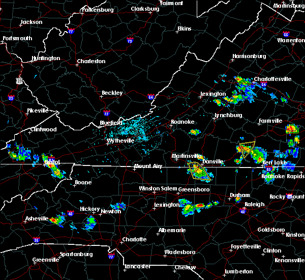 The severe thunderstorm warning for northeastern rockingham, northwestern caswell and south central pittsylvania counties and the southwestern city of danville will expire at 800 pm edt, the storm which prompted the warning has weakened below severe limits, and no longer poses an immediate threat to life or property. therefore, the warning will be allowed to expire. when it is safe to do so, please send your reports of hail of any size, as well as reports of any wind damage, including downed trees or large limbs, to the national weather service by calling toll free at 1, 8 6 6, 2 1 5, 4 3 2 4. reports and pictures can also be shared on the national weather service blacksburg facebook page and on twitter. The severe thunderstorm warning for northeastern rockingham, northwestern caswell and south central pittsylvania counties and the southwestern city of danville will expire at 800 pm edt, the storm which prompted the warning has weakened below severe limits, and no longer poses an immediate threat to life or property. therefore, the warning will be allowed to expire. when it is safe to do so, please send your reports of hail of any size, as well as reports of any wind damage, including downed trees or large limbs, to the national weather service by calling toll free at 1, 8 6 6, 2 1 5, 4 3 2 4. reports and pictures can also be shared on the national weather service blacksburg facebook page and on twitter.
|
| 7/11/2018 7:38 PM EDT |
 At 738 pm edt, a severe thunderstorm was located over bethel, moving south at 15 mph (radar indicated). Hazards include 60 mph wind gusts and quarter size hail. Hail damage to vehicles is expected. expect wind damage to roofs, siding, and trees. Locations impacted include, danville, yanceyville, bethel, providence, and mayfield. At 738 pm edt, a severe thunderstorm was located over bethel, moving south at 15 mph (radar indicated). Hazards include 60 mph wind gusts and quarter size hail. Hail damage to vehicles is expected. expect wind damage to roofs, siding, and trees. Locations impacted include, danville, yanceyville, bethel, providence, and mayfield.
|
| 7/11/2018 7:38 PM EDT |
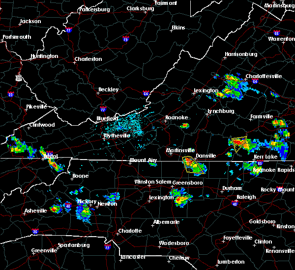 At 738 pm edt, a severe thunderstorm was located over bethel, moving south at 15 mph (radar indicated). Hazards include 60 mph wind gusts and quarter size hail. Hail damage to vehicles is expected. expect wind damage to roofs, siding, and trees. Locations impacted include, danville, yanceyville, bethel, providence, and mayfield. At 738 pm edt, a severe thunderstorm was located over bethel, moving south at 15 mph (radar indicated). Hazards include 60 mph wind gusts and quarter size hail. Hail damage to vehicles is expected. expect wind damage to roofs, siding, and trees. Locations impacted include, danville, yanceyville, bethel, providence, and mayfield.
|
| 7/11/2018 7:03 PM EDT |
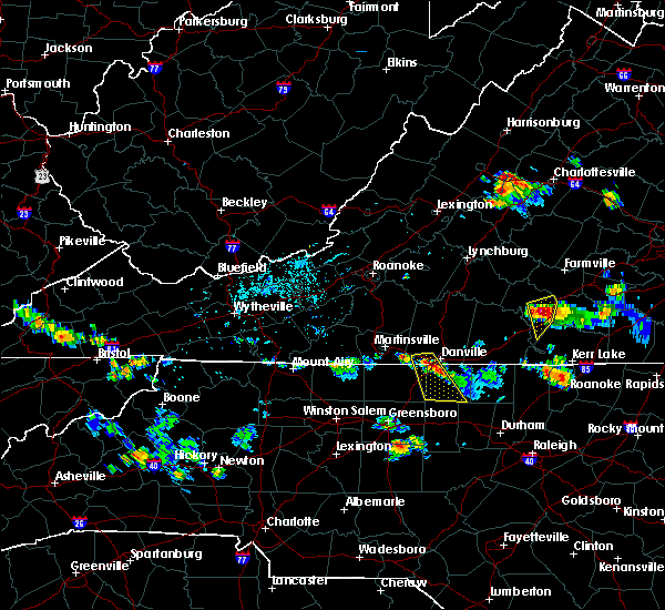 At 702 pm edt, a severe thunderstorm was located over pelham, moving south at 10 mph (radar indicated). Hazards include 60 mph wind gusts and quarter size hail. Hail damage to vehicles is expected. Expect wind damage to roofs, siding, and trees. At 702 pm edt, a severe thunderstorm was located over pelham, moving south at 10 mph (radar indicated). Hazards include 60 mph wind gusts and quarter size hail. Hail damage to vehicles is expected. Expect wind damage to roofs, siding, and trees.
|
| 6/21/2018 11:10 PM EDT |
 The severe thunderstorm warning for southeastern rockingham and caswell counties will expire at 1115 pm edt, the storms which prompted the warning have weakened below severe limits, and no longer pose an immediate threat to life or property. therefore, the warning will be allowed to expire. however brief gusty winds and heavy rain are still possible with these thunderstorms. when it is safe to do so, please send your reports of hail of any size, as well as reports of any wind damage, including downed trees or large limbs, to the national weather service by calling toll free at 1, 8 6 6, 2 1 5, 4 3 2 4. reports and pictures can also be shared on the national weather service blacksburg facebook page and on twitter. The severe thunderstorm warning for southeastern rockingham and caswell counties will expire at 1115 pm edt, the storms which prompted the warning have weakened below severe limits, and no longer pose an immediate threat to life or property. therefore, the warning will be allowed to expire. however brief gusty winds and heavy rain are still possible with these thunderstorms. when it is safe to do so, please send your reports of hail of any size, as well as reports of any wind damage, including downed trees or large limbs, to the national weather service by calling toll free at 1, 8 6 6, 2 1 5, 4 3 2 4. reports and pictures can also be shared on the national weather service blacksburg facebook page and on twitter.
|
| 6/21/2018 10:51 PM EDT |
 At 1051 pm edt, severe thunderstorms were located along a line extending from near ruffin to near camp springs, moving east at 40 mph (radar indicated). Hazards include 60 mph wind gusts. Expect damage to roofs, siding, and trees. Locations impacted include, yanceyville, bethel, providence, jericho, and prospect hill. At 1051 pm edt, severe thunderstorms were located along a line extending from near ruffin to near camp springs, moving east at 40 mph (radar indicated). Hazards include 60 mph wind gusts. Expect damage to roofs, siding, and trees. Locations impacted include, yanceyville, bethel, providence, jericho, and prospect hill.
|
| 6/21/2018 10:42 PM EDT |
 At 1041 pm edt, severe thunderstorms were located along a line extending from near pelham to near camp springs, moving east at 40 mph (radar indicated). Hazards include 60 mph wind gusts. Expect damage to roofs, siding, and trees. locations impacted include, danville, reidsville, yanceyville, bethel, and jericho. This includes the following location danville airport. At 1041 pm edt, severe thunderstorms were located along a line extending from near pelham to near camp springs, moving east at 40 mph (radar indicated). Hazards include 60 mph wind gusts. Expect damage to roofs, siding, and trees. locations impacted include, danville, reidsville, yanceyville, bethel, and jericho. This includes the following location danville airport.
|
| 6/21/2018 10:15 PM EDT |
 At 1015 pm edt, severe thunderstorms were located along a line extending from eden to near monroeton, moving east at 40 mph (radar indicated). Hazards include 60 mph wind gusts. expect damage to roofs, siding, and trees At 1015 pm edt, severe thunderstorms were located along a line extending from eden to near monroeton, moving east at 40 mph (radar indicated). Hazards include 60 mph wind gusts. expect damage to roofs, siding, and trees
|
| 6/10/2018 8:54 PM EDT |
 At 853 pm edt, severe thunderstorms were located along a line extending from keysville to dryburg to turbeville to near semora, moving southeast at 20 mph (radar indicated). Hazards include 60 mph wind gusts and quarter size hail. Hail damage to vehicles is expected. expect wind damage to roofs, siding, and trees. Locations impacted include, south boston, halifax, keysville, clover, and turbeville. At 853 pm edt, severe thunderstorms were located along a line extending from keysville to dryburg to turbeville to near semora, moving southeast at 20 mph (radar indicated). Hazards include 60 mph wind gusts and quarter size hail. Hail damage to vehicles is expected. expect wind damage to roofs, siding, and trees. Locations impacted include, south boston, halifax, keysville, clover, and turbeville.
|
| 6/10/2018 8:37 PM EDT |
 At 835 pm edt, severe thunderstorms were located along a line extending from near cullen to near crystal hill to ingram to yanceyville, moving southeast at 10 mph (radar indicated). Hazards include 60 mph wind gusts and quarter size hail. Hail damage to vehicles is expected. expect wind damage to roofs, siding, and trees. Locations impacted include, south boston, halifax, keysville, charlotte court house, and providence. At 835 pm edt, severe thunderstorms were located along a line extending from near cullen to near crystal hill to ingram to yanceyville, moving southeast at 10 mph (radar indicated). Hazards include 60 mph wind gusts and quarter size hail. Hail damage to vehicles is expected. expect wind damage to roofs, siding, and trees. Locations impacted include, south boston, halifax, keysville, charlotte court house, and providence.
|
| 6/10/2018 8:22 PM EDT |
 At 821 pm edt, severe thunderstorms were located along a line extending from near phenix to near nathalie to near ingram to near providence, moving southeast at 10 mph (radar indicated). Hazards include 60 mph wind gusts and quarter size hail. Hail damage to vehicles is expected. expect wind damage to roofs, siding, and trees. locations impacted include, danville, south boston, halifax, keysville, and charlotte court house. This includes the following location danville airport. At 821 pm edt, severe thunderstorms were located along a line extending from near phenix to near nathalie to near ingram to near providence, moving southeast at 10 mph (radar indicated). Hazards include 60 mph wind gusts and quarter size hail. Hail damage to vehicles is expected. expect wind damage to roofs, siding, and trees. locations impacted include, danville, south boston, halifax, keysville, and charlotte court house. This includes the following location danville airport.
|
| 6/10/2018 8:08 PM EDT |
 At 808 pm edt, severe thunderstorms were located along a line extending from near red house to near nathalie to near java to providence, moving southeast at 10 mph (radar indicated). Hazards include 60 mph wind gusts and quarter size hail. Hail damage to vehicles is expected. Expect wind damage to roofs, siding, and trees. At 808 pm edt, severe thunderstorms were located along a line extending from near red house to near nathalie to near java to providence, moving southeast at 10 mph (radar indicated). Hazards include 60 mph wind gusts and quarter size hail. Hail damage to vehicles is expected. Expect wind damage to roofs, siding, and trees.
|
| 5/21/2018 5:54 PM EDT |
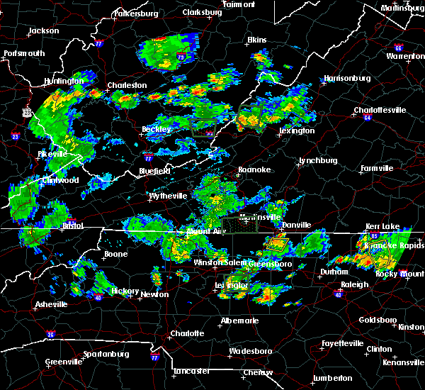 The severe thunderstorm warning for east central rockingham and southwestern caswell counties will expire at 600 pm edt, the storm which prompted the warning has weakened below severe limits. therefore, the warning will be allowed to expire. however gusty winds and heavy rain are still possible with this thunderstorm. when it is safe to do so, please send your reports of hail of any size, as well as reports of any wind damage, including downed trees or large limbs, to the national weather service by calling toll free at 1, 8 6 6, 2 1 5, 4 3 2 4. reports and pictures can also be shared on the national weather service blacksburg facebook page and on twitter. The severe thunderstorm warning for east central rockingham and southwestern caswell counties will expire at 600 pm edt, the storm which prompted the warning has weakened below severe limits. therefore, the warning will be allowed to expire. however gusty winds and heavy rain are still possible with this thunderstorm. when it is safe to do so, please send your reports of hail of any size, as well as reports of any wind damage, including downed trees or large limbs, to the national weather service by calling toll free at 1, 8 6 6, 2 1 5, 4 3 2 4. reports and pictures can also be shared on the national weather service blacksburg facebook page and on twitter.
|
| 5/21/2018 5:46 PM EDT |
 At 546 pm edt, a severe thunderstorm was located over bethel, moving north at 15 mph (radar indicated). Hazards include 60 mph wind gusts and quarter size hail. Hail damage to vehicles is expected. expect wind damage to roofs, siding, and trees. Locations impacted include, yanceyville, bethel, quick, and lawsonville. At 546 pm edt, a severe thunderstorm was located over bethel, moving north at 15 mph (radar indicated). Hazards include 60 mph wind gusts and quarter size hail. Hail damage to vehicles is expected. expect wind damage to roofs, siding, and trees. Locations impacted include, yanceyville, bethel, quick, and lawsonville.
|
| 5/21/2018 5:32 PM EDT |
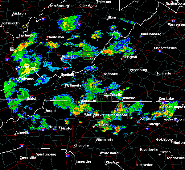 At 531 pm edt, a severe thunderstorm was located over quick, moving northwest at 20 mph (radar indicated). Hazards include 60 mph wind gusts and half dollar size hail. Hail damage to vehicles is expected. expect wind damage to roofs, siding, and trees. Locations impacted include, yanceyville, bethel, jericho, camp springs, and quick. At 531 pm edt, a severe thunderstorm was located over quick, moving northwest at 20 mph (radar indicated). Hazards include 60 mph wind gusts and half dollar size hail. Hail damage to vehicles is expected. expect wind damage to roofs, siding, and trees. Locations impacted include, yanceyville, bethel, jericho, camp springs, and quick.
|
| 5/21/2018 5:02 PM EDT |
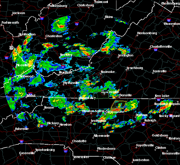 At 501 pm edt, a severe thunderstorm was located near jericho, moving north at 15 mph (radar indicated). Hazards include 60 mph wind gusts and half dollar size hail. Hail damage to vehicles is expected. Expect wind damage to roofs, siding, and trees. At 501 pm edt, a severe thunderstorm was located near jericho, moving north at 15 mph (radar indicated). Hazards include 60 mph wind gusts and half dollar size hail. Hail damage to vehicles is expected. Expect wind damage to roofs, siding, and trees.
|
| 5/10/2018 4:49 PM EDT |
 At 448 pm edt, severe thunderstorms were located along a line extending from cluster springs to near mebane, moving east at 65 mph (radar indicated). Hazards include 60 mph wind gusts and quarter size hail. Hail damage to vehicles is expected. expect wind damage to roofs, siding, and trees. Locations impacted include, reidsville, south boston, yanceyville, bethel, and jericho. At 448 pm edt, severe thunderstorms were located along a line extending from cluster springs to near mebane, moving east at 65 mph (radar indicated). Hazards include 60 mph wind gusts and quarter size hail. Hail damage to vehicles is expected. expect wind damage to roofs, siding, and trees. Locations impacted include, reidsville, south boston, yanceyville, bethel, and jericho.
|
| 5/10/2018 4:27 PM EDT |
 At 426 pm edt, severe thunderstorms were located along a line extending from elmo to near burlington, moving east at 65 mph (radar indicated). Hazards include 60 mph wind gusts and quarter size hail. Hail damage to vehicles is expected. Expect wind damage to roofs, siding, and trees. At 426 pm edt, severe thunderstorms were located along a line extending from elmo to near burlington, moving east at 65 mph (radar indicated). Hazards include 60 mph wind gusts and quarter size hail. Hail damage to vehicles is expected. Expect wind damage to roofs, siding, and trees.
|
| 4/15/2018 6:04 PM EDT |
 At 603 pm edt, severe thunderstorms were located along a line extending from near providence to 7 miles west of carrboro, moving northeast at 65 mph (radar indicated). Hazards include 60 mph wind gusts and quarter size hail. Hail damage to vehicles is expected. Expect wind damage to roofs, siding, and trees. At 603 pm edt, severe thunderstorms were located along a line extending from near providence to 7 miles west of carrboro, moving northeast at 65 mph (radar indicated). Hazards include 60 mph wind gusts and quarter size hail. Hail damage to vehicles is expected. Expect wind damage to roofs, siding, and trees.
|
| 3/17/2018 11:14 PM EDT |
 At 1113 pm edt, severe thunderstorms were located along a line extending from topnot to near baynes to 6 miles southeast of jericho, moving east at 45 mph (radar indicated). Hazards include 60 mph wind gusts and quarter size hail. Hail damage to vehicles is expected. expect wind damage to roofs, siding, and trees. Locations impacted include, yanceyville, jericho, prospect hill, leasburg, and topnot. At 1113 pm edt, severe thunderstorms were located along a line extending from topnot to near baynes to 6 miles southeast of jericho, moving east at 45 mph (radar indicated). Hazards include 60 mph wind gusts and quarter size hail. Hail damage to vehicles is expected. expect wind damage to roofs, siding, and trees. Locations impacted include, yanceyville, jericho, prospect hill, leasburg, and topnot.
|
| 3/17/2018 10:54 PM EDT |
 At 1054 pm edt, severe thunderstorms were located along a line extending from quick to near camp springs to 8 miles west of jericho, moving east at 45 mph (radar indicated). Hazards include 60 mph wind gusts and quarter size hail. Hail damage to vehicles is expected. Expect wind damage to roofs, siding, and trees. At 1054 pm edt, severe thunderstorms were located along a line extending from quick to near camp springs to 8 miles west of jericho, moving east at 45 mph (radar indicated). Hazards include 60 mph wind gusts and quarter size hail. Hail damage to vehicles is expected. Expect wind damage to roofs, siding, and trees.
|
| 10/23/2017 7:41 PM EDT |
 The tornado warning for eastern rockingham, northern caswell, pittsylvania, henry and southeastern franklin counties, the city of danville and the city of martinsville will expire at 745 pm edt, the storms which prompted the warning have weakened below severe limits, and no longer appear capable of producing a tornado. therefore the warning will be allowed to expire. however gusty winds are still possible with these thunderstorms. a tornado watch remains in effect until 900 pm edt for north central north carolina. a tornado watch also remains in effect until 200 am edt for south central, central, southwestern and west central virginia. when it is safe to do so, please send your reports of hail of any size, as well as reports of any wind damage, including downed trees or large limbs, to the national weather service by calling toll free at 1, 8 6 6, 2 1 5, 4 3 2 4. reports and pictures can also be shared on the national weather service blacksburg facebook page and on twitter. The tornado warning for eastern rockingham, northern caswell, pittsylvania, henry and southeastern franklin counties, the city of danville and the city of martinsville will expire at 745 pm edt, the storms which prompted the warning have weakened below severe limits, and no longer appear capable of producing a tornado. therefore the warning will be allowed to expire. however gusty winds are still possible with these thunderstorms. a tornado watch remains in effect until 900 pm edt for north central north carolina. a tornado watch also remains in effect until 200 am edt for south central, central, southwestern and west central virginia. when it is safe to do so, please send your reports of hail of any size, as well as reports of any wind damage, including downed trees or large limbs, to the national weather service by calling toll free at 1, 8 6 6, 2 1 5, 4 3 2 4. reports and pictures can also be shared on the national weather service blacksburg facebook page and on twitter.
|
| 10/23/2017 7:16 PM EDT |
 At 716 pm edt, severe thunderstorms capable of producing a tornado were located along a line extending from near ferrum to near sandy level, moving southeast at 55 mph (radar indicated rotation). Hazards include tornado. Flying debris will be dangerous to those caught without shelter. mobile homes will be damaged or destroyed. damage to roofs, windows, and vehicles will occur. Tree damage is likely. At 716 pm edt, severe thunderstorms capable of producing a tornado were located along a line extending from near ferrum to near sandy level, moving southeast at 55 mph (radar indicated rotation). Hazards include tornado. Flying debris will be dangerous to those caught without shelter. mobile homes will be damaged or destroyed. damage to roofs, windows, and vehicles will occur. Tree damage is likely.
|
| 7/18/2017 7:37 PM EDT |
 The severe thunderstorm warning for eastern rockingham, northern caswell, southern pittsylvania, southwestern halifax and southeastern henry counties and the city of danville will expire at 745 pm edt, the storm which prompted the warning has weakened below severe limits, and has exited the warned area. therefore, the warning will be allowed to expire. when it is safe to do so, please send your reports of hail of any size, as well as reports of any wind damage, including downed trees or large limbs, to the national weather service by calling toll free at 1, 8 6 6, 2 1 5, 4 3 2 4. reports and pictures can also be shared on the national weather service blacksburg facebook page and on twitter. The severe thunderstorm warning for eastern rockingham, northern caswell, southern pittsylvania, southwestern halifax and southeastern henry counties and the city of danville will expire at 745 pm edt, the storm which prompted the warning has weakened below severe limits, and has exited the warned area. therefore, the warning will be allowed to expire. when it is safe to do so, please send your reports of hail of any size, as well as reports of any wind damage, including downed trees or large limbs, to the national weather service by calling toll free at 1, 8 6 6, 2 1 5, 4 3 2 4. reports and pictures can also be shared on the national weather service blacksburg facebook page and on twitter.
|
| 7/18/2017 7:19 PM EDT |
 At 719 pm edt, a severe thunderstorm was located over westover hills, moving southwest at 25 mph (radar indicated). Hazards include 60 mph wind gusts and quarter size hail. Hail damage to vehicles is expected. expect wind damage to roofs, siding, and trees. Locations impacted include, danville, eden, reidsville, wentworth, and yanceyville. At 719 pm edt, a severe thunderstorm was located over westover hills, moving southwest at 25 mph (radar indicated). Hazards include 60 mph wind gusts and quarter size hail. Hail damage to vehicles is expected. expect wind damage to roofs, siding, and trees. Locations impacted include, danville, eden, reidsville, wentworth, and yanceyville.
|
| 7/18/2017 6:51 PM EDT |
 At 651 pm edt, a severe thunderstorm was located near elmo, moving southwest at 30 mph (radar indicated). Hazards include 60 mph wind gusts and quarter size hail. Hail damage to vehicles is expected. Expect wind damage to roofs, siding, and trees. At 651 pm edt, a severe thunderstorm was located near elmo, moving southwest at 30 mph (radar indicated). Hazards include 60 mph wind gusts and quarter size hail. Hail damage to vehicles is expected. Expect wind damage to roofs, siding, and trees.
|
| 7/8/2017 7:49 PM EDT |
 At 746 pm edt, thunderstorms were scattered along a line extending from near bethel to intelligence, moving east at 25 mph. while they have shown recent weakening trends, it is likely they reintensify before the conclusion of the warning (radar indicated). Hazards include 60 mph wind gusts and quarter size hail. Hail damage to vehicles is expected. expect wind damage to roofs, siding, and trees. Locations impacted include, reidsville, wentworth, madison, camp springs, and quick. At 746 pm edt, thunderstorms were scattered along a line extending from near bethel to intelligence, moving east at 25 mph. while they have shown recent weakening trends, it is likely they reintensify before the conclusion of the warning (radar indicated). Hazards include 60 mph wind gusts and quarter size hail. Hail damage to vehicles is expected. expect wind damage to roofs, siding, and trees. Locations impacted include, reidsville, wentworth, madison, camp springs, and quick.
|
| 7/8/2017 7:31 PM EDT |
 At 731 pm edt, severe thunderstorms were located along a line extending from near mayfield to wentworth, moving east at 20 mph (radar indicated). Hazards include 60 mph wind gusts and quarter size hail. Hail damage to vehicles is expected. expect wind damage to roofs, siding, and trees. Locations impacted include, eden, reidsville, wentworth, madison, and camp springs. At 731 pm edt, severe thunderstorms were located along a line extending from near mayfield to wentworth, moving east at 20 mph (radar indicated). Hazards include 60 mph wind gusts and quarter size hail. Hail damage to vehicles is expected. expect wind damage to roofs, siding, and trees. Locations impacted include, eden, reidsville, wentworth, madison, and camp springs.
|
| 7/8/2017 7:08 PM EDT |
 At 708 pm edt, severe thunderstorms were located along a line extending from draper to near madison, moving southeast at 20 mph (radar indicated). Hazards include 60 mph wind gusts and quarter size hail. Hail damage to vehicles is expected. Expect wind damage to roofs, siding, and trees. At 708 pm edt, severe thunderstorms were located along a line extending from draper to near madison, moving southeast at 20 mph (radar indicated). Hazards include 60 mph wind gusts and quarter size hail. Hail damage to vehicles is expected. Expect wind damage to roofs, siding, and trees.
|
| 7/8/2017 6:11 PM EDT |
 At 610 pm edt, severe thunderstorms were located along a line extending from near ringgold to danville, moving east at 25 mph (radar indicated). Hazards include 60 mph wind gusts and quarter size hail. Hail damage to vehicles is expected. Expect wind damage to roofs, siding, and trees. At 610 pm edt, severe thunderstorms were located along a line extending from near ringgold to danville, moving east at 25 mph (radar indicated). Hazards include 60 mph wind gusts and quarter size hail. Hail damage to vehicles is expected. Expect wind damage to roofs, siding, and trees.
|
| 7/5/2017 9:36 PM EDT |
 At 935 pm edt, severe thunderstorms were located along a line extending from semora to milton to near blanch, moving southeast at 25 mph (radar indicated). Hazards include 60 mph wind gusts. Expect damage to roofs, siding, and trees. Locations impacted include, yanceyville, jericho, prospect hill, providence, and milton. At 935 pm edt, severe thunderstorms were located along a line extending from semora to milton to near blanch, moving southeast at 25 mph (radar indicated). Hazards include 60 mph wind gusts. Expect damage to roofs, siding, and trees. Locations impacted include, yanceyville, jericho, prospect hill, providence, and milton.
|
| 7/5/2017 9:26 PM EDT |
 At 924 pm edt, severe thunderstorms were located along a line extending from milton through pelham to near quick, moving southeast at 20 mph (radar indicated). Hazards include 60 mph wind gusts. Expect damage to roofs, siding, and trees. Locations impacted include, yanceyville, bethel, providence, jericho, and prospect hill. At 924 pm edt, severe thunderstorms were located along a line extending from milton through pelham to near quick, moving southeast at 20 mph (radar indicated). Hazards include 60 mph wind gusts. Expect damage to roofs, siding, and trees. Locations impacted include, yanceyville, bethel, providence, jericho, and prospect hill.
|
| 7/5/2017 9:10 PM EDT |
 At 909 pm edt, severe thunderstorms were located along a line extending from near blanch through mayfield to near harrisons crossroads, moving southeast at 20 mph (radar indicated). Hazards include 60 mph wind gusts. Expect damage to roofs, siding, and trees. Locations impacted include, danville, eden, reidsville, wentworth, and yanceyville. At 909 pm edt, severe thunderstorms were located along a line extending from near blanch through mayfield to near harrisons crossroads, moving southeast at 20 mph (radar indicated). Hazards include 60 mph wind gusts. Expect damage to roofs, siding, and trees. Locations impacted include, danville, eden, reidsville, wentworth, and yanceyville.
|
| 7/5/2017 8:54 PM EDT |
 At 853 pm edt, severe thunderstorms were located along a line extending from near ringgold through draper to near wentworth, moving southeast at 20 mph (radar indicated). Hazards include 60 mph wind gusts. expect damage to roofs, siding, and trees At 853 pm edt, severe thunderstorms were located along a line extending from near ringgold through draper to near wentworth, moving southeast at 20 mph (radar indicated). Hazards include 60 mph wind gusts. expect damage to roofs, siding, and trees
|
| 5/11/2017 8:40 PM EDT |
 The severe thunderstorm warning for eastern rockingham and western caswell counties will expire at 845 pm edt, the storm which prompted the warning has weakened below severe limits, and has exited the warned area. therefore, the warning will be allowed to expire at 845 pm. when it is safe to do so, please send your reports of hail of any size, as well as reports of any wind damage, including downed trees or large limbs, to the national weather service by calling toll free at 1, 8 6 6, 2 1 5, 4 3 2 4. reports and pictures can also be shared on the national weather service blacksburg facebook page and on twitter. The severe thunderstorm warning for eastern rockingham and western caswell counties will expire at 845 pm edt, the storm which prompted the warning has weakened below severe limits, and has exited the warned area. therefore, the warning will be allowed to expire at 845 pm. when it is safe to do so, please send your reports of hail of any size, as well as reports of any wind damage, including downed trees or large limbs, to the national weather service by calling toll free at 1, 8 6 6, 2 1 5, 4 3 2 4. reports and pictures can also be shared on the national weather service blacksburg facebook page and on twitter.
|
| 5/11/2017 8:15 PM EDT | A tree was blown down blocking high rock school roa in caswell county NC, 4 miles SW of Yanceyville, NC |
| 5/11/2017 8:09 PM EDT |
 At 808 pm edt, a severe thunderstorm was located near camp springs, moving southeast at 40 mph (public. there have been multiple reports of trees downed in the towns of eden, draper and ruffin). Hazards include 60 mph wind gusts and quarter size hail. Minor damage to vehicles is possible. expect wind damage to trees and power lines. Locations impacted include, eden, reidsville, wentworth, yanceyville, and bethel. At 808 pm edt, a severe thunderstorm was located near camp springs, moving southeast at 40 mph (public. there have been multiple reports of trees downed in the towns of eden, draper and ruffin). Hazards include 60 mph wind gusts and quarter size hail. Minor damage to vehicles is possible. expect wind damage to trees and power lines. Locations impacted include, eden, reidsville, wentworth, yanceyville, and bethel.
|
| 5/11/2017 7:48 PM EDT |
 At 746 pm edt, a severe thunderstorm was located over lawsonville, moving southeast at 40 mph (radar indicated. henry county warning point had reported multiple trees downed in southeastern henry county). Hazards include 60 mph wind gusts and quarter size hail. Minor damage to vehicles is possible. Expect wind damage to trees and power lines. At 746 pm edt, a severe thunderstorm was located over lawsonville, moving southeast at 40 mph (radar indicated. henry county warning point had reported multiple trees downed in southeastern henry county). Hazards include 60 mph wind gusts and quarter size hail. Minor damage to vehicles is possible. Expect wind damage to trees and power lines.
|
| 5/5/2017 3:53 AM EDT |
 At 352 am edt, a severe thunderstorm with a history of producing damaging winds was located over draper, moving northeast at 55 mph (trained weather spotters). Hazards include 60 mph wind gusts. Expect damage to trees and power lines. Locations impacted include, danville, eden, yanceyville, bethel, and chatham. At 352 am edt, a severe thunderstorm with a history of producing damaging winds was located over draper, moving northeast at 55 mph (trained weather spotters). Hazards include 60 mph wind gusts. Expect damage to trees and power lines. Locations impacted include, danville, eden, yanceyville, bethel, and chatham.
|
| 5/5/2017 3:36 AM EDT |
 At 336 am edt, a severe thunderstorm was located over bethany, moving northeast at 55 mph (radar indicated). Hazards include 60 mph wind gusts. expect damage to trees and power lines At 336 am edt, a severe thunderstorm was located over bethany, moving northeast at 55 mph (radar indicated). Hazards include 60 mph wind gusts. expect damage to trees and power lines
|
| 5/1/2017 7:35 PM EDT |
 At 734 pm edt, severe thunderstorms were located along a line extending from tower hill to near alton, moving northeast at 30 mph (radar indicated). Hazards include 60 mph wind gusts and quarter size hail. Minor damage to vehicles is possible. expect wind damage to trees and power lines. Locations impacted include, buckingham, south boston, appomattox, halifax, and brookneal. At 734 pm edt, severe thunderstorms were located along a line extending from tower hill to near alton, moving northeast at 30 mph (radar indicated). Hazards include 60 mph wind gusts and quarter size hail. Minor damage to vehicles is possible. expect wind damage to trees and power lines. Locations impacted include, buckingham, south boston, appomattox, halifax, and brookneal.
|
| 5/1/2017 7:27 PM EDT |
 The severe thunderstorm warning for eastern rockingham, caswell, campbell, pittsylvania, southern bedford, south central amherst, and eastern henry counties, the city of danville and the city of lynchburg will expire at 730 pm edt, the storms which prompted the warning have moved out of the area. therefore the warning will be allowed to expire. however, a severe thunderstorm warning has been re-issued for eastern campbell, eastern pittsylvania, southeastern amherst and halifax counties in virginia and extreme southeastern caswell county in north carolina until 815 pm. a severe thunderstorm watch remains in effect until 1100 pm edt for north central north carolina, and central, south central and west central virginia. when it is safe to do so, please send your reports of hail of any size, as well as reports of any wind damage, including downed trees or large limbs, to the national weather service by calling toll free at 1, 8 6 6, 2 1 5, 4 3 2 4. reports and pictures can also be shared on the national weather service blacksburg facebook page and on twitter. The severe thunderstorm warning for eastern rockingham, caswell, campbell, pittsylvania, southern bedford, south central amherst, and eastern henry counties, the city of danville and the city of lynchburg will expire at 730 pm edt, the storms which prompted the warning have moved out of the area. therefore the warning will be allowed to expire. however, a severe thunderstorm warning has been re-issued for eastern campbell, eastern pittsylvania, southeastern amherst and halifax counties in virginia and extreme southeastern caswell county in north carolina until 815 pm. a severe thunderstorm watch remains in effect until 1100 pm edt for north central north carolina, and central, south central and west central virginia. when it is safe to do so, please send your reports of hail of any size, as well as reports of any wind damage, including downed trees or large limbs, to the national weather service by calling toll free at 1, 8 6 6, 2 1 5, 4 3 2 4. reports and pictures can also be shared on the national weather service blacksburg facebook page and on twitter.
|
| 5/1/2017 6:58 PM EDT |
 At 658 pm edt, severe thunderstorms were located along a line extending from lynchburg to near hamer, moving east at 35 mph (radar indicated). Hazards include 60 mph wind gusts and quarter size hail. Minor damage to vehicles is possible. Expect wind damage to trees and power lines. At 658 pm edt, severe thunderstorms were located along a line extending from lynchburg to near hamer, moving east at 35 mph (radar indicated). Hazards include 60 mph wind gusts and quarter size hail. Minor damage to vehicles is possible. Expect wind damage to trees and power lines.
|
| 5/1/2017 6:53 PM EDT |
 At 652 pm edt, severe thunderstorms were located along a line extending from near evington to near chatham to near camp springs, moving northeast at 45 mph (law enforcement). Hazards include 60 mph wind gusts and quarter size hail. Minor damage to vehicles is possible. expect wind damage to trees and power lines. Locations impacted include, lynchburg, danville, eden, reidsville, and bedford. At 652 pm edt, severe thunderstorms were located along a line extending from near evington to near chatham to near camp springs, moving northeast at 45 mph (law enforcement). Hazards include 60 mph wind gusts and quarter size hail. Minor damage to vehicles is possible. expect wind damage to trees and power lines. Locations impacted include, lynchburg, danville, eden, reidsville, and bedford.
|
| 5/1/2017 6:25 PM EDT |
 At 625 pm edt, severe thunderstorms were located along a line extending from near north shore to near sandy river to 7 miles north of greensboro, moving northeast at 45 mph (law enforcement). Hazards include 60 mph wind gusts and quarter size hail. Minor damage to vehicles is possible. Expect wind damage to trees and power lines. At 625 pm edt, severe thunderstorms were located along a line extending from near north shore to near sandy river to 7 miles north of greensboro, moving northeast at 45 mph (law enforcement). Hazards include 60 mph wind gusts and quarter size hail. Minor damage to vehicles is possible. Expect wind damage to trees and power lines.
|
| 5/1/2017 5:51 PM EDT |
 At 551 pm edt, a severe thunderstorm capable of producing a tornado was located near bethany, moving northeast at 50 mph (radar indicated rotation). Hazards include tornado and quarter size hail. Flying debris will be dangerous to those caught without shelter. mobile homes will be damaged or destroyed. damage to roofs, windows, and vehicles will occur. tree damage is likely. this dangerous storm will be near, bethany and intelligence around 555 pm edt. monroeton around 600 pm edt. reidsville and wentworth around 605 pm edt. Other locations impacted by this tornadic thunderstorm include haw river state park and belews lake. At 551 pm edt, a severe thunderstorm capable of producing a tornado was located near bethany, moving northeast at 50 mph (radar indicated rotation). Hazards include tornado and quarter size hail. Flying debris will be dangerous to those caught without shelter. mobile homes will be damaged or destroyed. damage to roofs, windows, and vehicles will occur. tree damage is likely. this dangerous storm will be near, bethany and intelligence around 555 pm edt. monroeton around 600 pm edt. reidsville and wentworth around 605 pm edt. Other locations impacted by this tornadic thunderstorm include haw river state park and belews lake.
|
| 5/1/2017 5:51 PM EDT |
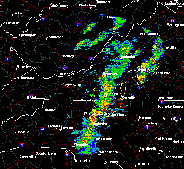 At 551 pm edt, a severe thunderstorm capable of producing a tornado was located near bethany, moving northeast at 50 mph (radar indicated rotation). Hazards include tornado and quarter size hail. Flying debris will be dangerous to those caught without shelter. mobile homes will be damaged or destroyed. damage to roofs, windows, and vehicles will occur. tree damage is likely. this dangerous storm will be near, bethany and intelligence around 555 pm edt. monroeton around 600 pm edt. reidsville and wentworth around 605 pm edt. Other locations impacted by this tornadic thunderstorm include haw river state park and belews lake. At 551 pm edt, a severe thunderstorm capable of producing a tornado was located near bethany, moving northeast at 50 mph (radar indicated rotation). Hazards include tornado and quarter size hail. Flying debris will be dangerous to those caught without shelter. mobile homes will be damaged or destroyed. damage to roofs, windows, and vehicles will occur. tree damage is likely. this dangerous storm will be near, bethany and intelligence around 555 pm edt. monroeton around 600 pm edt. reidsville and wentworth around 605 pm edt. Other locations impacted by this tornadic thunderstorm include haw river state park and belews lake.
|
| 4/6/2017 6:36 AM EDT |
 At 635 am edt, a severe thunderstorm was located near milton, moving northeast at 70 mph (radar indicated). Hazards include quarter size hail. Damage to vehicles is expected. Locations impacted include, milton, blanch, hamer, semora, and hyco lake. At 635 am edt, a severe thunderstorm was located near milton, moving northeast at 70 mph (radar indicated). Hazards include quarter size hail. Damage to vehicles is expected. Locations impacted include, milton, blanch, hamer, semora, and hyco lake.
|
| 4/6/2017 6:14 AM EDT | Quarter sized hail reported 0.8 miles ENE of Yanceyville, NC, report from the public relayed by local media. |
| 4/6/2017 5:59 AM EDT |
 At 557 am edt, a severe thunderstorm was located 10 miles west of burlington or 13 miles southwest over camp springs, moving northeast at 70 mph (radar indicated). Hazards include 60 mph wind gusts and quarter size hail. Hail damage to vehicles is expected. Expect wind damage to roofs, siding, and trees. At 557 am edt, a severe thunderstorm was located 10 miles west of burlington or 13 miles southwest over camp springs, moving northeast at 70 mph (radar indicated). Hazards include 60 mph wind gusts and quarter size hail. Hail damage to vehicles is expected. Expect wind damage to roofs, siding, and trees.
|
| 9/28/2016 6:10 PM EDT | Quarter sized hail reported 9.9 miles NW of Yanceyville, NC |
| 9/28/2016 5:47 PM EDT |
 At 547 pm edt, a severe thunderstorm was located over jericho, moving east at 20 mph (radar indicated). Hazards include 60 mph wind gusts and half dollar size hail. Hail damage to vehicles is expected. Expect wind damage to roofs, siding, and trees. At 547 pm edt, a severe thunderstorm was located over jericho, moving east at 20 mph (radar indicated). Hazards include 60 mph wind gusts and half dollar size hail. Hail damage to vehicles is expected. Expect wind damage to roofs, siding, and trees.
|
| 9/28/2016 4:32 PM EDT |
 At 430 pm edt, severe thunderstorms extended from south boston, to cluster springs, to milton, to yanceyville, moving east at 20 mph (radar indicated). Hazards include golf ball size hail and 60 mph wind gusts. People and animals outdoors will be injured. expect hail damage to roofs, siding, windows, and vehicles. Expect wind damage to roofs, siding, and trees. At 430 pm edt, severe thunderstorms extended from south boston, to cluster springs, to milton, to yanceyville, moving east at 20 mph (radar indicated). Hazards include golf ball size hail and 60 mph wind gusts. People and animals outdoors will be injured. expect hail damage to roofs, siding, windows, and vehicles. Expect wind damage to roofs, siding, and trees.
|
| 9/28/2016 4:14 PM EDT |
 At 414 pm edt, a severe thunderstorm was located near turbeville, moving east at 20 mph (radar indicated). Hazards include golf ball size hail and 60 mph wind gusts. People and animals outdoors will be injured. expect hail damage to roofs, siding, windows, and vehicles. expect wind damage to roofs, siding, and trees. locations impacted include, danville, south boston, halifax, clover, and turbeville. This includes the following location danville airport. At 414 pm edt, a severe thunderstorm was located near turbeville, moving east at 20 mph (radar indicated). Hazards include golf ball size hail and 60 mph wind gusts. People and animals outdoors will be injured. expect hail damage to roofs, siding, windows, and vehicles. expect wind damage to roofs, siding, and trees. locations impacted include, danville, south boston, halifax, clover, and turbeville. This includes the following location danville airport.
|
| 9/28/2016 3:32 PM EDT |
 At 331 pm edt, a severe thunderstorm was located just south of danville, moving east at 20 mph (radar indicated). Hazards include two inch hail and 70 mph wind gusts. People and animals outdoors will be injured. expect hail damage to roofs, siding, windows, and vehicles. expect considerable tree damage. Wind damage is also likely to mobile homes, roofs, and outbuildings. At 331 pm edt, a severe thunderstorm was located just south of danville, moving east at 20 mph (radar indicated). Hazards include two inch hail and 70 mph wind gusts. People and animals outdoors will be injured. expect hail damage to roofs, siding, windows, and vehicles. expect considerable tree damage. Wind damage is also likely to mobile homes, roofs, and outbuildings.
|
| 9/28/2016 3:14 PM EDT |
 At 312 pm edt, a severe thunderstorm was located over gatewood, moving east at 20 mph (radar indicated). Hazards include 60 mph wind gusts and quarter size hail. Hail damage to vehicles is expected. expect wind damage to roofs, siding, and trees. locations impacted include, danville, bethel, blairs, providence, and milton. This includes the following location danville airport. At 312 pm edt, a severe thunderstorm was located over gatewood, moving east at 20 mph (radar indicated). Hazards include 60 mph wind gusts and quarter size hail. Hail damage to vehicles is expected. expect wind damage to roofs, siding, and trees. locations impacted include, danville, bethel, blairs, providence, and milton. This includes the following location danville airport.
|
| 9/28/2016 2:58 PM EDT |
 At 257 pm edt, a severe thunderstorm was located over pelham, moving east at 20 mph (radar indicated). Hazards include 60 mph wind gusts and quarter size hail. Hail damage to vehicles is expected. expect wind damage to roofs, siding, and trees. locations impacted include, danville, bethel, blairs, mayfield, and providence. This includes the following location danville airport. At 257 pm edt, a severe thunderstorm was located over pelham, moving east at 20 mph (radar indicated). Hazards include 60 mph wind gusts and quarter size hail. Hail damage to vehicles is expected. expect wind damage to roofs, siding, and trees. locations impacted include, danville, bethel, blairs, mayfield, and providence. This includes the following location danville airport.
|
| 9/28/2016 2:26 PM EDT |
 At 226 pm edt, a severe thunderstorm was located over oregon hill, moving east at 20 mph (radar indicated). Hazards include 60 mph wind gusts and quarter size hail. Hail damage to vehicles is expected. Expect wind damage to roofs, siding, and trees. At 226 pm edt, a severe thunderstorm was located over oregon hill, moving east at 20 mph (radar indicated). Hazards include 60 mph wind gusts and quarter size hail. Hail damage to vehicles is expected. Expect wind damage to roofs, siding, and trees.
|
| 9/27/2016 9:42 PM EDT |
 At 941 pm edt, a severe thunderstorm was located 5 miles west of leasburg..moving east-southeast at 15 mph (radar indicated). Hazards include 60 mph wind gusts and quarter size hail. Hail damage to vehicles is expected. expect wind damage to roofs, siding, and trees. Locations impacted include, yanceyville, prospect hill, hamer, baynes, and topnot. At 941 pm edt, a severe thunderstorm was located 5 miles west of leasburg..moving east-southeast at 15 mph (radar indicated). Hazards include 60 mph wind gusts and quarter size hail. Hail damage to vehicles is expected. expect wind damage to roofs, siding, and trees. Locations impacted include, yanceyville, prospect hill, hamer, baynes, and topnot.
|
| 9/27/2016 9:16 PM EDT |
 At 915 pm edt, a severe thunderstorm was located near providence, moving east-southeast at 15 mph (radar indicated). Hazards include 60 mph wind gusts and quarter size hail. Hail damage to vehicles is expected. expect wind damage to roofs, siding, and trees. Locations impacted include, bethel, providence, hamer, and pelham. At 915 pm edt, a severe thunderstorm was located near providence, moving east-southeast at 15 mph (radar indicated). Hazards include 60 mph wind gusts and quarter size hail. Hail damage to vehicles is expected. expect wind damage to roofs, siding, and trees. Locations impacted include, bethel, providence, hamer, and pelham.
|
| 9/27/2016 9:00 PM EDT |
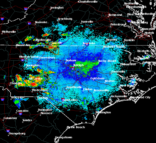 At 900 pm edt, a severe thunderstorm was located over bethel, moving east-southeast at 10 mph (radar indicated). Hazards include 60 mph wind gusts and quarter size hail. Hail damage to vehicles is expected. Expect wind damage to roofs, siding, and trees. At 900 pm edt, a severe thunderstorm was located over bethel, moving east-southeast at 10 mph (radar indicated). Hazards include 60 mph wind gusts and quarter size hail. Hail damage to vehicles is expected. Expect wind damage to roofs, siding, and trees.
|
| 9/27/2016 8:28 PM EDT |
 At 828 pm edt, a severe thunderstorm was located over mayfield, moving east at 15 mph (radar indicated). Hazards include 60 mph wind gusts and quarter size hail. Hail damage to vehicles is expected. Expect wind damage to roofs, siding, and trees. At 828 pm edt, a severe thunderstorm was located over mayfield, moving east at 15 mph (radar indicated). Hazards include 60 mph wind gusts and quarter size hail. Hail damage to vehicles is expected. Expect wind damage to roofs, siding, and trees.
|
| 8/17/2016 7:05 PM EDT |
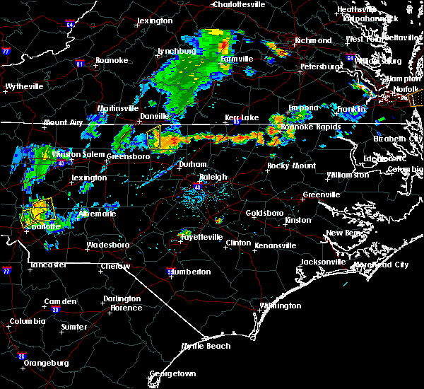 The severe thunderstorm warning for eastern caswell county will expire at 715 pm edt, the severe thunderstorm which prompted the warning has moved out of the warned area. therefore, the warning will be allowed to expire. when it is safe to do so, please send your reports of hail of any size, as well as reports of any wind damage, including downed trees or large limbs, to the national weather service by calling toll free at 1, 8 6 6, 2 1 5, 4 3 2 4. reports and pictures can also be shared on the national weather service blacksburg facebook page and on twitter. The severe thunderstorm warning for eastern caswell county will expire at 715 pm edt, the severe thunderstorm which prompted the warning has moved out of the warned area. therefore, the warning will be allowed to expire. when it is safe to do so, please send your reports of hail of any size, as well as reports of any wind damage, including downed trees or large limbs, to the national weather service by calling toll free at 1, 8 6 6, 2 1 5, 4 3 2 4. reports and pictures can also be shared on the national weather service blacksburg facebook page and on twitter.
|
| 8/17/2016 6:52 PM EDT |
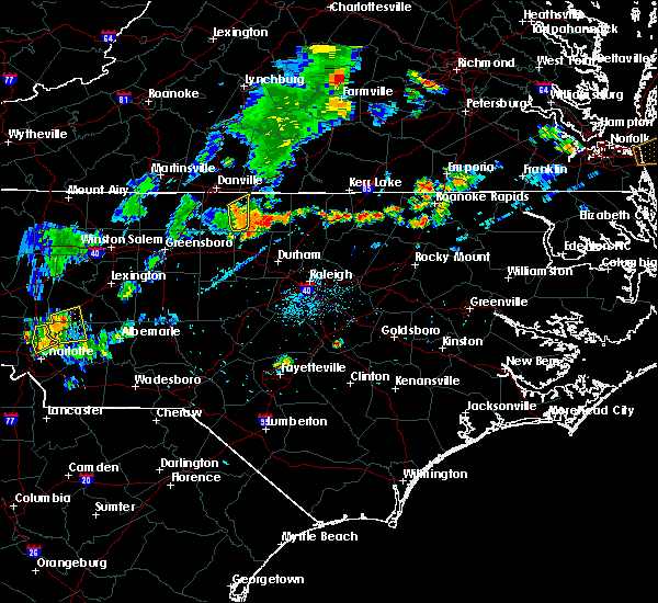 At 651 pm edt, a severe thunderstorm was located over leasburg, moving northeast at 35 mph (radar indicated). Hazards include 60 mph wind gusts and quarter size hail. Hail damage to vehicles is expected. expect wind damage to roofs, siding, and trees. Locations impacted include, prospect hill, semora, hamer, topnot, and leasburg. At 651 pm edt, a severe thunderstorm was located over leasburg, moving northeast at 35 mph (radar indicated). Hazards include 60 mph wind gusts and quarter size hail. Hail damage to vehicles is expected. expect wind damage to roofs, siding, and trees. Locations impacted include, prospect hill, semora, hamer, topnot, and leasburg.
|
| 8/17/2016 6:37 PM EDT |
 At 636 pm edt, a severe thunderstorm was located over hightowers, moving east at 30 mph (radar indicated). Hazards include 60 mph wind gusts and quarter size hail. Hail damage to vehicles is expected. expect wind damage to roofs, siding, and trees. Locations impacted include, yanceyville, camp springs, prospect hill, jericho, and semora. At 636 pm edt, a severe thunderstorm was located over hightowers, moving east at 30 mph (radar indicated). Hazards include 60 mph wind gusts and quarter size hail. Hail damage to vehicles is expected. expect wind damage to roofs, siding, and trees. Locations impacted include, yanceyville, camp springs, prospect hill, jericho, and semora.
|
| 8/17/2016 6:36 PM EDT | One tree down on burton chapel rd near hwy 6 in caswell county NC, 3.8 miles N of Yanceyville, NC |
| 8/17/2016 6:10 PM EDT |
 At 609 pm edt, a severe thunderstorm was located near camp springs, moving northeast at 35 mph (radar indicated). Hazards include 60 mph wind gusts and quarter size hail. Hail damage to vehicles is expected. Expect wind damage to roofs, siding, and trees. At 609 pm edt, a severe thunderstorm was located near camp springs, moving northeast at 35 mph (radar indicated). Hazards include 60 mph wind gusts and quarter size hail. Hail damage to vehicles is expected. Expect wind damage to roofs, siding, and trees.
|
| 8/17/2016 5:42 PM EDT | One tree down over allison r in caswell county NC, 6.4 miles E of Yanceyville, NC |
| 7/27/2016 6:35 PM EDT |
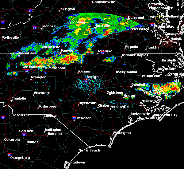 At 635 pm edt, a severe thunderstorm was located near semora, moving east at 30 mph (trained weather spotters). Hazards include 60 mph wind gusts and nickel size hail. Expect damage to roofs. siding. and trees. Locations impacted include, yanceyville, semora, hamer, topnot, and leasburg. At 635 pm edt, a severe thunderstorm was located near semora, moving east at 30 mph (trained weather spotters). Hazards include 60 mph wind gusts and nickel size hail. Expect damage to roofs. siding. and trees. Locations impacted include, yanceyville, semora, hamer, topnot, and leasburg.
|
| 7/27/2016 6:04 PM EDT | Thunderstorm winds downed trees along us 158 westbound south and west of yanceyville... n in caswell county NC, 6.5 miles ENE of Yanceyville, NC |
| 7/27/2016 5:48 PM EDT |
 At 547 pm edt, a severe thunderstorm producing damaging wind gusts and dime sized hail was located near camp springs, moving east at 30 mph (trained weather spotters). Hazards include 60 mph wind gusts and quarter size hail possible. Hail damage to vehicles is expected. expect wind damage to roofs, siding, and trees. Locations impacted include, reidsville, wentworth, yanceyville, bethel, and camp springs. At 547 pm edt, a severe thunderstorm producing damaging wind gusts and dime sized hail was located near camp springs, moving east at 30 mph (trained weather spotters). Hazards include 60 mph wind gusts and quarter size hail possible. Hail damage to vehicles is expected. expect wind damage to roofs, siding, and trees. Locations impacted include, reidsville, wentworth, yanceyville, bethel, and camp springs.
|
| 7/27/2016 5:37 PM EDT |
 At 537 pm edt, a severe thunderstorm was located near reidsville, moving east at 25 mph (radar indicated). Hazards include 60 mph wind gusts and quarter size hail. Hail damage to vehicles is expected. Expect wind damage to roofs, siding, and trees. At 537 pm edt, a severe thunderstorm was located near reidsville, moving east at 25 mph (radar indicated). Hazards include 60 mph wind gusts and quarter size hail. Hail damage to vehicles is expected. Expect wind damage to roofs, siding, and trees.
|
| 7/20/2016 12:26 AM EDT |
 At 1225 am edt, severe thunderstorms were located along a line extending from near roxboro to near hightowers to yanceyville, moving south at 25 mph (radar indicated). Hazards include 60 mph wind gusts and quarter size hail. Hail damage to vehicles is expected. expect wind damage to roofs, siding, and trees. Locations impacted include, yanceyville, prospect hill, jericho, milton, and semora. At 1225 am edt, severe thunderstorms were located along a line extending from near roxboro to near hightowers to yanceyville, moving south at 25 mph (radar indicated). Hazards include 60 mph wind gusts and quarter size hail. Hail damage to vehicles is expected. expect wind damage to roofs, siding, and trees. Locations impacted include, yanceyville, prospect hill, jericho, milton, and semora.
|
| 7/19/2016 11:41 PM EDT |
 At 1140 pm edt, severe thunderstorms were located along a line extending from near turbeville to near milton to near ringgold, moving south at 25 mph (radar indicated). Hazards include 60 mph wind gusts and quarter size hail. Hail damage to vehicles is expected. Expect wind damage to roofs, siding, and trees. At 1140 pm edt, severe thunderstorms were located along a line extending from near turbeville to near milton to near ringgold, moving south at 25 mph (radar indicated). Hazards include 60 mph wind gusts and quarter size hail. Hail damage to vehicles is expected. Expect wind damage to roofs, siding, and trees.
|
| 7/16/2016 6:52 PM EDT |
 At 650 pm edt, a severe thunderstorm was located near hightowers, moving east at 15 mph (radar indicated). Hazards include 60 mph wind gusts. Expect damage to roofs. siding. and trees. Locations impacted include, camp springs, prospect hill, jericho, baynes, and topnot. At 650 pm edt, a severe thunderstorm was located near hightowers, moving east at 15 mph (radar indicated). Hazards include 60 mph wind gusts. Expect damage to roofs. siding. and trees. Locations impacted include, camp springs, prospect hill, jericho, baynes, and topnot.
|
| 7/16/2016 6:20 PM EDT |
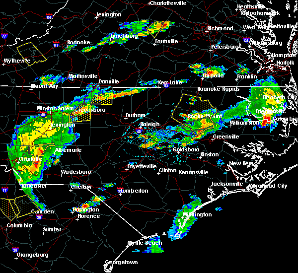 At 619 pm edt, severe thunderstorms were located from 5 miles northeast of camp springs to leasburg, moving east at 15 mph (radar indicated). Hazards include 60 mph wind gusts. Expect damage to roofs. siding. And trees. At 619 pm edt, severe thunderstorms were located from 5 miles northeast of camp springs to leasburg, moving east at 15 mph (radar indicated). Hazards include 60 mph wind gusts. Expect damage to roofs. siding. And trees.
|
| 7/15/2016 6:17 PM EDT |
 At 616 pm edt, a severe thunderstorm was located near jericho, moving east at 30 mph (radar indicated). Hazards include 60 mph wind gusts. Expect damage to roofs. siding. and trees. Locations impacted include, yanceyville, camp springs, prospect hill, jericho, and baynes. At 616 pm edt, a severe thunderstorm was located near jericho, moving east at 30 mph (radar indicated). Hazards include 60 mph wind gusts. Expect damage to roofs. siding. and trees. Locations impacted include, yanceyville, camp springs, prospect hill, jericho, and baynes.
|
| 7/15/2016 6:04 PM EDT |
 At 602 pm edt, a severe thunderstorm was located near lawsonville, moving east at 25 mph (radar indicated). Hazards include 60 mph wind gusts. Expect damage to roofs. siding. and trees. Locations impacted include, reidsville, yanceyville, camp springs, prospect hill, and jericho. At 602 pm edt, a severe thunderstorm was located near lawsonville, moving east at 25 mph (radar indicated). Hazards include 60 mph wind gusts. Expect damage to roofs. siding. and trees. Locations impacted include, reidsville, yanceyville, camp springs, prospect hill, and jericho.
|
| 7/15/2016 5:44 PM EDT |
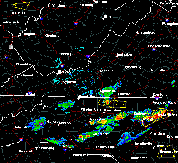 At 543 pm edt, a severe thunderstorm was located near reidsville, moving east at 25 mph (radar indicated). Hazards include 60 mph wind gusts. Expect damage to roofs. siding. And trees. At 543 pm edt, a severe thunderstorm was located near reidsville, moving east at 25 mph (radar indicated). Hazards include 60 mph wind gusts. Expect damage to roofs. siding. And trees.
|
| 7/8/2016 7:26 PM EDT |
 The severe thunderstorm warning for caswell county will expire at 730 pm edt, the storms which prompted the warning have moved out of the area. therefore the warning will be allowed to expire. a severe thunderstorm watch remains in effect until 1000 pm edt for north carolina and virginia. when it is safe to do so, please send your reports of hail of any size, as well as any reports of wind damage, including downed trees or large limbs, to the national weather service by calling toll free at 1, 8 6 6, 2 1 5, 4 3 2 4. reports and pictures can also be shared on the national weather service blacksburg facebook page and on twitter. The severe thunderstorm warning for caswell county will expire at 730 pm edt, the storms which prompted the warning have moved out of the area. therefore the warning will be allowed to expire. a severe thunderstorm watch remains in effect until 1000 pm edt for north carolina and virginia. when it is safe to do so, please send your reports of hail of any size, as well as any reports of wind damage, including downed trees or large limbs, to the national weather service by calling toll free at 1, 8 6 6, 2 1 5, 4 3 2 4. reports and pictures can also be shared on the national weather service blacksburg facebook page and on twitter.
|
| 7/8/2016 7:01 PM EDT |
 At 701 pm edt, severe thunderstorms were located along a line extending from leasburg to near hightowers to camp springs, moving southeast at 30 mph (radar indicated). Hazards include 60 mph wind gusts and quarter size hail. Hail damage to vehicles is expected. expect wind damage to roofs, siding, and trees. Locations impacted include, yanceyville, bethel, prospect hill, jericho, and camp springs. At 701 pm edt, severe thunderstorms were located along a line extending from leasburg to near hightowers to camp springs, moving southeast at 30 mph (radar indicated). Hazards include 60 mph wind gusts and quarter size hail. Hail damage to vehicles is expected. expect wind damage to roofs, siding, and trees. Locations impacted include, yanceyville, bethel, prospect hill, jericho, and camp springs.
|
| 7/8/2016 7:00 PM EDT | One tree down on stephentown roa in caswell county NC, 6.1 miles W of Yanceyville, NC |
| 7/8/2016 7:00 PM EDT | One power line down on route 86 near the northern city limits of yanceyville in caswell county NC, 2.5 miles SE of Yanceyville, NC |
| 7/8/2016 6:46 PM EDT |
 At 645 pm edt, severe thunderstorms were located along a line extending from near aspen to near redoak to near alton to near providence, moving east at 35 mph (radar indicated). Hazards include 60 mph wind gusts and quarter size hail. Hail damage to vehicles is expected. expect wind damage to roofs, siding, and trees. locations impacted include, danville, south boston, halifax, charlotte court house, and clover. This includes danville airport. At 645 pm edt, severe thunderstorms were located along a line extending from near aspen to near redoak to near alton to near providence, moving east at 35 mph (radar indicated). Hazards include 60 mph wind gusts and quarter size hail. Hail damage to vehicles is expected. expect wind damage to roofs, siding, and trees. locations impacted include, danville, south boston, halifax, charlotte court house, and clover. This includes danville airport.
|
| 7/8/2016 6:45 PM EDT | One tree down on melvin wrenn roa in caswell county NC, 3 miles SE of Yanceyville, NC |
| 7/8/2016 6:34 PM EDT |
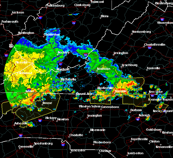 At 633 pm edt, severe thunderstorms were located along a line extending from near gatewood to near lawsonville, moving southeast at 35 mph (radar indicated). Hazards include 60 mph wind gusts and quarter size hail. Hail damage to vehicles is expected. Expect wind damage to roofs, siding, and trees. At 633 pm edt, severe thunderstorms were located along a line extending from near gatewood to near lawsonville, moving southeast at 35 mph (radar indicated). Hazards include 60 mph wind gusts and quarter size hail. Hail damage to vehicles is expected. Expect wind damage to roofs, siding, and trees.
|
| 7/8/2016 6:27 PM EDT |
 At 626 pm edt, severe thunderstorms were located along a line extending from near brookneal to near mt laurel to near turbeville to westover hills, moving east at 50 mph (radar indicated). Hazards include 60 mph wind gusts and quarter size hail. Hail damage to vehicles is expected. expect wind damage to roofs, siding, and trees. locations impacted include, danville, south boston, halifax, brookneal, and charlotte court house. This includes danville airport. At 626 pm edt, severe thunderstorms were located along a line extending from near brookneal to near mt laurel to near turbeville to westover hills, moving east at 50 mph (radar indicated). Hazards include 60 mph wind gusts and quarter size hail. Hail damage to vehicles is expected. expect wind damage to roofs, siding, and trees. locations impacted include, danville, south boston, halifax, brookneal, and charlotte court house. This includes danville airport.
|
| 7/8/2016 6:05 PM EDT |
 At 605 pm edt, severe thunderstorms were located along a line extending from hurt to near ridgeway to near pelham, moving east at 30 mph (radar indicated). Hazards include 60 mph wind gusts and quarter size hail. Hail damage to vehicles is expected. Expect wind damage to roofs, siding, and trees. At 605 pm edt, severe thunderstorms were located along a line extending from hurt to near ridgeway to near pelham, moving east at 30 mph (radar indicated). Hazards include 60 mph wind gusts and quarter size hail. Hail damage to vehicles is expected. Expect wind damage to roofs, siding, and trees.
|
| 7/3/2016 1:05 AM EDT |
 At 105 am edt, severe thunderstorms were located along a line extending from blanch to harrisons crossroads, moving southeast at 10 mph (radar indicated). Hazards include 60 mph wind gusts. Expect damage to roofs. siding. and trees. Locations impacted include, eden, reidsville, yanceyville, bethel, and camp springs. At 105 am edt, severe thunderstorms were located along a line extending from blanch to harrisons crossroads, moving southeast at 10 mph (radar indicated). Hazards include 60 mph wind gusts. Expect damage to roofs. siding. and trees. Locations impacted include, eden, reidsville, yanceyville, bethel, and camp springs.
|
| 7/3/2016 12:32 AM EDT |
 At 1231 am edt, severe thunderstorms were located along a line extending from near blairs to near mayfield, moving southeast at 20 mph (radar indicated). Hazards include 60 mph wind gusts. Expect damage to roofs. siding. And trees. At 1231 am edt, severe thunderstorms were located along a line extending from near blairs to near mayfield, moving southeast at 20 mph (radar indicated). Hazards include 60 mph wind gusts. Expect damage to roofs. siding. And trees.
|
| 6/29/2016 5:58 PM EDT |
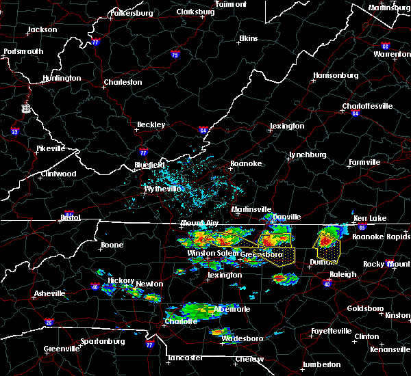 At 557 pm edt, a severe thunderstorm was located over camp springs, moving southeast at 25 mph (doppler radar). Hazards include 70 mph wind gusts and half dollar size hail. Hail damage to vehicles is expected. expect considerable tree damage. wind damage is also likely to mobile homes, roofs, and outbuildings. Locations impacted include, yanceyville, camp springs, prospect hill, jericho, and baynes. At 557 pm edt, a severe thunderstorm was located over camp springs, moving southeast at 25 mph (doppler radar). Hazards include 70 mph wind gusts and half dollar size hail. Hail damage to vehicles is expected. expect considerable tree damage. wind damage is also likely to mobile homes, roofs, and outbuildings. Locations impacted include, yanceyville, camp springs, prospect hill, jericho, and baynes.
|
| 6/29/2016 5:43 PM EDT |
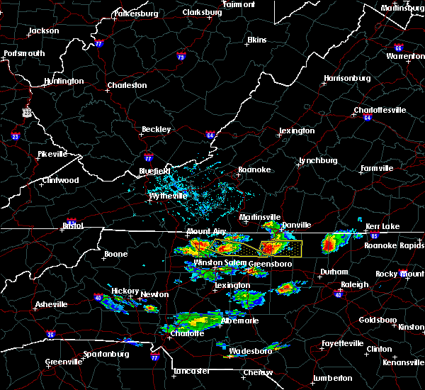 At 541 pm edt, a severe thunderstorm was located over camp springs, moving east at 30 mph (public indicated quarter sized hail and trees down in reidsville from this storm around 535 pm). Hazards include 70 mph wind gusts and quarter size hail. Expect damaing winds. wind damage is also possible to mobile homes, roofs, and outbuildings. Locations impacted include, reidsville, yanceyville, camp springs, jericho, and prospect hill. At 541 pm edt, a severe thunderstorm was located over camp springs, moving east at 30 mph (public indicated quarter sized hail and trees down in reidsville from this storm around 535 pm). Hazards include 70 mph wind gusts and quarter size hail. Expect damaing winds. wind damage is also possible to mobile homes, roofs, and outbuildings. Locations impacted include, reidsville, yanceyville, camp springs, jericho, and prospect hill.
|
| 6/29/2016 5:34 PM EDT |
 At 533 pm edt, a severe thunderstorm was located near reidsville, moving southeast at 25 mph (radar indicated). Hazards include golf ball size hail and 70 mph wind gusts. People and animals outdoors will be injured. expect hail damage to roofs, siding, windows, and vehicles. expect considerable tree damage. wind damage is also likely to mobile homes, roofs, and outbuildings. Locations impacted include, reidsville, yanceyville, bethel, camp springs, and jericho. At 533 pm edt, a severe thunderstorm was located near reidsville, moving southeast at 25 mph (radar indicated). Hazards include golf ball size hail and 70 mph wind gusts. People and animals outdoors will be injured. expect hail damage to roofs, siding, windows, and vehicles. expect considerable tree damage. wind damage is also likely to mobile homes, roofs, and outbuildings. Locations impacted include, reidsville, yanceyville, bethel, camp springs, and jericho.
|
| 6/29/2016 5:29 PM EDT |
 At 529 pm edt, a severe thunderstorm was located near lawsonville, moving east at 30 mph (radar indicated). Hazards include 60 mph wind gusts and quarter size hail. Hail damage to vehicles is expected. Expect wind damage to roofs, siding, and trees. At 529 pm edt, a severe thunderstorm was located near lawsonville, moving east at 30 mph (radar indicated). Hazards include 60 mph wind gusts and quarter size hail. Hail damage to vehicles is expected. Expect wind damage to roofs, siding, and trees.
|
| 6/24/2016 10:40 PM EDT |
 The severe thunderstorm warning for caswell and eastern rockingham counties will expire at 1045 pm edt, the storms which prompted the warning have weakened. therefore the warning will be allowed to expire. moderate to heavy rainfall and frequent cloud-to-ground lightning will continue in this area for another 30 minutes or so. when it is safe to do so, please send your reports of hail of any size, as well as any reports of wind damage, including downed trees or large limbs, to the national weather service by calling toll free at 1, 8 6 6, 2 1 5, 4 3 2 4. reports and pictures can also be shared on the national weather service blacksburg facebook page and on twitter. The severe thunderstorm warning for caswell and eastern rockingham counties will expire at 1045 pm edt, the storms which prompted the warning have weakened. therefore the warning will be allowed to expire. moderate to heavy rainfall and frequent cloud-to-ground lightning will continue in this area for another 30 minutes or so. when it is safe to do so, please send your reports of hail of any size, as well as any reports of wind damage, including downed trees or large limbs, to the national weather service by calling toll free at 1, 8 6 6, 2 1 5, 4 3 2 4. reports and pictures can also be shared on the national weather service blacksburg facebook page and on twitter.
|
| 6/24/2016 10:29 PM EDT |
 At 1027 pm edt, severe thunderstorms were located along a line extending from lawsonville to near hightowers to near leasburg, moving southeast at 25 mph (radar indicated). Hazards include 60 mph wind gusts. Expect damage to roofs. siding. and trees. Locations impacted include, eden, reidsville, yanceyville, bethel, and camp springs. At 1027 pm edt, severe thunderstorms were located along a line extending from lawsonville to near hightowers to near leasburg, moving southeast at 25 mph (radar indicated). Hazards include 60 mph wind gusts. Expect damage to roofs. siding. and trees. Locations impacted include, eden, reidsville, yanceyville, bethel, and camp springs.
|
| 6/24/2016 10:11 PM EDT |
 At 1010 pm edt, severe thunderstorms were located along a line extending from draper to yanceyville to semora, moving southeast at 25 mph (radar indicated). Hazards include 60 mph wind gusts. Expect damage to roofs. siding. and trees. locations impacted include, danville, eden, reidsville, yanceyville, and bethel. This includes danville airport. At 1010 pm edt, severe thunderstorms were located along a line extending from draper to yanceyville to semora, moving southeast at 25 mph (radar indicated). Hazards include 60 mph wind gusts. Expect damage to roofs. siding. and trees. locations impacted include, danville, eden, reidsville, yanceyville, and bethel. This includes danville airport.
|
| 6/24/2016 9:49 PM EDT |
 At 947 pm edt, severe thunderstorms were located along a line extending from near aiken summit to gatewood to near ringgold, moving southeast at 25 mph. another severe thunderstorm was located near reidsville, almost moving southeast at 25 mph (radar indicated). Hazards include 60 mph wind gusts. Expect damage to roofs. siding. and trees. locations impacted include, danville, eden, reidsville, yanceyville, and bethel. This includes danville airport. At 947 pm edt, severe thunderstorms were located along a line extending from near aiken summit to gatewood to near ringgold, moving southeast at 25 mph. another severe thunderstorm was located near reidsville, almost moving southeast at 25 mph (radar indicated). Hazards include 60 mph wind gusts. Expect damage to roofs. siding. and trees. locations impacted include, danville, eden, reidsville, yanceyville, and bethel. This includes danville airport.
|
| 6/24/2016 9:38 PM EDT |
 At 937 pm edt, severe thunderstorms were located along a line extending from laurel park to near westover hills to near keeling, moving southeast at 25 mph (radar indicated). Hazards include 60 mph wind gusts. Expect damage to roofs. siding. And trees. At 937 pm edt, severe thunderstorms were located along a line extending from laurel park to near westover hills to near keeling, moving southeast at 25 mph (radar indicated). Hazards include 60 mph wind gusts. Expect damage to roofs. siding. And trees.
|
| 6/23/2016 8:20 PM EDT | Thunderstorm winds resulted in numerous trees down along us 158 in the far eastern portions of caswell county in n in caswell county NC, 8.9 miles W of Yanceyville, NC |
| 6/23/2016 7:55 PM EDT | Thunderstorm winds caused a 12 - 15 inch pine to topple down east of yanceyville in n in caswell county NC, 4.9 miles W of Yanceyville, NC |
| 6/23/2016 7:48 PM EDT |
 At 748 pm edt, severe thunderstorms were located along a line extending from near turbeville to baynes, moving southeast at 40 mph (radar indicated). Hazards include 60 mph wind gusts and half dollar size hail. Hail damage to vehicles is expected. Expect wind damage to roofs, siding, and trees. At 748 pm edt, severe thunderstorms were located along a line extending from near turbeville to baynes, moving southeast at 40 mph (radar indicated). Hazards include 60 mph wind gusts and half dollar size hail. Hail damage to vehicles is expected. Expect wind damage to roofs, siding, and trees.
|
| 6/22/2016 4:59 PM EDT |
 At 458 pm edt, a severe thunderstorm was located near leasburg, moving southeast at 40 mph (radar indicated). Hazards include 60 mph wind gusts. Expect damage to roofs. siding. and trees. Locations impacted include, yanceyville, milton, semora, hamer, and topnot. At 458 pm edt, a severe thunderstorm was located near leasburg, moving southeast at 40 mph (radar indicated). Hazards include 60 mph wind gusts. Expect damage to roofs. siding. and trees. Locations impacted include, yanceyville, milton, semora, hamer, and topnot.
|
| 6/22/2016 4:43 PM EDT |
 At 443 pm edt, a severe thunderstorm was located over providence, moving southeast at 30 mph (radar indicated). Hazards include 60 mph wind gusts. Expect damage to roofs. siding. and trees. locations impacted include, danville, yanceyville, bethel, jericho, and providence. This includes danville airport. At 443 pm edt, a severe thunderstorm was located over providence, moving southeast at 30 mph (radar indicated). Hazards include 60 mph wind gusts. Expect damage to roofs. siding. and trees. locations impacted include, danville, yanceyville, bethel, jericho, and providence. This includes danville airport.
|
| 6/22/2016 4:11 PM EDT |
 At 411 pm edt, a severe thunderstorm was located near cascade, moving southeast at 35 mph (radar indicated). Hazards include 60 mph wind gusts and quarter size hail. Hail damage to vehicles is expected. Expect wind damage to roofs, siding, and trees. At 411 pm edt, a severe thunderstorm was located near cascade, moving southeast at 35 mph (radar indicated). Hazards include 60 mph wind gusts and quarter size hail. Hail damage to vehicles is expected. Expect wind damage to roofs, siding, and trees.
|
| 6/16/2016 11:40 PM EDT |
 At 1139 pm edt, a severe thunderstorm with a history of producing tree damage was located over semora, moving southeast at 50 mph (trained weather spotters). Hazards include 60 mph wind gusts and penny size hail. Expect damage to roofs. siding. and trees. Locations impacted include, south boston, yanceyville, bethel, prospect hill, and turbeville. At 1139 pm edt, a severe thunderstorm with a history of producing tree damage was located over semora, moving southeast at 50 mph (trained weather spotters). Hazards include 60 mph wind gusts and penny size hail. Expect damage to roofs. siding. and trees. Locations impacted include, south boston, yanceyville, bethel, prospect hill, and turbeville.
|
| 6/16/2016 11:33 PM EDT |
 At 1133 pm edt, a severe thunderstorm was located over milton, moving southeast at 50 mph (radar indicated). Hazards include 60 mph wind gusts and penny size hail. Expect damage to roofs. siding. and trees. locations impacted include, danville, south boston, yanceyville, bethel, and turbeville. This includes danville airport. At 1133 pm edt, a severe thunderstorm was located over milton, moving southeast at 50 mph (radar indicated). Hazards include 60 mph wind gusts and penny size hail. Expect damage to roofs. siding. and trees. locations impacted include, danville, south boston, yanceyville, bethel, and turbeville. This includes danville airport.
|
| 6/16/2016 11:22 PM EDT |
 At 1121 pm edt, a severe thunderstorm was located over danville, moving southeast at 50 mph (radar indicated). Hazards include 60 mph wind gusts and penny size hail. Expect damage to roofs. siding. and trees. locations impacted include, danville, south boston, yanceyville, bethel, and blairs. This includes danville airport. At 1121 pm edt, a severe thunderstorm was located over danville, moving southeast at 50 mph (radar indicated). Hazards include 60 mph wind gusts and penny size hail. Expect damage to roofs. siding. and trees. locations impacted include, danville, south boston, yanceyville, bethel, and blairs. This includes danville airport.
|
| 6/16/2016 11:14 PM EDT |
 At 1114 pm edt, a severe thunderstorm was located near westover hills, moving southeast at 35 mph (radar indicated). Hazards include 60 mph wind gusts. Expect damage to roofs. siding. And trees. At 1114 pm edt, a severe thunderstorm was located near westover hills, moving southeast at 35 mph (radar indicated). Hazards include 60 mph wind gusts. Expect damage to roofs. siding. And trees.
|
| 6/5/2016 6:25 PM EDT | Tree down on highway 119n in caswell county NC, 7.8 miles WSW of Yanceyville, NC |
| 6/5/2016 6:20 PM EDT | Tree down in blanch in caswell county NC, 7.7 miles SSW of Yanceyville, NC |
| 6/5/2016 6:19 PM EDT | Tree down in yanceyville in caswell county NC, 0.8 miles ENE of Yanceyville, NC |
| 6/5/2016 6:08 PM EDT |
 At 607 pm edt, severe thunderstorms were located along a line extending from pelham to bethel to near quick, moving east- northeast at 50 mph (radar indicated). Hazards include 60 mph wind gusts. Expect damage to roofs. siding. And trees. At 607 pm edt, severe thunderstorms were located along a line extending from pelham to bethel to near quick, moving east- northeast at 50 mph (radar indicated). Hazards include 60 mph wind gusts. Expect damage to roofs. siding. And trees.
|
| 6/4/2016 10:31 PM EDT |
 At 1030 pm edt, a severe thunderstorm was located over leasburg, moving east at 20 mph (radar indicated). Hazards include 60 mph wind gusts. Expect damage to roofs. siding. And trees. At 1030 pm edt, a severe thunderstorm was located over leasburg, moving east at 20 mph (radar indicated). Hazards include 60 mph wind gusts. Expect damage to roofs. siding. And trees.
|
| 6/4/2016 10:18 PM EDT | 911 call center reports tree down along hwy 150 sw of the community of yanceyville in caswell county... n in caswell county NC, 4.9 miles ENE of Yanceyville, NC |
| 6/4/2016 10:18 PM EDT | 911 call center reports a tree down near the brush arbor church in caswell county... n in caswell county NC, 8.9 miles NNE of Yanceyville, NC |
| 6/4/2016 9:33 PM EDT |
 At 933 pm edt, severe thunderstorms were located along a line extending from near pittsville to near harrisons crossroads, moving east at 20 mph (radar indicated). Hazards include 60 mph wind gusts. Expect damage to roofs. siding. And trees. At 933 pm edt, severe thunderstorms were located along a line extending from near pittsville to near harrisons crossroads, moving east at 20 mph (radar indicated). Hazards include 60 mph wind gusts. Expect damage to roofs. siding. And trees.
|
| 6/4/2016 7:11 PM EDT |
 At 710 pm edt, a severe thunderstorm was located near milton, moving northeast at 10 mph. another severe thunderstorm was located just northwest of bethel hill, also moving northeast at 10 mph (radar indicated). Hazards include 60 mph wind gusts and quarter size hail. Hail damage to vehicles is expected. Expect wind damage to roofs, siding, and trees. At 710 pm edt, a severe thunderstorm was located near milton, moving northeast at 10 mph. another severe thunderstorm was located just northwest of bethel hill, also moving northeast at 10 mph (radar indicated). Hazards include 60 mph wind gusts and quarter size hail. Hail damage to vehicles is expected. Expect wind damage to roofs, siding, and trees.
|
| 5/12/2016 8:26 PM EDT |
 The severe thunderstorm warning for caswell county will expire at 830 pm edt, the storm which prompted the warning has weakened below severe limits, and has exited the warned area. therefore the warning will be allowed to expire. however heavy rain is still possible with this thunderstorm. when it is safe to do so, please send your reports of hail of any size, as well as any reports of wind damage, including downed trees or large limbs, to the national weather service by calling toll free at 1, 8 6 6, 2 1 5, 4 3 2 4. reports and pictures can also be shared on the national weather service blacksburg facebook page and on twitter. The severe thunderstorm warning for caswell county will expire at 830 pm edt, the storm which prompted the warning has weakened below severe limits, and has exited the warned area. therefore the warning will be allowed to expire. however heavy rain is still possible with this thunderstorm. when it is safe to do so, please send your reports of hail of any size, as well as any reports of wind damage, including downed trees or large limbs, to the national weather service by calling toll free at 1, 8 6 6, 2 1 5, 4 3 2 4. reports and pictures can also be shared on the national weather service blacksburg facebook page and on twitter.
|
| 5/12/2016 7:59 PM EDT |
 At 758 pm edt, a severe thunderstorm was located over yanceyville, moving northeast at 25 mph (radar indicated). Hazards include 60 mph wind gusts and quarter size hail. Hail damage to vehicles is expected. expect wind damage to roofs, siding, and trees. Locations impacted include, yanceyville, bethel, camp springs, jericho, and prospect hill. At 758 pm edt, a severe thunderstorm was located over yanceyville, moving northeast at 25 mph (radar indicated). Hazards include 60 mph wind gusts and quarter size hail. Hail damage to vehicles is expected. expect wind damage to roofs, siding, and trees. Locations impacted include, yanceyville, bethel, camp springs, jericho, and prospect hill.
|
| 5/12/2016 7:55 PM EDT | A power line was blown dow in caswell county NC, 6.7 miles NW of Yanceyville, NC |
| 5/12/2016 7:45 PM EDT |
 At 745 pm edt, a severe thunderstorm was located near jericho, moving northeast at 25 mph (radar indicated). Hazards include 60 mph wind gusts and quarter size hail. Hail damage to vehicles is expected. expect wind damage to roofs, siding, and trees. Locations impacted include, yanceyville, bethel, camp springs, jericho, and prospect hill. At 745 pm edt, a severe thunderstorm was located near jericho, moving northeast at 25 mph (radar indicated). Hazards include 60 mph wind gusts and quarter size hail. Hail damage to vehicles is expected. expect wind damage to roofs, siding, and trees. Locations impacted include, yanceyville, bethel, camp springs, jericho, and prospect hill.
|
| 5/12/2016 7:25 PM EDT |
 At 724 pm edt, a severe thunderstorm was located over camp springs, moving northeast at 30 mph (radar indicated). Hazards include 60 mph wind gusts and quarter size hail. Hail damage to vehicles is expected. Expect wind damage to roofs, siding, and trees. At 724 pm edt, a severe thunderstorm was located over camp springs, moving northeast at 30 mph (radar indicated). Hazards include 60 mph wind gusts and quarter size hail. Hail damage to vehicles is expected. Expect wind damage to roofs, siding, and trees.
|
| 5/2/2016 5:56 PM EDT |
 At 556 pm edt, a severe thunderstorm was located over mayfield, moving northeast at 25 mph (radar indicated). Hazards include 60 mph wind gusts and half dollar size hail. Hail damage to vehicles is expected. Expect wind damage to roofs, siding, and trees. At 556 pm edt, a severe thunderstorm was located over mayfield, moving northeast at 25 mph (radar indicated). Hazards include 60 mph wind gusts and half dollar size hail. Hail damage to vehicles is expected. Expect wind damage to roofs, siding, and trees.
|
| 2/24/2016 3:22 PM EST |
 At 321 pm est, severe thunderstorms were located along a line extending from near brookneal to semora, moving east at 35 mph (radar indicated). Hazards include 60 mph wind gusts and quarter size hail. Hail damage to vehicles is expected. expect wind damage to roofs, siding, and trees. locations impacted include, danville, altavista, hurt, chatham, and gretna. this includes danville airport. a tornado watch remains in effect until 700 pm est for north central north carolina. A tornado watch also remains in effect until 900 pm est for south central virginia. At 321 pm est, severe thunderstorms were located along a line extending from near brookneal to semora, moving east at 35 mph (radar indicated). Hazards include 60 mph wind gusts and quarter size hail. Hail damage to vehicles is expected. expect wind damage to roofs, siding, and trees. locations impacted include, danville, altavista, hurt, chatham, and gretna. this includes danville airport. a tornado watch remains in effect until 700 pm est for north central north carolina. A tornado watch also remains in effect until 900 pm est for south central virginia.
|
| 2/24/2016 3:21 PM EST |
 At 320 pm est, severe thunderstorms were moving along a line extending from gatewood to 6 miles southwest of jericho, moving northeast at 25 mph (radar indicated). Hazards include 60 mph wind gusts. Expect damage to roofs. siding. And trees. At 320 pm est, severe thunderstorms were moving along a line extending from gatewood to 6 miles southwest of jericho, moving northeast at 25 mph (radar indicated). Hazards include 60 mph wind gusts. Expect damage to roofs. siding. And trees.
|
| 2/24/2016 2:47 PM EST |
 At 246 pm est, severe thunderstorms were located along a line extending from near gretna to near ruffin, moving northeast at 40 mph (radar indicated). Hazards include 60 mph wind gusts and quarter size hail. Hail damage to vehicles is expected. expect wind damage to roofs, siding, and trees. locations impacted include, danville, altavista, hurt, chatham, and gretna. this includes danville airport. a tornado watch remains in effect until 700 pm est for north central north carolina. A tornado watch also remains in effect until 900 pm est for south central virginia. At 246 pm est, severe thunderstorms were located along a line extending from near gretna to near ruffin, moving northeast at 40 mph (radar indicated). Hazards include 60 mph wind gusts and quarter size hail. Hail damage to vehicles is expected. expect wind damage to roofs, siding, and trees. locations impacted include, danville, altavista, hurt, chatham, and gretna. this includes danville airport. a tornado watch remains in effect until 700 pm est for north central north carolina. A tornado watch also remains in effect until 900 pm est for south central virginia.
|
| 2/24/2016 2:26 PM EST |
 At 226 pm est, a severe thunderstorm was located over cascade, moving east at 35 mph (radar indicated). Hazards include 60 mph wind gusts and quarter size hail. Hail damage to vehicles is expected. Expect wind damage to roofs, siding, and trees. At 226 pm est, a severe thunderstorm was located over cascade, moving east at 35 mph (radar indicated). Hazards include 60 mph wind gusts and quarter size hail. Hail damage to vehicles is expected. Expect wind damage to roofs, siding, and trees.
|
| 9/4/2015 4:36 PM EDT |
 The severe thunderstorm warning for caswell, southeastern rockingham, southeastern pittsylvania and southwestern halifax counties will expire at 445 pm edt, the storm which prompted the warning has weakened below severe limits, and no longer poses an immediate threat to life or property. therefore the warning will be allowed to expire. when it is safe to do so, please send your reports of hail of any size, as well as any reports of wind damage, including downed trees or large limbs, to the national weather service by calling toll free at 1, 8 6 6, 2 1 5, 4 3 2 4. reports and pictures can also be shared on the national weather service blacksburg facebook page and on twitter. The severe thunderstorm warning for caswell, southeastern rockingham, southeastern pittsylvania and southwestern halifax counties will expire at 445 pm edt, the storm which prompted the warning has weakened below severe limits, and no longer poses an immediate threat to life or property. therefore the warning will be allowed to expire. when it is safe to do so, please send your reports of hail of any size, as well as any reports of wind damage, including downed trees or large limbs, to the national weather service by calling toll free at 1, 8 6 6, 2 1 5, 4 3 2 4. reports and pictures can also be shared on the national weather service blacksburg facebook page and on twitter.
|
| 9/4/2015 4:17 PM EDT |
 At 416 pm edt, a severe thunderstorm was located over yanceyville, moving southwest at 20 mph (radar indicated). Hazards include 60 mph wind gusts and quarter size hail. Hail damage to vehicles is expected. expect wind damage to roofs, siding and trees. Locations impacted include, reidsville, yanceyville, bethel, camp springs, and jericho. At 416 pm edt, a severe thunderstorm was located over yanceyville, moving southwest at 20 mph (radar indicated). Hazards include 60 mph wind gusts and quarter size hail. Hail damage to vehicles is expected. expect wind damage to roofs, siding and trees. Locations impacted include, reidsville, yanceyville, bethel, camp springs, and jericho.
|
| 9/4/2015 3:52 PM EDT |
 At 352 pm edt, a severe thunderstorm was located over milton, moving southwest at 30 mph (radar indicated). Hazards include 60 mph wind gusts and quarter size hail. Hail damage to vehicles is expected. Expect wind damage to roofs, siding and trees. At 352 pm edt, a severe thunderstorm was located over milton, moving southwest at 30 mph (radar indicated). Hazards include 60 mph wind gusts and quarter size hail. Hail damage to vehicles is expected. Expect wind damage to roofs, siding and trees.
|
| 8/11/2015 6:05 PM EDT |
 The severe thunderstorm warning for caswell and southeastern rockingham counties will expire at 615 pm edt, the storms which prompted the warning have weakened below severe limits, and have exited the warned area. therefore the warning will be allowed to expire. when it is safe to do so, please send your reports of hail of any size, as well as any reports of wind damage, including downed trees or large limbs, to the national weather service by calling toll free at 1, 8 6 6, 2 1 5, 4 3 2 4. reports and pictures can also be shared on the national weather service blacksburg facebook page and on twitter. The severe thunderstorm warning for caswell and southeastern rockingham counties will expire at 615 pm edt, the storms which prompted the warning have weakened below severe limits, and have exited the warned area. therefore the warning will be allowed to expire. when it is safe to do so, please send your reports of hail of any size, as well as any reports of wind damage, including downed trees or large limbs, to the national weather service by calling toll free at 1, 8 6 6, 2 1 5, 4 3 2 4. reports and pictures can also be shared on the national weather service blacksburg facebook page and on twitter.
|
| 8/11/2015 5:31 PM EDT |
 At 531 pm edt, severe thunderstorms were located along a line extending from leasburg to near monroeton, moving east at 15 mph (radar indicated). Hazards include 60 mph wind gusts and quarter size hail. Hail damage to vehicles is expected. expect wind damage to roofs, siding and trees. Locations impacted include, reidsville, yanceyville, bethel, camp springs, and jericho. At 531 pm edt, severe thunderstorms were located along a line extending from leasburg to near monroeton, moving east at 15 mph (radar indicated). Hazards include 60 mph wind gusts and quarter size hail. Hail damage to vehicles is expected. expect wind damage to roofs, siding and trees. Locations impacted include, reidsville, yanceyville, bethel, camp springs, and jericho.
|
| 8/11/2015 5:30 PM EDT | Four pine trees dow in caswell county NC, 3.7 miles NW of Yanceyville, NC |
| 8/11/2015 5:20 PM EDT | One tree down on stoney creek school road in caswell county NC, 7.3 miles NE of Yanceyville, NC |
| 8/11/2015 5:15 PM EDT | Reported one tree down and multiple branches down described as thick as an arm. time radar estimate in caswell county NC, 4.9 miles WNW of Yanceyville, NC |
| 8/11/2015 4:56 PM EDT |
 At 456 pm edt, severe thunderstorms were located along a line extending from near blanch to bethany, moving southeast at 35 mph (radar indicated). Hazards include 60 mph wind gusts and quarter size hail. Hail damage to vehicles is expected. Expect wind damage to roofs, siding and trees. At 456 pm edt, severe thunderstorms were located along a line extending from near blanch to bethany, moving southeast at 35 mph (radar indicated). Hazards include 60 mph wind gusts and quarter size hail. Hail damage to vehicles is expected. Expect wind damage to roofs, siding and trees.
|
| 7/13/2015 9:28 PM EDT |
 At 927 pm edt, severe thunderstorms were located along a line extending from near milton to near prospect hill, moving east at 40 mph (radar indicated). Hazards include 60 mph wind gusts and quarter size hail. Hail damage to vehicles is expected. expect wind damage to roofs, siding and trees. Locations impacted include, yanceyville, prospect hill, jericho, providence, and milton. At 927 pm edt, severe thunderstorms were located along a line extending from near milton to near prospect hill, moving east at 40 mph (radar indicated). Hazards include 60 mph wind gusts and quarter size hail. Hail damage to vehicles is expected. expect wind damage to roofs, siding and trees. Locations impacted include, yanceyville, prospect hill, jericho, providence, and milton.
|
| 7/13/2015 9:00 PM EDT |
 At 859 pm edt, severe thunderstorms were located along a line extending from pelham to near camp springs, moving east at 60 mph (radar indicated). Hazards include 60 mph wind gusts and quarter size hail. Hail damage to vehicles is expected. Expect wind damage to roofs, siding and trees. At 859 pm edt, severe thunderstorms were located along a line extending from pelham to near camp springs, moving east at 60 mph (radar indicated). Hazards include 60 mph wind gusts and quarter size hail. Hail damage to vehicles is expected. Expect wind damage to roofs, siding and trees.
|
| 7/13/2015 8:36 PM EDT | Caswell county 911 center reported that a tree was down on burton-chapel road in the mebane are in caswell county NC, 6.9 miles NNW of Yanceyville, NC |
| 7/13/2015 8:23 PM EDT |
 At 822 pm edt, a severe thunderstorm was located over hightowers, moving southeast at 35 mph (radar indicated). Hazards include 60 mph wind gusts and quarter size hail. Hail damage to vehicles is expected. Expect wind damage to roofs, siding and trees. At 822 pm edt, a severe thunderstorm was located over hightowers, moving southeast at 35 mph (radar indicated). Hazards include 60 mph wind gusts and quarter size hail. Hail damage to vehicles is expected. Expect wind damage to roofs, siding and trees.
|
| 7/5/2015 4:29 PM EDT |
 At 428 pm edt, a severe thunderstorm was located near elmo, moving northeast at 15 mph (radar indicated). Hazards include 60 mph wind gusts. Expect damage to roofs. siding and trees. Locations impacted include, turbeville, milton, semora, alton, and elmo. At 428 pm edt, a severe thunderstorm was located near elmo, moving northeast at 15 mph (radar indicated). Hazards include 60 mph wind gusts. Expect damage to roofs. siding and trees. Locations impacted include, turbeville, milton, semora, alton, and elmo.
|
| 7/5/2015 4:12 PM EDT |
 At 410 pm edt, a severe thunderstorm was located over milton, moving east at 20 mph. while there have been some indications of the storm weakening, it is expected to merge with other storms in advance of it. a reintensification is expected when this happens (radar indicated). Hazards include 60 mph wind gusts. Expect damage to roofs. siding and trees. Locations impacted include, turbeville, milton, semora, alton, and elmo. At 410 pm edt, a severe thunderstorm was located over milton, moving east at 20 mph. while there have been some indications of the storm weakening, it is expected to merge with other storms in advance of it. a reintensification is expected when this happens (radar indicated). Hazards include 60 mph wind gusts. Expect damage to roofs. siding and trees. Locations impacted include, turbeville, milton, semora, alton, and elmo.
|
| 7/5/2015 3:53 PM EDT |
 At 353 pm edt, a severe thunderstorm was located over blanch, moving east at 20 mph (radar indicated). Hazards include 60 mph wind gusts and quarter size hail. Hail damage to vehicles is expected. Expect wind damage to roofs, siding and trees. At 353 pm edt, a severe thunderstorm was located over blanch, moving east at 20 mph (radar indicated). Hazards include 60 mph wind gusts and quarter size hail. Hail damage to vehicles is expected. Expect wind damage to roofs, siding and trees.
|
| 6/30/2015 6:58 PM EDT | One tree down on a power line at the hyco creek bridge on griers church road in caswell county NC, 7.9 miles NW of Yanceyville, NC |
| 6/30/2015 6:52 PM EDT |
 At 652 pm edt, severe thunderstorms were located along a line extending from near yanceyville to near prospect hill, moving northeast at 40 mph (radar indicated). Hazards include 70 mph wind gusts. Expect considerable tree damage. damage is likely to mobile homes, roofs and outbuildings. Locations impacted include, yanceyville, prospect hill, jericho, semora, and hamer. At 652 pm edt, severe thunderstorms were located along a line extending from near yanceyville to near prospect hill, moving northeast at 40 mph (radar indicated). Hazards include 70 mph wind gusts. Expect considerable tree damage. damage is likely to mobile homes, roofs and outbuildings. Locations impacted include, yanceyville, prospect hill, jericho, semora, and hamer.
|
| 6/30/2015 6:42 PM EDT |
 At 641 pm edt, severe thunderstorms were located along a line extending from near camp springs to near mebane, moving northeast at 40 mph (radar indicated). Hazards include 60 mph wind gusts. Expect damage to roofs. siding and trees. Locations impacted include, yanceyville, camp springs, prospect hill, jericho, and semora. At 641 pm edt, severe thunderstorms were located along a line extending from near camp springs to near mebane, moving northeast at 40 mph (radar indicated). Hazards include 60 mph wind gusts. Expect damage to roofs. siding and trees. Locations impacted include, yanceyville, camp springs, prospect hill, jericho, and semora.
|
| 6/30/2015 6:26 PM EDT |
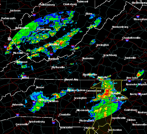 At 625 pm edt, severe thunderstorms were located along a line extending from 6 miles southwest of camp springs to graham, moving northeast at 40 mph (radar indicated). Hazards include 60 mph wind gusts. Expect damage to roofs. Siding and trees. At 625 pm edt, severe thunderstorms were located along a line extending from 6 miles southwest of camp springs to graham, moving northeast at 40 mph (radar indicated). Hazards include 60 mph wind gusts. Expect damage to roofs. Siding and trees.
|
| 6/30/2015 6:26 PM EDT |
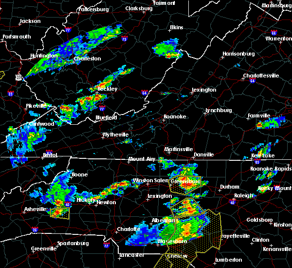 At 625 pm edt, severe thunderstorms were located along a line extending from 6 miles southwest of camp springs to graham, moving northeast at 40 mph (radar indicated). Hazards include 60 mph wind gusts. Expect damage to roofs. Siding and trees. At 625 pm edt, severe thunderstorms were located along a line extending from 6 miles southwest of camp springs to graham, moving northeast at 40 mph (radar indicated). Hazards include 60 mph wind gusts. Expect damage to roofs. Siding and trees.
|
| 6/27/2015 8:21 PM EDT |
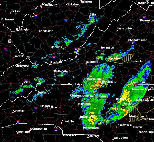 The severe thunderstorm warning for northwestern caswell, northeastern rockingham, southern pittsylvania counties and the city of danville will expire at 830 pm edt, the storms which prompted the warning have weakened below severe limits, and no longer pose an immediate threat to life or property. therefore the warning will be allowed to expire. when it is safe to do so, please send your reports of hail of any size, as well as any reports of wind damage, including downed trees or large limbs, to the national weather service by calling toll free at 1, 8 6 6, 2 1 5, 4 3 2 4. reports and pictures can also be shared on the national weather service blacksburg facebook page and on twitter. The severe thunderstorm warning for northwestern caswell, northeastern rockingham, southern pittsylvania counties and the city of danville will expire at 830 pm edt, the storms which prompted the warning have weakened below severe limits, and no longer pose an immediate threat to life or property. therefore the warning will be allowed to expire. when it is safe to do so, please send your reports of hail of any size, as well as any reports of wind damage, including downed trees or large limbs, to the national weather service by calling toll free at 1, 8 6 6, 2 1 5, 4 3 2 4. reports and pictures can also be shared on the national weather service blacksburg facebook page and on twitter.
|
| 6/27/2015 8:10 PM EDT |
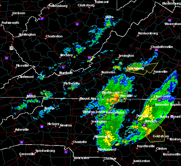 At 808 pm edt, severe thunderstorms extended from near keeling to near providence, and were moving east at 35 mph (radar indicated). Hazards include 60 mph wind gusts. Expect damage to roofs. siding and trees. locations impacted include, danville, bethel, blairs, mayfield, and danville city. This includes danville airport. At 808 pm edt, severe thunderstorms extended from near keeling to near providence, and were moving east at 35 mph (radar indicated). Hazards include 60 mph wind gusts. Expect damage to roofs. siding and trees. locations impacted include, danville, bethel, blairs, mayfield, and danville city. This includes danville airport.
|
| 6/27/2015 7:52 PM EDT |
 At 751 pm edt, severe thunderstorms were located along a line extending from near climax to mayfield, moving east at 30 mph (radar indicated). Hazards include 60 mph wind gusts and quarter size hail. Hail damage to vehicles is expected. expect considerable tree damage. wind damage is also likely to mobile homes, roofs and outbuildings. locations impacted include, danville, eden, bethel, blairs, and mayfield. This includes danville airport. At 751 pm edt, severe thunderstorms were located along a line extending from near climax to mayfield, moving east at 30 mph (radar indicated). Hazards include 60 mph wind gusts and quarter size hail. Hail damage to vehicles is expected. expect considerable tree damage. wind damage is also likely to mobile homes, roofs and outbuildings. locations impacted include, danville, eden, bethel, blairs, and mayfield. This includes danville airport.
|
| 6/27/2015 7:32 PM EDT |
 At 731 pm edt, severe thunderstorms were located along a line extending from callands to eden, moving east at 30 mph (radar indicated). Hazards include 70 mph wind gusts and quarter size hail. Hail damage to vehicles is expected. expect considerable tree damage. Wind damage is also likely to mobile homes, roofs and outbuildings. At 731 pm edt, severe thunderstorms were located along a line extending from callands to eden, moving east at 30 mph (radar indicated). Hazards include 70 mph wind gusts and quarter size hail. Hail damage to vehicles is expected. expect considerable tree damage. Wind damage is also likely to mobile homes, roofs and outbuildings.
|
| 6/27/2015 5:00 PM EDT | 911 call center reports 1 tree down along nc 150 just outside of cherry gove... n in caswell county NC, 9.6 miles ENE of Yanceyville, NC |
| 6/20/2015 5:31 PM EDT | Six 100 year old oak trees uproote in caswell county NC, 3.7 miles NW of Yanceyville, NC |
| 6/17/2015 11:50 PM EDT |
 At 1150 pm edt, a severe thunderstorm was located near hamer, moving southeast at 45 mph (radar indicated). Hazards include quarter size hail. damage to vehicles is expected At 1150 pm edt, a severe thunderstorm was located near hamer, moving southeast at 45 mph (radar indicated). Hazards include quarter size hail. damage to vehicles is expected
|
| 5/31/2015 8:41 PM EDT | At 840 pm edt, severe thunderstorms were located along a line extending from near cascade to reidsville, moving northeast at 15 mph (radar indicated). Hazards include 60 mph wind gusts. Expect damage to roofs. Siding and trees. |
| 5/31/2015 8:41 PM EDT | At 840 pm edt, severe thunderstorms were located along a line extending from near cascade to reidsville, moving northeast at 15 mph (radar indicated). Hazards include 60 mph wind gusts. Expect damage to roofs. Siding and trees. |
| 4/20/2015 4:17 PM EDT | Golf Ball sized hail reported 0.8 miles ENE of Yanceyville, NC |
| 4/20/2015 4:15 PM EDT | At 415 pm edt, a severe thunderstorm was located over hamer, moving east at 35 mph (radar indicated). Hazards include 60 mph wind gusts and half dollar size hail. Hail damage to vehicles is expected. Expect wind damage to roofs, siding and trees. |
| 4/20/2015 4:15 PM EDT | The national weather service in blacksburg has issued a * severe thunderstorm warning for. northern caswell county in north central north carolina. south central halifax county in south central virginia. until 445 pm edt * at 415 pm edt. A severe thunderstorm was located over hamer. |
| 4/20/2015 4:05 PM EDT | Quarter sized hail reported 7 miles ENE of Yanceyville, NC |
| 4/20/2015 4:03 PM EDT | At 402 pm edt, a severe thunderstorm capable of producing a tornado was located over camp springs, moving east at 40 mph (radar indicated rotation). Hazards include tornado and ping pong ball size hail. Flying debris will be dangerous to those caught without shelter. mobile homes will be damaged or destroyed. damage to roofs, windows and vehicles will occur. tree damage is likely. locations impacted include, yanceyville, camp springs, jericho, hamer, and baynes. Radar indicated. |
| 4/20/2015 3:52 PM EDT | At 352 pm edt, a severe thunderstorm capable of producing a tornado was located near reidsville, moving east at 40 mph (radar indicated rotation). Hazards include tornado and ping pong ball size hail. Flying debris will be dangerous to those caught without shelter. mobile homes will be damaged or destroyed. damage to roofs, windows and vehicles will occur. tree damage is likely. this dangerous storm will be near, camp springs around 400 pm edt. yanceyville and jericho around 415 pm edt. Radar indicated. |
| 4/20/2015 3:48 PM EDT | Quarter sized hail reported 7 miles ENE of Yanceyville, NC |
| 4/20/2015 3:47 PM EDT | At 346 pm edt, a severe thunderstorm was located near reidsville, moving northeast at 30 mph (radar indicated). Hazards include 60 mph wind gusts and quarter size hail. Hail damage to vehicles is expected. expect wind damage to roofs, siding and trees. locations impacted include, reidsville, wentworth, yanceyville, bethel, and mayfield. 1. 00in. |
| 4/20/2015 3:34 PM EDT | At 334 pm edt, a severe thunderstorm was located over monroeton, moving northeast at 35 mph (radar indicated). Hazards include 60 mph wind gusts and quarter size hail. Hail damage to vehicles is expected. expect wind damage to roofs, siding and trees. locations impacted include, reidsville, wentworth, yanceyville, bethel, and mayfield. 1. 00in. |
| 4/20/2015 3:19 PM EDT | At 318 pm edt, a severe thunderstorm was located near bethany, moving northeast at 30 mph (radar indicated). Hazards include 60 mph wind gusts and quarter size hail. Hail damage to vehicles is expected. Expect wind damage to roofs, siding and trees. |
| 7/9/2014 7:13 PM EDT | One tree down on cherry grove road in caswell county NC, 10.3 miles NE of Yanceyville, NC |
| 7/3/2014 3:26 PM EDT | Couple of trees down at 7335 address on nc 150 in caswell county NC, 7.8 miles ENE of Yanceyville, NC |
| 7/3/2014 3:22 PM EDT | Tree down at intersection of route 119 and highway 86 in caswell county NC, 7.6 miles NW of Yanceyville, NC |
| 5/10/2014 5:00 PM EDT | Tree down on power line in caswell county NC, 8.4 miles WNW of Yanceyville, NC |
| 8/12/2013 11:20 PM EDT | Tree down off rt 158 near rt 119 in caswell county NC, 6.6 miles W of Yanceyville, NC |
| 8/12/2013 10:55 PM EDT | One tree down along highway 158 wes in caswell county NC, 2.4 miles E of Yanceyville, NC |
| 8/1/2013 10:21 PM EDT | One tree down on roxboro lake roa in caswell county NC, 9.3 miles WNW of Yanceyville, NC |
| 6/28/2013 4:57 PM EDT | Several trees down along highway 62 sout in caswell county NC, 1.1 miles NNW of Yanceyville, NC |
| 6/28/2013 4:50 PM EDT | Several trees down along county home roa in caswell county NC, 1.3 miles ESE of Yanceyville, NC |
| 6/28/2013 4:47 PM EDT | Trees and power lines down along blanch roa in caswell county NC, 4 miles SSE of Yanceyville, NC |
| 4/19/2013 4:18 PM EDT | Trees down on country home roa in caswell county NC, 3.3 miles SSW of Yanceyville, NC |
| 4/19/2013 4:07 PM EDT | Large trees down at the intersection of nc 150 and nc 15 in caswell county NC, 7.8 miles ENE of Yanceyville, NC |
| 4/19/2013 4:07 PM EDT | Several large trees down at the intersection of nc 150 and nc 15 in caswell county NC, 7.8 miles ENE of Yanceyville, NC |
| 4/19/2013 4:07 PM EDT | 2 large trees dow in caswell county NC, 6.5 miles ENE of Yanceyville, NC |
| 4/18/2013 4:18 PM EDT | Trees down on country home roa in caswell county NC, 3.3 miles SSW of Yanceyville, NC |
| 4/12/2013 7:25 AM EDT | A tree was blown down along rascoe dameron roa in caswell county NC, 8.6 miles N of Yanceyville, NC |
| 9/2/2012 8:45 PM EDT | One tree down on highway 119 in caswell county NC, 6.6 miles W of Yanceyville, NC |
| 9/2/2012 8:28 PM EDT | One tree down on foster road in caswell county NC, 3 miles E of Yanceyville, NC |
| 7/21/2012 6:10 PM EDT | The caswell county sheriffs office reported a tree blown down along highway 62 near the community of jerich in caswell county NC, 8.9 miles NNE of Yanceyville, NC |
| 7/21/2012 6:00 PM EDT | The caswell county sheriffs office reported five trees blown down near the intersection of highway 62 and burton chapel roa in caswell county NC, 3.8 miles N of Yanceyville, NC |
| 7/9/2012 6:55 PM EDT | Tree down off route 62 south in caswell county NC, 3.8 miles N of Yanceyville, NC |
| 7/9/2012 6:30 PM EDT | Tree down off route 86 in caswell county NC, 3.1 miles WNW of Yanceyville, NC |
| 6/30/2012 10:15 PM EDT | 20 reports of downed trees on roads and 2 reports of trees on vehicles per thunderstorm gust front which entered the county at 1015 pm and exited the county at 1045 p in caswell county NC, 0.8 miles ENE of Yanceyville, NC |
| 6/29/2012 10:15 PM EDT | 20 reports of downed trees on roads and 2 reports of trees on vehicles per thunderstorm gust front which entered the county at 1015 pm and exited the county at 1045 p in caswell county NC, 0.8 miles ENE of Yanceyville, NC |
| 1/1/0001 12:00 AM | Tree down on route 62 sout in caswell county NC, 8.3 miles NNE of Yanceyville, NC |
| 1/1/0001 12:00 AM | Limb down across griers church road in caswell county NC, 7.9 miles NW of Yanceyville, NC |
| 1/1/0001 12:00 AM | Tree down on burton chapel roa in caswell county NC, 6.2 miles NNW of Yanceyville, NC |
| 1/1/0001 12:00 AM | Tree down along corbett ridge road in caswell county NC, 10.2 miles NNW of Yanceyville, NC |
| 1/1/0001 12:00 AM | Two trees down along burton chapel road in caswell county NC, 4.9 miles NNW of Yanceyville, NC |
| 1/1/0001 12:00 AM | Tree down along hatchett road in caswell county NC, 2.1 miles ENE of Yanceyville, NC |
| 1/1/0001 12:00 AM | Trees down along highway 6 in caswell county NC, 7.6 miles SW of Yanceyville, NC |
| 1/1/0001 12:00 AM | Trees down on allison roa in caswell county NC, 6 miles SE of Yanceyville, NC |
| 1/1/0001 12:00 AM | Trees down on cherry grove roa in caswell county NC, 10 miles NE of Yanceyville, NC |
| 1/1/0001 12:00 AM | Numerous large tree limbs down in caswell county NC, 6 miles SE of Yanceyville, NC |
| 1/1/0001 12:00 AM | Preliminary information from emergency manager of damage to numerous homes in the area with some roofs blown off. also trees dow in caswell county NC, 10.1 miles N of Yanceyville, NC |
| 1/1/0001 12:00 AM | Tree down in caswell county NC, 8.8 miles SW of Yanceyville, NC |
| 1/1/0001 12:00 AM | Tree down on gun poole road and highway 119 in caswell county NC, 9.4 miles NNW of Yanceyville, NC |
Hail Maps for Yanceyville, NC


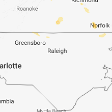


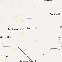


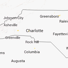


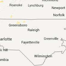
Connect with Interactive Hail Maps