

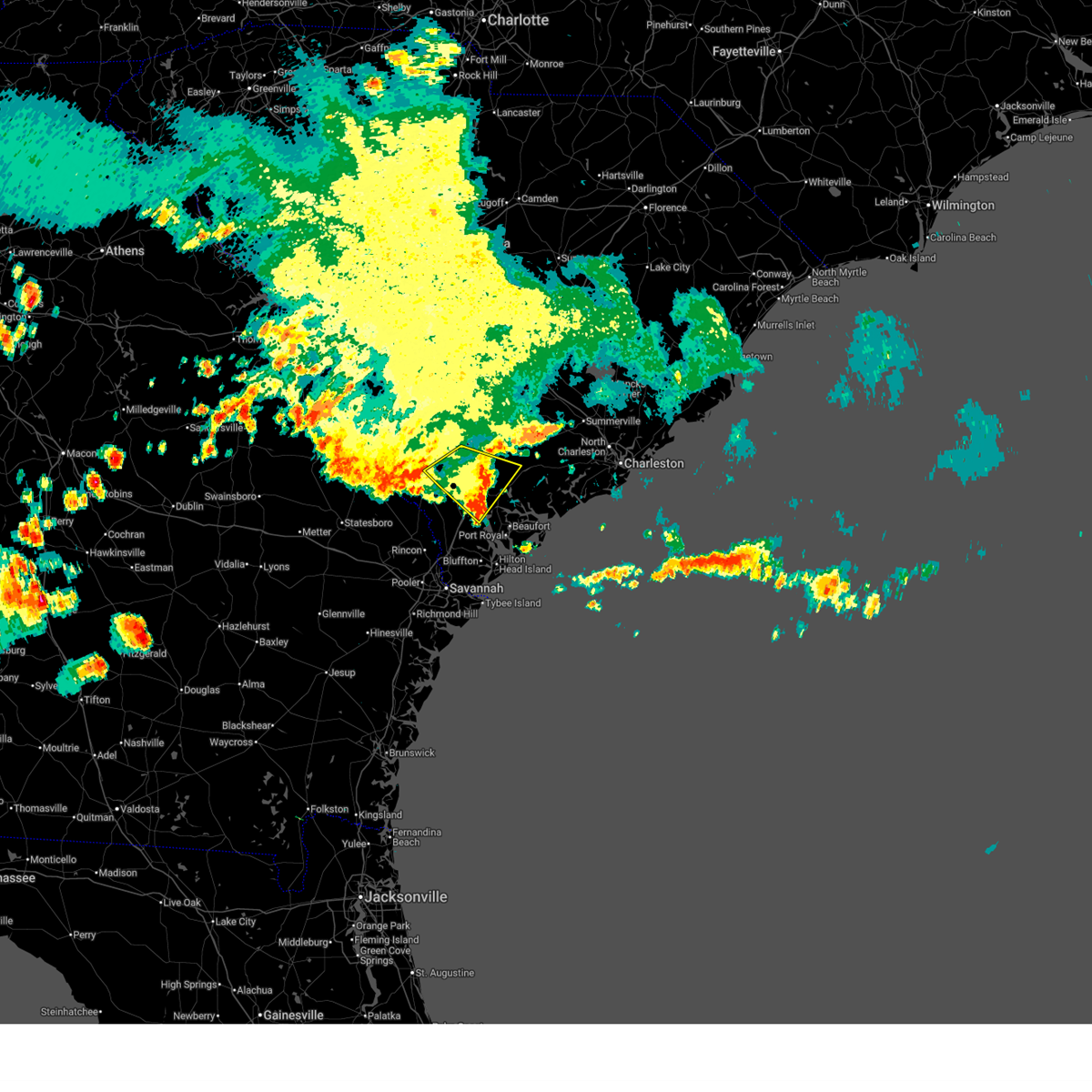
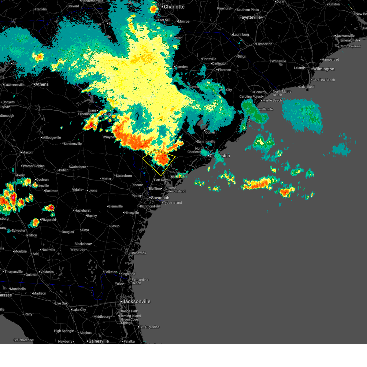
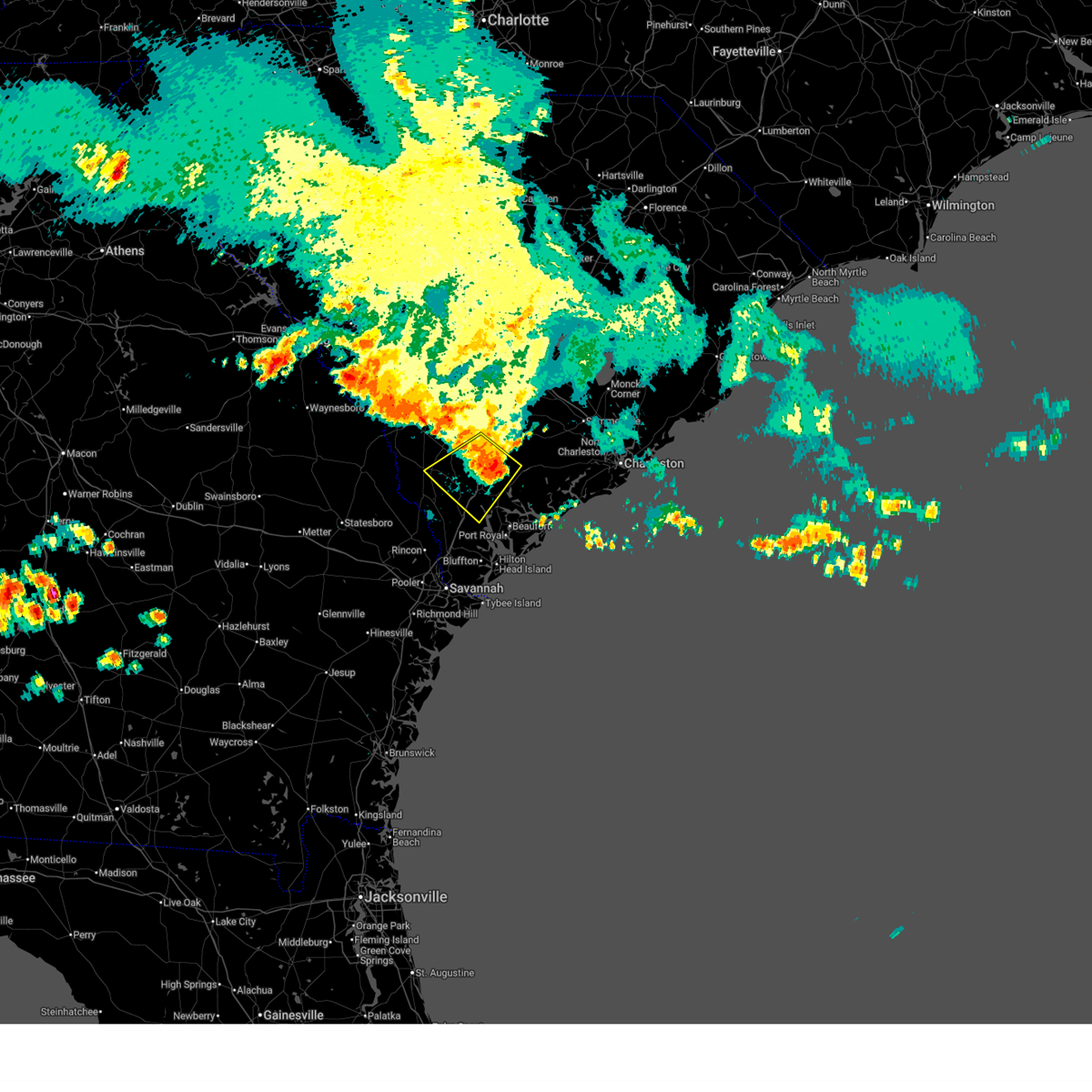
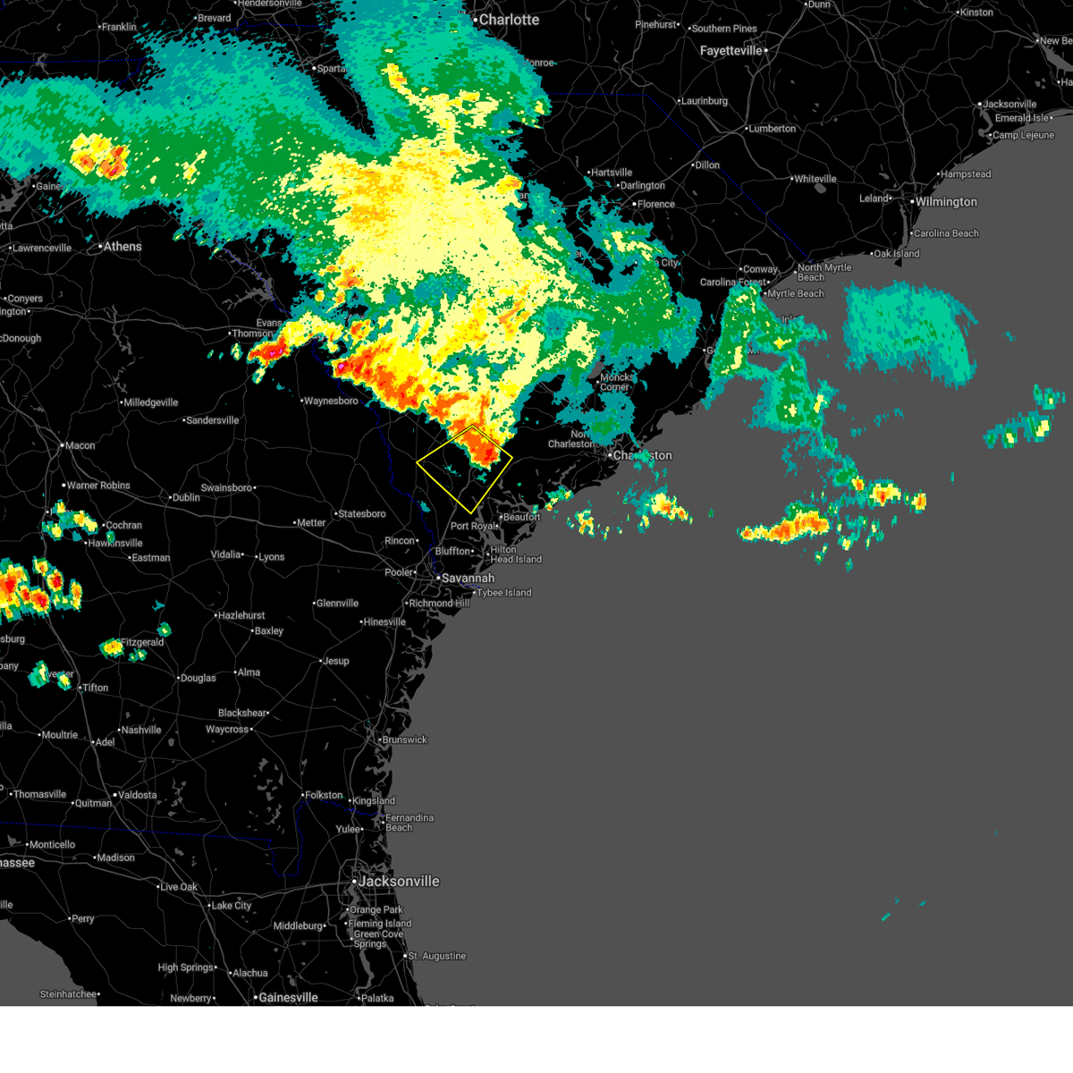
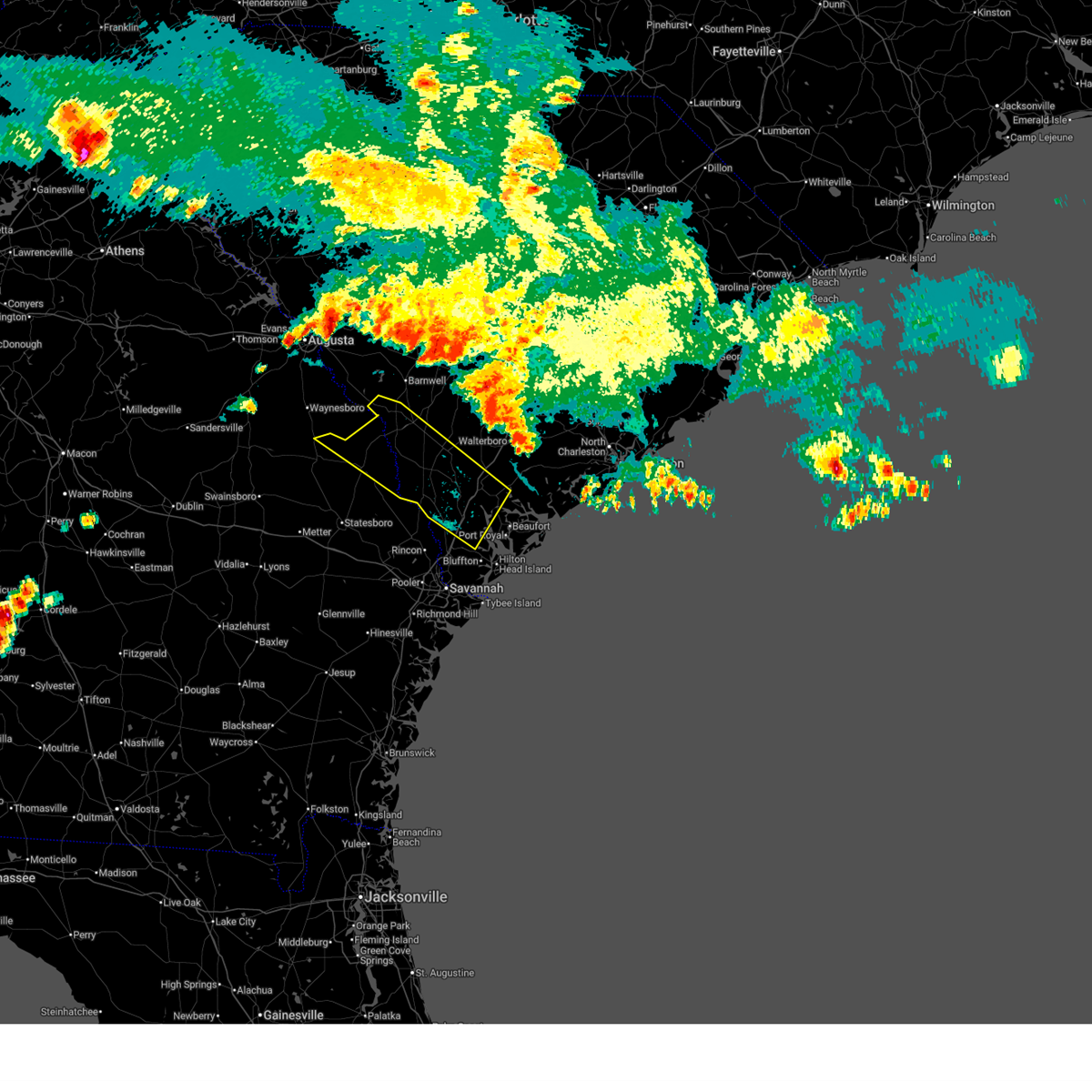
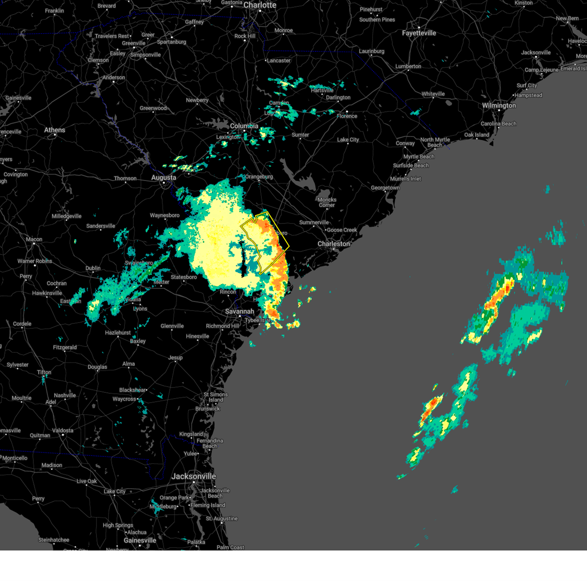
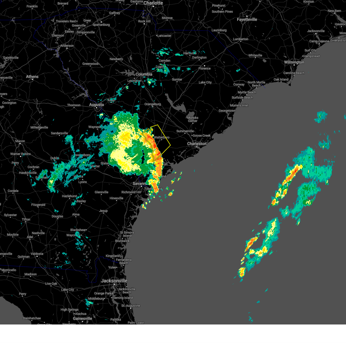
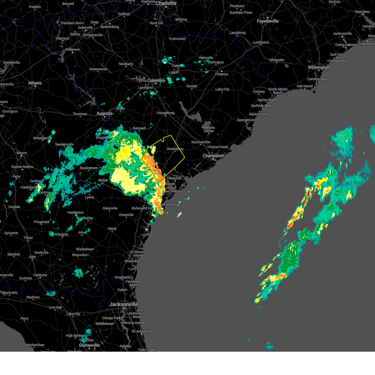
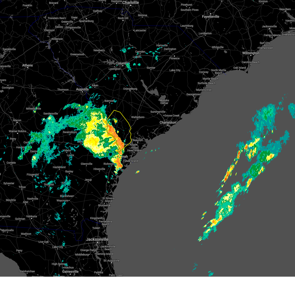
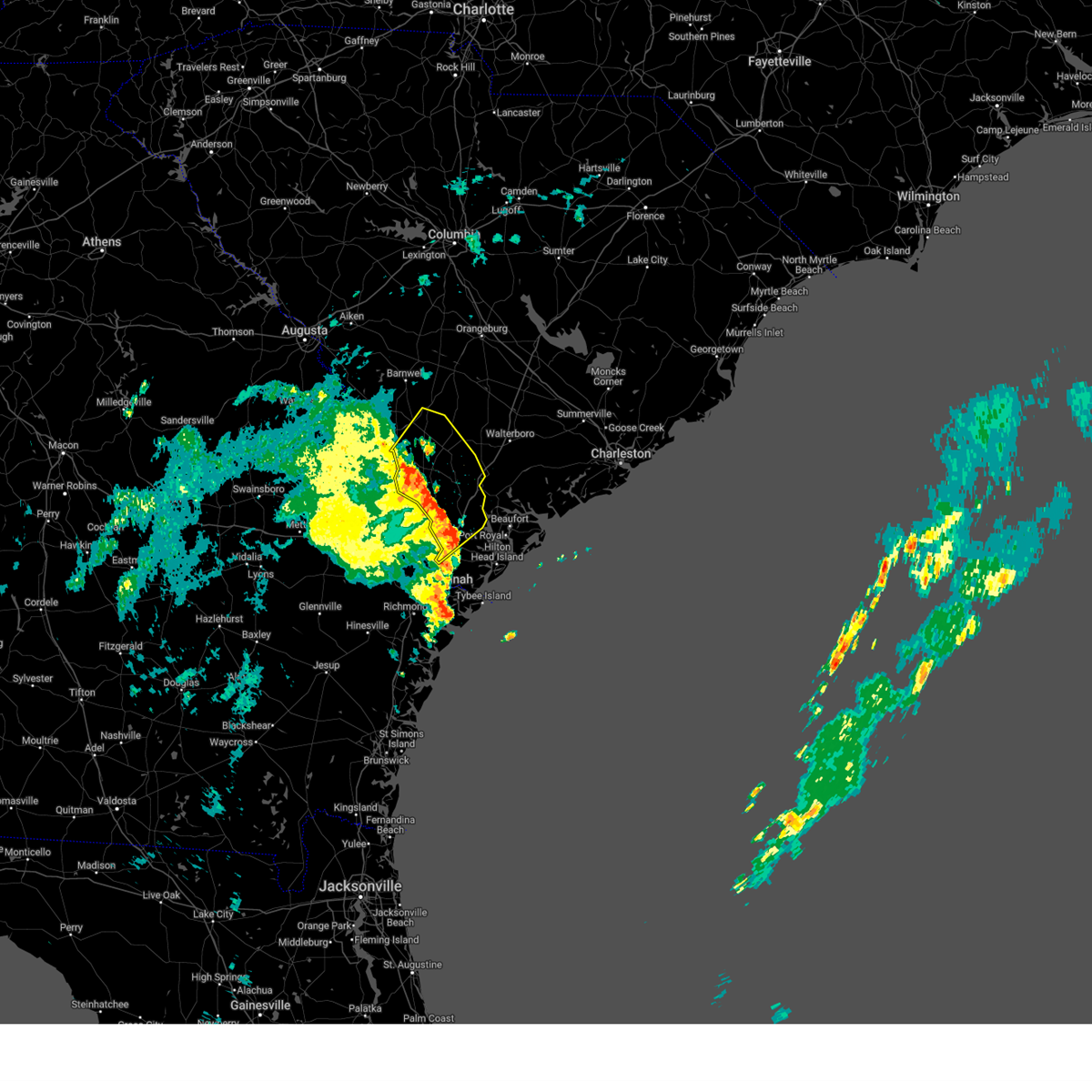
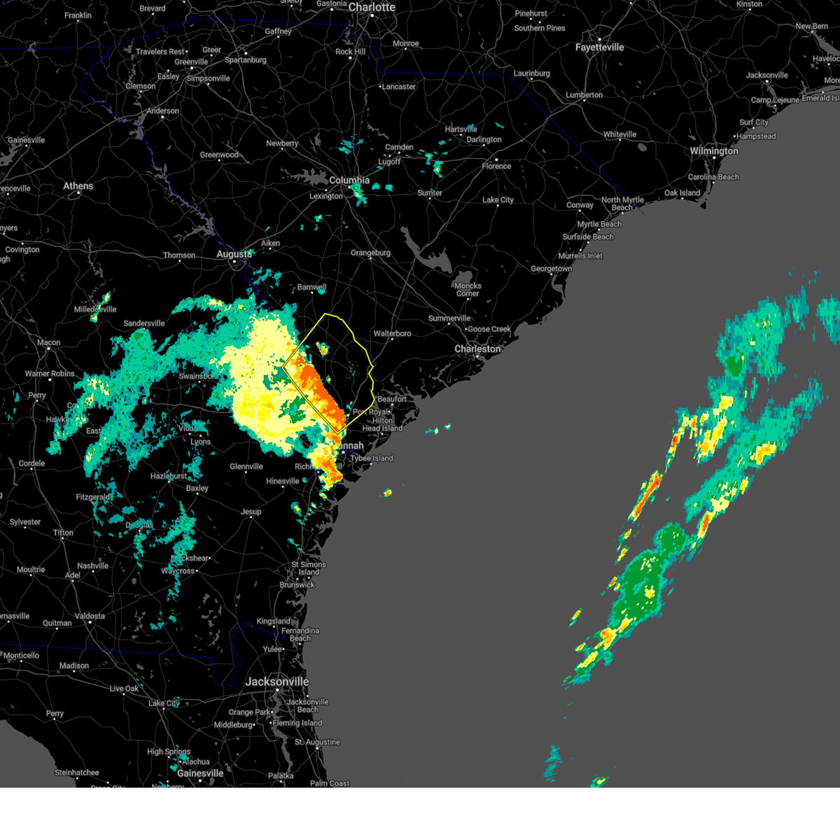
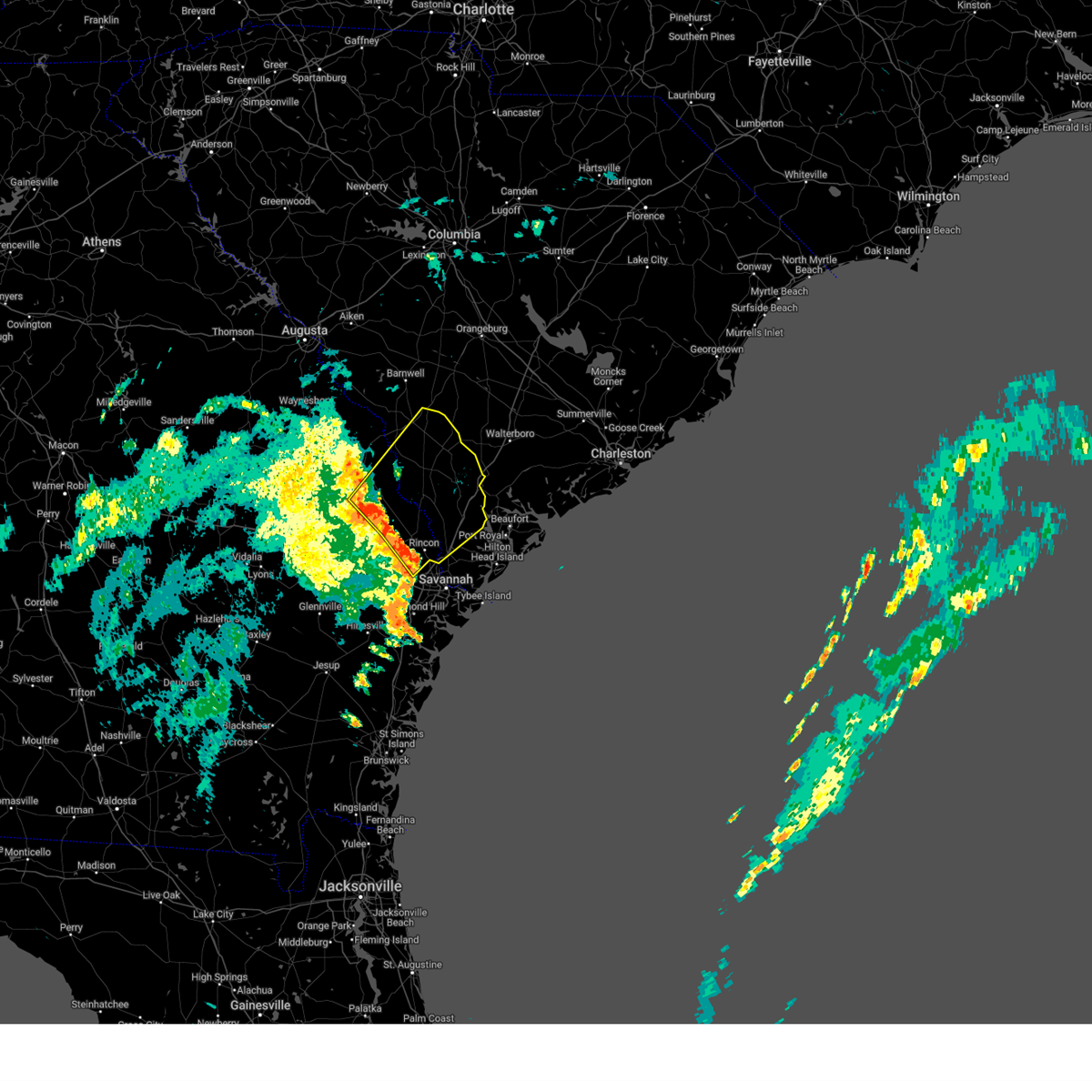
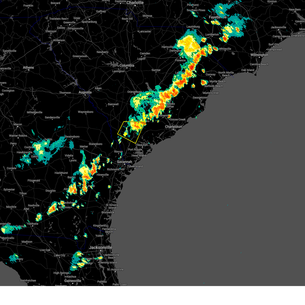
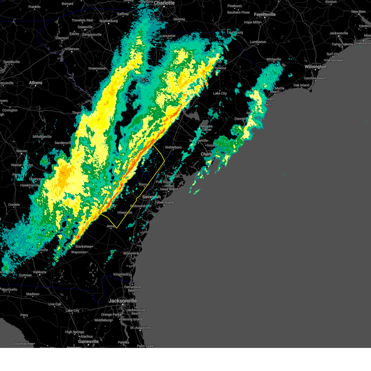
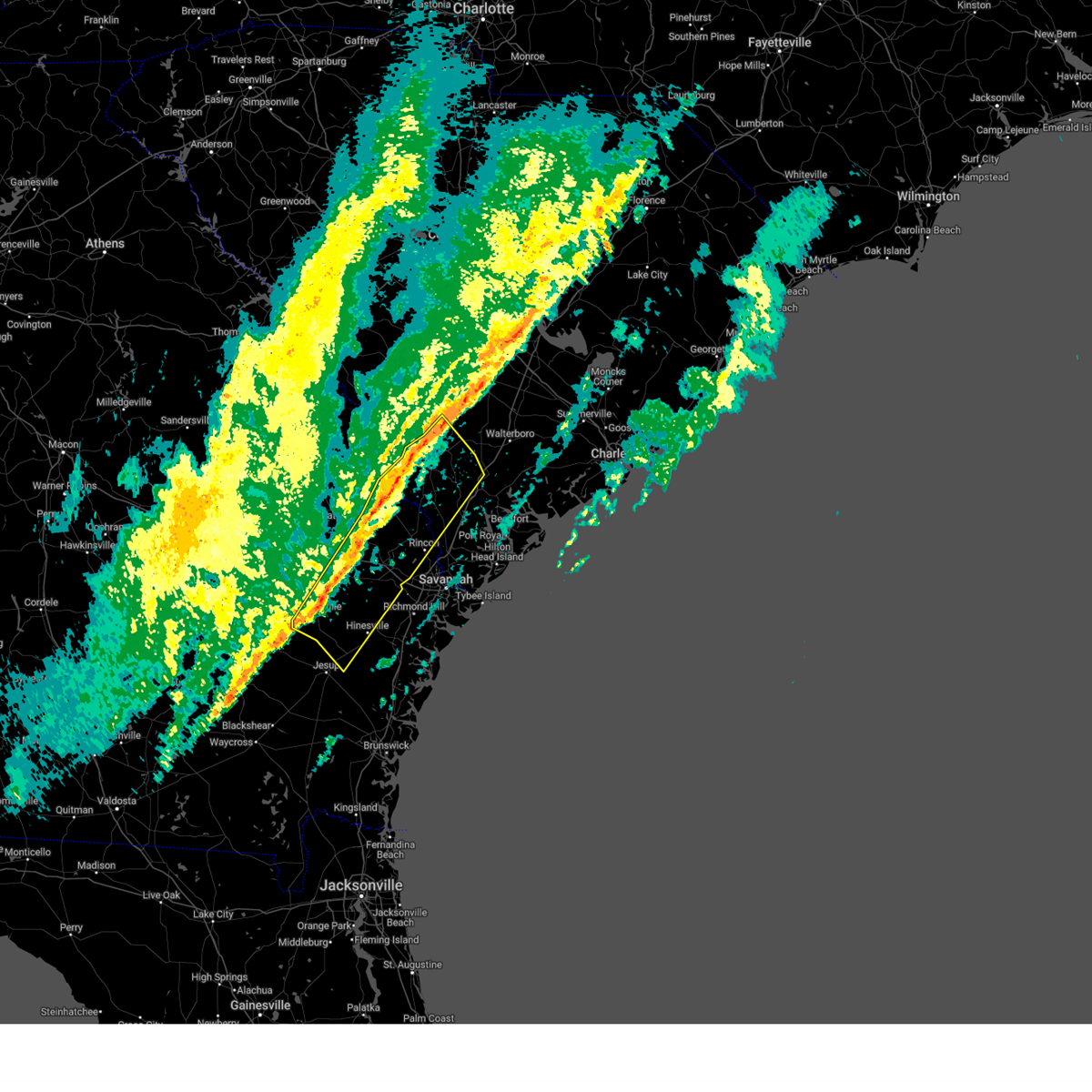
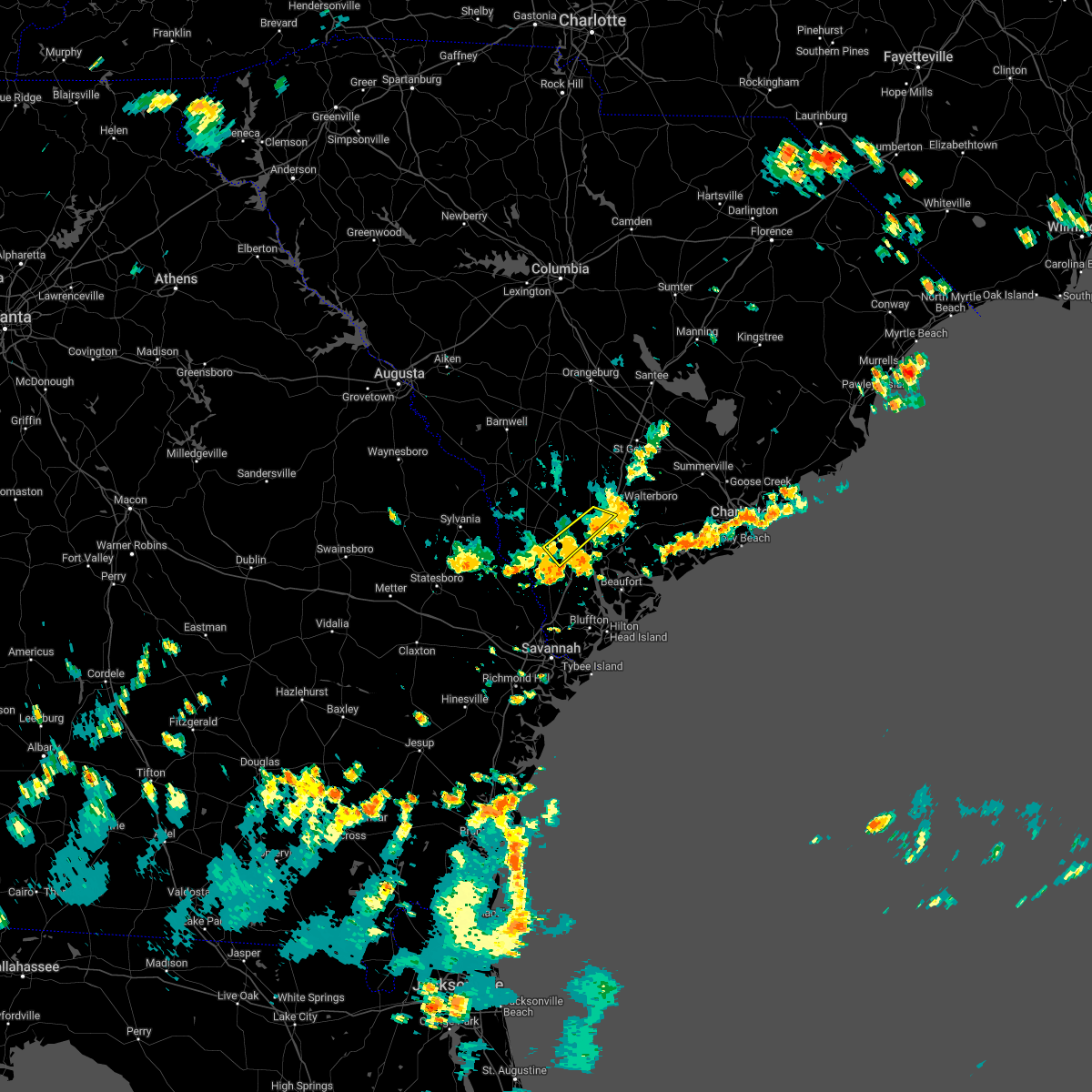
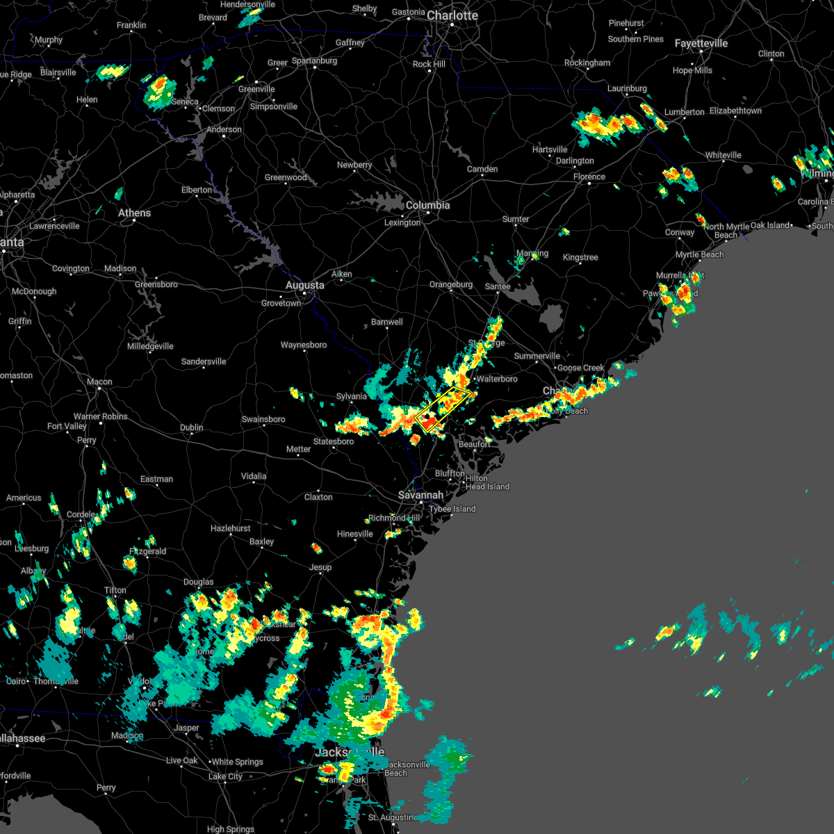
Hail Map for Yemassee, SC
The Yemassee, SC area has had 7 reports of on-the-ground hail by trained spotters, and has been under severe weather warnings 31 times during the past 12 months. Doppler radar has detected hail at or near Yemassee, SC on 64 occasions, including 4 occasions during the past year.
| Name: | Yemassee, SC |
| Where Located: | 44.6 miles NNE of Savannah, GA |
| Map: | Google Map for Yemassee, SC |
| Population: | 1027 |
| Housing Units: | 454 |
| More Info: | Search Google for Yemassee, SC |
0
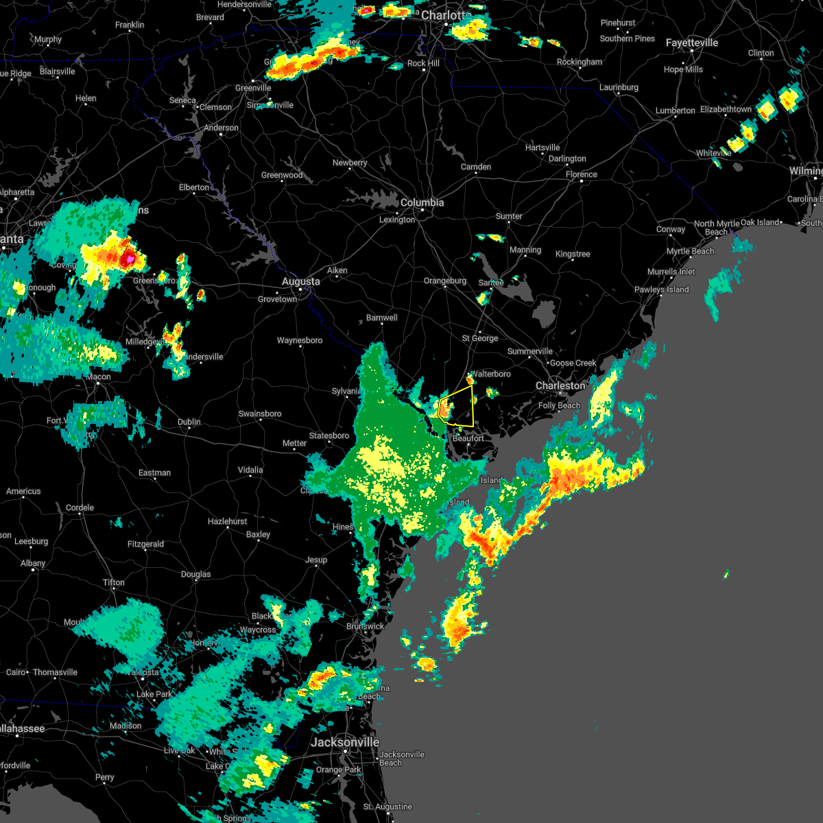
The Top Recent Hail Date for Yemassee, SC is Wednesday, June 25, 2025 (40th out of 64)

Hail and Wind Damage Spotted near Yemassee, SC
| Date / Time | Report Details |
|---|---|
| 6/25/2025 11:23 PM EDT |
 The storms which prompted the warning have weakened below severe limits, and have exited the warned area. therefore, the warning will be allowed to expire. a severe thunderstorm watch remains in effect until 1200 am edt for a portion of southeast south carolina. The storms which prompted the warning have weakened below severe limits, and have exited the warned area. therefore, the warning will be allowed to expire. a severe thunderstorm watch remains in effect until 1200 am edt for a portion of southeast south carolina.
|
| 6/25/2025 10:57 PM EDT |
 At 1057 pm edt, severe thunderstorms were located along a line from near clarendon to over early branch, moving south at 30 mph (radar indicated). Hazards include 60 mph wind gusts and quarter size hail. Hail damage to vehicles is expected. expect wind damage to roofs, siding, and trees. locations impacted include, yemassee, pocotaligo, cummings, early branch, mcphersonville, estill, coosawhatchie, grays, furman and ridgeland. This includes i-95 in south carolina between mile markers 25 and 49. At 1057 pm edt, severe thunderstorms were located along a line from near clarendon to over early branch, moving south at 30 mph (radar indicated). Hazards include 60 mph wind gusts and quarter size hail. Hail damage to vehicles is expected. expect wind damage to roofs, siding, and trees. locations impacted include, yemassee, pocotaligo, cummings, early branch, mcphersonville, estill, coosawhatchie, grays, furman and ridgeland. This includes i-95 in south carolina between mile markers 25 and 49.
|
| 6/25/2025 10:53 PM EDT | Emergency manager reported a tree down on the block of 15800 hendersonville highway. it's blocking both lane in colleton county SC, 2.9 miles WSW of Yemassee, SC |
| 6/25/2025 10:51 PM EDT | Emergency manager reported a tree down on public landing lan in colleton county SC, 2.7 miles W of Yemassee, SC |
| 6/25/2025 10:44 PM EDT |
 At 1044 pm edt, a severe thunderstorm was located over yemassee, moving southwest at 20 mph (emergency management reported. at 1020 pm, golf ball size hail was reported in hendersonville). Hazards include golf ball size hail and 70 mph wind gusts. People and animals outdoors will be injured. expect hail damage to roofs, siding, windows, and vehicles. expect considerable tree damage. wind damage is also likely to mobile homes, roofs, and outbuildings. locations impacted include, yemassee, early branch, cummings, mcphersonville, pocotaligo, grays, coosawhatchie, ridgeland, estill and furman. This includes i-95 in south carolina between mile markers 25 and 53. At 1044 pm edt, a severe thunderstorm was located over yemassee, moving southwest at 20 mph (emergency management reported. at 1020 pm, golf ball size hail was reported in hendersonville). Hazards include golf ball size hail and 70 mph wind gusts. People and animals outdoors will be injured. expect hail damage to roofs, siding, windows, and vehicles. expect considerable tree damage. wind damage is also likely to mobile homes, roofs, and outbuildings. locations impacted include, yemassee, early branch, cummings, mcphersonville, pocotaligo, grays, coosawhatchie, ridgeland, estill and furman. This includes i-95 in south carolina between mile markers 25 and 53.
|
| 6/25/2025 10:39 PM EDT | Emergency manager reported at tree down on the 11500 block of hendersonville highway. it is blocking both lane in colleton county SC, 7.2 miles WSW of Yemassee, SC |
| 6/25/2025 10:29 PM EDT |
 At 1029 pm edt, a severe thunderstorm was located near hendersonville, moving southwest at 20 mph (emergency management reported. at 1020 pm, golf ball size hail was reported in hendersonville). Hazards include golf ball size hail and 70 mph wind gusts. People and animals outdoors will be injured. expect hail damage to roofs, siding, windows, and vehicles. expect considerable tree damage. wind damage is also likely to mobile homes, roofs, and outbuildings. locations impacted include, yemassee, early branch, cummings, mcphersonville, pocotaligo, grays, coosawhatchie, ridgeland, estill and furman. This includes i-95 in south carolina between mile markers 25 and 53. At 1029 pm edt, a severe thunderstorm was located near hendersonville, moving southwest at 20 mph (emergency management reported. at 1020 pm, golf ball size hail was reported in hendersonville). Hazards include golf ball size hail and 70 mph wind gusts. People and animals outdoors will be injured. expect hail damage to roofs, siding, windows, and vehicles. expect considerable tree damage. wind damage is also likely to mobile homes, roofs, and outbuildings. locations impacted include, yemassee, early branch, cummings, mcphersonville, pocotaligo, grays, coosawhatchie, ridgeland, estill and furman. This includes i-95 in south carolina between mile markers 25 and 53.
|
| 6/25/2025 10:27 PM EDT | Tree down on residence at pentgage ct. time estimated from rada in colleton county SC, 5.8 miles SW of Yemassee, SC |
| 6/25/2025 10:26 PM EDT |
 Svrchs the national weather service in charleston has issued a * severe thunderstorm warning for portions of, beaufort county in southeastern south carolina, colleton county in southeastern south carolina, hampton county in southeastern south carolina, jasper county in southeastern south carolina, * until 1130 pm edt. * at 1026 pm edt, a severe thunderstorm was located near hendersonville, moving southwest at 20 mph (radar indicated). Hazards include 70 mph wind gusts and ping pong ball size hail. People and animals outdoors will be injured. expect hail damage to roofs, siding, windows, and vehicles. expect considerable tree damage. Wind damage is also likely to mobile homes, roofs, and outbuildings. Svrchs the national weather service in charleston has issued a * severe thunderstorm warning for portions of, beaufort county in southeastern south carolina, colleton county in southeastern south carolina, hampton county in southeastern south carolina, jasper county in southeastern south carolina, * until 1130 pm edt. * at 1026 pm edt, a severe thunderstorm was located near hendersonville, moving southwest at 20 mph (radar indicated). Hazards include 70 mph wind gusts and ping pong ball size hail. People and animals outdoors will be injured. expect hail damage to roofs, siding, windows, and vehicles. expect considerable tree damage. Wind damage is also likely to mobile homes, roofs, and outbuildings.
|
| 6/25/2025 10:20 PM EDT | Golf Ball sized hail reported 9 miles SW of Yemassee, SC, emergency manager reported golf ball sized hail (1.75 inches) on 1400 block of mewville road. |
| 6/25/2025 10:15 PM EDT | Tree down on black creek rd. time estimated from rada in colleton county SC, 9.8 miles SW of Yemassee, SC |
| 6/25/2025 10:14 PM EDT | Tree down on 10000 combahee rd. time estimated from rada in colleton county SC, 7.6 miles SW of Yemassee, SC |
| 6/25/2025 10:14 PM EDT | Emergency manager reported a tree down on the 2000 block of mewville road. it's blocking both lane in colleton county SC, 8.6 miles SW of Yemassee, SC |
| 6/25/2025 10:04 PM EDT |
 Svrchs the national weather service in charleston has issued a * severe thunderstorm warning for portions of, jenkins county in southeastern georgia, screven county in southeastern georgia, allendale county in southeastern south carolina, beaufort county in southeastern south carolina, colleton county in southeastern south carolina, hampton county in southeastern south carolina, jasper county in southeastern south carolina, * until 1100 pm edt. * at 1004 pm edt, severe thunderstorms were located along a line from over hendersonville to 16 miles north of millett, moving southwest at 30 mph (radar indicated). Hazards include 60 mph wind gusts and small hail. expect damage to roofs, siding, and trees Svrchs the national weather service in charleston has issued a * severe thunderstorm warning for portions of, jenkins county in southeastern georgia, screven county in southeastern georgia, allendale county in southeastern south carolina, beaufort county in southeastern south carolina, colleton county in southeastern south carolina, hampton county in southeastern south carolina, jasper county in southeastern south carolina, * until 1100 pm edt. * at 1004 pm edt, severe thunderstorms were located along a line from over hendersonville to 16 miles north of millett, moving southwest at 30 mph (radar indicated). Hazards include 60 mph wind gusts and small hail. expect damage to roofs, siding, and trees
|
| 6/10/2025 10:06 AM EDT |
 The severe thunderstorm warning that was previously in effect has been reissued for colleton county and is in effect until 1045 am edt. please refer to that bulletin for the latest severe weather information. The severe thunderstorm warning that was previously in effect has been reissued for colleton county and is in effect until 1045 am edt. please refer to that bulletin for the latest severe weather information.
|
| 6/10/2025 9:47 AM EDT |
 At 947 am edt, severe thunderstorms were located along a line from near ashton to 6 miles east of dale, moving northeast at 50 mph (radar indicated). Hazards include 60 mph wind gusts. Expect damage to roofs, siding, and trees. locations impacted include, walterboro, yemassee, colleton, smoaks, lodge, williams, hendersonville, ruffin, ritter and islandton. This includes i-95 in south carolina between mile markers 42 and 67. At 947 am edt, severe thunderstorms were located along a line from near ashton to 6 miles east of dale, moving northeast at 50 mph (radar indicated). Hazards include 60 mph wind gusts. Expect damage to roofs, siding, and trees. locations impacted include, walterboro, yemassee, colleton, smoaks, lodge, williams, hendersonville, ruffin, ritter and islandton. This includes i-95 in south carolina between mile markers 42 and 67.
|
| 6/10/2025 9:47 AM EDT |
 the severe thunderstorm warning has been cancelled and is no longer in effect the severe thunderstorm warning has been cancelled and is no longer in effect
|
| 6/10/2025 9:37 AM EDT | Tree down on old sheldon church rd at bailey r in beaufort county SC, 6.9 miles NW of Yemassee, SC |
| 6/10/2025 9:34 AM EDT | Tree down on possum corner at yemassee hw in hampton county SC, 5.7 miles SE of Yemassee, SC |
| 6/10/2025 9:26 AM EDT |
 the severe thunderstorm warning has been cancelled and is no longer in effect the severe thunderstorm warning has been cancelled and is no longer in effect
|
| 6/10/2025 9:26 AM EDT |
 Svrchs the national weather service in charleston has issued a * severe thunderstorm warning for portions of, beaufort county in southeastern south carolina, colleton county in southeastern south carolina, hampton county in southeastern south carolina, jasper county in southeastern south carolina, * until 1015 am edt. * at 926 am edt, severe thunderstorms were located along a line from over lake warren state park to over old house, moving northeast at 40 mph (radar indicated). Hazards include 60 mph wind gusts. expect damage to roofs, siding, and trees Svrchs the national weather service in charleston has issued a * severe thunderstorm warning for portions of, beaufort county in southeastern south carolina, colleton county in southeastern south carolina, hampton county in southeastern south carolina, jasper county in southeastern south carolina, * until 1015 am edt. * at 926 am edt, severe thunderstorms were located along a line from over lake warren state park to over old house, moving northeast at 40 mph (radar indicated). Hazards include 60 mph wind gusts. expect damage to roofs, siding, and trees
|
| 6/10/2025 9:14 AM EDT |
 the severe thunderstorm warning has been cancelled and is no longer in effect the severe thunderstorm warning has been cancelled and is no longer in effect
|
| 6/10/2025 9:14 AM EDT |
 At 914 am edt, severe thunderstorms were located along a line from over luray to over ridgeland, moving northeast at 55 mph (radar indicated). Hazards include 60 mph wind gusts and small hail. Expect damage to roofs, siding, and trees. locations impacted include, ridgeland, allendale, hampton, yemassee, lake warren state park, hardeeville, varnville, estill, fairfax and brunson. This includes i-95 in south carolina between mile markers 2 and 41. At 914 am edt, severe thunderstorms were located along a line from over luray to over ridgeland, moving northeast at 55 mph (radar indicated). Hazards include 60 mph wind gusts and small hail. Expect damage to roofs, siding, and trees. locations impacted include, ridgeland, allendale, hampton, yemassee, lake warren state park, hardeeville, varnville, estill, fairfax and brunson. This includes i-95 in south carolina between mile markers 2 and 41.
|
| 6/10/2025 9:08 AM EDT |
 the severe thunderstorm warning has been cancelled and is no longer in effect the severe thunderstorm warning has been cancelled and is no longer in effect
|
| 6/10/2025 9:08 AM EDT |
 At 908 am edt, severe thunderstorms were located along a line from 6 miles west of estill to near switzerland, moving northeast at 55 mph (radar indicated). Hazards include 60 mph wind gusts and small hail. Expect damage to roofs, siding, and trees. locations impacted include, ridgeland, allendale, springfield, hampton, yemassee, lake warren state park, rincon, hardeeville, varnville and estill. This includes i-95 in south carolina between mile markers 2 and 41. At 908 am edt, severe thunderstorms were located along a line from 6 miles west of estill to near switzerland, moving northeast at 55 mph (radar indicated). Hazards include 60 mph wind gusts and small hail. Expect damage to roofs, siding, and trees. locations impacted include, ridgeland, allendale, springfield, hampton, yemassee, lake warren state park, rincon, hardeeville, varnville and estill. This includes i-95 in south carolina between mile markers 2 and 41.
|
| 6/10/2025 8:49 AM EDT |
 Svrchs the national weather service in charleston has issued a * severe thunderstorm warning for portions of, bulloch county in southeastern georgia, effingham county in southeastern georgia, screven county in southeastern georgia, allendale county in southeastern south carolina, hampton county in southeastern south carolina, jasper county in southeastern south carolina, * until 930 am edt. * at 849 am edt, severe thunderstorms were located along a line from over newington to over rincon, moving northeast at 55 mph (radar indicated). Hazards include 60 mph wind gusts. expect damage to roofs, siding, and trees Svrchs the national weather service in charleston has issued a * severe thunderstorm warning for portions of, bulloch county in southeastern georgia, effingham county in southeastern georgia, screven county in southeastern georgia, allendale county in southeastern south carolina, hampton county in southeastern south carolina, jasper county in southeastern south carolina, * until 930 am edt. * at 849 am edt, severe thunderstorms were located along a line from over newington to over rincon, moving northeast at 55 mph (radar indicated). Hazards include 60 mph wind gusts. expect damage to roofs, siding, and trees
|
| 6/8/2025 1:29 PM EDT | Tree reported down along highway 17 near combahee road. time estimated from rada in colleton county SC, 7.2 miles WSW of Yemassee, SC |
| 6/8/2025 12:55 PM EDT |
 The storm which prompted the warning has moved out of the area. therefore, the warning will be allowed to expire. a severe thunderstorm watch remains in effect until 500 pm edt for a portion of southeast south carolina. The storm which prompted the warning has moved out of the area. therefore, the warning will be allowed to expire. a severe thunderstorm watch remains in effect until 500 pm edt for a portion of southeast south carolina.
|
| 6/8/2025 12:51 PM EDT | Tree reported down along highway 17 near combahee road. time estimated from rada in colleton county SC, 7.2 miles WSW of Yemassee, SC |
| 6/8/2025 12:35 PM EDT |
 the severe thunderstorm warning has been cancelled and is no longer in effect the severe thunderstorm warning has been cancelled and is no longer in effect
|
| 6/8/2025 12:35 PM EDT |
 At 1235 pm edt, a severe thunderstorm was located over early branch, moving east at 35 mph (radar indicated). Hazards include 60 mph wind gusts and small hail. Expect damage to roofs, siding, and trees. locations impacted include, walterboro, hampton, yemassee, varnville, estill, furman, scotia, early branch, cummings and mcphersonville. This includes i-95 in south carolina between mile markers 28 and 58. At 1235 pm edt, a severe thunderstorm was located over early branch, moving east at 35 mph (radar indicated). Hazards include 60 mph wind gusts and small hail. Expect damage to roofs, siding, and trees. locations impacted include, walterboro, hampton, yemassee, varnville, estill, furman, scotia, early branch, cummings and mcphersonville. This includes i-95 in south carolina between mile markers 28 and 58.
|
| 6/8/2025 12:00 PM EDT |
 Svrchs the national weather service in charleston has issued a * severe thunderstorm warning for portions of, allendale county in southeastern south carolina, beaufort county in southeastern south carolina, colleton county in southeastern south carolina, hampton county in southeastern south carolina, jasper county in southeastern south carolina, * until 100 pm edt. * at noon edt, a severe thunderstorm was located over gifford, moving east at 35 mph (radar indicated). Hazards include 60 mph wind gusts and small hail. expect damage to roofs, siding, and trees Svrchs the national weather service in charleston has issued a * severe thunderstorm warning for portions of, allendale county in southeastern south carolina, beaufort county in southeastern south carolina, colleton county in southeastern south carolina, hampton county in southeastern south carolina, jasper county in southeastern south carolina, * until 100 pm edt. * at noon edt, a severe thunderstorm was located over gifford, moving east at 35 mph (radar indicated). Hazards include 60 mph wind gusts and small hail. expect damage to roofs, siding, and trees
|
| 3/31/2025 6:15 PM EDT | Tree in roa in jasper county SC, 4.1 miles NNE of Yemassee, SC |
| 2/16/2025 9:16 AM EST |
 The storms which prompted the warning have weakened below severe limits. therefore, the warning has been allowed to expire. however, gusty winds are still possible with these thunderstorms and a special weather statement has been issued. a severe thunderstorm watch remains in effect until 100 pm est for portions of southeast georgia and southeast south carolina. The storms which prompted the warning have weakened below severe limits. therefore, the warning has been allowed to expire. however, gusty winds are still possible with these thunderstorms and a special weather statement has been issued. a severe thunderstorm watch remains in effect until 100 pm est for portions of southeast georgia and southeast south carolina.
|
| 2/16/2025 8:54 AM EST |
 the severe thunderstorm warning has been cancelled and is no longer in effect the severe thunderstorm warning has been cancelled and is no longer in effect
|
| 2/16/2025 8:54 AM EST |
 At 854 am est, severe thunderstorms were located along a line from near hampton to 6 miles west of donald, moving southeast at 35 mph (radar indicated). Hazards include 60 mph wind gusts. Expect damage to roofs, siding, and trees. locations impacted include, hinesville, glennville, springfield, hampton, claxton, pembroke, ludowici, yemassee, fort stewart and lake warren state park. this includes the following highways, i-16 between mile markers 122 and 150. I-95 in south carolina between mile markers 37 and 41. At 854 am est, severe thunderstorms were located along a line from near hampton to 6 miles west of donald, moving southeast at 35 mph (radar indicated). Hazards include 60 mph wind gusts. Expect damage to roofs, siding, and trees. locations impacted include, hinesville, glennville, springfield, hampton, claxton, pembroke, ludowici, yemassee, fort stewart and lake warren state park. this includes the following highways, i-16 between mile markers 122 and 150. I-95 in south carolina between mile markers 37 and 41.
|
| 2/16/2025 8:14 AM EST |
 Svrchs the national weather service in charleston has issued a * severe thunderstorm warning for portions of, bryan county in southeastern georgia, bulloch county in southeastern georgia, candler county in southeastern georgia, effingham county in southeastern georgia, evans county in southeastern georgia, jenkins county in southeastern georgia, liberty county in southeastern georgia, long county in southeastern georgia, screven county in southeastern georgia, tattnall county in southeastern georgia, allendale county in southeastern south carolina, hampton county in southeastern south carolina, jasper county in southeastern south carolina, * until 915 am est. * at 814 am est, severe thunderstorms were located along a line from near millett to 13 miles southwest of gordonia altamaha state park, moving southeast at 40 mph (radar indicated). Hazards include 60 mph wind gusts. expect damage to roofs, siding, and trees Svrchs the national weather service in charleston has issued a * severe thunderstorm warning for portions of, bryan county in southeastern georgia, bulloch county in southeastern georgia, candler county in southeastern georgia, effingham county in southeastern georgia, evans county in southeastern georgia, jenkins county in southeastern georgia, liberty county in southeastern georgia, long county in southeastern georgia, screven county in southeastern georgia, tattnall county in southeastern georgia, allendale county in southeastern south carolina, hampton county in southeastern south carolina, jasper county in southeastern south carolina, * until 915 am est. * at 814 am est, severe thunderstorms were located along a line from near millett to 13 miles southwest of gordonia altamaha state park, moving southeast at 40 mph (radar indicated). Hazards include 60 mph wind gusts. expect damage to roofs, siding, and trees
|
| 7/31/2024 6:22 PM EDT | Emergency manager reports a tree and powerlines down along the 3500 block of black creek road. time estimated from rada in colleton county SC, 8.4 miles SSW of Yemassee, SC |
| 7/20/2024 4:18 PM EDT | Tree down at the intersection of hendersonville highway and combahee road. time estimated by rada in colleton county SC, 7.2 miles WSW of Yemassee, SC |
| 7/20/2024 3:53 PM EDT | Tree down on low country highway near state road s-15-28. time estimated based on rada in colleton county SC, 7.2 miles S of Yemassee, SC |
| 7/15/2024 5:11 PM EDT | The storm which prompted the warning has weakened below severe limits, and no longer poses an immediate threat to life or property. therefore, the warning will be allowed to expire. however, gusty winds and heavy rain are still possible with this thunderstorm. |
| 7/15/2024 4:41 PM EDT | At 441 pm edt, a severe thunderstorm was located near tillman, moving northeast at 10 mph (radar indicated). Hazards include 60 mph wind gusts and quarter size hail. Hail damage to vehicles is expected. expect wind damage to roofs, siding, and trees. locations impacted include, ridgeland, yemassee, clarendon, coosawhatchie, gillisonville, grahamville, grays, old house, mcphersonville and switzerland. This includes i-95 in south carolina between mile markers 13 and 41. |
| 7/15/2024 4:39 PM EDT | A 911 call center relayed a report of a tree down near the intersection of big branch rd and cat branch r in jasper county SC, 8.5 miles E of Yemassee, SC |
| 7/15/2024 4:18 PM EDT |
 Svrchs the national weather service in charleston has issued a * severe thunderstorm warning for portions of, beaufort county in southeastern south carolina, hampton county in southeastern south carolina, jasper county in southeastern south carolina, * until 515 pm edt. * at 418 pm edt, a severe thunderstorm was located over tillman, moving northeast at 10 mph (radar indicated). Hazards include 60 mph wind gusts and quarter size hail. Hail damage to vehicles is expected. Expect wind damage to roofs, siding, and trees. Svrchs the national weather service in charleston has issued a * severe thunderstorm warning for portions of, beaufort county in southeastern south carolina, hampton county in southeastern south carolina, jasper county in southeastern south carolina, * until 515 pm edt. * at 418 pm edt, a severe thunderstorm was located over tillman, moving northeast at 10 mph (radar indicated). Hazards include 60 mph wind gusts and quarter size hail. Hail damage to vehicles is expected. Expect wind damage to roofs, siding, and trees.
|
| 7/13/2024 4:04 PM EDT |
 the severe thunderstorm warning has been cancelled and is no longer in effect the severe thunderstorm warning has been cancelled and is no longer in effect
|
| 7/13/2024 3:42 PM EDT |
 At 341 pm edt, a severe thunderstorm was located over pocotaligo, moving northwest at 10 mph (radar indicated). Hazards include 60 mph wind gusts and penny size hail. Expect damage to trees and powerlines. Locations impacted include: beaufort, clarendon, burton, laurel bay, dale, gardens corner, sheldon, ladys island, beaufort marine corps air station, and pocotaligo. At 341 pm edt, a severe thunderstorm was located over pocotaligo, moving northwest at 10 mph (radar indicated). Hazards include 60 mph wind gusts and penny size hail. Expect damage to trees and powerlines. Locations impacted include: beaufort, clarendon, burton, laurel bay, dale, gardens corner, sheldon, ladys island, beaufort marine corps air station, and pocotaligo.
|
| 7/13/2024 3:42 PM EDT |
 the severe thunderstorm warning has been cancelled and is no longer in effect the severe thunderstorm warning has been cancelled and is no longer in effect
|
| 7/13/2024 3:10 PM EDT |
 Svrchs the national weather service in charleston has issued a * severe thunderstorm warning for portions of, beaufort county in southeastern south carolina, colleton county in southeastern south carolina, jasper county in southeastern south carolina, * until 415 pm edt. * at 309 pm edt, a severe thunderstorm was located over gardens corner, moving northwest at 10 mph (radar indicated). Hazards include 60 mph wind gusts and penny size hail. Expect damage to trees and powerlines. locations impacted include: beaufort, ridgeland, yemassee, clarendon, grahamville, coosawhatchie, gardens corner, old house, laurel bay, dale, sheldon, ladys island, gillisonville, beaufort marine corps air station, and pocotaligo. This warning includes i-95 in south carolina between mile markers 21 and 34. Svrchs the national weather service in charleston has issued a * severe thunderstorm warning for portions of, beaufort county in southeastern south carolina, colleton county in southeastern south carolina, jasper county in southeastern south carolina, * until 415 pm edt. * at 309 pm edt, a severe thunderstorm was located over gardens corner, moving northwest at 10 mph (radar indicated). Hazards include 60 mph wind gusts and penny size hail. Expect damage to trees and powerlines. locations impacted include: beaufort, ridgeland, yemassee, clarendon, grahamville, coosawhatchie, gardens corner, old house, laurel bay, dale, sheldon, ladys island, gillisonville, beaufort marine corps air station, and pocotaligo. This warning includes i-95 in south carolina between mile markers 21 and 34.
|
| 6/10/2024 9:24 PM EDT |
 the severe thunderstorm warning has been cancelled and is no longer in effect the severe thunderstorm warning has been cancelled and is no longer in effect
|
| 6/10/2024 8:46 PM EDT |
 Svrchs the national weather service in charleston has issued a * severe thunderstorm warning for portions of, beaufort county in southeastern south carolina, hampton county in southeastern south carolina, colleton county in southeastern south carolina, jasper county in southeastern south carolina, * until 945 pm edt. * at 846 pm edt, a severe thunderstorm was located over grays, moving northeast at 35 mph (radar indicated). Hazards include 60 mph wind gusts and half dollar size hail. Minor hail damage to vehicles is possible. expect wind damage to trees and powerlines. locations impacted include: yemassee, early branch, cummings, gillisonville, mcphersonville, grays, pocotaligo, and white hall. This warning includes i-95 in south carolina between mile markers 33 and 48. Svrchs the national weather service in charleston has issued a * severe thunderstorm warning for portions of, beaufort county in southeastern south carolina, hampton county in southeastern south carolina, colleton county in southeastern south carolina, jasper county in southeastern south carolina, * until 945 pm edt. * at 846 pm edt, a severe thunderstorm was located over grays, moving northeast at 35 mph (radar indicated). Hazards include 60 mph wind gusts and half dollar size hail. Minor hail damage to vehicles is possible. expect wind damage to trees and powerlines. locations impacted include: yemassee, early branch, cummings, gillisonville, mcphersonville, grays, pocotaligo, and white hall. This warning includes i-95 in south carolina between mile markers 33 and 48.
|
| 6/10/2024 6:49 PM EDT | South carolina highway patrol reported powerlines down on near the intersection of white hall road and combahee roa in colleton county SC, 9.9 miles W of Yemassee, SC |
| 6/10/2024 6:48 PM EDT | Emergency manager reported tree down in 3000 block of combahee road. time estimated via rada in colleton county SC, 6.8 miles W of Yemassee, SC |
| 6/10/2024 6:21 PM EDT |
 Svrchs the national weather service in charleston has issued a * severe thunderstorm warning for portions of, beaufort county in southeastern south carolina, hampton county in southeastern south carolina, colleton county in southeastern south carolina, jasper county in southeastern south carolina, * until 715 pm edt. * at 621 pm edt, a severe thunderstorm was located over old house, moving northeast at 25 mph (radar indicated). Hazards include ping pong ball size hail and 60 mph wind gusts. People and animals outdoors will be injured. expect hail damage to roofs, siding, windows, and vehicles. expect wind damage to trees and powerlines. locations impacted include: beaufort, port royal, ridgeland, yemassee, clarendon, bennetts point, grahamville, coosawhatchie, gardens corner, burton, green pond, ladys island, pocotaligo, lemon island, and ritter. This warning includes i-95 in south carolina between mile markers 18 and 37. Svrchs the national weather service in charleston has issued a * severe thunderstorm warning for portions of, beaufort county in southeastern south carolina, hampton county in southeastern south carolina, colleton county in southeastern south carolina, jasper county in southeastern south carolina, * until 715 pm edt. * at 621 pm edt, a severe thunderstorm was located over old house, moving northeast at 25 mph (radar indicated). Hazards include ping pong ball size hail and 60 mph wind gusts. People and animals outdoors will be injured. expect hail damage to roofs, siding, windows, and vehicles. expect wind damage to trees and powerlines. locations impacted include: beaufort, port royal, ridgeland, yemassee, clarendon, bennetts point, grahamville, coosawhatchie, gardens corner, burton, green pond, ladys island, pocotaligo, lemon island, and ritter. This warning includes i-95 in south carolina between mile markers 18 and 37.
|
| 5/24/2024 5:23 PM EDT |
 The storm which prompted the warning has moved out of the area. therefore, the warning will be allowed to expire. The storm which prompted the warning has moved out of the area. therefore, the warning will be allowed to expire.
|
| 5/24/2024 4:50 PM EDT |
 the severe thunderstorm warning has been cancelled and is no longer in effect the severe thunderstorm warning has been cancelled and is no longer in effect
|
| 5/24/2024 4:50 PM EDT |
 At 450 pm edt, a severe thunderstorm was located over sheldon, moving east at 20 mph (radar indicated). Hazards include 60 mph wind gusts and penny size hail. Expect damage to trees and powerlines. Locations impacted include: beaufort, yemassee, green pond, dale, gardens corner, sheldon, pocotaligo, and white hall. At 450 pm edt, a severe thunderstorm was located over sheldon, moving east at 20 mph (radar indicated). Hazards include 60 mph wind gusts and penny size hail. Expect damage to trees and powerlines. Locations impacted include: beaufort, yemassee, green pond, dale, gardens corner, sheldon, pocotaligo, and white hall.
|
| 5/24/2024 4:48 PM EDT | Tree down on old sheldon church road and twickenham rd. time estimated from rada in beaufort county SC, 6 miles NW of Yemassee, SC |
| 5/24/2024 4:44 PM EDT | Tree down on mackay point roa in jasper county SC, 5.3 miles N of Yemassee, SC |
| 5/24/2024 4:40 PM EDT | Tree down on the 100 block of river roa in beaufort county SC, 1.1 miles WNW of Yemassee, SC |
| 5/24/2024 4:39 PM EDT | Three trees down on interstate 95. time estimated from rada in jasper county SC, 4.8 miles NNE of Yemassee, SC |
| 5/24/2024 4:36 PM EDT |
 Svrchs the national weather service in charleston has issued a * severe thunderstorm warning for portions of, beaufort county in southeastern south carolina, hampton county in southeastern south carolina, colleton county in southeastern south carolina, jasper county in southeastern south carolina, * until 530 pm edt. * at 435 pm edt, a severe thunderstorm was located over pocotaligo, moving east at 20 mph (radar indicated). Hazards include 60 mph wind gusts and penny size hail. Expect damage to trees and powerlines. locations impacted include: beaufort, yemassee, green pond, coosawhatchie, dale, gardens corner, sheldon, mcphersonville, pocotaligo, and white hall. This warning includes i-95 in south carolina between mile markers 27 and 39. Svrchs the national weather service in charleston has issued a * severe thunderstorm warning for portions of, beaufort county in southeastern south carolina, hampton county in southeastern south carolina, colleton county in southeastern south carolina, jasper county in southeastern south carolina, * until 530 pm edt. * at 435 pm edt, a severe thunderstorm was located over pocotaligo, moving east at 20 mph (radar indicated). Hazards include 60 mph wind gusts and penny size hail. Expect damage to trees and powerlines. locations impacted include: beaufort, yemassee, green pond, coosawhatchie, dale, gardens corner, sheldon, mcphersonville, pocotaligo, and white hall. This warning includes i-95 in south carolina between mile markers 27 and 39.
|
| 1/9/2024 3:52 PM EST | Tree down on public landing lan in colleton county SC, 2.7 miles W of Yemassee, SC |
| 1/9/2024 3:50 PM EST | Tree down on public landing lan in colleton county SC, 2.7 miles W of Yemassee, SC |
| 1/9/2024 3:28 PM EST |
 At 328 pm est, severe thunderstorms were located along a line extending from near smoaks to near tarboro, moving northeast at 55 mph (radar indicated). Hazards include 60 mph wind gusts. Expect damage to trees and powerlines. locations impacted include: beaufort, walterboro, ridgeland, saint george, yemassee, givhans ferry state park, dorchester, cottageville, harleyville, reevesville, smoaks, williams, coosawhatchie, ruffin, and gardens corner. this warning includes the following interstates: i-26 between mile markers 171 and 186. i-95 in south carolina between mile markers 23 and 85. hail threat, radar indicated max hail size, <. 75 in wind threat, radar indicated max wind gust, 60 mph. At 328 pm est, severe thunderstorms were located along a line extending from near smoaks to near tarboro, moving northeast at 55 mph (radar indicated). Hazards include 60 mph wind gusts. Expect damage to trees and powerlines. locations impacted include: beaufort, walterboro, ridgeland, saint george, yemassee, givhans ferry state park, dorchester, cottageville, harleyville, reevesville, smoaks, williams, coosawhatchie, ruffin, and gardens corner. this warning includes the following interstates: i-26 between mile markers 171 and 186. i-95 in south carolina between mile markers 23 and 85. hail threat, radar indicated max hail size, <. 75 in wind threat, radar indicated max wind gust, 60 mph.
|
| 1/9/2024 3:25 PM EST |
 At 325 pm est, severe thunderstorms were located along a line extending from near smoaks to near tarboro, moving northeast at 55 mph (radar indicated). Hazards include 60 mph wind gusts and quarter size hail. Minor hail damage to vehicles is possible. expect wind damage to trees and powerlines. locations impacted include: beaufort, walterboro, ridgeland, saint george, yemassee, givhans ferry state park, dorchester, cottageville, harleyville, reevesville, smoaks, williams, coosawhatchie, ruffin, and gardens corner. this warning includes the following interstates: i-26 between mile markers 171 and 186. i-95 in south carolina between mile markers 23 and 85. hail threat, radar indicated max hail size, 1. 00 in wind threat, radar indicated max wind gust, 60 mph. At 325 pm est, severe thunderstorms were located along a line extending from near smoaks to near tarboro, moving northeast at 55 mph (radar indicated). Hazards include 60 mph wind gusts and quarter size hail. Minor hail damage to vehicles is possible. expect wind damage to trees and powerlines. locations impacted include: beaufort, walterboro, ridgeland, saint george, yemassee, givhans ferry state park, dorchester, cottageville, harleyville, reevesville, smoaks, williams, coosawhatchie, ruffin, and gardens corner. this warning includes the following interstates: i-26 between mile markers 171 and 186. i-95 in south carolina between mile markers 23 and 85. hail threat, radar indicated max hail size, 1. 00 in wind threat, radar indicated max wind gust, 60 mph.
|
| 1/9/2024 2:47 PM EST |
 At 247 pm est, severe thunderstorms were located along a line extending from near luray to near shawnee, moving northeast at 45 mph (radar indicated). Hazards include 60 mph wind gusts and quarter size hail. Minor hail damage to vehicles is possible. expect wind damage to trees and powerlines. locations impacted include: ridgeland, hampton, yemassee, lake warren state park, colleton, varnville, estill, fairfax, brunson, gifford, furman, scotia, luray, smoaks, and lodge. this warning includes i-95 in south carolina between mile markers 23 and 43. hail threat, radar indicated max hail size, 1. 00 in wind threat, radar indicated max wind gust, 60 mph. At 247 pm est, severe thunderstorms were located along a line extending from near luray to near shawnee, moving northeast at 45 mph (radar indicated). Hazards include 60 mph wind gusts and quarter size hail. Minor hail damage to vehicles is possible. expect wind damage to trees and powerlines. locations impacted include: ridgeland, hampton, yemassee, lake warren state park, colleton, varnville, estill, fairfax, brunson, gifford, furman, scotia, luray, smoaks, and lodge. this warning includes i-95 in south carolina between mile markers 23 and 43. hail threat, radar indicated max hail size, 1. 00 in wind threat, radar indicated max wind gust, 60 mph.
|
| 10/20/2023 5:12 PM EDT | 3 trees down at 4068 white hall r in colleton county SC, 9.8 miles W of Yemassee, SC |
| 10/20/2023 5:09 PM EDT |
 At 509 pm edt, a severe thunderstorm was located over white hall, moving east at 45 mph (radar indicated). Hazards include 60 mph wind gusts and penny size hail. Expect damage to trees and powerlines. locations impacted include: yemassee, hendersonville, green pond, gardens corner, sheldon, ashepoo, pocotaligo, ritter, and white hall. this warning includes i-95 in south carolina between mile markers 33 and 52. hail threat, radar indicated max hail size, 0. 75 in wind threat, radar indicated max wind gust, 60 mph. At 509 pm edt, a severe thunderstorm was located over white hall, moving east at 45 mph (radar indicated). Hazards include 60 mph wind gusts and penny size hail. Expect damage to trees and powerlines. locations impacted include: yemassee, hendersonville, green pond, gardens corner, sheldon, ashepoo, pocotaligo, ritter, and white hall. this warning includes i-95 in south carolina between mile markers 33 and 52. hail threat, radar indicated max hail size, 0. 75 in wind threat, radar indicated max wind gust, 60 mph.
|
| 10/20/2023 5:01 PM EDT | 1 tree down on hill r in hampton county SC, 0.3 miles SE of Yemassee, SC |
| 10/20/2023 4:55 PM EDT |
 At 455 pm edt, a severe thunderstorm was located near early branch, moving east at 50 mph (radar indicated). Hazards include 60 mph wind gusts and quarter size hail. Minor hail damage to vehicles is possible. expect wind damage to trees and powerlines. locations impacted include: yemassee, gardens corner, grays, ritter, hendersonville, green pond, sheldon, early branch, ashepoo, cummings, mcphersonville, pocotaligo, and white hall. this warning includes i-95 in south carolina between mile markers 33 and 52. hail threat, radar indicated max hail size, 1. 00 in wind threat, radar indicated max wind gust, 60 mph. At 455 pm edt, a severe thunderstorm was located near early branch, moving east at 50 mph (radar indicated). Hazards include 60 mph wind gusts and quarter size hail. Minor hail damage to vehicles is possible. expect wind damage to trees and powerlines. locations impacted include: yemassee, gardens corner, grays, ritter, hendersonville, green pond, sheldon, early branch, ashepoo, cummings, mcphersonville, pocotaligo, and white hall. this warning includes i-95 in south carolina between mile markers 33 and 52. hail threat, radar indicated max hail size, 1. 00 in wind threat, radar indicated max wind gust, 60 mph.
|
| 10/20/2023 4:42 PM EDT |
 At 441 pm edt, a severe thunderstorm was located near almeda intersection, moving east at 45 mph (radar indicated). Hazards include 60 mph wind gusts and penny size hail. Expect damage to trees and powerlines. locations impacted include: yemassee, varnville, furman, scotia, coosawhatchie, gardens corner, grays, ritter, hendersonville, green pond, sheldon, early branch, ashepoo, cummings, and gillisonville. this warning includes i-95 in south carolina between mile markers 29 and 52. hail threat, radar indicated max hail size, 0. 75 in wind threat, radar indicated max wind gust, 60 mph. At 441 pm edt, a severe thunderstorm was located near almeda intersection, moving east at 45 mph (radar indicated). Hazards include 60 mph wind gusts and penny size hail. Expect damage to trees and powerlines. locations impacted include: yemassee, varnville, furman, scotia, coosawhatchie, gardens corner, grays, ritter, hendersonville, green pond, sheldon, early branch, ashepoo, cummings, and gillisonville. this warning includes i-95 in south carolina between mile markers 29 and 52. hail threat, radar indicated max hail size, 0. 75 in wind threat, radar indicated max wind gust, 60 mph.
|
| 9/11/2023 7:04 PM EDT |
 At 704 pm edt, severe thunderstorms were located along a line extending from near jacksonboro to near green pond to near yemassee, moving southeast at 20 mph (radar indicated). Hazards include 60 mph wind gusts and penny size hail. Expect damage to trees and powerlines. locations impacted include: beaufort, walterboro, yemassee, clarendon, hollywood, meggett, gardens corner, jacksonboro, ritter, hendersonville, green pond, laurel bay, dale, sheldon, and adams run. this warning includes i-95 in south carolina between mile markers 45 and 54. hail threat, radar indicated max hail size, 0. 75 in wind threat, radar indicated max wind gust, 60 mph. At 704 pm edt, severe thunderstorms were located along a line extending from near jacksonboro to near green pond to near yemassee, moving southeast at 20 mph (radar indicated). Hazards include 60 mph wind gusts and penny size hail. Expect damage to trees and powerlines. locations impacted include: beaufort, walterboro, yemassee, clarendon, hollywood, meggett, gardens corner, jacksonboro, ritter, hendersonville, green pond, laurel bay, dale, sheldon, and adams run. this warning includes i-95 in south carolina between mile markers 45 and 54. hail threat, radar indicated max hail size, 0. 75 in wind threat, radar indicated max wind gust, 60 mph.
|
| 9/11/2023 6:57 PM EDT |
 At 656 pm edt, severe thunderstorms were located along a line extending from jacksonboro to near green pond to near yemassee, moving southeast at 20 mph (radar indicated). Hazards include 60 mph wind gusts and nickel size hail. Expect damage to trees and powerlines. locations impacted include: beaufort, walterboro, yemassee, clarendon, hollywood, meggett, gardens corner, jacksonboro, ritter, hendersonville, green pond, laurel bay, dale, sheldon, and adams run. this warning includes i-95 in south carolina between mile markers 39 and 60. hail threat, radar indicated max hail size, 0. 88 in wind threat, radar indicated max wind gust, 60 mph. At 656 pm edt, severe thunderstorms were located along a line extending from jacksonboro to near green pond to near yemassee, moving southeast at 20 mph (radar indicated). Hazards include 60 mph wind gusts and nickel size hail. Expect damage to trees and powerlines. locations impacted include: beaufort, walterboro, yemassee, clarendon, hollywood, meggett, gardens corner, jacksonboro, ritter, hendersonville, green pond, laurel bay, dale, sheldon, and adams run. this warning includes i-95 in south carolina between mile markers 39 and 60. hail threat, radar indicated max hail size, 0. 88 in wind threat, radar indicated max wind gust, 60 mph.
|
| 9/11/2023 6:38 PM EDT |
 At 638 pm edt, a severe thunderstorm was located over ritter, moving southeast at 20 mph (radar indicated). Hazards include 60 mph wind gusts and quarter size hail. Minor hail damage to vehicles is possible. expect wind damage to trees and powerlines. locations impacted include: beaufort, walterboro, yemassee, clarendon, hollywood, meggett, gardens corner, jacksonboro, ritter, hendersonville, islandton, green pond, laurel bay, dale, and sheldon. this warning includes i-95 in south carolina between mile markers 34 and 60. hail threat, radar indicated max hail size, 1. 00 in wind threat, radar indicated max wind gust, 60 mph. At 638 pm edt, a severe thunderstorm was located over ritter, moving southeast at 20 mph (radar indicated). Hazards include 60 mph wind gusts and quarter size hail. Minor hail damage to vehicles is possible. expect wind damage to trees and powerlines. locations impacted include: beaufort, walterboro, yemassee, clarendon, hollywood, meggett, gardens corner, jacksonboro, ritter, hendersonville, islandton, green pond, laurel bay, dale, and sheldon. this warning includes i-95 in south carolina between mile markers 34 and 60. hail threat, radar indicated max hail size, 1. 00 in wind threat, radar indicated max wind gust, 60 mph.
|
| 8/11/2023 1:28 PM EDT | A tree was reported down on low country highway near catkin lane. time estimated by rada in colleton county SC, 5.9 miles S of Yemassee, SC |
| 8/11/2023 1:24 PM EDT |
 At 124 pm edt, a severe thunderstorm was located over islandton, moving east at 30 mph (radar indicated). Hazards include 60 mph wind gusts. Expect damage to trees and powerlines. locations impacted include: walterboro, hampton, yemassee, lake warren state park, varnville, crocketville, miley, hendersonville, islandton, early branch, cummings, mcphersonville, almeda intersection, and white hall. this warning includes i-95 in south carolina between mile markers 37 and 60. hail threat, radar indicated max hail size, <. 75 in wind threat, radar indicated max wind gust, 60 mph. At 124 pm edt, a severe thunderstorm was located over islandton, moving east at 30 mph (radar indicated). Hazards include 60 mph wind gusts. Expect damage to trees and powerlines. locations impacted include: walterboro, hampton, yemassee, lake warren state park, varnville, crocketville, miley, hendersonville, islandton, early branch, cummings, mcphersonville, almeda intersection, and white hall. this warning includes i-95 in south carolina between mile markers 37 and 60. hail threat, radar indicated max hail size, <. 75 in wind threat, radar indicated max wind gust, 60 mph.
|
| 8/11/2023 1:12 PM EDT |
 At 112 pm edt, a severe thunderstorm was located over varnville, moving east at 30 mph (radar indicated). Hazards include 60 mph wind gusts. Expect damage to trees and powerlines. locations impacted include: walterboro, hampton, yemassee, lake warren state park, varnville, brunson, gifford, luray, crocketville, miley, hendersonville, islandton, early branch, cummings, and mcphersonville. this warning includes i-95 in south carolina between mile markers 37 and 60. hail threat, radar indicated max hail size, <. 75 in wind threat, radar indicated max wind gust, 60 mph. At 112 pm edt, a severe thunderstorm was located over varnville, moving east at 30 mph (radar indicated). Hazards include 60 mph wind gusts. Expect damage to trees and powerlines. locations impacted include: walterboro, hampton, yemassee, lake warren state park, varnville, brunson, gifford, luray, crocketville, miley, hendersonville, islandton, early branch, cummings, and mcphersonville. this warning includes i-95 in south carolina between mile markers 37 and 60. hail threat, radar indicated max hail size, <. 75 in wind threat, radar indicated max wind gust, 60 mph.
|
| 8/11/2023 1:00 PM EDT |
 At 1258 pm edt, a severe thunderstorm was located over lake warren state park, moving east at 30 mph (radar indicated). Hazards include 60 mph wind gusts. Expect damage to trees and powerlines. locations impacted include: walterboro, hampton, yemassee, lake warren state park, varnville, fairfax, brunson, gifford, luray, crocketville, miley, hendersonville, islandton, early branch, and cummings. this warning includes i-95 in south carolina between mile markers 37 and 60. hail threat, radar indicated max hail size, <. 75 in wind threat, radar indicated max wind gust, 60 mph. At 1258 pm edt, a severe thunderstorm was located over lake warren state park, moving east at 30 mph (radar indicated). Hazards include 60 mph wind gusts. Expect damage to trees and powerlines. locations impacted include: walterboro, hampton, yemassee, lake warren state park, varnville, fairfax, brunson, gifford, luray, crocketville, miley, hendersonville, islandton, early branch, and cummings. this warning includes i-95 in south carolina between mile markers 37 and 60. hail threat, radar indicated max hail size, <. 75 in wind threat, radar indicated max wind gust, 60 mph.
|
| 8/7/2023 8:42 PM EDT |
 At 841 pm edt, severe thunderstorms were located along a line extending from near round o to ritter to sheldon, moving southeast at 30 mph (emergency management. these storms have a history of producing wind damage. colleton county emergency management has reported several trees down across the county so far). Hazards include 60 mph wind gusts. Expect damage to trees and powerlines. locations impacted include: north charleston, summerville, beaufort, yemassee, hollywood, ravenel, meggett, cottageville, bennetts point, gardens corner, jacksonboro, ritter, hendersonville, round o, and delemar crossroads. hail threat, radar indicated max hail size, <. 75 in wind threat, radar indicated max wind gust, 60 mph. At 841 pm edt, severe thunderstorms were located along a line extending from near round o to ritter to sheldon, moving southeast at 30 mph (emergency management. these storms have a history of producing wind damage. colleton county emergency management has reported several trees down across the county so far). Hazards include 60 mph wind gusts. Expect damage to trees and powerlines. locations impacted include: north charleston, summerville, beaufort, yemassee, hollywood, ravenel, meggett, cottageville, bennetts point, gardens corner, jacksonboro, ritter, hendersonville, round o, and delemar crossroads. hail threat, radar indicated max hail size, <. 75 in wind threat, radar indicated max wind gust, 60 mph.
|
| 7/30/2023 8:55 PM EDT | 911 call center reported a tree down along the 200 block of pocotaligo rd. time was estimated via radar dat in hampton county SC, 1.8 miles NE of Yemassee, SC |
| 7/30/2023 8:36 PM EDT | 911 call center reported a tree down along grays hwy and pine level church rd. time was estimated via radar dat in jasper county SC, 10.1 miles E of Yemassee, SC |
| 7/30/2023 8:34 PM EDT | 911 call center reported a tree down along the 700 block of anna laurel rd. time was estimated via radar dat in hampton county SC, 5.7 miles SE of Yemassee, SC |
| 7/30/2023 8:30 PM EDT |
 At 830 pm edt, severe thunderstorms were located along a line extending from near crocketville to near lena to near shirley, moving southeast at 40 mph (radar indicated). Hazards include 60 mph wind gusts. Expect damage to trees and powerlines. locations impacted include: hampton, yemassee, varnville, estill, furman, scotia, lena, miley, grays, hendersonville, islandton, garnett, pineland, shirley, and early branch. this warning includes i-95 in south carolina between mile markers 33 and 53. hail threat, radar indicated max hail size, <. 75 in wind threat, radar indicated max wind gust, 60 mph. At 830 pm edt, severe thunderstorms were located along a line extending from near crocketville to near lena to near shirley, moving southeast at 40 mph (radar indicated). Hazards include 60 mph wind gusts. Expect damage to trees and powerlines. locations impacted include: hampton, yemassee, varnville, estill, furman, scotia, lena, miley, grays, hendersonville, islandton, garnett, pineland, shirley, and early branch. this warning includes i-95 in south carolina between mile markers 33 and 53. hail threat, radar indicated max hail size, <. 75 in wind threat, radar indicated max wind gust, 60 mph.
|
| 7/23/2023 5:13 PM EDT |
 At 512 pm edt, a severe thunderstorm was located over cummings, moving northeast at 30 mph (radar indicated). Hazards include 60 mph wind gusts. Expect damage to trees and powerlines. this severe thunderstorm will remain over mainly rural areas of hampton and jasper counties, including the following locations, camp branch, davidson, barkerville, possum corner, nixville, blountville, fechtig, and hampton-varnville airport. this warning includes i-95 in south carolina between mile markers 37 and 41. hail threat, radar indicated max hail size, <. 75 in wind threat, radar indicated max wind gust, 60 mph. At 512 pm edt, a severe thunderstorm was located over cummings, moving northeast at 30 mph (radar indicated). Hazards include 60 mph wind gusts. Expect damage to trees and powerlines. this severe thunderstorm will remain over mainly rural areas of hampton and jasper counties, including the following locations, camp branch, davidson, barkerville, possum corner, nixville, blountville, fechtig, and hampton-varnville airport. this warning includes i-95 in south carolina between mile markers 37 and 41. hail threat, radar indicated max hail size, <. 75 in wind threat, radar indicated max wind gust, 60 mph.
|
| 7/23/2023 4:42 PM EDT |
 At 442 pm edt, a severe thunderstorm was located over furman, moving northeast at 30 mph (radar indicated). Hazards include 60 mph wind gusts. Expect damage to trees and powerlines. locations impacted include: hampton, yemassee, varnville, estill, furman, scotia, lena, grays, pineland, early branch, cummings, robertville, mcphersonville, and almeda intersection. this warning includes i-95 in south carolina between mile markers 37 and 41. hail threat, radar indicated max hail size, <. 75 in wind threat, radar indicated max wind gust, 60 mph. At 442 pm edt, a severe thunderstorm was located over furman, moving northeast at 30 mph (radar indicated). Hazards include 60 mph wind gusts. Expect damage to trees and powerlines. locations impacted include: hampton, yemassee, varnville, estill, furman, scotia, lena, grays, pineland, early branch, cummings, robertville, mcphersonville, and almeda intersection. this warning includes i-95 in south carolina between mile markers 37 and 41. hail threat, radar indicated max hail size, <. 75 in wind threat, radar indicated max wind gust, 60 mph.
|
| 6/19/2023 10:58 AM EDT |
 At 1058 am edt, severe thunderstorms were located along a line extending from near smoaks to sheldon, moving east at 20 mph (radar indicated). Hazards include 60 mph wind gusts. Expect damage to trees and powerlines. locations impacted include: walterboro, saint george, yemassee, colleton, reevesville, smoaks, williams, ruffin, gardens corner, jacksonboro, canadys, ritter, hendersonville, round o, and green pond. this warning includes i-95 in south carolina between mile markers 42 and 79. hail threat, radar indicated max hail size, <. 75 in wind threat, radar indicated max wind gust, 60 mph. At 1058 am edt, severe thunderstorms were located along a line extending from near smoaks to sheldon, moving east at 20 mph (radar indicated). Hazards include 60 mph wind gusts. Expect damage to trees and powerlines. locations impacted include: walterboro, saint george, yemassee, colleton, reevesville, smoaks, williams, ruffin, gardens corner, jacksonboro, canadys, ritter, hendersonville, round o, and green pond. this warning includes i-95 in south carolina between mile markers 42 and 79. hail threat, radar indicated max hail size, <. 75 in wind threat, radar indicated max wind gust, 60 mph.
|
| 6/19/2023 10:44 AM EDT |
 At 1043 am edt, severe thunderstorms were located along a line extending from 7 miles north of lodge to near sheldon, moving northeast at 25 mph (radar indicated). Hazards include 60 mph wind gusts. Expect damage to trees and powerlines. locations impacted include: walterboro, saint george, yemassee, colleton, reevesville, smoaks, lodge, williams, ruffin, gardens corner, ashton, hendersonville, round o, green pond, and padgetts. this warning includes i-95 in south carolina between mile markers 32 and 79. hail threat, radar indicated max hail size, <. 75 in wind threat, radar indicated max wind gust, 60 mph. At 1043 am edt, severe thunderstorms were located along a line extending from 7 miles north of lodge to near sheldon, moving northeast at 25 mph (radar indicated). Hazards include 60 mph wind gusts. Expect damage to trees and powerlines. locations impacted include: walterboro, saint george, yemassee, colleton, reevesville, smoaks, lodge, williams, ruffin, gardens corner, ashton, hendersonville, round o, green pond, and padgetts. this warning includes i-95 in south carolina between mile markers 32 and 79. hail threat, radar indicated max hail size, <. 75 in wind threat, radar indicated max wind gust, 60 mph.
|
| 6/12/2023 7:04 PM EDT | Beaufort county warning point reported a tree down at the intersection of trask parkway and stony creek cemetery roa in beaufort county SC, 4.8 miles NNW of Yemassee, SC |
| 6/12/2023 6:58 PM EDT |
 At 658 pm edt, severe thunderstorms were located along a line extending from sheldon to near tillman, moving east at 40 mph (radar indicated). Hazards include 60 mph wind gusts. Expect damage to trees and powerlines. locations impacted include: beaufort, port royal, ridgeland, clarendon, bennetts point, grahamville, coosawhatchie, gardens corner, lemon island, switzerland, shell point, burton, calawassie island, old house, and laurel bay. this warning includes i-95 in south carolina between mile markers 17 and 34. hail threat, radar indicated max hail size, <. 75 in wind threat, radar indicated max wind gust, 60 mph. At 658 pm edt, severe thunderstorms were located along a line extending from sheldon to near tillman, moving east at 40 mph (radar indicated). Hazards include 60 mph wind gusts. Expect damage to trees and powerlines. locations impacted include: beaufort, port royal, ridgeland, clarendon, bennetts point, grahamville, coosawhatchie, gardens corner, lemon island, switzerland, shell point, burton, calawassie island, old house, and laurel bay. this warning includes i-95 in south carolina between mile markers 17 and 34. hail threat, radar indicated max hail size, <. 75 in wind threat, radar indicated max wind gust, 60 mph.
|
| 6/11/2023 5:14 PM EDT | Tree down on 16721 hendersonville highway. time estimated from rada in colleton county SC, 2.9 miles WSW of Yemassee, SC |
| 6/11/2023 4:50 PM EDT |
 At 450 pm edt, severe thunderstorms were located along a line extending from near smoaks to near pineland, moving east at 30 mph (radar indicated). Hazards include 60 mph wind gusts and penny size hail. Expect damage to trees and powerlines. locations impacted include: walterboro, hampton, saint george, yemassee, colleton, varnville, furman, reevesville, smoaks, lodge, williams, coosawhatchie, ruffin, gardens corner, and miley. this warning includes i-95 in south carolina between mile markers 28 and 85. hail threat, radar indicated max hail size, 0. 75 in wind threat, radar indicated max wind gust, 60 mph. At 450 pm edt, severe thunderstorms were located along a line extending from near smoaks to near pineland, moving east at 30 mph (radar indicated). Hazards include 60 mph wind gusts and penny size hail. Expect damage to trees and powerlines. locations impacted include: walterboro, hampton, saint george, yemassee, colleton, varnville, furman, reevesville, smoaks, lodge, williams, coosawhatchie, ruffin, gardens corner, and miley. this warning includes i-95 in south carolina between mile markers 28 and 85. hail threat, radar indicated max hail size, 0. 75 in wind threat, radar indicated max wind gust, 60 mph.
|
| 6/11/2023 4:30 PM EDT |
 At 430 pm edt, severe thunderstorms were located along a line extending from near lodge to robertville, moving northeast at 35 mph (radar indicated). Hazards include 60 mph wind gusts and penny size hail. Expect damage to trees and powerlines. locations impacted include: walterboro, hampton, saint george, yemassee, lake warren state park, colleton, varnville, estill, brunson, furman, scotia, reevesville, luray, smoaks, and lodge. this warning includes i-95 in south carolina between mile markers 28 and 85. hail threat, radar indicated max hail size, 0. 75 in wind threat, radar indicated max wind gust, 60 mph. At 430 pm edt, severe thunderstorms were located along a line extending from near lodge to robertville, moving northeast at 35 mph (radar indicated). Hazards include 60 mph wind gusts and penny size hail. Expect damage to trees and powerlines. locations impacted include: walterboro, hampton, saint george, yemassee, lake warren state park, colleton, varnville, estill, brunson, furman, scotia, reevesville, luray, smoaks, and lodge. this warning includes i-95 in south carolina between mile markers 28 and 85. hail threat, radar indicated max hail size, 0. 75 in wind threat, radar indicated max wind gust, 60 mph.
|
| 8/12/2022 5:28 PM EDT |
 The severe thunderstorm warning for portions of hampton and jasper counties will expire at 530 pm edt, the storm which prompted the warning has weakened below severe limits, and no longer poses an immediate threat to life or property. therefore, the warning will be allowed to expire. however, gusty winds are still possible with this thunderstorm. The severe thunderstorm warning for portions of hampton and jasper counties will expire at 530 pm edt, the storm which prompted the warning has weakened below severe limits, and no longer poses an immediate threat to life or property. therefore, the warning will be allowed to expire. however, gusty winds are still possible with this thunderstorm.
|
| 8/12/2022 4:42 PM EDT |
 At 441 pm edt, a severe thunderstorm was located over grays, moving east at 30 mph (radar indicated). Hazards include 60 mph wind gusts. Expect damage to trees and powerlines. locations impacted include: yemassee, furman, coosawhatchie, pineland, early branch, tarboro, gillisonville, mcphersonville and grays. this warning includes i-95 in south carolina between mile markers 26 and 40. hail threat, radar indicated max hail size, <. 75 in wind threat, radar indicated max wind gust, 60 mph. At 441 pm edt, a severe thunderstorm was located over grays, moving east at 30 mph (radar indicated). Hazards include 60 mph wind gusts. Expect damage to trees and powerlines. locations impacted include: yemassee, furman, coosawhatchie, pineland, early branch, tarboro, gillisonville, mcphersonville and grays. this warning includes i-95 in south carolina between mile markers 26 and 40. hail threat, radar indicated max hail size, <. 75 in wind threat, radar indicated max wind gust, 60 mph.
|
| 8/12/2022 4:24 PM EDT | The south carolina highway patrol reported a tree down due to thunderstorm outflow near the intersection of mewville road and combahee roa in colleton county SC, 7.2 miles SW of Yemassee, SC |
| 8/12/2022 4:24 PM EDT |
 At 424 pm edt, a severe thunderstorm was located over pineland, moving east at 30 mph (radar indicated). Hazards include 60 mph wind gusts. Expect damage to trees and powerlines. locations impacted include: ridgeland, yemassee, furman, scotia, coosawhatchie, tarboro, grays, garnett, pineland, early branch, gillisonville, robertville and mcphersonville. this warning includes i-95 in south carolina between mile markers 25 and 40. hail threat, radar indicated max hail size, <. 75 in wind threat, radar indicated max wind gust, 60 mph. At 424 pm edt, a severe thunderstorm was located over pineland, moving east at 30 mph (radar indicated). Hazards include 60 mph wind gusts. Expect damage to trees and powerlines. locations impacted include: ridgeland, yemassee, furman, scotia, coosawhatchie, tarboro, grays, garnett, pineland, early branch, gillisonville, robertville and mcphersonville. this warning includes i-95 in south carolina between mile markers 25 and 40. hail threat, radar indicated max hail size, <. 75 in wind threat, radar indicated max wind gust, 60 mph.
|
| 7/20/2022 2:51 PM EDT |
 The severe thunderstorm warning for portions of hampton, colleton and jasper counties will expire at 300 pm edt, the storm which prompted the warning has weakened below severe limits, and no longer poses an immediate threat to life or property. therefore, the warning will be allowed to expire. The severe thunderstorm warning for portions of hampton, colleton and jasper counties will expire at 300 pm edt, the storm which prompted the warning has weakened below severe limits, and no longer poses an immediate threat to life or property. therefore, the warning will be allowed to expire.
|
| 7/20/2022 2:37 PM EDT |
 At 237 pm edt, a severe thunderstorm was located over gillisonville, moving east at 10 mph (radar indicated). Hazards include 60 mph wind gusts. Expect damage to trees and powerlines. locations impacted include: yemassee, hendersonville, early branch, gillisonville, mcphersonville and grays. this warning includes i-95 in south carolina between mile markers 37 and 50. hail threat, radar indicated max hail size, <. 75 in wind threat, radar indicated max wind gust, 60 mph. At 237 pm edt, a severe thunderstorm was located over gillisonville, moving east at 10 mph (radar indicated). Hazards include 60 mph wind gusts. Expect damage to trees and powerlines. locations impacted include: yemassee, hendersonville, early branch, gillisonville, mcphersonville and grays. this warning includes i-95 in south carolina between mile markers 37 and 50. hail threat, radar indicated max hail size, <. 75 in wind threat, radar indicated max wind gust, 60 mph.
|
| 7/20/2022 2:22 PM EDT |
 At 222 pm edt, a severe thunderstorm was located over grays, moving southeast at 20 mph (radar indicated). Hazards include 60 mph wind gusts. Expect damage to trees and powerlines. locations impacted include: yemassee, furman, hendersonville, early branch, cummings, gillisonville, mcphersonville, grays and almeda intersection. this warning includes i-95 in south carolina between mile markers 37 and 50. hail threat, radar indicated max hail size, <. 75 in wind threat, radar indicated max wind gust, 60 mph. At 222 pm edt, a severe thunderstorm was located over grays, moving southeast at 20 mph (radar indicated). Hazards include 60 mph wind gusts. Expect damage to trees and powerlines. locations impacted include: yemassee, furman, hendersonville, early branch, cummings, gillisonville, mcphersonville, grays and almeda intersection. this warning includes i-95 in south carolina between mile markers 37 and 50. hail threat, radar indicated max hail size, <. 75 in wind threat, radar indicated max wind gust, 60 mph.
|
| 7/20/2022 2:10 PM EDT |
 At 210 pm edt, a severe thunderstorm was located near grays, moving southeast at 15 mph (radar indicated). Hazards include 60 mph wind gusts and penny size hail. Expect damage to trees and powerlines. locations impacted include: hampton, yemassee, varnville, estill, furman, crocketville, lena, grays, hendersonville, early branch, cummings, gillisonville, mcphersonville and almeda intersection. this warning includes i-95 in south carolina between mile markers 37 and 50. hail threat, radar indicated max hail size, 0. 75 in wind threat, radar indicated max wind gust, 60 mph. At 210 pm edt, a severe thunderstorm was located near grays, moving southeast at 15 mph (radar indicated). Hazards include 60 mph wind gusts and penny size hail. Expect damage to trees and powerlines. locations impacted include: hampton, yemassee, varnville, estill, furman, crocketville, lena, grays, hendersonville, early branch, cummings, gillisonville, mcphersonville and almeda intersection. this warning includes i-95 in south carolina between mile markers 37 and 50. hail threat, radar indicated max hail size, 0. 75 in wind threat, radar indicated max wind gust, 60 mph.
|
| 7/20/2022 1:58 PM EDT |
 At 158 pm edt, a severe thunderstorm was located over almeda intersection, moving east at 15 mph (radar indicated). Hazards include 60 mph wind gusts and penny size hail. Expect damage to trees and powerlines. locations impacted include: hampton, yemassee, varnville, estill, furman, crocketville, lena, grays, hendersonville, early branch, cummings, gillisonville, mcphersonville and almeda intersection. this warning includes i-95 in south carolina between mile markers 37 and 50. hail threat, radar indicated max hail size, 0. 75 in wind threat, radar indicated max wind gust, 60 mph. At 158 pm edt, a severe thunderstorm was located over almeda intersection, moving east at 15 mph (radar indicated). Hazards include 60 mph wind gusts and penny size hail. Expect damage to trees and powerlines. locations impacted include: hampton, yemassee, varnville, estill, furman, crocketville, lena, grays, hendersonville, early branch, cummings, gillisonville, mcphersonville and almeda intersection. this warning includes i-95 in south carolina between mile markers 37 and 50. hail threat, radar indicated max hail size, 0. 75 in wind threat, radar indicated max wind gust, 60 mph.
|
| 7/19/2022 6:42 PM EDT | Jasper county 911 dispatched a deputy to a fallen tree on old sheldon church road. traffic map indicates that the tree was down just north of the intersection with twic in beaufort county SC, 5.6 miles NW of Yemassee, SC |
| 7/19/2022 6:38 PM EDT |
 At 638 pm edt, a severe thunderstorm was located near pocotaligo, moving east at 30 mph (radar indicated). Hazards include 60 mph wind gusts. Expect damage to trees and powerlines. locations impacted include: yemassee, hendersonville, dale, gardens corner, sheldon, pocotaligo and white hall. this warning includes i-95 in south carolina between mile markers 33 and 43. hail threat, radar indicated max hail size, <. 75 in wind threat, radar indicated max wind gust, 60 mph. At 638 pm edt, a severe thunderstorm was located near pocotaligo, moving east at 30 mph (radar indicated). Hazards include 60 mph wind gusts. Expect damage to trees and powerlines. locations impacted include: yemassee, hendersonville, dale, gardens corner, sheldon, pocotaligo and white hall. this warning includes i-95 in south carolina between mile markers 33 and 43. hail threat, radar indicated max hail size, <. 75 in wind threat, radar indicated max wind gust, 60 mph.
|
| 7/19/2022 6:13 PM EDT |
 At 613 pm edt, a severe thunderstorm was located near gillisonville, moving east at 25 mph (radar indicated). Hazards include 60 mph wind gusts. Expect damage to trees and powerlines. locations impacted include: yemassee, coosawhatchie, gardens corner, grays, hendersonville, dale, pineland, sheldon, early branch, gillisonville, mcphersonville, pocotaligo and white hall. this warning includes i-95 in south carolina between mile markers 28 and 48. hail threat, radar indicated max hail size, <. 75 in wind threat, radar indicated max wind gust, 60 mph. At 613 pm edt, a severe thunderstorm was located near gillisonville, moving east at 25 mph (radar indicated). Hazards include 60 mph wind gusts. Expect damage to trees and powerlines. locations impacted include: yemassee, coosawhatchie, gardens corner, grays, hendersonville, dale, pineland, sheldon, early branch, gillisonville, mcphersonville, pocotaligo and white hall. this warning includes i-95 in south carolina between mile markers 28 and 48. hail threat, radar indicated max hail size, <. 75 in wind threat, radar indicated max wind gust, 60 mph.
|
| 7/13/2022 3:57 PM EDT | Colleton county warning point reported several trees down between the 4000 and 5000 block of white hall roa in colleton county SC, 10.3 miles W of Yemassee, SC |
| 7/13/2022 3:38 PM EDT |
 At 338 pm edt, a severe thunderstorm was located over mcphersonville, moving east at 35 mph (radar indicated). Hazards include 60 mph wind gusts and nickel size hail. Expect damage to trees and powerlines. locations impacted include: yemassee, hendersonville, coosawhatchie, gardens corner, sheldon, early branch, gillisonville, mcphersonville, grays and pocotaligo. this warning includes i-95 in south carolina between mile markers 30 and 48. hail threat, radar indicated max hail size, 0. 88 in wind threat, radar indicated max wind gust, 60 mph. At 338 pm edt, a severe thunderstorm was located over mcphersonville, moving east at 35 mph (radar indicated). Hazards include 60 mph wind gusts and nickel size hail. Expect damage to trees and powerlines. locations impacted include: yemassee, hendersonville, coosawhatchie, gardens corner, sheldon, early branch, gillisonville, mcphersonville, grays and pocotaligo. this warning includes i-95 in south carolina between mile markers 30 and 48. hail threat, radar indicated max hail size, 0. 88 in wind threat, radar indicated max wind gust, 60 mph.
|
| 7/13/2022 3:24 PM EDT |
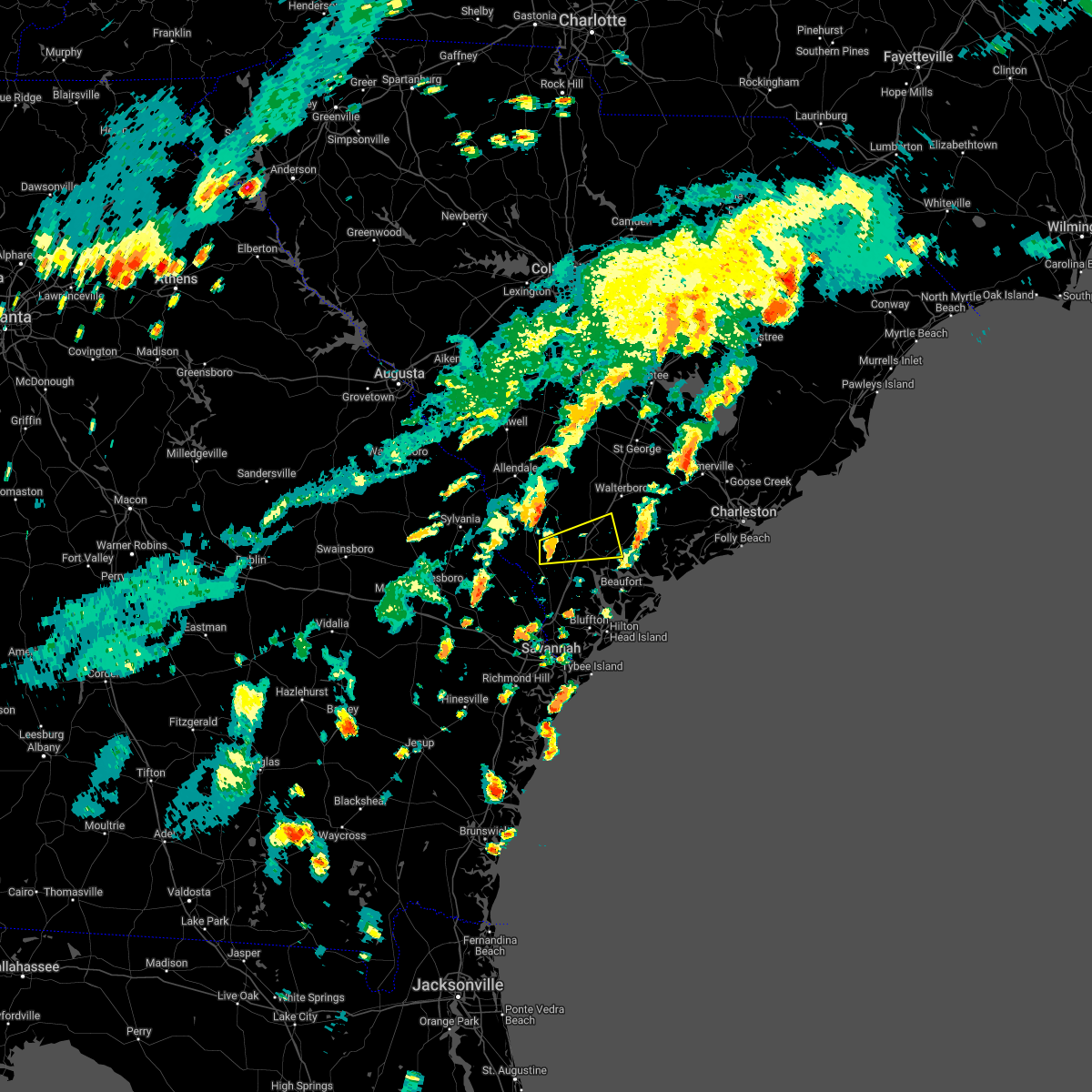 At 324 pm edt, a severe thunderstorm was located near gillisonville, moving east at 30 mph (radar indicated). Hazards include 60 mph wind gusts and quarter size hail. Minor hail damage to vehicles is possible. expect wind damage to trees and powerlines. locations impacted include: yemassee, hendersonville, coosawhatchie, gardens corner, pineland, sheldon, early branch, gillisonville, mcphersonville, grays and pocotaligo. this warning includes i-95 in south carolina between mile markers 30 and 48. hail threat, radar indicated max hail size, 1. 00 in wind threat, radar indicated max wind gust, 60 mph. At 324 pm edt, a severe thunderstorm was located near gillisonville, moving east at 30 mph (radar indicated). Hazards include 60 mph wind gusts and quarter size hail. Minor hail damage to vehicles is possible. expect wind damage to trees and powerlines. locations impacted include: yemassee, hendersonville, coosawhatchie, gardens corner, pineland, sheldon, early branch, gillisonville, mcphersonville, grays and pocotaligo. this warning includes i-95 in south carolina between mile markers 30 and 48. hail threat, radar indicated max hail size, 1. 00 in wind threat, radar indicated max wind gust, 60 mph.
|
| 7/4/2022 4:20 PM EDT | Tree down at ritter rd at white hall rd and another tree down at ritter rd at hendersonville hw in colleton county SC, 10.4 miles WSW of Yemassee, SC |
| 7/3/2022 5:42 PM EDT |
 At 541 pm edt, a severe thunderstorm was located over yemassee, moving northwest at 10 mph (radar indicated). Hazards include 60 mph wind gusts and penny size hail. Expect damage to trees and powerlines. locations impacted include: yemassee, islandton, early branch, cummings, mcphersonville, grays, almeda intersection and pocotaligo. this warning includes i-95 in south carolina between mile markers 31 and 47. hail threat, radar indicated max hail size, 0. 75 in wind threat, radar indicated max wind gust, 60 mph. At 541 pm edt, a severe thunderstorm was located over yemassee, moving northwest at 10 mph (radar indicated). Hazards include 60 mph wind gusts and penny size hail. Expect damage to trees and powerlines. locations impacted include: yemassee, islandton, early branch, cummings, mcphersonville, grays, almeda intersection and pocotaligo. this warning includes i-95 in south carolina between mile markers 31 and 47. hail threat, radar indicated max hail size, 0. 75 in wind threat, radar indicated max wind gust, 60 mph.
|
| 6/17/2022 8:45 PM EDT |
 At 844 pm edt, severe thunderstorms were located along a line extending from near islandton to oliver, moving southeast at 20 mph (emergency management). Hazards include 70 mph wind gusts and nickel size hail. Expect considerable tree damage. damage is likely to mobile homes, roofs, and outbuildings. locations impacted include: beaufort, port royal, ridgeland, springfield, hampton, yemassee, clarendon, jasper, rincon, hardeeville, varnville, estill, newington, furman and oliver. this warning includes i-95 in south carolina between mile markers 2 and 42. thunderstorm damage threat, considerable hail threat, radar indicated max hail size, 0. 88 in wind threat, radar indicated max wind gust, 70 mph. At 844 pm edt, severe thunderstorms were located along a line extending from near islandton to oliver, moving southeast at 20 mph (emergency management). Hazards include 70 mph wind gusts and nickel size hail. Expect considerable tree damage. damage is likely to mobile homes, roofs, and outbuildings. locations impacted include: beaufort, port royal, ridgeland, springfield, hampton, yemassee, clarendon, jasper, rincon, hardeeville, varnville, estill, newington, furman and oliver. this warning includes i-95 in south carolina between mile markers 2 and 42. thunderstorm damage threat, considerable hail threat, radar indicated max hail size, 0. 88 in wind threat, radar indicated max wind gust, 70 mph.
|
| 6/17/2022 8:30 PM EDT |
 At 829 pm edt, severe thunderstorms were located along a line extending from near islandton to altman, moving southeast at 25 mph (emergency management). Hazards include 70 mph wind gusts and nickel size hail. Expect considerable tree damage. damage is likely to mobile homes, roofs, and outbuildings. locations impacted include: allendale, sylvania, hampton, yemassee, lake warren state park, varnville, estill, fairfax, brunson, gifford, newington, furman, oliver, scotia and sycamore. this warning includes i-95 in south carolina between mile markers 40 and 41. thunderstorm damage threat, considerable hail threat, radar indicated max hail size, 0. 88 in wind threat, radar indicated max wind gust, 70 mph. At 829 pm edt, severe thunderstorms were located along a line extending from near islandton to altman, moving southeast at 25 mph (emergency management). Hazards include 70 mph wind gusts and nickel size hail. Expect considerable tree damage. damage is likely to mobile homes, roofs, and outbuildings. locations impacted include: allendale, sylvania, hampton, yemassee, lake warren state park, varnville, estill, fairfax, brunson, gifford, newington, furman, oliver, scotia and sycamore. this warning includes i-95 in south carolina between mile markers 40 and 41. thunderstorm damage threat, considerable hail threat, radar indicated max hail size, 0. 88 in wind threat, radar indicated max wind gust, 70 mph.
|
| 6/17/2022 8:05 PM EDT |
 At 804 pm edt, severe thunderstorms were located along a line extending from ashton to near woodcliff, moving southeast at 25 mph (emergency management). Hazards include 70 mph wind gusts and nickel size hail. Expect considerable tree damage. damage is likely to mobile homes, roofs, and outbuildings. locations impacted include: allendale, sylvania, hampton, yemassee, lake warren state park, varnville, estill, fairfax, brunson, hiltonia, gifford, newington, furman, oliver and scotia. this warning includes i-95 in south carolina between mile markers 40 and 42. thunderstorm damage threat, considerable hail threat, radar indicated max hail size, 0. 88 in wind threat, radar indicated max wind gust, 70 mph. At 804 pm edt, severe thunderstorms were located along a line extending from ashton to near woodcliff, moving southeast at 25 mph (emergency management). Hazards include 70 mph wind gusts and nickel size hail. Expect considerable tree damage. damage is likely to mobile homes, roofs, and outbuildings. locations impacted include: allendale, sylvania, hampton, yemassee, lake warren state park, varnville, estill, fairfax, brunson, hiltonia, gifford, newington, furman, oliver and scotia. this warning includes i-95 in south carolina between mile markers 40 and 42. thunderstorm damage threat, considerable hail threat, radar indicated max hail size, 0. 88 in wind threat, radar indicated max wind gust, 70 mph.
|
| 6/17/2022 8:01 PM EDT |
 At 800 pm edt, severe thunderstorms were located along a line extending from near ashton to near woodcliff, moving southeast at 25 mph (radar indicated). Hazards include 70 mph wind gusts and nickel size hail. Expect considerable tree damage. damage is likely to mobile homes, roofs, and outbuildings. locations impacted include: allendale, sylvania, hampton, yemassee, lake warren state park, varnville, estill, fairfax, brunson, hiltonia, gifford, newington, furman, oliver and scotia. this warning includes i-95 in south carolina between mile markers 40 and 42. thunderstorm damage threat, considerable hail threat, radar indicated max hail size, 0. 88 in wind threat, radar indicated max wind gust, 70 mph. At 800 pm edt, severe thunderstorms were located along a line extending from near ashton to near woodcliff, moving southeast at 25 mph (radar indicated). Hazards include 70 mph wind gusts and nickel size hail. Expect considerable tree damage. damage is likely to mobile homes, roofs, and outbuildings. locations impacted include: allendale, sylvania, hampton, yemassee, lake warren state park, varnville, estill, fairfax, brunson, hiltonia, gifford, newington, furman, oliver and scotia. this warning includes i-95 in south carolina between mile markers 40 and 42. thunderstorm damage threat, considerable hail threat, radar indicated max hail size, 0. 88 in wind threat, radar indicated max wind gust, 70 mph.
|
| 6/17/2022 7:49 PM EDT |
 At 749 pm edt, severe thunderstorms were located along a line extending from near rivers bridge state park to 7 miles north of woodcliff, moving southeast at 25 mph (radar indicated). Hazards include 60 mph wind gusts and penny size hail. Expect damage to trees and powerlines. locations impacted include: allendale, sylvania, hampton, yemassee, lake warren state park, varnville, estill, fairfax, brunson, hiltonia, gifford, newington, furman, oliver and scotia. this warning includes i-95 in south carolina between mile markers 40 and 42. hail threat, radar indicated max hail size, 0. 75 in wind threat, radar indicated max wind gust, 60 mph. At 749 pm edt, severe thunderstorms were located along a line extending from near rivers bridge state park to 7 miles north of woodcliff, moving southeast at 25 mph (radar indicated). Hazards include 60 mph wind gusts and penny size hail. Expect damage to trees and powerlines. locations impacted include: allendale, sylvania, hampton, yemassee, lake warren state park, varnville, estill, fairfax, brunson, hiltonia, gifford, newington, furman, oliver and scotia. this warning includes i-95 in south carolina between mile markers 40 and 42. hail threat, radar indicated max hail size, 0. 75 in wind threat, radar indicated max wind gust, 60 mph.
|
| 6/8/2022 5:23 PM EDT |
 At 522 pm edt, a severe thunderstorm was located near grays, moving east at 25 mph (radar indicated). Hazards include 60 mph wind gusts. Expect damage to trees and powerlines. locations impacted include: yemassee, furman, coosawhatchie, gardens corner, grays, hendersonville, dale, pineland, sheldon, early branch, cummings, gillisonville, mcphersonville, pocotaligo and white hall. this warning includes i-95 in south carolina between mile markers 27 and 51. hail threat, radar indicated max hail size, <. 75 in wind threat, radar indicated max wind gust, 60 mph. At 522 pm edt, a severe thunderstorm was located near grays, moving east at 25 mph (radar indicated). Hazards include 60 mph wind gusts. Expect damage to trees and powerlines. locations impacted include: yemassee, furman, coosawhatchie, gardens corner, grays, hendersonville, dale, pineland, sheldon, early branch, cummings, gillisonville, mcphersonville, pocotaligo and white hall. this warning includes i-95 in south carolina between mile markers 27 and 51. hail threat, radar indicated max hail size, <. 75 in wind threat, radar indicated max wind gust, 60 mph.
|
| 6/8/2022 5:10 PM EDT |
 At 509 pm edt, a severe thunderstorm was located over furman, moving east at 30 mph (radar indicated). Hazards include 60 mph wind gusts. Expect damage to trees and powerlines. locations impacted include: yemassee, furman, scotia, coosawhatchie, gardens corner, grays, hendersonville, garnett, dale, pineland, sheldon, early branch, cummings, gillisonville and robertville. this warning includes i-95 in south carolina between mile markers 27 and 51. hail threat, radar indicated max hail size, <. 75 in wind threat, radar indicated max wind gust, 60 mph. At 509 pm edt, a severe thunderstorm was located over furman, moving east at 30 mph (radar indicated). Hazards include 60 mph wind gusts. Expect damage to trees and powerlines. locations impacted include: yemassee, furman, scotia, coosawhatchie, gardens corner, grays, hendersonville, garnett, dale, pineland, sheldon, early branch, cummings, gillisonville and robertville. this warning includes i-95 in south carolina between mile markers 27 and 51. hail threat, radar indicated max hail size, <. 75 in wind threat, radar indicated max wind gust, 60 mph.
|
| 6/3/2022 5:37 PM EDT |
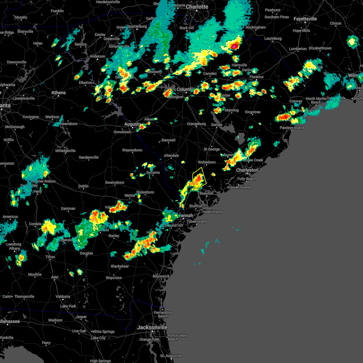 At 536 pm edt, a severe thunderstorm was located near hendersonville, moving northeast at 30 mph (radar indicated). Hazards include 60 mph wind gusts and quarter size hail. Minor hail damage to vehicles is possible. expect wind damage to trees and powerlines. locations impacted include: yemassee, sheldon, mcphersonville, pocotaligo and gardens corner. this warning includes i-95 in south carolina between mile markers 32 and 50. hail threat, radar indicated max hail size, 1. 00 in wind threat, radar indicated max wind gust, 60 mph. At 536 pm edt, a severe thunderstorm was located near hendersonville, moving northeast at 30 mph (radar indicated). Hazards include 60 mph wind gusts and quarter size hail. Minor hail damage to vehicles is possible. expect wind damage to trees and powerlines. locations impacted include: yemassee, sheldon, mcphersonville, pocotaligo and gardens corner. this warning includes i-95 in south carolina between mile markers 32 and 50. hail threat, radar indicated max hail size, 1. 00 in wind threat, radar indicated max wind gust, 60 mph.
|
| 6/3/2022 5:27 PM EDT | Sc state highway patrol reported a tree down in the roadway at the intersection of u.s. routes 21 and 17a. time was estimated from radar dat in colleton county SC, 3.7 miles WSW of Yemassee, SC |
| 6/3/2022 5:27 PM EDT | Sc state highway patrol reported a tree down in the roadway at the intersection of hendersonville highway and jonesville avenue. time was estimated from radar dat in colleton county SC, 4 miles SW of Yemassee, SC |
| 6/3/2022 5:25 PM EDT | Quarter sized hail reported 0.5 miles WSW of Yemassee, SC, public reported quarter sized hail and tree limbs down just north of yemassee. time was estimated from report and from radar data. |
| 6/3/2022 5:25 PM EDT | 1 inch hail reported and tree limbs down. power out for a short tim in hampton county SC, 0.5 miles WSW of Yemassee, SC |
| 6/3/2022 5:24 PM EDT | Sc state highway patrol reported a tree down in the roadway at the intersection of castle hall road and old sheldon church road. time was estimated from radar dat in beaufort county SC, 1.5 miles NW of Yemassee, SC |
| 6/3/2022 5:24 PM EDT |
 At 523 pm edt, a severe thunderstorm was located over pocotaligo, moving northeast at 20 mph (radar indicated). Hazards include 60 mph wind gusts and half dollar size hail. Minor hail damage to vehicles is possible. expect wind damage to trees and powerlines. locations impacted include: yemassee, coosawhatchie, gardens corner, sheldon, early branch, mcphersonville and pocotaligo. this warning includes i-95 in south carolina between mile markers 26 and 50. hail threat, radar indicated max hail size, 1. 25 in wind threat, radar indicated max wind gust, 60 mph. At 523 pm edt, a severe thunderstorm was located over pocotaligo, moving northeast at 20 mph (radar indicated). Hazards include 60 mph wind gusts and half dollar size hail. Minor hail damage to vehicles is possible. expect wind damage to trees and powerlines. locations impacted include: yemassee, coosawhatchie, gardens corner, sheldon, early branch, mcphersonville and pocotaligo. this warning includes i-95 in south carolina between mile markers 26 and 50. hail threat, radar indicated max hail size, 1. 25 in wind threat, radar indicated max wind gust, 60 mph.
|
| 6/3/2022 5:15 PM EDT | Sc state highway patrol reported a tree down in the roadway along nuna rock road. time was estimated from radar dat in jasper county SC, 6.5 miles NNE of Yemassee, SC |
| 5/23/2022 6:35 PM EDT | Trees down along i-95 near exit 4 in colleton county SC, 4 miles SSW of Yemassee, SC |
| 5/23/2022 6:26 PM EDT |
 At 626 pm edt, severe thunderstorms were located along a line extending from lodge to gillisonville, moving northeast at 40 mph (radar indicated). Hazards include 60 mph wind gusts. Expect damage to trees and powerlines. locations impacted include: walterboro, saint george, yemassee, colleton, varnville, cottageville, reevesville, smoaks, lodge, williams, ruffin, miley, grays, ashton and hendersonville. this warning includes i-95 in south carolina between mile markers 35 and 82. hail threat, radar indicated max hail size, <. 75 in wind threat, radar indicated max wind gust, 60 mph. At 626 pm edt, severe thunderstorms were located along a line extending from lodge to gillisonville, moving northeast at 40 mph (radar indicated). Hazards include 60 mph wind gusts. Expect damage to trees and powerlines. locations impacted include: walterboro, saint george, yemassee, colleton, varnville, cottageville, reevesville, smoaks, lodge, williams, ruffin, miley, grays, ashton and hendersonville. this warning includes i-95 in south carolina between mile markers 35 and 82. hail threat, radar indicated max hail size, <. 75 in wind threat, radar indicated max wind gust, 60 mph.
|
| 5/3/2022 6:52 PM EDT |
 The severe thunderstorm warning for portions of hampton and jasper counties will expire at 700 pm edt, the storm which prompted the warning has weakened below severe limits, and no longer poses an immediate threat to life or property. therefore, the warning will be allowed to expire. however, gusty winds are still possible with this thunderstorm. The severe thunderstorm warning for portions of hampton and jasper counties will expire at 700 pm edt, the storm which prompted the warning has weakened below severe limits, and no longer poses an immediate threat to life or property. therefore, the warning will be allowed to expire. however, gusty winds are still possible with this thunderstorm.
|
| 5/3/2022 6:32 PM EDT |
 At 631 pm edt, severe thunderstorms were located along a line extending from near almeda intersection to robertville, moving northeast at 25 mph (trained weather spotters. at 625 pm, quarter sized hail was reported at the north district middle school in varnville, sc). Hazards include 60 mph wind gusts and quarter size hail. Minor hail damage to vehicles is possible. expect wind damage to trees and powerlines. locations impacted include: hampton, yemassee, varnville, estill, furman, scotia, crocketville, lena, tarboro, miley, grays, garnett, pineland, early branch and cummings. this warning includes i-95 in south carolina between mile markers 35 and 41. hail threat, radar indicated max hail size, 1. 00 in wind threat, radar indicated max wind gust, 60 mph. At 631 pm edt, severe thunderstorms were located along a line extending from near almeda intersection to robertville, moving northeast at 25 mph (trained weather spotters. at 625 pm, quarter sized hail was reported at the north district middle school in varnville, sc). Hazards include 60 mph wind gusts and quarter size hail. Minor hail damage to vehicles is possible. expect wind damage to trees and powerlines. locations impacted include: hampton, yemassee, varnville, estill, furman, scotia, crocketville, lena, tarboro, miley, grays, garnett, pineland, early branch and cummings. this warning includes i-95 in south carolina between mile markers 35 and 41. hail threat, radar indicated max hail size, 1. 00 in wind threat, radar indicated max wind gust, 60 mph.
|
| 5/3/2022 6:17 PM EDT |
 At 617 pm edt, severe thunderstorms were located along a line extending from near varnville to near garnett, moving northeast at 20 mph (radar indicated). Hazards include 60 mph wind gusts and quarter size hail. Minor hail damage to vehicles is possible. expect wind damage to trees and powerlines. locations impacted include: hampton, yemassee, lake warren state park, varnville, estill, furman, scotia, luray, crocketville, lena, tarboro, miley, grays, garnett and pineland. this warning includes i-95 in south carolina between mile markers 35 and 41. hail threat, radar indicated max hail size, 1. 00 in wind threat, radar indicated max wind gust, 60 mph. At 617 pm edt, severe thunderstorms were located along a line extending from near varnville to near garnett, moving northeast at 20 mph (radar indicated). Hazards include 60 mph wind gusts and quarter size hail. Minor hail damage to vehicles is possible. expect wind damage to trees and powerlines. locations impacted include: hampton, yemassee, lake warren state park, varnville, estill, furman, scotia, luray, crocketville, lena, tarboro, miley, grays, garnett and pineland. this warning includes i-95 in south carolina between mile markers 35 and 41. hail threat, radar indicated max hail size, 1. 00 in wind threat, radar indicated max wind gust, 60 mph.
|
| 5/3/2022 6:02 PM EDT |
 At 602 pm edt, a severe thunderstorm was located over scotia, moving northeast at 25 mph (radar indicated). Hazards include 60 mph wind gusts and quarter size hail. Minor hail damage to vehicles is possible. expect wind damage to trees and powerlines. locations impacted include: springfield, hampton, yemassee, lake warren state park, varnville, estill, gifford, furman, scotia, luray, tarboro, miley, grays, shirley and early branch. this warning includes i-95 in south carolina between mile markers 35 and 41. hail threat, radar indicated max hail size, 1. 00 in wind threat, radar indicated max wind gust, 60 mph. At 602 pm edt, a severe thunderstorm was located over scotia, moving northeast at 25 mph (radar indicated). Hazards include 60 mph wind gusts and quarter size hail. Minor hail damage to vehicles is possible. expect wind damage to trees and powerlines. locations impacted include: springfield, hampton, yemassee, lake warren state park, varnville, estill, gifford, furman, scotia, luray, tarboro, miley, grays, shirley and early branch. this warning includes i-95 in south carolina between mile markers 35 and 41. hail threat, radar indicated max hail size, 1. 00 in wind threat, radar indicated max wind gust, 60 mph.
|
| 4/5/2022 7:23 PM EDT |
 The severe thunderstorm warning for portions of beaufort and jasper counties will expire at 730 pm edt, the storm which prompted the warning has moved out of the area. therefore, the warning will be allowed to expire. The severe thunderstorm warning for portions of beaufort and jasper counties will expire at 730 pm edt, the storm which prompted the warning has moved out of the area. therefore, the warning will be allowed to expire.
|
| 4/5/2022 7:14 PM EDT |
 At 714 pm edt, a severe thunderstorm was located over rose hill, moving east at 55 mph (radar indicated). Hazards include 60 mph wind gusts. Expect damage to trees and powerlines. locations impacted include: yemassee, jasper, hardeeville, calawassie island, old house, rose hill, sun city and pocotaligo. hail threat, radar indicated max hail size, <. 75 in wind threat, radar indicated max wind gust, 60 mph. At 714 pm edt, a severe thunderstorm was located over rose hill, moving east at 55 mph (radar indicated). Hazards include 60 mph wind gusts. Expect damage to trees and powerlines. locations impacted include: yemassee, jasper, hardeeville, calawassie island, old house, rose hill, sun city and pocotaligo. hail threat, radar indicated max hail size, <. 75 in wind threat, radar indicated max wind gust, 60 mph.
|
| 4/5/2022 6:41 PM EDT |
 At 640 pm edt, severe thunderstorms were located along a line extending from crocketville to near pineland to near godley station, moving east at 60 mph (radar indicated). Hazards include 60 mph wind gusts and penny size hail. Expect damage to trees and powerlines. locations impacted include: ridgeland, springfield, yemassee, godley station, jasper, rincon, port wentworth, hardeeville, varnville, guyton, furman, grahamville, coosawhatchie, eden and tarboro. this warning includes the following interstates: i-16 between mile markers 143 and 147. i-95 in south carolina between mile markers 2 and 43. i-95 in georgia between mile markers 110 and 112. hail threat, radar indicated max hail size, 0. 75 in wind threat, radar indicated max wind gust, 60 mph. At 640 pm edt, severe thunderstorms were located along a line extending from crocketville to near pineland to near godley station, moving east at 60 mph (radar indicated). Hazards include 60 mph wind gusts and penny size hail. Expect damage to trees and powerlines. locations impacted include: ridgeland, springfield, yemassee, godley station, jasper, rincon, port wentworth, hardeeville, varnville, guyton, furman, grahamville, coosawhatchie, eden and tarboro. this warning includes the following interstates: i-16 between mile markers 143 and 147. i-95 in south carolina between mile markers 2 and 43. i-95 in georgia between mile markers 110 and 112. hail threat, radar indicated max hail size, 0. 75 in wind threat, radar indicated max wind gust, 60 mph.
|
| 8/31/2021 3:42 PM EDT |
 At 342 pm edt, severe thunderstorms were located along a line extending from near crocketville to near tarboro, moving northeast at 20 mph (radar indicated). Hazards include 60 mph wind gusts. Expect damage to trees and powerlines. locations impacted include: hampton, yemassee, colleton, varnville, smoaks, williams, coosawhatchie, ruffin, miley, grays, ashton, islandton, padgetts, early branch and cummings. this warning includes i-95 in south carolina between mile markers 29 and 46. hail threat, radar indicated max hail size, <. 75 in wind threat, radar indicated max wind gust, 60 mph. At 342 pm edt, severe thunderstorms were located along a line extending from near crocketville to near tarboro, moving northeast at 20 mph (radar indicated). Hazards include 60 mph wind gusts. Expect damage to trees and powerlines. locations impacted include: hampton, yemassee, colleton, varnville, smoaks, williams, coosawhatchie, ruffin, miley, grays, ashton, islandton, padgetts, early branch and cummings. this warning includes i-95 in south carolina between mile markers 29 and 46. hail threat, radar indicated max hail size, <. 75 in wind threat, radar indicated max wind gust, 60 mph.
|
| 7/17/2021 3:09 PM EDT |
 At 309 pm edt, a severe thunderstorm was located over coosawhatchie, moving east at 10 mph (radar indicated). Hazards include 60 mph wind gusts and quarter size hail. Minor hail damage to vehicles is possible. Expect wind damage to trees and powerlines. At 309 pm edt, a severe thunderstorm was located over coosawhatchie, moving east at 10 mph (radar indicated). Hazards include 60 mph wind gusts and quarter size hail. Minor hail damage to vehicles is possible. Expect wind damage to trees and powerlines.
|
| 7/9/2021 7:38 PM EDT |
 At 738 pm edt, a severe thunderstorm was located over hendersonville, moving southeast at 15 mph (radar indicated). Hazards include 60 mph wind gusts and quarter size hail. Minor hail damage to vehicles is possible. Expect wind damage to trees and powerlines. At 738 pm edt, a severe thunderstorm was located over hendersonville, moving southeast at 15 mph (radar indicated). Hazards include 60 mph wind gusts and quarter size hail. Minor hail damage to vehicles is possible. Expect wind damage to trees and powerlines.
|
| 2/15/2021 7:54 PM EST |
 At 754 pm est, a severe thunderstorm was located near islandton, moving north at 70 mph (radar indicated). Hazards include 60 mph wind gusts. Expect damage to trees and powerlines. locations impacted include, yemassee, varnville, early branch, cummings and almeda intersection. This warning includes i-95 in south carolina near mile marker 40. At 754 pm est, a severe thunderstorm was located near islandton, moving north at 70 mph (radar indicated). Hazards include 60 mph wind gusts. Expect damage to trees and powerlines. locations impacted include, yemassee, varnville, early branch, cummings and almeda intersection. This warning includes i-95 in south carolina near mile marker 40.
|
| 2/15/2021 7:38 PM EST |
 At 738 pm est, a severe thunderstorm was located near gillisonville, moving north at 70 mph (radar indicated). Hazards include 60 mph wind gusts and half dollar size hail. Minor hail damage to vehicles is possible. expect wind damage to trees and powerlines. locations impacted include, ridgeland, hampton, yemassee, varnville, furman, crocketville, coosawhatchie, grays, pineland, early branch, cummings, gillisonville, robertville and mcphersonville. This warning includes i-95 in south carolina between mile markers 23 and 40. At 738 pm est, a severe thunderstorm was located near gillisonville, moving north at 70 mph (radar indicated). Hazards include 60 mph wind gusts and half dollar size hail. Minor hail damage to vehicles is possible. expect wind damage to trees and powerlines. locations impacted include, ridgeland, hampton, yemassee, varnville, furman, crocketville, coosawhatchie, grays, pineland, early branch, cummings, gillisonville, robertville and mcphersonville. This warning includes i-95 in south carolina between mile markers 23 and 40.
|
| 2/15/2021 7:27 PM EST |
 At 726 pm est, a severe thunderstorm was located near ebenezer, moving north at 70 mph (radar indicated). Hazards include ping pong ball size hail and 60 mph wind gusts. People and animals outdoors will be injured. expect hail damage to roofs, siding, windows, and vehicles. Expect wind damage to trees and powerlines. At 726 pm est, a severe thunderstorm was located near ebenezer, moving north at 70 mph (radar indicated). Hazards include ping pong ball size hail and 60 mph wind gusts. People and animals outdoors will be injured. expect hail damage to roofs, siding, windows, and vehicles. Expect wind damage to trees and powerlines.
|
| 12/24/2020 6:40 PM EST | Tree in roadway at lowcountry hwy and trenton ln. time estimated from rada in colleton county SC, 4.7 miles SSW of Yemassee, SC |
| 8/14/2020 6:53 PM EDT |
 The severe thunderstorm warning for beaufort, hampton, colleton and jasper counties will expire at 700 pm edt, the storm which prompted the warning has weakened below severe limits, and no longer poses an immediate threat to life or property. therefore the warning will be allowed to expire. however gusty winds are still possible with this thunderstorm. The severe thunderstorm warning for beaufort, hampton, colleton and jasper counties will expire at 700 pm edt, the storm which prompted the warning has weakened below severe limits, and no longer poses an immediate threat to life or property. therefore the warning will be allowed to expire. however gusty winds are still possible with this thunderstorm.
|
| 8/14/2020 6:43 PM EDT |
 At 641 pm edt, a severe thunderstorm was located near cummings, moving north at 30 mph (law enforcement). Hazards include 60 mph wind gusts and penny size hail. Expect damage to trees and powerlines. locations impacted include, walterboro, yemassee, gardens corner, ritter, hendersonville, islandton, green pond, sheldon, early branch, cummings, mcphersonville, pocotaligo and white hall. This warning includes i-95 in south carolina between mile markers 34 and 54. At 641 pm edt, a severe thunderstorm was located near cummings, moving north at 30 mph (law enforcement). Hazards include 60 mph wind gusts and penny size hail. Expect damage to trees and powerlines. locations impacted include, walterboro, yemassee, gardens corner, ritter, hendersonville, islandton, green pond, sheldon, early branch, cummings, mcphersonville, pocotaligo and white hall. This warning includes i-95 in south carolina between mile markers 34 and 54.
|
| 8/14/2020 6:26 PM EDT | Hampton county 911 reported a tree down on ridgecut r in hampton county SC, 3 miles SE of Yemassee, SC |
| 8/14/2020 6:17 PM EDT |
 At 617 pm edt, a severe thunderstorm was located near gillisonville, moving north at 30 mph (law enforcement). Hazards include 60 mph wind gusts and penny size hail. expect damage to trees and powerlines At 617 pm edt, a severe thunderstorm was located near gillisonville, moving north at 30 mph (law enforcement). Hazards include 60 mph wind gusts and penny size hail. expect damage to trees and powerlines
|
| 8/10/2020 9:20 PM EDT |
 The severe thunderstorm warning for hampton and colleton counties will expire at 930 pm edt, the storm which prompted the warning has weakened below severe limits, and no longer pose an immediate threat to life or property. therefore the warning will be allowed to expire. The severe thunderstorm warning for hampton and colleton counties will expire at 930 pm edt, the storm which prompted the warning has weakened below severe limits, and no longer pose an immediate threat to life or property. therefore the warning will be allowed to expire.
|
| 8/10/2020 9:04 PM EDT |
 At 903 pm edt, a severe thunderstorm was located over hendersonville, moving northeast at 25 mph (radar indicated. at 839 pm south carolina highway patrol reported a tree down near the intersection of interstate 95 and highway 17 in northern jasper county. ). Hazards include 60 mph wind gusts. Expect damage to trees and powerlines. locations impacted include, walterboro, yemassee, hendersonville, early branch, mcphersonville and ritter. This warning includes i-95 in south carolina between mile markers 35 and 58. At 903 pm edt, a severe thunderstorm was located over hendersonville, moving northeast at 25 mph (radar indicated. at 839 pm south carolina highway patrol reported a tree down near the intersection of interstate 95 and highway 17 in northern jasper county. ). Hazards include 60 mph wind gusts. Expect damage to trees and powerlines. locations impacted include, walterboro, yemassee, hendersonville, early branch, mcphersonville and ritter. This warning includes i-95 in south carolina between mile markers 35 and 58.
|
| 8/10/2020 8:39 PM EDT | South carolina highway patrol reported a tree down near the intersection of i-95 and highway 1 in jasper county SC, 6.1 miles NNE of Yemassee, SC |
| 8/10/2020 8:32 PM EDT | Schp reported a tree down near the intersection of church street and green street. time determined from radar dat in hampton county SC, 0.5 miles NNE of Yemassee, SC |
| 8/10/2020 8:29 PM EDT |
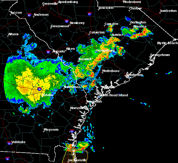 At 828 pm edt, a severe thunderstorm was located near pocotaligo, moving northeast at 15 mph (radar indicated). Hazards include 60 mph wind gusts and penny size hail. expect damage to trees and powerlines At 828 pm edt, a severe thunderstorm was located near pocotaligo, moving northeast at 15 mph (radar indicated). Hazards include 60 mph wind gusts and penny size hail. expect damage to trees and powerlines
|
| 4/13/2020 6:22 AM EDT |
 At 622 am edt, severe thunderstorms were located along a line extending from near lodge to egypt, moving east at 30 mph (radar indicated). Hazards include 60 mph wind gusts and penny size hail. expect damage to trees and powerlines At 622 am edt, severe thunderstorms were located along a line extending from near lodge to egypt, moving east at 30 mph (radar indicated). Hazards include 60 mph wind gusts and penny size hail. expect damage to trees and powerlines
|
| 3/31/2020 5:19 PM EDT |
 At 518 pm edt, a severe thunderstorm was located over mcphersonville, moving east at 50 mph (radar indicated). Hazards include 60 mph wind gusts. Expect damage to trees and powerlines. locations impacted include, walterboro, yemassee, round o, garnett, pineland, early branch, tarboro, robertville, mcphersonville and grays. This warning includes i-95 in south carolina between mile markers 39 and 56. At 518 pm edt, a severe thunderstorm was located over mcphersonville, moving east at 50 mph (radar indicated). Hazards include 60 mph wind gusts. Expect damage to trees and powerlines. locations impacted include, walterboro, yemassee, round o, garnett, pineland, early branch, tarboro, robertville, mcphersonville and grays. This warning includes i-95 in south carolina between mile markers 39 and 56.
|
| 3/31/2020 5:09 PM EDT |
 At 508 pm edt, severe thunderstorms were located along a line extending from ridgeville to near round o to near grays, moving east at 40 mph (radar indicated). Hazards include 60 mph wind gusts and quarter size hail. Minor hail damage to vehicles is possible. Expect wind damage to trees and powerlines. At 508 pm edt, severe thunderstorms were located along a line extending from ridgeville to near round o to near grays, moving east at 40 mph (radar indicated). Hazards include 60 mph wind gusts and quarter size hail. Minor hail damage to vehicles is possible. Expect wind damage to trees and powerlines.
|
| 3/31/2020 4:56 PM EDT |
 At 456 pm edt, severe thunderstorms were located along a line extending from near walterboro to near tarboro, moving east at 50 mph (radar indicated). Hazards include 60 mph wind gusts. Expect damage to trees and powerlines. locations impacted include, walterboro, hampton, yemassee, lake warren state park, varnville, estill, furman, scotia, luray, lena, tarboro, grays, round o, islandton and garnett. This warning includes i-95 in south carolina between mile markers 39 and 65. At 456 pm edt, severe thunderstorms were located along a line extending from near walterboro to near tarboro, moving east at 50 mph (radar indicated). Hazards include 60 mph wind gusts. Expect damage to trees and powerlines. locations impacted include, walterboro, hampton, yemassee, lake warren state park, varnville, estill, furman, scotia, luray, lena, tarboro, grays, round o, islandton and garnett. This warning includes i-95 in south carolina between mile markers 39 and 65.
|
| 3/31/2020 4:29 PM EDT |
 At 429 pm edt, severe thunderstorms were located along a line extending from near miley to near oliver, moving east at 50 mph (radar indicated). Hazards include 60 mph wind gusts. expect damage to trees and powerlines At 429 pm edt, severe thunderstorms were located along a line extending from near miley to near oliver, moving east at 50 mph (radar indicated). Hazards include 60 mph wind gusts. expect damage to trees and powerlines
|
| 8/14/2019 5:05 PM EDT | The schp reported a tree down on i-95 at mile marker 42. time is estimated by rada in colleton county SC, 4 miles SSW of Yemassee, SC |
| 8/14/2019 4:57 PM EDT | A tree was reported down by the sc highway patrol at mile marker 45 on i-95. time is estimated by rada in colleton county SC, 6.7 miles SSW of Yemassee, SC |
| 8/14/2019 4:13 PM EDT |
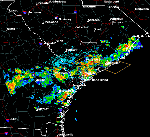 At 349 pm edt, a severe thunderstorm was located near yemassee, and is nearly stationary (radar indicated). Hazards include 60 mph wind gusts and penny size hail. expect damage to trees and powerlines At 349 pm edt, a severe thunderstorm was located near yemassee, and is nearly stationary (radar indicated). Hazards include 60 mph wind gusts and penny size hail. expect damage to trees and powerlines
|
| 8/14/2019 3:49 PM EDT |
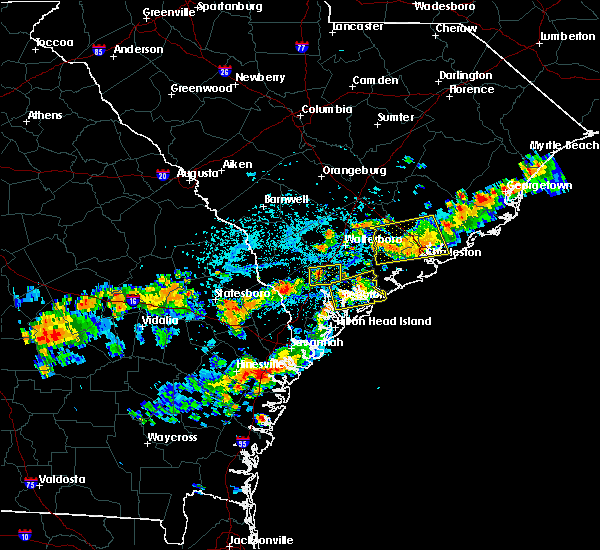 The national weather service in charleston has issued a * severe thunderstorm warning for portions of. beaufort county in southeastern south carolina. hampton county in southeastern south carolina. colleton county in southeastern south carolina. Jasper county in southeastern south carolina. The national weather service in charleston has issued a * severe thunderstorm warning for portions of. beaufort county in southeastern south carolina. hampton county in southeastern south carolina. colleton county in southeastern south carolina. Jasper county in southeastern south carolina.
|
| 7/15/2019 6:52 PM EDT |
 At 651 pm edt, a severe thunderstorm was located near yemassee, moving southeast at 20 mph (radar indicated). Hazards include 60 mph wind gusts and penny size hail. Expect damage to trees and powerlines. locations impacted include, ridgeland, yemassee, coosawhatchie, gardens corner, sheldon, early branch, gillisonville and mcphersonville. This warning includes i-95 in south carolina between mile markers 22 and 41. At 651 pm edt, a severe thunderstorm was located near yemassee, moving southeast at 20 mph (radar indicated). Hazards include 60 mph wind gusts and penny size hail. Expect damage to trees and powerlines. locations impacted include, ridgeland, yemassee, coosawhatchie, gardens corner, sheldon, early branch, gillisonville and mcphersonville. This warning includes i-95 in south carolina between mile markers 22 and 41.
|
| 7/15/2019 6:09 PM EDT |
 At 609 pm edt, a severe thunderstorm was located 8 miles southeast of hampton, moving southeast at 20 mph (radar indicated). Hazards include 60 mph wind gusts and penny size hail. expect damage to trees and powerlines At 609 pm edt, a severe thunderstorm was located 8 miles southeast of hampton, moving southeast at 20 mph (radar indicated). Hazards include 60 mph wind gusts and penny size hail. expect damage to trees and powerlines
|
| 6/22/2019 5:19 PM EDT | Schp reported a tree down near the intersection of hendersonville highway and ritter road. time estimated from radar dat in colleton county SC, 9.9 miles WSW of Yemassee, SC |
| 6/22/2019 5:15 PM EDT |
 At 514 pm edt, severe thunderstorms were located along a line extending from near yemassee to 10 miles northeast of beaufort, moving east at 35 mph (radar indicated). Hazards include 60 mph wind gusts. expect damage to trees and powerlines At 514 pm edt, severe thunderstorms were located along a line extending from near yemassee to 10 miles northeast of beaufort, moving east at 35 mph (radar indicated). Hazards include 60 mph wind gusts. expect damage to trees and powerlines
|
| 6/22/2019 5:14 PM EDT | A tree was reported down by the beaufort county 911 center at jenkins rd and charleston hwy. time is estimated by rada in beaufort county SC, 8.7 miles WNW of Yemassee, SC |
| 6/22/2019 5:09 PM EDT | A tree was reported down at river road and charleston hwy by the beaufort county 911 center. time is estimated by rada in beaufort county SC, 9.4 miles WNW of Yemassee, SC |
| 6/22/2019 5:07 PM EDT | A tree was reported down on river road by a 911 center. time is estimated by rada in beaufort county SC, 8.4 miles WNW of Yemassee, SC |
| 6/22/2019 5:02 PM EDT | Schp reported a tree down near the intersection of lowcountry highway and hendersonville highway. time estimated from report and from radar dat in colleton county SC, 3.4 miles WSW of Yemassee, SC |
| 6/22/2019 4:49 PM EDT | A 911 center reported a tree down on castle hall rd and hwy 17. time is estimated by rada in beaufort county SC, 3.9 miles N of Yemassee, SC |
| 6/22/2019 4:41 PM EDT |
 At 440 pm edt, severe thunderstorms were located along a line extending from 8 miles west of lake warren state park to 9 miles southeast of yemassee, moving east at 30 mph (radar indicated. this line of storms has a history of producing wind damage). Hazards include 70 mph wind gusts. Expect considerable tree damage. damage is likely to mobile homes, roofs, and outbuildings. locations impacted include, ridgeland, hampton, yemassee, lake warren state park, varnville, estill, brunson and gifford. This warning includes i-95 in south carolina between mile markers 24 and 49. At 440 pm edt, severe thunderstorms were located along a line extending from 8 miles west of lake warren state park to 9 miles southeast of yemassee, moving east at 30 mph (radar indicated. this line of storms has a history of producing wind damage). Hazards include 70 mph wind gusts. Expect considerable tree damage. damage is likely to mobile homes, roofs, and outbuildings. locations impacted include, ridgeland, hampton, yemassee, lake warren state park, varnville, estill, brunson and gifford. This warning includes i-95 in south carolina between mile markers 24 and 49.
|
| 6/22/2019 4:26 PM EDT |
 At 425 pm edt, severe thunderstorms were located along a line extending from 9 miles west of lake warren state park to 8 miles northwest of ridgeland, moving east at 15 mph (radar indicated). Hazards include 70 mph wind gusts and penny size hail. Expect considerable tree damage. damage is likely to mobile homes, roofs, and outbuildings. locations impacted include, ridgeland, hampton, yemassee, lake warren state park, varnville, estill, brunson and gifford. This warning includes i-95 in south carolina between mile markers 24 and 49. At 425 pm edt, severe thunderstorms were located along a line extending from 9 miles west of lake warren state park to 8 miles northwest of ridgeland, moving east at 15 mph (radar indicated). Hazards include 70 mph wind gusts and penny size hail. Expect considerable tree damage. damage is likely to mobile homes, roofs, and outbuildings. locations impacted include, ridgeland, hampton, yemassee, lake warren state park, varnville, estill, brunson and gifford. This warning includes i-95 in south carolina between mile markers 24 and 49.
|
| 6/22/2019 4:12 PM EDT |
 At 412 pm edt, severe thunderstorms were located along a line extending from 8 miles west of lake warren state park to 9 miles northwest of ridgeland, moving east at 40 mph (radar indicated). Hazards include 60 mph wind gusts and penny size hail. expect damage to trees and powerlines At 412 pm edt, severe thunderstorms were located along a line extending from 8 miles west of lake warren state park to 9 miles northwest of ridgeland, moving east at 40 mph (radar indicated). Hazards include 60 mph wind gusts and penny size hail. expect damage to trees and powerlines
|
| 6/22/2019 6:36 AM EDT |
 The severe thunderstorm warning for bulloch, candler, effingham, beaufort, hampton and jasper counties will expire at 645 am edt, the storms which prompted the warning have moved out of the area. therefore the warning will be allowed to expire. to report severe weather, contact your nearest law enforcement agency. they will relay your report to the national weather service charleston. The severe thunderstorm warning for bulloch, candler, effingham, beaufort, hampton and jasper counties will expire at 645 am edt, the storms which prompted the warning have moved out of the area. therefore the warning will be allowed to expire. to report severe weather, contact your nearest law enforcement agency. they will relay your report to the national weather service charleston.
|
| 6/22/2019 6:10 AM EDT |
 At 610 am edt, severe thunderstorms were located along a line extending from 6 miles southwest of yemassee to near bay, moving east at 45 mph (radar indicated). Hazards include 60 mph wind gusts and quarter size hail. Minor hail damage to vehicles is possible. expect wind damage to trees and powerlines. locations impacted include, statesboro, metter, ridgeland, springfield, yemassee, lake warren state park, westside and bay. this warning includes, i-16 between mile markers 96 and 137. I-95 in south carolina between mile markers 2 and 42. At 610 am edt, severe thunderstorms were located along a line extending from 6 miles southwest of yemassee to near bay, moving east at 45 mph (radar indicated). Hazards include 60 mph wind gusts and quarter size hail. Minor hail damage to vehicles is possible. expect wind damage to trees and powerlines. locations impacted include, statesboro, metter, ridgeland, springfield, yemassee, lake warren state park, westside and bay. this warning includes, i-16 between mile markers 96 and 137. I-95 in south carolina between mile markers 2 and 42.
|
| 6/22/2019 5:40 AM EDT |
 At 540 am edt, severe thunderstorms were located along a line extending from 11 miles southwest of lake warren state park to 6 miles south of westside, moving east at 45 mph (radar indicated). Hazards include 60 mph wind gusts and quarter size hail. Minor hail damage to vehicles is possible. Expect wind damage to trees and powerlines. At 540 am edt, severe thunderstorms were located along a line extending from 11 miles southwest of lake warren state park to 6 miles south of westside, moving east at 45 mph (radar indicated). Hazards include 60 mph wind gusts and quarter size hail. Minor hail damage to vehicles is possible. Expect wind damage to trees and powerlines.
|
| 6/20/2019 7:29 PM EDT |
 At 729 pm edt, severe thunderstorms were located along a line extending from 7 miles southeast of yemassee to 10 miles west of ridgeland, moving southeast at 30 mph (radar indicated). Hazards include 60 mph wind gusts. expect damage to trees and powerlines At 729 pm edt, severe thunderstorms were located along a line extending from 7 miles southeast of yemassee to 10 miles west of ridgeland, moving southeast at 30 mph (radar indicated). Hazards include 60 mph wind gusts. expect damage to trees and powerlines
|
| 6/20/2019 7:19 PM EDT | Schp reported a tree down on ritter rd near us17 in colleton county SC, 9.9 miles WSW of Yemassee, SC |
| 6/20/2019 7:16 PM EDT | Schp reported a tree down on mewville rd at moore hil in colleton county SC, 9 miles SW of Yemassee, SC |
| 6/20/2019 7:14 PM EDT | Schp reported a tree down on black creek rd near cavanaugh r in colleton county SC, 8.4 miles SSW of Yemassee, SC |
| 6/20/2019 7:07 PM EDT |
 At 707 pm edt, severe thunderstorms were located along a line extending from 10 miles northwest of yemassee to 11 miles north of springfield to near metter, moving east at 35 mph (radar indicated). Hazards include 60 mph wind gusts. Expect damage to trees and powerlines. locations impacted include, statesboro, metter, springfield, hampton, yemassee, bay, varnville and guyton. this warning includes, i-16 between mile markers 97 and 128. I-95 in south carolina between mile markers 37 and 41. At 707 pm edt, severe thunderstorms were located along a line extending from 10 miles northwest of yemassee to 11 miles north of springfield to near metter, moving east at 35 mph (radar indicated). Hazards include 60 mph wind gusts. Expect damage to trees and powerlines. locations impacted include, statesboro, metter, springfield, hampton, yemassee, bay, varnville and guyton. this warning includes, i-16 between mile markers 97 and 128. I-95 in south carolina between mile markers 37 and 41.
|
| 6/20/2019 7:06 PM EDT | Trees down... blocking some roads... and power ou in hampton county SC, 0.5 miles NNE of Yemassee, SC |
| 6/20/2019 6:26 PM EDT |
 At 626 pm edt, severe thunderstorms were located along a line extending from 7 miles north of allendale to 9 miles east of sylvania to near westside, moving east at 60 mph (radar indicated). Hazards include 70 mph wind gusts. Expect considerable tree damage. Damage is likely to mobile homes, roofs, and outbuildings. At 626 pm edt, severe thunderstorms were located along a line extending from 7 miles north of allendale to 9 miles east of sylvania to near westside, moving east at 60 mph (radar indicated). Hazards include 70 mph wind gusts. Expect considerable tree damage. Damage is likely to mobile homes, roofs, and outbuildings.
|
| 6/18/2019 10:58 PM EDT |
 At 1058 pm edt, a severe thunderstorm was located near lake warren state park, moving northeast at 30 mph (radar indicated). Hazards include 60 mph wind gusts and penny size hail. Expect damage to trees and powerlines. locations impacted include, walterboro, hampton, yemassee, lake warren state park, colleton, varnville, estill and furman. This warning includes i-95 in south carolina between mile markers 39 and 56. At 1058 pm edt, a severe thunderstorm was located near lake warren state park, moving northeast at 30 mph (radar indicated). Hazards include 60 mph wind gusts and penny size hail. Expect damage to trees and powerlines. locations impacted include, walterboro, hampton, yemassee, lake warren state park, colleton, varnville, estill and furman. This warning includes i-95 in south carolina between mile markers 39 and 56.
|
| 6/18/2019 10:44 PM EDT |
 The national weather service in charleston has issued a * severe thunderstorm warning for portions of. hampton county in southeastern south carolina. colleton county in southeastern south carolina. jasper county in southeastern south carolina. Until 1145 pm edt. The national weather service in charleston has issued a * severe thunderstorm warning for portions of. hampton county in southeastern south carolina. colleton county in southeastern south carolina. jasper county in southeastern south carolina. Until 1145 pm edt.
|
| 6/8/2019 2:12 PM EDT | Sc highway patrol reported a tree down. time estimated by rada in jasper county SC, 9.6 miles E of Yemassee, SC |
| 6/5/2019 4:23 PM EDT |
 The severe thunderstorm warning for hampton and jasper counties will expire at 430 pm edt, the storm which prompted the warning has weakened below severe limits and has exited the warned area. therefore the warning will be allowed to expire. however gusty winds and heavy rain are still possible with this thunderstorm. The severe thunderstorm warning for hampton and jasper counties will expire at 430 pm edt, the storm which prompted the warning has weakened below severe limits and has exited the warned area. therefore the warning will be allowed to expire. however gusty winds and heavy rain are still possible with this thunderstorm.
|
| 6/5/2019 3:46 PM EDT |
 At 346 pm edt, a severe thunderstorm was located 11 miles west of yemassee, moving southeast at 15 mph (law enforcement has reported trees downed by this storm). Hazards include 60 mph wind gusts and nickel size hail. Expect damage to trees and powerlines. Locations impacted include, furman, early branch, cummings, mcphersonville and grays. At 346 pm edt, a severe thunderstorm was located 11 miles west of yemassee, moving southeast at 15 mph (law enforcement has reported trees downed by this storm). Hazards include 60 mph wind gusts and nickel size hail. Expect damage to trees and powerlines. Locations impacted include, furman, early branch, cummings, mcphersonville and grays.
|
| 6/5/2019 3:28 PM EDT |
 At 328 pm edt, a severe thunderstorm was located near lake warren state park, moving southeast at 10 mph (radar indicated). Hazards include 60 mph wind gusts and quarter size hail. Minor hail damage to vehicles is possible. Expect wind damage to trees and powerlines. At 328 pm edt, a severe thunderstorm was located near lake warren state park, moving southeast at 10 mph (radar indicated). Hazards include 60 mph wind gusts and quarter size hail. Minor hail damage to vehicles is possible. Expect wind damage to trees and powerlines.
|
| 4/19/2019 1:32 PM EDT | Tree down on black creek r in colleton county SC, 8.4 miles SSW of Yemassee, SC |
| 4/19/2019 1:30 PM EDT | Tree down on charleston hwy at river r in beaufort county SC, 9.4 miles WNW of Yemassee, SC |
| 4/19/2019 1:29 PM EDT | Tree down on white hall r in colleton county SC, 9.7 miles W of Yemassee, SC |
| 4/19/2019 1:29 PM EDT | Three reports of trees and power lines down on low country hw in colleton county SC, 5.3 miles SSW of Yemassee, SC |
| 4/19/2019 1:27 PM EDT | Tree down on frog town r in colleton county SC, 3.2 miles SW of Yemassee, SC |
| 4/19/2019 1:27 PM EDT | Tree down on combahee r in colleton county SC, 7.4 miles W of Yemassee, SC |
| 4/19/2019 1:26 PM EDT |
 At 123 pm edt, severe thunderstorms were located along a line extending from 7 miles northeast of allendale to 8 miles northwest of beaufort, moving northeast at 55 mph (radar indicated). Hazards include 70 mph wind gusts. Expect considerable tree damage. damage is likely to mobile homes, roofs, and outbuildings. locations impacted include, hilton head island, bluffton, beaufort, port royal, walterboro, ridgeland, allendale and hampton. those attending the rbc heritage golf tournament at harbour town are in the path of this storm and should prepare for imminent, dangerous weather conditions. Seek shelter now! this warning includes i-95 in south carolina between mile markers 15 and 66. At 123 pm edt, severe thunderstorms were located along a line extending from 7 miles northeast of allendale to 8 miles northwest of beaufort, moving northeast at 55 mph (radar indicated). Hazards include 70 mph wind gusts. Expect considerable tree damage. damage is likely to mobile homes, roofs, and outbuildings. locations impacted include, hilton head island, bluffton, beaufort, port royal, walterboro, ridgeland, allendale and hampton. those attending the rbc heritage golf tournament at harbour town are in the path of this storm and should prepare for imminent, dangerous weather conditions. Seek shelter now! this warning includes i-95 in south carolina between mile markers 15 and 66.
|
| 4/19/2019 1:24 PM EDT | Tree down on salkehatchie rd near i-9 in hampton county SC, 1.2 miles SE of Yemassee, SC |
| 4/19/2019 1:07 PM EDT |
 At 104 pm edt, severe thunderstorms were located along a line extending from 8 miles southwest of allendale to 7 miles northwest of bluffton, moving northeast at 55 mph (radar indicated. these thunderstorms have been producing wind damage). Hazards include 70 mph wind gusts. Expect considerable tree damage. damage is likely to mobile homes, roofs, and outbuildings. locations impacted include, hilton head island, bluffton, beaufort, port royal, walterboro, ridgeland, allendale and hampton. those attending the rbc heritage golf tournament at harbour town are in the path of this storm and should prepare for imminent, dangerous weather conditions. Seek shelter now! this warning includes i-95 in south carolina between mile markers 2 and 66. At 104 pm edt, severe thunderstorms were located along a line extending from 8 miles southwest of allendale to 7 miles northwest of bluffton, moving northeast at 55 mph (radar indicated. these thunderstorms have been producing wind damage). Hazards include 70 mph wind gusts. Expect considerable tree damage. damage is likely to mobile homes, roofs, and outbuildings. locations impacted include, hilton head island, bluffton, beaufort, port royal, walterboro, ridgeland, allendale and hampton. those attending the rbc heritage golf tournament at harbour town are in the path of this storm and should prepare for imminent, dangerous weather conditions. Seek shelter now! this warning includes i-95 in south carolina between mile markers 2 and 66.
|
| 4/19/2019 12:49 PM EDT |
 At 1247 pm edt, severe thunderstorms were located along a line extending from 6 miles east of sylvania to 6 miles north of savannah, moving northeast at 55 mph (radar indicated. at 1246 pm edt a wind gust to 66 mph was reported at the savannah airport). Hazards include 70 mph wind gusts. Expect considerable tree damage. Damage is likely to mobile homes, roofs, and outbuildings. At 1247 pm edt, severe thunderstorms were located along a line extending from 6 miles east of sylvania to 6 miles north of savannah, moving northeast at 55 mph (radar indicated. at 1246 pm edt a wind gust to 66 mph was reported at the savannah airport). Hazards include 70 mph wind gusts. Expect considerable tree damage. Damage is likely to mobile homes, roofs, and outbuildings.
|
| 4/14/2019 6:29 PM EDT |
 At 629 pm edt, severe thunderstorms were located along a line extending from 6 miles northwest of indian field to 6 miles south of saint george to 9 miles northwest of yemassee, moving northeast at 60 mph (radar indicated). Hazards include 60 mph wind gusts and penny size hail. Expect damage to trees and powerlines. locations impacted include, summerville, walterboro, hampton, yemassee, slands bridge, givhans ferry state park, indian field and saint george. This warning includes i-95 in south carolina between mile markers 39 and 85. At 629 pm edt, severe thunderstorms were located along a line extending from 6 miles northwest of indian field to 6 miles south of saint george to 9 miles northwest of yemassee, moving northeast at 60 mph (radar indicated). Hazards include 60 mph wind gusts and penny size hail. Expect damage to trees and powerlines. locations impacted include, summerville, walterboro, hampton, yemassee, slands bridge, givhans ferry state park, indian field and saint george. This warning includes i-95 in south carolina between mile markers 39 and 85.
|
| 4/14/2019 6:11 PM EDT |
 At 611 pm edt, severe thunderstorms were located along a line extending from 15 miles southeast of bamberg to 9 miles northwest of walterboro to 11 miles south of lake warren state park, moving northeast at 50 mph (radar indicated). Hazards include 60 mph wind gusts and penny size hail. Expect damage to trees and powerlines. locations impacted include, summerville, walterboro, hampton, yemassee, lake warren state park, indian field, saint george and slands bridge. This warning includes i-95 in south carolina between mile markers 28 and 85. At 611 pm edt, severe thunderstorms were located along a line extending from 15 miles southeast of bamberg to 9 miles northwest of walterboro to 11 miles south of lake warren state park, moving northeast at 50 mph (radar indicated). Hazards include 60 mph wind gusts and penny size hail. Expect damage to trees and powerlines. locations impacted include, summerville, walterboro, hampton, yemassee, lake warren state park, indian field, saint george and slands bridge. This warning includes i-95 in south carolina between mile markers 28 and 85.
|
| 4/14/2019 5:48 PM EDT |
 At 548 pm edt, severe thunderstorms were located along a line extending from near hampton to 9 miles southeast of lake warren state park, moving northeast at 70 mph (radar indicated). Hazards include 60 mph wind gusts and penny size hail. expect damage to trees and powerlines At 548 pm edt, severe thunderstorms were located along a line extending from near hampton to 9 miles southeast of lake warren state park, moving northeast at 70 mph (radar indicated). Hazards include 60 mph wind gusts and penny size hail. expect damage to trees and powerlines
|
| 8/14/2018 8:19 PM EDT |
 At 818 pm edt, severe thunderstorms were located along a line extending from 8 miles southeast of lake warren state park to near yemassee, moving southeast at 15 mph (radar indicated). Hazards include 60 mph wind gusts and penny size hail. Expect damage to trees and powerlines. locations impacted include, ridgeland, yemassee, furman, scotia, coosawhatchie, grays, garnett and pineland. This warning includes i-95 in south carolina between mile markers 22 and 39. At 818 pm edt, severe thunderstorms were located along a line extending from 8 miles southeast of lake warren state park to near yemassee, moving southeast at 15 mph (radar indicated). Hazards include 60 mph wind gusts and penny size hail. Expect damage to trees and powerlines. locations impacted include, ridgeland, yemassee, furman, scotia, coosawhatchie, grays, garnett and pineland. This warning includes i-95 in south carolina between mile markers 22 and 39.
|
| 8/14/2018 8:09 PM EDT | The south carolina highway patrol reported a tree down near the intersection of cat branch road and possum corner roa in jasper county SC, 7.3 miles E of Yemassee, SC |
| 8/14/2018 8:07 PM EDT |
 At 806 pm edt, severe thunderstorms were located along a line extending from 8 miles southeast of lake warren state park to near yemassee, moving southwest at 10 mph (radar indicated). Hazards include 60 mph wind gusts and penny size hail. expect damage to trees and powerlines At 806 pm edt, severe thunderstorms were located along a line extending from 8 miles southeast of lake warren state park to near yemassee, moving southwest at 10 mph (radar indicated). Hazards include 60 mph wind gusts and penny size hail. expect damage to trees and powerlines
|
| 8/6/2018 5:40 PM EDT | South carolina highway patrol reported a tree down along i-95 between mile marker 40 and 4 in colleton county SC, 3.2 miles SSW of Yemassee, SC |
| 8/6/2018 5:34 PM EDT | The south carolina highway patrol reported a tree down near the intersection of black creek road and highway 2 in colleton county SC, 7.2 miles S of Yemassee, SC |
| 6/25/2018 12:48 AM EDT |
 At 1248 am edt, severe thunderstorms were located along a line extending from 13 miles north of edisto beach to 6 miles north of bluffton to 9 miles east of bay, moving southeast at 35 mph (radar indicated). Hazards include 60 mph wind gusts. Expect damage to trees and powerlines. locations impacted include, bluffton, beaufort, port royal, ridgeland, springfield, yemassee, clarendon and jasper. this warning includes, i-95 in south carolina between mile markers 2 and 38. I-95 in georgia between mile markers 109 and 112. At 1248 am edt, severe thunderstorms were located along a line extending from 13 miles north of edisto beach to 6 miles north of bluffton to 9 miles east of bay, moving southeast at 35 mph (radar indicated). Hazards include 60 mph wind gusts. Expect damage to trees and powerlines. locations impacted include, bluffton, beaufort, port royal, ridgeland, springfield, yemassee, clarendon and jasper. this warning includes, i-95 in south carolina between mile markers 2 and 38. I-95 in georgia between mile markers 109 and 112.
|
| 6/25/2018 12:29 AM EDT |
 At 1229 am edt, severe thunderstorms were located along a line extending from 14 miles southeast of walterboro to near ridgeland to 9 miles north of bay, moving southeast at 40 mph (radar indicated). Hazards include 60 mph wind gusts. Expect damage to trees and powerlines. locations impacted include, bluffton, beaufort, port royal, walterboro, ridgeland, springfield, yemassee and clarendon. this warning includes, i-95 in south carolina between mile markers 2 and 64. I-95 in georgia between mile markers 109 and 112. At 1229 am edt, severe thunderstorms were located along a line extending from 14 miles southeast of walterboro to near ridgeland to 9 miles north of bay, moving southeast at 40 mph (radar indicated). Hazards include 60 mph wind gusts. Expect damage to trees and powerlines. locations impacted include, bluffton, beaufort, port royal, walterboro, ridgeland, springfield, yemassee and clarendon. this warning includes, i-95 in south carolina between mile markers 2 and 64. I-95 in georgia between mile markers 109 and 112.
|
| 6/25/2018 12:11 AM EDT | Tree down on highway 3 east of gray in jasper county SC, 7.4 miles ENE of Yemassee, SC |
| 6/25/2018 12:09 AM EDT | Tree reported down on i95 southbound near mm4 in colleton county SC, 4 miles SSW of Yemassee, SC |
| 6/24/2018 11:58 PM EDT |
 At 1158 pm edt, severe thunderstorms were located along a line extending from near walterboro to 16 miles south of lake warren state park to middleground, moving southeast at 35 mph (radar indicated). Hazards include 60 mph wind gusts. expect damage to trees and powerlines At 1158 pm edt, severe thunderstorms were located along a line extending from near walterboro to 16 miles south of lake warren state park to middleground, moving southeast at 35 mph (radar indicated). Hazards include 60 mph wind gusts. expect damage to trees and powerlines
|
| 6/24/2018 11:41 PM EDT |
 At 1141 pm edt, severe thunderstorms were located along a line extending from near givhans ferry state park to 9 miles southeast of sylvania, moving south at 35 mph (radar indicated). Hazards include 60 mph wind gusts. Expect damage to trees and powerlines. locations impacted include, walterboro, hampton, yemassee, lake warren state park, indian field, saint george, colleton and varnville. this warning includes, i-26 between mile markers 171 and 175. I-95 in south carolina between mile markers 38 and 85. At 1141 pm edt, severe thunderstorms were located along a line extending from near givhans ferry state park to 9 miles southeast of sylvania, moving south at 35 mph (radar indicated). Hazards include 60 mph wind gusts. Expect damage to trees and powerlines. locations impacted include, walterboro, hampton, yemassee, lake warren state park, indian field, saint george, colleton and varnville. this warning includes, i-26 between mile markers 171 and 175. I-95 in south carolina between mile markers 38 and 85.
|
| 6/24/2018 11:41 PM EDT |
 At 1107 pm edt, severe thunderstorms were located along a line extending from near indian field to near allendale, moving southeast at 35 mph (radar indicated). Hazards include 60 mph wind gusts. expect damage to trees and powerlines At 1107 pm edt, severe thunderstorms were located along a line extending from near indian field to near allendale, moving southeast at 35 mph (radar indicated). Hazards include 60 mph wind gusts. expect damage to trees and powerlines
|
| 6/24/2018 11:08 PM EDT |
 At 1107 pm edt, severe thunderstorms were located along a line extending from near indian field to near allendale, moving southeast at 35 mph (radar indicated). Hazards include 60 mph wind gusts. expect damage to trees and powerlines At 1107 pm edt, severe thunderstorms were located along a line extending from near indian field to near allendale, moving southeast at 35 mph (radar indicated). Hazards include 60 mph wind gusts. expect damage to trees and powerlines
|
| 6/20/2018 7:11 PM EDT |
 The severe thunderstorm warning for hampton, colleton and jasper counties will expire at 715 pm edt, the storms which prompted the warning have weakened below severe limits, and no longer pose an immediate threat to life or property. therefore the warning will be allowed to expire. however gusty winds are still possible with these thunderstorms. to report severe weather, contact your nearest law enforcement agency. they will relay your report to the national weather service charleston. The severe thunderstorm warning for hampton, colleton and jasper counties will expire at 715 pm edt, the storms which prompted the warning have weakened below severe limits, and no longer pose an immediate threat to life or property. therefore the warning will be allowed to expire. however gusty winds are still possible with these thunderstorms. to report severe weather, contact your nearest law enforcement agency. they will relay your report to the national weather service charleston.
|
| 6/20/2018 6:44 PM EDT |
 At 643 pm edt, severe thunderstorms were located along a line extending from 9 miles east of hampton to lake warren state park, moving southeast at 10 mph (radar indicated. the hampton county warning point has indicated that damage has occurred with these storms). Hazards include 60 mph wind gusts and nickel size hail. Expect damage to trees and powerlines. locations impacted include, hampton, yemassee, lake warren state park, varnville, estill, gifford, furman and scotia. This warning includes i-95 in south carolina between mile markers 39 and 44. At 643 pm edt, severe thunderstorms were located along a line extending from 9 miles east of hampton to lake warren state park, moving southeast at 10 mph (radar indicated. the hampton county warning point has indicated that damage has occurred with these storms). Hazards include 60 mph wind gusts and nickel size hail. Expect damage to trees and powerlines. locations impacted include, hampton, yemassee, lake warren state park, varnville, estill, gifford, furman and scotia. This warning includes i-95 in south carolina between mile markers 39 and 44.
|
| 6/20/2018 6:35 PM EDT |
 At 635 pm edt, severe thunderstorms were located along a line extending from 9 miles east of hampton to lake warren state park, moving south at 5 mph (radar indicated). Hazards include 60 mph wind gusts and nickel size hail. Expect damage to trees and powerlines. locations impacted include, hampton, yemassee, lake warren state park, varnville, estill, brunson, gifford and furman. This warning includes i-95 in south carolina between mile markers 39 and 44. At 635 pm edt, severe thunderstorms were located along a line extending from 9 miles east of hampton to lake warren state park, moving south at 5 mph (radar indicated). Hazards include 60 mph wind gusts and nickel size hail. Expect damage to trees and powerlines. locations impacted include, hampton, yemassee, lake warren state park, varnville, estill, brunson, gifford and furman. This warning includes i-95 in south carolina between mile markers 39 and 44.
|
| 6/20/2018 6:15 PM EDT |
 At 615 pm edt, severe thunderstorms were located along a line extending from 14 miles east of lake warren state park to near hampton, moving southeast at 10 mph (radar indicated). Hazards include 60 mph wind gusts and nickel size hail. expect damage to trees and powerlines At 615 pm edt, severe thunderstorms were located along a line extending from 14 miles east of lake warren state park to near hampton, moving southeast at 10 mph (radar indicated). Hazards include 60 mph wind gusts and nickel size hail. expect damage to trees and powerlines
|
| 3/20/2018 4:26 AM EDT |
 At 425 am edt, severe thunderstorms were located along a line extending from 7 miles southwest of walterboro to 10 miles southeast of lake warren state park, moving east at 50 mph (radar indicated). Hazards include 60 mph wind gusts and penny size hail. expect damage to trees and powerlines At 425 am edt, severe thunderstorms were located along a line extending from 7 miles southwest of walterboro to 10 miles southeast of lake warren state park, moving east at 50 mph (radar indicated). Hazards include 60 mph wind gusts and penny size hail. expect damage to trees and powerlines
|
| 8/31/2017 6:06 PM EDT |
 At 605 pm edt, a severe thunderstorm was located over yemassee, moving east at 35 mph (radar indicated). Hazards include 60 mph wind gusts and penny size hail. Expect damage to trees and powerlines. locations impacted include, ridgeland, yemassee, coosawhatchie, early branch, gillisonville, mcphersonville and grays. This warning includes i-95 in south carolina between mile markers 24 and 39. At 605 pm edt, a severe thunderstorm was located over yemassee, moving east at 35 mph (radar indicated). Hazards include 60 mph wind gusts and penny size hail. Expect damage to trees and powerlines. locations impacted include, ridgeland, yemassee, coosawhatchie, early branch, gillisonville, mcphersonville and grays. This warning includes i-95 in south carolina between mile markers 24 and 39.
|
| 8/31/2017 5:50 PM EDT |
 At 550 pm edt, a severe thunderstorm was located 9 miles west of yemassee, moving east at 35 mph (radar indicated). Hazards include 60 mph wind gusts and penny size hail. Expect damage to trees and powerlines. locations impacted include, ridgeland, yemassee, furman, scotia, coosawhatchie, pineland, early branch and tarboro. This warning includes i-95 in south carolina between mile markers 24 and 39. At 550 pm edt, a severe thunderstorm was located 9 miles west of yemassee, moving east at 35 mph (radar indicated). Hazards include 60 mph wind gusts and penny size hail. Expect damage to trees and powerlines. locations impacted include, ridgeland, yemassee, furman, scotia, coosawhatchie, pineland, early branch and tarboro. This warning includes i-95 in south carolina between mile markers 24 and 39.
|
| 8/31/2017 5:47 PM EDT | South carolina highway patrol reported a tree down on highway 3 near the intersection with grays highwa in jasper county SC, 9.7 miles E of Yemassee, SC |
| 8/31/2017 5:46 PM EDT | South carolina highway patrol reported a tree down on heritage road near the intersection with lawtonville roa in jasper county SC, 9.7 miles E of Yemassee, SC |
| 8/31/2017 5:37 PM EDT |
 At 537 pm edt, a severe thunderstorm was located 11 miles northwest of ridgeland, moving east at 35 mph (radar indicated). Hazards include 60 mph wind gusts and penny size hail. expect damage to trees and powerlines At 537 pm edt, a severe thunderstorm was located 11 miles northwest of ridgeland, moving east at 35 mph (radar indicated). Hazards include 60 mph wind gusts and penny size hail. expect damage to trees and powerlines
|
| 5/1/2017 7:38 PM EDT |
 At 738 pm edt, severe thunderstorms were located along a line extending from 10 miles southeast of bamberg to 8 miles east of hampton to 11 miles west of ridgeland, moving east at 30 mph (radar indicated). Hazards include 60 mph wind gusts and penny size hail. Expect damage to trees and powerlines. locations impacted include, ridgeland, hampton, yemassee, lake warren state park, colleton, varnville, estill and furman. This warning includes i-95 in south carolina between mile markers 19 and 20, between mile markers 22 and 30, and between mile markers 36 and 41. At 738 pm edt, severe thunderstorms were located along a line extending from 10 miles southeast of bamberg to 8 miles east of hampton to 11 miles west of ridgeland, moving east at 30 mph (radar indicated). Hazards include 60 mph wind gusts and penny size hail. Expect damage to trees and powerlines. locations impacted include, ridgeland, hampton, yemassee, lake warren state park, colleton, varnville, estill and furman. This warning includes i-95 in south carolina between mile markers 19 and 20, between mile markers 22 and 30, and between mile markers 36 and 41.
|
| 5/1/2017 7:22 PM EDT |
 At 721 pm edt, severe thunderstorms were located along a line extending from 11 miles south of bamberg to hampton to 7 miles north of springfield, moving east at 40 mph (radar indicated). Hazards include 60 mph wind gusts and penny size hail. Expect damage to trees and powerlines. locations impacted include, ridgeland, hampton, yemassee, lake warren state park, colleton, varnville, estill and fairfax. This warning includes i-95 in south carolina between mile markers 19 and 20, between mile markers 22 and 30, and between mile markers 36 and 41. At 721 pm edt, severe thunderstorms were located along a line extending from 11 miles south of bamberg to hampton to 7 miles north of springfield, moving east at 40 mph (radar indicated). Hazards include 60 mph wind gusts and penny size hail. Expect damage to trees and powerlines. locations impacted include, ridgeland, hampton, yemassee, lake warren state park, colleton, varnville, estill and fairfax. This warning includes i-95 in south carolina between mile markers 19 and 20, between mile markers 22 and 30, and between mile markers 36 and 41.
|
| 5/1/2017 7:06 PM EDT |
 At 706 pm edt, severe thunderstorms were located along a line extending from 9 miles northeast of allendale to near lake warren state park to 9 miles northwest of springfield, moving east at 30 mph (radar indicated). Hazards include 60 mph wind gusts and penny size hail. expect damage to trees and powerlines At 706 pm edt, severe thunderstorms were located along a line extending from 9 miles northeast of allendale to near lake warren state park to 9 miles northwest of springfield, moving east at 30 mph (radar indicated). Hazards include 60 mph wind gusts and penny size hail. expect damage to trees and powerlines
|
| 4/5/2017 6:47 PM EDT |
 At 646 pm edt, a severe thunderstorm was located over yemassee, moving east at 45 mph (radar indicated). Hazards include 60 mph wind gusts. expect damage to roofs, siding, and trees At 646 pm edt, a severe thunderstorm was located over yemassee, moving east at 45 mph (radar indicated). Hazards include 60 mph wind gusts. expect damage to roofs, siding, and trees
|
| 4/5/2017 3:28 PM EDT |
 At 327 pm edt, a severe thunderstorm was located near yemassee, moving northeast at 50 mph (radar indicated). Hazards include 60 mph wind gusts and quarter size hail. Hail damage to vehicles is expected. Expect wind damage to roofs, siding, and trees. At 327 pm edt, a severe thunderstorm was located near yemassee, moving northeast at 50 mph (radar indicated). Hazards include 60 mph wind gusts and quarter size hail. Hail damage to vehicles is expected. Expect wind damage to roofs, siding, and trees.
|
| 4/3/2017 5:39 PM EDT |
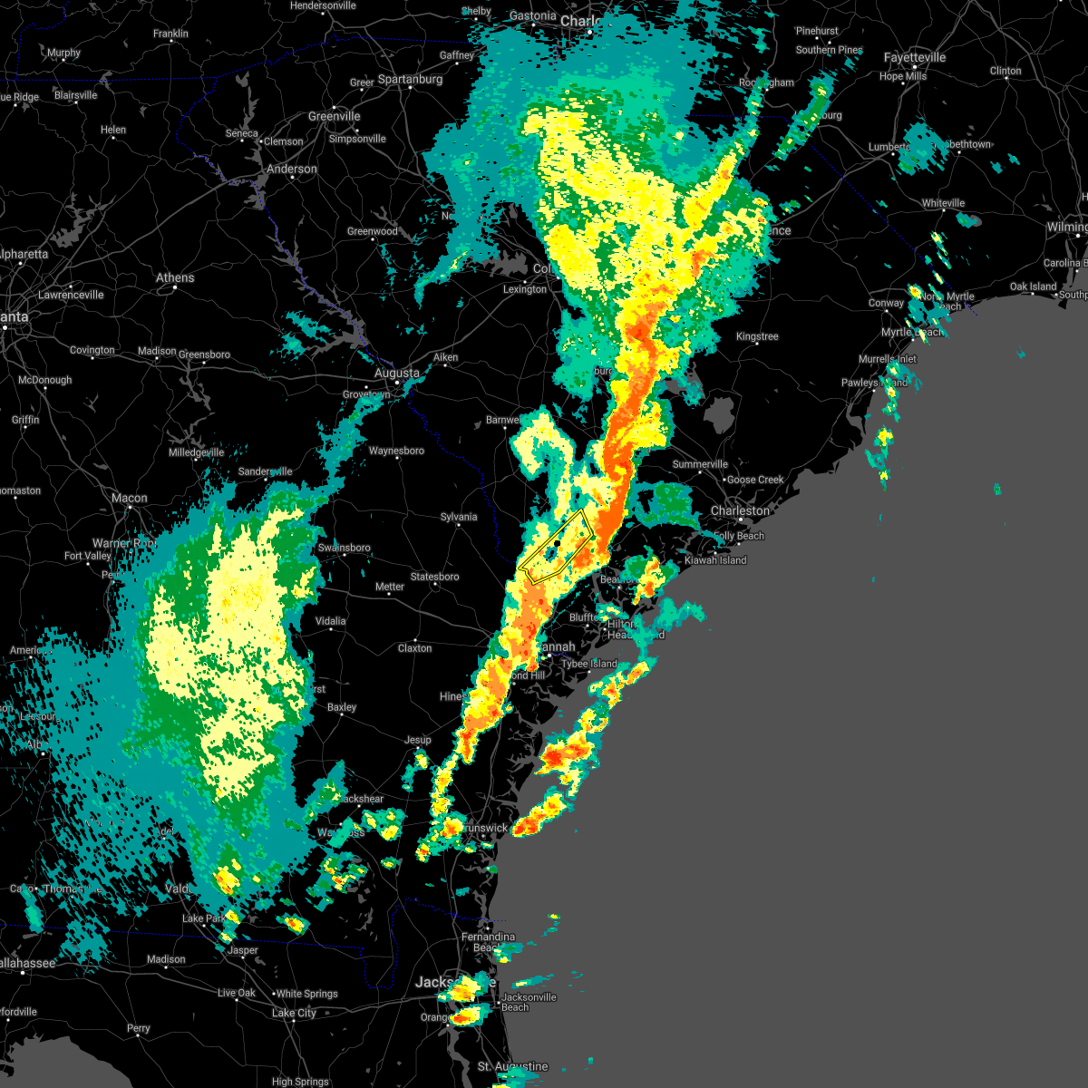 The severe thunderstorm warning for hampton and jasper counties will expire at 545 pm edt. the storm which prompted the warning has moved out of the area. therefore the warning will be allowed to expire. a tornado watch remains in effect until 900 pm edt for southeastern georgia. And southeastern south carolina. The severe thunderstorm warning for hampton and jasper counties will expire at 545 pm edt. the storm which prompted the warning has moved out of the area. therefore the warning will be allowed to expire. a tornado watch remains in effect until 900 pm edt for southeastern georgia. And southeastern south carolina.
|
| 4/3/2017 5:36 PM EDT |
 At 535 pm edt, severe thunderstorms were located along a line extending from 7 miles south of walterboro to 8 miles northeast of ridgeland, moving east at 30 mph (radar indicated). Hazards include 60 mph wind gusts and quarter size hail. Hail damage to vehicles is expected. Expect wind damage to roofs, siding, and trees. At 535 pm edt, severe thunderstorms were located along a line extending from 7 miles south of walterboro to 8 miles northeast of ridgeland, moving east at 30 mph (radar indicated). Hazards include 60 mph wind gusts and quarter size hail. Hail damage to vehicles is expected. Expect wind damage to roofs, siding, and trees.
|
| 4/3/2017 5:26 PM EDT |
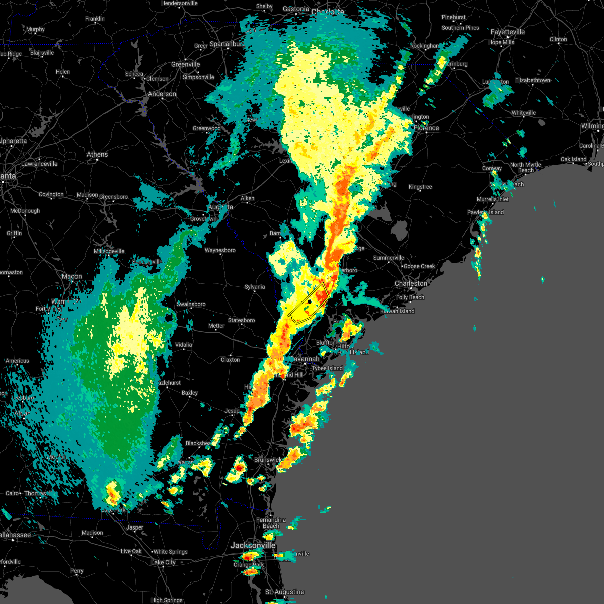 At 526 pm edt, a severe thunderstorm was located near yemassee, moving east at 45 mph (radar indicated). Hazards include 60 mph wind gusts and penny size hail. Expect damage to roofs, siding, and trees. locations impacted include, yemassee, pineland, early branch, tarboro, gillisonville, robertville, mcphersonville and grays. A tornado watch remains in effect until 900 pm edt for southeastern georgia, and southeastern south carolina. At 526 pm edt, a severe thunderstorm was located near yemassee, moving east at 45 mph (radar indicated). Hazards include 60 mph wind gusts and penny size hail. Expect damage to roofs, siding, and trees. locations impacted include, yemassee, pineland, early branch, tarboro, gillisonville, robertville, mcphersonville and grays. A tornado watch remains in effect until 900 pm edt for southeastern georgia, and southeastern south carolina.
|
| 4/3/2017 4:56 PM EDT |
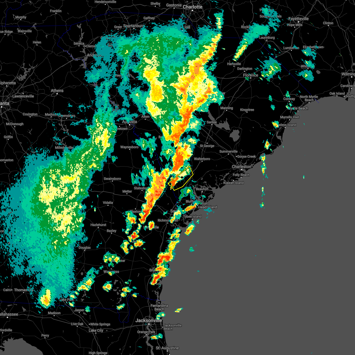 At 455 pm edt, a severe thunderstorm was located 14 miles north of springfield, moving northeast at 40 mph (radar indicated). Hazards include 60 mph wind gusts and quarter size hail. Hail damage to vehicles is expected. Expect wind damage to roofs, siding, and trees. At 455 pm edt, a severe thunderstorm was located 14 miles north of springfield, moving northeast at 40 mph (radar indicated). Hazards include 60 mph wind gusts and quarter size hail. Hail damage to vehicles is expected. Expect wind damage to roofs, siding, and trees.
|
| 1/21/2017 3:56 PM EST |
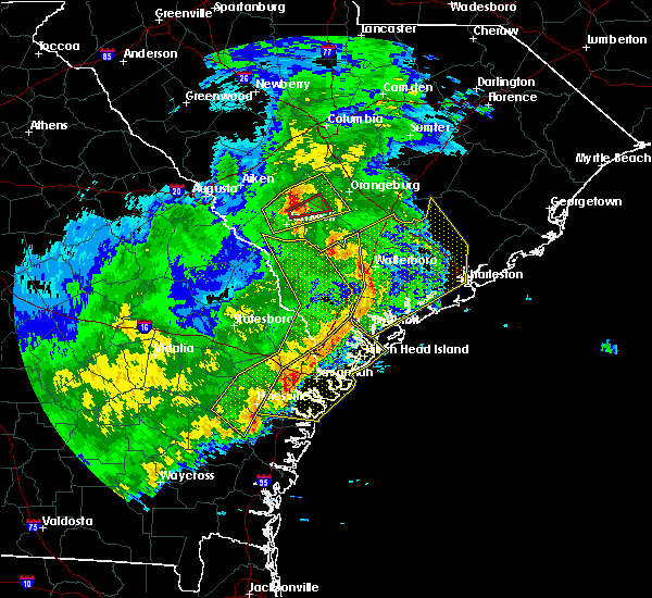 At 356 pm est, severe thunderstorms were located along a line extending from 16 miles southeast of bamberg to 10 miles south of walterboro to near port royal, moving east at 65 mph (radar indicated). Hazards include 60 mph wind gusts. expect damage to roofs, siding, and trees At 356 pm est, severe thunderstorms were located along a line extending from 16 miles southeast of bamberg to 10 miles south of walterboro to near port royal, moving east at 65 mph (radar indicated). Hazards include 60 mph wind gusts. expect damage to roofs, siding, and trees
|
| 1/21/2017 3:31 PM EST | Tree reported down on grays hwy. time estimated based on rada in jasper county SC, 9.5 miles ENE of Yemassee, SC |
| 1/21/2017 3:31 PM EST |
 At 330 pm est, severe thunderstorms were located along a line extending from 14 miles northeast of hampton to near ridgeland to 7 miles east of hinesville, moving east at 65 mph (radar indicated). Hazards include 60 mph wind gusts and penny size hail. Expect damage to roofs, siding, and trees. locations impacted include, hinesville, ridgeland, allendale, springfield, hampton, pembroke, ludowici and yemassee. A tornado watch remains in effect until 700 pm est for southeastern georgia, and southeastern south carolina. At 330 pm est, severe thunderstorms were located along a line extending from 14 miles northeast of hampton to near ridgeland to 7 miles east of hinesville, moving east at 65 mph (radar indicated). Hazards include 60 mph wind gusts and penny size hail. Expect damage to roofs, siding, and trees. locations impacted include, hinesville, ridgeland, allendale, springfield, hampton, pembroke, ludowici and yemassee. A tornado watch remains in effect until 700 pm est for southeastern georgia, and southeastern south carolina.
|
| 1/21/2017 3:16 PM EST |
 At 316 pm est, a severe thunderstorm capable of producing a tornado was located 13 miles southwest of lake warren state park, moving east at 50 mph (radar indicated rotation). Hazards include tornado. Flying debris will be dangerous to those caught without shelter. mobile homes will be damaged or destroyed. damage to roofs, windows, and vehicles will occur. Tree damage is likely. At 316 pm est, a severe thunderstorm capable of producing a tornado was located 13 miles southwest of lake warren state park, moving east at 50 mph (radar indicated rotation). Hazards include tornado. Flying debris will be dangerous to those caught without shelter. mobile homes will be damaged or destroyed. damage to roofs, windows, and vehicles will occur. Tree damage is likely.
|
| 1/21/2017 3:06 PM EST |
 At 304 pm est, severe thunderstorms were located along a line extending from 9 miles west of allendale to 12 miles northwest of springfield to 14 miles northwest of ludowici, moving east at 65 mph (radar indicated). Hazards include 60 mph wind gusts and penny size hail. expect damage to roofs, siding, and trees At 304 pm est, severe thunderstorms were located along a line extending from 9 miles west of allendale to 12 miles northwest of springfield to 14 miles northwest of ludowici, moving east at 65 mph (radar indicated). Hazards include 60 mph wind gusts and penny size hail. expect damage to roofs, siding, and trees
|
| 7/21/2016 5:40 PM EDT |
 At 540 pm edt, severe thunderstorms were located along a line extending from 9 miles north of beaufort to 9 miles north of yemassee, moving west at 15 mph (radar indicated). Hazards include 60 mph wind gusts. Expect damage to roofs. siding. and trees. Locations impacted include, beaufort, yemassee, sheldon, hendersonville, white hall, beaufort marine corps air station, gardens corner and green pond. At 540 pm edt, severe thunderstorms were located along a line extending from 9 miles north of beaufort to 9 miles north of yemassee, moving west at 15 mph (radar indicated). Hazards include 60 mph wind gusts. Expect damage to roofs. siding. and trees. Locations impacted include, beaufort, yemassee, sheldon, hendersonville, white hall, beaufort marine corps air station, gardens corner and green pond.
|
| 7/21/2016 5:23 PM EDT |
 At 523 pm edt, a severe thunderstorm was located 14 miles east of yemassee, moving west at 10 mph (radar indicated). Hazards include 60 mph wind gusts. Expect damage to roofs. siding. and trees. Locations impacted include, beaufort, yemassee, ashepoo, ritter, sheldon, hendersonville, white hall and beaufort marine corps air station. At 523 pm edt, a severe thunderstorm was located 14 miles east of yemassee, moving west at 10 mph (radar indicated). Hazards include 60 mph wind gusts. Expect damage to roofs. siding. and trees. Locations impacted include, beaufort, yemassee, ashepoo, ritter, sheldon, hendersonville, white hall and beaufort marine corps air station.
|
| 7/21/2016 5:07 PM EDT |
 At 507 pm edt, a severe thunderstorm was located 15 miles southeast of walterboro, moving west at 10 mph (radar indicated). Hazards include 60 mph wind gusts. Expect damage to roofs. siding. and trees. Locations impacted include, beaufort, walterboro, yemassee, sheldon, hendersonville, white hall, ritter and ashepoo. At 507 pm edt, a severe thunderstorm was located 15 miles southeast of walterboro, moving west at 10 mph (radar indicated). Hazards include 60 mph wind gusts. Expect damage to roofs. siding. and trees. Locations impacted include, beaufort, walterboro, yemassee, sheldon, hendersonville, white hall, ritter and ashepoo.
|
| 7/21/2016 4:53 PM EDT |
 At 453 pm edt, a severe thunderstorm was located 16 miles southeast of walterboro, moving west at 10 mph (radar indicated). Hazards include 60 mph wind gusts. Expect damage to roofs. siding. And trees. At 453 pm edt, a severe thunderstorm was located 16 miles southeast of walterboro, moving west at 10 mph (radar indicated). Hazards include 60 mph wind gusts. Expect damage to roofs. siding. And trees.
|
| 7/20/2016 5:21 PM EDT |
 At 520 pm edt, a severe thunderstorm was located 9 miles west of yemassee, moving southwest at 25 mph (radar indicated). Hazards include 60 mph wind gusts and quarter size hail. Hail damage to vehicles is expected. expect wind damage to roofs, siding, and trees. Locations impacted include, yemassee, furman, coosawhatchie, pocotaligo, early branch, grays, mcphersonville and gillisonville. At 520 pm edt, a severe thunderstorm was located 9 miles west of yemassee, moving southwest at 25 mph (radar indicated). Hazards include 60 mph wind gusts and quarter size hail. Hail damage to vehicles is expected. expect wind damage to roofs, siding, and trees. Locations impacted include, yemassee, furman, coosawhatchie, pocotaligo, early branch, grays, mcphersonville and gillisonville.
|
| 7/20/2016 5:02 PM EDT |
 At 501 pm edt, a severe thunderstorm was located 7 miles northwest of yemassee, moving southwest at 25 mph (radar indicated). Hazards include 60 mph wind gusts and quarter size hail. Hail damage to vehicles is expected. Expect wind damage to roofs, siding, and trees. At 501 pm edt, a severe thunderstorm was located 7 miles northwest of yemassee, moving southwest at 25 mph (radar indicated). Hazards include 60 mph wind gusts and quarter size hail. Hail damage to vehicles is expected. Expect wind damage to roofs, siding, and trees.
|
| 7/19/2016 8:27 PM EDT |
 At 827 pm edt, severe thunderstorms were located along a line extending from near yemassee to 9 miles east of hampton, moving west at 20 mph (radar indicated). Hazards include 60 mph wind gusts. Expect damage to roofs. siding. and trees. Locations impacted include, hampton, yemassee, varnville, early branch, almeda intersection, mcphersonville and cummings. At 827 pm edt, severe thunderstorms were located along a line extending from near yemassee to 9 miles east of hampton, moving west at 20 mph (radar indicated). Hazards include 60 mph wind gusts. Expect damage to roofs. siding. and trees. Locations impacted include, hampton, yemassee, varnville, early branch, almeda intersection, mcphersonville and cummings.
|
| 7/19/2016 8:13 PM EDT |
 At 813 pm edt, a severe thunderstorm was located 11 miles north of yemassee, moving west at 20 mph (radar indicated). Hazards include 70 mph wind gusts and quarter size hail. Hail damage to vehicles is expected. expect considerable tree damage. Wind damage is also likely to mobile homes, roofs, and outbuildings. At 813 pm edt, a severe thunderstorm was located 11 miles north of yemassee, moving west at 20 mph (radar indicated). Hazards include 70 mph wind gusts and quarter size hail. Hail damage to vehicles is expected. expect considerable tree damage. Wind damage is also likely to mobile homes, roofs, and outbuildings.
|
| 7/9/2016 3:55 PM EDT | Tree reported down on hwy 17 about 2 miles north of gardens corner. time estimated based on rada in beaufort county SC, 8.6 miles NW of Yemassee, SC |
| 7/9/2016 3:42 PM EDT | Tree reported down near the intersection of heritage rd with grays hwy. time estimated based on rada in jasper county SC, 9.7 miles E of Yemassee, SC |
| 7/9/2016 3:39 PM EDT |
 At 339 pm edt, a severe thunderstorm was located 11 miles southeast of lake warren state park, moving east at 10 mph (radar indicated). Hazards include 60 mph wind gusts. Expect damage to roofs. siding. and trees. Locations impacted include, yemassee, furman, coosawhatchie, early branch, grays, mcphersonville and gillisonville. At 339 pm edt, a severe thunderstorm was located 11 miles southeast of lake warren state park, moving east at 10 mph (radar indicated). Hazards include 60 mph wind gusts. Expect damage to roofs. siding. and trees. Locations impacted include, yemassee, furman, coosawhatchie, early branch, grays, mcphersonville and gillisonville.
|
| 7/9/2016 3:13 PM EDT |
 At 313 pm edt, a severe thunderstorm was located 8 miles south of lake warren state park, moving east at 10 mph (radar indicated). Hazards include 60 mph wind gusts and quarter size hail. Hail damage to vehicles is expected. Expect wind damage to roofs, siding, and trees. At 313 pm edt, a severe thunderstorm was located 8 miles south of lake warren state park, moving east at 10 mph (radar indicated). Hazards include 60 mph wind gusts and quarter size hail. Hail damage to vehicles is expected. Expect wind damage to roofs, siding, and trees.
|
| 7/6/2016 6:14 PM EDT |
 At 613 pm edt, severe thunderstorms were located along a line extending from 10 miles northwest of edisto beach to near bluffton, moving southeast at 30 mph (radar indicated). Hazards include 60 mph wind gusts. Expect damage to roofs. siding. and trees. Locations impacted include, charleston, hilton head island, bluffton, beaufort, port royal, ridgeland, yemassee and edisto beach. At 613 pm edt, severe thunderstorms were located along a line extending from 10 miles northwest of edisto beach to near bluffton, moving southeast at 30 mph (radar indicated). Hazards include 60 mph wind gusts. Expect damage to roofs. siding. and trees. Locations impacted include, charleston, hilton head island, bluffton, beaufort, port royal, ridgeland, yemassee and edisto beach.
|
| 7/6/2016 6:10 PM EDT |
 The severe thunderstorm warning for screven, hampton and jasper counties will expire at 615 pm edt, the storms which prompted the warning have weakened below severe limits, and no longer pose an immediate threat to life or property. therefore the warning will be allowed to expire. however gusty winds are still possible with these thunderstorms. a severe thunderstorm watch remains in effect until 900 pm edt for southeastern georgia, and southeastern south carolina. The severe thunderstorm warning for screven, hampton and jasper counties will expire at 615 pm edt, the storms which prompted the warning have weakened below severe limits, and no longer pose an immediate threat to life or property. therefore the warning will be allowed to expire. however gusty winds are still possible with these thunderstorms. a severe thunderstorm watch remains in effect until 900 pm edt for southeastern georgia, and southeastern south carolina.
|
| 7/6/2016 5:58 PM EDT |
 At 558 pm edt, a severe thunderstorm was located near yemassee, moving east at 50 mph (radar indicated). Hazards include 60 mph wind gusts. Expect damage to roofs. siding. And trees. At 558 pm edt, a severe thunderstorm was located near yemassee, moving east at 50 mph (radar indicated). Hazards include 60 mph wind gusts. Expect damage to roofs. siding. And trees.
|
| 7/6/2016 5:50 PM EDT |
 At 549 pm edt, severe thunderstorms were located along a line extending from 12 miles south of lake warren state park to yemassee, moving east at 40 mph (radar indicated). Hazards include 60 mph wind gusts. Expect damage to roofs. siding. and trees. Locations impacted include, yemassee, estill, furman, scotia, early branch, shirley, lena and robertville. At 549 pm edt, severe thunderstorms were located along a line extending from 12 miles south of lake warren state park to yemassee, moving east at 40 mph (radar indicated). Hazards include 60 mph wind gusts. Expect damage to roofs. siding. and trees. Locations impacted include, yemassee, estill, furman, scotia, early branch, shirley, lena and robertville.
|
| 7/6/2016 5:33 PM EDT |
 At 532 pm edt, severe thunderstorms were located along a line extending from 12 miles southeast of sylvania to 11 miles west of yemassee, moving east at 40 mph (radar indicated. also...multiple trees have been blown down in hampton county). Hazards include 60 mph wind gusts. Expect damage to roofs. siding. and trees. Locations impacted include, hampton, yemassee, lake warren state park, varnville, estill, brunson, gifford and furman. At 532 pm edt, severe thunderstorms were located along a line extending from 12 miles southeast of sylvania to 11 miles west of yemassee, moving east at 40 mph (radar indicated. also...multiple trees have been blown down in hampton county). Hazards include 60 mph wind gusts. Expect damage to roofs. siding. and trees. Locations impacted include, hampton, yemassee, lake warren state park, varnville, estill, brunson, gifford and furman.
|
| 7/6/2016 5:16 PM EDT | South carolina state police report tree down at the intersection of yemassee highway and possum corner road. time estimated from rada in hampton county SC, 5.7 miles SE of Yemassee, SC |
| 7/6/2016 5:12 PM EDT |
 At 512 pm edt, severe thunderstorms were located along a line extending from 8 miles west of barnwell to 16 miles north of springfield, moving northeast at 40 mph (radar indicated). Hazards include 60 mph wind gusts. Expect damage to roofs. siding. And trees. At 512 pm edt, severe thunderstorms were located along a line extending from 8 miles west of barnwell to 16 miles north of springfield, moving northeast at 40 mph (radar indicated). Hazards include 60 mph wind gusts. Expect damage to roofs. siding. And trees.
|
| 7/4/2016 4:52 PM EDT |
 At 452 pm edt, severe thunderstorms were located along a line extending from 13 miles northeast of springfield to 9 miles southwest of ridgeland, moving northeast at 30 mph (radar indicated). Hazards include 60 mph wind gusts. Expect damage to roofs. siding. and trees. Locations impacted include, ridgeland, yemassee, early branch, grahamville, almeda intersection, switzerland, tarboro and coosawhatchie. At 452 pm edt, severe thunderstorms were located along a line extending from 13 miles northeast of springfield to 9 miles southwest of ridgeland, moving northeast at 30 mph (radar indicated). Hazards include 60 mph wind gusts. Expect damage to roofs. siding. and trees. Locations impacted include, ridgeland, yemassee, early branch, grahamville, almeda intersection, switzerland, tarboro and coosawhatchie.
|
| 7/4/2016 4:31 PM EDT |
 At 431 pm edt, severe thunderstorms were located along a line extending from 7 miles north of springfield to 12 miles north of pooler, moving northeast at 35 mph (radar indicated). Hazards include 60 mph wind gusts. Expect damage to roofs. siding. And trees. At 431 pm edt, severe thunderstorms were located along a line extending from 7 miles north of springfield to 12 miles north of pooler, moving northeast at 35 mph (radar indicated). Hazards include 60 mph wind gusts. Expect damage to roofs. siding. And trees.
|
| 6/17/2016 5:25 PM EDT | The severe thunderstorm warning for screven, hampton, jasper and colleton counties will expire at 530 pm edt, the storms which prompted the warning have moved out of the area. therefore the warning will be allowed to expire. a severe thunderstorm watch remains in effect until 1000 pm edt for southeastern georgia, and southeastern south carolina. to report severe weather, contact your nearest law enforcement agency. they will relay your report to the national weather service charleston. |
| 6/17/2016 5:25 PM EDT | The severe thunderstorm warning for screven, hampton, jasper and colleton counties will expire at 530 pm edt, the storms which prompted the warning have moved out of the area. therefore the warning will be allowed to expire. a severe thunderstorm watch remains in effect until 1000 pm edt for southeastern georgia, and southeastern south carolina. to report severe weather, contact your nearest law enforcement agency. they will relay your report to the national weather service charleston. |
| 6/17/2016 5:12 PM EDT | The severe thunderstorm warning for hampton, beaufort, jasper and colleton counties will expire at 515 pm edt, the storms which prompted the warning have moved out of the area. therefore the warning will be allowed to expire. however gusty winds are still possible with these thunderstorms. a severe thunderstorm watch remains in effect until 1000 pm edt for southeastern south carolina. to report severe weather, contact your nearest law enforcement agency. they will relay your report to the national weather service charleston. |
| 6/17/2016 5:04 PM EDT |
 At 503 pm edt, severe thunderstorms were located along a line extending from 7 miles west of yemassee to 12 miles southeast of sylvania, moving southeast at 30 mph (radar indicated). Hazards include 60 mph wind gusts. Expect damage to roofs. siding. and trees. Locations impacted include, yemassee, estill, furman, scotia, early branch, shirley, lena and robertville. At 503 pm edt, severe thunderstorms were located along a line extending from 7 miles west of yemassee to 12 miles southeast of sylvania, moving southeast at 30 mph (radar indicated). Hazards include 60 mph wind gusts. Expect damage to roofs. siding. and trees. Locations impacted include, yemassee, estill, furman, scotia, early branch, shirley, lena and robertville.
|
| 6/17/2016 5:01 PM EDT |
 At 501 pm edt, severe thunderstorms were located along a line extending from 11 miles northwest of ridgeland to 16 miles southeast of walterboro, moving southeast at 30 mph (radar indicated). Hazards include 70 mph wind gusts and quarter size hail. Hail damage to vehicles is expected. expect considerable tree damage. wind damage is also likely to mobile homes, roofs, and outbuildings. Locations impacted include, yemassee, estill, furman, scotia, pocotaligo, early branch, sheldon and hendersonville. At 501 pm edt, severe thunderstorms were located along a line extending from 11 miles northwest of ridgeland to 16 miles southeast of walterboro, moving southeast at 30 mph (radar indicated). Hazards include 70 mph wind gusts and quarter size hail. Hail damage to vehicles is expected. expect considerable tree damage. wind damage is also likely to mobile homes, roofs, and outbuildings. Locations impacted include, yemassee, estill, furman, scotia, pocotaligo, early branch, sheldon and hendersonville.
|
| 6/17/2016 4:44 PM EDT | Sc state hwy patrol reports a tree in the roadway near the intersection of cat branch rd and pine branch dr in jasper county SC, 8.4 miles E of Yemassee, SC |
| 6/17/2016 4:44 PM EDT | Sc state hwy patrol reports a tree down in the 7600 block of yemassee hwy. time estimated from radar in colleton county SC, 6.7 miles SSW of Yemassee, SC |
| 6/17/2016 4:34 PM EDT |
 At 434 pm edt, severe thunderstorms were located along a line extending from near lake warren state park to near walterboro, moving southeast at 30 mph. these are very dangerous storms (radar indicated). Hazards include 80 mph wind gusts and quarter size hail. Flying debris will be dangerous to those caught without shelter. mobile homes will be heavily damaged. expect considerable damage to roofs, windows, and vehicles. extensive tree damage and power outages are likely. Locations impacted include, walterboro, hampton, yemassee, lake warren state park, colleton, varnville, estill and brunson. At 434 pm edt, severe thunderstorms were located along a line extending from near lake warren state park to near walterboro, moving southeast at 30 mph. these are very dangerous storms (radar indicated). Hazards include 80 mph wind gusts and quarter size hail. Flying debris will be dangerous to those caught without shelter. mobile homes will be heavily damaged. expect considerable damage to roofs, windows, and vehicles. extensive tree damage and power outages are likely. Locations impacted include, walterboro, hampton, yemassee, lake warren state park, colleton, varnville, estill and brunson.
|
| 6/17/2016 4:29 PM EDT |
 At 429 pm edt, severe thunderstorms were located along a line extending from hampton to 10 miles northeast of sylvania, moving southeast at 40 mph. these are very dangerous storms (radar indicated). Hazards include 80 mph wind gusts and quarter size hail. Flying debris will be dangerous to those caught without shelter. mobile homes will be heavily damaged. expect considerable damage to roofs, windows, and vehicles. Extensive tree damage and power outages are likely. At 429 pm edt, severe thunderstorms were located along a line extending from hampton to 10 miles northeast of sylvania, moving southeast at 40 mph. these are very dangerous storms (radar indicated). Hazards include 80 mph wind gusts and quarter size hail. Flying debris will be dangerous to those caught without shelter. mobile homes will be heavily damaged. expect considerable damage to roofs, windows, and vehicles. Extensive tree damage and power outages are likely.
|
| 6/17/2016 4:08 PM EDT |
 At 407 pm edt, severe thunderstorms were located along a line extending from near lake warren state park to 7 miles northeast of walterboro, moving southeast at 20 mph (radar indicated). Hazards include 60 mph wind gusts and quarter size hail. Hail damage to vehicles is expected. Expect wind damage to roofs, siding, and trees. At 407 pm edt, severe thunderstorms were located along a line extending from near lake warren state park to 7 miles northeast of walterboro, moving southeast at 20 mph (radar indicated). Hazards include 60 mph wind gusts and quarter size hail. Hail damage to vehicles is expected. Expect wind damage to roofs, siding, and trees.
|
| 6/12/2016 5:04 PM EDT |
 At 502 pm edt, severe thunderstorms were located along a line extending from 12 miles south of walterboro to near yemassee, moving southeast at 30 mph (radar indicated. at 445 pm...a trained weather spotter reported high winds blew down a large tree limb onto a car port near the community of hendersonville. pea size hail was also reported covering the ground). Hazards include 60 mph wind gusts. Expect damage to roofs. siding. and trees. Locations impacted include, yemassee, white hall, green pond, ashepoo and jacksonboro. At 502 pm edt, severe thunderstorms were located along a line extending from 12 miles south of walterboro to near yemassee, moving southeast at 30 mph (radar indicated. at 445 pm...a trained weather spotter reported high winds blew down a large tree limb onto a car port near the community of hendersonville. pea size hail was also reported covering the ground). Hazards include 60 mph wind gusts. Expect damage to roofs. siding. and trees. Locations impacted include, yemassee, white hall, green pond, ashepoo and jacksonboro.
|
| 6/12/2016 4:50 PM EDT |
 At 449 pm edt, severe thunderstorms were located along a line extending from 8 miles southwest of walterboro to yemassee, moving southeast at 30 mph (radar indicated. between 430 pm and 445 pm...trees were reported down along interstate 95 and near the community of early branch). Hazards include 70 mph wind gusts. Expect considerable tree damage. damage is likely to mobile homes, roofs, and outbuildings. Locations impacted include, yemassee, ashepoo, ritter, hendersonville, white hall, green pond and jacksonboro. At 449 pm edt, severe thunderstorms were located along a line extending from 8 miles southwest of walterboro to yemassee, moving southeast at 30 mph (radar indicated. between 430 pm and 445 pm...trees were reported down along interstate 95 and near the community of early branch). Hazards include 70 mph wind gusts. Expect considerable tree damage. damage is likely to mobile homes, roofs, and outbuildings. Locations impacted include, yemassee, ashepoo, ritter, hendersonville, white hall, green pond and jacksonboro.
|
| 6/12/2016 4:47 PM EDT | Sc highway patrol reported tree down on browntown lane near hendersonville highwa in colleton county SC, 9.8 miles SW of Yemassee, SC |
| 6/12/2016 4:41 PM EDT | Public reported large tree limb fell through roof of house. estimated 60 mph winds. also reported pea sized hail covering the groun in colleton county SC, 7.7 miles SW of Yemassee, SC |
| 6/12/2016 4:39 PM EDT | Sc highway patrol reported tree down on interstate 95 southbound lane at milemarker 4 in colleton county SC, 7.9 miles SW of Yemassee, SC |
| 6/12/2016 4:37 PM EDT |
 At 437 pm edt, a severe thunderstorm was located 8 miles north of yemassee, moving southeast at 30 mph (radar indicated). Hazards include 70 mph wind gusts. Expect considerable tree damage. Damage is likely to mobile homes, roofs, and outbuildings. At 437 pm edt, a severe thunderstorm was located 8 miles north of yemassee, moving southeast at 30 mph (radar indicated). Hazards include 70 mph wind gusts. Expect considerable tree damage. Damage is likely to mobile homes, roofs, and outbuildings.
|
| 6/12/2016 4:30 PM EDT | Sc highway patrol reported tree down at the intersection of lowcountry highway and black creek roa in colleton county SC, 7.2 miles S of Yemassee, SC |
| 6/5/2016 5:56 PM EDT |
 At 556 pm edt, a severe thunderstorm was located 9 miles north of ridgeland, moving north at 10 mph (radar indicated). Hazards include 60 mph wind gusts and quarter size hail. Hail damage to vehicles is expected. expect wind damage to roofs, siding, and trees. Locations impacted include, ridgeland, yemassee, pocotaligo, coosawhatchie, early branch, grahamville, grays and mcphersonville. At 556 pm edt, a severe thunderstorm was located 9 miles north of ridgeland, moving north at 10 mph (radar indicated). Hazards include 60 mph wind gusts and quarter size hail. Hail damage to vehicles is expected. expect wind damage to roofs, siding, and trees. Locations impacted include, ridgeland, yemassee, pocotaligo, coosawhatchie, early branch, grahamville, grays and mcphersonville.
|
| 6/5/2016 5:35 PM EDT |
 At 534 pm edt, a severe thunderstorm was located near ridgeland, moving northeast at 15 mph (radar indicated). Hazards include 60 mph wind gusts and quarter size hail. Hail damage to vehicles is expected. Expect wind damage to roofs, siding, and trees. At 534 pm edt, a severe thunderstorm was located near ridgeland, moving northeast at 15 mph (radar indicated). Hazards include 60 mph wind gusts and quarter size hail. Hail damage to vehicles is expected. Expect wind damage to roofs, siding, and trees.
|
| 5/3/2016 9:07 PM EDT |
 At 906 pm edt, a severe thunderstorm was located near yemassee, moving east at 55 mph (radar indicated). Hazards include 60 mph wind gusts. Expect damage to roofs. siding. and trees. Locations impacted include, hilton head island, beaufort, port royal, ridgeland, yemassee, edisto beach, clarendon and furman. At 906 pm edt, a severe thunderstorm was located near yemassee, moving east at 55 mph (radar indicated). Hazards include 60 mph wind gusts. Expect damage to roofs. siding. and trees. Locations impacted include, hilton head island, beaufort, port royal, ridgeland, yemassee, edisto beach, clarendon and furman.
|
| 5/3/2016 8:14 PM EDT |
 At 813 pm edt, a severe thunderstorm was located near bluffton, moving east at 30 mph. additional severe thunderstorms will affect areas west of interstate 95 (radar indicated). Hazards include 60 mph wind gusts and quarter size hail. Hail damage to vehicles is expected. Expect wind damage to roofs, siding, and trees. At 813 pm edt, a severe thunderstorm was located near bluffton, moving east at 30 mph. additional severe thunderstorms will affect areas west of interstate 95 (radar indicated). Hazards include 60 mph wind gusts and quarter size hail. Hail damage to vehicles is expected. Expect wind damage to roofs, siding, and trees.
|
| 9/4/2015 4:25 PM EDT | Several trees down on heritage rd. time estimated by rada in jasper county SC, 9.7 miles E of Yemassee, SC |
| 8/22/2015 5:25 PM EDT |
 At 525 pm edt, severe thunderstorms were located along a line extending from 7 miles north of beaufort to near springfield, moving southeast at 45 mph (radar indicated). Hazards include 60 mph wind gusts. Expect damage to roofs. Siding and trees. At 525 pm edt, severe thunderstorms were located along a line extending from 7 miles north of beaufort to near springfield, moving southeast at 45 mph (radar indicated). Hazards include 60 mph wind gusts. Expect damage to roofs. Siding and trees.
|
| 8/22/2015 4:45 PM EDT | Tree down at hwy 68 and bob gifford blvd. time estimated by rada in hampton county SC, 6.1 miles SE of Yemassee, SC |
| 7/22/2015 4:28 PM EDT |
 At 428 pm edt, a severe thunderstorm was located 7 miles northeast of ridgeland, moving southeast at 10 mph (radar indicated). Hazards include 60 mph wind gusts and penny size hail. Expect damage to roofs. Siding and trees. At 428 pm edt, a severe thunderstorm was located 7 miles northeast of ridgeland, moving southeast at 10 mph (radar indicated). Hazards include 60 mph wind gusts and penny size hail. Expect damage to roofs. Siding and trees.
|
| 7/21/2015 1:32 PM EDT |
 At 132 pm edt, a severe thunderstorm was located 7 miles southeast of yemassee, moving east at 30 mph (radar indicated). Hazards include 60 mph wind gusts and quarter size hail. Hail damage to vehicles is expected. Expect wind damage to roofs, siding and trees. At 132 pm edt, a severe thunderstorm was located 7 miles southeast of yemassee, moving east at 30 mph (radar indicated). Hazards include 60 mph wind gusts and quarter size hail. Hail damage to vehicles is expected. Expect wind damage to roofs, siding and trees.
|
| 7/19/2015 4:11 PM EDT |
 At 410 pm edt, severe thunderstorms were located along a line extending from 8 miles northwest of edisto beach to 12 miles east of beaufort, moving east at 30 mph. these are very dangerous storms (radar indicated). Hazards include 80 mph wind gusts and quarter size hail. Flying debris will be dangerous to those caught without shelter. mobile homes will be heavily damaged. expect considerable damage to roofs, windows and vehicles. extensive tree damage and power outages are likely. Locations impacted include, beaufort, yemassee, clarendon, pocotaligo, old house, sheldon, beaufort marine corps air station and gardens corner. At 410 pm edt, severe thunderstorms were located along a line extending from 8 miles northwest of edisto beach to 12 miles east of beaufort, moving east at 30 mph. these are very dangerous storms (radar indicated). Hazards include 80 mph wind gusts and quarter size hail. Flying debris will be dangerous to those caught without shelter. mobile homes will be heavily damaged. expect considerable damage to roofs, windows and vehicles. extensive tree damage and power outages are likely. Locations impacted include, beaufort, yemassee, clarendon, pocotaligo, old house, sheldon, beaufort marine corps air station and gardens corner.
|
| 7/19/2015 3:49 PM EDT | Spotter reported a large tree down near mt olive church in salkehatchie in colleton county SC, 4 miles SW of Yemassee, SC |
| 7/19/2015 3:49 PM EDT |
 At 349 pm edt, severe thunderstorms were located along a line extending from 10 miles south of walterboro to yemassee, moving southeast at 25 mph (radar indicated). Hazards include 60 mph wind gusts and quarter size hail. Hail damage to vehicles is expected. Expect wind damage to roofs, siding and trees. At 349 pm edt, severe thunderstorms were located along a line extending from 10 miles south of walterboro to yemassee, moving southeast at 25 mph (radar indicated). Hazards include 60 mph wind gusts and quarter size hail. Hail damage to vehicles is expected. Expect wind damage to roofs, siding and trees.
|
| 7/19/2015 3:35 PM EDT | Sc state law enforcement reports a tree down on old salkehatchie hwy near the intersection with mt olive rd in hampton county SC, 5.7 miles SSE of Yemassee, SC |
| 7/19/2015 3:24 PM EDT |
 At 324 pm edt, severe thunderstorms were located along a line extending from near yemassee to 7 miles southeast of ridgeland, moving east at 30 mph (radar indicated). Hazards include 60 mph wind gusts and quarter size hail. Hail damage to vehicles is expected. Expect wind damage to roofs, siding and trees. At 324 pm edt, severe thunderstorms were located along a line extending from near yemassee to 7 miles southeast of ridgeland, moving east at 30 mph (radar indicated). Hazards include 60 mph wind gusts and quarter size hail. Hail damage to vehicles is expected. Expect wind damage to roofs, siding and trees.
|
| 7/3/2015 2:27 PM EDT |
 At 227 pm edt, severe thunderstorms were located along a line extending from near white hall to near shawnee, moving east at 35 mph (radar indicated). Hazards include 60 mph wind gusts. Expect damage to roofs. siding and trees. Locations impacted include, ridgeland and yemassee. At 227 pm edt, severe thunderstorms were located along a line extending from near white hall to near shawnee, moving east at 35 mph (radar indicated). Hazards include 60 mph wind gusts. Expect damage to roofs. siding and trees. Locations impacted include, ridgeland and yemassee.
|
| 7/3/2015 2:20 PM EDT |
 At 219 pm edt, severe thunderstorms were located along a line extending from givhans to near white hall, moving east at 45 mph (radar indicated). Hazards include 60 mph wind gusts. Expect damage to roofs. siding and trees. Locations impacted include, givhans, white hall, ashepoo, jacksonboro, charleston, north charleston, summerville, hanahan, beaufort, slands bridge, archdale and magnolia gardens. At 219 pm edt, severe thunderstorms were located along a line extending from givhans to near white hall, moving east at 45 mph (radar indicated). Hazards include 60 mph wind gusts. Expect damage to roofs. siding and trees. Locations impacted include, givhans, white hall, ashepoo, jacksonboro, charleston, north charleston, summerville, hanahan, beaufort, slands bridge, archdale and magnolia gardens.
|
| 7/3/2015 2:18 PM EDT |
 At 218 pm edt, severe thunderstorms were located along a line extending from near yemassee to kildare, moving east at 35 mph (radar indicated). Hazards include 60 mph wind gusts. Expect damage to roofs. siding and trees. locations impacted include, ridgeland, springfield and yemassee. This line of thunderstorms has a history of producing wind damage to trees and power lines. At 218 pm edt, severe thunderstorms were located along a line extending from near yemassee to kildare, moving east at 35 mph (radar indicated). Hazards include 60 mph wind gusts. Expect damage to roofs. siding and trees. locations impacted include, ridgeland, springfield and yemassee. This line of thunderstorms has a history of producing wind damage to trees and power lines.
|
| 7/3/2015 2:11 PM EDT |
 The severe thunderstorm warning for bulloch, screven and hampton counties will expire at 215 pm edt, the storms which prompted the warning have moved out of the area. therefore the warning will be allowed to expire. however, another severe thunderstorm warning remains in effect for portions of screven and hampton counties until 3 pm. a severe thunderstorm watch remains in effect until 600 pm edt for southeastern georgia and southeastern south carolina. The severe thunderstorm warning for bulloch, screven and hampton counties will expire at 215 pm edt, the storms which prompted the warning have moved out of the area. therefore the warning will be allowed to expire. however, another severe thunderstorm warning remains in effect for portions of screven and hampton counties until 3 pm. a severe thunderstorm watch remains in effect until 600 pm edt for southeastern georgia and southeastern south carolina.
|
| 7/3/2015 2:05 PM EDT |
 At 205 pm edt, severe thunderstorms were located along a line extending from 6 miles east of canadys to early branch, moving east at 45 mph (radar indicated). Hazards include 60 mph wind gusts and quarter size hail. Hail damage to vehicles is expected. Expect wind damage to roofs, siding and trees. At 205 pm edt, severe thunderstorms were located along a line extending from 6 miles east of canadys to early branch, moving east at 45 mph (radar indicated). Hazards include 60 mph wind gusts and quarter size hail. Hail damage to vehicles is expected. Expect wind damage to roofs, siding and trees.
|
| 7/3/2015 2:01 PM EDT |
 At 201 pm edt, severe thunderstorms were located along a line extending from cummings to near oliver, moving east at 35 mph (radar indicated). Hazards include 60 mph wind gusts. Expect damage to roofs. Siding and trees. At 201 pm edt, severe thunderstorms were located along a line extending from cummings to near oliver, moving east at 35 mph (radar indicated). Hazards include 60 mph wind gusts. Expect damage to roofs. Siding and trees.
|
| 7/3/2015 1:54 PM EDT |
 At 153 pm edt, severe thunderstorms were located along a line extending from near almeda intersection to near westside, moving southeast at 30 mph (radar indicated). Hazards include 60 mph wind gusts. Expect damage to roofs. siding and trees. Locations impacted include, statesboro, hampton, yemassee, middleground and lake warren state park. At 153 pm edt, severe thunderstorms were located along a line extending from near almeda intersection to near westside, moving southeast at 30 mph (radar indicated). Hazards include 60 mph wind gusts. Expect damage to roofs. siding and trees. Locations impacted include, statesboro, hampton, yemassee, middleground and lake warren state park.
|
| 7/3/2015 1:43 PM EDT |
 At 142 pm edt, severe thunderstorms were located along a line extending from crocketville to near portal, moving southeast at 30 mph (radar indicated). Hazards include 60 mph wind gusts. Expect damage to roofs. siding and trees. Locations impacted include, statesboro, metter, hampton, yemassee, westside, middleground and lake warren state park. At 142 pm edt, severe thunderstorms were located along a line extending from crocketville to near portal, moving southeast at 30 mph (radar indicated). Hazards include 60 mph wind gusts. Expect damage to roofs. siding and trees. Locations impacted include, statesboro, metter, hampton, yemassee, westside, middleground and lake warren state park.
|
| 7/3/2015 1:32 PM EDT |
 At 132 pm edt, severe thunderstorms were located along a line extending from near crocketville to near twin city, moving southeast at 30 mph (radar indicated). Hazards include 60 mph wind gusts. Expect damage to roofs. Siding and trees. At 132 pm edt, severe thunderstorms were located along a line extending from near crocketville to near twin city, moving southeast at 30 mph (radar indicated). Hazards include 60 mph wind gusts. Expect damage to roofs. Siding and trees.
|
| 7/2/2015 7:42 PM EDT |
 At 740 pm edt, severe thunderstorms were located along a line extending from near jamestown to near calawassie island, moving east at 55 mph (radar indicated). Hazards include 70 mph wind gusts. Expect considerable tree damage. damage is likely to mobile homes, roofs and outbuildings. locations impacted include, beaufort, parris island, fripp island, charleston, north charleston, mount pleasant, summerville, hilton head island, goose creek, hanahan and bluffton. those attending the music festival in the north charleston park circle area at river front park are in the path of these storms and should prepare for imminent dangerous weather conditions. Seek shelter now!. At 740 pm edt, severe thunderstorms were located along a line extending from near jamestown to near calawassie island, moving east at 55 mph (radar indicated). Hazards include 70 mph wind gusts. Expect considerable tree damage. damage is likely to mobile homes, roofs and outbuildings. locations impacted include, beaufort, parris island, fripp island, charleston, north charleston, mount pleasant, summerville, hilton head island, goose creek, hanahan and bluffton. those attending the music festival in the north charleston park circle area at river front park are in the path of these storms and should prepare for imminent dangerous weather conditions. Seek shelter now!.
|
| 7/2/2015 7:33 PM EDT |
 At 731 pm edt, severe thunderstorms were located along a line extending from near bonneau to old house, moving east at 70 mph (radar indicated). Hazards include 60 mph wind gusts. Expect damage to roofs. siding and trees. locations impacted include, charleston, north charleston, mount pleasant, summerville, hilton head island, goose creek, moncks corner, hanahan, laurel bay, ashepoo, jacksonboro and bluffton. those attending the music festival at river front park in north charleston and park circle area are in the path of these storms and should prepare for imminent dangerous weather conditions. Seek shelter now!. At 731 pm edt, severe thunderstorms were located along a line extending from near bonneau to old house, moving east at 70 mph (radar indicated). Hazards include 60 mph wind gusts. Expect damage to roofs. siding and trees. locations impacted include, charleston, north charleston, mount pleasant, summerville, hilton head island, goose creek, moncks corner, hanahan, laurel bay, ashepoo, jacksonboro and bluffton. those attending the music festival at river front park in north charleston and park circle area are in the path of these storms and should prepare for imminent dangerous weather conditions. Seek shelter now!.
|
| 7/2/2015 7:07 PM EDT |
 At 706 pm edt, severe thunderstorms were located along a line extending from st. stephen to near white hall, moving east at 65 mph (radar indicated). Hazards include 60 mph wind gusts. Expect damage to roofs. Siding and trees. At 706 pm edt, severe thunderstorms were located along a line extending from st. stephen to near white hall, moving east at 65 mph (radar indicated). Hazards include 60 mph wind gusts. Expect damage to roofs. Siding and trees.
|
| 7/2/2015 6:44 PM EDT |
 At 642 pm edt, severe thunderstorms were located along a line extending from ashton to scotia to near stilson, moving east at 30 mph (radar indicated). Hazards include 60 mph wind gusts. Expect damage to roofs. siding and trees. Locations impacted include, walterboro, ridgeland, springfield, hampton, yemassee, islandton, varnville, lake warren state park, ashton, kildare, oaky, shawnee and pineland. At 642 pm edt, severe thunderstorms were located along a line extending from ashton to scotia to near stilson, moving east at 30 mph (radar indicated). Hazards include 60 mph wind gusts. Expect damage to roofs. siding and trees. Locations impacted include, walterboro, ridgeland, springfield, hampton, yemassee, islandton, varnville, lake warren state park, ashton, kildare, oaky, shawnee and pineland.
|
| 7/2/2015 6:21 PM EDT |
 At 620 pm edt, severe thunderstorms were located along a line extending from near sycamore to near shirley to near denmark, moving east at 40 mph (radar indicated). Hazards include 60 mph wind gusts and penny size hail. Expect damage to roofs. Siding and trees. At 620 pm edt, severe thunderstorms were located along a line extending from near sycamore to near shirley to near denmark, moving east at 40 mph (radar indicated). Hazards include 60 mph wind gusts and penny size hail. Expect damage to roofs. Siding and trees.
|
| 7/1/2015 11:18 PM EDT |
 At 1117 pm edt, severe thunderstorms were located along a line extending from near furman to near tillman, moving northeast at 40 mph (radar indicated). Hazards include 60 mph wind gusts. Expect damage to roofs. siding and trees. Locations impacted include, ridgeland, tarboro, tillman, gillisonville and stafford. At 1117 pm edt, severe thunderstorms were located along a line extending from near furman to near tillman, moving northeast at 40 mph (radar indicated). Hazards include 60 mph wind gusts. Expect damage to roofs. siding and trees. Locations impacted include, ridgeland, tarboro, tillman, gillisonville and stafford.
|
| 7/1/2015 11:01 PM EDT |
 The national weather service in charleston has issued a * severe thunderstorm warning for portions of. effingham county in southeastern georgia. hampton county in southeastern south carolina. jasper county in southeastern south carolina. Until 1145 pm edt. The national weather service in charleston has issued a * severe thunderstorm warning for portions of. effingham county in southeastern georgia. hampton county in southeastern south carolina. jasper county in southeastern south carolina. Until 1145 pm edt.
|
| 6/30/2015 5:49 PM EDT |
 At 548 pm edt, severe thunderstorms were scattered along a line extending from near reevesville to near white hall, moving east at 30 mph (radar indicated). Hazards include 60 mph wind gusts and penny size hail. Expect damage to roofs. siding and trees. Locations impacted include, walterboro, yemassee, saint george and indian field. At 548 pm edt, severe thunderstorms were scattered along a line extending from near reevesville to near white hall, moving east at 30 mph (radar indicated). Hazards include 60 mph wind gusts and penny size hail. Expect damage to roofs. siding and trees. Locations impacted include, walterboro, yemassee, saint george and indian field.
|
| 6/30/2015 5:39 PM EDT |
 At 539 pm edt, a severe thunderstorm was located over gardens corner, or near yemassee, moving east at 35 mph (radar indicated). Hazards include 60 mph wind gusts. Expect damage to roofs. Siding and trees. At 539 pm edt, a severe thunderstorm was located over gardens corner, or near yemassee, moving east at 35 mph (radar indicated). Hazards include 60 mph wind gusts. Expect damage to roofs. Siding and trees.
|
| 6/30/2015 5:26 PM EDT |
 At 526 pm edt, severe thunderstorms were located along a line extending from near branchville to almeda intersection, moving east at 25 mph (radar indicated). Hazards include 60 mph wind gusts. Expect damage to roofs. Siding and trees. At 526 pm edt, severe thunderstorms were located along a line extending from near branchville to almeda intersection, moving east at 25 mph (radar indicated). Hazards include 60 mph wind gusts. Expect damage to roofs. Siding and trees.
|
| 6/28/2015 2:18 PM EDT | Tree knocked down on river road at big estate roa in beaufort county SC, 6.7 miles WNW of Yemassee, SC |
| 6/22/2015 8:32 PM EDT |
 At 831 pm edt, a severe thunderstorm was located over dale, or near beaufort, and is nearly stationary (radar indicated). Hazards include 60 mph wind gusts and penny size hail. Expect damage to roofs. siding and trees. Locations impacted include, bluffton, beaufort, port royal, walterboro, ridgeland and yemassee. At 831 pm edt, a severe thunderstorm was located over dale, or near beaufort, and is nearly stationary (radar indicated). Hazards include 60 mph wind gusts and penny size hail. Expect damage to roofs. siding and trees. Locations impacted include, bluffton, beaufort, port royal, walterboro, ridgeland and yemassee.
|
| 6/22/2015 8:11 PM EDT |
 At 811 pm edt, severe thunderstorms were located along a line extending from near ladys island to near yemassee, moving southeast at 10 mph (radar indicated). Hazards include 60 mph wind gusts and quarter size hail. Hail damage to vehicles is expected. expect wind damage to roofs, siding and trees. Locations impacted include, bluffton, beaufort, port royal, walterboro, ridgeland and yemassee. At 811 pm edt, severe thunderstorms were located along a line extending from near ladys island to near yemassee, moving southeast at 10 mph (radar indicated). Hazards include 60 mph wind gusts and quarter size hail. Hail damage to vehicles is expected. expect wind damage to roofs, siding and trees. Locations impacted include, bluffton, beaufort, port royal, walterboro, ridgeland and yemassee.
|
| 6/22/2015 7:53 PM EDT |
 At 753 pm edt, a severe thunderstorm was located near white hall, or near yemassee, moving southwest at 15 mph (radar indicated). Hazards include 60 mph wind gusts and quarter size hail. Hail damage to vehicles is expected. Expect wind damage to roofs, siding and trees. At 753 pm edt, a severe thunderstorm was located near white hall, or near yemassee, moving southwest at 15 mph (radar indicated). Hazards include 60 mph wind gusts and quarter size hail. Hail damage to vehicles is expected. Expect wind damage to roofs, siding and trees.
|
| 6/22/2015 7:46 PM EDT | Warning point reported tree down at the 2900 block of combahee roa in colleton county SC, 8 miles W of Yemassee, SC |
| 6/22/2015 7:42 PM EDT |
 At 742 pm edt, a severe thunderstorm was located near white hall, or 7 miles east of yemassee, moving southwest at 15 mph (radar indicated). Hazards include 60 mph wind gusts and penny size hail. Expect damage to roofs. siding and trees. Locations impacted include, yemassee. At 742 pm edt, a severe thunderstorm was located near white hall, or 7 miles east of yemassee, moving southwest at 15 mph (radar indicated). Hazards include 60 mph wind gusts and penny size hail. Expect damage to roofs. siding and trees. Locations impacted include, yemassee.
|
| 6/22/2015 7:26 PM EDT |
 At 726 pm edt, a severe thunderstorm was located over green pond, or 11 miles east of yemassee, moving southwest at 25 mph (radar indicated). Hazards include 60 mph wind gusts and penny size hail. Expect damage to roofs. siding and trees. Locations impacted include, yemassee. At 726 pm edt, a severe thunderstorm was located over green pond, or 11 miles east of yemassee, moving southwest at 25 mph (radar indicated). Hazards include 60 mph wind gusts and penny size hail. Expect damage to roofs. siding and trees. Locations impacted include, yemassee.
|
| 6/22/2015 6:58 PM EDT |
 At 658 pm edt, a severe thunderstorm was located near round o, or 9 miles east of walterboro, moving southwest at 15 mph (radar indicated). Hazards include 70 mph wind gusts and quarter size hail. Hail damage to vehicles is expected. expect considerable tree damage. Wind damage is also likely to mobile homes, roofs and outbuildings. At 658 pm edt, a severe thunderstorm was located near round o, or 9 miles east of walterboro, moving southwest at 15 mph (radar indicated). Hazards include 70 mph wind gusts and quarter size hail. Hail damage to vehicles is expected. expect considerable tree damage. Wind damage is also likely to mobile homes, roofs and outbuildings.
|
| 6/19/2015 8:54 PM EDT |
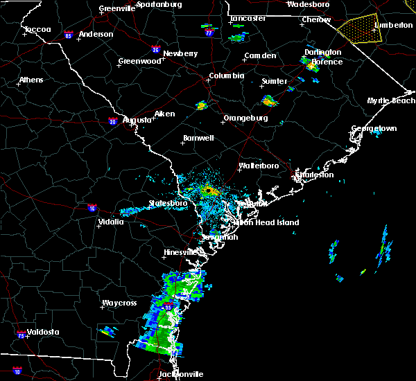 At 854 pm edt, a severe thunderstorm was located near grays, or 7 miles west of yemassee, moving northeast at 35 mph (radar indicated). Hazards include 60 mph wind gusts. Expect damage to roofs. Siding and trees. At 854 pm edt, a severe thunderstorm was located near grays, or 7 miles west of yemassee, moving northeast at 35 mph (radar indicated). Hazards include 60 mph wind gusts. Expect damage to roofs. Siding and trees.
|
| 6/19/2015 4:40 PM EDT |
 At 440 pm edt, a severe thunderstorm was located over gardens corner, or 8 miles southeast of yemassee, moving east at 20 mph (radar indicated). Hazards include 60 mph wind gusts. Expect damage to roofs. siding and trees. Locations impacted include, beaufort and yemassee. At 440 pm edt, a severe thunderstorm was located over gardens corner, or 8 miles southeast of yemassee, moving east at 20 mph (radar indicated). Hazards include 60 mph wind gusts. Expect damage to roofs. siding and trees. Locations impacted include, beaufort and yemassee.
|
| 6/19/2015 4:25 PM EDT |
 At 425 pm edt, a severe thunderstorm was located over sheldon, or 7 miles south of yemassee, moving east at 20 mph (radar indicated). Hazards include 60 mph wind gusts. Expect damage to roofs. siding and trees. Locations impacted include, beaufort and yemassee. At 425 pm edt, a severe thunderstorm was located over sheldon, or 7 miles south of yemassee, moving east at 20 mph (radar indicated). Hazards include 60 mph wind gusts. Expect damage to roofs. siding and trees. Locations impacted include, beaufort and yemassee.
|
| 6/19/2015 4:14 PM EDT |
 At 414 pm edt, a severe thunderstorm was located near pocotaligo, or 7 miles south of yemassee, moving east at 20 mph (radar indicated). Hazards include 60 mph wind gusts and quarter size hail. Hail damage to vehicles is expected. Expect wind damage to roofs, siding and trees. At 414 pm edt, a severe thunderstorm was located near pocotaligo, or 7 miles south of yemassee, moving east at 20 mph (radar indicated). Hazards include 60 mph wind gusts and quarter size hail. Hail damage to vehicles is expected. Expect wind damage to roofs, siding and trees.
|
| 6/9/2015 8:16 PM EDT | Tree down on roadway in area of 300 sheldon church r in beaufort county SC, 3.3 miles NW of Yemassee, SC |
| 6/9/2015 8:07 PM EDT |
 At 807 pm edt, severe thunderstorms were located along a line extending from white hall to folly field, moving northeast at 35 mph (radar indicated). Hazards include 60 mph wind gusts and penny size hail. Expect damage to roofs. Siding and trees. At 807 pm edt, severe thunderstorms were located along a line extending from white hall to folly field, moving northeast at 35 mph (radar indicated). Hazards include 60 mph wind gusts and penny size hail. Expect damage to roofs. Siding and trees.
|
| 5/12/2015 7:32 PM EDT | At 732 pm edt, a severe thunderstorm was located near sheldon, or near yemassee, moving east at 30 mph (radar indicated). Hazards include 60 mph wind gusts and penny size hail. Expect damage to roofs. Siding and trees. |
| 4/19/2015 5:15 PM EDT | At 514 pm edt, severe thunderstorms were located along a line extending from near smoaks to pocotaligo, moving northeast at 40 mph (radar indicated. this line of storms has a history of producing damaging winds). Hazards include 60 mph wind gusts. Expect damage to roofs. Siding and trees. |
| 4/15/2015 3:40 PM EDT | The national weather service in charleston has issued a * severe thunderstorm warning for portions of. colleton county in southeastern south carolina. beaufort county in southeastern south carolina. hampton county in southeastern south carolina. Jasper county in southeastern south carolina. |
| 4/15/2015 3:38 PM EDT | Tree down across pocotaligo rd. time estimated from radar in hampton county SC, 2.2 miles ENE of Yemassee, SC |
| 4/15/2015 3:33 PM EDT | Tree down along interstate 95 near point south. tree took power lines down with it. time estimated from rada in jasper county SC, 4.8 miles NNE of Yemassee, SC |
| 9/17/2014 5:41 PM EDT | Warning point reported tree down on pine level church roa in jasper county SC, 8.4 miles E of Yemassee, SC |
| 7/25/2014 5:19 PM EDT | Tree and powerlines down on highway 17 near william a campbell r in beaufort county SC, 6.5 miles NNW of Yemassee, SC |
| 7/15/2014 5:28 PM EDT | Multiple trees down and some power outage in hampton county SC, 0.6 miles NW of Yemassee, SC |
| 6/5/2014 5:47 PM EDT | Tree and powerline down on grays highway near river hill roa in jasper county SC, 9.7 miles E of Yemassee, SC |
| 5/28/2014 7:06 PM EDT | Quarter sized hail reported 3.2 miles WSW of Yemassee, SC, public reported penny to quarter size hail and several limbs down along highway 21. |
| 5/28/2014 6:15 PM EDT | Half Dollar sized hail reported 3.7 miles SW of Yemassee, SC, fire department reported nickel to half dollar size hail and estimated 50 mph winds. |
| 9/3/2013 9:04 PM EDT | Highway patrol reports tree down on highway 3 near grays highwa in jasper county SC, 9.7 miles E of Yemassee, SC |
| 8/14/2013 4:31 PM EDT | Quarter sized hail reported 5.7 miles SE of Yemassee, SC, emergency manager relayed a report of greater than 1 inch hail in early branch. |
| 4/29/2013 2:25 PM EDT | Quarter sized hail reported 3.9 miles N of Yemassee, SC, nickel to quarter size hail |
| 4/19/2013 5:45 PM EDT | Tree down interstate 95 at combahee roa in colleton county SC, 7 miles SW of Yemassee, SC |
| 4/19/2013 5:40 PM EDT | Tree in roadway at salkehatchie road and castle hall roa in hampton county SC, 0.6 miles NW of Yemassee, SC |
| 4/19/2013 5:34 PM EDT | Tree in roadway at mill pond roa in jasper county SC, 8 miles ENE of Yemassee, SC |
| 3/18/2013 10:46 PM EDT | Tree down between the 4000 and 5000 block of combahee road in colleton county SC, 6.8 miles W of Yemassee, SC |
| 3/18/2013 10:40 PM EDT | Sc highway patrol reports a tree down and in the roadway on lowcountry highway near hw-17 in colleton county SC, 3.7 miles WSW of Yemassee, SC |
| 7/30/2012 4:29 PM EDT | Sc highway patrol reports a tree down and blocking the roadway at mile marker 37 on i-9 in hampton county SC, 1.4 miles ENE of Yemassee, SC |
| 7/30/2012 4:29 PM EDT | Public reported several trees and power lines down on ridgecut rd near yemasse in hampton county SC, 3 miles SE of Yemassee, SC |
| 7/30/2012 4:26 PM EDT | Sc highway patrol reports a tree down and in the roadway on davidson tower road near the intersection with yemassee highwa in hampton county SC, 3.4 miles SE of Yemassee, SC |
| 7/28/2012 5:24 PM EDT | 2 trees were reported down near yemasse in hampton county SC, 0.5 miles NNE of Yemassee, SC |
| 7/24/2012 10:40 PM EDT | Sc highway patrol reports a tree down and in the roadway near the intersection of pocotaligo road and tulifinney roa in hampton county SC, 1.8 miles NE of Yemassee, SC |
| 5/14/2012 4:50 PM EDT | A national weather service employee reported several trees and large limbs blown down along river road. time estimated based on rada in beaufort county SC, 5.4 miles WNW of Yemassee, SC |
| 5/9/2012 3:25 PM EDT | Law enforcement reported one tree down on big estate roa in beaufort county SC, 7.8 miles WNW of Yemassee, SC |
| 1/1/0001 12:00 AM | One tree down on powerline along the intersection of combahee road and hendersonville highwa in colleton county SC, 7.2 miles WSW of Yemassee, SC |
| 1/1/0001 12:00 AM | Trees down at possum corner rd and grays hw in jasper county SC, 8.9 miles ENE of Yemassee, SC |
| 1/1/0001 12:00 AM | Tree down at cat branch rd and pinelevel church r in jasper county SC, 7.8 miles E of Yemassee, SC |
| 1/1/0001 12:00 AM | Tree down on cotton hall road blocking both lanes of traffi in beaufort county SC, 5.3 miles NNW of Yemassee, SC |
| 1/1/0001 12:00 AM | Quarter sized hail reported 9.5 miles ENE of Yemassee, SC, trained spotter reported quarter size hail and 40 mph wind gusts. |
| 1/1/0001 12:00 AM | Trees down at heritage rd and grays hw in jasper county SC, 9.7 miles E of Yemassee, SC |
| 1/1/0001 12:00 AM | Dispatch center reported a tree down near intersection of ficken rd and old salkehatchie r in hampton county SC, 4.2 miles SSE of Yemassee, SC |
| 1/1/0001 12:00 AM | 1 foot diameter tree limb fell on a pickup truck. picture sent in by trained spotte in colleton county SC, 7.7 miles SW of Yemassee, SC |
| 1/1/0001 12:00 AM | Tree debris with large limbs down along exit 41 off interstate 9 in colleton county SC, 6.7 miles SSW of Yemassee, SC |
| 1/1/0001 12:00 AM | Dispatch center reported trees down on bailey r in beaufort county SC, 7.1 miles NNW of Yemassee, SC |
| 1/1/0001 12:00 AM | Dispatch center reported trees down near big estate rd and river r in beaufort county SC, 6.7 miles WNW of Yemassee, SC |
| 1/1/0001 12:00 AM | Dispatch center reported trees down at la creuset rd and river r in beaufort county SC, 1.6 miles WNW of Yemassee, SC |
| 1/1/0001 12:00 AM | Dispatch center reported trees down near old sheldon church and castle hall r in beaufort county SC, 1.5 miles NW of Yemassee, SC |
| 1/1/0001 12:00 AM | County officials relayed numerous reports of trees down. time estimated by rada in jasper county SC, 9.7 miles E of Yemassee, SC |
| 1/1/0001 12:00 AM | Trees down in the community of gray in jasper county SC, 9.7 miles E of Yemassee, SC |
Hail Maps for Yemassee, SC
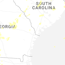
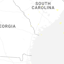
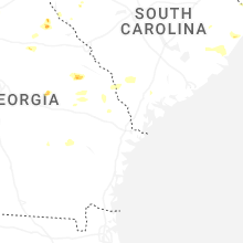


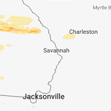


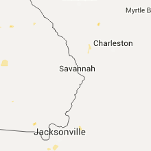


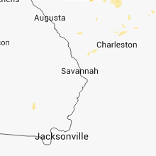


Connect with Interactive Hail Maps