

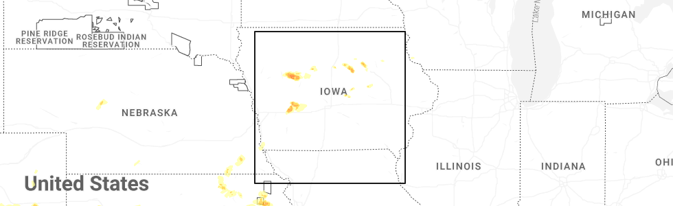
Hail Map for Yetter, IA
The Yetter, IA area has had 0 reports of on-the-ground hail by trained spotters, and has been under severe weather warnings 16 times during the past 12 months. Doppler radar has detected hail at or near Yetter, IA on 60 occasions, including 3 occasions during the past year.
| Name: | Yetter, IA |
| Where Located: | 29.2 miles SE of Storm Lake, IA |
| Map: | Google Map for Yetter, IA |
| Population: | 34 |
| Housing Units: | 20 |
| More Info: | Search Google for Yetter, IA |
4
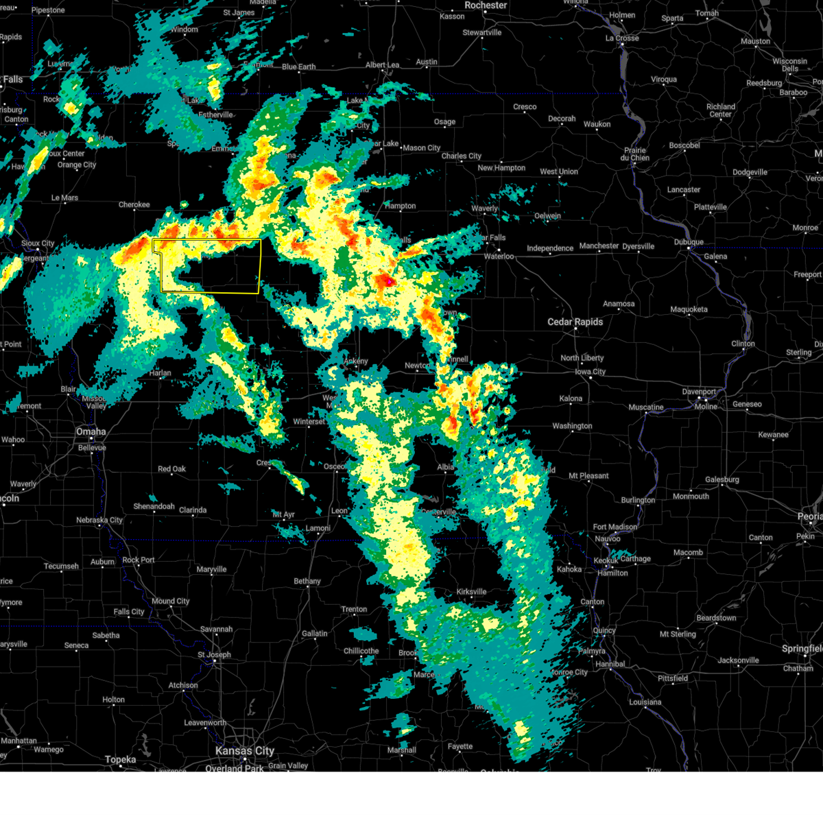
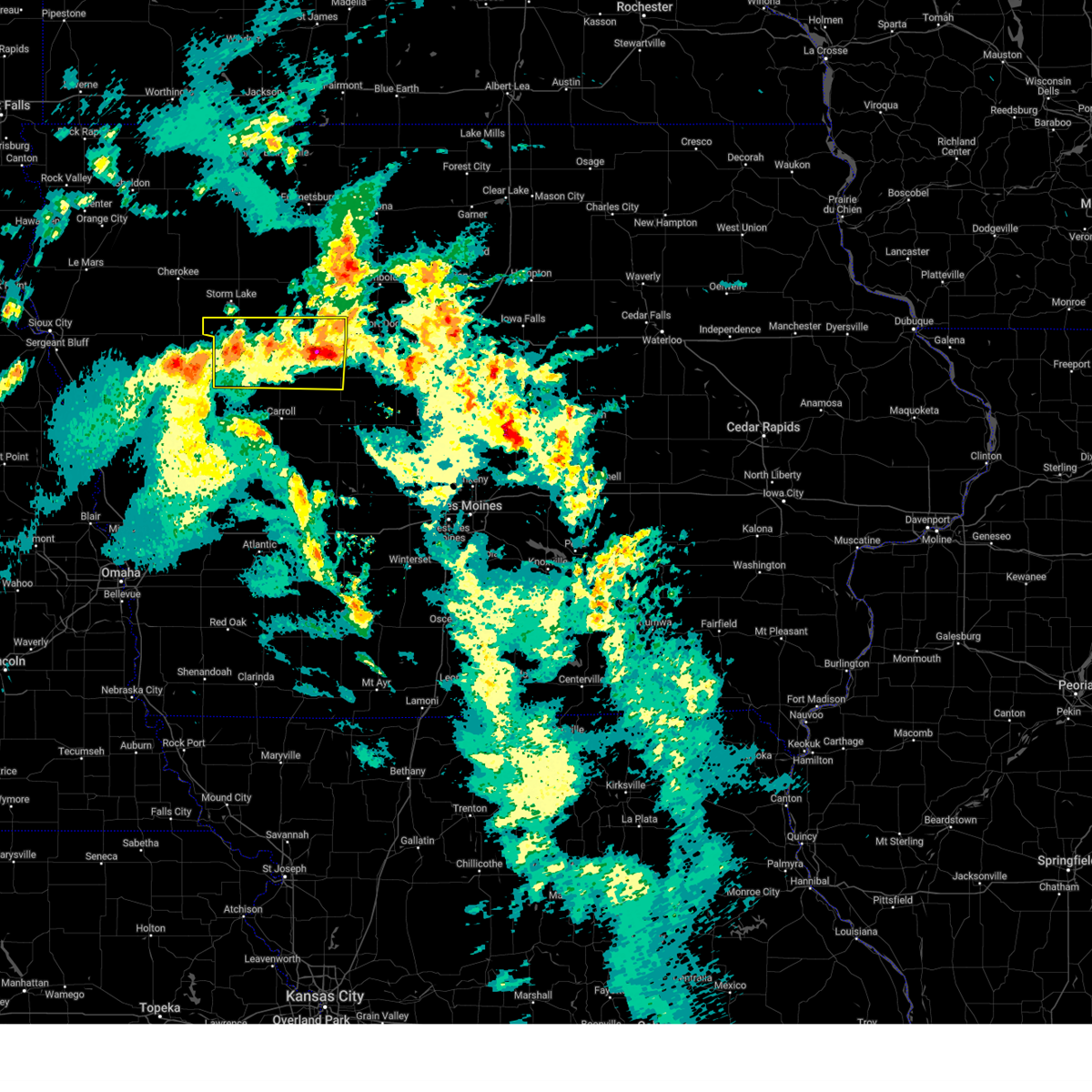
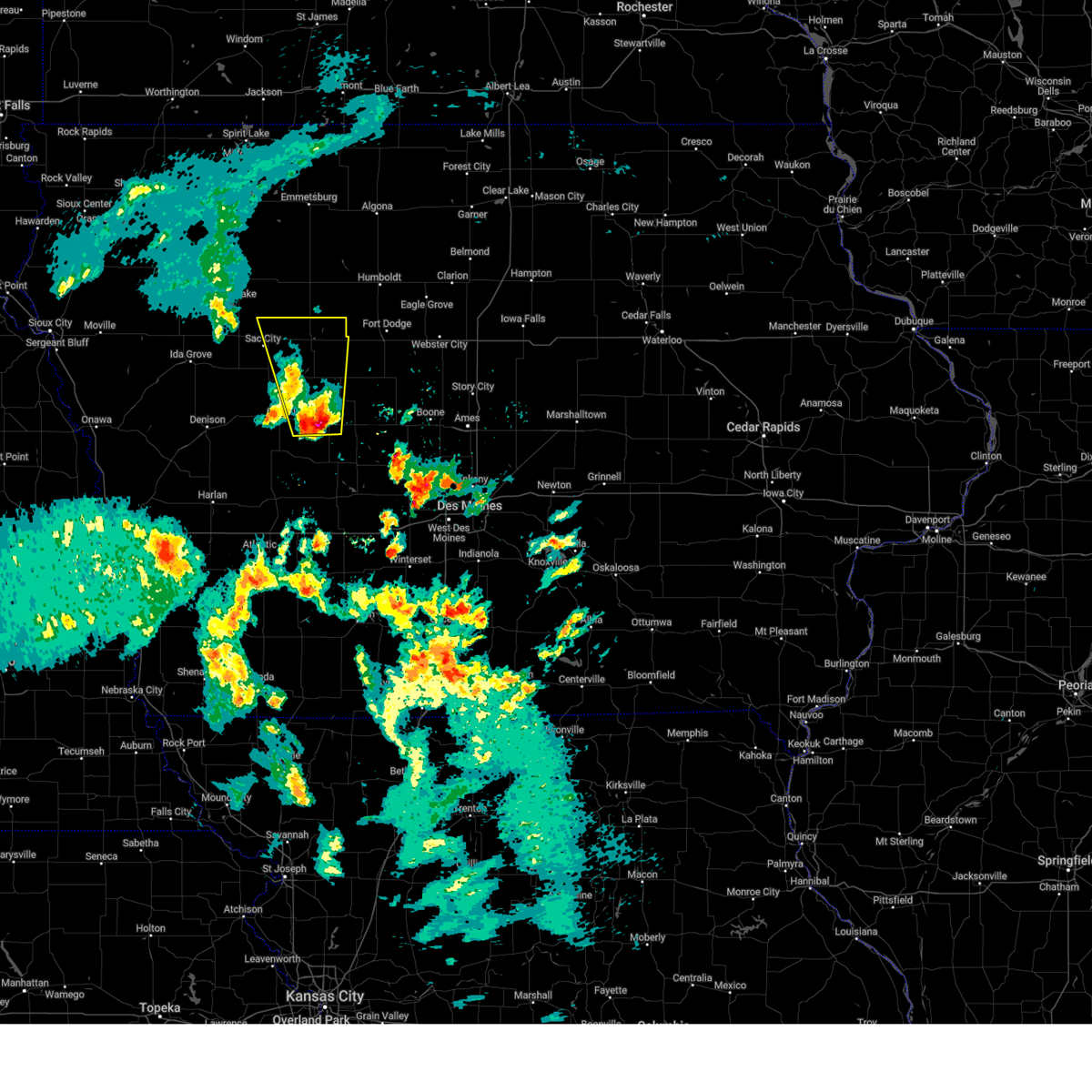
The Top Recent Hail Date for Yetter, IA is Wednesday, April 23, 2025 (2nd out of 60)
Hail and Wind Damage Spotted near Yetter, IA
| Date / Time | Report Details |
|---|---|
| 6/16/2025 6:43 PM CDT | Svrdmx the national weather service in des moines has issued a * severe thunderstorm warning for, eastern sac county in west central iowa, calhoun county in west central iowa, northeastern crawford county in west central iowa, northwestern carroll county in west central iowa, * until 730 pm cdt. * at 643 pm cdt, severe thunderstorms were located along a line extending from near fonda to sac city municipal airport to near kiron, moving east at 45 mph (radar indicated). Hazards include 60 mph wind gusts and nickel size hail. expect damage to roofs, siding, and trees |
| 4/23/2025 8:16 PM CDT |
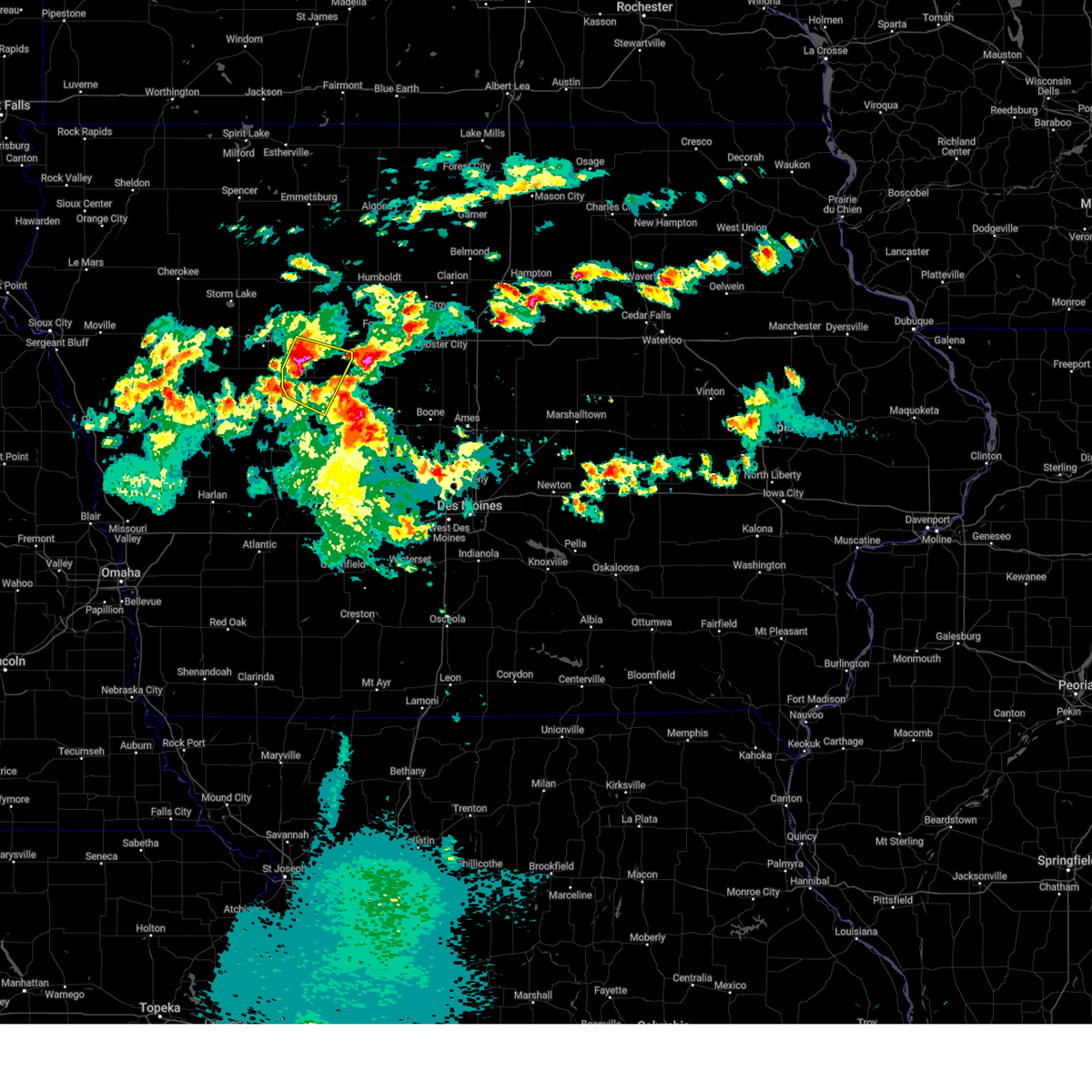 Svrdmx the national weather service in des moines has issued a * severe thunderstorm warning for, northwestern greene county in west central iowa, southern calhoun county in west central iowa, northeastern carroll county in west central iowa, * until 900 pm cdt. * at 815 pm cdt, severe thunderstorms were located along a line extending from rockwell city to near auburn, moving east at 20 mph (radar indicated). Hazards include ping pong ball size hail and 60 mph wind gusts. People and animals outdoors will be injured. expect hail damage to roofs, siding, windows, and vehicles. expect wind damage to roofs, siding, and trees. severe thunderstorms will be near, lake city, rockwell city, lanesboro, hobbs county park and rockwell city municipal airport around 820 pm cdt. lohrville and rinard around 830 pm cdt. Somers around 835 pm cdt. Svrdmx the national weather service in des moines has issued a * severe thunderstorm warning for, northwestern greene county in west central iowa, southern calhoun county in west central iowa, northeastern carroll county in west central iowa, * until 900 pm cdt. * at 815 pm cdt, severe thunderstorms were located along a line extending from rockwell city to near auburn, moving east at 20 mph (radar indicated). Hazards include ping pong ball size hail and 60 mph wind gusts. People and animals outdoors will be injured. expect hail damage to roofs, siding, windows, and vehicles. expect wind damage to roofs, siding, and trees. severe thunderstorms will be near, lake city, rockwell city, lanesboro, hobbs county park and rockwell city municipal airport around 820 pm cdt. lohrville and rinard around 830 pm cdt. Somers around 835 pm cdt.
|
| 4/23/2025 7:54 PM CDT |
 At 754 pm cdt, a severe thunderstorm was located near yetter, or 8 miles southeast of sac city, moving east at 20 mph (radar indicated). Hazards include ping pong ball size hail and 60 mph wind gusts. People and animals outdoors will be injured. expect hail damage to roofs, siding, windows, and vehicles. expect wind damage to roofs, siding, and trees. This severe storm will be near, lake city and yetter around 800 pm cdt. At 754 pm cdt, a severe thunderstorm was located near yetter, or 8 miles southeast of sac city, moving east at 20 mph (radar indicated). Hazards include ping pong ball size hail and 60 mph wind gusts. People and animals outdoors will be injured. expect hail damage to roofs, siding, windows, and vehicles. expect wind damage to roofs, siding, and trees. This severe storm will be near, lake city and yetter around 800 pm cdt.
|
| 4/23/2025 7:43 PM CDT |
 Svrdmx the national weather service in des moines has issued a * severe thunderstorm warning for, southeastern sac county in west central iowa, western calhoun county in west central iowa, * until 830 pm cdt. * at 743 pm cdt, a severe thunderstorm was located over sac city municipal airport, or near sac city, moving east at 15 mph (radar indicated). Hazards include 60 mph wind gusts and quarter size hail. Hail damage to vehicles is expected. expect wind damage to roofs, siding, and trees. this severe thunderstorm will be near, yetter and lytton around 750 pm cdt. Other locations in the path of this severe thunderstorm include jolley and lake city. Svrdmx the national weather service in des moines has issued a * severe thunderstorm warning for, southeastern sac county in west central iowa, western calhoun county in west central iowa, * until 830 pm cdt. * at 743 pm cdt, a severe thunderstorm was located over sac city municipal airport, or near sac city, moving east at 15 mph (radar indicated). Hazards include 60 mph wind gusts and quarter size hail. Hail damage to vehicles is expected. expect wind damage to roofs, siding, and trees. this severe thunderstorm will be near, yetter and lytton around 750 pm cdt. Other locations in the path of this severe thunderstorm include jolley and lake city.
|
| 3/14/2025 6:44 PM CDT |
 The storms which prompted the warning have moved out of the area. therefore, the warning will be allowed to expire. however, gusty winds are still possible. a severe thunderstorm watch remains in effect until 1000 pm cdt for central, northwestern and west central iowa. The storms which prompted the warning have moved out of the area. therefore, the warning will be allowed to expire. however, gusty winds are still possible. a severe thunderstorm watch remains in effect until 1000 pm cdt for central, northwestern and west central iowa.
|
| 3/14/2025 6:29 PM CDT |
 At 627 pm cdt, severe thunderstorms were located along a line extending from near cushing to near knierim, moving north at 45 mph (radar indicated). Hazards include 60 mph wind gusts and nickel size hail. Expect damage to roofs, siding, and trees. Locations impacted include, wall lake, lytton, lake city, sac city, twin lakes state park, knierim, rockwell city municipal airport, pomeroy, odebolt, blackhawk lake state park, jolley, black hawk lake, north twin lake, wall lake municipal airport, rinard, schaller, south twin lake, twin lakes, sac city municipal airport, and auburn. At 627 pm cdt, severe thunderstorms were located along a line extending from near cushing to near knierim, moving north at 45 mph (radar indicated). Hazards include 60 mph wind gusts and nickel size hail. Expect damage to roofs, siding, and trees. Locations impacted include, wall lake, lytton, lake city, sac city, twin lakes state park, knierim, rockwell city municipal airport, pomeroy, odebolt, blackhawk lake state park, jolley, black hawk lake, north twin lake, wall lake municipal airport, rinard, schaller, south twin lake, twin lakes, sac city municipal airport, and auburn.
|
| 3/14/2025 6:29 PM CDT |
 the severe thunderstorm warning has been cancelled and is no longer in effect the severe thunderstorm warning has been cancelled and is no longer in effect
|
| 3/14/2025 6:04 PM CDT |
 Svrdmx the national weather service in des moines has issued a * severe thunderstorm warning for, western greene county in west central iowa, sac county in west central iowa, calhoun county in west central iowa, crawford county in west central iowa, carroll county in west central iowa, * until 645 pm cdt. * at 603 pm cdt, severe thunderstorms were located along a line extending from near ute to 4 miles northeast of scranton, moving north at 50 mph (radar indicated). Hazards include 60 mph wind gusts and nickel size hail. expect damage to roofs, siding, and trees Svrdmx the national weather service in des moines has issued a * severe thunderstorm warning for, western greene county in west central iowa, sac county in west central iowa, calhoun county in west central iowa, crawford county in west central iowa, carroll county in west central iowa, * until 645 pm cdt. * at 603 pm cdt, severe thunderstorms were located along a line extending from near ute to 4 miles northeast of scranton, moving north at 50 mph (radar indicated). Hazards include 60 mph wind gusts and nickel size hail. expect damage to roofs, siding, and trees
|
| 3/14/2025 5:33 PM CDT |
 At 533 pm cdt, a severe thunderstorm was located near lohrville, or 6 miles south of rockwell city, moving north at 50 mph (radar indicated). Hazards include 60 mph wind gusts and quarter size hail. Hail damage to vehicles is expected. expect wind damage to roofs, siding, and trees. Locations impacted include, hobbs county park, lytton, south twin lake, somers, twin lakes, lake city, twin lakes state park, knierim, rockwell city municipal airport, pomeroy, jolley, rockwell city, churdan, lohrville, north twin lake, rinard, manson, scranton, yetter, and lanesboro. At 533 pm cdt, a severe thunderstorm was located near lohrville, or 6 miles south of rockwell city, moving north at 50 mph (radar indicated). Hazards include 60 mph wind gusts and quarter size hail. Hail damage to vehicles is expected. expect wind damage to roofs, siding, and trees. Locations impacted include, hobbs county park, lytton, south twin lake, somers, twin lakes, lake city, twin lakes state park, knierim, rockwell city municipal airport, pomeroy, jolley, rockwell city, churdan, lohrville, north twin lake, rinard, manson, scranton, yetter, and lanesboro.
|
| 3/14/2025 5:12 PM CDT |
 Svrdmx the national weather service in des moines has issued a * severe thunderstorm warning for, northwestern greene county in west central iowa, eastern sac county in west central iowa, calhoun county in west central iowa, northeastern carroll county in west central iowa, * until 600 pm cdt. * at 511 pm cdt, a severe thunderstorm was located near ralston, or 12 miles east of carroll, moving north at 50 mph (radar indicated). Hazards include 60 mph wind gusts and quarter size hail. Hail damage to vehicles is expected. Expect wind damage to roofs, siding, and trees. Svrdmx the national weather service in des moines has issued a * severe thunderstorm warning for, northwestern greene county in west central iowa, eastern sac county in west central iowa, calhoun county in west central iowa, northeastern carroll county in west central iowa, * until 600 pm cdt. * at 511 pm cdt, a severe thunderstorm was located near ralston, or 12 miles east of carroll, moving north at 50 mph (radar indicated). Hazards include 60 mph wind gusts and quarter size hail. Hail damage to vehicles is expected. Expect wind damage to roofs, siding, and trees.
|
| 7/30/2024 1:34 AM CDT | At 133 am cdt, severe thunderstorms were located along a line extending from 4 miles northeast of manson to somers to 5 miles east of churdan to near jefferson municipal airport to near bagley, moving east at 65 mph (public. at 127 am, a wind gust of 60 mph was reported 2 miles south of willey from a personal weather station). Hazards include 60 mph wind gusts. Expect damage to roofs, siding, and trees. Locations impacted include, fort dodge, gowrie, fort dodge regional airport, grand junction, callender, harcourt, rippey, paton, dayton, coalville, otho, lehigh, woodman hollow state park, dolliver memorial state park, stratford, duncombe and brushy creek st recreation area. |
| 7/30/2024 1:03 AM CDT | Svrdmx the national weather service in des moines has issued a * severe thunderstorm warning for, greene county in west central iowa, webster county in central iowa, southern pocahontas county in northwestern iowa, eastern sac county in west central iowa, calhoun county in west central iowa, southern humboldt county in north central iowa, carroll county in west central iowa, * until 145 am cdt. * at 103 am cdt, severe thunderstorms were located along a line extending from 5 miles northwest of newell to 4 miles north of sac city to near auburn to 4 miles west of carroll to near templeton, moving east at 65 mph (radar indicated). Hazards include 60 mph wind gusts. Expect damage to roofs, siding, and trees. severe thunderstorms will be near, carroll, lake city, glidden, fonda, auburn, lytton, dedham and lidderdale around 110 am cdt. rockwell city, coon rapids, south twin lake, north twin lake, pomeroy, twin lakes, ralston and twin lakes state park around 115 am cdt. manson, scranton, churdan, lohrville, palmer and rinard around 120 am cdt. Other locations in the path of these severe thunderstorms include jefferson, farnhamville, somers, knierim, gowrie, barnum, jefferson municipal airport, grand junction, callender, rippey, paton, moorland, clare and dana. |
| 7/15/2024 4:42 PM CDT | the severe thunderstorm warning has been cancelled and is no longer in effect |
| 7/15/2024 4:42 PM CDT | At 442 pm cdt, a severe thunderstorm was located over lidderdale, or 6 miles northeast of carroll, moving southeast at 40 mph (radar indicated). Hazards include 60 mph wind gusts and quarter size hail. Hail damage to vehicles is expected. expect wind damage to roofs, siding, and trees. Locations impacted include, lake city, lake view, black hawk lake, wall lake, arcadia, breda, auburn, lidderdale, lanesboro, yetter, hobbs county park, and blackhawk lake state park. |
| 7/15/2024 4:32 PM CDT | At 432 pm cdt, a severe thunderstorm was located over breda, or 10 miles north of carroll, moving southeast at 35 mph (radar indicated). Hazards include 70 mph wind gusts and quarter size hail. Hail damage to vehicles is expected. expect considerable tree damage. wind damage is also likely to mobile homes, roofs, and outbuildings. Locations impacted include, lake city, lake view, black hawk lake, wall lake, arcadia, breda, lohrville, auburn, westside, lidderdale, lanesboro, yetter, hobbs county park, blackhawk lake state park, and wall lake municipal airport. |
| 7/15/2024 4:14 PM CDT | Svrdmx the national weather service in des moines has issued a * severe thunderstorm warning for, southern sac county in west central iowa, southwestern calhoun county in west central iowa, northeastern crawford county in west central iowa, northern carroll county in west central iowa, * until 500 pm cdt. * at 413 pm cdt, a severe thunderstorm was located over wall lake, or 12 miles southwest of sac city, moving southeast at 35 mph (radar indicated. at 410 pm cdt wind damage was reported in odebolt). Hazards include 70 mph wind gusts and half dollar size hail. Hail damage to vehicles is expected. expect considerable tree damage. Wind damage is also likely to mobile homes, roofs, and outbuildings. |
| 5/24/2024 4:24 AM CDT |
 the severe thunderstorm warning has been cancelled and is no longer in effect the severe thunderstorm warning has been cancelled and is no longer in effect
|
| 5/24/2024 4:24 AM CDT |
 At 423 am cdt, severe thunderstorms were located along a line extending from near manson to dana to near linden to 4 miles north of macksburg, moving east at 55 mph (radar indicated). Hazards include 60 mph wind gusts and penny size hail. Expect damage to roofs, siding, and trees. locations impacted include, west des moines, fort dodge, waukee, boone, creston, perry, winterset, jefferson, adel, greenfield, rockwell city, guthrie center, dakota city, humboldt, ogden, lake city, manson, stuart, dallas center, and earlham. This includes interstate 80 between mile markers 80 and 117. At 423 am cdt, severe thunderstorms were located along a line extending from near manson to dana to near linden to 4 miles north of macksburg, moving east at 55 mph (radar indicated). Hazards include 60 mph wind gusts and penny size hail. Expect damage to roofs, siding, and trees. locations impacted include, west des moines, fort dodge, waukee, boone, creston, perry, winterset, jefferson, adel, greenfield, rockwell city, guthrie center, dakota city, humboldt, ogden, lake city, manson, stuart, dallas center, and earlham. This includes interstate 80 between mile markers 80 and 117.
|
| 5/24/2024 3:56 AM CDT |
 Svrdmx the national weather service in des moines has issued a * severe thunderstorm warning for, madison county in south central iowa, webster county in central iowa, southeastern pocahontas county in northwestern iowa, eastern audubon county in west central iowa, southeastern sac county in west central iowa, western boone county in central iowa, adair county in southwestern iowa, greene county in west central iowa, eastern cass county in southwestern iowa, union county in south central iowa, guthrie county in west central iowa, adams county in southwestern iowa, calhoun county in west central iowa, south central humboldt county in north central iowa, northeastern taylor county in southwestern iowa, eastern carroll county in west central iowa, western clarke county in south central iowa, dallas county in central iowa, * until 445 am cdt. * at 355 am cdt, severe thunderstorms were located along a line extending from near sac city municipal airport to 4 miles southwest of ralston to 4 miles north of adair to 6 miles southeast of bridgewater, moving east at 55 mph (personal weather station near audubon reported 62 mph wind gust at 339 am). Hazards include 60 mph wind gusts and quarter size hail. Hail damage to vehicles is expected. Expect wind damage to roofs, siding, and trees. Svrdmx the national weather service in des moines has issued a * severe thunderstorm warning for, madison county in south central iowa, webster county in central iowa, southeastern pocahontas county in northwestern iowa, eastern audubon county in west central iowa, southeastern sac county in west central iowa, western boone county in central iowa, adair county in southwestern iowa, greene county in west central iowa, eastern cass county in southwestern iowa, union county in south central iowa, guthrie county in west central iowa, adams county in southwestern iowa, calhoun county in west central iowa, south central humboldt county in north central iowa, northeastern taylor county in southwestern iowa, eastern carroll county in west central iowa, western clarke county in south central iowa, dallas county in central iowa, * until 445 am cdt. * at 355 am cdt, severe thunderstorms were located along a line extending from near sac city municipal airport to 4 miles southwest of ralston to 4 miles north of adair to 6 miles southeast of bridgewater, moving east at 55 mph (personal weather station near audubon reported 62 mph wind gust at 339 am). Hazards include 60 mph wind gusts and quarter size hail. Hail damage to vehicles is expected. Expect wind damage to roofs, siding, and trees.
|
| 5/24/2024 3:36 AM CDT |
 At 336 am cdt, severe thunderstorms were located along a line extending from 5 miles northwest of lake view to 4 miles northeast of aspinwall to 5 miles south of lake anita state park, moving east at 50 mph (radar indicated). Hazards include 70 mph wind gusts and quarter size hail. Hail damage to vehicles is expected. expect considerable tree damage. wind damage is also likely to mobile homes, roofs, and outbuildings. locations impacted include, carroll, denison, creston, atlantic, sac city, audubon, greenfield, rockwell city, corning, guthrie center, lake city, manning, lenox, coon rapids, glidden, lake view, griswold, odebolt, black hawk lake, and north twin lake. This includes interstate 80 between mile markers 50 and 87. At 336 am cdt, severe thunderstorms were located along a line extending from 5 miles northwest of lake view to 4 miles northeast of aspinwall to 5 miles south of lake anita state park, moving east at 50 mph (radar indicated). Hazards include 70 mph wind gusts and quarter size hail. Hail damage to vehicles is expected. expect considerable tree damage. wind damage is also likely to mobile homes, roofs, and outbuildings. locations impacted include, carroll, denison, creston, atlantic, sac city, audubon, greenfield, rockwell city, corning, guthrie center, lake city, manning, lenox, coon rapids, glidden, lake view, griswold, odebolt, black hawk lake, and north twin lake. This includes interstate 80 between mile markers 50 and 87.
|
| 5/24/2024 3:07 AM CDT |
 Svrdmx the national weather service in des moines has issued a * severe thunderstorm warning for, western greene county in west central iowa, cass county in southwestern iowa, western union county in south central iowa, guthrie county in west central iowa, audubon county in west central iowa, sac county in west central iowa, adams county in southwestern iowa, calhoun county in west central iowa, crawford county in west central iowa, northern taylor county in southwestern iowa, carroll county in west central iowa, adair county in southwestern iowa, * until 400 am cdt. * at 307 am cdt, severe thunderstorms were located along a line extending from 4 miles south of battle creek to dunlap to farm creek public wildlife area, moving east at 85 mph (radar indicated). Hazards include 70 mph wind gusts and quarter size hail. Hail damage to vehicles is expected. expect considerable tree damage. Wind damage is also likely to mobile homes, roofs, and outbuildings. Svrdmx the national weather service in des moines has issued a * severe thunderstorm warning for, western greene county in west central iowa, cass county in southwestern iowa, western union county in south central iowa, guthrie county in west central iowa, audubon county in west central iowa, sac county in west central iowa, adams county in southwestern iowa, calhoun county in west central iowa, crawford county in west central iowa, northern taylor county in southwestern iowa, carroll county in west central iowa, adair county in southwestern iowa, * until 400 am cdt. * at 307 am cdt, severe thunderstorms were located along a line extending from 4 miles south of battle creek to dunlap to farm creek public wildlife area, moving east at 85 mph (radar indicated). Hazards include 70 mph wind gusts and quarter size hail. Hail damage to vehicles is expected. expect considerable tree damage. Wind damage is also likely to mobile homes, roofs, and outbuildings.
|
| 5/21/2024 3:06 PM CDT |
 At 304 pm cdt, severe thunderstorms were located along a line extending from near auburn to near dedham, moving northeast at 65 mph (radar indicated). Hazards include 60 mph wind gusts and quarter size hail. Hail damage to vehicles is expected. expect wind damage to roofs, siding, and trees. Locations impacted include, carroll, lake city, manning, glidden, arcadia, breda, templeton, auburn, westside, dedham, halbur, lidderdale, lanesboro, willey, ralston, gray, aspinwall, yetter, hobbs county park, and arthur n neu airport. At 304 pm cdt, severe thunderstorms were located along a line extending from near auburn to near dedham, moving northeast at 65 mph (radar indicated). Hazards include 60 mph wind gusts and quarter size hail. Hail damage to vehicles is expected. expect wind damage to roofs, siding, and trees. Locations impacted include, carroll, lake city, manning, glidden, arcadia, breda, templeton, auburn, westside, dedham, halbur, lidderdale, lanesboro, willey, ralston, gray, aspinwall, yetter, hobbs county park, and arthur n neu airport.
|
| 5/21/2024 2:52 PM CDT |
 At 251 pm cdt, severe thunderstorms were located along a line extending from lake view to gray, moving northeast at 60 mph (radar indicated). Hazards include 60 mph wind gusts and quarter size hail. Hail damage to vehicles is expected. expect wind damage to roofs, siding, and trees. Locations impacted include, carroll, lake city, manning, glidden, lake view, black hawk lake, wall lake, manilla, arcadia, breda, vail, templeton, auburn, lytton, westside, dedham, halbur, lidderdale, lanesboro, and willey. At 251 pm cdt, severe thunderstorms were located along a line extending from lake view to gray, moving northeast at 60 mph (radar indicated). Hazards include 60 mph wind gusts and quarter size hail. Hail damage to vehicles is expected. expect wind damage to roofs, siding, and trees. Locations impacted include, carroll, lake city, manning, glidden, lake view, black hawk lake, wall lake, manilla, arcadia, breda, vail, templeton, auburn, lytton, westside, dedham, halbur, lidderdale, lanesboro, and willey.
|
| 5/21/2024 2:30 PM CDT |
 Svrdmx the national weather service in des moines has issued a * severe thunderstorm warning for, northwestern audubon county in west central iowa, southeastern sac county in west central iowa, western calhoun county in west central iowa, eastern crawford county in west central iowa, carroll county in west central iowa, * until 315 pm cdt. * at 230 pm cdt, severe thunderstorms were located along a line extending from near deloit to prairie rose state park, moving northeast at 60 mph (radar indicated). Hazards include 60 mph wind gusts and half dollar size hail. Hail damage to vehicles is expected. Expect wind damage to roofs, siding, and trees. Svrdmx the national weather service in des moines has issued a * severe thunderstorm warning for, northwestern audubon county in west central iowa, southeastern sac county in west central iowa, western calhoun county in west central iowa, eastern crawford county in west central iowa, carroll county in west central iowa, * until 315 pm cdt. * at 230 pm cdt, severe thunderstorms were located along a line extending from near deloit to prairie rose state park, moving northeast at 60 mph (radar indicated). Hazards include 60 mph wind gusts and half dollar size hail. Hail damage to vehicles is expected. Expect wind damage to roofs, siding, and trees.
|
| 5/20/2024 11:58 PM CDT |
 Svrdmx the national weather service in des moines has issued a * severe thunderstorm warning for, greene county in west central iowa, southwestern webster county in central iowa, northeastern guthrie county in west central iowa, southeastern sac county in west central iowa, southern calhoun county in west central iowa, boone county in central iowa, carroll county in west central iowa, northwestern dallas county in central iowa, * until 1245 am cdt. * at 1158 pm cdt, severe thunderstorms were located along a line extending from arcadia to 6 miles northwest of adel, moving northeast at 20 mph (radar indicated). Hazards include 60 mph wind gusts and quarter size hail. Hail damage to vehicles is expected. Expect wind damage to roofs, siding, and trees. Svrdmx the national weather service in des moines has issued a * severe thunderstorm warning for, greene county in west central iowa, southwestern webster county in central iowa, northeastern guthrie county in west central iowa, southeastern sac county in west central iowa, southern calhoun county in west central iowa, boone county in central iowa, carroll county in west central iowa, northwestern dallas county in central iowa, * until 1245 am cdt. * at 1158 pm cdt, severe thunderstorms were located along a line extending from arcadia to 6 miles northwest of adel, moving northeast at 20 mph (radar indicated). Hazards include 60 mph wind gusts and quarter size hail. Hail damage to vehicles is expected. Expect wind damage to roofs, siding, and trees.
|
| 5/6/2024 10:38 PM CDT |
 At 1037 pm cdt, severe thunderstorms were located along a line extending from varina to lake city to 4 miles southwest of scranton, moving northeast at 50 mph (radar indicated). Hazards include 70 mph wind gusts and nickel size hail. Expect considerable tree damage. damage is likely to mobile homes, roofs, and outbuildings. Locations impacted include, jefferson, sac city, pocahontas, rockwell city, lake city, manson, coon rapids, laurens, glidden, gowrie, north twin lake, south twin lake, grand junction, pomeroy, fonda, rolfe, scranton, gilmore city, churdan, and callender. At 1037 pm cdt, severe thunderstorms were located along a line extending from varina to lake city to 4 miles southwest of scranton, moving northeast at 50 mph (radar indicated). Hazards include 70 mph wind gusts and nickel size hail. Expect considerable tree damage. damage is likely to mobile homes, roofs, and outbuildings. Locations impacted include, jefferson, sac city, pocahontas, rockwell city, lake city, manson, coon rapids, laurens, glidden, gowrie, north twin lake, south twin lake, grand junction, pomeroy, fonda, rolfe, scranton, gilmore city, churdan, and callender.
|
| 5/6/2024 10:38 PM CDT |
 the severe thunderstorm warning has been cancelled and is no longer in effect the severe thunderstorm warning has been cancelled and is no longer in effect
|
| 5/6/2024 10:14 PM CDT |
 Svrdmx the national weather service in des moines has issued a * severe thunderstorm warning for, greene county in west central iowa, western webster county in central iowa, pocahontas county in northwestern iowa, sac county in west central iowa, calhoun county in west central iowa, western humboldt county in north central iowa, northeastern crawford county in west central iowa, carroll county in west central iowa, * until 1115 pm cdt. * at 1013 pm cdt, severe thunderstorms were located along a line extending from 4 miles east of schaller to near arcadia to near gray, moving northeast at 50 mph (radar indicated). Hazards include 70 mph wind gusts and nickel size hail. Expect considerable tree damage. Damage is likely to mobile homes, roofs, and outbuildings. Svrdmx the national weather service in des moines has issued a * severe thunderstorm warning for, greene county in west central iowa, western webster county in central iowa, pocahontas county in northwestern iowa, sac county in west central iowa, calhoun county in west central iowa, western humboldt county in north central iowa, northeastern crawford county in west central iowa, carroll county in west central iowa, * until 1115 pm cdt. * at 1013 pm cdt, severe thunderstorms were located along a line extending from 4 miles east of schaller to near arcadia to near gray, moving northeast at 50 mph (radar indicated). Hazards include 70 mph wind gusts and nickel size hail. Expect considerable tree damage. Damage is likely to mobile homes, roofs, and outbuildings.
|
| 5/6/2024 10:03 PM CDT |
 At 1003 pm cdt, severe thunderstorms were located along a line extending from near galva to 5 miles southeast of odebolt to near westside, moving north at 80 mph (radar indicated). Hazards include 70 mph wind gusts and nickel size hail. Expect considerable tree damage. damage is likely to mobile homes, roofs, and outbuildings. Locations impacted include, carroll, sac city, lake city, manning, coon rapids, glidden, lake view, odebolt, black hawk lake, wall lake, schaller, scranton, early, arcadia, breda, vail, churdan, lohrville, templeton, and auburn. At 1003 pm cdt, severe thunderstorms were located along a line extending from near galva to 5 miles southeast of odebolt to near westside, moving north at 80 mph (radar indicated). Hazards include 70 mph wind gusts and nickel size hail. Expect considerable tree damage. damage is likely to mobile homes, roofs, and outbuildings. Locations impacted include, carroll, sac city, lake city, manning, coon rapids, glidden, lake view, odebolt, black hawk lake, wall lake, schaller, scranton, early, arcadia, breda, vail, churdan, lohrville, templeton, and auburn.
|
| 5/6/2024 9:35 PM CDT |
 Svrdmx the national weather service in des moines has issued a * severe thunderstorm warning for, western greene county in west central iowa, sac county in west central iowa, southwestern calhoun county in west central iowa, crawford county in west central iowa, carroll county in west central iowa, * until 1015 pm cdt. * at 934 pm cdt, severe thunderstorms were located along a line extending from 5 miles south of charter oak to westphalia to near walnut, moving north at 80 mph (radar indicated). Hazards include 70 mph wind gusts and nickel size hail. Expect considerable tree damage. Damage is likely to mobile homes, roofs, and outbuildings. Svrdmx the national weather service in des moines has issued a * severe thunderstorm warning for, western greene county in west central iowa, sac county in west central iowa, southwestern calhoun county in west central iowa, crawford county in west central iowa, carroll county in west central iowa, * until 1015 pm cdt. * at 934 pm cdt, severe thunderstorms were located along a line extending from 5 miles south of charter oak to westphalia to near walnut, moving north at 80 mph (radar indicated). Hazards include 70 mph wind gusts and nickel size hail. Expect considerable tree damage. Damage is likely to mobile homes, roofs, and outbuildings.
|
| 4/26/2024 8:08 PM CDT |
 The storms which prompted the warning have weakened below severe limits, and no longer pose an immediate threat to life or property. therefore, the warning will be allowed to expire. however, small hail and gusty winds are still possible with these thunderstorms. a tornado watch remains in effect until midnight cdt for west central iowa. The storms which prompted the warning have weakened below severe limits, and no longer pose an immediate threat to life or property. therefore, the warning will be allowed to expire. however, small hail and gusty winds are still possible with these thunderstorms. a tornado watch remains in effect until midnight cdt for west central iowa.
|
| 4/26/2024 7:46 PM CDT |
 At 745 pm cdt, severe thunderstorms were located along a line extending from near fonda to near lake city to near gray, moving northeast at 40 mph (radar indicated). Hazards include 60 mph wind gusts and quarter size hail. Hail damage to vehicles is expected. expect wind damage to roofs, siding, and trees. Locations impacted include, carroll, sac city, pocahontas, rockwell city, lake city, manson, manning, glidden, lake view, black hawk lake, north twin lake, south twin lake, wall lake, pomeroy, fonda, rolfe, arcadia, breda, callender, and farnhamville. At 745 pm cdt, severe thunderstorms were located along a line extending from near fonda to near lake city to near gray, moving northeast at 40 mph (radar indicated). Hazards include 60 mph wind gusts and quarter size hail. Hail damage to vehicles is expected. expect wind damage to roofs, siding, and trees. Locations impacted include, carroll, sac city, pocahontas, rockwell city, lake city, manson, manning, glidden, lake view, black hawk lake, north twin lake, south twin lake, wall lake, pomeroy, fonda, rolfe, arcadia, breda, callender, and farnhamville.
|
| 4/26/2024 7:25 PM CDT |
 Svrdmx the national weather service in des moines has issued a * severe thunderstorm warning for, northwestern greene county in west central iowa, northwestern webster county in central iowa, pocahontas county in northwestern iowa, northwestern audubon county in west central iowa, sac county in west central iowa, calhoun county in west central iowa, eastern crawford county in west central iowa, carroll county in west central iowa, * until 815 pm cdt. * at 725 pm cdt, severe thunderstorms were located along a line extending from near newell to near auburn to manning municipal airport, moving northeast at 60 mph (radar indicated). Hazards include 60 mph wind gusts and quarter size hail. Hail damage to vehicles is expected. Expect wind damage to roofs, siding, and trees. Svrdmx the national weather service in des moines has issued a * severe thunderstorm warning for, northwestern greene county in west central iowa, northwestern webster county in central iowa, pocahontas county in northwestern iowa, northwestern audubon county in west central iowa, sac county in west central iowa, calhoun county in west central iowa, eastern crawford county in west central iowa, carroll county in west central iowa, * until 815 pm cdt. * at 725 pm cdt, severe thunderstorms were located along a line extending from near newell to near auburn to manning municipal airport, moving northeast at 60 mph (radar indicated). Hazards include 60 mph wind gusts and quarter size hail. Hail damage to vehicles is expected. Expect wind damage to roofs, siding, and trees.
|
| 9/23/2023 1:11 PM CDT |
 At 110 pm cdt, severe thunderstorms were located along a line extending from near palmer to near rockwell city municipal airport to near willey, moving northeast at 35 mph (radar indicated). Hazards include 60 mph wind gusts and quarter size hail. Hail damage to vehicles is expected. expect wind damage to roofs, siding, and trees. locations impacted include, carroll, rockwell city, lake city, manson, coon rapids, glidden, north twin lake, south twin lake, pomeroy, fonda, gilmore city, lohrville, templeton, twin lakes, auburn, lytton, dedham, lidderdale, palmer, and lanesboro. hail threat, observed max hail size, 1. 00 in wind threat, radar indicated max wind gust, 60 mph. At 110 pm cdt, severe thunderstorms were located along a line extending from near palmer to near rockwell city municipal airport to near willey, moving northeast at 35 mph (radar indicated). Hazards include 60 mph wind gusts and quarter size hail. Hail damage to vehicles is expected. expect wind damage to roofs, siding, and trees. locations impacted include, carroll, rockwell city, lake city, manson, coon rapids, glidden, north twin lake, south twin lake, pomeroy, fonda, gilmore city, lohrville, templeton, twin lakes, auburn, lytton, dedham, lidderdale, palmer, and lanesboro. hail threat, observed max hail size, 1. 00 in wind threat, radar indicated max wind gust, 60 mph.
|
| 9/23/2023 12:51 PM CDT |
 At 1251 pm cdt, severe thunderstorms were located along a line extending from fonda to near lake city to near templeton, moving northeast at 35 mph (public). Hazards include 60 mph wind gusts and quarter size hail. Hail damage to vehicles is expected. expect wind damage to roofs, siding, and trees. locations impacted include, carroll, sac city, rockwell city, lake city, manson, manning, coon rapids, glidden, lake view, north twin lake, black hawk lake, south twin lake, wall lake, pomeroy, fonda, gilmore city, arcadia, breda, lohrville, and templeton. hail threat, observed max hail size, 1. 00 in wind threat, radar indicated max wind gust, 60 mph. At 1251 pm cdt, severe thunderstorms were located along a line extending from fonda to near lake city to near templeton, moving northeast at 35 mph (public). Hazards include 60 mph wind gusts and quarter size hail. Hail damage to vehicles is expected. expect wind damage to roofs, siding, and trees. locations impacted include, carroll, sac city, rockwell city, lake city, manson, manning, coon rapids, glidden, lake view, north twin lake, black hawk lake, south twin lake, wall lake, pomeroy, fonda, gilmore city, arcadia, breda, lohrville, and templeton. hail threat, observed max hail size, 1. 00 in wind threat, radar indicated max wind gust, 60 mph.
|
| 9/23/2023 12:23 PM CDT |
 At 1223 pm cdt, severe thunderstorms were located along a line extending from near nemaha to near breda to near manilla, moving northeast at 35 mph (radar indicated). Hazards include 60 mph wind gusts and quarter size hail. Hail damage to vehicles is expected. Expect wind damage to roofs, siding, and trees. At 1223 pm cdt, severe thunderstorms were located along a line extending from near nemaha to near breda to near manilla, moving northeast at 35 mph (radar indicated). Hazards include 60 mph wind gusts and quarter size hail. Hail damage to vehicles is expected. Expect wind damage to roofs, siding, and trees.
|
| 8/5/2023 9:52 PM CDT |
 At 952 pm cdt, a severe thunderstorm was located near lohrville, or 5 miles south of rockwell city, moving southeast at 40 mph (radar indicated). Hazards include 60 mph wind gusts. expect damage to roofs, siding, and trees At 952 pm cdt, a severe thunderstorm was located near lohrville, or 5 miles south of rockwell city, moving southeast at 40 mph (radar indicated). Hazards include 60 mph wind gusts. expect damage to roofs, siding, and trees
|
| 8/5/2023 9:34 PM CDT |
 At 933 pm cdt, severe thunderstorms were located along a line extending from auburn to swan lake state park to manilla, moving southeast at 45 mph (radar indicated). Hazards include 60 mph wind gusts. Expect damage to roofs, siding, and trees. locations impacted include, carroll, denison, perry, jefferson, audubon, guthrie center, lake city, manning, coon rapids, glidden, lake view, panora, black hawk lake, lake panorama, exira, grand junction, wall lake, adair, manilla and scranton. hail threat, radar indicated max hail size, <. 75 in wind threat, radar indicated max wind gust, 60 mph. At 933 pm cdt, severe thunderstorms were located along a line extending from auburn to swan lake state park to manilla, moving southeast at 45 mph (radar indicated). Hazards include 60 mph wind gusts. Expect damage to roofs, siding, and trees. locations impacted include, carroll, denison, perry, jefferson, audubon, guthrie center, lake city, manning, coon rapids, glidden, lake view, panora, black hawk lake, lake panorama, exira, grand junction, wall lake, adair, manilla and scranton. hail threat, radar indicated max hail size, <. 75 in wind threat, radar indicated max wind gust, 60 mph.
|
| 8/5/2023 9:28 PM CDT |
 At 928 pm cdt, severe thunderstorms were located along a line extending from near lidderdale to halbur to near irwin, moving southeast at 60 mph (radar indicated). Hazards include 60 mph wind gusts. expect damage to roofs, siding, and trees At 928 pm cdt, severe thunderstorms were located along a line extending from near lidderdale to halbur to near irwin, moving southeast at 60 mph (radar indicated). Hazards include 60 mph wind gusts. expect damage to roofs, siding, and trees
|
| 5/7/2023 1:09 PM CDT |
 At 108 pm cdt, a severe thunderstorm was located near aspinwall, or 10 miles east of denison, moving east at 35 mph (radar indicated). Hazards include half dollar size hail. Damage to vehicles is expected. locations impacted include, arcadia, halbur, carroll, willey, swan lake state park, arthur n neu airport, glidden, lidderdale and ralston. hail threat, radar indicated max hail size, 1. 25 in wind threat, radar indicated max wind gust, <50 mph. At 108 pm cdt, a severe thunderstorm was located near aspinwall, or 10 miles east of denison, moving east at 35 mph (radar indicated). Hazards include half dollar size hail. Damage to vehicles is expected. locations impacted include, arcadia, halbur, carroll, willey, swan lake state park, arthur n neu airport, glidden, lidderdale and ralston. hail threat, radar indicated max hail size, 1. 25 in wind threat, radar indicated max wind gust, <50 mph.
|
| 5/7/2023 12:45 PM CDT |
 At 1245 pm cdt, a severe thunderstorm was located over denison municipal airport, or near denison, moving east at 50 mph (radar indicated). Hazards include quarter size hail. Damage to vehicles is expected. this severe thunderstorm will be near, manilla around 1250 pm cdt. deloit around 1255 pm cdt. vail around 100 pm cdt. westside around 105 pm cdt. other locations in the path of this severe thunderstorm include arcadia, halbur, breda, carroll, swan lake state park, arthur n neu airport, glidden and lidderdale. hail threat, radar indicated max hail size, 1. 00 in wind threat, radar indicated max wind gust, <50 mph. At 1245 pm cdt, a severe thunderstorm was located over denison municipal airport, or near denison, moving east at 50 mph (radar indicated). Hazards include quarter size hail. Damage to vehicles is expected. this severe thunderstorm will be near, manilla around 1250 pm cdt. deloit around 1255 pm cdt. vail around 100 pm cdt. westside around 105 pm cdt. other locations in the path of this severe thunderstorm include arcadia, halbur, breda, carroll, swan lake state park, arthur n neu airport, glidden and lidderdale. hail threat, radar indicated max hail size, 1. 00 in wind threat, radar indicated max wind gust, <50 mph.
|
| 7/23/2022 9:26 PM CDT |
 At 926 pm cdt, a severe thunderstorm was located 7 miles north of lake panorama, or 12 miles south of jefferson, and is nearly stationary (radar indicated). Hazards include 70 mph wind gusts and penny size hail. Expect considerable tree damage. damage is likely to mobile homes, roofs, and outbuildings. this severe thunderstorm will remain over mainly rural areas of western webster, southeastern sac and calhoun counties, including the following locations, callender, moorland, wall lake, lytton, somers, twin lakes, twin lakes state park and sac city municipal airport. thunderstorm damage threat, considerable hail threat, radar indicated max hail size, 0. 75 in wind threat, radar indicated max wind gust, 70 mph. At 926 pm cdt, a severe thunderstorm was located 7 miles north of lake panorama, or 12 miles south of jefferson, and is nearly stationary (radar indicated). Hazards include 70 mph wind gusts and penny size hail. Expect considerable tree damage. damage is likely to mobile homes, roofs, and outbuildings. this severe thunderstorm will remain over mainly rural areas of western webster, southeastern sac and calhoun counties, including the following locations, callender, moorland, wall lake, lytton, somers, twin lakes, twin lakes state park and sac city municipal airport. thunderstorm damage threat, considerable hail threat, radar indicated max hail size, 0. 75 in wind threat, radar indicated max wind gust, 70 mph.
|
| 7/23/2022 9:05 PM CDT |
 At 905 pm cdt, a severe thunderstorm was located near lake city, or near rockwell city, moving east at 50 mph (radar indicated). Hazards include 70 mph wind gusts. Expect considerable tree damage. damage is likely to mobile homes, roofs, and outbuildings. this severe thunderstorm will be near, lohrville around 910 pm cdt. rinard around 915 pm cdt. farnhamville, somers and knierim around 920 pm cdt. other locations in the path of this severe thunderstorm include gowrie, callender and moorland. thunderstorm damage threat, considerable hail threat, radar indicated max hail size, <. 75 in wind threat, radar indicated max wind gust, 70 mph. At 905 pm cdt, a severe thunderstorm was located near lake city, or near rockwell city, moving east at 50 mph (radar indicated). Hazards include 70 mph wind gusts. Expect considerable tree damage. damage is likely to mobile homes, roofs, and outbuildings. this severe thunderstorm will be near, lohrville around 910 pm cdt. rinard around 915 pm cdt. farnhamville, somers and knierim around 920 pm cdt. other locations in the path of this severe thunderstorm include gowrie, callender and moorland. thunderstorm damage threat, considerable hail threat, radar indicated max hail size, <. 75 in wind threat, radar indicated max wind gust, 70 mph.
|
| 7/23/2022 8:49 PM CDT |
 At 849 pm cdt, a severe thunderstorm was located near black hawk lake, or 10 miles southeast of sac city, moving east at 50 mph (trained weather spotters). Hazards include 60 mph wind gusts and penny size hail. Expect damage to roofs, siding, and trees. this severe thunderstorm will be near, lake city around 900 pm cdt. other locations in the path of this severe thunderstorm include rockwell city, lohrville, rockwell city municipal airport, rinard, farnhamville, somers, knierim, gowrie, callender and moorland. hail threat, radar indicated max hail size, 0. 75 in wind threat, radar indicated max wind gust, 60 mph. At 849 pm cdt, a severe thunderstorm was located near black hawk lake, or 10 miles southeast of sac city, moving east at 50 mph (trained weather spotters). Hazards include 60 mph wind gusts and penny size hail. Expect damage to roofs, siding, and trees. this severe thunderstorm will be near, lake city around 900 pm cdt. other locations in the path of this severe thunderstorm include rockwell city, lohrville, rockwell city municipal airport, rinard, farnhamville, somers, knierim, gowrie, callender and moorland. hail threat, radar indicated max hail size, 0. 75 in wind threat, radar indicated max wind gust, 60 mph.
|
| 7/11/2022 4:10 AM CDT |
 At 409 am cdt, a severe thunderstorm was located 10 miles northeast of glidden, or 11 miles northwest of jefferson, moving northeast at 55 mph (radar indicated. at 405 am, the carroll airport reported 79 mph winds). Hazards include 70 mph wind gusts and quarter size hail. Hail damage to vehicles is expected. expect considerable tree damage. wind damage is also likely to mobile homes, roofs, and outbuildings. locations impacted include, carroll, jefferson, rockwell city, lake city, glidden, lake view, gowrie, dayton, stratford, scranton, otho, breda, lehigh, churdan, callender, farnhamville, lohrville, auburn, harcourt and paton. thunderstorm damage threat, considerable hail threat, radar indicated max hail size, 1. 00 in wind threat, observed max wind gust, 70 mph. At 409 am cdt, a severe thunderstorm was located 10 miles northeast of glidden, or 11 miles northwest of jefferson, moving northeast at 55 mph (radar indicated. at 405 am, the carroll airport reported 79 mph winds). Hazards include 70 mph wind gusts and quarter size hail. Hail damage to vehicles is expected. expect considerable tree damage. wind damage is also likely to mobile homes, roofs, and outbuildings. locations impacted include, carroll, jefferson, rockwell city, lake city, glidden, lake view, gowrie, dayton, stratford, scranton, otho, breda, lehigh, churdan, callender, farnhamville, lohrville, auburn, harcourt and paton. thunderstorm damage threat, considerable hail threat, radar indicated max hail size, 1. 00 in wind threat, observed max wind gust, 70 mph.
|
| 7/11/2022 4:05 AM CDT |
 At 405 am cdt, a severe thunderstorm was located 10 miles northeast of glidden, or 12 miles northwest of jefferson, moving northeast at 70 mph (radar indicated). Hazards include 60 mph wind gusts and quarter size hail. Hail damage to vehicles is expected. Expect wind damage to roofs, siding, and trees. At 405 am cdt, a severe thunderstorm was located 10 miles northeast of glidden, or 12 miles northwest of jefferson, moving northeast at 70 mph (radar indicated). Hazards include 60 mph wind gusts and quarter size hail. Hail damage to vehicles is expected. Expect wind damage to roofs, siding, and trees.
|
| 7/11/2022 3:35 AM CDT |
 At 335 am cdt, severe thunderstorms were located along a line extending from near danbury to near denison to near manning, moving northeast at 50 mph (radar indicated). Hazards include 60 mph wind gusts and quarter size hail. Hail damage to vehicles is expected. Expect wind damage to roofs, siding, and trees. At 335 am cdt, severe thunderstorms were located along a line extending from near danbury to near denison to near manning, moving northeast at 50 mph (radar indicated). Hazards include 60 mph wind gusts and quarter size hail. Hail damage to vehicles is expected. Expect wind damage to roofs, siding, and trees.
|
| 7/5/2022 6:08 PM CDT |
 At 607 pm cdt, severe thunderstorms were located along a line extending from 8 miles west of algona to near pocahontas to 6 miles north of north twin lake to 7 miles east of sac city, moving southeast at 45 mph (radar indicated). Hazards include 60 mph wind gusts. expect damage to roofs, siding, and trees At 607 pm cdt, severe thunderstorms were located along a line extending from 8 miles west of algona to near pocahontas to 6 miles north of north twin lake to 7 miles east of sac city, moving southeast at 45 mph (radar indicated). Hazards include 60 mph wind gusts. expect damage to roofs, siding, and trees
|
| 7/5/2022 6:00 PM CDT |
 At 600 pm cdt, severe thunderstorms were located along a line extending from near five island lake to near pocahontas to 9 miles northwest of north twin lake to 6 miles northeast of sac city, moving east at 45 mph (radar indicated). Hazards include 60 mph wind gusts. Expect damage to roofs, siding, and trees. locations impacted include, estherville, emmetsburg, sac city, pocahontas, rockwell city, manson, laurens, swan lake, five island lake, ingham lake, iowa lake, north twin lake, high lake, lost island lake, south twin lake, okamanpedan lake, silver lake, rush lake, armstrong and graettinger. hail threat, radar indicated max hail size, <. 75 in wind threat, radar indicated max wind gust, 60 mph. At 600 pm cdt, severe thunderstorms were located along a line extending from near five island lake to near pocahontas to 9 miles northwest of north twin lake to 6 miles northeast of sac city, moving east at 45 mph (radar indicated). Hazards include 60 mph wind gusts. Expect damage to roofs, siding, and trees. locations impacted include, estherville, emmetsburg, sac city, pocahontas, rockwell city, manson, laurens, swan lake, five island lake, ingham lake, iowa lake, north twin lake, high lake, lost island lake, south twin lake, okamanpedan lake, silver lake, rush lake, armstrong and graettinger. hail threat, radar indicated max hail size, <. 75 in wind threat, radar indicated max wind gust, 60 mph.
|
| 7/5/2022 5:31 PM CDT |
 At 530 pm cdt, severe thunderstorms were located along a line extending from near spencer in clay county to near sioux rapids to storm lake to near galva, moving east at 45 mph (radar indicated). Hazards include 60 mph wind gusts. expect damage to roofs, siding, and trees At 530 pm cdt, severe thunderstorms were located along a line extending from near spencer in clay county to near sioux rapids to storm lake to near galva, moving east at 45 mph (radar indicated). Hazards include 60 mph wind gusts. expect damage to roofs, siding, and trees
|
| 4/12/2022 9:30 PM CDT |
 At 930 pm cdt, severe thunderstorms were located along a line extending from 14 miles northwest of humboldt to 8 miles west of coon rapids, moving east at 50 mph (radar indicated). Hazards include 60 mph wind gusts and quarter size hail. Hail damage to vehicles is expected. expect wind damage to roofs, siding, and trees. Locations impacted include, carroll, pocahontas, rockwell city, dakota city, humboldt, lake city, manson, manning, coon rapids, glidden, north twin lake, south twin lake, pomeroy, fonda, rolfe, scranton, gilmore city, breda, churdan and livermore. At 930 pm cdt, severe thunderstorms were located along a line extending from 14 miles northwest of humboldt to 8 miles west of coon rapids, moving east at 50 mph (radar indicated). Hazards include 60 mph wind gusts and quarter size hail. Hail damage to vehicles is expected. expect wind damage to roofs, siding, and trees. Locations impacted include, carroll, pocahontas, rockwell city, dakota city, humboldt, lake city, manson, manning, coon rapids, glidden, north twin lake, south twin lake, pomeroy, fonda, rolfe, scranton, gilmore city, breda, churdan and livermore.
|
| 4/12/2022 8:59 PM CDT |
 At 859 pm cdt, severe thunderstorms were located along a line extending from near laurens to near irwin, moving east at 30 mph (radar indicated). Hazards include 60 mph wind gusts and quarter size hail. Hail damage to vehicles is expected. Expect wind damage to roofs, siding, and trees. At 859 pm cdt, severe thunderstorms were located along a line extending from near laurens to near irwin, moving east at 30 mph (radar indicated). Hazards include 60 mph wind gusts and quarter size hail. Hail damage to vehicles is expected. Expect wind damage to roofs, siding, and trees.
|
| 12/15/2021 5:19 PM CST |
 At 518 pm cst, severe thunderstorms were located along a line extending from sioux rapids to near coon rapids, moving northeast at 80 mph. these are destructive storms for portions of central iowa (radar indicated). Hazards include 80 mph wind gusts. Flying debris will be dangerous to those caught without shelter. mobile homes will be heavily damaged. expect considerable damage to roofs, windows, and vehicles. extensive tree damage and power outages are likely. severe thunderstorms will be near, silver lake and rush lake around 530 pm cst. jefferson around 535 pm cst. Other locations in the path of these severe thunderstorms include emmetsburg and five island lake. At 518 pm cst, severe thunderstorms were located along a line extending from sioux rapids to near coon rapids, moving northeast at 80 mph. these are destructive storms for portions of central iowa (radar indicated). Hazards include 80 mph wind gusts. Flying debris will be dangerous to those caught without shelter. mobile homes will be heavily damaged. expect considerable damage to roofs, windows, and vehicles. extensive tree damage and power outages are likely. severe thunderstorms will be near, silver lake and rush lake around 530 pm cst. jefferson around 535 pm cst. Other locations in the path of these severe thunderstorms include emmetsburg and five island lake.
|
| 12/15/2021 5:15 PM CST |
 At 515 pm cst, a severe thunderstorm capable of producing a tornado was located near black hawk lake, or 13 miles south of sac city, moving northeast at 70 mph (radar indicated rotation). Hazards include tornado. Flying debris will be dangerous to those caught without shelter. mobile homes will be damaged or destroyed. damage to roofs, windows, and vehicles will occur. tree damage is likely. This dangerous storm will be near, sac city around 525 pm cst. At 515 pm cst, a severe thunderstorm capable of producing a tornado was located near black hawk lake, or 13 miles south of sac city, moving northeast at 70 mph (radar indicated rotation). Hazards include tornado. Flying debris will be dangerous to those caught without shelter. mobile homes will be damaged or destroyed. damage to roofs, windows, and vehicles will occur. tree damage is likely. This dangerous storm will be near, sac city around 525 pm cst.
|
| 8/26/2021 8:31 AM CDT |
 At 831 am cdt, severe thunderstorms were located along a line extending from 6 miles northwest of north twin lake to near lake city to near carroll, moving east at 45 mph (radar indicated). Hazards include 60 mph wind gusts. Expect damage to roofs, siding, and trees. locations impacted include, rockwell city, north twin lake, south twin lake, manson and jefferson. hail threat, radar indicated max hail size, <. 75 in wind threat, radar indicated max wind gust, 60 mph. At 831 am cdt, severe thunderstorms were located along a line extending from 6 miles northwest of north twin lake to near lake city to near carroll, moving east at 45 mph (radar indicated). Hazards include 60 mph wind gusts. Expect damage to roofs, siding, and trees. locations impacted include, rockwell city, north twin lake, south twin lake, manson and jefferson. hail threat, radar indicated max hail size, <. 75 in wind threat, radar indicated max wind gust, 60 mph.
|
| 8/26/2021 8:18 AM CDT |
 At 818 am cdt, severe thunderstorms were located along a line extending from near sac city to 8 miles west of lake city to near carroll, moving east at 40 mph (radar indicated). Hazards include 60 mph wind gusts. Expect damage to roofs, siding, and trees. severe thunderstorms will be near, lake city around 830 am cdt. glidden, south twin lake and north twin lake around 835 am cdt. other locations in the path of these severe thunderstorms include rockwell city and jefferson. hail threat, radar indicated max hail size, <. 75 in wind threat, radar indicated max wind gust, 60 mph. At 818 am cdt, severe thunderstorms were located along a line extending from near sac city to 8 miles west of lake city to near carroll, moving east at 40 mph (radar indicated). Hazards include 60 mph wind gusts. Expect damage to roofs, siding, and trees. severe thunderstorms will be near, lake city around 830 am cdt. glidden, south twin lake and north twin lake around 835 am cdt. other locations in the path of these severe thunderstorms include rockwell city and jefferson. hail threat, radar indicated max hail size, <. 75 in wind threat, radar indicated max wind gust, 60 mph.
|
| 6/22/2021 5:50 PM CDT |
 At 550 pm cdt, a severe thunderstorm was located 7 miles northwest of lake city, or 9 miles southeast of sac city, moving southeast at 35 mph (radar indicated). Hazards include 60 mph wind gusts and quarter size hail. Hail damage to vehicles is expected. expect wind damage to roofs, siding, and trees. This severe thunderstorm will be near, lake city around 605 pm cdt. At 550 pm cdt, a severe thunderstorm was located 7 miles northwest of lake city, or 9 miles southeast of sac city, moving southeast at 35 mph (radar indicated). Hazards include 60 mph wind gusts and quarter size hail. Hail damage to vehicles is expected. expect wind damage to roofs, siding, and trees. This severe thunderstorm will be near, lake city around 605 pm cdt.
|
| 6/22/2021 5:39 PM CDT |
 At 538 pm cdt, a severe thunderstorm was located 8 miles north of lake city, or 8 miles west of rockwell city, moving southeast at 40 mph (radar indicated). Hazards include 60 mph wind gusts and quarter size hail. Hail damage to vehicles is expected. expect wind damage to roofs, siding, and trees. Locations impacted include, sac city, rockwell city, south twin lake, twin lakes, lytton, jolley, yetter, rockwell city municipal airport and twin lakes state park. At 538 pm cdt, a severe thunderstorm was located 8 miles north of lake city, or 8 miles west of rockwell city, moving southeast at 40 mph (radar indicated). Hazards include 60 mph wind gusts and quarter size hail. Hail damage to vehicles is expected. expect wind damage to roofs, siding, and trees. Locations impacted include, sac city, rockwell city, south twin lake, twin lakes, lytton, jolley, yetter, rockwell city municipal airport and twin lakes state park.
|
| 6/22/2021 5:22 PM CDT |
 At 522 pm cdt, a severe thunderstorm was located near sac city, moving southeast at 40 mph (radar indicated). Hazards include 60 mph wind gusts and quarter size hail. Hail damage to vehicles is expected. Expect wind damage to roofs, siding, and trees. At 522 pm cdt, a severe thunderstorm was located near sac city, moving southeast at 40 mph (radar indicated). Hazards include 60 mph wind gusts and quarter size hail. Hail damage to vehicles is expected. Expect wind damage to roofs, siding, and trees.
|
| 6/16/2021 9:09 PM CDT |
 At 908 pm cdt, a severe thunderstorm was located 7 miles southwest of lakeside, or 8 miles south of storm lake, moving south at 45 mph (radar indicated). Hazards include two inch hail and 60 mph wind gusts. People and animals outdoors will be injured. expect hail damage to roofs, siding, windows, and vehicles. expect wind damage to roofs, siding, and trees. this severe storm will be near, odebolt around 925 pm cdt. lake view and black hawk lake around 930 pm cdt. Other locations impacted by this severe thunderstorm include wall lake, wall lake municipal airport, lytton, sac city municipal airport, nemaha, auburn, early, schaller, blackhawk lake state park and yetter. At 908 pm cdt, a severe thunderstorm was located 7 miles southwest of lakeside, or 8 miles south of storm lake, moving south at 45 mph (radar indicated). Hazards include two inch hail and 60 mph wind gusts. People and animals outdoors will be injured. expect hail damage to roofs, siding, windows, and vehicles. expect wind damage to roofs, siding, and trees. this severe storm will be near, odebolt around 925 pm cdt. lake view and black hawk lake around 930 pm cdt. Other locations impacted by this severe thunderstorm include wall lake, wall lake municipal airport, lytton, sac city municipal airport, nemaha, auburn, early, schaller, blackhawk lake state park and yetter.
|
| 6/16/2021 8:57 PM CDT |
 The national weather service in des moines has issued a * severe thunderstorm warning for. sac county in west central iowa. western calhoun county in west central iowa. until 1000 pm cdt. At 856 pm cdt, a severe thunderstorm was located near storm lake,. The national weather service in des moines has issued a * severe thunderstorm warning for. sac county in west central iowa. western calhoun county in west central iowa. until 1000 pm cdt. At 856 pm cdt, a severe thunderstorm was located near storm lake,.
|
| 8/10/2020 9:46 AM CDT |
 At 946 am cdt, a severe thunderstorm was located over black hawk lake, or 9 miles south of sac city, moving east at 35 mph (radar indicated). Hazards include 60 mph wind gusts and nickel size hail. expect damage to roofs, siding, and trees At 946 am cdt, a severe thunderstorm was located over black hawk lake, or 9 miles south of sac city, moving east at 35 mph (radar indicated). Hazards include 60 mph wind gusts and nickel size hail. expect damage to roofs, siding, and trees
|
| 6/5/2020 3:21 AM CDT |
 At 320 am cdt, a severe thunderstorm was located near lake city, or 13 miles northeast of carroll, moving southeast at 35 mph (radar indicated). Hazards include 60 mph wind gusts and quarter size hail. Hail damage to vehicles is expected. expect wind damage to roofs, siding, and trees. Locations impacted include, sac city, rockwell city, lake city, lake view, south twin lake, north twin lake, black hawk lake, wall lake, arcadia, breda, lohrville, twin lakes, auburn, lytton, lanesboro, rinard, jolley, yetter, twin lakes state park and sac city municipal airport. At 320 am cdt, a severe thunderstorm was located near lake city, or 13 miles northeast of carroll, moving southeast at 35 mph (radar indicated). Hazards include 60 mph wind gusts and quarter size hail. Hail damage to vehicles is expected. expect wind damage to roofs, siding, and trees. Locations impacted include, sac city, rockwell city, lake city, lake view, south twin lake, north twin lake, black hawk lake, wall lake, arcadia, breda, lohrville, twin lakes, auburn, lytton, lanesboro, rinard, jolley, yetter, twin lakes state park and sac city municipal airport.
|
| 6/5/2020 3:03 AM CDT |
 At 302 am cdt, a severe thunderstorm was located near black hawk lake, or 8 miles southeast of sac city, moving southeast at 25 mph (radar indicated). Hazards include 60 mph wind gusts and quarter size hail. Hail damage to vehicles is expected. expect wind damage to roofs, siding, and trees. Locations impacted include, sac city, rockwell city, lake city, lake view, north twin lake, black hawk lake, south twin lake, wall lake, pomeroy, early, arcadia, breda, lohrville, twin lakes, auburn, lytton, lanesboro, rinard, jolley and yetter. At 302 am cdt, a severe thunderstorm was located near black hawk lake, or 8 miles southeast of sac city, moving southeast at 25 mph (radar indicated). Hazards include 60 mph wind gusts and quarter size hail. Hail damage to vehicles is expected. expect wind damage to roofs, siding, and trees. Locations impacted include, sac city, rockwell city, lake city, lake view, north twin lake, black hawk lake, south twin lake, wall lake, pomeroy, early, arcadia, breda, lohrville, twin lakes, auburn, lytton, lanesboro, rinard, jolley and yetter.
|
| 6/5/2020 2:45 AM CDT |
 At 245 am cdt, a severe thunderstorm was located over sac city, moving southeast at 25 mph (radar indicated). Hazards include 60 mph wind gusts and quarter size hail. Hail damage to vehicles is expected. Expect wind damage to roofs, siding, and trees. At 245 am cdt, a severe thunderstorm was located over sac city, moving southeast at 25 mph (radar indicated). Hazards include 60 mph wind gusts and quarter size hail. Hail damage to vehicles is expected. Expect wind damage to roofs, siding, and trees.
|
| 6/5/2020 2:34 AM CDT |
 At 233 am cdt, severe thunderstorms were located along a line extending from 8 miles northeast of dakota city to near odebolt, moving southeast at 30 mph (radar indicated). Hazards include 60 mph wind gusts and quarter size hail. Hail damage to vehicles is expected. expect wind damage to roofs, siding, and trees. Locations impacted include, fort dodge, clarion, sac city, pocahontas, rockwell city, dakota city, humboldt, eagle grove, lake city, manson, lake view, odebolt, black hawk lake, elm lake, north twin lake, fort dodge regional airport, south twin lake, wall lake, schaller and pomeroy. At 233 am cdt, severe thunderstorms were located along a line extending from 8 miles northeast of dakota city to near odebolt, moving southeast at 30 mph (radar indicated). Hazards include 60 mph wind gusts and quarter size hail. Hail damage to vehicles is expected. expect wind damage to roofs, siding, and trees. Locations impacted include, fort dodge, clarion, sac city, pocahontas, rockwell city, dakota city, humboldt, eagle grove, lake city, manson, lake view, odebolt, black hawk lake, elm lake, north twin lake, fort dodge regional airport, south twin lake, wall lake, schaller and pomeroy.
|
| 6/5/2020 2:23 AM CDT |
 At 222 am cdt, severe thunderstorms were located along a line extending from 8 miles northeast of dakota city to near odebolt, moving southeast at 25 mph (radar indicated). Hazards include 60 mph wind gusts and quarter size hail. Hail damage to vehicles is expected. expect wind damage to roofs, siding, and trees. Locations impacted include, fort dodge, clarion, sac city, pocahontas, rockwell city, dakota city, humboldt, eagle grove, lake city, manson, lake view, odebolt, black hawk lake, elm lake, north twin lake, fort dodge regional airport, south twin lake, wall lake, west bend and schaller. At 222 am cdt, severe thunderstorms were located along a line extending from 8 miles northeast of dakota city to near odebolt, moving southeast at 25 mph (radar indicated). Hazards include 60 mph wind gusts and quarter size hail. Hail damage to vehicles is expected. expect wind damage to roofs, siding, and trees. Locations impacted include, fort dodge, clarion, sac city, pocahontas, rockwell city, dakota city, humboldt, eagle grove, lake city, manson, lake view, odebolt, black hawk lake, elm lake, north twin lake, fort dodge regional airport, south twin lake, wall lake, west bend and schaller.
|
| 6/5/2020 2:02 AM CDT |
 At 202 am cdt, severe thunderstorms were located along a line extending from near algona to near galva, moving southeast at 25 mph (radar indicated). Hazards include 60 mph wind gusts and quarter size hail. Hail damage to vehicles is expected. Expect wind damage to roofs, siding, and trees. At 202 am cdt, severe thunderstorms were located along a line extending from near algona to near galva, moving southeast at 25 mph (radar indicated). Hazards include 60 mph wind gusts and quarter size hail. Hail damage to vehicles is expected. Expect wind damage to roofs, siding, and trees.
|
| 6/5/2020 1:13 AM CDT |
 At 113 am cdt, a severe thunderstorm was located 7 miles northwest of sac city, moving southeast at 60 mph (radar indicated). Hazards include golf ball size hail and 60 mph wind gusts. People and animals outdoors will be injured. expect hail damage to roofs, siding, windows, and vehicles. expect wind damage to roofs, siding, and trees. Locations impacted include, sac city, schaller, early, lytton, nemaha, yetter and sac city municipal airport. At 113 am cdt, a severe thunderstorm was located 7 miles northwest of sac city, moving southeast at 60 mph (radar indicated). Hazards include golf ball size hail and 60 mph wind gusts. People and animals outdoors will be injured. expect hail damage to roofs, siding, windows, and vehicles. expect wind damage to roofs, siding, and trees. Locations impacted include, sac city, schaller, early, lytton, nemaha, yetter and sac city municipal airport.
|
| 6/5/2020 12:55 AM CDT |
 At 1254 am cdt, a severe thunderstorm was located near alta, or 7 miles southwest of storm lake, moving southeast at 30 mph (radar indicated). Hazards include 60 mph wind gusts and quarter size hail. Hail damage to vehicles is expected. Expect wind damage to roofs, siding, and trees. At 1254 am cdt, a severe thunderstorm was located near alta, or 7 miles southwest of storm lake, moving southeast at 30 mph (radar indicated). Hazards include 60 mph wind gusts and quarter size hail. Hail damage to vehicles is expected. Expect wind damage to roofs, siding, and trees.
|
| 9/24/2019 8:21 PM CDT |
 The severe thunderstorm warning for southern pocahontas, sac and northwestern calhoun counties will expire at 830 pm cdt, the storms which prompted the warning have weakened below severe limits, and no longer pose an immediate threat to life or property. therefore, the warning will be allowed to expire. however small hail and gusty winds to 50 mph are still possible with these thunderstorms. a tornado watch remains in effect until midnight cdt for north central, northwestern and west central iowa. The severe thunderstorm warning for southern pocahontas, sac and northwestern calhoun counties will expire at 830 pm cdt, the storms which prompted the warning have weakened below severe limits, and no longer pose an immediate threat to life or property. therefore, the warning will be allowed to expire. however small hail and gusty winds to 50 mph are still possible with these thunderstorms. a tornado watch remains in effect until midnight cdt for north central, northwestern and west central iowa.
|
| 9/24/2019 8:07 PM CDT |
 At 807 pm cdt, severe thunderstorms were located along a line extending from pocahontas to near sac city, moving east at 45 mph (radar indicated). Hazards include 60 mph wind gusts and quarter size hail. Hail damage to vehicles is expected. expect wind damage to roofs, siding, and trees. Locations impacted include, sac city, pocahontas, lake view, odebolt, black hawk lake, schaller, pomeroy, fonda, early, gilmore city, lytton, palmer, nemaha, varina, jolley, yetter, pocahontas municipal airport, sac city municipal airport and blackhawk lake state park. At 807 pm cdt, severe thunderstorms were located along a line extending from pocahontas to near sac city, moving east at 45 mph (radar indicated). Hazards include 60 mph wind gusts and quarter size hail. Hail damage to vehicles is expected. expect wind damage to roofs, siding, and trees. Locations impacted include, sac city, pocahontas, lake view, odebolt, black hawk lake, schaller, pomeroy, fonda, early, gilmore city, lytton, palmer, nemaha, varina, jolley, yetter, pocahontas municipal airport, sac city municipal airport and blackhawk lake state park.
|
| 9/24/2019 7:47 PM CDT |
 At 746 pm cdt, severe thunderstorms were located along a line extending from albert city to near galva, moving east at 35 mph (radar indicated). Hazards include 60 mph wind gusts and penny size hail. expect damage to roofs, siding, and trees At 746 pm cdt, severe thunderstorms were located along a line extending from albert city to near galva, moving east at 35 mph (radar indicated). Hazards include 60 mph wind gusts and penny size hail. expect damage to roofs, siding, and trees
|
| 8/20/2019 4:10 AM CDT |
 The national weather service in des moines has issued a * severe thunderstorm warning for. northwestern greene county in west central iowa. southwestern calhoun county in west central iowa. carroll county in west central iowa. Until 500 am cdt. The national weather service in des moines has issued a * severe thunderstorm warning for. northwestern greene county in west central iowa. southwestern calhoun county in west central iowa. carroll county in west central iowa. Until 500 am cdt.
|
| 8/20/2019 3:24 AM CDT |
 At 238 am cdt, a severe thunderstorm was located near carroll, moving northeast at 25 mph (radar indicated). Hazards include half dollar size hail. damage to vehicles is expected At 238 am cdt, a severe thunderstorm was located near carroll, moving northeast at 25 mph (radar indicated). Hazards include half dollar size hail. damage to vehicles is expected
|
| 8/20/2019 2:38 AM CDT |
 At 238 am cdt, a severe thunderstorm was located near carroll, moving northeast at 25 mph (radar indicated). Hazards include half dollar size hail. damage to vehicles is expected At 238 am cdt, a severe thunderstorm was located near carroll, moving northeast at 25 mph (radar indicated). Hazards include half dollar size hail. damage to vehicles is expected
|
| 9/20/2018 5:43 PM CDT |
 At 543 pm cdt, severe thunderstorms were located along a line extending from 8 miles southeast of battle creek to near dunlap, moving northeast at 65 mph (radar indicated). Hazards include 60 mph wind gusts. expect damage to roofs, siding, and trees At 543 pm cdt, severe thunderstorms were located along a line extending from 8 miles southeast of battle creek to near dunlap, moving northeast at 65 mph (radar indicated). Hazards include 60 mph wind gusts. expect damage to roofs, siding, and trees
|
| 8/5/2018 4:58 AM CDT |
 The severe thunderstorm warning for pocahontas, sac, calhoun and eastern palo alto counties will expire at 500 am cdt, the storms which prompted the warning have moved out of the warned area. therefore, the warning will be allowed to expire. however gusty winds are still possible with these thunderstorms. a severe thunderstorm watch remains in effect until 1000 am cdt for central, north central, northwestern and west central iowa. The severe thunderstorm warning for pocahontas, sac, calhoun and eastern palo alto counties will expire at 500 am cdt, the storms which prompted the warning have moved out of the warned area. therefore, the warning will be allowed to expire. however gusty winds are still possible with these thunderstorms. a severe thunderstorm watch remains in effect until 1000 am cdt for central, north central, northwestern and west central iowa.
|
| 8/5/2018 4:40 AM CDT |
 At 440 am cdt, severe thunderstorms were located along a line extending from 8 miles southwest of algona to 7 miles east of manson to 7 miles southeast of odebolt, moving east at 60 mph (trained weather spotters). Hazards include 70 mph wind gusts. Expect considerable tree damage. damage is likely to mobile homes, roofs, and outbuildings. Locations impacted include, emmetsburg, sac city, pocahontas, rockwell city, lake city, manson, lake view, odebolt, five island lake, north twin lake, black hawk lake, south twin lake, wall lake, west bend, pomeroy, fonda, rolfe, early, gilmore city and farnhamville. At 440 am cdt, severe thunderstorms were located along a line extending from 8 miles southwest of algona to 7 miles east of manson to 7 miles southeast of odebolt, moving east at 60 mph (trained weather spotters). Hazards include 70 mph wind gusts. Expect considerable tree damage. damage is likely to mobile homes, roofs, and outbuildings. Locations impacted include, emmetsburg, sac city, pocahontas, rockwell city, lake city, manson, lake view, odebolt, five island lake, north twin lake, black hawk lake, south twin lake, wall lake, west bend, pomeroy, fonda, rolfe, early, gilmore city and farnhamville.
|
| 8/5/2018 4:07 AM CDT |
 At 406 am cdt, severe thunderstorms were located along a line extending from near lost island lake to near newell to galva, moving east at 60 mph. these are very dangerous storms (trained weather spotters). Hazards include 80 mph wind gusts and nickel size hail. Flying debris will be dangerous to those caught without shelter. mobile homes will be heavily damaged. expect considerable damage to roofs, windows, and vehicles. extensive tree damage and power outages are likely. Locations impacted include, emmetsburg, sac city, pocahontas, rockwell city, lake city, manson, laurens, lake view, odebolt, five island lake, black hawk lake, north twin lake, lost island lake, south twin lake, silver lake, rush lake, graettinger, wall lake, west bend and schaller. At 406 am cdt, severe thunderstorms were located along a line extending from near lost island lake to near newell to galva, moving east at 60 mph. these are very dangerous storms (trained weather spotters). Hazards include 80 mph wind gusts and nickel size hail. Flying debris will be dangerous to those caught without shelter. mobile homes will be heavily damaged. expect considerable damage to roofs, windows, and vehicles. extensive tree damage and power outages are likely. Locations impacted include, emmetsburg, sac city, pocahontas, rockwell city, lake city, manson, laurens, lake view, odebolt, five island lake, black hawk lake, north twin lake, lost island lake, south twin lake, silver lake, rush lake, graettinger, wall lake, west bend and schaller.
|
| 8/5/2018 3:53 AM CDT |
 At 352 am cdt, severe thunderstorms were located along a line extending from near spencer in clay county to near alta to near washta, moving southeast at 60 mph (radar indicated). Hazards include 60 mph wind gusts and nickel size hail. expect damage to roofs, siding, and trees At 352 am cdt, severe thunderstorms were located along a line extending from near spencer in clay county to near alta to near washta, moving southeast at 60 mph (radar indicated). Hazards include 60 mph wind gusts and nickel size hail. expect damage to roofs, siding, and trees
|
| 7/13/2018 12:30 PM CDT |
 At 1230 pm cdt, severe thunderstorms were located along a line extending from 7 miles northeast of sac city to 7 miles west of south twin lake to near lake city to 8 miles north of carroll, moving east at 35 mph (emergency management). Hazards include 60 mph wind gusts. expect damage to roofs, siding, and trees At 1230 pm cdt, severe thunderstorms were located along a line extending from 7 miles northeast of sac city to 7 miles west of south twin lake to near lake city to 8 miles north of carroll, moving east at 35 mph (emergency management). Hazards include 60 mph wind gusts. expect damage to roofs, siding, and trees
|
| 6/11/2018 8:27 PM CDT |
 The national weather service in des moines has issued a * severe thunderstorm warning for. central calhoun county in west central iowa. until 915 pm cdt. At 827 pm cdt, a severe thunderstorm was located near lake city, or 7 miles southwest of rockwell city, moving northeast at 25 mph. The national weather service in des moines has issued a * severe thunderstorm warning for. central calhoun county in west central iowa. until 915 pm cdt. At 827 pm cdt, a severe thunderstorm was located near lake city, or 7 miles southwest of rockwell city, moving northeast at 25 mph.
|
| 6/11/2018 8:19 PM CDT |
 At 819 pm cdt, a severe thunderstorm was located near carroll, moving east at 15 mph (radar indicated). Hazards include 60 mph wind gusts and quarter size hail. Hail damage to vehicles is expected. expect wind damage to roofs, siding, and trees. locations impacted include, lake city, auburn and yetter. A tornado watch remains in effect until 1100 pm cdt for west central iowa. At 819 pm cdt, a severe thunderstorm was located near carroll, moving east at 15 mph (radar indicated). Hazards include 60 mph wind gusts and quarter size hail. Hail damage to vehicles is expected. expect wind damage to roofs, siding, and trees. locations impacted include, lake city, auburn and yetter. A tornado watch remains in effect until 1100 pm cdt for west central iowa.
|
| 6/11/2018 8:01 PM CDT |
 The national weather service in des moines has issued a * severe thunderstorm warning for. southeastern sac county in west central iowa. southwestern calhoun county in west central iowa. northern carroll county in west central iowa. Until 845 pm cdt. The national weather service in des moines has issued a * severe thunderstorm warning for. southeastern sac county in west central iowa. southwestern calhoun county in west central iowa. northern carroll county in west central iowa. Until 845 pm cdt.
|
| 6/6/2018 4:14 PM CDT |
 At 414 pm cdt, a severe thunderstorm was located over south twin lake, or over rockwell city, moving south at 15 mph (radar indicated). Hazards include 60 mph wind gusts and half dollar size hail. Hail damage to vehicles is expected. expect wind damage to roofs, siding, and trees. Locations impacted include, rockwell city, manson, north twin lake, south twin lake, twin lakes, somers, knierim, rinard, jolley, yetter, twin lakes state park and rockwell city municipal airport. At 414 pm cdt, a severe thunderstorm was located over south twin lake, or over rockwell city, moving south at 15 mph (radar indicated). Hazards include 60 mph wind gusts and half dollar size hail. Hail damage to vehicles is expected. expect wind damage to roofs, siding, and trees. Locations impacted include, rockwell city, manson, north twin lake, south twin lake, twin lakes, somers, knierim, rinard, jolley, yetter, twin lakes state park and rockwell city municipal airport.
|
| 6/6/2018 4:00 PM CDT |
 At 359 pm cdt, a severe thunderstorm was located over south twin lake, or near rockwell city, moving southeast at 10 mph (radar indicated). Hazards include ping pong ball size hail and 60 mph wind gusts. People and animals outdoors will be injured. expect hail damage to roofs, siding, windows, and vehicles. expect wind damage to roofs, siding, and trees. Locations impacted include, rockwell city, manson, south twin lake, north twin lake, pomeroy, twin lakes, lytton, somers, knierim, rinard, jolley, yetter, twin lakes state park and rockwell city municipal airport. At 359 pm cdt, a severe thunderstorm was located over south twin lake, or near rockwell city, moving southeast at 10 mph (radar indicated). Hazards include ping pong ball size hail and 60 mph wind gusts. People and animals outdoors will be injured. expect hail damage to roofs, siding, windows, and vehicles. expect wind damage to roofs, siding, and trees. Locations impacted include, rockwell city, manson, south twin lake, north twin lake, pomeroy, twin lakes, lytton, somers, knierim, rinard, jolley, yetter, twin lakes state park and rockwell city municipal airport.
|
| 6/6/2018 3:50 PM CDT |
 At 350 pm cdt, a severe thunderstorm was located over south twin lake, or near rockwell city, moving southeast at 10 mph (radar indicated). Hazards include 60 mph wind gusts and quarter size hail. Hail damage to vehicles is expected. Expect wind damage to roofs, siding, and trees. At 350 pm cdt, a severe thunderstorm was located over south twin lake, or near rockwell city, moving southeast at 10 mph (radar indicated). Hazards include 60 mph wind gusts and quarter size hail. Hail damage to vehicles is expected. Expect wind damage to roofs, siding, and trees.
|
| 5/14/2018 3:26 AM CDT |
 A severe thunderstorm warning remains in effect until 400 am cdt for calhoun and northeastern carroll counties. at 324 am cdt, a severe thunderstorm was located over lake city, or 11 miles southwest of rockwell city, moving northeast at 35 mph. hazard. quarter size hail. source. radar indicated. This storm has a history of producing. A severe thunderstorm warning remains in effect until 400 am cdt for calhoun and northeastern carroll counties. at 324 am cdt, a severe thunderstorm was located over lake city, or 11 miles southwest of rockwell city, moving northeast at 35 mph. hazard. quarter size hail. source. radar indicated. This storm has a history of producing.
|
| 5/14/2018 3:07 AM CDT |
 At 306 am cdt, a severe thunderstorm was located 7 miles southeast of black hawk lake, or 10 miles north of carroll, moving northeast at 45 mph (radar indicated). Hazards include quarter size hail. damage to vehicles is expected At 306 am cdt, a severe thunderstorm was located 7 miles southeast of black hawk lake, or 10 miles north of carroll, moving northeast at 45 mph (radar indicated). Hazards include quarter size hail. damage to vehicles is expected
|
| 5/16/2017 8:54 PM CDT |
 The severe thunderstorm warning for northern greene, southwestern webster, southeastern sac, calhoun and eastern carroll counties will expire at 900 pm cdt, new severe thunderstorm warnings have been issued for portions of the area where a threat remains. a severe thunderstorm watch remains in effect until midnight cdt for central, northwestern and west central iowa. a severe thunderstorm watch also remains in effect until 300 am cdt for central iowa. remember, a severe thunderstorm warning still remains in effect for 930 pm cdt. The severe thunderstorm warning for northern greene, southwestern webster, southeastern sac, calhoun and eastern carroll counties will expire at 900 pm cdt, new severe thunderstorm warnings have been issued for portions of the area where a threat remains. a severe thunderstorm watch remains in effect until midnight cdt for central, northwestern and west central iowa. a severe thunderstorm watch also remains in effect until 300 am cdt for central iowa. remember, a severe thunderstorm warning still remains in effect for 930 pm cdt.
|
| 5/16/2017 8:32 PM CDT |
 At 831 pm cdt, a severe thunderstorm was located 8 miles east of lake city, or 9 miles south of rockwell city, moving northeast at 45 mph (a 71 mph wind gust was measured in carroll). Hazards include 70 mph wind gusts and quarter size hail. Hail damage to vehicles is expected. expect considerable tree damage. wind damage is also likely to mobile homes, roofs, and outbuildings. Locations impacted include, carroll, rockwell city, lake city, manson, glidden, lake view, gowrie, north twin lake, south twin lake, pomeroy, scranton, breda, churdan, callender, farnhamville, lohrville, twin lakes, auburn, lytton and paton. At 831 pm cdt, a severe thunderstorm was located 8 miles east of lake city, or 9 miles south of rockwell city, moving northeast at 45 mph (a 71 mph wind gust was measured in carroll). Hazards include 70 mph wind gusts and quarter size hail. Hail damage to vehicles is expected. expect considerable tree damage. wind damage is also likely to mobile homes, roofs, and outbuildings. Locations impacted include, carroll, rockwell city, lake city, manson, glidden, lake view, gowrie, north twin lake, south twin lake, pomeroy, scranton, breda, churdan, callender, farnhamville, lohrville, twin lakes, auburn, lytton and paton.
|
| 5/16/2017 8:15 PM CDT |
 At 814 pm cdt, a severe thunderstorm was located near glidden, or near carroll, moving northeast at 45 mph (trained weather spotters). Hazards include 70 mph wind gusts and quarter size hail. Hail damage to vehicles is expected. expect considerable tree damage. Wind damage is also likely to mobile homes, roofs, and outbuildings. At 814 pm cdt, a severe thunderstorm was located near glidden, or near carroll, moving northeast at 45 mph (trained weather spotters). Hazards include 70 mph wind gusts and quarter size hail. Hail damage to vehicles is expected. expect considerable tree damage. Wind damage is also likely to mobile homes, roofs, and outbuildings.
|
| 4/15/2017 4:50 PM CDT |
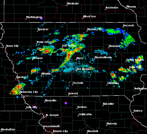 At 450 pm cdt, a severe thunderstorm was located near lake city, or 7 miles southwest of rockwell city, moving northeast at 35 mph (trained weather spotters). Hazards include quarter size hail. Damage to vehicles is expected. Locations impacted include, yetter. At 450 pm cdt, a severe thunderstorm was located near lake city, or 7 miles southwest of rockwell city, moving northeast at 35 mph (trained weather spotters). Hazards include quarter size hail. Damage to vehicles is expected. Locations impacted include, yetter.
|
| 4/15/2017 4:39 PM CDT |
 At 438 pm cdt, a severe thunderstorm was located near black hawk lake, or 9 miles southeast of sac city, moving northeast at 25 mph (radar indicated). Hazards include quarter size hail. Damage to vehicles is expected. Locations impacted include, lake city, auburn and yetter. At 438 pm cdt, a severe thunderstorm was located near black hawk lake, or 9 miles southeast of sac city, moving northeast at 25 mph (radar indicated). Hazards include quarter size hail. Damage to vehicles is expected. Locations impacted include, lake city, auburn and yetter.
|
| 4/15/2017 4:15 PM CDT |
 At 415 pm cdt, a severe thunderstorm was located over black hawk lake, or 9 miles south of sac city, moving northeast at 25 mph (radar indicated). Hazards include quarter size hail. damage to vehicles is expected At 415 pm cdt, a severe thunderstorm was located over black hawk lake, or 9 miles south of sac city, moving northeast at 25 mph (radar indicated). Hazards include quarter size hail. damage to vehicles is expected
|
| 3/6/2017 4:48 PM CST |
 At 447 pm cst, a severe thunderstorm was located near rockwell city, moving northeast at 95 mph (radar indicated). Hazards include golf ball size hail and 60 mph wind gusts. People and animals outdoors will be injured. expect hail damage to roofs, siding, windows, and vehicles. expect wind damage to roofs, siding, and trees. locations impacted include, rockwell city, lake city, auburn, yetter and rockwell city municipal airport. A tornado watch remains in effect until 1000 pm cst for west central iowa. At 447 pm cst, a severe thunderstorm was located near rockwell city, moving northeast at 95 mph (radar indicated). Hazards include golf ball size hail and 60 mph wind gusts. People and animals outdoors will be injured. expect hail damage to roofs, siding, windows, and vehicles. expect wind damage to roofs, siding, and trees. locations impacted include, rockwell city, lake city, auburn, yetter and rockwell city municipal airport. A tornado watch remains in effect until 1000 pm cst for west central iowa.
|
| 3/6/2017 4:19 PM CST |
 At 419 pm cst, a severe thunderstorm was located 8 miles west of manning, or 8 miles southeast of denison, moving northeast at 65 mph (radar indicated). Hazards include 60 mph wind gusts and quarter size hail. Hail damage to vehicles is expected. Expect wind damage to roofs, siding, and trees. At 419 pm cst, a severe thunderstorm was located 8 miles west of manning, or 8 miles southeast of denison, moving northeast at 65 mph (radar indicated). Hazards include 60 mph wind gusts and quarter size hail. Hail damage to vehicles is expected. Expect wind damage to roofs, siding, and trees.
|
| 7/17/2016 3:06 AM CDT |
 At 305 am cdt, severe thunderstorms were located along a line extending from 10 miles southeast of manson to lake city, moving southeast at 45 mph (radar indicated). Hazards include 60 mph wind gusts. Expect damage to roofs. siding. And trees. At 305 am cdt, severe thunderstorms were located along a line extending from 10 miles southeast of manson to lake city, moving southeast at 45 mph (radar indicated). Hazards include 60 mph wind gusts. Expect damage to roofs. siding. And trees.
|
| 7/11/2016 9:41 PM CDT |
 At 940 pm cdt, severe thunderstorms were located along a line extending from near north twin lake to near lake city, moving east at 30 mph (radar indicated). Hazards include 60 mph wind gusts and penny size hail. Expect damage to roofs. siding. And trees. At 940 pm cdt, severe thunderstorms were located along a line extending from near north twin lake to near lake city, moving east at 30 mph (radar indicated). Hazards include 60 mph wind gusts and penny size hail. Expect damage to roofs. siding. And trees.
|
| 7/7/2016 12:56 AM CDT |
 The severe thunderstorm warning for northern crawford, southwestern pocahontas, western calhoun, northwestern carroll and sac counties will expire at 100 am cdt, the storms which prompted the warning have moved out of the area. therefore the warning will be allowed to expire. however gusty winds and heavy rain are still possible with these thunderstorms. a severe thunderstorm watch remains in effect until 700 am cdt for west central and northwestern iowa. remember, a severe thunderstorm warning still remains in effect for eastern sac county and northern carroll county until 130 am. The severe thunderstorm warning for northern crawford, southwestern pocahontas, western calhoun, northwestern carroll and sac counties will expire at 100 am cdt, the storms which prompted the warning have moved out of the area. therefore the warning will be allowed to expire. however gusty winds and heavy rain are still possible with these thunderstorms. a severe thunderstorm watch remains in effect until 700 am cdt for west central and northwestern iowa. remember, a severe thunderstorm warning still remains in effect for eastern sac county and northern carroll county until 130 am.
|
| 7/7/2016 12:52 AM CDT |
 At 1252 am cdt, severe thunderstorms were located along a line extending from 9 miles southwest of pocahontas to 7 miles southwest of south twin lake to near carroll, moving east at 55 mph (radar indicated). Hazards include 60 mph wind gusts and nickel size hail. Expect damage to roofs. siding. and trees. severe thunderstorms will be near, rockwell city, south twin lake and north twin lake around 100 am cdt. manson around 105 am cdt. fort dodge regional airport around 125 am cdt. Other locations impacted by these severe thunderstorms include callender, palmer, paton, clare, pomeroy, dana, lanesboro, knierim, lytton and blackhawk lake state park. At 1252 am cdt, severe thunderstorms were located along a line extending from 9 miles southwest of pocahontas to 7 miles southwest of south twin lake to near carroll, moving east at 55 mph (radar indicated). Hazards include 60 mph wind gusts and nickel size hail. Expect damage to roofs. siding. and trees. severe thunderstorms will be near, rockwell city, south twin lake and north twin lake around 100 am cdt. manson around 105 am cdt. fort dodge regional airport around 125 am cdt. Other locations impacted by these severe thunderstorms include callender, palmer, paton, clare, pomeroy, dana, lanesboro, knierim, lytton and blackhawk lake state park.
|
| 7/7/2016 12:41 AM CDT |
 At 1241 am cdt, severe thunderstorms were located along a line extending from near newell to near sac city to near lake view to 6 miles north of denison, moving east at 55 mph (radar indicated). Hazards include 70 mph wind gusts and nickel size hail. Expect considerable tree damage. damage is likely to mobile homes, roofs, and outbuildings. these severe storms will be near, sac city, lake view and black hawk lake around 1245 am cdt. Other locations impacted by these severe thunderstorms include early, fonda, yetter, lytton, wall lake municipal airport, blackhawk lake state park, schleswig, wall lake, ricketts and varina. At 1241 am cdt, severe thunderstorms were located along a line extending from near newell to near sac city to near lake view to 6 miles north of denison, moving east at 55 mph (radar indicated). Hazards include 70 mph wind gusts and nickel size hail. Expect considerable tree damage. damage is likely to mobile homes, roofs, and outbuildings. these severe storms will be near, sac city, lake view and black hawk lake around 1245 am cdt. Other locations impacted by these severe thunderstorms include early, fonda, yetter, lytton, wall lake municipal airport, blackhawk lake state park, schleswig, wall lake, ricketts and varina.
|
| 7/7/2016 12:20 AM CDT |
 At 1220 am cdt, severe thunderstorms were located along a line extending from near alta to galva to near ida grove to near ute, moving east at 55 mph (radar indicated). Hazards include 70 mph wind gusts and nickel size hail. Expect considerable tree damage. damage is likely to mobile homes, roofs, and outbuildings. severe thunderstorms will be near, odebolt around 1230 am cdt. sac city around 1240 am cdt. lake view and black hawk lake around 1245 am cdt. Other locations impacted by these severe thunderstorms include early, fonda, yetter, lytton, wall lake municipal airport, blackhawk lake state park, schleswig, wall lake, ricketts and varina. At 1220 am cdt, severe thunderstorms were located along a line extending from near alta to galva to near ida grove to near ute, moving east at 55 mph (radar indicated). Hazards include 70 mph wind gusts and nickel size hail. Expect considerable tree damage. damage is likely to mobile homes, roofs, and outbuildings. severe thunderstorms will be near, odebolt around 1230 am cdt. sac city around 1240 am cdt. lake view and black hawk lake around 1245 am cdt. Other locations impacted by these severe thunderstorms include early, fonda, yetter, lytton, wall lake municipal airport, blackhawk lake state park, schleswig, wall lake, ricketts and varina.
|
| 7/5/2016 11:24 PM CDT |
 At 1123 pm cdt, a severe thunderstorm was located over carroll, moving east at 50 mph (radar indicated). Hazards include 70 mph wind gusts and quarter size hail. Hail damage to vehicles is expected. expect considerable tree damage. wind damage is also likely to mobile homes, roofs, and outbuildings. Locations impacted include, carroll, lake city, manning, glidden, lake view, odebolt, black hawk lake, wall lake, arcadia, breda, vail, templeton, auburn, lytton, westside, kiron, halbur, lidderdale, lanesboro and willey. At 1123 pm cdt, a severe thunderstorm was located over carroll, moving east at 50 mph (radar indicated). Hazards include 70 mph wind gusts and quarter size hail. Hail damage to vehicles is expected. expect considerable tree damage. wind damage is also likely to mobile homes, roofs, and outbuildings. Locations impacted include, carroll, lake city, manning, glidden, lake view, odebolt, black hawk lake, wall lake, arcadia, breda, vail, templeton, auburn, lytton, westside, kiron, halbur, lidderdale, lanesboro and willey.
|
| 7/5/2016 11:11 PM CDT |
 At 1110 pm cdt, a severe thunderstorm was located 7 miles southwest of black hawk lake, or 14 miles northwest of carroll, moving east at 55 mph (radar indicated). Hazards include 70 mph wind gusts and quarter size hail. Hail damage to vehicles is expected. expect considerable tree damage. wind damage is also likely to mobile homes, roofs, and outbuildings. Locations impacted include, carroll, sac city, lake city, manning, glidden, lake view, odebolt, black hawk lake, wall lake, arcadia, breda, vail, templeton, auburn, lytton, westside, kiron, halbur, lidderdale and lanesboro. At 1110 pm cdt, a severe thunderstorm was located 7 miles southwest of black hawk lake, or 14 miles northwest of carroll, moving east at 55 mph (radar indicated). Hazards include 70 mph wind gusts and quarter size hail. Hail damage to vehicles is expected. expect considerable tree damage. wind damage is also likely to mobile homes, roofs, and outbuildings. Locations impacted include, carroll, sac city, lake city, manning, glidden, lake view, odebolt, black hawk lake, wall lake, arcadia, breda, vail, templeton, auburn, lytton, westside, kiron, halbur, lidderdale and lanesboro.
|
| 7/5/2016 10:54 PM CDT |
 At 1054 pm cdt, a severe thunderstorm was located 8 miles north of denison, moving northeast at 65 mph (radar indicated). Hazards include 70 mph wind gusts and quarter size hail. Hail damage to vehicles is expected. expect considerable tree damage. Wind damage is also likely to mobile homes, roofs, and outbuildings. At 1054 pm cdt, a severe thunderstorm was located 8 miles north of denison, moving northeast at 65 mph (radar indicated). Hazards include 70 mph wind gusts and quarter size hail. Hail damage to vehicles is expected. expect considerable tree damage. Wind damage is also likely to mobile homes, roofs, and outbuildings.
|
| 11/11/2015 2:54 PM CST |
 At 254 pm cst, severe thunderstorms were located along a line extending from 5 miles southeast of black hawk lake to 5 miles southwest of jefferson, moving north at 65 mph (radar indicated). Hazards include 60 mph wind gusts. Expect damage to roofs. Siding and trees. At 254 pm cst, severe thunderstorms were located along a line extending from 5 miles southeast of black hawk lake to 5 miles southwest of jefferson, moving north at 65 mph (radar indicated). Hazards include 60 mph wind gusts. Expect damage to roofs. Siding and trees.
|
| 11/11/2015 1:25 PM CST |
 At 124 pm cst, a severe thunderstorm was located near lake city, or 11 miles southwest of rockwell city, moving north at 50 mph (radar indicated). Hazards include quarter size hail. Damage to vehicles is expected. locations impacted include, lake city, auburn and yetter. A tornado watch remains in effect until 600 pm cst for west central iowa. At 124 pm cst, a severe thunderstorm was located near lake city, or 11 miles southwest of rockwell city, moving north at 50 mph (radar indicated). Hazards include quarter size hail. Damage to vehicles is expected. locations impacted include, lake city, auburn and yetter. A tornado watch remains in effect until 600 pm cst for west central iowa.
|
| 11/11/2015 1:14 PM CST |
 At 113 pm cst, a severe thunderstorm was located 7 miles north of carroll, moving north at 50 mph (radar indicated). Hazards include quarter size hail. Damage to vehicles is expected. locations impacted include, lake city, auburn, lidderdale and yetter. A tornado watch remains in effect until 600 pm cst for west central iowa. At 113 pm cst, a severe thunderstorm was located 7 miles north of carroll, moving north at 50 mph (radar indicated). Hazards include quarter size hail. Damage to vehicles is expected. locations impacted include, lake city, auburn, lidderdale and yetter. A tornado watch remains in effect until 600 pm cst for west central iowa.
|
| 11/11/2015 1:07 PM CST |
 At 106 pm cst, a severe thunderstorm was located over carroll, moving north at 50 mph (radar indicated). Hazards include quarter size hail. damage to vehicles is expected At 106 pm cst, a severe thunderstorm was located over carroll, moving north at 50 mph (radar indicated). Hazards include quarter size hail. damage to vehicles is expected
|
| 9/6/2015 6:25 PM CDT |
 At 625 pm cdt, a severe thunderstorm was located near lake city, or 10 miles southwest of rockwell city, moving northeast at 20 mph (radar indicated). Hazards include 60 mph wind gusts and quarter size hail. Hail damage to vehicles is expected. expect wind damage to roofs, siding and trees. this severe thunderstorm will be near, rockwell city around 655 pm cdt. Other locations impacted by this severe thunderstorm include rockwell city municipal airport, rinard, lohrville, yetter, farnhamville, twin lakes state park and twin lakes. At 625 pm cdt, a severe thunderstorm was located near lake city, or 10 miles southwest of rockwell city, moving northeast at 20 mph (radar indicated). Hazards include 60 mph wind gusts and quarter size hail. Hail damage to vehicles is expected. expect wind damage to roofs, siding and trees. this severe thunderstorm will be near, rockwell city around 655 pm cdt. Other locations impacted by this severe thunderstorm include rockwell city municipal airport, rinard, lohrville, yetter, farnhamville, twin lakes state park and twin lakes.
|
| 9/6/2015 6:20 PM CDT | Tree damage to old maple tree partially rotted. winds estimated at over 50 mph. torrential rainfall at time of wind in calhoun county IA, 0.3 miles SW of Yetter, IA |
| 6/22/2015 7:09 AM CDT |
 At 708 am cdt, severe thunderstorms were located along a line extending from 9 miles west of lake mills to 7 miles east of dakota city to 4 miles south of rockwell city, moving east at 60 mph (radar indicated). Hazards include 60 mph wind gusts and penny size hail. Expect damage to roofs. siding and trees. Locations impacted include, fort dodge, forest city, garner, clarion, pocahontas, rockwell city, dakota city, humboldt, eagle grove, britt, lake city, manson, fort dodge regional airport, north twin lake, eagle lake, south twin lake, pomeroy, kanawha, goldfield and fonda. At 708 am cdt, severe thunderstorms were located along a line extending from 9 miles west of lake mills to 7 miles east of dakota city to 4 miles south of rockwell city, moving east at 60 mph (radar indicated). Hazards include 60 mph wind gusts and penny size hail. Expect damage to roofs. siding and trees. Locations impacted include, fort dodge, forest city, garner, clarion, pocahontas, rockwell city, dakota city, humboldt, eagle grove, britt, lake city, manson, fort dodge regional airport, north twin lake, eagle lake, south twin lake, pomeroy, kanawha, goldfield and fonda.
|
| 6/22/2015 6:43 AM CDT |
 At 642 am cdt, severe thunderstorms were located along a line extending from 9 miles south of blue earth to 9 miles northeast of pocahontas to 4 miles west of sac city, moving east at 60 mph (emergency management). Hazards include 60 mph wind gusts and penny size hail. Expect damage to roofs. Siding and trees. At 642 am cdt, severe thunderstorms were located along a line extending from 9 miles south of blue earth to 9 miles northeast of pocahontas to 4 miles west of sac city, moving east at 60 mph (emergency management). Hazards include 60 mph wind gusts and penny size hail. Expect damage to roofs. Siding and trees.
|
| 6/7/2015 12:26 AM CDT | At 1226 am cdt, severe thunderstorms were located along a line extending from 8 miles southeast of newell to 7 miles north of carroll to 4 miles southwest of manning, moving east at 40 mph (radar indicated). Hazards include 60 mph wind gusts. Expect damage to roofs. Siding and trees. |
| 5/10/2015 8:23 PM CDT | At 823 pm cdt, a severe thunderstorm was located 7 miles southwest of lake city, or 7 miles north of carroll, moving north at 45 mph (radar indicated). Hazards include golf ball size hail and 70 mph wind gusts. People and animals outdoors will be injured. expect hail damage to roofs, siding, windows and vehicles. expect considerable tree damage. wind damage is also likely to mobile homes, roofs and outbuildings. locations impacted include, rockwell city, lake city, auburn, lytton, lidderdale, yetter and hobbs county park. Possible. |
| 5/10/2015 8:18 PM CDT | At 818 pm cdt, a severe thunderstorm was located 4 miles northeast of carroll, moving north at 45 mph (radar indicated). Hazards include golf ball size hail and 60 mph wind gusts. People and animals outdoors will be injured. expect hail damage to roofs, siding, windows and vehicles. Expect wind damage to roofs, siding and trees. |
| 5/3/2012 3:38 AM CDT | Large healthy maple tree down in yard...roughly 3 feet in diameter. time estimated by rada in calhoun county IA, 0.5 miles NNW of Yetter, IA |
Hail Maps for Yetter, IA
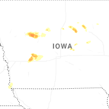


Connect with Interactive Hail Maps