

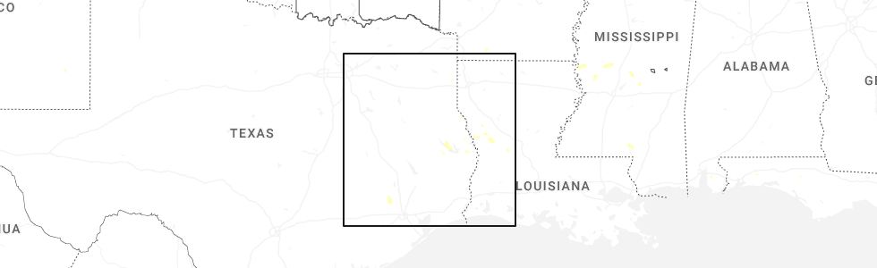
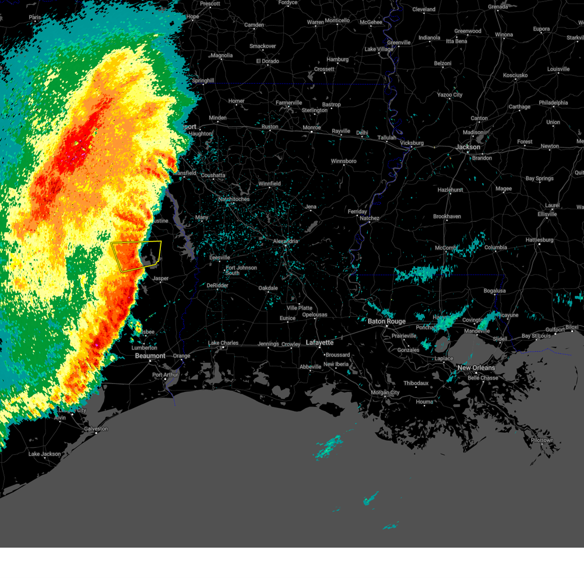
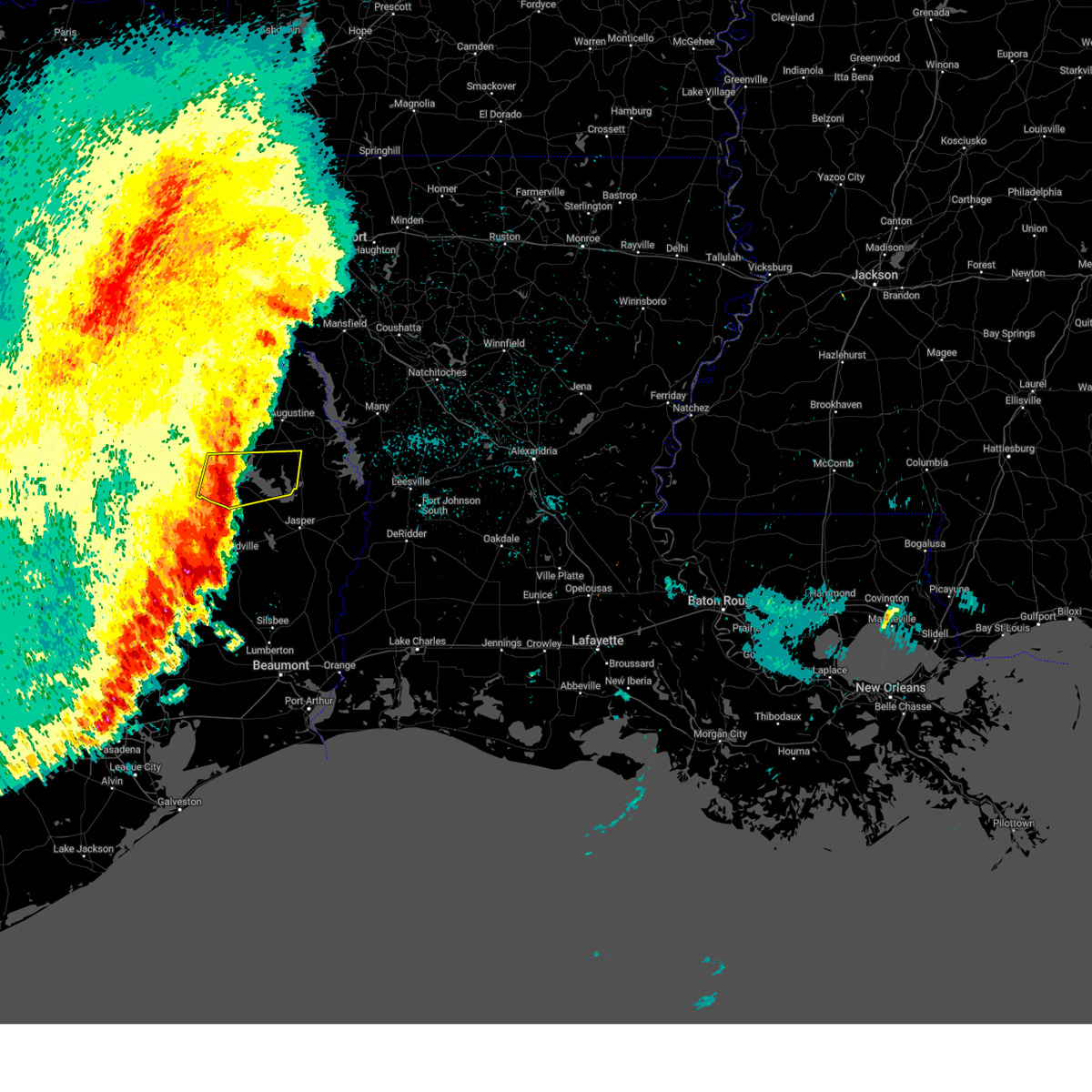
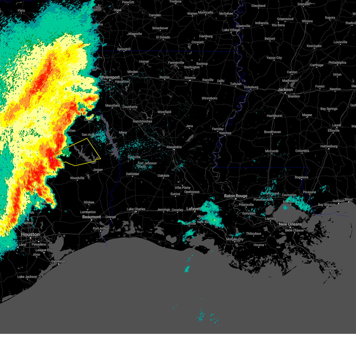
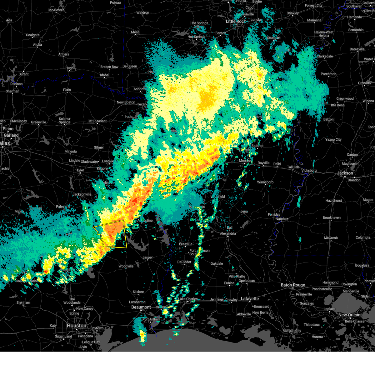
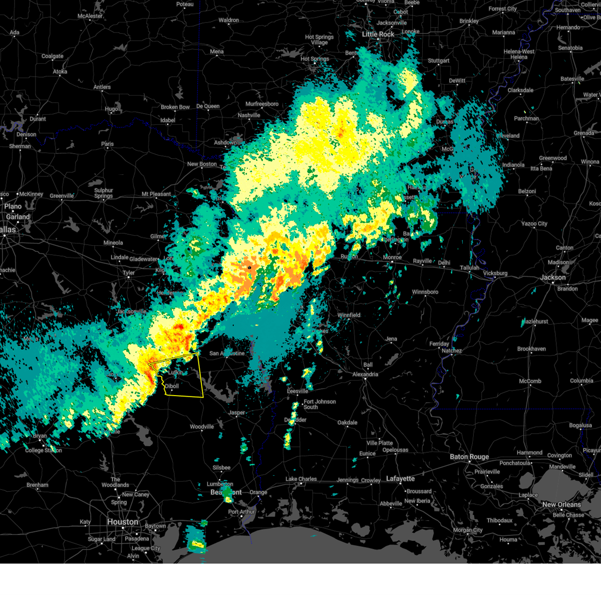
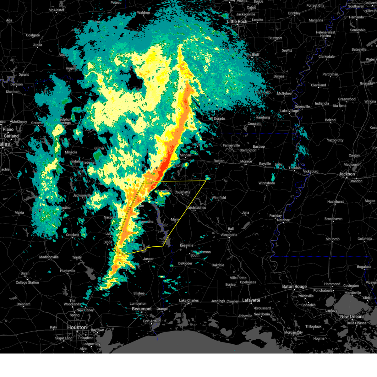
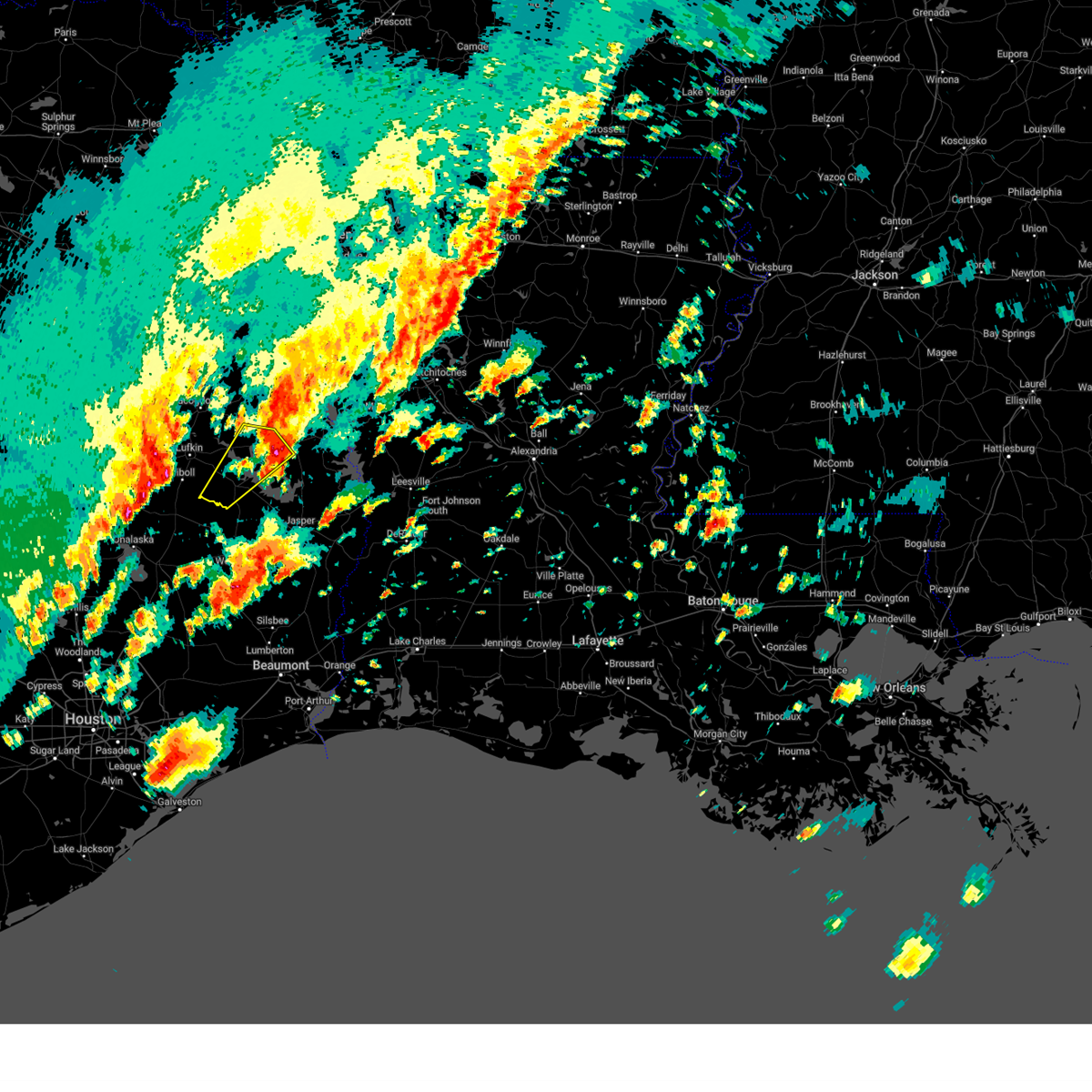
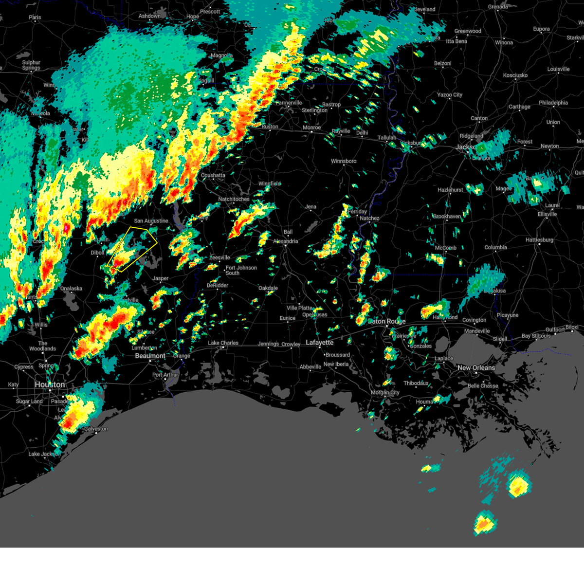
Hail Map for Zavalla, TX
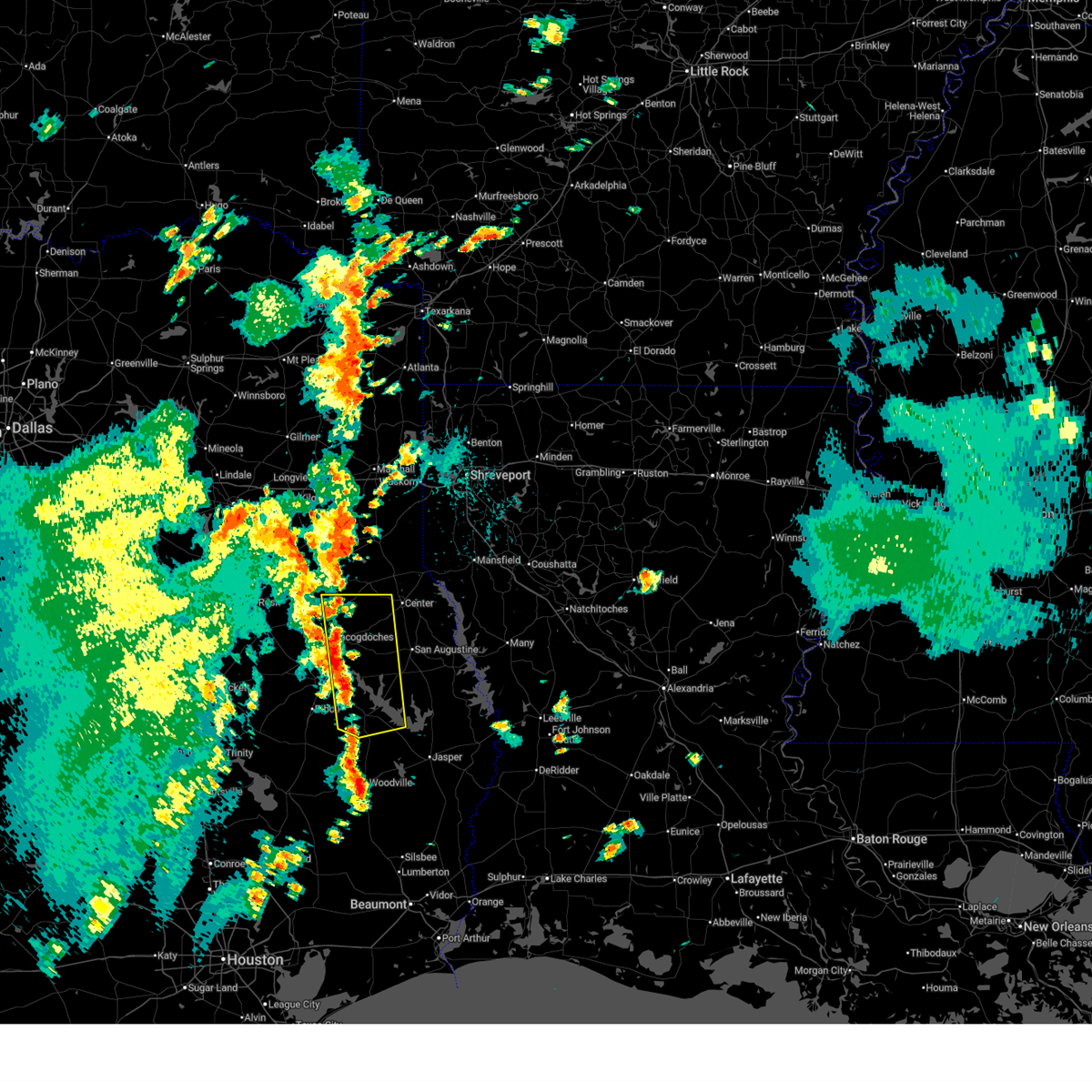
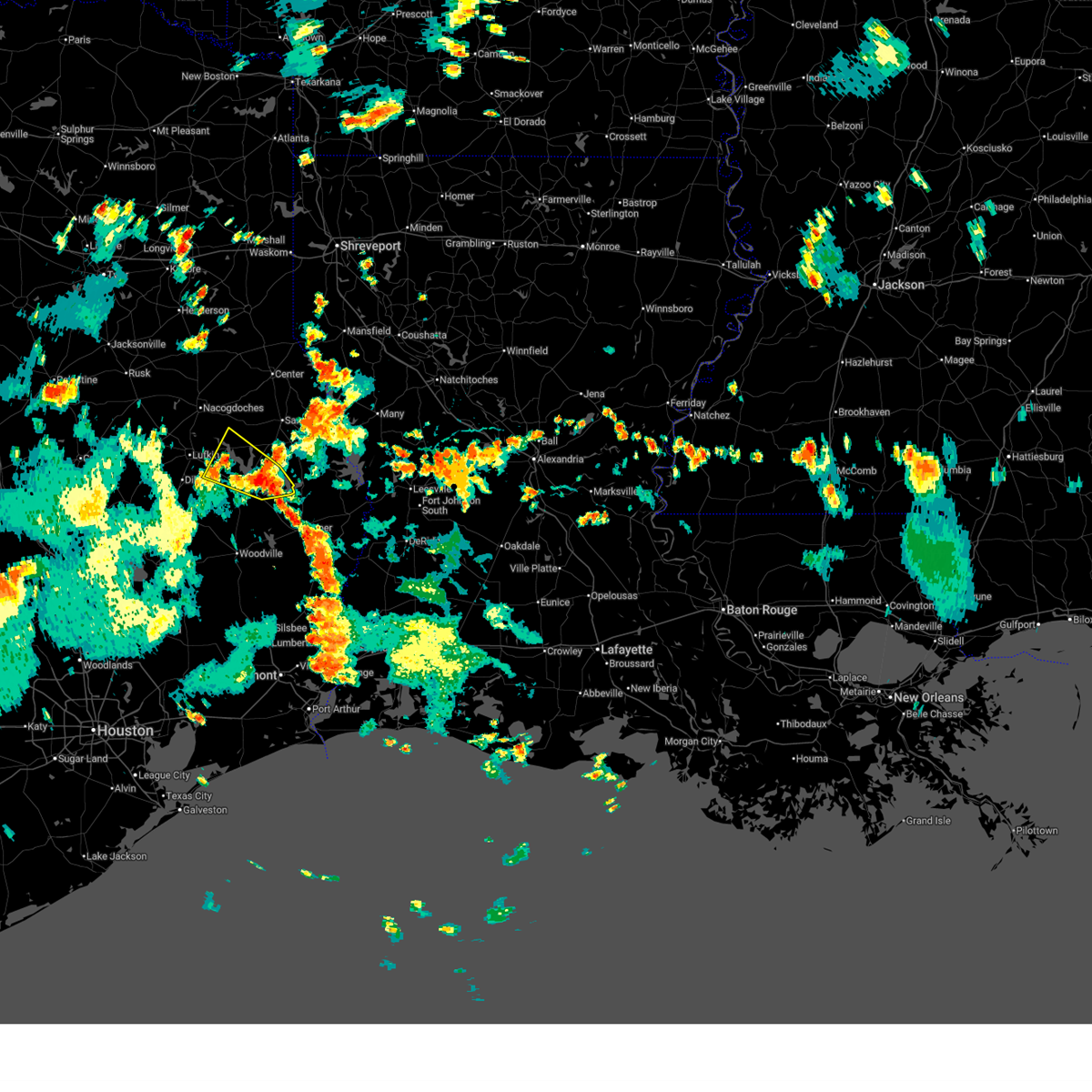
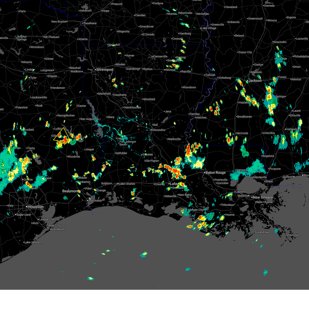
The Zavalla, TX area has had 4 reports of on-the-ground hail by trained spotters, and has been under severe weather warnings 14 times during the past 12 months. Doppler radar has detected hail at or near Zavalla, TX on 65 occasions, including 4 occasions during the past year.
| Name: | Zavalla, TX |
| Where Located: | 21.7 miles SE of Lufkin, TX |
| Map: | Google Map for Zavalla, TX |
| Population: | 713 |
| Housing Units: | 368 |
| More Info: | Search Google for Zavalla, TX |
1
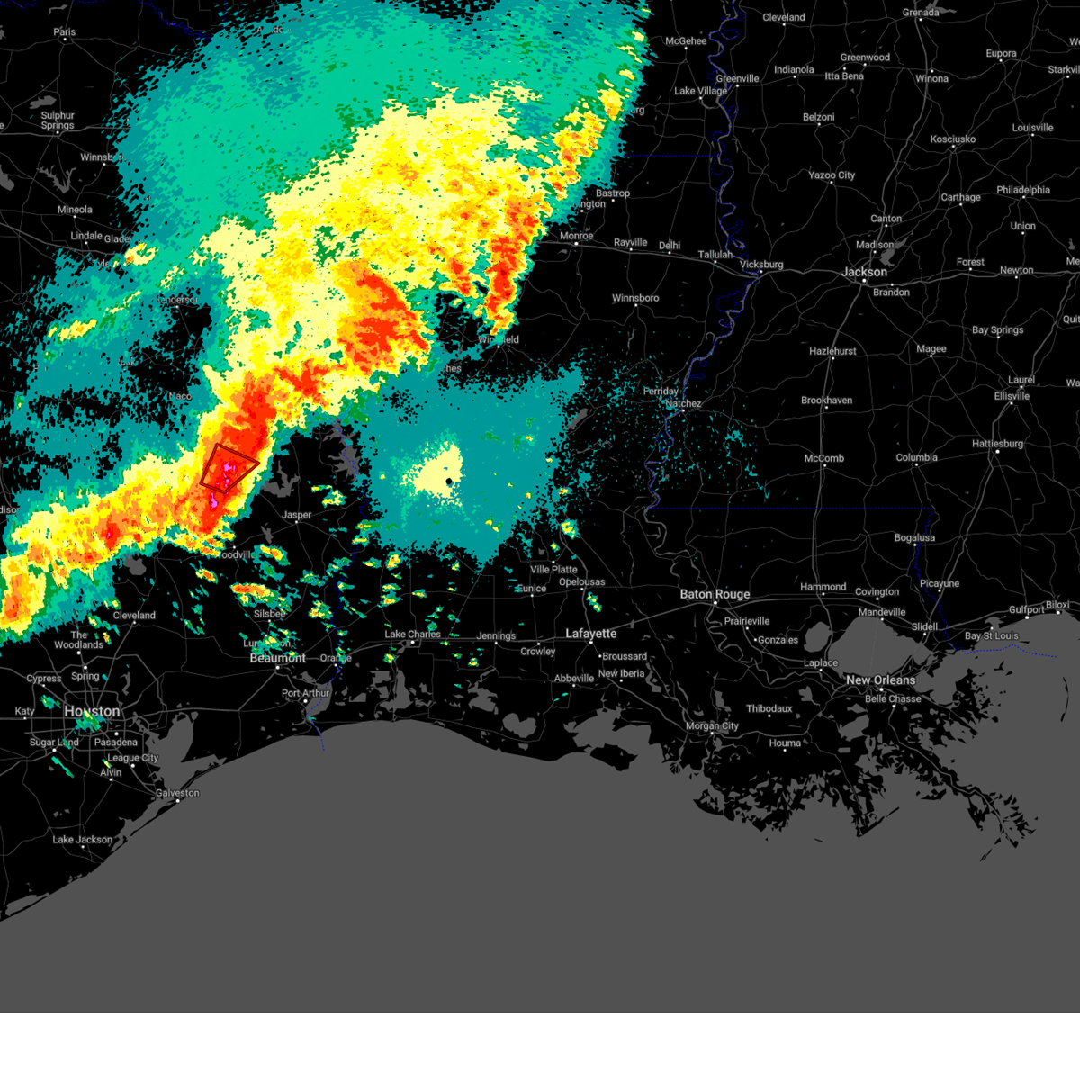
The Top Recent Hail Date for Zavalla, TX is Tuesday, June 24, 2025 (28th out of 65)
Hail and Wind Damage Spotted near Zavalla, TX
| Date / Time | Report Details |
|---|---|
| 7/13/2025 5:35 PM CDT |
 At 534 pm cdt, severe thunderstorms were located along a line extending from garrison to near colmesneil, moving east at 20 mph (radar indicated). Hazards include 60 mph wind gusts and penny size hail. Expect damage to roofs, siding, and trees. Locations impacted include, nacogdoches, huntington, garrison, melrose, woden, etoile, martinsville, zavalla, appleby, chireno, broaddus, denning, stockman, shawnee, arcadia, and dolan. At 534 pm cdt, severe thunderstorms were located along a line extending from garrison to near colmesneil, moving east at 20 mph (radar indicated). Hazards include 60 mph wind gusts and penny size hail. Expect damage to roofs, siding, and trees. Locations impacted include, nacogdoches, huntington, garrison, melrose, woden, etoile, martinsville, zavalla, appleby, chireno, broaddus, denning, stockman, shawnee, arcadia, and dolan.
|
| 7/13/2025 5:17 PM CDT |
 Svrshv the national weather service in shreveport has issued a * severe thunderstorm warning for, nacogdoches county in eastern texas, southwestern shelby county in eastern texas, eastern angelina county in eastern texas, western san augustine county in eastern texas, * until 600 pm cdt. * at 516 pm cdt, severe thunderstorms were located along a line extending from near garrison to near colmesneil, moving east at 20 mph (radar indicated). Hazards include 60 mph wind gusts and penny size hail. expect damage to roofs, siding, and trees Svrshv the national weather service in shreveport has issued a * severe thunderstorm warning for, nacogdoches county in eastern texas, southwestern shelby county in eastern texas, eastern angelina county in eastern texas, western san augustine county in eastern texas, * until 600 pm cdt. * at 516 pm cdt, severe thunderstorms were located along a line extending from near garrison to near colmesneil, moving east at 20 mph (radar indicated). Hazards include 60 mph wind gusts and penny size hail. expect damage to roofs, siding, and trees
|
| 6/24/2025 5:43 PM CDT |
 Svrshv the national weather service in shreveport has issued a * severe thunderstorm warning for, southeastern nacogdoches county in eastern texas, southeastern angelina county in eastern texas, southwestern san augustine county in eastern texas, * until 630 pm cdt. * at 543 pm cdt, a severe thunderstorm was located 13 miles northwest of ebenezer, moving west at 15 mph (radar indicated). Hazards include 60 mph wind gusts and nickel size hail. expect damage to roofs, siding, and trees Svrshv the national weather service in shreveport has issued a * severe thunderstorm warning for, southeastern nacogdoches county in eastern texas, southeastern angelina county in eastern texas, southwestern san augustine county in eastern texas, * until 630 pm cdt. * at 543 pm cdt, a severe thunderstorm was located 13 miles northwest of ebenezer, moving west at 15 mph (radar indicated). Hazards include 60 mph wind gusts and nickel size hail. expect damage to roofs, siding, and trees
|
| 6/23/2025 5:33 PM CDT |
 Svrshv the national weather service in shreveport has issued a * severe thunderstorm warning for, south central angelina county in eastern texas, * until 600 pm cdt. * at 533 pm cdt, a severe thunderstorm was located 11 miles northwest of rockland, moving northwest at 15 mph (radar indicated). Hazards include 60 mph wind gusts and nickel size hail. expect damage to roofs, siding, and trees Svrshv the national weather service in shreveport has issued a * severe thunderstorm warning for, south central angelina county in eastern texas, * until 600 pm cdt. * at 533 pm cdt, a severe thunderstorm was located 11 miles northwest of rockland, moving northwest at 15 mph (radar indicated). Hazards include 60 mph wind gusts and nickel size hail. expect damage to roofs, siding, and trees
|
| 5/27/2025 1:06 AM CDT |
 At 106 am cdt, a severe thunderstorm was located 9 miles northwest of ebenezer, moving east at 30 mph (radar indicated). Hazards include 60 mph wind gusts and quarter size hail. Hail damage to vehicles is expected. expect wind damage to roofs, siding, and trees. Locations impacted include, shawnee, bronson, huntington, broaddus, dolan, and zavalla. At 106 am cdt, a severe thunderstorm was located 9 miles northwest of ebenezer, moving east at 30 mph (radar indicated). Hazards include 60 mph wind gusts and quarter size hail. Hail damage to vehicles is expected. expect wind damage to roofs, siding, and trees. Locations impacted include, shawnee, bronson, huntington, broaddus, dolan, and zavalla.
|
| 5/27/2025 12:45 AM CDT |
 Svrshv the national weather service in shreveport has issued a * severe thunderstorm warning for, southeastern nacogdoches county in eastern texas, southeastern angelina county in eastern texas, southern san augustine county in eastern texas, southwestern sabine county in eastern texas, * until 130 am cdt. * at 1245 am cdt, a severe thunderstorm was located 11 miles northwest of rockland, moving east at 30 mph (radar indicated). Hazards include 60 mph wind gusts and quarter size hail. Hail damage to vehicles is expected. Expect wind damage to roofs, siding, and trees. Svrshv the national weather service in shreveport has issued a * severe thunderstorm warning for, southeastern nacogdoches county in eastern texas, southeastern angelina county in eastern texas, southern san augustine county in eastern texas, southwestern sabine county in eastern texas, * until 130 am cdt. * at 1245 am cdt, a severe thunderstorm was located 11 miles northwest of rockland, moving east at 30 mph (radar indicated). Hazards include 60 mph wind gusts and quarter size hail. Hail damage to vehicles is expected. Expect wind damage to roofs, siding, and trees.
|
| 5/27/2025 12:05 AM CDT |
 Svrshv the national weather service in shreveport has issued a * severe thunderstorm warning for, southeastern nacogdoches county in eastern texas, angelina county in eastern texas, southern san augustine county in eastern texas, southwestern sabine county in eastern texas, * until 1245 am cdt. * at 1205 am cdt, a severe thunderstorm was located near diboll, moving east at 50 mph (radar indicated). Hazards include 60 mph wind gusts and quarter size hail. Hail damage to vehicles is expected. Expect wind damage to roofs, siding, and trees. Svrshv the national weather service in shreveport has issued a * severe thunderstorm warning for, southeastern nacogdoches county in eastern texas, angelina county in eastern texas, southern san augustine county in eastern texas, southwestern sabine county in eastern texas, * until 1245 am cdt. * at 1205 am cdt, a severe thunderstorm was located near diboll, moving east at 50 mph (radar indicated). Hazards include 60 mph wind gusts and quarter size hail. Hail damage to vehicles is expected. Expect wind damage to roofs, siding, and trees.
|
| 5/2/2025 1:48 PM CDT | At 148 pm cdt, a severe thunderstorm was located 7 miles south of hemphill, or 42 miles southeast of center, moving northeast at 15 mph (radar indicated). Hazards include 60 mph wind gusts and quarter size hail. Hail damage to vehicles is expected. expect wind damage to roofs, siding, and trees. Locations impacted include, milam, hemphill, pineland, rosevine, zavalla, broaddus, mcelroy, bronson, yellowpine, dolan and fairmount. |
| 5/2/2025 1:11 PM CDT | Svrshv the national weather service in shreveport has issued a * severe thunderstorm warning for, southeastern angelina county in eastern texas, southern sabine county in eastern texas, southern san augustine county in eastern texas, * until 200 pm cdt. * at 111 pm cdt, a severe thunderstorm was located 5 miles southwest of pineland, or 43 miles east of lufkin, moving northeast at 15 mph (radar indicated). Hazards include quarter size hail. damage to vehicles is expected |
| 4/30/2025 11:38 PM CDT |
 The storm which prompted the warning has weakened below severe limits, and no longer poses an immediate threat to life or property. therefore, the warning will be allowed to expire. however, heavy rain is still possible with this thunderstorm. a severe thunderstorm watch remains in effect until 1200 am cdt for a portion of northeast texas. The storm which prompted the warning has weakened below severe limits, and no longer poses an immediate threat to life or property. therefore, the warning will be allowed to expire. however, heavy rain is still possible with this thunderstorm. a severe thunderstorm watch remains in effect until 1200 am cdt for a portion of northeast texas.
|
| 4/30/2025 11:11 PM CDT |
 Svrshv the national weather service in shreveport has issued a * severe thunderstorm warning for, angelina county in eastern texas, central nacogdoches county in eastern texas, southeastern cherokee county in northeastern texas, * until 1145 pm cdt. * at 1111 pm cdt, a severe thunderstorm was located 9 miles west of hudson, or 13 miles northwest of diboll, moving east at 45 mph (radar indicated). Hazards include 60 mph wind gusts and quarter size hail. Hail damage to vehicles is expected. Expect wind damage to roofs, siding, and trees. Svrshv the national weather service in shreveport has issued a * severe thunderstorm warning for, angelina county in eastern texas, central nacogdoches county in eastern texas, southeastern cherokee county in northeastern texas, * until 1145 pm cdt. * at 1111 pm cdt, a severe thunderstorm was located 9 miles west of hudson, or 13 miles northwest of diboll, moving east at 45 mph (radar indicated). Hazards include 60 mph wind gusts and quarter size hail. Hail damage to vehicles is expected. Expect wind damage to roofs, siding, and trees.
|
| 3/4/2025 9:40 AM CST |
 Svrshv the national weather service in shreveport has issued a * severe thunderstorm warning for, southeastern bienville parish in northwestern louisiana, de soto parish in northwestern louisiana, northwestern natchitoches parish in northwestern louisiana, red river parish in northwestern louisiana, sabine parish in northwestern louisiana, southeastern angelina county in eastern texas, southeastern nacogdoches county in eastern texas, sabine county in eastern texas, san augustine county in eastern texas, shelby county in eastern texas, southeastern panola county in northeastern texas, * until 1045 am cst. * at 940 am cst, severe thunderstorms were located along a line from 6 miles southeast of stonewall to 15 miles south of huntington, or along a line from 13 miles north of mansfield to 17 miles southeast of diboll, moving east at 40 mph (radar indicated). Hazards include 60 mph wind gusts and small hail. expect damage to roofs, siding, and trees Svrshv the national weather service in shreveport has issued a * severe thunderstorm warning for, southeastern bienville parish in northwestern louisiana, de soto parish in northwestern louisiana, northwestern natchitoches parish in northwestern louisiana, red river parish in northwestern louisiana, sabine parish in northwestern louisiana, southeastern angelina county in eastern texas, southeastern nacogdoches county in eastern texas, sabine county in eastern texas, san augustine county in eastern texas, shelby county in eastern texas, southeastern panola county in northeastern texas, * until 1045 am cst. * at 940 am cst, severe thunderstorms were located along a line from 6 miles southeast of stonewall to 15 miles south of huntington, or along a line from 13 miles north of mansfield to 17 miles southeast of diboll, moving east at 40 mph (radar indicated). Hazards include 60 mph wind gusts and small hail. expect damage to roofs, siding, and trees
|
| 12/28/2024 2:00 PM CST |
 The storm which prompted the warning has weakened below severe limits, and has exited the warned area. therefore, the warning has been allowed to expire. however, small hail and heavy rain are still possible with this thunderstorm. a tornado watch remains in effect until 300 pm cst for a portion of northeast texas. The storm which prompted the warning has weakened below severe limits, and has exited the warned area. therefore, the warning has been allowed to expire. however, small hail and heavy rain are still possible with this thunderstorm. a tornado watch remains in effect until 300 pm cst for a portion of northeast texas.
|
| 12/28/2024 1:18 PM CST |
 Svrshv the national weather service in shreveport has issued a * severe thunderstorm warning for, southeastern angelina county in eastern texas, southeastern nacogdoches county in eastern texas, central san augustine county in eastern texas, * until 200 pm cst. * at 118 pm cst, a severe thunderstorm was located 11 miles south of huntington, or 16 miles east of diboll, moving northeast at 40 mph (radar indicated). Hazards include 60 mph wind gusts and quarter size hail. Hail damage to vehicles is expected. Expect wind damage to roofs, siding, and trees. Svrshv the national weather service in shreveport has issued a * severe thunderstorm warning for, southeastern angelina county in eastern texas, southeastern nacogdoches county in eastern texas, central san augustine county in eastern texas, * until 200 pm cst. * at 118 pm cst, a severe thunderstorm was located 11 miles south of huntington, or 16 miles east of diboll, moving northeast at 40 mph (radar indicated). Hazards include 60 mph wind gusts and quarter size hail. Hail damage to vehicles is expected. Expect wind damage to roofs, siding, and trees.
|
| 12/26/2024 4:47 PM CST | Reports of 2-3 power lines sparking in the are in angelina county TX, 6.5 miles WNW of Zavalla, TX |
| 7/8/2024 11:00 AM CDT |
 Svrshv the national weather service in shreveport has issued a * severe thunderstorm warning for, southeastern nacogdoches county in eastern texas, southeastern angelina county in eastern texas, southwestern san augustine county in eastern texas, * until 1145 am cdt. * at 1100 am cdt, a severe thunderstorm was located near ebenezer, moving north at 30 mph (radar indicated). Hazards include 60 mph wind gusts and penny size hail. expect damage to roofs, siding, and trees Svrshv the national weather service in shreveport has issued a * severe thunderstorm warning for, southeastern nacogdoches county in eastern texas, southeastern angelina county in eastern texas, southwestern san augustine county in eastern texas, * until 1145 am cdt. * at 1100 am cdt, a severe thunderstorm was located near ebenezer, moving north at 30 mph (radar indicated). Hazards include 60 mph wind gusts and penny size hail. expect damage to roofs, siding, and trees
|
| 7/7/2024 2:26 PM CDT |
 Svrshv the national weather service in shreveport has issued a * severe thunderstorm warning for, west central nacogdoches county in eastern texas, angelina county in eastern texas, southeastern cherokee county in northeastern texas, * until 330 pm cdt. * at 226 pm cdt, severe thunderstorms were located along a line extending from 11 miles south of etoile to 6 miles southwest of huntington to near diboll, moving northwest at 35 mph (radar indicated. power lines have been downed in colmsneil in northern tyler county from these storms). Hazards include 60 mph wind gusts. expect damage to roofs, siding, and trees Svrshv the national weather service in shreveport has issued a * severe thunderstorm warning for, west central nacogdoches county in eastern texas, angelina county in eastern texas, southeastern cherokee county in northeastern texas, * until 330 pm cdt. * at 226 pm cdt, severe thunderstorms were located along a line extending from 11 miles south of etoile to 6 miles southwest of huntington to near diboll, moving northwest at 35 mph (radar indicated. power lines have been downed in colmsneil in northern tyler county from these storms). Hazards include 60 mph wind gusts. expect damage to roofs, siding, and trees
|
| 6/26/2024 2:50 PM CDT |
 Svrshv the national weather service in shreveport has issued a * severe thunderstorm warning for, south central sabine parish in northwestern louisiana, southeastern nacogdoches county in eastern texas, angelina county in eastern texas, southern san augustine county in eastern texas, southern sabine county in eastern texas, * until 330 pm cdt. * at 250 pm cdt, severe thunderstorms were located along a line extending from 8 miles north of toledo bend dam to 12 miles west of pineland to near hudson, moving southeast at 55 mph (radar indicated). Hazards include 60 mph wind gusts. expect damage to roofs, siding, and trees Svrshv the national weather service in shreveport has issued a * severe thunderstorm warning for, south central sabine parish in northwestern louisiana, southeastern nacogdoches county in eastern texas, angelina county in eastern texas, southern san augustine county in eastern texas, southern sabine county in eastern texas, * until 330 pm cdt. * at 250 pm cdt, severe thunderstorms were located along a line extending from 8 miles north of toledo bend dam to 12 miles west of pineland to near hudson, moving southeast at 55 mph (radar indicated). Hazards include 60 mph wind gusts. expect damage to roofs, siding, and trees
|
| 6/26/2024 2:12 PM CDT |
 Svrshv the national weather service in shreveport has issued a * severe thunderstorm warning for, central nacogdoches county in eastern texas, angelina county in eastern texas, central san augustine county in eastern texas, southern cherokee county in northeastern texas, * until 315 pm cdt. * at 211 pm cdt, severe thunderstorms were located along a line extending from near frankston to near douglass to 6 miles northwest of neuville, moving south at 40 mph (radar indicated). Hazards include 60 mph wind gusts. expect damage to roofs, siding, and trees Svrshv the national weather service in shreveport has issued a * severe thunderstorm warning for, central nacogdoches county in eastern texas, angelina county in eastern texas, central san augustine county in eastern texas, southern cherokee county in northeastern texas, * until 315 pm cdt. * at 211 pm cdt, severe thunderstorms were located along a line extending from near frankston to near douglass to 6 miles northwest of neuville, moving south at 40 mph (radar indicated). Hazards include 60 mph wind gusts. expect damage to roofs, siding, and trees
|
| 5/30/2024 6:49 PM CDT |
 Svrshv the national weather service in shreveport has issued a * severe thunderstorm warning for, western sabine parish in northwestern louisiana, eastern nacogdoches county in eastern texas, southern shelby county in eastern texas, angelina county in eastern texas, san augustine county in eastern texas, sabine county in eastern texas, * until 730 pm cdt. * at 649 pm cdt, severe thunderstorms were located along a line extending from near garrison to near woden to 7 miles southeast of apple springs, moving east at 65 mph (radar indicated). Hazards include 70 mph wind gusts. Expect considerable tree damage. Damage is likely to mobile homes, roofs, and outbuildings. Svrshv the national weather service in shreveport has issued a * severe thunderstorm warning for, western sabine parish in northwestern louisiana, eastern nacogdoches county in eastern texas, southern shelby county in eastern texas, angelina county in eastern texas, san augustine county in eastern texas, sabine county in eastern texas, * until 730 pm cdt. * at 649 pm cdt, severe thunderstorms were located along a line extending from near garrison to near woden to 7 miles southeast of apple springs, moving east at 65 mph (radar indicated). Hazards include 70 mph wind gusts. Expect considerable tree damage. Damage is likely to mobile homes, roofs, and outbuildings.
|
| 5/28/2024 12:42 PM CDT |
 Svrshv the national weather service in shreveport has issued a * severe thunderstorm warning for, central nacogdoches county in eastern texas, angelina county in eastern texas, southern san augustine county in eastern texas, southeastern cherokee county in northeastern texas, * until 130 pm cdt. * at 1242 pm cdt, a severe thunderstorm was located near lufkin, moving southeast at 35 mph (radar indicated). Hazards include 60 mph wind gusts and penny size hail. expect damage to roofs, siding, and trees Svrshv the national weather service in shreveport has issued a * severe thunderstorm warning for, central nacogdoches county in eastern texas, angelina county in eastern texas, southern san augustine county in eastern texas, southeastern cherokee county in northeastern texas, * until 130 pm cdt. * at 1242 pm cdt, a severe thunderstorm was located near lufkin, moving southeast at 35 mph (radar indicated). Hazards include 60 mph wind gusts and penny size hail. expect damage to roofs, siding, and trees
|
| 5/28/2024 11:19 AM CDT |
 At 1119 am cdt, severe thunderstorms were located along a line extending from near san augustine to near macune to 11 miles west of pineland to 9 miles northeast of rockland, moving east at 25 mph (radar indicated). Hazards include 60 mph wind gusts and quarter size hail. Hail damage to vehicles is expected. expect wind damage to roofs, siding, and trees. Locations impacted include, san augustine, pineland, macune, bland lake, rosevine, broaddus, bronson, mcelroy, and chinaquapin. At 1119 am cdt, severe thunderstorms were located along a line extending from near san augustine to near macune to 11 miles west of pineland to 9 miles northeast of rockland, moving east at 25 mph (radar indicated). Hazards include 60 mph wind gusts and quarter size hail. Hail damage to vehicles is expected. expect wind damage to roofs, siding, and trees. Locations impacted include, san augustine, pineland, macune, bland lake, rosevine, broaddus, bronson, mcelroy, and chinaquapin.
|
| 5/28/2024 11:19 AM CDT |
 the severe thunderstorm warning has been cancelled and is no longer in effect the severe thunderstorm warning has been cancelled and is no longer in effect
|
| 5/28/2024 11:09 AM CDT |
 the severe thunderstorm warning has been cancelled and is no longer in effect the severe thunderstorm warning has been cancelled and is no longer in effect
|
| 5/28/2024 11:09 AM CDT |
 At 1109 am cdt, severe thunderstorms were located along a line extending from bland lake to near macune to 9 miles northwest of ebenezer, moving east at 35 mph (radar indicated). Hazards include 60 mph wind gusts and quarter size hail. Hail damage to vehicles is expected. expect wind damage to roofs, siding, and trees. Locations impacted include, san augustine, pineland, macune, bland lake, rosevine, zavalla, broaddus, bronson, mcelroy, denning, and chinaquapin. At 1109 am cdt, severe thunderstorms were located along a line extending from bland lake to near macune to 9 miles northwest of ebenezer, moving east at 35 mph (radar indicated). Hazards include 60 mph wind gusts and quarter size hail. Hail damage to vehicles is expected. expect wind damage to roofs, siding, and trees. Locations impacted include, san augustine, pineland, macune, bland lake, rosevine, zavalla, broaddus, bronson, mcelroy, denning, and chinaquapin.
|
| 5/28/2024 10:45 AM CDT |
 Svrshv the national weather service in shreveport has issued a * severe thunderstorm warning for, eastern nacogdoches county in eastern texas, southwestern shelby county in eastern texas, eastern angelina county in eastern texas, san augustine county in eastern texas, western sabine county in eastern texas, * until 1130 am cdt. * at 1044 am cdt, severe thunderstorms were located along a line extending from martinsville to near etoile to 7 miles southeast of huntington, moving east at 35 mph (radar indicated). Hazards include 60 mph wind gusts and quarter size hail. Hail damage to vehicles is expected. Expect wind damage to roofs, siding, and trees. Svrshv the national weather service in shreveport has issued a * severe thunderstorm warning for, eastern nacogdoches county in eastern texas, southwestern shelby county in eastern texas, eastern angelina county in eastern texas, san augustine county in eastern texas, western sabine county in eastern texas, * until 1130 am cdt. * at 1044 am cdt, severe thunderstorms were located along a line extending from martinsville to near etoile to 7 miles southeast of huntington, moving east at 35 mph (radar indicated). Hazards include 60 mph wind gusts and quarter size hail. Hail damage to vehicles is expected. Expect wind damage to roofs, siding, and trees.
|
| 5/28/2024 10:28 AM CDT |
 At 1027 am cdt, severe thunderstorms were located along a line extending from near timpson to melrose to woden to 7 miles northeast of lufkin, moving southeast at 30 mph (radar indicated). Hazards include 60 mph wind gusts and quarter size hail. Hail damage to vehicles is expected. expect wind damage to roofs, siding, and trees. Locations impacted include, lufkin, nacogdoches, center, hudson, huntington, tenaha, timpson, garrison, melrose, martinsville, neuville, woden, macune, etoile, zavalla, appleby, chireno, broaddus, jericho, and stockman. At 1027 am cdt, severe thunderstorms were located along a line extending from near timpson to melrose to woden to 7 miles northeast of lufkin, moving southeast at 30 mph (radar indicated). Hazards include 60 mph wind gusts and quarter size hail. Hail damage to vehicles is expected. expect wind damage to roofs, siding, and trees. Locations impacted include, lufkin, nacogdoches, center, hudson, huntington, tenaha, timpson, garrison, melrose, martinsville, neuville, woden, macune, etoile, zavalla, appleby, chireno, broaddus, jericho, and stockman.
|
| 5/28/2024 9:58 AM CDT |
 Svrshv the national weather service in shreveport has issued a * severe thunderstorm warning for, southwestern panola county in northeastern texas, southeastern rusk county in northeastern texas, nacogdoches county in eastern texas, western shelby county in eastern texas, central angelina county in eastern texas, western san augustine county in eastern texas, * until 1045 am cdt. * at 958 am cdt, severe thunderstorms were located along a line extending from 6 miles east of minden to near nacogdoches to near hudson, moving southeast at 35 mph (radar indicated). Hazards include 60 mph wind gusts and quarter size hail. Hail damage to vehicles is expected. Expect wind damage to roofs, siding, and trees. Svrshv the national weather service in shreveport has issued a * severe thunderstorm warning for, southwestern panola county in northeastern texas, southeastern rusk county in northeastern texas, nacogdoches county in eastern texas, western shelby county in eastern texas, central angelina county in eastern texas, western san augustine county in eastern texas, * until 1045 am cdt. * at 958 am cdt, severe thunderstorms were located along a line extending from 6 miles east of minden to near nacogdoches to near hudson, moving southeast at 35 mph (radar indicated). Hazards include 60 mph wind gusts and quarter size hail. Hail damage to vehicles is expected. Expect wind damage to roofs, siding, and trees.
|
| 5/9/2024 7:55 PM CDT |
 Svrshv the national weather service in shreveport has issued a * severe thunderstorm warning for, southwestern angelina county in eastern texas, * until 845 pm cdt. * at 755 pm cdt, a severe thunderstorm was located near corrigan, or 10 miles south of diboll, moving east at 20 mph (radar indicated). Hazards include golf ball size hail and 60 mph wind gusts. People and animals outdoors will be injured. expect hail damage to roofs, siding, windows, and vehicles. Expect wind damage to roofs, siding, and trees. Svrshv the national weather service in shreveport has issued a * severe thunderstorm warning for, southwestern angelina county in eastern texas, * until 845 pm cdt. * at 755 pm cdt, a severe thunderstorm was located near corrigan, or 10 miles south of diboll, moving east at 20 mph (radar indicated). Hazards include golf ball size hail and 60 mph wind gusts. People and animals outdoors will be injured. expect hail damage to roofs, siding, windows, and vehicles. Expect wind damage to roofs, siding, and trees.
|
| 5/5/2024 7:50 AM CDT |
 At 750 am cdt, a severe thunderstorm was located 7 miles southeast of huntington, or 16 miles north of rockland, moving north at 40 mph (radar indicated). Hazards include 60 mph wind gusts. Expect damage to roofs, siding, and trees. Locations impacted include, etoile, zavalla, broaddus, and shawnee. At 750 am cdt, a severe thunderstorm was located 7 miles southeast of huntington, or 16 miles north of rockland, moving north at 40 mph (radar indicated). Hazards include 60 mph wind gusts. Expect damage to roofs, siding, and trees. Locations impacted include, etoile, zavalla, broaddus, and shawnee.
|
| 5/5/2024 7:46 AM CDT | A few trees reported down this morning on fm 1270 near highway 69 s. time estimated by rada in angelina county TX, 2.7 miles NNE of Zavalla, TX |
| 5/5/2024 7:32 AM CDT |
 Svrshv the national weather service in shreveport has issued a * severe thunderstorm warning for, southeastern nacogdoches county in eastern texas, eastern angelina county in eastern texas, southwestern san augustine county in eastern texas, * until 800 am cdt. * at 731 am cdt, a severe thunderstorm was located 9 miles west of rockland, moving north at 40 mph (radar indicated). Hazards include 60 mph wind gusts. expect damage to roofs, siding, and trees Svrshv the national weather service in shreveport has issued a * severe thunderstorm warning for, southeastern nacogdoches county in eastern texas, eastern angelina county in eastern texas, southwestern san augustine county in eastern texas, * until 800 am cdt. * at 731 am cdt, a severe thunderstorm was located 9 miles west of rockland, moving north at 40 mph (radar indicated). Hazards include 60 mph wind gusts. expect damage to roofs, siding, and trees
|
| 4/28/2024 11:42 PM CDT |
 Svrshv the national weather service in shreveport has issued a * severe thunderstorm warning for, southwestern natchitoches parish in northwestern louisiana, sabine parish in northwestern louisiana, southeastern shelby county in eastern texas, southeastern angelina county in eastern texas, southern san augustine county in eastern texas, sabine county in eastern texas, * until 1230 am cdt. * at 1141 pm cdt, severe thunderstorms were located along a line extending from 6 miles northeast of zwolle to 11 miles southeast of milam to near harrisburg, moving east at 40 mph (radar indicated). Hazards include 70 mph wind gusts and quarter size hail. Hail damage to vehicles is expected. expect considerable tree damage. Wind damage is also likely to mobile homes, roofs, and outbuildings. Svrshv the national weather service in shreveport has issued a * severe thunderstorm warning for, southwestern natchitoches parish in northwestern louisiana, sabine parish in northwestern louisiana, southeastern shelby county in eastern texas, southeastern angelina county in eastern texas, southern san augustine county in eastern texas, sabine county in eastern texas, * until 1230 am cdt. * at 1141 pm cdt, severe thunderstorms were located along a line extending from 6 miles northeast of zwolle to 11 miles southeast of milam to near harrisburg, moving east at 40 mph (radar indicated). Hazards include 70 mph wind gusts and quarter size hail. Hail damage to vehicles is expected. expect considerable tree damage. Wind damage is also likely to mobile homes, roofs, and outbuildings.
|
| 4/28/2024 11:27 PM CDT |
 At 1127 pm cdt, a severe thunderstorm was located near hemphill, or 15 miles northwest of toledo bend dam, moving southeast at 35 mph (radar indicated). Hazards include 70 mph wind gusts and quarter size hail. Hail damage to vehicles is expected. expect considerable tree damage. wind damage is also likely to mobile homes, roofs, and outbuildings. Locations impacted include, milam, many, huntington, san augustine, zwolle, hemphill, pineland, patroon, bland lake, rosevine, macune, etoile, zavalla, chireno, huxley, noble, broaddus, bronson, mcelroy, and yellowpine. At 1127 pm cdt, a severe thunderstorm was located near hemphill, or 15 miles northwest of toledo bend dam, moving southeast at 35 mph (radar indicated). Hazards include 70 mph wind gusts and quarter size hail. Hail damage to vehicles is expected. expect considerable tree damage. wind damage is also likely to mobile homes, roofs, and outbuildings. Locations impacted include, milam, many, huntington, san augustine, zwolle, hemphill, pineland, patroon, bland lake, rosevine, macune, etoile, zavalla, chireno, huxley, noble, broaddus, bronson, mcelroy, and yellowpine.
|
| 4/28/2024 11:05 PM CDT |
 Svrshv the national weather service in shreveport has issued a * severe thunderstorm warning for, northwestern sabine parish in northwestern louisiana, southeastern nacogdoches county in eastern texas, southeastern shelby county in eastern texas, southeastern angelina county in eastern texas, san augustine county in eastern texas, sabine county in eastern texas, * until 1145 pm cdt. * at 1105 pm cdt, a severe thunderstorm was located over rosevine, or 26 miles northeast of ebenezer, moving southeast at 35 mph (radar indicated). Hazards include 60 mph wind gusts and penny size hail. expect damage to roofs, siding, and trees Svrshv the national weather service in shreveport has issued a * severe thunderstorm warning for, northwestern sabine parish in northwestern louisiana, southeastern nacogdoches county in eastern texas, southeastern shelby county in eastern texas, southeastern angelina county in eastern texas, san augustine county in eastern texas, sabine county in eastern texas, * until 1145 pm cdt. * at 1105 pm cdt, a severe thunderstorm was located over rosevine, or 26 miles northeast of ebenezer, moving southeast at 35 mph (radar indicated). Hazards include 60 mph wind gusts and penny size hail. expect damage to roofs, siding, and trees
|
| 4/28/2024 10:44 PM CDT |
 Torshv the national weather service in shreveport has issued a * tornado warning for, southeastern nacogdoches county in eastern texas, central angelina county in eastern texas, southwestern san augustine county in eastern texas, * until 1115 pm cdt. * at 1043 pm cdt, a severe thunderstorm capable of producing a tornado was located 8 miles southeast of huntington, or 14 miles northwest of rockland, moving northeast at 20 mph (radar indicated rotation). Hazards include tornado and quarter size hail. Flying debris will be dangerous to those caught without shelter. mobile homes will be damaged or destroyed. damage to roofs, windows, and vehicles will occur. tree damage is likely. This tornadic thunderstorm will remain over mainly rural areas of southeastern nacogdoches, central angelina and southwestern san augustine counties, including the following locations, zavalla and shawnee. Torshv the national weather service in shreveport has issued a * tornado warning for, southeastern nacogdoches county in eastern texas, central angelina county in eastern texas, southwestern san augustine county in eastern texas, * until 1115 pm cdt. * at 1043 pm cdt, a severe thunderstorm capable of producing a tornado was located 8 miles southeast of huntington, or 14 miles northwest of rockland, moving northeast at 20 mph (radar indicated rotation). Hazards include tornado and quarter size hail. Flying debris will be dangerous to those caught without shelter. mobile homes will be damaged or destroyed. damage to roofs, windows, and vehicles will occur. tree damage is likely. This tornadic thunderstorm will remain over mainly rural areas of southeastern nacogdoches, central angelina and southwestern san augustine counties, including the following locations, zavalla and shawnee.
|
| 4/28/2024 10:31 PM CDT |
 Svrshv the national weather service in shreveport has issued a * severe thunderstorm warning for, southeastern nacogdoches county in eastern texas, angelina county in eastern texas, san augustine county in eastern texas, western sabine county in eastern texas, * until 1115 pm cdt. * at 1030 pm cdt, a severe thunderstorm was located near huntington, or 13 miles southeast of lufkin, moving northeast at 25 mph (radar indicated). Hazards include 70 mph wind gusts and half dollar size hail. Hail damage to vehicles is expected. expect considerable tree damage. Wind damage is also likely to mobile homes, roofs, and outbuildings. Svrshv the national weather service in shreveport has issued a * severe thunderstorm warning for, southeastern nacogdoches county in eastern texas, angelina county in eastern texas, san augustine county in eastern texas, western sabine county in eastern texas, * until 1115 pm cdt. * at 1030 pm cdt, a severe thunderstorm was located near huntington, or 13 miles southeast of lufkin, moving northeast at 25 mph (radar indicated). Hazards include 70 mph wind gusts and half dollar size hail. Hail damage to vehicles is expected. expect considerable tree damage. Wind damage is also likely to mobile homes, roofs, and outbuildings.
|
| 4/28/2024 10:15 PM CDT |
 Torshv the national weather service in shreveport has issued a * tornado warning for, southeastern angelina county in eastern texas, * until 1045 pm cdt. * at 1015 pm cdt, a severe thunderstorm capable of producing a tornado was located 10 miles south of huntington, or 12 miles east of diboll, moving northeast at 30 mph (radar indicated rotation). Hazards include tornado and quarter size hail. Flying debris will be dangerous to those caught without shelter. mobile homes will be damaged or destroyed. damage to roofs, windows, and vehicles will occur. tree damage is likely. This tornadic thunderstorm will remain over mainly rural areas of southeastern angelina county, including the following locations, zavalla and shawnee. Torshv the national weather service in shreveport has issued a * tornado warning for, southeastern angelina county in eastern texas, * until 1045 pm cdt. * at 1015 pm cdt, a severe thunderstorm capable of producing a tornado was located 10 miles south of huntington, or 12 miles east of diboll, moving northeast at 30 mph (radar indicated rotation). Hazards include tornado and quarter size hail. Flying debris will be dangerous to those caught without shelter. mobile homes will be damaged or destroyed. damage to roofs, windows, and vehicles will occur. tree damage is likely. This tornadic thunderstorm will remain over mainly rural areas of southeastern angelina county, including the following locations, zavalla and shawnee.
|
| 4/28/2024 9:31 PM CDT |
 Svrshv the national weather service in shreveport has issued a * severe thunderstorm warning for, southern nacogdoches county in eastern texas, angelina county in eastern texas, southwestern san augustine county in eastern texas, * until 1030 pm cdt. * at 930 pm cdt, a severe thunderstorm was located near apple springs, moving northeast at 40 mph (radar indicated). Hazards include 60 mph wind gusts and quarter size hail. Hail damage to vehicles is expected. Expect wind damage to roofs, siding, and trees. Svrshv the national weather service in shreveport has issued a * severe thunderstorm warning for, southern nacogdoches county in eastern texas, angelina county in eastern texas, southwestern san augustine county in eastern texas, * until 1030 pm cdt. * at 930 pm cdt, a severe thunderstorm was located near apple springs, moving northeast at 40 mph (radar indicated). Hazards include 60 mph wind gusts and quarter size hail. Hail damage to vehicles is expected. Expect wind damage to roofs, siding, and trees.
|
| 4/8/2024 3:13 PM CDT |
 the severe thunderstorm warning has been cancelled and is no longer in effect the severe thunderstorm warning has been cancelled and is no longer in effect
|
| 4/8/2024 2:39 PM CDT |
 Svrshv the national weather service in shreveport has issued a * severe thunderstorm warning for, southeastern nacogdoches county in eastern texas, southeastern angelina county in eastern texas, southwestern san augustine county in eastern texas, * until 345 pm cdt. * at 239 pm cdt, a severe thunderstorm was located 8 miles northwest of rockland, moving northeast at 30 mph (radar indicated). Hazards include 60 mph wind gusts and quarter size hail. Hail damage to vehicles is expected. Expect wind damage to roofs, siding, and trees. Svrshv the national weather service in shreveport has issued a * severe thunderstorm warning for, southeastern nacogdoches county in eastern texas, southeastern angelina county in eastern texas, southwestern san augustine county in eastern texas, * until 345 pm cdt. * at 239 pm cdt, a severe thunderstorm was located 8 miles northwest of rockland, moving northeast at 30 mph (radar indicated). Hazards include 60 mph wind gusts and quarter size hail. Hail damage to vehicles is expected. Expect wind damage to roofs, siding, and trees.
|
| 9/25/2023 1:08 AM CDT |
 At 107 am cdt, severe thunderstorms were located along a line extending from 7 miles southeast of logansport to near hemphill to 8 miles southeast of diboll, moving southeast at 50 mph (radar indicated). Hazards include 70 mph wind gusts and quarter size hail. Hail damage to vehicles is expected. expect considerable tree damage. wind damage is also likely to mobile homes, roofs, and outbuildings. locations impacted include, lufkin, milam, many, huntington, zwolle, logansport, hemphill, pineland, joaquin, converse, patroon, rosevine, shelbyville, oak grove, burke, pleasant hill, zavalla, florien, huxley, and noble. thunderstorm damage threat, considerable hail threat, radar indicated max hail size, 1. 00 in wind threat, radar indicated max wind gust, 70 mph. At 107 am cdt, severe thunderstorms were located along a line extending from 7 miles southeast of logansport to near hemphill to 8 miles southeast of diboll, moving southeast at 50 mph (radar indicated). Hazards include 70 mph wind gusts and quarter size hail. Hail damage to vehicles is expected. expect considerable tree damage. wind damage is also likely to mobile homes, roofs, and outbuildings. locations impacted include, lufkin, milam, many, huntington, zwolle, logansport, hemphill, pineland, joaquin, converse, patroon, rosevine, shelbyville, oak grove, burke, pleasant hill, zavalla, florien, huxley, and noble. thunderstorm damage threat, considerable hail threat, radar indicated max hail size, 1. 00 in wind threat, radar indicated max wind gust, 70 mph.
|
| 9/25/2023 12:33 AM CDT |
 At 1232 am cdt, severe thunderstorms were located along a line extending from 6 miles south of carthage to 9 miles west of bland lake to 7 miles northwest of apple springs, moving southeast at 50 mph (radar indicated). Hazards include 70 mph wind gusts and quarter size hail. Hail damage to vehicles is expected. expect considerable tree damage. Wind damage is also likely to mobile homes, roofs, and outbuildings. At 1232 am cdt, severe thunderstorms were located along a line extending from 6 miles south of carthage to 9 miles west of bland lake to 7 miles northwest of apple springs, moving southeast at 50 mph (radar indicated). Hazards include 70 mph wind gusts and quarter size hail. Hail damage to vehicles is expected. expect considerable tree damage. Wind damage is also likely to mobile homes, roofs, and outbuildings.
|
| 6/16/2023 6:25 AM CDT |
 At 625 am cdt, a severe thunderstorm was located just east of huntington, or 13 miles east of lufkin, moving southeast at 45 mph (radar indicated). Hazards include 60 mph wind gusts and quarter size hail. Hail damage to vehicles is expected. expect wind damage to roofs, siding, and trees. locations impacted include, huntington, woden, etoile, zavalla, broaddus and shawnee. hail threat, radar indicated max hail size, 1. 00 in wind threat, radar indicated max wind gust, 60 mph. At 625 am cdt, a severe thunderstorm was located just east of huntington, or 13 miles east of lufkin, moving southeast at 45 mph (radar indicated). Hazards include 60 mph wind gusts and quarter size hail. Hail damage to vehicles is expected. expect wind damage to roofs, siding, and trees. locations impacted include, huntington, woden, etoile, zavalla, broaddus and shawnee. hail threat, radar indicated max hail size, 1. 00 in wind threat, radar indicated max wind gust, 60 mph.
|
| 6/16/2023 5:59 AM CDT |
 At 559 am cdt, a severe thunderstorm was located just east of pollok, or 10 miles north of lufkin, moving southeast at 40 mph. this is a destructive storm for northern angelina and southern nacogdoches counties (radar indicated). Hazards include baseball size hail and 60 mph wind gusts. People and animals outdoors will be severely injured. Expect shattered windows, extensive damage to roofs, siding, and vehicles. At 559 am cdt, a severe thunderstorm was located just east of pollok, or 10 miles north of lufkin, moving southeast at 40 mph. this is a destructive storm for northern angelina and southern nacogdoches counties (radar indicated). Hazards include baseball size hail and 60 mph wind gusts. People and animals outdoors will be severely injured. Expect shattered windows, extensive damage to roofs, siding, and vehicles.
|
| 6/10/2023 7:00 PM CDT |
 At 659 pm cdt, severe thunderstorms were located along a line extending from near lufkin to corrigan, moving east at 10 mph (radar indicated). Hazards include 60 mph wind gusts and quarter size hail. Hail damage to vehicles is expected. expect wind damage to roofs, siding, and trees. locations impacted include, huntington, zavalla, shawnee, homer and dolan. hail threat, radar indicated max hail size, 1. 00 in wind threat, radar indicated max wind gust, 60 mph. At 659 pm cdt, severe thunderstorms were located along a line extending from near lufkin to corrigan, moving east at 10 mph (radar indicated). Hazards include 60 mph wind gusts and quarter size hail. Hail damage to vehicles is expected. expect wind damage to roofs, siding, and trees. locations impacted include, huntington, zavalla, shawnee, homer and dolan. hail threat, radar indicated max hail size, 1. 00 in wind threat, radar indicated max wind gust, 60 mph.
|
| 6/10/2023 6:47 PM CDT |
 At 646 pm cdt, severe thunderstorms were located along a line extending from near lufkin to corrigan, moving southeast at 10 mph (radar indicated). Hazards include 60 mph wind gusts and quarter size hail. Hail damage to vehicles is expected. Expect wind damage to roofs, siding, and trees. At 646 pm cdt, severe thunderstorms were located along a line extending from near lufkin to corrigan, moving southeast at 10 mph (radar indicated). Hazards include 60 mph wind gusts and quarter size hail. Hail damage to vehicles is expected. Expect wind damage to roofs, siding, and trees.
|
| 6/10/2023 6:06 PM CDT |
 At 605 pm cdt, a severe thunderstorm was located 5 miles north of zavalla, or 15 miles north of rockland, moving southeast at 15 mph (radar indicated). Hazards include 60 mph wind gusts and half dollar size hail. Hail damage to vehicles is expected. expect wind damage to roofs, siding, and trees. locations impacted include, lufkin, huntington, melrose, etoile, woden, zavalla, chireno, broaddus, shawnee and homer. hail threat, radar indicated max hail size, 1. 25 in wind threat, radar indicated max wind gust, 60 mph. At 605 pm cdt, a severe thunderstorm was located 5 miles north of zavalla, or 15 miles north of rockland, moving southeast at 15 mph (radar indicated). Hazards include 60 mph wind gusts and half dollar size hail. Hail damage to vehicles is expected. expect wind damage to roofs, siding, and trees. locations impacted include, lufkin, huntington, melrose, etoile, woden, zavalla, chireno, broaddus, shawnee and homer. hail threat, radar indicated max hail size, 1. 25 in wind threat, radar indicated max wind gust, 60 mph.
|
| 6/10/2023 5:47 PM CDT |
 At 546 pm cdt, a severe thunderstorm was located just to the east of huntington, or 15 miles east of lufkin, moving southeast at 25 mph (radar indicated). Hazards include 60 mph wind gusts and half dollar size hail. Hail damage to vehicles is expected. expect wind damage to roofs, siding, and trees. locations impacted include, lufkin, huntington, melrose, etoile, woden, zavalla, chireno, broaddus, shawnee and homer. hail threat, radar indicated max hail size, 1. 25 in wind threat, radar indicated max wind gust, 60 mph. At 546 pm cdt, a severe thunderstorm was located just to the east of huntington, or 15 miles east of lufkin, moving southeast at 25 mph (radar indicated). Hazards include 60 mph wind gusts and half dollar size hail. Hail damage to vehicles is expected. expect wind damage to roofs, siding, and trees. locations impacted include, lufkin, huntington, melrose, etoile, woden, zavalla, chireno, broaddus, shawnee and homer. hail threat, radar indicated max hail size, 1. 25 in wind threat, radar indicated max wind gust, 60 mph.
|
| 6/10/2023 5:30 PM CDT |
 At 529 pm cdt, a severe thunderstorm was located near woden, or 10 miles northeast of lufkin, moving southeast at 15 mph (radar indicated). Hazards include 60 mph wind gusts and quarter size hail. Hail damage to vehicles is expected. Expect wind damage to roofs, siding, and trees. At 529 pm cdt, a severe thunderstorm was located near woden, or 10 miles northeast of lufkin, moving southeast at 15 mph (radar indicated). Hazards include 60 mph wind gusts and quarter size hail. Hail damage to vehicles is expected. Expect wind damage to roofs, siding, and trees.
|
| 4/26/2023 11:39 PM CDT |
 At 1138 pm cdt, severe thunderstorms were located along a line extending from near etoile to 14 miles northwest of ebenezer to near rockland, moving east at 30 mph (radar indicated). Hazards include 60 mph wind gusts and quarter size hail. Hail damage to vehicles is expected. expect wind damage to roofs, siding, and trees. locations impacted include, huntington, macune, etoile, woden, zavalla, broaddus, shawnee and dolan. hail threat, radar indicated max hail size, 1. 00 in wind threat, radar indicated max wind gust, 60 mph. At 1138 pm cdt, severe thunderstorms were located along a line extending from near etoile to 14 miles northwest of ebenezer to near rockland, moving east at 30 mph (radar indicated). Hazards include 60 mph wind gusts and quarter size hail. Hail damage to vehicles is expected. expect wind damage to roofs, siding, and trees. locations impacted include, huntington, macune, etoile, woden, zavalla, broaddus, shawnee and dolan. hail threat, radar indicated max hail size, 1. 00 in wind threat, radar indicated max wind gust, 60 mph.
|
| 4/26/2023 11:12 PM CDT |
 At 1111 pm cdt, severe thunderstorms were located along a line extending from 6 miles southwest of woden to 6 miles south of huntington to 7 miles north of chester, moving east at 30 mph (radar indicated). Hazards include 60 mph wind gusts and half dollar size hail. Hail damage to vehicles is expected. Expect wind damage to roofs, siding, and trees. At 1111 pm cdt, severe thunderstorms were located along a line extending from 6 miles southwest of woden to 6 miles south of huntington to 7 miles north of chester, moving east at 30 mph (radar indicated). Hazards include 60 mph wind gusts and half dollar size hail. Hail damage to vehicles is expected. Expect wind damage to roofs, siding, and trees.
|
| 3/26/2023 1:30 PM CDT |
 At 129 pm cdt, a severe thunderstorm was located near etoile, or 23 miles east of lufkin, moving northeast at 50 mph (radar indicated). Hazards include 60 mph wind gusts and quarter size hail. Hail damage to vehicles is expected. expect wind damage to roofs, siding, and trees. locations impacted include, etoile, zavalla, chireno and broaddus. hail threat, radar indicated max hail size, 1. 00 in wind threat, radar indicated max wind gust, 60 mph. At 129 pm cdt, a severe thunderstorm was located near etoile, or 23 miles east of lufkin, moving northeast at 50 mph (radar indicated). Hazards include 60 mph wind gusts and quarter size hail. Hail damage to vehicles is expected. expect wind damage to roofs, siding, and trees. locations impacted include, etoile, zavalla, chireno and broaddus. hail threat, radar indicated max hail size, 1. 00 in wind threat, radar indicated max wind gust, 60 mph.
|
| 3/26/2023 1:05 PM CDT |
 At 104 pm cdt, a severe thunderstorm was located 10 miles southeast of diboll, moving northeast at 50 mph (radar indicated). Hazards include 60 mph wind gusts and half dollar size hail. Hail damage to vehicles is expected. Expect wind damage to roofs, siding, and trees. At 104 pm cdt, a severe thunderstorm was located 10 miles southeast of diboll, moving northeast at 50 mph (radar indicated). Hazards include 60 mph wind gusts and half dollar size hail. Hail damage to vehicles is expected. Expect wind damage to roofs, siding, and trees.
|
| 3/2/2023 11:29 PM CST |
 At 1127 pm cst, severe thunderstorms were located along a line extending from near tenaha to 7 miles south of huntington, moving east at 45 mph (radar indicated). Hazards include 60 mph wind gusts and penny size hail. Expect damage to roofs, siding, and trees. locations impacted include, lufkin, nacogdoches, center, diboll, hudson, huntington, san augustine, tenaha, timpson, garrison, joaquin, melrose, patroon, martinsville, bland lake, neuville, woden, macune, etoile and shelbyville. hail threat, radar indicated max hail size, 0. 75 in wind threat, radar indicated max wind gust, 60 mph. At 1127 pm cst, severe thunderstorms were located along a line extending from near tenaha to 7 miles south of huntington, moving east at 45 mph (radar indicated). Hazards include 60 mph wind gusts and penny size hail. Expect damage to roofs, siding, and trees. locations impacted include, lufkin, nacogdoches, center, diboll, hudson, huntington, san augustine, tenaha, timpson, garrison, joaquin, melrose, patroon, martinsville, bland lake, neuville, woden, macune, etoile and shelbyville. hail threat, radar indicated max hail size, 0. 75 in wind threat, radar indicated max wind gust, 60 mph.
|
| 3/2/2023 10:52 PM CST |
 At 1051 pm cst, severe thunderstorms were located along a line extending from 7 miles south of minden to 6 miles southwest of apple springs, moving east at 45 mph (radar indicated). Hazards include 60 mph wind gusts and penny size hail. expect damage to roofs, siding, and trees At 1051 pm cst, severe thunderstorms were located along a line extending from 7 miles south of minden to 6 miles southwest of apple springs, moving east at 45 mph (radar indicated). Hazards include 60 mph wind gusts and penny size hail. expect damage to roofs, siding, and trees
|
| 8/17/2022 8:11 PM CDT |
 At 810 pm cdt, severe thunderstorms were located along a line extending from 10 miles north of ebenezer to near chester, moving southeast at 15 mph (radar indicated). Hazards include 60 mph wind gusts and quarter size hail. Hail damage to vehicles is expected. expect wind damage to roofs, siding, and trees. locations impacted include, zavalla and dolan. hail threat, radar indicated max hail size, 1. 00 in wind threat, radar indicated max wind gust, 60 mph. At 810 pm cdt, severe thunderstorms were located along a line extending from 10 miles north of ebenezer to near chester, moving southeast at 15 mph (radar indicated). Hazards include 60 mph wind gusts and quarter size hail. Hail damage to vehicles is expected. expect wind damage to roofs, siding, and trees. locations impacted include, zavalla and dolan. hail threat, radar indicated max hail size, 1. 00 in wind threat, radar indicated max wind gust, 60 mph.
|
| 8/17/2022 7:45 PM CDT |
 At 745 pm cdt, severe thunderstorms were located along a line extending from 11 miles southeast of etoile to 8 miles north of chester, moving southeast at 15 mph (radar indicated). Hazards include 60 mph wind gusts and quarter size hail. Hail damage to vehicles is expected. Expect wind damage to roofs, siding, and trees. At 745 pm cdt, severe thunderstorms were located along a line extending from 11 miles southeast of etoile to 8 miles north of chester, moving southeast at 15 mph (radar indicated). Hazards include 60 mph wind gusts and quarter size hail. Hail damage to vehicles is expected. Expect wind damage to roofs, siding, and trees.
|
| 7/6/2021 2:47 PM CDT | Trees down along route 147 in zavall in angelina county TX, 0.4 miles WNW of Zavalla, TX |
| 5/11/2021 6:14 PM CDT |
 At 614 pm cdt, a severe thunderstorm was located 9 miles north of chester, moving east at 30 mph (radar indicated). Hazards include 60 mph wind gusts and quarter size hail. Hail damage to vehicles is expected. Expect wind damage to roofs, siding, and trees. At 614 pm cdt, a severe thunderstorm was located 9 miles north of chester, moving east at 30 mph (radar indicated). Hazards include 60 mph wind gusts and quarter size hail. Hail damage to vehicles is expected. Expect wind damage to roofs, siding, and trees.
|
| 5/9/2021 6:23 PM CDT |
 At 623 pm cdt, severe thunderstorms were located along a line extending from near rosevine to 10 miles south of macune to 9 miles northwest of rockland, moving east at 30 mph (radar indicated). Hazards include 60 mph wind gusts and quarter size hail. Hail damage to vehicles is expected. Expect wind damage to roofs, siding, and trees. At 623 pm cdt, severe thunderstorms were located along a line extending from near rosevine to 10 miles south of macune to 9 miles northwest of rockland, moving east at 30 mph (radar indicated). Hazards include 60 mph wind gusts and quarter size hail. Hail damage to vehicles is expected. Expect wind damage to roofs, siding, and trees.
|
| 5/9/2021 6:19 PM CDT |
 At 619 pm cdt, severe thunderstorms were located along a line extending from 10 miles southeast of diboll to 13 miles north of ebenezer to near macune to near milam, moving southeast at 20 mph (radar indicated). Hazards include 60 mph wind gusts and quarter size hail. Hail damage to vehicles is expected. expect wind damage to roofs, siding, and trees. Locations impacted include, diboll, milam, huntington, san augustine, hemphill, pineland, rosevine, macune, bland lake, zavalla, broaddus, shawnee, bronson, mcelroy, yellowpine, dolan and chinaquapin. At 619 pm cdt, severe thunderstorms were located along a line extending from 10 miles southeast of diboll to 13 miles north of ebenezer to near macune to near milam, moving southeast at 20 mph (radar indicated). Hazards include 60 mph wind gusts and quarter size hail. Hail damage to vehicles is expected. expect wind damage to roofs, siding, and trees. Locations impacted include, diboll, milam, huntington, san augustine, hemphill, pineland, rosevine, macune, bland lake, zavalla, broaddus, shawnee, bronson, mcelroy, yellowpine, dolan and chinaquapin.
|
| 5/9/2021 5:58 PM CDT |
 At 558 pm cdt, severe thunderstorms were located along a line extending from diboll to 10 miles southeast of etoile to 6 miles northwest of milam, moving southeast at 20 mph (radar indicated). Hazards include 60 mph wind gusts and quarter size hail. Hail damage to vehicles is expected. expect wind damage to roofs, siding, and trees. Locations impacted include, lufkin, diboll, milam, hudson, huntington, san augustine, hemphill, pineland, bland lake, rosevine, macune, etoile, burke, zavalla, chireno, broaddus, central, bronson, redland and mcelroy. At 558 pm cdt, severe thunderstorms were located along a line extending from diboll to 10 miles southeast of etoile to 6 miles northwest of milam, moving southeast at 20 mph (radar indicated). Hazards include 60 mph wind gusts and quarter size hail. Hail damage to vehicles is expected. expect wind damage to roofs, siding, and trees. Locations impacted include, lufkin, diboll, milam, hudson, huntington, san augustine, hemphill, pineland, bland lake, rosevine, macune, etoile, burke, zavalla, chireno, broaddus, central, bronson, redland and mcelroy.
|
| 5/9/2021 5:28 PM CDT |
 At 528 pm cdt, severe thunderstorms were located along a line extending from near apple springs to 6 miles southeast of etoile to san augustine, moving southeast at 25 mph (radar indicated). Hazards include 60 mph wind gusts and quarter size hail. Hail damage to vehicles is expected. Expect wind damage to roofs, siding, and trees. At 528 pm cdt, severe thunderstorms were located along a line extending from near apple springs to 6 miles southeast of etoile to san augustine, moving southeast at 25 mph (radar indicated). Hazards include 60 mph wind gusts and quarter size hail. Hail damage to vehicles is expected. Expect wind damage to roofs, siding, and trees.
|
| 4/23/2021 5:01 PM CDT |
 The national weather service in shreveport has issued a * severe thunderstorm warning for. southeastern angelina county in eastern texas. southern san augustine county in eastern texas. southwestern sabine county in eastern texas. Until 545 pm cdt. The national weather service in shreveport has issued a * severe thunderstorm warning for. southeastern angelina county in eastern texas. southern san augustine county in eastern texas. southwestern sabine county in eastern texas. Until 545 pm cdt.
|
| 4/7/2021 5:05 PM CDT | Tree and power line down along hwy 147 between zavalla and broaddu in angelina county TX, 2.5 miles WSW of Zavalla, TX |
| 4/7/2021 4:58 PM CDT |
 At 458 pm cdt, a severe thunderstorm was located 10 miles north of rockland, moving east at 25 mph (radar indicated). Hazards include 60 mph wind gusts and quarter size hail. Hail damage to vehicles is expected. Expect wind damage to roofs, siding, and trees. At 458 pm cdt, a severe thunderstorm was located 10 miles north of rockland, moving east at 25 mph (radar indicated). Hazards include 60 mph wind gusts and quarter size hail. Hail damage to vehicles is expected. Expect wind damage to roofs, siding, and trees.
|
| 3/17/2021 11:42 AM CDT |
 At 1141 am cdt, a severe thunderstorm was located 8 miles north of rockland, moving northeast at 40 mph (radar indicated). Hazards include 60 mph wind gusts and quarter size hail. Hail damage to vehicles is expected. Expect wind damage to roofs, siding, and trees. At 1141 am cdt, a severe thunderstorm was located 8 miles north of rockland, moving northeast at 40 mph (radar indicated). Hazards include 60 mph wind gusts and quarter size hail. Hail damage to vehicles is expected. Expect wind damage to roofs, siding, and trees.
|
| 4/29/2020 3:27 AM CDT |
 The severe thunderstorm warning for southeastern nacogdoches, angelina, southern san augustine and sabine counties will expire at 330 am cdt, the storms which prompted the warning have moved out of the area. therefore, the warning will be allowed to expire. however heavy rain is still possible with these thunderstorms. a severe thunderstorm watch remains in effect until 600 am cdt for northwestern louisiana, and eastern texas. The severe thunderstorm warning for southeastern nacogdoches, angelina, southern san augustine and sabine counties will expire at 330 am cdt, the storms which prompted the warning have moved out of the area. therefore, the warning will be allowed to expire. however heavy rain is still possible with these thunderstorms. a severe thunderstorm watch remains in effect until 600 am cdt for northwestern louisiana, and eastern texas.
|
| 4/29/2020 3:12 AM CDT |
 At 312 am cdt, severe thunderstorms were located along a line extending from 9 miles southeast of diboll to 10 miles southeast of huntington to near ebenezer to near burr ferry to 10 miles southwest of new llano, moving southeast at 40 mph (radar indicated). Hazards include 60 mph wind gusts and penny size hail. Expect damage to roofs, siding, and trees. Locations impacted include, lufkin, diboll, milam, hudson, huntington, hemphill, pineland, rosevine, macune, etoile, burke, zavalla, broaddus, fairmount, shawnee, bronson, mcelroy, yellowpine, columbus and homer. At 312 am cdt, severe thunderstorms were located along a line extending from 9 miles southeast of diboll to 10 miles southeast of huntington to near ebenezer to near burr ferry to 10 miles southwest of new llano, moving southeast at 40 mph (radar indicated). Hazards include 60 mph wind gusts and penny size hail. Expect damage to roofs, siding, and trees. Locations impacted include, lufkin, diboll, milam, hudson, huntington, hemphill, pineland, rosevine, macune, etoile, burke, zavalla, broaddus, fairmount, shawnee, bronson, mcelroy, yellowpine, columbus and homer.
|
| 4/29/2020 2:41 AM CDT |
 At 239 am cdt, severe thunderstorms were located along a line extending from near apple springs to 9 miles southwest of nacogdoches to near macune to 8 miles southeast of milam, moving southeast at 55 mph (radar indicated. these storms have downed numerous trees and power lines throughout much of east texas). Hazards include 60 mph wind gusts and quarter size hail. Hail damage to vehicles is expected. Expect wind damage to roofs, siding, and trees. At 239 am cdt, severe thunderstorms were located along a line extending from near apple springs to 9 miles southwest of nacogdoches to near macune to 8 miles southeast of milam, moving southeast at 55 mph (radar indicated. these storms have downed numerous trees and power lines throughout much of east texas). Hazards include 60 mph wind gusts and quarter size hail. Hail damage to vehicles is expected. Expect wind damage to roofs, siding, and trees.
|
| 4/22/2020 5:54 PM CDT |
 At 553 pm cdt, a severe thunderstorm was located 7 miles southeast of groveton, or 16 miles south of apple springs, moving east at 40 mph (radar indicated). Hazards include two inch hail and 60 mph wind gusts. People and animals outdoors will be injured. expect hail damage to roofs, siding, windows, and vehicles. Expect wind damage to roofs, siding, and trees. At 553 pm cdt, a severe thunderstorm was located 7 miles southeast of groveton, or 16 miles south of apple springs, moving east at 40 mph (radar indicated). Hazards include two inch hail and 60 mph wind gusts. People and animals outdoors will be injured. expect hail damage to roofs, siding, windows, and vehicles. Expect wind damage to roofs, siding, and trees.
|
| 5/19/2019 12:43 AM CDT |
 At 1243 am cdt, severe thunderstorms were located along a line extending from near patroon to near etoile to 6 miles north of apple springs, moving southeast at 25 mph (radar indicated). Hazards include 60 mph wind gusts and quarter size hail. Hail damage to vehicles is expected. Expect wind damage to roofs, siding, and trees. At 1243 am cdt, severe thunderstorms were located along a line extending from near patroon to near etoile to 6 miles north of apple springs, moving southeast at 25 mph (radar indicated). Hazards include 60 mph wind gusts and quarter size hail. Hail damage to vehicles is expected. Expect wind damage to roofs, siding, and trees.
|
| 5/2/2019 5:24 AM CDT |
 At 523 am cdt, severe thunderstorms were located along a line extending from 6 miles east of trawick to near melrose to near huntington to 9 miles southeast of diboll to near seven oaks, moving east at 35 mph (radar indicated). Hazards include 60 mph wind gusts and penny size hail. expect damage to roofs, siding, and trees At 523 am cdt, severe thunderstorms were located along a line extending from 6 miles east of trawick to near melrose to near huntington to 9 miles southeast of diboll to near seven oaks, moving east at 35 mph (radar indicated). Hazards include 60 mph wind gusts and penny size hail. expect damage to roofs, siding, and trees
|
| 5/2/2019 5:15 AM CDT |
 At 515 am cdt, severe thunderstorms were located along a line extending from near trawick to near nacogdoches to 7 miles northeast of lufkin to near diboll to near corrigan, moving east at 35 mph (radar indicated). Hazards include 60 mph wind gusts and penny size hail. Expect damage to roofs, siding, and trees. Locations impacted include, lufkin, nacogdoches, diboll, hudson, huntington, garrison, melrose, woden, etoile, martinsville, trawick, burke, zavalla, appleby, chireno, shawnee, clawson, central, redland and looneyville. At 515 am cdt, severe thunderstorms were located along a line extending from near trawick to near nacogdoches to 7 miles northeast of lufkin to near diboll to near corrigan, moving east at 35 mph (radar indicated). Hazards include 60 mph wind gusts and penny size hail. Expect damage to roofs, siding, and trees. Locations impacted include, lufkin, nacogdoches, diboll, hudson, huntington, garrison, melrose, woden, etoile, martinsville, trawick, burke, zavalla, appleby, chireno, shawnee, clawson, central, redland and looneyville.
|
| 5/2/2019 4:54 AM CDT |
 The national weather service in shreveport has issued a * severe thunderstorm warning for. nacogdoches county in eastern texas. angelina county in eastern texas. southeastern cherokee county in northeastern texas. Until 530 am cdt. The national weather service in shreveport has issued a * severe thunderstorm warning for. nacogdoches county in eastern texas. angelina county in eastern texas. southeastern cherokee county in northeastern texas. Until 530 am cdt.
|
| 4/18/2019 3:25 AM CDT |
 At 325 am cdt, severe thunderstorms were located along a line extending from near wells to near groveton, moving east at 40 mph (radar indicated). Hazards include 60 mph wind gusts and penny size hail. expect damage to roofs, siding, and trees At 325 am cdt, severe thunderstorms were located along a line extending from near wells to near groveton, moving east at 40 mph (radar indicated). Hazards include 60 mph wind gusts and penny size hail. expect damage to roofs, siding, and trees
|
| 4/13/2019 2:58 PM CDT |
 At 258 pm cdt, severe thunderstorms were located along a line extending from near center to near rockland, moving east at 30 mph (radar indicated). Hazards include 70 mph wind gusts and nickel size hail. Expect considerable tree damage. damage is likely to mobile homes, roofs, and outbuildings. Locations impacted include, center, san augustine, pineland, rosevine, macune, shelbyville, bland lake, neuville, zavalla, chireno, broaddus, hurstown, denning, james, jericho, calgary, bronson, mcelroy, arcadia and chinaquapin. At 258 pm cdt, severe thunderstorms were located along a line extending from near center to near rockland, moving east at 30 mph (radar indicated). Hazards include 70 mph wind gusts and nickel size hail. Expect considerable tree damage. damage is likely to mobile homes, roofs, and outbuildings. Locations impacted include, center, san augustine, pineland, rosevine, macune, shelbyville, bland lake, neuville, zavalla, chireno, broaddus, hurstown, denning, james, jericho, calgary, bronson, mcelroy, arcadia and chinaquapin.
|
| 4/13/2019 2:41 PM CDT |
 At 241 pm cdt, severe thunderstorms were located along a line extending from near garrison to 8 miles northwest of rockland, moving east at 30 mph (radar indicated). Hazards include 70 mph wind gusts and nickel size hail. Expect considerable tree damage. Damage is likely to mobile homes, roofs, and outbuildings. At 241 pm cdt, severe thunderstorms were located along a line extending from near garrison to 8 miles northwest of rockland, moving east at 30 mph (radar indicated). Hazards include 70 mph wind gusts and nickel size hail. Expect considerable tree damage. Damage is likely to mobile homes, roofs, and outbuildings.
|
| 4/13/2019 2:27 PM CDT |
 At 226 pm cdt, severe thunderstorms were located along a line extending from near trawick to 8 miles southeast of diboll, moving east at 55 mph (radar indicated). Hazards include 70 mph wind gusts and quarter size hail. Hail damage to vehicles is expected. expect considerable tree damage. wind damage is also likely to mobile homes, roofs, and outbuildings. Locations impacted include, lufkin, nacogdoches, diboll, hudson, huntington, garrison, melrose, woden, etoile, martinsville, trawick, burke, zavalla, appleby, chireno, broaddus, shawnee, clawson, redland and homer. At 226 pm cdt, severe thunderstorms were located along a line extending from near trawick to 8 miles southeast of diboll, moving east at 55 mph (radar indicated). Hazards include 70 mph wind gusts and quarter size hail. Hail damage to vehicles is expected. expect considerable tree damage. wind damage is also likely to mobile homes, roofs, and outbuildings. Locations impacted include, lufkin, nacogdoches, diboll, hudson, huntington, garrison, melrose, woden, etoile, martinsville, trawick, burke, zavalla, appleby, chireno, broaddus, shawnee, clawson, redland and homer.
|
| 4/13/2019 2:01 PM CDT |
 At 201 pm cdt, severe thunderstorms were located along a line extending from alto to diboll, moving northeast at 60 mph (radar indicated). Hazards include 60 mph wind gusts and quarter size hail. Hail damage to vehicles is expected. Expect wind damage to roofs, siding, and trees. At 201 pm cdt, severe thunderstorms were located along a line extending from alto to diboll, moving northeast at 60 mph (radar indicated). Hazards include 60 mph wind gusts and quarter size hail. Hail damage to vehicles is expected. Expect wind damage to roofs, siding, and trees.
|
| 4/7/2019 2:45 PM CDT |
 At 245 pm cdt, severe thunderstorms were located along a line extending from 7 miles southeast of kennard to near jamestown, moving north at 45 mph (radar indicated). Hazards include 60 mph wind gusts and quarter size hail. Hail damage to vehicles is expected. Expect wind damage to roofs, siding, and trees. At 245 pm cdt, severe thunderstorms were located along a line extending from 7 miles southeast of kennard to near jamestown, moving north at 45 mph (radar indicated). Hazards include 60 mph wind gusts and quarter size hail. Hail damage to vehicles is expected. Expect wind damage to roofs, siding, and trees.
|
| 4/4/2019 7:47 PM CDT |
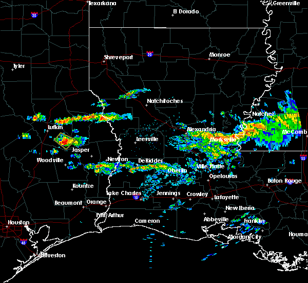 At 746 pm cdt, a severe thunderstorm was located 9 miles north of rockland, moving southeast at 15 mph (radar indicated). Hazards include 60 mph wind gusts and quarter size hail. Hail damage to vehicles is expected. expect wind damage to roofs, siding, and trees. Locations impacted include, zavalla and dolan. At 746 pm cdt, a severe thunderstorm was located 9 miles north of rockland, moving southeast at 15 mph (radar indicated). Hazards include 60 mph wind gusts and quarter size hail. Hail damage to vehicles is expected. expect wind damage to roofs, siding, and trees. Locations impacted include, zavalla and dolan.
|
| 4/4/2019 7:27 PM CDT |
 At 726 pm cdt, a severe thunderstorm was located 8 miles southeast of huntington, or 14 miles northwest of rockland, moving southeast at 15 mph (radar indicated). Hazards include 60 mph wind gusts and quarter size hail. Hail damage to vehicles is expected. expect wind damage to roofs, siding, and trees. Locations impacted include, zavalla, dolan and shawnee. At 726 pm cdt, a severe thunderstorm was located 8 miles southeast of huntington, or 14 miles northwest of rockland, moving southeast at 15 mph (radar indicated). Hazards include 60 mph wind gusts and quarter size hail. Hail damage to vehicles is expected. expect wind damage to roofs, siding, and trees. Locations impacted include, zavalla, dolan and shawnee.
|
| 4/4/2019 7:08 PM CDT |
 At 707 pm cdt, a severe thunderstorm was located near huntington, or 11 miles southeast of lufkin, moving southeast at 15 mph (radar indicated). Hazards include 60 mph wind gusts and quarter size hail. Hail damage to vehicles is expected. Expect wind damage to roofs, siding, and trees. At 707 pm cdt, a severe thunderstorm was located near huntington, or 11 miles southeast of lufkin, moving southeast at 15 mph (radar indicated). Hazards include 60 mph wind gusts and quarter size hail. Hail damage to vehicles is expected. Expect wind damage to roofs, siding, and trees.
|
| 5/26/2018 6:15 PM CDT | Trees and power lines down along mollywood roa in angelina county TX, 9.3 miles W of Zavalla, TX |
| 4/6/2018 11:53 PM CDT |
 At 1153 pm cdt, severe thunderstorms were located along a line extending from near diboll to 10 miles north of ebenezer to 9 miles east of hemphill to 12 miles northwest of hornbeck to just southwest of many, moving southeast at 25 mph (radar indicated). Hazards include 60 mph wind gusts and quarter size hail. Hail damage to vehicles is expected. Expect wind damage to roofs, siding, and trees. At 1153 pm cdt, severe thunderstorms were located along a line extending from near diboll to 10 miles north of ebenezer to 9 miles east of hemphill to 12 miles northwest of hornbeck to just southwest of many, moving southeast at 25 mph (radar indicated). Hazards include 60 mph wind gusts and quarter size hail. Hail damage to vehicles is expected. Expect wind damage to roofs, siding, and trees.
|
| 4/6/2018 11:45 PM CDT |
 A severe thunderstorm warning remains in effect until midnight cdt for southeastern nacogdoches. angelina. southern san augustine and sabine counties. At 1146 pm cdt, severe thunderstorms were located along a line extending from near diboll to 10 miles west of pineland to 7 miles southeast of milam, moving south southeast at 25 mph. A severe thunderstorm warning remains in effect until midnight cdt for southeastern nacogdoches. angelina. southern san augustine and sabine counties. At 1146 pm cdt, severe thunderstorms were located along a line extending from near diboll to 10 miles west of pineland to 7 miles southeast of milam, moving south southeast at 25 mph.
|
| 4/6/2018 11:00 PM CDT |
 At 1059 pm cdt, severe thunderstorms were located along a line extending from near etoile to macune to 7 miles south of patroon, moving southeast at 15 mph. other strong to severe thunderstorms were indicated along a line from appleby to alto, moving south at 20 mph (radar indicated). Hazards include 60 mph wind gusts and quarter size hail. Hail damage to vehicles is expected. Expect wind damage to roofs, siding, and trees. At 1059 pm cdt, severe thunderstorms were located along a line extending from near etoile to macune to 7 miles south of patroon, moving southeast at 15 mph. other strong to severe thunderstorms were indicated along a line from appleby to alto, moving south at 20 mph (radar indicated). Hazards include 60 mph wind gusts and quarter size hail. Hail damage to vehicles is expected. Expect wind damage to roofs, siding, and trees.
|
| 8/26/2017 4:16 PM CDT |
 At 416 pm cdt, a severe thunderstorm capable of producing a tornado was located 10 miles north of rockland, moving northwest at 25 mph (radar indicated rotation). Hazards include tornado. Flying debris will be dangerous to those caught without shelter. mobile homes will be damaged or destroyed. damage to roofs, windows, and vehicles will occur. tree damage is likely. this dangerous storm will be near, huntington around 450 pm cdt. Other locations impacted by this tornadic thunderstorm include zavalla and shawnee. At 416 pm cdt, a severe thunderstorm capable of producing a tornado was located 10 miles north of rockland, moving northwest at 25 mph (radar indicated rotation). Hazards include tornado. Flying debris will be dangerous to those caught without shelter. mobile homes will be damaged or destroyed. damage to roofs, windows, and vehicles will occur. tree damage is likely. this dangerous storm will be near, huntington around 450 pm cdt. Other locations impacted by this tornadic thunderstorm include zavalla and shawnee.
|
| 8/26/2017 4:07 PM CDT |
 At 407 pm cdt, a severe thunderstorm capable of producing a tornado was located 7 miles north of rockland, moving northwest at 20 mph (radar indicated rotation). Hazards include tornado. Flying debris will be dangerous to those caught without shelter. mobile homes will be damaged or destroyed. damage to roofs, windows, and vehicles will occur. tree damage is likely. this dangerous storm will be near, huntington around 450 pm cdt. Other locations impacted by this tornadic thunderstorm include zavalla and shawnee. At 407 pm cdt, a severe thunderstorm capable of producing a tornado was located 7 miles north of rockland, moving northwest at 20 mph (radar indicated rotation). Hazards include tornado. Flying debris will be dangerous to those caught without shelter. mobile homes will be damaged or destroyed. damage to roofs, windows, and vehicles will occur. tree damage is likely. this dangerous storm will be near, huntington around 450 pm cdt. Other locations impacted by this tornadic thunderstorm include zavalla and shawnee.
|
| 8/26/2017 3:31 PM CDT |
 At 330 pm cdt, a severe thunderstorm capable of producing a tornado was located 10 miles southeast of huntington, or 13 miles north of rockland, moving northwest at 25 mph (radar indicated rotation). Hazards include tornado. Flying debris will be dangerous to those caught without shelter. mobile homes will be damaged or destroyed. damage to roofs, windows, and vehicles will occur. tree damage is likely. this dangerous storm will be near, huntington around 355 pm cdt. Other locations impacted by this tornadic thunderstorm include zavalla, shawnee and homer. At 330 pm cdt, a severe thunderstorm capable of producing a tornado was located 10 miles southeast of huntington, or 13 miles north of rockland, moving northwest at 25 mph (radar indicated rotation). Hazards include tornado. Flying debris will be dangerous to those caught without shelter. mobile homes will be damaged or destroyed. damage to roofs, windows, and vehicles will occur. tree damage is likely. this dangerous storm will be near, huntington around 355 pm cdt. Other locations impacted by this tornadic thunderstorm include zavalla, shawnee and homer.
|
| 5/3/2017 5:49 PM CDT |
 At 549 pm cdt, a severe thunderstorm was located near diboll, moving east at 30 mph (radar indicated). Hazards include 60 mph wind gusts and quarter size hail. Hail damage to vehicles is expected. Expect wind damage to roofs, siding, and trees. At 549 pm cdt, a severe thunderstorm was located near diboll, moving east at 30 mph (radar indicated). Hazards include 60 mph wind gusts and quarter size hail. Hail damage to vehicles is expected. Expect wind damage to roofs, siding, and trees.
|
| 5/3/2017 2:19 PM CDT |
 At 218 pm cdt, a severe thunderstorm was located over lufkin, moving east at 40 mph (radar indicated). Hazards include 60 mph wind gusts and quarter size hail. Hail damage to vehicles is expected. expect wind damage to roofs, siding, and trees. locations impacted include, lufkin, nacogdoches, diboll, hudson, huntington, woden, etoile, burke, zavalla, chireno, broaddus, oak ridge, shawnee, redland, homer and dolan. A tornado watch remains in effect until 500 pm cdt for eastern texas. At 218 pm cdt, a severe thunderstorm was located over lufkin, moving east at 40 mph (radar indicated). Hazards include 60 mph wind gusts and quarter size hail. Hail damage to vehicles is expected. expect wind damage to roofs, siding, and trees. locations impacted include, lufkin, nacogdoches, diboll, hudson, huntington, woden, etoile, burke, zavalla, chireno, broaddus, oak ridge, shawnee, redland, homer and dolan. A tornado watch remains in effect until 500 pm cdt for eastern texas.
|
| 5/3/2017 2:07 PM CDT |
 At 207 pm cdt, a severe thunderstorm was located 7 miles east of diboll, moving northeast at 30 mph (radar indicated). Hazards include 60 mph wind gusts and quarter size hail. Hail damage to vehicles is expected. expect wind damage to roofs, siding, and trees. locations impacted include, lufkin, nacogdoches, diboll, hudson, huntington, woden, etoile, burke, zavalla, chireno, broaddus, oak ridge, shawnee, redland, homer and dolan. A tornado watch remains in effect until 500 pm cdt for eastern texas. At 207 pm cdt, a severe thunderstorm was located 7 miles east of diboll, moving northeast at 30 mph (radar indicated). Hazards include 60 mph wind gusts and quarter size hail. Hail damage to vehicles is expected. expect wind damage to roofs, siding, and trees. locations impacted include, lufkin, nacogdoches, diboll, hudson, huntington, woden, etoile, burke, zavalla, chireno, broaddus, oak ridge, shawnee, redland, homer and dolan. A tornado watch remains in effect until 500 pm cdt for eastern texas.
|
| 5/3/2017 1:48 PM CDT |
 At 147 pm cdt, a severe thunderstorm was located near diboll, moving northeast at 30 mph (radar indicated). Hazards include 60 mph wind gusts and quarter size hail. Hail damage to vehicles is expected. Expect wind damage to roofs, siding, and trees. At 147 pm cdt, a severe thunderstorm was located near diboll, moving northeast at 30 mph (radar indicated). Hazards include 60 mph wind gusts and quarter size hail. Hail damage to vehicles is expected. Expect wind damage to roofs, siding, and trees.
|
| 4/26/2017 5:20 PM CDT |
 At 520 pm cdt, a severe thunderstorm was located 8 miles north of rockland, moving east at 45 mph (radar indicated). Hazards include 60 mph wind gusts and quarter size hail. Hail damage to vehicles is expected. expect wind damage to roofs, siding, and trees. locations impacted include, zavalla and dolan. A tornado watch remains in effect until 1100 pm cdt for eastern texas. At 520 pm cdt, a severe thunderstorm was located 8 miles north of rockland, moving east at 45 mph (radar indicated). Hazards include 60 mph wind gusts and quarter size hail. Hail damage to vehicles is expected. expect wind damage to roofs, siding, and trees. locations impacted include, zavalla and dolan. A tornado watch remains in effect until 1100 pm cdt for eastern texas.
|
| 4/26/2017 5:15 PM CDT | Quarter sized hail reported 0.3 miles NE of Zavalla, TX |
| 4/26/2017 5:00 PM CDT |
 At 500 pm cdt, a severe thunderstorm was located 11 miles north of chester, moving east at 45 mph (radar indicated). Hazards include 60 mph wind gusts and quarter size hail. Hail damage to vehicles is expected. Expect wind damage to roofs, siding, and trees. At 500 pm cdt, a severe thunderstorm was located 11 miles north of chester, moving east at 45 mph (radar indicated). Hazards include 60 mph wind gusts and quarter size hail. Hail damage to vehicles is expected. Expect wind damage to roofs, siding, and trees.
|
| 4/2/2017 1:52 PM CDT |
 At 152 pm cdt, severe thunderstorms were located along a line extending from 7 miles south of deberry to near neuville to 8 miles northeast of rockland, moving northeast at 50 mph (radar indicated). Hazards include 60 mph wind gusts and quarter size hail. Hail damage to vehicles is expected. Expect wind damage to roofs, siding, and trees. At 152 pm cdt, severe thunderstorms were located along a line extending from 7 miles south of deberry to near neuville to 8 miles northeast of rockland, moving northeast at 50 mph (radar indicated). Hazards include 60 mph wind gusts and quarter size hail. Hail damage to vehicles is expected. Expect wind damage to roofs, siding, and trees.
|
| 3/24/2017 10:07 PM CDT |
 At 1006 pm cdt, severe thunderstorms were located along a line extending from 6 miles southeast of patroon to near milam to near pineland, moving northeast at 55 mph. additional strong to severe thunderstorms were indicated just southwest of zavalla in eastern angelina county, also moving northeast at 55 mph (radar indicated). Hazards include 60 mph wind gusts. Expect damage to roofs, siding, and trees. locations impacted include, milam, huntington, san augustine, hemphill, pineland, rosevine, macune, etoile, zavalla, broaddus, sexton, fairmount, shawnee, bronson, mcelroy, yellowpine, columbus, dolan and chinaquapin. A tornado watch remains in effect until 300 am cdt for northwestern louisiana, and eastern texas. At 1006 pm cdt, severe thunderstorms were located along a line extending from 6 miles southeast of patroon to near milam to near pineland, moving northeast at 55 mph. additional strong to severe thunderstorms were indicated just southwest of zavalla in eastern angelina county, also moving northeast at 55 mph (radar indicated). Hazards include 60 mph wind gusts. Expect damage to roofs, siding, and trees. locations impacted include, milam, huntington, san augustine, hemphill, pineland, rosevine, macune, etoile, zavalla, broaddus, sexton, fairmount, shawnee, bronson, mcelroy, yellowpine, columbus, dolan and chinaquapin. A tornado watch remains in effect until 300 am cdt for northwestern louisiana, and eastern texas.
|
| 3/24/2017 9:25 PM CDT |
 At 925 pm cdt, severe thunderstorms were located along a line extending from near etoile to 11 miles east of huntington to 6 miles northwest of rockland, moving east northeast at 55 mph (radar indicated). Hazards include 60 mph wind gusts. expect damage to roofs, siding, and trees At 925 pm cdt, severe thunderstorms were located along a line extending from near etoile to 11 miles east of huntington to 6 miles northwest of rockland, moving east northeast at 55 mph (radar indicated). Hazards include 60 mph wind gusts. expect damage to roofs, siding, and trees
|
| 6/18/2016 4:03 PM CDT |
 At 402 pm cdt, severe thunderstorms were located along a line extending from near nacogdoches to 8 miles north of lufkin to 7 miles south of huntington to rockland, moving southwest at 35 mph (radar indicated). Hazards include 60 mph wind gusts. Expect damage to roofs. siding. and trees. Locations impacted include, lufkin, nacogdoches, diboll, hudson, huntington, wells, pollok, woden, etoile, melrose, burke, zavalla, appleby, oak ridge, central, dolan, homer, clawson, shawnee and redland. At 402 pm cdt, severe thunderstorms were located along a line extending from near nacogdoches to 8 miles north of lufkin to 7 miles south of huntington to rockland, moving southwest at 35 mph (radar indicated). Hazards include 60 mph wind gusts. Expect damage to roofs. siding. and trees. Locations impacted include, lufkin, nacogdoches, diboll, hudson, huntington, wells, pollok, woden, etoile, melrose, burke, zavalla, appleby, oak ridge, central, dolan, homer, clawson, shawnee and redland.
|
| 6/18/2016 3:47 PM CDT |
 At 346 pm cdt, severe thunderstorms were located along a line extending from near nacogdoches to 6 miles south of woden to 7 miles southeast of huntington to near ebenezer, moving southwest at 25 mph (radar indicated). Hazards include 60 mph wind gusts. Expect damage to roofs. siding. and trees. Locations impacted include, lufkin, nacogdoches, diboll, hudson, huntington, wells, pollok, woden, martinsville, etoile, melrose, burke, zavalla, appleby, chireno, broaddus, oak ridge, central, dolan and homer. At 346 pm cdt, severe thunderstorms were located along a line extending from near nacogdoches to 6 miles south of woden to 7 miles southeast of huntington to near ebenezer, moving southwest at 25 mph (radar indicated). Hazards include 60 mph wind gusts. Expect damage to roofs. siding. and trees. Locations impacted include, lufkin, nacogdoches, diboll, hudson, huntington, wells, pollok, woden, martinsville, etoile, melrose, burke, zavalla, appleby, chireno, broaddus, oak ridge, central, dolan and homer.
|
| 6/18/2016 3:13 PM CDT |
 At 312 pm cdt, severe thunderstorms were located along a line extending from 7 miles southeast of garrison to 9 miles southeast of melrose to 8 miles south of macune, moving southwest at 35 mph (radar indicated). Hazards include 60 mph wind gusts. Expect damage to roofs. siding. And trees. At 312 pm cdt, severe thunderstorms were located along a line extending from 7 miles southeast of garrison to 9 miles southeast of melrose to 8 miles south of macune, moving southwest at 35 mph (radar indicated). Hazards include 60 mph wind gusts. Expect damage to roofs. siding. And trees.
|
| 5/14/2016 4:36 PM CDT |
 At 435 pm cdt, a severe thunderstorm was located 11 miles south of huntington, or 12 miles northwest of rockland, moving north at 10 mph (radar indicated). Hazards include 60 mph wind gusts and quarter size hail. Hail damage to vehicles is expected. Expect wind damage to roofs, siding, and trees. At 435 pm cdt, a severe thunderstorm was located 11 miles south of huntington, or 12 miles northwest of rockland, moving north at 10 mph (radar indicated). Hazards include 60 mph wind gusts and quarter size hail. Hail damage to vehicles is expected. Expect wind damage to roofs, siding, and trees.
|
| 4/30/2016 3:55 AM CDT |
 At 355 am cdt, a severe thunderstorm was located 11 miles south of huntington, or 12 miles northwest of rockland, moving east at 30 mph (radar indicated). Hazards include 60 mph wind gusts and nickel size hail. Expect damage to roofs. siding. And trees. At 355 am cdt, a severe thunderstorm was located 11 miles south of huntington, or 12 miles northwest of rockland, moving east at 30 mph (radar indicated). Hazards include 60 mph wind gusts and nickel size hail. Expect damage to roofs. siding. And trees.
|
| 5/25/2015 8:30 PM CDT | At 830 pm cdt, severe thunderstorms were located along a line extending from near etoile to 10 miles southeast of huntington to 7 miles west of rockland to near alabama-coushatta reservation, moving east at 50 mph (radar indicated). Hazards include 60 mph wind gusts and quarter size hail. Hail damage to vehicles is expected. Expect wind damage to roofs, siding and trees. |
| 5/25/2015 8:15 PM CDT | At 814 pm cdt, severe thunderstorms were located along a line extending from 6 miles northeast of plain dealing to 8 miles west of cotton valley to 6 miles southeast of shreveport to 11 miles west of converse to 9 miles south of macune, moving east at 65 mph (radar indicated). Hazards include 70 mph wind gusts and quarter size hail. Hail damage to vehicles is expected. expect considerable tree damage. wind damage is also likely to mobile homes, roofs and outbuildings. locations impacted include, shreveport, bossier city, center, mansfield, milam, haughton, greenwood, blanchard, huntington, san augustine, benton, stonewall, zwolle, logansport, hemphill, plain dealing, pineland, mooringsport, converse and hosston. a tornado watch remains in effect until 1000 pm cdt for eastern texas. A tornado watch also remains in effect until 200 am cdt for northwestern louisiana and eastern texas. |
| 5/25/2015 8:15 PM CDT | At 814 pm cdt, severe thunderstorms were located along a line extending from 6 miles northeast of plain dealing to 8 miles west of cotton valley to 6 miles southeast of shreveport to 11 miles west of converse to 9 miles south of macune, moving east at 65 mph (radar indicated). Hazards include 70 mph wind gusts and quarter size hail. Hail damage to vehicles is expected. expect considerable tree damage. wind damage is also likely to mobile homes, roofs and outbuildings. locations impacted include, shreveport, bossier city, center, mansfield, milam, haughton, greenwood, blanchard, huntington, san augustine, benton, stonewall, zwolle, logansport, hemphill, plain dealing, pineland, mooringsport, converse and hosston. a tornado watch remains in effect until 1000 pm cdt for eastern texas. A tornado watch also remains in effect until 200 am cdt for northwestern louisiana and eastern texas. |
| 5/25/2015 7:52 PM CDT | At 751 pm cdt, severe thunderstorms were located along a line extending from near hosston to near belcher to 7 miles east of deberry to center to near huntington, moving east at 65 mph (radar indicated). Hazards include 70 mph wind gusts and quarter size hail. Hail damage to vehicles is expected. expect considerable tree damage. wind damage is also likely to mobile homes, roofs and outbuildings. locations impacted include, shreveport, bossier city, lufkin, marshall, carthage, center, mansfield, milam, vivian, haughton, greenwood, blanchard, waskom, huntington, san augustine, benton, stonewall, zwolle, logansport and hemphill. a tornado watch remains in effect until 1000 pm cdt for northeastern texas. A tornado watch also remains in effect until 200 am cdt for northwestern louisiana and eastern texas. |
| 5/25/2015 7:52 PM CDT | At 751 pm cdt, severe thunderstorms were located along a line extending from near hosston to near belcher to 7 miles east of deberry to center to near huntington, moving east at 65 mph (radar indicated). Hazards include 70 mph wind gusts and quarter size hail. Hail damage to vehicles is expected. expect considerable tree damage. wind damage is also likely to mobile homes, roofs and outbuildings. locations impacted include, shreveport, bossier city, lufkin, marshall, carthage, center, mansfield, milam, vivian, haughton, greenwood, blanchard, waskom, huntington, san augustine, benton, stonewall, zwolle, logansport and hemphill. a tornado watch remains in effect until 1000 pm cdt for northeastern texas. A tornado watch also remains in effect until 200 am cdt for northwestern louisiana and eastern texas. |
| 5/25/2015 7:27 PM CDT | At 726 pm cdt, severe thunderstorms were located along a line extending from berea to near woodlawn to 8 miles northeast of beckville to near garrison to diboll, moving east at 65 mph (radar indicated). Hazards include 70 mph wind gusts and quarter size hail. Hail damage to vehicles is expected. expect considerable tree damage. Wind damage is also likely to mobile homes, roofs and outbuildings. |
| 5/25/2015 7:27 PM CDT | At 726 pm cdt, severe thunderstorms were located along a line extending from berea to near woodlawn to 8 miles northeast of beckville to near garrison to diboll, moving east at 65 mph (radar indicated). Hazards include 70 mph wind gusts and quarter size hail. Hail damage to vehicles is expected. expect considerable tree damage. Wind damage is also likely to mobile homes, roofs and outbuildings. |
| 4/27/2015 5:43 AM CDT | At 543 am cdt, severe thunderstorms were located along a line extending from near woden to near etoile to 10 miles southwest of macune to ebenezer, moving east at 35 mph (radar indicated). Hazards include 60 mph wind gusts and quarter size hail. Hail damage to vehicles is expected. Expect wind damage to roofs, siding and trees. |
| 4/27/2015 5:34 AM CDT | At 533 am cdt, severe thunderstorms were located along a line extending from 6 miles south of woden to near huntington to 12 miles northwest of rockland to 6 miles northwest of colmesneil, moving east at 35 mph (radar indicated). Hazards include 60 mph wind gusts and quarter size hail. Hail damage to vehicles is expected. expect wind damage to roofs, siding and trees. locations impacted include, lufkin, hudson, huntington, etoile, burke, zavalla, broaddus, dolan, homer and shawnee. a tornado watch remains in effect until 900 am cdt for eastern texas. 1. 00in. |
| 4/27/2015 5:02 AM CDT | At 501 am cdt, severe thunderstorms were located along a line extending from near hudson to near lufkin to near corrigan, moving east at 35 mph (radar indicated). Hazards include 60 mph wind gusts and quarter size hail. Hail damage to vehicles is expected. Expect wind damage to roofs, siding and trees. |
| 3/31/2013 11:35 AM CDT | Several trees down in angelina county TX, 0.3 miles NE of Zavalla, TX |
| 4/20/2012 1:43 PM CDT | Quarter sized hail reported 5.6 miles SW of Zavalla, TX, boat launch on lake sam rayburn reports quarter-sized hail. |
| 1/1/0001 12:00 AM | Trees down along highway 69 near zavall in angelina county TX, 0.3 miles NE of Zavalla, TX |
| 1/1/0001 12:00 AM | Quarter sized hail reported 0.3 miles NE of Zavalla, TX |
| 1/1/0001 12:00 AM | Numerous trees were snapped and uprooted along and east of hwy. 63 to the western shore of lake sam rayburn to just north of the jasper county line. winds were estimate in angelina county TX, 0.3 miles NE of Zavalla, TX |
| 1/1/0001 12:00 AM | Golf Ball sized hail reported 0.3 miles NE of Zavalla, TX |
Hail Maps for Zavalla, TX
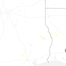
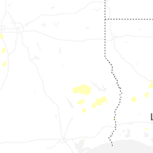
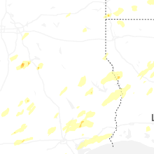
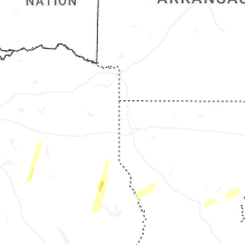


Connect with Interactive Hail Maps