

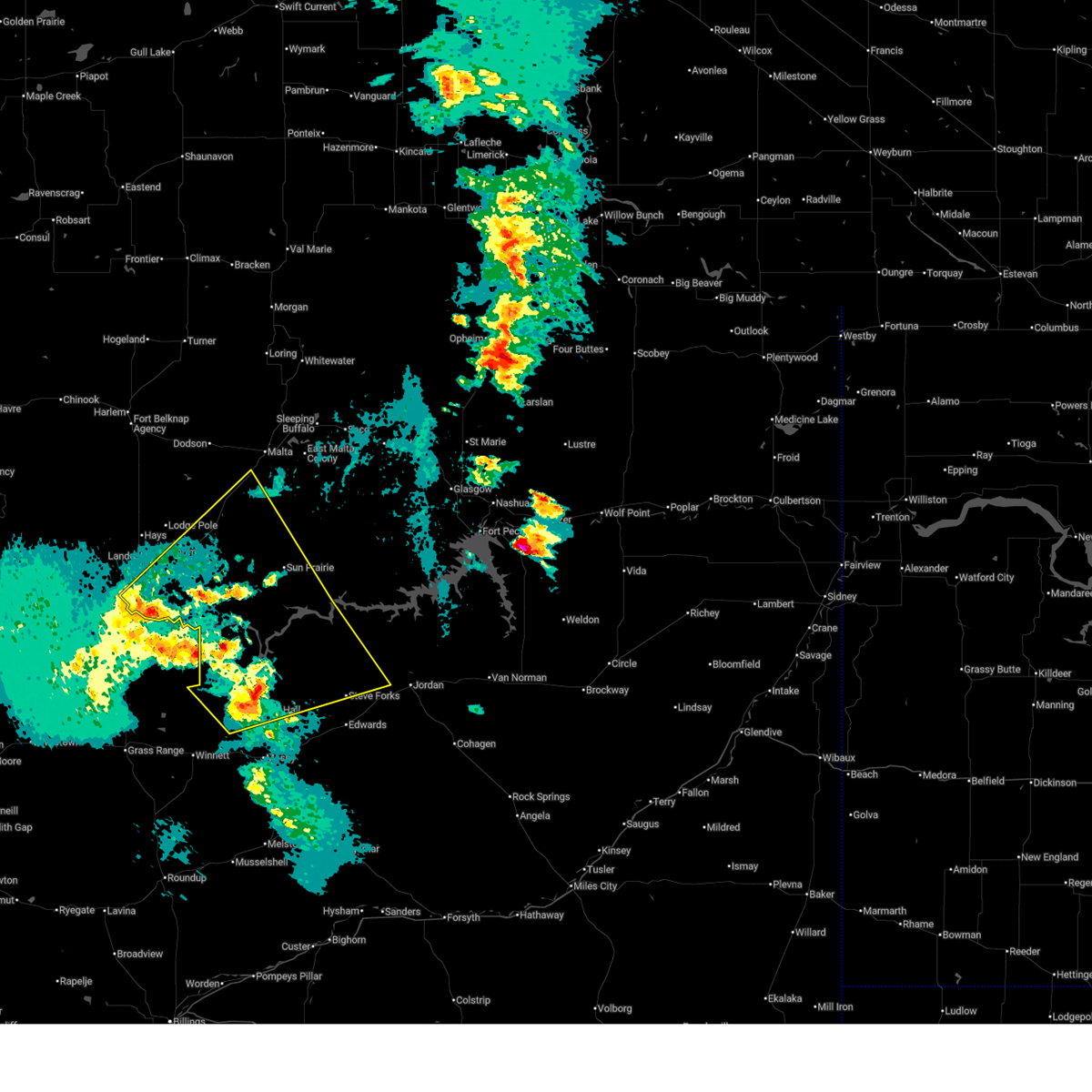
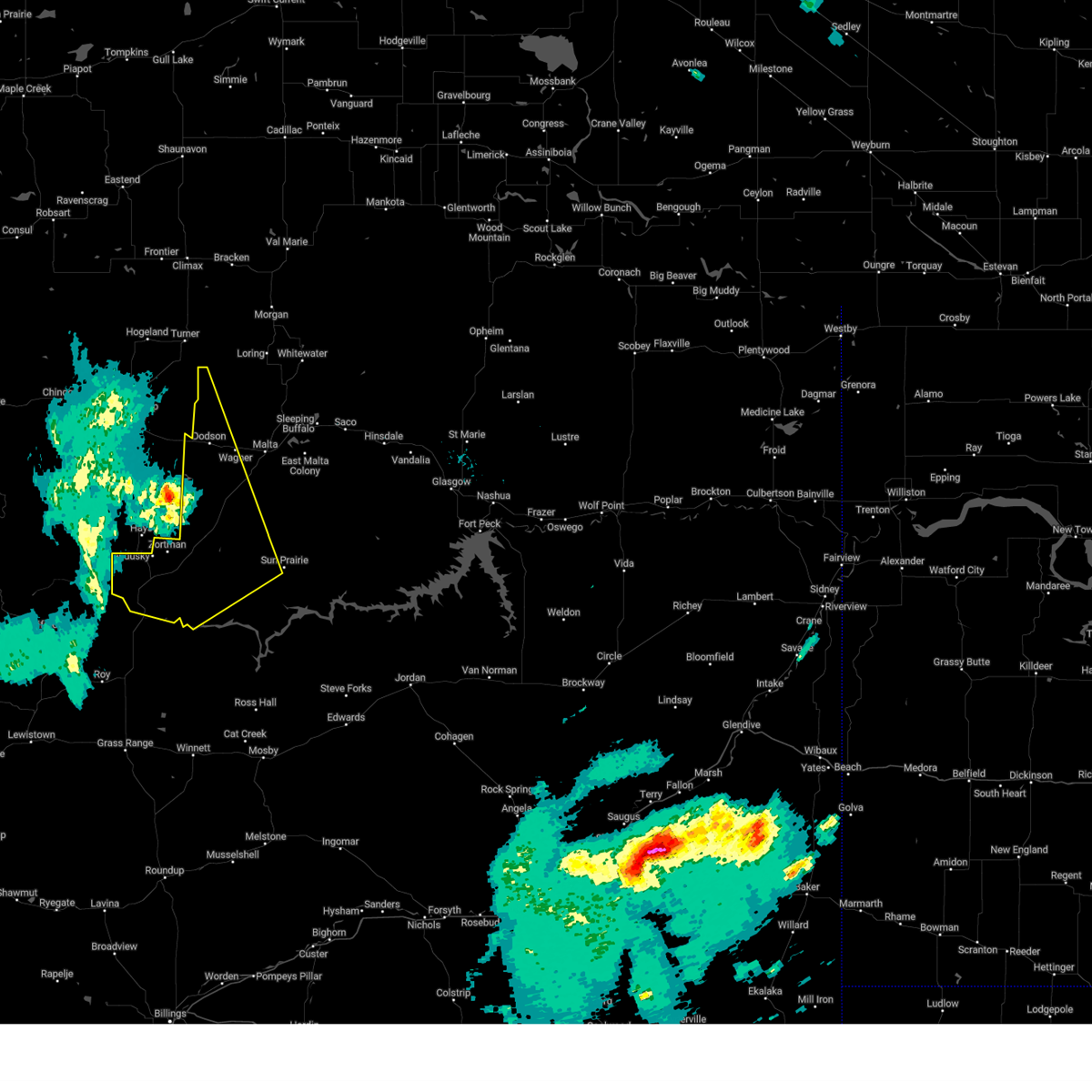
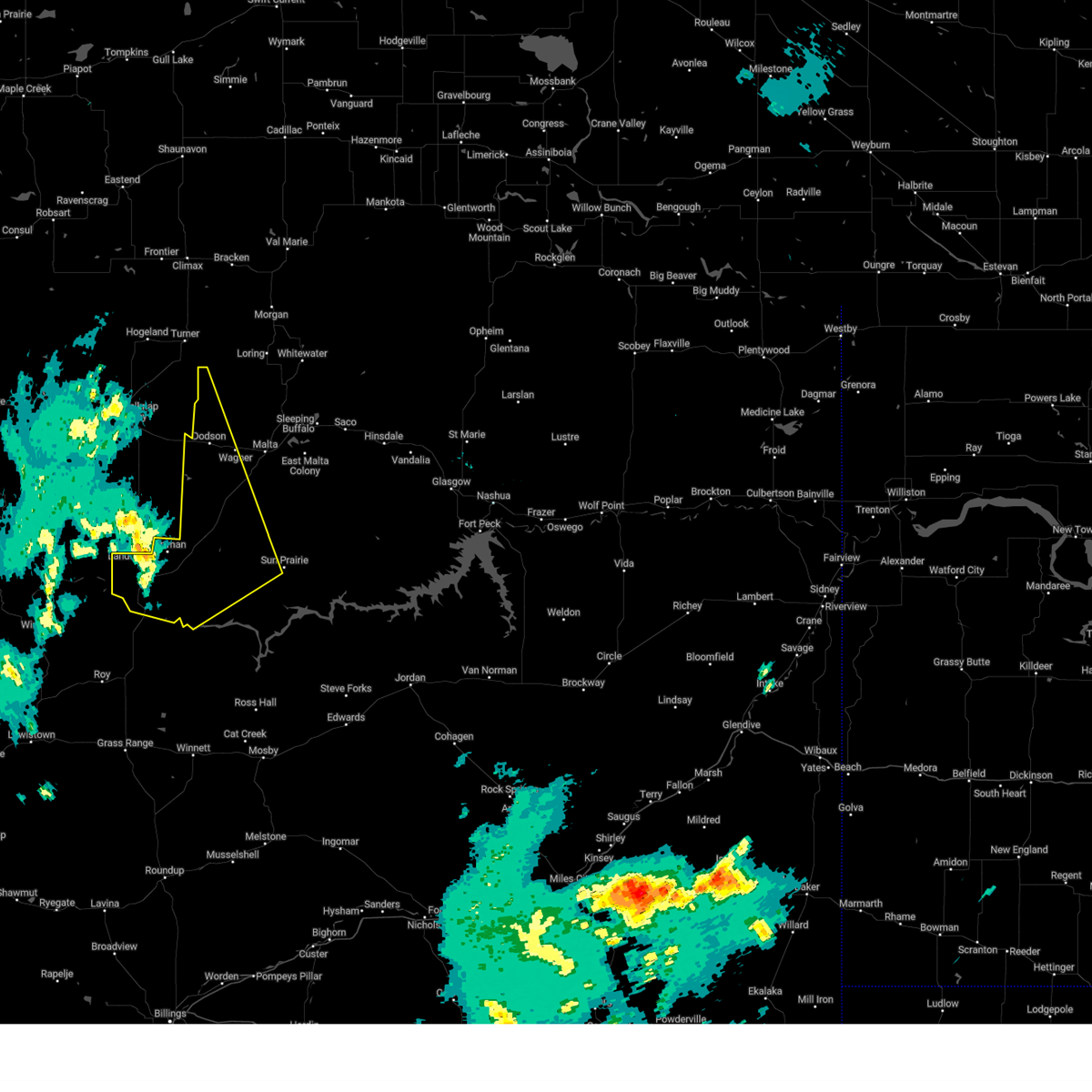
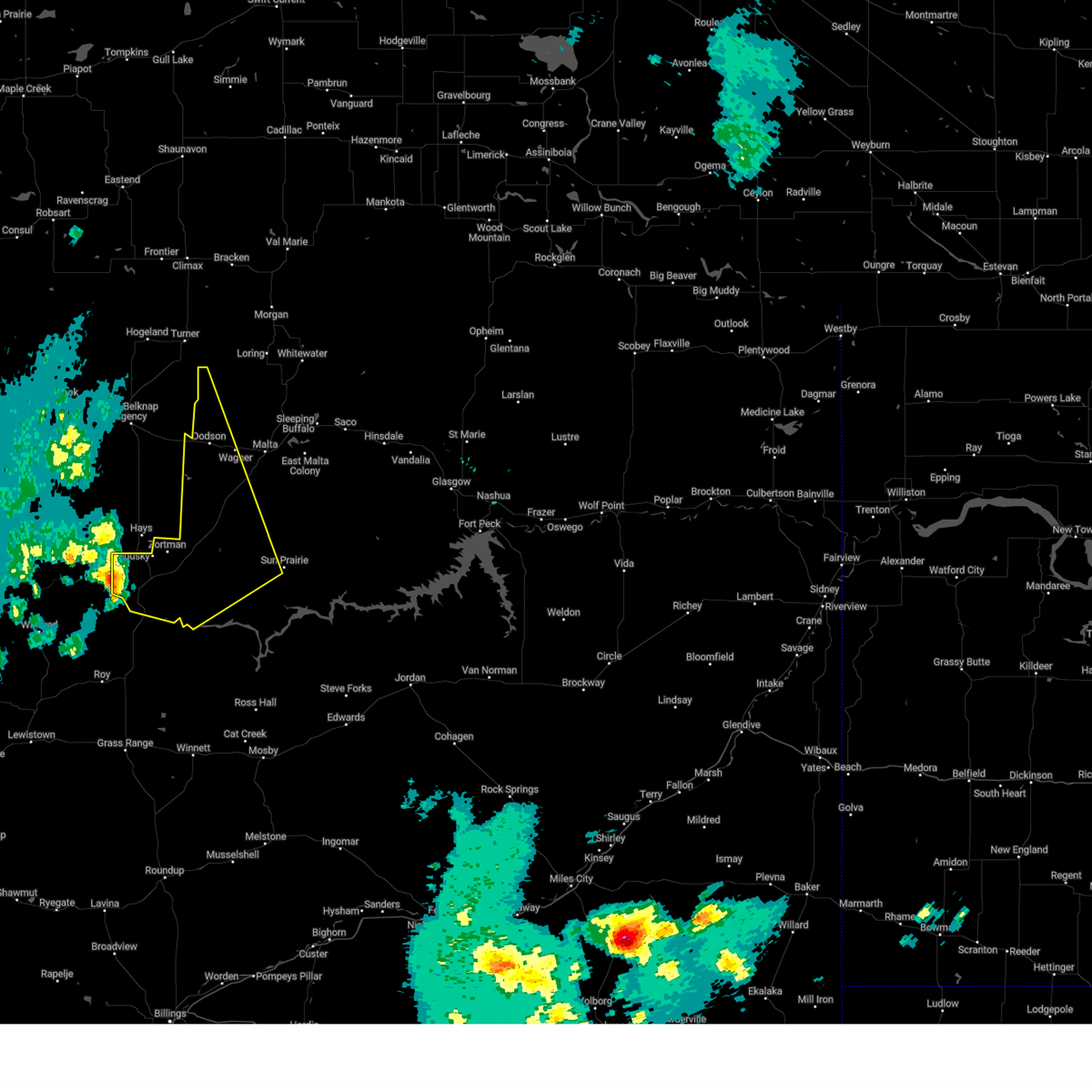
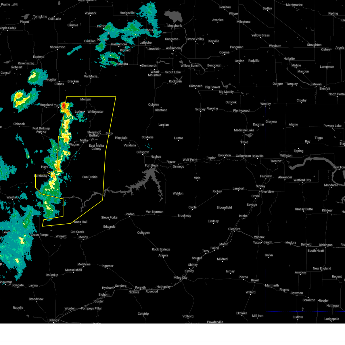
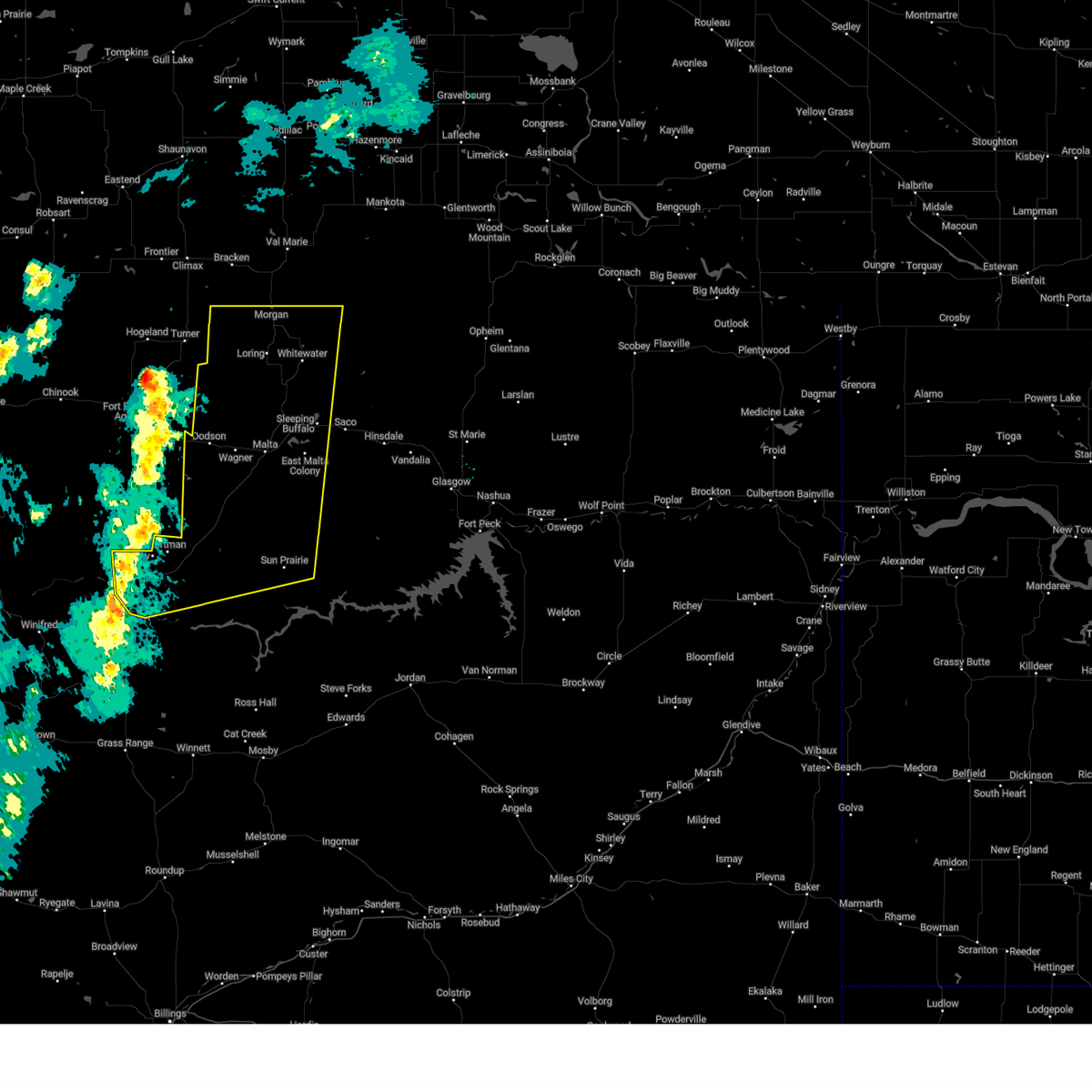
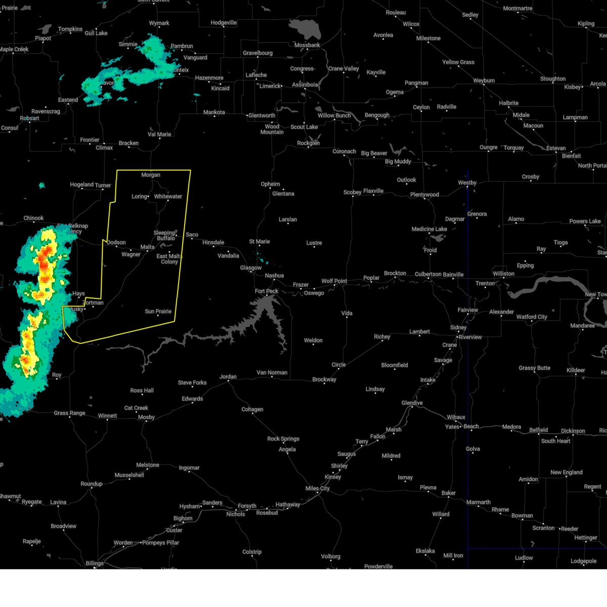
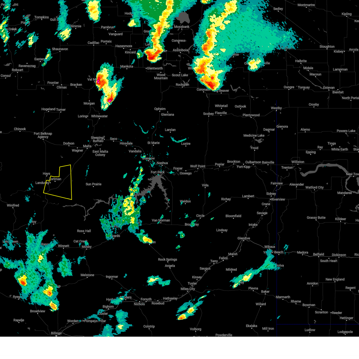
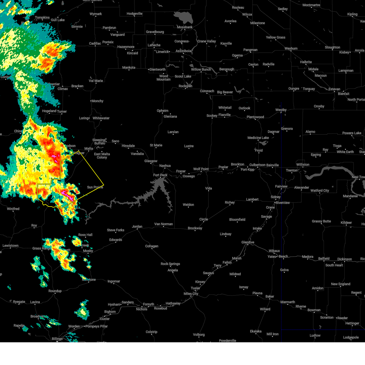
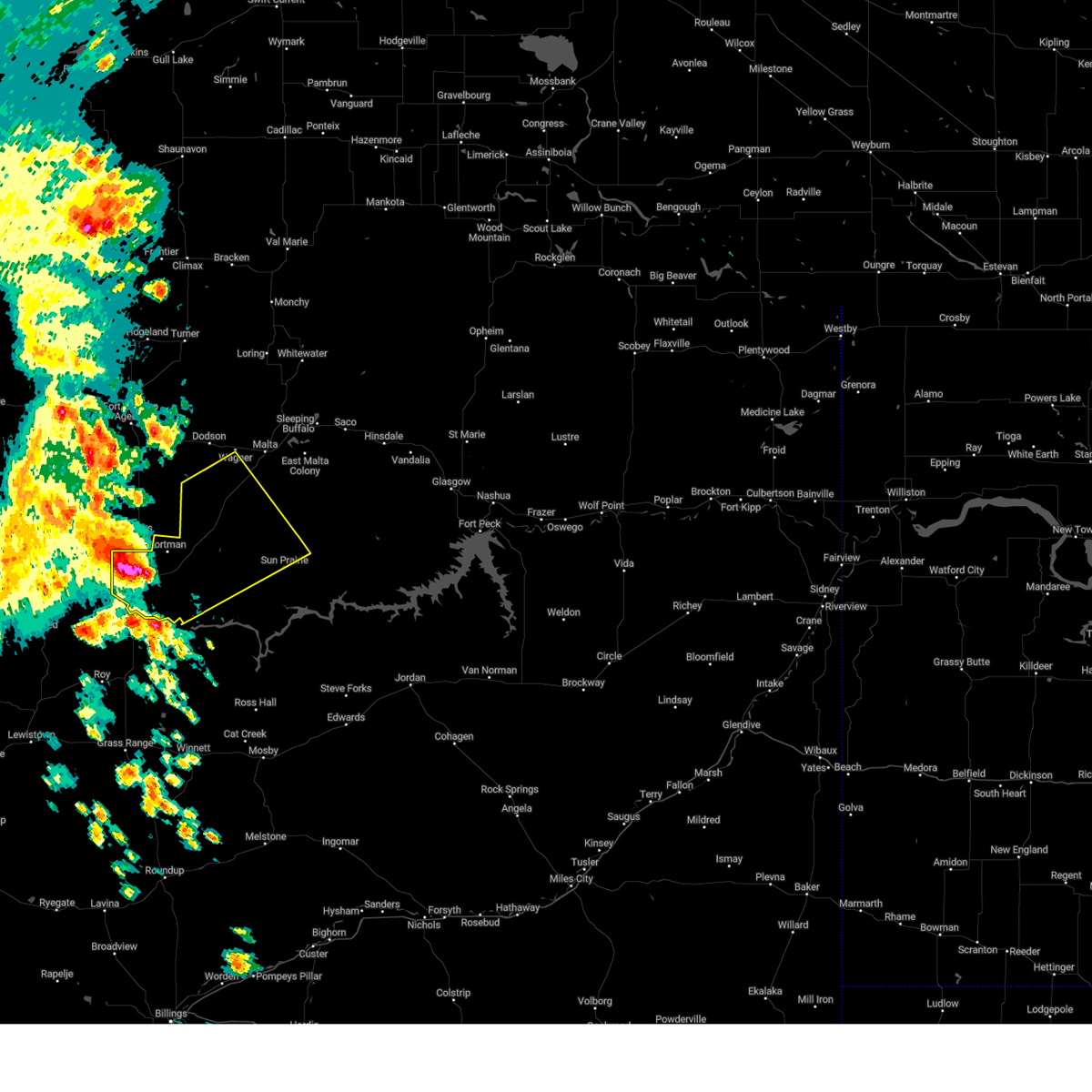
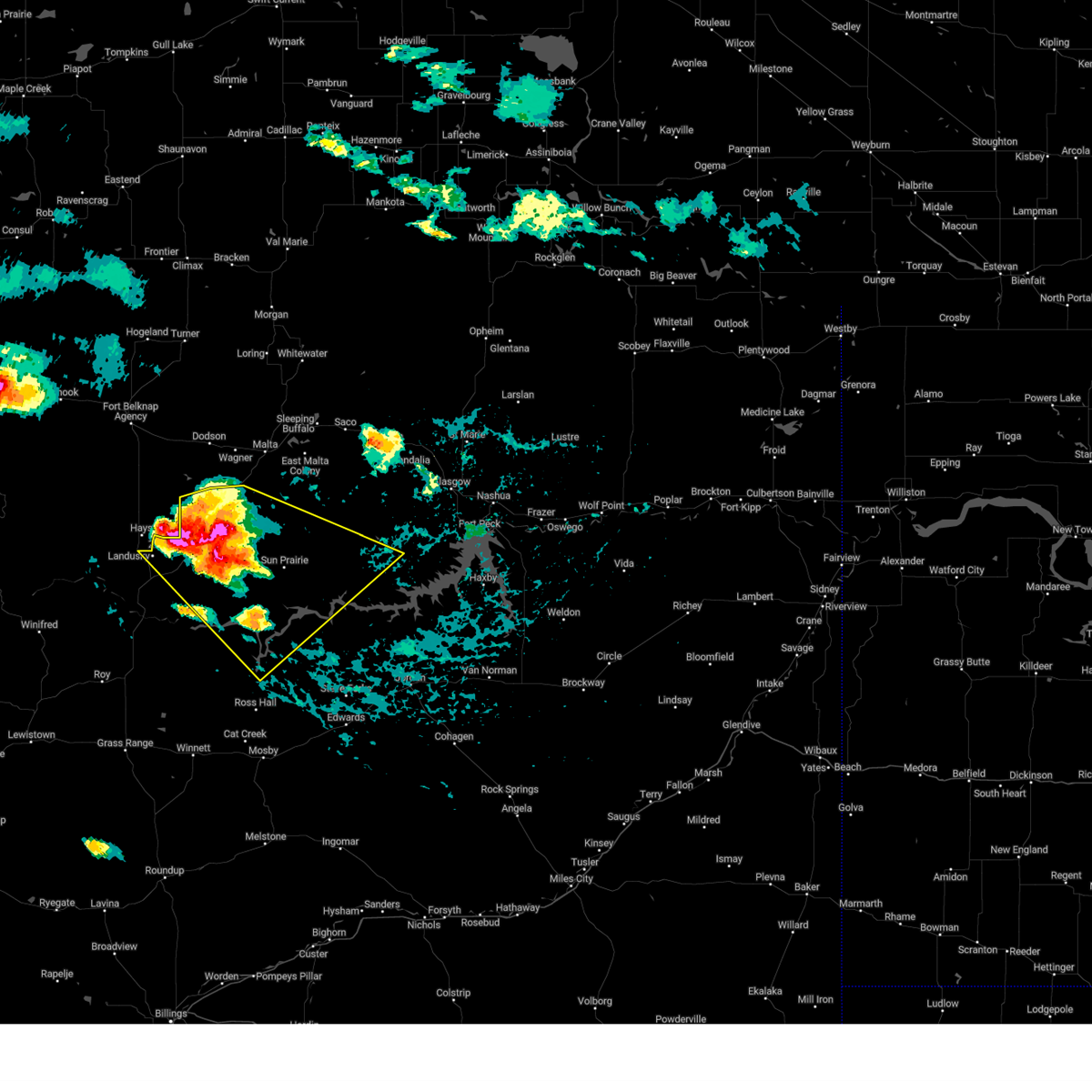
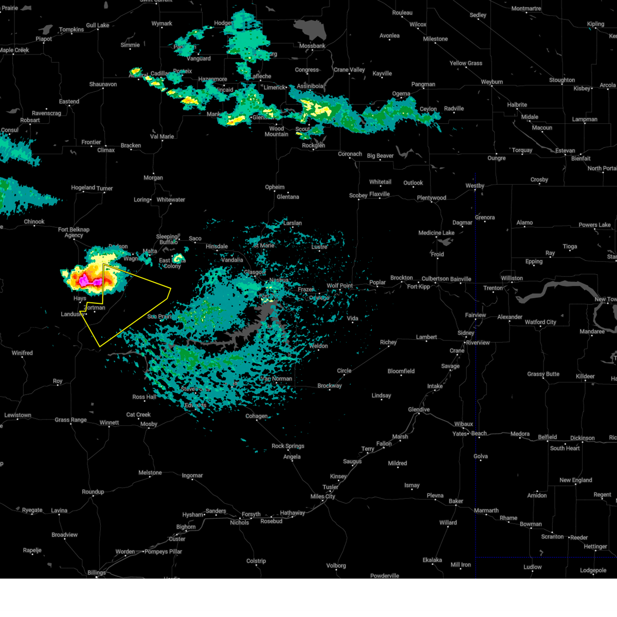
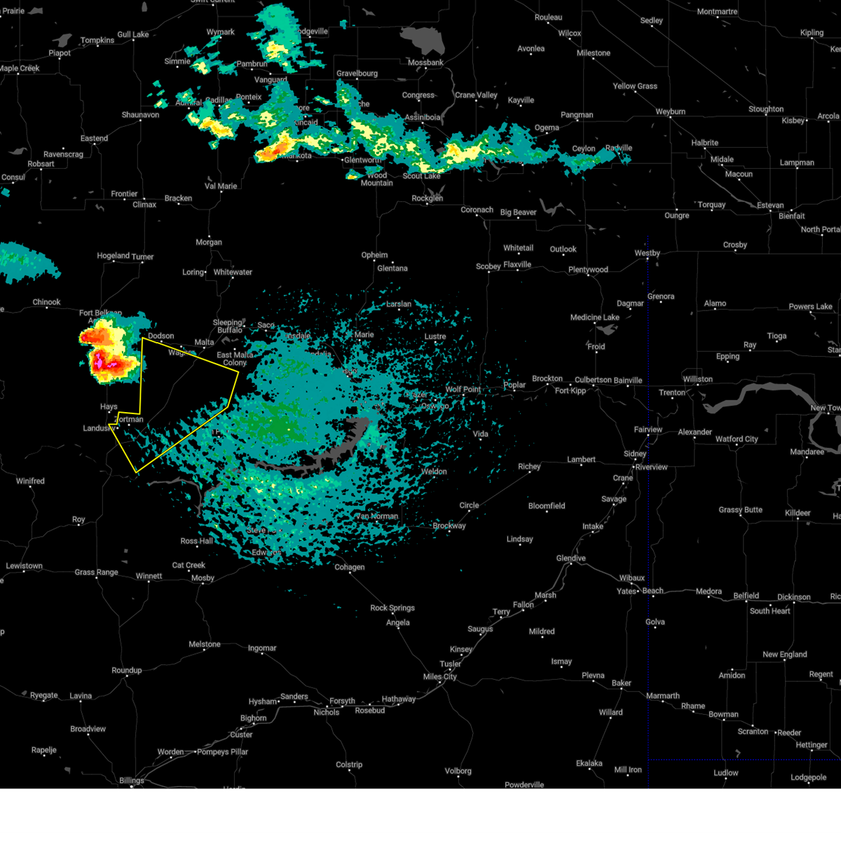
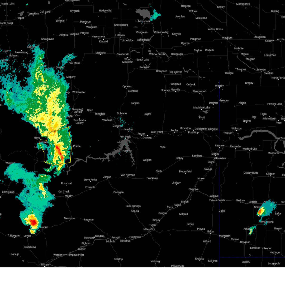
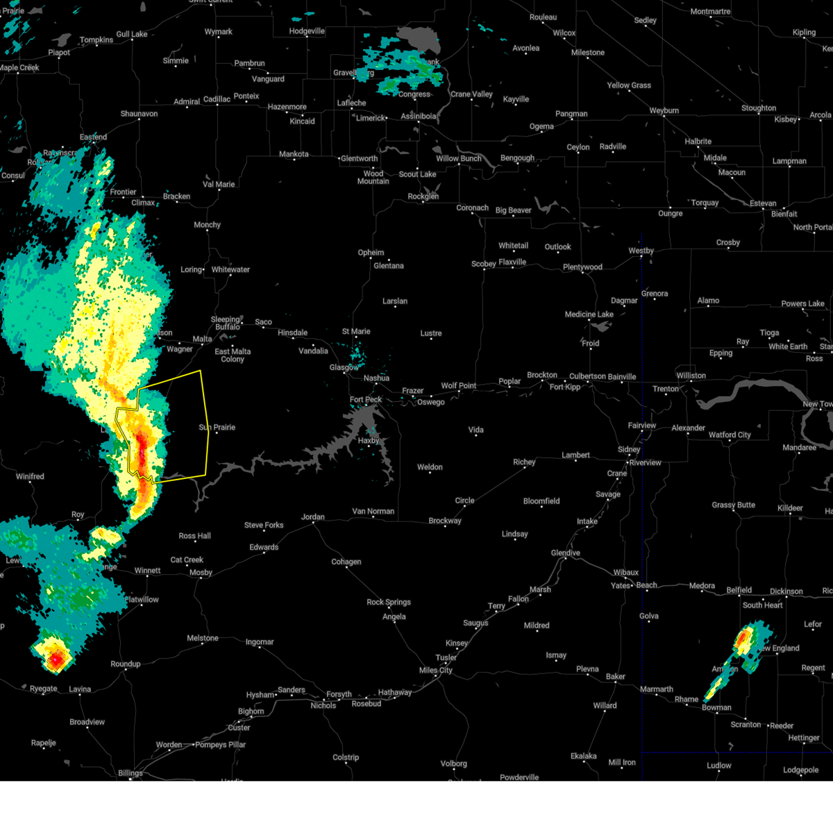
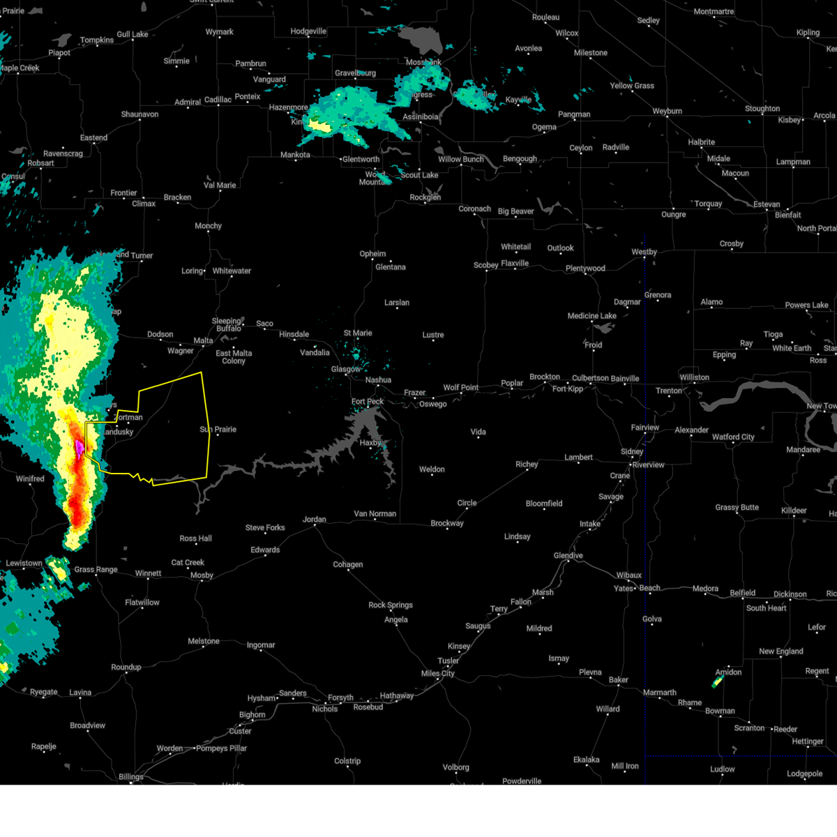
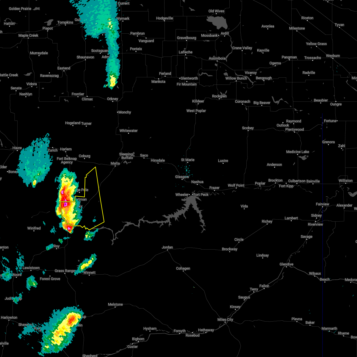
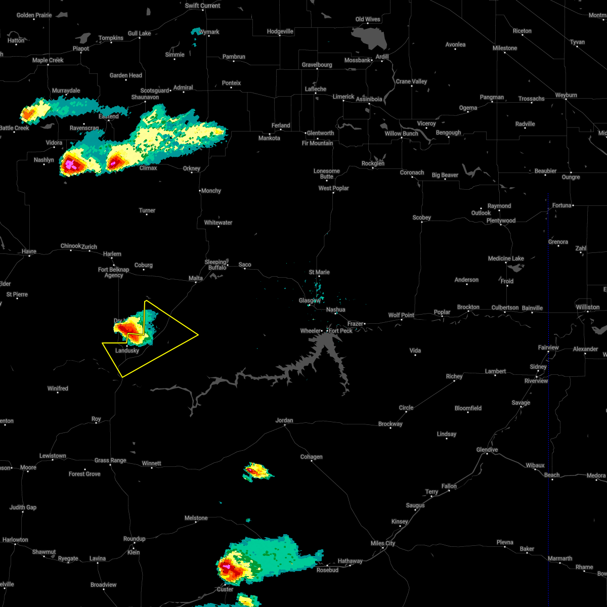
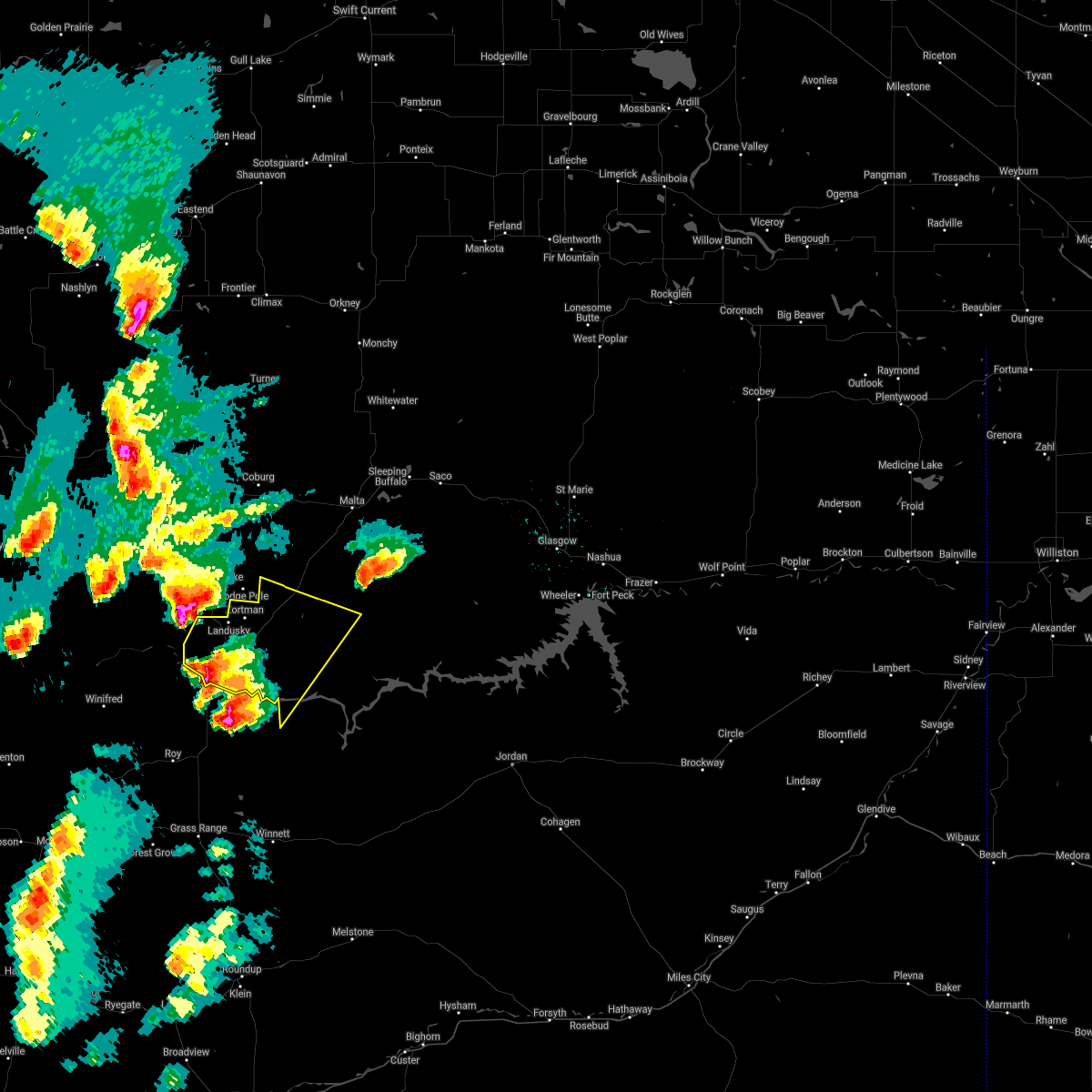
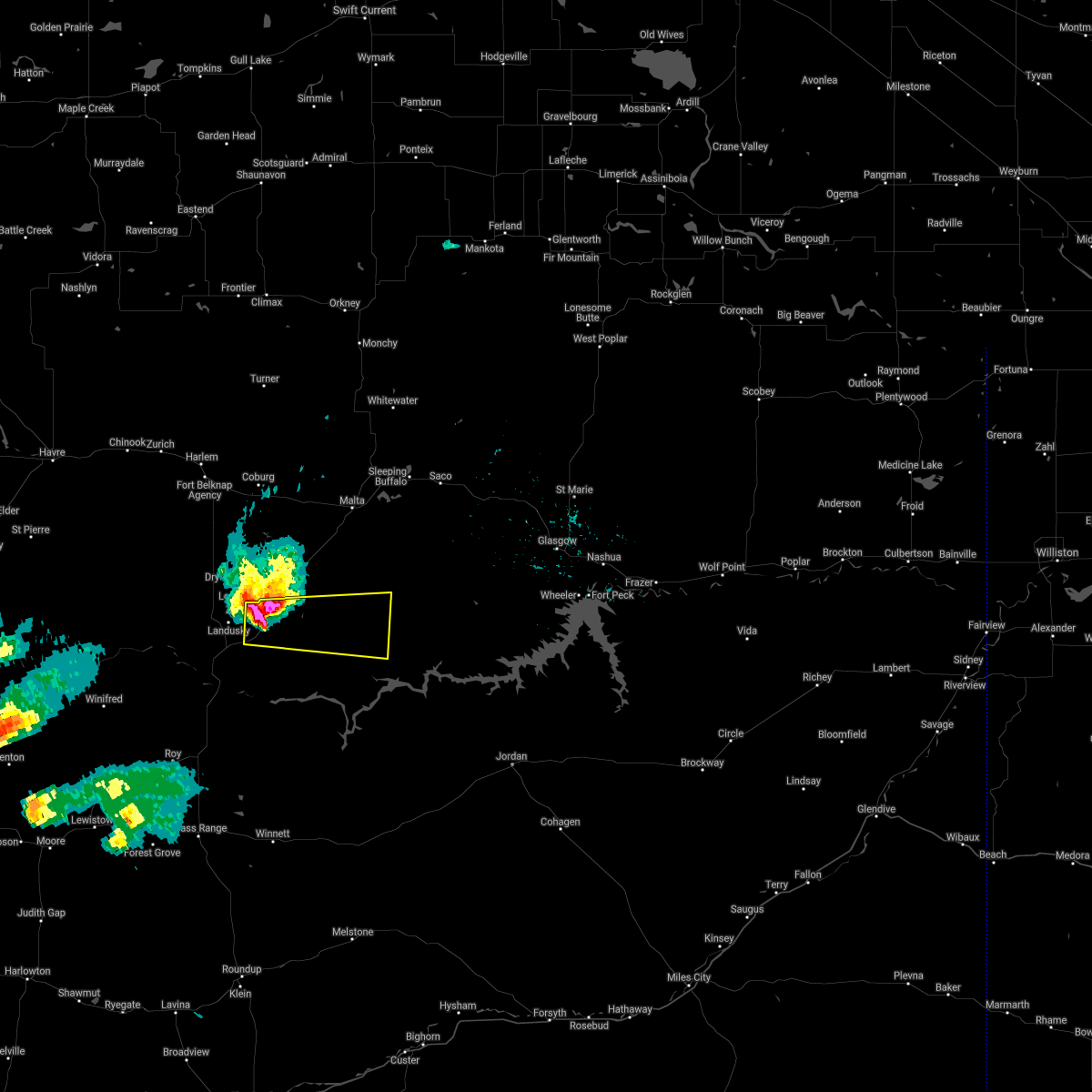
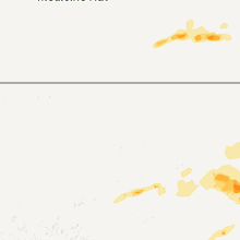
Hail Map for Zortman, MT
The Zortman, MT area has had 13 reports of on-the-ground hail by trained spotters, and has been under severe weather warnings 15 times during the past 12 months. Doppler radar has detected hail at or near Zortman, MT on 28 occasions, including 2 occasions during the past year.
| Name: | Zortman, MT |
| Where Located: | 69.4 miles SE of Havre, MT |
| Map: | Google Map for Zortman, MT |
| Population: | 69 |
| Housing Units: | 64 |
| More Info: | Search Google for Zortman, MT |
0
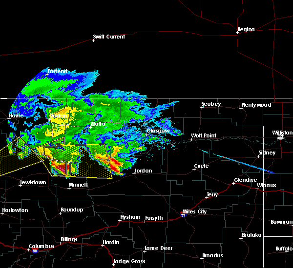
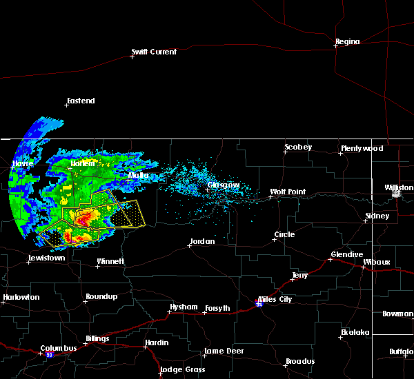
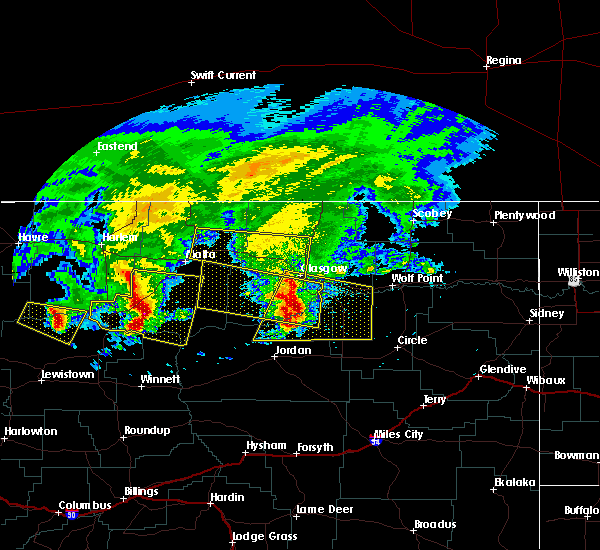
The Top Recent Hail Date for Zortman, MT is Saturday, July 20, 2024 (28th out of 28)

Hail and Wind Damage Spotted near Zortman, MT
| Date / Time | Report Details |
|---|---|
| 7/2/2025 7:41 PM MDT | Manning corral dogtown... mt (raws - ggw in phillips county MT, 15 miles N of Zortman, MT |
| 7/2/2025 6:45 PM MDT |
 Svrggw the national weather service in glasgow has issued a * severe thunderstorm warning for, southern phillips county in northeastern montana, northeastern petroleum county in northeastern montana, west central garfield county in northeastern montana, * until 745 pm mdt. * at 645 pm mdt, a severe thunderstorm was located 16 miles west of crooked creek rec area, or 32 miles north of winnett, moving northeast at 45 mph (radar indicated). Hazards include 60 mph wind gusts. expect damage to roofs, siding, and trees Svrggw the national weather service in glasgow has issued a * severe thunderstorm warning for, southern phillips county in northeastern montana, northeastern petroleum county in northeastern montana, west central garfield county in northeastern montana, * until 745 pm mdt. * at 645 pm mdt, a severe thunderstorm was located 16 miles west of crooked creek rec area, or 32 miles north of winnett, moving northeast at 45 mph (radar indicated). Hazards include 60 mph wind gusts. expect damage to roofs, siding, and trees
|
| 5/11/2025 7:18 PM MDT |
 The storm which prompted the warning has weakened below severe limits, and no longer poses an immediate threat to life or property. therefore, the warning has been allowed to expire. The storm which prompted the warning has weakened below severe limits, and no longer poses an immediate threat to life or property. therefore, the warning has been allowed to expire.
|
| 5/11/2025 6:48 PM MDT |
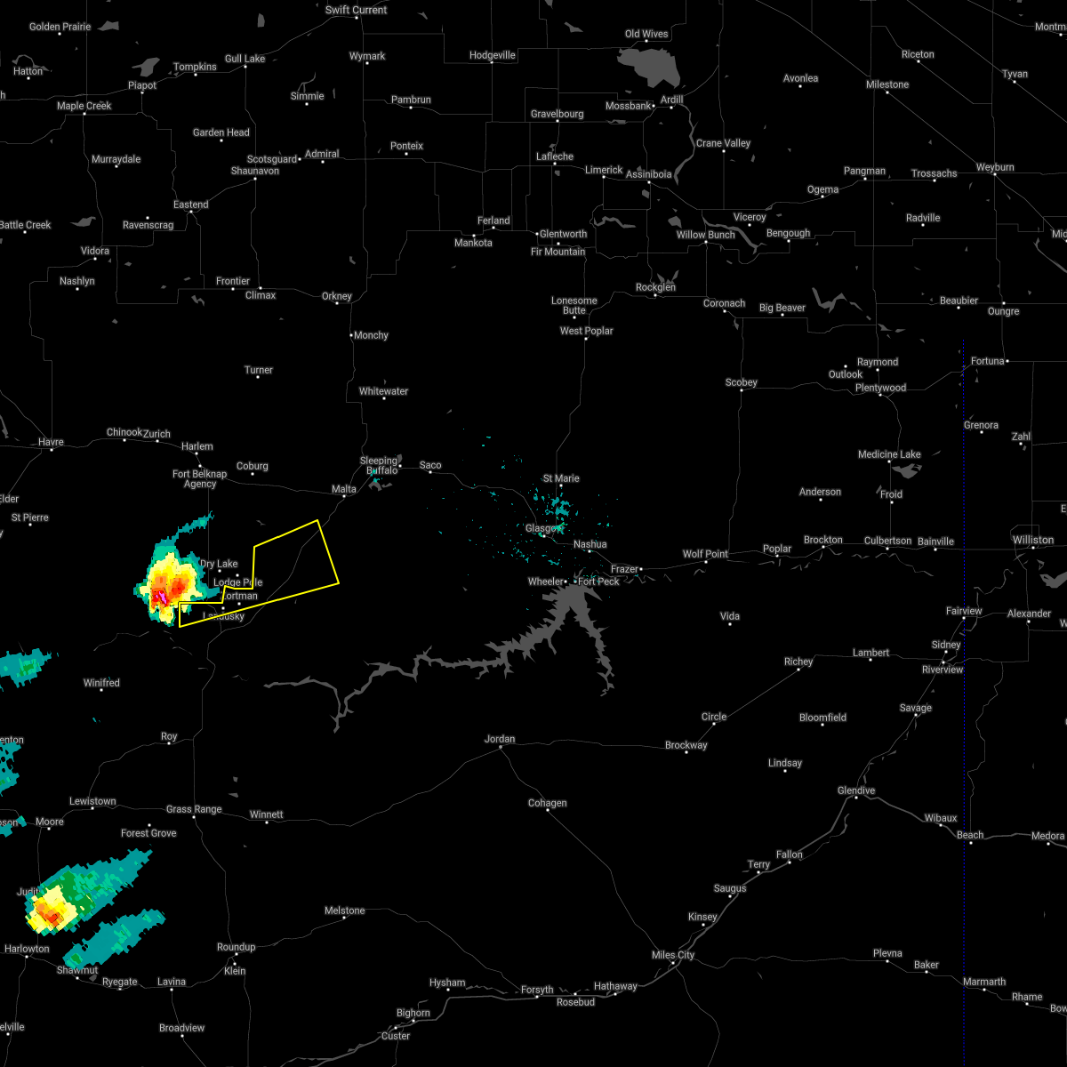
 At 647 pm mdt, a severe thunderstorm was located near zortman, moving northeast at 30 mph (radar indicated). Hazards include 60 mph wind gusts. Expect damage to roofs, siding, and trees. Locations impacted include, fourchette, wagner, phillips, zortman, landusky, and dodson. At 647 pm mdt, a severe thunderstorm was located near zortman, moving northeast at 30 mph (radar indicated). Hazards include 60 mph wind gusts. Expect damage to roofs, siding, and trees. Locations impacted include, fourchette, wagner, phillips, zortman, landusky, and dodson.
|
| 5/11/2025 6:21 PM MDT |
 Svrggw the national weather service in glasgow has issued a * severe thunderstorm warning for, western phillips county in northeastern montana, * until 715 pm mdt. * at 619 pm mdt, a severe thunderstorm was located 13 miles southwest of zortman, moving northeast at 30 mph (radar indicated). Hazards include 60 mph wind gusts and quarter size hail. Hail damage to vehicles is expected. Expect wind damage to roofs, siding, and trees. Svrggw the national weather service in glasgow has issued a * severe thunderstorm warning for, western phillips county in northeastern montana, * until 715 pm mdt. * at 619 pm mdt, a severe thunderstorm was located 13 miles southwest of zortman, moving northeast at 30 mph (radar indicated). Hazards include 60 mph wind gusts and quarter size hail. Hail damage to vehicles is expected. Expect wind damage to roofs, siding, and trees.
|
| 5/10/2025 6:57 PM MDT |
 Svrggw the national weather service in glasgow has issued a * severe thunderstorm warning for, phillips county in northeastern montana, northern petroleum county in northeastern montana, west central garfield county in northeastern montana, * until 800 pm mdt. * at 656 pm mdt, severe thunderstorms were located along a line extending from near loring to 16 miles north of winnett, moving northeast at 40 mph (radar indicated). Hazards include 60 mph wind gusts. expect damage to roofs, siding, and trees Svrggw the national weather service in glasgow has issued a * severe thunderstorm warning for, phillips county in northeastern montana, northern petroleum county in northeastern montana, west central garfield county in northeastern montana, * until 800 pm mdt. * at 656 pm mdt, severe thunderstorms were located along a line extending from near loring to 16 miles north of winnett, moving northeast at 40 mph (radar indicated). Hazards include 60 mph wind gusts. expect damage to roofs, siding, and trees
|
| 5/10/2025 6:30 PM MDT |
 At 630 pm mdt, severe thunderstorms were located along a line extending from 7 miles southeast of turner to 17 miles south of zortman, moving northeast at 40 mph (radar indicated). Hazards include 60 mph wind gusts. Expect damage to roofs, siding, and trees. Locations impacted include, chapman, sleeping buffalo, wagner, fred robinson bridge, whitewater, phillips, dodson, malta, loring, port of morgan, zortman, landusky, content, sun prairie, bowdoin, and fourchette. At 630 pm mdt, severe thunderstorms were located along a line extending from 7 miles southeast of turner to 17 miles south of zortman, moving northeast at 40 mph (radar indicated). Hazards include 60 mph wind gusts. Expect damage to roofs, siding, and trees. Locations impacted include, chapman, sleeping buffalo, wagner, fred robinson bridge, whitewater, phillips, dodson, malta, loring, port of morgan, zortman, landusky, content, sun prairie, bowdoin, and fourchette.
|
| 5/10/2025 5:59 PM MDT |
 Svrggw the national weather service in glasgow has issued a * severe thunderstorm warning for, phillips county in northeastern montana, * until 700 pm mdt. * at 559 pm mdt, severe thunderstorms were located along a line extending from 10 miles west of turner to near zortman, moving northeast at 60 mph (radar indicated). Hazards include 60 mph wind gusts. expect damage to roofs, siding, and trees Svrggw the national weather service in glasgow has issued a * severe thunderstorm warning for, phillips county in northeastern montana, * until 700 pm mdt. * at 559 pm mdt, severe thunderstorms were located along a line extending from 10 miles west of turner to near zortman, moving northeast at 60 mph (radar indicated). Hazards include 60 mph wind gusts. expect damage to roofs, siding, and trees
|
| 8/21/2024 9:06 PM MDT |
 The storm which prompted the warning has weakened below severe limits, and no longer poses an immediate threat to life or property. therefore, the warning will be allowed to expire. however, gusty winds are still possible with this thunderstorm. a severe thunderstorm watch remains in effect until 100 am mdt for northeastern montana. The storm which prompted the warning has weakened below severe limits, and no longer poses an immediate threat to life or property. therefore, the warning will be allowed to expire. however, gusty winds are still possible with this thunderstorm. a severe thunderstorm watch remains in effect until 100 am mdt for northeastern montana.
|
| 8/21/2024 8:45 PM MDT |
 At 844 pm mdt, a severe thunderstorm was located over zortman, moving east at 25 mph (radar indicated). Hazards include 60 mph wind gusts and penny size hail. Expect damage to roofs, siding, and trees. Locations impacted include, zortman and landusky. At 844 pm mdt, a severe thunderstorm was located over zortman, moving east at 25 mph (radar indicated). Hazards include 60 mph wind gusts and penny size hail. Expect damage to roofs, siding, and trees. Locations impacted include, zortman and landusky.
|
| 8/21/2024 8:15 PM MDT |
 Svrggw the national weather service in glasgow has issued a * severe thunderstorm warning for, southwestern phillips county in northeastern montana, * until 915 pm mdt. * at 815 pm mdt, a severe thunderstorm was located 9 miles southwest of hays, or 14 miles west of zortman, moving east at 25 mph (radar indicated). Hazards include 60 mph wind gusts and half dollar size hail. Hail damage to vehicles is expected. Expect wind damage to roofs, siding, and trees. Svrggw the national weather service in glasgow has issued a * severe thunderstorm warning for, southwestern phillips county in northeastern montana, * until 915 pm mdt. * at 815 pm mdt, a severe thunderstorm was located 9 miles southwest of hays, or 14 miles west of zortman, moving east at 25 mph (radar indicated). Hazards include 60 mph wind gusts and half dollar size hail. Hail damage to vehicles is expected. Expect wind damage to roofs, siding, and trees.
|
| 8/19/2024 2:56 AM MDT |
 At 256 am mdt, a severe thunderstorm was located 11 miles southeast of zortman, moving north at 40 mph (radar indicated). Hazards include 60 mph wind gusts and quarter size hail. Hail damage to vehicles is expected. expect wind damage to roofs, siding, and trees. Locations impacted include, zortman, phillips, landusky, sun prairie, and fred robinson bridge. At 256 am mdt, a severe thunderstorm was located 11 miles southeast of zortman, moving north at 40 mph (radar indicated). Hazards include 60 mph wind gusts and quarter size hail. Hail damage to vehicles is expected. expect wind damage to roofs, siding, and trees. Locations impacted include, zortman, phillips, landusky, sun prairie, and fred robinson bridge.
|
| 8/19/2024 2:24 AM MDT |
 Svrggw the national weather service in glasgow has issued a * severe thunderstorm warning for, southwestern phillips county in northeastern montana, * until 330 am mdt. * at 224 am mdt, a severe thunderstorm was located near zortman, moving northeast at 45 mph (radar indicated). Hazards include 60 mph wind gusts and quarter size hail. Hail damage to vehicles is expected. Expect wind damage to roofs, siding, and trees. Svrggw the national weather service in glasgow has issued a * severe thunderstorm warning for, southwestern phillips county in northeastern montana, * until 330 am mdt. * at 224 am mdt, a severe thunderstorm was located near zortman, moving northeast at 45 mph (radar indicated). Hazards include 60 mph wind gusts and quarter size hail. Hail damage to vehicles is expected. Expect wind damage to roofs, siding, and trees.
|
| 7/24/2024 5:45 PM MDT | Mesonet station mthay 6.1 sw hays (mt dot in phillips county MT, 10.2 miles E of Zortman, MT |
| 7/13/2024 5:41 PM MDT | Mesonet station mcdm8 manning corral dogtown. recorded sometime in the hour between 4:41 and 5:41 p in phillips county MT, 15 miles N of Zortman, MT |
| 7/13/2024 4:13 PM MDT |
 Svrggw the national weather service in glasgow has issued a * severe thunderstorm warning for, southern phillips county in northeastern montana, northeastern petroleum county in northeastern montana, west central garfield county in northeastern montana, southwestern valley county in northeastern montana, * until 515 pm mdt. * at 413 pm mdt, a severe thunderstorm was located 15 miles east of zortman, moving southeast at 40 mph (radar indicated). Hazards include golf ball size hail and 70 mph wind gusts. People and animals outdoors will be injured. expect hail damage to roofs, siding, windows, and vehicles. expect considerable tree damage. Wind damage is also likely to mobile homes, roofs, and outbuildings. Svrggw the national weather service in glasgow has issued a * severe thunderstorm warning for, southern phillips county in northeastern montana, northeastern petroleum county in northeastern montana, west central garfield county in northeastern montana, southwestern valley county in northeastern montana, * until 515 pm mdt. * at 413 pm mdt, a severe thunderstorm was located 15 miles east of zortman, moving southeast at 40 mph (radar indicated). Hazards include golf ball size hail and 70 mph wind gusts. People and animals outdoors will be injured. expect hail damage to roofs, siding, windows, and vehicles. expect considerable tree damage. Wind damage is also likely to mobile homes, roofs, and outbuildings.
|
| 7/13/2024 3:35 PM MDT |
 At 335 pm mdt, a severe thunderstorm was located 16 miles south of dodson, or 20 miles southwest of malta, moving southeast at 45 mph (radar indicated). Hazards include golf ball size hail and 60 mph wind gusts. People and animals outdoors will be injured. expect hail damage to roofs, siding, windows, and vehicles. expect wind damage to roofs, siding, and trees. Locations impacted include, zortman, phillips, and landusky. At 335 pm mdt, a severe thunderstorm was located 16 miles south of dodson, or 20 miles southwest of malta, moving southeast at 45 mph (radar indicated). Hazards include golf ball size hail and 60 mph wind gusts. People and animals outdoors will be injured. expect hail damage to roofs, siding, windows, and vehicles. expect wind damage to roofs, siding, and trees. Locations impacted include, zortman, phillips, and landusky.
|
| 7/13/2024 3:09 PM MDT |
 Svrggw the national weather service in glasgow has issued a * severe thunderstorm warning for, central phillips county in northeastern montana, * until 415 pm mdt. * at 309 pm mdt, a severe thunderstorm was located 17 miles north of hays, or 22 miles north of zortman, moving east at 40 mph (radar indicated). Hazards include 60 mph wind gusts and quarter size hail. Hail damage to vehicles is expected. Expect wind damage to roofs, siding, and trees. Svrggw the national weather service in glasgow has issued a * severe thunderstorm warning for, central phillips county in northeastern montana, * until 415 pm mdt. * at 309 pm mdt, a severe thunderstorm was located 17 miles north of hays, or 22 miles north of zortman, moving east at 40 mph (radar indicated). Hazards include 60 mph wind gusts and quarter size hail. Hail damage to vehicles is expected. Expect wind damage to roofs, siding, and trees.
|
| 6/15/2024 4:23 PM MDT |
 The storm which prompted the warning has weakened below severe limits, and has exited the warned area. therefore, the warning will be allowed to expire. however, small hail and gusty winds are still possible with this thunderstorm. a severe thunderstorm watch remains in effect until 900 pm mdt for northeastern montana. The storm which prompted the warning has weakened below severe limits, and has exited the warned area. therefore, the warning will be allowed to expire. however, small hail and gusty winds are still possible with this thunderstorm. a severe thunderstorm watch remains in effect until 900 pm mdt for northeastern montana.
|
| 6/15/2024 4:01 PM MDT |
 At 359 pm mdt, a severe thunderstorm was located 7 miles southeast of zortman, moving east at 45 mph (at 345 pm mdt, the montana department of transporation site in hays recorded a wind gust of 69 mph). Hazards include 60 mph wind gusts and quarter size hail. Hail damage to vehicles is expected. expect wind damage to roofs, siding, and trees. Locations impacted include, zortman, fourchette, and phillips. At 359 pm mdt, a severe thunderstorm was located 7 miles southeast of zortman, moving east at 45 mph (at 345 pm mdt, the montana department of transporation site in hays recorded a wind gust of 69 mph). Hazards include 60 mph wind gusts and quarter size hail. Hail damage to vehicles is expected. expect wind damage to roofs, siding, and trees. Locations impacted include, zortman, fourchette, and phillips.
|
| 6/15/2024 3:45 PM MDT | Mesonet station mthay 6.1 sw hays (mt dot in phillips county MT, 10.2 miles E of Zortman, MT |
| 6/15/2024 3:25 PM MDT |
 Svrggw the national weather service in glasgow has issued a * severe thunderstorm warning for, southwestern phillips county in northeastern montana, northern petroleum county in northeastern montana, * until 430 pm mdt. * at 324 pm mdt, a severe thunderstorm was located 19 miles southwest of hays, or 20 miles southwest of zortman, moving east at 45 mph (radar indicated). Hazards include 60 mph wind gusts and quarter size hail. Hail damage to vehicles is expected. Expect wind damage to roofs, siding, and trees. Svrggw the national weather service in glasgow has issued a * severe thunderstorm warning for, southwestern phillips county in northeastern montana, northern petroleum county in northeastern montana, * until 430 pm mdt. * at 324 pm mdt, a severe thunderstorm was located 19 miles southwest of hays, or 20 miles southwest of zortman, moving east at 45 mph (radar indicated). Hazards include 60 mph wind gusts and quarter size hail. Hail damage to vehicles is expected. Expect wind damage to roofs, siding, and trees.
|
| 9/7/2022 9:21 PM MDT |
 The severe thunderstorm warning for central phillips county will expire at 930 pm mdt, the storm which prompted the warning has weakened below severe limits, and no longer poses an immediate threat to life or property. therefore, the warning will be allowed to expire. however gusty winds are still possible with this thunderstorm. The severe thunderstorm warning for central phillips county will expire at 930 pm mdt, the storm which prompted the warning has weakened below severe limits, and no longer poses an immediate threat to life or property. therefore, the warning will be allowed to expire. however gusty winds are still possible with this thunderstorm.
|
| 9/7/2022 8:57 PM MDT |
 At 856 pm mdt, a severe thunderstorm was located 18 miles northeast of zortman, moving northeast at 45 mph (radar indicated). Hazards include 60 mph wind gusts. Expect damage to roofs, siding, and trees. locations impacted include, malta, zortman, dodson, fourchette, phillips, wagner, landusky, sun prairie and fred robinson bridge. hail threat, radar indicated max hail size, <. 75 in wind threat, radar indicated max wind gust, 60 mph. At 856 pm mdt, a severe thunderstorm was located 18 miles northeast of zortman, moving northeast at 45 mph (radar indicated). Hazards include 60 mph wind gusts. Expect damage to roofs, siding, and trees. locations impacted include, malta, zortman, dodson, fourchette, phillips, wagner, landusky, sun prairie and fred robinson bridge. hail threat, radar indicated max hail size, <. 75 in wind threat, radar indicated max wind gust, 60 mph.
|
| 9/7/2022 8:32 PM MDT |
 At 830 pm mdt, a severe thunderstorm was located over zortman, moving northeast at 45 mph (radar indicated). Hazards include 60 mph wind gusts. expect damage to roofs, siding, and trees At 830 pm mdt, a severe thunderstorm was located over zortman, moving northeast at 45 mph (radar indicated). Hazards include 60 mph wind gusts. expect damage to roofs, siding, and trees
|
| 8/4/2022 5:51 PM MDT | The severe thunderstorm warning for southern phillips, central petroleum, garfield and southwestern valley counties will expire at 600 pm mdt, the storms which prompted the warning have weakened below severe limits and have exited the warned area. therefore, the warning will be allowed to expire. |
| 8/4/2022 4:55 PM MDT | At 454 pm mdt, severe thunderstorms were located along a line extending from 8 miles north of fourchette to 12 miles northwest of sand springs, moving east at 55 mph (public surface observations). Hazards include 60 mph wind gusts. expect damage to roofs, siding, and trees |
| 8/4/2022 4:41 PM MDT | Storm damage reported in phillips county MT, 15 miles N of Zortman, MT |
| 7/9/2022 8:28 PM MDT |
 At 828 pm mdt, severe thunderstorms were located along a line extending from 18 miles north of fourchette to 12 miles southeast of devils creek rec area, moving east at 75 mph (radar indicated). Hazards include 60 mph wind gusts and quarter size hail. Hail damage to vehicles is expected. expect wind damage to roofs, siding, and trees. locations impacted include, zortman, fourchette, devils creek rec area, u l bend rec area, crooked creek rec area, brusett, phillips, content and sun prairie. hail threat, radar indicated max hail size, 1. 00 in wind threat, radar indicated max wind gust, 60 mph. At 828 pm mdt, severe thunderstorms were located along a line extending from 18 miles north of fourchette to 12 miles southeast of devils creek rec area, moving east at 75 mph (radar indicated). Hazards include 60 mph wind gusts and quarter size hail. Hail damage to vehicles is expected. expect wind damage to roofs, siding, and trees. locations impacted include, zortman, fourchette, devils creek rec area, u l bend rec area, crooked creek rec area, brusett, phillips, content and sun prairie. hail threat, radar indicated max hail size, 1. 00 in wind threat, radar indicated max wind gust, 60 mph.
|
| 7/9/2022 7:41 PM MDT |
 At 741 pm mdt, severe thunderstorms were located along a line extending from 17 miles west of hays to 11 miles northeast of roy, moving east at 75 mph (radar indicated). Hazards include 60 mph wind gusts and quarter size hail. Hail damage to vehicles is expected. Expect wind damage to roofs, siding, and trees. At 741 pm mdt, severe thunderstorms were located along a line extending from 17 miles west of hays to 11 miles northeast of roy, moving east at 75 mph (radar indicated). Hazards include 60 mph wind gusts and quarter size hail. Hail damage to vehicles is expected. Expect wind damage to roofs, siding, and trees.
|
| 7/8/2022 9:32 PM MDT | Via raws sit in phillips county MT, 0.6 miles NW of Zortman, MT |
| 7/8/2022 8:22 PM MDT |
 At 821 pm mdt, severe thunderstorms were located along a line extending from 26 miles southeast of parker school to 13 miles east of roy, moving northeast at 30 mph (radar indicated). Hazards include 70 mph wind gusts and nickel size hail. Expect considerable tree damage. Damage is likely to mobile homes, roofs, and outbuildings. At 821 pm mdt, severe thunderstorms were located along a line extending from 26 miles southeast of parker school to 13 miles east of roy, moving northeast at 30 mph (radar indicated). Hazards include 70 mph wind gusts and nickel size hail. Expect considerable tree damage. Damage is likely to mobile homes, roofs, and outbuildings.
|
| 7/6/2022 7:49 PM MDT | Baseball sized hail reported 1 miles ESE of Zortman, MT, relayed via facebook. |
| 7/6/2022 6:36 PM MDT | Ping Pong Ball sized hail reported 0.5 miles SE of Zortman, MT, also reported 0.43 in of rain in 15 min. |
| 7/6/2022 6:34 PM MDT | Golf Ball sized hail reported 0.5 miles SE of Zortman, MT |
| 7/6/2022 5:58 PM MDT |
 At 558 pm mdt, severe thunderstorms were located along a line extending from 13 miles north of fourchette to 14 miles east of zortman, moving east at 30 mph (radar indicated). Hazards include 60 mph wind gusts and quarter size hail. Hail damage to vehicles is expected. expect wind damage to roofs, siding, and trees. these severe thunderstorms will remain over mainly rural areas of southwestern phillips county. hail threat, radar indicated max hail size, 1. 00 in wind threat, radar indicated max wind gust, 60 mph. At 558 pm mdt, severe thunderstorms were located along a line extending from 13 miles north of fourchette to 14 miles east of zortman, moving east at 30 mph (radar indicated). Hazards include 60 mph wind gusts and quarter size hail. Hail damage to vehicles is expected. expect wind damage to roofs, siding, and trees. these severe thunderstorms will remain over mainly rural areas of southwestern phillips county. hail threat, radar indicated max hail size, 1. 00 in wind threat, radar indicated max wind gust, 60 mph.
|
| 7/6/2022 5:36 PM MDT | Ping Pong Ball sized hail reported 0.5 miles SE of Zortman, MT, corrects incorrect time from previous hail report from zortman. also reported 0.43 in of rain in 15 min. |
| 7/6/2022 5:35 PM MDT | Baseball sized hail reported 1 miles ESE of Zortman, MT, corrects timing from the previous hail report from zortman... due to connection issues. relayed via facebook. |
| 7/6/2022 5:35 PM MDT | Golf Ball sized hail reported 0.5 miles SE of Zortman, MT, corrects incorrect time from previous hail report from zortman. |
| 7/6/2022 5:11 PM MDT |
 At 511 pm mdt, severe thunderstorms were located along a line extending from near zortman to near hays, moving east at 30 mph (radar indicated). Hazards include 60 mph wind gusts and quarter size hail. Hail damage to vehicles is expected. Expect wind damage to roofs, siding, and trees. At 511 pm mdt, severe thunderstorms were located along a line extending from near zortman to near hays, moving east at 30 mph (radar indicated). Hazards include 60 mph wind gusts and quarter size hail. Hail damage to vehicles is expected. Expect wind damage to roofs, siding, and trees.
|
| 6/28/2022 8:01 PM MDT |
 At 801 pm mdt, a severe thunderstorm was located near zortman, moving northeast at 25 mph (radar indicated). Hazards include 60 mph wind gusts. expect damage to roofs, siding, and trees At 801 pm mdt, a severe thunderstorm was located near zortman, moving northeast at 25 mph (radar indicated). Hazards include 60 mph wind gusts. expect damage to roofs, siding, and trees
|
| 6/28/2022 7:49 PM MDT | Hays site mt-66 mp 10.5 reports winds of 47g60 mp in phillips county MT, 10.2 miles E of Zortman, MT |
| 6/18/2022 8:43 PM MDT |
 The severe thunderstorm warning for southwestern phillips county will expire at 845 pm mdt, the storms which prompted the warning have weakened below severe limits, and no longer pose an immediate threat to life or property. therefore, the warning will be allowed to expire. The severe thunderstorm warning for southwestern phillips county will expire at 845 pm mdt, the storms which prompted the warning have weakened below severe limits, and no longer pose an immediate threat to life or property. therefore, the warning will be allowed to expire.
|
| 6/18/2022 8:18 PM MDT |
 At 817 pm mdt, severe thunderstorms were located along a line extending from near hays to 15 miles south of zortman, moving northeast at 35 mph (radar indicated). Hazards include 60 mph wind gusts and quarter size hail. Hail damage to vehicles is expected. expect wind damage to roofs, siding, and trees. locations impacted include, zortman and landusky. hail threat, radar indicated max hail size, 1. 00 in wind threat, radar indicated max wind gust, 60 mph. At 817 pm mdt, severe thunderstorms were located along a line extending from near hays to 15 miles south of zortman, moving northeast at 35 mph (radar indicated). Hazards include 60 mph wind gusts and quarter size hail. Hail damage to vehicles is expected. expect wind damage to roofs, siding, and trees. locations impacted include, zortman and landusky. hail threat, radar indicated max hail size, 1. 00 in wind threat, radar indicated max wind gust, 60 mph.
|
| 6/18/2022 7:47 PM MDT |
 At 747 pm mdt, severe thunderstorms were located along a line extending from 7 miles southwest of hays to 18 miles northeast of roy, moving northeast at 25 mph (radar indicated). Hazards include 60 mph wind gusts and half dollar size hail. Hail damage to vehicles is expected. Expect wind damage to roofs, siding, and trees. At 747 pm mdt, severe thunderstorms were located along a line extending from 7 miles southwest of hays to 18 miles northeast of roy, moving northeast at 25 mph (radar indicated). Hazards include 60 mph wind gusts and half dollar size hail. Hail damage to vehicles is expected. Expect wind damage to roofs, siding, and trees.
|
| 6/15/2022 10:41 AM MDT | Manning corral raws in phillips county MT, 15 miles N of Zortman, MT |
| 7/6/2021 6:24 PM MDT |
 At 623 pm mdt, a severe thunderstorm was located near hays, or near zortman, moving southeast at 30 mph (public). Hazards include golf ball size hail and 60 mph wind gusts. People and animals outdoors will be injured. expect hail damage to roofs, siding, windows, and vehicles. Expect wind damage to roofs, siding, and trees. At 623 pm mdt, a severe thunderstorm was located near hays, or near zortman, moving southeast at 30 mph (public). Hazards include golf ball size hail and 60 mph wind gusts. People and animals outdoors will be injured. expect hail damage to roofs, siding, windows, and vehicles. Expect wind damage to roofs, siding, and trees.
|
| 6/9/2021 10:10 PM MDT |
 At 1009 pm mdt, a severe thunderstorm was located 20 miles south of zortman, moving northeast at 15 mph (radar indicated). Hazards include 60 mph wind gusts and half dollar size hail. Hail damage to vehicles is expected. expect wind damage to roofs, siding, and trees. Locations impacted include, zortman and landusky. At 1009 pm mdt, a severe thunderstorm was located 20 miles south of zortman, moving northeast at 15 mph (radar indicated). Hazards include 60 mph wind gusts and half dollar size hail. Hail damage to vehicles is expected. expect wind damage to roofs, siding, and trees. Locations impacted include, zortman and landusky.
|
| 6/9/2021 9:32 PM MDT |
 At 931 pm mdt, a severe thunderstorm was located 22 miles south of zortman, moving northeast at 40 mph (radar indicated). Hazards include 60 mph wind gusts and quarter size hail. Hail damage to vehicles is expected. Expect wind damage to roofs, siding, and trees. At 931 pm mdt, a severe thunderstorm was located 22 miles south of zortman, moving northeast at 40 mph (radar indicated). Hazards include 60 mph wind gusts and quarter size hail. Hail damage to vehicles is expected. Expect wind damage to roofs, siding, and trees.
|
| 6/9/2021 7:51 PM MDT |
 At 751 pm mdt, a severe thunderstorm was located near zortman, moving east at 30 mph (radar indicated). Hazards include 70 mph wind gusts and half dollar size hail. Hail damage to vehicles is expected. expect considerable tree damage. Wind damage is also likely to mobile homes, roofs, and outbuildings. At 751 pm mdt, a severe thunderstorm was located near zortman, moving east at 30 mph (radar indicated). Hazards include 70 mph wind gusts and half dollar size hail. Hail damage to vehicles is expected. expect considerable tree damage. Wind damage is also likely to mobile homes, roofs, and outbuildings.
|
| 6/9/2021 7:40 PM MDT | Tea Cup sized hail reported 1 miles ESE of Zortman, MT, public report of hail 2 to 3 inches... possibly larger. some people at nearby campground also sustained damage. busted windshields and dented vehicles. not very windy.. |
| 6/9/2021 7:40 PM MDT | Ping Pong Ball sized hail reported 1 miles ESE of Zortman, MT, photo submitted showing golf ball sized hail and shingle damage. time estimated. |
| 6/9/2021 7:34 PM MDT |
 At 733 pm mdt, a severe thunderstorm was located over zortman, moving east at 35 mph (trained weather spotters). Hazards include 60 mph wind gusts and half dollar size hail. Hail damage to vehicles is expected. expect wind damage to roofs, siding, and trees. Locations impacted include, zortman, phillips and landusky. At 733 pm mdt, a severe thunderstorm was located over zortman, moving east at 35 mph (trained weather spotters). Hazards include 60 mph wind gusts and half dollar size hail. Hail damage to vehicles is expected. expect wind damage to roofs, siding, and trees. Locations impacted include, zortman, phillips and landusky.
|
| 6/9/2021 7:15 PM MDT | Quarter sized hail reported 12.2 miles E of Zortman, MT, also wind gust to 62 mph with brief heavy rain. |
| 6/9/2021 6:56 PM MDT |
 At 656 pm mdt, a severe thunderstorm was located 12 miles west of hays, or 17 miles west of zortman, moving east at 40 mph (radar indicated). Hazards include 70 mph wind gusts and half dollar size hail. Hail damage to vehicles is expected. expect considerable tree damage. Wind damage is also likely to mobile homes, roofs, and outbuildings. At 656 pm mdt, a severe thunderstorm was located 12 miles west of hays, or 17 miles west of zortman, moving east at 40 mph (radar indicated). Hazards include 70 mph wind gusts and half dollar size hail. Hail damage to vehicles is expected. expect considerable tree damage. Wind damage is also likely to mobile homes, roofs, and outbuildings.
|
| 6/4/2021 7:10 PM MDT |
 The severe thunderstorm warning for southwestern phillips county will expire at 715 pm mdt, the storm which prompted the warning has weakened below severe limits, and no longer poses an immediate threat to life or property. therefore, the warning will be allowed to expire. however gusty winds are still possible with this thunderstorm. The severe thunderstorm warning for southwestern phillips county will expire at 715 pm mdt, the storm which prompted the warning has weakened below severe limits, and no longer poses an immediate threat to life or property. therefore, the warning will be allowed to expire. however gusty winds are still possible with this thunderstorm.
|
| 6/4/2021 7:04 PM MDT |
 At 703 pm mdt, a severe thunderstorm was located near zortman, moving northeast at 45 mph (radar indicated). Hazards include 60 mph wind gusts and quarter size hail. Hail damage to vehicles is expected. expect wind damage to roofs, siding, and trees. Locations impacted include, zortman and landusky. At 703 pm mdt, a severe thunderstorm was located near zortman, moving northeast at 45 mph (radar indicated). Hazards include 60 mph wind gusts and quarter size hail. Hail damage to vehicles is expected. expect wind damage to roofs, siding, and trees. Locations impacted include, zortman and landusky.
|
| 6/4/2021 7:02 PM MDT | Quarter sized hail reported 8.4 miles NE of Zortman, MT, 2nd round of hail moved through and produced up to quarter size hail. |
| 6/4/2021 6:39 PM MDT |
 At 638 pm mdt, a severe thunderstorm was located 12 miles southwest of hays, or 13 miles southwest of zortman, moving northeast at 45 mph (radar indicated). Hazards include 60 mph wind gusts and quarter size hail. Hail damage to vehicles is expected. Expect wind damage to roofs, siding, and trees. At 638 pm mdt, a severe thunderstorm was located 12 miles southwest of hays, or 13 miles southwest of zortman, moving northeast at 45 mph (radar indicated). Hazards include 60 mph wind gusts and quarter size hail. Hail damage to vehicles is expected. Expect wind damage to roofs, siding, and trees.
|
| 8/20/2020 8:32 PM MDT | Mesonet station aldm8 zortman 1 in phillips county MT, 0.6 miles NW of Zortman, MT |
| 8/20/2020 7:53 PM MDT |
 At 752 pm mdt, a severe thunderstorm was located 17 miles northeast of zortman, moving east at 55 mph (radar indicated). Hazards include 70 mph wind gusts and quarter size hail. Hail damage to vehicles is expected. expect considerable tree damage. wind damage is also likely to mobile homes, roofs, and outbuildings. Locations impacted include, malta, phillips, bowdoin, sleeping buffalo, wagner and content. At 752 pm mdt, a severe thunderstorm was located 17 miles northeast of zortman, moving east at 55 mph (radar indicated). Hazards include 70 mph wind gusts and quarter size hail. Hail damage to vehicles is expected. expect considerable tree damage. wind damage is also likely to mobile homes, roofs, and outbuildings. Locations impacted include, malta, phillips, bowdoin, sleeping buffalo, wagner and content.
|
| 8/20/2020 7:45 PM MDT | Storm damage reported in phillips county MT, 0.6 miles NW of Zortman, MT |
| 8/20/2020 7:42 PM MDT |
 At 741 pm mdt, a severe thunderstorm was located 11 miles northeast of zortman, moving east at 65 mph (radar indicated). Hazards include 60 mph wind gusts and penny size hail. expect damage to roofs, siding, and trees At 741 pm mdt, a severe thunderstorm was located 11 miles northeast of zortman, moving east at 65 mph (radar indicated). Hazards include 60 mph wind gusts and penny size hail. expect damage to roofs, siding, and trees
|
| 8/20/2020 7:41 PM MDT | Storm damage reported in phillips county MT, 15 miles N of Zortman, MT |
| 7/31/2020 1:59 PM MDT | Golf Ball sized hail reported 12.3 miles ENE of Zortman, MT, most hail between nickel to quarter sized... with a couple of golf balls. also had 0.75 inches of rain. time estimated from radar. |
| 7/7/2020 4:35 PM MDT | Storm damage reported in phillips county MT, 0.6 miles NW of Zortman, MT |
| 7/7/2020 4:28 PM MDT |
 At 428 pm mdt, severe thunderstorms were located along a line extending from 17 miles north of fourchette to near mosby, moving east at 60 mph (radar indicated). Hazards include 70 mph wind gusts and half dollar size hail. Hail damage to vehicles is expected. expect considerable tree damage. wind damage is also likely to mobile homes, roofs, and outbuildings. Locations impacted include, winnett, zortman, sand springs, fourchette, u l bend rec area, crooked creek rec area, flatwillow, devils creek rec area, mosby, petrolia lake, tiegen, content, sun prairie and cat creek. At 428 pm mdt, severe thunderstorms were located along a line extending from 17 miles north of fourchette to near mosby, moving east at 60 mph (radar indicated). Hazards include 70 mph wind gusts and half dollar size hail. Hail damage to vehicles is expected. expect considerable tree damage. wind damage is also likely to mobile homes, roofs, and outbuildings. Locations impacted include, winnett, zortman, sand springs, fourchette, u l bend rec area, crooked creek rec area, flatwillow, devils creek rec area, mosby, petrolia lake, tiegen, content, sun prairie and cat creek.
|
| 7/7/2020 4:16 PM MDT | 71 mph wind gust blew tree down next to house. from social medi in phillips county MT, 1 miles ESE of Zortman, MT |
| 7/7/2020 4:04 PM MDT | Mesonet station mcdm8 manning corral dogtow in phillips county MT, 15 miles N of Zortman, MT |
| 7/7/2020 3:47 PM MDT |
 The national weather service in glasgow has issued a * severe thunderstorm warning for. southern phillips county in northeastern montana. southwestern garfield county in northeastern montana. petroleum county in northeastern montana. Until 445 pm mdt. The national weather service in glasgow has issued a * severe thunderstorm warning for. southern phillips county in northeastern montana. southwestern garfield county in northeastern montana. petroleum county in northeastern montana. Until 445 pm mdt.
|
| 7/6/2020 5:58 PM MDT |
 The national weather service in glasgow has issued a * severe thunderstorm warning for. southwestern phillips county in northeastern montana. until 700 pm mdt. At 558 pm mdt, a severe thunderstorm was located over zortman, moving southeast at 15 mph. The national weather service in glasgow has issued a * severe thunderstorm warning for. southwestern phillips county in northeastern montana. until 700 pm mdt. At 558 pm mdt, a severe thunderstorm was located over zortman, moving southeast at 15 mph.
|
| 7/13/2019 6:52 PM MDT | Time estimated from rada in phillips county MT, 20.1 miles NE of Zortman, MT |
| 7/13/2019 6:15 PM MDT |
 At 615 pm mdt, severe thunderstorms were located along a line extending from hays to 15 miles west of fourchette, moving northeast at 40 mph (radar indicated). Hazards include 60 mph wind gusts and nickel size hail. Expect damage to roofs, siding, and trees. Locations impacted include, zortman, fourchette, crooked creek rec area, u l bend rec area and landusky. At 615 pm mdt, severe thunderstorms were located along a line extending from hays to 15 miles west of fourchette, moving northeast at 40 mph (radar indicated). Hazards include 60 mph wind gusts and nickel size hail. Expect damage to roofs, siding, and trees. Locations impacted include, zortman, fourchette, crooked creek rec area, u l bend rec area and landusky.
|
| 7/13/2019 5:52 PM MDT | Manning corral dogtown location. time estimated from rada in phillips county MT, 15 miles N of Zortman, MT |
| 7/13/2019 5:52 PM MDT | Time estimated from rada in phillips county MT, 20.1 miles NE of Zortman, MT |
| 7/13/2019 5:32 PM MDT |
 At 532 pm mdt, severe thunderstorms were located along a line extending from 17 miles northeast of winifred to 12 miles northeast of roy, moving northeast at 40 mph (radar indicated). Hazards include 60 mph wind gusts and nickel size hail. expect damage to roofs, siding, and trees At 532 pm mdt, severe thunderstorms were located along a line extending from 17 miles northeast of winifred to 12 miles northeast of roy, moving northeast at 40 mph (radar indicated). Hazards include 60 mph wind gusts and nickel size hail. expect damage to roofs, siding, and trees
|
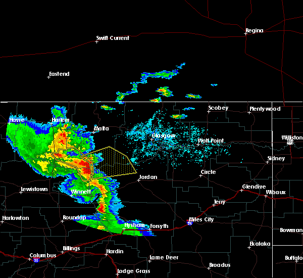
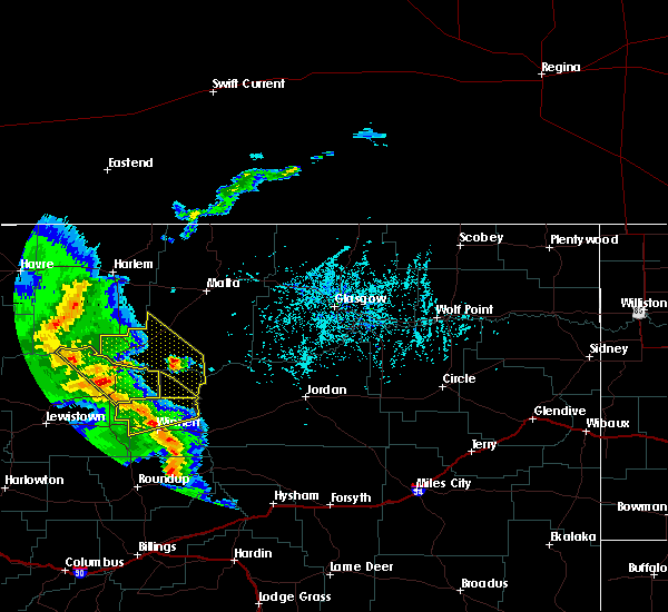
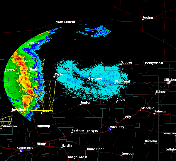
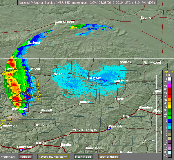
| 6/28/2019 7:45 PM MDT | Half Dollar sized hail reported 8.7 miles N of Zortman, MT, hail fell between 730 and 755 pm. |
| 6/28/2019 7:07 PM MDT |
 At 707 pm mdt, a severe thunderstorm was located 20 miles southwest of zortman, moving northeast at 30 mph (radar indicated). Hazards include golf ball size hail and 70 mph wind gusts. People and animals outdoors will be injured. expect hail damage to roofs, siding, windows, and vehicles. expect considerable tree damage. wind damage is also likely to mobile homes, roofs, and outbuildings. Locations impacted include, zortman and landusky. At 707 pm mdt, a severe thunderstorm was located 20 miles southwest of zortman, moving northeast at 30 mph (radar indicated). Hazards include golf ball size hail and 70 mph wind gusts. People and animals outdoors will be injured. expect hail damage to roofs, siding, windows, and vehicles. expect considerable tree damage. wind damage is also likely to mobile homes, roofs, and outbuildings. Locations impacted include, zortman and landusky.
|
| 6/28/2019 7:05 PM MDT | Also had pea size hail in phillips county MT, 8.3 miles NE of Zortman, MT |
| 6/28/2019 6:52 PM MDT |
 At 651 pm mdt, a severe thunderstorm was located 19 miles north of roy, or 28 miles southwest of zortman, moving northeast at 30 mph (radar indicated). Hazards include 60 mph wind gusts and quarter size hail. Hail damage to vehicles is expected. Expect wind damage to roofs, siding, and trees. At 651 pm mdt, a severe thunderstorm was located 19 miles north of roy, or 28 miles southwest of zortman, moving northeast at 30 mph (radar indicated). Hazards include 60 mph wind gusts and quarter size hail. Hail damage to vehicles is expected. Expect wind damage to roofs, siding, and trees.
|
| 6/27/2019 7:32 PM MDT | Mesonet station aldm8 zortman 1 in phillips county MT, 0.6 miles NW of Zortman, MT |
| 6/27/2019 7:20 PM MDT | Several power poles down on 7 mile road going into zortman off of us 191. no power in the area. trees were bending in the wind when the storm passe in phillips county MT, 8.4 miles NE of Zortman, MT |
| 6/27/2019 7:10 PM MDT | 10 inch tree branches blown out of the tops of trees. estimated wind gusts over 70 mp in phillips county MT, 8.7 miles N of Zortman, MT |
| 6/27/2019 6:55 PM MDT | Storm chase in phillips county MT, 14.7 miles NE of Zortman, MT |
| 6/27/2019 6:55 PM MDT |
 At 654 pm mdt, severe thunderstorms were located along a line extending from 25 miles southwest of fort belknap to 8 miles north of roy, moving northeast at 30 mph (radar indicated). Hazards include 60 mph wind gusts and nickel size hail. Expect damage to roofs, siding, and trees. Locations impacted include, zortman, landusky and fred robinson bridge. At 654 pm mdt, severe thunderstorms were located along a line extending from 25 miles southwest of fort belknap to 8 miles north of roy, moving northeast at 30 mph (radar indicated). Hazards include 60 mph wind gusts and nickel size hail. Expect damage to roofs, siding, and trees. Locations impacted include, zortman, landusky and fred robinson bridge.
|
| 6/27/2019 6:22 PM MDT |
 At 621 pm mdt, severe thunderstorms were located along a line extending from 18 miles southeast of parker school to 12 miles west of roy, moving northeast at 35 mph (radar indicated). Hazards include 70 mph wind gusts and half dollar size hail. Hail damage to vehicles is expected. expect considerable tree damage. Wind damage is also likely to mobile homes, roofs, and outbuildings. At 621 pm mdt, severe thunderstorms were located along a line extending from 18 miles southeast of parker school to 12 miles west of roy, moving northeast at 35 mph (radar indicated). Hazards include 70 mph wind gusts and half dollar size hail. Hail damage to vehicles is expected. expect considerable tree damage. Wind damage is also likely to mobile homes, roofs, and outbuildings.
|
| 6/6/2019 5:11 PM MDT |
 At 510 pm mdt, severe thunderstorms were located along a line extending from 8 miles southeast of zortman to crooked creek rec area, moving northeast at 40 mph (radar indicated). Hazards include 60 mph wind gusts and quarter size hail. Hail damage to vehicles is expected. Expect wind damage to roofs, siding, and trees. At 510 pm mdt, severe thunderstorms were located along a line extending from 8 miles southeast of zortman to crooked creek rec area, moving northeast at 40 mph (radar indicated). Hazards include 60 mph wind gusts and quarter size hail. Hail damage to vehicles is expected. Expect wind damage to roofs, siding, and trees.
|
| 7/27/2017 6:32 PM MDT | Zortman raws station 58mph wind gus in phillips county MT, 1 miles ESE of Zortman, MT |
| 7/15/2017 9:32 PM MDT | Blm raws recorded gust to 65 mp in phillips county MT, 1 miles ESE of Zortman, MT |
| 5/6/2017 10:32 PM MDT | Blm raws reports 58 mph wind gus in phillips county MT, 15 miles N of Zortman, MT |
| 5/6/2017 10:32 PM MDT | Blm raws reports 65 mph wind gus in phillips county MT, 0.6 miles NW of Zortman, MT |
| 7/18/2016 10:32 PM MDT | Mesonet station zortman 1w /aldm8 in phillips county MT, 1.9 miles E of Zortman, MT |
| 7/18/2016 10:22 PM MDT |
 At 1021 pm mdt, a severe thunderstorm was located 18 miles north of fourchette, or 25 miles east of zortman, moving northeast at 55 mph (radar indicated). Hazards include 60 mph wind gusts and quarter size hail. Hail damage to vehicles is expected. expect wind damage to roofs, siding, and trees. Locations impacted include, fourchette, phillips, sun prairie and content. At 1021 pm mdt, a severe thunderstorm was located 18 miles north of fourchette, or 25 miles east of zortman, moving northeast at 55 mph (radar indicated). Hazards include 60 mph wind gusts and quarter size hail. Hail damage to vehicles is expected. expect wind damage to roofs, siding, and trees. Locations impacted include, fourchette, phillips, sun prairie and content.
|
| 7/18/2016 9:55 PM MDT |
 At 954 pm mdt, a severe thunderstorm was located 7 miles south of zortman, moving northeast at 55 mph (radar indicated). Hazards include 60 mph wind gusts and quarter size hail. Hail damage to vehicles is expected. Expect wind damage to roofs, siding, and trees. At 954 pm mdt, a severe thunderstorm was located 7 miles south of zortman, moving northeast at 55 mph (radar indicated). Hazards include 60 mph wind gusts and quarter size hail. Hail damage to vehicles is expected. Expect wind damage to roofs, siding, and trees.
|
| 7/18/2016 9:36 PM MDT |
 At 936 pm mdt, a severe thunderstorm was located 20 miles southwest of zortman, moving northeast at 55 mph (radar indicated). Hazards include 60 mph wind gusts and quarter size hail. Hail damage to vehicles is expected. Expect wind damage to roofs, siding, and trees. At 936 pm mdt, a severe thunderstorm was located 20 miles southwest of zortman, moving northeast at 55 mph (radar indicated). Hazards include 60 mph wind gusts and quarter size hail. Hail damage to vehicles is expected. Expect wind damage to roofs, siding, and trees.
|
| 6/14/2016 4:41 PM MDT | Measured 72mph at manning corral dogtown raws statio in phillips county MT, 15 miles N of Zortman, MT |
| 6/14/2016 4:32 PM MDT | Zortman raws site recorded a gust to 58 mp in phillips county MT, 1 miles ESE of Zortman, MT |
| 6/14/2016 4:32 PM MDT | Measured 58mph at zortman blm raws statio in phillips county MT, 0.6 miles NW of Zortman, MT |
| 6/11/2016 12:09 AM MDT |
 The severe thunderstorm warning for southwestern valley and southern phillips counties will expire at 1215 am mdt, the storms which prompted the warning have weakened below severe limits, and no longer pose an immediate threat to life or property. therefore the warning will be allowed to expire. however gusty winds and heavy rain are still possible with these thunderstorms. a severe thunderstorm watch remains in effect until 200 am mdt for northeastern montana. The severe thunderstorm warning for southwestern valley and southern phillips counties will expire at 1215 am mdt, the storms which prompted the warning have weakened below severe limits, and no longer pose an immediate threat to life or property. therefore the warning will be allowed to expire. however gusty winds and heavy rain are still possible with these thunderstorms. a severe thunderstorm watch remains in effect until 200 am mdt for northeastern montana.
|
| 6/10/2016 11:36 PM MDT |
 At 1135 pm mdt, severe thunderstorms were located along a line extending from 12 miles east of zortman to 14 miles southwest of hinsdale, moving east at 55 mph (radar indicated). Hazards include 60 mph wind gusts and quarter size hail. Hail damage to vehicles is expected. expect wind damage to roofs, siding, and trees. Locations impacted include, malta, zortman, saco, dodson, tampico, hinsdale, fourchette, phillips, wagner, sun prairie, vandalia, fred robinson bridge, bowdoin, the bentonite plant, content and landusky. At 1135 pm mdt, severe thunderstorms were located along a line extending from 12 miles east of zortman to 14 miles southwest of hinsdale, moving east at 55 mph (radar indicated). Hazards include 60 mph wind gusts and quarter size hail. Hail damage to vehicles is expected. expect wind damage to roofs, siding, and trees. Locations impacted include, malta, zortman, saco, dodson, tampico, hinsdale, fourchette, phillips, wagner, sun prairie, vandalia, fred robinson bridge, bowdoin, the bentonite plant, content and landusky.
|
| 6/10/2016 11:09 PM MDT |
 At 1108 pm mdt, severe thunderstorms were located along a line extending from 12 miles southwest of hays to 16 miles south of malta, moving east at 55 mph (radar indicated). Hazards include 60 mph wind gusts and quarter size hail. Hail damage to vehicles is expected. Expect wind damage to roofs, siding, and trees. At 1108 pm mdt, severe thunderstorms were located along a line extending from 12 miles southwest of hays to 16 miles south of malta, moving east at 55 mph (radar indicated). Hazards include 60 mph wind gusts and quarter size hail. Hail damage to vehicles is expected. Expect wind damage to roofs, siding, and trees.
|
| 6/10/2016 10:33 PM MDT |
 At 1032 pm mdt, a severe thunderstorm was located 13 miles east of zortman, moving east at 55 mph (radar indicated). Hazards include 60 mph wind gusts and quarter size hail. Hail damage to vehicles is expected. expect wind damage to roofs, siding, and trees. Locations impacted include, zortman, fourchette, phillips and landusky. At 1032 pm mdt, a severe thunderstorm was located 13 miles east of zortman, moving east at 55 mph (radar indicated). Hazards include 60 mph wind gusts and quarter size hail. Hail damage to vehicles is expected. expect wind damage to roofs, siding, and trees. Locations impacted include, zortman, fourchette, phillips and landusky.
|
| 6/10/2016 10:15 PM MDT |
 At 1015 pm mdt, a severe thunderstorm was located near zortman, moving east at 55 mph (radar indicated). Hazards include 60 mph wind gusts and quarter size hail. Hail damage to vehicles is expected. Expect wind damage to roofs, siding, and trees. At 1015 pm mdt, a severe thunderstorm was located near zortman, moving east at 55 mph (radar indicated). Hazards include 60 mph wind gusts and quarter size hail. Hail damage to vehicles is expected. Expect wind damage to roofs, siding, and trees.
|
| 6/10/2016 8:55 PM MDT |
 At 855 pm mdt, a severe thunderstorm was located 8 miles west of crooked creek rec area, or 31 miles north of winnett, moving east at 45 mph (radar indicated). Hazards include 60 mph wind gusts and half dollar size hail. Hail damage to vehicles is expected. expect wind damage to roofs, siding, and trees. Locations impacted include, zortman, devils creek rec area, crooked creek rec area, u l bend rec area, fourchette, sun prairie and landusky. At 855 pm mdt, a severe thunderstorm was located 8 miles west of crooked creek rec area, or 31 miles north of winnett, moving east at 45 mph (radar indicated). Hazards include 60 mph wind gusts and half dollar size hail. Hail damage to vehicles is expected. expect wind damage to roofs, siding, and trees. Locations impacted include, zortman, devils creek rec area, crooked creek rec area, u l bend rec area, fourchette, sun prairie and landusky.
|
| 6/10/2016 8:36 PM MDT |
 At 834 pm mdt, a severe thunderstorm was located 23 miles east of roy, or 28 miles north of winnett, moving east at 45 mph (radar indicated). Hazards include 60 mph wind gusts and half dollar size hail. Hail damage to vehicles is expected. Expect wind damage to roofs, siding, and trees. At 834 pm mdt, a severe thunderstorm was located 23 miles east of roy, or 28 miles north of winnett, moving east at 45 mph (radar indicated). Hazards include 60 mph wind gusts and half dollar size hail. Hail damage to vehicles is expected. Expect wind damage to roofs, siding, and trees.
|
| 6/10/2016 7:59 PM MDT |
 At 759 pm mdt, a severe thunderstorm was located near fourchette, or 29 miles east of zortman, moving east at 35 mph (radar indicated). Hazards include 60 mph wind gusts and quarter size hail. Hail damage to vehicles is expected. expect wind damage to roofs, siding, and trees. Locations impacted include, fourchette, sun prairie and fred robinson bridge. At 759 pm mdt, a severe thunderstorm was located near fourchette, or 29 miles east of zortman, moving east at 35 mph (radar indicated). Hazards include 60 mph wind gusts and quarter size hail. Hail damage to vehicles is expected. expect wind damage to roofs, siding, and trees. Locations impacted include, fourchette, sun prairie and fred robinson bridge.
|
| 6/10/2016 7:41 PM MDT | Manning corral raws measured a 59 mph wind gus in phillips county MT, 13.5 miles N of Zortman, MT |
| 6/10/2016 7:11 PM MDT |
 At 708 pm mdt, a severe thunderstorm was located 16 miles south of zortman, moving east at 35 mph (radar indicated). Hazards include 60 mph wind gusts and half dollar size hail. Hail damage to vehicles is expected. Expect wind damage to roofs, siding, and trees. At 708 pm mdt, a severe thunderstorm was located 16 miles south of zortman, moving east at 35 mph (radar indicated). Hazards include 60 mph wind gusts and half dollar size hail. Hail damage to vehicles is expected. Expect wind damage to roofs, siding, and trees.
|
| 6/10/2016 6:50 PM MDT |
 At 650 pm mdt, a severe thunderstorm was located 9 miles south of zortman, moving northeast at 45 mph (radar indicated). Hazards include 60 mph wind gusts and quarter size hail. Hail damage to vehicles is expected. expect wind damage to roofs, siding, and trees. Locations impacted include, zortman, fourchette, phillips, landusky and fred robinson bridge. At 650 pm mdt, a severe thunderstorm was located 9 miles south of zortman, moving northeast at 45 mph (radar indicated). Hazards include 60 mph wind gusts and quarter size hail. Hail damage to vehicles is expected. expect wind damage to roofs, siding, and trees. Locations impacted include, zortman, fourchette, phillips, landusky and fred robinson bridge.
|
| 6/10/2016 6:20 PM MDT |
 At 619 pm mdt, a severe thunderstorm was located 18 miles east of winifred, or 29 miles southwest of zortman, moving northeast at 40 mph (radar indicated). Hazards include 60 mph wind gusts and quarter size hail. Hail damage to vehicles is expected. Expect wind damage to roofs, siding, and trees. At 619 pm mdt, a severe thunderstorm was located 18 miles east of winifred, or 29 miles southwest of zortman, moving northeast at 40 mph (radar indicated). Hazards include 60 mph wind gusts and quarter size hail. Hail damage to vehicles is expected. Expect wind damage to roofs, siding, and trees.
|
| 7/5/2015 12:59 AM MDT |
 At 1256 am mdt, a severe thunderstorm was located near zortman, and moving east at 45 mph (radar indicated). Hazards include 60 mph wind gusts and quarter size hail. Hail damage to crops and plants is expected. some damage to vehicles is possible. expect wind damage to roofs, siding and trees. The severe thunderstorm will affect mainly rural areas of northeastern petroleum and southwestern phillips counties. At 1256 am mdt, a severe thunderstorm was located near zortman, and moving east at 45 mph (radar indicated). Hazards include 60 mph wind gusts and quarter size hail. Hail damage to crops and plants is expected. some damage to vehicles is possible. expect wind damage to roofs, siding and trees. The severe thunderstorm will affect mainly rural areas of northeastern petroleum and southwestern phillips counties.
|
| 7/5/2015 12:29 AM MDT |
 At 1228 am mdt, a severe thunderstorm was located 10 miles west of hays, and moving east at 45 mph (radar indicated). Hazards include 60 mph wind gusts and quarter size hail. Hail damage to crops and plants is expected. some damage to vehicles is possible. expect wind damage to roofs, siding and trees. the severe thunderstorm will be near, zortman around 1250 am mdt. Other locations in the warning include landusky. At 1228 am mdt, a severe thunderstorm was located 10 miles west of hays, and moving east at 45 mph (radar indicated). Hazards include 60 mph wind gusts and quarter size hail. Hail damage to crops and plants is expected. some damage to vehicles is possible. expect wind damage to roofs, siding and trees. the severe thunderstorm will be near, zortman around 1250 am mdt. Other locations in the warning include landusky.
|
| 1/18/2015 3:30 PM MST | Malta south dot in phillips county MT, 9.8 miles WSW of Zortman, MT |
| 8/15/2014 7:49 PM MDT | Also heavy rain and frequent lightning in phillips county MT, 8.4 miles NE of Zortman, MT |
| 8/29/2013 11:50 PM MDT | Storm damage reported in phillips county MT, 15 miles N of Zortman, MT |
| 6/19/2013 9:30 PM MDT | Storm damage reported in phillips county MT, 9.8 miles WSW of Zortman, MT |
| 6/19/2013 9:15 PM MDT | Storm damage reported in phillips county MT, 15 miles N of Zortman, MT |
| 7/17/2012 5:13 PM MDT | Storm damage reported in phillips county MT, 10.3 miles WSW of Zortman, MT |
| 1/1/0001 12:00 AM | Quarter sized hail reported 8.7 miles N of Zortman, MT, not heavy but a scattering of hail |
Hail Maps for Zortman, MT


Connect with Interactive Hail Maps