

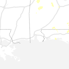
Hail Map for Saturday, June 12, 2021

Number of Impacted Households on 6/12/2021
0
Impacted by 1" or Larger Hail
0
Impacted by 1.75" or Larger Hail
0
Impacted by 2.5" or Larger Hail
Square Miles of Populated Area Impacted on 6/12/2021
0
Impacted by 1" or Larger Hail
0
Impacted by 1.75" or Larger Hail
0
Impacted by 2.5" or Larger Hail


Cities Most Affected by Hail Storms of 6/12/2021
| Hail Size | Demographics of Zip Codes Affected | ||||||
|---|---|---|---|---|---|---|---|
| City | Count | Average | Largest | Pop Density | House Value | Income | Age |
| Las Vegas, NM | 5 | 2.36 | 3.07 | 11 | $89k | $25.9k | 38.7 |
| Ovid, MI | 2 | 2.75 | 2.75 | 89 | $92k | $43.2k | 39.5 |
| Sapello, NM | 1 | 1.75 | 1.75 | 5 | $157k | $24.4k | 47.5 |
| Laingsburg, MI | 1 | 1.75 | 1.75 | 116 | $124k | $56.2k | 40.9 |
Hail and Wind Damage Spotted on 6/12/2021
Filter by Report Type:Hail ReportsWind Reports
States Impacted
Alabama, South Carolina, Kentucky, Illinois, Georgia, Florida, Tennessee, Indiana, Michigan, New Mexico, Arkansas, Ohio, Oklahoma, Texas, MississippiAlabama
| Local Time | Report Details |
|---|---|
| 1:05 PM CDT | Large tree limb snapped in new market roughly two miles east of walker lane and 231. time estimated based on rada in madison county AL, 65.4 miles E of Florence, AL |
| 2:21 PM CDT | Couple of power poles snapped near the intersection of hwy. 67 and mountainview dr. in priceville. time estimated by rada in morgan county AL, 45.8 miles ESE of Florence, AL |
| 2:21 PM CDT | An off-duty nws employee reported a single tree down along the side of interstate 65. a metal road sign was also bent over in the same location. time estimated based on in morgan county AL, 46.9 miles ESE of Florence, AL |
| 2:25 PM CDT | Power poles down between sherwood dr. and 13th street. time estimated from rada in morgan county AL, 44 miles ESE of Florence, AL |
| 2:48 PM CDT | Trees down across road on county road 1 near fig tree dr. time estimated by rada in autauga county AL, 43.4 miles NE of Camden, AL |
| 3:43 PM CDT | Multiple trees down in the anderson community. time estimated from rada in lauderdale county AL, 24.7 miles ENE of Florence, AL |
| 4:23 PM CDT | Trees and powerlines down along hwy in walker county AL, 41 miles NW of Birmingham, AL |
| 5:08 PM CDT | Power line down along highway 85 in the bellwood are in geneva county AL, 64.4 miles NNE of Miramar Beach, FL |
| 5:20 PM CDT | Trees and power lines dow in tuscaloosa county AL, 46.7 miles W of Birmingham, AL |
| 6:00 PM CDT | Several trees down in the knoxville area. time estimated by rada in greene county AL, 67.4 miles WSW of Birmingham, AL |
| 6:54 PM CDT | Several trees down along cr 187 near cr 84 and 83. time estimated by rada in chambers county AL, 17.2 miles NE of Auburn, AL |
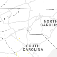
South Carolina
| Local Time | Report Details |
|---|---|
| 2:50 PM EDT | Sc highway patrol reports trees down at the intersection of sc-34 and broad river roa in newberry county SC, 66.6 miles SSW of Charlotte, NC |
| 3:42 PM EDT | Nws employee reports siding damage to a home on upper loop way with multiple trees down nearb in richland county SC, 65.3 miles NE of Augusta, GA |
| 3:59 PM EDT | Sc highway patrol reports trees down near windy r in lexington county SC, 49.4 miles NE of Augusta, GA |
Kentucky
| Local Time | Report Details |
|---|---|
| 3:11 PM EDT | Tree dow in clark county KY, 23.2 miles NNW of Irvine, KY |
| 3:24 PM EDT | Multiple trees knocked down along furnace roa in powell county KY, 11.6 miles NE of Irvine, KY |
| 3:27 PM EDT | Tree down on simpson lane. time estimated from rada in madison county KY, 22.2 miles WNW of Irvine, KY |
| 3:27 PM EDT | Tree knocked down near intersection of happy top and eddie ridge road in powell county KY, 9.7 miles N of Irvine, KY |
| 3:27 PM EDT | Tree knocked down along cat creek roa in powell county KY, 11.8 miles NE of Irvine, KY |
| 4:00 PM EDT | Delayed report: tree down blocking road at lansdowne drive and nantucket driv in fayette county KY, 35.8 miles NW of Irvine, KY |
| 4:18 PM EDT | Tree down along route 643 south of sanford. time estimated from rada in lincoln county KY, 39.6 miles WSW of Irvine, KY |
| 4:19 PM EDT | Tree down along rt. 1295. time estimated from rada in garrard county KY, 30.5 miles WSW of Irvine, KY |
| 4:48 PM EDT | Tree blocking roadway at georgetown rd and mckinney ave. time estimated from rada in woodford county KY, 49.9 miles NW of Irvine, KY |
| 4:51 PM EDT | Tree knocked dow in pulaski county KY, 43.1 miles SW of Irvine, KY |
| 4:51 PM EDT | Tree knocked dow in pulaski county KY, 47.5 miles SW of Irvine, KY |
| 4:51 PM EDT | Tree knocked dow in pulaski county KY, 46.4 miles SW of Irvine, KY |
| 4:51 PM EDT | Tree knocked dow in pulaski county KY, 47.9 miles SW of Irvine, KY |
| 4:51 PM EDT | Tree knocked dow in pulaski county KY, 47.6 miles SW of Irvine, KY |
| 4:53 PM EDT | Tree knocked dow in pulaski county KY, 49.7 miles SW of Irvine, KY |
| 4:56 PM EDT | Tree knocked dow in pulaski county KY, 49.6 miles SW of Irvine, KY |
| 4:57 PM EDT | Tree knocked dow in pulaski county KY, 50.9 miles SW of Irvine, KY |
| 4:58 PM EDT | Multiple trees knocked down along highway 490 in the vicinity of east bernstad in laurel county KY, 36.1 miles SSW of Irvine, KY |
| 4:59 PM EDT | Tree knocked down along sinking creek road near the parkwa in laurel county KY, 39.4 miles SSW of Irvine, KY |
| 5:00 PM EDT | Tree down on power lines. time estimated from rada in woodford county KY, 47.8 miles WNW of Irvine, KY |
| 5:02 PM EDT | Tree down at park st and rose hill ave. tree is blocking entrance to park st. time estimated from rada in woodford county KY, 47.8 miles WNW of Irvine, KY |
| 5:02 PM EDT | Tree down blocking williams ln and big sink rd. time estimated from rada in woodford county KY, 47.1 miles WNW of Irvine, KY |
| 5:03 PM EDT | Tree knocked dow in pulaski county KY, 52.9 miles SW of Irvine, KY |
| 5:04 PM EDT | Tree knocked dow in pulaski county KY, 55.1 miles SW of Irvine, KY |
| 5:07 PM EDT | Tree knocked dow in pulaski county KY, 54.4 miles SW of Irvine, KY |
| 5:07 PM EDT | Tree knocked dow in pulaski county KY, 53 miles SSW of Irvine, KY |
| 5:09 PM EDT | Tree knocked dow in pulaski county KY, 51.7 miles SSW of Irvine, KY |
| 5:14 PM EDT | Tree knocked dow in pulaski county KY, 54 miles SSW of Irvine, KY |
| 5:18 PM EDT | Tree knocked dow in pulaski county KY, 61 miles SSW of Irvine, KY |
| 5:20 PM EDT | Tree down on power line near oregon rd and hifner rd. time estimated from rada in woodford county KY, 46.6 miles WNW of Irvine, KY |
| 5:21 PM EDT | Tree knocked dow in pulaski county KY, 63 miles SSW of Irvine, KY |
| 5:55 PM EDT | Tree down at north bragg street and first street. time estimated from rada in boyle county KY, 48 miles ESE of Louisville, KY |
| 6:26 PM EDT | Trees dow in casey county KY, 57.7 miles SE of Louisville, KY |
| 8:48 PM CDT | *** 2 inj *** update to previous tstm wnd dmg report from crofton... truck collided with a fallen tree on u.s. 41. two children with non life-threatening injuries. appr in christian county KY, 64.1 miles S of Evansville, IN |
Illinois
| Local Time | Report Details |
|---|---|
| 2:15 PM CDT | Quarter sized hail reported near Elk Grove Village, IL, 19.9 miles WNW of Chicago, IL, near arlington heights rd and landmeier rd. |
| 2:20 PM CDT | Half Dollar sized hail reported near Carpentersville, IL, 36.2 miles WNW of Chicago, IL |
| 2:24 PM CDT | Measured using handheld mete in dupage county IL, 21 miles WNW of Chicago, IL |
| 2:45 PM CDT | Storm damage reported in cook county IL, 12.5 miles SW of Chicago, IL |
| 2:48 PM CDT | Storm damage reported in cook county IL, 8.9 miles SW of Chicago, IL |
| 2:54 PM CDT | Half Dollar sized hail reported near Geneva, IL, 35 miles W of Chicago, IL, from photo shared on twitter. time estimated based on radar. |
| 3:38 PM CDT | Quarter sized hail reported near Aurora, IL, 39.3 miles W of Chicago, IL, nickel to quarter size hail. |
| 5:15 PM CDT | Box truck blown over on i-57 near mile marker 290. no injuries per is in iroquois county IL, 73.7 miles SSW of Chicago, IL |
| 5:44 PM CDT | 10 power poles snapped near their base on county road 700n west of i-57... confirmed by video relayed via social medi in iroquois county IL, 77.9 miles N of Mattoon, IL |
| 5:45 PM CDT | Large tree downed in buckley. power outages reported in the are in iroquois county IL, 79.2 miles NNE of Mattoon, IL |
| 5:45 PM CDT | Photo of a large healthy tree snapped at the trunk just east of buckle in iroquois county IL, 78.6 miles NNE of Mattoon, IL |
| 5:47 PM CDT | Measured by a personal weather station north of cissna par in iroquois county IL, 80.4 miles NNE of Mattoon, IL |
| 5:50 PM CDT | Half Dollar sized hail reported near Buckley, IL, 79.5 miles NNE of Mattoon, IL |
| 6:00 PM CDT | Time estimated from rada in vermilion county IL, 72.5 miles NNE of Mattoon, IL |
| 6:00 PM CDT | Report from mping: 1-inch tree limbs broken; shingles blown off. time estimated from rada in champaign county IL, 57.4 miles N of Mattoon, IL |
| 6:00 PM CDT | Relayed via broadcast media. small grain bin wrapped around telephone pole. time estimated based on rada in vermilion county IL, 72.1 miles NNE of Mattoon, IL |
| 6:30 PM CDT | Relayed via broadcast met. reports of lots of tree limbs down. time estimated from rada in champaign county IL, 43 miles N of Mattoon, IL |
| 6:40 PM CDT | Several 2-3 inch tree limbs reported dow in christian county IL, 38.2 miles W of Mattoon, IL |
| 7:00 PM CDT | Photos of several large branches snapped off and blown away from trees. time estimated based on rada in vermilion county IL, 37.6 miles NE of Mattoon, IL |
| 8:10 PM CDT | Relayed via broadcast met. branches and a powerline down. time estimated from rada in coles county IL, 10.5 miles E of Mattoon, IL |
| 8:10 PM CDT | Relayed via broadcast media. report of a tree down. time estimated from rada in coles county IL, 0.3 miles ESE of Mattoon, IL |
| 10:15 PM CDT | Two large limbs about a foot in diameter blown down. one 30-foot limb grazed a garag in gallatin county IL, 37.9 miles WSW of Evansville, IN |
| 10:25 PM CDT | Quarter sized hail reported near Shawneetown, IL, 42 miles WSW of Evansville, IN, report relayed via wsil channel 3. |
Georgia
| Local Time | Report Details |
|---|---|
| 3:21 PM EDT | Tree down at oakview church post rd and highway 28 in seminole county GA, 58.6 miles NW of Tallahassee, FL |
| 3:24 PM EDT | A buisness in six mile reported damage to and loss of posted signs due to wind in floyd county GA, 55.7 miles WNW of Atlanta, GA |
| 3:24 PM EDT | Trees reported down on powerlines along burkhaulter r in polk county GA, 52.5 miles WNW of Atlanta, GA |
| 3:33 PM EDT | Trees reported down on powerlines near the intersection of blance rd and oakwood d in polk county GA, 52 miles WNW of Atlanta, GA |
| 3:33 PM EDT | Trees reported down on powerlines near the intersection of blance rd and oakwood d in polk county GA, 52 miles WNW of Atlanta, GA |
| 3:37 PM EDT | Trees reported down on powerlines near the intersection of blance rd and oakwood d in polk county GA, 52.5 miles WNW of Atlanta, GA |
| 4:11 PM EDT | Multiple trees reported down on powerlines off hwy 10 in glascock county GA, 43.2 miles WSW of Augusta, GA |
| 6:07 PM EDT | Power lines reported down along hwy 21 in wilcox county GA, 47.2 miles NW of Douglas, GA |
| 6:28 PM EDT | Tree down along kathleen d in ben hill county GA, 31.1 miles NW of Douglas, GA |
| 6:35 PM EDT | Tree down along 10 mile roa in ben hill county GA, 29.9 miles WNW of Douglas, GA |
| 7:02 PM EDT | A few trees were blown down in the waterloo are in irwin county GA, 37.1 miles W of Douglas, GA |
| 7:05 PM EDT | Tree down on oak circl in irwin county GA, 23.8 miles WNW of Douglas, GA |
| 7:10 PM EDT | Tree down in hickory roa in irwin county GA, 24.2 miles W of Douglas, GA |
| 7:10 PM EDT | 911 call center reported a tree was knocked dow in tift county GA, 39.2 miles W of Douglas, GA |
| 7:10 PM EDT | 911 call center reported a tree was knocked dow in tift county GA, 37.2 miles W of Douglas, GA |
| 7:15 PM EDT | 911 call center reported a tree was knocked dow in tift county GA, 34.3 miles W of Douglas, GA |
| 7:30 PM EDT | 911 call center reported a tree was knocked dow in berrien county GA, 28.7 miles SW of Douglas, GA |
| 7:37 PM EDT | 911 call center reported a tree down along north highway 135 near us8 in atkinson county GA, 16.4 miles SW of Douglas, GA |
| 7:40 PM EDT | 911 call center reported a tree was knocked dow in berrien county GA, 31.2 miles SW of Douglas, GA |
| 7:40 PM EDT | 911 call center reported a tree was knocked dow in berrien county GA, 30.8 miles SW of Douglas, GA |
| 7:40 PM EDT | 911 call center reported a tree was knocked dow in berrien county GA, 30.4 miles SW of Douglas, GA |
| 8:26 PM EDT | A tree was reported down near the intersection of big pond rd and old alabama r in bartow county GA, 41.1 miles NW of Atlanta, GA |
Florida
| Local Time | Report Details |
|---|---|
| 2:30 PM CDT | Numerous trees down across the count in jackson county FL, 50.2 miles WNW of Tallahassee, FL |
| 3:42 PM EDT | Reports of capsized boats in lake seminol in jackson county FL, 40.1 miles WNW of Tallahassee, FL |
| 5:05 PM EDT | Us air force wind network tower 0803 reported a 44mph/38kt gust from the s in brevard county FL, 43.4 miles E of Orlando, FL |
| 5:20 PM EDT | Us space force wind network tower 0001 at kennedy space center reported a 59mph/51kt gust from the in brevard county FL, 49.7 miles E of Orlando, FL |
| 5:25 PM EDT | Us air force wind network tower 0108 reported a 61mph/53kt gust from the s in brevard county FL, 49.1 miles E of Orlando, FL |
Tennessee
| Local Time | Report Details |
|---|---|
| 3:58 PM CDT | Trees down on powerlines at morton street and colloredo boulevar in bedford county TN, 49.4 miles SSE of Nashville, TN |
| 3:58 PM CDT | Large tree uprooted on alton avenue in shelbyville in bedford county TN, 50.2 miles SSE of Nashville, TN |
| 3:58 PM CDT | Trees down on powerlines at morton street and colloredo boulevar in bedford county TN, 49.6 miles SSE of Nashville, TN |
| 4:38 PM CDT | Tree down on bear creek pike in giles county TN, 54.9 miles NE of Florence, AL |
| 6:05 PM CDT | Quarter sized hail reported near Columbia, TN, 45 miles S of Nashville, TN |
| 7:45 PM EDT | Numerous trees reported down across the county by dispatc in rhea county TN, 51.1 miles NNE of Chattanooga, TN |
| 8:05 PM EDT | Social media photo of a large tree uprooted and fallen onto a house. time is estimate in bradley county TN, 26.3 miles ENE of Chattanooga, TN |
| 8:30 PM EDT | Social media post of trees/limbs down across hamilton count in hamilton county TN, 16.9 miles NNE of Chattanooga, TN |
| 11:03 PM CDT | Large tree on house. wind was estimated at 70 mph by spotte in benton county TN, 32.7 miles ENE of Mc Kenzie, TN |
Indiana
| Local Time | Report Details |
|---|---|
| 5:26 PM EDT | A power pole and wires were downed. time estimated by from rada in ripley county IN, 44.7 miles W of Cincinnati, OH |
| 5:35 PM EDT | Several large limbs down. time estimated by rada in ripley county IN, 42.8 miles W of Cincinnati, OH |
| 7:08 PM EDT | Trees down on 35o south. time estimated from rada in fayette county IN, 48 miles NW of Cincinnati, OH |
| 7:16 PM EDT | Trees and power lines down at 480 south and 121. time estimated from rada in fayette county IN, 47.5 miles NW of Cincinnati, OH |
| 7:30 PM EDT | Multiple trees down. time estimated from rada in franklin county IN, 45.7 miles NW of Cincinnati, OH |
| 9:05 PM EDT | 9 power poles knocked down... some broken at the ground along co rd 1550 north just west of state route 9. power lines down as well. damage to a wheat field just south in madison county IN, 46.2 miles NNE of Indianapolis, IN |
| 9:15 PM EDT | Tree down along 700w south of sr 32. trees and tree limbs noted to be down across several other portions of the county. time estimated from rada in delaware county IN, 43.1 miles NE of Indianapolis, IN |
| 10:04 PM EDT | Large limb fell on vehicl in hancock county IN, 31.5 miles ENE of Indianapolis, IN |
| 10:10 PM EDT | Utility pole and lines down at the intersection of state route 234 and shirley roa in hancock county IN, 31.5 miles ENE of Indianapolis, IN |
| 10:10 PM EDT | Tree down near the intersection of state route 103 and co rd 300 sout in henry county IN, 44.1 miles ENE of Indianapolis, IN |
| 10:34 PM EDT | Report from mping: 1-inch tree limbs broken; shingles blown of in randolph county IN, 62.2 miles S of Fort Wayne, IN |
| 10:44 PM EDT | Several repots of trees down in rural portions of eastern randolph county. time estimated from rada in randolph county IN, 67.4 miles SSE of Fort Wayne, IN |
| 10:45 PM EDT | Quarter sized hail reported near Indianapolis, IN, 2.8 miles ENE of Indianapolis, IN, report from mping: quarter (1.00 in.). |
| 10:48 PM EDT | Also saw 1 inch hail. relayed via social medi in marion county IN, 3.8 miles E of Indianapolis, IN |
| 10:50 PM EDT | Power poles dow in randolph county IN, 62.2 miles SSE of Fort Wayne, IN |
| 10:55 PM EDT | Quarter sized hail reported near Indianapolis, IN, 6.7 miles ESE of Indianapolis, IN, hail of varying sizes up to 1 inch near the intersection of raymond st and franklin rd. |
| 11:00 PM EDT | Several large tree limbs on road just off us 5 in hancock county IN, 14.7 miles ESE of Indianapolis, IN |
Michigan
| Local Time | Report Details |
|---|---|
| 6:10 PM EDT | Trees and wires down in ovid... mi at pearl street and main s in clinton county MI, 34.7 miles W of Flint, MI |
| 6:12 PM EDT | Baseball sized hail reported near Ovid, MI, 34.7 miles W of Flint, MI, baseball size hail. |
| 6:14 PM EDT | Baseball sized hail reported near Ovid, MI, 34.7 miles W of Flint, MI, baseball size hail along with trees down in ovid... mi. |
| 6:24 PM EDT | Large tree branches down resulting in property damage in the fishers lake area. time estimated from rada in st. joseph county MI, 67.6 miles S of Grand Rapids, MI |
| 6:29 PM EDT | Quarter sized hail reported near Atlanta, MI, 35.8 miles W of Alpena, MI |
| 6:33 PM EDT | Ping Pong Ball sized hail reported near Laingsburg, MI, 34.7 miles WSW of Flint, MI, report of ping pong sized hail along with multiple trees down |
| 6:35 PM EDT | Golf Ball sized hail reported near Laingsburg, MI, 34.2 miles WSW of Flint, MI, report of golf ball sized hail at pine hills golf course along with trees and powerlines down. |
| 6:36 PM EDT | Quarter sized hail reported near Atlanta, MI, 34.3 miles W of Alpena, MI |
| 6:45 PM EDT | Half Dollar sized hail reported near Perry, MI, 30.6 miles WSW of Flint, MI, half dollar sized hail - photo submitted via facebook. |
| 6:45 PM EDT | Half Dollar sized hail reported near Houghton Lake, MI, 55 miles SE of Traverse City, MI, time estimated from radar. |
| 7:04 PM EDT | Mdot sw tweet at 751 pm indicates power lines down on m 66 and road is closed. time estimated from rada in st. joseph county MI, 55.3 miles NNW of Fort Wayne, IN |
| 7:52 PM EDT | Multiple trees down across m-36 between pinckney and gregory. report relayed via wfo grand rapid in livingston county MI, 41 miles SSW of Flint, MI |
| 8:32 PM EDT | Quarter sized hail reported near Dexter, MI, 48 miles SSW of Flint, MI, also estimated 50 mph winds. |
| 8:34 PM EDT | Midland county central dispatch reported several trees down near e shaffer rd and n waldo r in midland county MI, 57 miles NNW of Flint, MI |
| 8:45 PM EDT | Quarter sized hail reported near Ann Arbor, MI, 50 miles S of Flint, MI, quarter sized hail reported near n maple rd and dexter ave. |
| 9:50 PM EDT | Quarter sized hail reported near Holt, MI, 50.4 miles WSW of Flint, MI |
| 10:31 PM EDT | Half Dollar sized hail reported near Houghton Lake, MI, 55 miles SE of Traverse City, MI, time estimated from radar. |
New Mexico
| Local Time | Report Details |
|---|---|
| 4:37 PM MDT | Golf Ball sized hail reported near Sapello, NM, 47.8 miles SSE of Taos, NM |
| 5:12 PM MDT | Quarter sized hail reported near Las Vegas, NM, 55.3 miles SSE of Taos, NM |
| 5:14 PM MDT | Golf Ball sized hail reported near Las Vegas, NM, 63.3 miles SSE of Taos, NM |
| 5:16 PM MDT | Tennis Ball sized hail reported near Las Vegas, NM, 61.9 miles SSE of Taos, NM |
| 5:18 PM MDT | Tea Cup sized hail reported near Las Vegas, NM, 64.1 miles SSE of Taos, NM |
| 5:18 PM MDT | Hen Egg sized hail reported near Las Vegas, NM, 65.1 miles SSE of Taos, NM |
| 5:19 PM MDT | Tennis Ball sized hail reported near Las Vegas, NM, 64.9 miles SSE of Taos, NM |
| 8:31 PM MDT | Ktcc aso in quay county NM, 6.9 miles ENE of Tucumcari, NM |
| 8:54 PM MDT | Quarter sized hail reported near Grady, NM, 34.1 miles SE of Tucumcari, NM |
| 9:08 PM MDT | Storm damage reported in quay county NM, 34.6 miles E of Tucumcari, NM |
| 9:35 PM MDT | Storm damage reported in roosevelt county NM, 76.2 miles ENE of Roswell, NM |
Arkansas
| Local Time | Report Details |
|---|---|
| 7:00 PM CDT | Quarter sized hail reported near Manila, AR, 50.7 miles N of Memphis, TN, quarter size hail south of big lake. |
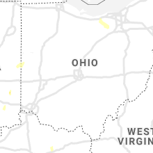
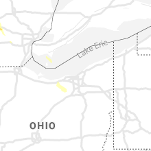
Ohio
| Local Time | Report Details |
|---|---|
| 10:37 PM EDT | Multiple trees down in the union city are in darke county OH, 62.6 miles SSE of Fort Wayne, IN |
| 11:23 PM EDT | Tree down in jaysville near 3 in darke county OH, 66 miles N of Cincinnati, OH |
Oklahoma
| Local Time | Report Details |
|---|---|
| 10:34 PM CDT | Quarter sized hail reported near Boise City, OK, 111.6 miles NNW of Amarillo, TX |
| 10:35 PM CDT | Mesonet station bois boise city report of cottonwood trees being ripped apart in boise cit in cimarron county OK, 108.8 miles NNW of Amarillo, TX |
| 10:40 PM CDT | Mesonet station bois boise city power is out in boise cit in cimarron county OK, 108.8 miles NNW of Amarillo, TX |
Texas
| Local Time | Report Details |
|---|---|
| 11:22 PM CDT | Storm damage reported in sherman county TX, 81.3 miles NNW of Amarillo, TX |
| 11:35 PM CDT | Asos station kdht dalhart (asos in hartley county TX, 69 miles NW of Amarillo, TX |
| 11:43 PM CDT | Asos station kdht dalhart (asos in hartley county TX, 69 miles NW of Amarillo, TX |
| 11:48 PM CDT | Asos station kdht dalhart (asos in hartley county TX, 69 miles NW of Amarillo, TX |
| 11:57 PM CDT | Asos station kdht dalhart (asos in hartley county TX, 69 miles NW of Amarillo, TX |
| 12:23 AM CDT | Measured thunderstorm wind gust with a handheld wind mete in moore county TX, 58.4 miles N of Amarillo, TX |
| 12:28 AM CDT | 3 inch tree limbs blown down and power poles blown over in cactu in moore county TX, 58.9 miles N of Amarillo, TX |
| 12:35 AM CDT | Awos station kdux dumas (awos in moore county TX, 45.5 miles NNW of Amarillo, TX |
| 12:50 AM CDT | Mesonet station 69 bootleg 11wn in deaf smith county TX, 46.2 miles ESE of Tucumcari, NM |
| 1:08 AM CDT | Asos station kbgd borger (asos in hutchinson county TX, 41.9 miles NE of Amarillo, TX |
| 1:13 AM CDT | Power poles blown dow in potter county TX, 22.3 miles N of Amarillo, TX |
| 1:16 AM CDT | Storm damage reported in potter county TX, 22.4 miles NNE of Amarillo, TX |
| 1:17 AM CDT | Measured using handheld wind mete in potter county TX, 22.2 miles NNE of Amarillo, TX |
| 1:29 AM CDT | Shingles blown off house in potter county TX, 3.6 miles N of Amarillo, TX |
| 2:13 AM CDT | Approximately 6 inch diameter tree down near zita along loop 33 in randall county TX, 5.4 miles S of Amarillo, TX |
Mississippi
| Local Time | Report Details |
|---|---|
| 12:27 AM CDT | The ship island weatherflow mesonet measured a 75 mph wind gust as a thunderstorm passed over the islan in gmz532 county MS, 63.3 miles WSW of Mobile, AL |
Connect with Interactive Hail Maps