

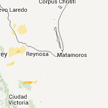
Hail Map for Sunday, April 12, 2015

Number of Impacted Households on 4/12/2015
0
Impacted by 1" or Larger Hail
0
Impacted by 1.75" or Larger Hail
0
Impacted by 2.5" or Larger Hail
Square Miles of Populated Area Impacted on 4/12/2015
0
Impacted by 1" or Larger Hail
0
Impacted by 1.75" or Larger Hail
0
Impacted by 2.5" or Larger Hail


Cities Most Affected by Hail Storms of 4/12/2015
| Hail Size | Demographics of Zip Codes Affected | ||||||
|---|---|---|---|---|---|---|---|
| City | Count | Average | Largest | Pop Density | House Value | Income | Age |
| Memphis, TX | 2 | 1.88 | 2.00 | 8 | $30k | $23.0k | 42.0 |
| Bellwood, NE | 1 | 2.75 | 2.75 | 12 | $70k | $35.8k | 44.4 |
| Columbus, NE | 1 | 1.75 | 1.75 | 100 | $82k | $40.2k | 38.0 |
| Wellington, TX | 1 | 1.75 | 1.75 | 7 | $36k | $25.4k | 37.6 |
| Schuyler, NE | 1 | 1.75 | 1.75 | 48 | $66k | $37.7k | 30.1 |
| Mankato, KS | 1 | 1.75 | 1.75 | 5 | $32k | $30.9k | 53.1 |
Hail and Wind Damage Spotted on 4/12/2015
Filter by Report Type:Hail ReportsWind Reports
Texas
| Local Time | Report Details |
|---|---|
| 3:35 PM CDT | Golf Ball sized hail reported near , , 74.5 miles W of Odessa, TX |
| 3:50 PM CDT | The big bend portable raws station reported a 65 mph gus in brewster county TX, 92.9 miles SSE of Alpine, TX |
| 4:38 PM CDT | The panther junction raws station reported a 59 mph gus in brewster county TX, 76.2 miles SSE of Alpine, TX |
| 5:05 PM CDT | Half Dollar sized hail reported near Odessa, TX, 7.4 miles W of Odessa, TX |
| 5:25 PM CDT | Quarter sized hail reported near Mobeetie, TX, 76.3 miles N of Childress, TX |
| 5:25 PM CDT | Storm damage reported in terrell county TX, 87.3 miles WNW of Del Rio, TX |
| 5:37 PM CDT | Quarter sized hail reported near Odessa, TX, 0.3 miles E of Odessa, TX, the ector county s.o. reported quarter size hail in south odessa. |
| 5:45 PM CDT | Hen Egg sized hail reported near Memphis, TX, 25 miles NW of Childress, TX |
| 5:55 PM CDT | Golf Ball sized hail reported near Memphis, TX, 28.1 miles NW of Childress, TX |
| 7:54 PM CDT | Half Dollar sized hail reported near Wellington, TX, 31.8 miles N of Childress, TX |
| 8:28 PM CDT | Golf Ball sized hail reported near Wellington, TX, 29.8 miles N of Childress, TX |
| 8:32 PM CDT | An out building was damaged and steel bars were lying across the highway in a pattern from ne to s in collingsworth county TX, 29.8 miles N of Childress, TX |
| 9:15 PM CDT | 60 mph winds and 0.25 - 0.50 inch hail reported in addition to heavy rain and frequent lightning. power outages are occurrin in webb county TX, 0.7 miles E of Laredo, TX |
| 9:17 PM CDT | Several trees reported down in zapata. time estimated from rada in zapata county TX, 46.6 miles SSE of Laredo, TX |
| 9:20 PM CDT | Down trees and powerlines in weslaco and rio lan in starr county TX, 70.9 miles SSE of Laredo, TX |
| 9:25 PM CDT | Trees down in 1st and highway 8 in zapata county TX, 46.6 miles SSE of Laredo, TX |
| 9:47 PM CDT | Trained weather spotter reported downed power pole in the city of zapata in zapata county TX, 46.6 miles SSE of Laredo, TX |
| 10:45 PM CDT | Trees and powerlines down in premont on 6th stree in jim wells county TX, 53.2 miles SW of Corpus Christi, TX |
| 11:05 PM CDT | Power out across much of the city for about 10 minutes. widespread power lines down. time of event estimated by rada in kleberg county TX, 34.2 miles SW of Corpus Christi, TX |
| 11:05 PM CDT | Trees down at frontage and bicentennial in mcalle in hidalgo county TX, 51.3 miles WNW of Brownsville, TX |
Nebraska
| Local Time | Report Details |
|---|---|
| 5:41 PM CDT | Quarter sized hail reported near Shelby, NE, 55.9 miles ENE of Grand Island, NE, pea sized hail covered the ground with quarter sized stones mixed in. |
| 5:41 PM CDT | Quarter sized hail reported near Shelby, NE, 55.1 miles ENE of Grand Island, NE, pea sized hail covered the ground with quarter sized stones mixed in. |
| 5:57 PM CDT | Golf Ball sized hail reported near Schuyler, NE, 62.8 miles W of Omaha, NE, 2 to 4 south of columbus along hwy 81... ping pong to golfball size hail produced damage to homes. |
| 5:57 PM CDT | Baseball sized hail reported near Bellwood, NE, 58.9 miles ENE of Grand Island, NE, clear lake |
| 6:10 PM CDT | Golf Ball sized hail reported near Columbus, NE, 58.3 miles ENE of Grand Island, NE, picture of hail received via twitter. |
| 6:30 PM CDT | Quarter sized hail reported near Leigh, NE, 71.9 miles WNW of Omaha, NE, windows shattered and screens ripped off south side of home. |
| 6:35 PM CDT | Quarter sized hail reported near Clarkson, NE, 68.5 miles WNW of Omaha, NE |
| 7:47 PM CDT | Quarter sized hail reported near Clay Center, NE, 31.8 miles SSE of Grand Island, NE, most of the hail was half inch diameter but there were a few to the size of quarters. |
| 7:48 PM CDT | Quarter sized hail reported near Wahoo, NE, 37.6 miles W of Omaha, NE |
| 8:15 PM CDT | Quarter sized hail reported near Mead, NE, 29 miles W of Omaha, NE |
| 8:40 PM CDT | Quarter sized hail reported near Omaha, NE, 13.7 miles WSW of Omaha, NE |
South Dakota
| Local Time | Report Details |
|---|---|
| 6:03 PM CDT | Quarter sized hail reported near Alcester, SD, 43.2 miles S of Sioux Falls, SD |
Oklahoma
| Local Time | Report Details |
|---|---|
| 6:15 PM CDT | Quarter sized hail reported near Reydon, OK, 63.4 miles SSW of Woodward, OK |
| 7:12 PM CDT | Quarter sized hail reported near Woodward, OK, 14.9 miles N of Woodward, OK |
| 7:44 PM CDT | Trees snapped and uproote in roger mills county OK, 59.2 miles SSW of Woodward, OK |
Kansas
| Local Time | Report Details |
|---|---|
| 7:05 PM CDT | Quarter sized hail reported near Lebanon, KS, 76.9 miles NNE of Hays, KS, quarter sized hail in lebanon ks est wind gust 35 to 45mph. |
| 7:10 PM CDT | Quarter sized hail reported near Lebanon, KS, 76.9 miles NNE of Hays, KS, hail started at 710 and ended at 717. |
| 7:36 PM CDT | Storm damage reported in pratt county KS, 74.9 miles W of Wichita, KS |
| 7:39 PM CDT | Quarter sized hail reported near Burr Oak, KS, 72.8 miles S of Grand Island, NE, currently falling |
| 7:50 PM CDT | Golf Ball sized hail reported near Mankato, KS, 78.6 miles S of Grand Island, NE, several pictures received via facebook |
| 7:54 PM CDT | Quarter sized hail reported near Lyons, KS, 65.7 miles NW of Wichita, KS |
| 8:10 PM CDT | Lost well top off a well. it was made of board and tin and weighed around 70 pounds. there was also dime size hai in barber county KS, 65.8 miles WSW of Wichita, KS |
| 8:13 PM CDT | Quarter sized hail reported near Formoso, KS, 81.1 miles SSE of Grand Island, NE, quarter sized hail on going at 818pm |
| 8:30 PM CDT | Storm damage reported in reno county KS, 61.7 miles WNW of Wichita, KS |
| 8:46 PM CDT | Occasional gusts to 60 mph in washington county KS, 62.6 miles NNW of Manhattan, KS |
| 10:30 PM CDT | One inch diameter tree limbs were downe in barber county KS, 65.1 miles NE of Woodward, OK |
| 10:30 PM CDT | There was also pea size hai in barber county KS, 65.1 miles NE of Woodward, OK |
Connect with Interactive Hail Maps