

Hail Map for Monday, April 20, 2020

Number of Impacted Households on 4/20/2020
0
Impacted by 1" or Larger Hail
0
Impacted by 1.75" or Larger Hail
0
Impacted by 2.5" or Larger Hail
Square Miles of Populated Area Impacted on 4/20/2020
0
Impacted by 1" or Larger Hail
0
Impacted by 1.75" or Larger Hail
0
Impacted by 2.5" or Larger Hail


Cities Most Affected by Hail Storms of 4/20/2020
| Hail Size | Demographics of Zip Codes Affected | ||||||
|---|---|---|---|---|---|---|---|
| City | Count | Average | Largest | Pop Density | House Value | Income | Age |
Hail and Wind Damage Spotted on 4/20/2020
Filter by Report Type:Hail ReportsWind Reports
Georgia
| Local Time | Report Details |
|---|---|
| 8:41 AM EDT | Public submitted photos over social media of outdoor yard property knocked over on their sides after a storm. time of damage based on radar dat in charlton county GA, 26.4 miles WNW of Jacksonville, FL |
Florida
| Local Time | Report Details |
|---|---|
| 8:45 AM EDT | Cedar key pd reported down tree near wildlife refug in levy county FL, 109 miles WNW of Orlando, FL |
| 8:48 AM EDT | Buoy station ckyf1 cedar key... f in gmz850 county FL, 108.4 miles WNW of Orlando, FL |
| 9:20 AM EDT | Caller reported tree damage on cr336 near cr 337 blocking both lanes near rainbow lake estate in levy county FL, 83 miles WNW of Orlando, FL |
| 9:36 AM EDT | Florida state watch office replayed a report of pine trees blocking the right and center southbound lanes of interstate 75 near mile marker 340 in southern marion count in marion county FL, 57.4 miles NW of Orlando, FL |
| 9:37 AM EDT | Marion county emergency management reports a stationary construction trailer thrown across interstate 75 at the ocala weigh station near belleview. time of damage based in marion county FL, 55.8 miles NW of Orlando, FL |
| 9:56 AM EDT | Florida state watch office reports roof damage and windows blown out along sapphire run near silver springs shores. time of damage based on radar dat in marion county FL, 53.1 miles NW of Orlando, FL |
| 10:13 AM EDT | Multiple trees down and gas station cover blown off from possible brief tornado. time appro in citrus county FL, 75.4 miles WNW of Orlando, FL |
| 10:25 AM EDT | Tree down on cr 110 near wildwood. location and time estimate in sumter county FL, 48.1 miles WNW of Orlando, FL |
| 10:27 AM EDT | Flagler county emergency management reports a tree downed along palm harbor drive in the vicinity of the hammock dunes bridge. time of damage based on radar dat in flagler county FL, 59.4 miles SSE of Jacksonville, FL |
| 11:47 AM EDT | Sandford airport reported a wind gust of 62 mph... 54 knots from the northwes in seminole county FL, 18.6 miles NNE of Orlando, FL |
| 11:47 AM EDT | Em city of deland reported tree limbs and power lines dow in volusia county FL, 35.5 miles N of Orlando, FL |
| 11:56 AM EDT | Broadcast media relayed viewer pictures of multiple large tree branches down near palma ceia in south tamp in hillsborough county FL, 30.3 miles N of Bradenton, FL |
| 12:44 PM EDT | Mesonet station xcbn clam bayou nature par in gmz830 county FL, 18.2 miles NNW of Bradenton, FL |
| 5:28 PM EDT | Ksua awos reported a peak wind of 52 knots/60 mph from the west via air traffic control towe in martin county FL, 10.9 miles SE of Port Saint Lucie, FL |
| 5:30 PM EDT | Quarter sized hail reported near Palm City, FL, 7.9 miles SE of Port Saint Lucie, FL, storm spotter reported quarter sized hail at monarch country club in palm city. |
| 5:35 PM EDT | Quarter sized hail reported near Palm City, FL, 7.9 miles SE of Port Saint Lucie, FL, trained spotter reported quarter sized hail in palm city. estimated wind gust of 40 mph. |
| 5:36 PM EDT | Quarter sized hail reported near Palm City, FL, 7.9 miles SE of Port Saint Lucie, FL, trained spotter reported quarter sized hail. |
| 5:49 PM EDT | Emergency managment reported a tree on a car in palm cit in martin county FL, 9.7 miles SE of Port Saint Lucie, FL |
Missouri
| Local Time | Report Details |
|---|---|
| 4:26 PM CDT | Quarter sized hail reported near West Plains, MO, 64.9 miles SSW of Salem, MO, one inch hail lasted 5 mins. via social media. |
| 4:48 PM CDT | Quarter sized hail reported near Anderson, MO, 69.7 miles WSW of Springfield, MO, public reports quarter size hail 5 miles ne of anderson mo for approximately 5 min. smaller hail fell before and after the quarter size hail and is reported to look lik |
| 4:50 PM CDT | Quarter sized hail reported near Koshkonong, MO, 71.8 miles S of Salem, MO, quarter size in koshkonong. |
| 5:35 PM CDT | Quarter sized hail reported near Noel, MO, 80 miles SW of Springfield, MO, hail of quarter size. |
Oklahoma
| Local Time | Report Details |
|---|---|
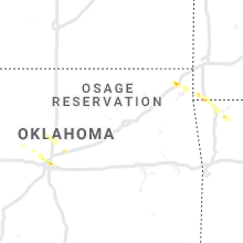
| 4:27 PM CDT | Quarter sized hail reported near Guthrie, OK, 28.7 miles NNE of Oklahoma City, OK |
| 6:18 PM CDT | Quarter sized hail reported near Oklahoma City, OK, 3.5 miles NNW of Oklahoma City, OK, via mping. |
Wisconsin
| Local Time | Report Details |
|---|---|
| 4:30 PM CDT | Large play set tipped over and damaged. report via social media. time estimated by rada in calumet county WI, 27.5 miles SSW of Green Bay, WI |
| 4:45 PM CDT | Several tress down... power poles broke in dunn county WI, 66.1 miles E of Minneapolis, MN |
| 4:54 PM CDT | Measured at sheboygan county airpor in sheboygan county WI, 51.2 miles S of Green Bay, WI |
| 4:55 PM CDT | Awos station klum menomonie a in dunn county WI, 68.6 miles E of Minneapolis, MN |
| 5:09 PM CDT | Asos station keau eau claire a in chippewa county WI, 73.8 miles N of La Crosse, WI |
| 5:16 PM CDT | Report from mping: 1-inch tree limbs broken; shingles blown of in eau claire county WI, 62 miles N of La Crosse, WI |
| 5:20 PM CDT | Several reports of trees and power lines down across the northern half of clark county. time is estimated from radar when the strongest winds first entered the count in clark county WI, 82.3 miles SW of Rhinelander, WI |
| 5:55 PM CDT | A few trees and power lines down around the neillsville area. time estimated from rada in clark county WI, 61.2 miles NNE of La Crosse, WI |
| 6:00 PM CDT | Snapped wood power pole. report relayed by wsaw - wausau in wood county WI, 78 miles SSW of Rhinelander, WI |
| 6:20 PM CDT | Semi truck tipped on its side on northbound i-39 in mosinee at mile marker 17 in marathon county WI, 60.8 miles SSW of Rhinelander, WI |
| 6:35 PM CDT | A few trees down near prairie drive and highway 5 in portage county WI, 75.3 miles W of Green Bay, WI |
| 6:43 PM CDT | Shingles blown off roo in portage county WI, 76.6 miles W of Green Bay, WI |
| 7:01 PM CDT | Trees and power lines down. time estimated by rada in waupaca county WI, 53.3 miles WSW of Green Bay, WI |
| 7:10 PM CDT | Asos station kenw kenosha airpor in kenosha county WI, 51.7 miles NNW of Chicago, IL |
| 7:19 PM CDT | Trees and power lines down. time estimated by rada in waupaca county WI, 37.7 miles WSW of Green Bay, WI |
| 7:20 PM CDT | Report from c-man station ksnw in kenosha county WI, 49 miles N of Chicago, IL |
| 7:20 PM CDT | Quarter sized hail reported near Fremont, WI, 45.6 miles WSW of Green Bay, WI, report via social media. time estimated based on radar. |
| 7:35 PM CDT | Seven snapped power poles north of black creek between hwy g and brugger road. report via social media. time estimated based on rada in outagamie county WI, 21.6 miles W of Green Bay, WI |
| 7:44 PM CDT | 1 tree down in hobart. time estimated by rada in brown county WI, 7.6 miles WSW of Green Bay, WI |
| 7:47 PM CDT | Six power poles snapped and wires down in the town of cicero. time estimated by rada in outagamie county WI, 19.2 miles WNW of Green Bay, WI |
| 7:47 PM CDT | Tree and wires down in nekimi. time estimated by rada in winnebago county WI, 46.1 miles SW of Green Bay, WI |
| 7:52 PM CDT | Tree fell on house on marydale dr in howar in brown county WI, 0.5 miles ESE of Green Bay, WI |
| 7:55 PM CDT | 1 tree down in green bay. time estimated by rada in brown county WI, 0.5 miles ESE of Green Bay, WI |
| 7:58 PM CDT | Downed spruce tree across road on main st. downed powerlines as well. measured 53 mph wind gus in brown county WI, 14.6 miles SSW of Green Bay, WI |
| 8:40 PM CDT | 3-inch tree limbs broken; power poles broken. report confirmed by medi in sheboygan county WI, 54.4 miles SSE of Green Bay, WI |
| 9:00 PM CDT | Reports of tree and light pole damage relayed via social media. time estimated from rada in washington county WI, 63.8 miles E of Madison, WI |
| 9:15 PM CDT | Awos station kmwc milwaukee lawre in milwaukee county WI, 68.7 miles E of Madison, WI |
| 9:26 PM CDT | Asos station kmke milwaukee-gen mitchell arp in milwaukee county WI, 74.8 miles N of Chicago, IL |
| 9:40 PM CDT | Multiple reports of tree damage in brookfield and new berlin areas relayed by waukesha county e in waukesha county WI, 64.3 miles E of Madison, WI |
Arkansas
| Local Time | Report Details |
|---|---|
| 5:05 PM CDT | Quarter sized hail reported near Mammoth Spring, AR, 79.8 miles S of Salem, MO, up to quarter sized hail covered the ground. |
| 6:05 PM CDT | Half Dollar sized hail reported near Walnut Ridge, AR, 84.2 miles NW of Memphis, TN, up to half dollar size hail was observed at williams baptist university. |
| 6:05 PM CDT | A 62 mph wind gust was measured at williams baptist universit in lawrence county AR, 84.2 miles NW of Memphis, TN |
| 6:31 PM CDT | Quarter sized hail reported near Rogers, AR, 67.1 miles NNE of Fort Smith, AR, lots of nickels and a few quarters. road almost covered. |
Connect with Interactive Hail Maps