

Hail Map for Wednesday, April 6, 2022

Number of Impacted Households on 4/6/2022
0
Impacted by 1" or Larger Hail
0
Impacted by 1.75" or Larger Hail
0
Impacted by 2.5" or Larger Hail
Square Miles of Populated Area Impacted on 4/6/2022
0
Impacted by 1" or Larger Hail
0
Impacted by 1.75" or Larger Hail
0
Impacted by 2.5" or Larger Hail


Cities Most Affected by Hail Storms of 4/6/2022
| Hail Size | Demographics of Zip Codes Affected | ||||||
|---|---|---|---|---|---|---|---|
| City | Count | Average | Largest | Pop Density | House Value | Income | Age |
| Warner Robins, GA | 1 | 1.75 | 1.75 | 1763 | $92k | $47.8k | 33.7 |
| Moncks Corner, SC | 1 | 1.75 | 1.75 | 195 | $97k | $35.8k | 37.6 |
| Brunson, SC | 1 | 1.75 | 1.75 | 11 | $58k | $31.8k | 40.2 |
| Leesburg, GA | 1 | 1.75 | 1.75 | 103 | $99k | $46.1k | 35.1 |
| Smithville, GA | 1 | 1.75 | 1.75 | 13 | $72k | $38.0k | 39.1 |
Hail and Wind Damage Spotted on 4/6/2022
Filter by Report Type:Hail ReportsWind Reports
States Impacted
South Carolina, Colorado, Georgia, Alabama, Kentucky, Florida, West Virginia, Tennessee, North Carolina, VirginiaSouth Carolina
| Local Time | Report Details |
|---|---|
| 10:42 AM EDT | Tree reported down at duke street and marsh road. time estimated from rada in beaufort county SC, 34.1 miles NE of Savannah, GA |
| 5:28 PM EDT | Quarter sized hail reported near Summerville, SC, 22.2 miles SW of Charleston, SC, public relayed via social media a report of quarter sized hail in summers corner. |
| 5:29 PM EDT | Quarter sized hail reported near Moncks Corner, SC, 0.9 miles ESE of Charleston, SC, public reported quarter sized hail at a residence on dennis blvd. |
| 5:39 PM EDT | Golf Ball sized hail reported near Moncks Corner, SC, 0.9 miles ESE of Charleston, SC, public reported hail as large as golf balls at a residence on dennis blvd. |
| 6:20 PM EDT | Quarter sized hail reported near Hampton, SC, 54.4 miles N of Savannah, GA, trained spotter reported quarter sized hail on willard street extension in hampton. time was estimated from radar data. |
| 6:21 PM EDT | Tree on roadway at country club rd and jarrell st. time estimated from rada in hampton county SC, 55.1 miles N of Savannah, GA |
| 6:29 PM EDT | Golf Ball sized hail reported near Brunson, SC, 57.8 miles N of Savannah, GA, broadcast media relayed report via social media of quarter to golf ball size hail in crocketville. |
| 6:41 PM EDT | Quarter sized hail reported near Saint Stephen, SC, 15.8 miles NE of Charleston, SC, public reported via social media quarter sized hail between saint stephen and alvin. time was estimated from radar data. |
| 6:42 PM EDT | Tree in roadway at cayce rd and moselle rd. time estimated from rada in colleton county SC, 60.1 miles WSW of Charleston, SC |
| 6:42 PM EDT | Mccormick county call center reported trees down near plum branch. time estimated by rada in mccormick county SC, 30.4 miles NNW of Augusta, GA |
| 8:33 PM EDT | Quarter sized hail reported near Moncks Corner, SC, 3.9 miles W of Charleston, SC, public report of nickel to quarter sized hail around cooper store road. |
| 8:56 PM EDT | Quarter sized hail reported near Summerville, SC, 19 miles SSW of Charleston, SC |
| 10:38 PM EDT | Tree and power lines reported down at joe frazier road and cherokee farms road. time estimated from rada in beaufort county SC, 30.7 miles NE of Savannah, GA |
| 10:40 PM EDT | Tree reported down along pine grove road. time estimated from rada in beaufort county SC, 31.1 miles NE of Savannah, GA |
| 10:40 PM EDT | Tree reported down at robert smalls pkwy and burton hill rd. time estimated from rada in beaufort county SC, 32.4 miles NE of Savannah, GA |
| 10:40 PM EDT | Tree on roadway at wk alston drive and robert smalls parkway. time estimated from rada in beaufort county SC, 31.5 miles NE of Savannah, GA |
| 10:42 PM EDT | Tree reported down at duke street and marsh road. time estimated from rada in beaufort county SC, 34.1 miles NE of Savannah, GA |
| 10:42 PM EDT | A tree and power lines were reported down on county shed road and moody sons lane. time estimated from rada in beaufort county SC, 32.5 miles NE of Savannah, GA |
| 10:42 PM EDT | Tree reported down at moss street and salem road. time estimated from rada in beaufort county SC, 32.8 miles NE of Savannah, GA |
| 10:44 PM EDT | Calibogue sound weatherflow sensor reported 50 knot wind gus in amz352 county SC, 14.8 miles E of Savannah, GA |
| 10:45 PM EDT | Power lines reported down at barnwell drive and pleasant point drive. time estimated from rada in beaufort county SC, 36 miles NE of Savannah, GA |
| 11:02 PM EDT | Colleton fire and rescue reported damage around a home in the 400 block of sandy springs circle. a fence on the property was damaged and scattered nearby... a metal gaz in colleton county SC, 45.8 miles WSW of Charleston, SC |
| 3:10 AM EDT | Trees down and a trampoline blown 300 fee in anderson county SC, 23.5 miles SSW of Greenville, SC |
| 3:20 AM EDT | 911 call center reported numerous trees and powerlines down on lakewood lane... hiott road... and new prospect church road. also... reported roof damage to a hous in anderson county SC, 22.9 miles SSW of Greenville, SC |
| 3:25 AM EDT | Quarter sized hail reported near Walhalla, SC, 26.9 miles W of Greenville, SC, oconee county sheriff deputy reported quarter (1.00") sized hail near walhalla. |
Colorado
| Local Time | Report Details |
|---|---|
| 11:00 AM MDT | Report from mping: 1-inch tree limbs broken; shingles blown of in logan county CO, 47.7 miles NNW of Yuma, CO |
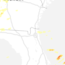
Georgia
| Local Time | Report Details |
|---|---|
| 2:35 PM EDT | Quarter sized hail reported near Cuthbert, GA, 71.1 miles SE of Auburn, AL, nickel to quarter size hail seen on video shared on social media from local media |
| 2:38 PM EDT | Quarter sized hail reported near Cuthbert, GA, 70.5 miles SE of Auburn, AL |
| 2:45 PM EDT | Golf Ball sized hail reported near Smithville, GA, 86.6 miles SE of Auburn, AL, golfball size hail reported in smithville. |
| 3:34 PM EDT | Quarter sized hail reported near Byron, GA, 86.2 miles SSE of Atlanta, GA, quarter sized hail at the pet lodge in powerville. |
| 3:40 PM EDT | Trees down with some structural damage in the larsen road area. possible tornad in lee county GA, 70.8 miles WNW of Douglas, GA |
| 3:43 PM EDT | Quarter sized hail reported near Byron, GA, 84.1 miles SSE of Atlanta, GA |
| 3:46 PM EDT | Quarter sized hail reported near Elko, GA, 75.5 miles NW of Douglas, GA |
| 3:48 PM EDT | Half Dollar sized hail reported near Toomsboro, GA, 78.5 miles SW of Augusta, GA, half dollar sized hail at the dollar general. |
| 3:55 PM EDT | Quarter sized hail reported near Warner Robins, GA, 87.9 miles NNW of Douglas, GA, report of 1" hail by trained spotter in warner robbins near burns drive and rusty road. |
| 3:55 PM EDT | Golf Ball sized hail reported near Warner Robins, GA, 87.7 miles NNW of Douglas, GA, picture via social media of golf ball sized hail in warner robbins. |
| 3:57 PM EDT | Trees and wires down at the plantation mobile home park. one tree fell onto a mobile hom in lee county GA, 82.7 miles N of Tallahassee, FL |
| 4:05 PM EDT | Golf Ball sized hail reported near Leesburg, GA, 78.7 miles W of Douglas, GA |
| 4:24 PM EDT | Trees down on chokee roa in lee county GA, 75.5 miles WNW of Douglas, GA |
| 4:45 PM EDT | A pine tree top was snapped off along with downed power lines near thomas county public work in thomas county GA, 33.7 miles NE of Tallahassee, FL |
| 5:00 PM EDT | Tree fell and crushed a car in apartment complex along milgen rd. asos at nearby csg airport reported a 53 mph wind gust at this tim in muscogee county GA, 34.9 miles E of Auburn, AL |
| 5:07 PM EDT | Quarter sized hail reported near Hillsboro, GA, 58.4 miles SE of Atlanta, GA, between quarter and half dollar sized hail reported by public in hillsboro. |
| 6:04 PM EDT | Half Dollar sized hail reported near Trenton, GA, 14.9 miles WSW of Chattanooga, TN, picture provided of half-dollar sized hail near intersection of dennis rd and new home loop. |
| 6:15 PM EDT | Quarter sized hail reported near Trenton, GA, 12.3 miles WSW of Chattanooga, TN, picture provided of quarter sized hail near intersection of picket post trail and stallings rd. |
| 6:30 PM EDT | Lincoln county dispatch reported trees down on mcgill rd. time estimated from rada in lincoln county GA, 34.1 miles WNW of Augusta, GA |
| 8:03 PM EDT | Tree down on powerlines along springdale rd between waverly dr and beaver run in laurens county GA, 72.2 miles N of Douglas, GA |
| 8:30 PM EDT | Powerlines down along 400 block of mcrae scotland rd due to winds from gust fron in telfair county GA, 37.5 miles N of Douglas, GA |
| 8:35 PM EDT | Several trees and powerlines down near the community of kibbee per e in montgomery county GA, 57.2 miles NNE of Douglas, GA |
| 8:46 PM EDT | Report of a house damage on stevens stree in thomas county GA, 32.6 miles NNE of Tallahassee, FL |
| 8:54 PM EDT | Social media report from the public that a few mobile homes were damaged off of highway 84 in the shady rest are in thomas county GA, 33.9 miles NE of Tallahassee, FL |
| 8:59 PM EDT | A tree was blown down along south kennedy street in metter. time was estimated from radar dat in candler county GA, 60.9 miles WNW of Savannah, GA |
| 9:12 PM EDT | House damaged near the intersection of highway 33 and magic roa in thomas county GA, 43.3 miles NE of Tallahassee, FL |
| 10:45 PM EDT | Quarter sized hail reported near Douglasville, GA, 16.7 miles W of Atlanta, GA, caller estimates quarter size hail near lithia spring. |
| 1:02 AM EDT | A tree fell on a house on little oak wa in lowndes county GA, 61.4 miles SSW of Douglas, GA |
Alabama
| Local Time | Report Details |
|---|---|
| 3:18 PM CDT | Quarter sized hail reported near Mc Calla, AL, 19 miles SW of Birmingham, AL |
| 3:30 PM CDT | Tree on power line in elmore county AL, 40.2 miles W of Auburn, AL |
| 3:39 PM CDT | Power line dow in elmore county AL, 36.9 miles WNW of Auburn, AL |
| 4:20 PM CDT | Reports of trees down near the intersection of marler rd and ridge water d in montgomery county AL, 37.5 miles WSW of Auburn, AL |
| 4:40 PM CDT | Cable and power lines dow in lee county AL, 0.9 miles N of Auburn, AL |
| 5:42 PM CDT | Quarter sized hail reported near Cleveland, AL, 35.9 miles NNE of Birmingham, AL |
Kentucky
| Local Time | Report Details |
|---|---|
| 5:03 PM EDT | Pictures on social media show multiple downed trees... significant damage to at least 2 barns... and a downed power line in the vicinity of hawk creek r in laurel county KY, 37.3 miles SSW of Irvine, KY |
| 5:03 PM EDT | Emergency manager reports trees blown down onto power lines in the 700 block of white oak r in laurel county KY, 40.1 miles SSW of Irvine, KY |
| 5:05 PM EDT | Emergency manager reported trees blown down onto power lines in the 2600 block of hawk creek rd. and 200 block of john r. jones r in laurel county KY, 37.3 miles SSW of Irvine, KY |
| 5:05 PM EDT | Cabin under construction was knocked off foundation at 1434 f. hubbard road near wood creek lak in laurel county KY, 36.5 miles SSW of Irvine, KY |
| 5:06 PM EDT | Corrects previous tstm wnd dmg report from hare. emergency manager reports tree downed onto power lines along the 5300 block of us-25 nort in laurel county KY, 36 miles SSW of Irvine, KY |
| 5:07 PM EDT | Pictures on social media show sections of a pool fence blown down along norwood driv in laurel county KY, 36.1 miles SSW of Irvine, KY |
| 5:08 PM EDT | Corrects previous tstm wnd dmg report from east bernstadt. emergency manager reports trees down on power lines along ky-490 in the 1800 block and also in the 900 block in laurel county KY, 36.1 miles SSW of Irvine, KY |
| 5:10 PM EDT | The steeple at first baptist church in east bernstadt was blown off the roo in laurel county KY, 35.9 miles SSW of Irvine, KY |
| 5:12 PM EDT | Corrects previous tstm wnd dmg report from 1 n oakley. emergency manager reports trees blown down on power lines in the 5600 block of ky-49 in laurel county KY, 31.8 miles SSW of Irvine, KY |
| 5:15 PM EDT | Report of tree down on power line in laurel county KY, 31.1 miles S of Irvine, KY |
| 6:06 PM EDT | Emergency manager reports tree downed onto power lines along the 5300 block of us-25 nort in laurel county KY, 36 miles SSW of Irvine, KY |
| 6:08 PM EDT | Emergency manager reports trees down on power lines along ky-490 in the 1800 block and also in the 900 block of fisherman cove rd. trees were also reported down on the in laurel county KY, 36.1 miles SSW of Irvine, KY |
| 6:12 PM EDT | Emergency manager reports trees blown down on power lines in the 5600 block of ky-49 in laurel county KY, 31.8 miles SSW of Irvine, KY |
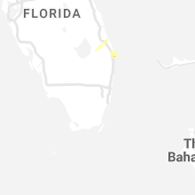
Florida
| Local Time | Report Details |
|---|---|
| 5:29 PM EDT | Mesonet plmgr palm beach gardens high school reported a wind gust of 78mph at 5:29pm as a severe thunderstorm moved through the area. site elevation is 26 fee in palm beach county FL, 34.6 miles SSE of Port Saint Lucie, FL |
| 5:42 PM EDT | Broadcast media reported light pole down due to strong winds on burns road near the community cente in palm beach county FL, 34.6 miles SSE of Port Saint Lucie, FL |
| 6:00 PM EDT | Quarter sized hail reported near Monticello, FL, 21.7 miles ENE of Tallahassee, FL, quarter size hail reported off of highway 90. |
| 5:00 AM EDT | Report of power lines down and minor street flooding caused by thunderstorm wind in nassau county FL, 17.8 miles N of Jacksonville, FL |
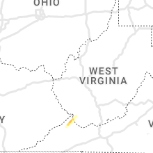
West Virginia
| Local Time | Report Details |
|---|---|
| 7:32 PM EDT | Tree dow in jackson county WV, 33.3 miles NNW of Charleston, WV |
Tennessee
| Local Time | Report Details |
|---|---|
| 9:45 PM EDT | Ping Pong Ball sized hail reported near Hampton, TN, 21.7 miles S of Bristol, TN, multiple reports of 1.00 to 1.50 inch hail in hampton. |
North Carolina
| Local Time | Report Details |
|---|---|
| 9:45 PM EDT | 911 call center reported a tree down that blocked the roadway on the intersection of rogers cover road and ledford driv in haywood county NC, 53.2 miles NNW of Greenville, SC |
Virginia
| Local Time | Report Details |
|---|---|
| 12:17 AM EDT | Quarter sized hail reported near Hurley, VA, 58.4 miles NNE of Bristol, TN, time estimated from radar. |
Connect with Interactive Hail Maps