

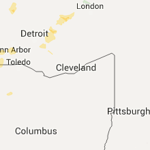
Hail Map for Friday, August 14, 2015

Number of Impacted Households on 8/14/2015
0
Impacted by 1" or Larger Hail
0
Impacted by 1.75" or Larger Hail
0
Impacted by 2.5" or Larger Hail
Square Miles of Populated Area Impacted on 8/14/2015
0
Impacted by 1" or Larger Hail
0
Impacted by 1.75" or Larger Hail
0
Impacted by 2.5" or Larger Hail


Cities Most Affected by Hail Storms of 8/14/2015
| Hail Size | Demographics of Zip Codes Affected | ||||||
|---|---|---|---|---|---|---|---|
| City | Count | Average | Largest | Pop Density | House Value | Income | Age |
| Pulaski, WI | 1 | 1.75 | 1.75 | 75 | $110k | $48.4k | 37.6 |
| Rapid River, MI | 1 | 1.75 | 1.75 | 8 | $92k | $36.2k | 51.4 |
| Little Suamico, WI | 1 | 1.75 | 1.75 | 103 | $122k | $53.5k | 42.0 |
Hail and Wind Damage Spotted on 8/14/2015
Filter by Report Type:Hail ReportsWind Reports
Michigan
| Local Time | Report Details |
|---|---|
| 12:51 PM EDT | Golf Ball sized hail reported near Rapid River, MI, 35.7 miles SE of Marquette, MI, social media report of up to golf ball sized hail near u.s. 41. |
| 2:57 PM EDT | Quarter sized hail reported near Traverse City, MI, 13.6 miles ESE of Traverse City, MI, time estimated from radar |
| 3:39 PM EDT | Half Dollar sized hail reported near Hubbard Lake, MI, 13.8 miles SSW of Alpena, MI, report via facebook. time estimated by radar. |
| 3:45 PM EDT | Half Dollar sized hail reported near Morley, MI, 34.9 miles NNE of Grand Rapids, MI, public report relayed by wood-tv of 1.25 hail. viewer also noted traffic was at a stand-still on u.s. hwy 131 due to heavy rain. time estimated by radar. |
| 4:10 PM EDT | Half Dollar sized hail reported near Evart, MI, 64.2 miles SSE of Traverse City, MI, follow up to earlier report...spotter called back in to report largest hail that fell near 100th ave and 3 mile was 1.25 inches in diameter. time estimated by radar. |
| 3:15 PM CDT | Quarter sized hail reported near Menominee, MI, 46.1 miles NNE of Green Bay, WI, multiple reports of dime to quarter sized hail via social media. |
| 4:35 PM EDT | Facebook and scanner reports of trees and power lines down around the area.time estimated from rada in arenac county MI, 72.3 miles N of Flint, MI |
| 4:37 PM EDT | Quarter sized hail reported near Greenville, MI, 25.9 miles NE of Grand Rapids, MI, central dispatch reported one inch hail falling on the northern side of greenville |
| 4:38 PM EDT | Half Dollar sized hail reported near Greenville, MI, 25.9 miles NE of Grand Rapids, MI, updated report- spotter called back in to report larger hail fell shortly after calling in at 435pm. largest hail was 1.25 inches in diameter. |
| 4:44 PM EDT | Quarter sized hail reported near Greenville, MI, 25.5 miles NE of Grand Rapids, MI, hail ranging from pea size to quarter size falling in greenville. reports relayed by wood-tv |
| 5:11 PM EDT | Trees downed across road at whitefeather and i-75 in bay county MI, 63.6 miles NNW of Flint, MI |
| 5:32 PM EDT | Large tree downed in bay city state park in bay county MI, 46.9 miles NNW of Flint, MI |
| 5:45 PM EDT | Trees reported downed as well as a mobile home carport blown ove in saginaw county MI, 35.9 miles NNW of Flint, MI |
| 5:48 PM EDT | Multiple trees and powerlines reported downed in bay county MI, 41.3 miles NNW of Flint, MI |
| 5:50 PM EDT | Numerous trees and power lines downed across northern tuscola county in tuscola county MI, 39.2 miles N of Flint, MI |
| 6:09 PM EDT | Power lines down across the city of vassar in tuscola county MI, 25.4 miles NNE of Flint, MI |
| 6:17 PM EDT | Wires reported downed in saginaw county MI, 28.1 miles N of Flint, MI |
| 6:40 PM EDT | Trees reported downed in thetford township in genesee county MI, 11.9 miles N of Flint, MI |
| 6:43 PM EDT | Tree and power lines reported downed at lewis and frances roads in genesee county MI, 8.2 miles N of Flint, MI |
| 6:57 PM EDT | Wires reported downed at i-475 in downtown flint in genesee county MI, 1.4 miles NNE of Flint, MI |
| 7:20 PM EDT | Seymour lake rd closed due to multiple trees down over the road. time from rada in oakland county MI, 20.1 miles SE of Flint, MI |
| 8:05 PM EDT | 4 inch tree limb downed in macomb county MI, 49.3 miles SE of Flint, MI |
| 8:09 PM EDT | Quarter sized hail reported near Charlotte, MI, 50.7 miles ESE of Grand Rapids, MI, spotter reported hail of 5/8ths of an inch fell just before 8pm before increasing in size to one inch. |
| 8:30 PM EDT | 4 inch diameter trees limbs downed at state and m-29 roads in st. clair county MI, 64.2 miles ESE of Flint, MI |
| 9:38 PM EDT | Jackson county dispatch was taking several calls concerning downed trees in the count in jackson county MI, 64.2 miles SW of Flint, MI |
| 11:03 PM EDT | Corrected time of report. spotter called in to report a couple of healthy trees down in the kalamazoo area. one was down near emrald drive between cork and miller. anot in kalamazoo county MI, 49.1 miles S of Grand Rapids, MI |
Montana
| Local Time | Report Details |
|---|---|
| 12:46 PM MDT | 47.38 in fergus county MT, 70.2 miles E of Great Falls, MT |
| 3:39 PM MDT | Quarter sized hail reported near Florence, MT, 13.7 miles SSW of Missoula, MT, twitter report of up to golf ball size hail... tweeted image confirms at least quarter size hail. |
| 6:50 PM MDT | Estimated gusts up to 60 mph rocking car in cascade county MT, 5.1 miles N of Great Falls, MT |
| 6:57 PM MDT | 66 mph wind gust about 6 miles northeast of great falls in cascade county MT, 6.5 miles NNE of Great Falls, MT |
| 7:30 PM MDT | 67 mph wind gust at crooked coulee mesonet sit in toole county MT, 73 miles N of Great Falls, MT |
| 7:53 PM MDT | 66 mph wind gus in hill county MT, 50.3 miles W of Havre, MT |
| 8:00 PM MDT | 63 mph wind gust at the dot sensor near inverness in hill county MT, 44.9 miles W of Havre, MT |
| 8:08 PM MDT | 59 mph wind gust at the dot sensor near monida pass on interstate 1 in beaverhead county MT, 74.9 miles N of Idaho Falls, ID |
| 9:22 PM MDT | Storm damage reported in stillwater county MT, 56.2 miles WSW of Billings, MT |
Alabama
| Local Time | Report Details |
|---|---|
| 3:00 PM CDT | Report of a few trees down...one on a mobile home...near the intersection of clear springs way and bethlehem church rd. one small outbuilding detroyed and one tin porch in shelby county AL, 33.8 miles SSE of Birmingham, AL |
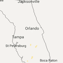
Florida
| Local Time | Report Details |
|---|---|
| 4:15 PM EDT | Tree down on power line near the intersection of woodward and brevard street in leon county FL, 1.4 miles WNW of Tallahassee, FL |
| 4:15 PM EDT | Power line also down near blairstone and apalachee. reported by retired usaf meteorologist. also 6 inches of water on the roa in leon county FL, 2.3 miles SE of Tallahassee, FL |
| 4:15 PM EDT | Picture submitted on social media of a tree down on a power line along redbud ave in leon county FL, 2.4 miles NNW of Tallahassee, FL |
| 5:07 PM CDT | Power line down on orange hill road just south of gilberts mill in washington county FL, 54.6 miles ENE of Miramar Beach, FL |
Wisconsin
| Local Time | Report Details |
|---|---|
| 3:20 PM CDT | Quarter sized hail reported near Marinette, WI, 44.4 miles NNE of Green Bay, WI, quarter size hail fell in marinette. |
| 3:47 PM CDT | Quarter sized hail reported near Oconto, WI, 26.2 miles NNE of Green Bay, WI, quarter size hail fell in oconto. |
| 4:15 PM CDT | Golf Ball sized hail reported near Little Suamico, WI, 13.8 miles N of Green Bay, WI, golf ball size hail fell in sobieski. |
| 4:20 PM CDT | Golf Ball sized hail reported near Pulaski, WI, 14.9 miles NW of Green Bay, WI, golf ball size hail fell in pulaski. |
| 4:35 PM CDT | Few large trees and power lines down... corner of west point road and packerland avenu in brown county WI, 1.5 miles W of Green Bay, WI |
| 4:37 PM CDT | 62 mph wind gust at the grb aso in brown county WI, 2.7 miles SSW of Green Bay, WI |
| 4:37 PM CDT | A few large trees and power lines dow in brown county WI, 1.5 miles W of Green Bay, WI |
| 4:38 PM CDT | 62 mph wind gust reported at the grb aso in brown county WI, 2.7 miles SSW of Green Bay, WI |
| 4:40 PM CDT | Trees dow in outagamie county WI, 21.6 miles W of Green Bay, WI |
| 4:40 PM CDT | Trees dow in brown county WI, 4.8 miles SSW of Green Bay, WI |
| 4:40 PM CDT | Trees dow in outagamie county WI, 16.2 miles SW of Green Bay, WI |
| 4:45 PM CDT | Additional reports of trees and power lines down on the west side of green ba in brown county WI, 0.5 miles ESE of Green Bay, WI |
| 4:45 PM CDT | Shingles torn from roof. report received via social media. time estimate in brown county WI, 8.3 miles NNW of Green Bay, WI |
| 5:00 PM CDT | Measured at little chute high school in outagamie county WI, 22.2 miles SW of Green Bay, WI |
| 5:10 PM CDT | Emergency manager relayed reports of trees down in kaukaun in outagamie county WI, 21.4 miles SW of Green Bay, WI |
| 5:27 PM CDT | Trees down in calumet county WI, 34.2 miles SSW of Green Bay, WI |
| 5:30 PM CDT | Trees down blocking road in outagamie county WI, 23.4 miles SW of Green Bay, WI |
| 5:30 PM CDT | Large trees snapped about 5 feet above the ground in kaukaun in outagamie county WI, 21.4 miles SW of Green Bay, WI |
| 5:56 PM CDT | Flag pole blown over at whistling straits golf course. flag pole fell on an individual...breaking individuals arm. time estimated by rada in sheboygan county WI, 48 miles SSE of Green Bay, WI |
| 5:56 PM CDT | Numerous trees down across the county. some powerlines down. time estimated by radar. relayed via faceboo in sheboygan county WI, 54.6 miles SSE of Green Bay, WI |
| 6:02 PM CDT | Sheboygan lakeshore station measured 60 knot wind gus in sheboygan county WI, 55 miles SSE of Green Bay, WI |
| 6:10 PM CDT | Quarter sized hail reported near Greenville, WI, 30 miles WSW of Green Bay, WI, one inch hail at highway 76 and highway 96. |
| 6:15 PM CDT | Quarter sized hail reported near Larsen, WI, 37.6 miles SW of Green Bay, WI, nickel to quarter size hail fell in clayton township. time is approximate. |
| 6:22 PM CDT | Quarter sized hail reported near Neenah, WI, 34 miles SW of Green Bay, WI, quarter size hail at highway 76 and cr-ii. time is approximate. |
| 6:30 PM CDT | Ping Pong Ball sized hail reported near Oakfield, WI, 59.6 miles NE of Madison, WI, relayed via facebook. |
| 6:39 PM CDT | Tree snapped near underwood elementary school. winds estimated about 55 mph. power is out in the area. relayed via twitter. time estimated by rada in milwaukee county WI, 67.2 miles E of Madison, WI |
| 6:55 PM CDT | Numerous trees damaged at the intersection of 83 and 60. 8 inch to 2 feet diameter tree limbs down. one garage was damaged. time estimated from radar. relayed via faceb in washington county WI, 52.2 miles ENE of Madison, WI |
| 7:32 PM CDT | Quarter sized hail reported near Franklin, WI, 71.8 miles E of Madison, WI, 30-35 mph wind gusts. |
| 7:33 PM CDT | Quarter sized hail reported near Waukesha, WI, 56.1 miles E of Madison, WI |
| 7:38 PM CDT | Reports of several trees down across racine county. time estimated by rada in racine county WI, 58.9 miles N of Chicago, IL |
| 8:15 PM CDT | One block north of 68th and fond du lac ave. 2 ft diameter tree branch fell...damaging a car. relayed via faceboo in milwaukee county WI, 70.7 miles E of Madison, WI |
North Carolina
| Local Time | Report Details |
|---|---|
| 5:15 PM EDT | Quarter sized hail reported near Morganton, NC, 61.5 miles NW of Charlotte, NC, spotter reports nickel to quarter size hail at piedmont rd and hwy 18 n in morganton |
| 5:17 PM EDT | Tree fell on residence on 2nd st in morganto in burke county NC, 60.3 miles NW of Charlotte, NC |
| 5:35 PM EDT | Power lines down on powell r in burke county NC, 57.2 miles NW of Charlotte, NC |
| 6:10 PM EDT | Tree down on west av in caldwell county NC, 59.9 miles SE of Bristol, TN |
| 6:15 PM EDT | Trees down along highway 90 in the oak hill communit in caldwell county NC, 57.6 miles NW of Charlotte, NC |
| 6:20 PM EDT | Tree down across roadway on taylorsville rd in caldwell county NC, 57 miles NNW of Charlotte, NC |
Idaho
| Local Time | Report Details |
|---|---|
| 3:30 PM MDT | Craters of the moon inl sit in butte county ID, 75 miles W of Idaho Falls, ID |
| 4:05 PM MDT | Craters of the moon inl sit in butte county ID, 53 miles W of Idaho Falls, ID |
| 4:35 PM MDT | Sand dunes inl site in butte county ID, 41.1 miles WNW of Idaho Falls, ID |
| 7:01 PM MDT | Mesonet at sage junction port of entry measured thunderstorm wind gust of 60 mp in jefferson county ID, 24.4 miles N of Idaho Falls, ID |
| 7:22 PM MDT | Trained spotter traveling on the salem highway 4 miles north of rexburg... reported several 3-4 inch tree branches laying on the road. estimated winds 50 to 60 mph with in madison county ID, 29.6 miles NNE of Idaho Falls, ID |
| 8:53 PM MDT | Ktwf in twin falls county ID, 5.3 miles S of Twin Falls, ID |
| 10:45 PM MDT | Tgfi1 trail gulch raws in twin falls county ID, 18.6 miles SSE of Twin Falls, ID |
Texas
| Local Time | Report Details |
|---|---|
| 4:50 PM CDT | Measured by west tx mesone in stonewall county TX, 56.4 miles NNW of Abilene, TX |
| 4:55 PM CDT | Wind damage in city. carport roof blown off at sheriffs offic in stonewall county TX, 55.2 miles NNW of Abilene, TX |
| 7:16 PM CDT | Several tree limbs down...largest tree limb was 4 inches in diamete in taylor county TX, 29.6 miles SW of Abilene, TX |
| 7:16 PM CDT | Several tree limbs down...largest tree limb was 4 inches in diamete in tom green county TX, 78.4 miles SW of Abilene, TX |
| 8:35 PM CDT | Storm damage reported in midland county TX, 21.8 miles NE of Odessa, TX |
| 8:35 PM CDT | Portion of motel roof blown off and blocking southbound lanes of andrews highwa in ector county TX, 7.2 miles NNW of Odessa, TX |
| 8:38 PM CDT | Back porch in front yard of home. part of roof caved i in ector county TX, 6.2 miles NW of Odessa, TX |
Connect with Interactive Hail Maps