

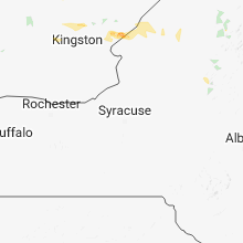
Hail Map for Wednesday, August 15, 2018

Number of Impacted Households on 8/15/2018
0
Impacted by 1" or Larger Hail
0
Impacted by 1.75" or Larger Hail
0
Impacted by 2.5" or Larger Hail
Square Miles of Populated Area Impacted on 8/15/2018
0
Impacted by 1" or Larger Hail
0
Impacted by 1.75" or Larger Hail
0
Impacted by 2.5" or Larger Hail


Cities Most Affected by Hail Storms of 8/15/2018
| Hail Size | Demographics of Zip Codes Affected | ||||||
|---|---|---|---|---|---|---|---|
| City | Count | Average | Largest | Pop Density | House Value | Income | Age |
| Arthur, NE | 2 | 2.25 | 2.75 | 0 | $48k | $30.5k | 43.8 |
| Paxton, NE | 1 | 1.75 | 1.75 | 2 | $55k | $30.8k | 43.4 |
| North Platte, NE | 1 | 1.75 | 1.75 | 50 | $79k | $36.3k | 38.7 |
| Brule, NE | 1 | 1.75 | 1.75 | 2 | $52k | $27.0k | 51.6 |
Hail and Wind Damage Spotted on 8/15/2018
Filter by Report Type:Hail ReportsWind Reports
States Impacted
South Dakota, Illinois, New York, Nebraska, Indiana, Kentucky, Colorado, Alabama, California, New Hampshire, TexasSouth Dakota
| Local Time | Report Details |
|---|---|
| 7:55 AM MDT | Quarter sized hail reported near Oglala, SD, 69.8 miles SSE of Rapid City, SD, time estimated from radar and spotters location on her way to work |
| 3:28 PM MDT | Storm damage reported in fall river county SD, 51.7 miles S of Rapid City, SD |
| 3:45 PM MDT | Quarter sized hail reported near Hot Springs, SD, 56.8 miles S of Rapid City, SD, delayed report. time estimated from radar. |
Illinois
| Local Time | Report Details |
|---|---|
| 2:23 PM CDT | More than 10 trees down some of which brought power lines down and caused power outages in mound in pulaski county IL, 23.2 miles SE of Cape Girardeau, MO |
New York
| Local Time | Report Details |
|---|---|
| 5:06 PM EDT | Golf Ball sized hail reported near , , 38.4 miles SW of Ogdensburg, NY, time estimated from radar. |
| 5:06 PM EDT | Ping Pong Ball sized hail reported near Clayton, NY, 40.1 miles SW of Ogdensburg, NY, estimated just smaller than a golf ball... cars dented. time estimated from radar. |
| 5:53 PM EDT | 4-5" tree limb snapped as well in st. lawrence county NY, 23.7 miles SW of Ogdensburg, NY |
Nebraska
| Local Time | Report Details |
|---|---|
| 3:51 PM MDT | Golf Ball sized hail reported near Arthur, NE, 68.5 miles NW of North Platte, NE, winds maxed at 40mph. hail accumulated on the property. |
| 4:22 PM MDT | Golf Ball sized hail reported near Brule, NE, 59 miles W of North Platte, NE |
| 4:34 PM MDT | Baseball sized hail reported near Arthur, NE, 50.7 miles NW of North Platte, NE, wide assortment of hail with largest being baseball size. |
| 4:35 PM MDT | Quarter sized hail reported near Brule, NE, 55.7 miles W of North Platte, NE, quarter size hail and 0.60 inches of rainfall in 30 minutes. |
| 4:51 PM MDT | Quarter sized hail reported near Arthur, NE, 56.7 miles WNW of North Platte, NE, quarter size hail reported at arthur high school. |
| 5:08 PM MDT | Quarter sized hail reported near Paxton, NE, 39.4 miles WNW of North Platte, NE |
| 5:11 PM MDT | Golf Ball sized hail reported near Paxton, NE, 31.7 miles WNW of North Platte, NE, ping pong to golf ball hail at largest. wind gusts of 25 mph or less. time estimated from radar. |
| 6:50 PM CDT | Storm damage reported in lincoln county NE, 11.2 miles WNW of North Platte, NE |
| 7:00 PM CDT | Golf Ball sized hail reported near North Platte, NE, 8.2 miles WNW of North Platte, NE, report via social media of golf ball size hail and 0.50 inches of rainfall. |
| 7:05 PM CDT | Quarter sized hail reported near North Platte, NE, 1.5 miles WSW of North Platte, NE |
| 7:05 PM CDT | Estimated 70-80 mph wind gusts on west side of north platte. large tree branch down in lincoln county NE, 1.5 miles WSW of North Platte, NE |
| 7:09 PM CDT | Quarter sized hail reported near North Platte, NE, 0.6 miles SW of North Platte, NE |
| 7:11 PM CDT | Half Dollar sized hail reported near North Platte, NE, 0.6 miles SW of North Platte, NE, reported at the 2800 block of west 6th street. |
| 7:11 PM CDT | Quarter sized hail reported near North Platte, NE, 0.6 miles SW of North Platte, NE, reported near sunset and buffalo bill road. |
| 7:20 PM CDT | Wind driven hail resulted in crop damage... corn stalks snapped and leaves shredde in lincoln county NE, 5.1 miles SE of North Platte, NE |
| 7:36 PM CDT | Quarter sized hail reported near Maxwell, NE, 13.3 miles SE of North Platte, NE, hail accumulations covering the ground. measured 1 inch plus rain in 15 to 20 minutes. time estimated from radar. |
| 7:39 PM CDT | Quarter sized hail reported near Maxwell, NE, 15.4 miles SE of North Platte, NE, accumulating hail with largest being quarter size. up to 2 inches deep in places. time estimate from radar. |
Indiana
| Local Time | Report Details |
|---|---|
| 4:55 PM CDT | Numerous trees down. power lines down als in warrick county IN, 20.9 miles NE of Evansville, IN |
| 6:55 PM EDT | French lick aso in orange county IN, 61.8 miles NW of Louisville, KY |
| 7:01 PM EDT | Power line dow in dubois county IN, 39.8 miles ENE of Evansville, IN |
| 7:55 PM EDT | Tree down at the 6300 block of circle roa in harrison county IN, 29.5 miles NW of Louisville, KY |
| 8:07 PM EDT | Tree down on highway 11 at morgan lan in harrison county IN, 17.4 miles NW of Louisville, KY |
Kentucky
| Local Time | Report Details |
|---|---|
| 5:26 PM CDT | Trees dow in daviess county KY, 28.6 miles SE of Evansville, IN |
| 5:31 PM CDT | Trees and power lines dow in daviess county KY, 28.5 miles ESE of Evansville, IN |
| 6:45 PM CDT | Trees down along highway 261 and over much of the western part of the count in breckinridge county KY, 51.5 miles WSW of Louisville, KY |
| 6:57 PM CDT | Power pole down along highway 47 in breckinridge county KY, 35.4 miles W of Louisville, KY |
| 8:27 PM EDT | Trees down in the 1600 block of loney lan in jefferson county KY, 15.8 miles NNW of Louisville, KY |
| 11:25 PM CDT | Measured at ohio county mesonet statio in ohio county KY, 52.9 miles SE of Evansville, IN |
Colorado
| Local Time | Report Details |
|---|---|
| 5:40 PM MDT | Quarter sized hail reported near Peyton, CO, 53.3 miles N of Pueblo, CO, from media video. |
| 6:24 PM MDT | Half Dollar sized hail reported near Peyton, CO, 52.6 miles N of Pueblo, CO |
Alabama
| Local Time | Report Details |
|---|---|
| 7:04 PM CDT | Couple of trees and power poles dow in limestone county AL, 48.1 miles E of Florence, AL |
California
| Local Time | Report Details |
|---|---|
| 5:11 PM PDT | Chp reports two semis overturned. 1 minor injury. large mileage sign blown dow in san bernardino county CA, 65.3 miles N of Yucca Valley, CA |
New Hampshire
| Local Time | Report Details |
|---|---|
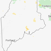
| 8:58 PM EDT | Trees down along rt in coos county NH, 76.6 miles NW of Portland, ME |
| 9:00 PM EDT | Trees and wires down at rt. 3/115 parker rd in coos county NH, 77.8 miles NW of Portland, ME |
Texas
| Local Time | Report Details |
|---|---|
| 8:45 PM CDT | Half Dollar sized hail reported near Summerfield, TX, 50.1 miles SW of Amarillo, TX |
Connect with Interactive Hail Maps