

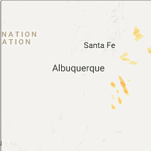
Hail Map for Tuesday, August 8, 2017

Number of Impacted Households on 8/8/2017
0
Impacted by 1" or Larger Hail
0
Impacted by 1.75" or Larger Hail
0
Impacted by 2.5" or Larger Hail
Square Miles of Populated Area Impacted on 8/8/2017
0
Impacted by 1" or Larger Hail
0
Impacted by 1.75" or Larger Hail
0
Impacted by 2.5" or Larger Hail


Cities Most Affected by Hail Storms of 8/8/2017
| Hail Size | Demographics of Zip Codes Affected | ||||||
|---|---|---|---|---|---|---|---|
| City | Count | Average | Largest | Pop Density | House Value | Income | Age |
Hail and Wind Damage Spotted on 8/8/2017
Filter by Report Type:Hail ReportsWind Reports
New Mexico
| Local Time | Report Details |
|---|---|
| 4:12 PM MDT | Quarter sized hail reported near Las Vegas, NM, 61.3 miles SSE of Taos, NM, nmdot patrol yard. |
Oregon
| Local Time | Report Details |
|---|---|
| 3:48 PM PDT | Quarter sized hail reported near Klamath Falls, OR, 59.9 miles E of Medford, OR, the duration of the hail event was 10 minutes. |
| 5:55 PM PDT | Reports of power lines down near the tablerocks. location and time estimate in jackson county OR, 11.9 miles NNW of Medford, OR |
| 6:10 PM PDT | 5 inch tree branch down. spotter reports tree was healthy and estimates gusts could've been up to 50 mph. time estimated from rada in jackson county OR, 3.3 miles NNW of Medford, OR |
| 7:15 PM PDT | Pine tree with 24 inch diameter was snapped in half and took out a birch tree. time based on radar estimat in jackson county OR, 10.7 miles WSW of Medford, OR |
Utah
| Local Time | Report Details |
|---|---|
| 5:45 PM MDT | Callao... ut dpg20 dugway sensor in tooele county UT, 80.1 miles NE of Ely, NV |
Connect with Interactive Hail Maps