

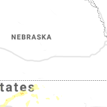
Hail Map for Saturday, July 18, 2020

Number of Impacted Households on 7/18/2020
0
Impacted by 1" or Larger Hail
0
Impacted by 1.75" or Larger Hail
0
Impacted by 2.5" or Larger Hail
Square Miles of Populated Area Impacted on 7/18/2020
0
Impacted by 1" or Larger Hail
0
Impacted by 1.75" or Larger Hail
0
Impacted by 2.5" or Larger Hail


Cities Most Affected by Hail Storms of 7/18/2020
| Hail Size | Demographics of Zip Codes Affected | ||||||
|---|---|---|---|---|---|---|---|
| City | Count | Average | Largest | Pop Density | House Value | Income | Age |
| Canyon, MN | 2 | 2.38 | 3.00 | 3 | $135k | $48.8k | 51.4 |
| Meadowlands, MN | 1 | 2.00 | 2.00 | 3 | $37k | $31.8k | 47.9 |
| Forest Lake, MN | 1 | 2.00 | 2.00 | 298 | $152k | $58.9k | 39.1 |
| Cotton, MN | 1 | 1.75 | 1.75 | 3 | $73k | $41.9k | 50.1 |
Hail and Wind Damage Spotted on 7/18/2020
Filter by Report Type:Hail ReportsWind Reports
States Impacted
Wisconsin, Minnesota, Michigan, Illinois, North Carolina, South Carolina, Georgia, KansasWisconsin
| Local Time | Report Details |
|---|---|
| 7:10 AM CDT | Trees down on power lines in oconto county WI, 26.2 miles NNE of Green Bay, WI |
| 8:43 AM CDT | Peak wind gust on backside of departing showers and storms. asos station klse la crosse regional airpor in la crosse county WI, 4.7 miles N of La Crosse, WI |
| 12:39 PM CDT | Numerous trees and branches down in an area bounded by hampton avenue and capitol drive from north to south... and 92nd street to 84th street from west to east. one lar in milwaukee county WI, 69.2 miles E of Madison, WI |
| 6:45 PM CDT | Half Dollar sized hail reported near Osceola, WI, 36.2 miles ENE of Minneapolis, MN |
| 6:56 PM CDT | Quarter sized hail reported near Dresser, WI, 41.3 miles NE of Minneapolis, MN |
| 8:50 PM CDT | Quarter sized hail reported near Superior, WI, 17.2 miles S of Duluth, MN, largest hail stones- mostly dime to nickle size hail. |
| 9:00 PM CDT | Personal weather station on bark point via davis weatherlin in lsz146 county WI, 43.6 miles E of Duluth, MN |
| 9:03 PM CDT | Quarter sized hail reported near Superior, WI, 17.2 miles S of Duluth, MN, hail estimated at least quarter size... falling at time of report. |
| 9:14 PM CDT | Tree dow in bayfield county WI, 47.6 miles E of Duluth, MN |
| 9:51 PM CDT | Personal weather station near barnes via ambientweather.ne in bayfield county WI, 42.3 miles SE of Duluth, MN |
| 10:12 PM CDT | Tree down on powerline. time estimated from rada in ashland county WI, 66 miles ESE of Duluth, MN |
| 10:15 PM CDT | Tree down across powerline in mareng in ashland county WI, 66 miles ESE of Duluth, MN |
| 10:20 PM CDT | Quarter sized hail reported near Rice Lake, WI, 84.1 miles ENE of Minneapolis, MN |
| 12:03 AM CDT | A tree fell on power lines in the town of phillips. uncertain on the size of the tre in price county WI, 48.1 miles W of Rhinelander, WI |
| 12:17 AM CDT | Trees down. time estimated by rada in vilas county WI, 31.7 miles NW of Rhinelander, WI |
| 12:32 AM CDT | Trees down in cassian. time estimated by radar in oneida county WI, 11.4 miles WNW of Rhinelander, WI |
| 12:50 AM CDT | Quarter sized hail reported near Rhinelander, WI, 0.6 miles S of Rhinelander, WI |
| 12:57 AM CDT | Delayed report. tree damage at hwy 53 and brown road. sporadic tree damage eleva to strum to south of osseo. time estimated based on rada in trempealeau county WI, 50.2 miles N of La Crosse, WI |
| 12:58 AM CDT | Trees down. time estimated by rada in oneida county WI, 16 miles NE of Rhinelander, WI |
| 12:58 AM CDT | Tree down on highway 45 south of three lakes. time estimated by rada in oneida county WI, 15.6 miles NE of Rhinelander, WI |
| 1:01 AM CDT | Trees down. time estimated by rada in vilas county WI, 33.2 miles NNE of Rhinelander, WI |
| 2:15 AM CDT | Tree down. time estimated by rada in marinette county WI, 61.1 miles SSW of Marquette, MI |
| 3:34 AM CDT | Trees down across highway j. time estimated by rada in adams county WI, 66.7 miles NNW of Madison, WI |
| 4:20 AM CDT | Corrects previous non-tstm wnd gst report from endeavor. endeavor fire reports estimated wind gust to 60 mp in marquette county WI, 44.9 miles N of Madison, WI |
| 4:40 AM CDT | Tree leaning on power lin in brown county WI, 14.9 miles SE of Green Bay, WI |
Minnesota
| Local Time | Report Details |
|---|---|
| 9:51 AM CDT | Small portion of barn roof torn of in aitkin county MN, 66.2 miles W of Duluth, MN |
| 5:50 PM CDT | Quarter sized hail reported near Andover, MN, 18.8 miles N of Minneapolis, MN, video on twitter. |
| 6:00 PM CDT | Quarter sized hail reported near Minneapolis, MN, 14.9 miles NNE of Minneapolis, MN, picture on facebook. |
| 6:12 PM CDT | Quarter sized hail reported near Forest Lake, MN, 24.4 miles NE of Minneapolis, MN |
| 6:18 PM CDT | Quarter sized hail reported near Forest Lake, MN, 20.5 miles NNE of Minneapolis, MN |
| 6:20 PM CDT | Quarter sized hail reported near Forest Lake, MN, 22.8 miles NE of Minneapolis, MN |
| 6:23 PM CDT | Hen Egg sized hail reported near Forest Lake, MN, 24.2 miles NNE of Minneapolis, MN, picture on twitter. several large stones. |
| 6:40 PM CDT | Quarter sized hail reported near Outing, MN, 63.2 miles SE of Bemidji, MN |
| 7:03 PM CDT | Quarter sized hail reported near Floodwood, MN, 46.2 miles WNW of Duluth, MN, corrects 2sw remer report. |
| 7:03 PM CDT | Quarter sized hail reported near Remer, MN, 53 miles SE of Bemidji, MN |
| 7:09 PM CDT | Hen Egg sized hail reported near Meadowlands, MN, 41.5 miles NW of Duluth, MN, hail varied from pea size up to two inches in diameter. standing water due to heavy rainfall. time estimated from radar. |
| 7:25 PM CDT | Golf Ball sized hail reported near Canyon, MN, 25.8 miles NNW of Duluth, MN, time estimated off radar... report via social media. |
| 7:30 PM CDT | Tea Cup sized hail reported near Canyon, MN, 25.8 miles NNW of Duluth, MN, largest hail stone. time estimated off radar. report via social media. |
| 7:33 PM CDT | Golf Ball sized hail reported near Cotton, MN, 31.1 miles NW of Duluth, MN |
| 7:35 PM CDT | Quarter sized hail reported near Cotton, MN, 31.4 miles NNW of Duluth, MN, hail estimated up to quarter size. |
| 7:35 PM CDT | Quarter sized hail reported near Cotton, MN, 27.9 miles NNW of Duluth, MN |
| 7:36 PM CDT | Two trees down on powerline in st. louis county MN, 30 miles NW of Duluth, MN |
| 7:50 PM CDT | Trees down. time estimated off rada in st. louis county MN, 17.6 miles N of Duluth, MN |
| 7:55 PM CDT | At least 8 large pine trees down across county road 4 / vermilion trail between three lakes rd and island lake. road passabl in st. louis county MN, 21.6 miles N of Duluth, MN |
| 7:56 PM CDT | 2 aspen trees blown over... 6 inches in diamete in st. louis county MN, 25.1 miles N of Duluth, MN |
| 8:13 PM CDT | Quarter sized hail reported near Barnum, MN, 34 miles SW of Duluth, MN |
| 8:20 PM CDT | Quarter sized hail reported near Barnum, MN, 28.5 miles SW of Duluth, MN |
Michigan
| Local Time | Report Details |
|---|---|
| 11:02 AM EDT | Pictures from facebook show multiple large trees down. some trees impacting camping trailers at onaway state par in presque isle county MI, 46 miles NW of Alpena, MI |
| 11:15 AM EDT | Trees blown down (snapped at the trunk). time approximate based on rada in presque isle county MI, 48.8 miles NW of Alpena, MI |
| 12:40 PM EDT | Power outage cause reported as trees. time estimated from rada in oscoda county MI, 38.3 miles SW of Alpena, MI |
| 4:15 PM EDT | Pictures on social media of building damage to pennsylvania plaza buildin in emmet county MI, 53.8 miles NE of Traverse City, MI |
| 4:20 PM EDT | Staffords inn at bay view trees and large sign blown dow in emmet county MI, 54.9 miles NE of Traverse City, MI |
| 4:30 PM EDT | Thunderstorm wind damage and possible tornad in cheboygan county MI, 55.9 miles WNW of Alpena, MI |
| 4:30 PM EDT | Multiple trees down across the roa in cheboygan county MI, 57.7 miles WNW of Alpena, MI |
| 4:40 PM EDT | Trees dow in emmet county MI, 53 miles NE of Traverse City, MI |
| 4:40 PM EDT | Multiple large trees down on southeast side of petoskey. time estimated from rada in emmet county MI, 53.3 miles NE of Traverse City, MI |
| 4:47 PM EDT | Report from social media---trees down and power lines are all down---in afto in cheboygan county MI, 55.7 miles WNW of Alpena, MI |
| 5:00 PM EDT | Multiple trees down on power line in cheboygan county MI, 62.2 miles WNW of Alpena, MI |
| 5:10 PM EDT | Trees down on power line in cheboygan county MI, 55.3 miles WNW of Alpena, MI |
| 5:14 PM EDT | Damage to wooden fence. also some broken limbs on tree in emmet county MI, 53.3 miles NE of Traverse City, MI |
| 6:00 PM EDT | Delayed report of large tree limb damaging roo in emmet county MI, 54.2 miles NE of Traverse City, MI |
| 10:50 PM CDT | Power pole down on putnam street. time estimated by rada in gogebic county MI, 63.3 miles NNW of Rhinelander, WI |
| 10:55 PM CDT | Numerous trees down along old us-2 near gogebic medical. time estimated by rada in gogebic county MI, 63.4 miles NNW of Rhinelander, WI |
| 10:55 PM CDT | Tree down near intersection of airport road and lake roa in gogebic county MI, 70.7 miles NNW of Rhinelander, WI |
| 11:10 PM CDT | *** 1 inj *** tree fell on vehicle near gogebic lodge and bait & tackle shop. male occupant in vehicle was injured. time estimated by rada in gogebic county MI, 53.1 miles NNW of Rhinelander, WI |
| 12:10 AM EDT | Widespread power outages reported across ontonagon county... especially from white pine northeast to ontonagon. time radar estimate in ontonagon county MI, 85.2 miles N of Rhinelander, WI |
| 12:35 AM EDT | Barn collapsed onto vehicles. trees and power lines down. time estimated by radar. report via social medi in houghton county MI, 67.3 miles WNW of Marquette, MI |
| 12:40 AM EDT | Quarter sized hail reported near Houghton, MI, 67.7 miles NW of Marquette, MI, delayed report. time radar estimated. |
| 12:40 AM EDT | Widespread power outages reported across houghton county... especially from houghton to calumet. time radar estimate in houghton county MI, 67.3 miles NW of Marquette, MI |
| 12:40 AM EDT | Numerous power outages reported across northwest baraga county. time radar estimate in baraga county MI, 51.3 miles WNW of Marquette, MI |
| 12:42 AM EDT | Trees and power lines down. time estimated by rada in baraga county MI, 61.1 miles WNW of Marquette, MI |
| 12:42 AM EDT | Roof blown off of a house. time estimated by rada in baraga county MI, 50.9 miles WNW of Marquette, MI |
| 1:45 AM EDT | Peak wind gust measured at stdm4. delayed repor in lsz266 county MI, 50.1 miles NNE of Marquette, MI |
| 3:49 AM EDT | Peak wind gusts measured at ldad station xmapv minneapolis shoa in lmz221 county MI, 69.6 miles SSE of Marquette, MI |
| 5:45 AM EDT | Photos from social media of large branch down on car in walloon lake are in charlevoix county MI, 48.7 miles NE of Traverse City, MI |
| 6:00 AM EDT | Social media picture of limb down that crushed edge of house roof. time estimated from rada in otsego county MI, 54.6 miles ENE of Traverse City, MI |
Illinois
| Local Time | Report Details |
|---|---|
| 10:58 AM CDT | 2-3 inch diameter branches dow in jo daviess county IL, 50.8 miles SSW of Madison, WI |
| 11:12 AM CDT | Trees and powerlines knocked down in town. time of the event estimated using radar and outage report in stephenson county IL, 45.2 miles SSW of Madison, WI |
| 12:49 PM CDT | Large tree branch down blocking gibson road near de kalb/ogle county line. time estimated by rada in ogle county IL, 68.7 miles W of Chicago, IL |
North Carolina
| Local Time | Report Details |
|---|---|
| 2:27 PM EDT | Multiple trees blown down off dysartsville rd... sw of glen alpin in burke county NC, 64.8 miles WNW of Charlotte, NC |
| 2:35 PM EDT | Tree fell on house off muddy creek r in mcdowell county NC, 65.2 miles SSE of Bristol, TN |
| 3:30 PM EDT | Multiple trees down along airport rhodhiss r in caldwell county NC, 49.3 miles NW of Charlotte, NC |
| 3:40 PM EDT | Tree down on marks creed r in wake county NC, 10.9 miles E of Raleigh, NC |
| 3:40 PM EDT | Tree down blocking three sisters r in wake county NC, 11.4 miles E of Raleigh, NC |
| 3:45 PM EDT | Tree down on edgemont r in wake county NC, 13.7 miles E of Raleigh, NC |
| 3:50 PM EDT | Multiple trees down along knightdale blvd as well as multiple powerlines down. trees down for about a mil in wake county NC, 11 miles E of Raleigh, NC |
| 3:59 PM EDT | Corrects previous report from 3 se knightdale. tree down on house on dunn rd.no injuries reporte in wake county NC, 11 miles E of Raleigh, NC |
| 4:15 PM EDT | Trees blown down off scotts creek r in iredell county NC, 43.8 miles N of Charlotte, NC |
| 4:34 PM EDT | Trees down off oaklin lan in lincoln county NC, 29 miles NW of Charlotte, NC |
| 4:43 PM EDT | At least 2 trees down with one blocking the roadway along new salem road to the southeast of unionville and southwest of new sale in union county NC, 24.6 miles ESE of Charlotte, NC |
| 5:40 PM EDT | Multiple trees down off zion church r in cabarrus county NC, 16.5 miles ENE of Charlotte, NC |
| 5:48 PM EDT | Trees down off south tryon s in mecklenburg county NC, 5.2 miles SW of Charlotte, NC |
| 6:12 PM EDT | Numerous trees blown down in matthew in mecklenburg county NC, 10.1 miles SE of Charlotte, NC |
| 6:14 PM EDT | Multiple trees down just south of gold hil in cabarrus county NC, 33.6 miles ENE of Charlotte, NC |
South Carolina
| Local Time | Report Details |
|---|---|
| 4:16 PM EDT | Trees down off old mill r in spartanburg county SC, 33 miles NE of Greenville, SC |
| 4:54 PM EDT | Trees down off granite s in spartanburg county SC, 49.3 miles E of Greenville, SC |
| 5:08 PM EDT | Numerous trees and power lines blown down across the southern half of the count in cherokee county SC, 45 miles WSW of Charlotte, NC |
| 5:22 PM EDT | Trees reported down in waterlo in laurens county SC, 45.3 miles SE of Greenville, SC |
Georgia
| Local Time | Report Details |
|---|---|
| 4:54 PM EDT | A tree was reported in the roadway in the 400 block of six flags parkway s in cobb county GA, 8.8 miles WNW of Atlanta, GA |
| 4:59 PM EDT | A tree was reported down on a truck in the 700 block of six flags roa in cobb county GA, 10.9 miles W of Atlanta, GA |
| 5:08 PM EDT | Powerlines were reported in the roadway in the 7000 block of blair chase court. a tree was also reported in the roadway near the intersection of south gordon road sw an in cobb county GA, 11.8 miles WNW of Atlanta, GA |
| 5:08 PM EDT | Quarter sized hail reported near Mableton, GA, 12.1 miles WNW of Atlanta, GA, quarter sized hail reported near the intersection of shannon green circle sw and nickajack rd sw. |
| 5:12 PM EDT | A few trees down and quarter-sized hail reported near the intersection of riley rd and veterans memorial hw in douglas county GA, 17.9 miles W of Atlanta, GA |
| 5:13 PM EDT | A tree and power lines were reported down near the intersection of n sweetwater road and veterans memorial highwa in douglas county GA, 15.7 miles W of Atlanta, GA |
| 5:13 PM EDT | A tree and powerlines were reported down near the intersection of n county line road and whitaker lan in douglas county GA, 16.3 miles W of Atlanta, GA |
| 5:15 PM EDT | A tree and powerlines were reported down near the intersection of lee road and vulcan driv in douglas county GA, 15 miles W of Atlanta, GA |
| 5:19 PM EDT | A tree was reported in the roadway in the 4000 block of roberta circle. powerlines were also reported in the roadway in the 5000 block of mable lake drive sw. powerline in cobb county GA, 12.8 miles WNW of Atlanta, GA |
| 5:27 PM EDT | A tree was reported in the road near the intersection of macedonia road and ernest w barrett parkway sw. powerlines were also reported in the road up the street near th in cobb county GA, 16.1 miles WNW of Atlanta, GA |
| 5:27 PM EDT | A tree was reported down on a house on concord close circle s in cobb county GA, 12 miles NW of Atlanta, GA |
| 5:37 PM EDT | In the 4000 block of duncan drive... multiple trees were reported down with some blocking the roadwa in cobb county GA, 18.9 miles WNW of Atlanta, GA |
| 5:43 PM EDT | A tree was reported down in powerlines in the 5000 block of lower roswell roa in cobb county GA, 16 miles N of Atlanta, GA |
Kansas
| Local Time | Report Details |
|---|---|
| 6:23 PM CDT | Report of 5 power poles broke in nw side of tow in wichita county KS, 45 miles NW of Garden City, KS |
| 6:25 PM CDT | Storm damage reported in wichita county KS, 44.1 miles NW of Garden City, KS |
| 6:25 PM CDT | Kwhk1 in leoti measured a 67 mph wind gust at 5:25 pm md in wichita county KS, 43.7 miles NW of Garden City, KS |
| 6:44 PM CDT | Storm damage reported in sheridan county KS, 32.5 miles E of Colby, KS |
| 6:49 PM CDT | Storm damage reported in sheridan county KS, 32.5 miles E of Colby, KS |
| 7:00 PM CDT | Report of power lines down due to win in sheridan county KS, 40.4 miles E of Colby, KS |
| 7:47 PM CDT | Asos station khlc hill cit in graham county KS, 43.6 miles NW of Hays, KS |
| 7:53 PM CDT | Asos station khlc hill cit in graham county KS, 43.6 miles NW of Hays, KS |
| 7:54 PM CDT | Gust ranged from 58mph to 72mph during this time perio in graham county KS, 42.4 miles NNW of Hays, KS |
| 8:05 PM CDT | Wind damage to a couple of campers at webster state par in rooks county KS, 37.6 miles N of Hays, KS |
| 8:14 PM CDT | Est 50 to 60mph winds... lawn furniture blowing around and rain is horizonta in rooks county KS, 40.8 miles NNW of Hays, KS |
| 7:15 PM MDT | Awos station k3k3 syracus in hamilton county KS, 47.9 miles W of Garden City, KS |
| 10:19 PM CDT | Storm damage reported in russell county KS, 27.6 miles E of Hays, KS |
| 10:33 PM CDT | Storm damage reported in russell county KS, 27.6 miles E of Hays, KS |
Connect with Interactive Hail Maps