

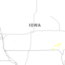
Hail Map for Sunday, July 19, 2020

Number of Impacted Households on 7/19/2020
0
Impacted by 1" or Larger Hail
0
Impacted by 1.75" or Larger Hail
0
Impacted by 2.5" or Larger Hail
Square Miles of Populated Area Impacted on 7/19/2020
0
Impacted by 1" or Larger Hail
0
Impacted by 1.75" or Larger Hail
0
Impacted by 2.5" or Larger Hail


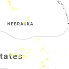


Cities Most Affected by Hail Storms of 7/19/2020
| Hail Size | Demographics of Zip Codes Affected | ||||||
|---|---|---|---|---|---|---|---|
| City | Count | Average | Largest | Pop Density | House Value | Income | Age |
| Lusk, WY | 7 | 2.25 | 4.25 | 0 | $63k | $30.4k | 44.7 |
| Gering, NE | 3 | 1.83 | 2.00 | 52 | $75k | $34.5k | 38.2 |
| Sundance, WY | 2 | 2.00 | 2.25 | 1 | $87k | $39.7k | 47.3 |
| Minatare, NE | 2 | 1.88 | 2.00 | 9 | $46k | $31.0k | 41.7 |
| Gillette, WY | 1 | 3.00 | 3.00 | 13 | $113k | $55.4k | 31.2 |
| Weston, WY | 1 | 2.75 | 2.75 | 0 | $30k | $53.9k | 47.9 |
| Tryon, NE | 1 | 2.00 | 2.00 | 0 | $42k | $25.2k | 42.8 |
| North Platte, NE | 1 | 1.75 | 1.75 | 50 | $79k | $36.3k | 38.7 |
| Douglas, WY | 1 | 1.75 | 1.75 | 3 | $88k | $39.7k | 38.0 |
| Devils Tower, WY | 1 | 1.75 | 1.75 | 1 | $460k | $33.8k | 54.3 |
| Lewellen, NE | 1 | 1.75 | 1.75 | 1 | $61k | $26.3k | 56.7 |
| Hulett, WY | 1 | 1.75 | 1.75 | 1 | $64k | $28.0k | 43.7 |
| Torrington, WY | 1 | 1.75 | 1.75 | 13 | $79k | $33.0k | 43.0 |
Hail and Wind Damage Spotted on 7/19/2020
Filter by Report Type:Hail ReportsWind Reports
States Impacted
Michigan, Iowa, Illinois, Indiana, New York, North Carolina, Pennsylvania, Ohio, Virginia, Colorado, Nebraska, Oklahoma, Missouri, Georgia, Wyoming, Texas, South Dakota, KansasMichigan
| Local Time | Report Details |
|---|---|
| 8:00 AM EDT | Delayed from morning - numerous trees dow in iosco county MI, 47.1 miles S of Alpena, MI |
| 8:05 AM EDT | Mesonet station xtaw tawas poin in iosco county MI, 56 miles S of Alpena, MI |
| 8:47 AM EDT | Numerous wires down. time estimated by rada in midland county MI, 60 miles NW of Flint, MI |
| 8:51 AM EDT | Numerous wires down. time estimated by rada in midland county MI, 57.9 miles NW of Flint, MI |
| 8:55 AM EDT | Numerous wires down. time estimated by rada in midland county MI, 52.6 miles NW of Flint, MI |
| 9:01 AM EDT | Numerous trees down throughout the city. time estimated by rada in midland county MI, 50.2 miles NNW of Flint, MI |
| 9:07 AM EDT | Numerous trees down. time estimated by rada in midland county MI, 42.8 miles NW of Flint, MI |
| 9:09 AM EDT | Numerous trees and wires down across city. time estimated by rada in bay county MI, 41.3 miles NNW of Flint, MI |
| 9:27 AM EDT | Numerous trees and wires down throughout the city. time estimated by radar. dispatch also reported numerous trees and wires down throughout saginaw count in saginaw county MI, 31.2 miles NNW of Flint, MI |
| 9:31 AM EDT | Trees down. time estimated by rada in tuscola county MI, 36.1 miles NNE of Flint, MI |
| 9:40 AM EDT | Trees down. time estimated by rada in tuscola county MI, 37.2 miles NE of Flint, MI |
| 10:22 AM EDT | Trees down. time estimated by rada in genesee county MI, 8.5 miles E of Flint, MI |
| 10:35 AM EDT | Numerous trees down. time estimated by rada in lapeer county MI, 15.1 miles ESE of Flint, MI |
| 10:42 AM EDT | Numerous trees down. time estimated by rada in lapeer county MI, 20.7 miles ESE of Flint, MI |
| 11:19 AM EDT | Social media photo of tree down on pickup truck. time estimated from rada in ogemaw county MI, 55.4 miles SW of Alpena, MI |
| 11:30 AM EDT | Social media photo of tree down on pole outbuilding. time estimated from rada in ogemaw county MI, 66.7 miles SW of Alpena, MI |
| 11:36 AM EDT | Asos station kbtl battle creek executive airpor in calhoun county MI, 50 miles SSE of Grand Rapids, MI |
| 11:50 AM EDT | Trees dow in macomb county MI, 37.7 miles ESE of Flint, MI |
| 11:53 AM EDT | A 1 ft diameter tree limb about 30 ft long fell and damaged a dog kennel. appeared to be a healthy limb. the dog was not injure in st. joseph county MI, 59.5 miles NNW of Fort Wayne, IN |
| 12:14 PM EDT | 2 to 3 inch diameter tree limbs down with estimated winds 50 to 55 mph. time estimated by rada in wayne county MI, 45.1 miles SSE of Flint, MI |
| 1:40 PM EDT | A few reports of trees and large limbs downed. one limb fell on a power line. no details available on the exact size and health of the trees/limb in berrien county MI, 63 miles ENE of Chicago, IL |
| 1:53 PM EDT | Washtenaw county emergency management dept relayed a report from a senior fire official regarding several large trees down on mobile homes in the 6400 block of lake dri in washtenaw county MI, 56.3 miles S of Flint, MI |
| 1:54 PM EDT | Van buren twp police reported damage to several buildings at kyip willow run airport and an overturned sem in wayne county MI, 53.8 miles S of Flint, MI |
| 1:56 PM EDT | 54 knot thunderstorm wind gust measured at willow run airpor in wayne county MI, 53.8 miles S of Flint, MI |
| 1:57 PM EDT | Numerous large branches... trees... and power lines down at rawsonville rd and textile/huron river d in washtenaw county MI, 56.5 miles S of Flint, MI |
| 2:02 PM EDT | Several trees down along hannan road south of ecorse roa in wayne county MI, 54.8 miles SSE of Flint, MI |
| 2:03 PM EDT | Numerous large trees down and power lines. minor damage to nearby homes due fallen tree in wayne county MI, 51 miles SSE of Flint, MI |
| 2:05 PM EDT | Large tree down on home near sumpter rd and paris d in wayne county MI, 59 miles S of Flint, MI |
| 2:26 PM EDT | Numerous trees dow in wayne county MI, 52.3 miles SSE of Flint, MI |
| 2:46 PM EDT | 51 knots measured at grosse pointe yacht clu in lcz460 county MI, 57.7 miles SE of Flint, MI |
Iowa
| Local Time | Report Details |
|---|---|
| 8:00 AM CDT | Tree dow in des moines county IA, 37.7 miles NE of Kahoka, MO |
| 8:02 AM CDT | Public relayed a picture of a tree down at this location. time based on rada in henry county IA, 33.4 miles NNE of Kahoka, MO |
| 8:04 AM CDT | Public relayed a photo of roofing peeled back on a farm outbuilding. time estimated from rada in henry county IA, 34.4 miles NNE of Kahoka, MO |
| 8:09 AM CDT | Corrects previous tstm wnd dmg report from middletown. tree dow in des moines county IA, 37.7 miles NE of Kahoka, MO |
| 8:20 AM CDT | Corrects previous tstm wind damage report from 1 ese new london to update the tree limb information . reported that a 5 inch tree limb was dow in henry county IA, 38.3 miles NNE of Kahoka, MO |
| 8:24 AM CDT | 5 inch diameter healthy tree lib down on a car. time estimated using rada in des moines county IA, 41.9 miles NE of Kahoka, MO |
| 8:25 AM CDT | 4 inch diameter peach tree dow in henry county IA, 37 miles NNE of Kahoka, MO |
| 8:25 AM CDT | 4-6 inch diameter limbs dow in henry county IA, 38.7 miles NNE of Kahoka, MO |
| 8:26 AM CDT | Trees uprooted... 8 inch limbs down as well as tree limbs on a house along northfield st. time estimated using rada in des moines county IA, 50.2 miles NE of Kahoka, MO |
| 8:26 AM CDT | Significant tree/limb damage in mediapolis. 4-8 in branches down over town. power ou in des moines county IA, 49.8 miles NE of Kahoka, MO |
| 8:27 AM CDT | 2 foot diameter... 40 foot cedar trees down. time estimate in des moines county IA, 39.1 miles NE of Kahoka, MO |
| 8:30 AM CDT | 8 inch limb down at leffler and wheeler street in des moines county IA, 40.8 miles NE of Kahoka, MO |
| 8:41 AM CDT | Tree down blocking the roadwa in des moines county IA, 54.2 miles NE of Kahoka, MO |
| 8:42 AM CDT | Billboard damage and twisted signs by the john deere dealershi in des moines county IA, 47.2 miles NE of Kahoka, MO |
Illinois
| Local Time | Report Details |
|---|---|
| 8:42 AM CDT | Trees and power lines dow in henderson county IL, 54 miles NE of Kahoka, MO |
| 8:49 AM CDT | Trees down across the road... trapping a car on the road. no injurie in henderson county IL, 60 miles NE of Kahoka, MO |
| 8:51 AM CDT | Reports of trees and branches down in keothsbur in mercer county IL, 62.5 miles NE of Kahoka, MO |
| 9:00 AM CDT | 4 inch tree branch down at locatio in henry county IL, 56.6 miles NW of Peoria, IL |
| 9:10 AM CDT | Power poles snapped with 3-5 inch limbs down; falling power pole has resulted in a house fir in warren county IL, 56.9 miles WNW of Peoria, IL |
| 9:20 AM CDT | Corrects previous tstm wnd dmg report from cambridge. part of a 8 inch diameter tree is down along with several branches. considerable damage across the city; partial t in henry county IL, 52.8 miles NW of Peoria, IL |
| 9:45 AM CDT | Corrects previous tstm wnd dmg report from galva for new information. multiple reports of trees down and power line down. sevral of the branches were 6 to 8 inches in d in henry county IL, 40.6 miles NW of Peoria, IL |
| 10:00 AM CDT | Storm damage reported in marshall county IL, 31.2 miles NNE of Peoria, IL |
| 10:00 AM CDT | Storm damage reported in marshall county IL, 31.2 miles NNE of Peoria, IL |
| 10:13 AM CDT | Tree down across u.s. route 6 blocking traffi in bureau county IL, 49.2 miles NNE of Peoria, IL |
| 10:16 AM CDT | Multiple reports of tree limbs... powerlines... and trees down across the county. tree down near the intersection of highway 26 and highway 1 in putnam county IL, 31.8 miles NNE of Peoria, IL |
| 10:23 AM CDT | Numerous tree limbs down on the south side of mendota. time estimated by radar. relayed via nws employe in la salle county IL, 63.4 miles NNE of Peoria, IL |
| 10:45 AM CDT | Large tree down; knocked down power lines; required crews to remov in livingston county IL, 51.9 miles ENE of Peoria, IL |
| 10:48 AM CDT | Trees and powerlines down. relayed by grundy county so. time estimated based on rada in grundy county IL, 54.5 miles SW of Chicago, IL |
| 10:50 AM CDT | Powerlines down across the boat launch at stratton park. relayed by grundy county so. time estimated based on rada in grundy county IL, 54.5 miles SW of Chicago, IL |
| 10:56 AM CDT | Trees and powerlines down. relayed by grundy county so. time estimated based on rada in grundy county IL, 53.6 miles SW of Chicago, IL |
| 11:04 AM CDT | Large tree down completely blocking the roadway. relayed by kendall county dispatch. time estimated based on rada in kendall county IL, 38.7 miles WSW of Chicago, IL |
| 11:05 AM CDT | 3-6 diameter tree branch down. report via social media. time estimated from rada in kendall county IL, 40.4 miles WSW of Chicago, IL |
| 11:08 AM CDT | Multiple medium sized branches downed... up to six inches in diameter. time estimated per rada in will county IL, 44 miles SW of Chicago, IL |
| 11:15 AM CDT | Large tree down on a power line on a power pole near division and hamilton. report via social medi in will county IL, 30.5 miles SW of Chicago, IL |
| 11:17 AM CDT | Large branch downed. time estimate in dupage county IL, 23.9 miles WSW of Chicago, IL |
| 11:19 AM CDT | Transformer blown down from power pole reported at division & hamilton s in will county IL, 30.5 miles SW of Chicago, IL |
| 11:20 AM CDT | Rotten tree down on a house -- 100 blk of west street in peotone. via social media. time estimated by rada in will county IL, 39.1 miles SSW of Chicago, IL |
| 11:35 AM CDT | Lost a massive branch on a tree at st. joseph church in summit. a few other trees lost smaller limbs down the block... too. report via social media. time estimated via in cook county IL, 10.8 miles SW of Chicago, IL |
| 11:40 AM CDT | Very large tree limb down in a backyard. social media report. time estimated from rada in cook county IL, 7.6 miles W of Chicago, IL |
| 11:40 AM CDT | Storm damage reported in cook county IL, 12.5 miles SW of Chicago, IL |
| 11:42 AM CDT | A tree and wires down on kostner ave around 99th st. time estimated per rada in cook county IL, 13 miles SSW of Chicago, IL |
| 11:44 AM CDT | Reports of large tree limbs and numerous smaller limbs down along balbo and michigan avenue. time estimated based on rada in cook county IL, 1.2 miles SSE of Chicago, IL |
| 11:45 AM CDT | 6-8 tree branch down near parked cars. time estimated from radar. report from social medi in cook county IL, 4 miles NNW of Chicago, IL |
| 11:50 AM CDT | Portion of large tree downed onto roa in cook county IL, 4.1 miles NNW of Chicago, IL |
| 11:50 AM CDT | Corrects previous tstm wnd gst report from 3 ne navy pier for wind speed. measured at the chicago harrison-dever cri in lmz741 county IL, 4.1 miles NE of Chicago, IL |
| 1:40 PM CDT | Large tree limb blown down on car. time estimate in champaign county IL, 43.8 miles N of Mattoon, IL |
| 5:20 PM CDT | Tree blown onto road. time estimate in edgar county IL, 39.4 miles E of Mattoon, IL |
Indiana
| Local Time | Report Details |
|---|---|
| 11:40 AM EDT | Several 4-5 inch diameter trees downed. trees appeared to be in good healt in elkhart county IN, 57.8 miles NW of Fort Wayne, IN |
| 12:00 PM CDT | Storm damage reported in jasper county IN, 66.2 miles SSE of Chicago, IL |
| 12:02 PM CDT | Tree blown onto hous in jasper county IN, 68.4 miles SSE of Chicago, IL |
| 1:30 PM EDT | Trees down. time estd from rada in carroll county IN, 68.8 miles NNW of Indianapolis, IN |
| 1:30 PM EDT | Trees down. time estd from rada in carroll county IN, 69.8 miles NNW of Indianapolis, IN |
| 1:35 PM EDT | Trees down. time estd from rada in carroll county IN, 66.6 miles NNW of Indianapolis, IN |
| 1:35 PM EDT | 53 knot wind gust recorded at logansport municipal airport (kggp in cass county IN, 66.1 miles N of Indianapolis, IN |
| 1:35 PM EDT | Reports of trees and power lines down across the count in cass county IN, 68.7 miles N of Indianapolis, IN |
| 1:46 PM EDT | Grissom arb fire officials reported trees down into power lines... as well as a large tree down onto a car and home. all of this occurring on the bas in miami county IN, 61.6 miles N of Indianapolis, IN |
| 1:47 PM EDT | 2 tree limbs downed... around 6 inches in diamete in miami county IN, 54.5 miles W of Fort Wayne, IN |
| 1:57 PM EDT | Tree down on old 24 between rich valley and the miami county lin in wabash county IN, 48 miles WSW of Fort Wayne, IN |
| 2:23 PM EDT | Sporadic reports of roughly 6 inch diameter tree limbs down just north of huntington... just north of mt etna and at county roads 300 n and 300 e. time estimated from r in huntington county IN, 23.8 miles WSW of Fort Wayne, IN |
| 2:45 PM EDT | 1-2 ft diameter tree downed on schwartz rd. several larger tree limbs also downe in allen county IN, 10.2 miles NNE of Fort Wayne, IN |
| 2:47 PM EDT | 4-6 inch diameter tree downed along i 69 near mile marker 30 in allen county IN, 6.8 miles W of Fort Wayne, IN |
| 2:47 PM EDT | Large tree down/power lines down across gerig road. fire department had road blocked of in allen county IN, 10.2 miles NNE of Fort Wayne, IN |
| 2:47 PM EDT | 6-12 inch diameter tree limbs downed at the leo-cedarville park. some of the limbs were rotted inside... others appear healthy from photo in allen county IN, 9.5 miles NNE of Fort Wayne, IN |
| 2:52 PM EDT | Asos station kfwa fort wayne international a in allen county IN, 7.8 miles SSW of Fort Wayne, IN |
| 3:05 PM EDT | Power lines dow in marion county IN, 7.3 miles NNE of Indianapolis, IN |
| 3:13 PM EDT | Fire dept responding to reports of power lines downe in allen county IN, 10.2 miles NNE of Fort Wayne, IN |
| 3:15 PM EDT | Fire dept responding to report of trees and wires down on kinnerk rd near winchester roa in allen county IN, 4.4 miles SSW of Fort Wayne, IN |
| 3:21 PM EDT | Fire dept responding to trees on gerig road near halter r in allen county IN, 9.8 miles NNE of Fort Wayne, IN |
| 4:35 PM EDT | Several tree branches down... one causing minor car damag in bartholomew county IN, 40.4 miles SSE of Indianapolis, IN |
| 4:35 PM EDT | Tree down. time estd from rada in monroe county IN, 38.2 miles SSW of Indianapolis, IN |
| 4:50 PM EDT | Tree down. time estd from rada in brown county IN, 39.5 miles S of Indianapolis, IN |
| 5:40 PM EDT | Tree down on short ridge road. time estimated from rada in dearborn county IN, 24.5 miles W of Cincinnati, OH |
| 6:45 PM EDT | 100 hickory tree snapped off at ground. 3.01 inches of rain as of ~2355z. time estd from rada in morgan county IN, 36.1 miles SW of Indianapolis, IN |
| 6:45 PM EDT | 2 trees down on godsey road. time estd from rada in morgan county IN, 33.2 miles SW of Indianapolis, IN |
| 7:10 PM EDT | Multiple medium-large trees across road. time est from rada in monroe county IN, 46.6 miles SSW of Indianapolis, IN |
| 7:15 PM EDT | Corrects previous tstm wnd dmg report from 3 sw woodview hills. tree across road. time est from rada in monroe county IN, 46.6 miles SSW of Indianapolis, IN |
| 8:15 PM EDT | Tree across roa in monroe county IN, 46.6 miles SSW of Indianapolis, IN |
New York
| Local Time | Report Details |
|---|---|
| 1:48 PM EDT | Trees fell taking down power line in chautauqua county NY, 52.9 miles SW of Buffalo, NY |
| 2:00 PM EDT | Multiple trees dow in cattaraugus county NY, 29.7 miles S of Buffalo, NY |
| 2:00 PM EDT | Multiple trees dow in cattaraugus county NY, 29 miles S of Buffalo, NY |
| 2:05 PM EDT | Multiple trees dow in cattaraugus county NY, 30.2 miles S of Buffalo, NY |
| 2:16 PM EDT | Trees dow in chautauqua county NY, 60.2 miles SSW of Buffalo, NY |
| 2:34 PM EDT | Trees dow in cattaraugus county NY, 37.7 miles SSE of Buffalo, NY |
| 2:35 PM EDT | Trees snapped and uprooted on north street in arcad in wyoming county NY, 33 miles SE of Buffalo, NY |
| 2:40 PM EDT | Tree fell bringing down power lines with i in wyoming county NY, 33.5 miles SE of Buffalo, NY |
| 2:48 PM EDT | Trees dow in cattaraugus county NY, 47.3 miles S of Buffalo, NY |
| 2:56 PM EDT | Trees and wires down on main street in leiceste in livingston county NY, 50.3 miles E of Buffalo, NY |
| 3:08 PM EDT | Trees down at redmond and green road in livingston county NY, 58.3 miles ESE of Buffalo, NY |
| 3:14 PM EDT | Trees and wires down on south livonia roa in livingston county NY, 61.7 miles E of Buffalo, NY |
| 3:18 PM EDT | Trees down on park av in livingston county NY, 64.5 miles ESE of Buffalo, NY |
| 3:18 PM EDT | Trees... poles and wires down on depot roa in livingston county NY, 67.4 miles ESE of Buffalo, NY |
| 3:20 PM EDT | Metal roof torn off hous in ontario county NY, 62.3 miles W of Syracuse, NY |
| 3:23 PM EDT | Tree snapped... trampoline and basketball hoop were lifted and throw in ontario county NY, 61.8 miles W of Syracuse, NY |
| 3:25 PM EDT | Trees fell onto town house in ontario county NY, 60.8 miles W of Syracuse, NY |
| 3:30 PM EDT | Trees dow in cattaraugus county NY, 64.5 miles SSE of Buffalo, NY |
| 3:33 PM EDT | Trees down on mobile home in ontario county NY, 55.2 miles W of Syracuse, NY |
| 3:36 PM EDT | Downed trees blocking road in steuben county NY, 75.1 miles ESE of Buffalo, NY |
| 3:47 PM EDT | Trees and wires across road in steuben county NY, 77.8 miles ESE of Buffalo, NY |
| 3:54 PM EDT | Tree on house in steuben county NY, 77.2 miles SW of Syracuse, NY |
| 4:06 PM EDT | Trees across road in steuben county NY, 78 miles SW of Syracuse, NY |
| 4:06 PM EDT | Trees across road in steuben county NY, 81 miles SW of Syracuse, NY |
| 4:19 PM EDT | Downed trees caused damage to a boat that was stored at a residence on nugent rd. time estimated from rada in cayuga county NY, 25.2 miles WSW of Syracuse, NY |
| 4:25 PM EDT | Tree across road in steuben county NY, 76.8 miles SW of Syracuse, NY |
| 4:30 PM EDT | Storm damage reported in tompkins county NY, 43.8 miles SSW of Syracuse, NY |
| 4:30 PM EDT | Trees and wires down in steuben county NY, 78.7 miles SW of Syracuse, NY |
| 4:48 PM EDT | Numerous trees down in chemung county NY, 74.4 miles SSW of Syracuse, NY |
| 4:52 PM EDT | Trees and wires down in chemung county NY, 67.6 miles SSW of Syracuse, NY |
| 5:10 PM EDT | Large tree branches down on mccloy road. time estimated from rada in cortland county NY, 30.9 miles S of Syracuse, NY |
| 5:24 PM EDT | Trees across road in broome county NY, 58.5 miles NNW of Scranton, PA |
| 5:36 PM EDT | Trees and wires down in broome county NY, 57.8 miles SSE of Syracuse, NY |
| 5:36 PM EDT | Trees and wires down in broome county NY, 51.4 miles NNW of Scranton, PA |
| 5:36 PM EDT | Trees and wires on car in broome county NY, 50.4 miles NNW of Scranton, PA |
| 5:42 PM EDT | Trees down on road in broome county NY, 49.3 miles NNW of Scranton, PA |
| 5:48 PM EDT | Large tree across road in broome county NY, 52.7 miles N of Scranton, PA |
| 6:14 PM EDT | Trees and lines down on clark s in st. lawrence county NY, 33.3 miles E of Ogdensburg, NY |
| 6:20 PM EDT | Trees and lines down on leary r in st. lawrence county NY, 28.9 miles ESE of Ogdensburg, NY |
| 6:24 PM EDT | Trees and wires down on sand pond r in lewis county NY, 61.7 miles NE of Syracuse, NY |
| 6:25 PM EDT | Trees and lines down on wildwood r in st. lawrence county NY, 30.7 miles ESE of Ogdensburg, NY |
| 6:26 PM EDT | Trees and lines down on converse r in st. lawrence county NY, 33 miles E of Ogdensburg, NY |
| 6:39 PM EDT | Trees across road in delaware county NY, 42.1 miles NNE of Scranton, PA |
| 7:00 PM EDT | Trees and wires down with one tree on fir in schoharie county NY, 32.5 miles WSW of Schenectady, NY |
| 7:01 PM EDT | Trees down in delaware county NY, 50.6 miles NE of Scranton, PA |
| 7:05 PM EDT | Trees and wires down in sullivan county NY, 42.9 miles NE of Scranton, PA |
| 7:13 PM EDT | Trees and wires down in delaware county NY, 58.9 miles SW of Schenectady, NY |
| 7:46 PM EDT | Trees down between broadway and mountain dale rd in sullivan county NY, 60.2 miles ENE of Scranton, PA |
| 8:10 PM EDT | Trees and wires dow in ulster county NY, 67.5 miles S of Schenectady, NY |
| 8:15 PM EDT | Trees and wires dow in ulster county NY, 73.1 miles N of Brooklyn, NY |
| 8:30 PM EDT | Trees and wires dow in dutchess county NY, 71.3 miles S of Schenectady, NY |
| 8:35 PM EDT | Us 44 is closed east of ny 55 due to a downed tre in dutchess county NY, 69.7 miles N of Brooklyn, NY |
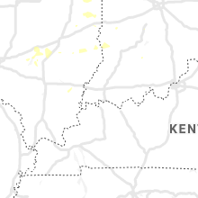
North Carolina
| Local Time | Report Details |
|---|---|
| 3:15 PM EDT | 911 call center reported trees down on jesse owenby rd and bearwallow mountain r in henderson county NC, 46.1 miles NNE of Greenville, SC |
Pennsylvania
| Local Time | Report Details |
|---|---|
| 3:20 PM EDT | Tree down blocking roadway on coovers crossing rd near old pittsfield r in warren county PA, 76.1 miles SSW of Buffalo, NY |
| 4:20 PM EDT | Tree and wires dow in mckean county PA, 74.1 miles NNW of State College, PA |
| 4:45 PM EDT | Corrects previous tstm wnd dmg report from 1 wnw emporium. tree and wires down on home and two vehicles on 500 block w allegany av in cameron county PA, 54.1 miles NNW of State College, PA |
| 4:48 PM EDT | Trees down on wires reported at rt 155 and 4 mile road pennsylvani in cameron county PA, 55.3 miles NNW of State College, PA |
| 4:50 PM EDT | Tree down on road at 214 w 4th s in cameron county PA, 53.2 miles NNW of State College, PA |
| 5:00 PM EDT | Trees and wires down in susquehanna county PA, 38.2 miles N of Scranton, PA |
| 5:45 PM EDT | Crawford county sheriff dispatch reports trees and power lines down in the area of espyville and north shenango township. time estimated via rada in crawford county PA, 62.7 miles E of Cleveland, OH |
| 5:54 PM EDT | Trees down in susquehanna county PA, 38.9 miles N of Scranton, PA |
| 6:09 PM EDT | Crawford county sheriff dispatch reports trees and power lines down in west mead township. time estimated via rada in crawford county PA, 80.8 miles E of Cleveland, OH |
| 6:13 PM EDT | Crawford county sheriff dispatch reports several trees down on state route 173. road remains closed at this time. time estimated via rada in crawford county PA, 78.1 miles N of Pittsburgh, PA |
| 6:30 PM EDT | Trees and wires on house in susquehanna county PA, 24.4 miles NW of Scranton, PA |
| 6:50 PM EDT | Crawford county sheriff dispatch reports trees and power lines down in the titusville area. time estimated via rada in crawford county PA, 83.9 miles NNE of Pittsburgh, PA |
| 7:00 PM EDT | Tree down on bedford roa in mercer county PA, 54.4 miles NNW of Pittsburgh, PA |
| 7:03 PM EDT | Wires down due to wind. time estimated based on rada in lawrence county PA, 49.5 miles NNW of Pittsburgh, PA |
| 7:05 PM EDT | Wires down on roadway. time estimated based on rada in mercer county PA, 56 miles NNW of Pittsburgh, PA |
| 7:08 PM EDT | Large tree down and blocking roadway. time estimated based on rada in lawrence county PA, 46.3 miles NNW of Pittsburgh, PA |
| 7:10 PM EDT | Trees down on us 322 near #1 cycle center. time estimated from rada in centre county PA, 7.9 miles E of State College, PA |
| 7:18 PM EDT | Trees and wires down on the 200 block of red mill roa in centre county PA, 11.6 miles E of State College, PA |
| 7:27 PM EDT | Tree down on 700 block of lower george valley rd in spring mill in centre county PA, 14.8 miles E of State College, PA |
| 8:10 PM EDT | Multiple trees down on portland mills rd between game commission rd & arkansas l in elk county PA, 62.8 miles NW of State College, PA |
| 8:30 PM EDT | Tree and wires down on bennetts valley highway (route 255) near berkey roa in clearfield county PA, 48.7 miles WNW of State College, PA |
| 8:31 PM EDT | Numerous trees and wires down in vicinity of route 255 and mountain run roa in clearfield county PA, 46.9 miles NW of State College, PA |
Ohio
| Local Time | Report Details |
|---|---|
| 3:30 PM EDT | A couple of large limbs down on seneca street... one fell onto a power lin in defiance county OH, 41.5 miles ENE of Fort Wayne, IN |
| 3:33 PM EDT | Large tree limb downed across euclid avenue. gas pump blew over on east 2nd stree in defiance county OH, 41.5 miles ENE of Fort Wayne, IN |
| 3:42 PM EDT | Tree down. time estimated from rada in darke county OH, 66.3 miles SSE of Fort Wayne, IN |
| 3:45 PM EDT | Multiple large branches down in drivewa in wood county OH, 84.3 miles ENE of Fort Wayne, IN |
| 3:45 PM EDT | Several trees and branches down in w 7th st are in wood county OH, 83.2 miles ENE of Fort Wayne, IN |
| 4:01 PM EDT | Numerous trees and power poles down near indian lake. time estimated from rada in logan county OH, 57.8 miles NW of Columbus, OH |
| 4:02 PM EDT | Two flagpoles bent in half. time estimated from rada in shelby county OH, 62 miles WNW of Columbus, OH |
| 4:02 PM EDT | Numerous reports of trees and power lines down between maplewood and port jefferson. time estimated from rada in shelby county OH, 61.9 miles WNW of Columbus, OH |
| 4:15 PM EDT | Two reports of tree limbs down. time estimated from rada in miami county OH, 60 miles WNW of Columbus, OH |
| 4:15 PM EDT | A tree was blown down on w river road south of highway 82 near columbia station. time was estimate in lorain county OH, 16.6 miles SW of Cleveland, OH |
| 4:27 PM EDT | Large tree branches were blown down in monroeville. time was estimate in huron county OH, 55.1 miles WSW of Cleveland, OH |
| 4:35 PM EDT | Large tree reported down on gettysburg avenu in montgomery county OH, 43.8 miles NNE of Cincinnati, OH |
| 4:35 PM EDT | Large tree reported down on gettysburg avenu in montgomery county OH, 43.8 miles NNE of Cincinnati, OH |
| 4:41 PM EDT | Huron county sheriff dispatch reports power poles and a tree down on hartland center road north of townsend and derussey road north of us 20. time is estimated via rada in huron county OH, 44.4 miles WSW of Cleveland, OH |
| 4:44 PM EDT | Storm damage reported in greene county OH, 48.8 miles NE of Cincinnati, OH |
| 4:46 PM EDT | Tree down on house at end of haines road. several trees down on property. time estimated from rada in greene county OH, 48.8 miles NE of Cincinnati, OH |
| 4:46 PM EDT | Six foot healthy tree snapped at trunk... blocking dayton-xenia roa in greene county OH, 50.3 miles NE of Cincinnati, OH |
| 4:50 PM EDT | Numerous trees down in xenia. time estimated from rada in greene county OH, 50.3 miles NE of Cincinnati, OH |
| 4:52 PM EDT | Several tree limbs downed on west side of xenia. time estimated by rada in greene county OH, 50.3 miles NE of Cincinnati, OH |
| 4:55 PM EDT | Several large tree branches and a tree was blown down in eastlake. time was estimated by radar and report was from social medi in lake county OH, 17.2 miles NE of Cleveland, OH |
| 4:56 PM EDT | Multiple trees downed near golfview woods... off wilson road between roberts rd. and trabue. time estimated by rada in franklin county OH, 6 miles WNW of Columbus, OH |
| 5:00 PM EDT | Large tree was blown down across road near mentor high school. time was estimated by radar and report from social medi in lake county OH, 22.2 miles NE of Cleveland, OH |
| 5:00 PM EDT | Buoy 45005 reported a 52 kt marine thunderstorm wind gus in lez164 county OH, 38.7 miles WNW of Cleveland, OH |
| 5:02 PM EDT | 5-6 inch diameter tree limbs down in butler county OH, 25.9 miles N of Cincinnati, OH |
| 5:06 PM EDT | C-man station faio1 reported a 56 kt marine thunderstorm wind gus in lake county OH, 27.6 miles NE of Cleveland, OH |
| 5:10 PM EDT | Tree and wires down. time estimated via rada in geauga county OH, 28.9 miles E of Cleveland, OH |
| 5:12 PM EDT | Tree was blown down on to power lines near chardon. time of social media report was estimated by rada in geauga county OH, 26 miles ENE of Cleveland, OH |
| 5:15 PM EDT | Video from social media showed a tree falling down due to severe wind gusts near hinckle in medina county OH, 18.4 miles S of Cleveland, OH |
| 5:17 PM EDT | Numerous trees down. time estimated from rada in warren county OH, 32.1 miles NE of Cincinnati, OH |
| 5:18 PM EDT | A large tree fell on a house on kile road near hambden township. time was estimate in geauga county OH, 30 miles ENE of Cleveland, OH |
| 5:18 PM EDT | Corrects previous tstm wnd dmg report from 3 s olmsted falls. a tree was blown down on w river road south of highway 82 near columbia station. time was corrected based in lorain county OH, 16.6 miles SW of Cleveland, OH |
| 5:21 PM EDT | Numerous trees and powerlines downed throughout the county... especially in colerain and greene townships. time estimated by rada in hamilton county OH, 12.5 miles NNW of Cincinnati, OH |
| 5:24 PM EDT | Multiple trees downed in the clarksville area. time estimated by rada in clinton county OH, 35.5 miles NE of Cincinnati, OH |
| 5:25 PM EDT | Social media photo of a large portion of a tree down south of the intersection of state route 303 and south carpenter road. time is estimated via rada in medina county OH, 19.8 miles SSW of Cleveland, OH |
| 5:26 PM EDT | Large branches reported down. time estimated from rada in fayette county OH, 36.9 miles SW of Columbus, OH |
| 5:29 PM EDT | Large dead tree broken in half. gust measured to 55 mph at same location. time estimated by rada in clinton county OH, 39.7 miles NE of Cincinnati, OH |
| 5:30 PM EDT | Trees down along i-70. time estimated from rada in licking county OH, 31.5 miles E of Columbus, OH |
| 5:31 PM EDT | Corrects previous tstm wnd dmg report from 4 e brunswick. video from social media showed a tree falling down due to severe wind gusts near hinckley. time corrected base in medina county OH, 18.4 miles S of Cleveland, OH |
| 5:34 PM EDT | Trees down in orwell and new lyme townships. time estimated via rada in ashtabula county OH, 45.4 miles E of Cleveland, OH |
| 5:34 PM EDT | Medina county sheriff dispatch reported trees and wires down in the hinckley area mostly impacting county roads. time estimated via rada in medina county OH, 18.4 miles S of Cleveland, OH |
| 5:40 PM EDT | Large branches down near interstate 70. time estimated from rada in licking county OH, 31.5 miles E of Columbus, OH |
| 5:55 PM EDT | Multiple trees were blown down between hudson and streetsboro. time was estimated by rada in portage county OH, 23.8 miles SE of Cleveland, OH |
| 5:57 PM EDT | Large tree blown down blocking roadway near cuyahoga falls. picture was from social media and time was estimate in summit county OH, 27 miles SSE of Cleveland, OH |
| 6:00 PM EDT | Multiple trees and power lines down around the city. time estimated based on rada in coshocton county OH, 69.7 miles ENE of Columbus, OH |
| 6:03 PM EDT | Tree down was across eastbound sr-14 on east side of streetsboro and blocking traffic. time was estimate in portage county OH, 26.5 miles SE of Cleveland, OH |
| 6:04 PM EDT | Multiple large tree branches blown down in streetsboro. time was estimated by radar. report from social medi in portage county OH, 25.4 miles SE of Cleveland, OH |
| 6:05 PM EDT | Large tree branches blown down southwest of streetsboro. report from social medi in portage county OH, 25.8 miles SE of Cleveland, OH |
| 6:20 PM EDT | Several trees blown down blocking the roadway near sugar bush golf clu in portage county OH, 33.8 miles ESE of Cleveland, OH |
| 6:22 PM EDT | Nws employee reports large trees down near the intersection of state route 5 and state route 225 south of the ravenna arsenal. time estimated via rada in portage county OH, 40.1 miles SE of Cleveland, OH |
| 6:25 PM EDT | Nws employee reports trees and phone lines down in newton falls. time estimated via rada in trumbull county OH, 43.3 miles ESE of Cleveland, OH |
| 6:28 PM EDT | Tree downed blocking a portion of old 50 road near county lin in highland county OH, 53.8 miles SSW of Columbus, OH |
| 6:29 PM EDT | Several large tree branches were blown down across warren. time was estimate in trumbull county OH, 48.8 miles ESE of Cleveland, OH |
| 6:30 PM EDT | Social media report of a couple large tree branches broken on eastland avenue and meadowbrook avenue in warren. time estimated via rada in trumbull county OH, 51 miles ESE of Cleveland, OH |
| 6:46 PM EDT | Trumbull county sheriff dispatch reports trees and power lines down all across southern trumbull county. a majority of their calls this evening were from the hubbard ar in trumbull county OH, 58.1 miles NNW of Pittsburgh, PA |
| 6:50 PM EDT | Mahoning county sheriff dispatch reports a couple trees down in berlin and ellsworth townships. one tree was also downed on the north side of austintown. time is estima in mahoning county OH, 52.6 miles SE of Cleveland, OH |
Virginia
| Local Time | Report Details |
|---|---|
| 4:00 PM EDT | A tree blown was down and a restaurant roof was torn off. time is extimate in scott county VA, 20.2 miles W of Bristol, TN |
| 4:05 PM EDT | Tree dow in pulaski county VA, 47.8 miles WSW of Roanoke, VA |
| 4:16 PM EDT | Tree dow in pulaski county VA, 42.8 miles WSW of Roanoke, VA |
| 6:18 PM EDT | Tree down... blocking both lanes... at intersection of willie craig road and mount hermon church road. time estimated from rada in henry county VA, 35.6 miles S of Roanoke, VA |
| 6:19 PM EDT | Trees and power lines down between horse pasture and stanleytown in henry count in henry county VA, 40.8 miles S of Roanoke, VA |
| 6:27 PM EDT | Three trees down along koehler roa in henry county VA, 40.1 miles S of Roanoke, VA |
| 6:27 PM EDT | Three trees down along koehler roa in henry county VA, 40.1 miles S of Roanoke, VA |
Colorado
| Local Time | Report Details |
|---|---|
| 2:44 PM MDT | Mesonet station co101 082w023 basalt-holland hill in pitkin county CO, 84.2 miles SSE of Craig, CO |
| 5:37 PM MDT | Quarter sized hail reported near Sterling, CO, 44.9 miles NNW of Yuma, CO |
| 5:37 PM MDT | Storm damage reported in logan county CO, 44.9 miles NNW of Yuma, CO |
| 5:40 PM MDT | Storm damage reported in logan county CO, 51.3 miles N of Yuma, CO |
| 5:55 PM MDT | Storm damage reported in logan county CO, 43.7 miles NW of Yuma, CO |
| 5:57 PM MDT | Quarter sized hail reported near Sterling, CO, 43.7 miles NW of Yuma, CO, also reported tree limbs down and heavy rain. |
| 6:00 PM MDT | L06 reported broken tree limbs 6-8 inches in diameter... a power pole knocked down... and extensive crop damag in logan county CO, 47.9 miles NNW of Yuma, CO |
| 6:00 PM MDT | Quarter sized hail reported near Iliff, CO, 47.9 miles NNW of Yuma, CO, l06. |
| 6:10 PM MDT | Quarter sized hail reported near Sterling, CO, 45.3 miles NNW of Yuma, CO, l06. |
| 6:21 PM MDT | Storm damage reported in phillips county CO, 34.3 miles N of Yuma, CO |
Nebraska
| Local Time | Report Details |
|---|---|
| 3:38 PM MDT | Quarter sized hail reported near Bushnell, NE, 60 miles SSW of Scottsbluff, NE, 49 mph wind gust recorded at 335 pm. |
| 4:40 PM MDT | Quarter sized hail reported near Kimball, NE, 43.7 miles S of Scottsbluff, NE, nickel to quarter size hail at four winds country club on the east side of kimball. time estimated off of radar. |
| 5:45 PM MDT | Golf Ball sized hail reported near Gering, NE, 2.2 miles S of Scottsbluff, NE |
| 5:45 PM MDT | Quarter sized hail reported near Gering, NE, 7.2 miles SSE of Scottsbluff, NE |
| 5:50 PM MDT | Hen Egg sized hail reported near Gering, NE, 2.2 miles S of Scottsbluff, NE |
| 6:02 PM MDT | Golf Ball sized hail reported near Minatare, NE, 7.9 miles ESE of Scottsbluff, NE |
| 6:04 PM MDT | Hen Egg sized hail reported near Minatare, NE, 9.1 miles ESE of Scottsbluff, NE |
| 6:09 PM MDT | Golf Ball sized hail reported near Gering, NE, 12.4 miles SSE of Scottsbluff, NE, golf ball size hail 6 miles south of highway 92 on wrights gap rd. |
| 6:15 PM MDT | Large tree uprooted. social media pos in scotts bluff county NE, 12.4 miles ENE of Scottsbluff, NE |
| 7:35 PM CDT | 60-70 mph wind gusts with very heavy rai in mcpherson county NE, 43.4 miles NNW of North Platte, NE |
| 8:00 PM CDT | Quarter sized hail reported near Tryon, NE, 35.3 miles NNW of North Platte, NE |
| 8:10 PM CDT | Hen Egg sized hail reported near Tryon, NE, 30.2 miles NNW of North Platte, NE, ping pong to hen egg size hail. |
| 7:15 PM MDT | Golf Ball sized hail reported near Lewellen, NE, 69.5 miles W of North Platte, NE |
| 8:40 PM CDT | Golf Ball sized hail reported near North Platte, NE, 19.9 miles NNW of North Platte, NE |
| 8:45 PM MDT | Quarter sized hail reported near Ashby, NE, 75.3 miles WSW of Valentine, NE |
Oklahoma
| Local Time | Report Details |
|---|---|
| 5:15 PM CDT | Storm damage reported in woodward county OK, 7 miles WNW of Woodward, OK |
| 5:15 PM CDT | Corrected location in woodward county OK, 5.1 miles NW of Woodward, OK |
| 6:25 PM CDT | Storm damage reported in cimarron county OK, 108.8 miles NNW of Amarillo, TX |
| 6:25 PM CDT | 2 1/2 inch diameter tree limbs down. peeled back tin roof on lumbar yar in cimarron county OK, 111.6 miles NNW of Amarillo, TX |
Missouri
| Local Time | Report Details |
|---|---|
| 5:15 PM CDT | A large tree was down near stadium and southwest blvd. highway 50 inundate with water in downtown jefferson city. several yards have standing water. time estimated by r in cole county MO, 27.3 miles SSE of Columbia, MO |
| 7:25 PM CDT | Multiple trees down in sullivan. time estimated from rada in franklin county MO, 44.9 miles NNE of Salem, MO |
| 7:45 PM CDT | Quarter sized hail reported near Valley Park, MO, 16.1 miles WSW of Saint Louis, MO |
| 7:57 PM CDT | Road signs blown dow in st. louis county MO, 14.9 miles WSW of Saint Louis, MO |
Georgia
| Local Time | Report Details |
|---|---|
| 6:20 PM EDT | Report of a tree down in the backyard of a house on traywick chase... in north alpharetta in fulton county GA, 24.9 miles NNE of Atlanta, GA |
Wyoming
| Local Time | Report Details |
|---|---|
| 4:25 PM MDT | Quarter sized hail reported near Hulett, WY, 46.1 miles NE of Gillette, WY |
| 4:43 PM MDT | Golf Ball sized hail reported near Hulett, WY, 45.7 miles NE of Gillette, WY |
| 5:10 PM MDT | Golf Ball sized hail reported near Devils Tower, WY, 44.3 miles ENE of Gillette, WY |
| 5:42 PM MDT | Tea Cup sized hail reported near Gillette, WY, 39.5 miles S of Gillette, WY |
| 5:47 PM MDT | Baseball sized hail reported near Weston, WY, 26.1 miles NNE of Gillette, WY |
| 5:49 PM MDT | Ping Pong Ball sized hail reported near Sundance, WY, 51.3 miles E of Gillette, WY, hail duration 10 minutes. |
| 6:00 PM MDT | Golf Ball sized hail reported near Sundance, WY, 56.6 miles WNW of Rapid City, SD |
| 6:05 PM MDT | Hen Egg sized hail reported near Sundance, WY, 54.9 miles WNW of Rapid City, SD |
| 6:08 PM MDT | Half Dollar sized hail reported near Hulett, WY, 45.1 miles NE of Gillette, WY |
| 6:42 PM MDT | Storm damage reported in weston county WY, 45.2 miles W of Rapid City, SD |
| 6:46 PM MDT | Golf Ball sized hail reported near Douglas, WY, 67.6 miles SSE of Gillette, WY, lasted less than 5 minutes.... |
| 7:13 PM MDT | Quarter sized hail reported near Hulett, WY, 62.7 miles NE of Gillette, WY |
| 7:45 PM MDT | Grapefruit sized hail reported near Lusk, WY, 86.4 miles E of Casper, WY, golf ball to softball size hail. duration 10 to 15 minutes. |
| 7:49 PM MDT | Golf Ball sized hail reported near Lusk, WY, 86.4 miles E of Casper, WY |
| 8:37 PM MDT | Golf Ball sized hail reported near Lusk, WY, 74 miles NNW of Scottsbluff, NE, ping pong ball and golf ball size hail. |
| 8:40 PM MDT | Hen Egg sized hail reported near Lusk, WY, 74 miles NNW of Scottsbluff, NE, 1.75 to 2.00 inch hail falling. |
| 8:54 PM MDT | Tennis Ball sized hail reported near Lusk, WY, 68.3 miles NW of Scottsbluff, NE, 2.00 to 2.50 inch hail falling along us highway 85 from lusk to 7 miles south of lusk. |
| 8:57 PM MDT | Golf Ball sized hail reported near Lusk, WY, 67.2 miles NW of Scottsbluff, NE |
| 9:00 PM MDT | Quarter sized hail reported near Lusk, WY, 62.6 miles NNW of Scottsbluff, NE |
| 9:00 PM MDT | Golf Ball sized hail reported near Lusk, WY, 66.1 miles NW of Scottsbluff, NE, golf ball hail falling on us highway 85. |
| 9:14 PM MDT | Golf Ball sized hail reported near Torrington, WY, 56.4 miles NW of Scottsbluff, NE, golf ball hail falling on us highway 85. |
Texas
| Local Time | Report Details |
|---|---|
| 8:19 PM CDT | Quarter sized hail reported near Stratford, TX, 79.2 miles N of Amarillo, TX |
South Dakota
| Local Time | Report Details |
|---|---|
| 7:36 PM MDT | Ping Pong Ball sized hail reported near Belle Fourche, SD, 68.9 miles NW of Rapid City, SD |
| 7:38 PM MDT | Quarter sized hail reported near Belle Fourche, SD, 74.5 miles NE of Gillette, WY |
Kansas
| Local Time | Report Details |
|---|---|
| 8:45 PM CDT | Barn blown over filled with livestock. reported via the coop weather observe in allen county KS, 25.7 miles NE of Chanute, KS |
Connect with Interactive Hail Maps