

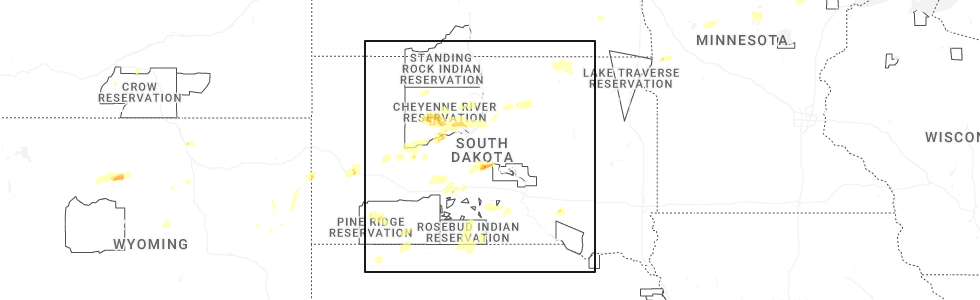
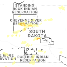
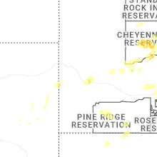
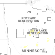
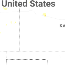
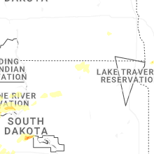
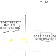
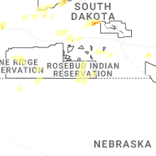
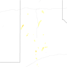
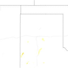
Hail Map for Tuesday, July 22, 2025
Number of Impacted Households on 7/22/2025
0
Impacted by 1" or Larger Hail
0
Impacted by 1.75" or Larger Hail
0
Impacted by 2.5" or Larger Hail
Square Miles of Populated Area Impacted on 7/22/2025
0
Impacted by 1" or Larger Hail
0
Impacted by 1.75" or Larger Hail
0
Impacted by 2.5" or Larger Hail
Cities Most Affected by Hail Storms of 7/22/2025
| Hail Size | Demographics of Zip Codes Affected | ||||||
|---|---|---|---|---|---|---|---|
| City | Count | Average | Largest | Pop Density | House Value | Income | Age |
Hail and Wind Damage Spotted on 7/22/2025
Filter by Report Type:Hail ReportsWind Reports
States Impacted
South Dakota, Texas, Minnesota, Georgia, Florida, South Carolina, Alabama, Colorado, Iowa, TennesseeSouth Dakota
| Local Time | Report Details |
|---|---|
| 10:30 AM CDT | Call from public with estimated winds and 0.77 in rai in brown county SD, 25.6 miles N of Aberdeen, SD |
| 12:15 AM MDT | Storm damage reported in custer county SD, 47.5 miles WSW of Rapid City, SD |
| 2:20 AM MDT | Storm damage reported in pennington county SD, 36.4 miles E of Rapid City, SD |
| 3:35 AM MDT | Storm damage reported in ziebach county SD, 71.6 miles ENE of Rapid City, SD |
| 4:40 AM MDT | Personal weather statio in dewey county SD, 46.5 miles NW of Pierre, SD |
| 6:09 AM CDT | Personal weather statio in sully county SD, 27.9 miles NNW of Pierre, SD |
| 11:15 AM UTC | Storm damage reported in sully county SD, 27 miles NNW of Pierre, SD |
| 5:15 AM MDT | Sd mesonet site near la plan in dewey county SD, 56.2 miles NNW of Pierre, SD |
Texas
| Local Time | Report Details |
|---|---|
| 10:50 AM CDT | Storm damage reported in potter county TX, 6.5 miles E of Amarillo, TX |
| 3:37 PM CDT | Storm damage reported in pecos county TX, 49 miles NE of Alpine, TX |
| 4:39 PM CDT | Storm damage reported in terrell county TX, 90.2 miles ESE of Alpine, TX |
| 9:40 PM CDT | Storm damage reported in lubbock county TX, 16.3 miles SW of Lubbock, TX |
| 10:32 PM CDT | Storm damage reported in lubbock county TX, 11.3 miles W of Lubbock, TX |
| 10:40 PM CDT | Storm damage reported in lamb county TX, 37.5 miles NNW of Lubbock, TX |
Minnesota
| Local Time | Report Details |
|---|---|
| 2:15 PM CDT | Several pontoon boats flipped over on big sandy lake. time estimated from rada in aitkin county MN, 56 miles W of Duluth, MN |
| 2:15 PM CDT | Time estimated from radar. trained spotter said trees were down on powerlines in the are in aitkin county MN, 58.4 miles W of Duluth, MN |
| 2:30 PM CDT | Several small trees down at golf course in emily. course had a lot of standing waters. time estimated from rada in crow wing county MN, 65.5 miles SE of Bemidji, MN |
| 2:50 PM CDT | Several 5 inch diameter oak tree limbs broken of in aitkin county MN, 73.1 miles W of Duluth, MN |
| 3:01 PM CDT | Four large oak trees were down at the spotters location. time estimated by rada in aitkin county MN, 63.2 miles W of Duluth, MN |
| 3:07 PM CDT | A large tree was blown over onto a camper at the eagle point campground on big sandy lake. time estimated by rada in aitkin county MN, 57.1 miles W of Duluth, MN |
| 3:15 PM CDT | Corrects time of previous tstm wnd dmg report from 2 ese libby. several pontoon boats flipped over on big sandy lake. time estimated from rada in aitkin county MN, 56 miles W of Duluth, MN |
| 3:15 PM CDT | Corrects time of previous tstm wnd dmg report from 5 n mcgregor. time estimated from radar. trained spotter said trees were down on powerlines in the are in aitkin county MN, 58.4 miles W of Duluth, MN |
| 8:50 PM CDT | Measured at kax in douglas county MN, 65.4 miles NNE of Montevideo, MN |
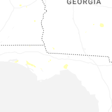
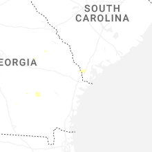
Georgia
| Local Time | Report Details |
|---|---|
| 3:19 PM EDT | Several large... deep rooted trees were reported blown down along parts of us-301 in statesboro by bulloch county emergency management. time estimated based on rada in bulloch county GA, 47.3 miles WNW of Savannah, GA |
Florida
| Local Time | Report Details |
|---|---|
| 3:29 PM EDT | Asos station ktlh tallahassee international airport reported a gust of 60 mp in leon county FL, 5 miles WSW of Tallahassee, FL |
| 3:41 PM EDT | Talquin electric reports downed trees and powerlines in the woodville area. time estimated by rada in leon county FL, 9.1 miles SSE of Tallahassee, FL |
| 5:09 PM EDT | 58 mph wind gust at st. george island bridge weatherste in gmz755 county FL, 62.1 miles SW of Tallahassee, FL |
| 4:40 PM CDT | Social media report of a large pine tree down on highway 22... blocking an eastbound lane of traffi in bay county FL, 51.5 miles ESE of Miramar Beach, FL |
| 5:15 PM CDT | Quarter sized hail reported near Panama City, FL, 38.4 miles E of Miramar Beach, FL, quarter-sized hail reported on hwy 388... east of ecp airport. |
South Carolina
| Local Time | Report Details |
|---|---|
| 3:46 PM EDT | Reports of several trees down along parts of toogoodoo road. reports relayed by charleston county emergency management and a member of the charleston broadcast media. t in charleston county SC, 36.1 miles SSW of Charleston, SC |
| 5:07 PM EDT | Tree down near log hall road and wooden horse run. this was associated with thunderstorm outflow. time estimated based on rada in jasper county SC, 32.3 miles NNE of Savannah, GA |
| 5:19 PM EDT | Tree down along kato bay road near okeetee club road. this was associated with thunderstorm outflow. time estimated based on rada in jasper county SC, 24.5 miles N of Savannah, GA |
| 5:22 PM EDT | Tree down in the 1050 block of tillman road. this was associated with thunerstorm outflow. time estimiated based on rada in jasper county SC, 26.1 miles N of Savannah, GA |
| 6:01 PM EDT | Powerpole down and tree down in the 700 block of shirley stree in jasper county SC, 13.8 miles N of Savannah, GA |
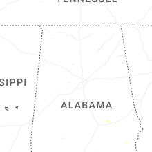
Alabama
| Local Time | Report Details |
|---|---|
| 5:46 PM CDT | Power pole leaning off memorial parkway resulting in power outages. time estimated from rada in madison county AL, 61.3 miles E of Florence, AL |
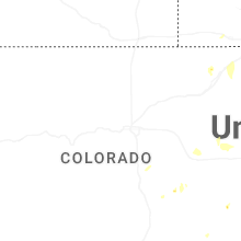
Colorado
| Local Time | Report Details |
|---|---|
| 5:16 PM MDT | Awos station kapa 2 sse centennia in douglas county CO, 14.5 miles SSE of Denver, CO |
| 5:18 PM MDT | Mesonet station co001 i-25 and c47 in douglas county CO, 14 miles SSE of Denver, CO |
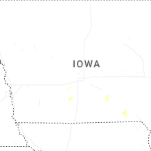
Iowa
| Local Time | Report Details |
|---|---|
| 6:56 PM CDT | Measured at the ottumwa airpor in wapello county IA, 61.1 miles NW of Kahoka, MO |
Tennessee
| Local Time | Report Details |
|---|---|
| 7:00 PM CDT | Several trees were blown down in lawrenceburg including one that fell on a car on 4th s in lawrence county TN, 36.1 miles NNE of Florence, AL |
Connect with Interactive Hail Maps