

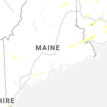
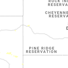
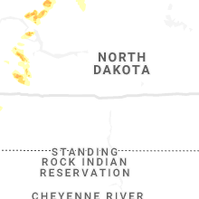
Hail Map for Wednesday, July 31, 2019

Number of Impacted Households on 7/31/2019
0
Impacted by 1" or Larger Hail
0
Impacted by 1.75" or Larger Hail
0
Impacted by 2.5" or Larger Hail
Square Miles of Populated Area Impacted on 7/31/2019
0
Impacted by 1" or Larger Hail
0
Impacted by 1.75" or Larger Hail
0
Impacted by 2.5" or Larger Hail


Cities Most Affected by Hail Storms of 7/31/2019
| Hail Size | Demographics of Zip Codes Affected | ||||||
|---|---|---|---|---|---|---|---|
| City | Count | Average | Largest | Pop Density | House Value | Income | Age |
| Newmarket, NH | 1 | 1.75 | 1.75 | 760 | $141k | $46.1k | 35.9 |
| Erie, KS | 1 | 1.75 | 1.75 | 15 | $44k | $32.1k | 43.7 |
| Portsmouth, NH | 1 | 1.75 | 1.75 | 908 | $170k | $45.6k | 40.6 |
| Edinburg, ND | 1 | 1.75 | 1.75 | 4 | $40k | $31.2k | 50.9 |
| West Jefferson, NC | 1 | 1.75 | 1.75 | 108 | $92k | $28.1k | 45.2 |
Hail and Wind Damage Spotted on 7/31/2019
Filter by Report Type:Hail ReportsWind Reports
States Impacted
Maine, Massachusetts, Pennsylvania, Connecticut, North Carolina, New York, Virginia, New Hampshire, West Virginia, New Jersey, Georgia, South Carolina, Florida, Maryland, Utah, Alabama, North Dakota, Kansas, WyomingMaine
| Local Time | Report Details |
|---|---|
| 11:30 AM EDT | Large tree limbs down at ashland community library. reported via social medi in aroostook county ME, 24.3 miles SW of Caribou, ME |
| 11:55 AM EDT | Large tree down in washburn via social media. time estimated based on rada in aroostook county ME, 8.5 miles SW of Caribou, ME |
| 12:00 PM EDT | Small birch tree down along caribou lake r in aroostook county ME, 5 miles SW of Caribou, ME |
| 12:10 PM EDT | Tree down and blocking rt. 161. time estimated based on rada in aroostook county ME, 4.3 miles NW of Caribou, ME |
| 4:10 PM EDT | Multiple trees down in the vicinity of the i-95 south of the york toll booth in york county ME, 41.1 miles SSW of Portland, ME |
| 4:12 PM EDT | Trees down in york maine blocking long sands and southside r in york county ME, 40.9 miles SSW of Portland, ME |
| 4:48 PM EDT | Trees on wires on river roa in sagadahoc county ME, 33.2 miles NE of Portland, ME |
| 5:42 PM EDT | Numerous trees down in waldobor in lincoln county ME, 54.1 miles NE of Portland, ME |
| 5:46 PM EDT | Trees and wires down on depot s in knox county ME, 47.7 miles SSW of Bangor, ME |
Massachusetts
| Local Time | Report Details |
|---|---|
| 1:26 PM EDT | Quarter sized hail reported near Westfield, MA, 72.8 miles WNW of Providence, RI, amateur radio confirmed by broadcast media |
| 1:30 PM EDT | Tree down blocking road on lockhouse road in hampden county MA, 72.8 miles WNW of Providence, RI |
| 1:47 PM EDT | Quarter sized hail reported near Chicopee, MA, 64.5 miles WNW of Providence, RI, amateur radio |
| 1:50 PM EDT | Tree down on car on beverly street in hampden county MA, 64.5 miles WNW of Providence, RI |
| 1:50 PM EDT | Tractor trailer truck blown over by wind on route 90 mass pike by exit 4 also tree down on highland street which is route 5 at route 9 in hampden county MA, 67 miles WNW of Providence, RI |
| 2:00 PM EDT | Tree down on wires on north street extension in hampden county MA, 64.5 miles WNW of Providence, RI |
| 2:23 PM EDT | Tree down on wires on rte 5 and route 91 in hampden county MA, 61.6 miles WNW of Providence, RI |
| 2:29 PM EDT | Tree down on car on beverly street in hampden county MA, 64.5 miles WNW of Providence, RI |
| 2:42 PM EDT | Tree down on wires on muddy brook street in worcester county MA, 54.4 miles NW of Providence, RI |
| 3:15 PM EDT | Quarter sized hail reported near Auburn, MA, 33.7 miles NW of Providence, RI |
| 3:17 PM EDT | Tree down on wires on southbridge road in worcester county MA, 30.9 miles WNW of Providence, RI |
| 3:27 PM EDT | Tree down on wires on mendell road in worcester county MA, 26 miles NNW of Providence, RI |
| 3:28 PM EDT | Trees down on glenwood and campbell streets in worcester county MA, 46.2 miles NW of Providence, RI |
| 3:30 PM EDT | Storm damage reported in suffolk county MA, 42.4 miles NNE of Providence, RI |
| 3:44 PM EDT | Wires down between western ave and washington and franklin in essex county MA, 50.3 miles NNE of Providence, RI |
| 3:47 PM EDT | Multiple trees down in the annisquam area in essex county MA, 67.4 miles NE of Providence, RI |
| 3:52 PM EDT | Multiple sail boats capsized at cottage park yacht club due to microburst winds 70 to 80 mph in suffolk county MA, 44.3 miles NNE of Providence, RI |
| 3:53 PM EDT | Storm damage reported in suffolk county MA, 42.4 miles NNE of Providence, RI |
| 3:54 PM EDT | Multiple trees down across town in suffolk county MA, 44.3 miles NNE of Providence, RI |
| 4:00 PM EDT | Tree down blocking baywater and annavoy street in suffolk county MA, 38.5 miles NNE of Providence, RI |
| 4:00 PM EDT | Tree down on adams street in suffolk county MA, 38.5 miles NNE of Providence, RI |
| 4:00 PM EDT | Tree down on concord ave and corp burns road in middlesex county MA, 41.2 miles NNE of Providence, RI |
| 4:15 PM EDT | Tree down on washington street in essex county MA, 50.3 miles NNE of Providence, RI |
| 4:26 PM EDT | Multiple trees down across town in essex county MA, 54.6 miles NNE of Providence, RI |
| 4:26 PM EDT | Trees down on ballard street in essex county MA, 48.9 miles NNE of Providence, RI |
| 4:28 PM EDT | Tree down on house on greendale ave in norfolk county MA, 32.7 miles NNE of Providence, RI |
| 4:37 PM EDT | Tree and wires down on washington street in essex county MA, 67.4 miles NE of Providence, RI |
| 5:04 PM EDT | Tree down on buckhorn terrace in suffolk county MA, 44.3 miles NNE of Providence, RI |
Pennsylvania
| Local Time | Report Details |
|---|---|
| 1:38 PM EDT | Mping report of trees uprooted;roof blown off in philadelphia county... p in philadelphia county PA, 71.4 miles SW of Brooklyn, NY |
| 2:49 PM EDT | Report of trees blown dow in chester county PA, 70.4 miles NE of Baltimore, MD |
| 3:00 PM EDT | Trees down. time estimated from rada in montgomery county PA, 82.2 miles WSW of Brooklyn, NY |
| 3:06 PM EDT | Report of trees blown dow in chester county PA, 79 miles NE of Baltimore, MD |
| 3:24 PM EDT | Large tree limbs downed in lafayette hill. time estimated from rada in montgomery county PA, 78.4 miles WSW of Brooklyn, NY |
| 3:24 PM EDT | Trees blown dow in montgomery county PA, 76.8 miles WSW of Brooklyn, NY |
| 3:25 PM EDT | Multiple trees and limbs down. time estimated from rada in montgomery county PA, 78.8 miles WSW of Brooklyn, NY |
| 4:05 PM EDT | Corrects time of previous tstm wnd dmg report from 1 nne holmesburg. metal bleachers thrown across football field and damaged at father judge high school. time estimate in philadelphia county PA, 70.1 miles SW of Brooklyn, NY |
| 6:30 PM EDT | Metal bleachers thrown across football field and damaged at father judge high schoo in philadelphia county PA, 70.1 miles SW of Brooklyn, NY |
| 7:25 PM EDT | Trees and wires down in clearfield county PA, 19.3 miles NW of State College, PA |
Connecticut
| Local Time | Report Details |
|---|---|
| 2:23 PM EDT | Numerous trees and wires down on albany ave in hartford county CT, 69.2 miles W of Providence, RI |
North Carolina
| Local Time | Report Details |
|---|---|
| 2:36 PM EDT | Golf Ball sized hail reported near West Jefferson, NC, 42 miles ESE of Bristol, TN, golf ball size hail now falling in baldwin. |
| 3:17 PM EDT | 2 trees down near the intersection of highway 16 and smithey roa in ashe county NC, 46.9 miles E of Bristol, TN |
| 3:48 PM EDT | Quarter sized hail reported near Hickory, NC, 46.7 miles NW of Charlotte, NC, quarter size hail on george hildebrand school rd near johnson bridge rd. |
| 4:40 PM EDT | 911 call center reported trees down and power outages in the steele creek area. time estimated from rada in mecklenburg county NC, 9 miles SW of Charlotte, NC |
| 4:50 PM EDT | Fire dept/rescue reported trees down on power lines on quail hollow rd in mecklenburg county NC, 6.4 miles S of Charlotte, NC |
| 7:00 PM EDT | 911 call center reported trees down in the boys camp rd area of chimney rock. time estimated from rada in rutherford county NC, 46.7 miles NNE of Greenville, SC |
| 7:15 PM EDT | 911 call center reported trees down near rumbling ridge. time estimated from rada in rutherford county NC, 48.2 miles NNE of Greenville, SC |
| 8:15 PM EDT | Tree dow in guilford county NC, 75 miles WNW of Raleigh, NC |
New York
| Local Time | Report Details |
|---|---|
| 2:42 PM EDT | Robbins reef in anz338 county NY, 4.3 miles WSW of Brooklyn, NY |
Virginia
| Local Time | Report Details |
|---|---|
| 3:04 PM EDT | Power line down across the roadway at the intersection of elizabeth st. and myrtle st. in harrisonburg in rockingham county VA, 62.5 miles ESE of Elkins, WV |
| 3:10 PM EDT | Quarter sized hail reported near Churchville, VA, 59.5 miles SE of Elkins, WV, quarter size hail and several trees down in the 300 block of dry branch road. |
| 3:10 PM EDT | Quarter size hail and several trees down in the 300 block of dry branch roa in augusta county VA, 59.5 miles SE of Elkins, WV |
| 3:25 PM EDT | A few trees down on lanier lane in massanutten... one onto a residenc in rockingham county VA, 70.7 miles ESE of Elkins, WV |
| 3:35 PM EDT | Two trees down on a house on flower driv in rockingham county VA, 71.6 miles ESE of Elkins, WV |
| 3:45 PM EDT | Tree down in the 7100 block of ruth roa in madison county VA, 70.9 miles NNW of Richmond, VA |
| 3:59 PM EDT | A couple of trees blown down onto power lines in the 1800 block of grove hill road. time estimated from rada in botetourt county VA, 16.5 miles N of Roanoke, VA |
| 4:15 PM EDT | Trees down along us-29 southwest of the city of charlottesvill in albemarle county VA, 62.5 miles WNW of Richmond, VA |
| 4:15 PM EDT | Tree down in the 1800 block of dairy roa in greene county VA, 65.9 miles NW of Richmond, VA |
| 4:25 PM EDT | Multiple reports of trees down in the city of charlottesvill in city of charlottes county VA, 59 miles NW of Richmond, VA |
| 4:27 PM EDT | Tree down on va-609 scuffletown road near spring brook roa in orange county VA, 59.8 miles NNW of Richmond, VA |
| 4:30 PM EDT | Several trees down on va-20 in northeastern albemarle count in albemarle county VA, 57.4 miles NW of Richmond, VA |
| 4:30 PM EDT | Tree blown down on old buena vista road near mountain view elementary. time estimated from rada in rockbridge county VA, 47.4 miles NE of Roanoke, VA |
| 4:33 PM EDT | Tree down on us-33 spotswood trail near va-645 magnolia roa in orange county VA, 55 miles NW of Richmond, VA |
| 4:36 PM EDT | Large maple tree snapped over drivewa in orange county VA, 61.6 miles NNW of Richmond, VA |
| 4:44 PM EDT | Tree down in the 11300 block of va-625 porter road. corrected event tim in orange county VA, 55.7 miles NNW of Richmond, VA |
| 4:55 PM EDT | Tree down in the 11300 block of va-625 porter roa in orange county VA, 55.7 miles NNW of Richmond, VA |
| 4:57 PM EDT | Tree down in the 19000 block of va-612 monrovia roa in orange county VA, 52.1 miles NNW of Richmond, VA |
| 5:00 PM EDT | Quarter sized hail reported near Orange, VA, 54 miles NNW of Richmond, VA |
| 5:03 PM EDT | Wires down near the intersection of belmont road and sunset harbor boulevar in spotsylvania county VA, 45.4 miles NNW of Richmond, VA |
| 5:09 PM EDT | Tree down blocking the webster road near the intersection of park drive. time estimated from rada in botetourt county VA, 7.7 miles NE of Roanoke, VA |
| 5:10 PM EDT | Tree and wires down near the intersection of belmont road and sunset harbor boulevard. corrected event tim in spotsylvania county VA, 45.4 miles NNW of Richmond, VA |
| 5:19 PM EDT | Several large branches snapped off of trees along the blue ridge parkway. time estimated with rada in botetourt county VA, 10.4 miles NE of Roanoke, VA |
| 5:33 PM EDT | Tree down in the 10600 block of va-612 catharpin roa in spotsylvania county VA, 50.8 miles N of Richmond, VA |
| 5:42 PM EDT | Tree down in the 10600 block of va-612 catharpin road. corrected event tim in spotsylvania county VA, 50.8 miles N of Richmond, VA |
| 6:04 PM EDT | Two trees and several branches blown down along lee highway... west of its intersection with virginia route 100. time estimated from rada in pulaski county VA, 44.1 miles WSW of Roanoke, VA |
| 6:07 PM EDT | A few trees down at the intersection of jackson river road and falls road. time estimated from rada in alleghany county VA, 42.7 miles N of Roanoke, VA |
| 6:23 PM EDT | A couple of trees reported down in and around the town of glade spring in washington county VA, 28.5 miles ENE of Bristol, TN |
| 6:35 PM EDT | One tree down on glove road on the southeast side of glade spring in washington county VA, 28.7 miles ENE of Bristol, TN |
New Hampshire
| Local Time | Report Details |
|---|---|
| 3:15 PM EDT | Half Dollar sized hail reported near Epping, NH, 60.1 miles SW of Portland, ME, epping coop reported half dollar size hail |
| 3:32 PM EDT | Trees on wires on shirkin rd and beede hill road in freemon in rockingham county NH, 61.6 miles SW of Portland, ME |
| 3:54 PM EDT | Half Dollar sized hail reported near Epping, NH, 60.1 miles SW of Portland, ME, epping coop reported half dollar size hail |
| 3:55 PM EDT | Ping Pong Ball sized hail reported near Portsmouth, NH, 47.6 miles SW of Portland, ME |
| 3:55 PM EDT | Golf Ball sized hail reported near Portsmouth, NH, 47.6 miles SW of Portland, ME, numerous quarter to half dollar sized hail stones. largest stones were golf ball size. |
| 4:05 PM EDT | Trees down in exeter. exeter polic in rockingham county NH, 58.5 miles SW of Portland, ME |
| 4:08 PM EDT | Quarter sized hail reported near Portsmouth, NH, 48.2 miles SW of Portland, ME, picture from teiiter showing quarter size hail. |
| 4:10 PM EDT | Golf Ball sized hail reported near Newmarket, NH, 52.7 miles SW of Portland, ME, twitter photo |
West Virginia
| Local Time | Report Details |
|---|---|
| 3:20 PM EDT | Quarter sized hail reported near Green Spring, WV, 74.1 miles ENE of Elkins, WV |
| 6:07 PM EDT | Several trees down along ingleside road a few miles west of the intersection with interstate 77. time estimated from rada in mercer county WV, 63.9 miles W of Roanoke, VA |
New Jersey
| Local Time | Report Details |
|---|---|
| 3:21 PM EDT | Trees and power lines down on vlietown rd. time estimated from rada in hunterdon county NJ, 38.9 miles W of Brooklyn, NY |
| 3:30 PM EDT | Tree dow in hunterdon county NJ, 60.2 miles W of Brooklyn, NY |
| 3:38 PM EDT | Trees and wires down in far hills. also a report of a house fire in the area; unclear if related to wind damage or a lightning strike. time estimated from rada in somerset county NJ, 34.1 miles W of Brooklyn, NY |
| 3:45 PM EDT | Trees down in beachwood. time estimated from rada in ocean county NJ, 54.5 miles SSW of Brooklyn, NY |
| 4:14 PM EDT | Wires down in cinnaminson. time estimated from rada in burlington county NJ, 71.2 miles SW of Brooklyn, NY |
| 4:20 PM EDT | Wires down in beverly. time estimated from rada in burlington county NJ, 65.7 miles SW of Brooklyn, NY |
| 6:16 PM EDT | Cwop site ew432 in ocean county NJ, 80.8 miles S of Brooklyn, NY |
| 6:23 PM EDT | Cwop site ew432 in ocean county NJ, 80.8 miles S of Brooklyn, NY |
Georgia
| Local Time | Report Details |
|---|---|
| 3:26 PM EDT | Dispatch reported a tree down in a driveway along nugget driv in columbia county GA, 14.7 miles WSW of Augusta, GA |
| 3:35 PM EDT | Trained skywarn spotter reported multiple trees and power lines down on the 800 block of railroad ave in grovetown. time estimate in columbia county GA, 13.3 miles WSW of Augusta, GA |
| 3:35 PM EDT | Columbia co ga sheriffs office reported multiple trees down at 970 reynolds farm rd. time estimate in columbia county GA, 14.3 miles W of Augusta, GA |
| 3:55 PM EDT | Quarter sized hail reported near Rome, GA, 49.9 miles NW of Atlanta, GA, public reported quarter size hail at the intersection of hwy. 411 and biddy rd. |
South Carolina
| Local Time | Report Details |
|---|---|
| 3:34 PM EDT | Sheriffs dispatch reported trees down near the intersection of binnicker bridge road and early morning roa in orangeburg county SC, 55.5 miles E of Augusta, GA |
| 9:08 PM EDT | 911 call center reported power lines down on sugar likker rd. time estimated from rada in pickens county SC, 16.9 miles NW of Greenville, SC |
| 10:00 PM EDT | Amateur radio reported a tree down on n little river r in oconee county SC, 23.2 miles WNW of Greenville, SC |
Florida
| Local Time | Report Details |
|---|---|
| 4:44 PM EDT | Earth networks mesonet site located at the naples municipal airport tower recorded a wind gust of 38 knots /44 mph/ with an offshore moving thunderstor in collier county FL, 1.2 miles NE of Naples, FL |
Maryland
| Local Time | Report Details |
|---|---|
| 5:10 PM EDT | Multiple reports of trees down in prince frederic in calvert county MD, 51.1 miles S of Baltimore, MD |
| 5:29 PM EDT | Tree down in the 5000 block of hardesty road. corrected event tim in calvert county MD, 44.9 miles S of Baltimore, MD |
| 5:30 PM EDT | Tree down in the 5000 block of hardesty roa in calvert county MD, 44.9 miles S of Baltimore, MD |
| 5:45 PM EDT | Tree down on a house in the 4100 block of summer city boulevar in calvert county MD, 43 miles S of Baltimore, MD |
| 6:20 PM EDT | Tree down on wires near the intersection of md-408 mt zion marlboro road and md-259 greenock roa in anne arundel county MD, 32.5 miles S of Baltimore, MD |
Utah
| Local Time | Report Details |
|---|---|
| 3:45 PM MDT | Wendover awos in tooele county UT, 91.9 miles E of Elko, NV |
Alabama
| Local Time | Report Details |
|---|---|
| 5:05 PM CDT | One tree blown down near the intersection of countess road and wayside drive (south of kmdq). power lines and a power pole were also blown down. wind speeds estimated a in madison county AL, 63.4 miles E of Florence, AL |
North Dakota
| Local Time | Report Details |
|---|---|
| 6:15 PM CDT | Quarter sized hail reported near New Town, ND, 51.2 miles ESE of Williston, ND, hail lasted about 3 minutes. nickel to quarter size. |
| 6:18 PM CDT | Ping Pong Ball sized hail reported near New Town, ND, 51.2 miles ESE of Williston, ND, reports from earlier this evening. |
| 5:20 PM MDT | Quarter sized hail reported near Dunn Center, ND, 65.4 miles SE of Williston, ND, lots of quarter and dime sized hail. time estimated by radar. |
| 7:27 PM CDT | Ping Pong Ball sized hail reported near Ross, ND, 48.2 miles E of Williston, ND, also received 1.5 of rainfall. time estimated by radar. |
| 8:05 PM CDT | Quarter sized hail reported near Stanley, ND, 50.5 miles W of Minot, ND, penny to quarter size hail lasted only a minute or so. |
| 7:07 PM MDT | Lots of pea size hail. time estimated from rada in dunn county ND, 75.9 miles SSE of Williston, ND |
| 8:44 PM CDT | Quarter sized hail reported near Donnybrook, ND, 35.2 miles NW of Minot, ND, ongoing at the time of the call. |
| 8:45 PM CDT | Quarter sized hail reported near Glenburn, ND, 19.9 miles N of Minot, ND, hail events lasted from 830 to 845 pm. |
| 9:00 PM CDT | Quarter sized hail reported near Glenburn, ND, 14.2 miles N of Minot, ND, time estimated from radar. |
| 10:05 PM CDT | Quarter sized hail reported near Langdon, ND, 59.5 miles NNE of Devils Lake, ND |
| 12:20 AM CDT | Tree branches down and nickel sized hai in cavalier county ND, 50 miles NNE of Devils Lake, ND |
| 12:24 AM CDT | Golf Ball sized hail reported near Edinburg, ND, 53.2 miles ENE of Devils Lake, ND, a few golf ball sized stones and many smaller ones. road was covered at one point. |
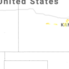
Kansas
| Local Time | Report Details |
|---|---|
| 6:30 PM CDT | Quarter sized hail reported near Ransom, KS, 39.4 miles WSW of Hays, KS, also reports of microburst winds. |
| 7:28 PM CDT | Storm damage reported in rush county KS, 23.5 miles S of Hays, KS |
| 7:43 PM CDT | 2 power poles snappe in ellis county KS, 2.3 miles E of Hays, KS |
| 8:08 PM CDT | Delayed report. spotter estimated 50 to 60 mph wind gusts. time estimated based on rada in barton county KS, 38.4 miles SE of Hays, KS |
| 8:14 PM CDT | Delayed report. north highway 281 is blocked by power poles down about 5 miles north of great bend. time estimated based on rada in barton county KS, 41.5 miles SE of Hays, KS |
| 8:31 PM CDT | Peak gust at the great bend airpor in barton county KS, 44.1 miles SE of Hays, KS |
| 8:33 PM CDT | Delayed report. spotter measured a 64 mph gust at his residence. large tree branches down and outdoor furniture blown 10 feet across the yar in barton county KS, 48 miles SE of Hays, KS |
| 8:39 PM CDT | Delayed report. ellinwood pd reporting numerous cases of power lines and tree branches down in the community. crews are responding for cleanu in barton county KS, 53.8 miles SE of Hays, KS |
| 10:12 PM CDT | Sheriff reported tree limbs down across hwy 68 between florida and delaware road in franklin county KS, 56.9 miles SW of Kansas City, MO |
| 10:45 PM CDT | Half Dollar sized hail reported near Westphalia, KS, 35.7 miles N of Chanute, KS, quarter size hail also was reported. |
| 10:54 PM CDT | Quarter sized hail reported near Topeka, KS, 42.6 miles ESE of Manhattan, KS |
| 10:55 PM CDT | Quarter sized hail reported near Topeka, KS, 44.7 miles ESE of Manhattan, KS, near washburn tech |
| 11:00 PM CDT | Quarter sized hail reported near Topeka, KS, 44.8 miles ESE of Manhattan, KS, near 37th and wanamaker road via social media. |
| 11:10 PM CDT | Half Dollar sized hail reported near Colony, KS, 26.8 miles N of Chanute, KS, from social media |
| 11:15 PM CDT | Quarter sized hail reported near Iola, KS, 21.2 miles N of Chanute, KS, time was estimated |
| 12:15 AM CDT | Storm damage reported in coffey county KS, 44.6 miles NNW of Chanute, KS |
| 12:30 AM CDT | Wind shattered a vinyl fenc in coffey county KS, 39.5 miles NNW of Chanute, KS |
| 12:30 AM CDT | Quarter sized hail reported near Burlington, KS, 39.5 miles NNW of Chanute, KS |
| 12:55 AM CDT | Golf Ball sized hail reported near Erie, KS, 14 miles ESE of Chanute, KS |
| 1:00 AM CDT | Half Dollar sized hail reported near Erie, KS, 14 miles ESE of Chanute, KS |
| 1:32 AM CDT | Storm damage reported in labette county KS, 24.6 miles SSE of Chanute, KS |
Wyoming
| Local Time | Report Details |
|---|---|
| 6:20 PM MDT | Storm damage reported in campbell county WY, 36.4 miles NNW of Gillette, WY |
| 6:30 PM MDT | Aluminum storage shed blown over and destroyed from winds in campbell county WY, 0.9 miles ENE of Gillette, WY |
Connect with Interactive Hail Maps