

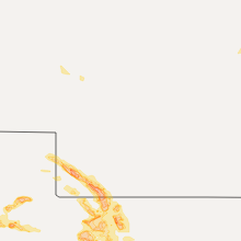
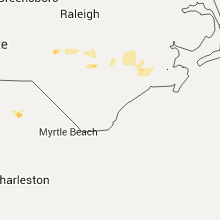
Hail Map for Thursday, July 7, 2016

Number of Impacted Households on 7/7/2016
0
Impacted by 1" or Larger Hail
0
Impacted by 1.75" or Larger Hail
0
Impacted by 2.5" or Larger Hail
Square Miles of Populated Area Impacted on 7/7/2016
0
Impacted by 1" or Larger Hail
0
Impacted by 1.75" or Larger Hail
0
Impacted by 2.5" or Larger Hail


Cities Most Affected by Hail Storms of 7/7/2016
| Hail Size | Demographics of Zip Codes Affected | ||||||
|---|---|---|---|---|---|---|---|
| City | Count | Average | Largest | Pop Density | House Value | Income | Age |
| Atwood, KS | 4 | 2.44 | 2.75 | 4 | $49k | $32.6k | 50.7 |
| Oakley, KS | 2 | 2.88 | 4.00 | 5 | $57k | $32.4k | 45.3 |
| Colorado Springs, CO | 3 | 1.75 | 1.75 | 2319 | $80k | $32.5k | 38.2 |
| Pueblo, CO | 3 | 1.75 | 1.75 | 244 | $85k | $29.3k | 36.2 |
| Bird City, KS | 1 | 4.25 | 4.25 | 1 | $43k | $27.5k | 46.6 |
| Saint Francis, KS | 1 | 3.00 | 3.00 | 2 | $50k | $31.4k | 51.1 |
| Stratton, NE | 1 | 2.75 | 2.75 | 1 | $38k | $26.1k | 50.9 |
| Osage, MN | 1 | 2.75 | 2.75 | 12 | $92k | $37.0k | 48.9 |
| Goodland, KS | 1 | 2.00 | 2.00 | 9 | $65k | $33.1k | 41.5 |
| Colby, KS | 1 | 1.75 | 1.75 | 13 | $79k | $37.3k | 35.7 |
| Midland, TX | 1 | 1.75 | 1.75 | 26 | $72k | $36.9k | 33.4 |
| Onawa, IA | 1 | 1.75 | 1.75 | 23 | $63k | $35.8k | 45.7 |
| Fort Stockton, TX | 1 | 1.75 | 1.75 | 6 | $41k | $27.4k | 36.2 |
Hail and Wind Damage Spotted on 7/7/2016
Filter by Report Type:Hail ReportsWind Reports
States Impacted
Missouri, Tennessee, Illinois, New York, Vermont, South Carolina, Kentucky, Rhode Island, Wisconsin, Indiana, Massachusetts, North Dakota, Connecticut, Florida, North Carolina, Nebraska, Minnesota, Iowa, Michigan, Texas, Colorado, Ohio, Kansas, VirginiaMissouri
| Local Time | Report Details |
|---|---|
| 7:02 AM CDT | Storm damage reported in knox county MO, 37.2 miles SW of Kahoka, MO |
| 7:02 AM CDT | Limbs down along highway 124 east. near centralia in boone county MO, 20.9 miles NNE of Columbia, MO |
| 7:11 AM CDT | Trees down reported by count in shelby county MO, 40.6 miles SSW of Kahoka, MO |
| 7:11 AM CDT | Trees down on highway 36 in shelby county MO, 53.2 miles SSW of Kahoka, MO |
| 7:11 AM CDT | Several utility poles downed along highway 54 near north callaway high schoo in callaway county MO, 21.2 miles E of Columbia, MO |
| 7:15 AM CDT | Several large trees down... power lines down... damage to roof of large shed in callaway county MO, 18.7 miles SE of Columbia, MO |
| 7:15 AM CDT | Several large trees uprooted... one tree fell on a house... and a lot of branches and debris all over town. power lines were also dow in monroe county MO, 40.6 miles NNE of Columbia, MO |
| 7:16 AM CDT | Three large trees snapped. komu social media acc in callaway county MO, 24.4 miles SSE of Columbia, MO |
| 7:18 AM CDT | Three large trees snapped. komu social media acc in callaway county MO, 24.4 miles SSE of Columbia, MO |
| 7:30 AM CDT | Large tree limbs broken at residence in monroe county MO, 53.2 miles S of Kahoka, MO |
| 7:30 AM CDT | Roof off house in audrain county MO, 23.4 miles ENE of Columbia, MO |
| 7:30 AM CDT | Severe thunderstorm wind gusts downed a large tree at the alhonna resort and marina on lake of the ozark in camden county MO, 55.9 miles SSW of Columbia, MO |
| 7:31 AM CDT | Large tree limbs down. up to 8 inch diamete in audrain county MO, 29.1 miles ENE of Columbia, MO |
| 7:46 AM CDT | Large ttree down at residenc in montgomery county MO, 44.4 miles E of Columbia, MO |
| 7:51 AM CDT | Power lines down relayed by county emergency manage in ralls county MO, 60.4 miles SSE of Kahoka, MO |
| 8:40 AM CDT | Large tree limbs down near s us hwy 6 in phelps county MO, 21.1 miles NW of Salem, MO |
| 8:43 AM CDT | Storm damage reported in st. charles county MO, 38.8 miles WNW of Saint Louis, MO |
| 9:30 AM CDT | Tree branches down... less than 3 inch diameter in st. louis county MO, 8.6 miles WSW of Saint Louis, MO |
| 11:34 AM CDT | Trees down on hwy 51 near zalm in bollinger county MO, 31.6 miles WSW of Cape Girardeau, MO |
| 12:00 PM CDT | Late report. intersection of county highways 332 and 333 two mobile homes damaged. one lost a roof and the second lost front porch. central portion of the county had 8 in scott county MO, 14 miles S of Cape Girardeau, MO |
| 12:04 PM CDT | Winds estimate in scott county MO, 14.9 miles SSE of Cape Girardeau, MO |
| 12:04 PM CDT | Winds estimate in scott county MO, 14.9 miles SSE of Cape Girardeau, MO |
| 12:15 PM CDT | Downed trees and power line in scott county MO, 5.8 miles S of Cape Girardeau, MO |
| 11:40 PM CDT | Power lines down and tree debris in moundville. porch torn off a mobile home at a unspecified distance southwest of nevad in vernon county MO, 55.2 miles E of Chanute, KS |
| 12:25 AM CDT | Several trees and power poles have been downed by severe thunderstorm wind gusts across the western half of jasper count in jasper county MO, 64.8 miles SE of Chanute, KS |
| 12:31 AM CDT | Several large tree limbs were ripped out of trees within the city of stockto in cedar county MO, 43.9 miles NW of Springfield, MO |
| 12:31 AM CDT | *** 1 inj *** severe thunderstorm wind gusts downed a large tree through a house in south joplin. one female was injured as the tree fell on he in newton county MO, 67.3 miles SE of Chanute, KS |
| 12:45 AM CDT | Severe thunderstorm wind gusts downed a tree on a car at the newton county fairground in newton county MO, 64 miles WSW of Springfield, MO |
| 1:00 AM CDT | 3-4 inch diameter branches off of a healthy tree. time estimated based on rada in greene county MO, 12 miles SW of Springfield, MO |
| 4:30 AM CDT | Several large tree limbs and a couple of trees blown around town...some of which were blocking roadway in st. francois county MO, 58.7 miles NW of Cape Girardeau, MO |
Tennessee
| Local Time | Report Details |
|---|---|
| 7:05 AM CDT | A tree was in the road at veterans pkwy and parkwood r in rutherford county TN, 31 miles SE of Nashville, TN |
| 7:05 AM CDT | Two trees down in fairview on horn tavern road at cleveland drive and highway 96 at dice lampley road in williamson county TN, 23.1 miles SW of Nashville, TN |
| 2:30 PM CDT | Trees reported dow in robertson county TN, 29.1 miles NNW of Nashville, TN |
| 2:42 PM CDT | Trees reported dow in montgomery county TN, 40.2 miles NW of Nashville, TN |
| 2:50 PM CDT | Tree down on car off main street in portland in sumner county TN, 32.5 miles NNE of Nashville, TN |
| 3:10 PM CDT | Numerous trees and power lines down all across sumner county in sumner county TN, 40 miles NE of Nashville, TN |
| 3:14 PM CDT | Tree on house in hendersonville in sumner county TN, 13.1 miles NE of Nashville, TN |
| 3:24 PM CDT | Several reports of trees down in lafayette. white road... new harmony road... chaffin road. time estimated by rada in macon county TN, 48.3 miles ENE of Nashville, TN |
| 3:30 PM CDT | Several reports of trees down in and around hartsville. one was on hall town road... another on canoe branch... and another on thompson lane. time estimated by rada in trousdale county TN, 37.8 miles ENE of Nashville, TN |
| 3:30 PM CDT | Trees down near the railroad tracks in lebanon in wilson county TN, 25.8 miles E of Nashville, TN |
| 3:35 PM CDT | Report of a tree down blocking roadwa in wilson county TN, 25.8 miles E of Nashville, TN |
| 3:43 PM CDT | Trees down all across gainesboro and numerous trees down in jackson count in jackson county TN, 64.4 miles ENE of Nashville, TN |
| 3:48 PM CDT | Trees down reported near kempville... tn. time estimated based on rada in smith county TN, 52.8 miles ENE of Nashville, TN |
| 4:00 PM CDT | Trees reported down in carthage... tn. time estimated by rada in smith county TN, 46.6 miles E of Nashville, TN |
| 4:00 PM CDT | Overton county ema reported numerous trees down across the county and watched 2 trees get blown down from the 911 center. power pole fires reported and power lines down in overton county TN, 82.3 miles E of Nashville, TN |
| 4:00 PM CDT | Trees reported down on hiawassee roa in smith county TN, 39 miles ENE of Nashville, TN |
| 4:07 PM CDT | Overton county ema reported numerous trees down across the county and watched 2 trees get blown down from the 911 center. power pole fires reported and power lines down in overton county TN, 82.3 miles E of Nashville, TN |
| 4:10 PM CDT | Trees and power lines down across putnam county in putnam county TN, 70.9 miles E of Nashville, TN |
| 4:20 PM CDT | 2 trees down near home between clarkrange and allardt in fentress county TN, 60.3 miles WNW of Knoxville, TN |
| 4:24 PM CDT | Several reports of trees down in the belk communit in de kalb county TN, 59.6 miles NNW of Chattanooga, TN |
| 4:29 PM CDT | Trees down betterton road in white county in white county TN, 60.1 miles NNW of Chattanooga, TN |
| 4:33 PM CDT | Several trees reported down via scanne in fentress county TN, 60.6 miles WNW of Knoxville, TN |
| 4:37 PM CDT | Several trees down along old kentucky highway south through white county in white county TN, 62.3 miles NNW of Chattanooga, TN |
| 4:37 PM CDT | Tree down on quebec road in white county TN, 54.5 miles NNW of Chattanooga, TN |
| 4:39 PM CDT | Several trees down around sparta in white county TN, 61.6 miles N of Chattanooga, TN |
| 4:40 PM CDT | Power pole snapped in tabor area and a few trees down in rinnie are in cumberland county TN, 61.3 miles W of Knoxville, TN |
| 4:40 PM CDT | Several trees reported down on highway 154... and in highway 10 sout in fentress county TN, 65.5 miles WNW of Knoxville, TN |
| 5:51 PM EDT | Trees down in glenmary and niggs creek roa in scott county TN, 49.7 miles NW of Knoxville, TN |
| 5:55 PM EDT | Trees downed throughout count in morgan county TN, 46.1 miles WNW of Knoxville, TN |
| 5:00 PM CDT | A few trees down along hwy 101 at beaver dam cree in bledsoe county TN, 46.8 miles N of Chattanooga, TN |
| 6:20 PM EDT | A large tree was down at hwy 297 near town of pionee in campbell county TN, 37.2 miles NNW of Knoxville, TN |
| 6:35 PM EDT | Couple of trees down near the claiborne/campbell county lin in claiborne county TN, 40.7 miles N of Knoxville, TN |
| 6:50 PM EDT | A few trees were snapped or uproote in monroe county TN, 39.1 miles SW of Knoxville, TN |
| 6:53 PM EDT | Large tree blown down...taking down power line in sevier county TN, 22.6 miles SE of Knoxville, TN |
| 7:00 PM EDT | A few trees downed near maynardvill in union county TN, 20.9 miles NNE of Knoxville, TN |
| 7:00 PM EDT | A few trees down near wears valle in sevier county TN, 22.6 miles SE of Knoxville, TN |
| 7:05 PM EDT | Several trees downed. many residents without powe in knox county TN, 15.8 miles WSW of Knoxville, TN |
| 7:35 PM EDT | Multiple trees down across northern jefferson count in jefferson county TN, 28.6 miles ENE of Knoxville, TN |
| 7:45 PM EDT | Numerous trees down county-wid in jefferson county TN, 26.5 miles ENE of Knoxville, TN |
| 7:50 PM EDT | Numerous trees down county-wid in sevier county TN, 19.7 miles ESE of Knoxville, TN |
| 8:10 PM EDT | Numerous trees down across the east part of the count in cocke county TN, 43.8 miles E of Knoxville, TN |
Illinois
| Local Time | Report Details |
|---|---|
| 8:05 AM CDT | Quarter sized hail reported near Quincy, IL, 38.1 miles SSE of Kahoka, MO, occurred at 24th and locust |
| 8:11 AM CDT | Storm damage reported in adams county IL, 43.1 miles SE of Kahoka, MO |
| 8:20 AM CDT | Est 50-60 mph in adams county IL, 43.2 miles SE of Kahoka, MO |
| 8:46 AM CDT | Trees down in the are in brown county IL, 63.4 miles ESE of Kahoka, MO |
| 9:08 AM CDT | Large tree limb on road on west side to town in morgan county IL, 75.1 miles SSW of Peoria, IL |
| 12:10 PM CDT | Trees down across a few roads in miller city. a few tree tops blown out at horseshoe lake are in alexander county IL, 16.7 miles SE of Cape Girardeau, MO |
| 12:26 PM CDT | Late report. trees on homes with damage reported. local power outage in saline county IL, 57.9 miles W of Evansville, IN |
New York
| Local Time | Report Details |
|---|---|
| 1:18 PM EDT | Trees down on worman road in essex county NY, 23.1 miles SSW of Burlington, VT |
Vermont
| Local Time | Report Details |
|---|---|
| 1:40 PM EDT | Tree down on rt. 7 by georgia town office in franklin county VT, 18.1 miles NNE of Burlington, VT |
| 1:52 PM EDT | Broken power pole casued by falling trees in franklin county VT, 20.5 miles NNE of Burlington, VT |
| 2:00 PM EDT | Trees down at 3 corners and on rugg road in franklin county VT, 20.6 miles NE of Burlington, VT |
| 2:03 PM EDT | Lareg tree broke pole causing power outage in addison county VT, 21.2 miles S of Burlington, VT |
| 2:15 PM EDT | Quarter sized hail reported near Cambridge, VT, 20.6 miles NE of Burlington, VT |
| 2:30 PM EDT | Tree down in road in chittenden county VT, 8.7 miles E of Burlington, VT |
| 2:40 PM EDT | Trees down on poker hill road... meadow lane... fox run... and sugar hill in chittenden county VT, 13.5 miles ENE of Burlington, VT |
South Carolina
| Local Time | Report Details |
|---|---|
| 1:57 PM EDT | A downed tree was reported on valley brook r in greenville county SC, 14.6 miles SE of Greenville, SC |
| 2:00 PM EDT | Schp reported a tree down at piedmont golf course rd and lake el-jema dr in greenville county SC, 12.8 miles SE of Greenville, SC |
| 2:06 PM EDT | Schp reported a tree down at jc cooper rd. and bethany r in laurens county SC, 25.7 miles ESE of Greenville, SC |
| 2:43 PM EDT | Schp reported a tree down at i-385sb and i-26 in laurens county SC, 47.1 miles ESE of Greenville, SC |
| 2:44 PM EDT | Tree down off ridge rd northeast of clinton... s in laurens county SC, 50.1 miles ESE of Greenville, SC |
| 3:07 PM EDT | Sheriff dispatch reported trees and limbs down near the intersection of hwy. 66 and little egypt roa in newberry county SC, 60.6 miles ESE of Greenville, SC |
| 3:07 PM EDT | Sheriff dispatch reported trees down near duckett stree in newberry county SC, 60.3 miles ESE of Greenville, SC |
| 3:08 PM EDT | Sheriff dispatch reported power lines down at the intersection of gary street and sinclair avenue in whitmir in newberry county SC, 60.8 miles ESE of Greenville, SC |
| 3:17 PM EDT | Public reported through social media of several limbs down and a few trees down in the community of maybinton in ne newberry county. in newberry county SC, 64.6 miles SW of Charlotte, NC |
| 3:45 PM EDT | Highway patrol reported trees down at old chester highway and hwy. 20 in fairfield county SC, 59.2 miles SSW of Charlotte, NC |
| 3:48 PM EDT | Highway patrol reported trees down near the intersection of hwy. 34 and i-7 in fairfield county SC, 63.6 miles S of Charlotte, NC |
| 3:48 PM EDT | Highway patrol reported trees down along east peach road from hwy. 321 to syrup mill roa in fairfield county SC, 66.2 miles S of Charlotte, NC |
| 4:13 PM EDT | Several reports of trees and power lines down in and around the town of lugof in kershaw county SC, 69 miles S of Charlotte, NC |
| 4:18 PM EDT | Several reports of trees and power lines down in and around the city of camden. power out throughout the city. in kershaw county SC, 67.6 miles S of Charlotte, NC |
| 4:31 PM EDT | Dispatch reported several trees down in the eastbound lane of i-20 near mile marker 11 in lee county SC, 73.2 miles NNW of Charleston, SC |
| 4:33 PM EDT | Public reported through social media of power lines and outages down in the community of cassat in kershaw county SC, 63.8 miles SSE of Charlotte, NC |
| 4:38 PM EDT | Dispatch reported several trees and power lines down in the lucknow community. in lee county SC, 69.6 miles SSE of Charlotte, NC |
| 4:50 PM EDT | Power company reported outages in the mcbee area due to damage to power lines from downed trees and and limbs. in chesterfield county SC, 61.1 miles SSE of Charlotte, NC |
| 4:59 PM EDT | Tree in roadway kellytown and tema r in darlington county SC, 72 miles SSE of Charlotte, NC |
| 5:01 PM EDT | Dispatch reported trees down along ousleydale roa in chesterfield county SC, 64.1 miles SE of Charlotte, NC |
| 5:05 PM EDT | Power lines in roadwa in darlington county SC, 74.7 miles N of Charleston, SC |
| 5:09 PM EDT | Tree in roadway s fourth st and swift creek r in darlington county SC, 73.2 miles SE of Charlotte, NC |
| 5:15 PM EDT | A large tree reporedly fell onto a house on green street road. no information passed along as to the extent of house damage. the time was estimated based on radar dat in darlington county SC, 72.8 miles N of Charleston, SC |
| 5:25 PM EDT | Tree in roadway s mccurdy rd and beckys pkw in florence county SC, 70.8 miles NNE of Charleston, SC |
| 5:26 PM EDT | Storm damage reported in florence county SC, 70.5 miles NNE of Charleston, SC |
| 5:27 PM EDT | Tree in roadway oak grove rd and olanta hwy in florence county SC, 57.5 miles N of Charleston, SC |
| 5:29 PM EDT | Tree in roadway s cashua dr and cypress p in florence county SC, 68.8 miles N of Charleston, SC |
| 5:50 PM EDT | Large tree down on mt. zion church rd in marlboro county SC, 78.6 miles ESE of Charlotte, NC |
| 5:50 PM EDT | Power lines in roadway pendeboro and bluff rd in marion county SC, 75.7 miles NNE of Charleston, SC |
| 6:05 PM EDT | Large tree down across power lines at hyman road and two notch road in florence county SC, 61 miles NNE of Charleston, SC |
| 6:10 PM EDT | Tree down hwy s308 and page r in horry county SC, 71.5 miles W of Wilmington, NC |
| 6:20 PM EDT | Trees down...second hand report through asbury vfd in cherokee county SC, 48.7 miles WSW of Charlotte, NC |
| 6:42 PM EDT | Ping Pong Ball sized hail reported near Pacolet, SC, 49.9 miles WSW of Charlotte, NC |
| 6:53 PM EDT | Trees down on the intersection of union highway and grindall ford road. also 1/2 inch hai in cherokee county SC, 49.9 miles WSW of Charlotte, NC |
| 7:11 PM EDT | County comms reports scattered trees and power lines down across the eastern half of the county...including locales near edgemoor...richburg and great fall in chester county SC, 39 miles SSW of Charlotte, NC |
| 7:34 PM EDT | Dispatch reported 3 trees down near the intersection of hwy. 200 and hwy. 97 near great falls. in lancaster county SC, 43 miles S of Charlotte, NC |
| 8:08 PM EDT | Trees down along hwy. 321 near the county line. in fairfield county SC, 49.4 miles SSW of Charlotte, NC |
| 8:12 PM EDT | Trees down near the intersection of heritage road and hwy. 90 in fairfield county SC, 47.5 miles SSW of Charlotte, NC |
| 8:13 PM EDT | Reported numerous trees down and power outages in the blackstock area with several roads blocked. in fairfield county SC, 49.6 miles SSW of Charlotte, NC |
| 8:32 PM EDT | Trees down in the winnsboro mills area. in fairfield county SC, 61 miles SSW of Charlotte, NC |
| 8:36 PM EDT | Reported trees down in the community of ashlan in lee county SC, 70.8 miles SSE of Charlotte, NC |
| 8:46 PM EDT | Highway patrol reported trees down along the westbound lane of i-20 near mile marker 11 in lee county SC, 72 miles NNW of Charleston, SC |
| 8:51 PM EDT | Tree in roadway cottonflower and newman swamp rd in darlington county SC, 68.6 miles N of Charleston, SC |
| 8:57 PM EDT | Reported trees down along horse pen roa in lee county SC, 72.7 miles NNW of Charleston, SC |
| 8:58 PM EDT | Trees down along browntown roa in lee county SC, 71.5 miles NNW of Charleston, SC |
| 9:03 PM EDT | Schp reported tree down along blackstock road in chester county SC, 49 miles SSW of Charlotte, NC |
| 9:07 PM EDT | Scattered trees downed between leeds...cornwell and blackstoc in chester county SC, 51.5 miles SSW of Charlotte, NC |
| 9:13 PM EDT | Trees and a power line dow in anderson county SC, 15.1 miles SW of Greenville, SC |
| 9:21 PM EDT | Trees down near cannery road and queen chapel road. in sumter county SC, 61.4 miles NNW of Charleston, SC |
| 9:23 PM EDT | Reports of several trees down in the vicinity of red hill church roa in fairfield county SC, 52.2 miles SSW of Charlotte, NC |
| 9:24 PM EDT | Reported trees down near the intersection of queen chapel road and ebenezer roa in sumter county SC, 61 miles NNW of Charleston, SC |
| 9:27 PM EDT | Trees down near the intersection of smallstown road and hwy. 20 in fairfield county SC, 55.8 miles SSW of Charlotte, NC |
| 9:45 PM EDT | Tree in roadway 3040 center church r in marion county SC, 71.8 miles W of Wilmington, NC |
| 9:45 PM EDT | Tree down on cattle drive at highway 4 in laurens county SC, 41.8 miles ESE of Greenville, SC |
| 9:52 PM EDT | A couple of trees down in the city of laurens...one on a hous in laurens county SC, 39.7 miles SE of Greenville, SC |
| 9:54 PM EDT | Storm damage reported in laurens county SC, 43.1 miles ESE of Greenville, SC |
| 10:04 PM EDT | Trees down in the winnsboro mills area. in fairfield county SC, 61 miles SSW of Charlotte, NC |
| 10:22 PM EDT | Trees down near clara brown road and hwy. 39 in newberry county SC, 54.4 miles NNE of Augusta, GA |
| 10:28 PM EDT | Trees down near the community of jorda in clarendon county SC, 32.4 miles NNW of Charleston, SC |
| 10:38 PM EDT | Reported trees down along st. peters church road from lee roy frick lane to dreher island roa in lexington county SC, 56.9 miles NE of Augusta, GA |
| 10:55 PM EDT | Trees down near old bush river road and saluda shoals par in lexington county SC, 59.9 miles NE of Augusta, GA |
| 11:05 PM EDT | Trees down near langford crossroad in richland county SC, 69.9 miles S of Charlotte, NC |
| 11:14 PM EDT | Highway patrol reported trees down along southbound lane of i-95 at the 129 mile marker. in clarendon county SC, 43.7 miles N of Charleston, SC |
Kentucky
| Local Time | Report Details |
|---|---|
| 1:08 PM CDT | Late report. tree uprooted from stor in mccracken county KY, 53.6 miles ESE of Cape Girardeau, MO |
| 1:15 PM CDT | Multiple trees down with power outages throughout the communit in mccracken county KY, 51.5 miles ESE of Cape Girardeau, MO |
| 1:24 PM CDT | Power outages reported throughout the community in mccracken county KY, 59.5 miles ESE of Cape Girardeau, MO |
| 1:39 PM CDT | Late report. large trees down 2 miles south of barkley regional airpor in mccracken county KY, 47 miles ESE of Cape Girardeau, MO |
| 1:41 PM CDT | Late report. tree uprooted from stor in mccracken county KY, 53.6 miles ESE of Cape Girardeau, MO |
| 1:59 PM CDT | Storm damage reported in caldwell county KY, 61.5 miles SSW of Evansville, IN |
| 2:04 PM CDT | Large tree limbs down in henderson county KY, 9.5 miles S of Evansville, IN |
| 2:05 PM CDT | Winds estimated 60 to 70 mph with downed trees and powerlines reporte in hopkins county KY, 44 miles S of Evansville, IN |
| 2:12 PM CDT | Several trees down... signs down... telephones leanin in hopkins county KY, 44 miles S of Evansville, IN |
| 2:12 PM CDT | Trees reported down throughout the communit in daviess county KY, 28.5 miles ESE of Evansville, IN |
| 2:15 PM CDT | Trees down blocking roadways. lightning struck a power pole which is down... on fire... and blocking roadwa in daviess county KY, 35.5 miles SE of Evansville, IN |
| 2:15 PM CDT | Winds estimated 65 to 70 mph occurring on northwest side of the communti in daviess county KY, 28.5 miles ESE of Evansville, IN |
| 2:23 PM CDT | Tree limb across power pole which is on fir in daviess county KY, 38.5 miles ESE of Evansville, IN |
| 2:25 PM CDT | Trees down between russellville and adairvill in logan county KY, 40.4 miles N of Nashville, TN |
| 2:28 PM CDT | Tree downed on a power line blocking sand hill roa in hancock county KY, 36.9 miles E of Evansville, IN |
| 2:29 PM CDT | Tree down blocking thruston dermont road in daviess county KY, 28.5 miles ESE of Evansville, IN |
| 2:32 PM CDT | Multiple power lines and trees down throughout the count in hopkins county KY, 44 miles S of Evansville, IN |
| 2:35 PM CDT | Trees and power lines down multiple locations in the count in logan county KY, 46.8 miles N of Nashville, TN |
| 2:35 PM CDT | At ohio county kentucky mesonet sit in ohio county KY, 52 miles SE of Evansville, IN |
| 2:46 PM CDT | Tree limb across power pole which is on fir in daviess county KY, 38.5 miles ESE of Evansville, IN |
| 2:46 PM CDT | Trees down blocking roadways. lightning struck a power pole which is down... on fire... and blocking roadwa in daviess county KY, 35.5 miles SE of Evansville, IN |
| 2:50 PM CDT | Several large trees down in and around frankli in simpson county KY, 40.3 miles NNE of Nashville, TN |
| 2:50 PM CDT | 100 pound roof blown off livestock building and blown 50 feet. trees with 5 to 6 inch branches were damage in edmonson county KY, 59.4 miles SW of Louisville, KY |
| 2:55 PM CDT | Storm damage reported in butler county KY, 70.5 miles SE of Evansville, IN |
| 2:55 PM CDT | Trees down. some county roads impassable due to high wate in simpson county KY, 40.5 miles NNE of Nashville, TN |
| 3:00 PM CDT | Multiple trees and power lines downed throughout the county. many roads closed due to high wate in allen county KY, 51.5 miles NE of Nashville, TN |
| 3:09 PM CDT | Trees downe in warren county KY, 55.8 miles NNE of Nashville, TN |
| 3:15 PM CDT | Tree uproote in grayson county KY, 47 miles SW of Louisville, KY |
| 3:18 PM CDT | Large trees snapped along morrison roa in grayson county KY, 39.2 miles SW of Louisville, KY |
| 3:20 PM CDT | Part of a roof blown off a buildin in barren county KY, 69 miles S of Louisville, KY |
| 3:30 PM CDT | Numerous trees down in horse cave and munfordvill in hart county KY, 43.1 miles SSW of Louisville, KY |
| 3:30 PM CDT | Trees and power lines down county wide. in monroe county KY, 70.9 miles ENE of Nashville, TN |
| 4:35 PM EDT | Trees down on roadways near us 62 and ky 8 in hardin county KY, 33.2 miles SSW of Louisville, KY |
| 3:40 PM CDT | Tree snapped on despain roa in green county KY, 39.4 miles S of Louisville, KY |
| 3:45 PM CDT | Tree on a structure on water street in greensburg. other trees down county wid in green county KY, 51.6 miles SSE of Louisville, KY |
| 4:48 PM EDT | Measured 55 mph wind gust. trees dow in larue county KY, 36.4 miles S of Louisville, KY |
| 3:50 PM CDT | Numerous large trees dow in clinton county KY, 83.8 miles NW of Knoxville, TN |
| 4:57 PM EDT | Power lines down near the amazon fulfillment cente in taylor county KY, 49.2 miles SSE of Louisville, KY |
| 4:57 PM EDT | 1 tree down off 44 west in the western part of the count in bullitt county KY, 7.8 miles W of Louisville, KY |
| 5:00 PM EDT | Large tree down across roadwa in hardin county KY, 13.5 miles WSW of Louisville, KY |
| 4:05 PM CDT | Roof damaged at a busines in adair county KY, 65.2 miles SSE of Louisville, KY |
| 5:10 PM EDT | Numerous trees down around the county. many roads blocked by downed trees. roof damage to a building near the adair county lin in taylor county KY, 48.4 miles SSE of Louisville, KY |
| 5:10 PM EDT | Large tree limbs fell and damaged a swing set on blue hole roa in taylor county KY, 51.5 miles SSE of Louisville, KY |
| 4:12 PM CDT | Radio antenna snapped just above the bas in russell county KY, 78.1 miles SSE of Louisville, KY |
| 4:15 PM CDT | Multiple trees down across the count in clinton county KY, 83.7 miles NW of Knoxville, TN |
| 4:16 PM CDT | Trees down on green acres roa in russell county KY, 76.8 miles SSE of Louisville, KY |
| 4:18 PM CDT | Trees down on clifty creek roa in russell county KY, 81.2 miles SW of Irvine, KY |
| 5:19 PM EDT | Large tree uproote in nelson county KY, 18.2 miles SE of Louisville, KY |
| 5:25 PM EDT | Tree snapped near its base. large limbs down between liberty and the marion county line. large tree blocking highway 49 northwest of libert in casey county KY, 56.8 miles SE of Louisville, KY |
| 5:36 PM EDT | Trees down on highway 776 at denny ga in wayne county KY, 71.6 miles NW of Knoxville, TN |
| 5:36 PM EDT | Trees down on boone and stokes street in wayne county KY, 76.4 miles SW of Irvine, KY |
| 5:36 PM EDT | Trees down on valley view driv in pulaski county KY, 65.4 miles SW of Irvine, KY |
| 5:45 PM EDT | Trees and power lines down across the county. ongoing power outage in mccreary county KY, 62.1 miles NNW of Knoxville, TN |
| 5:48 PM EDT | Trees down on jacksboro roa in pulaski county KY, 60.5 miles SW of Irvine, KY |
| 5:48 PM EDT | Trees down on jessie lan in pulaski county KY, 55.2 miles SW of Irvine, KY |
| 6:18 PM EDT | Trees down on prewitts bend roa in whitley county KY, 58.9 miles NNW of Knoxville, TN |
| 6:18 PM EDT | Trees down on ellison ben in whitley county KY, 47.4 miles NNW of Knoxville, TN |
| 6:21 PM EDT | Trees down on tidal wave roa in whitley county KY, 59.6 miles S of Irvine, KY |
| 6:30 PM EDT | Trees down on highway 343 in knox county KY, 56 miles S of Irvine, KY |
Rhode Island
| Local Time | Report Details |
|---|---|
| 2:10 PM EDT | Tree down on rte 12 and seven mile road in providence county RI, 10.9 miles W of Providence, RI |
Wisconsin
| Local Time | Report Details |
|---|---|
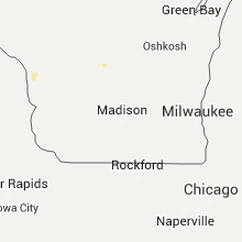
| 1:28 PM CDT | Numerous trees down in waupun. one tree on a house. probable wet microburst. time estimated from rada in dodge county WI, 50.4 miles NE of Madison, WI |
| 2:30 PM CDT | Tree limbs greater than 2 inches down. minor street floodin in fond du lac county WI, 59.4 miles SSW of Green Bay, WI |
Indiana
| Local Time | Report Details |
|---|---|
| 1:43 PM CDT | Event occurring along the west side of tow in vanderburgh county IN, 1.3 miles E of Evansville, IN |
| 1:46 PM CDT | Measured in the downtown area. large tree limbs falling. 50 mph winds reported on north side of tow in vanderburgh county IN, 1.3 miles E of Evansville, IN |
| 1:47 PM CDT | Winds estimated at the civic center to be 60 to 70 mph in vanderburgh county IN, 1.3 miles E of Evansville, IN |
| 1:49 PM CDT | 4 to 6 inch diameter tree limbs down near the universit in vanderburgh county IN, 1.3 miles E of Evansville, IN |
| 1:50 PM CDT | Measured near deconess hospital with some shingles blown off of nearby roof in vanderburgh county IN, 1.3 miles E of Evansville, IN |
| 1:50 PM CDT | Measured near deconess hospital with some shingles blown off of nearby roof in vanderburgh county IN, 1.3 miles E of Evansville, IN |
| 1:50 PM CDT | Late report. large tree down pulling up sidewalk and roadway in vanderburgh county IN, 7.8 miles N of Evansville, IN |
| 1:54 PM CDT | Wind measured one half mile west of sharon school. tree limbs down. torrential rain reported with the stor in warrick county IN, 9.2 miles ESE of Evansville, IN |
| 1:55 PM CDT | Mutiple trees and power lines down throughout the community. east side of town without power. winds estimated 60 mp in vanderburgh county IN, 1.3 miles E of Evansville, IN |
| 2:03 PM CDT | Multiple reports of trees and power lines down. power outages reported throughout the community. periods of torrential rains reported with the storm in vanderburgh county IN, 1.3 miles E of Evansville, IN |
| 2:11 PM CDT | Shingles blown off of store roo in warrick county IN, 9.2 miles ESE of Evansville, IN |
| 2:12 PM CDT | Trees down countywide. tree down across the richland post offic in spencer county IN, 28.9 miles ESE of Evansville, IN |
| 2:12 PM CDT | Downed trees. roof and siding damage to homes. large playhouse turned on its side. damage occurred on sr 6 in spencer county IN, 26.7 miles ESE of Evansville, IN |
| 2:15 PM CDT | Garage door bowed due to high winds in posey county IN, 18.5 miles W of Evansville, IN |
| 2:26 PM CDT | Wind gust near the hospital in vanderburgh county IN, 1.3 miles E of Evansville, IN |
Massachusetts
| Local Time | Report Details |
|---|---|
| 3:36 PM EDT | Tree down on wires locking road on elm street in worcester county MA, 26 miles NNW of Providence, RI |
North Dakota
| Local Time | Report Details |
|---|---|
| 2:37 PM CDT | Deputy reports very strong winds and trees cracking. possible debris motio in nelson county ND, 34.6 miles E of Devils Lake, ND |
| 3:40 PM CDT | Quarter sized hail reported near Maxbass, ND, 37.4 miles NNE of Minot, ND, lawn covered in hail with a few quarter sized hail. spotter may have also seen a funnel but was not sure. |
| 4:29 PM CDT | Quarter sized hail reported near Kramer, ND, 43.5 miles NE of Minot, ND, . |
Connecticut
| Local Time | Report Details |
|---|---|
| 4:15 PM EDT | Downed tree limb over power lines at hill top road and sailors lane in fairfield county CT, 53.7 miles NE of Brooklyn, NY |
| 4:15 PM EDT | Downed tree limb over power lines at hill top road and sailors lane in fairfield county CT, 53.7 miles NE of Brooklyn, NY |
Florida
| Local Time | Report Details |
|---|---|
| 4:25 PM EDT | Emergency management reported several 911 calls of trees down on roads in croom-a-coochee area near sw 47 dr and us301. time estimated by rada in sumter county FL, 48.9 miles W of Orlando, FL |
| 4:49 PM EDT | Power lines down near cr 622c in bushnel in sumter county FL, 53.8 miles W of Orlando, FL |
| 5:40 PM EDT | 207 cabit lane tree down and power pole down in putnam county FL, 54.5 miles S of Jacksonville, FL |
| 5:40 PM EDT | 128 saint johns ave tree down on powerlines in putnam county FL, 47 miles S of Jacksonville, FL |
| 5:40 PM EDT | 3 sections of roof blown off in putnam county FL, 55.2 miles S of Jacksonville, FL |
| 6:10 PM EDT | Wind gust measured at 40 mph in west palm coas in flagler county FL, 58.9 miles SSE of Jacksonville, FL |
| 6:25 PM EDT | Small branches down on belle terre parkway near braddock lane and on pine cone driv in flagler county FL, 58.7 miles SSE of Jacksonville, FL |
North Carolina
| Local Time | Report Details |
|---|---|
| 4:35 PM EDT | Tree and utility pole down on railroad street. in johnston county NC, 28.4 miles S of Raleigh, NC |
| 4:38 PM EDT | Numerous trees were reported down in between byrds mill road and the city limits of erwi in harnett county NC, 33.7 miles S of Raleigh, NC |
| 4:39 PM EDT | Multiple trees and powerlines down in the dunn are in harnett county NC, 32.8 miles S of Raleigh, NC |
| 4:42 PM EDT | Tree on a house on west c street in erwi in harnett county NC, 32.2 miles S of Raleigh, NC |
| 4:43 PM EDT | Several trees down in the four oaks area. in johnston county NC, 26 miles SSE of Raleigh, NC |
| 5:12 PM EDT | Several large tree branches were blown down. marbel-size hail was also observe in johnston county NC, 32.5 miles SSE of Raleigh, NC |
| 5:20 PM EDT | One tree was reported down on claridge nursery road near addison circl in wayne county NC, 41.5 miles SE of Raleigh, NC |
| 6:00 PM EDT | Tree blown down by strong winds on highway 11 near kinsto in lenoir county NC, 68.8 miles ESE of Raleigh, NC |
| 6:05 PM EDT | Powerlines blown down on charlotte avenu in lenoir county NC, 68.8 miles ESE of Raleigh, NC |
| 6:06 PM EDT | Multiple trees down in and around the ellerbe are in richmond county NC, 61.9 miles E of Charlotte, NC |
| 6:07 PM EDT | Power lines down near intersection of green lake road and hayward parker roa in richmond county NC, 64.5 miles E of Charlotte, NC |
| 6:20 PM EDT | Tree in roadway swamp fox highway in columbus county NC, 55.9 miles W of Wilmington, NC |
| 6:20 PM EDT | Tree blown down by strong winds on highway 118 near grifto in pitt county NC, 74.1 miles ESE of Raleigh, NC |
| 6:30 PM EDT | Tree across ice plant rd off hwy 7 in columbus county NC, 59.5 miles W of Wilmington, NC |
| 6:35 PM EDT | Tree across golf course r in columbus county NC, 45.8 miles WNW of Wilmington, NC |
| 6:47 PM EDT | Extensive tree and powerline damage between pinehurst and whispering pines. in moore county NC, 58.7 miles SW of Raleigh, NC |
| 6:58 PM EDT | Large tree down across the road near pireway. time estimated based on rada in columbus county NC, 41.7 miles WSW of Wilmington, NC |
| 6:58 PM EDT | Extensive tree and power line damage in vas in moore county NC, 51 miles SW of Raleigh, NC |
| 7:15 PM EDT | Reported at pope air force bas in cumberland county NC, 47.2 miles SSW of Raleigh, NC |
| 7:17 PM EDT | Air force wx forecaster/observer reported 50+ knot winds with large limbs down... and small property damage (non structural in harnett county NC, 40.5 miles SSW of Raleigh, NC |
| 7:25 PM EDT | Trees down countywid in graham county NC, 44.6 miles S of Knoxville, TN |
| 7:40 PM EDT | Trees down countywid in swain county NC, 45.2 miles SE of Knoxville, TN |
| 7:40 PM EDT | A few trees dow in cherokee county NC, 60.3 miles S of Knoxville, TN |
| 7:45 PM EDT | Multiple trees dow in sampson county NC, 53.9 miles SSE of Raleigh, NC |
| 7:56 PM EDT | Multiple trees dow in sampson county NC, 40.2 miles SSE of Raleigh, NC |
| 8:07 PM EDT | Tree down on i-40 at mile marker 3 in buncombe county NC, 50.6 miles N of Greenville, SC |
| 8:07 PM EDT | A few trees down...including one on a residenc in macon county NC, 50.3 miles WNW of Greenville, SC |
| 8:10 PM EDT | A few trees and powerlines down countywide...especially near wilmont...caney fork and cullowhe in jackson county NC, 46.6 miles NW of Greenville, SC |
| 8:18 PM EDT | One tree was reported down on overman road near grantha in wayne county NC, 44.4 miles SE of Raleigh, NC |
| 8:24 PM EDT | Tree down on a house on highway 111 south near price roa in wayne county NC, 58.1 miles SE of Raleigh, NC |
| 8:25 PM EDT | Tree down on a house on middlemont av in buncombe county NC, 51.6 miles N of Greenville, SC |
| 8:30 PM EDT | Several reports of trees down across the county...from weaverville to asheville to fairvie in buncombe county NC, 51 miles N of Greenville, SC |
| 8:35 PM EDT | Trees down in the road at potts and genoa road in wayne county NC, 49.4 miles SE of Raleigh, NC |
| 8:35 PM EDT | Power lines down at new stock road and aiken roa in buncombe county NC, 58.5 miles N of Greenville, SC |
| 8:43 PM EDT | Multiple trees reported down with power lines across the goldsboro are in wayne county NC, 47 miles SE of Raleigh, NC |
| 8:45 PM EDT | Tree dow in henderson county NC, 41.7 miles N of Greenville, SC |
Nebraska
| Local Time | Report Details |
|---|---|
| 3:44 PM CDT | Quarter sized hail reported near Wisner, NE, 70.1 miles NW of Omaha, NE |
| 5:39 PM MDT | Storm damage reported in chase county NE, 47.3 miles NE of Yuma, CO |
| 6:06 PM MDT | Quarter sized hail reported near Parks, NE, 54.2 miles ENE of Yuma, CO |
| 6:39 PM MDT | Emergency management reports structural damage to homes as well as several trees down in the town of ma in dundy county NE, 52.7 miles NNW of Colby, KS |
| 7:55 PM CDT | Baseball sized hail reported near Stratton, NE, 43.8 miles NNW of Colby, KS, relayed via social media. |
Minnesota
| Local Time | Report Details |
|---|---|
| 3:47 PM CDT | Baseball sized hail reported near Osage, MN, 47.4 miles SSW of Bemidji, MN |
| 4:56 PM CDT | Peak wind measured at the airport /kpkd in hubbard county MN, 42.5 miles SSW of Bemidji, MN |
| 5:07 PM CDT | Six inch tree and tree limbs dow in hubbard county MN, 41.9 miles S of Bemidji, MN |
| 5:11 PM CDT | Peak wind measured at the airport /kpkd in hubbard county MN, 42.5 miles SSW of Bemidji, MN |
| 6:21 PM CDT | 10 to 12 inch diameter live pine tree downe in cass county MN, 50.3 miles SSE of Bemidji, MN |
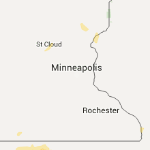
| 8:17 PM CDT | Half Dollar sized hail reported near Waite Park, MN, 62.5 miles NW of Minneapolis, MN, occurred at fleet farm. |
Iowa
| Local Time | Report Details |
|---|---|
| 4:40 PM CDT | Golf Ball sized hail reported near Onawa, IA, 49.6 miles N of Omaha, NE, hail up to golfball size reported by sheriff. 3 to 4 miles south of onawa. |
| 5:08 PM CDT | Ping Pong Ball sized hail reported near Lone Rock, IA, 57.1 miles NE of Storm Lake, IA, one stone possibly to baseball size...but nearly all others were ping pong ball size. strong winds accompanied the hail and caused substantial crop damage. |
| 6:06 PM CDT | Quarter sized hail reported near Earling, IA, 44.9 miles NE of Omaha, NE |
Michigan
| Local Time | Report Details |
|---|---|
| 6:40 PM EDT | A tree and a power line were downed near m-18. time estimated by rada in roscommon county MI, 57.8 miles ESE of Traverse City, MI |
| 10:10 PM EDT | Tree down blocking road in thomas twp in saginaw county MI, 36.8 miles NW of Flint, MI |
| 10:22 PM EDT | Large tree blocking river road north of state street. thunderstorm wind gust estimated at 60 mp in saginaw county MI, 31.2 miles NNW of Flint, MI |
Texas
| Local Time | Report Details |
|---|---|
| 5:42 PM CDT | Storm damage reported in pecos county TX, 58.9 miles NE of Alpine, TX |
| 6:00 PM CDT | Golf Ball sized hail reported near Fort Stockton, TX, 58.9 miles NE of Alpine, TX |
| 8:32 PM CDT | Golf Ball sized hail reported near Midland, TX, 22.7 miles ENE of Odessa, TX, golf ball hail fell at the intersection of south county road 1160 and fm 1213. |
| 8:55 PM CDT | Storm damage reported in ector county TX, 5.4 miles ENE of Odessa, TX |
| 11:55 PM CDT | Storm damage reported in ochiltree county TX, 75.3 miles W of Woodward, OK |
| 12:10 AM CDT | Storm damage reported in lipscomb county TX, 55.2 miles WSW of Woodward, OK |
Colorado
| Local Time | Report Details |
|---|---|
| 5:15 PM MDT | Storm damage reported in phillips county CO, 38.9 miles NE of Yuma, CO |
| 5:15 PM MDT | Storm damage reported in phillips county CO, 38.9 miles NE of Yuma, CO |
| 5:15 PM MDT | Storm damage reported in phillips county CO, 38.9 miles NE of Yuma, CO |
| 5:16 PM MDT | Tree damage in phillips county CO, 39.1 miles NE of Yuma, CO |
| 8:11 PM MDT | Quarter sized hail reported near Colorado Springs, CO, 40.5 miles N of Pueblo, CO, . |
| 8:20 PM MDT | Quarter sized hail reported near Peyton, CO, 46.7 miles N of Pueblo, CO, . |
| 8:44 PM MDT | Golf Ball sized hail reported near Colorado Springs, CO, 43.3 miles N of Pueblo, CO, relayed by media. |
| 8:50 PM MDT | Quarter sized hail reported near Colorado Springs, CO, 42.5 miles N of Pueblo, CO, . |
| 9:07 PM MDT | Ping Pong Ball sized hail reported near Peyton, CO, 45.9 miles N of Pueblo, CO, . |
| 9:09 PM MDT | Quarter sized hail reported near Peyton, CO, 48 miles N of Pueblo, CO, . |
| 9:10 PM MDT | Quarter sized hail reported near Peyton, CO, 45.9 miles N of Pueblo, CO, . |
| 9:11 PM MDT | Quarter sized hail reported near Peyton, CO, 47.3 miles N of Pueblo, CO, . |
| 9:30 PM MDT | Quarter sized hail reported near Colorado Springs, CO, 40.2 miles N of Pueblo, CO, lasted until 940 pm. |
| 9:50 PM MDT | Half Dollar sized hail reported near Calhan, CO, 42.2 miles NNE of Pueblo, CO, . |
| 11:15 PM MDT | Half Dollar sized hail reported near Colorado Springs, CO, 34.1 miles N of Pueblo, CO, . |
| 11:20 PM MDT | Half Dollar sized hail reported near Colorado Springs, CO, 33.3 miles N of Pueblo, CO, . |
| 11:25 PM MDT | Quarter sized hail reported near Colorado Springs, CO, 34.1 miles N of Pueblo, CO, . |
| 11:25 PM MDT | Golf Ball sized hail reported near Colorado Springs, CO, 33.4 miles N of Pueblo, CO, . |
| 11:32 PM MDT | Ping Pong Ball sized hail reported near Colorado Springs, CO, 36.8 miles N of Pueblo, CO, . |
| 11:34 PM MDT | Quarter sized hail reported near Colorado Springs, CO, 38.9 miles N of Pueblo, CO, . |
| 11:47 PM MDT | Ping Pong Ball sized hail reported near Colorado Springs, CO, 38.2 miles N of Pueblo, CO, . |
| 11:56 PM MDT | Quarter sized hail reported near Franktown, CO, 27.8 miles SSE of Denver, CO |
| 1:05 AM MDT | Ping Pong Ball sized hail reported near Flagler, CO, 42.9 miles SSW of Yuma, CO, estimated start time around 1240am and end time at 105am. |
| 3:03 AM MDT | Golf Ball sized hail reported near Colorado Springs, CO, 33.4 miles N of Pueblo, CO, . |
| 3:40 AM MDT | Golf Ball sized hail reported near Pueblo, CO, 2.9 miles NNW of Pueblo, CO, . |
| 3:53 AM MDT | Golf Ball sized hail reported near Pueblo, CO, 1.1 miles N of Pueblo, CO, . |
| 3:58 AM MDT | Quarter sized hail reported near Colorado Springs, CO, 29.8 miles NNW of Pueblo, CO, kfcs observation. |
| 4:00 AM MDT | Golf Ball sized hail reported near Pueblo, CO, 0.3 miles SSE of Pueblo, CO, . |
| 4:02 AM MDT | Quarter sized hail reported near Pueblo, CO, 5.1 miles ENE of Pueblo, CO, . |
| 5:33 AM MDT | Ping Pong Ball sized hail reported near Pueblo, CO, 9.2 miles WNW of Pueblo, CO, . |
| 5:35 AM MDT | Quarter sized hail reported near Pueblo, CO, 7.4 miles WNW of Pueblo, CO, . |
Ohio
| Local Time | Report Details |
|---|---|
| 8:30 PM EDT | Tree down on route 212 in carroll county OH, 63.9 miles W of Pittsburgh, PA |
Kansas
| Local Time | Report Details |
|---|---|
| 8:02 PM CDT | Ping Pong Ball sized hail reported near Bird City, KS, 36.4 miles NW of Colby, KS |
| 8:02 PM CDT | Ping Pong Ball sized hail reported near Bird City, KS, 36.7 miles NW of Colby, KS |
| 8:02 PM CDT | Grapefruit sized hail reported near Bird City, KS, 42.5 miles NW of Colby, KS |
| 8:08 PM CDT | Tea Cup sized hail reported near Saint Francis, KS, 46.7 miles NW of Colby, KS, measured at 3.2 inches...photo relayed via social media. |
| 8:10 PM CDT | Quarter sized hail reported near Bird City, KS, 35.5 miles NW of Colby, KS |
| 8:26 PM CDT | Baseball sized hail reported near Atwood, KS, 27.7 miles NNW of Colby, KS, relayed via social media...car windows broken in atwood ks. |
| 8:26 PM CDT | Baseball sized hail reported near Atwood, KS, 28.5 miles N of Colby, KS, relayed via social media...car windows broken in atwood ks. |
| 8:27 PM CDT | Tennis Ball sized hail reported near Atwood, KS, 33.6 miles N of Colby, KS |
| 8:27 PM CDT | Golf Ball sized hail reported near Atwood, KS, 33.6 miles N of Colby, KS |
| 8:20 PM MDT | Hen Egg sized hail reported near Goodland, KS, 30.4 miles W of Colby, KS |
| 9:23 PM CDT | Storm damage reported in thomas county KS, 1.9 miles E of Colby, KS |
| 9:26 PM CDT | Quarter sized hail reported near Colby, KS, 0.6 miles SSW of Colby, KS |
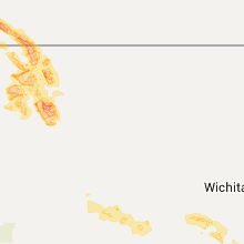
| 9:28 PM CDT | Quarter sized hail reported near Cassoday, KS, 47.6 miles NE of Wichita, KS, emergency manager reports dime to quarter sized hail on kansas turnpike mile marker 95. |
| 9:33 PM CDT | Golf Ball sized hail reported near Colby, KS, 4 miles W of Colby, KS |
| 10:04 PM CDT | Golf Ball sized hail reported near Oakley, KS, 20.7 miles SSE of Colby, KS |
| 10:34 PM CDT | Grapefruit sized hail reported near Oakley, KS, 32.1 miles SSE of Colby, KS, measured size was 3.75 inches. |
| 11:35 PM CDT | Severe thunderstorm wind gusts was damaging trees in fort scott. several large limbs had been ripped out of tree in bourbon county KS, 42 miles ENE of Chanute, KS |
| 11:41 PM CDT | *** 1 inj *** severe thunderstorm wind gusts downed a large tree through a hous in crawford county KS, 47.2 miles ESE of Chanute, KS |
| 12:02 AM CDT | Severe thunderstorm wind gusts have downed several power lines in girar in crawford county KS, 35.6 miles ESE of Chanute, KS |
| 12:03 AM CDT | Severe thunderstorm wind gusts damaged a roof of a hom in cherokee county KS, 45.4 miles SE of Chanute, KS |
| 12:23 AM CDT | Severe thunderstorm wind gusts snapped four power poles on the south side of galen in cherokee county KS, 61 miles SE of Chanute, KS |
| 5:14 AM CDT | Multiple tree limbs downed from 6 to 8 inches in diamete in harper county KS, 47 miles SW of Wichita, KS |
| 5:16 AM CDT | Downed power lines near duquoin. delayed report via social medi in harper county KS, 45.9 miles WSW of Wichita, KS |
| 5:16 AM CDT | 8 to 10 inch diameter limbs downe in harper county KS, 44.8 miles SW of Wichita, KS |
Virginia
| Local Time | Report Details |
|---|---|
| 9:17 PM EDT | Tree down at the rt 40 / rt 35 intersection. in sussex county VA, 46.5 miles SE of Richmond, VA |
Connect with Interactive Hail Maps