

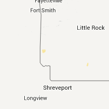
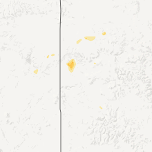
Hail Map for Friday, July 8, 2011

Number of Impacted Households on 7/8/2011
0
Impacted by 1" or Larger Hail
0
Impacted by 1.75" or Larger Hail
0
Impacted by 2.5" or Larger Hail
Square Miles of Populated Area Impacted on 7/8/2011
0
Impacted by 1" or Larger Hail
0
Impacted by 1.75" or Larger Hail
0
Impacted by 2.5" or Larger Hail


Cities Most Affected by Hail Storms of 7/8/2011
| Hail Size | Demographics of Zip Codes Affected | ||||||
|---|---|---|---|---|---|---|---|
| City | Count | Average | Largest | Pop Density | House Value | Income | Age |
| Venango, NE | 1 | 1.75 | 1.75 | 1 | $31k | $29.8k | 49.6 |
| Brusett, MT | 1 | 1.75 | 1.75 | 0 | $27k | $23.0k | 35.0 |
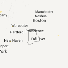
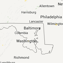
Hail and Wind Damage Spotted on 7/8/2011
Filter by Report Type:Hail ReportsWind Reports
States Impacted
Massachusetts, New York, Montana, Pennsylvania, Virginia, Colorado, New Jersey, Connecticut, Arizona, Nebraska, Mississippi, Arkansas, North Dakota, South Carolina, Georgia, North Carolina, South DakotaMassachusetts
| Local Time | Report Details |
|---|---|
| 1:40 PM UTC | Several trees dow in bristol county MA, 32.9 miles ESE of Providence, RI |
New York
| Local Time | Report Details |
|---|---|
| 7:00 PM UTC | Large branches down in onondaga county NY, 4 miles E of Syracuse, NY |
| 7:05 PM UTC | Ping Pong Ball sized hail reported near Cornwall on Hudson, NY, 51.6 miles N of Brooklyn, NY, half dollar to ping pong sized hail. |
| 7:10 PM UTC | Quarter sized hail reported near Cornwall, NY, 52.4 miles N of Brooklyn, NY, quarter size hail. |
| 7:35 PM UTC | Trees and wires down in madison county NY, 19.7 miles E of Syracuse, NY |
| 7:35 PM UTC | Quarter sized hail reported near Canastota, NY, 19.7 miles E of Syracuse, NY |
| 7:48 PM UTC | Quarter sized hail reported near Montgomery, NY, 58.6 miles NNW of Brooklyn, NY, quarter size hail. |
| 8:00 PM UTC | Quarter sized hail reported near Sherrill, NY, 27.7 miles E of Syracuse, NY |
| 8:10 PM UTC | Trees dow in schenectady county NY, 9.8 miles NW of Schenectady, NY |
| 8:16 PM UTC | Quarter sized hail reported near Clarkstown, NY, 31.6 miles N of Brooklyn, NY, quarter size hail. |
| 8:30 PM UTC | Trees down in saratoga county NY, 10.8 miles NNE of Schenectady, NY |
| 8:30 PM UTC | Small tree limbs down in saratoga county NY, 14.4 miles NNE of Schenectady, NY |
| 8:30 PM UTC | Wires down in saratoga county NY, 7.1 miles NNE of Schenectady, NY |
| 8:45 PM UTC | Tree down on wires on old post r in saratoga county NY, 15.7 miles NNE of Schenectady, NY |
| 9:00 PM UTC | Large tree limbs down. wires dow in saratoga county NY, 26.2 miles NE of Schenectady, NY |
| 10:10 PM UTC | Two trees and wires down in herkimer county NY, 46.5 miles WNW of Schenectady, NY |
Montana
| Local Time | Report Details |
|---|---|
| 7:00 PM UTC | Quarter sized hail reported near Terry, MT, 47.9 miles NNE of Miles City, MT, hail fell for about 7 minutes. size varied from dime to quarter. heavy rain is currently falling. |
| 9:45 PM UTC | Storm damage reported in stillwater county MT, 47.3 miles W of Billings, MT |
| 9:45 PM UTC | Storm damage reported in stillwater county MT, 30.9 miles WSW of Billings, MT |
| 10:16 PM UTC | Storm damage reported in yellowstone county MT, 15 miles WSW of Billings, MT |
| 10:28 PM UTC | Storm damage reported in yellowstone county MT, 3.9 miles SW of Billings, MT |
| 10:43 PM UTC | Storm damage reported in yellowstone county MT, 16.7 miles E of Billings, MT |
| 1:25 AM UTC | Golf Ball sized hail reported near Brusett, MT, 77.8 miles SSW of Glasgow, MT, 40 to 50 mph wind gusts |
Pennsylvania
| Local Time | Report Details |
|---|---|
| 7:05 PM UTC | Quarter sized hail reported near Tunkhannock, PA, 19.9 miles NW of Scranton, PA, ranged from pea size on up to one inch. |
| 7:10 PM UTC | Trees down in meshoppen in wyoming county PA, 24.5 miles NW of Scranton, PA |
| 9:23 PM UTC | Trees and wires down route 3013 in susquehanna county PA, 24.4 miles NW of Scranton, PA |
Virginia
| Local Time | Report Details |
|---|---|
| 7:14 PM UTC | Numerous trees down along hwy 340 in elkton in rockingham county VA, 75.1 miles ESE of Elkins, WV |
| 7:40 PM UTC | Tree down on gladys rd in campbell county VA, 47.1 miles E of Roanoke, VA |
| 8:15 PM UTC | Tree down in 7200 block of rapidan r in orange county VA, 59.3 miles NNW of Richmond, VA |
| 10:13 PM UTC | Tree down along franklin turnpike...sr41...near mt. hermon baptist churc in pittsylvania county VA, 49.9 miles SE of Roanoke, VA |
| 10:13 PM UTC | Trees down along roberston lane. one fell on a power pol in pittsylvania county VA, 49.3 miles SE of Roanoke, VA |
Colorado
| Local Time | Report Details |
|---|---|
| 7:39 PM UTC | Quarter sized hail reported near Northglenn, CO, 10.5 miles N of Denver, CO, penny to quarter size hail and rw+ |
| 8:05 PM UTC | Storm damage reported in denver county CO, 19.3 miles ENE of Denver, CO |
| 9:10 PM UTC | Quarter sized hail reported near Silt, CO, 59.6 miles NE of Grand Junction, CO, with heavy rain |
| 10:32 PM UTC | Quarter sized hail reported near Fort Collins, CO, 51.2 miles N of Denver, CO |
| 4:52 PM MDT | Also quarter sized hail in pueblo county CO, 6.4 miles ENE of Pueblo, CO |
| 4:52 PM MDT | Storm damage reported in pueblo county CO, 6.4 miles ENE of Pueblo, CO |
| 4:52 PM MDT | Metal ramp moved 100 yards from outbuilding at nws office. smith cotton shelter destroyed. evapopans blown across the stree in pueblo county CO, 5.1 miles ENE of Pueblo, CO |
| 4:52 PM MDT | Metal ramp moved 100 yards from outbuilding at nws office. smith cotton shelter destroyed. metal evaporation pans blown across the stree in pueblo county CO, 5.1 miles ENE of Pueblo, CO |
| 4:52 PM MDT | Northwest corner of roof at bf goodrich plant damage in pueblo county CO, 5.1 miles ENE of Pueblo, CO |
| 4:52 PM MDT | Semi trailer flipped on side on the north end of eaton way from earlier storm in pueblo county CO, 5.1 miles ENE of Pueblo, CO |
| 10:52 PM UTC | Quarter sized hail reported near Pueblo, CO, 5.1 miles ENE of Pueblo, CO |
| 11:50 PM UTC | Storm damage reported in prowers county CO, 99.4 miles W of Garden City, KS |
| 11:55 PM UTC | Storm damage reported in baca county CO, 104.6 miles WSW of Garden City, KS |
| 6:01 PM MDT | Metal ramp moved 100 yards from outbuilding at nws office. smith cotton shelter destroyed. evapopans blown across the stree in pueblo county CO, 5.1 miles ENE of Pueblo, CO |
| 6:01 PM MDT | Northwest corner of roof at bf goodrich plant damage in pueblo county CO, 5.1 miles ENE of Pueblo, CO |
| 7:05 PM MDT | Semi trailer flipped on side on the north end of eaton way from earlier storm in pueblo county CO, 5.1 miles ENE of Pueblo, CO |
| 1:15 AM UTC | Quarter sized hail reported near Bethune, CO, 50.8 miles SSE of Yuma, CO |
| 1:17 AM UTC | Storm damage reported in broomfield county CO, 14 miles N of Denver, CO |
| 1:50 AM UTC | Storm damage reported in kit carson county CO, 64.6 miles SSE of Yuma, CO |
| 2:33 AM UTC | Power lines reported down just north of venang in sedgwick county CO, 56.7 miles NE of Yuma, CO |
New Jersey
| Local Time | Report Details |
|---|---|
| 8:03 PM UTC | Large branches reported down with minor property damag in somerset county NJ, 30.1 miles WSW of Brooklyn, NY |
| 8:06 PM UTC | Large tree limbs blocking the intersection of lagrande avenue and 1st stree in union county NJ, 21.3 miles W of Brooklyn, NY |
| 8:18 PM UTC | Tree down on exit ramp of i-287 exit 37 in morris county NJ, 26.6 miles WNW of Brooklyn, NY |
| 9:04 PM UTC | Trees down in the stillwater - sparta area in sussex county NJ, 41.2 miles NW of Brooklyn, NY |
| 9:19 PM UTC | Tree down on ripplewood roa in bergen county NJ, 26 miles NNW of Brooklyn, NY |
Connecticut
| Local Time | Report Details |
|---|---|
| 8:05 PM UTC | Tree down on dorman roa in new haven county CT, 68.1 miles NE of Brooklyn, NY |
| 8:05 PM UTC | Tree down on edgewood roa in new haven county CT, 68.1 miles NE of Brooklyn, NY |
| 8:05 PM UTC | Tree down on seth den roa in new haven county CT, 68.1 miles NE of Brooklyn, NY |
| 8:23 PM UTC | Tree down on car on airline avenu in middlesex county CT, 65.6 miles WSW of Providence, RI |
Arizona
| Local Time | Report Details |
|---|---|
| 10:15 PM UTC | Quarter sized hail reported near Willcox, AZ, 64.5 miles NNW of Douglas, AZ |
| 3:30 AM UTC | Three 8-12 inch diameter trees 15-20 feet tall downed near pima mine rd and nogales hwy. recorded wind gust of 43 mp in pima county AZ, 15.3 miles S of Tucson, AZ |
Nebraska
| Local Time | Report Details |
|---|---|
| 11:00 PM UTC | Estimated 60 to 70 mph winds on the leading edge of the stor in cheyenne county NE, 60 miles SE of Scottsbluff, NE |
| 11:02 PM UTC | Storm damage reported in cheyenne county NE, 62.8 miles SE of Scottsbluff, NE |
| 11:09 PM UTC | Storm damage reported in cheyenne county NE, 58.7 miles SE of Scottsbluff, NE |
| 2:33 AM UTC | Power lines down just north of venang in perkins county NE, 58.3 miles NE of Yuma, CO |
| 2:33 AM UTC | Quonset was damaged near venango from thunderstorm wind in perkins county NE, 58.3 miles NE of Yuma, CO |
| 2:33 AM UTC | Golf Ball sized hail reported near Venango, NE, 58.7 miles NE of Yuma, CO, ground was covered with hail with the largest the size of golfballs. |
| 2:37 AM UTC | Quarter sized hail reported near Venango, NE, 57.1 miles NE of Yuma, CO |
Mississippi
| Local Time | Report Details |
|---|---|
| 11:15 PM UTC | A power line and transformer were blown dow in sunflower county MS, 88.7 miles NNW of Jackson, MS |
Arkansas
| Local Time | Report Details |
|---|---|
| 11:35 PM UTC | Police reporting trees down in the city of de quee in sevier county AR, 29 miles WNW of Nashville, AR |
North Dakota
| Local Time | Report Details |
|---|---|
| 11:43 PM UTC | Quarter sized hail reported near Pingree, ND, 64.4 miles S of Devils Lake, ND, late report from 7-8-11. |
| 11:45 PM UTC | Quarter sized hail reported near Pingree, ND, 68.4 miles S of Devils Lake, ND, late report from 7-8-11. |
| 11:46 PM UTC | Ping Pong Ball sized hail reported near Pingree, ND, 69.2 miles S of Devils Lake, ND, late report from 7-8-11. |
| 12:30 AM UTC | Storm damage reported in emmons county ND, 28.2 miles SE of Bismarck, ND |
| 3:02 AM UTC | Large trees and numerous branches blown down in tow in mcintosh county ND, 69.3 miles ESE of Bismarck, ND |
South Carolina
| Local Time | Report Details |
|---|---|
| 12:05 AM UTC | Trees down on power lines near 2044 peachtree road ese of finger in spartanburg county SC, 42.1 miles ENE of Greenville, SC |
| 1:05 AM UTC | A tree in the roadway on lakeside driv in union county SC, 55.4 miles SW of Charlotte, NC |
| 1:12 AM UTC | A tree in the roadway on bob adams roa in union county SC, 58.7 miles SW of Charlotte, NC |
Georgia
| Local Time | Report Details |
|---|---|
| 12:30 AM UTC | Two trees down in the northeast part of the count in jasper county GA, 52.1 miles ESE of Atlanta, GA |
| 12:36 AM UTC | A couple of trees down in the north part of the county...one on glades road near the 4h camp in the northwest part and another on phoenix road in the northeast part of in putnam county GA, 59.9 miles ESE of Atlanta, GA |
North Carolina
| Local Time | Report Details |
|---|---|
| 12:36 AM UTC | The roof of a masonic lodge was blown off and a few other trees blown down with at least two of those trees in the roadway. based on calls around shelby and waco...seem in cleveland county NC, 46 miles W of Charlotte, NC |
| 1:40 AM UTC | One tree was reported down at the intersection of pine meadow drive and high point roa in forsyth county NC, 69.9 miles NE of Charlotte, NC |
| 1:45 AM UTC | Tree down in sedge garde in forsyth county NC, 68.6 miles NNE of Charlotte, NC |
| 3:31 AM UTC | Tree down near pineview and spero road in randolph county NC, 67.6 miles NE of Charlotte, NC |
South Dakota
| Local Time | Report Details |
|---|---|
| 4:00 AM UTC | Storm damage reported in hughes county SD, 7.4 miles E of Pierre, SD |
Connect with Interactive Hail Maps