| 3:02 PM CDT |
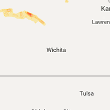
Hen Egg sized hail reported near Scott City, KS, 47 miles N of Garden City, KS, ping pong to hen egg sized hail.
|
| 3:21 PM CDT |
Ping Pong Ball sized hail reported near Scott City, KS, 40 miles N of Garden City, KS
|
| 3:30 PM CDT |
Hen Egg sized hail reported near Scott City, KS, 35.5 miles N of Garden City, KS, delayed report from social media photo.
|
| 3:36 PM CDT |
Quarter sized hail reported near Scott City, KS, 39.5 miles N of Garden City, KS
|
| 3:41 PM CDT |
Golf Ball sized hail reported near Scott City, KS, 35.3 miles N of Garden City, KS, golf ball hail in scott city and getting larger.
|
| 3:42 PM CDT |
Quarter sized hail reported near Scott City, KS, 35.9 miles N of Garden City, KS
|
| 3:47 PM CDT |
Half Dollar sized hail reported near Scott City, KS, 36 miles N of Garden City, KS
|
| 3:50 PM CDT |
Ping Pong Ball sized hail reported near Park, KS, 42.8 miles ESE of Colby, KS
|
| 3:50 PM CDT |
Golf Ball sized hail reported near Scott City, KS, 35.3 miles N of Garden City, KS, mostly ping pong size hail with some golf ball.
|
| 3:50 PM CDT |
Half Dollar sized hail reported near Hoxie, KS, 40.6 miles E of Colby, KS, delayed report. estimated sized from social media picture. hail lasted around 15 min.
|
| 3:54 PM CDT |
Half Dollar sized hail reported near Park, KS, 41.1 miles ESE of Colby, KS, spotter report of 1.25 in. hail sw of park.
|
| 3:54 PM CDT |
Golf Ball sized hail reported near Hoxie, KS, 37.3 miles E of Colby, KS, storm spotter reports golf ball sized hail 5.5 miles east of hoxie.
|
| 4:00 PM CDT |
Quarter sized hail reported near Morland, KS, 46.3 miles WNW of Hays, KS
|
| 4:00 PM CDT |
Golf Ball sized hail reported near Hoxie, KS, 39.5 miles E of Colby, KS, location was west and a little south of hwy 24 from tasco... ks.
|
| 4:10 PM CDT |
Quarter sized hail reported near Scott City, KS, 48.3 miles NNW of Garden City, KS, hail lasted about 15 min and sized ranged from nickel to quarter. delayed report... timing based on radar.
|
| 4:16 PM CDT |
Quarter sized hail reported near Quinter, KS, 48.3 miles ESE of Colby, KS, nickel to quarter size hail at mm 106 on i-70.
|
| 4:23 PM CDT |
Hen Egg sized hail reported near Oakley, KS, 23.5 miles SSE of Colby, KS, largest hail size was 2 inches... received a lot of 1 to 1.5 inch hail. been hailing for 15 minutes... hail is getting smaller.
|
| 4:31 PM CDT |
Tennis Ball sized hail reported near Scott City, KS, 45.9 miles NNW of Garden City, KS
|
| 4:32 PM CDT |
Ping Pong Ball sized hail reported near Wakeeney, KS, 31.7 miles W of Hays, KS
|
| 4:40 PM CDT |
Half Dollar sized hail reported near Oakley, KS, 24.2 miles SSE of Colby, KS, a few larger pieces also occurred but no measurement on those.
|
| 5:05 PM CDT |
Quarter sized hail reported near Grinnell, KS, 23.8 miles SE of Colby, KS
|
| 5:07 PM CDT |
Half Dollar sized hail reported near Grinnell, KS, 23.8 miles SE of Colby, KS, social media report. time estimated from radar.
|
| 5:14 PM CDT |
Quarter sized hail reported near Scott City, KS, 32.5 miles N of Garden City, KS
|
| 5:22 PM CDT |
Golf Ball sized hail reported near Grainfield, KS, 36.7 miles ESE of Colby, KS, hail occurring along i-70.
|
| 5:25 PM CDT |
Ping Pong Ball sized hail reported near Marienthal, KS, 37.6 miles NNW of Garden City, KS, delayed report...from social media photo.
|
| 5:33 PM CDT |
Quarter sized hail reported near Plainville, KS, 25.3 miles NNW of Hays, KS, dime to quarter size hail.
|
| 5:44 PM CDT |
Storm damage reported in kearny county KS, 20.3 miles W of Garden City, KS
|
| 5:45 PM CDT |
Quarter sized hail reported near Plainville, KS, 26.2 miles N of Hays, KS
|
| 5:46 PM CDT |
Ping Pong Ball sized hail reported near Deerfield, KS, 14.1 miles W of Garden City, KS, via social media photo.
|
| 5:51 PM CDT |
Half Dollar sized hail reported near Plainville, KS, 25.5 miles N of Hays, KS, torrent of rain at the time with zero visibility.
|
| 5:53 PM CDT |
Quarter sized hail reported near Deerfield, KS, 15.5 miles WNW of Garden City, KS
|
| 6:02 PM CDT |
Golf Ball sized hail reported near Lakin, KS, 21.2 miles W of Garden City, KS
|
| 6:05 PM CDT |
Half Dollar sized hail reported near Rexford, KS, 17.6 miles E of Colby, KS, a few quarter and half dollar sized hail... mostly dime and nickel hail. still hailing... no rain.
|
| 5:07 PM MDT |
Baseball sized hail reported near Kendall, KS, 37.6 miles WSW of Garden City, KS
|
| 6:18 PM CDT |
Reported at holcomb middle schoo in finney county KS, 6.5 miles WNW of Garden City, KS
|
| 6:20 PM CDT |
Quarter sized hail reported near Holcomb, KS, 7.3 miles WNW of Garden City, KS
|
| 6:22 PM CDT |
Ping Pong Ball sized hail reported near Holcomb, KS, 6.7 miles WNW of Garden City, KS
|
| 6:40 PM CDT |
Estimated 60-70 mph win in ellis county KS, 16.6 miles NE of Hays, KS
|
| 7:00 PM CDT |
Also reported large tree limbs down from the thunderstorm wind gust in russell county KS, 28.2 miles ENE of Hays, KS
|
| 7:05 PM CDT |
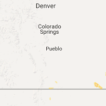
Golf Ball sized hail reported near Ulysses, KS, 30.3 miles SW of Garden City, KS, also reported windows broken.
|
| 7:10 PM CDT |
Quarter sized hail reported near Hoxie, KS, 33.6 miles E of Colby, KS, nickel and quarter hail... but not a lot of hail.
|
| 7:10 PM CDT |
Quarter sized hail reported near Ulysses, KS, 36.4 miles SW of Garden City, KS
|
| 7:14 PM CDT |
Ping Pong Ball sized hail reported near Ulysses, KS, 37.3 miles SW of Garden City, KS
|
| 7:15 PM CDT |
Quarter sized hail reported near Ulysses, KS, 37.8 miles SW of Garden City, KS
|
| 7:16 PM CDT |
Storm damage reported in grant county KS, 37.7 miles SW of Garden City, KS
|
| 7:18 PM CDT |
Tennis Ball sized hail reported near Ulysses, KS, 37.8 miles SW of Garden City, KS, from social media photo. also reports of broken windshields in ulysses.
|
| 7:23 PM CDT |
Grapefruit sized hail reported near Ulysses, KS, 37 miles SW of Garden City, KS, delayed report.
|
| 7:23 PM CDT |
Hen Egg sized hail reported near Ulysses, KS, 37 miles SW of Garden City, KS
|
| 7:41 PM CDT |
Storm damage reported in lincoln county KS, 48.7 miles ENE of Hays, KS
|
| 7:46 PM CDT |
Ping Pong Ball sized hail reported near Ulysses, KS, 40.2 miles SW of Garden City, KS, also estimated 50 mph wind.
|
| 8:01 PM CDT |
Quarter sized hail reported near Sylvan Grove, KS, 52.4 miles ENE of Hays, KS, emergency manager reported quarter size hail in the area of k-181 and navajo dr.
|
| 8:09 PM CDT |
Along k-1 in lincoln county KS, 63.8 miles E of Hays, KS
|
| 8:09 PM CDT |
Large tree down on highway 181 near quail d in lincoln county KS, 53.1 miles ENE of Hays, KS
|
| 8:10 PM CDT |
Public reported 3 inch tree limbs broken and a trampoline was blown into power line in ford county KS, 73.9 miles ESE of Garden City, KS
|
| 8:17 PM CDT |
Quarter sized hail reported near Ulysses, KS, 36.8 miles SW of Garden City, KS
|
| 8:23 PM CDT |
Storm damage reported in grant county KS, 41.8 miles SSW of Garden City, KS
|
| 8:33 PM CDT |
Quarter sized hail reported near Beverly, KS, 70.8 miles E of Hays, KS, also reported 50mph winds.
|


Connect with Interactive Hail Maps