

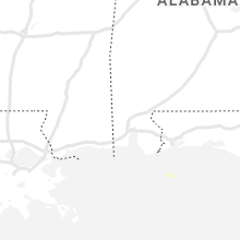
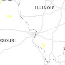
Hail Map for Tuesday, May 17, 2022

Number of Impacted Households on 5/17/2022
0
Impacted by 1" or Larger Hail
0
Impacted by 1.75" or Larger Hail
0
Impacted by 2.5" or Larger Hail
Square Miles of Populated Area Impacted on 5/17/2022
0
Impacted by 1" or Larger Hail
0
Impacted by 1.75" or Larger Hail
0
Impacted by 2.5" or Larger Hail


Cities Most Affected by Hail Storms of 5/17/2022
| Hail Size | Demographics of Zip Codes Affected | ||||||
|---|---|---|---|---|---|---|---|
| City | Count | Average | Largest | Pop Density | House Value | Income | Age |
| Holdrege, NE | 3 | 2.42 | 3.00 | 30 | $72k | $37.2k | 43.2 |
| Wakefield, KS | 1 | 2.00 | 2.00 | 10 | $70k | $35.0k | 38.7 |
| Clay Center, KS | 1 | 1.75 | 1.75 | 17 | $56k | $35.2k | 44.5 |
| Lance Creek, WY | 1 | 1.75 | 1.75 | 0 | $33k | $30.2k | 53.2 |
Hail and Wind Damage Spotted on 5/17/2022
Filter by Report Type:Hail ReportsWind Reports
States Impacted
Nebraska, Louisiana, Missouri, Iowa, Texas, Wyoming, Kansas, Oklahoma, Colorado, North DakotaNebraska
| Local Time | Report Details |
|---|---|
| 7:45 AM CDT | Quarter sized hail reported near Royal, NE, 28 miles ESE of Oneill, NE, mostly dime size... but a few up to quarter size. |
| 11:11 AM CDT | Ping Pong Ball sized hail reported near Winside, NE, 77.6 miles ESE of Oneill, NE, many dime and nickel size hail stones with a few up to ping pong ball sized. |
| 5:45 PM CDT | Quarter sized hail reported near Holdrege, NE, 63.6 miles WSW of Grand Island, NE, rec. via facebook. |
| 5:47 PM CDT | Quarter sized hail reported near Oxford, NE, 86.2 miles SE of North Platte, NE, rec. via facebook. |
| 5:55 PM CDT | Quarter sized hail reported near Oxford, NE, 82.3 miles SW of Grand Island, NE |
| 6:14 PM CDT | Quarter sized hail reported near Ragan, NE, 65.5 miles SW of Grand Island, NE |
| 6:16 PM CDT | Ping Pong Ball sized hail reported near Holdrege, NE, 68.8 miles SW of Grand Island, NE, rec. via mping. |
| 5:19 PM MDT | Quarter sized hail reported near Scottsbluff, NE, 6.1 miles N of Scottsbluff, NE |
| 5:22 PM MDT | Reports of dust along with the strong wind in scotts bluff county NE, 3.4 miles NNW of Scottsbluff, NE |
| 6:25 PM CDT | Tea Cup sized hail reported near Holdrege, NE, 67.5 miles SW of Grand Island, NE, report and photo on facebook... relayed by ntv studio. hail this size was also reported just south of this location near the intersection of hwy 183 and hwy 4. time was |
| 6:30 PM CDT | Tennis Ball sized hail reported near Holdrege, NE, 67.5 miles SW of Grand Island, NE, rec. report and photo via facebook. |
| 6:36 PM CDT | Golf Ball sized hail reported near Holdrege, NE, 66.3 miles SW of Grand Island, NE, rec. via spotter network. |
| 6:15 PM MDT | Ping Pong Ball sized hail reported near Bridgeport, NE, 30.3 miles ESE of Scottsbluff, NE |
| 7:16 PM CDT | Half Dollar sized hail reported near Edison, NE, 78.5 miles SE of North Platte, NE |
| 6:23 PM MDT | Quarter sized hail reported near Bridgeport, NE, 32 miles ESE of Scottsbluff, NE, mostly pea to dime sized with up to quarter size. 1 inch of hail accumulation. |
| 7:33 PM CDT | Quarter sized hail reported near Edison, NE, 78.5 miles SE of North Platte, NE, been getting hail since the 716 pm report... still getting quarter size hail at this time. |
| 7:42 PM CDT | Ping Pong Ball sized hail reported near Edison, NE, 78.5 miles SE of North Platte, NE, hail back up to half dollar to ping pong ball size. |
| 6:45 PM MDT | Quarter sized hail reported near Broadwater, NE, 45.7 miles ESE of Scottsbluff, NE |
| 7:03 PM MDT | Quarter sized hail reported near Lisco, NE, 55.5 miles ESE of Scottsbluff, NE, delayed report. quarter-sized hail still on the ground 90 minutes after the storm passed. time estimated based on radar. |
| 7:42 PM MDT | Quarter sized hail reported near Chappell, NE, 78.3 miles W of North Platte, NE, hail was estimated at 3 inches deep on top of their car. |
| 8:06 PM MDT | Half Dollar sized hail reported near Big Springs, NE, 66.2 miles W of North Platte, NE, half dollar size hail with 68 mph winds. hail damaged egress window. |
| 8:06 PM MDT | Measured 68 mph wind gust before hail knocked out wind senso in keith county NE, 66.2 miles W of North Platte, NE |
| 8:13 PM MDT | Mesonet up938 in keith county NE, 65.8 miles W of North Platte, NE |
| 9:35 PM CDT | Quarter sized hail reported near Grand Island, NE, 1.6 miles WSW of Grand Island, NE, report from the north side of grand island. |
| 9:37 PM CDT | Quarter sized hail reported near Grand Island, NE, 1.6 miles WSW of Grand Island, NE, dime to quarter size hail reported on the west side of grand island. |
| 9:41 PM CDT | Half Dollar sized hail reported near Grand Island, NE, 3.2 miles W of Grand Island, NE, corrects time of previous hail report from 2 w grand island. received via mping. |
| 9:45 PM CDT | Half Dollar sized hail reported near Grand Island, NE, 3.2 miles W of Grand Island, NE, received via mping. |
| 9:59 PM CDT | Quarter sized hail reported near Hampton, NE, 24.7 miles E of Grand Island, NE, quarter sized hail reported by em. |
| 12:20 AM CDT | Quarter sized hail reported near Valley, NE, 22.7 miles W of Omaha, NE |
| 12:25 AM CDT | Quarter sized hail reported near Valley, NE, 20.6 miles W of Omaha, NE, 264th and meigs. started three minutes ago. |
Louisiana
| Local Time | Report Details |
|---|---|
| 3:35 PM CDT | Quarter sized hail reported near Slidell, LA, 29.6 miles NE of New Orleans, LA, ham operator and public reported quarter-sized hail near brownswitch and robert rd in slidell... la. |
Missouri
| Local Time | Report Details |
|---|---|
| 4:20 PM CDT | Quarter sized hail reported near Hopkins, MO, 74.9 miles SE of Omaha, NE |
| 4:32 PM CDT | A large tree was blocking hwy 148 just south of hopkins. powerlines also down in tow in nodaway county MO, 76.5 miles SE of Omaha, NE |
| 5:14 PM CDT | Quarter sized hail reported near Mercer, MO, 74.6 miles S of Des Moines, IA, report relayed via emergency management who saw the report of facebook. |
| 5:35 PM CDT | Delayed report...several powerlines down... roof damage... and roof taken off of machine shed at hwy 129 south and 190th st. southeast of unionville... mo. unionville a in putnam county MO, 65.5 miles W of Kahoka, MO |
| 5:36 PM CDT | Quarter sized hail reported near Milan, MO, 77.2 miles W of Kahoka, MO |
| 5:39 PM CDT | Quarter sized hail reported near Milan, MO, 75.5 miles W of Kahoka, MO |
| 12:05 AM CDT | Nws employee reports at 6 to 8 inch tree limb down over road... obstructing traffic in neighborhoo in jackson county MO, 6.4 miles S of Kansas City, MO |
| 2:24 AM CDT | Power outages were reported in parts of joplin as wel in jasper county MO, 63.9 miles SE of Chanute, KS |
| 2:26 AM CDT | Tree down over road at civil war road and i-4 in jasper county MO, 57.3 miles W of Springfield, MO |
| 2:34 AM CDT | Tree down blocking roadway on highway ff west of highway 5 in newton county MO, 57.8 miles W of Springfield, MO |
Iowa
| Local Time | Report Details |
|---|---|
| 4:57 PM CDT | Ping Pong Ball sized hail reported near Blockton, IA, 78.2 miles SW of Des Moines, IA, report from mping: ping pong ball (1.50 in.). |
| 5:01 PM CDT | 72 mph wind gust sustained and measured with hand held anemometer via spotternetwork.or in taylor county IA, 78.2 miles SW of Des Moines, IA |
| 5:05 PM CDT | 12 to 18 inch diameter tree branches dow in taylor county IA, 75.7 miles ESE of Omaha, NE |
| 9:57 PM CDT | Quarter sized hail reported near Harlan, IA, 41.3 miles NE of Omaha, NE |
| 1:22 AM CDT | Quarter sized hail reported near Woodbine, IA, 35.2 miles NNE of Omaha, NE, quarter size hail. |
| 1:23 AM CDT | Half Dollar sized hail reported near Woodbine, IA, 35.2 miles NNE of Omaha, NE, half dollar sized hail. |
| 1:35 AM CDT | Quarter sized hail reported near Woodbine, IA, 37.3 miles NNE of Omaha, NE, quarter size hail. |
Texas
| Local Time | Report Details |
|---|---|
| 5:29 PM CDT | Quarter sized hail reported near Mclean, TX, 62.2 miles NNW of Childress, TX, spotter came across mostly dime size hail with a couple quarter size stones on the ground at roughly 531pm. time hail fell estimated by radar. |
| 6:22 PM CDT | Quarter sized hail reported near Wheeler, TX, 65.5 miles N of Childress, TX, mostly small hail with a few quarters. quarters fell from 622 to 624pm. |
| 6:28 PM CDT | Storm damage reported in carson county TX, 17.8 miles ENE of Amarillo, TX |
| 7:22 PM CDT | West texas mesonet observed continuous severe wind gusts between 7:20 pm and 7:24 pm from a passing virga shower. power was also reported out in the tow in lubbock county TX, 16.4 miles SE of Lubbock, TX |
| 7:46 PM CDT | West texas mesonet reported continuous severe wind gusts between 7:44 pm and 7:46 pm from a passing virga showe in motley county TX, 49.8 miles SW of Childress, TX |
Wyoming
| Local Time | Report Details |
|---|---|
| 4:40 PM MDT | Golf Ball sized hail reported near Lance Creek, WY, 87 miles E of Casper, WY, reports of shredded leaves and car dents. |
| 5:22 PM MDT | Quarter sized hail reported near Basin, WY, 96.9 miles SSE of Billings, MT, one inch diameter hail reported 3 miles north of basin along wyoming highway 789. |
Kansas
| Local Time | Report Details |
|---|---|
| 6:09 PM CDT | Quarter sized hail reported near Jennings, KS, 45.4 miles ENE of Colby, KS, pea to quarter hail. rainfall 0.30-0.40 inches. |
| 8:07 PM CDT | Golf Ball sized hail reported near Clay Center, KS, 30.5 miles W of Manhattan, KS, delayed report. |
| 8:16 PM CDT | Quarter sized hail reported near Manhattan, KS, 4.2 miles NW of Manhattan, KS |
| 8:18 PM CDT | Hen Egg sized hail reported near Wakefield, KS, 23.6 miles W of Manhattan, KS |
| 8:19 PM CDT | Storm damage reported in osborne county KS, 52.4 miles NE of Hays, KS |
| 8:22 PM CDT | Half Dollar sized hail reported near Manhattan, KS, 9.7 miles NW of Manhattan, KS |
| 8:22 PM CDT | From personal weather statio in riley county KS, 9.7 miles NW of Manhattan, KS |
| 8:22 PM CDT | Delayed peak gust report from ksu mesone in osborne county KS, 52.4 miles NE of Hays, KS |
| 8:43 PM CDT | Delayed report of estimated 75 mph winds in the vicinity of a possible qlcs tornado. photos and video received via twitte in osborne county KS, 57.4 miles NE of Hays, KS |
| 9:02 PM CDT | Storm damage reported in russell county KS, 27.6 miles E of Hays, KS |
| 9:02 PM CDT | Quarter sized hail reported near Junction City, KS, 18.3 miles WSW of Manhattan, KS, report from mping: quarter (1.00 in.). |
| 9:14 PM CDT | Half Dollar sized hail reported near Junction City, KS, 18.6 miles WSW of Manhattan, KS |
| 9:30 PM CDT | Reported from audio on twitc in ellsworth county KS, 59.5 miles E of Hays, KS |
| 8:31 PM MDT | Asos station kgld goodlan in sherman county KS, 35.1 miles W of Colby, KS |
| 9:46 PM CDT | Measured at k9k in ellsworth county KS, 60.6 miles E of Hays, KS |
| 9:51 PM CDT | 60-65 mph wind gusts. power is ou in shawnee county KS, 42.4 miles ESE of Manhattan, KS |
| 9:55 PM CDT | Storm damage reported in shawnee county KS, 42.4 miles ESE of Manhattan, KS |
| 10:00 PM CDT | Relayed through the e in shawnee county KS, 38.1 miles E of Manhattan, KS |
| 10:00 PM CDT | Quarter sized hail reported near Silver Lake, KS, 38.1 miles E of Manhattan, KS, social media - delayed report. |
| 10:18 PM CDT | Spotter also reported reduced visibility due to blowing dus in pawnee county KS, 47.4 miles S of Hays, KS |
| 10:18 PM CDT | Tree limbs downe in saline county KS, 62.1 miles WSW of Manhattan, KS |
| 10:26 PM CDT | Storm damage reported in barton county KS, 44.4 miles SE of Hays, KS |
| 10:31 PM CDT | Measured from kgbd awo in barton county KS, 44.1 miles SE of Hays, KS |
| 10:33 PM CDT | Quarter sized hail reported near Topeka, KS, 50.1 miles E of Manhattan, KS |
| 10:39 PM CDT | Quarter sized hail reported near Larned, KS, 48.6 miles SSE of Hays, KS |
| 10:48 PM CDT | 2 inch diameter tree limb down across roa in shawnee county KS, 46.8 miles ESE of Manhattan, KS |
| 10:50 PM CDT | Correct time previous tstm wnd dmg. split tree blocking roadway at 1600 block cadet av in douglas county KS, 35.9 miles WSW of Kansas City, MO |
| 10:51 PM CDT | Half Dollar sized hail reported near Baldwin City, KS, 39.6 miles SW of Kansas City, MO, delayed report. time estimated radar. |
| 10:57 PM CDT | Quarter sized hail reported near Osage City, KS, 54.9 miles SE of Manhattan, KS, social media report. time estimated radar. |
| 11:15 PM CDT | 50 to 60 mph wind in reno county KS, 50 miles NW of Wichita, KS |
| 11:18 PM CDT | 50 to 60 mp in marion county KS, 48.9 miles NNE of Wichita, KS |
| 11:19 PM CDT | Mesonet station up423 2.8 w langdon (upr in reno county KS, 57.6 miles W of Wichita, KS |
| 11:20 PM CDT | Quarter sized hail reported near Jetmore, KS, 51 miles E of Garden City, KS, at 156 hwy and 215 rd... quarter hail was observed. |
| 11:27 PM CDT | Storm damage reported in saline county KS, 64.1 miles WSW of Manhattan, KS |
| 11:30 PM CDT | Public report of 60 mph wind gust and nickel size hail in olathe near 159th street and ridgeview road. relayed from faceboo in johnson county KS, 21.6 miles SSW of Kansas City, MO |
| 11:55 PM CDT | Storm damage reported in sedgwick county KS, 6 miles WSW of Wichita, KS |
| 12:02 AM CDT | Report from mping: 3-inch tree limbs broken; power poles broke in sedgwick county KS, 5.2 miles SSW of Wichita, KS |
| 12:03 AM CDT | Report from mping: 1-inch tree limbs broken; shingles blown off or roo in sedgwick county KS, 4.8 miles SSW of Wichita, KS |
| 12:10 AM CDT | Storm damage reported in sedgwick county KS, 5.9 miles SE of Wichita, KS |
| 12:11 AM CDT | 50 to 60 mph wind gusts from outflow well ahead of storm in harper county KS, 41 miles SW of Wichita, KS |
| 12:47 AM CDT | Storm damage reported in cowley county KS, 40 miles SSE of Wichita, KS |
| 1:52 AM CDT | Asos station kcfv coffeyville municipal airp in montgomery county KS, 42 miles S of Chanute, KS |
Oklahoma
| Local Time | Report Details |
|---|---|
| 6:55 PM CDT | Storm damage reported in beckham county OK, 69.2 miles S of Woodward, OK |
| 10:30 PM CDT | Minor damage due to heat burst wind gust in major county OK, 60.7 miles ESE of Woodward, OK |
Colorado
| Local Time | Report Details |
|---|---|
| 6:44 PM MDT | Storm damage reported in cheyenne county CO, 90.8 miles WSW of Colby, KS |
| 8:00 PM MDT | Report from mping: 1-inch tree limbs broken; shingles blown of in yuma county CO, 36.9 miles SE of Yuma, CO |
North Dakota
| Local Time | Report Details |
|---|---|
| 9:00 PM CDT | Quarter sized hail reported near Willow City, ND, 51 miles NE of Minot, ND |
Connect with Interactive Hail Maps