

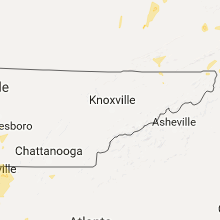
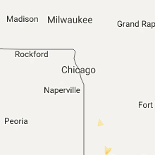
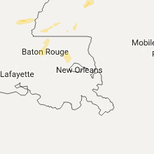
Hail Map for Saturday, May 20, 2017

Number of Impacted Households on 5/20/2017
0
Impacted by 1" or Larger Hail
0
Impacted by 1.75" or Larger Hail
0
Impacted by 2.5" or Larger Hail
Square Miles of Populated Area Impacted on 5/20/2017
0
Impacted by 1" or Larger Hail
0
Impacted by 1.75" or Larger Hail
0
Impacted by 2.5" or Larger Hail


Cities Most Affected by Hail Storms of 5/20/2017
| Hail Size | Demographics of Zip Codes Affected | ||||||
|---|---|---|---|---|---|---|---|
| City | Count | Average | Largest | Pop Density | House Value | Income | Age |
| Rush, KY | 1 | 2.50 | 2.50 | 54 | $57k | $31.8k | 39.7 |
| Knippa, TX | 1 | 1.75 | 1.75 | 2 | $41k | $29.8k | 39.7 |
| Willis, TX | 1 | 1.75 | 1.75 | 150 | $61k | $35.7k | 32.0 |
| Pointblank, TX | 1 | 1.75 | 1.75 | 69 | $63k | $27.8k | 55.1 |
| Lufkin, TX | 1 | 1.75 | 1.75 | 249 | $70k | $34.5k | 35.5 |
Hail and Wind Damage Spotted on 5/20/2017
Filter by Report Type:Hail ReportsWind Reports
States Impacted
Texas, Louisiana, Ohio, North Carolina, Kentucky, Virginia, West Virginia, Alabama, Tennessee, Indiana, Georgia, Florida, ArkansasTexas
| Local Time | Report Details |
|---|---|
| 9:29 AM CDT | Quarter sized hail reported near Knippa, TX, 69 miles W of San Antonio, TX |
| 9:29 AM CDT | Golf Ball sized hail reported near Knippa, TX, 68.4 miles W of San Antonio, TX, public reported golf ball sized hail on fm 1049 north of knippa. |
| 9:36 AM CDT | Quarter sized hail reported near Knippa, TX, 65.3 miles W of San Antonio, TX |
| 11:52 AM CDT | Quarter sized hail reported near Pearsall, TX, 54.9 miles SW of San Antonio, TX, fm 140 at us57. |
| 3:44 PM CDT | Cotulla asos measured a wind gust to 59 mph in la salle county TX, 65.6 miles NNE of Laredo, TX |
| 4:15 PM CDT | Public reported thunderstorm winds of 50-60 mph near magnolia spring in jasper county TX, 45.6 miles NNW of Beaumont, TX |
| 5:06 PM CDT | Golf Ball sized hail reported near Pointblank, TX, 50.5 miles SW of Lufkin, TX, golf ball size hail in point blank near lake livingston. |
| 6:30 PM CDT | Golf Ball sized hail reported near Willis, TX, 45.5 miles N of Houston, TX, golf ball size hail reported near willis by law enforcement. |
| 6:49 PM CDT | Ping Pong Ball sized hail reported near , , 52.1 miles ENE of Laredo, TX, storm chaser reported hail slightly less than golf ball size |
| 6:50 PM CDT | Quarter sized hail reported near Freer, TX, 58 miles ENE of Laredo, TX, storm spotters report 1 inch hail |
| 7:23 PM CDT | Golf Ball sized hail reported near Lufkin, TX, 0.7 miles WSW of Lufkin, TX, near angelina college. |
| 7:24 PM CDT | Ping Pong Ball sized hail reported near Lufkin, TX, 2.3 miles SSE of Lufkin, TX, quarters to ping pong sized hail reported at crown colony subdivision in south lufkin near angelina college. |
| 7:24 PM CDT | Quarter sized hail reported near Freer, TX, 58.6 miles ENE of Laredo, TX, social media post of quarter size hail in freer |
| 7:43 PM CDT | Quarter sized hail reported near Lufkin, TX, 1.2 miles N of Lufkin, TX, quarter size reported intersection hwy 59 and hwy 69 in lufkin. |
| 9:35 PM CDT | Ping Pong Ball sized hail reported near Joaquin, TX, 41.8 miles SSW of Shreveport, LA, a picture of ping pong ball size hail was posted by the public to the ksla facebook page. |
| 1:08 AM CDT | Tree down near the intersection of fm-159 and matt wright roa in brazos county TX, 69.7 miles NW of Houston, TX |
| 6:19 AM CDT | Quarter sized hail reported near Purmela, TX, 27.9 miles NNW of Killeen, TX, report of quarter size hail in coryell county |
Louisiana
| Local Time | Report Details |
|---|---|
| 11:42 AM CDT | Power out at haughton middle school... haughton high school... kinsley cour in bossier county LA, 14 miles E of Shreveport, LA |
| 4:50 PM CDT | Tree reported fallen on a home on severn ave. wind gusts likely around 45 mph based on nearby observation in east baton rouge county LA, 55.3 miles ENE of Lafayette, LA |
| 10:45 PM CDT | Tree down linwood extension stonewall on the roa in de soto county LA, 17.4 miles SSW of Shreveport, LA |
| 10:45 PM CDT | Tree on power line linwood extension off stonewall frierso in de soto county LA, 16.7 miles SSW of Shreveport, LA |
| 11:18 PM CDT | Trees and power lines down bayou drive between dixie garden and bermuda... power ou in caddo county LA, 4.1 miles SE of Shreveport, LA |
| 11:35 PM CDT | Power out in golden meadows subdivision and near parkway high schoo in bossier county LA, 6.3 miles SE of Shreveport, LA |
Ohio
| Local Time | Report Details |
|---|---|
| 2:57 PM EDT | Tree down near intersection of old us hwy 52 and free soil rd. time estimated by rada in brown county OH, 37.9 miles SE of Cincinnati, OH |
North Carolina
| Local Time | Report Details |
|---|---|
| 3:05 PM EDT | Quarter sized hail reported near Swanquarter, NC, 90.5 miles S of Virginia Beach, VA, law enforcement reported quarter-size hail at intersection of hwy 264 and hwy 94. |
| 4:19 PM EDT | Public report of 64 mph wind gust measured on personal weather statio in beaufort county NC, 86.4 miles SSW of Virginia Beach, VA |
| 5:50 PM EDT | Reported by mesonet sensor at the ferry terminal in carteret county NC, 106.1 miles ENE of Wilmington, NC |
Kentucky
| Local Time | Report Details |
|---|---|
| 3:50 PM EDT | Half Dollar sized hail reported near Rush, KY, 62 miles W of Charleston, WV, trained spotter estimated 1.25 inch hail. |
| 3:50 PM EDT | Tennis Ball sized hail reported near Rush, KY, 62 miles W of Charleston, WV, social media picture of estimated 2.5 inch hail in city of rush. |
| 3:15 PM CDT | Telephone pole down on herndon oak grove road in christian county KY, 57.4 miles NW of Nashville, TN |
| 3:15 PM CDT | 3 power poles broken off at the intersection of oak grove/herndon road and newman lane. the road is blocke in christian county KY, 51.4 miles NW of Nashville, TN |
| 4:35 PM EDT | Large branches on top of car in ashland in boyd county KY, 54.9 miles W of Charleston, WV |
| 4:54 PM EDT | Tree fell causing a telephone pole to snap. time estimated from radar in boyd county KY, 52.3 miles W of Charleston, WV |
| 4:35 PM CDT | Twitter picture of a large limb blown in to the rear window of a ca in butler county KY, 65.4 miles SW of Louisville, KY |
| 5:00 PM CDT | 10 inch diameter tree limb snappe in grayson county KY, 50.2 miles SW of Louisville, KY |
| 7:15 PM EDT | Cinder block building damaged... 2 homes with roof damage... trees dow in spencer county KY, 18.1 miles E of Louisville, KY |
| 8:57 PM EDT | A tree was reported to have been blown dow in magoffin county KY, 53.5 miles E of Irvine, KY |
| 9:00 PM EDT | A tree was reported down near the intercection of ky 7 and long brach roa in magoffin county KY, 54.8 miles E of Irvine, KY |
| 9:10 PM EDT | 3-4 trees dow in johnson county KY, 57.8 miles E of Irvine, KY |
| 9:10 PM EDT | Trees down on 114 before floyd county lin in magoffin county KY, 55.6 miles E of Irvine, KY |
| 9:20 PM EDT | Numerous trees dow in johnson county KY, 57.2 miles E of Irvine, KY |
| 9:25 PM EDT | 2-3 trees dow in johnson county KY, 64.3 miles E of Irvine, KY |
| 9:35 PM EDT | 2 trees dow in johnson county KY, 61.6 miles ENE of Irvine, KY |
| 9:43 PM EDT | Tree across ky 1940 near eals lan in harrison county KY, 46.5 miles NNW of Irvine, KY |
Virginia
| Local Time | Report Details |
|---|---|
| 4:06 PM EDT | Quarter sized hail reported near Newport, VA, 25.7 miles WNW of Roanoke, VA, relayed from a trained spotter. |
| 4:24 PM EDT | Quarter sized hail reported near Daleville, VA, 8.3 miles NNE of Roanoke, VA, half inch to one inch size hail near tinker mountain |
| 4:28 PM EDT | Tree down on coaling road in botetourt county VA, 7.6 miles NNE of Roanoke, VA |
| 4:45 PM EDT | Tree down in botetourt county VA, 12.4 miles NNE of Roanoke, VA |
| 4:45 PM EDT | Tree down on nace road in botetourt county VA, 13.7 miles NNE of Roanoke, VA |
| 4:49 PM EDT | Tree down in botetourt county VA, 15.7 miles NNE of Roanoke, VA |
| 6:54 PM EDT | Tree down over rockford school rd. time radar estimate in pittsylvania county VA, 36.8 miles ESE of Roanoke, VA |
| 7:12 PM EDT | Ping Pong Ball sized hail reported near Gretna, VA, 40.1 miles ESE of Roanoke, VA, relayed by media. |
| 7:12 PM EDT | Tree down on millstream dr. time radar estimate in pittsylvania county VA, 39 miles ESE of Roanoke, VA |
| 7:12 PM EDT | Tree down over banley st. time radar estimate in pittsylvania county VA, 38.1 miles ESE of Roanoke, VA |
| 7:26 PM EDT | Ping Pong Ball sized hail reported near Gretna, VA, 41.1 miles SE of Roanoke, VA, relayed via media. hail cracked two windows in a home. |
| 7:26 PM EDT | Large limbs blown dow in pittsylvania county VA, 41.1 miles SE of Roanoke, VA |
| 7:54 PM EDT | Several trees down at halifax rd and spring garden rd. time radar estimate in pittsylvania county VA, 49.3 miles SE of Roanoke, VA |
| 8:48 PM EDT | Multiple trees down along melon rd near dan river. also reports plenty of debri in halifax county VA, 64 miles NNW of Raleigh, NC |
| 9:30 PM EDT | 3 trees down in an area west of clinchport in scott county VA, 30 miles WNW of Bristol, TN |
| 9:35 PM EDT | 2 trees down near dryden in lee county VA, 42 miles WNW of Bristol, TN |
West Virginia
| Local Time | Report Details |
|---|---|
| 4:12 PM EDT | Multiple trees down in mercer county WV, 67.6 miles SSE of Charleston, WV |
| 5:35 PM EDT | Local ems reported a tree down along route 10 near merritts creek in cabell county WV, 31.6 miles W of Charleston, WV |
| 5:35 PM EDT | Tree down in vivian in mcdowell county WV, 65.3 miles S of Charleston, WV |
| 5:35 PM EDT | Multiple trees down in the carswell hollow area in mcdowell county WV, 64.1 miles S of Charleston, WV |
| 5:40 PM EDT | Quarter sized hail reported near Meadow Bridge, WV, 54.3 miles SE of Charleston, WV, public reported quarter size hail in meadow bridge wv |
| 7:35 PM EDT | Quarter sized hail reported near Danville, WV, 27.8 miles SSW of Charleston, WV, trained spotter reported quarter size hail |
| 7:40 PM EDT | Tree down in glen ferris in fayette county WV, 26.8 miles ESE of Charleston, WV |
| 7:50 PM EDT | Tree and power lines on a house along ramage road in town of ramage in boone county WV, 27.7 miles SSW of Charleston, WV |
| 7:53 PM EDT | Tree and power lines down on a trailer in greenview in boone county WV, 25.7 miles SSW of Charleston, WV |
| 8:20 PM EDT | Tree down in danese in fayette county WV, 49.6 miles SE of Charleston, WV |
Alabama
| Local Time | Report Details |
|---|---|
| 3:25 PM CDT | A tree was blown down in winfield. winds were estimated at 40 mp in marion county AL, 60.6 miles S of Florence, AL |
| 3:31 PM CDT | A few trees were blown down around buhl. winds were estimated around 50 mp in tuscaloosa county AL, 57.1 miles WSW of Birmingham, AL |
| 3:34 PM CDT | A few tents were blown down at the blues and bbq event. winds were estimated around 45 mp in tuscaloosa county AL, 48.8 miles WSW of Birmingham, AL |
| 4:52 PM CDT | Multiple trees down in the loretto communit in cullman county AL, 38.4 miles N of Birmingham, AL |
| 5:00 PM CDT | Trees reported down on county rd 11 in dale county AL, 75.2 miles SSW of Auburn, AL |
| 5:00 PM CDT | Trees reported down on county rd 108 in dale county AL, 77.9 miles SSW of Auburn, AL |
| 5:00 PM CDT | Several trees down in different locations in western jefferson county. winds were estimated around 50 mp in jefferson county AL, 16.5 miles WNW of Birmingham, AL |
| 5:30 PM CDT | A few trees were blown down along cr 114. winds were estimated around 45 mp in cherokee county AL, 54 miles SSW of Chattanooga, TN |
| 5:40 PM CDT | Broken power pole and transformer down near the leeman ferry road and memorial parkwa in madison county AL, 62.1 miles E of Florence, AL |
| 5:45 PM CDT | Multiple trees down near the intersection of sparkman dr and laverne d in madison county AL, 60.1 miles E of Florence, AL |
| 5:45 PM CDT | Multiple trees down near the intersection of sparkman dr and laverne d in madison county AL, 60.1 miles E of Florence, AL |
| 5:46 PM CDT | Multiple tree limbs down estimated 6in diameter limb in madison county AL, 68 miles E of Florence, AL |
| 5:49 PM CDT | A 16-18in tree was blown down near the intersection of jordan rd and naugher r in madison county AL, 66.9 miles E of Florence, AL |
| 5:49 PM CDT | Wind gusts estimated between 60 to 65 mp in madison county AL, 67.4 miles E of Florence, AL |
| 5:50 PM CDT | Large limbs knocked down along homer nance roa in madison county AL, 67.4 miles E of Florence, AL |
| 6:03 PM CDT | Trees down along county road in jackson county AL, 58.5 miles WSW of Chattanooga, TN |
| 6:15 PM CDT | Trees down along state road 65 between princeton and estillfor in jackson county AL, 52.7 miles WSW of Chattanooga, TN |
| 7:05 PM CDT | Several trees were blown down around tallassee. winds were estimated around 60 mp in tallapoosa county AL, 20 miles W of Auburn, AL |
| 7:10 PM CDT | Several trees were blown down along cobb road in reeltown. winds were estimated between 50 and 60 mp in tallapoosa county AL, 20.4 miles W of Auburn, AL |
| 9:00 PM CDT | Several trees down in several different locations around wedowee. winds were estimated around 50 mp in randolph county AL, 48.4 miles N of Auburn, AL |
| 10:13 PM CDT | Several trees down in the area. some of the locations include claude fleahop road... mullins road... highway 14... cherokee trails... murphy road... weldon road... and in elmore county AL, 24.8 miles W of Auburn, AL |
| 11:50 PM CDT | Quarter sized hail reported near Enterprise, AL, 73 miles NNE of Miramar Beach, FL, quarter sized hail reported northeast of enterprise. |
| 12:05 AM CDT | Tree down on highway 123... mile marker 38... just south of west county road 1 in dale county AL, 75.1 miles S of Auburn, AL |
Tennessee
| Local Time | Report Details |
|---|---|
| 3:50 PM CDT | Small limbs were blown down at percy warner park. winds were estimated at 45 mp in davidson county TN, 10.5 miles SW of Nashville, TN |
| 4:25 PM CDT | Large trees down in white hous in sumner county TN, 21.4 miles NNE of Nashville, TN |
| 6:35 PM CDT | Numerous trees down. power lines down. power outages reported in decher in franklin county TN, 45.6 miles WNW of Chattanooga, TN |
| 9:15 PM EDT | Several trees down countywide in bradley county TN, 26.5 miles ENE of Chattanooga, TN |
| 9:15 PM EDT | Several trees down and power lines down south of dayton in rhea county TN, 35 miles NNE of Chattanooga, TN |
| 9:30 PM EDT | Roof damage on shop behind house and trees down in roane county TN, 43 miles W of Knoxville, TN |
Indiana
| Local Time | Report Details |
|---|---|
| 5:05 PM EDT | Quarter sized hail reported near Leavenworth, IN, 38.3 miles WNW of Louisville, KY |
| 5:09 PM EDT | Quarter sized hail reported near Leavenworth, IN, 36 miles WNW of Louisville, KY |
| 5:13 PM EDT | Quarter sized hail reported near Milltown, IN, 38.3 miles WNW of Louisville, KY, spotter also saw a brief funnel cloud 1.5 northeast of carefree but it didn't drop down much. |
| 6:15 PM EDT | Tree blocking a roadwa in clark county IN, 28.5 miles N of Louisville, KY |
| 6:35 PM EDT | Half Dollar sized hail reported near Charlestown, IN, 34.7 miles N of Louisville, KY, average size nickels... but had max size of half-dollars. |
| 7:06 PM EDT | Measured at madison airpor in jefferson county IN, 55.1 miles NNE of Louisville, KY |
| 7:09 PM EDT | Trees and power lines down on sr 7 near dawson smith roa in jefferson county IN, 54.6 miles WSW of Cincinnati, OH |
| 7:11 PM EDT | Damage to the awning over a fuel statio in jefferson county IN, 54 miles WSW of Cincinnati, OH |
| 7:12 PM EDT | Roof damage to a bowling alle in jefferson county IN, 52.7 miles WSW of Cincinnati, OH |
| 7:39 PM EDT | A couple of trees downed in cross plains. time estimated by rada in ripley county IN, 39.1 miles WSW of Cincinnati, OH |
Georgia
| Local Time | Report Details |
|---|---|
| 5:30 PM EDT | Social media report of a small softwood tree snapped 10 feet above the base in brooks in fayette county GA, 31.8 miles S of Atlanta, GA |
| 7:47 PM EDT | Report from whitfield skywarn of multiple trees down along hwy 151 between hwy 136 and catoosa county line in walker county GA, 23 miles SSE of Chattanooga, TN |
| 8:14 PM EDT | Damage to privacy fences at 2 different properties. large trampoline blown away and can not be found. sign dow in lanier county GA, 35.2 miles SSW of Douglas, GA |
Florida
| Local Time | Report Details |
|---|---|
| 11:53 PM CDT | Tree down on 18th stree in walton county FL, 27.5 miles NNE of Miramar Beach, FL |
| 11:53 PM CDT | Tree down on 18th stree in walton county FL, 27.5 miles NNE of Miramar Beach, FL |
| 11:53 PM CDT | Two reports of power lines down on florence stree in walton county FL, 28.4 miles NNE of Miramar Beach, FL |
| 11:56 PM CDT | Tree down on florenc in walton county FL, 28.4 miles NNE of Miramar Beach, FL |
| 12:18 AM CDT | Tree down at 181a and catahula roa in walton county FL, 35 miles NE of Miramar Beach, FL |
Arkansas
| Local Time | Report Details |
|---|---|
| 1:53 AM CDT | Quarter sized hail reported near Camden, AR, 64.9 miles ESE of Nashville, AR |
Connect with Interactive Hail Maps