

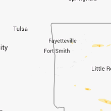
Hail Map for Wednesday, October 17, 2012

Number of Impacted Households on 10/17/2012
0
Impacted by 1" or Larger Hail
0
Impacted by 1.75" or Larger Hail
0
Impacted by 2.5" or Larger Hail
Square Miles of Populated Area Impacted on 10/17/2012
0
Impacted by 1" or Larger Hail
0
Impacted by 1.75" or Larger Hail
0
Impacted by 2.5" or Larger Hail


Cities Most Affected by Hail Storms of 10/17/2012
| Hail Size | Demographics of Zip Codes Affected | ||||||
|---|---|---|---|---|---|---|---|
| City | Count | Average | Largest | Pop Density | House Value | Income | Age |
Hail and Wind Damage Spotted on 10/17/2012
Filter by Report Type:Hail ReportsWind Reports
Missouri
| Local Time | Report Details |
|---|---|
| 2:07 PM CDT | Tree down on a house and the awning was ripped off the hous in greene county MO, 19.9 miles NW of Springfield, MO |
| 2:10 PM CDT | Tree uprooted in ash grove in greene county MO, 17.6 miles WNW of Springfield, MO |
| 2:15 PM CDT | Above ground pool and swingset damaged from wind in greene county MO, 19.4 miles NW of Springfield, MO |
| 2:18 PM CDT | Winds reported at exit 69 on interstate 4 in greene county MO, 4.9 miles W of Springfield, MO |
| 2:22 PM CDT | Rood completely blown off barn and spotters relayed estimated winds up to 75 mph from another report near pleasant hop in polk county MO, 17.6 miles N of Springfield, MO |
| 2:22 PM CDT | Roof completely blown off barn and spotters relayed estimated winds up to 75 mph from another report near pleasant hop in polk county MO, 17.6 miles N of Springfield, MO |
| 2:25 PM CDT | Several trees uprooted between brighton and pleasant hope and heavy damage to outbuildings and barns in polk county MO, 15.9 miles N of Springfield, MO |
| 2:25 PM CDT | Large limb down on highway n just south of i-44 in the road way. winds were estimated from spotters at 65 mp in greene county MO, 10.5 miles W of Springfield, MO |
| 2:27 PM CDT | Reports of two barns destroyed west of pleasant hope near 175th north of highway 215 between brighton and pleasant hop in polk county MO, 17.3 miles N of Springfield, MO |
| 2:29 PM CDT | Small buidlings blown down and 70 mph winds estimate in greene county MO, 6.6 miles NNW of Springfield, MO |
| 2:30 PM CDT | Reports of damage in the area of alliance and ee hwy just southeast of the springfield airport. damage to trailers and metal buildings. damage to siding panels and a tr in greene county MO, 4.4 miles W of Springfield, MO |
| 2:33 PM CDT | Estimated wind gusts up to 65 mph on the west side of springfield in greene county MO, 1.7 miles WSW of Springfield, MO |
| 2:33 PM CDT | Tree blown into house and estimated wind gusts up to 65 mph on the west side of springfield in greene county MO, 1.7 miles WSW of Springfield, MO |
| 2:40 PM CDT | Storm damage reported in greene county MO, 4.9 miles NE of Springfield, MO |
| 2:41 PM CDT | Large limbs down on page stree in greene county MO, 3.1 miles SSW of Springfield, MO |
| 3:00 PM CDT | A couple trees were blown down in the marshfield are in webster county MO, 22.9 miles ENE of Springfield, MO |
| 3:21 PM CDT | Large limbs down on highway 5 south of lebanon and power pole dow in laclede county MO, 46.2 miles NE of Springfield, MO |
| 4:00 PM CDT | Houses and sheds damaged...car damaged in tow in gasconade county MO, 46 miles N of Salem, MO |
| 4:02 PM CDT | *** 2 inj *** two minor injuries...treated and released at the scene. twelve buildings with minor to moderate damage. post office heavily damaged...one employee briefly in gasconade county MO, 46 miles N of Salem, MO |
| 4:02 PM CDT | Houses and sheds damaged...car damaged in tow in gasconade county MO, 46 miles N of Salem, MO |
| 4:02 PM CDT | Post office building has collapsed and part of the fire departments roof was taken off. also... numerous phone and power lines were downed in blan in gasconade county MO, 46 miles N of Salem, MO |
| 4:02 PM CDT | Several 1 to 2 foot diameter trees snapped in gasconade county MO, 39.2 miles N of Salem, MO |
| 4:05 PM CDT | Small tree limbs down in owensvill in gasconade county MO, 49.2 miles N of Salem, MO |
| 4:05 PM CDT | Small tree limbs down in owensville. winds estimated up to 50 mph with visibility down to as low as 200 yard in gasconade county MO, 49.2 miles N of Salem, MO |
| 4:15 PM CDT | 8-10 inch diameter limbs down off of tree tops. 0.5 inch hail lasted about 2 minute in gasconade county MO, 52.5 miles N of Salem, MO |
| 4:15 PM CDT | 8 to 10 inch diameter limbs blown out of the tops of trees in gasconade county MO, 52.5 miles N of Salem, MO |
| 4:15 PM CDT | Trees down in rosebu in gasconade county MO, 52.5 miles N of Salem, MO |
| 4:18 PM CDT | Numerous trees and large tree limbs along with a few power lines downed in the gerald are in franklin county MO, 53.8 miles NNE of Salem, MO |
| 4:20 PM CDT | 8-10 inch diameter limbs down off of tree tops. 0.5 inch hail lasted about 2 minute in gasconade county MO, 52.5 miles N of Salem, MO |
| 4:24 PM CDT | Numerous trees and large tree limbs along with a few power lines downed in the gerald are in franklin county MO, 53.8 miles NNE of Salem, MO |
| 4:30 PM CDT | Power lines down throughout the county with a report of an electirical fir in warren county MO, 52.5 miles WNW of Saint Louis, MO |
| 4:36 PM CDT | Winds estimated up to 50 mp in franklin county MO, 44.9 miles NNE of Salem, MO |
| 4:42 PM CDT | Power lines down throughout the county with a report of an electirical fir in warren county MO, 52.5 miles WNW of Saint Louis, MO |
| 4:44 PM CDT | Trees down on south side of i-70 near foristel in st. charles county MO, 43.2 miles WNW of Saint Louis, MO |
| 4:53 PM CDT | Goal posts at progress park blown ove in st. charles county MO, 38.1 miles WNW of Saint Louis, MO |
| 4:53 PM CDT | Several power lines blown down just south of i-70 on hepperman roa in st. charles county MO, 38.9 miles WNW of Saint Louis, MO |
| 4:55 PM CDT | Storm damage reported in lincoln county MO, 44.8 miles WNW of Saint Louis, MO |
| 4:55 PM CDT | Winds estimated up to 50 mp in franklin county MO, 44.9 miles NNE of Salem, MO |
| 5:05 PM CDT | Winds estimated to 60 mph with 3-inch limbs dow in st. charles county MO, 35.5 miles WNW of Saint Louis, MO |
| 5:10 PM CDT | Winds estimated to 60 mph with 3-inch limbs dow in st. charles county MO, 35.5 miles WNW of Saint Louis, MO |
| 5:23 PM CDT | Storm damage reported in st. charles county MO, 20.3 miles NW of Saint Louis, MO |
| 5:23 PM CDT | Trees down near fee fee road and olive blv in st. louis county MO, 15.6 miles WNW of Saint Louis, MO |
| 5:30 PM CDT | Trees down near cc and olive in the westport are in st. louis county MO, 16.4 miles WNW of Saint Louis, MO |
| 5:38 PM CDT | Storm damage reported in jefferson county MO, 38.9 miles SSW of Saint Louis, MO |
| 5:45 PM CDT | Trees down with the thunderstorm lin in st. louis county MO, 8.6 miles N of Saint Louis, MO |
| 8:30 PM CDT | Large billboards blown in dunklin county MO, 75.2 miles N of Memphis, TN |
Illinois
| Local Time | Report Details |
|---|---|
| 3:33 PM CDT | Off of route 16...house shifted off of foundation and steel framed machine shed sustained damage. also...numerous power poles down in area. time estimated from rada in jersey county IL, 34 miles N of Saint Louis, MO |
| 5:55 PM CDT | Power pole and wires down in st. clair county IL, 7.5 miles S of Saint Louis, MO |
| 6:25 PM CDT | Relayed from the litchfield pd...numerous trees snapped and splintered in montgomery county IL, 47.9 miles NE of Saint Louis, MO |
| 6:35 PM CDT | Late report...microburst with wind speed estimated 90 mph...occurred south and southeast of town mainly along hwy 14. several roofs damaged on homes and farm building in perry county IL, 50 miles NNE of Cape Girardeau, MO |
| 6:40 PM CDT | Fence blown down in residential area on east side of williamsville. time estimate in sangamon county IL, 51.3 miles S of Peoria, IL |
| 7:25 PM CDT | Power pole snapped causing a power outage on the south side of clinton. from dewitt co ema and clinton sheriff. time estimate in de witt county IL, 50 miles SE of Peoria, IL |
Mississippi
| Local Time | Report Details |
|---|---|
| 6:50 PM CDT | Large tree over road at intersection of cobb and hwy 61. powerpoles down on hwy in tunica county MS, 36.8 miles SSW of Memphis, TN |
| 7:50 PM CDT | Large tree over road at intersection of cobb and hwy 61. powerpoles down on hwy in tunica county MS, 36.8 miles SSW of Memphis, TN |
| 8:05 PM CDT | Large tree over road at intersection of cobb and hwy 61. powerpoles down on hwy in tunica county MS, 36.8 miles SSW of Memphis, TN |
| 8:50 PM CDT | Car turned around on highway 51 near arkabutla road. trees down on multiple house in tate county MS, 31.9 miles S of Memphis, TN |
| 9:00 PM CDT | *** 2 inj *** at least one home was damaged. two persons in the home had minor injuries in tallahatchie county MS, 81.5 miles SSW of Memphis, TN |
| 9:00 PM CDT | Quarter sized hail reported near Hernando, MS, 22.3 miles S of Memphis, TN, quarter-sized hail near intersection of byhalia and craft |
| 9:05 PM CDT | Tree down on residence in coahoma county MS, 80.5 miles SSW of Memphis, TN |
| 9:08 PM CDT | Major damage to a home and car...report via social medi in bolivar county MS, 92.4 miles SSW of Memphis, TN |
| 9:25 PM CDT | Awning at coldwater highschool damaged. blown out windows on bus and big trees dow in tate county MS, 31.9 miles S of Memphis, TN |
| 9:26 PM CDT | Trees down around rome in sunflower county MS, 85.6 miles SSW of Memphis, TN |
| 9:30 PM CDT | Storm damage reported in tate county MS, 36.8 miles S of Memphis, TN |
| 9:30 PM CDT | 7-8 mobile homes destroyed and blown off foundation. several houses have roof damage due to trees falling on them. no injuries at this tim in union county MS, 66.6 miles SE of Memphis, TN |
| 9:30 PM CDT | Large tree limbs in tate county MS, 36.8 miles S of Memphis, TN |
| 9:30 PM CDT | Power lines down along highway 4 in tunica. 4 power poles snapped and blocking the roa in tunica county MS, 37.2 miles SSW of Memphis, TN |
| 9:30 PM CDT | One home uninhabitable on countyline road near sunflower county line. one agricultural shop and grain bins with major damage. one child with minor injurie in coahoma county MS, 83.3 miles SSW of Memphis, TN |
| 9:45 PM CDT | Reports of multiple limbs and trees down with some damage to structures along with streets flooded in downtow in washington county MS, 64.7 miles NE of Bastrop, LA |
| 9:45 PM CDT | Sign damage in greenville along with multiple outages and 5700 customers without power. trees also down on cypress and ann stokes rds. damage to a few buildings at cott in washington county MS, 64.7 miles NE of Bastrop, LA |
| 9:45 PM CDT | Sign damage in greenville along with multiple outages and 5700 customers without power. trees also down on cypress and ann stokes rd in washington county MS, 64.7 miles NE of Bastrop, LA |
| 9:50 PM CDT | Several mobile homes with moderate to major roof d in union county MS, 66.6 miles SE of Memphis, TN |
| 10:09 PM CDT | Trees down along carpenter and pearidge...likely tornado in grenada county MS, 68.5 miles WNW of Starkville, MS |
| 10:13 PM CDT | Power lines down and half a roof blown off a home along country meadows rd...possible tornad in grenada county MS, 65.1 miles WNW of Starkville, MS |
| 10:30 PM CDT | Boat overturned off a boat trailer and siding damaged on a house on lott rd in issaquena county MS, 54.1 miles ENE of Bastrop, LA |
| 10:30 PM CDT | 7-8 mobile homes destroyed and blown off foundation. several houses have roof damage due to trees falling on them. no injuries at this tim in union county MS, 66.6 miles SE of Memphis, TN |
| 10:30 PM CDT | Several mobile homes were damaged. several houses have roof damage due to trees falling on the in union county MS, 66.6 miles SE of Memphis, TN |
| 10:50 PM CDT | Around louise and along county barn rd...mobile home damaged with another mobile home turned over...power lines down as wel in humphreys county MS, 52.7 miles NNW of Jackson, MS |
| 10:55 PM CDT | Tree fell on a powerline in the springhill communit in webster county MS, 36.9 miles WNW of Starkville, MS |
| 10:55 PM CDT | Tree fell on a powerline in montevista communit in webster county MS, 29.4 miles WNW of Starkville, MS |
| 11:02 PM CDT | Heavy damage reported along lake city rd in yazoo county MS, 45.4 miles NNW of Jackson, MS |
| 11:08 PM CDT | Couple of trees and limbs down in tow in humphreys county MS, 63.3 miles NNW of Jackson, MS |
| 11:30 PM CDT | Tree down on a home along myrleville rd in yazoo county MS, 37.1 miles NNW of Jackson, MS |
| 12:09 AM CDT | A few trees dow in madison county MS, 24.9 miles NNE of Jackson, MS |
| 12:14 AM CDT | Trees and power lines down e and se of canto in madison county MS, 25.1 miles NE of Jackson, MS |
| 12:23 AM CDT | Trees down on barn in madison county MS, 21.5 miles NNE of Jackson, MS |
| 12:32 AM CDT | Two homes damaged and trees down along e frankling st. a couple chicken houses were damaged along hwy 16 e and a tree was down on a house. possible tornad in leake county MS, 49.6 miles NE of Jackson, MS |
| 12:35 AM CDT | Several trees down along hwy 35 in leake county MS, 46.7 miles ENE of Jackson, MS |
| 12:40 AM CDT | Several trees down across hwy 487. possible tornad in leake county MS, 49.7 miles ENE of Jackson, MS |
| 12:55 AM CDT | *** 1 inj *** person trapped in mobile home with tree on top on russell community rd. lots of trees down in the area as wel in scott county MS, 45.7 miles E of Jackson, MS |
| 12:55 AM CDT | Tree down on a house ne of forest...likely tornado in scott county MS, 47.7 miles E of Jackson, MS |
| 1:00 AM CDT | Structure damage on jim owens rd along with trees and powerlines dow in scott county MS, 50.4 miles E of Jackson, MS |
| 1:13 AM CDT | Damage to a couple homes on cr 505 and lots of trees and powerlines down...possible tornad in neshoba county MS, 56.2 miles SSW of Starkville, MS |
| 1:42 AM CDT | Tree down across new hope rd in kemper county MS, 52 miles S of Starkville, MS |
| 1:52 AM CDT | One house was destroyed. ten homes had wind damage and some of them had trees on them. approximately six poultry houses were damaged. a number of trees and utility line in leake county MS, 50 miles NE of Jackson, MS |
| 1:55 AM CDT | Quarter sized hail reported near Enterprise, MS, 82.4 miles S of Starkville, MS, reports of nickel and quarter sized hail |
| 2:09 AM CDT | Power lines down in franklin county MS, 62.3 miles SSW of Jackson, MS |
| 3:05 AM CDT | Several large limbs down within the city limits. one home received some damage when a limb fell onto a service in jasper county MS, 57.2 miles ESE of Jackson, MS |
Arkansas
| Local Time | Report Details |
|---|---|
| 7:37 PM CDT | Trees and powerlines down in clarendo in monroe county AR, 55 miles E of Little Rock, AR |
| 7:45 PM CDT | Large tree reported dow in stone county AR, 77.9 miles N of Little Rock, AR |
| 7:58 PM CDT | Several trees down across the cit in union county AR, 52.9 miles NW of Bastrop, LA |
| 8:00 PM CDT | Trees down on county road 300 in horno in phillips county AR, 49.2 miles SW of Memphis, TN |
| 8:40 PM CDT | Quarter sized hail reported near Arkadelphia, AR, 47.6 miles ENE of Nashville, AR |
| 8:47 PM CDT | A few trees were blown down in ashley county AR, 31.4 miles N of Bastrop, LA |
| 9:07 PM CDT | A few trees were down in ashley county AR, 19.4 miles N of Bastrop, LA |
| 9:32 PM CDT | A couple trees down in lake chicot st park along hwy 257 in chicot county AR, 55.1 miles NE of Bastrop, LA |
| 9:50 PM CDT | Large limbs and power lines down throughout the city of monticell in drew county AR, 58.5 miles N of Bastrop, LA |
| 9:55 PM CDT | Power lines down in dermott in chicot county AR, 58.7 miles NNE of Bastrop, LA |
| 9:55 PM CDT | Power lines down in dermott. many limbs down and a billboard torn apar in chicot county AR, 58.7 miles NNE of Bastrop, LA |
Tennessee
| Local Time | Report Details |
|---|---|
| 8:12 PM CDT | Observed 195 foot of fence blown down with 2ft wooden poles snapped or uprooted conrete and all. two 28 inch pine trees snapped in half. one 16 inch tree snapped in hal in shelby county TN, 15.3 miles NE of Memphis, TN |
| 8:30 PM CDT | Quarter sized hail reported near Munford, TN, 25 miles NE of Memphis, TN, quarter-sized hail near tipton/shelby county line. near intersection of dead fall and mcquiston roads. |
| 8:35 PM CDT | Several trees and powerlines down. tree on traile in shelby county TN, 15.3 miles NE of Memphis, TN |
| 9:00 PM CDT | Observed 195 foot of fence blown down with 2ft wooden poles snapped or uprooted conrete and all. two 28 inch pine trees snapped in half. one 16 inch tree snapped in hal in shelby county TN, 15.3 miles NE of Memphis, TN |
| 9:00 PM CDT | Quarter sized hail reported near Millington, TN, 15.3 miles NE of Memphis, TN |
| 11:23 PM CDT | Report of a 48 mph wind gust...roof shingles blown off home on garson r in lewis county TN, 52.1 miles N of Florence, AL |
| 1:40 AM CDT | A tree and several large tree limbs were blown down at 911 trent road in lafayett in macon county TN, 48.3 miles ENE of Nashville, TN |
Louisiana
| Local Time | Report Details |
|---|---|
| 11:02 PM CDT | Trees dow in ouachita county LA, 32.4 miles SSW of Bastrop, LA |
| 11:55 PM CDT | Roof damage to a home in franklin county LA, 51.8 miles S of Bastrop, LA |
| 12:40 AM CDT | Downed trees caused traffic acciden in vernon county LA, 86.8 miles NW of Lafayette, LA |
| 12:59 AM CDT | Reports of trees and power lines down. time estimated from rada in rapides county LA, 78.3 miles N of Lafayette, LA |
Connect with Interactive Hail Maps