

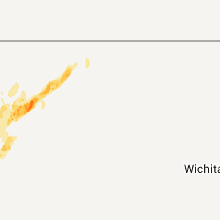
Hail Map for Thursday, October 6, 2011

Number of Impacted Households on 10/6/2011
0
Impacted by 1" or Larger Hail
0
Impacted by 1.75" or Larger Hail
0
Impacted by 2.5" or Larger Hail
Square Miles of Populated Area Impacted on 10/6/2011
0
Impacted by 1" or Larger Hail
0
Impacted by 1.75" or Larger Hail
0
Impacted by 2.5" or Larger Hail


Cities Most Affected by Hail Storms of 10/6/2011
| Hail Size | Demographics of Zip Codes Affected | ||||||
|---|---|---|---|---|---|---|---|
| City | Count | Average | Largest | Pop Density | House Value | Income | Age |
| Hermosa, SD | 1 | 1.75 | 1.75 | 3 | $127k | $35.4k | 44.4 |
Hail and Wind Damage Spotted on 10/6/2011
Filter by Report Type:Hail ReportsWind Reports
South Dakota
| Local Time | Report Details |
|---|---|
| 2:32 PM MDT | Quarter sized hail reported near Hot Springs, SD, 39.8 miles SSW of Rapid City, SD |
| 3:09 PM MDT | Quarter sized hail reported near Fairburn, SD, 29.8 miles S of Rapid City, SD |
| 3:20 PM MDT | Golf Ball sized hail reported near Hermosa, SD, 21.7 miles S of Rapid City, SD |
| 3:32 PM MDT | Quarter sized hail reported near Rapid City, SD, 5 miles ESE of Rapid City, SD |
| 10:00 PM UTC | Storm damage reported in custer county SD, 29.3 miles S of Rapid City, SD |
| 10:15 PM UTC | Storm damage reported in shannon county SD, 72.3 miles SSE of Rapid City, SD |
| 11:00 PM UTC | Storm damage reported in meade county SD, 43.2 miles NE of Rapid City, SD |
| 11:11 PM UTC | Hail size .75 inches in bennett county SD, 47.9 miles WNW of Valentine, NE |
| 11:20 PM UTC | Hail size .50 inches in bennett county SD, 63.1 miles WNW of Valentine, NE |
| 11:30 PM UTC | Roof blown off seed house about 1 block. damage to tracto in jackson county SD, 66.8 miles E of Rapid City, SD |
| 11:30 PM UTC | Roof blown off seed house about 1 block. damage to tractor. pieces of wood driven into seed barrel...walls...tractor. glass everywher in jackson county SD, 64.9 miles E of Rapid City, SD |
| 11:50 PM UTC | Storm damage reported in jackson county SD, 62.7 miles NW of Valentine, NE |
| 12:00 AM UTC | Dime size hai in jackson county SD, 51.8 miles SW of Pierre, SD |
| 12:01 AM UTC | Storm damage reported in meade county SD, 72.7 miles NE of Rapid City, SD |
| 6:01 PM MDT | Quarter sized hail reported near Faith, SD, 72.7 miles NE of Rapid City, SD |
| 12:20 AM UTC | Storm damage reported in jackson county SD, 48.8 miles SW of Pierre, SD |
| 12:24 AM UTC | Storm damage reported in meade county SD, 87.9 miles NE of Rapid City, SD |
| 12:30 AM UTC | Storm damage reported in jackson county SD, 62.7 miles NW of Valentine, NE |
| 12:30 AM UTC | Also received 1.45 rain in jones county SD, 42.7 miles SW of Pierre, SD |
| 12:53 AM UTC | Storm damage reported in todd county SD, 42.9 miles NW of Valentine, NE |
| 1:00 AM UTC | Also received dime size hail and 3.35 rain in stanley county SD, 23.7 miles WSW of Pierre, SD |
| 1:00 AM UTC | Storm damage reported in ziebach county SD, 100 miles NW of Pierre, SD |
| 1:00 AM UTC | 12 inch diameter trees b in ziebach county SD, 100 miles NW of Pierre, SD |
| 1:15 AM UTC | Storm damage reported in mellette county SD, 56 miles NNW of Valentine, NE |
| 1:15 AM UTC | 6 power poles blown down. no electricity since last evening in corson county SD, 103.2 miles SSW of Bismarck, ND |
| 1:35 AM UTC | Also received 2 to 3 inches of rain in dewey county SD, 39.6 miles NNW of Pierre, SD |
| 1:35 AM UTC | Storm damage reported in sully county SD, 16 miles N of Pierre, SD |
| 1:50 AM UTC | Storm damage reported in haakon county SD, 44.8 miles WSW of Pierre, SD |
| 8:50 PM CDT | Quarter sized hail reported near Murdo, SD, 30.6 miles SW of Pierre, SD, also had winds around 50 mph |
| 3:00 AM UTC | Storm damage reported in butte county SD, 71.1 miles N of Rapid City, SD |
| 3:20 AM UTC | Storm damage reported in tripp county SD, 50.2 miles ENE of Valentine, NE |
| 4:10 AM UTC | Storm damage reported in tripp county SD, 42 miles NE of Valentine, NE |
Nebraska
| Local Time | Report Details |
|---|---|
| 11:22 PM UTC | Estimated 60 to 70 mph winds combining with pea size hail and very heavy rai in cherry county NE, 58.4 miles W of Valentine, NE |
| 6:05 PM MDT | Ping Pong Ball sized hail reported near Merriman, NE, 58.4 miles W of Valentine, NE, quarter to ping ball sized hail occcured in merriman. rescue unit reported highway green from stripped leaves. |
| 6:07 PM MDT | Ping Pong Ball sized hail reported near Merriman, NE, 58.4 miles W of Valentine, NE, very heavy rain and wind gusts also reported. |
| 1:07 AM UTC | Accompanied with pea size hail and driving rai in mcpherson county NE, 40.8 miles NNW of North Platte, NE |
| 1:20 AM UTC | Storm damage reported in hooker county NE, 50.6 miles NNW of North Platte, NE |
| 1:43 AM UTC | Storm damage reported in hooker county NE, 61.2 miles SSW of Valentine, NE |
| 2:28 AM UTC | Storm damage reported in hooker county NE, 61.3 miles NNW of North Platte, NE |
| 2:40 AM UTC | Storm damage reported in cherry county NE, 0.3 miles S of Valentine, NE |
| 2:42 AM UTC | Storm damage reported in cherry county NE, 21.2 miles SSE of Valentine, NE |
Wyoming
| Local Time | Report Details |
|---|---|
| 12:59 AM UTC | Several reports of d in weston county WY, 50.9 miles WSW of Rapid City, SD |
| 1:29 AM UTC | Storm damage reported in weston county WY, 45.5 miles ESE of Gillette, WY |
| 1:40 AM UTC | Storm damage reported in crook county WY, 45.5 miles E of Gillette, WY |
| 1:40 AM UTC | Storm damage reported in crook county WY, 35.2 miles E of Gillette, WY |
| 1:49 AM UTC | Storm damage reported in crook county WY, 34.7 miles E of Gillette, WY |
| 2:00 AM UTC | 0.53 inches of rain in crook county WY, 54.3 miles NE of Gillette, WY |
Kansas
| Local Time | Report Details |
|---|---|
| 7:30 PM MDT | Half Dollar sized hail reported near Sharon Springs, KS, 51.6 miles SW of Colby, KS |
| 7:35 PM MDT | Quarter sized hail reported near Syracuse, KS, 48 miles WNW of Garden City, KS |
| 4:25 AM UTC | Observation from ksgrinn2 in gove county KS, 29.3 miles SE of Colby, KS |
Connect with Interactive Hail Maps