

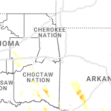
Hail Map for Friday, September 8, 2023

Number of Impacted Households on 9/8/2023
0
Impacted by 1" or Larger Hail
0
Impacted by 1.75" or Larger Hail
0
Impacted by 2.5" or Larger Hail
Square Miles of Populated Area Impacted on 9/8/2023
0
Impacted by 1" or Larger Hail
0
Impacted by 1.75" or Larger Hail
0
Impacted by 2.5" or Larger Hail


Cities Most Affected by Hail Storms of 9/8/2023
| Hail Size | Demographics of Zip Codes Affected | ||||||
|---|---|---|---|---|---|---|---|
| City | Count | Average | Largest | Pop Density | House Value | Income | Age |
Hail and Wind Damage Spotted on 9/8/2023
Filter by Report Type:Hail ReportsWind Reports
States Impacted
Arkansas, Florida, Louisiana, Connecticut, New Jersey, Massachusetts, North Carolina, Delaware, Texas, New York, New Hampshire, Pennsylvania, Maine, Vermont, Virginia, Georgia, Oklahoma, Maryland, West Virginia, South DakotaArkansas
| Local Time | Report Details |
|---|---|
| 7:52 AM CDT | Numerous trees and power lines blown down along highway 8 between caddo gap and glenwoo in montgomery county AR, 33.2 miles NNE of Nashville, AR |
| 7:55 AM CDT | A tree was blown down in this are in pike county AR, 28.1 miles NNE of Nashville, AR |
| 7:57 AM CDT | Numerous trees and power lines reported throughout the count in pike county AR, 24 miles NNE of Nashville, AR |
| 8:40 AM CDT | Tree downed on highway 371 in prescot in nevada county AR, 28.2 miles ESE of Nashville, AR |
| 8:45 AM CDT | Tree downed along highway 73 west on the east side of hop in hempstead county AR, 25.8 miles SE of Nashville, AR |
| 8:50 AM CDT | Tree downed on highway 32 near the hempstead county lin in nevada county AR, 33.5 miles SE of Nashville, AR |
Florida
| Local Time | Report Details |
|---|---|
| 11:50 AM EDT | Quarter sized hail reported near Crescent City, FL, 61.9 miles S of Jacksonville, FL, sheriff deputy in crescent city reported hail to near 1 inch in size. |
| 12:50 PM EDT | Several large trees down along the area of walnut ave and bayberry street west of bunnell... fl in western flagler county. time estimated from rada in flagler county FL, 62.3 miles SSE of Jacksonville, FL |
Louisiana
| Local Time | Report Details |
|---|---|
| 11:57 AM CDT | Pictures received of trees down south of boyce. time estimated by rada in rapides county LA, 86 miles NNW of Lafayette, LA |
| 12:00 PM CDT | Trees down along hwy 8 in the slagle area. time estimated by rada in vernon county LA, 84.6 miles NNE of Beaumont, TX |
| 12:05 PM CDT | Social media report of portion of fence blown down from thunderstorm winds. time estimated by rada in rapides county LA, 80.1 miles NNW of Lafayette, LA |
| 12:10 PM CDT | Rapides 911 reports trees down in the tioga are in rapides county LA, 85.1 miles NNW of Lafayette, LA |
| 12:15 PM CDT | Rapides 911 reports sporadic trees down east of pineville. time estimated by rada in rapides county LA, 80.7 miles NNW of Lafayette, LA |
| 12:35 PM CDT | Rapides 911 reports numerous trees down along and near hwy11 in rapides county LA, 67.7 miles NW of Lafayette, LA |
| 12:35 PM CDT | Report from mping: 1-inch tree limbs broken; shingles blown of in rapides county LA, 78.2 miles NNW of Lafayette, LA |
| 12:55 PM CDT | Severe thunderstorm wind gusts down numerous trees throughout the parish from near the communities of mansura... cottonport... and bunki in avoyelles county LA, 52.4 miles N of Lafayette, LA |
| 1:00 PM CDT | Tree damage in the plainview fd distric in rapides county LA, 67 miles NW of Lafayette, LA |
| 1:04 PM CDT | Thunderstorm caused a large tree branch to fall across 10 mile roa in allen county LA, 62.8 miles NW of Lafayette, LA |
| 1:15 PM CDT | Significant tree and powerline damage parish wide. will get a full report of details from the emd later this evenin in allen county LA, 52.2 miles WNW of Lafayette, LA |
| 1:25 PM CDT | Severe thunderstorm wind gusts downed numerous trees and powerlines in the ragley area. the eastern part of the parish also experienced widespread tree and powerline da in beauregard county LA, 41.7 miles NE of Beaumont, TX |
| 1:30 PM CDT | Severe thunderstorm wind gusts caused a large tree to fall on a house in port barr in st. landry county LA, 23.7 miles N of Lafayette, LA |
| 1:53 PM CDT | Trees down between grosse tete and maringoui in iberville county LA, 36.3 miles ENE of Lafayette, LA |
| 1:53 PM CDT | Measured wind from the lsu mesone in acadia county LA, 20 miles W of Lafayette, LA |
| 1:53 PM CDT | Broadcast media reports roof damage at the healthworks gym in crowle in acadia county LA, 21.7 miles W of Lafayette, LA |
| 1:55 PM CDT | Report from mping: 1-inch tree limbs broken; shingles blown of in east baton rouge county LA, 61.9 miles E of Lafayette, LA |
| 1:56 PM CDT | *** 1 inj *** corrects previous tstm wnd dmg report from 2 nnw crowley. large commercial sign in crowley blown down on top of car. one person was injured and trapped in in acadia county LA, 21.7 miles W of Lafayette, LA |
| 2:00 PM CDT | Cesna plane was flipped and destroye in calcasieu county LA, 31 miles E of Beaumont, TX |
| 2:01 PM CDT | Power line down on sunset d in livingston county LA, 63.8 miles NW of New Orleans, LA |
| 2:04 PM CDT | Asos station klch lake charles. station reported gusts of 50 mp in calcasieu county LA, 31 miles E of Beaumont, TX |
| 2:12 PM CDT | Report tree down in cad in st. martin county LA, 11.4 miles SE of Lafayette, LA |
| 2:22 PM CDT | Power lines down in white castl in iberville county LA, 52 miles E of Lafayette, LA |
| 2:23 PM CDT | Report from mping: 1-inch tree limbs broken; shingles blown of in cameron county LA, 34.3 miles E of Beaumont, TX |
| 2:34 PM CDT | Thunderstorm caused a tree to fall down on clarence road near the powell road intersectio in allen county LA, 44.8 miles WNW of Lafayette, LA |
| 2:35 PM CDT | Severe thunderstorm wind gusts downed numerous trees and powerlines parish wid in iberia county LA, 19.6 miles SE of Lafayette, LA |
| 2:50 PM CDT | Small tree down on hwy 7 in assumption county LA, 51.8 miles ESE of Lafayette, LA |
| 2:57 PM CDT | Large section of tree blown down onto house. time estimated by rada in calcasieu county LA, 44.5 miles ENE of Beaumont, TX |
| 3:24 PM CDT | Corrects previous tstm wnd gst report from 19 sw burns point. offshore platform measured wind gust of 76 mp in gmz455 county LA, 59.9 miles SSE of Lafayette, LA |
| 3:35 PM CDT | Offshore platform measured wind gust of 72 mp in gmz455 county LA, 59.9 miles SSE of Lafayette, LA |
| 4:55 PM CDT | Awos station keke 74 s burns poin in gmz475 county LA, 121.4 miles SSE of Lafayette, LA |
Connecticut
| Local Time | Report Details |
|---|---|
| 1:00 PM EDT | Corrects previous non-tstm wnd dmg report from andover. corrects previous non-tstm wnd dmg report from andover. tree and wires down on shoddy mill road. relayed by amat in tolland county CT, 49.9 miles W of Providence, RI |
| 1:13 PM EDT | Quarter sized hail reported near Storrs Mansfield, CT, 43.8 miles W of Providence, RI, reported by spotter at university of connecticut. |
| 1:55 PM EDT | Corrects previous tstm wnd dmg report from woodstock. several trees down. area of dugg hill road. relayed by amateur radi in windham county CT, 30.6 miles WNW of Providence, RI |
| 4:10 PM EDT | Trees and wires down throughout the town of new milford. time estimated by rada in litchfield county CT, 68.9 miles NNE of Brooklyn, NY |
| 4:38 PM EDT | Limbs and wires dow in fairfield county CT, 59.8 miles NNE of Brooklyn, NY |
| 4:42 PM EDT | Limbs and wires dow in fairfield county CT, 63.2 miles NNE of Brooklyn, NY |
| 4:52 PM EDT | A few trees down on sabbaday roa in litchfield county CT, 75.2 miles NNE of Brooklyn, NY |
| 5:06 PM EDT | A couple of wires down on tirus road in litchfield county CT, 74.1 miles NNE of Brooklyn, NY |
| 5:17 PM EDT | Limbs and wires dow in fairfield county CT, 64 miles NE of Brooklyn, NY |
| 6:10 PM EDT | Trees and wires down on school street and nonotuck street. relayed by amateur radi in hartford county CT, 60.6 miles W of Providence, RI |
| 6:10 PM EDT | Tree down on house on brookside lane and a tree downed on a vehicle on high street. time estimated from rada in tolland county CT, 55.1 miles W of Providence, RI |
| 9:30 PM EDT | Several limbs down on stone st between new britain avenue and i-8 in hartford county CT, 65.6 miles W of Providence, RI |
New Jersey
| Local Time | Report Details |
|---|---|
| 1:50 PM EDT | Report via social media of trees and wires down in howell n in monmouth county NJ, 38.7 miles SSW of Brooklyn, NY |
| 1:51 PM EDT | Trees down in the eastern portion of pemberton twp. time estimated from rada in burlington county NJ, 56.8 miles SSW of Brooklyn, NY |
| 1:55 PM EDT | Reports of trees down on wires in colts neck twp. time estimated from rada in monmouth county NJ, 29.7 miles SSW of Brooklyn, NY |
| 2:23 PM EDT | Several reports of trees down on wires across freehold twp. time estimated from rada in monmouth county NJ, 35 miles SSW of Brooklyn, NY |
| 2:23 PM EDT | Report of trees down on wires in keyport. time estimated from rada in monmouth county NJ, 20.6 miles SSW of Brooklyn, NY |
| 2:30 PM EDT | Reports of trees down on wires in freehold borough. time estimated from rada in monmouth county NJ, 33.3 miles SSW of Brooklyn, NY |
| 2:45 PM EDT | 1 inch hail reported at 255 us highway 46 in saddle broo in bergen county NJ, 14.6 miles NNW of Brooklyn, NY |
| 2:59 PM EDT | Tree down on roadway at bryant st and elm av in union county NJ, 16.2 miles WSW of Brooklyn, NY |
| 2:59 PM EDT | Tree down blocking the road on harrison av in union county NJ, 16 miles WSW of Brooklyn, NY |
| 3:05 PM EDT | Quarter sized hail reported near Saddle River, NJ, 26.7 miles NNW of Brooklyn, NY |
| 3:05 PM EDT | Social media photo of a large... healthy tree with half of its truck snapped off. time estimated from rada in mercer county NJ, 40.4 miles SW of Brooklyn, NY |
| 3:06 PM EDT | Large tree down on powerline at 203 3rd avenu in union county NJ, 14.9 miles W of Brooklyn, NY |
| 3:10 PM EDT | Large tree limbs fallen on car in ironbound section of newar in essex county NJ, 9.8 miles WNW of Brooklyn, NY |
| 3:17 PM EDT | Tree branches down on the roa in essex county NJ, 19.1 miles WNW of Brooklyn, NY |
| 3:19 PM EDT | A 66 mph thunderstorm wind gust was reported by the teb aso in bergen county NJ, 12.1 miles NNW of Brooklyn, NY |
| 3:20 PM EDT | Tree limbs broken and on ground with time estimated by rada in bergen county NJ, 22.1 miles N of Brooklyn, NY |
| 3:24 PM EDT | Quarter sized hail reported near Chatham, NJ, 23.4 miles W of Brooklyn, NY, dime to quarter sized hail. shredded maple leaves. wind gusts of 15-20 mph. |
| 3:25 PM EDT | Large tree uprooted and down on corner of street blocking part of the roa in bergen county NJ, 21.9 miles N of Brooklyn, NY |
| 3:30 PM EDT | Report of trees down in east hanover on social medi in morris county NJ, 21.6 miles WNW of Brooklyn, NY |
| 3:30 PM EDT | A large white pine uprooted and completely blocking the roa in bergen county NJ, 23.3 miles N of Brooklyn, NY |
| 3:36 PM EDT | Large tree down near hanover park high school. power is out in the area as well. time estimated from rada in morris county NJ, 21.3 miles WNW of Brooklyn, NY |
| 3:38 PM EDT | Report of extensive tree damage and downed trees across east hanover on social media. time estimated with rada in morris county NJ, 21.6 miles WNW of Brooklyn, NY |
| 3:47 PM EDT | Report from mping: 3-inch tree limbs broken; power poles broke in bergen county NJ, 21.9 miles N of Brooklyn, NY |
| 4:01 PM EDT | Quarter sized hail reported near Browns Mills, NJ, 59.6 miles SSW of Brooklyn, NY, social media video showing quarter sized hail falling in pemberton township. time estimated from radar. |
| 4:08 PM EDT | Ping Pong Ball sized hail reported near Browns Mills, NJ, 57.9 miles SSW of Brooklyn, NY, social media photo of ping pong ball sized hail in browns mills. time estimated from radar. |
| 4:30 PM EDT | Two reports of trees down on power lines in allentown. time estimated from rada in monmouth county NJ, 47.1 miles SW of Brooklyn, NY |
| 4:38 PM EDT | Ping Pong Ball sized hail reported near Browns Mills, NJ, 58.8 miles SSW of Brooklyn, NY, social media photo of ping pong ball sized hail in browns mills. time estimated from radar. |
| 4:47 PM EDT | Reports of trees and power lines down in franklin twp. time estimated from rada in hunterdon county NJ, 49.2 miles W of Brooklyn, NY |
| 5:05 PM EDT | Half Dollar sized hail reported near Long Valley, NJ, 41.4 miles W of Brooklyn, NY, photos from trained spotter showed hail as large as half dollar size in long valley. hail fell for 5 minutes. |
| 5:06 PM EDT | Downed tree on us 46 westbound east of cr 604/nj 182/willow grove st (mount olive twp) all lanes closed. time estimated from rada in morris county NJ, 44.9 miles WNW of Brooklyn, NY |
| 5:07 PM EDT | Quarter sized hail reported near Long Valley, NJ, 42 miles W of Brooklyn, NY, report from mping: quarter (1.00 in.). |
| 5:20 PM EDT | Reports of trees and power lines down in byram twp. time estimated from rada in sussex county NJ, 41.4 miles WNW of Brooklyn, NY |
| 5:20 PM EDT | Reports of trees and power lines down in green twp. time estimated from rada in sussex county NJ, 46 miles WNW of Brooklyn, NY |
| 5:48 PM EDT | Reports of trees and power lines down in belvidere. time estimated from rada in warren county NJ, 50.5 miles SE of Scranton, PA |
Massachusetts
| Local Time | Report Details |
|---|---|
| 1:57 PM EDT | Quarter sized hail reported near West Brookfield, MA, 47.6 miles NW of Providence, RI, quarter size hail. |
| 2:00 PM EDT | Laarge tree down on blackmere road. relayed by amateur radi in worcester county MA, 30.9 miles WNW of Providence, RI |
| 2:13 PM EDT | Trees down on riverlin street. relayed by amateur radi in worcester county MA, 31.5 miles NW of Providence, RI |
| 2:15 PM EDT | Tree down across blackstone street and tree down across wheelock road. relayed by amateur radi in worcester county MA, 29.1 miles NW of Providence, RI |
| 2:17 PM EDT | Tree down on a house on west main street. trees down on wires on west main stree in worcester county MA, 32.6 miles NNW of Providence, RI |
| 2:25 PM EDT | Multiple trees down with 12+ inch diameter at tuttle drive and lothrop roa in middlesex county MA, 44.7 miles N of Providence, RI |
| 2:25 PM EDT | Multiple trees down along central st. windsor ave... prospect street and main stree in middlesex county MA, 45.4 miles N of Providence, RI |
| 2:30 PM EDT | 5-6 trees snapped in a stright line along route 117/main s in worcester county MA, 42.9 miles NNW of Providence, RI |
| 2:37 PM EDT | Numerous reports of trees downed across town. time estimated from rada in middlesex county MA, 43.3 miles N of Providence, RI |
| 2:40 PM EDT | 2 trees down on newtown roa in middlesex county MA, 45.4 miles N of Providence, RI |
| 2:40 PM EDT | Numerous trees down and snapped. straight line sw to ne after the heavy rainfal in middlesex county MA, 53.6 miles N of Providence, RI |
| 2:45 PM EDT | Tree down on longmeadow roa in middlesex county MA, 52.2 miles N of Providence, RI |
| 2:45 PM EDT | Tree down on wires on porter road. trees down on house and through the window of a home on frederick stree in middlesex county MA, 53.6 miles N of Providence, RI |
| 2:53 PM EDT | In lowell wires were down on rodgers s in middlesex county MA, 56.6 miles N of Providence, RI |
| 3:00 PM EDT | In lowell... there were wires down on monadnock av in middlesex county MA, 55.7 miles N of Providence, RI |
| 3:00 PM EDT | Quarter sized hail reported near Andover, MA, 59.4 miles NNE of Providence, RI |
| 3:00 PM EDT | Multiple reports of trees and wires down across town. tree down with limbs on the roof of a home with 2 broken windows on beacon hill boulevar in essex county MA, 59.4 miles NNE of Providence, RI |
| 3:12 PM EDT | Reported by trained spotte in essex county MA, 66.8 miles NNE of Providence, RI |
| 3:40 PM EDT | Tree and power lines down on brattleboro road. relayed by amateur radi in franklin county MA, 71.5 miles E of Schenectady, NY |
| 4:48 PM EDT | Tree down on east hoosac street in berkshire county MA, 44.3 miles ESE of Schenectady, NY |
| 5:30 PM EDT | Wires down on elm street. relayed by amateur radi in hampshire county MA, 72.2 miles WNW of Providence, RI |
| 5:30 PM EDT | Wires down on jackson street. relayed by amateur radi in hampshire county MA, 72.4 miles ESE of Schenectady, NY |
| 5:45 PM EDT | Tree and wires down on granby road. relayed by amateur radi in hampden county MA, 75 miles SE of Schenectady, NY |
| 6:10 PM EDT | Tree down on a car on sylvester road. person was trapped... but not injured. relayed by amateur radi in hampshire county MA, 72.4 miles ESE of Schenectady, NY |
| 6:15 PM EDT | Report from mping: 1-inch tree limbs broken; shingles blown of in hampshire county MA, 69.2 miles WNW of Providence, RI |
| 6:20 PM EDT | Tree uprooted and wires down on dwight street. relayed by amateur radi in hampshire county MA, 72.2 miles WNW of Providence, RI |
| 6:25 PM EDT | Tree down on warren road. relayed by amateur radi in hampden county MA, 45.4 miles WNW of Providence, RI |
| 6:45 PM EDT | Tree and wires down. report relayed by amateur radi in franklin county MA, 70.7 miles ESE of Schenectady, NY |
| 7:06 PM EDT | Tree downed blocking intervale road by rte 68. time estimated from rada in worcester county MA, 51 miles NW of Providence, RI |
| 7:21 PM EDT | Quarter sized hail reported near Sterling, MA, 45.3 miles NNW of Providence, RI |
North Carolina
| Local Time | Report Details |
|---|---|
| 2:18 PM EDT | Emergency manager reported multiple trees down... with both lanes blocked in the area of 14900 garland highwa in sampson county NC, 46.7 miles NNW of Wilmington, NC |
| 3:05 PM EDT | *** 1 inj *** tree on car on e. main and n. lee. 1 passenger in the car was injure in johnston county NC, 28.5 miles SSE of Raleigh, NC |
| 3:07 PM EDT | A large tree was blown down near the intersection of e hill st and n lee st in benson. the tree took out some power lines and blocked the intersectio in johnston county NC, 28.5 miles SSE of Raleigh, NC |
| 3:32 PM EDT | One tree blown down on a power pole near the 400 block of n southerland street in mount oliv in wayne county NC, 51.7 miles SE of Raleigh, NC |
| 3:32 PM EDT | One tree blown down near the intersection of kelly springs rd and nc 55 hwy east near mount oliv in wayne county NC, 53.5 miles SE of Raleigh, NC |
| 3:45 PM EDT | Quarter sized hail reported near Fuquay Varina, NC, 16 miles SSW of Raleigh, NC, quarter sized hail reported. |
| 3:46 PM EDT | Corrects previous tstm wnd dmg report from 4 e fuquay-varina. utility company reports power outages due to fallen trees on power equipment near the intersection of dwig in wake county NC, 13.7 miles SSW of Raleigh, NC |
| 3:52 PM EDT | Report from mping: 1-inch tree limbs broken; shingles blown off. time estimated by rada in wake county NC, 8.9 miles WSW of Raleigh, NC |
| 3:53 PM EDT | Report from mping: trees uprooted or snapped; roof blown off. time updated based on rada in wake county NC, 8.1 miles WSW of Raleigh, NC |
| 4:05 PM EDT | A tree was blown down and blocking one lane of traffic near 750 forehand rd. time estimated by rada in wayne county NC, 45.3 miles ESE of Raleigh, NC |
| 4:08 PM EDT | A tree was blown down across both lanes of traffic of airport rd near big daddys r in wayne county NC, 43.7 miles ESE of Raleigh, NC |
| 4:20 PM EDT | Media reports a large tree down near the intersection of slabtown rd and morningside rd near lucama. time estimated by rada in wilson county NC, 41 miles ESE of Raleigh, NC |
| 4:21 PM EDT | Greene county 911 call center reports tree down on power lines near intersection of hwy13 s and rodell barrow rd. time estimated by rada in greene county NC, 52.1 miles ESE of Raleigh, NC |
| 4:21 PM EDT | Storm damage reported in wake county NC, 10.6 miles NW of Raleigh, NC |
| 4:28 PM EDT | Utility company reports power outages due to fallen trees on powerlines near the intersection of holloman rd and page rd in bethesda. time estimated by rada in durham county NC, 14.6 miles NW of Raleigh, NC |
| 4:33 PM EDT | A tree was reported down near the intersection of us highway 301 and new bern st. time estimated by rada in wilson county NC, 42.1 miles E of Raleigh, NC |
| 4:33 PM EDT | A tree was reported down near the intersection of martin luther king jr parkway and tuskeegee st. time estimated by rada in wilson county NC, 42.5 miles E of Raleigh, NC |
| 4:33 PM EDT | A tree was reported down near the intersection of nash st and reid st in wilson. time estimated by rada in wilson county NC, 42 miles E of Raleigh, NC |
| 4:34 PM EDT | A tree was reported down near the intersection of jackson st and green st in wilson. time estimated by rada in wilson county NC, 41.4 miles E of Raleigh, NC |
| 4:38 PM EDT | Trees down on corbett av in wilson county NC, 41.3 miles E of Raleigh, NC |
| 4:40 PM EDT | 1 tree down on burgess rd between cone rd and bryantown r in nash county NC, 25.5 miles ENE of Raleigh, NC |
| 4:42 PM EDT | A tree was reported down near the intersection of pearson st and gold st in wilson. time estimated by rada in wilson county NC, 40.7 miles E of Raleigh, NC |
| 4:45 PM EDT | Utility company reports power outages due to fallen trees near the intersection of holly rd and topez ln west of spring hope. time estimated by rada in nash county NC, 28.1 miles ENE of Raleigh, NC |
| 4:46 PM EDT | Utility company reports power outages due to fallen trees on power equipment near the intersection of dwight rowland rd and kennebec rd in willow spring in wake county NC, 13.7 miles SSW of Raleigh, NC |
| 4:53 PM EDT | Trees down at oakland and englewoo in durham county NC, 22.8 miles NW of Raleigh, NC |
| 5:37 PM EDT | Trees down on whitt town r in person county NC, 45.2 miles NNW of Raleigh, NC |
| 5:38 PM EDT | Utility company reports fallen trees damaged power equipment and led to power outages near the intersection of allensville rd and old allensville rd in roxbor in person county NC, 44.9 miles NNW of Raleigh, NC |
| 5:45 PM EDT | Trees reported down east of highway 301 along green acres r in halifax county NC, 66.5 miles ENE of Raleigh, NC |
| 5:53 PM EDT | Trees down on concord church r in person county NC, 51.6 miles NNW of Raleigh, NC |
| 5:56 PM EDT | Trees down along old halifax rd near rosemary. time estimated by rada in halifax county NC, 66.4 miles NE of Raleigh, NC |
| 6:34 PM EDT | Tree knocked on a powerline resulting in power outages. time estimated from rada in hertford county NC, 60.8 miles WSW of Virginia Beach, VA |
Delaware
| Local Time | Report Details |
|---|---|
| 2:25 PM EDT | Quarter sized hail reported near Milton, DE, 33.2 miles NNW of Ocean City, MD, trained spotter reports quarter-sized hail in milton de. |
| 10:23 PM EDT | Quarter sized hail reported near Wilmington, DE, 67.4 miles ENE of Baltimore, MD, quarter size hail reported at marsh road and philadelphia pike. time estimated from radar. |
| 10:25 PM EDT | Quarter sized hail reported near Wilmington, DE, 67.4 miles ENE of Baltimore, MD, report from mping: quarter (1.00 in.). |
Texas
| Local Time | Report Details |
|---|---|
| 1:35 PM CDT | Report estimating 50 mph winds and trees down northwest of kirbyvill in jasper county TX, 46.2 miles NNW of Beaumont, TX |
| 2:20 PM CDT | Severe thunderstorm wind gusts downed a large tree on the northwest side of silsbe in hardin county TX, 32.8 miles NW of Beaumont, TX |
| 2:20 PM CDT | Severe thunderstorm wind gusts knocked over some trees in powerlines in beaumont. there is also a social media picture of a tree down on a car in beaumont on 5th street in jefferson county TX, 22.4 miles W of Beaumont, TX |
| 3:09 PM CDT | Broadcast media reports weathernet gust to 60 mp in jefferson county TX, 27.2 miles W of Beaumont, TX |
| 6:11 PM CDT | Nickel size hail... tree limbs and fences down were also reported. report shared via social medi in montgomery county TX, 36.6 miles NW of Houston, TX |
| 7:08 PM CDT | Ping Pong Ball sized hail reported near Clarksville, TX, 73.3 miles WSW of Nashville, AR, corrects previous hail report from 1 sse clarksville. |
| 7:39 PM CDT | Quarter sized hail reported near Gainesville, TX, 61.1 miles NNW of Dallas, TX, report from mping: quarter (1.00 in.). |
| 7:53 PM CDT | Ping Pong Ball sized hail reported near Clarksville, TX, 73.3 miles WSW of Nashville, AR |
| 10:29 PM CDT | Knfw measured 52 kt in tarrant county TX, 37.5 miles W of Dallas, TX |
| 10:44 PM CDT | Kftw measured 51 kt in tarrant county TX, 33 miles W of Dallas, TX |
| 11:05 PM CDT | Kcpt measured 59 kt in johnson county TX, 46.9 miles SW of Dallas, TX |
| 11:58 PM CDT | Storm damage reported in johnson county TX, 30.8 miles SW of Dallas, TX |
| 4:00 AM CDT | Thunderstorm wind gust was measured at a mesonet sit in san jacinto county TX, 54.1 miles SSW of Lufkin, TX |
New York
| Local Time | Report Details |
|---|---|
| 2:40 PM EDT | Half Dollar sized hail reported near Staten Island, NY, 13.6 miles SW of Brooklyn, NY, half dollar hail reported in annadale on staten island. |
| 3:02 PM EDT | Trees and powerlines down near roeblings bridg in sullivan county NY, 35.7 miles E of Scranton, PA |
| 3:10 PM EDT | Multiple tree limbs downed at a campgroun in sullivan county NY, 41.7 miles E of Scranton, PA |
| 3:32 PM EDT | Multiple reports of downed tree limbs and power line in orange county NY, 50 miles E of Scranton, PA |
| 3:36 PM EDT | Quarter sized hail reported near Washingtonville, NY, 52.3 miles N of Brooklyn, NY, report from mping: quarter (1.00 in.). |
| 3:50 PM EDT | Power out with a tree that fell on saddle river road in spring valley... time estimated by rada in rockland county NY, 28.4 miles N of Brooklyn, NY |
| 3:50 PM EDT | Tree blocking road on nelson road with crew respondin in orange county NY, 41 miles NNW of Brooklyn, NY |
| 3:55 PM EDT | A tree and large branches fell on a school bus on agor lane in mahopac with power company and highway dept arriving on scene shortly afte in putnam county NY, 48.7 miles NNE of Brooklyn, NY |
| 4:01 PM EDT | Multiple trees downn on rapp rd. time estimated on rada in columbia county NY, 28.1 miles SSE of Schenectady, NY |
| 4:06 PM EDT | Downed trees resulting in power outages along dosen road with time estimated by rada in orange county NY, 60.9 miles NNW of Brooklyn, NY |
| 4:12 PM EDT | Trees on wires on borden ave... time estimated by rada in orange county NY, 65.3 miles NNW of Brooklyn, NY |
| 4:14 PM EDT | Powerline down on tre in orange county NY, 45.8 miles N of Brooklyn, NY |
| 4:15 PM EDT | Tree down on road on honey hallow road in greene county NY, 28.5 miles S of Schenectady, NY |
| 4:45 PM EDT | Trees and wires down in cornwal in orange county NY, 51 miles N of Brooklyn, NY |
| 4:58 PM EDT | Telephone poll on fire on route 26 in greene county NY, 28.6 miles S of Schenectady, NY |
| 5:45 PM EDT | Large tree on wires over road on cauterskill avenue in greene county NY, 40.9 miles S of Schenectady, NY |
| 6:48 PM EDT | Downed tree and powerline at the intersection of route 4 and sunset boulevar in rensselaer county NY, 16.5 miles SE of Schenectady, NY |
| 6:54 PM EDT | Wires down on teliska avenue in rensselaer county NY, 16.5 miles SE of Schenectady, NY |
| 6:56 PM EDT | Tree down at 401 north greenbush road in rensselaer county NY, 16.1 miles SE of Schenectady, NY |
| 8:20 PM EDT | Quarter sized hail reported near Mechanicville, NY, 12.5 miles NE of Schenectady, NY |
New Hampshire
| Local Time | Report Details |
|---|---|
| 2:56 PM EDT | Reports of trees and branches down in the city of nahua. time estimated by rada in hillsborough county NH, 64.7 miles N of Providence, RI |
| 3:33 PM EDT | Delayed repor in rockingham county NH, 60.2 miles SSW of Portland, ME |
| 3:35 PM EDT | Trees and power lines dow in rockingham county NH, 65.4 miles SW of Portland, ME |
| 3:47 PM EDT | Trained spotter sent pictures via social media of widespread tree damage... including large branches greater than 6 inches covering roads and a car. also a large tree g in rockingham county NH, 52.7 miles SW of Portland, ME |
| 3:53 PM EDT | Power poles broken and branches down. time estimated by rada in strafford county NH, 49.8 miles SW of Portland, ME |
| 4:00 PM EDT | Quarter sized hail reported near West Chesterfield, NH, 72.4 miles E of Schenectady, NY |
| 4:02 PM EDT | Ping Pong Ball sized hail reported near Westmoreland, NH, 72.8 miles E of Schenectady, NY |
| 4:25 PM EDT | Quarter sized hail reported near Alton Bay, NH, 51.2 miles WSW of Portland, ME |
| 4:25 PM EDT | Quarter sized hail reported near Troy, NH, 79.8 miles NNW of Providence, RI |
| 4:57 PM EDT | Numerous reports of trees and wires down reported to claremont dispatch. time estimated by rada in sullivan county NH, 89.3 miles SSE of Burlington, VT |
| 6:07 PM EDT | Trees and wires dow in cheshire county NH, 78.5 miles E of Schenectady, NY |
| 6:10 PM EDT | Trees and wires dow in cheshire county NH, 80.4 miles E of Schenectady, NY |
| 6:13 PM EDT | Trees and wires dow in cheshire county NH, 79 miles NW of Providence, RI |
| 6:25 PM EDT | Trees and wires down w lake roa in cheshire county NH, 74.5 miles NNW of Providence, RI |
| 6:35 PM EDT | Trees down on route 13 in cheshire county NH, 82.4 miles NNW of Providence, RI |
| 6:36 PM EDT | Trees and wires down on main street in dubli in cheshire county NH, 81.8 miles NNW of Providence, RI |
| 6:41 PM EDT | Trees and wires dow in cheshire county NH, 71.3 miles NNW of Providence, RI |
| 6:45 PM EDT | Trees and wires dow in hillsborough county NH, 75.6 miles NNW of Providence, RI |
Pennsylvania
| Local Time | Report Details |
|---|---|
| 3:15 PM EDT | Trees and powerlines downe in sullivan county NY, 43.2 miles E of Scranton, PA |
| 4:24 PM EDT | Corrects previous tstm wnd dmg report from plumstead twp. emergency management reports trees and wires down across plumstead twp. time estimated by rada in bucks county PA, 64 miles WSW of Brooklyn, NY |
| 4:29 PM EDT | Numerous large trees down... some into homes... across north coventry twp. time estimated from rada in chester county PA, 81.4 miles S of Scranton, PA |
| 4:30 PM EDT | Quarter sized hail reported near Doylestown, PA, 64.5 miles WSW of Brooklyn, NY |
| 4:57 PM EDT | Quarter sized hail reported near Doylestown, PA, 64.5 miles WSW of Brooklyn, NY, quarter sized hail fell in danboro around 4:30 pm and again 4:57 pm. |
| 5:05 PM EDT | Quarter sized hail reported near Pipersville, PA, 63.1 miles WSW of Brooklyn, NY, report on social media of quarter-sized hail. |
| 5:34 PM EDT | Downed tree on wires. time estimated from rada in lehigh county PA, 58.5 miles SSE of Scranton, PA |
| 5:51 PM EDT | Emergency management reports trees and wires down across doylestown. time estimated by rada in bucks county PA, 65.6 miles WSW of Brooklyn, NY |
| 6:02 PM EDT | Emergency management reports trees and wires down across buckingham twp. time estimated by rada in bucks county PA, 61.6 miles WSW of Brooklyn, NY |
| 6:06 PM EDT | Reports of multiple trees down. time estimated by rada in york county PA, 41.8 miles N of Baltimore, MD |
| 6:10 PM EDT | Reports of multiple trees down. time estimated by rada in york county PA, 45.3 miles N of Baltimore, MD |
| 6:20 PM EDT | Trees and wires dow in pike county PA, 42.7 miles ESE of Scranton, PA |
| 6:24 PM EDT | Emergency management reports trees and wires down across plumstead twp. time estimated by rada in bucks county PA, 64 miles WSW of Brooklyn, NY |
| 6:35 PM EDT | Reports of tree limbs down on wires. time estimated by rada in lancaster county PA, 47.7 miles NNE of Baltimore, MD |
| 6:35 PM EDT | Trees and wires reported down near east delp road and landis valley road. time estimated by rada in lancaster county PA, 57.7 miles NNE of Baltimore, MD |
| 6:57 PM EDT | Trees and wires dow in pike county PA, 38.6 miles E of Scranton, PA |
| 8:15 PM EDT | Report of a major tree down along with trees and wires down. time estimated by rada in york county PA, 34 miles NNE of Baltimore, MD |
| 8:35 PM EDT | Multiple reports of trees and wires down. time estimated by rada in lancaster county PA, 37.6 miles NNE of Baltimore, MD |
| 8:50 PM EDT | Tree and wires down. time estimated by rada in lancaster county PA, 40.6 miles NNE of Baltimore, MD |
| 9:10 PM EDT | Trees and wires down. time estimated by rada in york county PA, 52.5 miles N of Baltimore, MD |
| 10:53 PM EDT | Down trees or limbs in the rosemary circle area of upper providence township resulting in several power outages. time estimated from rada in delaware county PA, 77.4 miles NE of Baltimore, MD |
| 11:20 PM EDT | Down tree and limbs near shawmount school in northwest philadelphia. peco reported 400 customers without power. time estimated from rada in philadelphia county PA, 79.5 miles WSW of Brooklyn, NY |
Maine
| Local Time | Report Details |
|---|---|
| 3:47 PM EDT | 61 mph wind gust on appledore mesone in anz154 county ME, 49.5 miles SSW of Portland, ME |
| 4:04 PM EDT | Police report numerous trees and wires down all over town. time estimated from rada in york county ME, 28.5 miles SW of Portland, ME |
| 4:13 PM EDT | Trees... pole... wires down at depot and summer street. summer st. closed. time estimated by rada in york county ME, 23.7 miles SW of Portland, ME |
| 4:25 PM EDT | Trained spotted relayed that there are numerous trees down on houses in goodwins mills. time estimated by rada in york county ME, 19.2 miles WSW of Portland, ME |
| 4:29 PM EDT | Trees and wires down on lillian av in york county ME, 14 miles SW of Portland, ME |
| 4:45 PM EDT | Trees on wires and trees on fir in cumberland county ME, 8.3 miles WSW of Portland, ME |
| 4:47 PM EDT | Tree blocking burnham r in cumberland county ME, 11.4 miles WSW of Portland, ME |
Vermont
| Local Time | Report Details |
|---|---|
| 3:51 PM EDT | Quarter sized hail reported near Brattleboro, VT, 69.7 miles E of Schenectady, NY, report of hail damage to a car |
| 4:54 PM EDT | Trees down in guilford. time estimated by rada in windham county VT, 69.2 miles E of Schenectady, NY |
Virginia
| Local Time | Report Details |
|---|---|
| 4:35 PM EDT | Quarter sized hail reported near Woodstock, VA, 70.3 miles E of Elkins, WV |
| 5:15 PM EDT | A wind gust of 50 knots (58 mph) was measured by a tempest station on chickory lan in shenandoah county VA, 75.8 miles E of Elkins, WV |
| 5:24 PM EDT | Quarter sized hail reported near Mount Jackson, VA, 58 miles E of Elkins, WV |
| 5:36 PM EDT | Quarter sized hail reported near Chantilly, VA, 54.6 miles WSW of Baltimore, MD, multiple reports of quarter-sized hail in the chantilly and south riding areas |
| 5:38 PM EDT | Quarter sized hail reported near Aldie, VA, 57.8 miles WSW of Baltimore, MD, quarter size hail was reported south of arcola. |
| 5:42 PM EDT | Quarter sized hail reported near Sterling, VA, 54.8 miles WSW of Baltimore, MD |
| 6:00 PM EDT | Half Dollar sized hail reported near Sterling, VA, 51.9 miles WSW of Baltimore, MD, hail of up to half dollar size was observed for about 15 minutes from 6:00 to 6:15 pm at the nws office in sterling. hail covered the ground. |
| 6:10 PM EDT | Half Dollar sized hail reported near Sterling, VA, 50.2 miles WSW of Baltimore, MD |
| 6:15 PM EDT | A wind gust of 61 knots (70 mph) was measured by a tempest station (23370) between arcola and brambleto in loudoun county VA, 54.2 miles WSW of Baltimore, MD |
| 6:15 PM EDT | A wind gust of 61 knots (70 mph) was measured by a tempest station (23370) between arcola and brambleto in loudoun county VA, 54.2 miles WSW of Baltimore, MD |
| 6:35 PM EDT | A tree was blown down by thunderstorm winds near the intersection of cove road and neals corner roa in halifax county VA, 69.8 miles ESE of Roanoke, VA |
| 6:35 PM EDT | Quarter sized hail reported near Sterling, VA, 51.9 miles WSW of Baltimore, MD, another round of quarter size hail was observed at the nws sterling office. |
| 6:35 PM EDT | Ping Pong Ball sized hail reported near Sterling, VA, 51.9 miles WSW of Baltimore, MD, another round of quarter to ping pong ball size hail was observed at the nws sterling office between 6:35 and 6:40 pm. |
| 6:43 PM EDT | One tree down across ridgeway roa in charlotte county VA, 65.2 miles ESE of Roanoke, VA |
| 6:44 PM EDT | Two trees down on coles ferry loop roa in charlotte county VA, 63.9 miles ESE of Roanoke, VA |
| 6:53 PM EDT | Two trees down on aspen roa in charlotte county VA, 63.7 miles ESE of Roanoke, VA |
| 7:00 PM EDT | Tree knocked down and powerlines down. time estimated from rada in southampton county VA, 55.1 miles W of Virginia Beach, VA |
| 7:00 PM EDT | Numerous trees and powerlines down near the intersection of mill creek road and waterfall road in prince william county VA, 63 miles WSW of Baltimore, MD |
| 7:05 PM EDT | Trees blew down near the intersection of va-601 shelter lane and greenville driv in prince william county VA, 62.1 miles WSW of Baltimore, MD |
| 7:08 PM EDT | Tree down on a powerline on mattox stree in campbell county VA, 56.8 miles ESE of Roanoke, VA |
| 7:08 PM EDT | Tree and powerlines down on cook av in campbell county VA, 57.3 miles ESE of Roanoke, VA |
| 7:09 PM EDT | Trees down on dog creek roa in campbell county VA, 57.3 miles ESE of Roanoke, VA |
| 7:12 PM EDT | Multiple trees down along a line from just east of brookneal to hat creek communit in campbell county VA, 57.3 miles ESE of Roanoke, VA |
| 7:37 PM EDT | Tree downed by thunderstorm winds on forest chapel roa in appomattox county VA, 58.5 miles WSW of Richmond, VA |
| 7:39 PM EDT | Tree downed by thunderstorm winds near the intersection of bowler creek road and rocks church roa in appomattox county VA, 59.8 miles WSW of Richmond, VA |
| 7:42 PM EDT | Tree downed by thunderstorm winds near on old evergreen roa in appomattox county VA, 63.1 miles WSW of Richmond, VA |
| 7:59 PM EDT | Quarter sized hail reported near Dillwyn, VA, 54.9 miles W of Richmond, VA, quarter sized hail observed near the intersection of state road 646 and route 24. |
| 8:03 PM EDT | Two trees downed by thunderstorm winds near the intersection of mount rush highway and toga roa in buckingham county VA, 53.8 miles W of Richmond, VA |
| 8:12 PM EDT | Tree downed by thunderstorm winds near the intersection of candlers mountain road and sunnymeade roa in campbell county VA, 43.7 miles E of Roanoke, VA |
| 8:14 PM EDT | Two trees down on possum island roa in amherst county VA, 48.6 miles ENE of Roanoke, VA |
| 8:15 PM EDT | Tree downed by thunderstorm winds near the intersection of woods road and texas school roa in buckingham county VA, 55.6 miles W of Richmond, VA |
| 8:29 PM EDT | Tree downed by thunderstorm winds near the intersection of patterson road and howardsville roa in buckingham county VA, 52.5 miles WNW of Richmond, VA |
| 8:54 PM EDT | A couple calls for trees down in and around scottsvill in albemarle county VA, 50.3 miles WNW of Richmond, VA |
| 9:02 PM EDT | Calls for several trees down in and around woodridg in albemarle county VA, 51.1 miles WNW of Richmond, VA |
| 9:12 PM EDT | 911 call center reported tons of trees and tons of power lines down across fluvanna count in fluvanna county VA, 41.4 miles NW of Richmond, VA |
| 9:15 PM EDT | Numerous trees and powerlines down countywid in fluvanna county VA, 41.4 miles NW of Richmond, VA |
| 9:15 PM EDT | Report from mping: 1-inch tree limbs broken; shingles blown of in fluvanna county VA, 45.3 miles NW of Richmond, VA |
| 9:26 PM EDT | Calls for a couple individual trees down in/near keswic in albemarle county VA, 52.7 miles NW of Richmond, VA |
| 9:26 PM EDT | Calls for a couple individual trees down in/near keswic in albemarle county VA, 59 miles NW of Richmond, VA |
| 9:27 PM EDT | 911 call center reported a tree down on i-64 near mile marker 131. in fluvanna county VA, 49.7 miles NW of Richmond, VA |
Georgia
| Local Time | Report Details |
|---|---|
| 5:10 PM EDT | Tree down at the intersection of highway 135 south and ganas road in lanier county georgi in lanier county GA, 38.5 miles SSW of Douglas, GA |
| 6:20 PM EDT | Power poles down at the intersection of camp ground road and highway 76 in morvin georgi in brooks county GA, 53.8 miles SW of Douglas, GA |
| 6:20 PM EDT | Tree over powerlines on adel highway and old coffee roa in brooks county GA, 53.3 miles SW of Douglas, GA |
Oklahoma
| Local Time | Report Details |
|---|---|
| 6:09 PM CDT | Storm damage reported in cotton county OK, 34.8 miles NNE of Wichita Falls, TX |
Maryland
| Local Time | Report Details |
|---|---|
| 7:29 PM EDT | Multiple reports of trees down northwest of cockeysville toward butle in baltimore county MD, 15.5 miles NNW of Baltimore, MD |
| 7:33 PM EDT | Multiple trees down on frederick road and fairground roa in howard county MD, 19.3 miles W of Baltimore, MD |
| 7:35 PM EDT | Trees blew down on eastbound i-70 baltimore national pike between mile markers 82.0 and 83. in howard county MD, 16.7 miles W of Baltimore, MD |
| 7:42 PM EDT | Quarter sized hail reported near West Friendship, MD, 18.3 miles W of Baltimore, MD, multiple reports of large hail around quarter sized in west friendship. |
| 7:54 PM EDT | A wind gust of 59 knots (68 mph) was measured by a personal weather station near randallstown (kmdwoods5 in baltimore county MD, 12.7 miles WNW of Baltimore, MD |
| 7:57 PM EDT | Numerous trees blew down blocking md-140 reisterstown road near woodholme avenu in baltimore county MD, 9.8 miles NW of Baltimore, MD |
| 8:00 PM EDT | Numerous trees down in the randallstown... windsor mill... woodlawn area. a roof caved in on the north side of woodlaw in baltimore county MD, 11.6 miles WNW of Baltimore, MD |
| 8:09 PM EDT | Quarter sized hail reported near Cockeysville, MD, 13.8 miles N of Baltimore, MD |
| 8:26 PM EDT | Tree down near the intersection of madonna road and mt. horeb road in harford county MD, 26.3 miles NNE of Baltimore, MD |
| 8:30 PM EDT | Trees and wires blew down near the intersection of md-624 graceton road and md-136 whiteford roa in harford county MD, 31.9 miles NNE of Baltimore, MD |
| 8:45 PM EDT | Tree down near the intersection of ridge road and whiteford road in harford county MD, 32 miles NNE of Baltimore, MD |
| 8:49 PM EDT | Tree down on the 4000 block of mellow road in harford county MD, 27.7 miles NNE of Baltimore, MD |
| 9:49 PM EDT | 911 center reported several roads north of elkton had trees down. time estimated from rada in cecil county MD, 47.3 miles ENE of Baltimore, MD |
West Virginia
| Local Time | Report Details |
|---|---|
| 7:45 PM EDT | Half Dollar sized hail reported near Upper Tract, WV, 32 miles ESE of Elkins, WV, public relayed image of half dollar size hail at upper tract. time estimated from radar. |
South Dakota
| Local Time | Report Details |
|---|---|
| 6:48 PM MDT | Ping Pong Ball sized hail reported near New Underwood, SD, 27.9 miles E of Rapid City, SD |
| 10:45 PM CDT | Storm damage reported in mellette county SD, 48.3 miles NNW of Valentine, NE |
Connect with Interactive Hail Maps