

Hail Map for Monday, August 10, 2020

Number of Impacted Households on 8/10/2020
0
Impacted by 1" or Larger Hail
0
Impacted by 1.75" or Larger Hail
0
Impacted by 2.5" or Larger Hail
Square Miles of Populated Area Impacted on 8/10/2020
0
Impacted by 1" or Larger Hail
0
Impacted by 1.75" or Larger Hail
0
Impacted by 2.5" or Larger Hail


Cities Most Affected by Hail Storms of 8/10/2020
| Hail Size | Demographics of Zip Codes Affected | ||||||
|---|---|---|---|---|---|---|---|
| City | Count | Average | Largest | Pop Density | House Value | Income | Age |
| La Crosse, KS | 2 | 1.88 | 2.00 | 8 | $41k | $31.5k | 47.7 |
| El Dorado Springs, MO | 1 | 2.50 | 2.50 | 31 | $53k | $25.0k | 43.6 |
| Nevada, MO | 1 | 2.50 | 2.50 | 91 | $65k | $30.9k | 40.0 |
| Freeport, IL | 1 | 2.00 | 2.00 | 209 | $77k | $38.1k | 42.9 |
| New Richland, MN | 1 | 1.75 | 1.75 | 16 | $77k | $40.6k | 42.7 |
| Morris, IL | 1 | 1.75 | 1.75 | 135 | $137k | $51.9k | 39.9 |
| Mc Cracken, KS | 1 | 1.75 | 1.75 | 1 | $17k | $37.4k | 51.7 |
| Laverne, OK | 1 | 1.75 | 1.75 | 1 | $40k | $34.0k | 40.0 |
Hail and Wind Damage Spotted on 8/10/2020
Filter by Report Type:Hail ReportsWind Reports
States Impacted
Wisconsin, Nebraska, Iowa, Minnesota, Missouri, Illinois, Georgia, Alabama, Michigan, Tennessee, New York, Kansas, Indiana, Massachusetts, Texas, Oklahoma, Ohio, South CarolinaWisconsin
| Local Time | Report Details |
|---|---|
| 7:00 AM CDT | Storm damage reported in jackson county WI, 39.2 miles NNE of La Crosse, WI |
| 7:35 AM CDT | Large tree down at the intersection of highway 80 and 54. delayed report from social media. time estimated by rada in wood county WI, 68.6 miles NE of La Crosse, WI |
| 7:48 AM CDT | Law enforcement reported a tree down in armenia townshi in juneau county WI, 69.5 miles ENE of La Crosse, WI |
| 8:03 AM CDT | Law enforcement reported a tree down near 13th drive and cypress driv in adams county WI, 67.8 miles NNW of Madison, WI |
| 8:20 AM CDT | Trees down. delayed report. time estimated by rada in waushara county WI, 75.7 miles WSW of Green Bay, WI |
| 8:55 AM CDT | Tree down. delayed report from social media. time estimated by rada in waupaca county WI, 53.3 miles WSW of Green Bay, WI |
| 12:30 PM CDT | Possible tornado damage. relayed via emergency managemen in grant county WI, 66 miles NE of Cedar Rapids, IA |
| 12:30 PM CDT | Storm damage reported in grant county WI, 61.9 miles SSE of La Crosse, WI |
| 12:49 PM CDT | Storm damage reported in grant county WI, 66.4 miles SSE of La Crosse, WI |
| 12:50 PM CDT | Storm damage reported in grant county WI, 68.8 miles WSW of Madison, WI |
| 1:05 PM CDT | Storm spotter reported a funnel with corn leaves/stocks and steel siding debri in grant county WI, 65.9 miles NE of Cedar Rapids, IA |
| 1:09 PM CDT | Multiple reports of a semi truck tipped over on hwy 151 between belmont and platteville. time estimated based on rada in lafayette county WI, 55.4 miles WSW of Madison, WI |
| 1:10 PM CDT | Trees down. reported via social media. time estimate in grant county WI, 67.3 miles WSW of Madison, WI |
| 1:10 PM CDT | Tree damage and wind gusts of 62 mp in grant county WI, 60 miles WSW of Madison, WI |
| 1:11 PM CDT | Power outages in lancaster/fennimore area in grant county WI, 68.8 miles WSW of Madison, WI |
| 1:13 PM CDT | Power lines and trees dow in grant county WI, 69.7 miles NE of Cedar Rapids, IA |
| 1:14 PM CDT | Tree fell on hous in grant county WI, 60 miles WSW of Madison, WI |
| 1:14 PM CDT | Tall tree snapped at the top. time estimated from rada in grant county WI, 59.6 miles WSW of Madison, WI |
| 1:15 PM CDT | 4 roads blocked off in the town and 8-10 inch trees and tree limbs dow in grant county WI, 60.3 miles WSW of Madison, WI |
| 1:20 PM CDT | Tree damage and power outage in grant county WI, 60.5 miles WSW of Madison, WI |
| 1:29 PM CDT | Multiple reports of downed powerlines... tree branches... and a blown transformer around alice st. and galena st. on the south side of darlington. time estimated based in lafayette county WI, 46.1 miles SW of Madison, WI |
| 2:20 PM CDT | Social media report of a downed tree in monroe... wi. time estimated based on rada in green county WI, 35.1 miles SSW of Madison, WI |
| 2:25 PM CDT | Storm damage reported in green county WI, 32.9 miles SSW of Madison, WI |
| 2:30 PM CDT | Tree down across road at location. report relayed via picture on social media. time estimated from rada in rock county WI, 37.8 miles SE of Madison, WI |
| 3:38 PM CDT | Multiple reports of trees and tree limbs down in the city of lake geneva. time estimated based on rada in walworth county WI, 58.9 miles SE of Madison, WI |
| 3:38 PM CDT | Multiple trees down on lake geneva blvd and west south street. report passed along by broadcast media. time estimated from rada in walworth county WI, 59.7 miles SE of Madison, WI |
| 3:45 PM CDT | Corrects previous flood report from 2 ssw camp lake. numerous trees down and snapped at wilmot and 286th. report relayed via social media. time estimated from rada in kenosha county WI, 51 miles NNW of Chicago, IL |
| 3:47 PM CDT | Tree snapped at location. report relayed via social media. time estimated from rada in kenosha county WI, 51 miles NNW of Chicago, IL |
| 3:47 PM CDT | Multiple reports of trees and wires down around the camp lake are in kenosha county WI, 51.9 miles NNW of Chicago, IL |
| 3:52 PM CDT | Trees down around the intersection of hwy z and hwy p in powers lak in kenosha county WI, 56.2 miles NW of Chicago, IL |
| 3:55 PM CDT | Reports relayed via social media of powerlines and large tree branches down with estimated 70 mph winds. time estimated based on rada in walworth county WI, 58.4 miles NW of Chicago, IL |
| 3:55 PM CDT | Storm damage reported in kenosha county WI, 53.9 miles NNW of Chicago, IL |
| 4:00 PM CDT | Numerous reports of trees... tree limbs... and powerlines down across walworth count in walworth county WI, 51.2 miles ESE of Madison, WI |
| 4:07 PM CDT | Large tree branches down in the city of kenosha. report relayed via social medi in kenosha county WI, 49.8 miles NNW of Chicago, IL |
| 4:09 PM CDT | Storm damage reported in kenosha county WI, 56.8 miles NW of Chicago, IL |
| 4:10 PM CDT | Several reports of tree down in union grove. time estimated by rada in racine county WI, 59 miles NNW of Chicago, IL |
| 4:13 PM CDT | Two mature pine trees down around lathrop ave and foxwood rd in mt. pleasant. time estimated by rada in racine county WI, 55.9 miles N of Chicago, IL |
| 4:13 PM CDT | Large limbs down and damage to siding. report relayed via social media. time estimated from rada in racine county WI, 57.5 miles NNW of Chicago, IL |
| 4:15 PM CDT | Large tree limbs down at locatio in racine county WI, 56.5 miles N of Chicago, IL |
| 4:21 PM CDT | Large branches down. report relayed via social media. time estimated from rada in racine county WI, 60.9 miles N of Chicago, IL |
| 4:45 PM CDT | Sheboygan lakeshore weather observation platform measured a gust to 52 knots as the strong thunderstorms moved into lake michiga in lmz643 county WI, 55 miles SSE of Green Bay, WI |
| 4:55 PM CDT | Large tree limbs down at locatio in racine county WI, 58.7 miles N of Chicago, IL |
| 4:55 PM CDT | Report relayed via social media of downed tree limbs caused by estimated 60 mph gust in racine county WI, 58.9 miles N of Chicago, IL |
| 5:00 PM CDT | Tree reported down at locatio in racine county WI, 57.8 miles N of Chicago, IL |
Nebraska
| Local Time | Report Details |
|---|---|
| 8:06 AM CDT | Large older tree blown dow in thurston county NE, 71.4 miles NNW of Omaha, NE |
| 8:14 AM CDT | Large tree dow in thurston county NE, 70.3 miles NW of Omaha, NE |
| 8:14 AM CDT | Corrects location of previous tstm wnd dmg report from 1 sse pender. large tree dow in thurston county NE, 67.6 miles NNW of Omaha, NE |
| 8:39 AM CDT | Public weather station (knecraig6) measured peak wind gust of 62 mp in burt county NE, 42.2 miles NNW of Omaha, NE |
| 8:39 AM CDT | Storm damage reported in burt county NE, 42.6 miles NW of Omaha, NE |
| 8:52 AM CDT | Corrects previous report from 2 ese tekamah. asos station ktqe tekamah airpor in burt county NE, 37.3 miles NNW of Omaha, NE |
| 8:57 AM CDT | Personal weather station (kneomaha429) measured a peak wind gust of 77 mp in douglas county NE, 9.6 miles WNW of Omaha, NE |
| 8:58 AM CDT | Corrects previous tstm wnd gst report from 3 nnw boys town. e 55-6 in douglas county NE, 11.2 miles WNW of Omaha, NE |
| 9:02 AM CDT | Personal weather station (pws-kneomaha539) measured a peak wind gust of 59 mp in douglas county NE, 5.2 miles W of Omaha, NE |
| 9:03 AM CDT | Measured on a personal weather statio in douglas county NE, 15.2 miles WSW of Omaha, NE |
| 9:05 AM CDT | Former nws employee called in a report estimating winds at 60 mp in sarpy county NE, 17.7 miles WSW of Omaha, NE |
| 9:06 AM CDT | Asos station koma omaha eppley airfiel in douglas county NE, 4.6 miles NNE of Omaha, NE |
| 9:07 AM CDT | Trained spotter called in report of downed tree branches with 8 inch diameter. also said there was a power outag in douglas county NE, 6.2 miles WNW of Omaha, NE |
| 9:09 AM CDT | Public called in report of large tree branches... up to 10 inches in diameter damage in douglas county NE, 8 miles NNW of Omaha, NE |
| 9:10 AM CDT | Trees and power lines down in the bellevue... lavista... and papillion areas. some homes with tree damage. time estimated based on rada in sarpy county NE, 8 miles SW of Omaha, NE |
| 9:11 AM CDT | Asos station klnk lincoln airpor in lancaster county NE, 51.8 miles WSW of Omaha, NE |
| 9:15 AM CDT | Trees and power lines down in the bellevue... lavista... and papillion areas. some homes with tree damage. time estimated based on rada in sarpy county NE, 7.7 miles S of Omaha, NE |
| 9:20 AM CDT | Omaha public power district reported crews are responding to widespread power outages in the omaha area due to straight line wind damag in douglas county NE, 3.7 miles W of Omaha, NE |
Iowa
| Local Time | Report Details |
|---|---|
| 8:16 AM CDT | Branches and part of a tree laying in the road. trees swayed back and forth for at least 10 to 15 minutes. time estimated from rada in woodbury county IA, 61.3 miles W of Storm Lake, IA |
| 8:20 AM CDT | Asos station ksux sioux gateway airpor in woodbury county IA, 63 miles WSW of Storm Lake, IA |
| 8:24 AM CDT | Delayed report. asos station ksux sioux gateway airpor in woodbury county IA, 63 miles WSW of Storm Lake, IA |
| 8:40 AM CDT | Mesonet station rsci4 sioux city (i-29 in woodbury county IA, 46.3 miles WSW of Storm Lake, IA |
| 9:00 AM CDT | Large tree snapped off. appears to be at least 3 feet in diameter. report via social media. time estimated based on radar dat in harrison county IA, 28.4 miles NNE of Omaha, NE |
| 9:10 AM CDT | Coop observer estimated wind speeds of 70 mph. noted that there were several downed tree limbs in his are in harrison county IA, 39.7 miles N of Omaha, NE |
| 9:11 AM CDT | Measured on a personal weather statio in harrison county IA, 23.6 miles NNE of Omaha, NE |
| 9:20 AM CDT | Tree limbs were strewn across the highwa in ida county IA, 25 miles SW of Storm Lake, IA |
| 9:20 AM CDT | Coop observer called in with winds estimated of at least 60 mph. he noted several large trees were down in the are in pottawattamie county IA, 16.6 miles NE of Omaha, NE |
| 9:29 AM CDT | 4 or 5 large branches down. lots of smaller branches and leaves dow in ida county IA, 26.6 miles SSW of Storm Lake, IA |
| 9:30 AM CDT | Law reports tree damage in town - tree fell on neighbors car. tree damage throughout the county. time estimate in crawford county IA, 44 miles S of Storm Lake, IA |
| 9:30 AM CDT | Semi jackknifed due to strong wind in crawford county IA, 32.3 miles SSW of Storm Lake, IA |
| 9:33 AM CDT | Storm damage reported in shelby county IA, 44 miles NE of Omaha, NE |
| 9:35 AM CDT | Awos station khnr harlan airpor in shelby county IA, 38.6 miles NE of Omaha, NE |
| 9:36 AM CDT | Large tree limb roughly 6 inches in diameter and 20 feet long down. several smaller tree limbs down as wel in carroll county IA, 51.4 miles S of Storm Lake, IA |
| 9:45 AM CDT | Tree damage reported around tow in crawford county IA, 51.2 miles SSW of Storm Lake, IA |
| 10:00 AM CDT | Outbuilding had roof blown off. time estimate in guthrie county IA, 48.2 miles WNW of Des Moines, IA |
| 10:02 AM CDT | Storm damage reported in carroll county IA, 46.3 miles SSE of Storm Lake, IA |
| 10:04 AM CDT | Semi blown over at mile marker 28 near minde in pottawattamie county IA, 25.8 miles NE of Omaha, NE |
| 10:10 AM CDT | Storm damage reported in cass county IA, 49.2 miles E of Omaha, NE |
| 10:14 AM CDT | Storm damage reported in guthrie county IA, 43.2 miles W of Des Moines, IA |
| 10:15 AM CDT | Large trees down blocking roads. wind still blowin in carroll county IA, 52 miles SSE of Storm Lake, IA |
| 10:20 AM CDT | Personal weather station. time estimated from rada in greene county IA, 47.3 miles NW of Des Moines, IA |
| 10:21 AM CDT | Along with pea sized hail and heavy rainfal in guthrie county IA, 47.9 miles WNW of Des Moines, IA |
| 10:25 AM CDT | Two foot diameter tree limb down in perr in dallas county IA, 30.4 miles NW of Des Moines, IA |
| 10:26 AM CDT | Branches down... power ou in dallas county IA, 31.2 miles NW of Des Moines, IA |
| 10:30 AM CDT | Debris on roads as wel in greene county IA, 49.9 miles SE of Storm Lake, IA |
| 10:30 AM CDT | Roof damage to a home. time estimate in marshall county IA, 48.2 miles NE of Des Moines, IA |
| 10:32 AM CDT | Large tree limb down hit house. without power now. estimate 60 mph winds or highe in dallas county IA, 26.8 miles WNW of Des Moines, IA |
| 10:33 AM CDT | 60 to 70 mph wind gust in dallas county IA, 25.5 miles WNW of Des Moines, IA |
| 10:34 AM CDT | Trees down. wind still blowin in guthrie county IA, 46.2 miles W of Des Moines, IA |
| 10:34 AM CDT | 8 inch tree limbs down. power lines down. trees down all over tow in calhoun county IA, 33.8 miles ESE of Storm Lake, IA |
| 10:37 AM CDT | Power off/on. winds higher than 60 mp in dallas county IA, 19.9 miles W of Des Moines, IA |
| 10:38 AM CDT | Tree damage reported. winds greater than 60 mph estimate in boone county IA, 44.7 miles NNW of Des Moines, IA |
| 10:40 AM CDT | Lots of small trees down and several anchored swing sets toppled ove in dallas county IA, 24.2 miles W of Des Moines, IA |
| 10:47 AM CDT | Mills civic and i35; 70 mph winds. sign and tree damage. winds of 55 to 70 lasted nearly 20 minutes during the surg in polk county IA, 8.8 miles WSW of Des Moines, IA |
| 10:48 AM CDT | Wind reported in city of adel. limbs down... objects blown aroun in dallas county IA, 21.6 miles W of Des Moines, IA |
| 10:52 AM CDT | Semi blown over at us30/highway 17 interchange. time estimated by rada in boone county IA, 32.2 miles NNW of Des Moines, IA |
| 10:54 AM CDT | Several large tree limbs down... power ou in boone county IA, 28.3 miles NNW of Des Moines, IA |
| 10:54 AM CDT | Damage to home foundation and several large tree limbs down as well as very large tree trun in clarke county IA, 42.4 miles SSW of Des Moines, IA |
| 10:54 AM CDT | Time estimated from rada in hamilton county IA, 59.5 miles SW of Mason City, IA |
| 10:55 AM CDT | Trees down... roof off building. lots of tree damag in calhoun county IA, 37.3 miles SE of Storm Lake, IA |
| 10:55 AM CDT | Storm damage reported in madison county IA, 15.1 miles SW of Des Moines, IA |
| 10:56 AM CDT | Power out near cumming... iow in warren county IA, 10.6 miles SW of Des Moines, IA |
| 10:57 AM CDT | Power out... trees dow in boone county IA, 34.6 miles NNW of Des Moines, IA |
| 10:59 AM CDT | Reported at 75th and diamond... urbandale iowa tree damag in polk county IA, 5.6 miles WNW of Des Moines, IA |
| 11:00 AM CDT | Several large tree limbs down and a couple tree trunks snapped. roads blocke in polk county IA, 3.6 miles SW of Des Moines, IA |
| 11:00 AM CDT | Reported at 112th ne and 104th... des moines from personal weather station. time estimate in polk county IA, 8.7 miles WNW of Des Moines, IA |
| 11:00 AM CDT | Numerous trees and powerlines down. time estimate in polk county IA, 11.1 miles NE of Des Moines, IA |
| 11:00 AM CDT | 100 to 120 cars had their windows blown out at a factory. time estimate in marshall county IA, 48.2 miles NE of Des Moines, IA |
| 11:01 AM CDT | Mesonet station raki4 ankeny - i35 and ne 36t in polk county IA, 12 miles NNE of Des Moines, IA |
| 11:02 AM CDT | Numerous trees down along with power outage in webster county IA, 53 miles E of Storm Lake, IA |
| 11:03 AM CDT | Storm damage reported in warren county IA, 16.1 miles S of Des Moines, IA |
| 11:03 AM CDT | Several large trees down throughout the town of cumming. time estimated by rada in warren county IA, 10.6 miles SW of Des Moines, IA |
| 11:04 AM CDT | Asos station kdsm des moines international airpor in polk county IA, 5 miles SW of Des Moines, IA |
| 11:05 AM CDT | Twelve inch to eight inch diameter trees dow in polk county IA, 3.5 miles NNW of Des Moines, IA |
| 11:05 AM CDT | Roof damage to buccaneer arena. 72nd and hickman rd. report via social media. time estimate in polk county IA, 5.8 miles WNW of Des Moines, IA |
| 11:06 AM CDT | Mesonet station cw2001 madri in boone county IA, 21.8 miles NNW of Des Moines, IA |
| 11:06 AM CDT | Lots of small branches dow in polk county IA, 7.1 miles WNW of Des Moines, IA |
| 11:07 AM CDT | Storm damage reported in story county IA, 35.9 miles N of Des Moines, IA |
| 11:10 AM CDT | Mesonet station rami4 2 e ame in story county IA, 30.5 miles N of Des Moines, IA |
| 11:10 AM CDT | Branches dow in polk county IA, 8.2 miles ENE of Des Moines, IA |
| 11:10 AM CDT | Mesonet station up752 0.6 w elkhart (upr in polk county IA, 14.5 miles NNE of Des Moines, IA |
| 11:10 AM CDT | 6 in larger tree limbs down. power outages. time estimated by radar. wind gusts of 50 mph lasted 30 minutes. report 11:40 a in polk county IA, 10.4 miles N of Des Moines, IA |
| 11:10 AM CDT | Nw johnston tree uprooted. time estimate in polk county IA, 9.3 miles NW of Des Moines, IA |
| 11:11 AM CDT | Estimated over 70 mph winds in ame in story county IA, 31.1 miles N of Des Moines, IA |
| 11:12 AM CDT | Trees down. damage to roofs. relayed by woi-t in polk county IA, 7.3 miles WNW of Des Moines, IA |
| 11:13 AM CDT | Part of the des moines buccaneers roof blown off. relayed by who-t in polk county IA, 5.8 miles WNW of Des Moines, IA |
| 11:14 AM CDT | Large tree branches dow in polk county IA, 1.4 miles WNW of Des Moines, IA |
| 11:15 AM CDT | Tree and bin damage. time estimate in story county IA, 42.6 miles NNE of Des Moines, IA |
| 11:15 AM CDT | Awos station kikv ankeny airpor in polk county IA, 6.7 miles NNE of Des Moines, IA |
| 11:16 AM CDT | 128th and douglas urbandale... iowa fence blown down with high wind in polk county IA, 9.4 miles WNW of Des Moines, IA |
| 11:16 AM CDT | Lots of tree damage in carlisle. social medi in warren county IA, 9 miles SE of Des Moines, IA |
| 11:19 AM CDT | Large tree dow in polk county IA, 4.8 miles WSW of Des Moines, IA |
| 11:20 AM CDT | Winds of 70 to 80 mp in jasper county IA, 20.4 miles ENE of Des Moines, IA |
| 11:20 AM CDT | Trees down with high winds. power on/of in story county IA, 30.9 miles NNE of Des Moines, IA |
| 11:24 AM CDT | Large tree blocking both lanes of state highway f48 in town of colfa in jasper county IA, 20.9 miles ENE of Des Moines, IA |
| 11:24 AM CDT | Iowa state campus. 65 to 75 mph winds estimated. extensive tree damage throughout ames. no powe in story county IA, 29.7 miles N of Des Moines, IA |
| 11:26 AM CDT | Asos station klwd lamoni airpor in decatur county IA, 67.9 miles SSW of Des Moines, IA |
| 11:26 AM CDT | Mailboxes blown down... along with trees and branches of undetermined siz in polk county IA, 10.4 miles N of Des Moines, IA |
| 11:29 AM CDT | Damage reported throughout town. tree damage with roads blocked. delayed report at 12:30 pm. radar estimated 11:29 a in jasper county IA, 30.3 miles ENE of Des Moines, IA |
| 11:30 AM CDT | Peak wind gust of 77 mph via davis weather station. tree branches of 2-3 inch diameter broken and on the ground. 4 inch tree broke off at the groun in polk county IA, 7 miles N of Des Moines, IA |
| 11:34 AM CDT | Large tree branches down. street signs blown down in town. part of house roof blown off. exact time unknow in story county IA, 20.3 miles N of Des Moines, IA |
| 11:35 AM CDT | Awos station koxv knoxville airpor in marion county IA, 33.5 miles SE of Des Moines, IA |
| 11:38 AM CDT | Mesonet station fw1669 hubbar in hardin county IA, 49.7 miles NNE of Des Moines, IA |
| 11:39 AM CDT | Multiple large tree limbs down... largest is eight inches in diameter. exact time unknow in polk county IA, 11.4 miles NW of Des Moines, IA |
| 11:40 AM CDT | Mesonet station nswi4 neil smith nwr raw in jasper county IA, 18.5 miles E of Des Moines, IA |
| 11:43 AM CDT | Mesonet station rmti4 marshalltown (us 30) - ia dot rwi in marshall county IA, 44.1 miles NE of Des Moines, IA |
| 11:43 AM CDT | Numerous large trees down. winds estimated at 70 mp in hardin county IA, 52.1 miles NNE of Des Moines, IA |
| 11:47 AM CDT | Damage to barns and roof in hardin county IA, 52.4 miles NNE of Des Moines, IA |
| 11:50 AM CDT | Asos station kmiw marshalltown airport. peak gust thus fa in marshall county IA, 51.3 miles NE of Des Moines, IA |
| 11:51 AM CDT | Estimated winds of 90 to 100 mp in marshall county IA, 46.6 miles NE of Des Moines, IA |
| 11:51 AM CDT | Estimated winds of 90 to 100 mp in marshall county IA, 46.6 miles NE of Des Moines, IA |
| 11:52 AM CDT | Personal weather station kiamarsh1 in marshall county IA, 51.1 miles NE of Des Moines, IA |
| 11:52 AM CDT | Numerous trees and powerlines downed. via socail medi in hardin county IA, 55.4 miles NNE of Des Moines, IA |
| 11:55 AM CDT | 70 mph plus wind gust in toledo. tree struck offic in tama county IA, 46.7 miles W of Cedar Rapids, IA |
| 11:57 AM CDT | Reported at leighton... ia. pw in mahaska county IA, 46.7 miles ESE of Des Moines, IA |
| 11:58 AM CDT | Storm damage reported in marshall county IA, 56.5 miles NE of Des Moines, IA |
| 11:58 AM CDT | Significant damage in state center. numerous cars blown off us30 and flippe in marshall county IA, 37.6 miles NE of Des Moines, IA |
| 12:00 PM CDT | Storm damage reported in tama county IA, 37.5 miles W of Cedar Rapids, IA |
| 12:00 PM CDT | Significant tree and structural damage. exact time unknow in marshall county IA, 47 miles NE of Des Moines, IA |
| 12:01 PM CDT | 60x90 foot machine shed completely demolished. neighbors (empty) grain bins were blown across highway 63. several large trees snapped and/or uprooted. measured wind gus in tama county IA, 46.9 miles W of Cedar Rapids, IA |
| 12:10 PM CDT | Semi blown over on i-80 just west of the grinnell interchang in poweshiek county IA, 46 miles E of Des Moines, IA |
| 12:15 PM CDT | Multiple spotter reports of 70+ mph winds from belle plaine to luzern in benton county IA, 31.2 miles W of Cedar Rapids, IA |
| 12:15 PM CDT | Trees down all over town on the roads. estimated wind speeds 70 mph. time estimate in grundy county IA, 53.5 miles WNW of Cedar Rapids, IA |
| 12:19 PM CDT | Along with pea sized hai in grundy county IA, 59.8 miles SSE of Mason City, IA |
| 12:20 PM CDT | A bunch of damage done to trees... roofing missing on several buildings... and a building was destroye in linn county IA, 6.7 miles SW of Cedar Rapids, IA |
| 12:25 PM CDT | Winds in excess of 90 mph with major damage reported in tow in benton county IA, 21.4 miles WSW of Cedar Rapids, IA |
| 12:28 PM CDT | Storm damage reported in benton county IA, 19.7 miles WNW of Cedar Rapids, IA |
| 12:30 PM CDT | Location is at wgan. several trees down and snapped around property... along with heavy damage to satellites at their buildin in linn county IA, 4.1 miles NNE of Cedar Rapids, IA |
| 12:30 PM CDT | Estimated location. several trees snapped clean at the middle in wooded are in linn county IA, 3.9 miles NNW of Cedar Rapids, IA |
| 12:30 PM CDT | Estimated time. major tree damage and shingles everywher in linn county IA, 12.3 miles NNE of Cedar Rapids, IA |
| 12:30 PM CDT | Heavy damage reported at the housby heavy equipment buildin in linn county IA, 2.2 miles WSW of Cedar Rapids, IA |
| 12:30 PM CDT | Large trees dow in linn county IA, 3.1 miles WSW of Cedar Rapids, IA |
| 12:30 PM CDT | Storm damage reported in linn county IA, 6.2 miles SSW of Cedar Rapids, IA |
| 12:31 PM CDT | Fire department reported winds around 90 mp in benton county IA, 9.7 miles W of Cedar Rapids, IA |
| 12:32 PM CDT | Lots of tree damage with a large birch tree falle in linn county IA, 3.4 miles W of Cedar Rapids, IA |
| 12:34 PM CDT | Measured with handheld anemomete in linn county IA, 5.5 miles SW of Cedar Rapids, IA |
| 12:35 PM CDT | Storm damage reported in jefferson county IA, 45.5 miles NNW of Kahoka, MO |
| 12:35 PM CDT | Storm damage reported in wapello county IA, 55.3 miles NW of Kahoka, MO |
| 12:35 PM CDT | Winds in excess of 80 mph with large limbs dow in linn county IA, 6.7 miles SW of Cedar Rapids, IA |
| 12:35 PM CDT | Large mature trees down at linn/benton r in linn county IA, 2.4 miles NE of Cedar Rapids, IA |
| 12:35 PM CDT | Trees snapped in half... around 12 inch diameter (estimated by photos in linn county IA, 5.1 miles SE of Cedar Rapids, IA |
| 12:35 PM CDT | Large tree snapped. 80 ft long tree that was about a foot in diamete in johnson county IA, 21.9 miles S of Cedar Rapids, IA |
| 12:37 PM CDT | 3 trees tops knocked out. multiple limbs down in the are in johnson county IA, 18.9 miles SSE of Cedar Rapids, IA |
| 12:38 PM CDT | 4 inch limb from a tree snapped and over roadwa in washington county IA, 52.6 miles N of Kahoka, MO |
| 12:38 PM CDT | Estimated wind gusts up to 80 mp in linn county IA, 5.1 miles N of Cedar Rapids, IA |
| 12:39 PM CDT | Corrects previous tstm wnd gst report from iowa city airpor in johnson county IA, 24.2 miles SSE of Cedar Rapids, IA |
| 12:39 PM CDT | Corrects previous tstm wnd gst report from iowa city airpor in johnson county IA, 24.2 miles SSE of Cedar Rapids, IA |
| 12:40 PM CDT | Multiple transformers have blown... with large tree limbs down in tow in johnson county IA, 23.9 miles SSE of Cedar Rapids, IA |
| 12:40 PM CDT | Numerous large 1 ft diameter or larger trees snappe in iowa county IA, 29.3 miles SW of Cedar Rapids, IA |
| 12:40 PM CDT | A lot of tree damage with large oak trees snapped half way up. an outbuilding was tossed into a field and a large amount of corn damage was observed in the are in linn county IA, 6.9 miles NNW of Cedar Rapids, IA |
| 12:40 PM CDT | Time estimated from rada in iowa county IA, 16.2 miles SW of Cedar Rapids, IA |
| 12:40 PM CDT | Several large 12 inch tree limbs down... time estimated from rada in iowa county IA, 15.8 miles SW of Cedar Rapids, IA |
| 12:42 PM CDT | Multiple trees and branches dow in linn county IA, 1.9 miles W of Cedar Rapids, IA |
| 12:43 PM CDT | Widespread tree damage in cedar rapids... with very high winds. numerous power outage in linn county IA, 0.4 miles NW of Cedar Rapids, IA |
| 12:44 PM CDT | Reported a measured gust of 70 mp in benton county IA, 22.7 miles NW of Cedar Rapids, IA |
| 12:45 PM CDT | Minor damage to new construction site in johnson county IA, 23.6 miles SSE of Cedar Rapids, IA |
| 12:49 PM CDT | Storm damage reported in linn county IA, 5.1 miles N of Cedar Rapids, IA |
| 12:50 PM CDT | 60-70 mph winds estimate in jefferson county IA, 41.2 miles NNW of Kahoka, MO |
| 12:51 PM CDT | Storm damage reported in cedar county IA, 26.9 miles SE of Cedar Rapids, IA |
| 12:52 PM CDT | Gust measured with davis weather statio in johnson county IA, 18.4 miles S of Cedar Rapids, IA |
| 12:55 PM CDT | Storm damage reported in linn county IA, 8 miles N of Cedar Rapids, IA |
| 12:55 PM CDT | Storm damage reported in henry county IA, 38.1 miles NNE of Kahoka, MO |
| 12:55 PM CDT | Several trees down in her neighborhood... two of which were in her yar in linn county IA, 4.8 miles NNW of Cedar Rapids, IA |
| 12:56 PM CDT | Large branches down... playground equipment blown out of yard in linn county IA, 7.8 miles NE of Cedar Rapids, IA |
| 12:57 PM CDT | 2 ft diameter trees uprooted. shingles torn off house and power ou in linn county IA, 3.8 miles NNW of Cedar Rapids, IA |
| 12:58 PM CDT | Estimated gusts over 100 mph with multiple campers blown over... along with the shelter roof at the park blown of in linn county IA, 12.1 miles NW of Cedar Rapids, IA |
| 12:58 PM CDT | Small to medium tree limbs down within tow in jefferson county IA, 41.6 miles NNW of Kahoka, MO |
| 1:00 PM CDT | Ia-do in cedar county IA, 36 miles SE of Cedar Rapids, IA |
| 1:00 PM CDT | Estimated location. large tree dow in muscatine county IA, 48.8 miles SE of Cedar Rapids, IA |
| 1:00 PM CDT | 70 ft tall tree topple in dubuque county IA, 60 miles NE of Cedar Rapids, IA |
| 1:00 PM CDT | Large tree limbs and fences are dow in jones county IA, 27.5 miles E of Cedar Rapids, IA |
| 1:00 PM CDT | The emergency manager relayed numerous reports of widespread trees... powerlines and limbs down throughout the county. the time of the event was estimated using rada in jones county IA, 23.2 miles ENE of Cedar Rapids, IA |
| 1:01 PM CDT | Damage to mobile homes in the area of intersection of highways 13 and 151. estimates of wind around 90 mp in linn county IA, 7.7 miles NE of Cedar Rapids, IA |
| 1:05 PM CDT | Estimating wind gusts to 75mp in muscatine county IA, 49.5 miles SE of Cedar Rapids, IA |
| 1:05 PM CDT | Large tree branches blown off trees with an estimate at 60+mph wind in cedar county IA, 39.7 miles ESE of Cedar Rapids, IA |
| 1:05 PM CDT | Estimated location. downed trees and an amateur radio operator tower went dow in muscatine county IA, 50.3 miles SE of Cedar Rapids, IA |
| 1:05 PM CDT | Several large tree branches down along with several power flashe in muscatine county IA, 35.3 miles SE of Cedar Rapids, IA |
| 1:05 PM CDT | Several tree branches blown to the ground... up to 3 inches in diameter. no power. personal weather station recorded 69 knots before the power went ou in johnson county IA, 24.7 miles SSE of Cedar Rapids, IA |
| 1:06 PM CDT | Shingles completely blown off roo in linn county IA, 13.3 miles ENE of Cedar Rapids, IA |
| 1:07 PM CDT | No power and lots of 6-12 inch diameter trees snapped. estimating 90mph wind in linn county IA, 4.9 miles NNE of Cedar Rapids, IA |
| 1:10 PM CDT | Estimated location. large tree dow in muscatine county IA, 48.8 miles SE of Cedar Rapids, IA |
| 1:12 PM CDT | Tree limbs everywher in cedar county IA, 39.8 miles ESE of Cedar Rapids, IA |
| 1:15 PM CDT | Storm damage reported in muscatine county IA, 49.9 miles SSE of Cedar Rapids, IA |
| 1:15 PM CDT | A lot of tree damage throughout the town. large tree limbs and trees dow in scott county IA, 48.9 miles ESE of Cedar Rapids, IA |
| 1:20 PM CDT | Trees snapped in half... around 12 inch diameter (estimated by photos in linn county IA, 5.1 miles SE of Cedar Rapids, IA |
| 1:22 PM CDT | Storm damage reported in des moines county IA, 40.1 miles NE of Kahoka, MO |
| 1:23 PM CDT | Flagpole bent ove in scott county IA, 61.3 miles ESE of Cedar Rapids, IA |
| 1:24 PM CDT | 6 inch tree limbs down across power line in des moines county IA, 37.2 miles NE of Kahoka, MO |
| 1:25 PM CDT | 60 knot gust reported at davenport municipal airport aso in scott county IA, 61.9 miles ESE of Cedar Rapids, IA |
| 1:25 PM CDT | Quarter sized hail reported near Cascade, IA, 41.6 miles ENE of Cedar Rapids, IA |
| 1:26 PM CDT | Nws office... rsoi in scott county IA, 61.9 miles ESE of Cedar Rapids, IA |
| 1:27 PM CDT | Numerous tree branches down all over town... time estimated from rada in des moines county IA, 50.2 miles NE of Kahoka, MO |
| 1:28 PM CDT | Multiple trees down with very strong wind in scott county IA, 60.3 miles ESE of Cedar Rapids, IA |
| 1:28 PM CDT | Large tree uprooted and laying across someones yard. large limbs throughout the stree in scott county IA, 67.1 miles ESE of Cedar Rapids, IA |
| 1:30 PM CDT | Estimated location and time from radar. large trees dow in scott county IA, 68 miles ESE of Cedar Rapids, IA |
| 1:30 PM CDT | Trees down across road... time estimated from rada in des moines county IA, 40.3 miles NE of Kahoka, MO |
| 1:30 PM CDT | Lost an old hickory tree and another 18 inch diameter tree was broken off halfway up. strong winds lasted until 2 pm. time of the event was estimated using rada in jones county IA, 21 miles ENE of Cedar Rapids, IA |
| 1:30 PM CDT | Via social media...trees down and soffitt peeled back on an outbuilding north of wildcat den state park. time was estimated using rada in muscatine county IA, 52.6 miles SE of Cedar Rapids, IA |
| 1:45 PM CDT | Storm damage reported in clinton county IA, 70 miles E of Cedar Rapids, IA |
| 1:45 PM CDT | Corrects previous tstm wnd gst report from davenport airport to ad additional information. numerous tree limbs down around the airport including a 3 foot wide sycamore in scott county IA, 61.4 miles ESE of Cedar Rapids, IA |
| 1:45 PM CDT | Via social media. large tree and limbs down in front yard about 12 to 18 inches in diameter.time of the event is estimated using rada in clinton county IA, 59.4 miles E of Cedar Rapids, IA |
| 1:47 PM CDT | Significant roof damage at radio station kmcn... with roofing and insulation material blown into adjacent fiel in clinton county IA, 74.5 miles E of Cedar Rapids, IA |
| 1:47 PM CDT | 4-5 semi trailers blown over on hwy 61 blocking traffic... time estimated from rada in scott county IA, 62.8 miles ESE of Cedar Rapids, IA |
| 1:50 PM CDT | Corrects previous tstm wnd gst report from 3 nnw moline to ad addiitional information. dot rwis on i-74 bridge there are numerous reports of of powerlines and trees dow in rock island county IL, 67.9 miles ESE of Cedar Rapids, IA |
| 1:52 PM CDT | Storm damage reported in scott county IA, 67.5 miles ESE of Cedar Rapids, IA |
| 1:58 PM CDT | 8 inch branch snapped and numerous additional tree damage. also damage to wood fenc in scott county IA, 68.5 miles ESE of Cedar Rapids, IA |
| 2:00 PM CDT | Storm damage reported in clinton county IA, 70 miles E of Cedar Rapids, IA |
| 2:00 PM CDT | Numerous reports of trees... limbs andpowerlines down in the county. clinton awos shows gusts over 60 mph for about 45 minutes. time of the event was estimated based on in clinton county IA, 74.9 miles E of Cedar Rapids, IA |
| 2:02 PM CDT | 60 to 70 mph winds estimated. time is also estimate in scott county IA, 61.8 miles ESE of Cedar Rapids, IA |
| 2:32 PM CDT | Extensive damage to buildings at this interchang in linn county IA, 3.2 miles S of Cedar Rapids, IA |
Minnesota
| Local Time | Report Details |
|---|---|
| 8:36 AM CDT | Half Dollar sized hail reported near New Richland, MN, 53.3 miles NNW of Mason City, IA |
| 8:36 AM CDT | Golf Ball sized hail reported near New Richland, MN, 55.6 miles NNW of Mason City, IA, report via spotter with time estimated based on radar. |
Missouri
| Local Time | Report Details |
|---|---|
| 11:24 AM CDT | Emergency manager reported winds of around 60 mph moved through the eagleville to blythdale are in harrison county MO, 78.3 miles SSW of Des Moines, IA |
| 11:24 AM CDT | Report of an extended power outage between eagleville to blytheville due to an estimated 24 inch diameter healthy limb falling on and breaking power line in harrison county MO, 79.1 miles SSW of Des Moines, IA |
| 1:04 PM CDT | Several trees uprooted. metal farm outbuildings heavily damaged. aluminum grain trailer blown ove in daviess county MO, 75.2 miles NNE of Kansas City, MO |
| 1:06 PM CDT | Several large limbs and power lines down on highway f near the intersection of highway in grundy county MO, 74.9 miles NE of Kansas City, MO |
| 1:06 PM CDT | Numerous large trees down near the intersection of hwy p and hwy 19 in daviess county MO, 75.8 miles NNE of Kansas City, MO |
| 2:24 PM CDT | Power lines down within the city of holde in johnson county MO, 41.5 miles SE of Kansas City, MO |
| 2:40 PM CDT | Storm damage reported in johnson county MO, 40.4 miles ESE of Kansas City, MO |
| 2:45 PM CDT | Large tree limbs blown down on hous in johnson county MO, 52.2 miles ESE of Kansas City, MO |
| 2:45 PM CDT | Large tree blown down along highway 13 south of hale lake rd. time estimated from rada in johnson county MO, 52.3 miles ESE of Kansas City, MO |
| 2:58 PM CDT | Home flagpole snapped and blown dow in lafayette county MO, 46.3 miles E of Kansas City, MO |
| 3:39 PM CDT | Maple tree downed in boonville. numerous other trees damaged/ limbs blown dow in cooper county MO, 21.9 miles W of Columbia, MO |
| 4:22 PM CDT | Two inch tree limbs dow in montgomery county MO, 53.1 miles E of Columbia, MO |
| 4:33 PM CDT | Storm damage reported in boone county MO, 1.9 miles N of Columbia, MO |
| 4:36 PM CDT | Storm damage reported in callaway county MO, 26.7 miles SSE of Columbia, MO |
| 4:40 PM CDT | Trees uprooted in very wet soi in boone county MO, 6.5 miles NNW of Columbia, MO |
| 5:00 PM CDT | 6 inch tree limbs down... wind blew into an open east-west facing gable barn and tore the tin roof halfway of in lincoln county MO, 46.2 miles WNW of Saint Louis, MO |
| 5:12 PM CDT | Two large highway signs blown down along hwy 61 near mile marker 4 in lincoln county MO, 48.2 miles WNW of Saint Louis, MO |
| 5:12 PM CDT | Trees uprooted in very wet soi in lincoln county MO, 41.2 miles NW of Saint Louis, MO |
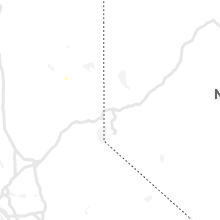
| 5:12 PM CDT | Quarter sized hail reported near Nevada, MO, 65.4 miles E of Chanute, KS, quarter size hail behind camp clark. delayed report via social media. |
| 5:17 PM CDT | 12 inch diameter tree limb snapped and fell on garag in st. charles county MO, 20.6 miles WNW of Saint Louis, MO |
| 5:26 PM CDT | Tree down on hwy w in franklin county MO, 49.4 miles WSW of Saint Louis, MO |
| 5:30 PM CDT | Tennis Ball sized hail reported near Nevada, MO, 68.1 miles ENE of Chanute, KS, via social media. delayed report. hail 2 to 2.5 inches. time based on radar. |
| 5:35 PM CDT | 4-5 inch diameter limbs down... pea to small marble sized hai in franklin county MO, 44.9 miles NNE of Salem, MO |
| 5:35 PM CDT | 6 inch tree limbs dow in st. charles county MO, 21.5 miles WNW of Saint Louis, MO |
| 5:36 PM CDT | 1-2 inch softwood tree branches down at tom ginnever ave and st. matthew av in st. charles county MO, 29.6 miles WNW of Saint Louis, MO |
| 5:37 PM CDT | Gust observed by asos at spirit of st. louis airpor in st. louis county MO, 25 miles W of Saint Louis, MO |
| 5:38 PM CDT | Via social media report of 2 inch size tree branches down. time based on rada in newton county MO, 74.3 miles SE of Chanute, KS |
| 5:38 PM CDT | Tree down over hwy dd near sommers roa in st. charles county MO, 32.5 miles WNW of Saint Louis, MO |
| 5:40 PM CDT | 6-8 inch tree limbs down... short light pole dow in moniteau county MO, 25.6 miles SSW of Columbia, MO |
| 5:40 PM CDT | 8-12 inch tree limbs down on pralle lan in st. charles county MO, 20.1 miles WNW of Saint Louis, MO |
| 5:41 PM CDT | Public reported a tree was down on a house off jungs station road in st. peters. the fire dept was on the scen in st. charles county MO, 21 miles WNW of Saint Louis, MO |
| 5:45 PM CDT | Large trees and power lines dow in st. louis county MO, 10.2 miles WNW of Saint Louis, MO |
| 5:45 PM CDT | Large tree limb down on creve coeur mill road at thomas patrick cour in st. louis county MO, 16.1 miles WNW of Saint Louis, MO |
| 5:45 PM CDT | Branches down at creve coeur park lake front. portable traffic control sign blown ove in st. louis county MO, 16.2 miles WNW of Saint Louis, MO |
| 5:46 PM CDT | Reported power line down causing power outages in neosho. time based on rada in newton county MO, 64 miles WSW of Springfield, MO |
| 5:50 PM CDT | Power poles down along the service roa in franklin county MO, 45.2 miles NNE of Salem, MO |
| 5:55 PM CDT | 1-2 inch tree limbs down... power is ou in st. louis county MO, 12.4 miles WSW of Saint Louis, MO |
| 5:55 PM CDT | 5-6 inch tree limb down in tower grove sout in st. louis city county MO, 3.3 miles SW of Saint Louis, MO |
| 5:55 PM CDT | Delayed report of a large tree down on power lines near ameling road and bennington place. it was noted that several large trees were down in the area. time estimated b in st. louis county MO, 15 miles WNW of Saint Louis, MO |
| 5:55 PM CDT | Delayed report of a tree down on some power lines near rose acres and mckelvy. time estimated by rada in st. louis county MO, 16.1 miles WNW of Saint Louis, MO |
| 6:00 PM CDT | Several 2 inch maple tree branches down near i-255 and telegraph rao in st. louis county MO, 10.9 miles SSW of Saint Louis, MO |
| 6:00 PM CDT | 3-4 inch tree limbs down at gerald drive and tesson ferry roa in st. louis county MO, 11.9 miles SW of Saint Louis, MO |
| 6:00 PM CDT | Power pole down at the 3800 block of shaw blv in st. louis city county MO, 2.8 miles W of Saint Louis, MO |
| 6:00 PM CDT | Delayed social media report of a tree limb down in a residential area. limbs look to be about 6-8 inches in diamete in st. louis county MO, 15.5 miles WSW of Saint Louis, MO |
| 6:00 PM CDT | Power lines reported down near highlands plaza drive south of i-64/40. power was out in the are in st. louis city county MO, 4.4 miles W of Saint Louis, MO |
| 6:04 PM CDT | A large maple tree down on a house. the house suffered damage to the awning and gutters before rolling off the slanted roof. power lines are also down in the area. spot in jefferson county MO, 16.2 miles SSW of Saint Louis, MO |
| 6:04 PM CDT | 10 inch branch down at old hwy m and old lemay ferry roa in jefferson county MO, 23.6 miles SW of Saint Louis, MO |
| 6:04 PM CDT | Quarter sized hail reported near Rolla, MO, 27.1 miles NNW of Salem, MO, strong winds were also reported... but no measurement or estimate was given. |
| 6:05 PM CDT | Half Dollar sized hail reported near Salem, MO, 0.9 miles NNW of Salem, MO, dispatch office reported hail the size of a half dollar. time based on radar. |
| 6:07 PM CDT | Ping Pong Ball sized hail reported near El Dorado Springs, MO, 62.2 miles NW of Springfield, MO, sheriff reported ping pong sized hail along with a tree blown over. |
| 6:10 PM CDT | Delayed report: awning material removed from a structure on the property. several trees down in the area southeast of the i-55/255 junctio in st. louis county MO, 13.3 miles SW of Saint Louis, MO |
| 6:14 PM CDT | Tree down on route c in jefferson county MO, 32.5 miles SSW of Saint Louis, MO |
| 6:28 PM CDT | Mesonet station wktm7 wah kon tah raw in cedar county MO, 61.2 miles NW of Springfield, MO |
| 6:40 PM CDT | Tennis Ball sized hail reported near El Dorado Springs, MO, 64.3 miles NW of Springfield, MO, tennis ball size hail. via social media. delayed report. |
| 6:57 PM CDT | Trees down in wheatland par in hickory county MO, 51.4 miles N of Springfield, MO |
| 6:58 PM CDT | Trees dow in hickory county MO, 44.8 miles N of Springfield, MO |
| 7:00 PM CDT | Winds 55 mph... gusting to 65 mp in st. francois county MO, 56.4 miles SSW of Saint Louis, MO |
| 7:06 PM CDT | Power poles snapped near base at tesson ferry rd. and griffin r in st. louis county MO, 13.6 miles SW of Saint Louis, MO |
| 7:30 PM CDT | Several trees snapped in yard and along roadway. via social medi in dallas county MO, 31.7 miles NNE of Springfield, MO |
Illinois
| Local Time | Report Details |
|---|---|
| 1:28 PM CDT | Storm damage reported in rock island county IL, 66.3 miles SE of Cedar Rapids, IA |
| 1:28 PM CDT | Storm damage reported in rock island county IL, 70.7 miles ESE of Cedar Rapids, IA |
| 1:30 PM CDT | Location estimated. tree snapped (1 foot diameter estimated by photo in rock island county IL, 68.3 miles NW of Peoria, IL |
| 1:33 PM CDT | Via social media. old barn and other out buildings with roofs ripped off. time of the event was estimated using rada in mercer county IL, 67.6 miles NW of Peoria, IL |
| 1:35 PM CDT | Estimated time by radar. large tree limbs down and on top of house in rock island county IL, 70.7 miles NW of Peoria, IL |
| 1:35 PM CDT | Hen Egg sized hail reported near Freeport, IL, 54.7 miles SSW of Madison, WI, reported at freeport... il. |
| 1:35 PM CDT | Storm damage reported in rock island county IL, 70.3 miles ESE of Cedar Rapids, IA |
| 1:40 PM CDT | Reported that a few trees were down in little work as well as power lines. time of the event was estimated using rada in warren county IL, 64.7 miles WNW of Peoria, IL |
| 1:44 PM CDT | Tree limbs down near south park mal in rock island county IL, 70 miles ESE of Cedar Rapids, IA |
| 1:45 PM CDT | Numerous photos of trees down in port byron via social media. time of the event was estimated using rada in rock island county IL, 73.9 miles ESE of Cedar Rapids, IA |
| 1:46 PM CDT | Corrects previous tstm wnd dmg report from nora to correct the time. 6 inch diameter tree limb down. estimated winds of 60 to 70 mph. time of the event was estimated us in jo daviess county IL, 50.8 miles SSW of Madison, WI |
| 1:48 PM CDT | Storm damage reported in rock island county IL, 70.3 miles ESE of Cedar Rapids, IA |
| 1:50 PM CDT | Several trees and powerlines down in town. time of the event was estimated using rada in warren county IL, 57.7 miles WNW of Peoria, IL |
| 1:53 PM CDT | Via social media...two large tree limbs down in their yard. time estimated using radar and duratio in henry county IL, 60 miles NNW of Peoria, IL |
| 1:55 PM CDT | Home weather station reported 58 mph gusts and pea sized hai in stephenson county IL, 49.8 miles SSW of Madison, WI |
| 2:00 PM CDT | Several power lines and tree branches dow in knox county IL, 45.2 miles WNW of Peoria, IL |
| 2:00 PM CDT | 4 to 6 inch tree limb down. picture via social medi in mercer county IL, 62.6 miles NW of Peoria, IL |
| 2:15 PM CDT | Several power lines and trees blown down between 210-220p in stark county IL, 33.9 miles N of Peoria, IL |
| 2:15 PM CDT | Several power lines and trees blown down between 210-220p in stark county IL, 36 miles NNW of Peoria, IL |
| 2:15 PM CDT | Several power lines and trees blown down between 210-220p in stark county IL, 30.9 miles NNW of Peoria, IL |
| 2:15 PM CDT | Several power lines and trees blown down between 210-220p in stark county IL, 27.1 miles NNW of Peoria, IL |
| 2:15 PM CDT | Several tree limbs snapped based on photo about 4 to 6 inches in diameter. trampoline was blown over on its side. time of the event was estimated based on radar and dur in henry county IL, 41.8 miles NNW of Peoria, IL |
| 2:15 PM CDT | Tree limbs down about 4 to 6 inches in diameter or larger in morrison. time of the event was estimated using rada in whiteside county IL, 78.9 miles NNW of Peoria, IL |
| 2:18 PM CDT | Multiple trailers blown over by wind and numerous trees down in forreston. relayed by emergency manage in ogle county IL, 65.8 miles S of Madison, WI |
| 2:20 PM CDT | 1700 people without power in the county... many in the city of the freeport. numerous streets are blocked due to down trees and power lines. the time of the event was e in stephenson county IL, 54.5 miles SSW of Madison, WI |
| 2:20 PM CDT | Ten inch tree across il-78 near graham chapel road. delayed repor in peoria county IL, 21.6 miles WNW of Peoria, IL |
| 2:23 PM CDT | Reported wind gusts of 50-60 mph. wind gusts remained at this level for about five minute in fulton county IL, 21.7 miles W of Peoria, IL |
| 2:25 PM CDT | Several branches down. exterior side of house peeled awa in lee county IL, 71 miles N of Peoria, IL |
| 2:25 PM CDT | Tree was on home at 4th st and birch and tree branches on home at 5th and birch. delayed repor in peoria county IL, 12.6 miles NNW of Peoria, IL |
| 2:28 PM CDT | Large tree uprooted in peoria county IL, 11.3 miles NW of Peoria, IL |
| 2:29 PM CDT | Eight inch tree down on house on 3300 block alta lane. delayed repor in peoria county IL, 8.6 miles NNW of Peoria, IL |
| 2:30 PM CDT | 3-4 inch tree branches down... time estimated from rada in bureau county IL, 38 miles N of Peoria, IL |
| 2:30 PM CDT | Tree snapped at base in fulton county IL, 25.5 miles WSW of Peoria, IL |
| 2:30 PM CDT | Storm damage reported in peoria county IL, 10.6 miles W of Peoria, IL |
| 2:32 PM CDT | Tree fell on house in fulton county IL, 32.3 miles WSW of Peoria, IL |
| 2:35 PM CDT | Damage to a home under construction in peoria county IL, 4.1 miles NNE of Peoria, IL |
| 2:35 PM CDT | Eight inch tree limbs down at war memorial drive and grave ave. delayed repor in peoria county IL, 2.8 miles NNE of Peoria, IL |
| 2:35 PM CDT | Multiple tree limbs down and power pole partially down on 5400 block of galena road. delayed repor in peoria county IL, 4.9 miles NNE of Peoria, IL |
| 2:35 PM CDT | Large billboard was blown over near the intersection of gift avenue and sheridan road. steel beams supporting the billboard bent about halfway. delayed repor in peoria county IL, 2 miles NNW of Peoria, IL |
| 2:35 PM CDT | A porch roof was blown off on the west side of canto in fulton county IL, 25.5 miles WSW of Peoria, IL |
| 2:37 PM CDT | Two trees blown down. one resulted in a road being blocke in peoria county IL, 2.3 miles WNW of Peoria, IL |
| 2:38 PM CDT | Part of the germantown hills middle school roof was blown off. delayed repor in woodford county IL, 9 miles NE of Peoria, IL |
| 2:39 PM CDT | Private weather station observed 92 mph wind gust just south of dixon at 2:39 pm. 20-30 minutes of winds gusting more than 50mp in lee county IL, 75.2 miles N of Peoria, IL |
| 2:40 PM CDT | Tree down on graham chapel road and il route 7 in peoria county IL, 21.3 miles WNW of Peoria, IL |
| 2:40 PM CDT | Wind gusts up to 60mph lasted for approximately five minute in peoria county IL, 5.5 miles NNW of Peoria, IL |
| 2:40 PM CDT | Tree fell on house on main st. many 6-8 inch diameter branches down. school st blocked by downed tree in marshall county IL, 31.2 miles NNE of Peoria, IL |
| 2:40 PM CDT | Trees and power lines down on 2nd stree in marshall county IL, 24.5 miles NNE of Peoria, IL |
| 2:40 PM CDT | Two trees broken near the base in tazewell county IL, 6 miles ENE of Peoria, IL |
| 2:40 PM CDT | Large limb down. time estimated by rada in winnebago county IL, 59 miles SSE of Madison, WI |
| 2:40 PM CDT | Large tree limb down. time estimated by rada in ogle county IL, 75.4 miles W of Chicago, IL |
| 2:40 PM CDT | Multiple trees and power lines down. tree down on a house... residents had to be helped out of hom in woodford county IL, 22.2 miles NE of Peoria, IL |
| 2:40 PM CDT | Roof damage to middle school. reported by week-t in woodford county IL, 8.2 miles NE of Peoria, IL |
| 2:40 PM CDT | Several trees and fences blown down in woodford county IL, 13.7 miles ENE of Peoria, IL |
| 2:40 PM CDT | Tree damage... power lines down... 2 semis overturned... snapped traffic signs... and roof damage to homes reported. time estimated by rada in la salle county IL, 47.1 miles NNE of Peoria, IL |
| 2:42 PM CDT | Many 6 inch diameter tree branches dow in fulton county IL, 25.5 miles WSW of Peoria, IL |
| 2:42 PM CDT | Storm damage reported in woodford county IL, 9.3 miles NNE of Peoria, IL |
| 2:42 PM CDT | Storm damage reported in woodford county IL, 9.3 miles NNE of Peoria, IL |
| 2:43 PM CDT | Storm damage reported in peoria county IL, 5.1 miles WSW of Peoria, IL |
| 2:43 PM CDT | *** 1 inj *** corrects previous tstm wnd dmg report from 2 n peru for including one injury that was the truck driver... as reported by area radio station wlpo. semi tra in la salle county IL, 51.6 miles NNE of Peoria, IL |
| 2:45 PM CDT | Trained spotter reports widespread tree damage in rockford. medium to large branches and trees snappe in winnebago county IL, 57.4 miles SSE of Madison, WI |
| 2:45 PM CDT | 1 foot diameter branch downed. winds estimated at 60 mph. time estimated by rada in winnebago county IL, 58.4 miles SSE of Madison, WI |
| 2:45 PM CDT | Two large trees... approximately 10 inches in diameter... blown dow in marshall county IL, 31.2 miles NNE of Peoria, IL |
| 2:45 PM CDT | Estimated 70-75mph wind gusts in mendota. time estimated by rada in la salle county IL, 64 miles NNE of Peoria, IL |
| 2:45 PM CDT | Trees down in mason county IL, 36.8 miles SW of Peoria, IL |
| 2:45 PM CDT | In rockford... lots of downed trees... power lines and poles... and fences northeast of the area from near the north alpine and guilford intersection thru shaw woods to in winnebago county IL, 57.7 miles SSE of Madison, WI |
| 2:46 PM CDT | Thunderstorm downed large tree on the property of a manufactured home and impaled a small branch from this into one of the walls. time estimated from rada in la salle county IL, 66.3 miles NNE of Peoria, IL |
| 2:46 PM CDT | 6 inch diameter tree limb down. estimated winds of 60 to 70 mph. time of the event was estimated using rada in jo daviess county IL, 50.8 miles SSW of Madison, WI |
| 2:47 PM CDT | Power pole snapped near jefferson and westshore in tazewell county IL, 7.5 miles SE of Peoria, IL |
| 2:48 PM CDT | Power lines blown down... power out in tow in woodford county IL, 16.3 miles E of Peoria, IL |
| 2:48 PM CDT | Large tree blown down. power lines also dow in mason county IL, 36.8 miles SW of Peoria, IL |
| 2:48 PM CDT | Large tree limbs downed. time estimated by rada in ogle county IL, 68.5 miles W of Chicago, IL |
| 2:50 PM CDT | Photos show tree damage and flattened crops along buck road north of kirkland. time estimated by rada in de kalb county IL, 65.3 miles WNW of Chicago, IL |
| 2:50 PM CDT | Large trees snapped and large limbs down on the rock valley college campus. time estimated by rada in winnebago county IL, 56.2 miles SSE of Madison, WI |
| 2:50 PM CDT | Storm damage reported in tazewell county IL, 8.9 miles SE of Peoria, IL |
| 2:50 PM CDT | Storm damage reported in tazewell county IL, 8.9 miles SE of Peoria, IL |
| 2:52 PM CDT | Farm and fleet on east riverside road in loves park lost a good portion of its roo in winnebago county IL, 55.9 miles SSE of Madison, WI |
| 2:53 PM CDT | Quarter sized hail reported near Rockford, IL, 57.9 miles SSE of Madison, WI |
| 2:53 PM CDT | Multiple large tree limbs... approximately 20 feet long... down. power lines also down. some streets blocked by downed trees. no structural damage reporte in peoria county IL, 3.1 miles NNW of Peoria, IL |
| 2:53 PM CDT | Power lines downed... and corn flattened. time estimated by rada in de kalb county IL, 64.3 miles WNW of Chicago, IL |
| 2:53 PM CDT | Estimated 70 to 80 mph winds and dime size hai in de kalb county IL, 67.8 miles W of Chicago, IL |
| 2:55 PM CDT | Tree down and damage to a metal structure. time estimated by rada in winnebago county IL, 55.9 miles SSE of Madison, WI |
| 2:56 PM CDT | Live tree... over one foot in diameter... blown dow in tazewell county IL, 8.7 miles SSW of Peoria, IL |
| 2:56 PM CDT | Reports of damage to roofs and outside structuers in utica. time estimated by rada in la salle county IL, 54 miles NNE of Peoria, IL |
| 2:58 PM CDT | Measured wind gusts between 55-62mph occurred between 250 and 258p in tazewell county IL, 8.5 miles SE of Peoria, IL |
| 3:00 PM CDT | Quarter sized hail reported near Belvidere, IL, 62.2 miles SSE of Madison, WI |
| 3:00 PM CDT | Grain bin damaged in tazewell county IL, 20.7 miles SSE of Peoria, IL |
| 3:00 PM CDT | Large tree down blocking a road in tazewell county IL, 9.5 miles SSW of Peoria, IL |
| 3:00 PM CDT | Rockford fire chief reports at least 150 damaged power poles across the cit in winnebago county IL, 57.6 miles SSE of Madison, WI |
| 3:02 PM CDT | Several trees snapped and uprooted. time estimated by rada in la salle county IL, 49.5 miles NE of Peoria, IL |
| 3:04 PM CDT | Large tree down onto powerlines. numerous large branches/limbs down. shed destroyed. time estimated by rada in la salle county IL, 59.9 miles NE of Peoria, IL |
| 3:05 PM CDT | Multiple trees and power lines down. estimated 60 mph gust in de kalb county IL, 57.7 miles W of Chicago, IL |
| 3:06 PM CDT | Storm damage reported in tazewell county IL, 13.3 miles S of Peoria, IL |
| 3:06 PM CDT | Storm damage reported in tazewell county IL, 13.3 miles S of Peoria, IL |
| 3:10 PM CDT | Downed power lines caused a four acre field fire in mason county IL, 34.7 miles SW of Peoria, IL |
| 3:10 PM CDT | Multiple trees and power lines down... including 10 and 20 inch in diameter trees. fences also blown down. time estimated by rada in kane county IL, 49.9 miles W of Chicago, IL |
| 3:11 PM CDT | Large tree limb down in mclean county IL, 33.9 miles ESE of Peoria, IL |
| 3:12 PM CDT | Storm damage reported in mclean county IL, 37.3 miles ESE of Peoria, IL |
| 3:14 PM CDT | Private weather station recorded 65 mph wind gus in kendall county IL, 48.6 miles WSW of Chicago, IL |
| 3:15 PM CDT | Trained spotter reports widespread tree and power line damage across somanauk. trees up to 4-6 diameter snapped at the bas in de kalb county IL, 56.9 miles WSW of Chicago, IL |
| 3:15 PM CDT | Tree down on house at 1st and 4th st. tree branches down at 5th and atlant in peoria county IL, 12.6 miles NNW of Peoria, IL |
| 3:15 PM CDT | 20 inch tree limb down. no structural damage reported. time estimate in mclean county IL, 37.7 miles ESE of Peoria, IL |
| 3:15 PM CDT | Large tree uprooted and down on two homes near constitution trail. one large tree branch also dow in mclean county IL, 33.1 miles ESE of Peoria, IL |
| 3:15 PM CDT | 4 inch diameter branch downed and damage to traffic signals at il-38 and meredith road. time estimated by rada in kane county IL, 46.8 miles W of Chicago, IL |
| 3:15 PM CDT | 8 inch diameter tree snapped near il-47 and nottingham. relayed via nws chat... time estimated by rada in kane county IL, 43.4 miles W of Chicago, IL |
| 3:16 PM CDT | Aurora asos peak gus in kane county IL, 43.9 miles W of Chicago, IL |
| 3:16 PM CDT | Storm damage reported in kane county IL, 44.5 miles W of Chicago, IL |
| 3:16 PM CDT | Numerous mature branches down near veterans and bloomington roa in tazewell county IL, 2.5 miles SE of Peoria, IL |
| 3:17 PM CDT | Numerous metal farm buildings damaged including roofs and metal sidings blown off. also... large tree snapped and downed onto a house. time estimated by rada in livingston county IL, 66.8 miles ENE of Peoria, IL |
| 3:20 PM CDT | 10 inch diameter tree snapped. time estimated by rada in kane county IL, 36.5 miles WSW of Chicago, IL |
| 3:20 PM CDT | Tree damage blocking fays lane west of sugar grove. time estimated by rada in kane county IL, 44.6 miles W of Chicago, IL |
| 3:20 PM CDT | Storm damage reported in mclean county IL, 38.1 miles ESE of Peoria, IL |
| 3:20 PM CDT | Several trees and large branches down. time estimated by rada in kendall county IL, 45.5 miles WSW of Chicago, IL |
| 3:27 PM CDT | Tree down on road near nancy ln and powis rd in wayn in dupage county IL, 31.6 miles W of Chicago, IL |
| 3:27 PM CDT | Tree down on ca in dupage county IL, 31.5 miles W of Chicago, IL |
| 3:27 PM CDT | Quarter sized hail reported near Morris, IL, 54.5 miles SW of Chicago, IL, time estimated by radar. |
| 3:28 PM CDT | Eight inch tree limbs down in peoria county IL, 9.1 miles NNW of Peoria, IL |
| 3:29 PM CDT | 14 inch diameter tree split in half. power lines downed. time estimated by rada in kane county IL, 35 miles W of Chicago, IL |
| 3:30 PM CDT | Golf Ball sized hail reported near Morris, IL, 54 miles SW of Chicago, IL, law enforcement reports golfball sized hail near i-80 and lisbon road. |
| 3:30 PM CDT | 8-in diameter branches down near i-55 and caton farm road. relayed via amateur radio. time estimated by rada in will county IL, 35.7 miles SW of Chicago, IL |
| 3:30 PM CDT | Damage to siding of a house. small branches downed in the vicinity. time estimated by rada in kendall county IL, 36.7 miles WSW of Chicago, IL |
| 3:30 PM CDT | Video relayed via social media of tree damage in forres in livingston county IL, 62 miles E of Peoria, IL |
| 3:30 PM CDT | Tree over 12 inches in diameter snapped. near us-12 and il-17 in mchenry county IL, 53.9 miles NW of Chicago, IL |
| 3:30 PM CDT | One foot tree limb down on car in mason county IL, 34.5 miles S of Peoria, IL |
| 3:30 PM CDT | One foot tree limb down on car in mason county IL, 34.5 miles S of Peoria, IL |
| 3:31 PM CDT | Large trees and power lines down across plainfield. time estimated by rada in will county IL, 35.3 miles WSW of Chicago, IL |
| 3:32 PM CDT | Measured by weatherbug statio in will county IL, 33.8 miles WSW of Chicago, IL |
| 3:33 PM CDT | Public reports trees down near caton farm road and drauden roa in will county IL, 38.1 miles SW of Chicago, IL |
| 3:34 PM CDT | Six inch diameter tree limb down. time estimated by rada in dupage county IL, 24.7 miles W of Chicago, IL |
| 3:35 PM CDT | Trained spotter reports 1-6 in diameter tree branches down all over warrenvill in dupage county IL, 28.1 miles W of Chicago, IL |
| 3:35 PM CDT | Kc09 morris airpor in grundy county IL, 51.4 miles SW of Chicago, IL |
| 3:36 PM CDT | 12 inch diameter tree down on house. time estimated by rada in dupage county IL, 17.9 miles W of Chicago, IL |
| 3:36 PM CDT | Structural damage to the roof of wheaton college church. relayed via social media. time estimated by rada in dupage county IL, 24.1 miles W of Chicago, IL |
| 3:36 PM CDT | Rolled over b-class truck with trailer at irving park road and schaumburg roa in cook county IL, 31.7 miles WNW of Chicago, IL |
| 3:38 PM CDT | Dupage asos peak gus in dupage county IL, 32.4 miles W of Chicago, IL |
| 3:38 PM CDT | Kdpa west chicago - dupage arp in dupage county IL, 31.9 miles W of Chicago, IL |
| 3:39 PM CDT | Large tree limbs and small trees down. time estimated by rada in will county IL, 25.9 miles WSW of Chicago, IL |
| 3:39 PM CDT | Estimated 60 to 70 mph winds. time estimated by rada in cook county IL, 25.2 miles WNW of Chicago, IL |
| 3:40 PM CDT | Trained spotter reports numerous 6 inch diameter healthy tree limbs down with several whole trees uproote in kane county IL, 36.2 miles WNW of Chicago, IL |
| 3:40 PM CDT | Public reports large limbs downed. time estimated by rada in dupage county IL, 25 miles WNW of Chicago, IL |
| 3:40 PM CDT | 4-5 block area of widespread tree damage. 8 inch and larger diameter branches broken... some trees snapped near the top. relayed via amateur radi in dupage county IL, 19.5 miles W of Chicago, IL |
| 3:40 PM CDT | Report of estimated winds up to 50mph... small branches downed... and hail to half inch diamete in dupage county IL, 16.8 miles WSW of Chicago, IL |
| 3:40 PM CDT | 10 inch tree down and eight inch tree branches down in peoria county IL, 3.5 miles NNW of Peoria, IL |
| 3:40 PM CDT | Considerable tree damage along main st north of 75th stree in dupage county IL, 21.3 miles WSW of Chicago, IL |
| 3:40 PM CDT | 8-10 inch diameter limbs downed in the vicinity of sullivan lake road and game trail. some branches were up to 20 feet in length. time estimated by rada in lake county IL, 41.7 miles NW of Chicago, IL |
| 3:41 PM CDT | Peak wind gust measured at nws chicago. small tree limbs observed flying past window at time of wind gus in will county IL, 30.7 miles SW of Chicago, IL |
| 3:43 PM CDT | Numerous large trees uprooted. time estimated by rada in will county IL, 31.2 miles SW of Chicago, IL |
| 3:43 PM CDT | Quarter sized hail reported near Glen Ellyn, IL, 21.6 miles W of Chicago, IL, trained spotter reports quarter sized hail near roosevelt road and il-53. |
| 3:45 PM CDT | Power line down due to 36 inch diameter tree being uprooted. tree was partially rotten in the middle. time estimated by rada in sangamon county IL, 60.3 miles S of Peoria, IL |
| 3:45 PM CDT | 18 inch diameter tree uproote in sangamon county IL, 58.2 miles S of Peoria, IL |
| 3:45 PM CDT | Power poles down on s 9th s in sangamon county IL, 58.2 miles S of Peoria, IL |
| 3:45 PM CDT | Numerous traffic signals and a large tree damaged near delaney road and cedar road. time estimated by rada in will county IL, 33.2 miles SSW of Chicago, IL |
| 3:45 PM CDT | Power poles damaged in mclean county IL, 59.8 miles N of Mattoon, IL |
| 3:45 PM CDT | Storm damage reported in sangamon county IL, 61.6 miles S of Peoria, IL |
| 3:46 PM CDT | Trained spotter reported hundreads of trees snapped and uprooted along cedar road and joliet highwa in will county IL, 32.9 miles SSW of Chicago, IL |
| 3:48 PM CDT | Measured wind gust. small trees downed. time estimated by rada in will county IL, 27.4 miles SSW of Chicago, IL |
| 3:49 PM CDT | Ohare asos peak gus in cook county IL, 15.3 miles WNW of Chicago, IL |
| 3:50 PM CDT | Overturned semi trailer on i-57 near mile marker 28 in iroquois county IL, 75.9 miles SSW of Chicago, IL |
| 3:50 PM CDT | Small trees down across town... all in the same direction. time estimated by rada in will county IL, 28.8 miles SSW of Chicago, IL |
| 3:50 PM CDT | Power lines down at 9th and carpenter. time estimated by rada in sangamon county IL, 61.6 miles S of Peoria, IL |
| 3:50 PM CDT | Garage collapsed. reported at nordica and rosco in cook county IL, 9.5 miles WNW of Chicago, IL |
| 3:50 PM CDT | Two large trees were blown down...one of which fell onto a grain bi in de witt county IL, 50.5 miles NNW of Mattoon, IL |
| 3:51 PM CDT | Measured with handheld anemometer in sangamon county IL, 57.1 miles S of Peoria, IL |
| 3:52 PM CDT | Small garage partially collapsed. time estimated by rada in cook county IL, 9.5 miles WNW of Chicago, IL |
| 3:53 PM CDT | Large tree down on roa in cook county IL, 9.2 miles W of Chicago, IL |
| 3:53 PM CDT | The emergency manager relayed reports of trees uprooted across the entire county. time estimated by rada in kankakee county IL, 54 miles SSW of Chicago, IL |
| 3:53 PM CDT | Overturned semi at milepost 287 on southbound i-57. time estimated by rada in iroquois county IL, 80.7 miles SSW of Chicago, IL |
| 3:55 PM CDT | Also had pea size hai in cook county IL, 12.5 miles SW of Chicago, IL |
| 3:55 PM CDT | Private weather station observed 66 mph wind gus in iroquois county IL, 61.8 miles S of Chicago, IL |
| 3:57 PM CDT | 6-8 inch tree limbs down in mclean county IL, 49.9 miles ESE of Peoria, IL |
| 3:57 PM CDT | 50 to 60 foot tall trees downed. time estimated by rada in cook county IL, 20.4 miles SSW of Chicago, IL |
| 3:57 PM CDT | Bricks knocked off top of building and trees downed. time estimated by rada in cook county IL, 7.3 miles NW of Chicago, IL |
| 3:57 PM CDT | Measured by weatherbug statio in cook county IL, 7.3 miles NNW of Chicago, IL |
| 3:57 PM CDT | Reports of a roof blown off a building north of addison and lake shore driv in cook county IL, 4.6 miles N of Chicago, IL |
| 3:57 PM CDT | Midway asos peak gus in cook county IL, 8.5 miles SW of Chicago, IL |
| 3:57 PM CDT | Reported at 2105 w eastwood dr... chicago... il. large tree down and large branches broken out of other tree in cook county IL, 6.4 miles NNW of Chicago, IL |
| 3:59 PM CDT | Large tree uprooted in oak lawn. time estimated by rada in cook county IL, 12.9 miles SSW of Chicago, IL |
| 4:00 PM CDT | Numerous reports of downed tree limbs across wrigleyville... roscoe village... logan square... and lincoln square. time estimated by rada in cook county IL, 0.8 miles ENE of Chicago, IL |
| 4:00 PM CDT | Possible structure damage near 18th and canalport avenue in chicag in cook county IL, 1.7 miles SSW of Chicago, IL |
| 4:00 PM CDT | Large trees and power poles down across entire county. also reported billboard damage. time estimated by rada in iroquois county IL, 77.8 miles S of Chicago, IL |
| 4:00 PM CDT | Widespread wind damage throughout steger including trees down... trees on power lines... and power poles broke in will county IL, 28.6 miles S of Chicago, IL |
| 4:00 PM CDT | Tree damage near 7500s road west of st anne. time estimated by rada in kankakee county IL, 60.9 miles S of Chicago, IL |
| 4:02 PM CDT | Harrison dever crib measured a 63 kt wind gus in lmz741 county IL, 4.1 miles NE of Chicago, IL |
| 4:02 PM CDT | 45 foot pine tree downed. time estimated by rada in cook county IL, 25.8 miles S of Chicago, IL |
| 4:02 PM CDT | Mesonet station xmtb montrose beac in lmz741 county IL, 5.9 miles N of Chicago, IL |
| 4:03 PM CDT | Numerous trees snapped and uprooted in evanston. time estimated by rada in cook county IL, 11.2 miles NNW of Chicago, IL |
| 4:03 PM CDT | Large tree snapped. time estimated by rada in cook county IL, 4.1 miles NNW of Chicago, IL |
| 4:05 PM CDT | Measured wind gust of 72 mph near fir street relayed via amateur radi in cook county IL, 27.3 miles S of Chicago, IL |
| 4:05 PM CDT | Large trees downed. time estimated by rada in kankakee county IL, 44.5 miles S of Chicago, IL |
| 4:08 PM CDT | Trained spotter estimates winds of 60 mph in thornton. relayed via amateur radi in cook county IL, 21.7 miles S of Chicago, IL |
| 4:09 PM CDT | Public report of tree damage in cicer in cook county IL, 7.3 miles WSW of Chicago, IL |
| 4:10 PM CDT | Tree fell on house in macon county IL, 42.5 miles WNW of Mattoon, IL |
| 4:10 PM CDT | Tree blocking kezie blvd at logan blvd in logan square neighborhood of chicag in cook county IL, 5.1 miles NW of Chicago, IL |
| 4:10 PM CDT | 12 inch limb down. time estimated by rada in macon county IL, 39 miles NW of Mattoon, IL |
| 4:18 PM CDT | Storm damage reported in dupage county IL, 27.4 miles WSW of Chicago, IL |
| 4:20 PM CDT | Private weather station observed 66 mph gust west of kentland. time estimated by rada in newton county IN, 75 miles S of Chicago, IL |
| 4:20 PM CDT | Two large trees down. shingles damage in champaign county IL, 44.2 miles NNE of Mattoon, IL |
| 4:23 PM CDT | Storm damage reported in macon county IL, 35.7 miles NW of Mattoon, IL |
| 4:25 PM CDT | Private weather station observed 73 mph gust west of kentland. time estimated by rada in newton county IN, 75 miles S of Chicago, IL |
| 4:25 PM CDT | Tree down on a house in champaign county IL, 43.8 miles N of Mattoon, IL |
| 4:25 PM CDT | Tree down on a garage in champaign county IL, 44.2 miles NNE of Mattoon, IL |
| 4:25 PM CDT | Tree down on a garage in champaign county IL, 44.2 miles NNE of Mattoon, IL |
| 4:25 PM CDT | Wind gusts estimated at 50-60mp in vermilion county IL, 72.4 miles NNE of Mattoon, IL |
| 4:25 PM CDT | Storm damage reported in champaign county IL, 38.9 miles N of Mattoon, IL |
| 4:30 PM CDT | Arps mesonet in champaign county IL, 41.9 miles NNE of Mattoon, IL |
| 4:40 PM CDT | Two large trees down blocking us 15 in vermilion county IL, 53.8 miles NE of Mattoon, IL |
| 4:43 PM CDT | Storm damage reported in vermilion county IL, 61.9 miles NE of Mattoon, IL |
| 4:50 PM CDT | Numerous trees and power lines down throughout danville. several streets blocke in vermilion county IL, 60.7 miles NE of Mattoon, IL |
| 5:05 PM CDT | Tree limb dow in montgomery county IL, 45.8 miles NE of Saint Louis, MO |
| 5:09 PM CDT | Corrected time in coles county IL, 5.1 miles E of Mattoon, IL |
| 5:14 PM CDT | Storm damage reported in coles county IL, 5.1 miles E of Mattoon, IL |
| 5:27 PM CDT | Large tree limbs snapped in edgar county IL, 43.6 miles E of Mattoon, IL |
| 5:36 PM CDT | 2 inch tree limb blown dow in madison county IL, 17.1 miles NNE of Saint Louis, MO |
| 5:37 PM CDT | 4 inch diameter tree limb down with the gust fron in madison county IL, 19 miles N of Saint Louis, MO |
| 5:42 PM CDT | Tree dow in fayette county IL, 41.1 miles SW of Mattoon, IL |
| 5:49 PM CDT | Powerline dow in fayette county IL, 45.3 miles SW of Mattoon, IL |
| 6:00 PM CDT | Large tree down blocking the roadway near intersection of spring st and lebanon roa in madison county IL, 12.8 miles ENE of Saint Louis, MO |
| 6:13 PM CDT | Storm damage reported in st. clair county IL, 4.5 miles SSE of Saint Louis, MO |
| 6:19 PM CDT | 12-14 inch tree limb over paula driv in monroe county IL, 20.6 miles S of Saint Louis, MO |
| 6:20 PM CDT | Powerlines dow in monroe county IL, 20.6 miles S of Saint Louis, MO |
| 6:37 PM CDT | Strong winds out ahead of a thunderstorm as a gust front. small and medium size tree branches down. winds estimated to be about 50-55 mp in st. clair county IL, 11.6 miles ESE of Saint Louis, MO |
| 6:37 PM CDT | 4 to 5 inch tree limbs down... power lines down. wind gusts estimated at 50 mp in st. clair county IL, 20.8 miles SE of Saint Louis, MO |
| 6:41 PM CDT | Roof damage to supermarke in st. clair county IL, 35.2 miles SE of Saint Louis, MO |
| 7:08 PM CDT | Power out... 5 inch tree limbs down... wind gust estimated around 75 mp in perry county IL, 50.9 miles N of Cape Girardeau, MO |
| 7:09 PM CDT | Large tree blocking the right lane on interstate 64 for a half mile near exit 5 in washington county IL, 47.3 miles ESE of Saint Louis, MO |
| 7:16 PM CDT | Delayed report of a wind measurement. several small trees dow in washington county IL, 60.1 miles ESE of Saint Louis, MO |
| 7:20 PM CDT | Trees down on vehicles and roadways in ava are in jackson county IL, 40.6 miles N of Cape Girardeau, MO |
| 7:25 PM CDT | Branches down... tree on a hous in perry county IL, 54.4 miles N of Cape Girardeau, MO |
| 7:30 PM CDT | Tree damage across the are in franklin county IL, 61.2 miles NNE of Cape Girardeau, MO |
| 7:33 PM CDT | Lots of trees down... power outage in franklin county IL, 53.1 miles NNE of Cape Girardeau, MO |
| 7:36 PM CDT | Power lines down in multiple locations in murphysbor in jackson county IL, 33.5 miles NNE of Cape Girardeau, MO |
| 7:42 PM CDT | Lots of trees down and power outage in franklin county IL, 49.3 miles NNE of Cape Girardeau, MO |
| 8:40 PM CDT | Trees limbs down in carmi and across the count in white county IL, 34 miles WNW of Evansville, IN |
Georgia
| Local Time | Report Details |
|---|---|
| 2:30 PM EDT | Emergency management reports strong winds from a downburst blew down several trees in a trailer park north of griffin. approx 5-6 manufactured homes were affected by fa in spalding county GA, 32.1 miles S of Atlanta, GA |
| 2:30 PM EDT | Report of a snapped tree blown down and significantly damaging a golf cart on magnolia creek dr in forsyth county GA, 40.2 miles NNE of Atlanta, GA |
| 2:55 PM EDT | A couple of trees reported down along bayberry rd... west of cumming... with some isolated roof damage sustaine in forsyth county GA, 34.1 miles NNE of Atlanta, GA |
| 3:22 PM EDT | Strong winds snapped and uprooted multiple trees along crawfordville rd in union point in greene county GA, 63.9 miles W of Augusta, GA |
| 3:40 PM EDT | Tree down on powerlines along cliffview drive in lilburn. time estimated from rada in gwinnett county GA, 18.6 miles ENE of Atlanta, GA |
| 3:47 PM EDT | Mutliple trees down along hwy 138 and granade rd sw. time estimated from rada in rockdale county GA, 21.6 miles ESE of Atlanta, GA |
| 3:50 PM EDT | Twitter report of a couple trees down near by a home close to honey creek elementary school in rockdale county GA, 23.7 miles ESE of Atlanta, GA |
| 3:55 PM EDT | Large tree down on powerlines off cowan road se. time estimated from rada in rockdale county GA, 23.8 miles ESE of Atlanta, GA |
| 4:15 PM EDT | Report of trees down on hwy 36 near the county lin in butts county GA, 37.6 miles SE of Atlanta, GA |
| 4:22 PM EDT | Report of a few scattered trees down between hwy 36 and stark rd... ne of jackson in butts county GA, 38.5 miles SE of Atlanta, GA |
| 5:03 PM EDT | Several trees reported down around the i-75 and i-16 interchage in macon in bibb county GA, 75.6 miles SE of Atlanta, GA |
| 5:09 PM EDT | Tree blown down on n franklinton rd in bibb county GA, 79.7 miles SE of Atlanta, GA |
| 5:12 PM EDT | A couple trees were blown down near patterson rd and masseyville rd in jones county GA, 78.6 miles SE of Atlanta, GA |
| 5:24 PM EDT | A couple trees blow down ne of dry branch in twiggs county GA, 84.2 miles SE of Atlanta, GA |
| 5:36 PM EDT | Tree reported down across deepstep road around deepstep area. time estimated from rada in washington county GA, 65.2 miles WSW of Augusta, GA |
| 6:01 PM EDT | Tree reported down on powerlines along hwy 24 about 3 miles east of sandersvill in washington county GA, 55.6 miles SW of Augusta, GA |
Alabama
| Local Time | Report Details |
|---|---|
| 1:30 PM CDT | Damage was reported to a marin in marshall county AL, 68.3 miles SW of Chattanooga, TN |
| 2:35 PM CDT | Trees down along chalakee r in marshall county AL, 65.8 miles NNE of Birmingham, AL |
| 4:16 PM CDT | Quarter sized hail reported near Pell City, AL, 29 miles ENE of Birmingham, AL |
| 4:22 PM CDT | Quarter sized hail reported near Pell City, AL, 30 miles E of Birmingham, AL |
| 4:25 PM CDT | Tree down across a road in the clayhatchee area. reported on clayhatchee volunteer fire dept facebook pag in dale county AL, 70.4 miles NNE of Miramar Beach, FL |
| 4:36 PM CDT | Trees blown down along stemley roa in talladega county AL, 37.1 miles E of Birmingham, AL |
| 4:37 PM CDT | Trees down on michaels cove lan in talladega county AL, 38.9 miles E of Birmingham, AL |
| 4:39 PM CDT | Trees down near glade roa in talladega county AL, 37 miles E of Birmingham, AL |
| 4:40 PM CDT | Trees down on beck lan in talladega county AL, 38.8 miles E of Birmingham, AL |
| 4:42 PM CDT | Trees down on howells cove roa in talladega county AL, 37.2 miles E of Birmingham, AL |
| 5:12 PM CDT | Corrects previous tstm wnd dmg report from 4 wnw mellow valley. one small tree and several branches were blown down along new prospect road and mack crawford road. it a in clay county AL, 45.7 miles NNW of Auburn, AL |
| 5:12 PM CDT | Corrects previous tstm wnd dmg report from 4 wnw mellow valley. one small tree and several branches were blown down along new prospect road and mack crawford road. it a in clay county AL, 45.7 miles NNW of Auburn, AL |
| 5:43 PM CDT | Trees and power lines down along spring hill roa in talladega county AL, 38.2 miles E of Birmingham, AL |
| 6:24 PM CDT | A few trees blown down. cr 183 near 28 in lee county AL, 13.5 miles E of Auburn, AL |
| 6:35 PM CDT | Trees blown down. cr 166. time estimated from rada in lee county AL, 9.5 miles ESE of Auburn, AL |
| 6:41 PM CDT | Several trees were blown down across a few locations south and southwest of dadeville... this includes along sr-42 and cr-34... generally near and east of lake martin & in tallapoosa county AL, 21.2 miles WNW of Auburn, AL |
| 7:45 PM CDT | Ema reported trees down in the higdon are in jackson county AL, 22.2 miles SW of Chattanooga, TN |
| 8:15 PM CDT | A few trees were blown down along gammage roa in barbour county AL, 45.3 miles SSE of Auburn, AL |
| 8:15 PM CDT | A few trees were blown near mccoo schoo in barbour county AL, 54 miles SSE of Auburn, AL |
| 8:20 PM CDT | Corrects previous tstm wnd dmg report from 1 sse eufaula. a few trees were blown near mccoo schoo in barbour county AL, 54 miles SSE of Auburn, AL |
| 8:25 PM CDT | Trees reported down south of scottsbor in jackson county AL, 53.1 miles SW of Chattanooga, TN |
| 9:05 PM CDT | Trees down near honey comb rd with a tree down on a hous in marshall county AL, 69.9 miles SW of Chattanooga, TN |
| 9:08 PM CDT | Multiple trees down along white elephant r in marshall county AL, 68.9 miles SW of Chattanooga, TN |
| 9:10 PM CDT | Tree on house reported at 2694 aldridge gap r in marshall county AL, 60.2 miles NNE of Birmingham, AL |
| 9:15 PM CDT | Multiple trees dow in marshall county AL, 67.6 miles SW of Chattanooga, TN |
Michigan
| Local Time | Report Details |
|---|---|
| 2:45 PM CDT | Quarter sized hail reported near Stephenson, MI, 65 miles NNE of Green Bay, WI, social media report. time estimated from radar. |
| 6:05 PM EDT | Quarter sized hail reported near Baroda, MI, 59.1 miles E of Chicago, IL, estimated wind gusts around 50 mph with small to medium sized tree limbs down. |
| 6:06 PM EDT | Tree on power line (on fire) in grand beac in berrien county MI, 44.1 miles E of Chicago, IL |
| 6:12 PM EDT | Hollywood rd and west lemon creek in baroda twp... wind blew down transforme in berrien county MI, 60.7 miles E of Chicago, IL |
| 6:16 PM EDT | Ansley and lincoln in saint joseph twp large tree ~2 ft dia down across roa in berrien county MI, 60.6 miles ENE of Chicago, IL |
| 6:21 PM EDT | Several trees down in the baroda township. additional reports of trees down in grand beach... st. joseph... and surrounding area in berrien county MI, 59.1 miles E of Chicago, IL |
| 6:25 PM EDT | Storm damage reported in berrien county MI, 64.1 miles ENE of Chicago, IL |
| 6:52 PM EDT | Some trees dow in van buren county MI, 52.6 miles S of Grand Rapids, MI |
| 6:56 PM EDT | Trees down along western territorial roa in van buren county MI, 58.8 miles SSW of Grand Rapids, MI |
| 6:59 PM EDT | Some trees dow in van buren county MI, 43.2 miles SSW of Grand Rapids, MI |
| 7:05 PM EDT | Several reports or large trees down in three rivers area. time estimated from rada in st. joseph county MI, 66.3 miles NNW of Fort Wayne, IN |
| 7:19 PM EDT | Small shed damaged and isolated tree damag in kent county MI, 13.6 miles SSW of Grand Rapids, MI |
| 7:25 PM EDT | 8 inch diameter tree down across m89 in plainwel in allegan county MI, 36.4 miles S of Grand Rapids, MI |
| 7:35 PM EDT | Corrects previous tstm wnd dmg report from 1 n south gull lake. multiple trees down along the east shoreline of gull lak in kalamazoo county MI, 41.5 miles SSE of Grand Rapids, MI |
Tennessee
| Local Time | Report Details |
|---|---|
| 3:25 PM CDT | Multiple trees and power lines down in the area of defeated creek in smith county TN, 50.3 miles ENE of Nashville, TN |
| 3:51 PM CDT | Branch down on power line in smith county TN, 53.6 miles E of Nashville, TN |
| 4:00 PM CDT | Large... hollow tree snapped and fell on power line. us 70 between rock springs rd and stanton r in putnam county TN, 57.5 miles E of Nashville, TN |
| 6:09 PM CDT | A couple trees dow in bledsoe county TN, 43.2 miles N of Chattanooga, TN |
New York
| Local Time | Report Details |
|---|---|
| 4:31 PM EDT | Trees down on lighthouse and clermont street in ulster county NY, 50.5 miles S of Schenectady, NY |
| 4:36 PM EDT | Tree down on dock street in ulster county NY, 51.2 miles S of Schenectady, NY |
| 4:36 PM EDT | Trees down on the intersection of fish creek and patch roads and also on rte 9 in ulster county NY, 52 miles S of Schenectady, NY |
| 4:40 PM EDT | Numerous wires down in ulster county NY, 51.2 miles S of Schenectady, NY |
| 4:58 PM EDT | Trees down on west kerley corners road in dutchess county NY, 52.7 miles S of Schenectady, NY |
| 4:58 PM EDT | Numours tree limnb and dead trees down along route 22 near warner road in washington county NY, 49.3 miles NE of Schenectady, NY |
| 5:07 PM EDT | Tree down in albany county NY, 19.5 miles S of Schenectady, NY |
| 5:16 PM EDT | Tree down across road across east old state road in albany county NY, 6.5 miles S of Schenectady, NY |
| 5:16 PM EDT | A couple of trees and wires downed in columbia county NY, 48.4 miles SSE of Schenectady, NY |
| 5:16 PM EDT | Large tree uprooted at the intersection of warnick and callaway in washington county NY, 42.3 miles NE of Schenectady, NY |
| 5:18 PM EDT | Large tree limbs down in albany county NY, 8.2 miles SSE of Schenectady, NY |
| 5:18 PM EDT | Large tree limbs down in albany county NY, 8.2 miles SSE of Schenectady, NY |
| 5:20 PM EDT | Multiple trees and powerlines down in washington county NY, 40.5 miles NE of Schenectady, NY |
| 5:21 PM EDT | Wires down near the intersection of halls pond road and route 30 in washington county NY, 43 miles NE of Schenectady, NY |
| 5:40 PM EDT | Tree down across route 45. time estimated by rada in washington county NY, 39.9 miles NE of Schenectady, NY |
| 5:40 PM EDT | Numerous wires down in ulster county NY, 51.2 miles S of Schenectady, NY |
| 5:44 PM EDT | Trees down in glasco in ulster county NY, 52.6 miles S of Schenectady, NY |
| 5:44 PM EDT | Trees and wires were downed in columbia county NY, 60.4 miles SSE of Schenectady, NY |
| 6:08 PM EDT | Tree and wires down on mcghee hill road in dutchess county NY, 63.4 miles SSE of Schenectady, NY |
| 7:22 PM EDT | Tree down on fowler road in dutchess county NY, 71.3 miles S of Schenectady, NY |
Kansas
| Local Time | Report Details |
|---|---|
| 4:04 PM CDT | Asos station kcfv coffeyvill in montgomery county KS, 42 miles S of Chanute, KS |
| 4:05 PM CDT | Storm damage reported in montgomery county KS, 36.8 miles SSW of Chanute, KS |
| 4:14 PM CDT | Storm damage reported in montgomery county KS, 45.4 miles SSW of Chanute, KS |
| 4:18 PM CDT | Asos station kcfv coffeyvill in montgomery county KS, 42 miles S of Chanute, KS |
| 4:19 PM CDT | Dime hail along with 70 mph wind in montgomery county KS, 41.5 miles S of Chanute, KS |
| 4:22 PM CDT | Quarter sized hail reported near Parsons, KS, 27.1 miles SSE of Chanute, KS |
| 4:25 PM CDT | Half Dollar sized hail reported near Dodge City, KS, 48.2 miles ESE of Garden City, KS |
| 4:27 PM CDT | Half Dollar sized hail reported near Dodge City, KS, 47.9 miles ESE of Garden City, KS |
| 4:41 PM CDT | Storm damage reported in finney county KS, 20.8 miles N of Garden City, KS |
| 4:46 PM CDT | Storm damage reported in labette county KS, 40 miles SSE of Chanute, KS |
| 4:52 PM CDT | Corrects previous tstm wnd dmg report from 2 wsw hallowell. cherokee county emergency management director observed 65 to 70 mph winds along highway 160 east of osweg in cherokee county KS, 42.3 miles SSE of Chanute, KS |
| 4:55 PM CDT | At least 5 downed tress in rural areas. time based on rada in cherokee county KS, 43.4 miles SSE of Chanute, KS |
| 5:05 PM CDT | Hen Egg sized hail reported near La Crosse, KS, 23.5 miles S of Hays, KS |
| 5:08 PM CDT | Storm damage reported in cowley county KS, 40 miles SSE of Wichita, KS |
| 5:12 PM CDT | Roof blown off an outbuilding along with several large trees dow in cowley county KS, 42.3 miles SSE of Wichita, KS |
| 5:18 PM CDT | 6 inch diameter tree branches down in arkansas cit in cowley county KS, 46.2 miles SSE of Wichita, KS |
| 5:23 PM CDT | Golf Ball sized hail reported near La Crosse, KS, 21.5 miles S of Hays, KS |
| 5:30 PM CDT | Mesonet station dw9907 bloo in ford county KS, 59.9 miles ESE of Garden City, KS |
| 5:43 PM CDT | Golf Ball sized hail reported near Mc Cracken, KS, 16.6 miles SSW of Hays, KS |
| 5:43 PM CDT | Shingles blown of in rush county KS, 16.6 miles SSW of Hays, KS |
| 6:50 PM CDT | Mesonet station k5wkr 2 nw victori in ellis county KS, 8.2 miles E of Hays, KS |
| 7:40 PM CDT | 50 to 60 mph wind in russell county KS, 31.9 miles ESE of Hays, KS |
Indiana
| Local Time | Report Details |
|---|---|
| 4:08 PM CDT | Several trees snappe in lake county IN, 31.1 miles SSE of Chicago, IL |
| 4:15 PM CDT | Private weather station observed 61 mph gus in lake county IN, 22.6 miles SSE of Chicago, IL |
| 4:15 PM CDT | 6 inch diameter tree downed near parrish avenue and 141st avenue in cedar lake. time estimated by rada in lake county IN, 37.4 miles SSE of Chicago, IL |
| 4:16 PM CDT | Large tree snapped. time estimated by rada in lake county IN, 35 miles SSE of Chicago, IL |
| 4:20 PM CDT | Powerlines down across us-41 near in-16 between morocco and kentland. time estimated by rada in newton county IN, 70.8 miles S of Chicago, IL |
| 4:21 PM CDT | Brick chimney blown down; multiple tree limbs blown down. time estimated by rada in newton county IN, 65.2 miles S of Chicago, IL |
| 4:21 PM CDT | 30 by 50 foot corn field flattened with swiling denoted in cornfall. also... metal sheds damaged with parts of roofs and doors missing. no major structure damage was no in newton county IN, 73.5 miles S of Chicago, IL |
| 4:29 PM CDT | Private weather station recorded 60 mph gus in lake county IN, 36.9 miles SSE of Chicago, IL |
| 4:31 PM CDT | Downed trees and trampoline thrown across yar in porter county IN, 37.5 miles SE of Chicago, IL |
| 4:32 PM CDT | Four 8 to 10 inch in diameter snappe in porter county IN, 40.7 miles SE of Chicago, IL |
| 4:39 PM CDT | Estimated 70 mph wind gusts. time estimated by rada in porter county IN, 49.9 miles SE of Chicago, IL |
| 4:40 PM CDT | Damage to the roof of a strip mall along central avenue in portage. time estimated by rada in porter county IN, 31.4 miles SE of Chicago, IL |
| 4:40 PM CDT | Trained spotter reports 10 inch diameter branch downed on lute road in portage. time estimated by rada in porter county IN, 32.4 miles SE of Chicago, IL |
| 4:41 PM CDT | Semi blown over near valparaiso. time estimated by rada in porter county IN, 41.6 miles SE of Chicago, IL |
| 4:48 PM CDT | Large tree down. time estimated from rada in la porte county IN, 48.3 miles SE of Chicago, IL |
| 5:58 PM EDT | Gust front ahead of approaching line has apparently knocked out electric power. currently estimated winds at 30-40 mph at the observing sit in vermillion county IN, 61.4 miles NE of Mattoon, IL |
| 6:03 PM EDT | Storm damage reported in carroll county IN, 60.5 miles NNW of Indianapolis, IN |
| 6:03 PM EDT | Storm damage reported in fountain county IN, 65.8 miles NW of Indianapolis, IN |
| 5:10 PM CDT | Storm damage reported in starke county IN, 62.8 miles SE of Chicago, IL |
| 6:13 PM EDT | Large tree uprooted...roughly 16 inches in diamete in tippecanoe county IN, 60.1 miles NW of Indianapolis, IN |
| 6:18 PM EDT | Storm damage reported in tippecanoe county IN, 58.5 miles NW of Indianapolis, IN |
| 6:19 PM EDT | Storm damage reported in fountain county IN, 65.3 miles WNW of Indianapolis, IN |
| 6:30 PM EDT | Reports of trees dow in fulton county IN, 57.5 miles W of Fort Wayne, IN |
| 6:30 PM EDT | Trees and power lines down along with pea sized hai in marshall county IN, 55.8 miles WNW of Fort Wayne, IN |
| 6:30 PM EDT | Trees and power lines down across plymouth area. time estimated from rada in marshall county IN, 65.9 miles WNW of Fort Wayne, IN |
| 6:30 PM EDT | Storm damage reported in carroll county IN, 61.6 miles NNW of Indianapolis, IN |
| 6:32 PM EDT | Ninety power outages in attica according to duke energ in fountain county IN, 68.6 miles WNW of Indianapolis, IN |
| 6:35 PM EDT | Tree and power line down over road. via twitte in elkhart county IN, 67.3 miles NW of Fort Wayne, IN |
| 6:36 PM EDT | Trees dow in st. joseph county IN, 65.4 miles NW of Fort Wayne, IN |
| 6:44 PM EDT | Several large trees down in nappanee. time estimated from rada in elkhart county IN, 53 miles WNW of Fort Wayne, IN |
| 6:46 PM EDT | Fifty homes or businesses without power. reported from duke energ in tippecanoe county IN, 58.2 miles NW of Indianapolis, IN |
| 6:48 PM EDT | Large trees down in peru. time estimated from rada in miami county IN, 55.3 miles WSW of Fort Wayne, IN |
| 6:50 PM EDT | Power outag in tippecanoe county IN, 63.3 miles NW of Indianapolis, IN |
| 6:50 PM EDT | Large tree down on the road. time estimated from rada in kosciusko county IN, 40.4 miles WNW of Fort Wayne, IN |
| 6:50 PM EDT | Large tree branch was down across sr 15. tree shows some ro in kosciusko county IN, 42.6 miles WNW of Fort Wayne, IN |
| 6:51 PM EDT | Estimated 60 to 70 mph wind gusts at fruitridge avenue and plum street on the east side of terre haut in vigo county IN, 54.3 miles E of Mattoon, IL |
| 6:51 PM EDT | Two hundred and two homes or businesses without power according to duke energ in clinton county IN, 51 miles NNW of Indianapolis, IN |
| 6:54 PM EDT | Multiple large tree limbs down in leesburg. time estimated from rada in kosciusko county IN, 42.9 miles WNW of Fort Wayne, IN |
| 6:54 PM EDT | A number of large tree branches down. branches look healthy in twitter pictur in kosciusko county IN, 39.1 miles WNW of Fort Wayne, IN |
| 6:55 PM EDT | Large tree limbs down in north manchester. time estimated from rada in wabash county IN, 35.3 miles W of Fort Wayne, IN |
| 6:56 PM EDT | Measured 70 mph wind gust at sr 26 and 750 w in howard co by trained amateur spotter. relayed by e in howard county IN, 45.5 miles N of Indianapolis, IN |
| 6:56 PM EDT | Duke energy reports 100 power outages to homes or businesse in parke county IN, 57.7 miles ENE of Mattoon, IL |
| 6:57 PM EDT | Scanner traffic indicates power lines down on south 7th st. in terre haut in vigo county IN, 51.7 miles E of Mattoon, IL |
| 6:57 PM EDT | Large tree dow in kosciusko county IN, 36.2 miles WNW of Fort Wayne, IN |
| 6:58 PM EDT | Several reports of utility lines down in terre haut in vigo county IN, 53.2 miles E of Mattoon, IL |
| 6:58 PM EDT | Widespread tree damage as well as some structure damage from falling trees in the epworth forest are in kosciusko county IN, 35.9 miles WNW of Fort Wayne, IN |
| 6:59 PM EDT | Duke energy reports 130 power outages to homes or businesse in carroll county IN, 62.5 miles NNW of Indianapolis, IN |
| 7:00 PM EDT | Tree and power lines down. time estimated from rada in putnam county IN, 38.9 miles W of Indianapolis, IN |
| 7:00 PM EDT | Six to eight inch diameter trees or tree limbs were blown down by thunderstorm winds. time is approximat in howard county IN, 49.2 miles N of Indianapolis, IN |
| 7:01 PM EDT | A 12 inch diameter tree limb was blown down by thunderstorm wind in greene county IN, 70.6 miles ESE of Mattoon, IL |
| 7:01 PM EDT | Power outag in vigo county IN, 57.9 miles E of Mattoon, IL |
| 7:05 PM EDT | Reports of trees and power lines down. time estimated from rada in whitley county IN, 27.7 miles W of Fort Wayne, IN |
| 7:06 PM EDT | A live 24 inch diameter tree was blown down by thunderstorm winds at county road 275 east and county road 1000 north. time estimated from rada in hendricks county IN, 19.7 miles WNW of Indianapolis, IN |
| 7:06 PM EDT | A 10 inch diameter tree was blown down by thunderstorm winds at 550 north maple stree in hendricks county IN, 18 miles WNW of Indianapolis, IN |
| 7:06 PM EDT | A 12 inch diameter tree limb was blown down by thunderstorm winds at state road 39 and county road 1025 north. time approximated from rada in hendricks county IN, 22.5 miles WNW of Indianapolis, IN |
| 7:07 PM EDT | Power lines down on north side of north webste in kosciusko county IN, 36.2 miles WNW of Fort Wayne, IN |
| 7:08 PM EDT | A tree was blow down by thunderstorm wind in hendricks county IN, 14.3 miles WNW of Indianapolis, IN |
| 7:09 PM EDT | Corrects previous tstm wnd dmg report from battle ground. numerous trees and limbs down around battle ground. video and lots of pics of tree damage. widespread power ou in tippecanoe county IN, 63 miles NW of Indianapolis, IN |
| 7:09 PM EDT | Corrects previous tstm wnd dmg report from battle ground. numerous trees and limbs down around battle ground. video and lots of pics of tree damage. widespread power ou in tippecanoe county IN, 63 miles NW of Indianapolis, IN |
| 7:10 PM EDT | A 25 inch diameter live with significant tree rot was blown down onto a road by thunderstorm wind in shelby county IN, 29.4 miles SSE of Indianapolis, IN |
| 7:14 PM EDT | Healthy tree snapped at the base. photo on twitte in huntington county IN, 21 miles WSW of Fort Wayne, IN |
| 7:14 PM EDT | Empty grain bin toppled. photo on twitte in huntington county IN, 21.3 miles WSW of Fort Wayne, IN |
| 7:16 PM EDT | Large portion of a tree down. picture on twitte in huntington county IN, 24.9 miles WSW of Fort Wayne, IN |
| 7:16 PM EDT | 25 foot tall tree down across a fence. trunk snapped 2 or 3 feet from the ground. time estimated from rada in huntington county IN, 19.3 miles WSW of Fort Wayne, IN |
| 7:16 PM EDT | Corn knocked down in a fiel in huntington county IN, 18.5 miles WSW of Fort Wayne, IN |
| 7:17 PM EDT | Large tree dow in noble county IN, 25.9 miles NNW of Fort Wayne, IN |
| 7:18 PM EDT | Tree blown dow in fountain county IN, 68.2 miles WNW of Indianapolis, IN |
| 7:19 PM EDT | Metal roof partially taken off of a building. time estimated from rada in huntington county IN, 17.3 miles WSW of Fort Wayne, IN |
| 7:19 PM EDT | Large trees down on a property. time estimated from rada in huntington county IN, 15.8 miles WSW of Fort Wayne, IN |
| 7:20 PM EDT | A tree roughly 18 inches in diameter was snapped off that fell onto utility lines due to thunderstorm winds. time approximated from rada in hendricks county IN, 12.3 miles W of Indianapolis, IN |
| 7:20 PM EDT | Several trees down blocking road near 900n and 300e. damage also to a house. time estimated from rada in huntington county IN, 21.8 miles SW of Fort Wayne, IN |
| 7:20 PM EDT | Tree downed onto a house with notable damage to the house. time estimated from rada in whitley county IN, 18.1 miles W of Fort Wayne, IN |
| 7:21 PM EDT | Estimated 50 to 60 mph winds in brownsburg. biggest tree limb down nearby is about 3 inches in diamete in hendricks county IN, 14.2 miles WNW of Indianapolis, IN |
| 7:21 PM EDT | Power poles downed. time estimated from rada in whitley county IN, 17.3 miles NW of Fort Wayne, IN |
| 7:21 PM EDT | Thunderstorm winds blew down a 14 to 16 inch diameter tree across the road near or at county road 625 east and county road 300 south. time approximated from rada in hendricks county IN, 14.6 miles W of Indianapolis, IN |
| 7:23 PM EDT | Numerous large tree branches down onto a hous in huntington county IN, 17.2 miles WSW of Fort Wayne, IN |
| 7:23 PM EDT | New barn under construction sustained significant roof and wall damage. photos on twitte in huntington county IN, 17.3 miles WSW of Fort Wayne, IN |
| 7:23 PM EDT | Tree downed onto a house. time estimated from rada in whitley county IN, 17.8 miles NW of Fort Wayne, IN |
| 7:25 PM EDT | A large tree limb was blown down that is approximately 8 to 10 inches in diamete in hendricks county IN, 13.6 miles WSW of Indianapolis, IN |
| 7:28 PM EDT | A tree and power lines were blown down from thunderstorm winds at 200 south and dan jones road. time approximated from rada in hendricks county IN, 12.5 miles WSW of Indianapolis, IN |
| 7:29 PM EDT | Large tree down and power lines snapped in kendallville. time estimated from rada in noble county IN, 27.2 miles NNW of Fort Wayne, IN |
| 7:30 PM EDT | Dispatch reports trees and power lines down in fort wayne. no specific detail in allen county IN, 2.2 miles W of Fort Wayne, IN |
| 7:32 PM EDT | Estimated 12-18 inch diameter tree was blow down into the road with live power lines down at 4000 block of 00ns howard co. relayed to ema by citize in howard county IN, 49.9 miles N of Indianapolis, IN |
| 7:32 PM EDT | Storm damage reported in allen county IN, 10.3 miles WSW of Fort Wayne, IN |
| 7:33 PM EDT | Power pole snapped in lake arrowhead area. time estimated from rada in steuben county IN, 38.4 miles N of Fort Wayne, IN |
| 7:33 PM EDT | A pear tree was blown dow in marion county IN, 11.7 miles SW of Indianapolis, IN |
| 7:33 PM EDT | Over 50 reports of trees and power lines sent to electric companies reported by fire departments...most of which were in anderson...alexandria...and elwood. time estima in madison county IN, 42.2 miles NE of Indianapolis, IN |
| 7:33 PM EDT | Over 50 reports of trees and power lines sent to electric companies reported by fire departments...most of which were in anderson...alexandria...and elwood. time estima in madison county IN, 33.1 miles NE of Indianapolis, IN |
| 7:33 PM EDT | Over 50 reports of trees and power lines sent to electric companies reported by fire departments...most of which were in anderson...alexandria...and elwood. time estima in madison county IN, 39 miles NNE of Indianapolis, IN |
| 7:33 PM EDT | One tree of unknown size was blown down into a house near anderson university by thunderstorm winds. time approximated from rada in madison county IN, 34.8 miles NE of Indianapolis, IN |
| 7:34 PM EDT | Storm damage reported in marion county IN, 8.1 miles WSW of Indianapolis, IN |
| 7:34 PM EDT | Thunderstorm winds snapped off a 36 inch diameter live tree at its base. time estimated from rada in marion county IN, 6.3 miles NNE of Indianapolis, IN |
| 7:35 PM EDT | Top half of a 1 foot diameter tree snapped at the intersection of leo road and arapaho passove in allen county IN, 7.4 miles NNE of Fort Wayne, IN |
| 7:38 PM EDT | Semi blown on its sid in allen county IN, 10.5 miles SW of Fort Wayne, IN |
| 7:40 PM EDT | Multiple trees and large branches across sr 327 between cr56 and cr64. time estimated by rada in de kalb county IN, 16.3 miles N of Fort Wayne, IN |
| 7:42 PM EDT | Thunderstorm winds have caused over 500 power outages in the anderson area per emergency manage in madison county IN, 33.1 miles NE of Indianapolis, IN |
| 7:42 PM EDT | Thunderstorm winds have caused power outages in the pendleton area per emergency manage in madison county IN, 27.1 miles NE of Indianapolis, IN |
| 7:45 PM EDT | Storm damage reported in marion county IN, 5.5 miles SSW of Indianapolis, IN |
| 7:45 PM EDT | *** 1 fatal... 1 inj *** mobile home rolled over trapping two occupants... adult female died later at hospital... male child in good conditio in allen county IN, 6.5 miles N of Fort Wayne, IN |
| 7:45 PM EDT | Eight to ten inch diameter trees or tree limbs were blown down by thunderstorm wind in hancock county IN, 20.3 miles E of Indianapolis, IN |
| 7:46 PM EDT | A six to eight inch diameter tree was blown down onto utility lines. line down in yard. power ou in hendricks county IN, 13.7 miles WNW of Indianapolis, IN |
| 7:46 PM EDT | Trees were blown down just west of linwood. time approximat in madison county IN, 38.4 miles NE of Indianapolis, IN |
| 7:47 PM EDT | No damage see in marion county IN, 8.3 miles NNE of Indianapolis, IN |
| 7:50 PM EDT | Approximate location. receiving reports of trees and power lines and a few shingles and siding off a business in northern anderson and frankton indian in madison county IN, 35 miles NE of Indianapolis, IN |
| 7:50 PM EDT | Approximate location. receiving reports of trees and power lines and a few shingles and siding off a business in northern anderson and frankton indian in madison county IN, 35 miles NE of Indianapolis, IN |
| 7:50 PM EDT | Approximate location. receiving reports of trees and power lines and a few shingles and siding off a business in northern anderson and frankton indian in madison county IN, 37.2 miles NNE of Indianapolis, IN |
| 7:50 PM EDT | Ten inch diameter live tree broken at cr 800 n and 500 e from thunderstorm win in hendricks county IN, 17.3 miles WNW of Indianapolis, IN |
| 7:50 PM EDT | Two 10 to 12 inch down from a live healthy tre in hancock county IN, 20.9 miles E of Indianapolis, IN |
| 7:55 PM EDT | A twelve inch diameter live tree was blown down at its base by thunderstorm winds near 600 w and 700 s. time approximated from rada in delaware county IN, 41.1 miles ENE of Indianapolis, IN |
| 7:57 PM EDT | Semi was overturne in allen county IN, 12 miles ENE of Fort Wayne, IN |
| 8:19 PM EDT | At 100 north and apple street there are several 10 to 12 inch diameter live tree limbs down from thunderstorm wind in hancock county IN, 20.9 miles E of Indianapolis, IN |
| 8:23 PM EDT | Storm damage reported in johnson county IN, 29.8 miles SSE of Indianapolis, IN |
| 8:26 PM EDT | Numerous trees and limbs down around battle ground. video and lots of pics of tree damage. widespread power outages from battle ground to burrows reported with much of in carroll county IN, 65.8 miles NNW of Indianapolis, IN |
| 8:30 PM EDT | Scattered power outages have occurred from thunderstorm wind damage in hop in bartholomew county IN, 38.1 miles SSE of Indianapolis, IN |
| 8:30 PM EDT | Scattered power outages have occurred from thunderstorm wind damag in bartholomew county IN, 33.9 miles SSE of Indianapolis, IN |
| 8:30 PM EDT | Numerous trees dow in morgan county IN, 37 miles SW of Indianapolis, IN |
| 8:48 PM EDT | Twelve inch diameter tree limbs were blown down from thunderstorm wind in daviess county IN, 72.3 miles NNE of Evansville, IN |
| 8:48 PM EDT | A tree approximately 18 inches in diameter was blown down by thunderstorm winds. time is approximated from rada in hendricks county IN, 18.8 miles WNW of Indianapolis, IN |
| 9:05 PM EDT | Trees down near intersection of walnut ridge rd and north mckinley roa in washington county IN, 57.3 miles NNW of Louisville, KY |
Massachusetts
| Local Time | Report Details |
|---|---|
| 5:25 PM EDT | Tree and wires down on jug end road in berkshire county MA, 52.4 miles SSE of Schenectady, NY |
| 8:15 PM EDT | Tree down on campbell street in worcester county MA, 46.2 miles NW of Providence, RI |
Texas
| Local Time | Report Details |
|---|---|
| 5:32 PM CDT | Quarter sized hail reported near Stratford, TX, 78.7 miles N of Amarillo, TX, trained spotter measured quarter size hail in southwest stratford. |
| 5:32 PM CDT | Ping Pong Ball sized hail reported near Stratford, TX, 76.2 miles NNW of Amarillo, TX, storm spotter measured ping pong ball size hail along u.s. highway 54 southwest of stratford. |
| 6:01 PM CDT | Storm damage reported in hansford county TX, 87.6 miles NNE of Amarillo, TX |
| 6:19 PM CDT | Quarter sized hail reported near Spearman, TX, 76.6 miles NNE of Amarillo, TX |
| 6:30 PM CDT | 2 miles of power poles blown down on county road 28 around 1/2 mile south of county road 75 in hansford county TX, 78.5 miles NNE of Amarillo, TX |
| 7:36 PM CDT | Storm damage reported in hutchinson county TX, 44.7 miles NE of Amarillo, TX |
| 8:09 PM CDT | Siding was pulled off of a home. pea sized hail also reporte in deaf smith county TX, 27 miles WSW of Amarillo, TX |
| 8:25 PM CDT | Mesonet measured 65 mph wind gus in gray county TX, 52.9 miles E of Amarillo, TX |
| 9:02 PM CDT | Dozier mesonet measured 62 mph wind gus in collingsworth county TX, 46 miles NNW of Childress, TX |
| 10:30 PM CDT | West texas mesonet in briscoe county TX, 55.9 miles W of Childress, TX |
| 11:00 PM CDT | Measured by the west texas mesonet in hall county TX, 41.2 miles W of Childress, TX |
| 12:10 AM CDT | Observed by the west texas mesonet in cottle county TX, 38.7 miles SSW of Childress, TX |
Oklahoma
| Local Time | Report Details |
|---|---|
| 5:56 PM CDT | Golf Ball sized hail reported near Laverne, OK, 43.7 miles NW of Woodward, OK |
| 6:25 PM CDT | Tree blown over on to a home. per social media pos in osage county OK, 57.2 miles NW of Tulsa, OK |
| 6:35 PM CDT | Storm damage reported in woods county OK, 43.7 miles NNE of Woodward, OK |
| 6:40 PM CDT | Storm damage reported in woods county OK, 43.7 miles NNE of Woodward, OK |
| 6:45 PM CDT | Storm damage reported in woods county OK, 43.7 miles NNE of Woodward, OK |
| 6:50 PM CDT | Storm damage reported in woods county OK, 43.7 miles NNE of Woodward, OK |
| 6:55 PM CDT | Storm damage reported in woods county OK, 43.7 miles NNE of Woodward, OK |
| 7:05 PM CDT | Numerous tree limbs down. per social media repor in osage county OK, 40.7 miles NNW of Tulsa, OK |
| 8:10 PM CDT | Storm damage reported in alfalfa county OK, 61.5 miles ENE of Woodward, OK |
| 8:19 PM CDT | Train derailment with multiple train cars off track in ellis county OK, 22.1 miles WSW of Woodward, OK |
| 8:19 PM CDT | Storm damage reported in ellis county OK, 23.2 miles WSW of Woodward, OK |
| 8:55 PM CDT | Storm damage reported in dewey county OK, 27.3 miles S of Woodward, OK |
| 9:00 PM CDT | Storm damage reported in dewey county OK, 27.3 miles S of Woodward, OK |
| 9:10 PM CDT | Storm damage reported in dewey county OK, 27.3 miles S of Woodward, OK |
| 9:30 PM CDT | Storm damage reported in beckham county OK, 57.4 miles NNE of Childress, TX |
| 9:37 PM CDT | Storm damage reported in beckham county OK, 62.6 miles NNE of Childress, TX |
| 10:30 PM CDT | Storm damage reported in kiowa county OK, 76.9 miles ENE of Childress, TX |
| 10:30 PM CDT | Storm damage reported in kiowa county OK, 77 miles ENE of Childress, TX |
| 10:48 PM CDT | Storm damage reported in kingfisher county OK, 32.8 miles NW of Oklahoma City, OK |
| 10:50 PM CDT | Storm damage reported in kingfisher county OK, 35.4 miles NW of Oklahoma City, OK |
| 11:20 PM CDT | Storm damage reported in comanche county OK, 60.3 miles N of Wichita Falls, TX |
| 11:29 PM CDT | Storm damage reported in comanche county OK, 60.1 miles N of Wichita Falls, TX |
| 11:32 PM CDT | Storm damage reported in caddo county OK, 49.2 miles SW of Oklahoma City, OK |
| 11:46 PM CDT | Storm damage reported in comanche county OK, 61.3 miles N of Wichita Falls, TX |
| 12:16 AM CDT | Storm damage reported in kiowa county OK, 76.9 miles ENE of Childress, TX |
| 12:20 AM CDT | Storm damage reported in kiowa county OK, 77 miles ENE of Childress, TX |
Ohio
| Local Time | Report Details |
|---|---|
| 8:13 PM EDT | Trees and power lines down across the town of hicksvill in defiance county OH, 23.1 miles NE of Fort Wayne, IN |
| 8:13 PM EDT | Large tree down in convoy. time estimated from rada in van wert county OH, 23 miles ESE of Fort Wayne, IN |
| 8:26 PM EDT | Large tree down in ohio city. time estimated from rada in van wert county OH, 32.8 miles SE of Fort Wayne, IN |
| 8:30 PM EDT | Trees and power lines down in the area. time estimate in mercer county OH, 48.5 miles SSE of Fort Wayne, IN |
| 8:38 PM EDT | Trees down across roa in mercer county OH, 54.3 miles SSE of Fort Wayne, IN |
| 8:39 PM EDT | Tree down on road... suv struck the tree that was down. no reported injurie in fulton county OH, 57.4 miles NE of Fort Wayne, IN |
| 8:50 PM EDT | Tree down near 112 st. state route 11 in mercer county OH, 48.5 miles SSE of Fort Wayne, IN |
| 9:00 PM EDT | Tree down in the area. time is estimate in auglaize county OH, 54.9 miles SE of Fort Wayne, IN |
| 9:05 PM EDT | Downed tree on county road 10 between county roads s and t. time estimated from rada in henry county OH, 59.7 miles ENE of Fort Wayne, IN |
| 9:07 PM EDT | Large tree down on state road 109. time estimated from rada in henry county OH, 61.5 miles ENE of Fort Wayne, IN |
| 10:44 PM EDT | Trees down in clermont county OH, 18 miles E of Cincinnati, OH |
South Carolina
| Local Time | Report Details |
|---|---|
| 8:32 PM EDT | Schp reported a tree down near the intersection of church street and green street. time determined from radar dat in colleton county SC, 47.2 miles SW of Charleston, SC |
| 8:32 PM EDT | Schp reported a tree down near the intersection of church street and green street. time determined from radar dat in hampton county SC, 44.1 miles NNE of Savannah, GA |
| 8:39 PM EDT | South carolina highway patrol reported a tree down near the intersection of i-95 and highway 1 in jasper county SC, 38.5 miles NNE of Savannah, GA |
| 8:41 PM EDT | Schp reported a tree down on hendersonville highway near highway 21 alternate. event time was determined from radar dat in colleton county SC, 47.6 miles WSW of Charleston, SC |
Connect with Interactive Hail Maps