

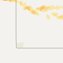
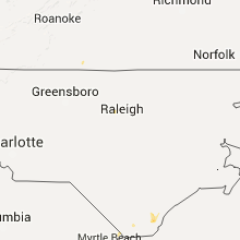
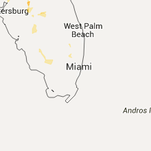
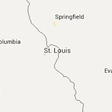
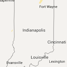
Hail Map for Tuesday, July 12, 2016

Number of Impacted Households on 7/12/2016
0
Impacted by 1" or Larger Hail
0
Impacted by 1.75" or Larger Hail
0
Impacted by 2.5" or Larger Hail
Square Miles of Populated Area Impacted on 7/12/2016
0
Impacted by 1" or Larger Hail
0
Impacted by 1.75" or Larger Hail
0
Impacted by 2.5" or Larger Hail


Cities Most Affected by Hail Storms of 7/12/2016
| Hail Size | Demographics of Zip Codes Affected | ||||||
|---|---|---|---|---|---|---|---|
| City | Count | Average | Largest | Pop Density | House Value | Income | Age |
| Mclean, TX | 1 | 2.75 | 2.75 | 1 | $25k | $26.7k | 46.1 |
| Jacksonville, FL | 1 | 1.75 | 1.75 | 3084 | $84k | $35.6k | 39.1 |
Hail and Wind Damage Spotted on 7/12/2016
Filter by Report Type:Hail ReportsWind Reports
States Impacted
Missouri, South Carolina, Florida, Tennessee, Alabama, Michigan, Georgia, Mississippi, Indiana, North Dakota, Minnesota, Oregon, Texas, Montana, Colorado, KansasMissouri
| Local Time | Report Details |
|---|---|
| 7:15 AM CDT | 2 mile section of powerlines down along highway bb in st. clair county MO, 68 miles NNW of Springfield, MO |
South Carolina
| Local Time | Report Details |
|---|---|
| 11:31 AM EDT | Two trees down near decatur rd and audie rd in horry county SC, 57.3 miles W of Wilmington, NC |
Florida
| Local Time | Report Details |
|---|---|
| 3:23 PM EDT | Broadcast media reported a tree down on market stree in duval county FL, 0.3 miles WSW of Jacksonville, FL |
| 3:25 PM EDT | Quarter sized hail reported near Jacksonville, FL, 0.3 miles WSW of Jacksonville, FL, numerous reports of hail at least the size of quarters in downtown jacksonville. |
| 3:35 PM EDT | Quarter sized hail reported near Jacksonville, FL, 3.5 miles SE of Jacksonville, FL, picture relayed by social media. quarter sized hail reported on beach blvd near emerson. |
| 3:35 PM EDT | Golf Ball sized hail reported near Jacksonville, FL, 3.5 miles SE of Jacksonville, FL, pictures were posted on social media showing hail approximately the size of golf balls on emerson street in jacksonville. |
| 3:55 PM EDT | Trees down near 5th street and iona stree in duval county FL, 0.7 miles NNE of Jacksonville, FL |
| 4:05 PM EDT | National weather service employee reported a very large branch across san jose blvd at loretto roa in duval county FL, 11.9 miles S of Jacksonville, FL |
| 4:07 PM EDT | Quarter sized hail reported near Jacksonville, FL, 12.5 miles S of Jacksonville, FL, trained spotter reported quarter size hail in mandarin off san jose blvd just north of interstate 295. |
| 4:10 PM EDT | Large oak tree down along san jose boulevar in duval county FL, 5 miles S of Jacksonville, FL |
| 4:12 PM EDT | Quarter sized hail reported near Jacksonville, FL, 12.5 miles S of Jacksonville, FL, trained spotter reported quarter size hail in mandarin off san jose blvd just north of interstate 295. |
| 4:15 PM EDT | Broadcast media reported a tree down in mandarin at loretto road and flynn roa in duval county FL, 12.5 miles S of Jacksonville, FL |
| 4:25 PM EDT | Emergency manager reported 2 trees down on homes... multiple trees down from fleming island and westward on cr 220. 6 other houses with damage including shingles blown in clay county FL, 17.6 miles SSW of Jacksonville, FL |
| 4:25 PM EDT | Off-duty nws employee estimated wind gust of 60 to 70 mp in clay county FL, 18.2 miles S of Jacksonville, FL |
| 4:25 PM EDT | Updated...emergency manager reported 15 trees down on homes... 5 roads blocked by trees and 5 out buildings damaged by trees in fleming islan in clay county FL, 16.5 miles SSW of Jacksonville, FL |
| 5:25 PM EDT | Tree down at oak hill road in madison county FL, 58.8 miles ENE of Tallahassee, FL |
| 5:28 PM EDT | Trees dow in suwannee county FL, 78.5 miles WSW of Jacksonville, FL |
| 5:57 PM EDT | Numerous trees down to the west of lake city. small hail also reporte in columbia county FL, 62.1 miles W of Jacksonville, FL |
| 6:00 PM EDT | Emergency manager reported multiple powerlines and trees down west of lake city. multiple trees were down in the woodgate village subdivision...and a tree fell on a mob in columbia county FL, 63.7 miles W of Jacksonville, FL |
| 6:16 PM EDT | 911 call center reported tree down on state road 5 in suwannee county FL, 74.4 miles E of Tallahassee, FL |
| 6:45 PM EDT | Power pole snapped at intersection of cr 476 and sr 471. barn roof torn of in sumter county FL, 41.7 miles WNW of Orlando, FL |
Tennessee
| Local Time | Report Details |
|---|---|
| 3:28 PM EDT | Several trees down across eastern part of the county in anderson county TN, 14.7 miles NW of Knoxville, TN |
| 3:45 PM EDT | Trees and power lines down across much of the northern half of the county...including downtown knoxville...carter...and koda in knox county TN, 1.8 miles WNW of Knoxville, TN |
| 3:49 PM EDT | Metal awning on the front of a building was peeled back. location is western ave near i-64 in knox county TN, 1.8 miles WNW of Knoxville, TN |
| 4:25 PM EDT | Trees down near dandridge and near new marke in jefferson county TN, 28.4 miles E of Knoxville, TN |
| 4:25 PM EDT | Trees down north of seviervill in sevier county TN, 17.4 miles E of Knoxville, TN |
| 5:10 PM EDT | 3 trees down near newport - highway 160... highway 321... and in downtown newport in cocke county TN, 41 miles E of Knoxville, TN |
Alabama
| Local Time | Report Details |
|---|---|
| 2:45 PM CDT | One tree down at lake judson rd and hargove rd. winds estimated at 40-45 mp in tuscaloosa county AL, 45.8 miles SW of Birmingham, AL |
| 3:00 PM CDT | Tree down on top of house on 269 idaho road in talladega county AL, 43.1 miles ESE of Birmingham, AL |
| 3:13 PM CDT | Tree down at the intersection of state hwy 10 and county rd 7 in henry county AL, 69.1 miles S of Auburn, AL |
| 3:17 PM CDT | Two trees down. one on sandy drive and one on cora lee circle. winds estimated at 40-45 mp in tuscaloosa county AL, 26.1 miles SW of Birmingham, AL |
| 3:50 PM CDT | Tree blown down on powerlines and vehicle along robinson rd. occupants not injured. winds estimated at 40mph in tallapoosa county AL, 37.9 miles NW of Auburn, AL |
Michigan
| Local Time | Report Details |
|---|---|
| 4:44 PM EDT | Numerous tree branches down. time estimated from rada in kent county MI, 8.7 miles SE of Grand Rapids, MI |
| 4:52 PM EDT | A few trees down around east grand rapids and numerous power outages. time estimated by rada in kent county MI, 3.6 miles SE of Grand Rapids, MI |
| 4:52 PM EDT | Healthy 18 foot tree down at 52nd and mildred... grand rapids. time esti mated from rada in kent county MI, 6.8 miles SSE of Grand Rapids, MI |
| 4:55 PM EDT | Healthy 18 inch diameter tree down. reported at 68 st and division av in kent county MI, 8.7 miles S of Grand Rapids, MI |
| 4:55 PM EDT | Reported at 1950 32 street se... grand rapids a 40 foot tall tree 14 inches diameter healthy was snapped 4 inches above the ground. no damage to near by structures was in kent county MI, 4.7 miles SSE of Grand Rapids, MI |
| 6:45 PM EDT | Power lines down in dewitt twp but no other significant damage of note elsewhere in the count in clinton county MI, 44.9 miles WSW of Flint, MI |
| 7:25 PM EDT | 1-2 ft diameter tree uprooted and fell on a garage-damage to garage from tree is substantia in branch county MI, 59.9 miles N of Fort Wayne, IN |
| 7:45 PM EDT | Tree snapped near base or partial uproot. at least 8 inches in diameter. blocking the street. photo via twitte in ingham county MI, 48.5 miles SW of Flint, MI |
| 8:05 PM EDT | Several large limbs down. power out in the are in jackson county MI, 66.8 miles SW of Flint, MI |
| 8:06 PM EDT | Numerous downed trees and large branches... some of which fell on homes... cars and power lines. very heavy rainfall and hail up to marble size also. time estimated fro in jackson county MI, 66 miles SW of Flint, MI |
| 8:30 PM EDT | Large trees blocking roa in washtenaw county MI, 44.8 miles SSW of Flint, MI |
| 9:03 PM EDT | Tree limb damage required county maintenance remova in washtenaw county MI, 50 miles S of Flint, MI |
| 9:10 PM EDT | Roof damage to a home and tree downed on a ca in oakland county MI, 35.1 miles S of Flint, MI |
Georgia
| Local Time | Report Details |
|---|---|
| 5:05 PM EDT | Numerous power lines dow in randolph county GA, 75.8 miles SSE of Auburn, AL |
| 6:00 PM EDT | Several trees and power lines down in north valdosta near the country clu in lowndes county GA, 50.4 miles SSW of Douglas, GA |
| 6:00 PM EDT | Quarter sized hail reported near Valdosta, GA, 51.9 miles SSW of Douglas, GA, quarter size hail in valdosta. |
| 6:20 PM EDT | Numerous trees down across thomas county...mostly along hwy 19 near ochlocknee in thomas county GA, 37.7 miles NNE of Tallahassee, FL |
| 6:20 PM EDT | Quarter sized hail reported near Thomasville, GA, 32.9 miles NNE of Tallahassee, FL, picture on facebook of hail from the thomasville area. |
| 8:35 PM EDT | Tree down on highway 441 nort in coffee county GA, 15.1 miles NNW of Douglas, GA |
Mississippi
| Local Time | Report Details |
|---|---|
| 5:10 PM CDT | Ping Pong Ball sized hail reported near Madison, MS, 16 miles NNE of Jackson, MS, ping pong ball size hail...picture on social media |
| 5:10 PM CDT | Half Dollar sized hail reported near Madison, MS, 16 miles NNE of Jackson, MS, quarter to half dollar size hail observed near intersection of highway 51 and yandell road reported to us by a local tv station...video of the hail had been sent to the |
Indiana
| Local Time | Report Details |
|---|---|
| 6:15 PM EDT | Report of a 10-12 ft long... 6-7" diameter tree limb downed with winds in the storm. observers estimated 45-50 mph wind gusts in elkhart county IN, 51.1 miles NW of Fort Wayne, IN |
| 6:30 PM EDT | Multiple large limbs downed on main and section streets in south side of milford. two trees also uprooted in the same area. one tree fell on a mobile hom in kosciusko county IN, 45.4 miles WNW of Fort Wayne, IN |
| 6:45 PM EDT | Maple tree trunk downed-approx. 6" in diameter. reported that it appeared rotted where it spli in lagrange county IN, 42.6 miles NNW of Fort Wayne, IN |
North Dakota
| Local Time | Report Details |
|---|---|
| 6:02 PM CDT | Reports of trees damaged in the 47th and cherry neighborhood. esitmated wind speed was 40 to 50mp in grand forks county ND, 73.4 miles N of Fargo, ND |
Minnesota
| Local Time | Report Details |
|---|---|
| 6:45 PM CDT | Multiple trees damaged on farmstead. wind gust at awos near report was 40 mp in pennington county MN, 56.8 miles SSW of Roseau, MN |
Oregon
| Local Time | Report Details |
|---|---|
| 4:45 PM PDT | Quarter sized hail reported near Baker City, OR, 84.4 miles SSE of Walla Walla, WA, a trained spotter reported occasional 1 inch hail associated with a strong thunderstorm moving through the area. most of the hail that fell was from 1/4 to 3/4 inches i |
Texas
| Local Time | Report Details |
|---|---|
| 8:20 PM CDT | Half Dollar sized hail reported near Claude, TX, 32.6 miles ESE of Amarillo, TX, reported on us highway 287 east of claude. |
| 8:57 PM CDT | Ping Pong Ball sized hail reported near Groom, TX, 47.2 miles E of Amarillo, TX, reported between groom and highway 70 going north. quarter size increased to ping pong ball size. |
| 9:07 PM CDT | Storm damage reported in gray county TX, 48.9 miles E of Amarillo, TX |
| 9:43 PM CDT | Baseball sized hail reported near Mclean, TX, 62.2 miles NNW of Childress, TX |
| 9:47 PM CDT | Ping Pong Ball sized hail reported near Mclean, TX, 61.4 miles NNW of Childress, TX |
Montana
| Local Time | Report Details |
|---|---|
| 7:24 PM MDT | Storm damage reported in park county MT, 28.3 miles E of Bozeman, MT |
Colorado
| Local Time | Report Details |
|---|---|
| 8:30 PM MDT | Quarter sized hail reported near Yuma, CO, 18.5 miles S of Yuma, CO |
Kansas
| Local Time | Report Details |
|---|---|
| 1:54 AM MDT | Still gusting to 59 mp in sherman county KS, 35.8 miles W of Colby, KS |
| 2:57 AM CDT | Small living tree limbs down around 1/2 inch in diamete in cheyenne county KS, 36.5 miles WNW of Colby, KS |
| 2:02 AM MDT | Storm damage reported in sherman county KS, 35.8 miles W of Colby, KS |
| 3:45 AM CDT | Storm damage reported in thomas county KS, 1.9 miles ESE of Colby, KS |
| 4:20 AM CDT | Estimated wind gusts of 50-60 mp in graham county KS, 51.6 miles NW of Hays, KS |
| 4:20 AM CDT | Quarter sized hail reported near Morland, KS, 51.6 miles NW of Hays, KS, very strong winds accompanied the hail. no estimate on the speed of the wind. |
| 4:30 AM CDT | 2 power poles down causing a power outag in graham county KS, 51.6 miles NW of Hays, KS |
| 4:51 AM CDT | Storm damage reported in graham county KS, 44.3 miles NW of Hays, KS |
| 4:57 AM CDT | Storm damage reported in gove county KS, 53.7 miles W of Hays, KS |
| 5:16 AM CDT | Time est fm radar. power outages reported in the are in rooks county KS, 26.4 miles NNW of Hays, KS |
| 5:50 AM CDT | Wind gust measured from home weather station. numerous tree limbs and some power lines down in are in ellis county KS, 0.6 miles N of Hays, KS |
| 6:19 AM CDT | Galatia fire chief estimates winds in excess of 60 mp in barton county KS, 25.6 miles SE of Hays, KS |
| 6:21 AM CDT | Storm damage reported in russell county KS, 27.6 miles E of Hays, KS |
| 6:23 AM CDT | Storm damage reported in russell county KS, 27.6 miles E of Hays, KS |
| 6:35 AM CDT | Trained spotter reports multiple cedar trees are down in his yard. time is approximated from other reports of highest wind speed in russell county KS, 29.2 miles ENE of Hays, KS |
| 6:46 AM CDT | Storm damage reported in ellsworth county KS, 46.6 miles E of Hays, KS |
Connect with Interactive Hail Maps