

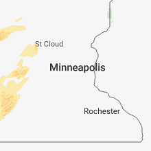
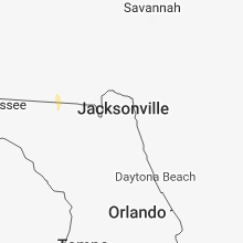
Hail Map for Monday, July 2, 2018

Number of Impacted Households on 7/2/2018
0
Impacted by 1" or Larger Hail
0
Impacted by 1.75" or Larger Hail
0
Impacted by 2.5" or Larger Hail
Square Miles of Populated Area Impacted on 7/2/2018
0
Impacted by 1" or Larger Hail
0
Impacted by 1.75" or Larger Hail
0
Impacted by 2.5" or Larger Hail


Cities Most Affected by Hail Storms of 7/2/2018
| Hail Size | Demographics of Zip Codes Affected | ||||||
|---|---|---|---|---|---|---|---|
| City | Count | Average | Largest | Pop Density | House Value | Income | Age |
| Stapleton, NE | 4 | 2.00 | 2.75 | 1 | $53k | $33.9k | 45.0 |
| Cogswell, ND | 1 | 2.75 | 2.75 | 1 | $19k | $37.6k | 52.3 |
| Lame Deer, MT | 1 | 1.75 | 1.75 | 0 | $48k | $23.3k | 23.7 |
| Carson, ND | 1 | 1.75 | 1.75 | 1 | $21k | $21.0k | 44.4 |
| Argusville, ND | 1 | 1.75 | 1.75 | 8 | $93k | $48.3k | 35.1 |
| Hysham, MT | 1 | 1.75 | 1.75 | 0 | $42k | $30.1k | 51.2 |
| Elgin, ND | 1 | 1.75 | 1.75 | 2 | $29k | $22.4k | 56.2 |
| Side Lake, MN | 1 | 1.75 | 1.75 | 4 | $155k | $51.9k | 56.0 |
Hail and Wind Damage Spotted on 7/2/2018
Filter by Report Type:Hail ReportsWind Reports
States Impacted
Ohio, New York, Louisiana, Pennsylvania, Arkansas, Maryland, Kentucky, Mississippi, West Virginia, Virginia, Colorado, Texas, Indiana, Nebraska, New Mexico, Montana, North Dakota, Georgia, South Dakota, MinnesotaOhio
| Local Time | Report Details |
|---|---|
| 1:56 PM EDT | 6 inch tree branch downe in franklin county OH, 6.8 miles N of Columbus, OH |
| 3:48 PM EDT | Multiple trees down... shingle damage. time estimated from radar dat in licking county OH, 31.1 miles E of Columbus, OH |
| 3:48 PM EDT | Seven trees blown down... one tree uprooted. largest tree downed had a two-foot diamete in licking county OH, 29.5 miles E of Columbus, OH |
| 6:25 PM EDT | Large tree across the roadway at state route 139 and rosemount roa in scioto county OH, 76.4 miles WNW of Charleston, WV |
| 6:27 PM EDT | Two trees downed into power lines near the intersection of bonser run raod and elliott roads north of sciotovill in scioto county OH, 73.7 miles WNW of Charleston, WV |
| 7:15 PM EDT | A tree fell on a house due to high wind on mill s in gallia county OH, 38.5 miles WNW of Charleston, WV |
| 7:15 PM EDT | A few trees down due to high wind near the intersection of 775 and 14 in lawrence county OH, 48.7 miles WNW of Charleston, WV |
| 7:50 PM EDT | Tree down due to high wind on route 32 in jackson county OH, 62.5 miles SSE of Columbus, OH |
New York
| Local Time | Report Details |
|---|---|
| 2:18 PM EDT | Trees down in south dayton. time estimated in cattaraugus county NY, 37.3 miles SSW of Buffalo, NY |
| 2:24 PM EDT | Storm damage reported in oswego county NY, 33.7 miles NNW of Syracuse, NY |
| 2:24 PM EDT | Storm damage reported in oswego county NY, 33.7 miles NNW of Syracuse, NY |
| 2:47 PM EDT | Trees down in cato...time estimated in cayuga county NY, 23.2 miles WNW of Syracuse, NY |
| 2:52 PM EDT | 911 center reports a tree and wires down on camp on rainbow shores rd near lake ontario. town of richlan in oswego county NY, 38.7 miles N of Syracuse, NY |
| 3:00 PM EDT | Report of multiple trees down in town of schroeppel. time estimated with rada in oswego county NY, 17 miles NNW of Syracuse, NY |
| 3:17 PM EDT | 911 reports tree down on wires near intersection of county route 23b and 26 in town of west monroe. time estimated with rada in oswego county NY, 20.2 miles NNE of Syracuse, NY |
| 3:23 PM EDT | Trees down in randolph. time estimates in cattaraugus county NY, 50.3 miles S of Buffalo, NY |
| 3:30 PM EDT | 911 center reports multiple trees down in town of constanti in oswego county NY, 15.7 miles NNE of Syracuse, NY |
| 3:34 PM EDT | Trees down in cato in cayuga county NY, 23.2 miles WNW of Syracuse, NY |
| 3:55 PM EDT | Trees and wires dow in cayuga county NY, 23 miles WSW of Syracuse, NY |
| 4:30 PM EDT | Trees and power lines down on inslee stree in seneca county NY, 37.6 miles WSW of Syracuse, NY |
| 4:30 PM EDT | Tree down on soft maple rd in town of crogan in lewis county NY, 54.8 miles SSE of Ogdensburg, NY |
| 4:38 PM EDT | Tree branch down on roa in allegany county NY, 69.5 miles SE of Buffalo, NY |
| 4:50 PM EDT | Trees and wires down on genesee roa in onondaga county NY, 8.3 miles W of Syracuse, NY |
| 5:20 PM EDT | Trees and powerlines down near 405 mclean r in cortland county NY, 31.9 miles S of Syracuse, NY |
| 5:55 PM EDT | Tree down on route 30 near duane in franklin county NY, 54.4 miles E of Ogdensburg, NY |
| 6:00 PM EDT | Tree and wires down on route 26 in franklin county NY, 53.1 miles W of Burlington, VT |
| 6:03 PM EDT | Tree down across roadway on schoolhouse r in cortland county NY, 38.5 miles SSE of Syracuse, NY |
| 6:28 PM EDT | Tree down on wires near 514 miller roa in tioga county NY, 57.4 miles S of Syracuse, NY |
| 6:30 PM EDT | Tree and wires down off route 26 in broome county NY, 55 miles S of Syracuse, NY |
| 6:45 PM EDT | Multiple trees and wires down on michigan hollow roa in tioga county NY, 57.3 miles SSW of Syracuse, NY |
| 6:48 PM EDT | Trees and wires down near pultz hill road and hollister roa in tioga county NY, 59.4 miles NNW of Scranton, PA |
| 7:18 PM EDT | Trees and wires down on lyle rd. some houses involve in tioga county NY, 58.2 miles NW of Scranton, PA |
| 7:47 PM EDT | Wires down near route 79 and pigeon hill r in broome county NY, 57.9 miles SSE of Syracuse, NY |
| 8:27 PM EDT | Numerous trees down in the town of argyl in washington county NY, 37.3 miles NE of Schenectady, NY |
| 8:27 PM EDT | Tree down blocking road on route 40... north of lick springs road. time estimated from rada in washington county NY, 35.7 miles NE of Schenectady, NY |
Louisiana
| Local Time | Report Details |
|---|---|
| 2:15 PM CDT | Tree down on bullard ave via social medi in orleans county LA, 11.9 miles NE of New Orleans, LA |
| 7:08 PM CDT | Trees and power lines down over much of gibslan in bienville county LA, 40.7 miles E of Shreveport, LA |
| 7:55 PM CDT | Trees and power lines down in bryceland... and over much the northern half of the paris in bienville county LA, 45 miles E of Shreveport, LA |
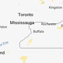
Pennsylvania
| Local Time | Report Details |
|---|---|
| 3:32 PM EDT | Trees down on wires in blair county PA, 39.1 miles SW of State College, PA |
| 3:43 PM EDT | Trees down on wires in blair county PA, 29.5 miles WSW of State College, PA |
| 4:01 PM EDT | Quarter sized hail reported near Sugar Grove, PA, 69.4 miles SSW of Buffalo, NY, quarter-sized hail in chandlers valley. |
| 4:15 PM EDT | Trees down in mcconnellstow in huntingdon county PA, 26.4 miles SSW of State College, PA |
| 4:20 PM EDT | Trees and wires down at pennsylvania avenue and 4th street in smithfield townshi in huntingdon county PA, 22.1 miles SSW of State College, PA |
| 4:24 PM EDT | Trees down in logan townshi in huntingdon county PA, 18.4 miles SSW of State College, PA |
| 4:49 PM EDT | Trees down on wires in warren county PA, 72.5 miles S of Buffalo, NY |
| 5:11 PM EDT | Trees down on wires in warren county PA, 77.2 miles SSW of Buffalo, NY |
| 5:12 PM EDT | Tree down on a house and trees down on wires on mount davis road in somerset county PA, 61.2 miles SE of Pittsburgh, PA |
| 5:12 PM EDT | Numerous trees down on wires in warren county PA, 79.6 miles S of Buffalo, NY |
| 5:18 PM EDT | Tree and wires down on deerfield ln in westmoreland county PA, 44.4 miles ESE of Pittsburgh, PA |
| 5:19 PM EDT | Trees down along moraine state park bike trail in butler county PA, 36.3 miles N of Pittsburgh, PA |
| 5:25 PM EDT | Trees down on wires in somerset county PA, 66.4 miles SE of Pittsburgh, PA |
| 5:31 PM EDT | Tree and lines down near twin echo dr in westmoreland county PA, 47.3 miles ESE of Pittsburgh, PA |
| 5:32 PM EDT | Trees down on lindsay dr in beaver county PA, 26.7 miles NW of Pittsburgh, PA |
| 5:49 PM EDT | Trees down on wires in warren county PA, 72.5 miles S of Buffalo, NY |
| 6:20 PM EDT | Trees down along us 62 at mcpherson road in venango county PA, 71 miles NNE of Pittsburgh, PA |
| 6:40 PM EDT | 2 trees down near salem church rd in westmoreland county PA, 18.3 miles SE of Pittsburgh, PA |
| 7:06 PM EDT | Multiple trees down along margaret r in armstrong county PA, 40.2 miles NE of Pittsburgh, PA |
| 7:15 PM EDT | Tree down on route 220... just north of the penn dot she in bradford county PA, 58 miles NW of Scranton, PA |
| 7:23 PM EDT | Multiple trees down in mcdonald boro / robinson twp area in washington county PA, 13.9 miles WSW of Pittsburgh, PA |
| 7:29 PM EDT | Noblestown road at station street is closed due to fallen tree and down power line in allegheny county PA, 1.7 miles W of Pittsburgh, PA |
Arkansas
| Local Time | Report Details |
|---|---|
| 2:40 PM CDT | A 40x60 foot pole barn was blown dow in montgomery county AR, 42.4 miles N of Nashville, AR |
Maryland
| Local Time | Report Details |
|---|---|
| 4:00 PM EDT | Trees down along lakeshore dr; unclear if produced by severe win in garrett county MD, 48.1 miles NNE of Elkins, WV |
Kentucky
| Local Time | Report Details |
|---|---|
| 4:18 PM EDT | Dispatch reported 4 trees down across the county due to thunderstorms. time from rada in franklin county KY, 51.6 miles ENE of Louisville, KY |
| 9:40 PM EDT | One tree down on panit rock r in clay county KY, 37.5 miles SSE of Irvine, KY |
Mississippi
| Local Time | Report Details |
|---|---|
| 3:40 PM CDT | Tree downed on old morgantown r in marion county MS, 75.2 miles SSE of Jackson, MS |
| 3:42 PM CDT | Tree downed at ms hwy 586 at sumbax r in marion county MS, 74.5 miles SSE of Jackson, MS |
| 8:10 PM CDT | Trees downed in the city of greenvill in washington county MS, 66.4 miles NE of Bastrop, LA |
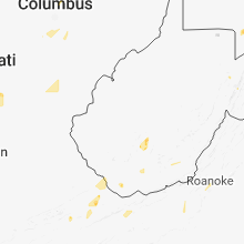
West Virginia
| Local Time | Report Details |
|---|---|
| 5:01 PM EDT | Downed tree on three churches hollow roa in hampshire county WV, 73.7 miles ENE of Elkins, WV |
| 5:15 PM EDT | Numerous trees down along spring gap roa in hampshire county WV, 78.1 miles ENE of Elkins, WV |
| 6:09 PM EDT | Trees down near the intersection of virginia line road and unger store roa in morgan county WV, 89 miles W of Baltimore, MD |
Virginia
| Local Time | Report Details |
|---|---|
| 5:30 PM EDT | Tree fell on house on the corner of wesley street and lee avenu in tazewell county VA, 68.3 miles NE of Bristol, TN |
| 5:35 PM EDT | Multiple trees were blown down by thunderstorm winds along tazewell av in tazewell county VA, 69.1 miles NE of Bristol, TN |
| 5:55 PM EDT | Trees down near the intersection of chapel hill road and wesley chapel roa in frederick county VA, 89.2 miles ENE of Elkins, WV |
| 6:00 PM EDT | Tree down near the intersection of chapel hill road and morgan frederick grad in frederick county VA, 89.5 miles ENE of Elkins, WV |
| 7:18 PM EDT | 2 trees down near st paul and dant in russell county VA, 23 miles N of Bristol, TN |
Colorado
| Local Time | Report Details |
|---|---|
| 4:28 PM MDT | Storm damage reported in prowers county CO, 99.4 miles W of Garden City, KS |
| 10:29 PM MDT | Storm damage reported in denver county CO, 18.9 miles ENE of Denver, CO |
Texas
| Local Time | Report Details |
|---|---|
| 6:02 PM CDT | Storm damage reported in foard county TX, 42.2 miles SE of Childress, TX |
| 7:05 PM CDT | West texas mesonet in yoakum county TX, 75.2 miles WSW of Lubbock, TX |
| 7:45 PM CDT | Storm damage reported in gaines county TX, 62 miles SW of Lubbock, TX |
Indiana
| Local Time | Report Details |
|---|---|
| 7:07 PM EDT | Report of large trees down along with power lines in jeffersonville. duke energy reports 3000 power outages in clark count in clark county IN, 22.2 miles N of Louisville, KY |
| 7:25 PM EDT | Trees down along pratt st. in jeffersonville. some minor street flooding also occurrin in clark county IN, 20.2 miles N of Louisville, KY |
Nebraska
| Local Time | Report Details |
|---|---|
| 6:26 PM CDT | Baseball sized hail reported near Stapleton, NE, 22.9 miles NNE of North Platte, NE, jagged |
| 6:35 PM CDT | Quarter sized hail reported near , , 25 miles NNE of North Platte, NE, mix of hail with largest up to quarter size. |
| 8:00 PM CDT | Half Dollar sized hail reported near Stapleton, NE, 25.8 miles NNE of North Platte, NE |
| 8:20 PM CDT | Golf Ball sized hail reported near Stapleton, NE, 27.1 miles NNE of North Platte, NE |
| 8:34 PM CDT | Golf Ball sized hail reported near Stapleton, NE, 29 miles NNE of North Platte, NE, ranging from quarters to golf balls. |
| 9:05 PM CDT | Golf Ball sized hail reported near Stapleton, NE, 32.1 miles NNE of North Platte, NE |
| 9:25 PM CDT | Half Dollar sized hail reported near Stapleton, NE, 33.3 miles NNE of North Platte, NE |
| 9:20 PM MDT | Ping Pong Ball sized hail reported near Keystone, NE, 45.5 miles WNW of North Platte, NE, largest stones up to ping pong size. lasted approximately 20 minutes. |
New Mexico
| Local Time | Report Details |
|---|---|
| 5:32 PM MDT | Storm damage reported in lea county NM, 81.5 miles NW of Odessa, TX |
Montana
| Local Time | Report Details |
|---|---|
| 5:58 PM MDT | Quarter sized hail reported near Absarokee, MT, 48.8 miles WSW of Billings, MT |
| 6:44 PM MDT | Quarter sized hail reported near Reed Point, MT, 61.7 miles WSW of Billings, MT |
| 6:57 PM MDT | Quarter sized hail reported near Absarokee, MT, 49 miles WSW of Billings, MT |
| 8:01 PM MDT | Quarter sized hail reported near Absarokee, MT, 48.8 miles WSW of Billings, MT |
| 8:32 PM MDT | Golf Ball sized hail reported near Hysham, MT, 63.8 miles ENE of Billings, MT, hail from the size of quarters to golf balls. |
| 8:55 PM MDT | Quarter sized hail reported near Forsyth, MT, 52.9 miles W of Miles City, MT |
| 9:09 PM MDT | Quarter sized hail reported near Forsyth, MT, 46.9 miles WSW of Miles City, MT |
| 9:14 PM MDT | Golf Ball sized hail reported near Lame Deer, MT, 67.5 miles SW of Miles City, MT |
| 9:14 PM MDT | Quarter sized hail reported near Forsyth, MT, 42 miles WSW of Miles City, MT |
| 9:16 PM MDT | Quarter sized hail reported near Hardin, MT, 42.1 miles ESE of Billings, MT, 8 inch diameter tree limbs broken |
| 9:16 PM MDT | 8 inch diameter tree limbs broken in big horn county MT, 42.1 miles ESE of Billings, MT |
| 9:19 PM MDT | Ping Pong Ball sized hail reported near Forsyth, MT, 39.5 miles WSW of Miles City, MT |
| 9:19 PM MDT | Storm damage reported in rosebud county MT, 39.5 miles WSW of Miles City, MT |
| 9:30 PM MDT | Storm damage reported in rosebud county MT, 38.1 miles WSW of Miles City, MT |
| 9:34 PM MDT | Quarter sized hail reported near Miles City, MT, 2.5 miles ENE of Miles City, MT |
| 10:00 PM MDT | Quarter sized hail reported near Hardin, MT, 43 miles E of Billings, MT |
| 10:00 PM MDT | Storm damage reported in rosebud county MT, 24 miles WSW of Miles City, MT |
| 10:00 PM MDT | Quarter sized hail reported near Busby, MT, 77.2 miles ESE of Billings, MT |
| 10:25 PM MDT | Quarter sized hail reported near Lame Deer, MT, 67.7 miles SW of Miles City, MT |
| 10:30 PM MDT | Ping Pong Ball sized hail reported near Miles City, MT, 10.8 miles SSE of Miles City, MT |
| 10:40 PM MDT | Quarter sized hail reported near Miles City, MT, 0.5 miles S of Miles City, MT |
| 11:04 PM MDT | Quarter sized hail reported near Terry, MT, 40.9 miles ENE of Miles City, MT, winds up to 40mph as well. |
| 11:53 PM MDT | Ping Pong Ball sized hail reported near Plevna, MT, 63.5 miles E of Miles City, MT |
| 11:58 PM MDT | Storm damage reported in fallon county MT, 76.1 miles E of Miles City, MT |
| 12:29 AM MDT | Measured off davis equipmen in carter county MT, 91.9 miles ESE of Miles City, MT |
| 12:40 AM MDT | Storm damage reported in fallon county MT, 85.1 miles E of Miles City, MT |
| 1:40 AM MDT | Storm damage reported in fallon county MT, 85.1 miles E of Miles City, MT |
North Dakota
| Local Time | Report Details |
|---|---|
| 6:06 PM MDT | Quarter sized hail reported near New England, ND, 94.1 miles W of Bismarck, ND, lots of hail ranging from nickels to quarters. |
| 6:10 PM MDT | Quarter sized hail reported near New England, ND, 94.1 miles W of Bismarck, ND, corrects previous hail report from 7 se schefield. lots of hail ranging from nickels to quarters. |
| 6:16 PM MDT | Quarter sized hail reported near New England, ND, 94.5 miles W of Bismarck, ND, corrects previous hail report from 6 se schefield. hail lasted for about 15 minutes. largest hail was around quarter size... possibly half dollar. time estimated on rad |
| 6:35 PM MDT | Half Dollar sized hail reported near Mott, ND, 79.2 miles WSW of Bismarck, ND, lots of pea to quarter size hail. a few hail stones were slightly larger than a quarter. hail lasted for 5 minutes. |
| 7:16 PM MDT | Quarter sized hail reported near New England, ND, 94.5 miles W of Bismarck, ND, hail lasted for about 15 minutes. largest hail was around quarter size... possibly half dollar. time estimated on radar. many trees and crops stripped and destroyed. |
| 7:35 PM MDT | Golf Ball sized hail reported near Elgin, ND, 57.8 miles WSW of Bismarck, ND, hail ranged from pea size to golf ball size in the city of elgin... nd. |
| 7:50 PM MDT | Quarter sized hail reported near Carson, ND, 51.3 miles SW of Bismarck, ND, lots of pea to quarter size hail in the town of leith. hail was accumulating in depth at the time of the report. the duration of the hail event was 15 minutes. |
| 8:00 PM MDT | Golf Ball sized hail reported near Carson, ND, 51.3 miles SW of Bismarck, ND, golf ball size hail reported in leith. hail ongoing at the time of this report. |
| 9:05 PM CDT | Baseball sized hail reported near Cogswell, ND, 56.5 miles NE of Aberdeen, SD, public reports received via broadcast media of 2.8 inch diameter hail in cogswell. time estimated based on radar. |
| 9:14 PM CDT | Ping Pong Ball sized hail reported near Cogswell, ND, 58.1 miles NE of Aberdeen, SD, lots of quarter sized and larger hail. some ping ping ball sized. |
| 9:29 PM CDT | Quarter sized hail reported near Lisbon, ND, 61.3 miles SW of Fargo, ND, very heavy rains and a few large hail. |
| 9:33 PM CDT | Quarter sized hail reported near Lisbon, ND, 61.3 miles SW of Fargo, ND, very heavy rains and a few large hail. |
| 9:44 PM CDT | Half Dollar sized hail reported near Lisbon, ND, 50.1 miles SW of Fargo, ND |
| 9:48 PM CDT | Half Dollar sized hail reported near Lisbon, ND, 50.1 miles SW of Fargo, ND |
| 10:09 PM CDT | Half Dollar sized hail reported near West Fargo, ND, 6.2 miles W of Fargo, ND, broadcast meteorologist observed a few half dollar sized hail lasting 2-3 minutes within along with quarter sized hail. |
| 10:40 PM CDT | Quarter sized hail reported near Harwood, ND, 8.6 miles NNW of Fargo, ND, relayed by broadcast media of public report as measured by comparison to a quarter. |
| 10:50 PM CDT | Golf Ball sized hail reported near Argusville, ND, 14.2 miles NNW of Fargo, ND, relayed from broadcast media. |
| 10:50 PM CDT | Quarter sized hail reported near Argusville, ND, 14.2 miles NNW of Fargo, ND, photo of quarter sized hail in argusville via social media. |
| 12:15 AM MDT | Measured on beach observatio in golden valley county ND, 86.7 miles SSW of Williston, ND |
| 12:30 AM MDT | Storm damage reported in golden valley county ND, 84.9 miles S of Williston, ND |
| 1:25 AM MDT | Also had pea size hail. worst of the storm 225 to 230 am cdt. trees bending pretty goo in bowman county ND, 118.8 miles E of Miles City, MT |
| 1:30 AM MDT | Mesonet station amdn8... sand cree in slope county ND, 110.4 miles S of Williston, ND |
| 1:33 AM MDT | Quarter sized hail reported near Bowman, ND, 118.8 miles E of Miles City, MT, report relayed through social media to broadcast meteorologist to nws. |
| 1:58 AM MDT | Tr airport south of dickinson along highway 2 in stark county ND, 95.9 miles W of Bismarck, ND |
| 2:18 AM MDT | Asos station hei... hettinger municipal airpor in adams county ND, 104.9 miles WSW of Bismarck, ND |
| 2:22 AM MDT | Nd ag weather networ in hettinger county ND, 79.2 miles WSW of Bismarck, ND |
| 3:55 AM CDT | Awos station d57... glen ullin rgn in morton county ND, 51.3 miles W of Bismarck, ND |
| 3:05 AM MDT | Storm damage reported in grant county ND, 50.8 miles WSW of Bismarck, ND |
| 4:20 AM CDT | Time estimated based on radar. relayed from broadcast medi in morton county ND, 34.6 miles W of Bismarck, ND |
| 4:23 AM CDT | Nd ag weather networ in morton county ND, 26.3 miles W of Bismarck, ND |
| 4:33 AM CDT | Mesonet station nd003... 1 wnw new sale in morton county ND, 31.1 miles W of Bismarck, ND |
| 5:14 AM CDT | Nws aso in burleigh county ND, 2.8 miles SSE of Bismarck, ND |
| 5:15 AM CDT | Awos station y19... 4 s manda in morton county ND, 5.8 miles WSW of Bismarck, ND |
| 5:25 AM CDT | Mesonet station ttkn8... 8 n selfridg in sioux county ND, 45 miles S of Bismarck, ND |
| 5:47 AM CDT | Mesonet station ts633... 2 e moffi in burleigh county ND, 27 miles ESE of Bismarck, ND |
| 6:46 AM CDT | Storm damage reported in stutsman county ND, 63.8 miles E of Bismarck, ND |
Georgia
| Local Time | Report Details |
|---|---|
| 8:51 PM EDT | 911 call center reported a tree fell onto a powerline near the intersection of us highway 129 and ga state road 94 knocking out the power in the tow in echols county GA, 56.5 miles S of Douglas, GA |
South Dakota
| Local Time | Report Details |
|---|---|
| 8:05 PM CDT | Quarter sized hail reported near Tulare, SD, 49.7 miles S of Aberdeen, SD |
| 9:40 PM CDT | Ping Pong Ball sized hail reported near Miller, SD, 61 miles SSW of Aberdeen, SD |
| 10:04 PM CDT | Quarter sized hail reported near Rockham, SD, 55 miles SSW of Aberdeen, SD |
| 10:27 PM CDT | Quarter sized hail reported near Rockham, SD, 53.5 miles SSW of Aberdeen, SD |
Minnesota
| Local Time | Report Details |
|---|---|
| 11:04 PM CDT | Golf Ball sized hail reported near Side Lake, MN, 66.8 miles SSE of International Falls, MN |
| 11:08 PM CDT | Quarter sized hail reported near Waubun, MN, 39.4 miles WSW of Bemidji, MN, public report of hail between half an inch to an inch. |
| 12:07 AM CDT | Tree knocked down on state highway 38 approximately 10 miles north of grand rapids. time estimated by rada in itasca county MN, 61.3 miles E of Bemidji, MN |
Connect with Interactive Hail Maps