

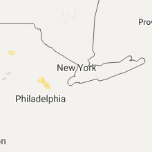
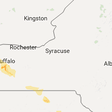
Hail Map for Thursday, July 20, 2017

Number of Impacted Households on 7/20/2017
0
Impacted by 1" or Larger Hail
0
Impacted by 1.75" or Larger Hail
0
Impacted by 2.5" or Larger Hail
Square Miles of Populated Area Impacted on 7/20/2017
0
Impacted by 1" or Larger Hail
0
Impacted by 1.75" or Larger Hail
0
Impacted by 2.5" or Larger Hail


Cities Most Affected by Hail Storms of 7/20/2017
| Hail Size | Demographics of Zip Codes Affected | ||||||
|---|---|---|---|---|---|---|---|
| City | Count | Average | Largest | Pop Density | House Value | Income | Age |
| Dickinson, ND | 1 | 1.75 | 1.75 | 39 | $73k | $33.0k | 37.1 |
Hail and Wind Damage Spotted on 7/20/2017
Filter by Report Type:Hail ReportsWind Reports
States Impacted
New York, Pennsylvania, South Carolina, New Hampshire, Montana, Florida, North Dakota, Maine, Colorado, New Jersey, South Dakota, Iowa, Utah, Wyoming, Idaho, OhioNew York
| Local Time | Report Details |
|---|---|
| 11:50 AM EDT | Trees and wires down in niagara county NY, 29.1 miles N of Buffalo, NY |
| 12:28 PM EDT | Erie county dep posted images of home damage and trees down near st. marys on the lake churc in erie county NY, 9.4 miles S of Buffalo, NY |
| 12:33 PM EDT | Tree snappe in erie county NY, 10.8 miles SSE of Buffalo, NY |
| 12:33 PM EDT | News video of multiple picnic tables mangled... one thrown on roof at erie county fairgrounds in erie county NY, 10.5 miles SSE of Buffalo, NY |
| 12:33 PM EDT | Trees and fence blown down in erie county NY, 10.1 miles S of Buffalo, NY |
| 12:34 PM EDT | Erie county dpw posted picture of tree down on clark s in erie county NY, 11.3 miles SSE of Buffalo, NY |
| 12:39 PM EDT | Photos of extensive tree damage at chestnut ridge park via county exec. trees snapped/blown ove in erie county NY, 14 miles SSE of Buffalo, NY |
| 12:40 PM EDT | Trees down on gartman rd between 277 and scherff in erie county NY, 14.3 miles SE of Buffalo, NY |
| 12:42 PM EDT | Tree and wires down on behm rd between cole rd and rte. 24 in erie county NY, 15.1 miles SE of Buffalo, NY |
| 12:52 PM EDT | Rte 16 closed between partridge and blanchard rd. due to debris in roa in erie county NY, 22.5 miles SE of Buffalo, NY |
| 12:53 PM EDT | Trees down and large party tent destroye in erie county NY, 21.2 miles SE of Buffalo, NY |
| 12:53 PM EDT | Photos of trees on powerlines in holland by erie county sheriff. time estimated by rada in erie county NY, 23.8 miles SE of Buffalo, NY |
| 12:55 PM EDT | Trees down... tractor trailer blown over... and damage to bar in clinton county NY, 37.4 miles NNW of Burlington, VT |
| 12:56 PM EDT | Trees down at vermont st. and vermont hill r in erie county NY, 24.4 miles SE of Buffalo, NY |
| 1:01 PM EDT | Trees down on s. protection rd near vermont hil in erie county NY, 27.1 miles SE of Buffalo, NY |
| 1:17 PM EDT | Trees and wires down in allegany county NY, 41.6 miles SE of Buffalo, NY |
| 1:24 PM EDT | Tree down - radar estimated time in livingston county NY, 64.4 miles E of Buffalo, NY |
| 1:35 PM EDT | Trees and wires down in allegany county NY, 50.9 miles SE of Buffalo, NY |
| 2:02 PM EDT | Tree down at beech tree rd and hwy 24 in cattaraugus county NY, 29.9 miles SSE of Buffalo, NY |
| 2:04 PM EDT | Trees down on creek rd. in town of yorkshir in cattaraugus county NY, 31.2 miles SE of Buffalo, NY |
| 2:25 PM EDT | Tree down in hartsville in steuben county NY, 74.4 miles SE of Buffalo, NY |
| 2:35 PM EDT | Trees and wires down in allegany county NY, 53.5 miles SE of Buffalo, NY |
| 2:53 PM EDT | Tree down across hwy 417 near banks hollow blocking both lanes in steuben county NY, 81.6 miles SE of Buffalo, NY |
| 3:00 PM EDT | Tree down across power lines on county route 7 in steuben county NY, 73.8 miles SW of Syracuse, NY |
| 3:00 PM EDT | Numerous trees dow in steuben county NY, 86.4 miles SW of Syracuse, NY |
| 3:00 PM EDT | Numerous trees down. boat lifted up and blowin across roa in steuben county NY, 89 miles NNE of State College, PA |
| 3:05 PM EDT | Storm damage reported in steuben county NY, 85.2 miles SW of Syracuse, NY |
| 3:10 PM EDT | Tree down over power lines in the vicinity of 1616 co. rd. 85 in steuben county NY, 85.2 miles SW of Syracuse, NY |
| 3:13 PM EDT | Roof partially blown off house on ryon circle in tioga county PA, 86.2 miles WNW of Scranton, PA |
| 3:15 PM EDT | Numerous large trees down in lawrenceville in tioga county PA, 86.2 miles WNW of Scranton, PA |
| 3:21 PM EDT | Tree down over power lines in the vicinity of 1350 tioughanack blv in tompkins county NY, 45.8 miles SSW of Syracuse, NY |
| 3:21 PM EDT | Tree fell on house on college ave in schuyler county NY, 59.1 miles SW of Syracuse, NY |
| 3:42 PM EDT | Tree down across rt 13 at county line in schuyler county NY, 60.1 miles SSW of Syracuse, NY |
| 4:04 PM EDT | Tree down across elmira st in bradford county PA, 61 miles NW of Scranton, PA |
| 4:07 PM EDT | Wires down across the roadway in the vicinity of tutlle hill r in tioga county NY, 57.4 miles S of Syracuse, NY |
| 7:10 PM EDT | Road closed from live wire and downed tree near shenandoah road and jackson roa in dutchess county NY, 58.7 miles N of Brooklyn, NY |
| 7:10 PM EDT | Tree branch and power line wires down on long hill roa in dutchess county NY, 56.4 miles N of Brooklyn, NY |
Pennsylvania
| Local Time | Report Details |
|---|---|
| 3:15 PM EDT | Trees and wires down across route 287 at school road in tioga county PA, 84 miles WNW of Scranton, PA |
| 3:15 PM EDT | Wires down across east lawrence road in tioga county PA, 83.9 miles WNW of Scranton, PA |
| 4:00 PM EDT | Tree down across watkins hill rd in bradford county PA, 66 miles WNW of Scranton, PA |
| 4:10 PM EDT | Thunderstorm wind damage... trees down... door ripped from house in the vicinity of 2202 arnold r in bradford county PA, 50.2 miles NW of Scranton, PA |
| 4:13 PM EDT | Multiple large trees and wires down in mansfield in tioga county PA, 78.5 miles WNW of Scranton, PA |
| 4:18 PM EDT | Numerous trees dow in bradford county PA, 46.9 miles NW of Scranton, PA |
| 4:20 PM EDT | 2 large trees down on odonnell r in jefferson county PA, 73.9 miles WNW of State College, PA |
| 4:25 PM EDT | Numerous trees dow in bradford county PA, 42.5 miles WNW of Scranton, PA |
| 4:56 PM EDT | Tree and power lines down across gary rd in susquehanna county PA, 32.5 miles NW of Scranton, PA |
| 5:10 PM EDT | Multiple trees down in susquehanna county PA, 22.1 miles N of Scranton, PA |
| 5:15 PM EDT | Tree and wires down in luzerne county PA, 18.1 miles SW of Scranton, PA |
| 5:28 PM EDT | 72mph wind gust in lackawanna county PA, 5.5 miles N of Scranton, PA |
| 5:45 PM EDT | Tree down across maplewood rd in wayne county PA, 14.8 miles E of Scranton, PA |
| 6:05 PM EDT | Trees down on powerlines. time estimated from rada in carbon county PA, 25.8 miles S of Scranton, PA |
| 6:06 PM EDT | 72mph wind gust in lackawanna county PA, 5.5 miles N of Scranton, PA |
| 6:07 PM EDT | Tree down on interstate 80 at mile marker 274...blocking the roa in carbon county PA, 23.5 miles S of Scranton, PA |
| 6:15 PM EDT | Several trees down on route 940 from blakeslee westward to moosey wood road. time approximated from rada in monroe county PA, 22.4 miles S of Scranton, PA |
| 6:26 PM EDT | Several trees down along route 534 in hickory run state park. time approximated from rada in carbon county PA, 26.3 miles S of Scranton, PA |
| 6:32 PM EDT | Trees and powerlines down. time estimated from rada in carbon county PA, 40.7 miles S of Scranton, PA |
| 6:53 PM EDT | Downed tree on us highway 46 westbound south of columbia. time approximated from rada in warren county NJ, 45.9 miles SE of Scranton, PA |
| 6:55 PM EDT | Trees down in northampton county PA, 49 miles SSE of Scranton, PA |
| 7:01 PM EDT | Trees and wires down in upper and lower mount bethel township in northampton county PA, 45.4 miles SE of Scranton, PA |
| 7:07 PM EDT | Several reports of trees and wires down in easton. time approximated from rada in northampton county PA, 54.8 miles SSE of Scranton, PA |
| 7:10 PM EDT | Several trees and wires reported down in bethlehem and hellertown. time approximated from rada in northampton county PA, 55.9 miles SSE of Scranton, PA |
South Carolina
| Local Time | Report Details |
|---|---|
| 3:35 PM EDT | South carolina highway patrol reported a tree down along i-95 southbound at mile marker 12. the tree was down due to thunderstorm outflo in jasper county SC, 21.7 miles N of Savannah, GA |
| 3:38 PM EDT | South carolina highway patrol reported a tree down along i-95 southbound at mile marker 14. the tree was down due to thunderstorm outflo in jasper county SC, 23.8 miles NNE of Savannah, GA |
| 3:48 PM EDT | South carolina highway patrol reported a tree down along i-95 southbound at mile marker 22. the tree was down due to thunderstorm outflo in jasper county SC, 29.7 miles NNE of Savannah, GA |
| 4:58 PM EDT | Public report of 2 trees down and very strong wind in orangeburg county SC, 54.2 miles E of Augusta, GA |
| 5:44 PM EDT | Barnwell dispatch reported trees down on powerlines on highway 304 outside of blackvill in barnwell county SC, 42.8 miles ESE of Augusta, GA |
New Hampshire
| Local Time | Report Details |
|---|---|
| 3:40 PM EDT | Trees down on wires tolend road barrington nh in strafford county NH, 50.1 miles SW of Portland, ME |
| 3:52 PM EDT | Trees dow in strafford county NH, 47.5 miles SW of Portland, ME |
| 4:00 PM EDT | Trees down on route 9 in strafford county NH, 44.2 miles SW of Portland, ME |
| 4:15 PM EDT | Trees down on route 9 in strafford county NH, 44.2 miles SW of Portland, ME |
| 4:17 PM EDT | Trees down on wires tolend road barrington nh in strafford county NH, 50.1 miles SW of Portland, ME |
Montana
| Local Time | Report Details |
|---|---|
| 2:20 PM MDT | Quarter sized hail reported near Sidney, MT, 34.7 miles SW of Williston, ND |
Florida
| Local Time | Report Details |
|---|---|
| 4:50 PM EDT | Quarter sized hail reported near Deltona, FL, 23.8 miles NNE of Orlando, FL, trained spotter reported dime to quarter size hail in enterprise. |
| 5:19 PM EDT | Quarter sized hail reported near Orlando, FL, 6.4 miles SSW of Orlando, FL, broadcast media relayed a report of a viewer-submitted photo of quarter-sized hail near the sand lake road area. location approximate. |
| 7:05 PM EDT | 911 call center reported wires down on northeast 170th street. time estimated from radar dat in marion county FL, 69.7 miles SSW of Jacksonville, FL |
| 7:12 PM EDT | 911 call center reported tree down on northeast 22nd court. time estimated from rada in marion county FL, 68.2 miles NW of Orlando, FL |
| 7:12 PM EDT | 911 call center reported wires down on northeast 33rd avenue. time estimated from radar dat in marion county FL, 67.4 miles NW of Orlando, FL |
| 7:17 PM EDT | 911 call center reported wires down on west anthony road. time estimated from radar dat in marion county FL, 67 miles NW of Orlando, FL |
| 7:17 PM EDT | 911 call center reported wires down on northeast 36th avenue road. time estimated from radar dat in marion county FL, 64.8 miles NW of Orlando, FL |
| 7:20 PM EDT | 911 call center reported wires down on northwest 155th street. time estimated from radar dat in marion county FL, 72.8 miles SSW of Jacksonville, FL |
| 7:23 PM EDT | 911 call center reported wires down on northeast 44th street. time estimated from radar dat in marion county FL, 65.1 miles NW of Orlando, FL |
| 7:23 PM EDT | 911 call center reported wires down on northeast 49th street. time estimated from rada in marion county FL, 65.6 miles NW of Orlando, FL |
| 7:29 PM EDT | 911 call center reported wires down on northeast 25th street. time estimated from radar dat in marion county FL, 65.4 miles NW of Orlando, FL |
| 7:29 PM EDT | 911 call center reported wires down on 24th street. time estimated from radar dat in marion county FL, 66.3 miles NW of Orlando, FL |
| 7:30 PM EDT | 911 call center reported wires down on northwest 2nd avenue. time estimated from radar dat in marion county FL, 64.9 miles NW of Orlando, FL |
| 7:30 PM EDT | 911 call center reported tree down northeast 18th street. time estimated from radar dat in marion county FL, 65 miles NW of Orlando, FL |
| 7:30 PM EDT | 911 call center reported wires down on northeast 18th avenue. time estimated from radar dat in marion county FL, 65.1 miles NW of Orlando, FL |
| 7:30 PM EDT | 911 call center reported wires down on northeast 4th place. time estimated from radar dat in marion county FL, 61.1 miles NW of Orlando, FL |
| 7:31 PM EDT | 911 call center reported wires down. time estimated from radar dat in marion county FL, 65.8 miles NW of Orlando, FL |
| 7:50 PM EDT | 911 call center reported trees down on northwest 4th place. time estimated using rada in alachua county FL, 61.4 miles SW of Jacksonville, FL |
| 7:52 PM EDT | 911 call center reported tree down near 7300 block of northeast waldo road. time estimated from radar dat in alachua county FL, 55.5 miles SW of Jacksonville, FL |
| 7:55 PM EDT | 911 call center reported tree down near 9700 block on northeast waldo road. time estimated from radar dat in alachua county FL, 53.3 miles SW of Jacksonville, FL |
| 7:55 PM EDT | 911 call center reported a tree was on a home on northwest 15th place. time estimated from radar dat in marion county FL, 68 miles NW of Orlando, FL |
| 8:00 PM EDT | 911 call center reported wires down on southwest 128th place. time estimated from radar dat in marion county FL, 61.2 miles NW of Orlando, FL |
| 8:11 PM EDT | 911 call center reported trees with wires down on southwest 180th avenue road. brush fire also occurred due to the damage. time estimated from radar dat in marion county FL, 74.3 miles WNW of Orlando, FL |
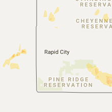
North Dakota
| Local Time | Report Details |
|---|---|
| 3:50 PM CDT | Quarter sized hail reported near Alexander, ND, 33 miles S of Williston, ND, also estimated 40-50 mph wind gusts. mostly pea size hail with a few as big as quarters. hail lasted about 2 minutes. |
| 3:54 PM CDT | Quarter sized hail reported near Alexander, ND, 32.3 miles S of Williston, ND, a few quarters but mostly peas. 30-40 mph winds. |
| 4:19 PM CDT | Ping Pong Ball sized hail reported near Watford City, ND, 38 miles SSE of Williston, ND, relayed via social media. |
| 4:24 PM CDT | Half Dollar sized hail reported near Watford City, ND, 37.2 miles SSE of Williston, ND, mostly quarters with some half dollars. |
| 3:30 PM MDT | Quarter sized hail reported near Rhame, ND, 102.6 miles E of Miles City, MT, a few quarters... but mostly peas. corrected for time of the report. the duration of the hail event was 10 minutes. |
| 3:47 PM MDT | At the ht ranch... a hopper bin was destroyed and several electrical polls snapped. time estimated from rada in slope county ND, 110.8 miles E of Miles City, MT |
| 4:05 PM MDT | Quarter sized hail reported near Rhame, ND, 102.6 miles E of Miles City, MT, a few quarters... but mostly peas. the duration of the hail event was 10 minutes. |
| 4:23 PM MDT | Deputy reports multiple snapped power polls in halliday. time estimated from rada in dunn county ND, 77.6 miles SW of Minot, ND |
| 4:26 PM MDT | Windows in a farm house broken... two farm buildings toppled. time estimated from rada in slope county ND, 117 miles E of Miles City, MT |
| 4:26 PM MDT | Quarter sized hail reported near Dickinson, ND, 95.1 miles SSE of Williston, ND, interstate at exit 56. |
| 4:34 PM MDT | Barn collapsed near steward lake. animals are trapped. time estimated from rada in slope county ND, 115.7 miles E of Miles City, MT |
| 4:34 PM MDT | Barn destroyed... described as "gone" in bowman county ND, 103.5 miles E of Miles City, MT |
| 4:34 PM MDT | Quarter sized hail reported near Halliday, ND, 77.6 miles SW of Minot, ND, 60 mph winds also estimated. the duration of the hail event was 10 minutes. |
| 4:39 PM MDT | Estimated 60 mph gusts that knocked over a motorcycle and tore up a flag. pea size hail als in bowman county ND, 101 miles E of Miles City, MT |
| 4:42 PM MDT | Golf Ball sized hail reported near Dickinson, ND, 95.5 miles W of Bismarck, ND, relayed through state radio. |
| 5:07 PM MDT | 4 grain bins damaged. relayed via broadcast media. time estimated from rada in slope county ND, 117.1 miles WSW of Bismarck, ND |
| 5:07 PM MDT | Power lines reported down north side of griffin on hwy 1 in bowman county ND, 111.3 miles E of Miles City, MT |
| 5:20 PM MDT | Relayed from bowman airport via arb employe in bowman county ND, 123.1 miles E of Miles City, MT |
| 5:53 PM MDT | Airport asos repor in adams county ND, 104.6 miles WSW of Bismarck, ND |
| 6:00 PM MDT | Measured by airport aso in adams county ND, 104.9 miles WSW of Bismarck, ND |
| 6:30 PM MDT | Spotter estimated a brief episode of at least 60 mph winds with the leading edge of the storm. time estimated from rada in grant county ND, 62.6 miles WSW of Bismarck, ND |
| 6:35 PM MDT | Shingles from nearly a quarter of a house roof were torn off and took some of the plywood with them. branches down all over town. picture relayed via email and time est in grant county ND, 57.8 miles WSW of Bismarck, ND |
Maine
| Local Time | Report Details |
|---|---|
| 5:40 PM EDT | Trees down on route 27 in belgrade in kennebec county ME, 57.9 miles WSW of Bangor, ME |
| 7:30 PM EDT | Quarter sized hail reported near Sebec, ME, 36.6 miles NNW of Bangor, ME, mostly pea sized... but some quarter sized hail. picture of hail sent via facebook. |
| 7:30 PM EDT | Reports of trees down all over the roads between corinna and etna. report via facebook. time estimated based on rada in penobscot county ME, 25.4 miles WNW of Bangor, ME |
| 7:42 PM EDT | Weather spotter in levant heard on scanner that trees are down in stetso in penobscot county ME, 19.1 miles WNW of Bangor, ME |
| 7:55 PM EDT | Power lines down in penobscot county ME, 9.6 miles WNW of Bangor, ME |
| 8:07 PM EDT | Power lines down in penobscot county ME, 9.6 miles WNW of Bangor, ME |
Colorado
| Local Time | Report Details |
|---|---|
| 4:48 PM MDT | Quarter sized hail reported near Elizabeth, CO, 29.1 miles SE of Denver, CO, covering the road |
New Jersey
| Local Time | Report Details |
|---|---|
| 7:10 PM EDT | Large tree limbs blocking road. time estimated from rada in warren county NJ, 55.4 miles SSE of Scranton, PA |
| 7:40 PM EDT | Reports of trees down. time estimated from rada in hunterdon county NJ, 55.6 miles WSW of Brooklyn, NY |
| 8:07 PM EDT | Tree down on state highway 31 southbound between titus mill road and woodville road...forcing a road closure and detours. time estimated from rada in mercer county NJ, 48.7 miles WSW of Brooklyn, NY |
| 8:17 PM EDT | Downed tree on state highway 31 near olden avenue. time estimated by rada in mercer county NJ, 51.6 miles SW of Brooklyn, NY |
| 8:37 PM EDT | Downed tree on state highway 35 near lawrence parkway. time estimated from rada in middlesex county NJ, 21.1 miles SW of Brooklyn, NY |
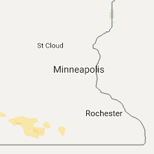
South Dakota
| Local Time | Report Details |
|---|---|
| 5:22 PM MDT | Storm damage reported in harding county SD, 124 miles ESE of Miles City, MT |
| 7:03 PM MDT | Time estimated from radar in perkins county SD, 102.9 miles SW of Bismarck, ND |
| 7:15 PM MDT | 17 miles south of keldro in corson county SD, 91.5 miles SSW of Bismarck, ND |
| 8:00 PM MDT | Winds 60 to 70 mph. a few branches down. pea hail. winds lasted from 9 to 910 p in dewey county SD, 92.7 miles NW of Pierre, SD |
| 8:06 PM MDT | Storm damage reported in corson county SD, 83.7 miles S of Bismarck, ND |
| 8:15 PM MDT | Storm damage reported in corson county SD, 83.7 miles S of Bismarck, ND |
| 8:45 PM MDT | Storm damage reported in corson county SD, 73.8 miles S of Bismarck, ND |
| 10:48 PM CDT | Storm damage reported in walworth county SD, 67.3 miles N of Pierre, SD |
| 6:00 AM CDT | Quarter sized hail reported near De Smet, SD, 71.2 miles NW of Sioux Falls, SD |
| 6:30 AM CDT | Quarter sized hail reported near Wessington Springs, SD, 90.6 miles ESE of Pierre, SD |
Iowa
| Local Time | Report Details |
|---|---|
| 7:09 PM CDT | Quarter sized hail reported near Mount Pleasant, IA, 38.2 miles NNE of Kahoka, MO, time estimated from radar. |
| 7:11 PM CDT | Storm damage reported in henry county IA, 38.2 miles NNE of Kahoka, MO |
| 7:23 PM CDT | Dumpster flipped over and a fence down near hote in henry county IA, 38.2 miles NNE of Kahoka, MO |
| 7:28 PM CDT | Large barn blown over...report via kwqc faceboo in henry county IA, 38.2 miles NNE of Kahoka, MO |
| 7:30 PM CDT | Quarter sized hail reported near Bayard, IA, 52 miles WNW of Des Moines, IA, quarter size hail started around 7:30pm and is ongoing. |
| 7:50 PM CDT | Large road detour sign flipped over along with a piece of fence blown dow in henry county IA, 39 miles NNE of Kahoka, MO |
| 8:01 PM CDT | Some small branches down as wel in carroll county IA, 49.2 miles SSE of Storm Lake, IA |
| 8:32 PM CDT | Downed power line in jefferson county IA, 39.3 miles N of Kahoka, MO |
| 8:37 PM CDT | 2 to 3 foot diameter tree down in bagley. time estimated from rada in guthrie county IA, 45.8 miles WNW of Des Moines, IA |
| 9:01 PM CDT | Storm damage reported in dallas county IA, 35.1 miles WNW of Des Moines, IA |
| 9:13 PM CDT | Storm damage reported in dallas county IA, 25.5 miles WNW of Des Moines, IA |
| 9:27 PM CDT | Small branches also being broken off as wel in boone county IA, 26 miles NW of Des Moines, IA |
| 9:32 PM CDT | Small branches broken or down. time estimated from rada in boone county IA, 22.6 miles NNW of Des Moines, IA |
| 9:40 PM CDT | Half Dollar sized hail reported near Blue Grass, IA, 57.1 miles SE of Cedar Rapids, IA |
| 10:00 PM CDT | Fallen tree on iowa 141 at mile marker 127 reported by dallas county sheriff to iowa dot. time estimated from radar and iowa dot repor in dallas county IA, 32.6 miles WNW of Des Moines, IA |
| 10:17 PM CDT | Large tree limbs dow in scott county IA, 61.7 miles ESE of Cedar Rapids, IA |
| 10:19 PM CDT | Storm damage reported in scott county IA, 61.5 miles ESE of Cedar Rapids, IA |
| 10:19 PM CDT | Trees dow in scott county IA, 59.5 miles ESE of Cedar Rapids, IA |
| 10:23 PM CDT | Large tree branch down... blocking sidewalk... near i-74 and i-80 intersection. public report via social media. time estimated by rada in scott county IA, 66.4 miles ESE of Cedar Rapids, IA |
| 10:29 PM CDT | Storm damage reported in scott county IA, 61.6 miles ESE of Cedar Rapids, IA |
Utah
| Local Time | Report Details |
|---|---|
| 7:50 PM MDT | Mesonet station dpg15 in tooele county UT, 76.8 miles WSW of Salt Lake City, UT |
Wyoming
| Local Time | Report Details |
|---|---|
| 7:53 PM MDT | Weather station at moorcroft hs... time estimated from radar in crook county WY, 27.6 miles E of Gillette, WY |
| 7:55 PM MDT | Storm damage reported in crook county WY, 27.6 miles E of Gillette, WY |
| 8:05 PM MDT | Storm damage reported in campbell county WY, 32.1 miles SSE of Gillette, WY |
Idaho
| Local Time | Report Details |
|---|---|
| 8:25 PM MDT | Quarter sized hail reported near Saint Charles, ID, 96.3 miles SSE of Idaho Falls, ID |
Ohio
| Local Time | Report Details |
|---|---|
| 7:15 AM EDT | Storm damage reported in darke county OH, 62.7 miles SSE of Fort Wayne, IN |
| 7:27 AM EDT | Storm damage reported in montgomery county OH, 56.8 miles NNE of Cincinnati, OH |
Connect with Interactive Hail Maps