

Hail Map for Friday, July 21, 2023

Number of Impacted Households on 7/21/2023
0
Impacted by 1" or Larger Hail
0
Impacted by 1.75" or Larger Hail
0
Impacted by 2.5" or Larger Hail
Square Miles of Populated Area Impacted on 7/21/2023
0
Impacted by 1" or Larger Hail
0
Impacted by 1.75" or Larger Hail
0
Impacted by 2.5" or Larger Hail


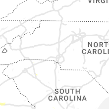


Cities Most Affected by Hail Storms of 7/21/2023
| Hail Size | Demographics of Zip Codes Affected | ||||||
|---|---|---|---|---|---|---|---|
| City | Count | Average | Largest | Pop Density | House Value | Income | Age |
| Hermosa, SD | 1 | 1.75 | 1.75 | 3 | $127k | $35.4k | 44.4 |
Hail and Wind Damage Spotted on 7/21/2023
Filter by Report Type:Hail ReportsWind Reports
States Impacted
Oklahoma, Arkansas, Tennessee, Mississippi, Florida, Vermont, New Hampshire, Massachusetts, Alabama, Georgia, Connecticut, South Dakota, New Mexico, Arizona, Iowa, Colorado, South Carolina, NebraskaOklahoma
| Local Time | Report Details |
|---|---|
| 7:05 AM CDT | Social media report of large tree downed onto power lines in salina. relayed by broadcast media. time estimated by rada in mayes county OK, 48.2 miles ENE of Tulsa, OK |
Arkansas
| Local Time | Report Details |
|---|---|
| 7:55 AM CDT | Tree blown down and blocking portion of highway 9 sout in perry county AR, 30.3 miles WNW of Little Rock, AR |
| 8:35 AM CDT | Social media report of thunderstorm wind damage. pic of downed tree and broken tree branc in crawford county AR, 22.6 miles NE of Fort Smith, AR |
| 8:36 AM CDT | Report from mping: trees uprooted or snappe in pulaski county AR, 12.2 miles WNW of Little Rock, AR |
| 8:58 AM CDT | Tree fell onto a house in sw little roc in pulaski county AR, 7.2 miles SW of Little Rock, AR |
| 8:59 AM CDT | Social media report of broken tree branch in north ft. smit in sebastian county AR, 2.7 miles NNE of Fort Smith, AR |
| 9:16 AM CDT | Tree blown down onto some trucks at a landscaping compan in pulaski county AR, 6.2 miles S of Little Rock, AR |
| 11:24 AM CDT | Tree reported to be blown down and covering roadwa in white county AR, 33.4 miles NNE of Little Rock, AR |
| 12:42 PM CDT | Corrects previous tstm wnd dmg report from widener. reported powerline dow in st. francis county AR, 36.7 miles WSW of Memphis, TN |
| 12:53 PM CDT | Reported powerline dow in st. francis county AR, 36.7 miles WSW of Memphis, TN |
| 12:55 PM CDT | Multiple trees down across poinsett count in poinsett county AR, 43.8 miles NW of Memphis, TN |
| 1:23 PM CDT | Powerlines down and power poles snapped around the high school are in crittenden county AR, 8.5 miles WNW of Memphis, TN |
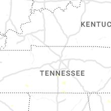
Tennessee
| Local Time | Report Details |
|---|---|
| 1:40 PM CDT | Tree on two vehicles on allison ave in binghampton. time is radar estimate in shelby county TN, 5 miles E of Memphis, TN |
| 1:43 PM CDT | Bartlett pd reports ivanhoe rd at kenwood cv impassable due to tree down. time is radar estimate in shelby county TN, 11.2 miles ENE of Memphis, TN |
| 1:43 PM CDT | *** 1 inj *** corrects previous tstm wnd dmg report from 3 n southeast memphis. tree fell on car on park avenue. time is radar estimated. 1 injur in shelby county TN, 9.4 miles ESE of Memphis, TN |
| 1:43 PM CDT | *** 1 inj *** corrects previous tstm wnd dmg report from 3 n southeast memphis. tree fell on car on park avenue. time is radar estimated. 1 injur in shelby county TN, 9.4 miles ESE of Memphis, TN |
| 1:43 PM CDT | Trees down across parts of austin peay - east of millington; along pleasant ridge & raleigh-millington road. time is radar estimate in shelby county TN, 13 miles NE of Memphis, TN |
| 1:52 PM CDT | Numerous trees down across the southern half of tipton count in tipton county TN, 25.4 miles NE of Memphis, TN |
| 1:54 PM CDT | Corrects previous tstm wnd dmg report from 2 wnw germantown. tree on house in germantow in shelby county TN, 12.9 miles ESE of Memphis, TN |
| 1:55 PM CDT | Tree down on powerline on holmes road west of forest wind d in shelby county TN, 18.5 miles ESE of Memphis, TN |
| 1:58 PM CDT | Measured wind gust. snapped 3 inch flag pol in shelby county TN, 21.4 miles ESE of Memphis, TN |
| 2:00 PM CDT | Trees down. time is radar estimate in tipton county TN, 30.8 miles NE of Memphis, TN |
| 2:01 PM CDT | Power lines down in the 4300 block of marshall rd. time is radar indicate in tipton county TN, 25.7 miles NE of Memphis, TN |
| 2:02 PM CDT | Tree down across mt. carmel rd just north of waley lane. time is radar estimate in tipton county TN, 34.1 miles NE of Memphis, TN |
| 2:11 PM CDT | Powerline down on greenleaf cemetery roa in haywood county TN, 38.8 miles ENE of Memphis, TN |
| 2:14 PM CDT | Tree down blocking both lanes across hwy 57 in the 11200 block... east of rossville. time is radar estimate in fayette county TN, 33 miles ESE of Memphis, TN |
| 2:16 PM CDT | Trees down across haywood count in haywood county TN, 42.9 miles ENE of Memphis, TN |
| 2:24 PM CDT | Tree on house in germantow in shelby county TN, 12.9 miles ESE of Memphis, TN |
| 2:28 PM CDT | Tree on house on college st. in whiteville. widespread trees and powerlines down across the count in hardeman county TN, 52.2 miles ENE of Memphis, TN |
| 3:20 PM CDT | Tree on house on woodland dr in henderson. relayed by media. time is radar estimate in chester county TN, 47.8 miles S of Mc Kenzie, TN |
| 3:25 PM CDT | 60 mph wind gust measured on weather statio in hardin county TN, 44 miles NW of Florence, AL |
| 3:25 PM CDT | Trees down... a possible vehicle accident due to trees down... power outages across hardin county. time is radar estimate in hardin county TN, 40.1 miles NW of Florence, AL |
| 3:27 PM CDT | Nursing home in savannah is without power due to trees down and transformers are sparking on sterling lane. time is radar estimate in hardin county TN, 42.2 miles NW of Florence, AL |
| 3:33 PM CDT | Trees down on a house with 4 occupants inside. occupants un-injured. time is radar estimate in hardin county TN, 34.5 miles NW of Florence, AL |
| 4:21 PM CDT | A tree was blown down across road near the intersection of s old military road and fairview roa in lawrence county TN, 19.9 miles NNE of Florence, AL |
| 4:25 PM CDT | A tree fell on power lines on 3rd street in lawrencebur in lawrence county TN, 37 miles NNE of Florence, AL |
| 4:25 PM CDT | A tree was blown down onto a garage and two cars along beartown roa in lawrence county TN, 21.4 miles NE of Florence, AL |
Mississippi
| Local Time | Report Details |
|---|---|
| 1:59 PM CDT | Tree down on hilliard rd. in cayce are in marshall county MS, 27.6 miles ESE of Memphis, TN |
| 3:09 PM CDT | Large tree snapped and fell on a home in new alban in union county MS, 72.8 miles SE of Memphis, TN |
| 3:34 PM CDT | Corrects previous tstm wnd dmg report from saltillo. relayed by broadcast media: tree snapped near a pool in saltillo... m in lee county MS, 64.1 miles N of Starkville, MS |
| 3:34 PM CDT | Corrects previous tstm wnd dmg report from saltillo. relayed by broadcast media: tree snapped near a pool in saltillo... m in lee county MS, 64.1 miles N of Starkville, MS |
| 3:46 PM CDT | Tree down on a house in the auburn communit in lee county MS, 59.7 miles N of Starkville, MS |
| 3:47 PM CDT | Roof damage to the dirt cheap in tupelo. time is radar estimate in lee county MS, 55 miles N of Starkville, MS |
| 3:47 PM CDT | Multiple trees down throughout the count in lee county MS, 59.4 miles N of Starkville, MS |
| 3:57 PM CDT | Large tree branches snapped in half near dulaney branch hil in itawamba county MS, 52.5 miles SW of Florence, AL |
| 4:45 PM CDT | Reported tree down along highway 27 in monroe county MS, 40.3 miles NE of Starkville, MS |
| 4:47 PM CDT | Reported tree down on coontail r in monroe county MS, 33.9 miles NNE of Starkville, MS |
Florida
| Local Time | Report Details |
|---|---|
| 4:00 PM EDT | Wind damage was reported to fences and temporary tents. time estimated from rada in lee county FL, 28.4 miles N of Naples, FL |
Vermont
| Local Time | Report Details |
|---|---|
| 4:20 PM EDT | Uprooted tree in alburgh in grand isle county VT, 35.1 miles N of Burlington, VT |
| 4:36 PM EDT | Tree down with power outages near lakewood drive and campgrounds in franklin county VT, 33.4 miles N of Burlington, VT |
| 4:40 PM EDT | A tree uprooted and landed on a camper... one camper lost its entire front porch... small hail (size unknown)... and several tree branches and decorations torn off in grand isle county VT, 33.5 miles N of Burlington, VT |
| 5:15 PM EDT | Tree down on route 66. over 1200 power outages in the town in orange county VT, 46.9 miles SE of Burlington, VT |
New Hampshire
| Local Time | Report Details |
|---|---|
| 4:32 PM EDT | Delayed report...uprooted tree partially blocking wheeler rd near apple tree far in hillsborough county NH, 64.5 miles N of Providence, RI |
| 4:40 PM EDT | Trees down on lake potanipo and nh hwy 130 in brookline with diameters of 7-10 inches. small hail also reporte in hillsborough county NH, 64.7 miles NNW of Providence, RI |
| 4:46 PM EDT | Half Dollar sized hail reported near Hollis, NH, 63.2 miles N of Providence, RI |
| 4:46 PM EDT | Delayed report...trained spotter observed downed trees and larges branches around greeley park and other parts of north nashu in hillsborough county NH, 66.1 miles N of Providence, RI |
| 4:50 PM EDT | Delayed report...a few trees down on pine hill r in hillsborough county NH, 66.2 miles N of Providence, RI |
| 4:56 PM EDT | Quarter sized hail reported near Nashua, NH, 66.2 miles N of Providence, RI, delayed report...hail fell in vicinity of nashua airport for 7-8 minutes. estimated at quarter size. |
Massachusetts
| Local Time | Report Details |
|---|---|
| 4:36 PM EDT | Tree down on wires on barker hill rd near turnpike rd. relayed by amateur radi in middlesex county MA, 60.5 miles NNW of Providence, RI |
| 5:21 PM EDT | Multiple trees and wires downed on barker hill rd in townsend. power lost but was restored at 755 pm. time estimated by rada in middlesex county MA, 61.8 miles NNW of Providence, RI |
| 6:34 PM EDT | Tree down blocking chicopee r in middlesex county MA, 54.9 miles N of Providence, RI |
| 6:35 PM EDT | Trees and wires down near hollis s in middlesex county MA, 54.9 miles N of Providence, RI |
| 7:50 PM EDT | In the area of south shelburne road - tree and wires down. relayed by amateur radi in franklin county MA, 70 miles ESE of Schenectady, NY |
| 8:20 PM EDT | Corrects previous tstm wnd dmg report from deerfield. river road north of hillside - 2 trees dow in franklin county MA, 70.7 miles ESE of Schenectady, NY |
| 8:25 PM EDT | In the area of sylvester road - tree dow in hampshire county MA, 72.4 miles ESE of Schenectady, NY |
| 8:55 PM EDT | Tree down on winch st. relayed by amateur radi in middlesex county MA, 34.3 miles N of Providence, RI |
| 9:35 PM EDT | Trees and wires down on shore road. relayed by amateur radi in worcester county MA, 43.6 miles NW of Providence, RI |
| 9:35 PM EDT | Tree down on ayers st. relayed by amateur radi in worcester county MA, 46.9 miles NW of Providence, RI |
| 11:06 PM EDT | River road north of hillside - 2 trees dow in franklin county MA, 70.7 miles ESE of Schenectady, NY |
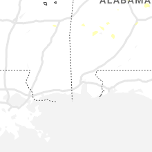
Alabama
| Local Time | Report Details |
|---|---|
| 4:20 PM CDT | Tree was blown down and blocking the roadway near ketchum road and bullard roa in blount county AL, 42.4 miles NNE of Birmingham, AL |
| 4:21 PM CDT | Trees were blown down on cr 4 in blount county AL, 40.9 miles NNE of Birmingham, AL |
| 4:22 PM CDT | Trees and power lines were blown down near cr 51 and poultry driv in blount county AL, 41.6 miles NNE of Birmingham, AL |
| 4:24 PM CDT | Trees were blown down on twin oaks driv in blount county AL, 40 miles NNE of Birmingham, AL |
| 4:32 PM CDT | Tree was blown down near reid road and spunky hollow roa in blount county AL, 24.3 miles NNE of Birmingham, AL |
| 4:50 PM CDT | Multiple trees were blown down in the western half of the count in etowah county AL, 50 miles NE of Birmingham, AL |
| 5:00 PM CDT | Roof partially torn off school and upstairs classrooms flooded. athens renaissance middle school on clinton stree in limestone county AL, 40.1 miles E of Florence, AL |
| 5:04 PM CDT | Shingles off a home at brownsferry and lucas ferry roads in athen in limestone county AL, 38.4 miles E of Florence, AL |
| 5:04 PM CDT | A tree was blown down and blocking the roadway on 13th st n in fayette county AL, 58.9 miles ENE of Starkville, MS |
| 5:10 PM CDT | Tree uprooted just west of natchez trace pkwy north of cloverdale... about 2 mi s of the tn state lin in lauderdale county AL, 14.9 miles NNW of Florence, AL |
| 5:10 PM CDT | Trees were blown down and blocking railroad tracks at popes chapel roa in st. clair county AL, 34.7 miles ENE of Birmingham, AL |
| 5:12 PM CDT | A tree was blown over onto a home on berea av in etowah county AL, 57.2 miles NE of Birmingham, AL |
| 5:12 PM CDT | A tree was blown down on grand ave. and landed on a vehicl in etowah county AL, 56.8 miles NE of Birmingham, AL |
| 5:14 PM CDT | Tree was blown down on rainbow driv in etowah county AL, 55.1 miles NE of Birmingham, AL |
| 5:18 PM CDT | A few trees and power lines were blown down on highway 27 in etowah county AL, 61.8 miles ENE of Birmingham, AL |
| 5:21 PM CDT | Roof damage reported at the glencoe elementary schoo in etowah county AL, 59.1 miles ENE of Birmingham, AL |
| 5:21 PM CDT | Roof damage reported at the glencoe middle schoo in etowah county AL, 59 miles ENE of Birmingham, AL |
| 5:28 PM CDT | Tree down county road 55 north of low ga in jackson county AL, 37.2 miles WSW of Chattanooga, TN |
| 5:36 PM CDT | A tree was snapped and knocked power lines down into roadwa in calhoun county AL, 57.3 miles ENE of Birmingham, AL |
| 5:37 PM CDT | A few trees were blown down in the saks/lenlock are in calhoun county AL, 58.2 miles ENE of Birmingham, AL |
| 5:37 PM CDT | Tree down w/partial blockage on nuclear plant road... west of hatchett ridge in athen in limestone county AL, 36 miles E of Florence, AL |
| 5:40 PM CDT | A tree was uprooted and blocking the roadway on 55th st and glade roa in calhoun county AL, 58.2 miles ENE of Birmingham, AL |
| 5:41 PM CDT | Trees down on wales road... partially blocking the roadwa in limestone county AL, 36.5 miles E of Florence, AL |
| 5:43 PM CDT | Power lines down on ham roa in limestone county AL, 36.2 miles E of Florence, AL |
| 5:43 PM CDT | A few trees were blown down in weave in calhoun county AL, 59.9 miles ENE of Birmingham, AL |
| 5:58 PM CDT | Damage to exxon canopy in hampton cov in madison county AL, 68.7 miles E of Florence, AL |
| 6:20 PM CDT | Tree uprooted at 717 shades crest roa in jefferson county AL, 7.3 miles SSW of Birmingham, AL |
| 6:20 PM CDT | Large tree uprooted at alford avenue and ivey lan in jefferson county AL, 6.3 miles S of Birmingham, AL |
| 6:20 PM CDT | Large tree uprooted along old tuscaloosa highway in mccall in jefferson county AL, 19.1 miles SW of Birmingham, AL |
| 6:24 PM CDT | A few trees were blown down around sand roc in cherokee county AL, 59.4 miles SSW of Chattanooga, TN |
| 6:32 PM CDT | A few trees were blown down around centr in cherokee county AL, 64.6 miles SSW of Chattanooga, TN |
| 6:32 PM CDT | A tree was blown down on woodmont road and landed on a hom in cherokee county AL, 59.7 miles SSW of Chattanooga, TN |
| 6:34 PM CDT | A few trees were blown down around gaylesvill in cherokee county AL, 55.4 miles SSW of Chattanooga, TN |
| 7:24 PM CDT | Reports of multiple trees blown down on castaway island roa in elmore county AL, 27.5 miles WNW of Auburn, AL |
| 7:29 PM CDT | Reports of multiple trees down on red hill road in the kent communit in elmore county AL, 27.3 miles W of Auburn, AL |
| 7:42 PM CDT | A very large tree was blown down and blocking macedonia roa in tallapoosa county AL, 20.4 miles W of Auburn, AL |
| 7:42 PM CDT | A large tree was blown down at west blvd and birmingham hw in montgomery county AL, 55 miles WSW of Auburn, AL |
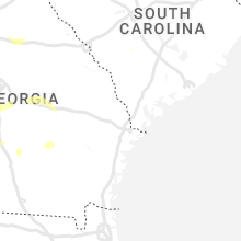
Georgia
| Local Time | Report Details |
|---|---|
| 5:30 PM EDT | Tree was reported down on a powerline off brannon driv in cobb county GA, 13.5 miles WNW of Atlanta, GA |
| 5:33 PM EDT | Report from mping: trees uprooted or snapped; roof blown of in dekalb county GA, 5.9 miles E of Atlanta, GA |
| 5:36 PM EDT | Powerlines down near the intersection of panola rd and rock springs r in dekalb county GA, 13 miles ESE of Atlanta, GA |
| 6:05 PM EDT | A tree blown down near the intersection of montevideo rd and sandy lane d in elbert county GA, 40.5 miles SSW of Greenville, SC |
| 6:08 PM EDT | Tree down across the road near the intersection of buttermilk rd sw and henson rd s in baldwin county GA, 72.2 miles SE of Atlanta, GA |
| 6:09 PM EDT | Tree down across railroad tracks along whitney r in walton county GA, 39.3 miles E of Atlanta, GA |
| 6:25 PM EDT | Large oak tree down near the intersection of mentelle dr ne and 7th st n in fulton county GA, 2.5 miles NNE of Atlanta, GA |
| 6:26 PM EDT | A tree was reported down on a house near the intersection of burton dr ne and stephens dr n in dekalb county GA, 5.5 miles NE of Atlanta, GA |
| 6:26 PM EDT | Trees reported down near the intersection of veterans memorial hwy se and oakdale rd s in cobb county GA, 7.7 miles WNW of Atlanta, GA |
| 6:29 PM EDT | Tree down at the intersection of briarcliff rd and old briarcliff r in dekalb county GA, 4.6 miles NE of Atlanta, GA |
| 6:38 PM EDT | Tree reported down near the intersection of cave springs rd and summerwind d in polk county GA, 54.4 miles WNW of Atlanta, GA |
| 6:41 PM EDT | Tree down near the intersection of booze mountain rd and pine s in floyd county GA, 54.3 miles WNW of Atlanta, GA |
| 6:58 PM EDT | Corrects previous flash flood report from 1 w atlantic station. cars stalled from high waters along huff rd n in fulton county GA, 3.3 miles NNW of Atlanta, GA |
| 7:42 PM EDT | Tree down at vulcan dr and groovers lake r in douglas county GA, 15.6 miles W of Atlanta, GA |
| 7:44 PM EDT | Multiple trees down near the intersection of highway 5 and amber d in douglas county GA, 22.6 miles W of Atlanta, GA |
| 7:45 PM EDT | Numerous trees and powerlines down in douglasville along hwy5 between nations dr and kings hwy. two reports of trees on house in douglas county GA, 22.6 miles W of Atlanta, GA |
| 7:50 PM EDT | Tree down at center st sw and daniel st in mableto in cobb county GA, 11.9 miles WNW of Atlanta, GA |
| 7:50 PM EDT | Tree down at thornton rd and n blairs bridge r in douglas county GA, 12.8 miles W of Atlanta, GA |
| 10:30 PM EDT | Reports of tress down throughout the county... especially across southern portions where storms rolled throug in lee county GA, 74.5 miles W of Douglas, GA |
| 10:38 PM EDT | Multiple trees down along interstate 16 between mile markers 80 and 7 in treutlen county GA, 66.9 miles NNE of Douglas, GA |
| 10:48 PM EDT | Tree down near hwy4 in sumter county GA, 74.9 miles ESE of Auburn, AL |
| 10:53 PM EDT | Tree down on home on peachtree s in sumter county GA, 80.7 miles ESE of Auburn, AL |
| 11:00 PM EDT | Tree limbs down with storms moving through the are in worth county GA, 55.3 miles W of Douglas, GA |
| 11:00 PM EDT | From 911 call center reports of quite a few trees down across east and northeast portions of the county fro in ben hill county GA, 22.7 miles NW of Douglas, GA |
Connecticut
| Local Time | Report Details |
|---|---|
| 6:30 PM EDT | 2 cars crushed from 24 inch oak tree uprooted. multiple roads closed in the are in windham county CT, 36.6 miles W of Providence, RI |
| 6:40 PM EDT | Corrects previous tstm wnd dmg report from chaplin. 2 cars crushed from 24 inch oak tree uprooted. multiple roads closed in the are in windham county CT, 36.6 miles W of Providence, RI |
| 6:40 PM EDT | Corrects previous tstm wnd dmg report from chaplin. 2 cars crushed from 24 inch oak tree uprooted. multiple roads closed in the are in windham county CT, 36.6 miles W of Providence, RI |
| 7:17 PM EDT | Trees and wires down blocking road at ardmore and greenway s in new haven county CT, 72.9 miles NE of Brooklyn, NY |
South Dakota
| Local Time | Report Details |
|---|---|
| 4:31 PM MDT | Golf Ball sized hail reported near Hermosa, SD, 20.8 miles SSE of Rapid City, SD |
| 6:45 PM CDT | Quarter sized hail reported near Volin, SD, 46.1 miles SW of Sioux Falls, SD, a tremendous amount of nickel hail which shredded bean and corn leaves. a few stones as large as a quarter. |
| 7:05 PM MDT | Quarter sized hail reported near Rapid City, SD, 9.1 miles SSW of Rapid City, SD, lasted about a minute. |
New Mexico
| Local Time | Report Details |
|---|---|
| 4:37 PM MDT | Quarter sized hail reported near Las Vegas, NM, 59.7 miles SSE of Taos, NM |
| 5:35 PM MDT | Peak wind gust of 61 mph at nmdot surface observation site. visibilities dropped to less than half a mile as wel in hidalgo county NM, 50.2 miles SW of Silver City, NM |
Arizona
| Local Time | Report Details |
|---|---|
| 4:20 PM MST | Mesonet station qgta3 guthri in greenlee county AZ, 60.7 miles W of Silver City, NM |
| 4:34 PM MST | Asos station ksad safford regional airpor in graham county AZ, 79 miles W of Silver City, NM |
Iowa
| Local Time | Report Details |
|---|---|
| 7:06 PM CDT | 3 to 4 inch diameter tree limbs dow in plymouth county IA, 56 miles W of Storm Lake, IA |
Colorado
| Local Time | Report Details |
|---|---|
| 6:22 PM MDT | Ping Pong Ball sized hail reported near New Raymer, CO, 68 miles WNW of Yuma, CO |
| 6:22 PM MDT | Quarter sized hail reported near New Raymer, CO, 68 miles WNW of Yuma, CO |
| 7:52 PM MDT | Ping Pong Ball sized hail reported near Greeley, CO, 53 miles NNE of Denver, CO, report from mping: ping pong ball (1.50 in.). |
| 7:54 PM MDT | Quarter sized hail reported near Greeley, CO, 53.6 miles NNE of Denver, CO |
| 8:24 PM MDT | Mesonet station co221 aurora i-70/airport blv in adams county CO, 11.4 miles E of Denver, CO |
South Carolina
| Local Time | Report Details |
|---|---|
| 10:00 PM EDT | Spotter called and reported a tree down on two power poles on golden jubilee rd near windy rd. time estimated by rada in lexington county SC, 48.9 miles NE of Augusta, GA |
Nebraska
| Local Time | Report Details |
|---|---|
| 9:17 PM CDT | Quarter sized hail reported near Brewster, NE, 63.7 miles SSE of Valentine, NE |
Connect with Interactive Hail Maps