

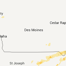
Hail Map for Thursday, July 28, 2011

Number of Impacted Households on 7/28/2011
0
Impacted by 1" or Larger Hail
0
Impacted by 1.75" or Larger Hail
0
Impacted by 2.5" or Larger Hail
Square Miles of Populated Area Impacted on 7/28/2011
0
Impacted by 1" or Larger Hail
0
Impacted by 1.75" or Larger Hail
0
Impacted by 2.5" or Larger Hail


Cities Most Affected by Hail Storms of 7/28/2011
| Hail Size | Demographics of Zip Codes Affected | ||||||
|---|---|---|---|---|---|---|---|
| City | Count | Average | Largest | Pop Density | House Value | Income | Age |
| Palisade, NE | 2 | 1.75 | 1.75 | 2 | $33k | $24.9k | 48.5 |
| Lodgepole, SD | 1 | 2.00 | 2.00 | 0 | $31k | $28.1k | 53.4 |
| Gettysburg, SD | 1 | 1.75 | 1.75 | 3 | $45k | $31.2k | 49.2 |
| Dupree, SD | 1 | 1.75 | 1.75 | 0 | $26k | $26.9k | 32.8 |
Hail and Wind Damage Spotted on 7/28/2011
Filter by Report Type:Hail ReportsWind Reports
States Impacted
Iowa, Illinois, South Dakota, Wyoming, Ohio, Kansas, Nebraska, Pennsylvania, Missouri, Colorado, Texas, MichiganIowa
| Local Time | Report Details |
|---|---|
| 3:15 PM UTC | Half dozen 18 inch diameter pine trees trunk snapped 10 feet off ground. wind estimated 80 mph. delayed repor in jackson county IA, 66.8 miles ENE of Cedar Rapids, IA |
| 3:15 PM UTC | Machine shed destroyed in downtown bellevue. debris blown onto dnr building across street. dnr vehicle received broken wind shield. wind estimated 85 mph. delayed repor in jackson county IA, 66.8 miles ENE of Cedar Rapids, IA |
Illinois
| Local Time | Report Details |
|---|---|
| 4:50 PM UTC | Part of the roof of a muffler shop was damaged. power lines dow in dupage county IL, 17.9 miles W of Chicago, IL |
| 4:50 AM UTC | Debris and signs down near north avenue and summi in dupage county IL, 17.9 miles W of Chicago, IL |
| 4:50 AM UTC | Part of the roof of a muffler shop was damaged. power lines dow in dupage county IL, 17.9 miles W of Chicago, IL |
| 6:42 AM UTC | Many trees downed in glen ellyn including a tree that damaged a house and resulted in closure of park blvd. numerous large tree limbs and at least one uprooted tree alo in dupage county IL, 22.2 miles W of Chicago, IL |
| 7:15 AM UTC | Delayed report. extensive tree limb damage throughout the village. a large sign in front of a restaurant was pulled from its concrete base. a telephone pole was also bl in cook county IL, 12.5 miles WSW of Chicago, IL |
| 11:16 AM UTC | Numerous large tree limbs down. swop in knox county IL, 43.5 miles WNW of Peoria, IL |
| 11:20 AM UTC | Numerous corn fields flattened by strong thunderstorm winds around yates cit in knox county IL, 23 miles WNW of Peoria, IL |
| 11:30 AM UTC | Trees were blown down across route 8 in elmwoo in peoria county IL, 21 miles WNW of Peoria, IL |
South Dakota
| Local Time | Report Details |
|---|---|
| 8:15 PM UTC | Quarter sized hail reported near Rapid City, SD, 16.9 miles W of Rapid City, SD, very heavy rainfall. |
| 8:15 PM UTC | Quarter sized hail reported near Nemo, SD, 21.3 miles WNW of Rapid City, SD, mainly marble to nickel hail covering ground. some pieces as big as quarters. |
| 8:15 PM UTC | Quarter sized hail reported near Nemo, SD, 21.9 miles WNW of Rapid City, SD, marble to nickle sized hail covered the ground with a few stones to quarter size./corrected time of report/ |
| 8:27 PM UTC | Quarter sized hail reported near Buffalo, SD, 110 miles ESE of Miles City, MT, mainly dime sized hail with a few bigger stones to quarter size. |
| 8:30 PM UTC | Quarter sized hail reported near Hettinger, SD, 114.3 miles SW of Bismarck, ND |
| 8:34 PM UTC | Quarter sized hail reported near Rapid City, SD, 16.9 miles W of Rapid City, SD |
| 9:10 PM UTC | Quarter sized hail reported near Lemmon, SD, 110.5 miles SW of Bismarck, ND |
| 9:20 PM UTC | Hen Egg sized hail reported near Lodgepole, SD, 114.6 miles NNE of Rapid City, SD |
| 9:25 PM UTC | Quarter sized hail reported near Keystone, SD, 17.8 miles SW of Rapid City, SD |
| 9:28 PM UTC | Lots of marble size hai in harding county SD, 103.5 miles N of Rapid City, SD |
| 9:35 PM UTC | Quarter sized hail reported near Camp Crook, SD, 99.8 miles NNW of Rapid City, SD, ground covered with quarter sized hail |
| 9:35 PM UTC | Quarter sized hail reported near Camp Crook, SD, 100.5 miles NNW of Rapid City, SD |
| 9:45 PM UTC | Quarter sized hail reported near Reva, SD, 100.3 miles N of Rapid City, SD, also had 60 mph wind. |
| 9:45 PM UTC | Also had hail from 345 pm to 352 p in harding county SD, 100.3 miles N of Rapid City, SD |
| 9:50 PM UTC | Golf Ball sized hail reported near Gettysburg, SD, 60.5 miles N of Pierre, SD, damage to corn from penny to golf ball sized hail |
| 10:00 PM UTC | Also had 0.50 inch hai in perkins county SD, 106.3 miles NNE of Rapid City, SD |
| 10:00 PM UTC | Wind driven hail broke windows out of school hous in harding county SD, 101.7 miles N of Rapid City, SD |
| 10:00 PM UTC | Wind driven hail broke windows out of a hom in harding county SD, 99.6 miles N of Rapid City, SD |
| 10:15 PM UTC | Storm damage reported in pennington county SD, 16.7 miles ESE of Rapid City, SD |
| 10:30 PM UTC | Ping Pong Ball sized hail reported near Dupree, SD, 101.4 miles NW of Pierre, SD |
| 11:03 PM UTC | Storm damage reported in ziebach county SD, 92.2 miles NW of Pierre, SD |
| 11:20 PM UTC | Half Dollar sized hail reported near Sturgis, SD, 15.1 miles N of Rapid City, SD |
| 11:27 PM UTC | Golf Ball sized hail reported near Dupree, SD, 78.9 miles NW of Pierre, SD |
| 11:42 PM UTC | Half Dollar sized hail reported near Isabel, SD, 71.8 miles NW of Pierre, SD |
| 11:57 PM UTC | Quarter sized hail reported near Isabel, SD, 73.3 miles NW of Pierre, SD, 60 plus mph winds..crops damage |
| 12:15 AM UTC | Quarter sized hail reported near Eagle Butte, SD, 58.6 miles NW of Pierre, SD, no wind with the hail...1 or 2 inches of rain |
Wyoming
| Local Time | Report Details |
|---|---|
| 8:30 PM UTC | Half Dollar sized hail reported near Moorcroft, WY, 41.6 miles E of Gillette, WY |
| 10:00 PM UTC | Half Dollar sized hail reported near Moorcroft, WY, 41.6 miles E of Gillette, WY |
| 10:40 PM UTC | Quarter sized hail reported near Moorcroft, WY, 47.5 miles E of Gillette, WY, also had 60 mph winds. |
| 10:40 PM UTC | Also had quarter size hai in crook county WY, 47.5 miles E of Gillette, WY |
Ohio
| Local Time | Report Details |
|---|---|
| 8:30 PM UTC | Several trees and large limbs down on schaefer roa in huron county OH, 52.2 miles WSW of Cleveland, OH |
Kansas
| Local Time | Report Details |
|---|---|
| 9:05 PM UTC | 12 power poles were blown down across 111 road between garnett and ross blvd. powerlines fell across one vehicle with a person trapped inside who was eventually rescued in ford county KS, 47.9 miles ESE of Garden City, KS |
| 9:35 PM UTC | Half Dollar sized hail reported near Bird City, KS, 35.5 miles NW of Colby, KS, half-dollar size hail ongoing at the bird city airport. |
| 9:40 PM UTC | Half Dollar sized hail reported near Bird City, KS, 35.5 miles NW of Colby, KS, estimated 60 mph winds. |
| 10:02 PM UTC | Also received 1.41 inches of rai in cheyenne county KS, 36.3 miles NW of Colby, KS |
| 10:15 PM UTC | Storm damage reported in stanton county KS, 73.6 miles WSW of Garden City, KS |
| 10:23 PM UTC | Round-top calf shed blown over. calves appear uninjured. pea to dime sized hail als in cheyenne county KS, 29.8 miles WNW of Colby, KS |
| 11:00 PM UTC | Storm damage reported in ness county KS, 46.5 miles SW of Hays, KS |
| 11:03 PM UTC | Storm damage reported in sherman county KS, 34.7 miles WNW of Colby, KS |
| 11:15 PM UTC | Ping Pong Ball sized hail reported near Goodland, KS, 34.7 miles WNW of Colby, KS, hail estimated to be between half dollar and ping pong ball in size. hail covering the ground. |
| 11:18 PM UTC | Pea-sized hai in sherman county KS, 32.5 miles WNW of Colby, KS |
| 11:45 PM UTC | Quarter sized hail reported near Ransom, KS, 36.6 miles WSW of Hays, KS |
| 12:28 AM UTC | Delayed report of damage wind to a hay in ottawa county KS, 45.2 miles W of Manhattan, KS |
| 1:11 AM UTC | Delayed multiple reports of wind damage in ottawa county near the state lake. windows blown out of a house near the intersection of n 180th rd and limestone rd. three t in ottawa county KS, 55.3 miles W of Manhattan, KS |
| 1:14 AM UTC | Storm damage reported in ottawa county KS, 52.5 miles W of Manhattan, KS |
| 1:14 AM UTC | Quarter sized hail reported near Minneapolis, KS, 52.5 miles W of Manhattan, KS |
| 1:16 AM UTC | Quarter sized hail reported near Minneapolis, KS, 52.5 miles W of Manhattan, KS |
| 1:16 AM UTC | Storm damage reported in ottawa county KS, 52.5 miles W of Manhattan, KS |
| 1:20 AM UTC | Power line reported down in bucyrus. thunderstorm wind gusts were estimated up to 60 mph. time estimate in miami county KS, 27.4 miles SSW of Kansas City, MO |
| 1:24 AM UTC | Storm damage reported in ottawa county KS, 47.8 miles W of Manhattan, KS |
| 1:24 AM UTC | Quarter sized hail reported near Minneapolis, KS, 47.8 miles W of Manhattan, KS |
| 1:26 AM UTC | Quarter sized hail reported near Minneapolis, KS, 47.8 miles W of Manhattan, KS |
| 1:26 AM UTC | Storm damage reported in ottawa county KS, 47.8 miles W of Manhattan, KS |
| 1:28 AM UTC | Delayed report of damage wind to a hay in ottawa county KS, 45.2 miles W of Manhattan, KS |
| 2:00 AM UTC | Four block area in stilwell had around a dozen large trees knocked down...with a few landing on homes. multiple power poles snapped off with power outages in town. one in johnson county KS, 23.3 miles S of Kansas City, MO |
| 2:38 AM UTC | 4 inch tree limb blown out of maple tree with estimated 60 mph wind in riley county KS, 20.3 miles NNW of Manhattan, KS |
| 2:50 AM UTC | Storm damage reported in pottawatomie county KS, 12.4 miles NNW of Manhattan, KS |
| 3:17 AM UTC | Estimated 60 to 65 mph winds on the north side of town in pottawatomie county KS, 17.9 miles NNE of Manhattan, KS |
| 4:33 AM UTC | Reports of dock braking loose from the lake perry marina. wind speed unknown in jefferson county KS, 45 miles W of Kansas City, MO |
Nebraska
| Local Time | Report Details |
|---|---|
| 9:06 PM UTC | Golf Ball sized hail reported near Palisade, NE, 58.1 miles SSW of North Platte, NE |
| 9:10 PM UTC | Quarter sized hail reported near Palisade, NE, 57.8 miles SSW of North Platte, NE |
| 9:15 PM UTC | Golf Ball sized hail reported near Palisade, NE, 57.8 miles SSW of North Platte, NE, golf ball size hail but not a great deal of it. |
| 9:40 PM UTC | Ping Pong Ball sized hail reported near Palisade, NE, 57.9 miles SSW of North Platte, NE, the public reported numerous windshields broken in hamlet due to large hail. |
| 1:09 AM UTC | Quarter sized hail reported near Benkelman, NE, 52.2 miles NNW of Colby, KS, torrential rainfall also occurring. |
| 1:10 AM UTC | Estimated 65-70mph winds at fairgrounds just south of tow in dundy county NE, 52.2 miles NNW of Colby, KS |
Pennsylvania
| Local Time | Report Details |
|---|---|
| 9:50 PM UTC | Trees down on route 65 in beaver county PA, 31.2 miles NNW of Pittsburgh, PA |
| 10:30 PM UTC | 5 or 6 trees dow in allegheny county PA, 9.3 miles ENE of Pittsburgh, PA |
| 11:15 PM UTC | Trees down on millersdale road in westmoreland county PA, 26 miles ESE of Pittsburgh, PA |
| 11:20 PM UTC | Trees and powerlines dow in westmoreland county PA, 21.8 miles ESE of Pittsburgh, PA |
| 11:20 PM UTC | Powerlines down in hempfield township in westmoreland county PA, 25.1 miles ESE of Pittsburgh, PA |
| 11:35 PM UTC | Trees down on route 982 in westmoreland county PA, 31.3 miles SE of Pittsburgh, PA |
| 11:40 PM UTC | Trees down at idlewild park in westmoreland county PA, 42.3 miles ESE of Pittsburgh, PA |
| 11:40 PM UTC | Tree down on tire hill road in conemaugh township in somerset county PA, 58 miles E of Pittsburgh, PA |
Missouri
| Local Time | Report Details |
|---|---|
| 11:40 PM UTC | Large trees blown down along with building damag in henry county MO, 70.9 miles SE of Kansas City, MO |
| 12:09 AM UTC | Quarter sized hail reported near Greenwood, MO, 21.8 miles SE of Kansas City, MO, hail accompanied by 50 mph wind. |
| 12:55 AM UTC | Tent blown over at the boone county fair causing one minor injury. wind speed unknow in boone county MO, 3.1 miles NE of Columbia, MO |
| 4:15 AM UTC | Twelve to fifteen inch diameter trees uprooted. a 30 x 40 foot shed was also destroyed in addition to a roof that was torn off its structure in town. time is approximat in lewis county MO, 33.1 miles S of Kahoka, MO |
Colorado
| Local Time | Report Details |
|---|---|
| 1:00 AM UTC | Quarter sized hail reported near Lamar, CO, 96.1 miles W of Garden City, KS |
Texas
| Local Time | Report Details |
|---|---|
| 3:13 AM UTC | Storm damage reported in el paso county TX, 5.8 miles ENE of El Paso, TX |
Michigan
| Local Time | Report Details |
|---|---|
| 5:45 AM UTC | A few trees reported down across the county. time estimated by rada in van buren county MI, 52.7 miles SSW of Grand Rapids, MI |
| 6:00 AM UTC | Widely scattered tree damage throughout county. time estimate in kalamazoo county MI, 47.6 miles S of Grand Rapids, MI |
| 6:02 AM UTC | Storm damage reported in calhoun county MI, 49.8 miles SSE of Grand Rapids, MI |
| 6:05 AM UTC | Powerlines down. time estimated by rada in calhoun county MI, 68.8 miles SSE of Grand Rapids, MI |
| 6:05 AM UTC | Powerlines down. time estimated by rada in calhoun county MI, 52.2 miles SSE of Grand Rapids, MI |
| 6:05 AM UTC | Tree down at j drive s and 7 1/2 mile road. time estimated by rada in calhoun county MI, 61.1 miles SSE of Grand Rapids, MI |
| 6:15 AM UTC | Tree down at c drive n and 13 mile. time estimated by rada in calhoun county MI, 57.8 miles SE of Grand Rapids, MI |
| 6:20 AM UTC | Tree down at 29 mile road and f drive s. time estimated by rada in calhoun county MI, 71.4 miles SE of Grand Rapids, MI |
| 6:40 AM UTC | Aluminum siding torn off house. estimated 50-60mph wind in jackson county MI, 64.2 miles SW of Flint, MI |
| 6:40 AM UTC | Scattered tree damage across the county. some powerlines down als in jackson county MI, 64.2 miles SW of Flint, MI |
Connect with Interactive Hail Maps