

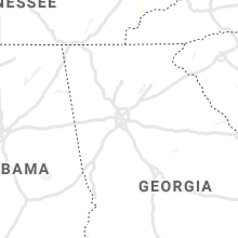
Hail Map for Friday, July 31, 2020

Number of Impacted Households on 7/31/2020
0
Impacted by 1" or Larger Hail
0
Impacted by 1.75" or Larger Hail
0
Impacted by 2.5" or Larger Hail
Square Miles of Populated Area Impacted on 7/31/2020
0
Impacted by 1" or Larger Hail
0
Impacted by 1.75" or Larger Hail
0
Impacted by 2.5" or Larger Hail


Cities Most Affected by Hail Storms of 7/31/2020
| Hail Size | Demographics of Zip Codes Affected | ||||||
|---|---|---|---|---|---|---|---|
| City | Count | Average | Largest | Pop Density | House Value | Income | Age |
| Chester, MT | 2 | 1.88 | 2.00 | 0 | $65k | $30.1k | 45.4 |
| Isabel, SD | 1 | 1.75 | 1.75 | 0 | $25k | $22.1k | 43.7 |
| Zortman, MT | 1 | 1.75 | 1.75 | 0 | $98k | $22.1k | 56.2 |
| Las Vegas, NM | 1 | 1.75 | 1.75 | 11 | $89k | $25.9k | 38.7 |
Hail and Wind Damage Spotted on 7/31/2020
Filter by Report Type:Hail ReportsWind Reports
States Impacted
Tennessee, Alabama, North Dakota, Louisiana, Arkansas, Montana, Mississippi, New Mexico, South Dakota, Texas, Nebraska, Idaho, Colorado, North CarolinaTennessee
| Local Time | Report Details |
|---|---|
| 1:53 PM CDT | 1 tree down from thunderstorm winds in de kalb county TN, 42.3 miles E of Nashville, TN |
| 2:03 PM CDT | Tree fell on powerline on dale ridge r in de kalb county TN, 50.9 miles E of Nashville, TN |
| 2:06 PM CDT | 2 trees down from thunderstorm winds in de kalb county TN, 55.5 miles ESE of Nashville, TN |
| 2:43 PM CDT | Trees down along milligan road in white county TN, 64 miles N of Chattanooga, TN |
| 3:35 PM CDT | Several reports of trees down across the south-central part of the county in fentress county TN, 63.8 miles WNW of Knoxville, TN |
| 4:35 PM EDT | Corrects previous tstm wnd dmg report from 1 nnw grandview. one tree down with power lines in the far northern portion of the count in rhea county TN, 53.4 miles WSW of Knoxville, TN |
| 4:45 PM EDT | Numerous trees down in rockwood and philadelphia and south of river roa in roane county TN, 46.9 miles WSW of Knoxville, TN |
| 5:06 PM EDT | One tree down on highway 63 near newtown. a small mud slide may have accompanied the tree that fel in scott county TN, 42.8 miles NW of Knoxville, TN |
| 5:07 PM EDT | Snapped trees and downed power lines in huntsvill in scott county TN, 44.9 miles NW of Knoxville, TN |
| 5:25 PM EDT | Many trees down county wide along with widespread power outage in campbell county TN, 31.6 miles NNW of Knoxville, TN |
| 5:30 PM EDT | Several trees down in the briceville are in anderson county TN, 21 miles NW of Knoxville, TN |
| 5:30 PM EDT | Several trees down in dutch valle in anderson county TN, 20.5 miles WNW of Knoxville, TN |
| 5:35 PM EDT | Partial barn collapse in halls from strong wind in knox county TN, 8.9 miles N of Knoxville, TN |
| 5:35 PM EDT | Numerous trees down on tell mynatt road in halls. report relayed through social medi in knox county TN, 11.1 miles N of Knoxville, TN |
| 5:45 PM EDT | Trees down county wid in union county TN, 23.2 miles N of Knoxville, TN |
| 6:15 PM EDT | Lots of trees and power lines down in tazewell with power outages. one tree fell on a house near cane circle... and one house has siding blown of in claiborne county TN, 39.6 miles NNE of Knoxville, TN |
| 6:20 PM EDT | Numerous trees down county wid in grainger county TN, 38.5 miles NE of Knoxville, TN |
| 6:25 PM EDT | Many trees and power lines down county wide... and 1300 residents without powe in sevier county TN, 20.6 miles ESE of Knoxville, TN |
| 6:30 PM EDT | Trees and power lines down county wid in jefferson county TN, 23.8 miles E of Knoxville, TN |
| 6:31 PM EDT | Several reports of trees down across the morristown are in hamblen county TN, 38.8 miles ENE of Knoxville, TN |
| 6:35 PM EDT | Several trees down in the newman ridge area north of sneedvill in hancock county TN, 55.6 miles W of Bristol, TN |
| 7:08 PM EDT | Many trees down county wid in cocke county TN, 49.6 miles E of Knoxville, TN |
| 7:14 PM EDT | Numerous trees down county wid in greene county TN, 45.1 miles SW of Bristol, TN |
| 7:45 PM EDT | Many trees down county wid in washington county TN, 25.3 miles SW of Bristol, TN |
| 8:05 PM EDT | Several trees down from milligan college east to hampton and southeast to roan mountain area. one tree down on residence in hampton but no injurie in carter county TN, 21.7 miles S of Bristol, TN |
Alabama
| Local Time | Report Details |
|---|---|
| 1:54 PM CDT | Trees were blown down on underwood ferry roa in walker county AL, 24.3 miles WNW of Birmingham, AL |
| 1:55 PM CDT | Tree down in the good hope area between dodge city and hwy 31. time estimated based on rada in cullman county AL, 40 miles N of Birmingham, AL |
| 2:00 PM CDT | Several large tree limbs and small trees were reported to have been blown down on power lines across cullman county. time estimated by rada in cullman county AL, 40.8 miles N of Birmingham, AL |
| 2:09 PM CDT | Tree fell on a power line at 1555 perkins wood roa in morgan county AL, 53.5 miles ESE of Florence, AL |
| 2:15 PM CDT | Tree reported down at this intersection. time estimated by rada in morgan county AL, 55.7 miles ESE of Florence, AL |
| 2:15 PM CDT | Tree blocking road at this intersectio in morgan county AL, 54.8 miles ESE of Florence, AL |
| 2:15 PM CDT | Tree blocking road at this intersectio in morgan county AL, 54.8 miles ESE of Florence, AL |
| 2:48 PM CDT | A tree was blown down on tidmore lane and odus murphree roa in blount county AL, 39.4 miles NNE of Birmingham, AL |
| 2:54 PM CDT | Several trees were blown down near highland avenue and mcdonald chapel roa in jefferson county AL, 7.5 miles W of Birmingham, AL |
| 3:06 PM CDT | A large tree was blown down and blocking the roa in jefferson county AL, 11.9 miles SW of Birmingham, AL |
| 3:54 PM CDT | A few trees were blown down between pell city and cropwell. roads were partially blocke in st. clair county AL, 30.2 miles E of Birmingham, AL |
North Dakota
| Local Time | Report Details |
|---|---|
| 1:25 PM MDT | Penny size hail and some rotation in the cloud in stark county ND, 95.7 miles W of Bismarck, ND |
| 1:26 PM MDT | Storm damage reported in stark county ND, 95.4 miles W of Bismarck, ND |
| 1:52 PM MDT | Winds estimated at 60 to 70 mph began at 252 pm and lasted about 15 minutes until 307 pm. spotter also reported penny sized hail and very heavy rain but had not checked in stark county ND, 85.6 miles W of Bismarck, ND |
| 2:50 PM MDT | Mesonet station tt584 12 e mot in hettinger county ND, 68.3 miles WSW of Bismarck, ND |
| 6:45 PM CDT | Half Dollar sized hail reported near Milnor, ND, 58.2 miles SW of Fargo, ND, farmer mentioned extensive crop damage. via social media. |
Louisiana
| Local Time | Report Details |
|---|---|
| 2:28 PM CDT | Tree down along hwy 17 in west carroll county LA, 36.3 miles ENE of Bastrop, LA |
| 2:32 PM CDT | Tree down on carroll r in west carroll county LA, 26.6 miles E of Bastrop, LA |
| 2:34 PM CDT | Half Dollar sized hail reported near Oak Grove, LA, 34.5 miles ENE of Bastrop, LA, hail just larger than quarters fell at the general store in terry. |
| 2:35 PM CDT | Trees down in oak grov in west carroll county LA, 31.1 miles E of Bastrop, LA |
| 2:35 PM CDT | Tree down across county road 58 in west carroll county LA, 28.3 miles E of Bastrop, LA |
| 2:47 PM CDT | Tree down near the intersection of hwy 134 and county road 318 in east carroll county LA, 39.9 miles E of Bastrop, LA |
| 2:50 PM CDT | Tree down in the city of lake providenc in east carroll county LA, 42.8 miles E of Bastrop, LA |
| 4:30 PM CDT | Trees and power lines down on lemoine cutoff road near highway 7 in grant county LA, 91.4 miles SE of Shreveport, LA |
| 4:42 PM CDT | A large tree limb was downed on a power line on hill street in polloc in grant county LA, 91.4 miles SSW of Bastrop, LA |
Arkansas
| Local Time | Report Details |
|---|---|
| 2:32 PM CDT | 3 trees down in the city of eudora... including one that brought down power line in chicot county AR, 44.4 miles ENE of Bastrop, LA |
| 2:33 PM CDT | Tree down along hwy 16 in chicot county AR, 46.9 miles NE of Bastrop, LA |
Montana
| Local Time | Report Details |
|---|---|
| 1:59 PM MDT | Golf Ball sized hail reported near Zortman, MT, 62.4 miles SE of Havre, MT, most hail between nickel to quarter sized... with a couple of golf balls. also had 0.75 inches of rain. time estimated from radar. |
| 6:55 PM MDT | Hen Egg sized hail reported near Chester, MT, 66.5 miles W of Havre, MT, mix of 1.5 to 2 inch hail... and very gusty winds about 50 to 60 mph gusts. very heavy rainfall as well over the area for a prolonged time. no report of flooding condit |
| 7:10 PM MDT | Golf Ball sized hail reported near Chester, MT, 63.9 miles N of Great Falls, MT, golf ball sized hail reported with some gusty winds. reported major crop damage... damage to trees... and broken windows. |
Mississippi
| Local Time | Report Details |
|---|---|
| 3:00 PM CDT | One tree and several large limbs down in the city of mayersvill in issaquena county MS, 51 miles E of Bastrop, LA |
| 3:06 PM CDT | Tree down in hollandal in washington county MS, 67.5 miles ENE of Bastrop, LA |
| 3:11 PM CDT | Several trees reported down in the city of anguill in sharkey county MS, 59.8 miles NW of Jackson, MS |
| 3:28 PM CDT | Tree down on main st in silver cit in humphreys county MS, 58.1 miles NNW of Jackson, MS |
| 3:32 PM CDT | Tree down on church st and another on price st in belzon in humphreys county MS, 64 miles NNW of Jackson, MS |
| 3:52 PM CDT | Trees down along hwy 12 near tchul in holmes county MS, 60.8 miles N of Jackson, MS |
| 4:04 PM CDT | Trees down along hwy 17 in holmes county MS, 59.8 miles N of Jackson, MS |
| 4:23 PM CDT | Power lines down on emory rd in wes in holmes county MS, 59.4 miles WSW of Starkville, MS |
| 4:29 PM CDT | Tree down across power lines along hwy 3 in carroll county MS, 54.5 miles W of Starkville, MS |
| 4:31 PM CDT | Trees down along hwy 35 in northwest attala count in attala county MS, 52.3 miles WSW of Starkville, MS |
| 4:43 PM CDT | Tree down along hwy 413 near the intersection of kemp l in montgomery county MS, 42.8 miles W of Starkville, MS |
| 4:43 PM CDT | Several trees down along hwy 413 near the choctaw county lin in montgomery county MS, 40.3 miles W of Starkville, MS |
| 4:49 PM CDT | Trees down along the natchez trace parkway just south of french cam in attala county MS, 38.1 miles WSW of Starkville, MS |
| 5:00 PM CDT | Trees down along the natchez trace parkway in the central portion of the count in choctaw county MS, 27.5 miles W of Starkville, MS |
| 5:14 PM CDT | Trees down along hwy 15 between ackerman and the webster county lin in choctaw county MS, 18.9 miles W of Starkville, MS |
| 7:54 PM CDT | Tree downed along highway 481 just past the intersection of highway 3 in smith county MS, 40.6 miles ESE of Jackson, MS |
| 7:55 PM CDT | Report of a tree downed along county road 12 in smith county MS, 41.9 miles ESE of Jackson, MS |
New Mexico
| Local Time | Report Details |
|---|---|
| 2:20 PM MDT | Golf Ball sized hail reported near Las Vegas, NM, 59.4 miles SSE of Taos, NM |
| 2:30 PM MDT | Quarter sized hail reported near Las Vegas, NM, 60.7 miles SSE of Taos, NM |
| 2:55 PM MDT | Quarter sized hail reported near Las Vegas, NM, 60.5 miles S of Taos, NM |
| 3:55 PM MDT | Quarter sized hail reported near Ribera, NM, 69.6 miles ENE of Albuquerque, NM |
| 4:50 PM MDT | Quarter sized hail reported near Cochiti Pueblo, NM, 40.2 miles NNE of Albuquerque, NM |
| 5:00 PM MDT | Storm damage reported in santa fe county NM, 52 miles SW of Taos, NM |
| 5:30 PM MDT | Elev 5902 ft wmsr in dona ana county NM, 46.5 miles N of El Paso, TX |
| 6:00 PM MDT | Quarter sized hail reported near Ocate, NM, 24 miles ESE of Taos, NM |
| 6:05 PM MDT | Large tree limb down at unser and 5th street in sandoval county NM, 11.8 miles NNW of Albuquerque, NM |
| 6:30 PM MDT | Large pine tree toppled near nakomis drive and other branches snapped off trees in the are in bernalillo county NM, 9.1 miles E of Albuquerque, NM |
| 6:35 PM MDT | Kabq aso in bernalillo county NM, 3.5 miles SSE of Albuquerque, NM |
| 7:00 PM MDT | Quarter sized hail reported near Alto, NM, 64.6 miles W of Roswell, NM |
| 7:05 PM MDT | Quarter sized hail reported near Alto, NM, 62.9 miles W of Roswell, NM |
| 7:08 PM MDT | Storm damage reported in valencia county NM, 25.2 miles S of Albuquerque, NM |
| 7:24 PM MDT | Quarter sized hail reported near Ruidoso, NM, 67.1 miles W of Roswell, NM |
| 10:35 PM MDT | Elev 4063 ft wsmr in otero county NM, 75.7 miles NNE of El Paso, TX |
| 11:20 PM MDT | Elev 4149 ft nmdot in hidalgo county NM, 48.9 miles SW of Silver City, NM |
| 11:25 PM MDT | Elev 4148 ft nmdot in hidalgo county NM, 48 miles SW of Silver City, NM |
| 11:35 PM MDT | Elev 4153 ft nmdot in hidalgo county NM, 50.2 miles SW of Silver City, NM |
South Dakota
| Local Time | Report Details |
|---|---|
| 2:50 PM MDT | Storm damage reported in perkins county SD, 91.7 miles SW of Bismarck, ND |
| 3:02 PM MDT | Storm damage reported in harding county SD, 106 miles N of Rapid City, SD |
| 3:52 PM MDT | Golf Ball sized hail reported near Isabel, SD, 86.6 miles SSW of Bismarck, ND |
| 4:44 PM MDT | Mesonet station 205 mclaughlin (sddot in corson county SD, 66.3 miles S of Bismarck, ND |
| 6:04 PM CDT | Power lines down. time estimated by radar and mobridge airport wind gus in walworth county SD, 81 miles N of Pierre, SD |
| 6:12 PM CDT | Winds over 60 mp in walworth county SD, 74 miles N of Pierre, SD |
| 6:16 PM CDT | Asos station kmbg mobridge muni a in walworth county SD, 81.6 miles N of Pierre, SD |
| 6:24 PM CDT | Mesonet station 209 lowry (sddot in walworth county SD, 66.5 miles NNE of Pierre, SD |
| 6:30 PM CDT | Storm damage reported in walworth county SD, 80.9 miles N of Pierre, SD |
| 6:57 PM CDT | Asos station kpir pierre muni a in hughes county SD, 3.6 miles ENE of Pierre, SD |
| 7:00 PM CDT | Storm damage reported in walworth county SD, 75 miles W of Aberdeen, SD |
| 6:09 PM MDT | Storm damage reported in jackson county SD, 49.4 miles SW of Pierre, SD |
| 7:14 PM CDT | Mesonet station 216 bowdle (sddot in edmunds county SD, 56 miles W of Aberdeen, SD |
| 7:24 PM CDT | Mesonet station 13 vivian (sddot in lyman county SD, 22 miles S of Pierre, SD |
| 7:39 PM CDT | Mesonet station 173 craven (sddot in edmunds county SD, 21.5 miles W of Aberdeen, SD |
Texas
| Local Time | Report Details |
|---|---|
| 4:25 PM CDT | Broadcast media reports minor wind damage near the area of interstate 35 and slaughter lane. large tree limbs were blown dow in travis county TX, 65.3 miles S of Killeen, TX |
Nebraska
| Local Time | Report Details |
|---|---|
| 4:20 PM MDT | Kiml asos in chase county NE, 62.6 miles SW of North Platte, NE |
Idaho
| Local Time | Report Details |
|---|---|
| 4:25 PM MDT | Storm damage reported in custer county ID, 46.1 miles SSW of Salmon, ID |
Colorado
| Local Time | Report Details |
|---|---|
| 5:32 PM MDT | Quarter sized hail reported near Longmont, CO, 30 miles NNW of Denver, CO |
| 7:30 PM MDT | Awos station kpub pueblo airpor in pueblo county CO, 6.2 miles E of Pueblo, CO |
North Carolina
| Local Time | Report Details |
|---|---|
| 7:37 PM EDT | Emergency mngr reported trees down on burnette rd near highway 70. additional trees down on deer park rd off pinnacle church rd and on sugar hill r in mcdowell county NC, 63.8 miles S of Bristol, TN |
| 8:40 PM EDT | Broadcast media reported trees and power lines down on cape hickory r in burke county NC, 47.2 miles NW of Charlotte, NC |
| 8:43 PM EDT | Storm damage reported in watauga county NC, 34.4 miles SE of Bristol, TN |
| 9:10 PM EDT | Broadcast media reported trees down blocking antioch church r in alexander county NC, 53.4 miles NNW of Charlotte, NC |
| 9:25 PM EDT | Trained spotter relayed scanner report of multiple trees down and blocking pisgah church r in iredell county NC, 47.5 miles N of Charlotte, NC |
| 9:35 PM EDT | Amateur radio reported multiple trees down along rockbarn rd n in catawba county NC, 39.9 miles NNW of Charlotte, NC |
| 9:44 PM EDT | Tree blown down on hous in iredell county NC, 39.2 miles N of Charlotte, NC |
Connect with Interactive Hail Maps