

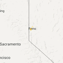
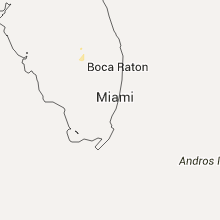
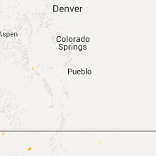
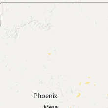
Hail Map for Saturday, June 27, 2015

Number of Impacted Households on 6/27/2015
0
Impacted by 1" or Larger Hail
0
Impacted by 1.75" or Larger Hail
0
Impacted by 2.5" or Larger Hail
Square Miles of Populated Area Impacted on 6/27/2015
0
Impacted by 1" or Larger Hail
0
Impacted by 1.75" or Larger Hail
0
Impacted by 2.5" or Larger Hail


Cities Most Affected by Hail Storms of 6/27/2015
| Hail Size | Demographics of Zip Codes Affected | ||||||
|---|---|---|---|---|---|---|---|
| City | Count | Average | Largest | Pop Density | House Value | Income | Age |
| Finley, ND | 1 | 3.00 | 3.00 | 2 | $41k | $36.3k | 45.5 |
| Northwood, ND | 1 | 3.00 | 3.00 | 3 | $59k | $35.5k | 45.1 |
| Grand Forks AFB, ND | 1 | 1.75 | 1.75 | 218 | $45k | $36.4k | 22.0 |
| Mcleod, ND | 1 | 1.75 | 1.75 | 2 | $61k | $23.8k | 46.5 |
| Wolsey, SD | 1 | 1.75 | 1.75 | 3 | $39k | $35.8k | 44.8 |
| Lankin, ND | 1 | 1.75 | 1.75 | 2 | $27k | $29.2k | 51.8 |
| Emerado, ND | 1 | 1.75 | 1.75 | 7 | $80k | $36.7k | 42.7 |
| Wheatland, ND | 1 | 1.75 | 1.75 | 4 | $46k | $46.7k | 41.0 |
| Warren, MN | 1 | 1.75 | 1.75 | 7 | $56k | $38.6k | 45.7 |
| Arvilla, ND | 1 | 1.75 | 1.75 | 4 | $58k | $28.1k | 47.4 |
Hail and Wind Damage Spotted on 6/27/2015
Filter by Report Type:Hail ReportsWind Reports
States Impacted
Indiana, Minnesota, Virginia, Georgia, Florida, Alabama, Maryland, North Dakota, Texas, North Carolina, Pennsylvania, South Carolina, Louisiana, South Dakota, New Mexico, Ohio, Delaware, Arizona, Nevada, IowaIndiana
| Local Time | Report Details |
|---|---|
| 8:07 AM EDT | Numerous large trees uprooted... approximately 1-2 ft diameter. some trees down on house in allen county IN, 5.3 miles SW of Fort Wayne, IN |
Minnesota
| Local Time | Report Details |
|---|---|
| 11:05 AM CDT | Trees blown over in town...damage to road billboard sig in lyon county MN, 34.8 miles S of Montevideo, MN |
| 6:11 PM CDT | Golf Ball sized hail reported near Warren, MN, 69.8 miles SW of Roseau, MN, relayed via social media |
| 6:50 PM CDT | Quarter sized hail reported near Euclid, MN, 70.6 miles SSW of Roseau, MN |
| 8:20 PM CDT | Ping Pong Ball sized hail reported near Wheaton, MN, 65.2 miles NW of Montevideo, MN |
| 8:35 PM CDT | Ping Pong Ball sized hail reported near Beardsley, MN, 68.4 miles NW of Montevideo, MN |
| 8:41 PM CDT | Ping Pong Ball sized hail reported near Graceville, MN, 57.4 miles NW of Montevideo, MN |
| 9:25 PM CDT | Quarter sized hail reported near Odessa, MN, 36.7 miles NW of Montevideo, MN |
| 9:35 PM CDT | Large branches down and power out across town time estimate in lac qui parle county MN, 30.5 miles WNW of Montevideo, MN |
| 9:50 PM CDT | Small branches down in town in lac qui parle county MN, 23.5 miles W of Montevideo, MN |
| 9:54 PM CDT | Storm damage reported in lac qui parle county MN, 22.8 miles W of Montevideo, MN |
| 9:58 PM CDT | Large branches blown dow in lac qui parle county MN, 16.9 miles W of Montevideo, MN |
| 10:14 PM CDT | Rainwise mark iii on a 60 ft tower in lac qui parle county MN, 11.4 miles WSW of Montevideo, MN |
| 11:05 PM CDT | Storm damage reported in lyon county MN, 35 miles S of Montevideo, MN |
Virginia
| Local Time | Report Details |
|---|---|
| 2:30 PM EDT | Multiple trees down south of i-264. one tree on a residenc in city of virginia b county VA, 0.6 miles SE of Virginia Beach, VA |
| 3:14 PM EDT | Trees down near intersection of river road and bragg roa in city of fredericks county VA, 56.1 miles N of Richmond, VA |
| 7:12 PM EDT | Half Dollar sized hail reported near Ridgeway, VA, 44.5 miles S of Roanoke, VA, public reports half-dollar sized hail fell along the 58 bypass near 220 south of martinsville... va. |
Georgia
| Local Time | Report Details |
|---|---|
| 2:30 PM EDT | Tree down in decatur county GA, 37.8 miles NW of Tallahassee, FL |
| 2:40 PM EDT | Tree down in decatur county GA, 37.6 miles NNW of Tallahassee, FL |
| 3:10 PM EDT | Tree down in grady county GA, 24.1 miles N of Tallahassee, FL |
| 3:22 PM EDT | Tree down on highway 33 in brooks county GA, 48.2 miles NE of Tallahassee, FL |
| 3:30 PM EDT | Tree down on metcalf road in thomas county GA, 33.3 miles NE of Tallahassee, FL |
| 3:36 PM EDT | Tree down on magnolia street in thomas county GA, 35.4 miles NE of Tallahassee, FL |
| 3:55 PM EDT | Tree down on ozell roa in thomas county GA, 40.6 miles NE of Tallahassee, FL |
| 3:55 PM EDT | Tree down across hutchinson road in brooks county GA, 43.8 miles NE of Tallahassee, FL |
| 4:20 PM EDT | Power line down in valdosta in lowndes county GA, 51.9 miles SSW of Douglas, GA |
| 4:20 PM EDT | Tree down on pine street in lowndes county GA, 53.4 miles SSW of Douglas, GA |
| 5:10 PM EDT | Trees and power lines down near dearin in mcduffie county GA, 24.4 miles W of Augusta, GA |
| 5:15 PM EDT | Traffic lights and lines down vicinity gate #2. time estimated by rada in richmond county GA, 10.4 miles WSW of Augusta, GA |
| 5:30 PM EDT | Traffic lights and lines down vicinity gate #2. time estimated by rada in richmond county GA, 10.4 miles WSW of Augusta, GA |
| 5:45 PM EDT | Tree down near i-20 and warren bridge rd overpass. time estimate in richmond county GA, 5.1 miles WNW of Augusta, GA |
| 6:30 PM EDT | Trees were blown down on tharpe rd near highway 7 in monroe county GA, 67.5 miles SSE of Atlanta, GA |
| 6:30 PM EDT | Trees were blown down on maynards mill rd near hwy 7 in monroe county GA, 67.7 miles SSE of Atlanta, GA |
| 6:47 PM EDT | Numerous trees were downed on tucker road and forsyth road in the vicinity of wesleyan colleg in bibb county GA, 71.9 miles SSE of Atlanta, GA |
| 6:51 PM EDT | 911 operators received numerous reports of downed trees across macon and bibb count in bibb county GA, 76.8 miles SE of Atlanta, GA |
| 7:00 PM EDT | A tree was blown down at mile marker 11 on i-1 in twiggs county GA, 85.2 miles SE of Atlanta, GA |
| 7:04 PM EDT | Two trees were blown down on sgoda rd near white springs church r in twiggs county GA, 86.4 miles SE of Atlanta, GA |
| 7:14 PM EDT | A tree was blown down on bullard rd near i-1 in twiggs county GA, 86.7 miles NNW of Douglas, GA |
Florida
| Local Time | Report Details |
|---|---|
| 3:10 PM EDT | Tree down near woodgate and centerville road intersection in leon county FL, 3.2 miles NE of Tallahassee, FL |
| 3:15 PM EDT | Tree down near county road 12 and meridian road intersection in leon county FL, 15.9 miles N of Tallahassee, FL |
| 3:20 PM EDT | Tree down near golden eagle drive and wingfoot dr in leon county FL, 13.6 miles NNE of Tallahassee, FL |
| 3:55 PM EDT | Tree down along on waukeenah highway in jefferson county FL, 20.7 miles ESE of Tallahassee, FL |
| 3:43 PM CDT | Tree reported down across florida avenue near laurel hill. time estimated via radar to be between 340 and 345 cd in okaloosa county FL, 34.2 miles NNW of Miramar Beach, FL |
| 4:50 PM EDT | 2 foot diameter tree limb down in madison county FL, 52 miles E of Tallahassee, FL |
| 5:19 PM EDT | Tree down. time determined by rada in palm beach county FL, 48.3 miles SSW of Port Saint Lucie, FL |
| 4:45 PM CDT | Tree down on power line near adkison road and highway 280 in walton county FL, 26.1 miles NE of Miramar Beach, FL |
Alabama
| Local Time | Report Details |
|---|---|
| 2:20 PM CDT | Trees and power lines down along highway 431 in henry county AL, 79.7 miles S of Auburn, AL |
| 2:25 PM CDT | Tree down on county road 32 in henry county AL, 78.6 miles S of Auburn, AL |
| 2:35 PM CDT | Tree down on county road 65 in henry county AL, 77.9 miles SSE of Auburn, AL |
| 2:35 PM CDT | Tree down on county road 36 in henry county AL, 77.1 miles SSE of Auburn, AL |
| 3:48 PM CDT | Power lines down near the intersection of airport blvd and calvert r in mobile county AL, 14.8 miles W of Mobile, AL |
| 3:54 PM CDT | Power lines down at the corner of cody and cottage hill roads. time estimated from rada in mobile county AL, 9.9 miles WSW of Mobile, AL |
Maryland
| Local Time | Report Details |
|---|---|
| 4:31 PM EDT | Eight large trees down near swan pt r in charles county MD, 55.9 miles SSW of Baltimore, MD |
| 4:34 PM EDT | Multiple trees snapped in half or toppled over. trees onto wires. structural damage to a barn near intersection of morgantown rd and rock point rd. event time corrected in charles county MD, 67.3 miles SSW of Baltimore, MD |
| 4:43 PM EDT | Tree down 23000 blk maddox rd in st. marys county MD, 67.8 miles S of Baltimore, MD |
| 4:45 PM EDT | A line of trees down in st. marys county MD, 66.2 miles S of Baltimore, MD |
| 4:47 PM EDT | Multiple tree down reports in the county including the chaptico are in st. marys county MD, 66.1 miles S of Baltimore, MD |
| 4:50 PM EDT | Extensive tree damage. portion of roof and cinder blocks of building destroyed. barn destroyed. near intersection of md rt 234 and horse shoe rd in st. marys county MD, 66 miles S of Baltimore, MD |
| 4:52 PM EDT | Trees snapped and bleachers were pushed over near chopticon high school in st. marys county MD, 64.4 miles S of Baltimore, MD |
| 4:53 PM EDT | Multiple trees down near horseshoe rd and budds creek rd. blocking parts of the roadwa in st. marys county MD, 66 miles S of Baltimore, MD |
| 4:54 PM EDT | Downed power lines and poles 39000 blk doctor johnson rd in st. marys county MD, 64.5 miles S of Baltimore, MD |
| 4:54 PM EDT | Trees knocked down. fencing torn apart and tossed. near intersection of point lookout rd and busy corner rd in st. marys county MD, 63.7 miles S of Baltimore, MD |
| 6:12 PM EDT | Trees down in rock hall. time estimated from rada in kent county MD, 22.4 miles ESE of Baltimore, MD |
| 6:26 PM EDT | Trees down in worton. time estimated from rada in kent county MD, 27.9 miles E of Baltimore, MD |
| 7:05 PM EDT | Tree down at jenkins lane in chesapeake cit in cecil county MD, 45.9 miles ENE of Baltimore, MD |
| 8:36 PM EDT | Multiple trees snapped in half or toppled over. trees onto wires. structural damage to a barn near intersection of morgantown rd and rock point rd in charles county MD, 67.3 miles SSW of Baltimore, MD |
North Dakota
| Local Time | Report Details |
|---|---|
| 3:42 PM CDT | Quarter sized hail reported near Walhalla, ND, 70.5 miles NE of Devils Lake, ND |
| 4:47 PM CDT | Ping Pong Ball sized hail reported near Aneta, ND, 54.6 miles ESE of Devils Lake, ND, time estimated by radar. spotter found ping pong ball sized hail 45 minutes after it fell. |
| 5:00 PM CDT | Golf Ball sized hail reported near Lankin, ND, 45.2 miles ENE of Devils Lake, ND |
| 5:25 PM CDT | Tea Cup sized hail reported near Finley, ND, 63.7 miles NW of Fargo, ND, very large hail across northwest side of golden lake. also some 2 inch branches broken down. |
| 5:26 PM CDT | Quarter sized hail reported near Grand Forks AFB, ND, 69.3 miles E of Devils Lake, ND |
| 5:31 PM CDT | Golf Ball sized hail reported near Grand Forks AFB, ND, 69.3 miles E of Devils Lake, ND |
| 5:35 PM CDT | Golf Ball sized hail reported near Arvilla, ND, 64.8 miles ESE of Devils Lake, ND |
| 5:37 PM CDT | Tea Cup sized hail reported near Northwood, ND, 64 miles ESE of Devils Lake, ND |
| 5:44 PM CDT | Golf Ball sized hail reported near Emerado, ND, 67.2 miles E of Devils Lake, ND |
| 6:00 PM CDT | Quarter sized hail reported near Clifford, ND, 44.2 miles NW of Fargo, ND, large hail and strong winds produced widespread rooftop and crop damage in the clifford area. |
| 6:15 PM CDT | Quarter sized hail reported near Thompson, ND, 66.4 miles NNW of Fargo, ND, quarter size hail currently falling at intersection of county road 15 and 13 in grand forks county. |
| 6:28 PM CDT | Golf Ball sized hail reported near Mcleod, ND, 41.6 miles SW of Fargo, ND, quarter to golf ball size hail reported by multiple spotters in mcleod. |
| 6:58 PM CDT | Golf Ball sized hail reported near Wheatland, ND, 27.9 miles W of Fargo, ND |
| 7:00 PM CDT | Quarter sized hail reported near Casselton, ND, 20.3 miles W of Fargo, ND |
| 7:35 PM CDT | Grain bins blown down. location and time are approximate in richland county ND, 53.6 miles S of Fargo, ND |
Texas
| Local Time | Report Details |
|---|---|
| 2:45 PM MDT | Social media report of 35 ft pine tree down at intersection of trawood and george dieter. radar estimated winds of 50 to 55 mph at time of damag in el paso county TX, 11 miles E of El Paso, TX |
North Carolina
| Local Time | Report Details |
|---|---|
| 4:56 PM EDT | One tree down on airport road near oakley church roa in chatham county NC, 49.3 miles W of Raleigh, NC |
| 5:00 PM EDT | 911 call center reports 1 tree down along nc 150 just outside of cherry gove... n in caswell county NC, 60.9 miles NW of Raleigh, NC |
| 5:05 PM EDT | Several reports of trees down in the clemmons are in forsyth county NC, 60.5 miles NNE of Charlotte, NC |
| 5:05 PM EDT | 911 call center reports multiple limbs greater than 4 inches in diameter down along route 158 near the intersection of bethesda church roa in caswell county NC, 62.3 miles NW of Raleigh, NC |
| 5:12 PM EDT | One tree down on edwards hill church road near providence church roa in chatham county NC, 46.3 miles WSW of Raleigh, NC |
| 5:46 PM EDT | Multiple trees down from possible tornado near cotten roa in lee county NC, 37.3 miles WSW of Raleigh, NC |
| 6:06 PM EDT | Five or six trees and numerous small branches down near intersection of hwy 51 and carmel rd. time estimated from rada in mecklenburg county NC, 9.2 miles S of Charlotte, NC |
| 6:42 PM EDT | Multiple trees down in southern pine in moore county NC, 59.7 miles SW of Raleigh, NC |
| 6:50 PM EDT | Multiple trees reported down in sanfor in lee county NC, 36.9 miles SW of Raleigh, NC |
| 7:37 PM EDT | Trees down near the intersection of nc 50/210 in johnston county NC, 13.7 miles S of Raleigh, NC |
| 7:40 PM EDT | Trees down at the intersection of nc 50/21 in johnston county NC, 18.6 miles S of Raleigh, NC |
| 7:50 PM EDT | Multiple trees down blocking one lane of hwy 4 in wake county NC, 13.5 miles S of Raleigh, NC |
| 7:53 PM EDT | Tree down at 1706 nc highway 50. time estimated by radar. in johnston county NC, 27 miles S of Raleigh, NC |
| 8:23 PM EDT | Report of roof off barn along with trees and powerlines in the roadway at the intersection of hwy 301 s and chicken rd near i-95. possible tornado damage. time estimate in robeson county NC, 72.8 miles WNW of Wilmington, NC |
| 8:23 PM EDT | Trees down at bizzell grove chruch rd and lowell mill rd. radar estimated tim in johnston county NC, 30.3 miles ESE of Raleigh, NC |
| 8:38 PM EDT | Tree blown down on highwa in wayne county NC, 39 miles ESE of Raleigh, NC |
| 9:13 PM EDT | A few trees down in the city of elizabethtown. time estimated by rada in bladen county NC, 46.3 miles NW of Wilmington, NC |
| 9:16 PM EDT | Emergency manager reports 3 to 4 trees down around the city of bladenboro. numerous reports of power outages across the county as well. time estimated by rada in bladen county NC, 53.1 miles WNW of Wilmington, NC |
| 9:45 PM EDT | Tree knocked into power lines in sampson county NC, 45.9 miles NNW of Wilmington, NC |
| 9:55 PM EDT | One tree reported down in sampson county NC, 30.8 miles NNW of Wilmington, NC |
| 10:28 PM EDT | Tree down near hwy 24 in kenansvill in duplin county NC, 50 miles N of Wilmington, NC |
| 10:50 PM EDT | Tree down on highway near the intersection of burgaw highway and holly shelter r in onslow county NC, 43.9 miles NE of Wilmington, NC |
| 11:05 PM EDT | Tree down on jasper rd near rocky run r in onslow county NC, 50.4 miles NE of Wilmington, NC |
Pennsylvania
| Local Time | Report Details |
|---|---|
| 4:59 PM EDT | Numerous trees down due to possible tornado in allegheny county PA, 16.9 miles NNW of Pittsburgh, PA |
| 5:01 PM EDT | Numerous trees down - confirmed via pictures - from possible tornado in butler county PA, 17.4 miles NNW of Pittsburgh, PA |
| 5:08 PM EDT | 2 large trees down from possible tornado. time estimated by radar in butler county PA, 18.7 miles NNW of Pittsburgh, PA |
| 5:10 PM EDT | Trees uprooted from possible tornado. rotating debris cloud spotted aloft off of franklin and goehring road in butler county PA, 19.9 miles NNW of Pittsburgh, PA |
South Carolina
| Local Time | Report Details |
|---|---|
| 5:48 PM EDT | Highway patrol reported trees down near beechcreek rd and cherokee rd intersection in lexington county SC, 53 miles NE of Augusta, GA |
| 6:00 PM EDT | Tree down on irmo dr just north of lake murray blvd. pea sized hail as wel in lexington county SC, 61.8 miles NE of Augusta, GA |
| 6:08 PM EDT | Savannah river site wind tower at n area measured a peak wind gust of 60 mph in the 15 minute period ending at 615 pm. tower is 200 feet off the groun in barnwell county SC, 24.6 miles SE of Augusta, GA |
| 6:10 PM EDT | Highway patrol reported trees down near clement road at mountain dr in richland county SC, 65.4 miles NE of Augusta, GA |
| 6:13 PM EDT | Highway patrol reported trees down near ramblin rd and elnora dr in lexington county SC, 56.1 miles ENE of Augusta, GA |
| 6:13 PM EDT | Trees down in roadway 301 dean hall lane in richland county SC, 67.1 miles ENE of Augusta, GA |
| 6:14 PM EDT | Highway patrol reported trees down near windward point rd and river rd in lexington county SC, 58.7 miles NE of Augusta, GA |
| 6:14 PM EDT | Highway patrol reported trees down rainbow drive at wilton road in lexington county SC, 60.2 miles NE of Augusta, GA |
| 6:14 PM EDT | Highway patrol reported trees down us 378 at woodvine dr in lexington county SC, 53.8 miles NE of Augusta, GA |
| 6:19 PM EDT | Highway patrol reported trees down us 378 at woodvine dr in lexington county SC, 53.8 miles NE of Augusta, GA |
| 6:33 PM EDT | County dispatch reported trees down on old state road near sandy run in calhoun county SC, 62.6 miles ENE of Augusta, GA |
| 6:50 PM EDT | Tree in roadway at fork church rd and bluff rd in gadsden. time estimated in richland county SC, 60.3 miles NW of Charleston, SC |
| 7:13 PM EDT | Trees down hwy 521 at mason road. time estimated by rada in sumter county SC, 57.8 miles NNW of Charleston, SC |
| 7:23 PM EDT | Reports of multiple trees down on vehicles on plowden mill road. time estimated by rada in sumter county SC, 52.3 miles NNW of Charleston, SC |
| 7:40 PM EDT | Tree(s) in roadway at sc hwy 33 and sc hwy 6 between cameron and lone star. time estimate in calhoun county SC, 46.2 miles NW of Charleston, SC |
| 7:40 PM EDT | Tree(s) in roadway at mccords ferry rd and weeks landing rd near lone star. time estimated in calhoun county SC, 46.1 miles NW of Charleston, SC |
| 7:45 PM EDT | Schp reports trees down at 3 bridges rd and mccords ferry rd (hwy 267)... south of lone star. time estimate in calhoun county SC, 42.6 miles NW of Charleston, SC |
| 7:47 PM EDT | Report of tree down near the intersection of lamar hwy and friday rd. time esimated by rada in florence county SC, 62.3 miles N of Charleston, SC |
| 7:49 PM EDT | Report of tree down at intersection of blitsgel dr and s arundel dr. time estimated by rada in florence county SC, 68.8 miles N of Charleston, SC |
| 7:52 PM EDT | Report of tree down near intersection of peniel rd and twin church rd. time estimated by rada in florence county SC, 62.7 miles N of Charleston, SC |
| 7:54 PM EDT | Report of tree in roadway at intersection of jefferson dr and s cashua dr. time estimated by rada in florence county SC, 68 miles N of Charleston, SC |
| 7:54 PM EDT | Report of tree down at 3rd loop rd and s mayfair terrace. time estimated by rada in florence county SC, 68.1 miles N of Charleston, SC |
| 7:57 PM EDT | Tree in roadway at pisgah rd and e mciver rd. time estimated by rada in darlington county SC, 74.3 miles N of Charleston, SC |
| 8:02 PM EDT | Tree in roadway at intersection of georgetown rd and wachovia hills dr. time estimated by rada in darlington county SC, 77.5 miles NNE of Charleston, SC |
| 8:05 PM EDT | Trees down at bingle pond road. time estimated by rada in clarendon county SC, 34.5 miles NW of Charleston, SC |
| 8:08 PM EDT | Report of tree down at intersection of old wallace gregg rd and francis marion rd. time estimated by rada in florence county SC, 71.4 miles NNE of Charleston, SC |
| 8:10 PM EDT | Trees down at dingle pond road. time estimated by rada in clarendon county SC, 31.5 miles NW of Charleston, SC |
| 8:44 PM EDT | Report of tree in roadway near intersection of center church rd and gilchrist rd. time estimated by rada in marion county SC, 71.2 miles W of Wilmington, NC |
Louisiana
| Local Time | Report Details |
|---|---|
| 4:58 PM CDT | Wind gust estimated at 60 mph. some siding blown off side of house... tree branches down... power outage in livingston county LA, 65.6 miles NW of New Orleans, LA |
South Dakota
| Local Time | Report Details |
|---|---|
| 5:15 PM CDT | 60 mph winds along with a lot of pea hai in mcpherson county SD, 28.8 miles NNW of Aberdeen, SD |
| 5:30 PM CDT | Half Dollar sized hail reported near Leola, SD, 28.5 miles NW of Aberdeen, SD, largest hail was slighly larger than quarters...ground white. |
| 5:55 PM CDT | Quarter sized hail reported near Aberdeen, SD, 10.6 miles NNW of Aberdeen, SD |
| 6:10 PM CDT | Peak wind from the richmond lake cwo in brown county SD, 6.5 miles NW of Aberdeen, SD |
| 7:41 PM CDT | Storm damage reported in spink county SD, 54.6 miles S of Aberdeen, SD |
| 7:58 PM CDT | Numerous branches down in beadle county SD, 60.7 miles S of Aberdeen, SD |
| 8:03 PM CDT | Golf Ball sized hail reported near Wolsey, SD, 73.2 miles S of Aberdeen, SD |
| 8:19 PM CDT | Storm damage reported in beadle county SD, 75.6 miles S of Aberdeen, SD |
| 9:18 PM CDT | Measured with handheld anemometer in davison county SD, 79.6 miles WNW of Sioux Falls, SD |
| 9:18 PM CDT | Small outbuilding destroyed...shingles damaged on the house...windows broken in davison county SD, 78.4 miles WNW of Sioux Falls, SD |
| 9:18 PM CDT | Trailer home rolled over in davison county SD, 79.6 miles WNW of Sioux Falls, SD |
| 9:22 PM CDT | Quarter sized hail reported near Mitchell, SD, 66.1 miles W of Sioux Falls, SD |
| 9:29 PM CDT | Quarter sized hail reported near Mitchell, SD, 72.2 miles W of Sioux Falls, SD |
| 9:29 PM CDT | Tree limbs down in davison county SD, 72.2 miles W of Sioux Falls, SD |
New Mexico
| Local Time | Report Details |
|---|---|
| 4:40 PM MDT | Half Dollar sized hail reported near Jemez Springs, NM, 54.1 miles NNE of Albuquerque, NM |
Ohio
| Local Time | Report Details |
|---|---|
| 7:15 PM EDT | Reports of large tree down across road... one fell onto unoccupied car on beckham stree in henry county OH, 55 miles ENE of Fort Wayne, IN |
Delaware
| Local Time | Report Details |
|---|---|
| 7:22 PM EDT | Downed trees and wires in new castle county DE, 50.4 miles ENE of Baltimore, MD |
Arizona
| Local Time | Report Details |
|---|---|
| 5:20 PM MST | Ts wind gusts to 60 mph. heavy rain visibility down to 150 feet in gila county AZ, 63.2 miles E of Phoenix, AZ |
| 5:22 PM MST | Storm damage reported in pima county AZ, 6.4 miles S of Tucson, AZ |
| 5:55 PM MST | 3-4 foot swells at roosevelt lake. boats knocked into shore. people knocked into water. tonto basin fd starting rescue in gila county AZ, 58.4 miles ENE of Phoenix, AZ |
| 6:00 PM MST | Roosevelt lake raws reorted wiind gust to 72mph at 600pm in gila county AZ, 56.7 miles ENE of Phoenix, AZ |
| 6:30 PM MST | City of apache junction reports power lines down at 317 north saguaro due to strong winds in pinal county AZ, 30.5 miles E of Phoenix, AZ |
| 6:45 PM MST | Tree down on apache blvd between mcclintock and rural in maricopa county AZ, 10.7 miles ESE of Phoenix, AZ |
| 7:00 PM MST | Large trree down in backyard. wind gust estimated at 50 mp in maricopa county AZ, 26.4 miles E of Phoenix, AZ |
| 7:00 PM MST | Tree down. winds over 40 mp in pinal county AZ, 29.3 miles E of Phoenix, AZ |
| 7:00 PM MST | Large tree branches greater than 2 in down thomas and 67th p in maricopa county AZ, 9.1 miles E of Phoenix, AZ |
| 7:16 PM MST | Power pole snapped at base due to wind in maricopa county AZ, 16.5 miles NNE of Phoenix, AZ |
Nevada
| Local Time | Report Details |
|---|---|
| 6:30 PM PDT | A trained weather spotter recorded a wind gust of 78 mp in douglas county NV, 42.6 miles S of Reno, NV |
Iowa
| Local Time | Report Details |
|---|---|
| 11:43 PM CDT | Several large trees blown over in little roc in lyon county IA, 43.4 miles E of Sioux Falls, SD |
Connect with Interactive Hail Maps