

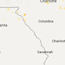
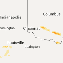
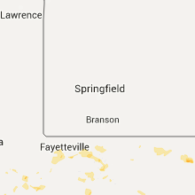
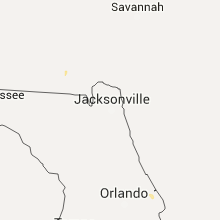
Hail Map for Friday, June 26, 2015

Number of Impacted Households on 6/26/2015
0
Impacted by 1" or Larger Hail
0
Impacted by 1.75" or Larger Hail
0
Impacted by 2.5" or Larger Hail
Square Miles of Populated Area Impacted on 6/26/2015
0
Impacted by 1" or Larger Hail
0
Impacted by 1.75" or Larger Hail
0
Impacted by 2.5" or Larger Hail


Cities Most Affected by Hail Storms of 6/26/2015
| Hail Size | Demographics of Zip Codes Affected | ||||||
|---|---|---|---|---|---|---|---|
| City | Count | Average | Largest | Pop Density | House Value | Income | Age |
| Paducah, KY | 1 | 2.50 | 2.50 | 391 | $94k | $37.7k | 42.2 |
| Canton, GA | 1 | 1.75 | 1.75 | 477 | $136k | $50.5k | 34.5 |
| Monticello, KY | 1 | 1.75 | 1.75 | 44 | $55k | $20.9k | 40.8 |
| Ripley, WV | 1 | 1.75 | 1.75 | 94 | $86k | $29.4k | 40.8 |
Hail and Wind Damage Spotted on 6/26/2015
Filter by Report Type:Hail ReportsWind Reports
States Impacted
Missouri, Indiana, Alabama, Florida, Ohio, Kentucky, Tennessee, Minnesota, Georgia, Oklahoma, North Carolina, Arkansas, South Carolina, West Virginia, Colorado, Texas, Virginia, OregonMissouri
| Local Time | Report Details |
|---|---|
| 10:50 AM CDT | Severe thunderstorm wind gusts downed tree limbs on table rock lake near joe bald par in stone county MO, 41.8 miles SSW of Springfield, MO |
| 11:01 AM CDT | Large tree reported down 2 miles north of forsyt in taney county MO, 35.7 miles SSE of Springfield, MO |
| 11:05 AM CDT | Severe thunderstorm wind gusts collapsed a 20 by 20 foot steel beamed carnival tent at the taney county fair. no injuries occurred as everyone had exited the tent prior in taney county MO, 37.7 miles SSE of Springfield, MO |
Indiana
| Local Time | Report Details |
|---|---|
| 12:05 PM EDT | Many trees broken off high near park. one house had a porch damage in floyd county IN, 27.8 miles NNW of Louisville, KY |
| 5:20 PM EDT | Powerlines down on state road 62 a half a mile east of corydon. corrected event typ in harrison county IN, 25.9 miles NW of Louisville, KY |
Alabama
| Local Time | Report Details |
|---|---|
| 12:20 PM CDT | Trees down along hwy 9 near mt moriah rd and lees bridge rd in clay county AL, 57.7 miles NNW of Auburn, AL |
| 12:42 PM CDT | Powerline down on oxford st in cleburne county AL, 68.8 miles W of Atlanta, GA |
| 12:49 PM CDT | Large tree down close to exit 205 on i-2 in cleburne county AL, 65.4 miles W of Atlanta, GA |
| 2:30 PM CDT | Plate glass window blown out...powerline pole snapped and several trees down in downtown fort payn in dekalb county AL, 47.9 miles SSW of Chattanooga, TN |
| 2:50 PM CDT | Plate glass window blown out...powerline pole snapped and several trees down in downtown fort payn in dekalb county AL, 47.9 miles SSW of Chattanooga, TN |
| 3:12 PM CDT | Multiple trees down on nance ford roa in morgan county AL, 52.8 miles SE of Florence, AL |
| 3:20 PM CDT | Tree down across highway 69 along with highway signs snapped in the fort payne are in dekalb county AL, 47.9 miles SSW of Chattanooga, TN |
| 3:48 PM CDT | Trees down and roof damage to a home in cullman county AL, 45.5 miles N of Birmingham, AL |
| 3:53 PM CDT | Large tree and fence blown down in dekalb county AL, 49.2 miles SW of Chattanooga, TN |
| 3:55 PM CDT | Power line down in a yard on old oneonta road in marshall county AL, 55.3 miles NNE of Birmingham, AL |
| 4:12 PM CDT | Tree down in a yard in morgan county AL, 48.7 miles ESE of Florence, AL |
| 4:12 PM CDT | Multiple trees down on nance ford roa in morgan county AL, 52.8 miles SE of Florence, AL |
Florida
| Local Time | Report Details |
|---|---|
| 1:25 PM EDT | Large oak tree down 1300 block of belvedere av in duval county FL, 3.6 miles WSW of Jacksonville, FL |
| 1:30 PM EDT | Large tree down near hendricks ave and southside united methodist church in duval county FL, 2.9 miles S of Jacksonville, FL |
| 3:29 PM EDT | Cfnews13 relayed viewer picture of large tree down in parking lot of the ormond beach moose lodg in volusia county FL, 54.4 miles NNE of Orlando, FL |
Ohio
| Local Time | Report Details |
|---|---|
| 1:25 PM EDT | Several trees are down in a two mile path. in addition some trees have damaged trailers in a trailer par in butler county OH, 30.1 miles NNE of Cincinnati, OH |
| 1:45 PM EDT | Large tree limb down on lebanon street near monro in butler county OH, 24.3 miles NNE of Cincinnati, OH |
| 3:04 PM EDT | 7 inch diameter tree fell in clinton county OH, 40 miles ENE of Cincinnati, OH |
| 3:06 PM EDT | Numerous tree limbs down across leslie driv in clinton county OH, 41.6 miles ENE of Cincinnati, OH |
| 3:09 PM EDT | 2 feet diameter tree down at highway 350 and 55 intersection in clinton county OH, 39.2 miles ENE of Cincinnati, OH |
| 3:09 PM EDT | Telephone pole snapped in half in clinton county OH, 46.6 miles ENE of Cincinnati, OH |
| 3:09 PM EDT | Numerous 6 to 12 inch trees and branches down on highway 350 in clinton county OH, 40.6 miles ENE of Cincinnati, OH |
| 3:10 PM EDT | 7 inch tree fell in clinton county OH, 40 miles ENE of Cincinnati, OH |
| 3:15 PM EDT | Quarter sized hail reported near Wilmington, OH, 42.6 miles ENE of Cincinnati, OH, nssl shave |
| 3:19 PM EDT | Side off of house trailer. many trees and large limbs dow in clinton county OH, 46.9 miles ENE of Cincinnati, OH |
| 3:20 PM EDT | Extensive roof damage to traile in clinton county OH, 46.9 miles ENE of Cincinnati, OH |
| 3:25 PM EDT | Multiple trees and limbs down across bernard roa in clinton county OH, 48.3 miles ENE of Cincinnati, OH |
| 3:25 PM EDT | Significant damage to sturdy structure with entire wall ripped from structur in clinton county OH, 46.1 miles ENE of Cincinnati, OH |
| 3:28 PM EDT | Reports of numerous trees scattered in various directions. pine trees topped off at 15 feet. roof damage. caller was raised in xenia so has experience in severe weather in highland county OH, 50.5 miles ENE of Cincinnati, OH |
| 3:30 PM EDT | 1 1/2 ft diamter tree snapped in highland county OH, 57.5 miles SSW of Columbus, OH |
| 3:30 PM EDT | Quarter sized hail reported near New Vienna, OH, 48.6 miles ENE of Cincinnati, OH, nssl shave |
| 3:33 PM EDT | Trailer blown onto house. multiple trees dow in highland county OH, 51.6 miles SSW of Columbus, OH |
| 3:35 PM EDT | Numerous 1 ft diameter trees snapped. metal garage received extensive damag in highland county OH, 51.9 miles SSW of Columbus, OH |
| 3:40 PM EDT | Quarter sized hail reported near Leesburg, OH, 51.3 miles SW of Columbus, OH, significant tree damage also reported across area. |
| 3:45 PM EDT | 1 1/2 ft diamter tree snapped. corrected time of even in highland county OH, 57.5 miles SSW of Columbus, OH |
| 4:02 PM EDT | Tree dow in ross county OH, 54.2 miles SSW of Columbus, OH |
| 4:05 PM EDT | Numerous trees down across rocky fork state par in highland county OH, 52.7 miles E of Cincinnati, OH |
| 5:15 PM EDT | Several trees dow in pike county OH, 65 miles S of Columbus, OH |
| 5:34 PM EDT | Trees down along hwy 32 near jackso in jackson county OH, 68 miles SSE of Columbus, OH |
| 5:39 PM EDT | Half Dollar sized hail reported near Jackson, OH, 69.3 miles SSE of Columbus, OH |
| 5:42 PM EDT | Numerous trees down across the southern portion of jackson county. time estimated from rada in jackson county OH, 63.9 miles NW of Charleston, WV |
| 6:28 PM EDT | 1 ft diameter tree snapped. many limbs down 5-6 in diameter. lots of rain 3/4 or mor in gallia county OH, 55.1 miles NW of Charleston, WV |
| 8:28 PM EDT | Quarter sized hail reported near South Point, OH, 51.1 miles W of Charleston, WV |
| 8:48 PM EDT | No damage in lawrence county OH, 49.8 miles W of Charleston, WV |
| 8:48 PM EDT | Half Dollar sized hail reported near South Point, OH, 49.8 miles W of Charleston, WV, no damage |
| 8:50 PM EDT | Quarter sized hail reported near Chesapeake, OH, 44.4 miles W of Charleston, WV, quarter sized hail in the town of chesapeake. |
| 8:50 PM EDT | Quarter sized hail reported near South Point, OH, 50.8 miles W of Charleston, WV, bouncing off of cars |
Kentucky
| Local Time | Report Details |
|---|---|
| 12:30 PM CDT | Quarter sized hail reported near Cunningham, KY, 43.9 miles SE of Cape Girardeau, MO, quarter size hail and 30 to 40 mph winds |
| 12:50 PM CDT | Numerous small branches down in marshall county KY, 44.9 miles NNE of Mc Kenzie, TN |
| 12:50 PM CDT | A swingset was blown over and there lots of limbs down. also...nickel size hail reported in graves county KY, 51.1 miles ESE of Cape Girardeau, MO |
| 12:55 PM CDT | A tree fell on a house in graves county KY, 52.2 miles N of Mc Kenzie, TN |
| 1:36 PM CDT | Several power lines down and on fire in marshall county KY, 57.6 miles N of Mc Kenzie, TN |
| 1:59 PM CDT | Power lines dow in hopkins county KY, 51.1 miles S of Evansville, IN |
| 2:07 PM CDT | Storm damage reported in graves county KY, 51.1 miles ESE of Cape Girardeau, MO |
| 2:33 PM CDT | Trees down blocking road in hopkins county KY, 44 miles S of Evansville, IN |
| 2:37 PM CDT | Tree down on power lines on hwy 136 in ohio county KY, 44.2 miles SE of Evansville, IN |
| 2:40 PM CDT | Large tree dow in carlisle county KY, 47.1 miles ESE of Cape Girardeau, MO |
| 2:50 PM CDT | Tennis Ball sized hail reported near Paducah, KY, 45.9 miles ESE of Cape Girardeau, MO, late report. picture and report via social media. |
| 3:15 PM CDT | Several trees down in the vicinity of the kfarm mesonet sit in warren county KY, 53.9 miles NNE of Nashville, TN |
| 3:17 PM CDT | Structural damage to a building resulted in damage to several vehicles. media relayed viewer repor in grayson county KY, 47.6 miles SW of Louisville, KY |
| 3:18 PM CDT | Quarter sized hail reported near Bowling Green, KY, 57.3 miles NNE of Nashville, TN |
| 3:20 PM CDT | 2 trees down near dry for in barren county KY, 64.7 miles NE of Nashville, TN |
| 3:23 PM CDT | Quarter sized hail reported near Bowling Green, KY, 58.1 miles NNE of Nashville, TN, high winds also reported |
| 3:25 PM CDT | Outbuildings damaged and small trees down. winds estimated to be 60 mp in christian county KY, 59.7 miles NW of Nashville, TN |
| 4:35 PM EDT | Golf Ball sized hail reported near Monticello, KY, 82.4 miles SW of Irvine, KY, golfball hail occurred in murl near highway 1546. |
| 3:37 PM CDT | Trees dow in hickman county KY, 48.8 miles NNW of Mc Kenzie, TN |
| 3:42 PM CDT | Trees dow in hickman county KY, 49.2 miles SE of Cape Girardeau, MO |
| 4:52 PM EDT | Tree down on old 14 in meade county KY, 20.2 miles SW of Louisville, KY |
| 3:55 PM CDT | Trees reported down in metcalfe county KY, 75.1 miles S of Louisville, KY |
| 4:55 PM EDT | Powerlines down on saint martin road near flahert in meade county KY, 22.6 miles WSW of Louisville, KY |
| 4:57 PM EDT | Powerlines down on rock ridge roa in meade county KY, 19.4 miles W of Louisville, KY |
| 5:00 PM EDT | Tree down on dewy street in muldraug in meade county KY, 15.4 miles WSW of Louisville, KY |
| 5:00 PM EDT | Small tree fell on a car at conley bottom marin in wayne county KY, 70 miles SW of Irvine, KY |
| 5:35 PM EDT | Tree down on hwy 80w near casey county lin in pulaski county KY, 61.7 miles SW of Irvine, KY |
| 5:36 PM EDT | Storm damage reported in jefferson county KY, 13.3 miles N of Louisville, KY |
| 4:40 PM CDT | Trees down along highway 775 in logan county KY, 42.2 miles NNW of Nashville, TN |
| 5:50 PM EDT | Dispatch reported dozens of trees down throughout the county in spencer county KY, 20.8 miles E of Louisville, KY |
| 6:02 PM EDT | Many trees down in shelby county. some roads blocked. tree on house with people trappe in shelby county KY, 30.6 miles ENE of Louisville, KY |
| 6:02 PM EDT | State road 53 has trees down everywhere in shelbyvill in shelby county KY, 31.7 miles ENE of Louisville, KY |
| 6:42 PM EDT | Numerous 6-7 inch trees down on highway 22... 227... and 330. no structural damag in owen county KY, 43.1 miles SSW of Cincinnati, OH |
| 6:50 PM EDT | Multiple trees downed near the intersection of keefer and lawrenceville road in grant county KY, 38.5 miles SSW of Cincinnati, OH |
| 6:53 PM EDT | Multiple trees downed near the intersection of us route 25 and corinth roa in grant county KY, 41.9 miles S of Cincinnati, OH |
| 6:57 PM EDT | One tree down on the 2200 block of us route 42 wes in carroll county KY, 48.9 miles SW of Cincinnati, OH |
| 7:05 PM EDT | Trees down along hwy 113 in gallatin county KY, 34.5 miles SW of Cincinnati, OH |
| 7:10 PM EDT | Trees down along hwy 455 between us 127 and hwy 41 in gallatin county KY, 31 miles SSW of Cincinnati, OH |
| 7:24 PM EDT | Several trees down in the eastern portion of the county. pictures from public via media confirm this repor in bourbon county KY, 34 miles NNW of Irvine, KY |
| 7:29 PM EDT | Several trees down county wide. also confirmed by public pictures from the medi in harrison county KY, 50.6 miles NNW of Irvine, KY |
| 7:45 PM EDT | Trees dow in nicholas county KY, 40.7 miles N of Irvine, KY |
| 7:47 PM EDT | Trees dow in nicholas county KY, 40.7 miles N of Irvine, KY |
| 8:22 PM EDT | Quarter sized hail reported near Ashland, KY, 54.9 miles W of Charleston, WV, quarter sized hail in the town of ashland. |
Tennessee
| Local Time | Report Details |
|---|---|
| 2:15 PM CDT | Storm spotter reports 60 mph wind gust. no damage at this tim in dyer county TN, 48.6 miles W of Mc Kenzie, TN |
| 4:10 PM EDT | Power lines dow in bradley county TN, 22.7 miles E of Chattanooga, TN |
| 4:23 PM EDT | A few trees down in hamilton county TN, 14.7 miles E of Chattanooga, TN |
| 4:25 PM EDT | Estimated 55-60 mph winds. also 6 inch diameter maple tree dow in bradley county TN, 24.3 miles ENE of Chattanooga, TN |
| 4:26 PM EDT | Trees and power lines down. minor street flooding and estimated 50 mph wind in bradley county TN, 24.7 miles E of Chattanooga, TN |
| 4:30 PM EDT | Several trees down along and near hwy 70 east of kingston and southwest of bradbur in roane county TN, 29 miles WSW of Knoxville, TN |
| 4:45 PM EDT | Several trees down on nw side of clevelan in bradley county TN, 27.1 miles ENE of Chattanooga, TN |
| 5:00 PM EDT | One tree down on hwy 33 between tazewell and sneedvill in claiborne county TN, 46.5 miles NE of Knoxville, TN |
| 5:26 PM EDT | Trees down across the wolf creek are in rhea county TN, 48.7 miles NNE of Chattanooga, TN |
| 5:31 PM EDT | Several trees down in the ten mile are in meigs county TN, 46.6 miles WSW of Knoxville, TN |
| 4:57 PM CDT | A few trees down across donnell road near rosemark. time is radar estimate in shelby county TN, 20.5 miles NE of Memphis, TN |
| 5:51 PM CDT | Image of a large tree down on long hollow pike near long hollow pike golf course. time estimated based on rada in sumner county TN, 21.8 miles NE of Nashville, TN |
| 6:00 PM CDT | Storm spotter near highway 18 and highway 100 measured 66 mph gust with handheld anemometer. no damage reported at this tim in hardeman county TN, 59.1 miles SSW of Mc Kenzie, TN |
| 6:45 PM CDT | Report of a tree down in humphreys county TN, 32.3 miles ESE of Mc Kenzie, TN |
Minnesota
| Local Time | Report Details |
|---|---|
| 2:26 PM CDT | Quarter sized hail reported near Menahga, MN, 51 miles SSW of Bemidji, MN, spotter stated hail ranged from penny to quarter sized |
Georgia
| Local Time | Report Details |
|---|---|
| 3:38 PM EDT | The walker county 911 center reported a few trees down along taylor broome roa in walker county GA, 14.3 miles S of Chattanooga, TN |
| 3:42 PM EDT | The floyd county 911 center reported a few trees down near fosters mill road and livingston roa in floyd county GA, 57.7 miles S of Chattanooga, TN |
| 4:08 PM EDT | Trees were blown into powerlines on harrison roa in floyd county GA, 52.3 miles S of Chattanooga, TN |
| 4:25 PM EDT | A tree fell onto a church in lyerly causing structural damag in chattooga county GA, 44.9 miles S of Chattanooga, TN |
| 4:35 PM EDT | Quarter sized hail reported near Hiawassee, GA, 63.7 miles W of Greenville, SC, quarter sized hail on mauldin drive |
| 4:42 PM EDT | Golf Ball sized hail reported near Canton, GA, 35 miles N of Atlanta, GA, the cherokee county emergency manager reported golf ball sized hail at reinhardt college parkway and north etowah drive. |
| 4:50 PM EDT | Metal roofing was blown off an auto parts business at the corner of hwy 76 and 52 alternate. a couple trees were also blown down in the vicinit in murray county GA, 36.1 miles ESE of Chattanooga, TN |
| 5:03 PM EDT | Power lines were downed on hwy 286 west of eto in murray county GA, 33.9 miles ESE of Chattanooga, TN |
| 5:07 PM EDT | Quarter sized hail reported near Hiawassee, GA, 67.4 miles W of Greenville, SC, the long ridge camp ground reported quarter sized hail. |
| 5:15 PM EDT | The dawson county 911 center reported one tree down along hwy 9 sout in dawson county GA, 46.9 miles NNE of Atlanta, GA |
| 5:19 PM EDT | The pickens county 911 center reported one power line down near bradley court and parker roa in pickens county GA, 46.3 miles N of Atlanta, GA |
| 5:22 PM EDT | The dawson county 911 center reported three trees down along hwy 138 and hwy 13 in dawson county GA, 53.3 miles N of Atlanta, GA |
| 6:18 PM EDT | The union county emergency manager reported one tree down near hwy 515 and hwy 32 in union county GA, 70.8 miles E of Chattanooga, TN |
| 6:20 PM EDT | A twitter user reported one tree down at ensign court and plantation lan in dekalb county GA, 12.1 miles NNE of Atlanta, GA |
| 6:31 PM EDT | The union county emergency manager reported one tree down near hwy 515 and hwy 32 in union county GA, 70.8 miles E of Chattanooga, TN |
| 6:31 PM EDT | The union county 911 center reported one tree down along craig gap road and pine top roa in union county GA, 71.1 miles W of Greenville, SC |
| 6:44 PM EDT | The union county 911 center reported one tree down on track rock gap road and plott town roa in union county GA, 72.3 miles W of Greenville, SC |
| 9:15 PM EDT | Quarter sized hail reported near Alpharetta, GA, 21.6 miles NNE of Atlanta, GA, public reported quarter sized hail in the northpoint area of alpharetta. |
Oklahoma
| Local Time | Report Details |
|---|---|
| 2:40 PM CDT | Storm damage reported in pittsburg county OK, 63.3 miles W of Fort Smith, AR |
| 2:50 PM CDT | Three large trees snapped at bas in mcintosh county OK, 60.9 miles NNE of Atoka, OK |
| 2:50 PM CDT | 6 inch tree limbs down and trees blown dow in mcintosh county OK, 59.4 miles NNE of Atoka, OK |
| 3:35 PM CDT | Scattered large tree limbs reported blown down around tow in sequoyah county OK, 32 miles WNW of Fort Smith, AR |
| 4:03 PM CDT | Metal signs blown into the streets. very wind in sequoyah county OK, 5.6 miles WNW of Fort Smith, AR |
North Carolina
| Local Time | Report Details |
|---|---|
| 4:00 PM EDT | Trees down on mal weathers road and silver farm road. pool also uprooted and blown over. time estimated from reports...and radar data that strongly indicate a downburst in wake county NC, 12.1 miles S of Raleigh, NC |
| 4:15 PM EDT | A few trees dow in cherokee county NC, 62.4 miles S of Knoxville, TN |
| 4:21 PM EDT | Quarter sized hail reported near Clayton, NC, 13.1 miles SSE of Raleigh, NC, report of 1 inch hail 6 miles southwest of clayton at i-40 and nc-42. |
| 4:25 PM EDT | Quarter sized hail reported near Clayton, NC, 18.1 miles SSE of Raleigh, NC, penny to quarter size hail reported in southern clayton. |
| 4:25 PM EDT | Quarter sized hail reported near Clayton, NC, 17.5 miles SE of Raleigh, NC, quarter size hail reported 5 miles south of clayton. |
| 4:25 PM EDT | Quarter sized hail reported near Clayton, NC, 13.9 miles SE of Raleigh, NC, public report of nickel to quarter size hail in clayton. |
| 4:28 PM EDT | Local law enforcement reported numerous trees and power lines down just north of dento in davidson county NC, 50.1 miles NE of Charlotte, NC |
| 4:45 PM EDT | Trees down off north rugby rd in hendersonville... n in henderson county NC, 34.6 miles NNE of Greenville, SC |
| 4:54 PM EDT | Trees down off north rugby rd in hendersonville... n in henderson county NC, 36.3 miles N of Greenville, SC |
| 5:08 PM EDT | Quarter sized hail reported near Trenton, NC, 67.7 miles NNE of Wilmington, NC, quarter-size hail reported on wyse fork road. |
| 5:25 PM EDT | Tree down on ether rd in sta in montgomery county NC, 60 miles ENE of Charlotte, NC |
| 5:35 PM EDT | Tree limb down on powerline in southwood are in lenoir county NC, 71 miles ESE of Raleigh, NC |
| 5:40 PM EDT | Tree down near the intersection of hogan farm rd and dover rd in sta in montgomery county NC, 63.1 miles ENE of Charlotte, NC |
| 5:48 PM EDT | Several power lines blown down in a field just se of hiddenite... n in alexander county NC, 48 miles NNW of Charlotte, NC |
| 6:00 PM EDT | Multiple trees down in northeast randolph county. time and location estimated by rada in randolph county NC, 53.2 miles W of Raleigh, NC |
| 6:05 PM EDT | Numerous trees and power lines down between ramseur and siler city off of us hwy 64 e. most activity occurred between eastern randolph rd and hicks farm r in randolph county NC, 52.8 miles W of Raleigh, NC |
| 6:37 PM EDT | Trees blown down on car at 1244 wilksboro hw in iredell county NC, 40 miles N of Charlotte, NC |
| 6:54 PM EDT | Moore co 911 received reports of numerous trees and power lines down in carthag in moore county NC, 52.9 miles SW of Raleigh, NC |
| 7:18 PM EDT | Numerous trees down in southern pine in moore county NC, 59 miles SW of Raleigh, NC |
| 7:42 PM EDT | Several trees down in the southern pines/aberdeen are in moore county NC, 61.7 miles SW of Raleigh, NC |
| 8:35 PM EDT | Numerous trees down in raeford. power outages and dime size hail were also reporte in hoke county NC, 66.3 miles SSW of Raleigh, NC |
| 8:45 PM EDT | Power line down on 401 n near wagra in scotland county NC, 74.2 miles SSW of Raleigh, NC |
| 9:05 PM EDT | Large limbs down in the ballantyne are in mecklenburg county NC, 11.9 miles S of Charlotte, NC |
| 9:07 PM EDT | Tree down at hwy 73 in ellerb in richmond county NC, 61.7 miles E of Charlotte, NC |
| 9:10 PM EDT | Report of tree down in roadway near intersection of jacquelyn rd and rennert rd. time estimated by rada in robeson county NC, 72.3 miles SSW of Raleigh, NC |
| 9:10 PM EDT | Report of tree down on roadway on hwy 71 just outside of red springs. time estimated by rada in robeson county NC, 69.5 miles SSW of Raleigh, NC |
| 9:11 PM EDT | Quarter sized hail reported near West Jefferson, NC, 42 miles ESE of Bristol, TN, quarter sized hail fell within the baldwin community in ashe county nc. |
| 9:28 PM EDT | Tree down blocking the road on sneadtown rd near silver hill r in scotland county NC, 78 miles SW of Raleigh, NC |
| 9:39 PM EDT | Two trees down along route 221 north near the alleghany and ashe county line in ashe county NC, 51.3 miles E of Bristol, TN |
| 11:23 PM EDT | Several trees down and power outages reported in carrbor in orange county NC, 26.2 miles WNW of Raleigh, NC |
| 11:42 PM EDT | Tree down at farrington rd and ephesus church r in durham county NC, 21.9 miles WNW of Raleigh, NC |
| 11:47 PM EDT | Multiple trees down in bethesd in durham county NC, 15.4 miles NW of Raleigh, NC |
Arkansas
| Local Time | Report Details |
|---|---|
| 3:44 PM CDT | 60 mph wind gusts reported at kait 8 studio. small limbs dow in craighead county AR, 58.7 miles NW of Memphis, TN |
| 4:21 PM CDT | Blytheville asos reported 53 knot wind gus in mississippi county AR, 54.3 miles N of Memphis, TN |
| 4:45 PM CDT | Numerous reports of large trees and power lines down across roadways in the jethro communit in franklin county AR, 37.1 miles ENE of Fort Smith, AR |
| 5:10 PM CDT | A few trees reported down along county road 410 in johnson county AR, 47.9 miles ENE of Fort Smith, AR |
| 5:15 PM CDT | A few trees reported down along highway 6 in johnson county AR, 52.9 miles E of Fort Smith, AR |
| 6:00 PM CDT | Several trees reported down near crow mountai in pope county AR, 58.6 miles NW of Little Rock, AR |
| 6:00 PM CDT | Several trees snapped near ground leve in lonoke county AR, 21 miles NE of Little Rock, AR |
| 6:05 PM CDT | Several trees and powerlines reported down in the are in pope county AR, 51.1 miles NW of Little Rock, AR |
| 6:20 PM CDT | A few trees reported down in the are in perry county AR, 34.9 miles WNW of Little Rock, AR |
| 6:45 PM CDT | Storm damage reported in faulkner county AR, 25.6 miles NNW of Little Rock, AR |
| 7:00 PM CDT | One tree snapped near ground leve in saline county AR, 21.3 miles SW of Little Rock, AR |
| 7:05 PM CDT | A few trees blown over near the intersection of mccain and warden roa in pulaski county AR, 3 miles NNE of Little Rock, AR |
| 7:05 PM CDT | Tree down on southeastern roa in pulaski county AR, 11.2 miles NE of Little Rock, AR |
| 7:09 PM CDT | Storm damage reported in pulaski county AR, 3.4 miles ESE of Little Rock, AR |
| 7:10 PM CDT | Several trees reported down across downtown little roc in pulaski county AR, 0.3 miles WNW of Little Rock, AR |
| 7:12 PM CDT | Storm damage reported in pulaski county AR, 13.8 miles NNE of Little Rock, AR |
| 7:35 PM CDT | Just north of joplin...thunderstorm winds downed trees onto cars and camping trailers at the tompkins bend use area. no injuries were reporte in montgomery county AR, 49.1 miles NNE of Nashville, AR |
South Carolina
| Local Time | Report Details |
|---|---|
| 5:44 PM EDT | Quarter sized hail reported near Anderson, SC, 19.6 miles S of Greenville, SC, 1 inch hail at 326 ave of oaks... anderson... sc. |
| 5:45 PM EDT | One tree down on the porch of a house. also...a few trees uprooted and snapped as well as large branches down nearb in anderson county SC, 21.8 miles S of Greenville, SC |
| 5:45 PM EDT | 2 large trees blown down at 326 ave of oaks in anderson... s in anderson county SC, 19.6 miles S of Greenville, SC |
| 5:47 PM EDT | Trees blown down off 700 concord rd in anderson... s in anderson county SC, 18.9 miles S of Greenville, SC |
| 5:50 PM EDT | Powerlines broken at 209 altamont court north of anderson... s in anderson county SC, 17.5 miles S of Greenville, SC |
| 8:00 PM EDT | Downed trees and power lines in lancaster county SC, 39.7 miles S of Charlotte, NC |
West Virginia
| Local Time | Report Details |
|---|---|
| 7:30 PM EDT | Quarter sized hail reported near Ripley, WV, 32.6 miles N of Charleston, WV, quarter sized hail at the ripley water plant. |
| 7:34 PM EDT | Multiple pictures of large trees down along cedar lakes drive in riple in jackson county WV, 32.6 miles N of Charleston, WV |
| 7:35 PM EDT | Half Dollar sized hail reported near Ripley, WV, 28.3 miles N of Charleston, WV |
| 7:40 PM EDT | Golf Ball sized hail reported near Ripley, WV, 27.1 miles N of Charleston, WV, golf ball sized hail observed along aplin ridge road. via social media. time estimated from radar. |
| 7:50 PM EDT | Trees down along wv 119 near gandeevill in roane county WV, 27.4 miles NNE of Charleston, WV |
| 8:20 PM EDT | Reports of trees down through southern roane county...particularly along rt 3 in roane county WV, 28.7 miles ENE of Charleston, WV |
| 8:20 PM EDT | Numerous trees down in southern roane county...particularly along rt 11 in roane county WV, 21.4 miles NE of Charleston, WV |
| 8:50 PM EDT | Numerous trees and powerlines down in and around the downtown huntington are in cabell county WV, 43.1 miles W of Charleston, WV |
| 8:55 PM EDT | 60 mph winds tree limbs dow in cabell county WV, 43.1 miles W of Charleston, WV |
| 9:00 PM EDT | Quarter sized hail reported near Huntington, WV, 45.3 miles W of Charleston, WV |
| 10:10 PM EDT | Tree across road in guardian drive. multiple trees across roa in webster county WV, 40.9 miles SW of Elkins, WV |
| 10:10 PM EDT | Multiple trees down in hacker valle in webster county WV, 34.5 miles WSW of Elkins, WV |
| 11:02 PM EDT | 1 tree down on cheat mountain r in pocahontas county WV, 25.8 miles S of Elkins, WV |
Colorado
| Local Time | Report Details |
|---|---|
| 6:14 PM MDT | Quarter sized hail reported near Westcliffe, CO, 40.7 miles WSW of Pueblo, CO |
Texas
| Local Time | Report Details |
|---|---|
| 7:45 PM CDT | 12 inch tree uprooted and several 8 inch diameter tree limbs downed near pipeline at 82 in tarrant county TX, 20.8 miles W of Dallas, TX |
Virginia
| Local Time | Report Details |
|---|---|
| 9:53 PM EDT | 911 call center reports a tree down along coxs chapel road in grayson county... virginia in grayson county VA, 54.6 miles E of Bristol, TN |
| 10:17 PM EDT | 911 call center reports multiple trees down along country lane just north of elk creek... virgini in grayson county VA, 59.7 miles E of Bristol, TN |
| 10:17 PM EDT | Multiple trees down across elk creek parkway in near elk creek virgini in grayson county VA, 59.8 miles E of Bristol, TN |
| 10:20 PM EDT | 911 call center reports a tree down along wagon wheel road near elk creek... virgini in grayson county VA, 59.8 miles E of Bristol, TN |
| 11:57 PM EDT | Spotter reports tree limbs less than an inch in diameter... a few shingles... and dime sized hail fell within along hankens circle in richlands virgini in tazewell county VA, 41.2 miles NNE of Bristol, TN |
Oregon
| Local Time | Report Details |
|---|---|
| 9:13 PM PDT | A local fire information officer reported that a gust front from a collapsing thunderstorm came through the area from takilma road to holland loop around 5 pm. he estim in josephine county OR, 44.2 miles WSW of Medford, OR |
Connect with Interactive Hail Maps