

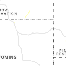
Hail Map for Sunday, June 7, 2020

Number of Impacted Households on 6/7/2020
0
Impacted by 1" or Larger Hail
0
Impacted by 1.75" or Larger Hail
0
Impacted by 2.5" or Larger Hail
Square Miles of Populated Area Impacted on 6/7/2020
0
Impacted by 1" or Larger Hail
0
Impacted by 1.75" or Larger Hail
0
Impacted by 2.5" or Larger Hail


Cities Most Affected by Hail Storms of 6/7/2020
| Hail Size | Demographics of Zip Codes Affected | ||||||
|---|---|---|---|---|---|---|---|
| City | Count | Average | Largest | Pop Density | House Value | Income | Age |
| Cody, NE | 4 | 2.06 | 2.50 | 0 | $34k | $26.7k | 41.3 |
| Dawson, ND | 3 | 1.75 | 1.75 | 1 | $23k | $21.0k | 47.9 |
| Ashley, ND | 2 | 2.13 | 2.50 | 2 | $24k | $22.1k | 55.7 |
| Callaway, NE | 1 | 2.50 | 2.50 | 2 | $54k | $33.0k | 47.3 |
| New Rockford, ND | 1 | 1.75 | 1.75 | 6 | $37k | $29.1k | 49.9 |
| Thief River Falls, MN | 1 | 1.75 | 1.75 | 33 | $65k | $34.8k | 38.8 |
| Zeeland, ND | 1 | 1.75 | 1.75 | 1 | $11k | $23.6k | 48.0 |
| Midland, SD | 1 | 1.75 | 1.75 | 0 | $28k | $28.3k | 49.0 |
| Tuthill, SD | 1 | 1.75 | 1.75 | 0 | $38k | $29.6k | 50.6 |
| Ogden, UT | 1 | 1.75 | 1.75 | 613 | $111k | $39.4k | 30.2 |
| Ekalaka, MT | 1 | 1.75 | 1.75 | 0 | $23k | $25.4k | 50.1 |
| Highmore, SD | 1 | 1.75 | 1.75 | 1 | $35k | $30.0k | 48.2 |
| Minto, ND | 1 | 1.75 | 1.75 | 5 | $53k | $34.9k | 44.7 |
| Java, SD | 1 | 1.75 | 1.75 | 1 | $11k | $28.5k | 49.3 |
Hail and Wind Damage Spotted on 6/7/2020
Filter by Report Type:Hail ReportsWind Reports
North Dakota
| Local Time | Report Details |
|---|---|
| 8:30 AM CDT | Peak wind measured at a personal weather statio in barnes county ND, 59.1 miles WNW of Fargo, ND |
| 8:34 AM CDT | Peak wind measured at a personal weather statio in griggs county ND, 55 miles SE of Devils Lake, ND |
| 9:13 AM CDT | Peak wind measured by a personal weather statio in grand forks county ND, 55.7 miles ESE of Devils Lake, ND |
| 5:35 PM CDT | Half Dollar sized hail reported near Minto, ND, 69.8 miles E of Devils Lake, ND, report received via facebook. |
| 5:40 PM CDT | Golf Ball sized hail reported near Minto, ND, 69.8 miles E of Devils Lake, ND |
| 6:30 PM CDT | Golf Ball sized hail reported near Ashley, ND, 61.8 miles NW of Aberdeen, SD, relayed via our coop observer in ashley. |
| 6:30 PM CDT | Tennis Ball sized hail reported near Ashley, ND, 63.5 miles NW of Aberdeen, SD, relayed through broadcast media. |
| 6:45 PM CDT | 6 buildings destroyed on a farmstead. debris spread a quarter mile to the northeast of the far in mcintosh county ND, 48.2 miles NW of Aberdeen, SD |
| 7:02 PM CDT | Quarter sized hail reported near Steele, ND, 41.9 miles ESE of Bismarck, ND, time estimated from radar. |
| 7:06 PM CDT | Golf Ball sized hail reported near Dawson, ND, 49.7 miles ESE of Bismarck, ND, lasted about 10 minutes. quarter size hail too. |
| 7:20 PM CDT | Golf Ball sized hail reported near Zeeland, ND, 65.5 miles SE of Bismarck, ND, golf ball sized hail ongoing at time of call. |
| 7:20 PM CDT | Corrects the time of the previous tstm wnd dmg report from 14 e ashley. 6 buildings destroyed on a farmstead. debris spread a quarter mile to the northeast of the far in mcintosh county ND, 48.2 miles NW of Aberdeen, SD |
| 7:28 PM CDT | Golf Ball sized hail reported near Dawson, ND, 49.4 miles E of Bismarck, ND, relayed through broadcast media photo sharing website. handful of golf ball sized hail. time estimated from radar. |
| 7:28 PM CDT | Golf Ball sized hail reported near Dawson, ND, 49.3 miles E of Bismarck, ND, relayed through broadcast media photo website. handful of golf ball sized hail. time estimated from radar. |
| 7:35 PM CDT | Ndawn station 4sw edgele in lamoure county ND, 61 miles NNW of Aberdeen, SD |
| 7:53 PM CDT | Report of downed power line on 34th street. relayed through social media. time estimated from rada in stutsman county ND, 83.7 miles S of Devils Lake, ND |
| 7:56 PM CDT | Asos station kjms jamestown nd airport asos (bis in stutsman county ND, 82.1 miles S of Devils Lake, ND |
| 7:06 PM MDT | Quarter sized hail reported near Mott, ND, 88.7 miles WSW of Bismarck, ND |
| 8:07 PM CDT | Half Dollar sized hail reported near Carrington, ND, 39.9 miles SSW of Devils Lake, ND, still hailing. |
| 7:08 PM MDT | Quarter sized hail reported near Mott, ND, 79.3 miles WSW of Bismarck, ND, relayed through broadcast media. time estimated from radar. |
| 8:10 PM CDT | Half Dollar sized hail reported near Grafton, ND, 72.8 miles WSW of Roseau, MN, quater to half dollar sized hail along interstate 29... near mp 171. |
| 8:10 PM CDT | Half Dollar sized hail reported near Grafton, ND, 75.1 miles WSW of Roseau, MN, along i-29. report received via facebook. |
| 8:15 PM CDT | Siding blown off of a barn and bushes uprooted. report received via faceboo in barnes county ND, 70.4 miles WNW of Fargo, ND |
| 8:20 PM CDT | Golf Ball sized hail reported near New Rockford, ND, 30.9 miles SSW of Devils Lake, ND |
| 8:25 PM CDT | Storm damage reported in steele county ND, 59.2 miles WNW of Fargo, ND |
| 8:29 PM CDT | Storm damage reported in barnes county ND, 70 miles WNW of Fargo, ND |
| 8:30 PM CDT | Peak wind measured at a personal weather statio in barnes county ND, 59.1 miles WNW of Fargo, ND |
| 8:32 PM CDT | Peak wind measured by an ndawn statio in griggs county ND, 55.9 miles SE of Devils Lake, ND |
| 8:33 PM CDT | 1-inch tree limbs broken and shingles blown of in barnes county ND, 59.9 miles WNW of Fargo, ND |
| 8:34 PM CDT | Peak wind measured at a personal weather statio in griggs county ND, 55 miles SE of Devils Lake, ND |
| 8:35 PM CDT | Storm outflo in griggs county ND, 67 miles SSE of Devils Lake, ND |
| 8:35 PM CDT | Peak wind mesured on a persinal weather statio in steele county ND, 59.2 miles WNW of Fargo, ND |
| 8:50 PM CDT | Ping Pong Ball sized hail reported near Brocket, ND, 27.9 miles ENE of Devils Lake, ND |
| 8:58 PM CDT | Mesonet station as622 2 nnw catha in wells county ND, 45.1 miles SW of Devils Lake, ND |
| 8:00 PM MDT | Storm damage reported in grant county ND, 53.1 miles WSW of Bismarck, ND |
| 9:00 PM CDT | Multiple trees and at least one power pole down in ellendal in dickey county ND, 38.1 miles N of Aberdeen, SD |
| 9:01 PM CDT | Peak wind measured by the ndawn near logan cente in grand forks county ND, 53.6 miles ESE of Devils Lake, ND |
| 9:04 PM CDT | Larimore fire dept. reported wind gust moved truc in grand forks county ND, 55 miles ESE of Devils Lake, ND |
| 8:05 PM MDT | Storm damage reported in grant county ND, 52.5 miles WSW of Bismarck, ND |
| 9:09 PM CDT | Peak winds measured by an ndawn statio in sargent county ND, 48.7 miles NE of Aberdeen, SD |
| 9:10 PM CDT | Trees blown down... power lines blown down... and roofing torn off a building downtown. peak winds estimated to 80 mp in grand forks county ND, 58.6 miles ESE of Devils Lake, ND |
| 9:12 PM CDT | Small 4 to 6 inch diameter tree snappe in grand forks county ND, 65.1 miles ESE of Devils Lake, ND |
| 9:13 PM CDT | Peak wind measured by a personal weather statio in grand forks county ND, 55.7 miles ESE of Devils Lake, ND |
| 9:16 PM CDT | Peak wind measured at an rwis statio in cass county ND, 37.7 miles WNW of Fargo, ND |
| 9:16 PM CDT | Peak wind measured at an rwis statio in grand forks county ND, 68.7 miles E of Devils Lake, ND |
| 9:24 PM CDT | Trees down at farmstead. public report of possible tornad in traill county ND, 51.5 miles NNW of Fargo, ND |
| 9:25 PM CDT | Peak wind measured at the grand forks airport /kgfk in grand forks county ND, 76.6 miles NNW of Fargo, ND |
| 9:31 PM CDT | Peak winds measured by an rwis statio in traill county ND, 48.5 miles NNW of Fargo, ND |
| 9:40 PM CDT | Large tree branches broken down and power lines blown down on walnut street. report and photo posted to social medi in grand forks county ND, 73.4 miles N of Fargo, ND |
| 9:46 PM CDT | Peak wind measured at an rwis statio in grand forks county ND, 76.4 miles N of Fargo, ND |
| 9:47 PM CDT | Peak wind measured at an ndawn statio in cass county ND, 24.7 miles WSW of Fargo, ND |
| 9:49 PM CDT | Peak wind measured at the sheyenne raws statio in ransom county ND, 37.3 miles SW of Fargo, ND |
| 9:50 PM CDT | Trees uprooted and power lines blown dow in ransom county ND, 52.3 miles SW of Fargo, ND |
| 10:08 PM CDT | Video and report posted via social media of extremely low visibility in corn field debris blowing across cr17 near intersection with cr2 in cass county ND, 8.3 miles NW of Fargo, ND |
| 10:09 PM CDT | Peak wind measured at an ndawn station at 10 meter in cass county ND, 2.8 miles NW of Fargo, ND |
| 10:11 PM CDT | Quarter sized hail reported near Mandan, ND, 17.4 miles NW of Bismarck, ND, hail is ongoing at the time of the call. |
| 10:11 PM CDT | Peak wind measured at the fargo airport /kfar in cass county ND, 4.9 miles NW of Fargo, ND |
| 12:01 AM CDT | Peak wind measured at a personal weather statio in cass county ND, 24.1 miles N of Fargo, ND |
| 12:02 AM CDT | Peak wind measured at an ndawn statio in cass county ND, 17.3 miles WNW of Fargo, ND |
| 12:04 AM CDT | Peak wind measured by a personal weather statio in cass county ND, 12.7 miles WNW of Fargo, ND |
| 12:10 AM CDT | Gust front crossing interstate 29 between harwood and argusville causing vehicles to slide on pavement. nearby wind sensor reported peak wind to 79 mp in cass county ND, 13.3 miles NNW of Fargo, ND |
| 12:15 AM CDT | Peak wind measured at a personal weather statio in cass county ND, 24.1 miles N of Fargo, ND |
| 11:26 PM MDT | Delayed report of thunderstorm wind damage. a roof was blown off a house. also report of a piece of a metal swing driven 10 inches into the ground around 75 yards away in grant county ND, 38.2 miles SW of Bismarck, ND |
Utah
| Local Time | Report Details |
|---|---|
| 9:42 AM MDT | Half Dollar sized hail reported near Willard, UT, 44.9 miles N of Salt Lake City, UT, quarter to half dollar size hail in south willard. |
| 9:42 AM MDT | Golf Ball sized hail reported near Ogden, UT, 38.5 miles NNW of Salt Lake City, UT, estimated based on pictures sent to broadcast media. time estimated. |
Wyoming
| Local Time | Report Details |
|---|---|
| 11:45 AM MDT | Evw asos in uinta county WY, 59.1 miles NE of Salt Lake City, UT |
| 11:53 AM MDT | Evanston airport in uinta county WY, 57 miles NE of Salt Lake City, UT |
| 11:55 AM MDT | Evanston airport in uinta county WY, 57 miles NE of Salt Lake City, UT |
| 12:22 PM MDT | Wydot sensor wy35 in uinta county WY, 72.2 miles WSW of Rock Springs, WY |
| 12:28 PM MDT | French - wydot mesonet in uinta county WY, 71.7 miles WSW of Rock Springs, WY |
| 12:52 PM MDT | Church butte - wydot mesonet in uinta county WY, 47.8 miles WSW of Rock Springs, WY |
| 4:53 PM MDT | Rawlins airport wind sustained 41mph... gust 60mp in carbon county WY, 84.5 miles SSW of Casper, WY |
| 5:12 PM MDT | I80/us287/us30 - walcott junctio in carbon county WY, 71.3 miles WNW of Laramie, WY |
Florida
| Local Time | Report Details |
|---|---|
| 3:34 PM EDT | Damage to the roof and siding on a home. possible tornado damage. radar estimated tim in columbia county FL, 62.2 miles WSW of Jacksonville, FL |
| 3:34 PM EDT | Multiple large trees snapped with some smaller trees uprooted. possible tornado damage. radar estimated tim in columbia county FL, 62.7 miles WSW of Jacksonville, FL |
| 4:00 PM EDT | Tree down near sw county road 18a. radar estimated tim in union county FL, 52.1 miles WSW of Jacksonville, FL |
Minnesota
| Local Time | Report Details |
|---|---|
| 3:10 PM CDT | Quarter sized hail reported near Crookston, MN, 64.3 miles NNE of Fargo, ND, report and photo posted via social media. time estimated based on radar. |
| 3:50 PM CDT | Half Dollar sized hail reported near Thief River Falls, MN, 54.3 miles SSW of Roseau, MN |
| 4:05 PM CDT | Golf Ball sized hail reported near Thief River Falls, MN, 49.8 miles SSW of Roseau, MN |
| 4:35 PM CDT | Quarter sized hail reported near Karlstad, MN, 31.7 miles SW of Roseau, MN |
| 5:20 PM CDT | Ping Pong Ball sized hail reported near Stephen, MN, 57.3 miles WSW of Roseau, MN |
| 5:25 PM CDT | Quarter sized hail reported near Halma, MN, 40.3 miles WSW of Roseau, MN |
| 5:35 PM CDT | Ping Pong Ball sized hail reported near Ulen, MN, 26.5 miles NE of Fargo, ND, report and photo posted via social media. |
| 6:30 PM CDT | Quarter sized hail reported near Lancaster, MN, 33.3 miles WNW of Roseau, MN, dime to quarter sized hail fell for at least 5 minutes... through 635 pm cdt. |
| 6:35 PM CDT | Quarter sized hail reported near Lancaster, MN, 33.3 miles WNW of Roseau, MN |
| 6:55 PM CDT | Quarter sized hail reported near Lancaster, MN, 47.7 miles W of Roseau, MN, hail noted acorss highway near the border. |
| 7:00 PM CDT | Half Dollar sized hail reported near Alvarado, MN, 70.4 miles SW of Roseau, MN, nickel to half dollar sized hail. |
| 7:17 PM CDT | Quarter sized hail reported near Stephen, MN, 58 miles WSW of Roseau, MN, dime to quarter sized hail reported along highway 75. |
| 10:02 PM CDT | Peak winds measured at the crookston airport /kckn in polk county MN, 63.4 miles N of Fargo, ND |
| 10:18 PM CDT | Peak wind measured at the thief river falls airport /ktvf in pennington county MN, 55.6 miles SSW of Roseau, MN |
| 10:20 PM CDT | Large branches broken down... power lines down... sections of fencing blown down between north moorhead and dilwort in clay county MN, 3.9 miles E of Fargo, ND |
| 10:35 PM CDT | A few large 4 to 6 inch diameter tree branches broken down in farmyar in marshall county MN, 42.8 miles SSW of Roseau, MN |
| 10:40 PM CDT | Large branches broken down in farmyard. report posted via social medi in clay county MN, 25.1 miles SE of Fargo, ND |
| 12:19 AM CDT | Peak wind measured at an ndawn statio in norman county MN, 21.7 miles NNE of Fargo, ND |
| 12:20 AM CDT | Peak wind measured at an ndawn statio in norman county MN, 21.7 miles NNE of Fargo, ND |
| 12:30 AM CDT | Large tree branches broken down... power lines blown down. report posted via social medi in norman county MN, 32 miles NNE of Fargo, ND |
South Dakota
| Local Time | Report Details |
|---|---|
| 5:15 PM CDT | Quarter sized hail reported near Wood, SD, 46 miles N of Valentine, NE |
| 5:15 PM CDT | Storm damage reported in mellette county SD, 46 miles N of Valentine, NE |
| 5:15 PM CDT | Storm damage reported in todd county SD, 26.1 miles NNW of Valentine, NE |
| 5:16 PM CDT | Ping Pong Ball sized hail reported near Blunt, SD, 19.8 miles ENE of Pierre, SD |
| 5:20 PM CDT | Quarter sized hail reported near Mission, SD, 30.9 miles NNW of Valentine, NE |
| 5:46 PM CDT | Quarter sized hail reported near Eureka, SD, 63 miles WNW of Aberdeen, SD |
| 4:50 PM MDT | Quarter sized hail reported near Norris, SD, 47 miles NW of Valentine, NE |
| 5:54 PM CDT | Quarter sized hail reported near Parmelee, SD, 43.2 miles NW of Valentine, NE |
| 6:04 PM CDT | Quarter sized hail reported near Draper, SD, 41.7 miles SSW of Pierre, SD |
| 6:09 PM CDT | Storm damage reported in hughes county SD, 3 miles ESE of Pierre, SD |
| 6:12 PM CDT | Storm damage reported in lyman county SD, 17.4 miles S of Pierre, SD |
| 6:14 PM CDT | Storm damage reported in todd county SD, 15.8 miles N of Valentine, NE |
| 6:15 PM CDT | Golf Ball sized hail reported near Java, SD, 67.7 miles W of Aberdeen, SD |
| 6:17 PM CDT | Storm damage reported in mellette county SD, 49.9 miles NNW of Valentine, NE |
| 6:17 PM CDT | Quarter sized hail reported near White River, SD, 49.9 miles NNW of Valentine, NE |
| 6:19 PM CDT | Storm damage reported in hyde county SD, 52.3 miles ENE of Pierre, SD |
| 6:20 PM CDT | Several buildings damaged. time estimated by rada in faulk county SD, 50.7 miles SW of Aberdeen, SD |
| 6:24 PM CDT | Quarter sized hail reported near Java, SD, 67.9 miles W of Aberdeen, SD |
| 6:24 PM CDT | Storm damage reported in hughes county SD, 1.5 miles E of Pierre, SD |
| 6:26 PM CDT | Several buildings damage in faulk county SD, 57 miles WSW of Aberdeen, SD |
| 6:30 PM CDT | 1 tree down. time estimated by rada in faulk county SD, 43.9 miles SW of Aberdeen, SD |
| 6:31 PM CDT | Power poles down. 3 inch tree limbs dow in faulk county SD, 43.1 miles SW of Aberdeen, SD |
| 6:34 PM CDT | Storm damage reported in faulk county SD, 46.4 miles WSW of Aberdeen, SD |
| 6:39 PM CDT | Storm damage reported in todd county SD, 15.8 miles N of Valentine, NE |
| 6:45 PM CDT | Quarter sized hail reported near White River, SD, 48.8 miles N of Valentine, NE |
| 5:59 PM MDT | Quarter sized hail reported near Scenic, SD, 50 miles ESE of Rapid City, SD |
| 7:04 PM CDT | Mesonet station 173 craven (sddot in edmunds county SD, 21.5 miles W of Aberdeen, SD |
| 7:07 PM CDT | Quarter sized hail reported near Tolstoy, SD, 58 miles W of Aberdeen, SD |
| 7:09 PM CDT | Storm damage reported in tripp county SD, 40.2 miles ENE of Valentine, NE |
| 7:09 PM CDT | Mesonet station 19 harrold (sddot in hughes county SD, 33.1 miles ENE of Pierre, SD |
| 7:09 PM CDT | Mesonet station 184 eureka (sddot in mcpherson county SD, 47.4 miles WNW of Aberdeen, SD |
| 7:10 PM CDT | Storm damage reported in mcpherson county SD, 47 miles WNW of Aberdeen, SD |
| 7:30 PM CDT | Storm damage reported in hughes county SD, 17.7 miles ESE of Pierre, SD |
| 7:30 PM CDT | Large tree down over road. residence in this area are without electricit in jones county SD, 36 miles S of Pierre, SD |
| 7:34 PM CDT | Mesonet station 216 bowdle (sddot in edmunds county SD, 56 miles W of Aberdeen, SD |
| 7:34 PM CDT | Corrects previous non-tstm wnd gst report from 17 w polo. mesonet station 215 jct sd47/sd26 (sddot in hyde county SD, 52.7 miles ENE of Pierre, SD |
| 6:35 PM MDT | Quarter sized hail reported near Quinn, SD, 64.9 miles E of Rapid City, SD |
| 7:38 PM CDT | Roof torn off a building. time estimated by rada in lyman county SD, 30.4 miles S of Pierre, SD |
| 7:40 PM CDT | Ping Pong Ball sized hail reported near Vivian, SD, 25.6 miles S of Pierre, SD |
| 7:50 PM CDT | Quarter sized hail reported near Vivian, SD, 23.1 miles S of Pierre, SD |
| 7:50 PM CDT | Ping Pong Ball sized hail reported near Bowdle, SD, 58 miles W of Aberdeen, SD, time estimated by radar. |
| 7:10 PM MDT | Quarter sized hail reported near Tuthill, SD, 36.7 miles WNW of Valentine, NE |
| 8:10 PM CDT | Storm damage reported in edmunds county SD, 21.5 miles W of Aberdeen, SD |
| 7:11 PM MDT | Golf Ball sized hail reported near Tuthill, SD, 36.7 miles WNW of Valentine, NE |
| 8:15 PM CDT | Storm damage reported in edmunds county SD, 21.5 miles W of Aberdeen, SD |
| 7:15 PM MDT | Golf Ball sized hail reported near Midland, SD, 42.9 miles WSW of Pierre, SD |
| 8:20 PM CDT | Storm damage reported in brown county SD, 7.5 miles W of Aberdeen, SD |
| 7:23 PM MDT | Ping Pong Ball sized hail reported near Fort Pierre, SD, 36.1 miles WSW of Pierre, SD |
| 8:25 PM CDT | Storm damage reported in brown county SD, 9.3 miles NW of Aberdeen, SD |
| 8:30 PM CDT | Storm damage reported in brown county SD, 10.4 miles N of Aberdeen, SD |
| 8:30 PM CDT | 1 inch of rain as of 10:15p in brown county SD, 7.7 miles WNW of Aberdeen, SD |
| 8:34 PM CDT | 60 mph sustained winds from the west for a few minute in brown county SD, 22.2 miles N of Aberdeen, SD |
| 8:35 PM CDT | Several large trees down. at least one uproote in brown county SD, 13.4 miles N of Aberdeen, SD |
| 8:36 PM CDT | Storm damage reported in brown county SD, 20.2 miles N of Aberdeen, SD |
| 8:40 PM CDT | Ping Pong Ball sized hail reported near Highmore, SD, 46.2 miles ENE of Pierre, SD |
| 8:40 PM CDT | Ping Pong Ball sized hail reported near Highmore, SD, 45.6 miles ENE of Pierre, SD |
| 8:40 PM CDT | Golf Ball sized hail reported near Highmore, SD, 45.7 miles E of Pierre, SD |
| 8:40 PM CDT | Several trees down and fences blown over in tow in brown county SD, 18.7 miles N of Aberdeen, SD |
| 8:40 PM CDT | Irrigation pivot flipped ove in brown county SD, 24.9 miles N of Aberdeen, SD |
| 8:40 PM CDT | Storm damage reported in brown county SD, 6.2 miles NW of Aberdeen, SD |
| 8:54 PM CDT | Storm damage reported in todd county SD, 41 miles NW of Valentine, NE |
| 8:55 PM CDT | Large trees down. time estimated by rada in brown county SD, 27.4 miles ENE of Aberdeen, SD |
| 9:09 PM CDT | Storm damage reported in todd county SD, 43.2 miles NW of Valentine, NE |
| 9:15 PM CDT | 60 to 70 mph wind in brown county SD, 9.6 miles S of Aberdeen, SD |
| 9:20 PM CDT | Report from mping: 1-inch tree limbs broken; shingles blown of in brown county SD, 1.1 miles NE of Aberdeen, SD |
| 10:05 PM CDT | Report of 72 mph wind at 10:05 pm... 72 at 10:10 pm... and 53 mph at 10:15 p in edmunds county SD, 21.5 miles W of Aberdeen, SD |
Nebraska
| Local Time | Report Details |
|---|---|
| 6:20 PM MDT | Golf Ball sized hail reported near Cody, NE, 46.6 miles W of Valentine, NE, broken windows on south side of house due to hail. |
| 7:11 PM MDT | Tennis Ball sized hail reported near Cody, NE, 36.1 miles W of Valentine, NE, report via social media... time estimated by radar. |
| 8:11 PM CDT | Tennis Ball sized hail reported near Callaway, NE, 45.7 miles ENE of North Platte, NE, report via social media... time estimated by radar. |
| 7:18 PM MDT | Hen Egg sized hail reported near Cody, NE, 35.8 miles W of Valentine, NE |
| 7:21 PM MDT | Hen Egg sized hail reported near Cody, NE, 35 miles W of Valentine, NE, hail broke patio furniture. |
Montana
| Local Time | Report Details |
|---|---|
| 7:03 PM MDT | Golf Ball sized hail reported near Ekalaka, MT, 67.4 miles ESE of Miles City, MT |
Connect with Interactive Hail Maps