

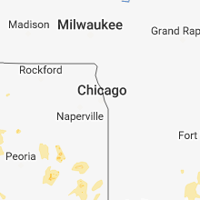
Hail Map for Saturday, June 9, 2018

Number of Impacted Households on 6/9/2018
0
Impacted by 1" or Larger Hail
0
Impacted by 1.75" or Larger Hail
0
Impacted by 2.5" or Larger Hail
Square Miles of Populated Area Impacted on 6/9/2018
0
Impacted by 1" or Larger Hail
0
Impacted by 1.75" or Larger Hail
0
Impacted by 2.5" or Larger Hail


Cities Most Affected by Hail Storms of 6/9/2018
| Hail Size | Demographics of Zip Codes Affected | ||||||
|---|---|---|---|---|---|---|---|
| City | Count | Average | Largest | Pop Density | House Value | Income | Age |
| Leland, IA | 2 | 2.25 | 2.50 | 10 | $56k | $40.2k | 45.2 |
| Latimer, IA | 1 | 1.75 | 1.75 | 7 | $50k | $31.8k | 42.8 |
| Clarks Grove, MN | 1 | 1.75 | 1.75 | 21 | $70k | $40.5k | 39.8 |
| Nora Springs, IA | 1 | 1.75 | 1.75 | 18 | $69k | $37.0k | 42.1 |
| Charles City, IA | 1 | 1.75 | 1.75 | 58 | $67k | $33.4k | 43.3 |
Hail and Wind Damage Spotted on 6/9/2018
Filter by Report Type:Hail ReportsWind Reports
States Impacted
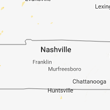
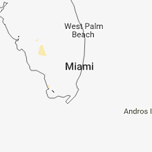
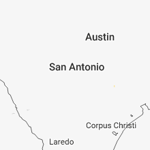
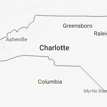
Iowa, Nebraska, Missouri, Illinois, Minnesota, Georgia, Indiana, Delaware, Kentucky, Alabama, Texas, Florida, Ohio, Virginia, Arkansas, Mississippi, Montana, West Virginia, Wyoming, Washington, Maryland, North Dakota, South Carolina, Kansas, South Dakota, TennesseeIowa
| Local Time | Report Details |
|---|---|
| 8:45 AM CDT | Quarter sized hail reported near Cedar Rapids, IA, 2.4 miles NNE of Cedar Rapids, IA, mix of pea to quarter sized hail. |
| 1:05 PM CDT | Quarter sized hail reported near Osage, IA, 23.8 miles NE of Mason City, IA |
| 2:55 PM CDT | Tennis Ball sized hail reported near Leland, IA, 27 miles WNW of Mason City, IA |
| 3:00 PM CDT | Hen Egg sized hail reported near Leland, IA, 25.5 miles WNW of Mason City, IA |
| 3:44 PM CDT | Ping Pong Ball sized hail reported near Clear Lake, IA, 9.6 miles WNW of Mason City, IA, via social media. |
| 3:54 PM CDT | Storm damage reported in cerro gordo county IA, 6.6 miles W of Mason City, IA |
| 4:27 PM CDT | Golf Ball sized hail reported near Nora Springs, IA, 9.8 miles E of Mason City, IA |
| 4:30 PM CDT | Trees and limbs down... light pole down on outbuilding... and bleachers blown through fence at rockville high school baseball/softball complex. time estimated from rada in floyd county IA, 15.2 miles ESE of Mason City, IA |
| 4:30 PM CDT | Numerous trees down. time estimated from radar. report via social media photo in floyd county IA, 14.3 miles ESE of Mason City, IA |
| 4:30 PM CDT | Farm outbuilding destroyed with debris scattered through across street and through a field. time estimated from radar. report via photos on social medi in floyd county IA, 12.6 miles ESE of Mason City, IA |
| 4:32 PM CDT | Storm damage reported in floyd county IA, 12.6 miles ESE of Mason City, IA |
| 4:36 PM CDT | Storm damage reported in floyd county IA, 14.3 miles ESE of Mason City, IA |
| 4:37 PM CDT | Storm damage reported in floyd county IA, 14.3 miles E of Mason City, IA |
| 4:50 PM CDT | Quarter sized hail reported near Rockford, IA, 18 miles ESE of Mason City, IA, report via social media. |
| 4:53 PM CDT | Hay racks blown across farm and through fence. power out. report via photo on social medi in floyd county IA, 14.3 miles ESE of Mason City, IA |
| 4:55 PM CDT | Storm damage reported in floyd county IA, 24.6 miles ESE of Mason City, IA |
| 4:55 PM CDT | Golf Ball sized hail reported near Charles City, IA, 24.6 miles ESE of Mason City, IA, nickel to golf ball sized hail. |
| 5:00 PM CDT | Storm damage reported in floyd county IA, 19.3 miles E of Mason City, IA |
| 5:03 PM CDT | Quarter sized hail reported near Charles City, IA, 24.4 miles ESE of Mason City, IA |
| 5:18 PM CDT | Storm damage reported in floyd county IA, 27.9 miles ESE of Mason City, IA |
| 5:22 PM CDT | Power lines down across west-central floyd count in floyd county IA, 12.8 miles ESE of Mason City, IA |
| 5:29 PM CDT | Storm damage reported in chickasaw county IA, 36.1 miles ESE of Mason City, IA |
| 5:38 PM CDT | Power out in charles cit in floyd county IA, 27.4 miles E of Mason City, IA |
| 5:59 PM CDT | Quarter sized hail reported near New Hampton, IA, 46.2 miles ESE of Mason City, IA |
| 5:59 PM CDT | Storm damage reported in chickasaw county IA, 46.2 miles ESE of Mason City, IA |
| 6:10 PM CDT | Quarter sized hail reported near Clarksville, IA, 35.6 miles SE of Mason City, IA, via kwwl. |
| 6:40 PM CDT | Small tree down in winneshiek county IA, 57 miles SSW of La Crosse, WI |
| 7:00 PM CDT | Trees and power lines down. time estimate from rada in fayette county IA, 65.2 miles SSW of La Crosse, WI |
| 7:11 PM CDT | Golf Ball sized hail reported near Latimer, IA, 26.3 miles SSW of Mason City, IA |
| 7:14 PM CDT | Reports of power lines and branches down in fayette county IA, 65.2 miles SSW of La Crosse, WI |
| 7:14 PM CDT | Trees down. time estimated from rada in winneshiek county IA, 43.2 miles SW of La Crosse, WI |
| 7:27 PM CDT | Large branches and power lines down in fayette county IA, 62.1 miles N of Cedar Rapids, IA |
| 7:28 PM CDT | Quarter sized hail reported near Geneva, IA, 30.6 miles S of Mason City, IA, nickle to quarter sized hail - via social media. |
| 8:00 PM CDT | Quarter sized hail reported near Ackley, IA, 37.6 miles SSE of Mason City, IA, mostly pea to nickel hail with a few to the size of quarters. |
| 8:35 PM CDT | Trees at about a 45 degree angle... no tree damage visibil in buchanan county IA, 37.1 miles NNW of Cedar Rapids, IA |
| 9:02 PM CDT | Quarter sized hail reported near Independence, IA, 35.5 miles NNW of Cedar Rapids, IA |
| 9:18 PM CDT | Quarter sized hail reported near Independence, IA, 36.2 miles NNW of Cedar Rapids, IA |
| 9:20 PM CDT | Estimated wind gust of 70 mph and quarter hail.. in benton county IA, 12.5 miles NW of Cedar Rapids, IA |
| 9:20 PM CDT | Roof blown off of a home. relayed by the em. time estimated from rada in buchanan county IA, 32.1 miles N of Cedar Rapids, IA |
| 9:24 PM CDT | Quarter sized hail reported near Norway, IA, 13 miles WSW of Cedar Rapids, IA, relayed by benton county em. |
| 9:34 PM CDT | Relayed a report of thunderstorm wind damage in watkin. tree limbs down. time estimated using rada in benton county IA, 17.1 miles WSW of Cedar Rapids, IA |
| 9:50 PM CDT | Storm damage reported in buchanan county IA, 34.2 miles N of Cedar Rapids, IA |
| 10:00 PM CDT | Storm damage reported in buchanan county IA, 33.5 miles N of Cedar Rapids, IA |
| 10:09 PM CDT | Multiple trees snapped off about halfway up along highway 13 north of manchester. time estimated from rada in delaware county IA, 37.8 miles NNE of Cedar Rapids, IA |
| 10:46 PM CDT | Relayed by local broadcast medi in linn county IA, 8.7 miles NNW of Cedar Rapids, IA |
| 11:09 PM CDT | Multiple trees snapped off about halfway up along highway 13 north of manchester. time estimated from rada in delaware county IA, 37.8 miles NNE of Cedar Rapids, IA |
Nebraska
| Local Time | Report Details |
|---|---|
| 10:07 AM CDT | Storm damage reported in platte county NE, 73.3 miles NE of Grand Island, NE |
| 7:00 PM CDT | Pea size hai in richardson county NE, 79.6 miles NE of Manhattan, KS |
| 7:09 PM CDT | Storm damage reported in richardson county NE, 81 miles NE of Manhattan, KS |
Missouri
| Local Time | Report Details |
|---|---|
| 11:15 AM CDT | Multiple tents and canopies blown over at church even in st. louis city county MO, 6 miles WSW of Saint Louis, MO |
| 11:22 AM CDT | Tree blown on to house. corrected tim in st. louis city county MO, 6.5 miles WSW of Saint Louis, MO |
| 11:22 AM CDT | Large tree limbs blown down. one fell onto an unoccupied car damaging it on loran avenu in st. louis city county MO, 6.4 miles WSW of Saint Louis, MO |
| 11:35 AM CDT | Tree blown on to hous in st. louis city county MO, 6.5 miles WSW of Saint Louis, MO |
| 2:35 PM CDT | Also penny size hai in webster county MO, 13.4 miles ENE of Springfield, MO |
| 3:41 PM CDT | Late report. localized wind damage to property. large tree uprooted and fell on portion of home sustaining minor damage... vehicle damaged as well. one side of house ha in mississippi county MO, 36.1 miles SSE of Cape Girardeau, MO |
| 7:43 PM CDT | Tree and power line dow in holt county MO, 68 miles NNW of Kansas City, MO |
Illinois
| Local Time | Report Details |
|---|---|
| 11:15 AM CDT | Corrects previous tstm wnd dmg report from 2 ese columbia. delayed report. multiple tree limbs down. partial tree fallen on a house. some power lines also dow in monroe county IL, 12.9 miles S of Saint Louis, MO |
| 11:20 AM CDT | Numerous trees reported down throughout cit in schuyler county IL, 51.8 miles ESE of Kahoka, MO |
| 11:27 AM CDT | Quarter sized hail reported near East Carondelet, IL, 6.3 miles SSW of Saint Louis, MO |
| 11:36 AM CDT | Quarter sized hail reported near Columbia, IL, 12.9 miles S of Saint Louis, MO |
| 11:36 AM CDT | Delayed report. multiple tree limbs down. partial tree fallen on a house. some power lines also dow in monroe county IL, 12.9 miles S of Saint Louis, MO |
| 11:45 AM CDT | Quarter sized hail reported near Industry, IL, 57.4 miles E of Kahoka, MO, hail up to quarter size... most was smaller. |
| 11:48 AM CDT | Large trees reported down around cit in schuyler county IL, 64.2 miles ESE of Kahoka, MO |
| 12:00 PM CDT | Report of a power pole dow in cass county IL, 64.7 miles SW of Peoria, IL |
| 12:12 PM CDT | Gutters and siding damage in monroe county IL, 12.9 miles S of Saint Louis, MO |
| 12:30 PM CDT | Tree knocked down a power pole. delayed report. time estimated from rada in marion county IL, 57.8 miles E of Saint Louis, MO |
| 12:47 PM CDT | Delayed report from a spotter near cartter il. a 1-3 foot diameter tree in a neighbor's front yard was knocked down by the winds. several tree limbs were also down in t in marion county IL, 70 miles SSW of Mattoon, IL |
Minnesota
| Local Time | Report Details |
|---|---|
| 11:55 AM CDT | Golf Ball sized hail reported near Clarks Grove, MN, 42.8 miles N of Mason City, IA, image from social media via broadcast meadia. |
| 5:34 PM CDT | Quarter sized hail reported near Caledonia, MN, 23.4 miles SSW of La Crosse, WI |
| 6:20 PM CDT | Quarter sized hail reported near Crookston, MN, 58 miles NNE of Fargo, ND |
| 7:15 PM CDT | Quarter sized hail reported near Georgetown, MN, 14.1 miles N of Fargo, ND, time and size estimated from video sent on social media |
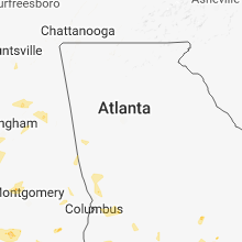
Georgia
| Local Time | Report Details |
|---|---|
| 1:56 PM EDT | Two treeds down in oaklan in marion county GA, 55.9 miles E of Auburn, AL |
| 1:57 PM EDT | Multiple trees down and .25 inch hail reporte in heard county GA, 51.5 miles WSW of Atlanta, GA |
| 4:00 PM EDT | Tree down along hwy 308... north of smithvill in sumter county GA, 83.5 miles SE of Auburn, AL |
| 6:30 PM EDT | Alma-bacon county emergency management reported numerous... at least 20... large trees and power line poles... at least 6... down across roads in the northwest and west in bacon county GA, 19.1 miles E of Douglas, GA |
| 6:47 PM EDT | Report of several trees leaning over roadway via twitter in fulton county GA, 21.4 miles NNE of Atlanta, GA |
| 7:00 PM EDT | A large gust of wind knocked down sveral trees in the area of five forks trickum rd between lawrenceville and snellvill in gwinnett county GA, 23.3 miles ENE of Atlanta, GA |
| 7:07 PM EDT | Picture via twitter of a tree down over a roadway over powerline in dekalb county GA, 14.8 miles N of Atlanta, GA |
Indiana
| Local Time | Report Details |
|---|---|
| 2:40 PM EDT | 10" diameter tree blown down and numerous limbs to 6" in diameter blown dow in jay county IN, 36.3 miles S of Fort Wayne, IN |
| 2:48 PM EDT | Quarter sized hail reported near Bryant, IN, 36.3 miles S of Fort Wayne, IN, the duration of the hail event was 5 minutes. |
| 3:24 PM EDT | Several tree limbs and some utility lines down across vincennes in various locations. time estimated from rada in knox county IN, 48.6 miles N of Evansville, IN |
| 5:03 PM EDT | Tree down on 225 in orange county IN, 57.1 miles NW of Louisville, KY |
| 5:05 PM EDT | Wires down on water stree in orange county IN, 56.9 miles NW of Louisville, KY |
| 5:58 PM EDT | Roof damage to a horse paddoc in floyd county IN, 27 miles NNW of Louisville, KY |
| 6:06 PM EDT | 1 tree knocked down at north hogan rd and possum ridge rd in dearborn county IN, 25 miles W of Cincinnati, OH |
| 6:38 PM EDT | Roof removed from school bus garage and tree damage observed in the area. time estimated from rada in steuben county IN, 37.9 miles N of Fort Wayne, IN |
| 6:36 AM EDT | Several large limbs of unknown size broken off of healthy tree. relayed via social media. time estimated from rada in tippecanoe county IN, 52.3 miles NW of Indianapolis, IN |
Delaware
| Local Time | Report Details |
|---|---|
| 2:46 PM EDT | Large tree down on thomas street in seaford in sussex county DE, 36.3 miles NW of Ocean City, MD |
| 3:25 PM EDT | Spotter reports large tree limbs down in sussex county DE, 32 miles NW of Ocean City, MD |
Kentucky
| Local Time | Report Details |
|---|---|
| 2:20 PM CDT | Trees down in the community in ballard county KY, 34.4 miles SE of Cape Girardeau, MO |
| 2:26 PM CDT | Power outages reporte in ballard county KY, 35.5 miles ESE of Cape Girardeau, MO |
| 4:00 PM CDT | Several trees... fences... and windmill blown down on j.o. davis road near roundhill k in edmonson county KY, 64 miles SW of Louisville, KY |
| 4:25 PM CDT | *** 2 inj *** in the community of cleaton... multiple large trees and power lines down. one tree fell on a mobile home injuring 2 peopl in muhlenberg county KY, 55.4 miles SSE of Evansville, IN |
| 4:25 PM CDT | Multiple reports of power lines and trees down reported to law enforcement. pea size hail reported with the storms earlier. this is a correction for additional informat in muhlenberg county KY, 52.4 miles SSE of Evansville, IN |
| 6:15 PM EDT | Tree down on bearcamp roa in jefferson county KY, 8.7 miles NW of Louisville, KY |
| 6:15 PM EDT | Tree split and leaning on power lines. pic via social medi in jefferson county KY, 10.2 miles NNW of Louisville, KY |
| 7:00 PM EDT | Large diameter tree downed on mcintyre r in hardin county KY, 20.3 miles SW of Louisville, KY |
Alabama
| Local Time | Report Details |
|---|---|
| 2:41 PM CDT | Tree and powerline dow in henry county AL, 76.1 miles SSE of Auburn, AL |
| 2:55 PM CDT | Tree dow in dale county AL, 75 miles S of Auburn, AL |
| 3:07 PM CDT | Quarter sized hail reported near Mobile, AL, 7.6 miles W of Mobile, AL, one inch hail reported at the university of south alabama from numerous pictures and video on social media. |
| 3:07 PM CDT | Half Dollar sized hail reported near Mobile, AL, 8.2 miles W of Mobile, AL, broadcast media relayed picture of roughly half dollar size hail at the corner of hillcrest and airport blvd. time estimated from radar data |
| 3:13 PM CDT | Tree down over the roadway near the corner of old shell rd near ridgelawn dr. e. time estimated by rada in mobile county AL, 5.8 miles W of Mobile, AL |
| 3:22 PM CDT | Tree dow in dale county AL, 83 miles S of Auburn, AL |
| 3:22 PM CDT | Tree dow in dale county AL, 79.5 miles S of Auburn, AL |
| 4:26 PM CDT | Multiple trees down in the count in coffee county AL, 79.3 miles NNE of Miramar Beach, FL |
| 6:45 PM CDT | Multiple trees and power lines down on mountain gap road between chesterfield drive and brandywine drive; and near greenleaf circle and greenleaf drive intersectio in madison county AL, 64.6 miles E of Florence, AL |
| 6:45 PM CDT | Multiple trees and power lines down on mountain gap road between chesterfield drive and brandywine drive; and near greenleaf circle and greenleaf drive intersectio in madison county AL, 64.6 miles E of Florence, AL |
| 6:50 PM CDT | Trees and power lines down near s shawdee road and nature trail roa in madison county AL, 67.8 miles ESE of Florence, AL |
| 7:14 PM CDT | Tree down on mobile home along bessemer superhighwa in jefferson county AL, 7.9 miles SW of Birmingham, AL |
| 7:47 PM CDT | Several trees down on johns roa in jefferson county AL, 15 miles SW of Birmingham, AL |
| 8:03 PM CDT | Trees and powerlines down on headrick road in besseme in jefferson county AL, 14.8 miles SSW of Birmingham, AL |
| 8:03 PM CDT | Several trees down near hopewell road and nixon road in besseme in jefferson county AL, 14.2 miles SW of Birmingham, AL |
| 8:14 PM CDT | Trees down blocking tyler loop road in center poin in jefferson county AL, 13.5 miles NE of Birmingham, AL |
| 8:22 PM CDT | Several trees down on airport road near oneont in blount county AL, 39.7 miles NE of Birmingham, AL |
Texas
| Local Time | Report Details |
|---|---|
| 3:00 PM CDT | Sheriff's office reporting numerous trees down off of gordy road in galveston county TX, 28.6 miles SE of Houston, TX |
Florida
| Local Time | Report Details |
|---|---|
| 4:00 PM EDT | Quarter sized hail reported near Immokalee, FL, 30.8 miles NE of Naples, FL, report of quarter size hail in immokalee received via nbc2 social media site. |
| 4:25 PM EDT | Quarter sized hail reported near Labelle, FL, 45.5 miles NNE of Naples, FL, picture received from wink-tv of quarter size hail in fort denaud. |
Ohio
| Local Time | Report Details |
|---|---|
| 4:13 PM EDT | Tree on a powerline with wires down near intersection of grubbs-rex road and rte 127. time estimated by rada in darke county OH, 59.3 miles N of Cincinnati, OH |
| 4:14 PM EDT | Roof removed from barn structure along otterbein ithaca road. time estimated by rada in darke county OH, 58 miles N of Cincinnati, OH |
| 4:55 PM EDT | Tree downed near the 3000 block of kesler frederick road. time estimated by rada in miami county OH, 61.7 miles N of Cincinnati, OH |
| 5:33 PM EDT | Tree uprooted along dayton xenia road near progress drive. time estimated from rada in greene county OH, 49.9 miles NE of Cincinnati, OH |
| 5:38 PM EDT | Large tree snapped near the base along winfield drive. time estimated by rada in clark county OH, 40.8 miles W of Columbus, OH |
| 5:38 PM EDT | Very large tree uprooted at its base along magillivary at taywell court. time estimated by rada in clark county OH, 40.8 miles W of Columbus, OH |
| 5:39 PM EDT | Very large tree uprooted along calais drive. time estimated by rada in clark county OH, 40.8 miles W of Columbus, OH |
| 5:39 PM EDT | Trees downed in the 7000 block of middle urbana road. time estimated by rada in clark county OH, 40.4 miles W of Columbus, OH |
| 5:40 PM EDT | Large sections of shingles removed from a residence along anson place. trees downed throughout neighborhoo in clark county OH, 39.2 miles W of Columbus, OH |
| 5:42 PM EDT | Several full sized trees down near intersection of middle urbana road and moorefield road. powerlines and traffic signals downed. time estimated by rada in clark county OH, 40.2 miles W of Columbus, OH |
| 6:25 PM EDT | Storm damage reported in crawford county OH, 58.5 miles N of Columbus, OH |
| 6:28 PM EDT | Tree limb downed along mitchell dewitt road near the county line. time estimated by rada in union county OH, 14.9 miles NW of Columbus, OH |
| 6:32 PM EDT | Large branch blocking southbound us highway 68. time estimated from rada in clinton county OH, 42.9 miles ENE of Cincinnati, OH |
| 6:32 PM EDT | Tree downed along pyle road. time estimated by rada in clinton county OH, 37.7 miles NE of Cincinnati, OH |
| 7:33 PM EDT | One limb downed along columbus street. time estimate in franklin county OH, 7 miles SW of Columbus, OH |
Virginia
| Local Time | Report Details |
|---|---|
| 4:14 PM EDT | Trees down across southeastern augusta county in augusta county VA, 68.4 miles NE of Roanoke, VA |
| 5:54 PM EDT | A few trees down around amherst. one closed road briefly at east monitor road and lexington turnpike. time radar estimate in amherst county VA, 54 miles ENE of Roanoke, VA |
| 5:55 PM EDT | Tree down along the 400 block of marple roa in frederick county VA, 85.9 miles W of Baltimore, MD |
| 6:02 PM EDT | Tree down along tye river roa in nelson county VA, 60.8 miles ENE of Roanoke, VA |
| 6:48 PM EDT | Tree down on john scott drive. time radar estimate in city of lynchburg county VA, 42.8 miles ENE of Roanoke, VA |
| 6:54 PM EDT | Tree down in the blue ridge farms neighborhood. time radar estimate in city of lynchburg county VA, 41 miles ENE of Roanoke, VA |
| 7:05 PM EDT | Tree down over landover pl. time radar estimate in city of lynchburg county VA, 42.9 miles ENE of Roanoke, VA |
| 7:14 PM EDT | Tree down on entrence ramp to 501 northbound from fort avenu in city of lynchburg county VA, 41.3 miles E of Roanoke, VA |
| 7:38 PM EDT | Tree down along the 6800 block of wilson roa in fauquier county VA, 78 miles WSW of Baltimore, MD |
| 8:05 PM EDT | Tree down along the 6800 block of wilson roa in fauquier county VA, 78 miles WSW of Baltimore, MD |
Arkansas
| Local Time | Report Details |
|---|---|
| 3:50 PM CDT | Trees were blown down at lake catherine state par in hot spring county AR, 42.4 miles WSW of Little Rock, AR |
| 4:23 PM CDT | A tree fell across power line in lonoke county AR, 22.5 miles SE of Little Rock, AR |
| 5:48 PM CDT | Several power poles are down in yorktow in lincoln county AR, 56.5 miles SSE of Little Rock, AR |
Mississippi
| Local Time | Report Details |
|---|---|
| 4:00 PM CDT | A few trees uprooted and snapped. trampoline blown over 100 yards. damage to a she in pearl river county MS, 52.9 miles NE of New Orleans, LA |
| 4:38 PM CDT | Trees downed along ms hwy 1 in smith county MS, 33.3 miles ESE of Jackson, MS |
| 4:45 PM CDT | Tree down on a power line at hwy 19 and cr 3407. estimated wind speed 50 mp in neshoba county MS, 45.6 miles SSW of Starkville, MS |
| 4:50 PM CDT | Trees downed in polkvill in smith county MS, 29.5 miles ESE of Jackson, MS |
| 5:55 PM CDT | Tree downed on power lines at sellers rd and beeson r in jones county MS, 76.4 miles SE of Jackson, MS |
| 6:00 PM CDT | Tree downed at beeson rd and austin r in jones county MS, 77.2 miles SE of Jackson, MS |
| 6:00 PM CDT | Tree downed across ms hwy 15 s near ovet in jones county MS, 82.8 miles SE of Jackson, MS |
Montana
| Local Time | Report Details |
|---|---|
| 3:07 PM MDT | Quarter sized hail reported near Hamilton, MT, 44.3 miles SSE of Missoula, MT |
| 4:30 PM MDT | Storm damage reported in toole county MT, 104.6 miles NNW of Great Falls, MT |
| 5:40 PM MDT | Ping Pong Ball sized hail reported near Broadus, MT, 64 miles S of Miles City, MT |
| 5:45 PM MDT | Quarter sized hail reported near Broadus, MT, 67.6 miles S of Miles City, MT |
| 7:20 PM MDT | Ping Pong Ball sized hail reported near Stanford, MT, 65 miles ESE of Great Falls, MT |
West Virginia
| Local Time | Report Details |
|---|---|
| 6:08 PM EDT | Tree down along back creek roa in hampshire county WV, 77.6 miles ENE of Elkins, WV |
Wyoming
| Local Time | Report Details |
|---|---|
| 4:14 PM MDT | Storm damage reported in campbell county WY, 14.7 miles WNW of Gillette, WY |
| 4:40 PM MDT | Storm damage reported in campbell county WY, 23.3 miles WNW of Gillette, WY |
| 5:07 PM MDT | Quarter sized hail reported near Gillette, WY, 15.3 miles WNW of Gillette, WY |
| 8:04 PM MDT | Half Dollar sized hail reported near Aladdin, WY, 62.9 miles NW of Rapid City, SD |
Washington
| Local Time | Report Details |
|---|---|
| 4:00 PM PDT | The public reported some minor wind damage around a baseball field at harmony sports complex. 1 injury resulte in clark county WA, 14.1 miles NE of Portland, OR |
Maryland
| Local Time | Report Details |
|---|---|
| 7:00 PM EDT | Tree down on hungerford road in charles county MD, 52.7 miles SSW of Baltimore, MD |
North Dakota
| Local Time | Report Details |
|---|---|
| 6:45 PM CDT | Quarter sized hail reported near Gardner, ND, 17.9 miles NNW of Fargo, ND, mostly pea to dime size. |
South Carolina
| Local Time | Report Details |
|---|---|
| 8:37 PM EDT | Law enforcement reported trees down near the intersection of highway 176 and highway 20 in newberry county SC, 63.2 miles NNE of Augusta, GA |
| 9:06 PM EDT | Newberry county dispatch reported trees and power lines down on macedonia church rd at ballfield r in newberry county SC, 54.9 miles NNE of Augusta, GA |
| 9:36 PM EDT | Newberry dispatch reported trees down on old dutch rd at wheeland school r in newberry county SC, 55.5 miles NNE of Augusta, GA |
Kansas
| Local Time | Report Details |
|---|---|
| 8:15 PM CDT | Estimated winds of 40 to 50 mph with gusts of 60 to 70 mph. pea-sized hai in doniphan county KS, 54.6 miles NNW of Kansas City, MO |
South Dakota
| Local Time | Report Details |
|---|---|
| 7:55 PM MDT | Quarter sized hail reported near Buffalo, SD, 98.9 miles NNW of Rapid City, SD |
Tennessee
| Local Time | Report Details |
|---|---|
| 11:15 PM EDT | Winds blew down a metal building in cocke county TN, 46.7 miles E of Knoxville, TN |
Connect with Interactive Hail Maps