

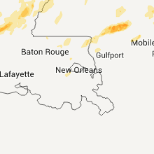
Hail Map for Tuesday, March 8, 2011

Number of Impacted Households on 3/8/2011
0
Impacted by 1" or Larger Hail
0
Impacted by 1.75" or Larger Hail
0
Impacted by 2.5" or Larger Hail
Square Miles of Populated Area Impacted on 3/8/2011
0
Impacted by 1" or Larger Hail
0
Impacted by 1.75" or Larger Hail
0
Impacted by 2.5" or Larger Hail


Cities Most Affected by Hail Storms of 3/8/2011
| Hail Size | Demographics of Zip Codes Affected | ||||||
|---|---|---|---|---|---|---|---|
| City | Count | Average | Largest | Pop Density | House Value | Income | Age |
| Dodd City, TX | 2 | 1.75 | 1.75 | 14 | $56k | $35.9k | 43.1 |
| Benton, AR | 1 | 1.75 | 1.75 | 336 | $87k | $41.4k | 34.9 |
| Montalba, TX | 1 | 1.75 | 1.75 | 12 | $50k | $34.7k | 47.0 |
| Paris, TX | 1 | 1.75 | 1.75 | 266 | $47k | $26.2k | 36.7 |
Hail and Wind Damage Spotted on 3/8/2011
Filter by Report Type:Hail ReportsWind Reports
Arkansas
| Local Time | Report Details |
|---|---|
| 7:40 PM UTC | Quarter sized hail reported near El Dorado, AR, 43.4 miles NW of Bastrop, LA, hail sizes varied from penny to quarter. |
| 11:48 PM UTC | Quarter sized hail reported near Lamar, AR, 61.1 miles E of Fort Smith, AR, hail lasted 3 minutes...mainly pea to marble size |
| 2:15 AM UTC | Quarter sized hail reported near Turrell, AR, 18.6 miles NW of Memphis, TN |
| 3:34 AM UTC | Quarter sized hail reported near Benton, AR, 21.3 miles SW of Little Rock, AR, severe storm in benton produced one inch hail |
| 3:36 AM UTC | Golf Ball sized hail reported near Benton, AR, 21.3 miles SW of Little Rock, AR, golf ball size hail in downtown benton |
Mississippi
| Local Time | Report Details |
|---|---|
| 8:19 PM UTC | Large limbs were reported dow in franklin county MS, 62.3 miles SSW of Jackson, MS |
| 11:56 PM UTC | Quarter sized hail reported near Lumberton, MS, 81.7 miles NNE of New Orleans, LA |
| 12:30 AM UTC | Tree down on lost john road. time estimated from radar in lamar county MS, 80.1 miles NNE of New Orleans, LA |
| 12:46 AM UTC | Quarter sized hail reported near Purvis, MS, 79.4 miles WNW of Mobile, AL |
| 12:55 AM UTC | Quarter sized hail reported near Hattiesburg, MS, 82.1 miles WNW of Mobile, AL |
| 1:14 AM UTC | Multiple trees down across carmel-new hope road and olivar wilson roa in lawrence county MS, 53.7 miles S of Jackson, MS |
| 1:25 AM UTC | Quarter sized hail reported near New Augusta, MS, 67.9 miles WNW of Mobile, AL, perry county sheriffs office in new au |
| 2:00 AM UTC | Quarter sized hail reported near Richton, MS, 58.9 miles NW of Mobile, AL, public reported quarter size hail 4 miles southwest of avera near the intersection of tung oil and neely-avera roads. |
| 2:36 AM UTC | Trees reported down by fox40 in jefferson davis county MS, 51.5 miles SSE of Jackson, MS |
| 6:25 AM UTC | Trees and power lines were downed along bridewell ln...causing power outages throughout the cit in claiborne county MS, 52.7 miles WSW of Jackson, MS |
| 6:27 AM UTC | Mobile home blown off its blocks on wolfe circle in copiah county MS, 23.7 miles SSW of Jackson, MS |
| 6:30 AM UTC | A few power lines down along hwy 552 in jefferson county MS, 61.7 miles WSW of Jackson, MS |
| 7:11 AM UTC | Trees and power lines down on ernie martin rd and hickstown rd. a mobile home had the roof blown off. possible tornad in hinds county MS, 25 miles WSW of Jackson, MS |
| 7:24 AM UTC | Trees down along old highway 51 near the copiah county lin in hinds county MS, 16.9 miles SSW of Jackson, MS |
| 7:27 AM UTC | Trees and power lines were downed along bridewell ln...causing power outages throughout the cit in claiborne county MS, 52.7 miles WSW of Jackson, MS |
| 7:30 AM UTC | Tree down on powerlines in copiah county MS, 23.7 miles SSW of Jackson, MS |
| 7:34 AM UTC | Trees and powerlines down along bluebird lane near terry roa in hinds county MS, 13.6 miles SSW of Jackson, MS |
| 7:34 AM UTC | Trees and power lines down along terry rd and wynndale rd. report of a roof off of a house and a carport caved in. possible tornad in hinds county MS, 13.6 miles SSW of Jackson, MS |
| 7:34 AM UTC | Trees and power lines down alont terry rd and wynndale rd. possible tornad in hinds county MS, 13.6 miles SSW of Jackson, MS |
| 7:34 AM UTC | Trees down along old port gibson road near mt. moriah roa in hinds county MS, 13.6 miles SSW of Jackson, MS |
| 8:08 AM UTC | Powerlines down at luckney road and mary miles drive. also some minor tree damage reported in are in rankin county MS, 10.6 miles E of Jackson, MS |
| 8:21 AM UTC | A few power lines down along hwy 552 in jefferson county MS, 61.7 miles WSW of Jackson, MS |
| 9:01 AM UTC | A few trees down along hwy 35n and 50 in smith county MS, 40.6 miles ESE of Jackson, MS |
| 9:15 AM UTC | Minor roof damage reported to one residence in jefferson davis county MS, 46.6 miles SSE of Jackson, MS |
| 11:25 AM UTC | Trees down goodyear blvd in picayune. possible tornado... surveys this mornin in pearl river county MS, 46.3 miles NNE of New Orleans, LA |
| 11:46 AM UTC | Tree limbs down throughout cit in perry county MS, 69.7 miles NW of Mobile, AL |
Texas
| Local Time | Report Details |
|---|---|
| 9:33 PM UTC | Quarter sized hail reported near Bonham, TX, 51.5 miles S of Atoka, OK |
| 9:36 PM UTC | Half Dollar sized hail reported near Bonham, TX, 51.5 miles S of Atoka, OK |
| 9:40 PM UTC | Golf Ball sized hail reported near Dodd City, TX, 52.8 miles S of Atoka, OK |
| 9:40 PM UTC | Baseball sized hail reported near , , 56 miles S of Atoka, OK |
| 10:00 PM UTC | Golf Ball sized hail reported near Dodd City, TX, 52.8 miles S of Atoka, OK |
| 10:20 PM UTC | Quarter sized hail reported near Paris, TX, 58.2 miles SSE of Atoka, OK, at fm 2820 and fm 79 |
| 10:30 PM UTC | Golf Ball sized hail reported near Paris, TX, 61.9 miles SE of Atoka, OK |
| 11:10 PM UTC | Quarter sized hail reported near Paris, TX, 69.1 miles SSE of Atoka, OK, pea to quarter size hail was reported in biardstown |
| 12:18 AM UTC | Quarter sized hail reported near Bogata, TX, 82.2 miles SE of Atoka, OK, marble to quarter sized hail reported from a gas station in bogata |
| 12:30 AM UTC | Quarter sized hail reported near Dike, TX, 82.6 miles SSE of Atoka, OK |
| 3:24 AM UTC | Golf Ball sized hail reported near Montalba, TX, 77 miles WNW of Lufkin, TX, report of golfball hail just ne of blackfoot. |
Louisiana
| Local Time | Report Details |
|---|---|
| 10:30 PM UTC | Large tree downed near st.tammany-tangipahoa parish line near highway 4 in st. tammany county LA, 49.5 miles N of New Orleans, LA |
| 1:14 AM UTC | Multiple trees down across carmel-new hope road and olivar wilson roa in east carroll county LA, 31.7 miles ESE of Bastrop, LA |
| 3:50 AM UTC | Large oak tree blown dow in rapides county LA, 78.3 miles N of Lafayette, LA |
| 4:27 AM UTC | Trees and powerlines downed. damage to an awning on one home. nws surveyed ef0 tornad in rapides county LA, 80 miles NNW of Lafayette, LA |
| 4:27 AM UTC | Trees and powerlines downed. public reports it was a possible tornad in rapides county LA, 80 miles NNW of Lafayette, LA |
| 4:59 AM UTC | Quarter sized hail reported near Jonesville, LA, 80 miles S of Bastrop, LA |
| 7:01 AM UTC | Storm damage reported in rapides county LA, 89.4 miles NNW of Lafayette, LA |
| 10:50 AM UTC | Numerous trees and power lines blown down or snapped. roof partially torn off of large residence...possible tornad in st. tammany county LA, 26.1 miles NNE of New Orleans, LA |
Alabama
| Local Time | Report Details |
|---|---|
| 1:18 AM UTC | Quarter sized hail reported near Citronelle, AL, 29.9 miles NNW of Mobile, AL, quarter size hail reported in citro |
| 5:15 AM UTC | Tree down along highway 10 east near abbevill in henry county AL, 72.8 miles S of Auburn, AL |
| 9:00 AM UTC | Numerous trees and power lines down in uniontow in perry county AL, 34 miles NNW of Camden, AL |
| 9:00 AM UTC | Scattered tree and powerline damage in and around uniontown. path length less than 1 mile with a width of approximately 3 miles. estimated winds 70 to 80 mp in perry county AL, 34 miles NNW of Camden, AL |
| 10:46 AM UTC | A few trees were blown down in extreme southeastern sumter count in sumter county AL, 48 miles WNW of Camden, AL |
| 10:55 AM UTC | Trees downed on county road 18 in choctaw county AL, 61.6 miles W of Camden, AL |
Tennessee
| Local Time | Report Details |
|---|---|
| 3:10 AM UTC | Trees and power lines down in manchester. measured wind gusts were around 40 mp in coffee county TN, 52.4 miles NW of Chattanooga, TN |
| 3:10 AM UTC | Trees were blown down onto power lines near the medical center. wind gusts were estimated from 40 to 50 mp in coffee county TN, 52.4 miles NW of Chattanooga, TN |
Georgia
| Local Time | Report Details |
|---|---|
| 5:15 AM UTC | Tree on house in fort gaines. reports of trees down throughout count in clay county GA, 71.5 miles SSE of Auburn, AL |
| 5:50 AM UTC | Trees down in ediso in calhoun county GA, 81.8 miles NNW of Tallahassee, FL |
Connect with Interactive Hail Maps