

Hail Map for Friday, May 18, 2012

Number of Impacted Households on 5/18/2012
0
Impacted by 1" or Larger Hail
0
Impacted by 1.75" or Larger Hail
0
Impacted by 2.5" or Larger Hail
Square Miles of Populated Area Impacted on 5/18/2012
0
Impacted by 1" or Larger Hail
0
Impacted by 1.75" or Larger Hail
0
Impacted by 2.5" or Larger Hail


Cities Most Affected by Hail Storms of 5/18/2012
| Hail Size | Demographics of Zip Codes Affected | ||||||
|---|---|---|---|---|---|---|---|
| City | Count | Average | Largest | Pop Density | House Value | Income | Age |
| Sauk Centre, MN | 1 | 1.75 | 1.75 | 37 | $87k | $38.8k | 41.6 |
| Spicer, MN | 1 | 1.75 | 1.75 | 103 | $137k | $45.6k | 47.1 |
Hail and Wind Damage Spotted on 5/18/2012
Filter by Report Type:Hail ReportsWind Reports
States Impacted
South Dakota, Utah, Florida, Virginia, Wyoming, Alabama, Nebraska, Minnesota, GeorgiaSouth Dakota
| Local Time | Report Details |
|---|---|
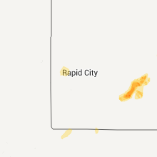
| 8:30 AM MDT | Roof off barn which downed power lines at residence in stanley county SD, 23.3 miles W of Pierre, SD |
| 3:00 PM MDT | Quarter sized hail reported near Nemo, SD, 19.3 miles WNW of Rapid City, SD, hail covered the ground |
| 3:00 PM MDT | Half Dollar sized hail reported near Nemo, SD, 17.4 miles WNW of Rapid City, SD |
| 3:10 PM MDT | Quarter sized hail reported near Nemo, SD, 19.3 miles WNW of Rapid City, SD, hail covered the ground |
| 6:02 PM MDT | Quarter sized hail reported near Kadoka, SD, 80.8 miles SW of Pierre, SD, power out at home |
| 6:02 PM MDT | Power out at home in jackson county SD, 80.8 miles SW of Pierre, SD |
| 6:22 PM MDT | Winds estimated at 80-90 mph in town with roofs blown off two buildings...power lines also dow in jackson county SD, 68.7 miles WSW of Pierre, SD |
| 6:22 PM MDT | Roof blown off hardware store in downtown...tree limbs down around town in jackson county SD, 68.7 miles WSW of Pierre, SD |
| 6:39 PM MDT | Trees uprooted...hail up to just smaller than quarters covered the ground in jackson county SD, 63.5 miles WSW of Pierre, SD |
| 7:05 PM MDT | Accompanied with pea size hail in jackson county SD, 55.5 miles WSW of Pierre, SD |
| 7:25 PM MDT | Storm damage reported in haakon county SD, 44.8 miles WSW of Pierre, SD |
| 8:30 PM MDT | Roof off barn which downed power lines at residence in stanley county SD, 23.3 miles W of Pierre, SD |
| 12:40 AM CDT | Large tree limbs down in yard in faulk county SD, 31.9 miles SW of Aberdeen, SD |
| 12:45 AM CDT | Estimated 50-60 mph winds at residence with pea-sized hail in faulk county SD, 32.1 miles SW of Aberdeen, SD |
| 1:15 AM CDT | Knocked horse fences down along property in edmunds county SD, 16.9 miles W of Aberdeen, SD |
Utah
| Local Time | Report Details |
|---|---|
| 9:30 AM MDT | Flight park south sensor in salt lake county UT, 20.7 miles S of Salt Lake City, UT |
Florida
| Local Time | Report Details |
|---|---|
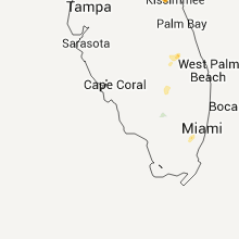
| 2:00 PM EDT | Large tree branches broken off near sw 8th street and sw 147th av in miami-dade county FL, 12.8 miles W of Miami, FL |
| 2:10 PM EDT | Trees downed near the intersection of nw 64th street and nw 114th avenu in miami-dade county FL, 11.3 miles NW of Miami, FL |
| 2:10 PM EDT | Tree downed near the intersection of sw 8th street and sw 139th av in miami-dade county FL, 11.6 miles W of Miami, FL |
| 2:14 PM EDT | Quarter sized hail reported near Pompano Beach, FL, 39.2 miles NNE of Miami, FL, spotter reported quarter sized hail to almost half dollar size,with 35-45 mph wind gusts. |
| 2:14 PM EDT | Half Dollar sized hail reported near Pompano Beach, FL, 39.2 miles NNE of Miami, FL, spotter reported quarter sized hail to almost half dollar size,with 35-45 mph wind gusts. |
| 2:15 PM EDT | Half Dollar sized hail reported near Miami, FL, 10.8 miles NW of Miami, FL, hail slightly larger than a quarter was reported near nw 41st and 107th ave at doral. |
| 2:15 PM EDT | Half Dollar sized hail reported near Miami, FL, 10 miles NW of Miami, FL, hail slightly larger than a quarter was reported near nw 41st and 107th ave in doral |
| 2:15 PM EDT | Public estimated wind gusts to 60 mph in dora in miami-dade county FL, 10.8 miles NW of Miami, FL |
| 2:15 PM EDT | A member of the public estimated wind speeds up to 70 mp in miami-dade county FL, 10.8 miles NW of Miami, FL |
| 2:15 PM EDT | A member of the public estimated wind speeds up to 70 mph near the intersection of nw 58th street and nw 107th ave. in doral in miami-dade county FL, 10.8 miles NW of Miami, FL |
| 2:15 PM EDT | Trees down and window screens blown out in balmoral estates and doral isles in doral. winds estimated 60 to 70 mp in miami-dade county FL, 10.8 miles NW of Miami, FL |
| 2:17 PM EDT | At least two trees snapped near the eugenia b. thomas schoo in miami-dade county FL, 11.3 miles NW of Miami, FL |
| 2:17 PM EDT | Quarter sized hail reported near Miami, FL, 10.8 miles NW of Miami, FL, quarter sized hail was reported near nw 41 and nw 58th streets in doral. |
| 2:17 PM EDT | Quarter sized hail reported near Miami, FL, 10.8 miles NW of Miami, FL, quarter sized hail was reported near nw 41 and nw 58th streets |
| 2:20 PM EDT | Quarter sized hail reported near Miami, FL, 8 miles NW of Miami, FL, quarter size hail reported near the intersection of palmetto expressway and doral blvd. |
| 2:20 PM EDT | An off duty nws employee reported a large tree down on northwest 58th st in doral between northwest 102 ave and northwest 107 av in miami-dade county FL, 10.8 miles NW of Miami, FL |
| 2:20 PM EDT | Large tree downed near 44th street and 113th terrace in dora in miami-dade county FL, 10.5 miles WNW of Miami, FL |
| 2:20 PM EDT | Large tree uprooted and lightpole downed near the intersection of nw 58th street and 95th av in miami-dade county FL, 9.9 miles NW of Miami, FL |
| 2:20 PM EDT | An off duty nws employee reported a large tree down on northwest 58th st in doral between northwest 102 ave and northwest 107 av in miami-dade county FL, 10.8 miles NW of Miami, FL |
| 4:35 PM EDT | A severe thunderstorm and possible tornado snapped several trees and downed at least 6 powerline poles near the intersection of old u.s. highway 27 and hookers point ro in hendry county FL, 50.7 miles SW of Port Saint Lucie, FL |
| 6:15 PM EDT | Quarter sized hail reported near Okeechobee, FL, 26.6 miles W of Port Saint Lucie, FL, dime to quarter size hail. |
| 7:43 PM EDT | Quarter sized hail reported near Haines City, FL, 33.3 miles SSW of Orlando, FL, quarter size hail reported near lake lowery. time estimated by radar. |
Virginia
| Local Time | Report Details |
|---|---|
| 2:35 PM EDT | Quarter sized hail reported near Big Stone Gap, VA, 36.1 miles WNW of Bristol, TN |
Wyoming
| Local Time | Report Details |
|---|---|
| 3:18 PM MDT | Storm damage reported in fremont county WY, 3.5 miles W of Riverton, WY |
| 3:20 PM MDT | Storm damage reported in fremont county WY, 2.2 miles WNW of Riverton, WY |
| 3:28 PM MDT | Estimated 70 mph and blowing debris around an outdoor event at a local retail store. pea-sized hail also reporte in fremont county WY, 1.1 miles N of Riverton, WY |
| 3:50 PM MDT | Storm damage reported in fremont county WY, 62.8 miles SE of Riverton, WY |
| 4:07 PM MDT | Storm damage reported in fremont county WY, 62.8 miles SE of Riverton, WY |
| 4:07 PM MDT | Storm damage reported in fremont county WY, 2.2 miles WNW of Riverton, WY |
Alabama
| Local Time | Report Details |
|---|---|
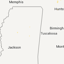
| 4:30 PM CDT | Three small pine trees uprooted or snapped and one small hardwood tree uprooted along mitchellville road. very small section of metal roofing peeled back at one residen in calhoun county AL, 43.8 miles ENE of Birmingham, AL |
Nebraska
| Local Time | Report Details |
|---|---|
| 3:30 PM MDT | Quarter sized hail reported near Whitney, NE, 74.2 miles N of Scottsbluff, NE |
| 7:28 PM MDT | Quarter sized hail reported near Arthur, NE, 59.4 miles WNW of North Platte, NE |
Minnesota
| Local Time | Report Details |
|---|---|
| 5:19 PM CDT | Mndot station us-169 mile post 200 in mille lacs county MN, 57.1 miles NNW of Minneapolis, MN |
| 5:30 PM CDT | One energy pole down and ten spruce trees...late repor in mille lacs county MN, 65.1 miles NNW of Minneapolis, MN |
| 5:35 PM CDT | Large tree down in drivewa in renville county MN, 55.9 miles ESE of Montevideo, MN |
| 5:35 PM CDT | Half dozen large 6 to 8 inch diameter branche in sibley county MN, 57.8 miles ESE of Montevideo, MN |
| 5:35 PM CDT | Large tree down in drivewa in sibley county MN, 57.8 miles ESE of Montevideo, MN |
| 7:10 PM CDT | Beltrami county deputy reports small trees down at residence near highway two and hubbard county road 45...near grace lak in hubbard county MN, 6.9 miles SE of Bemidji, MN |
| 7:20 PM CDT | 100 yd row of trees laid down from south to in beltrami county MN, 12.2 miles E of Bemidji, MN |
| 7:20 PM CDT | 100 yd row of trees laid down from south to in beltrami county MN, 7 miles E of Bemidji, MN |
| 7:40 PM CDT | Quarter sized hail reported near Storden, MN, 70.6 miles SSE of Montevideo, MN |
| 9:47 PM CDT | Golf Ball sized hail reported near Spicer, MN, 39 miles ENE of Montevideo, MN, hail with strong wind. power is out. |
| 10:50 PM CDT | Six to eight inch branches in tow in stearns county MN, 56.3 miles NE of Montevideo, MN |
| 10:55 PM CDT | Quarter sized hail reported near Wadena, MN, 68.7 miles S of Bemidji, MN, nickel to quarter size hail fell with gusty winds. garden damage reported. |
| 11:24 PM CDT | Golf Ball sized hail reported near Sauk Centre, MN, 62.9 miles NE of Montevideo, MN, hail and strong winds reported together |
| 11:35 PM CDT | Quarter sized hail reported near Sauk Centre, MN, 65.8 miles NE of Montevideo, MN |
| 11:36 PM CDT | Quarter sized hail reported near Sauk Centre, MN, 65.8 miles NE of Montevideo, MN |
| 11:42 PM CDT | Half Dollar sized hail reported near Sauk Centre, MN, 65.8 miles NE of Montevideo, MN, winds gust to near 40 mph. a couple inches of hail on the ground |
| 11:49 PM CDT | Large cottonwood trees blown down over road...late repor in stearns county MN, 52.6 miles NE of Montevideo, MN |
| 11:50 PM CDT | Quarter sized hail reported near Sauk Centre, MN, 69.7 miles NNE of Montevideo, MN, hail covering the ground |
Georgia
| Local Time | Report Details |
|---|---|
| 7:19 PM EDT | Quarter sized hail reported near Trenton, GA, 10.8 miles SW of Chattanooga, TN, public reported nickle to quarter sized hail covering slygo road in northern dade county. radar estimated time around 1919 edt. |
Connect with Interactive Hail Maps