

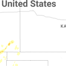
Hail Map for Monday, October 2, 2023

Number of Impacted Households on 10/2/2023
0
Impacted by 1" or Larger Hail
0
Impacted by 1.75" or Larger Hail
0
Impacted by 2.5" or Larger Hail
Square Miles of Populated Area Impacted on 10/2/2023
0
Impacted by 1" or Larger Hail
0
Impacted by 1.75" or Larger Hail
0
Impacted by 2.5" or Larger Hail


Cities Most Affected by Hail Storms of 10/2/2023
| Hail Size | Demographics of Zip Codes Affected | ||||||
|---|---|---|---|---|---|---|---|
| City | Count | Average | Largest | Pop Density | House Value | Income | Age |
| Carlsbad, NM | 4 | 1.94 | 2.50 | 16 | $65k | $32.8k | 38.4 |
| Pecos, TX | 1 | 2.75 | 2.75 | 8 | $26k | $24.7k | 34.8 |
Hail and Wind Damage Spotted on 10/2/2023
Filter by Report Type:Hail ReportsWind Reports
Colorado
| Local Time | Report Details |
|---|---|
| 6:31 AM MDT | Likely outflow from storms north of westcliff in custer county CO, 47.5 miles W of Pueblo, CO |
| 5:25 PM MDT | Mesonet station fw6605 founati in el paso county CO, 21.6 miles NNW of Pueblo, CO |
| 5:39 PM MDT | Asos station kcos colorado springs airpor in el paso county CO, 38.5 miles N of Pueblo, CO |
New Mexico
| Local Time | Report Details |
|---|---|
| 1:11 PM MDT | Golf Ball sized hail reported near Carlsbad, NM, 62.5 miles S of Roswell, NM, golfball size hail (some bigger possible) along state highway 137 near rocky arroyo crossing. wind driven hail broke windshields... and fences were blown down. time est |
| 1:36 PM MDT | Golf Ball sized hail reported near Carlsbad, NM, 60.9 miles S of Roswell, NM, golf ball sized hail along us285. time estimated from radar. |
| 1:37 PM MDT | Tennis Ball sized hail reported near Carlsbad, NM, 62 miles S of Roswell, NM, relayed report from nmdot employee... tennis ball size hail on us285. time estimated from radar. |
| 1:37 PM MDT | Quarter sized hail reported near Las Vegas, NM, 59.4 miles SSE of Taos, NM, lots of nickel to quarter sized hail that accumulated to about 3 inches deep in some areas. |
| 1:46 PM MDT | Quarter sized hail reported near Carlsbad, NM, 61.7 miles S of Roswell, NM, quarter sized hail and wind gusts over 60 mph along us285 northwest of carlsbad. |
| 1:50 PM MDT | Quarter sized hail reported near Las Vegas, NM, 57.8 miles SSE of Taos, NM, copious amounts of nickel to quarter sized hail required nmdot snow plows to be dispatched along interstate 25. |
| 3:41 PM MDT | Wind gusts at or above 60 mp in eddy county NM, 66.5 miles SSE of Roswell, NM |
| 4:30 PM MDT | Mesonet station fw9688 ja in lea county NM, 71.6 miles WNW of Odessa, TX |
| 4:41 PM MDT | Single wide trailer fully collapsed. no injuries reported. time estimated from rada in lea county NM, 74.8 miles ESE of Roswell, NM |
| 5:01 PM MDT | Asos station ktcc tucumcari muni airpor in quay county NM, 7.1 miles E of Tucumcari, NM |
| 5:39 PM MDT | Golf ball sized hail observed in walnut canyon in carlsbad caverns national par in eddy county NM, 83.8 miles S of Roswell, NM |
| 5:39 PM MDT | Golf Ball sized hail reported near Carlsbad, NM, 83.8 miles S of Roswell, NM, corrects previous report. golf ball sized hail observed in walnut canyon in carlsbad caverns national park. |
| 6:00 PM MDT | Measured 59 mph wind gust due to strong thunderstorm southeast of white sand in dona ana county NM, 40.3 miles N of El Paso, TX |
| 6:00 PM MDT | Measured 61 mph wind gust due to strong thunderstorm just southeast of white sand in dona ana county NM, 42.8 miles N of El Paso, TX |
| 6:10 PM MDT | Measured 60 mph wind gust northeast of white sand in otero county NM, 47.7 miles N of El Paso, TX |
Texas
| Local Time | Report Details |
|---|---|
| 4:20 PM CDT | Baseball sized hail reported near Pecos, TX, 72.9 miles WSW of Odessa, TX |
| 7:36 PM CDT | Mesonet station fw9691 mentone. time estimated by rada in loving county TX, 76.6 miles W of Odessa, TX |
| 8:08 PM CDT | Severe gusts began at 803 pm and ended at 808 p in cochran county TX, 45.7 miles WSW of Lubbock, TX |
| 12:40 AM CDT | Quarter sized hail reported near Odessa, TX, 7.4 miles W of Odessa, TX, located at university blvd and moss ave. |
| 9:00 AM UTC | Mesonet station fluvanna 3 in borden county TX, 61 miles SE of Lubbock, TX |
Nebraska
| Local Time | Report Details |
|---|---|
| 5:22 PM MDT | Many tree branches downed due to estimated wind gusts 60-80 mp in morrill county NE, 42.3 miles ESE of Scottsbluff, NE |
| 6:25 PM MDT | Quarter sized hail reported near Hay Springs, NE, 70.7 miles NE of Scottsbluff, NE |
| 6:33 PM MDT | Storm damage reported in sheridan county NE, 85 miles NNE of Scottsbluff, NE |
| 6:33 PM MDT | Quarter sized hail reported near Chadron, NE, 85.1 miles SSE of Rapid City, SD |
South Dakota
| Local Time | Report Details |
|---|---|
| 6:57 PM MDT | Quarter sized hail reported near Hot Springs, SD, 43.4 miles SSW of Rapid City, SD, time estimated from radar. |
| 7:32 PM MDT | Quarter sized hail reported near Rapid City, SD, 2 miles E of Rapid City, SD |
| 7:32 PM MDT | Quarter sized hail reported near Rapid City, SD, 3.2 miles NE of Rapid City, SD |
| 7:53 PM MDT | Half Dollar sized hail reported near Box Elder, SD, 14 miles NE of Rapid City, SD |
| 7:56 PM MDT | Ping Pong Ball sized hail reported near Box Elder, SD, 14 miles NE of Rapid City, SD |
| 8:21 PM MDT | Quarter sized hail reported near Rapid City, SD, 9 miles ESE of Rapid City, SD, mping report |
Kansas
| Local Time | Report Details |
|---|---|
| 11:08 PM CDT | Mesonet station cw8810 elkhar in morton county KS, 88 miles SW of Garden City, KS |
Connect with Interactive Hail Maps