

Hail Map for Tuesday, August 13, 2019

Number of Impacted Households on 8/13/2019
0
Impacted by 1" or Larger Hail
0
Impacted by 1.75" or Larger Hail
0
Impacted by 2.5" or Larger Hail
Square Miles of Populated Area Impacted on 8/13/2019
0
Impacted by 1" or Larger Hail
0
Impacted by 1.75" or Larger Hail
0
Impacted by 2.5" or Larger Hail


Cities Most Affected by Hail Storms of 8/13/2019
| Hail Size | Demographics of Zip Codes Affected | ||||||
|---|---|---|---|---|---|---|---|
| City | Count | Average | Largest | Pop Density | House Value | Income | Age |
| Bethune, CO | 2 | 3.50 | 5.00 | 1 | $54k | $30.5k | 38.2 |
| Madrid, NE | 3 | 1.75 | 1.75 | 2 | $38k | $35.2k | 35.9 |
| Trenton, NE | 2 | 2.25 | 2.50 | 1 | $38k | $26.8k | 49.1 |
| Big Springs, NE | 2 | 2.13 | 2.50 | 2 | $47k | $29.3k | 49.5 |
| Lewellen, NE | 2 | 2.13 | 2.50 | 1 | $61k | $26.3k | 56.7 |
| Oberlin, KS | 2 | 2.00 | 2.00 | 5 | $49k | $31.7k | 50.5 |
| Burlington, CO | 1 | 2.75 | 2.75 | 6 | $85k | $34.7k | 38.4 |
| Ellendale, MN | 1 | 1.90 | 1.90 | 16 | $84k | $43.0k | 41.8 |
| Oshkosh, NE | 1 | 1.75 | 1.75 | 1 | $44k | $27.8k | 49.3 |
| Wauneta, NE | 1 | 1.75 | 1.75 | 1 | $40k | $30.1k | 50.2 |
| Madison Lake, MN | 1 | 1.75 | 1.75 | 59 | $138k | $52.6k | 43.4 |
| Syracuse, KS | 1 | 1.75 | 1.75 | 0 | $62k | $31.6k | 32.3 |
| Erie, CO | 1 | 1.75 | 1.75 | 513 | $250k | $74.9k | 36.7 |
| Ellsworth, NE | 1 | 1.75 | 1.75 | 1 | $13k | $31.3k | 43.3 |
| Gove, KS | 1 | 1.75 | 1.75 | 0 | $15k | $32.2k | 50.5 |
| Ashby, NE | 1 | 1.75 | 1.75 | 0 | $29k | $47.2k | 46.2 |
Hail and Wind Damage Spotted on 8/13/2019
Filter by Report Type:Hail ReportsWind Reports
States Impacted
Nebraska, Tennessee, Virginia, North Carolina, Colorado, South Carolina, Maine, Minnesota, Kentucky, Texas, Kansas, Illinois, Georgia, Mississippi, Alabama, WisconsinNebraska
| Local Time | Report Details |
|---|---|
| 6:42 AM MDT | Golf Ball sized hail reported near Ellsworth, NE, 83 miles ENE of Scottsbluff, NE, report shared with photo via facebook |
| 7:22 AM MDT | Golf Ball sized hail reported near Ashby, NE, 79.8 miles WSW of Valentine, NE, pea to golf ball size hail reported. ground covered by hail. |
| 7:32 AM MDT | Half Dollar sized hail reported near Hyannis, NE, 79.4 miles SW of Valentine, NE, half dollar size hail reported. |
| 11:31 AM MDT | Golf Ball sized hail reported near Oshkosh, NE, 79 miles ESE of Scottsbluff, NE, golf ball hail and .62 rain |
| 11:40 AM MDT | Quarter sized hail reported near Lewellen, NE, 77.1 miles WNW of North Platte, NE, 1.30 estimated rain... quarter size hail... 40-50mph winds with small branches down. |
| 11:40 AM MDT | Quarter sized hail reported near Grant, NE, 48.4 miles WSW of North Platte, NE, quarter size |
| 11:49 AM MDT | Quarter sized hail reported near Lewellen, NE, 77.1 miles WNW of North Platte, NE, 1.30 estimated rain... quarter size hail... 40-50mph winds with small branches down. |
| 11:55 AM MDT | Quarter sized hail reported near Lewellen, NE, 73 miles W of North Platte, NE |
| 12:17 PM MDT | Golf Ball sized hail reported near Lewellen, NE, 69 miles W of North Platte, NE |
| 12:20 PM MDT | Tennis Ball sized hail reported near Lewellen, NE, 68 miles W of North Platte, NE, hail measured tennis ball size 30 minutes after falling. vehicle damage and small tree branches downed. |
| 12:45 PM MDT | Golf Ball sized hail reported near Big Springs, NE, 68.4 miles W of North Platte, NE, some golf ball sized hail mixed with smaller sizes |
| 12:45 PM MDT | Quarter sized hail reported near Lewellen, NE, 61.2 miles W of North Platte, NE, quarter size hail |
| 12:47 PM MDT | Half Dollar sized hail reported near Brule, NE, 58.9 miles W of North Platte, NE |
| 12:55 PM MDT | Tennis Ball sized hail reported near Big Springs, NE, 71.6 miles W of North Platte, NE, from radio station |
| 1:27 PM MDT | Quarter sized hail reported near Grant, NE, 48.4 miles WSW of North Platte, NE, quarter size |
| 1:27 PM MDT | Estimated between 70 and 80 mph in perkins county NE, 48.4 miles WSW of North Platte, NE |
| 1:30 PM MDT | Quarter sized hail reported near Grant, NE, 48.4 miles WSW of North Platte, NE, quarter size |
| 1:30 PM MDT | Estimated between 70 and 80 mph in perkins county NE, 48.4 miles WSW of North Platte, NE |
| 1:30 PM MDT | Pws in perkins county NE, 49.3 miles WSW of North Platte, NE |
| 1:51 PM MDT | Golf Ball sized hail reported near Madrid, NE, 45 miles WSW of North Platte, NE, golf ball hail... torrential rain... very strong winds |
| 1:57 PM MDT | Golf Ball sized hail reported near Madrid, NE, 47.5 miles WSW of North Platte, NE, nickel to golf ball size hail |
| 2:04 PM MDT | Estimated 70-80 mph winds in perkins county NE, 46.4 miles SW of North Platte, NE |
| 2:04 PM MDT | Golf Ball sized hail reported near Madrid, NE, 46.4 miles SW of North Platte, NE, a few windows broken... trees stripped of leaves. |
| 2:23 PM MDT | Storm damage reported in chase county NE, 62.6 miles SW of North Platte, NE |
| 2:30 PM MDT | Storm damage reported in chase county NE, 62.6 miles SW of North Platte, NE |
| 2:35 PM MDT | Quarter sized hail reported near Champion, NE, 46.9 miles ENE of Yuma, CO |
| 2:38 PM MDT | Quarter sized hail reported near Wauneta, NE, 55.9 miles SW of North Platte, NE |
| 2:40 PM MDT | Quarter sized hail reported near Champion, NE, 45.1 miles ENE of Yuma, CO, nickle to quarter size hail |
| 3:51 PM CDT | Golf Ball sized hail reported near Wauneta, NE, 53.9 miles SSW of North Platte, NE, hail was covering the ground... largest was about the size of golf ball |
| 3:55 PM CDT | Ping Pong Ball sized hail reported near Trenton, NE, 54 miles N of Colby, KS, delayed report... picture received via facebook. |
| 3:59 PM CDT | Hen Egg sized hail reported near Trenton, NE, 53.4 miles N of Colby, KS |
| 4:00 PM CDT | Tennis Ball sized hail reported near Trenton, NE, 53.4 miles N of Colby, KS |
| 4:12 PM CDT | Quarter sized hail reported near Culbertson, NE, 58.5 miles N of Colby, KS, delayed report... public reported via facebook comment. |
| 4:17 PM CDT | Half Dollar sized hail reported near Trenton, NE, 55.6 miles N of Colby, KS |
Tennessee
| Local Time | Report Details |
|---|---|
| 12:20 PM EDT | A couple of trees were downe in knox county TN, 16.9 miles WSW of Knoxville, TN |
| 3:10 PM CDT | Twitter report of a tree down on charlotte pike before nashville wes in davidson county TN, 6 miles WSW of Nashville, TN |
| 3:12 PM CDT | Facebook report of tree branches and debris on river rd leaving nashvill in davidson county TN, 12 miles W of Nashville, TN |
| 3:16 PM CDT | Tree down blocking caldwell lane between caldwell ct and general bate dr in davidson county TN, 4 miles S of Nashville, TN |
| 3:19 PM CDT | Tspotter report of tree damage in crieve hal in davidson county TN, 7.4 miles S of Nashville, TN |
| 3:24 PM CDT | Twitter report of a tree down on charlotte pike before nashville wes in davidson county TN, 6 miles WSW of Nashville, TN |
| 3:27 PM CDT | Tspotter report of a tree down across hill road in front of granbery elementar in davidson county TN, 5.4 miles S of Nashville, TN |
| 3:27 PM CDT | Large tree snapped near hwy 70 at hwy 109 in wilson county TN, 19.9 miles ENE of Nashville, TN |
| 3:36 PM CDT | An under construction airport hangar at the lebanon airport collapsed due to high thunderstorm winds in wilson county TN, 25.7 miles E of Nashville, TN |
| 3:38 PM CDT | Tree across roadway in coles ferry pike/cario bend road area as well as around the 1485 block of old hunters point pik in wilson county TN, 28.7 miles ENE of Nashville, TN |
| 3:41 PM CDT | Facebook report of trees down in cedar glen community of la vergn in rutherford county TN, 15.9 miles SE of Nashville, TN |
| 3:44 PM CDT | Tspotter report of pea sized hail and tree damage in smyrn in rutherford county TN, 19.4 miles SE of Nashville, TN |
| 3:44 PM CDT | Outdoor garage building picked up and tossed to a neighbors yard in la vergn in rutherford county TN, 16.4 miles SE of Nashville, TN |
| 3:45 PM CDT | Numerous trees down along vesta road in wilson county TN, 23 miles ESE of Nashville, TN |
| 3:53 PM CDT | Numerous trees and power lines down across the lake forest subdivision in lavergne with some falling on cars and homes in rutherford county TN, 15.5 miles SE of Nashville, TN |
| 3:53 PM CDT | Trees down on sulphur springs road in rutherford county TN, 25 miles SE of Nashville, TN |
| 3:55 PM CDT | Facebook photos showed extensive siding blown off a home at 269 hollandale road in rutherford county TN, 16.4 miles SE of Nashville, TN |
| 4:02 PM CDT | Several trees down around the blair road and rock springs road area in rutherford county TN, 18.1 miles SE of Nashville, TN |
| 4:11 PM CDT | Tree down near stewart's creek school. rocky fork r in rutherford county TN, 20.5 miles SE of Nashville, TN |
| 4:14 PM CDT | Tree down blocking belle meade blvd near bonaventure place in davidson county TN, 5.2 miles SW of Nashville, TN |
| 4:15 PM CDT | Report of a large tree down on linwood drive near natchez trace blocking one lan in davidson county TN, 5.6 miles SW of Nashville, TN |
| 4:15 PM CDT | Facebook report of trees down in grant community in gordonsvill in smith county TN, 47.4 miles E of Nashville, TN |
| 4:27 PM CDT | Quarter sized hail reported near College Grove, TN, 26.6 miles SSE of Nashville, TN, quarter sized hail report on facebook with picture. in college grove area. |
| 4:27 PM CDT | Large tree limbs down on bievins hill road near goochie ford road in rutherford county TN, 40 miles SE of Nashville, TN |
| 5:24 PM CDT | Quarter sized hail reported near Summertown, TN, 49.2 miles NNE of Florence, AL, em report of quarter size hail slightly west of lawrence/maury co. line along tn-20 in summertown. report of car windshield damage associated with hail. |
| 5:44 PM CDT | Tspotter report of a tree down on rhea branch rd. in campbellsvill in giles county TN, 46 miles NE of Florence, AL |
| 5:46 PM CDT | Report of roof blown off of trailer on old nashville dirt roa in bedford county TN, 43 miles SSE of Nashville, TN |
| 5:52 PM CDT | Measured wind gust from shelbyville asos of 51 kts at 5:52 p in bedford county TN, 50.2 miles SSE of Nashville, TN |
| 5:52 PM CDT | Measured wind gust from shelbyville asos of 51 kts / 59 mph at 5:52 p in bedford county TN, 46 miles SSE of Nashville, TN |
| 5:59 PM CDT | Quarter sized hail reported near Ethridge, TN, 45.6 miles NE of Florence, AL, up to quarter size hail reported near campbellsville |
| 5:59 PM CDT | Tspotter report of a tree down on rhea branch rd. in campbellsvill in giles county TN, 46 miles NE of Florence, AL |
| 6:12 PM CDT | Tree and power lines down on cascade hollow road near schmeide machinery in coffee county TN, 58.3 miles SSE of Nashville, TN |
| 6:22 PM CDT | Trees reported down over camp roa in bedford county TN, 49 miles S of Nashville, TN |
| 6:22 PM CDT | Raws station mert1 meriwether lewis measured a wind gust of 63 mp in lewis county TN, 49.7 miles NNE of Florence, AL |
| 6:44 PM CDT | Tspotter report of a tree down on rhea branch rd. in campbellsvill in giles county TN, 46 miles NE of Florence, AL |
| 6:55 PM CDT | Tree down on hwy 55 near motlow state community college. time estimated from rada in moore county TN, 60.1 miles WNW of Chattanooga, TN |
| 8:15 PM EDT | A few trees reported down near tellico plain in monroe county TN, 45.7 miles SSW of Knoxville, TN |
| 7:15 PM CDT | Tree and power lines down on highway 13 south near the water plant. time estimate in perry county TN, 52.5 miles SE of Mc Kenzie, TN |
| 7:45 PM CDT | Wind gust measured at memphis international airpor in shelby county TN, 8.5 miles SSE of Memphis, TN |
| 7:50 PM CDT | Winds strong enough to move two (likely empty) railcars in an uphill direction at the cn railyard in southwest memphi in shelby county TN, 4.1 miles S of Memphis, TN |
| 8:35 PM CDT | Tree down on highway 13 south near dales market in wayne county TN, 31.4 miles N of Florence, AL |
Virginia
| Local Time | Report Details |
|---|---|
| 1:13 PM EDT | Tree limbs and debris blocking the road near the intersection of cedar springs road and rural retreat road. time estimated from rada in wythe county VA, 55.4 miles ENE of Bristol, TN |
| 1:13 PM EDT | Tree down in front of home on ridge ave... south of rural retreat. timing estimated by rada in wythe county VA, 57.2 miles ENE of Bristol, TN |
| 1:44 PM EDT | Tree down on rakestown rd. timing estimated by rada in wythe county VA, 64 miles WSW of Roanoke, VA |
| 1:47 PM EDT | Tree down at intersection of fincastle ad austinville rd. timing estimated by rada in wythe county VA, 61.6 miles WSW of Roanoke, VA |
| 1:57 PM EDT | Measured by spotte in carroll county VA, 61.2 miles WSW of Roanoke, VA |
| 2:10 PM EDT | Tree down on blue ridge yacht club rd. time estimated by rada in henry county VA, 35.1 miles S of Roanoke, VA |
| 2:24 PM EDT | Tree down near 380 washburn dr. time estimated from rada in henry county VA, 32.9 miles S of Roanoke, VA |
| 2:32 PM EDT | Tree down reported by bus driver from blueridge elementary. timing estimated by rada in patrick county VA, 55.2 miles SW of Roanoke, VA |
| 2:42 PM EDT | Large tree down which is blocking part of dyers store road. time estimated by rada in henry county VA, 36.8 miles SSE of Roanoke, VA |
| 2:48 PM EDT | Tree dow in pittsylvania county VA, 38.9 miles SE of Roanoke, VA |
| 2:48 PM EDT | Tree down off of state rt. 40... just east of gretna. timing estimated by rada in pittsylvania county VA, 39.8 miles SE of Roanoke, VA |
| 2:50 PM EDT | Tree down on power line in pittsylvania county VA, 40.3 miles SE of Roanoke, VA |
| 2:51 PM EDT | Tree dow in pittsylvania county VA, 39.4 miles SE of Roanoke, VA |
| 2:56 PM EDT | Tree down on vehicl in pittsylvania county VA, 40.4 miles ESE of Roanoke, VA |
| 3:04 PM EDT | Powerlines downed on ridgecrest rd. time estimated by rada in pittsylvania county VA, 50.8 miles SE of Roanoke, VA |
| 3:08 PM EDT | Tree down on power lines which sparked a fire. time estimated from rada in pittsylvania county VA, 48.4 miles SE of Roanoke, VA |
| 3:16 PM EDT | Tree down near moorefield store rd. that fell on power-line. timing estimated by rada in patrick county VA, 51.5 miles SSW of Roanoke, VA |
| 3:21 PM EDT | A couple of trees down... one on dyers store road and another at ravenscroft road and serenity driv in henry county VA, 36.1 miles SSE of Roanoke, VA |
| 3:24 PM EDT | Another tree down near the intersection of serenity drive and barrows mill road. tree down across a power line and the roa in henry county VA, 35.2 miles S of Roanoke, VA |
| 3:35 PM EDT | Multiple trees down at the intersection of 360 and 119. timing estimated by rada in halifax county VA, 61.4 miles NNW of Raleigh, NC |
| 3:45 PM EDT | Large tree down on pointer road in southwest halifax county... one mile west of its intersection with foster road. tree was blocking the roa in halifax county VA, 60.1 miles NNW of Raleigh, NC |
| 3:47 PM EDT | Tree down near intersection of highway 119 and route 58. time estimated from rada in halifax county VA, 61.4 miles NNW of Raleigh, NC |
| 4:52 PM EDT | Trees down along jamestown roa in james city county VA, 51.2 miles NW of Virginia Beach, VA |
| 6:57 PM EDT | Tree down near the intersection of seminole trail and boulders roa in albemarle county VA, 61.8 miles NW of Richmond, VA |
| 7:02 PM EDT | 1 foot diameter branch snapped off a sugar maple at brodus wood elementary schoo in albemarle county VA, 64.5 miles NW of Richmond, VA |
| 7:50 PM EDT | Trees down at small country campgroun in louisa county VA, 43 miles NW of Richmond, VA |
| 7:58 PM EDT | Several trees dow in louisa county VA, 39.6 miles NW of Richmond, VA |
| 8:05 PM EDT | Several trees dow in louisa county VA, 36 miles NW of Richmond, VA |
| 8:30 PM EDT | Tree down along forest grove r in goochland county VA, 29.5 miles NW of Richmond, VA |
| 8:58 PM EDT | Tree down on wires off of kent driv in city of manassas p county VA, 58.2 miles SW of Baltimore, MD |
| 9:06 PM EDT | Tree down on a car in the 6200 block of multiplex driv in fairfax county VA, 54.8 miles SW of Baltimore, MD |
| 9:34 PM EDT | Trees down at old ridge roa in hanover county VA, 23.8 miles NNE of Richmond, VA |
North Carolina
| Local Time | Report Details |
|---|---|
| 2:20 PM EDT | Public reported line down on bald mountain r in yancey county NC, 45.7 miles SSW of Bristol, TN |
| 2:21 PM EDT | Tree down at intersection of 88 and baker hollow rd. timing estimated by rada in ashe county NC, 34.8 miles ESE of Bristol, TN |
| 3:19 PM EDT | Tree down along lynchburg rd. timing estimated by rada in stokes county NC, 60.9 miles SSW of Roanoke, VA |
| 3:20 PM EDT | Multiple trees reported down in ronda... nc. person reporting also said there was hail. timing estimated by rada in wilkes county NC, 69 miles N of Charlotte, NC |
| 3:24 PM EDT | Numerous trees down along hw 89 between danbury and francisco. timing estimated by rada in stokes county NC, 59.7 miles SSW of Roanoke, VA |
| 3:26 PM EDT | Power lines reported down on flinchum rd. timing estimated by rada in stokes county NC, 60.5 miles SSW of Roanoke, VA |
| 3:29 PM EDT | Trained spotter reported trees down on valley view st in burke county NC, 61.5 miles NW of Charlotte, NC |
| 3:29 PM EDT | Quarter sized hail reported near Morganton, NC, 61.5 miles NW of Charlotte, NC, trained spotter reported quarter (1.00') size hail on valley view st |
| 3:30 PM EDT | Large tree fell on a mobile home. the home was completely destroye in stokes county NC, 65.3 miles S of Roanoke, VA |
| 3:30 PM EDT | Extensive tree damage along a one mile long path in the francis cove/westfield area going toward danbury. one home on frye road sustained severe damage from a large dow in stokes county NC, 59.8 miles SSW of Roanoke, VA |
| 3:42 PM EDT | Downed trees and limbs resulting in power outages in norlin in warren county NC, 52.1 miles NNE of Raleigh, NC |
| 3:50 PM EDT | Trained spotter reported building damage on nc-127 in alexander county NC, 49.1 miles NNW of Charlotte, NC |
| 3:57 PM EDT | 911 call center reported tree down on snow creek rd ne blocking roa in catawba county NC, 46.4 miles NNW of Charlotte, NC |
| 3:59 PM EDT | Tree down on newton pleasant loop rd off hesters store r in person county NC, 46.1 miles NW of Raleigh, NC |
| 4:00 PM EDT | Tree down on thee hester rd off highway 15 in person county NC, 47.5 miles NNW of Raleigh, NC |
| 4:01 PM EDT | Power lines dow in forsyth county NC, 64.3 miles NNE of Charlotte, NC |
| 4:02 PM EDT | Tree down at intersection of berrymore rd. and cedar lane. timing estimated by rada in rockingham county NC, 60.8 miles SSE of Roanoke, VA |
| 4:06 PM EDT | 911 reports trees and lines down along lee cline... laurel springs drive and county home r in catawba county NC, 42.3 miles NNW of Charlotte, NC |
| 4:09 PM EDT | Tree down on nc 700 and quesineberry rd. timing estimated by rada in rockingham county NC, 55.8 miles SSE of Roanoke, VA |
| 4:09 PM EDT | Tree down on us29 and oregan hill rd. timing estimated by rada in rockingham county NC, 62.5 miles SSE of Roanoke, VA |
| 4:10 PM EDT | Three trees down near the intersection of helena-moriah rd and malone r in person county NC, 38.6 miles NNW of Raleigh, NC |
| 4:11 PM EDT | Tree blown down across roa in forsyth county NC, 67.7 miles NNE of Charlotte, NC |
| 4:12 PM EDT | Tree down at dink ashley rd and river oaks pkw in person county NC, 40 miles NNW of Raleigh, NC |
| 4:15 PM EDT | Amateur radio reported two trees down and blocking traffic near intersection of highway 127 n and telephone exchange rd in alexander county NC, 49.6 miles NNW of Charlotte, NC |
| 4:20 PM EDT | 911 call center reported lines down and power outages in parts of mocksvill in davie county NC, 49.3 miles NNE of Charlotte, NC |
| 4:30 PM EDT | Power lines down in roadwa in alexander county NC, 48.2 miles NNW of Charlotte, NC |
| 4:32 PM EDT | Trees across hwy 903... partially blocking the roa in halifax county NC, 66 miles NE of Raleigh, NC |
| 4:44 PM EDT | Public reported a wind gust of 63 mph in catawba county NC, 27.7 miles NNW of Charlotte, NC |
| 4:46 PM EDT | Thunderstorm winds downed several trees within the community of trinity... including a tree on a home. unknown amount of damage at this time. time via radar estimat in randolph county NC, 66.3 miles NE of Charlotte, NC |
| 4:49 PM EDT | 911 call center reported trees down along highway 150 in iredell county NC, 26.4 miles N of Charlotte, NC |
| 4:55 PM EDT | 911 call center reported trees down on lakeshore school and perth rd in iredell county NC, 26.9 miles N of Charlotte, NC |
| 5:01 PM EDT | Several trees reported across roadways and on power lines in and near franklinto in franklin county NC, 24.8 miles NNE of Raleigh, NC |
| 5:38 PM EDT | Nash county 911 reports numerous trees and power lines down across central nash count in nash county NC, 40.4 miles ENE of Raleigh, NC |
| 5:55 PM EDT | 911 call center reported fairly widespread downed trees... power outages... and cloud to ground lightning strikes across eastern lincoln count in lincoln county NC, 18.2 miles NNW of Charlotte, NC |
| 6:32 PM EDT | Power lines down on guy rd in clayto in johnston county NC, 11.4 miles SE of Raleigh, NC |
| 8:26 PM EDT | Trees reported down on wolf creek rd. near stuart mountain r in fannin county GA, 56.8 miles E of Chattanooga, TN |
| 8:26 PM EDT | Tree reported down on henderson ln near rooks r in fannin county GA, 57.4 miles E of Chattanooga, TN |
Colorado
| Local Time | Report Details |
|---|---|
| 1:23 PM MDT | Quarter sized hail reported near Yuma, CO, 7.2 miles SSE of Yuma, CO, spotter reported dime to quarter sized hail. |
| 1:31 PM MDT | Quarter sized hail reported near Yuma, CO, 3 miles SE of Yuma, CO |
| 3:00 PM MDT | Quarter sized hail reported near Stratton, CO, 56.8 miles S of Yuma, CO |
| 3:05 PM MDT | Quarter sized hail reported near Stratton, CO, 56.8 miles S of Yuma, CO, public reported 1 inch hail in stratton... co. |
| 3:08 PM MDT | Quarter sized hail reported near Stratton, CO, 56.7 miles S of Yuma, CO |
| 3:12 PM MDT | Hen Egg sized hail reported near Bethune, CO, 48.9 miles SSE of Yuma, CO |
| 3:35 PM MDT | Softball sized hail reported near Bethune, CO, 58.7 miles SSE of Yuma, CO, delayed report... broadcast media relayed a picture on twitter from bethune earlier this afternoon appearing to depict a hail stone at or above 5 inches in diameter. ne |
| 3:58 PM MDT | Baseball sized hail reported near Burlington, CO, 64.6 miles SSE of Yuma, CO |
| 10:00 PM MDT | Quarter sized hail reported near Windsor, CO, 51.2 miles N of Denver, CO |
| 10:23 PM MDT | Half Dollar sized hail reported near Mead, CO, 34.5 miles N of Denver, CO |
| 10:44 PM MDT | Quarter sized hail reported near Longmont, CO, 26.3 miles N of Denver, CO |
| 10:45 PM MDT | Quarter sized hail reported near Frederick, CO, 24.4 miles N of Denver, CO |
| 10:46 PM MDT | Half Dollar sized hail reported near Frederick, CO, 24.4 miles N of Denver, CO, reported at 6148 gorham st 80530. |
| 10:46 PM MDT | Golf Ball sized hail reported near Erie, CO, 24.2 miles N of Denver, CO, time estimated from radar. |
| 10:56 PM MDT | Quarter sized hail reported near Frederick, CO, 24.3 miles N of Denver, CO |
| 11:10 PM MDT | Half Dollar sized hail reported near Fort Lupton, CO, 24 miles NNE of Denver, CO |
South Carolina
| Local Time | Report Details |
|---|---|
| 3:25 PM EDT | Trained spotter reported downed trees and power line in spartanburg county SC, 31.2 miles NE of Greenville, SC |
| 4:35 PM EDT | Schp reported a tree down at highway 97 near york co line in chester county SC, 38.8 miles SW of Charlotte, NC |
| 4:40 PM EDT | Co-op observer reported large tree down along highway 9 in york county SC, 39.2 miles SW of Charlotte, NC |
| 12:49 AM EDT | Report of a tree down on knighton chapel rd. time estimated by rada in laurens county SC, 32.2 miles ESE of Greenville, SC |
Maine
| Local Time | Report Details |
|---|---|
| 3:50 PM EDT | Trees on wire in york county ME, 39.4 miles SW of Portland, ME |
Minnesota
| Local Time | Report Details |
|---|---|
| 3:28 PM CDT | Golf Ball sized hail reported near Madison Lake, MN, 60.1 miles SSW of Minneapolis, MN, relayed report from spotter. |
| 3:44 PM CDT | Quarter sized hail reported near Elysian, MN, 57.4 miles SSW of Minneapolis, MN, relayed by law enforcement. |
| 3:46 PM CDT | Quarter sized hail reported near Elysian, MN, 57.4 miles SSW of Minneapolis, MN |
| 4:15 PM CDT | Half Dollar sized hail reported near Waseca, MN, 63.2 miles S of Minneapolis, MN |
| 4:26 PM CDT | Golf Ball sized hail reported near Ellendale, MN, 58.2 miles N of Mason City, IA, public report relayed by tv meteorologist via twitter. photo provided. |
| 5:05 PM CDT | Quarter sized hail reported near Cottage Grove, MN, 19.4 miles SE of Minneapolis, MN, reported via tweet. no photo. |
| 5:05 PM CDT | Quarter sized hail reported near Blooming Prairie, MN, 47.4 miles N of Mason City, IA |
| 5:25 PM CDT | Ping Pong Ball sized hail reported near Cannon Falls, MN, 37.1 miles SE of Minneapolis, MN, photographed hail size. hail lasted 15 minutes... ending at 540 pm. |
| 5:41 PM CDT | Half Dollar sized hail reported near Hampton, MN, 32.7 miles SSE of Minneapolis, MN, reported via tweet with photo. |
| 5:50 PM CDT | Half Dollar sized hail reported near Rose Creek, MN, 35.3 miles NNE of Mason City, IA |
Kentucky
| Local Time | Report Details |
|---|---|
| 3:46 PM CDT | Quarter sized hail reported near Gamaliel, KY, 64.2 miles ENE of Nashville, TN, the public reported hail the size of quarters at gamaliel shooting supply. |
Texas
| Local Time | Report Details |
|---|---|
| 4:23 PM CDT | Storm damage reported in grayson county TX, 58 miles SSW of Atoka, OK |
| 4:30 PM CDT | Up to 50 cars received hail damage and broken windows at grayson college. a few power lines are down from strong wind in grayson county TX, 50.1 miles SSW of Atoka, OK |
| 4:32 PM CDT | Quarter sized hail reported near Sherman, TX, 58 miles SSW of Atoka, OK |
| 8:38 PM CDT | Half Dollar sized hail reported near Big Spring, TX, 59.3 miles ENE of Odessa, TX |
Kansas
| Local Time | Report Details |
|---|---|
| 4:27 PM CDT | Quarter sized hail reported near Atwood, KS, 28.5 miles N of Colby, KS |
| 4:48 PM CDT | Hen Egg sized hail reported near Oberlin, KS, 44.2 miles NNE of Colby, KS |
| 4:49 PM CDT | Hen Egg sized hail reported near Oberlin, KS, 44.2 miles NNE of Colby, KS |
| 4:49 PM CDT | Storm damage reported in decatur county KS, 44.2 miles NNE of Colby, KS |
| 5:10 PM CDT | Storm damage reported in rawlins county KS, 38.4 miles N of Colby, KS |
| 5:16 PM CDT | Storm damage reported in rawlins county KS, 32.6 miles N of Colby, KS |
| 5:36 PM CDT | Storm damage reported in thomas county KS, 2.3 miles N of Colby, KS |
| 5:41 PM CDT | Storm damage reported in thomas county KS, 2.3 miles N of Colby, KS |
| 5:42 PM CDT | Storm damage reported in thomas county KS, 0.6 miles SSW of Colby, KS |
| 4:45 PM MDT | Storm damage reported in wallace county KS, 62 miles SW of Colby, KS |
| 5:45 PM CDT | Delayed report... strong winds reported near rexfor in thomas county KS, 16.6 miles ENE of Colby, KS |
| 5:52 PM CDT | All of colby without power due to thunderstorm wind damage. possible power lines dow in thomas county KS, 0.3 miles NW of Colby, KS |
| 5:55 PM CDT | Storm damage reported in thomas county KS, 0.6 miles SSW of Colby, KS |
| 5:57 PM CDT | Storm damage reported in thomas county KS, 0.6 miles SSW of Colby, KS |
| 5:58 PM CDT | Also reported torrential rainfall with rainfall rates up to 5 inches per hour as well as some small hai in sheridan county KS, 33 miles E of Colby, KS |
| 5:00 PM MDT | Estimated 60 mph wind gusts and pea sized hai in wallace county KS, 61.1 miles SW of Colby, KS |
| 6:01 PM CDT | Sustained 59 mph wind in norton county KS, 52.1 miles ENE of Colby, KS |
| 5:09 PM MDT | Also reported pea size hai in wallace county KS, 51.1 miles SW of Colby, KS |
| 6:20 PM CDT | Storm damage reported in trego county KS, 39.4 miles WNW of Hays, KS |
| 6:25 PM CDT | Also reported no hail... but visibility greatly reduced by strong rainfal in logan county KS, 21.2 miles SSE of Colby, KS |
| 6:26 PM CDT | Also reported tree branches down up to 12 inches in diameter. time estimated based on rada in logan county KS, 21.2 miles SSE of Colby, KS |
| 6:26 PM CDT | Also reported estimated 60 mph wind gusts. time estimated based on rada in logan county KS, 20.9 miles SSE of Colby, KS |
| 6:31 PM CDT | Storm damage reported in graham county KS, 44.1 miles NW of Hays, KS |
| 6:34 PM CDT | Multiple larges trees down in hill city... kansa in graham county KS, 43.4 miles NW of Hays, KS |
| 6:42 PM CDT | Storm damage reported in graham county KS, 44.1 miles NW of Hays, KS |
| 6:49 PM CDT | Storm damage reported in gove county KS, 53.6 miles W of Hays, KS |
| 6:51 PM CDT | Golf Ball sized hail reported near Gove, KS, 53.5 miles SE of Colby, KS, pea to golf ball size hail. |
| 6:55 PM CDT | Mesonet station k5wky 1 ssw wakeene in trego county KS, 31 miles WNW of Hays, KS |
| 6:55 PM CDT | Social media photo of a roof blown off a building in wakeene in trego county KS, 31.5 miles WNW of Hays, KS |
| 7:00 PM CDT | Delayed report... public reported via facebook comment a large tree blown down in hill city. time estimated based on rada in graham county KS, 43.9 miles NW of Hays, KS |
| 7:15 PM CDT | Storm damage reported in lane county KS, 34.6 miles NE of Garden City, KS |
| 7:16 PM CDT | Reports of limbs down in elli in ellis county KS, 13.2 miles WNW of Hays, KS |
| 7:24 PM CDT | Weather link site in elli in ellis county KS, 13.2 miles WNW of Hays, KS |
| 7:30 PM CDT | Reports of 3 semis on their side in the westbound lane of i-7 in ellis county KS, 9.7 miles WNW of Hays, KS |
| 7:30 PM CDT | Delayed report... dispatch reported strong winds in leoti. time estimated based on rada in wichita county KS, 44.1 miles NW of Garden City, KS |
| 7:35 PM CDT | Awos station keha elkhart awos sit in morton county KS, 87.5 miles SW of Garden City, KS |
| 7:47 PM CDT | Weatherlink site hay in ellis county KS, 2.1 miles NNW of Hays, KS |
| 7:48 PM CDT | Social media report of a roof taken off of a church and landed on a vehicle in the parking lo in ellis county KS, 2.9 miles NNW of Hays, KS |
| 7:50 PM CDT | Storm damage reported in hodgeman county KS, 54.3 miles E of Garden City, KS |
| 7:52 PM CDT | Asos station kgck garden cit in finney county KS, 9 miles ESE of Garden City, KS |
| 7:55 PM CDT | Awos station khys hays regional airport awos sit in ellis county KS, 3.7 miles ESE of Hays, KS |
| 7:56 PM CDT | Storm damage reported in ellis county KS, 7.3 miles NE of Hays, KS |
| 8:02 PM CDT | Storm damage reported in gray county KS, 35.6 miles ESE of Garden City, KS |
| 8:07 PM CDT | Social media report of tree damage in wrigh in ford county KS, 55.3 miles ESE of Garden City, KS |
| 8:10 PM CDT | Reports of a transformer blown over with live wires on the groun in ford county KS, 54.3 miles ESE of Garden City, KS |
| 8:11 PM CDT | Asos station kddc dodge city regional airpor in ford county KS, 51.2 miles ESE of Garden City, KS |
| 8:20 PM CDT | From hays dispatch...reports of 20 semis blown over across the county. khp is reporting high voltage power lines blown over semi in ellis county KS, 0.9 miles NE of Hays, KS |
| 8:30 PM CDT | Multiple reports of trees down and power outages in larne in pawnee county KS, 48.6 miles SSE of Hays, KS |
| 8:33 PM CDT | Time estimated from rada in barton county KS, 25.6 miles SE of Hays, KS |
| 8:54 PM CDT | Storm damage reported in pratt county KS, 78.6 miles SSE of Hays, KS |
| 7:58 PM MDT | Quarter sized hail reported near Syracuse, KS, 47.9 miles W of Garden City, KS |
| 8:03 PM MDT | Golf Ball sized hail reported near Syracuse, KS, 47.9 miles W of Garden City, KS, multiple reports of golfball hail from social media photos. |
| 9:08 PM CDT | Storm damage reported in pratt county KS, 77 miles NNE of Woodward, OK |
| 9:30 PM CDT | Delayed report. 2 inch diameter tree branches blown down south of great ben in barton county KS, 48.1 miles SE of Hays, KS |
| 9:30 PM CDT | Semi blown over on hwy 281 6 miles south of great bend. report relayed via nws dodge cit in barton county KS, 51.7 miles SE of Hays, KS |
| 9:35 PM CDT | Awos station kptt pratt indus in pratt county KS, 77.5 miles W of Wichita, KS |
| 9:35 PM CDT | Also reported power was out in parts of tow in barton county KS, 45.5 miles SE of Hays, KS |
| 9:35 PM CDT | Delayed report. report of wind damage via mping (3 inch tree limbs down and/or power poles down). time estimated based on earlier report in barton county KS, 46 miles SE of Hays, KS |
| 9:45 PM CDT | Mesonet station k5gtb us-56 - great ben in barton county KS, 45.5 miles SE of Hays, KS |
| 9:59 PM CDT | Co-op observer station qnrk1 quivera remote automated weather statio in stafford county KS, 66.1 miles SE of Hays, KS |
| 10:10 PM CDT | Delayed report. report via facebook of at least 60 to 70 mph wind gust in reno county KS, 56.8 miles WNW of Wichita, KS |
| 12:12 AM CDT | Tree damage reported at k-42 and argonia rd. report came in via faceboo in sumner county KS, 28.5 miles WSW of Wichita, KS |
Illinois
| Local Time | Report Details |
|---|---|
| 6:36 PM CDT | Storm damage reported in dupage county IL, 15.9 miles W of Chicago, IL |
| 7:00 PM CDT | Large tree limbs down up to 6 inches in diameter along plainfield rd. corridor between wolf rd. and county line r in cook county IL, 16 miles WSW of Chicago, IL |
Georgia
| Local Time | Report Details |
|---|---|
| 8:40 PM EDT | Tree reported down on hidden valley dr. between old loving rd. and forge mill r in fannin county GA, 61.5 miles E of Chattanooga, TN |
| 8:40 PM EDT | Trees reported down on laurel springs rd. between salem rd. and hardscrabble r in fannin county GA, 59.3 miles E of Chattanooga, TN |
| 8:46 PM EDT | Powerlines reported down on kelly ridge dr. near jordan d in fannin county GA, 54.8 miles E of Chattanooga, TN |
| 10:00 PM EDT | Tree reported down near the intersection of unicoi st. and yonah s in white county GA, 64.9 miles W of Greenville, SC |
| 10:15 PM EDT | Tree on home causing structural damage near intersection of independent dr. and partin r in white county GA, 65.7 miles NNE of Atlanta, GA |
| 10:20 PM EDT | Tree reported down on powerlines near wauka ridge rd. and ransom free r in white county GA, 61.9 miles NNE of Atlanta, GA |
| 10:26 PM EDT | Tree reported down near hwy 75 south and dorsey brothers r in white county GA, 67 miles NE of Atlanta, GA |
| 12:20 AM EDT | Tree down blocking traffic at moreland ave se and lyndale dr. se. reported by local media and social medi in fulton county GA, 1.9 miles ESE of Atlanta, GA |
Mississippi
| Local Time | Report Details |
|---|---|
| 8:00 PM CDT | A wind gust damaged side of apartment building in walls. a few trees down on hwy 61 near the apartment buildin in desoto county MS, 14.5 miles SSW of Memphis, TN |
| 8:10 PM CDT | Numerous trees and power lines down around desoto count in desoto county MS, 13.1 miles S of Memphis, TN |
Alabama
| Local Time | Report Details |
|---|---|
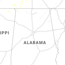
| 8:48 PM CDT | Several trees reported down around the killen area along with damage to a mcdonalds sign along highway 72. time estimated by rada in lauderdale county AL, 9.2 miles ENE of Florence, AL |
| 9:01 PM CDT | Several trees down around tuscumbia along with some damage to an apartment complex... which includes a fence being knocked over. thunderstorm wind gust of 51 mph was al in colbert county AL, 5.2 miles SSW of Florence, AL |
| 9:20 PM CDT | Several trees were reported blown down around the florence are in lauderdale county AL, 2.1 miles N of Florence, AL |
Wisconsin
| Local Time | Report Details |
|---|---|
| 9:35 PM CDT | Storm damage reported in crawford county WI, 52.3 miles S of La Crosse, WI |
| 9:35 PM CDT | Trees and power lines dow in crawford county WI, 52.9 miles S of La Crosse, WI |
Connect with Interactive Hail Maps