

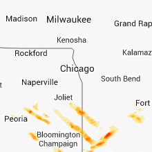
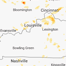
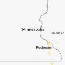
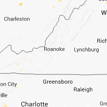
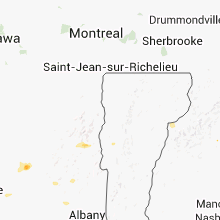
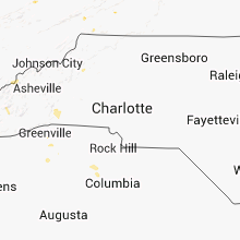
Hail Map for Thursday, August 9, 2012

Number of Impacted Households on 8/9/2012
0
Impacted by 1" or Larger Hail
0
Impacted by 1.75" or Larger Hail
0
Impacted by 2.5" or Larger Hail
Square Miles of Populated Area Impacted on 8/9/2012
0
Impacted by 1" or Larger Hail
0
Impacted by 1.75" or Larger Hail
0
Impacted by 2.5" or Larger Hail


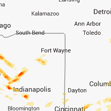


Cities Most Affected by Hail Storms of 8/9/2012
| Hail Size | Demographics of Zip Codes Affected | ||||||
|---|---|---|---|---|---|---|---|
| City | Count | Average | Largest | Pop Density | House Value | Income | Age |
| Remington, IN | 3 | 1.75 | 1.75 | 21 | $86k | $43.3k | 40.0 |
| Decorah, IA | 2 | 1.88 | 2.00 | 38 | $97k | $39.5k | 37.5 |
| Gambier, OH | 2 | 1.75 | 1.75 | 39 | $109k | $48.0k | 21.8 |
| Morocco, IN | 1 | 2.75 | 2.75 | 11 | $75k | $35.1k | 43.3 |
| Camden, IN | 1 | 2.00 | 2.00 | 23 | $73k | $40.4k | 41.4 |
| Bringhurst, IN | 1 | 1.75 | 1.75 | 42 | $100k | $57.6k | 39.9 |
| Ladoga, IN | 1 | 1.75 | 1.75 | 26 | $88k | $44.7k | 40.0 |
| Wilmington, OH | 1 | 1.75 | 1.75 | 129 | $107k | $40.3k | 38.7 |
| Alexandria, KY | 1 | 1.75 | 1.75 | 338 | $119k | $53.1k | 38.2 |
Hail and Wind Damage Spotted on 8/9/2012
Filter by Report Type:Hail ReportsWind Reports
States Impacted
Tennessee, Kentucky, Mississippi, Alabama, West Virginia, Pennsylvania, Maryland, Delaware, Louisiana, New York, Wisconsin, Georgia, New Jersey, Maine, North Carolina, Indiana, New Hampshire, Texas, South Carolina, Florida, Illinois, Minnesota, Oklahoma, Virginia, Ohio, Iowa, Arkansas, Arizona, NevadaTennessee
| Local Time | Report Details |
|---|---|
| 7:40 AM CDT | Trees and powerlines down along central avenue. dime sized hail also reporte in robertson county TN, 23.6 miles NNW of Nashville, TN |
| 9:26 AM CDT | Quarter sized hail reported near Mt Juliet, TN, 14.7 miles ENE of Nashville, TN |
| 9:50 AM CDT | Several trees down on rockbridge road near 31 in sumner county TN, 27.4 miles NE of Nashville, TN |
| 10:03 AM CDT | Tree across oldham road in trousdale county TN, 35.7 miles ENE of Nashville, TN |
| 11:45 AM CDT | Few trees down in whitwel in marion county TN, 15.9 miles NW of Chattanooga, TN |
| 11:50 AM CDT | Some power lines and some trees blown down across the count in white county TN, 61.6 miles N of Chattanooga, TN |
| 1:30 PM EDT | Couple of trees down north of relianc in polk county TN, 44.4 miles ENE of Chattanooga, TN |
| 1:55 PM EDT | Couple of trees down around etowa in mcminn county TN, 48.3 miles ENE of Chattanooga, TN |
| 2:25 PM EDT | Couple of trees down south of wallan in blount county TN, 18.8 miles SSE of Knoxville, TN |
| 3:05 PM EDT | Couple of trees down in west knoxvill in knox county TN, 1.8 miles WNW of Knoxville, TN |
| 3:35 PM EDT | Trees down across western knox county in knox county TN, 1.8 miles WNW of Knoxville, TN |
| 3:55 PM EDT | One tree down on howell river r in grainger county TN, 31 miles NE of Knoxville, TN |
| 4:05 PM EDT | A few trees down in harrogate in claiborne county TN, 45.5 miles NNE of Knoxville, TN |
| 5:20 PM EDT | Trees dow in hawkins county TN, 36.5 miles WSW of Bristol, TN |
| 9:42 PM CDT | A couple of trees were reported downed in mcewen. dime size hail also occurre in humphreys county TN, 48.4 miles W of Nashville, TN |
| 9:52 PM CDT | Dickson county emergency management determined a strong microburst struck the southeast side of tennessee city along a 1/2 mile long path around pruitt road. two dozen in dickson county TN, 41.4 miles W of Nashville, TN |
Kentucky
| Local Time | Report Details |
|---|---|
| 12:15 PM EDT | Trees down near the climax communit in rockcastle county KY, 21.2 miles SW of Irvine, KY |
| 12:35 PM EDT | 3 trees were reported d in pulaski county KY, 55.2 miles SW of Irvine, KY |
| 12:41 PM EDT | Trees blown across road on leaf lan in pulaski county KY, 55.2 miles SW of Irvine, KY |
| 1:12 PM EDT | One tree down on hwy 89s in the indian creek are in jackson county KY, 22.5 miles S of Irvine, KY |
| 2:55 PM EDT | Some trees reported dow in lincoln county KY, 45.7 miles WSW of Irvine, KY |
| 3:52 PM EDT | Quarter sized hail reported near Lexington, KY, 35.4 miles NW of Irvine, KY, near southland drive. |
| 3:55 PM EDT | A tree reported dow in jessamine county KY, 36.2 miles WNW of Irvine, KY |
| 4:03 PM EDT | Large trees down in boone county KY, 16 miles SW of Cincinnati, OH |
| 4:03 PM EDT | Quarter sized hail reported near Independence, KY, 12.4 miles SSW of Cincinnati, OH, dime to quarter size hail. also estimated winds in excess of 50 mph. |
| 4:05 PM EDT | Trees were blown down by thunderstorm wind in boone county KY, 17.5 miles SSW of Cincinnati, OH |
| 4:13 PM EDT | Trees reported dow in woodford county KY, 47.8 miles WNW of Irvine, KY |
| 4:38 PM EDT | Golf Ball sized hail reported near Alexandria, KY, 17.9 miles S of Cincinnati, OH |
| 4:45 PM EDT | A tree was reported down on route 142 in floyd county KY, 67.2 miles E of Irvine, KY |
| 4:55 PM EDT | A tree was reported down on the west side of prestonsbur in floyd county KY, 66.1 miles E of Irvine, KY |
| 5:15 PM EDT | Storm damage reported in harrison county KY, 43.3 miles SSE of Cincinnati, OH |
| 5:15 PM EDT | Trees blown down by thunderstorm wind in bracken county KY, 30.2 miles SE of Cincinnati, OH |
Mississippi
| Local Time | Report Details |
|---|---|
| 11:24 AM CDT | Wind damage to barn and surrounding structures between highway 43 and highway 11 near mcneil. radar signature indicative of a downburst between 1119 and 1124 cd in pearl river county MS, 55.8 miles NNE of New Orleans, LA |
| 2:00 PM CDT | 4 to 5 trees downed blocking roadways around rankin county...including in the brandon and cleary area in rankin county MS, 9.6 miles S of Jackson, MS |
| 3:20 PM CDT | Trees downed on leaf avenue in prentiss...highway 42 w between new hebron and prentiss...and hill road west of prentiss in jefferson davis county MS, 51.5 miles SSE of Jackson, MS |
| 3:20 PM CDT | Trees downed at elks lake rd and homestead near the dixie community in forrest county MS, 83.6 miles WNW of Mobile, AL |
| 3:20 PM CDT | Trees downed at elks lake rd and homestead near the dixie community. roof was damaged at a multi-purpose buildin in forrest county MS, 83.6 miles WNW of Mobile, AL |
| 3:30 PM CDT | Observed at hattiesburg municipal airport in forrest county MS, 81.6 miles WNW of Mobile, AL |
| 3:30 PM CDT | Trees downed along james street. pea sized hail was also reporte in forrest county MS, 82.8 miles WNW of Mobile, AL |
| 3:45 PM CDT | Tree downed at the intersection of us highway 49 and ms highway 59 in covington county MS, 69.1 miles SE of Jackson, MS |
| 3:50 PM CDT | Trees downed along graves road...blocking the road in jones county MS, 72.4 miles SE of Jackson, MS |
| 3:50 PM CDT | Trees downed along monroe road and rainey road in jones county MS, 72.5 miles SE of Jackson, MS |
| 4:25 PM CDT | A few out buildings were damaged and a number of trees were blown dow in walthall county MS, 77.8 miles S of Jackson, MS |
| 4:25 PM CDT | At least four trees were downed across lamar county in lamar county MS, 83.2 miles SSE of Jackson, MS |
Alabama
| Local Time | Report Details |
|---|---|
| 11:30 AM CDT | Multiple trees down. time estimated based on rada in dekalb county AL, 37.9 miles SSW of Chattanooga, TN |
| 11:35 AM CDT | Several trees down. corrected x2 delete roof damag in st. clair county AL, 19.3 miles ENE of Birmingham, AL |
| 11:35 AM CDT | Several trees down with rood damage to hom in st. clair county AL, 19.3 miles ENE of Birmingham, AL |
| 11:35 AM CDT | Several trees down with roof damage to home. corrected in st. clair county AL, 19.3 miles ENE of Birmingham, AL |
| 11:48 AM CDT | Tree down county rd 89 south of tutwiler gap in dekalb county AL, 38.2 miles SSW of Chattanooga, TN |
| 11:52 AM CDT | Several trees dow in st. clair county AL, 32.6 miles ENE of Birmingham, AL |
| 12:01 PM CDT | Several trees dow in st. clair county AL, 40.5 miles ENE of Birmingham, AL |
| 4:45 PM CDT | One tree down along carnoustie drive. time estimated from rada in shelby county AL, 18.2 miles S of Birmingham, AL |
West Virginia
| Local Time | Report Details |
|---|---|
| 12:35 PM EDT | Trees reported dow in tucker county WV, 19.8 miles NNE of Elkins, WV |
| 1:22 PM EDT | Tree down blocking knobley road near rt 48 intersectio in grant county WV, 41.7 miles ENE of Elkins, WV |
| 1:27 PM EDT | Tree down blocking knobley road near rt 48 intersectio in grant county WV, 41.7 miles ENE of Elkins, WV |
| 1:47 PM EDT | Quarter sized hail reported near Morgantown, WV, 49.1 miles N of Elkins, WV |
| 2:44 PM EDT | One tree down in preston county WV, 52.7 miles NNE of Elkins, WV |
| 4:29 PM EDT | Downed tree limbs along winchester grade roa in morgan county WV, 87.5 miles W of Baltimore, MD |
| 4:29 PM EDT | Half Dollar sized hail reported near Berkeley Springs, WV, 87.5 miles W of Baltimore, MD, downed tree limbs along winchester grade road. |
Pennsylvania
| Local Time | Report Details |
|---|---|
| 12:45 PM EDT | Tree down on halsey road in mckean county PA, 73.4 miles NNW of State College, PA |
| 1:00 PM EDT | Tree down on route 146 in mckean county PA, 70 miles NNW of State College, PA |
| 1:40 PM EDT | Trees and power lines down on route 44 in hebron township in potter county PA, 73.3 miles N of State College, PA |
| 3:36 PM EDT | Trees down in chester county PA, 78.8 miles NE of Baltimore, MD |
| 4:45 PM EDT | Trees down in bucks county PA, 59.4 miles WSW of Brooklyn, NY |
| 5:22 PM EDT | 100-200yd path of large trees down in lycoming county PA, 55.6 miles NE of State College, PA |
| 5:45 PM EDT | Trees down in mercer county PA, 59.3 miles NNW of Pittsburgh, PA |
| 5:45 PM EDT | Multiple trees down roads closed in snyder county PA, 54.7 miles E of State College, PA |
| 5:45 PM EDT | Trees downed in mercer county PA, 56 miles NNW of Pittsburgh, PA |
| 5:55 PM EDT | Trees dow in mercer county PA, 62.4 miles NNW of Pittsburgh, PA |
| 6:10 PM EDT | Trees dow in mercer county PA, 56.7 miles NNW of Pittsburgh, PA |
| 6:45 PM EDT | Trees dow in venango county PA, 64.4 miles N of Pittsburgh, PA |
| 6:50 PM EDT | Trees down in venango county PA, 64.4 miles N of Pittsburgh, PA |
| 7:00 PM EDT | Trees dow in venango county PA, 66.2 miles N of Pittsburgh, PA |
| 7:04 PM EDT | Trees down in venango county PA, 64.5 miles NNE of Pittsburgh, PA |
| 7:04 PM EDT | Quarter sized hail reported near Seneca, PA, 66.7 miles NNE of Pittsburgh, PA |
| 7:09 PM EDT | Trees and power lines down in lawrence county PA, 42.1 miles NNW of Pittsburgh, PA |
| 7:09 PM EDT | Quarter sized hail reported near Oil City, PA, 70.2 miles NNE of Pittsburgh, PA |
| 7:10 PM EDT | Quarter sized hail reported near Meadville, PA, 78.4 miles E of Cleveland, OH, quarter-sized hail observed for 30 seconds. |
| 7:10 PM EDT | Trees and wires down in western berks count in berks county PA, 73.7 miles SSW of Scranton, PA |
| 7:10 PM EDT | Tree on mobile home. no injurie in lawrence county PA, 41 miles NNW of Pittsburgh, PA |
| 7:14 PM EDT | Quarter sized hail reported near New Castle, PA, 42.1 miles NNW of Pittsburgh, PA |
| 7:23 PM EDT | Trees down in forest county PA, 78.7 miles NNE of Pittsburgh, PA |
| 7:25 PM EDT | Trees down blocking road in luzerne county PA, 15.8 miles SW of Scranton, PA |
| 7:30 PM EDT | Trees and wires dow in berks county PA, 73.7 miles SSW of Scranton, PA |
| 7:50 PM EDT | Tree dow in berks county PA, 66.2 miles SSW of Scranton, PA |
| 8:10 PM EDT | Trees dow in mckean county PA, 67.4 miles SSE of Buffalo, NY |
| 8:11 PM EDT | Reports of several downed tree in crawford county PA, 70.6 miles ENE of Cleveland, OH |
| 8:11 PM EDT | Reports of several downed tree in crawford county PA, 66.7 miles E of Cleveland, OH |
| 8:18 PM EDT | Trees down at west center road and maple roa in crawford county PA, 66.7 miles E of Cleveland, OH |
| 8:30 PM EDT | Tree dow in berks county PA, 67.4 miles S of Scranton, PA |
| 8:40 PM EDT | Trees down in venango county PA, 67.1 miles NNE of Pittsburgh, PA |
| 8:45 PM EDT | Trees down on lexington driv in lebanon county PA, 70.3 miles N of Baltimore, MD |
| 8:54 PM EDT | Trees down in washington county PA, 19.4 miles W of Pittsburgh, PA |
| 9:00 PM EDT | Wires dow in berks county PA, 67.1 miles S of Scranton, PA |
| 9:04 PM EDT | Large branches down in allegheny county PA, 12.8 miles W of Pittsburgh, PA |
Maryland
| Local Time | Report Details |
|---|---|
| 1:40 PM EDT | Large tree into a residence along iowa dr n in allegany county MD, 77.8 miles NE of Elkins, WV |
| 1:40 PM EDT | Tree down on cowden dr nw in allegany county MD, 77.8 miles NE of Elkins, WV |
| 1:40 PM EDT | Quarter sized hail reported near Cumberland, MD, 76.4 miles NE of Elkins, WV |
| 5:20 PM EDT | Tree down at nuwood drive and baltimore national pik in baltimore county MD, 8.1 miles W of Baltimore, MD |
| 7:05 PM EDT | Light pole knocked down near intersection of route 97 and reedie roa in montgomery county MD, 29.3 miles SW of Baltimore, MD |
| 7:20 PM EDT | Quarter sized hail reported near Silver Spring, MD, 27.5 miles WSW of Baltimore, MD |
| 7:25 PM EDT | Tree down near vicinity of route 650 at georgia avenu in montgomery county MD, 27.9 miles WSW of Baltimore, MD |
Delaware
| Local Time | Report Details |
|---|---|
| 1:55 PM EDT | Trees down in sussex county DE, 30.9 miles N of Ocean City, MD |
Louisiana
| Local Time | Report Details |
|---|---|
| 1:15 PM CDT | Trees and power lines were knocked down. time estimated based on rada in st. charles county LA, 18.8 miles W of New Orleans, LA |
| 1:34 PM CDT | Damage to fencing and small objects 5400 block of tusa drive. also some images available from twitter and media.radar signature strongly suggestive of a wet microburst in jefferson county LA, 4.8 miles SSW of New Orleans, LA |
| 6:55 PM CDT | Trees and powerlines down on west bank of lake saint joseph from 1.5 miles south of newellton to 3 miles south of newellton. radar analysis and damage suggests localize in tensas county LA, 63.7 miles WSW of Jackson, MS |
| 7:50 PM CDT | Power lines dow in west carroll county LA, 27.8 miles E of Bastrop, LA |
| 8:18 PM CDT | Several large limbs down on power line in morehouse county LA, 15.2 miles SSE of Bastrop, LA |
| 8:25 PM CDT | Half Dollar sized hail reported near Oak Ridge, LA, 18.5 miles SSE of Bastrop, LA, half dollar size hail north of start...beginning to cover the ground |
| 8:30 PM CDT | Reports of large limbs dow in richland county LA, 19.5 miles SSE of Bastrop, LA |
| 8:35 PM CDT | Numerous trees and powerlines down with several metal carports blown around along route 577 between bayou macon lounge and waverly in madison county LA, 39 miles SE of Bastrop, LA |
| 8:40 PM CDT | Numerous trees and powerlines down with several metal carports blown around along route 577 between bayou macon lounge and waverly in madison county LA, 39 miles SE of Bastrop, LA |
| 8:50 PM CDT | A roof was blown off a trailer at 1839 highway 57 in franklin county LA, 45.1 miles SSE of Bastrop, LA |
| 8:55 PM CDT | Multiple trees down across franklin parish in franklin county LA, 48 miles SSE of Bastrop, LA |
| 9:00 PM CDT | Storm damage reported in franklin county LA, 37 miles SSE of Bastrop, LA |
| 9:00 PM CDT | Trees and a power line down across la highway 15 in richland county LA, 29 miles S of Bastrop, LA |
| 9:00 PM CDT | Tree fell down on house on 302 jim albert roa in franklin county LA, 43.4 miles SSE of Bastrop, LA |
| 9:10 PM CDT | Multiple trees and power poles downed around franklin parish in franklin county LA, 44.1 miles SSE of Bastrop, LA |
| 9:10 PM CDT | Multiple trees and power poles downed around franklin parish. trees fell on three house in franklin county LA, 44.1 miles SSE of Bastrop, LA |
| 9:10 PM CDT | Several trees...power lines...and power poles downed across franklin parish in franklin county LA, 44.1 miles SSE of Bastrop, LA |
| 9:10 PM CDT | Widespread trees...power lines...and power poles downed all across franklin parish in franklin county LA, 44.1 miles SSE of Bastrop, LA |
| 9:15 PM CDT | Several trees fell onto roadways and one trailer was damaged by a tree. power outages were also reporte in catahoula county LA, 63.2 miles SSE of Bastrop, LA |
| 9:15 PM CDT | In the area near and just south of crowville...trees uprooted...a roof was blown off a trailer...large tree limbs fell through houses...and some windows were blown ou in franklin county LA, 42.3 miles SSE of Bastrop, LA |
| 9:20 PM CDT | Multiple downed trees blocking la highway 4 in tensas county LA, 54.4 miles SSE of Bastrop, LA |
| 9:20 PM CDT | Power lines and large tree limbs down in northern tensas parish in tensas county LA, 57.1 miles SSE of Bastrop, LA |
| 9:25 PM CDT | Couple of signs blown down at citgo gas station on highway 4 wes in franklin county LA, 44.4 miles SSE of Bastrop, LA |
| 9:25 PM CDT | Half Dollar sized hail reported near Mangham, LA, 33.4 miles SSE of Bastrop, LA |
| 9:53 PM CDT | Multiple trees and power lines down between rayville and mangham in richland county LA, 29.4 miles SSE of Bastrop, LA |
| 10:00 PM CDT | Multiple trees and power lines downed across northern catahoula parish in catahoula county LA, 67.5 miles S of Bastrop, LA |
| 10:45 PM CDT | Power lines downed in jonesville in catahoula county LA, 80 miles S of Bastrop, LA |
| 10:45 PM CDT | Power lines downed in wildsville in concordia county LA, 80.2 miles S of Bastrop, LA |
| 10:50 PM CDT | Tree down across hwy 133 in morehouse county LA, 12.2 miles SE of Bastrop, LA |
| 11:10 PM CDT | Tree downed on home in east jena in la salle county LA, 76 miles S of Bastrop, LA |
| 12:45 AM CDT | A tree was blown down on highway 15 between spearsville and highway 16 in union county LA, 42.5 miles WNW of Bastrop, LA |
| 2:00 AM CDT | Tree down in elmer...rapides parish louisiana in rapides county LA, 74.9 miles NNW of Lafayette, LA |
| 6:06 AM CDT | Sheriffs dept reports tree down on powerlines at intersection of hwy 1207 and 11 in rapides county LA, 78.3 miles N of Lafayette, LA |
New York
| Local Time | Report Details |
|---|---|
| 2:30 PM EDT | Limbs and branches down throughout campground in essex county NY, 49 miles SW of Burlington, VT |
| 3:43 PM EDT | Tree down on a house on east main stree in oneida county NY, 37.1 miles E of Syracuse, NY |
| 3:55 PM EDT | Trees down in fulton county NY, 18.6 miles NW of Schenectady, NY |
| 4:26 PM EDT | Tree down on house in fulton county NY, 25.9 miles NW of Schenectady, NY |
| 5:08 PM EDT | Trees dow in otsego county NY, 52.5 miles ESE of Syracuse, NY |
| 5:50 PM EDT | Tree down on secor roa in putnam county NY, 52.1 miles NNE of Brooklyn, NY |
| 5:50 PM EDT | Trees dow in otsego county NY, 41.1 miles W of Schenectady, NY |
| 6:00 PM EDT | Quarter sized hail reported near Cooperstown, NY, 50.9 miles W of Schenectady, NY |
| 6:25 PM EDT | Trees dow in otsego county NY, 53.6 miles WSW of Schenectady, NY |
| 7:15 PM EDT | Tree dow in cattaraugus county NY, 59.7 miles SSE of Buffalo, NY |
| 7:29 PM EDT | Tree down on sherry hollow r in allegany county NY, 65.3 miles SSE of Buffalo, NY |
| 7:35 PM EDT | Tree down in a parking lo in allegany county NY, 66.9 miles SSE of Buffalo, NY |
| 9:20 PM EDT | Tree down on wires in steuben county NY, 68.2 miles WSW of Syracuse, NY |
| 9:33 PM EDT | Trees and wires blown down by thunderstorm wind in yates county NY, 57.6 miles WSW of Syracuse, NY |
| 9:37 PM EDT | Tree blown down on hous in yates county NY, 55.9 miles SW of Syracuse, NY |
| 10:39 PM EDT | Trees and wires dow in cayuga county NY, 27.2 miles SSW of Syracuse, NY |
| 11:12 PM EDT | Trees down from thunderstorm wind in onondaga county NY, 5.2 miles W of Syracuse, NY |
| 11:15 PM EDT | Trees down in cortland county NY, 28.3 miles S of Syracuse, NY |
| 6:38 AM EDT | Trees down in madison county NY, 24 miles SE of Syracuse, NY |
Wisconsin
| Local Time | Report Details |
|---|---|
| 1:45 PM CDT | Quarter sized hail reported near Boyceville, WI, 65.5 miles ENE of Minneapolis, MN, hail damage to crops...corn completely stripped..soy beans stripped and flattened for a 5 mile long 1.5 mile wide patch. |
Georgia
| Local Time | Report Details |
|---|---|
| 2:47 PM EDT | One tree down on mud creek road. time estimated by rada in dougherty county GA, 76.6 miles N of Tallahassee, FL |
| 2:50 PM EDT | Fox31 news article reports large tree down in the road at the 1800 block of edgerly av in dougherty county GA, 78 miles N of Tallahassee, FL |
| 2:54 PM EDT | Two trees down across the southern portion of the county. time estimated by rada in lee county GA, 79.7 miles W of Douglas, GA |
| 3:58 PM EDT | Pulaski county emergency management relayed reports of 2 downed trees and several downed power lines in and just east of the hawkinsville area. time estimated off radar in pulaski county GA, 64.6 miles NW of Douglas, GA |
| 5:37 PM EDT | Monroe county 911 relayed reports of several downed trees in the eastern portion of the county. most of the trees have been cleared from roads...but one large tree stil in monroe county GA, 60.7 miles SSE of Atlanta, GA |
| 5:50 PM EDT | Trees and power lines were blown down in the jesup city limits. the time of damage was estimated based on radar dat in wayne county GA, 57 miles E of Douglas, GA |
| 5:57 PM EDT | A spotter reported power lines and trees were blown down in the jesup area. the time of damage was estimated based on rada in wayne county GA, 56.6 miles SW of Savannah, GA |
| 6:05 PM EDT | A spotter reported two trees were blown down into the power lines. the time of the report was based on rada in wayne county GA, 55.2 miles WSW of Savannah, GA |
| 6:17 PM EDT | One tree down on powerline along wells roa in liberty county GA, 38.9 miles WSW of Savannah, GA |
| 6:17 PM EDT | One tree reported down along elim church roa in long county GA, 42.6 miles WSW of Savannah, GA |
| 6:22 PM EDT | One tree down along the intersection of highway 196 and wells cemetery roa in liberty county GA, 38.9 miles WSW of Savannah, GA |
| 6:35 PM EDT | Trees down on leonard circle in waynesboro in burke county GA, 27 miles S of Augusta, GA |
| 6:35 PM EDT | One tree down on powerline along the intersection of eb cooper highway and thompson hunting clu in liberty county GA, 34.4 miles SW of Savannah, GA |
| 7:26 PM EDT | Tree down on milledge rd at battle row in richmond county GA, 2 miles W of Augusta, GA |
| 7:26 PM EDT | Large tree limbs down on washington rd at bertram rd in richmond county GA, 3.8 miles NW of Augusta, GA |
| 7:34 PM EDT | Columbia county sheriff reported tree down on stevens creek road and old stevens creek roa in columbia county GA, 6 miles NW of Augusta, GA |
New Jersey
| Local Time | Report Details |
|---|---|
| 2:55 PM EDT | Trees down in hunterdon county NJ, 47.4 miles WSW of Brooklyn, NY |
| 5:13 PM EDT | Window blown out at mercer county airport in mercer county NJ, 52 miles SW of Brooklyn, NY |
| 5:13 PM EDT | Window damaged at control tower at mercer county airport. trees also down on train tracks in trento in mercer county NJ, 52 miles SW of Brooklyn, NY |
| 5:19 PM EDT | Trees down in mercer county NJ, 52 miles SW of Brooklyn, NY |
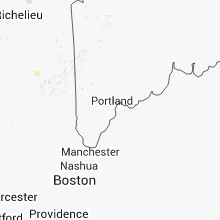
Maine
| Local Time | Report Details |
|---|---|
| 3:00 PM EDT | Large branches and vineyard rows blown down at prospect hill winery. time is estimated based on rada in oxford county ME, 55.1 miles NNW of Portland, ME |
| 3:00 PM EDT | Large branches and vineyard rows blown down at prospect hill winery. time is estimated based on rada in york county ME, 41 miles WSW of Portland, ME |
| 12:02 AM EDT | More than 20 large trees uprooted and snapped on meetinghouse lane in vicki lyn campground...trees and wires also down on weymouth road in cumberland county ME, 32.6 miles NW of Portland, ME |
| 12:10 AM EDT | Several trees down. tree fell on fencing. 4-5 inch diamter birch trees down als in cumberland county ME, 37.6 miles NW of Portland, ME |
North Carolina
| Local Time | Report Details |
|---|---|
| 3:04 PM EDT | One tree down near the intersection of big willow rd and declaration lan in henderson county NC, 33.7 miles N of Greenville, SC |
| 3:07 PM EDT | One tree down off south mills river rd in the town of mills rive in henderson county NC, 38.6 miles N of Greenville, SC |
| 6:19 PM EDT | Trees down throughout the area in rutherford county NC, 54.3 miles NE of Greenville, SC |
| 6:59 PM EDT | Trees and power lines down on spainhour rd and along 18 in burke county NC, 60.3 miles NW of Charlotte, NC |
Indiana
| Local Time | Report Details |
|---|---|
| 3:36 PM EDT | Half Dollar sized hail reported near South Whitley, IN, 27.7 miles W of Fort Wayne, IN, hail larger than a quarter and smaller than golf balls reported. |
| 3:39 PM EDT | Half Dollar sized hail reported near South Whitley, IN, 27.7 miles W of Fort Wayne, IN, hail larger than a quarter and smaller than golf balls reported. |
| 3:49 PM EDT | Several trees dow in scott county IN, 46 miles N of Louisville, KY |
| 4:00 PM EDT | Tree reported down on a hous in jefferson county IN, 48.7 miles N of Louisville, KY |
| 7:07 PM EDT | Hail 1.50 to 2.25 inches in diameter caused damage to cars and roofs. trees and tree limbs were downed by thunderstorm gusts. time estimated...based on rada in fountain county IN, 55.3 miles WNW of Indianapolis, IN |
| 7:19 PM EDT | Half Dollar sized hail reported near Crawfordsville, IN, 50.6 miles WNW of Indianapolis, IN, reported via media facebook page. hail size estimated from photo and time estimated from radar. |
| 7:35 PM EDT | Quarter sized hail reported near Wingate, IN, 56.2 miles WNW of Indianapolis, IN, report relayed via tv media. time estimated from radar. |
| 7:38 PM EDT | Time estimated...based on rada in montgomery county IN, 45.2 miles WNW of Indianapolis, IN |
| 6:52 PM CDT | Baseball sized hail reported near Morocco, IN, 65.2 miles S of Chicago, IL, 3 blocks from the center of morocco...hail ranged from golfball to baseball sized. |
| 7:55 PM EDT | Estimated 60 mph winds accompanied by nickel size hai in montgomery county IN, 36.1 miles WNW of Indianapolis, IN |
| 8:03 PM EDT | Estimated 60 mph winds accompanied by nickel size hai in montgomery county IN, 36.1 miles WNW of Indianapolis, IN |
| 8:07 PM EDT | Trees down on powerlines at 933 e cr 1050 s. time estimated from rada in tippecanoe county IN, 51.2 miles NW of Indianapolis, IN |
| 8:09 PM EDT | Golf Ball sized hail reported near Ladoga, IN, 36.1 miles WNW of Indianapolis, IN, reported via media facebook page. |
| 8:10 PM EDT | Half Dollar sized hail reported near Romney, IN, 51.9 miles NW of Indianapolis, IN, hail larger than quarters accumulated to 1.5 inches deep reported in romney. time estimated from radar. |
| 7:18 PM CDT | Half Dollar sized hail reported near Goodland, IN, 77 miles SSE of Chicago, IL, hail ranged from quarter to half dollar sized. |
| 8:24 PM EDT | Trees and tree limbs down. one tree was down on a garage. time estimated...based on rada in tippecanoe county IN, 53.9 miles NW of Indianapolis, IN |
| 7:25 PM CDT | Golf Ball sized hail reported near Remington, IN, 78.6 miles SSE of Chicago, IL, relayed by sheriff |
| 7:27 PM CDT | Golf Ball sized hail reported near Remington, IN, 78.3 miles SSE of Chicago, IL, near mile marker 205 on interstate 65. relayed by sheriff. |
| 7:27 PM CDT | Also dime sized hai in jasper county IN, 79.2 miles SSE of Chicago, IL |
| 7:30 PM CDT | Golf Ball sized hail reported near Remington, IN, 81.5 miles SSE of Chicago, IL |
| 8:38 PM EDT | Quarter sized hail reported near Wolcott, IN, 83.1 miles NW of Indianapolis, IN |
| 8:50 PM EDT | Tree limbs 2-3 inches in diameter and powerlines down along cr 700 in carroll county IN, 53.1 miles NNW of Indianapolis, IN |
| 9:00 PM EDT | Quarter sized hail reported near Plainfield, IN, 14.2 miles WSW of Indianapolis, IN, many small limbs downed. accompanied by heavy rainfall measuring 1.01 inches in 30 minutes. |
| 9:02 PM EDT | Half Dollar sized hail reported near Fowler, IN, 85.8 miles NW of Indianapolis, IN, quarter to half dollar sized hail half way between ambia and boswell. |
| 9:03 PM EDT | Quarter sized hail reported near Camden, IN, 58.1 miles NNW of Indianapolis, IN, quarter size hail just north of flora at 50 e and 100 n. |
| 9:05 PM EDT | Winds estimated to at least 60 mph just north of flora at 50 e and 100 in carroll county IN, 58.1 miles NNW of Indianapolis, IN |
| 9:05 PM EDT | Time estimated...based on rada in carroll county IN, 56.8 miles NNW of Indianapolis, IN |
| 9:05 PM EDT | Hen Egg sized hail reported near Camden, IN, 58.1 miles NNW of Indianapolis, IN, hail now over 2 inches in diameter just north of flora at 50 e and 100 n. |
| 9:05 PM EDT | Quarter sized hail reported near Plainfield, IN, 14.6 miles WSW of Indianapolis, IN, quarter sized hail damaged shingles and shredded leaves. |
| 9:07 PM EDT | Quarter sized hail reported near Plainfield, IN, 16.3 miles WSW of Indianapolis, IN, quarter size hail at us highway 40 and cartersburg road. |
| 9:09 PM EDT | Quarter sized hail reported near Plainfield, IN, 15.6 miles WSW of Indianapolis, IN |
| 9:10 PM EDT | Quarter sized hail reported near Avon, IN, 12.3 miles W of Indianapolis, IN, nickel to quarter size hail. |
| 9:11 PM EDT | Ping Pong Ball sized hail reported near Plainfield, IN, 15.6 miles WSW of Indianapolis, IN |
| 9:11 PM EDT | Quarter sized hail reported near Plainfield, IN, 13.6 miles W of Indianapolis, IN |
| 9:12 PM EDT | Quarter sized hail reported near Plainfield, IN, 13.6 miles WSW of Indianapolis, IN, accompanied by 50 mph winds. |
| 9:12 PM EDT | Golf Ball sized hail reported near Bringhurst, IN, 54.7 miles NNW of Indianapolis, IN, reported near radnor. |
| 9:15 PM EDT | Ping Pong Ball sized hail reported near Plainfield, IN, 13.6 miles WSW of Indianapolis, IN |
| 9:17 PM EDT | Ping Pong Ball sized hail reported near Plainfield, IN, 15.6 miles WSW of Indianapolis, IN, hail lasted nearly 10 minutes...ending at 917 pm edt. |
| 9:23 PM EDT | Quarter sized hail reported near Plainfield, IN, 13.6 miles WSW of Indianapolis, IN, quarter size hail at the homewood suites from 907-923 pm. |
| 9:28 PM EDT | Trees downed in reelsville. late repor in putnam county IN, 45.7 miles WSW of Indianapolis, IN |
| 9:40 PM EDT | Ping Pong Ball sized hail reported near Urbana, IN, 38.1 miles WSW of Fort Wayne, IN, measured after the event. hail ranged from half inch to 1.5 inch in diameter. |
| 9:50 PM EDT | Estimated 50 to 60 mph wind and unknown size hail on cr 600e in wabash county IN, 33.8 miles WSW of Fort Wayne, IN |
| 10:01 PM EDT | Estimated 60 mph thunderstorm gust as well as pea size hail from trained storm spotte in marion county IN, 0.9 miles N of Indianapolis, IN |
| 10:04 PM EDT | Quarter sized hail reported near Andrews, IN, 31.2 miles WSW of Fort Wayne, IN, quarter sized hail at the intersection of sr105 and division rd. |
| 10:45 PM EDT | Tree on car on w broadway street and tree on house on north street. time estimated from rada in shelby county IN, 26.1 miles SE of Indianapolis, IN |
New Hampshire
| Local Time | Report Details |
|---|---|
| 3:43 PM EDT | Large tree and wires down across mckeagney road in strafford county NH, 41.7 miles WSW of Portland, ME |
| 6:18 PM EDT | Three large trees across pearl lake road between lisbon and sugar hill in grafton county NH, 71 miles ESE of Burlington, VT |
Texas
| Local Time | Report Details |
|---|---|
| 2:45 PM CDT | Wind damage along highway 277 south of eldorado. roof taken off a pumphouse...flagpole bent over...10 foot section of a barn door blown in. extensive tree damage as wel in schleicher county TX, 97.7 miles N of Del Rio, TX |
| 4:27 PM CDT | Estimated 50 to 60 mph winds in gatesvill in coryell county TX, 21.6 miles N of Killeen, TX |
| 4:30 PM CDT | Photos of tree damage and tin roof damage relayed via cha in coryell county TX, 21.6 miles N of Killeen, TX |
| 4:55 PM CDT | Wind gusts to 60 mph with pea size hail in edwards county TX, 61.2 miles NE of Del Rio, TX |
| 5:30 PM CDT | Minor roof damage to some homes. public report relayed to sheriffs offic in burnet county TX, 37.3 miles SW of Killeen, TX |
| 7:15 PM CDT | Multiple trees down including trees across hwys. 37... 3370...3230...3250...1448 and 7 in franklin county TX, 91.1 miles ENE of Dallas, TX |
| 7:25 PM CDT | Tree fell into house in winnsboro...chainsaws had to be used to access the residenc in wood county TX, 88.4 miles E of Dallas, TX |
| 7:45 PM CDT | Numerous trees and powerlines downed in wood county TX, 88.4 miles E of Dallas, TX |
| 7:45 PM CDT | Tree down near cr 556 southwest of pittsbur in camp county TX, 81.4 miles WNW of Shreveport, LA |
| 8:24 PM CDT | Numerous trees and powerlines downed across the western part of upshur county in upshur county TX, 79.8 miles W of Shreveport, LA |
| 8:30 PM CDT | Powerlines downed in judso in gregg county TX, 59.1 miles W of Shreveport, LA |
| 8:40 PM CDT | Quarter sized hail reported near Longview, TX, 59.9 miles W of Shreveport, LA, 4 south of diana tx on the upshur/gregg co line. |
| 8:45 PM CDT | Large pine tree uprooted and fell onto saddlebrook apartments in longvie in gregg county TX, 59.1 miles W of Shreveport, LA |
| 8:45 PM CDT | Tree downed on georgia richie road just west of tow in gregg county TX, 59.1 miles W of Shreveport, LA |
| 8:57 PM CDT | Several trees downed in the longview heights area. homes were damaged by some of the tree in gregg county TX, 59.1 miles W of Shreveport, LA |
| 8:58 PM CDT | Several trees downed throughout the community...including some trees falling on homes. there were no report of injurie in gregg county TX, 70.2 miles W of Shreveport, LA |
| 8:58 PM CDT | The roof was removed from a business near gladewater on hwy. 80. portion of the roof landed on an automobil in gregg county TX, 70.2 miles W of Shreveport, LA |
| 8:58 PM CDT | Powerlines downed in the lake gladewater are in gregg county TX, 70.2 miles W of Shreveport, LA |
| 9:00 PM CDT | Large tree fell on a house on bingham road. another tree was blocking the road at bingham and white oak roa in gregg county TX, 65 miles W of Shreveport, LA |
| 9:05 PM CDT | Powerlines downed southeast of town in the 11000 block of cr. 17 in gregg county TX, 66.2 miles W of Shreveport, LA |
| 9:10 PM CDT | Large tree and powerlines downed north of overton on cr 111 in rusk county TX, 66.3 miles NNW of Lufkin, TX |
| 9:10 PM CDT | Cr 152 completely blocked by trees and powerlines just off sh 42 in the leveretts chapel are in rusk county TX, 65.9 miles N of Lufkin, TX |
| 9:15 PM CDT | Large trees downed near new london on fm 2012 and fm 151 in rusk county TX, 65.1 miles N of Lufkin, TX |
| 10:10 PM CDT | Trees reported down and a metal roof blown off a shed near highway 8 in shelby county TX, 43.4 miles NNE of Lufkin, TX |
South Carolina
| Local Time | Report Details |
|---|---|
| 3:50 PM EDT | Law enforcement reported a tree in the roadway. time estimated by rada in laurens county SC, 42.3 miles SE of Greenville, SC |
| 3:50 PM EDT | Law enforcement reported power lines and trees blocking the road. time estimated by rada in laurens county SC, 40.5 miles SE of Greenville, SC |
| 4:14 PM EDT | Multiple large tree limbs blown down and some urban flooding in anderson county SC, 21.9 miles SSW of Greenville, SC |
| 4:14 PM EDT | Two reports of trees down on power lines near the fox run country club on hunter roa in greenville county SC, 23.1 miles ESE of Greenville, SC |
| 4:42 PM EDT | Trees down across 2 vehicles and blocking the north bound lanes of i-85 at mile marker 5 in greenville county SC, 18.3 miles E of Greenville, SC |
| 4:43 PM EDT | Several trees and lines down including along blacks drive...hudson farm road and shannon lake circl in greenville county SC, 17.8 miles E of Greenville, SC |
| 4:45 PM EDT | One power line down on reid school rd near edwards mill r in greenville county SC, 17.6 miles ENE of Greenville, SC |
| 4:45 PM EDT | One large limb blown down on dillard roa in greenville county SC, 19.5 miles ENE of Greenville, SC |
| 4:58 PM EDT | Large limbs blown down in greenville county SC, 17.6 miles ENE of Greenville, SC |
| 5:13 PM EDT | Large limbs blown down and 1/2 inch hail in greenville county SC, 13.7 miles E of Greenville, SC |
| 5:30 PM EDT | Trees blown across the road at crain and donahue in greenville county SC, 23.3 miles NE of Greenville, SC |
| 5:35 PM EDT | Power lines and limbs down in greenville county SC, 14.2 miles ENE of Greenville, SC |
| 5:35 PM EDT | Trees blown down in greenville county SC, 21.1 miles NE of Greenville, SC |
| 5:40 PM EDT | A tree fell on a power line on hilltop roa in laurens county SC, 39.7 miles SE of Greenville, SC |
| 5:40 PM EDT | Trees blown down at highway 101 and donahue rd in greenville county SC, 21.1 miles NE of Greenville, SC |
| 5:48 PM EDT | Tree down near mile marker 10 off i-385 near the intersection with hwy 22 in laurens county SC, 37.5 miles ESE of Greenville, SC |
| 6:57 PM EDT | Newberry sheriff office reported a tree down on a house in chappells. considerable roof damage. no injurie in newberry county SC, 48.7 miles N of Augusta, GA |
| 6:57 PM EDT | Trees and power lines down at sc highway 34 and old landfill rd in newberry county SC, 47.9 miles N of Augusta, GA |
| 7:39 PM EDT | Sc highway patrol reported a tree down at sc hwy 119 and sand hills r in jasper county SC, 33.2 miles NNW of Savannah, GA |
| 7:48 PM EDT | Sc highway patrol reported a tree down at n jacob smart blvd and n green s in jasper county SC, 28.9 miles NNE of Savannah, GA |
| 7:55 PM EDT | Srs dispatch reported trees down on sc hwy 125 and on savannah river site road in barnwell county SC, 23.7 miles SE of Augusta, GA |
| 7:58 PM EDT | Sc highway patrol reported a tree down on sc hwy 601 in furma in hampton county SC, 41.7 miles N of Savannah, GA |
| 8:18 PM EDT | Saluda county dispatch reported trees down on mariachi in saluda county SC, 37.8 miles NNE of Augusta, GA |
| 8:50 PM EDT | Trees down on mineral springs rd at shoal creek rd in lexington county SC, 57.7 miles NE of Augusta, GA |
Florida
| Local Time | Report Details |
|---|---|
| 4:00 PM EDT | Power lines down on east paniel roa in putnam county FL, 49.8 miles S of Jacksonville, FL |
Illinois
| Local Time | Report Details |
|---|---|
| 3:05 PM CDT | 12 inch diameter tree blown down on state street....powerline down and road blocked in peoria county IL, 8.9 miles N of Peoria, IL |
| 3:35 PM CDT | Trees and powerlines blown down in marshall county IL, 32.5 miles NE of Peoria, IL |
| 3:35 PM CDT | Quarter sized hail reported near Toluca, IL, 32.5 miles NE of Peoria, IL |
| 3:35 PM CDT | Quarter sized hail reported near Wenona, IL, 37.5 miles NE of Peoria, IL |
| 3:54 PM CDT | Quarter sized hail reported near Rutland, IL, 34.9 miles NE of Peoria, IL |
| 4:20 PM CDT | Quarter sized hail reported near Flanagan, IL, 40.3 miles ENE of Peoria, IL, at caseys general store in flanagan. |
| 4:25 PM CDT | Along illinois route 9 west of i-55...damage assessment from ema indicated damaging wind blowing roof off of a building and roof peeled off another building. also wind in mclean county IL, 30.9 miles ESE of Peoria, IL |
| 4:25 PM CDT | Trees blown down...relayed by illinois state police in mclean county IL, 30.9 miles ESE of Peoria, IL |
| 4:25 PM CDT | Quarter sized hail reported near Bloomington, IL, 34.2 miles ESE of Peoria, IL |
| 4:25 PM CDT | Ping Pong Ball sized hail reported near Bloomington, IL, 30.9 miles ESE of Peoria, IL, 1.5 inch hail...relayed by illinois state police |
| 4:30 PM CDT | Ping Pong Ball sized hail reported near Heyworth, IL, 40.2 miles SE of Peoria, IL, swop report. |
| 4:35 PM CDT | Quarter sized hail reported near Pontiac, IL, 50.6 miles E of Peoria, IL |
| 4:35 PM CDT | Measured 65 mph wind gust in mclean county IL, 35 miles ESE of Peoria, IL |
| 4:50 PM CDT | Quarter sized hail reported near Streator, IL, 45.7 miles NE of Peoria, IL, quarter sized hail fell on farm for 10 minutes...ending at about 500 pm. hail covered the ground. |
| 4:50 PM CDT | Some trees down on far in livingston county IL, 45.7 miles NE of Peoria, IL |
| 4:54 PM CDT | Quarter sized hail reported near Fairbury, IL, 57.8 miles E of Peoria, IL |
| 6:05 PM CDT | Ten train cars derailed by thunderstom wind gust in champaign county IL, 38.1 miles NNE of Mattoon, IL |
| 6:06 PM CDT | Tree limbs blown down in champaign county IL, 40.6 miles NNE of Mattoon, IL |
| 6:06 PM CDT | Trees topped...corn field blown down...power lines blown down in champaign county IL, 39.9 miles NNE of Mattoon, IL |
| 6:07 PM CDT | Tree limbs blown down in champaign county IL, 37.6 miles NNE of Mattoon, IL |
| 6:15 PM CDT | Grain silo with dents...some structure damage...trees blown down in champaign county IL, 35.7 miles NE of Mattoon, IL |
| 6:26 PM CDT | Quarter sized hail reported near Pembroke Twp, IL, 56.2 miles S of Chicago, IL, 2690 south 13000 east road. |
| 6:33 PM CDT | Three power poles snapped and tree limbs blown down in edgar county IL, 34.8 miles NE of Mattoon, IL |
| 6:35 PM CDT | Swop report of three large trees dow in edgar county IL, 37.3 miles NE of Mattoon, IL |
| 6:55 PM CDT | Reported at the edgar county airport in edgar county IL, 37.9 miles ENE of Mattoon, IL |
| 7:30 PM CDT | Quarter sized hail reported near Milford, IL, 86.6 miles S of Chicago, IL, estimated pea and quarter sized hail outside the dollar general at 15 south axtel avenue. |
Minnesota
| Local Time | Report Details |
|---|---|
| 3:20 PM CDT | 15 inch diameter walnut tree snapped 30 feet above ground. corn pushed over 45 degrees. some corn snapped on top. other trees pushed ove in winona county MN, 43.3 miles WNW of La Crosse, WI |
Oklahoma
| Local Time | Report Details |
|---|---|
| 3:40 PM CDT | Storm damage reported in atoka county OK, 9 miles SE of Atoka, OK |
Virginia
| Local Time | Report Details |
|---|---|
| 5:25 PM EDT | Couple of trees down north of meadowvie in washington county VA, 26.4 miles NE of Bristol, TN |
| 5:30 PM EDT | One tree down on cedar creek rd in washington county VA, 23.5 miles ENE of Bristol, TN |
| 5:30 PM EDT | Quarter sized hail reported near Winchester, VA, 84.3 miles W of Baltimore, MD |
| 5:45 PM EDT | Trees down county wide in scott county VA, 20.2 miles W of Bristol, TN |
| 6:55 PM EDT | Trees down along punkin ridge rd in frederick county VA, 81 miles W of Baltimore, MD |
| 7:28 PM EDT | Tree down on sycolin roa in loudoun county VA, 52.5 miles WSW of Baltimore, MD |
| 2:55 AM EDT | Tree down on john marshall hw in shenandoah county VA, 79.9 miles E of Elkins, WV |
Ohio
| Local Time | Report Details |
|---|---|
| 5:41 PM EDT | Tree down near intersection of walnut and minor street in clermont county OH, 28.5 miles SE of Cincinnati, OH |
| 5:47 PM EDT | Quarter sized hail reported near Minerva, OH, 61.1 miles SSE of Cleveland, OH, quarter sized hail reported in minerva. |
| 5:49 PM EDT | Golf Ball sized hail reported near Wilmington, OH, 43.7 miles ENE of Cincinnati, OH |
| 5:50 PM EDT | Numerous tree branches down by thunderstorm wind in stark county OH, 61.1 miles WNW of Pittsburgh, PA |
| 5:52 PM EDT | One tree limb dow in brown county OH, 36.4 miles ESE of Cincinnati, OH |
| 6:15 PM EDT | Tree down on sr78 in highland county OH, 51.4 miles E of Cincinnati, OH |
| 6:20 PM EDT | Trees down on cross rd and coon hill rd. numerous other trees down in the area between seaman and west unio in adams county OH, 51.6 miles ESE of Cincinnati, OH |
| 6:25 PM EDT | Trees down in muskingum county OH, 66.8 miles E of Columbus, OH |
| 6:36 PM EDT | Quarter sized hail reported near Cambridge, OH, 75.1 miles E of Columbus, OH |
| 6:47 PM EDT | Tree down on sr124 near mile marker 2 in highland county OH, 58.8 miles E of Cincinnati, OH |
| 6:50 PM EDT | Power lines down in tuscarawas county OH, 76.8 miles W of Pittsburgh, PA |
| 6:50 PM EDT | Trees down along route 93 near community of bristol. time estimated from rada in perry county OH, 46.8 miles ESE of Columbus, OH |
| 6:50 PM EDT | Trees and powerlines down at 575 black gold r in perry county OH, 46.1 miles ESE of Columbus, OH |
| 6:55 PM EDT | Trees and powerlines down at 5720 sout in perry county OH, 43.9 miles ESE of Columbus, OH |
| 7:00 PM EDT | Power lines down in tuscarawas county OH, 73.3 miles W of Pittsburgh, PA |
| 7:10 PM EDT | Tree down along county route 8 in morgan county OH, 51.9 miles ESE of Columbus, OH |
| 7:20 PM EDT | Tree down in electric lines on sr21 in hocking county OH, 51.3 miles ESE of Columbus, OH |
| 7:25 PM EDT | Quarter sized hail reported near Oxford, OH, 30.8 miles NNW of Cincinnati, OH |
| 8:40 PM EDT | Trees and wires down. time estimated by rada in licking county OH, 25.4 miles NE of Columbus, OH |
| 9:05 PM EDT | Golf Ball sized hail reported near Gambier, OH, 43.4 miles NE of Columbus, OH, several reports of golf ball-sized hail. |
| 9:08 PM EDT | Quarter sized hail reported near Howard, OH, 45.1 miles NE of Columbus, OH, quarter size hail in the town of howard. |
| 9:15 PM EDT | Golf Ball sized hail reported near Gambier, OH, 43.4 miles NE of Columbus, OH, several reports of golf ball-sized hail. |
| 10:38 PM EDT | Ping Pong Ball sized hail reported near Kelleys Island, OH, 50.8 miles W of Cleveland, OH, ping pong ball size hail reported. |
| 1:24 AM EDT | Storm damage reported in sandusky county OH, 89.8 miles W of Cleveland, OH |
Iowa
| Local Time | Report Details |
|---|---|
| 4:55 PM CDT | Quarter sized hail reported near Decorah, IA, 48.4 miles SW of La Crosse, WI, dime to quarter sized. also some small branches downed from wind. |
| 4:56 PM CDT | Hen Egg sized hail reported near Decorah, IA, 45.2 miles SW of La Crosse, WI, courtesy kwwl media. verified with picture. |
| 4:56 PM CDT | Golf Ball sized hail reported near Decorah, IA, 48.4 miles SW of La Crosse, WI, quarter to golfball. dented camper. wind estimated at 50 mph with leaves sprayed onto side of house. no damage to home siding. |
| 5:05 PM CDT | Storm damage reported in winneshiek county IA, 53.5 miles SW of La Crosse, WI |
| 5:10 PM CDT | Calmar fire department estimated a wind gust of 70 miles per hou in winneshiek county IA, 53.6 miles SW of La Crosse, WI |
| 5:10 PM CDT | Quarter sized hail reported near Calmar, IA, 51.6 miles SW of La Crosse, WI, cooperative observer measured up to quarter size hail. drifts of hail in road ditch and the corn was stripped of the leaves with stalks and ears left. |
| 6:40 PM CDT | Quarter sized hail reported near Greene, IA, 26.5 miles SE of Mason City, IA |
| 6:55 PM CDT | Multiple trees down in tow in iowa county IA, 23.8 miles WSW of Cedar Rapids, IA |
| 7:00 PM CDT | Two large branches down along with damage to soffit on the home. report delaye in jones county IA, 20.7 miles ENE of Cedar Rapids, IA |
| 7:00 PM CDT | Multiple trees down in rural areas between marengo and williamsburg. time estimated by rada in iowa county IA, 27 miles SW of Cedar Rapids, IA |
| 7:10 PM CDT | Powerlines damaged due to strong thunderstorm winds. knocked out power at the mall. time estimated from rada in iowa county IA, 27.4 miles SW of Cedar Rapids, IA |
Arkansas
| Local Time | Report Details |
|---|---|
| 5:50 PM CDT | Tree limbs were blown down onto a power line...which caused an outag in clark county AR, 46.1 miles ENE of Nashville, AR |
| 8:06 PM CDT | Trees were blown dow in drew county AR, 69 miles N of Bastrop, LA |
| 8:31 PM CDT | Numerous trees are down across the city of monticell in drew county AR, 58.5 miles N of Bastrop, LA |
| 8:32 PM CDT | The monticello municpal airport reported a gust of 63 miles per hou in drew county AR, 59.2 miles N of Bastrop, LA |
| 8:45 PM CDT | Trees were blown down at comint in drew county AR, 55.7 miles NNE of Bastrop, LA |
| 9:20 PM CDT | Several trees downed along us highway 82 between hamburg and montrose...blocking the roadwa in ashley county AR, 39.6 miles NNE of Bastrop, LA |
| 9:30 PM CDT | Half Dollar sized hail reported near Montrose, AR, 34 miles NNE of Bastrop, LA |
| 9:30 PM CDT | Trees down across eastern ashley county...some blocking roads in ashley county AR, 32.3 miles NNE of Bastrop, LA |
| 12:10 AM CDT | Several trees downed east of town along hwy. 98 and county road 3 in columbia county AR, 61.6 miles SE of Nashville, AR |
| 12:35 AM CDT | Large tree down across hwy. 15 southwest of el dorado in the three creeks are in union county AR, 56 miles WNW of Bastrop, LA |
| 1:40 AM CDT | Quarter sized hail reported near Magnolia, AR, 58.4 miles SE of Nashville, AR, quarter size hail fell in magnolia. |
Arizona
| Local Time | Report Details |
|---|---|
| 3:50 PM MST | Thunderstorm winds blew trampolines into power lines in peach spring in mohave county AZ, 89.4 miles NE of Lake Havasu City, AZ |
| 4:40 PM MST | Dolan springs fire department reported 3 power poles were knocked down in dolan springs by wind from a thunderstor in mohave county AZ, 62.7 miles SE of Las Vegas, NV |
| 5:58 PM MST | A spotter measured a 68 mph wind gust at a home weather station. the wind was showing a steady period of 50 to 55 mph. the wind knocked over a large mesquite tree and p in mohave county AZ, 49.4 miles N of Lake Havasu City, AZ |
| 5:58 PM MST | A spotter measured a 68 mph wind gust at a home weather station. the wind was showing a steady period of 50 to 55 mph winds. the wind knocked over a large mesquite tree in mohave county AZ, 49.4 miles N of Lake Havasu City, AZ |
| 6:00 PM MST | Bullhead city police department reported numerous power lines down and power poles knocked down. power was out to a considerable portion of bullhead city. roofs were ak in mohave county AZ, 48.2 miles NNW of Lake Havasu City, AZ |
| 6:00 PM MST | Bullhead city police department reported numerous power lines down and power poles knocked down. power was out to a considerable portion of bullhead city. roofs were ta in mohave county AZ, 48.2 miles NNW of Lake Havasu City, AZ |
| 6:15 PM MST | A spotter reported 2 big trees down in the sams club parking lot in bullhead city. one car windshield was broken ou in mohave county AZ, 49.5 miles NNW of Lake Havasu City, AZ |
| 6:46 PM MST | 69 mph gust reported at bullhead city cw4367 mesonet statio in mohave county AZ, 45.6 miles NNW of Lake Havasu City, AZ |
| 6:50 PM MST | Thunderstorm outflow winds caused several tents to collapse during a party at the community park in bullhead city. the wind also knocked over several portable toilets a in mohave county AZ, 47.6 miles NNW of Lake Havasu City, AZ |
| 6:50 PM MST | Power lines were reported down in golden shores and mohave valley. visibility between 50 and 500 fee in mohave county AZ, 22.2 miles NNW of Lake Havasu City, AZ |
| 7:00 PM MST | Power was knocked out in downtown kingma in mohave county AZ, 53.8 miles NNE of Lake Havasu City, AZ |
| 7:00 PM MST | Damage to fences and signs from bullhead city and mohave valley. power was out in old bullhead and in mohave valle in mohave county AZ, 36.5 miles NNW of Lake Havasu City, AZ |
| 7:00 PM MST | Damage to fences and signs from bullhead city to mohave valley. power was out in old bullhead and in mohave valle in mohave county AZ, 36.5 miles NNW of Lake Havasu City, AZ |
Nevada
| Local Time | Report Details |
|---|---|
| 6:00 PM MST | *** 8 inj *** 8 people were sent to the hospital after an 8 by 12 foot window blew in at a riverfront lounge at the riverside casino and shattered glas in clark county NV, 50.3 miles NNW of Lake Havasu City, AZ |
| 6:00 PM MST | An 8 by 12 foot window was blown out of the riverside casin in clark county NV, 50.3 miles NNW of Lake Havasu City, AZ |
| 6:15 PM PDT | Power was knocked out to residential neighborhoods on the north side of laughlin. the event time is an estimat in clark county NV, 49.8 miles NNW of Lake Havasu City, AZ |
| 7:24 PM PDT | Remote sensor west of ragtown near highway 50 reported south winds at 25g77 mp in churchill county NV, 47.3 miles E of Reno, NV |
| 7:25 PM PDT | Thunderstorm with heavy rain with some ponding of water on local streets. small branches broken on nearby tree in churchill county NV, 54.8 miles E of Reno, NV |
| 7:25 PM PDT | Sheriffs office reported a 4 to 5 foot diameter tree down on st. clair s in churchill county NV, 55.3 miles E of Reno, NV |
| 8:10 PM PDT | Tikaboo peak mesonet site measured a 59 mph thunderstorm wind gus in lincoln county NV, 81.5 miles N of Las Vegas, NV |
Connect with Interactive Hail Maps