

Hail Map for Saturday, July 14, 2012

Number of Impacted Households on 7/14/2012
0
Impacted by 1" or Larger Hail
0
Impacted by 1.75" or Larger Hail
0
Impacted by 2.5" or Larger Hail
Square Miles of Populated Area Impacted on 7/14/2012
0
Impacted by 1" or Larger Hail
0
Impacted by 1.75" or Larger Hail
0
Impacted by 2.5" or Larger Hail


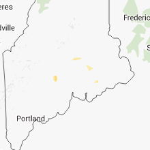


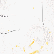


Cities Most Affected by Hail Storms of 7/14/2012
| Hail Size | Demographics of Zip Codes Affected | ||||||
|---|---|---|---|---|---|---|---|
| City | Count | Average | Largest | Pop Density | House Value | Income | Age |
| Marlow, OK | 1 | 1.75 | 1.75 | 39 | $50k | $28.9k | 41.5 |
Hail and Wind Damage Spotted on 7/14/2012
Filter by Report Type:Hail ReportsWind Reports
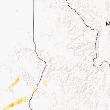
States Impacted
Michigan, Oregon, Arkansas, Iowa, Oklahoma, Maine, Utah, Arizona, Colorado, Texas, Mississippi, Washington, Alabama, North Dakota, Georgia, Montana, South Dakota, Kansas, IdahoMichigan
| Local Time | Report Details |
|---|---|
| 12:58 PM EDT | Pontoon boat fl in roscommon county MI, 51.6 miles SE of Traverse City, MI |
| 1:00 PM EDT | Pontoon boat fl in roscommon county MI, 51.6 miles SE of Traverse City, MI |
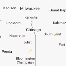
| 5:22 PM EDT | Power poles down across the road at redfield st and conrad rd. time estimated from radar in cass county MI, 71.5 miles NW of Fort Wayne, IN |
| 6:25 PM EDT | 61 mph measured wind gust at intersection of m60 and baer rd in st. joseph county MI, 66.9 miles NNW of Fort Wayne, IN |
| 6:45 PM EDT | A few tree limbs down. time estimate in kalamazoo county MI, 58.8 miles S of Grand Rapids, MI |
Oregon
| Local Time | Report Details |
|---|---|
| 10:45 AM PDT | Received nickel sized hail...heavy rain and strong winds. trees down and portion of foothill road washed out by heavy rai in baker county OR, 76.7 miles SSE of Walla Walla, WA |
| 11:15 AM PDT | Quarter sized hail reported near Union, OR, 65.4 miles SSE of Walla Walla, WA, nickel and quarter sized hail...heavy rain and strong winds. 0.40 inch rain in 15 minutes. |
| 3:00 PM PDT | Quarter sized hail reported near Bridgeport, OR, 89.6 miles NE of Burns, OR, flash flooding also reported |
| 7:30 PM PDT | Quarter sized hail reported near Culver, OR, 23.9 miles WNW of Bend, OR, a family member of an nws employee camping at lake billy chinook reported quarter sized hail and 6 inches of water running through the camp ground due to heavy rain. |
Arkansas
| Local Time | Report Details |
|---|---|
| 1:42 PM CDT | Highway sign blown down onto interstate 540 and interstate 40 junctio in crawford county AR, 5.5 miles NE of Fort Smith, AR |
| 1:47 PM CDT | Highway sign blown down onto highway 40 near the oklahoma and arkansas state lin in crawford county AR, 4.6 miles NNW of Fort Smith, AR |
| 1:55 PM CDT | Power out caused by outflow winds in sebastian county AR, 14.6 miles SE of Fort Smith, AR |
| 1:55 PM CDT | Power lines blown dow in sebastian county AR, 13 miles SE of Fort Smith, AR |
| 1:55 PM CDT | Power lines blown dow in sebastian county AR, 12.5 miles SSE of Fort Smith, AR |
| 2:05 PM CDT | Quarter sized hail reported near Booneville, AR, 31.9 miles ESE of Fort Smith, AR |
| 6:15 PM CDT | Trees down in woodlaw in cleveland county AR, 55.3 miles SSE of Little Rock, AR |
Iowa
| Local Time | Report Details |
|---|---|
| 2:23 PM CDT | Quarter sized hail reported near Marshalltown, IA, 45.5 miles NE of Des Moines, IA |
| 3:14 PM CDT | Quarter sized hail reported near Boone, IA, 39.4 miles NNW of Des Moines, IA |
| 3:15 PM CDT | Storm damage reported in union county IA, 55.2 miles SW of Des Moines, IA |
Oklahoma
| Local Time | Report Details |
|---|---|
| 2:30 PM CDT | Power lines blown dow in le flore county OK, 20.4 miles SW of Fort Smith, AR |
| 2:57 PM CDT | Large tree blown down. time estimated via rada in le flore county OK, 32.4 miles SSW of Fort Smith, AR |
| 4:50 PM CDT | Quarter sized hail reported near Atoka, OK, 11.4 miles WSW of Atoka, OK |
| 5:57 PM CDT | Thunderstorm winds blew over 2 ft. diameter sycamore tree in cleveland county OK, 28.4 miles SSE of Oklahoma City, OK |
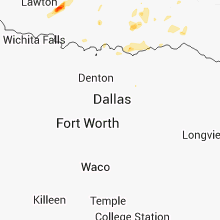
| 7:35 PM CDT | Quarter sized hail reported near Marlow, OK, 59.2 miles NNE of Wichita Falls, TX |
| 7:40 PM CDT | Golf Ball sized hail reported near Marlow, OK, 57.7 miles NNE of Wichita Falls, TX |
| 7:40 PM CDT | Numerous reports of windows broken and trees uprooted around town by large hail and severe winds. power outages as well. unconfired reports of hail up to tennis balls s in stephens county OK, 59.2 miles NNE of Wichita Falls, TX |
| 8:02 PM CDT | Storm damage reported in stephens county OK, 46.8 miles NNE of Wichita Falls, TX |
| 8:02 PM CDT | Quarter sized hail reported near Duncan, OK, 46.8 miles NNE of Wichita Falls, TX |
Maine
| Local Time | Report Details |
|---|---|
| 3:51 PM EDT | Trees down main st between pittsfield and burnham in somerset county ME, 31.6 miles W of Bangor, ME |
| 3:52 PM EDT | Trees down crawford rd in somerset county ME, 33.4 miles W of Bangor, ME |
| 4:20 PM EDT | Quarter sized hail reported near Burnham, ME, 33.3 miles WSW of Bangor, ME, also very strong winds and heavy rain |
| 5:40 PM EDT | Thunderstorm wind gusts estimated between 50 and 60 mph toppled trees on portions of route 155...route 16 and town roa in penobscot county ME, 25.7 miles N of Bangor, ME |
Utah
| Local Time | Report Details |
|---|---|
| 2:12 PM MDT | Wind gust measured at canyonlands airport in grand county UT, 67.6 miles WSW of Grand Junction, CO |
Arizona
| Local Time | Report Details |
|---|---|
| 1:53 PM MST | Delayed report. aps reported downed power poles along hwy 95 north of quartzsite...one 5 mi n and 2 additional poles down at 8 mi in la paz county AZ, 51.1 miles S of Lake Havasu City, AZ |
| 2:11 PM MST | Quarter sized hail reported near Tucson, AZ, 21.8 miles NNE of Tucson, AZ |
| 3:45 PM MST | Numerous trees knocked down including 40 foot tree that fell onto an aut in maricopa county AZ, 21.1 miles ESE of Phoenix, AZ |
| 4:04 PM MST | Trained spotter reported trees down up to 12 inches along greenfield bwetween ray and warne in maricopa county AZ, 21.1 miles ESE of Phoenix, AZ |
Colorado
| Local Time | Report Details |
|---|---|
| 3:10 PM MDT | Thunderstorm outflow from the sw in mesa county CO, 24.5 miles NW of Grand Junction, CO |
| 3:18 PM MDT | Peak gust. some tree damag in mesa county CO, 24.5 miles NW of Grand Junction, CO |
Texas
| Local Time | Report Details |
|---|---|
| 5:00 PM CDT | Several trees blown down and powerlines down in boerne in kendall county TX, 29.8 miles NNW of San Antonio, TX |
| 6:00 PM CDT | Delayed report relayed through media. several trees damaged and several blown over in kerrville saturday evenin in kerr county TX, 57.5 miles NW of San Antonio, TX |
| 7:15 PM CDT | Cotulla asos reported a 53 knot gus in la salle county TX, 65.6 miles NNE of Laredo, TX |
Mississippi
| Local Time | Report Details |
|---|---|
| 5:11 PM CDT | Trees and power lines down. also trees down in itta ben in leflore county MS, 79.9 miles W of Starkville, MS |
| 5:28 PM CDT | Trees and power lines down in leflore county MS, 81.6 miles W of Starkville, MS |
| 6:20 PM CDT | Power outages in hinds county MS, 14.3 miles W of Jackson, MS |
Washington
| Local Time | Report Details |
|---|---|
| 3:15 PM PDT | Quarter sized hail reported near Spokane, WA, 3.1 miles SE of Spokane, WA, dime-sized hail with a few quarter-sized hail. heavy downpours and some water running downhill and ponding near curbside. spotter spokane 1. |
Alabama
| Local Time | Report Details |
|---|---|
| 5:30 PM CDT | Ten or more reports of trees and power line being knocked down were received at the 911 center. roads were blocked in some cases. the reports were most concentrated in in lawrence county AL, 22.4 miles SE of Florence, AL |
| 5:44 PM CDT | Tree down at the intersection of county road 425 and county road 3 in lauderdale county AL, 15 miles ENE of Florence, AL |
| 5:44 PM CDT | Power lines down on county road 2 in lauderdale county AL, 11.2 miles NE of Florence, AL |
North Dakota
| Local Time | Report Details |
|---|---|
| 4:50 PM MDT | No damage reporte in bowman county ND, 94.6 miles ESE of Miles City, MT |
Georgia
| Local Time | Report Details |
|---|---|
| 7:20 PM EDT | Powerline and tree down in harrells still.powerline down on peebles road in cairo in grady county GA, 40.2 miles N of Tallahassee, FL |
| 7:41 PM EDT | 2 reports of trees down..one in county line rd and another on county lane road in mitchell county GA, 50.7 miles N of Tallahassee, FL |
| 7:41 PM EDT | 2 reports of trees down one each on county line road and on county lane road in rural sw part of count in decatur county GA, 45.5 miles NNW of Tallahassee, FL |
| 7:41 PM EDT | 2 reports of trees down..one on county line rd and another on county lane road off highway 19 in mitchell county GA, 45.9 miles NNE of Tallahassee, FL |
Montana
| Local Time | Report Details |
|---|---|
| 5:52 PM MDT | Storm damage reported in prairie county MT, 55 miles ENE of Miles City, MT |
South Dakota
| Local Time | Report Details |
|---|---|
| 6:00 PM MDT | Branches blown in butte county SD, 71.1 miles N of Rapid City, SD |
| 6:20 PM MDT | Storm damage reported in butte county SD, 60.9 miles N of Rapid City, SD |
| 6:20 PM MDT | Storm damage reported in butte county SD, 64.2 miles N of Rapid City, SD |
Kansas
| Local Time | Report Details |
|---|---|
| 7:10 PM CDT | Estimated 55-60 mph. downed small branche in butler county KS, 27.4 miles NNE of Wichita, KS |
Idaho
| Local Time | Report Details |
|---|---|
| 6:50 PM PDT | Broken tree branches in idaho county ID, 21.2 miles SSW of Grangeville, ID |
Connect with Interactive Hail Maps