

Hail Map for Monday, July 14, 2014

Number of Impacted Households on 7/14/2014
0
Impacted by 1" or Larger Hail
0
Impacted by 1.75" or Larger Hail
0
Impacted by 2.5" or Larger Hail
Square Miles of Populated Area Impacted on 7/14/2014
0
Impacted by 1" or Larger Hail
0
Impacted by 1.75" or Larger Hail
0
Impacted by 2.5" or Larger Hail


Cities Most Affected by Hail Storms of 7/14/2014
| Hail Size | Demographics of Zip Codes Affected | ||||||
|---|---|---|---|---|---|---|---|
| City | Count | Average | Largest | Pop Density | House Value | Income | Age |
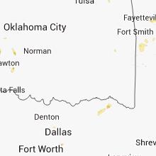
| Syracuse, KS | 2 | 1.75 | 1.75 | 0 | $62k | $31.6k | 32.3 |
Hail and Wind Damage Spotted on 7/14/2014
Filter by Report Type:Hail ReportsWind Reports
States Impacted
Illinois, Missouri, Kentucky, Kansas, Colorado, Virginia, Indiana, Tennessee, Florida, Oklahoma, South Carolina, Pennsylvania, Texas, Arkansas, New Jersey, New York, District of Columbia, Arizona, Maryland, Idaho, New Mexico, California, Mississippi, Alabama, Ohio, Wyoming, Nevada, Utah, WisconsinIllinois
| Local Time | Report Details |
|---|---|
| 11:20 AM CDT | Several large tree branches down in tazewell county IL, 8.7 miles SSW of Peoria, IL |
| 11:27 AM CDT | Large tree blown down onto power lines in schaefervill in tazewell county IL, 10.1 miles SSW of Peoria, IL |
| 11:30 AM CDT | Windows blown out of menards. relayed by week-t in tazewell county IL, 8.7 miles SSW of Peoria, IL |
| 12:23 PM CDT | Delayed repor in kankakee county IL, 51.6 miles SSW of Chicago, IL |
| 12:35 PM CDT | Numerous trees and power lines blown in city of clinto in de witt county IL, 50 miles SE of Peoria, IL |
| 1:10 PM CDT | Large tree blown down in champaign county IL, 57.9 miles N of Mattoon, IL |
| 1:15 PM CDT | Large tree down on mattis ave. north of springfiel in champaign county IL, 43.8 miles N of Mattoon, IL |
| 1:20 PM CDT | Large tree down at intersection of university and broadwa in champaign county IL, 44.2 miles NNE of Mattoon, IL |
| 1:22 PM CDT | Storm damage reported in champaign county IL, 38.9 miles N of Mattoon, IL |
| 1:31 PM CDT | Aprs mesonet in champaign county IL, 40.1 miles NNE of Mattoon, IL |
| 1:35 PM CDT | Numerous trees and power lines blown in city of clinto in de witt county IL, 50 miles SE of Peoria, IL |
| 1:36 PM CDT | Tree blown down on home on overton street. corrected tim in douglas county IL, 22.6 miles NNE of Mattoon, IL |
| 2:00 PM CDT | Large tree limbs down and a tree down blocking henning road at kickapoo roa in vermilion county IL, 57.9 miles NE of Mattoon, IL |
| 2:01 PM CDT | Large tree and power lines down on franklin street. corrected tim in vermilion county IL, 60.7 miles NE of Mattoon, IL |
| 2:30 PM CDT | Damage to 4 inch diameter trees. winds estimated 30-40 mp in st. clair county IL, 3.1 miles SSE of Saint Louis, MO |
| 2:30 PM CDT | Report of several large tree branches down. time estimate in madison county IL, 15.8 miles NE of Saint Louis, MO |
| 4:33 PM CDT | Storm damage reported in lawrence county IL, 54.1 miles N of Evansville, IN |
Missouri
| Local Time | Report Details |
|---|---|
| 11:46 AM CDT | Quarter sized hail reported near Houstonia, MO, 52.8 miles W of Columbia, MO |
| 11:49 AM CDT | Quarter sized hail reported near Hughesville, MO, 52.6 miles W of Columbia, MO, us postal worker with a quarter sized hail report. |
| 12:15 PM CDT | Delayed report...several small tree limbs of around 2 inches in diameter down around town. resident estimated 50-60 mph wind in cooper county MO, 39.3 miles WSW of Columbia, MO |
| 12:34 PM CDT | Storm damage reported in moniteau county MO, 31.8 miles SW of Columbia, MO |
| 12:55 PM CDT | Quarter sized hail reported near California, MO, 29.3 miles SSW of Columbia, MO |
| 1:05 PM CDT | Hail between nickel and quarter. very high winds as well...some tree damage in area in cole county MO, 29.4 miles S of Columbia, MO |
| 1:05 PM CDT | Quarter sized hail reported near Lohman, MO, 29.4 miles S of Columbia, MO, hail between nickel and quarter. very high winds as well...some tree damage in area |
| 1:45 PM CDT | Estimated 50-60 mph winds in st. charles county MO, 24.5 miles WNW of Saint Louis, MO |
| 2:07 PM CDT | Top of tree 6-8 inches in diameter across dielman road at dielman and olive blv in st. louis county MO, 10.2 miles WNW of Saint Louis, MO |
| 2:07 PM CDT | Small tree limbs snapped by high winds in st. louis county MO, 13.6 miles NW of Saint Louis, MO |
| 2:10 PM CDT | Several small tree limbs blown dow in st. louis county MO, 9.5 miles NW of Saint Louis, MO |
Kentucky
| Local Time | Report Details |
|---|---|
| 1:38 PM EDT | Several trees down in livingston...including one that fell on a home. estimated event time from rada in rockcastle county KY, 30.7 miles SSW of Irvine, KY |
| 1:39 PM EDT | 2 trees dow in rockcastle county KY, 30.7 miles SSW of Irvine, KY |
| 2:03 PM EDT | 2 trees down on sasser school r in laurel county KY, 39.7 miles S of Irvine, KY |
| 2:25 PM EDT | Tree down on paces creek r in clay county KY, 39.6 miles SSE of Irvine, KY |
| 3:00 PM EDT | Tree down on combs b in perry county KY, 42 miles SE of Irvine, KY |
| 3:07 PM EDT | Tree down on coal ave in walkertow in perry county KY, 51.5 miles SE of Irvine, KY |
| 3:07 PM EDT | Tree down on browns fork r in perry county KY, 55.4 miles SE of Irvine, KY |
| 3:07 PM EDT | Tree down at lotts cree in perry county KY, 50.3 miles ESE of Irvine, KY |
| 3:56 PM EDT | Several trees down in livingston...including one that fell on a home. estimated time based on report and when spotter said it occure in rockcastle county KY, 30.7 miles SSW of Irvine, KY |
| 8:25 PM EDT | Quarter sized hail reported near Stanton, KY, 9.1 miles ENE of Irvine, KY, hail ongoing on watson ridge road outside of irvine. averaging nickel size hail... with quarter sized hail mixing in. |
Kansas
| Local Time | Report Details |
|---|---|
| 11:42 AM MDT | Golf Ball sized hail reported near Syracuse, KS, 60.4 miles WNW of Garden City, KS |
| 12:41 PM MDT | Golf Ball sized hail reported near Syracuse, KS, 63.1 miles WSW of Garden City, KS, most of the hail was no larger than a quarter. |
| 2:35 PM CDT | Tree limbs four to five inches in diameter were blown down by thunderstorm outflo in morton county KS, 72.6 miles SW of Garden City, KS |
| 2:45 PM CDT | Storm damage reported in morton county KS, 70.2 miles SW of Garden City, KS |
| 2:55 PM CDT | Storm damage reported in morton county KS, 86.8 miles SW of Garden City, KS |
| 3:00 PM CDT | A couple of power poles were down in elkhar in morton county KS, 87.1 miles SW of Garden City, KS |
| 3:02 PM CDT | Storm damage reported in morton county KS, 87.1 miles SW of Garden City, KS |
| 3:08 PM CDT | The wind was measured at the elkhart amos sit in morton county KS, 87.1 miles SW of Garden City, KS |
| 3:10 PM CDT | Quarter sized hail reported near Elkhart, KS, 87.1 miles SW of Garden City, KS |
| 3:16 PM CDT | Quarter sized hail reported near Rolla, KS, 68.8 miles SW of Garden City, KS |
| 3:20 PM CDT | 4 power poles dow in sedgwick county KS, 22.5 miles W of Wichita, KS |
| 3:25 PM CDT | Wind estimated at 65 to 70 mp in sedgwick county KS, 20.7 miles SW of Wichita, KS |
| 3:30 PM CDT | Large tree limbs down all over the yar in sedgwick county KS, 22 miles SW of Wichita, KS |
| 3:52 PM CDT | Emergency manager reported 6 to 8 power poles snapped off along with 8 to 10 inch tree branche in pratt county KS, 86.3 miles NNE of Woodward, OK |
| 4:07 PM CDT | Storm damage reported in chautauqua county KS, 60.8 miles SE of Wichita, KS |
| 4:13 PM CDT | Storm damage reported in chautauqua county KS, 60.8 miles SE of Wichita, KS |
| 4:19 PM CDT | Storm damage reported in barber county KS, 70.4 miles NNE of Woodward, OK |
| 4:23 PM CDT | Quarter sized hail reported near Montezuma, KS, 33.1 miles SE of Garden City, KS |
| 4:28 PM CDT | Observer reports 50 to 60 mph winds with a power outage in chautauqua county KS, 65.3 miles SE of Wichita, KS |
| 4:31 PM CDT | Storm damage reported in pratt county KS, 74.8 miles W of Wichita, KS |
| 5:11 PM CDT | Storm damage reported in comanche county KS, 60.1 miles N of Woodward, OK |
Colorado
| Local Time | Report Details |
|---|---|
| 12:09 PM MDT | Half Dollar sized hail reported near Lamar, CO, 95.6 miles W of Garden City, KS, prowers county comm |
| 2:25 PM MDT | Quarter sized hail reported near Colorado Springs, CO, 37.7 miles NNW of Pueblo, CO |
| 3:00 PM MDT | Ping Pong Ball sized hail reported near Calhan, CO, 41.5 miles NNE of Pueblo, CO, time estimated |
| 3:45 PM MDT | Quarter sized hail reported near Loveland, CO, 55.7 miles NNW of Denver, CO |
| 4:13 PM MDT | Quarter sized hail reported near Loveland, CO, 41.8 miles N of Denver, CO |
| 4:51 PM MDT | Storm damage reported in weld county CO, 24.2 miles N of Denver, CO |
Virginia
| Local Time | Report Details |
|---|---|
| 3:11 PM EDT | Tree down on rudasill mill rd near shady l in rappahannock county VA, 85.3 miles NNW of Richmond, VA |
| 3:49 PM EDT | Tree down on fence along rt 793 near lake brittl in fauquier county VA, 69.1 miles WSW of Baltimore, MD |
| 3:51 PM EDT | Two 4-5 inch diameter trees snapped at faa cente in fauquier county VA, 68.2 miles WSW of Baltimore, MD |
| 3:54 PM EDT | Large branches down near intersection of vint hill road and greenwich roa in prince william county VA, 67.3 miles WSW of Baltimore, MD |
| 4:40 PM EDT | A tree was down in the roadway on eastbound old dominion drive at birch roa in fairfax county VA, 39.1 miles SW of Baltimore, MD |
| 4:41 PM EDT | A tree fell on wires and two cars at north glebe road and north henderson roa in arlington county VA, 39.1 miles SW of Baltimore, MD |
| 5:40 PM EDT | Dispatch reported several trees downed countywid in russell county VA, 22.6 miles NNE of Bristol, TN |
| 6:00 PM EDT | One tree down at the buckingham courthouse in buckingham county VA, 50 miles W of Richmond, VA |
| 6:00 PM EDT | Two trees down on andersonville road near the intersection with oak hill road in buckingham county VA, 47.7 miles W of Richmond, VA |
| 6:00 PM EDT | Two trees down along oak hill road in buckingham county VA, 48.3 miles W of Richmond, VA |
| 6:03 PM EDT | Tree down on troublesome creek road just east of buckingham courthous in buckingham county VA, 48.9 miles W of Richmond, VA |
| 6:04 PM EDT | One tree down on lee wayside road in buckingham county VA, 47.8 miles W of Richmond, VA |
| 6:08 PM EDT | One tree down at the intersection of belle branch road and belmont lane in buckingham county VA, 38.5 miles W of Richmond, VA |
| 6:30 PM EDT | One tree down on chapel road in buckingham county VA, 38.6 miles WNW of Richmond, VA |
| 6:30 PM EDT | One tree down on cartersville road in buckingham county VA, 36.8 miles WNW of Richmond, VA |
| 6:43 PM EDT | Tree down on a power line between byllesby and buck dam in carroll county VA, 64.1 miles WSW of Roanoke, VA |
| 6:51 PM EDT | One tree down on a power line near the intersection of fairview church road and cedar springs road in wythe county VA, 55.4 miles ENE of Bristol, TN |
| 7:52 PM EDT | Three trees down at the intersection of simpkinstown road and lead mine road in pulaski county VA, 38.5 miles WSW of Roanoke, VA |
Indiana
| Local Time | Report Details |
|---|---|
| 3:12 PM EDT | Storm damage reported in warren county IN, 69.3 miles NE of Mattoon, IL |
| 3:27 PM EDT | Storm damage reported in fountain county IN, 62.6 miles WNW of Indianapolis, IN |
| 4:12 PM EDT | Scattered trees down around county including greencastle....largest 1 foot diameter and half rotted. measured wind of 48 mp in putnam county IN, 37.8 miles WSW of Indianapolis, IN |
| 4:17 PM EDT | Trees down. time estimated from radar in putnam county IN, 37.8 miles WSW of Indianapolis, IN |
| 4:53 PM EDT | Estimated 55 to 65 mph wind. stop sign blown dow in hendricks county IN, 12.9 miles WSW of Indianapolis, IN |
| 5:10 PM EDT | Tree 4 to 5 inches in diameter blown down in hamilton county IN, 14.4 miles NNE of Indianapolis, IN |
| 5:15 PM EDT | Large trees swayed...almost snapped...off 104th street in hamilton county IN, 12.6 miles N of Indianapolis, IN |
Tennessee
| Local Time | Report Details |
|---|---|
| 2:15 PM CDT | Large limbs down with winds estimated to be 60 mp in weakley county TN, 20.2 miles WNW of Mc Kenzie, TN |
| 2:15 PM CDT | Large limbs down with winds estimated to be 60 mp in weakley county TN, 21.2 miles WNW of Mc Kenzie, TN |
| 2:33 PM CDT | 2 large trees down and numerous small trees down.roof and structural damage to at least one home on north hwy ave. power lines down across the communit in weakley county TN, 18.1 miles WNW of Mc Kenzie, TN |
| 2:33 PM CDT | Large limbs down with winds estimated to be 60 mp in weakley county TN, 20.2 miles WNW of Mc Kenzie, TN |
| 2:40 PM CDT | Large trees down on power lines on old medina r in madison county TN, 37.6 miles SSW of Mc Kenzie, TN |
| 3:07 PM CDT | Large trees down on power lines on old medina r in madison county TN, 37.6 miles SSW of Mc Kenzie, TN |
| 3:14 PM CDT | Trees down at intersection of washington and frasyer street in benton county TN, 24 miles ESE of Mc Kenzie, TN |
| 3:20 PM CDT | Tree down on shaver road west of waverly in humphreys county TN, 35.9 miles E of Mc Kenzie, TN |
| 3:30 PM CDT | Trees down and power lines down around beaver dam area and the town of camde in benton county TN, 24 miles ESE of Mc Kenzie, TN |
| 3:32 PM CDT | Tree down on clydeton road north of waverly in humphreys county TN, 40.8 miles E of Mc Kenzie, TN |
| 3:41 PM CDT | On airways blvd power lines dow in madison county TN, 38.8 miles SSW of Mc Kenzie, TN |
| 4:05 PM CDT | Large tree limbs downa and shingles lifted off roo in chester county TN, 48.3 miles S of Mc Kenzie, TN |
| 4:30 PM CDT | Trees snapped and some uprooted across railroad tracks at poplar and poplar pike near germantown and collierville borde in shelby county TN, 15.2 miles ESE of Memphis, TN |
| 4:38 PM CDT | A large tree fell on house located on norfolk street vcnty of interstate 240 and east person roa in shelby county TN, 1.4 miles S of Memphis, TN |
| 4:51 PM CDT | 18 inch tree down at wickle road and franklin road in brentwood in williamson county TN, 13.7 miles S of Nashville, TN |
| 5:00 PM CDT | A tree and large tree limb were blown down near cool springs galleria in williamson county TN, 14.4 miles S of Nashville, TN |
| 5:02 PM CDT | A tree was blown down in the mckays mill subdivision in williamson county TN, 17.1 miles S of Nashville, TN |
| 5:06 PM CDT | Trees down and power poles down along whitten near bartlett blvd and elmore roa in shelby county TN, 12.3 miles ENE of Memphis, TN |
| 5:08 PM CDT | Wind gusting to around 67 mph in central fayette count in fayette county TN, 40 miles E of Memphis, TN |
| 5:10 PM CDT | Trees down on goodlett between appling and whitten roa in shelby county TN, 11.8 miles E of Memphis, TN |
| 5:20 PM CDT | Large tree limbs were blown down in the jordan acres area of smyrna in rutherford county TN, 21.7 miles SE of Nashville, TN |
| 5:30 PM CDT | Power lines down on whitten road near fletcher creek/kamali r in shelby county TN, 15.8 miles E of Memphis, TN |
| 5:53 PM CDT | Wind gust to 62 mph recorded at jackson airpor in madison county TN, 38.8 miles SSW of Mc Kenzie, TN |
| 6:27 PM CDT | Several trees down on north spring street in sparta in white county TN, 62.9 miles N of Chattanooga, TN |
| 6:41 PM CDT | Tree damage. some rotation in the debris not connected to cloud bas in fayette county TN, 45.1 miles E of Memphis, TN |
| 6:44 PM CDT | Trees down near hwy 368 and 1 in hardeman county TN, 49 miles E of Memphis, TN |
Florida
| Local Time | Report Details |
|---|---|
| 3:25 PM EDT | A tree fell onto a house with minimal structure damage on the 1600 block of nightowl trail. time based on radar dat in clay county FL, 19 miles SW of Jacksonville, FL |
| 3:30 PM EDT | Skywarn spotter reported small to medium size branches down and slight street flooding. time of event between 325 pm and 345 p in clay county FL, 18.8 miles SW of Jacksonville, FL |
| 4:42 PM EDT | Several trees reported down in the danforth subdivision off of hodges boulevard. time based on radar dat in duval county FL, 12.2 miles ESE of Jacksonville, FL |
| 4:42 PM EDT | Local media reports trees downed in the windsor park subdivision in eastern jacksonville. time based on radar dat in duval county FL, 11.3 miles ESE of Jacksonville, FL |
| 4:45 PM EDT | Wtev broadcasted a picture of a tree downed by thunderstorm wind gusts near the intersection of hodges and beach boulevard. time of damage based on radar dat in duval county FL, 12 miles ESE of Jacksonville, FL |
| 4:53 PM EDT | The weatherflow sensor at buck island recorded a 70 mph wind gust as a severe thunderstorm moved through coastal duval count in duval county FL, 11.3 miles ENE of Jacksonville, FL |
| 5:15 PM EDT | Flagler county emergency management relayed a report of tree downed by thunderstorm wind gusts that toppled powerlines near the intersection of state road 100 and woodl in flagler county FL, 63.9 miles SSE of Jacksonville, FL |
| 5:53 PM EDT | Preliminary reports of numerous trees down and road blockages along state road 11 in the de leon springs and pierson areas. reports relayed by volusia county sheriff an in volusia county FL, 40.1 miles N of Orlando, FL |
| 5:55 PM EDT | Tree down and blocking road on canal view blvd. in port orang in volusia county FL, 45.3 miles NNE of Orlando, FL |
| 5:58 PM EDT | Flagler county emergency management relayed a report of a tree and powerlines downed by thunderstorm wind gusts along foster lane in palm coas in flagler county FL, 58.6 miles SSE of Jacksonville, FL |
Oklahoma
| Local Time | Report Details |
|---|---|
| 2:47 PM CDT | Quarter sized hail reported near Carnegie, OK, 68.2 miles WSW of Oklahoma City, OK |
| 3:57 PM CDT | Quarter sized hail reported near Guymon, OK, 95 miles SSW of Garden City, KS |
| 5:06 PM CDT | At ponca city regional airport in kay county OK, 67.8 miles S of Wichita, KS |
| 6:01 PM CDT | Storm damage reported in mayes county OK, 47.9 miles ENE of Tulsa, OK |
| 6:02 PM CDT | Storm damage reported in mayes county OK, 45.1 miles ENE of Tulsa, OK |
| 6:02 PM CDT | Storm damage reported in mayes county OK, 45.1 miles ENE of Tulsa, OK |
| 6:02 PM CDT | Quarter sized hail reported near Adair, OK, 45.1 miles ENE of Tulsa, OK |
| 6:10 PM CDT | Storm damage reported in mayes county OK, 42.9 miles ENE of Tulsa, OK |
| 8:10 PM CDT | Storm damage reported in dewey county OK, 27.3 miles S of Woodward, OK |
| 8:22 PM CDT | 18 utility poles downed. entire town of newkirk without powe in kay county OK, 57.7 miles SSE of Wichita, KS |
South Carolina
| Local Time | Report Details |
|---|---|
| 3:47 PM EDT | Reported a line down due to trees on power lin in aiken county SC, 16.2 miles SE of Augusta, GA |
| 3:58 PM EDT | Sc highway patrol reports a tree down and in the roadway on hendersonville highway near the intersection with great swamp road. time estimated from rada in colleton county SC, 46.9 miles WSW of Charleston, SC |
Pennsylvania
| Local Time | Report Details |
|---|---|
| 3:53 PM EDT | Trees down and power outages reported in montgomeryvill in montgomery county PA, 74.6 miles WSW of Brooklyn, NY |
| 4:01 PM EDT | Quarter sized hail reported near Lansdale, PA, 72.6 miles WSW of Brooklyn, NY, quarter size hail reported at the montgomery mall in montgomeryville. |
Texas
| Local Time | Report Details |
|---|---|
| 2:55 PM CDT | Large limbs down up and down fm 2573 in bagwell in red river county TX, 75 miles WSW of Nashville, AR |
| 2:55 PM CDT | Tree down over road on cr 2104 in red river county TX, 74.8 miles SE of Atoka, OK |
| 2:55 PM CDT | Wind damage at fairview stacy rd and country club. 8" diameter tree blown dow in collin county TX, 28.7 miles NNE of Dallas, TX |
| 3:10 PM CDT | Wind damage in frisco. house under construction destroyed in collin county TX, 25.6 miles N of Dallas, TX |
| 3:15 PM CDT | Large trees damaged by thunderstorm winds near the colony in denton county TX, 22.2 miles NNW of Dallas, TX |
| 4:29 PM CDT | Pea to marble size hail was also fallin in dallam county TX, 91.8 miles NNE of Tucumcari, NM |
| 4:49 PM CDT | Trees damaged in the oak cliff section of the city of dallas in dallas county TX, 2 miles S of Dallas, TX |
| 4:58 PM CDT | Several trees damaged along highway 11 near com in hopkins county TX, 79.6 miles ENE of Dallas, TX |
| 5:08 PM CDT | Storm damage reported in hartley county TX, 69.6 miles NW of Amarillo, TX |
| 5:15 PM CDT | Storm damage reported in hartley county TX, 69.6 miles NW of Amarillo, TX |
| 5:43 PM CDT | Trees blown down roughly at the intersection of northern cross and anderson boulevar in tarrant county TX, 27.7 miles W of Dallas, TX |
| 5:52 PM CDT | Via kvii schoolnet at middlewell methodist churc in moore county TX, 41.4 miles NNW of Amarillo, TX |
| 6:32 PM CDT | 65 mph wind gust measured in seagoville. large tree limbs damaged. hail lasted for approximately 8 minute in dallas county TX, 18.5 miles ESE of Dallas, TX |
| 6:57 PM CDT | Quarter sized hail reported near Amarillo, TX, 6.8 miles WSW of Amarillo, TX, a mix of pea to quarter size hail was falling along with very heavy rain and street flooding near 45th and soncy. |
| 7:04 PM CDT | Quarter sized hail reported near Amarillo, TX, 8 miles SW of Amarillo, TX, hail up to quarter size fell in the hillside terrace neighborhood. |
| 7:50 PM CDT | Storm damage reported in deaf smith county TX, 46.2 miles ESE of Tucumcari, NM |
Arkansas
| Local Time | Report Details |
|---|---|
| 3:13 PM CDT | Metal from a chicken house was blown around a power pol in cleburne county AR, 63.5 miles NNE of Little Rock, AR |
| 3:35 PM CDT | Poles down along highway 63. near east parker road and one plac in craighead county AR, 56.9 miles NW of Memphis, TN |
| 3:50 PM CDT | A power pole broke a few miles northeast of tow in independence county AR, 76.3 miles NE of Little Rock, AR |
| 3:50 PM CDT | Power and light poles down on highway 63 and parker road east of caraway road in jonesbor in craighead county AR, 58.7 miles NW of Memphis, TN |
| 7:30 PM CDT | Two houses were damaged by falling trees...with several trees down throughout the cit in dallas county AR, 64.5 miles S of Little Rock, AR |
| 7:38 PM CDT | A pine tree snapped and other large limbs down...report via social media pictur in ashley county AR, 25.7 miles NNW of Bastrop, LA |
| 7:45 PM CDT | Power lines down in chicot county AR, 53 miles NE of Bastrop, LA |
| 9:53 PM CDT | A tree was blown down on the west side of tow in ashley county AR, 24.4 miles N of Bastrop, LA |
New Jersey
| Local Time | Report Details |
|---|---|
| 4:35 PM EDT | Tree and wires down on gould road between union valley road and wooley roa in passaic county NJ, 35.9 miles NW of Brooklyn, NY |
| 6:55 PM EDT | Wires down. also branches down in nearby readington townshi in hunterdon county NJ, 48.3 miles WSW of Brooklyn, NY |
| 8:07 PM EDT | Numerous trees down in camden county NJ, 77.5 miles SW of Brooklyn, NY |
| 8:27 PM EDT | 65 mph wind gust in lumberto in burlington county NJ, 66 miles SW of Brooklyn, NY |
| 8:28 PM EDT | Large aluminum irrigation pipes blown across buddtown road in southampton twp. many trees also blown dow in burlington county NJ, 66.6 miles SW of Brooklyn, NY |
New York
| Local Time | Report Details |
|---|---|
| 4:38 PM EDT | Tree down along route 20 between county routes 47 and 1 in ontario county NY, 54 miles WSW of Syracuse, NY |
District of Columbia
| Local Time | Report Details |
|---|---|
| 4:49 PM EDT | A tree was down on 28th street nw and q street n in district of columb county DC, 35.7 miles SW of Baltimore, MD |
| 4:52 PM EDT | A tree was down at 3rd street ne and r street n in district of columb county DC, 33.6 miles SW of Baltimore, MD |
Arizona
| Local Time | Report Details |
|---|---|
| 2:04 PM MST | Storm damage reported in gila county AZ, 69.2 miles SW of Show Low, AZ |
| 3:35 PM MST | Quarter sized hail reported near Tucson, AZ, 16.4 miles N of Tucson, AZ, spotter reports quarter sized hail |
| 7:24 PM MST | Power lines and trees of unknown size blown dow in maricopa county AZ, 6.1 miles NE of Phoenix, AZ |
| 7:30 PM MST | The mohave county sheriff reported power lines down in kingma in mohave county AZ, 53.8 miles NNE of Lake Havasu City, AZ |
| 7:35 PM MST | Several trees were reported down in the new butler area. road crews had to be dispatched to clear a few tree in mohave county AZ, 57.1 miles NNE of Lake Havasu City, AZ |
| 7:35 PM MST | A roof was blown off a shed and power lines were downed on christy drive in kingma in mohave county AZ, 56.7 miles NNE of Lake Havasu City, AZ |
| 7:42 PM MST | Quarter sized hail reported near Hereford, AZ, 40.2 miles W of Douglas, AZ, spotter reports quarter sized hail |
| 7:44 PM MST | Quarter sized hail reported near Sierra Vista, AZ, 43 miles WNW of Douglas, AZ, quater size hail in ash canyon |
Maryland
| Local Time | Report Details |
|---|---|
| 5:50 PM EDT | 5 inch cherry tree branch in anne arundel county MD, 19.3 miles SSE of Baltimore, MD |
| 5:50 PM EDT | Three large trees and several smaller trees down in hawthorne in middle river in baltimore county MD, 9.3 miles ENE of Baltimore, MD |
| 6:06 PM EDT | Mesone in anne arundel county MD, 19.2 miles SSE of Baltimore, MD |
| 6:11 PM EDT | Multiple tree limbs down on jerusalem rd near the baltimore county lin in baltimore county MD, 16.6 miles NE of Baltimore, MD |
| 6:22 PM EDT | Trees and power lines were down on wheel roa in harford county MD, 19.9 miles NE of Baltimore, MD |
| 6:30 PM EDT | Trees were down on md-22 between i-95 and us-4 in harford county MD, 28.4 miles NE of Baltimore, MD |
| 6:45 PM EDT | A large tree was down blocking the roadway at 38870 foley mattingly roa in st. marys county MD, 62.5 miles S of Baltimore, MD |
| 6:55 PM EDT | Multiple trees down...some on power lines and two on house in calvert county MD, 56.9 miles S of Baltimore, MD |
| 7:00 PM EDT | Trees down in northeas in cecil county MD, 40.2 miles ENE of Baltimore, MD |
| 7:05 PM EDT | Trees down in chesapeake cit in cecil county MD, 45.9 miles ENE of Baltimore, MD |
| 7:32 PM EDT | Large tree down blocking the intersection of probasco landing road and longwoods roa in talbot county MD, 45.8 miles SE of Baltimore, MD |
| 7:37 PM EDT | Tree down at rt 343 and horns point r in dorchester county MD, 56.3 miles SSE of Baltimore, MD |
Idaho
| Local Time | Report Details |
|---|---|
| 4:18 PM MDT | 4 to 6 inch diameter branches broken off trees from strong wind in caribou county ID, 70.9 miles SSE of Idaho Falls, ID |
New Mexico
| Local Time | Report Details |
|---|---|
| 4:24 PM MDT | Quarter sized hail reported near Sedan, NM, 74.3 miles NNE of Tucumcari, NM |
| 5:02 PM MDT | Storm damage reported in union county NM, 55.1 miles NE of Tucumcari, NM |
| 7:02 PM MDT | Ping Pong Ball sized hail reported near Cuba, NM, 71.1 miles NNW of Albuquerque, NM, report of car being dented by hail on hwy 550 relayed by giant thriftway store clerk from cuba |
California
| Local Time | Report Details |
|---|---|
| 3:55 PM PDT | Quarter sized hail reported near Bridgeport, CA, 93.1 miles SSE of Reno, NV, mono county sheriff reported hail up to 1 inch diameter between 355 and 405 pm. also brief heavy rainfall. |
Mississippi
| Local Time | Report Details |
|---|---|
| 6:45 PM CDT | Roof was blown off of trailer at 2318 rabbit ridge road. several trees and power lines down around byhali in marshall county MS, 28.5 miles SE of Memphis, TN |
| 7:00 PM CDT | Several tress down across northern tippah county...especially community of walnu in tippah county MS, 66.6 miles ESE of Memphis, TN |
| 7:35 PM CDT | A tree and power lines down on hwy 1 in bolivar county MS, 88.3 miles NE of Bastrop, LA |
Alabama
| Local Time | Report Details |
|---|---|
| 7:30 PM CDT | Trees down near leeth gap road and duck srpings road. winds estimated around 50 mp in etowah county AL, 57.2 miles NE of Birmingham, AL |
Ohio
| Local Time | Report Details |
|---|---|
| 8:30 PM EDT | Trees down in berlin cente in mahoning county OH, 50.6 miles SE of Cleveland, OH |
Wyoming
| Local Time | Report Details |
|---|---|
| 6:56 PM MDT | Church butte-6743 ft sensor in uinta county WY, 47.8 miles W of Rock Springs, WY |
Nevada
| Local Time | Report Details |
|---|---|
| 5:58 PM PDT | Thunderstorm wind gust of 64 mph measured at the nws weather forecast office in nw ren in washoe county NV, 5.7 miles N of Reno, NV |
Utah
| Local Time | Report Details |
|---|---|
| 7:15 PM MDT | Wig mountain-4352 ft sensor in tooele county UT, 61.1 miles WSW of Salt Lake City, UT |
| 7:15 PM MDT | Promontory point-6926 ft sensor in box elder county UT, 43.1 miles NW of Salt Lake City, UT |
| 7:25 PM MDT | Salt flats-4265 ft sensor in tooele county UT, 51.1 miles WNW of Salt Lake City, UT |
| 7:37 PM MDT | Saratoga springs-4787 ft sensor in utah county UT, 31 miles S of Salt Lake City, UT |
| 7:50 PM MDT | Camel back mtn-5077 ft sensor in tooele county UT, 70.9 miles SW of Salt Lake City, UT |
| 8:40 PM MDT | I-80 at grassey-4650 ft sensor in tooele county UT, 58.7 miles WNW of Salt Lake City, UT |
| 8:49 PM MDT | Storm damage reported in uintah county UT, 80.5 miles S of Rock Springs, WY |
Wisconsin
| Local Time | Report Details |
|---|---|
| 10:41 PM CDT | Quarter sized hail reported near Sturgeon Bay, WI, 42 miles NE of Green Bay, WI, three to four inches of hail covered the roads. |
Connect with Interactive Hail Maps