

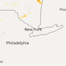
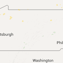
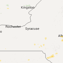
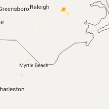
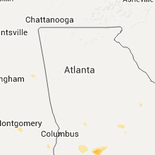
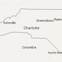
Hail Map for Sunday, July 19, 2015

Number of Impacted Households on 7/19/2015
0
Impacted by 1" or Larger Hail
0
Impacted by 1.75" or Larger Hail
0
Impacted by 2.5" or Larger Hail
Square Miles of Populated Area Impacted on 7/19/2015
0
Impacted by 1" or Larger Hail
0
Impacted by 1.75" or Larger Hail
0
Impacted by 2.5" or Larger Hail


Cities Most Affected by Hail Storms of 7/19/2015
| Hail Size | Demographics of Zip Codes Affected | ||||||
|---|---|---|---|---|---|---|---|
| City | Count | Average | Largest | Pop Density | House Value | Income | Age |
| Selkirk, NY | 2 | 1.88 | 2.00 | 203 | $103k | $49.5k | 40.4 |
| North Berwick, ME | 1 | 2.75 | 2.75 | 101 | $107k | $47.1k | 42.2 |
| Rochester, NH | 1 | 2.50 | 2.50 | 704 | $104k | $40.8k | 41.3 |
| Springview, NE | 1 | 1.75 | 1.75 | 1 | $27k | $23.3k | 50.5 |
| Belmont, NH | 1 | 1.75 | 1.75 | 222 | $97k | $48.2k | 42.0 |
| Hugo, CO | 1 | 1.75 | 1.75 | 0 | $71k | $31.3k | 46.8 |
| Tilton, NH | 1 | 1.75 | 1.75 | 202 | $94k | $43.2k | 41.8 |
Hail and Wind Damage Spotted on 7/19/2015
Filter by Report Type:Hail ReportsWind Reports
States Impacted
Ohio, South Carolina, Alabama, Florida, Georgia, North Carolina, New Hampshire, Maine, New York, Vermont, Colorado, Pennsylvania, Kentucky, California, Massachusetts, South Dakota, Kansas, NebraskaOhio
| Local Time | Report Details |
|---|---|
| 1:31 PM EDT | Several trees downed on paragon road and mcewen road in centervill in montgomery county OH, 40.1 miles NNE of Cincinnati, OH |
| 1:32 PM EDT | A large tree was uprooted on eagle creek drive in centervill in montgomery county OH, 40.2 miles NNE of Cincinnati, OH |
| 1:33 PM EDT | A large healthy tree was partially split off near the intersection of penbrooke trail and yankee stree in montgomery county OH, 40.2 miles NNE of Cincinnati, OH |
| 1:35 PM EDT | One tree snapped off near mad river and westridge road in montgomery county OH, 41.7 miles NNE of Cincinnati, OH |
| 2:00 PM EDT | Several large limbs blown down. time estimated from rada in miami county OH, 59.6 miles N of Cincinnati, OH |
| 2:03 PM EDT | 4 trees knocked dow in warren county OH, 30.1 miles NE of Cincinnati, OH |
| 2:04 PM EDT | A couple of trees were blown down in harlan township. time estimated from rada in warren county OH, 27 miles ENE of Cincinnati, OH |
| 2:15 PM EDT | Large limbs down on dayton road. time estimated from rada in clark county OH, 45.7 miles W of Columbus, OH |
| 2:29 PM EDT | Tree knocked down on shrine roa in clark county OH, 47.1 miles W of Columbus, OH |
| 2:42 PM EDT | A large tree was downed on stanton ave causing damage to vehicle in clark county OH, 42.4 miles W of Columbus, OH |
| 3:24 PM EDT | A large healthy tree was partially snapped. time of event estimated from rada in franklin county OH, 14.3 miles NW of Columbus, OH |
| 3:25 PM EDT | A very large healthy tree limb was downed on crescent drive in hilliard...with minor damage to a vehicl in franklin county OH, 9.9 miles WNW of Columbus, OH |
| 3:36 PM EDT | One large tree downed over rocky fork road near upper twin creek roa in scioto county OH, 71.4 miles ESE of Cincinnati, OH |
| 4:30 PM EDT | Several large tree branches down in a campground in vanlu in hancock county OH, 74.6 miles NNW of Columbus, OH |
| 4:50 PM EDT | Several large tree branches down in a campground in vanlu in hancock county OH, 74.6 miles NNW of Columbus, OH |
South Carolina
| Local Time | Report Details |
|---|---|
| 2:00 PM EDT | Sc state hwy patrol reports a tree down on clyo rd near the intersection of hwy 119. time estimated from radar in jasper county SC, 33.2 miles NNW of Savannah, GA |
| 2:22 PM EDT | Sc state hwy patrol reports tree down on hwy 119 near the intersection with us hwy 321 in jasper county SC, 26.2 miles N of Savannah, GA |
| 2:56 PM EDT | Sc state hwy patrol reports tree down on us hwy 321 near the dearfield sand pit in jasper county SC, 21.3 miles N of Savannah, GA |
| 3:09 PM EDT | Sc state hwy patrol reports a tree down on hudson mill rd near the intersection with little elbow dr in colleton county SC, 47.4 miles WSW of Charleston, SC |
| 3:09 PM EDT | Large tree limb down blocking traffic at the intersection of plantation dr and s okatie hwy in jasper county SC, 11.1 miles NNE of Savannah, GA |
| 3:09 PM EDT | Large tree limb down blocking traffic at the intersection of plantation dr and s okatie hwy in jasper county SC, 11.5 miles NNE of Savannah, GA |
| 3:35 PM EDT | Sc state law enforcement reports a tree down on old salkehatchie hwy near the intersection with mt olive rd in hampton county SC, 48.8 miles NNE of Savannah, GA |
| 3:35 PM EDT | Bamberg 911 reported 2 trees down on crazy horse rd near olar. time estimate in bamberg county SC, 49.4 miles ESE of Augusta, GA |
| 3:35 PM EDT | Sc state hwy patrol reports tree down on jacksonboro rd near the intersection of us hwy 17a in colleton county SC, 32.9 miles WSW of Charleston, SC |
| 3:40 PM EDT | Beaufort 911 center reports a large tree down on a house on cornelius drive. no injurie in beaufort county SC, 37.2 miles NE of Savannah, GA |
| 3:49 PM EDT | Spotter reported a large tree down near mt olive church in salkehatchie in colleton county SC, 47.9 miles NNE of Savannah, GA |
| 4:05 PM EDT | Beaufort 911 center reports a tree down on hunting island and across sea island parkwa in beaufort county SC, 42.2 miles ENE of Savannah, GA |
| 4:05 PM EDT | Twitter report shows large tree that fell in the front yard of a house near fort dorchester high school in dorchester county SC, 19.2 miles SSW of Charleston, SC |
| 4:23 PM EDT | Sc state hwy patrol reports tree down on ashley river rd in front of magnolia plantation in charleston county SC, 22.9 miles S of Charleston, SC |
| 4:44 PM EDT | Large tree and several large limbs down on chisholm plantation road about 0.3 miles south of the edisto island historical societ in charleston county SC, 46.7 miles SSW of Charleston, SC |
| 4:44 PM EDT | Sc state hwy patrol reports tree down across maybank hwy near the intersection of fenwich hall allee in charleston county SC, 30.8 miles S of Charleston, SC |
| 4:46 PM EDT | Sc state hwy patrol reports tree down on us hwy 321 in jasper county SC, 21.3 miles N of Savannah, GA |
| 4:50 PM EDT | Large limbs down in nearby wooded area. estimates winds up to 65 mp in charleston county SC, 47.6 miles SSW of Charleston, SC |
| 5:05 PM EDT | Newberry 911 reported tree down on us 176 and big pine rd. time estimate in newberry county SC, 64.9 miles NNE of Augusta, GA |
| 5:25 PM EDT | Social media report of some large trees down... and a tin roof of a home pulled back... at keitts crossroads... sc hwy 34 and us hwy 17 in newberry county SC, 65.1 miles NNE of Augusta, GA |
| 5:35 PM EDT | Newberry 911 reported tree down on interstate 26 westbound at mile marker 7 in newberry county SC, 62 miles NNE of Augusta, GA |
| 5:40 PM EDT | Schp reports trees down on ladds rd at hwy 21 in fairfield county SC, 62.3 miles SSW of Charlotte, NC |
| 5:49 PM EDT | Sc hwy patrol reported a tree fallen onto lewis store road near old douglass road. this is near the community of blackstoc in fairfield county SC, 53.2 miles SSW of Charlotte, NC |
| 6:00 PM EDT | Newberry 911 reports trees down at evans st and mcdowell st in the city of newberr in newberry county SC, 58.9 miles NNE of Augusta, GA |
| 6:00 PM EDT | Schp reports trees down on leesburg rd at davis r in richland county SC, 72.3 miles NW of Charleston, SC |
| 6:04 PM EDT | Schp reports trees down on leesburg rd at harmon r in richland county SC, 71.2 miles NW of Charleston, SC |
| 7:09 PM EDT | Schp reports trees down on running fox rd at leaning tree rd. time estimate in richland county SC, 76.2 miles NE of Augusta, GA |
| 7:40 PM EDT | Kershaw 911 reported tree down on lucknow r in kershaw county SC, 69.6 miles SSE of Charlotte, NC |
Alabama
| Local Time | Report Details |
|---|---|
| 1:20 PM CDT | A couple trees down near highway 9 in calhoun county AL, 66.9 miles E of Birmingham, AL |
| 1:55 PM CDT | The jack edwards airport jka awos measured a wind gust of 61 mp in baldwin county AL, 35.6 miles SE of Mobile, AL |
| 3:58 PM CDT | Tree down on us highway 23 in dale county AL, 83.4 miles NE of Miramar Beach, FL |
| 4:20 PM CDT | Strong winds pushed over two trees near riddle rd in brewton. relayed via social medi in escambia county AL, 59.9 miles SSE of Camden, AL |
Florida
| Local Time | Report Details |
|---|---|
| 1:34 PM CDT | Tree down on crews lake roa in washington county FL, 29 miles E of Miramar Beach, FL |
| 2:30 PM CDT | Several trees and powerlines dow in jackson county FL, 63.4 miles NW of Tallahassee, FL |
| 2:53 PM CDT | Several trees and powerlines dow in jackson county FL, 60.2 miles WNW of Tallahassee, FL |
| 2:53 PM CDT | Several trees and powerlines dow in jackson county FL, 52.8 miles WNW of Tallahassee, FL |
| 3:03 PM CDT | Several trees and powerlines dow in jackson county FL, 61.5 miles WNW of Tallahassee, FL |
| 5:15 PM EDT | Powerline down on dees cour in lafayette county FL, 71.6 miles ESE of Tallahassee, FL |
| 4:24 PM CDT | Numerous trees down across the central and western portions of calhoun count in calhoun county FL, 58.5 miles WSW of Tallahassee, FL |
| 7:10 PM EDT | Wires down in the sunrise and mccracken roads area. from the city of tallahassee twitter accoun in leon county FL, 12.1 miles ENE of Tallahassee, FL |
| 7:15 PM EDT | Trees down on the west bound side of the road near chaires crossroads and highway 90 in leon county FL, 9.6 miles ENE of Tallahassee, FL |
| 7:16 PM EDT | Tree down blocking traffic at wadesboro road and baum road in leon county FL, 12.7 miles ENE of Tallahassee, FL |
| 7:16 PM EDT | Tree down partially blocking traffic at highway 90 and baum road in leon county FL, 12.9 miles ENE of Tallahassee, FL |
| 7:25 PM EDT | Tree down near cr365 and sr267 partially blocking the road in wakulla county FL, 14.8 miles SSE of Tallahassee, FL |
Georgia
| Local Time | Report Details |
|---|---|
| 3:09 PM EDT | Tree on house at 249-a shipyard roa in chatham county GA, 9.8 miles S of Savannah, GA |
| 3:09 PM EDT | Trees and powerlines blocking road at beaulieu bend/beaulieu farm bend roa in chatham county GA, 9.8 miles S of Savannah, GA |
| 3:15 PM EDT | Trees blocking road bay street and houston stree in chatham county GA, 0.1 miles SE of Savannah, GA |
| 3:28 PM EDT | Tree on home at 2 roundabout lan in chatham county GA, 8.7 miles ESE of Savannah, GA |
| 3:38 PM EDT | Trees and powerlines down at harbin dr. and landrum dr. many residents without powe in fulton county GA, 5.8 miles WSW of Atlanta, GA |
| 4:47 PM EDT | Multiple trees dow in taylor county GA, 72.5 miles E of Auburn, AL |
| 5:58 PM EDT | Tree down at hwy 441 and capps browning r in laurens county GA, 62.5 miles N of Douglas, GA |
| 6:02 PM EDT | Trees down along logan store roa in sumter county GA, 82.3 miles SE of Auburn, AL |
| 6:26 PM EDT | Two trees down at scenic route and south cedar creek r in crisp county GA, 66.6 miles WNW of Douglas, GA |
| 6:31 PM EDT | Tree down on highway 195 in lee county GA, 75.5 miles WNW of Douglas, GA |
| 6:38 PM EDT | Tree down near the 100 block of highway 377 in lee county GA, 77.4 miles WNW of Douglas, GA |
| 6:47 PM EDT | Goat barn blown down and a few uprooted trees near warwick in worth county GA, 66.9 miles WNW of Douglas, GA |
| 6:55 PM EDT | Tree down near jb odom rd and champion r in worth county GA, 61.4 miles WNW of Douglas, GA |
| 7:03 PM EDT | Tree down at highway 33 near rocky mount church r in worth county GA, 59.1 miles WNW of Douglas, GA |
| 7:15 PM EDT | Trees down on highway 33 nort in worth county GA, 58 miles WNW of Douglas, GA |
| 7:20 PM EDT | Tree down on highway 32 near harmony r in turner county GA, 56.2 miles WNW of Douglas, GA |
| 7:30 PM EDT | Tree down near whiddon mill r in worth county GA, 51.4 miles W of Douglas, GA |
| 7:40 PM EDT | Tree down on ray taylor road in tift county GA, 44.4 miles W of Douglas, GA |
| 7:40 PM EDT | Tree down near ty ty in tift county GA, 47.3 miles W of Douglas, GA |
| 8:10 PM EDT | Several trees and power lines down across the county in irwin county GA, 24.5 miles WNW of Douglas, GA |
| 8:20 PM EDT | Tree on power line on morrison creek roa in cook county GA, 44.4 miles SW of Douglas, GA |
| 8:57 PM EDT | Tree down in the naylor area of lowndes county in lowndes county GA, 43.2 miles SSW of Douglas, GA |
| 9:04 PM EDT | Tree down in the city of valdosta in lowndes county GA, 51.9 miles SSW of Douglas, GA |
North Carolina
| Local Time | Report Details |
|---|---|
| 3:54 PM EDT | Tree down at a residence near exit 179 off i-85...northeast of durham. radar estimated tim in durham county NC, 20.5 miles NW of Raleigh, NC |
| 4:05 PM EDT | Powerlines down near glenn rd and glenn school rd in durham county NC, 21 miles NNW of Raleigh, NC |
| 4:07 PM EDT | Powerlines down at redwood rd and cheek rd. radar estimated time in durham county NC, 19 miles NNW of Raleigh, NC |
| 4:22 PM EDT | Tree down at wade ave and glenwood ave. radar estimated time in wake county NC, 1.1 miles NNW of Raleigh, NC |
New Hampshire
| Local Time | Report Details |
|---|---|
| 4:19 PM EDT | Tennis Ball sized hail reported near Rochester, NH, 44 miles SW of Portland, ME |
| 4:55 PM EDT | Quarter sized hail reported near Alton, NH, 50.5 miles WSW of Portland, ME |
| 5:37 PM EDT | Ping Pong Ball sized hail reported near Rochester, NH, 44 miles SW of Portland, ME |
| 5:50 PM EDT | Trees and power lines down in carroll county NH, 56.8 miles NW of Portland, ME |
| 6:10 PM EDT | Quarter sized hail reported near Union, NH, 40.1 miles WSW of Portland, ME |
| 6:30 PM EDT | Trees and wires down in grafton county NH, 77.2 miles ESE of Burlington, VT |
| 6:35 PM EDT | Trees and wires down in grafton county NH, 77 miles W of Portland, ME |
| 6:45 PM EDT | Numerous trees and wires down in grafton county NH, 72.4 miles E of Burlington, VT |
| 6:50 PM EDT | Numerous trees and wires down in grafton county NH, 76.6 miles E of Burlington, VT |
| 7:15 PM EDT | Golf Ball sized hail reported near Tilton, NH, 68.6 miles WSW of Portland, ME, broke windshield |
| 7:16 PM EDT | Golf Ball sized hail reported near Belmont, NH, 63.1 miles WSW of Portland, ME, also strong winds |
| 7:20 PM EDT | Trees down in belknap county NH, 63.1 miles WSW of Portland, ME |
| 7:30 PM EDT | Trees down on sugar river dr in sullivan county NH, 87.1 miles SSE of Burlington, VT |
| 7:45 PM EDT | Trees and power lines down in carroll county NH, 58.8 miles WNW of Portland, ME |
| 7:45 PM EDT | Quarter sized hail reported near Barnstead, NH, 56.7 miles WSW of Portland, ME |
| 7:59 PM EDT | Trees down washburn rd in grafton county NH, 77 miles W of Portland, ME |
| 8:13 PM EDT | Main st. trees on cars in merrimack county NH, 88.7 miles W of Portland, ME |
| 9:20 PM EDT | Trees and power lines down on route 3 in coos county NH, 82.4 miles ENE of Burlington, VT |
| 3:20 AM EDT | Quarter sized hail reported near Campton, NH, 72.1 miles W of Portland, ME |
| 3:24 AM EDT | Volunteer firefighter reported 60 mph wind and 3/4 inch hai in grafton county NH, 72.1 miles W of Portland, ME |
Maine
| Local Time | Report Details |
|---|---|
| 4:21 PM EDT | Baseball sized hail reported near North Berwick, ME, 35.9 miles SW of Portland, ME, estimate based on photo |
| 4:31 PM EDT | Quarter sized hail reported near South Berwick, ME, 40.6 miles SW of Portland, ME, taking leaves off trees |
| 5:27 PM EDT | Ping Pong Ball sized hail reported near Naples, ME, 27.8 miles NW of Portland, ME |
| 6:10 PM EDT | Trees and power lines down in oxford county ME, 31.2 miles WNW of Portland, ME |
| 6:55 PM EDT | Large branches and wires down in york county ME, 35.1 miles WSW of Portland, ME |
| 8:30 PM EDT | Trees down at douglas and hathaway in oxford county ME, 38 miles WNW of Portland, ME |
| 8:58 PM EDT | Branches and power lines down with outages in york county ME, 40.6 miles SW of Portland, ME |
New York
| Local Time | Report Details |
|---|---|
| 4:36 PM EDT | 1 tree dow in albany county NY, 16.5 miles SSE of Schenectady, NY |
| 4:47 PM EDT | 1 tree down on wires on campbell av in rensselaer county NY, 21.8 miles SSE of Schenectady, NY |
| 4:50 PM EDT | Trees and wires dow in albany county NY, 20.8 miles SSE of Schenectady, NY |
| 4:50 PM EDT | Golf Ball sized hail reported near Selkirk, NY, 20.8 miles SSE of Schenectady, NY, golfball size hail |
| 4:50 PM EDT | Hen Egg sized hail reported near Selkirk, NY, 20.8 miles SSE of Schenectady, NY, few pieces lime/hen egg size...majority quarter to golf ball size. |
| 5:10 PM EDT | Downed trees along river r in albany county NY, 24.8 miles SSE of Schenectady, NY |
| 5:18 PM EDT | Tree down in rensselaer county NY, 26.8 miles SE of Schenectady, NY |
| 5:20 PM EDT | Massive tree damage at 123 cortland d in columbia county NY, 30.8 miles SSE of Schenectady, NY |
| 5:22 PM EDT | Trees down on county route 1 in columbia county NY, 35.7 miles SSE of Schenectady, NY |
| 5:23 PM EDT | Trees and wires down kinderhook lak in columbia county NY, 31.6 miles SSE of Schenectady, NY |
| 5:23 PM EDT | Large tree limbs dow in albany county NY, 10.5 miles ESE of Schenectady, NY |
| 5:25 PM EDT | Trees and wires down county route 28b and round lake r in columbia county NY, 35.7 miles SSE of Schenectady, NY |
| 5:27 PM EDT | Multiple trees down on the concourse in columbia county NY, 29.1 miles SSE of Schenectady, NY |
| 5:29 PM EDT | Trees and wires down on kinderhook s in columbia county NY, 30.8 miles SSE of Schenectady, NY |
| 5:30 PM EDT | Quarter sized hail reported near Schenectady, NY, 2.2 miles ENE of Schenectady, NY, quarter size hail |
| 5:30 PM EDT | .multiple trees and branches down in schoharie county NY, 29.4 miles WSW of Schenectady, NY |
| 5:30 PM EDT | Multiple trees and branches dow in schoharie county NY, 24.6 miles SW of Schenectady, NY |
| 5:30 PM EDT | Multiple trees and branches down in schoharie county NY, 21.2 miles WSW of Schenectady, NY |
| 5:35 PM EDT | Half Dollar sized hail reported near Laurens, NY, 61.7 miles WSW of Schenectady, NY |
| 5:36 PM EDT | Tree dow in montgomery county NY, 12.5 miles NW of Schenectady, NY |
| 5:42 PM EDT | One tree dow in montgomery county NY, 20.4 miles W of Schenectady, NY |
| 5:45 PM EDT | Scattered tree and wires down. towns of laurens... milford... and oneont in otsego county NY, 62.7 miles WSW of Schenectady, NY |
| 6:02 PM EDT | Quarter sized hail reported near Mongaup Valley, NY, 49.1 miles ENE of Scranton, PA |
| 6:06 PM EDT | Trees and wires dow in saratoga county NY, 20.3 miles NNE of Schenectady, NY |
| 6:10 PM EDT | Quarter sized hail reported near Latham, NY, 10.6 miles ESE of Schenectady, NY |
| 6:15 PM EDT | Trees down at quaker lake beach parking lot in cattaraugus county NY, 57.7 miles S of Buffalo, NY |
| 6:15 PM EDT | State park police reports trees down on 3 cars within the quaker area of allegany state park. reports of numberous other trees down throughout the quaker area. power ou in cattaraugus county NY, 59.8 miles S of Buffalo, NY |
| 6:18 PM EDT | Trees and wires down in saratoga county NY, 27.2 miles NNE of Schenectady, NY |
| 6:25 PM EDT | Sporatic tree and wire damage across the city and near mountain dal in sullivan county NY, 53 miles ENE of Scranton, PA |
| 6:27 PM EDT | Trees down in rensselaer county NY, 22.4 miles SSE of Schenectady, NY |
| 6:38 PM EDT | Large tree and wires down along northern pines road. time estimated by rada in saratoga county NY, 26.7 miles NNE of Schenectady, NY |
| 6:40 PM EDT | *** 1 inj *** tree fell on moving vehicle resulting in a head injury. time estimated by rada in rensselaer county NY, 30.6 miles ENE of Schenectady, NY |
| 6:41 PM EDT | Trees dow in rensselaer county NY, 31.2 miles E of Schenectady, NY |
| 7:00 PM EDT | Trees and wires down in washington county NY, 48.1 miles NE of Schenectady, NY |
| 7:06 PM EDT | Numerous trees dow in ulster county NY, 64.9 miles S of Schenectady, NY |
| 7:07 PM EDT | Numerous large tree branches down in ulster county NY, 67.2 miles S of Schenectady, NY |
Vermont
| Local Time | Report Details |
|---|---|
| 4:42 PM EDT | Quarter sized hail reported near Chelsea, VT, 49.2 miles SE of Burlington, VT, hail reported to broadcast media |
| 5:30 PM EDT | Quarter sized hail reported near Fairlee, VT, 66.1 miles SE of Burlington, VT |
| 5:42 PM EDT | Report of a tree down in wolcott from the storms earlier this afternoon. time estimated by rada in lamoille county VT, 37.6 miles E of Burlington, VT |
| 6:15 PM EDT | Quarter sized hail reported near Saint Johnsbury, VT, 60 miles E of Burlington, VT, quarter-sized hail accompanied heavy downpour. time estimated by radar. |
| 8:50 PM EDT | Quarter sized hail reported near West Burke, VT, 65.2 miles ENE of Burlington, VT, also several limbs down |
| 9:15 PM EDT | Tree down on a hous in essex county VT, 80.2 miles ENE of Burlington, VT |
| 1:37 AM EDT | Quarter sized hail reported near Bristol, VT, 24 miles SSE of Burlington, VT, quarter size hail |
| 1:41 AM EDT | Quarter sized hail reported near Bristol, VT, 24.1 miles SSE of Burlington, VT, quarter size hail |
| 1:48 AM EDT | Tree down on airport road in washington county VT, 30.5 miles SE of Burlington, VT |
| 2:19 AM EDT | Tree down on airport road in washington county VT, 30.5 miles SE of Burlington, VT |
Colorado
| Local Time | Report Details |
|---|---|
| 2:47 PM MDT | Power lines down with standing water in fields. time estimated by rada in kit carson county CO, 67.3 miles S of Yuma, CO |
| 3:16 PM MDT | Golf Ball sized hail reported near Hugo, CO, 80.5 miles ENE of Pueblo, CO |
| 4:13 PM MDT | Numerous 3-4 inch live branches down. near zero visibilit in cheyenne county CO, 92.3 miles ENE of Pueblo, CO |
| 6:12 PM MDT | Half Dollar sized hail reported near Sheridan Lake, CO, 74.2 miles WNW of Garden City, KS |
Pennsylvania
| Local Time | Report Details |
|---|---|
| 4:50 PM EDT | About a dozen healthy trees downed or broken off halfway up. some power lines snapped off insulators in sullivan county PA, 34.8 miles W of Scranton, PA |
| 5:41 PM EDT | Several trees and wires dow in crawford county PA, 89.8 miles ENE of Cleveland, OH |
| 6:00 PM EDT | Large tree limb brought down by thunderstorm wind in erie county PA, 85.6 miles SW of Buffalo, NY |
| 6:01 PM EDT | Several trees dow in crawford county PA, 89.8 miles ENE of Cleveland, OH |
| 6:06 PM EDT | Several trees dow in crawford county PA, 82.9 miles N of Pittsburgh, PA |
| 6:20 PM EDT | Several trees dow in crawford county PA, 84 miles N of Pittsburgh, PA |
| 6:30 PM EDT | Multiple trees down in bradford in mckean county PA, 65 miles S of Buffalo, NY |
| 6:49 PM EDT | Multiple trees and power lines down in northern venango county near cherrytree and pleasantville in venango county PA, 82.4 miles NNE of Pittsburgh, PA |
| 6:50 PM EDT | Trees down on rt 62 and also on main s in warren county PA, 87.4 miles SSW of Buffalo, NY |
| 7:07 PM EDT | Multiple trees and power lines down in northern venango county near cherrytree in venango county PA, 76.8 miles N of Pittsburgh, PA |
| 7:07 PM EDT | Multiple trees and power lines down in northern venango county near pleasantville in venango county PA, 82.4 miles NNE of Pittsburgh, PA |
| 7:40 PM EDT | Trees down on lamont rd. in highland tw in elk county PA, 76.2 miles NW of State College, PA |
| 7:50 PM EDT | Tree blocking lane of traffic in elk county PA, 57.1 miles NW of State College, PA |
| 8:05 PM EDT | Trees down on glen hazel r in elk county PA, 57.1 miles NW of State College, PA |
| 8:05 PM EDT | Penfield rd. rt 153 blocked by downed trees in elk county PA, 54.9 miles NW of State College, PA |
| 8:15 PM EDT | Trees down at 133 washington s in elk county PA, 57.1 miles NW of State College, PA |
| 8:50 PM EDT | Tree fell down hit wires in cameron county PA, 40.4 miles NNW of State College, PA |
Kentucky
| Local Time | Report Details |
|---|---|
| 5:09 PM EDT | Tree dow in bath county KY, 29.6 miles NNE of Irvine, KY |
| 5:13 PM EDT | Tree down on a house on 113 bypas in bath county KY, 34.9 miles NNE of Irvine, KY |
| 7:11 PM EDT | Large tree blocking roadway on highway 28 in marion county KY, 39 miles SE of Louisville, KY |
California
| Local Time | Report Details |
|---|---|
| 2:16 PM PDT | Chp report of electrical pole bent and wires hanging across the roadway in nuev in riverside county CA, 46.6 miles WSW of Yucca Valley, CA |
| 2:56 PM PDT | Chp reported palm tree in the roadwa in riverside county CA, 54.2 miles WSW of Yucca Valley, CA |
Massachusetts
| Local Time | Report Details |
|---|---|
| 5:23 PM EDT | Quarter sized hail reported near Housatonic, MA, 47.1 miles SE of Schenectady, NY |
| 7:29 PM EDT | Tree and wires down and blocking hawley road in franklin county MA, 56.8 miles ESE of Schenectady, NY |
South Dakota
| Local Time | Report Details |
|---|---|
| 7:20 PM CDT | Storm damage reported in todd county SD, 25.2 miles NNW of Valentine, NE |
| 7:20 PM CDT | Quarter sized hail reported near Mission, SD, 25.2 miles NNW of Valentine, NE |
| 7:30 PM CDT | Storm damage reported in tripp county SD, 31.8 miles NE of Valentine, NE |
| 7:55 PM CDT | Storm damage reported in tripp county SD, 44.4 miles NE of Valentine, NE |
| 8:10 PM CDT | Storm damage reported in tripp county SD, 49.7 miles NE of Valentine, NE |
| 8:10 PM CDT | Quarter sized hail reported near Colome, SD, 49.7 miles NE of Valentine, NE |
| 8:40 PM CDT | Quarter sized hail reported near Winner, SD, 28.8 miles ENE of Valentine, NE |
| 8:40 PM CDT | Storm damage reported in tripp county SD, 28.8 miles ENE of Valentine, NE |
Kansas
| Local Time | Report Details |
|---|---|
| 6:45 PM MDT | 1.10 inches of rain and a brief moment of pea sized hai in greeley county KS, 60.7 miles NW of Garden City, KS |
| 7:00 PM MDT | Storm damage reported in greeley county KS, 57.9 miles WNW of Garden City, KS |
| 8:35 PM CDT | Quarter sized hail reported near Sublette, KS, 31.7 miles S of Garden City, KS |
| 8:45 PM CDT | Storm damage reported in kearny county KS, 28.1 miles NW of Garden City, KS |
| 8:55 PM CDT | Storm damage reported in morton county KS, 66 miles SW of Garden City, KS |
| 9:16 PM CDT | Storm damage reported in stanton county KS, 47.9 miles SW of Garden City, KS |
| 9:16 PM CDT | Storm damage reported in grant county KS, 42.5 miles SSW of Garden City, KS |
| 9:26 PM CDT | Storm damage reported in finney county KS, 8.8 miles ESE of Garden City, KS |
| 9:45 PM CDT | Storm damage reported in finney county KS, 20.6 miles NE of Garden City, KS |
| 9:47 PM CDT | Storm damage reported in scott county KS, 21.2 miles NNE of Garden City, KS |
Nebraska
| Local Time | Report Details |
|---|---|
| 8:20 PM CDT | Quarter sized hail reported near Springview, NE, 36.6 miles E of Valentine, NE |
| 8:30 PM CDT | Half Dollar sized hail reported near Springview, NE, 42.2 miles E of Valentine, NE |
| 8:30 PM CDT | Quarter sized hail reported near Springview, NE, 36.6 miles E of Valentine, NE |
| 8:35 PM CDT | Golf Ball sized hail reported near Springview, NE, 49.3 miles E of Valentine, NE |
| 8:40 PM CDT | Half Dollar sized hail reported near Springview, NE, 44.3 miles E of Valentine, NE |
| 8:40 PM CDT | Small branches dow in keya paha county NE, 44.3 miles E of Valentine, NE |
| 9:05 PM CDT | Storm damage reported in rock county NE, 42.7 miles WNW of Oneill, NE |
| 9:05 PM CDT | Quarter sized hail reported near Newport, NE, 42.7 miles WNW of Oneill, NE |
| 9:20 PM CDT | Storm damage reported in rock county NE, 39.2 miles WNW of Oneill, NE |
| 10:58 PM CDT | Large trees brought dow in holt county NE, 9.4 miles W of Oneill, NE |
Connect with Interactive Hail Maps